Architectural Association
M.Arch, Landscape Urbanism
CEPT University
Bachelors In Urban Design
Portfolio
Parth Mehta
Selected work
2019 - 2023
Name
Date of Birth Nationality
Parth Mehta

July 28, 1998.
Indian
Skills
Exploration
Sketching, Handmade-Models
Drafting and 3D modelling
AutoCAD 2D, Rhinoceros 3D, Blender 3D
Analysis
Arch GIS, Grasshopper, DepthmapX
Virtual presentation
Adobe create Suite: Photoshop, Illustrator, Indesign, After Effects, Premiere Pro.
Physical presentation
MDF - Laser cutting, CNC machine, 3D Printing
Address
Email Contact Languages
Education
4, Brampton Grove, Harrow, London- HA3 8LG.
ud1.parth.mehta@gmail.com
+44 73920 28711
English Hindi Gujarati
Masters in Architecture, Landscape Urbanism
Architectural Association | London, UK
2022 - 2023
Bachelor’s in Urban Design
CEPT University | Ahmedabad, India
2016 - 2021
Work Experience
Landscape Design Consultant
Freelancing, London, UK.
June - December [2022]
Teaching Associate
Emergence: Cities of the Future, CEPT University. January – June [2022]
Urban Designer
CCBA Designs,, Pune
July – November [2021]
Trainee Architect
CCBA Designs, Pune
June – December [2019]
Urban Design Research Intern
Groundwork Architecture, Ahmedabad
June – July [2018]
Academic Experience
Sensor based real-time Data collection for Urban Design. CEPT University, Ahmedabad, February 2021.
Rethinking Campus Design Through Mapping Social Interaction.
Indian Institute of Management- Bangalore, May 2018.
Space Syntax; The Social Logic of Space. CEPT University, Ahmedabad, March 2018.
Documenting Dholavira
Village of Khadir Bet, Kutch, October 2017
Himalayan Raw Architecture
Dhulikhel, Nepal, May 2017
Earth Construction: Hunarshala
Bhuj, Kutch February 2017
Reading And Narrating A City
Jaisalmer, Rajasthan, December 2016
Recent Achievement
CRDF Idea behind Art - Competition [2022]
Project: The Contemporary Touchdown
CEPT Excellence Award [2021]
Project: Ukiyo- End of Anthropocentric Interventions
Art Installation: ConneXions [2019]
Bombay Exhibition Center, Goregaon, Mumbai, India.
CEPT Honours Exhibition – Shortlisted [2019]
Project: Mass Housing for Migrants
Professional Dance Scholarship [2017]
Dance Style: Contemporary and Jazz, Dance Inc., Ahmedabad, India.
Founder Youth Ambassador [2016]
SDG Z: Young Guardians of Humanity, Ahmedabad, India.
Resume | Parth Mehta
Resume - 2016-2023
Content
Projects Type
Urban Design Landscape Urbanism Urban Design City Planning Landscape Architecture Data Visualisation Tactical Urbanism Data Visualisation 1. Ukiyo: End of Anthropocentric Interventions 04
Guided by: Prof. Chandrani Chakrabarti + Prof. Mansi Shah
Guided by: Prof. Chandrani Chakrabarti + Prof. Melissa Smith
Guided by: Clara Olóriz Sanjuán In Collaboration with: Jinghan Xue + Chao Lei
26 12 36 3.
Contemporary Touchdown 2. The Pixels 4. Footprints: Expanding One planet Development Policy Index of work
Guided by: Clara Olóriz Sanjuán In Collaboration with: Runqi Ye + Wenxue Hue + Reshma Susan Mathew
Under Construction:
Ukiyo: End of Anthropocentric Interventions
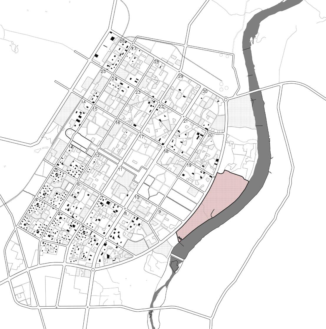
Gandhinagar Riverfront, 23°13’09.5”N 72°40’40.5”E
55% of our total population lives in cities because of which we don’t often appreciate essential ways it sustains our world. For this sustenance biodiversity is important to humans for many reasons. It underpins life as we know it. It provides functioning ecosystems such as air we breathe, the food we eat and the water we drink. It is a web of life and if biodiversity is affected it would directly impact the future of food supplies. Recently, we have seen a huge decline in bee population and bees alone are responsible for over 1/3rd of everything we eat. Similarly mangroves provide vital protection from cyclones and tsunamis for people in coastal areas and are habitat for the world’s sea food supply. Species and biodiversity play essential roles in ecosystems and their disappearance threaten the stability of the ecosystem services provided to us. Biodiversity also has economic value, ecological life support, cultural value, recreational value, scientific value and non-negative value and it’s crucial to think about it now.
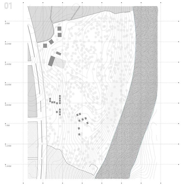
The project questions the anthropocentric development and the dominance of human activity that is taking over nature. The stretch of river edge in Gandhinagar is still left unexplored offering a matrix of plantation, villages, and wilderness patch
which should not only be preserved but also enhanced to support biodiversity. This is also a great amenity for the residents to come and explore. Project ‘Ukiyo’ creates almost transient, unobtrusive architectural interventions that will allow for minimal human exploration in a sensitive micro ecosystem, and embed new programs for native plants and animals to take over. Thus the project wants to create a harmonious relationship between human and nature so that they both coexist.
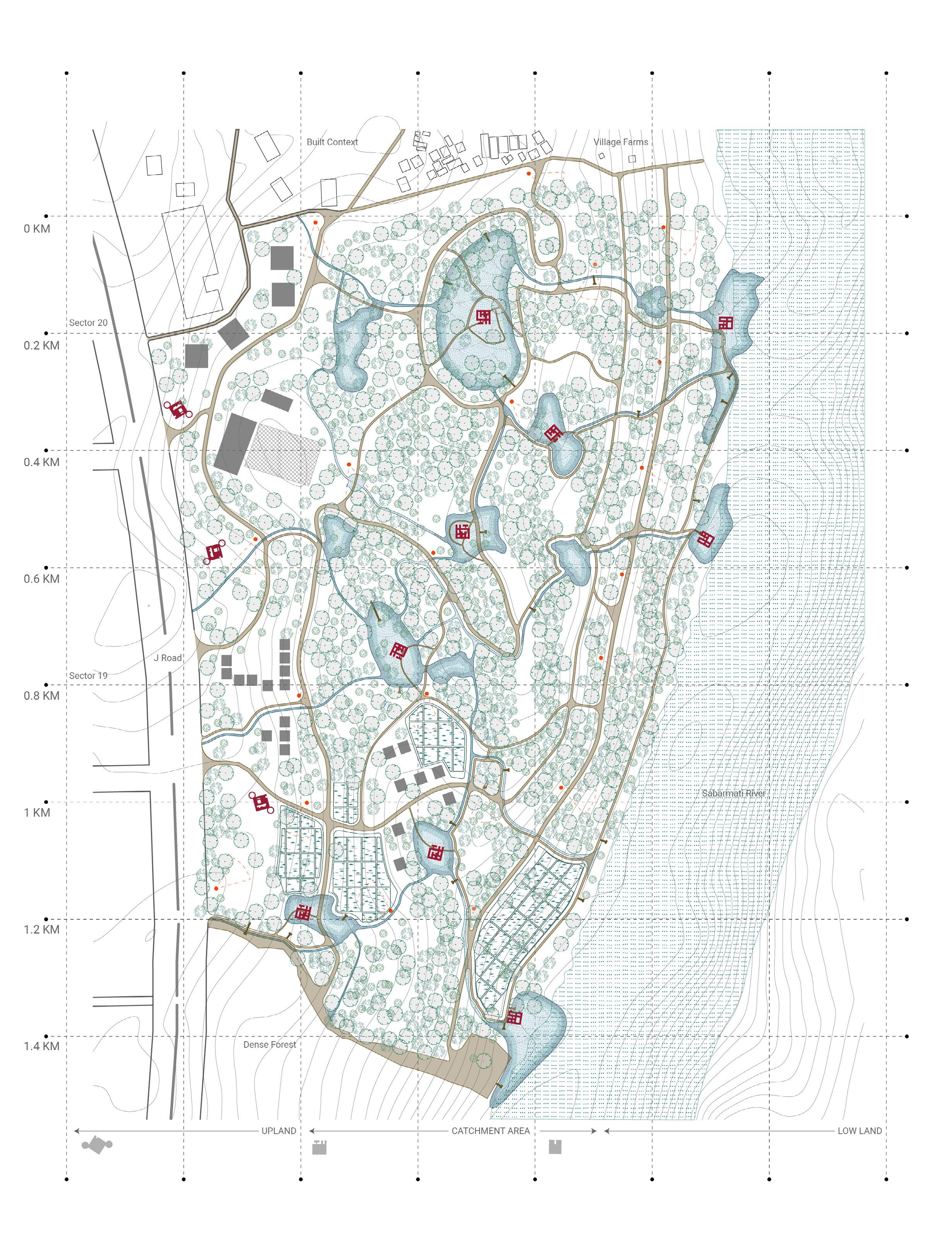
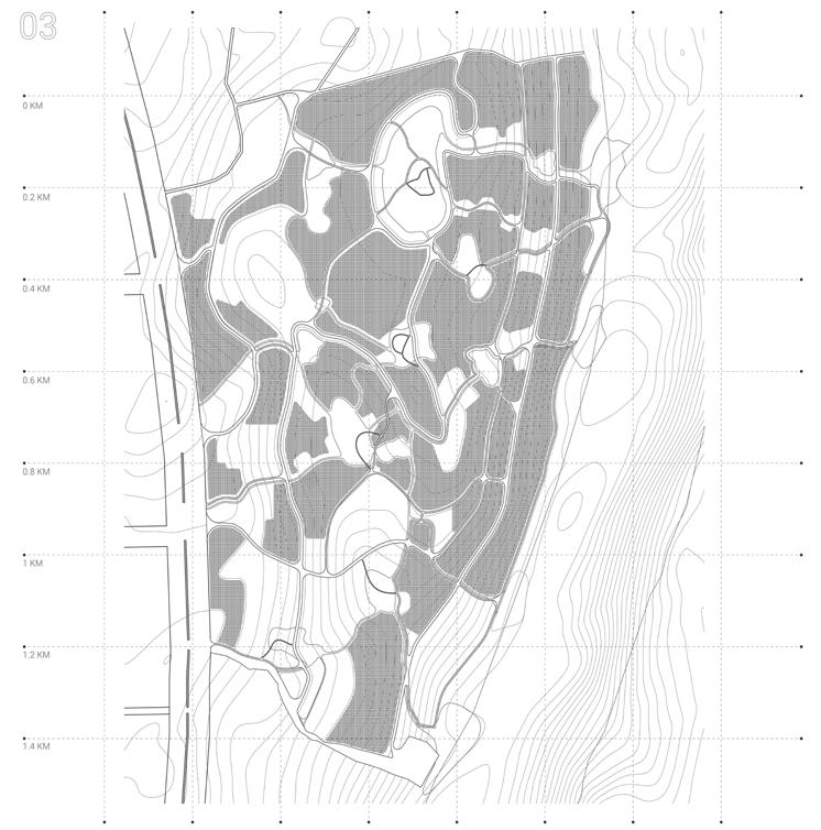
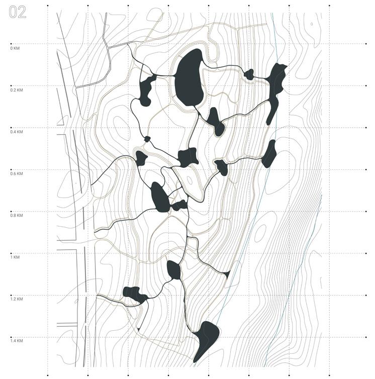
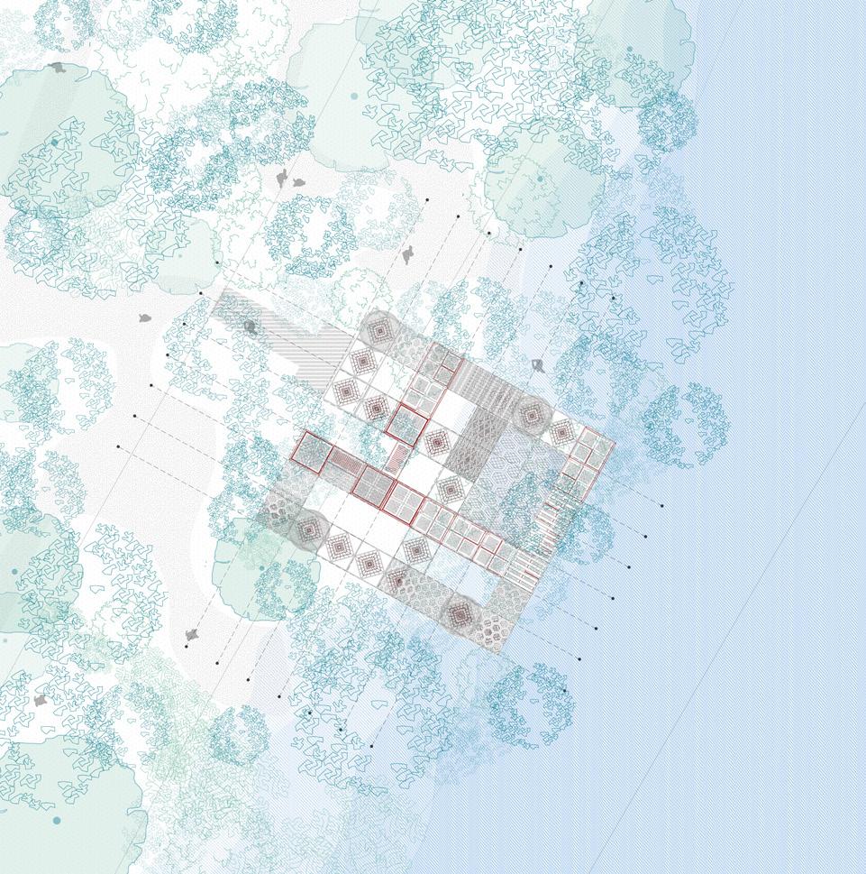
The interventions are placed in response to the ground condition that make three distinct zones. The proposal plan retains the existing matrix of vegetation and land conditions and introduces new vegetation of nectar rich flowers and growing creepers in areas that are vacant. The plan also weaves the existing village and provides spaces for community farming. And the last layer of light infrastructures are introduced in three distinct zones that would over time be taken over by nature and become a ruin for humans and a house for other beings.
Site plan shows the juxtaposition of various layers – trails, micro catchments, and architectural interventions
Portfolio | Parth Mehta
Fig 1.1 L-Scale Plan
4
Ukiyo: End of Anthropocentric Interventions
1.1 Conserve – Involve – Evolve 5
fig
Fig 1.3 The Masterplan Mechanism
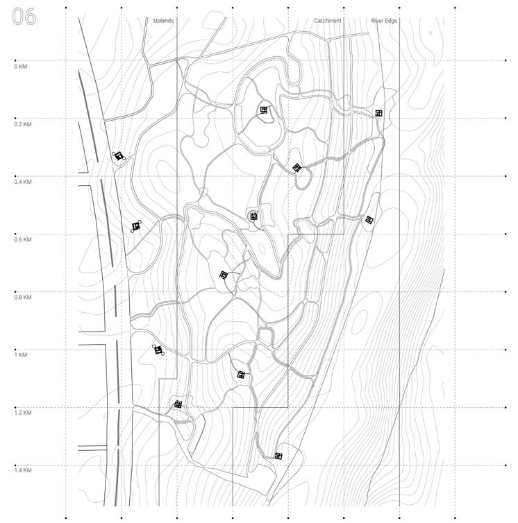
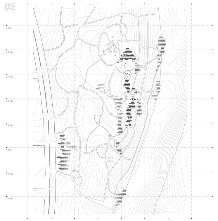
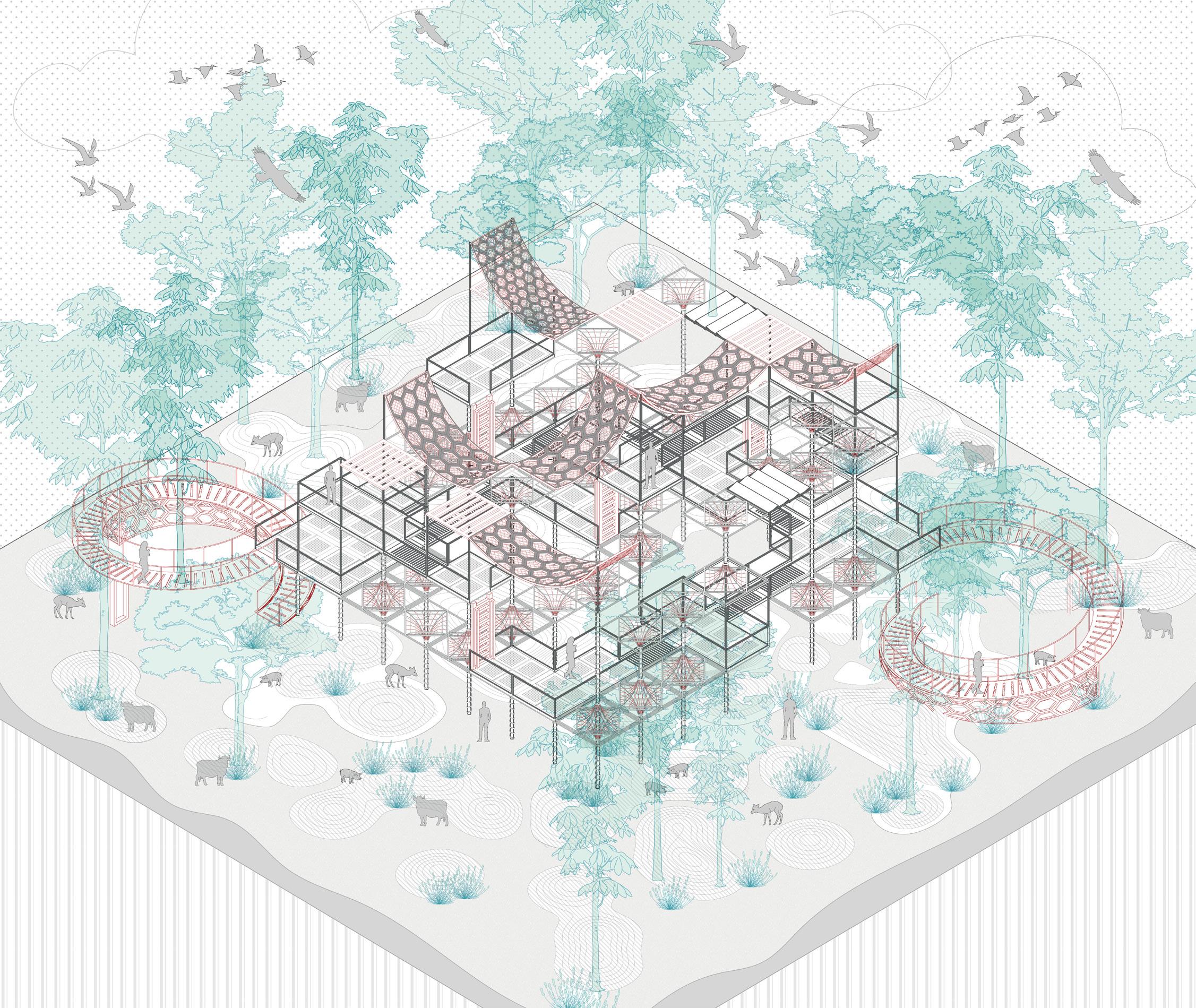
Design Process and site considerations. The structures embedded lightly on the site were markers and viewing points for people to enjoy and acknowledge the mysteries of nature around from afar.
Fig 1.4 Visualization of Upland structure

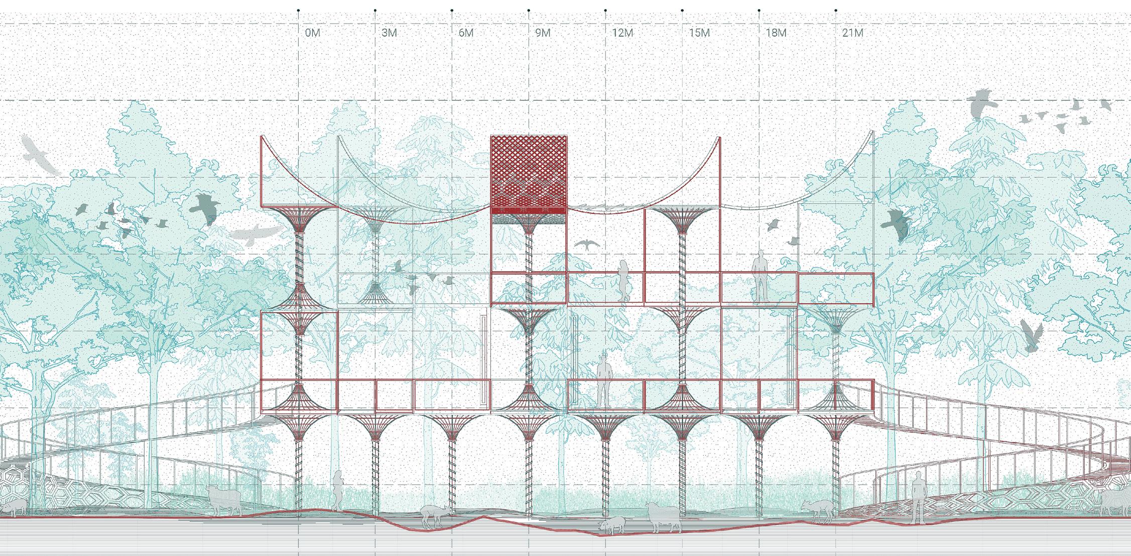
The Upland structure sits in the span of 25m X 25m – assembled using modular sizes such that the construction process is minimalistic and surrounding is left untouched.
Fig 1.5 Framework for Upland Structure These specific upland structures have connecting decks and ramps for universal access, thus allowing humans to be an audience of evolving ecosystems.
a. Existing built
b. Discovering water catchment areas
c. Exisitng vegetation
d. Trails along existing topography
e. Planted vegetation
f. Introducing transient architecture
6 Portfolio | Parth Mehta
Fig 1.2 The Gandhinagar Riverfront Highlighted site area sitting on the edge of river sabarmati, Gujarat, India.
fig 1.3
fig 1.2
Ukiyo: End of Anthropocentric Interventions
7 The transient architecture – Upland Landscape
fig 1.5
fig 1.4
Portfolio | Parth Mehta
fig 1.7
8
fig 1.6
Ukiyo: End of Anthropocentric Interventions
9 The transient architecture – In-Between and River Landscape
fig 1.9
fig 1.8

10 Portfolio | Parth Mehta
fig 1.10
fig 1.11
fig 1.12
fig 1.13
fig 1.14
fig 1.15
Ukiyo: End of Anthropocentric Interventions
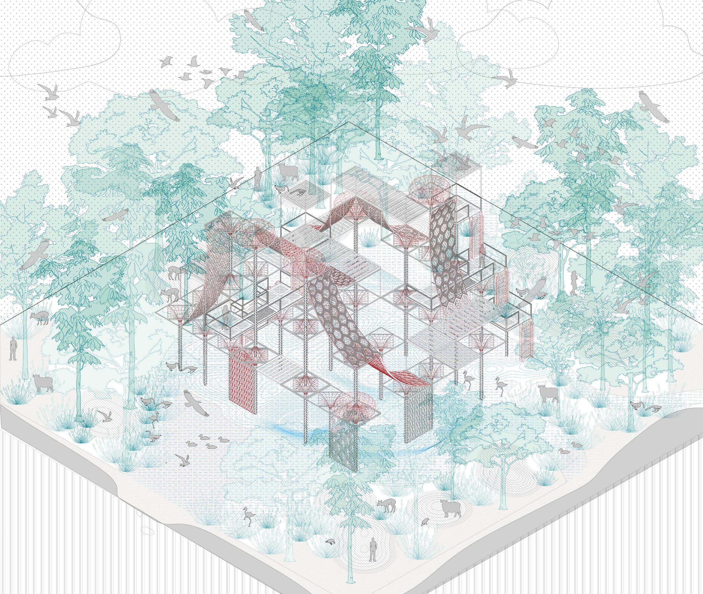
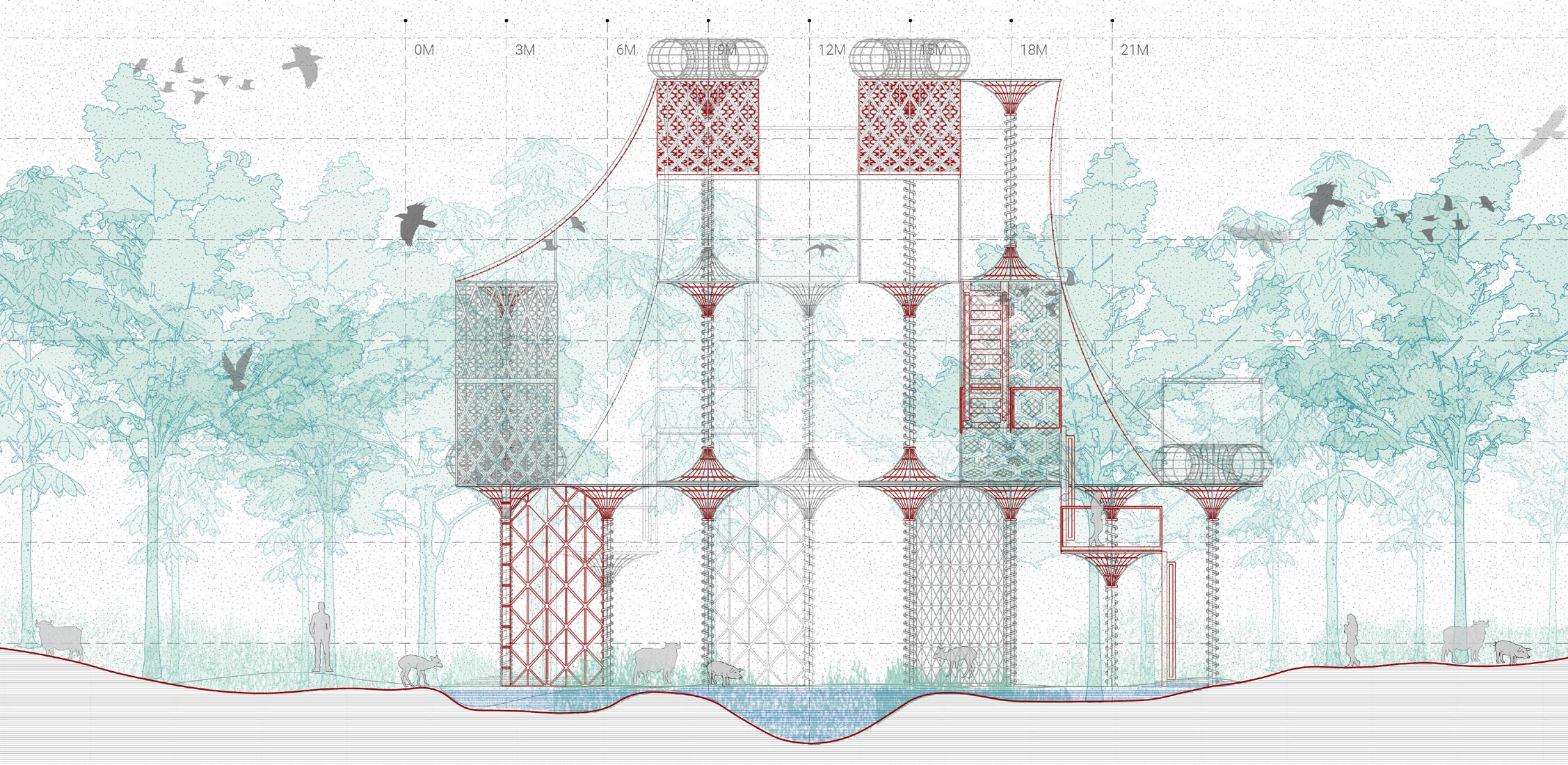
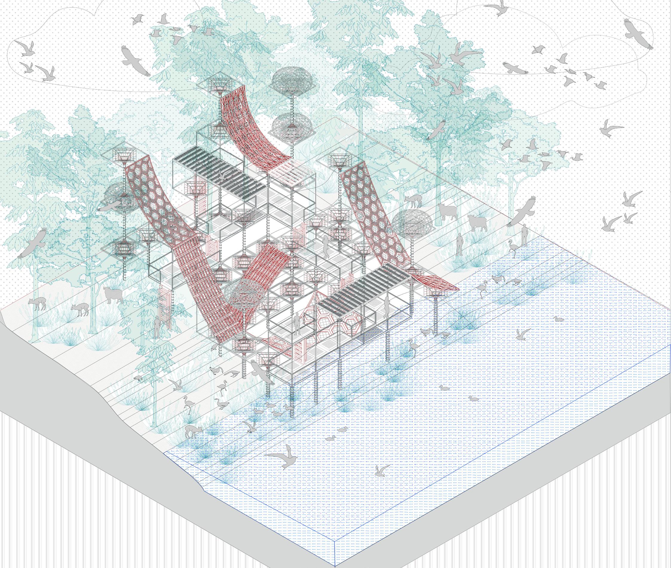
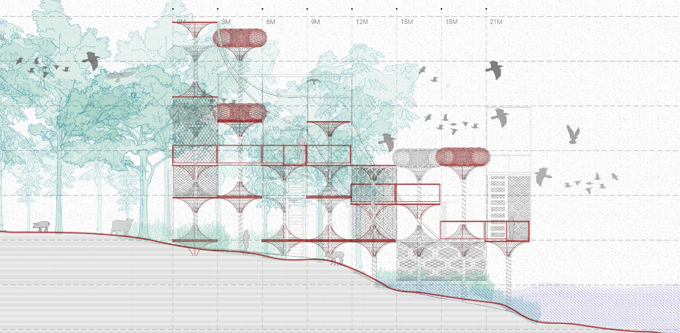
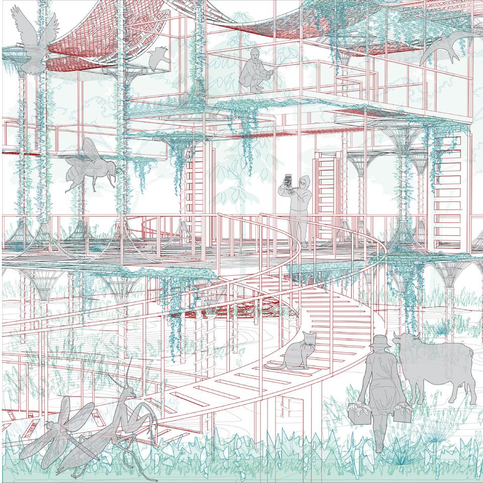
Fig 1.6 Visualization of In-between structure
The In-Between structure perches lightly above the ground that provides a continuous landscape on the ground.
Fig 1.7 Framework for In-Between Structure
The accessibility to this structure is limited to certain smaller decks above ground that can become a vantage point for nature enthusiasts.
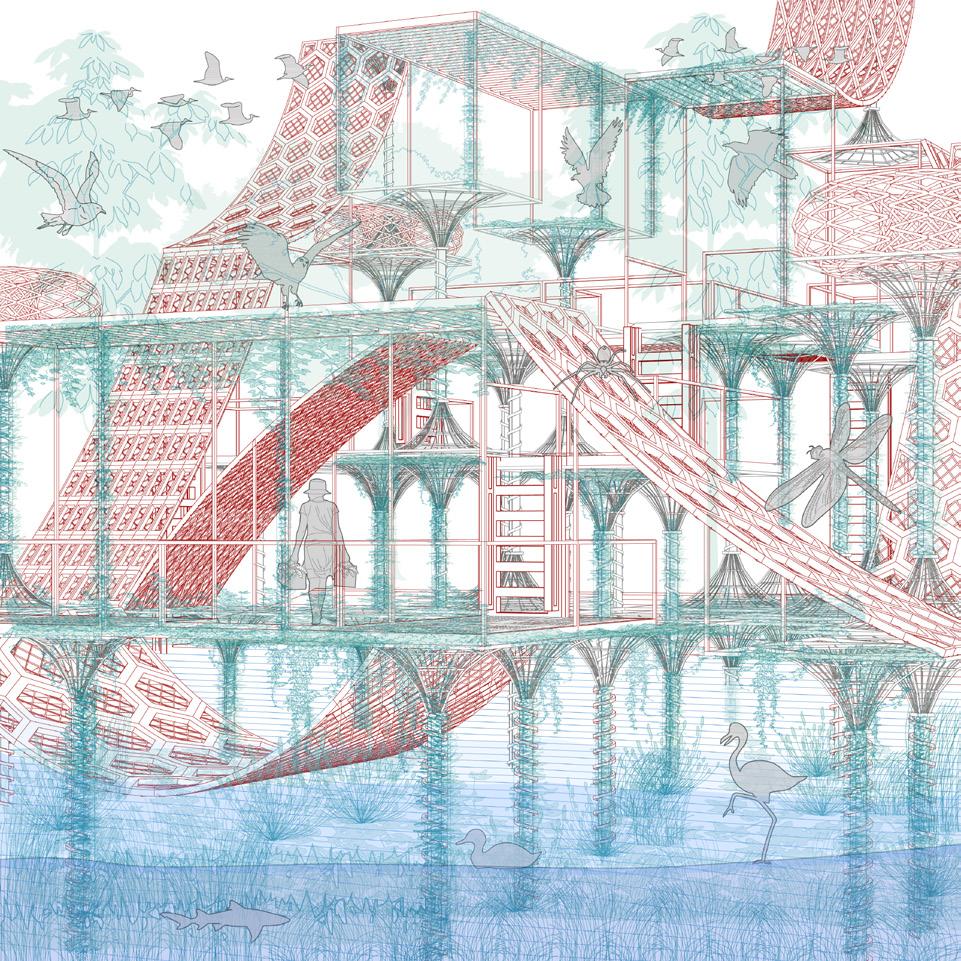
Fig 1.8 Visualization of River structure
The river edge structure with its large open canopies and framework under water provides foraging and feeding grounds for birds and other animals
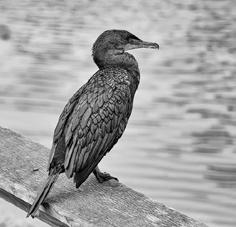
Fig 1.9 Framework for River Structure
The idea here is to create a selfsustaining ecosystem where organisms can interact both with each other.
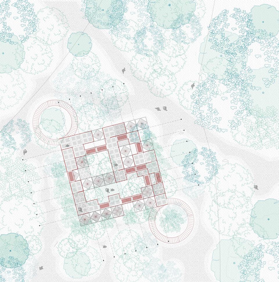
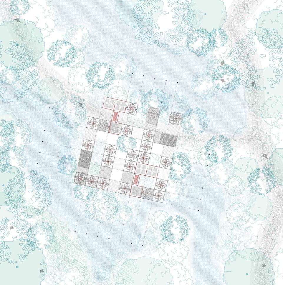
Fig 1.10 Plan - Upland Landscape
These specific upland structures have connecting decks and ramps for universal access, thus allowing humans to be an audience of evolving ecosystems.
Fig 1.11 Plan - In-between Landscape
With geobiological material, the structure itself is enriched with qualities of attracting native species of residing or migratory fauna.
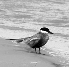
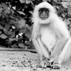
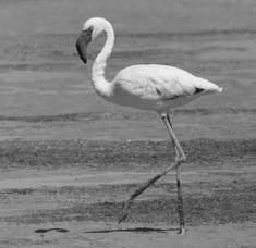
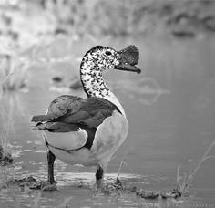
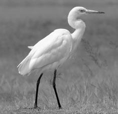
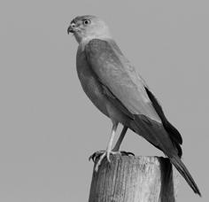
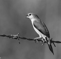
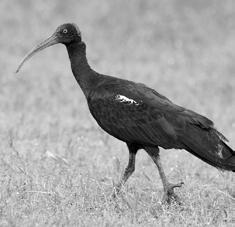
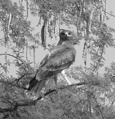
Fig 1.12 Plan - River Landscape
The interface between land and river is rich in terrestrial biomes. The water table in the Sabarmati river fluctuates with the season and hydrophilic vegetation have thrived on the soft riparian edge.
Fig 1.13 Visuals - Upland sturucture
Structure evolves with time and houses varied flora and fauna allowing minimum human interaction.
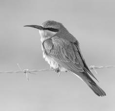
Fig 1.14 Visuals - Inbetween sturucture
Structure creates an eco-sensitive zone for vegetation and inhabitation of insects birds and other smaller terrestial animals.
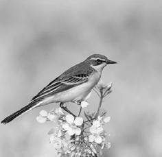
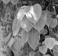
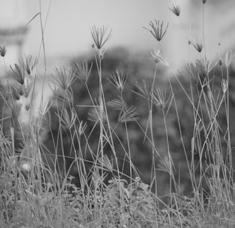
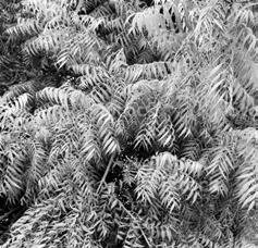
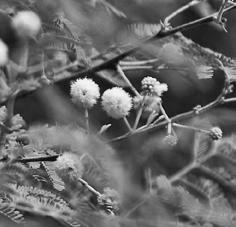
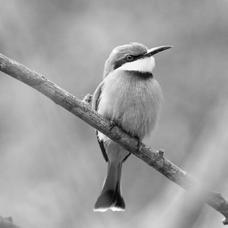
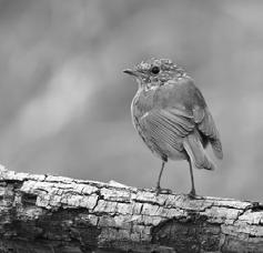
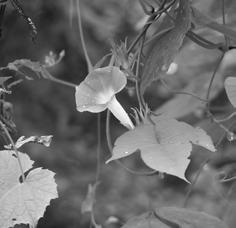
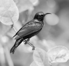

Fig 1.15 Visuals - River sturucture
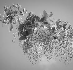
The idea here is to create a selfsustaining ecosystem where organisms can interact both with each other.
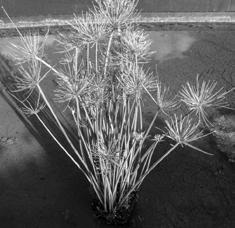
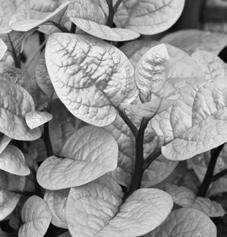
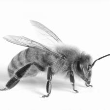
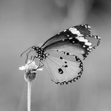
Fig 1.16, 1.17, 1.18 The Palette
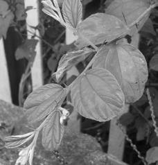
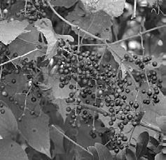
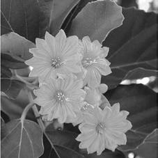
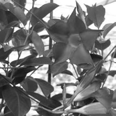
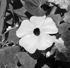
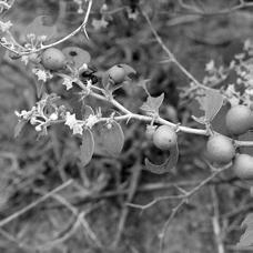
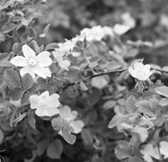
A native planting palette was selected that can also thrive in specific micro ecosystems. The palette consists of urban meadows with nectar rich wildflower fields which can grow with less maintenance and can attract a large body of urban fauna. Specifically the palette has six nectar rich flower plants and six creepers that grow along the existing vegetation. Also the palette is selected in a manner that throughout the year different parts of the site blooms on different months, creating active food rich patches for other organisms throughout the year.
11 Vision Plan: Gandhinagar Riverfront in 2030
fig 1.16
fig 1.17
fig 1.18
Aparijita
Plain Tiger
Ipomea nil
Blue Sun Bird
Wild White Rose
Honey Bee
Mandevilla
Indian Robin
Gold Shower
BlueBee Eater
Thungbergia
little Bee Eater
Intermedia
Clanga Hastata
Neem
indian Silver Bill
Babool
Carmorant
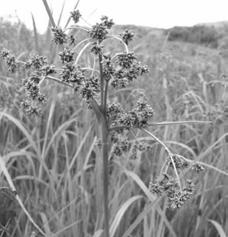
Scripus Grass
Pond Heron
Cordia
Ibis
Ziziphus
Shikara
Basella Alba
Egrets
Ficus Religiosa
Monkey
Chloris Barbata
Knob Billed Duck Fox Grape
Whiskered Tern
Cyperus Haspan
Lesser Flamingo
Ziziphus Jujuba
Yellow Wing Tail
The Pixels: The tool to Re-visualize
United Kingdom, England, 52.3555° N, 1.1743° W
Pixels is an innovative project that re-imagines agricultural practices, aiming to visualize spatial data and juxtapose numerical information with graphic representations featuring spatial capabilities.
Moreover, it seeks to establish rules for specific scenarios and general policies through an interactive platform. Utilizing this tool, users can create diverse maps, comparing various scales and parameters that influence the urban fabric.
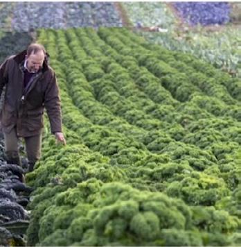
The project’s core idea revolves around the agricultural revolution and its impact on the landscape. Throughout history, as we cultivated productive lands for agriculture, we inadvertently created wastelands that affected biodiversity.
Drawing inspiration from the Nature-Friendly Farming Network’s policies and ideas, this tool is designed to foster the development of more nature-friendly farms. Its ultimate goal is to provide visualizations of “future farms.”
During the research process, the tool is developed to gain insights into people’s participation, ideas, resource availability, and tool accessibility. In the present day, approximately 69% of England’s land is dedicated to farmland, presenting a significant piece of the global puzzle we face. These agricultural lands in England are categorized into five grades, with Grade 1 being considered as high-yield output land. Notably, around 50% of the land falls under Grade 3, offering potential opportunities for intervention.
To achieve these objectives, algorithms are thoughtfully developed, resulting in a structured process to create, compare, and visualize datasets. The tool also offers alternative visualizations to craft an ideal landscape for the future.
The agricultural revolution around 10,000 years became a turning point in human history that enabled people to settle, built, and create. In short, agriculture enabled the existence of civilization.
The Aftermath
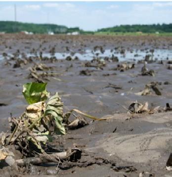
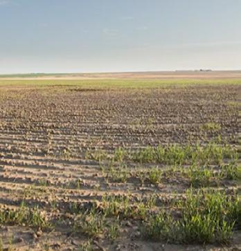
The first agricultural revolution was characterized by expanding and exploiting forests, wildlife, and water.
fig
2.3 The Change we need
There is need to increase the output of our existing farmland while protecting biodiversity, conserving water, and reducing pollution.
Portfolio | Parth Mehta
12
The Pixels: The tool to Re-visualize
fig 2.1 The Agriculture Revolution
fig 2.2
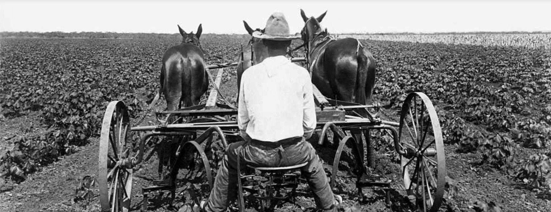
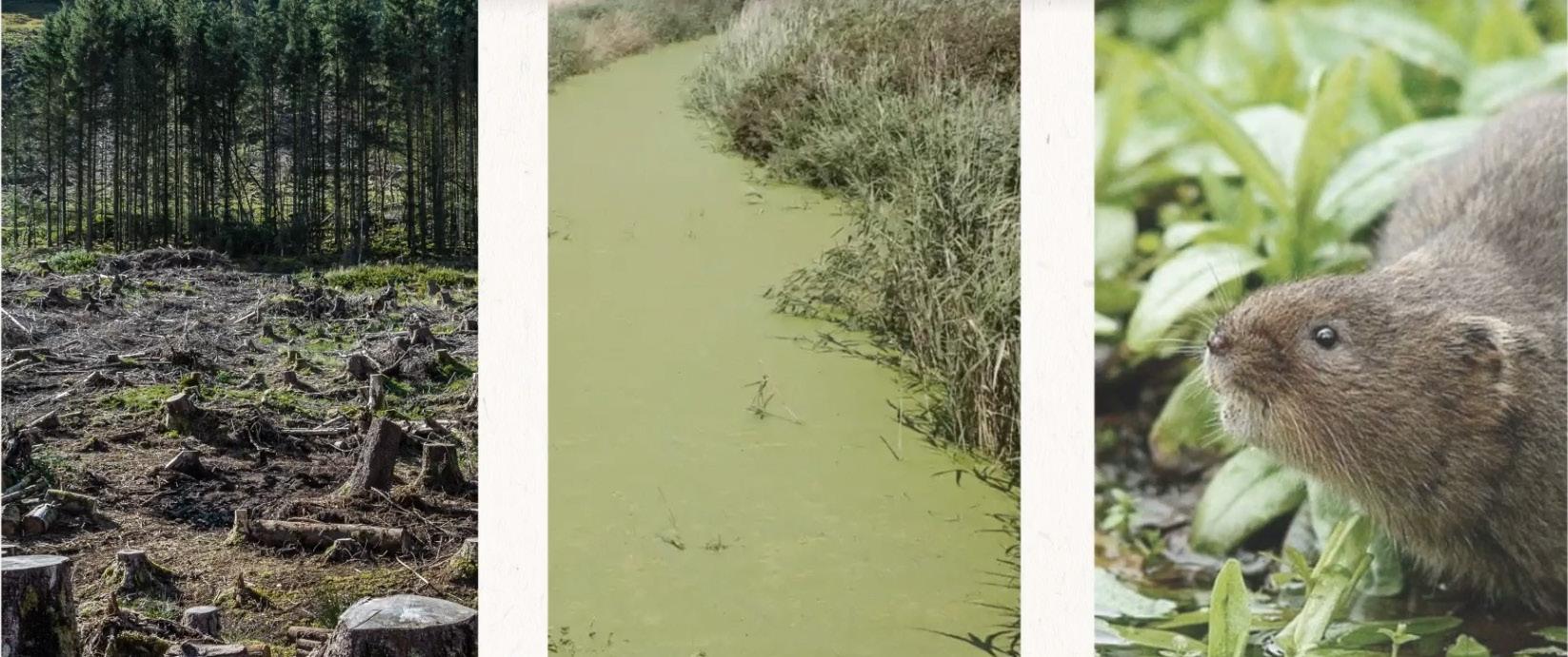
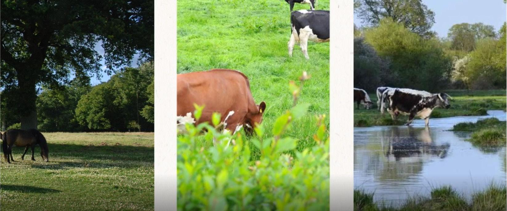 fig 2.2
Before - After 13
fig 2.1
fig 2.3
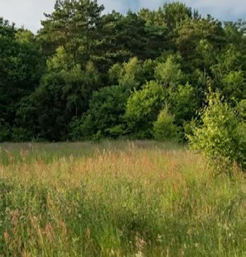
Strategic grazing in help to improve conditions for environment and rewild.
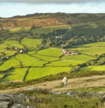
Wetland to improve biodiversity and attract tourism
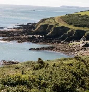
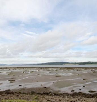

Native plants planted in marshes to improve the soil
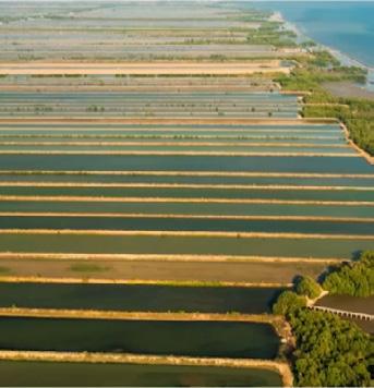
Hydroelectricity
New Energy Power Plant
Organic Food
Food Marketing

Food processing Unit
Trading with High Environmental Standards
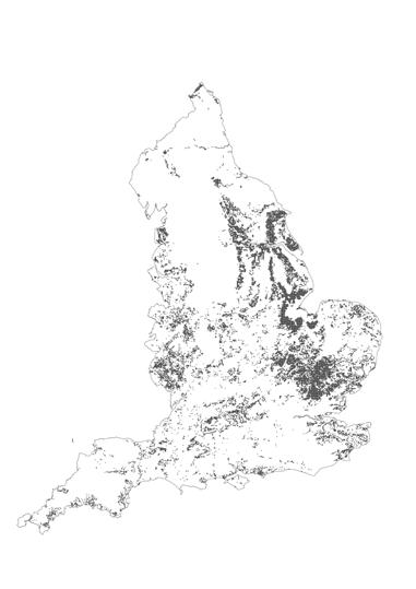
Grade 3 Arable Freshwater Grade 2 Confireous Woodland Saltwater Grade 1 Broadleaf Woodland Mountain, Heath and Bog Grade 4 Improved Grassland Coastal Grade 5 Semi - Grassland Builtup area and Gardens 62801 Pixels - 48.19% 44601 Pixels - 34.20% 949 Pixels - 0.73% 18478 Pixels - 14.16% 2701 Pixels - 2.07 % 79 Pixels - 0.06% 3580 Pixels - 2.74% 10523 Pixels - 8.07% 5256 Pixels - 4.03% 18460 Pixels - 14.15% 41543 Pixels - 31.85% 689 Pixels - 0.53% 10984 Pixels - 8.42% 8320 Pixels - 6.38% 15573 Pixels - 12.08% fig 2.4 fig 2.5 14 The Pixels: The tool to Re-visualize
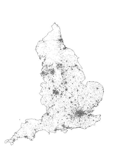
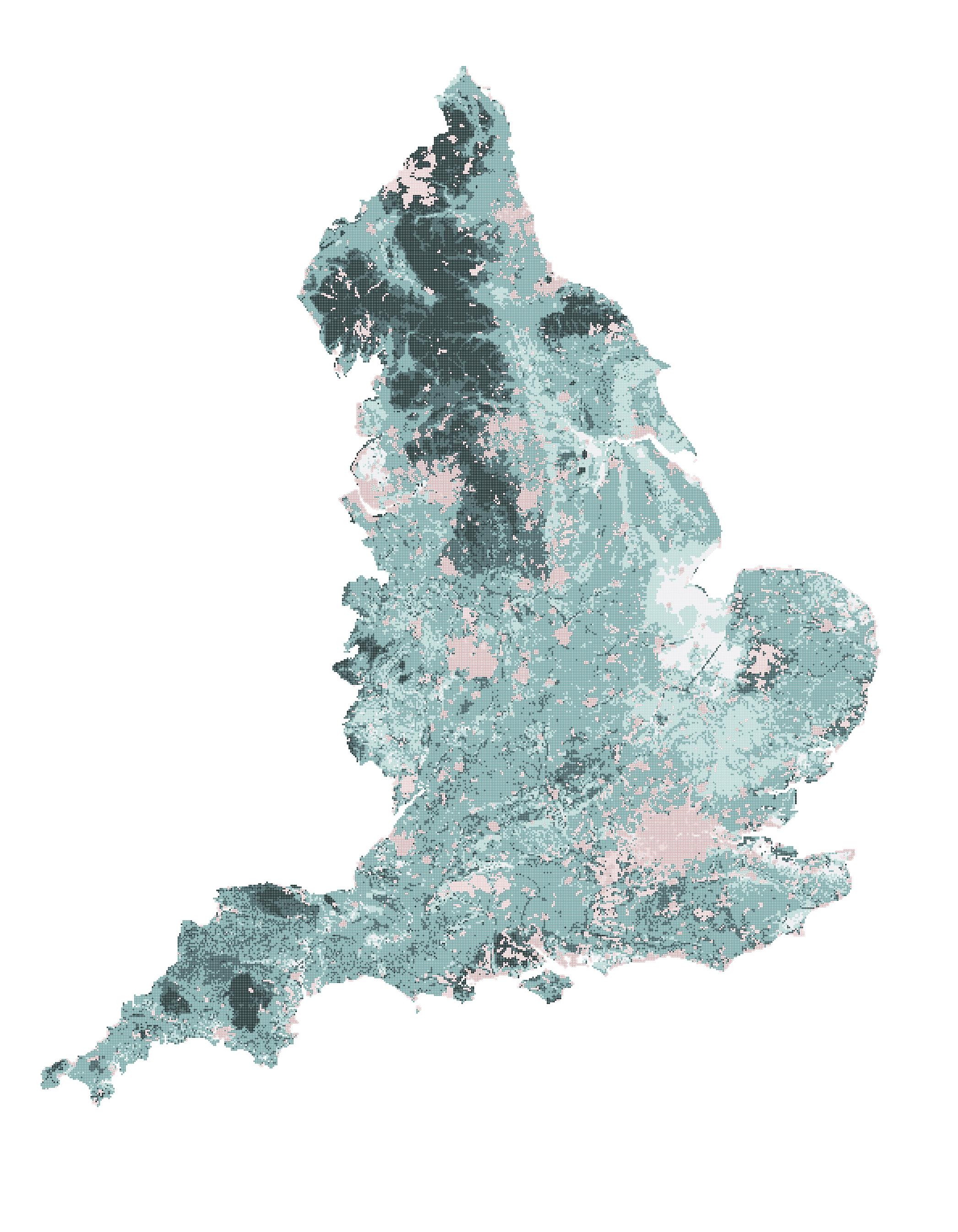
fig 2.4 The Pixels of England
The development of the ‘Pixels’ is based on two important land layers. Firstly agriculture grade classification from Grades 1 to Grade 5 on the basis of their crop productivity. While another layer is existing land use categorized into 10 parts from Broadleaf Woodland to Builtup areas and Gardens.
fig 2.5 Nature Friendly Farming Network
NFFN tackles climate and ecological crises with a conceptual land division: Productive, Agro-ecology, and Restorative. Pixelated for varied land uses, promoting soil fertility, rewilding, and net-zero logistics. Connecting with nature-friendly farms and reducing food waste reinforces their goal for a reliable ecosystem and healthy food.

Restorative Pastures
Land ideally suited for agriculture
Farms that provides raw materials for flooding
Wetlands to purify sea and protect against flooding
Natural pastures
15
 Confireous Woodland
Broadleaf Woodland
Arable
Grade 01 Grade 02 Grade 03 Grade 04 Grade 05 Portfolio | Parth Mehta
Improved Grassland Semi - Grassland
16 The Pixels: The tool to Re-visualize
fig 2.6
The tool performs proximity tests and applies rules, overlapping Agriculture land classification and Land use data. It’s rule-based, aligned with NFFN’s ambition for biodiversity preservation and diversified croplands, generating an illustrated mosaic.
Grassland
Mountain, Heath and Bog
Saltwater
Freshwater
Coastal Builtup area and Gardens
Fig 2.6 The Rule Mosaic
The
17
varied iterations
1
//select block to retrive layer information
//select layer to isolate
//codes for landtype
1 = broadland woodland
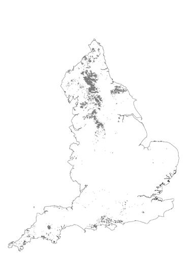
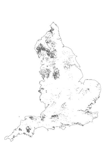
2 = confireous woodland
3 = arable
4 = improved grassland
5 = seminatural grassland
6 = mountain heath and bog
7 = salt water
8 = freshwater
9 = coastal area
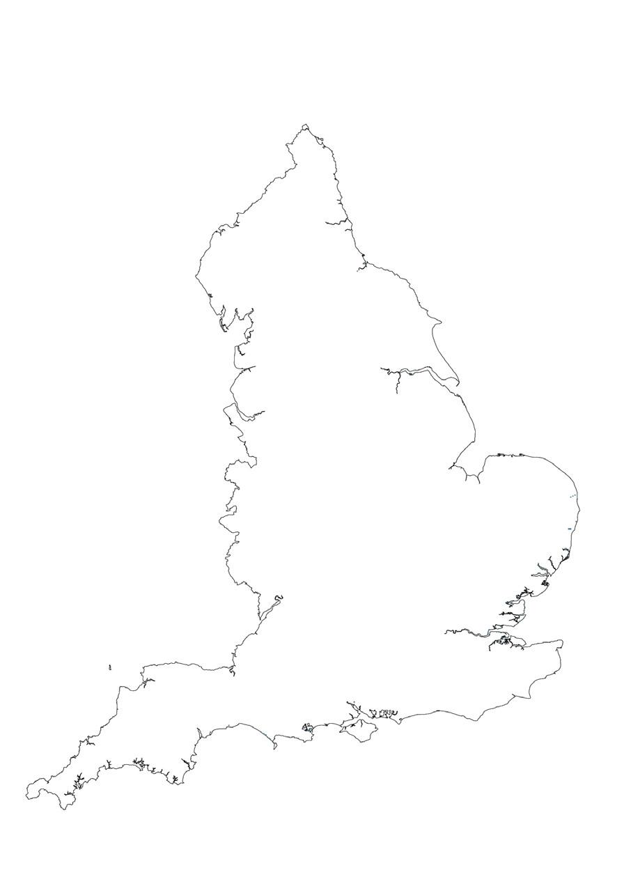
10 = urban areas + gardens
//command prompt find other layers (open source)
1
2 3 4
5 6 7 8 9 10
STEP
01 SELECT
1 10
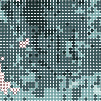
fig 2.7 The Tool Development - A This part allows to select patch and layer for developing pixel image. Here each pixels carries spatial information and selected layer information. It is land use type here. The layer selection is user based and can be customized as information available from open source network.

3 4
1 2
Portfolio | Parth Mehta
18 The Pixels: The tool to Re-visualize
fig 2.7
Broadleaf Woodland
Confireous Woodland
Arable
Improved Grassland
Semi - natural Grassland
Mountain, Heath and Bog
Saltwater
Freshwater
Coastal
Builtup area and Gardens
1 Pixel = 1 Km
Pixel Resolution
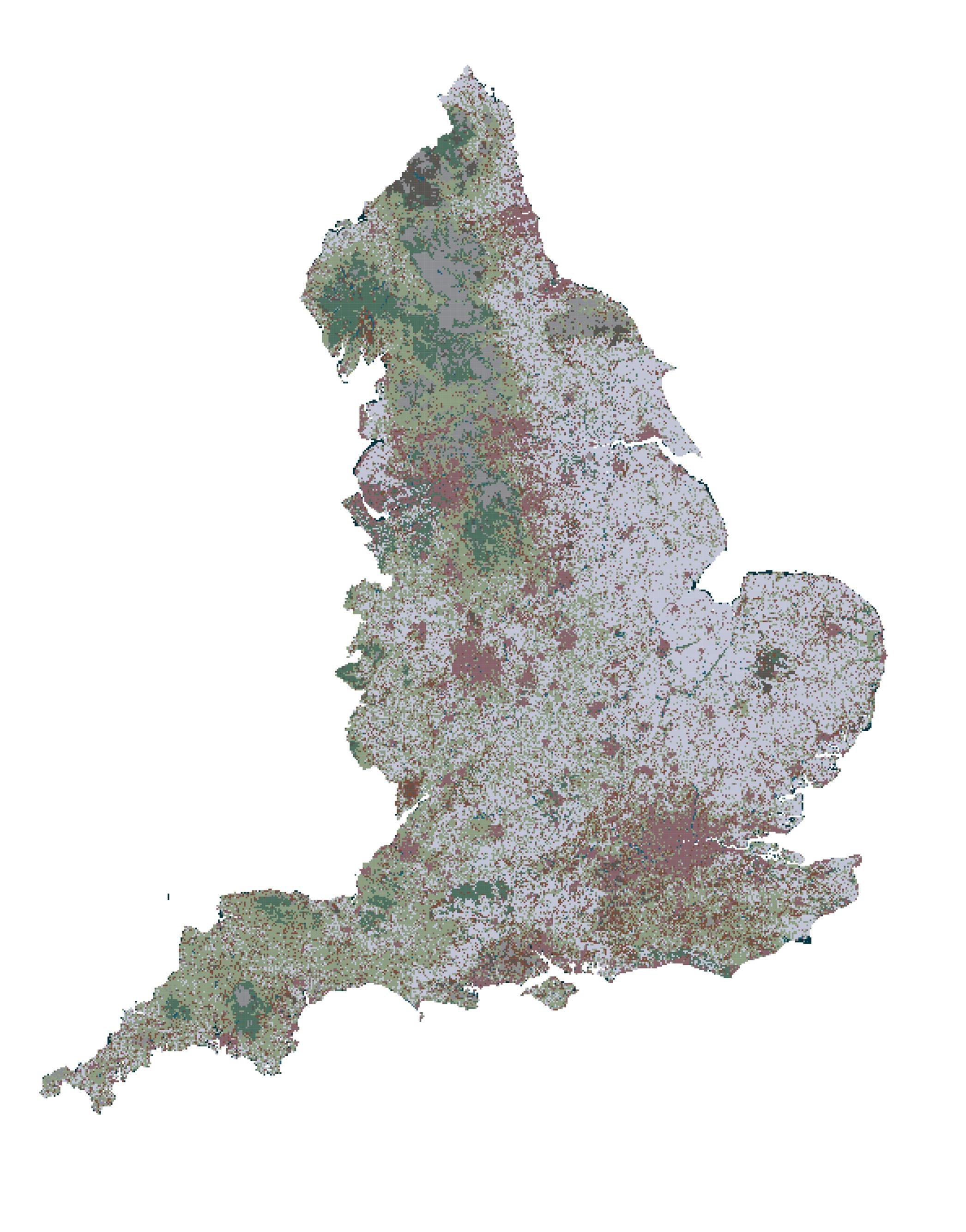
Land-use Pixel - Data
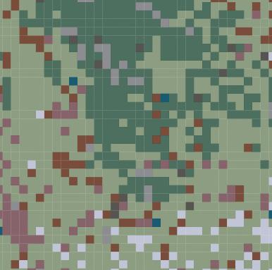
fig 2.8 The Land-Use Pixel Map A land-use dataset generates a pixel map: 10523 broadleaved woodland, 2701 coniferous woodland, and various other areas at 1km distance.
19
fig 2.8
2
//codes for agriculture grade
A = grade 01
B = grade 02
C = grade 03
D = grade 04
E = grade 05
F = urban areas
//pixel resolution 25m | 100m | 1km
//select second layer to evaluate //generate rules A
B C D
E
landtype
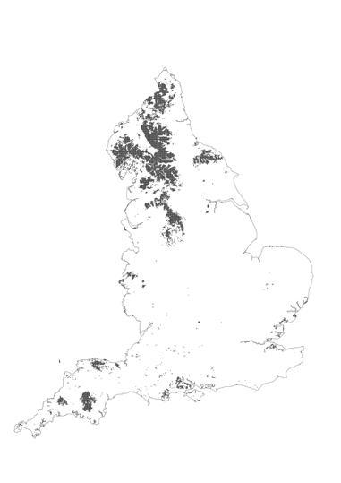
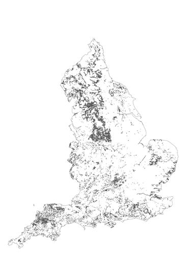
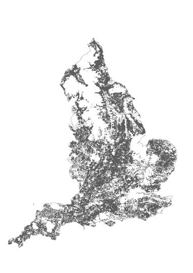
new type A
new type B
new type C
new type D pixel division
agriculture grade classification rule based pixel developed
STEP 03 RECALCULATE
Proximity text (pixels near river)
//new rules 3 1 5
waterway layer
Y
population density layer


livestock density layer
create your own layer
Overlaying ALC and Land use with rules generates image 2.12, defining interventions at pixel level (e.g., Grade 4 + Arable = 20% crops, 40% Forests, 40% Pasture). 50 rules accommodate diverse conditions, fostering nature, agriculture and NFFN engagement via open-source contributions from farmers.
fig
This tool also lets you develop exclusive rules for certain spatial condition making it more inclusive and creating bottom-up approach.
X
Z U Portfolio | Parth Mehta
2.11 The Visualization Plan
22 The Pixels: The tool to Re-visualize
fig 2.11
Forest
Grassland
Pasture
Crop
Freshwater
Saltwater
Marsh
Wetland
fig 2.12 Algorithm - Generated Map Algorithm tests pixel overlaps, creating 8 outcomes: Forests, Grassland, Pasture, crops, Freshwater, Saltwater, Marsh, and Wetland, encompassing land and water.


Pixel Resolution The Generative Map
23
fig 2.12
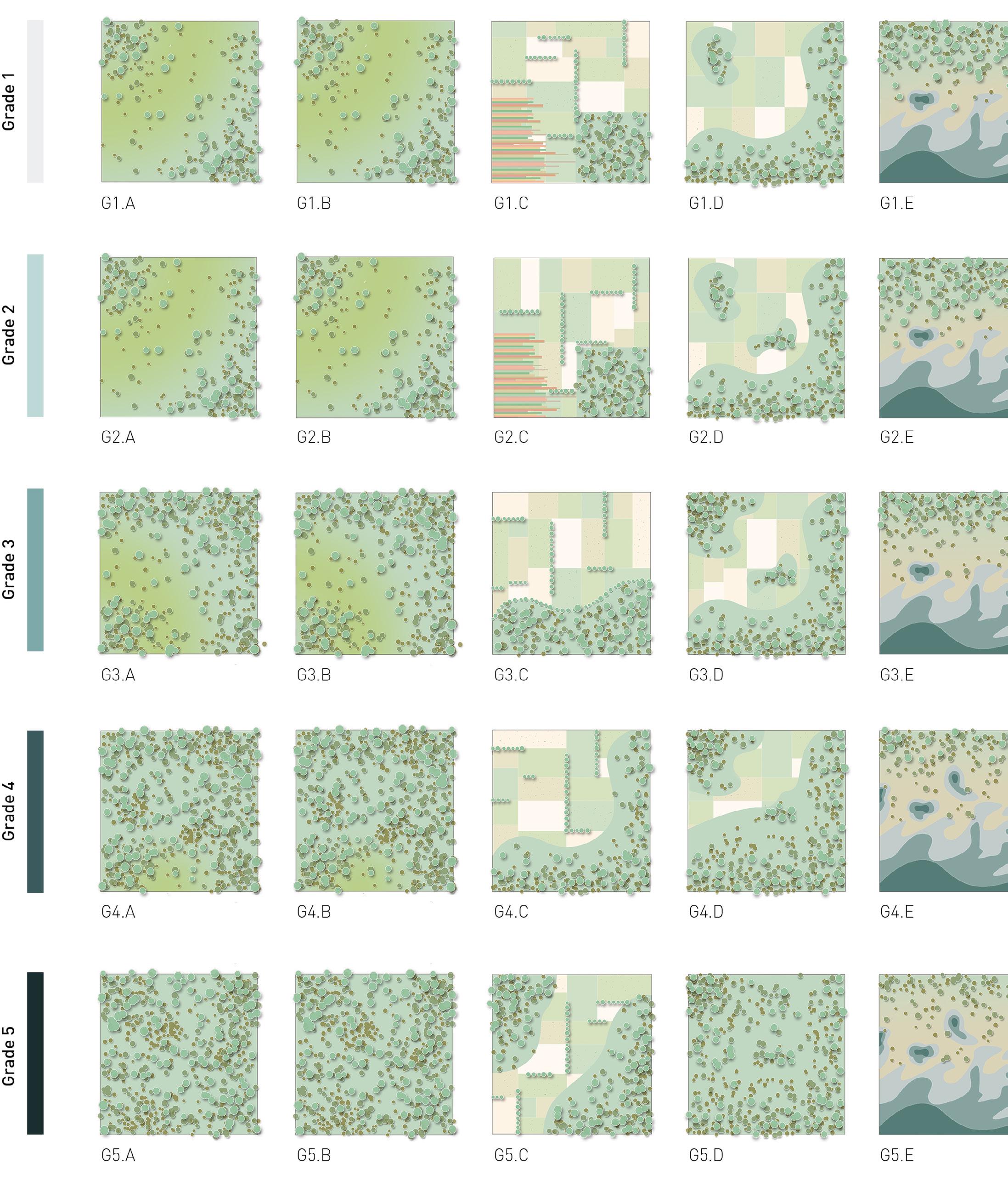
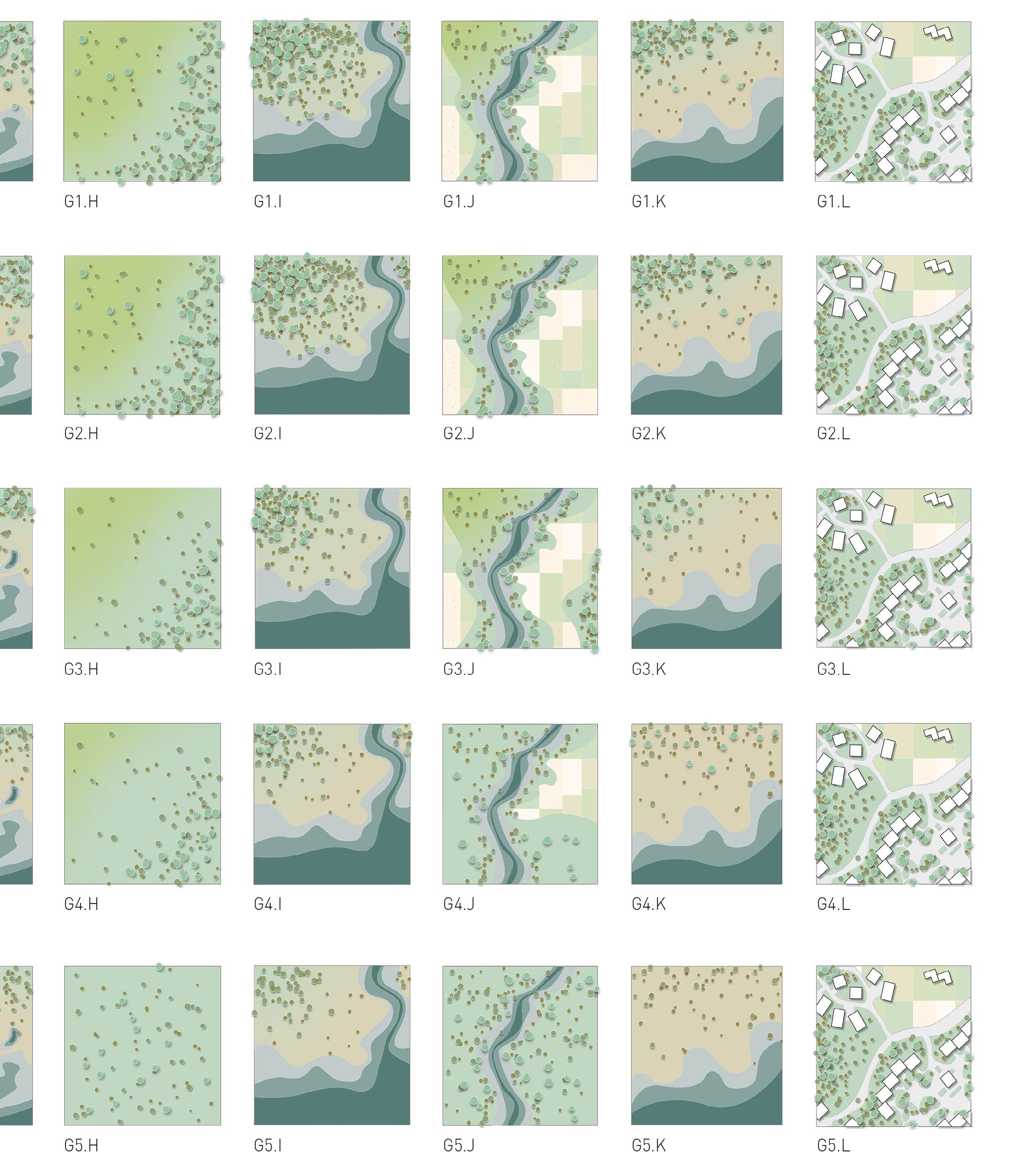
Spatial awareness begins with the river layer, establishing buffer zones at 50 and 100-pixel resolutions around nearby pixels. Illustrated diagrams showcase potential pixel distributions along the river edge, examining the implications of these layers on the landscape..

 G1.A + B
G2 A + B
G1. C G2. C
G1. D G2. D
G3 . A + B
G4, G5 A + B
G3 C G4, G5 C
G3 D G4, G5 D
Portfolio | Parth Mehta
G3 E G4, G5 E
fig 2.13 The Spatial Scenario
24
fig 2.13
The Pixels: The tool to Re-visualize
/imagine prompt: Broadband Weaveland in England’s grade 3 agricultural land with 20 percent crop, 40 Percent forest and 40 percent pasture land. Visualise a realistic render.

/imagine prompt: Freshwater in England’s grade 3 agricultural land with 20 percent Wetlands, 40 Percent forest and 40 percent crops. Visualise a realistic render.
fig 2.14 Plugin to Rethink The concept reinterprets data for visualization, pattern recognition, and proactive intervention. Linked with AI drawing tools, it creates captivating images from pixel data, enabling quick data processing, overlap, and rule design for diverse applications.

Exploring reality
25
fig 2.14
Under Construction: Contemporary Touchdown
Rakhiyal, Monogram Mill Lands, 23°01’25.6”N 72°37’23.9”E
The cities of today can only increase in population density at the expense of the open spaces which are quite the lungs of the city. Now we need to understand if we want to increase the density of the cities without urban Sprawl in order to diminish distance between places we need to go ‘Vertical’.
The Idea here is to construct water tight formula to arrive at the fundamental principles of site development and introducing variant typologies to reflect the surrounding which can adapt to the changes and which change in context can become potential for the new place. The Design questions Idea of Underutilized space and space pressurised as a balance enforced by the fabric. ‘The contemporary touchdown’ – Occurring on the site ; tries to bring new skyline in the city, the skyline that is dynamic due to always under construction process with concerns of site and changes that needs to be addressed. The development strategy of such typologies links with parameters to be preserved or respond deriving potential location for the built fabric which will always be in the harmony with open spaces ; currently are perceived as just VACANT plots.
Here the vacant plot is developed with series of processes which can be applied to other sites with different constrains. Here the plot is connected across edges with points where potential development can take place and is in the proximity yet avoiding densification in fabric. The relationship thereby is created without hindering wall across market and slum residence. The process is likely to be used as a program to understand possible location whereas development of the site can be done in process still left incomplete with creating relationships across developed anchor points.The intent here is to create a stable environment with respect to the need for instability. The idea is to bridge the gap. The vacuum is the catalyst by the walled element. To decentralize the density pressure and create the bridge between existing Archipelagos.
There are sets of new typologies that needs to be introduced in the existing fabric – vacant here. Picture a platform that can be workshop, discussion room, commercial block, housing unit or production unit, designed to be an architectural experience and engage city surrounding it.
26
Portfolio | Parth Mehta Under Construction: Contemporary Touchdown
Fig 2.1 Lay of the Land The design parti diagram shows preserved patches, designated built zones and the overall network in Monogram mill land.

27 Design parti diagram
fig 2.1
a. Site voronoi diagram for desired anchor points


As mapped white lines in the south of vacant plot marks built up space occupied by Monogram Mills in relationship to red line in the plot portraying current built up space of hospital – created as public infrastructure. Drawing out relationship there is an overlap of landscape in 2000s and current built up space. This indicates the landscape in past was hampered for development observed in present.

The site development strategy focuses on preserving potential and history of the site.
The intent here is to bridge the gap between density and vacancy. The vacuum is catalyzed by the deployed structure walled element. To decentralize the density pressure and create the bridge between existing archipelagos of density. Different typologies can be added to engage the city, based on the particular surrounding.
development
c. Scoring of each cell and selected buildable cells
d. Proximity test and final buidable grid
28 Portfolio | Parth Mehta
fig 2.3
fig 2.2
Fig 2.2 Issues and concern map
Fig 2.3 Design development process
Fig 2.4 Space Interpretation
b. Plots generated with possible
Under Construction: Contemporary Touchdown

29 Understanding the importance and repelling factors
2.4
fig

30
Portfolio | Parth Mehta Under Construction: Contemporary Touchdown
fig 2.5
Things that evolved in one context suddenly find their potential when they are moved into another context. Exploring how society can be manifested into physical form. The form seeks to connect the tangible and intangible and inform change for the positive. The form that will be always under construction with changing context will be always at the most beautiful state,halffinished. Over time it becomes more about the magic of the structure and its emergent qualities.

31
The design manifesto
Fig 2.5 Visionary Image of structures with site context
Under Construction: Contemporary Touchdown


32 Portfolio | Parth Mehta
a. Foundation + Plinth construction
b. Crane vertical column assembly
c. Crane assembled core construction
d. Vertical extension assembly - element 01
e. Rotating pulley unit
f. Vertical circulation group


33 Project
to
complete
g. Exploded view of module - Integrated elements
rationality - Please click here
view
animation
h. Module attached together with frame structure
i. Eight module assembly extension - 128 sq.m
j. Sixteen module assembly extension - 288 sq.m
k. Thirty two module assembly extension - 448 sq.m


 fig 2.6
fig 2.7
fig 2.8
Portfolio | Parth Mehta 34
fig 2.9
Under Construction: Contemporary Touchdown
Fig 2.6 Visuals of eight module form the feasibility of the project in terms of how will it be constructed, what scale will it be and what materials will be used

Fig 2.7 Visuals of sixteen module form Tower Crane assembly is used to attach modules that creates coherent form without function
Fig 2.8 Visuals of thirty-two module form Flexible enough to allow variant activities.
Fig 2.9 Across the Vacant plot The more denser the cities ae there are less distance to be covered by people. The mortal is therefore that the density of the centres must be increased in cities. Now with the logic of where to place, there is a system which allows to address need of the context. System is deployable and flexible with functions it can inherit and now with the locations on spatial basis the structure system can be utilized with changing context.
35 Space based deployable structure
One Planet Development: The Policy
United Kingdom, Wales, 52.1307° N, 3.7837° W
The One Planet Development is a planning policy implemented under the guidelines set forth by numerous Welsh parliamentary legislations and international conferences on climate action. The Welsh government introduced this policy with the aim of reducing its environmental impact, which currently exceeds permissible levels, by encouraging individuals to take responsibility for reducing their ecological footprints. The government hopes that this collective effort will also lead to positive changes in national consumption patterns. As part of this policy, individuals who sign up are allowed to live on farmlands, provided they can sustain themselves while adhering to a reduced ecological footprint allowance of 1.88gHa per person. This allowance is calculated based on the Welsh population and national ecological footprint.
Aptly named the ‘One Planet Development’, the policy provides detailed guidelines for various occupants of the Welsh landscape. However, it currently remains incomplete, having only specified ‘Practice Guidelines’ for applicants from the ‘open countryside’ category (Wimbush 2023). Initially, the intention was to create separate Practice Guidelines for those seeking to build an OPD on the ‘edge of settlement’ as well as a ‘multi-unit OPD’. Unfortunately, these alternative models were scarcely elaborated
on, and without the necessary policy provisions, the ideas were eventually abandoned over time.
Under the single-unit OPD scheme, the general principles remain the same. Each applicant must convince the Planning Authorities of their commitment to the following goals:
A) Reducing their ecological footprint to 1.88gHa
B) Constructing an eco-house on the land with net-zero emissions, operating under zero carbon upon completion.
C) Successfully operating a land-based business that can financially support the occupants.
Each OPD project is granted a 5-year incubation period during which they can work towards achieving these goals in a sustainable manner. The planning process also outlines the improvements to be made to the biodiversity of the land and the benefits to be brought to the local community (Trust 2012).
Portfolio | Parth Mehta One Planet Development: The policy 36
Fig 4.1 Individual OPD Diagram of a typical individual One Planet Development Site highlighting 7 point well-being goals
Fig 4.2 Multi-unit OPD Diagram of a multi-unit OPD Site with shared resources.


The OPDs
fig 4.2
37
fig 4.1
Ownership Data
RSPB
Crown Estate
National Trust
Ministry of Defence
Proximity to Settlement
0Km to 1Km
1Km to 6 Km
6K to 11Km
11Km to 16Km
16Km to 28Km
Agriculture Land Productivity
Grade 1
Grade 2
Grade 3a/3b
Grade 4
Grade 5
Landuse Reclassified
Builtup Marine
Coast-land
Rock exposure and waste
Open Water
Mosaic, Mire/Swamp

Woodland Scrub
Cultivated/Marginal Land
Grassland and Marsh
Portfolio | Parth Mehta One Planet Development: The policy
38
fig 4.3
Multi-criteria Scoring Grades
Priority 1
Priority 2
Priority 3
Priority 4
Priority 5
Misleading Standards
Studying One Planet Council’s planning applications reveals key factors influencing OPD site selection: affordable land near settlements and specific government land classifications. Suitability index shows potential areas, but accessibility remains limited. Effective management can restore unsuitable land, but unknown factors also influence availability.
Fig 4.4 OPD uitability Map Suitability Map indicating all areas available for an OPD if parameters from previous figure are accepted as standards
Data Source- DataMapWales, Welsh Government. Landmap Landscape Habitats, 2017 Edition. Downloaded [March 2023] DataMapWales, Welsh Government.Predictive Agricultural Land Classification (ALC) Map 2, 2019 Edition. Downloaded [March 2023]

Multi-criteria Analysis
39
fig 4.4
Fig 4.3 Multiple criteria to determine suitability of an OPD


Tall Herb - Fern 0.3% Tall Herb - Fern 0.7% Open Water + Marine 0.8% Open Water + Marine 1% Heather land 1.5% Heather land 2% Rock Exposure - Waste 0.3% Rock Exposure - Waste 0.3% Cultivated land 1.1% Cultivated land 1.3% Built-up Area 6% Built-up Area 3.7% Coast-land 5% Coast-land 3% Woodland Scrub 10% Woodland Scrub 10% Mosaic + Mine/Swamp 18% Mosaic + Mine/Swamp 21% Grassland - Marsh 57% Grassland - Marsh 57% Portfolio | Parth Mehta One Planet Development: The policy
fig 4.6
40
fig 4.5
Contradictions in Landcover X Agricultural Productivity
National land classifications based on agricultural productivity and land cover are widespread but have limitations and omissions. Individual land management, like OPDs, must acknowledge these contradictions and prioritize development typologies that restore landscapes beyond scientific formulas. To reduce the ecological footprint, strategies should focus on landscape health beyond imposed classifications.
Data Source- DataMapWales, Welsh Government. Landmap Landscape Habitats, 2017 Edition. Downloaded [March 2023] DataMapWales, Welsh Government.Predictive Agricultural Land Classification (ALC) Map 2, 2019 Edition. Downloaded [March 2023]]

Tall Herb - Fern 1.8% Open Water + Marine 0.6% Heather land 2.5% Rock Exposure - Waste 0.1% Cultivated land 1.4% Built-up Area 2.7% Coast-land 2% Woodland Scrub 7.9% Mosaic + Mine/Swamp 22% Grassland - Marsh 59% Land productivity + Land-use analysis
41
fig 4.7
Fig 4.4 Landcover variations in Agricultural productivity Class High.
Fig 4.5 Landcover variations in Agricultural productivity Class Medium
Fig 4.6 Landcover variations in Agricultural productivity Class Low
Disclaimer
The work in this portfolio includes work from acedemic studios undertaken during the Bachelor’s of Urban Design program at CEPT University and Masters in Architecture, Landscape Urbanism at Architectural Association. All drawings and text shown in the portfolio are produced by the author.
If i was part of wilderness [monologue]
Forsaken fallen bud into wilderness says,
I was learning how to steadily walk, but my very self was fallen on a patch of barren land, we are not supported here, but I reach by my own sum and substance, in foreign land I m yellow-eyed daisies, sticking into someone’s hair and I am inevitably small but I hold highest essence. A bunch of me makes a story that is retold so many times. And while I don’t remember taking those first steps, the smell of fresh grass is still with me. I stop in front of every freshly mowed lawn, close my eyes and immediately get transported into the backyard of my childhood.
I remember long summer afternoons entangled in forbidden bushes under the protective spell of the forest, And hours spent wandering through those captivating woods.
That never-ending covet for connection is what pulls me out of sleep before the crack of dawn, pushes me to the mountain tops and drives me into the woods, onto remote lakes and backcountry trails, Perpetual search for beauty, is always exaggerated and overwhelming, I will stand resilient for that is my only nature and so far the strongest.
At times that beauty is understated, Unfailingly satisfying, soothing, invigorating. You never let me down, Nature, always go out of your way to make each encounter special. You choreograph most exquisite of dances with twirling autumn foliage and frolicking butterflies. You compose stirring rhapsody of crashing waves and howling winds… Especially for me.
You take me as I am: tired, happy, exhilarated, sad. You send rainfalls to quench my thirst and pour sunlight over my wounds, You lift me up all the way to the skies and firmly root me in the ground. You inspire and never cease to amaze.
Portfolio | Parth Mehta


 fig 2.2


 Confireous Woodland
Broadleaf Woodland
Arable




 G1.A + B
G2 A + B
G1. C G2. C
G1. D G2. D
G3 . A + B
G4, G5 A + B
G3 C G4, G5 C
G3 D G4, G5 D


 fig 2.6
fig 2.7
fig 2.8


