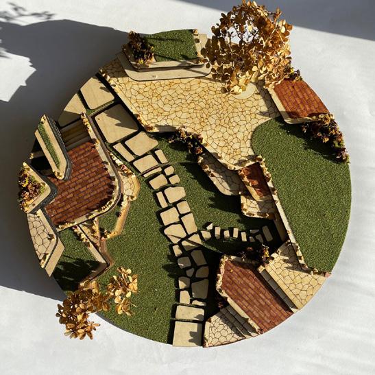
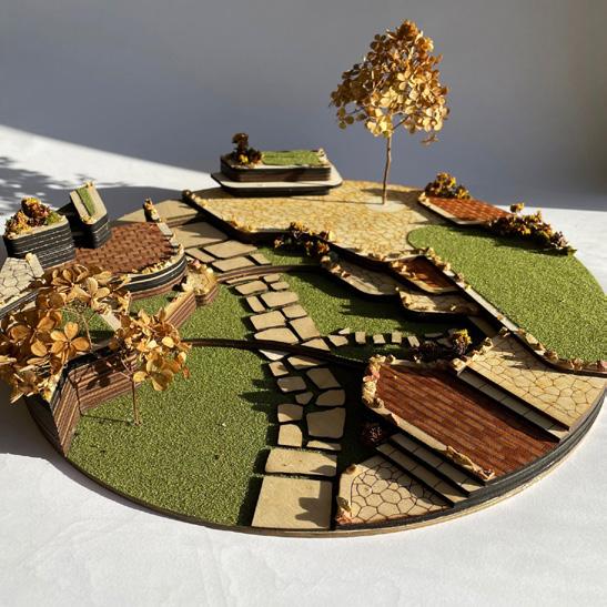
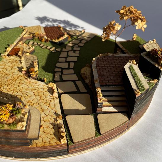
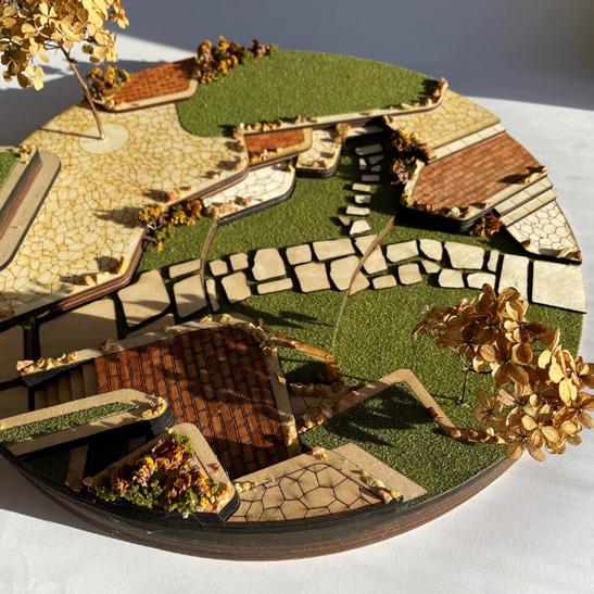
GROWING GUTHRIE: HISTORIC TROLLEY ROUTE
Guthrie, OK
First Capitol Trolley Route Redesign
Project Throught the Institute for Q uality CommunitiesGuthrie: The Elbow Recreational and Cultural Area
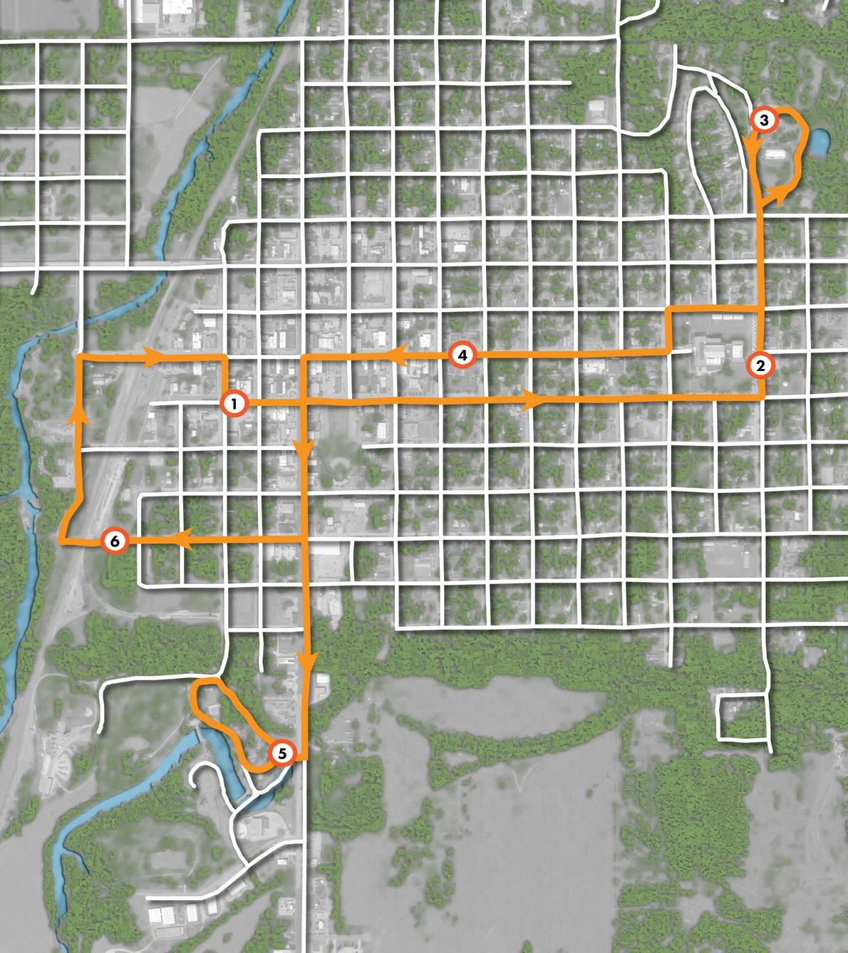
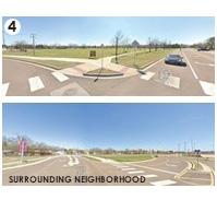
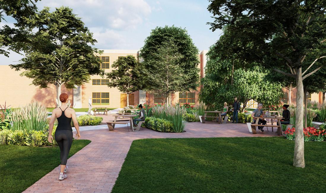
The historic trolley route has been rethought as another way to reduce vehicle traffic in downtown Guthrie and grow the city’s access to public transportation. Visitors can park their cars in west Guthrie at the Elbow Project and use the trolley system to travel around town. The goal for the trolley route was not just to grow public transportation, but also create interest points with each stop. This project features unique styles for each shelter inspired by their different locations. They have a progression of styles that honor the historic district and past of Guthrie, but also look forward to new styles for the city.
For more information:
https://iqc.ou.edu/project/guthrie/
02
9
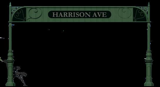
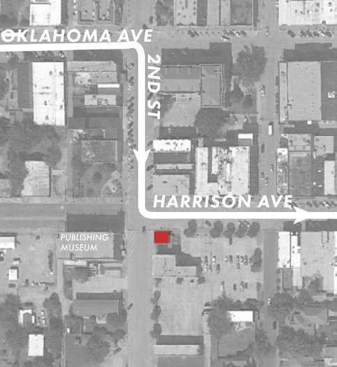
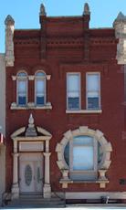
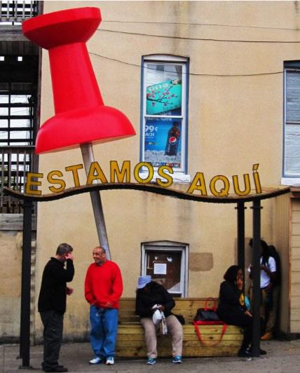
This first stop, Harrison Ave, takes visitors to the State Capitol Publishing Museum. Since it’s in the historic district, the structure imitates the character of the surrounding area with green cast iron. This shelter also connects with the trail system so it provides bike racks and shelter for cyclists and pedestrians coming from that direction.
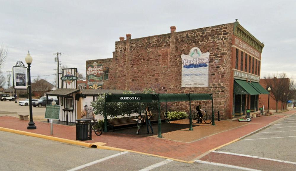
 Pedestrians and cyclists enjoy the shelter, drawing attention to the red stone wall and historic mural to its south.
10
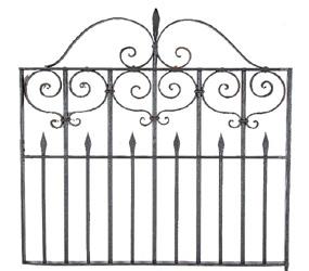
Stop located in a currently empty lot. The shelter features sculptural iron detail.
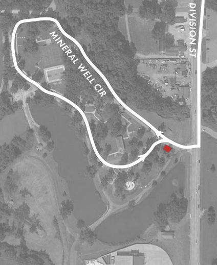
The stop at Mineral Wells Park is also in the historic district, and thus respects the character of the surrounding park. The stop is at the end of the park loop, at the site of some existing sidewalks and landscaping. The structure highlights Guthrie’s stone architecture and features the recognizable arch built around Guthrie by the architect Joseph Foucart.
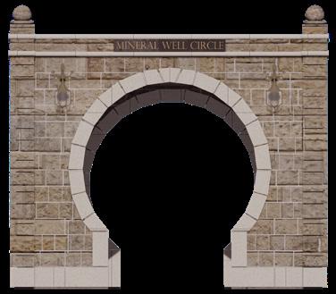

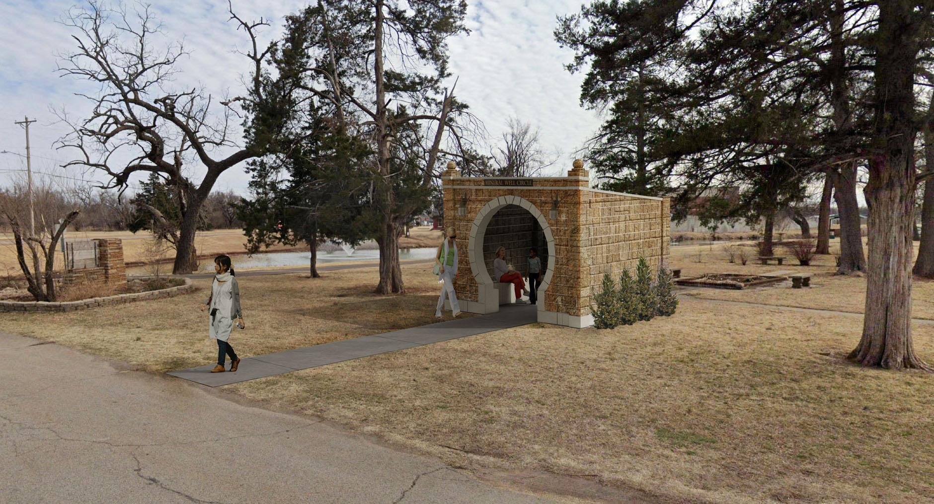 Mineral Wells Park visitors rest at the stone structure that echoes its natural setting. The arch and wall lamps recall Guthrie’s famous historic architecture.
11
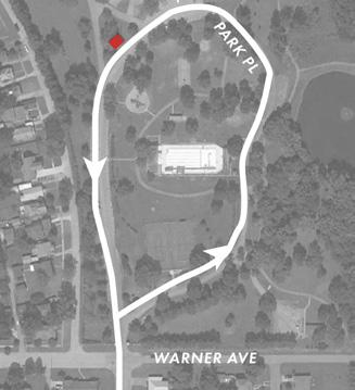
Foucart Design Shelter Location
The Oklahoma Ave stop takes visitors to the Oklahoma Territorial Museum. As it is outside the historic district, the design highlights a different historic style from around Guthrie: mid-century modern architecture. This structure has sculptural concrete features, mid-century geometric forms and V-shaped supports. The elements take inspiration from Guthrie’s history beyond the Victorian aesthetic.
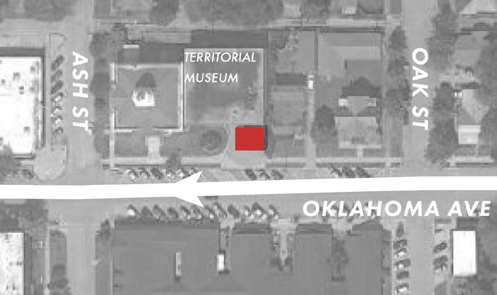


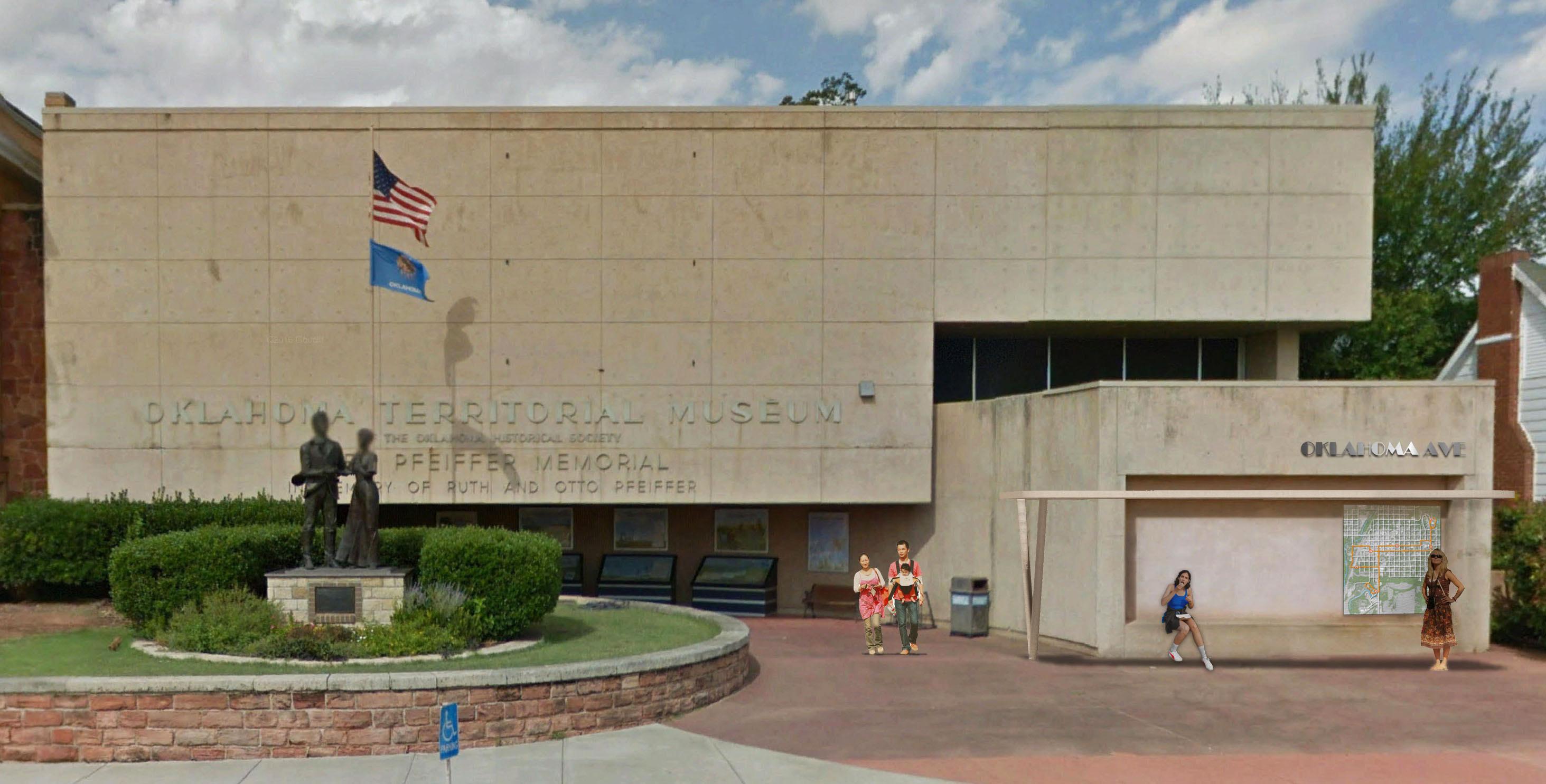
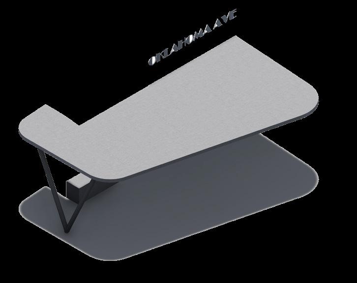 The shelter matches the Territorial Museum’s concrete facade and attaches to an exisgting recess on the side of the building which provides a bench.
12
The shelter projects from the east section of the building, allowing the trolley to pull right in front of the museum.
Swings are a fun place to rest while waiting. Shelter Location
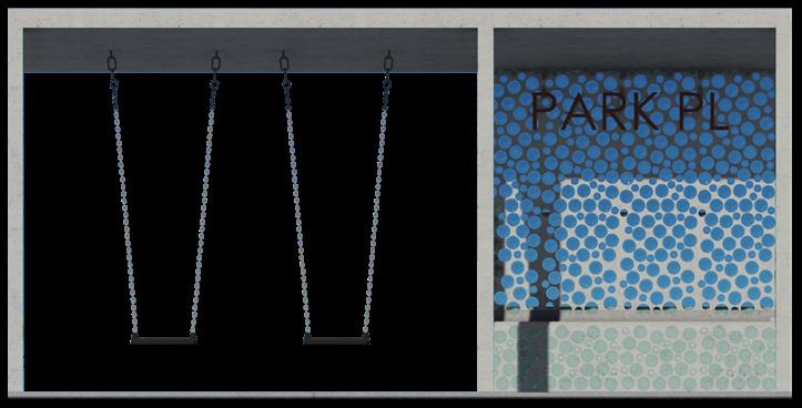
The stop at Highland Park, Park Pl, reinterprets the Works Progress Administration style of architecture found around the area. The stop is located down the street from Highland Hall. The trolley travels around the park loop, providing visitors with enough time to notice the arrival of the trolley before it stops. The red stone of Highland Hall and other New Deal is difficult to come by today, but we can still take inspiration from this resourceful style that uses inexpensive and local material. In this case the shelter is made of reused glass bottles and concrete structure. And, since this stop is at a park, the intent for this shelter is to be colorful and playful, featuring different hues of glass and swings for people to use while they wait.
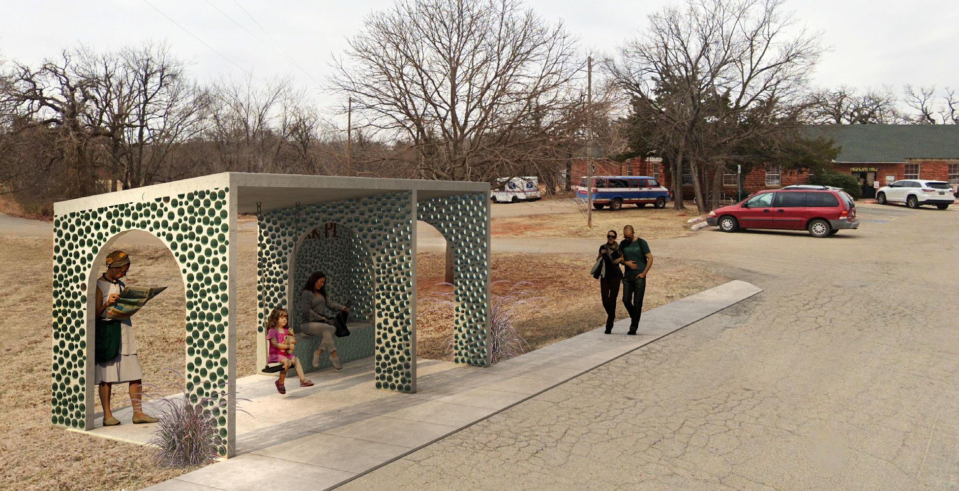
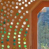
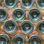 The glass bottle structure of the Highland Park stop casts colored lights on the park-goers and features a mid-century sloped roof.
13


 Located across Drexel St. to the east of the temple, the stop lets visitors view the back of the historic building.
14
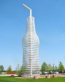
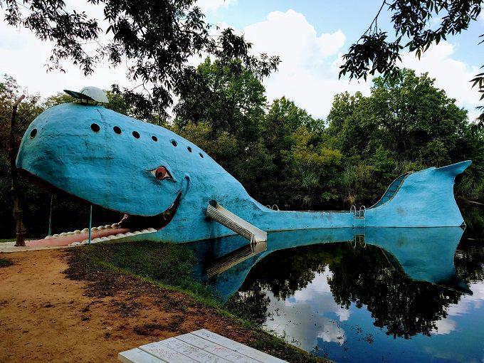
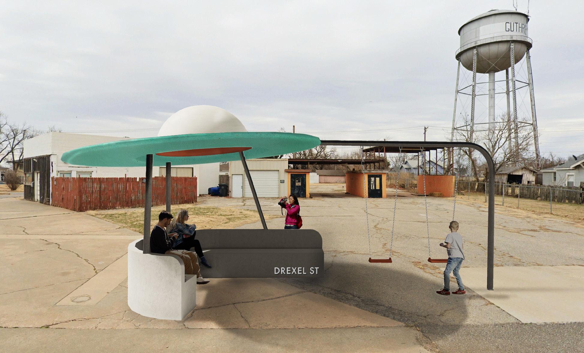
The Route 66 Pops statue and the Blue Whale of Catoosa are iconic Oklahoma roadside attractions; A town in Spain has incorporated whimsical shelters.
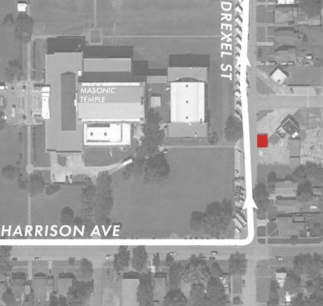
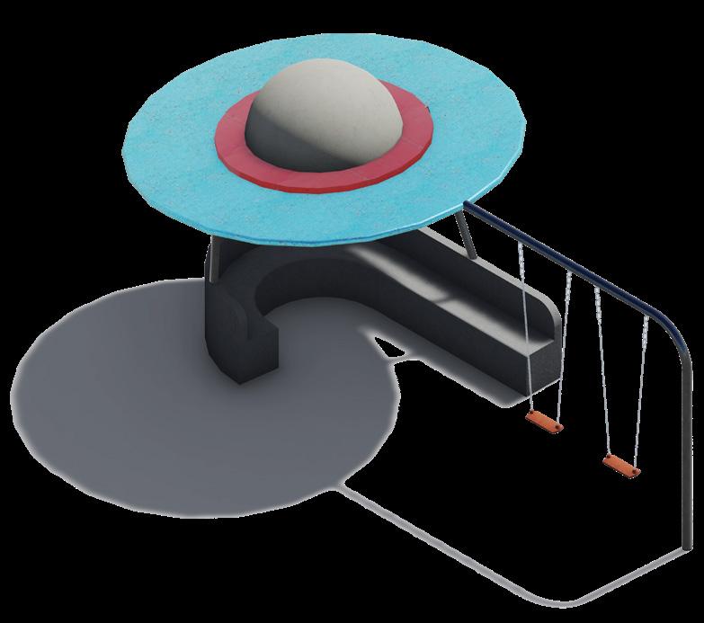
These trolley stops can also be a way to attract a different type of tourist - those interested in oddities & roadside attractions. These are a big draw for many people. For example, there are clearly some well known locations through Oklahoma such as Pops and the Blue Whale of Catoosa. This idea can create another iconic landmark for Guthrie & draw people in that may not stop just for historic architecture. The Drexel St. stop is just beyond the Scottish Rite Temple on the east side of town. This is a prime location to bring people into Guthrie off of the highway. The stop is also supposed to be playful with a whimsical structure and swings. The metal ufo sculpture framing the water tower in the background could act as a photo opportunity and nods to iconic roadside attractions popular across the United states. The stop is designed to be, all at once, a bus shelter, roadside attraction, playground and sculpture.
15
The ufo provides shade and lights up at night for a whimsical touch. The stop frames a water tower and buildings that have the character of ‘roadside’ America.

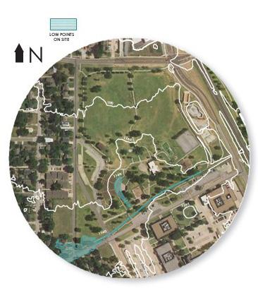
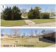
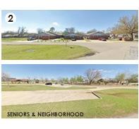
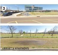
SITE CONTEXT 16
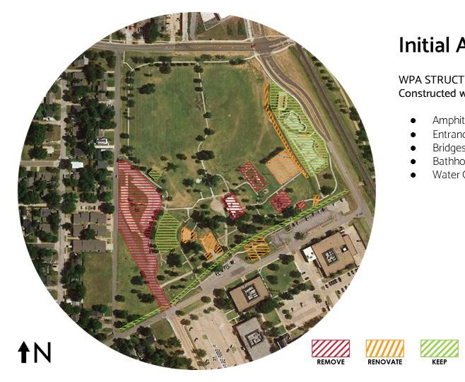
INITIAL ASSESSMENT
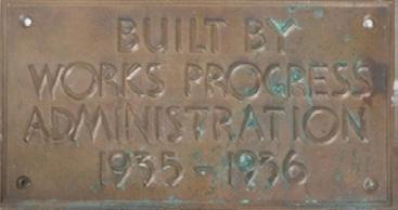
Preserve Historic WPA Structures
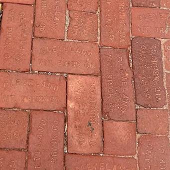
Constructed with Native Stone
1. Amphitheater
2. Entrance Gates
3. Bridges
4. Bathhouses
5. Water Channel
Water Channel
Bridges
Entrance Gates
Bathhouses
Amphitheater
DESIGN FEATURES
Primary Goals
I. Improve pedestrian connections to surrounding areas & emphasize entry sequences.
II. Incorporate LID techniques.
• Make water management a feature of the site.
III. Preserve & reuse existing structures: WPA features and splash pad.
IV. Create intergenerational spaces.
• Sensory garden, easy wayfinding, low-impact exercise options.
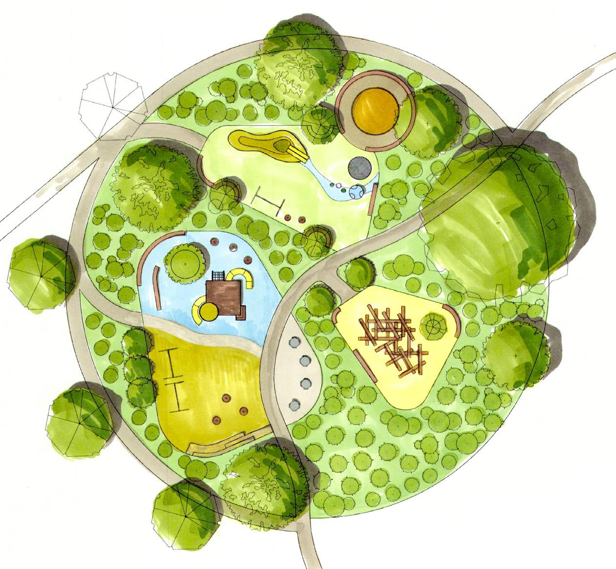
Four Main Zones
1. Exercise & Sport
2. Open Fields
3. Play & Education
4. Natural Area
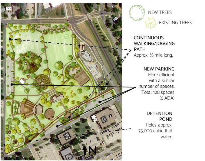
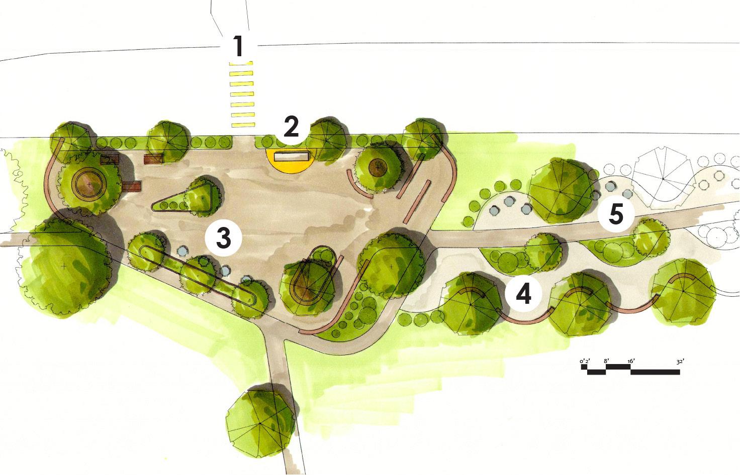
20
1. Entry Plaza
2. Parking Lot & Rain Garden
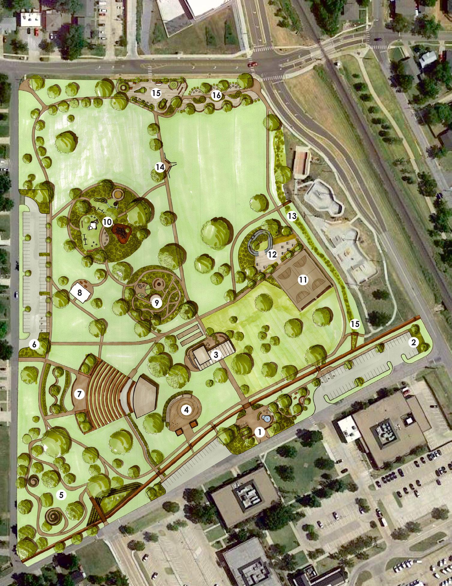
3. Cafe & Pavilion
4. Splash Pad & Renovated Structures
5. Nature Walk & Detention Ponds
6. New Parking Lot & Rain Garden
7. Amphitheater Plaza
8. Existing Pavilion
9. Sensory Garden
10. Playground Area
11. Existing Basketball Court
12. Exercise Area

13. Bioswale
14. Baseball Field & Seating
15. Library Plaza
16. Varied Seating
21
• Emphasize park entry & clear around entry walls.
• Create more seating.
• Make a flexible space.
CAFE & PAVILION
1. SHADE STRUCTURE
2. CAFE BUILDING WITH RESTROOMS
3. SUN SEATING
4. PLAZA STEPS
5. BOCCE BALL COURTS
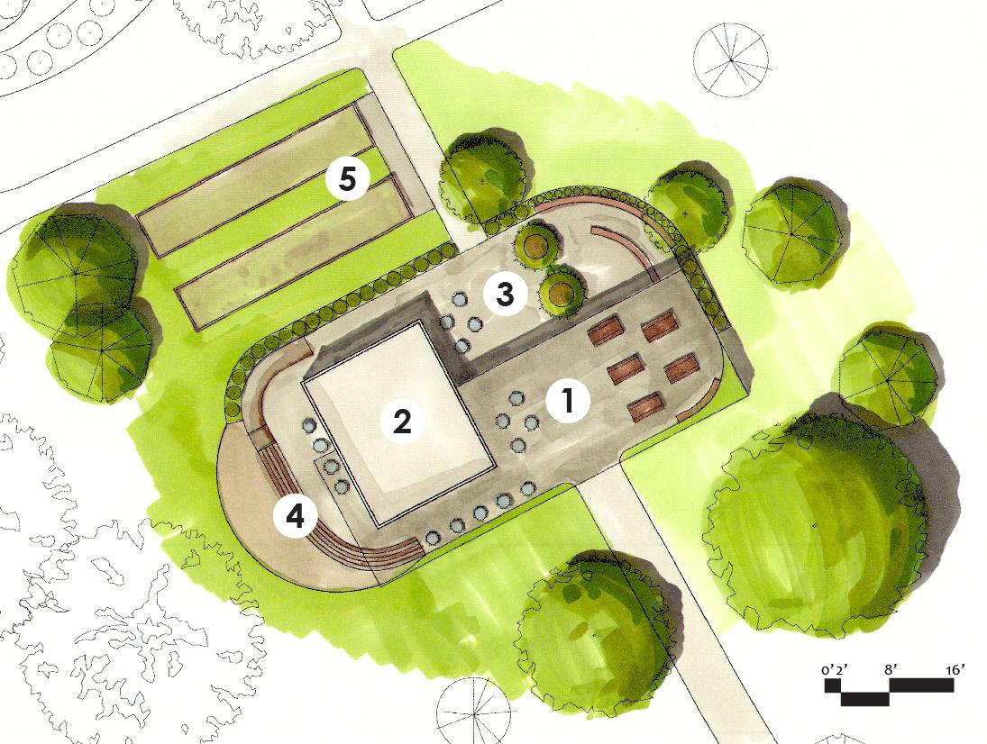
• Activate a central gathering place: a place to eat & newly built bathrooms.
• Shade structure acts as gateway into park along axis.
4. EXISTING BRIDGE
5. NATURAL PATH
6. PICNIC TABLES
1. PEDESTRIAN ENTRY & WPA GATES
2. SHADED BENCHES
3. FOUNTAIN
SOUTH ENTRY PLAZA
22
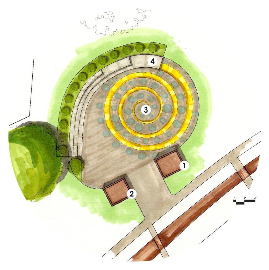
NATURE WALK & DETENTION PONDS
• Water management structures should be dual purpose.
• Create a feel of nature away from the city.
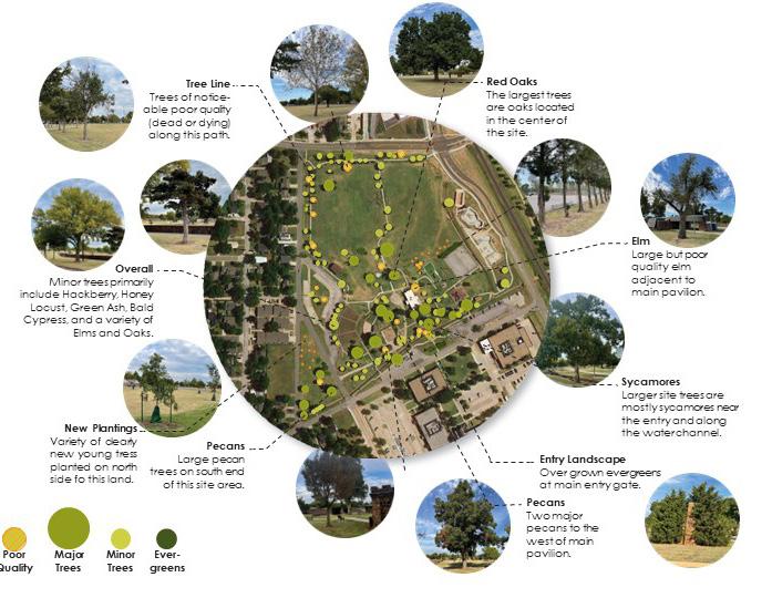
• Preserve existing trees.
1. MAIN DETENTION POND & PEDESTRIAN BRIDGE
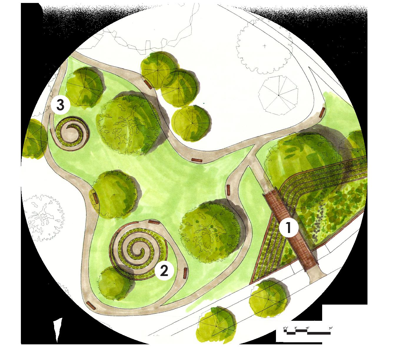
2. SUNKEN SPIRAL
3. RAISED SPIRAL
4. WPA WATER CHANNEL
23
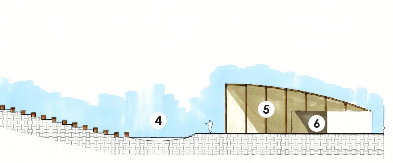
AMPHITHEATER PAVILION
• Emphasize the amphitheater from the street.
• Allow gathering places for those attending a show and area for viewers to set up their own seats.
• Create easier access from neighborhood to West.
• Drain water that pools in front of stage.
1. CROSSWALK AT SENIOR HOME INTERSECTION
2. RAIN GARDEN
3. SERIES OF PATHS & BENCHES
4. STAGE EXTENSION (BIOSWALE BELOW THAT DRAINS TO WPA WATER CHANNEL)
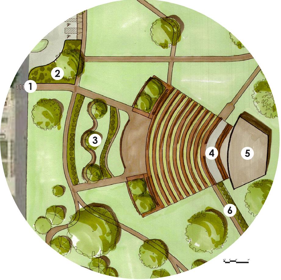
5. NEW SHADE STRUCTURE
6. LARGER STAGE & STORAGE BUILDING
24
PLAYGROUNDS
• Create separate & combinedage playgrounds.
• Whimsical and naturalistic play structures.
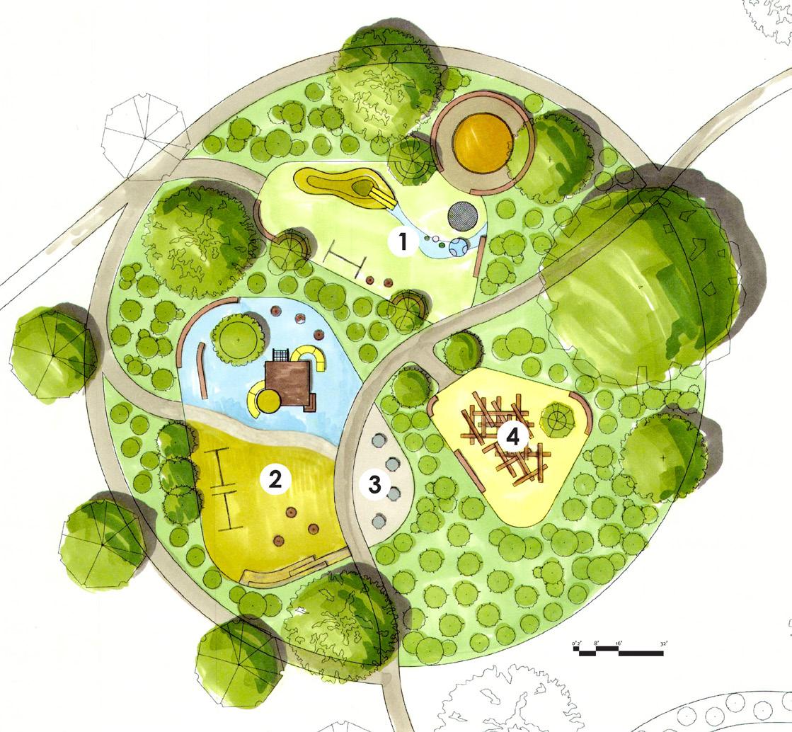
• Spaces should be enclosed & secure with shaded seating for parents.
1. YOUNG CHILDREN
a. ‘LAND FORMS’
b. SANDBOX
c. SWINGS
4. OLDER CHILDREN:
a. LARGE JUNGLE GYM
b. SIT & SPINS
c. SWINGS
4. PICNIC TABLES
5. NATURAL CLIMB & BUILD STRUCTURES
SENSORY GARDENS
• Space to be educational and have calming effects.
• Aid seniors with sensory experience.
• Secluded area from street noises.
1. FIRE PIT
2. LARGE LECTURE BENCH
3. NATURAL SEATING & ROCK GARDEN
4. VARIETY OF SENSORY & NATIVE PLANTS
26
SPLASH PAD
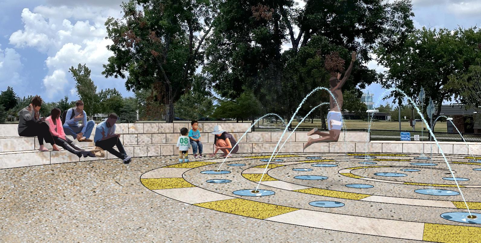
• Renovate the existing shower rooms to activate the area & the ability to close them off.
• Create a naturalistic & whimsical play area.
• Surrounding fence should be replaced with integrated seating.
3.
4.
LIBRARY PLAZA
• Emphasize connection to public library.
• Plaza should be an extension of library with shaded picnic and working tables.
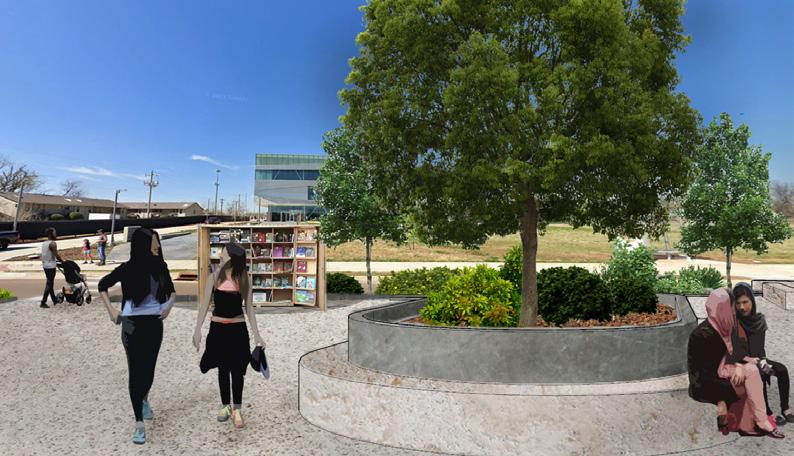
• Create seating for views to baseball fields.
 1. CROSS WALK TO LIBRARY
2. OUTDOOR BOOKSTAND
3. SHADED PICNIC TABLES
4. BENCH PATH
5. PICNIC TABLE AREAS
1. SNACK BAR
2. PLAY STRUCTURE
SPIRAL FOUNTAIN
TERRACED SEATING
1. CROSS WALK TO LIBRARY
2. OUTDOOR BOOKSTAND
3. SHADED PICNIC TABLES
4. BENCH PATH
5. PICNIC TABLE AREAS
1. SNACK BAR
2. PLAY STRUCTURE
SPIRAL FOUNTAIN
TERRACED SEATING
27
SITE CONTEXT 28
BROOKS ST. PLAZA
Norman, OK University of Oklahoma
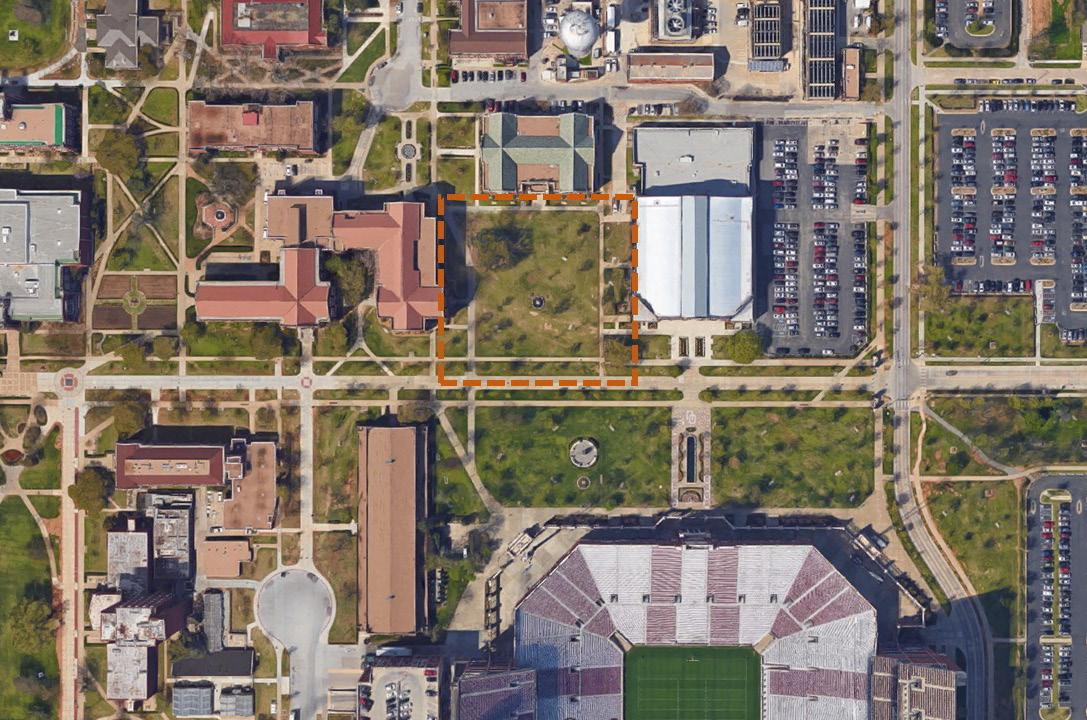
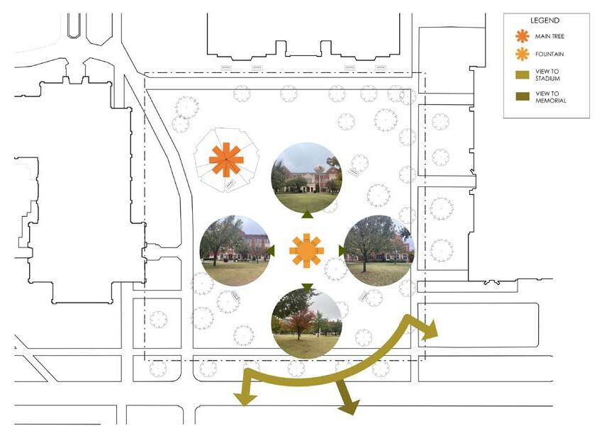
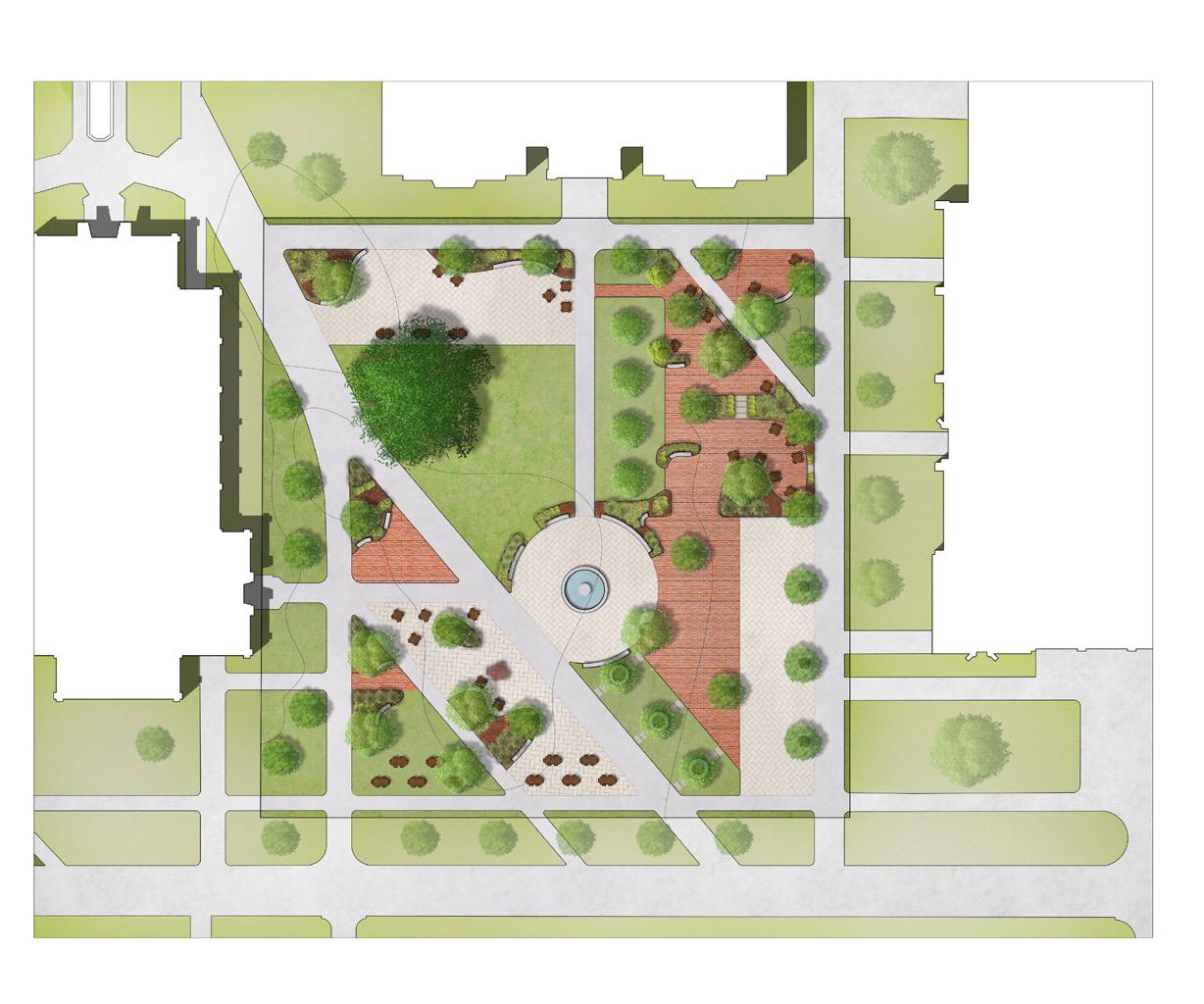
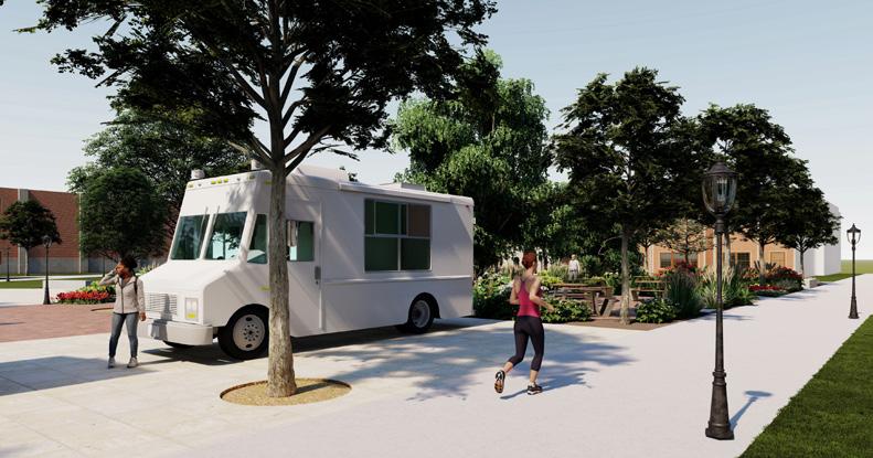
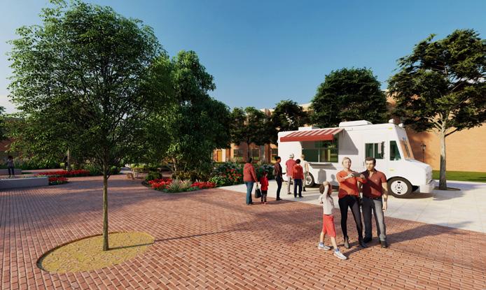
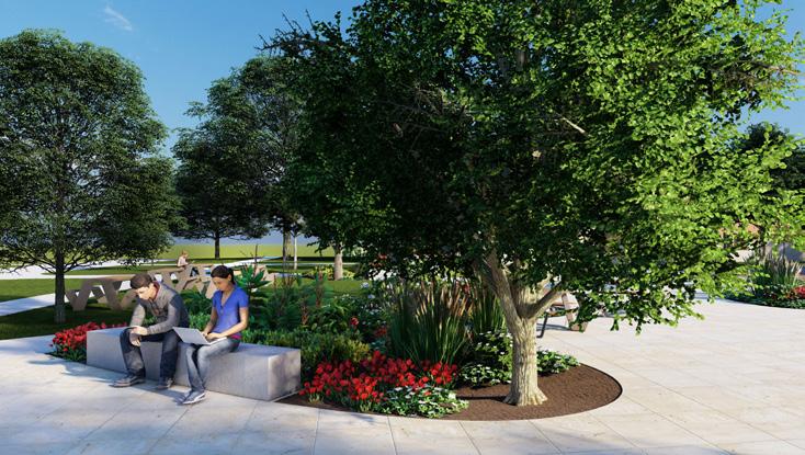
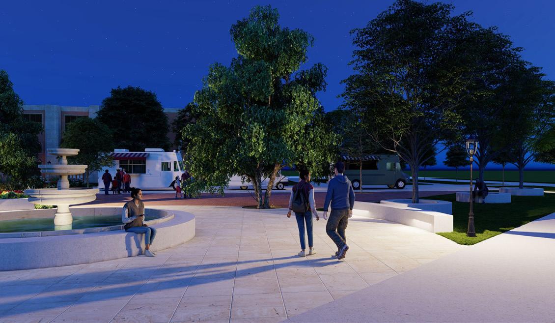
This project is the re-design of a site at the University of Oklahoma to create a multi-use space for students and game-day visitors. The space will serve as a place for students to study or eat lunch, as well as a flexible location for events such as cookouts or food trucks. As a main entrance into campus on a game day or weekday, the site will also better accommodate pedestrian traffic based on current circulation patterns.
03
29
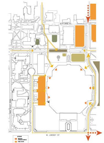
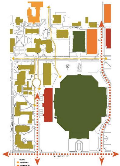
SITE CONTEXT ANALYSIS GAME DAY ANALYSIS 30
Primary Issues
I. Insufficient pedestrian circulation for this high traffic area.
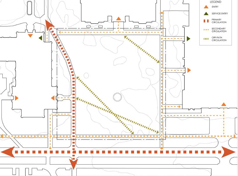
II. Lack of adequate shaded seating (especially during gameday).
III. Lack of access to the central fountain.
IV. No adequate space for events.
V. Pooling of water in multiple areas of the site.
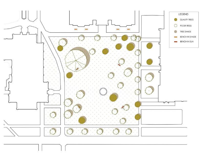
VI. Students and university not taking advantage of this large campus space.
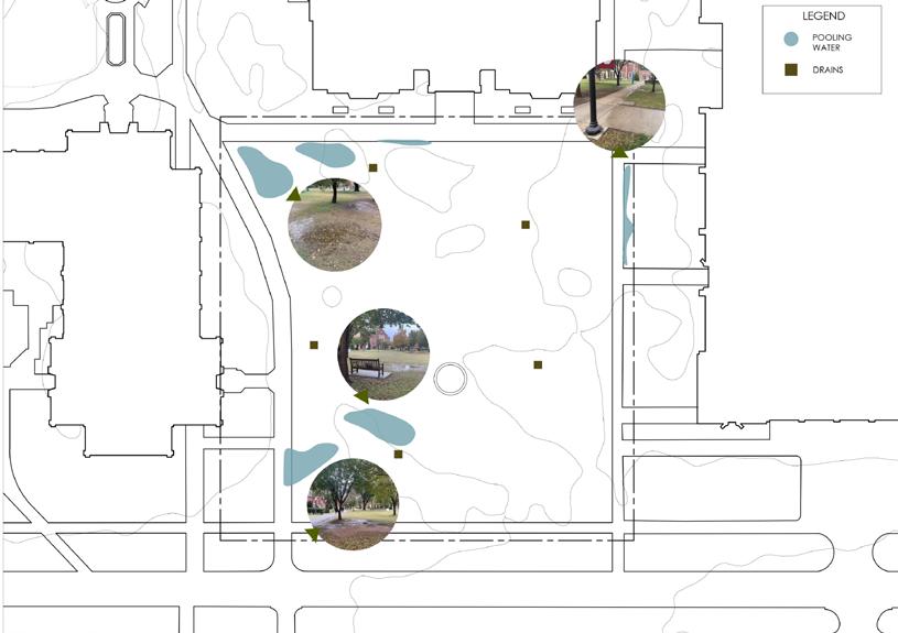 WATER ANALSYIS
VIEWS & FOCAL POINTS ANALSYIS
WATER ANALSYIS
VIEWS & FOCAL POINTS ANALSYIS
31
VEGETATION ANALSYIS CIRCULATION ANALSYIS
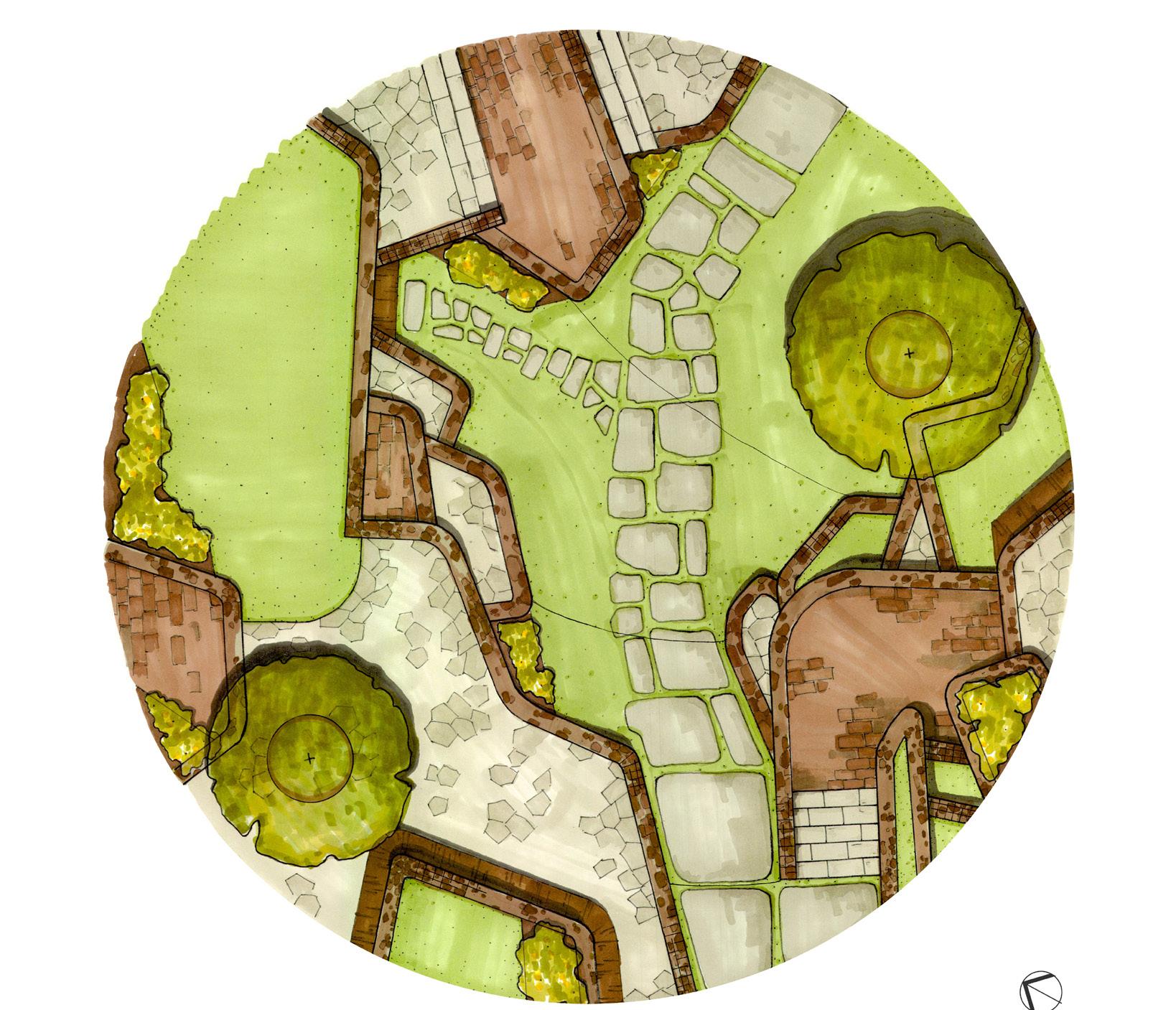
Goal I: Create a flexible event space for game day.
i. Create a plaza for larger gatherings of people or food trucks away from the main pedestrian path.
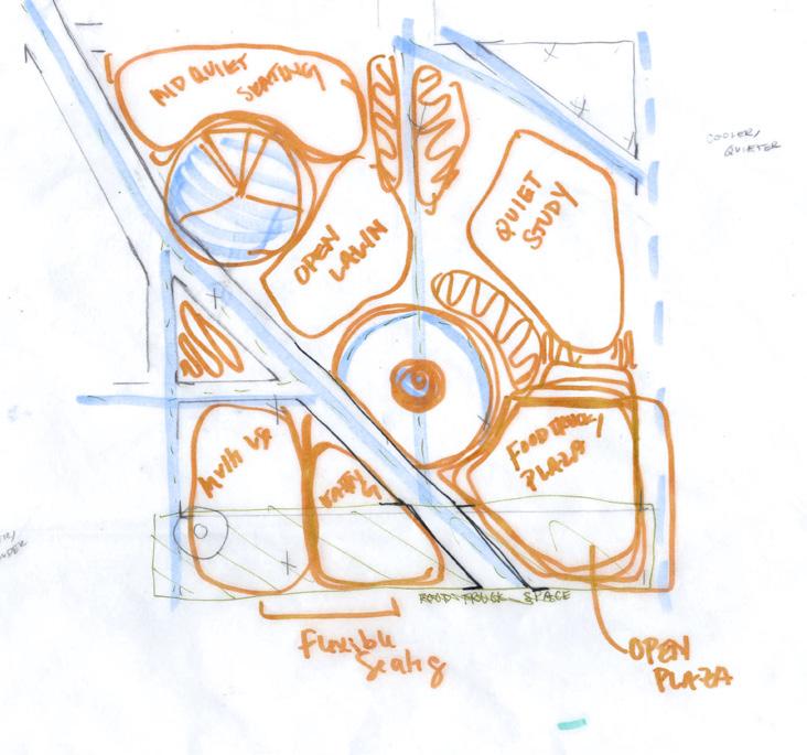
ii. Incorporate shared gathering areas (based on shade analysis).
iii. Display OU pride in colors, materials, etc.
Goal II: Improve pedestrian routes and establish the site as a major path through campus.
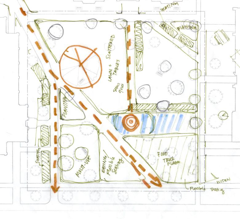
i. Create logical pedestrian routes based on analysis, widening paths and the site’s northwest entry.
ii. Provide a path to the fountain in the center of the site.
Goal III: Improve water drainage on site to allow use after rainy days.
i. Create rain gardens in areas that retain water.
ii. Drain away from seating areas.
Goal IV: Provide a place for students to study and eat.
i. Provide multiple fixed and flexible seating options in more effective locations than the current furniture.
ii. Plan for new shade structures or shade trees to provide seating areas out of the direct sun.
iii. Design planted areas to make a calming green space.
CONCEPT SKETCHES
SUNNY/ ACTIVE SHADE / QUIET
32
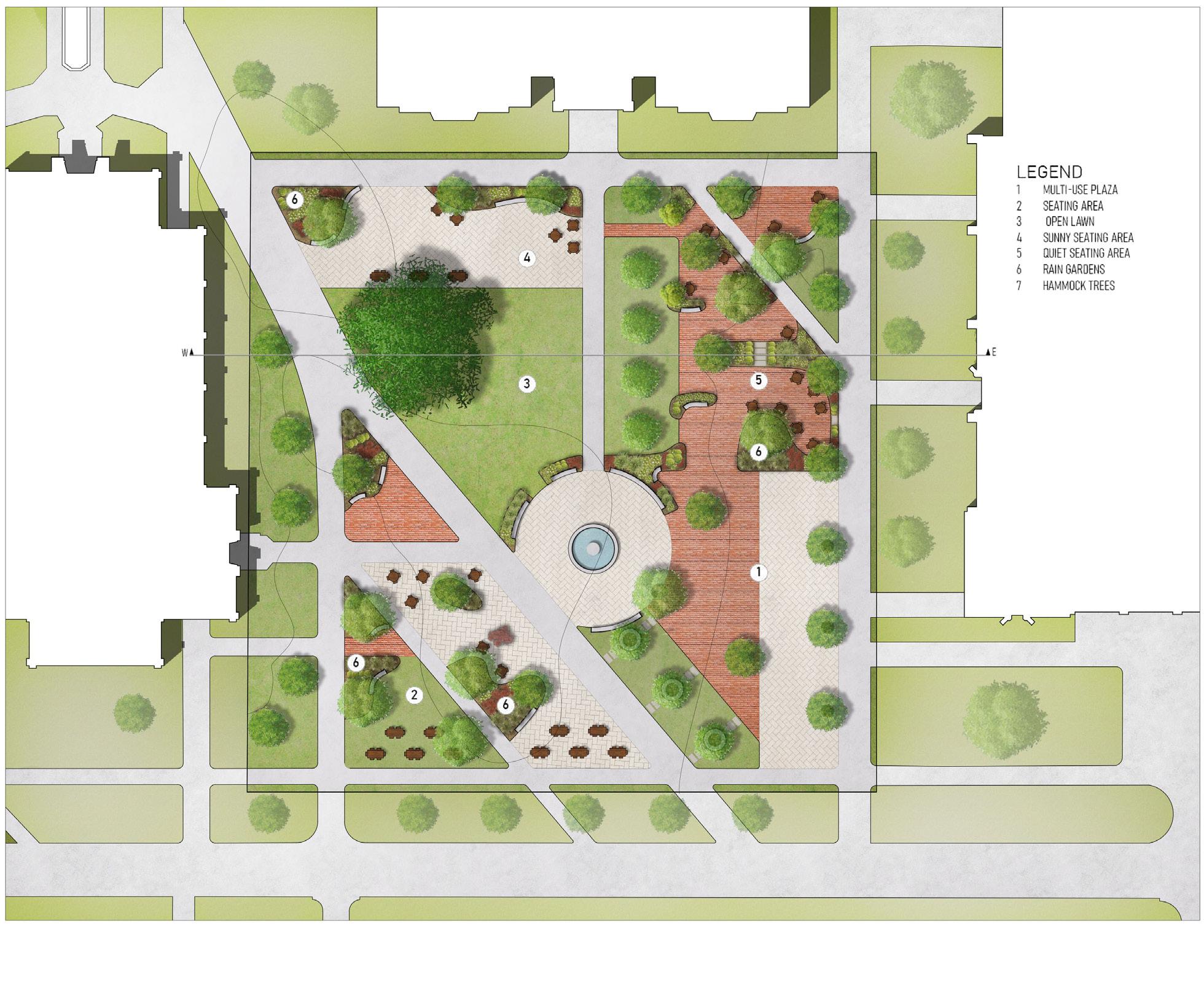

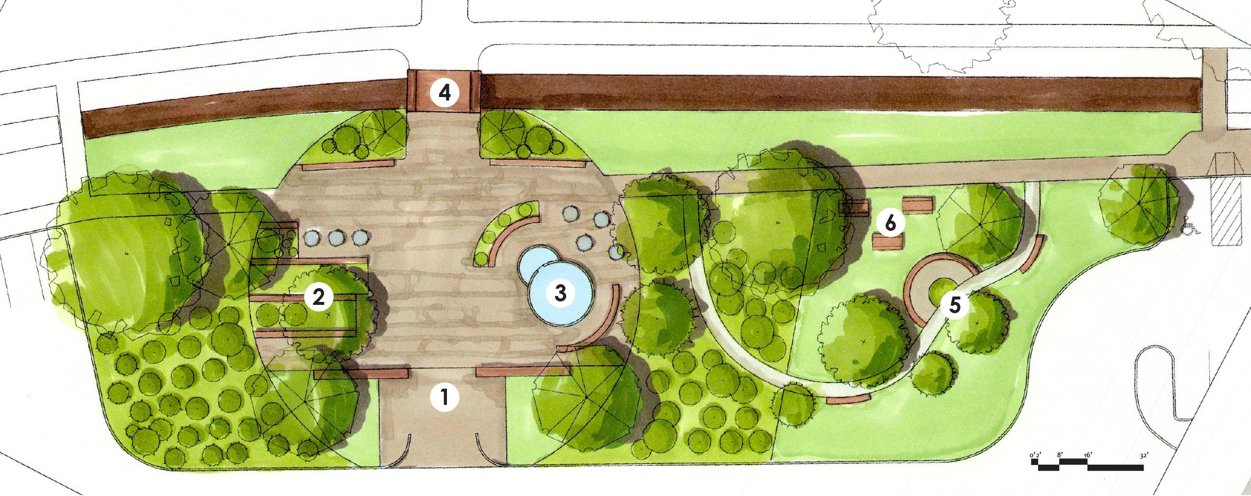
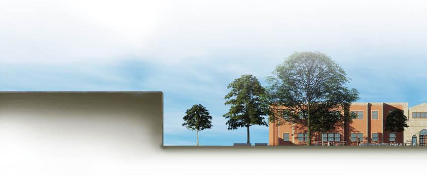
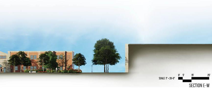
0’ SCALE: 1” = 20-0” 5’ 15’ 25’ N SITE PLAN 33
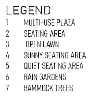
1 4 2 3 5 34
 1. MULTI-USE PLAZA
2. PEDESTRIAN PATH OFF PLAZA
3. PATHWAY WITH BENCHES
5. SHADED PICNIC TABLES
4. CENTRAL FOUNTAIN SEATING
1. MULTI-USE PLAZA
2. PEDESTRIAN PATH OFF PLAZA
3. PATHWAY WITH BENCHES
5. SHADED PICNIC TABLES
4. CENTRAL FOUNTAIN SEATING

36
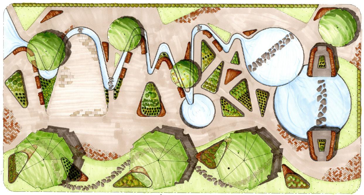
ALPHA WAVE STREAM
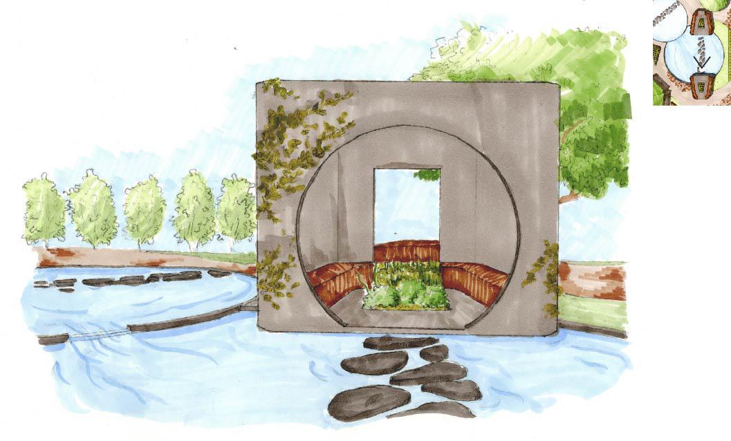
Conceptual Healing Garden
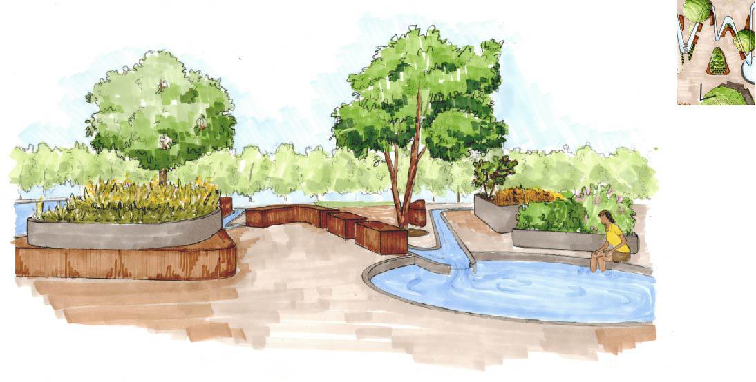
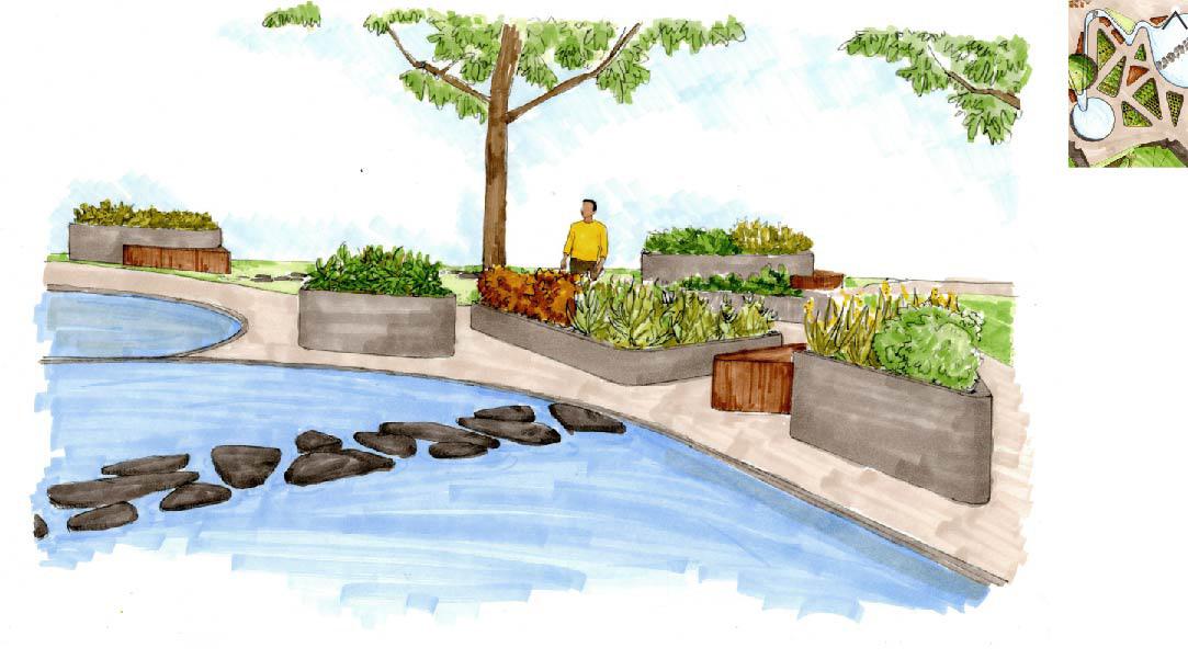
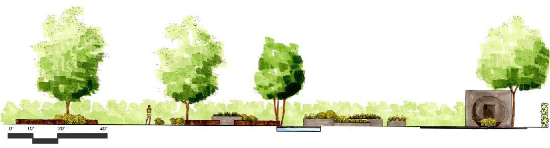
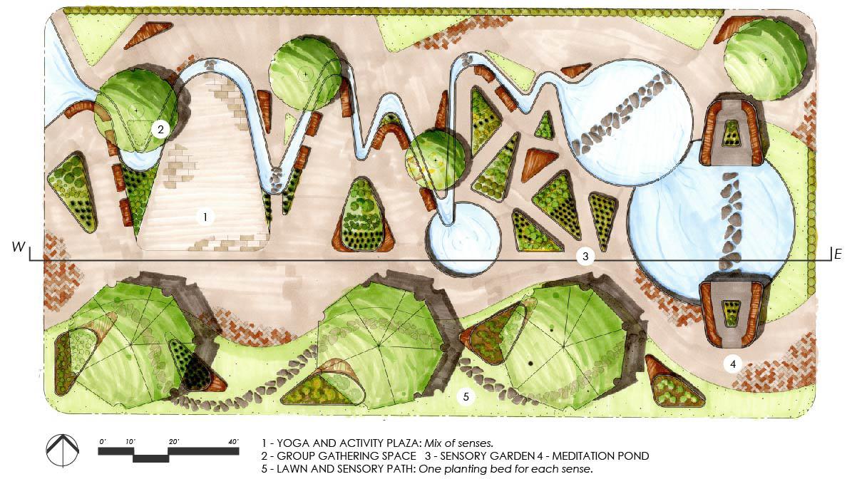
The goal of the healing garden is to create a retreat from the outside world. Connections with nature can help reduce stress, healing the body and mind. This garden’s form takes inspiration from brain wave patterns and has three main uses: a yoga space, a sensory garden and a meditation area. The stream at the entrance to the garden takes a more jagged shape like gamma waves and eventually relaxes into the easier shapes of the theta or delta waves. The spaces of the garden also correspond to the wave pattern, transitioning from spaces for activity and socializing to quieter, private and contemplative spaces.
04
37
38
A visitor enters into the activity plaza where yoga classes are held. They then walk along the main path to group sitting areas, to the sensory garden with private sitting areas, to the quiet meditation pond and buildings. They can relax on the lawn before exiting the garden via the small stone path through the lawn. The shallow stream provides soothing sounds and the opportunity to touch or walk through the water throughout the garden.
39


40
WICHITA ROCK GARDEN Conceptual Park
This conceptual pocket garden was inspired by the Wichita Mountains Wildlife Refuge in southwestern Oklahoma and is intended to be a glimpse of unique native Oklahoma landscape. Its basic form was influenced by the changes in elevation at the actual Wichita mountains, in this case on a much smaller scale. The garden’s shape is formed by gabion wall encircled “mountains” on either side with a ravine through the middle acting as the base path of circulation. The rocks in the gabion walls are larger at the bottom and smaller at higher elevations to create differences in texture that force perspective and create the illusion of height.
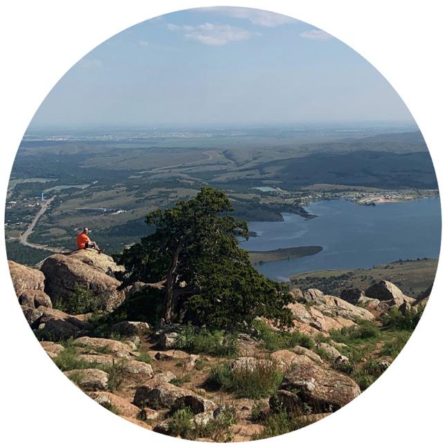
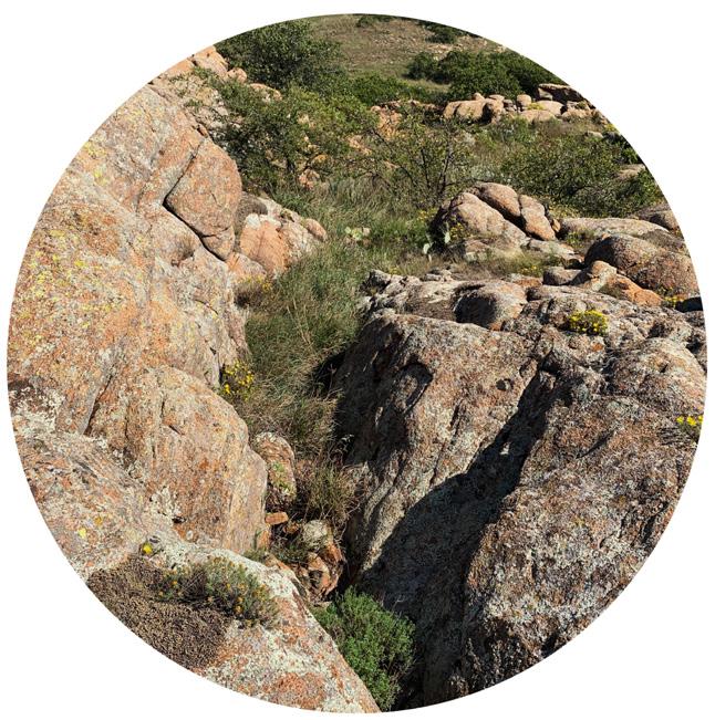
The garden also creates a similar experience to the mountains. There are a variety of levels to climb, sit or observe. The northwest side of the garden acts as a more accessible area with lower elevations. The southern levels of the garden are for climbing and playing with greater changes in elevation. Sloping down the central path of the site creates a looping circulation pattern. Overall, it is a mostly rocky landscape with vegetation growing in on the lower levels and in the cracks.
04
41

THANK YOU! 918.237.6059 peyton.g.kroh@ou.edu peytonkroh.myportfolio.com