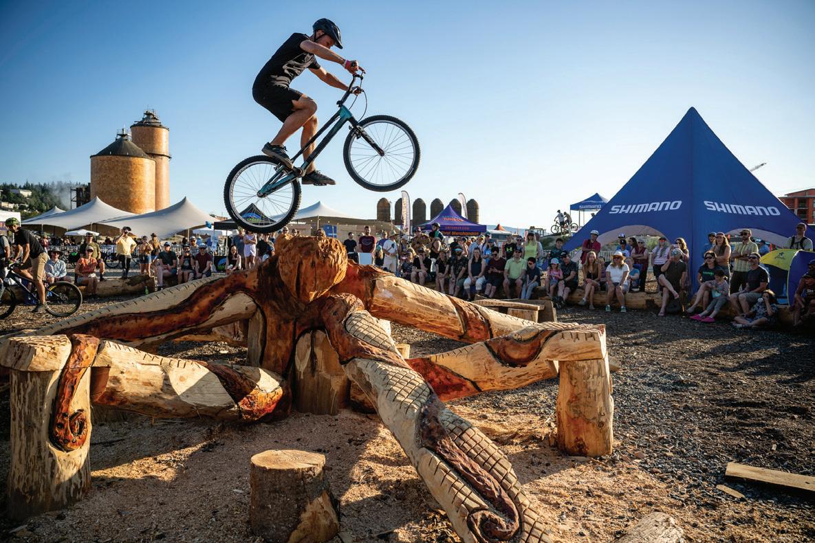
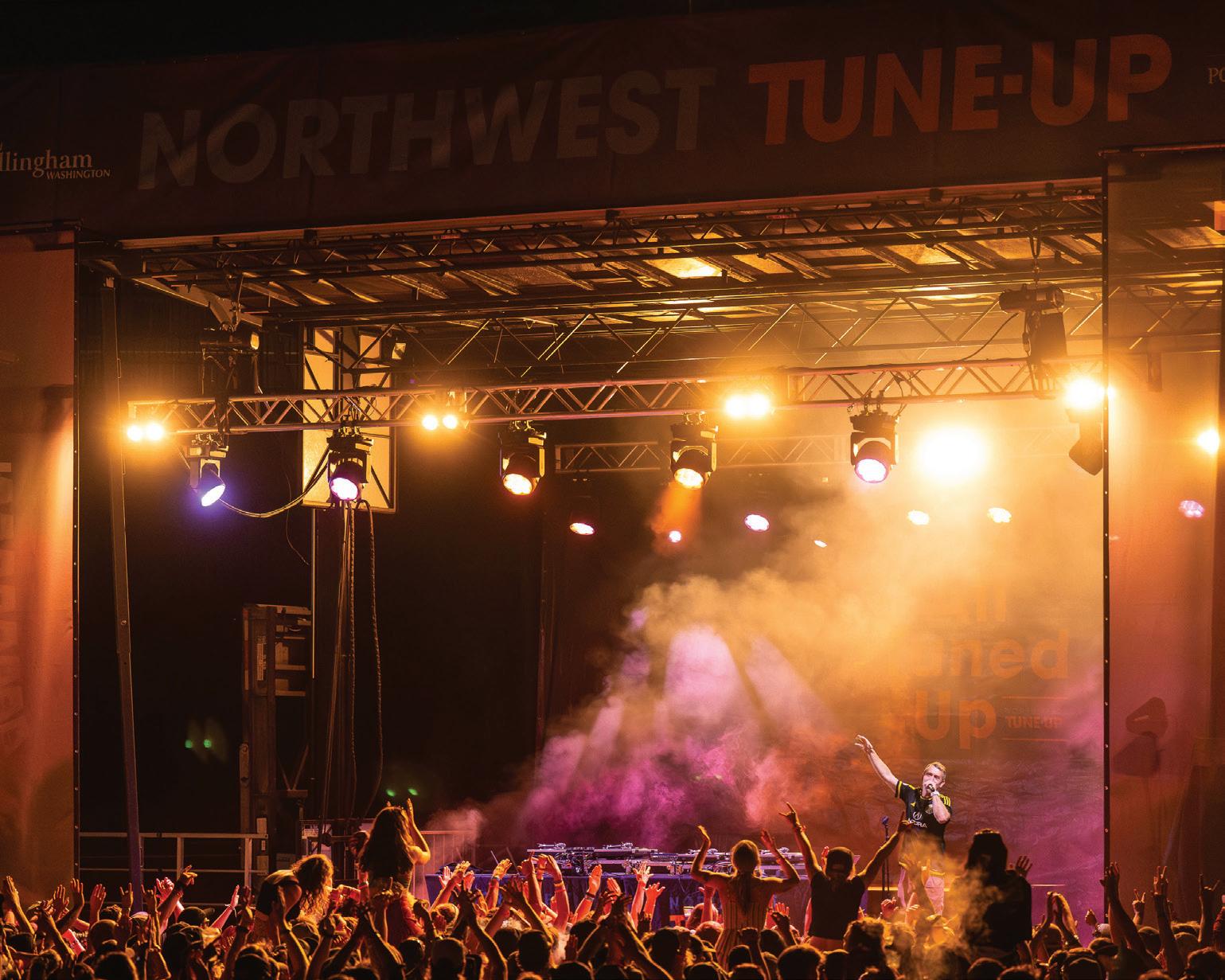
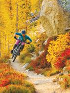
This is the weekend your summer’s been waiting for. From July 11–13, 2025, the Northwest Tune-Up festival transforms Bellingham into the ultimate playground for mountain bikers and music lovers. By day, session Bellingham’s legendary singletrack, race against the best or test-ride the latest gear from the biggest brands in the industry. By night, trade your helmet for headliners and soak up an unforgettable lineup of live music on Friday and Saturday.
With its iconic trails and vibrant outdoor community, Bellingham isn’t just a stop on the map—it’s a destination for every serious mountain biker. Whether you’re ripping laps with your favorite crew or going big with your favorite bands, Northwest Tune-Up is where the ride of your life begins. Lock in your tickets now at NWTuneUp.com. Scan to find tickets.
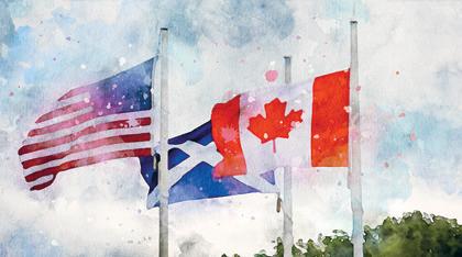
• A cultural celebration of the sites and sounds of Scotland.
• Experience Pacific Northwest Beauty and Nature along the Salish Sea.
• A stone’s throw from the Peace Arch Border Crossing into Canada.
• Waterfront views of Semiahmoo Spit, Mount Baker, and White Rock, B.C.
by Pat Grubb
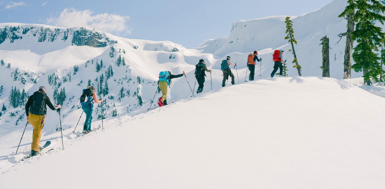
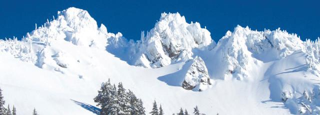
t’s the last week of February and the Pineapple Express is full-blown out my window. Luckily, it’s cold enough up top that they expect 10 inches of snow today and more in coming days. While we’re working to put this publication to bed, there are some lucky buggers up the mountain just hootin’ and hollarin’ about now. I’m not saying I hope they face plant but … That’s ok – there’s plenty of season left. So far, Baker’s had 371 inches of snow, almost four feet more than last year and, over the last 15 years, March has averaged over 10 feet of snow. In other words, there’s plenty of riding yet to come.
But once you’ve finished for the day, put your feet up, grab a beer, and pick up the spring Mount Baker Experience and travel far, far away. Take a trek with Cameron Fenton as he hikes the Hudson’s Bay Company Heritage Trail in southern B.C. and tells you about the people who have taken on the responsibility to maintain and repair it.
Shhh! Walk the woods with Tony Moceri as he follows sound engineer Jason Cushing recording the sounds of the forest – it will never sound the same again to you.
Feeling strong? Feeling adventurous? MBE editor Nolan Baker tells you how you can sign up for the WA360 – the wind or human powered boat race that can take up to two weeks to finish. If you finish. Feeling romantic? Hah! Liam Delaney and his new bride Daphne decided they would spend their honeymoon riding their bikes from Seattle to Vancouver Island to the Sunshine Coast to Vancouver to back to the island and home. Who knew the month of August could be so rainy? And what was wrong with going to Hawaii?
And, of course, the Mount Baker Experience wouldn’t be what it is without some spectacular photography from locals who love the Pacific Northwest and know how to capture it, one beautiful frame after another.
In just a couple of weeks, daylight saving time will start, the weather will warm up and the outdoors will be calling us to different pursuits. Get out there and enjoy and be safe!
GLACIER PEAK: SUMMIT TO SEA
Natural wines and ciders right from the Mt. Baker foothills
360-mile race around Puget Sound gets set for a reboot
Recording nature sounds with Tony Moceri
best cross-country
in
MOUNT BAKER EXPERIENCE
Since 1986
Special publication of The Northern Light and All Point Bulletin
PUBLISHERS
Patrick Grubb and Louise Mugar
EDITOR
Nolan Baker
PUBLICATION DESIGN
Doug De Visser
COPY EDITOR
Grace McCarthy
ADVERTISING DESIGN
Ruth Lauman • Doug De Visser
ADVERTISING SALES
Gary Lee • Molly Ernst
CONTRIBUTORS IN THIS ISSUE:
Brett Baunton, Jere Burrell, Liam Delaney, Jake Goldstein-Street, Andrew Grubb, Justa Jeskova, Heather J., Nick Reid.
EMAIL: info@mountbakerexperience.com
WEB: www.mountbakerexperience.com
FACEBOOK: facebook.com/mtbakerexperience
TWITTER: twitter.com/MB_Experience
INSTAGRAM: instagram.com/mtbakerexp
If you can see Mt. Baker, you’re part of the experience. Mount Baker Experience is an outdoor recreation guide for and about the Mt. Baker region, distributed from Seattle to Vancouver, B.C. and published by Point Roberts Press, Inc. Locally owned, the company also publishes TheNorthernLight, All Point Bulletin, Pacific Coast Weddings, Waterside and area maps.
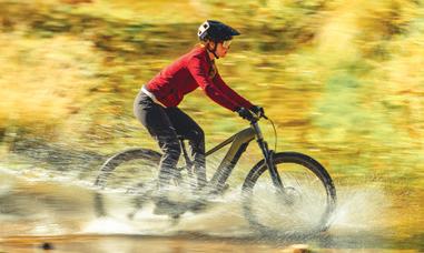
Spencer Arps and Callie Waldschmidt mountain biking on Orcas Island, Washington.
Photo by ColinWiseman
MBE spring 2025
CONTRIBUTORS
NICKDANIELSON
A designer by trade and photographer by experience, Nick spends his summers trail running and winters splitboarding in the mountains of the Northwest. Nickdanielson.com
ERINDEINZER
Erin Deinzer has worked as a copywriter, travel writer, and editor, and would one day like to ghostwrite an autobiography. As a recently-minted PNW resident, she enjoys exploring her adopted home as well as off-the-beaten path destinations around the world.
CAMERONFENTON
Cameron Fenton lives on the Canadian side of the North Cascades near Chilliwack, BC where he works as a writer and a guide.
ETHANFRITZBERG
Originally from Seattle and now based in Bellingham, Ethan is a lifelong photographer and avid watersports enthusiast. When he’s not out wing foiling in Bellingham Bay, you can find him around the harbor with his dog, Ranger.
JASONGRIFFITH
Jason is a fisheries biologist who would rather be on a summit than down by the river. When he isn’t fiddling with his camera in the mountains, he lives in Mount Vernon with his wife and two boys.
MIKENOLAN
Mike Nolan is a freelance writer who lives in Port Angeles, where the mountains greet the sea.
MEGOLSON
Meg is the co-owner of Kingfisher Bookstore in Coupeville, which has a bit of everything but specializes in the natural and human history of the Pacific Northwest. She likes to explore, in person or on pages.
DAVESUMMERS
Addicted to altitude, business, adventure. Photographer, athlete, explorer, businessman. @davesummertimes.
MATTHEWTANGEMAN
Matthew is a Bellingham-based adventure photographer with a passion for deep powder, alpine granite and not making it back to the trailhead until way after dark. mtangeman.com.
COLINWISEMAN
Colin Wiseman is an outdoor lifestyle and action sports photographer, writer, and producer who has lived in Bellingham since 2007. Follow him on Instagram @colin_ wise_man and on the web at colinwisemancreative.com
JACKWILEY
JASONHUMMEL
Jason is an outdoor photographer from Washington who has documented numerous first descents in the North Cascades.
TONYMOCERI
Tony is a freelance writer who loves to get out and explore the world with his family. He shares his journey @adventurewithinreach and tonymoceri.com
Jack Wiley is a photographer, snowboarder and media producer who grew up in Seattle and now resides in Salt Lake City. You can find him in the mountains or working on a new project at all times.
JOSHWOODWARD
Josh Woodward is a professional action sports photographer and videographer based in Bellingham. An athlete himself, Josh loves to participate as much in his subject’s sports as he does shooting them.
Newsroom Notes big and small from around the region
Washington state $5 million e-bike rebate program to start in April
The Washington State Department of Transportation (WSDOT) is set to begin a pair of new programs with the goal of allowing more people access to electric bicycles. The new programs, a rebate for e-bike purchases dubbed “WE-Bike” and an e-bike lending library, were funded by the Washington State Legislature in the 2024 supplemental transportation budget.
WSDOT, along with vendor company APTIM, LLC. will launch the program starting in April 2025. APTIM has been working on educating local bike shops on how to participate in the program.
All Washington state residents are eligible to receive a $300 point-of-sale rebate, with up to $1,200 available for low-income households – though purchases must be made at brick-and-mortar stores, not online, WSDOT said.
“I am thrilled to share that following a competitive bid process in 2024, WSDOT identified APTIM, LLC., to develop the technology and process the agency needs to safely and securely manage the program,” said Adele Peers, who oversees WSDOT’s e-bike program.
APTIM has been administering e-bike rebates at local and state levels for cities like Boston, Boulder, Denver and the state of Colorado, and will now work with local retailers in Washington state to administer the rebates.
Prospective e-bikers with a household income at or below 80 percent of the county-area median income ($64,791 or less in Whatcom County) will be eligible for a $1,200 rebate – roughly covering the cost of an entry-level e-bike, while those not meeting the low-in-
Before you go out to the nearest e-bike dealer come April 1, WSDOT made it clear that not everyone who wants a rebate voucher will be able to get one. WSDOT wrote online that it expects to give out “about 8,500” vouchers, most of which will go to low-income households, of which there are about 3 million in the state. A household is only eligible
Among other hoops to jump through for the rebate, only bike shops officially associated with the program are eligible to give out rebates. A list of participating vendors has yet to be revealed. APTIM expects roughly 100 bike shops around the state to be selected for the single-use, point-of-sale
According to data from the American Community Survey conducted by the U.S. Census Bureau, just 0.7 percent of Washington commuters choose to bike for work in 2023, and a majority of those are in urban areas. That
For those not able to purchase an e-bike or who miss out on the rebate, WSDOT is also piloting an e-bike lending library, allowing local communities to
The 2023 Move Ahead Washington transportation bill approved by the state legislature earmarked $2 million for the program, which will focus on grant applications for local and tribal governments and their employees,
Canada closes border permit to Pacific Crest Trail thru-hikers
The Canadian Border Services Agency (CBSA) announced in January it will no longer issue permits to thru-hikers finishing the Pacific Crest Trail without going through an official port of entry, ending a decades-long entry program for weary travelers on the final leg of the 2,650-mile trail.
In a January 27 press release, CBSA said the new policy is an effort to increase security along the border and is in line with U.S. border policy that does not allow hikers to enter the U.S. through Canada without a permit.
“This change will facilitate monitoring of compliance of trail users, enhance security at the border, and aligns with the U.S. Customs and Border Protection who does not allow travellers to enter the U.S. from Canada on the trail.”
The Pacific Crest Trail stretches from Mexico, through California, Oregon
and Washington and ends at the Canadian border.
“This is disappointing news,” Jack Haskel, trail information manager for the Pacific Crest Trail Association wrote in response to the CBSA policy.
“That said, we can appreciate their points, and the fact that this policy is consistent with the United States’ policy which does not allow entry into the United States via the PCT.”
Before the change in border policy, thru-hikers would take heroic photos at the final marker post, Monument 78, cross the Canadian border, then hike eight miles north to B.C. Highway 3 near Manning Provincial Park and find a ride home.
Now, thru-hikers must immediately double-back at the border and re-tread the 30 miles they just hiked, back to the closest U.S. road at Hart’s Pass and head back to the nearest town of Mazama or Winthrop, Washington.
“Hikers and equestrians should turn around after reaching the Northern Terminus,” Haskel wrote. “We ask that everyone travels with the utmost respect for nature by practicing gold standard Leave No Trace practices. This area will experience increased use now that more people are traveling this section of the PCT twice.”
If thru-hikers wish to continue traveling into Canada, CBSA said they must declare themselves at an official land point of entry. The nearest of those are 60 miles away in Abbotsford or Osoyoos.
The change is another page in a tumultuous chapter of U.S.-Canadian relations since the start of the Trump administration’s second term, which has threatened 25 percent tariffs on Canadian imports if the country doesn’t take steps to deter illegal border crossings and boasted of annexing the country as the U.S.’s 51st state.
Continued on page 11
National Park Service firings hit Mt. Rainier, Olympic, North Cascades
By Jake Goldstein-Street, Courtesy of the Washington State Standard
Reduced staffing could mean closed campgrounds and trails as well as unsafe conditions, advocates said.
About half a dozen employees at each of Washington’s three national parks are believed to have been laid off as part of the Trump administration’s government-wide push to slash staff.
Mt. Rainier and North Cascades national parks each saw six employees let go mid-February, while Olympic National Park lost five, said Bill Wade, the executive director of the Association of National Park Rangers.
It’s been difficult for anyone to figure out the extent of layoffs at Washington’s parks. Even the park superintendents have been kept mostly in the dark. Wade got information from “reliable sources, such as other employees in the parks, or from one who is terminated and knows how many others in the park were terminated.”
The cuts at Mt. Rainier included the popular park’s only plumber, Wade said.
The Trump administration also laid off one employee at the Lake Roosevelt National Recreation Area in northeast Washington, Wade said. Nationwide, more than 1,000 National Park Service probationary employees have been let go as Elon Musk’s Department of Government Efficiency has taken a buzzsaw to the federal workforce in recent weeks.
About 3,400 U.S. Forest Service workers have also lost their jobs. Hundreds of employees in the Forest Service’s Region 6 in Washington and Oregon are among them. This included chopping
the team that manages the Enchantments in the Alpine Lakes Wilderness from 13 people to three, according to the Washington Trails Association.
Gregg Bafundo was the lead wilderness ranger at the Okanogan-Wenatchee National Forest until February 14. He’d been with the Forest Service for nearly a decade, but a recent promotion turned him into a probationary employee – a category that includes federal workers who’ve only been in their jobs a year or two.
“In the simplest terms, we save lives, we protect our environment, we protect the American people and the very dirt that our country is built upon,” Bafundo told reporters Wednesday. “I’ve saved lives dangling off of cliffs in the North Cascades. I saved a life of a cardiac patient on the Naches loop trail just outside Mount Rainier National Park.”
National parks elsewhere have already started to see the consequences of a reduced workforce. For example, lines to get into Grand Canyon National Park this weekend were twice as long as usual, with some people waiting 90 minutes to enter, The Washington Post reported.
Winter is a slower time of year for Washington’s national parks so the immediate effects are less clear. But as spring and summer approach and more visitors flock to the parks, trouble could come, said Rob Smith, the northwest regional director for the National Parks Conservation Association.
“It creates a very uncertain future for our national parks,” Smith said, questioning “whether
facilities like bathrooms will have enough rangers to clean them, whether someone will be at visitor centers or search and rescue will be adequate.” It could also mean closed campgrounds and trails.
More immediately, Smith wondered whether Mt. Rainier would have enough snowplow operators to keep the road open to the beloved Paradise area on the south side of the park.
The layoffs come as the nation’s parks are growing in popularity. Mt. Rainier, for example, had nearly 2.5 million visitors last year, up from less than 1.9 million a decade earlier. Meanwhile, the park service’s workforce had already dropped significantly in the past decade.
At the North Cascades National Park, advocates had previously been sounding the alarm over lack of staffing. The North Cascades Conservation Council recently circulated a petition to reopen the visitor center in Stehekin after it was indefinitely shuttered last year.
Even fewer staff could mean increased risks for backcountry travelers who venture into the park, known for its remote terrain and glaciated peaks.
“It is appalling to us to see the park service, known as ‘America’s best idea,’ gutted of staff crucial to the visitor experience by what will doubtless be known as ‘America’s worst idea,’” the conservation council’s president, Phil Fenner, wrote in an email.
The park service didn’t respond to a request for comment on the number of people laid off in Washington. x
Photo by Jason Griffith
Newsroom
Continued from page 9
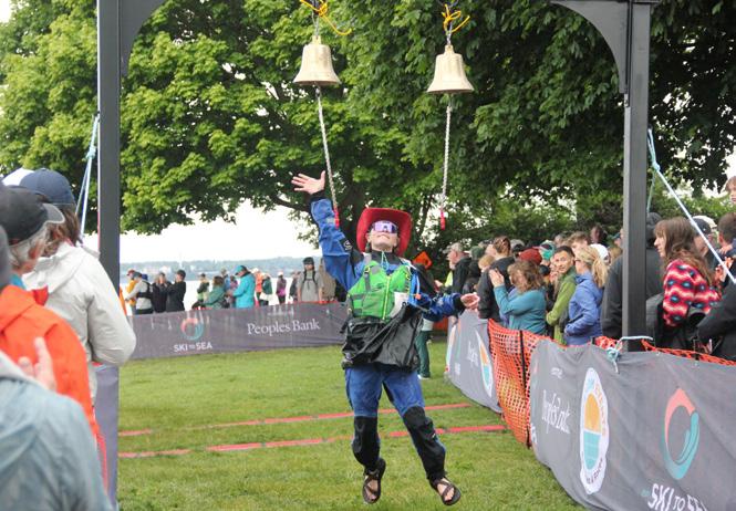
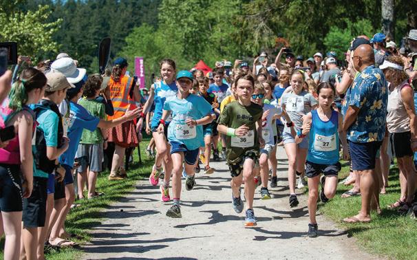
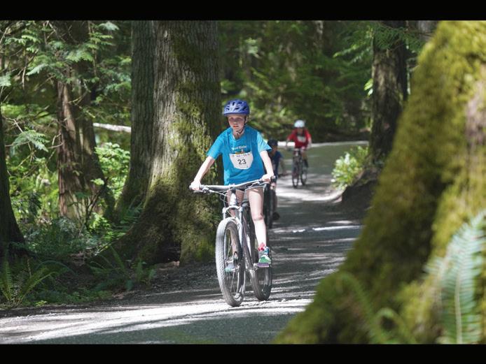
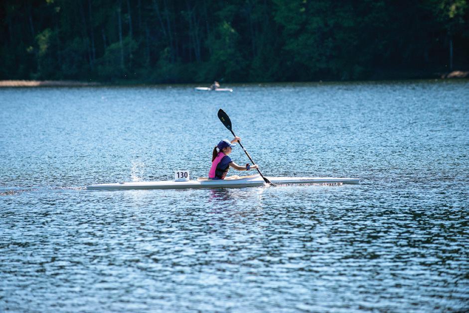
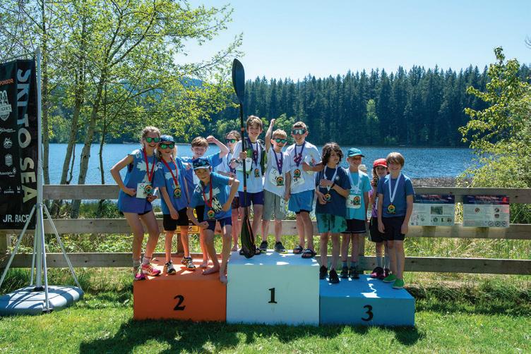
Ski to Sea sells out in a hurry
Ski to Sea 2025 is set for Sunday, May 25, and race organizer Whatcom Events announced that registration is officially sold out as of February 14. The race filled up five weeks earlier than last year and the waitlist is filled with 65 additional teams.
Team numbers will be assigned in May a few weeks before the race. Team captains are able to make changes to the team name, division and members prior to the May 1 deadline.
The iconic, seven-leg relay race from Mt. Baker Ski Area to Bellingham Bay has become one of Bellingham and northwest Washington’s most celebrated traditions since officially starting in 1973. The race segments include cross-country skiing, downhill skiing/snowboarding, running, road cycling, canoeing, cyclocross cycling, and sea kayaking before finishing at Marine Park during the historic Fairhaven Festival.
In January, Aurielle Buermann was appointed race director for the 2025 race.
Buermann has worked with Whatcom Events since early 2022 as assistant race director under longtime director Anna Rankin and has experience not only in the past three Ski to Seas, but also worked in the service, health care and fitness industries, according to a Whatcom Events press release.
“I am honored to step into the role of race director,” Buermann said. “As a lifelong resident of the region, I am passionate about outdoor recreation and Ski to Sea perfectly captures and celebrates what makes Bellingham and Whatcom County a world class recreation destination.”
Buermann will relieve executive director Anna Rankin of her race day duties, while Rankin remains in the executive director position, organizing the non-profit side of Whatcom Events.
“Aurielle has shown exemplary work ethic and passion for the organization since day one and now is the perfect time to reward her hard work and dedication by handing the proverbial baton over to her,” Rankin said. “I feel grateful that we found the perfect candidate within our organization, and I am excited to work beside her for years to come.”
The races rely on a team of roughly 1,000 volunteers to run recreational events throughout the year. Since 2011, the organization has raised over $200,000 in charitable contributions for dozens of local non-profits through events including Mt. Baker Hill Climb, Trails to Taps Relay, and Tour de Whatcom.
Whatcom Events was recently honored for its hard work and years of dedication when it received the 2024 Tourism Business of the Year award from the Bellingham Regional Chamber of Commerce on November 21.
Continued on page 12
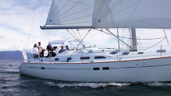
Experienced or new to boating, we can help you discover the joys of cruising the Salish Sea! Beginner to advanced courses. Sailboat and powerboat bareboat charters.
Experienced or new to boating, we can help you discover the joys of cruising the Salish Sea! Beginner to advanced courses. Sailboat and powerboat bareboat charters.
Continued from page 11
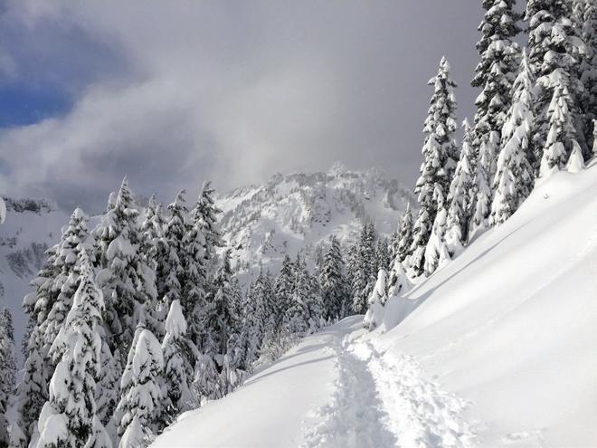
Mt. Baker Splitfest to fund crucial avalanche organization
Mt. Baker Splitfest is set to return to the Mt. Baker backcountry starting Friday, March 14 through Sunday, March 17.
The weekend event will feature splitboarding tours organized by Glacier-based adventure guides Guided Exposure, ample demo opportunities with a host of top of the line splitboard brands, and a raffle at Chair 9 in Glacier at 5 p.m. Saturday, March 15. Proceeds from the raffle will benefit Northwest Avalanche Center, the region’s leading mountain weather forecaster.
Bob Rodgers and Terry Schmidbauer co-founded Mt. Baker Splitfest to allow the splitboard community to celebrate some of the best terrain in the Pacific Northwest. After starting in 2010, the festival has become one of the largest winter sports mixers in the region.
In the past six years, the Saturday night raffle has raised over $28,000 for Northwest Avalanche Center, Rodgers said.
“It’s a good way to demo gear, it’s a good way to meet up with a bunch of people who want to go out into the backcountry, and we do a safety talk so people know what kind of condition to expect,” said Rodgers.
The festival is free to attend, but Rodgers recommends bringing cash for the raffle – which features prizes from various winter sports manufacturers – and for those who plan on touring the backcountry to bring their own avalanche gear and the knowledge to use it properly.
For schedules, a full list of sponsors and demo vendors, and more informa-
Photo by Andrew Grubb
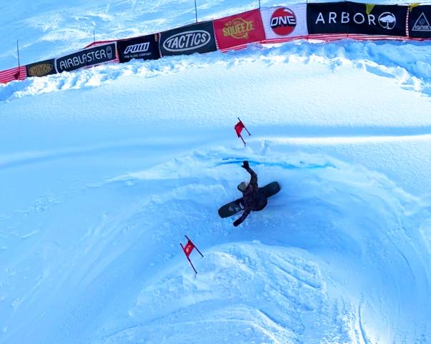
Legendary Banked Slalom returns after hiatus
It’s no secret that the 2023-24 winter season at Mt. Baker had some of the worst winter weather in recent memory.
According to the Washington State Climate Office, last year’s winter snow pack on Mt. Baker ended with 94 inches of snow depth, the fourth-lowest in the past 30 years. Not only did that mean fewer days for good skiing, it also meant Mt. Baker Ski Area was forced to kibosh its 35th edition of the Leg endary Banked Slalom.
The world’s longest-running snowboard race returned to Mt. Baker Ski Area for a beautiful bluebird weekend on February 7, 8 and 9, and featured racers from around the globe.
The race starts at the top of Chair 5 at Mt. Baker Ski Area, utilizing a “nat-
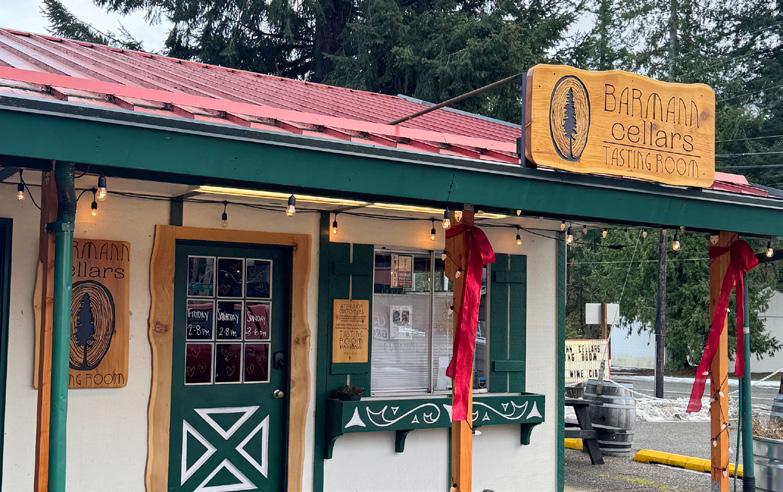
Barmann cellars:
An oasis in the Mt. Baker Foothills
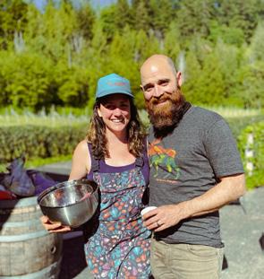
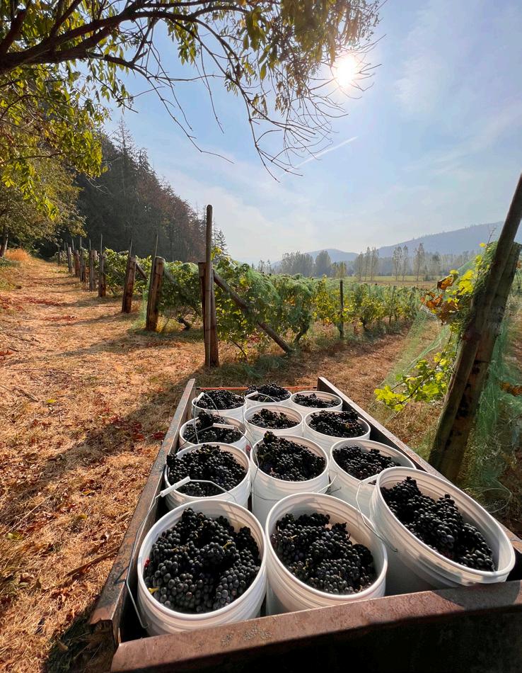
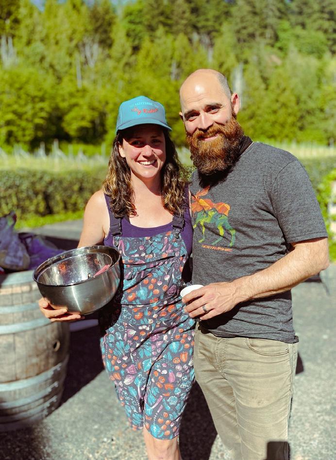
By Nolan Baker
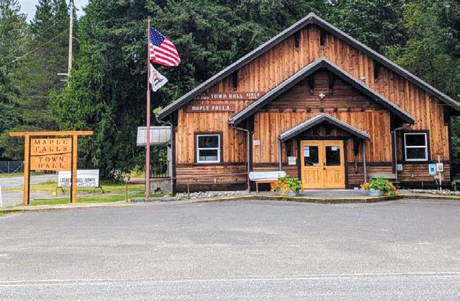
Zooming up Mt. Baker Highway for an early bird ski lift, blink and you might miss Barmann Cellars Tasting Room on the corner of Silver Lake Road and Highway 542 in Maple Falls.
The 16-acre farmstead was purchased in 2021 by husband-andwife duo Stephanie Barmann and Jesse Nickerson, who took a small grove of perennials planted in 1989 by a Western Washington University professor into a full-blown winery, which now boasts a wide selection of natural wines and ciders and a tasting room for event hosting.
A fourth-generation farmer hailing from northern California, Barmann handles the day-to-day sales, marketing, design, and inventory management of the cellar, while Nickerson takes on the seasonal farming, harvesting and production work.
The whole idea behind Barmann Cellars, they said, is to create wines, ciders and experiences that can’t be done at the larger corporate wineries that dominate the consumer wine market.
The goal is to ferment “low-intervention” wine free of pesticides throughout the growing process, and chemicals in the fermentation process, Barmann said. That makes for a more expensive product that, admittedly, can’t compete with a cheap bottle of wine from Eastern Washington, Europe or Australia, but offers a unique experience that can only be had in the Mt. Baker Foothills.
“Our style of fermenting that we use doesn’t leave room for a lot of mistakes,” Barmann said. “We’re not filtering, we’re not adding chemicals to erase mistakes made. They’re very honest, true representations of this area from which beautiful wines can be made.”
Staying true to the natural flavors that are born on the banks of the Nooksack Valley means Barmann Cellars is constantly up against the elements, Nickerson said. Anyone living in the Pacific Northwest knows those pesky elements make the region stunningly beautiful, but fickle to the wants of a winemaker.
“Farming is a difficult task where you give up a lot of control, especially when you do things the way we do things, which is low-intervention, regenerative-type approaches,” Nickerson said. “We’re not spraying boatloads of chemicals, so we’re kind of at the whim of the weather and we can only do so much to fight it. It’s a challenge.”
While the farming aspect is an ever-evolving puzzle to solve, running a hyper-local small business also comes with its own challenges, Barmann said. Nearly everything is done by hand, especially the picking, which is almost
unheard of in the commercial wine business. That makes for a more labor-intensive process, but also a more personal experience for the wine lovers that choose a bottle of Barmann.
“People are coming off the mountain with that same kind of adventurous spirit that we’re crafting from,” Barmann said. “It’s an effort to give people a place to come together and consume the flavors of the Nooksack Valley. This is where we are.”
Barmann Cellars most recent addition is the tasting room, which offers event hosting, private tastings, and monthly craft nights at 7802 Silver Lake Road, right next to Crossroads Grocery. Barmann Cellars also started a bottle club, which offers three handcrafted wines and ciders every three months for $120/quarter, if shipped, and $100 if picked up at 5560 Hillard Road.
“The most important part of the whole effort is bringing an agricultural product to market that was produced, grown, hand-bottled and done here in the community,” Barmann said. “It’s more important than ever to have agency and to take control over what you put in your own body.” x
Co
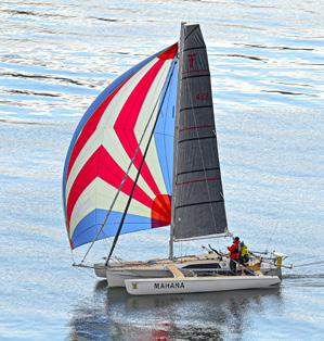
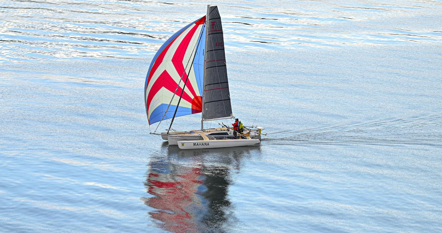
WA360 returns to Puget Sound
By Nolan Baker
by Nick Reid
For the first time since its premiere in 2021, WA360 is returning this summer, offering a salty adventure for some of the toughest watercraft competitors on the globe to attempt a 360-mile, engineless, unsupported lap around Puget Sound in two weeks.
Starting from Port Townsend on June 28, contestants will travel south through Puget Sound to Budd Inlet in Olympia, turn around, head past Tacoma and Seattle before a fork in the road at Goat Island offers a choice between Swinomish Pass (“easy”) and Deception Pass (terrifying), find a marked buoy in Bellingham Bay, turn around at Point Roberts, and finish back in Port Townsend. Easy, right?
Competitors can be sorted into two classifications: the “Wind Group,” which means any watercraft using sails and the power of wind to move, and the “Muscle Group” which means kayakers, paddlers, and anyone crazy enough to push water for two weeks through the Salish Sea.
“This year, WA360 is not so much a sequel as it is a reboot of the 2021 event,” WA360 race master Jesse Wiegel said. Wiegel has been working with race organizer Northwest Maritime for years in preparation for the second version of WA360. Northwest Maritime also organizes other legendary motorless water races such as the R2AK, a 750-mile journey up the coast of B.C. to Ketchikan that takes place in 2026, and Seventy48, a 48-hour sprint from Port Townsend to Tacoma.
Wiegel sees WA360 as a love letter to Washington and Puget Sound itself, unique from any other race put on by Northwest Maritime.
“As a standalone event, WA360 is here to knit Washington state together with the communities of the Puget Sound,” Wiegel said. “But also, within all the things that NW Maritime does, it’s another steppingstone. It fills a void where people can see what we do through our programs, through our less demanding events on the water.”
Unlike R2AK, WA360 won’t send sailors several hundred miles away from civilization, “but it
ain’t nothing,” Wiegel said. “It is some real deal waters, and you are contending with a lot of the same things that you’re contending with in R2AK, albeit in closer proximity to rescue.”
Tiny boats without engines, powered by the wind or whatever the paddler ate for breakfast that morning means there are unique challenges throughout the two-week odyssey.
One unique difficulty with the race is the close proximity to shipping lines and the massive container ships that crisscross the Puget Sound on a nearly by-the-minute basis, Wiegel said.
Competitors can count on drastic shifts in tides, tough currents (one route offers passage through Deception Pass, a strait famous for its ferocious currents) and inclement weather even in the summer.
“This is not an entry-level event,” Wiegel said. Even with the dangerous challenges -- or perhaps because of them -- the event attracts mariners from not only across the Pacific Northwest, but from across the country and the world. Every
Photo
by Heather J.
sailor, paddler, kayaker or homemade watercraft captain competes for a reason, Wiegel said.
“We’re getting people who are coming to promote a cause, we are getting people who are coming to form tighter bonds with their families and friends, we’re getting people who are old friends of the adventure races at Northwest Maritime, people who have done Race to Alaska and Seventy48 and are gunning to complete the triple crown,” Wiegel said. “We’re getting all sorts, even people with wild schemes and ideas who are building boats in their backyards out of whatever found material they can get.”
All watercrafts, and the crews who man them, must undergo rigorous testing to be approved for racing – even homemade boats. Northwest Maritime has put on countless maritime races throughout the years and hopes to provide another memorable experience when WA360 sets sail this summer.
“Our whole aim is to create transformational maritime experiences,” Wiegel said. “We do that through getting young people in the water early. We have programs for kids as young as six and we go all the way up to adult programs, engaging those in their 70s. We offer a lifetime of program opportunities and experiences.”
Wiegel said WA360 can get competitive, but the camaraderie shared by boaters overcoming two weeks of challenges brings people together and creates shared joy like nothing else.
“It’s hard times out there, to put it lightly,” Wiegel said. “The way to move through hard times is through defiance, and the act of defiance right now is to bring joy into the world. That’s what the race is ultimately doing. Coming together, being joyful together, doing something real and feeling a sense of
accomplishment together, whether you’re on the boat or not, you get to take part in that.”
Applications close on May 1, and so far roughly 45 teams have sent in their applications. There is no hard cap on the number of teams that can join, Wiegel said. To apply, visit WA360.org.
To learn more about Northwest Maritime, sign up for a class or to donate and support its efforts to get folks out on the beautiful waters of the Salish Sea, visit nwmaritime.org. x
Photo
Finding Sound
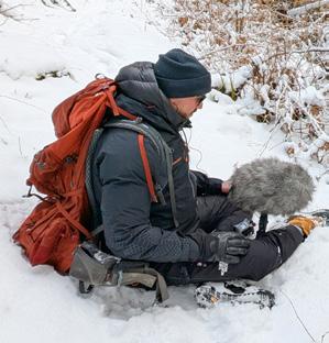
By Tony Moceri
As the world gets louder, quiet places become scarce. Humans now seek out these places to find solitude in the quiet, but are they truly quiet?
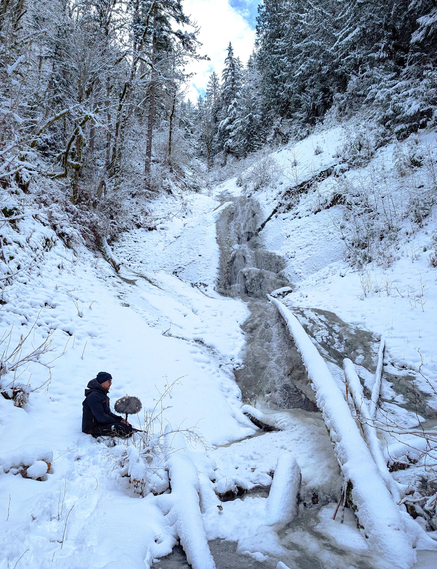
From the rustling of leaves and the creaking of trees to the chirping of birds and the flowing of water, when you listen, the sounds of nature can seem almost deafening. I think a better description than quiet, is peaceful. When searching for sound in our local wilderness with Jason Cushing, I discovered what could be heard when accompanied by a trained ear.
Jason is a local sound engineer who, through his company, SoundMorph, has had his audio recordings used by big movie and game studios, many that you would likely find familiar. Beginning his craft at the Art Institute of Vancouver, he has spent decades making sound libraries to share with creators. To say that he hears things differently would be an understatement. His trained ear can focus on minute sounds and cadences that typically go unnoticed. Since what I like to do is go wander around in the woods, I couldn't wait to bring Jason along to find out what he would hear.
The temperature dropped, and the snow began to fall as the day approached when we were set to go on our little adventure. My primary thought was to take him to water, one of the most obvious sounds in nature, but I became nervous as that water began to freeze. Do I reschedule so we can go out on a day when we aren't battling cold fingers and trying to keep snow off the equipment? The idea crossed my mind, but with cold weather forecasted as far as I could see, and a deadline looming, we kept our schedule.
We decided to begin in the most obvious sound spot, at the base of an approximately 120-foot waterfall. Jason taught me the basics of capturing sound as we trekked up the trail. The first point that he made clear was how quiet we would need to be. The microphone he had brought along was extremely sensitive, so while it was directional, meaning it picked up a tight cone of sound where it was pointed; it was sensitive enough to pick up the subtlest sounds. This was Jason's way of letting me know I would need to shut my trap while he was recording. I've been known to be a bit chatty at times. Not talking was obvious, but we would
also need to hold still because even the rustling of clothes would sully the sounds of nature. When I approached Jason about collaborating on this project with me, he said the challenge is finding places where you can't hear road noise. I was fairly certain this location would work, but as we approached, I was nervous that the waterfall would be so frozen that there would be no sound to record. This showed how naive I was about the whole process. I was correct that the waterfall would not be raging, but it was still flowing down its partially frozen face, creating unique sounds only to be found when the temperature drops and the water is crystallized into ice. Jason pulled out his equipment and went to work with great skill. He first videotaped the scene with a camera placed on a tripod for YouTube or social media content. He then pulled out his microphone. The microphone was in a case to act as a windscreen, and then he added a fuzzy wrap to further protect from wind. He inserted earbuds to hear what the microphone was picking up and signaled to me that he was about to record. I probably didn’t need the signal, as he became still as a statue once he pressed record. He and his microphone focused only on the sound around us. I stood there quietly, and I listened. I could hear sounds come to life that, with my other senses going, typically go overlooked. I noticed the slight changes in the water, creating a subtle but consistent pattern. Occasionally, a bird would chirp, or some leaves would rustle, but on this day, with the snow acting as an insulator, the sounds of the waterfall were the star of the show.
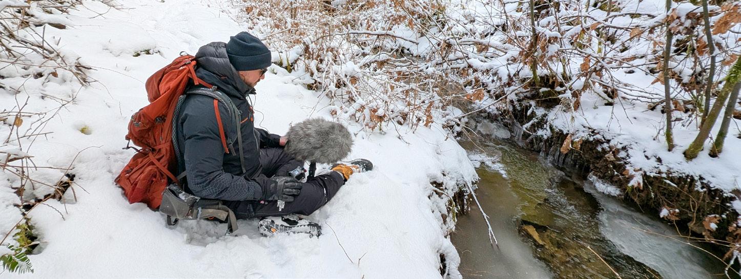
Jason recorded for a few minutes at a time, and once he felt happy with what he had recorded, we moved on to find more sounds. We went downstream and found a spot where the creek was sheeting across the face of a large rock that was attempting to dam the water. Jason again directed his microphone exactly where he wanted it and began recording. Yes, it was still running water, but no, it didn't sound the same as the waterfall. As I stood there listening, I realized that water has infinite sounds varying on flow, fall, and terrain. The shape of the bank and the surrounding trees also influence how the sound is perceived as it bounces its way to the microphone and our ears.
As we made our way to another nearby creek,
Jason followed, microphone in hand, capturing the sound of my boots crunching in the snow. Usually when I walk, my eyes are my dominant sense, but my awareness of the microphone made me shift my senses to my ears. I heard the crunching of the snow beneath my boot with every step. The mundane task of walking became a sensory experience. While we walked without speaking, my mind wandered a bit, thinking that the sounds of my boots on the snow could end up being the sound of a character in a movie or video game crunching their way through winter. We didn't discuss it, but I don't think my great snow crunching skills come with a royalty deal. We stopped a few more times to record the sounds of the creeks and whatever else Mother Nature was providing before embracing the warmth of a car ride to our next destination. We headed to the south fork of the Nooksack River, where I was confident we would have the sound of flowing water. You never know what water level you will experience, but with the snow frozen in the mountains, the water was low, giving us access to a beach and an easy approach to the water's edge. As Jason once again set up his equipment, an eagle soared overhead, saying hello with a dip of the wing. With his microphone on, Jason once again began recording the natural ambience. The river offered a consistent flow of sound, but now less sheltered by conifers and in a less remote location, the challenges Jason faced when trying to capture sound became apparent. Even in a place that felt isolated and quiet, the occasional sound from vehicles on the highway would impede the sounds of nature.
Spending a day focused on sound brought attention to just how rare it is to find a truly quiet place. Human sounds are nearly everywhere, making it a unique experience when one can sit and simply hear what the world used to sound like. Thanks to Jason, I have a new appreciation for sound. I'm more aware of the subtleties and intricacies that exist in what seems obvious, and how important it is to take the time to just be still and listen.
Some of the recordings from our day can be found on YouTube @Naturesleepmeditate or they just might find their way into your next favorite film. x
north cascades institute spring events
With spring on the horizon and snow starting to melt off the American Alps, North Cascades Institute (NCI) has unveiled a slew of events, educational opportunities and excursions for the public to join.
Read on to find an event for you and yours:
Pacific Northwest Native Plants
Larrabee State Park, S1 Shelter
April 12, 9:00 a.m. – 5:00 p.m.
Cost: $145
Join PhD candidate and certified professional tracker Chris Byrd for
an all-day educational experience in the natural beauty of Larrabee State Park, and learn about plant identification, ecology, and edibility.
Designed for both novices and experienced botanists, this event will hone practical skills and create a deeper appreciation for the plant life of the Pacific Northwest.
Walk through the lush trails of Larrabee as spring comes into full bloom, and learn deeply about the delicate flowers and mighty conifers that line the Salish Sea bioregion.
NCI offers student, military and disability discounts for most in-person programs. Call 360/854-2599 for more information on discounted events.
Salish Seaweed Garden: A Day of Sea Veggie Foraging, Feasting and Ecology
Whidbey Island
April 27, 8:45 a.m. - 4:00 p.m.
Cost: $215
Seaweed has been used as super food, medicine, fishing line, and even tax payment in ancient Japan for thousands of years, and it grows in abundance throughout the Salish Sea. Join seaweed scientist, author and Fairhaven College faculty member Jennifer Hahn for a workshop along the coast of Whidbey Island and learn about the fascinating and often-overlooked world of kelp ecology, harvesting techniques, nutrition, and the ecological threats and restoration projects of West Coast kelp. The event is scheduled around a massive low tide, and the one month of the year where public recreational seaweed harvesting is allowed. Bring your favorite kitchen knife and cutting board for the dinner service at the end!
Spring Birding on the Snow Goose
Bellingham Bay
May 10, 8:30 a.m. – 3:00 p.m.
Cost: $215
Bird watchers won’t want to miss this one. Hop aboard the 65-foot Snow Goose at Squalicum Harbor with Captain Dan Liden and naturalist guide Amanda Colbert for a day of
bird, marine mammal, and perhaps even whale watching – along with stunning views of Mt. Baker, Rosario Strait and the San Juan Islands.
Snake Count in the Methow Valley
Methow Valley
May 11, 10:00 a.m. – 4:00 p.m.
Cost: $145
Not for the faint of heart – or whip-cracking archaeologists – NCI is hosting a chance to learn more about one of the most misunderstood members of the animal kingdom: snakes!
The Methow Valley is the perfect outdoor classroom for field biologists John Rohrer and Scott Fitkin to showcase their lesson plan on the reptiles and amphibians of Eastern Washington. Findings will contribute to real-life scientific data monitoring long-term reptile habitats.
San Juan Islands
Exploration on the Orion Anacortes
May 17, 9:00 a.m. – May 18, 5:00 p.m.
Cost: $625
Set sail on the restored 1934 wooden sailboat Orion for a natural history adventure through the San Juan Islands, departing from Cap Sante Marina with Captain Kevin Campion. Tuition includes all meals, campground fees and sailboat transportation featuring multiple scenic stops. x
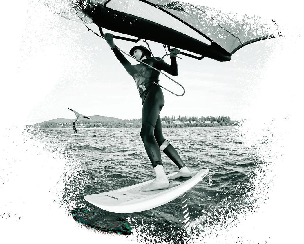
Page 22: From top: Wing foiling at Birch Bay. Photo by Ethan Fritzberg.
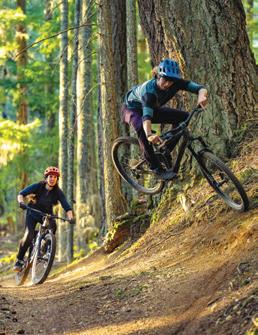
Emiel Miller, Skyler Magee and Elliott Sciborski rip through Galbraith Mountain. Photo by Josh Woodward.
Page 23: Spring snow at Mt. Baker Ski Area. Photo by Jack Wiley.
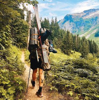
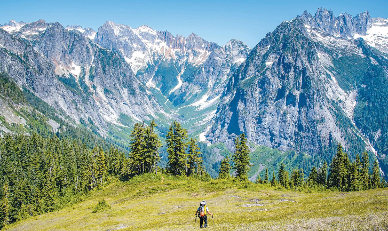
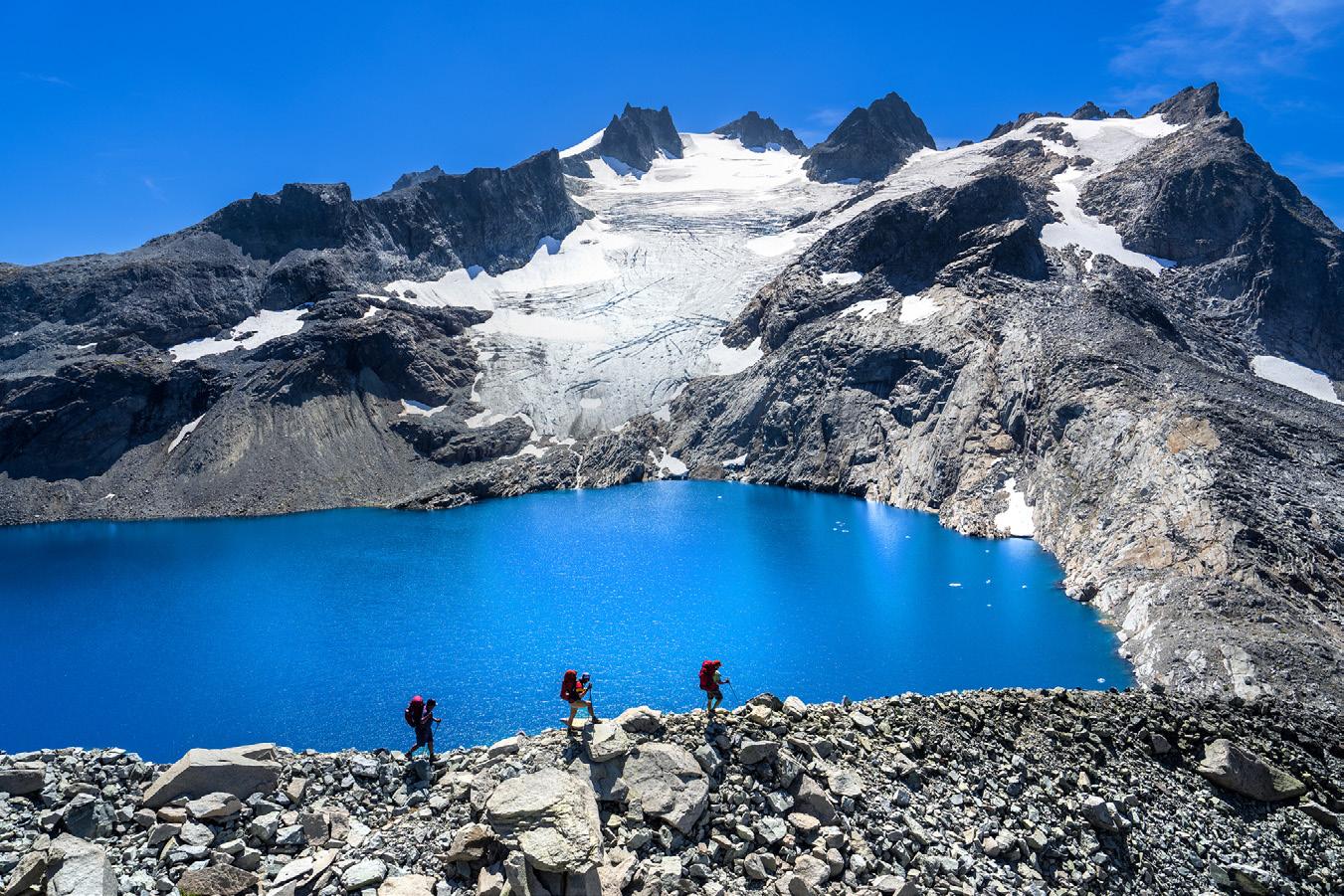
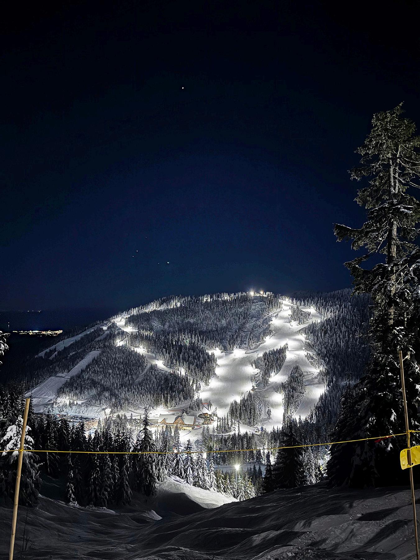
Page 24: Trekking through Alpine Lakes Wilderness Area. Photo by Jason Hummel. Beachcombing at Ebey’s Landing State Park, Whidbey Island. Photo by Jason Griffith. Page 25: Night skiing at Cypress Mountain, West Vancouver, B.C. Photo by Andrew Grubb.
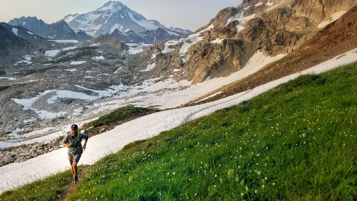
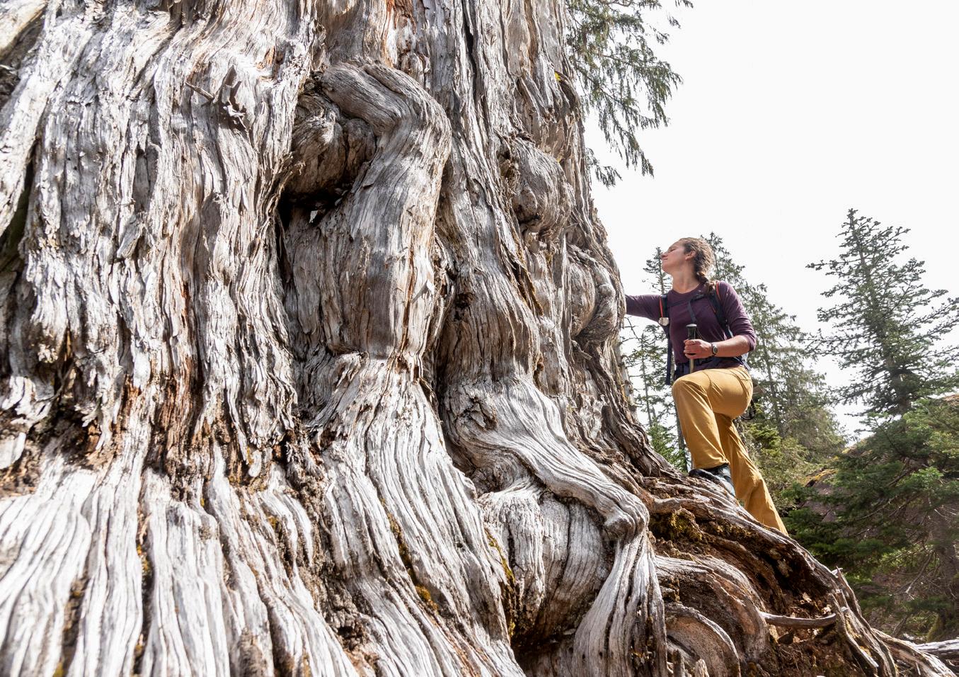
Page 26: From top: Trail running through the spring thaw. Photo by Dave Summers. Big steps atop bigger trunks. Photo by Matthew Tangeman.
Page 27: Jake Taylor goes airborne on Galbraith Mountain. Talus Turk rolls over on Galbraith Mountain. Photos by Josh Woodward.
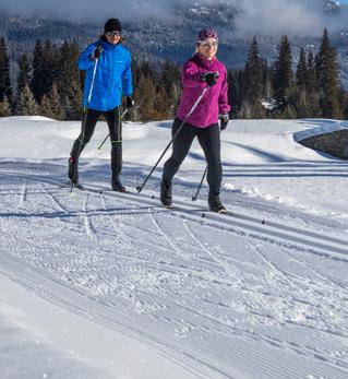
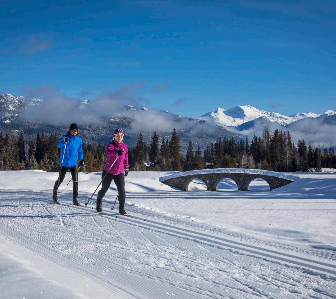
Spring Into Action
Cross-country skiing in BC is the perfect way to usher in the season.
By Erin Deinzer
Thousands of downhill skiers descend on the mountain like revelers at spring break, intent on getting to where the action is. Queuing up for a seat on lifts that will ferry them to the top, they’ll disembark and begin the task of trying to find an unobstructed (and highly coveted) path back down.
Nearby, other enthusiasts step onto slender skis, lower their sunglasses, and enter a world where snowflakes fall on cedars, sunlight glistens off ice crystals, and the gentle swooshing of soft snow offers the only noise that surrounds them.
While that might be an idealized version of what cross-country skiing is versus the rush-hour frenzy of a busy day on the downhill slopes, there’s no arguing that of the two types of skiing, cross-country (or Nordic) is the more peaceful alternative to Alpine.
While you can participate almost anytime there’s enough snow on the ground, cross-country skiing in the spring is one of nature’s true delights. Luckily for us, we’ve got four ideal spots to learn and/or en-
joy the sport just beyond the Canadian border–where the exchange rate also works in our favor.
CYPRESS MOUNTAIN
Zigzagging its way up the road from Highway 99, Cypress Mountain offers one of the most easily accessible cross-country skiing areas. Located in West Vancouver, it has 19 km (about 12 miles) of groomed and track-set trails and is the closest option to the border.
For those unfamiliar with the term, track-set trails are created using a specialized machine to make paths in the snow specifically designed for classic style cross-country skiing. The tracks allow you to glide along those paths with your skis properly positioned, in essence providing a groomed trail with dedicated grooves.
Cypress Mountains offers a multitude of options including showing up with your own skis, purchasing a pass and heading out on the trails, or signing up for an individual or group lesson that can include rented equipment.
Open daily for daytime skiing, there’s also illuminated nighttime skiing along 7.5 km of trails. And while you’re there, be sure to check out Hollyburn Lodge, a historic property that’s been hosting skiers since the ‘20s. Recently rebuilt, it still boasts turn-of-the-century charm and has live music on Saturday nights.
WHISTLER OLYMPIC VILLAGE
Want to ski in the literal footsteps of Olympic athletes? If so, set your sights on Whistler Olym-
pic Park, host for the 2010 Winter Olympics’ Nordic events and explore the park’s 55 km of worldclass trails. Situated within the Callaghan Valley, they’re rated from beginner to expert.
Some of those expert skiers include Maureen and Ned, a couple from nearby Lummi Island who booked a three-day, midweek cross-country skiing trip to the park and were able to enjoy halfprice trail tickets for skiers over the age of 60.
“Skiing midweek was a great decision,” said Maureen. “But even on weekends everyone would be spread out. Although we aren’t beginners, it’s the perfect place to get introduced to the sport because of all the flat trails. Those skiers can take it slow and not cover as much ground as we might, which is about 10 miles a day.
“We’ve skied all over the world,” she continued, “and these are some of the prettiest groomed trails Ned and I have ever seen. It is spectacularly beautiful. There are trails with creeks and tiny waterfalls with a gorgeous tree canopy and mountains that pop into view. They’ve even got a network of pet-friendly trails so you’re likely to see people out skiing alongside their dogs.”
For more information on the dog-friendly aspects of the park, visit: https://www.whistlerolympicpark.com/things-to-do/dog-friendly-skiing-snowshoeing
THE CALLAGHAN
Adjacent to Whistler Olympic Park, The Callaghan offers 40 km of groomed trails (half of which are dog-friendly) and where you can really
feel like you’re getting away from it all.
Located in the midst of sweeping valleys, oldgrowth cedars, and mountainous ridges is the Callaghan’s Solitude Valley: home to the Journeyman Lodge. The full-service, chalet-style lodge offers 10 rooms, a communal living room, locally sourced dining, and a sauna perched right above a creek.
Outside of hopping a ride on the snowcat (which also ferries gear and overnight necessities), Nordic skiers can ski directly to the lodge. Once there, you’ll have access to a network of trails leading directly from the lodge and into the surrounding backcountry.
LOST LAKE PARK
What about those of us who are interested in a day’s worth of cross-country skiing within striking distance of après ski shopping, drinking and dining? If that’s the case, head to the heart of Whistler Village where you can easily access Lost Lake Park.
Nestled within the mountains’ coastal forest and providing stunning lakeside views, the park offers 25 km of trails within view of Whistler and Blackcomb Mountain. During limited times of the year, the PassivHaus (built in 2010 to accommodate the Austrian Olympic contingent) serves light snacks and offers rentals.
Night skiing is also an option in a section of the park and is available 3-8 p.m. daily. After which you can head back to the village and enjoy some nightlife and local fare. x
Book Reviews by Meg Olson
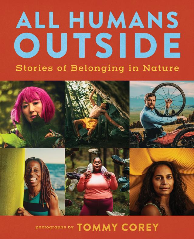
All Humans Outside: Stories of Belonging in Nature
Tommy Corey (Photographer) Mountaineers Books, May 1, 2025
When Tommy Corey hiked the Pacific Crest Trail from Mexico to Canada in 2018, he found himself able to integrate the things he valued most: the outdoors, photography, and self-worth. “Hiker Trash Vogue,” the photo project he created during that journey featuring long distance hikers posing as fashion models, set him off on his next journey. He spent two years travelling the U.S., photographing over 200 people in their natural habitat and collecting their stories of connection, strength, healing and belonging in nature.
“All Humans Outside: Stories of Belonging in Nature” features 101 of these stories and Corey’s intimate, insightful photographs of them. Most of the stories are first person accounts that celebrate the diversity of how humans connect to the natural world, calling for us to create a more inclusive outdoors.
“Being in nature is a powerful healing tool that everyone has the right to experience comfortably,” writes Nicole Snell, CEO of Girls Fight Back who uses lessons from nature to teach empowerment-based self-defense. Her story is included in a section titled: “Empathy, one of eight including Overcoming, Belonging and Identity, Family and Ancestors, and Community.”
From physical differences to cultural expectations, whether internal or external, the stories explore how people overcome barriers that separate them from nature, and with the strength they gain, help their communities and the natural world through stewardship, mentorship, and advocacy.
“My job is to flip the script by not just focusing on our intergenerational trauma and fear of the outside but also celebrating the liberation and joy we feel in nature – a spirited current flowing through the veins of our history,” writes Francis Eymard Mendoza, a Filipino outdoor educator.
Many of the stories are about long-distance connections with nature and wilderness: long-distance hikers and riders, a bike trip across the continent, kayaking the Mississippi from source to sea. Others are about connecting to and caring for a place or community, from a first generation Black farmer to an Afro-Indigenous woman honoring her grandfather’s teaching as she stewards her own land. Paragliders and hunters, surfers and even a taxidermist all share the challenges and joys their individual bodies and minds experience as they connect with the outdoors.
“Nature grants us the freedom too be our authentic selves,” writes deaf nature and forest therapist Summer Crider.
Corey makes the collection feel personal, popping in through sidebars to introduce some of the people whose stories he includes. Parallels can be drawn with the “Humans of New York” project, but with an extra edge of empowerment and joyfulness that come from his commitment to fostering self-worth across the widest reach of diversity.
“He connects with his subjects and they want to participate,” his father Tim Corey writes in the closing note to the collection. “You can see it in their faces.”
Farmed and Foraged: Four books inviting you to enjoy nature’s bounty
Healing Garden:
Cultivate Your Garden to Treat, Feed and Soothe
Caroline Parker
Thames and Hudson
From planning your herb garden to building an herbal medicine cabinet, this is an accessible and informative guide to using plants for wellness. 47 plants are profiled, both garden herbs or common weeds to be foraged, or encouraged! Each plant profile includes recipes, mostly for healing but also for healthy snacks and meals. “Healing Garden” includes clear instructions on techniques for making remedies and preserving harvested herbs, as well as information-rich charts for herbal uses.
Drink Your Garden: Recipes, Stories and Tips from the Simple Goodness Cocktail Farm
Belinda Kelly and Venise Cunningham Countryman Press
The partnership of cocktail crafter and farmer sisters from Kent Valley have crafted a “garden to glass” guide to growing the raw materials, crafting ingredients and mixing cocktails. There is a sturdy how-to section to start, including stocking your pantry, basic techniques for infusions (complete with a comprehensive table of infusion times), and suggestions for your cocktail garden. Recipes follow for syrups, cordials, shrubs, tinctures, liqueurs and how to mix them, including a section on homemade garnishes that are as much at home on a charcuterie board as in a glass.
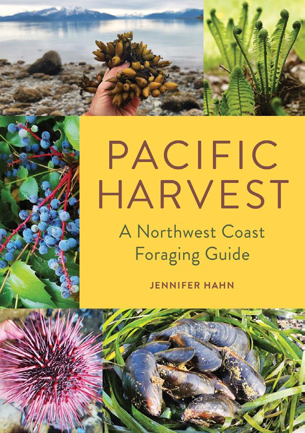
Pacific Harvest: A Northwest Coast Foraging Guide
Jennifer Hahn Mountaineers Books
Culinary explorer, wilderness guide and sustainable wild food harvesting teacher at Western Washington University, Hahn has written a comprehensive and authoritative guide to regional foraging that is filled with personality and just plain fun to read. The first section and meat of the book is a guide to identifying and harvesting edible wild foods on the Pacific Northwest coast, with culinary tips, personal stories and interesting ecological trivia. Did you know that a dandelion bloom is visited by 93 different insects looking for a feast? The second section has a collection of recipes for wild foods to get you started making incorporating them into your dinner plans.
A Foragers Guide to Wild Drinks
Liz Knight Skittledog
A beautifully illustrated seasonal guide to making wines, liqueurs, tinctures, syrups, teas, fermented drinks and other imbibables and garnishes out of wild harvested and garden plants. The first section is a guide to possibilities that come with each season, from red-flowering currant in spring to rose hips in winter, and what sippable delights can be made from them. The second section is a basic guide to techniques with a solid list of additional resources.
Bridge Over Troubled Water
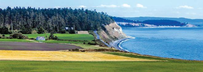
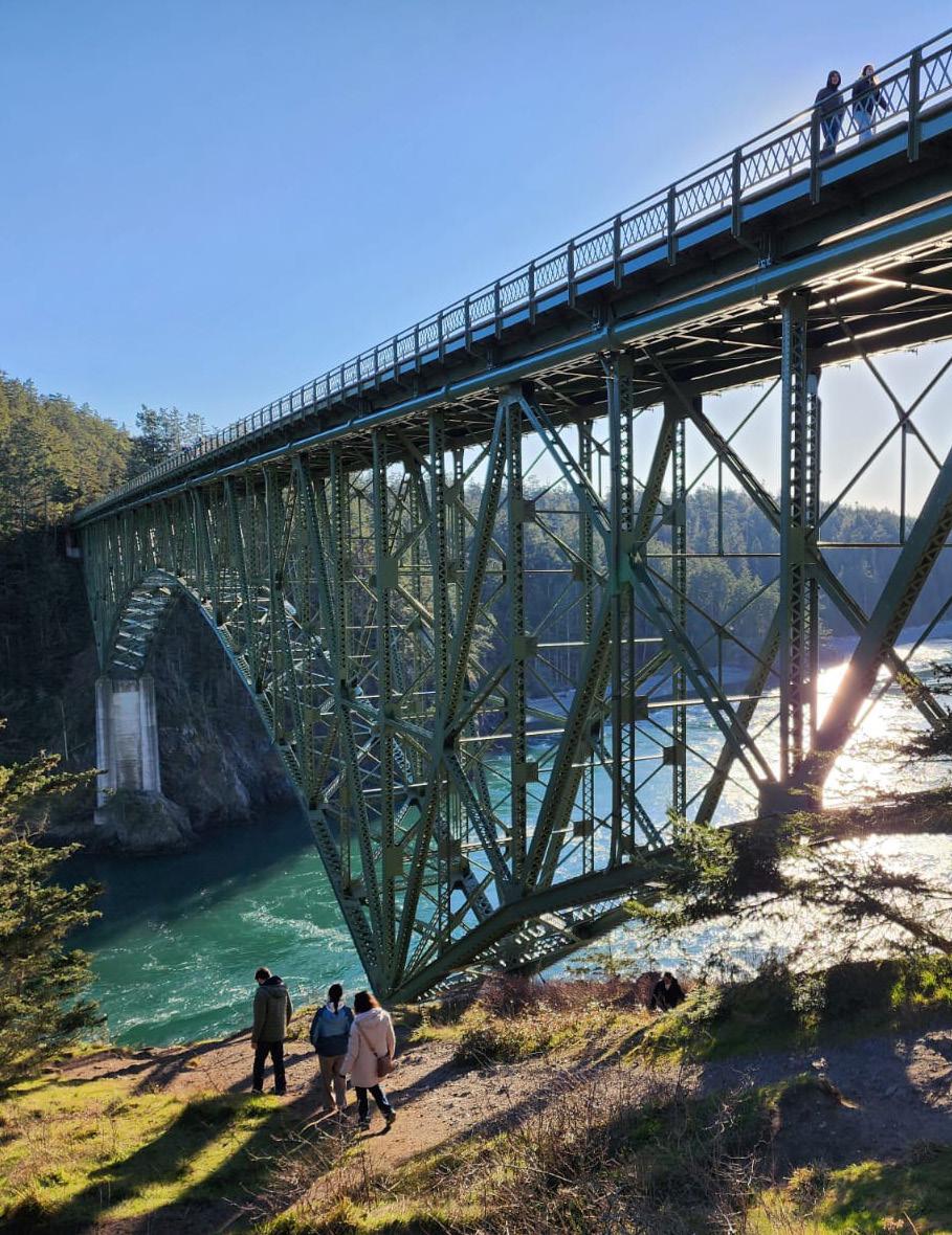
By Mike Nolan
To the typical traveler, the words “Deception Pass” bring to mind a towering steel bridge with commanding views of Puget Sound, but there is much more to be discovered. That bridge is part of Deception Pass State Park. Measuring about 4,000 square acres, the park encompasses the northern end of Whidbey Island as well as a southern section of Fidalgo Island, and includes three pristine lakes. With Highway 20 running through, it’s the most visited state park in Washington.
On a crisp, sunny afternoon, I stood by the railing of the bridge alongside other tourists, staring wide-eyed at the roiling waters below me. “I can see why it’s called ‘Deception Pass,’” I said to the woman next to me, “just look at the crazy way the water is moving . . . almost like it's having a battle with itself.” I nodded to her then looked back down again. “Those currents must be fierce.”
“These are deep, turbulent waters,” the woman agreed. “The currents and cross currents are incredible when the tide is running. But that’s not how the passage got its name.”
Now I was looking back at her, not the water. She explained that the name came from early British explorers, “Captain George Vancouver, I think.”
She was right. I did some research and found out the British Royal Navy originally thought Whidbey and Fidalgo were peninsulas, part of the mainland. Upon further exploration, Vancouver realized the “deception” and determined they were islands, giving the pass its name. Master Joseph Whidbey, along with Lieutenant Peter Puget, had a role in that expedition, and Vancouver named the island after his friend Whidbey.
The history of Deception Pass, of course, goes back much further. Coastal Salish tribes called this area home for thousands of years.
Deception Pass is known for its iconic bridge and the incredible perspective it provides over this part of Puget Sound. More than a quarter mile in length, there are two spans, actually, connecting Whidbey Island to Fidalgo Island with tiny Pass Island inbetween.
After walking the bridges and enjoying the views, I followed the North Beach Trail, descending to the water’s edge out towards Gun Point. The path curved past mammoth Douglas Fir and Western Red Cedar, bordered by gracefully twisted Madrona growing on the steep bank. Evergreen branches and sword ferns bobbed in the
breeze coming off the pass. As I turned toward the water, I passed a timeworn stone and wood-beam picnic shelter and, reaching the beach, was captivated by the view of the pass and the whirlpools and rolling eddies created by the shifting tide. My eyes were continually drawn upward, though, to the bridges standing about 180 feet above me. Gulls circled and rose on the wind coming off the pass and striking the rocky headlands.
With close to 40 miles of trails in the park, I had my choice of old growth forest, rocky outcroppings, freshwater shoreline and saltwater shoreline to explore.
Looking east from the bridges, by the mouth of Cornet Bay, lies 10 acre Ben Ure Island, named after a notorious local criminal. With his partnerin-crime Laurence “Pirate” Kelly, Ure used the island as a hideout while smuggling liquor, opium and Chinese migrants. When the 1882 Chinese Exclusion Act banned Chinese nationals from entering the country, human smuggling thrived as immigrants sought work in northwest fish canneries. Ure was arrested several times and spent at least two years in jail.
When I gazed at the neighboring islands in the pass, I saw rounded, thickly forested landmasses with steep rocky banks. Each one appeared so natural and pristine that it was hard to imagine any connection between the islands and forced labor or criminal activity.
In 1910, guards stood watch over a prison rock quarry operated on the Fidalgo Island side of the park area, manned by inmates from Walla Walla State Penitentiary. It was hard labor: blasted bedrock was broken – using sledgehammers – into smaller pieces and loaded into a rock crushing machine. The resulting gravel was barged by tugboats to the expanding Seattle waterfront area. The quarry operated until 1914.
The surrounding natural beauty was undeniable though, and the area became a public park in 1922. Ten years later, during the Great Depression, Roosevelt’s New Deal brought the Civilian Conservation Corps (CCC) to help develop the park by creating trails, walkways and roads, and constructing buildings and bridges. An interpretive center tells the story of the CCC’s contributions to the park and their work across the state.
The bridges opened in 1935. Prior to that, people wanting to get from Whidbey Island to Fidalgo Island used a ferry, which sailed on an “as needed” basis. Travelers alerted the ferry crew
by banging a saw with a mallet, then stood by to make the crossing. Today, about 20,000 cars cross the bridges every day.
Heading back up the trail, I drove from the bridges to the park entrance, where a Discover Pass ($10 for a day visit, or $30 annually) is required. I made my way along a camping area bordering Cranberry Lake, driving out to West Point and then hiking along the Sand Dune Interpretive Trail.
Camping opportunities abound, with three park campgrounds to choose from (172 standard sites and 134 partial-hookup sites / reserve at www. parks.wa.gov). Plan ahead: summer is peak season, and the main campgrounds are usually fully booked. The campgrounds are leashed-dog friendly. There are also some nearby “boater only” island camping opportunities (accessed by kayak, canoe, or rowboat).
If you trailer a boat, there are launches at the park’s three lakes, and sandy beach swimming is available. Those coming to the park from Puget Sound by boat will find a marina, mooring docks, boat launches and nearby marine services.
Deception Pass State Park also has an amphitheater with interpretive programs, a retreat center accommodating up to 70 people, sites designated for group camping and a number of kitchen shelters.
So, if your travels include this northern stretch of Highway 20, plan to stop and walk the bridges over Deception Pass – if you can stomach the height. Enjoy the views out to Rosario Strait, see the evergreen carpeted neighboring islands, and take in the rugged cliffs descending to the turbulent waters of the pass.
This is a fascinating portion of Puget Sound. You'll be mesmerized watching the troubled, shifting waters below the bridges as the current creates frothy, circular patterns which swirl on the surface and bend into themselves as they careen through the pass. I was hypnotized, although I also have to admit having a sudden empty feeling in the pit of my stomach: staring straight down from that height is a little unsettling, even with a firm grip on the railing. But that all went away once I started hiking.
Do give yourself time to explore some of the trails in this lovely park, and see the islands and the beautiful blue waters from different perspectives. It’s worth the time; you won’t be disappointed. x
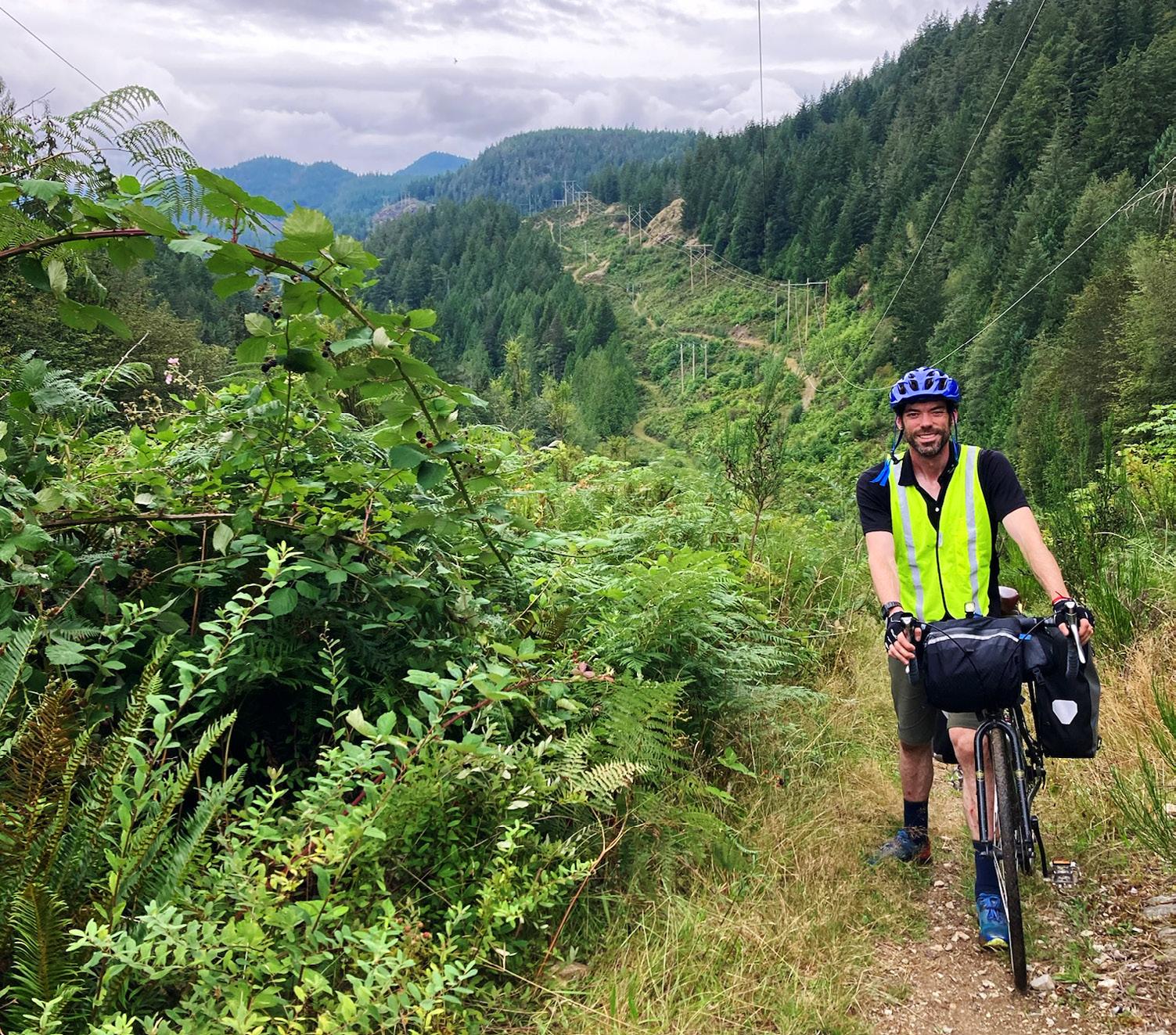
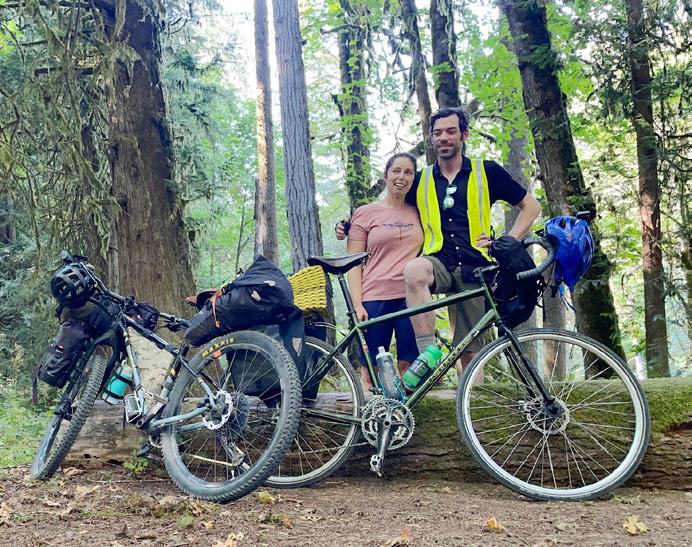
Biking Through Canada On Our Honeymoon
By Liam Delaney
An inside joke developed between my wife Daphne and I on our honeymoon. Whenever things got a little difficult, like when we were biking up our fourth steep hill in a row breathing fumes from the adjacent landfill in the pouring rain, we’d look at each other and sing out “Honeymoon!” Because here we were, a month after our wedding, suffering together while pedaling through our honeymoon and laughing at the absurdity.
We married on July 20th, 2024 surrounded by our favorite people over a perfect weekend in a beautiful ceremony held in Port Townsend, Washington. The question often arose, “Are you going on a honeymoon?” Ideas were shared –tropical places to sleep within view of a beach, enjoy elegant dinners and spa treatments – but that didn’t quite fit how we wanted to start our newlywed life. I don’t remember who said it first,
in all honesty it was probably Daphne, whose adventurous spirit drew me to her and kept me close for all these years. After all our deliberations and pouring over maps and potential flights, the idea of a car-free trip to British Columbia on bikes and boats presented itself.
The complexity of logistics without an all-inclusive resort quickly stacked up – gear to borrow and find, route specifics to weigh and mechanical skills to refresh, but the beauty of traveling by bicycle drew us in. No other mechanized mode of transportation can get you away from it all with greater freedom. With the right bicycle, or even the wrong one for the brave, you can ride through city streets, down dirt roads, and through old growth forests. You can get lost then escape back to civilization for a muffin or three and a shower if needed. This was our choice: a bikepacking honeymoon trip through and across Canada.
After much discussion, we chose to start our
adventure on a lovely and accessible bikepacking route starting in Victoria, B.C. called the Cowichan Valley 8, found on bikepacking.com. The relatively easy entry of the route was great for us. We could ease into our bike trip with just the first couple days of 10 planned, see how it went, and be experimental with where the journey took us. We woke up in the early light, loaded up our bikes and pedaled from our home in Seattle to the Clipper Ferry terminal at six in the morning, adjusting saddles and bags bursting with snacks as we went. We made it just in time for departure, enjoyed a fast ride past familiar islands, and arrived in Victoria excited and in time for late breakfast. Before too long we were on our way on the Galloping Goose Trail. Always on the search for fresh produce, we were delighted to find a quick trailside stop for veggies from FED Urban Farm, a nonprofit that increases food security and access to urban agriculture within the Victoria
community. With assorted zucchinis, tomatoes and blueberries stuffed in every empty pocket, we took off towards the outskirts of the city.
The Galloping Goose Trail is a gorgeous example of Canada’s interconnected bike path system. Separated from the roads and usually clearly marked, these trails traverse a huge amount of Canada. It led us to the Sooke Hills Wilderness Trail, unpaved and weaving through forests, and had a beautiful ending at Goldstream Provincial Park for our first night’s sleep. The ranger squeezed us into a biker-only camping spot, we took a dip in the creek, made dinner, and winded down. We needed our rest for the road ahead.
Our morning began with breakfast, some gentle road riding, and friendly directions from a local that saved us from starting down a dead-end. It was a warm up for the next infamous section of trail – a steep, relentless gravel road baked in the blazing sun. It was only us, our water-laden bikes, and tenacity. We didn’t see anyone else for hours. The trail climbed and climbed through thick forest to higher, drier, more mountainous regions. We finally topped out in the heat of the day, drank as much water as we could, and enjoyed a rambling decent that took us along a river to two memorable landmarks, the Sooke Hills Suspension Bridge and the Yos totem pole just before crossing Shawnigan Creek, a perfect place to break for lunch. A friendly biker stopped to chat, gave us some route recommendations, and clued us in on checking out the lesser-known backside of the totem pole. It was a beautiful surprise!
After a few more miles and a slog up and down some unexpected bonus hills, we arrived at our next campground, Stoltz Pool in the Cowichan Valley Provincial Park. We were tired! Rinsing off in the river revived us just enough to make dinner and set up our tent in the fading light. Our neighbors were a welcoming bikepacking team, an allstar father and son duo who had independently and together travelled thousands of miles on bikes.
The next morning we woke up a little sore from the big climbing day before to the patter of rain on our tent and had a choice to make. Do we play it safe, continuing to Lake Cowichan and around the closer region with the allure of lazy rest days? Or do we sign up for higher mileage, more rugged terrain, and head to the coast for a more demanding loop of northern Vancouver Island and the Sunshine Coast? With lingering encouragement of our new friends who were already long gone, we chose adventure. Honeymoon! We ate as much as we could stomach and took off north to the coast, our legs warming up to the task. Our aim was the ferry to Powell River and the Sunshine Coast Trail. Despite the sunny forecast, it rained most of the day, continuing off and on for the next few days, presenting a new challenge: how to dry out wet socks on a moving bicycle. I still don’t have a great answer other than just keep pedaling, bring extra socks, and stash a precious emergency pair in a dry spot!
Overall, traffic was mostly calm on our route, but one required section that follows the shoulder of the Trans-Canada highway made our eyes
wide. Just as Daphne was scouting spots to hitchhike through it (a tall order with two people, bikes, and pile of gear) a Nanoose First Nation elder named Ray biked over to say hello. With his guidance, we heard a bit about his life as we pedaled through his waterside community then faithfully followed him onto the shoulder of the six-lane freeway. Cars and semis whizzing by, he made it look like no big deal. We were very grateful for the hospitality and yelled our goodbyes and well wishes as we parted ways.
Eventually, we made it to the ferry terminal that would bring us back to mainland B.C. and Powell River. We were soaked again, making plans to change into our pajamas to warm up on the ferry, but much to our delight, it was so windy on the crossing that we just had to stand outside on the deck with our hair whipping until we were dry and cozy again. Honeymoon!
Parts of the sunshine coast were seaside, blissfully flat and with little traffic. Other times, we were battling up steep gravely hills under powerlines and cruising through the forest on more technical singletrack. Daphne’s more rugged hardtail mountain bike was much more capable on the rougher terrain compared to my drop bar gravel bike. She said I was a great sport as we biked and hiked our way east, grateful for all the hard work of the conservationists, trail builders and communities that have kept these spaces accessible.
What always astonished me, even through all of the slogging, numb hands and insatiable hunger, was how special it felt to travel by bicycle. We got to see verdant and lush landscapes, wildlife, secret hidden beaches, and many, many bakeries on the way. Special places were more accessible because we were on bikes. Twice we took small ferries to little islands to camp for the night. Chemainus to Thetis Island and then later Langdale to Keats Island. Being obvious travelers also made connecting with curious and helpful people on the way easy and very fun. We got to eat more tasty food than either of us ever had before, trying to keep up with our body’s constant demand for more fuel. Together, we grew closer through the highs and the lows. This trip truly drove home how freeing it is to be on a bicycle. A bicycle can take you farther than merely walking and it can go to more remote places than a car. There was no other way that I could picture spending my honeymoon, and we would not have seen as much, or been together as much, if we had done something different. More miles and more ferries took us from the Sunshine Coast to the much more developed Horseshoe Bay. After so much time in small towns, along the coast, and through forest, our next leg was something different. Starting at Marine Drive in West Vancouver, a squiggly, narrow
road that goes up and down indefinitely, we knew we were out of the woods but still in for a challenge. By this point, Daphne and I were on day nine of biking. We felt strong and dialed, but like sloths compared to the hundreds of spandex-clad road bikers who migrate to Marine Drive on weekends. We had to laugh while mashing our heavily laden bikes while by getting buzzed again and again by serious cyclists trying to cut as much weight and wind resistance as possible. More honeymoon magic!
Vancouver was a cacophonous experience after so many days of being alone together in the wilderness. We biked through all of it. We dodged other visitors in the popular touristy areas, snaked through residential neighborhoods, refueled at a farmers’ market full of treats, crossed bridges into vast industrial areas, pedaled through miles and miles of quiet, tidy farmland, and finally along a beautiful waterway park called The Dyke Trail. In a car we would not have had the freedom to ride this trail, nor would we have experienced the refreshing seaside air.
We had one more night to sleep before the Tsawwassen ferry back to Vancouver Island, but with no easy campground to find, we reached out to my family in Point Roberts. They generously welcomed us on very short notice. After all of the new sites and sounds, it was comforting for our final night to feel more like home with a long shower, home cooked feast, and the chance to share our adventures with family, who were awed by our tales.
Another ferry ride and one more rainy day of riding mostly flat and well-marked trails brought us back to Victoria, our last Canadian leg of the trip complete. We picked up hot dumplings to devour and chocolate for gifts, and loaded the Clipper Ferry to Seattle, tired, soggy and satisfied. We were only a single bike ride away from home when we landed in Seattle. In proper honeymoon fashion, it was all uphill and started raining as soon as we loaded up, but we were all smiles. Just Daphne, myself, and our bikes with a warm shower awaiting and the rest of our married life to enjoy.
In the end, we biked 10 days in a row, covered approximately 380 miles, took 10 boat rides, consumed countless calories, and got one stronger partnership out of it all. x
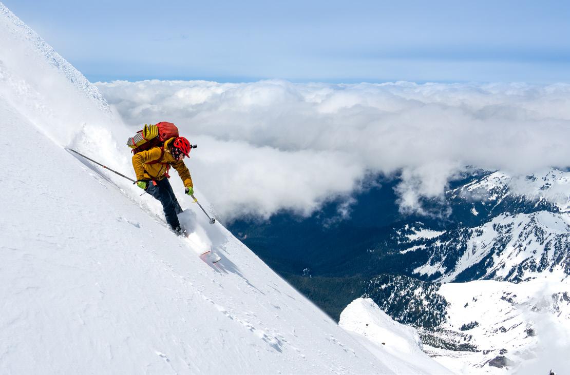
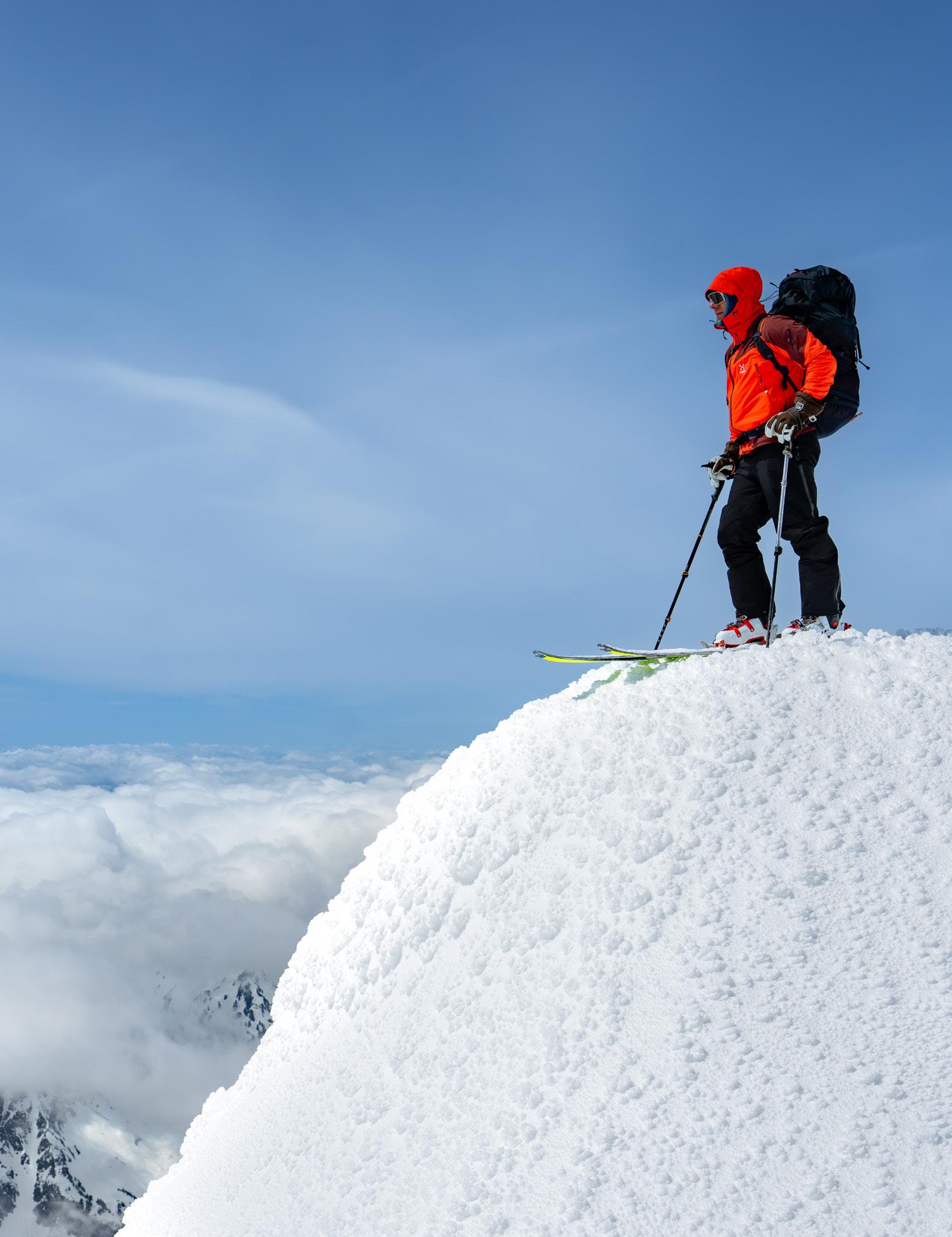
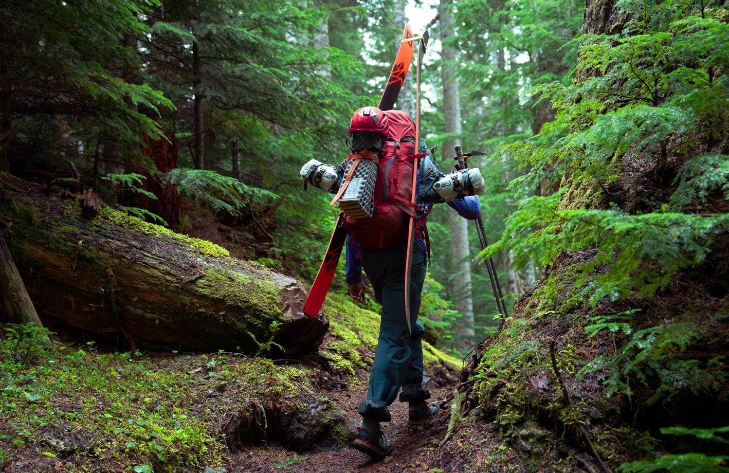
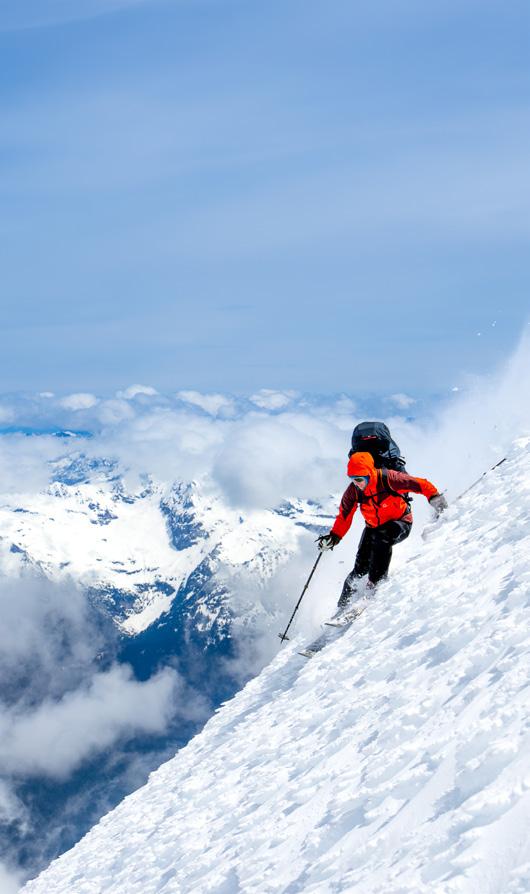
Glacier Peak: Summit to Sea
By Jason Hummel
When I decided to ski across Mt Baker and pack raft to the Salish Sea in 2023, I realized I was onto something special. There was a mystery I wanted to unravel, logistical problems I hungered for, and that deeper connection to the wild that I craved.
For my second summit to sea story, Glacier Peak was the obvious choice. From Kennedy Glacier’s ice cliffs to Skagit Bay’s shores, there’s 150 miles of ski turns and paddle strokes to delight in.
May 21-22: Sauk River Trailhead to Suiattle Glacier
My twin brother Josh’s call came as my windshield wipers fought a losing battle with the rain. “Did you lie to me about the forecast?”
“No,” I spluttered. We both knew that wasn’t entirely true.
At the end of Suiattle River Road, we met Matt Leitzinger and Jay Hergert. After separating paddle from climbing gear, we continued to the Sauk River Trailhead. Eight hours after leaving home, I stepped from my car into a momentary break in the rain.
The trail transformed our mindset from home comforts to mountain adventure. Wind in the treetops, water over river stones, and solitary birds kept us company as we scrambled over enormous logs and across moss-covered bridges. Through the trees, we could see rain and clouds on our heels.
After climbing 2,000 feet, switchbacks ended in knee-deep snow. Finally switching to skis, we continued to White Pass, which in weeks would explode with thousands of yellow lilies.
Matt led us over White Mountain’s northeast ridge on terrible snow. On the far side, we climbed what remained of the White Chuck Glacier, where four newly formed lakes lay hidden beneath seasonal snow. Using GPS through milk-white nothingness, we reached the crest between the White Chuck and Suiattle Glaciers. A stiff breeze convinced us to camp on a lower bench, where we built a seven-foot snow wall protecting three tent spots.
Story continued on page 41
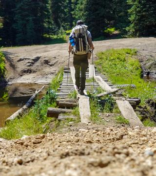
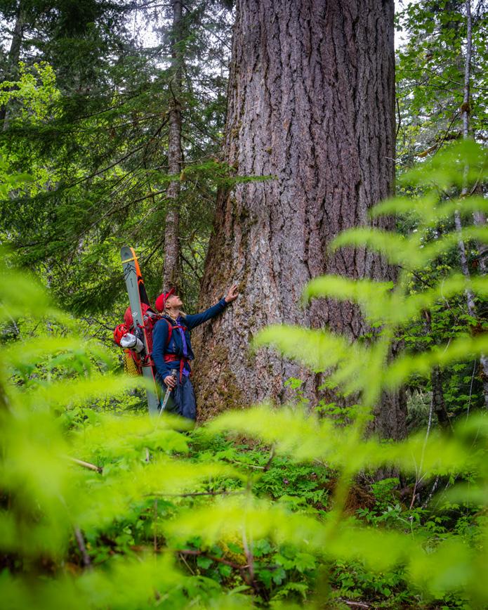
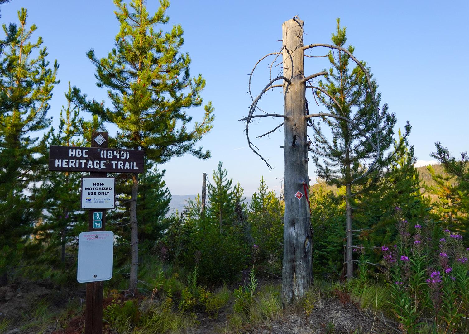
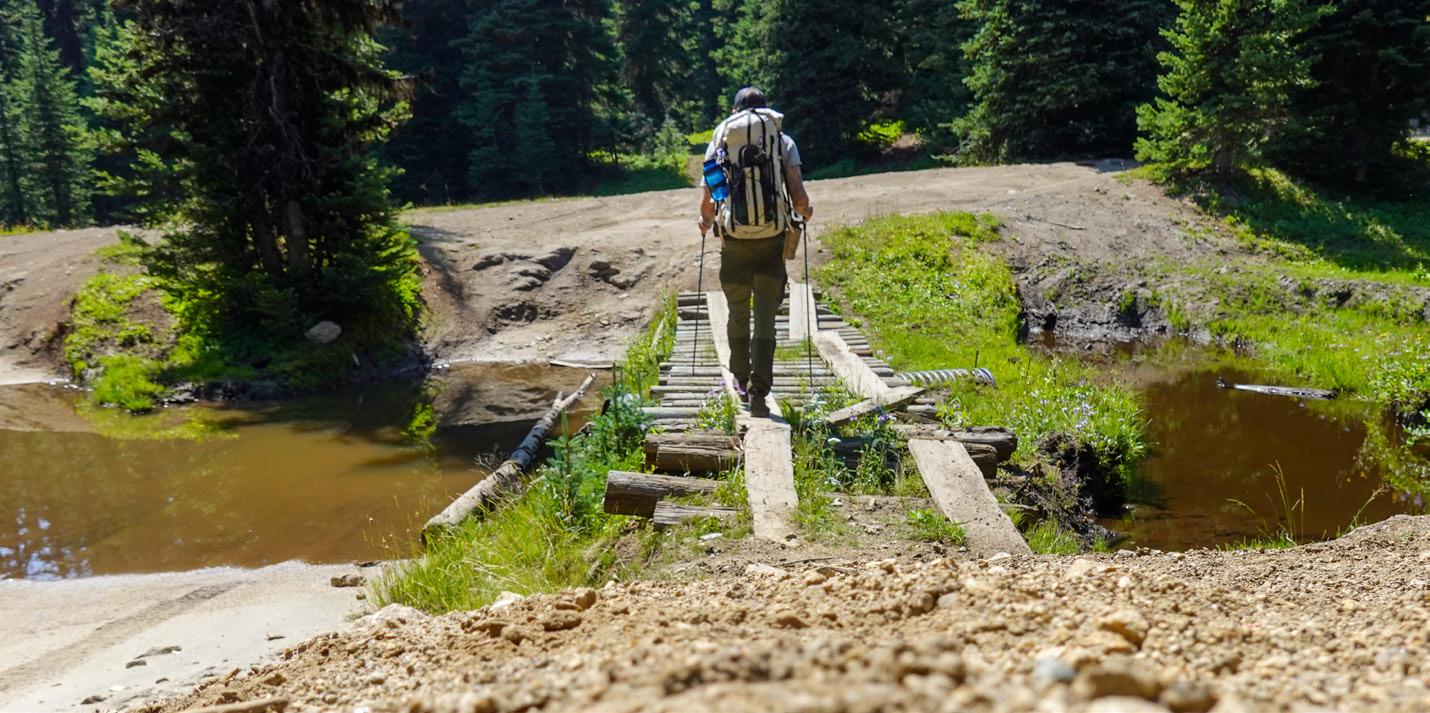
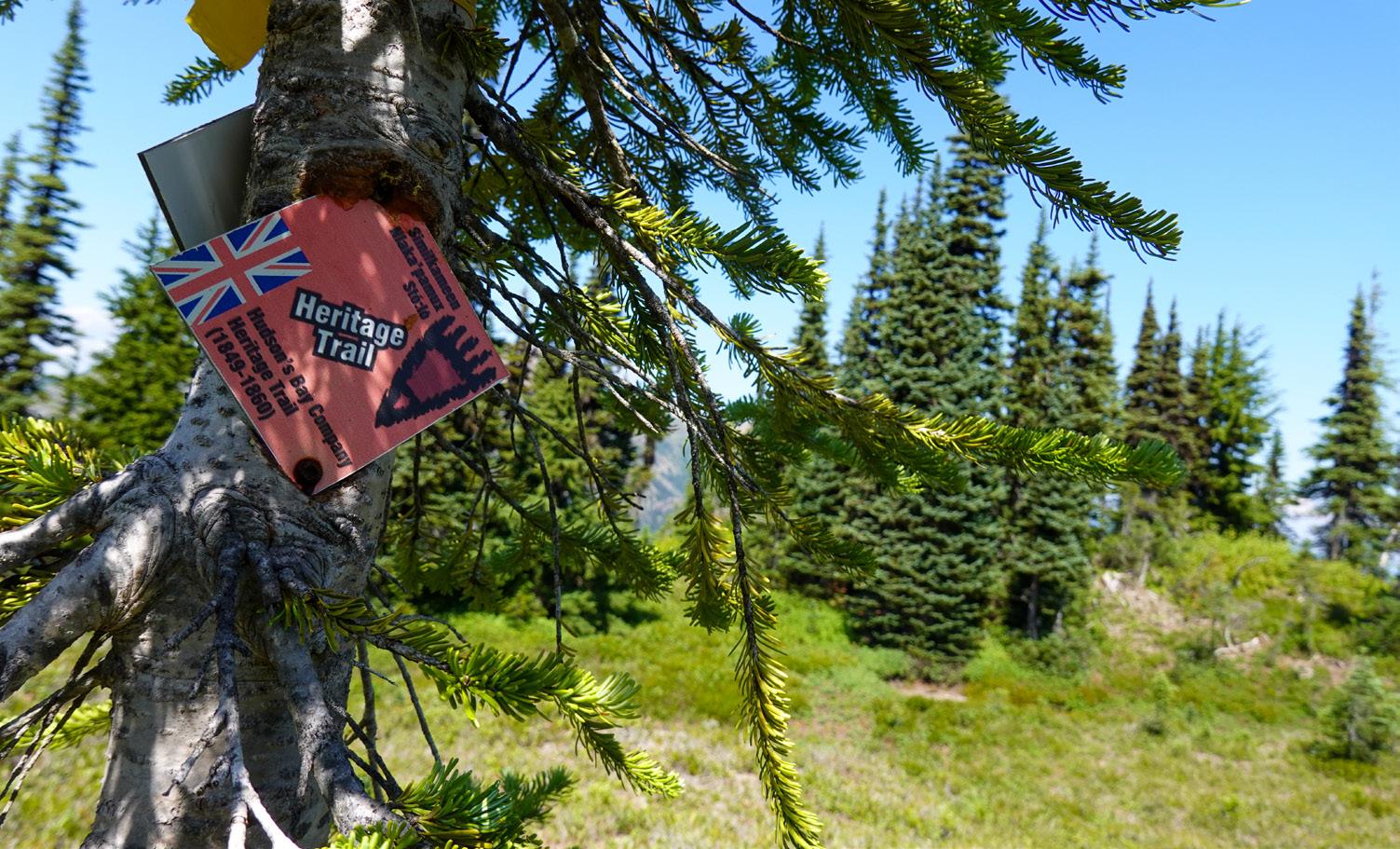
Hell Hill stretched out below me. This section of the Hudson’s Bay Company (HBC) Heritage Trail earned its nickname mostly from hikers going the opposite direction, grinding up an endless stretch of tight switchbacks as they ascended the Cascade Crest. Under my feet, it's about as steep and loose as a trail can get before gravity overcomes friction. After an hour of careful hiking, the trail disappeared in front of me. Instead, it looked like one of those giant sandworms from Dune had torn through the forest, leaving a deep trench littered with small trees and skull sized rocks.
This trench was just the latest piece of evidence from the 2021 atmospheric river that, over the course of two days, dropped nearly 300mm of rain on southwestern B.C. The rains washed out highways, stranded hundreds of people and forced thousands more to evacuate their homes. It also wreaked havoc along the 50-mile HBC Heritage Trail, a long distance hiking trail that tracks historical travel routes across the northern Cascade range.
At the time, the fate of this trail was probably the farthest thing from most peoples’ minds. But in the months that followed, while governments and business started to get to work rebuilding the highways, a group of dedicated backpackers and
HBC Heritage Trail
By Cameron Fenton
outdoor educators took on the herculean task of bringing this trail back to life.
“We lost several bridges and two big ones had to be replaced. Massive landslides washed away several areas of trail completely. Trees were down everywhere like matchsticks. Every water drainage was scoured to bedrock,” said Nate Brown, assistant trail crew lead for the Hope Mountain Center.
As a nonprofit outdoor education society, the people at Hope Mountain Center are stewards of the HBC Trail. Since the floods, it’s been Brown and a dedicated team of staff and volunteers that have led the charge to resuscitate the trail.
That work has included everything from clearing fresh deadfall to rerouting the trail around landslides and bridge washouts, made harder by the fact that, for months after the flooding, access to the trail was hamstrung by closed and washed out roads. According to Brown, the work to fully clear the trail took most of two summers. First was what he called “summer of contemplation and planning” followed by trail work that fall and all through 2023 and 2024. When I started hiking the trail in late August of 2024, Brown was still out clearing deadfall.
From the moment I turned off the highway towards the trail’s eastern terminus near Tulameen, B.C., I saw the scars left by the floods. It had been
nearly three years since the waters rose, but sandbag and rebar barriers remained all along the banks of the Tulameen River. At the river ford that starts the trail, waterlogged deadfall, flushed down from the forests upstream, littered the gravel bank.
Climbing up the first miles of trail, deadfall in open sections of forest looked like the piles of “matchsticks” Brown had described. I completely lost count of the freshly cut downed trees that flanked the trail within a few minutes. Not long after, I passed the remains of an old logging bridge that had been shorn in two when flood waters poured down the drainage. Now onto the Tulameen Plateau – a series of rounded summits in the rain shadow of the Cascades – the trail opened up into an old wildfire burn. The fire was long ago enough that iridescent purple fireweed and stubby trees began to reclaim the landscape. I could still pick out charred stumps and logs nested among the fresh growth.
I woke up early and cold the next morning, my tent coated with moisture. I boiled water for coffee and oatmeal and wandered around the campsite, having arrived just before dark the previous night. I was camped at Olivine Camp, one of 10 established campsites along the trail. Each one is well appointed with a bear cache, pit toilet and areas for both tents and cooking. Most of the sites
are built on, or near, historic encampments. Some have massive interpretive signposts of the type you find in a museum, an odd sight in the backcountry.
Like many trails we now hike, the first people to walk along the HBC trail were Indigenous. When western expansion brought the fur trade to what is now B.C. in the mid-19th century, an employee of the Hudson’s Bay Company named Alexander Caulfield Anderson looked to Indigenous knowledge to find a path through these mountains. Blackeye, a Similkameen Chief, showed him the hunting paths his people had relied on for generations. Caulfield followed these trails and established the first version of the HBC route in 1846. By 1849 the HBC Brigade Trail officially connected camps and forts to the interior.
While the signs in campsites along the trail offered interesting nuggets of history, things settled in as I logged miles on the trail. After a day on the trail, I was starting to catalogue the different trail markers on the trees. The oldest were worn rectangles chopped into thick bark with an axe or a knife, some of which may have marked the original trail. Within some of these, faded and worn tin plaques marked the initial establishment of a recreational trail in the late 1960s and it’s construction through the 1970s. Signs from various government agencies, some no longer active, marked the passage of time. More recently, the Hope Mountain Center had put up bright red kilometer markers supplemented by multicoloured flagging tape to keeps hikers on track through the flood impact zones.
As I hiked, I was reminded of a quote from Robert Moor’s “On Trails” describing the paths we walk as, “the collaborative artwork of trillions of sculptors, large and small.”
I stopped for the night at Horseguard Camp, another well-built backcountry campsite along the banks of the Tulameen River. I couldn’t help but think of everything that had to happen to lead to
this trail. Animals had to travel through these valleys and mountains in search of food. Early hunters had to follow them. These hunters showed these trails to newcomers in search of a route for commercial goods. Fur traders traveled this route for decades until the new travel routes and the promise of gold in the nearby Fraser Canyon led to its abandonment by the 1860s. Nearly a century later, a group of hikers found the trail and brought it back to life with countless hours of toil. Since then, it’s passed through various hands, each doing differing levels of work to maintain and develop it. I fell asleep that night thinking about all the history that would be lost if Nate and the Hope Mountain Center hadn’t been there to bring the trail back after the floods.
The next day was the biggest of the trip. I started early to knock out some flat and easy miles along a route I had travelled back in the summer of 2021.
A friend and I had met at a trailhead to the south to attempt a possible first descent of the headwaters of the Tulameen River. We loaded packrafts, whitewater gear and a few days of food into heavy packs and set off at dawn. By the time we hit the river late in the morning, it was already sweltering and we laid in fresh snowmelt to cool down. We didn’t know it, but while we navigated whitewater canyons and sweat on long portages around wood choked rapids, we were in the middle of an event that would be called the “Pacific Northwest Heat Dome” a period of heat that would spark devastating wildfires in the town of Lytton and claim hundreds of lives.
Both that event, and the 2021 floods were natural disasters fuelled by climate change. For the floods, the culprit was an “atmospheric river.” The term refers to long columns of water vapour that form a continuous flow in the sky. Normally these columns bring storms, but nothing of the scale and frequency that we experienced then and still see today.
According to climate scientists, rising global temperatures are increasing evaporation. This means more moisture in these columns and more powerful atmospheric rivers happening more often. Looking back at the 2021 floods, scientists at the University of Victoria found that the probability of similar rainfall events had “increased by roughly 50 percent by human-induced climate change.”
When these supercharged atmospheric rivers slam into mountain ranges, they can drop months worth of rain in a matter of hours, starting a chain reaction.
First, the soil gets saturated and, as anyone who has overwatered a plant knows, eventually the ground just can’t absorb any more water. This excess water pours over the ground and finds pathways down mountains, flooding small creeks and carving new ones in other low lying areas. As more water pours into these areas, it starts to wash away soil, pulling trees, rocks and earth down with it. The new grooves converged into Sowaqua Creek at the bottom of the valley. As the creek swelled, it transformed from a low volume trickle into a surging freight train, wiping out bridges, washing away sections of trail, filling with debris and punching down the valley to the Coquihalla River. When this river, swollen by Sowaqua and other creeks, met the highway of the same name, it washed out 20 sites along 130 kilometers, closing one of the main arteries connecting Vancouver to the rest of Canada and stranding hundreds of people.
I camped that night beside Colville Creek and woke up to the familiar dank and fecund scent of coastal temperate rainforest. The bright orange, red, purple and yellow hues of the Tulameen plateau wildflowers had been replaced by a smorgasbord of greens that define so much of the Pacific Northwest.
It only took a few steps out of camp to come face to face with the impacts of the floods. Chainsaw
cuts split through the trunk of an ancient giant that, after standing sentinel for generations, had crashed across the trail. Though no one was there to hear it, this ancient tree and its neighbours falling to the ground must have sounded like an artillery barrage.
As I climbed up and over Manson’s Ridge, the last high divide of the route, I noticed that some of these cuts were brand new, fresh sawdust caking my hiking boots as I passed by. If I had been a day earlier, I probably would have found Nate right here, chainsaw in hand, clearing this final stretch of deadfall.
I was close to the western end of the trail, one of the last sections to be cleared and brought back. As Nate explained, the Hope Mountain Center finished building detours on the last stretch of trail just beyond this in 2021. Before then, this section of trail followed a defunct logging road. When logging picked back up on the road, they cut a new trail through steep old growth on the opposite side of the valley. “We all know logging trucks and hikers don’t mix,” Brown explained. “Our amazing trail crew that summer managed to punch the trail all the way through… [we] put quite a number of bridges and boardwalks along the trail. During the first week of November we prepped the trail for a new aluminum bridge, connected the trail between bridges and packed up for winter.”
The week after they finished in 2021, the rains started. Two days later, it was like Mother Nature had shaken the Etch-a-Sketch on their brand new trail. Rebuilding that section of trail started in 2023 and it was finally re-opened in June of 2024.
The sky was tinged with a hint of wildfire smoke when I made it off of Manson’s Ridge onto this new trail. The smell of smoke reminded me of the fires earlier this summer in Jasper, one of Canada’s most iconic national parks. Politicians had lamented that nearly a third of the town’s buildings burnt in the fire, but I hadn’t heard much about the more than 30,000 hectares of forest and mountains. I wondered, what trails and campsites had been impacted?
Photos shared by Parks Canada show sections of two iconic campgrounds, Whistlers and Wapiti, burnt and covered in ash. A picture shared on social media by a local photographer showed the Mt. Edith Cavell trailhead before and after the fire. In the latter image, the trees are gone and the sign is burned away. According to wildfire experts, the forests could take more than a century to recover in that area.
This train of thought led me to think about Mt. Robson Provincial Park, just to the east of Jasper. It too was also just starting to recover from trail flooding in 2021. Late that June, river levels in the park started rising when the Heat Dome opened up the snowmelt faucet. A storm quickly followed and, by early July, the park was evacuated and floodwaters charged through the iconic Berg Lake trail network. In 2024, part of that trail finally re-opened, with BC Parks hoping to open the rest in 2025. According to their website, this long process is because they are “ensuring we are rebuilding the trail with climate resiliency in mind”.
As I continued down the trail, I started to make a list of climate change’s impacts on trails I knew. There were the 2023 wildfires that shut down
parts of both Cathedral and Stein Valley Provincial Parks. Or the climate change-linked rock fall on Squamish’s iconic granite buttresses that closed a number of climbing and running trails near my old home. I remembered conversations among guides about ski traverses and mountaineering routes that are becoming harder and more dangerous as glaciers recede and snowpacks decline. I thought about numerous closures on iconic long trails like the Pacific Crest and Appalachian Trails from yearly wildfires, not knowing that just a few months after this hike, much of the latter would face the brunt of Hurricane Helene. I kept going with everything from bikepacking routes to international destinations and backyard runs. I ran out of trail before I ran out of examples.
As my friend Sam pulled up to the parking lot to give me a ride back to my car, I searched for a tidy ending to all my thoughts. I wanted a soundbite or a pithy conclusion that could tie the whole experience together, but I struggled to find a clean line to pull all the threads together.
Climate change is sometimes described as an “existential threat”. As I waited for my ride at the western end of the HBC Trail, I felt like I was finally starting to understand what that actually meant. A threat to the very existence of something is difficult to imagine. Hiking the HBC trail was a trip through both natural and human history. It took me through wildlife habitat and across landscapes changed and still changing. It was an experience that could only happen on this trail, at this moment. And, it’s an experience that fire and floods could erase the possibility of future hikers having. x
May 23-24: Summit Push and
Descent
Morning light speared the eastern slopes before clouds swallowed them again. Like blind marmots, we burrowed up the Gerdine Glacier until breaking through at 9,100 feet into clear skies. From the summit, we descended to Kennedy Glacier, named for William Kennedy who built a cabin near the hot springs where mountain goats still gather. Josh’s excited shout echoed up: “It’s powder!” Having my twin brother back on a bigger ski adventure made the moment even sweeter.
Beyond Kennedy Peak, we passed a spectacular pyramidal nunatak on the Ptarmigan Glacier, its sharp top cutting the sky. Few such features remain intact in the Cascades. The rest of our descent to the Suiattle River fought wet, unconsolidated snow.
May 25-26: River Days
Xander Demetrios joined us at Sulphur Creek. My first paddle strokes led to instant karma when I high-sided on a boulder, then poor Matt smashed into me and flipped. The Suiattle demanded teamwork through its logjams – some requiring crawling, others fancy footwork. Twenty-two miles later, Xander left us at the Sauk confluence. We found a perfect beach camp, where I flopped onto shore like a landed fish. Camp chair came out before tent, but eventually we settled in for supper and cribbage – a fitting end to a day of confluences, where rivers and friends, paddles and water came together.
May 26-27: The Final Push
MT. BAKER FOOTHILLS & REGION MAP
With 68 miles and incoming rain ahead, we kept a strong pace past towns and farms. Our eighth day started in dawn darkness. As seasoned professionals now used to rain’s company, we shrugged it off and pointed our boats toward salt water. We passed Sedro Woolley, Burlington, and Mount Vernon before threading through Skagit Bay’s grass-lined channels to Shelter Bay. Like the water beneath my boat, there’s depth to this story. Fresh water meeting the sea might spend six thousand years in the ocean before becoming clouds, then snow on glaciers where seventy percent of Earth’s fresh water is stored. The oldest glacier ice is over six million years old. Sitting on shore after the final paddle stroke, I considered our story written in powder turns and river waves. While just a drop compared to water’s epic tale, our adventure paid homage to this ice king of the Cascades, reminding me that life is best when you’re in the flow. x
EATS
BLAINE
PACKERS KITCHEN & BAR AT
SEMIAHMOO RESORT
9565 Semiahmoo Parkway
360/318-2090
semiahmoo.com
Seaside dining with stunning views and a fresh menu of seafood, hand-crafted pizza, and local specialties.
BELLINGHAM
BELLINGHAM CIDER COMPANY
205 Prospect Street, Suite A105
360 /510-8494
bellinghamcider.com
A local craft cider producer and solar-powered restaurant with a full bar overlooking Bellingham Bay. Food is prepped fresh and sourced from local farms and businesses.
BOUNDARY BAY BREWERY & BISTRO
1107 Railroad Ave
360/647-5593
bbaybrewery.com
A family-friendly community hub. Unwind in the taproom, bistro, deck or beer garden with handcrafted brews, fresh local food.
HOLLY’S MEAT PIES
4073 Hannegan Rd.
360/778-1111
hollysmeatpies.com
Washington’s original pasty company. Artisan hand pies made from scratch. Order online.
EATS & SLEEPS
KULSHAN BREWING ROOSEVELT
TAPROOM (K2)
1538 Kentucky St
360/389-5348
kulshanbrewing.com
30 Barrel production brewery and taproom. Food trucks, keg sales, beer-to-go and TVs for sports. Covered patio and beer garden! A hub for community events.
KULSHAN BREWING SUNNYLAND
TAPROOM
2238 James St
360/389-5348
kulshanbrewing.com
This neighborhood staple offers up beers from Kulshan’s Small-Batch Program alongside yearround offerings. Family-friendly, dog-friendly outdoor beer garden, food trucks, music and beer-to-go.
KULSHAN BREWING TRACKSIDE BEER GARDEN
298 W Laurel St
360/389-5348
kulshanbrewing.com
Trackside Brewery and Beer Garden is Kulshan Brewing’s seasonal beer garden that operates from late spring to early fall. Located on the former Georgia Pacific paper mill site, in Downtown Bellingham’s redeveloping waterfront district. Trackside welcomes all ages, is dog-friendly, and is a hub for summertime fun. We have regular live music and events, over 25,000 square feet of beer garden, yard games and a huge lawn!
PENNY FARTHING BAR AND RESTAURANT AT CHUCKANUT BAY DISTILLERY
1309 Cornwall Avenue
360/738-7179
chuckanutbaydistillery.com
Featuring a variety of delicious, shareable “small
plate” dishes and creative craft cocktails. The perfect downtown Bellingham destination for any occasion.
BURLINGTON
SKAGIT’S OWN FISH MARKET
18042 Hwy 20
360/707-2722
skagitfish.com
Offering the highest quality in local seafood. Daily lunch specials freshly prepared. Local jams, jellies, salsas, honey and sauces.
CONCRETE
ANNIE’S PIZZA STATION
44568 State Route 20
360/853-7227
anniespizzastation.com
Family-owned pizza restaurant focusing on fresh, homemade quality Italian fare. Friendly service, helpful information and great food combine for an unforgettable experience.
DEMING
THE NORTH FORK BREWERY
6186 Mt. Baker Highway
360/599-2337
northforkbrewery.com
Handcrafted beer and hand tossed pizza. Order online for to-go orders. New covered beer garden. Weekday Happy Hour Mon-Fri 12-5 p.m.
FERNDALE
SILVER REEF CASINO RESORT 4876 Haxton Way 866/383-0777
silverreefcasino.com
Diverse dining options from woodstone pizza to award-winning fine dining at The Steak House.
BE PART OF THE EXPERIENCE
Since 1986, Mount Baker Experience magazine has inspired outdoor enthusiasts of all ages throughout Washington and British Columbia.
MBE gets readers outside - it’s the publication outdoor enthusiasts turn to when they need a hit of adrenaline.
Increase your exposure with the Northwest’s premier adventure magazine. Seattle to Vancouver.
Next issue: Summer 2025
To be part of the experience call 360-332-1777 or email sales@mountbakerexperience.com www.MountBakerExperience.com
GLACIER
GRAHAMS RESTAURANT & BAR
9989 Mt Baker Hwy
360/599-3302
grahamsglacier.com
NW Craft Brews on tap, NW Comfort Food with a culinary twist. Live music.
Open 7 days a week at noon.
GUNNERS TEX MEX BBQ
9990 Mt. Baker Hwy
360/599-0783
gunnersbbq.com
Succulent, fresh smoked meats, order by the pound or dish. Burgers, tacos and vegan option. Beer, wine, craft cocktails.
WAKE ‘N BAKERY
6903 Bourne Street
360/599-9378
getsconed.com
Open daily from 7 a.m. to 6 p.m. serving breakfast burritos & sandwiches, quiche, soup, paninis, and freshly baked goods. Savory and sweet gluten-free and vegan options. Organic espresso and coffee.
MOUNT VERNON
SKAGIT VALLEY FOOD CO-OP
202 S. 1st Street
360/336-9777
skagitfoodcoop.com
Deli food from scratch using fresh, quality ingredients, sourced from local and organic suppliers whenever possible. Entrees, side dishes, soups, salads, sandwiches, and handmade, organic ice cream. Vegan, vegetarian, raw, gluten-free, and whole food choices for every meal.
SLEEPS
BLAINE
SEMIAHMOO RESORT
4565 Semiahmoo Parkway
360/318-2000
semiahmoo.com
A casual northwest beach resort surrounded by the Salish Sea. An authentic Pacific Northwest experience for everyone – from families looking for a fun getaway to couples and friends seeking an easy-going retreat.
FERNDALE
SILVER REEF CASINO RESORT
4876 Haxton Way
866/383-0777
silverreefcasino.com
Exit 260 off I-5. 206 luxurious rooms or suites to make yourself feel at home with beautiful Mt. Baker views, complimentary breakfast, free WiFi.
GLACIER
LUXURY GETAWAYS
10005 Mt. Baker Hwy.
360/398-9590 or 877-90-BAKER
luxurygetaways.com
Redefining the cabin in the woods. Vacation rentals in the heart of the Mt. Baker Recreational Area – perfect for hitting the slopes or relaxing.
SERENE MOUNTAIN ESCAPES
360/961-0123
serenemountainescapes.com
Quality vacation rentals that sleep from 1-12 guests. Choose from pools, hot tubs, dog friendly & more.
THE KNOTTY LODGE
360/303-2887
VRBO.com/563675
Premier Mt. Baker vacation rental. 3BR, 2BA luxury timber home with modern amenities, hot tub, WiFi, gourmet kitchen, fireplace, fire pit. Your perfect getaway base camp!
LYNDEN
THE INN AT LYNDEN
100 5th Street
360/746-8597
innatlynden.com
Your closest full service hotel to the Mt. Baker Ski Area. 35 luxury rooms in a historic building, close to shopping and restaurants. Less than 5 miles from the Canadian border.
MAPLE FALLS
MT. BAKER LODGING
7425 Mt. Baker Hwy.
800/709-7669
mtbakerlodging.com
Find your perfect accommodations - from rustic to luxury getaways, from studio to 12+ bedrooms. Open 7 days a week.
RACES, RUNS AND EVENTS
OUTDOOR ADVENTURE & TRAVEL SHOW:
March 1-2
BC’s largest showcase of outdoor gear and adventure travel experiences. Over 250 exhibitors and 60 adventure presentations. Info: outdooradventureshow.ca
MUSSELS IN THE KETTLES:
Saturday, March 8
A non-competitive ride for all types of riders in Coupeville. You pick your pace and your route, 3 courses through the Fort Ebey and the Kettles trail system. Info: whidbeyislandbicycleclub.org
WINGS OVER WATER NW BIRDING FESTIVAL:
March 14-16
Blaine, Semiahmoo and Birch Bay. Celebrate the incredible variety of migratory birds that flock these coastal waters. Field trips, birding expo. Info: wingsoverwaterbirdingfestival.com
BAKER SPLITFEST:
March 14-16
Glacier. A pilgrimage for all backcountry snowboard enthusiasts. Free demo boards, raffles, and a fundraiser for the Northwest Avalanche Center. Daily clinics provided by professional guides. Info: guidedexposure.com
FROSTY MOSS RELAY:
Saturday, March 15
Experience the green season on the Olympic Peninsula. Frosty Moss Relay is an 80-mile running relay on the Olympic Peninsula of Washington State. The course takes place on the paved Olympic Discovery Trail as well as the singletrack Olympic Adventure Route. Teams of 2 to 5. Info: frostymossrelay.com.
CHUCKANUT 50K:
Saturday, March 15
The Chuckanut 50k is a lollipop-shaped course. The first 10k and last 10k repeat on the Interurban Trail with smooth, relatively flat running. The middle 30k is what this race is known for — you get to climb (5,000ft), traverse and descend the famous Chuckanut Mountain Ridge amongst beautiful Pacific Northwest terrain. Info: chuckanut50krace.com.
WHATCOM CULTURAL ARTS FESTIVAL:
March 15 - 16
At the Bellingham Cruise Terminal. Exhibits and vendors, live performances. For all ages. Free admission. Info: alliedarts.org
OAT RUN:
Saturday, April 12
Port Angeles. 50K and point-to-point 12K and half marathon Trail Race that
traverses Kelly Ridge between Olympic National Park and the Strait of Juan de Fuca, all on single-track trail. Info: peninsulaadventuresports.com
CASCADIA INTERNATIONAL WOMENS FILM FESTIVAL:
April 24-27
Bellingham. Celebrating exceptional films directed by women from around the world. Info: cascadiafilmfest.org
TOUR DE LOPEZ:
Saturday, April 26
Great family event. Come for the day or stay for the weekend. Non-competitive rural road tour through scenic Lopez Island and challenging 31-mile route. Lunch included, live music and beer garden. Info: lopezisland.com
VANCOUVER SUN RUN:
Sunday, April 27
Canada’s largest 10k road race since 1985. Inspiring healthy, active lifestyles for people of all ages and at any fitness level. Info: vancouversunrun.com
WHIDBEY ISLAND MARATHON:
Sunday, April 27
One of the Pacific Northwest’s hidden athletic gems it’s the perfect destination race. Starting at the famed Deception Pass Bridge then winding its way through picturesque ocean views and tranquil farmland, the courses promise to be scenic from country back roads to waterfront coastlines, snow-capped mountains and rolling hills. Boston Marathon Qualifier. Info: oakharbor.gov
SKI TO SEA:
Sunday, May 25
Ski to Sea is the original multisport relay race, from Mt. Baker to Bellingham Bay. Organize your team of 3-8 racers and join us on Memorial Day weekend. Celebrating 51 years. Info: skitosea.com.
BELLINGHAM SWIMRUN:
Sunday, June 1
The Swedes discovered SwimRun in 2006. It consists of swimming and running and swimming and running. The Bellingham SwimRun will be held at Lake Padden and offered as a 15K and 5K. Racers can compete solo or with a team. Info: questraces.com/bellingham-swimrun
SEVENTY48 RACE:
June 6
Race from Tacoma to Port Townsend in 48 hours. The rules are simple: no motors, no support and no wind—human power only. Pedal, paddle or row. Info: seventy48.com
GALBRAITH SUPREME:
Saturday, June 7
The ultimate Galbraith Mountain bike race. Do the 33 miles, 5,200 vertical on your own or divide into segments with one or two teammates. Info: questraces.com
SCOTTISH GATHERING:
Saturday, June 7
Blaine. 200 competitors in dance, athletics, piping and drumming. Info: scottishdancesociety.org
NORTH OLYMPIC DISCOVERY MARATHON:
June 7-8
The largest running event on the Olympic Peninsula. A USATF certified course and a Boston Marathon qualifier. Info: nodm.com
GRAVEL UNRAVEL BON JON PASS OUT:
Saturday, June 14
Quilcene. For endurance riders it’s one part of the Gravel Unravel endurance bicycle series on the gravel road systems of the Olympic and Kitsap peninsulas. Info: peninsulaadventuresports.com
DEMING LOGGING SHOW:
June 14 & 15
Deming. 62nd annual benefit for busted up loggers. 31 events., world champion speed climbing. Info: demingloggingshow.com
WA360 ADVENTURE RACE:
Saturday, June 28
A 360-ish mile loop from Port Townsend to Port Townsend through Washington’s waterways on engineless craft, Wind and Muscle Group divisions. Route makes its way via Bellingham Bay and off Point Roberts. Info: nwmaritime.org
NORTHWEST TUNE-UP:
July 11-13
A bike, beer and music festival celebrating PNW culture on the Bellingham waterfront. Family friendly events. 3-day festival passes, which include access to endless bike demos, award-winning headliners, bike and skills clinics, shuttles to trailheads, as well as single day admission. Info: NWTuneUp.com.
LAKE WHATCOM TRIATHLON:
Saturday, July 12
An Olympic-distance triathlon that is a USAT sanctioned event. The race includes a 1500-meter swim on Lake Whatcom, 40km bike ride along North Shore Drive and Y Road, and a 10km run around the trails of beautiful Whatcom Falls Park, with the transition area and start/finish lines at Bloedel Donovan
Park. The event draws beginner to elite athletes, in individual and relay divisions, and includes an expo area for athletes and spectators. Info: lakewhatcomtriathlon.com.
TOUR DE WHATCOM:
Saturday, July 19
Enjoy all that the Northwest has to offer in one ride — Mt. Baker, Lake Whatcom, valleys, rivers, farmland and beaches. Rides vary from 22 to 100 miles. Join the post ride party at Boundary Bay Brewery. Info: tourdewhatcom.com.
BELLINGHAM OFF-ROAD TRIATHLON:
Sunday, August 17
Includes a 800 meter swim on Lake Padden, 9K mountain bike loop along the Lake Padden horse trails, and finishes with the classic 4.1K (2.6 mile) gravel loop trail around Lake Padden. Transition area will be on the grass near the old baseball fields at Lake Padden Park. Beginner to elite friendly and you can do it with friends as a relay. Info: bellinghamoffroadtri.com.
GOAT RUN:
Saturday, September 6
Great Olympic Adventure Trail Run is a point-to-point half marathon, marathon, and 50K trail race that traverses Kelly Ridge between the Olympic National Park and the Strait of Juan de Fuca. Port Angeles. Info: peninsulaadventuresports.com.
MT. BAKER HILL CLIMB:
Sunday, September 14
Ascend 4,462’ from Chair 9 in Glacier to Artist Point (5,140’ elevation) in 22 miles along the Mt. Baker Highway. One of the most scenic paved roads in the country. Steep elevation but the views are stunning. Experience the agony and the ecstasy. In top 10 Grand Fondo Hill Climb Events. Info: bakerhillclimb.com.
BELLINGHAM BAY MARATHON:
Sunday, September 21
Also, half Marathon, 10K and 5K races. Often called one of the most beautiful races in the Pacific Northwest. Info: bellinghambaymarathon.org.
THE BIG HURT:
Saturday, September 27
A premier multi-sport race on the Olympic Peninsula. A four-leg test of endurance, strength and tenacity intertwined with the beauty of the North Olympic Peninsula. The event starts with 15-mile mountain bike, followed by 2.6-mile kayak, 30-mile road bike and a 10K run along the scenic Olympic Discovery Trail, Port Angeles. Info: bighurtpa.com.