


PROJECT 01: DELITE CINEMAS // 03
Team: Akansha Gupta, Aman Issar, Khadija Khan, Pratyush Yadav, Shamoon Mansoori, Sophiya Khan
LANDSCAPE DESIGN AND INTERVENTIONS//11
Sophiya Khan
PROJECT 02: MAPPING THE STREETS // 08
Sophiya Khan


PROJECT 01: DELITE CINEMAS // 03
Team: Akansha Gupta, Aman Issar, Khadija Khan, Pratyush Yadav, Shamoon Mansoori, Sophiya Khan
LANDSCAPE DESIGN AND INTERVENTIONS//11
Sophiya Khan
PROJECT 02: MAPPING THE STREETS // 08
Sophiya Khan

Sophiya Khan //
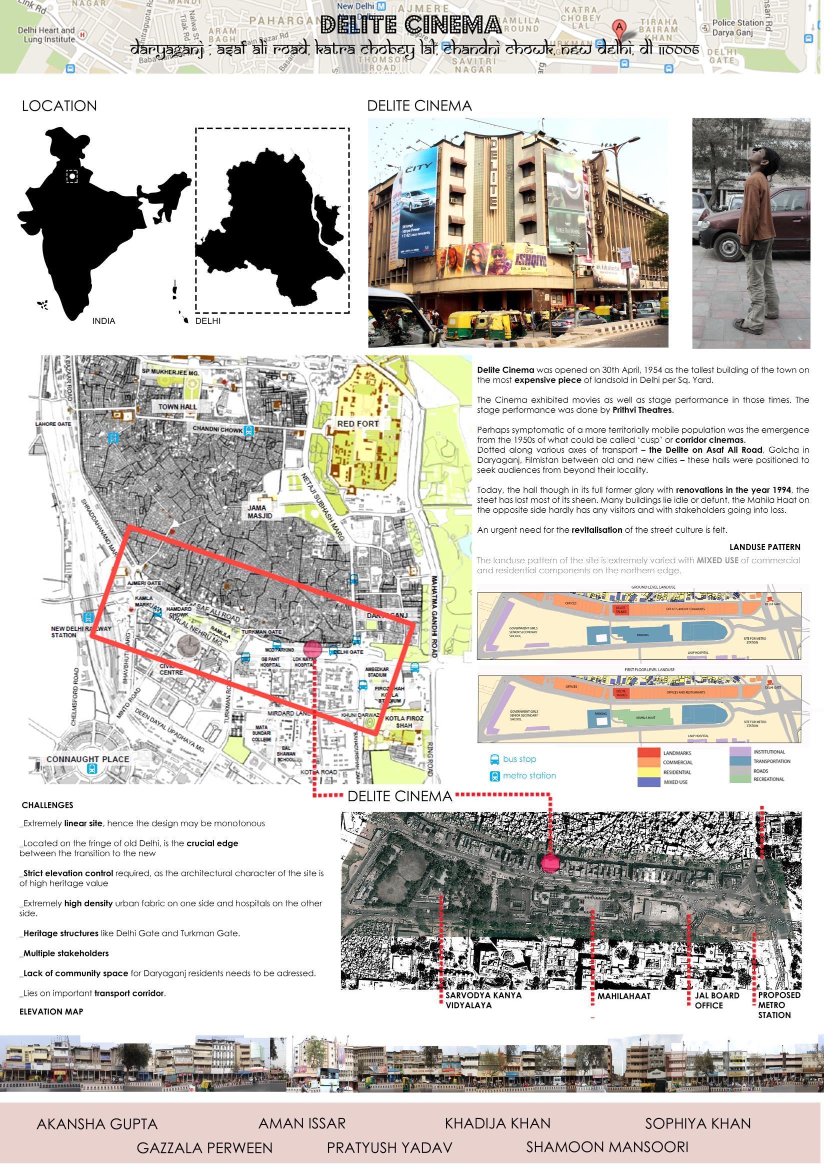
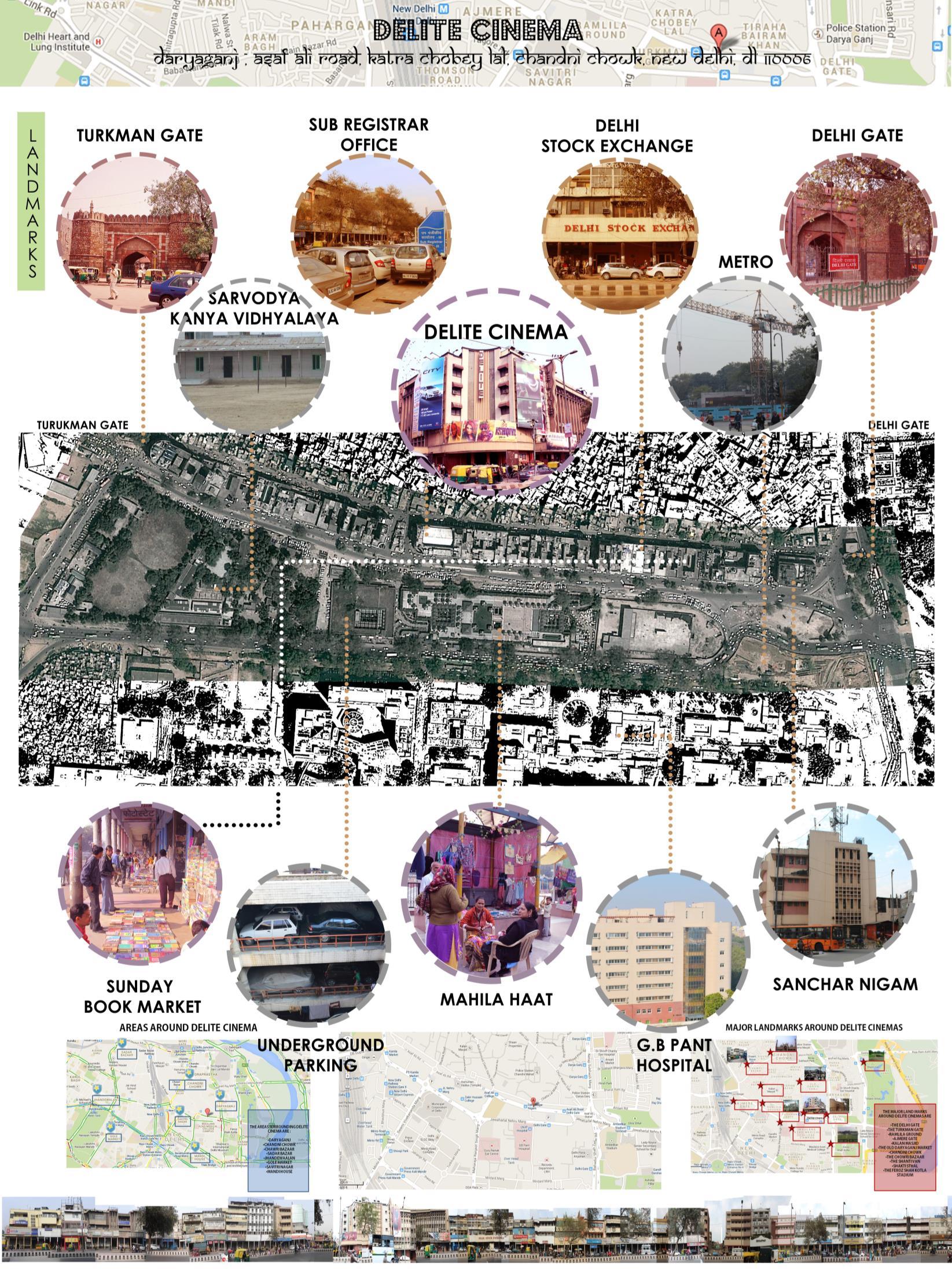
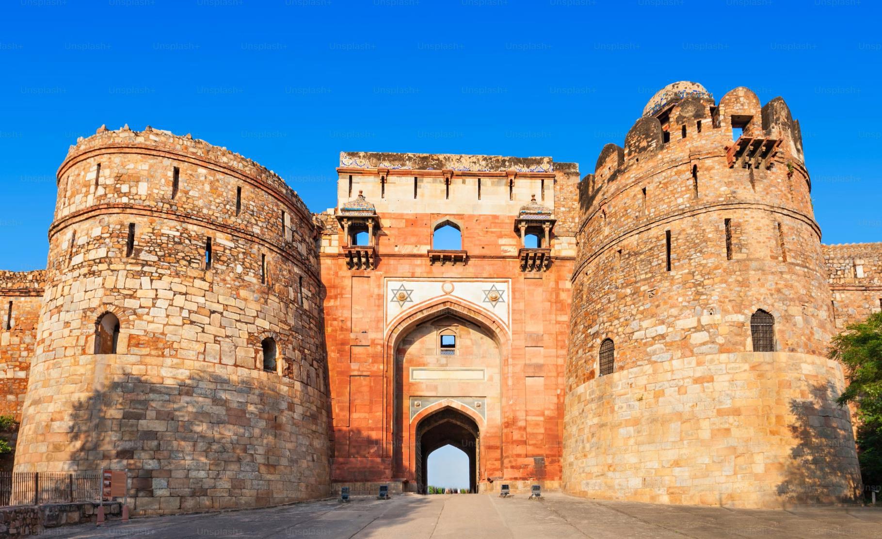
Daryaganj means `the mart by the river’ (darya is the Urdu word for river; ganj means mart or wholesale market). Although the river in question the Yamuna has since changed its course, it originally flowed by here, along the walls of what was, in the 17th century, an important wholesale market.
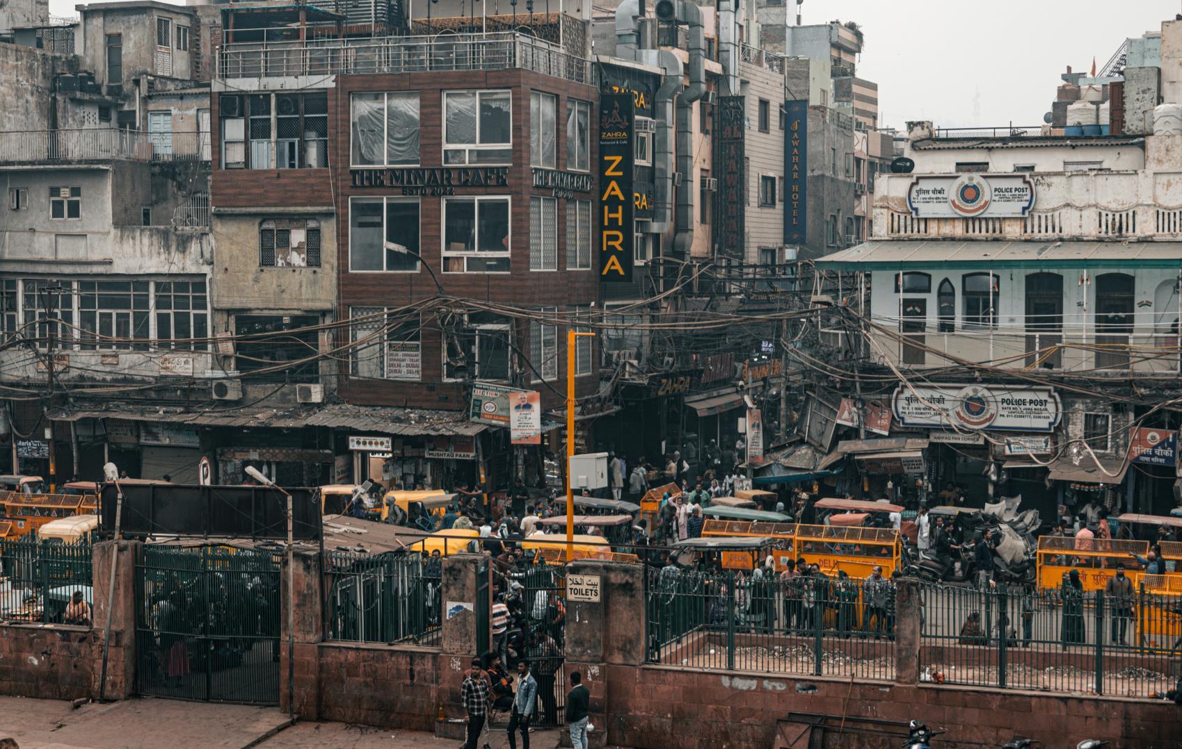
Daryaganj today is a very busy commercial district, teeming with people all through the day. But the memories of ages past still haunt this area, and there’s plenty of interesting history hidden within the narrow lanes and bylanes of the neighbourhood to make this a rewarding heritage route.
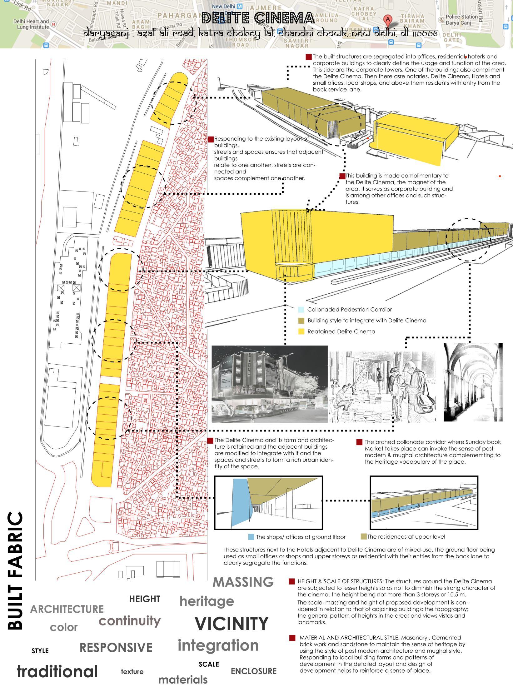
Before multiplexes came into being, Delite Cinema was the go-to theatre for all movie buffs. The first big hall to get air-conditioning, and ample seating and cheap tickets – there was little reason to not head here for blockbuster weekends. Delite has faithfully served people since 1954 and continues to till this day.
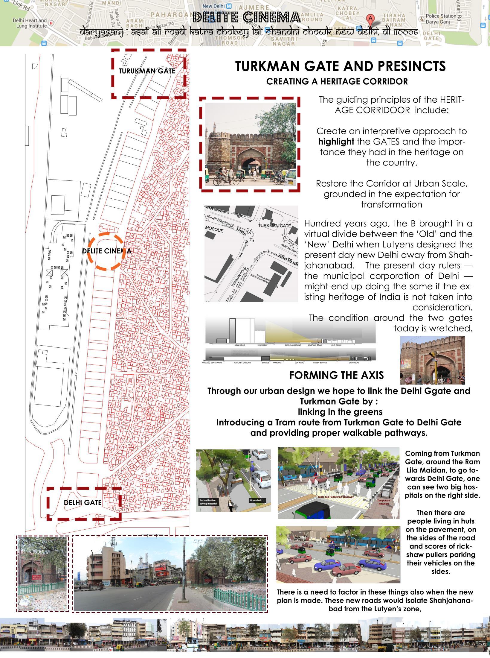
However, the dilapidated conditions of the old streets in Daryaganj and their constant need for repair raise questions about their continued existence or potential regeneration. This prompts a critical question: Is it worth preserving in its current state, or does it they require a comprehensive makeover?
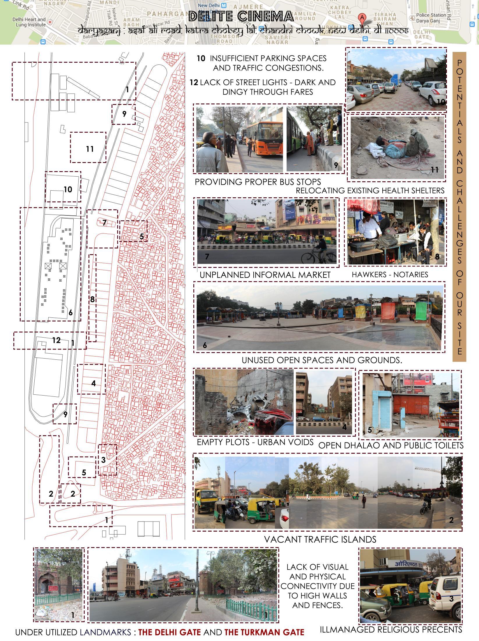
Explore the potential for a wider development including the adjacent sites.
Reconsider the nature of the proposed community uses and abandoned building structures.
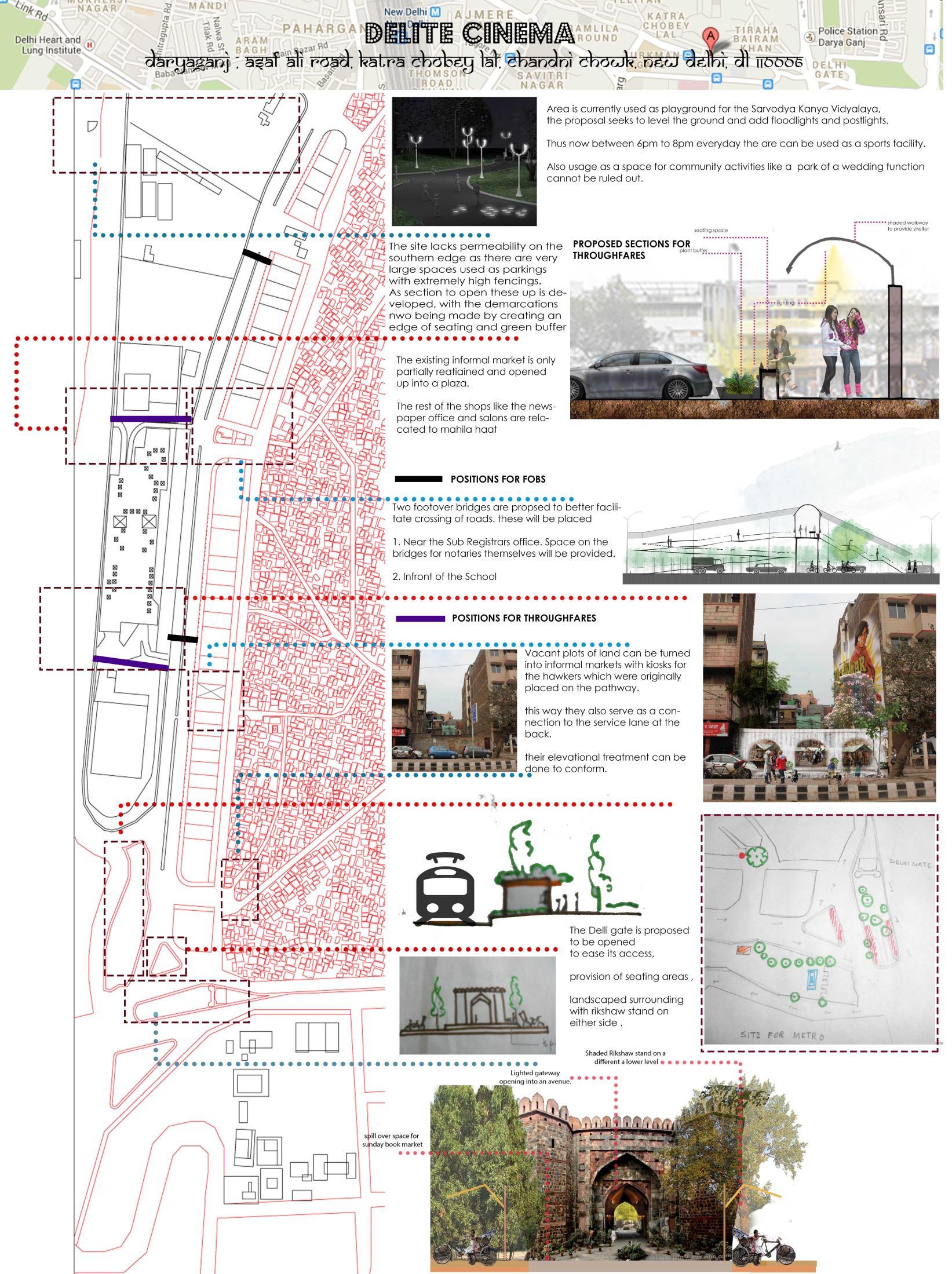
Improved pedestrian access by the reintroduction of the historic route.
Design improvements to shopfronts and signs on the eastern side of Asaf Ali Khan Road.
Design improvements and local Public Art Initiatives to the rear facade of the NCP car park.
A coordinated design approach for the shopfronts and signs to the ground floor premises including new street lighting and CCTV coverage.
Provision for secure bike lanes.
Removal of existing high-level perimeter wall around parks and the Mahila Haat and replacement with railings.
Ensure that the existing amenity of residents is protected.
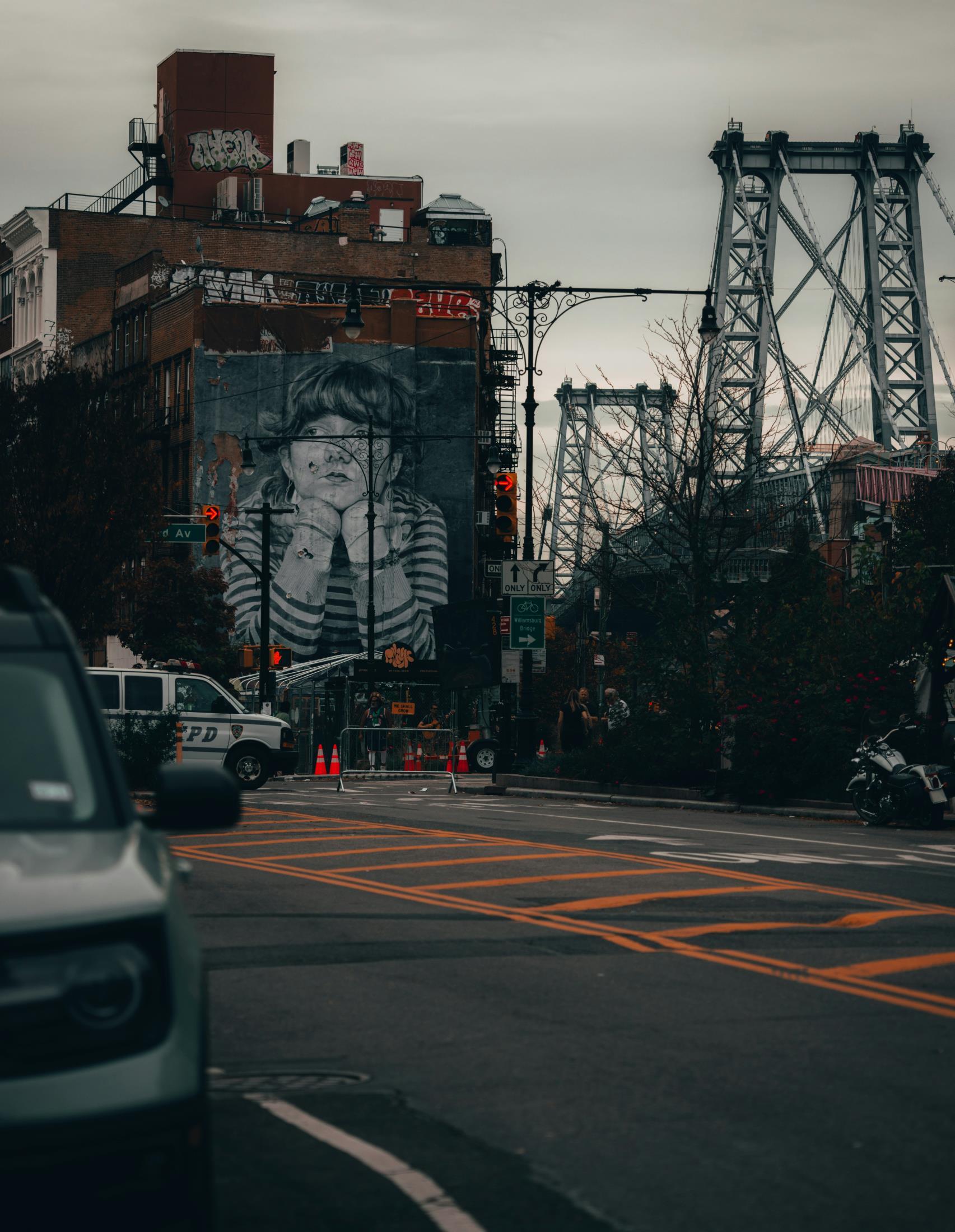
To map and study the existing conditions in Southside Williamsburg with a focus on the open space system, including priority parks, to develop recommendations to promote the overall goals of the ‘Green Light District Initiative.’
Our Proposal
1. Advocate reclamation of Open Space through Parkland Alienation initiative
3. Pedestrian plazas to improve existing open spaces
4. “Southside Pedestrian Superblocks” to reduce pollution and traffic
5. Cover Williamsburg Plaza Bus Terminal with green roof structure
6. Multipurpose open space under Williamsburg Bridge
7. Propose Rainwater harvesting and a water storage project
2. Develop a plan for a Green walkable corridor to connect the neighborhood
8. Youth-Led Environmental Justice walking tour to promote interest and culture
Williamsburg: Mural ‘Lost Time’ //
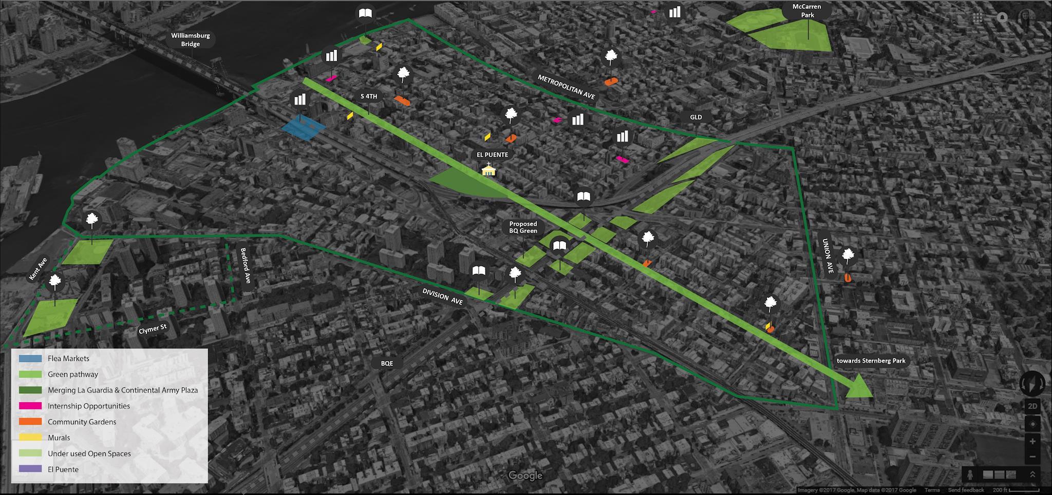
Map identifies potential areas for green and open spaces, including community gardens, plazas and spaces for future development //
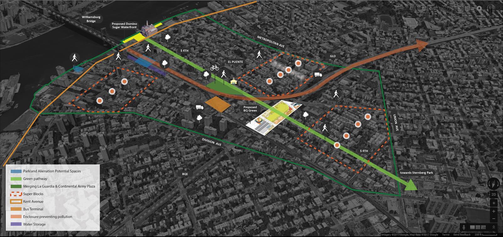
Map identifies potential Green Corridor, parklands, and proposed Southside Pedestrian Superblocks //
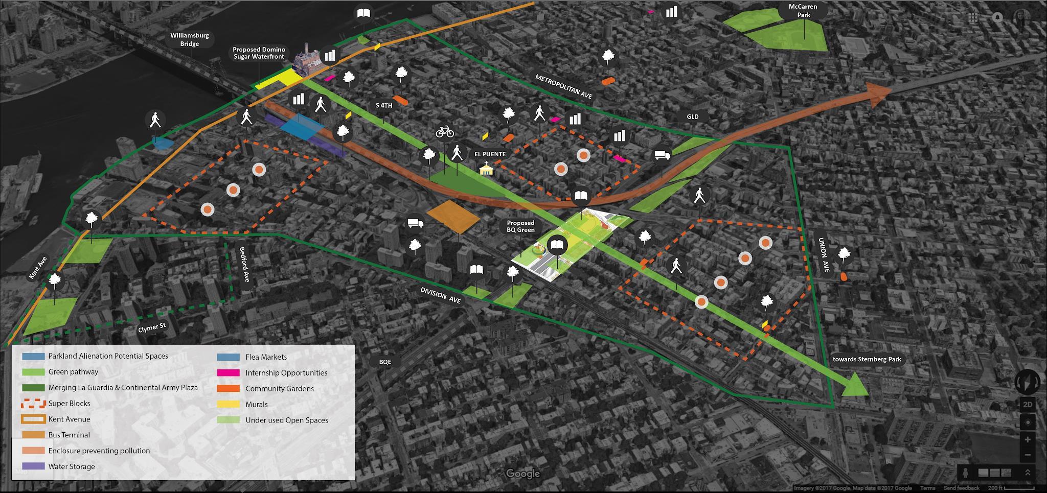
A combined overlay of the Green Light District Initiative, that includes all potential spaces of improvement and consideration //
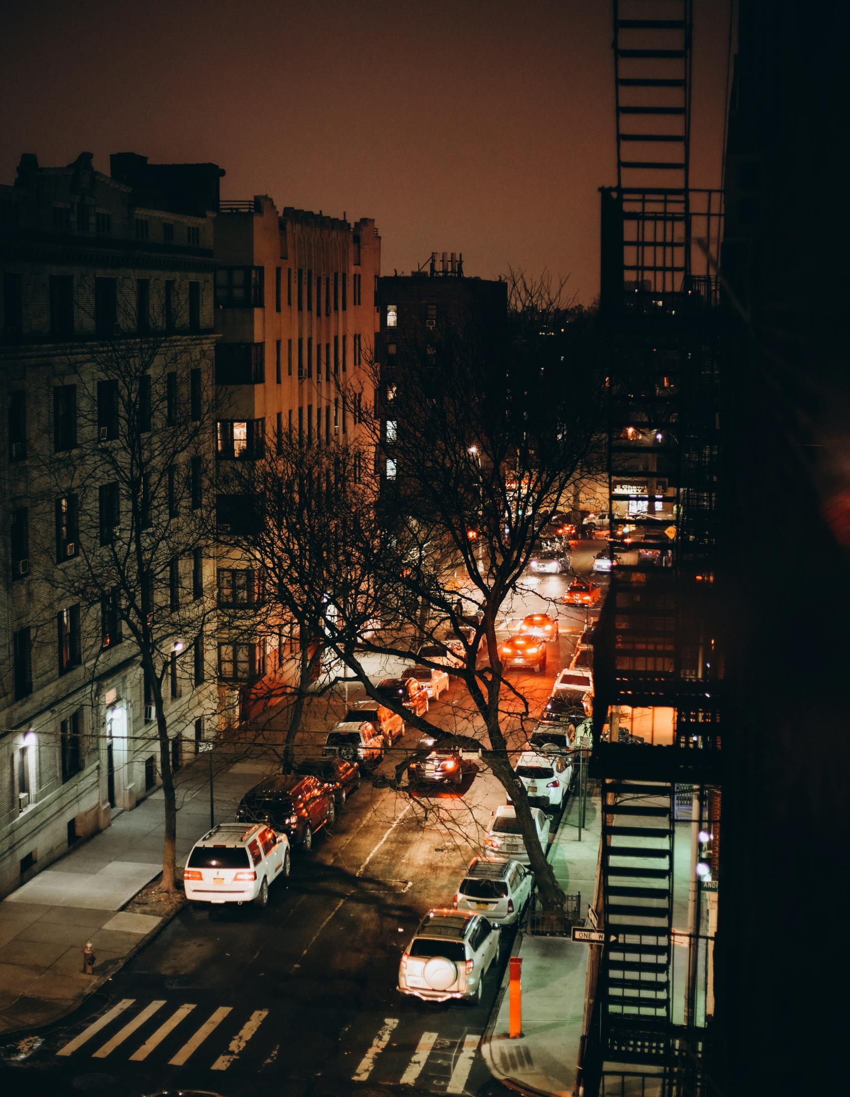
Sophiya Khan //
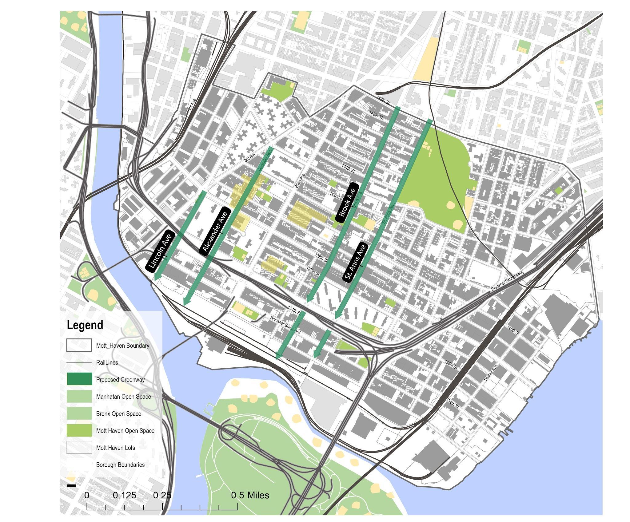
Mott Haven is located on the southernmost edge of the Bronx in New York City, bordering the Harlem River waterfront. This research defined the study area as encompassing both Mott Haven and its neighboring industrial district to the east, Port Morris. The East River serves as the study area’s eastern boundary, while the northern boundary falls on 149th Street, extending from one waterfront to the other.
. The neighborhood’s potential to provide safe and beautiful open spaces that would unlock health benefits for the community’s 53,000 residents1 has been unrealized for decades. A serious upgrade to the built
environment could result in significant improvements in health and well-being for these residents, who suffer from some of the poorest health outcomes in the United States.
This project aims to transform an underutilized community asset—the waterfront—by designing, building, and creating a new network of connected open spaces. This initiative will improve the quality of life and deliver measurable benefits for South Bronx residents.
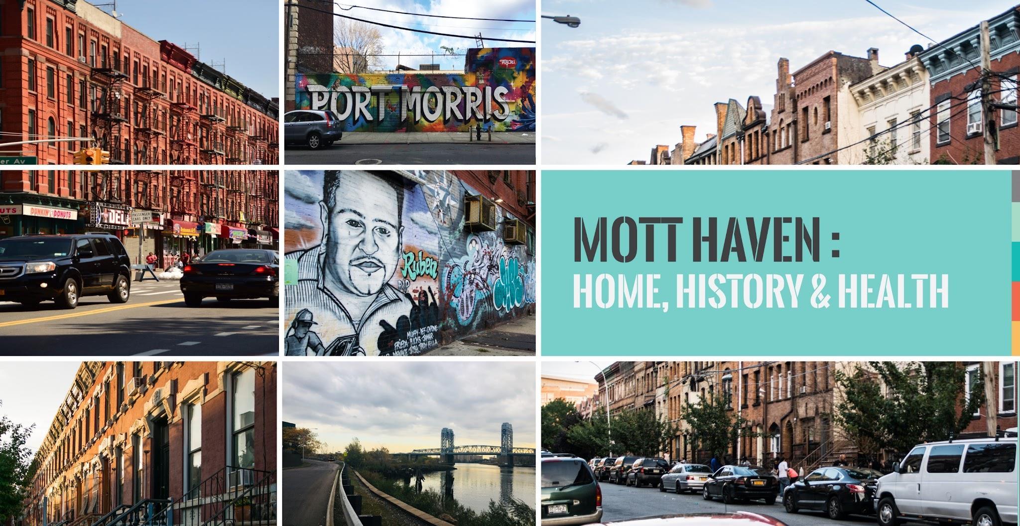
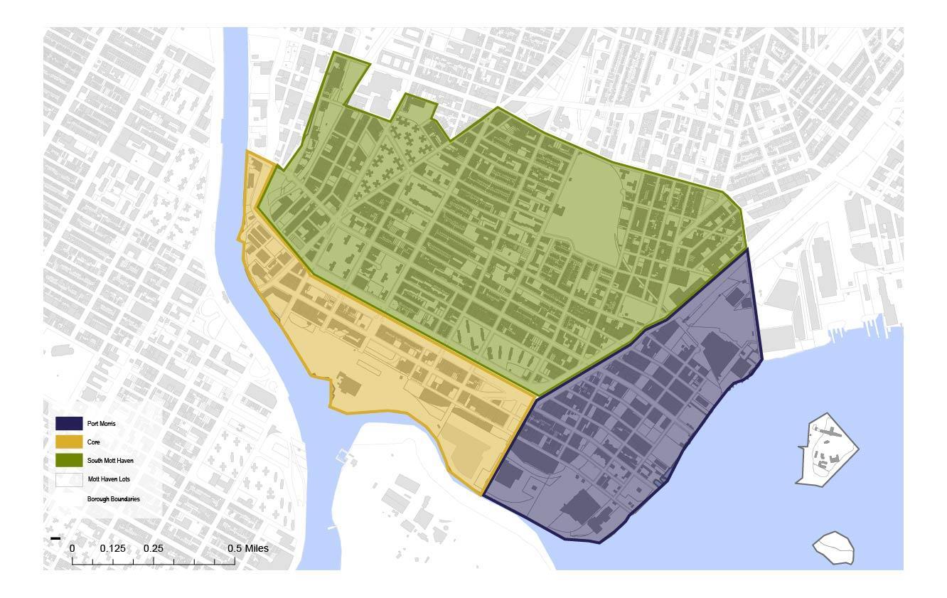
Decades of disruptive and fragmenting conditions have diminished Mott Haven’s ability to form a cohesive, healthy neighborhood.
Despite its strong, multicultural, and self-determined identity, the Mott Haven community actively battles with its physical environment, which creates pollution and disease in return for no benefit.
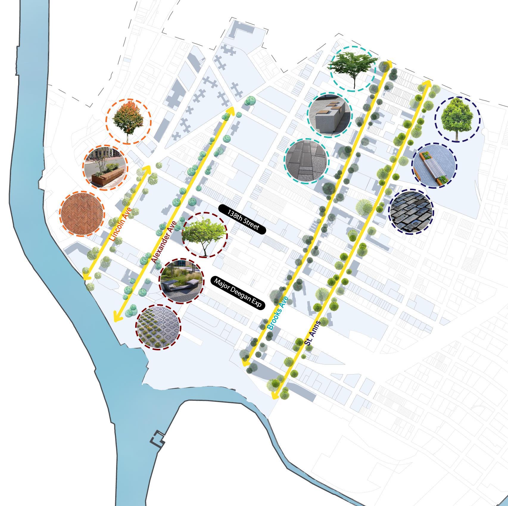
“ Design interventions along Lincoln, Alexander, St. Ann’s, and Brooks’ avenues are will draw residents from Mott Haven’s neighborhood “core.” If implemented, the changes on these streets, each of which connect directly to the waterfront, will form a cohesive network of connectivity throughout Mott Haven.”
The network will be comprised of inviting, “green” corridors with active streetscapes and proper infrastructure to promote safe, multimodal transportation, akin to greenways. In addition to promoting waterfront access and overall movement throughout the neighborhood, this recommendation’s focus on walkability, bike-ability, and green infrastructure will encourage healthy lifestyles and improve quality of life.
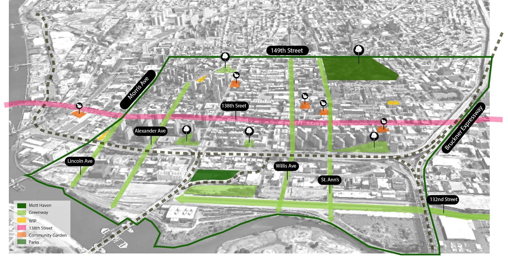
Map identifies potential corridors for landscape transformation, which will act as main axes connecting the Mott Haven core to the Waterfront.//
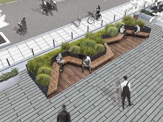
1. Creating a well-defined and unique greenway along Lincoln Ave, Alexander Ave, Brook Ave, and St. Anns Ave, each with its own character, landscaping style, outdoor furniture and parklets, making it easy to identify which street or avenue you are walking on.
2. Increased sidewalk and protected bike lanes: using lane control signs and flexible barriers.
3. Murals and art wall along the streets that depict the evolution and rich history of the Bronx.
4. Connect Greenways to neighborhood community gardens and NYCHA Open Spaces.
Top picture // “Caption here”
Bottom picture// “Caption here”
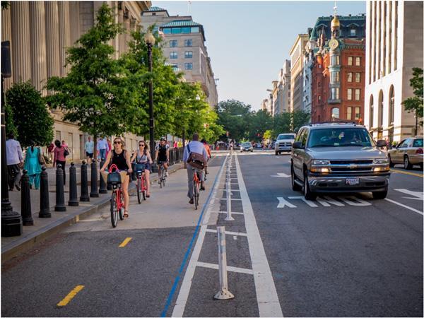
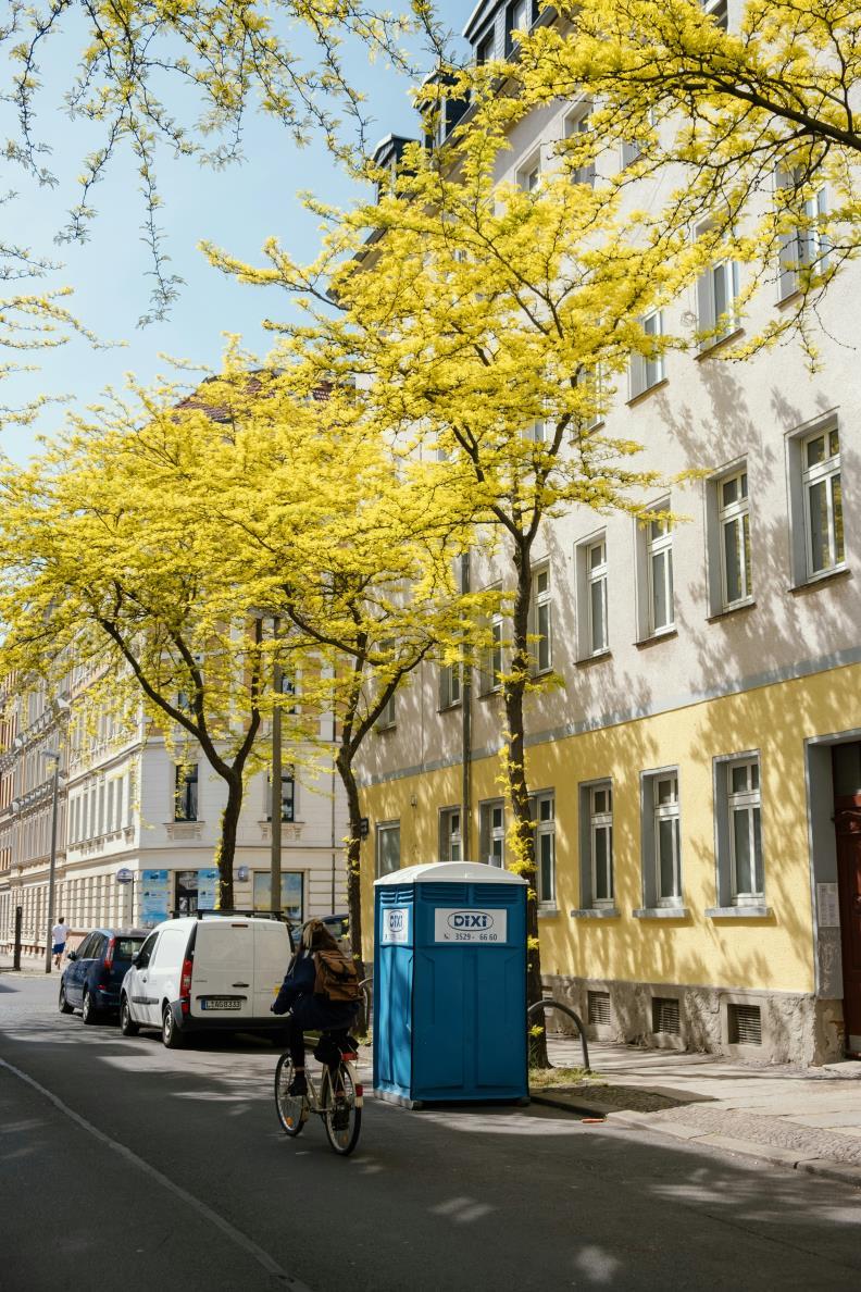
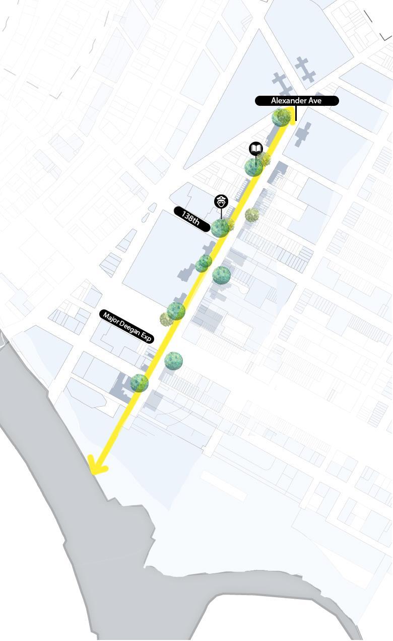
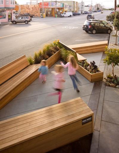
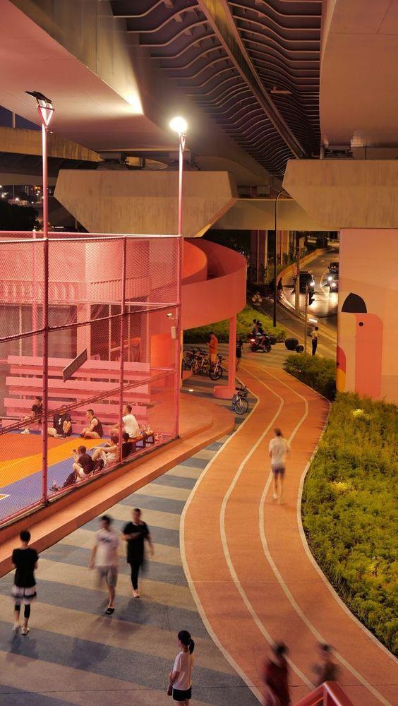
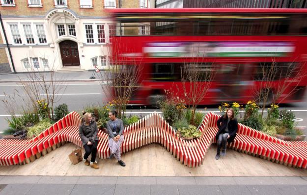
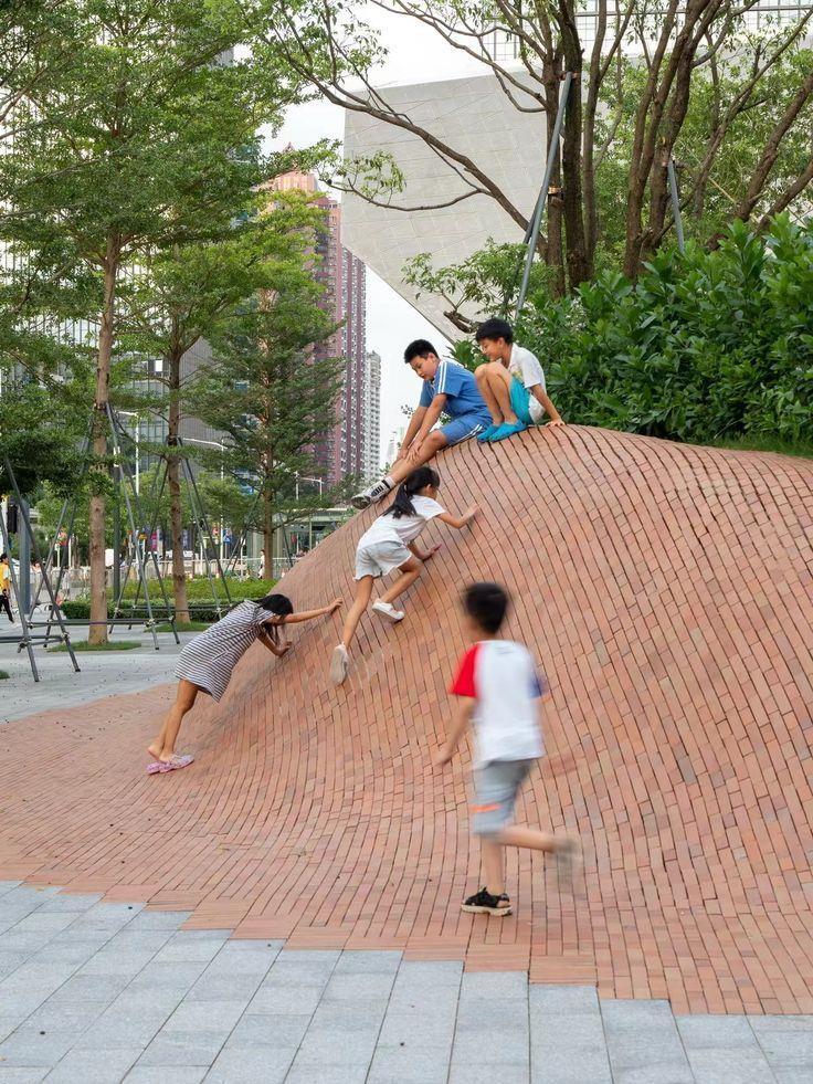
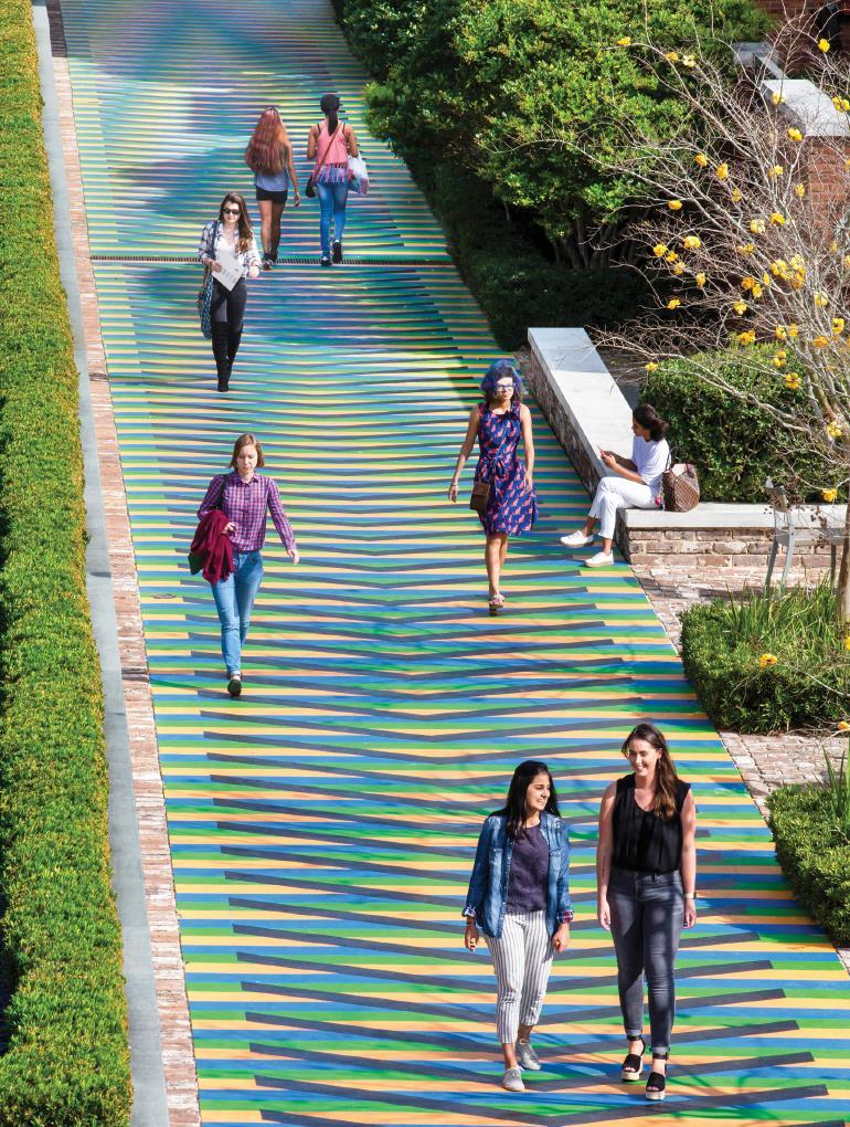
1. Lincoln Avenue: As showcased with terracotta clay tiles and trees that will eventually fade to Red giving the streets its unique characteristic
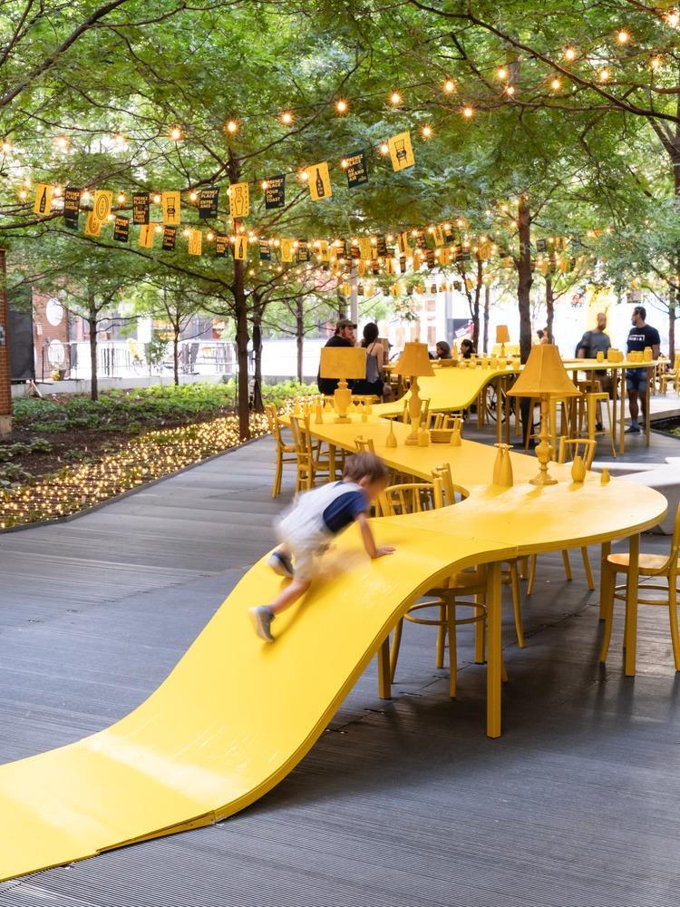
2. Alexander Ave. Shows kid friendly street furniture. Similar to other streets the foliage will eventually turn yellow and match the furniture.
3. Brooks Avenue: Fun, Vibrant and colorful, with Murals and art all along the streets
4. St. Anns: Safe for people with disability, Connect Greenways to neighborhood community gardens and NYCHA Open Spaces.

This is a live document and will keep updating. Thank you for taking the time to review it.