Value to the Nation


2024 Edition


From maintaining navigation corridors to reducing flood risk and protecting our environment, the U.S. Army Corps of Engineers (USACE) has provided solutions to some of our nation’s toughest challenges for nearly 250 years.
Aging infrastructure, climate change, and more frequent and powerful natural disasters make finding sustainable and innovative solutions to these tough challenges more difficult; however, these complexities are no match for our world-class organization.
Our research and development teams at the Engineer Research and Development Center (ERDC), the USACE Institute for Water Resources (IWR), and our districts and divisions are proactively developing advanced tools and techniques to address evolving Civil Works challenges and implement these innovations nationwide.
For example, we are using three-dimensional printing to fabricate infrastructure components, applying cutting-edge precipitation forecasts to better manage our reservoirs, and developing techniques to beneficially use the material we dredge from the nation’s waterways.
Additionally, we are studying transformative applications for next-generation technologies such as artificial intelligence and robotics to execute today’s mission and meet tomorrow’s demands with high-quality solutions, greater speed, and efficiency.
Our Engineering with Nature® initiative is helping us harness the value of nature as we integrate natural and engineering processes for sustainable infrastructure.
This past year, Lt. Gen. Scott Spellmon, the 55th Chief of Engineers and the USACE Commanding General, prioritized research and development within USACE to better align our efforts with the nation’s most pressing needs.
This year’s Value to the Nation contains just a few examples of the innovative research we are conducting across our six Civil Works Strategic Focus Areas. The focus areas are infrastructure; water modeling; crisis preparedness; artificial intelligence, robotics, and data; ecosystems; and sediment management.
The historic support we have received from the Administration and Congress both validate our past successes and emphasize the importance of the mission before us.
As leaders in research and development, our staff is working hard to address various water resource challenges that support economic sustainability, environmental stewardship, and societal well-being.
While the challenges are complex, we are confident we can solve them as we work together with our partners from across government, academia, and industry to safely deliver high-quality products, on time and within budget, for the nation.
Essayons! Building Strong! Army Strong!
WILLIAM H. GRAHAM JR. Major General, U.S. Army Deputy Commanding General for Civil and Emergency Operations
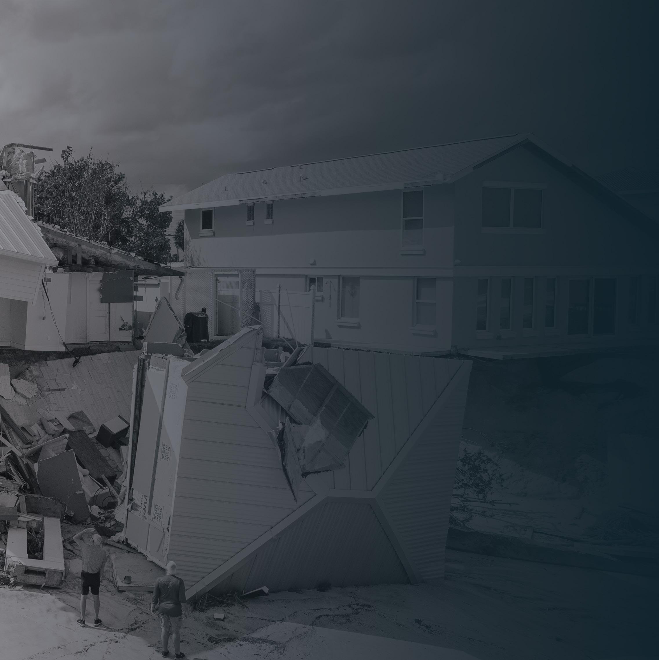
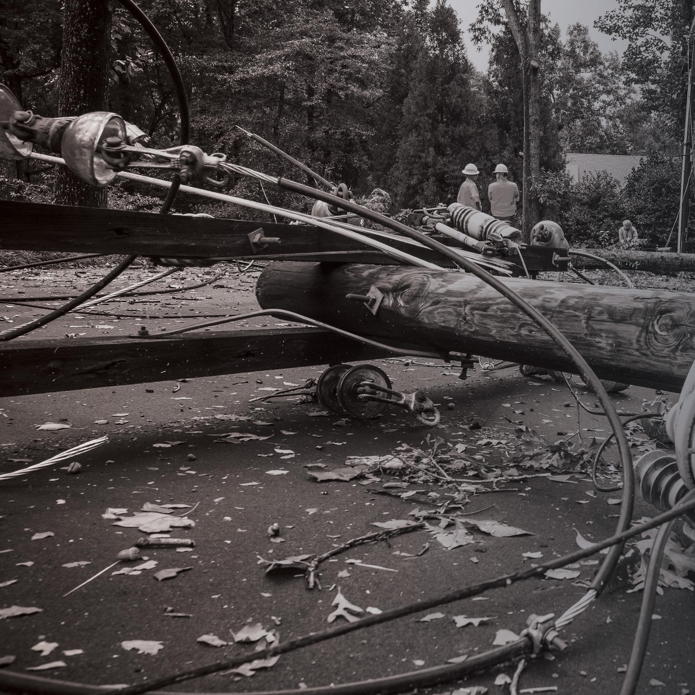
INFRASTRUCTURE: Years of deferred construction and maintenance have created backlogs approaching $200 billion. Maintaining and replacing aging infrastructure requires transformative technologies that enable more cost-effective, resilient and reliable solutions within a changing climate, including ultra-durable and rapid construction materials and processes, models that predict performance and optimize maintenance, and autonomous inspection techniques.

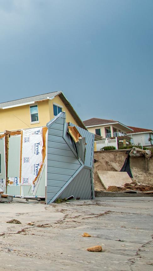
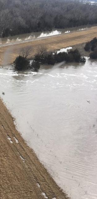
WATER MODELING: The cost of U.S. inland and coastal flood damage has increased 10fold over the past 40 years, from $5 billion to $50 billion annually. To most effectively manage this growing risk within a changing climate, USACE needs a common operating framework that evaluates comprehensive flood hazards on a continental scale. This framework will incorporate next-generation remote and space-based observations; advanced numerical modeling methods that analyze the interaction of atmospheric, inland and coastal processes; and the ability to integrate simulation and observation data using machine learning and artificial intelligence. This framework can evaluate lifecycle performance of water resource systems, including nature-based features and traditional infrastructure solutions, and improve arid region forecasting and post-crisis impacts.

CRISIS PREPAREDNESS: As natural and man-made hazards continue to grow, planners need proactive tools to evaluate how infrastructure will perform during extreme conditions, to understand compound threats, and to identify vulnerabilities and potential cascading failures. Meanwhile, first responders and emergency managers need artificial intelligence capabilities to rapidly collect and analyze data from multiple sources to support decisions. Frameworks must allow for greater integration of data and broad communication across agencies and partners with advanced mobile reconnaissance solutions and supply chain logistics.

AI, ROBOTICS & DATA: Solving the most complex Civil Works problems requires leapahead capabilities, such as machine learning and artificial intelligence, to enable rapid risk-informed decision making. This area will combine sensor data with big data analytics, integrate disparate models, and enable trade-space analytics to optimize designs and operations. The result will be a dashboard to evaluate impacts of alternatives, and a “systems-of-systems” approach to evaluate benefits across USACE’s complex water resource missions.

: USACE spends approximately $500 million each year on aquatic ecosystem restoration, and approximately $400 million each year to manage invasive and nuisance species, such as Harmful Algal Blooms and invasive carp, and foster endangered species, such as the Interior Least Tern and Pallid Sturgeon. Advanced technologies and strategies are needed to prevent, detect and manage ecosystem health to promote environmental sustainability. Applying technologies such as sensors, unmanned aerial systems, data analytics and modeling tools, while also prioritizing interagency collaboration, can enable improved stewardship of local ecosystems.

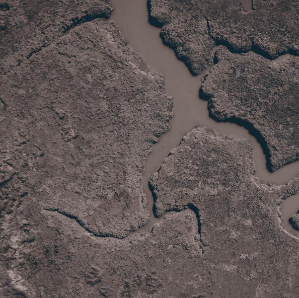
: Leap-ahead construction and operation technologies are needed to reduce USACE dredging costs that currently exceed $1 billion annually, and enhance environmental sustainability through strategic placement of dredged sediments. Next-generation sensors, advanced modeling and increased public-private partnerships carry the potential to spark greater efficiencies. Meanwhile, dredged sediment must be strategically placed using Engineering With Nature® principles to deliver environmental and social benefits toward sustainability, such as healthier wetlands, flood-risk reduction, and more sustainable river and coastal shorelines and habitats. Partnering is essential to achieve these goals.

USACE EMPOWERS INFRASTRUCTURE MANAGEMENT THROUGH TRANSFORMATIVE TECHNOLOGIES, ENSURING COST-EFFECTIVE, RESILIENT AND CLIMATE-ADAPTIVE MAINTENANCE AND REPLACEMENT OF AGING STRUCTURES.
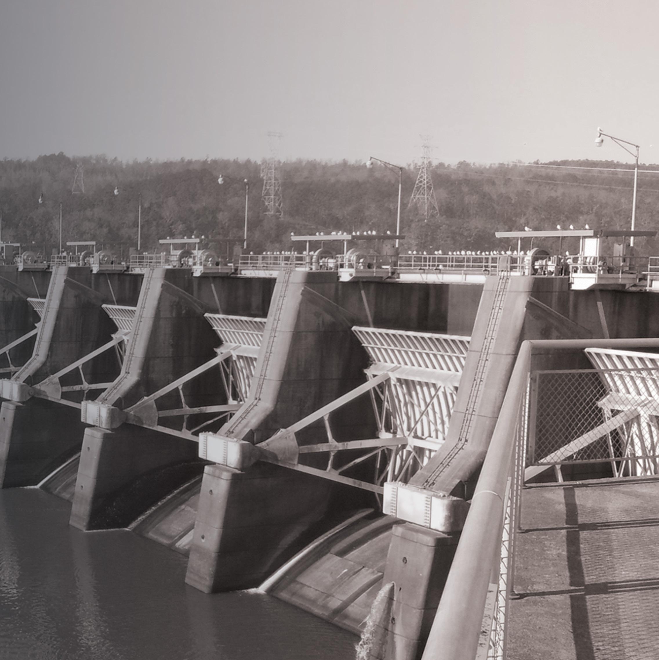
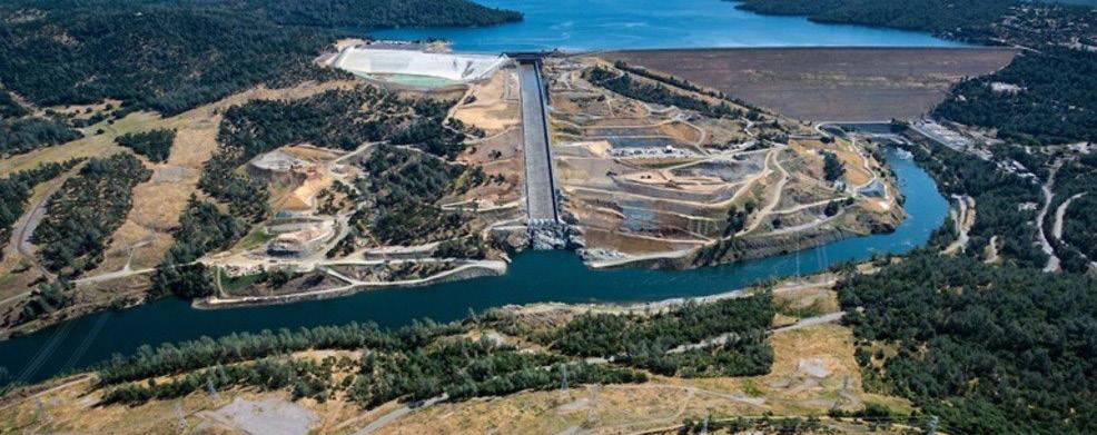
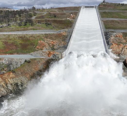
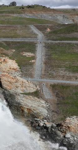
Approximately 70% of all flood risk management (FRM) dams have reached or exceeded their designed service lives, and 35% are in poor or unsatisfactory condition, making it imperative to understand the risk due to component failure within those facilities. Having reliable risk data enables decision makers to identify facilities with the highest risk and allocate resources accordingly.
USACE R&D has developed a novel methodology that generates the probability and potential consequence of a system’s failure based on the state of its components and the associated FRM watershed. This approach incorporates the condition of individual components and accounts for the reality that FRM dams operate as part of a watershed to mitigate flood risk.
Data generated better informs infrastructure investment and could result in millions of dollars in maintenance funds reallocated annually to the highest risk facilities. The riskbased prioritization framework could impact dam assessments, preventative maintenance schedules and work package development and prioritization.
USACE operates, maintains and manages more than 700 dams and 4,000 miles of levees. To track the condition of this network in a way that maps to infrastructure investments, USACE developed the Operational Condition Assessment (OCA) system. As part of OCA, components at each facility are assessed at a minimum of every five years. USACE conducts OCAs that are not informed by any comprehensive risk assessment. High-risk failures could be prevented through more frequent OCAs, preventative maintenance or some other intervening action.
A risk-based prioritization framework provides a robust approach to accommodate a range of facility types and system configurations, while providing feasibility for implementation at scale, given the large number of facilities and components.
MILLIONS IN MAINTENANCE FUNDS COULD BE REALLOCATED TO FACILITIES WITH A HIGHER RISK
USACE is challenged with maintaining and managing aging civil works infrastructure to serve the critical needs of navigation and flood risk management. As the supply of aging infrastructure components decreases, the importance of expedient and cost-effective methods for manufacturing replacement components increases.
Historically, components are manufactured using casting or forging, depending on the part. These methods can be effective for large quantities of parts but suffer from long lead times when manufacturing in small quantities. Improvements in large format additive manufacturing have developed the capability to allow a technology originally designed for small complex components to be used for large metal infrastructure parts with cost-effective deposition rates. By leveraging arc-directed energy deposition and additive friction stir deposition, critical components can be manufactured faster than using traditional manufacturing means, reducing the time required to return a structure to operation.
THE USE OF LARGE FORMAT ADDITIVE MANUFACTURING CAN ACCELERATE MANUFACTURING OF CRITICAL INFRASTRUCTURE COMPONENTS BY 10 TIMES
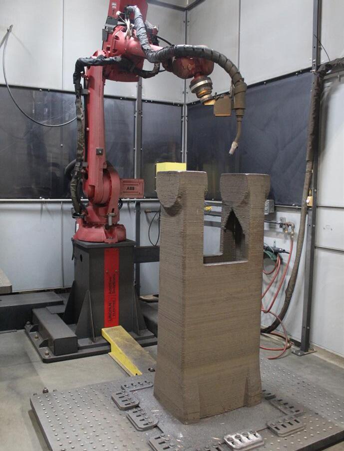
Supply for replacement Civil Works infrastructure components can be costly and time-consuming to acquire due to non-existent or damaged molds and tooling for traditional manufacturing techniques. Failure of critical infrastructure components can be costly and lead to extended structure down time.
USACE is leveraging large format additive manufacturing technologies to address current supply needs. These technologies are being used to fabricate unique vintage components in critical mechanical and structural systems for Civil Works projects.
Leveraging large format additive manufacturing technologies can accelerate manufacturing time for critical components by 10 times over traditional manufacturing. The technology is also suited to modernize component design and materials used for fabrication. This technology can also be pushed to forward-manufacturing capabilities to support rapid response replacement parts.
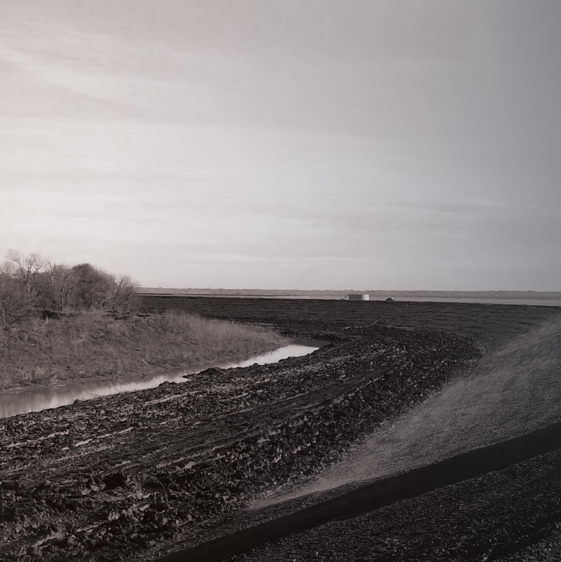
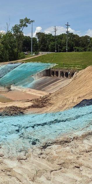
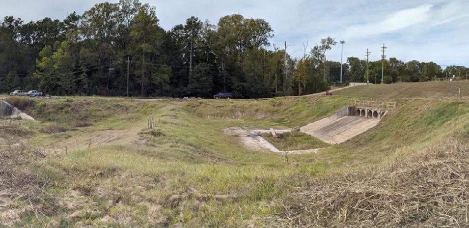
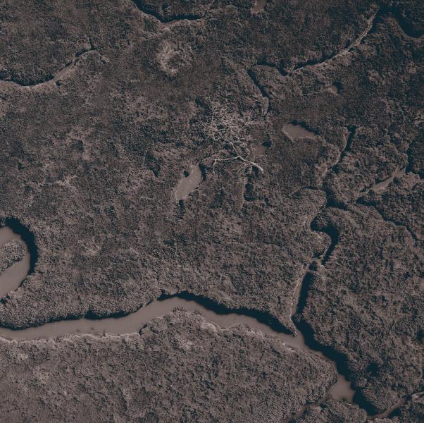
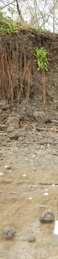
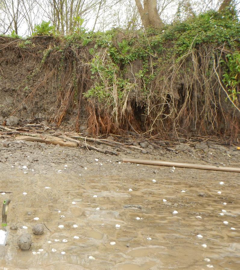
Levees and embankment dams are constructed with local materials, which are not usually suited for long-term performance. Biopolymers, natural polymers produced by the cells of living organisms,are being investigated as a nature-based solution applied to embankment soils for improved stability, erosion and drought resistance.
USACE is performing laboratory and field testing to define the best uses of biopolymers as soil additives. Potential benefits of this research include a cost-effective and natural soil additive to improve slope stability, vegetation drought resistance, plant root density, erosion resistance and soil retention.
There are nearly 7,000 levee systems in the U.S., with an average age of 59 years. Current methods to remediate these embankments include the use of lime and cement. Biopolymers provide an environmentally friendly alternative that can help mitigate risk and ensure robust flood control embankments.
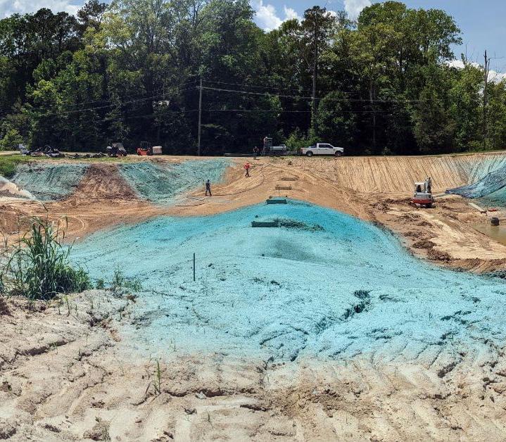
FRIENDLY OPTION TO STRENGTHEN LEVEES AND EMBANKMENT DAMS
Earthen embankments such as levees or dams are often constructed using soils available in alluvial valleys which are not well suited for long-term use. There may be trouble keeping the slopes vegetated with grasses, leading to surface erosion and increased weathering, as well as subsequent changes in the soil fabric and a decrease in shear strength. A decrease in shear strength causes instabilities or slides that, if left unrepaired, can lead to larger failures.
If proper vegetation or armoring is lacking at the embankment toe, slope failures can occur, decreasing the ability of the embankment to withstand flood loadings.
Slopes designed to use vegetation as erosion control, as opposed to other methods such as riprap armoring or cement treatment, are cost-prohibitive. Petroleum-based polymer treatments have been used for erosion control, but often leach toxic products into the soil.
The use of biopolymers to rapidly vegetate slopes and increase root density, as well as increase the shear strength of soils, has the potential to drastically improve stability and resistance against surface erosion.
USACE IS ADDRESSING INCREASING COSTS OF U.S. INLAND AND COASTAL FLOOD DAMAGE THROUGH R&D INNOVATIONS THAT PROVIDE ADVANCED TECHNOLOGIES EMBEDDED IN A COMPREHENSIVE FRAMEWORK TO REDUCE WATER RESOURCE RISKS AND BUILD RESILIENCE.
Since 2014, USACE has participated in a multi-agency, multi-disciplinary R&D effort to investigate how modern observation and prediction technology can provide water managers more time to make decisions about selectively retaining or releasing water from reservoirs based on longer-term forecasts. This effort, called Forecast-Informed Reservoir Operations (FIRO), began with a single pilot reservoir, Lake Mendocino in northern California. This initial FIRO investigation – or Phase I –was carried out over five years and concluded successfully in 2021 after demonstrating substantial benefits in a severe drought year by increasing water availability for the dry summer by 20%.
Over the next five years, in Phase II, additional pilot reservoirs were added, and a screening process was developed. USACE has now embarked on Phase III, the Nationwide Expansion Pathfinder. This effort will employ the viability assessment process at additional sites across the country, including systems of dams, and apply the screening process to USACE’s entire dam portfolio.

IN 2023, FIRO ALLOWED WATER MANAGERS THE FLEXIBILITY TO SAVE ENOUGH WATER TO SUPPLY 60,000 HOMES BETWEEN TWO RESERVOIRS IN A SINGLE WATERSHED, WHILE PREVENTING FLOODING IN A RECORD-SETTING WET YEAR

Challenges posed by frequent and intense weather extremes, such as prolonged droughts broken by record-breaking precipitation, require that existing water resources infrastructure be more adaptive in reducing flood risk, while also providing increased flexibility to improve water availability during intense droughts.
USACE is pursuing FIRO to build resilience to climate extremes. FIRO uses advanced precipitation and runoff forecasts to release water in advance of storms or, when no major storms are predicted, store more water to buffer against possible drought. This technique increases the flexibility to reduce flood risk and improve water availability. FIRO also conducts significant research efforts to increase forecast skill, enabling greater FIRO benefits.
Since 2019, FIRO pilots have realized increased water availability of 20% in drought years, providing available water for thousands of homes, while also improving flood risk management in record-setting wet years. Screening for FIRO suitability at all USACE dams and applying FIRO to additional sites nationwide will increase the climate resilience of USACE water resources infrastructure.
Current Coastal Storm Risk Management (CSRM) feasibility study planning models are used to justify billions of dollars of investment into coastal protective measures. These tools require intensive involvement by a multi-disciplinary team with repeated effort over the course of a study. Teams are under increasing pressure to adhere to Specific, Measurable, Attainable, Risk Informed, Timley (SMART) planning requirements ($3 million over three years) and evolving guidance that legacy tools were not intended to address.
USACE R&D and district practitioners are developing a new toolsuite to replace legacy models used in CSRM feasibility studies. The new toolsuite will provide improved capability, accuracy and user experience and is targeted for deployment within the Civil Works Business Intelligence cloud-based infrastructure. Cloud deployment allows seamless implementation of future models within existing workflows.
The Coastal Hazards Analysis and Risk Toolkit (CHART) will help justify USACE investment through its application on CSRM feasibility studies and subsequent designs. This framework has the capacity to support design of environmental restoration projects exposed to coastal hazards. CHART will reduce data preparation and analysis efforts on studies and improve accuracy, transparency and confidence in results.
INVESTMENT OF $6.5M OVER FIVE YEARS WILL RESULT IN PROBABLISTIC LIFECYCLE ANALYSIS ADVANCEMENTS WITH THE ABILITY TO REDUCE FEASIBILITY STUDY COSTS BY $5M PER YEAR
Coastal areas around the world are at an increased risk of storm damage and flooding due to rising sea levels, climate change and precipitation changes. The impact of multiple hazards requires the evaluation of compound flooding scenarios that current tools are incapable of addressing.
Existing models fail to take advantage of precomputed nationally consistent hazard datasets developed in regional studies (e.g., Coastal Hazards System), cutting-edge planning and design computation tools developed over the last decade (e.g., StormSim) and access to increased computational power.
Development of the nextgeneration Probablistic Lifecycle Analysis (PLCA) toolsuite is critical for maintaining engineering and economic fidelity and meeting tight timelines in Coastal Storm Risk Management feasibility studies. Additionally, a modulebased workflow approach allows greater transparency of intramodel interactions and error tracing, and improves the ability to adopt newly released tools.
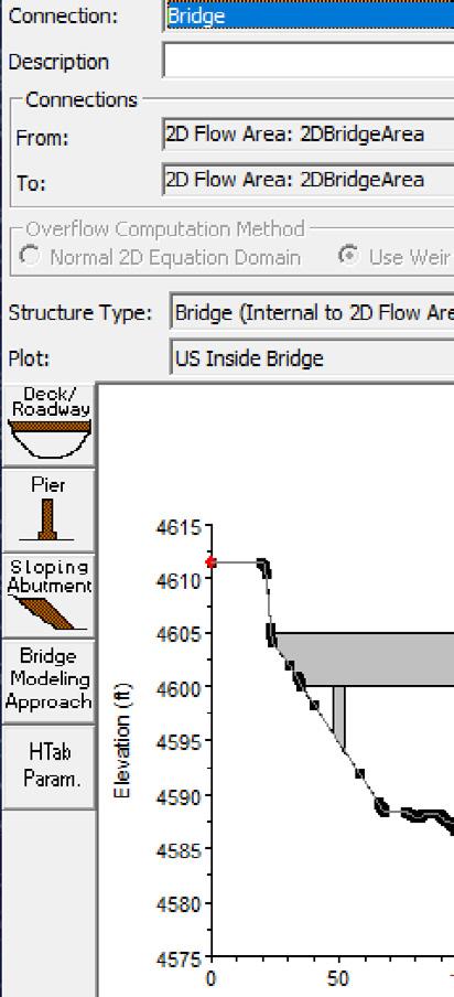
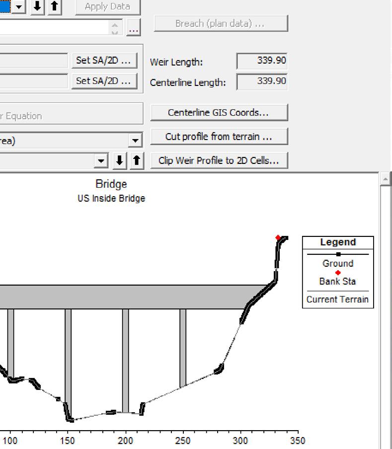
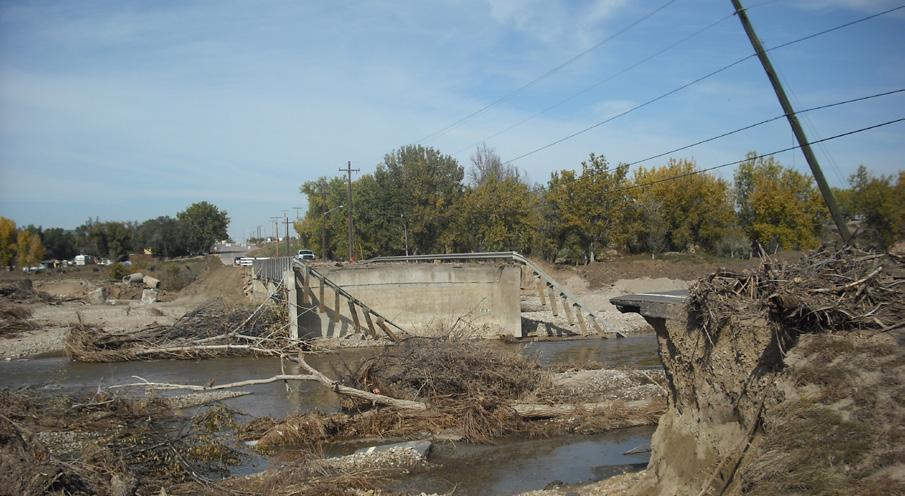
The USACE Hydrologic Engineering Center River Analysis System (HEC-RAS) 2D models are widely used by USACE and other federal and private agencies across the globe in real-world projects frequently involving bridges.
A current effort is focused on advancing tools to better simulate flow at bridges in diverse conditions, including low to pressure flow, submerged scenarios and overtopping. The main outcome is a sophisticated 2D flow solver that meticulously simulates pressurized flow beneath the bridge, depth-averaged flow, and weir flow over and off the bridge deck. In addition, a simplified 2D approach has been developed that provides versatile modeling options.
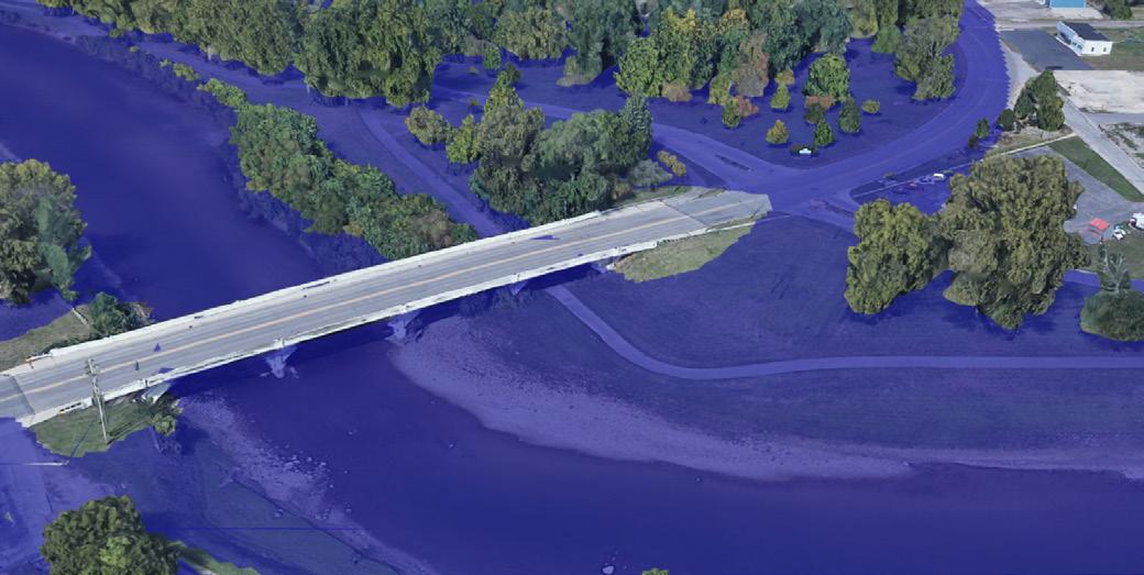
This research is crucial for enhancing hydraulic modeling capabilities tailored to bridge complexities. The 2D flow solver offers a detailed representation of bridge hydraulics. The simplified 2D approach increases modeling versatility, addressing diverse project needs. This work significantly advances hydraulic modeling, providing essential tools for engineers globally engaged in designing, analyzing and managing infrastructure projects with bridges.
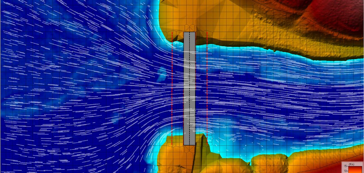


The integration of 1D hydraulics into 2D HEC-RAS modeling for computing hydraulic properties at bridges presents accuracy deficiencies and slow simulations, as well as modeling limitations.


USACE has devised an innovative computational method to address shallow water equations at bridges. This approach employs distinct 2D meshes below and above the bridge, enabling comprehensive flow condition simulation. Applicable to diverse scenarios, the hydraulic model undergoes rigorous verification with analytical datasets and validation with both laboratory and field datasets. Additionally, a streamlined 2D bridge approach has been integrated for enhanced efficiency.
This research enhances hydraulic model development, accuracy and computational efficiency. Resulting products will find widespread application across all USACE district and division offices and among USACE partners using HEC-RAS. Given the widespread use of HEC-RAS, this research will elevate the effectiveness and precision of hydraulic modeling practices on a broad scale.

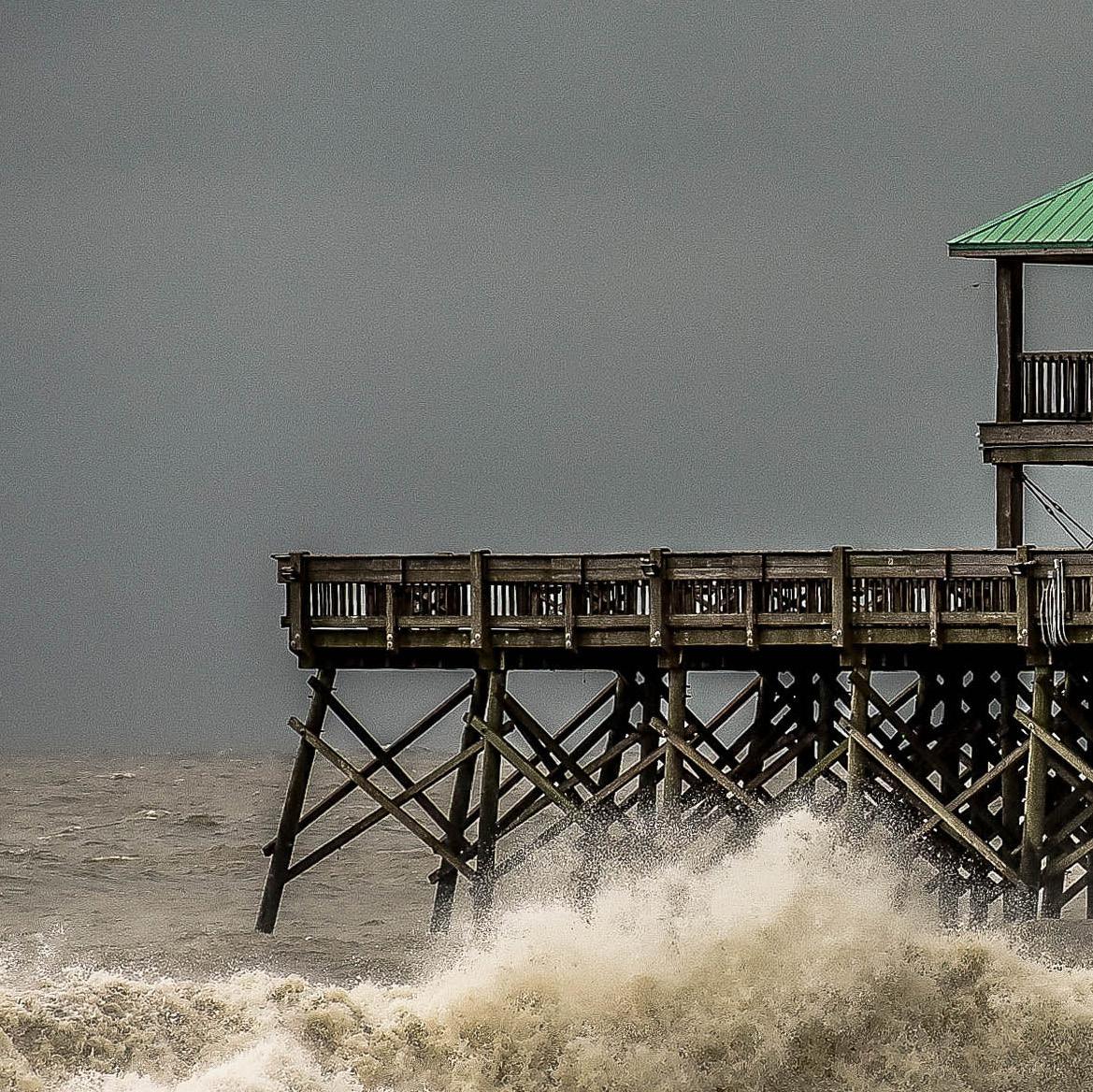
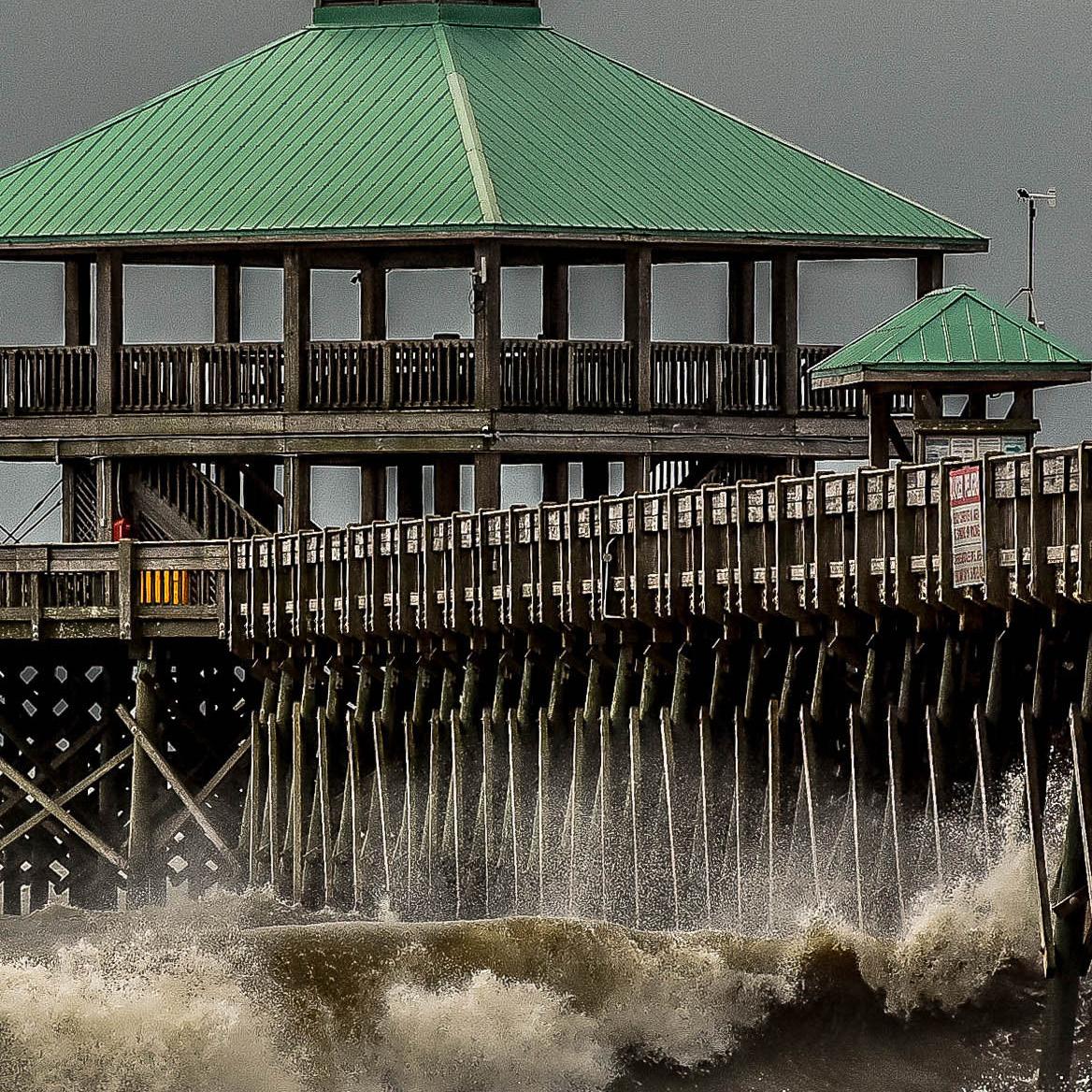
ADDRESSING INCREASING NATURAL AND MAN-MADE HAZARDS, CIVIL WORKS R&D EMPHASIZES PROACTIVE TOOLS, ARTIFICIAL INTELLIGENCE, AND ENHANCED COMMUNICATION FOR ROBUST CRISIS PREPAREDNESS AND RESPONSE CAPABILITIES.

USACE operational projects are often reliant upon services from the local community, such as power, internet, potable water, sanitation and bridges. Disruptions to these services may threaten the USACE mission. However, region-wide risk and resilience analyses showing the impacts on the interdependent infrastructure are not being widely performed.
A tool to simulate disruptions across a constructed network will enable a watershed-wide analysis of critical infrastructure, potential disruptions and cascading effects that impact infrastructure.
Identifying potential disruptions will help USACE and local communities focus on resilience and mitigation. This will also result in significant cost savings to USACE infrastructure and reduce both the frequency of failures and time to recovery during major disruption events.
FOR EVERY $1 SPENT ON
SAVE $5 TO $7 IN DISASTER RESPONSE AND RECOVERY
The resilience of the nation’s 91,000 dams, including those owned and operated by USACE, often depends on critical functions and infrastructure managed by local communities, such as power, water, internet or access provided by community-maintained infrastructure such as bridges and roads.
Over the last 20 years, the number of dams with high-hazard potential has more than doubled. Managing risk in the dam sector also depends on the resilience of critical functions across many other sectors. For example, more than 5% of the 617,000 U.S. bridges are structurally deficient, with the overall maintenance backlog for this infrastructure sector estimated at more than $125 billion.
In the past, there have been minimal applications of standardized models, tools or efforts integrated into the USACE operations process to analyze this interconnection. USACE R&D has established the Resilience Matrix, a framework that incorporates physical, information, cognitive and social network domains. The framework provides emergency managers and operations project managers a common operating picture of infrastructure interdependencies to better inform resilience investments across the watershed.
Wildland fire intensity and frequency is increasing across the U.S. due to weather extremes, climate change and human development. This threat is compounded by lesser-known post-fire risks, which increase exponentially due to ecological and hydrologic changes. Post-fire flood and debris flow events can exceed 800 times the magnitude of pre-fire floods.
Limited understanding of post-fire flood risk impacts the USACE Flood Risk Management mission and water resource infrastructure, and leaves fire-impacted communities particularly vulnerable. USACE needs fast and reliable methods to assess wildfire impact on flood risk management. This includes quantitative approaches to predict streamflow and sediment runoff changes for planning and designing flood control measures, as well as qualitative approaches to assess information needs of water management and emergency response operators to improve decision making.
USACE researchers developed new modeling and decision-support approaches to predict highrisk areas accurately and rapidly for deadly post-fire flood and debris flow events. By incorporating non-Newtonian physics into existing USACE models, modeling efforts have dramatically improved our ability to estimate post-fire flood risks. Development of decision support tools using these models enables practitioners to protect lives, critical infrastructure and property.
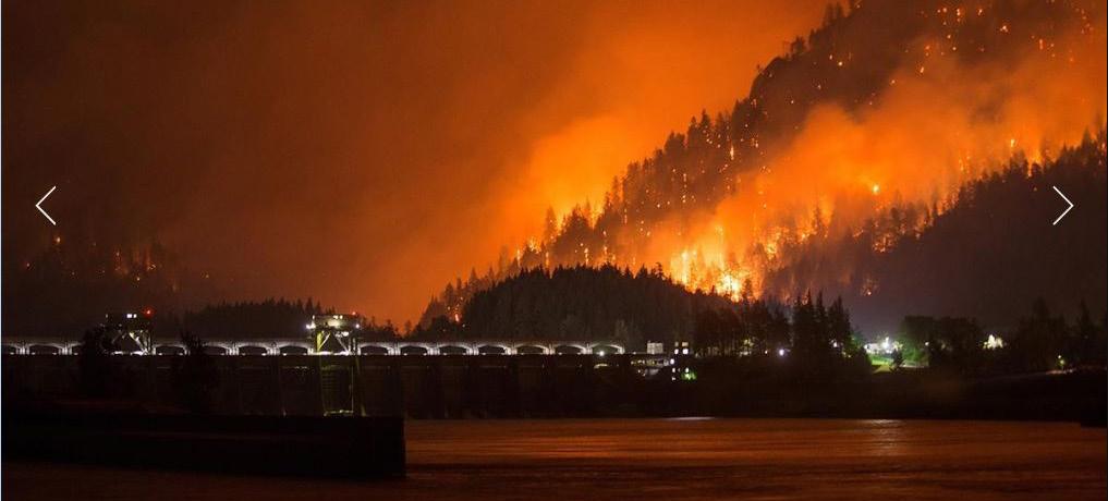
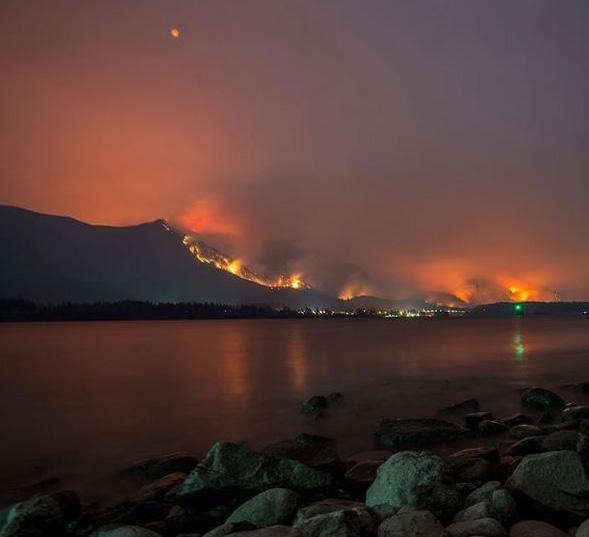


More than 59,000 wildfires burned more than 29-million acres across the U.S. between 2019 and 2022. The risk of flooding and debris flow increase exponentially after a wildfire, and these risks can last up to decades in some regions. Previous methodologies lacked rapid and dynamic risk and decision support capabilities, complicating operational decision making and leaving fire-torn communities vulnerable to flooding and post-fire recovery.
USACE R&D continues to develop new modeling techniques and decision-support tools to accurately predict areas vulnerable to flooding and debris flows. Modeling approaches include the ability to forecast such risks during active wildfires and to simulate potential future fires, giving planners, operators and emergency responders critical information to mitigate increased risks and rapidly identify vulnerable populations.
USACE R&D has worked with roughly 50 communities and tribal nations to help identify regions most vulnerable to postwildfire impacts and to reduce uncertainty in planning and managing emergency response and recovery. These modeling and decision-support tools can provide near real-time support for water management and evacuations, saving lives, protecting infrastructure and property, and mitigating flood and debris flow impacts.
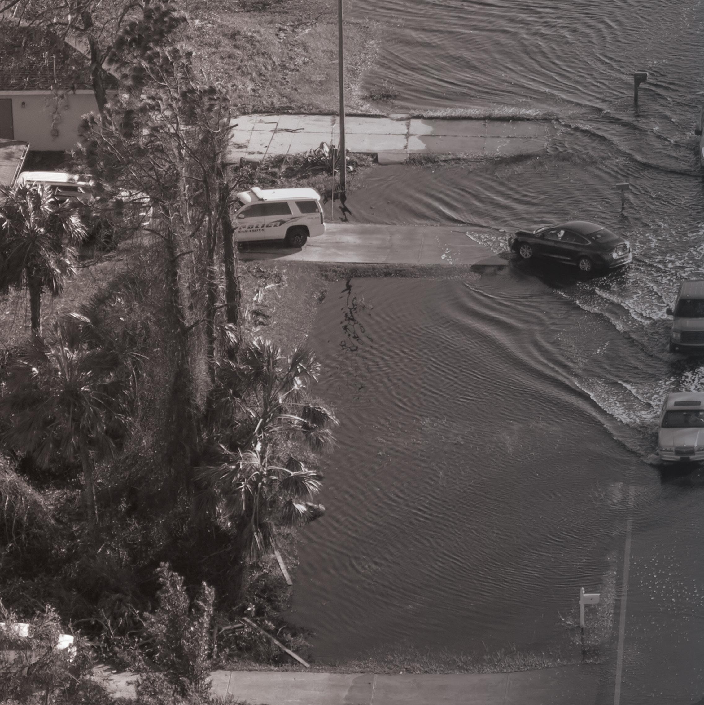
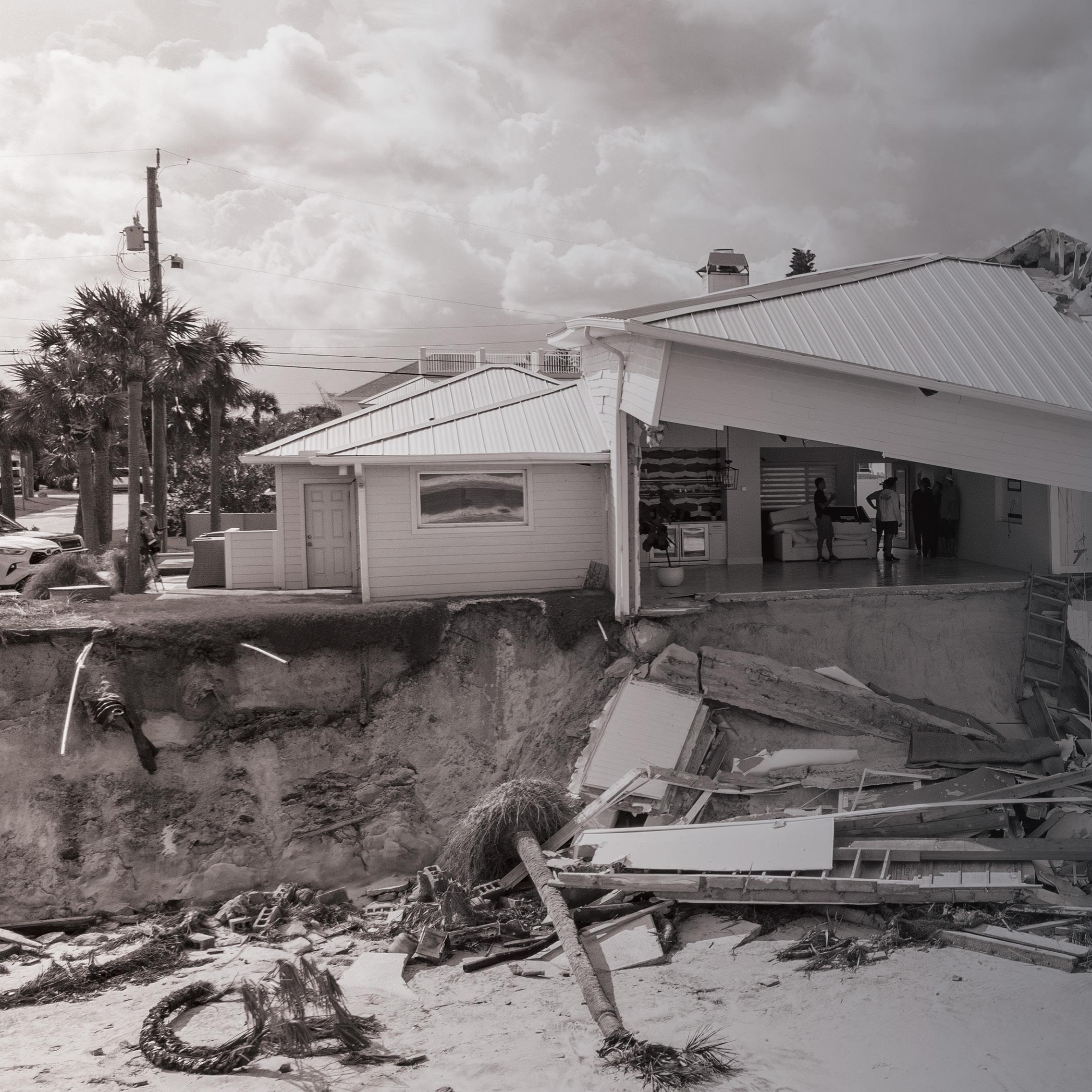
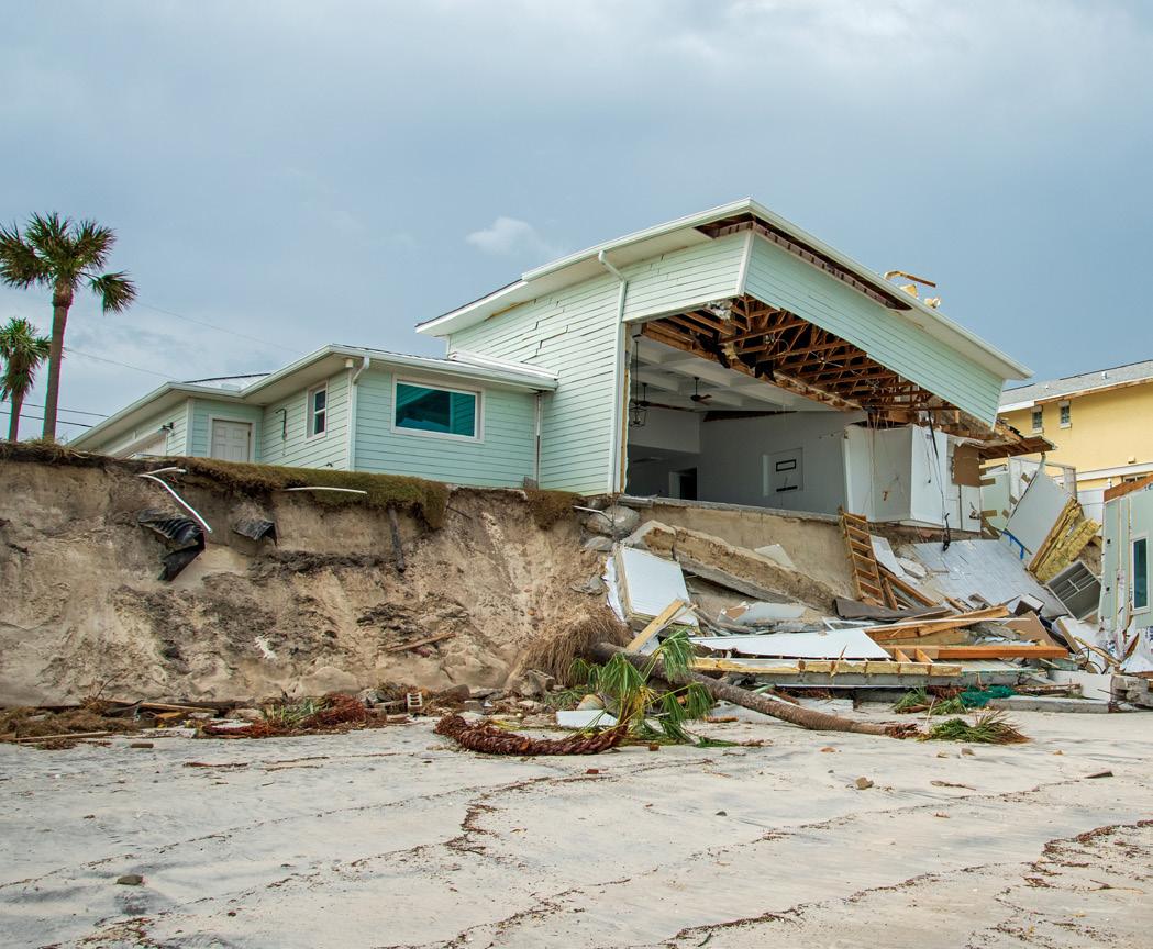
When a hurricane strikes a community already experiencing a disruption from an unrelated threat, such as a pandemic, or when multiple hurricanerelated threats coincide, such as flooding and infrastructure failure, siloed emergency management approaches are inadequate. Because the low probability of compounding events makes for scarce reliable historical data, advanced modeling techniques are needed to explore potential impacts and plan accordingly.
USACE R&D is developing modeling techniques to predict the influence of public messaging on population dynamics, allowing for more efficient evacuation and allocation of scarce resources during a disaster. R&D is also modeling the confluence of flooding and transportation infrastructure damage to better understand the compound impact on critical facility accessibility.

The capabilities being developed by USACE R&D will provide emergency managers with better tools for hurricane planning and response. Improved population dynamic predictions will provide more reliable projections of shelter resource needs, and transportation modeling will allow more accurate projections for targeted repairs during and after an event to maintain accessibility of critical facilities.
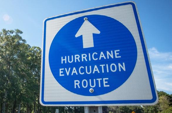
ADVANCED DECISIONMAKING TOOLS FOR HURRICANE EVACUATION PLANNING AND RESPONSE

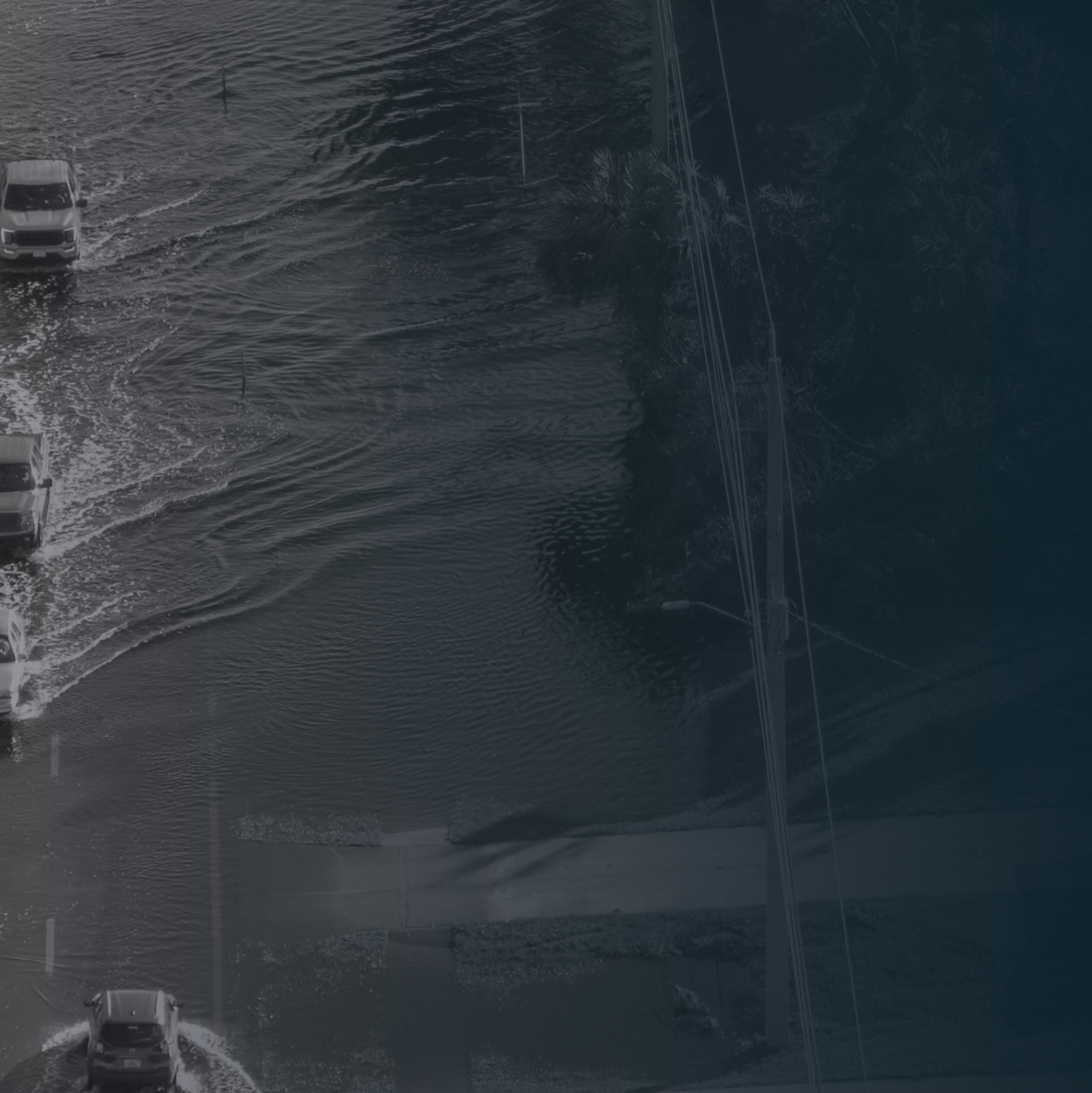
Hurricane evacuation safety, effectiveness and efficiency are driven by complex interactions among multiple stakeholders and interdependent infrastructure networks. The conventional approach to planning for hurricane evacuations addresses the problem in a vacuum, ignoring the potential for compounding threats. The need to expand this perspective is highlighted by past experiences with hurricane-concurrent disturbances, such as a major roadway disruption or a pandemic which could reduce accessibility to critical facilities or impact the safety of evacuees crowded into shelters.
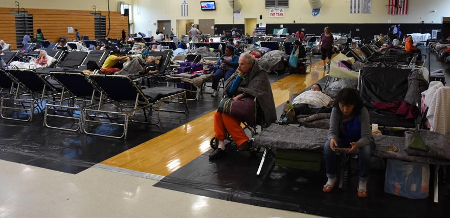
The unique challenge posed by compounding threats for hurricane evacuation is being investigated and addressed based on these past experiences. This approach includes using agent-based modeling to simulate hurricane shelter demands and determine how they can be managed through public messaging to shelter evacuees more evenly within an affected region. It also develops a decision-support tool to better allocate scarce healthcare resources to hurricane shelters while using hydrologic and network modeling to evaluate how transportation network disruptions during a hurricane impact critical facility accessibility.
ADDRESSING COMPLEX CIVIL WORKS CHALLENGES, ADVANCEMENTS IN ARTIFICIAL INTELLIGENCE, ROBOTICS, AND BIG DATA ANALYTICS ARE BEING EXPLORED FOR SWIFT, RISK-INFORMED DECISION MAKING AND OVERALL MISSION OPTIMIZATION.


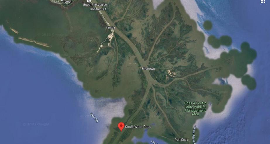
Southwest Pass, which connects the Mississippi River and the Gulf of Mexico, is one of the most used commercial waterways in the U.S. However, sediment accumulation at Southwest Pass, which is hard to predict, often disrupts the normal access of deepdraft vessels in the pass, which serves four of the nation’s top 15 ports, as measured by tonnage.
In recent years, USACE has dredged an annual average of 25 million cubic yards of sediment from Southwest Pass. However, despite these efforts, vessel draft restrictions have been in place for an average of 93 days per year since 2015. USACE spends more than $100 million annually on dredging operations to maintain a reliable shipping channel throughout the pass, and the unpredictability of rapid-onset shoaling has been known to double that amount.
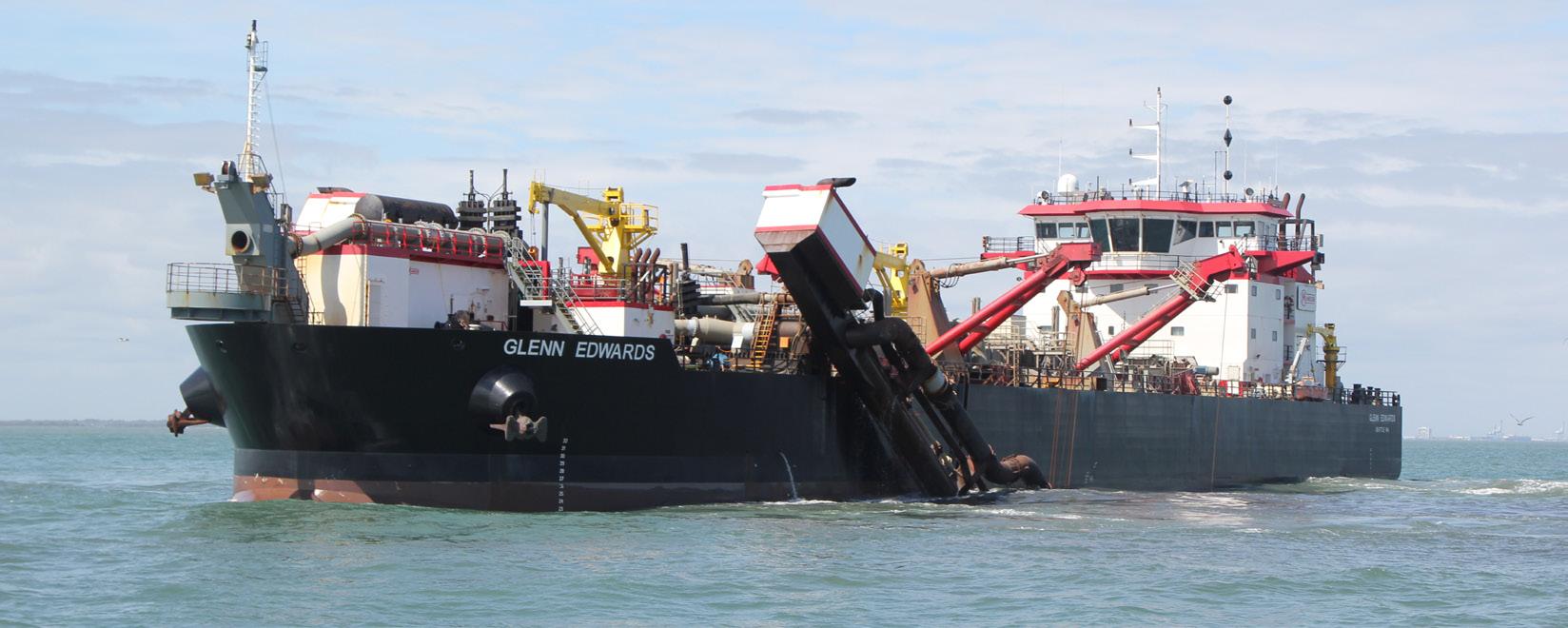
THESE AND SIMILAR MODELS WILL SAVE MILLIONS OF DOLLARS ANNUALLY THROUGH MORE EFFICIENT DREDGING
USACE project managers currently rely on seasonal river stage trends, hydrographic surveys, and experience-based benchmarks to get only 10-14 days of lead time for Southwest Pass shoaling conditions. Such short lead times complicate and increase the costs of dredge mobilization, coordination and scheduling. There is a need to develop a rolling sedimentation forecast capability to increase lead times and accuracy of the shoaling forecast.
USACE R&D is mining data from several enterprise dredging data sources and developing machine learning models to increase the lead times and accuracy of forecasted Southwest Pass dredging requirements. Such capabilities include machine learning regression models embedded in a multi-variate, timeseries forecasting framework, as well as image-based forecasting trained on sand waves and other notable bathymetric features.
Acting as a digital twin of predicted Southwest Pass sediment volumes, the artificial intelligence and machine learning-based automated rolling capability will modernize and accelerate decision making about Southwest Pass dredging operations. Providing a 45-day lead time will enable more efficient dredging operations, more timely mobilizations and cost reductions. This approach may also be applied to forecast dredging needs at other critical waterways nationwide.
Unpredicted sedimentation in navigation channels can disrupt waterborne commerce and necessitate a costly emergency dredging response. While streamflow predictions can provide an early warning, they currently have large uncertainty and error, which can contribute to sub-optimal dredging resource allocation.
HYBRID MODELING GREATLY IMPROVES FUTURE ESTIMATES OF STREAMFLOW AND RESULTING SEDIMENTATION, ENABLING MORE EFFICIENT AND TIMELY NAVIGATION MISSION DELIVERY
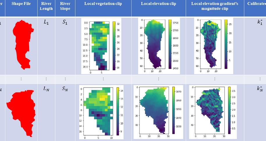
USACE R&D is working with partners to develop tools that leverage artificial intelligence and machine learning to provide an improved probabilistic streamflow and sedimentation estimate. The framework uses physics-based modeling while also considering information that is hidden in other data sources, such as soil classification, vegetation distribution and precipitation.
This research has improved the Routing Application for Parallel computation of Discharge (RAPD) model, which leads to better streamflow and sedimentation estimates. Also, the development of a hybrid machine learning framework that combines physics-based modeling with other data sources allows better forecasts for future dredging requirements and more efficient and timely Navigation mission delivery.
Channel shoaling reduces navigable depth in unpredictable ways, causing disruptions to waterborne commerce that significantly impact the economy and national security. The potential for channel shoaling disruptions will increase as vessels get larger and carry more goods. However, it is often difficult to predict where and to what depth shoaling might occur, making it more difficult to dredge these channels.
Having accurate streamflow forecasts that include smaller order contributing streams in addition to the main stem of navigation channels can improve dredging efficiency. While USACE currently uses streamflow to estimate future channel dredging requirements, it needs more tools to better understand inland, precipitation-driven streamflow. Combining artificial intelligence and machine learning approaches with recent advances in geospatial, atmospheric and weather data, as well as hydrologic modeling and computing resources, offers great potential to improve these in-stream estimates and better predict resulting shoaling of navigation channels.
Comprehensive water resource project design, operation and decision support must consider water-related risk. Comprehensive risk assessment requires complex numerical models and workflows that are often difficult to apply and adapt to different applications, slowing completion times and increasing project costs.
The numerical model modernization (NMM) effort is researching and developing modern integrated numerical modeling technologies and processes within a cloud computing environment to support USACE’s Flood Risk Management, Navigation and Aquatic Ecosystem Restoration missions. The NMM effort also supports ongoing collaboration with historically black colleges and universities, including integration into academic curriculum and supporting student internships from science, technology, engineering and mathematics disciplines.


Many existing USACE numerical models and workflows are extremely complex, have code structures that make software maintenance difficult and costly, are not written to allow for coupling with other models, lack modern flexible graphical interfaces, have insufficient documentation and training materials, and are not fully open-source or open-access for community use and co-development.
USACE R&D is implementing a modernization strategy that guides development and restructuring of numerical models and their associated workflows. These models are being transitioned to operate on cloud-computing resources. They will have restructured coding to allow for modular design, coupling and systems integration; and enable converting graphical user interfaces into modern platforms with community accessible tools, as well as improved training material and guidance support.
The NMM products allow for timely and accurate solutions to the nation’s water resource needs while reducing the time and cost for software maintenance and development. Products developed for USACE and other federal and community partners include on-demand, integrated computing solutions for community-based numerical model simulations, data storage and reuse, and training, as well as robust and scalable modernized numerical model codes and workflows.


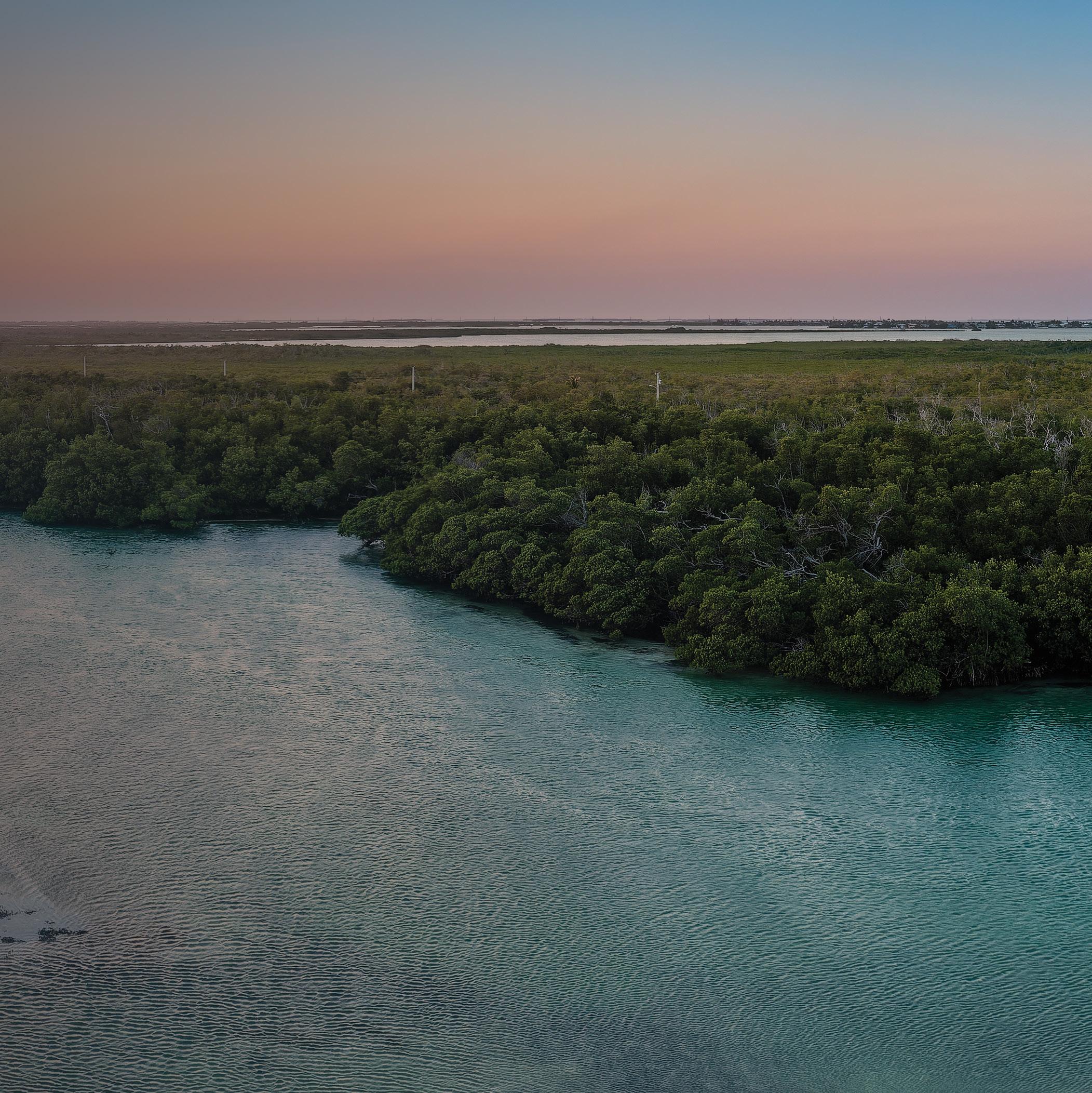
USACE IS ADDRESSING COMPLEX ENVIRONMENTAL CHALLENGES FACING AQUATIC ECOSYSTEM RESTORATION AND ENVIRONMENTAL STEWARDSHIP THROUGH ADVANCING SCIENTIFIC UNDERSTANDING AND ADOPTING ADVANCED TECHNOLOGIES AND METHODOLOGIES.
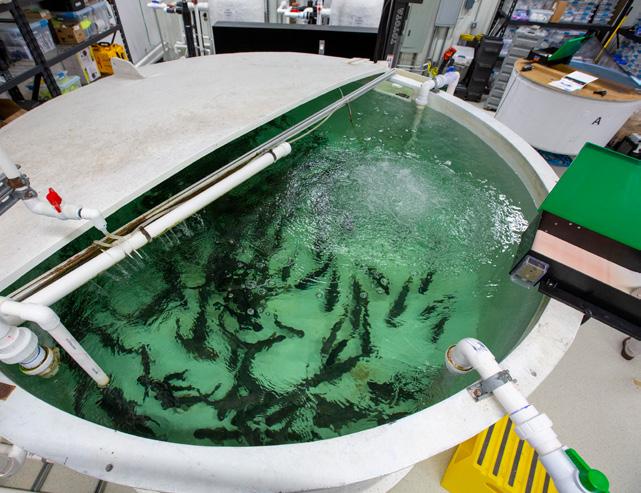
Invasive carp, a destructive group of fish, have infested waterways from the Mississippi Delta to Minnesota, and are now expanding east and west. Most mitigation strategies focus on post-infestation management rather than prevention of species propagation and movement. The estimated cost of potential invasive carp damage to the Great Lakes is between $8.5 billion and $15 billion annually.

USACE R&D is developing new multi-modal technologies that detect and deter invasive carp from moving upstream by exploiting their physiological and behavioral systems. Hand-in-hand with decision-support tools and predictive models on navigation impacts and invasive carp responses, resource managers and planners throughout North America will have tools for pre-invasion planning and post-invasion management.
USACE ERDC has been the lead developer for more than a decade on detection and deterrence technology that is selective for invasive carp to minimize the impacts on native species and navigation and reduce human health risks. USACE R&D is developing tools and technologies from lab testing to full in-field deployments within three to five years and with up to 80% effectiveness by exploiting invasive species physiology and behavior, physics processes and aspects of the environment.
SECURING THE NATION’S WATERWAYS FROM INVASIVE SPECIES EXPANSION
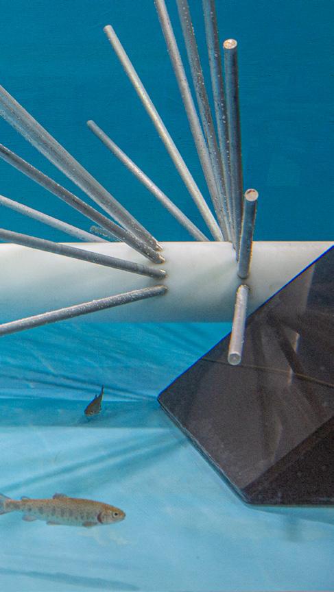

In North America, invasive non-native species severely affect the environment and ecological diversity and cost $21 billion annually, with invasive carp representing the majority of this cost. Invasive species, such as invasive carp, are outcompeting native species, exploiting resources throughout their range and thus continuously expanding into vulnerable environments. Isolation attempts, targeted removal and intentional fragmentation involve the use of deterrents and barriers in freshwater systems to control species movement and population expansion.

Management of threatened and endangered species and invasive species is an ever-present issue for USACE due to the complexity of habitats, structures and missions. Species management is further compounded by changing needs for training operations, coastal development, aging infrastructure, infrastructure removal, new navigation criteria, growing coastal and waterway human populations and climate change. USACE researchers are developing best practices for invasive species control that focus on pre-invasion management through technology and predictive tools that minimize impacts on native species and society.
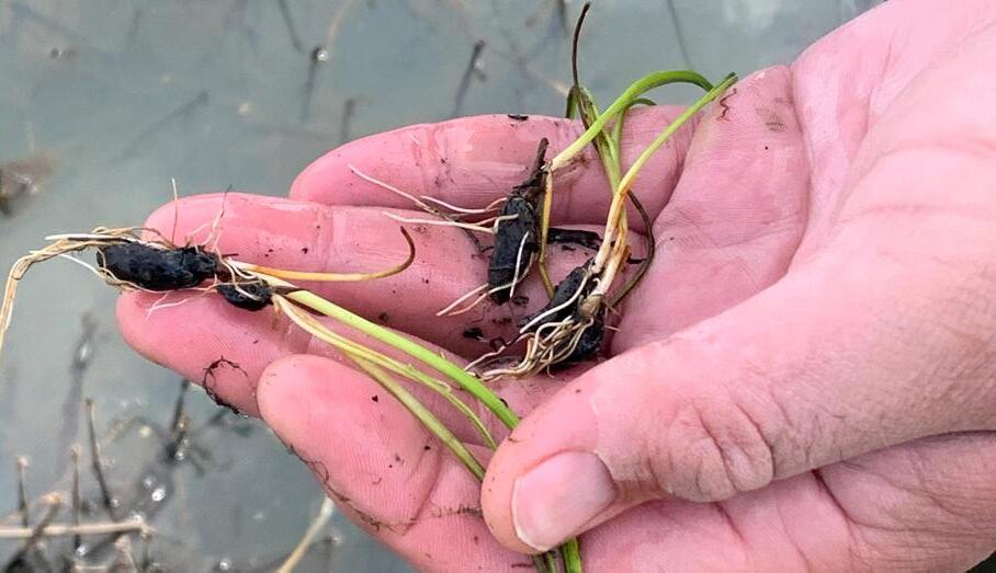
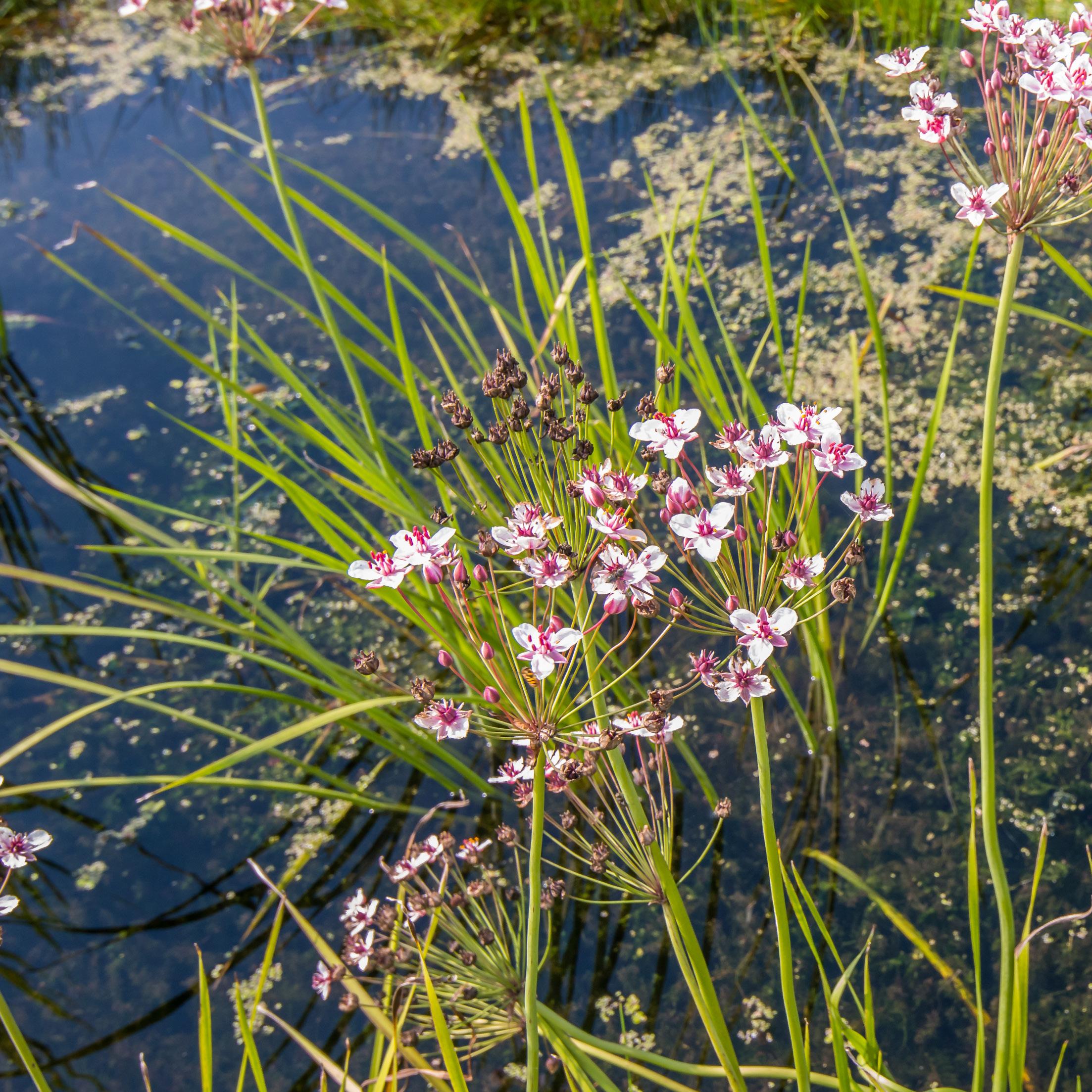
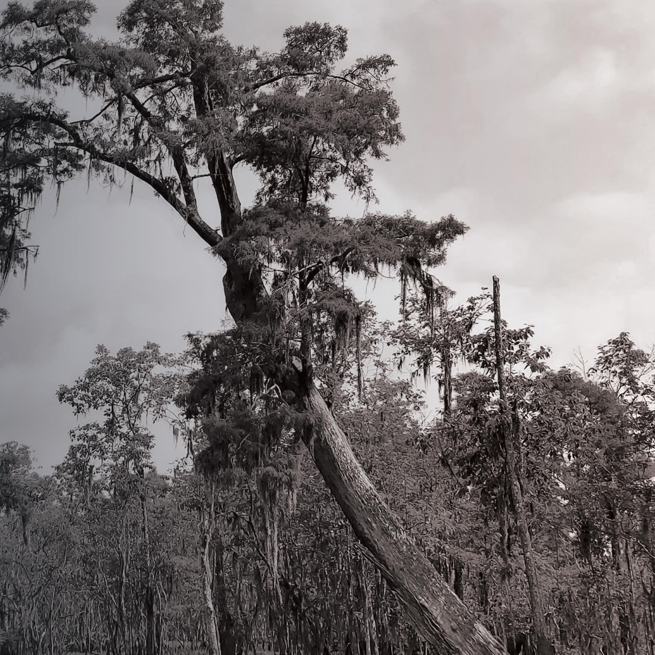
Flowering rush continues to expand and impact native ecosystems across the northern tier of the U.S. This invasive plant impacts native plant communities, endangered species and USACE missions, including Flood Risk Management, Hydropower and Environmental Stewardship. The species rapidly colonizes shorelines and near-shore habitat, forming dense monotypic stands, impairing habitat for native flora and fauna and negatively affecting USACE project management. Two distinct biotypes of the species exist in the U.S. They show signs of different reproductive strategies and respond to management measures differently. Although there are some similarities between the two biotypes, the differences create management challenges that require biotype-specific management techniques. Species management is further complicated because flowering rush can grow as an emergent plant in shallow water and a submersed plant in deeper water up to 20 feet in some cases. Research has focused on better understanding the reproductive strategies of both biotypes in an effort to identify a weak point in the plant’s lifecycle that can be exploited for management purposes. Research on control methods includes the use of different aquatic herbicides, alone or in combination, and identification of biocontrol agents.
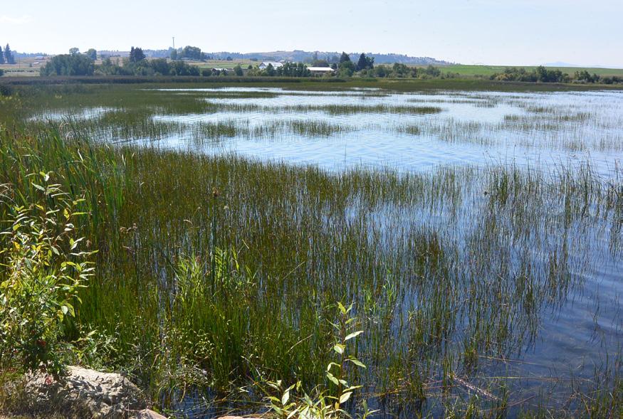


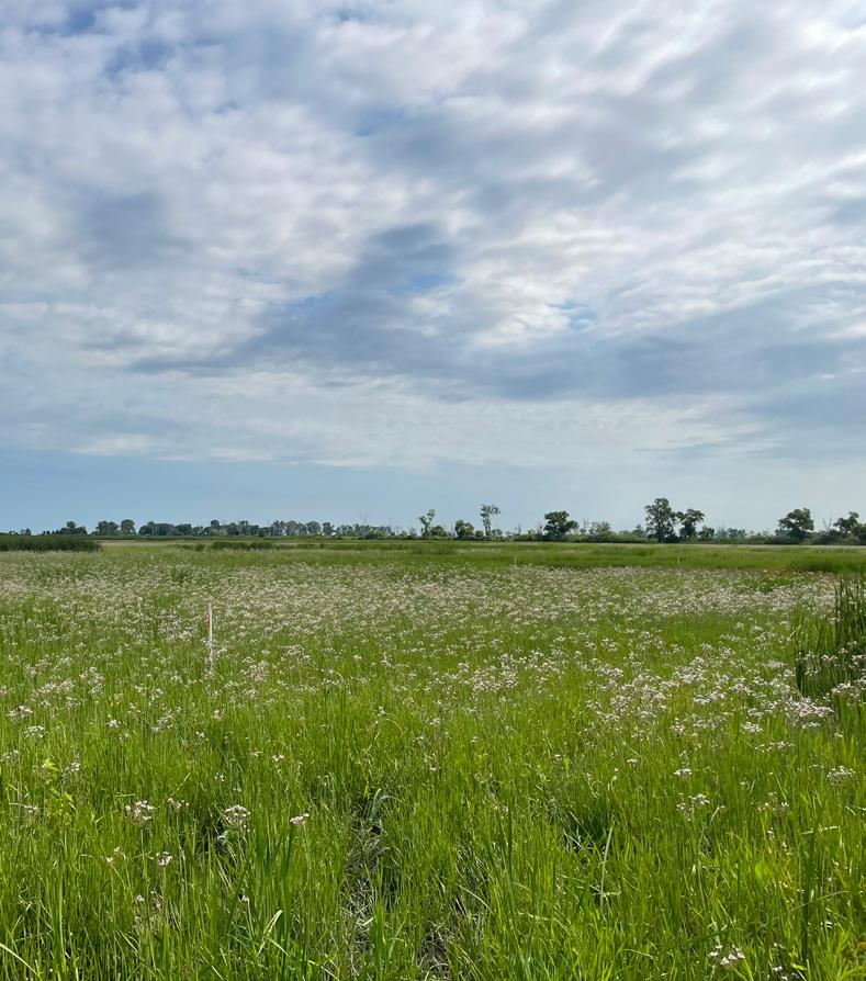

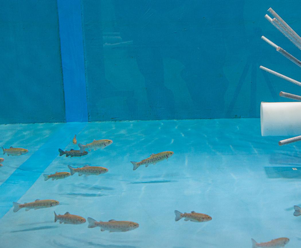
As of 2023, flowering rush was present across the Columbia River basin, North and South Dakota, upper Mississippi River basin and across the Great Lakes states. The species continues to expand, creating management challenges for USACE and other agencies, and it negatively impacts habitat for native species, including federally listed endangered or threatened species such as bull trout.
USACE R&D is developing new tools to manage flowering rush and reduce impacts on native flora and fauna. These efforts include new technology to deliver herbicide application in flowing water systems and development and approval recommendations for biocontrol agents to suppress growth and expansion of the species more efficiently. This research is critical for cost-effective solutions for managing this species and others, such as hydrilla in the Connecticut River.
To date, USACE ERDC has worked with stakeholders in the Columbia River basin, USACE Civil Works projects in Idaho, and state collaborators in Upper Midwest and Great Lakes states to build an understanding of management challenges with flowering rush and develop research projects to meet these needs. In addition, USACE R&D supports a robust effort to find biological control solutions for flowering rush through leveraging international knowledge and ongoing research efforts.
As USACE expands its nature-based solutions (NBS) project portfolio, the need to efficiently quantify project benefits becomes increasingly vital. Moreover, traditional field surveys often face limitations due to site access and resource constraints. Remote sensing is increasingly investigated in various project applications; however, without a targeted approach, it can be misaligned with specific project needs, leading to inefficiencies and costing time and money.
TRANSFORMING PROJECT PRACTICES THROUGH UNDERSTANDING THE ROLE OF REMOTE SENSING IN SUSTAINABLE INFRASTRUCTURE DEVELOPMENT
Technological advancements in, and increased usage of, satellite sensors, readily available data products and manned and unmanned aircraft system technology has resulted in a surge of new opportunities to integrate remote sensing technology into NBS projects. These tools illustrate innovative pathways to identify and focus project objectives, examine environmental conditions, quantify project-related impacts and benefits, and track targets and milestones.
Integrating remote sensing across naturebased project phases and types helps optimize efficiency, inform decision making, and expand impacts beyond the project footprint. Innovative remote sensing technology will streamline quantification, reducing time and costs as well as supporting communication of project benefits while decreasing project and system risks and uncertainties.
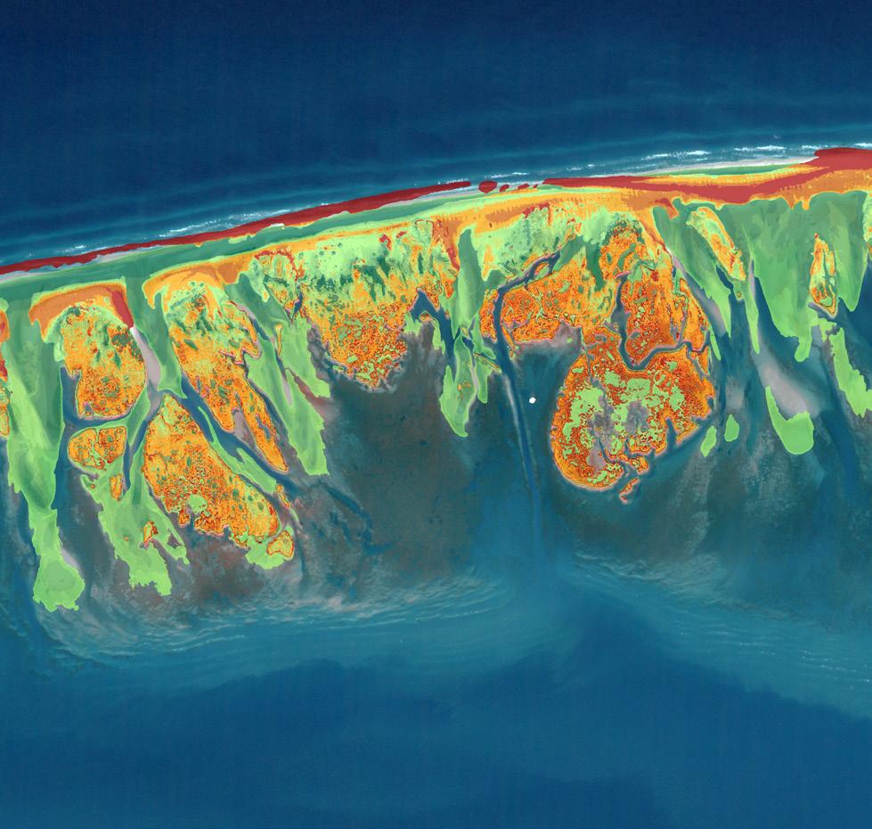

USACE is quantifying the impact of nature-based solutions (NBS) by using remote sensing technology in the Engineering With Nature® project approach. From initial planning stages to implementation and operations, intentional technology integration can revolutionize our understanding of the value of NBS.
Advances in remote sensing technology enable practitioners to assess NBS projectrelevant details across large geographic areas while meeting specific needs within various project types and phases. Such advancements include more high-resolution sensors, accurate data, software tools and methodological improvements to (1) demonstrate project design, implementation, performance and application; (2) increase project forecasting and risk reduction; (3) improve inter-relationships in system processes; (4) increase project efficiencies and resilience; and (5) improve adaptive management. Whether restoring valuable coastal systems or creating islands using channel sediment, remote sensing provides an opportunity for consistent quantification of project benefits over time, and thus improves assessment and communication surrounding project performance.
USACE R&D is showcasing applications of remote sensing technology in every phase of nature-based projects, using example case studies nationwide. The case study examples offer compelling demonstrations of geospatial workflows, illustrating how remote sensing metrics, methods, data and products can be seamlessly integrated throughout the project lifecycle to improve project efficiencies and effectiveness.

Mitigation is an important part of permitting and environmental reviews for both the USACE Regulatory Program and USACE Civil Works projects. Mitigation requirements include avoiding or minimizing any adverse impacts to aquatic ecosystems. Compensatory mitigation provides the mechanism to offset unavoidable losses of ecosystem functions and services. These offsets include restoring, enhancing or preserving the functions and services provided by aquatic ecosystems to sustainably maintain the biological, chemical and physical integrity of the nation’s waters and aquatic ecosystems.
USACE needs rapid tools and technical guidelines to improve the planning, development, implementation and performance of wetland compensatory mitigation projects and to decrease costly delays in permit reviews and approvals of these mitigation projects. Since the 1990s, USACE R&D has collaborated with federal and state agencies, academia and the private sector to develop more than 30 wetland compensatory mitigation techniques and tools. Now, R&D is developing new tools and standardized frameworks to accelerate and revolutionize compensatory mitigation decisions.
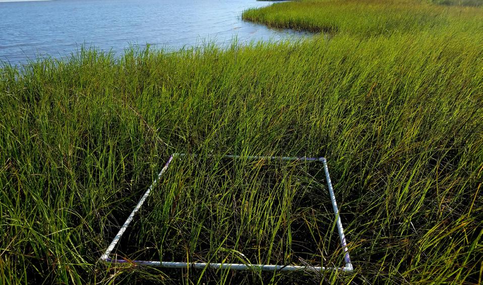


As part of the 2008 Mitigation Rule, USACE considers the losses and gains of wetland functions when making permitting and environmental compliance decisions. USACE requires sciencebased, transparent and rapid approaches to not only assess the function and condition of wetlands for compensatory mitigation, but also to inform management and monitoring strategies which ensure environmental sustainability, resilience, enhanced comprehensive benefits, community use and co-development.
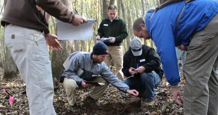
In 2023, USACE R&D developed a new wetland assessment method and decision-support tool covering 11 states within the Piedmont region using the hydrogeomorphic approach. It also released the first ever national technical guidelines and standardized framework for USACE and its federal partners to use when developing rapid wetland assessment methods. Sustainable management strategies for pine flatwood wetlands within the Gulf Coast region were also developed as part of this 2023 effort.
To date, USACE R&D has developed multiple wetland assessment and compensatory mitigation tools, technical guidelines and management strategies. This effort will rapidly inform compensatory mitigation requirements and plans, as well as management and monitoring strategies, to ensure sustainable and successful ecosystem restoration outcomes while streamlining and accelerating the decision making process.
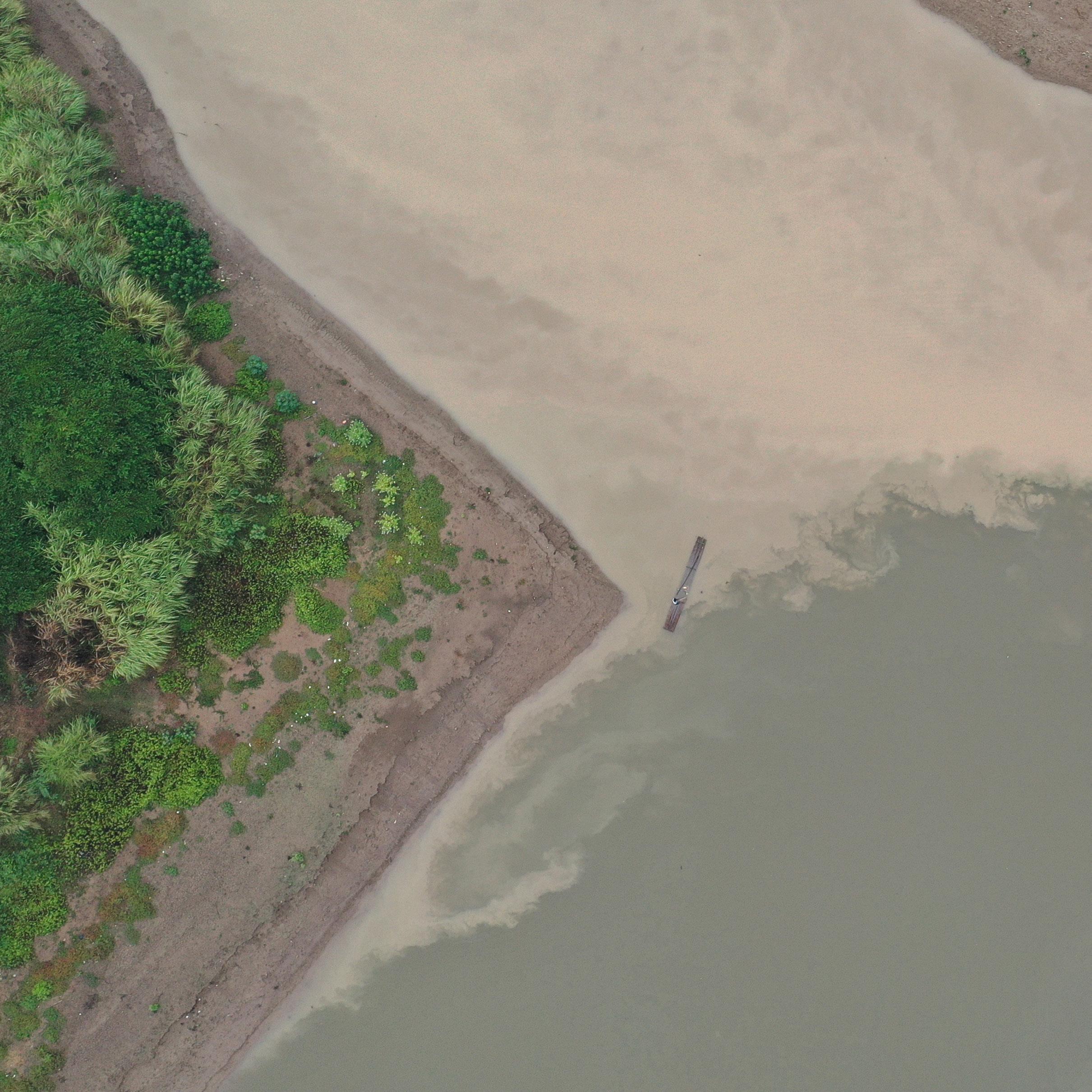
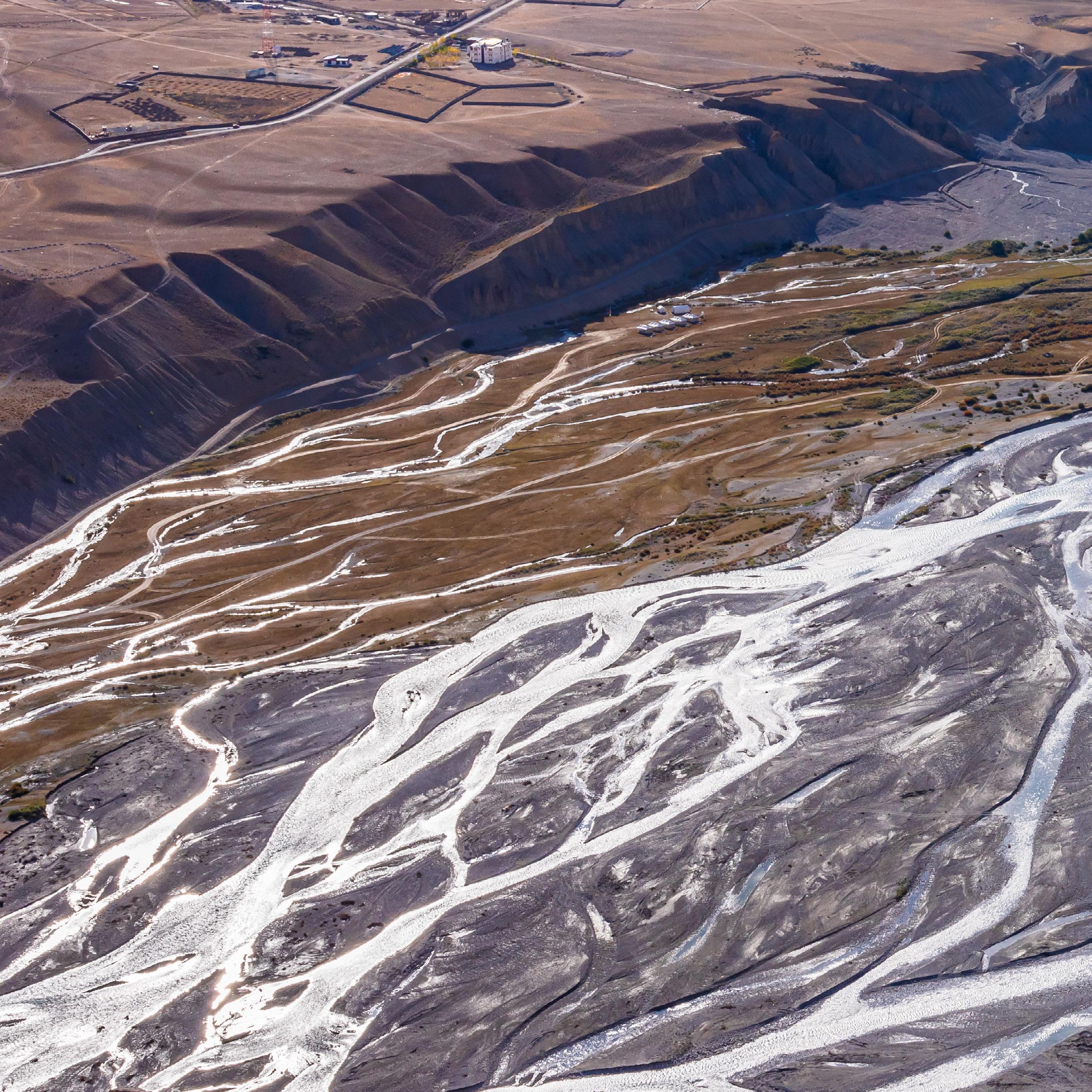
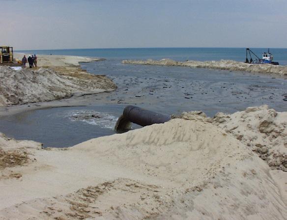
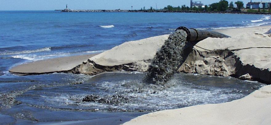
SEDIMENT MANAGEMENT R&D AIMS TO CUT DREDGING COSTS VIA ADVANCED TECHNOLOGIES, PUBLIC-PRIVATE PARTNERSHIPS AND ENGINEERING WITH NATURE® PRINCIPLES FOR ENHANCED SUSTAINABILITY.
USACE’s goal to achieve 70% beneficial use (BU) of dredged sediments by 2030 – the 70/30 beneficial use goal – and optimize navigational maintenance requires a systematic approach for identifying sediment beneficial use sites. Existing tools have been predominantly developed and used in isolation, lacking integration into a systematic framework. The absence of a reproducible approach hinders nationwide applicability, prompting the need for a comprehensive and cohesive strategy in beneficial use site identification.

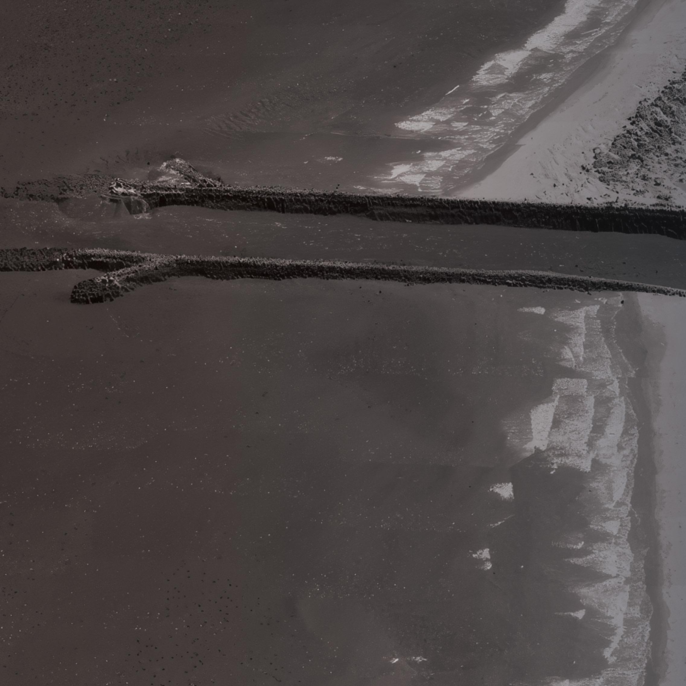
Addressing this need involves an approach to identify nearshore placement sites using existing information and models accompanied by a brief case study. The systematic method relies on freely available documentation and tools – the Sediment Mobility Tool, Lakeshore Geomorphic Vulnerability Index, and historical imagery – for broad application. Focused on the Great Lakes, the approach enables a change in attitude and unlocks opportunities for beneficial use.
Employing this systematic approach, beneficial use options for Lake Michigan’s west coast have been delineated and presented to federal, state and local stakeholders. The identified alternatives serve as valuable inputs for planning and regulatory discussions. Replicability in other regions expands beneficial use and sustainable sediment management options, aiding USACE in achieving its 70/30 goal and optimizing sustainable beneficial use practices.
ACHIEVE 70% BU BY 2030 BY HARNESSING STRATEGIC TOOLS FOR THE GREAT LAKES
The Great Lakes encompass 140 federally maintained harbors and require annual dredging of 2.6-5.2 million cubic yards of sediment. Irregular dredging in smaller harbors has resulted in an accumulated backlog exceeding 11.8 million cubic yards of sediment.
USACE policy mandates maximizing the beneficial use of dredged sediment, aiming for a 70% beneficial placement target by 2030 – known as the 70/30 goal. Despite the prevalent practice of placing clean sands on beaches for shoreline nourishment, many harbors, especially those with finer-grained or mixed sediment, lack plans for the beneficial use of dredged sediments.
Currently, only one-third of the dredged sediment in the Great Lakes is used beneficially, falling well below the 70/30 goal. Research is pivotal for addressing the imperative to optimize sediment management practices. Research bridges the gap between existing policies and operational reality, ensuring sustainable use of dredged sediments to meet specified goals by 2030.

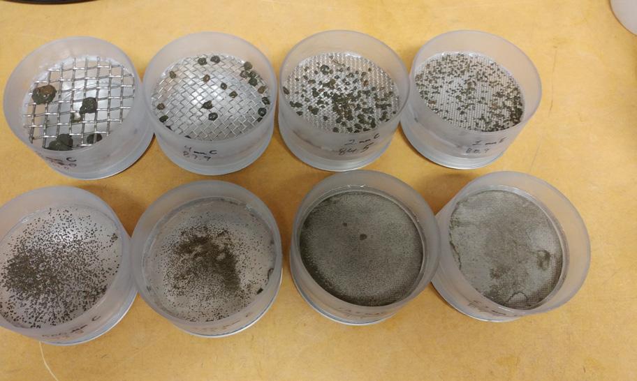
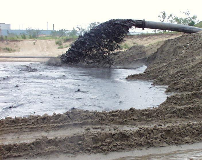
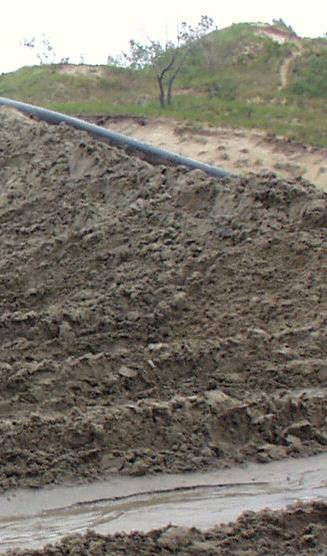
Mud aggregate transport research addresses the complex dynamics of sediment transport associated with dredging projects, with a specific focus on the influence of aggregated mud. Sediments in ports, wetlands and coastal areas are typically mixtures of sand, silt and clay, which under certain conditions form mud aggregates that significantly influence sediment transport and management. This research aims to enhance sediment transport modeling capabilities and sediment management practices by documenting and simulating the impact of eroded mud aggregates on sediment transport and channel infilling rates.
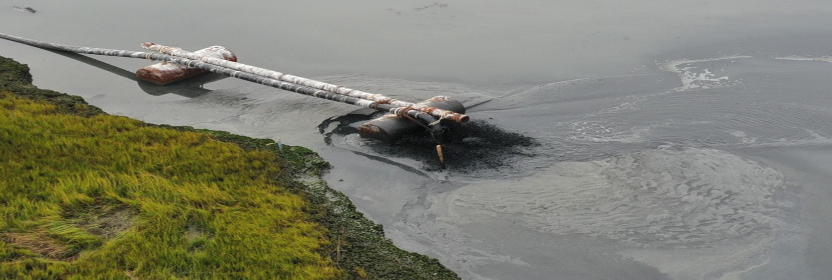

EXPANDING INNOVATIVE SEDIMENT MANAGEMENT BY UNDERSTANDING MUD AGGREGATE
Until now, numerical models omitted mud aggregate transport processes, relying on transport properties derived from disaggregated grain-size distribution data. Eroded mud aggregates have much greater settling velocities which influence the mode of sediment transport and ultimate location of deposition. Neglecting these transport modes reduces dredging project model simulation fidelity, notably in Virginia’s James River estuary.
This R&D project investigates eroded mud aggregates, identifies the geotechnical properties influencing aggregate production and durability, and develops and tests a numerical model framework for simulating mud aggregate transport. Applying innovative measurement, testing and simulation in the James River estuary underscores the necessity to integrate mud aggregate transport into sediment management planning.
Enhancing the fidelity of sediment management prediction improves project planning for navigation, flood protection and environmental restoration missions. Mud aggregate transport can influence dredged material management, beneficial use, beach nourishment, construction and environmental considerations, emphasizing the need to include mud aggregate processes in achieving better sediment management outcomes.
Many eroding U.S. shorelines rely on hard structures, supplemented by periodic beach fill. Barrier islands with intricate geological features like inlets challenge multi-dimensional coastal models. Users are often forced to choose either higher-dimensional modeling of limited scenarios or a reduced-order model. Inadequate study characterization can cause project failure due to cost or performance.
17:1 ROI VIA OPTIMIZATION OF SAND VOLUME IN A TYPICAL COASTAL STORM RISK MANAGEMENT PROJECT
GenCade provides an efficient one-dimensional approach to capturing relevant coastal processes while allowing users to apply the full range of probable scenarios through the Monte Carlo functionality. Addition of cross-shore sediment transport results in a more robust model with improved fidelity. Integrating these models equips GenCade to capture diverse outcomes at project sites, enhancing precision in coastal modeling and erosion risk assessment.
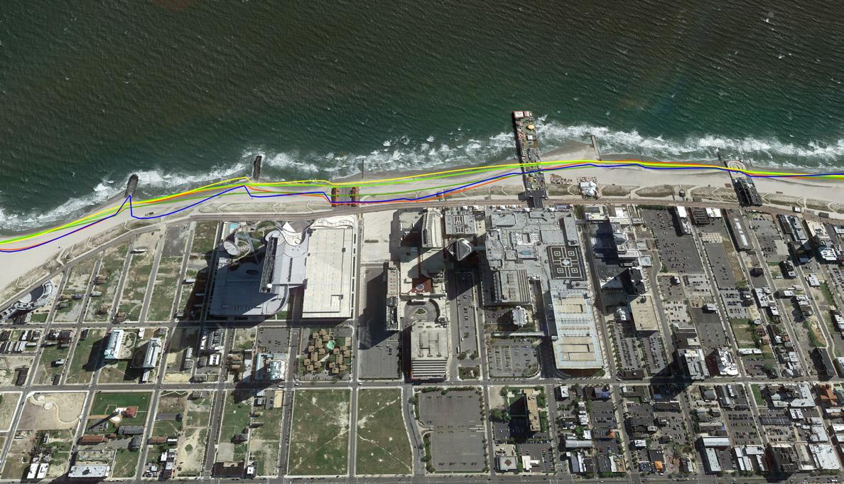
Validated through a decade-long simulation in Duck, North Carolina, and Absecon Island, New Jersey, GenCade’s enhanced features allow quantification of sediment transport impacts from coastal structures, bypassing, dredging and nourishments. Essential for USACE projects on open coast sandy beaches, GenCade is a critical tool for efficient coastal engineering studies.
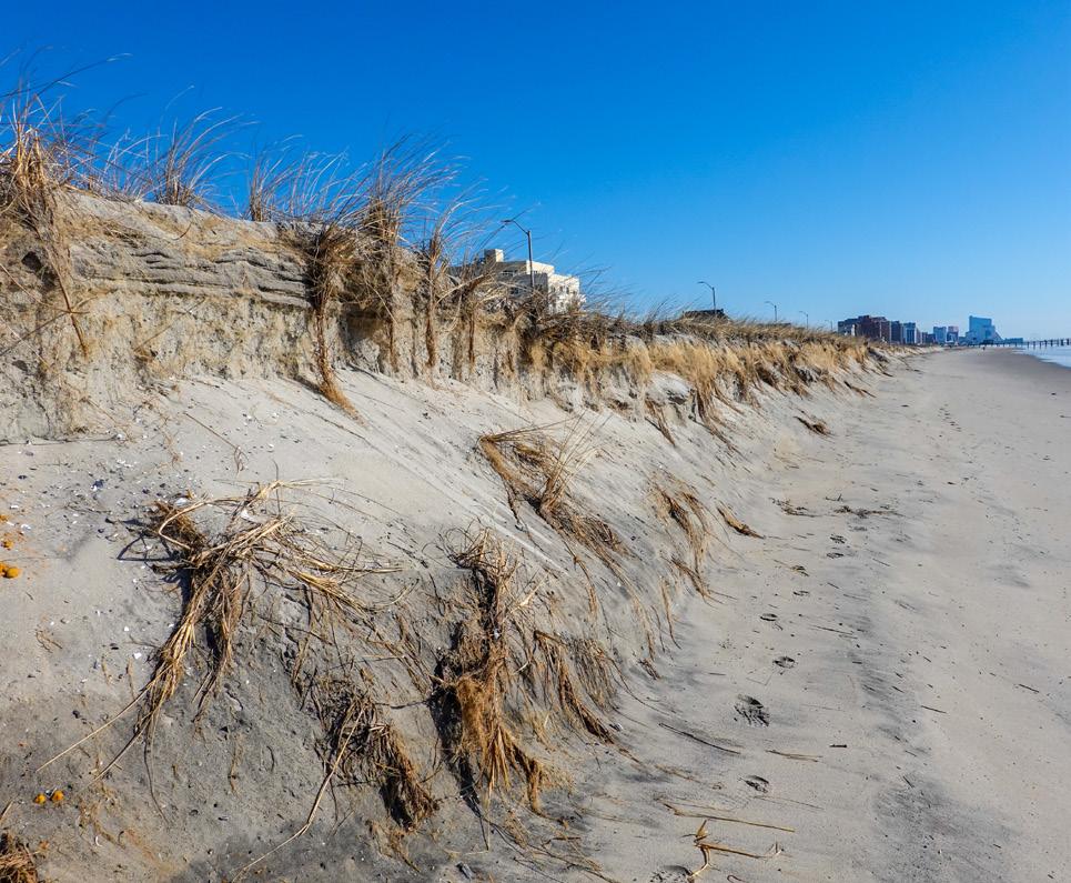

The USACE GenCade shoreline model, formulated using equations for longshore transport and equilibrium beach profile response, has been pivotal in coastline modeling. However, nearshore processes and inlet dynamics on barrier islands introduce complexity due to the uncertainty inherent in waves, tidal currents and meteorological phenomena. Extensions to GenCade for cross-shore sediment transport and the Monte Carlo simulations through wave climate emulators provide solutions for these issues. The refined GenCade model proves effective in USACE coastal protection planning, guiding decisions on beach fills, sand bypassing and coastal structure design.
These efforts resulted in an advanced tool that enhances understanding of shoreline dynamics for USACE districts and users worldwide. GenCade model advancements provide rigorous simulations and comprehensive understanding of multifaceted factors influencing shoreline evolution, ensuring coastal management strategies do not solely rely on empirical data.

FOR MORE INFORMATION, CONTACT US AT ERDCINFO@USACE.ARMY.MIL
PUBLISH DATE:
FEBRUARY 2024
APPROVED FOR PUBLIC RELEASE DISTRIBUTION UNLIMITED
AUTHORED AND EDITED BY:
USACE CIVIL WORKS R&D TEAM
ERDC CORPORATE COMMUNICATIONS OFFICE
DESIGNED BY:
ERDC INFORMATION TECHNOLOGY LABORATORY
COVER IMAGE:
ERIN DIURBA - CHL FIELD RESEARCH FACILITY


REPORT NUMBER: ERDC B-24-2