2 minute read
Mini-Argus Nearshore Video Imaging

SAFE & COST EFFECTIVE RAPID DATA COLLECTION
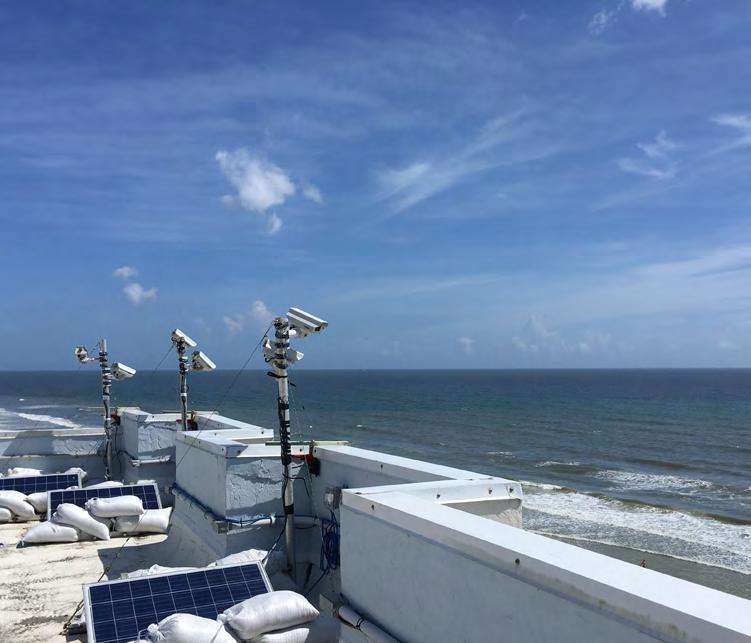
Coastal imaging research has been ongoing at the ERDC Field Research Facility for more than 30 years, in collaboration with Oregon State University. Imagery of the coast is exploited to provide information on coastal processes, beach and dune topography, nearshore water depths, sandbar positions and wave run-up elevations. It can also be used to determine the condition of coastal infrastructure and the navigability of harbor or inlet entrances. Mini-Argus is an inexpensive coastal monitoring system that rapidly obtains remote sensing data, and is being transitioned to Corps districts for use in monitoring Coastal Storm Risk Management, navigation and coastal infrastructure projects. The systems will provide the Corps a unique capability to address challenges before, during and after coastal storm risk management actions, such as beach nourishment, by providing cost-efficient and real-time video monitoring of federal beach projects. Such video imagery can quantify metrics of interest to Corps districts, such as public use, safety and geomorphologic change. It can also depict how each of these values is altered by the federal project, even during periods of extreme change, such as storm events.

PROBLEM: Corps districts need an improved ability to quickly monitor the state of federal beach projects. Existing insitu monitoring is limited in either temporal duration, spatial coverage, or real-time data accessibility. In addition, it is often time-consuming or dangerous. This is particularly true during storm events, the most disruptive and dynamic conditions when project monitoring is needed most.
SOLUTION: ERDC researchers are developing turn-key coastal imaging hardware and software to provide district engineers near real-time engineering information from coastal imagery. The self-contained and autonomous Mini-Argus hardware can be rapidly deployed near federal beach projects. An associated data framework and web interface allow districts to access near real-time imagery and data within hours of deployment and without the need for a subject matter expert.
IMPACT: Rapid remote sensing data collected from Mini-Argus stations can substantially improve the Corps’ ability to collect coastal geospatial products for project monitoring and immediate decision support without time-consuming and costly field visits. Project response to seasonal and short-term wave and storm events will be better understood, which will enhance planning and impact analysis at beach projects. Corps districts will have high-value coastal monitoring data that will be integrated into engineering decisions and adaptive management practices.


