4 minute read
Prime Hook Wildlife Refuge


Milton, Delaware, United States
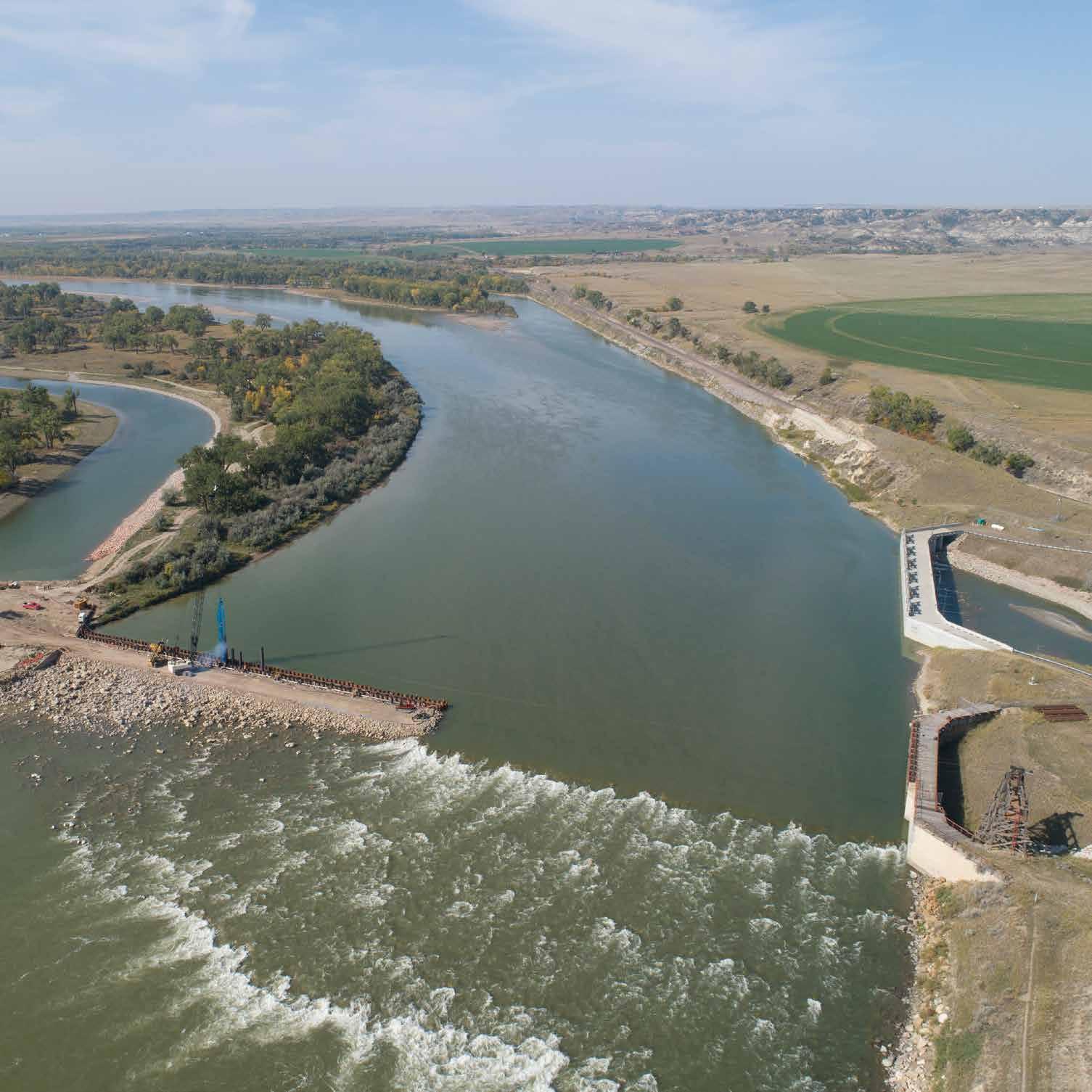
Implementing the largest ecosystem restoration project east of the Mississippi River. On Delaware Bay’s western shore, Prime Hook National Wildlife Refuge has faced substantial challenges. Previously managed as coastal freshwater impoundments, its wetlands had become large areas of open water due to sea level rise and coastal storms. Since 2006, overwashes and saltwater intrusion fundamentally altered the profile of the refuge, with over 1,600 hectares of freshwater marsh and 240 hectares of riparian forest impacted or lost. The complex legacy of anthropogenic influences on the wetlands had created a coastal system out of sync with the evolving landscape—and susceptible to catastrophic failure. To remedy this vulnerability, the U.S. Fish and Wildlife Service, resource manager for the refuge, developed an extensive restoration plan to create an ecosystem resilient to climate change and rising sea levels. Over the course of two phases, the project team closed large breaches in the refuge using material dredged from a nearby offshore borrow area. To improve circulation and distribution of salinity and sediment, they then excavated 460,000 cubic meters of material to create a network of 37 kilometers of historic tidal channels. In total, the team moved over 1.08 million cubic meters of sand to recreate 2,700 meters of shoreline.
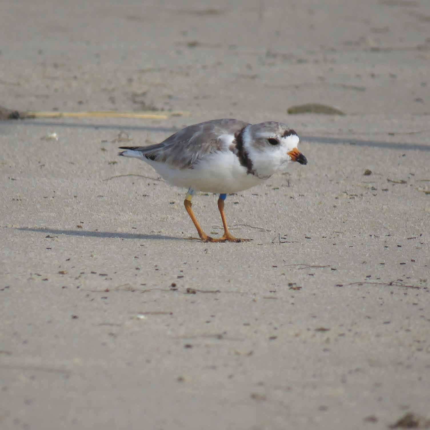
Article Cover: One of the many adult piping plovers spotted on the restored beach. (Photo by U.S. Fish and Wildlife Service)
Producing Efficiencies
Several years of water level, water quality, sediment movement, and marsh accretion monitoring informed the team’s robust hydrodynamic modeling, providing their restoration design with real-world data and conditions. Contrary to initial theories, the marsh’s degradation was not because of an elevation problem but rather a hydrological problem—that is, water was not draining. With this knowledge, the team changed focus to lower water levels instead of raising sediment levels. This adaptive management through use of monitoring and modeling allowed the team to optimize project results to match the evolving conditions of the site.

Using Natural Processes
The team created a natural shoreline that encouraged overwashes. The design included a low-angle beach and berm, a low dune, and a 24-hectare back-barrier platform planted with back dune and wetland vegetation. This beach and barrier naturally preserve the refuge’s numerous flood shoals, which serve as critically important bird breeding habitat. The team sprayed the dredged sediment directly into the unvegetated areas using a thin-layering approach, creating a microtopography. After seeding 400 hectares, the team allowed the remaining area to recolonize naturally over time.

Broadening Benefits
Ecotourism in the region has greatly increased as diverse migratory birds and waterfowl now flourish: snowy owl (Bubo scandiacus), snow bunting (Plectrophenax nivalis), the critically vulnerable saltmarsh sparrow (Ammospiza caudacuta), and many others. The newly restored beach has become a breeding hot spot for endangered piping plover (Charadrius melodus) and is experiencing some of the highest fledging success on the east coast. Additionally, the waterways have provided nursery grounds and refuge for native fish species, and flooding of the surrounding public roads and private lands is now nearly nonexistent.

Promoting Collaboration
Regulatory agencies, nongovernmental organizations, and other partner groups worked together throughout the process. A comprehensive data collection and restoration monitoring partnership has been in place with numerous state and academic partners since the wetland management challenges first arose and throughout restoration. It will continue into the future. The refuge now stands as a focal point for the public, government officials, and restoration practitioners to view the importance of restoring imperiled ecosystems.