4 minute read
Puyallup River Revetment
Orting, Washington, United States
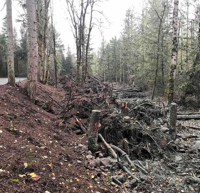
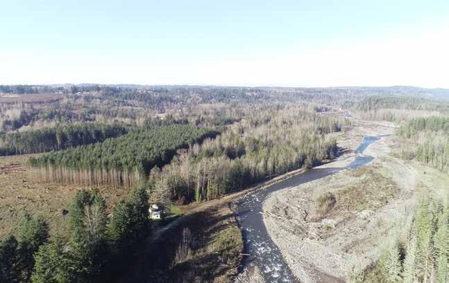
Protecting critical transportation infrastructure from flooding and volcanic hazards. In the shadow of Mt. Rainier, the high-energy, glacially fed Puyallup River runs through rural Washington. But a series of river-training facilities, such as traditional levees, and logging in the region have left the Puyallup disconnected from its floodplain and channelized, cutting off side-channel habitat for salmon and other species. Further, the river threatens nearby Orville Road East, a main transportation artery and lahar evacuation route. Using a technique known as restorative flood protection, Pierce County staff engineers, biologists, and planners began in 2018 a 1.6-kilometer project to open up approximately 28 hectares of previously disconnected floodplain and by 2022 will remove approximately 800 meters of an existing levee. The project has begun installing a series of discontinuous, engineered logjams to form a 1,200-meter setback revetment and will install approximately 40 more logjams throughout the newly connected floodplain. This will encourage channel braiding and habitat formation and discourage channel avulsion toward Orville Road. Already the work has restored the nature hydrological processes in the floodplain, promoting the recovery of three threatened salmonids: Puget Sound Chinook salmon (Oncorhynchus tshawytscha), Puget Sound steelhead (O. mykiss), and bull trout (Salvelinus confluentus).
Article cover: A completed series of discontinuous, engineered logjams form a setback revetment on the right with the floodplain on the left.(Photo by Pierce County Staff)
Producing Efficiencies
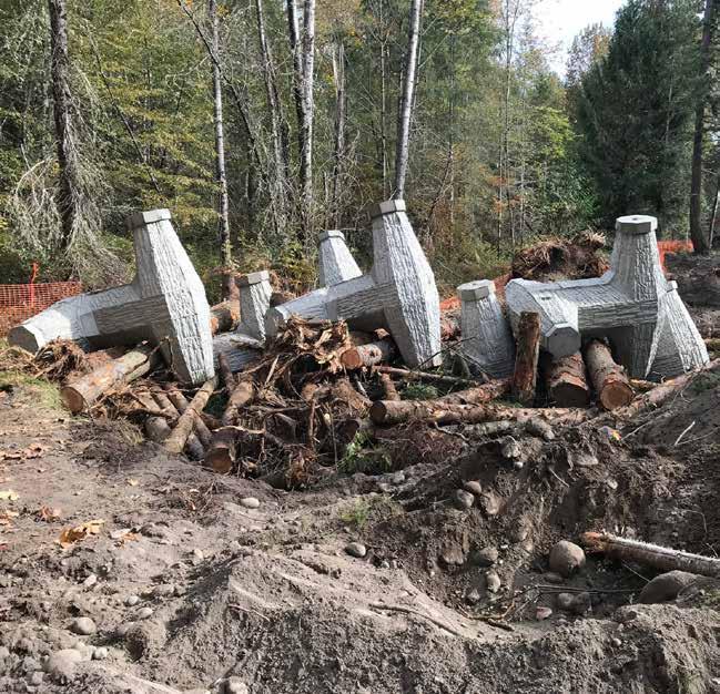
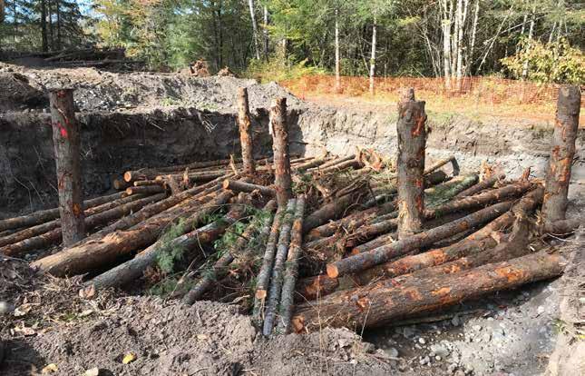
Levee setback projects create additional space for rivers in their natural floodplain and are a more sustainable and cost-efficient approach than longterm levee maintenance. To mimic the naturally occurring logjams common in the region, the project team created engineered logjams consisting of large wood, racking, and slash structures, each ballasted by a 7-tonne concrete structure called a dolos. This innovative design requires less excavation than traditional engineered logjams because it self-settles when exposed to river scour, reducing installation time and cost.

Using Natural Processes
Levee removal and its resulting floodplain reconnection will allow more natural fluvial processes to develop, increasing the quality and quantity of salmon habitat through the river’s natural life cycle. The series of logjams slows the flow of water through the river, creating braids in the floodplain over time, encouraging increased water storage at the site, and protecting the region from flash flooding. Protecting Orville Road therefore occurs naturally, since the surrounding terrain is better able to hold water and release it over time without the need for human intervention.

Broadening Benefits
An active volcano, Mt. Rainier periodically triggers lahars, mud and debris flows that rush down the slope at speeds of up to 70–80 kilometers per hour. Keeping Orville Road clear as an evacuation route will save lives. The reduced risk and impact of flooding in the area will provide additional important social and economic benefits, as will the $8 million the ongoing project is reinvesting in the local economy. Additionally, creating high-quality habitat for salmon, important to the cultural, historical, and economic fabric of the Pacific Northwest, also creates holistic benefits for the overall ecosystem and the entire region.


Promoting Collaboration
This project built off the work of Dr. Tim Abbe and Natural Systems Design, a consulting firm specializing in replicating natural processes. This collaboration led to combining the concrete dolos with the conifer logs, lowering the project’s construction costs. Pierce County took the lead, working with Pierce County Surface Water Management and Tribal government staff and resource managers to ensure the restoration project had full community support from its original design through the committee approval process and final implementation.


