


Australia’s Golden Outback acknowledges the Traditional Custodians throughout the Golden Outback of Western Australia and their Elders, past present and emerging.
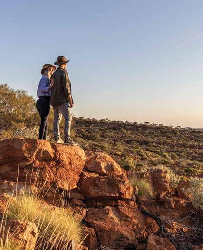
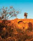
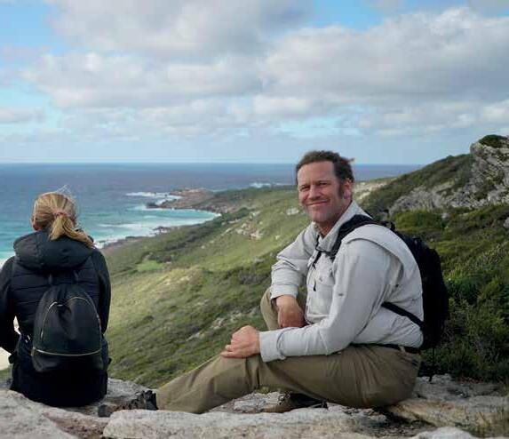
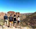
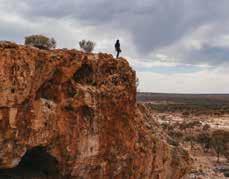
The adventure of a lifetime awaits in the untamed expanse of

Australia’s Golden Outback acknowledges the Traditional Custodians throughout the Golden Outback of Western Australia and their Elders, past present and emerging.
The adventure of a lifetime awaits in the untamed expanse of
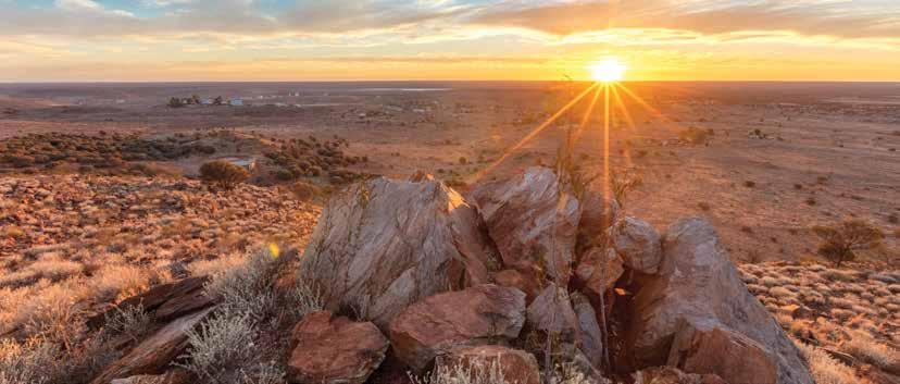
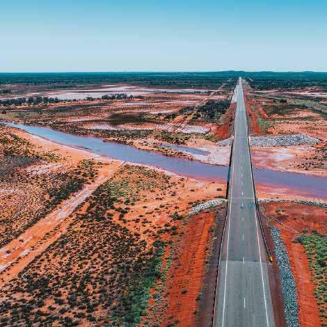
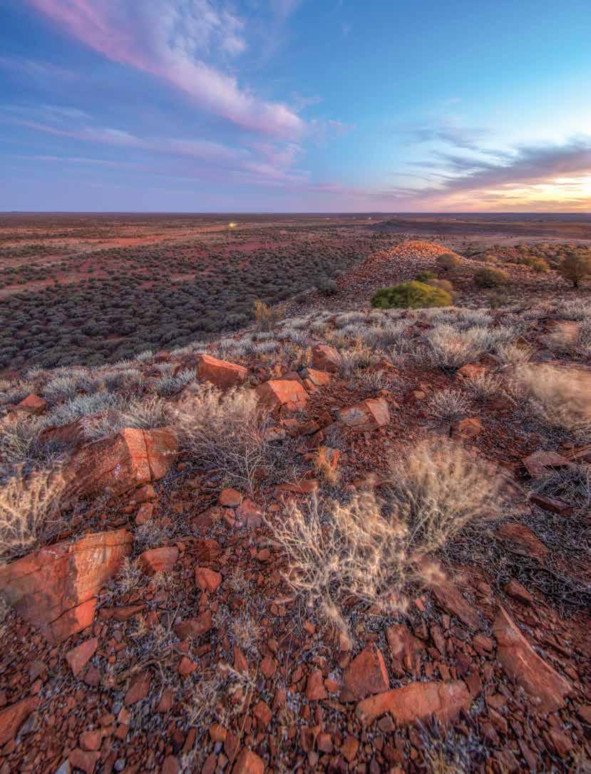
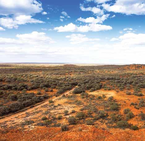
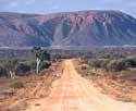
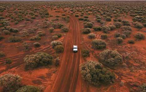
Hit the road and let endless horizons lead the way as you take in the dazzling displays of wildflowers, rugged rocky outcrops, wild woodlands, brilliant beaches, and vast open plains of Australia’s Golden Outback. Networks of road trips sprawling throughout the region will take you far and wide, covering 54 per cent of Western Australia.
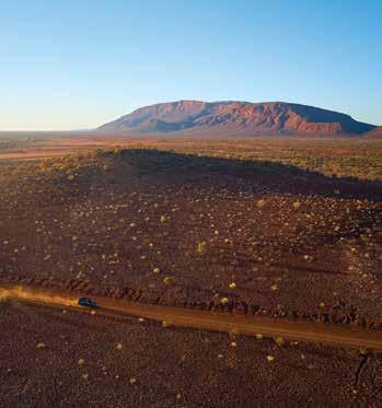
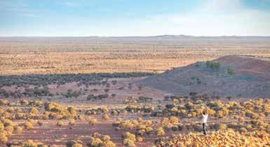
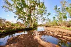
In the north discover Gascoyne Murchison, the red heart of the state where pindan soils sweep the plains and station stays abound for a true-blue outback experience. The expansive ranges and massive Mount Augustus / Burringurrah are majestic sites to behold.
Venture to the Wheatbelt where country charm emanates, carpets of canola sweep over rolling fields, and quaint streetscapes light up with character. The iconic 100m wide Wave Rock is a must-see sight, and immersive farm stays and fresh produce will give you a rich taste of the region.
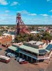
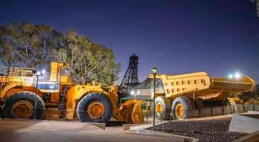
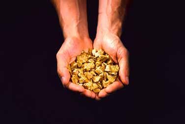
If the Gascoyne Murchison is the red heart of the region, Kalgoorlie and the Goldfields is its heart of gold. History and heritage of wild gold rush days of the late 1800s will forever be imprinted here, despite the modern mining boom transforming the Kalgoorlie-Boulder City into a progressive place to explore.
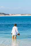
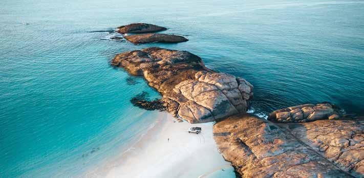
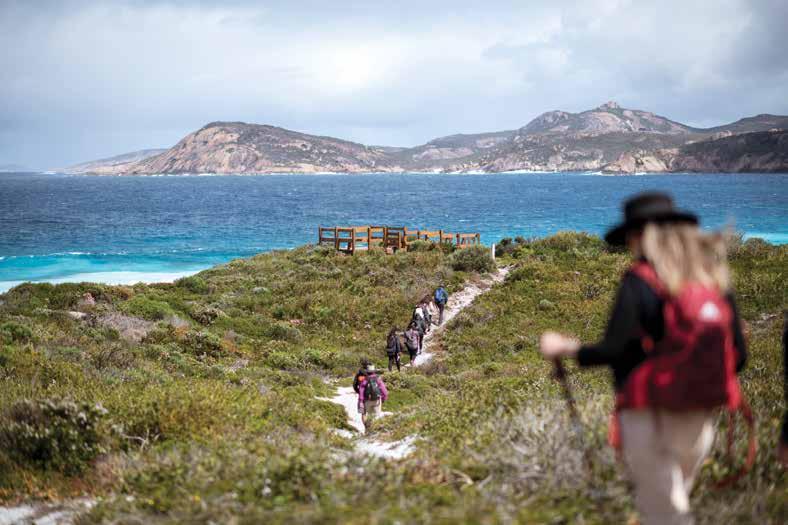
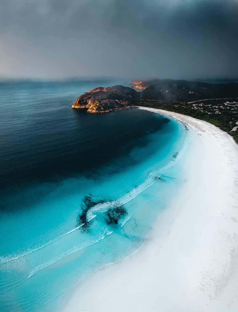
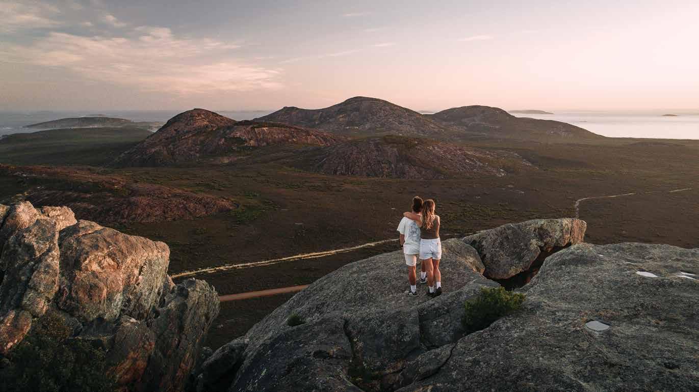
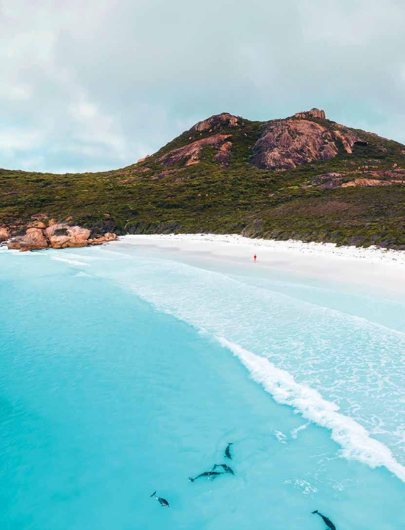
Travel further south and find the spectacular coastal destinations of Esperance and the Fitzgerald Coast. Glistening blue waters, snow-white beaches and over 100 islands are in stark contrast to the red earth of the surrounding outback, making for an invigorating spot to cool off and bathe in tranquillity. Cape Le Grand National Park and Fitzgerald River National Park are paradises of biodiversity to discover.
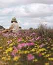
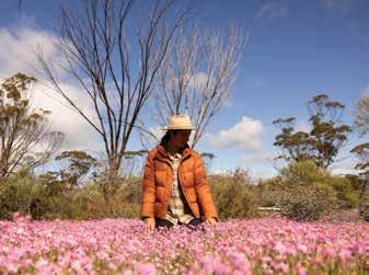
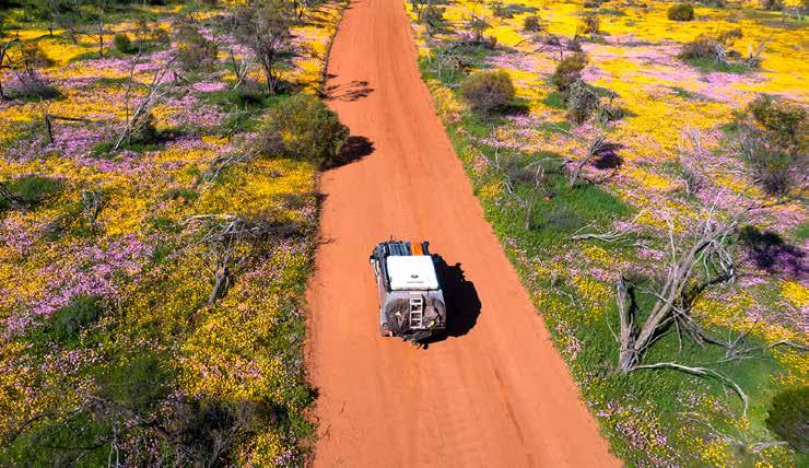
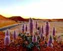
Spectacular displays of wildflowers bloom all around in season, erupting from August in the north and until November in the south. Discover these magical displays of colour on one of the regions many wildflower trails.
Walk the lands and stretch your mind back to over 60,000 years ago when Aboriginal people first began tending to this Country. Ancient Aboriginal culture and remnants of history run deep through Australia’s Golden Outback and are inspiring to observe and understand.
While accessible to even the most inexperienced tourer, this is territory that should be respected. Use this guide to thoroughly plan ahead, contact our local visitor centres, and ensure you equip yourself properly to make the most of your adventure ahead.
With so much natural beauty to explore in this vast and varied region, when you immerse yourself in its rich experiences, the time is always now.
PUBLISHED BY Vanguard Publishing
PRINTED BY Vanguard Print
Distributed by Vanguard Distribution
EDITORIAL ENQUIRIES
editor@vanguardpublishing.com.au
ADVERTISING ENQUIRIES natalie@vanguardpublishing.com.au
DESIGNER Cally Browning
FRONT COVER Lake Ballard, Golden Quest Discovery Trail
VANGUARD MEDIA GROUP
26 John Street, Northbridge WA 6003
Ph: 08 6323 1389
www.vanguardmediagroup.com.au
2:25pm wednesday. lion tamed.
Slowly but surely, you’re working out how to tame this toddler. His attention span can now stretch up to six minutes per activity, so you keep a steady stream of distractions lined up when you go out. You have about four minutes left before that babycino loses its fascination – long enough to plan out your next holiday stop. You picked up a colouring-in sheet and pencils on your way in. That should take care of providing you with some extra planning time. For keeping everyone entertained, there’s no place like Dôme.
domecoffees.com


Disconnect from the world and embrace the elements in Esperance
Discover one of the world’s largest outdoor galleries at Lake Ballard
Detour off the coastal highway to experience the rural lifestyle with an outback station stay
Journey along the Golden Quest Discovery Trail and uncover the stories of prospecting and pioneers
Marvel at rare and exquisite wildflowers throughout the vast outback
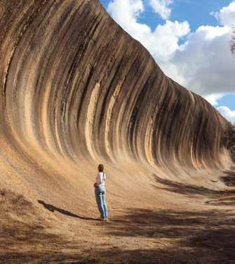
Catch some waves of a different kind at Wave Rock
Surround yourself in a biodiversity-rich paradise within Fitzgerald River National Park
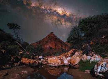
Be awestruck by the outback’s dark skies and the brilliance of its stars
Discover paddock to plate and farm life experiences throughout the Wheatbelt
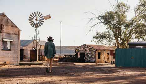
Travel back in time and visit the Gwalia ghost town
Embark on a hike or simply marvel at the world’s largest rock, Mount Augustus
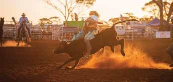
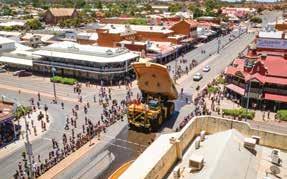
Put on your cowboy boots and hat and experience Outback Rodeo
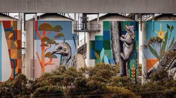
Embark on a tour along the Public Silo Trail to witness aweinspiring art on a grand scale
FEBRUARY
• Darkan Sheepfest
MARCH
• Kondinin Gourmet in the Garden
• Wagin Woolarama
APRIL
• Kickstarters Gascoyne Dash
• Merredin Show
• Nullarbor Muster
• Quindanning Picnic Race Day
MAY
• Burringurrah Festival of Fire, Mt Augustus
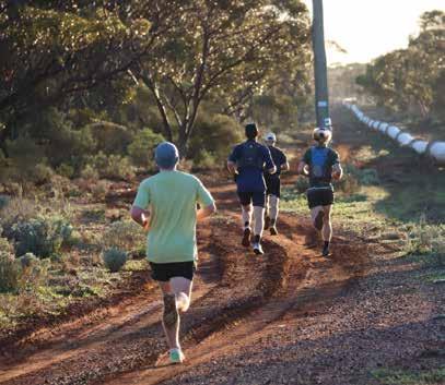
• Pipeline Challenge
JUNE
• Goldfields Cyclassic
• Leonora Golden Gift Weekend
JULY
• Goldfields Pipeline Marathon
AUGUST
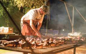
• Australia’s Biggest BBQ
• Coolgardie Rodeo
• Dowerin Field Days
• Junction Races
• 100 Yrs Kingsford Smith Mail Run Celebrations
• Murchison Camp Oven Muster
• Sandstone Art Show
• Wyalkatchem Rodeo

SEPTEMBER
• Bike it to Ballidu Gravel
• Coolgardie Day
• Dalwallinu Wattle Week
• Esperance Wildflower Festival
• GROUNDED Esperance Hiking Festival
• Lake Perkolilli Red Dust Revival
• Landor Races
• Meekatharra Outback Festival
• Moora Show
• Mt Magnet Races
• Newdegate Machinery Field Days
• Pingelly Flowers Arts Music (FAM) Festival
• Ravensthorpe Wildflower Show
• Wave Rock Weekender
OCTOBER
• Boulder Cup
• Cunderdin Classic Car Show
• Kalgoorlie Cup
• Kalgoorlie Desert Race
• Kulin Bush Races
• Lake Yealering Regatta
• Laverton Race Day
• Moora Cup
• Reynoldson Reserve Wildflower Festival
NOVEMBER
• Balmy Nights Esperance
• Boddington Lions Rodeo
• Narrogin Revheads Weekend
DECEMBER
• Pingelly Christmas Festival
• St Barbara’s Festival
Scan here to discover more amazing regional events
Australia’s Golden Outback is rugged and beautiful, full of vast stretches of dry plains. Exploring it is a true adventure, warranting considered preparation. Here are a few top tips from the experts at Western 4W Driver to get you started.
1. Get your vehicle serviced before you depart.
2. Share your plans.
3. Carry two to four litres of water per person, per day.
4. If you break down or get stuck, stay with your vehicle.
5. Fuel up when you can. Don’t expect the next petrol station to be around the corner.
6. Check your tyre pressure, battery levels, coolant, engine oil levels and lights, daily.
7. Check current road conditions prior to departure. Visit travelmap.mainroads. wa.gov.au/Home/Map
8. For the best mobile connectivity, use Telstra.
9. Visit plugshare.com for electric vehicle charging stations.
Here’s a handy checklist of important items to carry on your journey:
✔ A first aid kit
✔ A good quality, 12-volt air compressor. You will need it if you want to drive on sand or corrugated roads.
✔ A quality GPS and carry a paper map road book as back up. Don’t rely on Google Maps.
✔ Cash with a range of notes and change. Don’t rely on internet.
✔ Dirty gear bag and bin bags. If you brought it with you, take it with you.

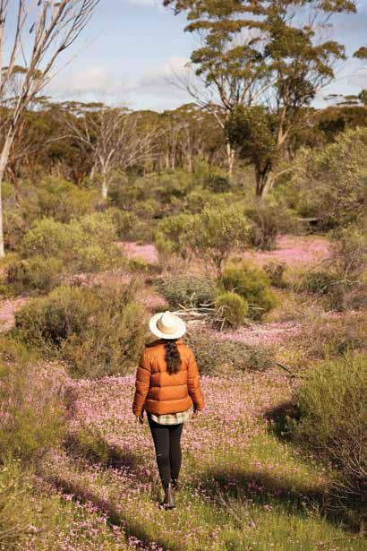
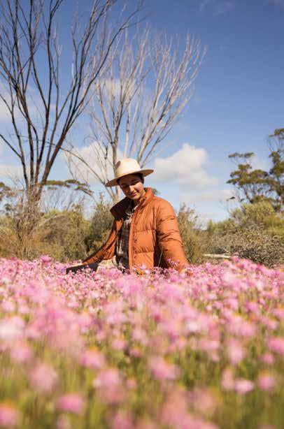
Hit the road and admire the magic of wildflower season in Western Australia’s Golden Outback, from endless inland plains to remote and rugged coast.
By TORI WILSON
As late winter and early spring approach, the vast outback springs to life with over 12,000 varieties of wildflowers erupting from the earth. A myriad of colours studded across sweeping plains herald the onset of spring. A wet winter, especially in the north, enhances this spectacle. From late July, as the season moves south, landscapes from golden canola fields to flower-studded cliffs beckon visitors to revel in their beauty. One of the most immersive ways to experience this is on one of the self-drive wildflower trails
that wind their way around the region, offering an array of sights. Most are 2WD accessible, with accommodation options like farm stays and station stays welcoming travellers along the way.
In the Gascoyne-Murchison region, wildflower season starts as early as July. Here, mulla mulla, sturt desert pea, and a host of other flowers thrive. The nine-day Road to the Rock road trip is the ultimate way to take in the region and its floral delights. Must-experience highlights of the route include the majestic Mount Augustus adorned with wildflowers,
colourful trails along the Gascoyne River, plus the gushing waterfalls and gorges of Kennedy Ranges.
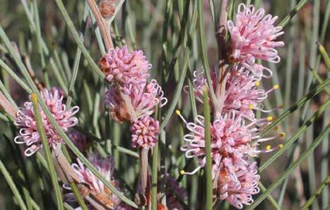
By August, the wildflower season is ablaze across the Wheatbelt, in all its glory. Travellers are greeted by golden canola fields, the coveted wreath flower and a vast array of delicate orchids — from startling white sugar orchids and sunshine-hued cowslip orchids, to the incredible greens and reds of the many spider orchids. Make your way through northern Wheatbelt towns such as Wubin, Buntine, Latham, Dalwallinu and Perenjori — renowned for dense blooms. Expect to admire carpets of everlastings, the unique and distinctive wreath flower, bright pink native foxgloves, many species of orchids, grevillea, acacia, purple darwinia and dampiera, thriptomene and many more distinctive wildflowers.
In the northeast, take your time meandering the many towns, from Wyalkatchem with its melaleuca and verticordia, to Wongan Hills with its Koorda rose, tinsel lily and delicate orchids. View a rich array of flora, extraordinary rock formations and ancient Aboriginal history along the way.
In the southeastern Wheatbelt, the diversity of wildflowers will inspire all. Explore the region’s salt lakes; picnic at Australia’s third-largest monolith, Kokerbin Rock; hunt for the holy grail of wildflowers — the rare Queen of Sheba orchid; and take in sights of the iconic Wave Rock / Katter Kich, the English name
Sept 2025:
Dalwallinu Wattle Week
Esperance Wildflower Festival
8th-21st Sept 2025: Ravensthorpe Wildflower Show
31st Oct-2nd Nov 2025: Reynoldson Reserve Wildflower Festival, Wongan Hills
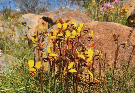
chosen aptly for its uncanny shape.
Also in August, Kalgoorlie and the Goldfields come to life with wildflowers like bush tomatoes and daisies.
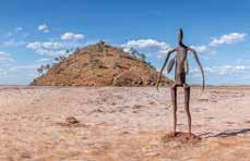
Experience maximum regional highlights by exploring natural attractions like the Yellowdine Nature Reserve, Boorabin National Park, the heritage-listed Niagara Dam, and Lake Ballard — with its striking Anthony Gormley sculptures amid the swathes of wattles. From Merredin to Kalgoorlie, the highway is bursting with blooms. Admire the flame grevillea, grass leaf hakea and Roe’s featherflower, as well as a collection of semi-arid banksias including the rare Lullfitz’s banksia.
By late August, the wildflower season reaches Esperance and the Fitzgerald Coast. Hopetoun is the gateway to Fitzgerald River National Park — a UNESCO World Biosphere Reserve with 1,800 types of spectacular plant species, like banksia, coneflowers, starflowers, smokebushes and numerous orchids. You may even spot rare royal and pincushion hakeas. Noteworthy eye-candy includes the qualup bells in Ravensthorpe and picturesque views of flower fields from Frenchman Peak in the Cape Le Grand National Park. Set to the backdrop of the vast blue sea, this is a breathtaking area to admire native blooms.
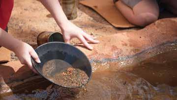
✔ Try your luck on a gold prospecting tour
✔ Don hi-vis and tour the Super Pit
✔ Explore the region’s history at a local museum
✔ Make an epic journey of discovery through the Norseman Heritage Trail
✔ Marvel at the Gormley Sculptures at Lake Ballard
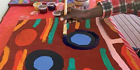
✔ Explore Aboriginal history on a cultural tour
✔ Wander through Kalgoorlie’s Heartwalk trail to 50 stunning murals
✔ Amble along Coolgardie’s dog-friendly Bluff Trail Walk
✔ Explore the fascinating Gwalia ghost town and museum
✔ Unearth the virtual journey of gold via the Heart of Gold Discovery Trail
✔ Take a break and experience the local flavours of an outback pub
From the fervor of the early gold rush days to the vast expanse of contemporary mining, Kalgoorlie/ Karlkurla and the Goldfields encapsulate the essence of adventure and the allure of the outback. Dive deep into Western Australia’s golden core and unearth its wonders for yourself. Anchored by the ambitions of early prospectors, the bustling cityscape of KalgoorlieBoulder showcases exquisite colonial designs, transporting you to a golden age of audacious adventurers and their dreams of prosperity.
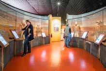
Start your exploration at the Museum of the Goldfields. This treasure trove dives deep into the region’s gilded history, allowing visitors to relive the days of the gold rush and understand its profound impact on Australia’s development. Here, vibrant exhibits narrate tales of fortune, dreams, and the indomitable human spirit that thrived during the gold frenzy.
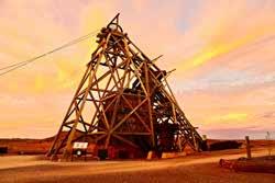
From the museum, visitors naturally gravitate to Hannan’s North Tourist Mine, named after Paddy Hannan, whose discovery in 1893 triggered the gold rush. Today, it stands as an evocative monument to those tumultuous times, transporting visitors back to an era of adventurers, dreamers, and fortune-seekers.
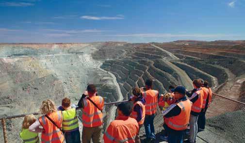
Yet, what’s history without a touch of grandeur? The Super Pit delivers this in spades. As one of the largest openpit mines globally, it’s a testament to human ambition. Viewing platforms around this massive expanse allow visitors to witness mining operations, offering an awe-inspiring perspective of the sheer scale and determination that drives the industry.
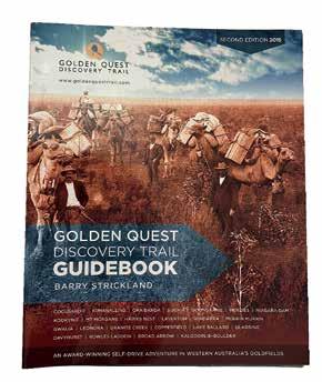
For a truly immersive experience of the area’s goldrush heritage, hit the road along The Golden Quest Discovery Trail (GQDT). This 965km adventurous drive from Coolgardie to Laverton weaves through historic gold rush towns, revealing tales of fortunes, tragedies, and the indomitable spirit of pioneering gold seekers.
Nature, however, offers a pristine counterpoint to the Goldfields’ industrial
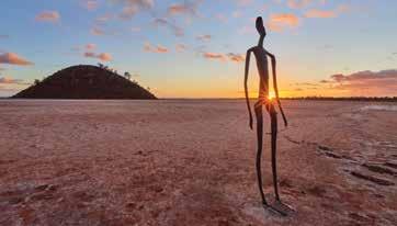
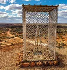
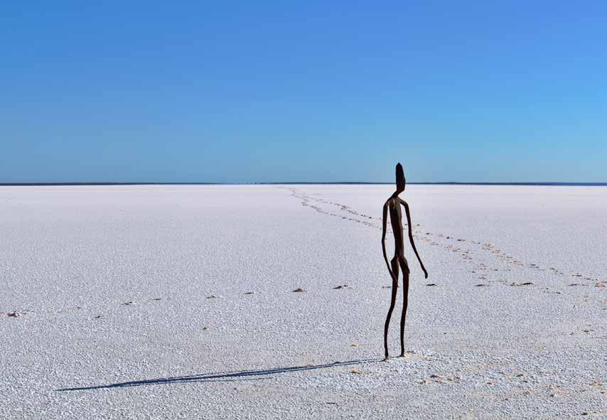
spirit. Lake Ballard — a highlight along the GQDT — stands as a silent witness to the region’s timeless beauty. Famous for its statues by artist Antony Gormley, this vast salt lake offers a surreal landscape where creativity thrives. Equally enchanting is Lake Lefroy in Kambalda, a gleaming expanse that mirrors the sky, presenting a breathtaking tableau of reflections, especially during sunset.
The spirit of exploration is celebrated grandly at Laverton’s Great Beyond Explorers’ Hall of Fame. Honouring the brave souls who charted unknown terrains in search of gold, it’s a tribute to the adventurers who laid the foundation for the Goldfields’ legacy.
If you’re driven by the urge to traverse, the Outback Way beckons. Often dubbed as ‘Australia’s longest shortcut’, this epic six-day journey departs Laverton and weaves through ancient landscapes, Indigenous communities, past the iconic Uluru while venturing through the Northern Territory, arriving in Winton, Queensland.
In the heart of the Goldfields lies Gwalia, a ghost town that whispers tales of yesteryears and is home to an insightful museum. Here, Hoover House stands out, once home to the 31st US President Herbert Hoover during his stint as a mining engineer. It’s a rare opportunity to step into a dwelling that has hosted world leaders, offering glimpses into the personal side of history.
For a more intimate look into the lives of those who shaped the region, the Warden Finnerty Cottage in Coolgardie stands as a preserved piece of the past. This historic residence, with its authentic furnishings and artifacts, paints a vivid picture of life during the gold rush. Nearby, the Coolgardie Bluff offers panoramic views of the town and surrounding landscapes, making it a popular spot for picnics and reflection.
In Kalgoorlie and the Goldfields, every corner, from the shimmering lakes to the hallowed halls of history, beckons with a story. For those who seek adventure, knowledge, and beauty, Kalgoorlie and the Goldfields promise a journey gilded with memories.
By Road:
Kalgoorlie is the transport hub of the Goldfields, with a good network of sealed roads that link Kalgoorlie with Perth, Esperance and the Northern Goldfields, Murchison and Gascoyne.
By
Rail:
Transwa operates the Prospector train, with daily services between Perth and Kalgoorlie.
Tel: 1300 662 205.
If you have a valid Western Australia Pension Concession Card you are entitled to one free return trip or two single trips per calendar year on the Transwa network. Book your Transwa Seniors Break in person at the WA Visitor Centre or call on 1800 812 808 or Kalgoorlie Boulder Visitor Centre on 08 9021 1966.
The coast to coast Indian Pacific rail service, travelling between Sydney, Adelaide and Perth, travels through Kalgoorlie weekly in each direction.
Tel: 13 21 47.
By Air
Kalgoorlie-Boulder is serviced by Qantas and Virgin Airlines with multiple daily flights from Perth. Skippers flies from Perth to Leonora, Laverton and Wiluna.
Tel:
Qantas 13 13 13 | Virgin 13 67 89 | Skippers 1300 729 924
By Coach
Goldrush Tours operates a weekly service linking Kalgoorlie-Boulder, Menzies, Leonora and Laverton.
Tel: 1800 620 440.
Coolgardie Bluff Cultural and Heritage Trail
Kalgoorlie Heart of Gold Discovery Trail (1.9km)
Karlkurla Bushland Park walking trail (4km)
Malcolm-Laverton Rail Trail (37.8km)
Leonora Heritage Trail (1.6km)
The Breakaway Trail at Niagara Dam (1.6km)
Wiluna Heritage Trail (2.9km)
Embark on the epic Golden Quest Discovery Trail and return home rich with golden memories and a heart full with heritage.
By JOHN BRADSHAW
Road trip. Is there a more evocative phrase? Two words that bring images of blazing through wide open, beautiful country to mind. Adventure. Experience. Making memories that will last a lifetime.
How lucky are we then to have one of the world’s most rewarding road trips right here in Western Australia?
The Golden Quest Discovery Trail ticks all the boxes that a perfect highway adventure should tick — breathtaking landscapes, a glimpse into enthralling, enlightening and occasionally dark history, and warm hospitality from true blue sandgropers.
That sounds like a big ask — we’re talking about a big bit of story-laden bush here — but the GQDT has been proving it’s up to the job since 2003. Since then, tens of thousands of travellers have trusted it to deliver an itinerary to leave them starstruck and have come home richer than they left.
All a well-prepared traveller needs to set off on this epic journey, is a minimum
three days up their sleeve, a vehicle, and a yearning to get into Australia’s outback and discover. Any 2WD will do; but a 4WD will enhance the journey and ability to make the most of being out bush.
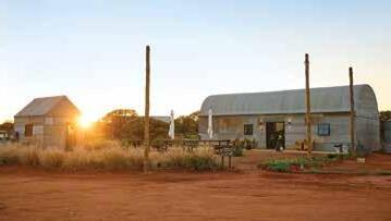
Coolgardie is the point of departure. This charismatic outpost, steeped in history, is a comfortable, friendly stop for travellers; but it once reigned as the third-biggest settlement in WA, and the biggest in the bush. Gold made it boom and it was key in Australia becoming what is today.
It’s an apt place to begin a journey that will take eager explorers to some equally iconic overnight stops. Destinations vary, as it’s up to each traveller to choose their awe-inspiring adventure — Menzies and Laverton are included along the longer trips, while all itineraries include insightful stays at the inspiring Kookynie and Leonora-Gwalia.
All these outposts have their own stories to tell, but a favourite among locals and travellers alike has to be Kookynie’s proudest boast. The tiny
town — population 12 — welcomes the friendly face and character, Willie, a horse that was once lost in the outback and has now made Kookynie home. Rescued by locals and nursed back to health, Willie is now celebrated around town and, like all good residents, he drops into the town’s pub every day for his lunch — quite the experience for newcomers on their GQDT journey.
Along the GQDT, natural splendour and historical significance knows no bounds. The picturesque Niagara Dam is the perfect place to settle in for a picnic; while a visit to Leonora’s renowned Gwalia Museum is a heritage haven and echoes of a bygone era. Just a 40-minute drive from Menzies reveals the extraordinary Lake Ballard, a vast salt lake adorned with 51 striking sculptures—silent steel guardians overlooking this serene bush jewel.
These destinations are not merely coordinates on a map, but realms of discovery, inviting travellers to immerse in the enduring beauty and heritage of this outback quest. The places you’ll go and the things you’ll see will never leave you.
Ultimately, though, all three tours have to come to an end, but once they do your adventure is only just beginning — welcome to Kalgoorlie-Boulder.
This unique bush capital is unlike any other city on earth. A place that boasts a, let’s just say, colourful history, here you’ll find a modern, vibrant bolthole that still has echoes of the truly wild west that built it.
Indigenous culture regains strength alongside settler history, in a city that was built on overcoming adversity and succeeding against the odds. The Hannans Tourist Mine, tram tour and Super Pit are just the top of the iceberg for highlights relating to the activity that spurred the flow of gold.
Those on a tighter schedule can also make Kal their base, and follow one of three day tours or two overnight trips that take in many of the gems the Goldfields has to offer. Each is a delight, an experience, an adventure, and each will make you want to come back for more.
The good news? There’s so much here in this big red land that, when you do return, we’ll always have something new to show you.
The Golden Quest Discovery Trail provides comprehensive directions and advice, including important tips on respecting Indigenous communities and lands, as well as sorting out where to bed down.
While most roads are sealed, some are not, so leave your metro driving habits at home. And watch the weather — a change in the elements means more here than remembering to get your washing in on time.
Don’t worry though — the offical website has all the information and resources any traveller needs to work alongside nature in this ruggedly beautiful part of the world.


naturalgoldnuggets.com.au


4 days
Unsealed roads
Shires on your journey: Laverton
Known as ‘Australia’s Longest Shortcut’, the 2,800km Outback Way offers an awe-inspiring journey through the red centre from the gold rush town of Laverton, Western Australia to Winton in Queensland.
The Outback Way crosses central Australia through the Great Victoria Desert encountering vast salt lakes,
6 days | Sealed and unsealed roads
Shires on your journey: Coolgardie, Kalgoorlie, Menzies, Laverton, Leonora
Travel from Kalgoorlie-Boulder on an amazing loop trail from Coolgardie to Laverton through incredible goldfields towns rich in heritage, history and charm. This is a true outback adventure
which unearths the riches of the Goldfields’ 120-year old gold rush and showcases what is still one of the world’s biggest gold producing regions.
The 96km trail leads you from the buzz of one of the largest opencut gold mines on earth, the Super Pit, to the striking beauty of artist Antony Gormley’s 51 steel statues on Lake Ballard. There are a number of beautiful nature reserves and
scenic nature reserves, waterholes, natural springs and caves. The route runs via Uluru, Alice Springs and Winton where you’ll learn about ancient Aboriginal culture, life in the outback, and the natural environment of Australia’s central desert. Visitors can enjoy searching for treasure boxes hidden along the world’s longest ‘Outback Way Geocache Trail’.
This route is fast becoming one of the must-see and mustdo adventure drives. Permits are required.

6 days Unsealed roads
Shires on your journey: Wiluna
Get ready to experience one of Australia’s most famous and challenging 4WD tracks and tell your friends you conquered the rugged and unforgiving Gunbarrel.
Built by surveyor Len Beadell, this 1,400km outback adventure is perfect for the experienced and wellprepared 4WD enthusiast.
The route runs from Wiluna in WA’s Northern Goldfields to Yulara in the Northern Territory. Highlights include Giles Weather Station, Banjo Creek, Mt Beadell, Lasseter’s Cave and Docker River. You’ll find original bores and blaze trees along the trail, and keep an eye out for the interpretative plaques as well as wild camels and dingoes. Travelling with another vehicle is recommended and permits are required.
campsites, including the man-made lake Niagara Dam. Tour the town of Kookynie, (the pub is well worth the stop) as well as old camps in the town of Gwalia, near Leonora, where the 31st United States President, Herbert Hoover, lived and worked.
The linked Green Trail highlights sites in the Kambalda and Coolgardie areas with outstanding environmental, historical or cultural values such as beautiful woodlands and natural salt lakes.
Anne Beadell | 5-7 days (unsealed roads)
Leonora Loop Trails | 2 days (unsealed and sealed roads) Norseman Heritage Trail | 1-2 hours (sealed roads)

LEONORA LOOPS TRAILS
1 day each / Sealed and unsealed roads
Shires on your journey:
Leonora
Comprising two self-drive routes, the Leonora Loop Trails are a great way to learn about this fascinating part of the northern goldfields.
Learn about coach roads, stock routes and the historic mines and pastoral stations that this area is famous for. From dramatic breakawys to samphire flats, salt lakes, mulga plains and magnificent marble gums on spinifex sands, the landscape varies as you drive the trails.
Both trails start in Leonora and a day is recommended for each. With interpretative sites every 15-30 kilometres, there is plenty of opportunity to stop and see the sights.
The Darlot Loop is 345km and takes in locations including the Terraces, Malcolm Dam, Sullivan Creek and the Granites.
The Agnew Loop is 300km and you will discover places including Poison Creek, Leinster, Goanna Patch and the old mining settlement of Lawlers.
Most of the trails are gravel and are generally suitable for a 2WD vehicle unless there has been heavy rain, in which case a 4WD would be necessary.


Scan the QR code for more insights.

From Laverton WA to Winton Qld 1600km of bitumen and 1100km of gravel.


The name ‘Kalgoorlie’ is derived from the Wangai word ‘Karlkurla’, or ‘Kulgooluh’, meaning ‘place of the silky pears’.
Located in the Eastern Goldfields region of Western Australia, the City of Kalgoorlie-Boulder is a vibrant regional centre with a population of 30,000. Its rich history and culture provide an experience like no other. There is something for everyone including a variety of activities and attractions, captivating scenery and enthralling culture.
Kalgoorlie-Boulder promises a unique adventure to all those who visit.
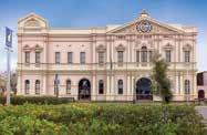
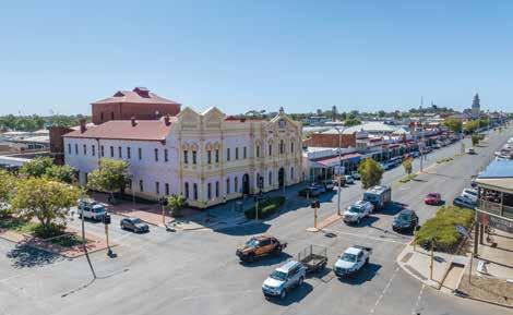
Kalgoorlie Town Hall
The Kalgoorlie-Boulder Visitor Centre is located inside the Kalgoorlie Town Hall. Whether you need information on the area or just want to marvel at this magnificent building, the Kalgoorlie Town Hall is the heart of the city. Guided tours of this historic building are available on Monday and Wednesday at 10.30am.
Boulder Town Hall and Goldfields War Museum
With its pressed tin ceilings, wrought iron balustrades, and beautifully preserved interiors, the Boulder Town Hall is the home of the Goldfields War
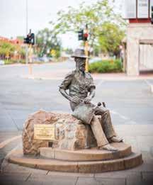
In 1893, prospectors Patrick (Paddy) Hannan, Tom Flanagan, and Dan Shea, were travelling through the region, when one of their horses cast a shoe. During the unexpected interruption to their journey, the men noticed signs of gold located on a hill north of what is now the City of Kalgoorlie-Boulder. In the hope of discovering gold, they decided to stay and investigate.
On 17 June 1893, Hannan filed a Reward Claim, leading to hundreds of men swarming to the area in search of gold; and Kalgoorlie, originally called Hannan’s Find, was born. However, it was the major gold discoveries of William Brookman and Sam Pearce, who would go on to make up the richest square mile on earth known as “The Golden Mile,” that secured the region’s future.
Museum. Opened in 1908, not only is the building itself of historic architectural significance, but it also provides a detailed history of the Goldfields. Visitors come from far and wide to the hall to see the priceless and world-renowned Philip Goatcher stage curtain. This
In 1896 the town site was laid out and gazetted. The first town blocks sold quickly, then a second sale a few months later saw blocks sold for twice as much!
Building then began in earnest. Elaborate business facades and public buildings lined Burt Street. Grand brick homes were built for doctors and public officials. In 1908 the Boulder Town Hall was opened.
In 1989, the Town of Kalgoorlie and Shire of Boulder formally amalgamated to create the City of Kalgoorlie-Boulder.
spectacular artwork, painted in the Trompe-l’œil or ‘optical illusion’ style, depicts the scene of the Bay of Naples and has hung in the hall since 1908. Local guides offer tours of the Boulder Town Hall on Tuesdays and Thursdays at 10.30am and the Goldfields War Museum
on Thursdays at 1.30pm, including war artefacts from the Boer War, World Wars I and II, Korea, Malaysia, Vietnam, and more recent conflicts and peacekeeping missions. Immerse yourself in stories of the Goldfields region and its warfare history – a worthwhile and enriching experience for locals and visitors alike. Tours: $10 adult, $8 concession, $4 child (includes tour badge giveaway).
Museum of the Goldfields
The Museum of the Goldfields showcases the rich history of the Eastern
Goldfields and the city’s mining heritage. Step back in time to what life would have been like for prospectors and their families in the early 1900s and explore the state’s largest collection of gold bars and nuggets.
Open daily, 10am to 3pm (closed public holidays. Open on ANZAC Day 1pm-3pm).
Immerse yourself in the rugged wilderness of Australia’s Golden Outback, which has remained largely unchanged for billions of years. Travelling this region will arouse a feeling of venturing back into ancient times, especially when you’re with an Aboriginal guide who can reveal astonishing secrets handed down by their ancestors over thousands of years.
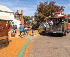
Hannans North Tourist Mine
During your visit, climb aboard a giant 793C haul truck, stand in the shovel of a 994F loader, listen to Paddy tell his tale of discovery, pan for gold and try your hand at a game of two-up.
Open daily, 9am to 4pm (closed public holidays).
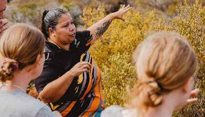
With a variety of experiences in hunting, food gathering, bush survival and bush medicine, your guide will take you on a unique journey along ‘hidden tracks’, which unveil a fascinatingly different perception of the country’s rich natural treasures and the influential role they play in paving their lifestyle.
For the Aboriginal people, their spiritual connection to the land and natural environment is a key part of their identity.
Their knowledge of the country and the sacred places that are scattered through it are priceless gems in a fast changing world and a deeply moving experience, that you’re sure to take home as lasting memories.
For more details about the full range of authentic Aboriginal tourism experiences in Australia’s Golden Outback and Western Australia, visit www.waitoc.com
The Western Australian Indigenous Tourism Operators Council (WAITOC) is the peak not for profit organisation representing Indigenous Tourism on Country, showcasing over 100 of the best of WA’s unique Indigenous Tourism experiences & authentic cultural offerings.

The Kalgoorlie Two-Up Shed
Experience the thrill of two-up, a classic Australian gambling game. As the only legal venue of its kind in WA, the Kalgoorlie Two-Up Shed is still in its original condition of corrugated iron and brush ring. Games are held on Sundays from 2.30pm.
Goldfields Arts Centre
Owned by the Perth Theatre Trust and proudly operated by the City of Kalgoorlie-Boulder, the Goldfields Arts Centre presents an annual program of events that provides unique cultural experiences and opportunities for residents and visitors alike. Stroll upstairs to the gallery, home to yearround exhibitions and public programs showcasing works of local artists, national and state touring exhibitions, and the City of Kalgoorlie-Boulder’s annual Art Prize and Art Collection.
Kalgoorlie Golf Course
The Kalgoorlie Golf Course is a premier, 18hole championship golf course, designed by top course architect Graham Marsh. The course is currently ranked no. 20 in the top 100 public golf courses in Australia and is also home to two holes of the Nullarbor Links — an 18-hole course spanning 1,365km from Ceduna in South Australia to Kalgoorlie-Boulder.
Karlkurla Bushland Park
A gateway to the Goldfields Western Woodlands, Karlkurla Bushland Park is 200ha of regenerative natural
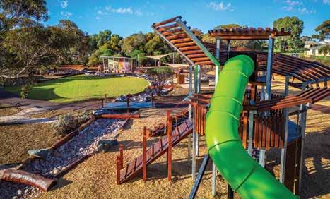
which are highlighted with interpretive flora signage throughout. The park is also home to a new large adventure playground, suitable for all ages.
Goldfields Oasis Recreation Centre
‘The Oasis’ is open year-round, and offers an Olympic-sized, heated indoor pool, child-friendly swimming areas, playgrounds, two waterslides, and a fully equipped 24-hour gymnasium with group fitness classes. The facility also boasts an indoor stadium, outdoor sporting field, spas, saunas, and a kiosk.
Hammond Park
Hammond Park is the jewel of KalgoorlieBoulder’s parks and reserves. It is a haven for a variety of birdlife, including peacocks and pink cockatoos, who wander freely around the park. Other popular features include an aviary, and

a miniature Bavarian Castle decorated with 40,000 gemstones. Pack a picnic, take the kids to the playground, or watch the world go by over a drink or light lunch from the on-site café.
There is always something happening in the City of Kalgoorlie-Boulder. To see what’s on during your stay visit ckb.wa.gov.au/events
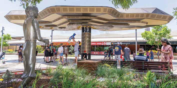
St. Barbara’s Square
Discover St Barbara’s Square in the heart of Kalgoorlie’s CBD on Hannan St. Reopened in 2023, the multi-million-dollar precinct embraces a fusion of heritage, nature, and industry, and is a testament to the community’s vibrant past and present. It features an enchanting nature playground where the iconic silky pear (Karlkurla) takes centre stage. Venture

into a realm of play as you climb the towering structure to take in the views of the precinct, explore the vines between the giant seed pods and discover the animal art installations.
The hovering earth canopy and water play area is the centrepiece of the precinct. Inspired by the region’s long-standing relationship with the mining industry, the canopy’s water play resembles a mining blast, and provides relief if visiting in the hotter months. It includes a night time light show and plays a soundtrack composed of sounds from the Goldfields landscape, weather patterns, cultural stories and the spoken words of the Wongutha People.
The precinct is home to the City’s iconic St Barbara’s Statue, Patron Saint of Mines, and boasts one of WA’s largest First Nations art displays. The art can be seen throughout the precinct, and includes a range of wall murals and sculptures created by local artists.
St Barbara’s Square is open 24/7 with the canopy’s light show and soundtrack on rotation every 30 minutes. The water
play operates between 9am to 9pm in summer and 9am to 4pm in winter.
Heartwalk
Grab a coffee from a local café and immerse yourself in culture with an award-winning arts trail. Heartwalk features over 60 street art murals, installations and sculptures, created by artists from the Goldfields and beyond. Self-guided walking trail maps can be downloaded at artgold. net.au/artmap
Stay a while with free RV stays
In addition to services offered at local caravan parks, the City of KalgoorlieBoulder offers two free 72-hour RV stay areas for self-contained vehicles. Centennial Park - Hannan Street, Kalgoorlie. Set alongside shady parklands and located within walking distance to Kalgoorlie’s CBD.
Lake Douglas - Enjoy the beauty of the outback in this bushland setting - located 15km west of KalgoorlieBoulder off the Great Eastern Highway.

32 Paitt St, Willagee WA 6156 08 9331 3933 | info@want-tours.com.au www.want-tours.com.au


High-quality guided tours in comfortable vehicles for small groups. Tour modules can be easily combined and guarantee all-year round regular departures from two persons onwards. Consequently, according to budget and planned duration, your individualised holiday can be found.
WHAT’S ON
Australia Day Celebrations — 26 Jan 2025
Sunset Concert Series — Jan – Feb 2025
Multicultural Festival — June 2025
Goldfields Cyclassic — June 2025
ArtPrize — Sept/Oct 2025
WA PGA Championship — Oct 2025
Lorna Mitchell Spring Festival — Oct 2025
Saint Barbara’s Festival & Parade — Dec 2025
Christmas in the City — Dec 2025
TOP ATTRACTIONS
Historic Town Halls / Karlkurla Park / Kalgoorlie Golf Course / Goldfields Arts Centre / Super Pit
Lookout / St Barbara’s Square
WILDFLOWERS TO DISCOVER
Everlastings / Large-fruited Mallee / Mulga / Spider Flower / Yellow Cassia

VISITOR INFORMATION
KALGOORLIE TOWN HALL
316 Hannan Street, Kalgoorlie T: (08) 9021 1966 E: visitors@kalgoorlietourism.com W: kalgoorlietourism.com
BOULDER TOWN HALL


Located 15km west of Kalgoorlie-Boulder off the Great Eastern Highway.
There are a variety of tours to choose from in Kalgoorlie-Boulder. Hop on a historic tram for daily tours of Kalgoorlie-Boulder, that will take you to several local attractions. Spend the day as a gold rush pioneer, exploring 50 sites on a Kalgoorlie-Boulder Audio Walking Tour, available for hire from the Kalgoorlie-Boulder Visitor Centre. Wander the streets of Kalgoorlie’s CBD to explore 11 locations for the #heartofgold Discovery Trail.
557km east of Perth
Spend time in the footsteps of early goldfields pioneers as you explore the dramatic and rich history of Coolgardie, “Mother of the Goldfields”.
A kaleidoscope of history-making events highlight how the discovery of gold in 1892 led to the creation of a ramshackle tent city, before it went on to become the third largest city in Western Australia, servicing a population of 25,000 residents and 700 mining companies.
Lions Lookout
Offering spectacular panoramic views to the east of Coolgardie, as seen by Arthur Bayley and William Ford when they arrived in 1892 and discovered gold.
Historic Cemeteries
History is etched into the headstones of the Pioneer and Coolgardie Cemeteries. Among these headstones you will find John Holland and his wife; explorer Ernest Giles; and Bertha Finnerty, wife of the first Magistrate and Warden of the goldfields.
Goldfields Exhibition Museum
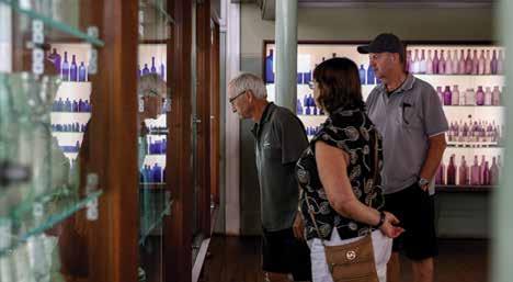
This museum is housed in the historic Warden’s Court Building (built 1898). Each room features fascinating displays of the dramatic and often tragic stories of life in and around Coolgardie during the gold rush days. Here you will also find the Varischetti mine rescue story, the famous Waghorn bottle collection and an extensive pharmacy display.
Warden Finnerty’s Residence
Built by the Bunnings brothers in 1895, Warden Finnerty’s is a beautiful old house constructed of local stone for Coolgardie’s first Mining Warden and Resident Magistrate, John Michael Finnerty. During a visit here walk through the rooms containing lovely antique furnishings and chinaware which capture the feel of life in the 1890s. Enjoy a Devonshire tea from the verandah overlooking the Coolgardie townsite.
Visit Australia’s first nickel township originally established in 1897 as a gold mining town during the gold rush frenzy. Virtually deserted by 1908, the town came alive again during the 1960s with the discovery of one of the world’s largest nickel sulphide deposits and the opening of Australia’s Golden Outback’s first nickel mine known as St Ives.
Kambalda Memorial Garden
A memorial dedicated to the men who lost their lives whilst working on mines around Kambalda, as well as the hundreds of men who died from illnesses attributed to mining.
Red Hill Lookout
Visit Red Hill which overlooks Lake Lefroy and active mining operations. The bush trails take you around the hill, showcasing some mining history and rare flora and fauna.
WHAT’S ON
Coolgardie Rodeo and Ute Muster — 15-17 Aug 2025
Coolgardie Day — 14 Sept 2025
TOP ATTRACTIONS
Goldfields Exhibition Museum / Warden
Finnerty’s Residence / Ben Prior Park / Cave Hill / Lake Lefroy
WILDFLOWERS TO DISCOVER
Mulla Mulla / Hop Bush / Eremophila / Ruby Dock
COOLGARDIE VISITOR CENTRE
62 Bayley St (Warden’s Court Building), Coolgardie T: (08) 9026 6090

E: visitors.centre@coolgardie.wa.gov.au W: coolgardie.wa.gov.au
Red Hill Pioneer Cemetery
Here you will find only a handful of graves of the early pioneers of Kambalda that give a glimpse into the early history of the town.
Nullarbor Links
The world’s longest golf course! Play the par 3, Hole 15 Golden Eagle in Widgiemooltha and the par 4, Hole 16 Silver Lake in Kambalda.
Located along the western end of the Great Central Road, which forms part of the Outback Way, is the outback mining town of Laverton – once known to be the wildest town in the west.
Laverton was founded by Dr Charles Laver, a keen prospector who rode his bicycle from Coolgardie into the area and was active in attracting investors to the small town.
From the very beginning, Laverton developed as the centre for commercial and social activity. Today, the small town with a population of just over 340 people, features a range of accommodation options including a caravan park, hotel and motel. Laverton also has a supermarket, service station and sports club.
For those following the Golden Quest Discovery Trail, Laverton is the northern most site on the trail (site 13).
The Great Beyond Explorers’ Hall of Fame
Take a step back in time with explorers who led challenging expeditions through Central Australia during the mid to late 19th century. Using cutting-edge technology, the characters and their stories of the past are brought back to life, providing visitors with a rich visual history of the Northern Goldfields.
Windarra Mine Site Lookout
The lookout provides panoramic views over the famous Poseidon Nickel site and its main mining structures that remain standing.
Lonely Bush Graves
For those intrigued by the ghoulish and macabre, the lonely bush graves will
leave you with a chill down your spine as you note that disease, accidents, suicide and murder were common causes of death in the small town. Legend says that some past souls still haunt some areas of Laverton.
The Outback Way
AKA ‘Australia’s longest shortcut’, this 2,800km route that links Winton in Queensland to Laverton in Western Australia via Alice Springs and Uluru is an awe-inspiring journey through the heart of Australia’s most breathtaking and remote desert landscapes.
Laverton Aboriginal Art Gallery
The Laverton Aboriginal Art Gallery, managed by the Laverton Cross Cultural Association, is located in a historic mine manager’s house from the early 1900s. Established in 2002, the Gallery showcases and sells authentic Aboriginal art from the Laverton and Western Desert areas. Local artists create various items, including silk scarves, necklaces, paintings, boomerangs, painted emu eggs, and artefacts.
WHAT’S ON
Australia Day Breakfast & Activities — 26 Jan 2025
NAIDOC Celebrations — July 2025
Laverfest (Biennial) — Sept/Oct 2025
Laverton Race Day — late Oct 2025
TOP ATTRACTIONS
Laverton Outback Gallery / The Outback Way / Old Police Precinct / Explorers Hall of Fame / Golden Quest Discover Trail (site 13)
WILDFLOWERS TO DISCOVER
Sturt’s Desert Peas / Wattles / Hop Bush / Eremophila / Fruiting varietals such as Quandong, Native Apricot & Bush Tomato
THE GREAT BEYOND VISITOR CENTRE
Augusta Street, Laverton
T: (08) 9031 1361
E: greatbeyond@laverton.wa.gov.au
W: laverton.wa.gov.au
Free WiFi at Visitor Centre
Billy Goat Hill Lookout
Situated at the top of Hawks Place you’ll get a bird’s eye, panoramic view over the township and beyond.
Old Police Precinct
Visit the original police sergeant’s house, the police office and the gaol, all of which have been extensively refurbished in recent years. The buildings are open from 11am to 1pm daily or by appointment.


Laverton Aboriginal Art Gallery has a wonderful range of paintings and artefacts for sale, created by artists from Laverton and the Ngaanyatjarra Lands of the Western Desert region of Western Australia.
The unique works share the Tjukurrpa (Dreamtime) stories of this beautiful country and celebrate the cultural heritage of the region.
The Gallery is housed in a heritage building which was a mine manager’s house in the early 1900’s and is located on the corner of Augusta & Euro Streets, an easy walk from the Great Beyond Visitor Centre.
Monday to Friday 8am – 4pm or by appointment
2-4 Euro Street, Laverton WA 6440 (08) 9031 1395 gallery@lavertoncca.com.au


831km north-east of Perth
Leonora is located on Wangkatja Country and is a main regional centre in the Northern Goldfields, an area rich in history and stunning unique landscapes. The town’s history dates back to 1869, when explorer John Forrest and his party made camp near a hill and named it Mount Leonora. This prominent feature is an ancient Aboriginal spiritual site, associated with the Dreamtime story of the dingo, Baba Ngoorrba.
Gold was first discovered in the area in 1895 and a year later the townsite of Leonora was established. The town quickly grew and by the early 1900s had a population of over 1000 people. Leonora grew from the resourcefulness of early gold prospectors and pastoralists.
Malcolm Dam
Located 12km from Leonora, Malcolm Dam was built in 1902 to provide water for the railway. Today, this dam is a haven for birds and other wildlife.
The Terraces
A large breakaway formation about 40km north-east of Leonora provides good bushwalking and camping, and magnificent views for kms in every direction.
Leonora Heritage Trail
A showcase of the history of Leonora townsite can be found on the Leonora
Heritage Trail. The trail consists of 30 sites, including several old banks, hotels and churches, and the Barnes Federal Theatre.
Leonora Loop Trails
The Leonora Loop Trails are two self-drive trails and a great way to see the area and learn the history of the region. Each trail takes about a day, so allow two days to see everything, or you can combine them for a longer day of exploring.
Leinster is often described as an oasis in the desert. The town was first established in 1976 as a company town supporting the nickel mine of the Agnew Gold Mining Company. Here there are a variety of services available for travellers.
WHAT’S ON
Leonora Golden Gift — 31 May - 1 Jun 2025
TOP ATTRACTIONS
Hoover House / Abandoned Gwalia Cottages / The Terraces / Malcolm Dam / Poison Creek / Gold Prospecting
WILDFLOWERS TO DISCOVER
Eremophila / Parakeelya / Purple Flannel Bush / Sturt’s Desert Peas / Everlastings
LEONORA INFORMATION CENTRE
Cnr Tower & Trump Streets, Leonora T: (08) 9037 7016
E: library@leonora.wa.gov.au
W: leonora.wa.gov.au
See Outback Parks and Lodges advert on page 2
Gwalia Historic Precinct Gwalia, located approximately 3 km south of Leonora, is a truly unique and fascinating place to visit. Here you can wander around the abandoned miners’ cottages of Gwalia Ghost Town, learn about the history of the settlement and gold mine at Gwalia Museum, enjoy a Devonshire tea on the verandah of Hoover House while looking out over the working open pit mine, or stay a night or two in one of the period-style bedrooms at Hoover House Bed & Breakfast.
Found along the Golden Quest Discovery Trail (Site 6), Menzies is famed for its rich history, named after early prospector Leslie Robert Menzies. During the gold rush days of the 1890s Menzies was home to 10,000 residents, 13 hotels, three banks, breweries and cordial factories, a post office with a staff of 25, a school with 205 students, a public library and four churches. Today, Menzies is a smaller town, however it is again beginning to prosper.
Walking Tours
Explore the heritage and gain insights into the Aboriginal experience of Menzies with two self-guided walking tours – Our Place and Gubbee Menzies Wongi Our Way. Brochures are available from the Menzies Visitor Centre.
The railway station built in 1898 is a brick federation building and the last railway station remaining on the Northern Goldfields railway line. Other historic buildings include the Nursing Post housed in the former Menzies Warden’s

House, the old Menzies Hotel, the post office, tearooms and butcher (now Laurie’s Café), The Pioneer Store (featuring an Art Gallery) and the current Menzies Hotel — a place to enjoy a drink, have a meal and stay the night.
Tjuntjuntjara Community in the Great Victoria Desert
About 700km east of Menzies near the South Australian border, the Spinifex people express the traditional culture of Spinifex lands and lore through art.
Ballard
Located just 30 minutes by car from Menzies and 1.5 hours from Kalgoorlie, the iconic Inside Australia exhibition features 51 sculptures by internationally renowned artist Antony Gormley. With haunting skies, it is recognised as one of Western Australia’s best sites for stargazing. Free camping, toilets, and picnic facilities are available, as well as a black water dump station. Note: the road from Menzies to Lake Ballard is fully sealed.
Kookynie
Located on Site 9 of the Golden Quest Discovery Trail, Kookynie was originally a thriving township of more than 400 buildings and 2,500 people back in 1903. Now a ‘Living Ghost Town’ Kookynie’s stories are interpreted at the Visitor Information Bay. From there you can visit many historical sites such as the ruins of the Cosmopolitan Hotel, the Cosmopolitan mine site, the cemetery, and the Grand Hotel - a real outback pub with cold beer and comfortable accommodation.

WHAT’S ON
Anzac Day Dawn Service & Breakfast –25 April 2025
Remembrance Day Ceremony –11 Nov 2025
Community Christmas Party –Dec 2025
TOP ATTRACTIONS
Lake Ballard / Niagara and Kookynie
Ghost Towns / Mount Owen Stargazing
Site / Menzies Town Hall and Historic Buildings / Niagara Dam
WILDFLOWERS TO DISCOVER
Eremophilas / Everlastings / Goodenias / Sturt’s Desert Peas / Parakeelya / Monkey Orchids / Mulla mulla
MENZIES VISITOR CENTRE & MENZIES COMMUNITY RESOURCE CENTRE
Cnr Shenton & Brown Streets, Menzies T: (08) 9024 2702
E: visitors@menzies.wa.gov.au W: menzies.wa.gov.au
Niagara Dam
Completed in 1898 to provide water for the steam trains operating on the Kalgoorlie-Menzies line, Niagara Dam has spent the past 100 years as a picnic and swimming spot. Free camping facilities include shady sites, gas barbecues, picnic tables, toilets, and a black water dump point. Located at site 8 on the Golden Quest Discovery Trail.
The ideal place to base yourself with historic and natural sites close by. Menzies Caravan Park is conveniently located adjacent to the Visitor Centre, which is the booking centre and go-to point for information about the region.
Self-contained modern cabins | Caravan and camping sites Dedicated disabled amenity with wheelchair access. Camp kitchen | Dump point | Dogs on leads welcome. Prepaid diesel and unleaded fuel (24/7) available in Menzies town centre. For after hours bookings, please either book online or call the after hours mobile: 0473 633 149
1,542km north-east of Perth 550km north-east of Laverton
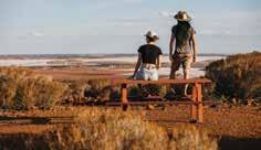
The Shire of Ngaanyatjarraku encompasses an area of 159,948 sq km and is diverse in natural beauty from the magnificent Rawlinson Ranges to the red sandy plains of the Gibson and Great Victoria Deserts. The distinctive red sand and blue skies form a spectacular context for a diverse array of desert rangelands and arid zone flora and fauna. Rocky escarpments and other landforms give texture to this beautiful country.
The shire is home to 10 Aboriginal communities scattered throughout the district with a total population of approximately 1,650 people. The main regional centre is Warburton, situated on the Great Central Road.
The Great Central Road forms the main thoroughfare for the Shire of Ngaanyatjarraku. It is part of the Outback Way, a 2,800km trans-national link stretching from Laverton in Western Australia to Winton in Queensland. The Outback Way passes through Australia’s most spectacular outback country, including the Uluru-Kata Tjuta National Park.
Pass through the Rawlinson Ranges, Walter James Ranges, and Gill Pinnacle.
Tjulyuru Cultural and Civic Centre, Warburton
The Tjulyuru Cultural Centre complex is a cultural hub for visitors and locals based at the Warburton Community on the Great Central Road. Visitors to the area are encouraged to visit the Tjulyuru Regional Arts Gallery and check out the arts, crafts and publications for sale at the Warta Shop. Tjulyuru Regional Arts Gallery exhibitions draw from contemporary Ngaanyatjarra art practice in the region and the Warburton Art Collection - reputably the world’s largest collection of community-owned and controlled Aboriginal art.
Giles Weather Station, Warakurna Giles Weather Station (est. 1956) is a fullyfunctioning meteorological observation station based at Warakurna Community. Visitors can view the daily release of the observation balloon at 8.45am CST from the Weather Station car park.
Kutjarra (rest stop)
The Yarla Kutjarra wayside stop between Warburton and Warakurna has been provided by the Ngaanyatjarra people as a place where visitors can camp and enjoy the peace and tranquillity of the Ngaanyatjarra Lands without disturbing any of the culturally significant places along the Great Central Road.
TOP ATTRACTIONS
Tjulyuru Cultural and Civic Centre / Giles Weather Station / Yarla Kutjarra / Surveyor Generals Corner
WILDFLOWERS TO DISCOVER
Balsam Wattle / Balonne Parakeelya / Soft Spinifex / Calytrix Warburtonensis / Mulga Grass
VISITOR INFORMATION
Great Central Road, Warburton Community
PMB 87, Kalgoorlie
T: (08) 8956 7966
E: mail@ngaanyatjarraku.wa.gov.au
W: ngaanyatjarraku.wa.gov.au
PERMITS:
permits@ngaanyatjarra.org.au
T: (08) 8950 1711
W: dplh.wa.gov.au/entrypermits
Surveyor General’s Corner
The intersection of the borders of the Northern Territory, South Australia and Western Australia is known as the Surveyor General’s Corner. Access to the area is limited to guided tours and visitors require a special permit. Contact Wingellina Community on (08) 8956 7566.
Local Roadhouses
Roadhouses form vital sources of water, fuel, food and accommodation along the Great Central Road. Two roadhouses operate in the Shire of Ngaanyatjarraku – Warburton Roadhouse and Warakurna Roadhouse. Both facilities operate seven days a week (please check opening hours) and offer fuel, fast food and supplies, and motel or campground accommodation for travellers.
966km north-east of Perth
The Shire of Wiluna covers an area of 184,000 sq km and is predominately mining, pastoral and native title land, including Indigenous Protected Areas at Matuwa (Lorna Glen Station), Kurrara-kurrara and Birriliburu.
The town of Wiluna is on the edge of the Little Sandy Desert, located east of Meekatharra (unsealed) and north of Leinster (sealed) on the Goldfields Highway. It’s the gateway to the Canning Stock Route which runs north to Halls Creek, and the Gunbarrel Highway that runs east to Alice Springs. Good fuel and grocery outlets are available in Wiluna.
Canning-Gunbarrel Discovery Centre
The Canning-Gunbarrel Discovery Centre is a beautiful complex including five historical and heritage-listed buildings, a central courtyard and displays of the town’s mining and pastoral histories, Aboriginal culture, and
the Canning Stock Route and Gunbarrel Highway.
Tjukurba Art Gallery
The Tjukurba Art Gallery offers visitors a sample of unique and affordable paintings by the Birriliburu artists. The gallery is located in the eastern building of the historic former Wiluna District Hospital (now Canning-Gunbarrel Discovery Centre).
Statues of Warri and Yatungka
Visit the town’s statue Last of the Nomads and read the plaque to learn of the beautiful love story behind their culturally frowned-on relationship. Their deaths marked the end of a nomadic lifestyle that has stretched back more than 40,000 years. Not to be missed!
Pioneer Cemetery
Visit 19 grave sites identified from shire records dating from 1893 to 1903 when the cemetery was moved because of periodic flooding in the area.
Gunbarrel Highway
The Gunbarrel Highway is a popular four-wheel drive which takes you across the ranges and central desert to Warburton and Alice Springs.
Canning Stock Route (CSR)
CSR wells number 1 and 2 are close to the town, as are the original cattle loading yards. The turn-off for well no. 1 is located 3.8km north of town on Neds Creek Road and then 3.5km to the west. Well no. 2 is located approximately 3km
Whether you’re setting off on your epic drive along the Canning Stock Route or Gunbarrel Hwy, or newly arrived after your desert adventure, you’ll get a warm welcome and complimentary hot drink at the Canning-Gunbarrel Discovery Centre, a true celebration of the area’s remarkable history. T: (08) 9981 8009


Canning-Gunbarrel Discovery Centre and Tjukurba Art Gallery / Wiluna Town Heritage Trail / Statues of Warri and Yatungka, the Last Nomads / Mingal Pool / Clay Pans
WILDFLOWERS TO DISCOVER
Sennas / Eremophillas / Sturt’s Desert Peas / Purple Mulla Mulla / Pipitjarli
SHIRE OF WILUNA 70 Wotton Street, Wiluna T: (08) 9981 8000 E: reception@wiluna.wa.gov.au W: wiluna.wa.gov.au
to the north, also along Neds Creek Road and then to the east along the CSR track.
North Pool is located on the Canning Stock Route within 20km of town and is a pleasant spot for a picnic and fantastic for bird watching.
Enjoy a maximum of three night’s of free accommodation by parking your caravan at the temporary RV site, located next to CanningGunbarrel Discovery Centre.

Co-located within the Discovery Centre view authentic Aboriginal artworks available for purchase by Martu artists and an opportunity to meet the artists who still live a semi traditional lifestyle. T: (08) 9981 8080 E: reception@wiluna.wa.gov.au www.tjukurbagallery.com.au


Explore woodlands and the goldrush past on the Golden Quest Discovery Trail.
A guidebook is available from Visitor Centres along the trail and select bookstores, with audio available to download via the website.
Complementing the guidebook and audio is a free companion app that provides additional interpretive and regional information.


✔ Marvel at the scenery along the Great Ocean Drive
✔ Explore biodiversity hotspots at Fitzgerald River National Park
✔ Check out paddock-to-plate and bush-to-bottle products from local farmers
✔ Visit Esperance’s full-sized replica of Stonehenge
✔ Experience immersive glamping on Woody Island or spend the day exploring the waters with a snorkel
✔ Explore Esperance’s Museum Village and Growers’ Markets
✔ Take an immersive cultural tour and discover the rich history of Esperance and its surrounds.
✔ Take to the skies to see the rainbow lakes dotted across the countryside
✔ Discover larger than life art, admiring the Ravensthorpe Silo Art and Farm Gate Art Trail
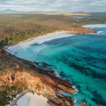
Tucked away in Australia’s Golden Outback, Esperance and the Fitzgerald Coast beckon as cooling coastal havens where nature’s wonders unveil themselves in every nook and cranny.
With their dazzling blue waters, pristine snow-white beaches, and some of the country’s most awe-inspiring national parks, these destinations offer a unique blend of tranquillity and adventure, ideal for family getaways, group escapades, or introspective solo journeys.
Esperance serves as the gateway to the region’s mesmerising coastal beauty and intriguing hinterland. One of its star attractions is the majestic Cape Le Grand National Park, a sanctuary that harmoniously blends sheltered bays with imposing granite peaks, vast heathlands, and diverse native fauna. Within the national park is Lucky Bay, voted World’s Best Beach in 2023. Known for its kangaroos, you may be fortunate enough to spot them. Please remember they are wild animals, so please don’t touch or feed them. The park’s campgrounds, such as Le Grand Beach and Lucky Bay, immerse visitors in this nature wonderland, allowing for intimate experiences with the environment.
Beyond Cape Le Grand, the UNESCO recognised Fitzgerald River National Park emerges as another natural masterpiece. Notably, Four Mile Beach and Hamersley Inlet are remarkable spots within this park, offering spectacular landscapes and biodiversity hotspots. Serving as the entrances to this park’s beauty and worthy of exploration are Ravensthorpe, host of the world’s biggest wildflower show, and Hopetoun, known for its rugged coastal scenery and fishing.
The coastal journey is made even more enchanting with two iconic drives. The Fitzgerald Coast Loop is a 40km circuit that extends from the Esplanade, past Twilight Bay and out to Pink Lake (which is no longer pink). It brings travellers through the heart of the region’s captivating landscapes, while The Great Ocean Drive, stretching from Esperance’s Esplanade to the magical Twilight Bay, offers an unparalleled coastal experience. These routes offer the quintessential Australian beach
experience, where the vastness of the open coast allows for personal retreats into secluded coves, natural rock pool aquariums, and mesmerising sunsets.
In Esperance town, a vibrant blend of culture, history, and beach life awaits — from its lively music scenes, outdoor cinemas, and bustling twilight markets to the picturesque James Street Precinct. Landmarks like the Whale Tail Sculpture and a full-size replica of Stonehenge add to the town’s charm and unique character.
Just a stone’s throw from the coast, the Recherche Archipelago stands as a testament to the region’s maritime wonders. Comprising 105 islands, this archipelago offers an unparalleled marine sanctuary, home to dolphins, seals, and seabirds. Take to the sky on a scenic flight and admire one of Australia’s most spectacular coastlines, along with the brilliant rainbow lakes and their multitude of colours.
The rich Indigenous culture of the region can be explored through local eco-culture tours, where visitors can delve into the Dreaming stories and songlines of the land, gaining insight into Esperance’s Wudjari name, Kepa Kurl, which means “where the waters lie like a boomerang.”
Lastly, for those looking to extend their adventure, the journey across the Nullarbor Plain offers a deep dive into Australia’s outback culture. Starting at Norseman, with its quirky corrugated iron dromedaries symbolising the bygone camel trains, this route takes travellers to iconic landmarks like the Caiguna Blowhole and the historic Eucla Telegraph Station ruins.
Whether you’re a nature enthusiast, history buff, or someone seeking solace, these coastal jewels of Australia’s Golden Outback await your discovery.
By Road:
Road conditions are excellent, with sealed main roads heading in and out of Esperance.
Esperance is accessible from many of the drive routes from Perth and the Nullarbor
By Air:
Esperance is serviced by Rex with daily flights from Perth.
Tel: 13 17 13.
Skippers provides charter services from Perth to Ravensthorpe.
Tel: 1300 729 924.
By Coach:
Transwa operates regular coach services from Perth to Esperance and from Albany to Esperance via Ravensthorpe.
Tel: 1300 662 205.
Frenchman Peak Walktrail, Cape Le Grand NP (3km)
Great Ocean Walk and Cycle Trail, Esperance (17km)
Mt Arid, Cape Arid NP (3.6km)
Coastal Trail, Cape Le Grande NP (20km)
East Mt Barren, Fitzgerald River NP (3km)
Hakea Walk Trail, Fitzgerald River NP (23km)
Hamersley Inlet Trail, Fitzgerald River NP (3.6km)
The Woodlands Walk (0.6km)
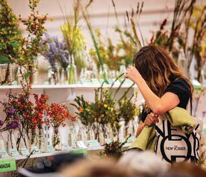
In Esperance, experience authentic flavours as fresh as they get — sourced locally from bush, land and sea.
By ALEXANDRA CASEY
When it comes to natural attractions, this secluded south-coast WA town has it covered. Its allure is synonymous with some of Australia’s most celebrated beaches and pristine national parks. But in recent years, it’s become the paddock-to-plate microbrewery, bushto-bottle distillery, and fresh-fromthe-ocean foodie scene that have the masses talking. From the blue to the bush, Esperance — or Kepa Kurl, as it’s known to the Wudjari Noongar people — is a hotspot for fresh, local produce worth writing home about.
Taylor St Quarters (or ‘Quarters’ as the locals like to call it) is a buzzing culinary scene, humming cocktail bar and charming, live music venue — is an
apt destination to begin the ultimate Esperance foodie quest. Woven into the walls of the popular hang-out is the vibrant historical tapestry of a building that once housed an old hospital and tearooms. TSQ supports small local producers to source the finest and freshest flavours from land and sea, as it’s no secret the south western corner of Australia is home to some of the country’s best food and wine. The menu is constantly evolving to reflect the seasons, think tempura fish tacos, local beef burger and beer and miso braised lamb ribs.
Feast on bread as fresh as it gets at Bread Local and Little Local Having been raised in Esperance by a broadacre wheat farmer, owner and
baker Tiffany Brown has an innate passion for the process of sourdough. “I love that no two days are the same when you’re working with natural fermentation — it’s always a wonder seeing the bread emerge from the oven.” While the bread is hard to beat, Tiffany says it’s the vanilla slice with passionfruit glaze that attracts the pilgrims.
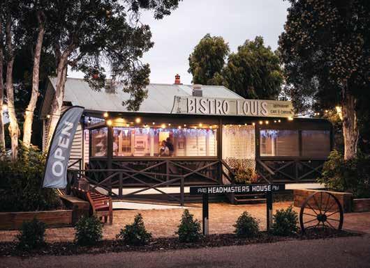
Bistro Louis is a classic French eatery, open for breakfast, lunch and dinner. It’s located in the old schoolmaster’s house
within Esperance’s Museum Village – a collection of historic buildings relocated from around town and now housing a quirky selection of shops and galleries. Don’t leave without ordering the panfried bread and butter pudding with boozy raisins and custard.
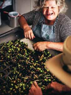
Perched among a grove of olive trees with vistas of Cape Le Grand and Frenchman Peak, olive oil is the lifeblood of all operations at Yirri Grove Olive Farm. “Our restaurant menu begun with extra virgin olive oil,” owner and operator Anne O’Neill says. “It’s the start of a meal, the start of a conversation, the start of a lifestyle and for us, the start of a business.” According to Anne, their signature product features on every plate, all of which are baked and prepared onsite. Locality is central to production and due to their remote and rural location, food accessibility is a common struggle. For this reason, a vegetable patch was introduced — the

root of their Mediterranean-inspired meals. Born in England, Anne traces her love for living off the land back to her grandparents and their farm. “Everything was grown and produced — I remember learning so much from them.” As a teenager Anne migrated to a remote Australian sheep station where fresh food was non-existent, so they grew their own. Inspired by nature, sustainability and an appreciation for the beauty of home, Lucky Bay Brewing is guided by a paddock-to-pint ethos, with beers named in honour of Esperance locations. It’s the only WA brewery that uses raw barley direct from local farmers to make beer. Their emphasis on locality reduces their carbon footprint, as the process doesn’t require the water, energy or food miles that malted barley does to be produced. The award-winning microbrewery also doesn’t use any preservatives, only pure ingredients, fresh rain water and real hops. According to


head chef Sam Burgell, “beer literally flows into our kitchen.” The woodfired pizzas made from local flour and beer yeast are the menu hero, while other share-style offerings include pulled pork tacos and chargrilled lamb skewers. Driven by a love for spirits, surf and environmental conservation, the McCarthy-Price father-son duo behind Esperance Distillery Co is passionate about local flavours. Housed inside a once derelict fish processing plant, the award-winning distillery, which launched in December 2020, has grown from a micro-distillery operating out of a garage with a 30-litre pot still, to small-batch producing gins showcasing native botanicals — with many grown in their own garden. Inspired by the region’s beauty, the gin range features the names of Esperance locations, while the watercolour label artwork was designed by local botanist Katie White.


By DANIELLE AUSTIN
Fitzgerald River National Park is renowned as one of Australia’s most significant botanical parks. The crowning jewel of the UNESCOrecognised Fitzgerald Biosphere, the park is home to one-fifth of the State’s identified plant species. With no single wildflower season, blooms burst forth year-round and nature cycles in tandem with the six Noongar seasons.
Birak (December-January)
Extending from December through January, Birak is the start of the warm season. Bright yellow buttercups, bulbous banksia flowers and heady eucalyptus can be discovered everywhere. Many plants produce intoxicating nectar, so you may encounter some of the 210 species of birds found in Fitzgerald River National Park, as well as curious honey and pygmy possums. Melaleucas and coastal moorts shade the coastal campgrounds, protecting native fauna.
Bunuru (February-March)
The heat intensifies in Bunuru, the orange season of February through to March. Under the crush of the blazing sun, it’s a perfect time of year to stick close to the Fitzgerald River, or in the shallows of the coastline. Despite the heat, native eucalypts burst into bloom and you can also admire towering salmon gums, the tallest trees in the area.
Djeran (April-May)
April and May bring Djeran. This green season welcomes cooler weather and pleasant breezes, with early banksia flowers, qualup bells and hakea beginning to appear.
(June-July)
As the skies open up and a chill descends the ground, the Fitzgerald Coast welcomes Makuru. This rainy season spans June and July, and it brings a smattering of melancholy flowers, including the purple-blue
Experience the heart of Esperance at Clearwater Motel Apartments. A five-minute walk from local cafes and restaurants, town centre, cinemas and foreshore, our accommodation offers unrivalled convenience.
A selection of 20 spacious one and two bedroom studio rooms, fully self-contained apartments and a three bedroom Beach House. Air-conditioning, TVs, free Wi-Fi, laundry facilities and parking.

1A William Street Esperance T: (08) 9071 3587 E: enq@clearwatermotel.com.au www.clearwatermotel.com.au
mauves and lilacs of the herbaceous blueberry lily and the grassy purple flag forming groundcover.
Djilba (August-September)
Carpets of wildflowers erupt in Djilba, transforming the Fitzgerald Coast into a kaleidoscope of colour. This season is about new life, with hundreds of native wildflower species greeting the warmer weather. Discover local qualup bells with their soft pink drooping petals, as well as countless native orchids.
Kambarang (October-November)
In October and November, Kambarang brings a return of radiant weather. Verticordias or feather flowers are in full bloom and smoke bush envelopes the landscape. Acacias, banksias, kangaroo paws, orchids, recently burnt balga grass trees and the vibrant orange flowers of the Australian Christmas tree all emerge to mark the end of the year.
TIME YOUR TRIP - the spectacular Ravensthorpe Wildflower Show in September has over 700 flowering species on display as well as a series of curated events.
The world-class Hakea Trail and the Mamang Trail are the ultimate hikes to witness wildflowers in all their glory. You can also spot wildflowers by road on the 40-kilometre Ravensthorpe Range drive.

fishing in the
the
with our
with over 40 years experience. Book one of our fishing charters or design your own fishing or scenic charter. Individual or group bookings. 0429 106 960 blackjackcharters.com.au Blackjack Charters


The Esperance Promise was created to promote and encourage responsible travel. By making the promise you’re making a commitment to respect the environment and local community that you’re visiting.
WHILE TRAVELLING IN ESPERANCE - KEPA KURL COUNTRY, I PROMISE TO EMBRACE THE ELEMENTS OF THIS LAND AND ENSURE MY VISIT IS SUSTAINABLE AND RESPECTFUL.
• I will enjoy following paths less trodden, yet, I will stay on the marked trails.
• Camping under the stars will be a wonder, enjoyed from designated camp areas.
• Wildlife will remain wild, never fed or touched by human hands.
• I will feel the wind on my face, and swim in the cool sea. Leaving only footprints in the sand.
• Walking on the earth will ground me. Boots scrubbed clean, to stop the spread of weeds and disease.
• When embarking on a 4WD adventure, I promise to be prepared and respectful of others.
• I will admire the power of the ocean, being mindful of swell, rips, and slippery black rocks.
• I will feel the sun on my back or the warmth of a campfire, never forgetting to be bushfire smart.
• Time away from technology’s range will recharge me. Yet, I will plan to have no coverage.
• Where locals live in their element and visitors feel like locals. I agree to be kind, take it slow and go with the flow.
• I make this promise with nature and the community of Esperance. To care for this special place that you call home.


Esperance Central offers several styles of self-contained accommodation at Esperance Central Apartments and The Beach House & Villas. Both are within walking distance to the centre of town and across the road from the Esperance foreshore, have ample parking and awesome complimentary WIFI. Esperance Central Apartments
73 The Esplanade, Esperance The Beach House & Villas
20 The Esplanade, Esperance Tel: 0427 774 287
info@esperancecentral.com
Book online: www.esperancecentral.com

1-2 hours | Sealed roads
Shires along your journey: Esperance
The road trip that should be on everyone’s bucket list, the Great Ocean Drive is a 40km circular loop showcasing a coastal wonderland of stunning, powder-white beaches, rocky headlands, small bays of crystalline water, steep cliffs and hidden ocean pools.
Highlights include the Rotary Lookout (an ideal first stop), the famous Twilight Bay, Observatory Point and Lookout, 11 Mile Beach, and Nine Mile Beach renowned for its serene rock pools. If you’re feeling adventurous, you can also cycle or walk the trail, following the coast from the Esplanade all the way to Twilight Bay.
The best way to travel the Great Ocean Drive is slowly. Plan a picnic lunch, throw in your towel, picnic rug, snorkel and fins, surfboard or just your walking shoes. Wherever you go on this loop, the views are constant and amazing.

2 Days | Sealed roads
Shires along your journey: Dundas
The Nullarbor Plain, with the epic Eyre highway to follow, is easily one of Australia’s greatest road trip adventures. Take off into the west from the border town of Eucla down the sweeping highway into the scenic lower Nullarbor around Mundrabilla, then pause to look back at the lookout at Madura.
The Eyre Bird Observatory, a remote research station, has fantastic programs (check them out online) and the 10th hole of the Nullarbor Links course at Cocklebiddy is a top introduction to Nullarbor Links — the world’s longest golf course. The aptly named 90 Mile Straight will bring you to Balladonia by nightfall.
Explore the remains of Skylab station — which plummeted to earth in 1979 — at the nearby Balladonia Hotel, before continuing west. Take your time and savour the sense of space and timelessness that makes the Nullarbor unique. Soon you’ll arrive at Norseman, the end of this 880km trip and the Eyre Highway. Next to the town’s cute tin camels is a photographic gallery where the region’s stunning landscapes are captured in prints. To appreciate the vastness of the place, drive up to Beacon Hill Lookout before heading either north to Kalgoorlie or south to Esperance.


7 days | Sealed roads
Shires along your journey: Kondinin, Lake Grace, Dumbleyung, Wagin, Ravensthorpe and Esperance
Esperance is a picture-perfect reel of nature’s wonders with an abundance of pearl-white beaches boasting translucent blue waters, and rugged national parks. Expect to experience a glorious journey, worthy of this stunning destination, on the 700km stretch between Esperance and Perth.
You can take two routes, so mix it up and see different perspectives of the Wheatbelt region. Go out via Hyden so you can take the famous surfing selfie at Wave Rock, then admire the bright white salt lakes at the Lake King Nature Reserve. Ravensthorpe is home to the superb 25m high wildflower murals of the PUBLIC Silo Trail, and maybe detour south to the picturesque coastal town of Hopetoun before making your way back to Esperance.
On the way back, stop for more
supersized art at Newdegate, before heading through the Southern Wheatbelt countryside including Lake Grace, Dumbleyung and Wagin.
In Esperance, spend at least a day exploring Cape Le Grand National Park and, while there, climb Frenchman Peak for stunning views of the ocean and the myriad offshore islands. Meet the photogenic kangaroos of Lucky Bay
Ravensthorpe Ranges 2- 3 hours (sealed/unsealed roads)

Scan the QR code for more insights.
along the way, swim, snorkel or walk on some of the most incredible beaches in the world, or simply chill with a craft beer at the local Lucky Bay Brewing.
Finally, book a boat cruise to explore some of the 105 islands of the Recherche Archipelago, locally known as the Bay of Isles. You can also see the islands from the air if you hop on a scenic flight of the local coastline.
PROUDLY PART OF

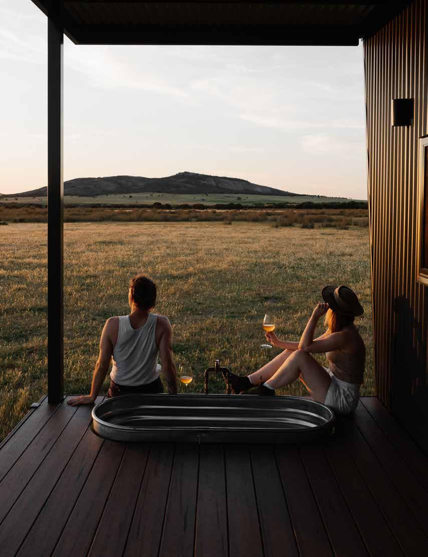
Check in to one of our premium, uniquely located, off-grid cabins and check out from it all. Book today.
Experience the raw natural beauty of Esperance. Nestled along the southern coast of Western Australia, Esperance boasts otherworldly beaches and coastlines. Discover unique national parks and hike bush trails and granite peaks. Immerse yourself in the rich cultural tapestry, where a thriving arts scene and local producers draw inspiration from nature and the seasons. Here you don’t just visit - you become a part of it. With every walk barefoot in the sand, every swim in the cool sea, and every breath of fresh country air, prepare to be transformed by nature – oh and don’t forget to pack a jumper!
This spectacular park is a place for the truly adventurous and bold explorers. You can see ruins of homesteads, buildings and dams constructed by pioneer graziers in the early 1870s, camp under the stars and walk through the magnificent landscapes to your heart’s content. 4WD vehicles and outdoor experiences are highly recommended. Check road closures and conditions before heading out.
Kepwari Wetland Walk Trail
Kepwari is the local Aboriginal word for ‘place of moving water’ and this interpretive walk trail in the wetlands is designed to be a learning experience with bird hides and seating along the way. A short drive from town and nestled out of the wind, this one way 3.5km trail is perfect for families with young children. For a different perspective, explore the lakes from kayak or canoe.
Lake Monjingup
An ideal place for a picnic, birdwatching and walk through the bush or along the boardwalk, visit the Environmental Centre at Lake Monjingup for information about the various plants and animals which live there. With toilets and picnic tables, the reserve makes for a fantastic day out for the whole family.
Peak Charles National Park — Karrukarrunya (4WD recommended)
This ancient granite peak and its companion, Peak Eleanora, give sweeping views over the dry and plain heaths and salt lake systems of the surrounding countryside. The park lies within the Great Western Woodlands, an internationally significant area of great biological richness.
Recherche Archipelago
The 105 islands of Recherche Archipelago offer incredible spots for fishing, diving, snorkeling and sailing. This natural treasure is a haven for a variety of wildlife, as well as a hotspot for holiday makers. Fishing charters and island cruises available.
Mount Ridley — Marbeleerup
Head north out of Esperance and explore our hinterland. The coast is a distant memory out here, but you may encounter ancient Aboriginal cave art that shows a whaling ship in action and also enjoy a surf on our very own ‘Wave Rock’. The climb to the summit of this wave shaped rock is of medium difficulty but the spectacular views make it very worthwhile. 4WD access only.
Duke of Orleans Bay
East of Cape le Grand National Park, you’ll find breathtaking beaches made of snow-white sand, washed by turquoise blue waters and framed with a backdrop of rugged granite peaks. Wharton Beach in particular is a sight to behold and for those averse to camping, there’s also a caravan park. This area is dog-friendly.
Munglinup Beach & Oldfield Estuary West of Esperance, you’ll find Munglinup Beach and the Oldfield Estuary. Picturesque views of the winding inlet and a rugged coastline await. The estuary offers small boat access for fishing and is a great place for canoeing, or strolling along the walk trail. The Munglinup Beach Holiday Park is not far if you would like a place to stay overnight.
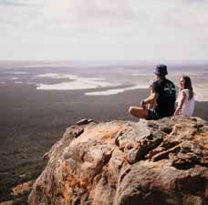

MAKE THE ESPERANCE PROMISE While travelling in Esperance / Kepa Kurl country, I promise to embrace the elements of this land and ensure my visit is sustainable and respectful. Make the Promise: esperancepromise.com
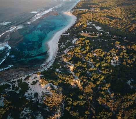
With a population of 13,849, Esperance is home to a vibrant community abundant in history, creativity and culture. Bordered by the stunning Esperance Foreshore, the Esperance town centre offers unique retail with specialty craft stores, markets, cafés, facilities, tourism attractions and much more.
Esperance Museum
As one of Western Australia’s outstanding regional museums, view the world’s largest and most comprehensive displays of Skylab (the first American space station), the Sanko Harvest (the largest diving wreck off the Australian coast) and learn about the agricultural history of the region.
Cannery Arts Centre
Located in town, the Cannery Arts Centre is a premier exhibition space and the gallery doubles as an event space for the local music scene. You’ll find touring exhibitions, studios, and art and craft shops featuring local works for sale. Keep an eye out for events and workshops at this venue.
Esperance Foreshore & Jetty
Grab a coffee and take a leisurely stroll along the Foreshore and new Esperance Jetty. More than a kilometre of oceanfront by the town centre is beautifully landscaped. With walking
paths, exercise equipment, public artworks (including the Whale Tail sculpture), all abilities and nature playgrounds, BBQ facilities, picnic shelters, beach access, and an enclosed swimming area and lap pool. Opened in March 2021, the 415 metre Esperance Jetty was built for the Esperance community and visitors to enjoy. Fishing, walking, photography and diving are all accessible.
Wander through the historical buildings of Museum Village. You’ll find art, craft and design shops. Don’t miss the bustling Sunday markets regularly held in the Village.
Let the kids blow off some steam in this beautiful open space. Perfect for a picnic, there’s plenty to do with various playgrounds, a duck pond, mini golf, and the mini steam train (October 1 to April 30).
Test out your skate skills on an array of different elements and obstacles varying in difficulty at the Skate Park & Pump Track. This hub of multigenerational interaction activity invites families and individuals to join in and enjoy the space. Remember to skate and ride to your abilities.
TIP:
More than breathtaking coastlines: Esperance invites you to embark on an adventure that reconnects you with the elements – sun, air, ocean, earth. To book accommodation, find the perfect restaurant or pub or to explore more of the coastal region, head over to visitesperance.com to plan your perfect holiday. For those with adventure in their heart, and salt in their veins –Esperance. In your element.
WHAT’S ON
Family Fun Day in the Park
— 26 Jan 2025 (Australia Day)
Winter Wonderland — July 2025 Esperance Wildflower Festival — Sept 2025
Grounded – Esperance Hiking Festival – Sept 2025
Esperance Districts & Agricultural Show — Oct 2025
Edge of the Bay Festival — Dec 2025
New Year’s Eve (at the foreshore) — 31 Dec 2025
TOP ATTRACTIONS
The Great Ocean Drive / Peak Charles National Park –Karrukarrunya / Cape le Grand National Park / Lake Monjingup / Mount Ridley – Marbeleerup
WILDFLOWERS TO DISCOVER
Spider orchids / Pincushion hakeas / Banksias / Kangaroo paw
ESPERANCE VISITOR CENTRE
Cnr Dempster Street and Kemp Street, Esperance
T: (08) 9083 1555 or 1300 664 455
E: info@visitesperance.com W: visitesperance.com


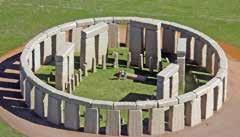
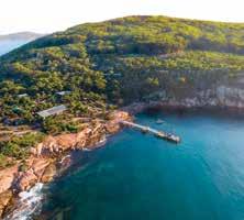


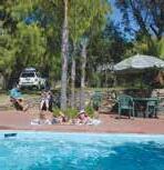

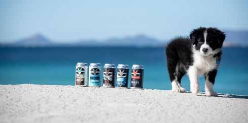

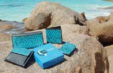

the unique world of fish, shark & stingray leather.
Open 6 days 2-5pm, CLOSED MONDAYS 6 Woods St, Esperance WA 6450
Tel/Fax: (08) 9071 5248
Email: mermaid@comswest.net.au
Web: www.mermaidleather.com.au

• Four ground floor self-contained 2 bedroom apartments, private covered decks & BBQs
• Three two storey luxury self-contained 2 bedroom apartments with spas & BBQ balconies
Reverse cycle air-con, full cooking & laundry facilities.
A short stroll to CBD, restaurants, parks & island cruises.
69 The Esplanade, Esperance WA 6450

Tel: 0428 716 677
Email: info@driftwoodapartments.com.au Web: www.driftwoodapartments.com.au
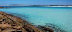
Just 90km east of Esperance, beautiful peaceful location on the beach. 6 chalets and 6 park homes. Plenty of powered and unpowered sites.
Lot 1 and 5 Wharton Road Via Condingup WA 6450 Tel:(08) 9075 0033 orleansbaycamp.com.au


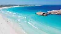

Affordable accommodation in the town centre within an easy walk to beach, foreshore, jetty, shopping, restaurants and cafes. Motel units, family units, self-contained apartments and a 3-bedroom house

Reverse cycle airconditioning • BBQ • Guest laundry Truck and van parking • Starlink WiFi Complimentary bus pick-up and drop-off Bayview Motel – 31 Dempster St, Esperance Bayview Apartments – 4 Dempster St, Esperance 9071 1533 • bayviewmotel.com.au
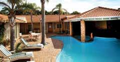
• Eljay’s Bar & Restaurant onsite.
• Free Wi-Fi.


• 90+ Fox channels & Foxtel On Demand.
• Perfect spot to base yourself to discover the beautiful Esperance beaches.
Tel: (08) 9071 9000
Fax: (08) 9071 3800
Email: reservations@comfortinnbayofisles.com.au
Web: www.comfortinnbayofisles.com.au
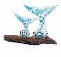

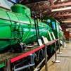


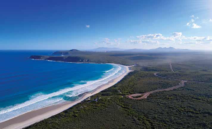
Located on the South Coast Highway between Albany and Esperance / Kepa Kurl, the Shire of Ravensthorpe is located within the stunning Fitzgerald Coast. The internationally-recognised biosphere reserve is brimming with undiscovered wilderness and easily one of the state’s best kept secrets. It is the gateway to one of the largest and most botanically-significant national parks in Australia — Fitzgerald River National Park.
Two-thirds of the Shire of Ravensthorpe is natural bushland, made up of the national park, the Ravensthorpe Range, and reserves — rich in geology and native flora and fauna, including many rare species unique to the area. The coastal scenery of Hopetoun and Munglinup is spectacular, with grand headlands, pristine white beaches and idyllic rockpools for safe swimming.
509km south-east of Perth
Begin at Ravensthorpe Silos followed by a visit to the visitor centre and museum,
before venturing on scenic drives around the stunning Ravensthorpe.
The Ravensthorpe Range
The Ravensthorpe Range is a haven for natural attractions, scenic drives and walks. With geological complexity, an abundance of plants, wildflowers and fauna, it has the most eucalyptus species for its size in the world. The rugged range has seemingly endless unspoiled bushland stretching 45km from Ravensthorpe to Kundip. The range is accessible by all vehicles along Archer Drive although 4WD is required to access the remainder of the Range Top Drive. Enjoy sweeping views and picnic spots from Archer Drive Lookout, along Mt Short Scenic Drive and Mt Madden Scenic Drive.
Farm Gate Art Trail
The Farm Gate Art Trail is a great selection of sculptures made from farm scrap metal, dotted around the landscape. A map of their locations and explanation of each work is available on fitzgeraldcoast.com.au
Kukenarup Memorial and Heritage Walk
This memorial and heritage walk is a place for reflection and is one of the first memorials of its kind in Australia to acknowledge the tragic past and help move towards reconciliation.
PUBLIC Silo Trail
Visible for miles around, the 25m high mural by renowned artist Amok Island showcases the flowering cycle of a banksia, native to the region and is part of the PUBLIC Silo Trail by FORM.
Railway Heritage Walk Trail
Immerse yourself in this four-section walk track through natural bush. The original railway track was built to connect Ravensthorpe mines to the Hopetoun Port and operated from 1909 to 1935.
Hopetoun is surrounded by unspoilt wilderness and is the perfect setting for a relaxed, all-year round holiday. September to April is especially ideal to enjoy the 200km of pristine beaches, picturesque
scenery, abundance of water activities and the easy access to the Fitzgerald River National Park. Take to boating, windsurfing, swimming, snorkelling, fishing and whale watching while in Hopetoun.
Jim McCulloch Park
Be sure to check out the family-friendly park, just a stone’s throw from the grassy foreshore with gas barbecue, picnic shelters, play equipment, replica railway station and jumping pillow.
Southern Ocean Road
East from Hopetoun is the scenic Southern Ocean Road which takes in the spectacular coastline, passing several lookout viewing points and access points to many beaches, salt water pools and fishing spots including Two Mile Beach, Five Mile Beach, Twelve Mile Beach, Mason Bay and Starvation Bay.
Mason Bay and Starvation Bay
Take a day trip east of Hopetoun to discover two spectacular bays. Swim, fish, snorkel and play all day or enjoy coastal camping at its finest. Each has boat launching points and snow white beaches you won’t want to leave.
Munglinup Beach forms a lagoon that is protected by a reef and here you can swim or snorkel, enjoy the underwater world or just relax on the beach. If you are looking for a secluded beach you needn’t go any further, you’ll find it here. Just a short distance away, Lake Shaster and the Oldfield Estuary are renowned havens for rare and unusual birds. The Oldfield Estuary area offers visitors plenty of activities including canoeing, small boating, kayaking, nature bush walks, wildflower viewing and fishing.
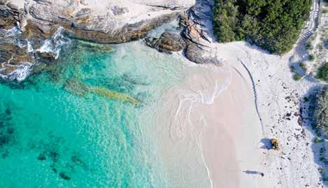
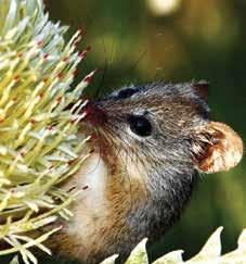
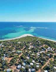
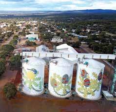
WHAT’S ON
Hopetoun Summer Festival — Jan 2025
Hopetoun Annual Fishing Classic — March long weekend, 2025
Hopetoun Local Markets — 1st Sunday of each month
Ravensthorpe Wildflower Show and Festival — 8–20 Sept 2025
Ravensthorpe Enduro Club Rat Run (Motorcross) — Oct 2025
TOP ATTRACTIONS
Fitzgerald River NP / Farm Gate Art / Ravensthorpe Silos / Ravensthorpe Range / Walk Trails / Philips River Canoe Trail / Largest Lollipop WILDFLOWERS TO DISCOVER
Royal Hakea / Qualup Bell / Barrens Regelia / Scarlet Banksia / White Spider Orchid / Queen of Sheba / Lemann’s Banksia
RAVENSTHORPE VISITOR CENTRE AND MUSEUM
Discover the ultimate beachside retreat at our hidden gem, nestled on the doorstep of the magnificent Fitzgerald River National Park in Hopetoun, WA.
Our rustic yet welcoming caravan park accommodation is designed to provide you with the perfect escape from the hustle and bustle of everyday life. Here, you’ll find a harmonious blend of nature’s beauty and modern comforts, all wrapped up in a laid-back atmosphere.
Accommodation to suit every budget: Self-contained cabins, caravan & camping sites

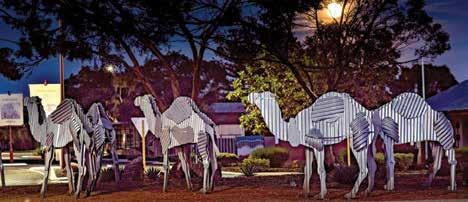
THE NULLARBOR PLAIN is somewhat of a rite of passage for Australians. One of the country’s most epic road trips, it extends from the town of Norseman through to the Eyre Peninsular in South Australia. There are seven main stops along this route between Norseman and the border with South Australia – Fraser Range, Balladonia, Caiguna, Cocklebiddy, Madura, Mundrabilla, and finally Eucla, just 11km from the South Australian border. This is a harsh and unique landscape, home to various
wildlife, including wombats, wedgetailed eagles, and whales. Crossing the plain is one of the world’s great road adventures with plenty to see.
Located in the southeast of WA, the town of Norseman is the gateway to Western Australia. The Shire of Dundas has a diverse landscape, home to remote and
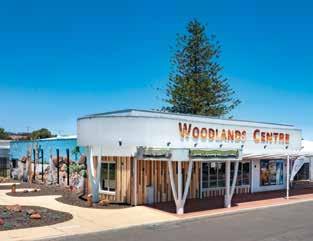
Whether seeking information, enjoying the interpretive displays, watching the murals come to life with AR technology, or shopping for a souvenir to show off after your travels, the Woodlands Centre has everything you need.
78 Prinsep Street, Norseman WA 6443
T: (08) 9039 0040
E: tourism@dundas.wa.gov.au www.dundas.wa.gov.au
rugged coastlines, the famous Nullarbor Plain, spectacular granite outcrops and vast sparkling salt lakes. Norseman also sits in the heart of the ecologically significant Great Western Woodlands, the world’s largest, untouched temperate woodlands.
The Ngadju and Mirning people are the traditional owners of the land. Aboriginal cultural heritage draws visitors to the region to learn about and experience local Ngadju and Mirning culture through tours, arts and sharing of knowledge and heritage. Gold was Norseman’s original claim to fame when prospector Laurie Sinclair and his horse Norseman passed through only 20km north of the original Dundas townsite. When his horse went lame, Sinclair discovered that the piece of rock lodged in Norseman’s hoof was gold-bearing. Excited by his lucky find, he continued prospecting, resulting in a major find that sparked a gold rush and established a town named after his trusty horse. Gold has been mined ever since.
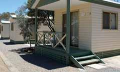
Tel: (08) 9038 1500 / 0438 188 118

Email: gateway@acclaimparks.com.au Lot 1175 Prinsep Street, Norseman, WA 6443
www.acclaimparks.com.au
191km east of Norseman
Balladonia is a small roadhouse community offering an important rest stop for travellers traversing the plain. Balladonia Roadhouse includes a restaurant, bar, motel and caravan park. While passing through visit the Cultural Heritage Museum with Skylab debris and interactive displays.
180km east of Balladonia
Caiguna is a small roadhouse community and a 146.6km stretch of the highway, being one of the longest straight stretches of road in the world. Find the Caiguna Blowhole 5km west of town.
66km east of Caiguna
Cocklebiddy lies on the southern edge of
Western Australia’s vast sheep grazing belt. Visit Australia’s first bird observatory here, the Eyre Bird Observatory, which offers a delightful retreat for nature lovers. The observatory requires advance bookings (call 08 9039 3450) with access by 4WD only.
91km east of Cocklebiddy
Madura was settled as a pastoral homestead in about 1876. Stop at Madura Roadhouse before visiting the Madura Pass Lookout for a rare vantage point of the sweeping plains.
115km east of Madura
Mundrabilla Roadhouse offers fuel, accommodation, food and the world’s longest golf course, Nullarbor Links Golf Course. This picturesque location along the escarpment is also the site of Australia’s biggest meteorite.

62km west of Mundrabilla
Eucla is the final stop within WA before crossing the border to SA. This tiny settlement is home to a service station, hotel-motel, caravan park and golf course. The old, desolated Telegraph Station here is an iconic image of the Nullarbor — a reminder of the lonely, harsh environment.
The Norseman Museum / Tin Camel Roundabout / Nullarbor Links / Granite and Woodlands Discovery Trail / Norseman Woodlands Cultural, Community & Visitor Centre / Dundas Heritage Trail & Dundas Rocks
STOPS ALONG THE PLAIN
Norseman / Balladonia / Caiguna / Cocklebiddy / Madura / Mundrabilla / Eucla
WILDFLOWERS TO DISCOVER
Sturt Desert Pea / Eremophilia / Wattle / Orchids / Everlastings
NORSEMAN VISITOR CENTRE
78 Princep Street, Norseman
T: (08) 9039 0040 or 1300 664 455
E: tourism@dundas.wa.gov.au
W: dundas.wa.gov.au

✔ Walk on Mount Augustus / Burringurrah, Australia’s largest rock
✔ Experience true outback hospitality at a station stay
✔ Discover the geological heritage of the Murchison GeoRegion
✔ Explore ancient landscapes on an Outback Pathway Road Trip
✔ Dress up and attend a bush race event
✔ Unearth the intriguing history of the Big Bell ghost town in Cue
✔ Admire a chandelier of stars from your swag
✔ Visit the gallery of Aboriginal rock paintings at Walga Rock
✔ Camp out in Kennedy Range National Park / Mundatharrda
✔ Swim in the oasis of Bilung Pool /Birlungardi

Download the Storytowns app to access a location-based audio guide of the Gascoyne Murchison.

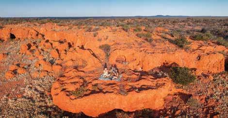
Stretching across the vast expanses of Western Australia, the Gascoyne Murchison region is a land of contrasts, where sweeping outback landscapes meet ancient geological wonders and a rich pastoral history thrives. This enchanting region, off the beaten track, is a treasure trove for intrepid travellers and those yearning for a taste of true Australian outback adventure.
At the heart of Gascoyne Murchison lies an ever-changing topography. Rugged ranges, dramatic riverbeds, and vast stretches of red desert sand under the endless blue sky captivate visitors. The Kennedy Range and Mount Augustus — or Mundatharra and Burringurrah, as they are known to the local Yamatji people — are must-visit sites. Mount Augustus is particularly awe-inspiring, standing as the world’s largest monocline and twice the size of Uluru. It changes colours throughout the day, showcasing shades of deep red, orange, and pink as the sun journeys across the sky. Every year the massive rock is the fitting venue for Australia’s Biggest BBQ when the Gascoyne Food Festival celebrates the best of the bush.
Stepping into Gascoyne Murchison is like traveling back in time. The region’s pastoral and gold mining history is palpable, with the stories of yesteryears echoing in ghost towns and heritage buildings. The gold-rush town of Cue, home to the iconic Queen of Murchison Guest House, offers a peek into the 19th-century gold boom, with its wellpreserved colonial architecture. Similarly, towns like Meekatharra and Yalgoo also provide an insight into the region’s rich mining past.
The Gascoyne Murchison region holds deep significance for the Indigenous people of the area. Rock engravings, sacred sites, and ancient art provide an insight into the millennia-old history
and culture of the Aboriginal people. At Walga Rock, visitors can witness one of Western Australia’s largest galleries of Aboriginal rock paintings, narrating stories of the land and its ancestors. The main surviving language of the Gascoyne Murchison is Wadjari, originally spoken in the eastern Murchison area. While a number of languages were spoken in the region, the people all referred to themselves as Yamatji. Today, they refer to the language they speak as the Yamatji language.
The region, despite its seemingly harsh climate, is teeming with unique wildlife and flora. During the wildflower season, usually between July and October, the landscapes are transformed into a colourful carpet of blooms that can be admired all around, — best experienced on an immersive wildflower road trip like Road to the Rock
For those with an adventurous spirit, Gascoyne Murchison is a playground. From challenging 4WD tracks, winding through the outback, to serene spots for camping under the starlit skies, there’s an experience waiting at every corner. The Wool Wagon Pathway is an iconic drive, taking visitors through an epic journey of the region’s highlights. Don’t forget to hop out of the car to stretch your legs on one of the region’s many walking trails and inspiring hikes.
The Murchison GeoRegion Trail is another trophy in the region’s road trip treasure chest, showcasing the significant natural, cultural and geological heritage of the area and easily explored from the region’s towns and the Outback Pathways. Download the Murchison GeoRegion app which takes you on a journey of 21 significant sites, through a unique and ancient landscape full of stories that reach back almost to the earth’s beginning, some 4.54 billion years ago.
A visit to Gascoyne Murchison would be incomplete without becoming immersed in the pastoral lifestyle. Stations like Wooleen Station and Melangata Station offer stays where visitors can get a firsthand experience of local station life. Enjoy campfire dinners under the vast southern sky by night for an unforgettable glimpse into the heart of Australian outback living.
Also note that Dairy Creek and Landor Stations will both be open to visitors for the first time in 2025.
By Road:
The Gascoyne Murchison has a good network of sealed and all-weather roads. There are also the gazetted Outback Pathway trails that make for an enjoyable self-drive adventure.
By
Air:
Skippers flies regular air services from Perth to Meekatharra and Mount Magnet.
Tel: 1300 729 924.
By Coach:
Transwa operates coaches to a number of the GascoyneMurchison towns - including Yalgoo, Mount Magnet, Cue and Meekatharra.
Tel: 1300 662 205.
Cue’s Heritage Trail (2.7km)
Meeka Lookout, Meekatharra (2.5km)
Mount Magnet Heritage Trail (37km self-drive)
The Granites, Mount Magnet
Telephone Line Trail, Wooleen Station (20km)
Sandstone Heritage Trail (18km self-drive)
The Summit Trail, Beedoboondu, Mount Augustus (12.5km)
Petroglyph Trail, Mundee, Mt Augustus NP (0.2km)
Experience serene stillness under sheer dark sky while unravelling stories of the stars in Gascoyne Murchison.
By CAITLIN SCOTT
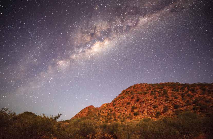
In the Gascoyne Murchison region, as the sun dips below the glowing horizon, endless constellations light up the sky. It’s one of the few places left where you can stand in silence, enveloped by the sheer darkness of an ancient landscape, and become absorbed by the stars.
Scattered around the region, guided stargazing explorations and remote station stays, where the milky way paints the sky at night, provide endless opportunity to admire the stars in all their glory. The tour guides and station stay owners that are blessed yearround, share their insights into what makes the sky here quite so spectacular.
North of Yalgoo, you’ll find Melangata Station — a small property by the region’s standard, at a mere 125,000 acres, and a true treasure for admiring natural lightshows at night.
To stay at Melangata and marvel at the stars, self-contained glamping tents, unpowered campsites, and bed
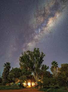
and breakfast stays within its historic homestead are all available options.
Once her guests have had a chance to settle in, Jo Clew, owner of Melangata Station, typically seizes the opportunity on the second eve to suggest, ‘How would you like to go out for dinner tonight?’. She pauses to enjoy their quizzical looks,
before explaining that she’s talking about packing up the dinner and going outdoors for their meal. There, the postdinner performance differs from those found in the city theatres, and exceeds all expectations.
“Even just sitting around the campfire at night, especially with the new moon, you can just look up and the stars are absolutely magnificent,” Jo says.
Sometimes guests will take matters into their own hands and carry the verandah furniture out onto the lawn, says Jo, where they can recline and watch the star display at their own pace. However, during the new moon, the station runs dark sky tours in the early evening that are well worth experiencing.
About 200 kilometres from the nearest town and sitting on 331,000 acres, Wooleen Station is a community of its own — an outback haven of historic buildings and lush gardens, run on a philosophy of mindfulness, slowing down, and genuine connection.
As the station is completely off-grid, without any streetlights, all you have to do is step away from the buildings and the night sky comes alive. About 100 metres away from the homestead, there are wooden benches positioned next to a vintage steam engine, which station owner Frances Pollock suggests as the spot to sit with a glass of wine, while allowing the desert stillness to welcome an otherworldly expanse of stars.
“Often people talk about how small they feel, when they sit out there and consider their place in the universe. Some people find that a terrifying thought, but for so many, it’s a really humbling feeling,” says Frances. “We’re all little specks of stardust that are going to come and go from this world.”
The station has three accommodation options, offering various styles of stays to experience the sky — a hosted and catered experience at the National Trust-listed central homestead, self-contained stays in rammed earth guest houses, and nature-based camping based 16 kilometres away on the banks of the Murchison River.
In the remote north of the Gascoyne Murchison, Mount Augustus Tourist Park sits beside the backdrop of Mount Augustus / Burringarrah — the largest monocline rock in the world which is twice the size of Uluru. About 300 kilometres from the nearest town, the tourist park is a place to fully decompress and connect with the vast landscape surrounding your campsite.
This far into the desert, there aren’t clear seasons, and after months without rain the skies develop a crisp clarity. So, even without a telescope, you can just relax in your camping chair, and watch shooting stars and passing satellites.
With the earth around you bathed in blackness, the depths of space feel close and tangible. As the tourist park manager, Sally Kingdon, says, “It’s a pretty special place, it sort of gets into your soul.”
There are cabins, both unpowered and powered sites, and a bar and restaurant that’s open between April and September — often a spot to gather

at outdoor tables and watch the stars appear above.
One of the central points of the region, Gascoyne Junction is a town lit by 18 street lights — the only street lights to be seen, within an area of 58,000 sq km — so it’s no wonder the opportunities for seeing stars here are glowing. The pastime is so active in this remote part of the world, the council has even recently introduced a weekly stargazing experience on the town oval.
“Our light pollution is pretty much non-existent, and we get to stand here every night and it just feels like the stars are reaching down to touch us,” says Ainsley Hardie, the tourism and community development officer for the Shire of Upper Gascoyne.
A team of volunteers, trained by experts from the Perth Observatory, lead the stargazing experience, showing visitors how to use the telescope while pointing out planets, stars, nebulas, and constellations that leave all awestruck.
Ainsley recalls one spectacular eve where, “We took the team from Perth Observatory up around the Kennedy Loop track, with telescopes strapped very carefully in the back of utes. There were 36 of us that sat out under the stars in Kennedy Range National Park, and we were able to see Jupiter and Saturn, just in the absolute silence of the night. The quiet — it’s just otherworldly.”
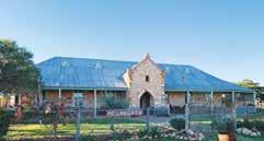
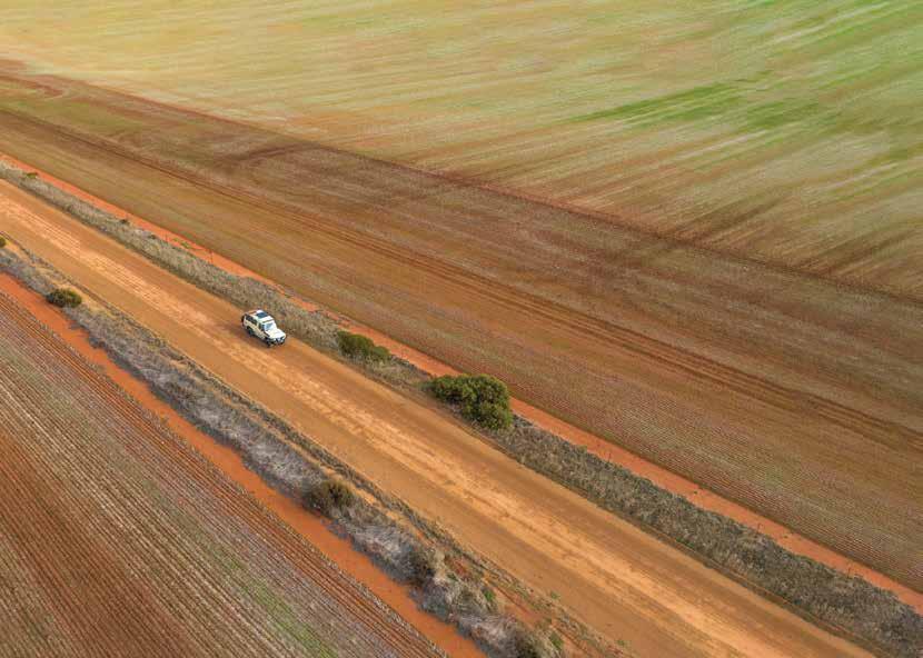
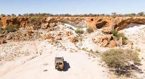

9 days | Sealed and unsealed roads
Shires on your journey: Dalwallinu, Yalgoo, Mount Magnet, Cue, Meekatharra, Upper Gascoyne, Murchison, Mullewa, Mingenew, Perenjori
This adventurous, rugged road trip takes you more than 1,000km north of Perth. You’ll weave your way through gorgeous country towns, historical sites, station stays and carpets of seasonal wildflowers before arriving at the world’s biggest rock, Mount Augustus.
You’ll venture through historic towns
like Paynes Find, Mount Magnet, Cue and Meekatharra, seeing amazing natural attractions like the Aboriginal rock art at Walga Rock. In springtime, this area is ablaze with a kaleidoscope of wildflowers.
At Mount Augustus National Park, the colours of the landscape change from chalky white soils and fields of olive-coloured shrub to a dark, ruby red moonscape. The park is a lush outback paradise with swimming holes, ancient rock art and a buzzing outback village.
Mount Augustus is the star of this road trip. At 1,700 million years old, it’s three times older than Uluru and twice its size.
There are a number of walking trails around the base, and a summit trail if you’re up for a climb with epic views.

3 days | Unsealed roads
Shires on your journey: Mullewa, Yalgoo, Murchison, Upper Gascoyne, Exmouth
This outback trail takes you from Geraldton through the Gascoyne Murchison up to Exmouth in the Coral Coast, passing through historic and timeless towns like Pindar and Murchison Settlement. Camp along the way or get a taste for life on the land by enjoying one of the many station stay options. There are wide open spaces, historic homesteads and lots of attractions to enjoy on this adventure, including a natural spring, seashell fossils and gorgeous picnic spots. Take in the beauty of the Kennedy Ranges; some 75km of cliffs, canyons and wildlife. Finish your trip in Exmouth with an experience on the spectacular Ningaloo Reef and witness majestic whale sharks in season.
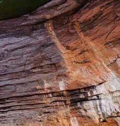

15 days | 4WD Track
Shires on your journey: Wiluna
Internationally recognised as one of Australia’s most iconic journeys, The Canning Stock Route runs from Halls Creek in the Kimberley region to Wiluna in the Northern Goldfields. Stretching 1,850km, it is the longest historic stock route in the world and is perfect for experienced off-roaders. Permits are
required and travelling with another vehicle or in a convoy is recommended. It’s a route steeped in history – from both an Aboriginal and a pioneer perspective – and you’ll notice this in every kilometre. You’ll cross four deserts on the way: the Little Sandy, Gibson, Great Sandy, and Tanami. Along the way you’ll see amazing outback scenery of sand ridges stretching to the horizon, spinifex grasslands, narrow gorges, sheer cliffs, ancient Aboriginal art sites, and engravings left by the explorers and drovers of old.
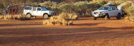
One of WA’s iconic outback destinations. Karijini Eco Retreat captivates with its rugged landscapes and breathtaking gorges. A must-vist for anyone seeking to explore Australia’s golden outback.
Kingsford Smith Mail Run | 3 days (unsealed roads) Miners Pathway | 4 days (sealed/unsealed roads) Scan the QR code for more insights.

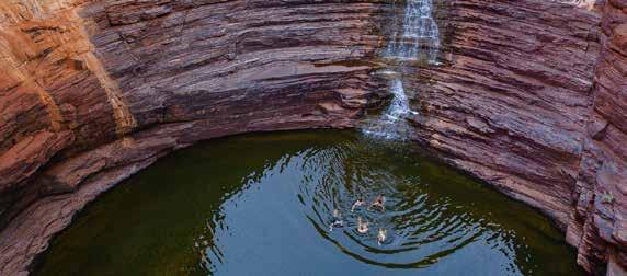


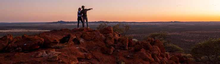

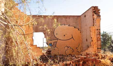
649km north of Perth
Known as the ‘Queen of the Murchison’ because of its importance in the gold production of the area, Cue makes a fascinating starting point to explore the Murchison and Goldfields regions of Western Australia. As legend has it, Cue came about thanks to a gold find by prospector Mick Fitzgerald who spotted an Aboriginal man called ‘Governor’ with a 10-ounce nugget around his neck. The prospector asked where the nugget was found and on New Year’s Day 1892, he was led to a quartz hill in Cue’s town centre bearing gold. The quartz blow is still visible today, located behind the fire station. Cue is ready to delight tourists with attractions ranging from charming 19th century gold rush era buildings to 10,000-year-old Aboriginal rock art.
Aboriginal Art – Walga Rock
Situated 48km west of Cue, this huge granite monolith known as Walga Rock is of deep Aboriginal cultural and spiritual significance. The most unusual art depicts a sailing ship in white ochre with masts, rigging and portholes.
The Cue Historical Photograph Collection
Step back in time to the wild gold rush days of Cue’s past with a journey among the collection of historical photos on display in the Cue Shire Administration
Building. Built in 1895, it was once home to the London and Western Australian Investment Company offices, and later the Gentlemen’s Club.
Nallan Lake
Nallan Lake is a nature reserve and during periods of heavy winter rains transforms into a favoured picnic spot.
Old Cemetery
About 4km east along the Sandstone Road, view a cluster of graves from the late 1890s. It is thought that nine graves were moved here from their original burial sites in 1897 to make way for the railway station.
Old Gaol
Located in the Cue Tourist Park, the Old Gaol was built in 1896 and was a temporary home to prisoners being transported from outback lock ups in the north until its official closure in 1914.
Cue Heritage Centre
Located behind the Cue Community & Visitor Centre, the Heritage Centre is a museum full of memorabilia and showcases the history of Cue.
Masonic Lodge
Built in 1899 from timber and galvanised iron, the Masonic Lodge is said to be the biggest free standing, double story corrugated iron construction in the southern hemisphere. It is subject to many a ghost story!
WHAT’S ON
Australia Day Fireworks — 26 Jan 2025
Monthly Community Markets — Feb - Sept 2025
Anzac Day Ceremony — 25 April 2025
Free Community Events — April to Sept 2025
Town Christmas Party — Dec 2025
TOP ATTRACTIONS
Cue Heritage Centre / Walga Rock / Big Bell / The Masonic Lodge / Great Fingall Mine Office
WILDFLOWERS TO DISCOVER
Everlastings / Pink Mulla Mulla / Eremophilas (The Emu Bush) / Bush
Tomatoes / Eremophila rostrata
Chinnock Subs Rostrata
CUE COMMUNITY & VISITOR CENTRE, CUE HERITAGE CENTRE
72 Austin Street, Cue T: (08) 9963 1198
E: info@cuecrc.net.au W: cuecrc.net.au

The hospital served the old Day Dawn township and started as a canvas and bough shed in July 1892. In 1895 a sturdier structure was built from local stone. Today several walls from this building remain, as do the ruins of the chimney from the hospital’s crematorium.
The Great Fingall Mine Site Office is another turn-of-the-century structure that is a truly magnificent example of the buildings of this period. Interestingly, Herbert Hoover, President of the USA, worked in this building.
The ghost town of Big Bell, situated approximately 30km north-west of town was gazetted in 1936 and soon after became the terminus of a spur line from the main railway in Cue. The town was deserted by the mid-1950s. The hotel reputedly had the longest bar in Australia and the remains of this once impressive structure are still standing.
Wooleen Station is one of the finest working cattle stations in the heart of outback Western Australia, situated on the Murchison River and covering half a million acres of picturesque rangelands.
At one with nature
Wooleen is a place to relax and enjoy your getaway. Simply unwind, connect with country and take in the Australian outback at its best.
Creature comforts
Accommodation ranging from camping to self-contained rammed earth guesthouses. Or stay in the gracious National Trust Listed Wooleen homestead including stylish accommodation, delicious home style cooking, cellar of Western Australian wines, magnificent formal dining room, full sized billiards table and swimming pool all amidst an oasis of spectacular award winning gardens.
Rich in history
Guided tours of the station encompassing such things as the listed wetlands of Wooleen Lake, seasonal wildflowers, Aboriginal heritage, colonial history, and spectacular granite outcrops. Learn how the Pollock family are now working towards making Wooleen an ecologically sustainable enterprise.
Wooleen Station is situated on the Twin Peaks-Wooleen Rd in the Shire of Murchison, 690km north east of Perth, Western Australia. Access is via bitumen and gravel roads. Fuel supplies can be obtained from the Murchison Roadhouse, 37km north of the Homestead. Flying brings the outback to within 90 minutes of the city and two airstrips are available for aircraft, private or chartered.
Bookings are essential. Please call or email to enquire. Open for tourism each year from April to October. Wildflowers are seasonal. Drinks and tours extra charge.
Wooleen Station, Murchison WA
Ph: +61 8 9963 7973
E: info@wooleen.com.au
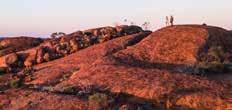


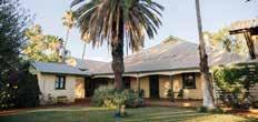


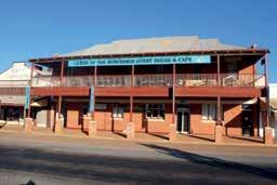

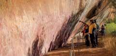
Plan
at
Owner Joyce Penny has
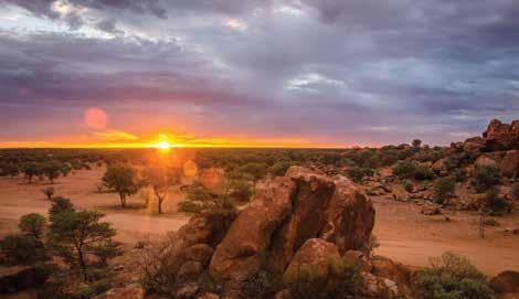
764km north of Perth
Located 764 km north of Perth, Meekatharra serves as a friendly hub for travellers exploring the Golden Outback.
Established in the late 1800s as a pastoral and prospecting settlement, the Shire of Meekatharra boasts geological formations, stargazing opportunities and significant cultural sites.
Meekatharra welcomes RV travellers with potable water at Welcome Park on Main Street and a chemical toilet dump behind the Shire Office on Lane Way B. Essential services include a hospital, chemist, GP, visiting dental and specialist services, a post office, and 24-hour fuel. For recreation, the town offers a skate park, playgrounds, gymnasium, sports complex, tennis and basketball courts, and swimming pool.
• Museum: Features photographs and memorabilia showcasing Meekatharra’s rich history.
• Peace Gorge: Just 3 km from town, this scenic heritage site has free camping and cultural significance as a registered Aboriginal site.
• Lloyd’s Plaza – Meekatharra Community Resource and Visitor Centre: This hub offers shops and serves as the town’s central point for visitors.
• Meeka Heritage Walk Trail: Starting at the Information Bay, this 2 km trail takes 30-60 minutes, is mostly
accessible and showcases historic buildings like the Old Bakery and Masonic Lodge.
• Meeka Lookout Trail: A 900 m trail leading to a lookout with stunning views of the red soil landscape. With interpretive signs on the town’s mining history, it takes 20-25 minutes.
• Meeka Creek Trail: This 3 km loop highlights Indigenous culture and natural wonders through 17 interpretive panels and takes 60-90 minutes.
• Meeka Drive Trail: A self-guided tour of historical sites, including mining pits and a cemetery. With interpretive signs, it takes two hours and is suitable for all vehicles.
• Wildflowers: After winter rains, the red earth blooms with wildflowers, delighting flora and fauna enthusiasts.
• Mt Yagahong: Located 40 km southeast, this mountain rises 150 meters above the landscape.
• Barlangi Rock: Situated 75 km along the Meekatharra-Sandstone Road, this
WHAT’S ON
Meeka Outback Festival — 2025
Saturday Markets: Second Saturday every month (9am – 1pm)
TOP ATTRACTIONS
Peace Gorge / Museum / Drive and Walk Trails / Gold Mining Pits and Prospecting / Wildflowers and Wildlife
WILDFLOWERS TO DISCOVER
Mulla Mulla / Native Hops / Flannel Bush / Cotton Bush / Various Eremophila
MEEKATHARRA COMMUNITY RESOURCE CENTRE
64-66 Main Street (in Lloyd’s Plaza), Meekatharra T: (08) 9980 0600 E: cso@meekashire.wa.gov.au W: meekashire.wa.gov.au
meteorite crater site dates back 2.23 billion years.
• Mt Gould Police Station: Built in 1888, this station lies 156 km west of Meekatharra on the Landor-Meekatharra Road.
• Bilyuin Pool: A serene camping spot 85 km north of town. No facilities available.
• Peak Hill: Explore remnants of this abandoned gold mining town.
• Prospecting: Visitors can explore old mining sites like Garden Gully.
• Murchison GeoRegion: Part of a self-drive trail with 21 sites across seven Shires. For further information, visit www. murchisongeoregion.com.
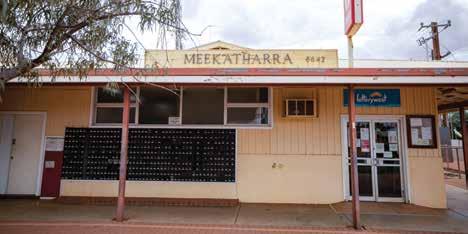
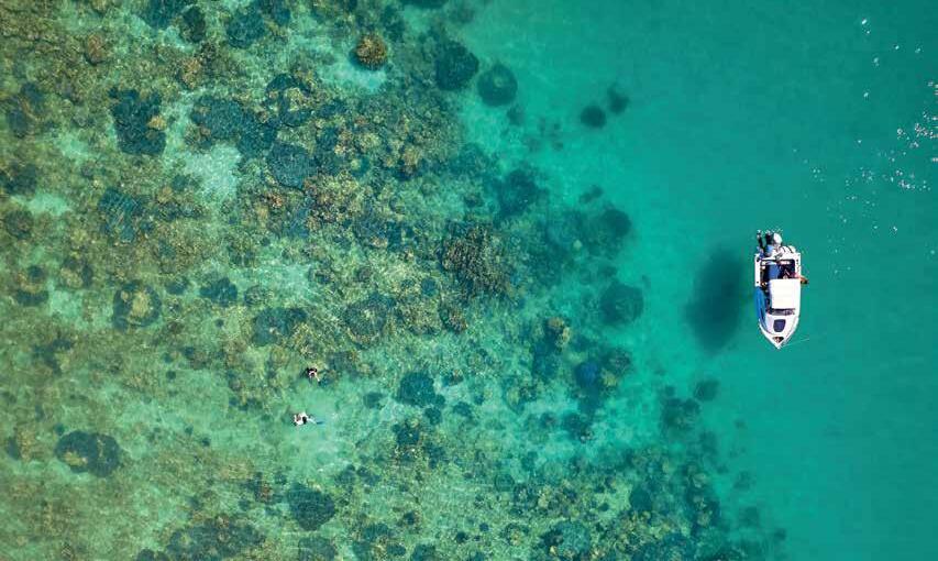
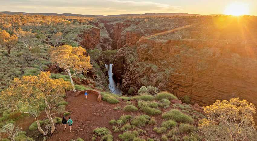

Navigate your way through a world of natural and ancient wonders that stretches across the beating heart of the Pilbara.
Discover the secrets of Onslow and the nearby Mackerel Islands that are set amongst the sparkling warm blue waters and pristine coral reefs.
Weave through the iconic red dirt of the Western Australian outback, be engulfed by the ancient ranges taking you to the iconic Aussie towns of Paraburdoo and Tom Price, the gateway to the gorges, waterfalls and billabongs of the spectacular Karijini National Park.

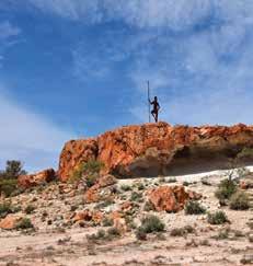
560km north-east of Perth
Mount Magnet is the gateway to one of the world’s natural geoparks. It’s located at the Magnetic Centre of Australia’s Golden Outback, on the Murchison GeoRegion Geo Trail and Gascoyne-Murchison Miner’s Pathway. With accessible, aweinspiring geology of the Murchison GeoRegion, three geosites and overarching dark skies — it is the perfect place for landscape and deep space astrophotography. Discover ancient landscapes, learn of Aboriginal culture, discover the history of early pastoralism from 1878 and visit the longest operating gold mining centre (open since 1891) when visiting Mount Magnet. Services include a visitor centre, swimming pool and fitness centre, caravan park, station stays, hotel-motels, new units, a
post office, mines office, police station, medical services, a supermarket, butcher, hardware store with Muzz Buzz coffee, Centrelink, a library, internet, a mechanic, Swagman Roadhouse, an airport and more.
PLACES TO VISIT
Mining and Pastoral Museum
Located at the Mount Magnet Visitor Centre, the Mining and Pastoral Museum is considered one of the best regional museums in Australia with extraordinary exhibits, including Rabbit Proof Fence exhibit, Hill 50 Gold Mine Winder and Miners Tribute. See the new Genestream Songlines Mural here. While at the visitor centre peruse the locally-connected gifts on offer and ask for travel advice.
Heritage Walk
Take a trip back in time where stories of pioneer pastoralists, grand gold rush days and Government Proclamations are revealed through buildings and new public art sites unique to Mount Magnet. The New Rock Room Display, housed at the restored historic State School (Cnr Attwood and Naughton Streets), is a curated selection of Ron Ashlin’s rock collection.
Tourist Drive Trail
Take a 37km drive or cycle through famous gold mining areas, scenic lookout, ghost town and spectacular outback scenery, including two geosites.
Warramboo Hill Lookout
See spectacular views across open cut mines and the township to far horizons.
WHAT’S ON
Australia Day - Jan 2025
ANZAC Day - April 2025
NAIDOC Week - July 2025
Mount Magnet Races - September 2025
Mount Magnet Markets - Bi-Monthly
TOP ATTRACTIONS
Tourist Drive / Ampitheatre / The Granites / Mining and Pastoral Museum / Genestreams Songlines mural
WILDFLOWERS TO DISCOVER
Mulla Mulla / Eremophilia / Flannel Bush / Desert Kurrajong in summer
MOUNT MAGNET VISITOR CENTRE
Southern entrance to town on the Great Northern Highway 39 Hepburn Street, Mount Magnet
T: (08) 9963 4172
E: visitor@mtmagnet.wa.gov.au
W: mtmagnet.wa.gov.au
Part of the Murchison GeoRegion Trail, view extraordinary ancient waterfall rock formations that are the ideal surrounds for landscape astrophotography. No camping permitted.
Fascinating historical evidence of ancient Aboriginal presence is revealed and celebrated at The Granites, a Geo Trail site of Aboriginal rock art and place of cultural significance for the Badimia tribe. Stunning at sunset.
Mount Magnet Vistor Centre Mining & Pastoral Museum
Mount Magnet Caravan Park

A welcome stay with friendly service, clean, tidy facilities in pleasant surrounds. Modern Ablutions, washing machines, dump point, gas, powered sites, grassed tent sites powered / un-powered. Cabins (no kitchen facilities) linen provided. Campers kitchen, electric BBQ, full kitchen facilities with outdoor setting. Close to shops, post office & parks. Disabled access.
Mount Magnet Genestreams Songlines Mural
Magnet Caravan Park

Mt Magnet Visitor Centre, with entry into Mining & Pastoral Museum is the best place to visit for information, regional geo-tourism, heritage, Aboriginal & astronomy interest. Local, regional, state-wide information. Heritage walk & drive trail maps. Wirnda Barna Art. Internet. WIFI. Gift shop. MWA & rare orbicular granite display. “Treasures of the Earth” rock collection.
Mount Magnet Vistor Centre Mining & Pastoral Museum (Northern end of) Hepburn St, Mt Magnet E: caravanpark@mtmagnet.wa.gov.au
Mt Magnet Visitor Centre, with entry into Mining & Pastoral Museum is the best place to visit for information, regional geo-tourism, heritage, Aboriginal & astronomy interest. Local, regional, state-wide information. Heritage walk & drive trail maps. Wirnda Barna Art. Internet. WIFI. Gift shop. MWA & rare orbicular granite display. “Treasures of the Earth” rock collection. Southern Entrance to Mt Magnet, Great Northern Hwy E: visitor@mtmagnet.wa.gov.au
T: (08) 9963 4172 www.mtmagnet.wa.gov.au
Southern Entrance to Mt Magnet, Great Northern Hwy E: visitor@mtmagnet.wa.gov.au
T: (08) 9963 4198 www.mtmagnet.wa.gov.au
T: (08) 9963 4172 www.mtmagnet.wa.gov.au

A welcome stay with friendly service, clean, tidy facilities in pleasant surrounds. Modern Ablutions, washing machines, dump point, gas, powered sites, grassed tent sites powered / un-powered. Cabins (no kitchen facilities) linen provided. Campers kitchen, electric BBQ, full kitchen facilities with outdoor setting. Close to shops, post office & parks. Disabled access.
Before you visit - take a deep dive into multiple stories about Mount Magnet’s diverse cross cultural perspectives about ecology, geology, and deep time history of the region. Informed by scientists and locals through art, this one of a kind mural on display at the Mount Magnet Visitor Centre - reveals Mount Magnet as never before.
Discover more on www.sciart.com.au Artist Residency and Public Art pages 2021 Mount Magnet.
(Northern end of) Hepburn St, Mt Magnet
E: caravanpark@mtmagnet.wa.gov.au
T: (08) 9963 4198
www.mtmagnet.wa.gov.au

A welcome stay with friendly service, clean, tidy facilities in pleasant surrounds. Modern Ablutions, washing machines, dump point, gas, powered sites, grassed tent sites powered / un-powered. Cabins (no kitchen facilities) linen provided. Campers kitchen, electric BBQ, full kitchen facilities with outdoor setting. Close to shops, post office & parks. Disabled access.
A welcome stay with friendly service, clean, tidy facilities in pleasant surrounds. Modern Ablutions, washing machines, dump point, gas, powered sites, grassed tent sites powered / un-powered. Cabins (no kitchen facilities) linen provided. Campers kitchen, electric BBQ, full kitchen facilities with outdoor setting. Close to shops, post office & parks. Disabled access.
A welcome stay with friendly service, clean, tidy facilities in pleasant surrounds. Modern ablutions, washing machines, dump point, gas, powered sites, grassed tent sites powered/unpowered. Cabins (no kitchen facilities) linen provided. Campers kitchen, electric BBQ, full kitchen facilities with outdoor setting. Close to shops, post office & parks. Disabled access. (Northern end of) Hepburn St, Mt Magnet E: caravanpark@mtmagnet.wa.gov.au
(Northern end of) Hepburn St, Mt Magnet E: caravanpark@mtmagnet.wa.gov.au
T: (08) 9963 4198
www.mtmagnet.wa.gov.au
(Northern end of) Hepburn St, Mt Magnet E: caravanpark@mtmagnet.wa.gov.au T: (08) 9963 4198 www.mtmagnet.wa.gov.au
T: (08) 9963 4198 www.mtmagnet.wa.gov.au

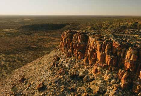
669km north of Perth
It doesn’t get any more outback than the Shire of Murchison. The ‘Ancient Lands Under Brilliant Skies’ are home to sprawling pastoral stations, abundant wildlife and seasonal wildflower displays, yet very few people. The Shire covers an area of 49,500km2 with a population of just 102.
At the centre of Murchison Shire is the radio quiet zone allowing travellers no option but to disconnect from the digital world and enjoy the good quality open roads that are at the core of the Shires operation. Murchison is the only Shire in Australia without a town, however Murchison Settlement is a vibrant hub. Home to around 20 people and everything a traveller needs, especially those who prefer to venture off the beaten track.
Murchison Settlement
Be at one with nature on the rangeland botanical walk or view the many artefacts of pastoral and Indigenous Australian life at the Murchison Museum. Go bird watching, enjoy the sunsets, gaze at the amazing night sky or listen to stories from local residents.
Oasis Roadhouse and Caravan Park
If you are looking for a feed and a place to rest your head the Oasis has
you covered. In its luscious green surrounds there are powered and unpowered caravan and camping sites with a selection of motel rooms. During your stay you can enjoy great food, cool off in the pool, play tennis, give lawn bowls a go or simply explore the Settlement.
Errabiddy Bluff and Outcamp
Fifteen kilometres west of Murchison Settlement, Errabiddy Bluff’s large rock formations make a mark on the landscape— it’s an ideal setting for a day trip and a picnic or barbeque. The magnificent sunsets seen from the bluff or lookout opposite are a prelude to a breath-taking display of stars.
Bilung Pool and Wooramel River Gorges
On the Carnarvon-Mullewa Road, discover the tranquil waters and enjoy a picnic at Bilung Pool. While you’re there be sure to take in the Wooramel River gorges, a spectacular example of an inland river system.
Old Stock Well
Fifty-five kilometres south of Murchison Settlement on the Carnarvon-Mullewa Road, is a restored well that was once used by drovers moving stock. A picnic area is available for visitors making it a great place to stop off and take in the vast history of the area.
WHAT’S ON
Murchison Camp Oven MusterAug 1-3 2025
TOP ATTRACTIONS
Errabiddy Bluff / Bilung Pool / Oasis Roadhouse / Wooleen Lake / Murchison Museum
WILDFLOWERS TO DISCOVER
Mulla Mulla / Bladder Dock / Native Hops / Flannel Bush / Cotton Bush / Various Eremophila
MURCHISON VISITOR INFORMATION
Murchison Oasis
Roadhouse
3001 Carnarvon-Mullewa Road Murchison
T: (08) 9961 3875
E: oasis@murchison.wa.gov.au
W: murchison.wa.gov.au
Check the Murchison Shire website for events.
Ballinyoo Bridge
Further south, the oldest concrete bridge in Western Australia has been replaced with a new bridge, but a span of the original Ballinyoo Bridge has been preserved as a historic marker of its former glory.
Kangaroos, emus, majestic eagles, red-tail black cockatoos and many amazing reptile species. Seasonal rain can bring fields of everlastings and other rangeland natives.
Experience true station life, discover Indigenous Australian rock art or soak in the outback atmosphere at the various station stays throughout the region.
HIDDEN WITHIN THE vast arid wilderness-like Murchison GeoRegion, are the mysteries and wonders of life itself. Vast and unfathomable – still being explored and discovered, the Murchison GeoRegion holds riches beyond our understanding.
Under endless skies renowned for astronomy, atop ancient geology from Earth’s beginnings – billion year old rocks break down and soils of many kinds form, enabling diverse flora and fauna.
A Road Trip into Murchison GeoRegion is a new adventure through mulga woodlands and open saltbush plains – pulling up and discovering a whole new
world of life lived under vast blue and dark night skies. Birds flit and then so quiet, air can be heard whooshing under wing. By day, kangaroos sleep but if disturbed, a surprising whack of tail on red earth punctuates the silence. This is the Murchison GeoRegion!
Whether above surface or deep in subterranean aquifers which sometimes spill out into moist and occasionally reedy water holes and soaks or shimmering then dry ephemeral lakes and creek bedsMurchison GeoRegion landscape is full of wonderment and surprise to the traveller, who slows down to pause and immerse in this wide open space – where Aboriginal,
mining and pastoral cultures have prospered over time.
Not a “drive through region” but a stop to be surrounded by the freedom of nature. Bewildering plants. Nocturnal marsupial tracks – stories in the sand. A lumbering goanna in hot weather. Echidna ambling by decorated ant nests.
Murchison GeoRegion has many Trails and attractions within its boundaries. The Geotrail connects seven Shires - six historic gold mining towns from 1890’s – Yalgoo, Mount Magnet, Sandstone, Cue, Meekatharra, Wiluna and Murchison Settlement, Australia’s only Shire without a town.
Experience wide streets, museums and art galleries, heritage buildings and cemeteries, station stays and other accommodation, services, unique and new Events, and, if the local gallery is closed – visit an ancient rock art gallery on the Murchison Geotrail.

Murchison GeoRegion - covering seven unique outback Shires, invites you to journey through an ancient, far horizon landscape to discover stories that reach back almost to the Earth’s beginning, some 4.54 billion years ago. Stand under an often dark night sky, where the Milky Way’s full arc can be seen in total awe and silence.
A self drive Geotrail connects the six gold rush townships and Murchison Settlement – while guiding you to geosites of extraordinary significance.
connection to this oldest place on Earth - where fragments of all previous continental land masses - Rodinia, Gondwana and Pangea are found, imbedded with meteor impact craters and seasonal lakes.
about unique fauna and flora – lizards mimicking pebbles, birds, trapdoor spiders, turtles in subterranean streams and, after rain - how dazzling carpets of wildflowers colour the landscape July to September. Bush tucker trees and surprising Desert Kurrajong afresh with new leaves in summer.
A quiet region hosting the world’s largest and most capable radio telescope, where people deeply connected to Aboriginal, mining and pastoral cultures live and work together.
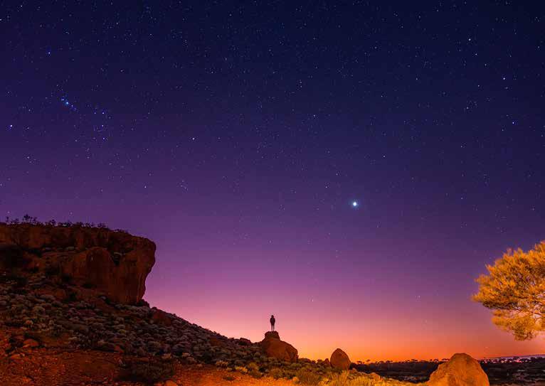

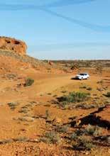

Driving the Geotrail? Experience a Station Stay and share your journey with the cultural Outback Pathways and Monsignor Hawes Heritage Trail, as you travel through the Murchison GeoRegion. Contact one of our local Visitor Information Centres for information and advice.
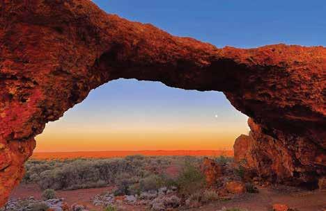
In the heart of the spectacular lower Murchison district, Sandstone’s bronzed landscape contains many unique and picturesque locations. Throughout the stunning Shire of Sandstone, natural rock formations contrast dramatically with rust-stained landscape. Gold was first discovered in the immediate Sandstone area in 1894 and remains popular for the casual gold prospector. From 1906, Sandstone grew to a small city of some 7,000 people. By the end of the 1920s, only 200 people remained. Fortunately, Sandstone survived and makes an ideal stopover at the centre of some of WA’s great tourist routes.
Sandstone Heritage Trail
Take to the road along the 18km Sandstone Heritage Trail and discover a series of natural and historically significant sites, including the breakaway that housed the Old Brewery. Photograph London Bridge, the natural basalt formation which is over 350 million years old. The trail also includes the former State Battery and Contradiction Well.
Sandstone Heritage Town Walk
Step back in time and wander the Sandstone Heritage Town Walk. Some of the sites you will see on the town walk include the old and new Shire Office
buildings, Black Range Chapel, Heritage Cottage, Pioneer Park, Gold and Wool Interpretive Park and former School (the original Courthouse). The Police Lock-up and the Water Park are favourites on this easy stroll about town.
Peter Denny Lookout
For stunning natural vistas, head to the Peter Denny Lookout, just over 30km east of Sandstone, en route to Leinster and bring a picnic for when you arrive.
Sandstone Night Sky
Another unbeatable view that’s truly spectacular is Sandstone’s clear, deep dark night sky. The shire has installed a telescope system and stargazers can book a viewing, from April to October, by calling the visitor centre during office hours.
WHAT’S ON
Australia Day Games — 26 Jan 2025
Art Show — Aug 2025
Astrodome — Viewings by arrangement. Book at Heritage Museum & Visitor Centre
TOP ATTRACTIONS
London Bridge / Sandstone and Nungarra Cemeteries / Old Post Office / Water Tank Murals / Old Brewery
WILDFLOWERS TO DISCOVER
Royal Mulla Mulla and Pink Mulla Mulla / Ruby Dock or Bladder Dock / Pink Thryptomene / Calandrinia / Crimson Eremophila / Blue Pincushion
SANDSTONE HERITAGE MUSEUM & VISITOR INFORMATION CENTRE
18 Hack Street
Sandstone WA 6639
T: (08) 9963 5061 or (08) 9963 5802
E: visitus@sandstone.wa.gov.au W: sandstone.wa.gov.au
Post Office Café
Across from the Visitor Centre and Heritage Museum, the historic Post and Telegraph Office, built in 1909, has a new lease of life as a café that has become the central hub of town. Serving light meals and barista coffee, it is the perfect spot to recharge. Spend time looking over the many curiosities inside or take a seat outside and watch the world go by.
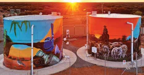
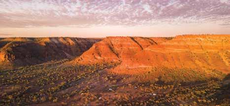
The residents of the Upper Gascoyne invite you to take a wander to experience the rivers, the rock, ranges, and the real outback found in their backyard. With 57,809 sq km of outback to share, you will find the space and tranquillity you have been looking for with the beauty of nature as a backdrop. The roads are less travelled than most with around 1,800km of unsealed road traversing ever-changing landscapes, with colours that make you feel like you are driving through a set of Derwent pencils. Epic road trips are inevitable in both 2WD and 4WD vehicles.
GASCOYNE JUNCTION
1069km north of Perth
Start your wander outback in ‘the Junction’ – the 2023 National Tidy Town Winner. Situated where the Lyons and Gascoyne Rivers meet, Gascoyne Junction is also where the stockroutes of the past overlap and the gateway to the ancient landscapes of Kennedy Range (50km north of the Junction) and Mount Augustus National Parks (300km northeast of the Junction).
Enjoy the hospitality of the Gascoyne Junction Pub & Tourist Park, located in Gascoyne Junction, as your base for exploring the area’s iconic national parks. Take epic road trips and unwind at the spectacular waterholes and rivers.
Mount Augustus National Park
Twice the size of Uluru, Mount Augustus is the biggest rock in the world. Rising spectacularly over the surrounding plain and at 715m, it is visible from kilometres away. Interesting rock formations, caves and Aboriginal engravings are
found on many parts of the rock that have been untouched for thousands of years. Camping is not permitted within the national park however Mount Augustus Tourist Park offers a station stay experience, the perfect place to call home with units, van and camping sites sitting at the rock’s base.
Kennedy Range National Park
Kennedy Range National Park offers spectacular scenery of gorges and precipitous faces, with a vast plateau of ancient dune fields on top of the range. Just 50km north of Gascoyne Junction, the area retains a wilderness feeling with camping beneath the sandstone cliffs available within the National Park. Artefacts found in the park provide evidence of the long history the Yinggarda people have with the area. The developed visitor sites on the eastern side of the range can be reached by 2WD.
Road Trips
Road trip the 49km Burringurrah Scenic Drive circuit for excellent views of Mount Augustus’ changing faces.
For excellent vantage points of the Kennedy Range, road trip its loop track.
WHAT’S ON
Music in the Park — 4th Sat of month, May-Sept 2025
Gascoyne Food Festival @ the Junction — Aug 2025
Mount Augustus Biggest BBQ — Aug 2025
Junction Races — Aug/Sep 2025
Kennedy Range Campdraft — Oct 2025
Landor Races Oct 2025
TOP ATTRACTIONS
Dark Sky Destination / Two Rivers
Memorial Park / Gascoyne Junction Museum, Gascoyne Junction War
Memorial / The Waterhole
WILDFLOWERS TO DISCOVER
Eremophila / Flannel Bush / Mulla Mulla / Native Cornflower / Everlastings

GASCOYNE JUNCTION
VISITOR INFORMATION CENTRE
4 Scott Street, Gascoyne Junction T: (08) 9943 0988
E: visitorcentre@uppergascoyne.wa.gov.au W: uppergascoyne.wa.gov.au/
This extreme 4WD-only track provides access to the remote western side of Kennedy Range before crossing over the range top to enjoy the more accessible eastern side. This 270km circuit from Gascoyne Junction will take a minimum of one and a half days to complete. Or hop in the car and embark upon a self drive trail to see the sights along the Wool Wagon Pathway and Kingsford Smith Mail Run, part of the Outback Pathways collection.

Welcome to the Mt Augustus Tourist Park located in the Heart of the Gascoyne region of WA. Home to the largest rock in the world. Our Tourist Park is described as a ‘green oasis’ in the rugged outback, with powered green grassed caravan and camp sites, to airconditioned accommodation units to suit all. Shop, fuel supplies and tyre service as well.
New to the park is the Mt View Cookhouse serving our famous Mt Augustus ‘Shorthorn’ steaks, fully licensed with big screen tv and a fantastic outback atmosphere. With scenic spots such as Emu Hill and Cattle Pool for a swim, there’s plenty to see and do.
Oh did we mention a “Bloody Big Rock”? Spend a few days just exploring this amazing site, with Aboriginal art and views as far as the eye can see. So come and join us for a true Heart of the Gascoyne holiday experience.
Landor Cobra Road, East Lyons River T: (08) 9943 0527

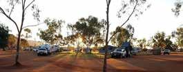
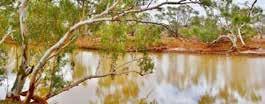
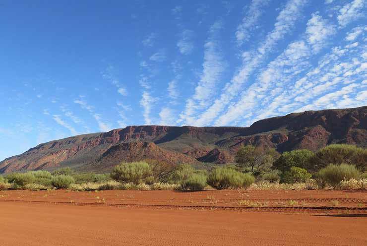
The Junction Pub and Tourist Park has been welcoming guests to Gascoyne Junction since 2014.
ACCOMMODATION • ROAD HOUSE • TAVERN
Whether you need to refuel and grab a barista coffee, enjoy an outback pub meal, or need a place to rest your head, the friendly team at the Junction Pub and Tourist Park have got you covered during your stay in Gascoyne Junction.
Serving breakfast, lunch and dinner and everything in between, stop in for a well deserved break and relax with a cool drink in the beer garden before taking a Wander Outback and visiting Kennedy Range & Mt Augustus National Park.
The tourist park has chalets, caravan and camping sites available for your stay.
T: 08 9943 0868 | www.junctiontouristpark.com

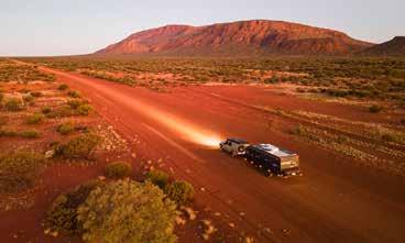


www.uppergascoyne.wa.gov.au facebook.com/visituppergascoyne www.instagram.com/shireofuppergascoyne


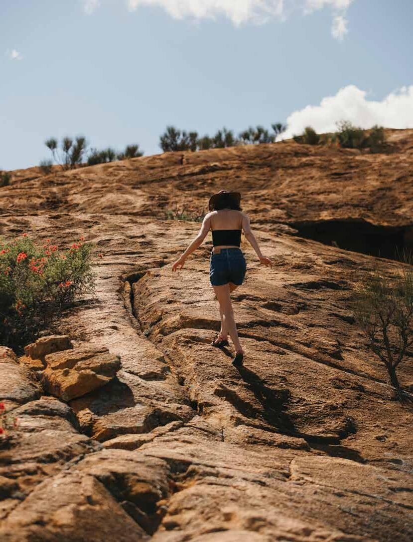
✔ Explore Kulin’s Tin Horse Highway
✔ Camp at the base of Wave Rock / Katter Kich
✔ Visit the Wheatbelt’s spring wildflowering
✔ Meet the furry locals at a Barna Mia Nocturnal Tour
✔ Take an Aboriginal cultural tour
✔ Visit Elachbutting Rock and walk Monty’s Pass
✔ Visit the Earthquake House at Cunderdin Museum
✔ Follow the Wheatbelt Way Road Trip
✔ Uncover farm to plate produce and local wineries
✔ See Aboriginal rock art at Mulka’s Cave
✔ Take in the vastness of Lake Dumbleyung
✔ Visit ‘Bart’, the Giant Ram, all year round and enjoy a stroll in Wetlands Park to See & Do
Download the Storytowns app to access a location-based audio guide of the Wheatbelt.

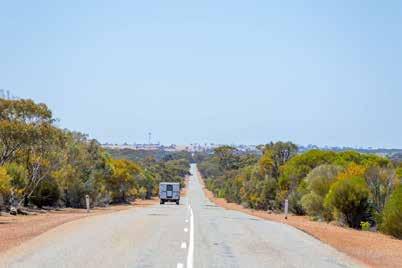


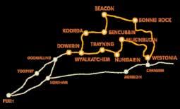

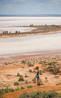
Duration: 3 nights, 4 days
Distance: One way Perth to Kalgoorlie 650km
Road Conditions: Sealed roads with stretches of maintained unsealed roads to some attractions.
Accommodation: Bed & Breakfasts, Self-Contained Units, Farm Stays, Motels, Hotels, Caravan Parks & RV Friendly Towns & Free Camp Sites.
Leave Perth in your rearview mirror and head towards the sunrise following the Great Eastern Highway. Begin with a visit to Tammin’s Kadjininy Kep Hydrology Model and Amphitheatre before travelling north to Yorkrakine Rock. In Kellerberrin, stroll through the town to appreciate its vibrant history, and be sure to stop by the Kellerberrin Hill lookout for a scenic view.
Explore Australia’s third-largest monolith, Kokerbin Rock before travelling on to Bruce Rock where you can visit the Bruce Rock Museum or meander through the landscaped grounds of Remembrance Park.
South of Merredin, stop by Totadgin Conservation Park, then head on to Merredin Peak and Railway Dam, both significant to the region’s early water catchment history. Two local museums showcase Merredin’s military and railway heritage.
Cross the original site of the No 1 Rabbit Proof Fence at Burracoppin then head north from Carrabin to Westonia where history is preserved in the towns’ buildings facades. The Hood-Penn Museum offers a fascinating look at Westonia’s gold mining and social history, including a mine blast simulation tunnel.
Visit the Yilgarn history museum in Southern Cross before driving south to Frog Rock Nature Reserve to explore the dam and rock with its wave-like formation. If time permits travel 55km east to Karalee Rock and Dam at the start of the Great Western Woodlands. wheatbelttourism.com | weroc.com


Duration: 2 to 5 days
Distance: 292km One Way Perth via Toodyay to Merredin
Road Conditions: Sealed road with some unsealed access sections into nature reserves.
Accommodation: Bed & Breakfasts, Self-Contained Units, Heritage Homestead, Motels, Hotels, Caravan Parks & RV Friendly Camp Sites.
Traverse the Wheatbelt following the well-worn trail many prospectors once took on their way to the Yilgarn and Kalgoorlie Goldfields.
This scenic journey wanders past expansive Wheatbelt farmland and through the small towns of Toodyay, Goomalling, Dowerin, Wyalkatchem, Nungarin, and Merredin providing a classic experience of Western Australia’s Wheatbelt heartland.
Whether you’re travelling from Perth to the Goldfields, or from the west to east coast, this trip is a rewarding alternative to the Great Eastern Highway direct route, adding only 44 kilometres to the journey. It offers the remarkable view of wildflowers in colourful profusion during the season, invigorating leg-stretching nature walks, as well as numerous buildings and museums reflecting the unique rural historical significance of the region.

pioneerspathway.com.au
storytowns.com.au


PERTH

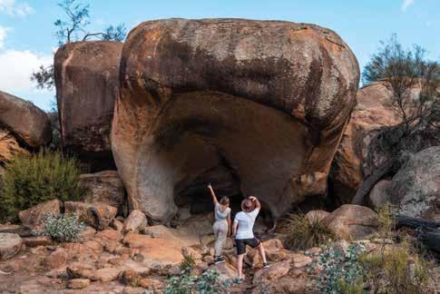
In the Wheatbelt, expect to be greeted by a harmonious blend of history, culture, and natural wonders. It’s not just a place on the map; it’s a journey that echoes with tales of pioneering spirits, the serenity of vast landscapes, and the rustic charm of country life. It beckons explorers to traverse its great open roads, admire its bounty of wildflowers, walk its sprawling trails, and book in for a farm stay for a slice of local life.
At the heart of this region is its network of road trip tracks, across which ever-changing vistas unfurl the scenic beauty of the Wheatbelt. Named after a famed explorer, the 2WD Holland Way and 4WD John Holland Track wind through historical settlements, narrating tales of early adventurers.
The Wheatbelt Way also presents a vivid tapestry of character-filled towns along a scenic drive that spotlights some of the area’s best attractions. Then there’s the Pathways to Wave Rock which exposes one of the most striking of all — Wave Rock, just a five-minute drive from the town of Hyden. This granite wonder, known as “Katter Kich” by the traditional Njaki Naki — Ballardong — Gubrun people, appears as a colossal tidal wave captured in stone. It’s a marvel that stands as a testament to nature’s artistic prowess, making it a magnet for both photographers and nature lovers.
Hidden granite treasures like Elachbutting Rock and Kokerbin
Rock, make for other fascinating sights of similar origin. These sites, with their panoramic views and intricate formations, beckon explorers and casual visitors alike.
Further southwest, Dryandra Woodland National Park is a sanctuary for the region’s unique flora and fauna. Nestled within this sanctuary is Barna Mia, where you can discover native marsupials in their natural environment. Book a nocturnal guided tour to see threatened species such as bilby, woylie, mala, quenda and boodie.
Yet, the Wheatbelt’s appeal isn’t confined to its natural wonders. The region is a canvas where art meets history. The Tin Horse Highway is a testament to this, with its quirky tin horse sculptures narrating whimsical tales. Similarly, the Public Silo Art Trail turns the mundane into the extraordinary. What once were grain silos now serve as canvases for breathtaking art, painting a vibrant picture of the region’s artistic spirit.
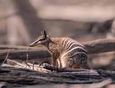
By Road:
The Wheatbelt has a good network of sealed roads and gazetted drive trails. There are a number of tour companies offering one day and extended holidays from Perth throughout the Wheatbelt, if you’d like to leave the driving to someone else.
By Coach/Train:
Transwa operates coaches to many of the Wheatbelt towns and The Prospector train stops in Cunderdin, Kellerberrin, Merredin, Southern Cross and Kalgoorlie. Tel: 1300 662 205.
Tin Dog Walk Trail (1.8 – 3.3km)
Wave Rock Walk Circuit, Hyden (3.6km)
Kwongan Heathland Walk, Lake Grace (5km)
Merredin Peak (1.8km)
Carnaby Cockatoo Interpretative Walk Trail (7km)
Mukinbudin Botanical Walk Trail (4.8km)
Foxes Lair, Narrogin (400m to 2.1km)
Boyagin Rock Summit (1.4km)
Westonia’s Woodlands & Wildflowers
Heritage Trail, Westonia (3.1km)
Mt Matilda Walk Trail, Wongan Hills (7.9km)
With nature and creative endeavours all around, the soul of Wheatbelt truly shines through in its farm stays. These aren’t mere accommodations; they’re experiences. Visitors can immerse themselves in authentic country life, from interacting with farm animals to savouring the region’s fresh produce. Olive oil, preserves, emu oil, and more, all carry the distinct flavour and essence of the Wheatbelt.
In its entirety, the Wheatbelt is a symphony of experiences. It resonates with the songs of its Indigenous people, the tales of its settlers, and the timeless beauty of its landscapes. It’s a place where the past melds seamlessly with the present, promising memories that last a lifetime.
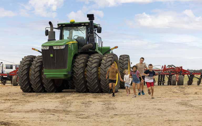
By DANIELLE AUSTIN
With the sun rising over fields of flaxen wheat, throwing golden rays over the vast pastureland and lighting up the earth, it’s easy to see what drew Erin and Damien Clark to the Golden Outback. There’s a stillness in the morning air, a buzzy quietude of stirring animals, faint bleats of the flock of sheep in the far distance.
The pair are owners of Mather Farm, a hobby farm and farmstay experience in the Wheatbelt’s Kellerberrin. Having grown up on a hobby farm in central Victoria, Erin always knew it was a lifestyle she’d one day return to, but it took falling in love with their 1950s Kellerberrin farmhouse, and the charms of the Wheatbelt region, before she and husband Damien took the plunge to settle in remote Western Australia in late 2022.
“We’ve fallen in love with the wideopen expanse of the Wheatbelt, and
want others to do the same. Mather Farm became the place for us to connect with family, friends and the land,” says Erin.
Connection to land has become even more important to the duo since their move, and has become something they’re excited to share with visitors to their property. The pair are passionate about sharing an understanding of seasonality with guests, allowing them to soak up what the land has to offer throughout the calendar year.
“I’ve learned it’s not until you stay in a single place, and mark the passing of the seasons, that you truly appreciate the Noongar people’s six seasons and its cycles.”
Working with a local horticulturist, Erin and Damien have rehabilitated the farm’s gardens with native species, and are happy to take visitors on flora
tours on request. Through their sister agritourism business, Dark Stry, they also offer bespoke, self-guided driving tours between Perth and Kellerberrin, aimed at educating guests on the past, present and future of the land and the many crops being farmed along the way. The pair try to impress on visitors just how innovative the farmers have to be to make flourish in what can be a very harsh landscape.
“There’s something really profound about the vast expanse of Australia’s Golden Outback,” says Erin. “Guests tell us that being out in wide open spaces, living life in the slow lane, really helps them appreciate the land that we share. There are so many stories out here — from our first nation’s people, to the region’s farming founders, to what it’s like to live and work in the region today. There’s always something to see if you
know where to look — the scale of each year’s harvest, the region’s dark skies, the stories behind its escarpments and the characters that you find at our local country pubs.”
The Nenke family, owners of Mary’s Farm Cottages, have long known the value of the rich Wheatbelt soils, having established their farmstay in 1912. Now, they rely on those soils to nurture their crops of wheat, barley, oats, lupin, field peas, vetch and multiple hay species.
“Our family embraces regenerative agriculture using biological fertilisers and practices to improve our soils,” explains Mary Nenke.
Alongside their crops, the family runs Cambinata Yabbies, having diversified from sheep and grains more than 30 years ago. Now, their yabby operation is the largest yabby exporter in Australia, and guests can experience the full scale of the business, right down to sampling freshly cooked yabbies in a real paddock-to-plate experience.
The family is proud to open up their property to visitors, inviting guests to meet the farmers and get a taste of the Wheatbelt farming lifestyle. Rather than a singular farmhouse, the property houses eight two-bedroom cottages, the picturesque country abodes nestled under towering native gums. By day, guests can soak up the farmland views with each cottage boasting a private verandah overlooking the paddocks and expansive crops, while by night they can gather around the fire pit for stargazing.
After more than 100 years of operations, the farm remains a family affair. Guests will likely see patriarch, and hobby apiarist, Michael tending his bees, son Derek managing crop rotations, or daughter-in-law Lisa cooking for guests helped by their young children. These family links make it even more important to share agritourism with visitors, says Lisa.
“It’s essential tourists meet and learn from real life farmers who are passionate about looking after the land and producing quality food for everyone to enjoy on their plates. It is essential for the future of family farms that the city learns through experience the challenges and opportunities in farming, how farmers look after their land and their animals as well as the importance of having animals in the system to help in the requesting of

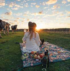
carbon and the economics of farming. Everyone needs to know where their food comes from and about the people who care for that land.”
Nestled among the looming rusty red ironbark eucalyptus trees that inform its name, Ironbark Farm Stay offers a taste of the Wheatbelt farming lifestyle on the edge of the Golden Outback region. Owner Lisa West describes the property as being the gateway to the Golden Outback, bridging the city and Wheatbelt regions.
As born-and-bred farmers, Lisa and partner Andrew know better than others the many challenges that come with the farming lifestyle, but also the many rewards. “It is extremely rewarding growing and producing food,” says Lisa. “It gives us a real sense of freedom, space, grounding and tranquillity.”
For Lisa, educating visitors on the realities of farm life is not only important, but ultimately gratifying for the guests. She encourages guests to immerse themselves in farm experiences,
Those iconic golden crops are not all that grows with abundance in the Golden Outback — there are a number of vineyards and wineries where visitors can taste the fruits of the region. The founders of Walker Hill Vineyard set out to prove vines could be grown in the Wheatbelt, and the award-winning vino the winery has produced is proof enough. Leading off the brick tasting room, an airy deck overlooks the rows of grapes, and proves a perfect place to perch with a glass of the house Shiraz. Owners of Downderry Wines similarly felt a desire to prove that the clay soils of the property had potential to house healthy vines. Alongside an award-winning Zinfandel, the winery produces Shiraz, Rosé, Moscato and sparkling wines, all nestled in the shade of the towering native trees.
from hand-feeding the chickens to observing the shearing process.
“There’s always something happening on the farm that guests can observe right at their cabins, whether the seeding rig is out in the paddock, the header is harvesting the crop, the ute out in the paddock feeding sheep, or the motorbike is mustering the sheep into the yards.”
The country-style cabins on the property are ideal to experience farm life, allowing guests to rise with the sun and enjoy the countryside peace in morning solitude before embarking on a day exploring the farm and surrounding attractions.
“I believe tourists enjoy learning about our Wheatbelt landscapes, the work we undertake and having the opportunity to experience farm life first-hand. They can have the opportunity to learn about the different aspects of agriculture and how food is produced, whilst enjoying a short stay on the land.”
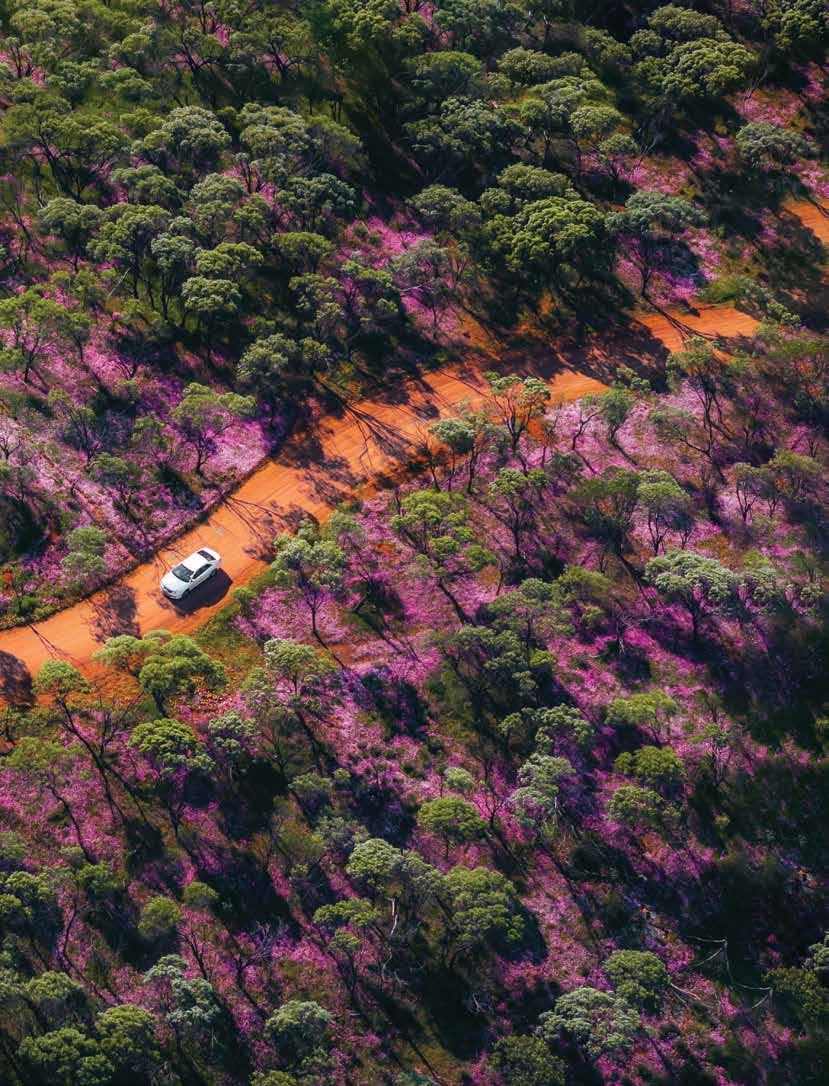
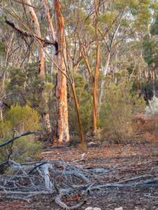

3 days | Sealed and unsealed roads
Shires on your journey: BroomehillTambellup, Kent, Lake Grace, Kondinin, Coolgardie
Journey along the Holland Way before connecting up with the more adventurous John Holland Track, created by pioneer John Holland in 1893 as a shortcut to the Goldfields in this adventurous outback route.
The Holland Way connects Broomehill in the Southern Wheatbelt to Coolgardie in the Goldfields and consists of mainly bitumen roads and good-surface gravel roads.
The John Holland Track also starts in Broomehill, but from the Hyden/ Norseman Road north it follows a different route that is a proper adventure accessible only by high clearance 4WD. There are no facilities, so you’ll need to be gloriously self-sufficient!
Both options offer an amazing drive through gorgeous countryside, beautiful salt lakes, granite outcrops, rock formations and nature reserves. There are lots of great camping spots but come prepared as much of this track is remote. The trail’s better known camps are Holland Track Farm, Wattle Rocks, Sandalwood Rocks, Centenary Rocks, Mt Holland and Thursday Rock.

3 days | Sealed roads
Shires on your journey: York, Quairading, Bruce Rock, Narembeen, Kondinin, Lake Grace, Kulin, Corrigin, Brookton
Make your road trip to the iconic Wave Rock a journey of real discovery.
This drive is best done over three days and will take you through the changing landscapes and charming farming communities of the Western Australian Wheatbelt. Choose your options from the various pathways linking the several shires and always plan to stop at welcoming rural towns to enjoy some proper country hospitality.
Route highlights include Kokerbin Rock, the Grain Discovery Centre, the wonderfully creative Tin Horse Highway at Kulin, Lake Grace (visit the outback winery) and of course, Wave Rock.
The trail is punctuated with massive granite outcrops perfect for hiking and taking in some spectacular views. You’ll see natural bushland, expansive yellow canola fields and in
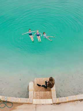
spring, amazing displays of vibrant wildflowers and rare orchids. There are lots of places to camp out underneath a chandelier of stars and enjoy the space and serenity.
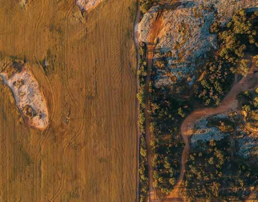

5 days | Sealed roads
Shires on your journey: Northam, Merredin, Narembeen, Lake Grace, Ravensthorpe, Esperance, Gnowangerup, Kent, Plantagenet, Cranbrook, Broomehill-Tambellup, Katanning, Wagin, West Arthur, Williams
Discover stunning outdoor artworks — visible for miles — on silos, street walls and transformer boxes celebrating the people and stories of the Wheatbelt and Great Southern regions.
The PUBLIC Silo Trail is an open-air art gallery stretching from Northam to Albany. Wind your way through gorgeous Wheatbelt country towns like Merredin, bright with yellow canola fields and wildflowers in spring. Pause at pretty picnic spots and discover nature walks as you travel. Go via Hyden and see the famous Wave Rock before heading south to Newdegate where Perth muralist Brenton See has painted the area’s local wildlife on an epic scale. The Western Bearded Lizard, Mallee Fowl, Thigh Spotted Tree Frog and a Redtailed Phascogale are depicted across four silos.
As you leave the countryside behind, you’ll head towards the expansive

4 days | Sealed roads
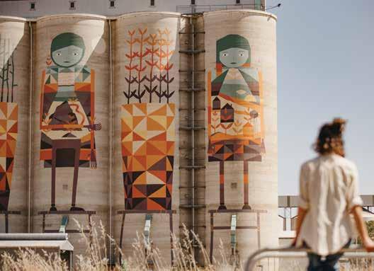
coastline of South West WA. Visit the charming towns of Ravensthorpe and Hopetoun as you journey to the Fitzgerald River National Park — a beautiful yet rugged area with many walk trails, camping spots and places to picnic. Continue along the coast to Albany, home to the National ANZAC Centre and
Shires on your journey: Dowerin, Trayning, Koorda, Mt Marshall, Mukinbudin, Westonia, Wyalkatchem
Follow the bright skies and big horizons along the Northern Wheatbelt on a stargazing, bird watching road trip that delivers all the history and charm of this laidback region. Be sure to check on upcoming events and weave these cultural gems into your plans, too.
The Wheatbelt Way takes you from cute country towns like Dowerin, Koorda and Beacon through to the Hood-Penn museum at historic Westonia and onto charming places like Bencubbin and Mukinbudin where you’ll find towering granite outcrops perfect for exploring. Highlights include Wyalkatchem CBH Museum, Nungarin Markets and Mangowine Homestead. Throughout this self-drive route you’ll be treated to stunning natural surrounds, sites of historical significance, and the laidback country atmosphere of the Wheatbelt. There are lots of campsites along the trail as well as walk trails and pretty picnic spots.
amazing whale watching opportunities in season. On the return, head back inland towards the charming farming towns of Katanning and Pingrup, taking in those wide landscapes and open skies. At each site, read about the artists and the stories of the silo towns they’ve shared in their stunning works of art.
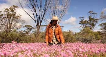
Golden Pipeline Heritage Trail | 3 days (sealed road)
Granite & Woodlands Discovery Trail | 2 days (unsealed road)
Wildflower Way | 3 days (sealed road)
Wineries, Woodlands & Wheatbelt Trail | 3 days (sealed road)
Northern Wheatbelt Wonders | 3 days (sealed road)
Scan the QR code for more insights.

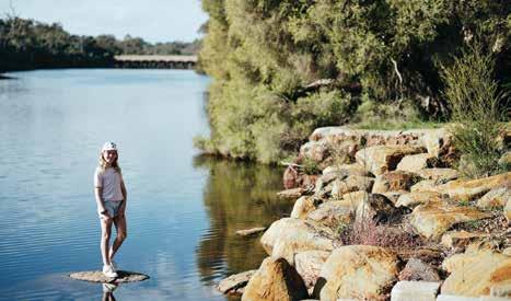
Nestled along the banks of the Hotham River and just a quick 15-minute detour off Albany Highway, Boddington is a captivating destination that promises a rich blend of nature, art, and history, making it a must-visit for your next road trip.
Explore the local art sculptures and murals, award-winning playgrounds for all ages, unique bull riding and medieval events, or surround yourself with native wildlife along a nature trail. Camp at one of the best locations in the Wheatbelt, or discover the unique alternative accommodations like the Boddington Old Police Station.
Located along the Hotham River and surrounded by the rolling hills of canola fields, you will never tire of Boddington.
Hotham Park
Children can swing, slide and climb while older kids skate, bike or shoot hoops on the half-court. With undercover BBQ facilities, a café overlooking the playground, and plenty of lawn to set up a picnic, Hotham Park is the perfect spot to relax and enjoy a meal. Wander along a riverbank trail, cross Lions Weir to explore the local wildlife, or take the adventure to the water on your kayak, canoe or SUP.
Art and Sculpture Trail
Experience the artistic heritage of Boddington along the art and sculpture
trail, featuring over 30 sculptures and four murals. Starting at ‘Wanda’ on the Hotham River Foreshore, the trail leads to ‘Quirky Cow’, where you can follow the river back to Hotham Park. Trail brochures can be found at the Visitor Centre.
Discover the diverse landscapes and wildlife of Boddington along a nature trail. Choose from a leisurely walk ending at the popular swimming hole, Ranford Pool, or challenge yourself with something longer. Trail brochures and maps are available at the Visitor Centre.
Ranford Pool River Trail
Enjoy a 4km return walk from Lions Weir along the Hotham River to the picturesque Ranford Pool. This spot is popular with locals thanks to its deeper water, created in the 1970s when the Tannin Factory was operational. This secluded spot is ideal for picnics, swimming, and learning about local bird and fish species.
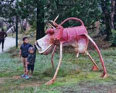
WHAT’S ON
Boddington Lions Rodeo
Boddington Medieval Fayre and Feast
Boddington Field of Quilts
Quindanning Picnic Races
Summer by the River
TOP ATTRACTIONS
Boddington Art and Sculpture Trail / Hotham Park / Nature Trails / Newmont Gold Mine / Red Hill Reserve / South32 Bauxite Mine / St. Alban’s Church / Tullis Rail Trail and Bridge Walk
BODDINGTON VISITOR CENTRE
Wuraming Ave, Boddington
Open 7 days a week. Opening hours are subject to change. T: (08) 9883 4999
E: shire@boddington.wa.gov.au
Local Flora and Fauna Boddington features a variety of landscapes that are ideal for exploring wildflowers, with nearly half of the area consisting of State Forests. The wildflower blooming season lasts for six months, beginning in June. Put on your hiking boots and grab your camera to enjoy the breathtaking floral diversity in Boddington!
St. Alban’s Church
Located along the Pinjarra-Williams Road on the west side, approximately 1km from the turn-off. Built in 1894, the church is well-preserved and open for visitors to admire its architecture and history.

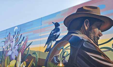
BRUCE ROCK
240km east of Perth
Bruce Rock has several iconic places to visit, including Bruce’s Rock, Kokerbin Rock, Shackleton Lakes and the Ardath Hotel. Bruce Rock provides an excellent base with ample parking and rest areas running the length of the main street, making it easy to explore the surrounding regions, both within the shire and further throughout the Central Wheatbelt region.
Bruce’s Rock
Named after sandalwooder John Rufus Bruce, who used the outcrop as his depot in 1869, Bruce Rock is a mustvisit landmark when stopping through the town. There are two old wells at the picnic site at the foot of the rock and scenic walks are to be enjoyed over the rock outcrop, with stunning wildflower displays in spring.
Kokerbin Rock
Covering 9ha and rising 122m above the ground, Kokerbin Rock is Australia’s third largest monolith. Situated 40km northwest of Bruce Rock, it is a great place for a hike and a picnic with barbecue and toilet facilities.
Bruce Rock Remembrance Park
Located in the main street, this park pays tribute to the men and women who served and continue to serve Australia
in military conflicts and peacekeeping operations across the globe. Eight sculptures of the theme ‘war and peace’ feature throughout the park, with the highlight being the replica Peace Window from the Bruce Rock St Peter’s Anglican Church.
Centennial Mosaic Pathway
The Mosaic Pathway was commissioned in 2013 to commemorate the town’s centennial. Comprising 417 mosaics, the pathway celebrates the Shire of Bruce Rock’s early settlers, community members, local businesses and sporting clubs.
Bruce Rock Museum and Machinery Museum
Located on Johnson Street, in the Bruce Rock Museum you will find an original one schoolhouse, a replica mud brick
WHAT’S ON
Back to the Bush Veterans Reunion — Nov 2025
Bruce Rock and Districts Agricultural Show — Sept 2025 (biennial)
TOP ATTRACTIONS
Bruce Rock Remembrance Park / Bruce’s Rock / Kokerbin Rock & Kwolyin Free Camp Site / Bruce Rock Museum & Machinery Museum / Centenary Mosaic Pathway / ‘Australia’s Smallest Bank’
WILDFLOWERS TO DISCOVER
The Underground Orchid / Everlastings / Spider Orchids / Isopogons / Tinsel Flowers
BRUCE ROCK VISITOR INFORMATION CENTRE
42 Johnson Street
Bruce Rock T: (08) 9061 1687
E: reception@brucerockcrc.com.au W: brucerock.wa.gov.au
settler’s cottage, and a replica early shearing shed and workshop. The Machinery Museum is across the street from the main museum and houses working farm machinery, vintage cars and a steam traction engine, all of which were once in use within the shire.
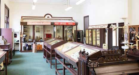
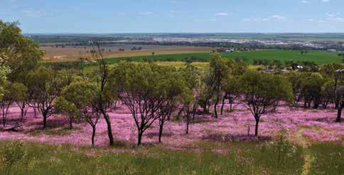
In the heart of the spectacular Wheatbelt is Cunderdin, a major town situated on the Great Eastern Highway approximately a two-hour drive from Perth. The town was settled and evolved into the Wheatbelt centre it is today due to the development of the Coolgardie/ Kalgoorlie Goldfields railway in 1894 and the Goldfields water supply pipeline in 1901.
Cunderdin Museum
Located in the heritage listed No 3 Pump Station, the museum is a must see attraction on the Golden Heritage Pipeline Trail. Experience the Meckering earthquake simulator and explore the region’s rich history including railway dining carriage, bush school, agricultural displays and much more.
Cunderdin Hill Lookout
When visiting the Cunderdin Hill (1km south of the main street), you’ll be greeted by 360-degree panoramic views of the town and surrounding farmland.
Ettamogah Pub
This is one landmark you certainly won’t miss when you visit Cunderdin. The brightly coloured and rather distinctive Ettamogah Pub is based on the wellknown comics of Ken Maynard – made famous by the Australian Post magazine.
Bulgin Rock Reserve
Bulgin Rock, located off Burges Road, is the perfect place to absorb the rolling landscape and observe wildflowers.
At Youndegin (19km south of Cunderdin along the Cunderdin-Quairading Road, and left onto Goldfields Road), you’ll find the original police outpost still standing, built in the 1880s from stone and mud with a thatched roof.
The name Meckering originates from a local Aboriginal language meaning ‘place of water’ or ‘moon on water’. The town formerly called Beebering was established in 1887 then renamed Meckering in 1897. Today, Meckering is probably best known for the devastating earthquake in October 1968 with many of the places of interest relating to this event.
Meckering Earthquake Garden and Memorial Rose Garden
Discover impacts and the devastation of the 1968 Meckering Earthquake at this newly upgraded Park. See the damage caused to the original steel pipe and twisted railway lines along with impressive murals of the town streetscape as you explore the garden trails and rose garden’s memorials. Scan the QR codes on the signs to hear community member’s earthquake stories. The gardens are an impressive testament to the resilient townspeople’s hard work and dedication.
Meckering Earthquake Walk Trail
Visitors can view images, descriptions and footprints of the former Meckering Main Street businesses and public buildings
WHAT’S ON
Australia Day Celebrations — 26 Jan 2025
Cunderdin Hot Rod Show –October 2025
TOP ATTRACTIONS
Meckering Memorial Rose Garden / Meckering Earthquake trail / Cunderdin Museum / Ettamogah Pub / Cunderdin Hill Lookout
WILDFLOWERS TO DISCOVER
Everlastings / Dandelions / Orchids / Blue Pincushions
CUNDERDIN TOURIST CENTRE
CUNDERDIN MUSEUM 100 Forrest Street
Cunderdin T: (08) 9365 1291 W: cunderdin.wa.gov.au
through a trail of interpretative signage. View the preserved fault line 12km south of Meckering on Quellington Road.
Meckering Earthquake Farm Ruins ‘Salisbury’ - an old stone homestead built in 1904 - was flattened during the quake. The ruins give an eerie insight into the scale of the devastation experienced (2km north of Meckering, turn onto Meckering-Goomalling Road and left onto Moore North Road).
The Big Camera –Museum of Photography
It is impossible to miss this unique building on the Great Eastern Highway. An amazing history of photography is on display including a wonderful collection of earthquake images.
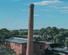
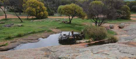
Dalwallinu is a vibrant shire located 253km north of Perth and covering 7,235 sq km of predominantly agricultural land. The five towns in the shire are Buntine, Dalwallinu, Kalannie, Pithara and Wubin. Located on the Wildflower Way, Dalwallinu is an ideal base from which to explore the region’s prolific wildflowers from late winter to spring.
PLACES TO VISIT
Dalwallinu Discovery Centre
The impressive Dalwallinu Discovery Centre houses the Public Library, Community Resource Centre, visitor information and environmental displays. Open weekdays 8.30am to 4.30pm and weekends during wildflower season.
McIntosh Park
Located 14km south of Dalwallinu in the town of Pithara, McIntosh Park was the site of the first fatal commercial plane crash in WA and is home to Pithara Speedway.
Petrudor Rocks
An attractive reserve 45km south-east of Dalwallinu with fabulous wildflowers and natural water pools that cascade following winter rains.
Xantippe Tank & Reserve
Constructed in the 1920s to capture water run-off from the granite outcrop and located 33 km east of Dalwallinu, the tank and reserve are a hotspot for orchids and bush flowers.
Rabbit Proof Fence and Boundary Rider’s Waterhole
Situated on Rabbit Proof Fence Road, sections of the No. 2 Rabbit-Proof Fence
are still visible, as is one of the original water holes blasted for the Boundary Rider who maintained the fence.
Miamoon Reserve
Located 27km north-east of Dalwallinu, Miamoon is a hotspot for wildflowers and has a gnamma hole in the granite outcrop.
Wubin is the ‘gateway to the north’ and the magnificent seasonal display of wildflowers in the area.
PLACES TO VISIT
Wubin Wheatbin Museum
The heritage-listed Wheatbin Museum depicts the history of agriculture through photos, models and artefacts. It houses a motor vehicle and machinery annexe and an extensive rock and mineral collection. The museum also tells the story of Gustav Liebe, who after a distinguished career as a master builder in Perth (His Majesty’s Theatre; Maylands Peninsula Hotel), successfully turned his hand to farming in the region.
WHAT’S ON
Australia Day Celebrations — 26 Jan 2025
ANZAC Day Service — 25 April 2025
Dalwallinu Arts Festival — Sept 2025
Wattle Week — Sept 2025
Christmas Street Party — Dec 2025
TOP ATTRACTIONS
Petrudor Rocks / Buntine Rocks / Wubin
Wheatbin Museum / Mia Moon Reserve / Jibberding Reserve / Cailro Mud School
WILDFLOWERS TO DISCOVER
Wattle / Wreath Leschenaultia / Everlastings / Orchids (Spider, Donkey, Ant, Blue Fairy, Pink Candy) / Fringed Lilies
DALWALLINU DISCOVERY CENTRE
Open 8:30am-5pm Monday-Friday; weekends (hours vary) during peak wildflower season
53 Johnston Street Dalwallinu
T: (08) 9661 1805
E: shire@dalwallinu.wa.gov.au
Buntine Rock
A granite outcrop and nature reserve located 3km east of Buntine, Buntine Rock offers a magnificent view of farmland from the top and is an inviting place to find wildflowers.
Jibberding Reserve
Located on the Great Northern Highway 25km from Wubin, Jibberding Reserve has pretty displays of white, pink and yellow everlastings.
Cailbro Mudbrick School
This restored one room school located 33 km from Wubin features a local history display.
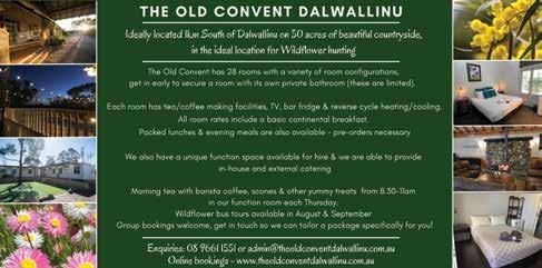
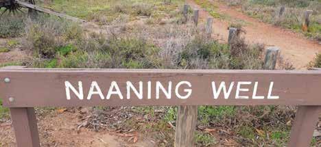
The name Dowerin is derived from the Aboriginal word “Daren” given to a series of lakes found 10km south of town. It was originally established as a watering hole and resting place for prospectors and travellers on their way to the goldfields. Dowerin is a two-hour drive from Perth, located along the Wheatbelt Way and Pioneers’ Pathway self-drive trails. Dowerin is a welcoming and wellserviced country town.
Rusty & Rosey
When in town, be sure to say hi to Rusty and Rosey, the iconic, large tinsculpture dogs. Rusty is located to the west entrance of town and was a project designed by local school students in 2004. Rosey is located along Stewart Street and its paw directs visitors to the Dowerin Visitor Centre. Rosey acknowledges the pioneering women who were integral in the development of Dowerin. The inspiration for Rusty came from the Tin Dog Creek, which you can observe on the Tin Dog Creek Walk Trail through native bushland. Along the walk trail discover the Dowerin Bird Hide, home to a variety of birds.
Dowerin and Districts Museum
For a peek back in time, visit the Dowerin and Districts Museum (by appointment only through the shire). The Dowerin District Museum is a genuine cottage, containing various artefacts from around the district and was built in 1915 by Eugene O’Shaughnessy.
The old town Minnivale also showcases life once upon a time. Its importance was lost as rail was replaced by roads and now, Minnivale boasts the old general store, still displaying advertisements from times gone by, the picturesque church, cemetery, and the old baker’s oven.
Located in Minnivale is the Wheatbelt Heritage Rail Discovery Centre. Housed within a 1964 Type B wheatbin is a collection of carriages dating from early in the 20th century. Climb aboard passenger carriages, read the history of the district, along with the early days of the wheat industry (by appointment only through the shire).
Located East of Dowerin, Naaning Well was vital for gold seekers traveling to the Yilgarn Goldfield in the late 1800s. Established in 1869, it supported prospectors with water and provisions. Now part of a flora reserve, it features
WHAT’S ON Dowerin Machinery Field Days — 27-28 Aug 2025
TOP ATTRACTIONS
Rusty & Rosey / Tin Dog Walk Trail / Minnivale / Naaning Well / Dowerin Museum
WILDFLOWERS TO DISCOVER
Donkey Orchid / Bunny Orchid / Leek Orchid / Spider Orchid
picnic facilities, toilets, and a walking trail, celebrating its rich goldfield history.
The Rabbit Proof Fence No.2
Running north to south through the east, this fence was built in 1907-1908 and was designed to control the rabbit plague. Much of it remains in good condition.
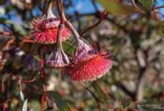


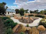

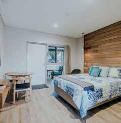

267km south-east of Perth
The Bluebird Precinct
Visit The Bluebird Precinct to discover the incredible story of how Donald Campbell made history on Lake Dumbleyung in 1964 by breaking both land and water speed records in one year – a feat that has never been achieved before or since.
The precinct encompasses several attractions related to the Bluebird story, including the Bluebird Interpretive Centre and café within the Community Resource Centre, and the Bluebird Replica and Historical Display in the old railway building.
Lake Dumbleyung
Lake Dumbleyung is the largest open lake in WA’s southwest at 13 km in length and 6.5km wide. It may even be the reason the ‘Dumbleyung’ town name exists, thought to be derived from the Aboriginal word ‘Dambeling’ meaning
large lake or sea. Experience the natural beauty of a sunset or sunrise at Pussy Cat Hill Lookout, take a picnic or visit the lake to walk, paddle or boat depending on varying water levels.
Culture and Farm Tours
Visit the Wuddi Aboriginal Cultural Centre and book your Bushfood Garden Experience or On Country Bus Tours including Lake Dumbleyung & Significant Sites and the Emu & Djilgi Dreaming. Short and full-length tours available.
Explore Dumbleyung’s reserves and discover wildflowers at Tarin Rock Reserve & Lakeview Gold Club, and keep your eyes peeled for wildflowers as you traverse the shire roads. Pick up your Wildflower Trail Map from the CRC.
Shopping
Enjoy some retail therapy at the Dumbleyung Mini Mall, filled with homewares, clothing, art, local produce, books, eco products and so much more! Get your photos printed at John Lee Photography, a haircut at Sniptrix, artwork at Scally Art Gallery and visit the Dumbleyung General Store for all your grocery, lottery and postage needs.
Further south-east you will find Kukerin, where immersive farm experiences are a feature. Visit Cambinata Yabbies, which will guide you through their yabby processing facility and on request can show you other aspects of their farming
An authentic, environmentally friendly, rural experience with modern comfort. Ranked number 1 in the region and the ideal base to visit nearby award winning Cambinata Yabbies plus iconic Wave Rock & Lake Dumbleyung.
• A variety of accommodation options are available
• Breakfast and dinner baskets on request
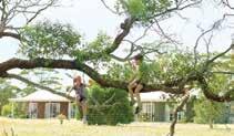
• Uninterrupted farm views from every room with private facilities and air-conditioning.
3645 Dumbleyung-Lake Grace Road, Kukerin WA 6352
Ph: +61 8 9864 6054 marysfarmcottages.com.au
WHAT’S ON
Dumbleyung Bluebird Festival — 11 April 2026
Kukerin Creek Bed Burnout Competition — 20–21 Sept 2025
TOP ATTRACTIONS
Lake Dumbleyung / Donald Campbell interpretation centre at Dumbleyung CRC / Dumbleyung Mainstreet Bluebird Replica / Tarin Rock / Cooks Vintage Car Collection / Historical Display
WILDFLOWERS TO DISCOVER
Greenhood Orchid / Yellow Acacia / Hibbertia / Synaphaea / White Leucopogon / Cryptandra
SHIRE OF DUMBLEYUNG
Harvey Street, Dumbleyung T: (08) 9863 4012
W: visitdumbleyungshire.com
DUMBLEYUNG CRC
28 Absolon Street, Dumbleyung
T: (08) 9863 4829
W: dumbleyungcrc.com
operation including cropping, livestock, and bees. At Emu Essence Farm you can get up close and personal with the flock and even join an emu egg hunt during laying season. Be sure to visit Kukerin’s Bouncing Pillow, and cook a BBQ lunch! Stay at Mary’s Farm Cottages overlooking the farm or in town at the historical Kukerin Hotel and enjoy a meal and drink in their new beer garden.


One hour from famous Wave Rock or visit Cambinata Yabbies enroute to Albany or Esperance.
• Jars of gourmet yabbies’ tails, Michael’s Honey and other gourmet products available for purchase.
• Lunch or dinner with fresh cooked yabbies available for groups by appointment.
4208-10 Dumbleyung-Lake Grace Road, Kukerin WA 6352
Ph: +61 8 9864 6054 cambinatayabbies.com.au
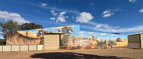
Situated in the heart of WA’s Golden Outback, the Shire of Kondinin is located 273km east of Perth. The Shire of Kondinin consists of three towns, namely Kondinin, Karlgarin and Hyden. The shire is encircled by fertile agricultural plains, dramatic granite monoliths, spectacular woodlands and majestic salt lakes.
Filled with heritage shop fronts and museums, the towns are quintessentially Australian with friendly locals, rambling pubs and quirky country events. These include the Wave Rock Weekender (music festival), Kondinin’s Gourmet in the Garden and a variety of colourful country market days.
While travelling through Kondinin, stop in town and explore some of the creative highlights including the inspiring Art Trail, starting at Statues Lake (10km west of Kondinin on the Corrigin-Kondinin Road) and finishing at Yeerakine Rock (3km south of Kondinin via the WilliamsKondinin Road).
A more recent creative addition to admire is the ANZAC watertank mural at Yeerakine Rock — painted in 2023 by renowned WA artist Jacob Butler (Shakey) — which tells the story of a soldier leaving his family during the 1914 drought, and his eventual return home. Each year, Kondinin holds an ANZAC dawn service, attracting hundreds of people to Yeerakine Rock to watch the sunrise and pay their respects. Yeerakine rock is also a fantastic spot to catch some spectacular sunsets.
Other noteable murals include: the
War Nurse Mural, also by Jacob Butler, at the Memorial Garden; and the JW West Mural, by Graeme Miles Richards, depicting Kondinin of the past with its original motor garage, iron monger, drapery and butcher.
Be sure to visit in October for the prestigious annual Kondinin Art Show and exhibition. Glorious wildflowers can also be seen during August and October at Yeerakine Rock.
Karlgarin is a small and proud Wheatbelt town, located 321km south-east of Perth in the eastern Wheatbelt region of Western Australia. The first European to visit the area was Surveyor-General John Septimus Roe who passed through in 1848. ‘Carlgarin’ was the original name Roe gave the district, now spelled with a K, and is said to come from the Noongar language. “Karl” is the Noongar word for fire.
Karlgarin has a lot of history and unique attractions, such as Stafford Park featuring old farm machinery, unique artwork and historic information about the Karlgarin district since 1920. There are many more attractions such as Karlgarin Centenary Park walk trail, the Malleefowl travel stop and McCann’s Rock, a great camping spot.
Hyden is a friendly farming community situated four hours south-east of Perth, via the Brookton Highway. More than 100,000 tourists visit the town every year on their way to the iconic Wave Rock. The townsite has lots to see and do, as well as a range of dining experiences, including bakeries, cafes and a local
WHAT’S ON
Kondinin Triathlon – 23rd Feb 2025
Gourmet in the Garden in Kondinin – 21st March 2025
Hyden Twilight Markets – 27th April 2025
Wave Rock Weekender – September long weekend
TOP ATTRACTIONS
Wave Rock / Hippo Yawn, Mulkas Cave & Humps / Yeerakine Rock / Statue Lake (Kondinin) / ANZAC water tank mural / Act Belong Commit Hyden Centenary Mural
WILDFLOWERS TO DISCOVER
Spider Orchid / Donkey Orchid / Ant/Man/ Clown/Jack-in-the-box Orchid
KONDININ TOURIST INFORMATION SHIRE OFFICE
Gordon Street, Kondinin T: (08) 9889 1006 W: kondinin.wa.gov.au
HYDEN TOURIST INFORMATION CENTRE
Wave Rock Wildflower Shoppe, Wave Rock T: (08) 9880 5182
W: waverock.com.au
hotel and beer garden. In addition to Wave Rock, amazing rock formations, such as Mulka’s Cave and Hippo’s Yawn, are a must-see. For camping enthusiasts, Woodlands Discovery Trail east of Hyden, is a must visit if you have a 4WD. The wealth of colours in spring from the carpets of wildflowers and the abundance of bird life make it a photographer’s delight. Situated beside Lake Magic, a large local salt lake, is a 20m round and 6m deep swimming pool-like gypsum pond where the buoyancy and therapeutic properties are greater than those of the Dead Sea.
A recent addition to the community is the Act Belong Commit Hyden Centenary Mural located in Coronation Park on the back of the Hyden Elder Shed, as well as the Hyden Railway Barracks museum located on the main road in Marshall street, Hyden.
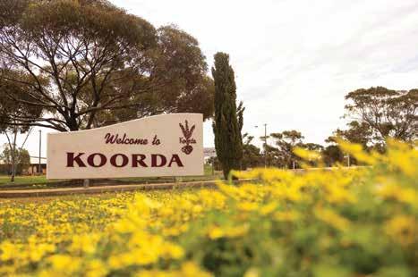
Take the road less travelled to the Shire of Koorda and enjoy the peaceful atmosphere of this small country town. Catch a movie under the canopy of stars at the Koorda Drive In or take a serene stroll around one of the many nature reserves Koorda has to offer. Colourful flowering shrubs and wildflowers are a blaze of glory many months of the year.
Approximately three hours’ drive north-east of Perth and situated along the popular Wheatbelt Way self-drive trail, Koorda’s main industries include wheat, coarse grain, and sheep farming. Koorda is famously referred to as ‘Corn Dolly Country’, attracting sightseers wanting to learn more about this ancient tradition of creating ‘dollies’ from stalks and husks of wheat.
Koorda Drive In Theatre
The iconic Koorda Drive In Movie Theatre is one of only three left in WA, showing two new release movies at its monthly screenings. It’s a fantastic activity for making memories.
Museums
Koorda boasts two museums. Koorda Museum draws on the building’s origins as a hospital in the years before World War II. It is worth a visit to view the
collection of antique medical and surgical equipment that was used in the former hospital ward. There is also a large display of early farming machinery and pioneer homestead artefacts. The Motor and Military Museum has an extensive private collection of motor and military memorabilia and a café where you can rest and have a cuppa.
Koorda Swimming Pool
The Koorda Swimming Pool consists of one large and two small swimming pools. Open from November to April with free entry, the facilities include a barbecue area and plenty of grassed shaded areas to enjoy.
For natural splendour, there’s a wealth of granite outcrops and wildflowers
WHAT’S ON
Koorda Drive In — Monthly Feb – Nov
Koorda Show – 20 Sept 2025
TOP ATTRACTIONS
Mollerin Rock / Newcarlbeon Tank & Reserve / Koorda Museum / Koorda Motor Museum & Military Collection / Koorda Art Gallery
WILDFLOWERS TO DISCOVER
Koorda Rose / Everlastings / Feather Plant / Tinsel Bush / Variety of Orchids
SHIRE OF KOORDA
10 Haig Street, Koorda
T: (08) 9684 1219
W: koorda.wa.gov.au
KOORDA COMMUNITY
RESOURCE CENTRE
Railway St, Koorda
T: (08) 9684 1081
W: koorda.crc.net.au
to be discovered. Near to town you can find Mollerin Rock, Newcarlbeon, Badgerin Rock, Native Flora Reserve and Moningarin. These picturesque outcrops each have their own peculiar mini environment of magnificent wildflowers and native shrubs including the Koorda Rose, dozens of bird varieties and native animals including kangaroos and echidnas. Most have picnic and/or barbecue facilities.
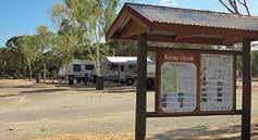
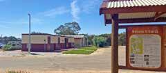


Bookings: Shire of Koorda Office 10 Haig St, Koorda T: (08) 9684 1219
32 Scott Street, Koorda www.koorda.wa.gov.au

Shire of Koorda Office
10 Haig St, Koorda
T: (08) 9684 1219
28-30 Greenham Street, Koorda www.koorda.wa.gov.au

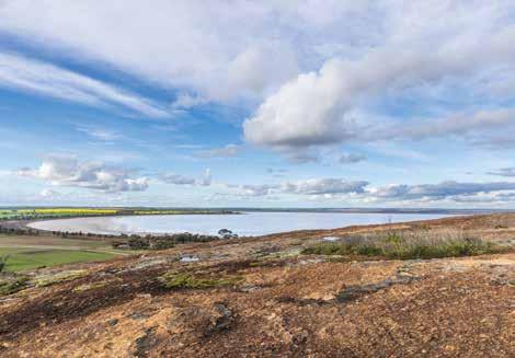
285km south-east of Perth
Famous for its quirky Tin Horse Highway drive, annual Bush Races event and giant waterslide, the vibrant Kulin region provides a true rural experience. Kulin is the perfect base to explore the eastern Wheatbelt and easy day trips can be made to many of the region’s unique and iconic sights, including Wave Rock.
Tin Horse Tourist Route & Highway
Make the most of your journey to Wave Rock on the fabulous 120km Tin Horse Tourist Route drive trail, which takes you to Wave Rock via Kulin and the famous Tin Horse Highway. Dubbed a ‘quirky open-air gallery’, the Tin Horse Highway’s famous collection of clever community art provides a seriously entertaining drive and is fast becoming a must-see for travellers across Australia.
Discovery Zone
Learn about Kulin at the Discovery Zone in town. The new zone along Kulin’s main street includes picnic facilities, public amenities, art works and interpretative signage, which tell of Kulin’s past, present and future. It also contains a free 72hour RV-friendly parking area for fully self-contained travellers.
To fill your day with summer fun, don’t miss regional Australia’s biggest waterslide, located at the vibrant Kulin Aquatic Centre (open during summer months).
Jilakin Lake and Rock
For stunning scenery, stop and admire the breathtaking views from the top of Jilakin Rock or enjoy a picnic under the most inland stand of jarrah trees found in the area.
Buckley’s Breakaway
Buckley’s Breakaway is another beautiful picnic spot and a photographer’s delight. This picturesque landform displays a contrast of vibrant orange clays against spectacular white cliffs and gullies.
WHAT’S ON
Blazing Swan — 16-22 April 2025
Kulin Bush Races — 3-5 Oct 2025
TOP ATTRACTIONS
Tin Horse Highway / Jilakin Rock and Lake / Buckley’s Breakaway/ Macrocarpa Trail / Visitor Discovery Zone
WILDFLOWERS TO DISCOVER
One-sided Bottle Brush / Plummed
Feather Flower / Candy Orchids / Guinea Flowers / Blue Squill
TOURIST INFORMATION
38 Johnston Street, Kulin
T: (08) 9880 1204
E: crccounter@kulin.wa.gov.au
W: visitkulin.com.au
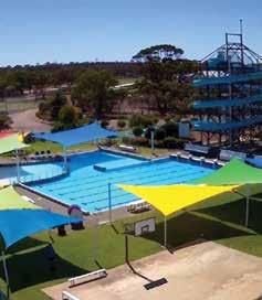
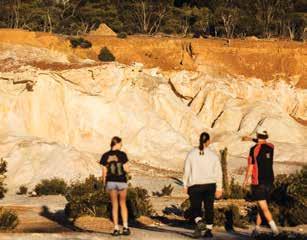
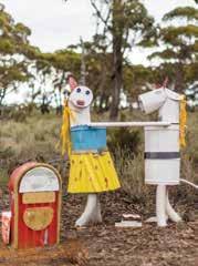
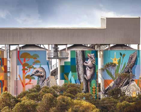
on the Esperance to Perth, Albany to Hyden crossroads.
Lake Grace is a thriving rural town named after a shallow lake 10km west of the townsite. Lake Grace itself is one of Western Australia’s largest inland salt lakes and a nationally significant wetland, comprising two separate bodies of water — Lake Grace North and Lake Grace South.
Lake Grace has a diverse range of public artwork from the Story Trail nestled in the centre of town, to the detailed mural of pioneering women from the region.
Visit the restored Stationmaster’s House now operating as the Lake Grace Visitor Centre and right next door is the Lake Grace Regional Artspace featuring exhibitions from local artists, travelling exhibitions and artists in residence. Sample wines from a local winery Walkers Hill Vineyard, located 8km north of Lake Grace, and stop by the stunning nature reserve, the Jam Patch. A must-visit is our new All Abilities Playground.
‘Gateway to the Holland Track.’ Follow the traces of John Holland’s 1893 epic
journey when he and his partners cut the now famous Holland Track. Explore salt lakes along the ancient river systems and immerse yourself in the natural beauty of Dragon Rock Reserve.
Part of the PUBLIC Silo Trail, visitors to Newdgate can view the stunning creations by Perth muralist Brenton See, depicting the area’s local wildlife across four 30m high silos.
Visit Pioneer Park in the town centre to read up about the town, then head across the road to the skate park and check out this family-friendly facility. Step back in time with a visit to the Hainsworth Museum and be transported back to a bygone era.
A small rural town on the fringe of the Wheatbelt’s sheep and wheat farming country, the area truly comes alive during spring with some of the district’s best wildflower displays. Walk trails through the town’s bushland enable visitors to take short, self-guided walks and enjoy the wildflowers, native vegetation, birdlife and a little local history.
The Roe Heritage Trail retraces part of Surveyor-General Roe’s historical journey in 1848.
WHAT’S ON
Winter Sports — April – Sept
Wildflower season — June – Dec
Newdegate Machinery Field Days — 4 – 5 Sept 2025
Market Day & Treasure Trail — last week in Oct or first week in Nov Community events — ongoing
Museums - Australian Inland Mission Hospital, Hainsworth Building, Bush Tractor Museum and Varley Museum / PUBLIC Silo Trail Art & Art exhibitions / Walk Trails – Jam Patch, Kwongan Heathland Walk, Lake Grace StoryTrail / Walker’s Hill Winery / Salt Lakes and lookouts
WILDFLOWERS TO DISCOVER
Cowslip Orchid / Rushtike Dampier / Painted Feather Flower / Granite Honey Myrtle / Yellow Feather Flower
LAKE GRACE VISITOR CENTRE 19 Stubbs Street, Lake Grace T: (08) 9865 2140
E: lgvc2@lakegrace.wa.gov.au
W: lakegracevisitorcentre.com.au
Travel 30km east on the Lake King Norseman Road to the Rabbit Proof Fence. Make sure you call in at the new Lake King Tractor Museum with its exhibit of unique locally made tractors.
Travel from Varley to Hatters Hill or to the historic Rabbit Proof Fence that skirts the eastern end of the shire. Gold was discovered at Hatters Hill in the early part of the twentieth century and the small settlement is now uninhabited and an interesting spot for fossickers.

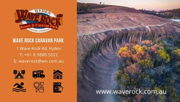

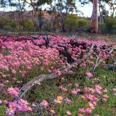
260km east of Perth
Merredin is the perfect place to engage with nature and absorb the ambience of a RV-friendly country town. With a range of accommodation options, stay and enjoy its cafés, dining facilities, catch a movie at the cinema or time your stay for a show at Cummins Theatre.
Cummins Theatre
Catch a show or view its history through interpretive panels and walk the Stars of Fame.
Two impressive museums, both with extensive displays, preserve Merredin’s history as a busy railway hub and an important military base during WWII. Visit both the Railway Museum and the Military Museum, (check opening hours.)
To learn about the Golden Pipeline history, view three generations of
pumping stations at the stabilised ruin of the No. 4 Pump Station 3km west of town.
Green Energy
Collgar Wind Farm, with 111 wind turbines, is the largest wind farm in WA. Merredin Solar Farm features 354,425 370W panels mounted on tracking systems.
This massive granite rock and early water catchment scheme is adjacent to the town. A spectacular view from the top, enjoy a sunset or a bush walk for seasonal wildflowers, water pipeline history, Railway Dam and the remains of the WWII 2/1 Australian General Hospital site.
A FREE 24hr self-contained RV campsite in a woodland reserve is dog friendly.
Multi-Purpose Trails
The town map explores Merredin’s Heritage sites and Public Art.
Public Silo Trail
One of seven Silo Art towns on the PUBLIC Silo Trail, the Merredin CBH silos were transformed in August 2017 with artwork that still inspires locals and visitors.
The No. 1 Rabbit Proof Fence
An interpretive site is located 25km east of Merredin.
Parks
Apex Park | Danjoo Waabininy Boodja
- recently redeveloped with tables, BBQs, shelters, playground, accessible equipment, public toilets, basketball court, skate park.
Roy Little Park - paved paths, duck pond and fountain and nearby Long Tan
WILDFLOWERS TO DISCOVER
Bluebeard Fairy Orchid / Donkey Orchid / Spider Orchids / Yellow Feather Flower / Blue Pincushion
CENTRAL WHEATBELT VISITOR CENTRE
T: (08) 9041 1666 or 1300 736 283
Merredin Train Station, 45 Barrack Street
E: visitor@merredin.wa.gov.au
W: wheatbelttourism.com
Transwa Rail & Coach Bookings Cummins Theatre Tickets
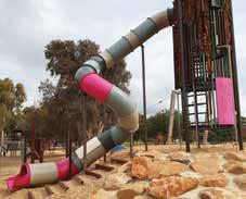
Pioneer Park – vehicle only car park, historic water tower, shaded seating. Merredin Dog Park - fully fenced and gated exercise park with water points. Tamma Park – natural bushland on the south edge of town.
Totadgin Rock Conservation Parkwheelchair accessible car park, picnic, BBQ, interpretive walks in natural bushland to rock wave formation and a historic well.
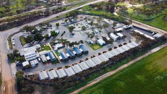
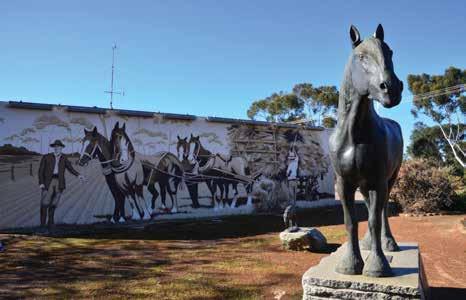
The beautiful country town of Moora is situated on the banks of the Moore River in the Wheatbelt Region of WA. It is surrounded by impressive salmon gums, parks, gardens and heritage buildings and is a popular stopover for tourists following the Wildflower Trail.
Located less than two hours north of Perth, Moora is a thriving town strategically located between two of Western Australia’s most popular tourism attractions – New Norcia, Australia’s only monastic town, and the natural wonder of the Pinnacles in Nambung National Park near Cervantes.
Moora is the largest inland service centre between Perth and Geraldton, providing services to a population catchment of 6,000 residents within a 100km radius. Whether you are just passing through or planning to stop and breathe in some fresh country air for a few days, Moora has something for everyone.
Candy’s Bush Reserve
Features informal walk trails, plentiful wildflowers and orchids. Parking and access off Midlands Road.
Watheroo National Park and Jingemia Cave
The Watheroo National Park, situated
63.6km north of Moora, is very rich in many different kinds of wildflowers, and Jingemia Cave has a shady picnic site. The cave is formed in chert, an unsealed rock that leads to a vegetation community in the hill that is very different from the surrounding areas.
Carnaby Cockatoo Walk Trail
The trail currently extends between the two town bridges and Candy’s Bush Reserve. The Carnaby Cockatoo Walk Trail plays a major role in educating the community about the conservation of the Carnaby’s Cockatoo, the importance of the salmon gums, and Moora’s flora and fauna.
Stack Cooper Reserve
Located between Stack Street and Cooper Street. Enjoy a short walk through the reserve which features signage on local flora and fauna.
WHAT’S ON
Moora Show — Sept 2025
Moora Races — Oct 2025
Moora Bedrace Street Festival — Dec 2025
TOP ATTRACTIONS
Candy’s Bush Reserve / Moora Town Walk / Carnaby Cockatoo Walk Trail / Stack Cooper Reserve / Moora Museum
WILDFLOWERS TO DISCOVER
July to November
65 Padbury Street, Moora
T: (08) 9653 1053
E: moora@crc.net.au W: moora.wa.gov.au
Moora Museum
The Moora Museum is open every Sunday from 9am to 2pm during May to October, or appointment only: (08) 9651 1372.
Moora Town Walk
This fascinating walk trail leads to Moora’s historic buildings, murals and points of interest including the Moora town clock. This stunning clock was designed by local school students, before being constructed into a magnificent stained-glass feature by local artists.
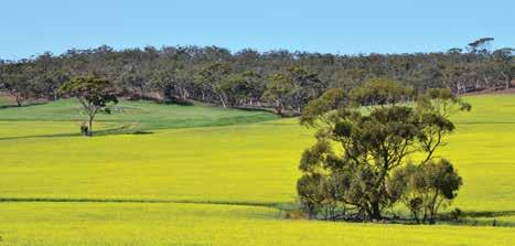
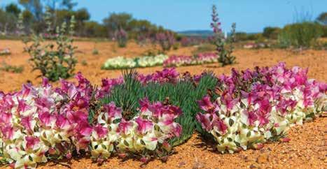
The Shire of Morawa is located on the traditional lands of the Yamatji People and their ongoing connection to its land, water and culture is still evident in the district today. Morawa’s recent history began when Sir Augustus Charles Gregory travelled through the area in 1846. In 1896, Sir John Forrest carried out exploratory trips around the present Morawa district, with the first farmers settling in the early 1900s. Morawa was declared a town in 1912. Morawa is often referred to as the ‘Heart of the Wildflower Country’. Its shire is one of the most prolific areas for native flowering plants. If you roam through its numerous reserves from late July to early October you will come across many species of flowers that are unique to this district.
The Shire of Morawa has some of the clearest and darkest night skies, ideal for stargazing. Bring your telescopes and cameras to fully capture this pristine environment, or simply look skyward to soak it in.
War Rock and Pintharuka Dam Hills at Pintharuka come alive with white everlastings during wildflower season. The surrounding bushland hosts a variety of birds, flowers, mammals and reptiles. In the backdrop are the Moonagin, Karrakarook and Milhun Ranges, which change their colours when the everlastings are blooming right to their tops. Legend has it that War Rock received its name when war occurred
between two Aboriginal tribes many years ago. The gnamma hole is usually full of water particularly after heavy rains.
Located 20km north of Morawa is a large granite outcrop, surrounded by bushland, making it an enjoyable place for picnicking and bushwalking. On top of the rock is a large cairn of rocks built by John Forrest. Koolanooka, meaning, ‘place of plenty wild turkey’ is an ideal place for a picnic. It is also an ideal area to see the wildflowers or to gain a picturesque view of the surrounding land from the top of the ironstone formations that encapsulate the springs.
Built in 1929, the Canna Store is owned by Sue and Paul Offszanka who have a wealth of knowledge of local flora and fauna. Please note this location provides information only; food or fuel are not available in Canna. Maps can be found outside the store.
The Morawa Museum is located on Prater Street and is run by the Morawa District Historical Society. The Museum hosts a vast collection of memorabilia, including the world’s sixth largest collection of windmills, a wide array of farming implements and machinery of historical interest, and the original Morawa Police Station.
Koolanooka Springs
Koolanooka, meaning, ‘place of plenty wild turkey’ is an ideal place for a picnic, see the wildflowers and gain a
WHAT’S ON
Australia Day – 26 Jan 2025
Midwest NAIDOC – July 2025
Bi-Annual Art Awards and Exhibition –Aug 2026
Speedway – Oct 2025
Christmas Festival – 1st Friday in Dec – 2025
TOP ATTRACTIONS
Karara Rangeland Park / War Rock / Widimia Trail / Koolanooka Springs / Bilya Rocks
WILDFLOWERS TO DISCOVER
Wreath Flower / Schoenia / Beaufortia / Verticordia / Cornflower
MORAWA VISITOR CENTRE
Cnr Dreghorn & Prater Streets, Morawa (open July to Oct)
T: 0408 610 514
E: morawavc@gmail.com
W: morawa.wa.gov.au
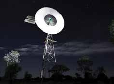
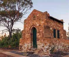
picturesque view of the surrounding land from the top of the ironstone formations that encapsulate the springs. The picnic area provides barbeque and toilet facilities.
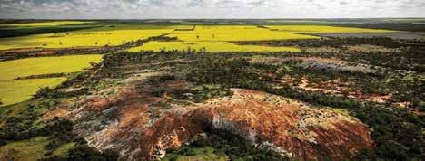
350km north-east of Perth
The Shire of Mt Marshall is located deep in the heart of Australia’s Golden Outback, an easy threehour drive north-east of Perth. The two main towns within the shire are Beacon and Bencubbin as well as the locations of Gabbin, Wialki, Welbungin and Cleary. There is a heritage trail located in the old Gabbin townsite that showcases all the highlights of Gabbin’s history. If you love the outdoors, it is a great place to take a trip back in time and visit the remains of historical buildings, rocky outcrops, nature reserves and amazing night skies. From July to October, you will be treated to a spectacular vista of wildflowers.
The main street of Bencubbin features many original buildings built between 1911 and 1929. Enjoy a walk around the Heritage Trail to learn more about the history of the town including a restored sandalwood dray and the town’s first generator and engine.
Waddouring Dam & Reserve
Enjoy free camping, waterless toilet facilities, picnic shelter and fire pits at this stunning location. Perfect for kayaking, paddle boarding or enjoying a picnic on the water’s edge.
Marshall Rock
Free camping, waterless toilet facilities, fire pits and large shady trees make this location the perfect spot for self-sufficient campers or a picnic lunch. Enjoy a walk or drive to the top of the rock where you can experience 360-degree views
of
Lake McDermott
Free camping, shelter and fire pits make this a great place to camp or picnic. Season rainfall determines the water level with the lake only filling every 10 to 15 years.
Beacon is the farthest north easterly town in the Wheatbelt. While in Beacon, learn more about the pioneer settlement of the town by taking a walk around the new historic walking trail. Beacon is famed for its wildflower tours, run annually through August and September.
Beacon Men’s Shed
The Men’s Shed holds an important place in Australian culture. Visitors are invited to view the restored projects on display and check out current projects.
Billiburning Rock
Enjoy free camping, waterless toilet facilities, picnic shelter and fire pits at
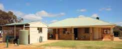
accommodation options available along with modern comfortable facilities.
Marshall Rock and Pergande
Sheepyards / Waddouring Dam and Reserve / Lake McDermott / Beacon Mens Shed / Billiburning Rock
WILDFLOWERS TO DISCOVER
Spider Orchid / Pink Everlastings / Sugar Candy Orchid / Emu Tree / Wattle
283 Monger Street, Bencubbin
T: (08) 9685 1007
E: bencubbin@bencubbincrc.net.au
W: bencubbin.crc.net.au
BEACON CENTRAL COMMUNITY RESOURCE CENTRE
11 Rowland Street, Beacon
T: (08) 9686 1014
E: beacon@beaconcrc.net.au
W: beaconcrc.com.au
this beautiful reserve. Billiburning provides fantastic views from the top of both cropping and pastoral country, and offers many great photographic opportunities. Located on the reserve are a gnamma hole and a soak well, which are easily accessible.
Located 18km east of Beacon is the Datjoin Well and Rock Reserve. During the winter and spring months the reserve is a popular picnic destination for picnickers and visitors looking to find some of the best orchids and wildflowers in the district.
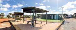
Walking distance to local businesses and town facilities. Camping and on-site self-contained accommodation options available along with modern comfortable facilities.
Visit www.mtmarshall.wa.gov.au to make a booking or find out more.
and on-site self-contained accommodation options available along with modern comfortable facilities.
Visit www.mtmarshall.wa.gov.au to make a booking or find out more.
Visit www.mtmarshall.wa.gov.au to make a booking or find out more.
T: (08) 9685 1202 during office hours • www.mtmarshall.wa.gov.au
T: (08) 9685 1202 during office hours www.mtmarshall.wa.gov.au
T: (08) 9685 1202 during office hours www.mtmarshall.wa.gov.au
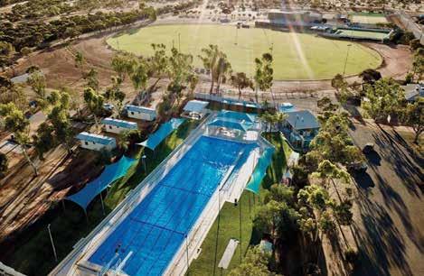
MUKINBUDIN
300km north-east of Perth
Mukinbudin, located along the Wheatbelt Way self-drive trail, is a welcoming and vibrant community with a range of amenities. As you explore the Wheatbelt Way, you’ll encounter the impressive granite outcrops of Mukinbudin and the Central Wheatbelt region. This scenic self-drive route includes a visit to Beringbooding Rock, one of the standout attractions in the area.
Beringbooding Rock
This remarkable site boasts one of the largest rock water catchment tanks in Australia, constructed in 1937 with a capacity of 2.25 million gallons. Beringbooding Rock is renowned for its striking balancing boulder, a massive gnamma hole (water source accessed by bucket and rope), and cave paintings of hands created by the Kalamaia tribe.
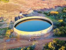
Beringbooding Tank
A historically significant settlement used for water transportation in the early 1900s. It features a gnamma hole, a soak, and two wells meticulously crafted by early pastoralists, which are still in excellent condition today. The site also includes three graves, reminding us of the past.
Just 20km east of Mukinbudin, Weira Reserve offers a breakaway area with gnamma holes. It’s equipped with barbecue facilities, toilets, and picnic areas. While exploring the bush trail, keep an eye out for native orchids in damp areas and the Red Capped Robin.
Local men utilise the Men’s Shed for various projects, including the restoration of old machinery and household items. Visitors are welcome to drop in and meet the members, who are more than happy to provide tours of the shed.
Located 8km east of the townsite, Pope’s Hill pays tribute to Colonel Harold Pope, John Mulqueeny, and the returning soldiers who played a significant role in developing farming land in the Lake Brown area. This area marked the first large-scale Soldier Settlement Scheme in Western Australia.
Whether you’re interested in history, natural beauty, or community
TOP ATTRACTIONS
Beringbooding Rock / Weira Reserve / Pope’s Hill Historical Site / Wattoning Historical Site / Bonnie Rock Townsite
WILDFLOWERS TO DISCOVER
Native Cornflowers / Pink Everlastings / Freckled Sun Orchid / Orange Immortelle
MUKINBUDIN COMMUNITY
RESOURCE CENTRE
8 White Street, Mukinbudin WA 6479
T: (08) 9047 2150
E: info@mukacrc.net.au
SHIRE OF MUKINBUDIN
15 Maddock Street, Mukinbudin
T: (08) 9047 2100
E: admin@mukinbudin.wa.gov.au
engagement, Mukinbudin and its surroundings offer a diverse range of attractions and experiences for visitors to enjoy.
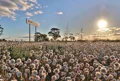
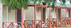
Accommodation includes Self-contained holiday villas, railway barracks, park units. Powered & unpowered sites. FREE use of swimming pool for all guests November – Easter. Unique camper’s kitchen, clean ablutions & BBQ facilities. Free NBN wireles internet. RV friendly town, dumpsite available.
E: stay@mukinbudin.wa.gov.au
T: 0429 471 103
E: stay@mukinbudin.wa.gov.au
T: 0429 471 103
W: mukinbudincaravanpark.com

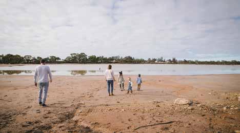
NAREMBEEN
286km east of Perth
Located between Wave Rock and the Great Eastern Highway, Narembeen is the perfect location to discover, explore and stay. Enjoy beautiful nature trails, a wildlife sanctuary, prolific wildflowers in spring, granite outcrops and the undisturbed beauty of this country town.
PLACES TO VISIT
Hidden Hollow
Approximately 30km from Narembeen, the perfect place for a picnic, this secluded granite outcrop boasts a natural amphitheatre. For the more energetic –the vantage point from the summit offers spectacular views of the district.
Walker Lake & Avoca Farm Walk Trails
Located near the townsite, the Walker Lake Trail is 1.8km and the Avoca Farm walk trail is 2.2km.
Narembeen Lesser Hall Precinct
This newly-refurbished outdoor interpretation area is a great place for visitors and locals to learn about the value of Narembeen’s heritage and the way that social life developed in country towns of this era.
Narembeen Grain Discovery Centre
Located within Narembeen’s roadhouse is an interpretive centre focusing on grain growing in Western Australia. Learn more about farming in Narembeen as you wander through the exhibits. Open 9am to 5pm daily.
Narembeen Sculptures
Discover amazing metal sculptures around town including the Narembeen Hawk located at the Recreation Centre and the Narembeen Draught Horse located at the Lesser Hall Precinct.
Roe Dam
Approximately 45km east of Narembeen, enjoy the picnic area beside this 20-million-gallon storage dam, built in 1971. Toilets available.
Roe Lookout
Only 8km from Narembeen, this site is the first site of European contact in the Narembeen Shire. A scenic drive takes you to the peak of this granite formation with beautiful panoramic views of the district.
Step Back in Time
Visit one of the many historical museums in Narembeen including The Old Church, History Museum and Machinery Museum, History Centre and the Spotters Post.
Wadderin Wildlife Sanctuary, Information Centre and Walk Trail
This 400ha nature conservation project, managed by the local community, focuses on the reintroduction of rare or locally-extinct animals in the Wheatbelt. Be sure to check out the new Information Centre and Walk Trail!
Narembeen’s Mile of Boots
A quirky spectacle, located on Mt Walker Road, see more than 1000 odd shoes and boots hanging from a fence-line. The collection of footwear, put together by local farmers, stretches for more than 1km.
TOP ATTRACTIONS
Wadderin Wildlife Sanctuary / Avoca Farm & Historical Machinery / Narembeen Grain Discovery Centre / Roe Lookout / Narembeen Lesser Hall
Precinct and Draught Horse Sculpture
WILDFLOWERS TO DISCOVER
Flame Grevillia / Cowslip Orchid / Hibbertia / Dampiera lavandulacea / Caladenia Longicauda / Yellow Granite
Donkey Orchid (Diuris hazeliae)
NAREMBEEN COMMUNITY
RESOURCE CENTRE
2/19 Churchill Street, Narembeen
T: (08) 9064 7055

E: crcreception@narembeen.wa.gov.au
W: narembeen.wa.gov.au
SHIRE OF NAREMBEEN
1 Longhurst Street, Narembeen
T: (08) 9064 7308
E: admin@narembeen.wa.gov.au
W: narembeen.wa.gov.au
@visitnarembeen_
Narembeen Caravan Park
Relax in our caravan park, conveniently located in the centre of town, with shops and facilities within walking distance. Free 72-hour parking is available for fully self-contained cabins and onsite cabins are also available for booking. Bookings Ph 9054 7308 or email admin@narambeen.wa.gov.au.
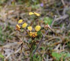
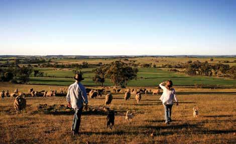
192km south-east of Perth
Narrogin is situated within the Gnaala Karla Booja region in the land of the Noongar People. Narrogin is a Wilman Noongar name, first recorded in 1869 as “Narroging” for a pool in this area. It is a regional centre and an easy drive of just over two hours from Perth. It’s a perfect destination for day trippers or for a stop over for a few days with a range of enticing attractions.
Downderry Wines
Established in 1997, this is a must-visit attraction just 12km west of Narrogin. Downderry makes chemical-free award-winning quality wines. Enjoy free wine tastings, cheeses, tea and coffee. Free overnight camping is available and there are child-friendly farm animals to pat!
Gnarojin Park
“When the wind blows we hear more than just the rustle of leaves or the sound of falling bark. We hear and feel the presence of our ancestors.” — Noel Nannup.
Gnarojin Park contains significant cultural sites including a ceremonial Corrobboree Ground and a birthing tree. Narrogin Brook, a running waterway within the park, is believed to be part of a song line, which possibly runs to the mouth of the Blackwood River. Enjoy the interpretive signage and public art.
Foxes Lair
Take a stroll on one of the five walking trails replete with interpretive signage in this stunning 68ha bush reserve on the town’s doorstep. Spend time at the arboretum with over 60 species of the iconic Australian eucalypt. This fascinating reserve has a wide array of wildflowers, landscapes, birds and wildlife. From August to early October is the best time for viewing wild flowers.
Barna Mia Nocturnal Wildlife
Experience and Dryandra Woodland National Park
Enjoy a unique wildlife experience at the Barna Mia animal sanctuary nestled in the heart of Dryandra Woodland National Park, a 25-minute drive from town. A tour guide with special torches for night viewing will help you discover this magical place. You will be captivated by the sight of threatened native nocturnal marsupials such as the bilby, woylie and quenda.
Astrotourism and a Dark Night Sky
Use telescopes and binoculars to enjoy an evening of stargazing at the local golf club. Take stunning images of the starry night sky over the special landscape at Yilliminning Rock.
Narrogin Heritage Walk Trail
Take an easy stroll along the Heritage Walk Trail within the CBD. This walk, with 25 interpretive signs, celebrates the town’s early buildings which stand as monuments to the times and people of another era.
WHAT’S ON
Australia Day Breakfast & Activities — 25 – 26 Jan 2025
Ulysses WA State Odyssey –27 - 29 Sept 2025
Narrogin Agricultural Show — 18 Oct 2025
Narrogin Flaming BBQ Festival — Oct 2025
Narrogin Rev Heads — 15 Nov 2025
Christmas in Narrogin — Dec 2025
Downderry Wines / Foxes Lair / Barna Mia / Narrogin Railway Station / CBD Walk
WILDFLOWERS TO DISCOVER
Stark White Spider Orchid / Primrose Spider Orchid / Smooth-lipped Spider Orchid / Golden Dryandra / Tassel Grevillea
NARROGIN & DRYANDRA VISITOR CENTRE

1 Pioneer Drive, Narrogin (Narrogin Railway Station)
T: (08) 9881 2064
E: visitorcentre@narrogin.wa.gov.au
W: dryandratourism.org.au
Visitor Centre and Narrogin Railway Station
Stop at the visitor centre at the State heritage-listed Narrogin Railway Station. Make sure you take the time to view the amazing miniature model of Narrogin’s railway precinct and the railway of bygone days. Enjoy interpretative signage, public art, and free WIFI and relax in the lounge while planning your next move.
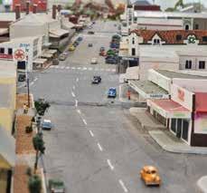
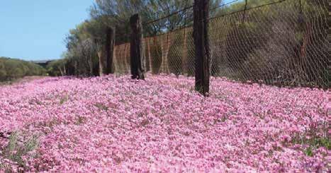
355km north of Perth
Just three and a half hours out of Perth, enjoy the peace and wonder of the countryside in Perenjori.
Situated in the heart of wildflower country, every spring the countryside is ablaze in colour. View an endless range of wildflowers including everlastings and rare native spring orchids from August to October and the iconic and unique wreath flower in September and October.
Perenjori offers a relaxed stop-over for travellers but there is plenty to keep you occupied for an extended stay. Daphne’s Café is a perfect stop off before or after adventuring the beautiful and natural surrounding bushlands.
The Perenjori Pub is an iconic building in the main street, and T-Bone Tuesday has become an institution in its own right. One not to be missed!
Perenjori Roadhouse, located 800 metres north of town, is the only roadhouse in the region open 7 days a week and offers 24-hour fuel.
Charles Darwin Reserve
About 60km to the east of Perenjori you will find Australia’s only internationally recognised biodiversity ‘hotspot’Charles Darwin Reserve. Established in 2003, it provides habitat for over 230 animals and over 680 plant species have been recorded to date. Camping is available June - September at Samphire Campground. Bookings are essential and managed by Bush Heritage Australia. email: info@ bushheritage.org.au
Rothsay Heritage Trail and John Forrest Lookout
For a full day round trip of sightseeing: work your way east of Perenjori from Caron Dam to Camel Soak and Mongers Lake Lookout, which takes you through pastoral and mining country to the John Forrest Lookout in the magnificent Karara Rangelands, offering impressive 360-degree views of farms, stations and minesites.
Caron Rail Trail
Rail enthusiasts will not want to miss the heritage listed Caron Coal Stage, bringing reminders of the golden age of steam locomotives. Follow the rail trail to the dam catchment, especially scenic during springtime with a great range of flora and birdlife and an ideal picnic spot.
Perenjori Tourist Centre and Pioneer Museum
Located in the heritage listed Bank of NSW building, the centre offers great information on the best wildflower and orchid viewing locations. View the impressive collection of historical memorabilia and machinery and wander through the community garden. The Perenjori Tourist Centre and Pioneer Museum is a great place to call in for a chat with one of the friendly local volunteers – they know all the secret spots and will point you in the right direction! FREE WiFi available.
Perenjori People’s Pathway
Steel cut-out artworks provide an opportunity to step back in time and see how Perenjori has changed over the years, allowing visitors and locals to meet some of the characters who
WHAT’S ON
Perenjori 360 — Off Road Racing — 1–3 March 2025
Stargazing with AstrotourismWA — TBC ANZAC Day Ceremony — 25 April 2025
Perenjori Agricultural Show –9 August 2025
TOP ATTRACTIONS
John Forrest Lookout / Pioneer Museum / Camel Soak / Astrotourism
Observation Platform / Charles Darwin Reserve
WILDFLOWERS TO DISCOVER
Wreath Flowers / Donkey Orchids / Spider Orchids / Pink Everlastings / White Everlastings
56 Fowler Street, Perenjori
T: (08) 9973 0100
E: reception@perenjori.wa.gov.au
W: visitperenjori.com.au
perenjori.wa.gov.au
shireofperenjori Shire of Perenjori
helped make Perenjori the town it is today. Providing an opportunity for visitors to explore the main street of the townsite it also takes you past the Church of St Joseph, one of a significant collection of Monsignor Hawes’ churches, including the St Francis Xavier Cathedral in Geraldton.
Astrotourism WA
Ready for a dark sky tourism adventure? Enjoy a night of stargazing under the Milky Way and utilise our Giant Planisphere star wheel and dark sky observing platform just a few minutes’ walk from the Perenjori Caravan Park. No experience necessary as our planisphere gives you all the information you need.
Perenjori Caravan Park
With a friendly and helpful Park Manager to assist in all aspects of your visit, enjoy a relaxing stay in Perenjori surrounded by shady & spacious sites, a large camp kitchen and fully self-contained accommodation. Tel: (08) 9973 1193. Free WiFi available.
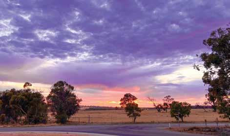
Pingelly is a pleasant 90-minute drive from central Perth, close enough for an overnight stay or a day trip. Settled in the 1860s, Pingelly is a rich and diverse cropping and grazing agricultural region contributing significantly to the state’s wool and grain exports. Pingelly won the State Tidy Towns Award in 2023.
The town is picturesque, with many parks, free barbecue facilities, picnic areas, playgrounds, gardens and two RV dump points. Facilities include a 24/7 medical centre, chemist, supermarket (open seven days), butcher, ATM, community crafts and giftware shops, an op-shop, a swimming pool (November – March), and dine-in and takeaway food options.
The PRACC
The PRACC is the largest timber structure built in Western Australia since World War II. This amazing facility was built using 1,000 tonnes of yellow stringy bark, houses a bar and bistro, and is open from Wednesday to Sunday each week.
Moorumbine Heritage Townsite
This picturesque site was originally settled in 1864. Many of the original houses and buildings built by convicts survive, such as St Patrick’s Church, which was consecrated in 1873 and is still in use today.
Boyagin Nature Reserve
Boyagin Nature Reserve is a designated flora and fauna reserve with picnic, bushwalking activities, and wildflowers in season. Boyagin Rock rises 50m above the surrounding countryside and is of immense spiritual and cultural significance to Noongar people.
Apex Lookout on Ironstone Hill
The lookout offers panoramic views of the town and countryside. Access and parking is found off Balfour Street.
Tutanning Flora and Fauna Reserve
Tutanning is world renowned as a sanctuary for the endangered Tammar wallaby, and for hundreds of wildflower species and native orchids.
Dryandra Woodland
Dryandra Woodland offers one of the best opportunities to view native animals in their natural habitat.
Memorial Park
In the heart of Pingelly, Memorial Park now features purpose-built play spaces encompassing an early years playground, an adventure and nature playground for all ages, an expanded children’s playground, as well as barbecue, picnic and toilet facilities.
Pingelly Community Craft Centre
Purchase local crafts and souvenirs from the shop, which doubles as a tourist information source and booking centre
WHAT’S ON
Pingelly Heritage Festival — April 2025
Flowers Art & Music (FAM) Festival –Sept 2025
Tutanning Wildflower Walk — Sept 2025
Pingelly Christmas Village — Dec 2025
Pingelly Party on the Oval — Dec 2025
TOP ATTRACTIONS
Historic Town Centre / Pingelly
Recreation and Cultural Centre (PRACC) / Moorumbine Heritage
Townsite / Boyagin Rock / Tutanning Nature Reserve
WILDFLOWERS TO DISCOVER
Jarrah / Wandoo / Powderbank
Wandoo / Brown Mallet
PINGELLY COMMUNITY
CRAFT CENTRE AND TOURIST INFORMATION
28 Parade Street, Pingelly
T: (08) 9887 1295
W: pingelly.wa.gov.au
PINGELLY RECREATION AND CULTURAL CENTRE
Somerset Street, Pingelly
T: (08) 9887 0092
E: enquiries@pracc.net.cu
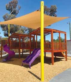
Playground at Pingelly’s Memorial Park
for the local caravan park. Open from 9.30am. Further tourist information and shire location maps are available from all retail outlets in town.
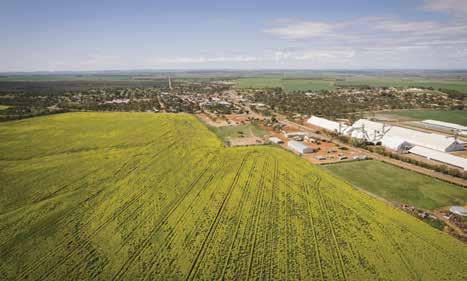
167km from Perth
Quairading is a beautiful town nestled in the Central Wheatbelt of Western Australia, just 167km east of Perth on the York-Quairading Road. This vibrant community has a population of about 1,200 and a strong agricultural industry, producing cereal and grain crops, forestry, wool, sheep and cattle, supported by rural service industries.
Toapin Weir
The largest and most comprehensive privately constructed reservoir and water scheme in Western Australia, this picturesque area boasts spectacular views, an electric barbecue and toilet facilities.
El Toro
El Toro is a major artistic attraction in town — a sculpture crafted by the world-renowned metal sculptor based in WA. Jordan Sprigg’s attention to detail and regional WA craftsmanship along with his obvious passion, all contribute to El Toro magnificently displaying his collection of time-worn scrap iron that is catching the eyes and hearts of locals and visitors alike in this small rural town. Quairading proudly aligns itself with many traits of the bull that El Toro resembles. El Toro is on public display in Quairading, outside the Quairading Town Hall.
Nookaminnie Rock Nature Reserve
The Nookaminnie Rock Nature Reserve
lies 3km west of town on the YorkQuairading Road. The heart of the reserve is dominated by Nookaminnie Rock, which is a large granite outcrop with magnificent views of the surrounding landscape and the town of Quairading. The top of Nookaminnie Rock offers a perfect platform to watch the Wheatbelt’s breathtaking sunsets and in spring you can enjoy some of the most beautiful wildflowers the Wheatbelt has to offer. Marked walk trails provide easy and safe access to the reserve.
Rabbit Proof Fence
The Rabbit Proof Fence is the longest fence in the world! Two re-created examples of the fence and rabbit traps are located south of Quairading on the Corrigin Road. There are three fences in Western Australia: the original No. 1 Fence crosses the state from north to south, No. 2 Fence is smaller and further west, and No. 3 Fence is smaller still and runs east–west. The fences took six years to build. When completed in 1907, the rabbitproof fences (including all three) stretched 3,237km (2,023 miles). The
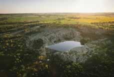
Toapin Weir / Nookaminnie Rock Nature Reserve / Quairading Railway Museum / Rabbit Proof Fence / El Toro
WILDFLOWERS TO DISCOVER Banksia Cuneata (Matchstick Banksia) / Donkey Orchid / Spider Orchid / Everlastings
QUAIRADING VISITOR CENTRE
QUAIRADING COMMUNITY
RESOURCE CENTRE
1 Parker Street, Quairading
T: (08) 9645 0096
E: admin@quairadingcrc.com.au
W: quairading.wa.gov.au
cost to build the fences at the time was about £167 per mile ($250/km) which totals just over $800,000.
Kwirrading Koort
Completed in August 2023, the new community park and adventure playground is a must-see Wheatbelt attraction. The playground features equipment for all ages, water play, vast lawn areas, barbecue facilities, and plenty of seating and tables for visitors.
Quairading Caravan Park
Need somewhere to stay? Book into the Quairading Caravan Park! There are two-bedroom self-contained cabins as well as single rooms, powered/ unpowered caravan sites and camping options available.
Book online at www.quairading.wa.gov.au or call 0438 213 042.
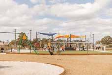
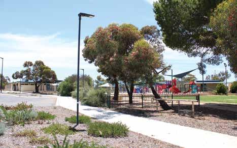
235km from Perth
Located along the Wheatbelt Way self-drive route, the Shire of Trayning consists of the three townships of Kununoppin, Trayning, and Yelbeni. It is home to 300 people and has a distinct focus on agriculture.
The area is named after Trayning Well, the Aboriginal name of a nearby water source located on the old road from Goomalling to the Eastern Goldfields. It was first recorded by a surveyor in 1892 and allegedly derives from the European interpretation of the Aboriginal word ‘dur-iring’ meaning ‘snake calling in the grass near a campfire’.
While in Trayning, discover natural granite outcrops, native birds, insects, reptiles, woodlands and stunning panoramas of wildflowers in season.
Billyacatting Hill
Situated on the shire’s eastern boundary (27km east of Trayning), this 2,500ha flora and fauna reserve is a nature lover’s delight.
Yarragin Rock
Located 24km north-east of Trayning, Yarragin Rock consists of twin monoliths rising from a flat granite outcrop and is visible from a great distance.
Gnammas
Located 18km north of Trayning are the
gnamma holes. Birds and other wildlife frequent the rock pools. The perimeters of gnamma holes are also good places to search for orchids, and other wildflowers.
Rance Caravan
Home of one of the first registered caravans in Western Australia, you will find the old Rance Caravan and its story displayed on Railway Street in Trayning. A variety of amazing flora and fauna can be found at these locations, highlighting the natural diversity of the area.
Yelbeni Centenary Museum
Marvel at machinery from yesteryear at the Yelbeni Centenary Museum.
Trayning Caravan Park
This quaint little spot really is the peace and quiet you have been looking for. With drive-through powered sites, free WiFi, barbecues, an expansive grassed area, a playground, laundry and kitchen
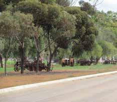
WHAT’S ON
Rock Solid Smoke ‘N’ Dirt Event — Sept 2025
TOP ATTRACTIONS
The Wheatbelt Way / Trayning Caravan Park / Yarragin Rock / Billyacatting Hill / Yelbeni Centenary Museum
WILDFLOWERS TO DISCOVER
Common Firebush / Yellow Feather Flower / Rock Buttercup / Pink Everlasting / Orchids / Grevilleas
VISITOR INFORMATION
Railway Street (PO Box 95), Trayning
T: (08) 9683 1001
E: admin@trayning.wa.gov.au
W: trayning.wa.gov.au
amenities, and an RV dump point, this dog-friendly caravan park is a great spot to stop and stay a while. Enjoy starry-night skies around the communal fire pit (subject to fire season). Situated north on the Bencubbin / Kellerberrin Road and close to town the caravan park is in walking distance to everything.
Trayning Short Stay Accommodation
On Felgate Parade, there are two furnished, two bedroom cottages, accommodating up to four people which are perfect for a family of four visiting relatives or visitors travelling the Wheatbelt.
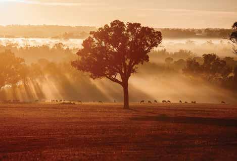
204km south-east of Perth
The town of Darkan was established in 1907, with the establishment of two connecting railway lines from Collie to the Great Southern Railway. Darkan, located on the Coalfields Highway, is now the shire’s main town.
Arthur River
The Arthur and Beaufort Rivers area, located on the Albany Highway, was first settled during the 1850s, with grazing leases granted as early as 1854. Arthur River developed into a thriving centre, but in 1889, when the Great Southern Railway opened, many of the existing businesses moved to the new railway towns. Arthur River still contains some lovely examples of early buildings, with some being on the State Heritage Register.
Lake Towerrinning
Lake Towerrinning is a large and beautiful semi-freshwater lake with clean sandy beaches. Nestled amid bush and farmland, the 256ha lake is perfect for waterskiing, kayaking, swimming, birdwatching and stargazing. The lake is close to, but not directly part of the Arthur River. The lake hosts annual events such as the WA Speed Boat Club’s State Titles and the Towerrinning
since 2023.
is available at the lake at Lakeside Camping.
Follow the old railway line that once connected Collie and Narrogin. The line was used to transport timber, farm produce, livestock and grain and also provided a passenger service. The line closed in 1979 and became a trail in 2005. The trailheads are at Buckingham, Darkan and Dardinine, a total of 60.5km. The trail is multi-use, and suitable for most walkers, cycling, adaptive cycling and horse riding. Find out more at westarthur.wa.gov.au or on Trails WA’s website.
Betty Brown Historical Centre
This award-winning museum highlights the contributions made by women to rural communities, and how they assisted in the development of their towns and districts. Located in the old West Arthur Road Board building in Darkan, it is well worth a visit.
Stargazing
West Arthur is part of the Astrotowns network, and there are many places in the shire that offer the chance to stargaze and take stunning astrophotos. Local tourism business One Gate Farm offers astro tours, farm gate tastings, wildflowers and historical tours.
WHAT’S ON
Australia Day Activities –26 January 2025
Shearing Competition – Darkan, Feb 2025
Birdy’s Backyard Ultra Marathon –Aug 2025
WA Speed Boats State Titles – Oct 2025
TOP ATTRACTIONS
Lake Towerrinning / Collie-Darkan Rail Trail / Arthur River Heritage Precinct / Betty Brown Historical Centre / Astrotourism
WILDFLOWERS TO DISCOVER
Orchids / Boronia / Forest shrubs
SHIRE OF WEST ARTHUR
31 Burrowes Street, Darkan
T: (08) 9736 2400
E: shire@westarthur.wa.gov.au
W: westarthur.wa.gov.au
Astro sites within the shire include Lake Towerrinning, historical Six Mile Cottage and Kylie Water Tower.
Flora and Fauna
Wildflowers are abundant within the shire, along the rail trail, and in road verges and nature reserves. The shire is a combination of forest to the west, and plains to the east, with natural water ways and stunning vistas. Phascogales, or wambengers are found in the district, with a wooden carving of one found in the Railway Reserve area and playground in Darkan. The red-tailed phascogales are endangered and only found in certain areas of Western Australia, while emus, kangaroos and Banks Black Cockatoo can also be sighted.
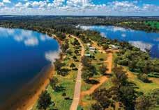
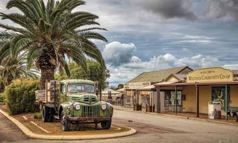
WESTONIA
316km east of Perth
Wessy’, as locals call it, is just over a three hours drive east of Perth, where the Wheatbelt meets the Goldfields. The town owes its origin to gold mining and now relies largely on wheat and sheep farming. Westonia is located along the Golden Pipeline Heritage Trail and the Wheatbelt Way self-drive trail and boasts beautiful historic façades on its main street.
Hood-Penn Museum
Showcasing early life in the shire, it includes a mine tunnel and blast simulation.
Wolfram Street
The main street features charming façades of the original bank and other historic buildings such as the café, hotel, fire station, boarding house and greengrocer.
Elachbutting Rock
A prominent landmark with excellent views from the top and colourful caves.
Baladjie Rock
Extensive granite outcrops in attractive woodland setting adjacent to Baladjie Lake with spectacular views of the nearby lake system landscape. Popular for camping in milder months.
Edna May Lookout
A working gold mine which offers a view of a mine by day or night.
Westonia Common
Westonia townsite is nestled inside approx. 5,600ha of remnant bushland. ‘The Common’ features salmon gum, morrell and gimlet woodlands, a woodlands and wildflowers walk trail with miniature replicas and points of interest, and Boodalin Soak – a historic water and rest place for travellers. It was the place of capture for Moondyne Joe (WA’s best known bushranger) in 1866.
Yanneymooning Rock and Reserve
Comprises granite rock formations and bushland. Spot the abundant ornate dragon lizard (Ctenophurus ornatus), an inhabitant of Yanneymooning Rock.
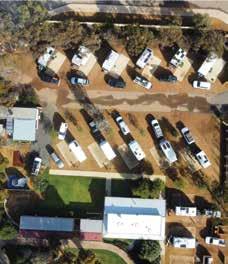
WHAT’S ON
Wessy Christmas Markets — Nov 2025 Wessy on the Green — April 2025 (biennial)
TOP ATTRACTIONS
Edna May Lookout / Hood-Penn Museum / Elachbutting Rock / Baladjie Rock / Wolfram Street façades
WILDFLOWERS TO DISCOVER
Orchids / Cowslip Orchid / Grevilleas / Hakeas / Red Morrell Eucalypts / Lesser Bottlebrush
SHIRE OF WESTONIA & COMMUNITY
RESOURCE CENTRE
41 Wolfram Street, Westonia T: (08) 9046 7063
E: shire@westonia.wa.gov.au W: westonia.wa.gov.au
Sandford Rocks Nature Reserve
Experience the granite outcrop, wildflowers scrub and woodland. A must do for birding and wildflower enthusiasts.
Chiddaracooping Reserve
This reserve has abundant and unique flora such as the cowslip orchid and the lesser bottlebrush or Callistemon phoeniceus, one of only two bottlebrush species native to South West WA.
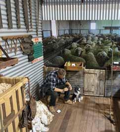
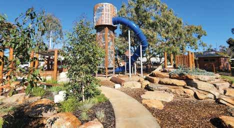
227km south-east of Perth
The Wickepin area was settled in the early 1900s as a service centre for grain and sheep farming and still features many preserved historical sites from this period. The shire covers an area of 198,900ha including the towns of Wickepin, Yealering, Harrismith and Tincurrin.
Wickepin town boasts impressive sporting and recreational facilities including a sporting oval, indoor courts, synthetic bowling greens, a swimming pool, golf course, tennis courts, and a dynamic nature playground located within the town’s centre. This RV friendly town has 24-hour fuel available.
Albert Facey Homestead
Located in the main street of Wickepin, the Albert Facey Homestead celebrates the life of Albert Facey, author of the bestselling autobiography ‘A Fortunate Life’. The homestead was moved into town from his family farm and has been lovingly restored to reflect the harsh and simple lifestyle of the 1930s.
Wickepin Heritage Precinct and Walk Trail
The Wickepin Heritage Precinct walk trail is located within the town centre. There you’ll find The Old Railway Station, Stationmaster’s House, Old Police Station, along with the former Road Board Building all built prior to 1915.
The town of Yealering is located 27km north of Wickepin. Yealering is known to be the only country town in Western Australia with a lake within the town boundary and is part of the Living Lakes initiative.
In a picturesque setting with picnic and barbecue facilities, Lake Yealering is an ideal place for a variety of water sports including skiing, swimming, sailing and windsurfing. There are nature walks throughout the surrounding bushland which is alive with birdlife. Overlooking the lake are modern sporting facilities including tennis courts, a bowling green and cricket oval. The golf course surrounds the lake and the 18th hole features a unique tee box set out over the water. The Town Hall, caravan park and picnic facilities are located on the lake shore.
Harrismith is located 45km south-east of Wickepin and the area boasts some of Western Australia’s most unique wildflowers. An established wildflower walk trail with informative signage surrounds the town and showcases the magnificent display of orchids, verticordias, grevilleas and banksias. Visitors will enjoy the display of historical machinery and memorabilia assembled by local community members including information about the Rabbit Proof Fence. Facilities in the town include a Town Hall, caravan park and accommodation units, cricket oval as well as an 18-hole golf course.
WHAT’S ON
Ignite Wicky Festival — 21 Feb 2026
TOP ATTRACTIONS
Malyalling Reserve / Lake Toolibin / Albert Facey Homestead / Lake Yealering / Wildflowers Harrismith
WILDFLOWERS TO DISCOVER
Fringed Mantis, Banded Greenhoods, Many Orchid varieties (e.g. Spider Orchids – Pink & Blue Fairy Orchids –Sugar Orchids – Purple Enamel Orchids)
INFORMATION
77 Wogolin Road, Wickepin
T: (08) 9888 1005
E: admin@wickepin.wa.gov.au
W: wickepin.wa.gov.au
WICKEPIN COMMUNITY
RESOURCE CENTRE
24 Wogolin Road, Wickepin
T: (08) 9888 1500
Tincurrin
The small town of Tincurrin is located 35km south of Wickepin and showcases a stunning display of wildflowers.
Toolibin Nature Reserve
Toolibin Nature Reserve is an A class nature reserve that is home to the Ramsar listed Toolibin Lake. Toolibin Lake is an area of high conservation value, being one of the last remaining inland freshwater lakes in the southwest. An easy 1.6km loop walk takes about 45 minutes and you can learn about the lake from the interpretive signs. To date, 41 species of waterbird have been recorded here including rare species like the freckled duck (Stictonetta naevosa).
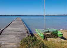
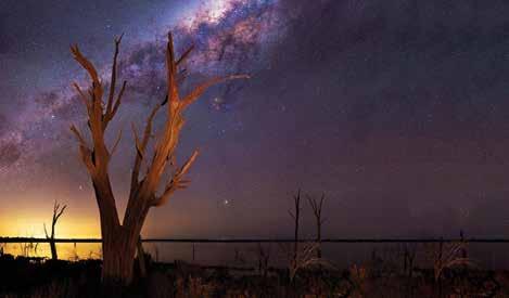
184km north-east of Perth
Ashort, scenic drive from Perth brings you to Wongan Hills, the largest town within the Shire of Wongan-Ballidu. Translated from the Aboriginal Wongan Katta, or Talking Hills, the area falls within WA’s rich and diverse floral region and is home to over 1,300 varieties of wildflowers including 24 species found only in Wongan Hills. Noted as one of WA’s first Astrotourism towns, visit Lake Ninan or the airport to gaze at spectacular starry-night skies. The town offers outstanding cycling paths, sporting facilities, museum and cultural festivals and activities.
PLACES TO VISIT
Mt Matilda Walk Trail
Located within the Wongan Hills nature reserve, this walk trail boasts spectacular views, fauna, and flora. Two trails are available for people with a moderate fitness level.
Mt O’Brien Lookout
Mt O’Brien is the second highest point in Wongan Hills and has a variety of wildflowers, some of which are only found in these hills. Barbecue and lighting facilities are provided.
Christmas Rock Walk
This trail is easily accessible and will take approximately an hour to walk at a leisurely stroll. Filled with natural attractions and cultural history of the town.
Gathercole Nature Reserve and Walk Trail
Many species of native plants and animals call this granite outcrop home. The walk trail is suitable for people with moderate levels of fitness.
Dingo Rock
This large granite outcrop has a gnamma hole on the rock face, which is a water collection site. During late winter and spring, the reserve develops a picturesque covering of wildflowers.
Reynoldson Reserve
The reserve is renowned for its spectacular displays of Verticordia. Flowering seasons vary with most blooming between October and January, with November being the peak season.
Lake Ninan
Once a thriving ski lake with its own yacht club, Lake Ninan is a beautiful place for a picnic. The perfect spot for watching the sunset and stargazing under the night’s sky. An RV-friendly site and only a short 8km from Wongan Hills town centre.
Still sporting the verandahs and posts on the original main street shops, this cultural hamlet town is famous for its annual Bike it to Ballidu Gravel event. The old Ballidu Hall has been repurposed to house a charming history collection and is well worth a look. Be sure to visit the local tavern for a sense of country
WHAT’S ON
Reynoldson Reserve Wildflower Festival — 31 Oct - 2 Nov 2025
Bike it to Ballidu Gravel — 28 Sept 2025
TOP ATTRACTIONS
Lake Ninan / Gamma Rock / Reynoldson Reserve / Ballidu Heritage Centre / Astrotourism
WILDFLOWERS TO DISCOVER
Verticordia / Orchid Species / Grevillea ‘Superb’ / Pink Poker (Grevillea Petrophiloides) / Wongan Cactus
WONGAN HILLS VISITOR CENTRE
The Station, 1 Wongan Road
Wongan Hills
T: (08) 9671 1973
E: wongantourism@westnet.com.au
W: wongantourism.com.au

hospitality. The town’s arts scene can also be enjoyed at the award-winning Ballidu Lodge Art Gallery. Ballidu Town Dam and the Balli-Balli Rocks offer nature enthusiasts great scenery, fauna, and flora.
At the core of Cadoux are its general store, school, outstanding recreation centre and wheat bins. The town suffered major destruction during the 1979 earthquake and the fault lines and geological phenomena are clearly marked with interpretive signage. Just north of the town will take you to the Flat Rocks Nature Reserve, a water catchment area built during WWII. During winter and spring this is a great place to enjoy the wildflowers and gnamma hole.
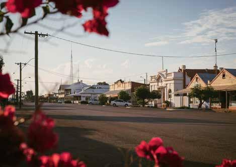


192km north-east of Perth
Wyalkatchem lies along the popular Pioneers’ Pathway and Wheatbelt Way selfdrive routes, an easy two-hour drive from Perth via Northam or Toodyay. The first recorded exploration was in 1846, guided by local Aboriginals. Settlers first arrived in 1904 and the town site was officially declared in 1908. By 1905, Wyalkatchem was home to pioneer and politician John Lindsay, a key advocate for farmers and the bulk handling of wheat. Later, Wyalkatchem became known as the “cradle of bulk handling” and remains a thriving grain and sheep farming region.
PLACES TO VISIT
CBH Agricultural Museum
The first delivery of bulk wheat in Western Australia was received at Korrelocking in November 1931. Today, the Museum’s original K Type wheat bin protects an impressive collection of early farming equipment including the rare Waterloo Boy - one of the first John Deere tractors (1920).
Wyalkatchem Town Heritage Walk
The town boasts many fine historical, National Trust and heritage listed buildings from the early 1900s. A leaflet is available at the visitor centre and shire offices.
Old School House
Once home to Sir William Heseltine, who later became a member of the
Royal Household and Press Secretary to Queen Elizabeth II, see life from a bygone era at the Old School House. Viewing by appointment only – contact Pat Jones on 0429 080 200.
Walk-A-Wyal Tracks
Along three different tracks marked by yellow, blue and red triangles, you can observe unique flora and fauna in the peaceful surrounds of some of the oldest bushland reserves in WA.
Cowcowing Lake
Cowcowing Lake and Cemetery lie 26km to the north of town. The lake gives its name to Cowcowing Siding and covers an area of 15,000ha. On rare occasions when the lake is full, locals use it to water ski.
Yorkrakine Rock
A spectacular granite outcrop rising 341m and covering some 160ha, Yorkrakine Rock is an ideal spot for picnics (it has amenities) and bushwalking.
Korrelocking Reserve
Site four on the Wheatbelt Way selfdrive trail, Korrelocking Reserve features 259ha of bushland and a picturesque picnic spot (especially during wildflower season) with amenities, interpretative signage, a marked walk trail and pioneer well. Some 44 bird species have been recorded at the reserve including pacific heron, black-shouldered kite, whistling kite, little eagle, black-tailed native hen and Long-billed corella.
WHAT’S ON
Wyalkatchem Rodeo
Wylie Arts Expo
TOP ATTRACTIONS
Wyalkatchem CBH and Agriculture Museum and Pioneer Pathway display – John Lyndsay / Wyalkatchem Schoolhouse Museum / Korrelocking Reserve / Pioneer Park Memorial Rose Garden / Olympic swimming pool and children’s pool
WILDFLOWERS TO DISCOVER
Wyalkatchem Foxglove / Spider Orchids / Donkey Orchids / Paper Daisies
WYALKATCHEM VISITOR CENTRE
Wyalkatchem Visitor Centre
CRC & CBH Museum
Railway Tce, Wyalkatchem WA 6485
T: (08) 9681 1500
E: admin@wyalcatchemcrc.com
W: wyalkatchemcrc.com
E: general@wyalkatchem.wa.gov.au
W: wyalkatchem.wa.gov.au
Historic Wyalkatchem Well
Commonly known as ‘Wyalkatchem Tank’, find the unique granite Wylkatchem Well at site five on the Wheatbelt Way self-drive trail.

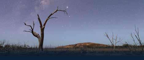
368km east of Perth
The town of Southern Cross was founded in 1888 and is named after the stars that guided the explorers in search of gold, that lead to the settlement of the town.
Today, all the streets in the area are named after stars and constellations. If you are sightseeing or just taking a break from driving, there are many interesting sites, facilities and amenities situated within town. Off Great Eastern Highway on Antares Street you will find cafés, a chemist, hardware store, newsagent, post office, pubs, a supermarket and an op-shop. Enjoy the outdoors and rest under the shade of a gum tree in the Rotary Park, with barbecue and toilet facilities. Parts of the main street and park are covered by free public WiFi. Reminisce at the Yilgarn Historical Museum, exercise in the well-appointed outdoor fitness centre, or give your four-legged friend a workout at the dog park. If visiting during summer have a splash to cool down in the town swimming pool, free of charge.
Constellation Park
Located on Antares Street, Constellation Park has a new skate park, toddlers bike track, shaded playground, barbecue and soccer pitch.
Exercise your four-legged friend at the dog exercise area located conveniently close to the RV dump point on the corner of Achernar and Sirius Street.
The new aquatic facility located on Antares Street boasts a 25m pool with wheelchair access, as well as a wading pool with water features. There is also a basketball half court, cricket net, barbecue facilities and kiosk. Open November to March with free entry.
Yilgarn History Museum
Located on Antares Street, see the earliest Registrar’s Office in Western Australia (now the Museum) built in 1892.
Wimmera Hill Lookout
This lookout allows visitors to view the townsite of Southern Cross, the surrounding farmland and gold mines.
Karalee Dam
Collecting water running off the rocks, this historically significant aqueduct was constructed to provide water to the dam for steam trains. Great picnic and camping facilities, located 56km east of Southern Cross along Great Eastern Highway.
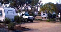
WHAT’S ON
Australia Day Community Breakfast — 26 Jan 2025
ANZAC Day Dawn & 11am Services — 25 April 2025
Yilgarn Agricultural Show — 31 Aug 2025
Check visit.yilgarn.wa.gov.au
Yilgarn History Museum / Karalee Dam / Lake Koorkoordine / Wimmera Hill / Frog Rock
WILDFLOWERS TO DISCOVER
Spider Orchids / Donkey Orchids / Dainty Blue Orchids / Tea Tree / Boryceae
SHIRE OF YILGARN 23 Antares Street, Southern Cross T: (08) 9049 1001
E: yilgarn@yilgarn.wa.gov.au W: visit.yilgarn.wa.gov.au
Frog Rock
A miniature wave-like formation, dam and picnic area located 30km southwest of Southern Cross.
Lake Koorkoordine
A vastly spectacular salt lake, which has recently become a popular land sailing destination.
Cross Caravan Park & Sandalwood Lodge
located on Great Eastern Hwy and within walking distance of the town centre, dog park and free community swimming pool. We offer 5th wheeler premium and drive-through bays, spacious tent sites, recently fully refurbished ablution block and an en-suite disability site.
The Sandalwood Motor Lodge has fully equipped air-conditioned motel style rooms. We offer free Wi-Fi in parts of the park, coin operated laundry facilities, free BBQ’s, playground, campers’ kitchen, recreation room with TV. Dogs are allowed in the caravan park but not in our lodge rooms (special needs & guide dogs excepted) conditions apply.

Great Eastern Highway, Southern Cross Tel: (08) 9049 1212
Email: caravanpark@yilgarn.wa.gov.au
Web: visit.yilgarn.wa.gov.au
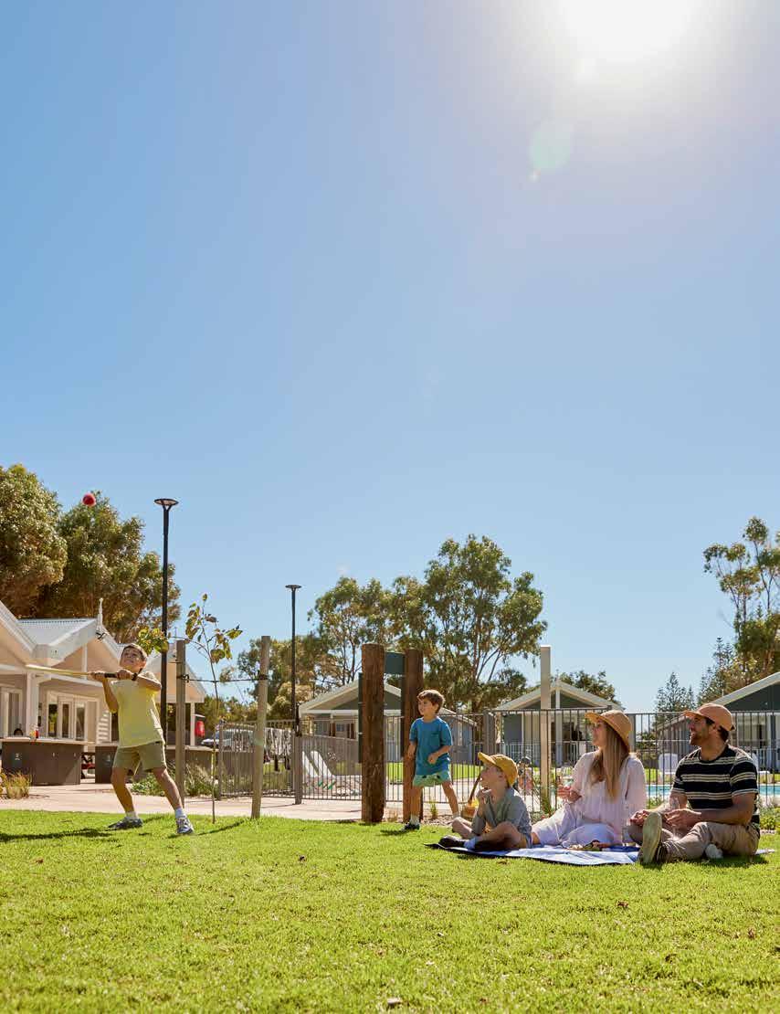
Enjoy a beachside stay with brand new facilities and a wide range of accommodation options. From self-contained villas to ensuite camping sites, including pet friendly options. Plus RAC members enjoy exclusive rates. Book now and relax with us.