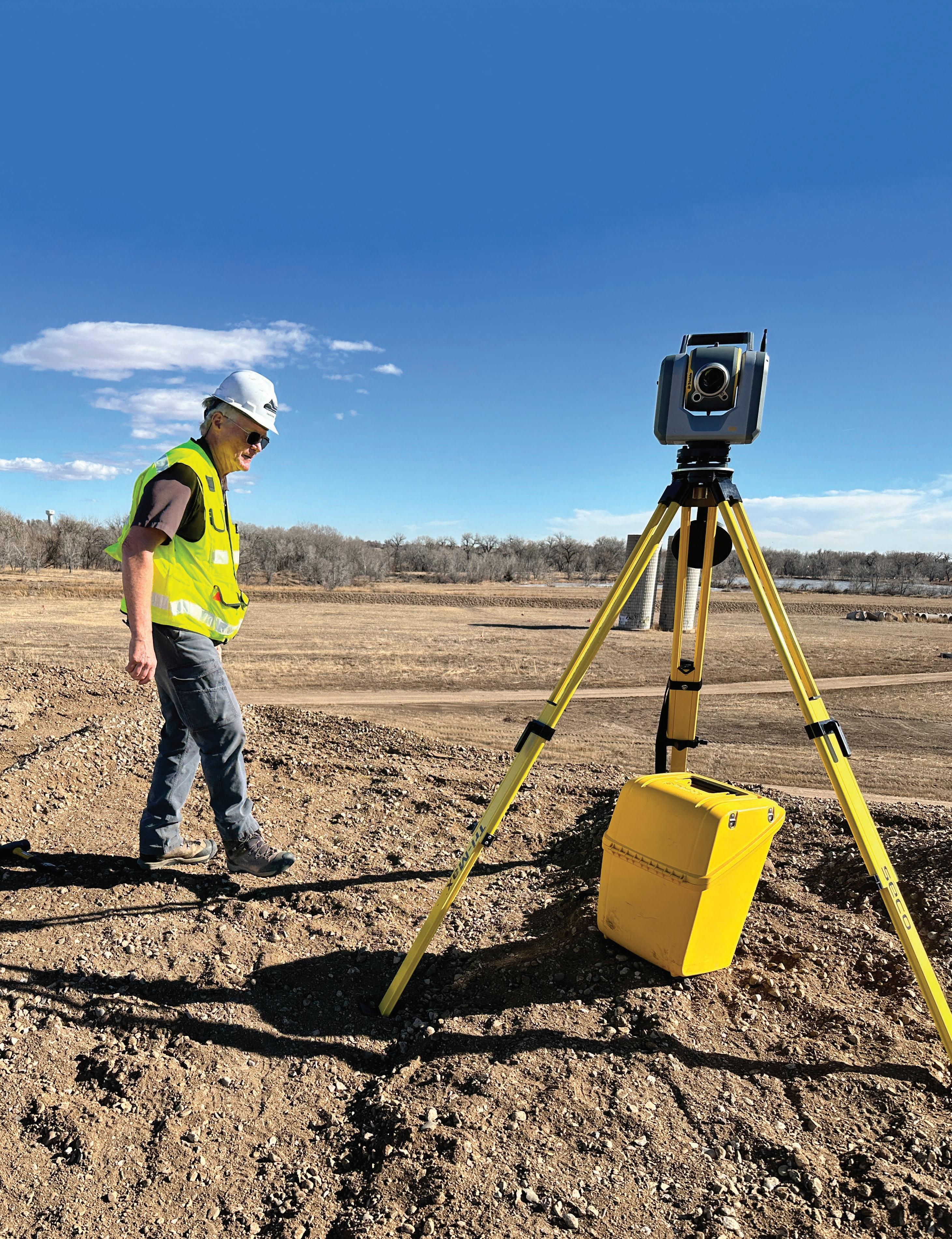
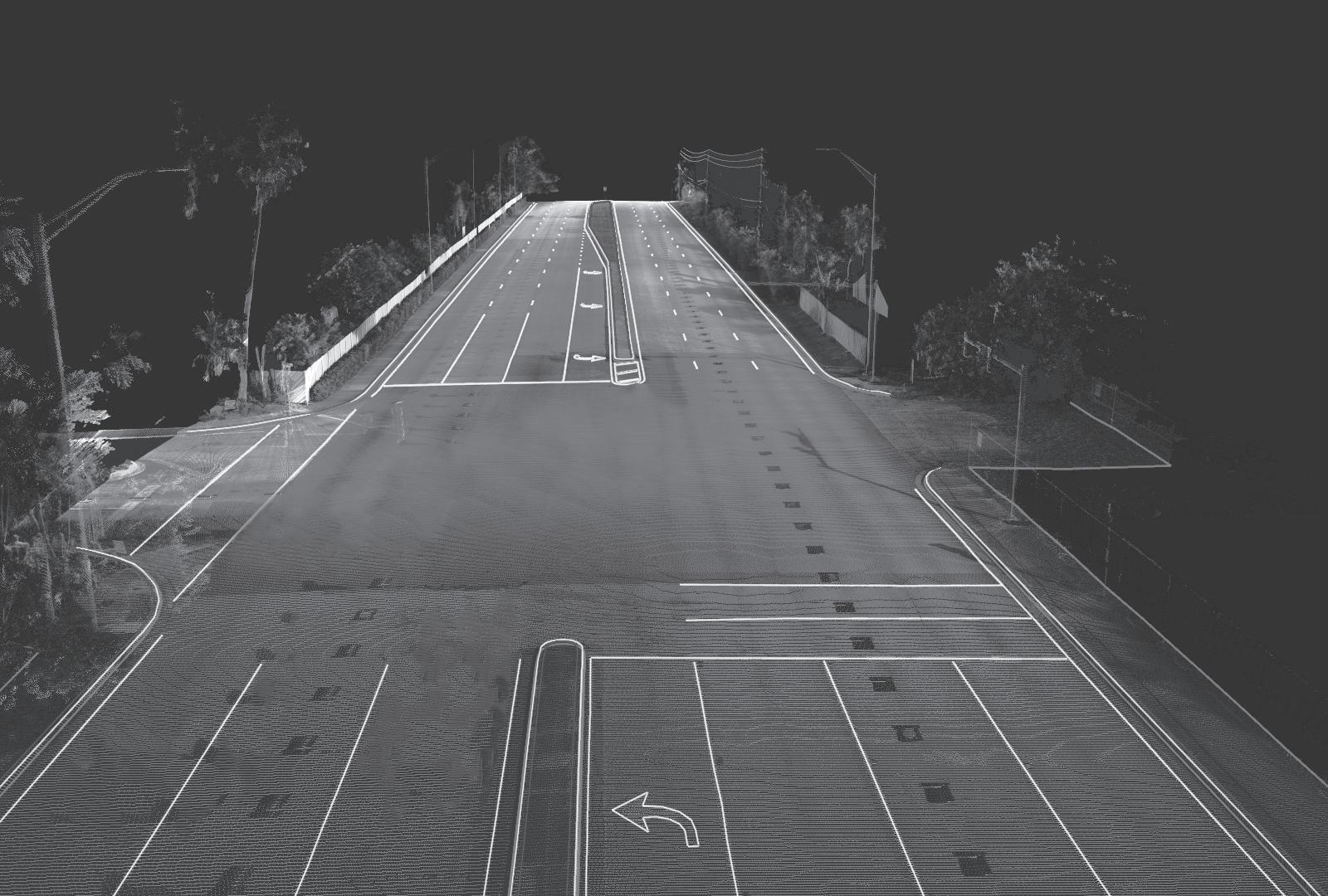
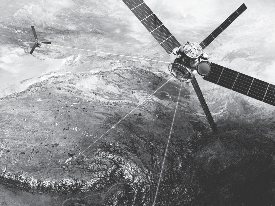
Combining innovative technology with intuitive functionality, the Trimble® SX12 scanning total station saves time and maximizes efficiency. The SX12 collects high-quality, highspeed scan data, providing detailed site context in a seamless workflow that enables informed and faster project-based decisions.
Professional Land Surveyors of Colorado, Inc.
AFFILIATE—NATIONAL SOCIETY OF PROFESSIONAL SURVEYORS
MEMBER—ASSN. OF COLORADO ENGINEERING COUNCIL
MEMBER—WESTERN FEDERATION OF PROFESSIONAL SURVEYORS
OFFICERS (2024)
Brian Dennis President 719-337-1262
Shaun Lee Secretary/Treasurer sdl051@yahoo.com 570-499-8073
Becky Roland
Executive Director PO Box 441069, Aurora, CO 80044 • broland@plsc.net Phoenix AMC (303) 551-3266 F: (720) 230-4846
Directors: Brian Bowker, Ian Cortez, Todd Johnston, Heather Lassner, Steve Parker, Tom Sylvester, Scott Thompson, Dennis Mouland
Side Shots Editorial Committee
Laine Landau, Chair; Becky Roland, Justin C. Scheitler, Dave Berglund, Brian Kelly, Steve Parker, Todd Johnston, Sean Mullen
Directors: Roger Atnes, Derek Brown, Amara Hildebrand, Eric Laburda, Jim Lynch, Tony Peall, Hayley Young
NORTHERN CHAPTER - PLSC, INC.
President-elect: Dave Berglund; Secretary/Treasurer, Heather Lassner
Directors: Celine LeBeau, Tony Fendick, Pete Paulus, Kathryn Rocha, Reade Roselles,
NORTHWEST 1/4 COLORADO LAND SURVEYORS
President: Brian T. Kelly
Treasurer/VP, AJ Summers; Secretary, Walter Magill
Directors: Thomas H. Effinger, Skidge Moon, Walter Magill, Lloyd Powers, Peter Epp
Past President and Director: Gordon Dowling
SOUTHERN COLORADO PROFESSIONAL LAND SURVEYORS
President: Steven Parker
Vice President: Mark Johannes; Secretary: Don R. Hulsey
Treasurer: Dan Hanten
Directors: Joseph Alessi III, Dennis Craig, Steve Rutzen, Jon Tessin, Eric White, Honorable Lifetime: Nathan Lira, PLS
SOUTHWESTERN CHAPTER - PLSC, INC.
President: Brian Boniface
Vice President: Tim Barnett; Secretary: Robert Hinojosa; Treasurer: Justin Bonnell
WESTERN COLORADO LAND SURVEYORS
President: Sean Mullen
Vice President: David Holmes; Secretary-Treasurer: James Combs
Directors: Ted Juntilla, Renee Parent, Kurt Shepherd, Alec Thomas, Tom Sylvester, and Scott Thompson
Side Shots is the official publication of the Professional Land Surveyors of Colorado, Inc. and is published quarterly for the betterment of the surveying profession. Brian Dennis President
For Editorial Correspondence, contact: Laine Landau sideshots@plsc.net
This publication is not copyrighted and articles may be reprinted with due credit. Statements made and opinions expressed are from the contributors and do not necessarily express the official views of the Professional Land Surveyors of Colorado, Inc. Deadlines for editorials, articles, pictures and advertising are January 1, April 1, July 1 and October 1. Material received after the current deadline will appear in the
BRIAN DENNIS PRESIDENT C: (719) 337-1262 president@plsc.net
DIRECTORS (2021-2024)
BRIAN BOWKER
C: (970) 985-8086
IAN CORTEZ O: (720) 523-6835
TOM SYLVESTER O: (970) 255-7386
TODD JOHNSTON O: (970) 769-8751
DIRECTORS (2023-2026)
SCOTT THOMPSON O: (970) 244-1821
DENNIS MOULAND O: (928) 460-0230
HEATHER LASSNER O: (970) 310-4089
STEVE PARKER C: (719) 641-3355
WFPS DELEGATES (2022-2023)
TODD BEERS (O): (303) 353-3528
NSPS DIRECTOR (2022-2023)
TODD BEERS (O): (303) 353-3528
STEVE PARKER
Alternate C: (719) 641-3355
PROFESSIONAL
LAND SURVEYORS OF COLORADO, INC.
PO Box 441069, Aurora, CO 80044
AFFILIATE – NATIONAL SOCIETY OF PROFESSIONAL SURVEYORS MEMBER- WESTERN FEDERATION OF PROFESSIONAL SURVEYORS
OFFICERS (2022-2023)
RALPH PETTIT PAST PRESIDENT C: (720) 400-3723 ralph.pettit@denvergov.org
Hello Fellow Members
BECKY ROLAND EXECUTIVE DIRECTOR O: (303) 551-3266 broland@plsc.net
SHAUN LEE SECRETARY-TREASURER O: (570) 499-8073 sdl051@yahoo.com
House Bill 24-1329 has been signed by the Governor of Colorado, which creates a requirement for Continuing Education for Professional Land Surveyors. The Department of Regulatory Agency (DORA) has reached out to the PLSC for a list of (5) five names of licensed surveyors to volunteer to be on the committee, which will include members of the AES Board, including (2) two public members. We have given them the list of names including bio’s, of which they will select 2-3 to be on the committee moving forward. As of this writing, we have not heard who has been selected. This committee is charged with creating the parameters of the Continuing Education requirement. As this moves forward and more information becomes available, we will share that information with the membership. Stay Tuned!
The 2024 Rocky Mountain Summit (RMSS) was a big hit with many of our members. We have received many comments and feedback on the good quality of speakers, topics, excitement for the new venue and the overall experience of the conference. Unfortunately, the summit was not able to make a profit for 2024. This was primarily due to the significant cost for the new venue and food. While most speaker rooms appeared full, we were short approximately 80 attendees over the full (4) four day conference. The RMSS committee is already working diligently to increase attendance and to find cost saving measures without negatively impacting the conference experience for the attendees for the 2025 Rocky Mountain Summit. With Heather Lassner as the RMSS committee chair and her current committee members, I know they can do it. I also know they can always use more help on the committee. The conference requires a lot of hard work and effort to put in place and the more folks helping the better the conference can be. If you can help, please reach out to Heather.
Due to the financial shortage from the conference, the main source of revenue for the PLSC, the PLSC Board is already meeting and taking a hard look at the budget for this year. It has already been determined that the loss does not allow the PLSC to disperse any funds to the Chapters. Each eligible Chapter has already been notified thru their PLSC liaison. In addition, for the PLSC Board to operate for the remainder of the year and keep financial obligations previously committed, we had to borrow +/- $35,000 from the investment fund. This places a debt to the investment fund of approximately $75,000 total, to be repaid by the PLSC as we are able. If you want more detailed information on the current financial status of the PLSC, you can reach out to Shaun Lee (Treasurer/Secretary) or myself.
On a brighter note – the PLSC equipment auction webpage is up and running. The page lists the equipment the PLSC has had in storage received by donation. There is a lot of equipment that needs to be in the field, your office or a museum. Contact Becky Roland for information. You can reach the web page thru the PLSC website at www.PLSC.net. We will be adding more equipment and various other items as we get them cataloged. We are also working on a book store web page. Still in the works and details will come out as we go.
I hope everyone has a great summer!
Thank you
Brian Dennis, PLS, PLSC President
FROM THE EDITORIAL COMMITTEE
This edition made me nostalgic. First the article by Hayley Young about the trailblazer Sacagawea and the discussion of the Corps of Discovery reminded me of road trips listening to Stephen D. Ambrose’s Undaunted Courage and daydreaming that I would have enjoyed their adventure although I’m not sure I would have been allowed to be the “map maker”.
Second, Celine Bromley interviewed Ron Perkins who I have also had the pleasure of working with. When I worked at TST I did not have a field crew and Ron stepped in as an accomplished surveyor to do contract field surveying. When he became too busy to do the work, he took the time to teach me how to use the unfamiliar equipment and was always available by phone to answer my many questions. Notably, when I got the 4-wheel drive truck stuck, he dropped what he was doing and hauled me and the truck out of the half frozen (and unfortunately half-thawed) spring mud. He was a mentor when I needed support and continues to be a friend I can count on to haul me out of trouble. For both roles, I will be forever grateful.
Third, is that Side Shots was one of my first introductions to the land surveying world outside my role as drafter at Flatirons Surveying. There were always copies lying around and I started gathering them up and reading them at lunch. Eventually I gained enough
confidence to join the discussions for or against a particular boundary resolution. I’m nostalgic because that paper copy was my entry into the world of the professional land surveyor and since we have a budget deficit one of the possible ways to save money is to publish Side Shots electronically. In the past our members have said they prefer receiving the hard copy in the mail however, it costs PLSC about $8 per copy to design, proof, and deliver this magazine to your mailbox. We would love to continue delivering the printed magazine and would appreciate your feedback and support.
What does support look like? Send in new original articles because content is why we read it; send checks specifically marked “Save Side Shots”; help us generate additional advertising income by posting or soliciting new ads, potentially including new color ads; solicit new members – we all know someone who should belong but doesn’t; send in your suggestions for ways to raise funds for Side Shots or for PLSC. With your participation I know we will come through this budget crisis in a creative and cooperative way.
Thank you!
Laine Landau Chair, Side Shots Editorial Committee
CHANGE YOUR LIFE WITH COLORADO’S ONLY LAND SURVEYING DEGREE PROGRAM
Sponsored by the PLSC, the Land Surveying and Geomatics programs at Western Colorado Community College are designed for students on a career pathway toward becoming a licensed Professional Land Surveyor.
WCCC OFFERS TWO PROGRAMS:
• Associates in Applied Science Degree in Land Surveying and Geomatics for those without prior college coursework. This program is designed to be completed within two years.
• Post-baccalaureate Technical Certificate for those with a minimum of a Bachelor of Science or Bachelor of Arts degree who need the required surveying curriculum to meet the education requirements to sit for the PLS exams. The Technical Certificate program is designed to be completed in one year.
Learn more at coloradomesa.edu/wccc/programs/land-surveying-geomatics
Contact WCCC Students Services at 970.255.2600 for admissions, registration and financial aid information.
PLSC BOARD OF DIRECTORS MEETING MINUTES
May 9, 2024 • 4:30 p.m.
1. Call to Order: Dennis
Name Position Chapter Attending?
Brian Dennis President Southern x Vice President
Shaun Lee Secretary/Treasurer Central x
Becky Roland Executive Director n/a x
Heather Lassner Director Northern x
Brian Bowker Director Western x
Ian Cortez Director Central x
Todd Johnston Director Southwestern x
Steve Parker Director Southern x
Tom Sylvester Director Western
Scott Thompson Director Western, Legislative Co-Chair
Dennis Mouland Director Northern Chapter x Ralph Pettit Ex-Officio Central
Todd Beers Non-Voting NSPS/WFPS Delegate x Guests:
John Hunter Geo-Coordinator
Laine Landau Side Shots Co-Editor
Randy Fortuin Central Chapter
David Berglund Northern Chapter
Brian Kelly NW 1/4 Chapter
Brian Shaw NOAA/NGS
James Combs YSN
Cole Conger YSN
Sue Weiss CST x
2. Determined Quorum (6 voting): Lee
3. Changes to the Agenda: Dennis
a. Discuss Chapter Distribution from RMSS
b. Hiring our Heros Event – added under Outreach Committee
4. Financial Report: Lee/Roland
a. Bank Balances
i. Balance Report
ii. NSPS Scholarship Amount
b. Summit 2024 Final Numbers
i. Discuss Chapter Distribution from RMSS
ii. PLSC has to address shortfall of income and find additional revenue before end of fiscal year (12/31/24)
1. Repurpose presentations from RMSS
2. Create training videos
3. Equipment sales
iii. 2025 RMSS Changes
1. Remove afternoon coffee/sodas
2. Have fee for exhibitor electrical/Lay our own cords
3. Switch to lunch tickets to keep vendors to two people each and then purchase extra
a. Allows half day registration without lunch
c. Silent Auction Results - $4,405 and counting
d. Membership Renewals
i. Mailed 249 paper renewals for recent and lapsed members
ii. Current Members
1. 185 Voting
2. 128 Associate
3. 13 Student
4. 6 Retired
5. 9 Honorary/Life
6. 9 Sustaining
e. Equipment Sales
i. Discussed set price vs. auction which would require consistent monitoring
ii. Board consensus is to set up equipment as set price
iii. Add books as a set price
iv. If no sale in 90-days – post on ebay
v. Promote through Facebook/LinkedIn
vi. Revisit in 90 days
vii. Shipping and handling not included 1. 10% plus cost of shipping
f. CST Courses in Fall
i. Consider Dane Courville’s courses
ii. WFPS courses (Colorado people – PLSC get %)
iii. Book bundles
g. Bacus books as PDF/sell outside PLSC
membership
i. BR to contact before next BOD meeting
h. NSPS books to sell?
5. Reports
a. NGS Update:Shaw
b. NSPS/WFPS Reports: Beers
i. NSPS Day on the Hill/BOD Meeting
ii. WFPS Meeting
c. Legislative Committee: Thompson
i. Mandatory continuing Education passed
d. Education/Scholarship Committee: Sylvester
i. WCCC/Scholarship Report: Sylvester
1. Scholarship Application for RMSS Attendee
a. Board consensus is that scholarship funds are not to be used for PLSC Events
ii. RMSS 2025 Report: Berglund/Lassner
PLSC BOARD OF DIRECTORS MEETING MINUTES
iii. CST Education: Weiss
e. Side Shots Report: Parker/Landau
f. Chapter Reports
i. Central
ii. Southern
iii. Northern
iv. Southwest
v. Western
vi. Reminder: please report work being done by PLSC at Chapter Meetings
g. Outreach Committee:Dennis
i. Hiring our Heros
6. New Business
7. Next Meetings
a. Topics
i. Sample Legal Documents
1. Contracts (Keane)
2. How to file a lien
3. Opt. Table A Items for ALTA
4. Right of Entry
ii. AI and Surveying
b. May 30 – Board Meeting in person
i. DTC Parkway,Suite 200 Greenwood Village
8. Adjourn SL/IC
June 27, 2024 • 4:30 p.m.
1. Call to Order: Dennis
Name Position Chapter Attending?
Brian Dennis President Southern x Vice President
Shaun Lee Secretary/Treasurer Central x
Becky Roland Executive Director n/a x
Heather Lassner Director Northern x
Brian Bowker Director Western x
Ian Cortez Director Central x
Todd Johnston Director Southwestern x
Steve Parker Director Southern x
Tom Sylvester Director Western
Scott Thompson Director Western, Legislative x Co-Chair
Dennis Mouland Director Northern Chapter x
Ralph Pettit Ex-Officio Central
Todd Beers Non-Voting NSPS/WFPS Delegate
Guests:
John Hunter Geo-Coordinator
Laine Landau Side Shots Co-Editor
JC Scheitler Central Chapter x
David Berglund Northern Chapter
Brian Kelly NW 1/4 Chapter
Brian Shaw NOAA/NGS
James Combs YSN
Cole Conger YSN
Sue Weiss CST
Dan Davis Central Chapter x
Determined Quorum (6 voting): Lee
2. Approve May 30 BOD Meeting Minutes
Dennis
a. Table to next meeting
3. Financial Report: Lee/Roland
a. Reviewed Financials
b. Reviewed Financial Outlook
i. Chapter Agreement for Summit was that no payment if no surplus
ii. Chapters each provided input on RMSS Surplus to be paid. The majority was that each Chapter is ok with no payment this year, if that is what is approved.
12. RMSS Report: Johnston/Bowker
a. New Chapter Agreement
i. All Chapters
ii. PLSC Board approves total amount of surplus to pay to Chapters - no more than 50% of surplus (budget for $35,000)
iii. 80% of approved Chapter funds will be paid to each Chapter based on total percent of PLSC membership (becomes incentive to recruit members)
iv. 20% of approved Chapter funds will be paid bsed on participation in the planning of the Summit. This will be determined by anonymous evaluation of individual partication provided by each Summit Planning Committee member.
iii. BD suggested a 50% payment to Chapters ($1,750 each for 4 Chapters). DM suggested $1,000 each.
iv. NOTE: The Chapter payments should be moved to the RMSS budget – this will need to be an amendment to the Chapter Agreements.
v. Need to have Chapter signatures on RMSS
PLSC BOARD OF DIRECTORS
Agreement every year.
vi. Venue needs to be selected with input from conference committee AND PLSC President and Treasurer. Dates should be in February. Need to be looking at 2026 now.
vii. Need to make sure the Chairs of the Summit are staggered for continuity.
viii. TS suggested offering a payment for Summit to each Chapter and asking if they would be willing to provide money back.
ix. BD asked for opinion of some funds to Chapters vs. no funds. Majority was no funds. TJ noted that SW Chapter understood the issue and were willing to forgo funding for a year.
x. TS suggested that BD should write a letter to the members to explain the situation with signatures from all Board Members and RMSS Committee. This would be a call to action. TJ and HL will write the draft for BD and BR to comment and then send to the Board and Committee for review/signature.
xi. If savings balance is below $25,000, there is an $18 fee each month. Can change
account type to avoid fees.
c. Vote on amount to transfer from Investments
MOTION: To move $43,000 from Investments to Checking which includes $36 to Savings to get balance to $25,000 in Savings. HL/DM
Approved/one opposition (SL)
i. SL will get more information on savings account choices and send to board for vote via email.
d. Discuss any future actions
i. Need to explore best accounts for making money on what we have
4. Next Meeting – Revenue Sources/Bank Account Types – July 25 in person (virtual for those outside Denver Metro Area - Denver Water – will need final list for security 48 hours in advance) – remind July 22 and require attendance type (virtual/in-person)
5. Adjourn ST/SL
Shaun Lee PLSC Secretary/ Treasurer
SECRETARY'S REPORT
Don’t forget to log onto PLSC. net to update your profile information! This will help you to gain access to new resources being planned by the PLSC (special historic records library, meeting recordings, and more). Also, to stay informed through general communications, event invitations, membership surveys issued by the PLSC, and much more.
You can reach out to any chapter or state board member directly to discuss any survey community topic and concern. You can find board members and contact information on the pages of PLSC. net or Side Shots.
• County Surveyors – not active-no known topic of concern, no members seated.
• Education – not active, needs members to be seated.
• Ethics & Fair Practice – not active-no known topic of concern, no members seated.
• GPS – not active-no known topic of concern, no members seated.
• Legislative – Chair Scott Thompson - Colorado Continuing Education
• Membership – not active, needs members to be seated.
• Outreach – not active, needs members to be seated.
• Special (current hot topic) – not active-no known topic of concern
• Survey Monuments & Records Standards – Now active, Chair Shaun Lee, Open Comment Session pertaining to but not limited by:
• Monument Records (ie. monument record template format, methods of filing records, fines for destroying monuments, limitation of access through current construction and repaving practices)
• Recordation of the setting of internal monuments following a new subdivision plat and construction practices (ie. reference monumentation, lot/property corners, and range points (where applicable))
Please send comments and suggestions in a group email to President@plsc.net, Treasurer@plsc.net, and Broland@plsc.net
Working Group:
Legislative Committee - Continuing Education Promulgation of Rules - July
New Technology:
• The PLSC.net website is under construction and is working on a new layout and resources.
• Online Store for PLSC is up and running. Stop by to purchase Surveying Equipment, Books, Educational Recordings, and Advertising with the PLSC. Chapter swag is coming.
• COMING:
• Online Auction space.
• Online records database for hard-tofind special records and records that are unrecorded in which the PLSC has come to be in possession of through membership involvement or donation. (Keep us in mind if you find treasure, we will work to preserve the record.)
Legislative:
Continuing Education (CE) HB24-1329 has been signed by Governor Polis on June 3, 2024. The Governor signed many Bills administratively so there was no signing ceremony. You can find a copy of HB24-1329 here https://leg.colorado.gov/bills/hb24-1329.
a. Legislative Committee is scheduled to meet in July to work on Continuing Education Promulgation of Rules. We look forward to working with DORA to write the requirements for Continuing Education.
TREASURER'S REPORT
Past Quarter in Review:
Current Status:
a. PLSC is working hard through a surplus deficit following recent expenses and ongoing business responsibilities. We are looking for ways to trim our budget; with many items being looked at including the hard copy of the Side Shots magazine possibly going digital (each hard copy run is costing $2,500)+, financing of the quarterly $24k payments to the Westin for RMSS 2025, and Chapter Payments per the PLSC & Chapter RMSS Agreement of 2021.
i. The Chapter Agreement brought all participating Conference Committee Chapter Members to share in surpluses of the RMSS Conference and the risk in sharing any losses. With a majority of Chapter representatives attending the June BOD - Financial Meeting there was agreement per contract where all Chapters would not receive any annual payment following the RMSS 2024 conference.
b.Moving Forward:
i. Annually the PLSC will revisit the Chapter Agreement by requesting signatures of the sitting BOD of each chapter. (This is to keep all informed of the agreement as new seats are filled at the chapter level.)
ii. Any new venue change would include not only the Conference Committee but the PLSC President and Treasurer to approve.
iii. The RMSS 2026 planning would need to start in 2024 to keep or obtain any new venue to then gain optimal calendar schedules and speakers.
iv. The PLSC is pulling additional funds from the investment account to cover budget costs of the RMSS 2024, upcoming RMSS 2025
Investments:
conference payments, and PLSC operating costs through August of 2024 totaling $68k. Considering $49k to be associated with the RMSS and to be owed back to the investment account as funds become available.
RMSS 2024 Review
a. The RMSS 2024 Conference
i. As the recent change of venue and inflationary economy weighed heavily on the total cost of the 2024 RMSS Conference. The total cost came to be $188k including conference space, meals, free beverages and audio-visual team provided by Details-3.
MOTION: To approve the transfer of an additional $43k from Investment account to make obligations thru August 2024. (Approved)
Lobbyists Paid for 2nd quarter 2024 at “Active” Level Status; fee $3,750.
No Scholarships were Awarded this quarter.
The PLSC-NSPS Foundation scholarship balance as of 3/31/24 is $ 108,318.27
Current assets:
b. Checking: $8,217
c. Savings: $25,022 $33,239
d. Donated Survey equipment, books, and miscellaneous $12k +/e. Investment Account (Education Fund): $162,584
PLSC On The Hill – Nationally and in Colorado
PLSC members have been very active this legislative session. On April 25, Colorado House Bill (HB24-1329) which authorizes the continuation of licensure for Land Surveyors, Engineers and Architects has been approved by the House and Senate and is now awaiting signature from the Governor. The Bill includes a mandatory continuing education (MCE) amendment for Land Surveyors to renew their license. PLSC members will continue their work to develop the MCE requirements with DORA using the NCEES Model.
PLSC gives a sincere thank you to Scott Thompson and the Legislative Committee for their hard work on this very important issue.
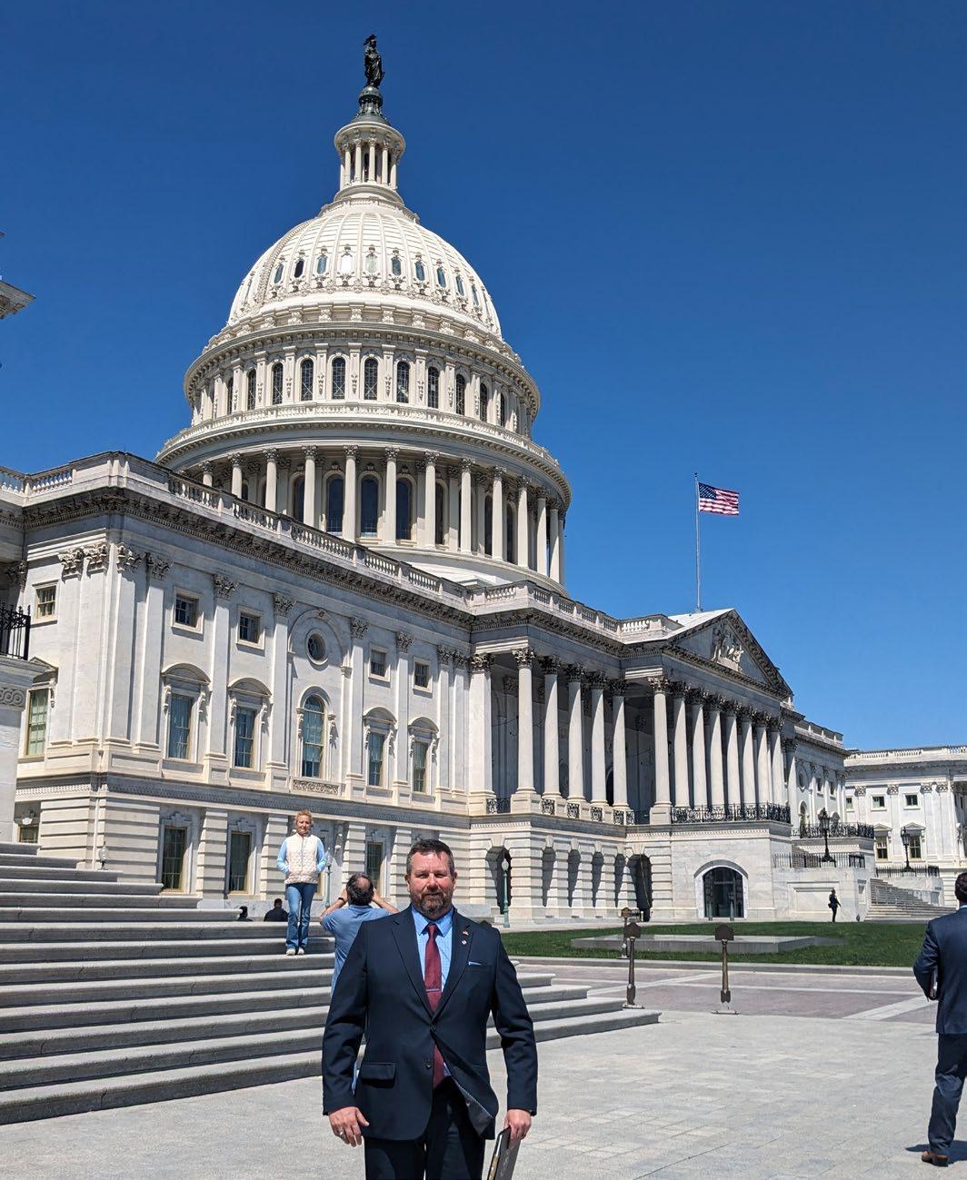
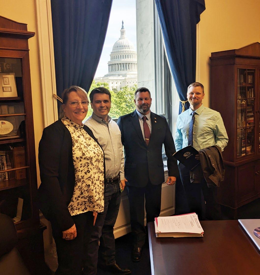
On Capital Hill in Washington DC, Brian Dennis – PLSC President, James Combs – Young Surveyors Network Past President, and Becky Roland – PLSC Executive Director, met with staffers in multiple Congressional and Senate offices as part of the NSPS Day on the Hill at the end of April.
There were three issues that the group was asking for support:
• A "Sense of the Congress" resolution highlighting the important role licensing of surveyors, architects, and engineers play in protecting the public health, safety, and welfare. This will help support states that are threatening to remove licensure requirements for land surveyors.
• Congress to include a provision in disaster planning and response legislation ensuring that survey mark reestablishment and preservation by professional surveyors be included in both pre-cleanup discussions as well as access to recovery and disaster relief and assistance programs.
• Congress to include a provision to the 2025 National Defense Authorization Act (NDAA) that would authorize a pilot program in DOD’s Transition Assistance Program (TAP) to target members of the Armed Services, with relevant skillsets, training and military surveying, mapping, and geospatial experience to transition into applicable career opportunities available in civilian sector surveying.
If you have questions or comments on any of the above information, please contact a PLSC Board Member or Becky Roland at broland@plsc.net
Brian Dennis in Washington, DC
(L-R) Becky Roland, staffer, Brian Dennis, and James Combs in Washington, DC
CHAPTER NEWS
CCPS
The Central Colorado Professional Surveyors would like to extend a great big ‘Thank you!’ to Jan Van Sickle for his brilliant presentation at our chapter meeting in June regarding the intersection of geospatial data and our responsibility to public safety. I know it opened more than a few eyes to a new perspective.
The CCPS will be hosting our Second Annual Summer Seminar on Friday, September 13 at Arapahoe Community College. The esteemed John B. Stahl, PLS will be discussing the Pillars of Land Surveying. The seminar will be held in-person and virtually. Watch for the email invite going out soon.
The 5th Annual CCPS Golf Tournament was another huge success. Aztec Consulting brought home 1st prize this year. Be sure to sign up next year to knock them off! Thank you to all those who attended and to Homestead Golf Course for hosting. And thank you to Tony Peall for all his work organizing the tournament.
I believe there is more to being a Professional Land Surveyor than just the work we do. It is our responsibility to be stewards of this noble profession. Get involved if you can, but at the very least, mentor that young technician. They will be in your shoes before you know it.
If you know of anyone who may be interested in what the PLSC and their local chapters are up to, please bring them to a meeting or upcoming event. Thank you.
Justin C Scheitler, PLS CCPS President
NORTHERN CHAPTER
The Northern Chapter is currently on its summer hiatus, so no regular meetings are being held currently. Please look for our meetings to commence starting again in September.
Additionally, the Northern Chapter will be arranging a one-day seminar with Dennis Mouland in later September. We are currently in the process of working out the details, but more to come! This will be a fundraiser for our annual Holiday Hockey game party in December.
Even though we are not holding our regular meetings, the Northern Chapter had the great pleasure of hosting Tom Sylvester for a Celestial Observation on July 26th. We started our evening with a BBQ dinner and good survey conversation off County Road 21 in Berthoud. Tom was able to borrow a specialized transit from the BLM that is specifically designed to sight the sun for a solar observation and direct you north. We didn’t use that piece of equipment other than a short demonstration, but many of us had never seen it before. After the BBQ, Tom held an open discussion on the movement of the earth, sun and stars in relation to each other and the spherical trigonometry behind what we were doing that evening. Polaris was elusive due to the cloud cover and many of us had never tried to sight a star before. It is a very different and using modern total stations brings its own challenge due to the vertical angle and the limited scope length in relation to the face plate on today’s equipment. A few of us were able to get a set of readings however and we were given the assignment to do the math and see if our results are close.
We had a good turnout. Thank you to Tom for making the trek across the mountains to come and share your knowledge with us. It is always so humbling and greatly appreciated. And I would like to thank Kat Rocha and Tait and Associates for helping us facilitate this experience and providing an excellent location with minimal light pollution. Kat, your time and efforts were invaluable, and the event would not have been successful without you!
Even here in beautiful Northwestern Colorado we are not immune to the national trends affecting the Land Surveying Business.
The most pressing one at the moment is the continuing trend of many Professional Land Surveyors aging out of the industry. Many surveyors work well into their latter sixties to mid-70’s- or later- but even that is not enough to stall the trend that is overtaking our industry. There are too many of us retiring or dying that are not getting replaced by younger Land Surveyors in their thirties or forties.
CHAPTER NEWS
The biggest root cause is simply that the generation of the thirties (Gen Z?) is not nearly as large as the baby boomers in their later sixties and seventies. There is not much we can do about that. Technology advances have certainly helped replace people with GPS, Robotics, Drones and even the Surveyor of the Year from two years ago — GPS mounted on a Robot with big wheels. Although many of these advances can help with aspects of Road, Parking Lot or Airport layout, AI has not yet risen to the point where it can assist in locating and surveying in a GLO brass cap from the early 1900’s, or a stone Section Corner from the late 19th century. I very much doubt it will as surveying is such a specialized profession the efficiency of scale is simply not there for the foreseeable future.
Heavy excavating contractors have certainly jumped full bore into all the GPS, drones and Robotics and this combined with a slowly changing mindset at CDOT is alleviating some of the role the Licensed Surveyor has played in the construction staking of our state and US Highways. The same can be said to a lesser degree at the FAA and Airport work. UDOT is clearly ahead of CDOT in working towards less slope staking and bluetopping and more checking grade at critical levels and as-builting. Less wood is being put into the ground, hence less time for the surveyor and they can take on more highway jobs as the most time consumptive part of the job is being reduced. Many of the younger generation of excavators don’t even know what a slope stake is or how to read it.
Yet that experienced set of eyes and mind of the Professional Land Surveyor is still much needed as all of the answers are not in the data collector and yes, someone better know how to read a set of plans. We simply need to find a way to attract more younger surveyors into the profession and increasing wages should help. Going into the High School job fairs should also help as we have been doing. Land Surveying is the world’s second oldest profession and we will survive. We just have some challenging years ahead of us.
Respectfully submitted,
Brian T. Kelly, Vice-President PLS in New Mexico, Arizona, Colorado and Utah
PLSC Southern Chapter
Southern Chapter hosted Charlie Tucker, railroad expert, in August in Colorado Springs, it was outstanding!!! Next, we will address the right-of-entry, self-defense and
use-of-force. Friday, December 6th, we have our annual Christmas Party reserved at the Flying-W Ranch. Tickets will be sold at scpls.net.
Steven Parker President
SWC-PLSC
The SWC held our regular meeting on June 18, 2024, various important updates were shared. Although there was no designated speaker for the session, LaPlata County and Montezuma County Surveyors stepped in to provide brief updates on their respective areas of focus. Todd Johnston, PLS played a crucial role by relaying information from the State PLSC that House Bill 24-1329 was signed into law granting powers to the State Board to establish continuing education requirements for surveyors. Additionally, discussions were held regarding potential future speakers and the examination of Side Shot articles for further exploration and analysis.
The gathering served as a platform for knowledge exchange and collaboration among professionals in the field. The absence of a formal speaker was compensated for by the active participation of local surveyors, enriching the meeting with diverse insights. Todd Johnston’s insights on impending continuing education requirements shed light on the evolving landscape of the profession, highlighting the importance of staying updated with the latest regulations. The engaging conversations and explorations of Side Shot articles hinted at the group’s commitment to fostering a culture of continuous learning and exploration within the SWC-PLSC community. Dustin Hoaglin, PLS with Vectors, Inc. volunteered to submit an article for the August Side Shots edition on behalf of the SWC. Thanks, Dustin!
A significant event during the meeting was the special election held to replace the outgoing Secretary of the Southwest Chapter, Conner Mahoskey, PLS. Conner informed the SWC of his exciting news about moving to Alaska for new opportunities, prompting the need for a new Secretary. Voted in to replace Conner as Secretary was Robert Hinojosa, PLS, who volunteered to step into this role, ensuring the smooth continuation of operations within the SWC-PLSC.
Brian M. Boniface, PLS President – SW Chapter PLSC
CHAPTER NEWS
WCLS
On July 10, Western Colorado Land Surveyors met at the Grand Junction City Hall and enjoyed a meal and discussion on current land surveying topics. Report outs were provided by Mesa County, the City of Grand Junction, CDOT, CMU Tech, among others. The recently passed continuing education requirement was something that was actively discussed. Thank you to all representatives for keeping Western Slope Land Surveyors informed. As a reminder, the chapter is accepting scholarship applications. Please contact Tom Sylvester for more information.
In other news, WCLS is excited to announce that
Dennis Mouland will be the speaker at the upcoming Fall Seminar. Mr. Mouland will be presenting on ethics and extension and completion surveys. The seminar will be held at the Grand Vista Hotel in Grand Junction on August 23. Additional information will be made available soon.
The next chapter meeting will be held on September 11 in Grand Junction.
Respectfully,
Sean Mullen, PLS WCLS President
MASTER FEDERAL BOUNDARIES
The Certified Federal Surveyor (CFedS) program is the United States’ pre-eminent public and tribal land survey certification since 2005.
To Be a Trailblazer
By Hayley Young, PE & PLS (CO), LEED AP ND
Following the format of my last article, I would like to introduce the prompt for this topic. In our Central Chapter board meeting, it was noted that the Side Shots editorial board was seeking articles on trailblazers in surveying. From dictionary.com: Trailblazer [ treyl-bley-zer ] noun
1. a person who blazes blaze a trail for others to follow through unsettled country or wilderness; pathfinder.
2. a pioneer in any field of endeavor
I immediately thought of the Corps of Discovery. In my opinion, this one journey was the single most successful, comprehensive documentation of land in American History. Dictionary.com’s examples of this term are filled with inspirational women in their respective fields. I tend to feel that this is because in our undeniably patriarchal society, women always carry an outsider’s perspective. We must be exceptional in order to be respected, and when we earn that respect, it is because we offer valuable insight. Thus, as a teenage girl, regarded as a woman being a wife, mother, and leader of a band of men through uncharted territory, the incredibly exceptional Sacagawea earned respect through her vast knowledge of land and courageous actions. I would like to acknowledge Laine Landau’s appreciation of my distinction between “property” and “land” in her comment on behalf of the editorial committee in the last issue. I will expand on this philosophy here as I describe why this title most appropriately applies to Sacagawea and her active collaboration with the Corps. Coming from an Irish family that immigrated through New Orleans, growing up in St. Louis, and traveling the trail via a road trip with my grandparents as a child gave the Lewis & Clark expedition an unparalleled legendary status in my mind. This article could be a well-researched and documented summary of Sacagawea’s many critical contributions, but instead I wish to capture a story of how a young girl’s heroism and actions earn her a rightful place as a pioneer and pathfinder in the field of land surveying.
In 1804, the qualifications to be a land surveyor were based on practical experience and reputation rather than formal education or certification. Master cartographer, William Clark, mapping the American West with great accuracy given his resources, had no
formal education. Meriwether Lewis likewise learned his surveying skills as private secretary to Thomas Jefferson but learned his outdoor survival skills from his mother and the military. Their stories, well documented in many books, are a great testament to the argument for an experience track to be permitted as a route to licensure. The practice of land surveying is one of the oldest professions, with roots tracing back to ancient civilizations where land measurements were crucial for taxation, construction, and agricultural purposes. However, the formal requirement for licensure or certification as a professional land surveyor, as we understand it today, developed much later. While Native people did not understand the concept of owning land, they had land surveying practices, territory, and a concept of ownership and property. This resonates with Celtic concepts that illustrate we do not own land; the land owns us. As we are born on the land, everything we are comes from it, and we will return to it, it feels logical to recognize that land is far more timeless and powerful than we are as humans. As we give priority to natural calls today, Native people recognized the same features, critical for survival and navigation. Practical portable items such as belts, baskets, and blankets were sometimes woven in ways that described waterways and natural monuments. Stolen from home around age 11 and forced into marriage, Sacagawea retained an intimate knowledge of the land, navigating waterways, documenting species of flora and fauna key to survival, and finding her tribe that provided valuable assistance to the Corps.
While now practically deified, emblazoned on our nation’s gold-colored coin with her son she birthed on the journey around age 17, Sacagawea received no compensation or merits for leading the Corps, serving as a guide and interpreter. Lewis and Clark transcribed what we know about her. They had many spellings of her name and labels they applied to her, but there is a great deal we do not know for certain, including her exact age or when she died. We know her Shoshone language did not have a hard “g” sound, but the exact words from her language that form her name, giving meaning, are still debated. I have seen “bird woman” more often, but also “boat puller,” and both would be fitting. Through her keen observation and clearminded action, she saved the irreplaceable equipment the mission depended on when her owner/husband capsized the boat.
The land provides for us. Before we can document the land, we must gather the knowledge worth documenting. Without Sacagawea, it is hard to imagine that the Corps of Discovery would have been successful. Lewis and Clark fought together against Native Americans and were pivotal in displacing Native Americans from their territory, but they acknowledged profusely the use of the woman on the journey whose sovereignty was roughly equivalent to that of a slave’s. In a time when voting rights and positions of power were largely exclusive to landowning white men, individuals with this societal status would naturally hold a predisposition for professional contribution. Sacagawea was bought by her husband Charbonneau and would have been unlikely to legally own land even if it were an option. Because land surveying as defined by our government has been so closely tied to property and ownership, legal definitions of boundaries have been given the utmost priority of importance. It’s hard to imagine that someone regarded as property could change a profession formatted to define property. Yet, the knowledge that Sacagawea shared was well documented in the journals and maps of Lewis and Clark and was key to the following massive westward expansion and claiming of property thereafter. I do not believe, however, that claiming and describing land as property is trailblazing. Being a trailblazer requires courage, ingenuity, and an inspirational quality that invites others to follow.
The action and feeling behind what it means to be a trailblazer is what I feel that we must embody as we try to define the individuals who have paved the way for us. In her essay “Learning the Grammar of Animacy”, Dr. Robin Wall Kimmerer of Potawatomi heritage tells us that there are very few nouns in Native American languages. She illustrates how the action given to everything alive helps us understand land, our connection to it, our dependence upon it, and how we cannot exist without it. Filled with frustration in translation, trying to understand the concept of “to be a bay,” learning the tongue of her heritage after a lifetime of English, an Elder explained that a Bay is only a noun if it is dead. When we transition our minds to understand animacy in the world around us, we cannot view land as simply property. Acknowledging that Water and Air provide us life constantly and there is life and movement in them helps us better understand these nouns as verbs. Learning the names of different flora and fauna with the same labels we give to family members, body parts, and other humanizing identifiers that describe their purpose imprint their use and tangibility in a way we cannot forget. Much can be learned about a
culture simply by seeing how they define their world. What does it say about our culture when we define land simply as property? We give otherwise fictitious lines the utmost priority of importance in plats that define only ownership. What have we lost as a nation by supplanting not only native peoples, but also their perception and understanding of the world? The knowledge Sacagawea shared with the Corps was real, invaluable, and rooted in a wisdom passed through generations. Her contributions provided a depth of meaning and purpose to the field of land surveying that cannot be described with monetary value as property is.
What does it say about us if we view those important to our profession as those with the greatest title or stature? Thomas Jefferson was a trailblazer in many respects and had a significant contribution to surveying, including his selection of representatives that would trailblaze for him, the knowledge he shared with them, and his establishment of the Public Land Survey System. What about the other two surveyors carved into Mount Rushmore? While often referred to by surveyors as “the other guy” as he did not hold a land surveyor position or title, Teddy Roosevelt provided revolutionary contributions to the field that likely outweigh the professional surveying merits of Washington and Lincoln. I can say for myself that if I had to give credit to characters in history who inspired my interest in surveying, it would be Sacagawea and Harriet Tubman, for their inspirational ability to be trailblazers, navigating to pave a way for others. For both individuals, their journeys and relationship to the land was spiritual in nature. I believe all of us in this profession are here for a love of the land, but the money we need to survive is tied to defining property. I don’t think it has to be one or the other. We can acknowledge value in what sustains life and give it the respect it deserves, using our knowledge for longrange planning. We can protect key resources and help envision a harmonious sustainable world that protects critical ecosystems on which we depend. I would like to leave you with lyrics from the Disney classic, Pocahontas. As inaccurate of a depiction as the story is, the feeling embodied in this song is the philosophy that Sacagawea undoubtedly shared, and that I wish for us to consider in our professional interaction with land:
“You think you own whatever land you land on. The Earth is just a dead thing you can claim. But I know every rock and tree and creature, has a life, has a spirit, has a name.”
CITY/COUNTY of DENVER CERTIFICATION: M/WBE, DBE, EBE, SBE
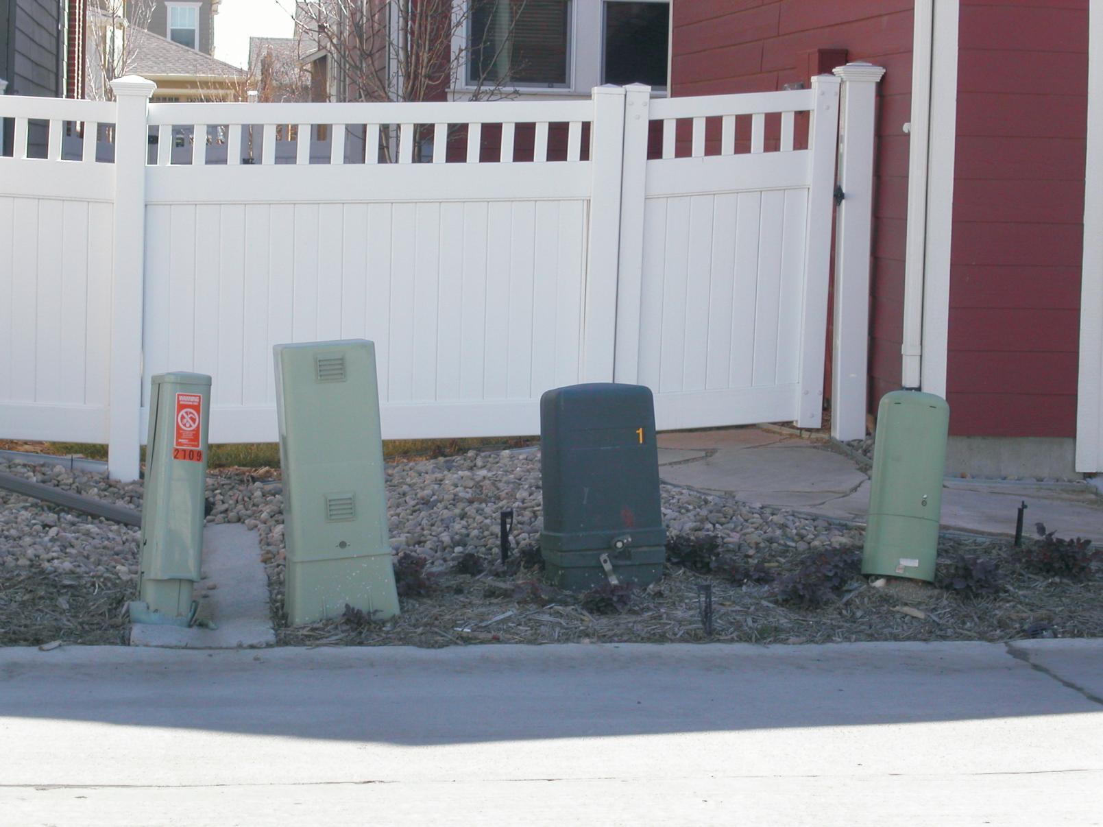
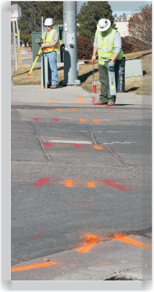
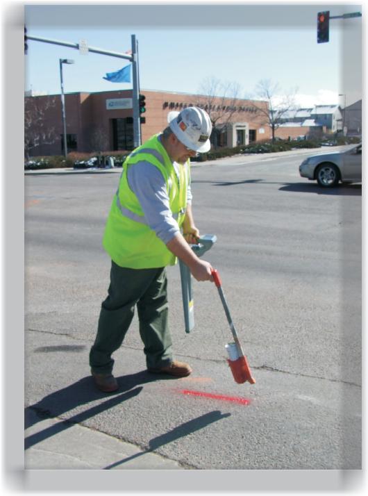
We pride ourselves in providing professional services in:
• Subsurface U�lity Engineering Locates
o ASCE Standard 38-02 Quality Levels D, C, B Locates
• Private U�lity Locates
o Residen�al and Commercial loca�ng for private u�li�es.
• Potholing (Quality Level A) & Core Drilling
o process of loca�ng u�li�es or pipelines (exposing them to daylight) to visually confirm exis�ng infrastructure.
• U�lity Mapping (Quality Level D)
• Drone Mapping Services
o Part 107 Cer�fied UAS Pilots – Commercial Drone Insurance
• Sanitary/Storm Camera Locates
o CATV Scoping & Locates of Sanita�on and Storm lines.
NAICS CODES:
561990 Loca�ng underground u�lity lines prior to digging.
238990 Special Trade Contractors (Potholing) –Nondestruc�ve excava�on using high-pressure water or air to expose u�li�es without damage. (Sani/Storm Scoping) – CCTV inspec�on of laterals, manholes, and pipelines
Tom Richardson – Sales/Es�mates/VP Opera�ons M: 303-356-2193 Tom@tomrichardsonllc.com
Brandon Francis – Sales/Potholing/Drone Informa�on M: 720-951-0418
Brandon@tomrichardsonllc.com
Trailblazer: Ron Perkins former Larimer County Surveyor
Interview by Celine Bromley current Larimer County Surveyor
I had the pleasure of working with Ron Perkins (Alex Rondall Perkins) for about 2.5 years for the Larimer County Engineering Department. I don’t know what it is, but all the surveyors I have worked for are very tall, including Ron. He was born in Durham, North Carolina and moved to Apex; a small town southwest of Raleigh. Ron is well into his 60’s and keeps active by biking and walking everyday so that he can keep being a field surveyor as well as using his 30-plus years of surveying knowledge to solve problems in the office. I enjoyed listening to his funny life stories in his great North Carolina accent and slang while also learning more tricks of the trade. Like many of the Licensed Land Surveyors I have met, including myself, Ron did not go to college to be a surveyor, but fell in love with the trade and dedicated his long career to land surveying, thank goodness!
How did you get into surveying? (Ron) I was introduced to land surveying as a temporary job between the Fall 1973 semester at Duke University and starting up again in the Fall of 1974 at Elon College.
What do you love about surveying?
I found land surveying required an appealing mix of mental and physical skills.
Who was your biggest professional influence and why?
Jerry Johnson, the Survey Department Manager at Triangle Engineering in Raleigh, NC, who encouraged me to go for my license in North Carolina.
What are your biggest challenges with this profession?
Developing truthful, accurate and complete
proposals which clients will accept and also result in a sustainable profit margin.
What qualities make a good surveyor? What do you need to be a good surveyor? Impartiality, logical thinking, curiosity, attention to detail, patience, perseverance, even-temperedness, organizational ability, self-confidence, persuasiveness, creativity, ingenuity, adaptability.
What is the most significant issue affecting surveying as a profession?
Making land surveying appealing to young professional career seekers.
What industry trends excite you?
Professional Land Surveyors are beginning to enjoy the same respect as other professionals.
What would you like to do more in surveying?
Integrate ground GPS and conventional/ robotic surveying with ground scanning, aerial scanning and detailed real time satellite imagery. I do not mean for just engineering topographic projects, but for property boundary surveying as well.
What do you think of where the profession is now?
I came along in the profession at a good time. Most of the changes I’ve experienced have been for the better. The advances in technology are amazing. However, there is one consequence of the technological advances that is unfortunate: We can now have one person survey crews. The first issue I see is
one of safety, especially when working out of cell phone range and/or in rough terrain. The second is the ability to adequately train and mentor new surveyors.
What career accomplishment makes you most proud?
Getting the surveying group of the Larimer County Engineering Department involved in the summer internship program.
Outside of your career, what has been your biggest accomplishment?
Staying fairly healthy and surviving to my current age.
What was your favorite project and why?
The survey of the Holcim Cement site in Laporte, Colorado. It was a large boundary survey with a lot of interesting situations and that is my favorite kind of surveying.
If you could start your career again, is there anything you would do differently?
I would have applied to Colorado School of Mines, University of Colorado, Colorado State University or University of Wyoming right out of High School and pursued a degree which would best set me up to be a land surveyor.
Do you have any advice for other up-andcoming surveyors?
Learn to read cursive really well.
What survey books would you recommend?
Boundary Control and Legal Principles, Evidence and Procedures for Boundary Location, Surveying Theory and Practice, both Wattles books and several more can’t recall the names of right now.
Is there any knowledge that you would like passed down?
Never stop looking for evidence too soon, but don’t waste time looking for more when you have enough.
Dreaming of incorporating UAS into your business?
Wanting to get FAA Remote Pilot Certified?
Let the FAASTeam help you build YOUR professional UAS team.
This UAS Certification Training course gives you the tools you need to pass your FAA Remote Pilot written exam. This one-day course will cover the key main elements of the 107 exam and provides you with additional at home study materials, including Air Craft’s proprietary study guide, FAA manuals, practice exams, log book, and even flight exercises.
What you get:
Eight hours ground school
Proprietary study guide saves study time.
Practice Exams
All FAA Exam Study Materials
Flight Exercises
Bonus flying techniques
Our Instructors:
FAA Certified (Commercial & UAS)
FAA Safety Team Representatives
Hundreds of hours of real – world UAS flight operation experience.
Join us for our next UAS Certification Class in Denver Saturday, May 19th Email bryan@air-craft.us for more info or to register.
SurveyMarker
Conquering Geomagnetic Storms: The Role of Trimble’s IonoGuard™ Technology
By Dustin Hoaglin, PLS
Introduction
In recent years, geomagnetic storms caused by solar activity have posed significant challenges to GNSS (Global Navigation Satellite System) operations. These disturbances can lead to positioning inaccuracies and disruptions in services reliant on GNSS signals. Trimble’s innovative IonoGuard™ technology has emerged as a critical solution to mitigate these effects, ensuring reliable and accurate GNSS performance even during severe ionospheric conditions. This article explores the impact of geomagnetic storms on GNSS, the technology behind IonoGuard, and its real-world applications and benefits.
The Impact of Geomagnetic Storms on GNSS
Geomagnetic storms, resulting from solar flares and coronal mass ejections, can significantly disrupt GNSS signals. These disturbances affect the ionosphere, the layer of Earth’s atmosphere that reflects and modifies radio waves used for satellite communication and navigation. The most severe geomagnetic storms can cause signal delays, increased noise, and even complete signal loss, leading to considerable challenges for industries dependent on precise GNSS data.
Key Effects:
• Signal Delays: Ionospheric disturbances can delay GNSS signals, leading to inaccuracies in position calculations.
• Increased Noise: Enhanced ionospheric activity can introduce noise into GNSS signals, degrading the quality and reliability of data.
• Signal Loss: In extreme cases, geomagnetic storms can cause a total loss of GNSS signals, halting operations that rely on real-time positioning. The Solar Cycle 25, which is expected to peak around 2025, has brought renewed attention to these challenges, prompting the need for advanced solutions to ensure uninterrupted GNSS performance.
The Most Significant Solar Activity Since 2003
The May 10, 2024, geomagnetic storm reached a G5 level, the most intense solar event since 2003. The storm’s severity was evident in its impact, making headlines and causing widespread disruptions. This period of heightened solar activity, linked to Solar Cycle 25, highlights the importance of robust GNSS technology to maintain operational integrity.
According to the USGS Geomagnetism Program, the recent solar storm was the most significant in over two decades, painting the night sky with vivid auroras and demonstrating the dramatic effects of such geomagnetic phenomena on satellite communications and navigation systems. The 2003 event similarly caused substantial disruptions, underlining the cyclical nature of solar activity and its impact on GNSS.
NASA’s Tracking of the Solar Storm
NASA’s Solar Dynamics Observatory captured a solar flare on May 14, 2024, which was part of a series of solar events during the first week of May. This storm produced the strongest auroras in decades, visible as far south as the southern U.S. and northern India. Teresa Nieves-Chinchilla, acting director of NASA’s Moon to Mars Space Weather Analysis Office, emphasized that this event would help “test the limits of our models and understanding of solar storms.” The storm resulted in significant GNSS signal disruptions, affecting power grids and satellite operations.
NASA’s monitoring and analysis of these events, including the tracking of 82 notable solar flares and multiple coronal mass ejections (CMEs), provided critical data to understand and mitigate the impact of such storms on GNSS and other technologies. Future missions like NASA’s Geospace Dynamics Constellation (GDC) and Dynamical Neutral Atmosphere-Ionosphere Coupling (DYNAMIC) will enhance our understanding of space weather and its effects on Earth’s upper atmosphere.
Introducing Trimble IonoGuard™
Trimble IonoGuard™ is designed to address the disruptions caused by ionospheric disturbances. Leveraging decades of data collection and engineering development, IonoGuard™ continuously monitors ionospheric conditions and adjusts the GNSS positioning engine to maintain accurate and reliable measurements.
Core Features:
• Real-Time Monitoring: IonoGuard™ tracks ionospheric disturbances in real-time, identifying and quantifying their impact on GNSS signals.
• Adaptive Algorithms: The technology uses sophisticated algorithms to adjust the GNSS positioning engine based on the current ionospheric conditions, ensuring consistent performance.
• Multi-Satellite Analysis: IonoGuard™ evaluates signals from multiple satellites, selecting the best ones to form an optimal positioning solution.
Real-World Applications and Benefits
Field Testing in Northern Alberta: In a recent field test during a G5-level geomagnetic storm, IonoGuard™ demonstrated its effectiveness in maintaining RTK (Real-Time Kinematic) fixed solutions. At a site in Northern Alberta, Canada, GNSS receivers equipped with IonoGuard™ maintained RTK-fixed mode throughout the storm, whereas receivers without this feature struggled and dropped below 91% operation.
Impact Across Different Regions: While the storm had significant effects in polar and mid-latitude regions, its impact was less pronounced in equatorial areas. In Denver, Colorado, for instance, operational GNSS shutdowns were reported, but IonoGuard-enabled receivers continued to function effectively.
Agricultural and Construction Applications: During the peak planting season, accurate GNSS is crucial for guiding farming tractors. Similarly, construction projects rely on precise positioning data. The IonoGuard™ technology ensures that these operations can continue without interruption, even during severe geomagnetic storms.
Preparing for the Future: Solar Cycle 25
With Solar Cycle 25 expected to bring increased solar activity, the importance of robust GNSS technology cannot be overstated. Trimble’s IonoGuard™ is poised to play a vital role in maintaining GNSS reliability, providing users with the confidence to operate in any conditions.
Firmware Updates: Trimble advises users to update their base station firmware to incorporate the latest IonoGuard™ enhancements. These updates are crucial for optimizing performance and mitigating the effects of upcoming solar activity.
Conclusion
As the world becomes increasingly reliant on GNSS for a variety of applications, the challenges posed by geomagnetic storms must be addressed with innovative solutions. Trimble’s IonoGuard™ technology offers a proactive approach to maintaining GNSS accuracy and reliability, ensuring that users can operate without disruption, regardless of ionospheric conditions. By leveraging decades of research and advanced engineering, IonoGuard™ sets a new standard in GNSS resilience, providing peace of mind in an era of heightened solar activity.
By understanding and preparing for the challenges posed by geomagnetic storms, Trimble continues to lead the way in GNSS technology, ensuring that users worldwide can depend on their systems in any condition.
For more information on Trimble IonoGuard™ and to stay updated on the latest advancements, visit Trimble’s IonoGuard™ Technology page and read the Trimble News Release.
References
• Trimble IonoGuard™ Technology
• Earth’s Free Light Show Causes Chaos for Some, but Not for Trimble Customers
• Solar Cycle 25 and GNSS
• Trimble Advises Base Station Firmware Update Due to Solar Flares
• USGS Geomagnetism Program Study on Magnetic Disturbance
• NASA’s Tracking of the Solar Storm
Code of Colorado Regulations 730-1 (CCR 730-1), 1.6 (E)(2)
Written by: Gene Reininger, PLS on behalf of the DORA AES Board
The first sentence under the Code of Colorado Regulations (Board Rule) 730-1 (CCR 730-1), 1.6 (E)(2) reads as follows:
“The licensed professional land surveyor shall conduct or be responsible for conducting such research activities that are needed to properly define the property boundary relative to instruments of record and show all visible evidence that may affect ownership and property rights.”
The Board of Licensure for Architects, Professional Engineers and Professional Land Surveyors (Board) considers this to be two separate activities:
1) The licensed Professional Land Surveyor (PLS) is responsible for reviewing deeds for the subject property and adjoining parcels, subdivision plats, survey plats of record and any other pertinent documentation which would aid in defining a property.
2) The licensed PLS is required to perform the necessary field activities (including scrutinizing improvements along line(s) of occupation) to help understand rights affecting the subject property.
The Board often sees boundary surveys falling short on item 1 above. Failure to perform adequate research is a direct harm to the public which the PLS and the Board are obligated to protect.
It is expected that a satisfactory effort be made when researching land. When performing a boundary survey, it is expected the PLS to review the deed for the subject property as well as adjoining deeds. Review of adjoining deeds can often identify deeded gaps/overlaps sparking a need for additional research to wholly understand the applicable boundary principles. Research should NOT be limited to the provided title commitment/report.
Additional research areas include but are not limited to:
● Monument records
● Adjoining subdivisions/plats/deeds
● BLM plats/field notes
● CDOT ROW Plans
● BLM / GLO - Plats and notes
● RTD / Railroads
It is critical that licensees understand that insufficient research has real world impacts and can harm the public.
United
States Department of the Interior
BUREAU OF LAND MANAGEMENT
Colorado State Office
Denver Federal Center, Building 40 Lakewood, Colorado 80215 www.blm.gov/colorado
In Reply Refer To: 9600 (CO-956) Colorado
Steven Parker and Laine Landau, Side Shots Co-Editors PO Box 441069 Aurora, Colorado 80044
Dear Mr. Parker and Ms. Landau:
June 27, 2024
This letter informs you of official BLM cadastral surveys in Colorado that have been accepted from August 21, 2017, through March 12, 2024, officially filed, and are now available in the Public Room, Bureau of Land Management, Colorado State Office, Denver Federal Center, Building 1A, Lakewood, Colorado 80215. The surveys will also be available at https://glorecords.blm.gov.
The accepted surveys are listed below by township, range, meridian, group number, type, a cceptance date and number of plats.
Township
T. 41 N R. 8 W NMPM 1671
T. 29 S. R. 70 W. Sixth 1732
T. 32 N. R. 6 E NMPM 1764
& Notes 03/12/24 1
As other surveys are completed, I will advise you of their acceptance. You may circulate this letter among the membership of the Professional Land Surveyors of Colorado.
Sincerely,
Digitally signed by DAVID GINTHER
Date: 2024.06.27 14:25:31 -06'00'
David W. Ginther Chief Cadastral Surveyor for
Colorado
•
-AutoCAD LT
-AutoCAD
-Map 3D
-Civil 3D
-Infrastructure Design Suites
-Infrastructure Map Server
-Raster Design
-Design Review
-Subscription
-State of the art training facility
-Implementation & customization
- Workflow analysis consulting
-Styles & standards set-up
-License activation support
-License compliance
- Techincal support
-Pilot projects
- Transition assistance
-On-site consulting
-Government Specialist
•
•
Introducing...
My name is Sue Weiss, and I am a Professional Land Surveyor in Colorado. I would like to introduce myself as the Certified Survey Technician (CST) Coordinator for Colorado. One of my top goals is to better the CST website and agendas/syllabus’ to be more user friendly and informational to our needs. I am also a contact to proctor or find a proctor for testing anywhere in the state.
I’m sure we can all agree that the survey tech knowledge base and pool for knowledgeable technicians is a major workforce issue in our industry. My hope is to develop better educational tools for CST training as well as a arrange a set of testing dates in the different areas around Colorado.
PLSC already presents a full day of training each year at the Rocky Mountain Surveyor Summit. PLSC and I will also start developing a library of short online courses and offer CST study material bundles for a discounted price. My vision for the Colorado CST Program is to partner with surveying companies that employ survey technicians and field personnel. There are many that instituting programs to incentivize the successful completion of testing modules within CST. Galloway, for example, provides raises, promotions, and bonuses for its CST members when they successfully pass a level. Survwest provides its employees with bonuses for their successful CST certifications. National statistics show that successful completion of each level of CST increases a technician’s salary by up to 30%. The below is directly from Brian
“At Galloway, we are in the middle of establishing our Party Chief roles and responsibilities including qualifiers. We are now including the CST program into the written metric for raises and promotions into each tier of Party Chief 1, Party Chief 2, Party Chief 3 and Senior Party Chief. Each will require a CST level be achieved and of course Senior will require achieving the LSI.
“New hires that do not already have these achievements will be required to obtain to continue. We are still working on the time limitation to complete.”
Brian Dennis, PLS Senior Associate, Galloway
The CST program was built to boost our industry and help make better surveyors of our employees. I hope you all will take it into consideration and start to utilize CST to improve your teams. I am available to assist you with setting up a CST program at your company. If you have any suggestions to improve the CST program, please don’t hesitate to reach out to myself or Trisha Lund.
Sue Weiss, PLS, CST Coordinator Colorado sweiss@survwest.com
Trisha Lund, RPLS, NSPS/CST Board Member –trisha@whitmanlandgroup.com
The Certified Federal Surveyor (CFedS) program is the United States’ pre-eminent public and tribal land survey certification since 2005. Our unique, seven-course training program was developed for licensed surveyors looking to gain the knowledge and skills necessary for providing cadastral services on federal trust lands.
sustaining members
ALPINE NAVIGATION LLC
David Mollenberg
3070 I-70 Business Loop Unit B-1 Grand Junction, CO 81504 970-236-2307 dave@alpinenav.com
ASSURANCE RISK MANAGERS, INC.
Lisa Isom
10651 E. Bethany Drive, Suite 300 Aurora, CO 80014 303-454-9562 lisom@arm-i.com
CARLSON SOFTWARE
Jim Reinbold
Regional Sales Director 1412 W Powder Ct. Eagle, ID 83616 303-482-1836 jreinbold@carlsonsw.com
CHC NAVIGATION USA CORP.
Jack Wang
6380 S Valley View Blvd., Ste. 246 Las Vegas, NV 89118 702-832-9040 jack_wang@chcnav.com
DIVERSIFIED UNDERGROUND INC.
Richard Chuapoco
2851 S. County Rd. 137 Bennett, CO 80102 720-490-1321 richard@diversifiedunderground. com
ECAD
Kelly Marrill 12130 N. Pennsylvania St. Thornton, CO 80241 303-427-2231
Kmarrill@cad-1.com
FLATIRONS SURVEYING, INC.
Tom Willis
3825 Iris Ave., Ste. 395 Boulder, CO 80301 303-443-7001 twillis@flatsurv.com
FRONTIER PRECISION INC.
Mel Philbrook 5480 W 60th Ave., Unit A Arvada, CO 80003 720-214-3500 mel@frontierprecision.com
GALLOWAY
Brian Dennis 1155 Kelly Johnson Blvd., Ste. 305 Colorado Springs, CO 80920 719-900-7220 briandennis@gallowayus.com
GEOSHACK
Thad King 7000 E 47th Ave., Ste. 900 Denver, CO 80216 303-853-0311 tking@geoshack.com
HARRIS KOCHER SMITH
Shawn Clarke 1120 Lincoln St., Ste. 1000 Denver, CO 80203 303-623-6300 sclarke@hkseng.com
HIXON MFG. & SUPPLY CO.
Ken Perry 1001 Smithfield Dr. Fort Collins, CO 80524 970-482-0111 and 7154 Dillon Ct. Englewood, CO 80112 303-694-0012 ken@hixonmfg.com
INFINITY SOLUTIONS INC.
Joe Jimenez 10465 Melody Dr., Ste. 225 Northglenn, CO 80234 303-229-6885 jjimenez@infinitysurvey.net
JACOBS
Robert Boehm, 9191 S Jamaica St Englewood CO 80112 720.286.2914 robert.boehm@jacobs.com
EUGENE LYNNE
HEATH HILDEBRAND PO Box 27691 Denver, CO 80227 720-361-2475 ahildebrand@eugenelynne.com
MERRICK & COMPANY
Todd Beers
Survey Project Manager 5970 Greenwood Plaza Blvd. Greenwood Village, CO 80111 303-751-0741 todd.beers@merrick.com
RJM PRECISION INSTRUMENTS
David Moss
5007 Pacific Hwy. E, Ste. 19 Fife, WA 98424 602-462-3990 davidmoss@rjmprecision.com
SKLD INFORMATION SERVICES
Kelly Mulé
Sales Representative 9540 East Jewell Ave Suite A Denver, CO 80247 (303)695-3850 kmule@skld.com
SURVEYING AND MAPPING, LLC (SAM)
Mark Hall 555 Zang Street #210 Lakewood CO 80228 303-988-5852 Mark.hall@sam.biz
SYNERGY MAPPING, INC.
Travis Kent 11027 S Pikes Peak Dr. #203 Parker, CO 80138 303-663-4483 tgkent@synergymapping.com
TERRAMETRA RESOURCES
Lynn Patten 2919 Bryn Mawr Place Longmont, CO 80503 303-709-2903 lynn.r.patten@gmail.com
TOM RICHARDSON LLC
41255 Dublin Dr. Parker, CO 80138 303-699-3524
Gwen@TomRichardsonLLC.com
TOPOGRAPHIC LAND SURVEYORS S. Erik Dumas 12265 W Bayaud Ave., Ste. 130 Lakewood, CO 80228 303-989-1461 erik.dumas@topographic.com
UNDERGROUND CONSULTING SOLUTIONS
Kelly Goff 2701 W. Oxford Ave., Suite 6 Englewood, CO 80110 303-904-7422 ucs@totalspeed.net
VECTORS, INC
Chuck Hutchins Sales 10670 E Bethany Dr. Bldg. 4 Aurora, CO 80014 303-283-0343 chuckh@vectorsinc.com
WESTWOOD PROFESSIONAL SVCS. Ty Trammell 4514 County Road 5 Erie, CO 80516 806-678-5540 ty44trammell@yahoo.com
These firms support our organization. Please show them your appreciation with your patronage. To become a Sustaining Member, please contact Becky Roland at broland@plsc.net, or 303-551-3266.
EQUIPMENT SALES
Top-tier surveying and construction products from industry leaders like Trimble, Spectra, Nikon, SECO, Schonstedt, Dutch Hill, Chrisnik, and other trusted brands.
EQUIPMENT RENTALS
Flexible terms and top quality rental equipment shipped to anywhere in the continental United States.
SERVICE & SUPPORT
Full-service Factory Authorized GPS/GNSS and Optical Repair facilities.
CONTINUING EDUCATION & TRAINING
Hands-on instruction for all experience levels. Invest in your career development.