2 minute read
Box 9. GBON technical requirements and types of observations

from World Meteorological Organisation: Systematic Observations Financing Facility (SOFF)
by Anne Stein

The Readiness phase involves four main steps:
Step 1. Readiness support proposal. Countries will submit a request for SOFF Readiness support through their NMHS and, if applicable, through the respective Implementing Entity in charge of the project or program in which SOFF funding would be embedded.39 The SOFF Secretariat will inform the Steering Committee regularly on the Readiness pipeline and the status of Readiness requests approved by the Steering Committee. Advanced NMHSs will be selected and contracted by the SOFF Secretariat, in coordination with the beneficiary country and in collaboration with the WMO Secretariat, to provide peer advisory services on a cost-recovery basis. The SOFF Secretariat will administer these services (section 7.7). The resource allocation for these services during the Readiness phase will be capped at USD 200.000 per country.40
Advertisement
Step 2. CHD and GBON gap assessment. The peer advisor will apply the CHD methodology (box 10 and annex 4). Among the elements assessed in the CHD is the country’s GBON gap. The GBON gap will be verified in line with the GBON regulations (box 8) by the WMO Technical Authority (see step 4 below) and would serve as the analytical basis to develop the GBON National Contribution plan.
Box 9. GBON technical requirements and types of observations
The detailed GBON technical requirements were approved by the WMO Commission for Observation, Infrastructure, and Information Systems in November 202041 and will be submitted to WMO Extraordinary Congress for formal approval in October 2021.

Types of observing stations
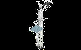
Surface observations required by GBON include measurements taken at the Earth’s surface of atmospheric pressure, temperature, humidity and (where applicable) snow cover. The measurements are typically obtained using Automated Weather Stations (AWS).
Surface land-based observations Types of observing stations
Members must operate surface land observing stations measuring atmospheric pressure, air temperature, humidity, horizontal wind, precipitation and snow depth, at a horizontal resolution of 200km or higher, and data must be reported hourly.
Members with networks operating at higher horizontal resolution must report their observations either at the full resolution of the network or at a minimum resolution of 100km, whichever is higher
Upper-air land-based observations
Upper air observations required by GBON are vertical profiles - from the surface up to a level of 30hPa (pressure level in the atmosphere corresponding to roughly 22km altitude) - of measurements of atmospheric temperature, humidity as well as wind speed and direction. These measurements are typically provided by radiosondes, which are small instrument packages carried aloft by helium- or hydrogen-filled balloons. Members must operate a set of upperair stations over land that observe temperature, humidity and horizontal wind profiles, with a vertical resolution of 100m or higher, twice a day or better, up to a level of 30hPa or higher, with a horizontal resolution of 500km or higher.


