
A Study of Boundaries
Selected work 2019-2024
Urban Design
CHUNYU SHA
Break the boundary
BOUNDARY

Transform into resilient connections
Bridge the boundary
CONTENTS
Boundaries —whether between nature, utopia and reality, or urban units—fuel hidden or overt tensions in urban environments. By breaking or bridging these boundaries, transforming them into resilient connections, urban design can create spaces where diverse groups coexist, address inequality, and uplift marginalized voices. With its power to shape both physical spaces and social structures, urban design is essential for fostering a more just, vibrant, and sustainable urban future, ensuring every community—especially the voiceless—has a role in shaping our shared environment.

01 "HUI" The Muslim Quarter
Break the boundaries of ethnicity and ideology
2024 Sep. -Dec.|Academic, Individual Work | Xi'an, China
02 Dam-Bridge Complex: Hasankeyf
Break the class boundaries between the powerful and the voiceless
2023 Oct.-Nov. |Academic, Individual Work | Hasankeyf, Turkey
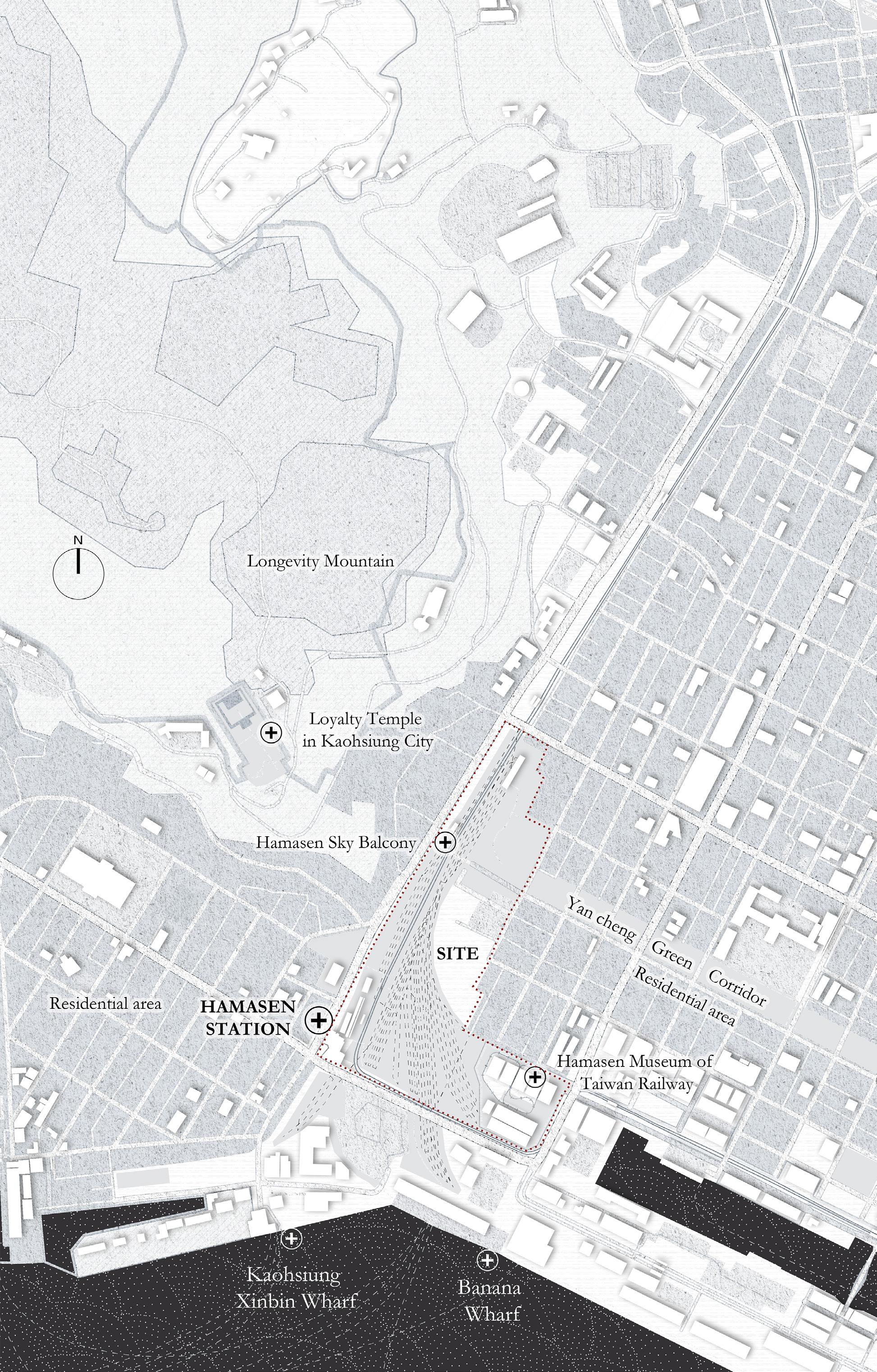
03 Collaged Railway Market: Taiwan era-market urbanism
Bridge the generational gaps and collective memory boundaries
2023 Jul. -Sep.|Academic, Individual Work |Kaohsiung, Taiwan

04 "Bamboo+" Community: Rural Revitalization Planning
Bridge the boundary of various community systems
2022 Aug. -Dec. |Academic, Individual Work |Wufeng, China

05 Three-Layered Les Champs-Elysees
Break the boundaries between humans and nature
2024 Jun. |Harvard GSD, Design Discovery Virtual |Academic| Paris
OTHER WORKS
01 2024 Jun. Harvard GSD, Design Discovery Virtual |Climate Change
02 Illustrations | Color Microscope Experiments

"HUI" The Muslim Quarter 01
2024 Sep. -Dec. Semester-long
Site: Xi'an, China
Instructor: Adam Jichao Sun
Individual Work

Break the ideological and cultural boundaries between different ethnicities
The Hui Muslim community faced significant challenges due to spatial marginalization. Home to over 60,000 Muslims, the Hui Quarter is partitioned by the flourishing Han cultural areas into narrow, neglected settlements, highlighting the inequality between the minority Hui and the majority Han. To address these issues, I conducted a typological mapping on the 12 mosques in the Quarter as spiritual representatives based on five criteria: scale, accessibility, function, building condition, and symmetry. Then I created a toolbox to improve the community's living conditions and foster cultural exchange between Hui and Han. The magnificent mosque with strong cultural attributes can be used as a landmark for cultural exchanges between Hui and Han by space clearance and commercial penetration; The middle mosque, which is mostly used for worship activities, is suggested to expand by construction strategies to cope with the growing residents; Small, dilapidated mosque can be transformed into infrastructures to benefit residents’ lives.


Hui Musilm Quarter
The history of Xi'an's Muslim district dates back to the Tang Dynasty. As the most distinctive ethnic enclave in the Han-dominated ancient city, the Hui people here were forced to live in increasingly dense conditions within a limited area, facing harsh living conditions.


The road network of the Hui quarter became more and more complex, While the overall layout became more and more blurred with the change of dynasties.
Republic of China
Qing Dynasty
PLAN OF TANG-ERA CHANG'AN, 195BCE
Ming Dynasty
Ming Dynasty
Tang Dynasty Song Dynasty


Renovate Add functions
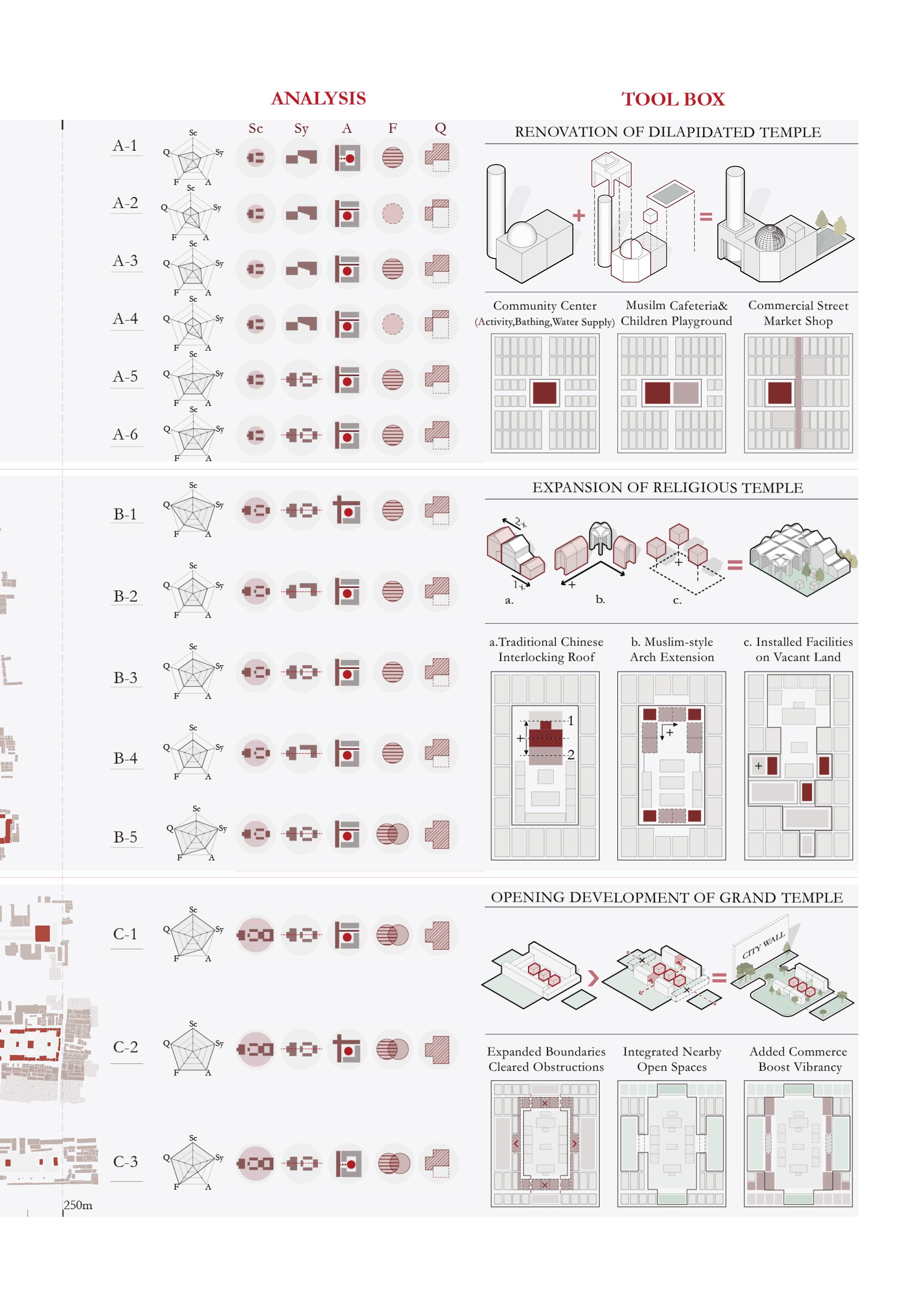
Address community needs Sc Sy A F Q

The small mosque, in decline, has an asymmetrical layout and diminished religious functions. It is passively used, not located along major streets, and surrounded by highdensity buildings with no public space. By renovating these mosques to meet community needs, they can be transformed into active spaces, benefiting the believers.

TYPE A-1 Small Dilapidated Mosque


Issues With The Small Mosque and The Surrounding Community


The original two main buildings and the minaret were preserved


Three expansions for the growing Hui population


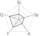
Medium-sized mosques mainly serve religious purposes but can no longer accommodate the growing Hui population. Proposed solutions include adding coffered ceilings to sinicized mosques, creating inward-facing entrances with Islamic arches, and installing activity spaces for Islamic festivals in open areas.


Sc
TYPE B-5 Medium Religion mosque

EXPANSION OF RELIGIOUS TEMPLE


A.Chinese coffered ceiling Accommodate more believers


Install activities in open spaces


B.Muslim arch entrance Inward-facing entrance


C.
Eid al-Fitr
Salah Worship
Eid al-Adha Mawlid
Ramadan Ashura


TYPE C-3 Large Grand Temple
Unblocking
Uniting businesses
Cultural Exchange


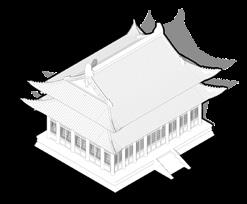
Large temples are currently blocked by unnecessary buildings, making them hard to access and rarely visited. With their unique cultural features and scale, these temples can become hubs for Hui and Han ethnic exchange. By improving accessibility, removing illegal structures, restoring their appearance, and integrating nearby schools, businesses, and activities, the temples can transform into lively, inclusive spaces.


OPENING DEVELOPMENT OF GRAND CULTURAL TEMPLE


Demolish Illegal /Damaged Buildings
Dynamic Flow Lines Expanded Boundaries Cleared Obstructions
Nearby Open Spaces Widen Roads Tidy Up Facades
Commerce Boost Vibrancy
Worship Gathering
Garden Tour Library
Sports Field
Open Space
Muslim Cafe
Souvenir Shop
Hui's Courtyard

The sketching process gradually evolved from considering the imagery and functionality.
DAM-BRIDGE COMPLEX 02
2023 Winter, Six Weeks
Open project
Site: Hasankeyf, Turkey
Instructor: Fang Xiao Individual Work
New Life Above the Submerged Old City:
Bridge the class boundaries between the powerful and the voiceless
People who have become victims of multilateral geopolitics are displaced and have lost their livelihoods. I try to use urban design to help the voiceless speak out, support their lives, and continue human civilization.
Nestled at the crossroads of Turkey, Syria, and Iraq, the ancient city of Hasankeyf was submerged underwater due to the construction of Turkey's GAP dam project, people here have been displaced by DAMS built, separating the two sides. Now we are building a bridge complex on the water, which, despite the appearance of a dam, has the opposite meaning: it acts as a bridge between the two sides, breaking down the boundary, acting as a microcosm of the underwater city, lifting people's memories and carrying people's new life on it.
• Extracted Local elements, anlyzed dam forms of GAP project, anlyzed topographic conditions and the Tigris river flow.
• Divided the building into 4 floors for different and alternative functions at different water levels.


-HUMAN CIVILIZATION SUBMERGED UNDERWATER

Combining with local elements, the iconic structure serves as both a symbol It bridges two shores, generates electricity, and provides spaces for community carrying people's new life on it and writing

symbol of resistance and a catalyst for renewal in the grand narrative. community life, including cave dwellings, terraces, and water markets, writing a sequel to the submerged civilization.

- THE PROLOGUE OF HUMAN CIVILIZATION -

Submerged new bridge
Folding steps - Karez
Ruins of Roman bridge columns
- THE SUBMERGED OLD CITY -


The retreat of Mesopotamia
The dam-bridge complex
2+: Cave dwellings + terraced fields

1: Floating Market + Bridge Transportation
Infrastructure pipelines
-1: Archaeological + museum exhibition
-2: Shipping + Hydropower
Lifting people's memories
Carrying people's new life
People’s memories of this place are continued through underwater ancient city elements and archaeological bases, and people are helped to continue their lives through cave living, water markets, shipping, hydroelectric power generation and terraced fields.

perspective


perspective

Upstream
Downstream
The water market


The sketching process gradually evolved from considering the interaction between railway ruins and the market floor plan.
Collaged Railway Market Taiwan era-market urbanism
2023 Sep. -Dec. Semester-long
Open project
Site: Kaohsiung, Taiwan
Instructor: Zekun Fan
Individual Work
Break the generational gaps and collective memory boundaries: Today is a complex of all the history of the past, and all traces of the past are echoed in the modern site
In curiosity about the diverse interactions between cultures of different eras, I was drawn to the diversity of markets, where diverse groups coexist, each with unique voices.
This inspired me to design a large, city-scale market complex to explore the possibility of blending market cultures from various eras within a single public space. In the Taiwan Marketing Complex project, I collected typical market structures from different periods and arranged them on the vacant, abandoned site of the Hamasen Railway. The buildings were strategically placed along the old railway tracks, interconnected by external traffic routes and an internal tourist train.
TAI PEI MARKET TYPOLOGY
Studying the urban fabric of Taipei, market spaces are influenced by, or influencing, the city’s development. Further exploration reveals that they were shaped during different periods of urban planning under various regimes, representing different cultural backgrounds and collective memories across generations.

Radiating from a central market or temple


Aligned along main roads or rivers


Aligned with the city’s street grid pattern


Chunghwa Mall
Round Market
Typ1. Centripetal Markets
Typ2. Linear Markets
Typ3. Grid-based Market
Ruifeng Market
Raohe Night Market Wufenpu Market
The Second Market
Collage Different Market
Spaces On An Abandoned Railway Site
Hamaxing Railway Cultural Park is the original Japanese rule of the Dagouyi, Kaohsiung's first railway station, was once the largest freight station in Taiwan, bringing modern development to Kaohsiung. The original station, which was destroyed by air raids during World War II because it was located at the main artery of land and sea traffic. The existing station was rebuilt in 1947 and became the later Kaohsiung Port Station of Taiwan Railway.
[3]


3.
4.
1. New Chunghwa Mall
2. Self-organizing Market
Sector Market
Hamasen Station
5. Linear Market+Hotel
6. Station Museum

Central Area Floor Plan
Starting from the entrance of the urban green island at the northwest corner of the site, the market radiates outward. The central area of the market is organically integrated along the main tourist route and railway remnants. People of different age groups can find spaces that belong to the memories of their respective eras.


Station museum Linear market+hotel Hamasen station Sector market Chunghwa mall

Hamasen Sky Balcony and New Chunghwa Mall
The corridor connects the existing sky platform and the newly built linear shopping mall, and is organically arranged along the railway track, creating a vertical traffic intersection.

Open Markets and Public Spaces Within the Station
The market spaces representing different periods are collaged along the railway ruins and connected by two sightseeing trains to break down the generational barriers.


"BAMBOO+" COMMUNITY Rural Revitalization Planning
2022 Aug. -Dec. Semester-long
Academic Studio
Site: Wufeng, Hanzhong, China
Instructor: Mayan
Individual Work|Based on shared data resources provided by the studio

Use "bamboo" to integrate the industry, life, and ecology of the village, breaking the boundaries between its systems
Covering an area of 4,220,000 m², the Wufeng Community Renewal Project adopts "Bamboo +" principles to integrate industry, life, and ecology while addressing gender imbalances in the village. Inspired by the abundant bamboo resources and the need to create employment for women, the project developed a bamboo-based industrial strategy, integrating bamboo into local industries such as rice, wine, tourism, and building materials. These industries emphasize skill and creativity, offering sustainable economic opportunities for women and fostering community growth.
The project involved analyzing slopes, landforms, bamboo coverage, public resources, and demographic patterns to design a comprehensive land-use and zoning plan. Detailed site plans and a total scheme model were created to ensure ecological balance and economic viability.
[4] The logo design originates from the combination of the Chinese characters " 五丰 "(Wufeng) and the element of bamboo


Reflections on the relationship between Parisian streets and the city deepened gradually through typology research.
Les Champs-Elysees in extreme heat Three-layered Paris 05
2024 Jun Three weeks
Instructor: Taylor Smith
Site: Paris
Individual Work
Design Discovery Virtual Program | Harvard GSD [5]

Facing Climate Change: Transform the boundary between humans and nature into a complementary and harmonious interaction
The Champs-Élysées in Paris revealed the transformative power of boundaries and the complex interplay between people and nature in urban contexts.
Inspired by discussions on public space and climate change, I recognized the importance of integrating ecological systems into urban design. To address these issues, I proposed interventions for the Champs-Élysées to mitigate urban heat islands and enhance climate resilience. These interventions included:
·Street Rain Gardens: Designed to improve stormwater management and reduce ambient temperatures through evaporative cooling and enhanced biodiversity.
·Foldable Subway Station Roofs: Created to provide adaptable shading and minimize heat accumulation in pedestrian areas.
·Operable Windows: Proposed to improve passive ventilation in metro stations and adjacent buildings, reducing reliance on mechanical cooling systems. These small-scale, climate-responsive measures demonstrated how urban design can generate significant, far-reaching impacts.
[5] Logo from Harvard GSD Design Discovery Virtual 2024 program
Les Champs-Elysees in extreme heat : Three-layered Paris
Focusing on the Rond-Point des Champs-Élysées in Paris's 8th arrondissement, I conducted an urban connectivity analysis, identified neighborhood issues, and designed targeted interventions. My work explored solutions to the urban heat island effect on the Champs-Élysées and developed a three-layer vision for the district.


Step 1: District-city Connectivity Analysis
Identify the importance of streets and subway in connecting the district to the city.
How the whole city is connected by roads and the green spaces? In this site, major streets , green corridors and subway connect to other landmarks in the city, creating strong continuity

Tourist Perspective: Using a tourist's perspective to consider possible routes they might take in this area of Paris and extended their route to more distant landmarks.
Simulating Tourist: routes, divided the information of site into a satellite map with green spaces, a diagram showing the block relationships, and roads for additional analysis.
Step 2: Infrastructure Strategy: Facing the Paris heat wave

Day Time: On street: cooling spry systemsmisting, rain garden,shades, first floor cooling rooms Underground: natural cooling island, Rainwater-Storing Roofs, Cooling and Natural Lighting

Night Time: Foldable Roofs for Natural Ventilation to Subways Subway Lighting Enhancing Surface Illumination
Step 3: Combination:Three-layer Concept
Visualizing the Street in Three Layers of Time and Space, Combining All Strategies


Collage
This collage shows that the closer you get to sunlight, the more vibrant the street space becomes, from the Paris catacombs underground to the metro level and up to street life. It deconstructs the layered relationships of different spatial atmospheres.
[7] Photograph © Paris
Allison C. Meier, Taipei, July 23, 2019, https://daily.jstor.org/how-the-paris-catacombs-solved-a-cemetery-crisis/
Diagrams
1 Street level -
2 Subway(metro)-
3 Paris catacombs-
Metro
Catacombs
catacombs,
Thickened Drawing
Intervention strategy + Infrastructure strategy + Three-layered world concept


Integrated the first step of intervention strategy, the second step of infrastructure planning, and the third step of the three-layered world concept into a cohesive illustration. This approach conveys a more holistic perspective on street life and the utilization of underground spaces.
Harvard GSD DDV program
Week 1: PUBLICS
Design is being for, by, and in the public, offering profound reflections. From an urban perspective, it considers infrastructure and interventions for public benefit. From an architectural perspective, it examines the balance between public and private in human society. From a landscape perspective, it explores shared habitats versus exclusivity for humans and other species.

Architecture: transparency of lives


Landscape: the exercise examined human and non-human interactions, categorizing spaces, analyzing public-private zones, and using light to assess spatial dynamics.
WORKS 1
program | Jun. 2024 two weeks
Week 2: CLIMATE CHANGE
As global climate issues become increasingly pressing, more resilient urban, architectural, and landscape designs are urgently needed to address climate risks.

Architecture: In extreme heat and drought, buildings can enhance resilience with ventilation corridors, sunken entrances, cooling rain gardens, insulation, vertical greenery, and rooftop solar panels, etc.

Landscape:
1-Analyzed climate risks for agricultural land along three axes: X (Time and Seasons); Y (Landscape Interventions); Z (Potential Risks).
2- The work is divided into four sections to illustrate scenarios: Section A: Ideal state with interventions; Section B: Floods during spring or rainy seasons from melting snow; Section C: Wind-related challenges for crops. Section D: Drought conditions affecting the land.
3- Proposed solutions include water banks, windbreaks, and drip irrigation systems to mitigate these risks.
OTHER WORKS 2
Hand models | 2020
Analyzed three works from Wassily Kandinsky, try to reconstruct them in three dimensions


Exploration of 3D Visualization of Famous Paintings|2020


arm mechanism|2024


Sketches and Line Drawings | 2019


Robotic
Illustrations
| 2020/2023


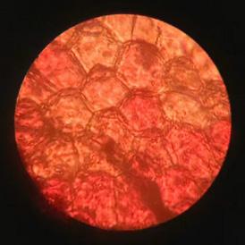
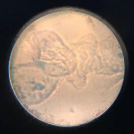
Observation and Color Experiment | 2019
Observe spring at 1200 times magnification, observe mountains and sea through astronomical telescopes, and use them as inspiration for color experiment


Chunyu Sha scyrain@126.com /rainscyy@gmail.com