5 minute read
Reykjanes Resource Park
A new eco-industrial landscape
Harvard GSD Urban Design Studio| Fall 2022
Advertisement
Professor: Anna Gasco
Collaborator: Yu Qin, Ni Ye, Liang Yang
Our site is located in Iceland. A nation that is prized for its breathtaking natural landscapes. These landscapes not only encourage tourism, but they are also vital tools for production. The rivers and the geothermal activities enabled iceland to produce a hundred percent renewable energy that is used in a variety of industries.


However It is important to remember that industry and nature are not a dichotomy. Industries that rely on natural resources often have to be collocated with nature, these include geothermal powerplants, hydro plants, fisheries and many others. The industrial elements together with wilderness, have created a new landscape, an amalgam of natural ecology and productional apparatuses.


This juxtaposition, nevertheless, creates conflicts. the industrial expansion has a great impact on the natural aspect. This is especially critical in iceland because of large economies that are based on nature, such as tourism.

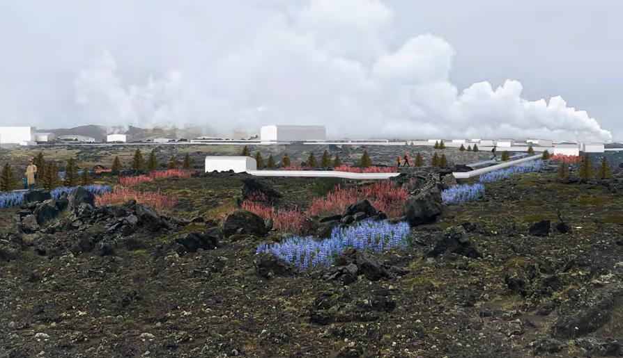
Imagine industrial infrastructure such as metal pipelines that run through miles of undisturbed wilderness can be transformed into viewing platforms and wayfinding tools?


What if the boreholes that extract geothermal heat power can be used to cultivate a garden filled with local flora?


And finally What if the factories themselves can be better equipped, and spatially organized to mitigate its impact on the environment? To make the industrial parks more open to mixed use programs?
And thus, our project is based on the belief these small scale, bottom-up intervention can reconcile the natural and the industrial.


This planned Resource Park is located at the far end of the peninsula’s southwest corner. It enjoys an extensive coastline and is also the start node of the volcanic geothermal belt on the island. Due to its abundance of natural resources, the park is already home to a number of industries, such as energy production, fish farming and processing, and salt production.
The industrial infrastructure are in a frame with these sceneries. One is the pipelines. These silver lines creep from the turbine factory at the centre of the site and extend out in all directions. We take advantage of the extensiveness of the pipeline to construct a wayfinding system that connects dispersed attractions and pedestrian traffic across the sites. By integrating the walkway with pipelines, it will not only conserve the land use but also better guide the pedestrian footprint, thus preserving the fragile landscape.


Based on our concept and plan, the site will be transformed into an eco-industry site with circular economy. As we mentioned before, our site will have a discrete distribution, and compared to the VSO’s proposal of 650 square kilometers, our site only takes 190 square kilometers which means that this project is less intrusive to the natural environment.The industries on the site are currently independent of each other and lack of communication. In order to better establish a circular economy industrial system, our goal is to change the site from a subdivided and isolated industrial plot into clusters with interaction, both physically and functionally.


The most important and visible industry on the site should be Reykjanes Power Plant. The Reykjanes Power Plant is a geothermal power station owned by HS Orka.
Energy for the plant is harnessed from twelve of the fifteen boreholes drilled in the area. There is a long history of using geothermal energy for industries and electricity production in Reykjanes.
This eco-industrial park is a community of manufacturing and service businesses located together on a common property. Member businesses seek enhanced environmental, economic, and social performance through collaboration in managing environmental and resource issues. There will be functional and logistical links between the clusters of the site. The industries are capable of functional interaction and interchange of energy and materials.
The main energy and material cycle of this area is between the power plant and the greenhouse. Also educational and exhibition functions are an important part of this zone. Site Perspectives


I. Graduate Works
Bottom-up Sub-Urbanism
Re-imagination of suburbia
Harvard GSD Urban Design Studio| Fall 2021


Professor: Stephen Gray, Rahul Mehrotra
Collaborator: Yixin Wu
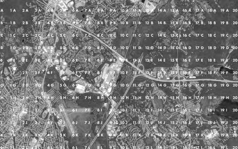
In this project, we started off by analyzing parcels of the existing built environment- we identified “snapshots” of our site with mismatched adjacencies, incoherent programs, discontinuous public realm as well as underutilized spaces. Putting these elements together gave us a rough sense of how much potential the site has in each of these clusters.

Our goal is to strategically re-configure the existing site condition not through total redevelopment but by formulating a number of widely applicable “rules” which address building density, programs, street adjacencies, community connection, and the arrangement of nature and public green spaces. We wanted to see how much difference it would make by applying small and subtle local changes and applying them over the entire site.

In this project, we started off by analyzing parcels of the existing built environment- we identified “snapshots” of our site with mismatched adjacencies, incoherent programs, discontinuous public realm as well as underutilized spaces. Putting these elements together gave us a rough sense of how much potential the site has in each of these clusters.
Our goal is to strategically re-configure the existing site condition not through total redevelopment but by formulating a number of widely applicable “rules” which address building density, programs, street adjacencies, community connection, and the arrangement of nature and public green spaces. We wanted to see how much difference it would make by applying small and subtle local changes and applying them over the entire site.
In this project, we started off by analyzing parcels of the existing built environment- we identified “snapshots” of our site with mismatched adjacencies, incoherent programs, discontinuous public realm as well as underutilized spaces. Putting these elements together gave us a rough sense of how much potential the site has in each of these clusters.

Our goal is to strategically re-configure the existing site condition not through total redevelopment but by formulating a number of widely applicable “rules” which address building density, programs, street adjacencies, community connection, and the arrangement of nature and public green spaces. We wanted to see how much difference it would make by applying small and subtle local changes and applying them over the entire site.

Left: Masterplan Right:Zoning and FAR Proposals


To Train Station
Nature Pavillion
Main Sequence
We apply these little rules to the site as an anti-framework design, referring to the project in Oosterwold. The project done by MVRDV sets principal rules of roads and paths, accessible green, urban agriculture, and facilities for the inhabitants to ensure the smooth adjacency and good relationship between the lots. All the other stuff inside the lots were largely decided and developed by the inhabitants to create a versatile and exciting neighborhood.
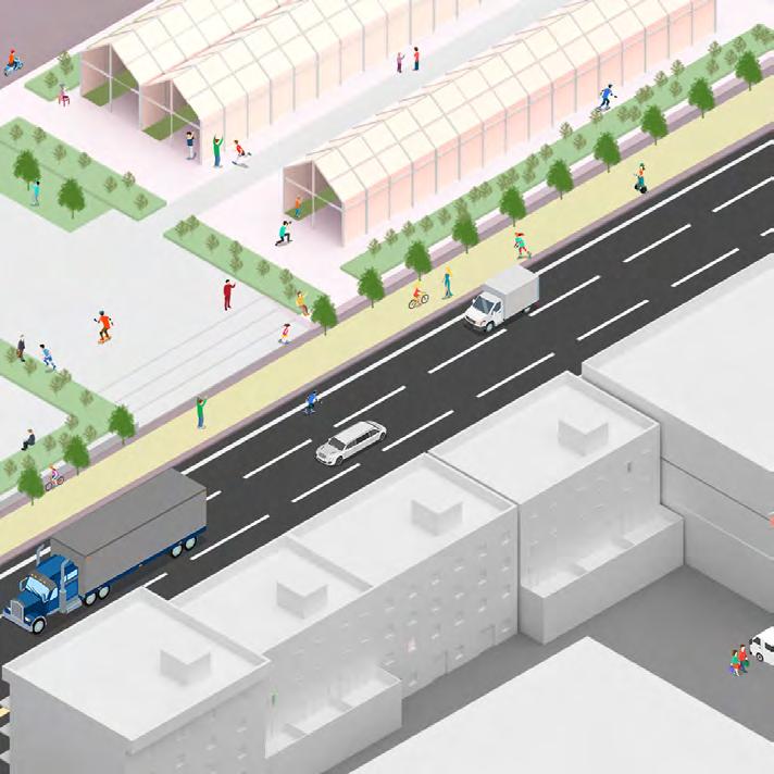
We too start by applying the rules of transforming the station into transport hub as a driving force, typographic barrier into corridor for better connectivity, and also main street into public interface, rail into renewed open space such as linear park, road intersection into anchors, and left-over space into nodes for more open spaces and various activities.

Without large demolishment of the existing buildings, the small interventions and improvements step by step transform the space into a better place for suburban life and experience. Gradually, the vibrant places connect together and form two exciting routes. One along the University Avenue with continuous public streetscape providing high quality recreational, commercial and service experience, and the other along the rail lines serving as the ecological, sports and recreational spine.
By applying these re-configurations throughout our site, a greater framework begins to emerge. On the main street, the changes yield a more consistent public realm that offers a variety of activities and encourages pedestrian foot traffic. This sequence of space becomes the central commercial backbone that connects traffic from the train station to the residential neighborhoods and down to the industrial workplaces.


