
7 minute read
Macro Planning


Madison Street differs from Oak Park in terms of racial and economic demographics, architecture, housing patterns, and retail options. Instead of presenting Madison as a problem that needs fixing, the ideas proposed in this report aim to celebrate and cherish the unique and diverse mix of people, places, and properties that already exist within the corridor. If Oak Park is for “everyone,” then Madison can be for “everyone else.”
What are we designing
Advertisement


In examining Madison Street within a broader context, we have identified its relationships with the surrounding urban realm. The diagrams specifically highlight the existing downtowns and open space systems that shape the edges of Forest Park and Austin, as well as the impact of Madison’s distance from the CTA Green and Blue Line stations. Additionally, we have identified specific notable assets on the corridor, such as blockchain retail, public institutions, and senior living facilities.


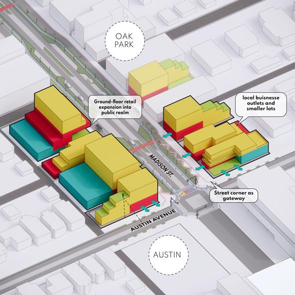
Building Typologies- Form Based Codes


These proposed building typologies respond to different parcel sizes and building heights, in line with the project goals. Each proposal is based on an average of three parcel sizes commonly found on Madison: 50’x120’, 120’x100’, and 200’x120’. The northern and southern blocks adjacent to Madison have distinct building characteristics, with 45’ multifamily housing zoned to the north and 30’ single-family homes zoned directly to the south.


Madisonst Madisonst
Madisonst Madisonst
Med draws inspiration from the RUSH Oak Park hospital, on the western edge.
On Madison Med, design interventions like public handrails, tactile crosswalks, outdoor fitness equipment, and information kiosks serve aging residents and pedestrians with specific mobility and safety needs.
Madisonst

Mix is in reference to the wide range of parcel sizes, land uses, and building types in the center of the corridor.


On Madison Mix, design interventions like group seating, playful social spaces, waiting spaces for school children, and patterned crosswalks help bring a diverse range of people and activities together to strengthen community and infuse a sense of dynamism into the corridor.
Made honors the significant number of small, historically Black-owned businesses on the eastern edge.
On Madison Made, expanded sidewalk space for outdoor retail amenities, parking spots at bus bulbs, popup market spaces along buffer zones, color-coded signage, and patterned crosswalks that bridge north and south sides of the street invite foot traffic to promote local businesses.
Urban Analysis
PROJECT LOCATION :
PROJECT TYPE :
ROLE : WORK :
CHICAGO, ILLINOIS
RESEARCH, DOCUMENTATION AND ANALYSIS
ACADEMIC (INDIVIDUAL)
RESEACH,CONCEPT,DESIGN,DOCUMENTATION, GRAPHICS
SEMESTER : DATE :
GUIDE :
MCD - FALL SEMESTER 22’
DEC, 2022
DR. SEVIN YILDIZ
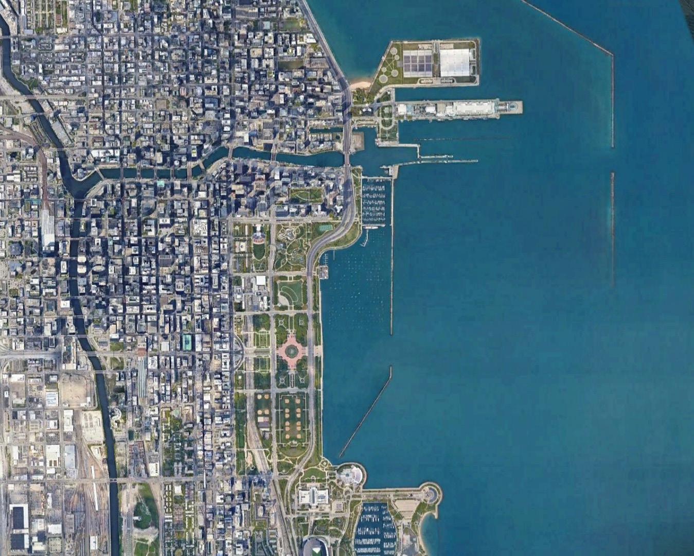
This analysis focuses on the ‘20 MIN DOWNTOWN’ concept as a way to evaluate the livability and accessibility of a city’s downtown core. The study aims to determine if the core has been designed to be a successful model of livability and if it enables pedestrians to access all the amenities and activities of the dense urban fabric. Through a three-level analysis (macro, meso, and micro), the investigation found that Chicago’s downtown core, ‘The LOOP,’ is accessible in under 20 minutes and offers a diverse range of experiences. The analysis used visual guidance for walking exploration, creating a layout that can be applied to any downtown area in any city.
GIS, InDesign, Illustrator, Photoshop, Lightroom
// Urban Analysis
// Research
// Prototyping
// Planning
METHOD 1
Introduction
Cities are dynamic systems made for people to inhabit and generate unique experiences. Walking is the most common and accessible mode of experiencing a city. We focus on Downtown and its core to analyze livability through walking.


We shall look at the whole site that is the ‘LOOP’ and create a matrix for all the major type of activites that are present and the rate them on the basic of how accessible they are from this area and how much footfall does each section experience.
- Type of Activity
- Accessiblity
- Footfall
We shall look at the Streets individually. Here we will mark the type of path and analyis the charater of the street North- South and East-West Streets will be analyzed differently.

We shall look at the street level visual guidance for the pedestrian that helps them to navigate and walk toward the desired destination or activity, adding to the Walkability aspect of the space.


The major types of activities in the downtown area are divided into seven zones, and their percentage impact is represented in a radial graph by the area they occupy, corresponding to their actual percentage area in the downtown.


ACCESSIBILITY LINK
- Level of the Street
- Movement pattern
- Time to travel
- Street Edge Condition
- Vibe
- Crosswalk
- Signals
- Signages
- Sidewalks
The impact on all seven zones is measured by their visual presence and the activities they host. This rating system allows us to identify the most active areas and the zones with the highest footfall. By analyzing this data, we can determine which zones are most impactful for a user within a 20-minute walk.
Street Charater Analysis
The Street Character Analysis examines the relationship between building edges and streets/sidewalks to provide insight into the walkability of the area.


Chicago has multiple levels in the city and downtown you can only expect it to be more layered. So indicating the layer of street interacted is important.

Chicago downtow is layed out in grid so there is no much non-linear movement. One can still move diagonally is the subject of intrest is such.


Street Edge Condition
Chicago’s conditions are measured on the basis of the porosity,materiality and the offset spaces created on the building edgeline where the space is being used for public
The vibe of the street is a intangible but its measure in relation to Street Condition, Time and Legibility of the space.
Street Walkability Element Analysis
The Street Walkability Element Analysis focuses on the streets and sidewalks in terms of the placement of elements that guide pedestrians visually and aid in their navigation from one location to another. This analysis is crucial for forming a comprehensive understanding of the streets and their legibility for the purpose of walkability.
Departments
Crosswalk
Sidewalk
All Rating in each department
7 Crosswalk Signal Signages
Sidewalk
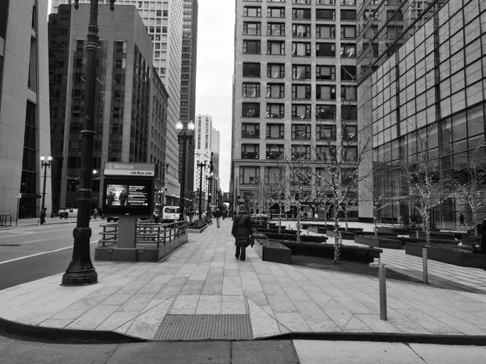
9 A street junction on the West - East axis, S Dearborn St.
Sidewalk hear creates a good buffer zone and all the other elements for the walkablility aspect are visible but could have been enhanced to cater better to the pedestrians visting here for first time.
CTA Blue Line- Inclusion of Transit facilities onto the sidewalk and merging the on-ground and underground levels of the city.


Plaza. A public seating space Included just next to the side walk, keeping in mind the activities of the surrounding spaces and building edge opening up to create a good in-between spaces.
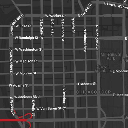
NORTH- SOUTH direction streets in downtown core area for walkability measurement of 20 min and activities.

WEST - EAST direction streets in downtown core area for walkability measurement of 20 min and activities.
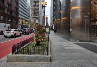
A green buffer spaces included in-between and on the edges of the side adds to the visual beautification and also contributes enviornmentally. The streets feel much more lively and vibe is overall enhanced.
A service infrastructure incorporated onto the sidewalk near the junction area, narrow downs the walkable area and cause a hindrance visually, physically and add to the congestion of the space.

Urban Research Publication
05
(RE) CODING MUMBAI
Research And Documentation Of Mumbai Streets And Build Typologies

Urban Analysis
Research
Prototyping
Planning
Community
Mixed-use
Adaptive reuse
Documentation
MUMBAI, INDIA
PROJECT TYPE : RAVI, NIRAV, SHAIBA. RAHUL, RIKUNJ
RESEARCH AND DOCUMENTATION
PROJECT LOCATION : DATE :
MEMBER : FIRM :
ROLE : sPare. (Sameep Padora and associates).
RESEACH, DOCUNEMTATION, GRAPHICS.
MAY-JUNE, 2017.
The research and documention was done at firm sP+A under the research wing sPare for publication.
The DCR (Development Control Regulations) primarily prioritizes road widening codes and overlooks pedestrian needs. While automobiles are important, we cannot overlook the importance of pedestrians. Instead we should reconsider their potential and create some space within the DCR to facilitate their revival where necessary. We need to make room for streets once again, giving equal consideration to pedestrians and automobiles, in order to ensure a balanced and sustainable urban development.
Autocad, Revit, InDesign, Illustrator, Photoshop
Typology Documentation
I participated in a research and documentation project with sPare, which divided volunteers into teams to document different types of structures and roads in Mumbai that have unique typologies and reflect the city’s urbanization. These structures and roads serve as markers in time and space, recording anomalies and slippages in the general set of logics operating within the urban field. They also present potential ideas or types that can be deployed within contemporary urban contexts.

Streets Documentation
These five streets were surrounded by different neighborhoods and cultural contexts, yet they were part of the same area. Therefore, the complexity of the streets’ nature was key to making further analysis possible. Each street already had a unique established character in the urban fabric, combined with its neighborhood. My role in this project was to document these relationships and different types of streets in Bandra, Mumbai. This documentation involved representing them with different styles of drawing such as plans, sections, isometric sections, and creating a comparative analysis between them to understand and enhance their characteristics.
Street Documentation Analysis
Photodocumentation higlighting street infrastructures and areas of concern, regarding re-planning and arrangements.
1. Informal shops on footpath
2. Under utilized edge condition
3. Absence of footpath
4. Absence of zebra crossing
5. Degenerated median condition
6. Reduced effective street width due to encroachment, hawkers and parking

Street Analysis
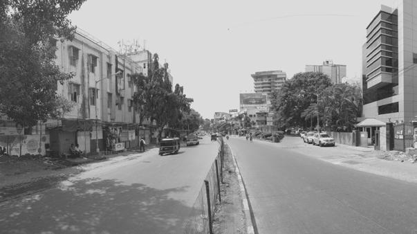
The street is an arterial road and the edges of the street are defined by the collector roads which branch out from the street.
The width of the street varies at different sections of the street but is approximately 18m wide and carries heavy traffic.
Out of the total street space, 60% is used for movement of vehicles. 30% is used by shops and eateries. 10 % is used by the pedestrians.
The street is characterised by the commercial shops which are present on the edge of the road
The street is a two way vehicular road with heavy traffic as it recieves traffic from adjacent collector road
It is a high traffic zone as the vehicular traffic is high almost throughout the day.
The pedestrian traffic is predominantly high durning the evening due to the roadside eateries and shopping programs.

