Wadi Hanifa
Urban Design Studio

Introduction
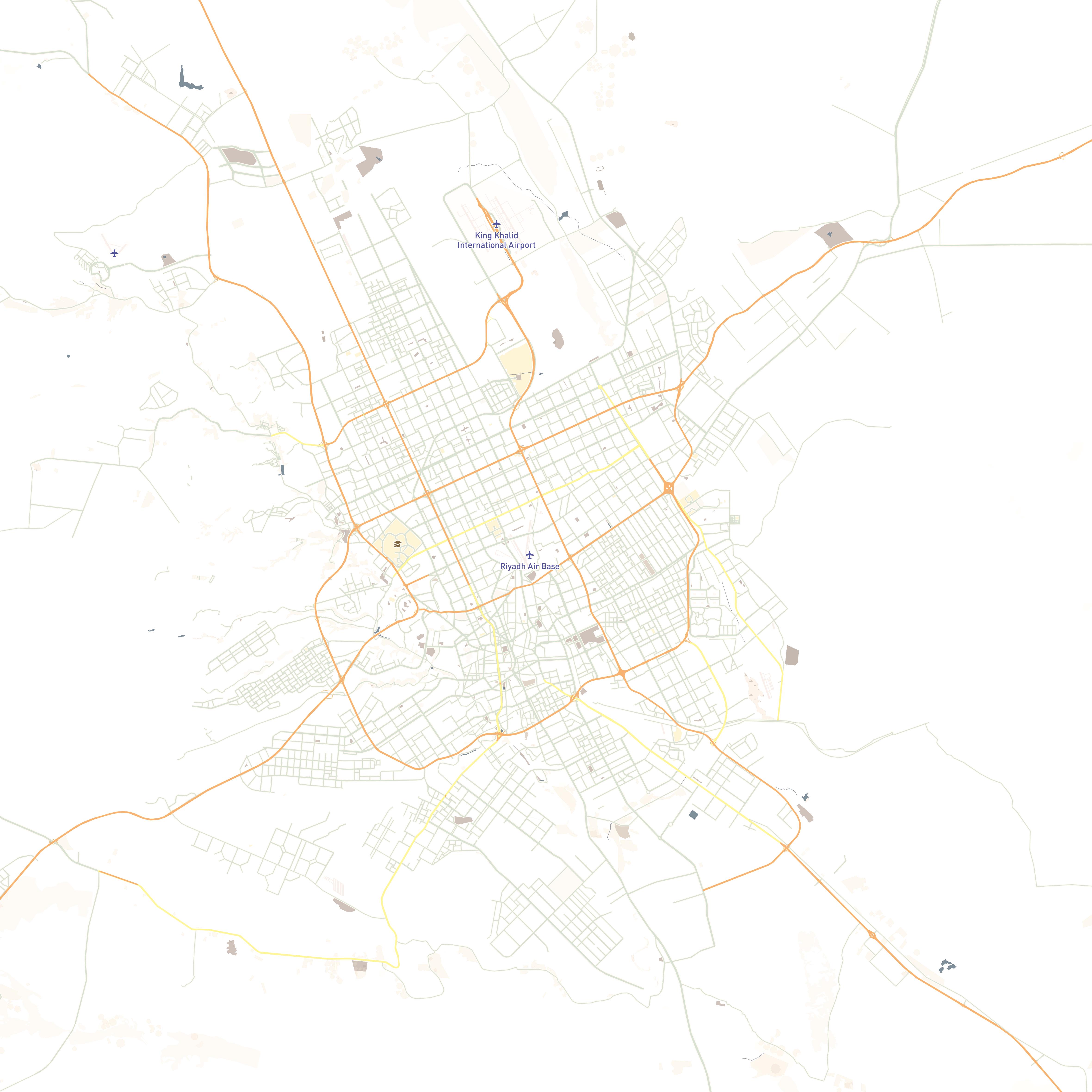
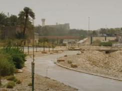
Project location
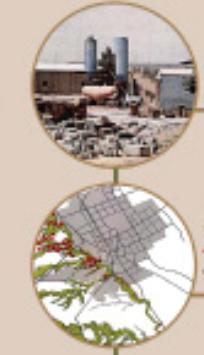
This design studio revolve around urban scale developement, and that year, Wadi Hanifa was the selected area. The Wadi or valley is located in in the captial of Saudi Arabia, Riyadh. It streches from the north down south to the outskirts of riydh into neighbouring villages and cities.
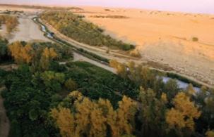
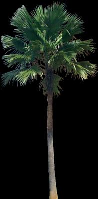
Wadi Hanifa is the longest and most important valley near Riyadh, a natural water drainage system for an area of over 4,000 square kilometers and a unique geographical feature in our dry region. It is located in the midst of the Najd Plateau of the Kingdom of Saudi Arabia.
For this studio, the Wadi was divided into seven sections , and we were working on area four. The area was close to the historc land of Addiriyadh.
The design team of this project consisted of three designers; Reme AlMazrou, Renad AlOmaigan and Nouf AlSaeed.


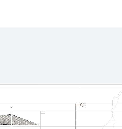
Secondary Rd Street Site Alley One Lane Alley Two Lane Secondary Rd Pedestrian Sidewalk Site Site Site
History of Wadi Hanifa
In ancient times, the wadi was known as al-Irdh. Its current name is derived from that of the Banu Hanifa, the principal Arab tribe in the area at the time of the Islamic conquest of Arabia.
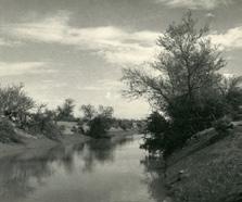
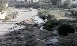
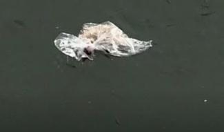
The Wadi then has been through tough times, filled with neglect and ill-use which resulted with it turned into a waste dump that cuts though Riyadh city.
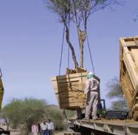
However, the Saudi government and Al Riyadh Development Authority were able to revive and preserved the wetlands of Wadi Hanifa, also initiated an environmental rehabilitation project.
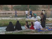
It has now become a park with lakes that catches breezy winds and attracts visitors to enjoy picnincs and ride bikes there.
Timeline
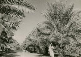
1930
Water Resourses
Rich of Agriculture Farms
1935
1969-1935
1969-1935
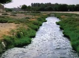
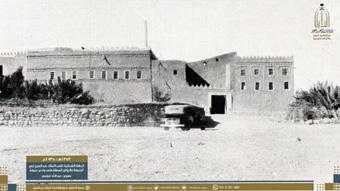
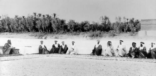
Kind Abdulaziz built to his palace in wadi Hanifa people walk beside the river grew to be accumulated by nature
palace walk to
Kind Abdulaziz with his guests in wadi Hanifa
1970
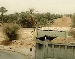
Soil Extraction from wadi hanifa due to the development of riyadh
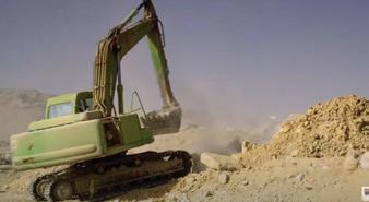
The fast development of riyadh a ected wadi hanifa
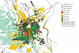
Became a dumping ground of waste materials
Wadi hanifa became unhabitable place
There was 17 factories in wadi for doil extraction
1980
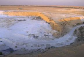
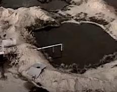
source material caused hole and pits
Restored the vegetation
soil extraction location Factories locatiojn
as a result. wadi hanifa became full of holes
1986
1970 1980 waste
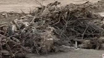
cause pullotion of the area
Riyadh development authority declearedthe wadi and remove the harmeful waste
Animals died
paved pathways along the wadi
controlled
controlled the drainage permanently flowing water
Done by : Renad AlOmaigan I
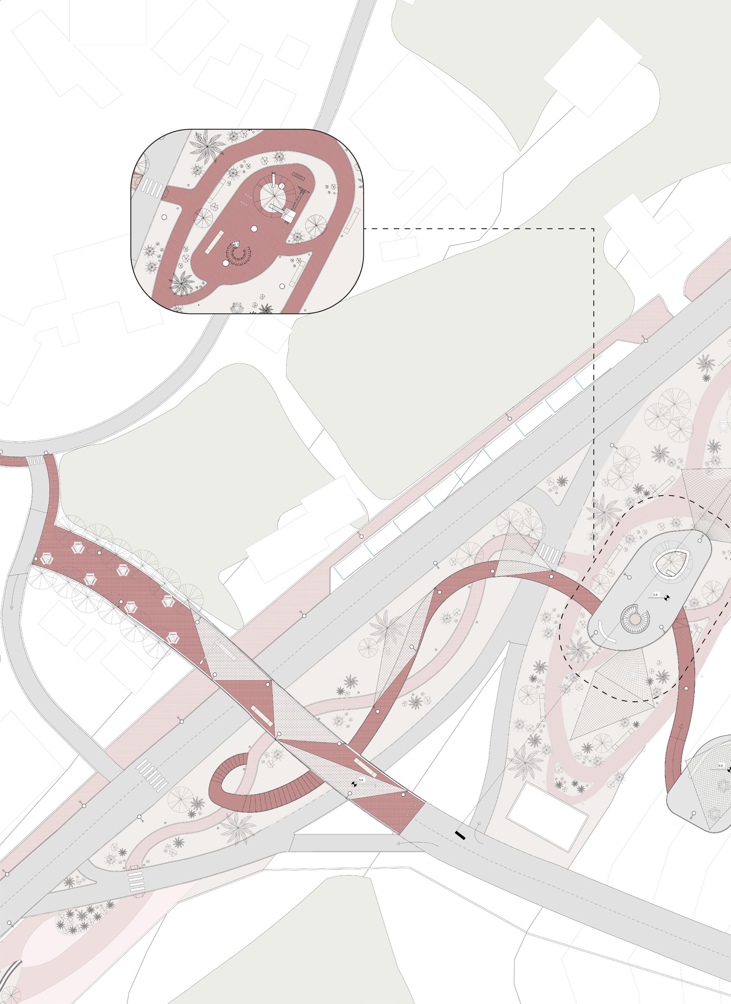
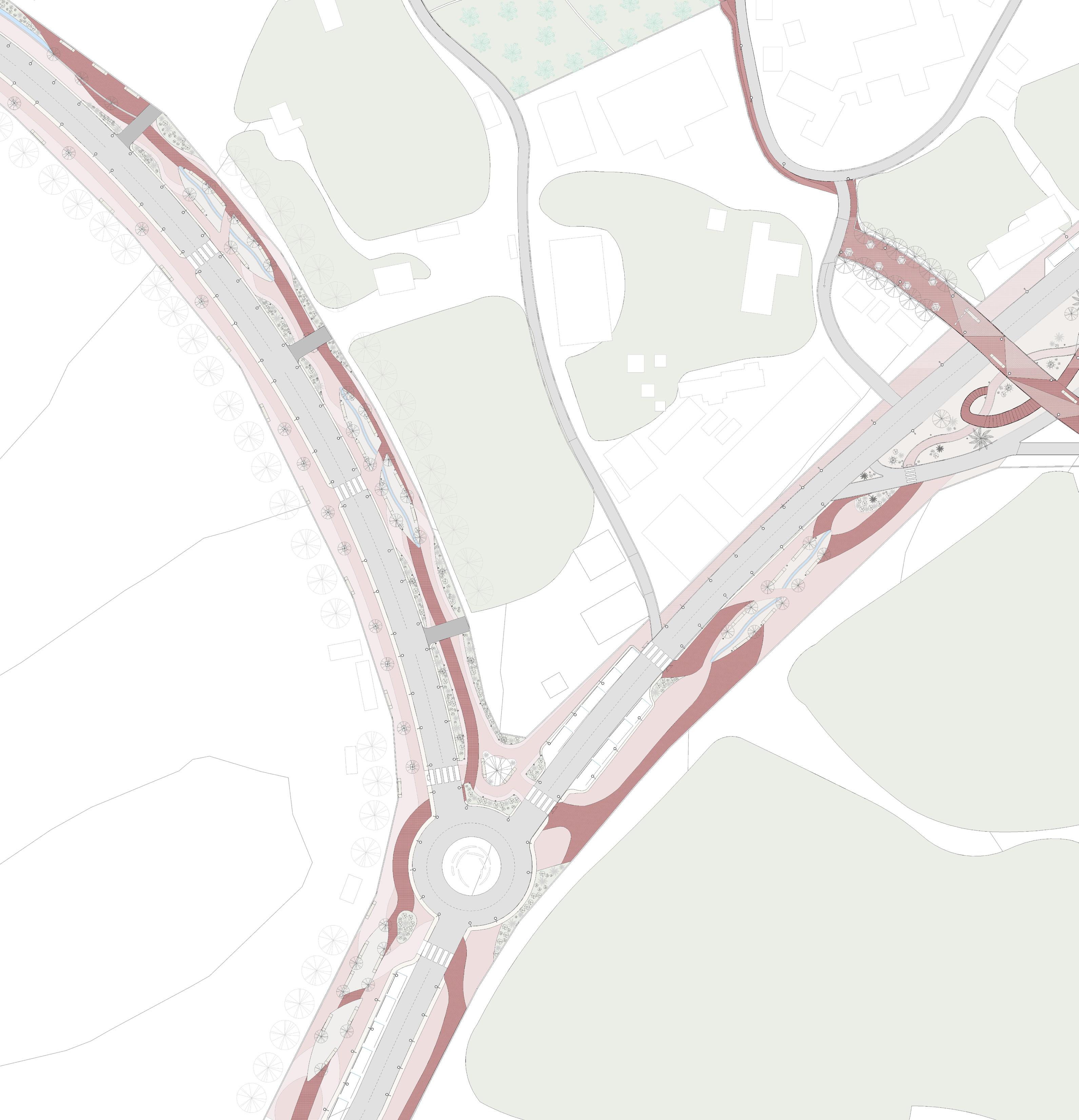
Site Analysis
Secondary Rd Street Site Alley One Lane Alley Two Lane Secondary Rd Pedestrian Sidewalk Site Site Cross-Walk Pedestrian Sidewalk Site > 100 vehicles 15 min 60 vehicles / 15 min < 20 vehicles / 15 min Site
Site 1 Storey 2 Storeys 3 Storeys New build Very Old (+30 years) Low Density Medium Density High Density Prince Mash-hoor Mosque Fahad Boarding House Sheik Mohammed Algshayyan Mosque Auto-Repair Shop Market Farm Buildings Agricultural Construction Site Vision 2030 Site Residential Commercial Religous Agricultural Construction Site Vision 2030 Site Agricultural Construction Site Vision 2030 Site Buildings Public Private Done by : Rema AlMazrou & Nouf AlSaeed I
Areas
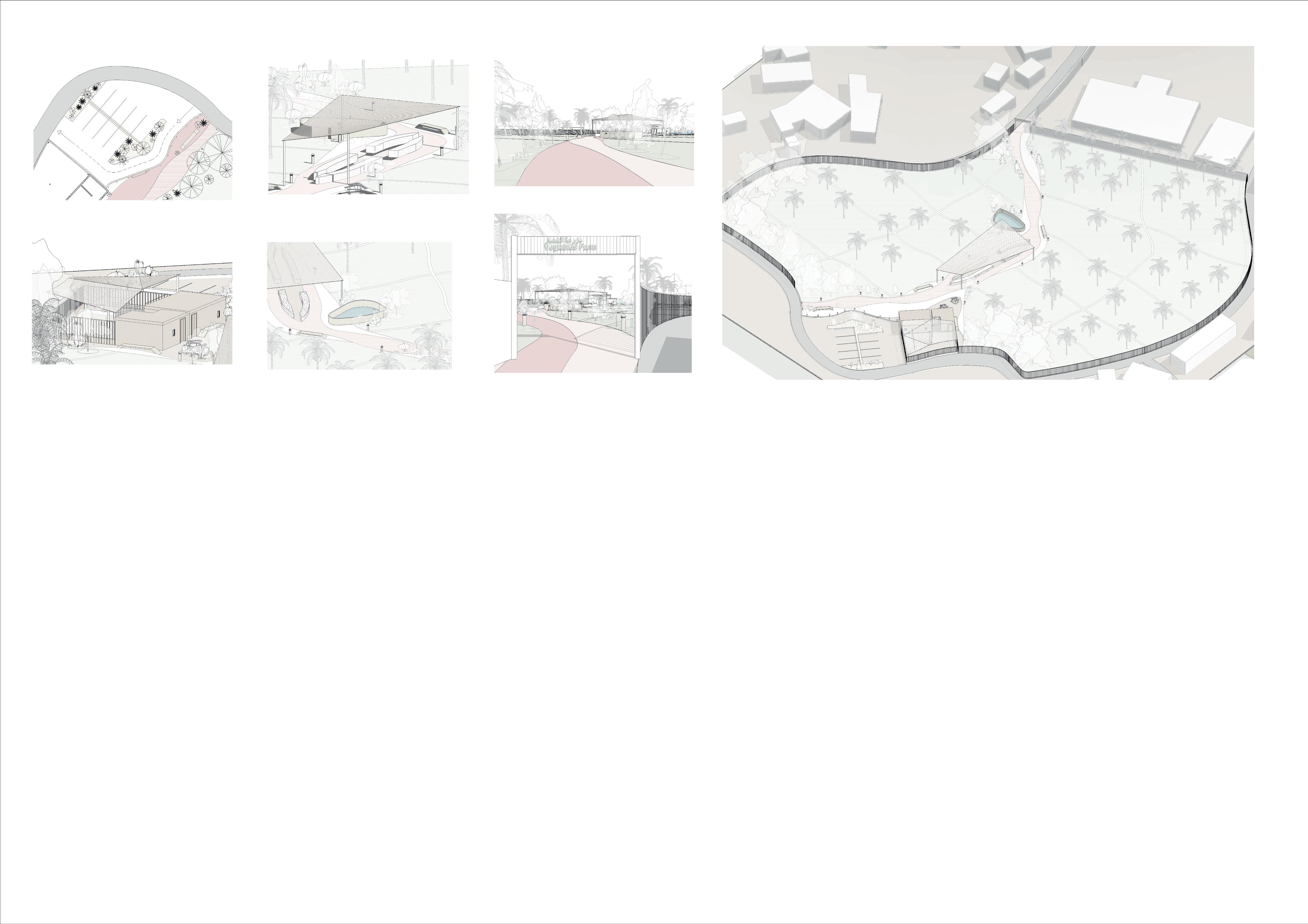
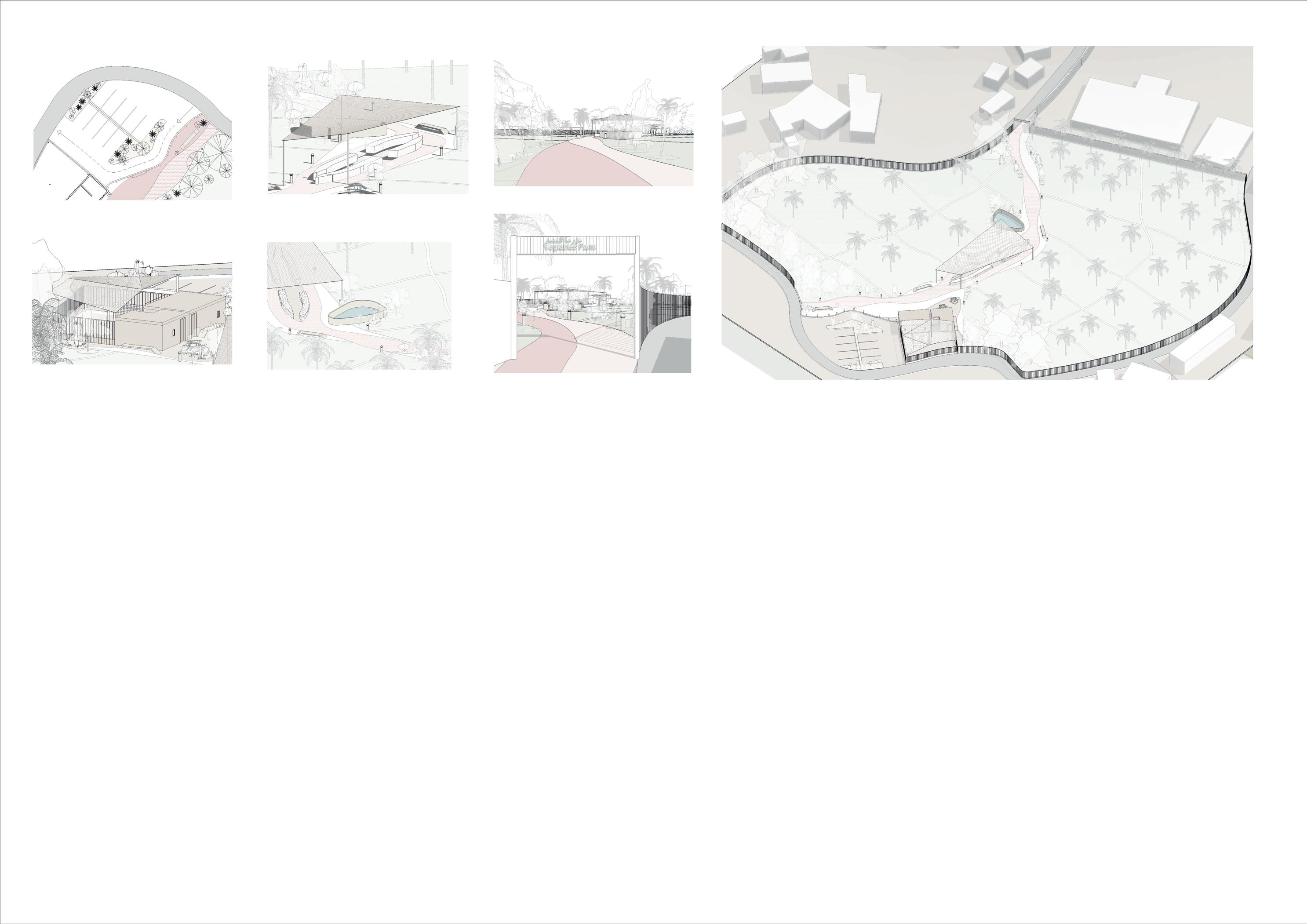
Based on the research, interviews, and analysis we have done for the area, we decided to respect the residences opinions and concers in which they have expressed wanting to keep the area private but still allow for easy accessability.
We divided the area into 3 main parts:
Area A - the park, highlighted in pink in the diagram on the right. This area hasnt been designed in a way which visitors can use all year round. It was left open with a single path going though it and a few scatteed trees.
Area B - the farm market indicated in blue. This farm has its history with its old builds dating back over 40 years. Unfourtunately, not many know of it due to its location and limited access to its roads.
Area C - the rest area, highlighted in orange in which pedesrian can walk. This area isnt comfortable for pedestrians to walk in due to safety concerns and lack of shade.

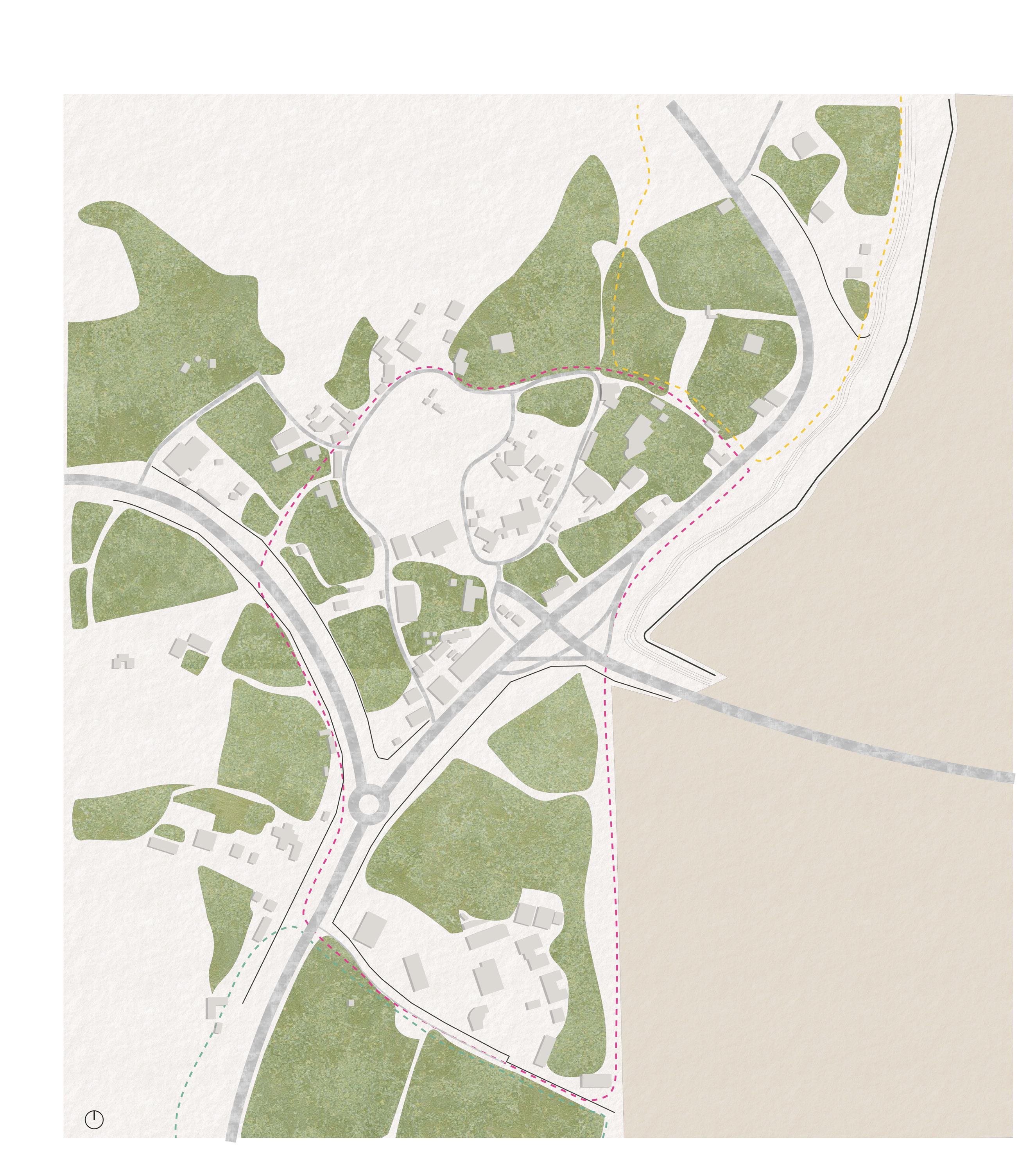

Site Site 3 Site 5 Gate Private Entrance Area A [Rema] Area B [Noof] Area C [Renad] Site Site 3 Site 5 Gate Private Entrance Area A [Rema] Area B [Noof] Area C [Renad] Done by : Rema AlMazrou I
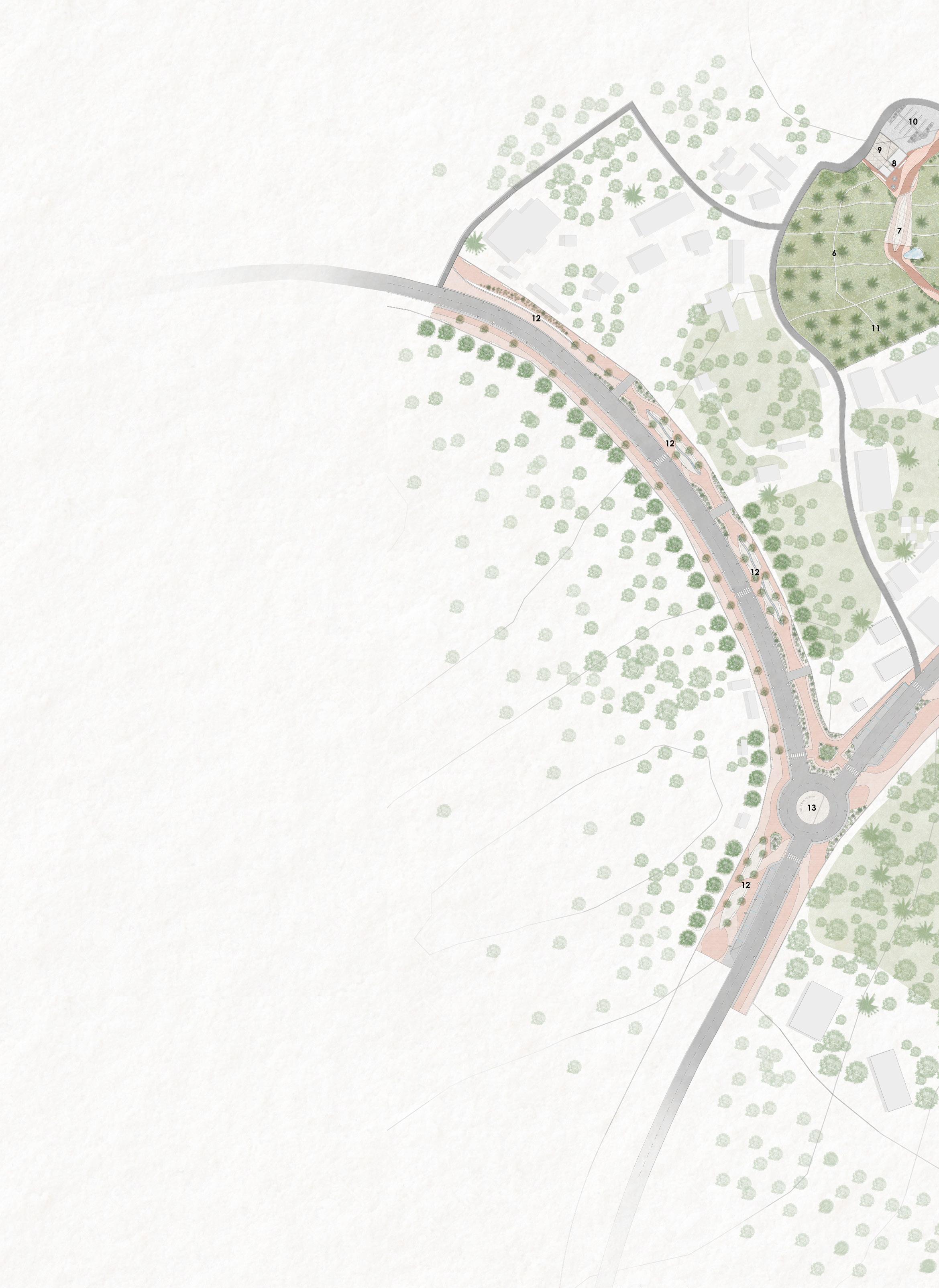
Area A - Park


Done by\ Rema AlMazrou

The area underneath the histroric mountain is left underdeveloped with a few scattered trees. After some research and interviews with the locals we decided to create a park with shaded picnic areas with elevated platform that are connected to the bridge that is now left with no use. Instead we decided to make it a pedestrian bridge that directs people towards the farms.


X Crossing Solution Bridge Crossing Pedestrian Crossing Pedestrian Pathway Not enough shading No seating Areas No pathway leading to crossway Not enough space to walk around parking Uneven Pavement Not ADA friendly Defined and paved pathway leading to crossway Removed parking New pavement material Added ADA ramp Closed bridge with no function Shaded area used as paking Dangerous crossing due to high speed of cars Redirected crossing to safer side 1 X Proposed Bridge design Crossing Solution Pedestrian Crossing Pedestrian Pathway Bridge Crossing Pedestrian Crossing No pathway leading to crossway Not enough space to walk around parking Uneven Pavement Not ADA friendly Defined and paved pathway leading to crossway Removed parking New pavement material Added ADA ramp Closed bridge with no function Shaded area used as paking Dangerous crossing due to high speed of cars Converted it into pedestrian bridge with connection to other parts of site Shaded area used for picnic Redirected crossing to safer side Proposed shading devce inspired by traditional picnic tents Provided seating and picnic areas Added seatings with shading elements Picnic Area Pedestrian Bridge Playground W/C Landscape 3 4 Circulation pathway Defined circulation, entrance points Entrance point Circulation pathway 2 Created Zones with Connections 1 Done by : Rema AlMazrou I


1. Pedestrian Bridge 2. Picnic Area 3. W.C 4. Playground Bridge Defined and paved pathway Removed parking New pavement material Added ADA ramp Closed Shaded Converted other Shaded Picnic Area Pedestrian Bridge Playground W/C Circulation pathway Defined circulation, entrance points Entrance point Circulation pathway 2 Created Zones with Connections 1 X Crossing Solution Pedestrian Bridge Crossing Pedestrian Crossing No seating No pathway leading to crossway Not enough space to walk around parking Uneven Pavement Not ADA friendly Defined and paved pathway leading to crossway Removed parking New pavement material Added ADA ramp Closed bridge with no function Shaded area used as paking Dangerous crossing due to high speed of cars Converted it into pedestrian bridge with connection to other parts of site Shaded area used for picnic Redirected crossing to safer side Proposed Provided Added seatings with shading elements Picnic Area Pedestrian Bridge Playground W/C 3 Circulation pathway Defined circulation, entrance points Entrance point Circulation pathway 2 Created Zones with Connections 1 X Crossing Solution Pedestrian Pathway Bridge Crossing Pedestrian Crossing Pedestrian Pathway Not enough shading No seating Areas No pathway leading to crossway Not enough space to walk around parking Uneven Pavement Not ADA friendly Defined and paved pathway leading to crossway Removed parking New pavement material Added ADA ramp Closed bridge with no function Shaded area used as paking Dangerous crossing due to high speed of cars Redirected crossing to safer side Proposed shading devce inspired by Provided seating and picnic areas Added seatings with shading elements Picnic Area Pedestrian Bridge Playground W/C Landscape 3 4 Circulation pathway Defined circulation, entrance points Entrance point Circulation pathway 2 Created Zones with Connections 1 X Pedestrian Pathway Bridge Crossing Pedestrian Crossing Pedestrian Pathway Not enough shading No seating Areas No pathway leading to crossway Not enough space to walk around parking Uneven Pavement Not ADA friendly Closed bridge with no function Shaded area used as paking Dangerous crossing due to high speed of cars Proposed shading devce inspired by Added seatings with shading elements Picnic Area Pedestrian Bridge Playground W/C Landscape 3 4 Circulation pathway Defined circulation, entrance points Entrance point Circulation pathway 2 Created Zones with Connections 1 5. Platform 6. Drop-off 7. Underground Parking
Proccess Done by : Rema AlMazrou I
Design
The proposed design showcases a better lanscaping enjoy the walkways that shaed with either includes picnic areas and elevated platforms that leads to the farm area. While the path


lanscaping strategy in which visitors could either trees of shaing elements. The design also platforms that conncets to the pedestian bridge path under the bridge, leads to area C.


Level 0 0.0 Level 1 5.0 Level 3 10.0 Level 0 0.0 Level 1 5.0 Level 3 10.0
Done by : Rema AlMazrou I
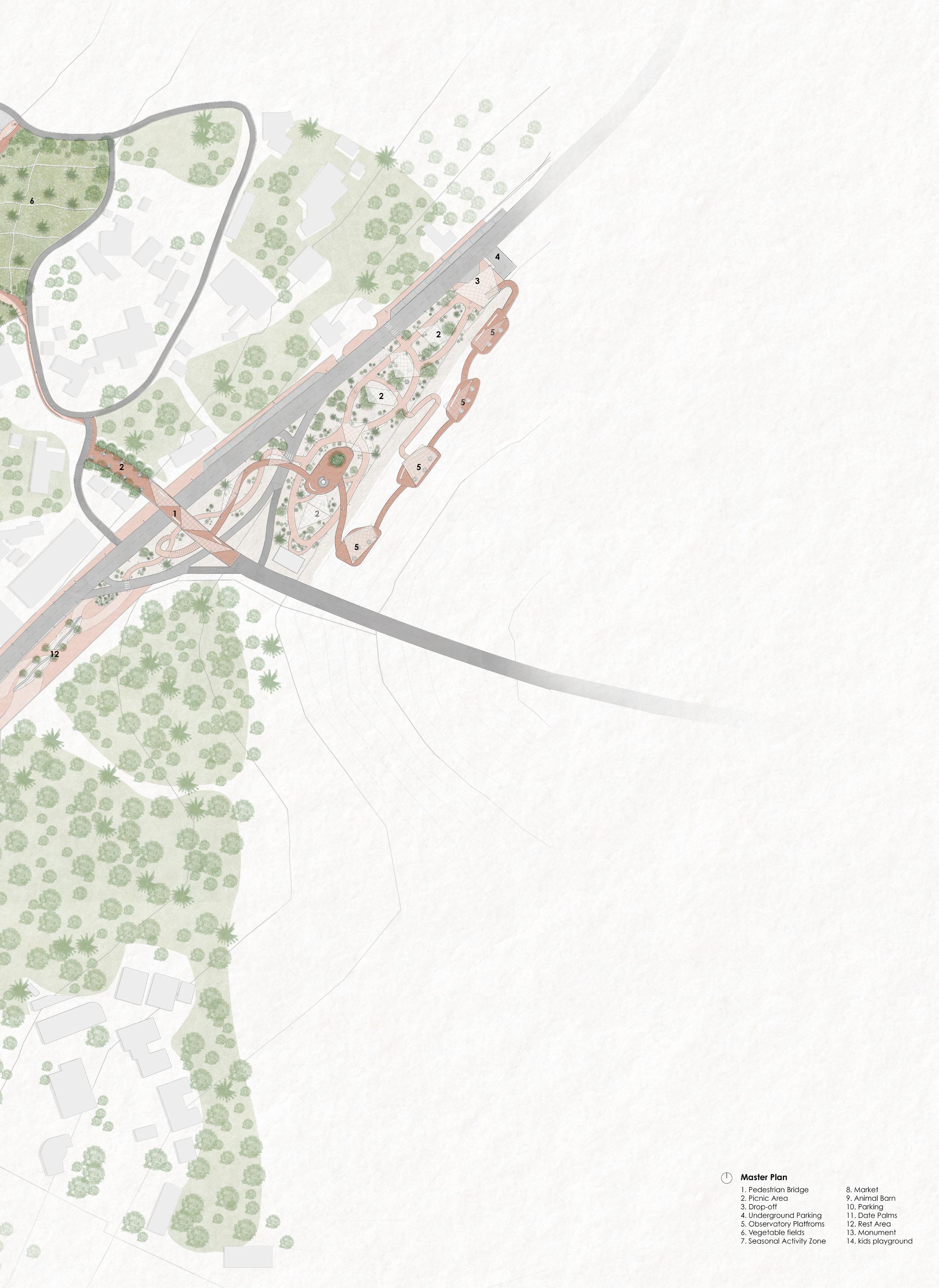
Area B - Farm


 Done by\ Nouf AlSaeed


The farm which is open to the public, however it is located in between private farms, making it unknown to visitors of the Wadi. The farm condition is very old, lacks appropriate fencing, pavement and other user facilities. The development of the farm focused on giving more exposure to the farm by connecting it with the rest of the Wadi.

Farm surrounded
1 Main entrance
2 Old market place
1
3 Agricultural lands
4 Pathway
5 Water pond
3
Condition
Farm surrounded by demolished, poor fencing
2 3 4 5
Proposed Design
1 Main entrance
2 Old market place
3 Agricultural lands
4 Pathway
5 Water pond
4
1 Main entrance
2 Old market place
3 Agricultural lands
4 Pathway
Old building used as a market to sell the farm produce that lacks su cient daylighting + an outdoor for winter season activities (grilled corn, tea) for visitors however it has no sitting areas.
Animals are scattered at the center, causing a bad smell
Farm surrounded by demolished, poor fencing
Proposed Design
Old building used for winter season activities
Animals are scattered at the center, causing a bad smell
Design
Parking area and drop o point
Old building used as a market to sell the farm produce that lacks su cient daylighting + an outdoor space for winter season activities (grilled corn, tea) for visitors however it has no sitting areas.
Old building used as a market to sell the farm produce that lacks su cient daylighting + an outdoor space for winter season activities (grilled corn, tea) for visitors however it has no sitting areas.
No parking, cars park along the entrance which only goes one way.
Seasonal market zone
Seasonal market zone
Improveed pedestrian circulation and pathway material
at the backyard
Water pond protected with stone fence for safety
Entrance from a connecting pathway from the wadi, making the farm visible and accessible to pedestrians
Done by : Nouf AlSaeed I
2 4 1
No parking, cars park along the entrance which only goes one way. by
5 Water pond 5
2
Parking area and drop o point
o point
Proposed Design


Design Proccess


The owner of the farm requested not to make his farm become a park, meaning to be crowded and have people sitting too long. The design proposes a long main pathway cutting through, and smaller arteries on each side for people to harvest their own goods.


Old building used as a market to sell the farm produce that lacks su cient daylighting + an outdoor space for winter season activities (grilled corn, tea) for visitors however it has no sitting areas. Obstructed pedestrian circulation, unsudden No parking, cars park along the entrance which only goes one way. 4 Pathway 5 Water pond Parking area and drop o point
Seasonal market zone Improveed pedestrian circulation and pathway material Acces Creating a continuous pathways from the farm towards the park Provide A parking space, with clear circulation (entrance and exit) and a drop o point Focal point Expanding the seasonal activity area to be used as a market for selling the farm produce out in the open space
1 Parking 2 Main market 3 Animals shed 4 Seasonal market 5 Water pond 6 Agricultural fields 7 Pedestrian entrance Done by : Nouf AlSaeed I
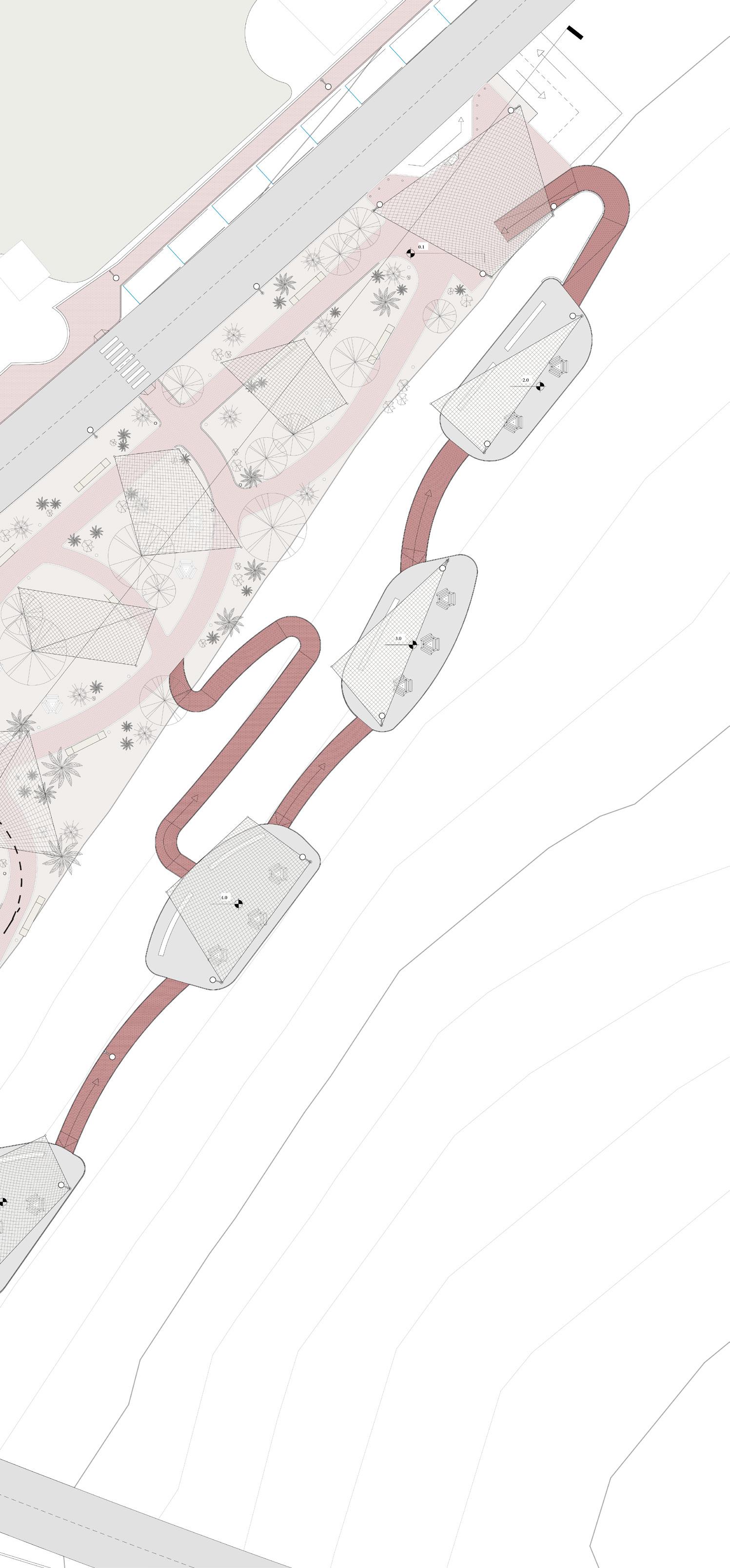
Area C - Rest


The area enjoys calm as the surrounding areas are considered private property. Still, it includes a lot of wasted spaces that we can develop and revive to become a rest and recreation area and reuse the existing elements and local materials more effectively t contribute to the development and design compatible with the at mosphere and the environment.


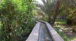


1Address the private entrances 2 Connect the two sides of the area by adding the cross walk 2 Pedstrian Pathways Design O set honger space from the private entrances Allowing Social distance by sperating the actvties. Adding a water element that has the same language of the "Saqi" to add calmness to the area Fence walls & the trees The fence wall and trees inside the private areas act as a shading element Not ADA friendly Done by : Renad AlOmaigan I
Crossing
The round is not define
Not enough crossways
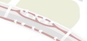

Lack of parking
Design Proccess
Rest Area

The area enjoys calm as the surrounding areas are considered private property. Still, it includes a lot of wasted spaces that we can develop and re vive to become a rest and recreation area and re-use the existing elements and local materials more effective ly to contribute to the development and design compatible with the at mosphere and the environment.

Fence walls & the trees
fence wall and trees inside the private areas act as a shading element Placement of the Parking


Section AA Sacle 1:200
Master Plan
Sacle 1:200
the
1Address the private entrances 2 Connect the two sides of the area by adding the cross walk
Sice the narrow Space, Use it as suitable walkyway with Benches O set honger space from the Adding a water element that has the same language of the "Saqi" to add calmness to the area
Placement of the Parking 1Address the private entrances 2 Connect the two sides of the area by adding the cross walk
4
2
narrow
suitable walkyway with Benches O set honger space from the private entrances Allowing Social distance by sperating the actvties. Adding a water element that has the same language of the "Saqi" to add calmness to the area
4 Sice the
Space, Use it as
2 Placement of the Parking
Master Plan Sacle 1:200 Elevation Sacle 1:200
Sacle
1:200
The Monument is designed to show the growth and development we are witnessing. As you rotate through it, we notice the elements gradually rising to represent the growth and Development.
Done by : Renad AlOmaigan I
Round Monument
Area APark Area BFarm Area CRest Existing Proposed Existing Circulation Circulation Zoning Site Gate Pedestrian Farm Market Concrete Blocks Private Entrance P Site Gate Pedestrian Farm Market Staircase Parking Space Private Entrance P Site Gate Pedestrian Vehicular Farm Market Concrete Block Parking Space Private Entrance P P Site Gate Pedestrian Vehicular Farm Market Staircase Parking Space Private Entrance Park P Site Gate Pedestrian Vehicular Farm Market Concrete Block Parking Space Private Entrance P P Not Paved nor Safe Poor night light Lack of pubic sitting areas P P Site Gate Pedestrian Vehicular Farm Market Cross way Parking Space Private Entrance P
Existing Proposed Final Zoning Zoning Proposal Gate Activity Zone Pedestrian Bridge Farm Market Staircase Parking Space Private Entrance P Platforms Green Zone 1 2 3 Gate Activity Zone Pedestrian Bridge Farm Market Staircase Parking Space Private Entrance P Platforms Green Zone 1 2 3 Gate Activity Zone Pedestrian Bridge Farm Market Staircase Parking Space Private Entrance P Platforms Green Zone Gate Market Pedestrian Bridge Staircase Parking Space Private Entrance P P Seasonal Activity Zone Agriculture Gate Market Pedestrian Bridge Staircase Parking Space Private Entrance P P P Seasonal Activity Zone Agriculture Gate Market Pedestrian Bridge Staircase Parking Space Private Entrance P P P Seasonal Activity Zone Agriculture P Gate Seating Area Pedestrian Bridge Staircase Parking Space Private Entrance P Monument Greenery P Exposed without any shading element Pavement material appropriate for walking Site Gate Pedestrian Vehicular Farm Market Cross way Parking Space Private Entrance P Site Gate Pedestrian Vehicular Farm Market Cross way Parking Space Private Entrance P Done by : Rema AlMazrou I
Done by : Rema AlMazrou I


