
Supervisors
Prasad Shetty
Vastvikata Bhagat
School of Environment & Architecture
University of Mumbai
Ritu Naik
2021-2022
All rights reserved. No part of this book maybe reproduced in any form by any electronic or mechanical means (including photocopying, recording, or information storage and retrieval) without permission in writing from the publisher.
©️ Copyright 2021, Ritu Naik, ritunaik199@gmail.com
Architecture of Public Spaces
When does open space become public?
2 3
Certificate
This is to certify that the dissertation title
‘Architecture of Public spaces’
is the work of Ritu Naik whose signature appears below as Author.
The Author certifies that this is the original work carried out by the Author and is not paraphrased, or copied in whole or in parts (except for those statements and graphics mentioned along with references) or submitted in any form to any other institution for obtaining an academic degree. The Supervisors whose names and signatures appear below confirm and certify: that the above-mentioned dissertation is the original work of the above-mentioned Author; that it is carried out under their supervision; and that the work is of acceptable quality necessary for partial completion of the course to obtain the Bachelor of Architecture Degree. The Director whose name and signature appears below certifies that the Supervisors are appointed by the School of Environment and Architecture for undertaking the above-mentioned work and based on the evaluation of the Supervisors, the above work is acceptable for the partial completion of the course to obtain the Bachelor of Architecture Degree from the University of Mumbai.
External Examiner 1
Name- ________________ Director
School of Environment & Architecture
External Examiner 2
Name- ________________
Institutional seal
4 5
Author Supervisor 1 Prasad Shetty Supervisor 2 Vastavikta Bhagat
Acknowledgement
I would like to take this opportunity to express my gratitude towards the people because of whom this dissertation has been possible.
First and foremost, I am grateful for the people in my field study who engaged in multiple interviews and conversations that helped me build the research argument.
I am grateful to everyone who has helped me during this research in the past few months. I would like to thank my thesis supervisor Prasad Shetty for his expertise and valuable guidance throughout thesis research. He has helped me sharpen my ideas for research work. His timely criticism and brainstorming sessions pushed me to think accurately. I would also like to express my gratitude to Vastvikata Bhagat for her insightful comments, encouragement and suggestions.
I would like to thank Apurva Talpade for guidance on drawing methodology and references. I would like to express my gratitude to all faculty members at the School of Environment and Architecture for critiquing my process at the different stages that help widen my research scope.
I would like to thank my parents and friends for their moral support and encouragement. My friends, Vaibhav Mistry, Manthan Chandak, Ronak Soni and Adwait Desai have always extended their support and encouragement towards me. Special thanks to Radhika Baviskar for her great help and for accompanying me on visits.
I would like to acknowledge the authors whose works I referred to. These works have added to my understanding immensely and made this dissertation more meaningful.
6 7
Abstract
The thesis looks at when does open space become public through spatial factors like activities, materiality, claims, edge condition, and accessibility. The thesis rethinks the idea of public spaces, for which it opens up different categories of subconsciously formed public spaces by different agencies in the Jalgaon city. The study includes an analysis of public places like a lake, an open ground, a chowk, and a garden in the city. The methodology of conducting the study uses interviews and site observations of different activities, life affordances, changes in edge conditions, livelihoods, etc. throughout the day put together in narrative drawings. The research then argues that public spaces work much better when there is an overlap of activities, edges are soft and allow interactions to happen, access to humans as well as animals.
8 9
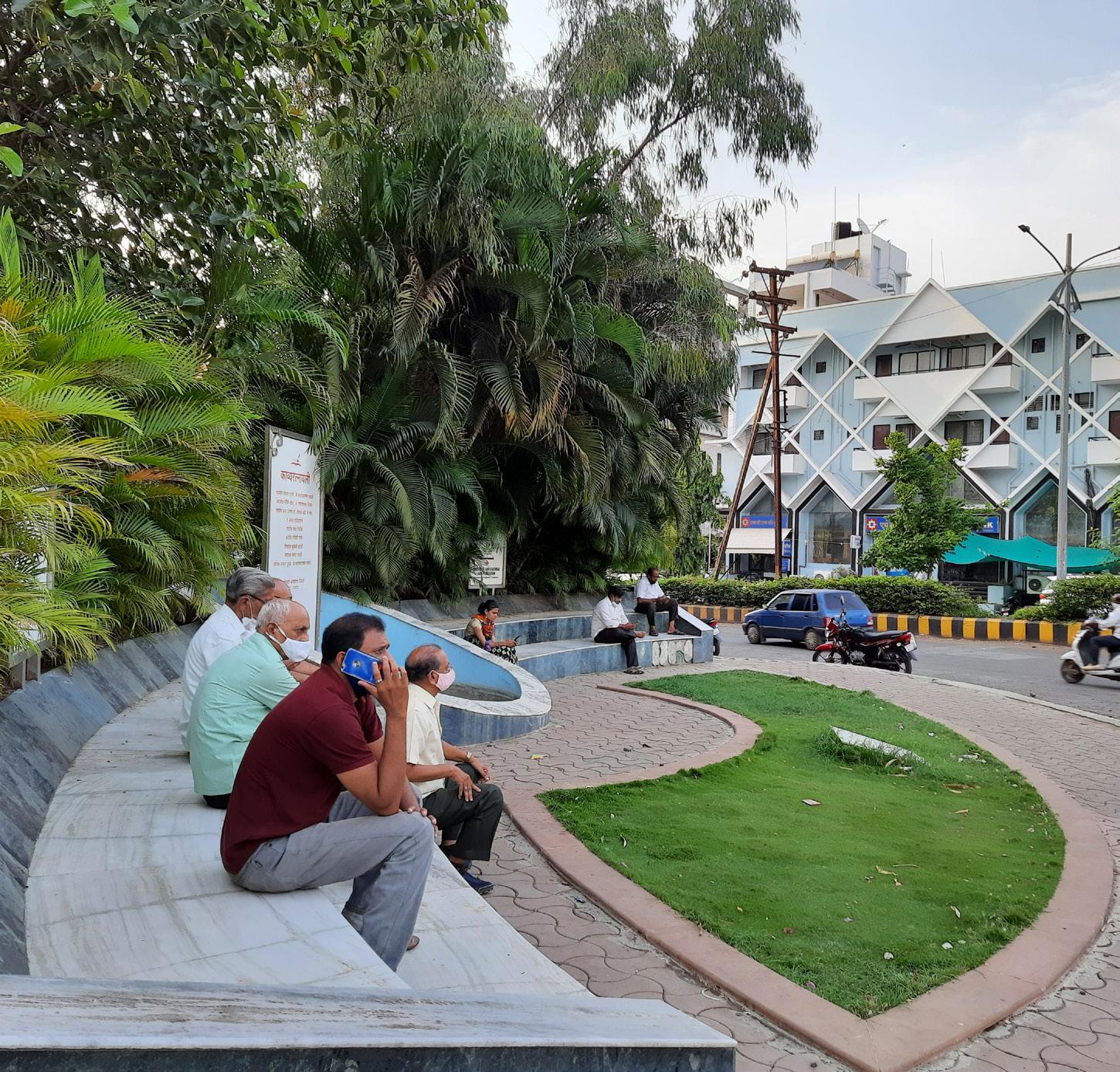
Fig. A1. view of Ratnavali chowk
Content
1. Introduction
1. Concern
2. Argument
3. Aim
4. Objectives
5. Research question
2. Theoretical framework
1. Conceptual framework
2. Literature reading
3. Analytical framework
3. Research methodology
1. Methodology
2. Sampling
3. Drawing strategy
4. Field work and sampling
1. Mehrun lake
2. Sagar park
3. Ratnavali chowk

4. Bhaunche udyan
5. Conclusion
1. Inference
2. Usefulness to architects
6. Bibliography
1. References
2. List of figures
10 11
Fig. A2. view of Bhaunche udyan
1. Introduction
1. Concern
During the covid-19 pandemic, places with high social interaction were prohibited to use. So there was no place to go for a walk or play other than the open grounds in the neighbourhood. The hidden and neglected spaces in the neighbourhood became socially active as they were not part of a gated community. These places are open to the public which do not require any surveillance, unlike gated parks.
My curiosity and engagement with public spaces in different contexts changed; Because of factors like spatiality, usability, affordance, location, sense of getting lost, etc. From personal experience, I want to look at a larger context where a community produces space through different practices and obtains an untitled public space. When I was studying in Mumbai, I visited marine drive, beaches, malls, restaurants, game zones, clubs, etc, which changed the idea of public places for me and my experience in them. Each form has to be a specific function. Even the large open grounds are walled and fenced. When I came back to my hometown in the coronavirus lockdown, I started looking at how public places are forming independently through the activities. Very important, there are no restrictions to access these places; they can be accessed by anyone at any time. So why do public places have to be demarcated? What is the architecture of public spaces that form organically in the city?
The sense of not considering context and activities happening on the site leads to public places’ alienation. This was the trigger point for me to go into the depth of this subject and look at public spaces through a different lens.
12 13
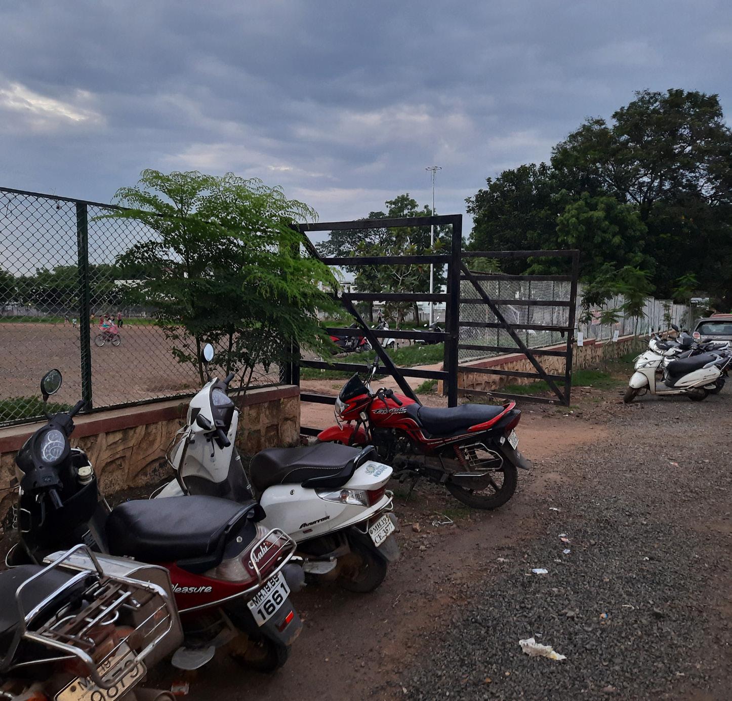
Fig. 1.1. Street view of Sagar park
2. Argument
A public place is the identity of the city. Public places are an integral part of city planning and development. Most of the time, public places in the city have tall walls or fences and are designed only for a particular activity. The defined nature of the form/spatiality of these spaces and their edges allows for a certain degree of appropriations and claims. There are large open grounds or places in the cities and people start using it in their own ways. These places are formed or get activated by people’s daily space-making activities like selling things, walking, meeting, playing, etc. With the absence of a defined edge, different activities start overlapping. For instance, in the morning, if vegetable vendors are occupying the place, then in the evening boys are playing football. And these series of activities throughout the day shape that place. I see this happening place as colours on a blank canvas; mixing and forming new shades.
The shape, boundaries of the place expand and contract with changes in events or activities. Edges mutate as the claims, and negotiations start happening by hawkers/ vendors. Edges start getting defined either by the territory of dogs, fully grown trees, temporary shelters by beggars or construction workers, parked vehicles, etc. Here, space and its edges get defined by these various actors on-site and its surrounding context. These are fuzzy and become spaces of social interaction, leisure, escapes as well as economic activities which improves the desirability of a community- in the sense place attracts people to visit and thus these undefined spaces of multiple claims and appropriations become active public spaces. Claims- for example, Migrant construction workers settlement forming beside one of the research sites. Appropriations- for example, food vendors keeping chairs and tables on one part of open ground to set up the stall; reformulation in available resources and spatialities.
Whereas public places which are developed and designed in specific ways do not have many possibilities for overlapping actors-activities at the same time. Public places are designated for certain activities and functions so the shape of the place is less flexible. Walls and compounds give a sense of
a privatized space and do not allow other acts of claiming and appropriations to happen like the open maidans with undefined edges. This renders these parks, gardens inaccessible to certain sections of society. That boundary restricts the acts of claiming and the overlapping of activities.
This thesis argues by understanding from the public spaces in Jalgaon, that public places happen when overlapping activities take place. The edge is blurred by actors and activities. The public place need not be designated for activities; it can be a free-flowing space accessible by animals, humans, birds, etc. This thesis intends to smudge the idea of ‘ideal public place’ and make it more relevant to the context.
3. Aim
Rethink the idea of public space and make it more relevant to the context.
This thesis aims to draw attention to the ‘untitled spaces’ in the city which became public places over the period. The open places are part of people’s everyday life where people would want to go every day for different activities and experience the space. These spaces allow me to reimagine the idea of public spaces in the emerging city and understand the production of the space through activities and spatialities.
4. Objectives
• To establish the relationship between the configuration of space, form, and life affords.
• Configuration of space would mean the edge condition, the activities, the vegetation, the size and shape, the terrain.
5. Research question
What spatiality makes an open space into public space?
14 15
2. Theoretical framework

16 17
Fig.2.1. Theoratical framework diagram
Conceptual framework
What is ‘Public’?
The simple and basic meaning of the word is a group of individual people.
Origin of word ‘Public’
Populus --- Poplicus --- Publicus --- Public Latin English
• Ordinary people in general
• The public also means a group of people who recognize it and organize themselves to address it is facing a similar problem. (John Dewey, 1927)
• जनता
• “It is impossible to conceive public place today outside the social idealization or generalization of a private place and its full product of modern capitalist society.”(Politics of public space, Setha Low and Neil Smith, 2006
What is ‘Public space’?
• Public space is a place that is generally open and accessible to people.
• Jürgen Habermas, the public sphere as “made up of private people gathered together as a public and articulating the needs of society with the state”
• Free from regulation and greater-lesser participation of the public. (Politics of public space, Neil smith & Setha low,2006)
What is ‘Open space’?
• Any piece of land which is undeveloped and accessible to the public
• It can be covered with grass, shrubs, or trees.
The basic understanding of public space is open to everyone. It can be in any form- digital or physical. It is a range of social locations like streets, parks, media, the internet, shopping malls, and local neighbourhoods. It is the place experienced at all stages in daily life from the spacelessness of the internet to public opinion, global institutions, and the economy. It is free from regulation and greater-lesser participation of the public.
What is ‘Spatiality’?
• Look at the space from a certain aspect or the quality of space.
• The effect of space on actions, interactions, entities, and theories.
18 19
1.
• Life between buildings- using public space
by Jan Gehl
Jan Gehl in his first chapter ‘Life between buildings’ talks about the activities that make streets happening and engaging.
Broadly activities can be categorised into three partsnecessary, optional and social activities. Necessary activities are everyday essential activities carried out in all conditions and independent of the external environment. Optional activities happen only in favourable conditions and exterior physical conditions. Activities depend on the physical environment of outdoor spaces. If the outdoor areas are poorly designed then only necessary activities will happen at the same time if it’s affording all types of activities necessary activities can take a longer time. He has derived this relationship between the quality of space and activities happening in it. Social activities are the resultant reaction to the space and people around. Spontaneously developing a connection with other people indirectly creates an overlapping network of all types of activities happening in better public spaces. So, different activities are resultant of the spatiality of public space. And spatiality that includes people, events, materials, edge conditions, built form etc. life between the buildings not only looks at social or recreational spaces but also a wide spectrum of communal spaces in cities and residential areas.
Public spaces enable the opportunities to see, meet, hear people and create connections on different levels. People chose to visit the places where these interactions or transactions happen on a higher level. People attract other people for different activities happening in the public area. Gehl defines activities as attractions. For example, choosing a lively street for a walk over a deserted one. In the same way, sitting in the front yard with a view of the street and more to see. So people make spaces public where there is more to experience, see, connect, etc. He discussed life between buildings
through outdoor activities influenced by spatial planning. One extreme of the city where multistory buildings with underground parking exist; gives less possibility to foot traffic and outdoor stays. Other conditions with closely spaced buildings with lively interstitial spaces turn into much better outdoor space; invites other people, activities, routine.
“Thisisalivingcity,oneinwhichspacesinsidebuildingsare supplements with usable outdoor areas, and where public spaceshaveamuchbetterchanceofworkingwell”(Lifebetweenbuildings,JanGehl,edition2011)
Gehl explains the close relationship between outdoor spaces and outdoor activities that can turn dead space into lively, happening public space.
20 21 2. Literature reading
by Prasad Shetty and Rupali Gupte
Writers of this article talk about ‘Public’ as the core of the entire city planning and infrastructure. ‘Public’ is considered as a clear entity. The idea of the public is considered without claims and negotiation by them. Further, they explained how planners look at the public and plan public infrastructure. Planner considers the road as pedestrian vehicular access with a neat, clean street. But when that same road converts into a shopping street, it does allow numerous activities to happen. The planner does not consider claims, appropriations over the road. They keep it simple and clean to avoid chaos while planning.
The streets or properties are defined by lines, points, polygons, edges in a cartographic manner. And typically properties defined by the administrative office show clear edges of the place. But in reality, the edges, sides are not as clean as they look on paper. It changes every hour of the day with different claims, negotiations, occupancies, etc. claims by hawkers, informal settlements; negotiations by shopkeepers leads to change in the form and shape of the site. It flexibly changes multiple times throughout the day. And this change or system can be considered while designing by the planner or administrations. But planners are obligated not to consider this to avoid mess and the administration will not be able to manage that. What happens most of the time is that these realities are ignored by the planner and considered in a specific, clean way. So the writers argue that ‘public’ is a produced idea not entirely established from existing. We produced the idea of the public for various reasons like- object of consumption, an ethic, as space and strategy.
Public as an object- an object to be consumed while planning or public art practices. With the example of an artist, writers argue that public art consumes ‘public’ as an object instead of art being an object. As it is curated, employed, spoken about in public in the whole process. It has been curated, by keeping public as a central idea. To support this argument,
they explained three types of art practices. One where the artist focuses on the cause against exploiters, advantage takers, oppressors, etc. the purpose of the art is to give a useful message for a cause. The second one in which the artist uses unusual materials for the cause. More than art, the focus shifts to the unusual use of materials and how it has become useful to art. The third one requires public engagement- forms installed in the gallery or performance, etc. so the public is either represented or addressed in the art.
Public as ethic- an ethic where the individual is answerable and accountable to the public. Writers give an example of a song in which the public is explained as an eye to society; knows everything inside out and keep watch on the individual. The public is a group of individual people but we consider it as a complete entity. The public is an invisible power where politicians, celebrities, and criminals have to answer but who is the actual public? Who are they really answering to? It is considered as an ethic to stand up to or we are answerable to.
Public as space- The local trains of Mumbai accommodate thousands of people daily. The journeys in local trains are active and eventful because of the travelling public. Here the public is everything- art, artist and the space. Local trains are the most active, lively public space in Mumbai. People have everyday routines synchronised with travelling. Many individuals come together and make it a public space. So the ‘public’ is space here.
Public as a strategy- the public is a produced idea to deal with or solve different issues. Writers talk about it through an example of a land allocation case in Bandra. Here the public is used as a strategy to get rights on the open space in Bandra. The strategy was used to save open space developers but at the same time, residents’ association used it to evict informal settlements from the open ground. The idea of the ‘Public’ is focused and pitched to complete the demands.
So, the overall summary of the article is that humans use ‘produced idea of the public’ in different ways (ethic, object, strategy, space and there can be more) which writers explained through different examples.
22 23
• The production of the public
3. Analytical framework
The public is a produced idea that is important for democracy in terms of public debate or public opinion. The conventional idea of public space is that it ‘holds’ public and has spatiality that is-
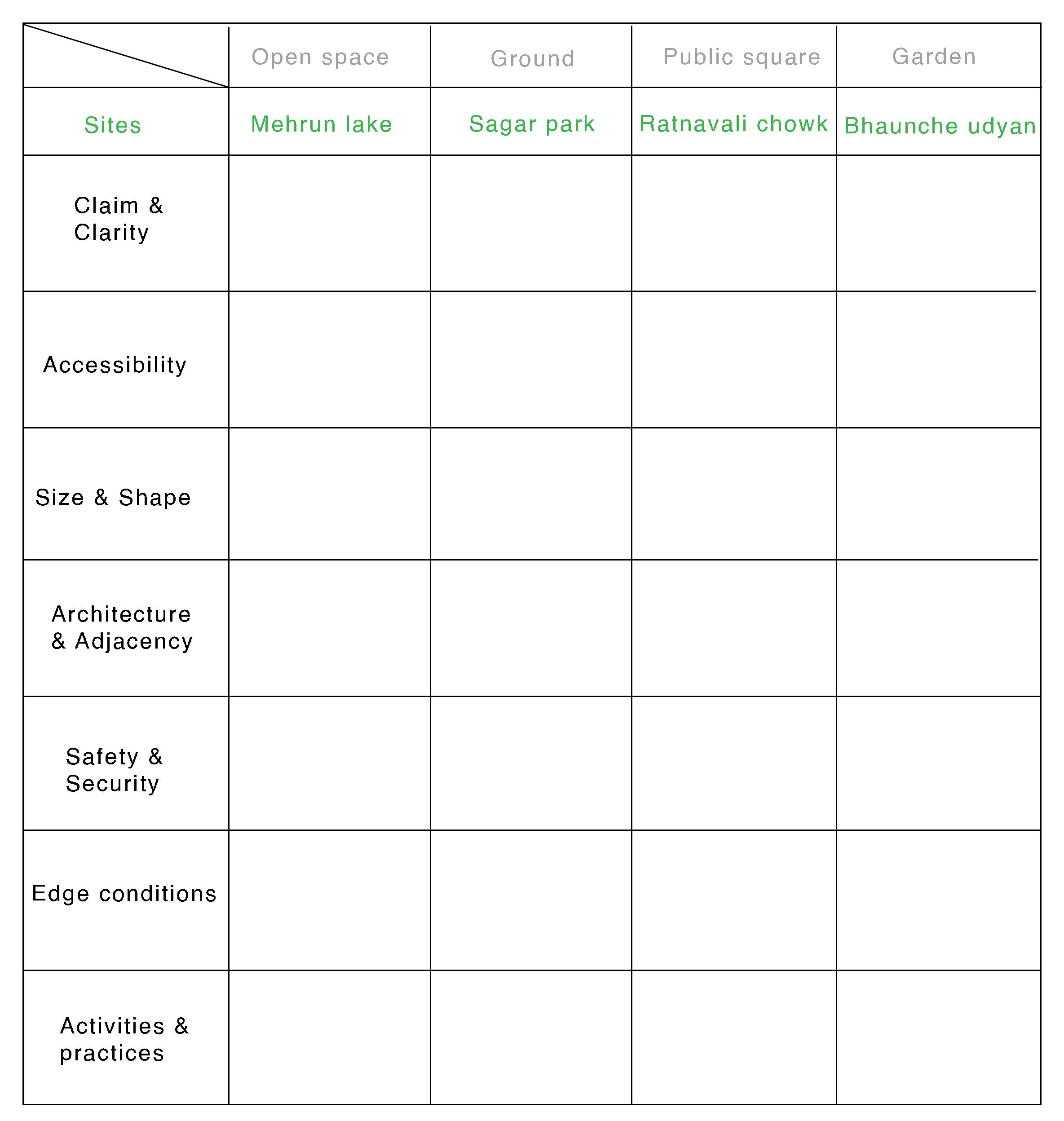
1. Unclaimed and clear
2. Open and accessible
3. Size, shape, proportion and architecture
In the following table, 2 public places have happened and 2 planned by the municipality in plans. All sites are compared with respect to - edges, adjacencies, activities, scale- proportion and forms.
24 25
Fig.2.2. Anlytical framework table
3. Research methodology
1. Methodology
The study started with asking people in my neighbourhood about their daily routine and where they go for a daily walk. Through the interviews, I asked them about public places in the neighbourhood or city. This collected initial data led me to the public places in the city.
In the second phase, I observed public places throughout the day and mapped down activities that are happening on the site. Also, through the site interviews, I understood the changes in edge conditions in the last few years and how that has affected the usability of the space.
2. Sampling
Mehrun lake, Sagarpark, Ratnavali chowk and Bhaunche udyan these four places are listed down based on initial interviews. These places fall under the category of planned and unplanned. Each of the sites is different in edge condition, adjacencies and spatiality. The study includes the comparison of all four sites.
26 27
3. Drawing strategy
Sinan Tuncay’s marketplace illustration opens up the space by showing the detailed activities of actors and flattens the built form around it. If you see in the artwork, it also uses part photography, but the space here forms a part of the same language as everything else. When you see the woman looking at some clothes, you also look at the stalls and the shopkeepers. When you see the man holding a sack, it makes sense because he’s in a marketplace. The buildings and the street get somewhat flattened so they work with the overall language of the collage which makes the whole drawing. So the idea is to extend the language of space through different narratives coming in one large illustration.

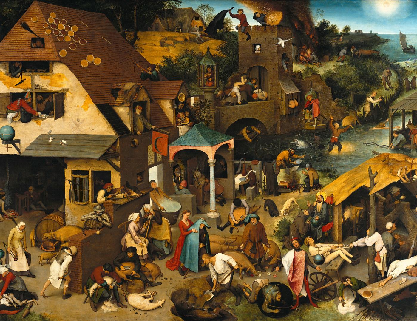
Pieter Bruegel’s Netherlandish Proverbs painting draws on multiple narratives in which humans, animals and objects show literal dutch idioms. The painting is one large drawing giving the idea of space with different architectural elements, landscapes and stories together.
The site study includes mapping of activities through on-site quick sketches. Drawing them over and over to get a clear sense of the site. Drawing as a ‘landscape scroll’ method has been used to show the whole site with detailed practices by actors on site. The drawings aim to show the relationship between the spatiality, activities, and different edge conditions happening on the site.
28 29
Fig.3.1. Sinan Tuncay’s painting
Fig.3.2. Pieter Bruegel’s Netherlandish Proverbs
4. Fieldwork and sampling
1. Mehrun lake
This lake is the identity of Jalgaon city. The word ‘Jal’ means water and this lake was the only drinking and irrigation source of the city in earlier years. Later on, the place turned into a waterbody that inhabits various species of birds and animals. Migrant birds and several other animals can be seen in this area which attracted bird watchers and tourists to the city.
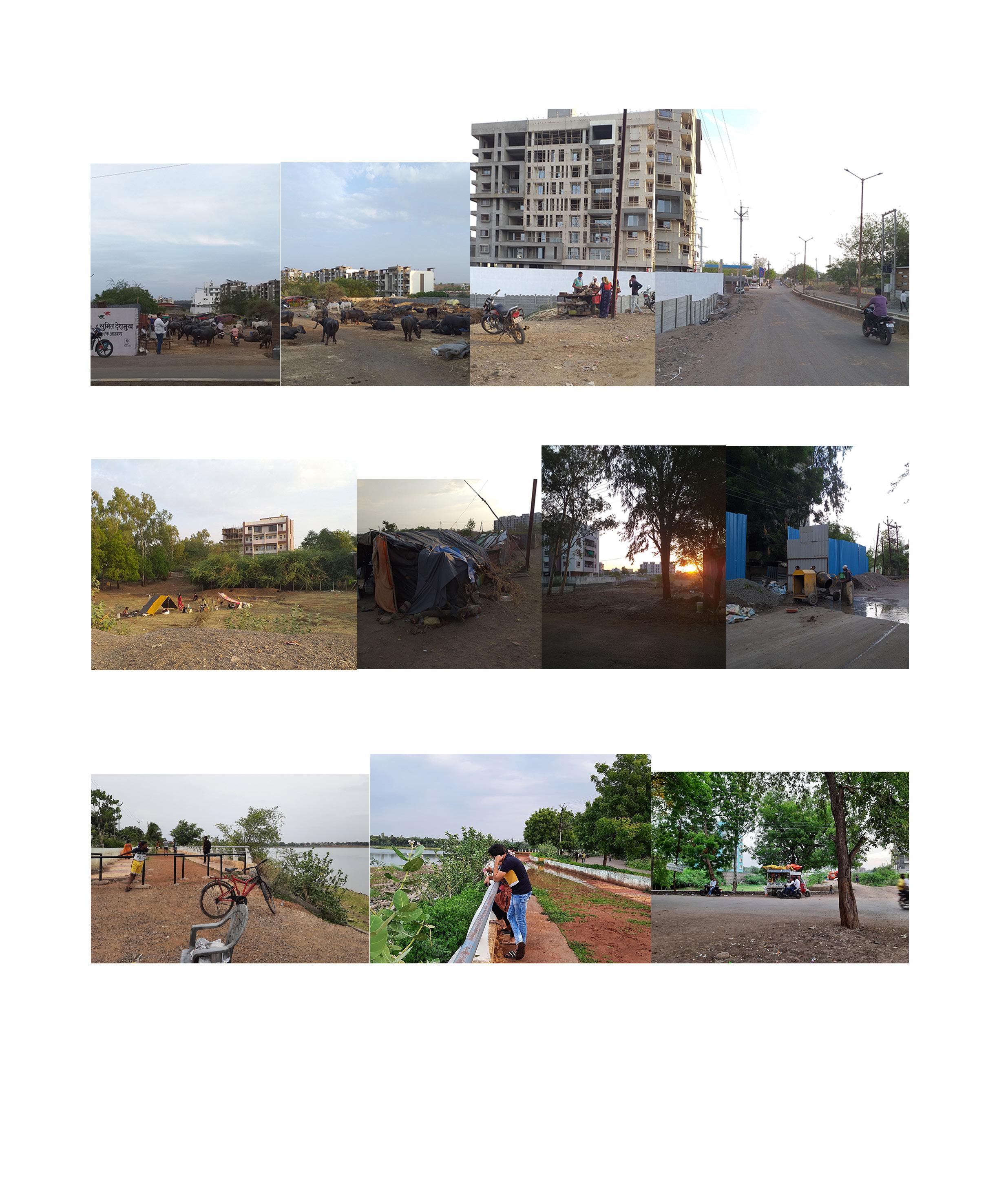
Initially, when I started interviewing people about the lake; most of the people replied as there are no other places to meet friends, go for a walk, to do exercise in an open place with nature but they also started saying about possibilities of different activities in that space.
As it is a sweet water lake it has good quality fish so some people from nearby settlements do fishing for their livelihood. New bungalows and housing projects are coming up in the surrounding area, so the open place near the lake edge is occupied with temporary tents of construction workers. Children of these workers swim in the lake, climb on the trees, and pluck fruits. That whole edge is like a playground for them. Some of them sell snacks, candies. There is one lady who lives in a village near to the lake who comes every day with a small tempo and sells snacks, packed food. She is famous for her homemade candies and sometimes people come there just to buy that. One of the accessing roads has had cattle sheds for the last 15 years. The owner of the cattle shed takes cattle every day to the lake. He let them be in the water for 4-5 hours till then he does fishing or swimming. Because of his everyday routine, people started asking if he could sell milk to them. Now he provides milk to the whole neighbourhood and he owns 3 more cattle sheds in that
31
Fig.4.1.1.Mehrun lake views
area. So the lake and surrounding area are giving possibilities to expand the livelihood of the nearby settlements. In the evening, families come there and park the car on the lake edge, take dogs for a walk which most of the time get into a fight with stray dogs. In the strict lockdown, some people used to feed these dogs. The police van always takes a round in the evening for surveillance as many crimes have happened in that area. The road has dense vegetation on both sides that makes it unsafe after sunset. Along the road, farmhouses and event halls make the place very active throughout the day.
While doing site visits almost every alternate day I made a new friend with an old uncle. He started telling me stories of the site from his time. This place used to be a dense forest with wild animals. So it was unsafe even for nearby settlements. Then the municipality started the development of the lake area. Concretization of roads; beautification of lake edge on one side with paved walkways, railings, and seating places. But other than this they have not changed anything which is why the place has held its importance for animals and humans.
This lake edge affords people from all classes, cast, and backgrounds. Of course, if the municipality ever decides to develop it and concretize the whole edge then the negotiations and claims happening subconsciously on site will be cleared out and it will also affect the livelihood of settlement around it. It will be very particular for activities like morning walks. This change will allow only a specific section of society as a user. The present scenario of the site makes it a better version of a public place.

33
Fig.4.1.2. Mehrun lake views
 Fig.4.1.3. Mehrun lake Narrative drawing


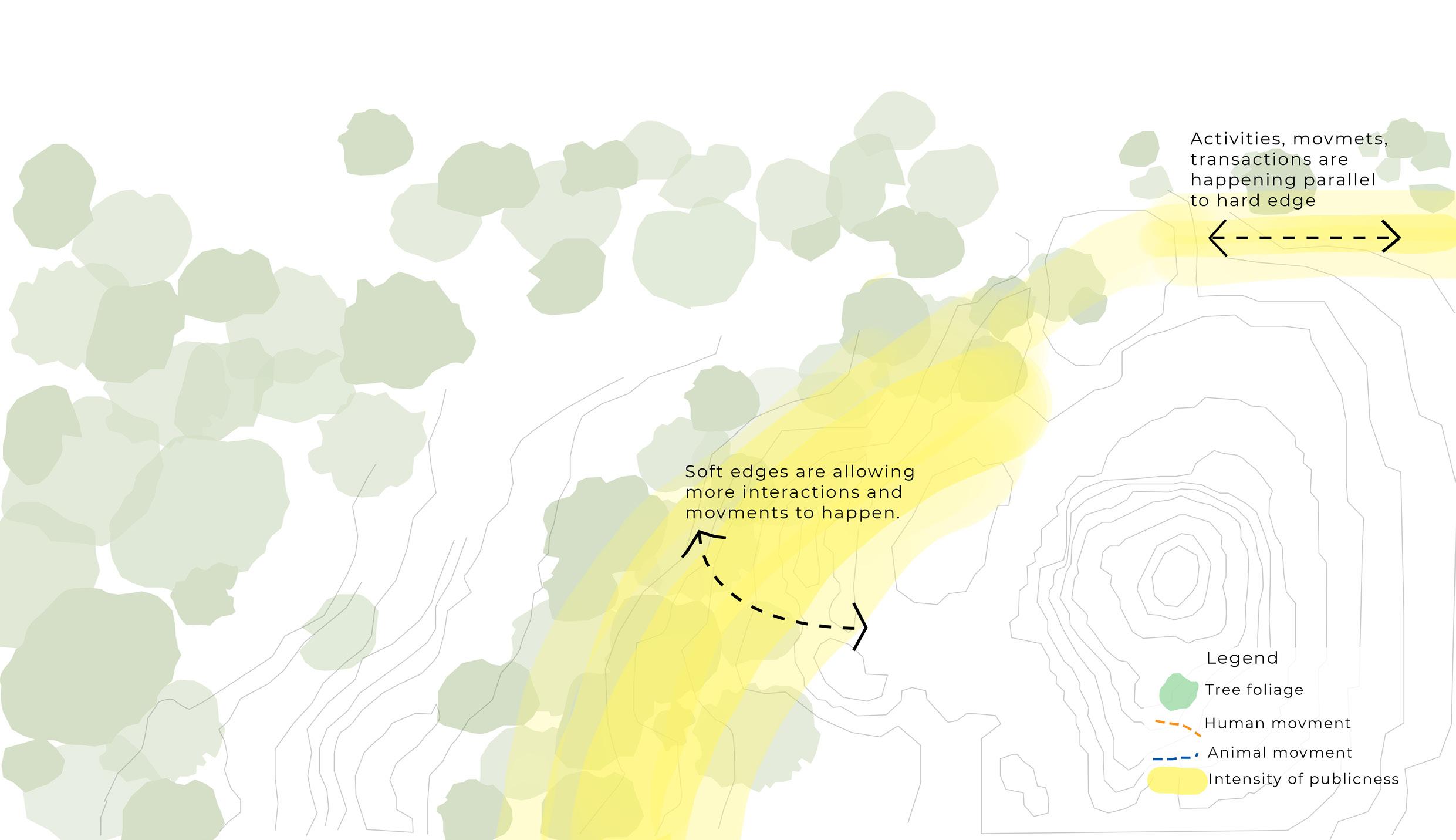 Fig.4.1.4. Anlytical drawing- Animal movment
Fig.4.1.5. Anlytical drawing- Human movment
Fig.4.1.7. Anlytical drawing of Mehrun lake
Fig.4.1.6. Anlytical drawing- Intensity of movements
2. Sagar park
It is an open ground owned by the municipal corporation mainly used for marriages, competitions, cricket matches, political rallies or meetings, festivals, etc. This place is situated at the heart of the city and is easy to access from anywhere. The neighbourhood around it has houses of political leaders, lawyers, etc. It is important to look at context while researching as these adjacencies and architecture shape the public spaces in that area.
While interviewing people on-site; an uncle said- “ I never used to come here for a walk but because of the pandemic all gardens are closed so I come here every day and one of the things I loved about this place is to watch the beautiful sunset, to see so many people doing different things.”
The site is a plain large open ground where people come to learn how to drive Among other things. Kids play football or cricket, children get into a bicycle or running races, the gym trainer comes with his group for a workout, old uncle aunties meet their friends every day.
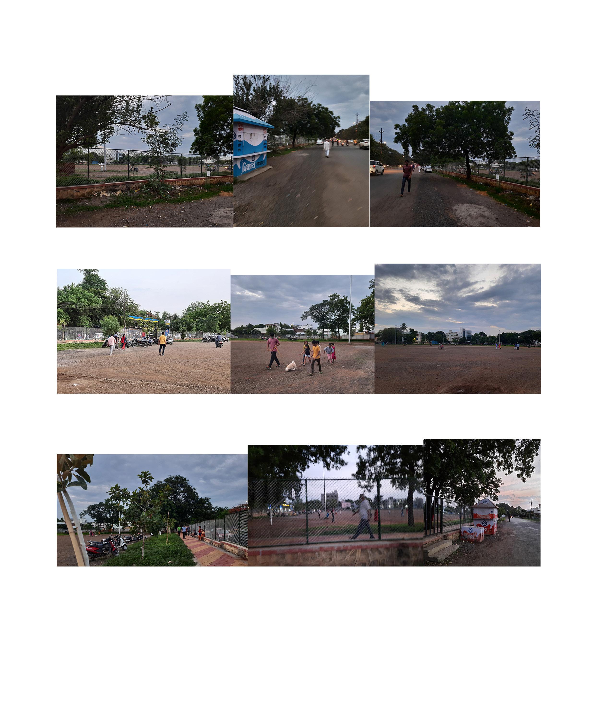
In the evening, the edge of this place became a ‘Khau galli’ (food street). Food street vendors used to set up their stalls with attractive lighting and make them attractive for the customers. Whenever political rallies used to happen there, people would occupy the adjacent streets; standing on dividers, crowding building terraces along with the site. This ground would be used as a helipad when Jalgaon did not have an airport facility. Police would barricade the entire junction as a security measure. Big fat weddings make this place noisy but very attractive to people passing by.
While talking to the uncle, who has owned the street shop for 5 years on the edge of the ground and road; I came to know that there was one shop on the east side of the ground but he started seeing the number of people visiting this place and events happening here so he decided to open the shop. Opening a shop here was an easy option for him as the popularity of the place has increased over time and many people started visiting the place.
39
Fig.4.2.1. Views of Sagar park
Recently the municipality fenced the ground from all four sides with the gate opening to the main road. Now the shop of this uncle is on the adjacent side, so the number of customers has decreased as people have to walk out and then go to the shop. Street food vendors are not allowed to set up their stalls. Now the crowd can not expand till the road or divider. This has resulted in monotony in terms of activities. In the evening people sit, chitchat, walk, jog and play. There is no other possibility to perform activities that will connect the road with the ground. The fence is defining the edge bluntly and not allowing the overlapping of activities, negotiations of claims. The growth of site qualities has been stunted in one sense.

41
Fig.4.2.2. Views of Sagar park
 Fig.4.2.3. Narrative drawing of Sagar park


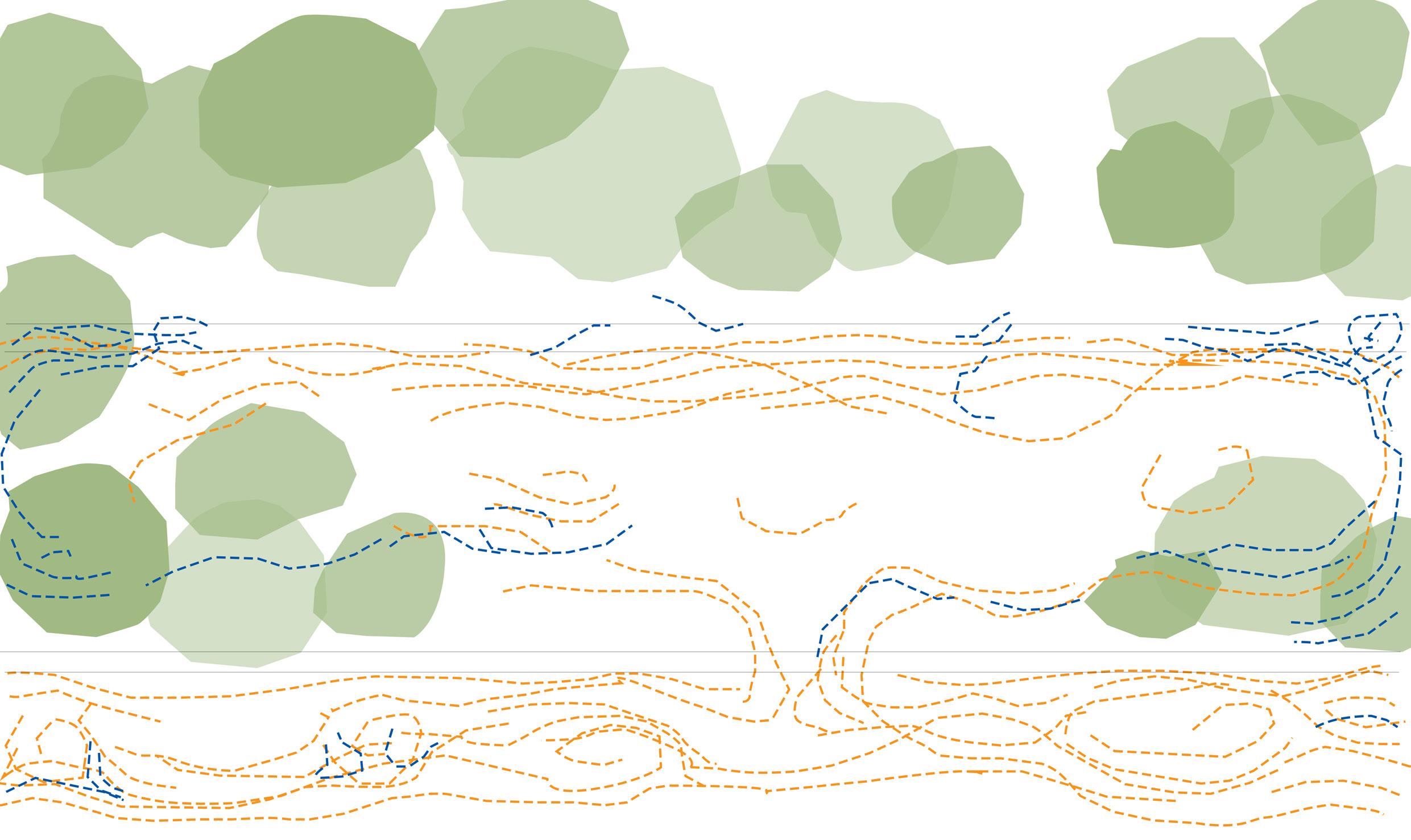
 Fig.4.2.4. Anlytical drawing- Animal movment
Fig.4.2.5. Anlytical drawing- Human movment
Fig.4.2.7. Anlytical drawing of Mehrun lake
Fig.4.2.6. Anlytical drawing- Intensity of movments
3. Ratnavali chowk
This chowk is the most crowded place in the Mahabal area. Surrounded by a commercial complex on one side and government housing on the other. Dense vegetation happens on either side of the chowk. This chowk was developed by one food company 7 years ago. That became the first planned and designed chowk in Jalgaon.
It is planned in such a way that on all four sides of the chowk there are seating areas and walkways. These seating areas are wide and comfortable with granite stone. Throughout the day, people sit and take a rest. There are fountains and greenery to enhance the space. Tired vendors sometimes lie down on the grass and take a nap in the afternoon. In the evening the place becomes very crowded. So hawkers selling balloons, candies, and toys set up shop on side walkways. Dogs come there to drink water from the fountain. Sellers from other villages come there to sell pots, vegetables, fruits, clothes, shoes, plants, sometimes even furniture. This place is part of people’s livelihood.
Yuva shakti club has installed a newspaper reading booth. So old uncles visit the place every day; they have also formed their laughter club. Many competitions and programs happen at this place. In the rainy season there will always be a ‘Kille banva’ (castle made from mud) competition, so that passing by people can cheer and encourage children. A lot of other festive activities happen.
The planning of this chowk is allowing many activities to happen without any crowding mishap. This overlapping of activities and burring of claims has made that place a better public place.

47
Fig.4.3.1. Views of Ratnavali chowk
 Fig.4.3.2. Narrative drawing of Ratnavali chowk


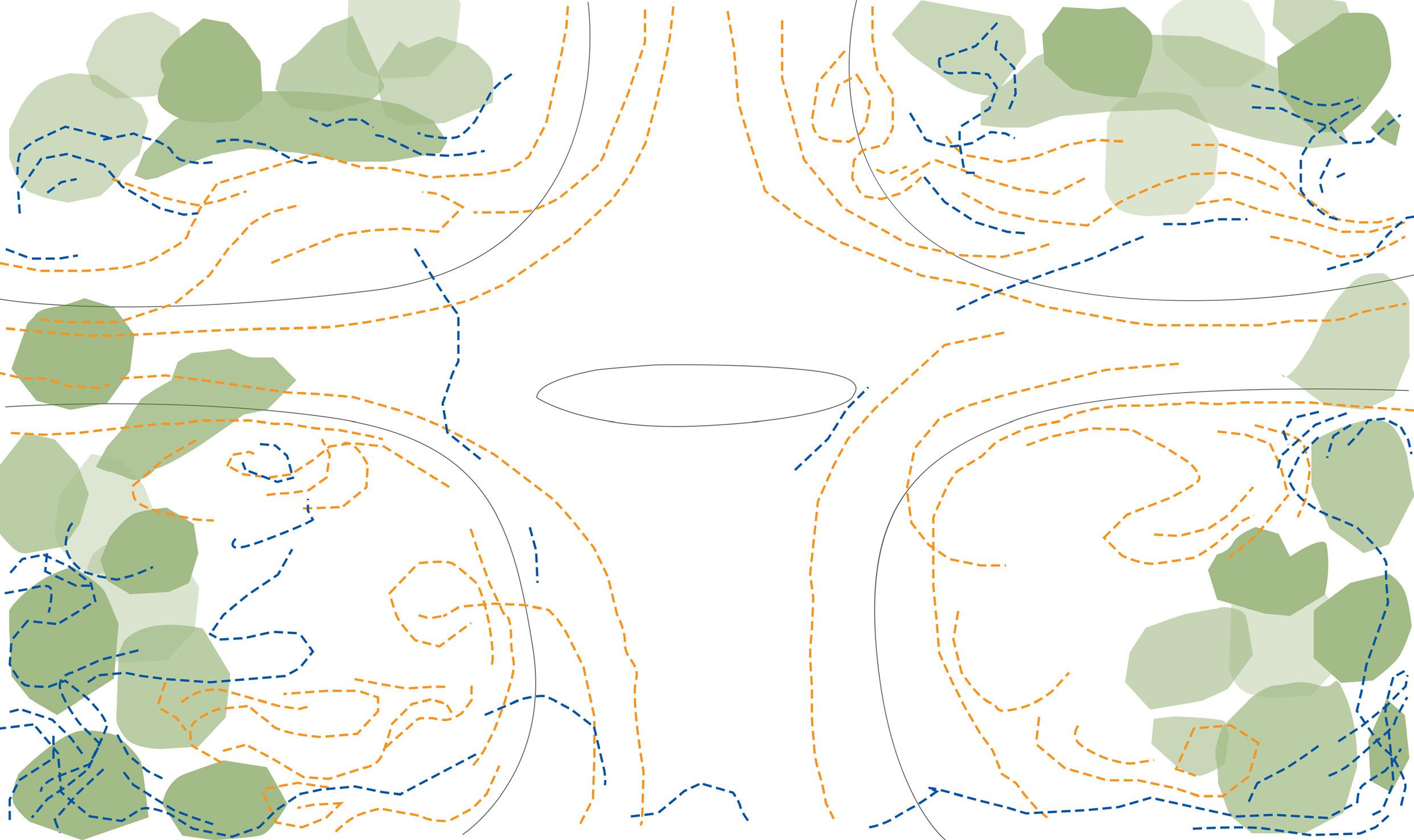
 Fig.4.3.3. Analytical drawing- Animal movment
Fig.4.3.4. Analytical drawing- Human movment
Fig.4.3.4. Analytical drawing- Intensity of movments
Fig.4.3.5. Analytical drawing- Animal movment
4. Bhaunche udyan (Brother’s garden)
This is the planned garden next to the Ratnavali chowk, it is one of the well-planned gardens in Jalgaon. It has a small amphitheatre, art gallery, exercise apparatus, jogging track and public toilet. The garden recently got developed by one company. The land comes under the municipality ownership but the company has developed it into the garden. And the company is maintaining the place right now. As the garden is next to the active public square (Ratnavali chowk) there is always a crowd in the morning and evening hours.

The garden opens early morning at 5 ‘o’clock. Most of the people come for a morning walk with peaceful Marathi devotional songs. Now they allow only 20-30 people at one time because of a coronavirus outbreak. But it was locked for many months even after lockdown. The garden is particularly planned for walks and a kids play area with tall compound walls.
The whole street turns into ‘Jatra’ mode every evening. Toy, fruit, food vendors start sitting along with the gate and footpath. People from nearby settlements and colonies come with their kids. On the opposite side of the road Chinese, Bhel puri, ice cream vendors set up shop by 7 or 7.30 pm. For the next two hours, it feels like a carnival with bright and colourful lightings, balloons. By 9.30 pm everything closes and people start occupying the sitting areas in the chowk.
Before the place went under development, it was an open space with dense trees, one temple and a city water tank. After the development, it has given many facilities to the neighbourhood but it has a tall compound wall. The beautification of the place attracts many people but that subconsciously restricts lower class people from visiting. The tall compound wall acts as a catalyst for not entering the garden. So even if the garden is well planned in terms of amenities, it is not able to afford all sorts of people from society. More than the garden, the street along the garden involves many transactional activities. The edge of this garden is very hard and rigid which is perceived differently (highly maintained and prohibited area) by common lower-class people.
53
Fig.4.4.1. Views of Bhaunche udyan
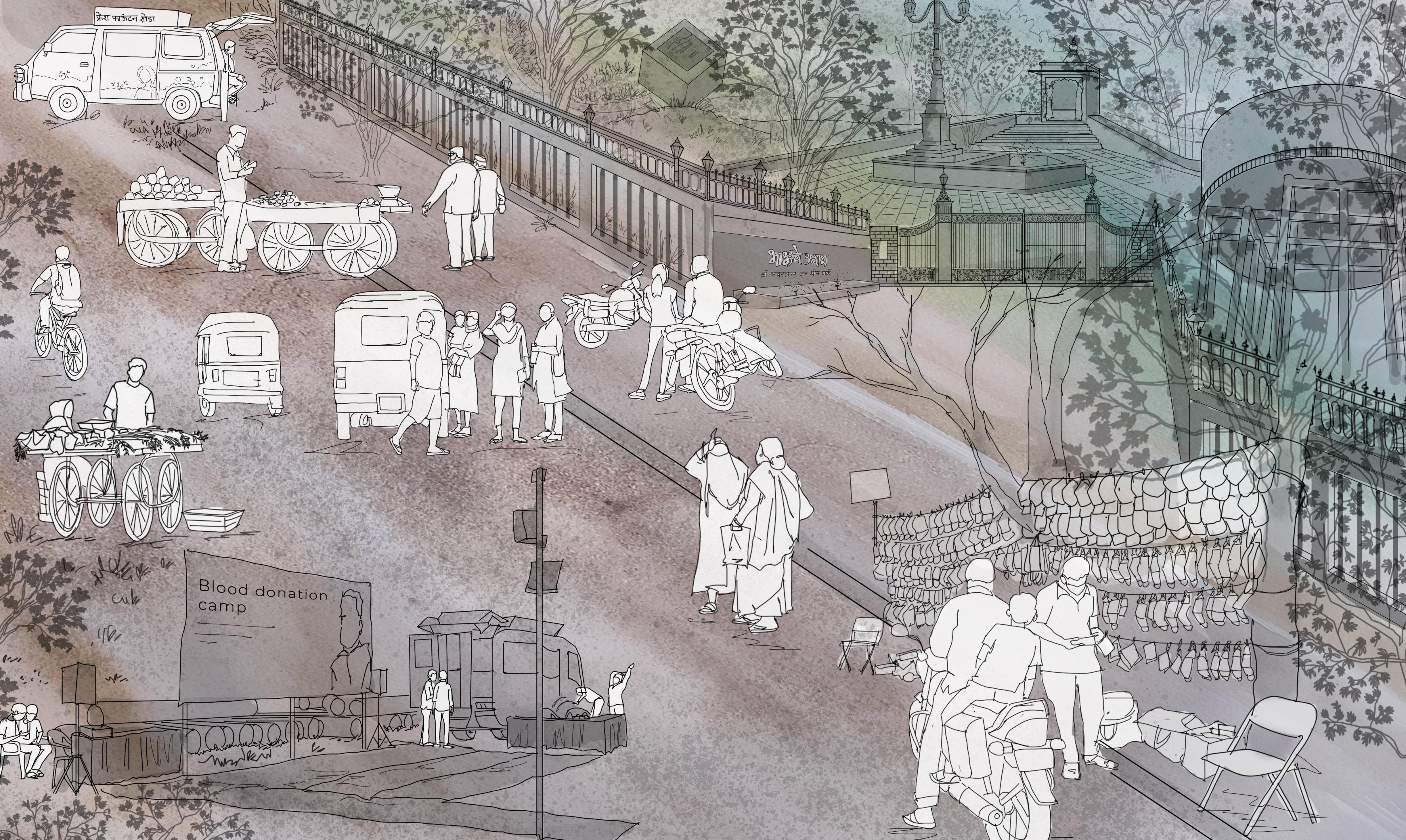 Fig.4.4.2. Narrative drawing of Bhauche udyan
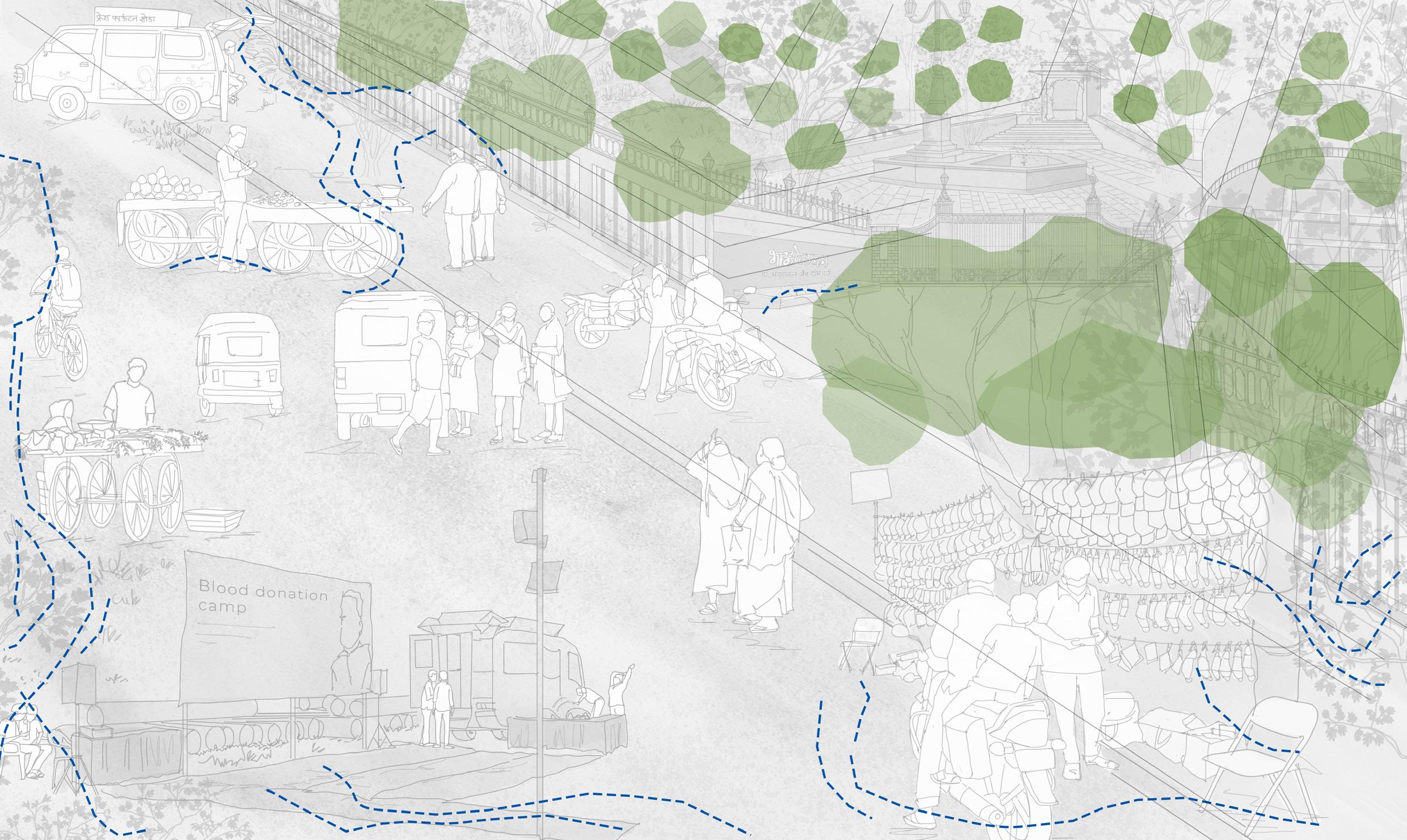

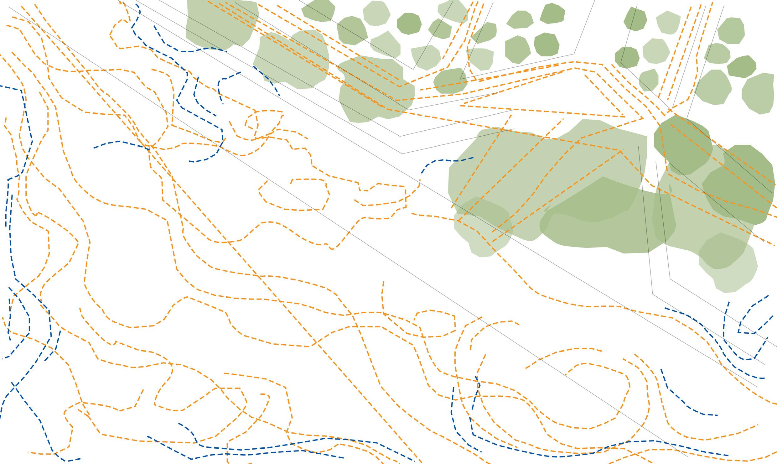
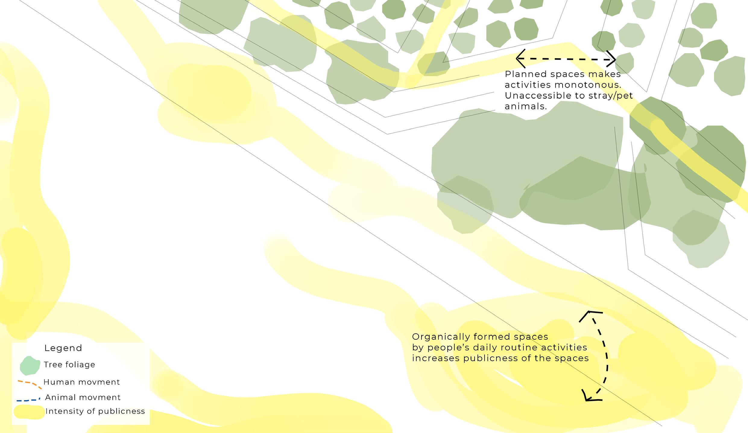 Fig.4.4.3. Analytical drawing- Animal movment
Fig.4.4.4. Analytical drawing-Human movment
Fig.4.4.5. Analytical drawing- Intensity of movments
Fig.4.4.6. Analytical drawing- Animal movment
5. Conclusions
1. Inference
From the research, comparison of all sites concludesThe edge of the Mehran lake smudges the activities and claims on-site. It is organically formed by people and affords all types of practices. Adding a fence in Sagar park made that place monotonous in terms of activities. It restricts the free-flowing nature of activities. Whereas in Ratnavali chowk, the planning of the space allows all sorts of activities to happen. So the planning plays a crucial role in the workability of the space. ‘Bhaunche udyan’ is the planned garden but the edge condition fails the space to serve its function.
This research aimed at understanding the relationship between publicness and space. Many arguments have emerged in the research that talks about this relationship.

1. Publicness can be generated in a place by several factors, few of the factors that are highlighted in this study are that of:
• Claim and clarity
• Accessibility
• Size and shape
• Architecture and adjacencies
• Edge condition
• Activities and practices
• Security and safety
58 59
Fig.5.1.1. Analytical framework table
2. The spatialities that increase the publicness of the space have been analysed through site studies.
1. Edge conditions- Edges of the open space holds a connection with the adjacencies, streets, space. The defined edge with a fence or compound wall resists the flexibility of the space which leads to monotonous activities. Hardening of the edge differentiates the spaces whereas soft edges let activities merge with surrounding and keep the flexibility of space. This increases interactions and the publicness of the space.

2. Proportion- The publicness of the space depends on the proportion of the adjacent built forms with respect to the open space. The width of the open space and the heights of the built form around it defines the user experience of the space. If the open space is huge and buildings are far away then interactions happen mostly on the edges. The central part of the ground does not get used as such. Also, these huge open spaces communities use for marriage or other cultural events leaves space littered thus edges become active.
Whereas if built forms are too close to each other then open space becomes less ventilated and a few times it turned into garbage spots for the buildings. The narrow dark, dingy open space between the buildings are not favourable for any activities to happen. Thus the height of the built form and width of the space proportion must be within 1:5.

60 61
Fig.5.1.2.1. Comparison of Edge conditions
Fig.5.1.2.2. Comaprison of different proportions- adjacent builtforms & open space
3. Neighbourhood type- If the open space is in the commercial area then most of the time it is used as a parking plot or informal market (bazaar) space. The open space loses its identity in market areas. Whereas in residential areas people use it in multiple ways like daily routine activities, independent sellers (thela valas), smaller events, etc. so neighbourhood around open space plays a crucial role in increasing its publicness.

4. Scale- The width of accessing or adjacent streets defines the usability of the open space. If the street is narrow then open space becomes part of the streets. Street starts overlapping with the open space. Vehicles and pedestrian movements increase but decrease the publicness. If the street is too wide then the total area of open space does not get used and transactional activities happen only on edge or street sideways. Thus the publicness of the open space increases with the moderate scale of open space with the street.

62 63
Fig.5.1.2.4. Comaprison of different Scales - open space & streets
Fig.5.1.2.3. Comaprison of different Neighbourhoods
5. The functions within space- Most of the planned public spaces do not consider activities currently happening on site which also pushes away the transactional capacity of the space and also limits the activities to very specific. Whereas open spaces developed by people’s daily routine practices have higher publicness. Public space must involve all sorts of activities, practices, routines of the context and people. This will help the public space to work much better and increase the publicness.

64 65
Fig.5.1.2.5. Comaprison of planned & unplanned open spaces

2. Publicness does inform the spatial character of a place in several ways, few of the characteristics of change that were established in the study are as follows:
• Smudegeness of the form-
The above factors like edge condition, adjacencies, scale and proportions, helps in smudging the actual form of the space. The space starts shaping and building with these factors. The resultant reactions in the process of shapingincludes and excludes some part of the surroundings that change the shape-size of the form constantly. The messily smeared patterns and activities become an everyday part of the public space. edge of this garden is very hard and rigid which is perceived differently (highly maintained and prohibited area) by common lower-class people.

68 69
Fig.5.1.3.1. Smudegeness of the form diagram
• Blurring of claims
Different actors and bodies claim different spaces in public areas, where the blur between the private, semi-public, public keeps increasing. Even the spaces are carved for semi-public purposes through various kinds of claims and appropriations. This results in blurring the sense of ownership and privacy in a place.

70 71
Fig.5.1.3.2. Blurring of claims
• Overlapping of activitiesSingle-use or purpose spaces reduces in number with the increase in publicness. Spaces start affording many functions at the same time. The transactional capacity of the affordance of spaces, for different kinds of functions, increases with the increase in publicness. Space becomes multifunctional. The spaces begin to lend themselves for leisure, markets, waiting, respite, work, etc.

72 73
Fig.5.1.3.3. Overlapping of activities
To conclude, the publicness of space increases with the increase in smudgeness of form, blurring of claims and overlapping of activities in the open space.
2. Usefulness to architects
The idea of a public place is different in an urban and rural context as the actors and social activities are different in both cases. The type of public places in the city cannot be part of village life even if the public has the aspiration to use such places. This may be because of various reasons such as - economic exposure, and a percentage of the population uses those amenities and lifestyles. That’s why the public place has to be relevant to the context.

Public places must be designed in a way that they will be open, free and accessible to humans, animals. The fencing and compounding of the edge of the public places detach the place from the outside environment and public realm.
The study intends to develop a lens to look at public spaces in the city. What is the architecture of the public spaces? This study introduces a new way to look at unseen or undervalued public spaces which have a big impact on people’s daily routine and livelihood.
74 75
Fig.5.2.1. View of Ratnavali chowk
6. Bibliography
1. References
Gehl, Jan. life between the buildings. 2011 ed., 1971.
Henery Lefebvre. The production of space. 1974.
Jeff Malpas. Place and experience: A philosophical topography. 1999.
Jonathan Daly. “Measuring human experiences of public spaces: A methodology in the making.” 2016.
Lefebvre, Henry. Right to the city. 1968.
Neil Smith & Setha Low. Politics of public space. 2006.
Prasad Shetty and Rupali Gupte. “The production of the Public.” Public issues, 2011.
Mara Holt Skov, performer. “Activating public spaces.” TEDxTwinFalls, 27th May 2016, https://www.youtube.com/ watch?v=5yB7xkiR5ts&list=PLvsHghZwABxsIe0fGb9PKxQGa2hFN888F&index=1&t=6s. Accessed July 2021.
Evelina Ozola, performer. “Architect’s hands: how can we design better streets.” TEDxRiga, 14th August 2015, https://www. youtube.com/watch?v=8iQnrM3DkVI&list=PLvsHghZwABxsIe0fGb9PKxQGa2hFN888F&index=2. Accessed July 2021.
Bjarke Ingels, performer. “Social Infrastructure.” TEDxEast, 18 July 2016, https://www.youtube.com/watch?v=8PItGf69eaw&list=PLvsHghZwABxsIe0fGb9PKxQGa2hFN888F&index=3. Accessed July 2021.
76 77
2. List of figures
Fig. A.1. View of Ratnavali chowk
Fig. A.2. view of Bhaunche udyan
Fig. 1.1. Street view of Sagar park
Fig. 2.1. Theoratical framework diagram
Fig. 2.2. Anlytical framework table
Fig. 3.1. Sinan Tuncay’s painting
Fig. 3.2. Pieter Bruegel’s Netherlandish Proverbs
Fig. 4.1.1. Mehrun lake views
Fig. 4.1.2. Mehrun lake views
Fig. 4.1.3. Mehrun lake Narrative drawing
Fig. 4.1.4. Anlytical drawing- Animal movment
Fig. 4.1.5. Anlytical drawing- Human movment
Fig. 4.1.6. Anlytical drawing- Intensity of movments
Fig. 4.1.7. Anlytical drawing of Mehrun lake
Fig. 4.2.1. Views of Sagar park
Fig. 4.2.2.Views of Sagar park
Fig. 4.2.3. Narrative drawing of Sagar park
Fig. 4.2.4. Anlytical drawing- Animal movment
Fig. 4.2.5. Anlytical drawing- Human movment
Fig. 4.2.6. Anlytical drawing- Intensity of movments
Fig. 4.2.7. Anlytical drawing of Mehrun lake
Fig. 4.3.1. Views of Ratnavali chowk
Fig. 4.3.2. Narrative drawing of Ratnavali chowk
Fig. 4.3.3. Analytical drawing- Animal movment
Fig. 4.3.4. Analytical drawing- Human movment
Fig. 4.3.5. Analytical drawing- Animal movment
Fig. 4.4.1. Views of Bhaunche udyan
Fig. 4.4.2. Narrative drawing of Bhauche udyan
Fig. 4.4.3. Analytical drawing- Animal movment
Fig. 4.4.4. Analytical drawing-Human movment
Fig. 4.4.5. Analytical drawing- Intensity of movments
Fig. 4.4.6. Analytical drawing- Animal movment
Fig. 5.1.1. Analytical framework table
Fig. 5.1.2.1. Comparison of Edge conditions
Fig. 5.1.2.2. Comaprison of different proportions- adjacent builtforms & open space
Fig. 5.1.2.3. Comaprison of different Neighbourhoods
Fig. 5.1.2.4. Comaprison of different Scales - open space & streets
Fig. 5.1.2.5. Comaprison of planned & unplanned open spaces
Fig. 5.1.2.6. Comapritive table
Fig. 5.1.3.1. Smudegeness of the form diagram
Fig. 5.1.3.2. Blurring of claims
Fig. 5.1.3.3. Overlapping of activities
Fig. 5.2.1. View of Ratnavali chowk
78 79
Supervisors
Prasad Shetty
Vastvikata Bhagat
School of Environment & Architecture
University of Mumbai
Ritu Naik
2021-2022
80 81
82


 Fig.4.1.3. Mehrun lake Narrative drawing


 Fig.4.1.4. Anlytical drawing- Animal movment
Fig.4.1.5. Anlytical drawing- Human movment
Fig.4.1.7. Anlytical drawing of Mehrun lake
Fig.4.1.6. Anlytical drawing- Intensity of movements


 Fig.4.2.3. Narrative drawing of Sagar park


 Fig.4.2.4. Anlytical drawing- Animal movment
Fig.4.2.5. Anlytical drawing- Human movment
Fig.4.2.7. Anlytical drawing of Mehrun lake
Fig.4.2.6. Anlytical drawing- Intensity of movments

 Fig.4.3.2. Narrative drawing of Ratnavali chowk


 Fig.4.3.3. Analytical drawing- Animal movment
Fig.4.3.4. Analytical drawing- Human movment
Fig.4.3.4. Analytical drawing- Intensity of movments
Fig.4.3.5. Analytical drawing- Animal movment

 Fig.4.4.2. Narrative drawing of Bhauche udyan


 Fig.4.4.3. Analytical drawing- Animal movment
Fig.4.4.4. Analytical drawing-Human movment
Fig.4.4.5. Analytical drawing- Intensity of movments
Fig.4.4.6. Analytical drawing- Animal movment


