
JACOBSONRYAN
adapting the next
design portfolio

• Led the research, writing and development of an urban design knowledge resource: Dimensions of The City • Key member of the DCP’s pandemic response and recovery team
JACOBSONRYAN
• Presented to a national organization (APA) to raise awareness for federal policy reform
• Added design support to a study on Resilient Industry
Urban/Landscape Designer Senior Urban Designer/Planner Focus Areas: Mobility Planning, Tactical Urbanism, Project Mangagement & Public Engagement
• Manage and mentor up to three junior staff members
• Created design regulations and waterfront public access requirements in three different neighborhoods Assistant Urban Designer (2014 - 2016)
Focus Areas: Flood Resiliency, Neighborhood Planning and Public Engagement
Senior Urban Designer (2018 - 2021, 2022 - Current)
Focus Areas: Design Review, Neighborhood Planning, Pandemic Recovery, Public Engagement, Urban Design Knowledge Products, and Waterfront Development
Urban Planner and Designer
I am an urban designer with 12 years of experience in the public and private sector. Through a diverse array of projects, I have acquired technical expertise in the planning and design of buildings, streets, sidewalks, landscapes, public spaces and most importantly, in understanding how these elements come together to impact public life. With people as the key focal point of my practice, I use visualization and facilitation techniques to help bring together the voices and stakeholders that ground planning ideas. What I find most rewarding in my work is the possibility to facilitate changes in the public realm that can lead to a more welcoming, friendly and resilient city.
• Contributed to a public realm plan and led coordination with local transportation, parks and public open space departments
• Co-led a report, Resilient Retail, on the challenges faced by commercial corridors within the flood risk zone
Focus Areas: Commercial Corridor Study, Design Review, Flood Resiliency, Neighborhood Planning and Public Engagement
Mobile: 847 529 4388 Email: rjacobson@planning.nyc.gov
Portfolio: tinyurl.com/raj2139 Website: Professional Experience
• Provided design feedback for over 25 waterfront development projects
Associate Urban Designer (2016 - 2018)
• Prepared project work plan and methodolgy for awarded tenders in North America and Europe
• Provided design-related feedback for 11 neighborhood flood resiliency plans
• Created curriculum and trained more than 100 agency staff in principles of urban design
STANTEC - LANSCAPE ARCHITECTURE + PLANNING
• Established relationships with colleagues at other city agencies to bring more awareness to design quality of waterfront developments
• Contributed to the guidebook: Retrofitting Buildings for Flood Risk
• Developed tools and strategies for engaging residents and business owners of a very diverse neighborhood in Queens
UNITED NATIONS Urban Planning Intern COLUMBIA UNIVERSITY Post-Graduate Research 2014 - 2021, 2022 - Current 2021 - 2022 2013 - 2014 New York, NY
20132013
Associate
• Led policy committee meetings for waterfront open space and design considerations
MOBYCON - SUSTAINABLE MOBILITY NYC DEPARTMENT OF CITY PLANNING
NewNewNewNetherlandsYork,NYYork,NYYork,NY
• Implemented a series of tactical urbanism projects for Park(ing) Day
wordpress.comryanalanjacobson.
• Led development of a cycling master plan and safe way to school projects in Europe
• Coordinated the agency’s input for the Open Restaurants program (Covid-19 recovery)
Delft, The
EDSA - PLANNING, LANDSCAPE + URBAN DESIGN Landscape Planning & Design Intern 2008 - 2009 Fort Lauderdale, FL ARGOS DESIGN Landscape Planner & Designer 2010 - 2012 Bloomfield, NJ and Cairo, Egypt
• Received in recognition for contributions as part of the Covid-19 pandemic response team
LEED GREEN ASSOCIATE CONGRESS FOR NEW URBANISM CLIMATE SUMMIT
• Presented relationship between urban design principles and flood adaptation strategies in NYC
• Obtained certification as BYPAD auditor Received an executive education certificate for completing 5-week course
PURDUE UNIVERSITY Master of Science in Architecture and Urban Design
MIKE LIN GRAPHICS WORKSHOP
Bachelors of Science in Landscape Architecture 2012 - 2013 20052007201420162020202120182017 - 2010 New York, NY New York, NY New York, NY New York, NY Virtual (EU countries) Amsterdam, The WestAlexandria,NewNewNetherlandsYork,NYYork,NYVAManhattan,KSLafayette,IN
• Received for participation as a member of DCP’s WERC Leadership Team
• A comprehensive analysis of retrofit options available for buildings in NYC’s floodplain
LIC WATERFRONT DESIGN
• Contributed as a reviewer to the latest update of the City’s Street Design Manual
GUIDELINES
• Principles intended to foster a sense of place around one of NYC’s emerging neighborhoods
•
•
• Received an award for emerging young professionals at the Department of City Planning
• Obtained LEED Green Associate accreditation Presented research on challenges faced by retail uses in the floodplain Certificate of Completion in Architectural Hand Graphics
Publications,Education Awards & Other Credentials COLUMBIA UNIVERSITY AMERICAN PLANNING ASSOCIATION CONFERENCE RESILIENT INDUSTRY BICYCLE POLICY AUDIT (BYPAD) TRAINING UNRAVELING THE CYCLING CITY DIVERSITY, EQUITY & INCLUSION AWARD OUTSTANDING SPECIAL ACHIEVEMENT IN SERVICE TO YOUR CITY AWARD STREET DESIGN MANUAL - NYC DOT BARNEY RABINOW AWARD RETROFITTING BUILDINGS FOR FLOOD RISK RESILIENT RETAIL
PROJECT LOCATION 07 - 15 17 - 23 25 - 29 31 - 35 37 - 41 57 - 63 77 - 79 88 - 89 43 - 55 65 - 69 90 - 91 71 - 75 92 - 93 81 - 8592 - 93 [PAGE #]*

Selected Works from Academic & Professional Career CONTENTS AREA OF EXPERTISE Animation, Film & Photography CommunityArchitectureDev. & Master Planning District & Regional Planning Landscape Architecture Public Space Design StreetscapeResearch Transportation-RelatedDesign Planning Urban Design PolicyACDLPRSTU 07 - 15 LAND USE & FLOOD RESILIENCY POLICIES 17 - 23 RETROFITTING BUILDINGS FOR FLOOD RISK 25 - 29 31 - 35 LARGE-SCALE DEVELOPMENT STUDY FLUSHING WATERFRONT REZONING STUDY 37 - 41 CHINATOWN SIDEWALK STUDY 43 - 55 READING BETWEEN THE LINES 57 - 63 SPATIAL MIXOLOGY 65 - 69 CONTESTED TERRITORIES 71 - 75 THE SIXTH SENSE 77 - 79 81 - 85 CORNING PRESERVE MASTER PLAN CITY CENTRE PLAN 88 - 89 URBAN STATIC 90 - 91 RECYCLING TERMINAL WORKS 92 - 93 COMMUNITY BUILDING EFFORTS F L LLL L RS S FFAAAAA CCC DDD P PP RR R T T UU UU U C D P P RR R TTT UUUFF SSSSSS AA C CC P PP R L SC P
DESIGN PORTFOLIO • URBAN DESIGN6
New York City Flood Zones
As part of the Climate Resiliency team in our Department I had the opportunity to work on various climate adaptation policy challenges that are currently in progress, including the Resilient Retail and Resilient Industries Initiatives. While the first major land use changes regarding flood resiliency in New York City were focused on residential land, there are still many questions about how to handle non-residential uses as they typically have equally stringent regulations. How does the city strengthen retail corridors that lie within the floodplain and what are the best ways to protect waterfront industrial sites during storm events? For each of these city-wide planning studies a methodology was undertaken to characterize similar traits and group them into typologies that could be accessed at the city-level scale. The Resilient Retail Study was broken into corridors that were organized by lot size, lot coverage, street wall presence, pedestrian activity, abundance of shared walls and building heights. Each retail street was then analyzed for building retrofit challenges, regulatory implications and ability to obtain or retain flood insurance. The Resilient Industries Study was tackled by creating prototypical sites that were organized by type of use and common characteristics found within that use. This may include: building size, construction type, multi- vs. single building sites, shoreline treatment and a variety of others. Each prototypical site was then analyzed for its operational challenges, building retrofit options (if present) and regulatory implications.
NYC Department of City Planning LAND USE & FLOOD RESILIENCY POLICIES N


As a significant part of the exercise in analyzing each retail corridor, we produced a physical profile that linked common characteristics. We found three different retail typologies across New York City: the dense, mixed-use corridor, the retail street with varied ground floor uses and the auto-oriented retail design. Illustrated on this page is the dense, mixed-use typology, which may include: Avenue C in the East Village, 1st Avenue in East Harlem, Van Brunt Street in Red Hook and so on. These are all primarily neighborhood-serving corridors comprised mainly of local small businesses at the ground level with residential units above. Most buildings are attached, tenement-style buildings with common flood resiliency challenges related to shared walls, presence of cellars and siting on small lots with dense building coverage. FEMA recognizes elevation as one option for non-residential uses to retrofit, which is not appropriate in this context since commercial uses are limited to the ground floor and floor to ceiling clearances may not be high enough for elevating. The other option is dry floodproofing (shown on previous page), which far exceeds budgets and storage capacity for small businesses.
LAND USE + FLOOD RESILIENCY POLICIES 9


2. Post-Sandy Condition (following page, top image) - flood insurance required for many new buildings, which now must retrofit and realize major resiliency challenges
3. Future Condition (following page, bottom image)- many businesses face are impeded from making resiliency investments and cannot afford to stay in business with flood insurance rates. Facade geometry and vertical articulation add texture to make an interesting ground plane that is fun for walking
DESIGN PORTFOLIO • URBAN DESIGN10
Setting aside the flood resiliency issues that were being analyzed, we illustrated the physical and programmatic elements (noted on images) that make up the characteristics of an ideal retail corridor. Many of these were observed in our New York City case studies of corridors in the floodplain. Due to rising sea levels many corridors are in jeopardy of loosing their identity and the small tenants which provide for such a variety of critical neighborhood services. This and the following page are meant to illustrate a sequence of events:
1. Pre-Storm Condition - a healthy, retail corridor offering a variety of options with bustling activity


11LAND USE + FLOOD RESILIENCY POLICIES

DESIGN PORTFOLIO • URBAN DESIGN12 Corridor-wide Resiliency Challenges Potential Implications After Flood


13LAND USE + FLOOD RESILIENCY POLICIES


DESIGN PORTFOLIO • URBAN DESIGN14 Prototypical Industrial Site - Existing Conditions Prototypical Industrial Site - Resiliency Considerations


The Resilient Industries Initiative explores land use policy from a similar lens, but focuses more on the operational aspect since many industrial buildings aren’t facing the same siting constraints as residential, commercial and mixed-use buildings. As mentioned previously prototypical sites were selected as a means for analyzing industrial sites and communicating common resiliency challenges that groupings of similar uses have faced. The industrial uses targeted were: film and entertainment studios, food distribution centers, construction and warehousing, petrochemical facilities, manufacturing and storage warehouses, maritime companies, waste and recycling facilities, small fabrication centers and larger industrial campuses with multiple tenants. Within each use we created a prototype that was generated from surveying related companies on operational challenges, site conditions, building typology, loading and parking layouts, insurance coverage, and their experience during and following Superstorm Sandy. With that information we illustrated a before condition that documents current regulatory implications, structural shortcomings and environmental impacts that similar businesses faced. We found that most businesses were very well-versed when it came to understanding complex insurance policies, had established new emergency preparedness plans for future storms, and some had made minor flood resiliency investments (raising valuable equipment, purchasing flood panels to be installed around doorways, etc.). However, many businesses had not considered re-evaluating their site design in order to better protect vulnerabilities and improve recovery time after a storm. Based on our understanding of existing conditions for each of the prototypes we illustrated a menu of “resiliency considerations” that businesses may want to examine as climate conditions change over the upcoming years. For the manufacturing and storage warehouse (to the left) we suggested a series of building retrofits that could help preserve the existing structure while protecting essential electrical equipment. We recommended that the site plan be re-evaluated to help achieve efficiency in operations within the smallest possible footprint to make room for a more substantial shoreline protection measures. The shoreline edge condition illustrated on the bottom left would dramatically improve ecological conditions, mitigate upland water channelization and help stabilize the eroding concrete bulkhead. In tandem, these illustrations were meant to identify resiliency impediments in current federal flood policy. There are many cases where it is not realistic for business owners to make substantial resiliency investments because the cost benefit ratio does not make sense nor do their buildings face as significant of structural challenges.
15LAND USE + FLOOD RESILIENCY POLICIES

DESIGN PORTFOLIO • URBAN DESIGN16
NYC Department of City Planning Consulting for: NYC Office of Emergency Management (Hazard Mitigation Plan)
This report analyzed and illustrated retrofitting options for ten real-world case study buildings reflecting many of the most prevalent typologies within New York City’s floodplain, including the most challenging buildings to retrofit. In developing each case study, common siting challenges encompassed a wide range of conditions that were taken into account. Overall, a range of adaptation strategies were demonstrated through the use of illustrative before and after renderings to reflect the challenges and variety of solutions that were applicable to each different structural type. For example, retrofitting strategies may differ for a detached wood frame building on non-structural footings and a detached wood frame home on a masonry foundation. For each of the ten case studies, the report presented the site and block configuration, and construction type. It also detailed the retrofitting measures available and any associated design challenges that tend to highlight potential regulatory constraints. The primary focus of this report was to unpack strategies that qualified a building for reduced insurance premiums under the National Flood Insurance Program (NFIP) and satisfy the flood-resistant construction requirements of Appendix G of the New York City Building Code, which apply to new and substantially improved buildings. In addition, this report explored practical alternative strategies that would reduce flood risk for buildings, even though under current regulations these measures may not lower insurance premiums or comply with NFIP standards. This section especially addressed a need for restructuring federal standards to allow for broader options to becoming flood resilient.
RETROFITTING BUILDINGS FOR FLOOD RISK
New York City Flood Zones
N

MULTI-FAMILYBUNGALOW UNIT (NON-BUNGALOW)
6,354 buildings / 9% of total 6,354 residential units / 3% of total 3,480 buildings / 5% of total 22,570 residential units / 9% of total 25,860 buildings / 36% of total 29,310 residential units / 12% of total 13,690 buildings / 19% of total 20,990 residential units / 8% of total 690 buildings / 1% of total 33,400 residential units / 13% of total 920 buildings / 1% of total 121,650 residential units / 48% of total
6 STORIES OR LESS, WALK-UP 1-4
MULTI-FAMILY OR LESS UNIT
6 STORIES
W/ ELEVATOR 1-4
DESIGN PORTFOLIO • URBAN DESIGN18
DETACHED
MULTI-FAMILYSEMI-DETACHEDABOVE6STORIES


RETROFITTING BUILDINGS FOR FLOOD RISK 19 1-4 UNIT ATTACHED 9,320 buildings / 13% of total 16,450 residential units / 6% of total Understanding New York City’s wide range of building conditions was key to developing the right set of adaptation solutions. The number of buildings in the floodplain in New York City is among the highest in any city in the United States. There are 71,500 buildings in the 100-year flood zone in New York City, as shown on FEMA’s Preliminary Flood Insurance Rate Maps (PFIRMs) issued in December 2013. These buildings house roughly 400,000 people, making the population of New York City’s floodplain comparable to entire population mid-size cities such as New Orleans, Cleveland or Tampa. The retrofitting solutions unfolded in the report may be applicable to many older cities which share similar building typologies with New York City. The building profile (to the left) highlights the prevalence of lower density homes within the floodplain. These include the bungalow, detached and semidetached building typologies. In comparison to larger buildings, these tend to be the most vulnerable to flooding due to limited structural reinforcement and lack of financial investment in flood protection systems. For that reason I have included an example of attached building (on the following pages), which faced similar vulnerabilities in addition to much more complex retrofitting challenges.

UnitUnitUnitCellar122
Three-story constructioncombustiblewith unreinforced masonry bearing party-walls and wood joist on a rubble foundation.
All systems are located in the cellar. The allowable building height is measured from the DFE. The floor area is overbuilt, which is an existing noncompliance. Zoning allows the relocation of existing non-compliant floor area to above the DFE within the adjusted bulk envelope.
SYSTEMSSTRUCTURAL
ENVELOPEZONING ACCESS Building access is provided at two front entrances, one located 5’ above sidewalk grade and the second located 4’ below sidewalk Thegrade.building access at the rear yard is provided at rear grade, 4’ below the sidewalk grade.
SYSTEMSCRITICAL
DESIGN PORTFOLIO • URBAN DESIGN20 14’ DFE = BFE + freeboard ELEVATIONFLOOD = 12’ above occupiablelowestfloorand lowest property grade


21RETROFITTING BUILDINGS FOR FLOOD RISK DFE +14’ Grade +6’
The attached, rowhouse typology faces some of the most significant retrofitting challenges in comparison to other typologies. Attached buildings share a party wall with their adjacent neighbors and are typically sited on fairly small lots, making it difficult to reconstruct. While this typology is more structurally sound than other lower density buildings their ability to retrofit is typically far-fetched. The shared wall and presence of cellars pose significant collaborative challenges, since what one building owner does to improve their building will highly impact the other’s structure. An equally impactful concern was maintaining the strong character of the neighborhood. As shown in the retrofit option on the subsequent page, an elevation was one of the only viable options to lower flood insurance premiums. This strategy puts a major strain on access to units, streetscape activity and contextual building heights. As an initial step to answer these issues we designed a set of streetscape mitigations that a building owner must provide when elevating their building in both residential and commercial districts.

ELEVATE & FLOODPROOFWET Unit 2 Unit 2 Unit 1 Access/Storage Mech.Room Access/Storage
SYSTEMSCRITICAL
Elevate systems on a platform above the DFE within new fireproof and vented mechanical room. Install sump pump with an emergency battery pack and discharge above the DFE. New building height requires installation of sprinkler system.
SYSTEMSSTRUCTURAL
STREETSCAPE
Wet floodproof area below the DFE by installing flood vents located at all exterior and interior walls and replacing all windows, doors and finishes with flood damageresistant materials. Fill basement and cellar to lowest adjacent grade. Relocate the square footage from the areas below the DFE to the new Elevateaddition.critical systems to a platform above the DFE.
Convertaddition.first level to porch, storage, access and mechanical room. The building remains 2-family. Relocate the garden level unit to the second story and the duplex unit to the new third and fourth stories. New entry vestibule to allow for reconfigured circulation. There is a total loss of 370 s.f. of floor area due to reconfigured unit and new interior access layout. USE Add plantings and porch to fulfill the zoning streetscape mitigation Replacerequirements.windows at streetwall elevation below the DFE with flood damage-resistant materials and install planters in front of the facade.
Relocate uses from the basement level and first level to the two story
DESIGN PORTFOLIO • URBAN DESIGN22
All doors below the DFE are required to be wet floodproofed by installation of flood vents. Modify the height of the front and rear building entries at the adjusted lowest level. Existing entrance at the front stairs to remain. Interior layout of this entrance reconfigured to accommodate the new vestibule and front porch. ACCESS Remove existing floor plate and slab, and fill the cellar and basement to lowest adjacent grade. Add reinforcement to the foundation walls. If the adjacent properties are not infilling their shared party wall areas, reinforce the foundation walls to account for new load. New addition at roof and platform for critical systems require additional structural support.


All wet floodproofed areas must be constructed of approved materials and contain vents that allow water to flow horizontally and vertically. It is important to prohibit buoyancy loads to build up in air pockets that could form in between the floor framing.
23RETROFITTING BUILDINGS FOR FLOOD RISK
The only NFIP compliant option for the rowhouse was to wet floodproof all area below the DFE and abandon those living quarters to be replaced with legal uses (access or storage). The lost units could be relocated on an addition above the roof, but there would remain a net loss in residential floor area, as well as a significant impact on contextual building heights. As a streetscape mitigation the owner is required to provide either a planted front yard, stair turn or covered porch. Each of these components help to reconnect the elevated home to the street and re-activate the sidewalk experience.
Hydrostatic Forces
When wet floodproofing between two floors, the homeowner must follow important steps to ensure the floor plate does not collapse.


DESIGN PORTFOLIO • URBAN DESIGN24
LARGE-SCALE DEVELOPMENT STUDY
NYC Department of City Planning
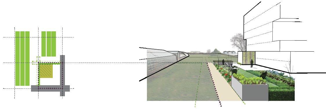
Queens Waterfront As a burgeoning development market continues to create a new skyline along the Queens waterfront, New York City made it a priority to study an essential string of sites along the East River. While much of this new development has consisted primarily of high-rise residential buildings the concept was to shape a vibrant, mixed-use district that maintained the look and feel of its industrial past and contributed a significant amount of new jobs to the borough. In order to achieve that aesthetic we used a concept called “packing the bulk,” that distributed as much floor area as possible closer to the ground plane, creating larger bases that would more seamlessly blend into the existing context. Those building bases would then be subject to a number of requirements (i.e. higher floor to floor heights, freight elevator, proper ventilation, etc.) that would help attract light industrial, retail, community facility and TAMI uses. In addition, we explored the waterfront public access requirements to verify that we were achieving a varied programmatic experience along the waterfront and were well adjusted for designs that demonstrate sea level rise adaptation.


A major guiding principle of this study was its potential for completing a waterfront greenway that would connect two destination parks and terminate at one of the boroughs most utilized subway stations. At just 1/2-mile and stretching five development sites (graphic below) it is a unique piece of the puzzle that could truly activate the Queens waterfront and help aid in future flood preparedness. In order to create this linear park an increase in allowable residential floor area was proposed to add an incentive that would balance the private cost of this public facility. Moving upland from the waterfront one enters into industrial and mixed-use neighborhoods that contain a wide variety of emerging innovative businesses as part of the most diverse economy in New York City. We studied their existing building typologies and talked to businesses about their spatial needs in order to ensure that a new building typology would function correctly. The goal of our planning framework was to guide mixed-use development along the waterfront to ensure the neighborhood’s economic diversity and viability, and achieve a new, built context that relates to its past.
DESIGN PORTFOLIO • URBAN DESIGN26


LARGE-SCALE DEVELOPMENT STUDY 27 Manufacturing Construction Other WholesaleServicesTrade Sciences/Tech. Services Hotel/Food Services Real Estate/Leasing/Rentals Retail Trade Admin./Support/WasteUnclassified EducationalInformationArts/Entertainment/RecreationHealthFinance/InsuranceTransportation/WarehousingMgmt.Care/SocialSciencesServices Distribution of Industries within the District


DESIGN PORTFOLIO • URBAN DESIGN28
Preserving a loft-like bulky base is central to achieving the fabric of the vibrant, mixed-use district. Among the key physical characteristics to maintaining this aesthetic are: strong street wall facades, large regularized windows and tall floor-floor heights. In addition, requiring a freight elevator within the building base would incentize the construction of a variety of different spaces, and help to retain longstanding industrial tenants in the area.
*Image produced by Julien Sneck


TowerUpper Height Limit
29LARGE-SCALE DEVELOPMENT STUDY
TowerIntermediate BaseBulky
*Image produced by Julien Sneck
Towers are set back from existing built context in order to provide relief from major neighborhood street corridor and create an interesting texture along potential future waterfront developments.


DESIGN PORTFOLIO • URBAN DESIGN30
FLUSHING WATERFRONT REZONING STUDY Flushing
NYC Department of City Planning
As Flushing has grown to become an active housing rental and condo market and attractive location for well known retailers it was evident that the Department become more intimately involved in future large scale development projects in Flushing. The waterfront rezoning study was planned in conjunction with a Brownfield Opportunity Area grant for a series of waterfront parcels that were highly vacant and underutilized, but had received recent development attention. The waterfront sites, approximately nine acres in total, are adjacent to 13 different bus lines and two blocks from a subway station. In addition, they were two blocks west from a bustling Main Street in Flushing and across the street from a mini mall with large retail anchors. These attributes made the potential sites ideal for transit-oriented development with smaller scale boutique retail operations that could piggyback off the retail anchors. On the contrary, our team had to deal with a series of design constraints which arose from the site’s proximity to Laguardia Airport and location within the 100-year floodplain. With these two conditions at hand there was a limited development window in which the floor area could reside. Subsequently, you will see quite bulky, mid-rise buildings on the following pages due to these constraints.
Flushing, Queens
Collaborated with: Flushing-Willets Point-Corona Local Development Corporation

As part of the rezoning process in New York City an environmental impact assessment must take place. The “Reasonable Worst Case Development Scenario” (left) was also used during environmental review to quantify and qualify potential development impacts on the neighborhood.
Reasonable Worst Case Design Scenario (Existing Zoning) Land Use & Building Massing Disjointed Street Network Inefficient Building Layout Uncoordinated Pedestrian Environment
• an “every man for yourself” development mentality that results in a disjointed street network
• a floorplate minimum for towers which would require many towers on a base in order to fit your full floor area
• large superblocks leading to the waterfront which may limit pedestrian movement and access
• a minimal waterfront public access requirement
DESIGN PORTFOLIO • URBAN DESIGN32
Sketching was a main strategy in which we used to communicate with the public and our stakeholders in order to have a rich dialogue. As the area had somewhat recently been rezoned in 1998, there was a natural barrier in explaining to the community why the zoning should be revisited again. The drawings on the left were used in a capacity building workshop in order to help the community understand what would potentially be built under the current zoning district. Key features that were discussed included:


After building consensus that this kind of development was not what the community had envisioned we began from a clean slate. At the broader planning scale we communicated that the street blocks were far too long to suggest movement to the waterfront so we ran a new, publicly accessible street across the development sites, breaking the blocks into walkable 200’-350’ parcels. The street would run parallel to the shoreline to provide fire access to buildings fronting the creek and relieve congestion on adjacent streets. With a framework set we began to test different densities to envision what kind of building height variation and streetwall height we could achieve, while considering there was enough buildable floor area to make for viable financing. As part of this process we showed the community before (existing zoning) and after (potential rezoning) illustrations for each topic that we addressed in the capacity building workshops. We arrived at solutions that minimized construction of expendable elevator cores, contributed height variety to the skyline of Flushing, created smaller building footprints that were more suitable for small retailers and community facility spaces, and reduced commercial parking requirements since multi-modal transit was close by.
FLUSHING WATERFRONT REZONING STUDY 33
Potential Site Design Under Rezoning Land Use & Building Massing Improved Street Network Minimizing Need for Elevator Cores A Safe Pedestrian Experience


DESIGN PORTFOLIO • URBAN DESIGN34


35FLUSHING WATERFRONT REZONING STUDY
Among our urban design work on the waterfront parcels we were charged with leading a design effort for a bus terminal combined with mixed-use development. We worked in collaboration with local transit agencies to get an understanding of the spatial requirements in which they needed to operate and worked around that as a shell. We targeted potential sites and sketched out layout options that would help mitigate the unpleasant nature of a bus terminal. We found adjacency to public space to be something that we could capitalize on, making this terminal more suitable as a potential destination. With that in mind we programmed the ground floors with retail and community space which wrapped the garage, and included destination retail above to buffer the residential towers from the bus terminal below.


DESIGN PORTFOLIO • URBAN DESIGN36
Lower Manhattan, New York City
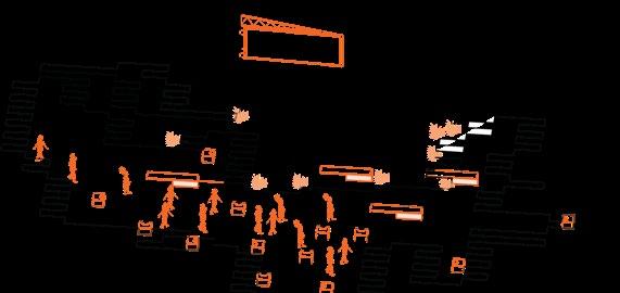
The point of this exercise was to focus on the perspective of sidewalk users in the Chinatown neighborhood of Lower Manhattan. As part of a larger comprehensive Chinatown sidewalk study, our group spent half a day on Henry Street, observing and documenting activity through the medium of drawing, mapping, video and photography. The focal point was to identify the condition of the sidewalk based on the four rooms that the user experiences: the ground plane, building wall, roadside plane and roof/canopy plane. Along with an understanding of the street’s role within its neighborhood context this analysis provided the metrics in order to grade each sidewalk based on the user experience. The outcome of the project prioritized sidewalk conditions into a databased that would be used by Manhattan-based urban design teams in their semester projects.
N
THE FIVE BOROUGHS STUDIO - SUMMER 2012 CHINATOWN SIDEWALK STUDY HenrySt.

DESIGN PORTFOLIO • URBAN DESIGN38 Commercial Henry St. Study Area School 5-minute Walk Radius Park Transit


CHINATOWN SIDEWALK STUDY 39 25’ 25’ 25’ 5’ 46’14’14’ 25’ 25’ 25’ 25’ 25’96’ Henry Street Building Block Elevation


DESIGN PORTFOLIO • URBAN DESIGN40 setback 62’ (Building Height) setbackbuilding buildingsidewalk 4’10’11’11’8’6’ 10’ 24’ sidewalk parkingparking two-way traffic lanes enlarged area

Personal chairs and umbrellas depict a lack of formal resting Loadingplacesdocks/basement entrances may disrupt continuity Current surface is uneven and cracked in many instances
CHINATOWN SIDEWALK STUDY 41
BUILDING WALL ROOF PLANE GROUND ROADSIDEPLANEPLANE
Building materials are poorly maintained and repulsive to the human eye Tall, vertical building facade does not break down to the pedestrian scale Lack of tree cover turns this into a concrete canyon during hot temperatures
Building entrances weave in and out of setback line, leaving it difficult to define the public area
A fair amount of empty streetside parking spots are left open, begging the question are the local parking garages along Henry Street sufficient for parking?
Differentiations in height, width and color among building canopies and awnings create chaos for pedestrians
Facades are primarily composed of visually impervious surfaces such as brick walls and aluminum garages
Bicycles and grocery carts are chained to signage, scaffolding posts, fences, and encroach into clear sidewalk width No roadside planting to soften the urban landscape and hold stormwater


DESIGN PORTFOLIO • URBAN DESIGN42
Clients: Wien Sud Nonprofit Housing Cooperative
READING BETWEEN THE LINES
Thesis: This project tests the limits of incremental development processes by adopting an additive form of urbanism. Provoked by the high degree of uncertainty, this proposal employs a set of design policies that guide future growth without losing sight of public amenities and evolving industries.
Liesing Vienna N
Partners: Vienna City Planning and Urban Development
URBAN GERM CELLS STUDIO - SPRING 2013
Vienna, Austria
Raiffeisen Evolution Project Development
Team: Ankita Chachra, Janice Tan, Ryan Jacobson
Subverting the typical residential pressures on industrial stock, the heart of the project lies in the creation of a new Productive Corridor through the site that links the existing Liesing industrial area to the Alt Erlaa subway station and the adjacent commercial/recreational node, located next to the Liesing River. This urban armature is intended to provide live/work spaces within the site, so as to encourage the existing micro-businesses to migrate into the site in order to free up the extensive industrial floorplates for more efficient uses, like the expansion of the service sector. In addition, the Corridor safeguards pedestrian connectivity, and acts as the social glue of the community through a shared civic space that sets the tone of identity and value for the district.
BUWOG Propert Managers


BadenModlingViennaA23
CommercialLocalExistingIndustrial
GrowthCommercial Public Realm as Connective Tissue GrowthIndustrial Live-Work Micro Industrial Units, Local IndustriesRetailConvenienceServices,&CreativeToCzechRepublicTo AustriaLower ToServiceExpandingSectortheSouth
An examination of Vienna’s burgeoning services sector reveals an opportunity for Liesing’s industrial area to participate in the significant agglomeration of service-sector firms occurring along the main trans-national traffic axes south of Vienna. However, a breakdown of Liesing’s current economy shows that service firms occupy only 30% of its economic sectors. The extensive industrial floorplates also appear to be under-utilized, as 65% of companies within Liesing comprise of micro-businesses. On top of this, the existing industrial stock (as well as the existing agrarian land within the given site) faces additional real estate pressures exerted by an anticipated strong annual population growth within the city limits.
Project Site Liesing
DESIGN PORTFOLIO • URBAN DESIGN44

GardenFragrance Outdoor Movie Screen Reading Area Small Vineyard Strawberry PatchMeadow Butterfly Garden YogaOutdoor GrowthCommercial Industrial Growth Activate Cultivate Rejuvenate Awaken Programming the Public Space Abc Connected Public Realm Productive Landscape Recreation Area Rest CulturalAreaAmenityAbcAbcAbc
Tomato Patch Dine, Drink, Restrooms BicycleCulturalRentalEvent Space Farmer’s Market Climbing Wall Orchard 5-A-Side Football Children’s Playground Glasshouse Great GardensVegetableLawn Handball ToViennaWanderweg London Planetree
FruitingPicnicGroveLawnCandlelitDinnerTrees

DESIGN PORTFOLIO • URBAN DESIGN46 0.4 0.90.4 0.5 0.50.50.30.30.30.20.20.30.20.30.30.30.4 0.4 0.3 0.3 0.3 0.4 0.3 0.4 0.3 0.4 0.3 0.4 0.40.40.30.30.40.30.40.30.3 0.40.30.10.30.10.10.2 0.2 0.3 0.40.40.40.50.40.40.40.30.40.40.40.50.30.30.40.20.20.2 0.20.40.40.30.20.30.20.20.50.30.40.3 0.30.20.30.40.3 0.40.4 0.40.30.40.40.4 0.3 0.5 0.20.20.20.20.30.20.20.20.20.30.20.20.20.20.20.20.20.30.40.40.40.40.30.30.3 0.9 Extrapolation of Site Lines Differentiated zonesExisting agrarian lot lines Necessary roads Urban GameboardCellular


groundapartmentsDouble-heightatprovide to
Public Space is to be EasementfrontinglocatedPedestrian
High-level and porous links between Urban Cells are to be designed to act as
roadwayfacadeConstitantInfrastructuresemi-privatesharedSocialbuildingalong
READING BETWEEN THE LINES 47
to Public Space Minimum 3m
CorridorisBuildingedgesEasementsPedestrianfromofcellFrontagetofacethe
Urban
flexibility
Development Design Guidelines
to be
Urban upbuildingFARdevelopments:[Other11heights3.0enjoyformingCellscorridorFARofandbuildingofuptostoreys2.0andheightsto6storeys]
25% of Cell Area is given wide
convert into live/work spaces


By following the design guidelines a number of different public space configurations are formed based on the road or easement adjacency. When urban cells amalgamate the public spaces begin to form a continuous corridor. The landscape responds to this mode of the incremental development process by offering a solution that adapts to the needs of its adjacent density. In the initial phase the perimeter landscape will act as a more private entity geared towards production. As development spreads, public spaces and their program shift use to strengthen community interaction. In order to compliment this evolution an investment and thoughtful placement of built public structures in Phase one will allow the users to recycle the infrastructure through the last phase of development (i.e. garden wall to food vendor).
DESIGN PORTFOLIO • URBAN DESIGN48 R2,E4 E2 R2, E2 R3, E1 R4
R1, E3

49READING BETWEEN THE LINES Phase 1 - Allotment Garden Phase 2 - Communal Space Phase 3 - Civic Space Existing Site - Unaccessible Lawn


DESIGN PORTFOLIO • URBAN DESIGN50 Phase 1- Leveraging on the existing Park asset Phase 2- 5 Sites completed Scenario 1 Scenario 2 Scenario 3 Phase 4 (Simulation 1) - Plan illustration of new Productive Corridor


Phase 4 (Scenario 1)Productive Corridor formed Phase 4 (Scenario 2)Productive Corridor formed Phase 4 (Scenario 3)Productive Corridor Formed
Phase 4 (Scenario 1)Road Access Phase 4 (Scenario 2)Road Access Phase 4 (Scenario 3)Road Access Phase 4 (Scenario 1)Pedestrian Easements Phase 4 (Scenario 2)Pedestrian Easements Phase 4 (Scenario 3)Pedestrian Easements
Phase 3 (Scenario 1)Parcels required to complete Corridor Phase 3 (Scenario 2)Parcels required to complete Corridor Phase 3 (Scenario 3)Parcels required to complete Corridor
51READING BETWEEN THE LINES


Double Height Live Module Artela StationBike Path Community Community ElevationSystem Green Recreation/ Food/Dining Utilities Services/ Work Cafe WalkwaySharedProductionUrban
DESIGN PORTFOLIO • URBAN DESIGN52
Flexible Live / Work Space
The first development site leverages on the potential for the existing under-utilized park to become a central community focus within the district. The site establishes a necessary critical mass to activate the public realm, and serves to anchor this portion of Corridor that connects pedestrians to the Alt Erlaa U-Bahn station. The programmatic strategy for the site recognizes that temporal uses allow space for experimentation, and can bring continued value to the site through a process of regeneration. The residential uses in the initial phases of development are thus designed with suitable spatial conditions (e.g. double-volume heights) that can be converted into live/work environments or commercial spaces in the later phases of the district’s development.

53READING BETWEEN THE LINES RoofGreensTop Community Play DiningFood/ DiningFood/ SupermarketCafe Cafe Work Work ProductionUrban Flexible Addition And Subtraction Kitchen + Utilities LivingBedroomModule Social Zone Circulation FutureBuildingUnitsModularLiving 6MX6MGridStructure


Activated Facades With Live And Work Spaces Towards Social Corridor
Angled Building Edges As A Navigation And Way Finding Strategy
DESIGN PORTFOLIO • URBAN DESIGN54
Connections And Angles Feature As Highly Concentrated Social And Community Zones


55 Social Public/Semi-PublicZone Social CommunityZonePrograms Work Work LiveLiveLiveLiveLiveLive LiveLiveLiveLiveLiveLiveWork/ Live / Work Work SocialCorridorProduction Live READING BETWEEN THE LINES

DESIGN PORTFOLIO • URBAN DESIGN56
Clients: Downtown Brooklyn Partnership New York Department of City Planning
The strategy to transform Atlantic Avenue into a socially rich corridor begins by making an investment in the periphery.
Thesis: An investment and design attention to a city’s periphery allows the future city to integrate an equal opportunity for quality of life.
SMART CITIES | LEARNING REGIONS STUDIO - FALL 2012 Team: Eiman Al Sakah, Ankita Chachra, Ryan Jacobson
SPATIAL MIXOLOGY
The corridor of the post industrial city leads us through different levels of lifestyle that segregate the peripheral neighborhood from the activity and opportunity that exists in the city core. Atlantic Avenue is a major arterial route connecting downtown Brooklyn’s new Barclays Center to its outer peripheral neighborhoods. Although portions of this avenue support industrial functions much of the present-day real estate is left dilapidating and under-utilized, and in many instances has no relation to its adjacent neighborhoods. What if a portion of the investment made at the city core was replicated at the peripheral neighborhood, creating an anchor opposite the Barclays Center? What if the corridor between these two developments became a series of local “social exchange” zones? Would it lead to equitable growth and better integration of activity between the core and periphery?
AvenueAtlanticN Atlantic Avenue, Brooklyn, New York City

DESIGN PORTFOLIO • URBAN DESIGN58 Atlantic Avenue is a major arterial transportation route which connects downtown Brooklyn’s new Barclays Center to its outer peripheral neighborhoods (i.e. East New York. A taxonomy of underutilized spaces and exploration of social/economic disparities along Atlantic reveal the opportunities to activate Atlantic avenue as a catalyst for equitable growth between a city’s core and periphery. Along this corridor there exists 3 distinct moments of racial and income segregation that lead to a low quality of supportive lifestyle amenities: poor education, lack of fresh food, poor health care and high crime rates. Although portions of this avenue continue to support what historically was a productive industrial corridor much of the present-day real estate is left dilapidating and underutilized, and in many instances has no relation to its adjacent neighborhoods. The strategy to transform Atlantic Avenue into a socially rich corridor lies in the hands of tactical urban design. Insertion of strategic programming into the 3 highly under-utilized areas will cut through racial and economic boundaries to introduce new neighborhood amenities that enrich the cultural experience along the length of Atlantic Avenue. These interventions will open the gates for natural Perceived Core &
CorridorCoresMultiplicityPeripheryofAlongMajorCorridors


SPATIAL MIXOLOGY 59 urban processes to provide for amenities (public health, education, safety and access to fresh food) that begin to bring equal living opportunity to peripheral neighborhoods. In our specific site implementation we’ve identified four areas in cross-section of Atlantic Avenue that have completely differing living conditions (the Barclays Center, Nostrand Avenue, and Ralph Avenue). We’ve research these areas based on percentage of impoverished, unemployement rate, high school drop-out rate, crime rate and obesity rate. This study determined that our presumptions of a lessened quality of life were true as you moved to the periphery. Next, we identified underutilized spaces that could be opportunistic infill areas. Based on what we found lacking in each of those neighborhoods we programmed these spaces so that they could benefit the community in the long term. These tactical interventions could be community built and phased based on available revenue. The new American corridor encourages a mixed race and mixed income transition between the city core and its periphery that allows for amenities of quality of life (public health, education, safety and access to fresh food) to be available to all city residents.


DESIGN PORTFOLIO • URBAN DESIGN60 Under-Utilized Building Typology Vacant Lot Typology

8 8 2 5 mixed use event space & nightlife charter primary school commercial space 1. A Clear Point of Entry with Visual Corridors 2. Increased Accessibility and Connectivity 3. Strategic Lighting 4. Programmed Space: Educational Pod 5. Programmed Space: Water Catchment Roof 6. Seating and Lighting Screens 7. Surface Rail Connection 8. Commercial and Residential Mixology Options 1 8 36 34


The decline of the manufacturing industry has left buildings unoccupied, parking lots fenced off, and contributed to a disconnect of East New York streets. Presently the area struggles to attract new, positive growth because of its lifeless streets and high crime rates.
4. Scheduled programming to cover all times of day
1. Introduction of a large public realm with mulit-modal pedestrian connectivity across Atlantic Avenue
The project strives to create a multi-functional anchor that reintroduces a social mix of culture and provides a platform for economic growth; which may only be accomplished if the area’s safety is improved. The project builds on specific design principles established in ‘Defensible Space, Crime Prevention Through Urban Design’ and ‘Crime Prevention Thorugh Environmental Design.’ A safer East New York can be achieved through the following factors:
The strategy to transform Atlantic Avenue into a socially rich corridor begins by making an investment in the periphery. Broadway Junction - Atlantic Avenue is a public transportation hub which lies in East New York, a peripheral neighborhood of Brooklyn. The area has been suffering from high crime rates, poverty and lack of education since blue collar jobs left New York after World War II. Corrupt real estate agent practices, such as blockbusting, led to a decrease in racial mix and resulted in a predominant Hispanic and African American population.
2. Adaptive re-use of existing physical infrastructure as a means to experience space 3. Mixed-income programming
An investment and design attention to a city’s periphery allows the future city to integrate an equal opportunity for quality of life and be a major draw in attracting newcomers in what may continue to be, a highly competitive market. *The images above are still-clips from a moving-image movie production. To view the full movie please https://vimeo.com/55418373visit:


SPATIAL MIXOLOGY 63

DESIGN PORTFOLIO • URBAN DESIGN64
Jerusalem’s shift towards economy become apparent when it extended development along trade routes outside its city walls. During British Mandate beginning in 1917 only land in West Jerusalem was designated for development leaving much of the Palestinian population in the wake of investment returns. While this line was only implied it acted as a dividing boundary and distinguished two separated areas for settlement, the Israeli and the Palestinian (below). Since, it has been a strategic challenge for each side to develop parcels of land that would get them closer to achieving ownership of Jerusalem. Today, we see geographic centers emerge far into a landscape that was not touched upon till the 20th century. These complex centers operate as enclaves and are the heterotopias that emit opposing energies, creating the tension in the holy city.
Jerusalem, Israel
Team: Ishita Gaur, Sagi Golan, Ryan Jacobson, Carolina Montilla, Janice Tan
CONTESTED TERRITORIES
Due to its historical significance in the Christian, Jewish and the Islamic religions, Jerusalem has been deemed the “Center of the World” by various sources since the mid-19th century. The city’s vast history has seen a change in power take place an estimated 23 times (summarized on page 30 - 31). These repetitive battles destroyed the city’s infrastructure multiple times, but each ruler made an effort to rebuild, relocate places of sanctuary and change territorial boundaries to fit religious values. Not only has this fragmented the walled city, but it has set the stage for modern day development.
RECOMBINANT URBANISM - SPRING 2013
*Image produced by Janice Tan Jerusalem N BankWest Israel
Thesis: Through a historical unfolding of the sacred city’s human settlement patterns and analysis of its public spaces, it is our intention to define current thresholds which raise levels of tension in Jerusalem.


DESIGN PORTFOLIO • URBAN DESIGN66 N MaximusCardo Decumanus W S Forum DISCONNECTED ENCLAVES NESTED ENCLAVE NETWORK Sacred Center Sacred District CitySacredWalls ALIGNMENT OF ROMAN STREET GRIDLEGEND 37 B.C. - 70 A.D. | Herod 1063 | Al-Quads 1099 - 1187 | Crusaders 135 - 351 | Aelia Capitolina Sacred Center Barrier/Border Sacred District Present Day Wall Sacred Center Significant Building Bath House Jewish Occupied Christian Occupied Muslim ArmenianOccupiedOccupied


CONTESTED TERRITORIES 67 Sacred Center 1 Sacred Center 2 INITIAL N-S ARMATURE REPURPOSES TO MARKET NESTED ENCLAVE NETWORK WITH EXPANSION Sacred Center Sacred Center Sacred District Sacred District CitySacredWalls CitySacredWalls Urban Parasites (waqfs) Urban Parasites (waqfs) NESTED ENCLAVE NETWORK EXPANDED OUTSIDE WALLS Urban Parasites Attached to Sacred City Walls ARMATURE STRETCHES TO REACH SACRED SITES 351 - 637 | Constantine After Persian Invasion Ottoman Empire Bounded by City Wall Israel & British Mandate


*Image produced by Ishita Gaur

CONTESTED TERRITORIES 69
Through a dissection of the walled city of Jerusalem we begin to understand the pieces of its complexity (summarized on page 30 - 31). The patterns, organizational methodology and location of the sacred “center” are reflected in the planning principles of the corresponding religion in power. As the walled city changed hands its infrastructure become a mix of urban character. Following subdivisions dissected its boundaries by distinguishing spatial proximities for religious followings to occupy. The complexity of the interior grew richer. When subdivisions within the city walls reached capacity, Jerusalem had to extend past its boundaries (this coincided with new infrastructure to support valuable trade routes). However, generated within those historical seems are the major thresholds that identify the tension that continues to fill the air of Jerusalem.

DESIGN PORTFOLIO • URBAN DESIGN70
Purdue University: URBAN DESIGN STUDIO
The Chicago lakefront has suffered from urban expansion and its adjacent parks provide little physical connection to Lake Michigan. Our design solution along this mile-long lakefront stretch builds upon the lake’s historic natural edge, while still taking a modern design approach to revitalize the character of this previously successful space. Our ideas strive to draw the surrounding community to Lake Michigan and provide them with the ability to interact with the power of the water in a number of ways. Whether you feel the mist from the waves crashing against the interactive wave wall, hear the wind chimes whistling in your ear while running along the lake, or taste the food in Chicago’s newest lakefront market your five senses will be engaged in our design.
N
Thesis: To introduce a public amenity that re-energizes Chicago’s lakefront north of Navy Pier. SIXTH SENSE Lake ShoreDrive
Lake Shore Drive, Chicago, IL
THE


1 2 3 4 4 4 5 6 6 7 7 7 8 9 10 11 12 12 12 13 13 15 1716 17 18 2019 21 22 22 n.t.s.n 14


THE SIXTH SENSE 73 1. North Avenue Beach (existing) 2. dune restoration project 3. interactive wavebreak structure 4. active pedestrian promenade with boulevard 5. iconic architectural element at terminus 6. Lake Shore Drive (Hwy 41) 7. Inner Lake Shore Drive 8. stairs down to interact with lake 9. Oak Street Beach (improved) 10. raised boardwalk 11. Urban Sensation Spa & Gardens 12. iconic architectural elements 13. islands to look natural and act as wavebreak 14. public beach 15. existing wavebreak structure 16. market area (farmers and art) 17. Lake Shore Drive tunnel skylights 18. Contemporary Art Museum 19. Ohio Street Beach (improved) 20. Jane Addams Memorial Park (existing) 21. Olive Pavilion & Amphitheatre 22. Lake Michigan

DESIGN PORTFOLIO • URBAN DESIGN74 URBAN SENSATION SPA AND GARDENS

THE SIXTH SENSE 75 Urban Sensation Spa & Gardens will be a destination to escape from the density of Chicago’s city center. The new archipelago acts as an artificial water break to protect Lake Michigan shores from further erosion. The main island will be publicly accessible by landbridge from the waterfront edge or from marina for vessel owners. Visitors will have the opportunity to experience the beautiful urban botanical gardens or relax at Chicago’s newest 5-star hotel and spa. The outdoor gardens offer a publicly accessable amenity that the city currently lacks in its political boundaries. The Botanical gardens will include a widespread collection of plants native to the Lake Michigan region, while the indoor greenhouse gives guests the opportunity to experience tropical plants from around the world. Indoor classrooms will provide for educational space. The upper floors of the state-of-the-art facility become privatized, and will be home to the spa and hotel. The hotel offers 60 guest suites, each with a view of Chicago’s beautiful skyline. 1. building (modern architecture + 1st floorurban botanical garden + 2nd-4th floorsboutique hotel/spa 2. pedestrian/shuttle access from city with guardhouse 3. main garden plaza with iconic art piece 4. outdoor urban botanical garden 5. tropically planted greenhouse 6. spa pool deck 7. transient boat slips 8. marina check-in center & water sports recreation rental 9. access to islands & private woodland suites 10. helipad 11. lake michigan 1 3 2 4 5 6 7 8 9 10 11 11 4 n.t.s.n

DESIGN PORTFOLIO • URBAN DESIGN76
CORNING PRESERVE MASTER PLAN NY PreserveCorning N
Albany,
Clients:STANTEC City of Albany Capitalize Albany Non-Profit Organization
Corning Preserve Park is an essential piece of Albany’s urban fabric that extends to the far eastern edge of the City. Bordered by I-787 to the west, Livingston Ave Bridge to the north, the Hudson River to the east and pump stations to the south, the 11-acre park is the City’s most direct outlet to the waterfront. Located only ¼ mile downhill from City Hall and downtown Albany, public access is primarily limited to a single pedestrian bridge over I-787 and a circuitous route from the warehouse district for those travelling by car. Connectivity to Corning Preserve Park is highly disrupted by an overwhelming 12 lanes of moving traffic, some elevated, that comprise Interstate 787 and its frontage roads, and a freight rail line nestled within the highway corridor. Through the Corning Preserve Master Plan, Capitalize Albany and the City of Albany have endeavored to help stakeholders visualize the park’s role within the community and add value to the future development of the Corning Preserve and Downtown Albany.


The consultant team moderated a public input process to gain perspectives from current and prospective park users and community stakeholders. They presented precedent images that helped community participants visualize the riverfront park’s exciting potential. This valuable exchange allowed the planning and design team to identify park users and take an inventory of park elements, infrastructure and experiences that were important to them. The dialogue offered a rationale behind prioritizing a park improvement development program outlined below. As a response to the public outreach session the Consultant team prepared a concept plan that spatially organizes the major program elements. The benefit of this iteritive process strives to lead to a truly activated public space. The park is highlighted by features that: create oppotunities for boating and dining, improve exisiting performance facilities, restore waterfront ecology, expand the park by activating under-utilized roadway, create multi-modal access and offer diverse activities to attract visitors for the region.
Universal LandscapeAArrivingDistinguishedAccessibilityPathwaysByWaterRegionalDestinationEnhancements A Self-Sustaining Park

CORNING PRESERVE MASTER PLAN 79

DESIGN PORTFOLIO • URBAN DESIGN80
City of CommunitySaskatoonServices CITY CENTRE PLAN N RiverSaskatchewan Saskatoon, Canada
CitySaskatoonCentre
Department
ClientsSTANTEC:
Saskatoon’s sits among some of the richest oil fields in Canada. Its ideal location has allowed distribution and logistics in oil trade to vastly grow its economy. The city’s expanding job market expects to lead to a population growth of 500,000 during the next 20-30 years. The City Centre Plan encourages a portion of this growth to be accomodated for within its quarters. The plan provides a strategic framework that would allow the city to become a destination and to capitalize on its strong economic infrastructure. Public space initiatives are highlighted by a vast improvement to public access through a series of connected parks, open spaces and greenways. In addition, the plan strives to offer design solutions that mitigate the cold weather climate and offer outdoor seasonal interest all year round. My role within the project was to provide the client with a vision of how seasonal public space would manifest itself at three of our key design sites.


DESIGN PORTFOLIO • URBAN DESIGN82 *Plan drawing by Marc Wouters

AfterBefore
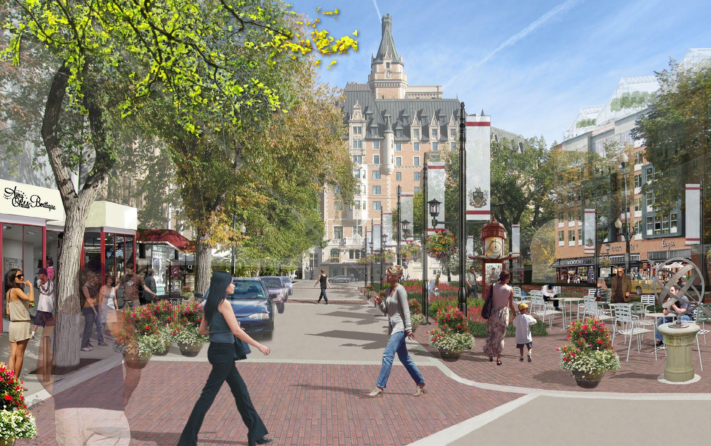
CITY CENTRE PLAN 83
The removal of an under-utilized traffic lane allowed our team to create a public space that allows for flexible programming to occur between traffic lanes. The transformation celebrates the presence of the landmark Besseborough Hotel which sits at the terminus of 21st Street just before reaching the Saskatchewan River. The new plaza acts as an axis that more clearly defines this pronounced anchor to the train station, which sits opposite on 21st Street. The public space provides incentive for investments in new retail and improvements to the adjacent residential building stock. With minor enhancements to the public realm the public space could be highly activated with a diverse group of people. As shown, the plaza offers the opportunity for the city to brand itself, bring people outdoors to enjoy long hours of sunlight in the summer and implement green infrastructure.

DESIGN PORTFOLIO • URBAN DESIGN84
*Plan drawing by Marc Wouters
The 23rd street corridor is an essential piece of Saskatoon’s urban fabric. The proposal of closing one lane of traffic from City Hall to the waterfront would allow for a safe and aesthetic progression down to the waterfront. At that terminus, Kiwanis Park runs parallel to the Saskatchewan River and offers over 2 km of walking trails directly adjacent to the CBD. The new linear greenway adds another layer of street trees to the existing, which would allow for an overhead canopy. This becomes the ideal environment for Saskatoon to display public art in a similar fashion to Park Avenue in New York City. Not only would this be an amenity for pedestrians, but it would promote adjacent private developments to turn their attention to the street. The final picture is an activated complete street with building terraces that overlook the new linear greenway.

CITY CENTRE PLAN 85

DESIGN PORTFOLIO • URBAN DESIGN86
EXTRACURRICULAR ACTIVITIES
URBAN RECYCLINGSTATICTERMINAL
IRON WORKS COMMUNITY BUILDING EFFORTS

DESIGN PORTFOLIO • URBAN DESIGN88 31 4


URBAN12345 STATIC
52
Ingersoll Houses, Fort Greene, Brooklyn Central Park, Manhattan Our Lady of Loreto, Brownsville, Brooklyn Crown Heights, Brooklyn Prospect Heights, Brooklyn
URBAN STATIC 89
New York City’s historical presence as the entry point of our ancestors to the “New World” created a mix of informality and fragmentation in the physical environment where one can see exaggerated contrasts. I found it intriguing to document NYC’s complex system of dense, active environments side-by-side their natural counterparts. Each composition illustrates an interesting piece of the urban fabric where the juxtaposition of natural landscape against the built environment is highlighted.

DESIGN PORTFOLIO • URBAN DESIGN90 As different forms of graphic representation continue to come forth it is evident that moving image has become a very effective way of storytelling. After rigorous graduate school practice of visual animation and narrative discourse my first professional video production was Recycling Terminal Iron Works. The project was displayed in an exhibition at the MAXXI National Museum of the 21st Century Arts in Rome from December 2013 – February 2014. Led by Marpillero Pollak Architects, the project Recycling Terminal Iron Works is not only a concept for the architectural restoration of an artist studio, but a process in which the sculptor practiced to form his pieces. This is captured in the narrative of the video, as well as the transformation of the studio. I intend to further my practice in video production to use this skill as an effective tool for design communication, decision-making and advocacy.
RECYCLING TERMINAL IRON WORKS
View at http://vimeo.com/85501323

RECYCLING TERMINAL IRON WORKS 91


DESIGN PORTFOLIO • URBAN DESIGN92 31 4


Summer Streets Initiative - Manhattan, New York
COMMUNITY BUIDLING EFFORTS 93
Community Planning Process - Wolcott, Indiana
Mayor Review of Master Plan - Bahia de Caraquez, Ecuador
52
A valuable attribute of an urban designer is to understand community needs and help community members accurately visualize the impacts of change. Throughout my career I have found public engagement to be a motivational tool for design thinking. To achieve more effective communication I have challenged myself through experiences such as an internship at the United Nations and community planning sessions led in Spanish in Ecuador. These have provided me with a sturdy background to confidently moderate public planning processes in the future.
Community Open House - Albany, New York
Community Gardening - Tombaviro, Ecuador
COMMUNITY54321 BUILDING EFFORTS


