
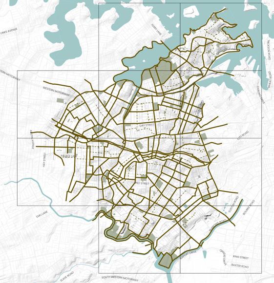
Precinct 9
Blue-Green Grid Links
2 Marrickville Peace Park to Montague Gardens
4 Victoria Road to Newtown Train Station
5 Fraser Park Football Club to Newtown Station
7 Enmore Park to Sydney Park
8 Newington Road from Albert Street to Enmore Road
9 Addison Road from Enmore Park to Bright Street
10 Southern Link of Newtown to Croydon train line
56 Cavendish Street
Relevant Projects and Responsibility
Streets Alive: Newtown and Enmore Master Plan
2023, Inner West Council
Cycling Strategy and Action Plan
2023 Inner West Council
St Peters Station Upgrade
2021, TfNSW/Inner West Council
Sydney Park Junction
2021, TfNSW/City of Sydney/Inner West Council
WestConnex Urban Design and Landscape Plan

2020, TfNSW
Sydney Park Junction
2021, TfNSW/City of Sydney/Inner West Council
Eastern Channel North Subcatchment Management Plan
2013, Inner West Council
Marrickville Draft Strategy for A Water Sensitive Community
2012, Inner West Council
Eastern Channel East Subcatchment Management Plan
2011, Inner West Council
Marrickville Urban Forest Strategy
2010, Inner West Council
Marrickville, Enmore, Stanmore
A key existing cycle way that runs from the Cooks River up to Montague Gardens via Marrickville Town Centre and number of schools including Ferncourt Public School and Newington College. The link along Illawarra Road is busy. The streets are predominantly residential in character, with some commercial and with a good amount of tree canopy.
A busy thoroughfare, the route connects parts of Marrickville through to Newtown predominantly following Victoria Road and Enmore Road. Key destinations along the link include the Factory Theatre, Enmore Park and Enmore Theatre. The link changes from residential to industrial then commercial along the route, with varying canopy cover.
Link runs through the Marrickville industrial area via the Sydenham Pit and Drainage Pumping Station. A pedestrian cut through from Shirlow Street to Sydney Steel Road offers connectivity between Sydenham Train Station to Marrickville Metro through to King Street via Alice Street and up to Newtown Station. The link is predominantly industrial and commercial in character travelling along a mix of busy roads and pedestrian links.
The link connects a series of green spaces including Enmore Park, Camdenville Oval, Simpson Park and Sydney Park. Route runs through some industrial areas in St Peters as well as a recognised Kangaroo Ground. It runs partially through a flood zone and crosses the Cooks River. The link also passes the St Peters Interchange of West Connex, a busy and wide street.
A residential link, with significant tree planting and shade. It contains an existing cycle way linking Enmore Road to the backstreets of Petersham but with no separated cycle path. It passes Newington College, Newington Road Playground and leaves you close to Marr Playground in Petersham.
This route has a mix of commercial, industrial and residential character. It connects Enmore Park through to Addison Road Community Centre, an important community and cultural institution for the Inner West.
The route has an existing strong tree canopy presence with room to expand, and the community wish to see increased planting for shade and amenity. Opportunity exists to raise pedestrian crossing through the high pedestrian activity area. The community identified Illawarra Road as good north-south connection. However, due to topography and heavy vehicle presence it would need improvements to be a safe option for active transport such as traffic calming, signage and line markings.
Additional canopy cover and street planting would be a key opportunity for this link which lacks shade along parts of Victoria Road. The link is an important connector from Marrickville to Newtown and on to the city with the opportunity to improve cycleways, footpaths and crossings and measures to create a safer environment for active transport. The community have suggested improving the crossing at King, Wilson and Eliza Street in Newtown. The link hosts some of the Inner West's most iconic cultural institutions providing an opportunity for public space activation and cultural installations.
Multiple opportunities for this link have been identified, including the potential for Sydenham Pit and Drainage Pumping Station to be investigated for naturalisation to support urban ecology and local amenity. The link includes parts of Marrickville's industrial precinct that holds cultural significance providing opportunity for public art and cultural activation. At Fraser Park, the link also runs through a Kangaroo Ground connecting to a potential Aboriginal archaeological site providing opportunity to recognise and celebrate Aboriginal and Torres Strait Islander culture and histories. Street planting for shade and improved sidewalks and cycleways are areas of improvement, especially in the industrial areas.
This link contains parks that are highly valued by the community as a place to gather, walk dogs and enjoy nature. Due to it linking several significant green spaces, it also holds opportunity for an ecological corridor. Community members suggested improvements to crossings at WestConnex and improved cycleways connecting Enmore and Campbell Street connecting better to Bourke Street in Alexandria. WestConnex has public path upgrades at the St Peters Interchange that could positively contribute to this link and deliver additional shared and cycle paths, significant tree planting, and permeability of the site for crossing.
The footpaths are narrow, as is the street, creating obstacles for pedestrians. The cycleway is valued, however the steep slope, poor road condition and school drop off's at Newington College create a hazard for cyclists. This link would benefit from reduced speed limits, separated cycleways, footpath improvements and other safety measures at drop off points to protect cyclists.
The route experiences some flooding and has limited canopy cover at points so could benefit from increased tree planting, landscaping and Water Sensitive Urban Design features. Opportunities exist to improve Addison Road for cyclists and pedestrians, namely at the intersection with Enmore Road, by improving sidewalks and intersections. A key feature of the link is the Addison Road Community Centre, which provides ample opportunity to provide public art and cultural activation in public spaces.
A key rail corridor that crosses through a biodiversity corridor at the GreenWay. Link is compromised of multiple links along train lines for connectivity, however is not fully connected for pedestrians. It provides direct routes to train stations and would be well travelled by daily transport users.
The link provides direct routes between train stations and opportunities for better connection to the GreenWay. There is also opportunity to identify a clear user journey along the line and create more crossing for both pedestrians and cyclists. Better cycleway connections, widened footpaths and tree planting for shade are other identified improvements along this route.
Link runs along Cavendish Street between Holt Street and Enmore Road. It incorporates an existing cycle path connecting with Stanmore Public School and Newington College. The link joins with link 3 which connects to Stanmore Train Station.
Improvements along this link should consider the provision of safe, accessible footpaths and crossings. This street is also identified in the 2023 Cycle Strategy allowing opportunities for new cycle infrastructure to be provided along this link in the future. The amenity of the link could also be further enhanced through the provision of additional vegetation and tree plantings.
East-west link connecting Stanmore Train Station and Town Centre to Royal Prince Alfred Hospital in Camperdown. Much of Salisbury Road has good tree canopy coverage.
Improvements along this link should consider the provision of safe, accessible footpaths and crossings. This street is also identified in the 2023 Cycle Strategy allowing opportunities for new cycle infrastructure to be provided along this link in the future. The amenity of the link could also be further enhanced through the provision of additional vegetation and tree plantings.
This link follows the T2 rail line between Croydon and Newtown. The northern side of the rail line does not currently allow for full pedestrian access east - west. This link is aspirational to show the need for increased access to the rail line by daily transport users.
Currently there is no continuous pedestrian or cycle link along the rail corridor. Through the community engagement undertaken for this project, this has been identified as a project opportunity that should be investigated to improve pedestrian and cycle connections east-west across the Inner West. Opportunities along the link should consider improving footpaths, crossings and cycle infrastructure. Rewilding of areas adjacent to the rail corridor in addition to consideration of areas that could accommodate increased tree canopy, verge and private garden plantings should be investigated.
The Cooks River is a key green and blue asset for the Inner West and neighbouring council areas. Along the link are multiple parks and reserves, a children’s playground and the Marrickville Golf Club. The link offers a diverse range of passive and active recreational opportunities.
While there are many recreational activities that can be undertaken along the Cooks River Foreshore, the community has expressed a desire for the Cooks River itself to be improved with the aim of providing increased access to the riverbank for recreational activities. Therefore, improvements should be focused on naturalising the waterway and improving water quality. This area of the Inner West is also recognised as an area with high biodiversity values and therefore, future improvements must also look to increase and enhance natural vegetation along the riverbank to enhance and increase areas of habitat for native flora and fauna. The river also has significant Indigenous heritage which should be recognised and promoted in any future works.
Currently there is no continuous pedestrian or cycle link along the rail corridor. Opportunities along the link should consider improving footpaths, crossings and cycle infrastructure. There is some opportunity along this link to increase tree canopy, verge and private garden plantings and to rewild the area along the rail corridor to increase areas of natural habitat for native flora and fauna.
65 King Street South Newtown
This link runs along Newtown's King Street, connecting Sydney Park and St Peters Station, to Camden and St Johns Street at Newtown High School of the Performing Arts.
Being a major high street within the Inner West, King Street is a high vehicular and pedestrian traffic area. Investigation of opportunities should consider improved footpaths and crossings and a reduced speed limit along the full length of King Street to improve safety for pedestrians and cyclists. A pedestrian and cyclist overpass over the Princes Highway from St Peters Station to Sydney Park should also be investigated. This would need to undertaken in collaboration with City of Sydney Council. There are many arts and cultural venues located just off King Street. Opportunities to provide additional public art and cultural activation spaces along the link should also be considered.
66 Pearl Street to St Peters Train Station Newtown, St Peters
This links provides a connection between Alice Street Newtown to St Peters Railway Station as an alternative to King Street.
There is some opportunity along this link to increase verge and private garden plantings and to rewild the area along the rail corridor to increase areas of natural habitat for native flora and fauna.
Link runs along Unwins Bridge Road connecting King Street to the Cooks River via Tillman Park.
77 Unwins Bridge Road Tempe
80
New Canterbury Road and Stanmore Road
Hurlstone Park, Dulwich Hill, Lewisham, Petersham, Stanmore, Newtown
Link runs along major roads including New Canterbury Road, Stanmore Road through to Enmore Road. The route connects with a number of town centres including Dulwich Hill and Petersham.
Improvements along this link should consider the provision of safe, accessible footpaths and crossings in addition to improved cycling infrastructure between these two key destinations. The amenity of the link could also be improved through the provision of additional vegetation and tree plantings to increase canopy cover and shade along the link.
This link will operate as a main active transport connection from the east-west across in the Inner West. Opportunities along this link should look to provide improved cycleways and pedestrian infrastructure, including reduced speed limits and traffic calming where there is high pedestrian activity. Where possible provision should be made for suitable separation of pedestrians, cyclists and vehicle infrastructure. Additional tree plantings to improve shade and amenity along the link is a noted opportunity, particularly within the town centres included within this grid link.
Link that connects Parramatta Road to Camperdown Park and Camperdown Memorial Rest Park to King Street, Newtown. O'Dea Reserve is located just west of Australia Street and can be easily accessed via this link.
Existing open spaces accessed from this link including Camperdown Park and the Commons are open spaces that are well loved and used by the community. Any improvements to this area should increase and improve access to these open spaces ensuring upgrades make them safe, inclusive and more accessible. Community feedback for these open spaces and the broader Newtown/Camperdown area has request that connectivity improvements in the form of safe, accessible footpaths and crossings are provided for pedestrians in addition to improved cycle infrastructure for the community to move around this area.
This link is within an area of Aboriginal and Torres Strait Islander significance. Future capital works projects should look to recognise and celebrate Aboriginal and Torres Strait Islander culture and histories through design elements.