
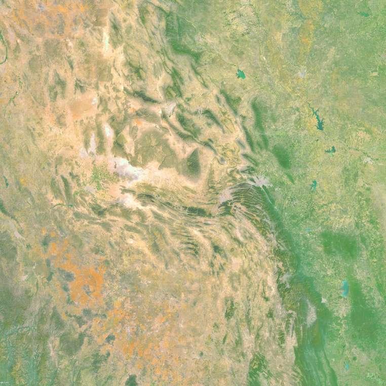
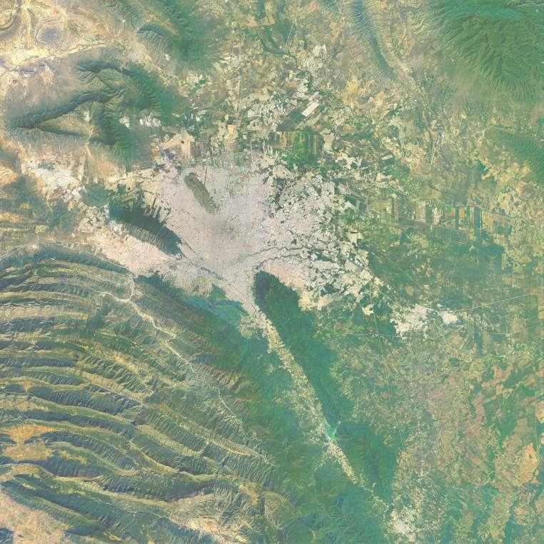
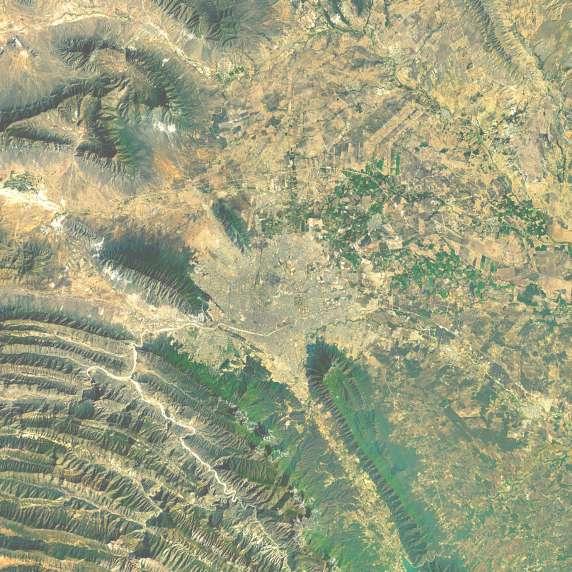
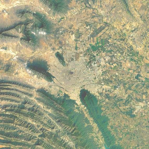
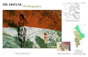
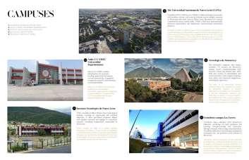
The city of mountain nested along the rugged terrain of the Sierra Madre mountain range of America.
La ciudad de montañas anidada a lo largo del terreno accidentado de la cadena montañosa de la Sierra Madre en América
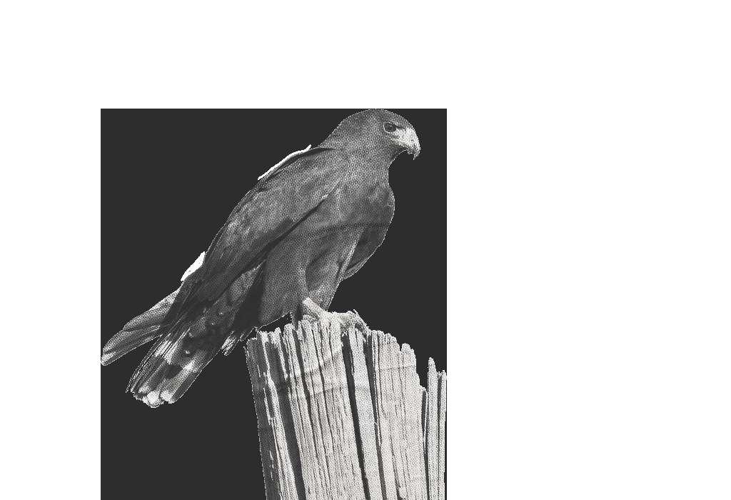
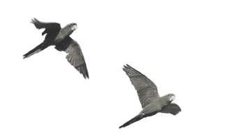
AGUILILLA AURA


The city of mountain nested along the rugged terrain of the Sierra Madre mountain range of America.
La ciudad de montañas anidada a lo largo del terreno accidentado de la cadena montañosa de la Sierra Madre en América
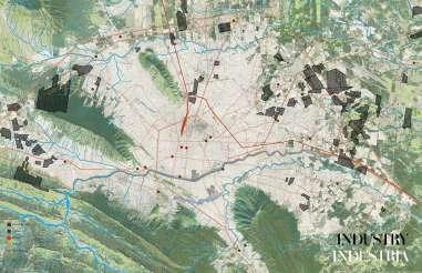
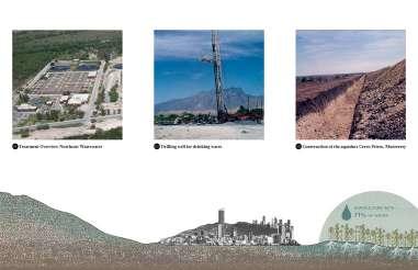
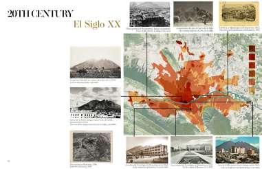
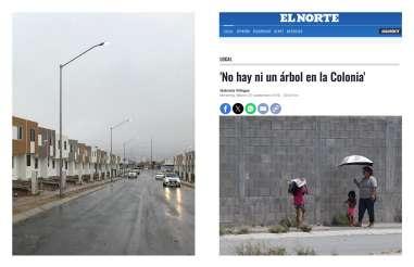
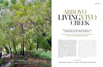
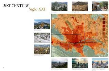
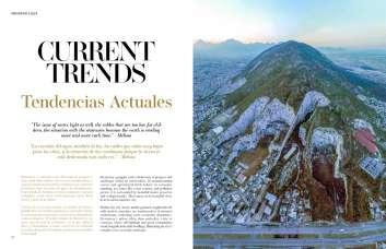
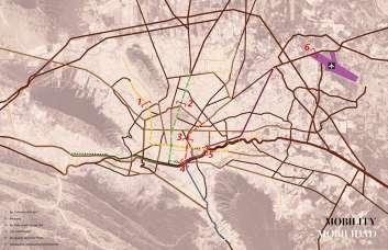
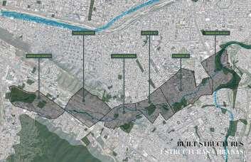
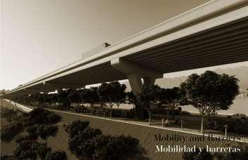
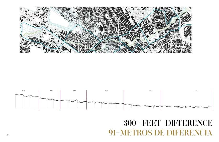
Over the course of 30 years, Monterrey has grown significantly, both in population and density. Unfortunately, the infrastructure required to sustain this growth is not present today.
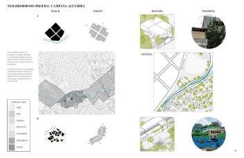
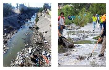
There are areas in Campana Altamira where people have not come down in over 5 years due to the lack of roads. There are areas where kids can’t go to school if it rains because the walkways are too slippery.
The city has heavily invested in infrastructure geared towards cars which have a lot of structure, and as a result, many areas in the city flood during heavy rains.
A lo largo de 30 años, Monterrey ha crecido significativamente, tanto en población como en densidad. Desafortunadamente, la infraestructura requerida para sostener este crecimiento no está presente en la actualidad.
Hay áreas en Campana Altamira donde la gente no ha bajado en más de 5 años debido a la falta de caminos. Hay áreas donde los niños no pueden ir a la escuela si llueve porque los senderos están demasiado resbaladizos.
La ciudad ha invertido fuertemente en infraestructura orientada hacia los automóviles, que tienen mucha estructura, y como resultado, muchas áreas en la ciudad se inundan durante lluvias intensas.
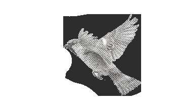
DOMESTICO MARTIN PESCADOR VERDE
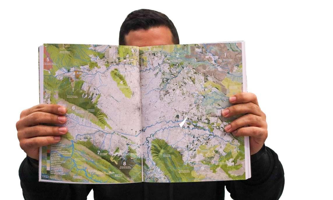
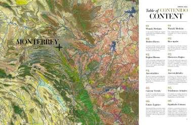
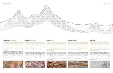
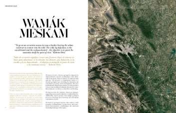
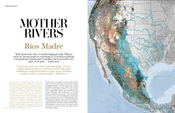
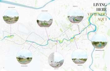
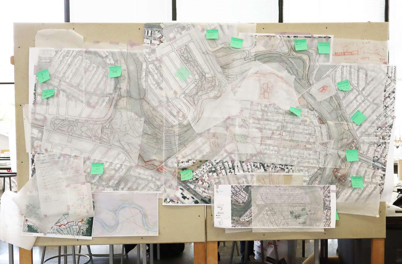
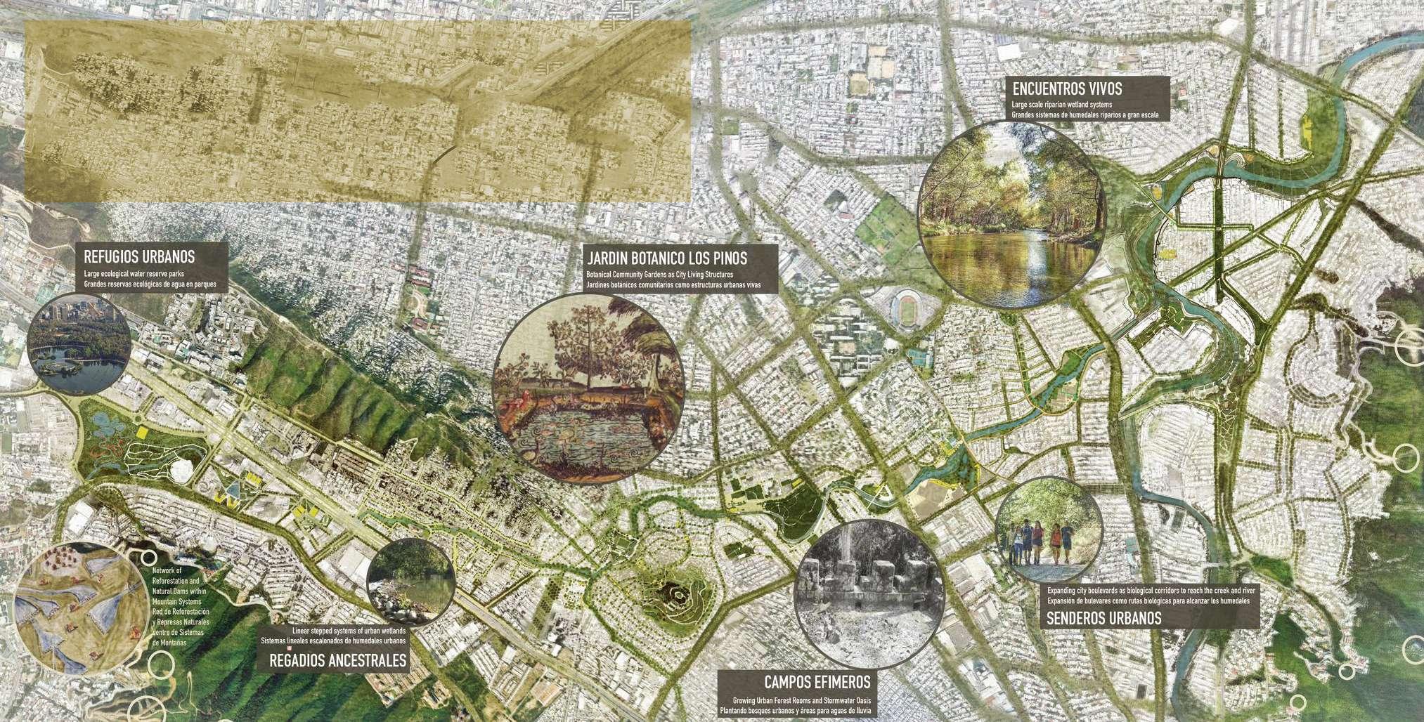
Prior to our visit in February, we collaborated to research and map our understanding of the existing conditions in Monterrey. The report shown is a condensed version that focuses on general information and our site specifically.
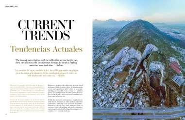
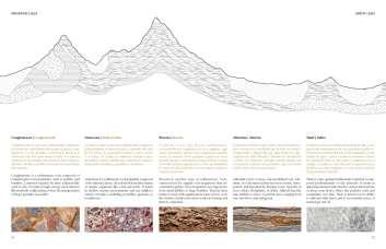
The report we developed was divided into 6 chapters, Wamak Meskam, Mother Rivers, Region Blooms, Ancestralities, Current Trends, and Future Equities.
From this analysis, we identified key ecological conditions to consider in our proposals. We also understood the amount of space required to hold water and where we needed to do it. The end goal is to collect, clean, and release water throughout the creek while programming in a way that people can engage with it.
Antes de nuestra visita en febrero, colaboramós para investigar y mapear nuestra comprensión de las condiciones existentes en Monterrey. El informe mostrado es una versión condensada que se centra en información general y en nuestro sitio específicamente.
El informe que desarrollamos se dividió en 6 capítulos, Wamak Meskam, Ríos Madre, Región en Flor, Ancestralidades, Tendencias Actuales y Equidades Futuras.
A partir de este análisis, identificamos condiciones ecológicas clave a tener en cuenta en nuestras propuestas. También entendimos la cantidad de espacio requerido para contener agua y dónde debíamos hacerlo. El objetivo final es recolectar, limpiar y liberar agua a lo largo del arroyo mientras programamos de una manera en que las personas puedan interactuar con él.


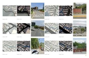

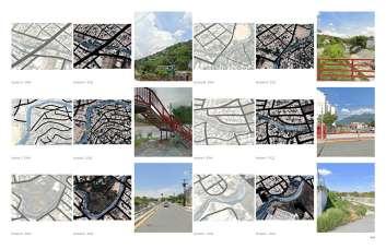

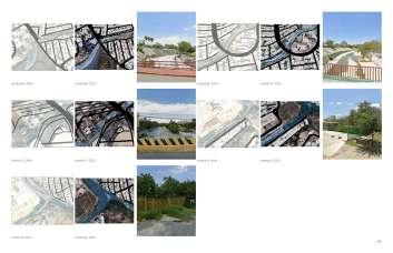


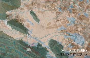


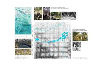


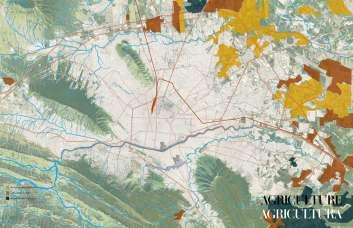

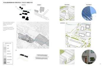


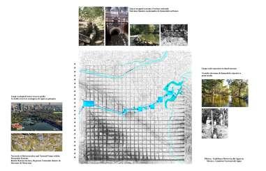
a collection of pages from the analysis report that was assembled and shared with community leaders, educators, students, and government officials in Monterrey.


una colección de páginas del informe de análisis que fue compilado y compartido con líderes comunitarios, educadores, estudiantes y funcionarios gubernamentales en Monterrey.

how do we design with the creek and river so they’re accessible to current and future generations?
¿cómo diseñamos con el arroyo y el río para que sean accesibles para las generaciones actuales y futuras?
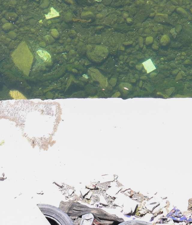
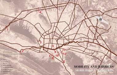
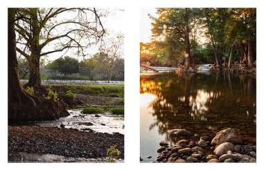
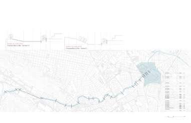
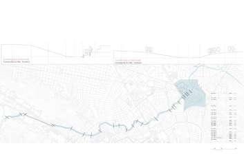
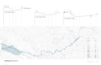
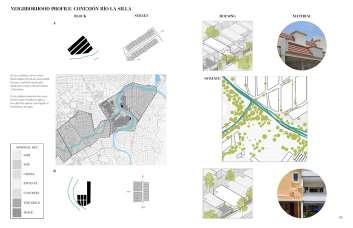
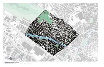
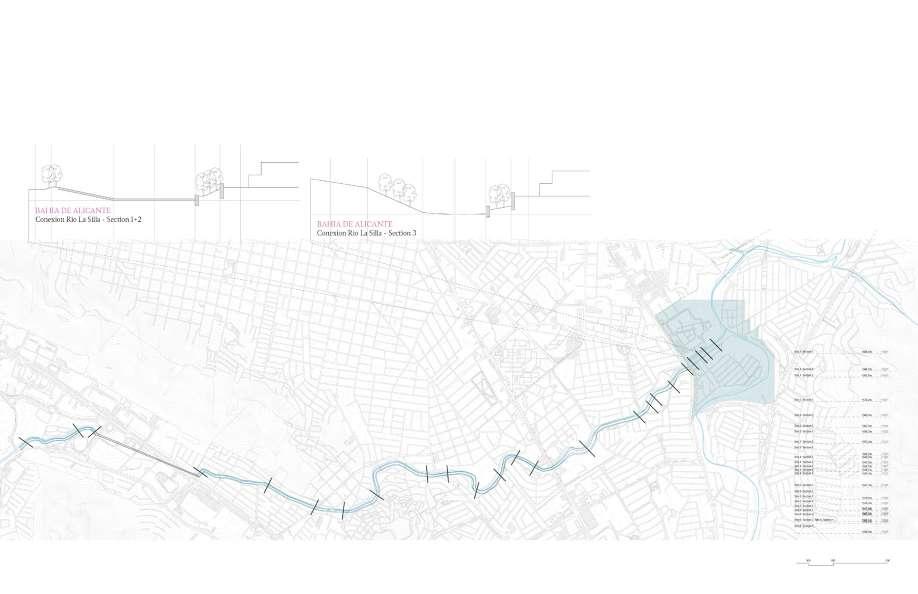
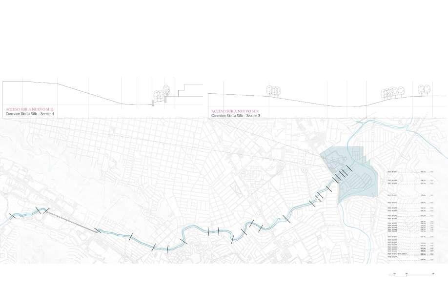
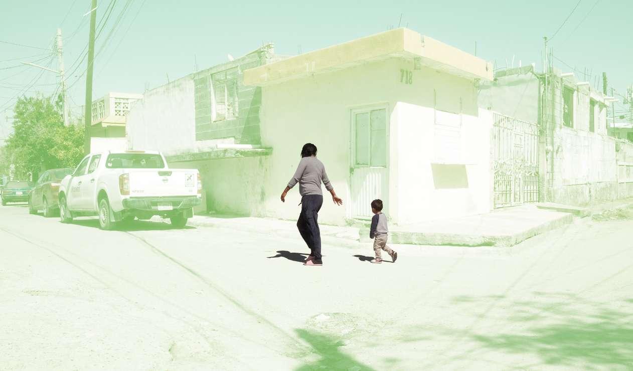
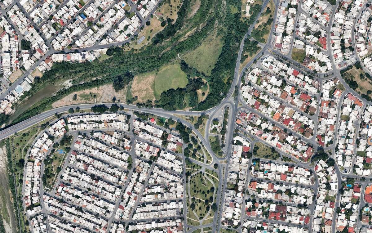
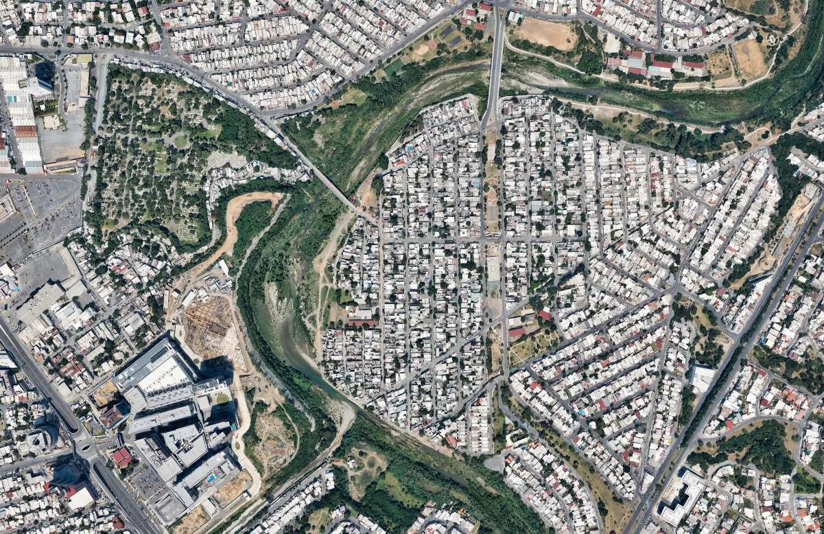
due to the direction of the river and creek, and garbage from homes and construction sites, the existing sidewalk along Rio la Silla is not accessible.
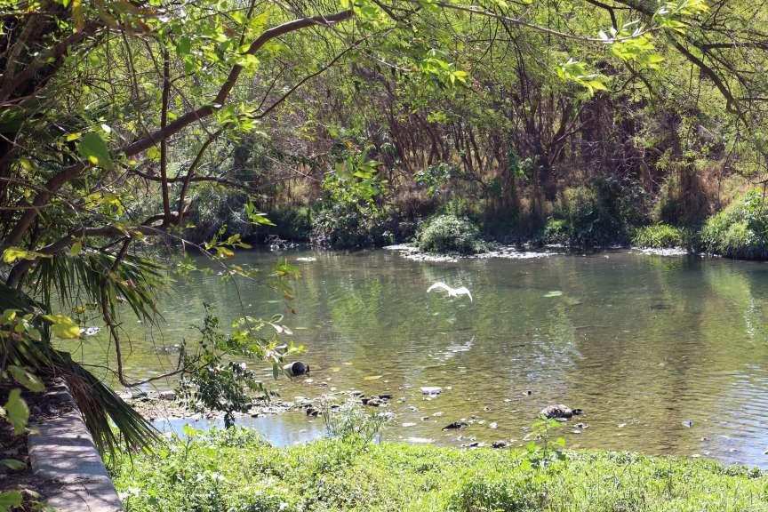
debido a la dirección del río y del arroyo, así como a la basura proveniente de hogares y sitios de construcción, la acera existente a lo largo del Río La Silla no es accesible.
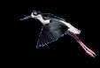
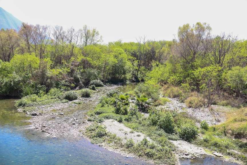
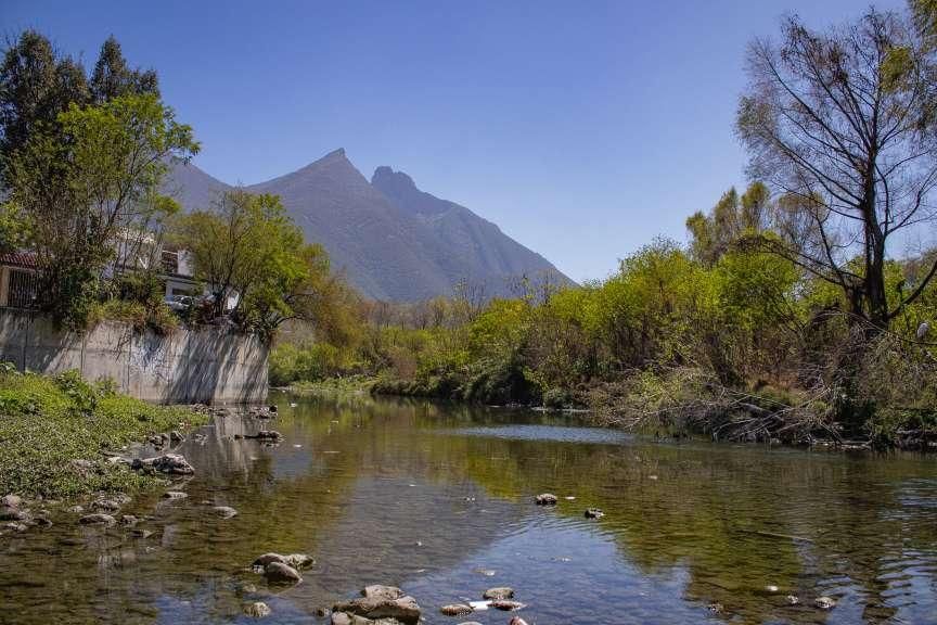
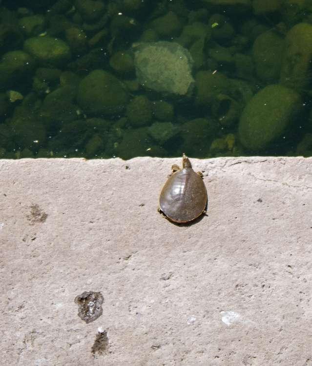
 PHOTO BY JAIME ORANTES
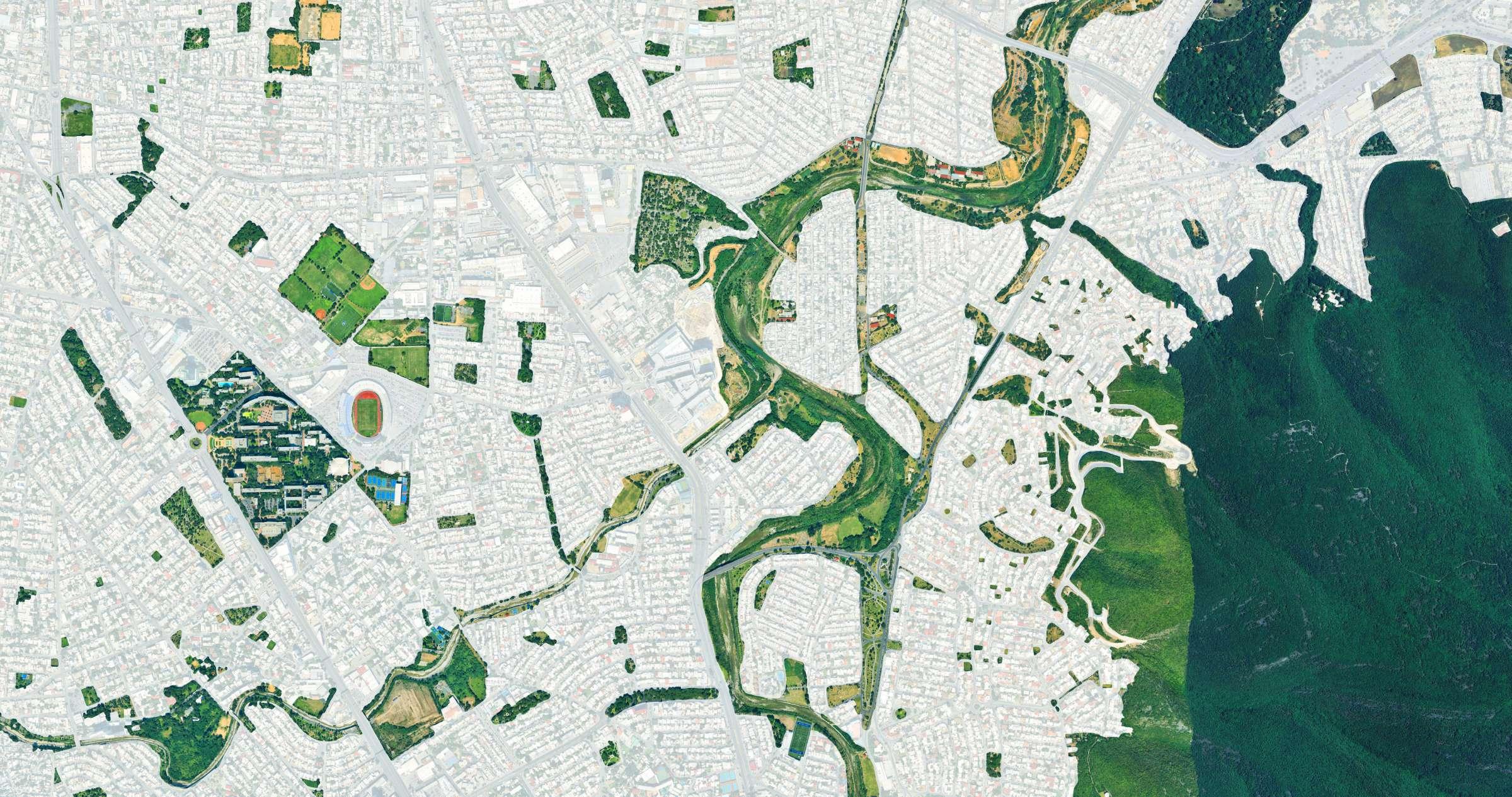
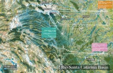
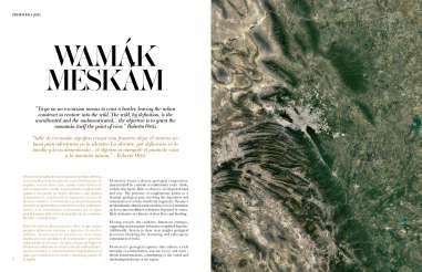
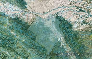
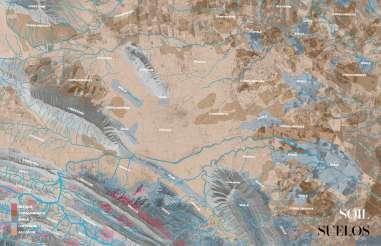
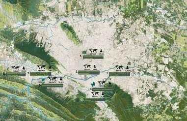
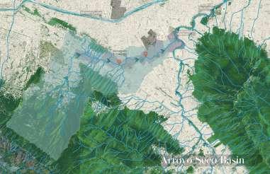
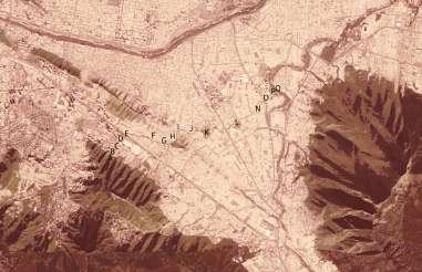
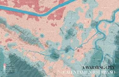
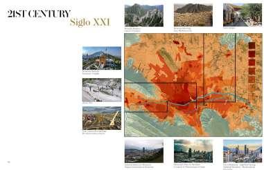
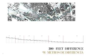
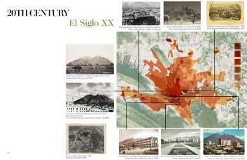
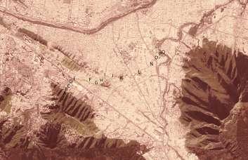
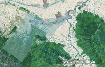
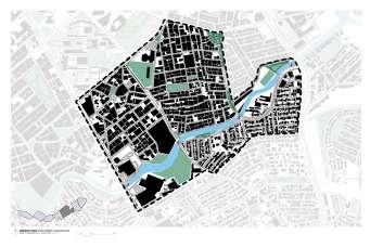
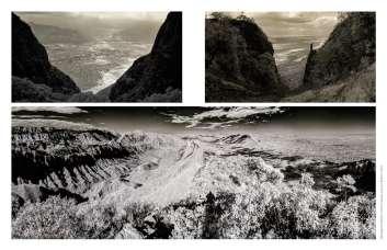
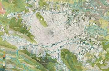
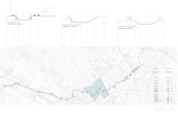
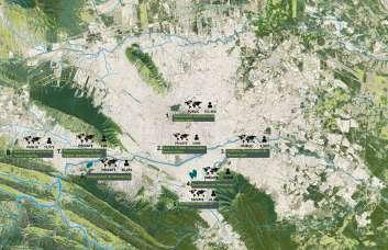
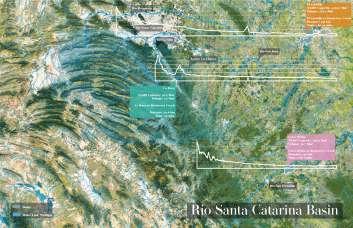
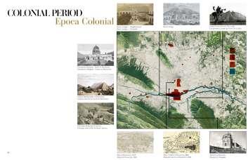
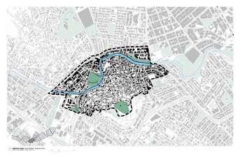
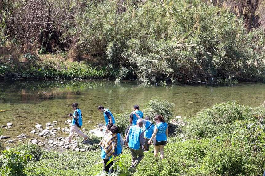
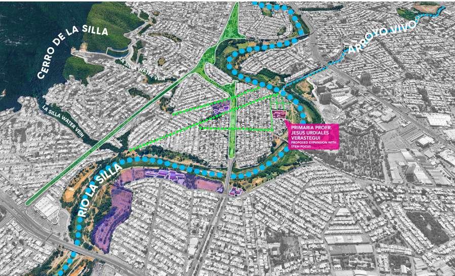
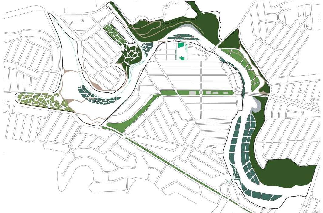
While documenting existing conditions, we noticed two water veins from Cerro de la Silla. We zoomed out from our site and mapped out green areas to visualize the mountain’s handprint.
Mientras documentábamos las condiciones existentes, notamos dos venas de agua provenientes del Cerro de la Silla. Ampliamos la vista desde nuestro sitio y mapeamos las áreas verdes para visualizar la huella de la montaña.
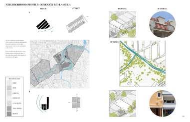
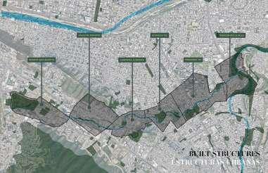
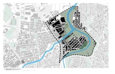
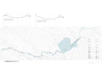
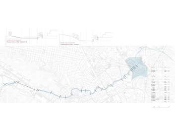
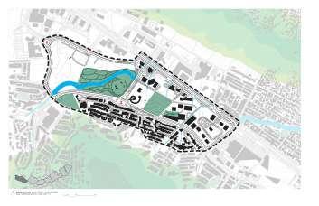
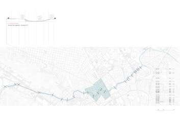
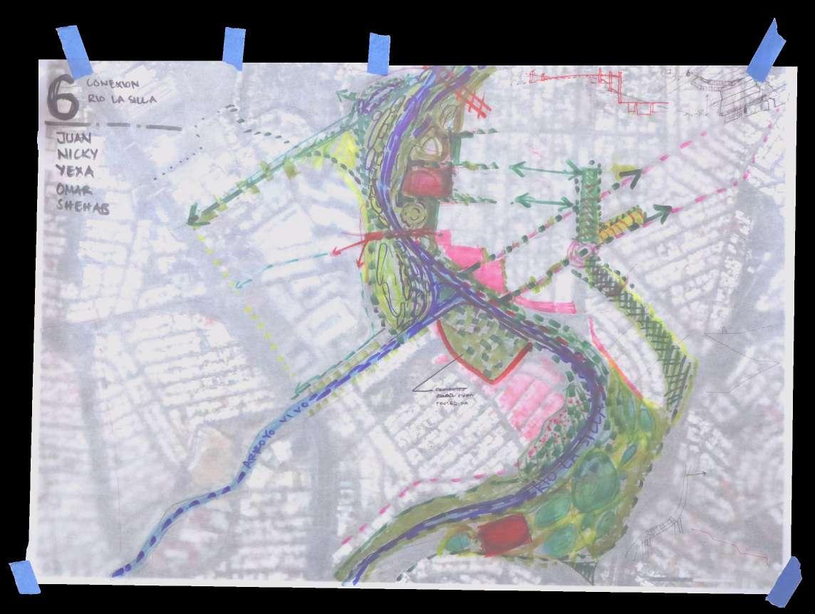
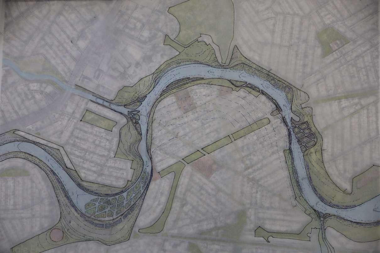
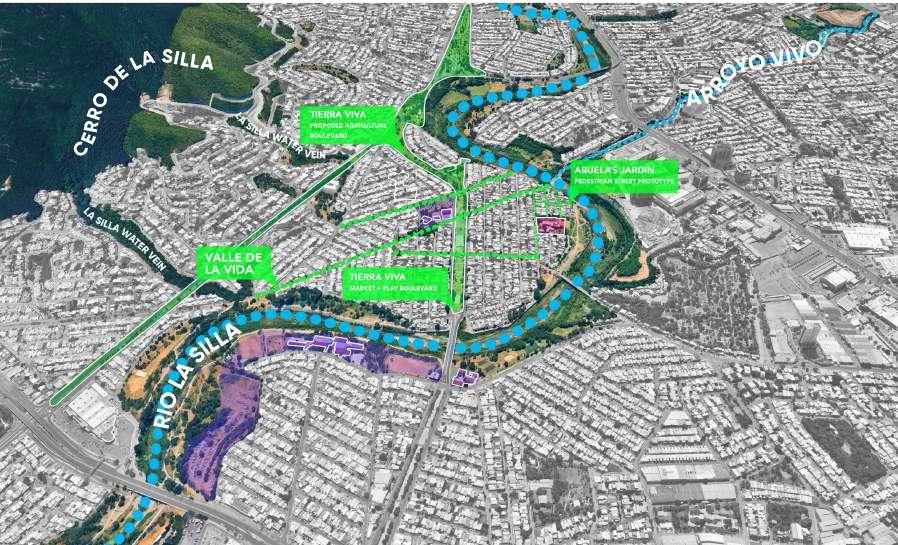
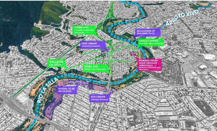
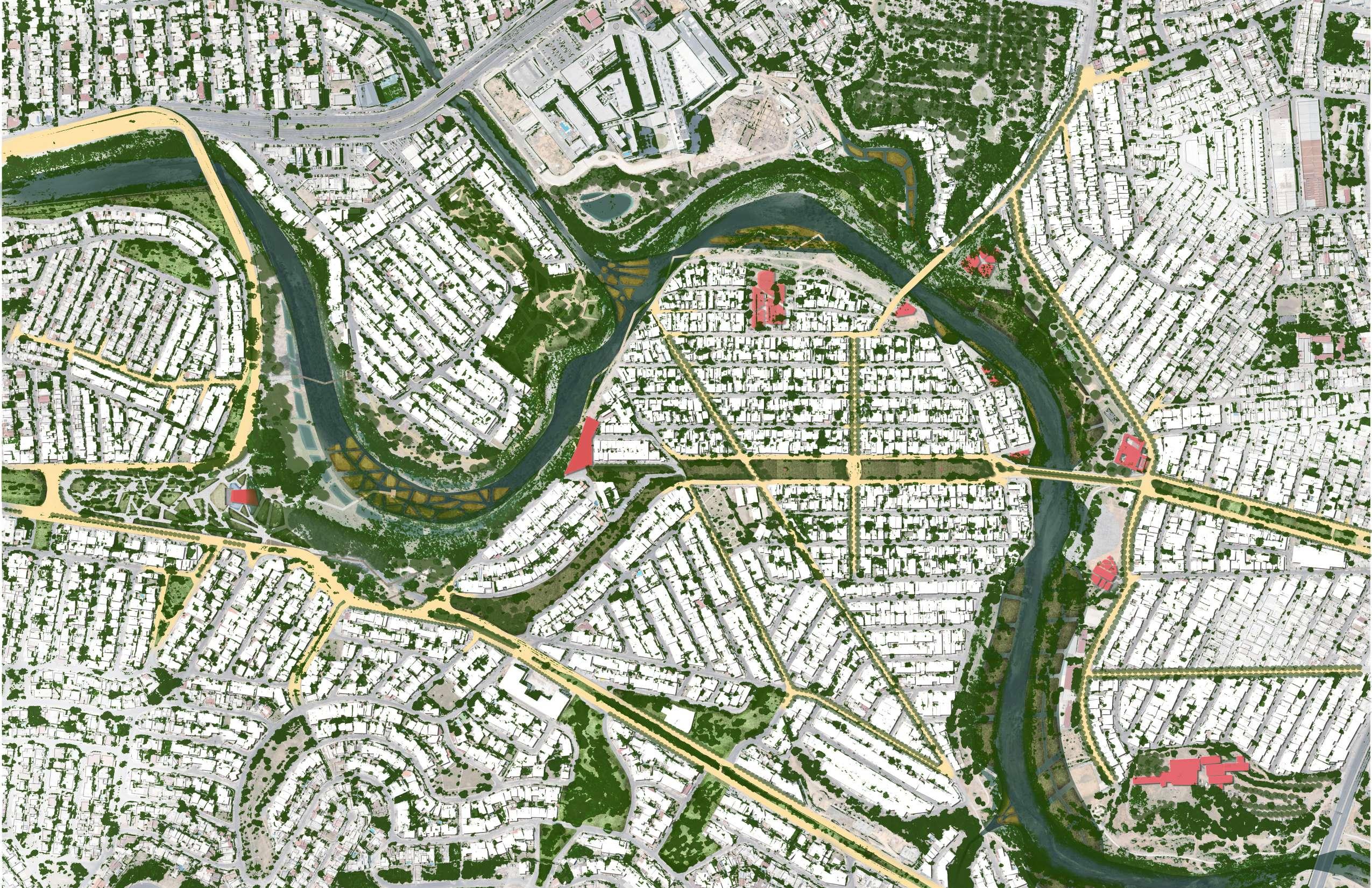
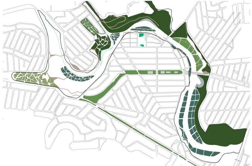
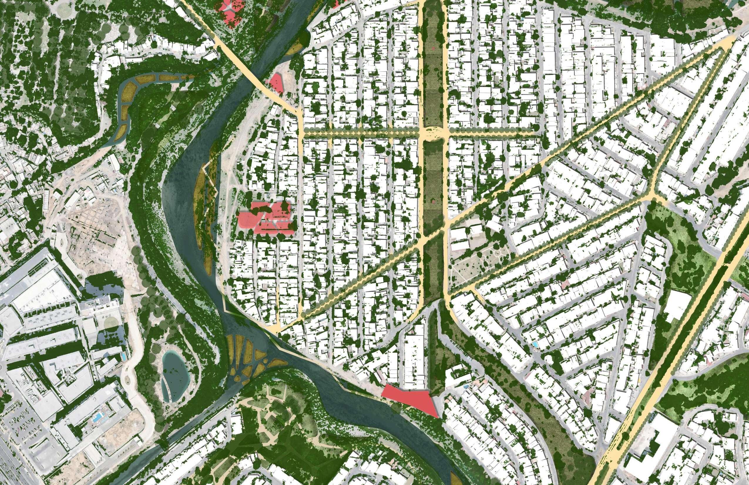
Our proposal, Encuentros Vivos, can be found at the intersection of the Arroyo Vivo and Rio de La Silla.
The name symbolizes the convergence of the following:
1. Neighborhoods from varying economic classes coming together arounf the Arroyo Vivo and Rio de La Silla.
2. A melding of urban infrastructure and urban fabric occurring in this area.
3. The marking of a natural junction as the creek flows into the river.
4. An intersection between ecology and infrastructure
Nuestra propuesta, Encuentros Vivos, se encuentra en la intersección del Arroyo Vivo y el Río de La Silla.
El nombre simboliza la convergencia de lo siguiente:
1. Vecindarios de diversas clases económicas que se reúnen alrededor del Arroyo Vivo y el Río de La Silla.
2. Una fusión de infraestructura urbana y tejido urbano que ocurre en esta área.
3. La marcación de una intersección natural mientras el arroyo fluye hacia el río.
4. Una intersección entre ecología e infraestructura.
01
Monterrey + Rio la Silla
The city of mountains nested along the rugged terrain od the Sierra Madre mountain range of America.
02
03
Monterrey + Rio la Silla
La ciudad de montañas anidada a lo largo del terreno accidentado de la cadena montañosa de la Sierra Madre en América
04
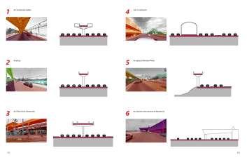
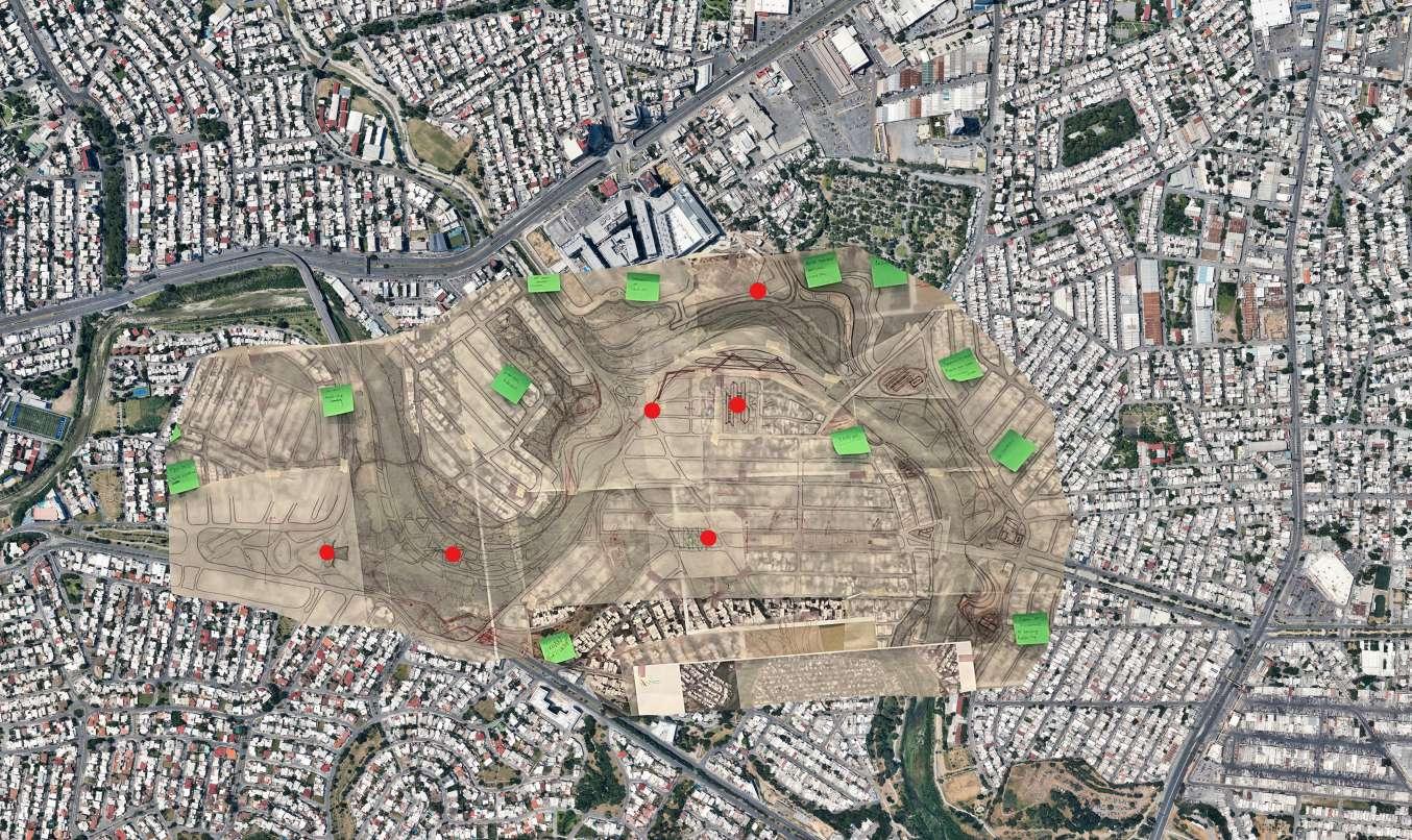
Challenges + Opportunities
Defining the landscape, architecture, and programmatic strategies for the living school.
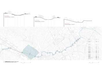
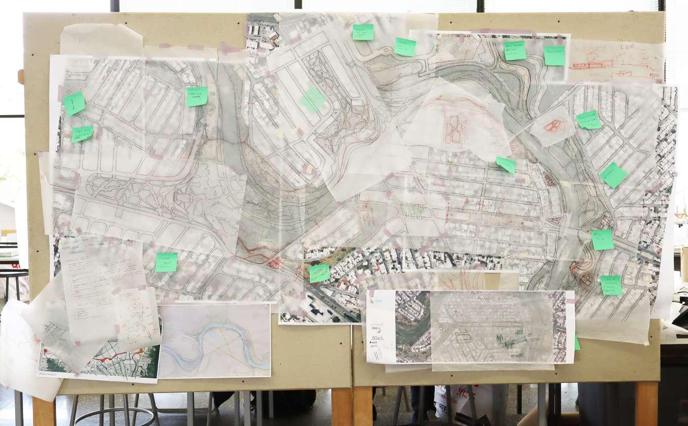
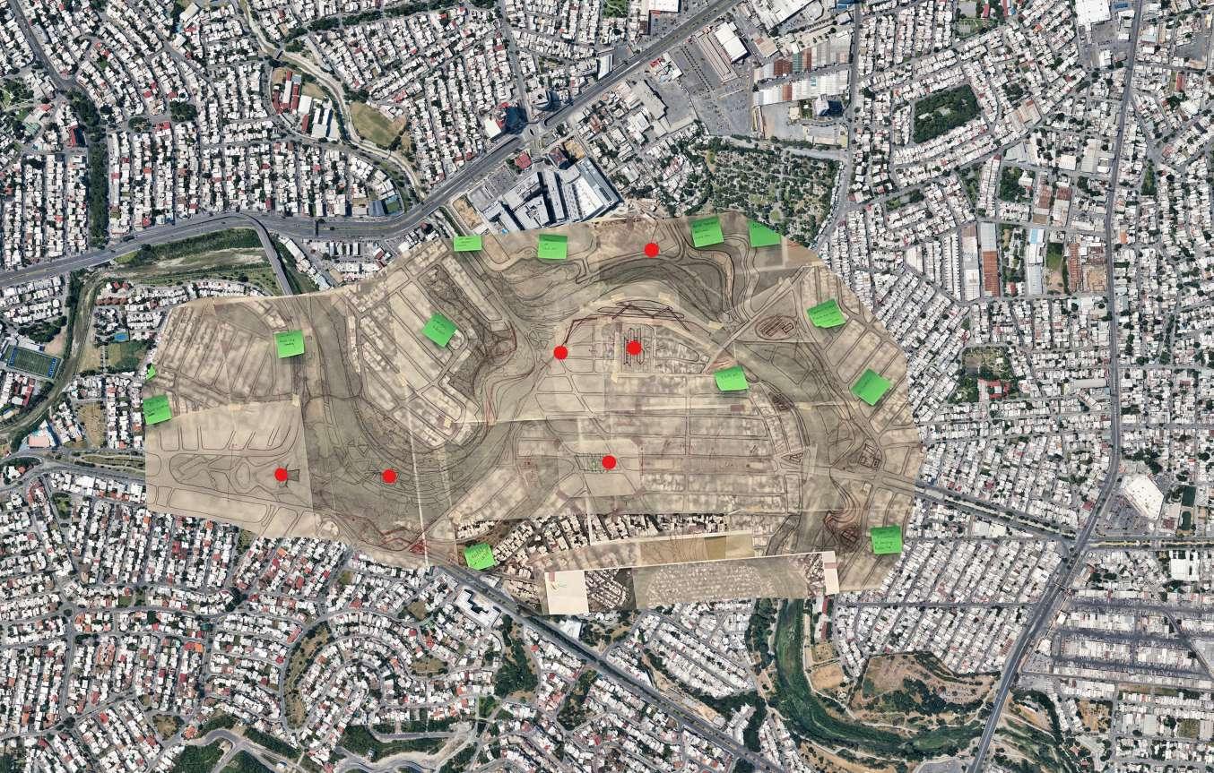
Process 1:1000 mapping charette hand drawing the conditions and refining the areas of intervention.
Framework Proposal
Desafíos + Oportunidades
Definir las estrategias paisajísticas, arquitectónicas y programáticas para la escuela viva.
Proceso
Mapeo a escala 1:1000 durante la sesión de diseño colaborativo, dibujando a mano las condiciones refinando las áreas de intervención.
Propuesta de Marco de Referencia Marcos para agua, circulación paisaje.
05
06
Frameworks for water, circulation, and landscape.
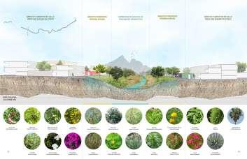
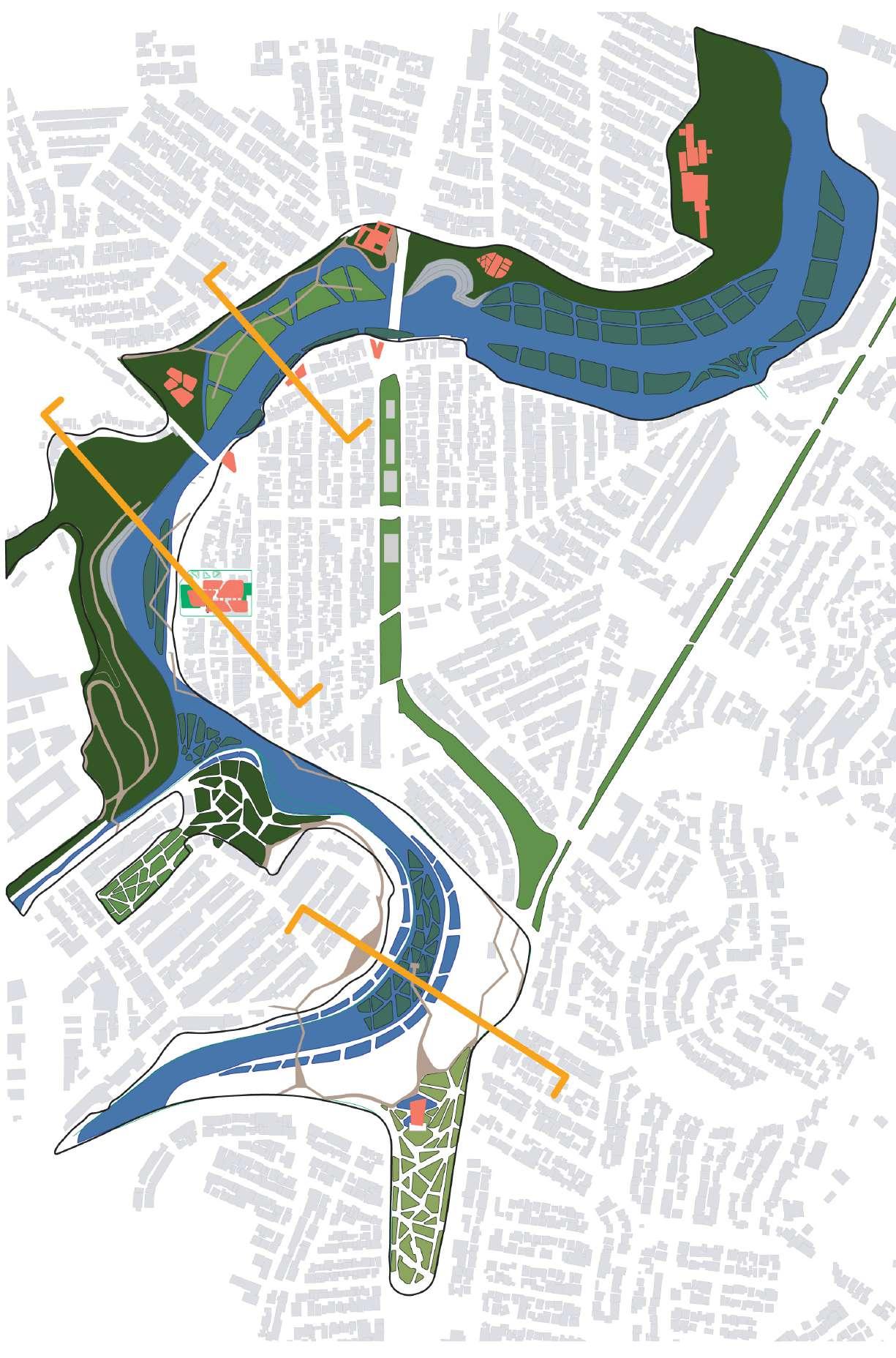
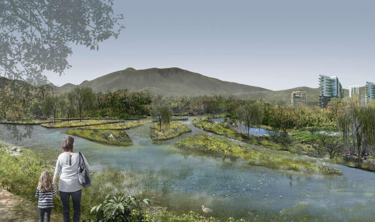
Defining the Wetlands
Large scale riparian wetland system strategies re-connecting people, nature, and wildlife.
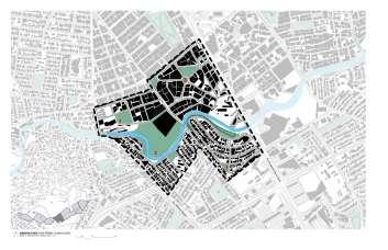
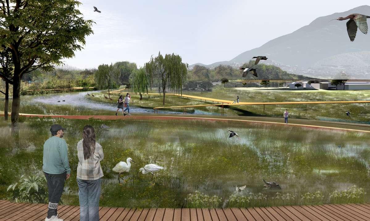
Encuentros Vivos
A living school bordering Rio la Silla that connects people from all backgrounds through wetlands, chinampas, and agriculture.

Definiendo los Humedales
Estrategias de sistemas de humedales riparios a gran escala para reconectar a las personas, la naturaleza y la vida silvestre.
Encuentros Vivos
Una escuela viva que bordea el Río La Silla, conectando a personas de todos los orígenes a través de humedales, chinampas y agricultura.
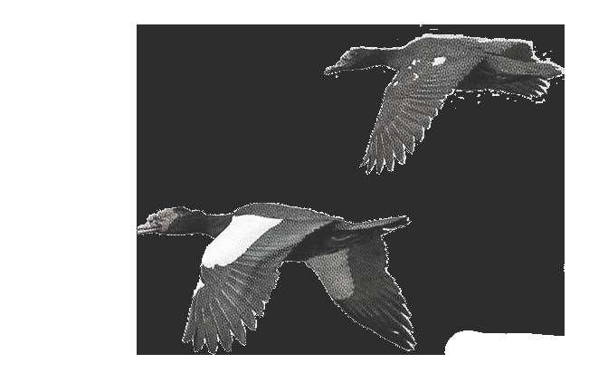
 PATO REAL
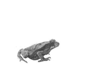
SAPO NEBULOSO
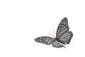
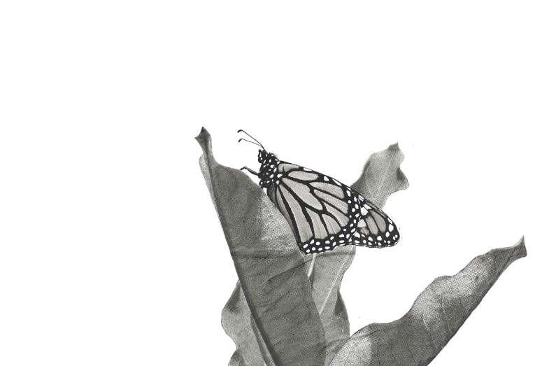
MARIPOSA MONARCH
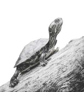
TROTUGA GRAVADA
PATO REAL
SAPO NEBULOSO
MARIPOSA MONARCH
TROTUGA GRAVADA
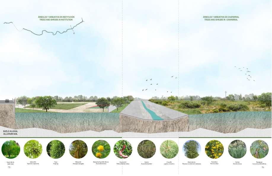
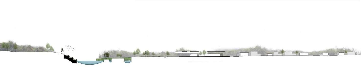
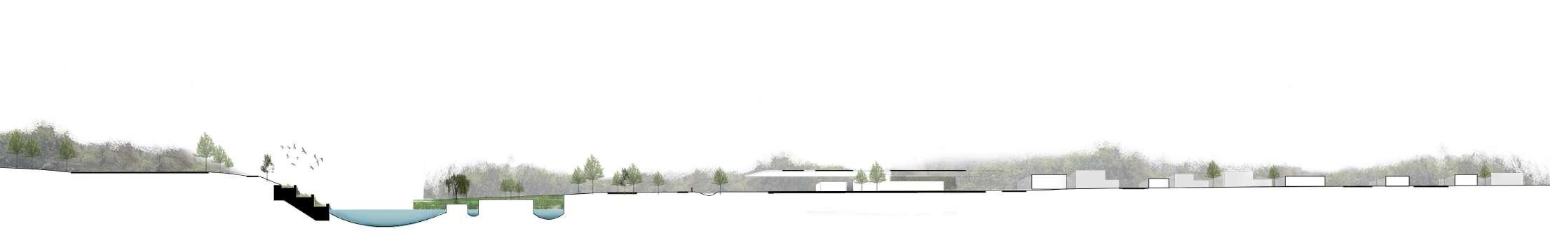
EXISTING CONDITIONS CONDICIONES EXISTENTES PROPOSED CONDITIONS CONDICIONES PROPUESTAS
LANDSCAPE PAISAJE
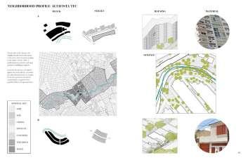
Identifying potential landscape zoning and establishing connections among them is a key focus.
Identificar zonas potenciales de paisaje y establecer conexiones entre ellas es un enfoque clave.
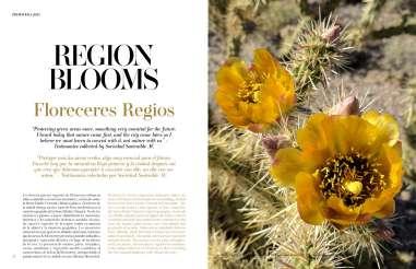
PROMOVIENDO LA AGRICULTURA URBANA
EXISTING CONDITIONS CONDICIONES EXISTENTES
PROPUESTAS
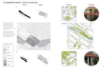
Gaining a deeper understanding of the urban fabric is essential to bridge conditions between existing structures and programs.
Obtener una comprensión más profunda del tejido urbano es esencial para establecer conexiones entre las condiciones existentes de estructuras y programas.
WATER DETENTION + INFRASTRUCTURE DETENCIÓN DE AGUA + INFRAESTRUCTURA
EXISTING CONDITIONS EXISTING CONDITIONS CONDICIONES EXISTENTES CONDICIONES EXISTENTES PROPOSED CONDITIONS PROPOSED CONDITIONS CONDICIONES PROPUESTAS
Recognizing vulnerabilities and challenges is crucial to developing effective solutions throughout the design process.
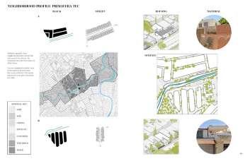
We focused on a lot containing a primary school, kindergarden w/ garden programs, and a clinic. Reconocer las vulnerabilidades y desafíos es crucial para desarrollar soluciones efectivas a lo largo del proceso de diseño.
Nos centramos en un terreno que contiene una escuela primaria, un jardín de infancia con programas de jardinería y una clínica.
CONDICIONES PROPUESTAS WATER TREATMENT + INFRASTRUCTURE TRATAMIENTO DE AGUA + INFRAESTRUCTURA
A living school bordering Rio la Silla that connects people from all backgrounds through wetlands, chinampas, and agriculture.
Promoting indigenous practices for health, wellness, and education.
Una escuela viva que bordea el Río La Silla, conectando a personas de todos los orígenes a través de humedales, chinampas y agricultura.
Promoviendo prácticas indígenas para la salud, el bienestar y la educación.
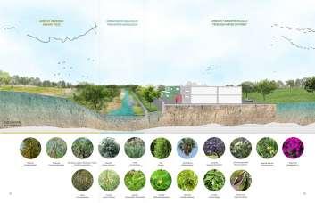
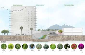
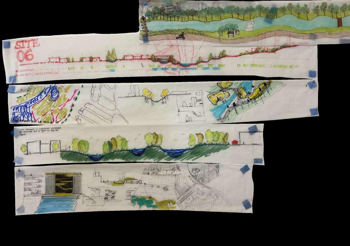
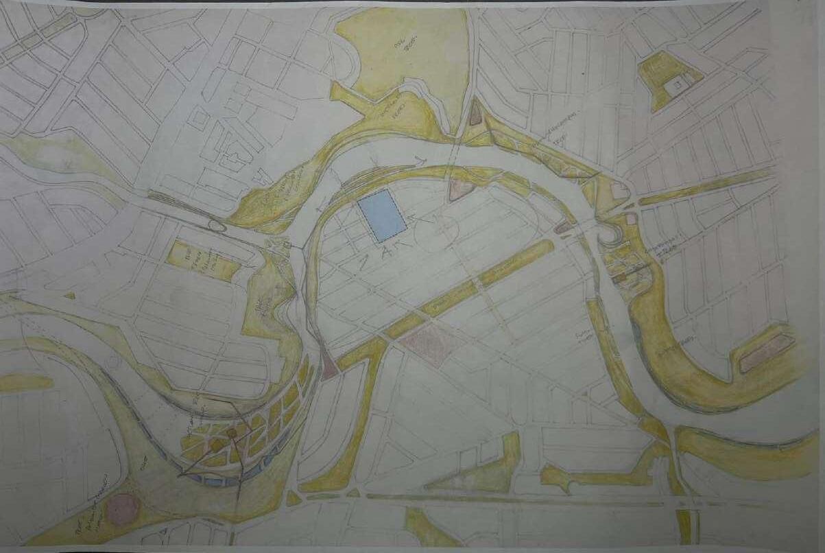
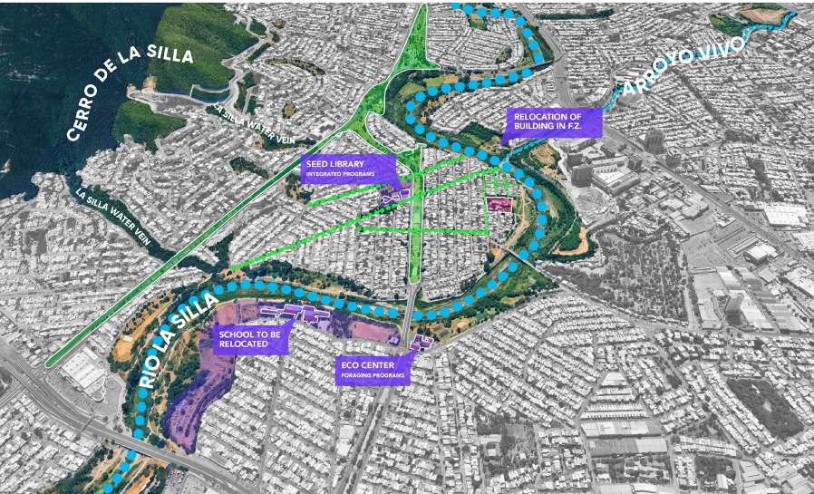
The site for Living Encounters can be found at the intersection of the Arroyo Vivo and Rio de La Silla.
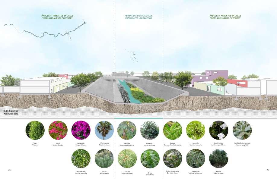
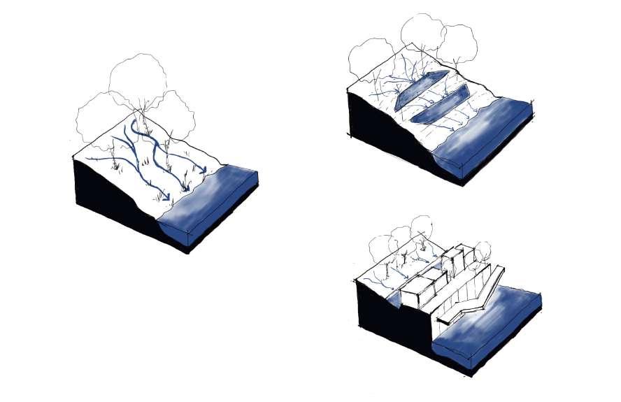
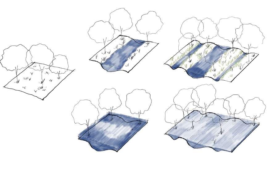
We developed a series of water strategies using a wetland system to help hold, manage, and clean the water.
Landscape and Vegetation Enhancement
Commit to expanding green spaces and vegetative elements to enrich the environment and aesthetic appeal.
Communal and Economic Spaces
Enhance communal spaces to boost local economies through programmed areas for farmers’ markets and educational activities, thereby supporting and promoting urban agriculture.
Educational and Event Spaces Designate spaces specifically for agronomy-related educational programs and events to engage and inform the community.
Mobility Enhancement Strengthen mobility frameworks to support and encourage active transportation, including walking and biking, making neighborhoods more accessible and environmentally friendly.
Water Management as Infrastructure Program water features to serve dual purposes—both as functional landscape infrastructure and aesthetic elements, managing water flow and treatment efficiently.
Community Space Development Actively Identify and propose potential sites for architectural designs that will foster community interaction and enhance neighborhood livability.
Urban Agriculture Integration Program urban agriculture into communal farmlands to encourage community participation and sustainable practices.
El sitio para Encuentros Vivos se encuentra en la intersección del Arroyo Vivo y el Río de La Silla.
Desarrollamos una serie de estrategias hídricas utilizando un sistema de humedales para ayudar a retener, gestionar y limpiar el agua.
Mejora del Paisaje y la Vegetación Comprometerse a expandir espacios verdes y elementos vegetativos para enriquecer el ambiente y el atractivo estético.
Espacios Comunales y Económicos Mejorar espacios comunales para impulsar las economías locales a través de áreas programadas para mercados de agricultores y actividades educativas, apoyando y promoviendo la agricultura urbana.
Espacios Educativos y de Eventos Designar espacios específicos para programas educativos y eventos relacionados con la agronomía para involucrar e informar a la comunidad.
Mejora de la Movilidad Fortalecer los marcos de movilidad para apoyar y fomentar el transporte activo, incluyendo caminar y andar en bicicleta, haciendo que los vecindarios sean más accesibles y respetuosos con el medio ambiente.
Gestión del Agua como Infraestructura Programar características de agua para servir a dos propósitos: como infraestructura paisajística funcional y elementos estéticos, gestionando eficientemente el flujo y tratamiento del agua.
Desarrollo de Espacios Comunitarios Identificar activamente y proponer sitios potenciales para diseños arquitectónicos que fomenten la interacción comunitaria y mejoren la habitabilidad del vecindario.
Integración de Agricultura Urbana Programar la agricultura urbana en tierras agrícolas comunales para fomentar la participación comunitaria y prácticas sostenibles.
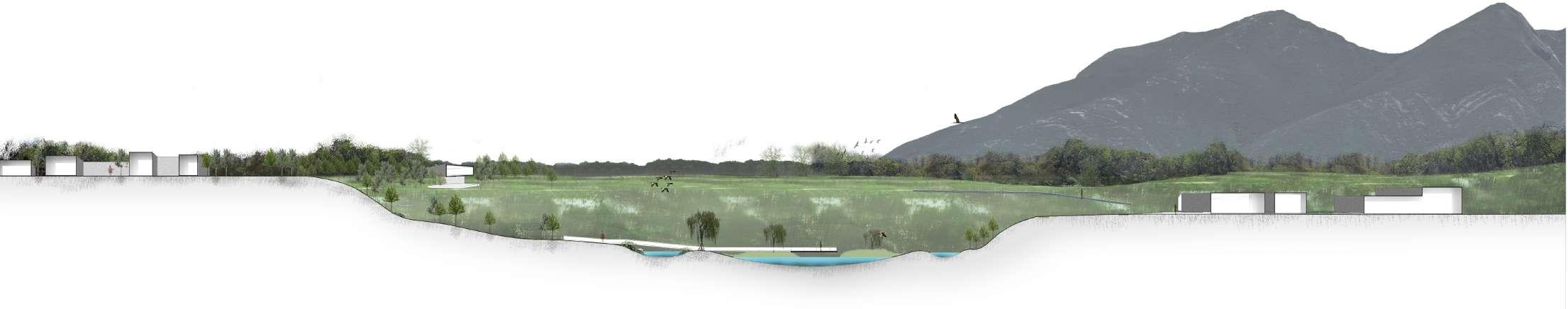

The site for Living Encounters can be found at the intersection of the Arroyo Vivo and Rio de La Silla.
We developed a series of water strategies using a wetland system to help hold, manage, and clean the water.
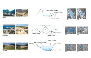
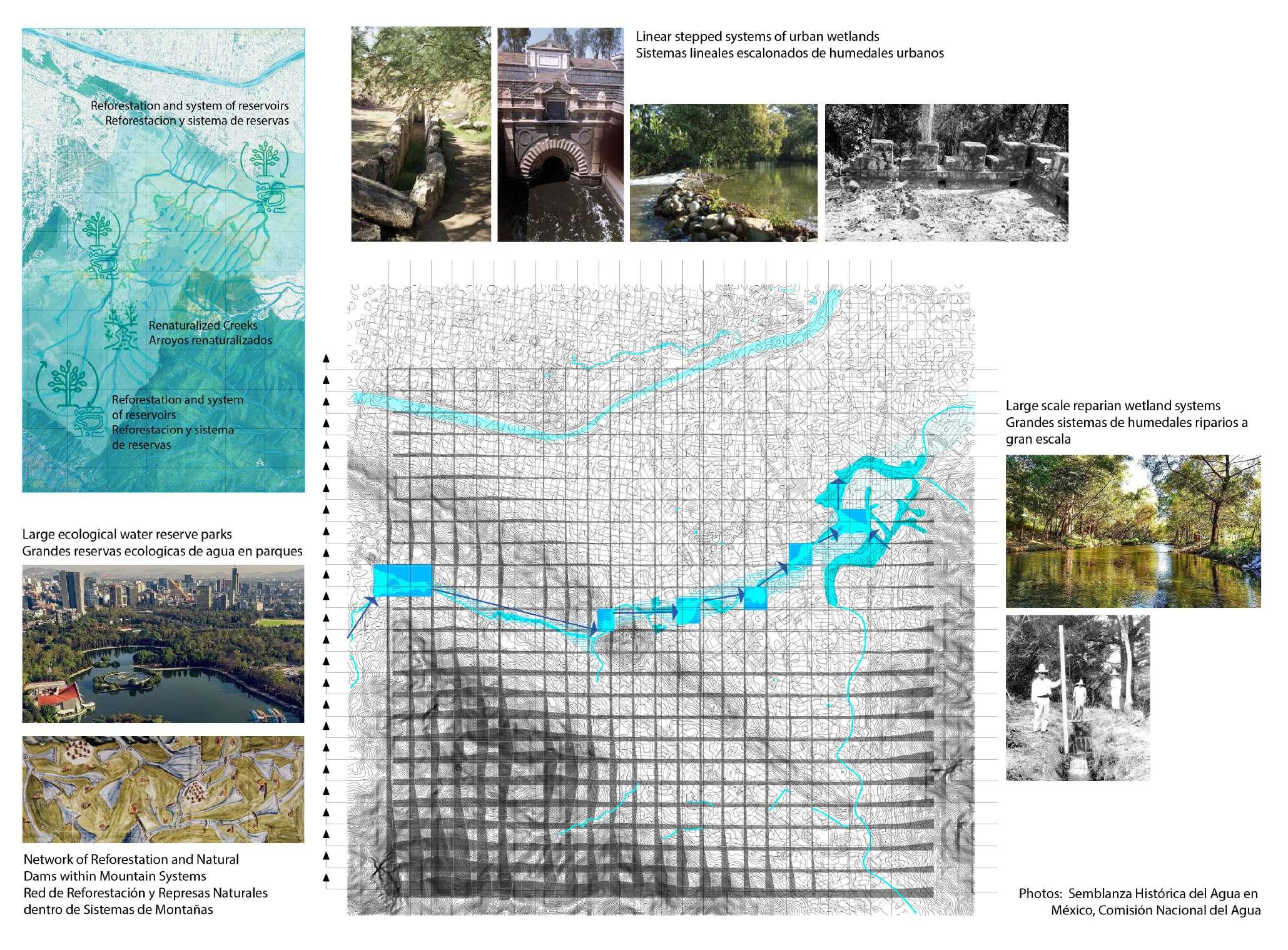
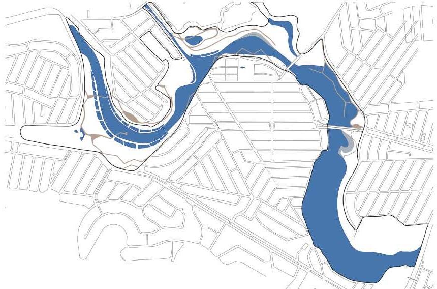
Flood Control and Retention
Implement a series of water reservoirs at various elevations to retain water during and after rainfall, effectively controlling floods.
Water Treatment
Establish a series of water reservoirs with wetlands designed to hold and treat water before it is discharged into the river.
Erosion and Flow Management
Develop infrastructures and wetlands that incorporate the Tesla Valve Model to control erosion and manage water flow efficiently.
El sitio para Encuentros Vivos se encuentra en la intersección del Arroyo Vivo y el Río de La Silla.
Desarrollamos una serie de estrategias hídricas utilizando un sistema de humedales para ayudar a retener, gestionar y limpiar el agua.
Control de Inundaciones y Retención
Implementar una serie de embalses de agua en diversas elevaciones para retener agua durante después de las lluvias, controlando eficazmente las inundaciones.
Tratamiento de Agua
Establecer una serie de embalses de agua con humedales diseñados para retener y tratar el agua antes de que sea descargada en el río.
Gestión de Erosión y Flujo
Desarrollar infraestructuras y humedales que incorporan el Modelo de Válvula Tesla para controlar la erosión y gestionar eficientemente el flujo de agua.
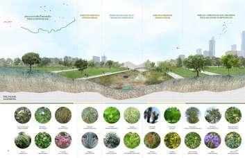
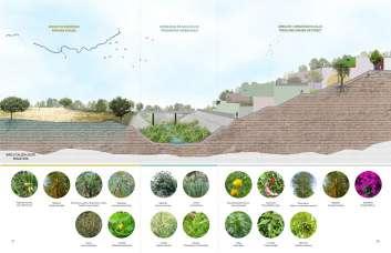
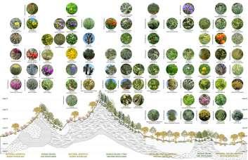
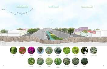
To truly bring the living school to life, we needed to develop a variety of planting areas to support the other systems and strategies in place.
These areas each play a role in improving the relationship between water, nature, animals, and people.
Wetlands for Water Treatment
Utilize natural wetland systems to purify water, harnessing their inherent filtration capabilities.
Soil Improvement
Enhance soil conditions to increase water retention, supporting healthier vegetation and reducing runoff.
Urban Agriculture and Foraging Promote urban farming and foraging opportunities to foster local food production and community engagement.
Vegetation as Infrastructure Implement vegetation strategically as a form of landscape infrastructure to stabilize soil, manage water flow, and provide aesthetic value.
Biodiversity Enhancement Focus on increasing biodiversity and the diversity of species to create more resilient and vibrant ecosystems.
Boulevard Systems Develop boulevard systems that integrate infrastructure improvements with enhanced vegetation, creating multifunctional green spaces.
Para realmente dar vida a la escuela viva, necesitábamos desarrollar una variedad de áreas de plantación para apoyar los otros sistemas y estrategias en su lugar.
Estas áreas cada una desempeñan un papel en mejorar la relación entre el agua, la naturaleza, los animales y las personas.
Humedales para Tratamiento de Agua Utilizar sistemas naturales de humedales para purificar agua, aprovechando sus capacidades de filtración inherentes.
Mejora del Suelo
Mejorar las condiciones del suelo para aumentar la retención de agua, apoyando una vegetación más saludable reduciendo el escurrimiento.
Agricultura Urbana y Recolecta Promover oportunidades de agricultura urbana y recolección para fomentar la producción local de alimentos y la participación comunitaria.
Vegetación como Infraestructura Implementar vegetación estratégicamente como forma de infraestructura paisajística para estabilizar el suelo, gestionar el flujo de agua y proporcionar valor estético.
Mejora de la Biodiversidad Enfocarse en aumentar la biodiversidad y la diversidad de especies para crear ecosistemas más resilientes y vibrantes.
Sistemas de Bulevar Desarrollar sistemas de bulevares que integren mejoras de infraestructura con vegetación mejorada, creando espacios verdes multifuncionales.
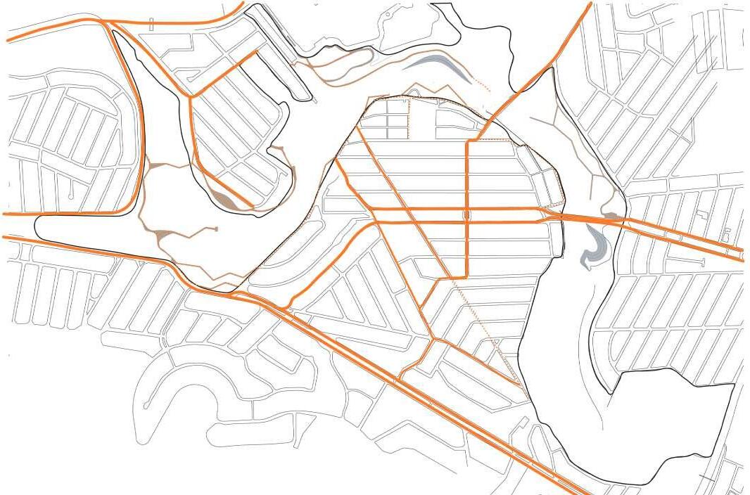
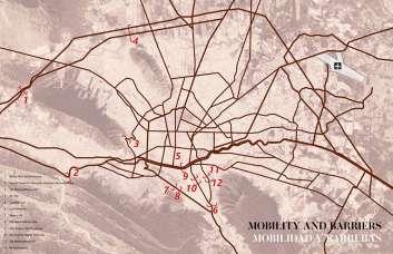
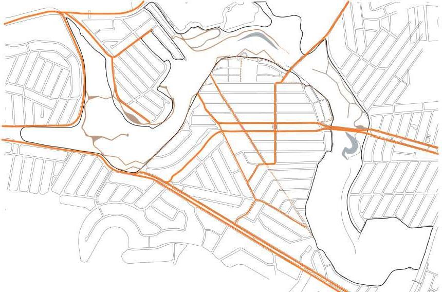
Currently the water divides all of the neighborhoods that surround our site.
We developed 3 key strategies to connect people, animals, and opportunities.
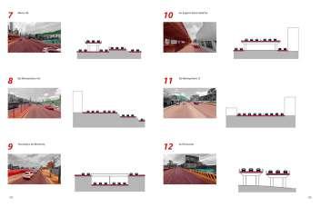
Riverfront Connectivity
Implement a carefully designed series of promenades to connect neighborhoods with waterfronts, enhancing access and enjoyment of the riverfront.
Neighborhood Connectivity Develop comprehensive plans for active transportation by integrating bike lanes and pedestrian walkways, facilitating easier and safer movement within neighborhoods, and promoting active transportation.
Agricultural Connectivity Establish routes connecting neighborhoods to communal farmlands, supporting farmers’ markets and urban agriculture initiatives by improving access and encouraging community participation.
Actualmente, el agua divide todos los vecindarios que rodean nuestro sitio.
Desarrollamos 3 estrategias clave para conectar a las personas, los animales y las oportunidades.
Conectividad del Frente Fluvial Implementar una serie de paseos cuidadosamente diseñados para conectar los vecindarios con las riberas, mejorando el acceso y disfrute del frente fluvial.
Conectividad del Vecindario Desarrollar planes integrales para el transporte activo mediante la integración de carriles para bicicletas y caminos peatonales, facilitando un movimiento más fácil y seguro dentro de los vecindarios, y promoviendo el transporte activo.
Conectividad Agrícola Establecer rutas que conecten los vecindarios con las tierras agrícolas comunales, apoyando los mercados de agricultores y las iniciativas de agricultura urbana mediante la mejora del acceso y fomentando la participación comunitaria.
CONDICIONES EXISTENTES EXISTING CONDITIONS

CONDICIONES EXISTENTES EXISTING CONDITIONS
how do we design with the creek and river so they’re accessible to current and future generations?
¿cómo diseñamos con el arroyo y el río para que sean accesibles para las generaciones actuales y futuras?