3 minute read
ponder s corner
option 1
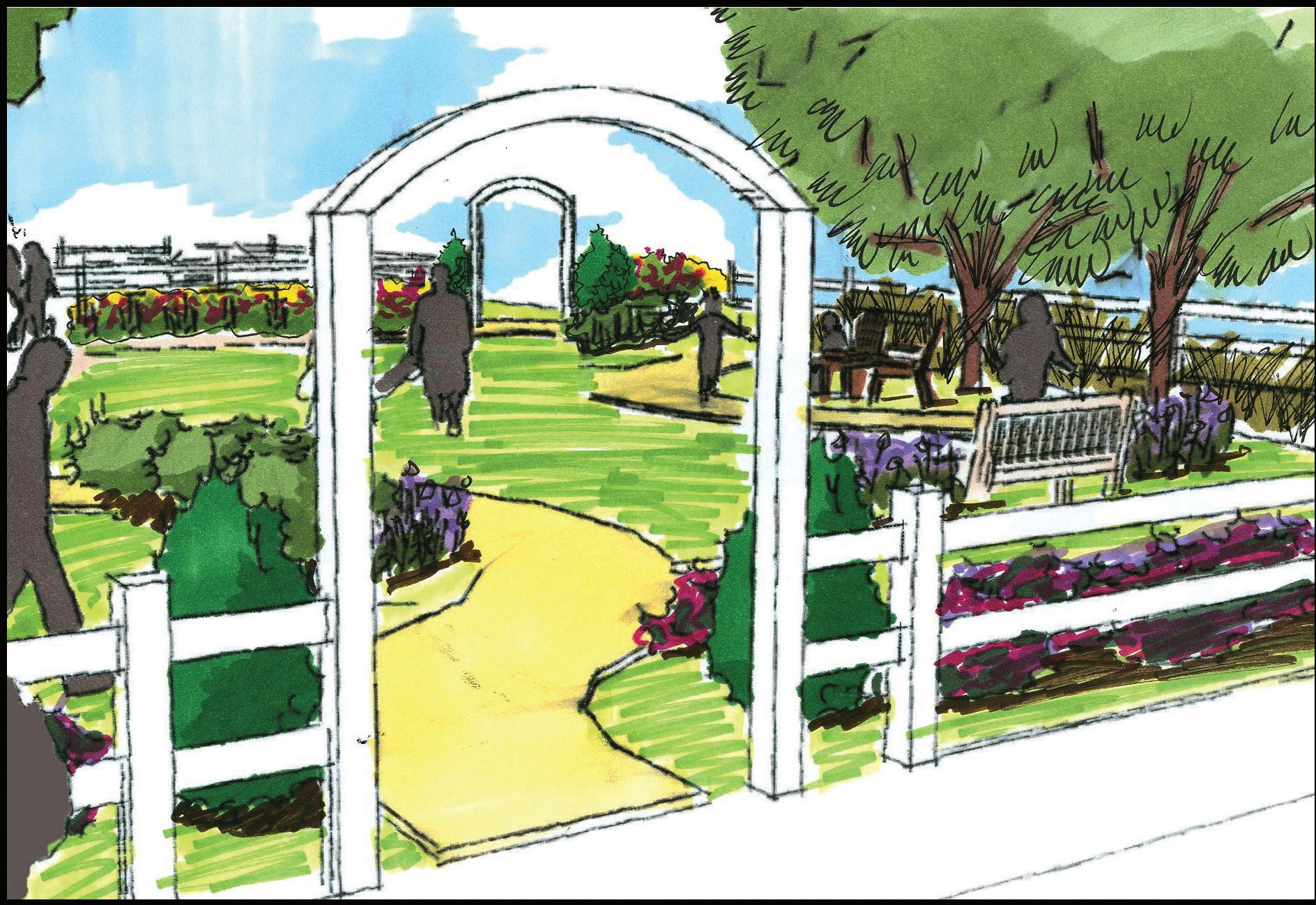
The purpose of this design is to use the site’s existing features to the fullest potential. In essence, anything that is added to the site is done to help the public appreciate the site as it is.

featured elements: • white vinyl fencing (as used at rec. fields) or brick and metal (Ponder Offices) white archway entrances
downtown welcome sign screening plant masses shade trees picnic tables/patio furniture

option 2


This design uses some of the same visual elements from option 1 while also creating an element that will draw people into the space. Design option 2 will provide amenities that include: a short walking trail and picnic areas within the site that will attract public attention and encourage the use of the space in addition to increasing the visual appeal.
featured elements: • walking path additional plant massing additional seating swingset
option 3
The purpose of this option is to build upon option 2, by maximizing the land use potential of the site. This design includes the construction of a corner building that will contain both retail space and public restrooms, and an interactive fountain that will provide a great way to escape the heat in summer months.
featured elements: • interactive fountain additional plant masses corner business building public restrooms in corner building murals on building


OPTION 3 (above). The completed look of option 3 for the property including the corner building and interactive fountain.
ADDITIONAL FOUNTAIN ELEMENTS (right). Sculptures of local animal species would be a creative way to add additional character to the arrowhead fountain, which reflects the rich Native American history of the area.
option 3


signage options
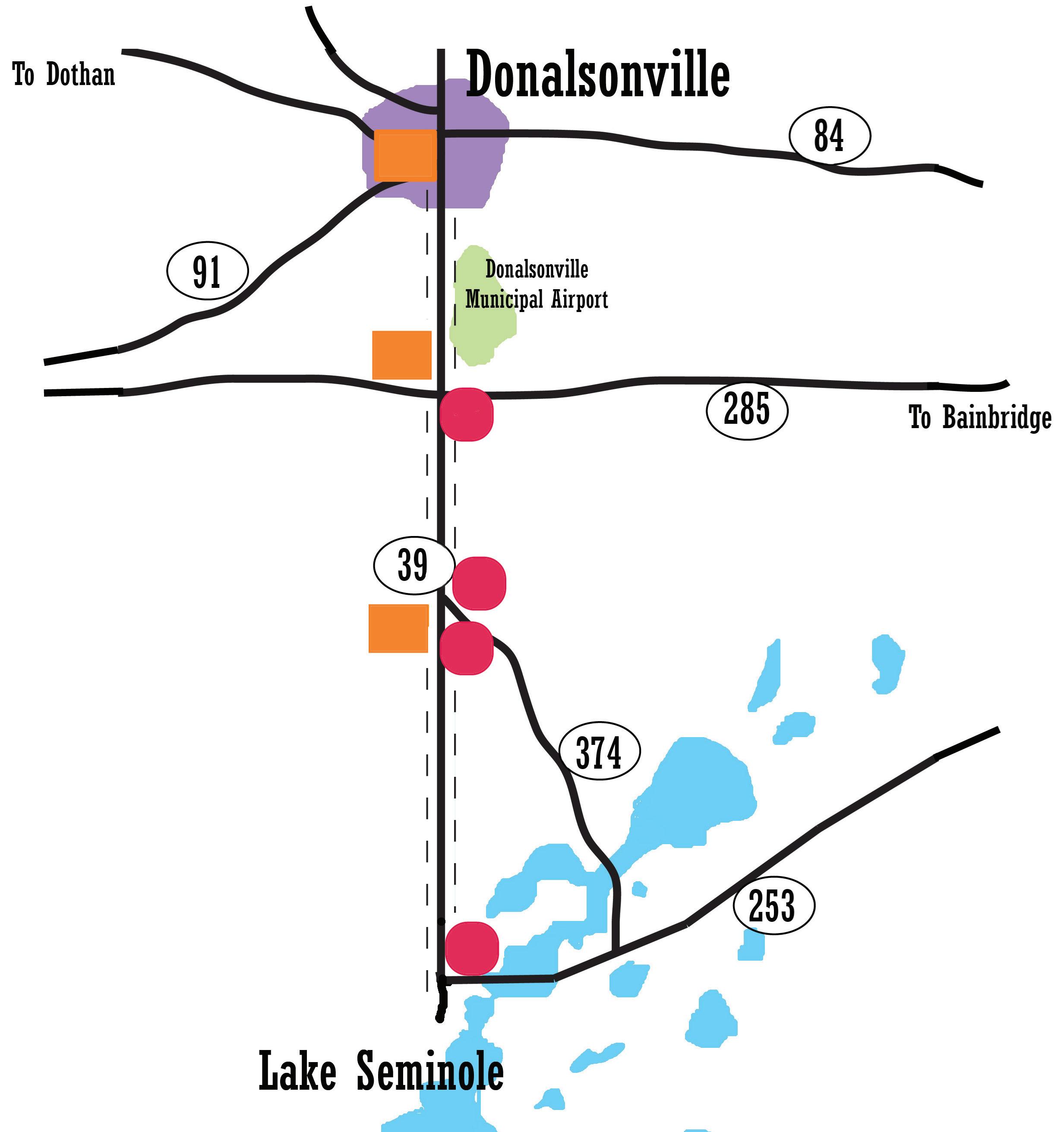
Legible, yet fun and enticing signage is needed along GA 39 to connect Lake Seminole and downtown Donalsonville.
SIGNAGE MAP. Depicts downtown Donalsonville, major highways, and Lake Seminole. Red dots indicate where signage for downtown Donalsonville should be placed. Orange squares indicate signage displaying information about Lake Seminole, and the dashed line indicates possible telephone pole signage. telephone pole indicators Icons that relate to Donalsonville and Lake Seminole, such as bass, would serve as appropriate signage along the GA 39, connecting downtown to the lake and providing aesthetic interest along the corridor. Another appropriate icon would be an arrowhead, due to Donalsonville’s rich Native American history as well as the fact that it will literally point travelers in the right direction. A simpler option would be to paint stripes on telephone poles along the corridor. As residents and visitors pass by the poles and notice the color they are painted, they will know they are on the correct route to the lake or downtown.
roadside signage Old fishing boats, canoes, kayaks, and other water sporting equipment can be painted and displayed along the side of the road to indicate the route to the lake. Alternatively, old farm equipment such as tractors and plows can serve as creative signage for Donalsonville while representing the great agricultural history of the area.


