17 minute read
Companies - SANSA
Companies
Guy Leitch
Advertisement
SANSA SET TO GROW BIG
The COVID-19 pandemic has caused the greatest crisis ever faced by commercial aviation. However, the space sector is rising above this crisis, both literally and figuratively. In a rare break of good news, the South African government has shown admirable commitment to the future by committing large scale funding for the continued development of South Africa’s space capability.
ABOVE: SANSA success as a development agency has been rewarded with a massive R4.47 billion fund allocation.
INTERNATIONALLY, space is now seen as the aerospace industry’s fastest-growing opportunity, with a combined $10 billion pipeline of long-term opportunities and several large proposals awaiting responses that total around $1 billion in the near term.
The USA has led a massive surge in space investment, from the new U.S. Space Force to a NASA mission to return Americans to the Moon in the coming years. Significantly, there is a commercial race to establish low Earth orbit (LEO) communication and Earth observation services.
This ‘return to space’ has not gone unnoticed by the South
African government which has included the South African
National Space Agency (SANSA) - an entity of the Department of Science and Innovation (DSI), in its Sustainable Infrastructure
Development Symposium (SIDS).
THE SIDS FUNDING
In July 2020 the integrity of SANSA and its achievements were recognised by the South African government and partner investors who have approved a substantial R4.47 billion in additional funding for the next three years. This will enable the agency to undertake hugely exciting new projects that will have demonstrable long-term benefits for not just South Africa, but the rest of Africa, and indeed mankind.
At the beginning of 2020 SANSA submitted a proposal to the Sustainable Infrastructure Development Symposium (SIDS). The SIDS is an intervention, introduced by President Cyril Ramaphosa, to focus investments in infrastructure as part of South Africa’s economic recovery plan. Under the SIDS process,
SANSA proposed a Space Infrastructure Hub.
More than 270 projects were submitted for consideration. Of these, 55 projects were classified as bankable (i.e. shovel ready) and of these 55 projects, five were considered high priority for the country in terms of the associated impact that was expected.
It is to SANSA’s great credit that its pitch for a Space Infrastructure Hub was considered as part of the top five projects. The total value of the SANSA pitch was R4.47 billion of blended financing which consists of parliamentary grants, debt and equity financing, committed over three years.
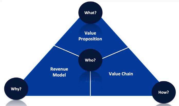
SANSA’s concept of a Space Infrastructure Hub is based on its concept of the space value chain. This chain includes 1) satellite builds (Earth observation and science missions), 2) a new ground segment, 3) an expanded data segment and a new data visualisation centre, 4) activation of the satellite based augmentation system over Southern Africa that was piloted a few years ago, 5) the development of products and services for use across all spheres of government, 6) human capital development and training.
The Space Infrastructure Hub also includes other projects for which separate ring-fenced funding has already been secured, namely: • Upgrade of SANSA’s Houwteq Facility – R75 million • Establishment of a Concurrent Engineering Design Facility – R25 million • Establishment of a new Space Weather Centre – R90 million • Establishment of an Earth Observation Data Cube facility – R12.5 million • A Research, Development and Innovation Fund for the development of products and services – R60 million.
A concerted team effort was put into securing these investment streams. To make maximum use of the opportunity they have been given, SANSA’s CEO Dr Val Munsami says, “significant emphasis will now need to be expended in repositioning/ reshaping the organisation to deliver on these exciting projects, which will require us to work seamlessly. Once we deliver on the promised value proposition, this will mean certain investments over the longterm, which will bolster the space sector's financial sustainability into the foreseeable future. This requires an ‘all hands-on deck’ team effort.”
This new phase for SANSA took a further step forward on 24 July when a Government Notice was issued that designated a number of Strategic Infrastructure Projects (SIPS), which forms part of the Presidential Infrastructure Coordination Committee (PICC). The Space Infrastructure Hub proposal that was submitted by SANSA is declared as SIP 22 which implies that space infrastructure is now seen as a national priority, and is viewed in a similar footing, for example, as the Square Kilometre Array Project (SIP 16).
The Head of Investment and Infrastructure within the Presidency, Dr Ramokgopa, confirmed that the Space Infrastructure Hub will be receiving R4.47 billion worth of funding and that these funds are already secured from investment institutions and are ready to be deployed, subject to final checks and balances.
A key step in the way forward is that SANSA will now be working with the Presidency, DSI and the Department of Communications and Digital Technologies (DCDT), as well as Sentech to secure a Telecommunications Satellite for South Africa through the SIDS process.
THE SPACE VALUE CHAIN
The basis for this large funding allocation to SANSA is that space technology, products and services contributes to sustainable development and provides many benefits to the country.
SANSA points out that of late, there has been an increasing appreciation of the value proposition of space applications. Spacederived services, such as Earth observation, satellite communications, navigation and space exploration, are increasingly being used to inform policy choices relating to political, social, economic and
environmental challenges.
Daily weather forecasts, instantaneous worldwide communications, navigation systems, and a constant ability to record high-resolution images are all examples of space technologies that we have come to rely upon. Even basic commodities, such as food and energy resources, are facilitated by space-based technology. All these benefits enable us to enjoy a convenient lifestyle
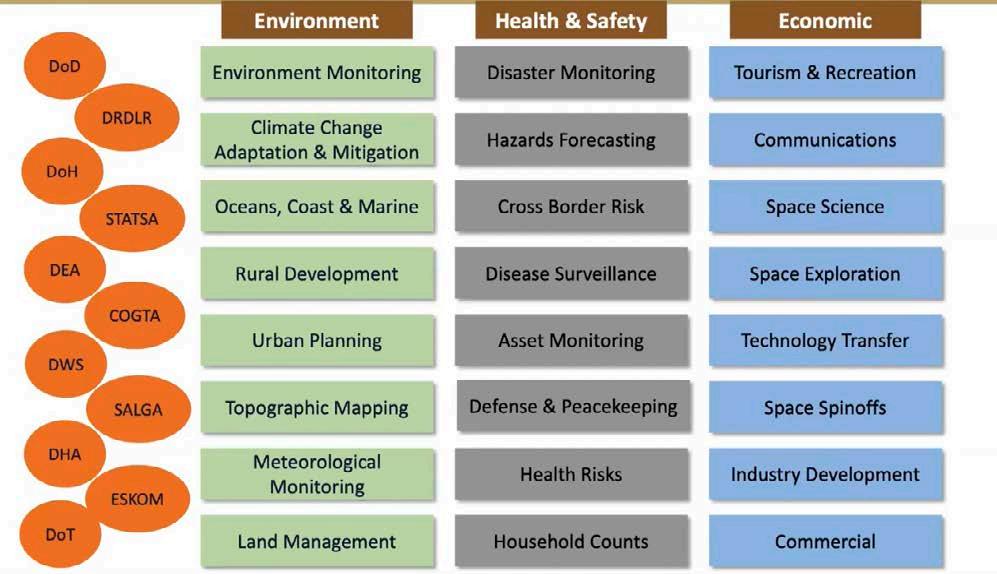
which is supported by the instant access to information and spacebased applications, such as the global positioning system (GPS) and global television coverage.
Of specific interest is that rapid response mechanisms to disasters and climate change are only possible through satellitebased information. Having this technical know-how and capacity to participate effectively in space-related activities is essential to any nation’s long term growth if it is not to become dependent on others as a consumer of space products and services.
For South Africa, building an indigenous space capability that will fully service the needs of the country is at the centre of these developments. The business case positions space data as a service for sustainable development, especially addressing government’s national priorities, and also for commercial usage, such as in the insurance and banking industries.
SATELLITES
Depending on their mission, satellites have different orbits. Weather and communication satellites are placed in Geostationary Earth Orbits (GEO) at an altitude of 36,000km above the equator, from which they have a constant gaze on the same hemisphere of the Earth. These satellites complete one orbit around the Earth every
24 hours. Other satellites are placed in Low Earth Orbits (LEO), which complete on average one orbit around the Earth every 100 minutes. Because the Earth rotates in the plane of the orbit, such a satellite eventually covers the whole Earth. Such orbits are used for remote sensing, navigation and positioning, and space exploration applications.
Satellites are the key part of the concept of a space data value chain, which is the chain of activities for transforming inputs into outputs/outcomes that end-users value.
The space data value chains comprise of the following elements: 1: Satellites - are built to perform a specific mission in an efficient, cost effective manner. A satellite can be conceptually divided into two basic parts: a) The payload – is the part of the satellite that actually performs the mission. b) The bus – provides all the “housekeeping” functions necessary to make the payload work. 2: Ground Station – the Earth-based point of communication with the satellite and launch platforms for control and retrieving user data. Elements of the ground station include: • Antennae systems, • Radio frequency equipment,
• Mission data recovery equipment, • Data user interface, • Telemetry, tracking and command equipment, • Station control centre. 3: High Performance Computing Platform – transforming raw satellite data into usable information requires high performance computing hardware and software, which forms the core element of the space data value chain. Such a platform will be used to: • Store satellite imagery data • Process the imagery data into usable information • Access a cloud platform and a user interface, where developers and users can converge without the need for significant infrastructure investments on their part.
4: Space Industry – comprises an important part of the conversion process of the space data value chain, where data and information is transformed into services and products that can be used by end users. There are two key activities that will be undertaken:
The design, creation, and delivery of products and services
The marketing and the post-delivery service. 5: Products and Services – value is delivered to end users by employing best practices in developing new and advanced applications to support their respective requirements. Such applications must have specific attributes, namely:
Be relevant to end user needs by addressing a very specific challenge
Be delivered in a timely and appropriate manner
Be packaged in a way that is easy to use. 6: Government – this is the primary user of space products and services in the quest to improve the quality of life of its citizens. In particular, government will use these product and services:
As a tool for evidence-based decision making
To monitor and evaluate the impact of specific policy choices
As a service delivery offering for the public good of its citizens. 7: Private Sector – space products and services have significant commercial value and form the biggest revenue component of the space data value chain. Industries in the private sector that require space products and services include: aviation, communications, energy, mining, agriculture, insurance, construction and banking.
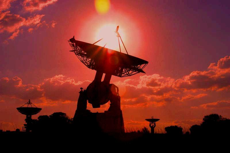
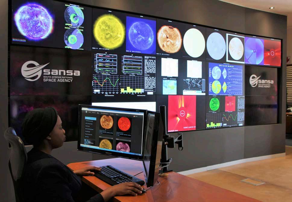
The SANSA Space Weather Regional Warning Centre monitors solar activity.
THE BENEFITS OF SATELLITES FOR AFRICA
EARTH observation/remote sensing satellites gather information about the nature and condition of Earth’s land, sea and atmosphere. The satellites receive electromagnetic emissions in various spectral bands that show objects, which are visible, such as clouds, hills, lakes and many other features. These instruments can detect an object’s temperature and composition, the wind’s direction and speed and environmental conditions, such as erosion, fires, and pollution.
Below is a selection of specific examples of the benefits of remote sensing:
1. IMPROVING HARVEST
YIELDS
In countries where the failure of a harvest may mean the difference between surplus and starvation, satellites have helped planners manage scarce resources and head off potential disasters before insects or other blights could wipe out an entire crop. For example, near the fringes of the Sahara Desert, scientists used satellite images to predict where locust swarms are breeding, thus saving large areas of cropland.
2. MONITORING SCARCE
RESOURCES
Remote sensing satellites can also help manage scarce resources by showing, for example, the best places to drill for water or oil. They have also become a formidable weapon against the destruction of the environment, because they can monitor large areas to assess the spread of pollution and other damages.
3. MONITORING SPACE
WEATHER
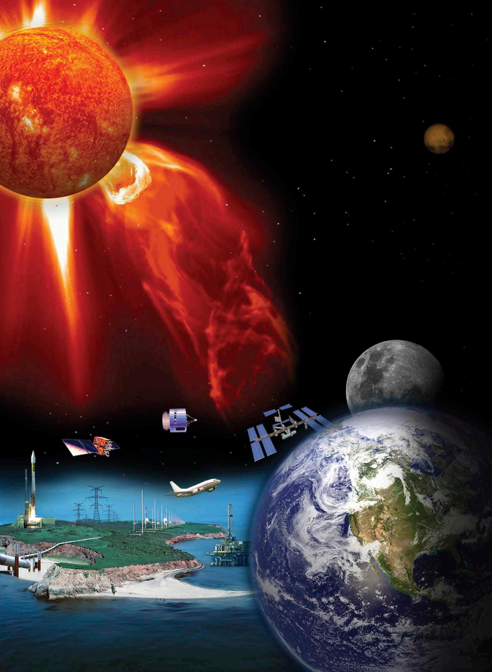
SANSA has been chosen by ICAO as one of two regional space weather centres to provide space weather services, including solar storm forecasts and warnings, to the global aviation sector. There are only five such centres in the world. The Space Science programme hosts the only Space Weather Warning Centre in Africa, providing early warnings and forecasts on space weather activity for public and private sector clients. This helps protect satellite technology, as well as communication and navigation systems in aviation and defence.
4. TOPOGRAPHIC MAPPING
Remote sensing technology has also helped mapmakers produce maps in a fraction of the time it would take using laborious ground or aerial surveys. This enables city planners to keep up with urban sprawl and provides key information in safety and security missions. In addition, such information is vital for disaster management where specific risk areas, such as flood and fire zones, can be ascertained from digital terrain maps.
The Sustainable Infrastructure Development Symposium has been key to mobilising funding for SANSA.
5. MONITORING GLOBAL CHANGE
Because remote sensing satellites cover the whole globe, they are important for the study of largescale phenomena like ocean circulations, climate change, desertification and deforestation.
Satellites pass over the same areas many times, making it possible to monitor environmental change caused by human activity and natural processes. Because data are collected in a consistent manner, satellites can reveal subtle changes over time that might otherwise remain undetected. For example, the well-known “ozone hole” over Antarctica and the phenomena of atmospheric ozone depletion was discovered using satellites.
6. SATELLITE COMMUNICATIONS APPLICATIONS
Satellite communications is a key enabler for developing countries to participate in the build-up of the global information infrastructure. Wireless systems are the most cost-effective way to develop or upgrade telecommunications networks in areas where user density is lower than 200 subscribers per square kilometre. Such wireless systems can be installed 5-10 times faster and at a 50% lower cost than landline networks.
Included below is a selection of specific examples of the benefits of satellite communications applications: a) Tele-education and training
Technologies for education and training, in particular distant education and multimedia, may be instrumental in meeting the needs of countries that have to train and integrate a large number of workers in widely dispersed and under-equipped areas. This allows for a constant renewal of skills without being geographically limited by Information
Technology (IT) infrastructure. b) Telemedicine
Many countries have to cope with large-scale disease outbreaks and telemedicine may help to meet these challenges by improving the organisation and management of health care. Databases may be linked through networks to monitor the development of diseases, provide access to medical expertise through tele-consultation and support remote medical assistance. In this regard, satellite communications contributes to preparing and implementing health policies. c) Weather forecasting
National weather forecasts begin with a current satellite view of Earth which show the direction of clouds and storms.
Further, by providing farmers with valuable climatic data, this technology has improved food production and crop management. d) Navigation and Positioning
Applications
GPS technology allows the calculation of positions on Earth to within one metre. With augmentations, satellite navigation can provide measurements down to centimetre levels.
ABOUT SANSA: SANSA was created ten years ago, but South Africa’s involvement with space research and activities began much earlier.
SANSA, an entity of the DSI, focuses on space science, engineering and technology that can promote development, build human capital and provide important national services. Much of this work involves monitoring the Earth and our surrounding environment, and using the collected data to ensure that navigation, communication technology and weather forecasting services function as intended.
SANSA oversees the following programmes:
The Earth Observation programme, the Space Operations programme (formerly the Satellite Application Centre at Hartebeesthoek near Lanseria); and the Space Science programme (former Hermanus Magnetic Observatory in Hermanus); as well as a newly established Space Engineering programme. 1. Earth Observation collects, processes, archives and disseminates Earth observation data (principally from satellites) to support policy-making, decision-making, economic growth and sustainable development in South Africa. Socioeconomic benefits include environmental and resource management, disaster management and health information. This is used for human capital development and science advancement in geo-informatics, image and data processing, and remote sensing. 2. Space Engineering develops, builds and tests systems and sub-systems for satellites. The aim is to develop and launch South Africa’s own satellites, while growing the human and technological capacity for satellite development, and supporting a native South African satellite industry. 3. Space Operations provides state-of-the-art and globally competitive ground station facilities and services for global launch activities. This includes satellite tracking, telemetry and command (TT&C), launch support, in-orbit testing, mission control and space navigation. The programme also conducts applied research, development and innovation in space operations and human development in this sector. 4. Space Science operates a wide range of infrastructure across southern Africa and in Antarctica, all dedicated to studying the Earth’s magnetic field, the Sun and the nearearth space environment. SANSA maintains several space science and space weather projects in Antarctica, as well as on Marion and Gough Islands, providing valuable space science data for national and international research.
CONCLUSION
A R4.47 billion investment in space may seem strange when compared to the needs of those struggling for basic service delivery on the ground. However, it has been well shown that the benefits arising from the mobilisation of such funds by government through its exciting and innovative SIDS programme will pay off many times over in terms of the long-term benefits of such investment. For this reason, private sector funders also recognise the importance of such investment and are willing to invest in partnership with government.
The only satellite engineering capability in Africa
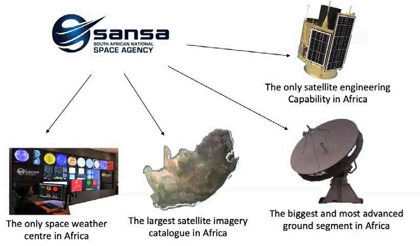

SANSA has numerous core competencies which are key components of the Space value chain.
What is the Space Infrastructure Hub for National Development?
In recognition of its macro-economic impact in the Digital sector, the Space Infrastructure Hub has been awarded a budget approval for R4.47 billion over three years.
THIS funding will allow for the development of satellite infrastructure, satellite-based augmentation systems, earth observation and space science satellites. Domestic access to this type of infrastructure will reduce South Africa’s reliance on other countries for the type of information that these satellites can make available and is expected to reduce the timeframes for collecting necessary data.
The space hub will provide information that may be used to develop targeted responses to the socio-economic and infrastructure challenges South Africa faces.

FLYING HIGH WITH SANSA
Its name may suggest that it’s concerned only with matters higher than atmosphere-bound aviation, but the South African National Space Agency (SANSA) performs key services for all aircraft and their operators.

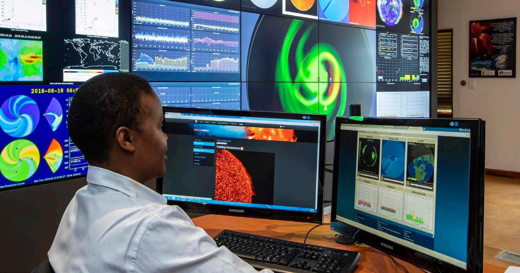
The Space Agency has been selected by the International Civil Aviation Organization (ICAO) as one of two regional centres to provide space weather services, including solar storm forecasts and warnings, to the global aviation sector. This means that every aircraft flying across the continent’s airspace will rely on SANSA for space weather information as part of its flight planning.
“With aviation, we consider four key risk areas: communication, navigation, avionics and radiation exposure,” says SANSA MD, Dr Lee-Anne McKinnell. “Highfrequency radio communication, as well as ground and airbased navigation systems, can be affected or knocked out entirely by space weather storms. Delicate electronics can also be damaged and radiation exposure poses a hazard for crew and passengers, particularly on long haul flights.” Space weather can also have a major knock-on effect on airlines and airports.
Another key competency of SANSA is compass accuracy. Despite the rise of modern navigation systems such as GPS and radio aids, compasses are still an essential component of aircraft navigation equipment. Electrical systems may fail, but the Earth’s magnetic field never does. However, it is continuously changing and that requires constant monitoring to determine the degree of compass variation at any specific place. A proper compass swing procedure is necessary to determine how to measure and compensate for the magnetic field of the actual aircraft, which will cause a deviation to the compass reading once located in the cockpit, due to the proximity of steel or iron components and by the effects of current flowing in nearby electrical circuits.
A properly conducted compass swing requires a calibrated reference compass, and must be done in a magnetically clean environment – free of steel structures, underground cables, or equipment that produces magnetic fields – to assure it is free of interference. As a recent grounding of part of a local airline’s fleet by the South African Civil Aviation Authority (SACAA) that stranded thousands of tourists over the holiday season recently showed, accurate compass swinging performed by qualified technicians is essential.
SANSA’s facility in Hermanus is the only SACAA accredited facility in South Africa that offers this type of service with the necessary expertise and facilities to perform training in the compass swing procedure on site. SANSA has been presenting training courses on the execution of compass swings to the South African Air Force for more than 20 years and recently hosted a five-day Compass Swing Training Course and a three-day Compass Swing Refresher Course. The course is presented by SANSA engineers and physicists who have many years of relevant magnetic navigation ground support experience.


