45 minute read
Sheep Ranching on San Miguel Island


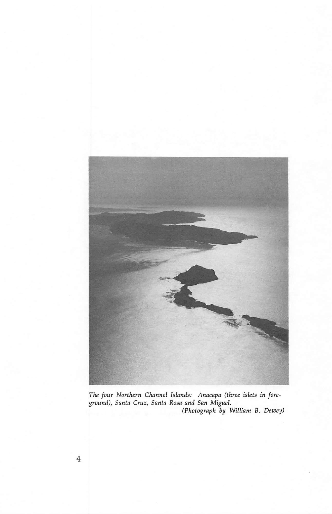
The four Northern Channel Islands: Anacapa (three islets in fore ground), Santa Cruz, Santa Rosa and San Migt^el. (Photograph by William B. Dewey)
4
CHANNEL ISLANDS NOMENCLATURE
By Walker A. Tompkins
The following article by the late Walker A. Tompkins was published in Santa Barbara Historical Society's Noticias, Vol. IV, No. 3, October, 1958.
Walker A. Tompkins (1909-1988) moved to Santa Barbara in 1948 where he wrote Western fiction for magazines, books, radio and television. In 1958, the year this article was published, he changed his writings to focus on Santa Barbara County's history.
Santa Barbara County's "maritime possessions", the Channel Islands, are currently in the news as a result of efforts by a southland group to persuade Congress to rename them in honor of their "forgotten" discoverer, Juan Rodriguez Cabrillo.
Since the name was established in 1792, the proposal to change it is being vigorously opposed by Santa Barbarans, including the private owners of property on the islands, and the directors of your Historical Society. The project had its genesis in a recently published book "The California Islands," by Charles Hillinger of the Los Angeles Times.
Mr. Hillinger's hankering to rename the Channel Islands is neither new nor original; it has been a popular sport for over four hundred years. The islands have probably been tagged with more labels than any other geographical feature on the coast, so that the practice of renaming them could almost be given the status of one of our old California customs.
No less than nine major groups have taken turns at christening the islands: the Indians; Cabrillo, in 1542; Vizcaino, in 1602; Costanso, in 1770; Perez, in 1774; Vancouver, in 1792-94; Wilkes, in 1841; the U.S. Coast Survey, of 1850; and a host of later-day place namers, who

5
Santa Cruz Island Foundation
finally consolidated their efforts, in 1938, when F.D.R. officially proclaimed the establishment of a "Channel Islands National Monument."
This Monument included the two westernmost of the
Anacapa group, and Santa Barbara Island to the south; but it excluded San Nicolas Island, of "Lost Woman" fame, the tourist resort of Santa Catalina, and the southernmost island, San Clemente. Thus it becomes obvious that the key word in naming the islands is the Channel which they create by their off-shore location.
The islands today are virtually inaccessible to the average tourist. In the case of San Miguel, the island is restricted to guided missile personnel of the U. S. Navy. Nevertheless, the Channel Islands are of great importance to Santa Barbara. Paralleling the shore line, they form a vast breakwater which shields the county's South Coast from ocean storms, thereby playing a key role in our far-famed climate. The islands have long been of major interest to scientists in the specialized fields of archaeology, ethnology, paleontology, anthropology and geology.
Today the Channel Islands are named, from east to west as follows: the Anacapa Group; Santa Cruz (the largest); Santa Rosa; and San Miguel. Collectively and individually, however, they have been officially known by a host of other names, which this article will attempt to summarize. Historians for centuries have consulted contemporary maps of California and, where the off-shore islands were concerned, "paid their money and took their choice."
The Channel Islands, as any school child knows, were discovered by Juan Rodriquez. Little is known of this man except that he was a Portuguese mariner, better known by his nickname of Cabrillo, which translates "little goat." He set sail from the port of Navidad, Mexico, on the 27th of June, 1542, with two ships, the San Salvador and La Victoria, for the purpose of exploring the west coast of New Spain.
California was sighted July 2; but it was not until the 15th of October that Cabrillo reached the sheltered waters of the Santa Barbara channel and his unidentified diarist noted this

in Relation of the Voyage of Cabrillo':
6
Channel Islands Nomenclature
"This day they passed along the shore of a large island, which must be 15 leagues long. They said it was very densely populated with the following pueblos: Niquipos, Maxul, Xugua, Nitel, Nacamo, and Nimitapal."
Cabrillo named this "large island" San Lucas. A few days later, discovering that it was actually three separate islands, he renamed them "Las Islas de San Lucas". The native Indian
names had been Ciquimuymu (San Miguel), Nicalque (Santa Rosa) and Limu (Santa Cruz).
On October 25 Cabrillo anchored in a sheltered bay on San Miguel Island. It was here that he suffered a fall which broke his arm and caused gangrene which eventually took his life. They took possession of the island in the name of the Crown and christened it La Posesion in honor of the occasion.
During the stormy month of November, Cabrillo continued up the California coast, reaching as far north as 38° 3V in the vicinity of Fort Ross, but failing to note the Golden Gate or Monterey Bay, the most important landmarks. Returning south, heavy weather off Point Concepcion drove Cabrillo to the shelter of La Posesion (San Miguel) once more.
His diarist reports: "Passing the winter on the island of La Posesion, on the 3rd of the month of January, 1543, Juan Rodriguez . . . departed from this life . . . He left as captain, Bartolme Ferrelo, a Levantine, who named the island Juan Rodriguez . . ."
Historians do not know positively whether Cabrillo was buried on San Miguel or Santa Rosa Island, due to the conflict of nomenclature existing at the time.
Six decades were to elapse before another European sail appeared on the horizon, Sebastian Vizcaino's, in 1602. Vizcaino was a Spaniard with a penchant for scattering new place names in his wake. Some were a bit unwieldy; as for example "The Bay of the Eleven Thousand Virgins" for Port San (Quentin, Baja California. He won local immortality, at any rate, when he bestowed the name "Santa Barbara" on the Channel to honor the martyred Roman virgin whose feast day was December 4, a day which found him anchored off our coast. He describes his arrival in the Santa Barbara channel in

his Diary^ as follows:
7
Santa Cruz Island Foundation
wrs^sfl.*
ft
Map by Russell Ruiz.

8
j. s 'Cl^
pf«.n
fiiuo
^ o ● ^
(Santa Barbara Historical Society collection)
Channel Islands Nomenclature
. . . we went on skirting the coast, and on Monday the second of said month we sighted two other large islands. Passing between the first and the mainland a canoe came out to us with two Indian fishermen . . . rowing so swiftly that they seemed to fly. They came alongside without saying a word to us, and went twice around us with so great speed that it seemed impossible; this finished, they their heads in way of courtesy ..
Vizcaino also gave the name Santa Barbara to the easternmost of the Anacapa Islands, although the later transferred (permanently) to the island lying to the southeast of the Channel group, far enough to fall inside the orbit of that most elastic and predatory of all geographical boundaries, the Los Angeles county line. (The name "Canal de St. Barbaria" also appeared on Briggs type maps as early at 1625).
Vizcaino kept on juggling place names at will. Santa Rosa, which had been Nicalque to the Indians and San Lucas to Cabrillo, was set down as "San Ambrosio charts. He also showed Santa Barbara and San Nicolas Islands, but makes no reference to them in his diary.
To San Miguel went the name "Isla de Baxos", which Juan Perez, in 1774, also applied to that island. On a 1794 map we find "Santa Rosa" in the middle of the three Channel Islands, and George Vancouver fixed this nomenclature in 1793. came aft, bowing name was on Vizcaino's
Next in line, working down the coast, is Santa Cruz Island. The Indians referred to it as Limu or Limun; Ferrelo in 1543 inked the name "San Sebastian" on his map of the island. Vizcaino, in his turn, called it "Isla de Gente Barbud" because he had heard rumors that bearded men—possibly mariners from Europe or the Orient who had been marooned there by shipwreck—had been seen by the Indians.
The name Santa Cruz first appeared in April 1774, when a shore party from the San Antonio, Juan Perez's ship, landed on its shores. A Friar lost a staff with a cross on it, which Indian found and returned the next day. However, it is not clear from Perez's maps and reports whether this incident occurred on what we now call Santa Cruz Island. an
9
Santa Cruz Island Foundation
The easternmost islands in the Channel group were by far the most troublesome, not only to lookouts posted in the crows nest atop a galleon's foremast, but to place-namers. The Anacapas, as we know them today, are actually a string of disconnected rocks large enough to be called islands.
Caspar de Portola, in 1770, mistook the westernmost island for the sail of a ship on the horizon. When he learned his mistake, he named the island Falsa Vela, false sail, and the adjoining islands Las Mesitas, or small tablelands. Four years later Juan Perez came along and renamed them 'Tsoletas de Santo Tomas", a name which frequently appeared on European maps of the period.
The only changeless thing where the Anacapas are concerned is the "monarch" who reigned there. His name was Confusion. For example, Costanso reports that "Anajup" was the native name for modern Santa Cruz Island, and that this name was transferred to the neighboring Anacapas.
Vancouver, in the last decade of the 1700s, called all three islands "Eneeapah", but spelled it "Enecapa" on his maps later on. Gibbs has Encapa, while the U. S. Coast Survey in 1852 set it down on their official charts as Anacapa. Two years later the name "Anacapa" first appeared on published maps. It is believed that the name was derived from a Chumash Indian
word, the meaning of which died when that culture became extinct.
In 1841 the U.S. exploring expedition led by the Navy's Charles Wilkes, the first American exploration of the interior of California, gave the three largest islands of the Channel group the names they now bear, verifying an alignment which had been established by Vancouver some fifty years previously.
The Coast Survey named the group the "Santa Barbara Islands" but local usage—the final arbiter in most hassles of this type—led to the official adoption of the name "Channel Islands" in 1938. Whether this name will become a political football and be changed, with the resulting confusion and cost of revising maps all over the world, remains to be seen.
In reviewing the roster of the Saints whose names have at various times been allotted to Santa Barbara County's
10
Channel Islands Nomenclature
off-shore territory, hindsight tells us that a lot of trouble could have been saved 416 years ago if Cabrillo had named them "Las Islas de Todos Santos" and been done with it!^
Footnotes
1. The "Relation of the Voyage of Juan Rodriguez Cabrillo 1542-1543 was first published in Spanish in 1857 by Buckington Smith in his Coleccion de Varies Documentos para la Historia de la Florida y Tierras Adyacentes from an unsigned contemporary manuscript in the Archive General de Indias at Seville. The writers identity is not established, some historians believing him to be Ferrelo, others Juan Paez, who seems to have the weight of evidence on his side.
The first English translation was by Richard Stuart Evans, made from the Buckington Smith text, and published in Washington D.C. in 1879 as a Report upon United States Geographical Surveys West of the 100th Meridian. 2. The complete Diary of Sebastian Vizcaino may be found in the volume "Spanish Exploration in the Southwest, 1542-1706" edited by Dr. Herbert Eugene Bolton of the University of California and published in 1916 by Charles Scribner's Sons, New York. 3. For those interested in delving into the derivation of geographical nomenclature, the geographical dictionary California Place Names compiled by Erwin G. Gudde and published by the University of California Press in 1949 is an excellent source. Readers are also referred to the August 1958 issue of the National Geographic Magazine article Ranches in the Sea, a profusely illustrated description of the Channel Islands by Earl Warren, Jr.
11
12 Santa Cruz Island Foundation
Anacapa Island
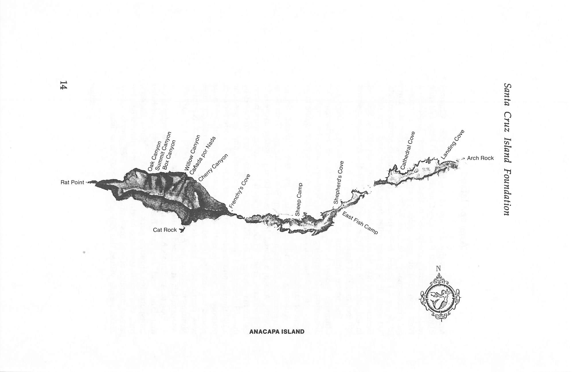
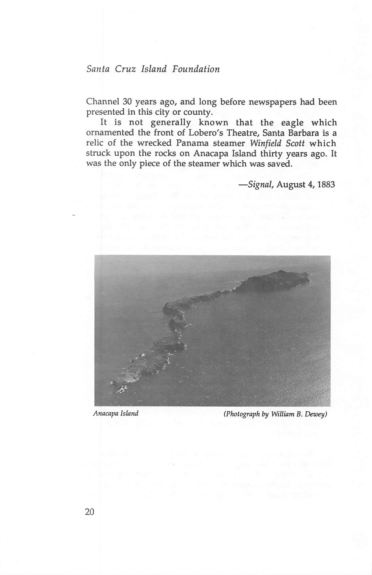
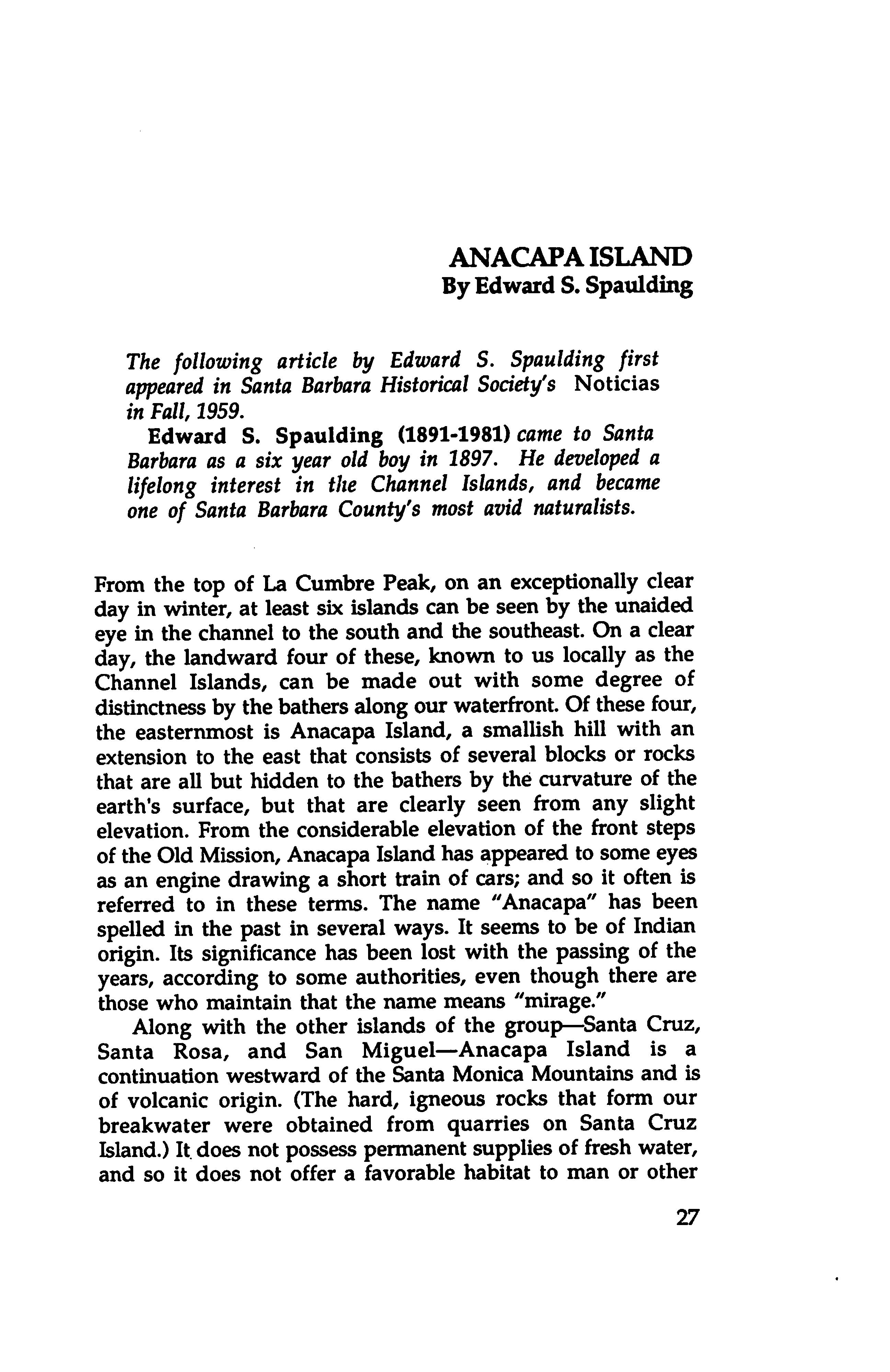
Anacapa Island is the smallest of the four Northern Channel Islands. It is almost five miles long, but only 1/4 to 1/2 mile wide. It is actually composed of three islets. East, Middle and West, bounded on most sides by sheer cliffs and connected only occasionally at extremely low tides. Together, the three islets are 1.1 square miles in size, and contain approximately 700 acres. It is eleven miles from the mainland, and lies in Ventura County. Summit Peak on West Anacapa, at 930 feet in elevation, is the highest point. Middle Anacapa reaches 320 feet, and East Anacapa is 250 feet.
The name Anacapa is thought to be derived from the Chumash Indian word Eneepah meaning ever-changing or deception. Depending on the weather and the angle of approach to Anacapa, the three islets often appear as one large mesa or tableland.
Anacapa Island is owned by the United States Government. Unlike neighboring Santa Cruz and Santa Rosa Islands, Anacapa Island has never been privately owned. In 1848 with the Treaty of Guadalupe Hidalgo, it became a part of California territory. In 1853 Anacapa Island was surveyed by the U.S. Coast and Geodetic Survey to determine the need for a lighthouse, and the following year it was set aside for such purpose. It was not until 1911 that an unmanned light was placed on Anacapa Island, and in 1932 the current lighthouse was completed. President Roosevelt assigned National Monument status to Anacapa Island in 1938, and in 1980 Anacapa Island attained National Park status.
EHie to Anacapa's National Park status, its proximity to the mainland, and the fact that it has regularly scheduled transportation through park concessionaire. Island Packers, Inc., this smallest of the Northern Channel Islands has the largest number of visitors annually. In 1988 approximately 25,000 people visited this 700-acre National Park island.
-editor
13
4^
Rat Point ■ c 5
e c £● |o%5
0^1 c?-ir .C ir
ANACAPA ISLAND
WRECKED ON ANACAPA
By Charles P. Holden
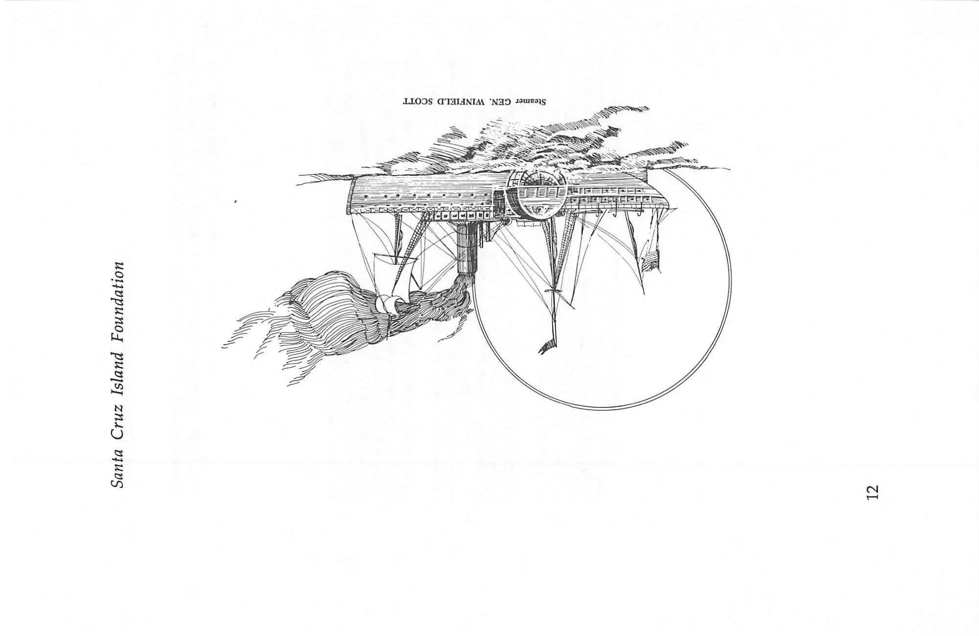
The following account of the wreck of the S.S. Winfield Scott first appeared on August 4, 1883 in the Signal. It was reprinted in Ventura County Historical Society's Quarterly, Vol. XX///, No. 3, Spring, 1978.
S.S. Winfield Scott (1851-1853), owned by the Pacific Mail Steamship Company, was built in 1851 to carry mail and passengers along the Pacific Coast of North America. She was a side paddle wheel steamer, 225 feet in length. On December 2, 1853, while attempting to set a new speed record from San Francisco to Panama, she rammed into Anacapa Island in a dense midnight fog. Today her wreck site is on the National Register of Historic Places. Various relics can be found in Santa Barbara Historical Society's Trussell Winchester Adobe.
The story of the wreck of the Panama Steamship Winfield Scott in sight of Santa Barbara, nearly 30 years ago, has just been given to the public by a survivor of the wreck, Charles P. Holden, who writes to the Chicago Times. The Winfield Scott with 200 passengers for Panama went on the rocks of Anacapa Island. Captain Blunt, who commanded the steamer, had decided that the Santa Barbara Channel was the shortest cut to
Panama. From Mr. Holden's story the following condensation is made:
Our steamer took the inside track, or the Santa Barbara Channel; and the night of December 1 and the day of December 2 passed pleasantly. Early in the day we could with field glasses see the steamships of other lines or companies at a great distance to the west of us; they too were making for Panama but had taken the
15
Santa Cruz Island Foundation
old, safe outside track. As it appeared we certainly would beat them into Panama by from 12 to 20 hours, which was worth saving to the Pacific Mail Steamship Company. On the night of December 2, soon after supper, a dense fog set in. We are then off Santa Barbara, steaming along finely; but the fog came, and such a fog too. The passengers, however, gave no heed to it, not dreaming of danger; and the ship glided swiftly along over the smooth sea. The hours passed pleasantly; and by 10 o'clock, or perhaps a little longer, most of the passengers had retired to their staterooms for the night, unconscious of the danger that to overtake them. At about the time the passengers retired there was a great commotion among the officers of the ship, and orders were quickly given to the man at the helm; and I presume the course of the steamer was somewhat changed, as it was quickly rumored that we had barely escaped a point of rocks making out from the Island of Santa Cruz. The officers again settled down quite at ease though it could be seen they were vigilant and it their post of duty. The steamer sped on through a fog so dense it would seem that one could cut it with a knife, so thick and heavy did it appear, when about 11 o'clock all hands aroused as if by magic for the ship when under full headway had run upon the rocks. Instantly as it would seem the deck was covered with the was soon were passengers, every stateroom being at once emptied of its inmates seeking for safety upon the ship's deck. All knew as if by instinct that some terrible calamity had befallen the steamer. Men, women and children were there in one common mass. The clear voice of the captain could be distinctly heard as he gave his orders pertaining to the saving of the lives of those on board, and also as to the handling of the ship then foundering on the rocks. As if by intuition the captain found that she had struck the lower edge of a slanting ledge of rocks; and he gave immediate orders to the engineer to force her on this ledge as far as possible and then, remembering the fate
16
Wrecked on Anacapa
of the passenger steamer Independence, ordered the fires under the boilers at once put out that the rush of water into the engine room and suddenly upon the fires might not precipitate a fire and thus burn up what was left of the sinking ship, as was the case a short time before. Life preservers were fastened around each passenger, and all on board were preparing for the worst.
The dashing of the waves against the rocks, and the sure sinking of the steamer or going to pieces in that dense fog, was well calculated to alarm the strongest heart. Some were praying and others imploring to be saved from a watery grave which at that time bid fair to engulf us all. It was a fearful time, a time of terrible suspense.
The cool-headed were actively at work getting ready for the tussle with the water when driven to it, by arranging different kinds of material (like cabin door, chairs, and other material) for rafts and floats. One genial gentleman who had his wife and family on board was nearly distracted. He ran up and down the deck like one beside himself while his wife was as cool

as the coolest, counseling all those near her to be calm and to be sure and obey the orders of the captain of the boat. I think his name was Diamond, a merchant of New York City. The captain knew that some unknown current had taken the steamer out of its course; but where he then was, he could not tell for you could not see half the ship's length, so dense was the fog. A boat had been dispatched to feel around among the rocks and to find a place to land the passengers, provided the vessel did not go to pieces in the meantime. It returned and reported favorably, then the debarkation commenced. The boats which had been filled with women, children and the sick were first taken to the spot of rescue, then the passengers in general; and it was but a very short time before all were landed on the rocks where they climbed far above the water's edge, thankful beyond measure that they had thus escaped a
17
Santa Cruz Island Foundation
watery grave. Judge of the surprise of the captain and crew of this beautiful steamer, when the fog cleared away, to find the bow of the ship within two hundred feet of a ledge of rock several hundred feet in height upon which the steamer was rushing when she struck the ledge that saved her and all on board from instant destruction. When daylight came, the passengers found themselves all huddled together on a mere ledge, surrounded by water, while a short distance away was the main island of which this spur was a part.
The captain found that they were on a reef a few hundred feet from Anacapa Island which was in plain view of the Pueblo of Santa Barbara. The passengers were transferred with what provisions were obtainable to the main island where the crowd huddled together the best they could.
The vessel was a complete wreck. The captain at once dispatched a boat for the main shore with dispatches to San Francisco to the Pacific Mail Steamship Company, informing them of our fate and calling for immediate assistance; but the distance being more than 400 miles, it took time to reach San Francisco as there were neither railroads nor telegraph from lower California to the metropolis. When these steps had been taken, we settled down to abide our time. We felt happy that we had been saved from the wreck; and now the question was, how could we get away from our miserable little island?
Our first meal on the island was doled out to us about 10 a.m., December 3, 1853. It consisted of such food as they had been enabled to save, and it was good enough; the only question was whether it would hold out until help would reach us. After this we scattered among the rocks, all scanning the ocean for help. At about 3 p.m. of that day, December 3, one of the regular mail steamers was seen in the distance en route for
San Francisco. The signal of distress attracted her attention, when a captain with a boat came to us, not
18
Wrecked on Anacapa
daring to come nearer than a couple of miles with the steamer. It was the steamship California, a Captain Leroy was her commander. She was heavily loaded with passengers for San Francisco, but took some of the passengers from our island home back to San Francisco; and among the number Mr. Diamond and his family. Then we awaited results.
The shipwrecked crowd on Anacapa waited anxiously for relief from San Francisco. It was the eighth day after the departure of the California before assistance arrived. In the meantime the provisions and water had been exhausted, and the situation was desperate. On the morning of the eighth day (December 10, 1853) the report of a cannon was heard on the island. Instantaneously as it seemed, the crowd hurrahed, screamed and yelled for joy. Assistance was close at hand, so we all thought. As it was quite dark, large piles of seagrass were lighted, and the gun which had been taken from the wreck made answer in tones of thunder. The little island seemed alive at that moment, then came a lull for 10 minutes and the time seemed an hour, when all began to think the report was from the shore which was nearly 20 miles away. Suddenly there came another report, and then another. The gun on the island was making answer, and the little party shouted as none but those in dire distress could shout. The firing of the cannon from the island and the shouting continued with casual reports from the ship of succor until in the early mist of the morning the little steamer came in full view, feeling her way towards us, and when within about a mile and a half her boats were manned and dispatched to our rescue.
The nearly starving passengers and crew, nearly 300 in all, were taken off the island and taken to Panama where they raised a subscription for the purpose of presenting a silver service to Captain Leroy who had saved them from death by starvation. Such is the story of a wreck in the Santa Barbara
19
Santa Cruz Island Foundation
Channel 30 years ago, and long before newspapers had been presented in this city or county.
It is not generally known that the eagle which ornamented the front of Lobero's Theatre, Santa Barbara is a relic of the wrecked Panama steamer Winfield Scott which struck upon the rocks on Anacapa Island thirty years ago. It was the only piece of the steamer which was saved.
—Signal, August 4,1883
Anacapa Island
20
(Photograph by William B. Dewey)
THE WINFIELD SCOTT
Told to John C. Wray by a Survivor
The following article was first published on January 17, 1896 in the Free Press. It was reprinted in Ventura County Historical Society's Quarterly^Vo/. XX///, No. 3, Spring 1978.
December 2, 1853 the Pacific Mail steamship Winfield Scott, Captain Le Roy commanding, left San Francisco bound for Panama with 450 steerage and 375 cabin passengers, the U.S. mail, something like $2,000,000 in bullion and a miscellaneous cargo. Everything went smoothly until between 2 and 3 o'clock on the morning of the 4th, when the ship went ashore on Anacapa Island in the Santa Barbara Channel and sank in about five hours. So much is of record in the archives of the P.M.S.S. Co., and the meager news reports of later date in the San Francisco papers of January 1853. No lives were lost and the treasure, mail and baggage were saved.
Newspaper enterprise had not developed in 1853 to the extent that it since has; and no special correspondents were sent out in chartered tugs to visit and write up the wreck; the only published accounts were dated some three weeks after it occurred, and came in fragments of stories through three and four hands. The officers of the vessel were ordered to maintain silence on the matter; and as the passengers were taken East, nothing like an accurate account of the chief incidents of the wreck of the famous liner has ever been
published.
After a lapse of 42 years the accident of chance renders it possible for the Free Press to furnish its readers the only true account ever published in California of the scenes and incidents of the disaster. This story will prove of more than ordinary interest to residents of southern California as
21
Santa Cruz Island Foundation
Anacapa Island is one of the historical group at our very door. Yachting parties from Ventura and Santa Barbara seldom return from water excursions without bringing to the mainland relics of the old steamer whose bones are bleaching on the rocks at this writing.
Saturday, December 21, 1895 F. S. Crane of Sycamore, Illinois was introduced to John C. Wray, a representative of the Free Press, and told in substance the following story:
April 14, 1853 in company with William Storp and Willis Wright, now a resident of Stockton, California, I left Aurora, Illinois with 150 head of beef cattle which we intended to drive to the gold mines in California for market. After a drive across the plains lasting six months, we reached Hangtown October 30th with 110 head, having lost 40 head on the road. After disposing of my share in the venture I decided to return home by steamer, not caring to undergo the hardships of a back trip overland. My partners decided to remain in the gold fields; and I left them behind and made my way to San Francisco, and took passage of New York on the Winfield Scott December 2nd. The cabin was full and I took a berth in the steerage with about 350 to 400 others, principally miners returning East, nearly all of whom had specie belts well-filled. There were a good many hard characters among them and life for the first 24 hours was anything but pleasant.
Everything went along all right until the afternoon of the 3rd when a heavy fog set in, so heavy that you could almost cut it with a knife. By 11 o'clock that night everything was quiet and all lights out in the steerage as nearly everybody was tired out and sleeping. As nearly as I can fix the time, between 2 and 3 o'clock in the morning (the 4th) I felt a shock coupled with a grinding, crushing kind of noise which woke me out of a sound sleep; and feeling that some accident had happened, I jumped out of my bunk and ran for the deck, being one of the first, if not the first, of the steerage passengers to reach there. I found

22
»i/J, P/a.'/M.'M })03S
pi/j. vdmmiy -pupisj 3z/2 ?jis hods
si uo spr; Pioi/s^o HO Pif? i{uou dpis /o ^ipptyi
jpuoijd/^ iP|si&5f /o :>uopiy
■S30v\d wpin.'M ^ t{dv^8o;ot{d) -g (AsoiSQ
puuvtij spurpi ivuotjot^

uotpuodsuvi}
oj p94njotd St 9snot{jti8}i s;i :i(aV(J P“»/s/ 'sjwuuoisssduod 'sisr^jpj sspiaoud
'spup/sj puum{j vdvovuy jsvj
puv puvjsj a WCT2/IM /u? t{dpuSo}cn{d} (f^smsQ
£Z
Santa Cruz Island Foundation
everything in confusion, and realized at once from the talk of the officers that we had gone ashore. The bow of the steamer was well up on a bank of some kind which could be seen indistinctly through the fog. I went back to my berth, and had hard work in getting my shoes and coat which I had left behind when I made the first
rush for the deck. The passengers had by this time become panic stricken, and were crowding over each other in their anxiety to reach the deck. The wildest kind of rumors ran through the ship, some declaring that the boilers had burst, others that we were sinking fast; but everyone was for himself, with no thought of anything but saving his life and his dust if he had any. When I reached the deck the second time (probably three to five minutes had elapsed from the time I felt the first shock) I found that the steamer was fast on the rocks and that she was settling gradually by the stem. The wildest kind of confusion prevailed; but Captain Le Roy and his officers assisted by Captain Brown, a cabin passenger, were getting the panic-stricken passengers quieted down and somewhat under control. In about 20 minutes from the time the steamer struck the first boat was lowered; but not until the captain and first mate had stood over the davits with drawn revolvers to keep the excited and frightened passengers back. The boat was manned by four of the crew and one of the mates, with instructions to find out how close the ship lay to land and discover, if possible, a landing place for the boats. The boat came back in about five minutes and reported a safe landing close at hand, on what appeared to be an island. From remarks which I overheard afterwards I
believe the captain thought he was ashore on Santa Cruz Island. As soon as the captain was satisfied that a landing was possible, he ordered the boats lowered and the passengers transferred to the shore. By this time the panic had subsided as the vessel remained fast on the rocks as though in a cradle, and the transfer was made rapidly and safely. The women, children and
24
The Winfield Scott
sick persons, of which there were quite a number, being first looked after. By daylight everybody was safe on shore, or what appeared to be the shore, but which in reality was a rock lying close to the main island.
With daylight the fog lifted and for the first time the officers knew where they were. A second transfer from the rock to the island was made and we went into
camp for the eight days and a half which we were obliged to pass on the island. The first day a boat with four men was dispatched to the mainland with instructions to make their way overland to the nearest point from which word could be wired to San Francisco. We saw them start for the mainland but never learned of their arrival. The captain and crew worked hard and got on shore nearly all of the mail matter, bullion and baggage, over which a guard was placed, as the rowdy element among the passengers began to manifest itself as soon as the first panic subsided and before the passengers had been transferred to the land. An Irishman and a Negro were caught in the act of cutting open carpet bags in the cabin. They were ironed and carried ashore for trial. We immediately formed a vigilance committee and appointed a police patrol of the camp with Captain Brown as chief. The two thieves were tried; and an example made of them for the benefit of the rowdy element who showed a decided disposition to run things their own way. The two men were stripped, spread-eagled on the sand and whipped by Captain Brown in person. Every time he brought the rope down, he brought blood. It was a fearful spectacle but it had the desired effect, and no more rowdyism or thieving occurred. Our provisions were scanty; during the last two days we were forced to issue short rations, but everything considered we got along fairly well.
The third day we sighted the Pacific Mail steamer Illinois which sent a boat ashore, learned our condition and took one of our officers and a few

passengers, and left for San Francisco to send us succor.
25
Santa Cruz Island Foundation
The morning of the 13th she returned; and we were transferred with bullion, mail and baggage to Panama without further incident of importance, but more than thankful for our deliverance from what at one time
seemed certain death. For myself I never wanted any more ocean travel in mine, and was glad when I set foot in New York City.
Mr. Crane has resided since 1854 in Sycamore, Illinois and made the trip to Ventura in the hope of being able to revisit Anacapa Island and go over the ground of his thrilling experiences of 42 years ago. Owing to the absence of H. B. Webster with his boat, Mr. Crane was obliged to go to Santa Barbara to find means of transportation to the island. He is a hale old gentlemen of 64 and retains a vivid recollection of the main features of the wreck which have been briefly outlined above. The only survivor of whom he has personal knowledge is Luther Johnson of Sterling, Illinois, who with him was one of the police patrol on the island.
—Free Press, January 17,1896
26
ANACAPA ISLAND
By Edward S. Spaulding
The following article by Edward S. Spaulding first appeared in Santa Barbara Historical Soddy's Noticias in Fall, 1959.
Edward S. Spaulding (1891-1981) came to Santa Barbara as a six year old boy in 1897. He developed a lifelong interest in the Channel Islands, and became one of Santa Barbara County's most avid naturalists.
From the top of La Cumbre Peak, on an exceptionally clear day in winter, at least six islands can be seen by the unaided eye in the channel to the south and the southeast. On a clear day, the landward four of these, known to us locally as the Channel Islands, can be made out with some degree of distinctness by the bathers along our waterfront. Of these four, the easternmost is Anacapa Island, a smallish hill with an extension to the east that consists of several blocks or rocks that are all but hidden to the bathers by the curvature of the earth's surface, but that are clearly seen from any slight elevation. From the considerable elevation of the front steps of the Old Mission, Anacapa Island has appeared to some eyes as an engine drawing a short train of cars; and so it often is referred to in these terms. The name "Anacapa" has been spelled in the past in several ways. It seems to be of Indian origin. Its significance has been lost with the passing of the years, according to some authorities, even though there are those who maintain that the name means "mirage."
Along with the other islands of the group—Santa Cruz, Santa Rosa, and San Miguel—Anacapa Island is a continuation westward of the Santa Monica Mountains and is
of volcanic origin. (The hard, igneous rocks that form our breakwater were obtained from quarries on Santa Cruz Island.) It does not possess permanent supplies of fresh water, and so it does not offer a favorable habitat to man or other
27
Santa Cruz Island Foundation
land mammals. Its only denizens, other than the rats and hares that have been placed there through the agency of man, are birds and sea mammals—seal, sea lions, and an occasional sea elephant. Its chief interest for us lies in the fact that its easternmost rock probably was the "island" to which Viscamo gave the name of "Santa Barbara" when, en route from Santa Catalina Island, he passed by it for the first time in 1503.* From this small event in a voyage of considerable importance, not only our channel but our county, our city, and one of our streets eventually received their names.
When, in 1860, Santa Barbara County was divided into two, roughly equal parts at Rincon Creek, this line of division was carried out to sea through the channel between Anacapa and Santa Cruz Islands. The former island became a part of the newly formed county of San Buenaventura, and the latter remained, as it had been for a decade, a part of Santa Barbara County. This status continues to this day. In the past, the ocean boundary line between the two counties has been of the smallest moment. Should large pools of oil be discovered below the Channel in this region, the exact location of this line may become a matter of considerable interest and of acrimonious dispute.
Anacapa, San Miguel, and Santa Barbara Islands are owned by the Federal Government. During the Second Phase of the World War, Anacapa Island was made a military reservation. Incidentally, Mexico continues to maintain its claim of sovereignty over all these islands on the ground that they are not specifically mentioned in the Treaty of Guadalupe Hidalgo, 1846, when California and other territory was ceded to the United States.
Some of the best fishing grounds of this area lie to the southeast of the easternmost rock of Anacapa Island. A "light" is maintained by the United States Coast Guard on its easternmost hilltop.
*1602 -editor
28
THE WEBSTERS ON ANACAPA
By Karen Jones Dowty
The following article first appeared in Ventura County Historical Society's Quarterly, Vol XXIII, No. 3, Spring 1978.
Heaman Bayfield Webster paid his first visit to Anacapa Island in 1884, at which time he reported a shack on West Anacapa Island occupied by a Chinese fisherman. From about 1890-1895 Webster hunted seals around Anacapa Island for their oil and pelts. By the end of the century the animals were no longer found in sufficient numbers to make the business profitable. According to Government records, Webster leased Anacapa Island from 1907-1917. In 1907 he purchased the 40-50 sheep already on the island from the island's previous lessee, and then added 250 additional sheep purchased from neighboring Santa Cruz Island.
Agriculture has played a major role in Ventura County history. Many colorful tales can be told of earlier ranching days, but one of the most unusual is that of Heaman Bayfield (H. Bay) Webster and his sheep ranch and fishing vacation camp on Anacapa Island.
The three small islets of Anacapa, barely a square mile in size, and much of that precipitous and inaccessible even for the sure-footed sheep, were not large enough for full-time ranching in the normal sense. Bay's father was postmaster’ and he was assistant postmaster. But his first love was boating, and this long-time Venturan had the time and income to try new ventures. When the Howland lease on Anacapa expired in 1907, Bay contracted with the Department of the Interior to run sheep on Anacapa and have the fishing concession for the same island. The lease cost him $75 per year.*
29
Santa Cruz Island Foundation
That spring Bay and his wife Martha loaded household goods aboard his boat. With their two young sons, Morris and Harvey, they moved across the 14 miles of the Santa Barbara Channel to Anacapa Island. There they would spend their next 10 summers and two of the winters. This small island
with its sheer cliffs, craggy precipices and volcanic tide pools would provide many an adventure for the Websters: an island ravaged by wind and water.
Where a few scraggly eucalyptus trees now grow on the shoreward side of Middle Anacapa, the Websters made their home. Using whatever materials were convenient and readily available, the family built five huts which they named Camps Felicity, Simplicity, Capacity, Intensity and Necessity. Camp Capacity was entirely of flotsam. Camp Intensity was created from tents. Camp Necessity was probably the world's only sand-flushing outhouse; a trapdoor on the windward side allowed wind-deposited sand to pour into the 'toilet'. Camp Felicity with its concrete floor and windows facing the channel and Camp Simplicity which had a galvanized iron roof and furnishings brought from the mainland were more permanent.
Water was a problem for his island family. Except for the slow seep in what is now called Indian Water Cave on the shoreward side of West Anacapa, there was no fresh water on the island. The previous lessee had constructed cisterns to collect rain water; but rats (about the only land mammal on the island) had invaded them, leaving the water fit only for laundering. Bay built a storage tank by Camp Felicity. On each trip to the mainland, he returned with five-gallon cans filled with fresh water.

The 800 sheep that Bay grazed on the island had an even more difficult time obtaining the water so necessary to their existence. During the wet winter and later the foggy months, they could lick moisture off the iceplant. This transport from Africa, along with the native Dudleya (a plant that looks similar to the iceplant), was also the main diet of the sheep. In the autumnal dry season, the animals were forced to eat the prickly pear cacti for their water. The spines from the cacti stuck in the lips and gums of the unfortunate animals. A turn
30
The Websters On Anacapa
Anacapa Landing Beach, 1895, later known as Frenchy's Cove. (Ventura County Museum of History & Art collection)
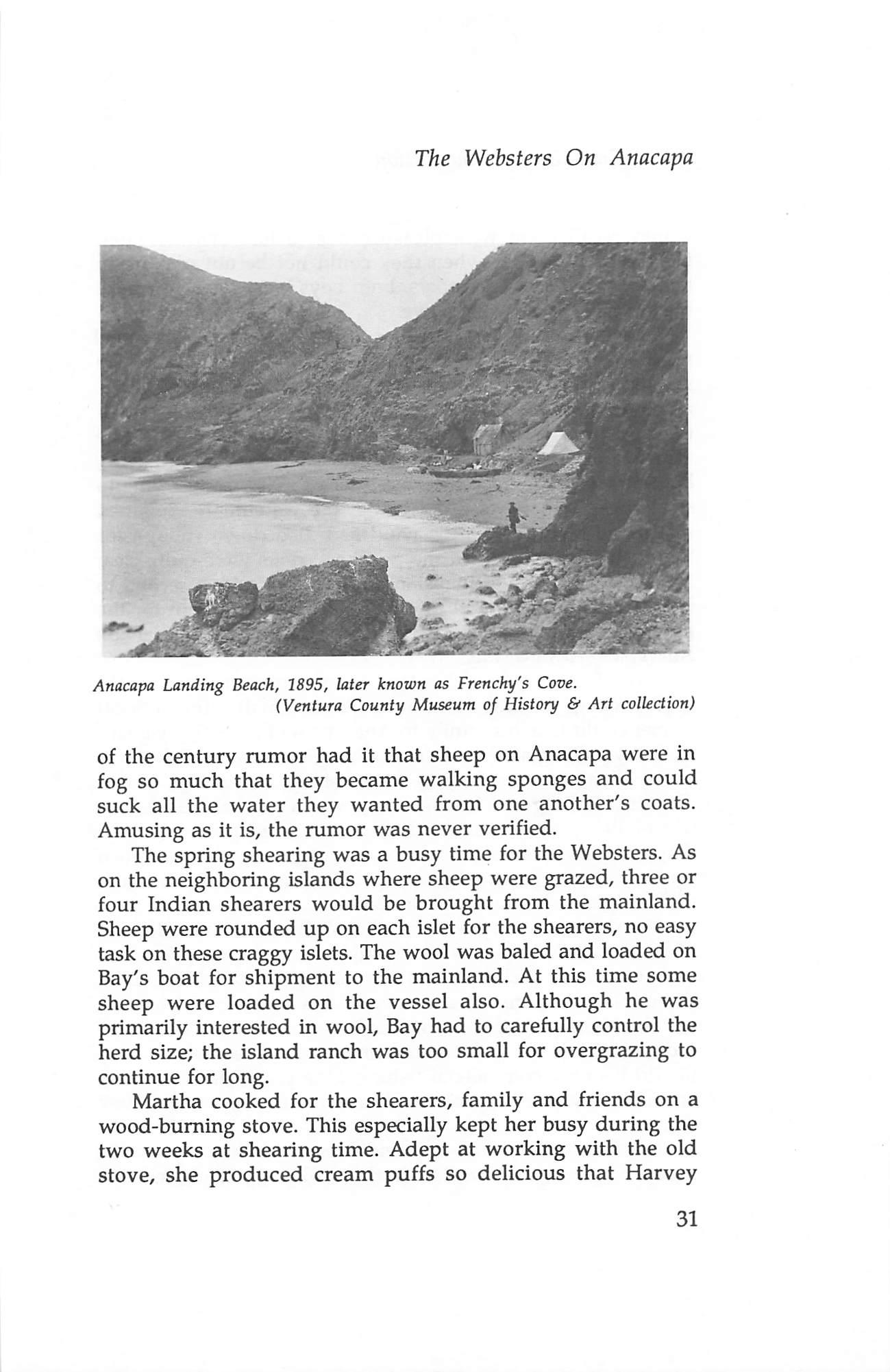
of the century rumor had it that sheep on Anacapa were in fog so much that they became walking sponges and could suck all the water they wanted from one another's coats. Amusing as it is, the rumor was never verified.
The spring shearing was a busy time for the Websters. As on the neighboring islands where sheep were grazed, three or four Indian shearers would be brought from the mainland. Sheep were rounded up on each islet for the shearers, no easy task on these craggy islets. The wool was baled and loaded on Bay's boat for shipment to the mainland. At this time some sheep were loaded on the vessel also. Although he was primarily interested in wool. Bay had to carefully control the herd size; the island ranch was too small for overgrazing to continue for long.
Martha cooked for the shearers, family and friends on a wood-burning stove. This especially kept her busy during the two weeks at shearing time. Adept at working with the old stove, she produced cream puffs so delicious that Harvey
31
Santa Cruz Island Foundation
would recall them with pleasure over a half century later. During bad weather when they could not be out playing in their boat or in the tidepools, both boys were taught to bake bread in this same wood stove.
The climate of Anacapa, as that of the rest of coastal southern California, is so mild that the sheep needed no shelter. Being rather self-sufficient animals, they made ranching a rather easy occupation. When the Websters spent their winters ashore, they left a single watchman on the island to protect the flock. Most years there were no problems; but one winter he kept reporting that poachers were trying to steal sheep. On Bay's questioning, the watchman explained that many nights when the wind had died down enough for him to hear, the barks of the poachers' dogs were quite clear from the other side of the island. It took Bay only a second to realize his flock was still safe and he had no problem for the noise was actually the raspy barks of sea lions which inhabit Anacapa's seaward side.
Bay Webster offered Ventura County residents one of the first package vacations known. For a small sum, a local farmer could take his family to Anacapa on one of Bay's boats^ and stay as long as they wanted. Facilities were available free in the 'Camp' community as were fishing, swimming, Indian artifact collecting and hildng. There was a smokehouse for the use of lucky fishermen, and many returned home with an ample supply of smoked fish for the following year. In return for their host's generosity, many brought the Websters gifts such as honey, produce and dried beans.
Morris and Harvey were in a boys' paradise, a wonderland of adventure. Morris was old enough to accompany his father and work as a deck hand on the fishing boat. Harvey, only three the first summer, stayed with his mother and hunted for the then plentiful arrowheads left from the Chumash Indians; with a life jacket and a line fastened securely to him, he did his own commercial fishing. One year's dried abalone and edible seaweed sales to Chinese markets made Harvey $80.
Days were busy with Bay and Morris making trips to the mainland or fishing while Martha took care of chores and
32
The Websters On Anacapa
Harvey worked at his enterprises. Evenings were spent reading and listening to the omnipresent crashing of waves on Anacapa's shores. Visits from Grandpa Webster and his war stories were always a treat, and many an evening was passed listening to them.
When Bay renewed his lease in 1912, the Bureau of Lighthouses had taken over the use of East Anacapa. He was not awarded another the next time so the family returned to shore, Bay subsequently occupied himself with other ** projects, one of which was the Webster Transportation Company that provided a bus line in Ventura.
Notes
1. Le Febre Webster
2. The Corliss was 45 feet long with a regular schooner canvas but never sailed; it was appropriately named for its three cylinder Corliss engine. The 35 foot Anacapa was a motor launch with a two cylinder gas engine. The 25 foot Virginia was run by steam. W. R. (Bob) Hill.
*Government records indicate H. Bay Webster took over the Anacapa Island lease from Le Mesnager, the first official lessee (1902-1907). In 1917 Webster tried to renew his lease for 25 years instead of the usual 5-year period outlined by the Government. He found an Act of Congress would be required to change the terms of the lease, and since World War I had begun, Congress had little time to devote to such small matters. Webster lost his bid to Ira Eaton who bid $607.50 per year for the 1917-1922 Anacapa Island lease. In 1912, East Anacapa was excluded from the lease for lighthouse facilities, -editor
33
Santa Cruz Island Foundation
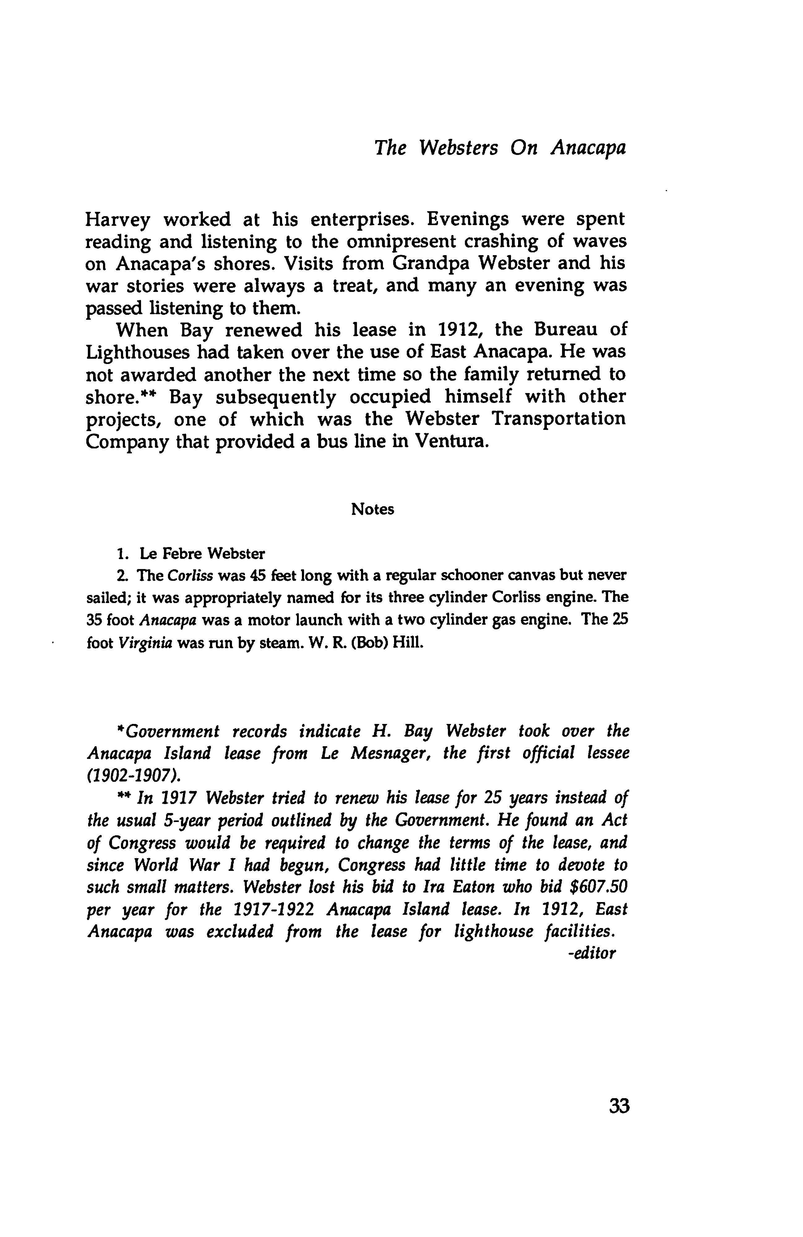
A rare photograph with long-time island resident Raymond "Frenchy" LaDreau (left) and former island lessee H. Bay Webster (right). Circa 1940. (Channel Islands National Park Service collection)
34
FRENCHIE
By Karen Jones Dowty
The following article first appeared in Ventura County Historical Society's Quarterly, Vol. XXIII, No. 3, Spring 1978.
Raymond "Frenchy" LaDreau was long-time resident of West Anacapa Island. He arrived some time around 1928, prior to the island's establishment as a National Monument. For about 28 years he lived a hermit-like existence with his cats on West Anacapa Island, serving as the unofficial Park Service representative, reporting acts of vandalism and island activities. He left West Anacapa Island after incurring injuries in a fall. What became of him remains a mystery. Today his homestead cove bears his name.
Little is visible from the Ventura County coastline in the gray month of June. An occasional boat or gull may pass; but the Island of Anacapa, only 11 miles from the coast, cannot be seen at all. When the dry East Winds have cleared the air of moisture in the autumn, this seaward portion of Ventura County looks close enough to touch. It was on this rugged island, only a square mile in size, that one of the county's more colorful residents lived as a hermit. Few people knew his real name. Simply called Frenchie,* he came to settle in the shoreward cove which now bears his name. Not at all the proverbial recluse, Frenchie welcomed all visitors to his sheer rock-walled

home and enjoyed frivolities, gallantries and lengthy discussions on almost any subject shared over a glass or more of 'vino'.
Named Raymond Ledreaux,** he was bom in Brittany over a hundred years ago. He studied for the priesthood but was never ordained. Disenchanted and bitter towards his
church, Ledreaux chose the life of the sea, travelling on
35
Santa Cruz Island Foundation
merchant vessels to China and America. In San Pedro, California he met his future wife Emma. He and the love of
his life had a few short years together. Three children were born. The flu epidemic of 1918, which killed so many, took Emma also. Filled with sorrow over her death, Frenchie searched for a life elsewhere. He tried living in Mexico and lobster fishing there. His grief not subsiding, the Frenchman sought solace in solitude and drinking wine. He moved north to the Channel Islands and finally settled on Anacapa in 1928.
At the cove where tidepool visitors now land, he made his home. Frenchie's huts were among the sunflower trees called Coreopsis. One shanty was his sleeping quarters. Another housed his gear: odds and ends collected from the cove beach, and materials to repair his lobster traps and skiffs. A third shack, perched on the rugged cove hillside, was used for guests. Nearby sat drums for the rainwater Frenchie collected because Anacapa is an island without fresh water.
People from Port Hueneme to Santa Barbara came to know Frenchie. His cook hut was a favorite gathering place for local fishermen and divers. In his customary red flannels and a three-day stubble on his face, Frenchie would be stoking the fire from a wood pile that housed his colony of semi-wild cats. Beer and wine would be passed around. The sea stories would start and so would another day in Frenchie's Cove.
Frenchie lived, as the island Indians had for hundreds of years, off the bounty of the sea. With traps he made from wood and wire and using empty wine bottles as floats, he caught lobster. The volcanic undersea terrain and the prolific kelp beds provided Frenchie with a never-ending supply of food. From one of his two heavy skiffs he fished the waters around the small islets of Anacapa. He rowed to other coves to collect abalone. Always he had spare seafood on hand; and on any weekend outing to Anacapa, Ventura County residents would take along a spare jug of wine to trade from some of Frenchie's catch.

Local coastal families enjoyed their vacations camping near Frenchie's huts. They would bring him canned goods, bread, cheese and wine and water when he needed it. With
36
Frenchie
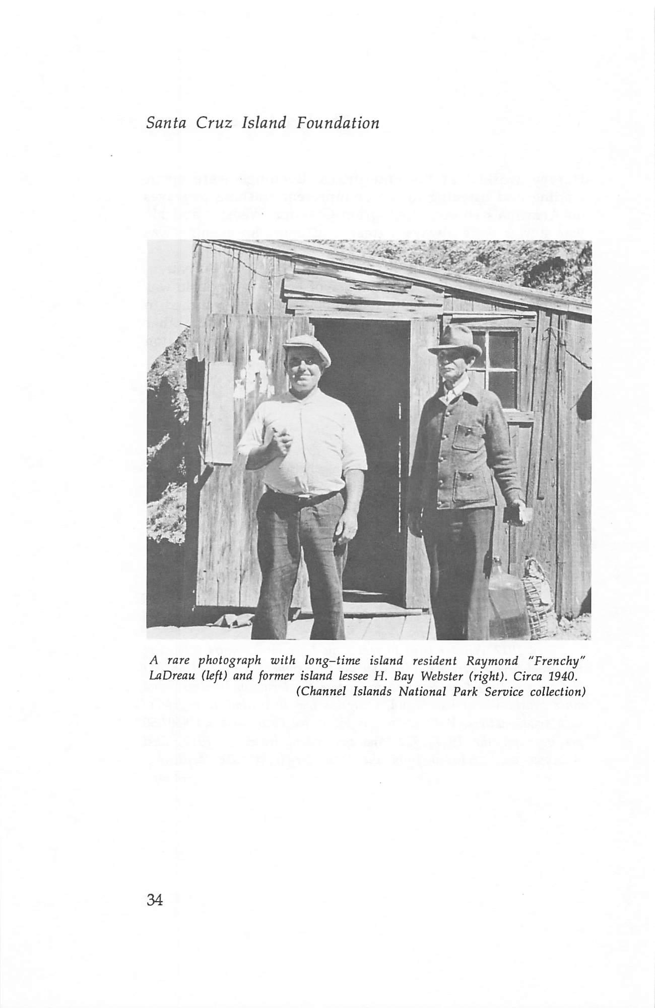
Frenchy's cabins, West Anacapa Island circa 1940. None is left today. (Channel Islands National Park Service collection)
supplies provided by the fishermen's wives, Frenchie would prepare his personal variety of bouillabaisse and other succulent seafood dishes. When the visiting children tired of fishing and playing in the colorful tidepools, they were always glad to return to camp to hear a story or two by Frenchie. Although alone most of the time on an otherwise
37


