

CAPITOL AREA ARCHITECTURAL AND PLANNING BOARD (CAAPB) 05.20.2024
DRAFT
MINNESOTA CAPITOL MALL DESIGN FRAMEWORK
CONTENTS FRAMEWORK INTRODUCTION 11 PROJECT PROCESS 25 INVENTORY + ANALYSIS 43 DESIGN FRAMEWORK 149 PROJECT IMPLEMENTATION 325 SUSTAINABLE LANDSCAPE DESIGN AND MAINTENANCE STANDARDS 337 TABLE OF CONTENTS DRAFT

DRAFT
4 5 Capitol Mall Design Framework Overview
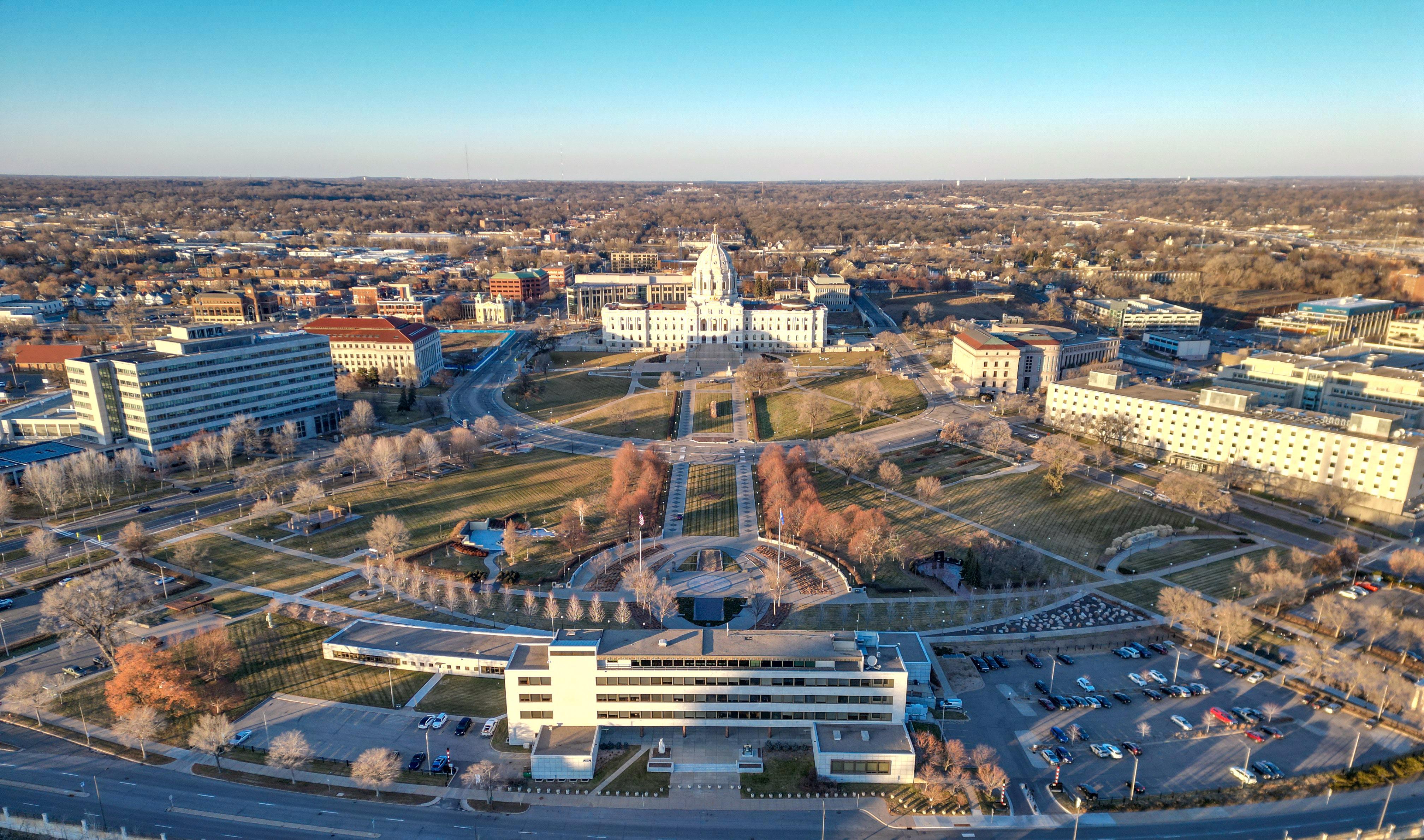
Figure 1: Minnesota Capitol Building from the Minnesota World War II Memorial
Source: Damon Farber. Minnesota Capitol. Jan 2024.
STAKEHOLDERS + TEAM

Minnesota Council on Disability

Office of Governor Tim Walz & Lt. Governor Peggy Flanagan


Minnesota Legislature
Minnesota Department of Administration
City of Saint Paul Minnesota

Minnesota Historical Society
Minnesota Legislature
DRAFT

106 GroupHistoric Consultant
BARR EngineeringStormwater Management & Lighting Design

Damon Farber - Local Landscape Architecture
Davey TreeArborist & Tree Canopy Planning
EDEN ResourcesPre-Construction Estimating
Pine & SwallowSoil Scientist
Stone Security EngineeringSecurity


Minnesota State Patrol
Capitol Region Watershed District
Water in MotionIrrigation Design
Zan - Engagement & Media Relations


6 7 Capitol Mall Design Framework Overview
ACKNOWLEDGMENTS
WE BUILT THE STATE CAPITOL ON THE THEORY THAT NOTHING WAS TOO GOOD FOR MINNESOTA. LET US DEVELOP THE CITY ON THE THEORY THAT NOTHING IS TOO GOOD FOR SAINT PAUL.
8 9 Capitol Mall Design Framework Overview
Figure 2: Minnesota Capitol Building above the Minnesota World War II Memorial
– CASS GILBERT
DRAFT
Source: Damon Farber. Minnesota Capitol. Jan 2024.
CHAPTER 1
FRAMEWORK INTRODUCTION
DRAFT
PROJECT PURPOSE
DRAFT
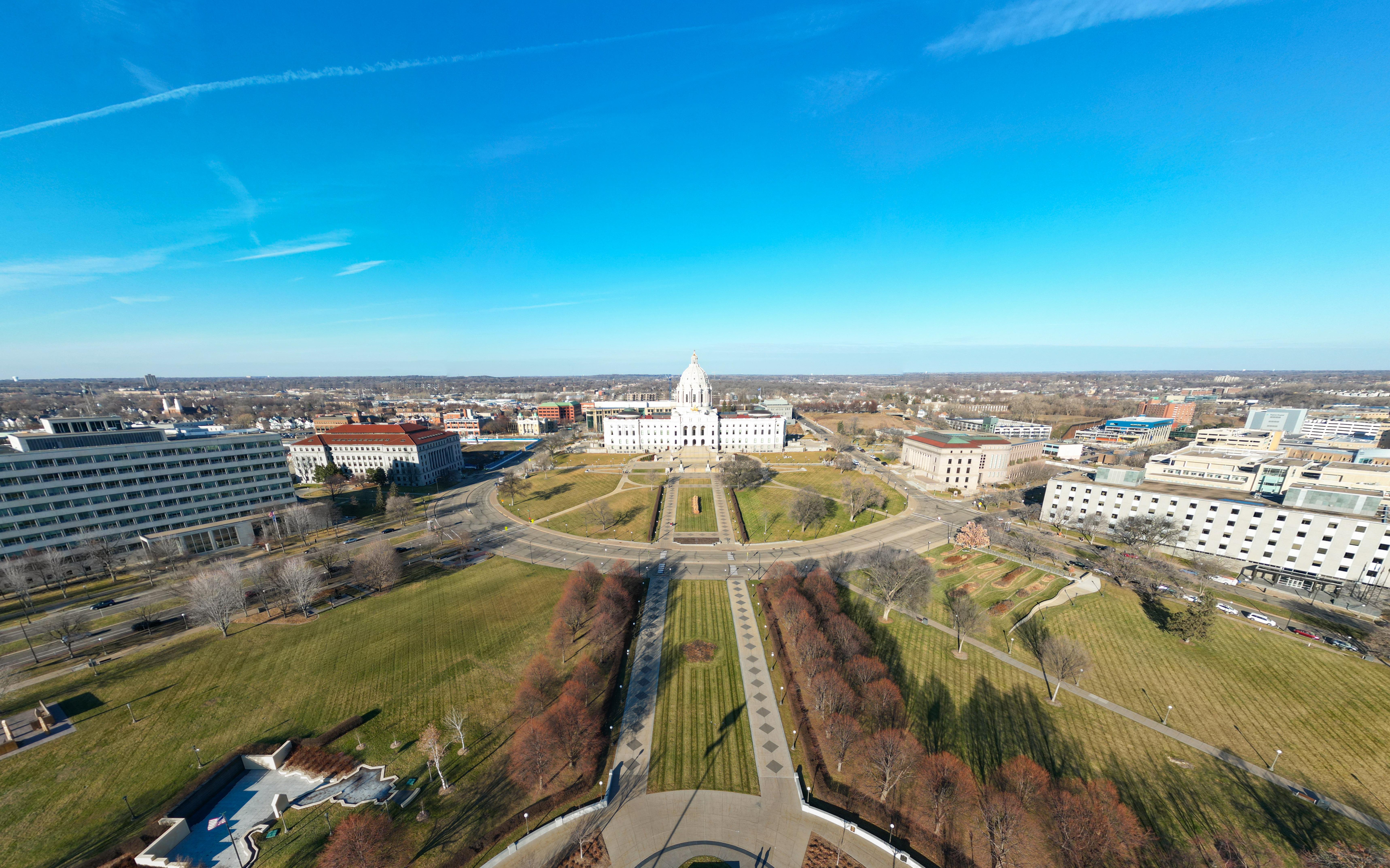
Figure 3: Aerial view of Capitol looking North “MNISÓTA MAKHÓČHE, THE LAND WHERE THE WATERS ARE SO CLEAR THEY REFLECT THE CLOUDS, EXTENDS BEYOND THE MODERN BORDERS OF MINNESOTA AND IS THE ANCESTRAL AND CONTEMPORARY HOMELAND OF THE DAKHÓTA (DAKOTA) PEOPLE. IT IS ALSO HOME TO THE ANISHINAABE AND OTHER INDIGENOUS PEOPLES, ALL WHO MAKE UP A VIBRANT COMMUNITY IN MNISÓTA MAKHÓČHE,” (RAMSEY COUNTY HISTORICAL SOCIETY). THE MINNESOTA CAPITOL MALL DESIGN FRAMEWORK ACKNOWLEDGES THAT THE CAPITOL CAMPUS IS LOCATED ON THESE SACRED DAKOTA LANDS AND STRIVES TO HONOR, CELEBRATE AND SHARE THESE HISTORIES.
As mandated by the State of Minnesota Legislature, the Capitol Area Architectural and Planning Board (CAAPB) and State of Minnesota Department of Administration produced the 2024 Capitol Mall Design Framework (hereafter referred to as the Design Framework) for the Capitol Area in Saint Paul, Minnesota. The Design Framework builds upon the 2040 Comprehensive Plan (2021) for the Minnesota State Capitol Area and the prior Capitol Mall Redesign Plan (mid-1980s) to shape, guide, and manage the Minnesota State Capitol Campus environment and its physical form. The Design Framework provides location-specific development guidelines and calibrates the 2040 Comprehensive Plan’s larger organizing principles to a specific area, detailing distinct goals for stability, change, and growth.
The Design Framework primarily focuses on the Capitol Mall itself and the area bounded by University Avenue, Rice Street, Robert Street, and the Interstates. However, it does consider the larger 60-block Capitol Area as an integral part of the overall design. More specifically, the Design Framework addresses design principles, standards, and guidelines for landscape systems (including increased tree canopy as a legislative priority alongside native planting strategies), lighting, security, wayfinding, circulation, stormwater management, commemorative/public art siting, street typologies and regulation, as well as the preservation and interpretation of historic resources in alignment with the Secretary of the Interior’s Standards for the Treatment of Historic Properties and the 2024 Minnesota State Capitol Mall Cultural Landscape Report.
As the original architect of the Minnesota State Capitol, Cass Gilbert’s vision was to create a canvas for civic life—to establish a ceremonial landmark with spaces that can accommodate gatherings of different sizes and create physical connections between the Capitol Grounds and nearby neighborhoods. Since then, the Capitol Mall has become a place of civic demonstration, cultural celebration, and reverent memorial. Gilbert’s vision is strengthened through the 2040 Comprehensive Plan, which strives to turn “boundaries into connections” and restore the historic urban fabric between the Capitol Area, surrounding neighborhoods, and Downtown. Through extensive community and stakeholder engagement at local and statewide scales, the Design Framework reinforces these ideals to create a public space that is more welcoming to more Minnesotans and that is an embodiment of the great ecological, historical, and social diversity of both the Twin Cities and the State of Minnesota.
12 13 Capitol Mall Design Framework Introduction
INTRODUCTION
Source: Damon Farber. Cedar St. Jan 2024.
CAPITOL CONTEXT
CASS GILBERT’S CAPITOL PLAN FOR SAINT PAUL, LIKE THE BURNHAM PLAN OF CHICAGO AND THE L’ENFANT PLAN FOR WASHINGTON DC, WAS AN EFFORT TO UNIFY AND INTERCONNECT THE CITY FABRIC, CONNECTING STREETS AND APPROACHES TO A CENTRAL MALL AS THE CENTERPIECE OF A GRAND CAPITAL CITY. MINNESOTA STATUTE, THE 2040 COMPREHENSIVE PLAN AND THE CAPITOL MALL DESIGN FRAMEWORK ARE AN EFFORT TO REINFORCE THIS UNIFYING VISION.
THE MALL IN CONTEXT SCALES OF INQUIRY
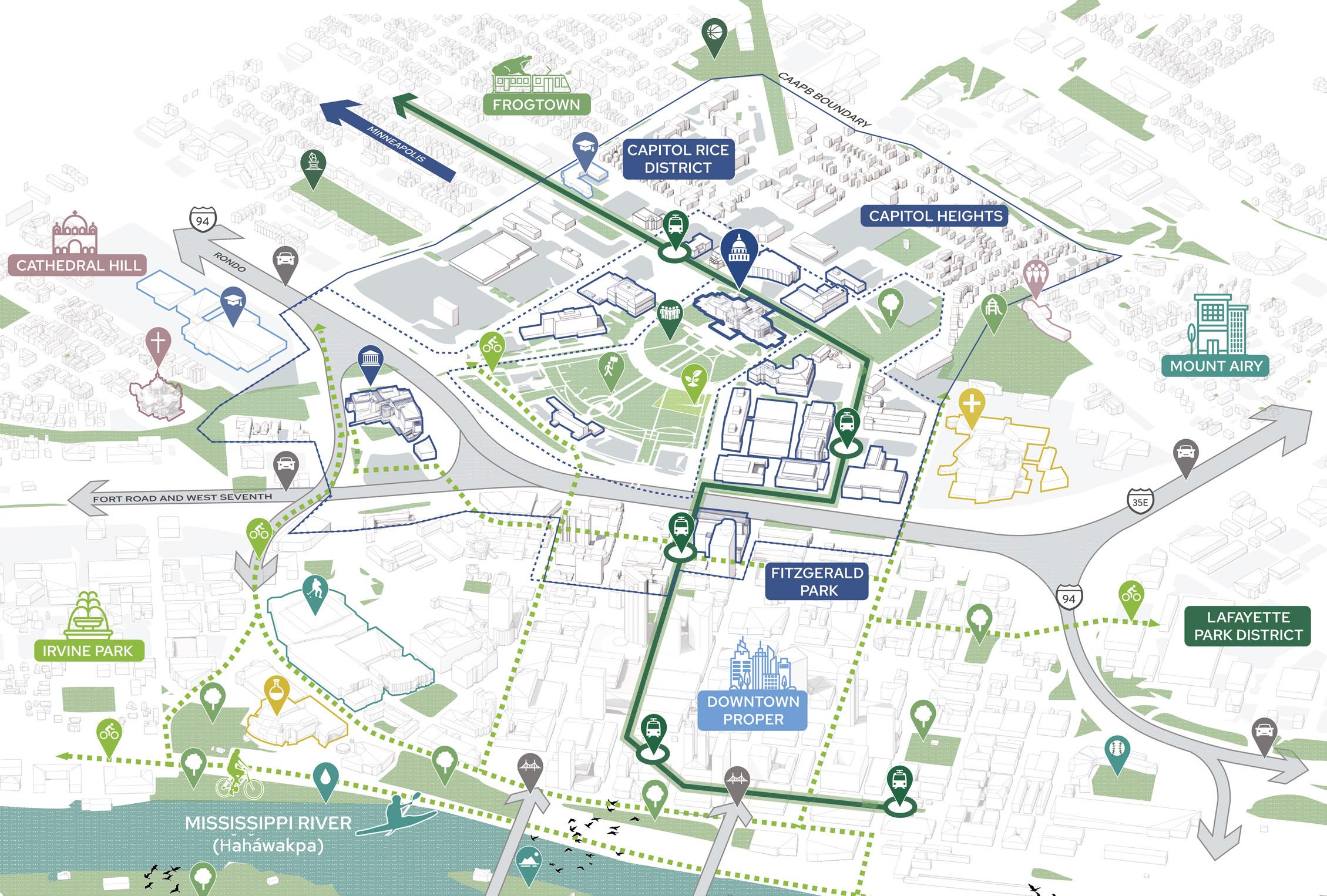
The Capitol Mall is centrally located in the city of Saint Paul, Minnesota. Saint Paul and Minneapolis collectively make up the Twin Cities—the largest metropolitan area in the state. Just north of Interstates 94 and 35E, the Capitol Mall is bounded by various distinct neighborhoods, including Capitol Heights, Capitol Rice District, Downtown, Fitzgerald Park, Frogtown, and others. The Mississippi River (HaHáwakpa) flows just one mile south of the Capitol Mall, connecting the Twin Cities to northern Minnesota and the Gulf of Mexico.
To achieve the goals and visions set forth by Gilbert, the 2040 Comprehensive Plan, and people of Minnesota, the Capitol Mall must be studied and considered at multiple scales. These include the Capitol Mall itself, the Capitol Campus, and the Capitol Area. It is important to note that while scales of inquiry provide a means to think about the Capitol Mall and ensure a comprehensive framework, most design strategies ultimately transcend these scales. Therefore, Capitol Area scale items will likely require intervention at the Capitol Mall scale (and vice versa).
The Capitol Area is the largest scale of inquiry and includes approximately 333 acres or 60 blocks; it is also the area governed by the CAAPB. It is bounded by West Pennsylvania Avenue, Jackson Street, Marion Street, and Downtown. The Capitol Area includes several neighborhoods and a plethora of land uses, ranging from government offices to small-scale single-family homes. By studying the Capitol Mall as part of the larger area, the Design Framework can address existing barriers like the Interstates and vacant Sears site; connect to valuable community assets like Downtown and the Minnesota History Center (MNHS); and integrate into larger ecological and social networks like the Mississippi Flyway and various nearby residential neighborhoods.
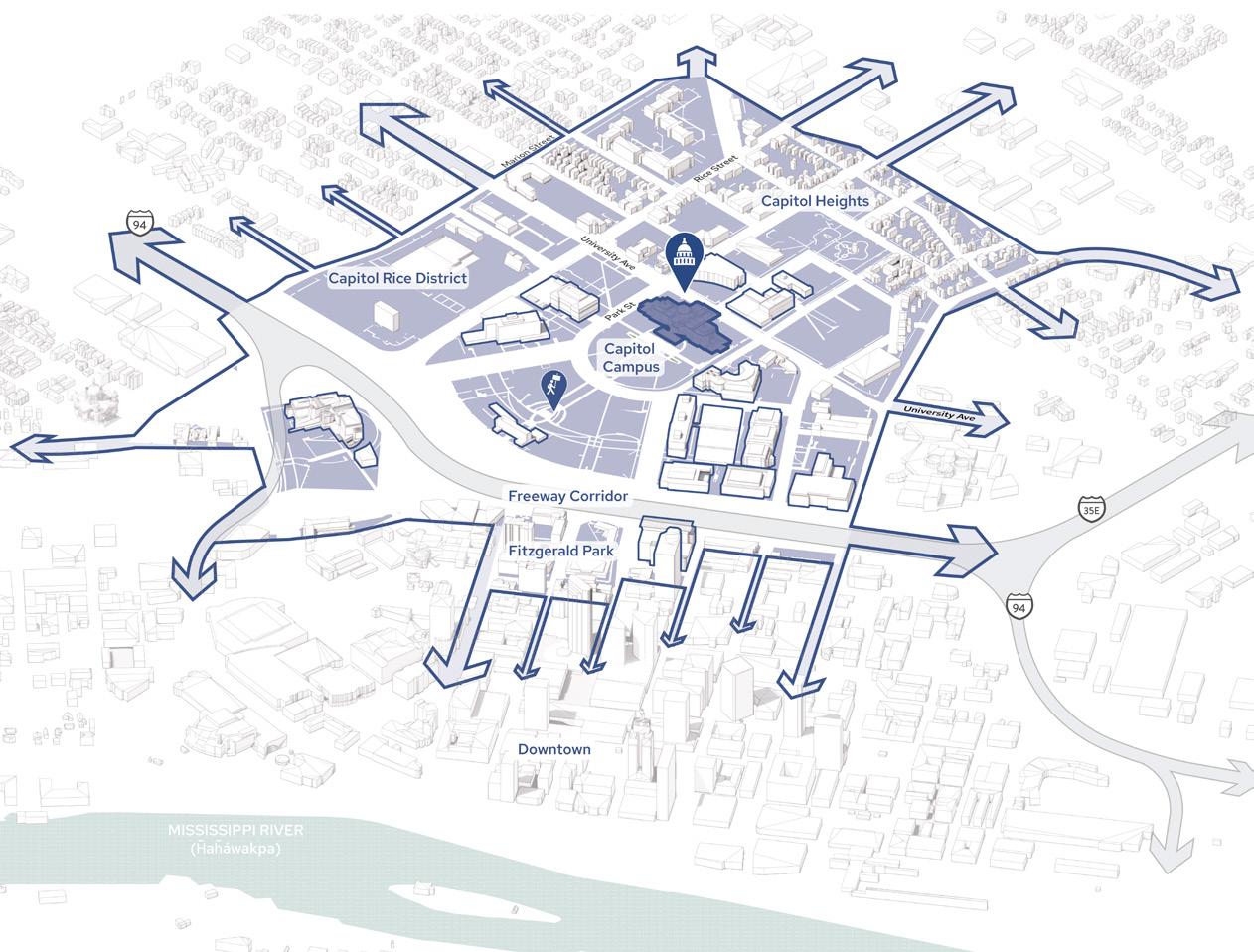
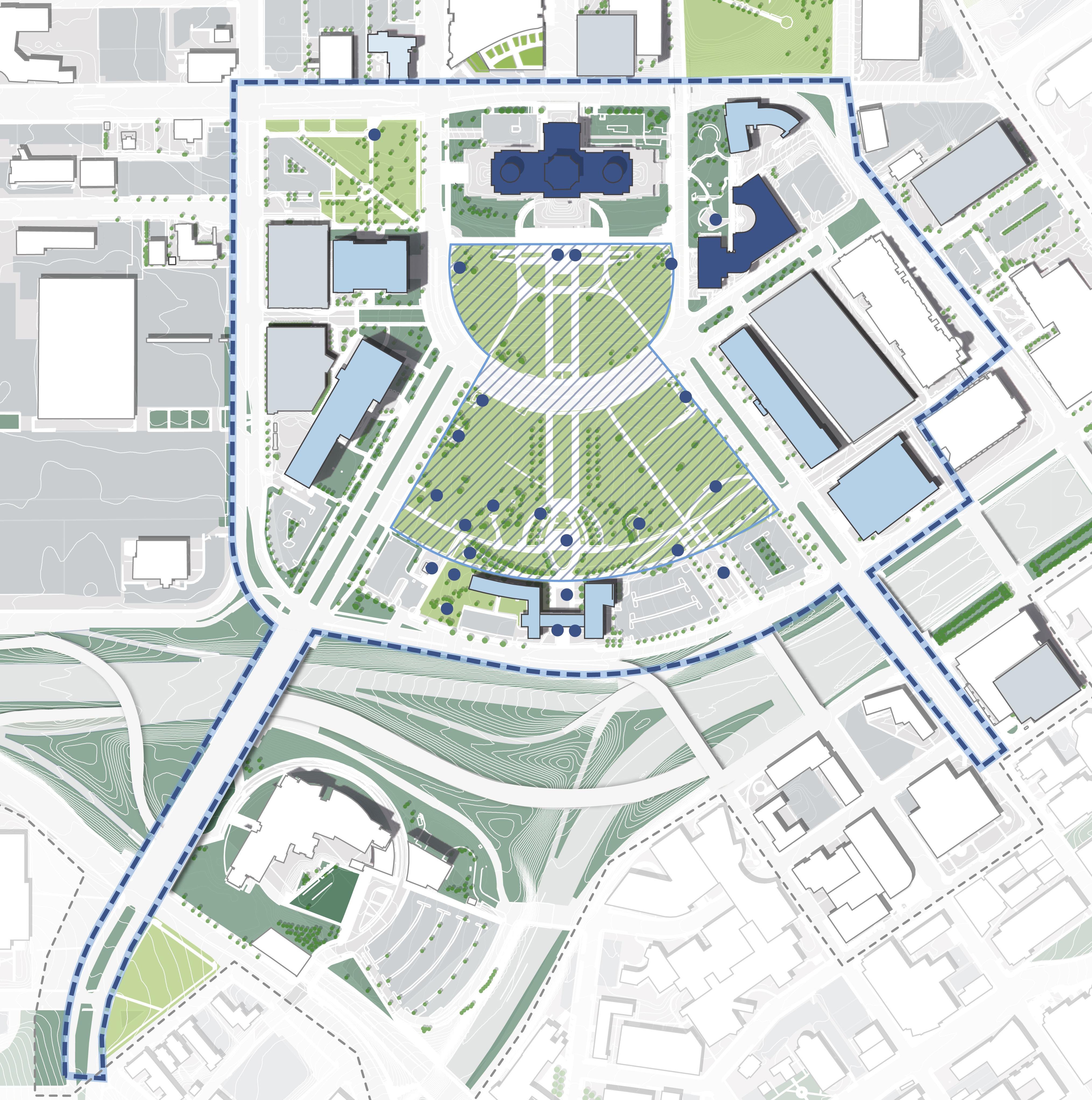
The Capitol Campus spans XX acres and includes the Capitol Building, Mall, and various government buildings immediately adjacent. It is bounded by University Avenue, Jackson Street, Rice Street, and Downtown. By studying the Capitol Mall as a part of the larger Capitol Campus, the Design Framework can better address the needs of visitors and government workers as they travel between buildings and other points of interest. The Design Framework can also propose new public amenities in currently underutilized spaces like Cass Gilbert Park, the proposed Rice and University Mobility Hub, and the vacant lots just north of University Avenue.
The Capitol Mall spans XX acres and focuses on the Upper and Lower Malls, which hold the Capitol Building, Veterans Services Building, and most commemorative works. It is bounded by University Avenue; Rev. Dr. Martin Luther King, Jr. Boulevard; John Ireland Boulevard; West 12th Street and Cedar Street. It is at this scale that the Design Framework can best address landscape typologies and planting strategies; pedestrian networks and ADA accessibility; public realm design; security implications; lighting; and more.
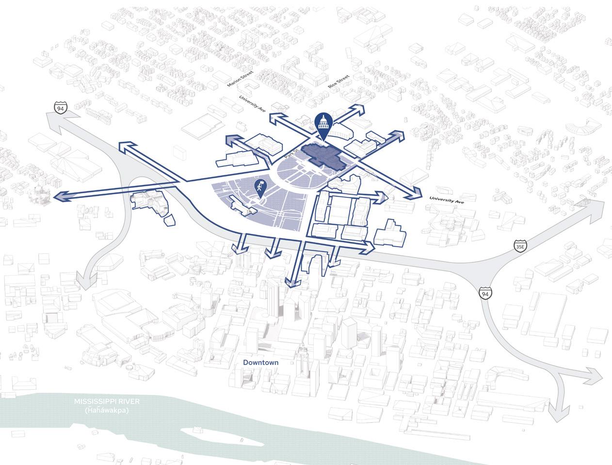 Figure 5: Capitol Mall
Figure 6: Capitol Campus
Figure 7: Capitol Area
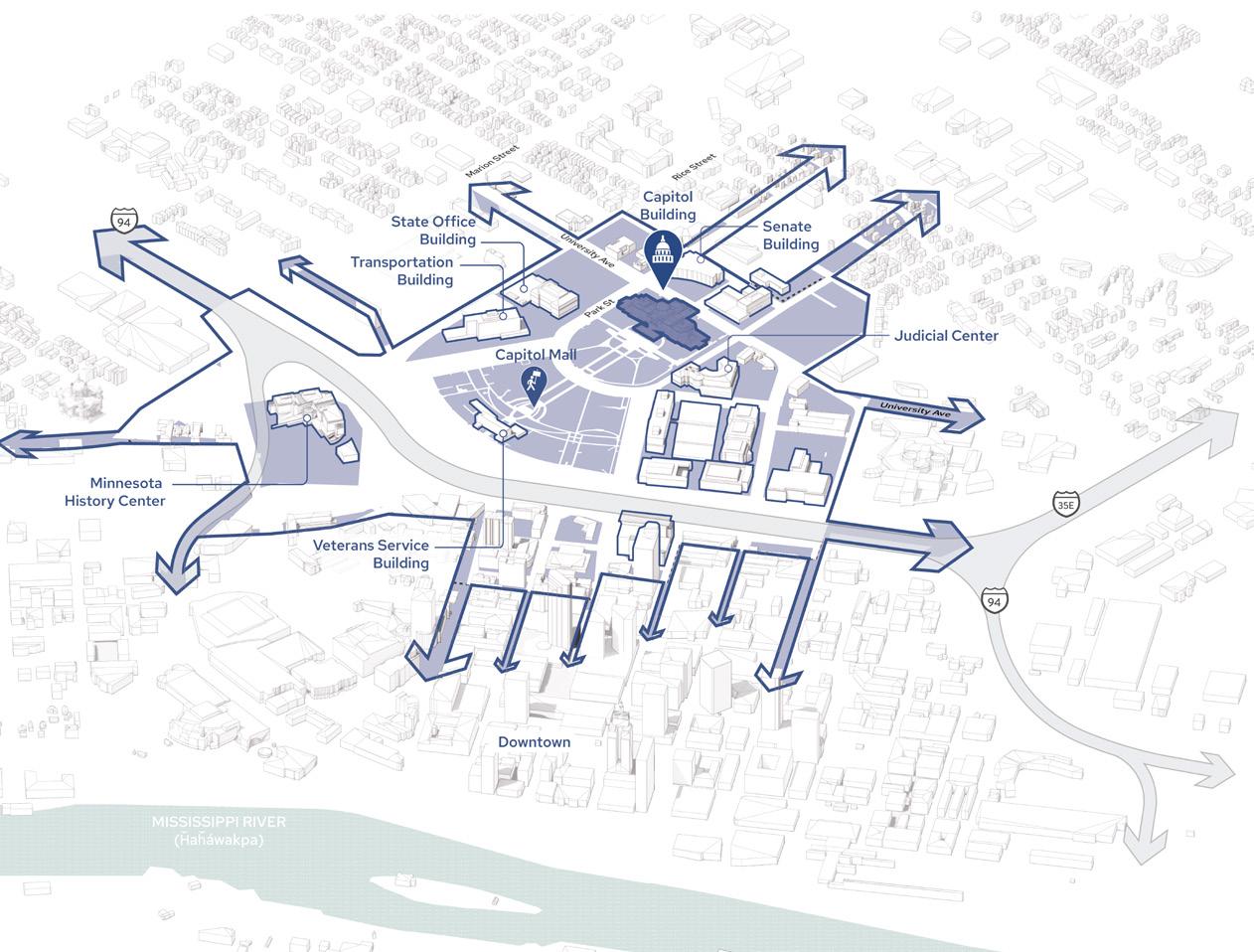
Figure 4: Capitol Context Axon
Figure 5: Capitol Mall
Figure 6: Capitol Campus
Figure 7: Capitol Area
Figure 4: Capitol Context Axon
14 15 Capitol Mall Design Framework Introduction INTRODUCTION
CAPITOL AREA
CAPITOL CAMPUS
CAPITOL MALL
DRAFT
PURPOSE OF A FRAMEWORK
UTILIZING THIS DOCUMENT
THE CAPITOL MALL DESIGN FRAMEWORK SEEKS TO FOSTER A HOLISTIC VISION WITH AN INCLUSIVE RANGE OF STRATEGIES TO ENSURE THE HIGHEST STANDARDS OF IMPLEMENTATION WITHIN THE CAPITOL AREA.
WHAT IS A DESIGN FRAMEWORK HOW TO USE THIS DOCUMENT
As previously described, the Design Framework functions similarly to municipal small area plans by providing more location-specific development guidelines than the 2040 Comprehensive Plan. It calibrates the comprehensive plan’s larger organizing principles to a specific area, detailing distinct goals for stability, change, and growth. At a high level, the Design Framework includes a detailed master plan as well as design guidelines, management practices and policy recommendations for the Capitol Campus. It also outlines guidance for future implementation on public land within the Capitol Area. More specific requirements of the Design Framework include the following:
O An overview and summary of previous/related plans
O Local and statewide community and stakeholder engagement
O A strategic vision with short- and long-term goals
O An analysis of existing site conditions and histories
O A detailed and phased master plan
O Coordination with the 2024 Cultural Landscape Report
O Campus- and area-wide systems plans
O Implementation plans and prioritization matrix
O Sustainable landscape design and maintenance standards
The Capitol Mall Design Framework is organized accordingly:
O Chapter 1: Framework Introduction (this chapter) provides a brief overview of the project; explains the purpose and requirements of a design framework; and describes the scales of inquiry utilized to study the Capitol Mall.
O Chapter 2: Process summarizes the overall schedule of the project and details the extensive community and stakeholder engagement conducted over a sixmonth period.
O Chapter 3: Inventory and Analysis outlines the Design Framework’s connection to the 2040 Comprehensive Plan in more detail and organizes existing site investigations into four specific lenses (connect, preserve, activate and grow).
O Chapter 4: Design Framework includes the overall master plan and eight supporting (bold) design moves; campus- and area-wide systems plans; as well as how the Design Framework reflects the 2024 Cultural Landscape Report findings.
DRAFT
O Chapter 5: Implementation provides the Design Framework phasing plan, prioritization matrix, and Phase 1 Schematic Design.
O Chapter 6: Design and Maintenance Standards summarizes guidelines and best practices for public realm enhancements throughout the Capitol Mall.
 Figure 8: Minnesota Capitol looking south. Capitol Boulevard reinforces a north axis from the Capitol stairs, which is currently only a visual connection across University Avenue. Following Gilbert’s plan, Administration Building (left) and Senate Building (right) flank Capitol Boulevard, and form the north edge of campus at Sherburne Avenue. Restoring this historic connection from the Capitol Building to the north is captured in the Capitol Mall Design Framework.
16 Capitol Mall Design Framework
INTRODUCTION
Source: Damon Farber. Minnesota Capitol. Jan 2024.
PREVIOUS PLANS
HISTORIC BACKGROUND
1903, 1907, 1931 Cass Gilbert Plans
O 1903: Established three major axes (commerce, culture, and nature), network of green gardens to river, and primary views. 1907: Revised to include various government buildings. 1931: Revised to include State Office Building.
1946 Johnston / Nelson / Nichols Plan
O Extended Capitol Mall fan & located Veterans Service Building, bifurcating Gilbert’s original plan.
1970 Comprehensive Plan for the Minnesota State Capitol Area
O CAAPB’s first Comprehensive Plan proposed a large plaza around the Capitol Building as well as a series of plazas connecting the Capitol Building to Downtown. It also proposed parkways that connect the Capitol Mall to other surrounding neighborhoods.
1986 Project for the Completion of the Capitol Grounds
O Design competition that restored Gilbert’s vision for a Capitol approach. The Upper Mall featured a large plaza for events flanked by gardens, while the lower Mall was a large public park. Plan not fully realized.
1989 Green River Planting Enhancements
O Beautified the interstates going through the Capitol Area. Construction completed in late 1980s.
1998 Comprehensive Plan for the Minnesota State Capitol Area
O Proposed a vision that the Capitol Campus is a good neighbor to the surrounding area and reenvisioned various parking lots / ramps as open space.
2009 Comprehensive Plan for the Minnesota State Capitol Area
O Amended the 1998 Comprehensive Plan for the Minnesota State Capitol Area
2017 Capitol Restoration
O Included landscaping around the Capitol Building and the restoration of Aurora Promenade as a more prominent open space
2018 Lower Rice Street Commercial Vitality Zone Strategy
O Outlined strategic investments along Rice Street.
2020 “Saint Paul for All” - City of Saint Paul 2040 Comprehensive Plan
O Guides development in Saint Paul for the next 20 years (2020-2040).
(2021) 2040 Comprehensive Plan for the Minnesota State Capitol Area
O Proposed a vision that the Capitol Campus is a unifying factor for those who come to live, work, learn and play. It also emphasized the importance of the Capitol Area as a connector.
2021 Capitol Rice Development Framework
O Outlined development strategies for the Capitol Rice District, including the vacant Sears site.
2022 Historic Context Report
O Documented the historic context of land use history in the Capitol Area; proposed an eligible historic district; and listed all Nationally Registered Historic Properties (NRHP) properties in the Capitol Area.
2022 Commemorative Works Task Force
DRAFT
O Outlined a process and series of guidelines for new or revised commemorative works within the Capitol Campus.
2024 Cultural Landscape Report
O Describes the physical history and existing conditions of the Capitol Mall and recommends treatment actions to rehabilitate the landscape.
2024 Capitol Area Community Vitality Account
O Strategic investment of $5 million to plan and design essential physical infrastructure improvements in the Capitol Area.
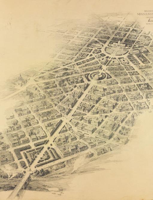
Figure 9: 1931 Cass Gilbert Plan
18 19 Capitol Mall Design Framework Introduction
INTRODUCTION
OPPORTUNITIES FOR CHANGE
COORDINATING EFFORTS
Numerous ongoing and proposed improvements are outlined in the 2040 Comprehensive Plan and other guiding documents. The Design Framework must respond to, inform and coordinate with such efforts. The improvements include, but are not limited to, the following:
O State Office Building Expansion
O Sears Capitol View Redevelopment
O League of Cities Block Redevelopment
O State Lot C and the Ford Building Redevelopment
O State Lot AA Redevelopment
O State Lot G Redevelopment
O Centennial Office Building Redevelopment
O Future Bethesda Health Center and Healing Gardens
O Cass Gilbert Park Improvements
O University and Rice Mobility Hub
O Rice Street Visioning and Reconstruction
O Bus Rapid Transit (BRT) G-Line along Rice Street
O Other streetscape and intersection improvements along Rev. Dr. Martin Luther King, Jr. Boulevard, East Columbus Avenue, North Capitol Boulevard, John Ireland Boulevard, University Avenue and others
O Separated and protected bike lanes along John Ireland Boulevard, Cedar Street, Rice Street and others
O Future public realm improvements in various locations
Rice Street Reconstruction
Future Development Plans
Future Building Plans
Important Intersections
Intersection Improvements
Streetscape Improvements
Future Public Realm Improvements
Source: Informed by the City of Saint Paul 2040 Comprehensive Plan (2020), and other public guiding documents.
N 0’ 500’ 250’ 125’
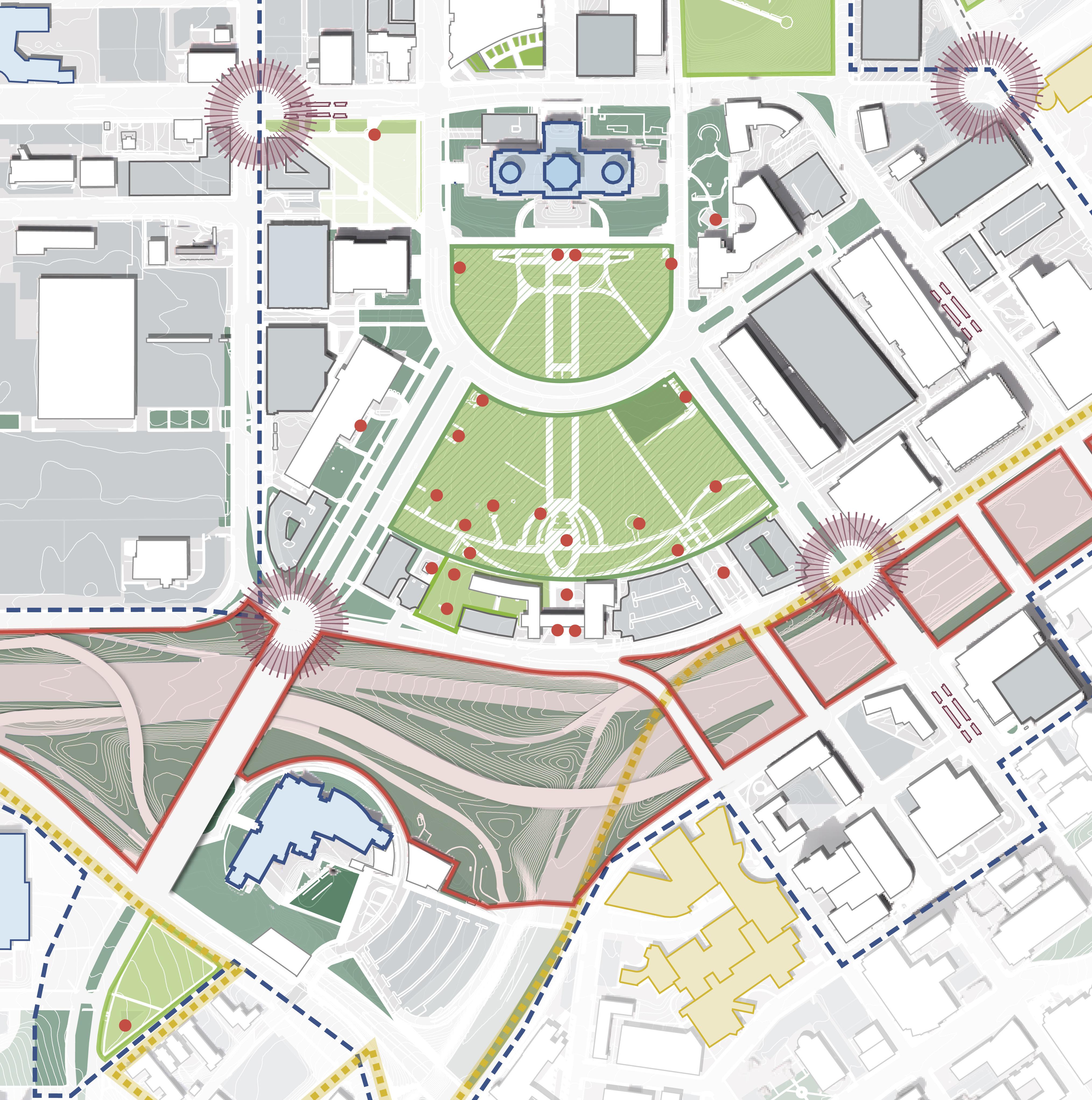
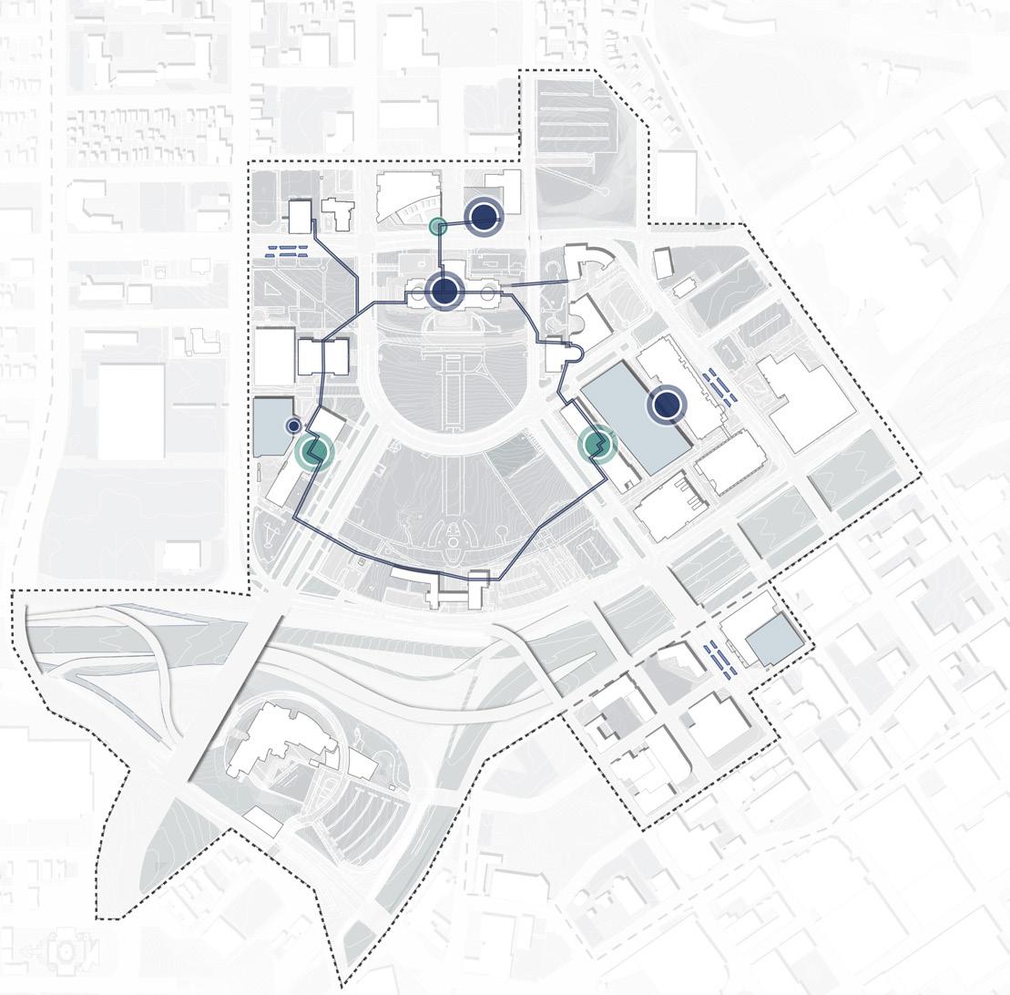
RICE STREET DISTRICT SAINT PAUL CITY SCHOOL LOT C + FORD BLDG CAPITOL PARK Rice St Future Public Realm Improvements Future Public Realm Improvements Mobility Hub Western Sculpture Park SEARS URBAN VILLAGE REDEVELOPMENT STATE OFFICE BUILDING FuturePublic RealmImprovements Future Public Realm Improvements MN STATE CAPITOL MALL Future Public Realm Improvements DOWNTOWN SAINT PAUL Valley Park I-94 Cass Gilbert Memorial Park University Ave W St Anthony Ave ComoAve W Pennsylvania Ave Park St N Capitol Blvd John Ireland Blvd CedarSt JacksonSt E12thSt 10thStERobertSt FortRd I-35E EColumbusAve
LEGEND
Figure 12: Current + Future Projects 20 21 Capitol Mall Design Framework Introduction
INTRODUCTION
DRAFT
THE CAPITOL IS THE BEST WORK I HAVE EVER DONE, OR SHALL EVER DO, AND I AM GLAD TO HAVE GIVEN IT TO SAINT PAUL.
– CASS GILBERT
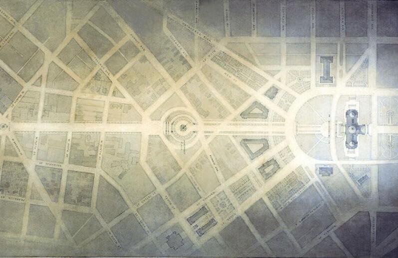
Source:https://cassgilbertsociety.org/works/mn-capitol/mn-capitol-axis/
Figure 13: 1931 Minnesota Capitol Mall Plan by Cass Gilbert
DRAFT
CHAPTER 2
PROJECT PROCESS
DRAFT
PROCESS OVERVIEW
A
COMPREHENSIVE
DRAFT
PROCESS FOCUSED ON RIGOROUS SITE ANALYSIS AND ROBUST STAKEHOLDER AND COMMUNITY ENGAGEMENT, AS WELL AS IDENTIFYING FEASIBLE AND PHASEABLE DESIGN STRATEGIES AND IMPLEMENTATION STEPS.
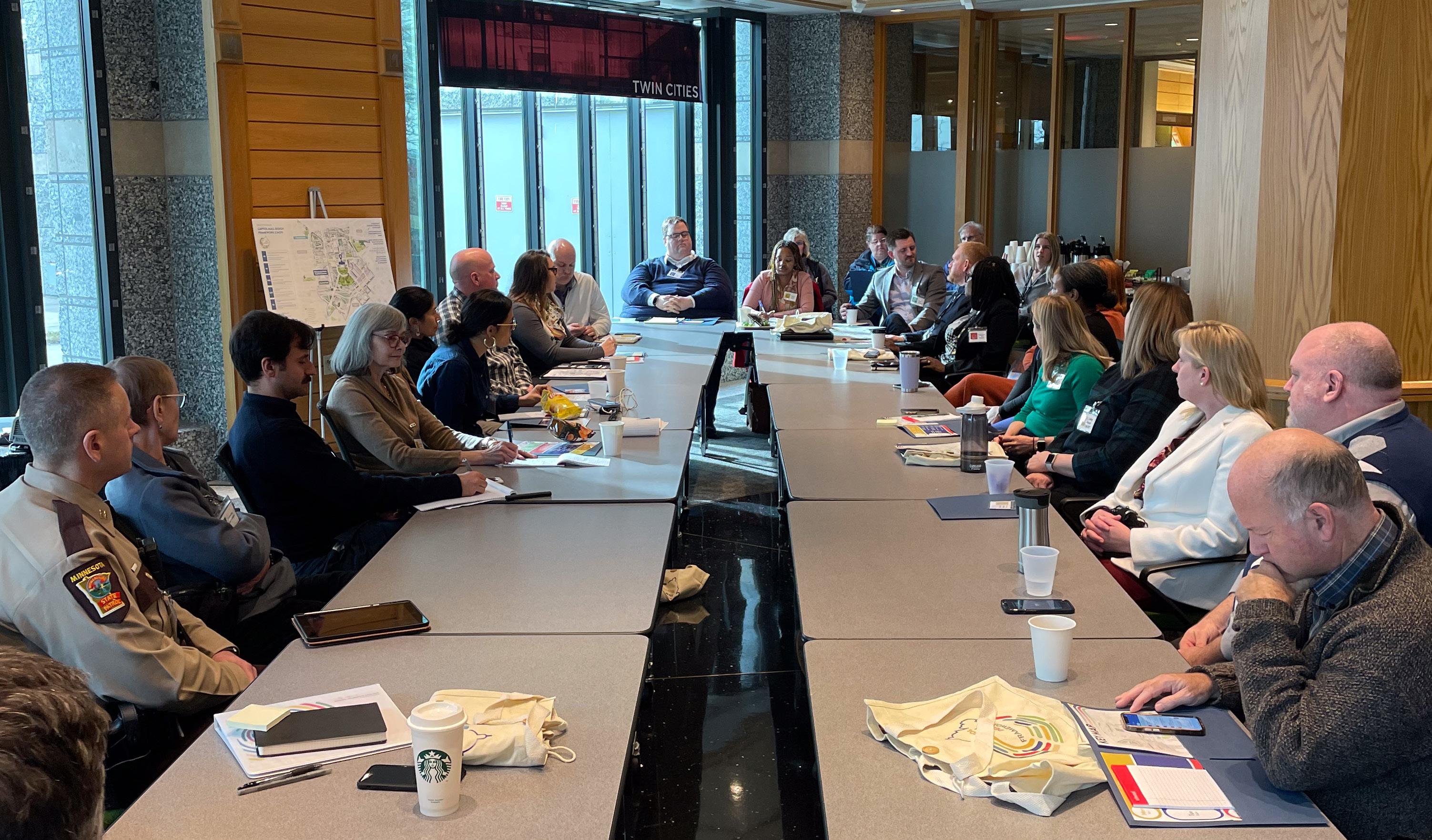
Figure 14: Executive Steering Focus Group, charrette week
The Design Framework process occurred over six months, from December 2023 to May 2024, with Phase 1 Schematic Design extending into the latter half of 2024. The process included three distinct design tasks and windows of engagement. Task 1: Learn and Create focused on rigorous site analysis and development of the draft cultural landscape report (see Chapter 3 for more details), in addition to extensive community and stakeholder engagement to develop a collective vision and foundation for the Capitol Mall Design Framework. Task 2: Refine and Design thoughtfully transformed this analysis and vision into a draft master plan. Community and stakeholder engagement during this task focused on bold supporting design moves to ensure comprehensive alignment with the original vision. Additionally, Task 2 included a final draft of the Minnesota Capitol Mall Cultural Landscape Report and a Phase 1 Schematic Design proposal. Task 3: Celebrate and Launch generated the final Design Framework for submission and approval (see Chapter 4 for more details). Engagement throughout this time included a thorough draft review by various stakeholders and unpacked specific design details with the larger community necessary to inform future work. Lastly, Task 4: Detailed Design and Implementation utilized this information to document Phase 1 Schematic Design, with projected implementation (or completed construction) by the end of the year.
Community and stakeholder engagement was integral to all these tasks. Thousands of diverse and distinct voices shaped the Design Framework and created a plan that is truly authored by the people of Minnesota. To achieve this, a multifaceted and robust engagement approach utilized digital communications, in-person events, surveys, stakeholder interviews and one-on-one conversations both within the Twin Cities and the larger state. This chapter outlines this engagement process in more detail by providing a deeper look into the people engaged as well as how their feedback directly shaped the Design Framework.
The Capitol Mall Design Framework built upon a robust series of previous engagement efforts, including the 2040 Comprehensive Plan, Lower Rice Commercial Vitality Strategy, Capitol Rice Development Framework, Visitor Experience Survey, Capitol Connections and the Downtown Commons Study, Capitol Area Commutes, Capitol Area Stormwater Management Study, Public Engagement Task Force on Commemorative Works, and the Capitol Area Community Vitality Task Force.
26 27 Capitol Mall Design Framework Project Process
PROJECT PROCESS
PROJECT SCHEDULE
Sasaki presentation to CAAPB Board and State Legislators Draft CLR and Phase 1 Submission
Phase 1A Scope Confirmation Phase 1A Documentation Handoff to HGA
90% Draft of Final CMDF Framework, Final CLR Submission
Feb 5th - Feb 8th Keystone Engagement Event One - Charrette Week
Engagement Event Two
Board Meeting for Phase 1A Approval
Board Meeting for Final Approval
Figure 15: Project Schedule DEC NOV 2023 2024 2025 JAN FEB MAR APR MAY JUN JUL AUG SEP OCT NOV DEC JAN ENGAGEMENT
TASK 1 TASK 2 TASK 3 TASK 4
TIMELINE
Mar 1
31
Website
One” release
Jul 31 Anticipated CMDF Project Completion Dec
Phase 1 Implementation Complete CMDF
launch and “Survey
Keystone
Focus
CAAPB
CAAPB
“Survey Two” release
Comment Period” Dec 1 Initial Site Visit Site Analysis Capitol Mall Design Framework Draft Final CMDF Submission Final CLR Phase 1A Detailed Design and Implementation Phase 1 Schematic Design Submission CLR Work Tree Inventory 28 29 Capitol Mall Design Framework Project Process
Group Engagement
“Final
LEARN + CREATE REFINE+ DESIGN COMMENT + APPROVAL PHASE 1 DETAILED DESIGN + IMPLEMENTATION WE ARE HERE! FRAMEWORK AND CLR 45 DAY REVIEW FRAMEWORK 30 DAY REVIEW DRAFT
ENGAGEMENT APPROACH

Figure 16: Engagement Approach
1: DESIGN CHARRETTE + FOCUS
LEVEL
CITYWIDE
LEVEL
REGIONAL
LEVEL 4:
Design Charrette Focus Group Stakeholder Meetings Keystone Engagement Event Roadshow Pop-up Events Mobile Engagement Online Survey & Website In-person Survey Youth Engagement 30 31 Capitol Mall Design Framework Project Process PROJECT PROCESS
LEVEL
GROUPS
2:
PUBLIC ENGAGEMENT EVENTS
3:
& INFORMAL ENGAGEMENT
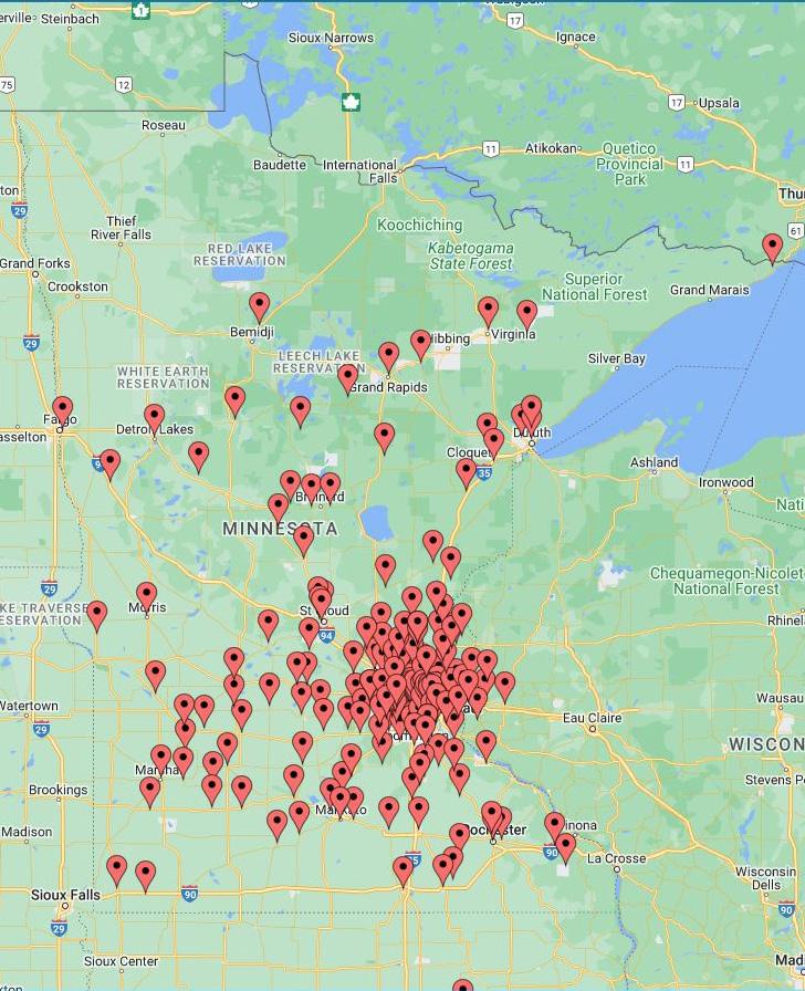
STATEWIDE ENGAGEMENT
DRAFT
ENGAGEMENT + OUTREACH DASHBOARD
13,982+
POINTS OF ENGAGEMENT
20+
Stakeholder and Technical Advisory Taskforce (TAT) Interviews / Listening Sessions 2 Keystone Events 4-Day intensive Design Charrette and Statewide Virtual Open House 15 Pop-Ups + Smaller Events Over 988 interactions
3 Community Surveys
2,434 total responses in 3 languages EST. +7,500 Emails sent to stakeholder groups, community members, etc.
5,200+ Unique Website Visitors to https://mncapitolmall. engage.sasaki.com/
DRAFT
ENGAGEMENT PRINCIPLES
The engagement approach is rooted in four engagement principles:
1. Go to where people are. This approach applies locally (e.g., holding pop-ups in locations where people already are, such as the LRT station and the Capitol) as well as statewide (e.g., communications through press and social media feeds where people are already subscribed).
2. Everyone has a right to be involved. Everyone has a valid opinion, and we respect and actively listen to people. Our approach will take steps to eliminate barriers to engagement, including utilizing a variety of media, languages, and considerations for access. We communicate technical information in ways that are easy for all people to understand.
Close the feedback loop. If we ask for feedback, we show how it impacts design outcomes. If input is not incorporated, we explain why it is not.
3. Partner. We partner with local community leaders and organizations for knowledge and collaboration. This approach helps to engage with hard-to-reach communities and respects the engagement work already being done.
Minnesota Capitol Mall Survey Response In-Person Event LEGEND 32 33 Capitol Mall Design Framework Project Process PROJECT PROCESS
Figure 17: Statewide community engagement
STAKEHOLDER ENGAGEMENT
VOICES OF MINNESOTA
The Technical Advisory Taskforce, or TAT, included CAAPB Staff and Advisors; State of Minnesota Government Officials, included the Lieutenant Governor; State of Minnesota Department of Administration Commissioner’s Office; Facilities Management; Minnesota State Historic Preservation Office; Office of Enterprise Sustainability; Capitol Security; Council on Disabilities; Ramsey County, Capitol Region Watershed District; and the City of St. Paul.
FOCUS GROUPS
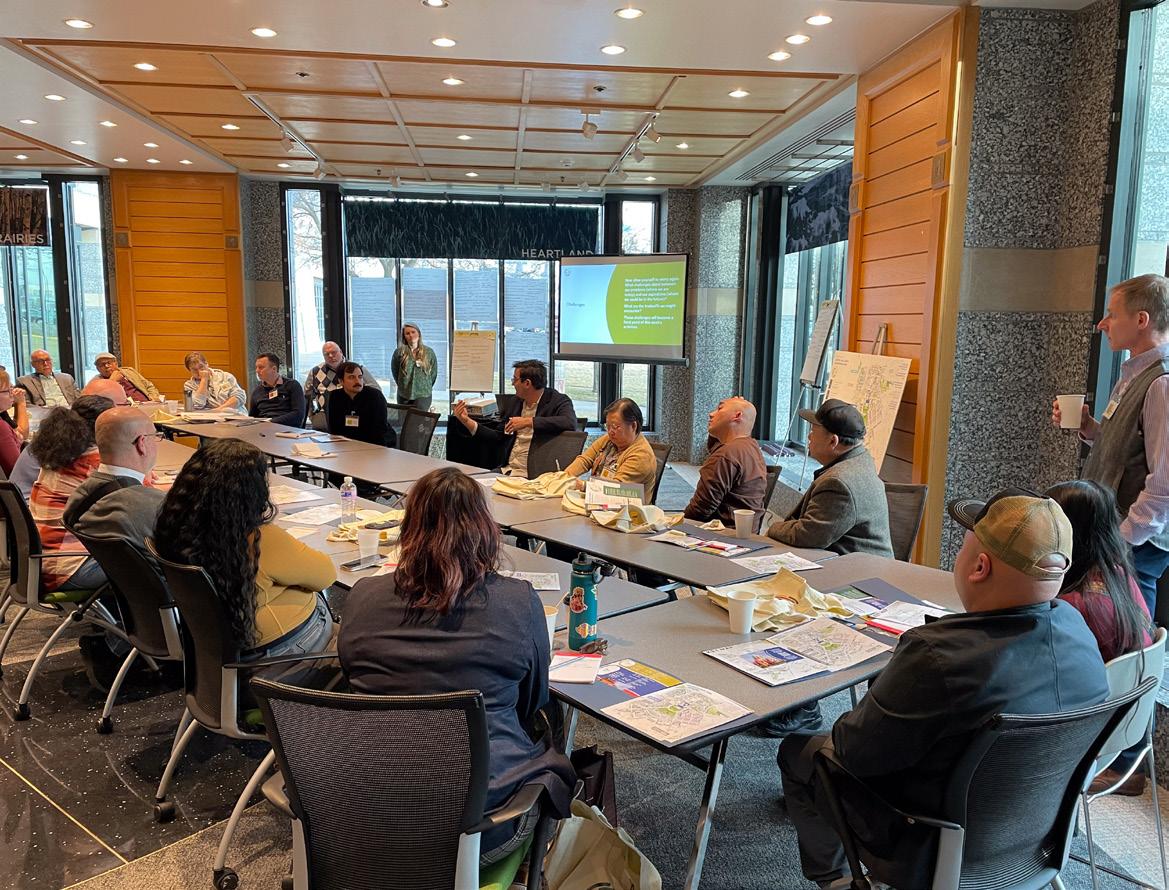
Focus Groups included members of the previously discussed TAT, as well as many others. More specifically, the Executive Steering Focus Group included elected officials and leaders; the Technical Focus Group included the remaining members of the TAT; the More Minnesota Focus Group included registered neighborhood associations, local community leaders, institutional leaders, and Tribal Nation representatives; and the Saint Paul Community group included local residents and nearby business owners—specifically those in the Indigenous American, African American, Hmong, Latinx, and/or Somali communities.
The fast-paced Capitol Mall Design Framework process required the identification of organizing principles and a preferred framework for the Capitol Mall design before March 1, 2024.
Stakeholders engagement was a critical component of the Design Framework process. Stakeholders include those who either interact with the Capitol Campus on a daily basis or represent a minority community whose voice might get lost in larger outreach efforts and thus require additional care. More specifically, stakeholders work on the Capitol Campus, operate a business or live nearby, lead various community groups or organizations, and/or are members of the African American, Indigenous American, Hmong, Latinx, and/or Somali communities.
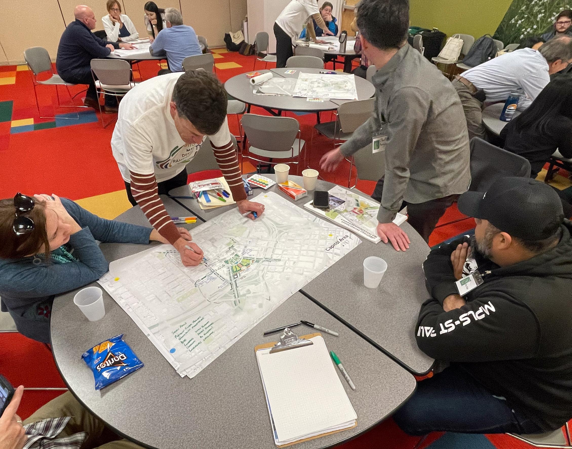
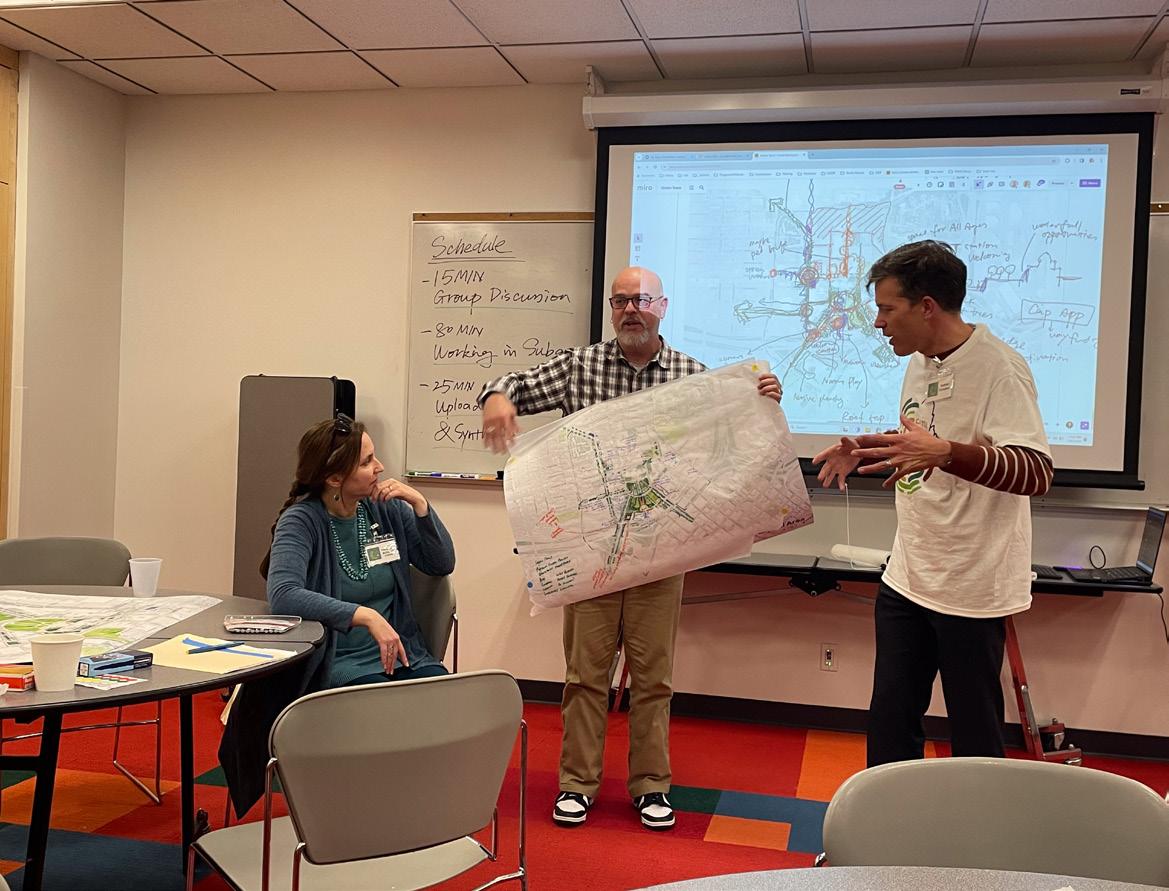
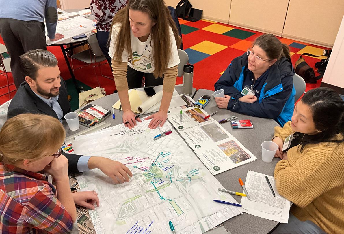
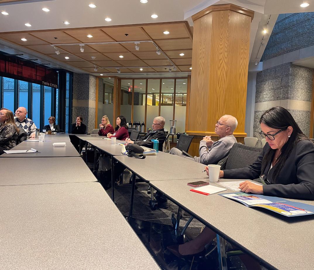
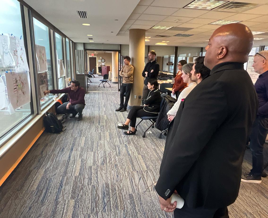
Stakeholder engagement took many forms throughout the six-month process. At times, it included virtual meetings with technical experts who are intimately familiar with Capitol Mall operations and maintenance, while other instances explored much larger engagement strategies like a week-long design charrette that gathered all stakeholders in person to collaborate on a shared vision and path forward. Regardless of scale, the team carefully integrated all feedback into the Design Framework to ensure utmost relevancy and representation.
In order to achieve this, a design charrette gathered all stakeholders together in a multi-day process of listening, co-designing, critiquing, iterating, and refining ideas. This allowed the design team to move from baseline analysis to design direction in an abbreviated period of time with the confidence that key stakeholders had buy-in and their voices had been heard.
34 35 Capitol Mall Design Framework Project Process TECHNICAL ADVISORY TASKFORCE (TAT)
PROJECT PROCESS
DESIGN CHARRETTE
STRATEGIC ENGAGEMENT PROCESS
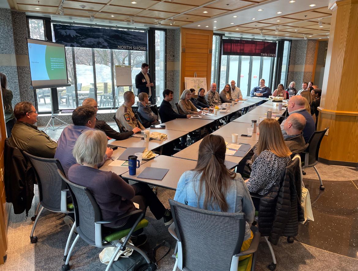
Figure 18: Design Charrette participants generating framework ideas
Figure 19: TAT members discussing initial framework goals
Figure 20: Saint Paul Community Focus Group discussing initial framework goals.
Figure 21: Design Charrette participants presenting framework ideas
DRAFT
COMMUNITY ENGAGEMENT
PHASE 1 PROCESS + RESULTS
OVERVIEW
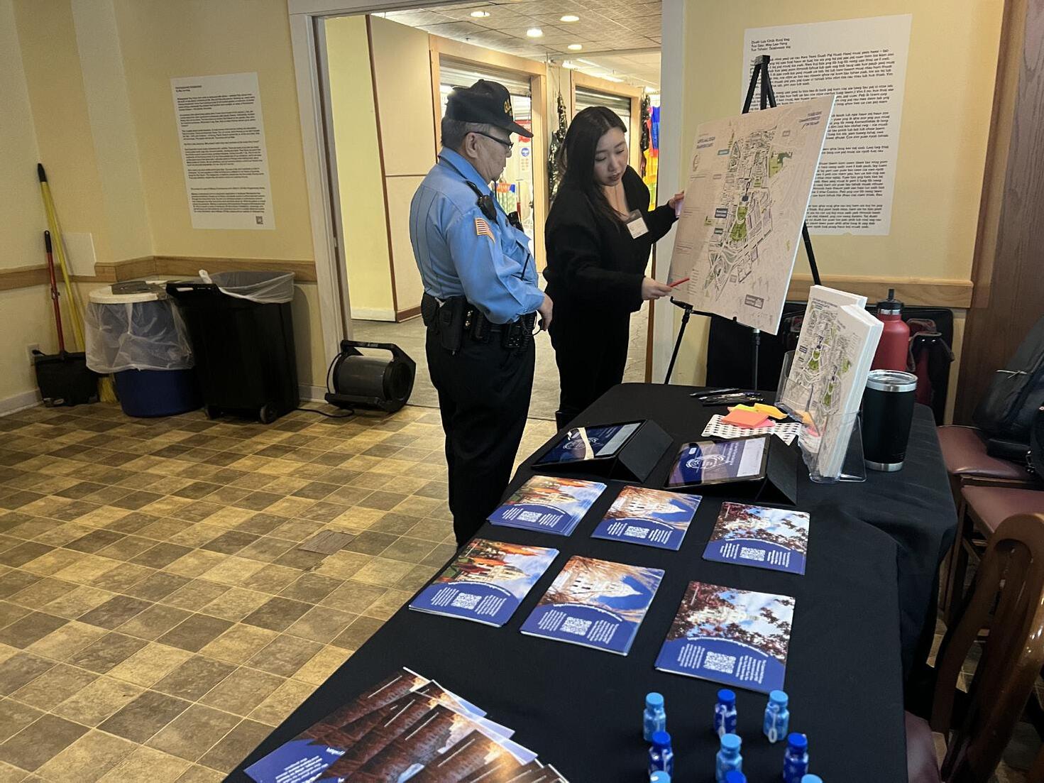
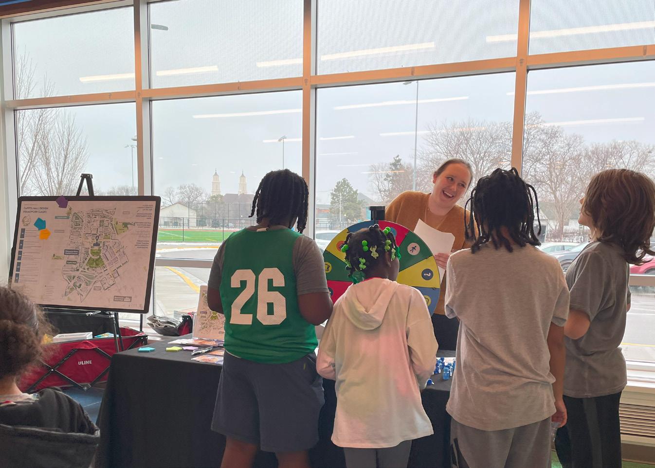
The Phase 1 engagement effort spanned from December 15th to February 8th. Goals for this phase included building awareness for the Capitol Mall Design Framework and all upcoming engagement; gathering impressions of the Capitol Mall through targeted stakeholder outreach, community pop-ups, and a baselining Survey One. Key questions addressed community identity, current uses, and hopes for the future. Phase 1 concluded with a fastpaced Design Charrette week that combined public and invited audience engagement to rapidly ideate and create a preferred framework direction for the Capitol Mall. Specific engagement efforts included:
O HmongTown Marketplace Pop-Up
O Frogtown Community Center Pop-Up
O Saint Paul Winter Carnival - Kids and Family Day PopUp
O Midtown Global Market Pop-Up
O Capitol River Council Presentation
O Survey One (1,441 partial and complete responses)
O Keystone Event One: Charrette Week (Four Days)
O 12 Stakeholder and TAT interviews and listening sessions
O Social media toolkit sent to 64 stakeholder groups
O Press release sent from CAAPB to multiple media outlets
MAJOR TAKEAWAYS
Major takeaways across all engagement efforts include:
O MORE THINGS TO DO. People want more contemporary artwork; picnicking, seating, food, and restaurants; trees, gardens, pollinators, and native plants; social events; and kid and family-friendly programming.
O MORE KID-FRIENDLY. People want child-friendly spaces, specifically areas where kids can run, climb, and play.
O MORE REPRESENTATION. The Capitol Mall does not reflect an inclusive history or Minnesota’s current diversity. People want more inclusive representation.
O IMPROVE SAFETY. Safety and connectivity were found to be interwoven topics, with most safety concerns related either to LRT stations or high traffic crossings.
O IMPROVE ACCESSIBILITY. Parking and handicap accessibility are issues that needs to be improved. The steep slopes, especially around the Upper Mall, are difficult to traverse.
O REACH MORE BIPOC. Future engagement efforts need to reach more statewide audiences and BIPOC communities.
O CULMINATING THEMES OF VITALITY, DIVERSITY, INCLUSIVITY. People want a Capitol Mall that is vibrant with many, diverse things to do and see while also representing the broad range of people and communities in Minnesota.
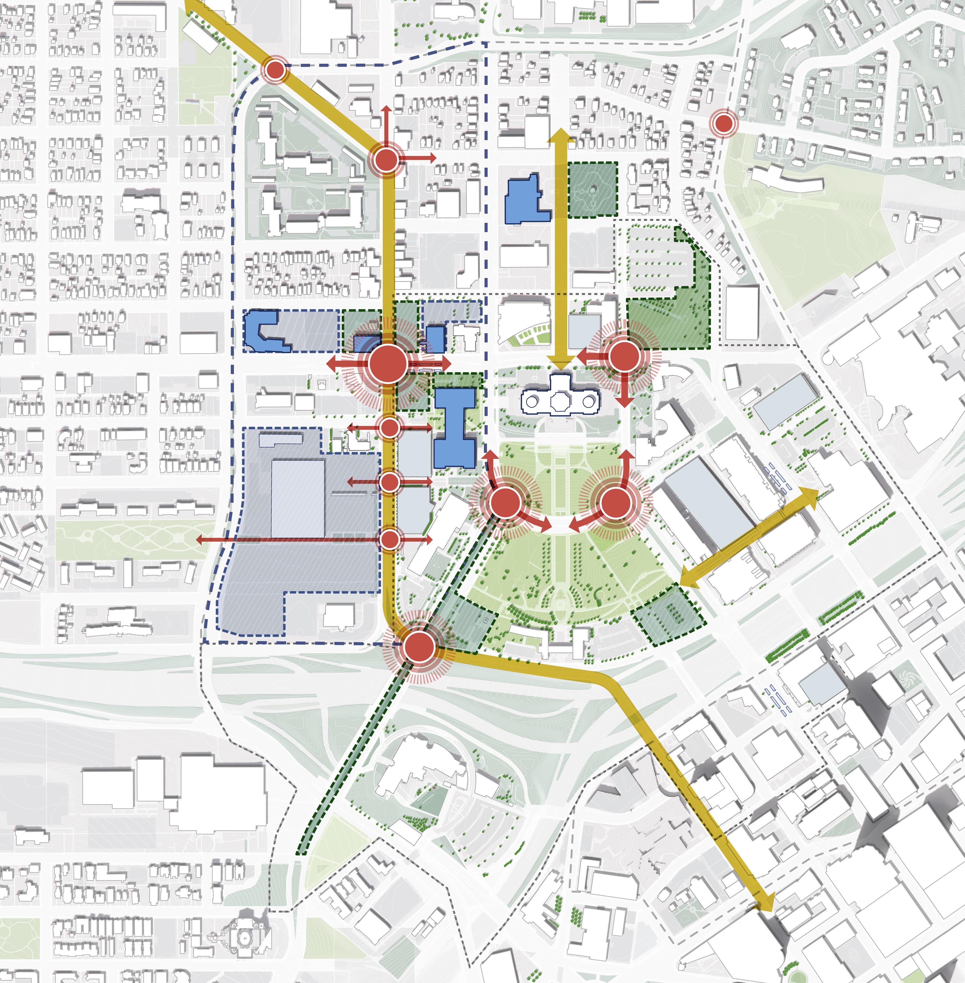
O TEN BOLD DESIGN MOVES:
1. Right size the roads and reinforce them with trees.
2. Convert Rev. Dr. Martin Luther King, Jr. Boulevard into a community shared street.
3. Reinvigorate nodes which connect the community to the Capitol Mall in each direction.
4. Transform Cass Gilbert Park into a multigenerational space for play, recreation and views.
5. Celebrate Minnesota’s connection to water in all seasons.
DRAFT
6. Sculpt topography to improve accessibility, seamlessly integrate security and provide a platform for events.
7. Establish a cultural walk that draws visitors in and provides opportunities for representation.
8. Enhance and streamline the user experience.
9. Create a gradient of planting strategies that support cultural programming, sustainable maintenance and human comfort goals
10. Introduce new strategies to represent Minnesota’s cultural and ecological diversity.
 Frogtown Community Center Pop-Up
Figure 24: More Minnesota Focus Group discussing initial framework ideas
Figure 25: Design Team and other stakeholders synthesizing Design Charrette takeaways to present back to participants
Figure 26: Saint Paul Winter Carnival Pop-Up
Figure 27: Design Charrette participants quickly generating ideas
Frogtown Community Center Pop-Up
Figure 24: More Minnesota Focus Group discussing initial framework ideas
Figure 25: Design Team and other stakeholders synthesizing Design Charrette takeaways to present back to participants
Figure 26: Saint Paul Winter Carnival Pop-Up
Figure 27: Design Charrette participants quickly generating ideas
36 37 Capitol Mall Design Framework Project Process PHASE 1 ENGAGEMENT
COMMUNITY ENGAGEMENT
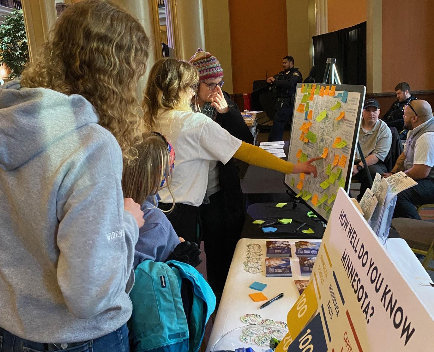
PHASE 2 PROCESS + RESULTS
OVERVIEW
The Phase 2 engagement effort spanned from February 9th to April 15th. Goals for this phase included refining the results of the charrette into a preferred framework direction with CAAPB sign-off before March 1st; expanding upon the Capitol Mall Design Framework with additional visualizations (bold design moves), directing community members to join our mailing list; and building interest in the Capitol Mall through educational materials on the website. Additionally, Phase 2 included advertising the design for a proposed Phase 1 implementation; launching Survey Two to gather targeted feedback about the overall direction; and expanding statewide engagement. Key questions addressed: What resonates and what does not?; What is the overall “character” of the Mall?; Is the Mall Framework doing what it should?; What is missing?; What are the biggest priorities for near term investment? Specific engagement efforts included:
Twin Cities Pop-Ups
O The Black Market, Capitol Rotunda, Capitol Rice LRT Station
Greater Minnesota Pop-Ups
O Duluth: UMD Hockey Pre-Game at Amsoil Arena, Bemidji: The Great Thaw Craft Fest, Willmar: Kids Connection Experience at Uptown Mall, Rochester: The Rochester Thaw Music Festival
Other Efforts
O Survey Two (993 partial and complete responses)
O 7 Stakeholder and TAT Meetings / Interviews (not including Keystone Event Two)
O Keystone Engagement Event Two (Focus Groups and Statewide Virtual Townhall)
O Social media toolkit sent in two rounds to 70 stakeholder groups
O 2+ press releases sent from CAAPB to multiple media outlets. Before each pop-up engagement event, social media content sent to local CBOs and local media outlets
MAJOR TAKEAWAYS
Phase 2 engagement had many similar takeaways to Phase 1. Significant takeaways include:
O SUPPORT FOR ALL TEN BOLD DESIGN MOVES. 75%+ of people think each Bold Design Moves makes the Capitol Mall more lively, inclusive, and diverse.
O SUPPORT FOR THE CULTURAL WALK AS A PHASE 1. People want water features; plantings representing Minnesota’s ecological and agricultural heritage; flags of the eleven Tribal Nations; and educational signage included in the Cultural Walk.
O INTERSTATE-94 BRIDGES NEED IMPROVEMENT. Many said the Capitol Mall feels disconnected and isolated from the surrounding city, especially Downtown.
O SEARS SITE IMPROVEMENTS. Redeveloping the vacant Sears building and parking lots is a top priority for many. The Rice St and University Ave intersection is called out as feeling unsafe and unwelcoming. People want to see this important entry to the Capitol Campus improved.
O BETTER INTEGRATED SECURITY FEATURES. Some suggest the Capitol itself is unwelcoming, with an imposing fence and security that makes it feel closed off to the public.
DRAFT
O ROAD DIETS. Streets like Rev. Dr. Martin Luther King, Jr. Boulevard are too wide and need road diets, traffic calming, safer pedestrian crossings, and bike lanes.
O NEED BASIC AMENITIES. Public restrooms, drinking fountains, trash cans, seating, and food options are lacking. People want to see these added throughout to make the space more comfortable to spend time.
O ADD MORE SHADE TREES. People want more shaded areas to rest and relax.
O POSITIVE FEEDBACK ABOUT CASS GILBERT MEMORIAL PARK AND A DESTINATION PLAY AREA
O CONCERNS ABOUT COST AND GENTRIFICATION. While there was overall excitement for the improvements to the area, there was some concern about overall cost to tax-payers and gentrification
out.
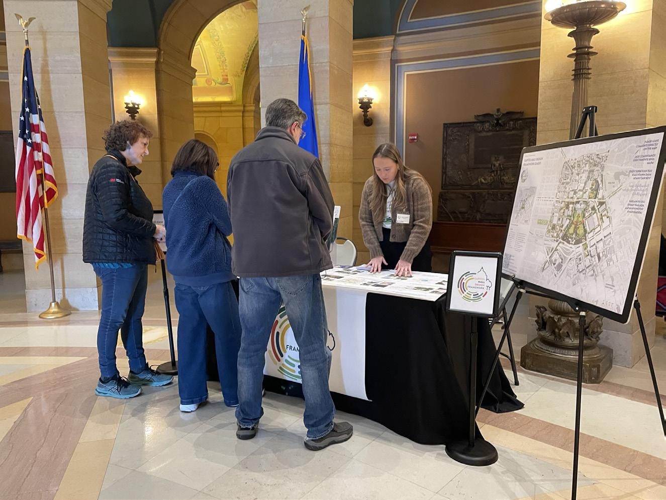
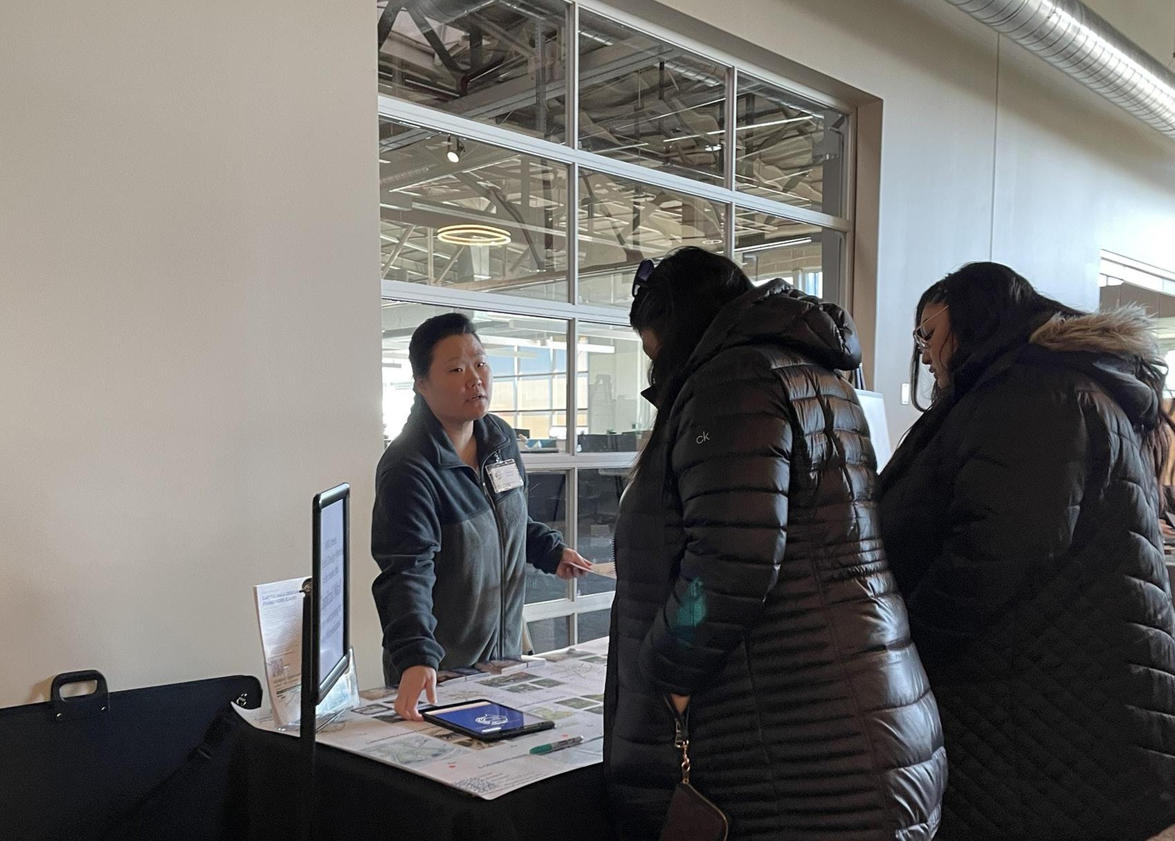
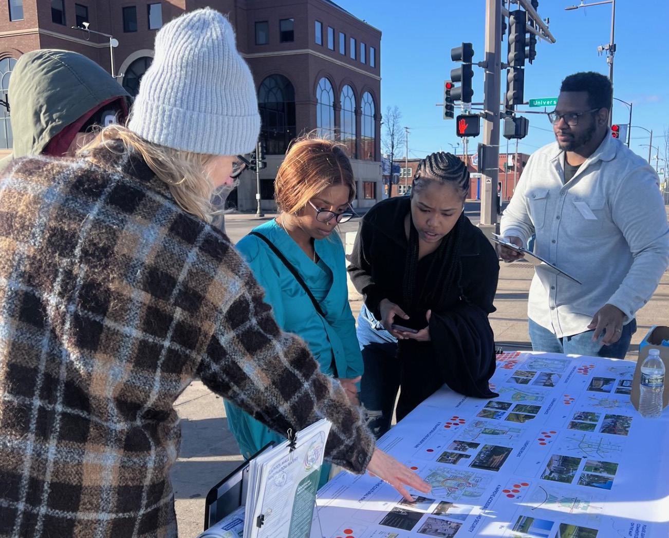
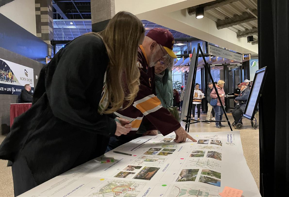
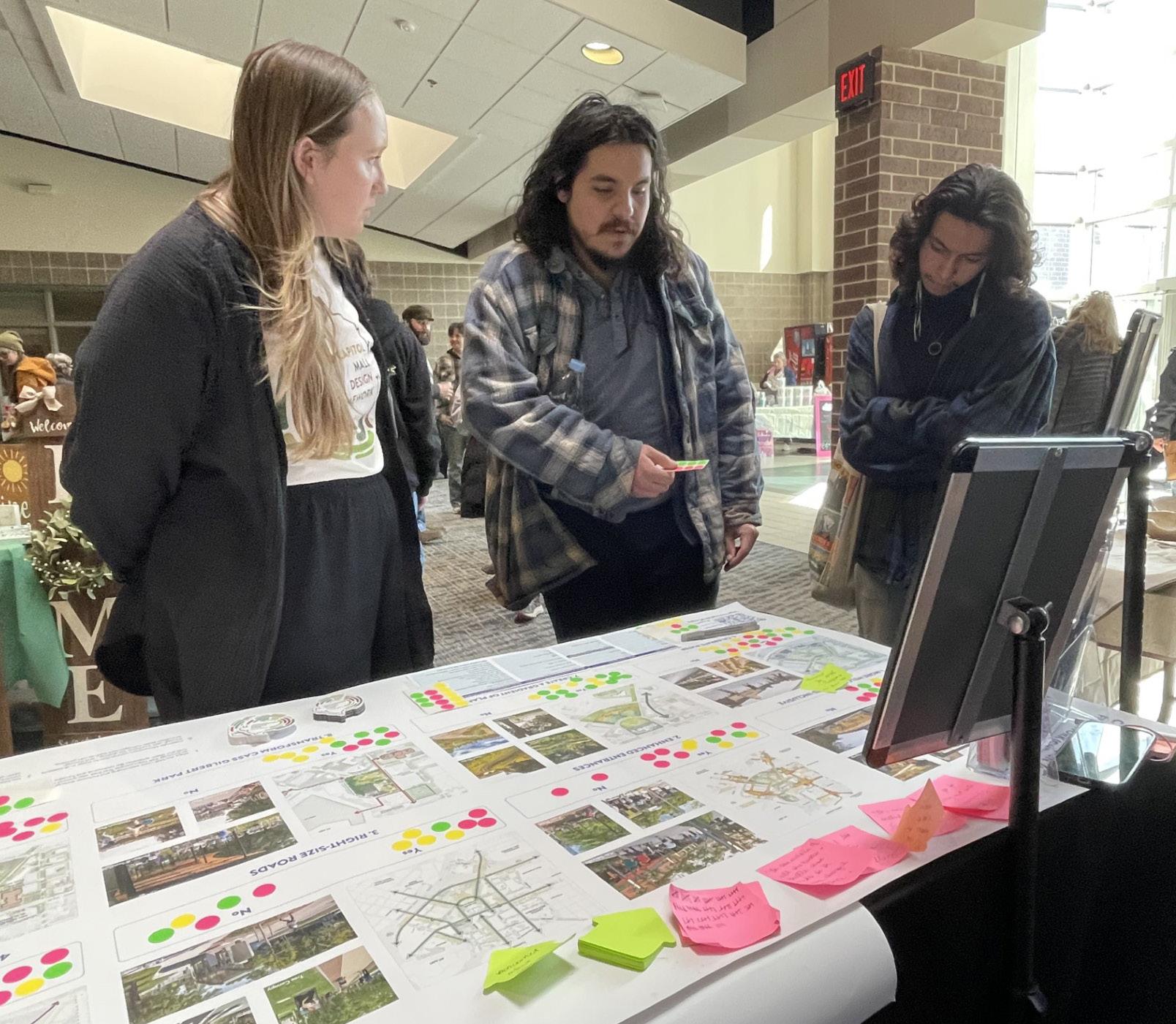
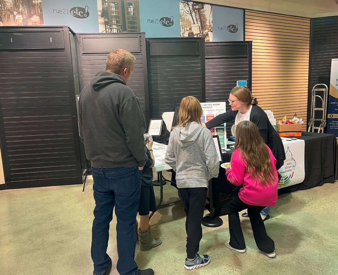 Figure 28: Capitol Rotunda Pop-Up
Figure 29: The Black Market Pop-Up
Figure 30: Capitol Rice LRT Pop-Up
Figure 31: Willmar Kids Connection Experience Pop-Up
Figure 32: Bemidji Craft Fair Pop-Up
Figure 33: Duluth UMD Hockey Pre-Game Pop-Up
Figure 28: Capitol Rotunda Pop-Up
Figure 29: The Black Market Pop-Up
Figure 30: Capitol Rice LRT Pop-Up
Figure 31: Willmar Kids Connection Experience Pop-Up
Figure 32: Bemidji Craft Fair Pop-Up
Figure 33: Duluth UMD Hockey Pre-Game Pop-Up
pushing local communities
38 39 Capitol Mall Design Framework Project Process PHASE 2 ENGAGEMENT
COMMUNITY ENGAGEMENT
PHASE 3 PROCESS + RESULTS
OVERVIEW
The Phase 3 engagement effort spanned from April 16th to June 20th. Goals for this phase included communicating what was heard in previous phases; expanding Indigenous Peoples engagement; developing a draft Capitol Mall Design Framework; presenting the draft Capitol Mall Design Framework in a way that connects stakeholder input to outcomes; and launching a final survey. Key questions addressed: Did we miss anything? What resonates and what does not? Do you support this direction? Specific engagement efforts included:
O Tribal Leadership Weekly Meeting Presentation/ Discussion
O Grand Reopening Open House & PowwowMinneapolis American Indian Center (maicnet.org) Pop-up
O MUID Arts & Culture Committee Meeting Presentation/Discussion
O Division of Indian Work Honoring Our Youth Celebration Pop-up
O Survey Three (TBD partial and complete responses)
O 4 Stakeholder and TAT Meetings / Interviews
MAJOR TAKEAWAYS
This phase is still on-going and will be updated as soon as it concludes on June 20th. Current takeaways include:
O ADDRESS HISTORICAL ERASURE. Recognize Native American sovereignty and military service; display tribal flags; include Indigenous languages in signage; acknowledgment and/or memorial for Missing and Murdered Indigenous Women/Relatives; • Removing “offensive” statues, etc.
O ENVIRONMENTAL INTEGRATION. Include Minnesota’s natural history and utilize open space for native plants and wildlife.
O IMPROVE ACCESSIBILITY. The walk up to the Capitol Building is long and steep and needs benches and natural stopping points.
O INCORPORATE WATER. This idea also ties in to Minnesota’s name, Mni Sota Makoce (Dakota) “land where the waters reflect the clouds.”
O TRIBAL FLAG MAINTENANCE. There was an emphasis on upkeep – flags tend to get weathered. Is there a more permanent way to display them?
O DETER VANDALISM. Ensure materials are resistant to vandalism
O INCLUDE DAKOTA AND OJIBWE LANGUAGES. While this is not representative of all Indigenous languages, it still shows respect.
DRAFT
O BETTER SIGNAGE OVERALL. Better signage is needed for parking and getting around.
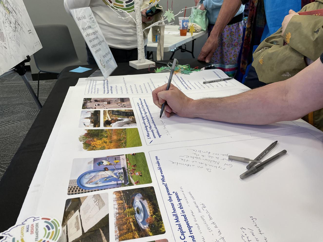
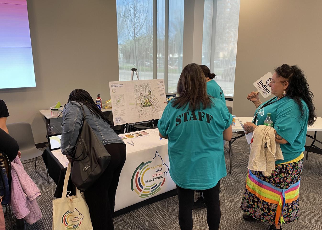
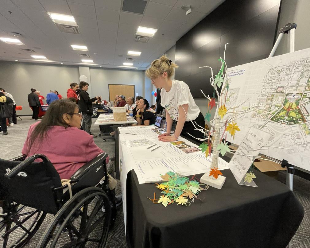
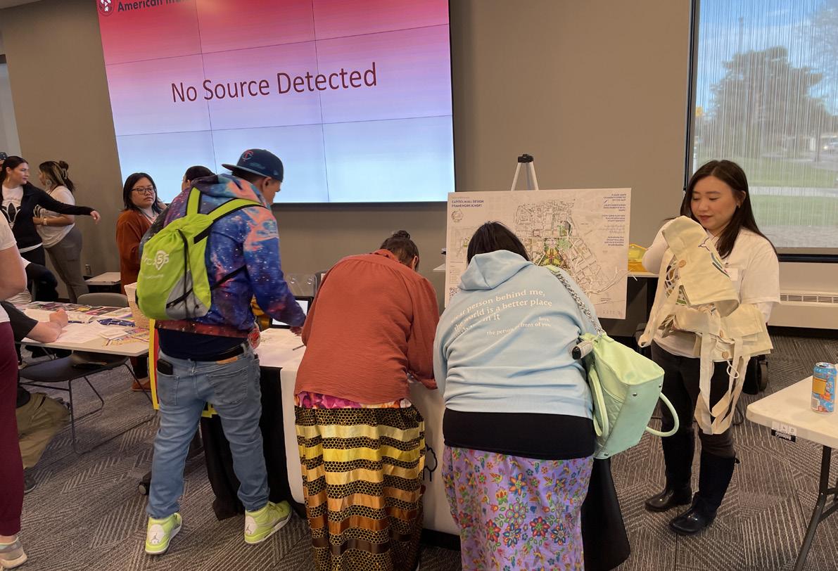
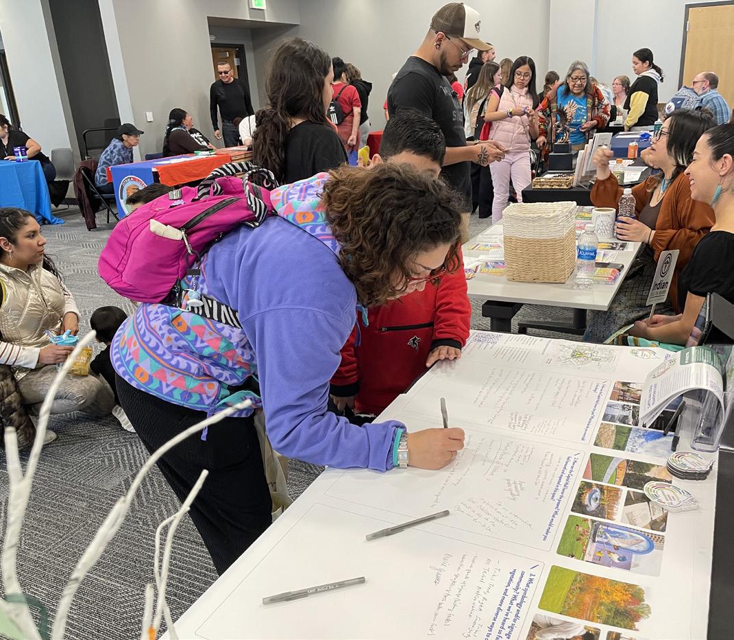
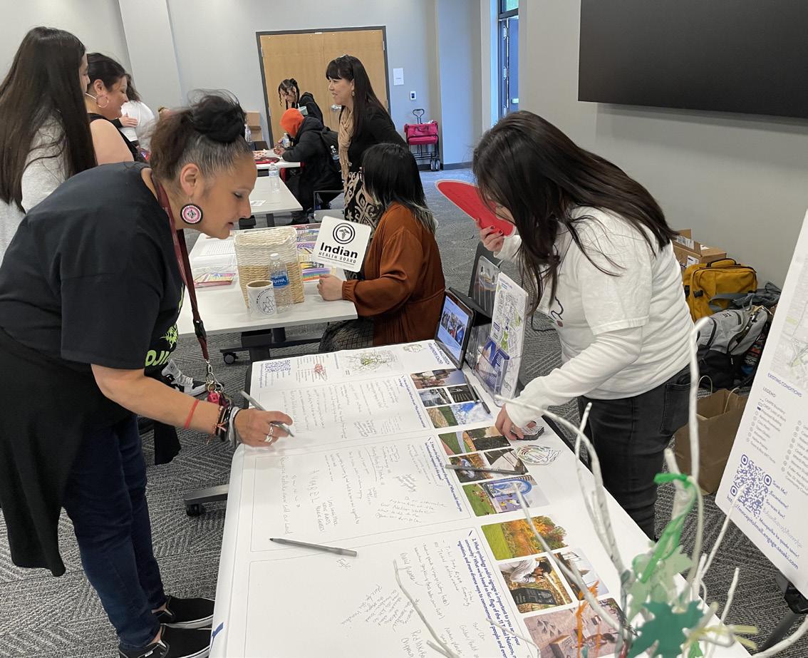 Figure 34: Grand Reopening Open House & Powwow Pop-Up
Figure 35: Grand Reopening Open House & Powwow Pop-Up
Figure 36: Grand Reopening Open House & Powwow Pop-Up
Figure 37: Grand Reopening Open House & Powwow Pop-Up
Figure 38: Grand Reopening Open House & Powwow Pop-Up
Figure 39: Grand Reopening Open House & Powwow Pop-Up
Figure 34: Grand Reopening Open House & Powwow Pop-Up
Figure 35: Grand Reopening Open House & Powwow Pop-Up
Figure 36: Grand Reopening Open House & Powwow Pop-Up
Figure 37: Grand Reopening Open House & Powwow Pop-Up
Figure 38: Grand Reopening Open House & Powwow Pop-Up
Figure 39: Grand Reopening Open House & Powwow Pop-Up
40 41 Capitol Mall Design Framework Project Process PHASE 3 ENGAGEMENT
CHAPTER 3
INVENTORY + ANALYSIS
DRAFT
COMMUNITY DESIGN BUILT ON COMMUNITY PLANNING
CONNECTING THE 2040 COMPREHENSIVE PLAN TO THE CAPITOL MALL DESIGN FRAMEWORK
“AS THE SYMBOLIC HEART OF THE STATE, THE VISION FOR THE CAPITOL AREA IS TO BE A UNIFYING FACTOR FOR ALL THOSE WHO COME TO LIVE, WORK, LEARN AND PLAY.”
-(2040 COMPREHENSIVE PLAN,
2021).
THE CAPITOL AREA PRINCIPLES
DESTINATION
PLAN VISION
“The vision adopted in 1998, of the Capitol Campus as a good neighbor to the surrounding area, has been updated and strengthened [in the 2040 Comprehensive Plan]. Compared with the Good Neighbor vision, the 2040 vision strives to turn boundaries into connections, integrating the elements of the Capitol Area to each other better, while also continuing policies that restore historic urban fabric between the Capitol Area and downtown and surrounding neighborhoods. The 1998 plan was organized by geography, treating the Capitol Campus and Capitol Area neighborhoods differently. This plan seeks to remove boundaries for a truly integrated Capitol Area. While the Capitol Building and Mall is acknowledged as a symbol and focus of Minnesota, the sixty-block area in which it is located, the Capitol Area, is now recognized not just as a neighbor, but as an integral and critical functioning part of Saint Paul, providing connections between downtown and neighborhoods,” (2040 Comprehensive Plan, 2021).
INFORMING THE DESIGN FRAMEWORK
The 2040 Comprehensive Plan is organized by a set of aspirational outcomes that support the vision, which are called The Capitol Area Principles. These principles are applied to the entire Capitol Area, not just the campus or neighborhoods and districts of the Capitol Area. The Capitol Area Principles anchor the policy that serves to guide the CAAPB in transforming the Capitol Area into a complete and healthy community with vibrant public spaces, a range of movement options, a diverse mix of land uses, and attractive buildings framing lively, pedestrianfriendly streets. They are designed to reinforce the visual pre-eminence of the Capitol Building, maintain the Capitol Campus as a visitor destination, preserve its component neighborhoods as vibrant urban villages, acknowledge the inherently productive nature of community building
To read the document in full, visit mn.gov/mn/reports/ caapb/2040ComprehensivePlan_full.pdf.
As Minnesota’s seat of government and destination for thousands of people each year, the Capitol Area offers the highest quality experience to visitors.
FOCAL POINT
DRAFT
and neighborhood interdependence, and produce a clear direction for a future in tune with Saint Paul’s aspirations.
The 2040 Comprehensive Plan explicitly calls for an update to the Capitol Mall Design Framework before 2025. Specific enabling legislation was passed by the Minnesota Legislature in May 2023 to fund this planning work by early 2024. Therefore, the Design Framework builds upon the 2040 Comprehensive Plan to shape, guide, and manage the Capitol Campus environment and its physical form. The Vision and Capitol Area Principles inform and guide every step of the Design Framework, most notably the analysis lenses that form the foundation for all design decisions moving forward. These analysis lenses include connect, preserve, activate, and grow.
The Capitol building and Mall are central to the identity of Saint Paul and are a unifying focal point for the city, as Cass Gilbert once envisioned.
MODEL FOR MINNESOTA
The Capitol Area is a model for Minnesota, where best practices are utilized in the planning, design, and development of public and private projects.
PUBLIC REALM
The entire Capitol Area provides an integrated, high quality, human scale public realm experience.
SEAMLESSLY CONNECTED
The Capitol Area is an urban multi-modal district, seamlessly connected to destinations and the larger mobility network of Saint Paul.
LAND USE DIVERSITY
Land use diversity is encouraged throughout the Capitol Area.
COORDINATED
In all parts of the Capitol Area, new development respects community, assets and context, including the distinct identities of the Capitol Rice District, Capitol Heights and Fitzgerald Park neighborhoods. 1 2 3 4 5 6 7


CONNECT PRESERVE ACTIVATE GROW
LENSES
ANALYSIS
LENSES


CONNECT PRESERVE ACTIVATE GROW
The Connect analysis lens seeks to answer the following questions: What mobility modes connect the Capitol Campus to the surrounding area? How do most people arrive at the Capitol Mall? What is the existing streetscape experience? And much more. The following investigation topics unpack these questions:
O City Connectivity
O Campus Connectivity
O Thresholds to the Capitol Campus
O Capitol Campus Parking
O Area Street Hierarchy
O Streetscape Experience
O Utilities and Infrastructure
DRAFT
The Preserve analysis lens seeks to answer the following questions: What is the history of the Capitol Mall and surrounding area? How have the communities living near or adjacent to the Capitol Mall changed over time? What features are important to preserve? What stories are being told and which are missing? And much more. The following investigations topics unpack these questions:
O Historically Diverse Communities
O Capitol Area through Time
O Campus Timeline
O 2022 Historic Context Report
O Viewshed Analysis
O Sculptures, Monuments and Memorials
The Activate analysis lens seeks to answer the following questions: How does the Capitol Mall fit into the larger urban network? How do Minnesotans currently use the Capitol Mall? What kinds of events occur there? How is security integrated into the design? And much more. The following investigation topics unpack these questions:
O Citywide Recreation
O Neighborhood Demographics
O Capitol Area Amenities
O Capitol Mall Programing
O Slope and Future Programming
O Security and Public Assembly
O Security Typologies
The Grow analysis lens seeks to answer the following questions: How does the Capitol Mall fit into the larger ecological network? How has the landscape changed over time? What types of landscapes currently exist in the Capitol Area? How is the Capitol Mall mitigating ongoing climate change? And much more. The following investigation topics unpack these questions:
O Minnesota’s Ecosystems
O Mississippi Flyway
O Ecosystem Heritage
O Landscape Typologies
O Capitol Area Tree Canopy
O Thermal Comfort
O Stormwater Systems
LENSES
O City Connectivity
O Campus Connectivity
O Thresholds to the Capitol Campus
O Capitol Campus Parking
CONNECT DRAFT
O Capitol Campus Street Hierarchy
O Streetscape Experience
O Utilities and Infrastructure
O Opportunities and Challenges
The Capitol Mall will forge connections between Minnesotans and their democratic institutions through shared experiences, heritage and physical connections that link the Capitol to the surrounding city and state.
CITY CONNECTIVITY
The Capitol Campus sits at the confluence of several regional transit lines and interstates. The existing LRT Green Line (light rail) connects Downtown Saint Paul to Minneapolis via the Capitol Campus, with the most immediate stops located at Rice Street and University Avenue as well as Robert Street and E 14th Street. Interstates 94 and 35E reinforce the southern edge of the Capitol Campus. Downtown Minneapolis is accessible in about a 25-minute car ride while the Minneapolis-Saint Paul Airport is accessible in about 15 minutes. Additionally, various other cities and regional hubs can be easily reached from the Capitol Campus, including Little Canada, Woodbury, West Saint Paul, and the Mall of America. Cyclists can travel from the Capitol Campus to Downtown Saint Paul and the Mississippi River (Haháwakpa) within ten minutes. Metro Transit has various planned Bus Rapid Transit (BRT) routes coming online in the next three or so years that either travel through the Capitol Campus or have stops within walking distance. These include the BRT G-Line and BRT Purple Line. The G-Line will travel down Rice Street, with several stops located mere steps from the Capitol Mall. It should be noted that while the Capitol Campus benefits from its proximity to various transit modes, some (like the Interstates, current design of key arterial streets, and even Light Rail corridors), create barriers to adjacent neighborhoods and communities. This will be discussed in more detail later on in the chapter.
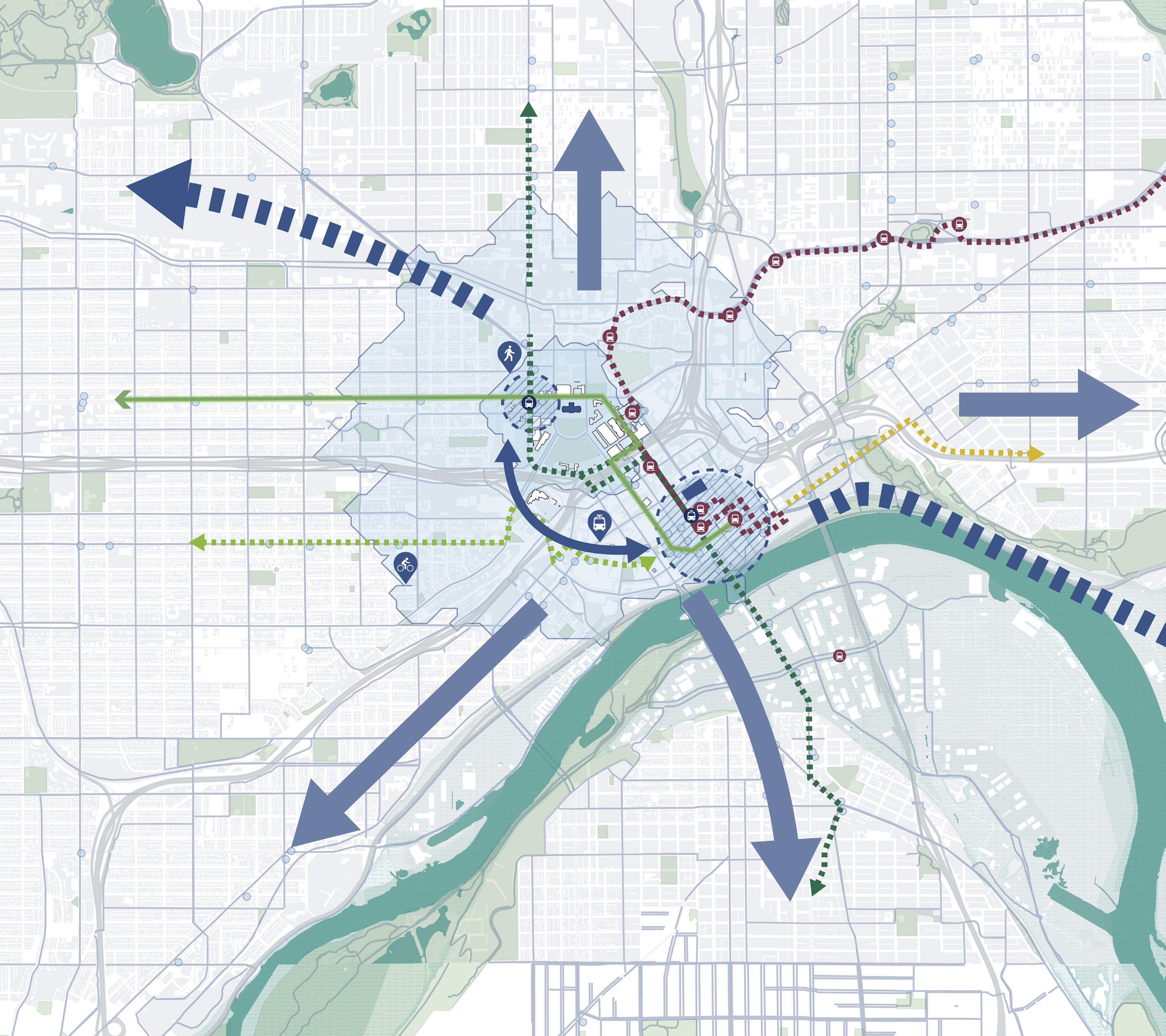
MississippiRiver CAPITOL GATEWAY LINE RUSH LINE RIVERVIEWLINE MississippiRiver TO WEST SAINT PAUL TO MALL OF AMERICA FROGTOWN TO MINNEAPOLIS TO WOODBURY TO LITTLE CANADA SUMMIT UNIVERSITY 10-MINUTE 10-MINUTE SUMMIT HILL PAYNEPHALEN DAYTON’S BLUFF AIRPORT PLANNED BRT G-LINE PLANNED BRT G-LINE METRO GREEN LINE BRT B-LINE DOWNTOWN SAINT PAUL PLANNED BRT PURPLE-LINE PLANNED BRT GOLD LINE TOHASTINGS ROBERTSTREET CORRIDOR 15-MINUTE I-94I-94 I-35E I-35E 52 10 N 0’ 2000’ 1000’ 500’
50 Capitol Mall Design Framework
CAPITOL DISTRICT AND CITY-WIDE TRANSIT CONNECT
Comp Plan for the Minnesota State Capitol Area CAAPB, June 2021.
Source: 2040
DRAFT
Figure 40: City Connectivity
CAMPUS
CONNECTIVITY
TRANSPORTATION, ACCESS AND ARRIVAL POINTS
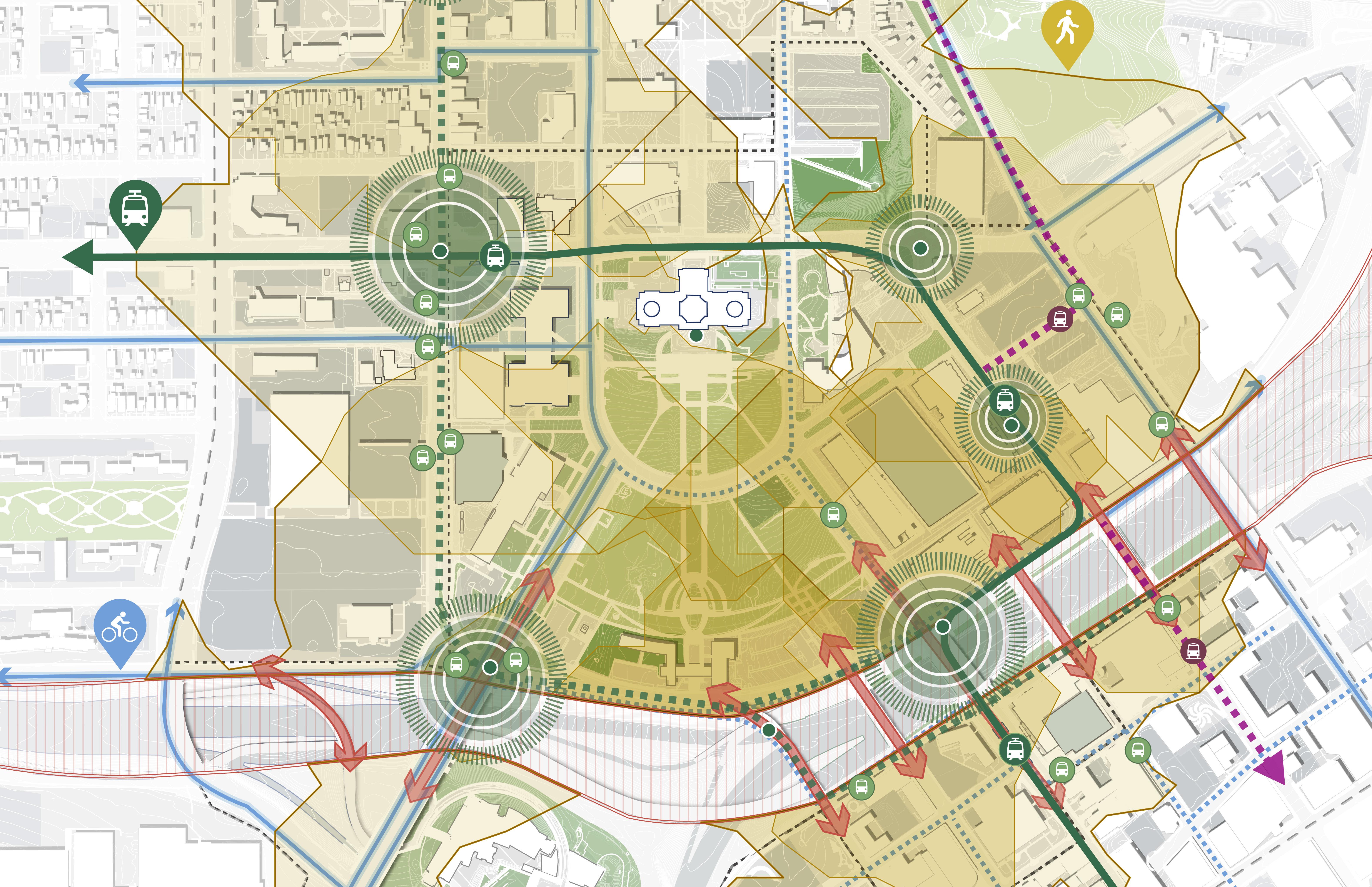
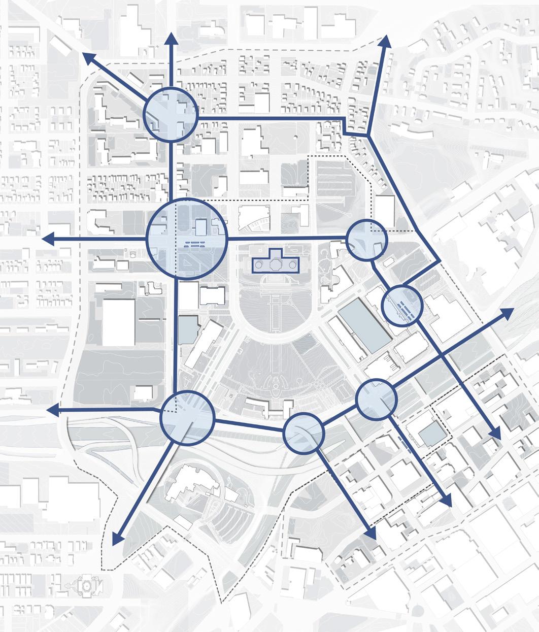
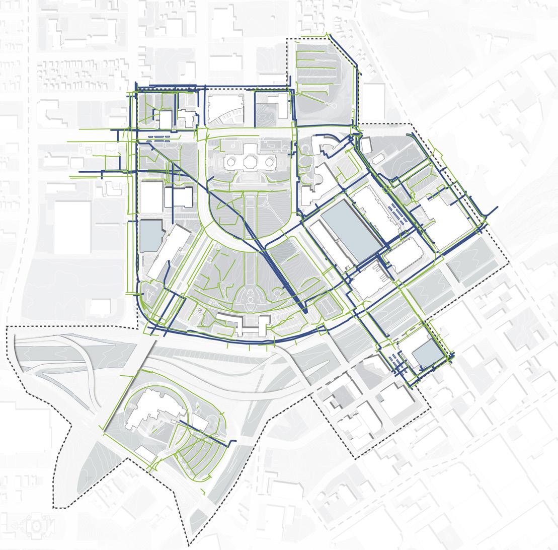
The Capitol Mall is accessible via multiple modes of transportation. Much of the Capitol Mall is accessible within a five-minute walk of various Capitol Campus thresholds. Visitors and workers can take the LRT Green Line, which has three stations within a five-minute walk of the Capitol Mall. Metro Transit operates various bus routes with numerous stops throughout the Capitol Campus. Additionally, Groome Transportation operates an airport shuttle that drops off at Cedar Street in front of the Centennial Office Building. As previously discussed, the planned BRT Green Line and Purple Line will pass through the Capitol Campus, with the corner of Rice Street and University Avenue slated to become an integrated mobility hub. The Saint Paul Bicycle Plan outlines various existing bikeways as well as numerous planned bikeways. Some of these planned bike lanes are improvements to existing routes, from upgrading shared conditions to creating separated and protected bikeways. Lastly, Interstates 94 and 35E, while making vehicular travel easier, create a substantial barrier to Downtown Saint Paul and other southern neighborhoods. These places are only accessible by bridge or interstate crossing.
RICE + UNIVERSITY STATION
Sited as one of two prime locations to be an integrated mobility hub in the twins cities shared mobility action plan
CAAPB Boundary
Metro Green Line BRT Green Line - Planned
Purple Line - Planned Bikeways Bikeways - Planned
Crossing
Source:chrome-extension://efaidnbmnnnibpcajpcglclefindmkaj/ https://www.stpaul.gov/sites/default/files/2024-03/Feb%202023%20 Bike%20Plan%20for%20webapge.pdf Figure 41: Campus Connectivity
Source: Saint Paul for All 2040 Comprehensive Plan. City of Saint Paul, Nov 2020.
Interstate
LRT Green Line - Transit Station BRT Purple Line - Transit Stop Bus Stop 5-Minute Walkshed from Transit Stops Interstate Barrier Arrival Points 5-Minute Walkshed Base Point
GREEN LINE
BRT
LRT
CASS GILBERT MEMORIAL PARK POTENTIAL TRANSIT HUB I-94 University Ave W Aurora Ave St Anthony Ave Marion St Como Ave Winter St W Pennsylvania Ave Park St Cedar St Rice St John Ireland Blvd CedarSt JacksonSt UniversityAveE E12thSt 10thStE RobertSt FortRd I-35E WabashStN DOWNTOWN SAINT PAUL N 0’ 500’ 250’ 125’ LEGEND
52 Capitol Mall Design Framework
CONNECT
DRAFT
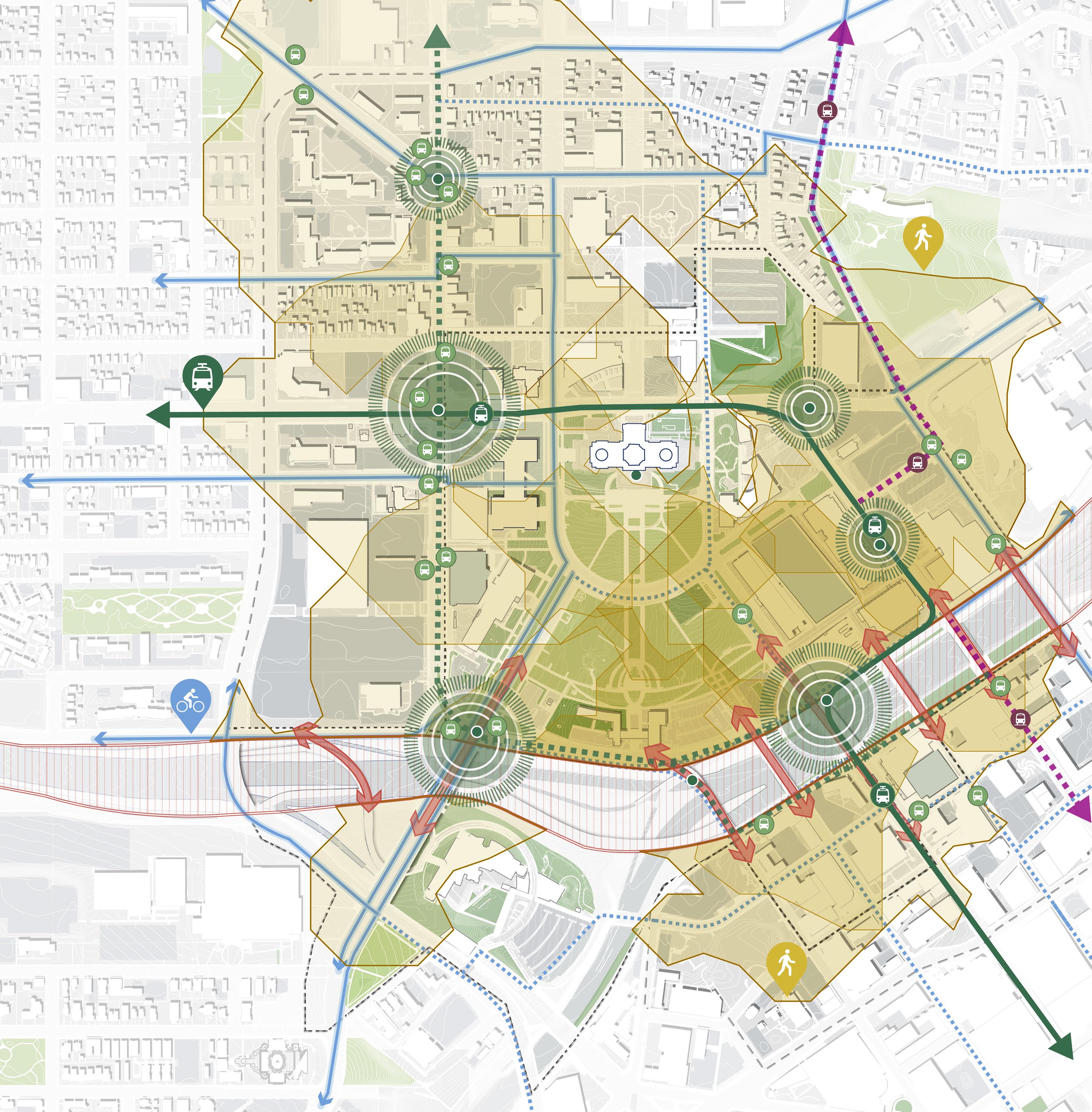
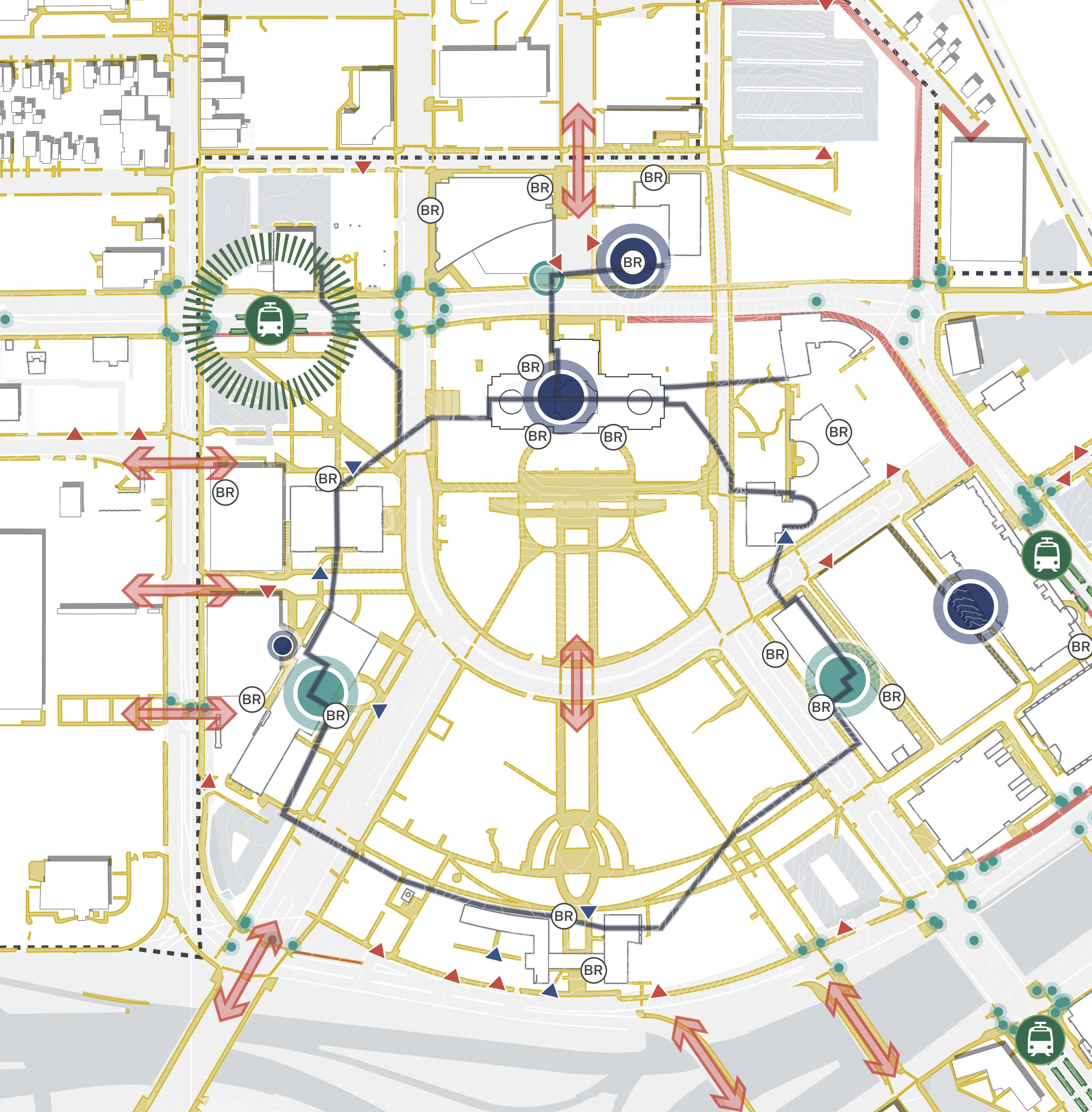
THRESHOLDS TO THE CAPITOL CAMPUS
Pedestrian circulation within and around the Capitol Mall includes an existing sidewalk network and an underground tunnel system that can be used to travel between various buildings. Much of the sidewalk network is limited to edges of major public spaces with a few opportunities to travel inward, including the significant north-south axis that runs from the Capitol Building to the Veterans Service Building. Crosswalk and/ or sidewalk improvements are needed in multiple locations, including along Rice Street, Rev. Dr. Martin Luther King, Jr. Boulevard, and the interstates. Campus buildings include ADA entrance ramps; however, it should be noted that they are often separated from primary entrances given the steep grades along major circulation routes. A more recent effort along Aurora Promenade added scissor ramps to improve ADA accessibility to the Capitol Building.
Crosswalk Improvement Needed
Gaps in sidewalk
Underground Tunnel
Keycard Access
Public Access
Ramp to Building
Entrance
Rack
Station
Crossing Signal
Source: Saint Paul for All 2040 Comprehensive Plan. City of Saint Paul, Nov 2020.
Source: Minnesota Department of Administration. mn.gov/admin/ citizen/buildings-grounds/maps/.
ADA
Bike
Transit
KEY CARD ACCESS TO CAAPB BUILDING PUBLIC ACCESS TO CAPITOL BUILDING NEW STATE BUILDING PROPOSED MOBILITY HUB N 0’ 500’ 250’ 125’ John Ireland Blvd CedarSt RobertSt Cedar St Rice St E12thSt Park St Aurora Promenade University Ave W Aurora Ave I-35E WabashaStN Rev Dr MLK Jr Blvd BR LEGEND
Parking
Pedestrian
54 Capitol Mall Design Framework Figure 42: Campus
Thresholds
CONNECT
ON-SITE PEDESTRIAN CIRCULATION
DRAFT
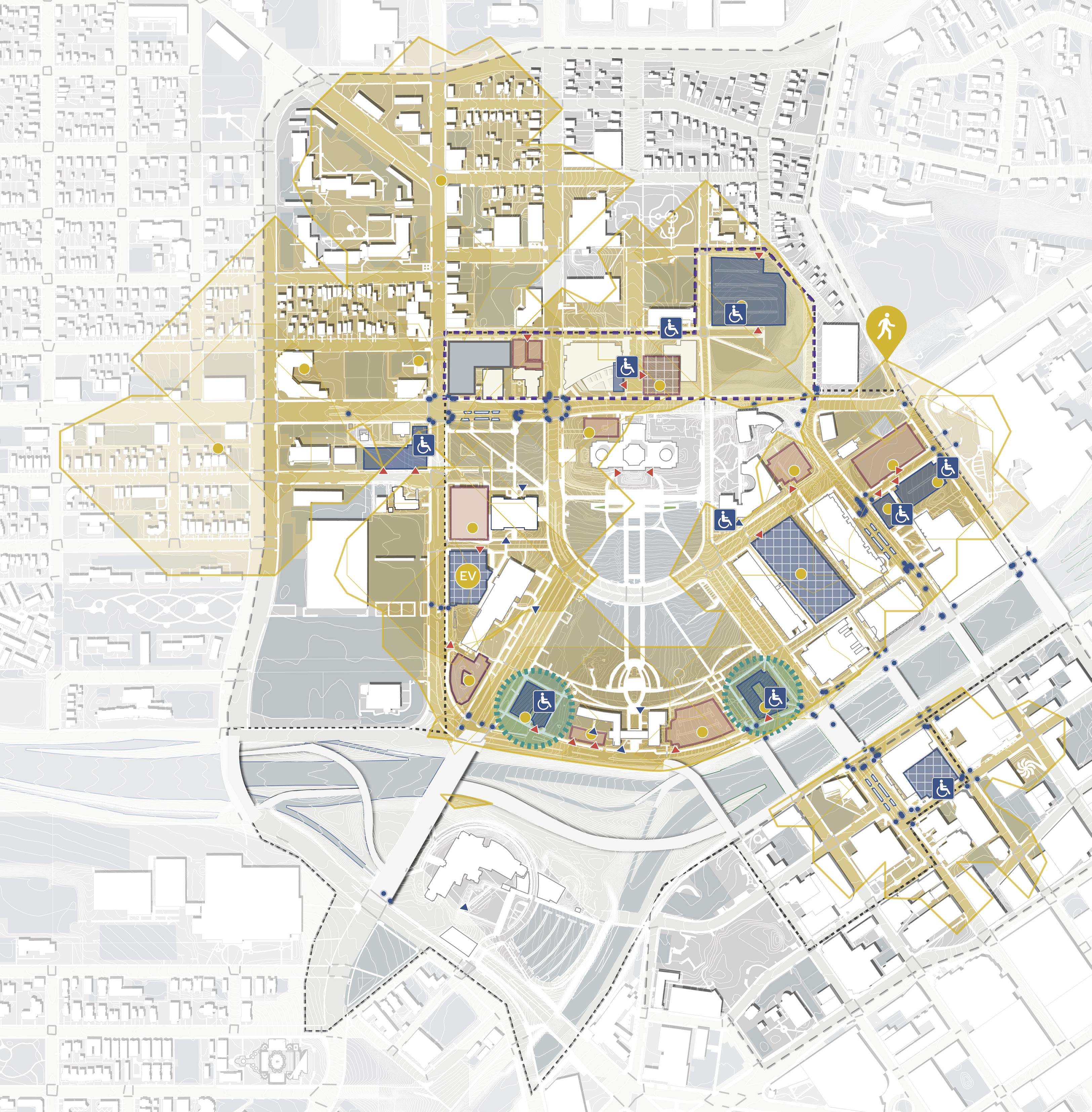
CAPITOL CAMPUS PARKING
PARKING SUPPLY AND DISTRIBUTION
Several parking options in and around the Capitol Mall support the high percentage of commuters who choose single-occupancy vehicles when traveling to and and from the Capitol Campus. Over 45 acres of land is dedicated to parking in the Capitol Campus, with 11,000+ parking stalls available in public and private lots or ramps (2040 Comprehensive Plan) throughout the campus. Private and public parking ramps (garages) and surface parking lots are located along the perimeter of the Capitol Mall in addition to metered street parking. Recommended disability parking for visitors is located in the Minnesota Senate Building Parking Garage just north of the Capitol Building. Existing parking supply meets 85% occupancy rate threshold during legislative session, while other times it sees high rates of parking vacancy. Two lots have been rezoned as potential open space adjacent to the Veterans Service Building.
MODE OF COMMUTE
Source: Saint Paul for All 2040 Comprehensive Plan. City of Saint Paul, Nov 2020. Source: Minnesota Department of Administration. https://mn.gov/admin/citizen/buildingsgrounds/maps/. Figure 43: Capitol Campus Parking
Private Parking Lot
Parking Lot
Parking Ramp Public Parking Ramp ADA Parking Parking Entrances ADA Ramp Entrances EV Parking 3-Minute Walkshed from Parking Lots Pedestrian Crossing Signals EV RECOMMENDED DISABILITY PARKING FOR VISITING THE STATE CAPITOL OR MN SENATE BUILDING MEETS 85% OCCUPANCY RATE THRESHOLD DURING LEGISLATIVE SESSION LOT TEMPORARILY CLOSED ZONED AS POTENTIAL OPEN SPACE ZONED AS POTENTIAL OPEN SPACE 77% 11.5% 5.23% 1.38% 1.61% 3.15% Car Transit Carpool Bike Walk Other
Public
Private
I-94 University Ave W Aurora Ave St Anthony Ave Marion St Winter St W Pennsylvania Ave Park St Cedar St Rice St John Ireland Blvd CedarSt JacksonSt UniversityAveE E12thSt 10thStE RobertSt FortRd I-35E DOWNTOWN SAINT PAUL N 0’ 500’ 250’ 125’ RobertSt LEGEND 1,481 STALLS 887 STALLS 92 STALLS 250 STALLS 353 STALLS 205 STALLS 404 STALLS 132 STALLS 92 STALLS 260 STALLS 514 STALLS 34 STALLS 83 STALLS 65 STALLS 86 STALLS 147 STALLS 478 STALLS 34 STALLS 20 STALLS 99 STALLS 41 STALLS 77%
Source: Capitol Complex Commuter Survey. MN GreenCorps, May 2019.
56 57 Capitol Mall Design Framework Inventory + Analysis
CONNECT
DRAFT
The 2040 Comprehensive Plan categorizes streets based on ownership and future streetscape experience. Ownership includes either Municipal (City of Saint Paul), County, or State/Federal. Coordination with multiple organizations and governmental agencies is required to encourage and implement improvements to the street network in the Capitol Area. Future streetscape experience includes Civic Streets (primary view corridors and pedestrian ways), Mixed-use Corridors (high-quality transit service while fostering a pedestrian scale), and Institutional Streets (access to state and office buildings and an exceptional pedestrian experience with highquality street furnishings). See the 2040 Comprehensive Plan for more details.
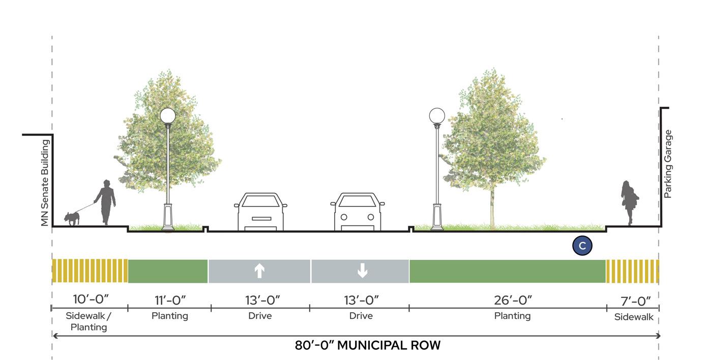
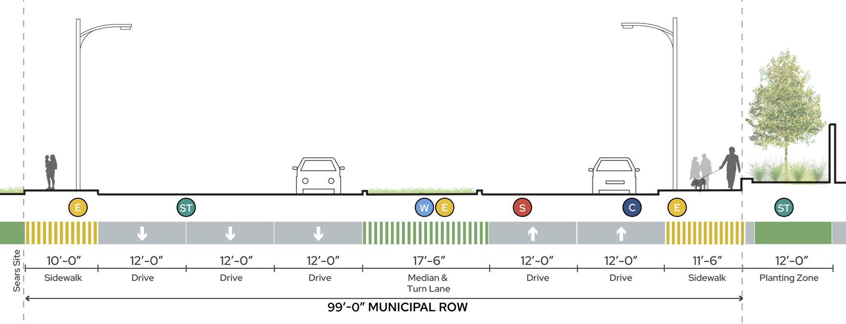
A. NORTH CAPITOL BOULEVARD
Located north of University Avenue and terminating at the Capitol Building, North Capitol Boulevard is a municipal 80-foot right-of-way (ROW) and proposed civic street. Existing street conditions include the following (most of which do not support civic street recommendations):
O Isolated sidewalks with minimal pedestrian amenities
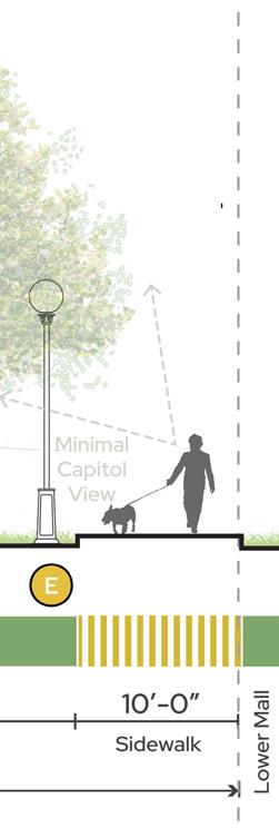
B2. CEDAR STREET AT LOWER MALL
Located along the eastern edge of the Lower Capitol Mall, Cedar Street at the Lower Mall is a municipal 100-foot ROW and proposed civic street. Existing street conditions include the following (most of which do not support civic street recommendations):
O No protected and separated bike lanes, which are recommended by the Saint Paul Bike Plan
CAPITOL CAMPUS STREET HIERARCHY DRAFT
O Minimal street lighting with primary views reserved for vehicles, not pedestrians
B1. CEDAR STREET AT AURORA PROMENADE
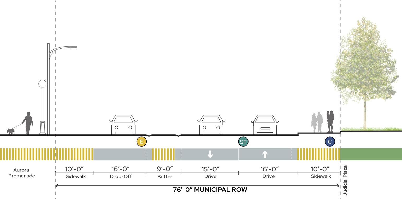
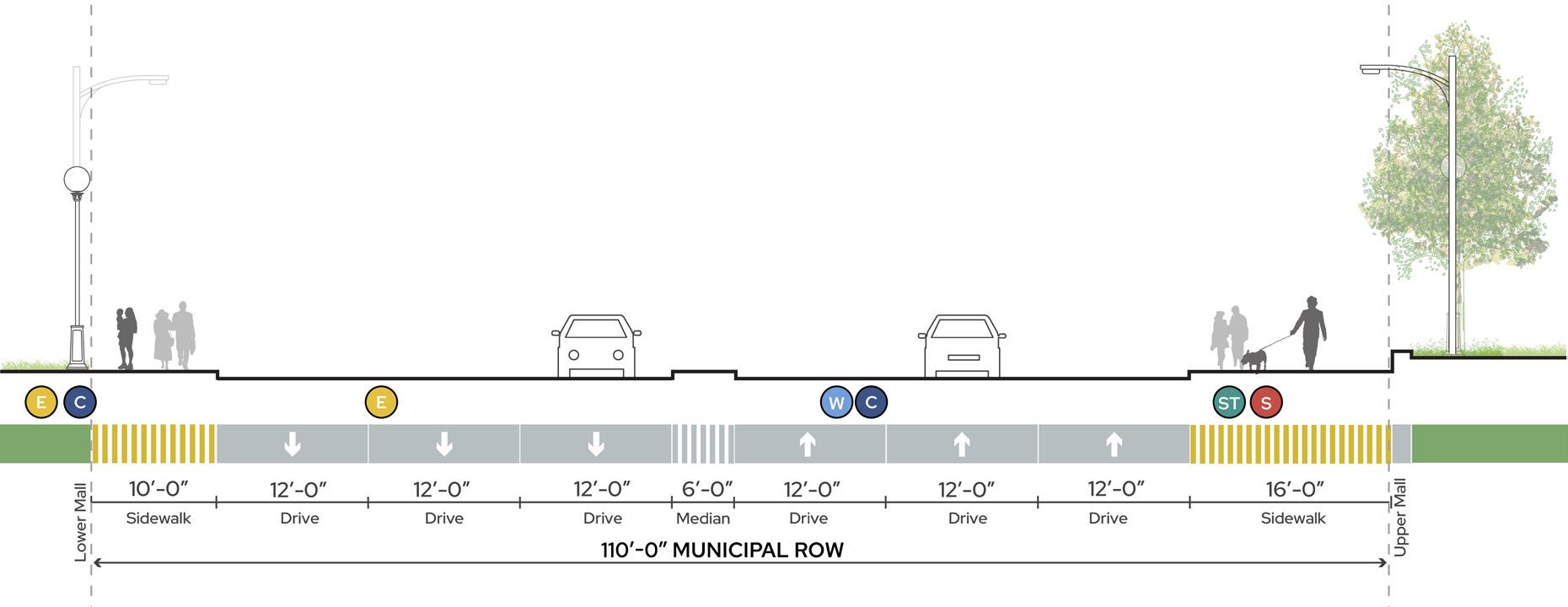
Located just east of the Capitol Building, Cedar Street at Aurora Promenade is a municipal 76-foot ROW and proposed civic street. Existing street conditions include the following (most of which do not support civic street recommendations):
O Oversized drive lanes
O Unprotected sidewalk conditions (no street buffer) with minimal pedestrian amenities
O Steep slopes that occasionally exceed ADA compliance
O Primary Capitol Views reserved for vehicles, not pedestrians
O Narrow sidewalks despite primary pedestrian circulation path
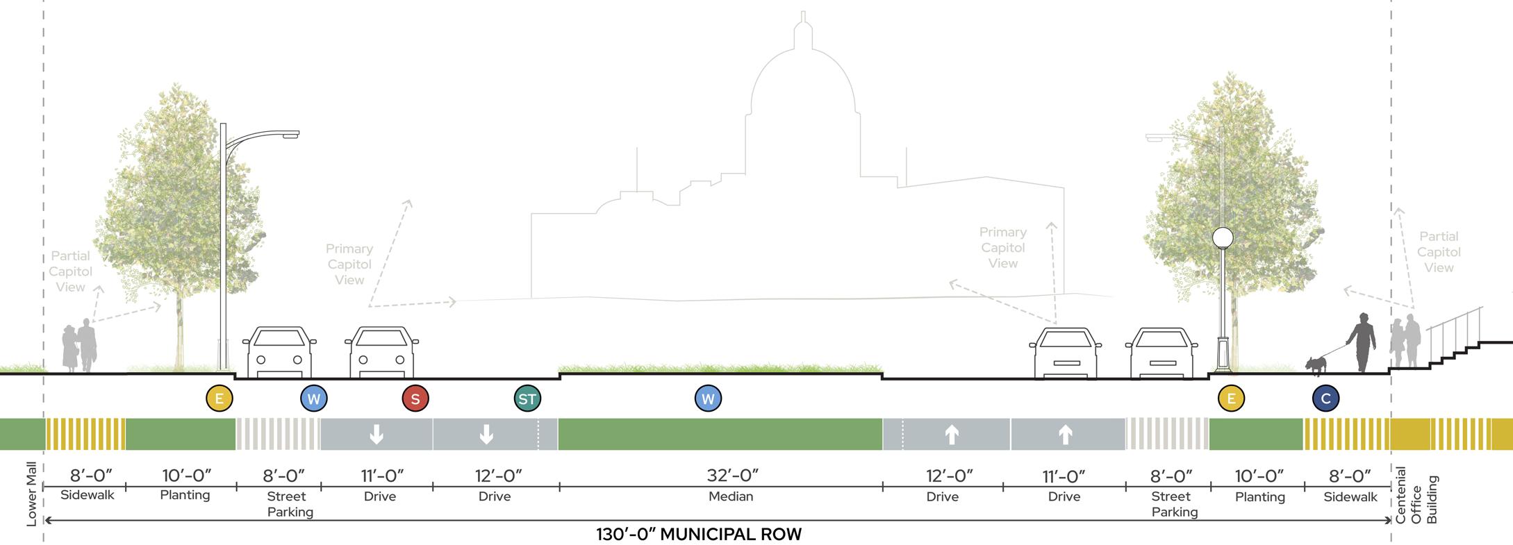
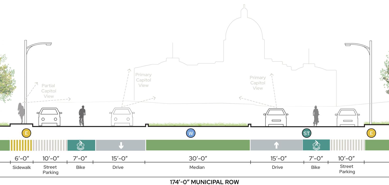
C. JOHN IRELAND BOULEVARD
Located along the western edge of the Lower Capitol Mall, John Ireland Boulevardis a municipal 174-foot ROW and proposed civic street. Existing street conditions include the following (most of which do not support civic street recommendations):
O Unprotected bike lanes, as opposed to separated and protected bike lanes recommended by the Saint Paul Bike Plan
O Primary Capitol Views reserved for vehicles, not pedestrians
ROW ROW ROW ROW ROW ROW ROW ROW Oversized drive-lanes No sidewalk buffer MUNICIPAL ROWCIVIC STREET MUNICIPAL ROWCIVIC STREET MUNICIPAL ROWCIVIC STREET MUNICIPAL ROWCIVIC STREET E Electrical C Underground Communication S Sewer W Water ST Stormwater A B1 B2 C Unprotected bike lane No bike lanes Primary views from vehicles Primary views from vehicles Pedestrian lighting separated from sidewalks Minimal sidewalk visibility from street A. N CAPITOL BLVD B1. CEDAR ST B2.
ST
CEDAR
AT AURORA PROMENADE AT LOWER MALL LEGEND 30’- 0” Planting Zone 24’- 0” Planting Zone
C. JOHN IRELAND BLVD
KEY MAP
58 59 Capitol Mall Design Framework Inventory + Analysis CONNECT STREET
TYPOLOGIES
KEY MAP
D. RICE STREET
Located adjacent to the vacant Sears Lot, Rice Street is a municipal ROW and proposed mixed-use street that fluctuates in width from 89 to 105 feet. Existing street conditions include the following (most of which do not support civic street recommendations):
O No dedicated BRT lanes, which are specified by the 2040 Comprehensive Plan and Metro Transit
O Minimal sidewalk amenities
CAPITOL CAMPUS STREET HIERARCHY DRAFT
O No protected and separated bike lanes, which are recommended by the Saint Paul Bike Plan
E. REV. DR. MARTIN LUTHER KING, JR. BOULEVARD
Located between the Upper and Lower Capitol Malls, Rev. Dr. Martin Luther King, Jr. Boulevard is a municipal 110-foot ROW and proposed civic street. Existing street conditions include the following (most of which do not support civic street recommendations):
O Minimal sidewalk amenities
O No protected and separated bike lanes, which are recommended by the Saint Paul Bike Plan
O Too many lanes for not enough traffic
O Minimal security barriers
F1. UNIVERSITY AVENUE AT NORTH CAPITOL BOULEVARD
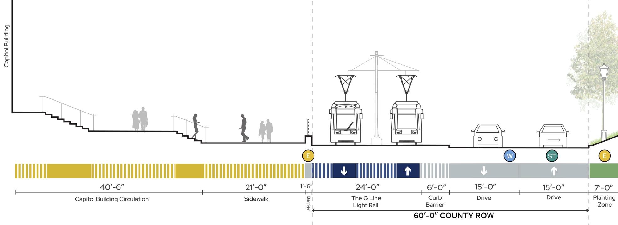
Located just north of the Capitol Building, University Avenue at North Capitol Boulevard is a county 60-foot ROW and proposed institutional street that hosts the LRT Green Line. Existing street conditions include the following (most of which do not support civic street recommendations):
O Oversized drive lanes and sidewalk gaps
O Minimal sidewalk amenities
O LRT Green Line creates a barrier to northern neighborhoods
F2. UNIVERSITY AVE W AT RICE ST
Located northwest of the Capitol Building, University Avenue at Rice Street is a county 110-footROW and proposed institutional street that hosts the LRT Green Line. Existing street conditions include the following (most of which do not support civic street recommendations):
O Oversized drive lanes
O Minimal sidewalk amenities
O Unresolved pavement (sidewalk) that could be reallocated
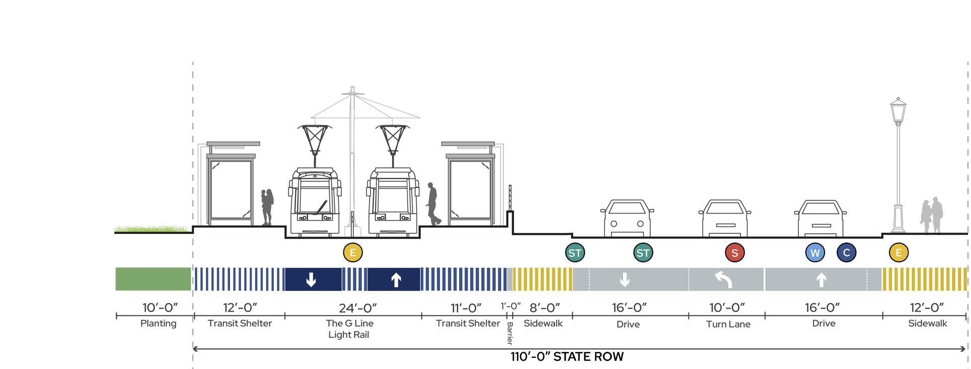
No dedicated BRT lanes MUNICIPAL ROWMIXED USE MUNICIPAL ROWCIVIC STREET COUNTY ROWINSTITUTIONAL COUNTY ROWINSTITUTIONAL D F1 F2 E ROW ROW ROW ROW ROW ROW ROW ROW E Electrical C Underground Communication S Sewer W Water ST Stormwater Oversized drivelanes Oversized drivelanes Sidewalk with no purpose Light Rail creates a barrier to N Capitol Blvd Not enough traffic to support lane quantity No sidewalk buffer No sidewalk buffer D. RICE ST E. REV DR MLK JR BLVD F1. UNIVERSITY AVE W F2. UNIVERSITY AVE W AT N CAPITOL BLVD AT RICE ST
LEGEND
60 61 Capitol Mall Design Framework Inventory + Analysis CONNECT
STREET TYPOLOGIES
STREETSCAPE EXPERIENCE
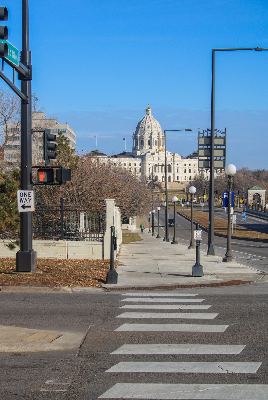
JOHN IRELAND BOULEVARD
John Ireland Boulevard is not only a significant pedestrian route, connecting MNHS and the Capitol Campus, but also a historic viewshed corridor. That said, the street contains very few pedestrian amenities and lacks any kind of tree canopy until West 12th Street. These conditions, in addition to a loud interstate, create a pedestrian experience that is noisy, exposed, and generally uncomfortable. Lastly, cars have a primary view of the Capitol Building while pedestrians often have a partial or obstructed view. This does not support the boulevard as a historic viewshed.
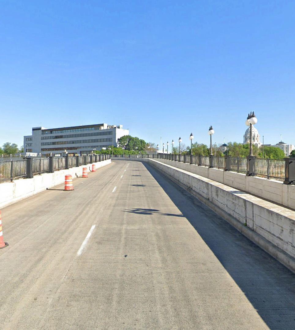
SAINT PETER’S BRIDGE
Saint Peter’s Bridge is both loud from nearby Interstate traffic and isolating for pedestrians as they traverse the narrow sidewalk. There are no pedestrian amenities.
LRT STATIONS
Community engagement throughout the Design Framework process identified LRT stations within the Capitol Campus as the spaces people feel most unsafe. The streetscape environments around the LRT stations are obviously infrastructure-heavy and uncomfortable to pedestrians, lacking tree canopy and other welcoming amenities.
UNIVERSITY AVENUR AND ROBERT STREET
University Avenue and Robert Street is a streetscape mostly dedicated to hard infrastructure. The LRT Green Line runs along the southern edge of the ROW with security barriers, solid walls, and no sidewalk access. The northern edge of the street does contain a sidewalk but has no amenities or tree canopy. Furthermore, the sidewalk is walled on both sides and creates an isolated and uncomfortable pedestrian experience.
COMO AVENUE AND RICE STREET
Como Avenue and Rice Street is a streetscape experience mostly dominated by vehicles with very little space for pedestrians. The sidewalks are narrow with no buffer or protection from the street, and include no pedestrian amenities or street trees. Light poles, traffic signals and cracked pavement create accessibility challenges.
DRAFT
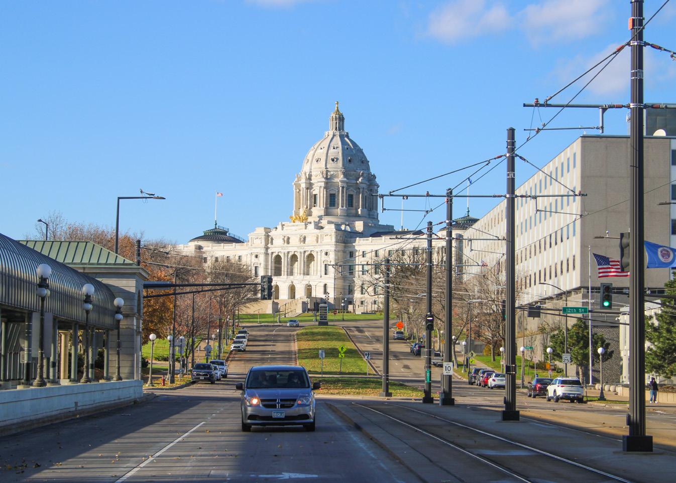
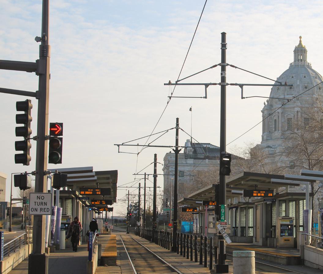

Figure 44: John Ireland Blvd
Figure 45: Saint Peter’s Bridge Figure 46: LRT Station at Cedar St and 10th St
47:
at
St and University Ave Figure 50: Como Ave and Rice St
Figure
LRT Station
Rice
Station at
St and
St Figure 49: University Ave W and Robert St 1 2 3 4 5 6 7 1 3 4 5 6 7 2
Figure
48: LRT
Robert
14th
62 63 Capitol Mall Design Framework Inventory + Analysis
CONNECT
Source: Damon Farber. John Ireland Blvd. Jan 2024.
Source: Google Maps, www.google.com/maps/.
Source: Google Maps, www.google.com/maps/. Accessed Jan. 2024.
Source: Damon Farber. LRT Station. Jan 2024.
Source: Damon Farber. University Ave W. Jan 2024.
Source: Google Maps, www.google.com/maps/. Accessed Apr. 2024.
Source: Damon Farber. Cedar St. Jan 2024.
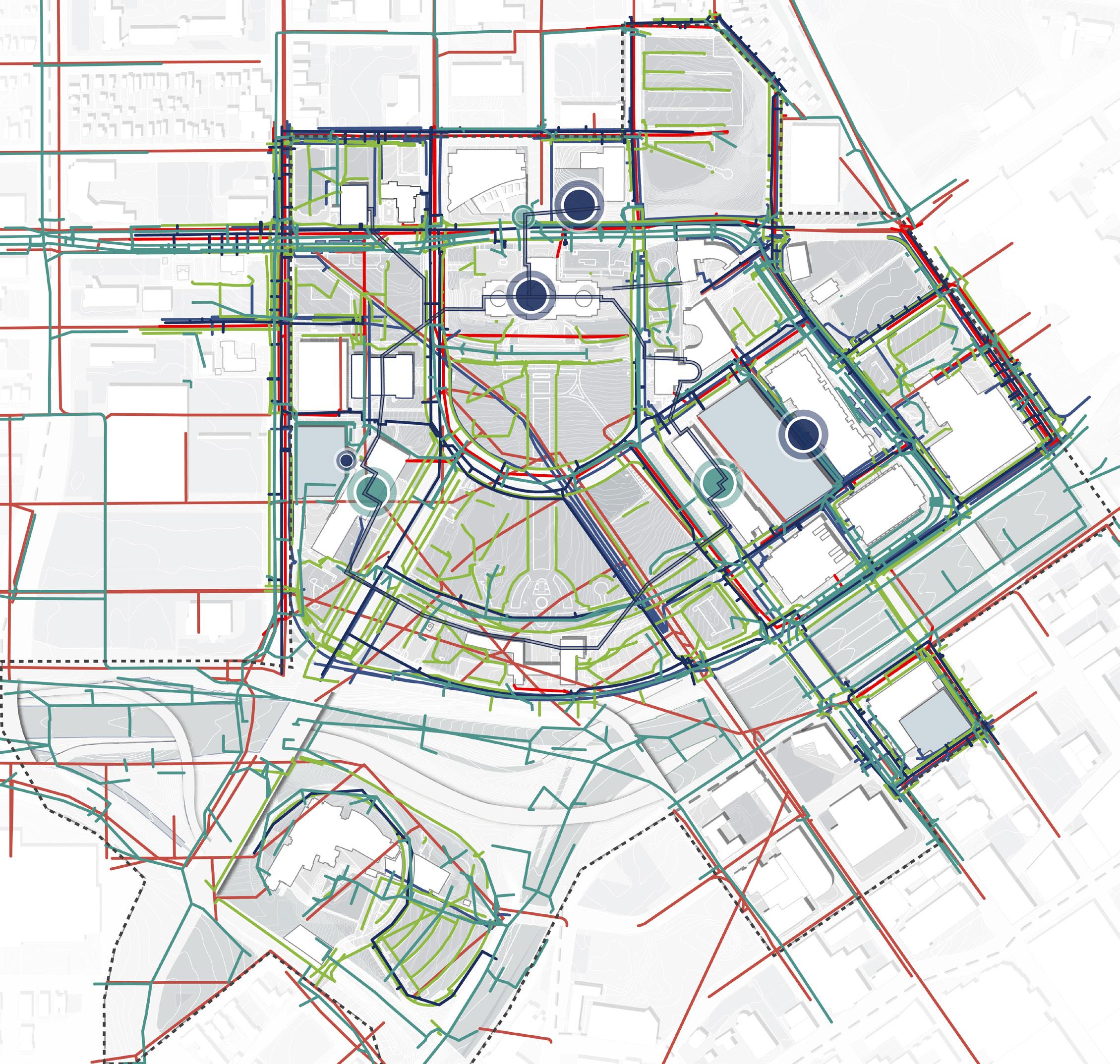
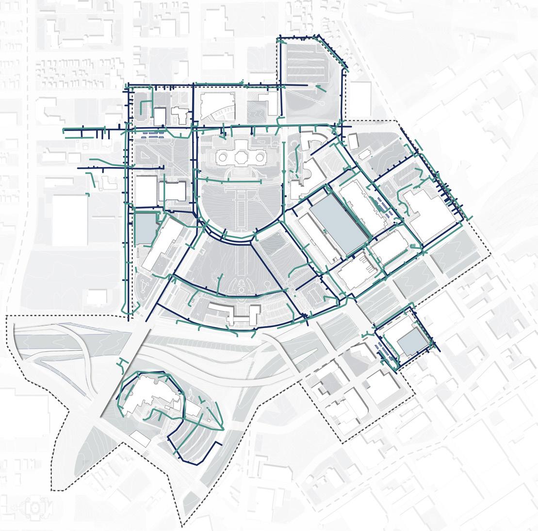
Water 10-Foot Underground Tunnel Keycard Access Public Access Underground Communication Electrical N NTS Stormwater I-94 University Ave W Aurora Ave St Anthony Ave Park St Cedar St Rice St John Ireland Blvd CedarSt UniversityAveE E12thSt 10thStE I-35E RobertSt WATER + STORMWATER ELECTRICAL + COMMICATION SEWER TUNNEL SYSTEM 64 65 Capitol Mall Design Framework Inventory + Analysis
CONNECT UNDERGROUND CONSTRAINTS Figure 51: Capitol Area Utilities and Infrastructure Source: Movement through Capitol Complex Tunnel System. https://mn.gov/admin/assets/COMPLEX.12_tcm36-206202.pdf. Source: Minnesota Department of Administration. https://mn.gov/admin/citizen/buildings-grounds/maps/. DRAFT
UTILITIES AND INFRASTRUCTURE
CONNECT
OPPORTUNITIES AND CHALLENGES
PRINCIPLE STRATEGIES
Moving forward from the 2040 Comprehensive Plan
OVERARCHING OPPORTUNITIES AND/OR CHALLENGES
TO GUIDE PRINCIPLE DESIGN FRAMEWORK STRATEGIES
MOVING FORWARD ARE AS FOLLOWS:
O Transit accessibility
O Built and perceived barriers exist around the Capitol Campus
O Arrival points to the Capitol Area are uncomfortable and infrastructure-heavy
O Pedestrian circulation is incomplete on the Capitol Campus
DRAFT
O Roads are oversized for current traffic demands and do not prioritize the pedestrian
ESTABLISH MULTI-MODAL ARRIVAL POINTS TO CONNECT LOCAL AND REGIONAL CORRIDORS
PRESERVE AND INTEGRATE HISTORICAL RELEVANCE WITH GREEN CORRIDORS ALONG RICE STREET AND MAJOR AXES
ESTABLISH PEDESTRIAN CIRCULATION HIERARCHY WITH COMPLETE STREET FRAMEWORK AND WELLDEFINED OPEN SPACES
ENHANCE CONNECTIONS BETWEEN THE CAPITOL CAMPUS AND SURROUNDING DISTRICTS BY TRANSFORMING PARKING SPACES
66 67 Capitol Mall Design Framework Inventory + Analysis
CONNECT PRINCIPLE STRATEGY
ESTABLISH
MULTI-MODAL ARRIVAL POINTS TO CONNECT LOCAL AND REGIONAL CORRIDORS
STRATEGIES
O Transform Rice Station into a mobility hub that draws regional attention. It should be treated with a clear sense of arrival and indicate a clear route to the campus.
O Provide a welcoming pedestrian experience at multimodal arrival points using active landscape and building frontages.
O Create nodes of activity by promoting green corridors along transit lines and major axes within a 5- to 10-minute walk.
O Expand axes to the north and east neighborhoods by integrating sidewalks and bikeways to connect to major trails and corridors outside of the Capitol Campus.
O Design for growth by having efficient and accessible stops and coordinated signals, and integrate smart technology with dedicated parking spaces.
O Facilitate movement for all users with dedicated bike lanes and separation from fast-moving vehicles along all vehicular lanes
O Encourage green transportation by providing infrastructure like charging stations, dedicated parking and drop offs for rideshare.
CONNECT PRINCIPLE STRATEGY
STRATEGIES
O Utilize tree allees to draw pedestrians into the central mall axis to reinforce the historic viewshed corridor.
O Integrate Rice Street as a green corridor by promoting pedestrian-friendly crosswalks and landscape buffers with areas of respite through a complete street framework.
O Develop human-scaled green corridors that have a welcoming streetscape, share similar visual cues with the campus, and integrate to the whole park system.
O Establish arrival points as visual entrances to the Capitol Campus with strategic placement of landscape buffers and urban street trees to frame views.
O Promote sustainable stormwater management with green infrastructure, such as healthy trees, bioswales and permeable surfaces that are efficient to maintain.
O Incorporate smart technology to improve efficiency and accommodate changes in traffic volume on streets.
Figure
Source:
https://kierantimberlake.com/page/dilworth-park
https://www.sasaki.com/projects/xuhui-runway-park/
Figure 53: Xuhui Runway Park
52: Dilworth Park
Ewing, James. Dilworth Park, Kieran Timberlake,
Source: Sasaki. Xuhui Runway Park Sasaki,
PRESERVE AND INTEGRATE HISTORICAL RELEVANCE WITH GREEN CORRIDORS ALONG RICE STREET AND MAJOR AXES
68 69 Capitol Mall Design Framework Inventory + Analysis DRAFT
CONNECT PRINCIPLE STRATEGY
ESTABLISH PEDESTRIAN CIRCULATION HIERARCHY WITH COMPLETE STREET FRAMEWORK AND WELL-DEFINED OPEN SPACES
STRATEGIES
O Create sidewalks that are accessible for all ages, abilities and weather conditions. The campus should promote a vibrant walking environment through comfortable and human-scaled design with inviting building frontages.
O Establish Rev. Dr. Martin Luther King, Jr. Boulevard as a shared street with removable bollards, drop offs, etc.
O Provide bike racks and bike lockers that are accessible from each building entrance (within 300 feet) to encourage alternative modes of micro-mobility.
O Ensure crosswalks are at each major intersection, with traffic signals and stop signs. Crosswalks should be placed every 200 to 300 feet to encourage pedestrian movement across areas.
STRATEGIES
CONNECT PRINCIPLE STRATEGY
ENHANCE CONNECTIONS BETWEEN THE CAPITOL CAMPUS AND SURROUNDING DISTRICTS BY TRANSFORMING PARKING SPACES
O Comprehensively analyze the parking demand for the campus and identify the barriers for pedestrian circulation.
O Increase pervious surfaces in parking areas to reduce stormwater runoff volumes, and increase water quality by utilizing bioswales and rain gardens.
O Incentivize alternative transportation through the reduction of parking to mitigate carbon dioxide.
O Promote collaborative parking by utilizing shared parking strategies, flexible parking plans and smart technologies.
O Provide street parking with curb bulb outs and frontage buffers to calm traffic and act as an alternative to expansive surface parking lots.
O Consolidate and streamline campus-wide parking strategy.
Source: Boston Convention Center Street Corridor. Sept. 2016. Sasaki, https://www.sasaki.com/projects/boston-convention-andexhibition-center-d-street-corridor/
Source:
WRT Design. Dutch Kills Green WRT Design, https://www.wrtdesign.com/work/dutch-kills-green
Figure 55: Dutch Kills Green
Figure 54: Boston Convention Center Street Corridor
70 71 Capitol Mall Design Framework Inventory + Analysis
DRAFT
O Campus Timeline
O Historically Diverse Communities
O Previous Planning Efforts
O Capitol Area through Time
PRESERVE DRAFT
O 2022 Historic Context Report
O Viewshed Analysis
O Memorials and Commemorative Works
O Opportunities and Challenges
The Capitol Mall will be an enduring representation of Minnesota’s rich past, design legacy and landscape heritage while adapting to 21st century needs like climate change, access and program diversity.
CAMPUS TIMELINE
or the impacts of urban renewal on nearby communities of color.
1853 - 1883 Original Capitol Building built; destroyed by fire & replaced
- 1905 Gilbert led relocation & construction of
Cambrian + Ordovician Periods
Twin Cities Area Sedimentary Bedrock: 30’ thick layer Platteville limestone overlying
150’ softer Saint Peter sandstone
Pre-Wisconsin glaciation est. eventual course of Mississippi River (Haha Wakpa)
Wisconsin Glaciation
Water carved Mississippi River Valley & formed cliffs, river terraces,& caves within Saint Paul’s tall river bluffs
Natural vegetation of Twin Cities (presettlement): oak woodland & brushland, dominated by bur oak & pin oak; aspen & hazel tickets; & prairie openings
Campus studies for future development
Various treaties (later determined invalid)
Geology & Glaciation 570-438 MILLION YA 12,000 YA 2020 2000 1950 1900 1850 Prior to Euro-American settlement, American Indian groups within the Siouan language family lived in the southern part of the land that
known as Minnesota 1800 American
Euro-American & Black Settlement of Saint Paul Forced Relocation of American Indian Peoples Euro-American Arrival to Minnesota Region Initial Capitol Construction Second Period of Capitol Development Major Land Clearance & Comprehensive Development The Good Neighbor Policy Era: Reconnecting the City Today 1650 Source: Historic Context Report for the Minnesota State Capitol Planning & Context Development Project. 106 Group, June 2022. Figure 56: Capitol Area Timeline 1939 - 1945 World War II 1949 Fed. Housing Act 1890s - 1900 City MovementBeautiful 1803 Louisiana Purchase 1914 - 1918 World War I 1754 - 1763 French and Indian War 1940s - 1970s Urban Renewal 1954 - 1968 Civil Rights Movement 2007 - 2009 Great Recession 1870 - 1914 Technological Revolution 1830 Indian Removal Act 2020 - 2023 COVID-19 Pandemic; Black Lives Matter 1760 - 1840 Industrial Revolution 1929-1939 Great Depression 1944 Fed. Highway Act 1961 The Death and Life of Great American Cities by J. Jacobs 1956 Indian Relocation Act ca. 12,000 - 8,000 YA PaleoIndian Stage ca. 8,000 - 3,000 YA Archaic Stage ca. 3,000 - 1,100 Woodland Stage 1,100 - 1650 Late Prehistoric Stage History is often told from one lens. The Minnesota State Capitol’s story demands much more. In doing so, we can begin to unpack the various forces at play, whether that was the glacier carving white cliffs (imnizaska),
1932 Morrell & Nichols Plans for grading & planting ARCHITECTURE 1903 Gilbert 1903 Plan: 3 major axes 1931 Gilbert 1931 Plan: additional building placement & southern extension across river 1956 Rondo
construction;
resettled
Twin Cities 1953 Vet. Service Building 1957 Legislative Building Commission created 2014 Green Line LRT 1992 Supreme Court relocated to Judicial Center; MNHS relocated to current site 2017 Capitol Restoration 1946 Johnston/Nelson/Nichols Plan: extended
Vet.
1961 Armory 1989 Green
1990
2020
1967
CAAPBopens;est.
current Capitol Building 1903 Power Plant 1929-1939 Adjacent low-income neighborhoods decried as “slum” & destroyed 1950 Significant land clearance 1962 Clearance for future Sears site 1967 Dep. of Admin. Building 2016 MN Senate Building 2017 Capitol Restoration 1973 Vet. Services Building upper level connection 1958 Transportation & Centennial Office Buildings 1932 State Office Building 2023State Office Building Expansion 2023 Leif Erikson Park removed 1986 Project
the Capitol Grounds Capitol area: deciduous savanna & prairie, with deciduous forest in the southwestern corner; low bluff or hills extended east to west through the southern portion of site; small creek ran south from what is now MNHS LANDSCAPE PEOPLE INFLUENCE 1650 Earliest Euro-Americans 1861
1862 “Starving Winter”
Dakota
1862 1837-1854
pushed
MN ca. 1944 90%
from Rondo
ca. 1900 Immigrant
settled
1907 Capitol CommissionGroundsest.; Gilbert 1907 Plan: revised
1930s Twin Cities redlining Saint Paul 1880 Population: 41.5K 1920 234.7K 1950 311.3K 1980 279.2K 2010 285.1K TrendingDown
would later become
Indian People’s Presence (Precontact)
Neighborhood destroyed by I-94
many American Indians
in the
Capitol Mall fan & located
Service Building
river enhancementsplanting
East
Ash trees along I-94 removed & replaced
I-94
1895
for the Completion of
-
&
War of
communitiesDakotaout of their traditional villages 1863 Remaining Dakota forced out of
city’s Black pop. lived
Neighborhood to Capitol area
& Black communities
around Capitol Area
to included gov. buildings
A STORIED
Source: Saint Paul for All 2040 Comprehensive Plan. City of Saint Paul, Nov 2020. PRESERVE
PAST
DRAFT
HISTORICALLY DIVERSE COMMUNITIES
COMMUNITIES AND CULTURES
Many historically diverse neighborhoods surround the Capitol Area. These communities have been disenfranchised and/or forcibly relocated over the last 200 years. The Indigenous American and Black communities were hit particularly hard. The Dakota suffered both great loss in terms of people and land—what was left of their community was relocated to distant reservations. Black neighborhoods were redlined and intentionally bisected by the construction of Interstate 94. While many Black people still live in close proximity to the Capitol, many more were pushed northward.
German residents concentrations over 10%
Irish residents concentrations over 10%
Swedish residents concentrations over 10%
Jewish neighborhoods
Black neighborhoods
Contact-period Dakota Places
N
Source: Historic Context Report for the Minnesota State Capitol Planning & Context Development Project. 106 Group, June 2022.
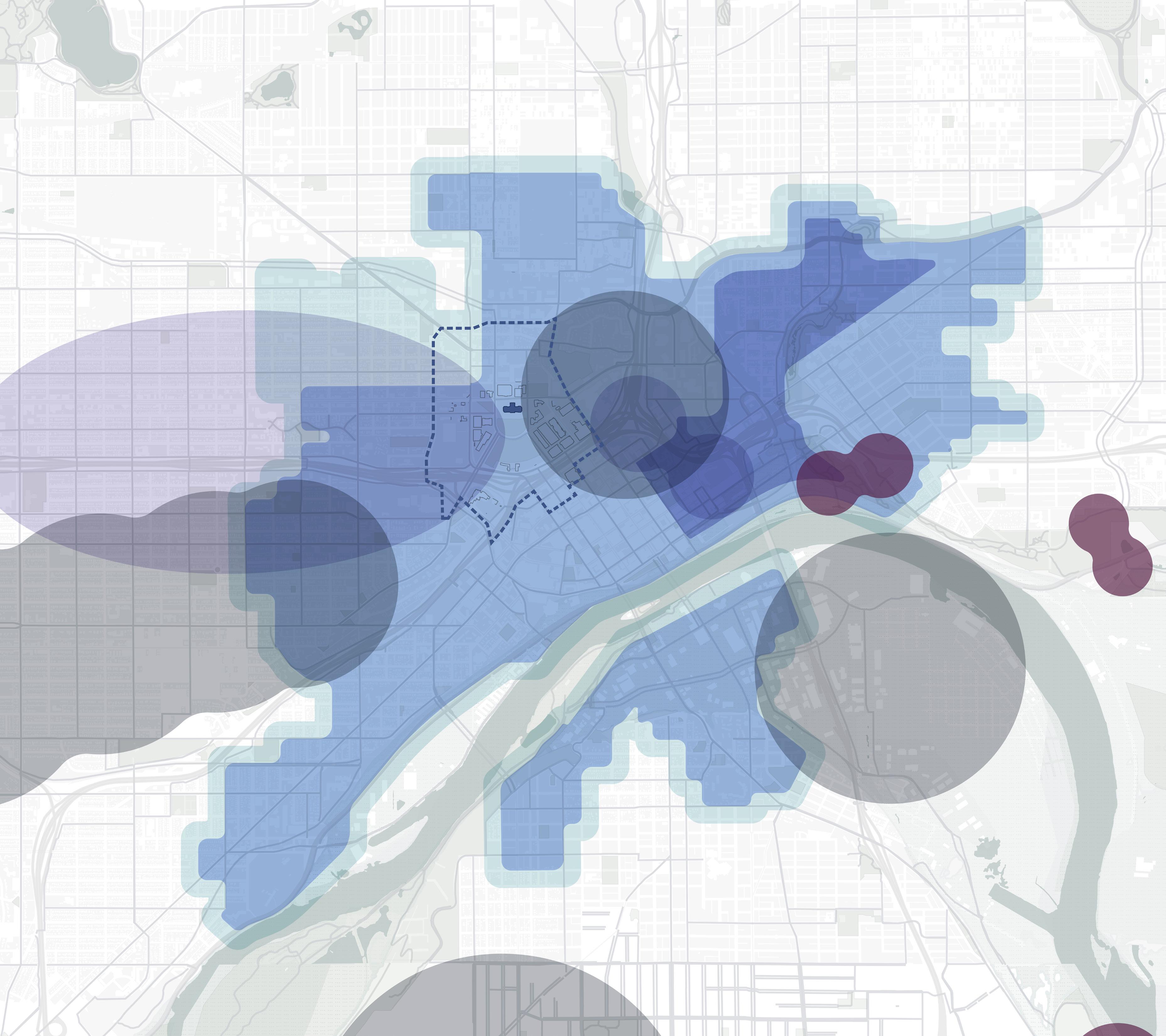 Figure 57: Historically Diverse Communities
0’ 2000’ 1000’ 500’
Black neighborhoods in Saint Paul (Bisected and many residents displaced by I-94 construction) 1900-1960 JewishneighborhoodsinSaintPaul 1880- Present Jewish neighborhoods in Saint Paul 1850-1900 Jewish neighborhoods in Saint Paul 1960 - Present Jewish neighborhoods in Saint Paul 1890 - 1940
Dayton’s Bluff Mound Group
Indian Mounds Park Mound Group
(1838-1858)
Kaposia
(Kap’oża)
Kaposia (Kap’oża) (to 1837)
1960Present 1960-Present(Maplewood) Black neighborhoods in Saint Paul 1880-1915 1860-1900 1930 - Present 1880 - 1950 MississippiRiver(HaháWakpa) LEGEND 76 Capitol Mall Design Framework
Carver’s Cave (Wakaŋ Tipi)
PRESERVE
DRAFT
SHIFTING
HISTORIC PLANNING EFFORTS
Cass Gilbert set forth bold plans that prioritized views, axes, and the Capitol’s position over (and connection to) Downtown. Many of these plans never came to fruition. The 1946 Nichols Plan bifurcated Gilbert’s central axis and viewshed across the river, undoubtedly influenced by future plans to build Interstate 94. Later plans addressed the Capitol Mall’s landscape and public realm, as well as the loss of connectivity to Downtown after the construction of Interstate 94 in 1967. Other planning and design efforts involving the Minnesota Capitol Mall include the following:
O Green River Planting Enhancements (1989)
O Capitol Restoration (2017)
O 2040 Comprehensive Plan for the Minnesota State Capitol Area (2021)
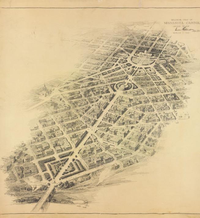
1931 CASS GILBERT PLAN
Revised to include government buildings (State Office Building).
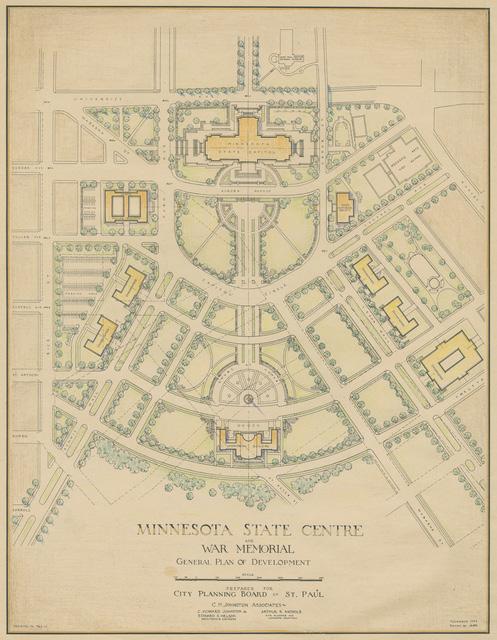
JOHNSTON / NELSON / NICHOLS PLAN
Extended Capitol Mall fan & located Veterans Service Building, bifurcating Gilbert’s original plan.
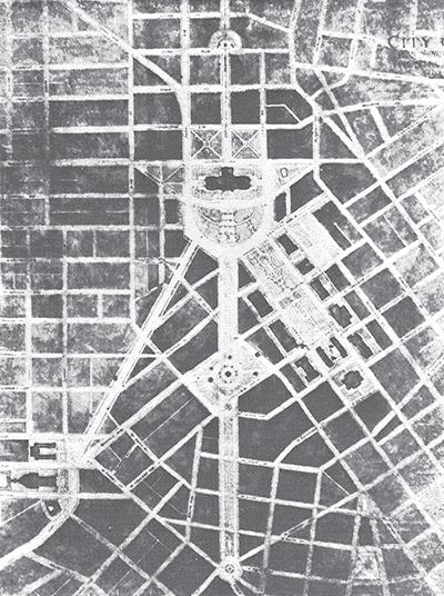
1903
CASS GILBERT PLAN
Established three major axes: commerce, culture, and nature; network of green gardens to river; and primary views.
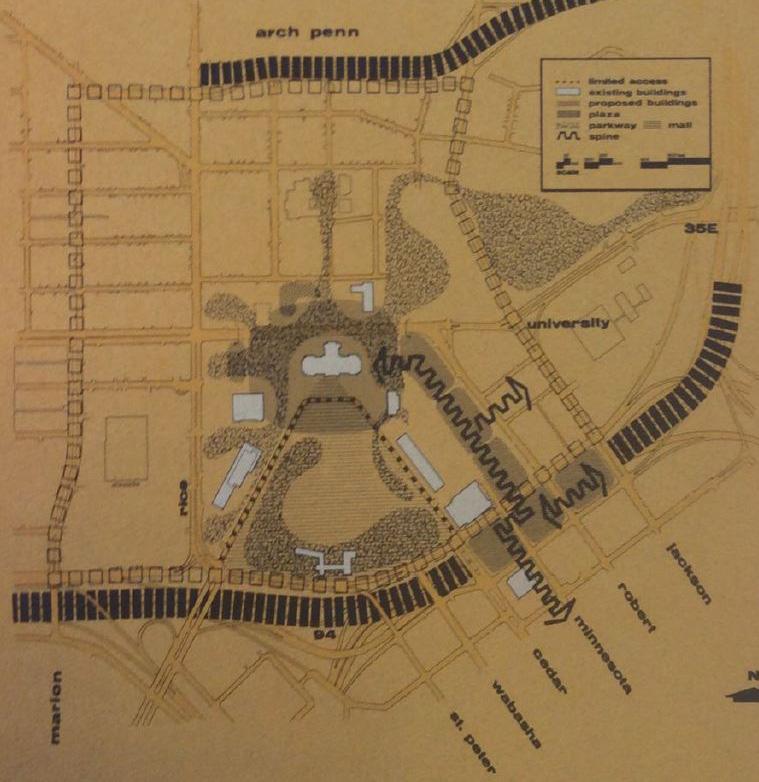
COMPREHENSIVE PLAN FOR THE MINNESOTA STATE CAPITOL AREA
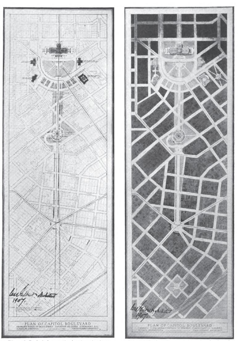
1907 CASS GILBERT PLAN
Revised to include government buildings
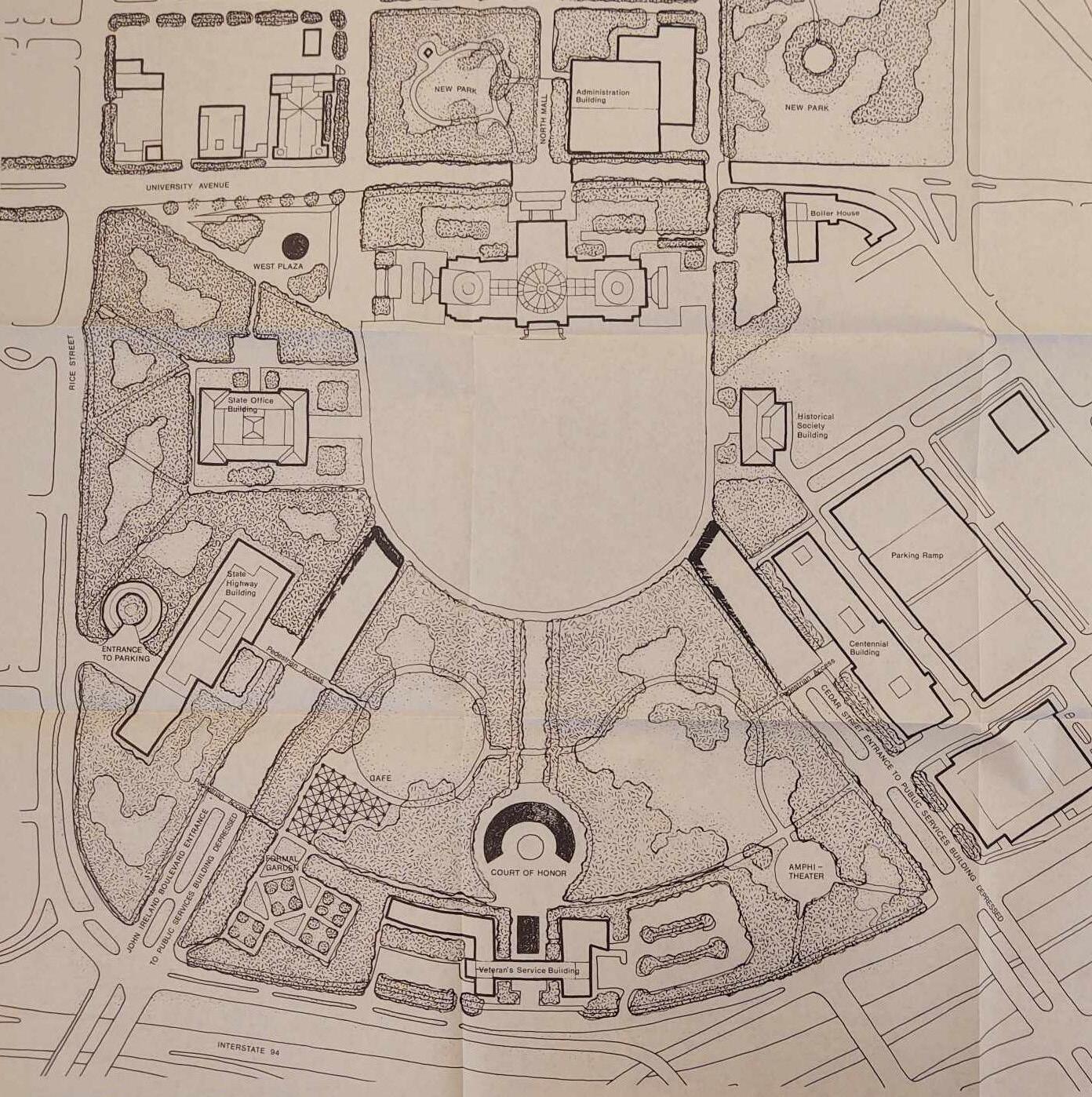
PROJECT FOR THE COMPLETION OF THE CAPITOL GROUNDS
1946
MALL PLAZA& SPINE PARKWAY PLAZA RETHINKING LANDSCAPE
1986
1970
2 4 6 VIEWS
1 VIEWS VIEWS 5
3
78 79 Capitol Mall Design Framework Inventory + Analysis
PRESERVE 1907
2021 DRAFT
TO
CAPITOL AREA THROUGH TIME
CHANGING URBAN FABRIC
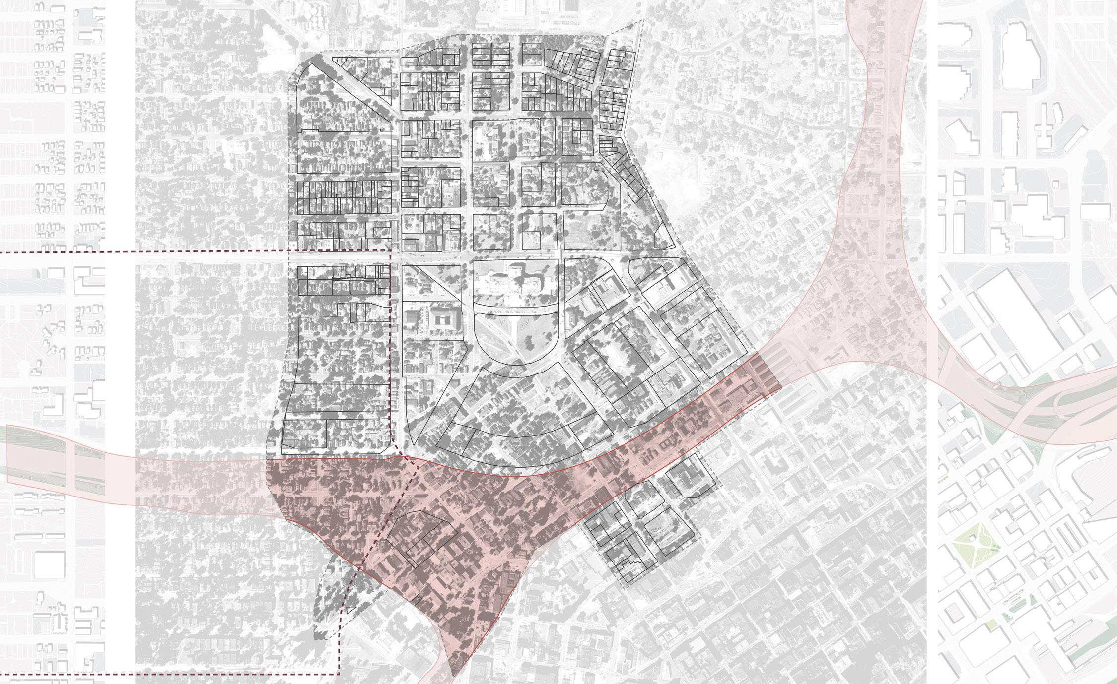
A HISTORY OF ERASURE
When Gilbert rebuilt the Capitol Building on its current site between 1895 and 1905, much of the adjacent land included small homes and businesses—a diverse neighborhood that housed many of the people who physically built the Capitol Building, as well as wealthy individuals who enjoyed the proximity to the now extant Central Park and sweeping views to the Mississippi River (Haháwakpa). Over time, much of this historic urban fabric was demolished. In an effort to expand the Capitol Campus, all structures within the Lower Capitol Mall boundary were torn down between 1946 and 1950. Shortly after, much of the historically Black Rondo neighborhood was forcibly relocated to accommodate the Interstate-94 construction.
Between 1950 and 1975, much of what we see today at the Capitol Campus came to fruition. As state government functions expanded, new buildings were constructed, along with the parking lots and ramps needed to support the many workers who occupied these buildings. Additionally, stores like Sears came in and wiped out huge plots of land for their big-box stores and expansive surface parking lots. Despite many recent efforts to remediate this loss of historic urban fabric, much of the adjacent vacant land has yet to see substantial infill or redevelopment.
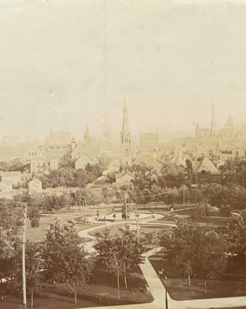
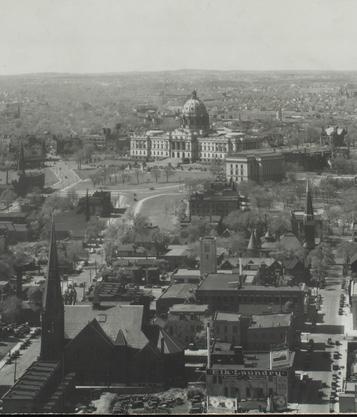
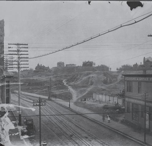
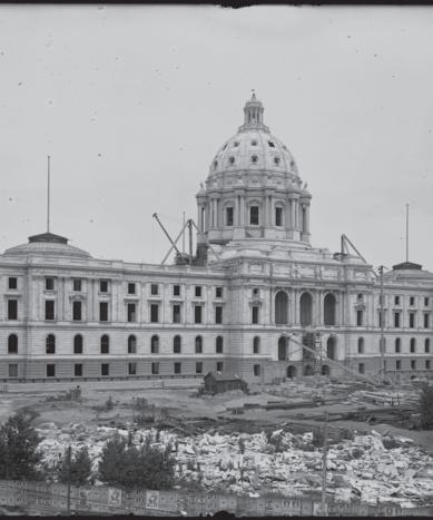
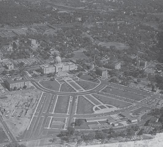
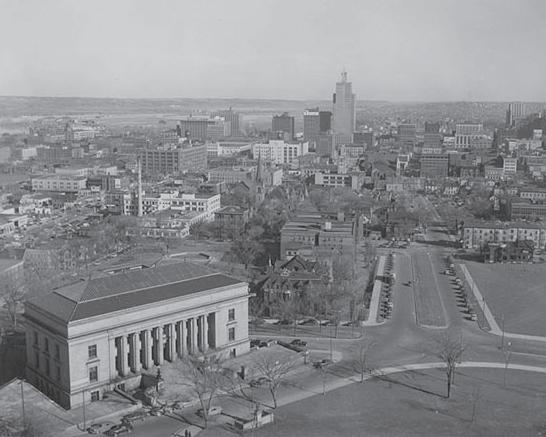
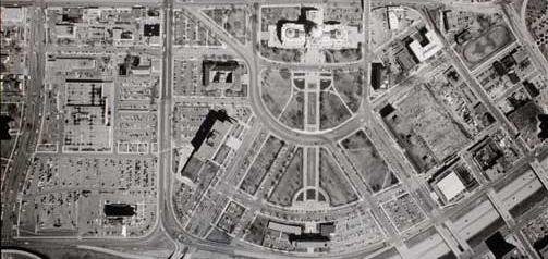 Figure 59: Aerial view of the Capitol
Figure 60: Central Park
Figure 61: Looking toward the Capitol Building
Figure 62: Capitol Construction
Figure 59: Aerial view of the Capitol
Figure 60: Central Park
Figure 61: Looking toward the Capitol Building
Figure 62: Capitol Construction
RONDO NEIGHBORHOOD (BISECTED BY I-94) I-94 University Ave W Rice St I-35E
Figure 63: Wabasha Street to Capitol
1952 1974
Figure 64. Aerial of the Capitol after the I-94 construction (1974) (MNHS) Figure 65. Original MNHS building (1952) (MNHS)
Source: Historic Aerial 1927, MNHS
Source: Aerial View of the Capitol, 1950, MNHS
Source: Wabasha St. to Capitol, 1896, MNHS Source: Capitol Con. 1904, MNHS
Source: Looking Toward the Capitol, 1927, MNHS
Source: Central Park, 1890, MNHS
Figure 58: Historic Aerial
Source:
1890 1950 1927 1927 1904 1896
Source: Original MNHS Building, 1952, MNHS
Aerial of Capitol after the I-94 Construction, 1974, MNHS
80 81 Capitol Mall Design Framework Inventory + Analysis
PRESERVE
DRAFT
2022 HISTORIC CONTEXT REPORT
ELIGIBLE AND CONTRIBUTING STRUCTURES
The Historic Context Report for the Minnesota State Capitol Planning & Context Development Project (106Group, 2022) documents the historic context of land use history in the Capitol Area. The report outlines an eligible historic district that includes the Capitol Mall and adjacent buildings, along with John Ireland Boulevard and Cedar Street, given their historic viewshed integrity. Additionally, the report documents properties listed on the National Register of Historic Places (NRHP) as well as NRHP-listed and contributing properties to the eligible historic district. Various other locally and nationally listed properties exist just beyond the Capitol Campus. The historic context report identifies critical subthemes within the land use history, including the presence of American Indian peoples in the vicinity of the study area; government intervention within the study area; and what was lost with the government establishment of the Capitol Area. The State Preservation Historic Office previously determined the period of significance as 1902 to 1962.
CAAPB Boundary
NRHP-listed Historic District
Eligible Historic District
Other Notable Landscapes
Historic Rondo Neighborhood
Historic Listing: Locally and Nationally Listed (outside CAAPB Boundary)
Historic Viewshed
Sculptures, Monuments, & Memorials
NRHP-listed (within CAAPB Boundary)
Norwegian Evangelical Lutheran Church (1915)
NRHP-listed + Contributing Property to Determined Eligible Historic District
MN Capitol Building (1905)
MN Historical Society Building (1918)
Contributing Property to Determined Eligible Historic District
State Capitol Power Plant (1903)
State Office Building (1932)
MNDOT Building (1958)
Veteran’s Administration Building (1973)
State Capitol Mall (1955)
Centennial Office Building (1958)
National Guard Armory Building (1962)
State Register of Historic Places (within CAAPB Boundary)
Old State Capitol Site (1853)
FROGTOWN
Figure 67: Historic Viewsheds, Eligible and Contributing Structures
Source: Historic Context Report for the Minnesota State Capitol Planning & Context Development Project 106 Group, June 2022.
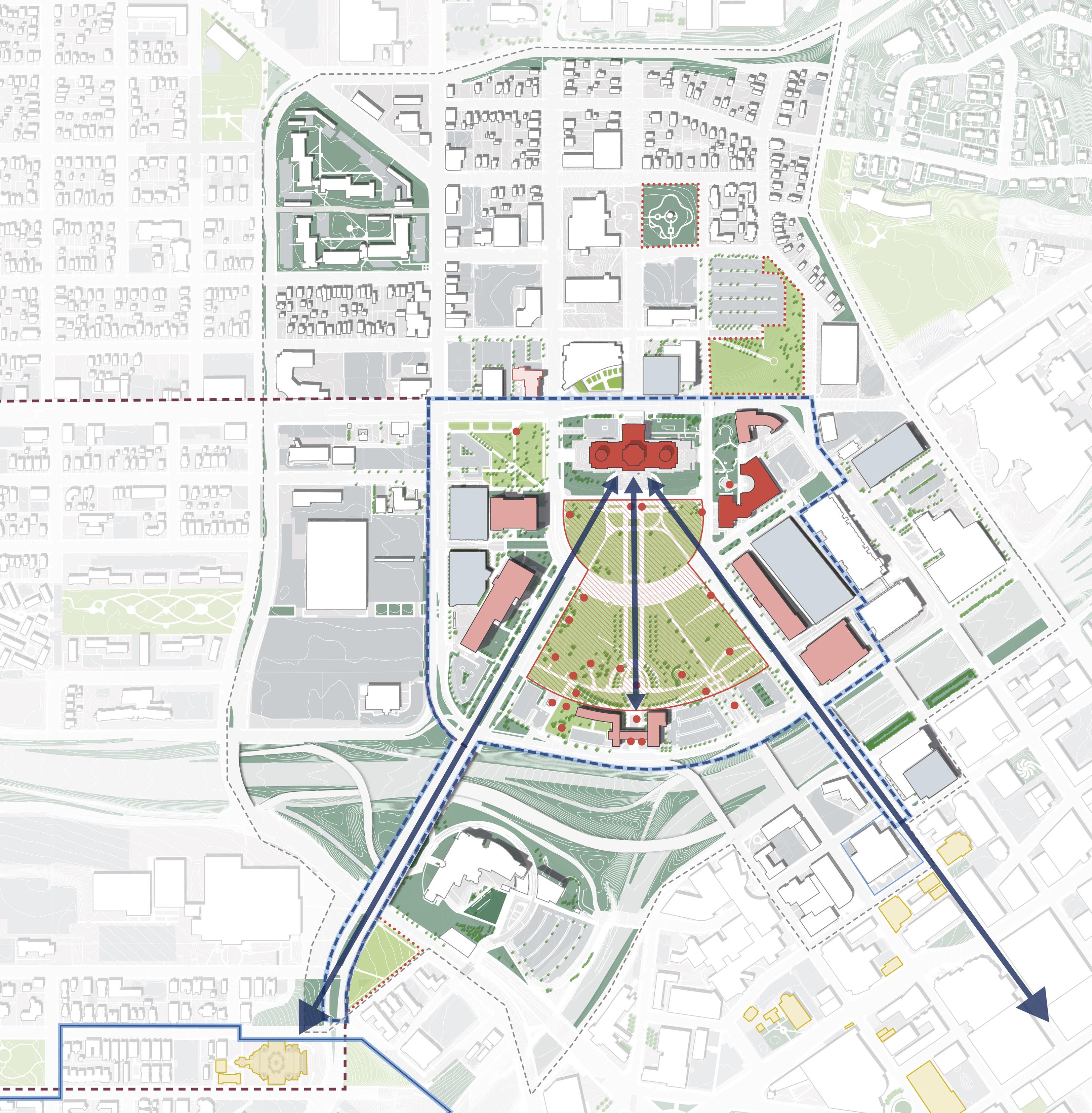
N 0’ 500’ 250’ 125’
A C B D E F G H I J K
NEIGHBORHOOD
I-94 University Ave W Aurora Ave St Anthony Ave Como Ave W Pennsylvania Ave CAPITOL HEIGHTS
DOWNTOWN SAINT PAUL ELIGIBLE HISTORIC DISTRICT Park St Cedar St Rice St John Ireland Blvd CedarSt JacksonSt UniversityAveE E12thSt 10thStE RobertSt FortRd I-35E CATHEDRAL OF SAINT PAUL MN HISTORY CENTER CAPITOL RICE DISTRICT FITZGERALD PARK Marion St Historic Viewshed HistoricViewshed H istoric Viewshed A B D C E F G H I J K LEGEND
SOUTH
HISTORIC RONDO
(BISECTED BY I-94)
EXISTING HISTORIC HILL DISTRICT
82 83 Capitol Mall Design Framework Inventory + Analysis
PRESERVE
DRAFT
VIEWSHED ANALYSIS
TO THE CAPITOL BUILDING
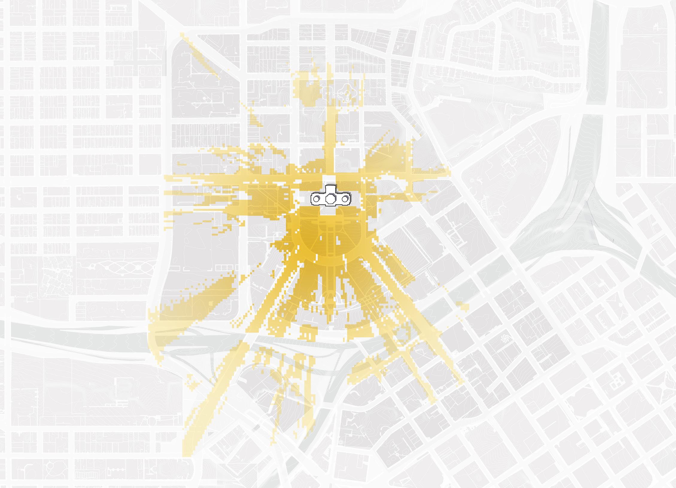
Figure 68: Existing Viewshed towards Capitol
Source: Minnesota Geospatial Commons. gisdata.mn.gov/dataset.
Source: Ramsey County Map Ramsey. maps.co.ramsey.mn.us/mapramsey/.
Source: Ramsey County Maps and Surveys. www.ramseycounty.us/residents/property/maps-surveys.
Source: Saint Paul Minnesota. information.stpaul.gov/search.
METHODOLOGY + OUTCOMES
One of the more distinct and historically significant elements of the Capitol Campus today includes the views to the Capitol Building from various other points around the Capitol Mall and beyond. To ensure the final design framework maximizes and protects these views, the planning team utilized a viewshed tool to better understand where there may be unperceived viewshed barriers. The three-dimensional modeling tool supported a four-step, iterative process:
O Capture current site and building viewsheds
O Determine and capture specific view values to target
O Locate new trees and other landscape interventions
O Revise the design framework as needed until desired viewsheds are preserved.
Views to the Capitol Building are largely dependent on the topography and adjacent buildings. Trees have less of an impact than the topography. Many of the major roadways leading to the Capitol Building capture primary views.
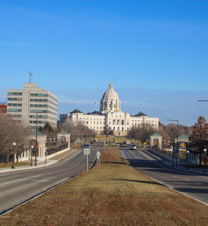
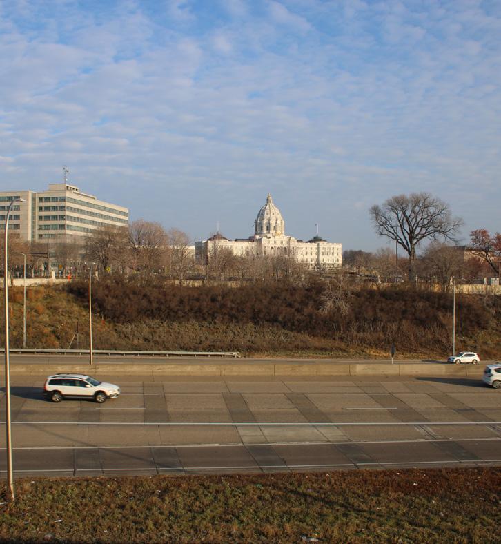
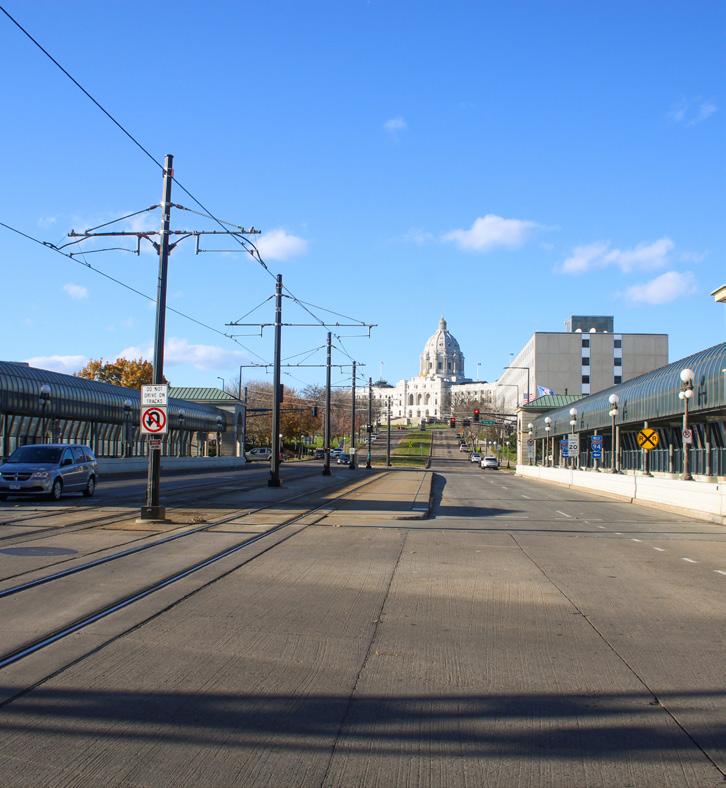
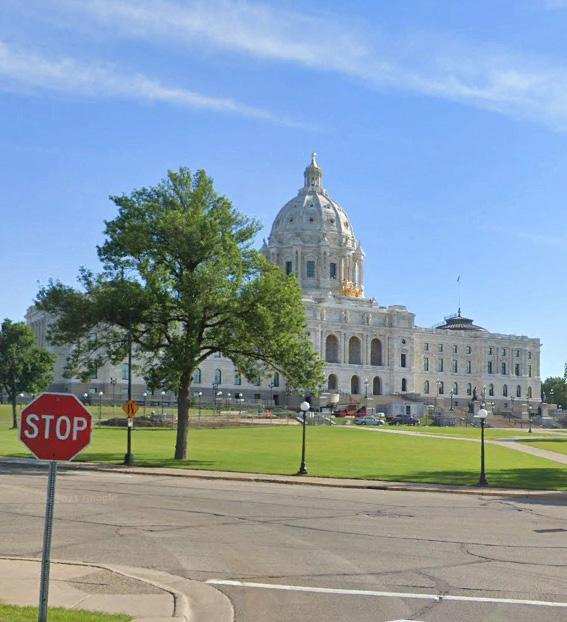
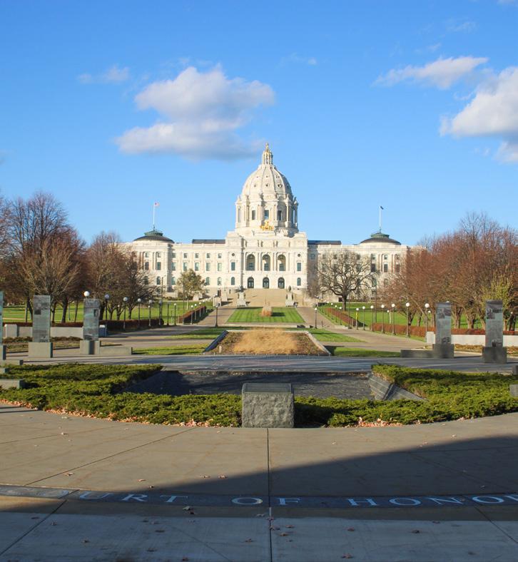
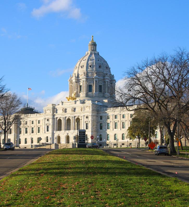
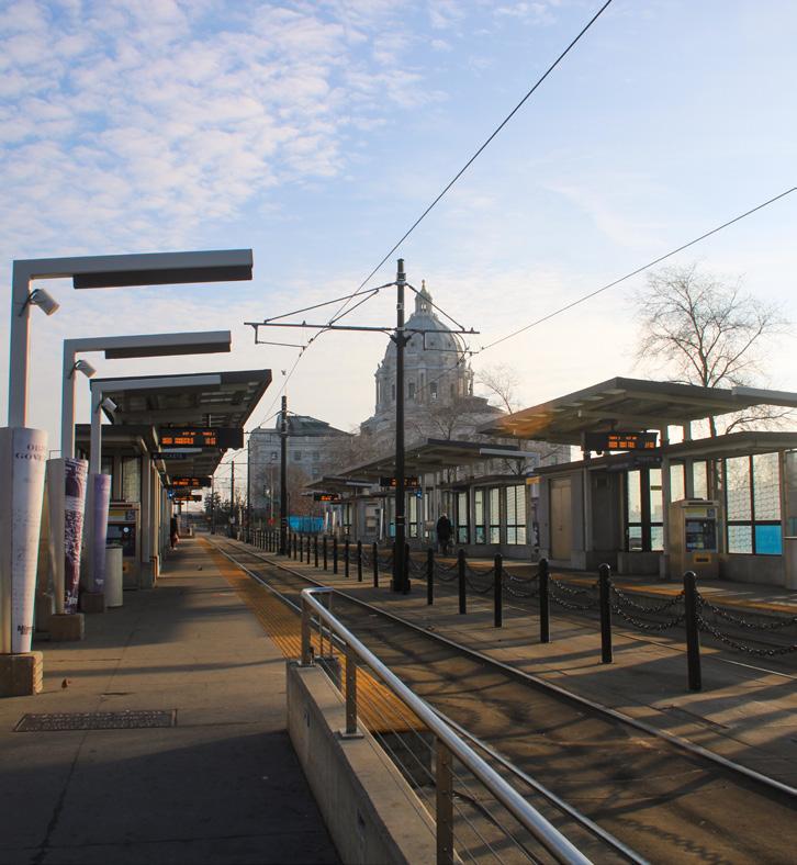
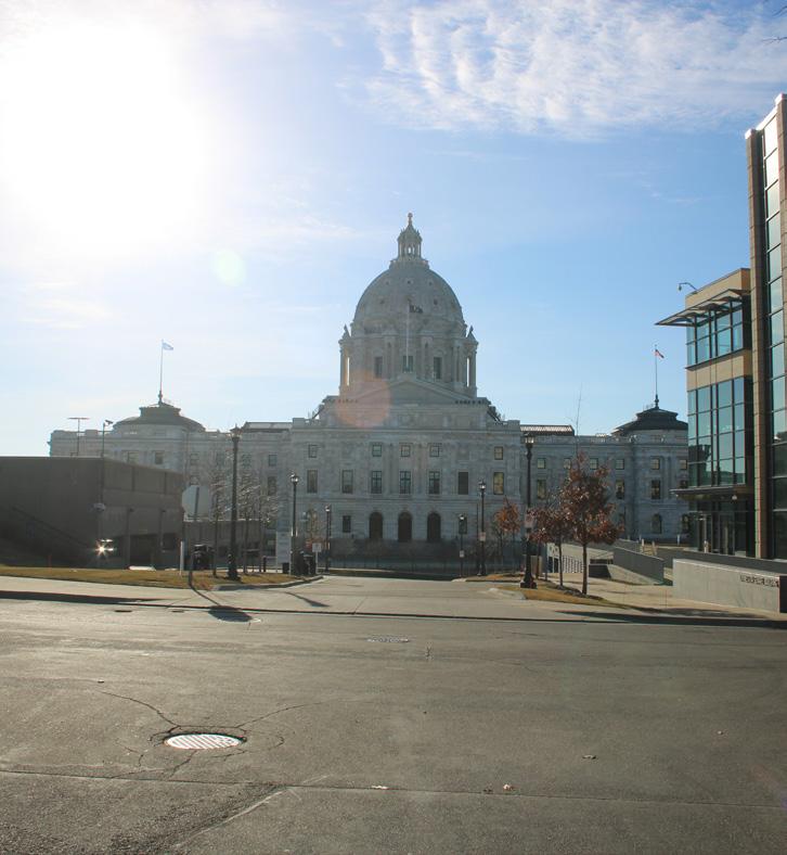
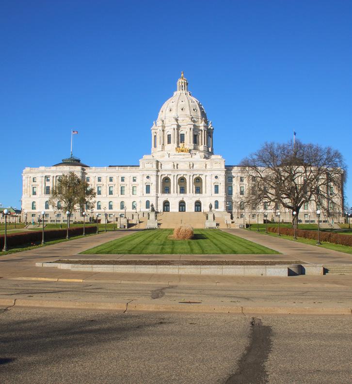
N NTS 3 1 2 4 7 9 8 3 6 4 5 1 2 8 9 7 5 6
Figure 74: From downtown on Cedar St
Figure 69: From John Ireland Blvd
Figure 71: From John Ireland Blvd
Figure 75: From Capitol Street Station
Figure 70: From MHC on Mulberry St
Figure 72: From N Capitol Blvd Figure 73: From Rev. Dr. Martin Luther King, Jr. Blvd
Best Views of Capitol Building
Worst Views of Capitol Building
84 85 Capitol Mall Design Framework Inventory + Analysis
Figure 76: From Lower Mall Figure 77: From Rev. Dr. Martin Luther King, Jr. Blvd and Cedar St
PRESERVE
Source: Damon Farber John Ireland Blvd. Jan 2024.
Source: Damon Farber John Ireland Blvd. Jan 2024.
Source: Google Maps, www.google.com/ maps/. Accessed Jan. 2024.
Source: Damon Farber University Ave W Jan 2024.
Source: Damon Farber MHC. Jan 2024.
Source: Damon Farber N Capitol Blvd Jan 2024
Source: Damon Farber Rev Dr MLK Blvd Jan 2024.
Source: Damon Farber Capitol Mall. Jan 2024.
Source: Damon Farber John Ireland Blvd. Jan 2024.
DRAFT
VIEWSHED ANALYSIS FROM THE CAPITOL
BUILDING
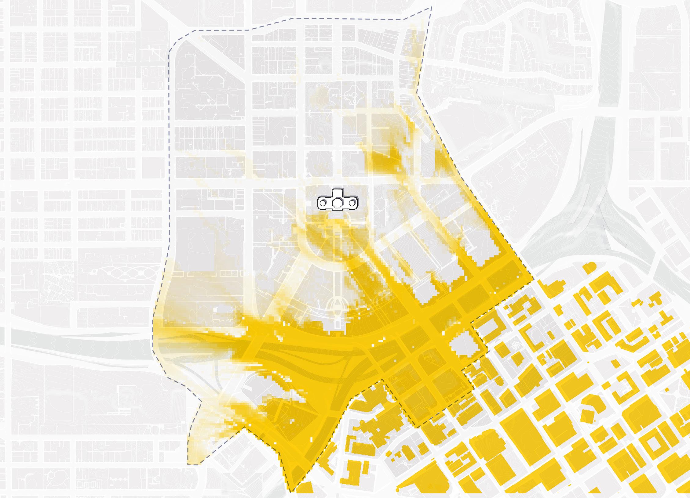
METHODOLOGY OUTCOMES
One of the more distinct and historically significant elements of the Capitol Campus today includes the views from the Capitol Building to Downtown and the Cathedral of Saint Paul along John Ireland Boulevard and Cedar Street. To ensure the final design framework maximizes and protects these views, the planning team utilized a viewshed tool to better understand where there may be unperceived viewshed barriers. The three-dimensional modeling tool supported a four-step, iterative process:
O Capture current site and building viewsheds
O Determine and capture specific view values to target
O Locate new trees and other landscape interventions
O Revise the design framework as needed until desired viewsheds are preserved.
The views from the Capitol Building are largely dependent on the topography and adjacent buildings. Trees have less of an impact than the topography. Downtown Saint Paul can be easily seen from many directions because it sits on higher ground.
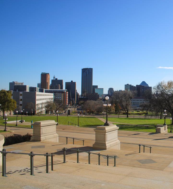
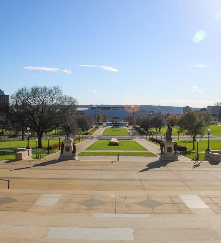
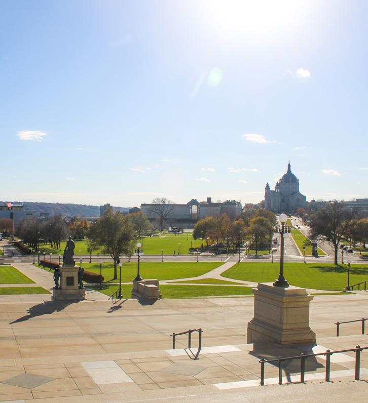
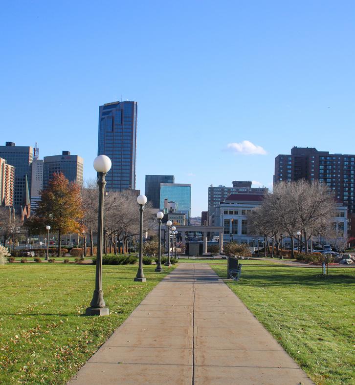
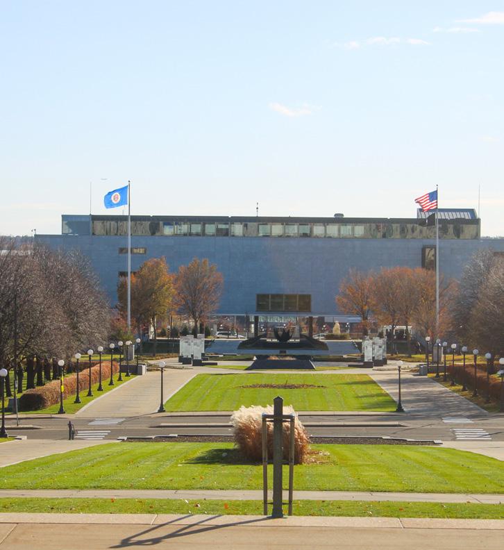
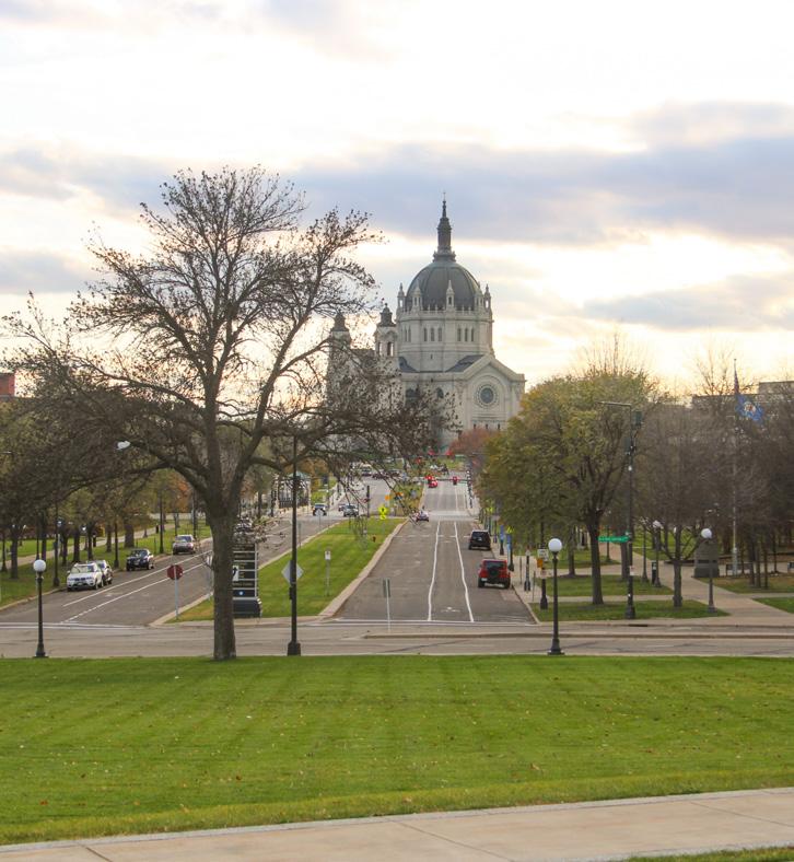
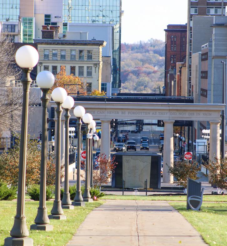
Source: Historic Aerial 1927, MNHS Figure 79: Historic Aerial N NTS 1 4 7 2 5 8 3 6 9 1 4 7 3 6 9 2 5 8 Best Views of City Worst Views of City
Figure 80: From Capitol steps to downtown
Figure 81: From Mall to downtown
Figure 82: From Mall to downtown
Figure 83: From Capitol steps to Mall
Figure 84: From Mall to Veteran’s Service Building
Figure 85: From 12th St bridge to downtown
Figure 86: From Capitol steps to Saint Paul Cathedral
Figure 87: From Mall to Saint Paul Cathedral
86 87 Capitol Mall Design Framework Inventory + Analysis
Figure 88: From 12th St bridge to Saint Paul Cathedral
PRESERVE
Source: Damon Farber Capitol Building. Jan 2024.
Source: Damon Farber John Ireland Blvd. Jan 2024.
Source: Damon Farber John Ireland Blvd. Jan 2024.
Source: Damon Farber John Ireland Blvd. Jan 2024.
Source: Damon Farber John Ireland Blvd. Jan 2024.
Source: Damon Farber John Ireland Blvd. Jan 2024.
Source: Damon Farber John Ireland Blvd. Jan 2024.
Source: Damon Farber John Ireland Blvd. Jan 2024.
DRAFT
Source: Damon Farber John Ireland Blvd. Jan 2024.
MEMORIALS AND COMMEMORATIVE WORKS
EXISTING THEMES AND ORGANIZATION
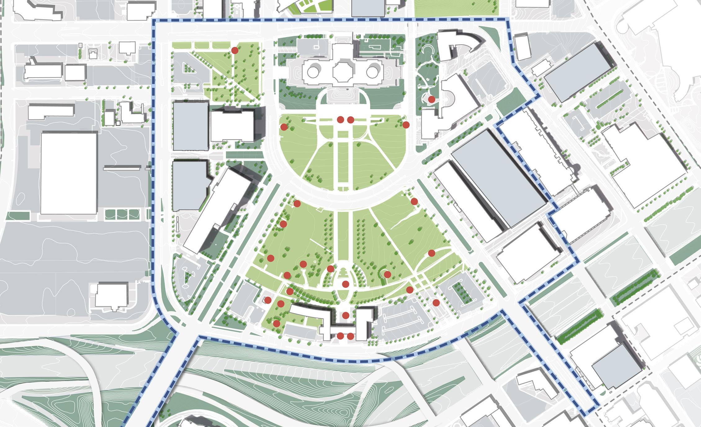
THEMATIC DEMOGRAPHIC
In 1993, the CAAPB developed spatial and thematic groupings for artwork within the Capitol grounds drawing from designs generated by 1986 Plans for the Capitol Mall Landscape Design Competition. The strategy affirmed Cass Gilbert’s original notion of a “memorial approach.” Under this plan, the area closest to the Capitol Building on the Upper Mall is designated for recognition of those in executive, legislative and judicial branches, while military and public safety memorials cluster in an arc surrounding the Veteran’s Service Building, with other important Minnesotans honored along John Ireland Boulevard. Since then, memorials to Hubert H. Humphrey and civil rights leader Roy Wilkins found a home along John Ireland Boulevard, while the lawn areas along Cedar Street were reserved for three larger theme gardens.
Time and events change attitudes, people, and their values—and the ongoing discourse about these realities has increased recently. A survey of Capitol Mall visitors in fall 2019 indicated that approximately 90% of people surveyed were very happy with the experiential aspects of the memorials on the mall, but less than half of the people felt that the memorials connected to their lives (38%) or current events (41%). Approximately 30% of the people surveyed indicated they would like to see more diverse representation of Minnesotans, including women, native communities, communities of color and other traditionally under-represented groups. Of the memorials and commemorative works on the Capitol Mall today, 26% are dedicated to white men, 37% are dedicated to war or the military, 7% are explicitly dedicated to BIPOC, 4% are dedicated to women, and 0% are dedicated to LGBTQ+ communities.
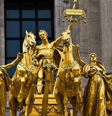
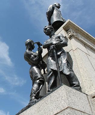
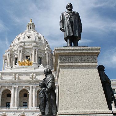
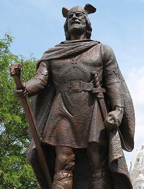
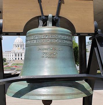
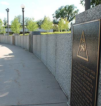
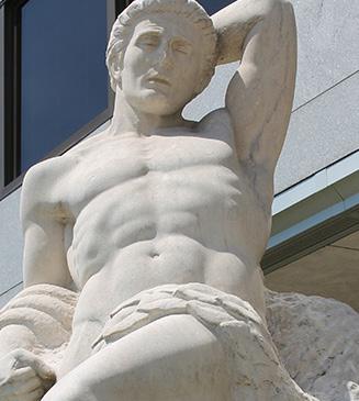
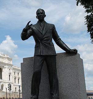
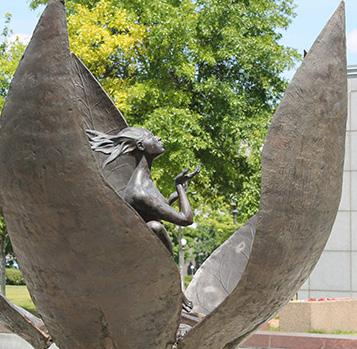 Figure 89. Commemorative works in and around the Capitol Mall.
Figure 90: Progress of the State Figure 91: John Johnson Statue Figure 92: Knute Nelson Statue
Figure 93: Leif Erickson Monument Figure 94: Liberty Bell Sculpture Figure 95: Court of Honor
Figure 96: Earthbound Monument Figure 97: Gov. Floyd B. Olson Statue Figure 98: Promise of Youth Fountain
Source: Progress of the State. 1906. Source: John Johnson Statue. 1912. Source: Knute Nelson Statue. 1928.
Source: Leif Erickson Monument. 1949. Source: Liberty Bell Sculpture. 1950. Source: Court of Honor. 1950.
Figure 89. Commemorative works in and around the Capitol Mall.
Figure 90: Progress of the State Figure 91: John Johnson Statue Figure 92: Knute Nelson Statue
Figure 93: Leif Erickson Monument Figure 94: Liberty Bell Sculpture Figure 95: Court of Honor
Figure 96: Earthbound Monument Figure 97: Gov. Floyd B. Olson Statue Figure 98: Promise of Youth Fountain
Source: Progress of the State. 1906. Source: John Johnson Statue. 1912. Source: Knute Nelson Statue. 1928.
Source: Leif Erickson Monument. 1949. Source: Liberty Bell Sculpture. 1950. Source: Court of Honor. 1950.
N NTS Military & Public Safety Government Individuals Groups Non-extant White Men BIPOC Women E12thSt Rev Dr MLK JrBlvd CedarSt John Ireland Blvd University Ave St Anthony Ave Rice St I-35E CAAPBBoundary Eligible Historic District J O K I L B C D E G H N M P Q R T S V @ W Z X Y & U I-94 A F
Source: Earthbound Monument. 1956. Source: Gov. Floyd B. Olson Statue. 1958. Source: Promise of Youth Fountain 1958.
B G C F J D
TO 2016 UPPER MALL LOWER MALL I K H LEGEND 88 89 Capitol Mall Design Framework Inventory + Analysis
COMMEMORATIVE WORKS 1906
PRESERVE
DRAFT
MEMORIALS AND COMMEMORATIVE WORKS
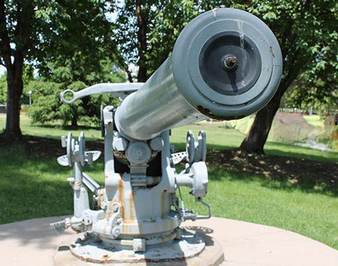
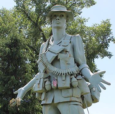
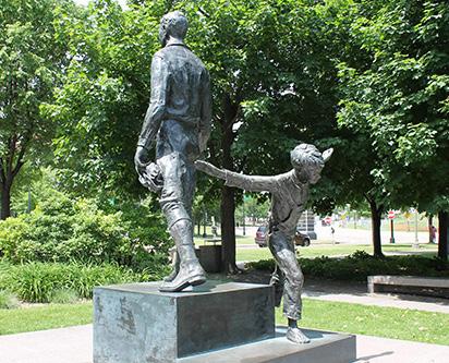
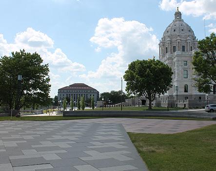
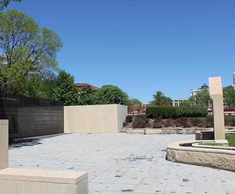
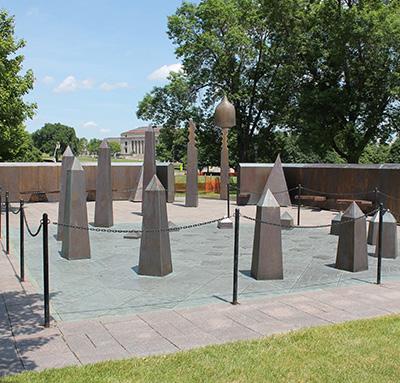

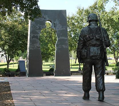
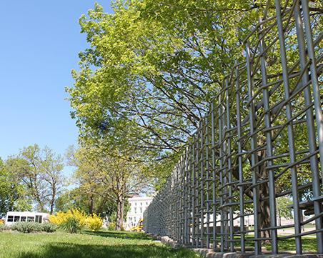
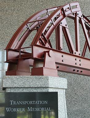
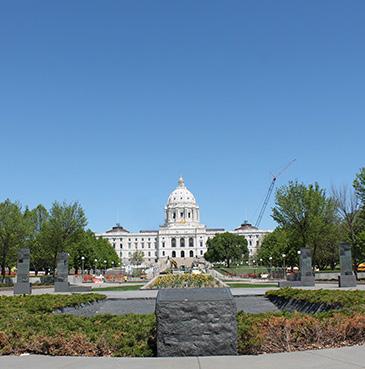
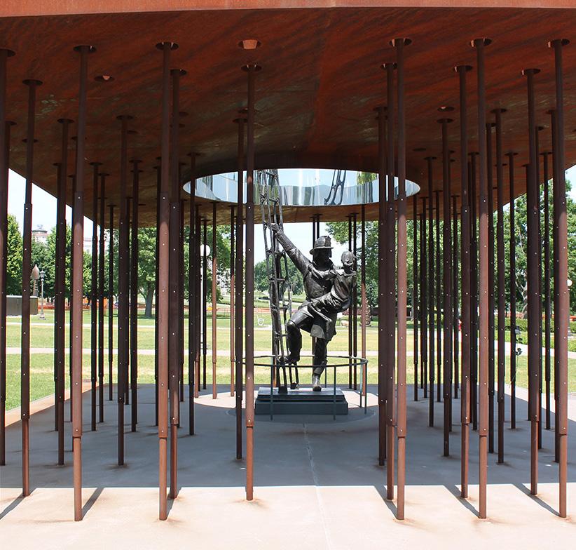
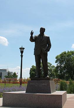
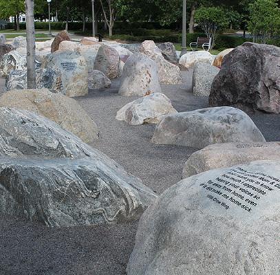
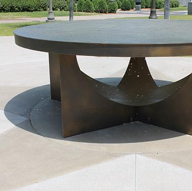
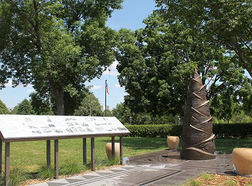
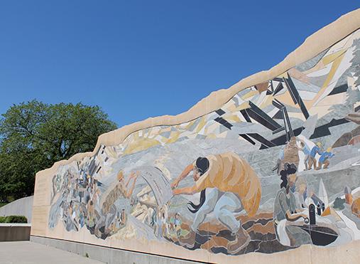 Figure 99: USS Ward Gun
Figure 108: Transportation Works
Figure 111: Hubert H. Humphrey
Figure 114: Special Forces in Laos Memorial
Figure 102: Judicial Plaza
Figure 105: Peace Officers Memorial
Figure 100: Monument to the Living
Figure 109: MN World War II Veterans Memorial
Figure 112: Military Family Tribute: Story Stones
Figure 115: MN Workers Memorial Garden
Figure 103: MN Vietnam Veterans Memorial
Figure 106: MN Korean Veterans Memorial
Figure 101: Charles A. Lindbergh Memorial
Figure 110: MN Fallen Firefighters Memorial
Figure 113: Military Family Tribute: Gold Star Table
Figure 104: Roy Wilkins Memorial
Figure 107: MN Woman Suffrage Memorial
Source: USS Ward Gun. 1958.
Source: Transportation Works. 2000.
Source: Hubert H. Humphrey. 2012.
Source: Special Forces in Laos Memorial. 2016.
Source: Judicial Plaza. 1990.
Source: Peace Officers Memorial. 1995.
Source: Monument to the Living. 1982.
Source: MN WWII Veterans Memorial. 2007.
Source: Military Family Tribute: Story Stones. 2015.
Source: MN Workers Memorial Garden. 2010.
Source: MN Vietnam Veterans Memorial. 1992.
Source: MN Korean Veterans Memorial. 1998.
Source: Charles A. Lindbergh Memorial. 1985.
Source: MN Fallen Firefighters Memorial. 2012.
Source: Military Family Tribute: Gold Star Table. 2015.
Source: Roy Wilkins Memorial. 1995.
Figure 99: USS Ward Gun
Figure 108: Transportation Works
Figure 111: Hubert H. Humphrey
Figure 114: Special Forces in Laos Memorial
Figure 102: Judicial Plaza
Figure 105: Peace Officers Memorial
Figure 100: Monument to the Living
Figure 109: MN World War II Veterans Memorial
Figure 112: Military Family Tribute: Story Stones
Figure 115: MN Workers Memorial Garden
Figure 103: MN Vietnam Veterans Memorial
Figure 106: MN Korean Veterans Memorial
Figure 101: Charles A. Lindbergh Memorial
Figure 110: MN Fallen Firefighters Memorial
Figure 113: Military Family Tribute: Gold Star Table
Figure 104: Roy Wilkins Memorial
Figure 107: MN Woman Suffrage Memorial
Source: USS Ward Gun. 1958.
Source: Transportation Works. 2000.
Source: Hubert H. Humphrey. 2012.
Source: Special Forces in Laos Memorial. 2016.
Source: Judicial Plaza. 1990.
Source: Peace Officers Memorial. 1995.
Source: Monument to the Living. 1982.
Source: MN WWII Veterans Memorial. 2007.
Source: Military Family Tribute: Story Stones. 2015.
Source: MN Workers Memorial Garden. 2010.
Source: MN Vietnam Veterans Memorial. 1992.
Source: MN Korean Veterans Memorial. 1998.
Source: Charles A. Lindbergh Memorial. 1985.
Source: MN Fallen Firefighters Memorial. 2012.
Source: Military Family Tribute: Gold Star Table. 2015.
Source: Roy Wilkins Memorial. 1995.
P Y V N Q M R S T Z @ X & W U O L 90 91 Capitol Mall Design Framework Inventory + Analysis
Source: MN Woman Suffrage Memorial. 2000.
PRESERVE EXISTING
DRAFT
THEMES AND ORGANIZATION
PRINCIPLE STRATEGIES
Moving forward from the 2040 Comprehensive Plan OPPORTUNITIES AND CHALLENGES
OVERARCHING OPPORTUNITIES AND/OR CHALLENGES
TO GUIDE PRINCIPLE DESIGN FRAMEWORK STRATEGIES
MOVING FORWARD ARE AS FOLLOWS:
O Historic and non-contributing features present
O Unfulfilled or disrupted historic plans
O A loss Of historic urban fabric and neighborhoods
O Lack of inclusive and holistically curated commemoration
PRESERVE, MAINTAIN AND CELEBRATE HISTORIC LANDSCAPE ASSETS WHILE ADAPTING TO CURRENT AND FUTURE CLIMATE CHANGE
DRAW INSPIRATION FROM UNFULFILLED HISTORIC PLANS WHERE APPROPRIATE, INCLUDING VIEWSHEDS, CONNECTIONS AND PLANTING STRATEGIES
MEMORIALIZE THE LOSS OF HISTORIC NEIGHBORHOODS AND IDENTIFY AREAS OF SENSITIVE AND CULTURALLYRELEVANT INFILL
REFLECT A HOLISTIC AND INCLUSIVE MINNESOTAN HISTORY THROUGH ARTFUL CURATION AND A FOCUS ON BIPOC, WOMEN, AND LGBTQ+ COMMUNITIES
92 93 Capitol Mall Design Framework Inventory + Analysis PRESERVE
DRAFT
STRATEGIES
PRESERVE PRINCIPLE STRATEGY
PRESERVE, MAINTAIN AND CELEBRATE HISTORIC LANDSCAPE ASSETS WHILE ADAPTING TO CURRENT AND FUTURE CLIMATE CHANGE
O Protect historically contributing landscape features through preservation, restoration and rehabilitation
O Allow additions in conformance with the treatment guidance and ensure new features are approved, designed and placed at the discretion of the CAAPB
O Remove existing features that diminish the integrity of the Capitol Mall, like parking lots, and replace with ecologically resilient landscapes and uses
O Utilize historically relevant and resilient plant species, increase tree canopy where historically relevant and ensure new trees do not damage archaeological sites, and ensure new plantings and landscapes preserve historic axes and viewsheds
O Prioritize historically relevant pedestrian-oriented circulation networks
O Develop a Capitol Mall Historic District branding strategy
O Ensure regular maintenance and repair for all contributing features of the Capitol Mall
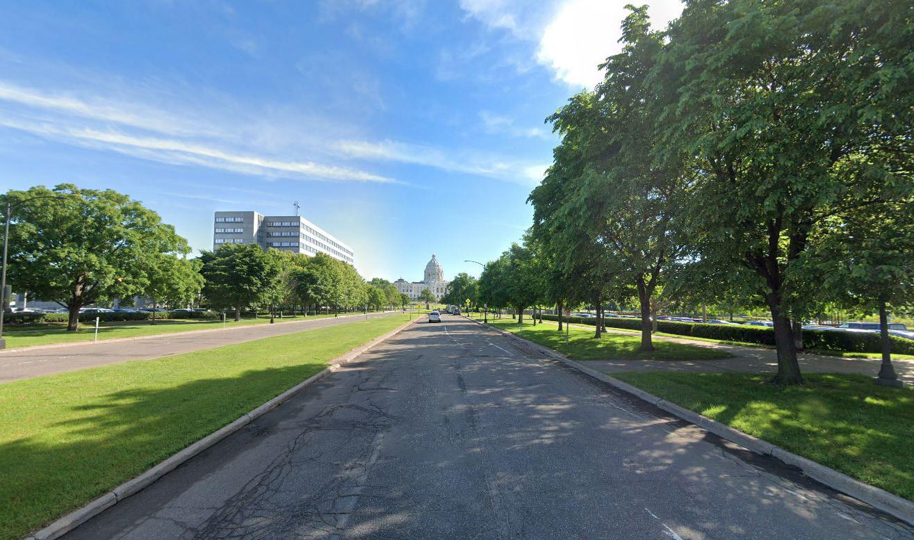
PRESERVE PRINCIPLE STRATEGY
DRAW INSPIRATION FROM UNFULFILLED HISTORIC PLANS WHERE APPROPRIATE, INCLUDING VIEWSHEDS, CONNECTIONS AND PLANTING STRATEGIES
STRATEGIES
O Refer and give precedent to all historic plans during the period of significance (1902 to 1962), including the early Cass Gilbert Plans and 1946 Nichols Plan
O Consider the reconstruction of unbuilt landscape features (initially proposed by Gilbert and Nichols), like the segmented and landscaped malls parallel to the radial boulevards
O Draw inspiration from post-1962 plans, so long as they support the historic integrity of the mall—including the 1986 Project for the Completion of the Capitol Grounds
O Note: more conclusive strategies are pending and will be determined by the Cultural Landscape Report
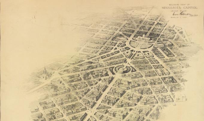 Figure 116: Historic Viewshed of Capitol along John Ireland Blvd
Figure 117: Cass Gilbert 1931 Plan
Source: Historic Viewshed of Capitol along John Ireland Blvd. Jan. 2024, Minnesota Historic Society
Source: Cass Gilbert 1931 Plan. 1931, Minnesota Historic Society
Figure 116: Historic Viewshed of Capitol along John Ireland Blvd
Figure 117: Cass Gilbert 1931 Plan
Source: Historic Viewshed of Capitol along John Ireland Blvd. Jan. 2024, Minnesota Historic Society
Source: Cass Gilbert 1931 Plan. 1931, Minnesota Historic Society
94 95 Capitol Mall Design Framework Inventory + Analysis
DRAFT
PRESERVE PRINCIPLE STRATEGY
MEMORIALIZE THE LOSS OF HISTORIC NEIGHBORHOODS AND IDENTIFY AREAS OF SENSITIVE AND CULTURALLY-RELEVANT INFILL
STRATEGIES STRATEGIES
O Acknowledge and address past displacement and community erasure through audio-visual walks and/or memorials
O Propose redevelopment and new public realms that are culturally relevant and responsive to nearby/ displaced communities, including the vacant Sears site
O Propose redevelopment and infill of various scales that respond to the adjacent neighborhood fabric
O Include affordable housing as a critical component of any new development
O Implement anti-gentrification measures for communities adjacent to new development
PRESERVE PRINCIPLE STRATEGY
REFLECT A HOLISTIC AND INCLUSIVE MINNESOTAN HISTORY THROUGH ARTFUL CURATION AND A FOCUS ON BIPOC, WOMEN, AND LGBTQ+ COMMUNITIES
O Identify and illuminate missing and/or neglected historic narratives through various programming strategies
O Curate a campus-wide approach to effectively tell the complete story of Minnesota’s history through strategically placed memorials and public art
O Thoughtfully site inclusive and diverse commemorative memorials as a part of the curated campus-wide approach
O Recognize and celebrate the Dakota people and other Indigenous Americans
O Highlight and celebrate historic immigrant and African American communities
O Highlight and celebrate women and LGBTQ+ communities
O Identify and determine the treatment of harmful memorials
 Figure 118: The Land Bridge
Figure 119: Dignity of Earth and Sky honors South Dakota’s Indigenous American roots
Source: Melo and James. The Land Bridge. Reconnect Rondo, https://reconnectrondo.com/landbridge/.
Source: Dignity of Earth and Sky honors South Dakota’s Indigenous American roots. Travel South Dakota, https://www. travelsouthdakota.com/trip-ideas/story/dignity-earth-sky
Figure 118: The Land Bridge
Figure 119: Dignity of Earth and Sky honors South Dakota’s Indigenous American roots
Source: Melo and James. The Land Bridge. Reconnect Rondo, https://reconnectrondo.com/landbridge/.
Source: Dignity of Earth and Sky honors South Dakota’s Indigenous American roots. Travel South Dakota, https://www. travelsouthdakota.com/trip-ideas/story/dignity-earth-sky
96 97 Capitol Mall Design Framework Inventory + Analysis
DRAFT
ACTIVATE
O City-wide Recreation
O Neighborhood Residential Demographics
O Missing Nearby Amenities
O Capitol Mall Programming
O Slope and Future Programming
O Security and Public Assembly
O Security Typologies
O Opportunities and Challenges
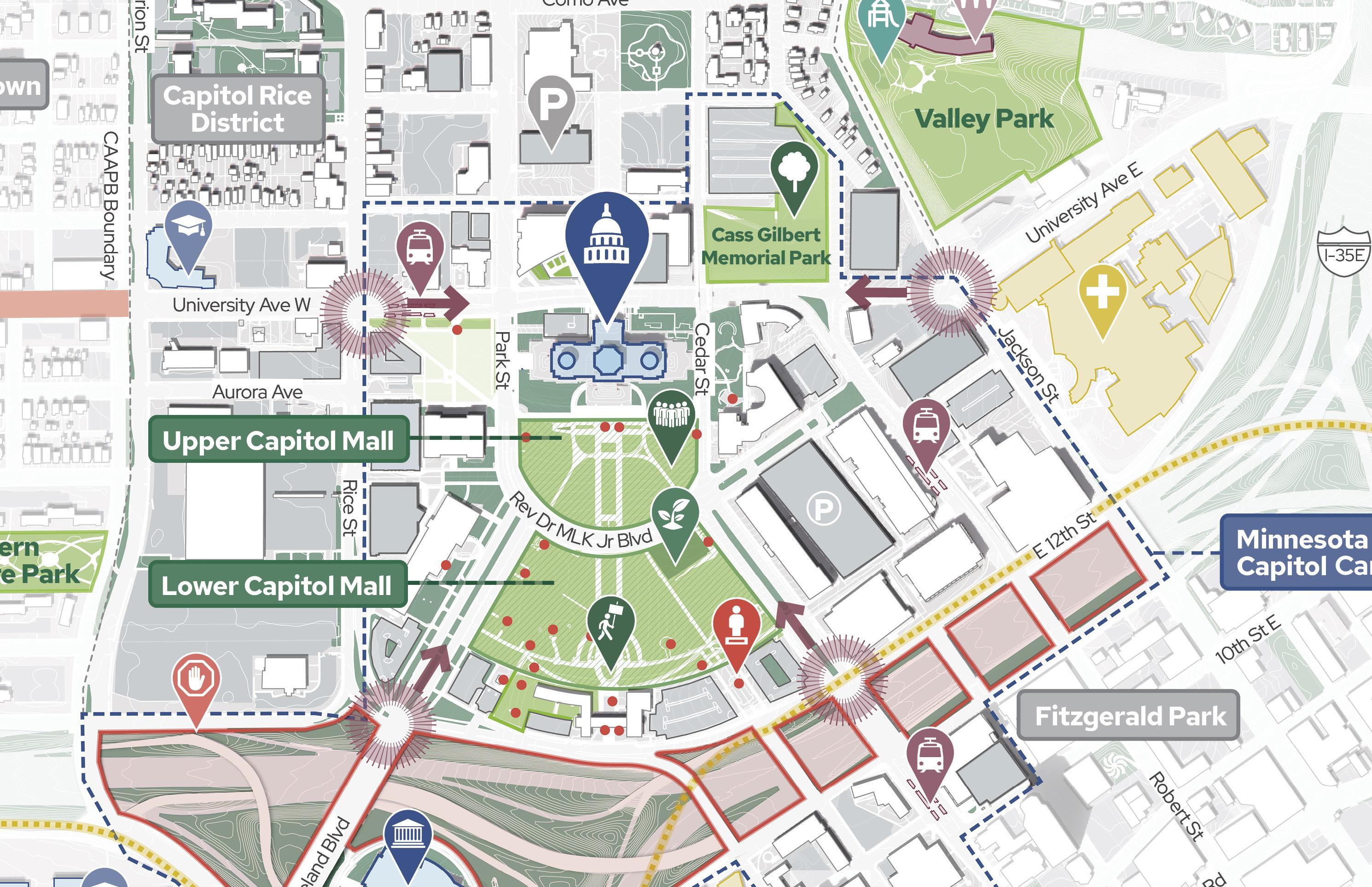
DRAFT
The Capitol Mall will become more welcoming for more Minnesotans to gather and share ideas through events, activities and opportunities to authentically tell a diversity of Minnesotan stories.
CITY-WIDE RECREATION
Transformation of the Saint Paul Parks and Recreation
System by the Saint Paul Parks and Recreation Department extensively documents the many open space amenities present within the City of Saint Paul, ranging from smaller neighborhood parks and recreation centers to the much larger Mississippi National River and Recreation Area. This study highlights the critical park gap filled by the Capitol Mall in almost every direction and emphasizes the need for community-oriented amenities within the larger campus.
Boundary
Source: Saint Paul for All 2040 Comprehensive Plan. City of Saint Paul, Nov 2020.
Source: Transformation of the Saint Paul Park and Recreation System
and Recreation, Dec.
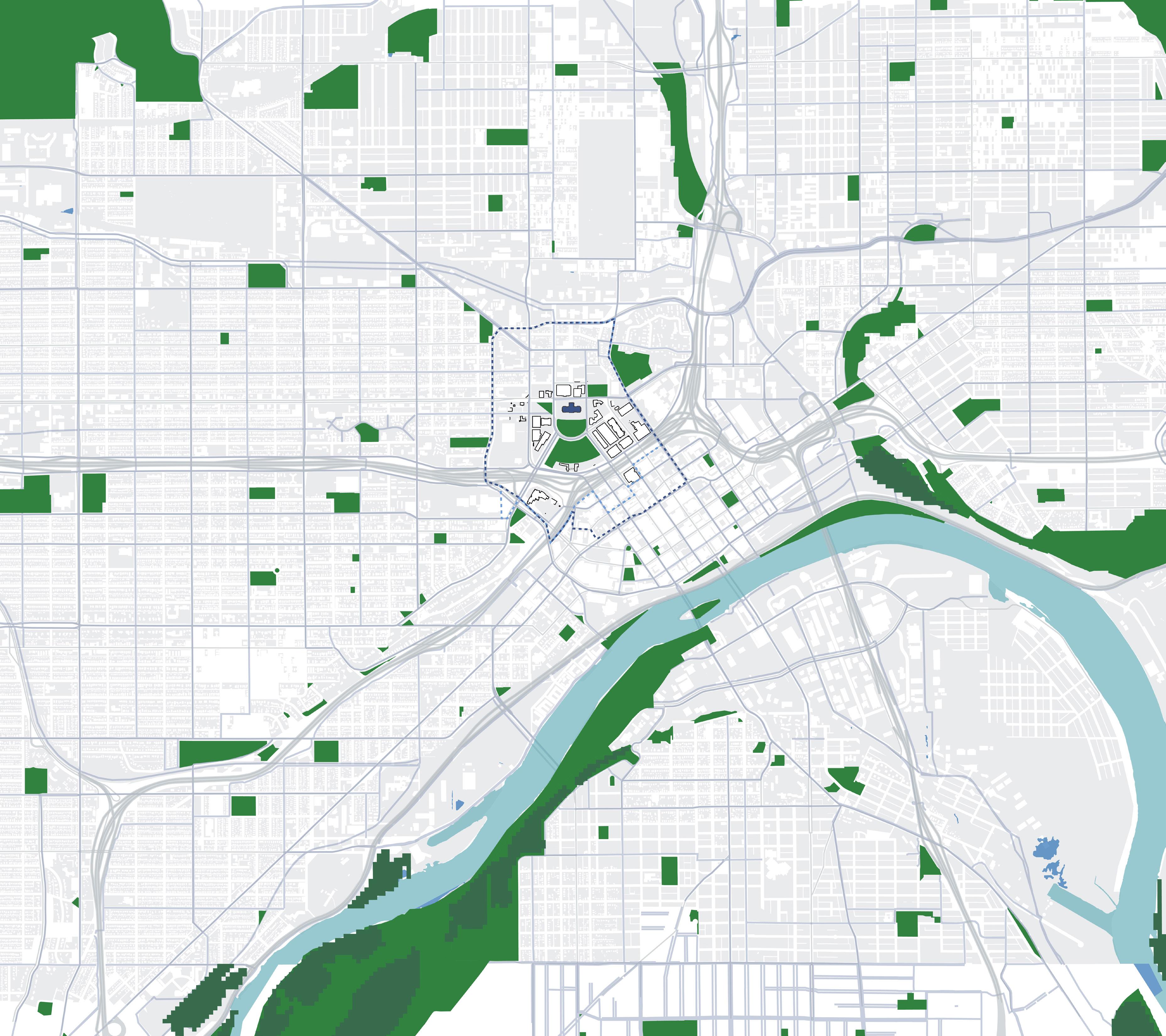
CAAPB
Tennis
Basketball
Horseshoe
Park Indoor Gym Pools Dog Area 10-min walking distance
Courts
Courts
Courts Skate
Figure 120: City-wide Recreation
Saint Paul Parks
2010.
Linwood Rec Center St. Clair Rec Center Palace Rec Center Edgcumbe Rec Center Dunning Rec Center Martin Luther King Rec Center West Minnehaha Rec Center Scheffer Rec Center Rice Rec Center Carty Park Como Reg Park Front Skate Park Arlington Arkwright Park Arlington Rec Center Duluth and Case Rec Center Dayton’s Buff Rec Center
Mounds Reg Park Central Village Park Webster Park NORTHERN DAKOTA COUNTY DOWNTOWN SAINT PAUL STATE CAPITOL FROGTOWN MINNEAPOLIS SUMMIT UNIVERSITY SUMMIT HILL PAYNEPHALEN DAYTON’S BLUFF AIRPORT I-35E I-35E I-94 52 10 N 0’ 2000’ 1000’ 500’ LEGEND MississippiRiver (Haháwakpa)
Indian
100 101 Capitol Mall Design Framework Inventory + Analysis
ACTIVATE NETWORK OF ACTIVE OPEN SPACES DRAFT
NEIGHBORHOOD
RESIDENTIAL DEMOGRAPHICS
A CAPITOL SURROUNDED BY DIVERSITY
The Capitol Campus has historically had many diverse neighbors and this is still true today, despite the disenfranchisement and forced relocation many faced in the last century. Most notably, the neighborhoods to the north, east and west of the Capitol include significant communities of color, as opposed to those Downtown and to the southwest with communities that are predominantly white. Recent engagement data reveals people of color use the Capitol Mall far less than those who identify as white, despite living in such close proximity. The Capitol Campus has the opportunity and responsibility to provide a backyard or prime gathering space for these diverse communities. Additionally, the neighborhoods to the north of the State Capitol contain many families; future programming should reflect this.
*This analysis does not show unhoused demographics, which are constantly changing.
DRAFT
CAAPB Boundary
0.9% Total Native American LEGEND
0.03% Total Hawaiian Pac Islander
0.5% Total Some Other Race
Total Hispanic
Total Asian Non-Hispanic
Total Black Non-Hispanic
Total White Non-Hispanic
Figure 121: Neighborhood Demographics
Source: Minnesota Geospatial Commons. gisdata.mn.gov/dataset.
Source: Ramsey County Map Ramsey. maps.co.ramsey.mn.us/mapramsey/.
Source: Ramsey County Maps and Surveys. www.ramseycounty.us/residents/property/maps-surveys.
Source: Saint Paul Minnesota. information.stpaul.gov/search.
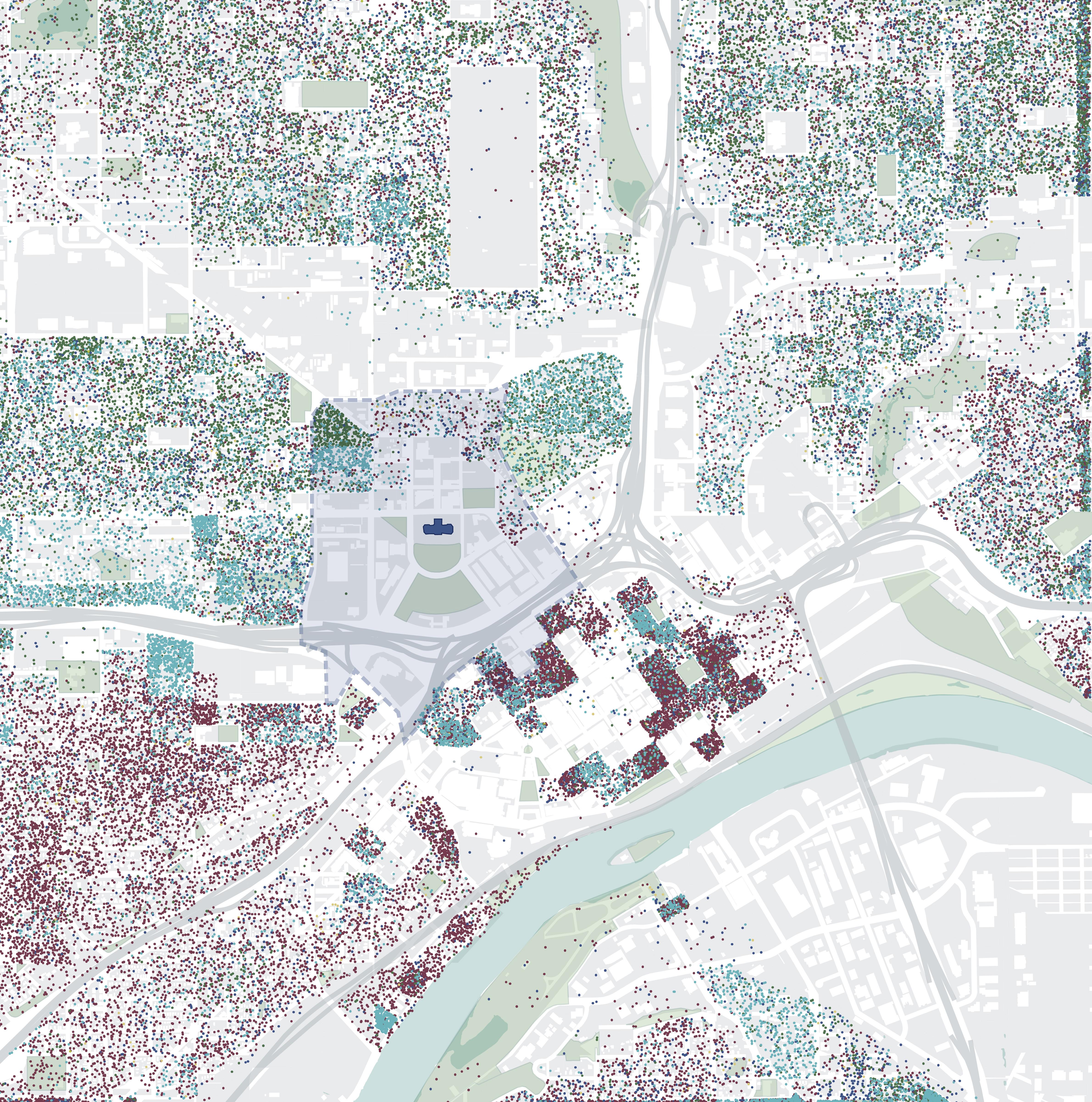
9.8%
21.5%
25.1%
42%
N 0’ 500’ 250’ 125’
STATE
CAPITOL
DOWNTOWN SAINT PAUL
RIVERVIEW
IRVINE PARK
CATHEDRAL HILL
DAYTON’S BLUFF SOUTH FROGTOWN SOUTH OF MARYLAND
PAYNE PHALEN
MT. AIRY MississippiRiver(Haháwakpa)
102 103 Capitol Mall Design Framework Inventory + Analysis I-94 I-35E
ACTIVATE
MISSING NEARBY AMENITIES
DISTRICTS, DESTINATIONS AND PROGRAM
The Capitol Mall is bounded by government office and institutional buildings that only operate during business hours and provide very few daily life amenities. Within the larger Capitol Area exists some retail and commercial uses, places of worship, civic buildings and residential buildings (both single-family and multifamily residences), along with many vacant structures and lots. The closest hubs for food and entertainment exist in both Downtown and University Avenue, west of Rice Street. For many working or visiting the Capitol Mall, finding food options, even a simple coffee shop, is difficult. Therefore, it is critical for the Design Framework to strategically utilize the many vacant spaces around the Capitol Campus to not only provide these resources but create an active and lively built environment.
*The 2040 Comprehensive Plan for the City of Saint Paul defines ACP50 as areas of concentrated poverty with over 50% people of color. The Capitol Campus is located within an ACP50.
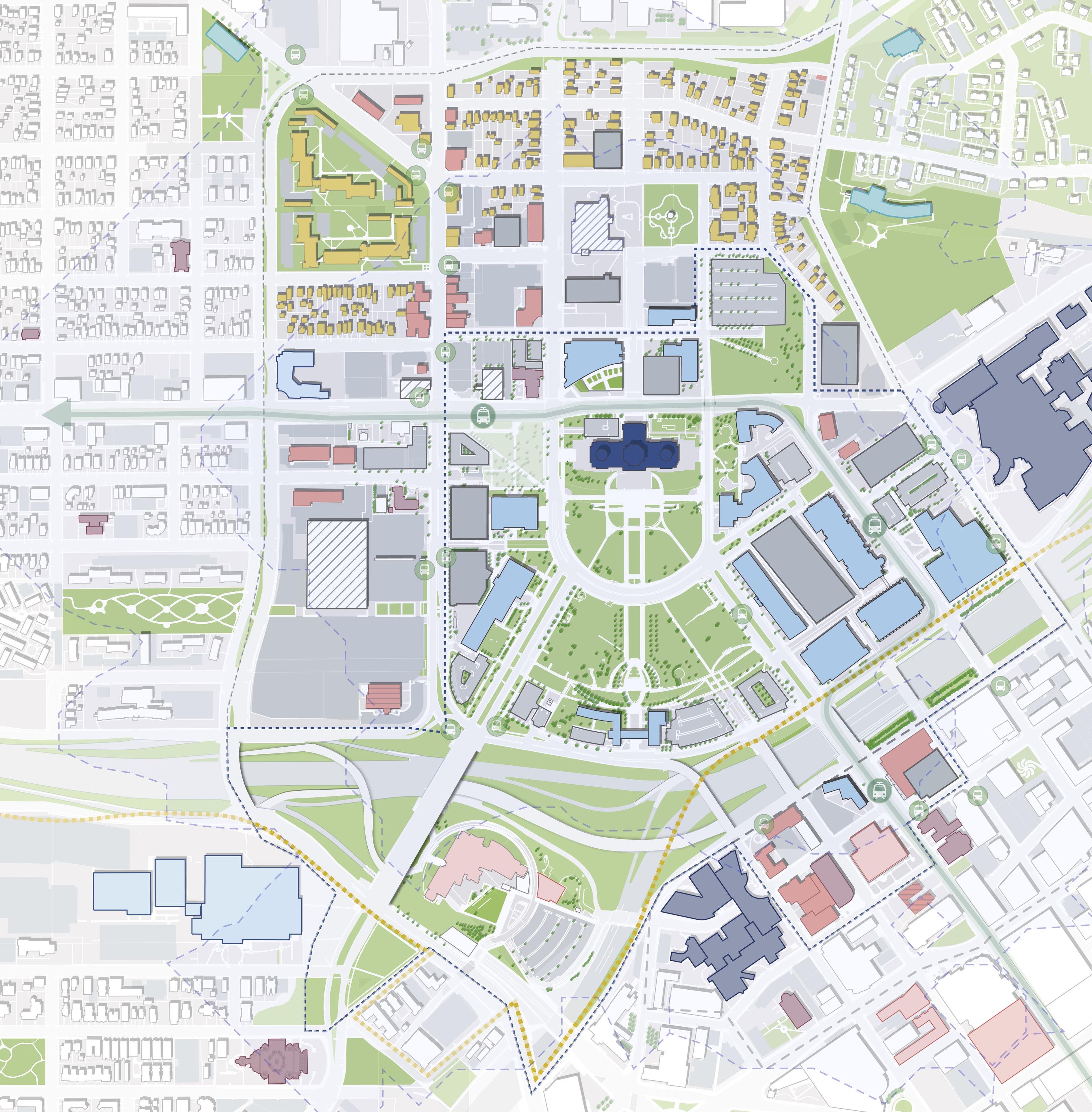
Mall CAAPB Boundary MN Capitol Complex *ACP50 10 and 15 Minute Isochrones / Walksheds Parks / Open Space Building Use State Capitol Government Office Buildings Retail / Commercial Hotel Civic Residential Places Of Worship Hospitals Educational Community Centers Known Vacant Buildings Parking Garage Figure 122: Capitol Area Amenities Source: Saint Paul for All 2040 Comprehensive Plan City of Saint Paul, Nov 2020. Cass Gilbert Memorial Park SOUTH
CAPITOL HEIGHTS MT. AIRY
DISTRICT MN CAPITOL CAMPUS HISTORIC HILL DISTRICT DOWNTOWN SAINT PAUL FITZGERALD PARK VALLEY PARK MN STATE CAPITOL MALL WESTERN SCULPTURE PARK 15 min walk from Capitol Building south steps 10 min walk from Capitol Building south steps Frogtown Community Center Boys & Girls Club University Ave W Aurora Ave St Anthony Ave Como Ave W Pennsylvania Ave Park St Cedar St Rice St John Ireland Blvd CedarSt JacksonSt UniversityAveE E12thSt 10thStERobertSt FortRd N 0’ 500’ 250’ 125’ I-94 I-35E P P P P P P P P P + + LEGEND
FROGTOWN COMMERCIAL STREET
CAPITOL RICE
104 105 Capitol Mall Design Framework Inventory + Analysis
ACTIVATE
DRAFT
CAPITOL MALL PROGRAMMING
Programming in and around the Capitol Mall lacks both diversity and specificity. Much of the Upper and Lower Malls include lawns for large events (despite being quite steep), and contemplative spaces with commemorative artworks for people to meander. When large events are not happening, the Upper and Lower Malls are often vacant, and no specific programming considers how different types of people use public space. This condition is exacerbated by the overwhelming number of adjacent building facades that are not active (i.e., solid walls and/or parking garages). Furthermore, there is very little relationship between these facades—even the active ones—and the landscape just outside them.
Capitol Campus
*Programmatic “Rooms”
Large lawn (>30,000SF)
Small lawn
Promenade / Steps
Contemplative
Building / Street Buffer
Other
Permitted Event Spaces
Sculptures, Monuments, & Memorials
Bench / Seat Areas
Public Building Entrance
Building Public Access
Private, Closed to Public
Semi-Public, Business Hrs (By Appointment Only)
Semi-Public, Business Hrs (Capitol Building open Saturdays)
Public, Cafe, Business Hrs
Ground Floor Building Frontage
Active (Entrances)
Office/Institutional (Windows)
Inactive (Solid Wall, Parking Garage)
*Programmatic “Rooms”refer to spaces that feel distinct with obvious edges like walkways, roadways and/or landscaping.
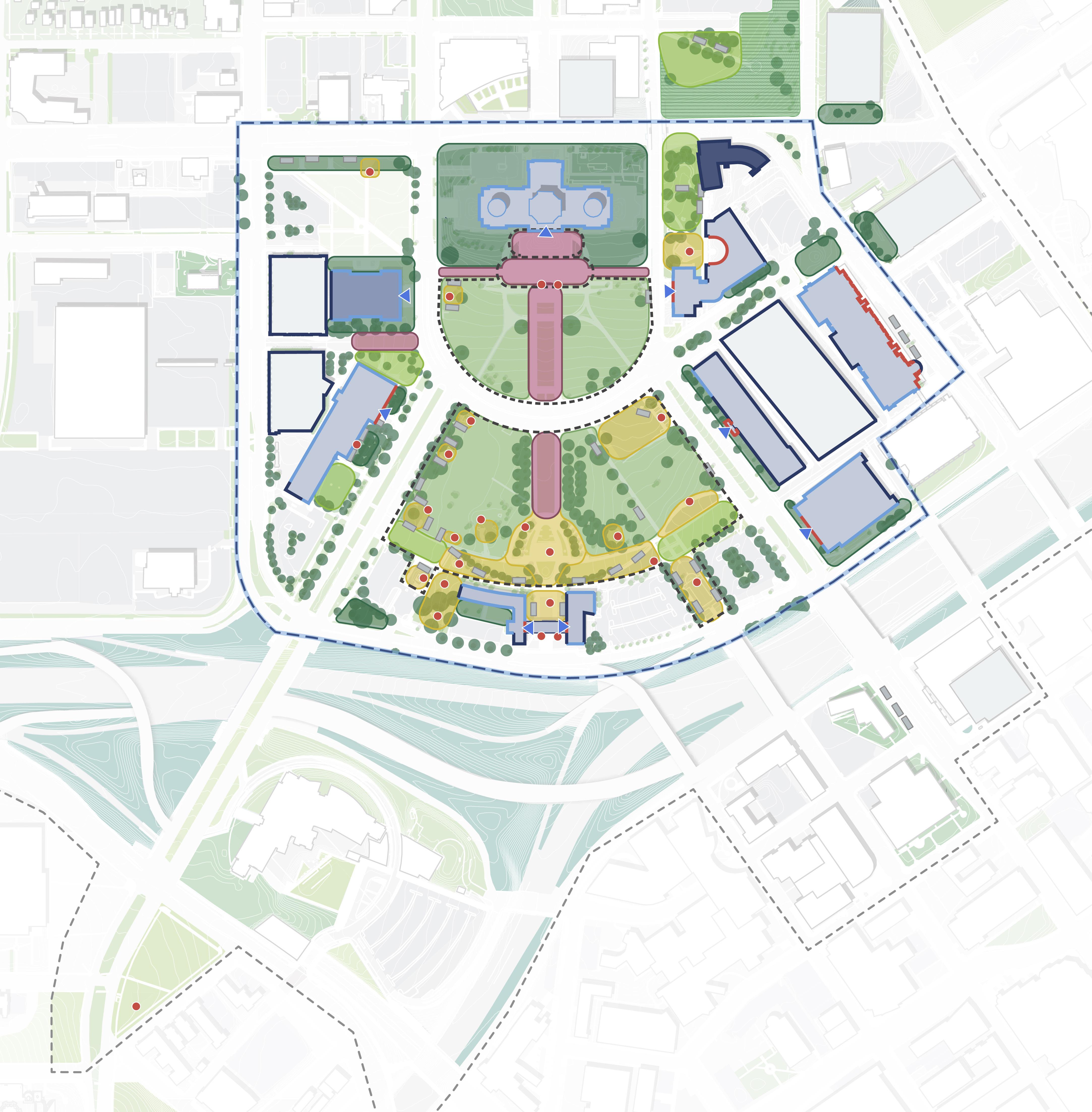
I-94 University Ave W Aurora Ave St Anthony Ave Park St Rice St John Ireland Blvd Cedar St E12thSt RobertSt I-35E Rev Dr MLK JrBlvd SaintPeterSt WabashaSt CedarSt N 0’ 200’ 100’ 50’
CAAPBBoundary
Cass Gilbert Memorial Park Upper Capitol Mall Lower Capitol Mall S. Steps Promenade Steep grade Events Walking Protesting Food Trucks Enjoying Nature DOWNTOWN SAINT PAUL P P P P
I-94
LEGEND
106 107 Capitol Mall Design Framework Inventory + Analysis
ACTIVATE
OPPORTUNITIES DRAFT
SLOPE AND FUTURE PROGRAMMING
While the Capitol Mall ‘s topography was the impetus of its original siting in the early 20th century, its steepness makes it difficult to host many open space programming typologies. The Upper Mall, which exceeds slopes normally recommended for both ADA accessibility and most open space programming, is the most frequently used gathering space for large events. Portions of the Lower Mall, especially along Cedar Street, also exceed these limits. Other spaces like Cass Gilbert Memorial Park have entire sections that are essentially inaccessible to anyone, given slopes of greater than 20%. These conditions necessitate strategies to adjust slope throughout the Capitol Campus to make spaces more accessible to a wider range of people while still celebrating the original topography that made the Capitol Campus grand.
Potential / suitable programs for the existing slope percentages
for
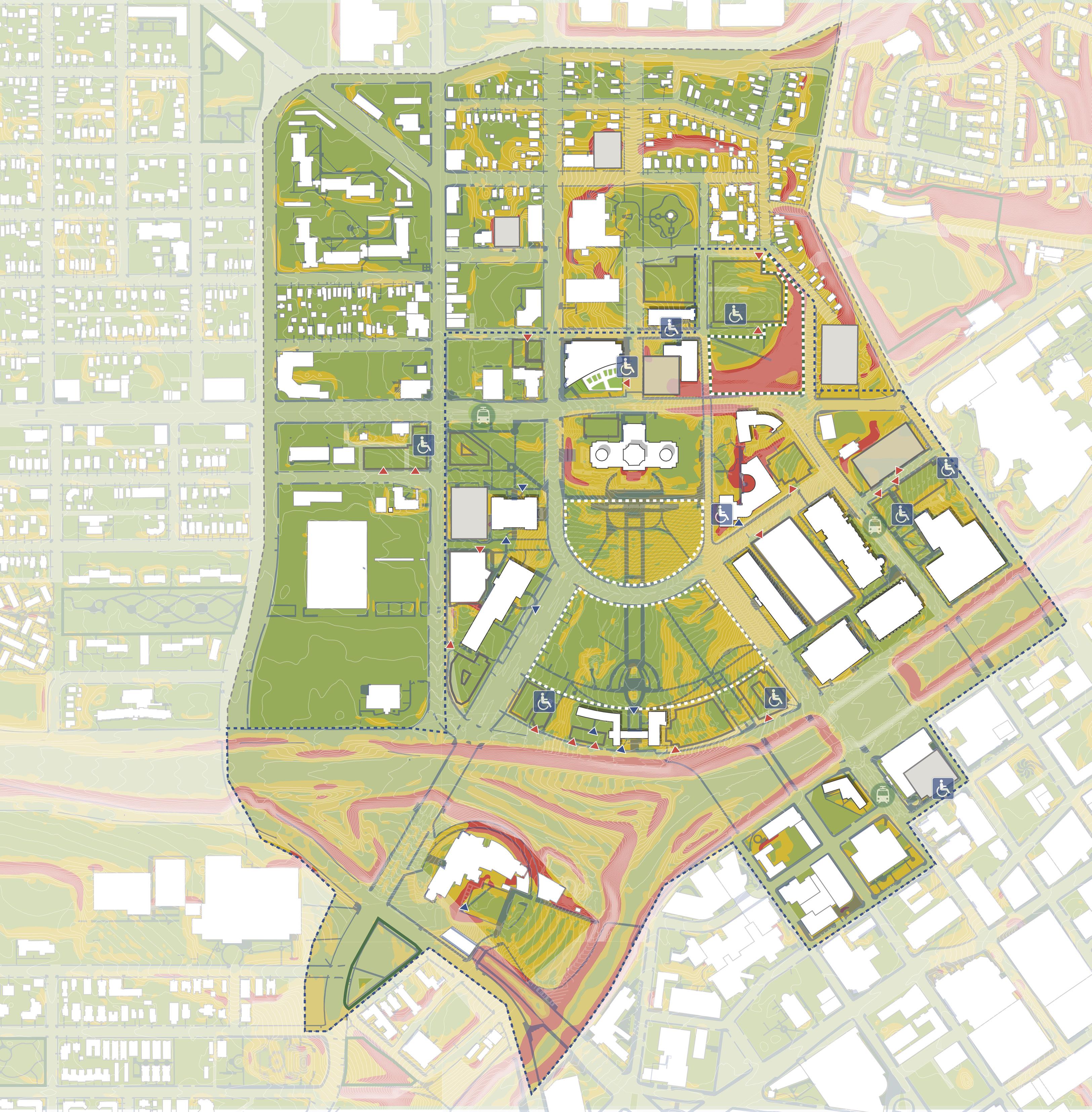
0 - 5% 5 - 20% Greater than 20% Biking Play Gardens Art Plaza Event Space Play Nature Trails Dog Park Amphitheater Terracing Walk/Run
CAAPB Boundary Campus Boundary 5 - 20% 5 - 10% 0 - 5% +10% +20% 5 - 10% 5 - 10% UPPER CAPITOL MALL 22,000 SF INFORMAL SETTING - 3,666 PEOPLE FORMAL SETTING - 2,200 PEOPLE CASS GILBERT MEMORIAL PARK 4,300 SF (NOT INCLUDING AREA OF STEEP SLOPE) INFORMAL SETTING - 700 PEOPLE FORMAL SETTING - 430 PEOPLE LOWER CAPITOL MALL 44,000 SF INFORMAL SETTING - 7,333 PEOPLE FORMAL SETTING - 4,400 PEOPLE 11.800 SF University Ave W Aurora Ave St Anthony Ave Como Ave W Pennsylvania Ave Park St Cedar St Rice St John Ireland Blvd CedarSt JacksonSt E12thSt 10thStERobertSt FortRd I-94 I-35E N 0’ 500’ 250’ 125’ P P P P P P P P P P P P P P P
can be
ADA access. LEGEND
Slopes greater than 5%
a challenge
108 109 Capitol Mall Design Framework Inventory + Analysis
ACTIVATE DRAFT
SECURITY AND PUBLIC ASSEMBLY
Given its prominence as both the home of state government and primary place for the public exercise of first amendment rights, the Capitol Campus must seamlessly balance security and public assembly. However, stakeholder and community engagement throughout the Design Framework process revealed several safety concerns (some related to public assembly and some not) that must be addressed. Most notably, vehicular threats in the Upper and Lower Malls are of high concern as there are no physical barriers along Rev. Dr. Martin Luther King, Jr. Boulevard to prevent vehicles from driving into gatherings of people. In many places around the country, including other Capitols, low walls have been used as an unobtrusive way to prevent this conflict. Additionally, the larger community noted the LRT Green-Line Stations at University and Rice as well as Robert Street and East 14th Street were places where they felt most unsafe around the Capitol Campus. Other areas, especially vacant lots near the Capitol, also contribute to people feeling unsafe. When people gather and protest, Capitol Security must be able to clearly see and monitor the situation, which is a requirement to consider when locating new trees and dense plantings.
Capitol Campus
Permitted Event & Allocated Protest
Spaces, High-Visibility Zones
Allocated Counter-Protest Space
Critical Security Zones / Areas
in Need of Immediate Security Upgrades
Building Entrances
Vehicular Entries to Mall
Parking Garages (inactive facades)
Barriers (Fencing, Bollards, Retaining Walls, etc.)
Large Vacant Lots
LRT Green Line and Stops
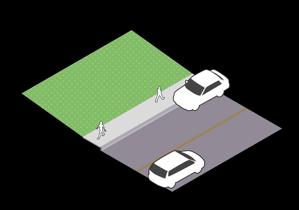
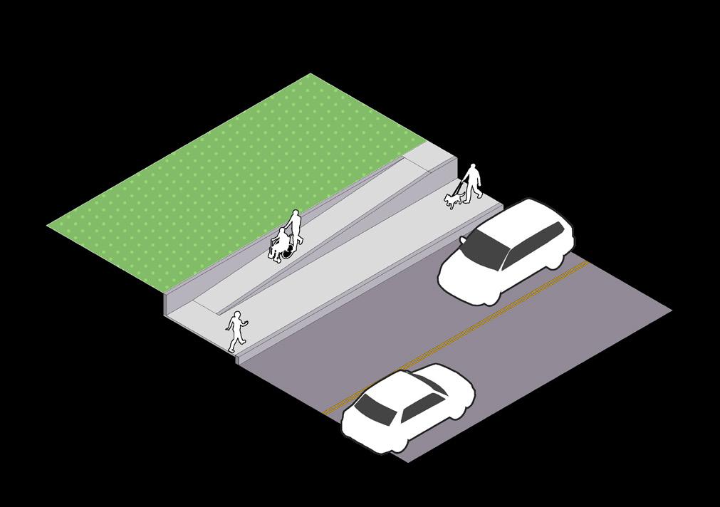
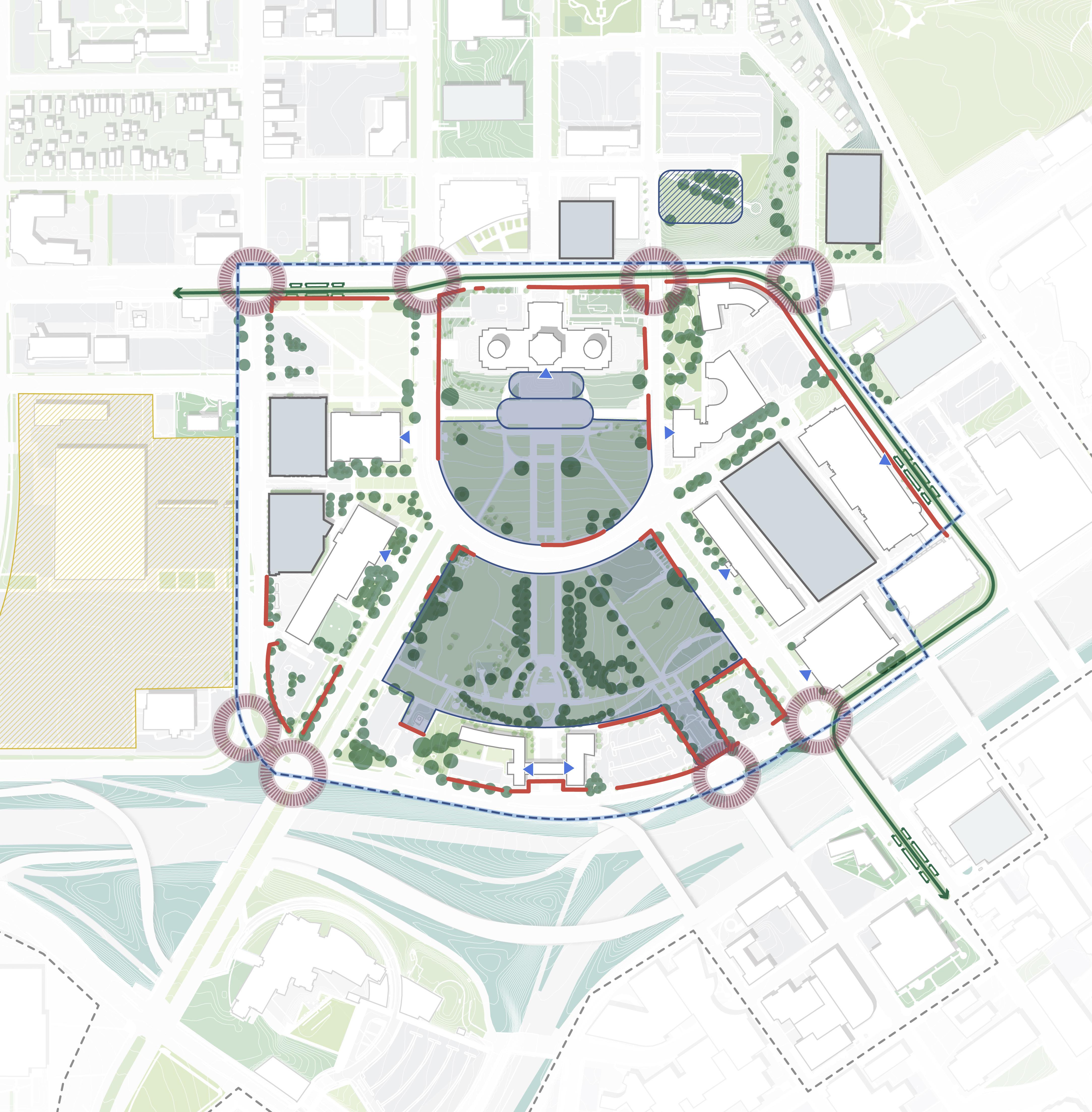
MinimalVehicular SafetyBarriers
I-94 University Ave W Aurora Ave St Anthony Ave Park St Rice St John Ireland Blvd E12thSt RobertSt
SaintPeterSt WabashaSt CedarSt I-35E N 0’ 200’ 100’ 50’
CAAPBBoundary Cass Gilbert Memorial Park Upper Capitol Mall Lower Capitol Mall S. Steps Promenade Protesting ALL PROTESTING & COUNTERPROTESTING SITES REQUIRE HIGH VISIBILITY Marching Marching Protesting Marching Marching MARCHES TRAVERSE ALL STREETS WITHIN CAPITOL MALL, & TYPICALLY TERMINATE AT THE CAPITOL BUILDING. DOWNTOWN SAINT PAUL EXISTINGCONDITION OPPORTUNITY STEEPSLOPE REDUCEDSLOPE NO BARRIER BARRIER + ADA ACCESS P P P P P LEGEND
110 111 Capitol Mall Design Framework Inventory + Analysis
ACTIVATE DRAFT
SECURITY TYPOLOGIES
VARIED AND DISPARATE STRATEGIES
Various physical security measures already exist around the Capitol Campus. They include, but are not limited to, the following:
RATED WALLS
Rated walls include a number of systems that can withstand a vehicular crash—like knee walls, retaining walls, seating walls and planter systems—located at linear boundaries. They can also take the form of stairs like those that lead up to the Capitol Building.
RATED REMOVABLE BOLLARDS
Rated removable bollards are short, sturdy, vertical posts that can withstand a vehicular crash, which are installed at places where pedestrian through-traffic is desired. They can be removed when needed. Examples of this include the east and west entries to Aurora Promenade just south of the Capitol Building.
RATED PERMANENT BOLLARDS
Rated permanent bollards are similar to removable bollards with the exception that they cannot be easily removed. They are often permanent fixtures, like those in front of the Veterans Services Building.
TEMPORARY BARRIERS
Temporary barriers include fencing and other easily moved devices that deter both people and vehicles from entering or passing through certain locations. They are often not crash rated.
RATED CABLE SYSTEM
Rated cable systems include low permanent fencing that is crash rated and more aesthetically pleasing than temporary fencing. Examples of this include the rated cable system surrounding the various surface parking lots adjacent to the Veterans Services Building along Saint Anthony’s Street and East 12th Street.
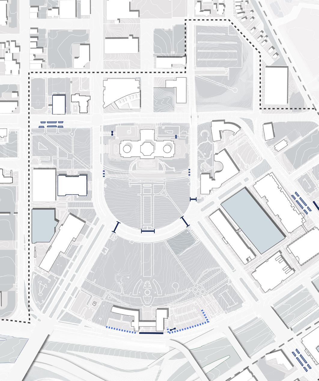
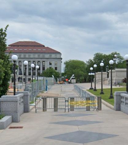
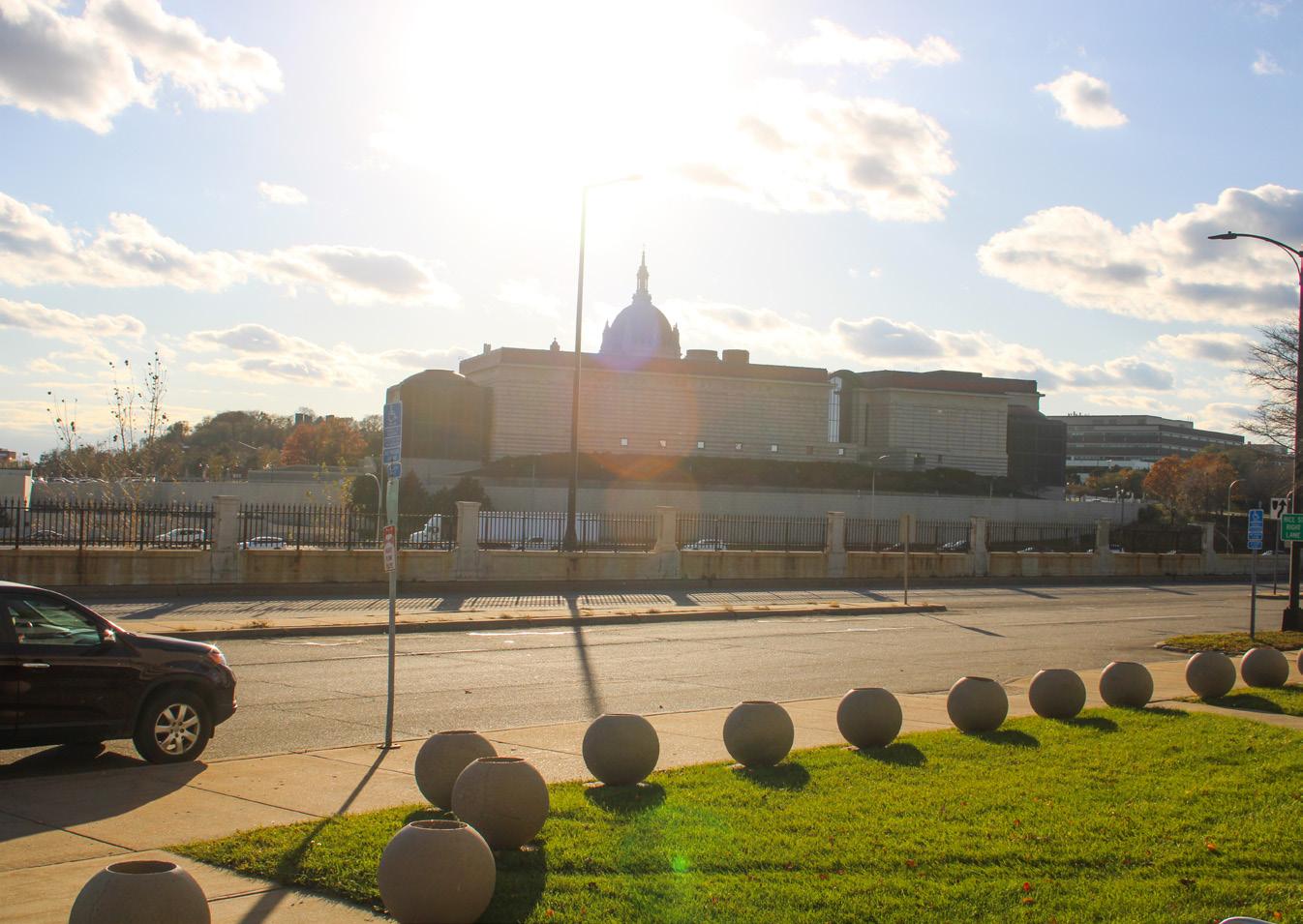
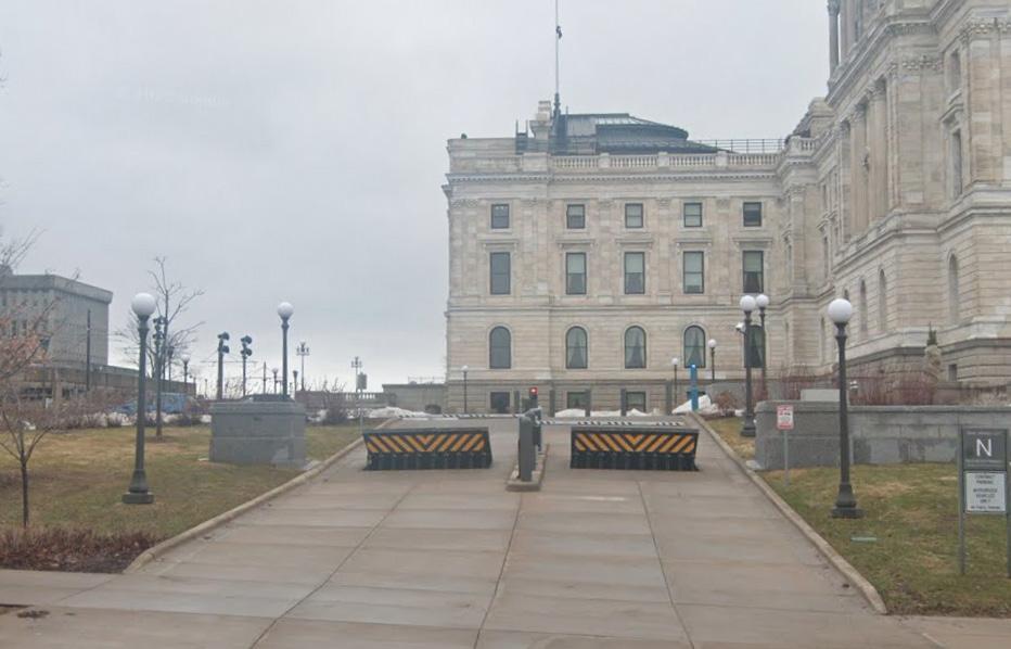
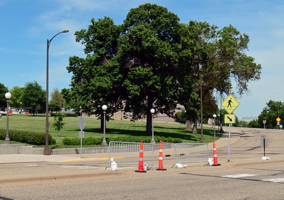
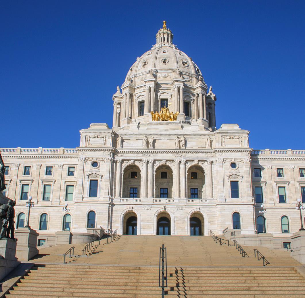
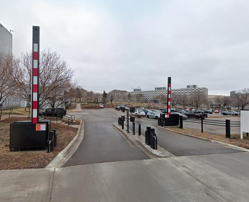
Figure 123: Capitol Building Stairs
Figure 124: Bollards at Aurora Promenade
Figure 125: Parking at University Ave W and Park St
Figure 127: Cable System
W
Figure 126: Parking entry near Veterans Service Building
along
12th St
Blvd Figure 129: Bollards at Veterans Service Building
Cable System
Removable Bollards Rated Permanent Bollards Rated Gates Temporary Barriers LEGEND 1 2 2 4 3 5 6 7 1 3 4 5 6 7
Figure 128: Temporary Barriers at Rev. Dr. Martin Luther King, Jr.
Rated
Rated
112 113 Capitol Mall Design Framework Inventory + Analysis
ACTIVATE Source: Damon Farber. Capitol Building Stairs. Jan 2024.
Google Maps, www.google.com/maps/. Accessed Apr. 2024. Source: Google Maps, www.google.com/maps/. Accessed Jan. 2024. Source: Google Maps, www.google.com/maps/. Accessed Jan. 2024. Source: Google Maps, www.google.com/maps/. Source: Google Maps, www.google.com/maps/. Accessed Apr. 2024.
Source:
Source: Damon Farber. Bollards at Veterans Service Building. Jan 2024.
DRAFT
OPPORTUNITIES AND CHALLENGES
OVERARCHING OPPORTUNITIES AND/OR CHALLENGES
TO GUIDE PRINCIPLE DESIGN FRAMEWORK STRATEGIES
MOVING FORWARD INCLUDE THE FOLLOWING:
O Minimal landscape to adjacent building use relationship
O Ensuring the Capitol Mall is welcoming to all
O Limited everyday amenities for capitol users and neighbors
O Balancing security And public assembly
PRINCIPLE STRATEGIES
Moving forward from the 2040 Comprehensive Plan
CREATE OUTDOOR SPACES THAT RESPOND TO AND COMPLEMENT EXISTING AND FUTURE BUILDING USES
DESIGN FOR THE DAY-TODAY AS WELL AS WEEKLY, MONTHLY, AND SPECIAL EVENTS
ALIGN SECURITY PRACTICES AND TECHNIQUES WITH DESIRED PHYSICAL DESIGN ATTRIBUTES
DESIGN INCLUSIVE SPACES WITH DIVERSE PROGRAMMING TO ACCOMMODATE VARIOUS LIFESTYLES
114 115 Capitol Mall Design Framework Inventory + Analysis ACTIVATE
DRAFT
PRINCIPLE STRATEGY ACTIVATE PRINCIPLE STRATEGY
CREATE OUTDOOR SPACES THAT RESPOND TO AND COMPLEMENT EXISTING AND FUTURE BUILDING USES
STRATEGIES
O Coordinate with ongoing and future site developments to ensure optimal connectivity and access to the Capitol Mall, to maintain historic site features (like viewsheds), and more
O Utilize strategic planting and other landscape features to emphasize building entrances and aid in wayfinding or place recognition
O Utilize the landscape as an educational opportunity, especially in historic storytelling
O Provide adjacent outdoor dining and working opportunities for government staff on campus
O Create landscape and streetscape conditions that accommodate active building frontage, and create multiple active hubs for small scale gatherings within a 5- to 10-minute walk
O Diversify the landscape programs across the campus
DESIGN FOR THE DAY-TO-DAY AS WELL AS WEEKLY, MONTHLY, AND SPECIAL EVENTS
STRATEGIES
O Design civic spaces of varying sizes that accommodate both active and passive uses
O Provide easy access to and from the site in the form of diverse mobility options, e.g., transit stops, bike lanes, complete sidewalks, crosswalks, pedestrian signals and affordable parking opportunities in close proximity to the site
DRAFT
O Implement planting strategies that accommodate diverse programming needs, designing spaces for human comfort
O Ensure the site’s infrastructure can accommodate large groups of people
O Provide access and eliminate barriers to everyday amenities like clean and secure toilet facilities
O Promote daily life amenities for government workers and nearby communities that operate beyond the hours of 9 a.m. to 5 p.m.
 Source: Sasaki. Moore Square, Sasaki, https://www.sasaki.com/projects/moore-square/.
Source: G. Lyon Photography, Inc. Texas Capitol Mall. Coleman Associates. https://www.colemanandassoc.com/projects/texas-capitolcomplex-mall-and-garage.
Figure 130: Moore Square
Figure 131: Texas Capitol Mall
Source: Sasaki. Moore Square, Sasaki, https://www.sasaki.com/projects/moore-square/.
Source: G. Lyon Photography, Inc. Texas Capitol Mall. Coleman Associates. https://www.colemanandassoc.com/projects/texas-capitolcomplex-mall-and-garage.
Figure 130: Moore Square
Figure 131: Texas Capitol Mall
116 117 Capitol Mall Design Framework Inventory + Analysis
ACTIVATE
ALIGN SECURITY PRACTICES AND TECHNIQUES WITH DESIRED PHYSICAL DESIGN ATTRIBUTES
O Provide ample lighting within the site and along access routes to and from supporting site services and amenities
O Provide clear, well-kept paths and sightlines that are not obstructed by low-canopy trees, overgrown or dense vegetation, changes in elevation, and other obstructions
O Eliminate or mediate sites of operational security threats, as well as all non-spaces
O Promote programming and building uses that operate throughout the day, including evening hours
O Design gathering spaces with operational security in mind
O Design landscape and infrastructure to prevent vehicular access on lawns
O Implement security design features that mitigate crime at LRT stations
O Design programmatic rooms (i.e., landscape zones separated by plantings, trees, etc.) to separate protesters from counter-protesters. Create space for easy flow control to reduce the complexity for events management
DESIGN INCLUSIVE SPACES WITH DIVERSE PROGRAMMING TO ACCOMMODATE VARIOUS LIFESTYLES
O Highlight and celebrate the presence of diverse populations, both in true form and representation
O Recognize and celebrate Indigenous Americans as well as Black, immigrant, and LGBTQ+ communities
DRAFT
O Connect to and engage nearby communities of color, and explore programming partnerships with local community groups
O Provide provisions for young children and the elderly
O Ensure all site features are specified with diverse populations in mind, i.e., furniture that is ergonomic for various bodies and ADA accessible
O Develop a branding strategy that is forward-looking, and that creates awareness and builds trust
O Incorporate wayfinding and easy-to-read signage that is ADA accessible, with , gender-inclusive graphics, and language translation
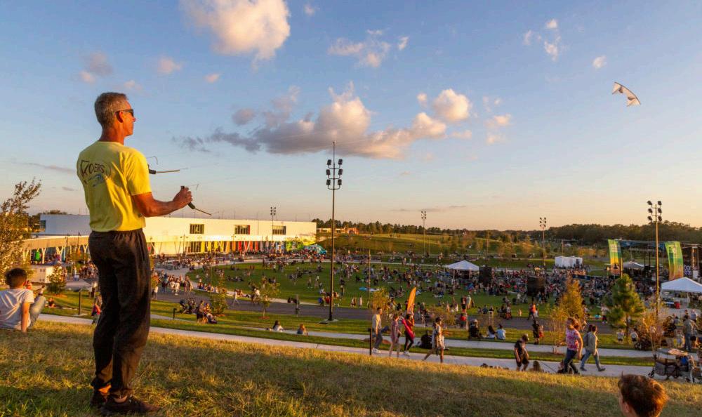 Figure 132: Texas Capitol Mall Closeup
STRATEGIES STRATEGIES Source: Sasaki. Bonnet Springs Park, Sasaki, https://www.sasaki.com/projects/bonnet-springs-park/. Source: Sylvie, Jonathan. Texas Capitol Mall Closeup. University of Texas, https://soa.utexas.edu/news/architecture-team-sport.
Figure 133: Bonnet Springs Park
ACTIVATE PRINCIPLE STRATEGY ACTIVATE PRINCIPLE STRATEGY 118 119 Capitol Mall Design Framework Inventory + Analysis
GROW
O Minnesota’s Ecosystems
O Sits on the Mississippi Flyway
O Ecosystem Heritage
O Landscape Typologies
O Capitol Area Tree Canopy
O Thermal Comfort
O Stormwater Systems
O Existing Campus Maintenance
O Opportunities and Challenges
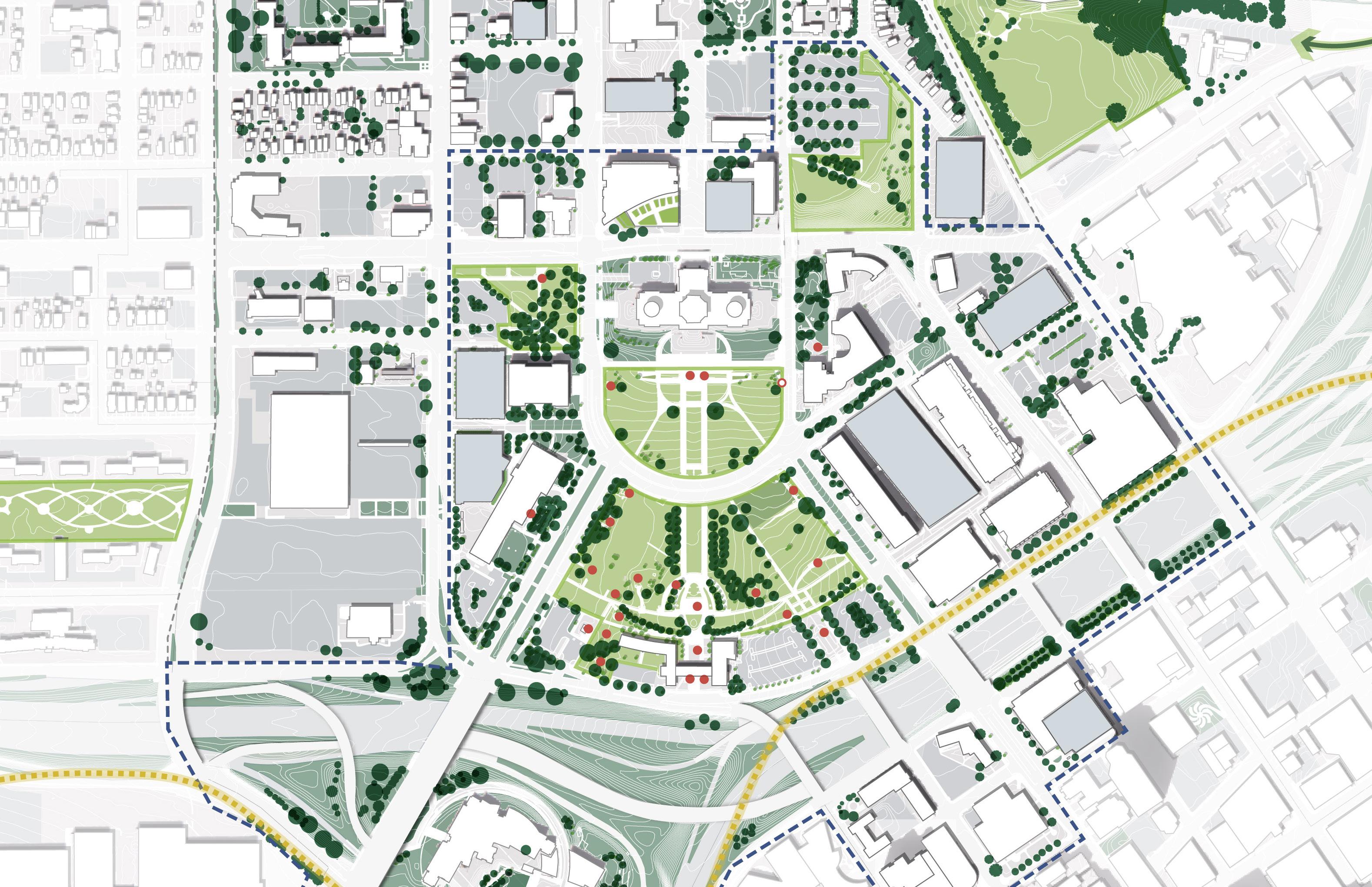
DRAFT
The Capitol Mall will steward its landscape with sustainable maintenance practices. The cultivation of a diverse and resilient ecosystem will enable this important area of Saint Paul to adapt to a changing climate while preserving cultural heritage.
MINNESOTA’S ECOSYSTEMS
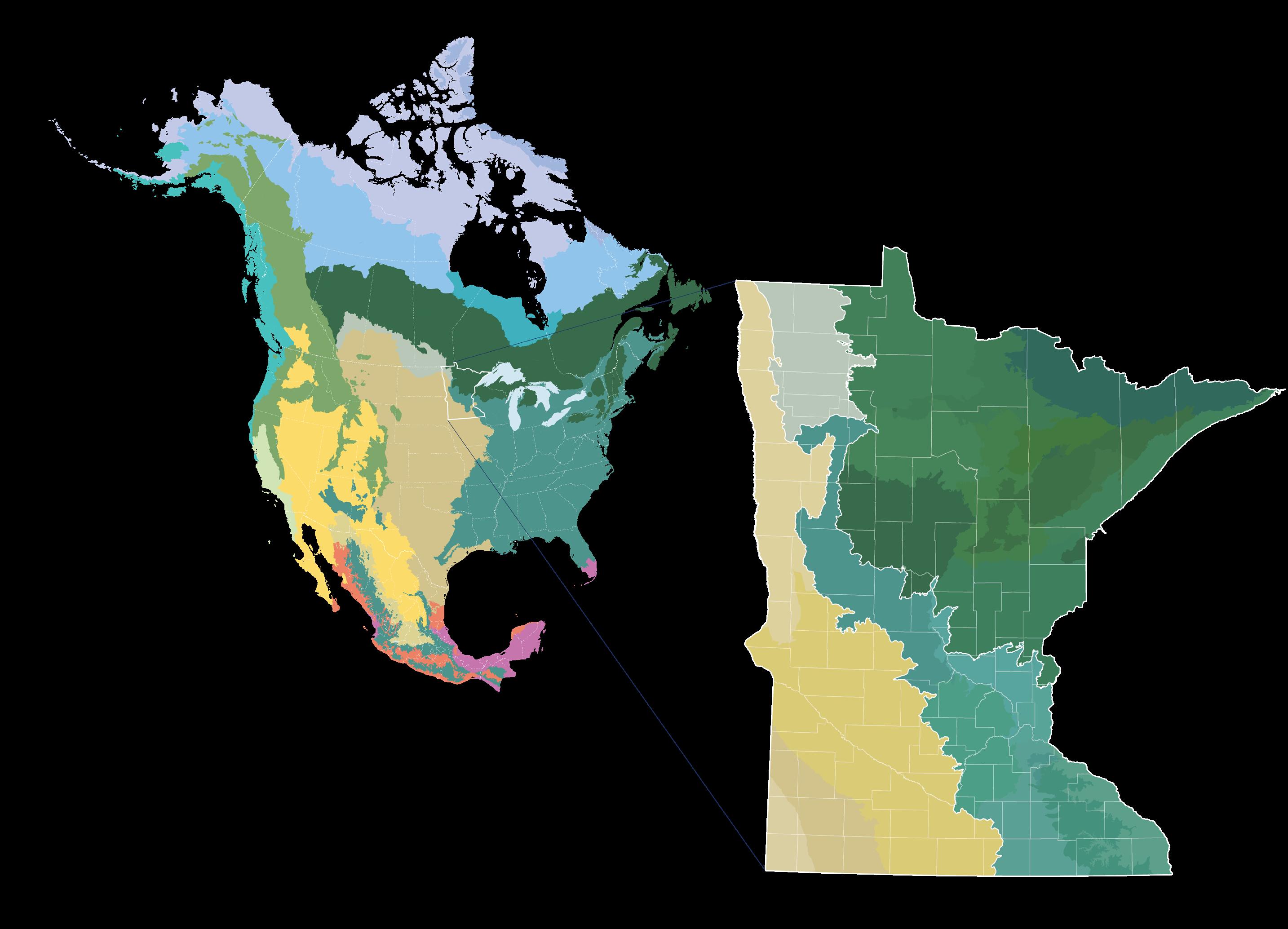
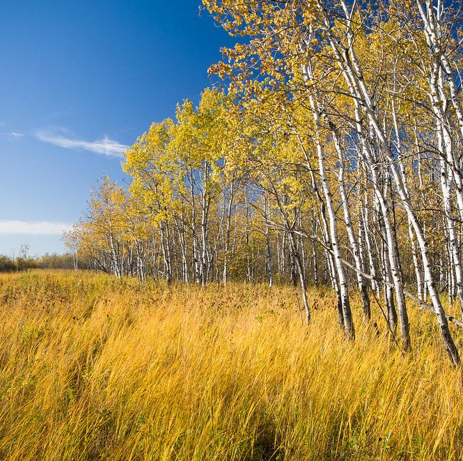
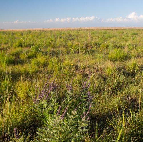
RISING TEMPERATURES
Minnesota will have warmer winters and nights, along with increased summer heat and longer dry spells. The warming temperatures will alter ecosystem productivity, exacerbating the spread of invasive species and changing how species interact with each other and with their environment. These changes are reconfiguring ecosystems in unprecedented ways.
SHIFTING LANDSCAPES
Today, Minnesota’s climate supports forests and trees. In 50 years, climate change could turn most of it to oak savannas, dominated not by trees, but grasslands. In fact, over 70% of the northern tree species have already shifted further northward.
MORE DAMAGING RAINS
Heavy rains are now more common in Minnesota and more intense than any recorded rain on record, and climate projections indicate extreme events—like flooding, drought and heat waves—will likely become more frequent and more intense. Minnesota is fortunate to lie at the center of four major North American ecological regions or biomes: aspen parkland, prairie grassland, deciduous forest, and coniferous forest.
134: Minnesota’s Ecosystems
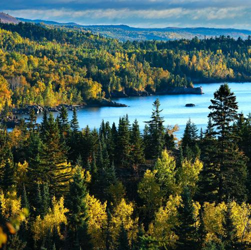
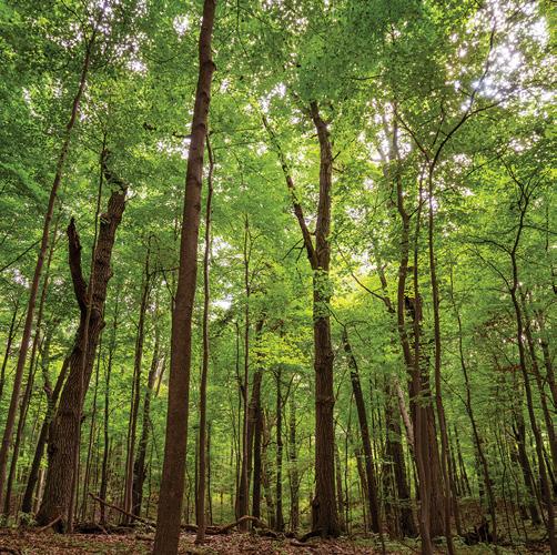

Without action, climate change will threaten the rich variety of plants in Minnesota. The Capitol Mall has the responsibility and opportunity to showcase the diverse natural heritage of Minnesota, and ensure that it can adapt to the changing climate.
Arctic Cordillera Tundra Taiga Hudson Plain Northern Forests Northwestern Forested Mountains Marine West Coast Forest Eastern Temperate Forests Great Plains North American Deserts Mediterranean California Southern Semi-arid Highlands Temperate Sierras Tropical Dry Forests Tropical Wet Forests 150Gt 10 20 30 40 4 8 12 18 Forest Savanna Savanna Forest Mix Days / year warmer than 90 °F C Comparison between today and 2080 SAINT PAUL Days / 100 years when daily rainfall exceeds 4 inches Comparison between today and projections for 2080 Current Biome zones Biome zones in 2070 50Gt 0 Greenhouse gas emissions up to the present No climate policies 4.1-4.8°C Current policies 2.7-3.1°C Pledges & targets 2.4°C ASPEN PARKLAND
TODAY FUTURE PRAIRIE GRASSLAND CONIFEROUS FOREST DECIDUOUS FOREST
Source: Climate Adaptation Partnership. “Minnesota CliMAT - Climate Mapping and Analysis Tool (CMIP6)“
Figure
GROW
DRAFT
SITUATED ON THE MISSISSIPPI FLYWAY

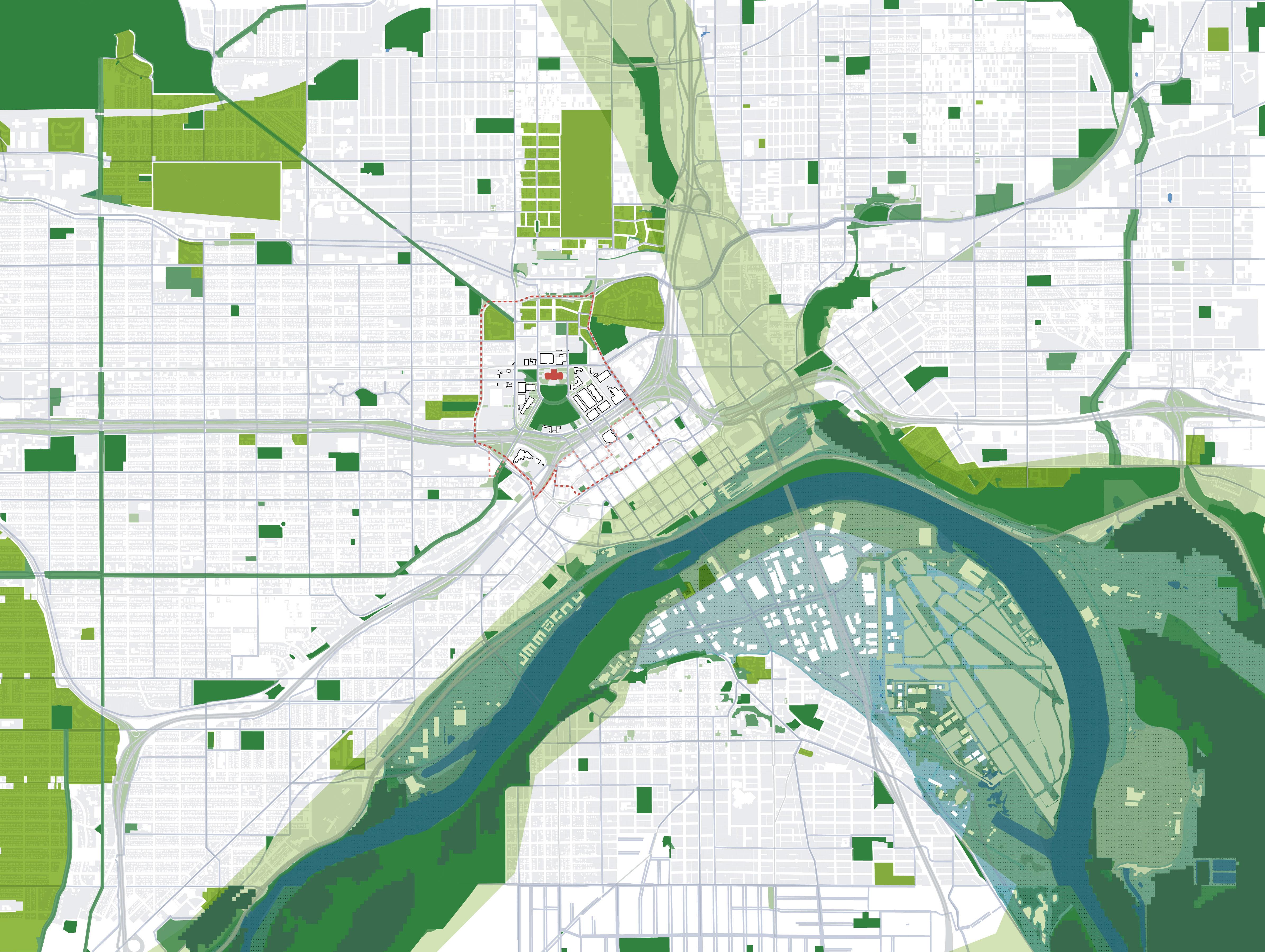
The Capitol is located along the Mississippi Flyway. This is the migratory corridor for 40% of North America’s waterfowl and shorebirds. According to Audubon MN’s Important Bird Areas (IBA), more than 126,000 birds used this corridor in fall 1997.
The Capitol Mall is one of the largest public green spaces near the Downtown area of Saint Paul. It sits at the intersection of the city and regional green corridors, which makes it critical for the biodiversity of the region and can provide culturally important ecological education.

The Capitol Mall is located on the Mississippi Flyway and a total of 234 bird species use this corridor for migration. With climate change, over half of Minnesota’s birds are at risk of severe decline. The new plan of the Capitol Mall should take action to meet this climate demand and preserve the local biodiversity.
and Green Corridors
Private Greenspace and Cemetery
Regional Ecological Corridors
Regional Significant Ecological Areas
Greenspace associated with City Infrastructure
100 year Floodplain
135: Mississippi Flyway Context Source: Audobon Minnesota. https://mn.audubon.org/.
Figure
N 0’ 2000’ 1000’ 500’ Parks
LEGEND
Lexington
Ave Green Corridor
Summit Ave Green Corridor
Parkway Como
MISSISSIPPI RIVER TWIN CITIES IMPORTANT BIRD AREA
REGIONAL ECOLOGICAL CORRIDORS
Macalester Groveland
Como Park Zoo and Conservatory South Como
South of Maryland
Saint Paul Downtown Airport
CAPITOL MississippiRiver MississippiRiver MISSISSIPPIFLYW YA
Swede Hollow Park
Forster’s Tern Sterna forsteri
DRAFT
ECOSYSTEM HERITAGE
Where the Capitol sits now was once a deciduous forest with prairie openings. Traces of bluffs, wetlands and creeks were found on locations of parking lots and buildings. Prior to colonization, Dakota people were living and using this site and its native plants for centuries.
Source: Minnesota Department of Natural Resources. www.dnr. state.mn.us/.
Source: Historic Context Report for the Minnesota State Capitol Planning & Context Development Project. 106 Group, June 2022. Figure 136: Ecosystem Heritage
Source: Tester, John R., et al. Minnesota’s Natural Heritage. 2021.


 Common yellowthroat
Brown belted bumble bee
Common yellowthroat
Brown belted bumble bee
Red
admiral Basswood
Indigo
Bitternut hickory
Scarlet tanager
bunting
Big
White-tailed deer
bluestem Western/Boreal chorus frog
Stiff sunflower
Red-eyed vireo
Virginia opossum Fox squirrel Prairie Phlox
Grey fox
Painted lady
Rusty patched bumblebee
Ruffed grouse
Quaking aspen
Basswood
Red-bellied woodpecker
Bur oak
Eastern screech owl
Sugar maple
Prairie Rose Eastern Cottonwood
Hackberry
Chokecherry
White Sage
Black Raspberry
Redosier dogwood
American elm
Tilia americana
Geothlypis trichas Bombus griseocollis
Vanessa
atalanta
Carya
cordiformis
Piranga olivacea
Passerina cyanea
Odocoileus virginianus
Andropogon gerardii
Pseudacris maculata
Helianthus pauciflorus
Vireo olivaceus
Didelphis virginiana Sciurus niger
Phlox pilosa
Geothlypis trichas
Vanessa cardui
Bombus affinis
Bonasa umbellus
Populus tremuloides
Tilia americana
Melanerpes carolinus
Quercus macrocarpa
Megascops asio
Acer saccharum
Rosa arkansana
Populus deltoides
Celtis occidentalis
Prunus virginiana Salvia apiana
Rubus occidentalis
Cornus sericea
MAPLE - BASSWOOD FOREST CAPITOL MALL AREA OAK - ASPEN FOREST OAK SAVANNA / MESIC PRAIRIE WETLAND / LOWLAND HARDWOOD TODAY PRESETTLEMENT
Ulmus americana
Selected species mentioned in DAKOTA ETHNOBOTANY
OBSERVED SPECIES ON SITE
FLORA
FAUNA
GROW DRAFT
LANDSCAPE
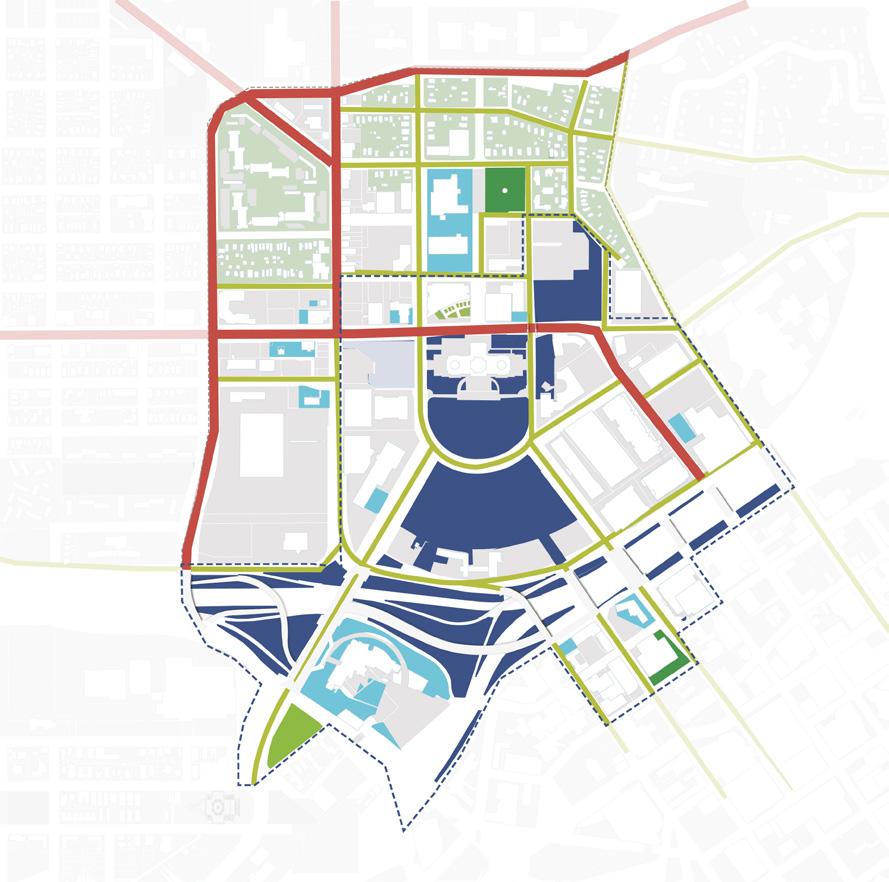
Source: Saint Paul for All 2040 Comprehensive Plan City of Saint Paul, Nov 2020. Figure 137: Landscape Typologies Formal
Commercial
Streetscape lawn
Residential lawn
Other
State
City
County owned ROW
Privately-owned public park
Commercial

As Minnesota’s Front Lawn, the Capitol Campus’s dominating landscape type is lawn with specimen trees, with some meadows and programmed landscape. The maintenance effort for public space and ROW is divided by landscape ownership.
lawn
and civic lawn
owned park and ROW
owned park and ROW
Meadow along steep slopes
in the vacant lot Meadow along highway -
Green River” I-94 University Ave W Aurora Ave St Anthony Ave Marion St Como Ave Winter St W Pennsylvania Ave Park St Cedar St Rice St John Ireland Blvd CedarSt JacksonSt UniversityAveE E12thSt I-35E WabashaStN RobertSt N 0’ 500’ 250’ 125’ Future Public Realm Improvements Future Public Realm Improvements Mobility Hub LAWN LANDSCAPE OWNERSHIP 16% 3% NATURAL LANDSCAPE PROGRAMMED LANDSCAPE Monumental landscape
/ institutional landscape Private Residential Landscape
Vegetation
“the
programmed landscape including pocket parks, sport fields and community gardens
80%+ LAWNS
Tree Canopy
128 129 Capitol Mall Design Framework Inventory + Analysis
GROW DRAFT
TYPOLOGIES
CAPITOL AREA
TREE CANOPY
More than 55 native species of trees are documented by CAAPB, including Basswood (Tilia americana), Norway maple (Acer platanoides), Hackberry (Celtis occidentalis) and other trees that play significant roles in the Saint Paul Baldwin Plains and Moraines Ecoregion. The central business district has an existing canopy cover of 9.4%, significantly lower than the city average of 32.5%. Increasing tree canopy while preserving important view corridors will be critical.
CANOPY COVER CLASSIFIED BY PARCEL
Figure 138: Metro Area Tree Canopy Cover
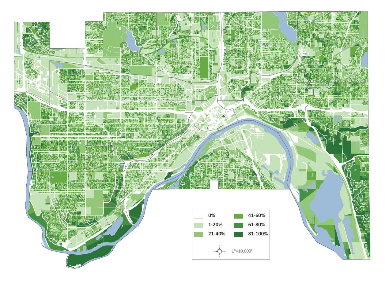
Source: Saint Paul for All 2040 Comprehensive Plan. City of Saint Paul, Nov 2020.
Source: Minnesota Geospatial Commons. gisdata.mn.gov/dataset.
Source: Ramsey County Map Ramsey. maps.co.ramsey.mn.us/mapramsey/.
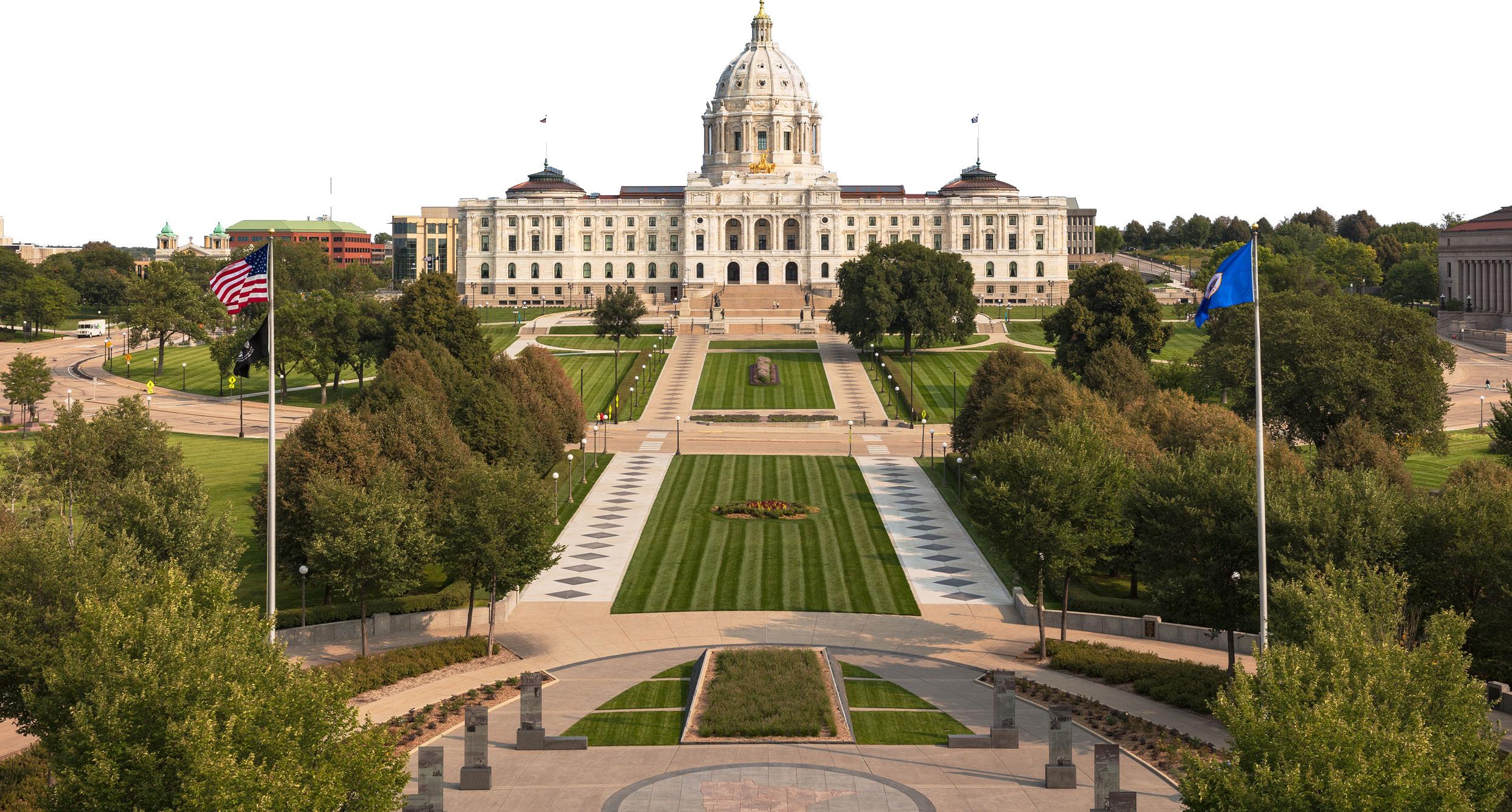
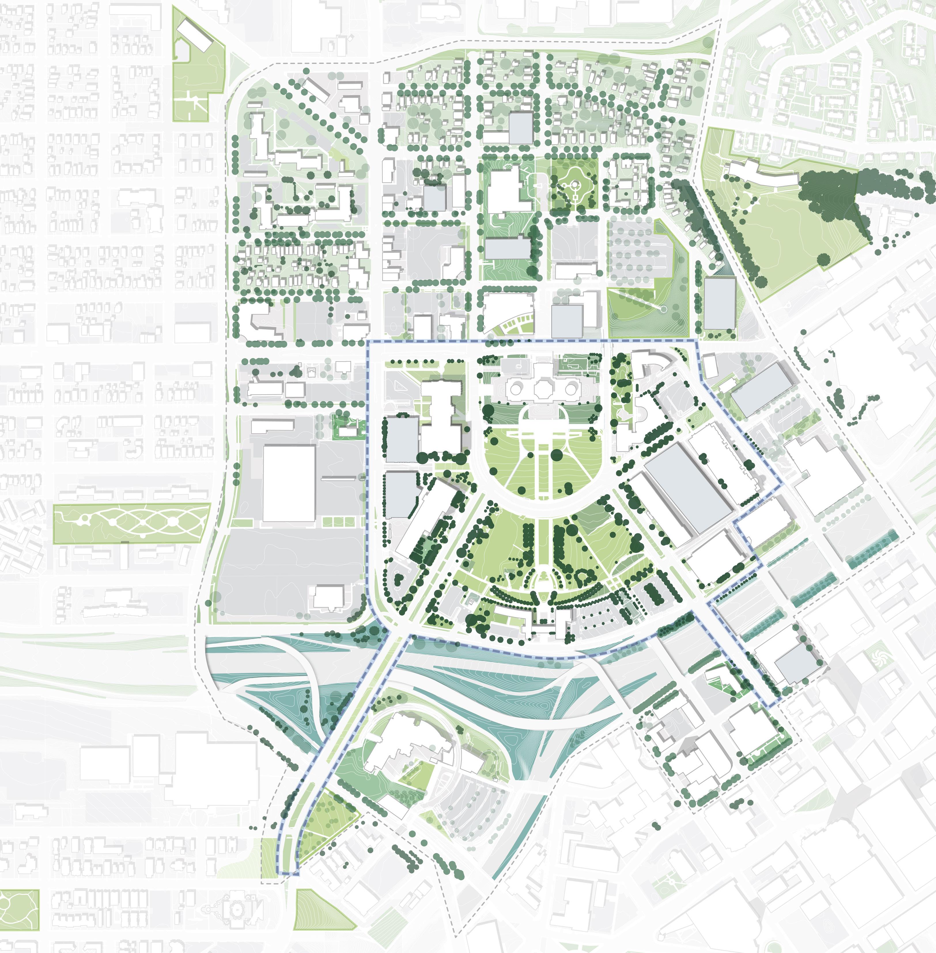
Trees (CAAPB)
Trees (Google Earth trace)
CLR
Feb. 2024 Tree Survey Boundary Existing
Existing
Existing
LEGEND
+
Trees (Survey)
0% 1-20% 21-40% 41-60% 61-80% 81-100%
Figure 139: Capitol Area Tree Canopy
CAAPBBoundary CBD Site N 0’ 500’ 250’ 125’ University Ave W Aurora Ave St Anthony Ave Como Ave W Pennsylvania Ave Park St Cedar St Rice St John Ireland Blvd CedarSt Jackson St UniversityAveE E12thSt 10thStE RobertSt Valley Park Cass Gilbert Park Upper Mall Lower Mall Western Sculpture Park Summit Park RevDr. MLK,Jr.Blvd
131 Inventory + Analysis
GROW DRAFT
TREE CANOPY
Top 4 Biological Species (of 24):
Acer (180)
Ulmus (85)
Tilia (85)
Amelanchier (67)
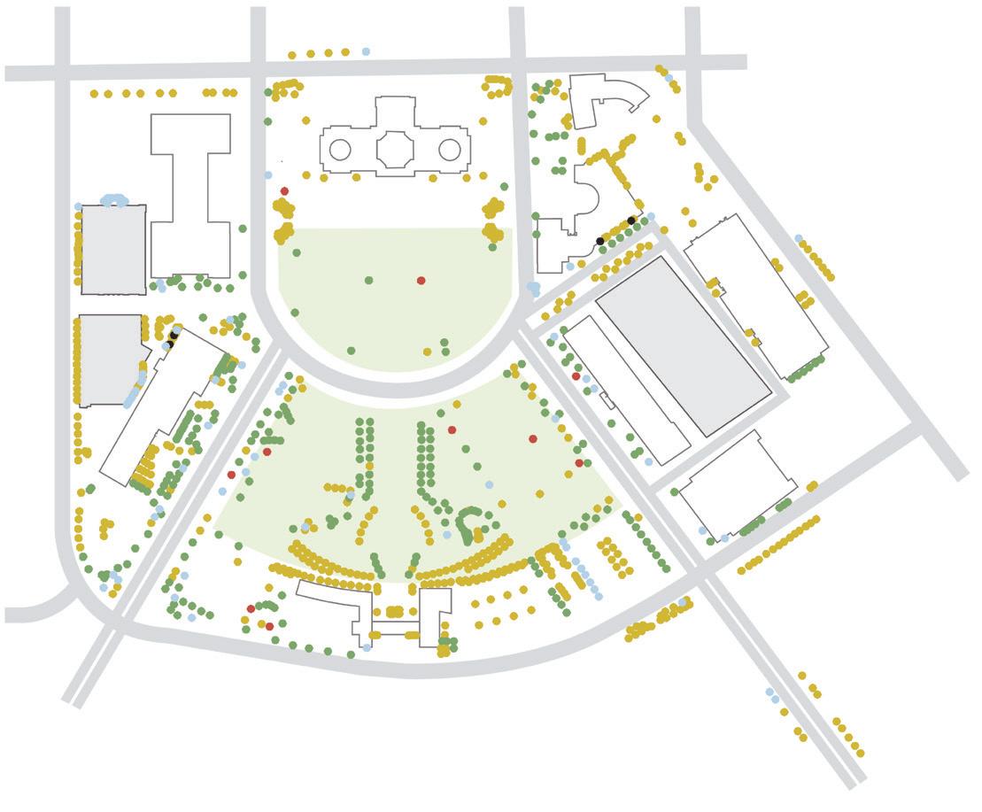
Dead (4)
Young (551)
Mature (285)
METHODOLOGY
Over-Mature (10) unknown/stump (85)

Dead (4) Poor (11) Fair (618)
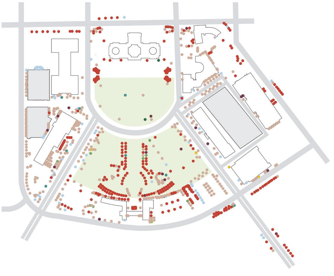
(85)
DRAFT
Branch Attachment (331)
Broken/Hanging Branches (18)
Dead/Dying Branches (475)
Architecture (3)
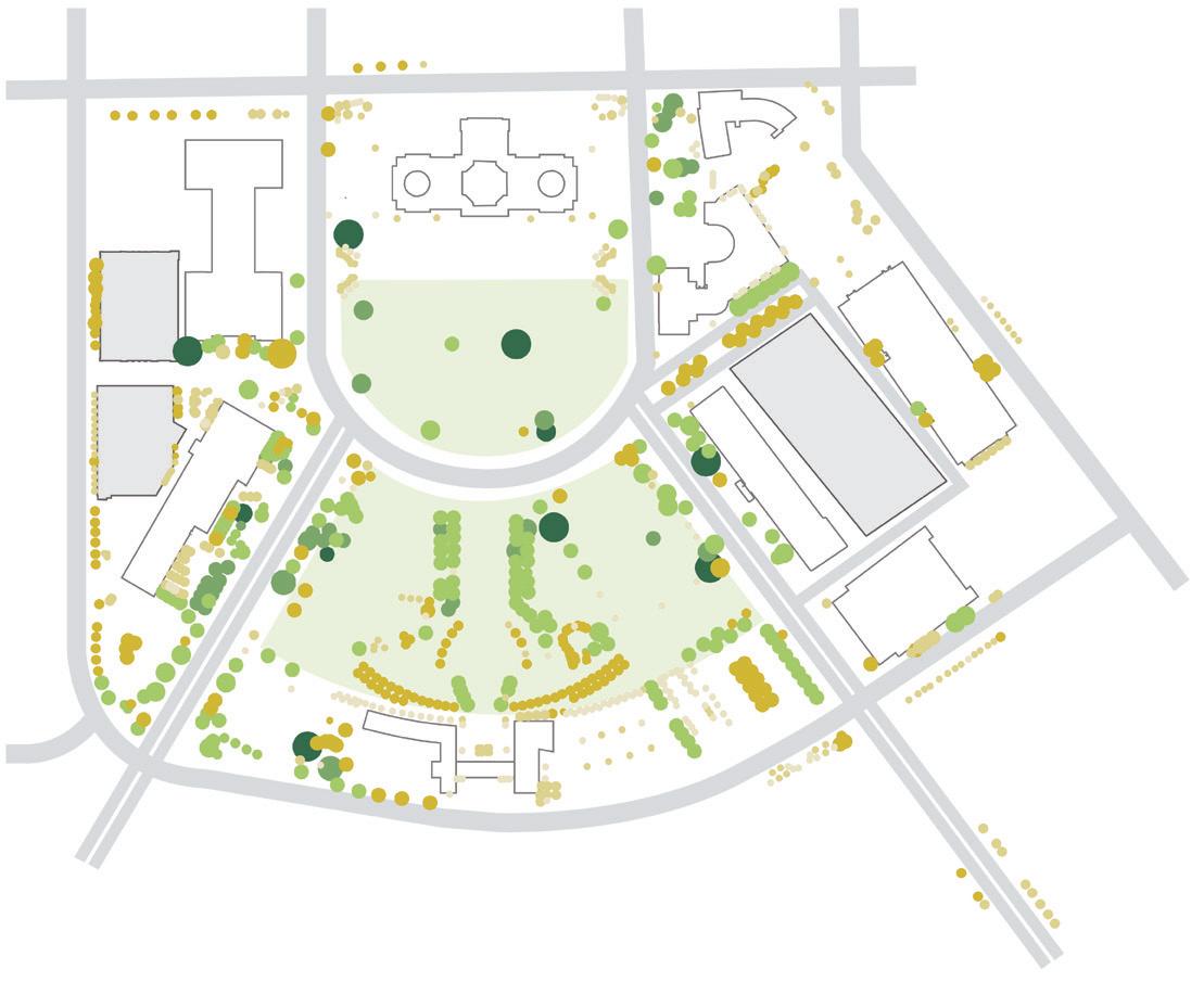
Condition includes 1) Good: A good tree shows no significant problems; 2) Fair: A fair tree has minor problems that may be corrected with time or corrective action; 3) Poor: A poor tree has significant problems that are irrecoverable; and 4) Dead: A dead tree shows no sign of life. Age is determined as 1) Young: Have achieved
one-third of their mature height; 2) Mature: Have achieved one-third to two-thirds of their mature height; 3) Overmature: Have achieved their full potential of height based on species and conditions; and 4) DeadNo signs of life. Crown diameter is estimated within ten feet. Defects document only the most significant
Cracks (9)
Trunk Condition (1)
Root Problems (4)
Decay or Cavity (9)
Stump (85)
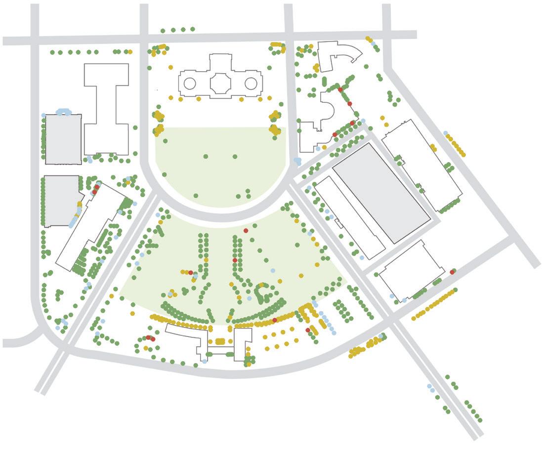
Prune (622) Train (214)
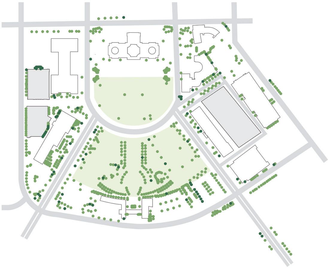
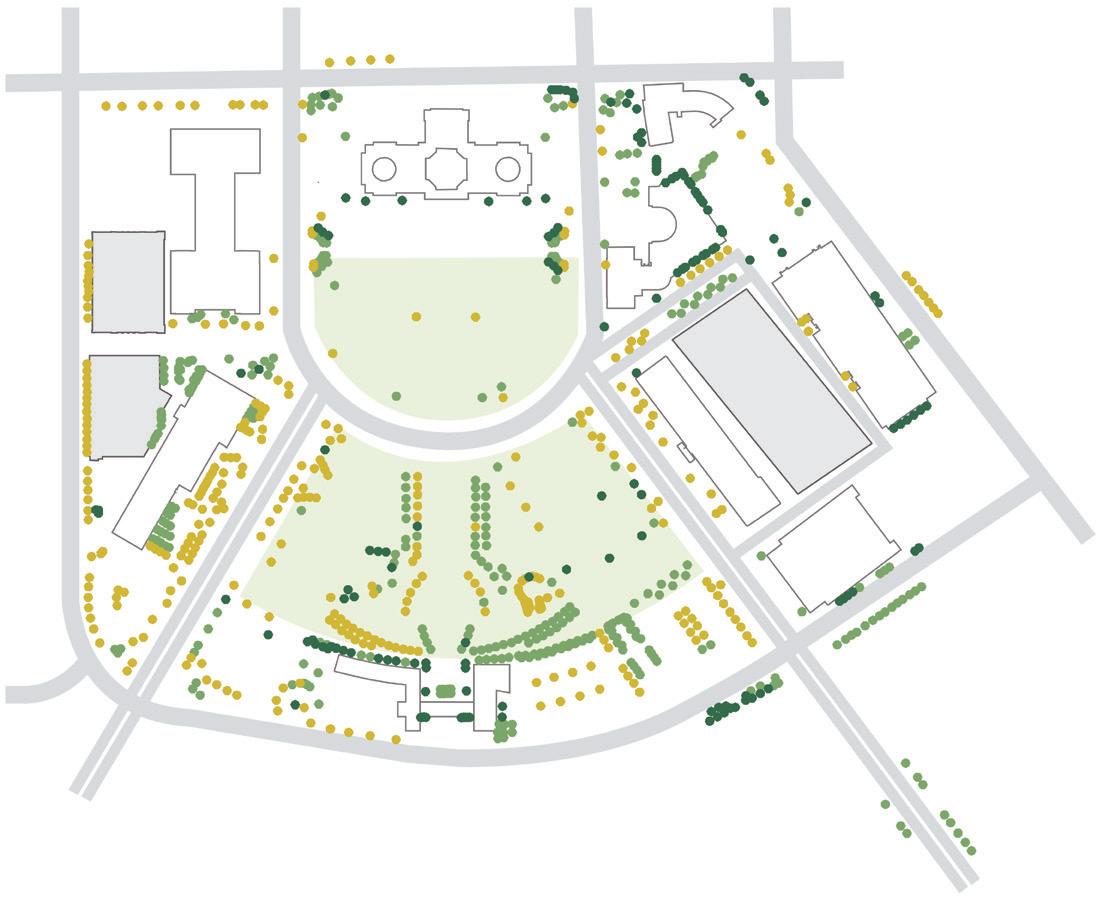
(80)
(14)
conditions and limit the conditions to those outlined above. Risk is assigned based on an assessment of the failure mode (i.e., branch, whole tree, codominant stem) with the most significant risk. The specified period for the risk assessment is one year. Maintenance includes 1) Remove: Trees recommended for removal have defects that cannot be practically or cost-effectively treated. Most trees in
this category have a sizable percentage of dead crown; 2) Prune: Removal of one or more limbs to reduce risk, provide clearance, and restore the tree; and 3) Train: Pruning of young or medium-aged trees to improve tree and branch architecture. Priority is determined via defects, risk, and recommended maintenance.
Very Low
Low
Good
unknown
(150)
(355)
(217)
/ stump
Stump Removal
Remove
Medium (345)
Low
(836)
1’ 50’+ 1-10ft 11-20ft 21-30ft 31-40ft 41-50ft 50’+ None (99) University Ave W University Ave W University Ave W University Ave W University Ave W University Ave W University Ave W University Ave W Rice St Rice St Rice St Rice St Rice St Rice St Rice St Rice St John Ireland Blvd John Ireland Blvd John Ireland Blvd John Ireland Blvd John Ireland Blvd John Ireland Blvd John Ireland Blvd John Ireland Blvd CedarSt CedarSt CedarSt CedarSt CedarSt CedarSt CedarSt CedarSt RobertSt RobertSt RobertSt RobertSt RobertSt RobertSt RobertSt RobertSt CONDITION DEFECTS MAINTENANCE GENUS RISK AGE PRIORITY CROWN
HEIGHT
132 133 Capitol Mall Design Framework Inventory + Analysis
GROW TREE SURVEY
THERMAL COMFORT
METHODOLOGY + OUTCOMES
Thermal comfort is defined as a person’s sensations in relation to the thermal environment, or the ability for a person to be outside and not feel too hot or too cold. Thermal comfort is determined by several factors, including air temperature, air velocity (wind), humidity, shade and so on. To ensure the final Design Framework
maximizes thermal comfort, the planning team utilized a thermal comfort tool to better understand what areas in the Capitol Area are most comfortable and which are not. Unsurprisingly, areas with the most tree canopy were the most comfortable overall and had the most significant influence during the summer months. Winter was generally less comfortable, particularly in areas between buildings.
Figure 140: Thermal Comfort Existing
Source: Minnesota Geospatial Commons gisdata.mn.gov/dataset.
Source: Ramsey County Map Ramsey. maps.co.ramsey.mn.us/ mapramsey/.
Source: Ramsey County Maps and Surveys. www. ramseycounty.us/residents/property/maps-surveys.
Source: Saint Paul Minnesota. information.stpaul.gov/search.
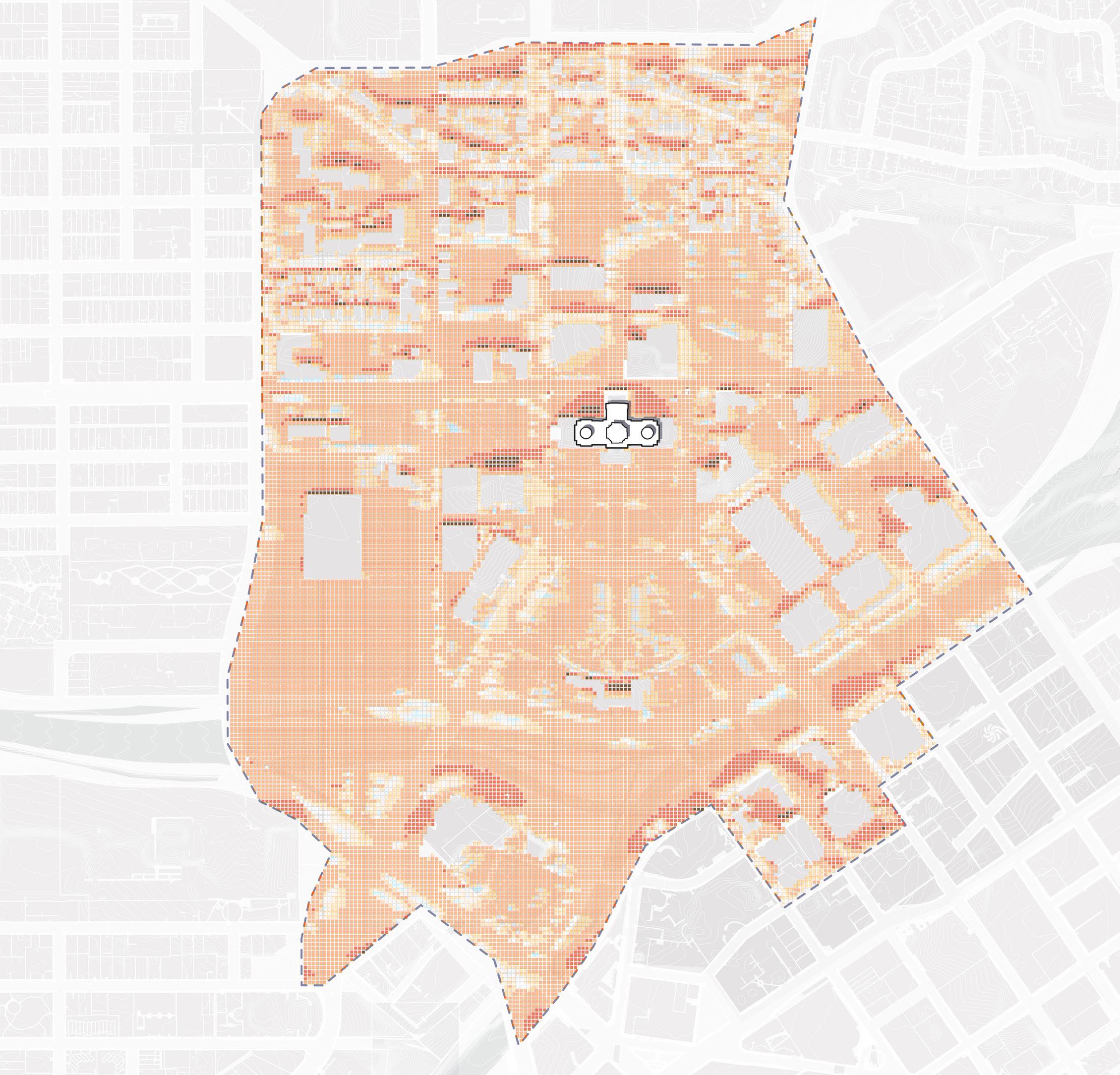
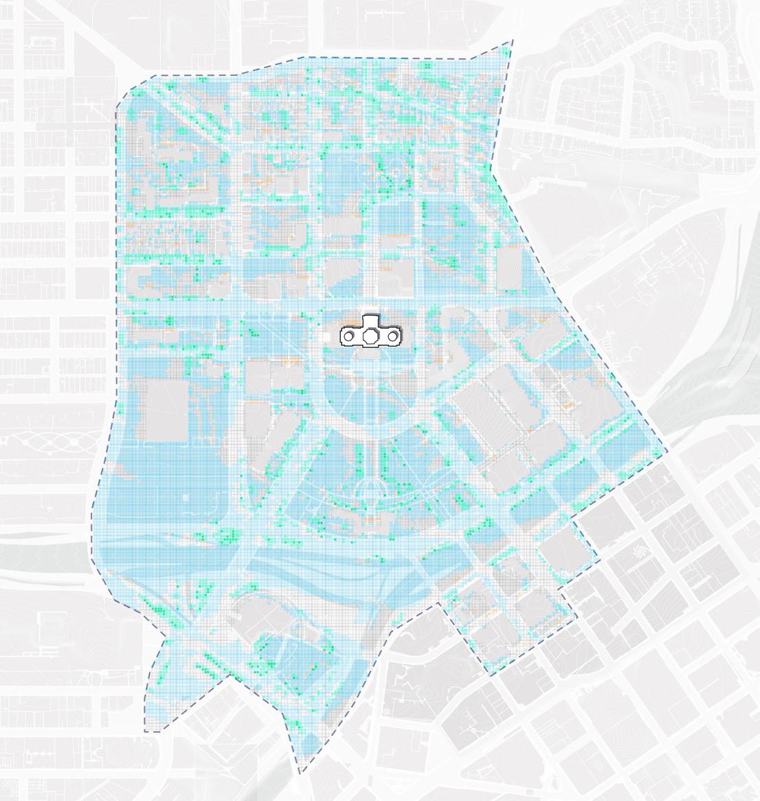
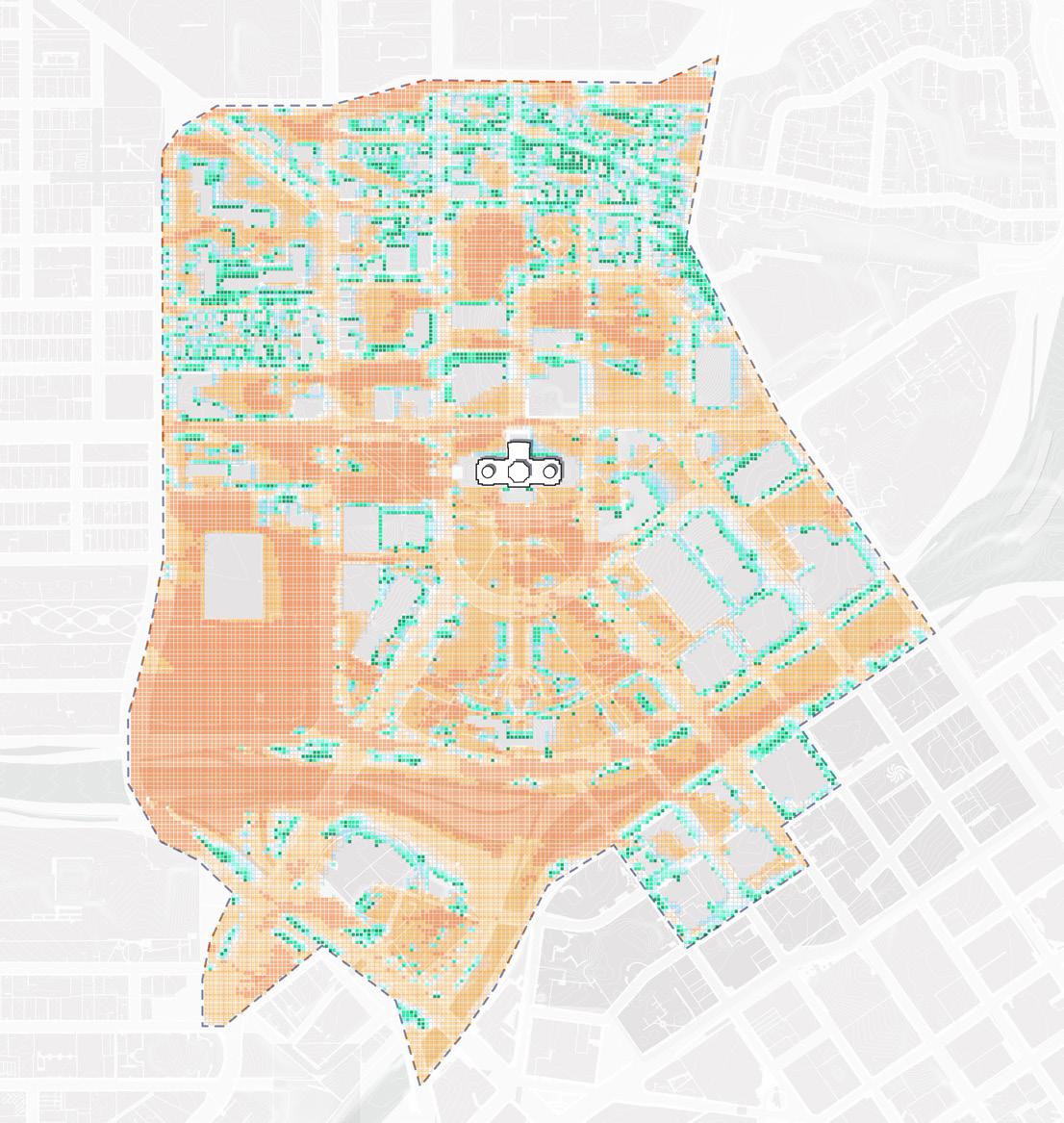
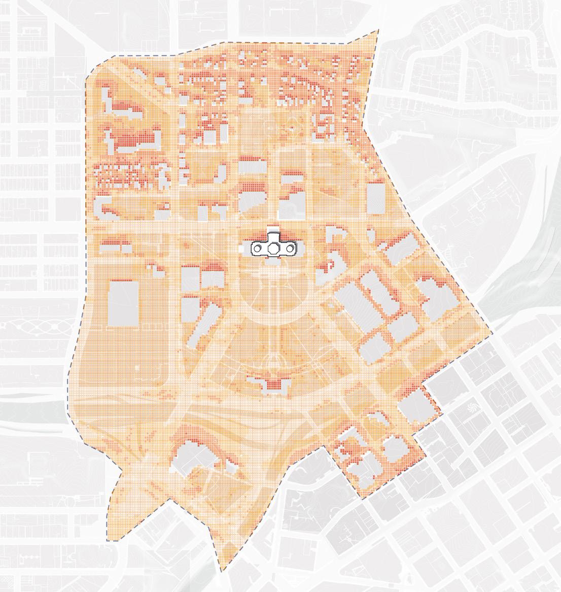
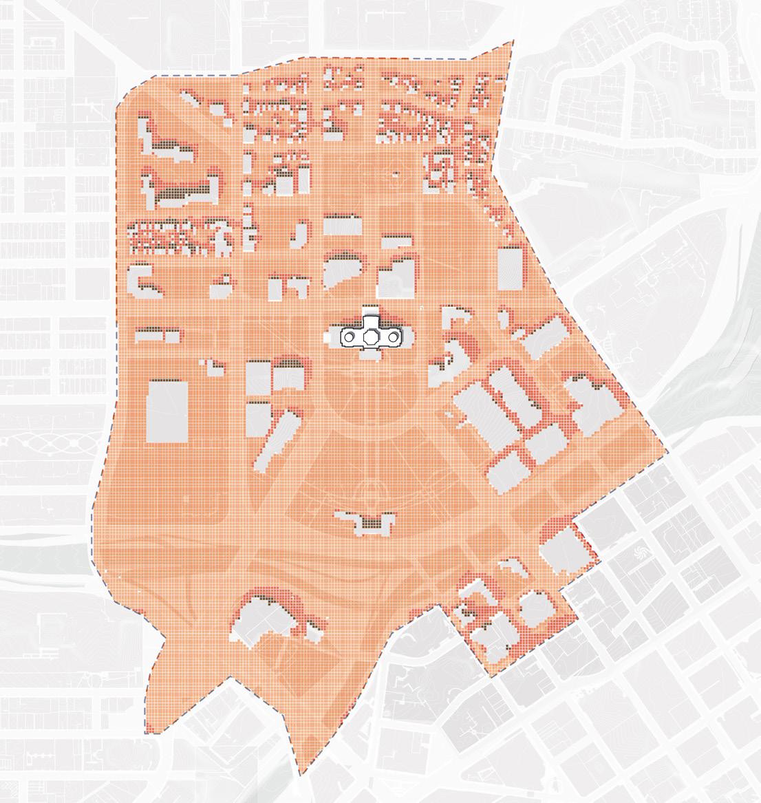
More comfortable Less comfortable
134 135 Capitol Mall Design Framework Inventory + Analysis
GROW FALL SUMMER WINTER NET THERMAL COMFORT EXISTING SPRING DRAFT
THERMAL COMFORT
SHADE VERSUS SUN
Locations requiring more shade versus more sun can be derived from the previous thermal comfort analysis. Both the Upper and Lower Malls require more shade via increased tree canopy to be comfortable year round. Additionally, all areas of extensive impervious cover (like the Sears Lot and Interstate bridges) are generally
noted as needing more shade. Pockets of unshaded lawn provide moments of warmth and sunshine during winter months, so long as vegetated edges minimize wind. While increasing sun between existing buildings is difficult, new development should carefully consider solar orientation to support thermal comfort.
Figure 141: Thermal Comfort Strategy
Source: Minnesota Geospatial Commons gisdata.mn.gov/dataset.
Source: Ramsey County Map Ramsey. maps.co.ramsey.mn.us/ mapramsey/.
Source: Ramsey County Maps and Surveys. www. ramseycounty.us/residents/property/maps-surveys.
Source: Saint Paul Minnesota. information.stpaul.gov/search.
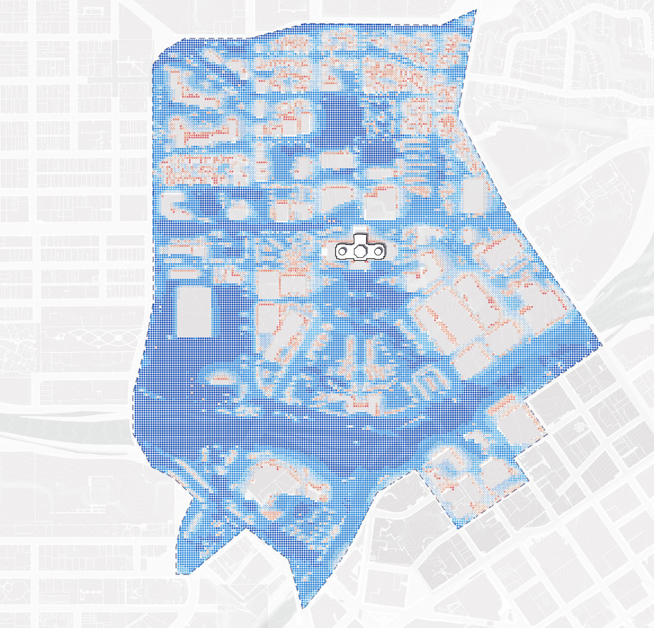
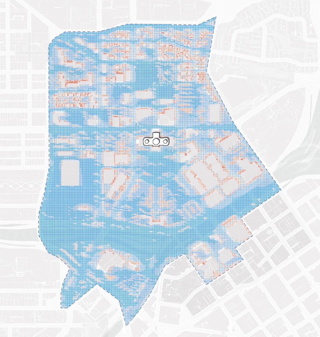
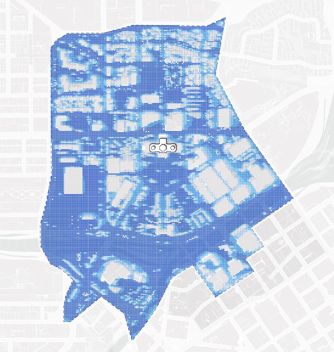
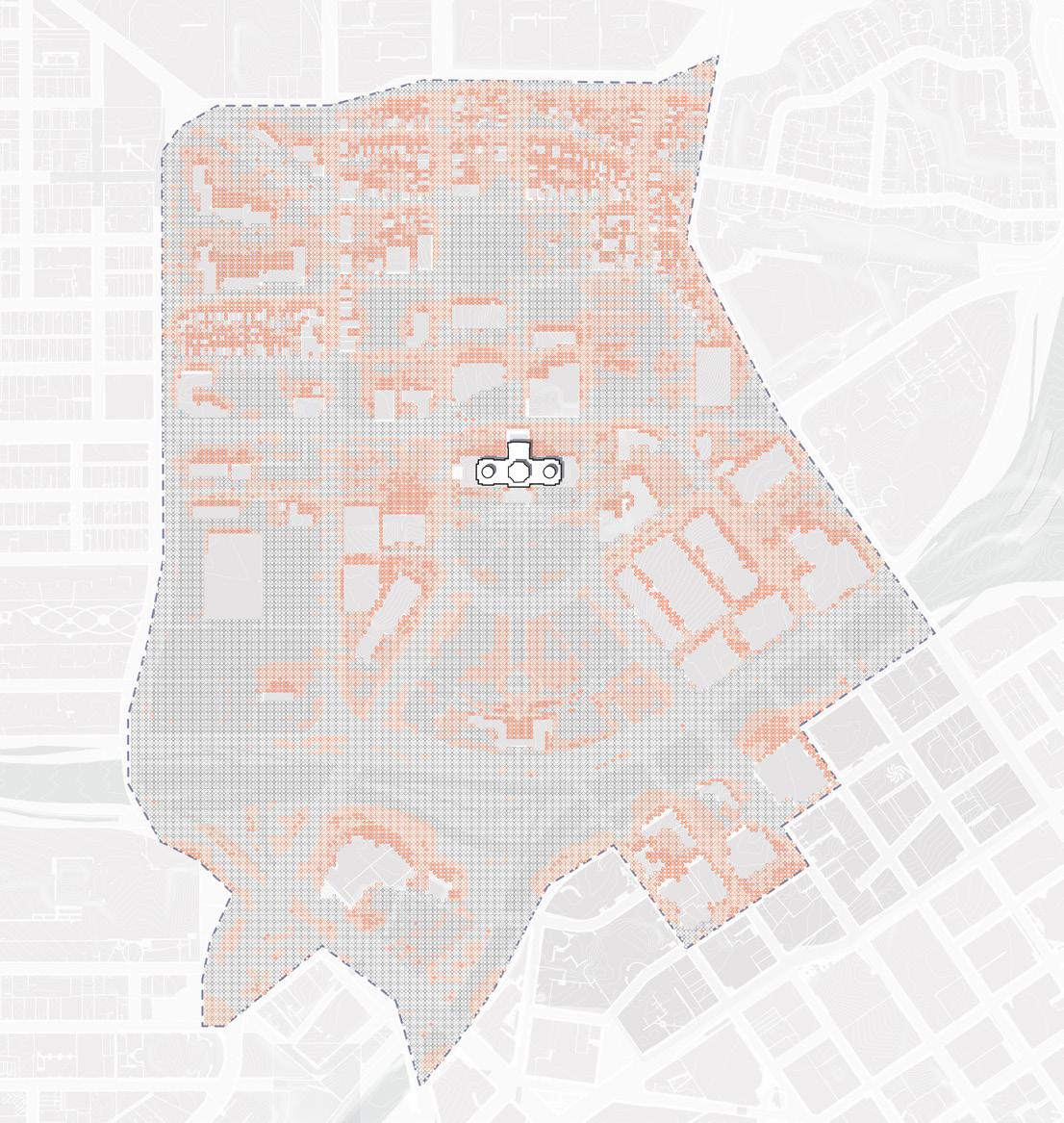
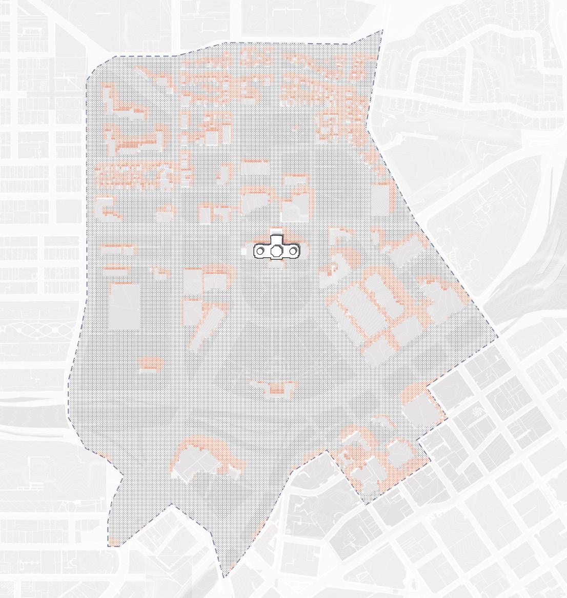
Add more shade Add more sun 136 137 Capitol Mall Design Framework Inventory + Analysis
GROW SPRING FALL SUMMER WINTER NET STRATEGY STRATEGY
DRAFT
STORMWATER SYSTEMS
RUNOFF WITHIN THE DISTRICT
The Capitol Mall is part of the larger Capitol Area, which encompasses 60 blocks and approximately 333 acres. Rainwater falling on the urban landscapes that comprise the Capitol Area runs off into the surrounding storm sewers, becoming stormwater that carries with it pollutants such as sediment and excess nutrients, and ultimately discharges into the nearby Mississippi River (Haháwakpa). Under current conditions, over 90% of the impervious surfaces within the Capitol Area receive no stormwater treatment to help manage and address this pollution before it flows to the river. These untreated landscapes include large portions of the Capitol Mall, the surrounding transportation network, and adjacent State Administration buildings (CRWD, Capitol Area Stormwater Management Study, 2024).
The Design Framework provides an opportunity to incorporate sustainable and resilient campus stormwater management systems and green stormwater infrastructure into several areas on and surrounding the Capitol Mall. Integrating these systems into the re-imagining of the Capitol Mall and its neighboring roadways allows for the capture, treatment, and reuse of stormwater runoff from this portion of the larger Capitol Area and for the State of Minnesota to be a leader in advancing and showcasing a more resilient approach to managing and protecting Minnesota’s water resources.
Impervious Surfaces
Treated Area
Non-Trout Brooks Interceptor (TBI) Subwatersheds
Trout Brooks Interceptor Subwatersheds Programmed/ Institutional Lawn Parks/Lawns
Figure 142: Stormwater Systems
Source: Saint Paul for All 2040 Comprehensive Plan. City of Saint Paul, Nov 2020.
Source: Minnesota Geospatial Commons. gisdata.mn.gov/dataset.
Source: Ramsey County Map Ramsey. maps.co.ramsey.mn.us/mapramsey/.
Source: Ramsey County Maps and Surveys. www.ramseycounty.us/residents/property/maps-surveys.
Source: Saint Paul Minnesota. information.stpaul.gov/search.
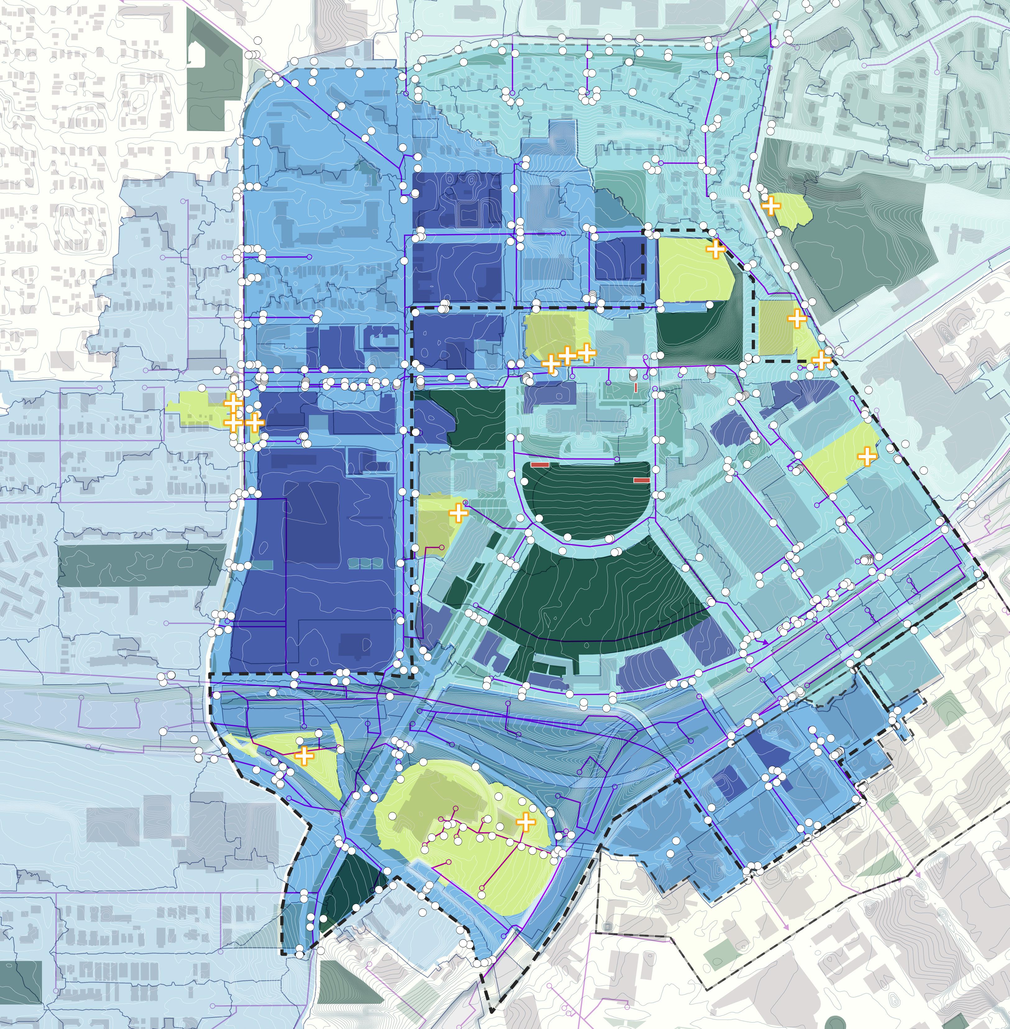
DRAFT
BMPs Catch Basin Storm Sewer Underground Storm Chamber
N 0’ 500’ 250’ 125’ I-94 University Ave W Aurora Ave St Anthony Ave Marion St Como Ave Winter St W Pennsylvania Ave Park St Cedar St Rice St John Ireland Blvd CedarSt JacksonSt UniversityAveE E12thSt I-35E WabashaStN RobertSt LEGEND
138 139 Capitol Mall Design Framework Inventory + Analysis
GROW
EXISTING CAMPUS


THE LEVEL OF MAINTENANCE VARIES ACROSS THE CAPITOL CAMPUS. THE CURRENT STANDARD MAINTENANCE
PRACTICE FOCUSES ON LAWNS. HOWEVER, CLIMATE CHANGE NECESSITATES MORE SUSTAINABLE MAINTENANCE
PRACTICES FOR ALL LANDSCAPE TYPES MOVING FORWARD.
Source: Streetscape Lawn, Lawn on Parking Lot, Meadow on Slopes, The “Green River”. www.google.com/maps/. Accessed Jan. 2024.
MAINTENANCE OVERVIEW
Current standard maintenance practices vary across the Capitol Campus, but primarily focus on lawns. Per extensive stakeholder engagement with government staff, specifically the Minnesota Department of Administration, maintenance is limited by insufficient budgets and staff power. Therefore, lawn dominates because it is perceived as the easiest and cheapest to maintain. While lawn is better than impervious cover when it comes to minimizing urban heat island effect and other climate challenges, it is much less effective than other native landscape typologies. Moreover, lawn actually requires more maintenance than some of these landscapes in the long term. The Design Framework incorporates more dynamic and resilient ecologies to address such issues and outlines sustainable maintenance practices moving forward.
PROGRAMMED FORMAL LAWN STREETSCAPE LAWN LAWN ON PARKING LOT MEADOW ON SLOPES THE “GREEN RIVER”
Figure 143: Landscape Maintenance Zones
Source: Doherty, Barrett. Programmed Formal Lawn. 2021. www.tclf.org/ minnesota-state-capitol-mall.
140 141 Capitol Mall Design Framework Inventory + Analysis
A NEED FOR CHANGING PRACTICES GROW DRAFT
MAINTENANCE
PRINCIPLE STRATEGIES
Moving forward from the 2040 Comprehensive Plan OPPORTUNITIES AND CHALLENGES
OVERARCHING OPPORTUNITIES AND/OR CHALLENGES
TO GUIDE PRINCIPLE DESIGN FRAMEWORK STRATEGIES
MOVING FORWARD INCLUDE THE FOLLOWING:
O Human comfort challenges related to shade and wind patterns on site
O Disconnection from natural process and pre-settlement ecologies
O Investment in ongoing maintenance and operations
O Climate adaptability and resilience to extreme natural events
DRAFT
INCREASE TREE CANOPY COVER AND EMBED HUMAN COMFORT IN PLACEMAKING
RECONNECT THE SITE’S NATURAL HERITAGE AND ALL CULTURES THROUGH PLANTING
DEVELOP AN EVOLUTIONARY MAINTENANCE REGIME THAT IS ECOLOGICAL AND SUSTAINABLE
CREATE A CLIMATE-READY LANDSCAPE THROUGH PLANTING AND STORMWATER MANAGEMENT
142 143 Capitol Mall Design Framework Inventory + Analysis GROW
INCREASE TREE CANOPY COVER AND EMBED HUMAN COMFORT IN PLACEMAKING RECONNECT THE SITE’S NATURAL HERITAGE AND ALL CULTURES
STRATEGIES STRATEGIES
O Strategically increase tree canopy and design plant communities for improved sightlines and microclimate effects in both parks and streetscapes
O Provide shading opportunities every two to four minutes of walking distance along park pathways and streets, and incorporate deciduous planting to balance thermal comfort during summer and winter
O Design with plant phenology in mind, and limit the use of plant that can be negatively affected by Minnesota’s climate extremes
O Leverage and strategically preserve existing vegetation to enhance resilience and thermal comfort
O Create dynamic height differences to increase mixing of air and encourage more wind at human height.
O Consider shading structures and plantings that encourage summer wind flow and block winter wind flow
O Design planting patterns with Indigenous ethnobotany in mind
O Embed nature education opportunities in design
O Use native plant communities and landscape succession as a guide, and design with faunal associations in mind, prioritizing the use of native plant species that provide superior ecological benefits
O Utilize foundational plant species that support local habitat, such as sugar maple, basswood and bur oak
O Eliminate the use of invasive plant species and restrict the use of those that may become invasive in the future
O Create a pollinator-friendly landscape that supports butterflies, moths and pollen specialist bees, referring to resources like Keystone Plants by Ecoregion led by Dr. Doug Tallamy from University of Delaware and the Pollinator Station Program led by the City of Saint Paul
 Figure 144: Pearl Street Mall
Figure 145: Bonnet Springs Park Birds Eye
Source: Sasaki. Bonnet Springs Park Birds Eye, Sasaki, https://www.sasaki.com/projects/bonnet-springs-park/.
Source: Sasaki Pearl Street Mall, Sasaki, https://www.sasaki.com/projects/bonnet-springs-park/.
Figure 144: Pearl Street Mall
Figure 145: Bonnet Springs Park Birds Eye
Source: Sasaki. Bonnet Springs Park Birds Eye, Sasaki, https://www.sasaki.com/projects/bonnet-springs-park/.
Source: Sasaki Pearl Street Mall, Sasaki, https://www.sasaki.com/projects/bonnet-springs-park/.
GROW PRINCIPLE STRATEGY GROW PRINCIPLE STRATEGY 144 145 Capitol Mall Design Framework Inventory + Analysis DRAFT
THROUGH PLANTING
DEVELOP AN EVOLUTIONARY MAINTENANCE REGIME THAT IS ECOLOGICAL AND SUSTAINABLE
O Facilitate application of resilience principles to ecosystem management through rich landscape settings at the human scale
O Promote a diversified native landscape pattern that sustains climate change and other anthropogenic stressors
O Design with plants that are less affected by common pathogens and pests and avoid those that may become a concern in the future
O Prioritize plants that are adapted to the current soil profile, and group plants together that share similar soil, irrigation and maintenance needs
O Promote green waste recycling, consider natural maintenance methods and reduce the use of chemicals and motorized equipment
O Maintain winter structure for planting and minimize salt damage on both parks and ROWs
CREATE A CLIMATE-READY LANDSCAPE THROUGH PLANTING AND STORMWATER MANAGEMENT
O Use climate-ready species and refer to local planting sources (utilize the University of Minnesota Climate Adaptation resources such as climate-ready woodlands for more site specific planting suggestions)
DRAFT
O Design the landscape and hardscape to help with carbon draw down by selecting plants and materials that promote carbon sequestration and storage and creating a landscape that reduces operational carbon
O Maximize green infrastructure for stormwater treatment, and consider local habitat and species while designing the stormwater landscape
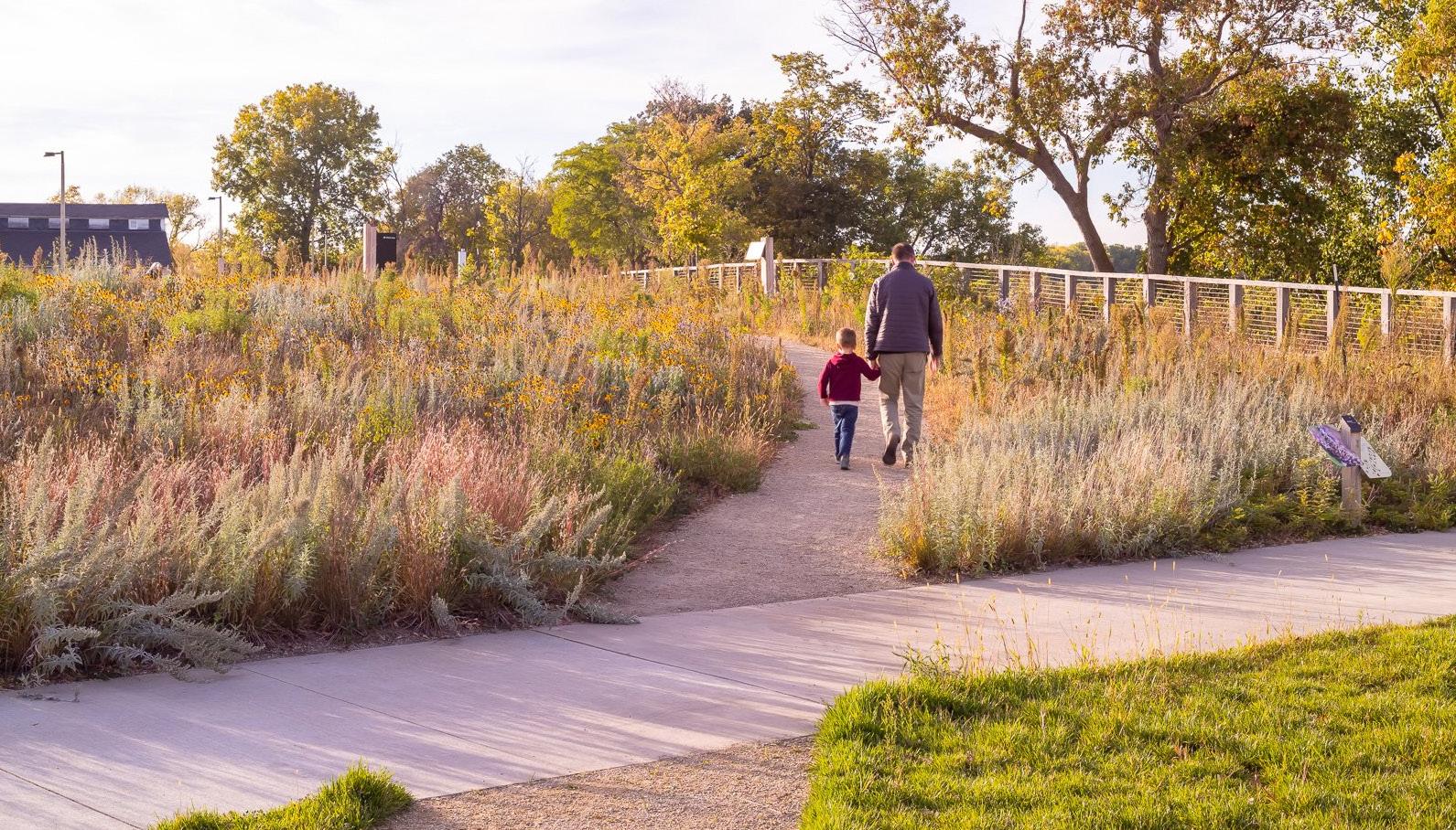
Source: FARM KID STUDIOS. Historic Fort Snelling at Bdote Revitalization. TEN X TEN Studio, www.tenxtenstudio.com/historic-fortsnelling-at-bdote-revitalization.
O Identify areas with high runoff potential and strategically size green infrastructure and the management requirements at those locations
O Design a landscape that promotes phosphorus and other pollutant removal
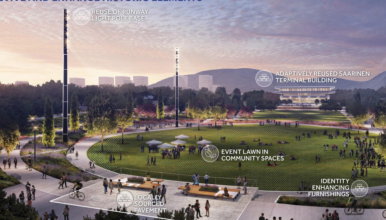
Source: Sasaki. Ellinikon Park, Sasaki, https://www.sasaki.com/projects/the-ellinikon-park/.
Figure 147: Ellinikon Park
Figure 146: Historic Fort Snelling at Bdote Revitalization
GROW PRINCIPLE STRATEGY GROW PRINCIPLE STRATEGY 146 147 Capitol Mall Design Framework Inventory + Analysis
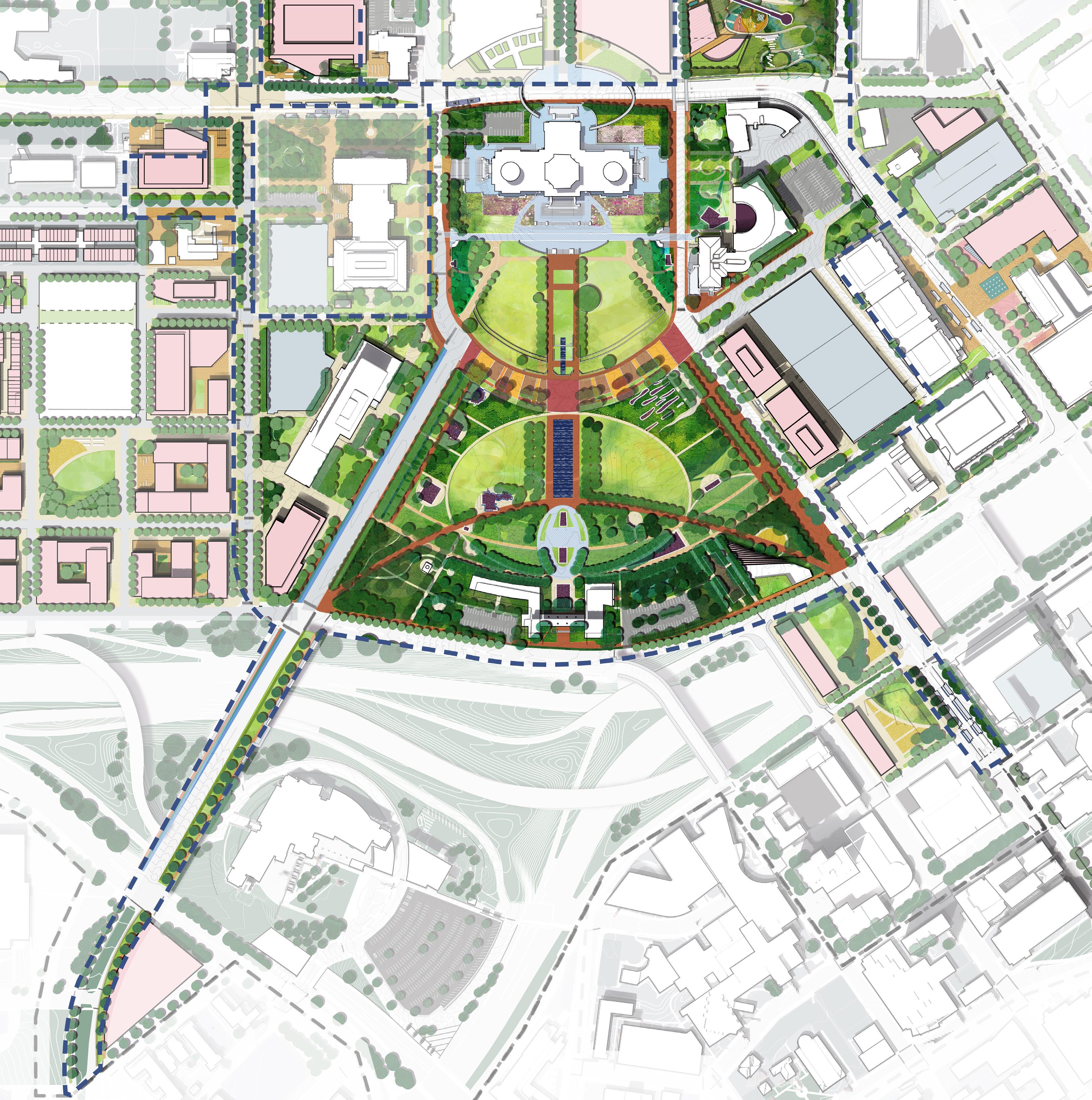
CHAPTER 4
DESIGN FRAMEWORK
DRAFT
PROPOSED DESIGN FRAMEWORK PLAN
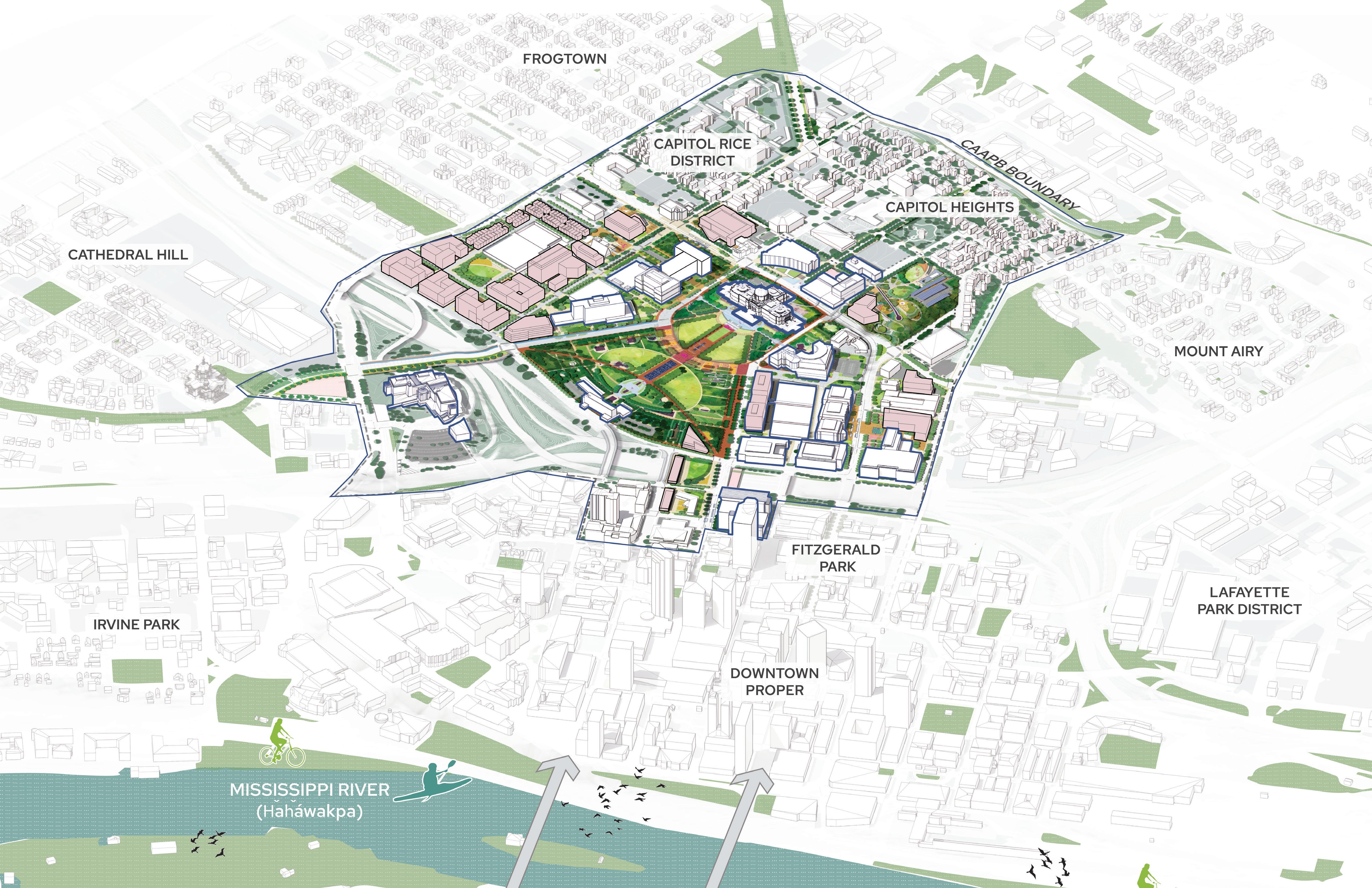
PROPOSED BUILDINGS VISITOR AMENITY BUILDING ROBERT STATION MOBILITY STOP UNIVERSITY AND RICE MOBILITY HUB SEARS AND RICE BRT NODE WesternSculpturePark ValleyPark 150 151 Capitol Mall Design Framework Design Framework
CASS GILBERT PARK
DESIGN FRAMEWORK
Figure 148: Design Framework Axon DRAFT
MINNESOTA CAPITOL MALL
PROPOSED DESIGN FRAMEWORK PLAN
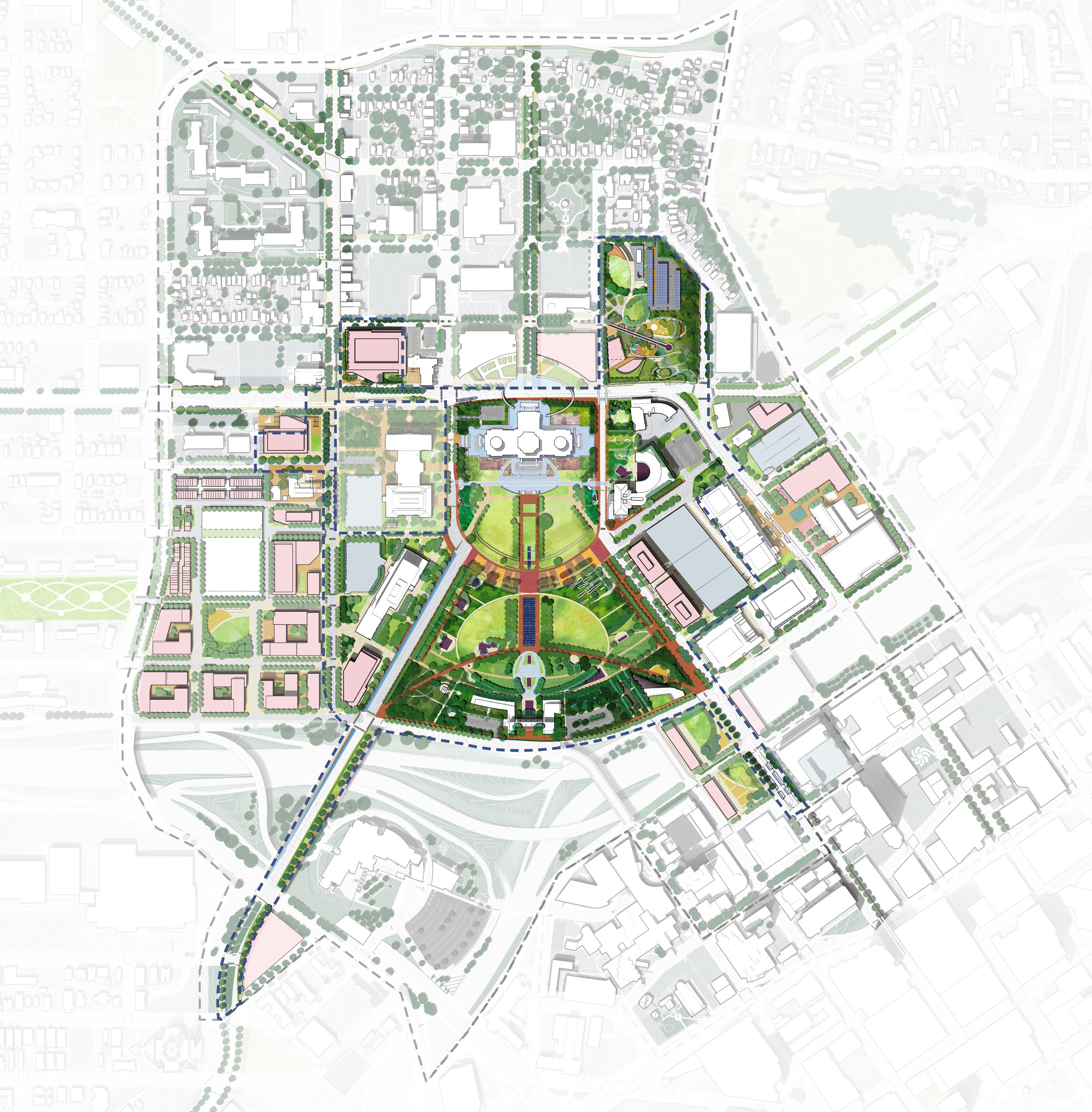
A A A B C D D C B F F E D E D B B C A G G C H H I I J J K K L L M N N M CAAPB Boundary CMDF Limit of Work Proposed Building Memorials MN State Capitol New State Office Building* MN Senate MN Judicial Branch Aurora Promenade Civic Plinth Open Glades Arboretum Native Prairies Sears & Rice BRT Node University & Rice Mobility Hub Cass Gilbert Memorial Park Robert Street Station Plaza Visitor Amenity Building Cedar and Wabasha Deck Node MNHS Plaza Western Sculpture Garden Atrium N 0’ 500’ 250’ 125’ University Ave W Aurora Ave W Fuller Ave St Anthony Ave Como Ave W Pennsylvania Ave Park St N Capitol Blvd Cedar St Rice St Marion St John Ireland Blvd JacksonSt UniversityAveE E12thSt 10thStE RobertSt CedarSt WabashaSt FortRd DOWNTOWN SAINT PAUL LEGEND * SOB Landscape to be Coordinated THE CAPITOL AREA IS MORE WELCOMING FOR MORE MINNESOTANS . THE DESIGN FRAMEWORK LAYS OUT A MULTI-PHASE IMPLEMENTATION STRATEGY AND A SERIES OF DESIGN GUIDELINE RECOMMENDATIONS TO BE USED AS A DECISION MAKING TOOL MOVING FORWARD. 152 153 Capitol Mall Design Framework Design Framework
DESIGN FRAMEWORK CAPITOL AREA Figure 149: Capitol Mall Design Framework DRAFT
PROPOSED DESIGN FRAMEWORK PLAN
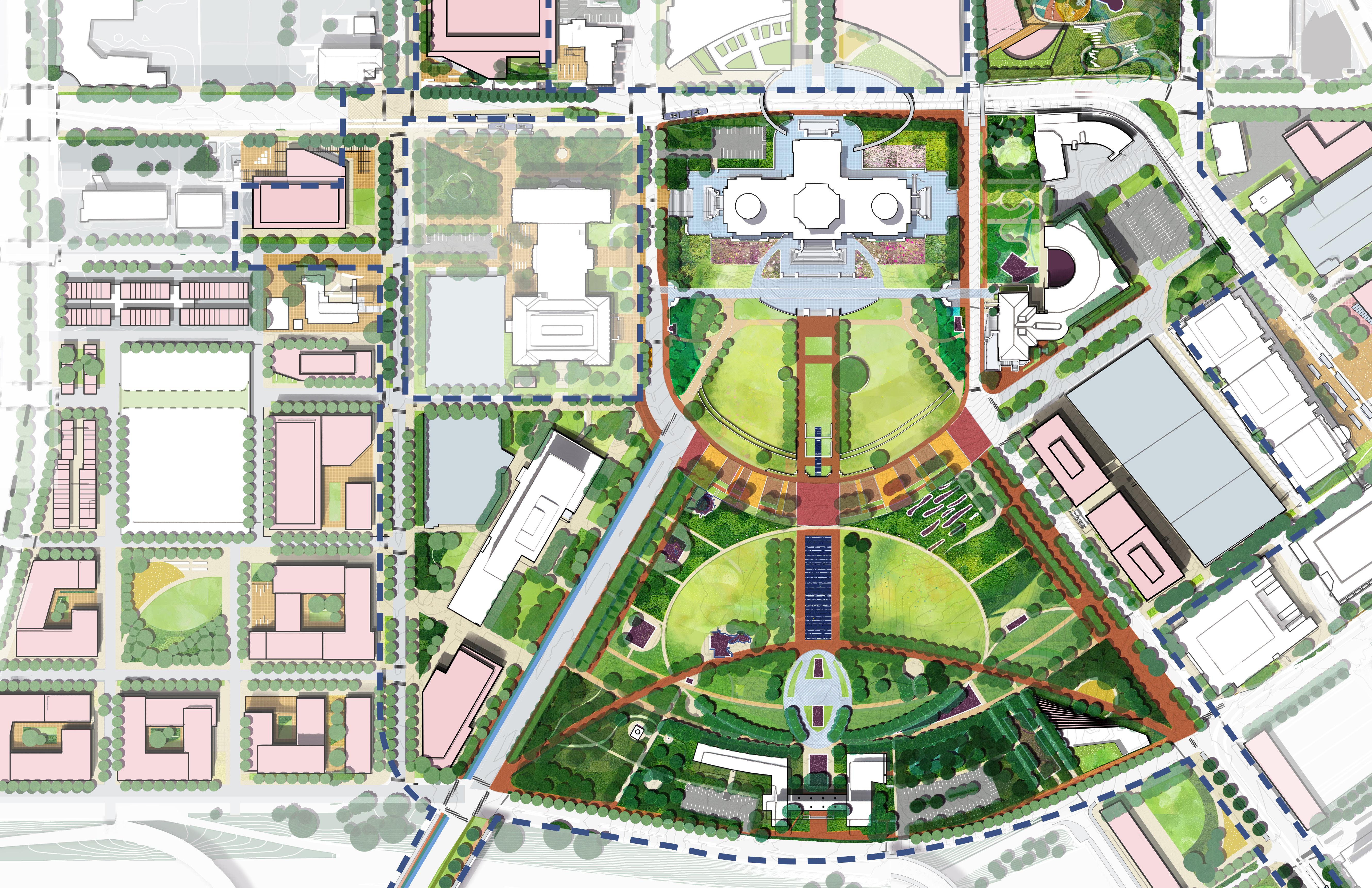
A A B B C C D D F F E E D D B B A A G G C C H H I I J J K K CAAPB Boundary CMDF Limit of Work Proposed Building Memorials MN State Capitol New State Office Building* MN Senate MN Judicial Branch Aurora Promenade Civic Plinth Open Glades Arboretum Native Prairies Sears & Rice BRT Node University & Rice Mobility Hub Cass Gilbert Memorial Park Robert Street Station Plaza Visitor Amenity Building Cedar and Wabasha Deck Node * SOB Landscape to be Coordinated University Ave W Aurora Ave W Fuller Ave St Anthony Ave Park St Cedar St Rice St John Ireland Blvd CedarSt E12thSt RobertSt N 0’ 250’’ 125’ 60’ LEGEND 154 155 Capitol Mall Design Framework Design Framework
CAPITOL MALL DESIGN FRAMEWORK Figure 150: Capitol Mall Design Framework Zoom In DRAFT
LOWER CAPITOL MALL
MORE WELCOMING TO MORE MINNESOTANS
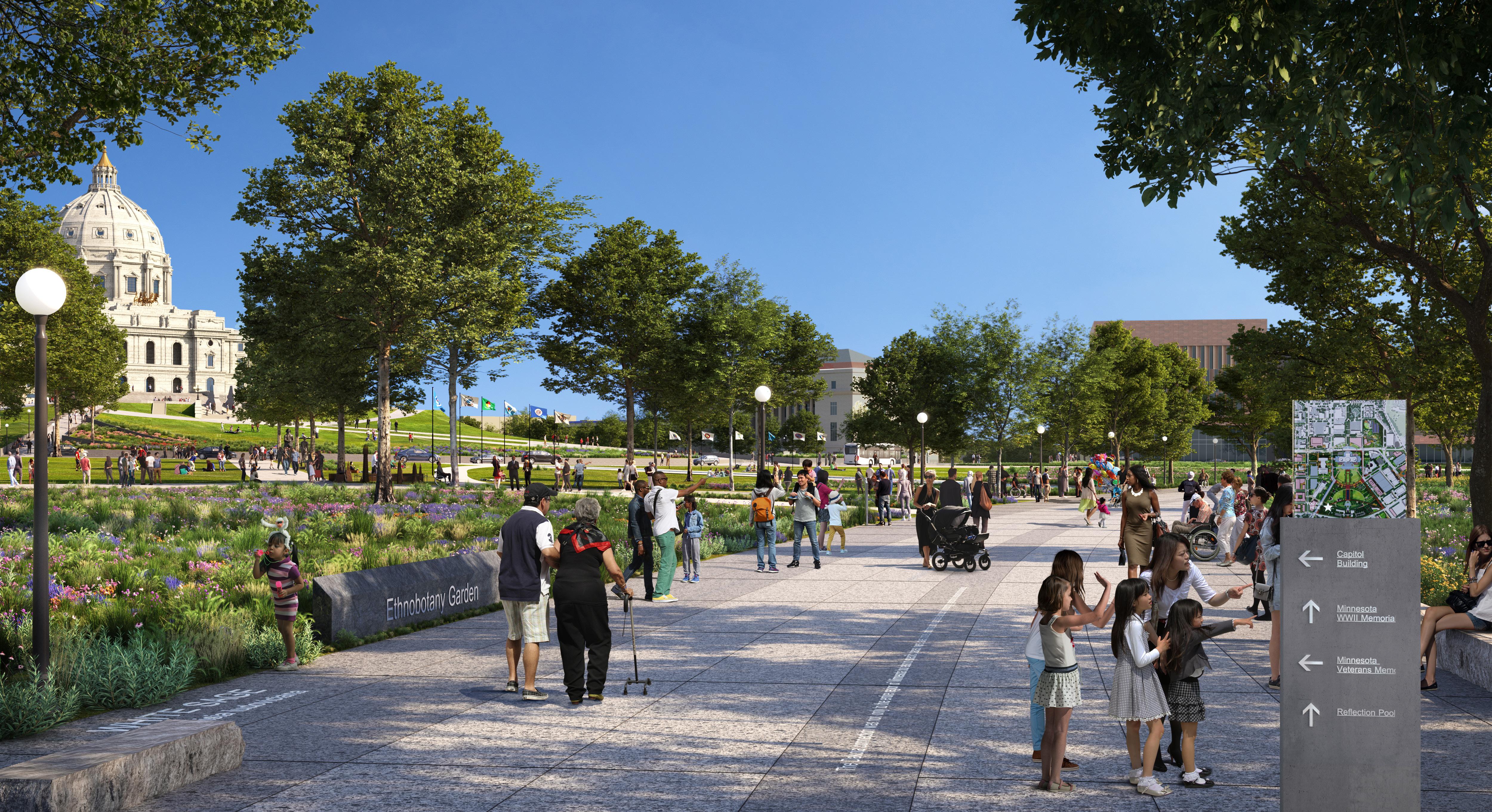
156 157 Capitol Mall Design Framework Design Framework DESIGN FRAMEWORK
DRAFT
CONNECTION TO LARGER CONTEXTS
THE GAP
The Capitol Mall will become the central open space in Saint Paul as a critical link between various open spaces, Downtown, and the Mississippi River (Haháwakpa). Reference the Eight Bold Moves for more information regarding site-specific programming.
Figure 151: Connection to Larger Contexts
Source: Saint Paul for All 2040 Comprehensive Plan. City of Saint Paul, Nov 2020.
Source: Transformation of the Saint Paul Park and Recreation System Saint Paul Parks and Recreation, Dec. 2010.
PLANNED GOLD BRT LINE CONNECTING DOWNTOWN TO NORTH NEIGHBORHOODS
BRIDGE CONNECTING NORTH OF
PLANNED PURPLE BRT LINE CONNECTING DOWNTOWN TO NORTHEAST NEIGHBORHOODS
I-35E I-35E I-94 52 10
NORTHERN DAKOTA COUNTY DOWNTOWN SAINT PAUL FROGTOWN MINNEAPOLIS SUMMIT UNIVERSITY SUMMIT HILL PAYNEPHALEN DAYTON’S BLUFF AIRPORT LAND
SOUTH OF CAPITOL BIKE LANES CONNECTING TO MNHS
BRIDGE CONNECTING
CAPITOL
Linwood Rec Center St. Clair Rec Center Palace Rec Center Edgcumbe Rec Center Dunning Rec Center Martin Luther King Rec Center West Minnehaha Rec Center Scheffer Rec Center Rice Rec Center Carty Park Como Reg Park Front Skate Park Arlington Arkwright Park Arlington Rec Center Duluth
Center
and Case Rec
Rec
Central Village Park Webster Park STATE CAPITOL INCREASE
N 0’ 2000’ 1000’ 500’ NEW PROGRAMMATIC ELEMENTS AT THE CAPITOL MALL THAT CATER TO DIVERSE NEIGHBORS Art Cultural Walks
Garden
+ Concert Venue
Play
Markets
Open Spaces
Dayton’s Buff
Center Indian Mounds Reg Park
IN GREEN SPACE FOR PROGRAMMING AND COMMUNITY
Educational
Festivals
Monuments Nature
Open
Outside Flexible
158 159 Capitol Mall Design Framework Design Framework
DESIGN FRAMEWORK FILLING
DRAFT
APPROACH AND THEMES
THE EIGHT BOLD DESIGN MOVES WERE BORN OUT OF EXTENSIVE COMMUNITY AND STAKEHOLDER ENGAGEMENT. THEY COLLECTIVELY MAKE UP THE CULMINATING CAPITOL MALL DESIGN FRAMEWORK.


DRAFT
INCLUSIVITY DIVERSITY VITALITY
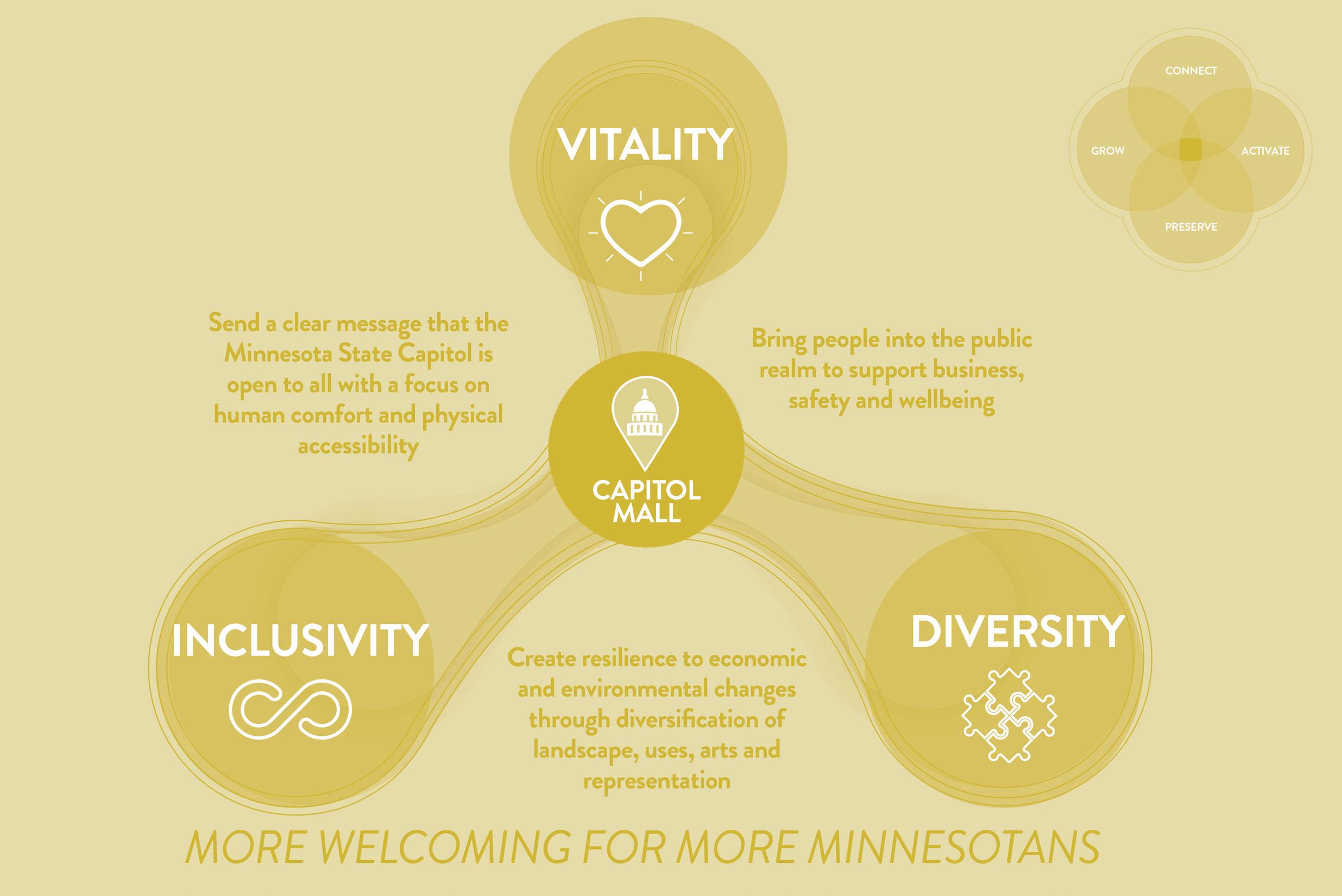
FRAMEWORK THEMES
Informed by the 2040 Comprehensive Plan and extensive community and stakeholder engagement, the following themes or values guide the Design Framework:
O Vitality speaks to a Capitol Mall that is lively, engaging, and memorable. The public realm is full of people who want to spend time in and around the Capitol Mall, whether that is to simply eat lunch, walk from one building to another, enjoy a picnic with friends, learn about Minnesota history and ecology, or attend a large event. This increased activity supports nearby businesses and even encourages new businesses to open. People feel safe because the Capitol Mall is busy and there are constant eyes on all streets and open spaces. Lastly, people feel an overwhelming sense of well-being on the Capitol Mall. They are enjoying the fresh air and connecting with the land, protected from the elements by sweeping tree canopies and various native plant species.
O Diversity supports a Capitol Mall that is resilient to environmental and economic change through a wide variety of landscapes, uses, arts and representations. Various landscape typologies ebb and flow, embodying stories of the land and educating passersby on local ecologies. Many distinct land
uses prosper within and around the Capitol Campus, including the more obvious government offices but also retail and commercial, food and beverage, housing and new civic spaces. Minnesota’s history is told from multiple lenses that represent the many diverse peoples and cultures within the state.
O Like Diversity but more direct, Inclusivity sends a clear message that the Capitol is open to all. All Minnesotans feel seen and heard on the Capitol Mall, both in their ability to protest and in the many distinct histories told throughout the Capitol Campus. Regardless of season or one’s physical abilities, workers and visitors know they can experience the Capitol Mall comfortably and with ease. People feel a sense of pride and ownership because the Capitol Mall is their Capitol Mall.
The three themes collectively create a Capitol Campus that is more welcoming to more Minnesotans. Each design move is carefully vetted and measured against these three themes to ensure all interventions, regardless of scale, align with and support the original vision outlined by the 2040 Comprehensive Plan and people of Minnesota.
THE CAPITOL
per
Analysis Lenses CONNECT PRESERVE ACTIVATE GROW
AREA PRINCIPLES
the 2040 Comprehensive Plan
Framework Themes 1. ENHANCE EXPERIENCE 2. REINVIGORATE NODES 3. RIGHT-SIZE THE STREETS 4. SCULPT TOPOGRAPHY 5. PUBLIC SPACE STRATEGIES 6. CELEBRATE WATER 7. PLANTING STRATEGIES 8. CASS GILBERT MEMORIAL PARK CAPITOL MALL DESIGN FRAMEWORK Eight Bold Design Moves
160 161 Capitol Mall Design Framework Design Framework
DESIGN FRAMEWORK
TYING IT ALL TOGETHER
GUIDANCE FROM CULTURAL LANDSCAPE REPORT
GENERAL TREATMENT GUIDELINES
The strategies below are intended to guide the preservation of the Capitol Mall Historic District’s landscape character and sense of place as a forecourt to the Saint Paul Capitol Building; as a civic space available to all residents; as a place to practice First Amendment Rights; and as a landscape which is evolving with climate change. Reference the 2024 Cultural Landscape Report (Damon Farber, 2024) for more information.
O Retain the volumes and spatial definition created by the three main approaches to the Capitol Mall intended by the original designers.
O Continue to allow the Mall to serve its cultural purpose as a civic gathering space, open to all.
O Maintain a deliberate and impactful design intent for the positioning of canopy trees within the Mall, respecting the historical viewsheds and spatial delineation.
O Retain extant contributing resources within the district.
O Enhance district-wide Universal Access
O Respect the distinct character of the ground plane as a verdant open space.
O Plan for future commemorative spaces.
O Reinforce urban connections as historically intended.
O Establish guidelines for a cohesive family of site furnishings, wayfinding elements, and educational interpretive features to ensure district-wide continuity.
O Foster resiliency within the campus.
162 Capitol Mall Design Framework A I B J C E G D F H
DESIGN FRAMEWORK N 0’ 500’ 250’ 125’ University Ave W Aurora Ave W Fuller Ave St Anthony Ave Como Ave W Pennsylvania Ave Park St N Capitol Blvd Cedar St Rice St Marion St John Ireland Blvd JacksonSt UniversityAveE E12thSt 10thStE RobertSt CedarSt WabashaSt FortRd DOWNTOWN SAINT PAUL Figure 153: Capitol Mall Design Framework A A A B B B B C C C C C D D D D D D D E E E F F F F G G G G H H H H H I I I I J J J J J J J J J DRAFT
KEY ISSUES AND STRATEGIES
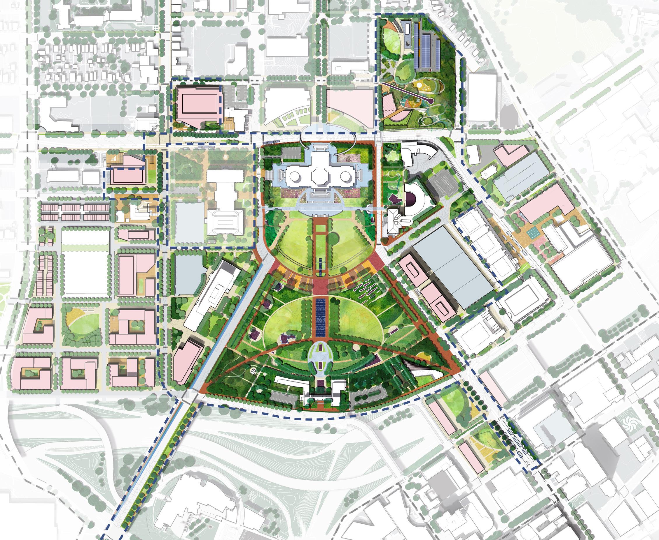
Urban tree canopy includes all of the trees within the Capitol Campus . Tree canopy enhances streetscapes and slows traffic. It also improves environmental and ecological services by reducing urban heat island effect, supporting stormwater and contributing to biodiversity. To address urban tree canopy, the Design Framework proposes multiple strategies that include, but are not limited to, lining the streets with more trees; diversifying tree species throughout the Capitol Campus; strategically locating trees within the Upper and Lower Malls that maintain views while providing more human comfort; and much more.
DRAFT
Human comfort in the physical environment refers to a state of physical ease or relaxation. It is created or inhibited through the thermal environment (temperature), visual ambiance, acoustics, air quality, and more abstract factors like security. To address human comfort, the Design Framework introduces numerous strategies that include, but are not limited to, increasing tree canopy and vegetation for shade as well as sound and wind buffer; providing more pedestrian amenities like benches and public restrooms for people to sit, rest and refresh; employing multiple security measures to ensure everyone feels safe and secure while on or around the Capitol Mall; and much more.
PUBLIC SAFETY AND SECURITY
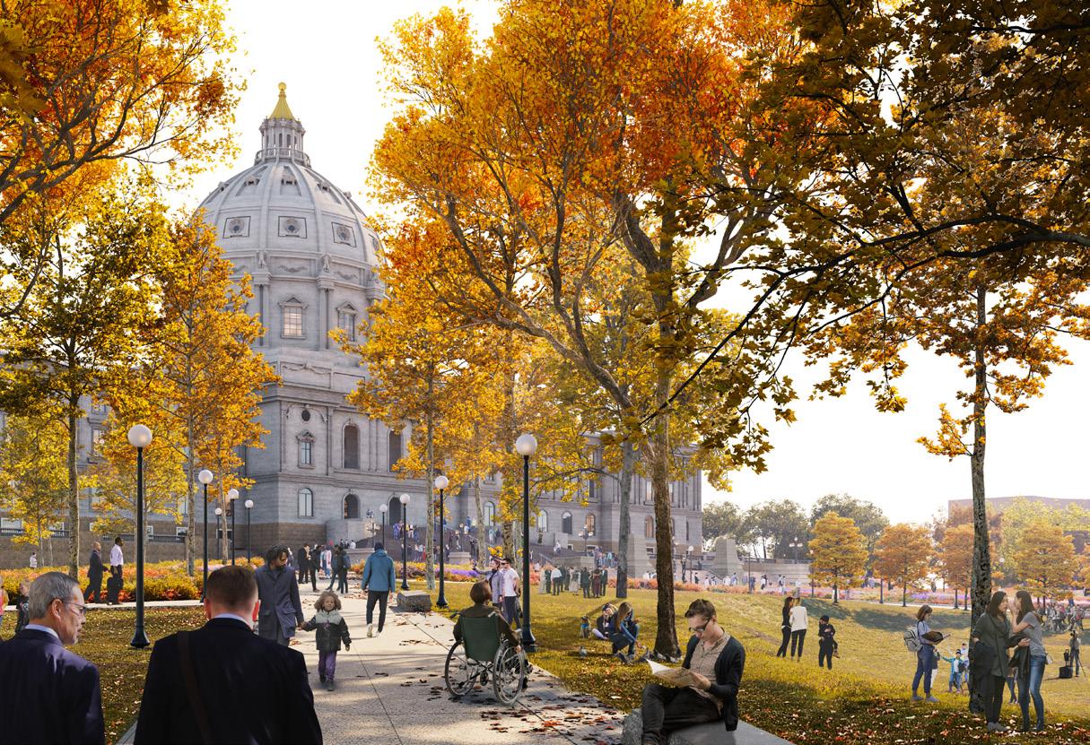
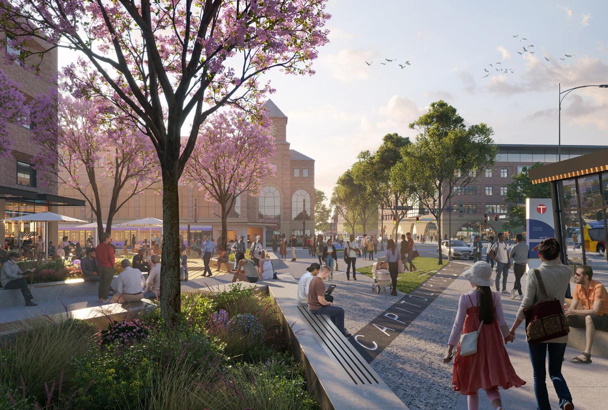
Throughout the Design Framework process, three key issues emerged that demanded innovative and multifaceted solutions or strategies: urban tree canopy, human comfort and public safety and security. These issues transcend the eight bold design moves in that they require consideration on multiple fronts. They are of high importance to various governing bodies (including the Lieutenant Governor) and the public, having bubbled to the surface as key concerns during almost every
community and stakeholder engagement outreach effort. Furthermore, their solutions and strategies are complex, interwoven, and cannot be conclusively addressed by one single design move. The Design Framework calls attention to and summarizes these issues here, but their solutions and strategies are embedded within the eight bold design moves.
Public safety and security refers to both physical protection as well as the feeling or sense of being protected. It can take the form of physical interventions in the landscape like knee walls or integrated security barriers to prevent vehicles from driving on the Capitol Mall, but also includes other factors like the presence of unhoused people on the site. While unhoused individuals have just as much a right to occupy the space as anyone else, the Design Framework’s many design moves will collectively increase public activation overall which naturally deters encampments and promotes feelings of community awareness and collective security.
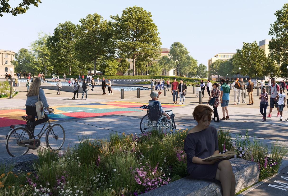
University Ave W N Capitol Blvd John Ireland Blvd E12thSt CedarSt WabashaSt
Figure 155: Increased tree canopy in the Upper Mall
Figure 156: Increased seating opportunities under expanded tree canopy
Figure 157: Integrated security features in a welcoming public realm
164 165 Capitol Mall Design Framework Design Framework
TREE CANOPY
Figure 154: ProposedDesignFramework
URBAN
HUMAN COMFORT
KEY ISSUE OVERVIEW
DESIGN FRAMEWORK
UPPER CAPITOL MALL
MORE WELCOMING TO MORE MINNESOTANS
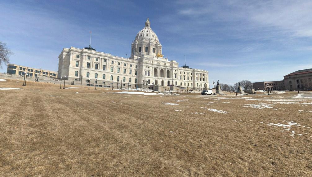
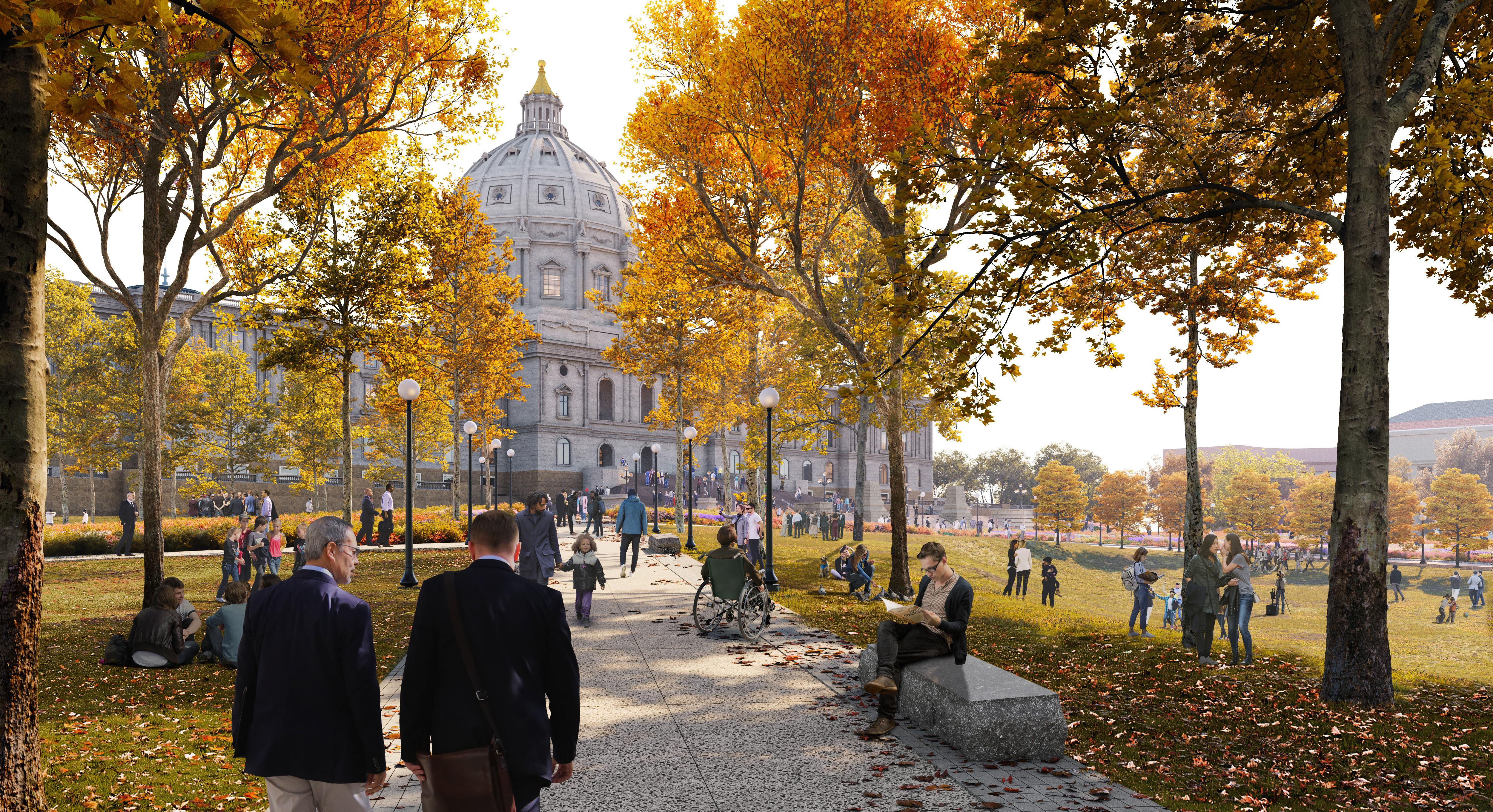
166 167 Capitol Mall Design Framework Design Framework DESIGN FRAMEWORK
Before DRAFT
JOHN IRELAND BOULEVARD
MORE WELCOMING TO MORE MINNESOTANS
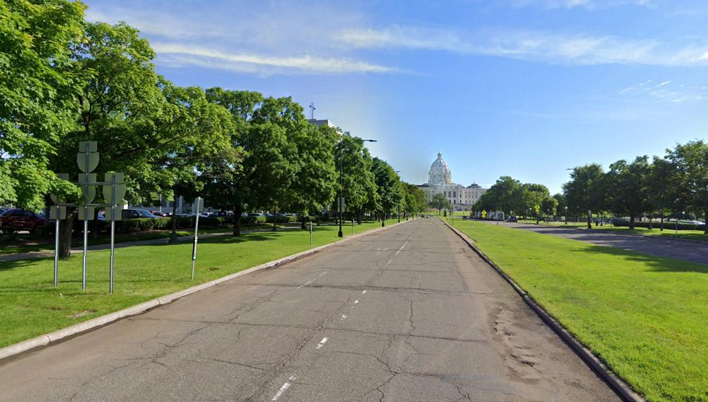
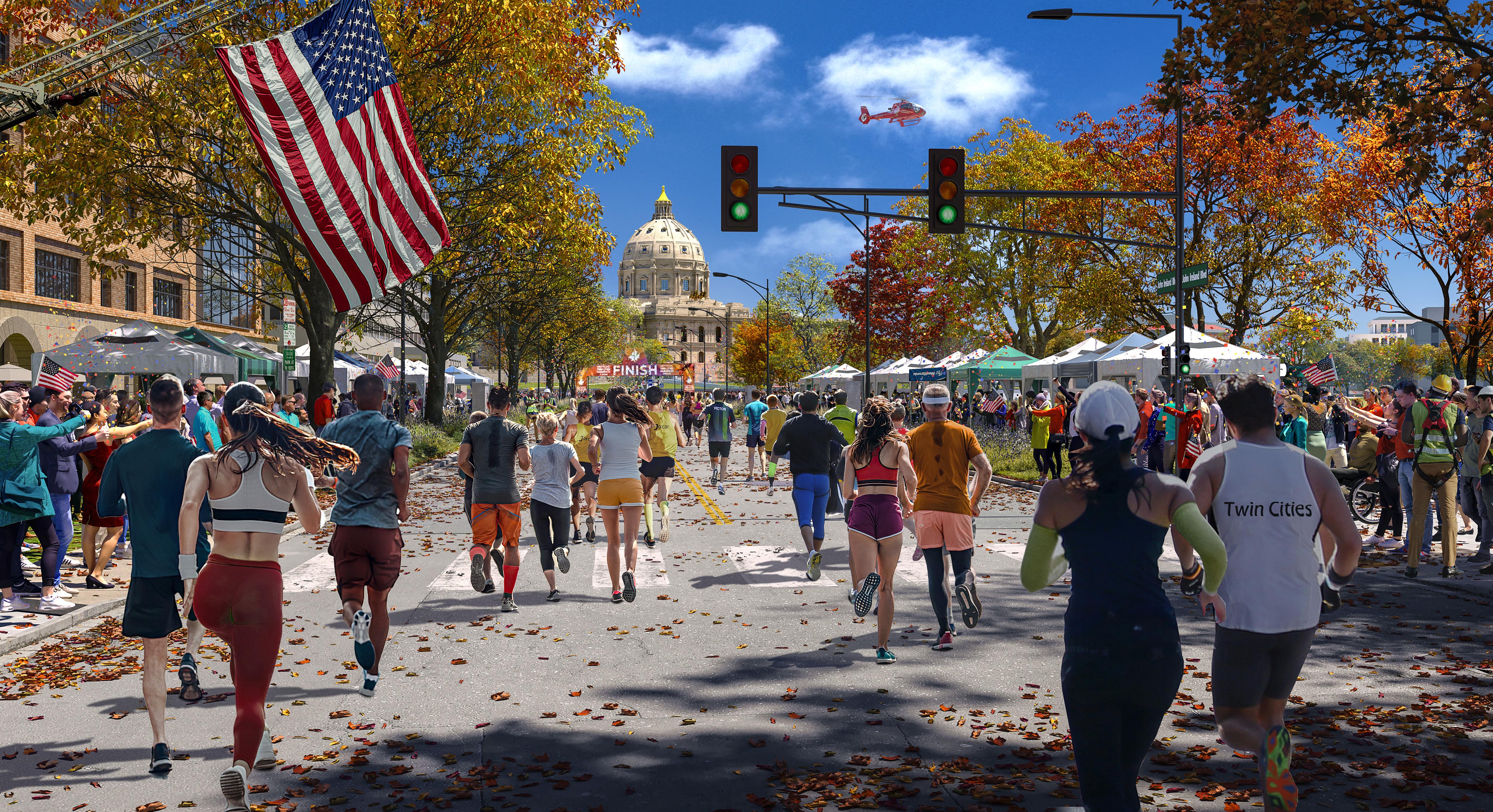
168 169 Capitol Mall Design Framework Design Framework DESIGN FRAMEWORK
Before DRAFT
CASS GILBERT MEMORIAL PARK
MORE WELCOMING TO MORE MINNESOTANS
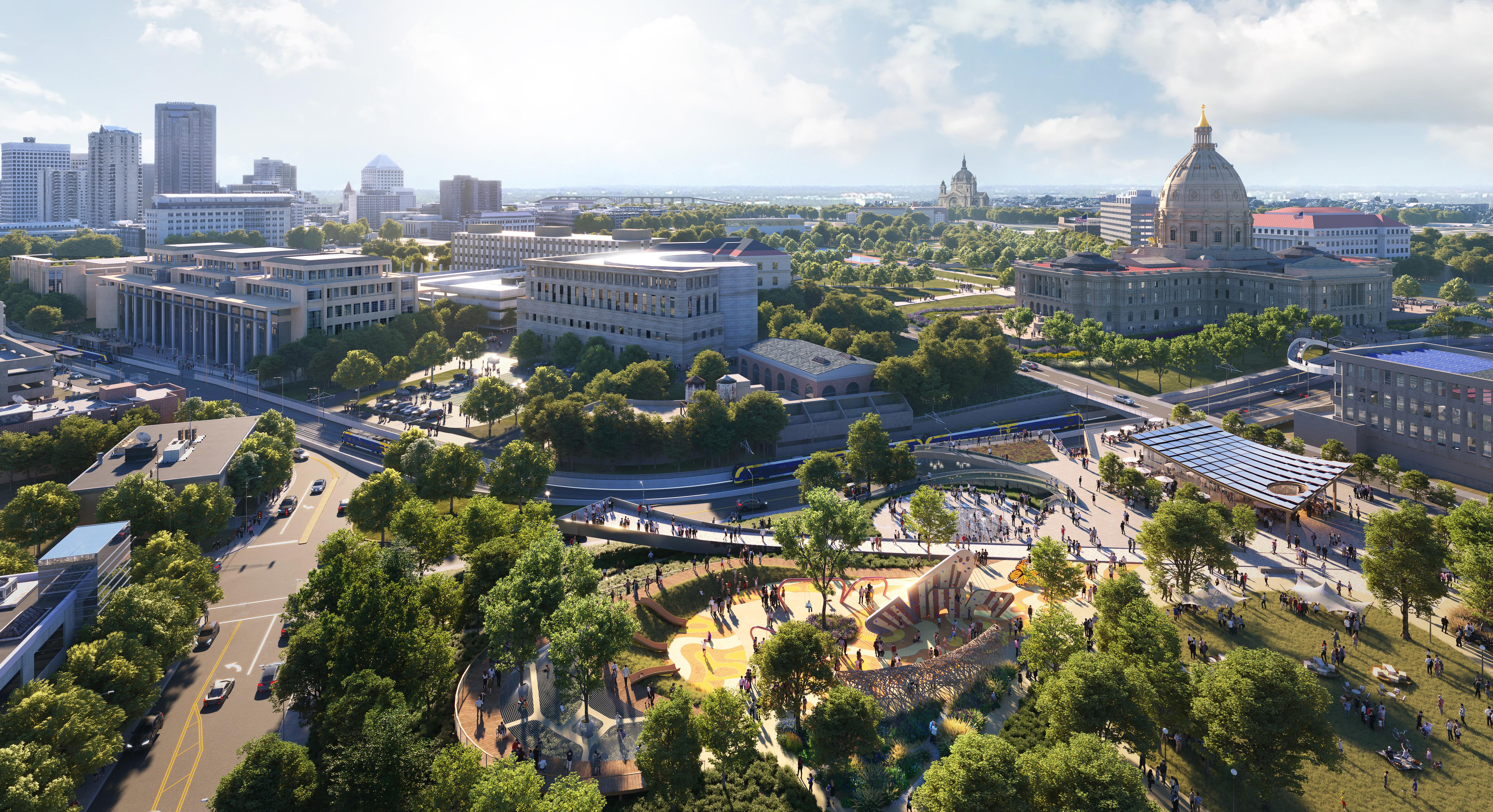
170 171 Capitol Mall Design Framework Design Framework DESIGN FRAMEWORK
DRAFT
8 FRAMEWORK APPROACH
O Enhance Experience
O Reinvigorate Nodes
O Right-size the Roads
O Sculpt Topography
O Public Space Strategies
O Celebrate Water
O Planting Strategies
O Cass Gilbert Park
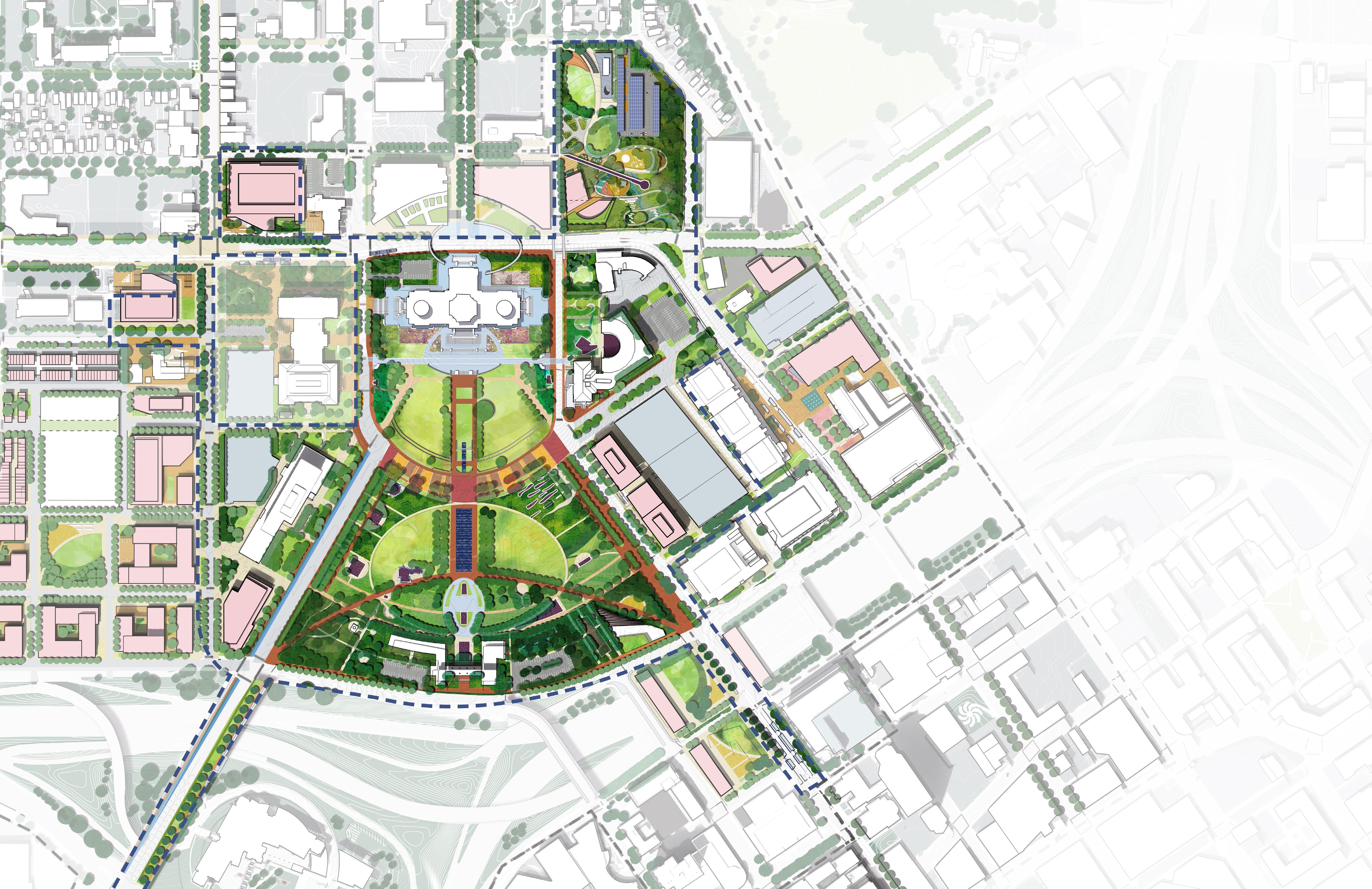
TO SHAPE THE FUTURE
OF THE CAPITOL MALL BOLD MOVES
172 173 Capitol Mall Design Framework Design Framework DESIGN FRAMEWORK
DRAFT
O Enhance the User Experience
O Day in the Life
O Amenity Principles
O Visitor Amenity Building
ENHANCE EXPERIENCE DRAFT
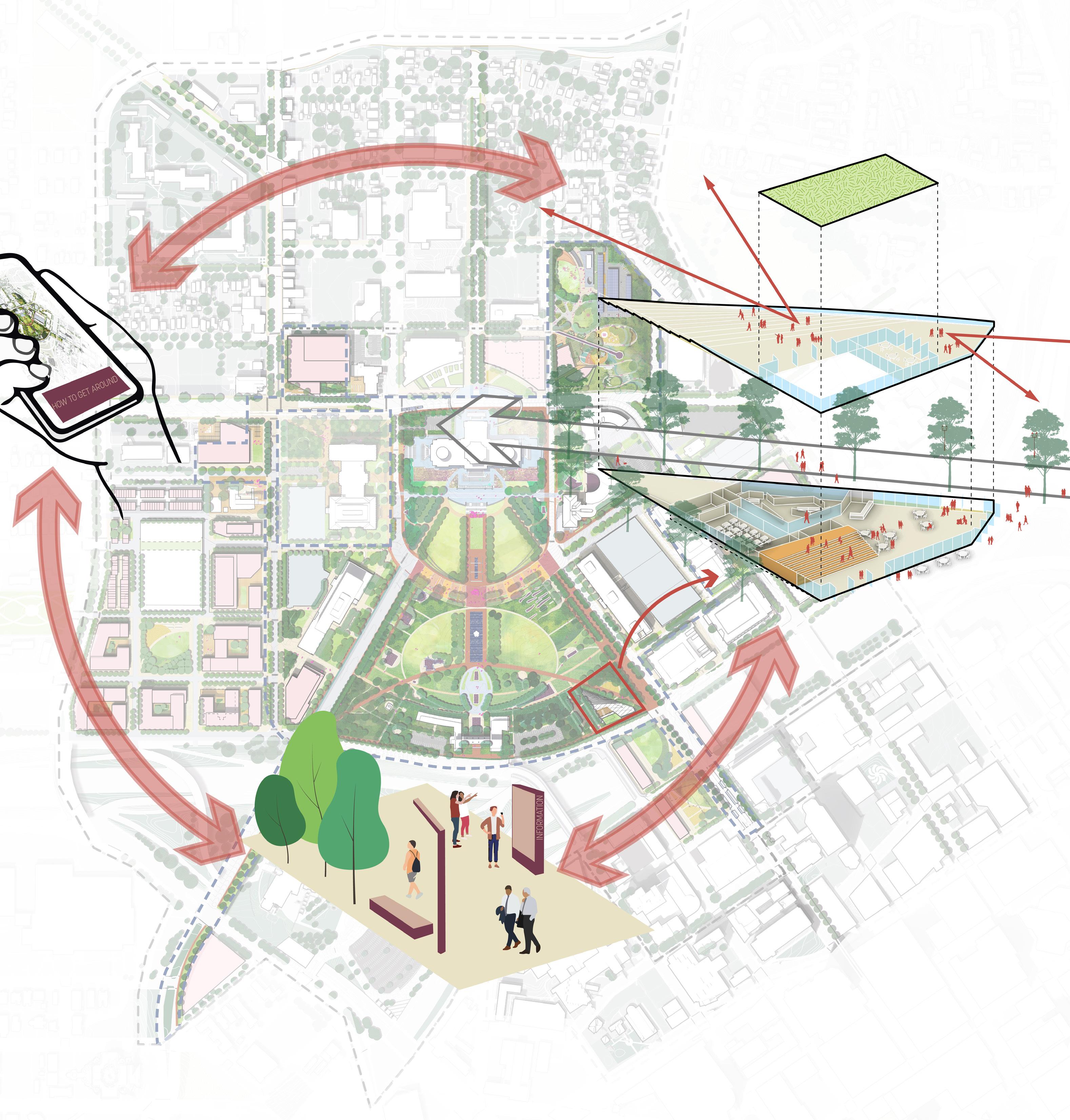
Enhance the user experience and make for a more inclusive and welcoming space
ENHANCE THE USER EXPERIENCE AND MAKE FOR A MORE INCLUSIVE AND WELCOMING SPACE
This bold move includes three distinct interventions. Digital infrastructure refers to the non-physical interfaces that utilize cell phones and other devices to assist in wayfinding and/or augmented reality. The interfaces often utilize GPS and allow visitors and workers to find their way around the campus, identify empty parking spots, or even compare historic photos to what the Capitol looks like today. A strategically placed visitor amenity center with restrooms, educational materials and gallery space will give people a home base—somewhere to orient themselves and take a rest before exploring other parts of the Capitol Campus. Placing the visitor amenity building at the corner of Cedar Street and East 12th Street not only emphasizes that threshold as a primary entry point to the Capitol Campus, but also creates a midpoint break for those traveling between the Capitol Building and Downtown. Lastly, amenity guidelines include design principles for landscape treatments around the Capitol Campus that support the user experience. These guidelines address interventions like smart kiosks, informational signage, wayfinding maps, restroom amenities, lighting, seatings, and so on.
TAKEAWAYS
O Digital infrastructure includes features like the Cap App with GPS-enabled wayfinding and/or augmented reality.
O A visitor amenity center can provide a home base or starting point for those visiting the Capitol Campus with restrooms, educational materials, and more.
O Amenity guidelines ensure consistent landscape treatments and reinforce the Capitol Mall as a distinct and special place.
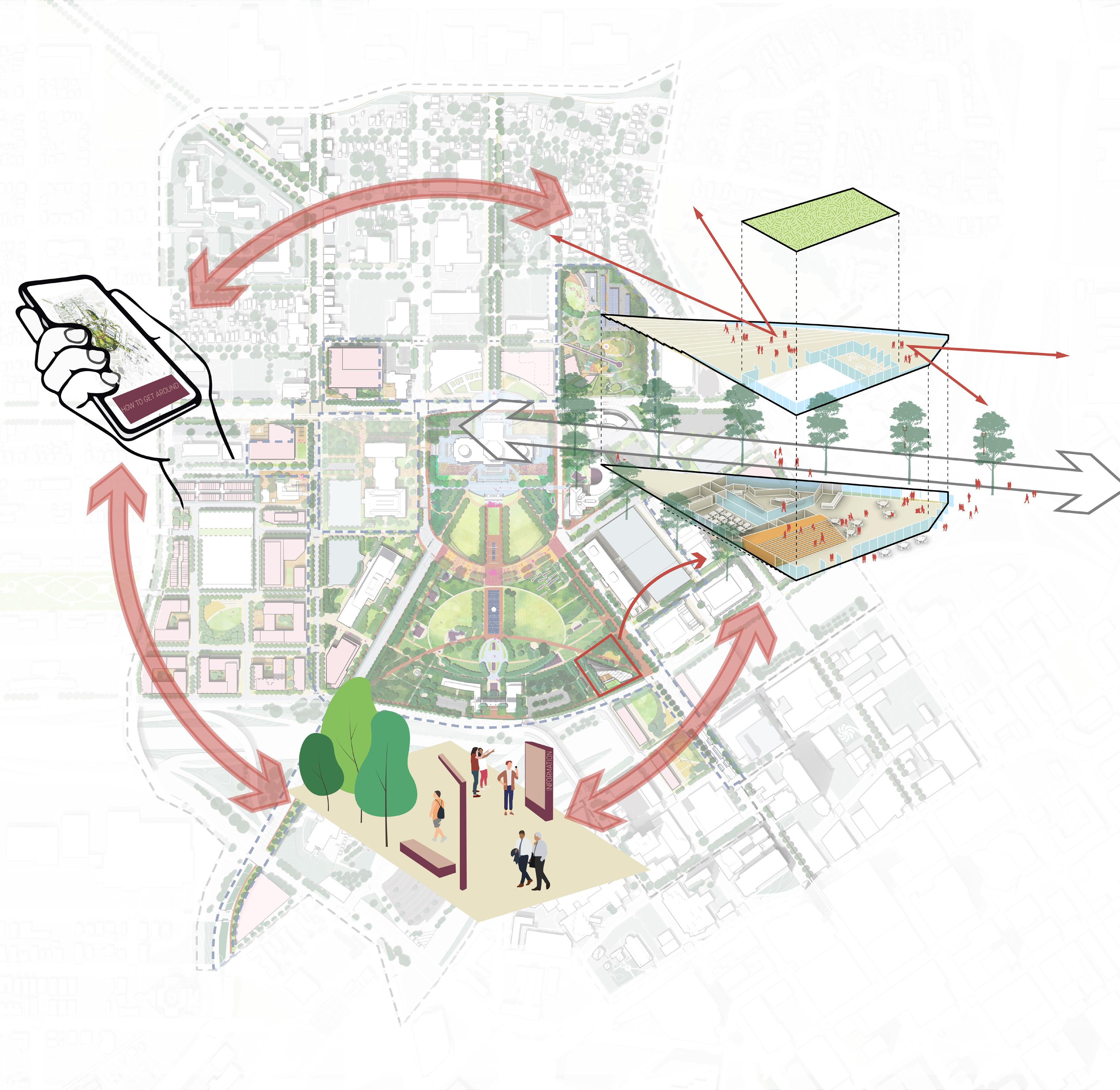
DRAFT
Figure 158: Capitol Mall User Experience DIGITAL INFRASTRUCTURE To City To Capitol University Ave Rice St CedarSt WabashaStN E12thSt W 12th St St Anthony Ave RobertSt VISITOR
AMENITY BUILDING AMENITY GUIDELINES
176 177 Capitol Mall Design Framework Design Framework
ENHANCE EXPERIENCE
DAY IN THE LIFE
USER PROFILES
Visitors to the Capitol Mall are enthralled by the rich architectural heritage of the Capitol building, museums and art installations, immersing themselves in the cultural tapestry of the region through guided tours and seasonal events.
Residents enjoy the serene ambiance of green spaces for leisurely strolls and picnics, while also benefiting from the convenience of nearby amenities for daily errands and social gatherings.
Office workers appreciate the accessibility to government offices, corporate buildings, and diverse dining options, which foster a productive work environment and opportunities for networking. Engaged citizens actively participate in community events, rallies, and advocacy campaigns at the Capitol Mall, leveraging its central location to voice their concerns, connect with like-minded individuals, and contribute to shaping public discourse and policy decisions.
Students frequenting the Capitol Mall areas find inspiration in the historical landmarks and cultural institutions, utilizing the serene surroundings for studying, group projects, and occasional recreational activities.
to Human Comfort Page
Tree Canopy Page
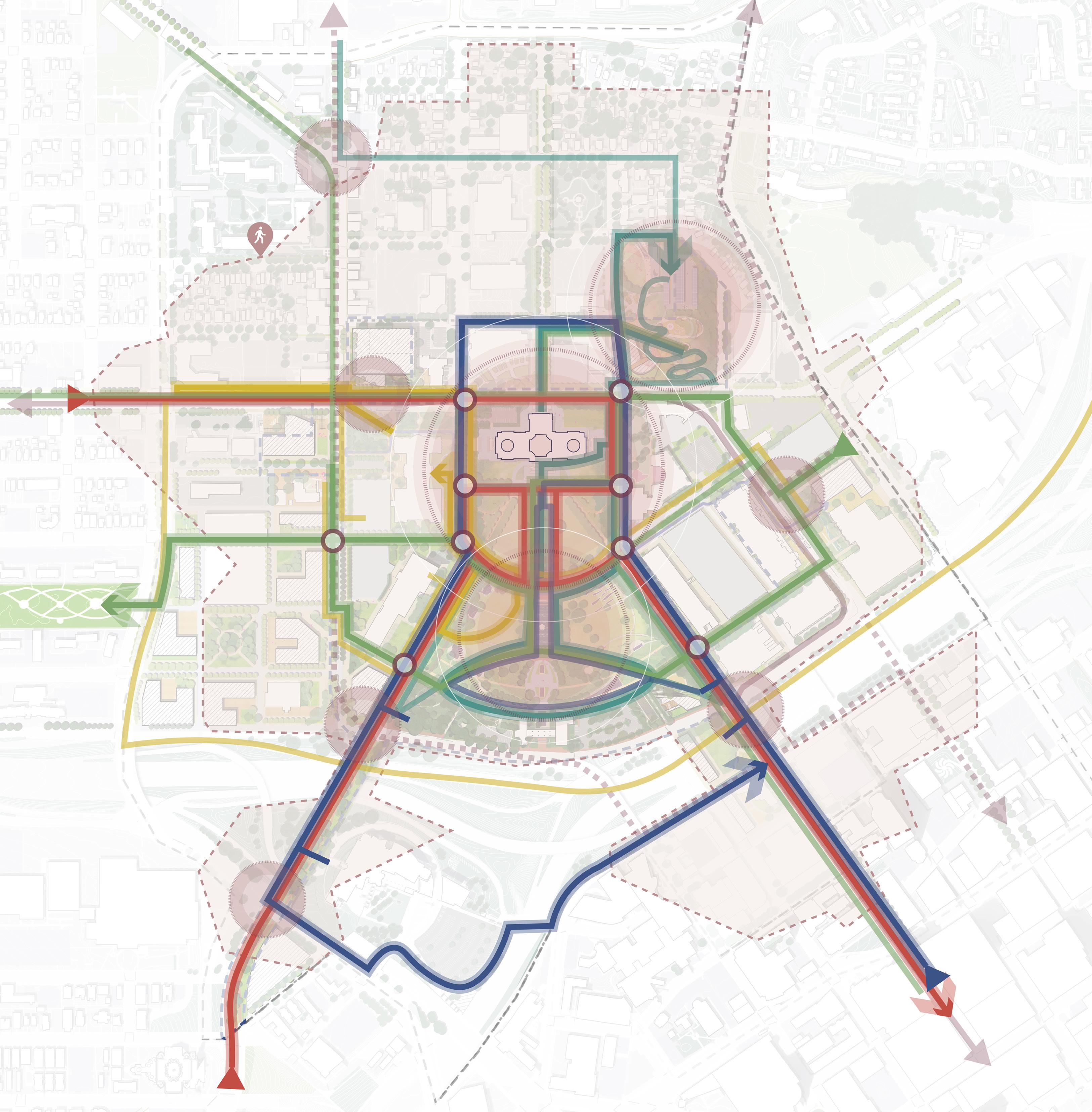
Figure 159. Day in the Life of Capitol Users Refer
Refer
Visitors Residents Office Workers Engaged Citizens Students Major Node Transit Hub Intersection N 0’ 500’ 250’ 125’ I-94 University Ave Aurora Ave St Anthony Ave Marion St Como Ave Winter St W Pennsylvania Ave Park St Rice St John Ireland Blvd CedarSt Cedar St JacksonSt UniversityAveE E12thSt FortRd I-35E WabashaStN RobertSt Robert St Capitol Heights DOWNTOWN SAINT PAUL 5minsWalkfromNodes MAJOR NODES TRANSIT HUBS INTERSECTIONS
to
LEGEND INFORMATION BOARD LIGHTING SMART KIOSK WATER FOUNTAIN RESTROOM SEATING INFORMATION BOARD LIGHTING BIKE RENTAL SMART KIOSK SEATING LIGHTING WAYFINDING SIGNAGE SEATING 178 179 Capitol Mall Design Framework Design Framework
ENHANCE EXPERIENCE DRAFT
DAY IN THE LIFE
USER ROUTES
JOIN TOGETHER IN THE DEMOCRATIC PROCESS
CONTRIBUTE TO SHAPING PUBLIC DISCOURSE AND POLICY DECISIONS
WE ENJOY THE GREEN SPACES FOR LEISURELY STROLLS AND PICNICS
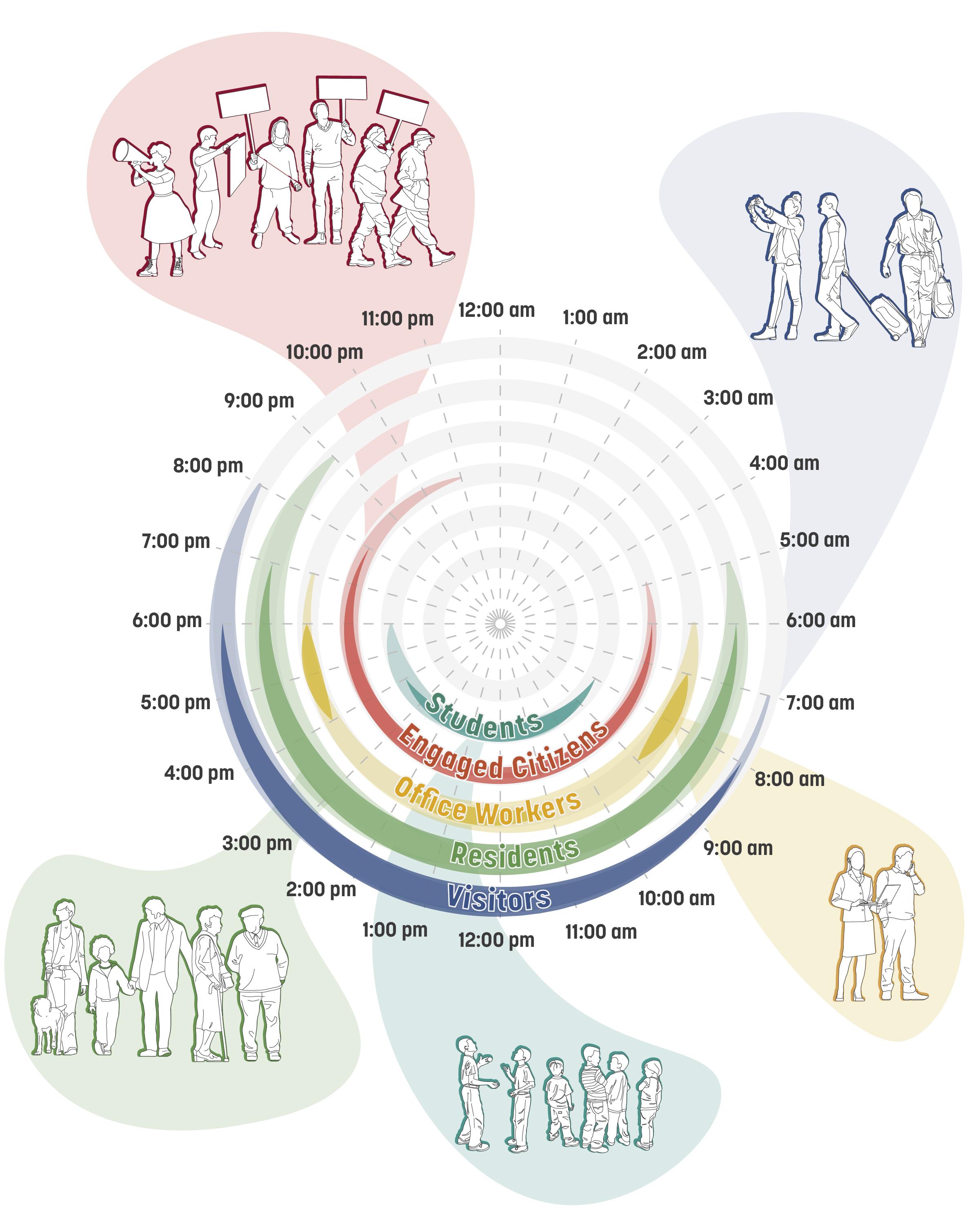
I LIKE THE CONVENIENCE OF NEARBY AMENITIES FOR SOCIAL GATHERINGS
BIKING IS A GREAT WAY TO EXPERIENCE THE CAPITOL AREA
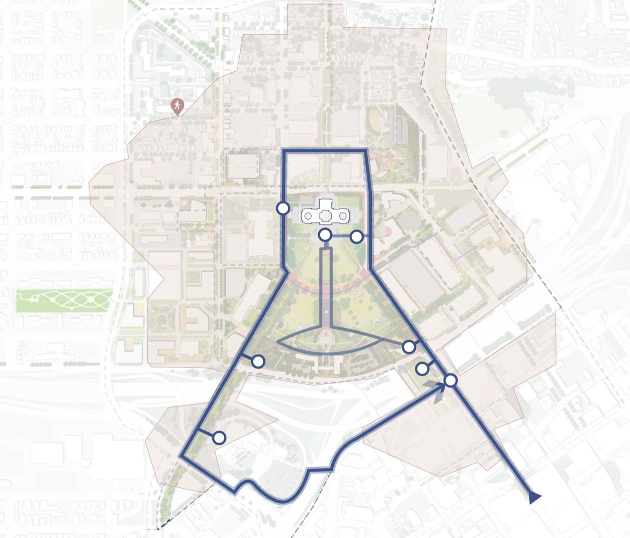
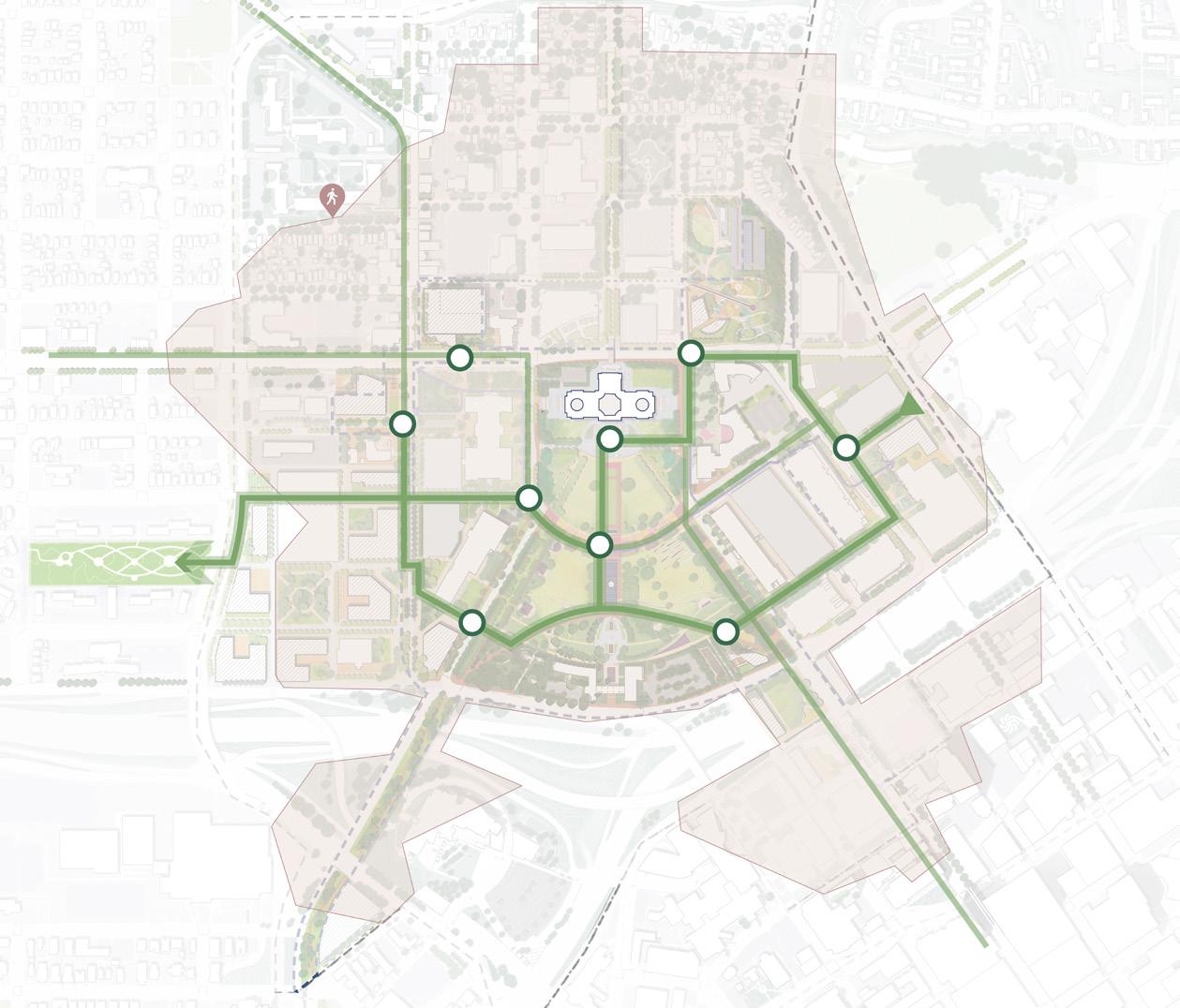
I LOVE VISITING THESE MEMORIALS AND LANDMARKS
THERE ARE GREAT OUTDOOR SPACES FOR MEETINGS AND NETWORKING
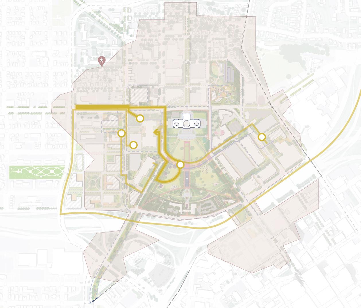
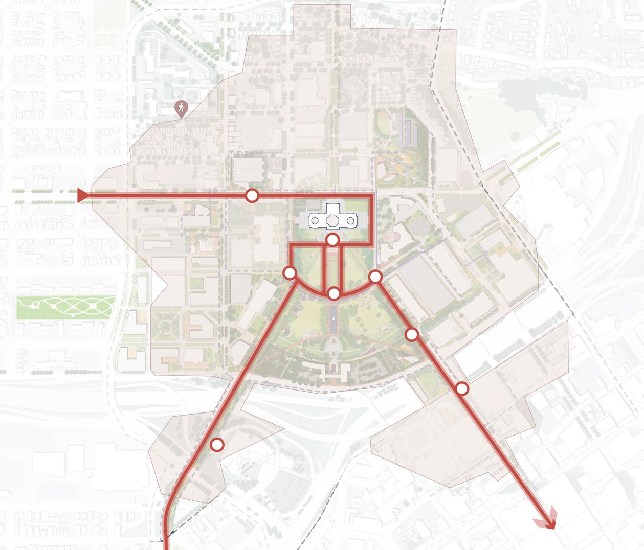
I APPRECIATE DIVERSE DINING OPTIONS
CASS GILBERT PARK HAS SO MANY AMENITIES
VISIT CULTURAL INSTITUTIONS FOR STUDYING
STARTING MY TOUR OF THE CAPITOL AT THE PARK IS AMAZING!
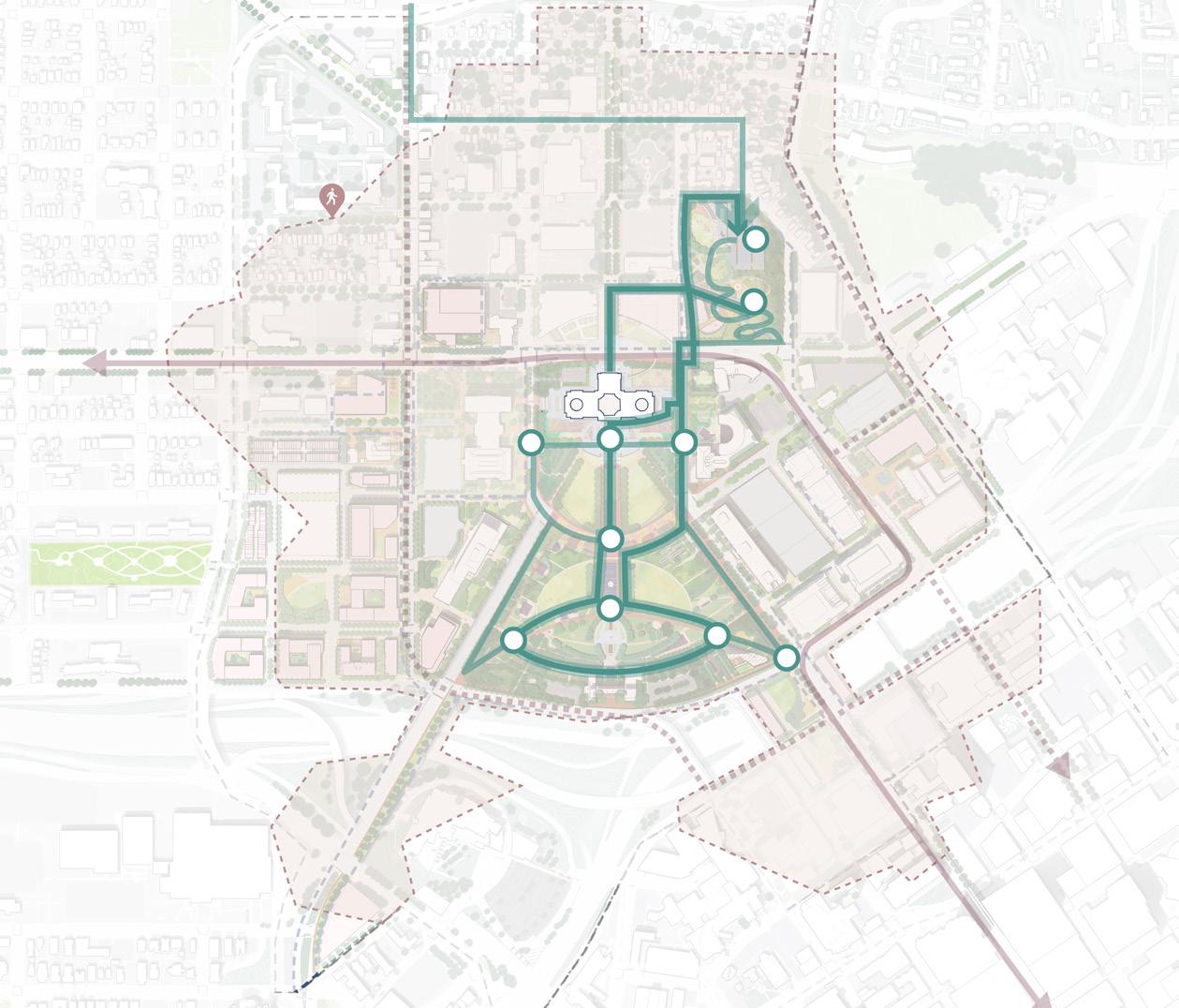
TAKEAWAYS
O Diverse user groups circulate within the campus, each with their distinct patterns of movement.
O Varied transit modes necessitate amenities that cater to different transportation needs.
O Apart from landmarks, programmed areas are key to attracting people.
Figure 160. Daily Use Timeline
INFORMATION CENTER INFORMATION CENTER BUS DROPOFF BUS PARKING NATURE PLAY OVERLOOK OVERLOOK OVERLOOK MARKET MONUMENTS MONUMENTS ART OPEN LAWN OPEN LAWN CAFE CAFE CAFE CAFE
VISITORS ENGAGED CITIZENS RESIDENTS STUDENTS & CHILDREN OFFICE WORKERS
Visitors Routes Office Workers Routes Students & Children Routes Residents Routes Engaged Citizens Routes 180 181 Capitol Mall Design Framework Design Framework
ENHANCE EXPERIENCE
DRAFT
AMENITY PRINCIPLES
hubs
In front of memorials, commemorative works, nodes and landmarks
All major pedestrian circulation intersections
Any points of low visibility or areas that have multiple routes
All major gateways, mobility hubs and light rail stations, intermittently along bike corridors to provide comprehensive coverage (5-min bike distance between facilities)
Cover 10-min walk area, can be included into welcome center and park amenity buildings
All roadways and pedestrian routes to provide even illumination (see Sustainable Landscape Design and Maintenance Standards)
Along pathways and major gathering spaces
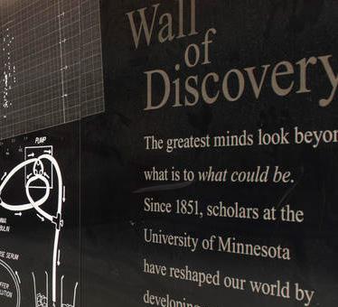
Interactive real-time information for all users
Display history and stories of the features for visitors, residents, students, and children
Allow users to orient and encourage them to explore the areas and plan tours
Direct ways with concise information
Provide a new way to experience the Capitol Area
DRAFT
Essential amenities on daily bases and during events
Essential amenities on daily basis and during events
Essential amenities on daily basis and during events
Cover 10-min walk area, resistant to extreme weather conditions
Essential amenities for events and extreme weather
Source: https://fishermenlabs.com/blog/how-snapchat-landmarkers-arechanging-the-face-of-architecture/
Source: https://www.baekdal.com/ trends/eyestop-bus-shelter/
Source: https://www.nytimes. com/2012/05/09/arts/design/a-new-visitorcenter-at-brooklyn-botanic-garden.html
Source: https://rsmdesign.com/
Source: University Gateway Corporation, https:// scholarswalk.umn.edu/about/wall-discovery
Source: https://www.archdaily.com/369870/the-bikesharing-takeover?ad_medium=gallery
Source: Damon Farber
Source: https://www.yter.es/mobiliariourbano/bancos-urbanos/bancolabyrinth/
Figure 161. Interactive apps
Figure 162. Wall of Discovery
Figure 163. Smart kiosk
Figure 164. Wayfinding signage
Figure 167. Light poles
Figure 168. Seating
Figure 165. Bikeshare station with information board
Figure 166. Weather shelter
AMENITY PLACEMENT CRITERIA PROGRAM Smart kiosk Welcome board Information signage Primary wayfinding map Wayfinding signage Micromobility facilities Restroom amenities Lighting Seating Weather Shelter All transit
182 183 Capitol Mall Design Framework Design Framework
SIGN AND AMENITIES LOCATION MATRIX ENHANCE EXPERIENCE
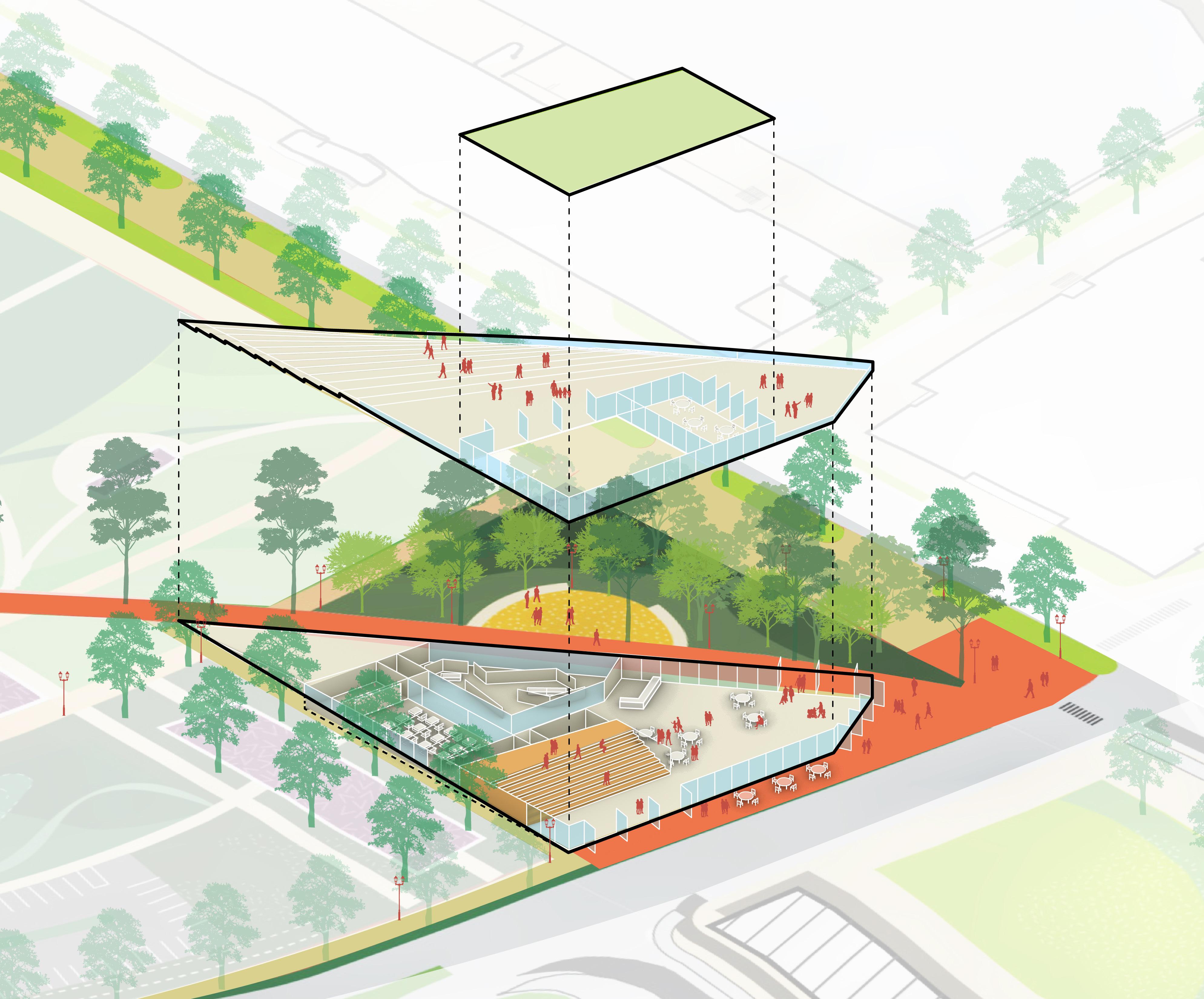
VISITOR AMENITY
BUILDING
A WELCOME CENTER AT THE ANCHOR POINT
STAIRSGRAND
CLASSROOM
GALLERY
CLASSROOMRESTROOMS
DRAFT
COMMUNITY
CREATE BETTER VIEWPOINT TO CAPITOL
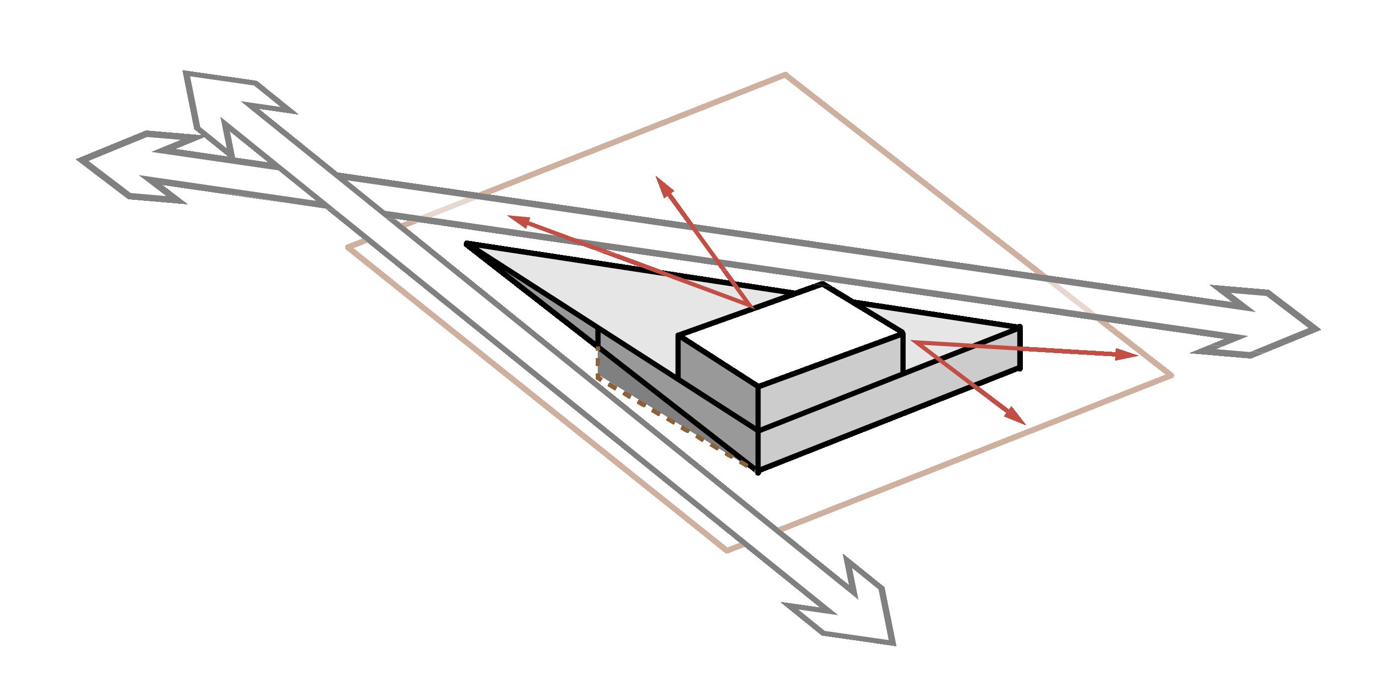
RESPONSETO EXISTING SLOPED LANDFORM
CEDAR STREET
WELCOME CENTER
O Located conveniently near the 10th Street transit station and new urban park over the highway, the Welcome Center serves as a vibrant hub for residents, visitors, and all user groups.
O With amenities like a cafe, gallery, gift shop, classrooms, and restrooms, the Welcome Center offers a collective space for visitor wayfinding, community gatherings, and cultural exploration. Students also benefit from educational opportunities through gallery exhibitions and interactive experiences.
O The rooftop provides stunning views to the nearby urban landscape and Capitol Building while still respecting the topography of the Lower Mall and historic design intentions.
Figure 170. Visitor Amenity Building
LOBBY GREENROOF W12THSTREET CAFE STORAGE
184 185 Capitol Mall Design Framework Design Framework
ENHANCE EXPERIENCE
REINVIGORATE NODES
O Matrix
O University and Rice Mobility Hub
O Sears + Rice BRT Node
O Robert Street Station Plaza
O Cedar + Wabasha Deck Node
O MNHS Plaza
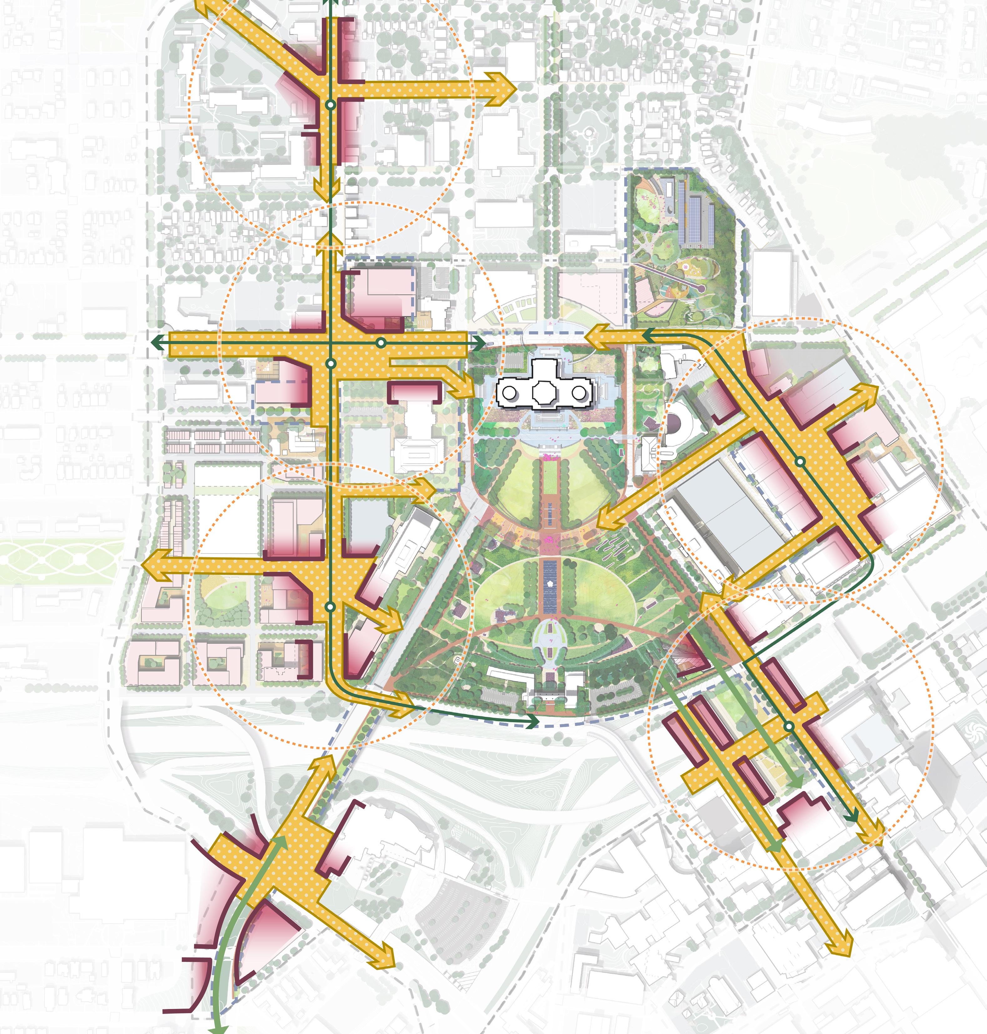
Reinvigorate nodes that connect the community to the Capitol in each direction
186 187 Capitol Mall Design Framework Design Framework
DRAFT
REINVIGORATE NODES THAT CONNECT THE COMMUNITY TO THE CAPITOL IN EACH DIRECTION
Nodes describe the major arrival points to the Capitol Campus and facilitate the first experiences people have when arriving. They include the MNHS Plaza, Sears and Rice BRT Station, University and Rice Mobility Hub, Como and Rice BRT Station, Robert Street Station Plaza, and Cedar and Wabasha Park Deck. Additionally, nodes connect the Capitol Mall to the surrounding community and operate as thresholds between these various distinct spaces. These points are multimodal in that they capture people arriving by car, light rail, bus, or walking. Focusing placemaking investments in these areas ensures nodes become vibrant public realms that welcome all Minnesotans to the Capitol Mall. Public realm enhancements can include signage and wayfinding, active ground floors that promote visibility and natural surveillance, complete street design with pedestrian-friendly sidewalks, and much more.
DRAFT
TAKEAWAYS
O Nodes are opportunities to focus placemaking investments in intentional areas to make the most impact.
O Creating a vibrant public realm at each node provides a welcoming and inviting entrance to the Capitol Campus for those arriving by car, transit and pathways.
Figure 171. Capitol Mall Nodes Cass Gilbert Memorial Park N 0’ 250’ 125’ 60’ I-94 I-35E University Ave W Rice St Park St CedarSt Cedar St E12thSt John Ireland Blvd Aurora Ave Charles Ave Marion St St Anthony Ave WKelloggBlvd JacksonSt UniversityAveW Como Ave ComoAve WPennsylvaniaAve RobertSt 10thStE Valley Park Western Sculpture Park CAPITOL HEIGHTS DOWNTOWN SAINT PAUL MT. AIRY CAPITOL RICE DISTRICT FITZGERALD PARK HISTORICAL HILL DISTRICT MN STATE CAPITOL MALL COMO & RICE BRT NODE UNIVERSITY & RICE MOBILITY HUB CEDAR & WABASHA DECK NODE ROBERT STREET STATION PLAZA MNHS PLAZA SEARS & RICE BRT NODE
188 189 Capitol Mall Design Framework Design Framework REINVIGORATE NODES
REINVIGORATE NODES
UNIVERSITY & RICE MOBILITY HUB
Multi-modal mobility hub Urban Core
SEARS & RICE
BRT NODE
COMO & RICE BRT NODE
ROBERT STREET
STATION PLAZA
Mixed-use district with enhanced transit options Urban District
CEDAR & WABASHA DECK NODE
Neighborhood Transit Street with Bike Lanes
MNHS PLAZA
Mixed-use district with Multi-modal mobility hub Urban Core
urban park and Activity Hub
O Clear signage and wayfinding systems with digital platforms and mobile apps provide real-time transit updates and highlight pick-up/drop-off areas.
O Mobility options such as light rail stations,
O Complete street design accommodates all users.
O Pedestrian-friendly sidewalks with tree canopy provide comfort during the day and human-scaled lighting enhances walkability and safety after traditional working hours.
O Pedestrian-friendly sidewalks with tree canopy provide comfort during the day and human-scaled lighting enhances walkability and safety after traditional working hours.
O Office building campus with urban plazas and retail stores enhance walkability and vibrancy.
O Transit stations with kiosks and wayfinding systems help orient between stations.
O Diverse amenities such as welcome center, cafe, restrooms, and wayfinding information enhance visitor experience and community space
O Warmer spaces such as covered pavilions or under-tree canopies offer protection from inclement weather.
O A strategically planned view corridor framed by landscape maximizes scenic vistas and focal points along the linear park.
micromobility stations and pedestrian crossings create barrier-free access.
O Active ground floors enhance visibility and natural surveillance.
O Mixed-use development with kiosks and wayfinding systems provide recommendations for attractions and amenities within the Capitol Campus.
O Dedicated micromobility infrastructure provides a safe and diverse transportation and recreation environment.
O Pedestrian-friendly sidewalks with tree canopy provide comfort during the day and human-scaled lighting enhances walkability and safety after traditional working hours.
O Climate-adaptive features like water management systems mitigate the impact of heavy rainfall and extreme temperatures.
O Clear signage and wayfinding systems at the intersections direct people to major destinations.
LOCATION TYPOLOGY KIT OF PARTS
CHARACTERISTICS
Cultural destination
Iconic
190 191 Capitol Mall Design Framework Design Framework
MATRIX REINVIGORATE NODES
DRAFT
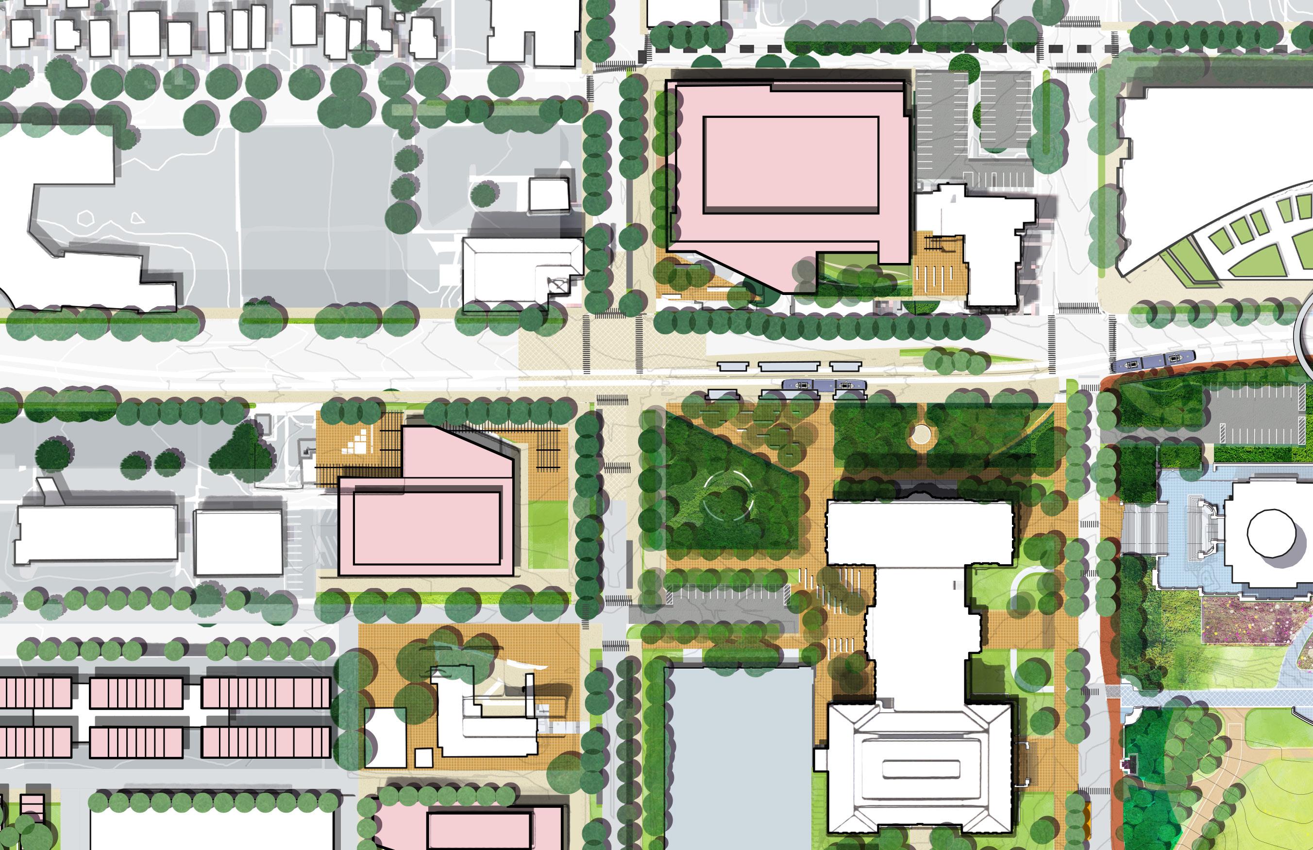
UNIVERSITY AVE P P RICE ST PARK ST NEW STATE OFFICE BUILDING SENATE BUILDING LIGHT RAIL STATION BRT STATION MN STATE CAPITOL O Clear signage and wayfinding systems with digital platforms and mobile apps provide real-time transit updates. O Mobility options like light rail stations, micromobility stations and pedestrian crossings create barrier-free access. O Active ground floors enhance visibility and natural surveillance. Figure 172. University and Rice Mobility Hub Plan Note: SOB Landscape to be coordinated
CHARACTERISTICS REINVIGORATE NODES DRAFT
UNIVERSITY + RICE MOBILITY HUB
UNIVERSITY + RICE
VISION AND KIT OF PARTS
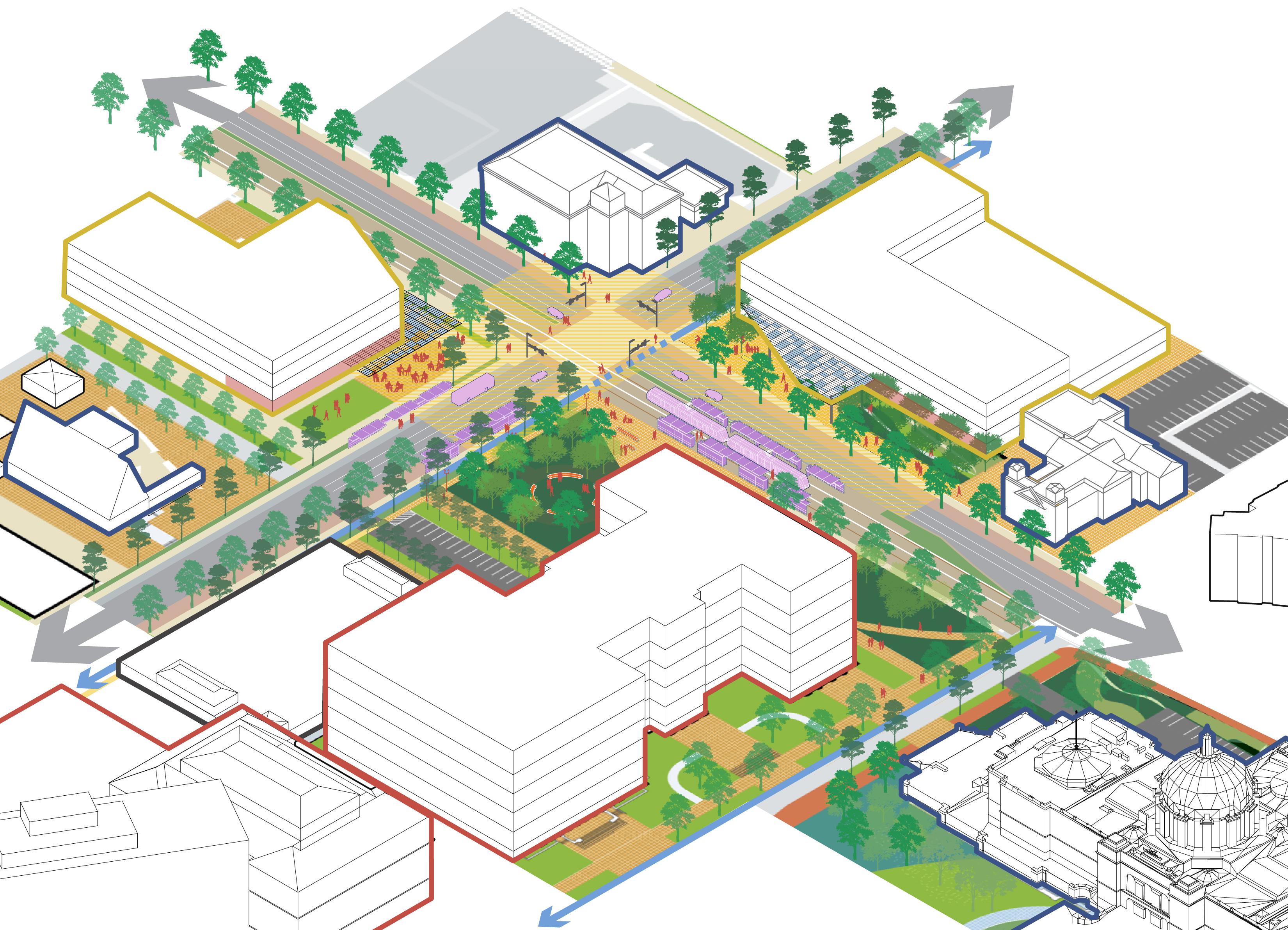
GROUND FLOOR PUBLIC GATHERING SPACES
CONCENTRATE PUBLIC REALM INVESTMENT
GROUND FLOOR
CONNECTIVITY
ACTIVE
PARKING
RICEST
Note: SOB Landscape to be coordinated Figure 173. University and Rice Mobility Hub Axon 194 195 Capitol Mall Design Framework Design Framework
DISTRICT
ACTIVE
INCREASED
MOBILITY CONCENTRATION UNIVERSITYAVE
PARKST
MOBILITY HUB
REINVIGORATE NODES DRAFT
UNIVERSITY AND RICE MOBILITY HUB
PRECEDENTS
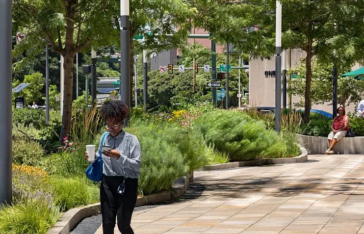
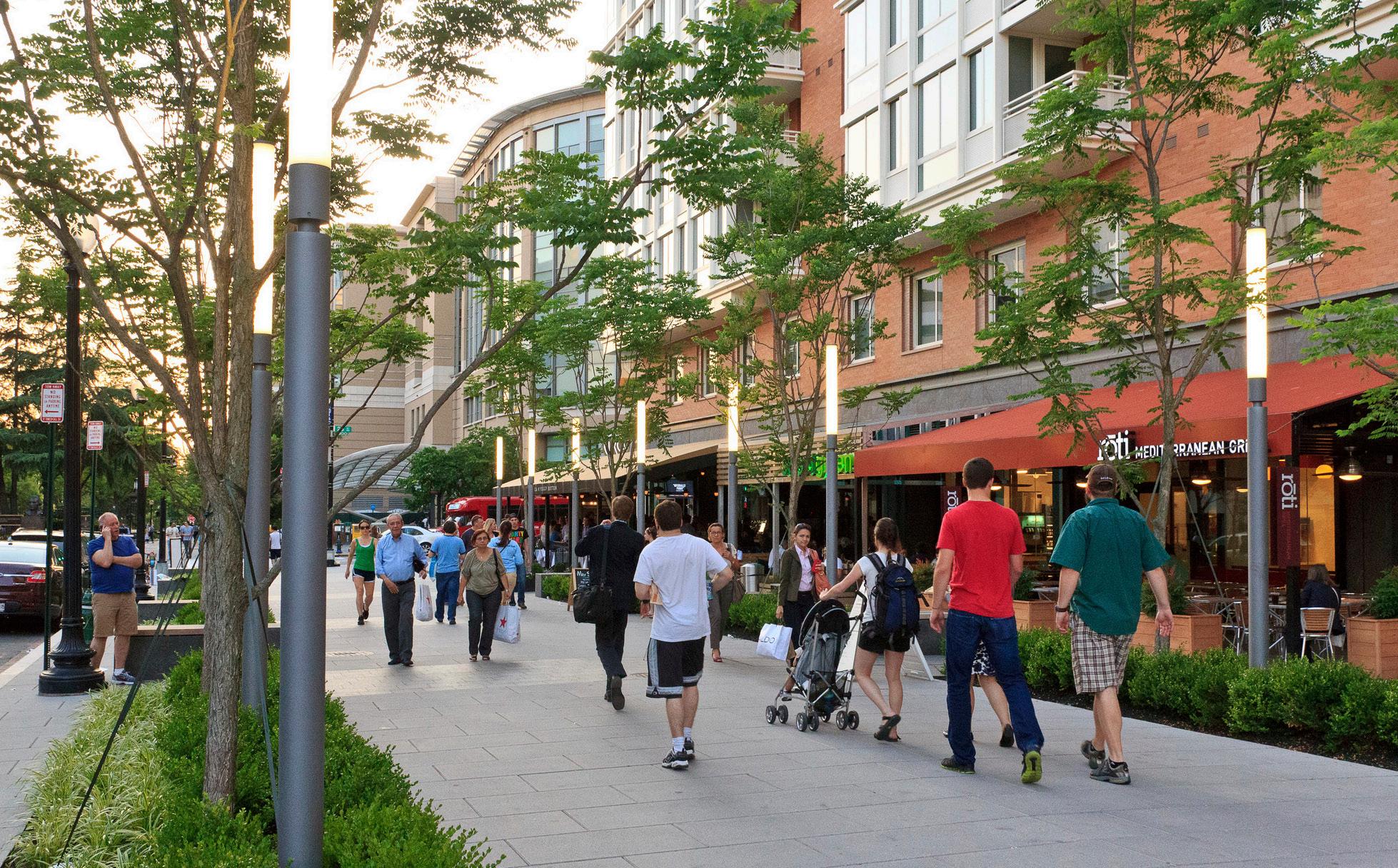
KIT OF PARTS
Clear signage and wayfinding systems with digital platforms and mobile apps provide real-time transit updates.
Mobility options like light rail stations, micromobility stations and pedestrian crossings create barrier-free access.
Active ground floors enhance visibility and natural surveillance.
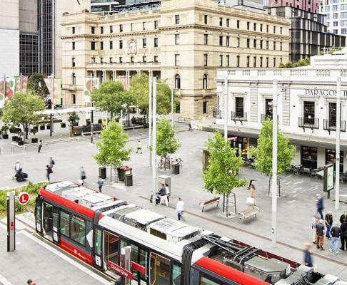
www.aspect-studios.com
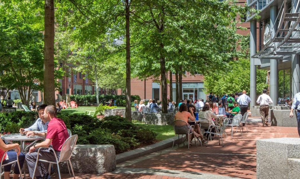
 Figure 174. Gateway Plaza, Richmond VA
Source: The Avenue DC, Sasaki
Figure 176. The Avenue, Washington D.C.
Source: Sydney CBD and South East Light Rail, Aspect Studios,
Figure 175. Sydney CBD and South East Light Rail, Sydney
Source: The Avenue DC, Sasaki
Figure 177. The Avenue, Washington D.C.
Source: Sydney CBD and South East Light Rail, Aspect Studios, www.aspect-studios.com
Figure 178. Sydney CBD and South East Light Rail, Sydney
Source: Sydney CBD and South East Light Rail, Aspect Studios, www.aspect-studios.com
Figure 179. Sydney CBD and South East Light Rail, Sydney
Source: Gateway Plaza. Lamar Johnson Collaborative, theljc.com
Figure 174. Gateway Plaza, Richmond VA
Source: The Avenue DC, Sasaki
Figure 176. The Avenue, Washington D.C.
Source: Sydney CBD and South East Light Rail, Aspect Studios,
Figure 175. Sydney CBD and South East Light Rail, Sydney
Source: The Avenue DC, Sasaki
Figure 177. The Avenue, Washington D.C.
Source: Sydney CBD and South East Light Rail, Aspect Studios, www.aspect-studios.com
Figure 178. Sydney CBD and South East Light Rail, Sydney
Source: Sydney CBD and South East Light Rail, Aspect Studios, www.aspect-studios.com
Figure 179. Sydney CBD and South East Light Rail, Sydney
Source: Gateway Plaza. Lamar Johnson Collaborative, theljc.com
196 197 Capitol Mall Design Framework Design Framework
REINVIGORATE NODES DRAFT
MOBILITY HUB
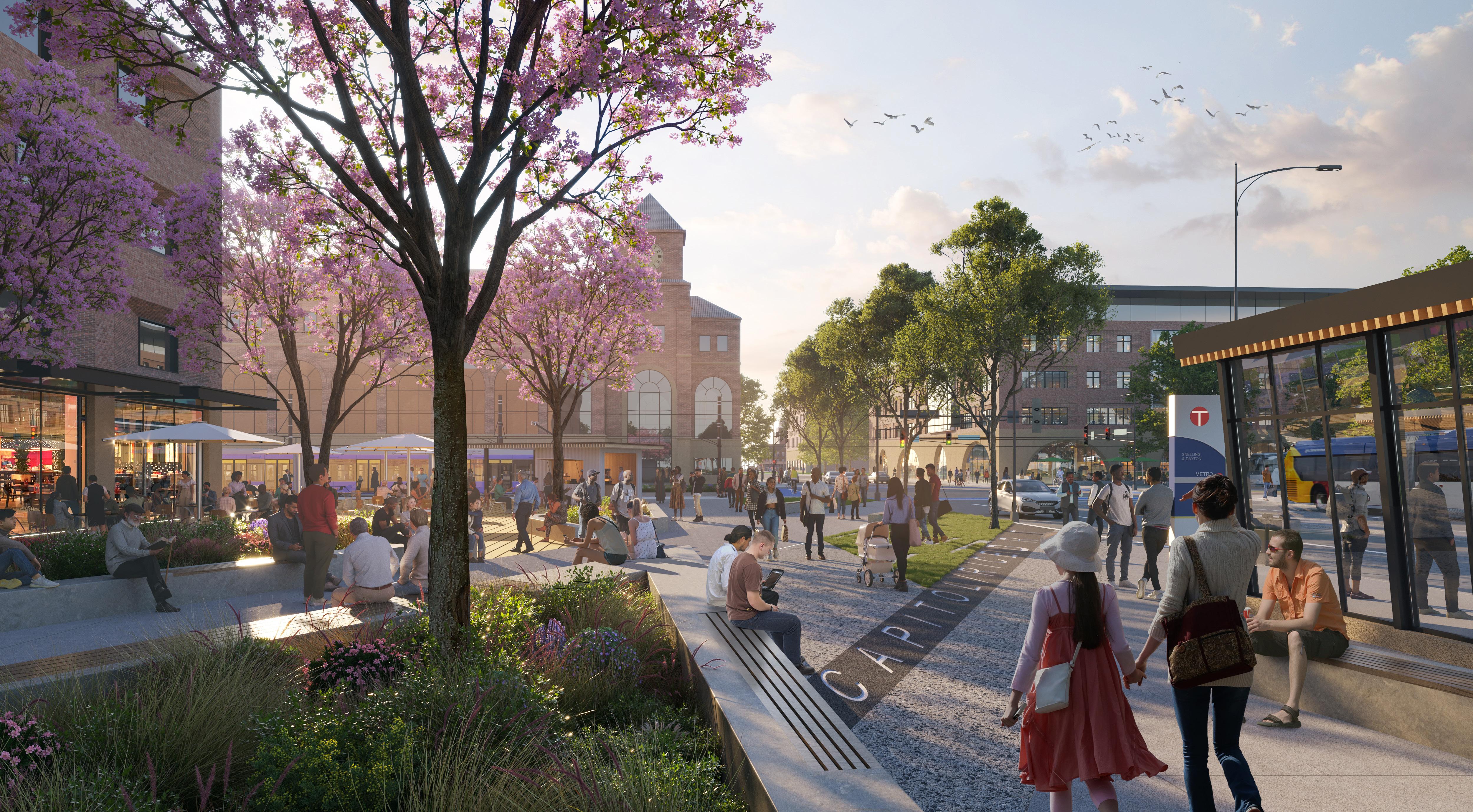
198 199 Capitol Mall Design Framework Design Framework RENDERING
REINVIGORATE NODES
DRAFT
SEARS + RICE
BRT NODE
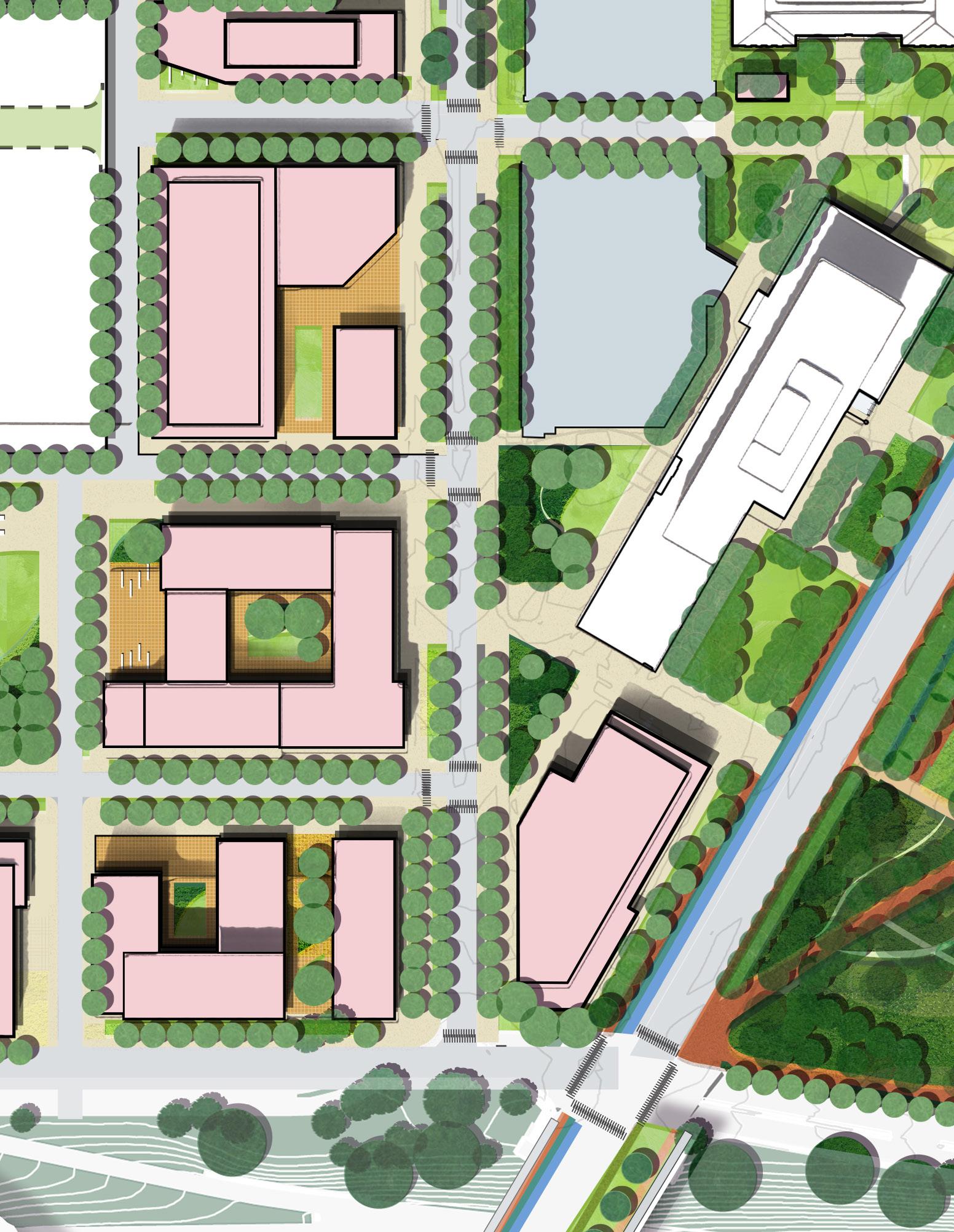
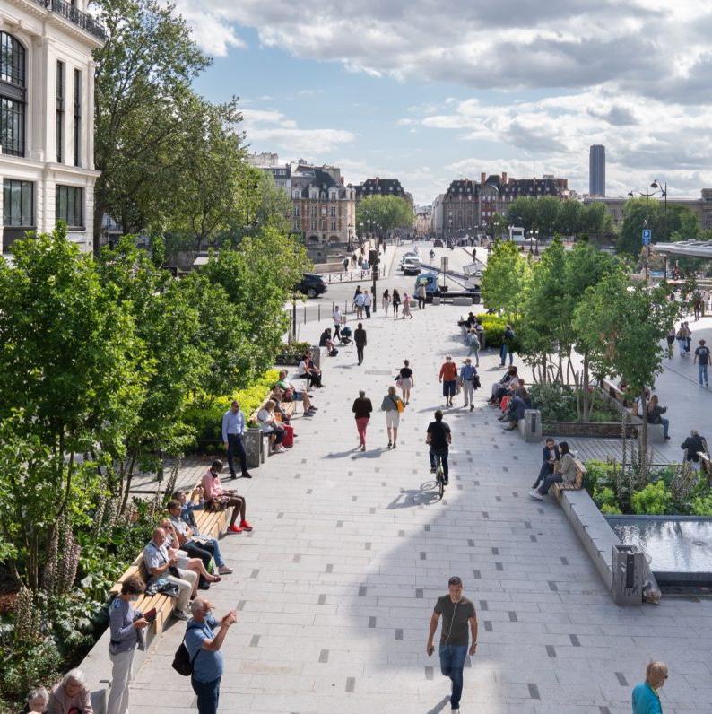
Source: Pont Neuf and La Samaritaine Place, IN SITU Paysages & urbanisme, https://landezine.com/pont-neuf-and-la-samaritaine-place-by-in-situ/
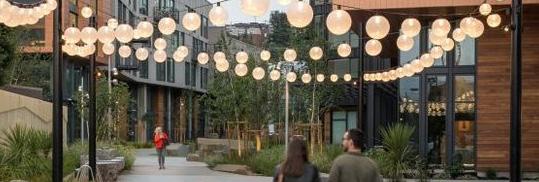
Source: Mason on Mariposa, David Baker Architects, https://www.dbarchitect.com/ projects/mason-mariposa
CHARACTERISTICS
O Complete street design accommodates all user groups.
O Pedestrian-friendly sidewalks with tree canopy provide comfort during the day and human-scaled lighting enhances walkability and safety after hours.
O Mixed-use development with kiosks and wayfinding systems provide recommendations for attractions and amenities within the area.
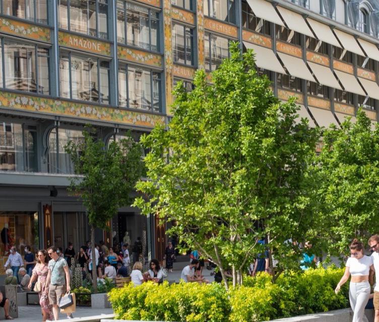
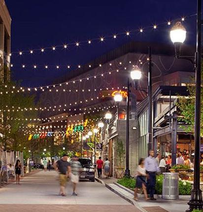
https://copley-wolff.com/all-projects/assembly-row
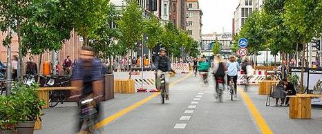
Source:Pont Neuf and La Samaritaine Place, IN SITU Paysages & urbanisme, https://landezine.com/pontneuf-and-la-samaritaine-place-by-in-situ/
Source: Volksentscheid Berlin Autofrei, https://worldwarzero.com/ magazine/2022/01/on-a-high-note-berliners-push-to-create-largest-car-freeurban-area/
Figure 180. Pont Neuf and La Samaritaine Place, Paris
Figure 182. Mason on Mariposa, CA
Source: Assembly Row, Copley Wolff Design Group,
Figure 181. Assembly Row, MA
Source: The Avenue DC, Sasaki
Figure 183. The Avenue, Washington D.C.
Figure 184. Pont Neuf and La Samaritaine Place, Paris
FULLER AVE JOHN IRELAND BLVD P RICE ST MINNESOTA DEPARTMENT OF TRANSPORTATION SEARS SITE BRT STATION
Figure 185. Flaniermeile Friedrichstrabe, Berlin
200 201 Capitol Mall Design Framework Design Framework
REINVIGORATE NODES
DRAFT
ROBERT STREET STATION PLAZA
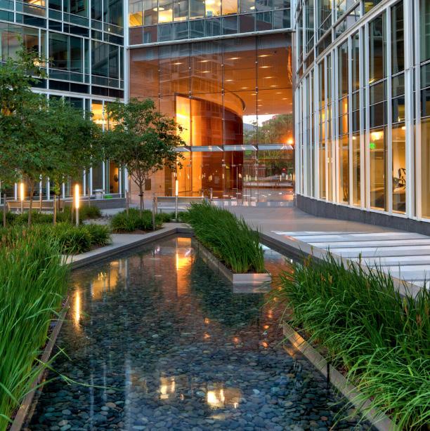
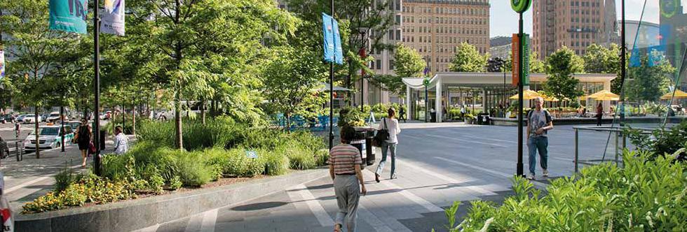
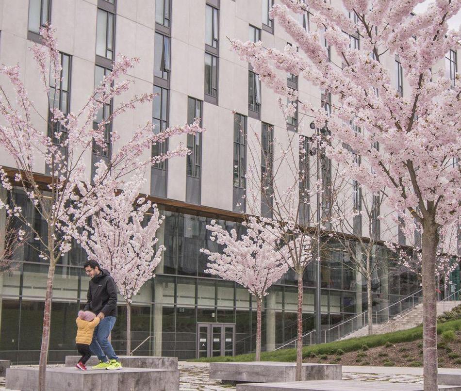
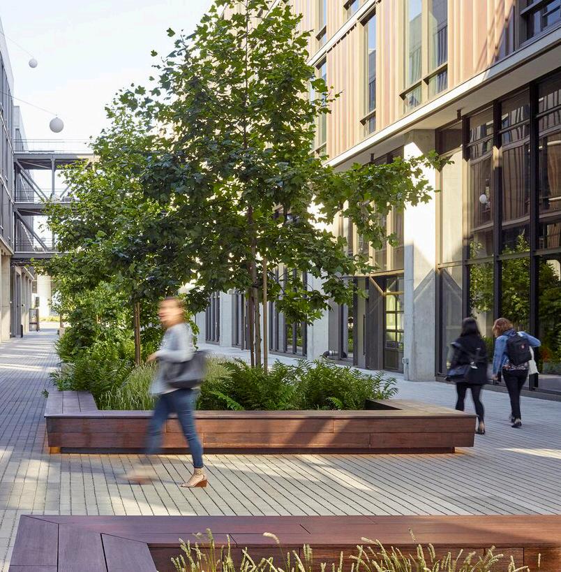
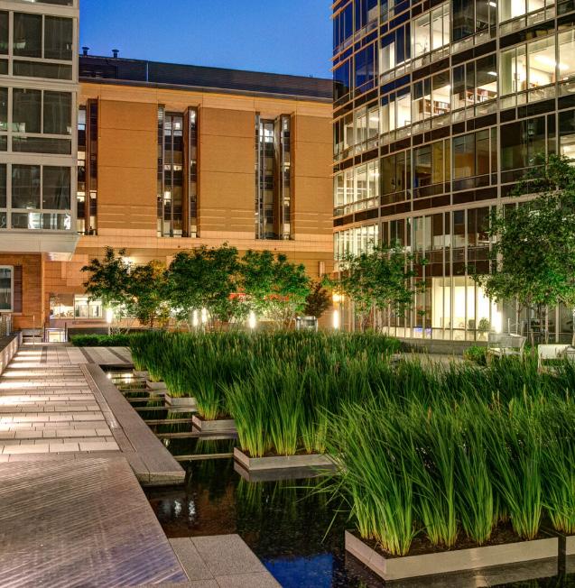
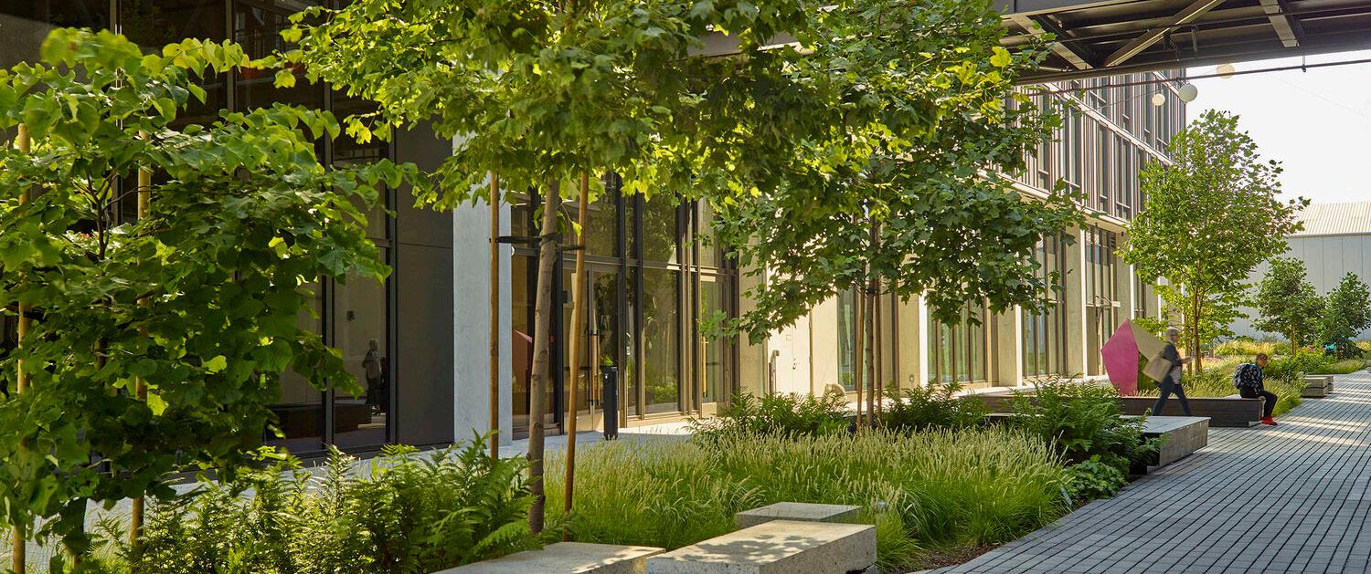 Figure 186. The Avenue, Washington D.C.
Figure 187. Dilworth Park
Figure 188. Hooper Street, San Francisco, CA
Figure 189. The Avenue, Washington D.C.
Figure 190. Ponderosa Commons, University of British Columbia
Figure 191. Hooper Street, San Francisco, CA
Source: The Avenue DC, Sasaki
Source: Hooper Street, Surfacedesign, https://www. sdisf.com/hooper-street Source: Dilworth Park, OLIN Studio,
Figure 186. The Avenue, Washington D.C.
Figure 187. Dilworth Park
Figure 188. Hooper Street, San Francisco, CA
Figure 189. The Avenue, Washington D.C.
Figure 190. Ponderosa Commons, University of British Columbia
Figure 191. Hooper Street, San Francisco, CA
Source: The Avenue DC, Sasaki
Source: Hooper Street, Surfacedesign, https://www. sdisf.com/hooper-street Source: Dilworth Park, OLIN Studio,
www.theolinstudio.com/dilworth-park
Source:
E12THST ECOLUMBUSAVE E14THST ROBERTST
JACKSONST MINNESOTA DEPARTMENT OF HEALTH MINNESOTA DEPARTMENT OF REVENUE LIGHT RAIL STATION P BRT STATION
Source: The Avenue DC, Sasaki
Source:
Ponderosa Commons, Hapa Collaborative,
https://landezine.com/
ponderosa-commons/
Hooper Street, Surfacedesign,
https://www.sdisf.com/hooper-street
CENTRALPARKAVEE
urban
walkability
vibrancy.
O Office environment with
plazas and retail stores enhances
and
tree canopy
comfort
day
human-
lighting enhances walkability
safety
hours.
202 203 Capitol Mall Design Framework Design Framework
REINVIGORATE NODES
O Pedestrian-friendly sidewalks with
provide
during the
and
scaled
and
after
O Transit stations with kiosks and wayfinding systems help orient people between stations.
CHARACTERISTICS
DRAFT
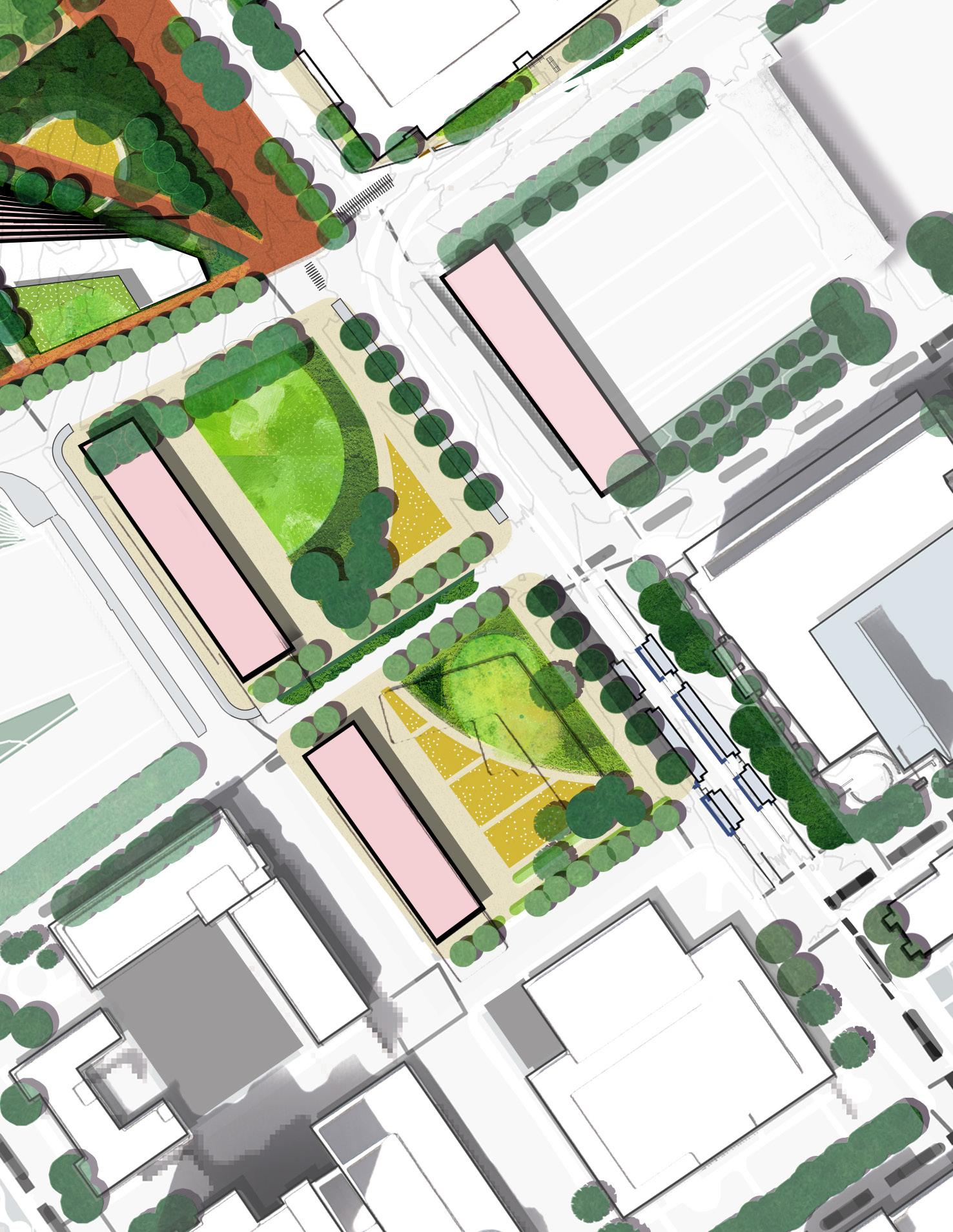
CEDAR + WABASHA DECK NODE
O Park provide diverse amenities such as welcome center, cafe and restrooms and wayfinding Diverse amenities such as a welcome center, cafe, restrooms, and wayfinding information enhance visitor experience and community space.
O Sheltered areas like covered pavilions and tree canopies offer protection from inclement weather.
O Climate-adaptive features like water management systems mitigate the impact of heavy rainfall or extreme temperatures.
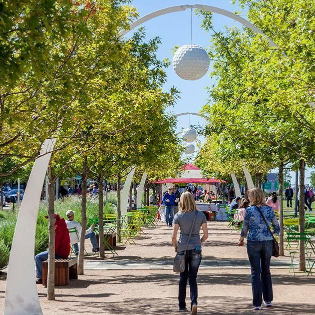
Source: Klyde Warren Park, OJB, https://www.ojb.com/work/klydewarrenpark/
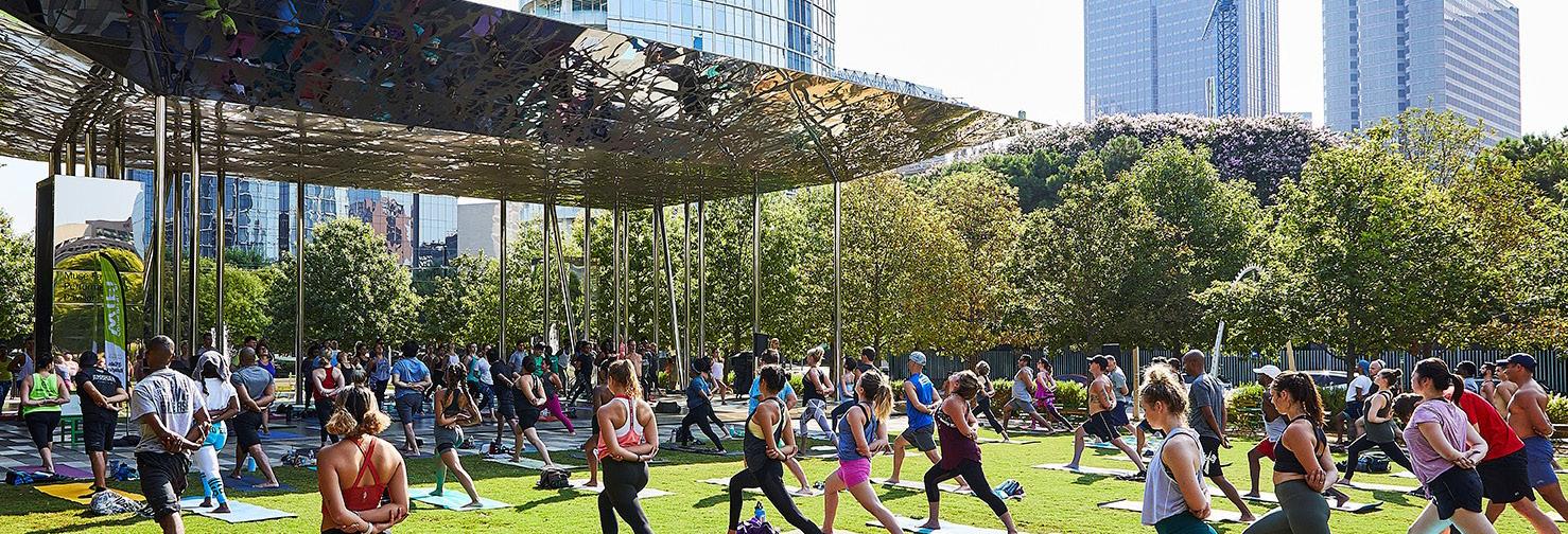
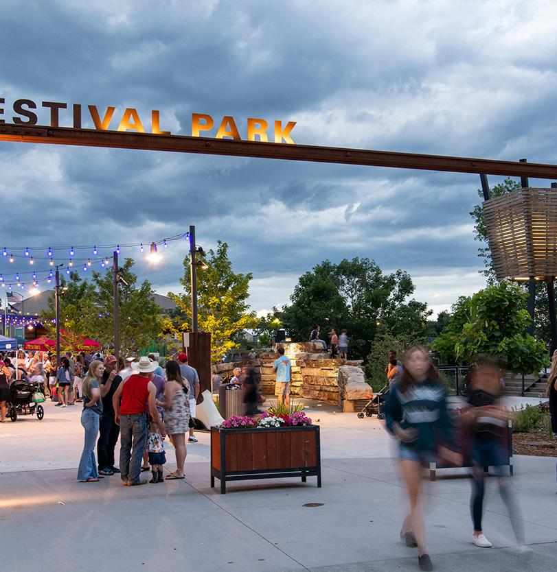
Source: Festival Park, Design Workshop, https://www. designworkshop.com/projects/festival-park.html
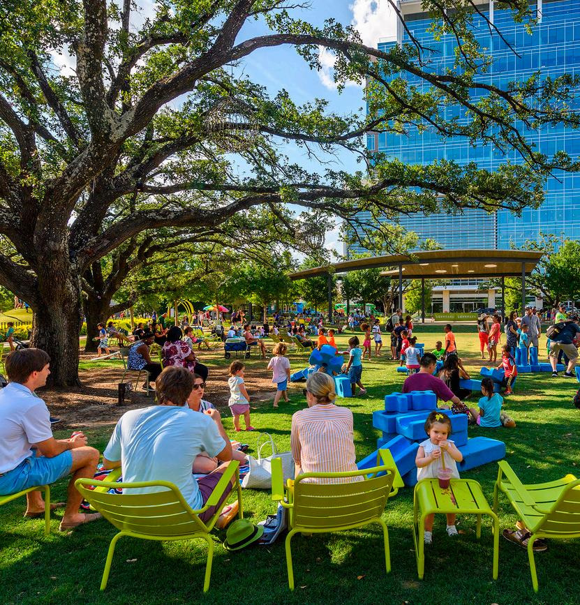
Source: Klyde Warren Park, OJB, https://www.ojb.com/work/klydewarrenpark/ Source: Levy Park, OJB, https://www.ojb.com/work/ levy-park/phyllis-w-smale-
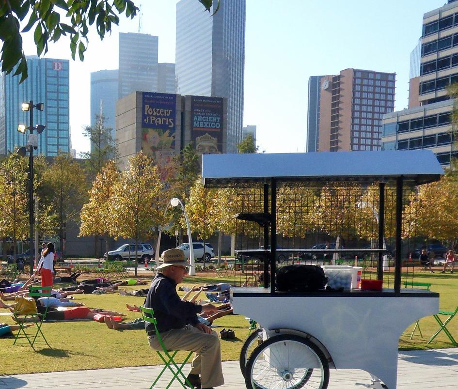
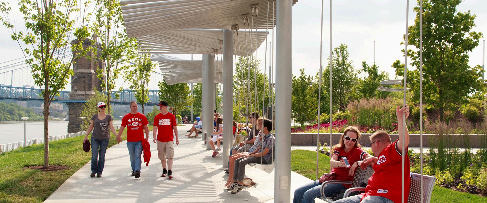
Source Festival Park, Design Workshop, https://www.designworkshop.com/projects/ festival-park.html
Source: Smale Riverfront Park, Sasaki, https://www.sasaki.com/projects/cincinnati-john-gand-phyllis-w-smale-riverfront-park/
Figure 192. Street, Klyde Warren Park, Dallas, TX
Figure 193. Festival, Klyde Warren Park, Dallas, TX
Figure 194. Festival Park, Castle Rock, CO
Figure 195. Tree Canopy, Levy Park, Houston, TX
Figure 196. Flexible market areas, Festival Park, Castle Rock , CO
Figure 197. Ohio Smale Riverfront Park OH
CEDARST
10THSTE EEXCHANGEST E11THST 10THSTE LIGHT RAIL STATION I-94
WABASHASTN
204 205 Capitol Mall Design Framework Design Framework
REINVIGORATE NODES
CHARACTERISTICS
DRAFT
MNHS PLAZA
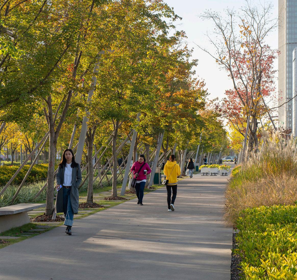
DRAFT
Source: Xuhui Runway Park, Sasaki, https://www.sasaki.com/projects/xuhuirunway-park/

Source: Buffalo Niagara Medical Campus Streetscape, SCAPE, https://www. scapestudio.com/projects/buffalo-niagara-medical-campus-streetscape/
Source: Governors Island, Trust for Governors Island, https://www.govisland.com/
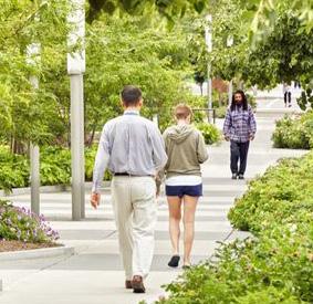
Source: https://www.scapestudio.com/projects/ buffalo-niagara-medical-campus-streetscape/
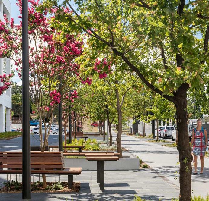
Source: https://landezine.com/constitution-avenuecanberra-by-jane-irwin-landscape-architecture/
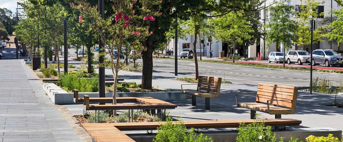
Source: Canberra Constitution Avenue, Jane Irwin Landscape Architecture, https://landezine. com/constitution-avenue-canberra-by-jane-irwin-landscape-architecture/
Figure 198. Xuhui Runway Park, Shanghai
Figure 199. Buffalo Niagara Medical Campus Streetscape, NY
Figure 200. Buffalo Niagara Medical Campus Streetscape,NY
Figure 201. Seating, Canberra Constitution Avenue, Canberra
Figure 202. Governors Island, NY
Figure 203. Canberra Constitution Avenue, Canberra
JOHN IRELAND BLVD WKELLOGGBLVD MINNESOTA HISTORY CENTER I-94 O A strategically planned view corridor framed by landscape maximizes scenic vistas and focal points along the linear park.
Clear signage
wayfinding systems at the intersections direct people to major destinations. 206 207 Capitol Mall Design Framework Design Framework
REINVIGORATE NODES
O
and
CHARACTERISTICS
O Preserve Historic Views
O Street Regulating Plan
O Proposed Street Sections
O Parking and Access
O Parking Supply and Distribution
O Transit and Micromobility
RIGHT-SIZE THE ROADS DRAFT
O Streetscape Precedents

Right size the streets to preserve historic viewsheds and provide comfortable pedestrian experience.
208 209 Capitol Mall Design Framework Design Framework
RIGHT-SIZE THE ROADS AND REINFORCE THEM WITH TREES
Many of the streets within the Capitol Campus are over-sized. The lanes themselves are too wide (13+ feet) and/or the streets contain too many lanes given the number of cars that travel them, even during typical rush hour time periods. Therefore, the ROW dedicated to cars can be reduced and reallocated to pedestrians, street trees, green infrastructure, cyclists, and other shared mobility options like BRT. Sometimes referred to as road-diets, these reductions are proven to not create more traffic. Furthermore, the addition of larger sidewalks, increased tree canopy, and bioswales creates more comfortable and engaging public realms that people want to explore and traverse. This is particularly important since many of the streetscapes around the Capitol Campus are infrastructureheavy and harsh pedestrian environments with few amenities. Given the historic viewsheds created by some of these streets—specifically, John Ireland Boulevard and Cedar Street—extra attention is given to maintaining views between the Capitol Building and Downtown as well as the Cathedral of Saint Paul.
TAKEAWAYS
O The streets around the Capitol Mall are currently oversized.
O ROW dedicated to vehicles can be slightly reduced and given back to pedestrians, street trees, green infrastructure, and other shared mobility options.
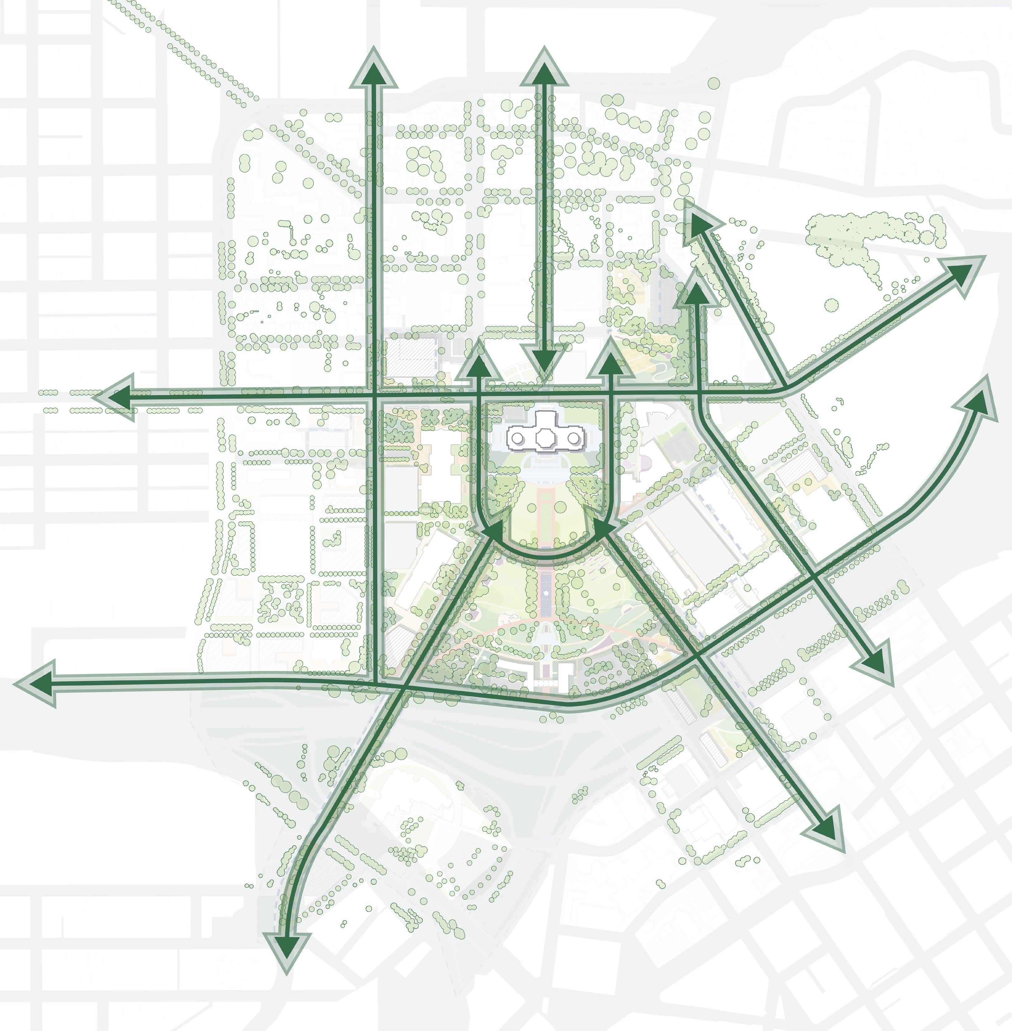
Cass Gilbert Memorial Park N 0’ 250’ 125’ 60’ I-94 I-35E
Park St CEDARST Cedar St E12THST JOHNIRELANDBLVD Aurora Ave Charles Ave Marion St ST ANTHONY AVE WKelloggBlvd JACKSONST Como Ave ComoAve W Pennsylvania Ave ROBERTST 10thStE MN STATE CAPITOL MALL Valley Park Western Sculpture Park CAPITOL HEIGHTS DOWNTOWN SAINT PAUL CAPITOL RICE DISTRICT FITZGERALD PARK
UNIVERSITY AVE W
DISTRICT RICE ST N CAPITOL BLVD MLK JR BLVD
HISTORICAL HILL
210 211 Capitol Mall Design Framework Design Framework
Figure 204: Right-size the Road and Reinforce with Trees RIGHT-SIZE THE ROADS DRAFT
PRESERVE HISTORIC VIEWS
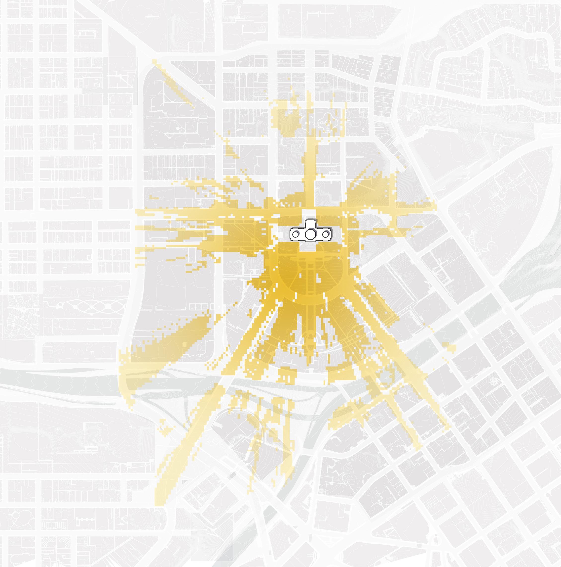
Figure 205: Existing Viewshed towards Capitol
Source: Minnesota Geospatial Commons. gisdata.mn.gov/dataset.
Source: Ramsey County Map Ramsey. maps.co.ramsey.mn.us/mapramsey/.
Source: Ramsey County Maps and Surveys. www.ramseycounty.us/residents/property/maps-surveys.
Source: Saint Paul Minnesota. information.stpaul.gov/search.
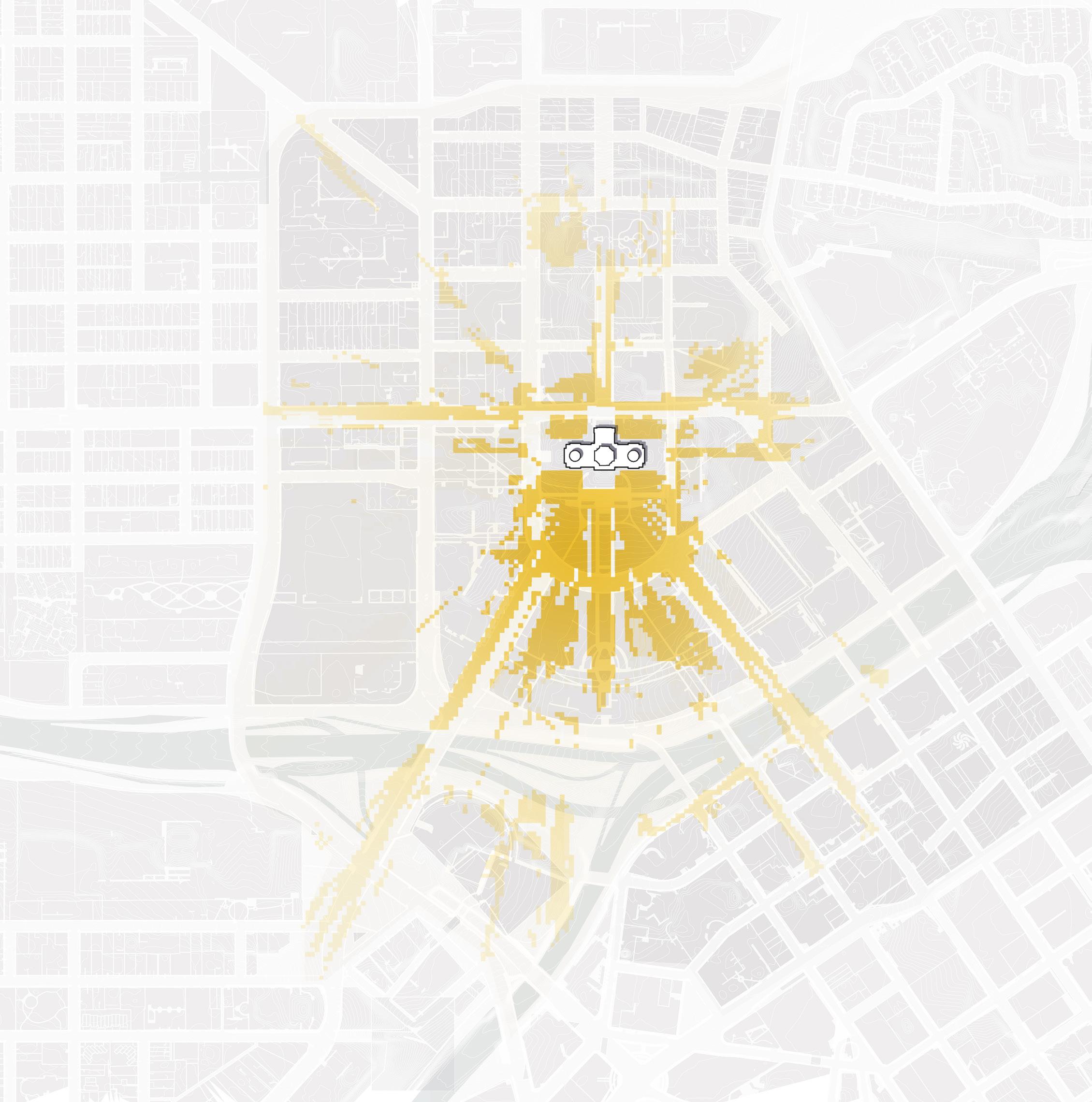
TAKEAWAYS
Strategically placed trees in the Capitol Area work together with reduced vehicular ROW to create a comfortable pedestrian experience while preserving historic viewsheds to the Capitol Building. As seen in the proposed diagram of the viewshed, views are concentrated on the Dome of the Capitol Building.
EXISTING PROPOSED
Figure 206: Framework Viewshed towards Capitol
N NTS N NTS University Ave W University Ave W St Anthony Ave St Anthony Ave ComoAve ComoAve John Ireland Blvd John Ireland Blvd CedarSt CedarSt UniversityAveE UniversityAveE Best Views of Capitol Building Best Views of Capitol Dome Worst Views of Capitol Building Worst Views of Capitol Dome
212 213 Capitol Mall Design Framework Design Framework
RIGHT-SIZE THE ROADS
DRAFT
STREET REGULATING PLAN
VEHICULAR CIRCULATION
As noted in the Analysis chapter, the 2040 Comprehensive Plan categorizes streets based on future desired streetscape experience. These street categories or typologies are still relevant for the Design Framework. They include the following:
O Civic Streets are primary view corridors and pedestrian ways as people move about the Capitol Campus. These streets have a design history dating back to Cass Gilbert.
O Mixed-use Corridors provide access to a mix of small- and medium-sized businesses as well as residences in mixed-use buildings. They also provide high-quality transit service while fostering a pedestrian scale.
O Institutional Streets provide access to state buildings and other large office buildings. They provide an exceptional pedestrian experience with highquality street furnishings.
O Existing Neighborhood Streets provide safe and inviting places to walk with direct access through the neighborhood to adjacent corridors and transit.
O Residential Corridors are more substantial than existing neighborhood streets and connect neighborhoods to major corridors.
O Downtown Streets host a wide range of high-density uses and provide access to a mix of office, retail, restaurants, arts and entertainment, and residential uses.
While a formal traffic study is underway, best practice determines that average annual daily traffic (AADT) indicates the following streets do not warrant two lanes in each direction and thus support road diets to one-lane in each direction: Rice Street, Cedar Street, and Rev. Dr. Martin Luther King, Jr. Boulevard. For Rice Street in particular, a road diet is the only way to accommodate other modes of travel as specified in the 2040 Comprehensive Plan and other guiding documents (BRT and separated/protected bike lanes).
The Design Framework focuses on the following streets as primary candidates for re-envisioning: Rice Street, John Ireland Boulevard, Cedar Street, University Avenue, North Capitol Avenue and West 12th Street. Proposed street sections for these roadways are outlined in the following pages.
Green Line
Gold Line (Planned)
Purple Line (Planned)

ROAD DIET ROAD DIET N 0’ 500’ 250’ 125’ Road
LRT
BRT
BRT
Average
Traffic Count Street Typologies Civic Mixed-Use Institutional Neighborhood Corridor Residential LEGEND I-94 I-35E Park St Cedar St Aurora Ave Charles Ave WKelloggBlvd Como Ave ComoAve W Pennsylvania Ave 10thStE Valley Park Western Sculpture Park DOWNTOWN SAINT PAUL
Diet
Annual Daily
2,900 3,850 3,300 5,600 8,900 8,900 15,500 785 11,500 8,100 5,200 3,600 7,000 AT 6TH ST E AND MINNESOTA ST (1-WAY) 11,500 AT FORD RD AND ROBERT ST N (2-WAY) 2,850 AT SAINT PETERS ST AND E 11TH ST (1-WAY) 4,300 AT SAINT PETERS ST AND 7TH ST W (1-WAY) 4,100 11,100 214 215 Capitol Mall Design Framework Design Framework RIGHT-SIZE THE ROADS
Figure 207: Street Regulating Plan DRAFT
RICE STREET
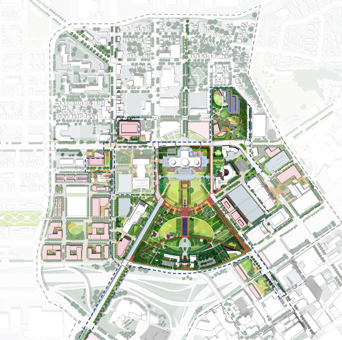
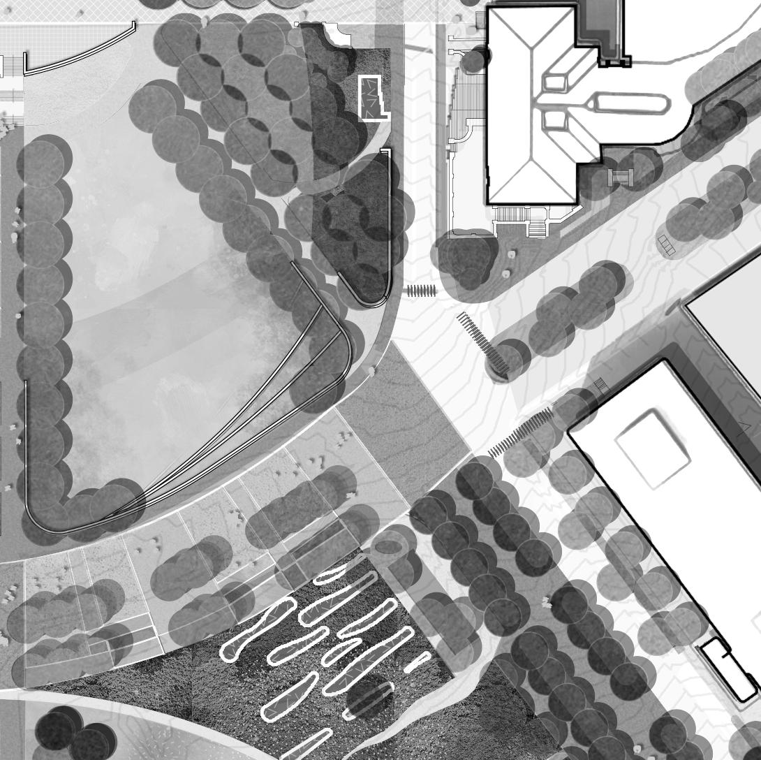
Rice Street fluctuates in width from Saint Anthony Avenue/West 12th Street (105-foot ROW), to north of University Avenue (80-foot ROW). Rice Street also includes the proposed BRT METRO G-Line, which requires dedicated bus lanes and transit shelters. BRT lanes can function as turn lanes when necessary. *Flex Zones can include street trees, landscaping, BRT shelters, street lighting and street parking. At its widest (A), Rice Street has an expanded pedestrian and amenity zone on the west side of the street closest to the Radisson Hotel. This establishes a threshold to the campus with wayfinding, street furniture and other amenities. At its narrowest (D), Rice Street does not include street parking; the west side of the street only provides a 10-foot flex zone that must simultaneously accommodate sidewalk, tree wells and any other pedestrian amenities. Coordination with the City of Saint Paul is required to resolve the proposed BRT station at University and Como, since the ROW is not wide enough to contain both the station platform and separated bike lanes.
Reference the Analysis chapter for existing street sections.
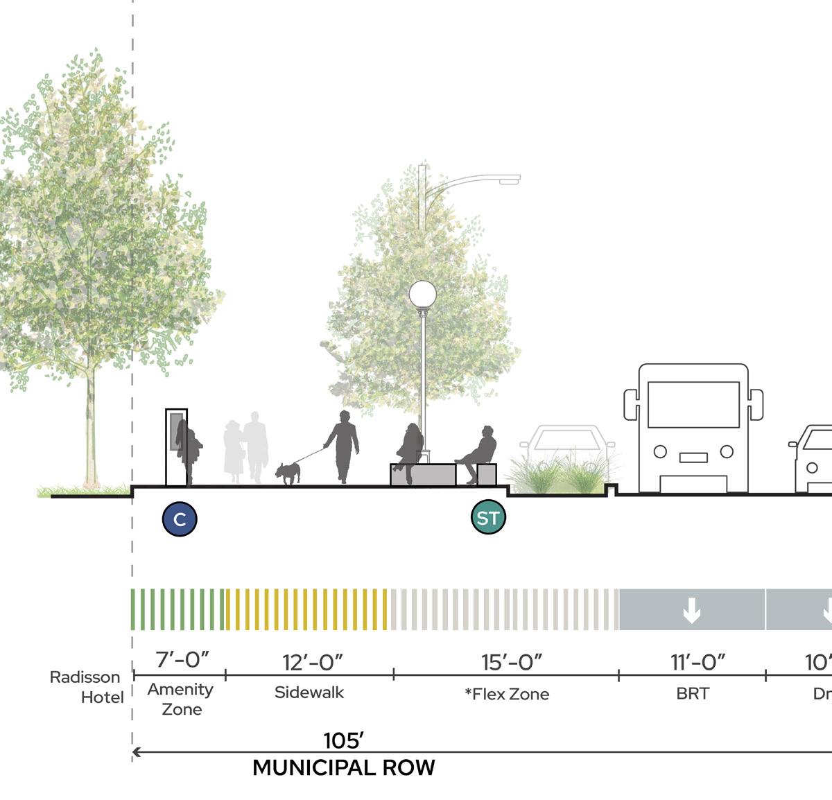
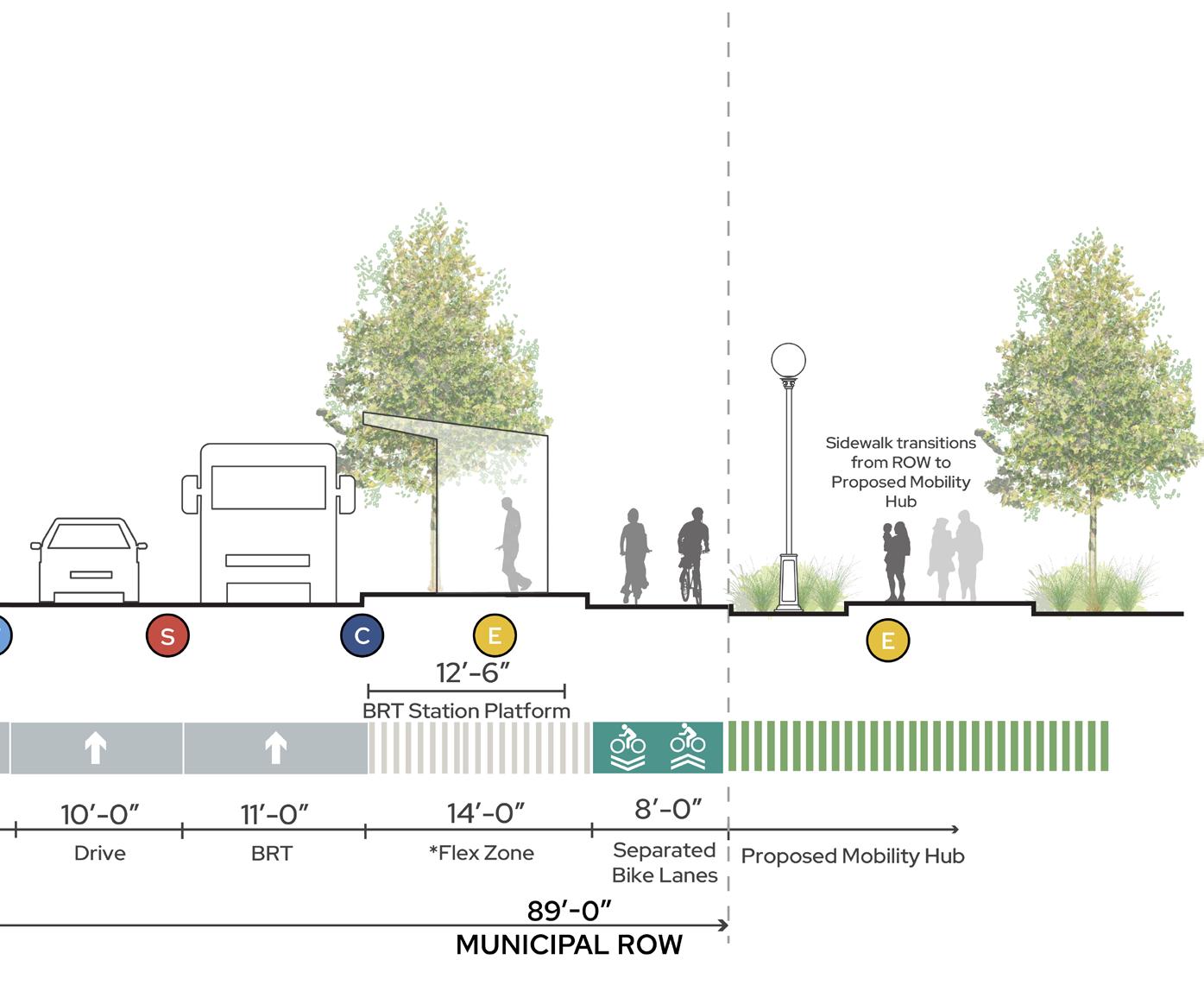
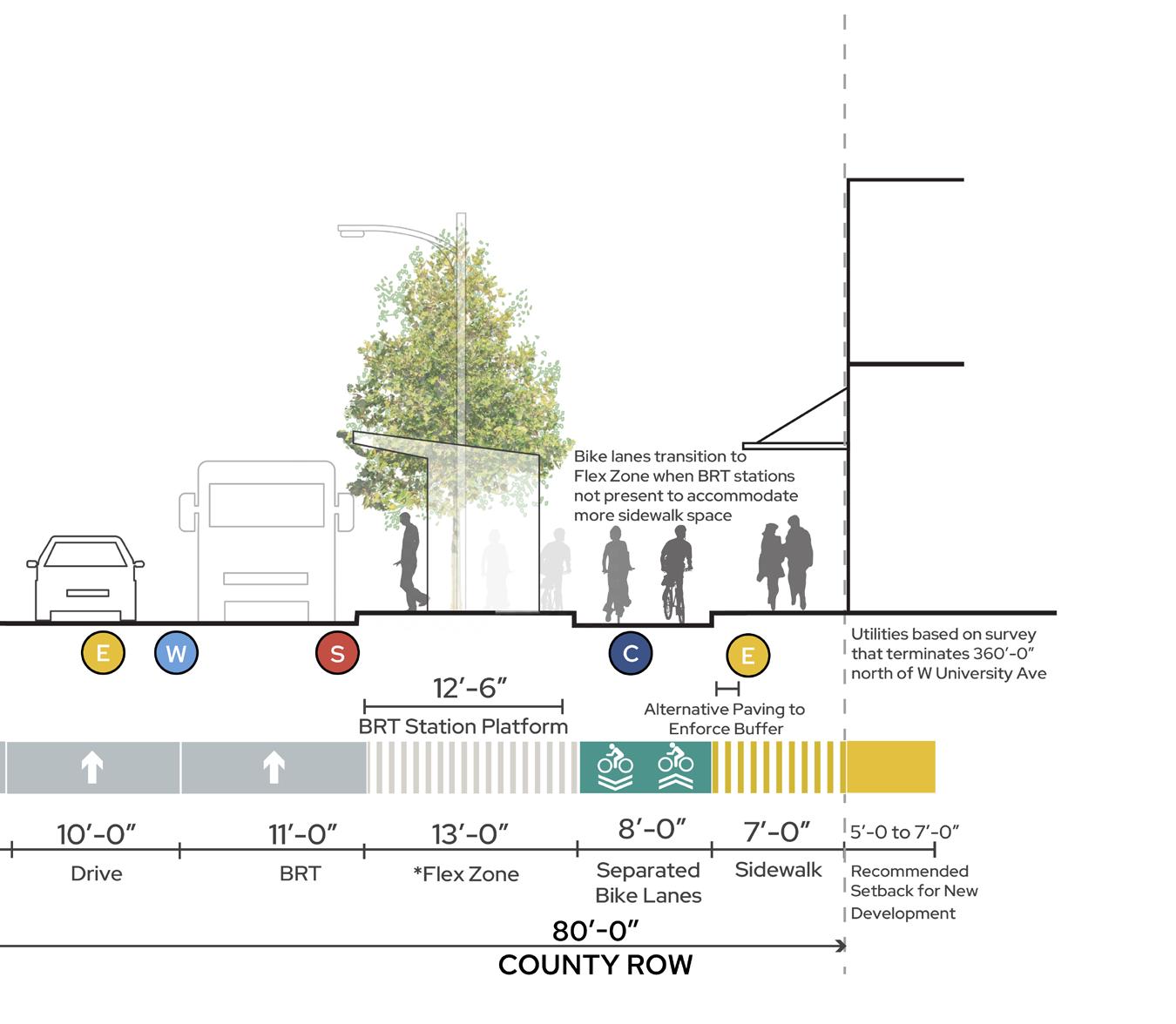
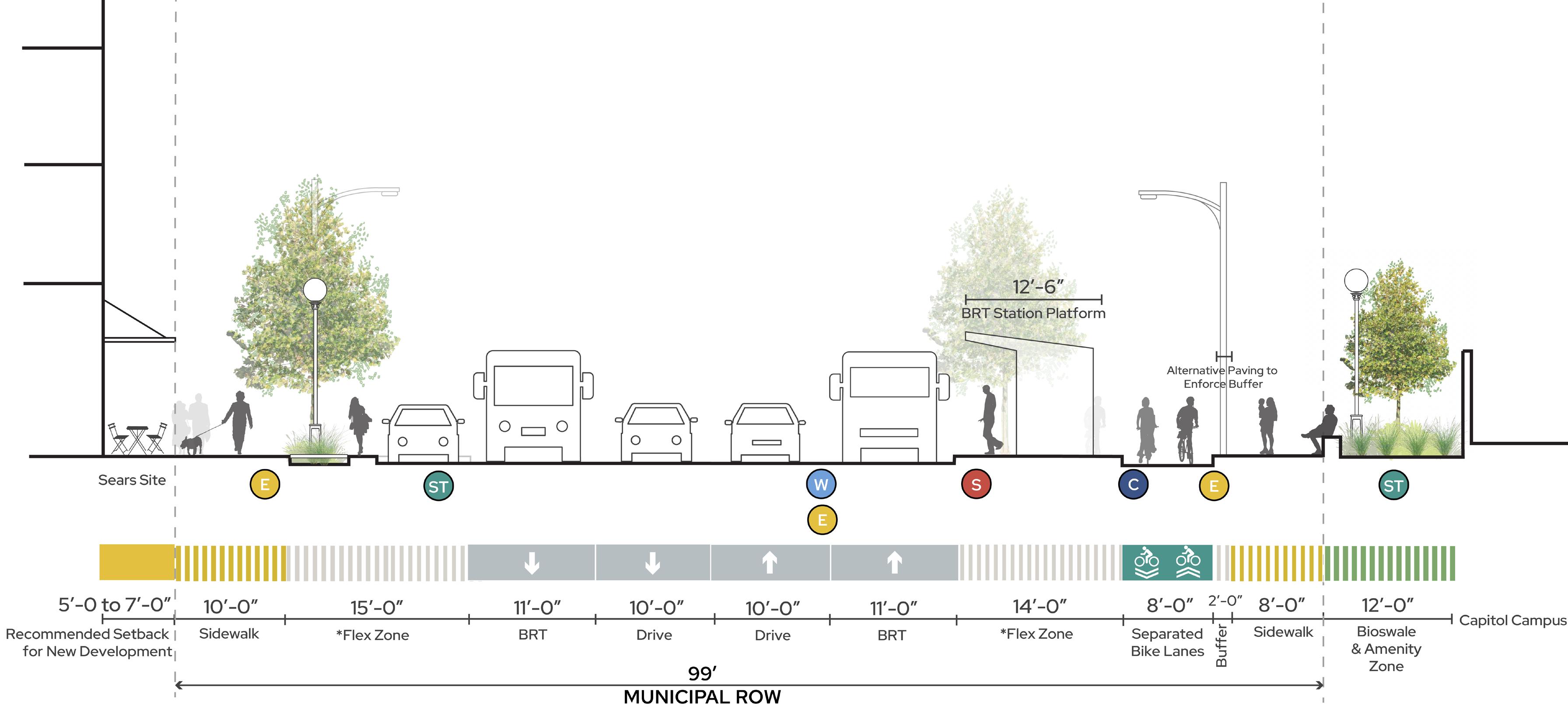
**D.RICE STRE E T + COMOAVENUE C.RICESTREET + U NIVERSITYAVENUE E C W S ST Water Stormwater Electrical Underground Communication Sewer LEGEND B. RICE STREET + FULLER AVENUE Stormwater management Protected existing trees Pedestrian lighting Right-sized vehicular lanes BRT G-Line per 2040 Comp Plan Increased tree canopy B A C D **Dimensions differ. Dimensions differ. **See text description for more information. ROW ROW ROW ROW A. RICESTREET + S A INT ANTHONYAVENUE ROW 105’-0” Separated
protected bike lanes
and
per 2040 Comp Plan
216 217 Capitol Mall Design Framework Design Framework
PROPOSED STREET
RIGHT-SIZE THE ROADS DRAFT
SECTIONS
JOHN IRELAND BOULEVARD
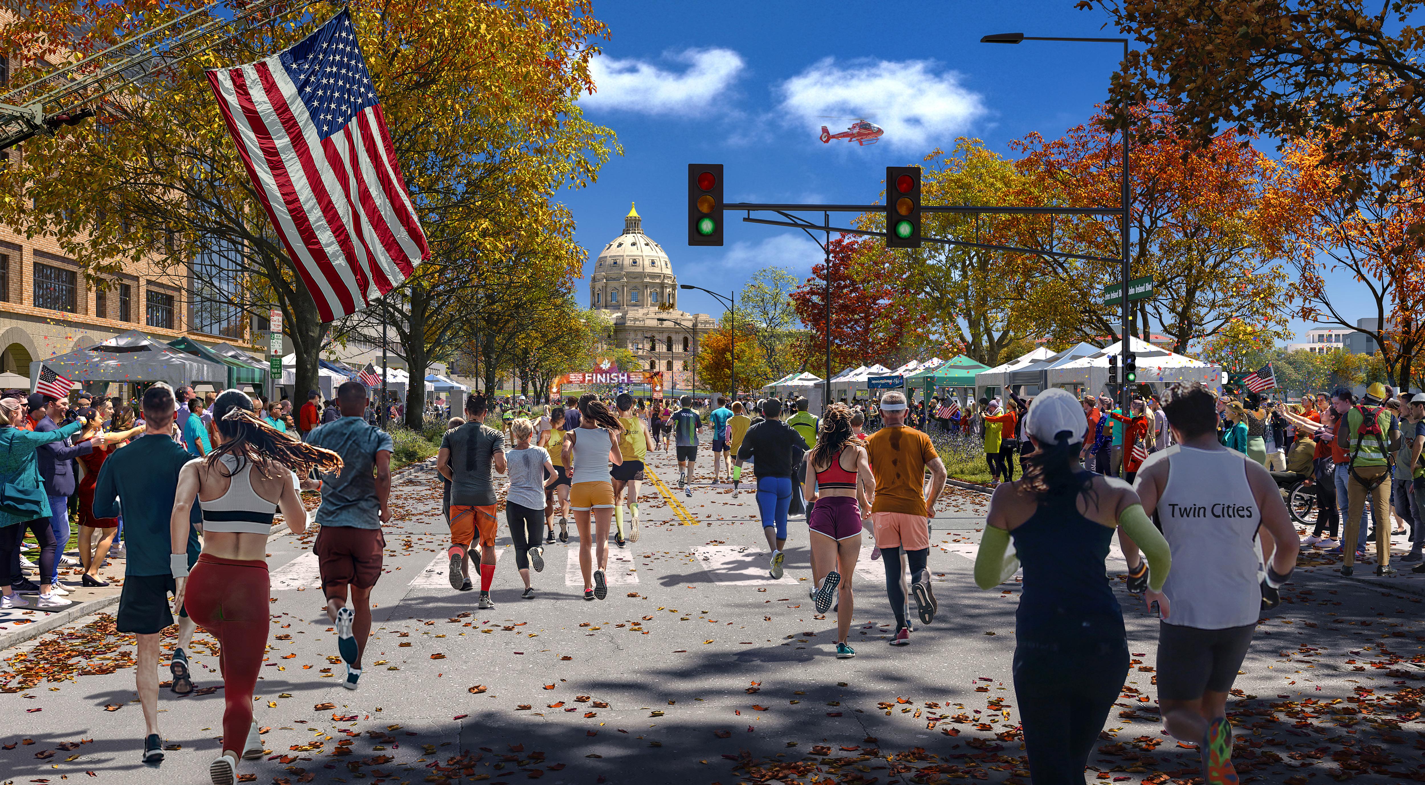
218 219 Capitol Mall Design Framework Design Framework
THE BIG DAY RIGHT-SIZE THE ROADS Before DRAFT
JOHN IRELAND BOULEVARD
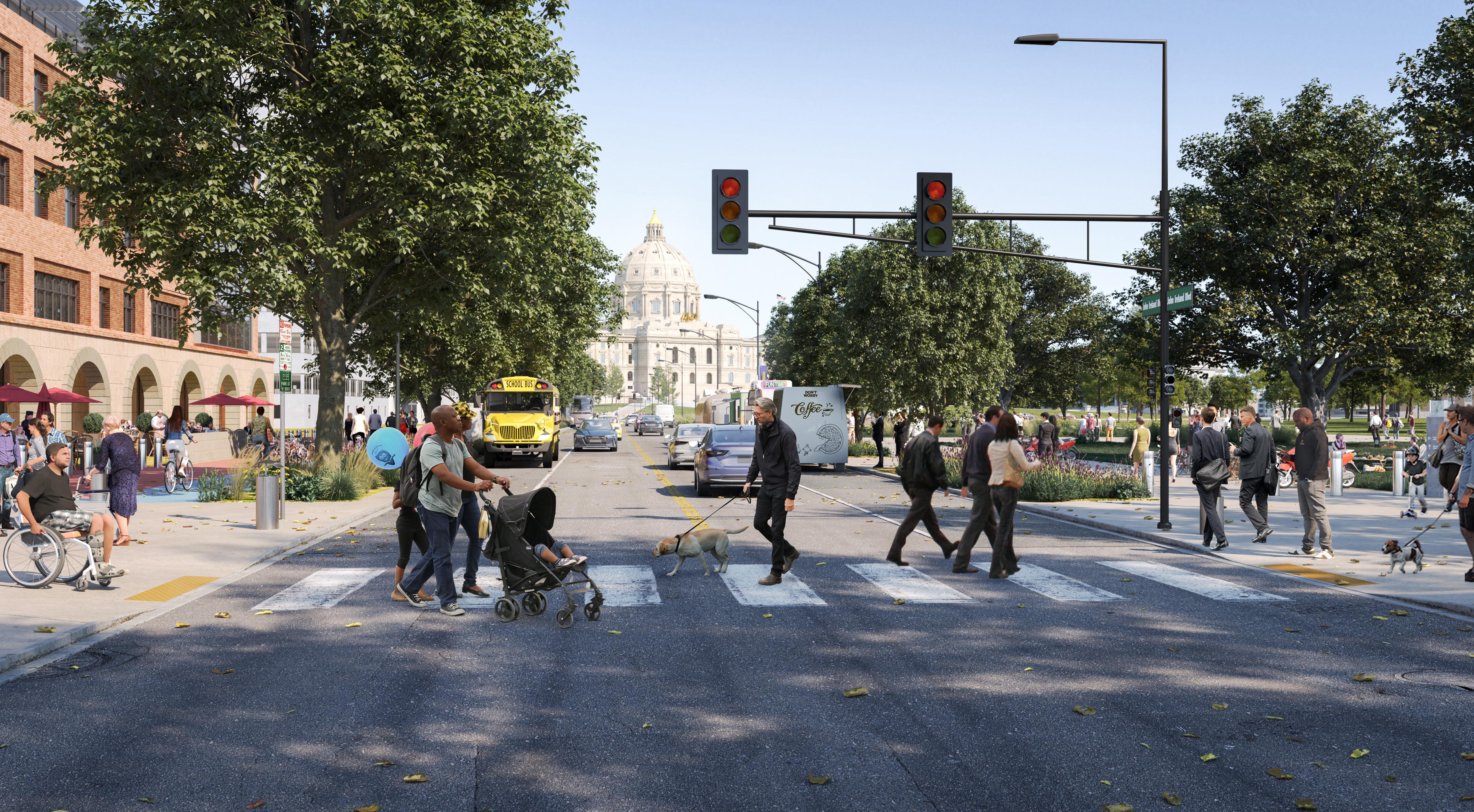
220 221 Capitol Mall Design Framework Design Framework
EVERY DAY RIGHT-SIZE THE ROADS Before DRAFT
JOHN IRELAND BOULEVARD
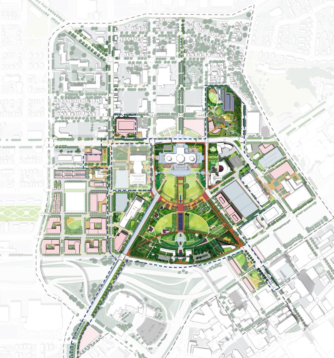
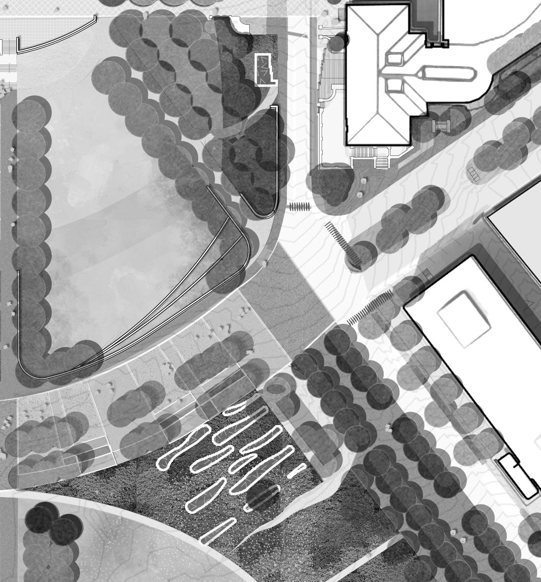
Rated permanent bollards integrated adjacent to MNDOT building
John Ireland Boulevard is a historically significant street in that it frames views between the Capitol Building and Cathedral of Saint Paul. Like Rice Street, the Saint Paul Bicycle Plan and 2040 Comprehensive Plan identifies John Ireland Boulevard as a primary bicycle way with separated and protected bike lanes. Lastly, food trucks currently park along John Ireland Boulevard and attract a significant amount of people throughout the day. With all this in mind, the newly envisioned boulevard proposes a lively multi-modal environment with an expanded sidewalk and amenity zone where people can grab lunch and sit at movable furniture with primary views to the Capitol Building. A double-tree allay shades the two-way bike lane and people can still find affordable street parking the entire length of the boulevard. Lastly, bioswales provide necessary green infrastructure to filter and treat all stormwater runoff before it drains south and deposits in the Mississippi River (Haháwakpa).
Reference the Analysis chapter for existing street sections.
and protected bike lanes per 2040 Comp Plan
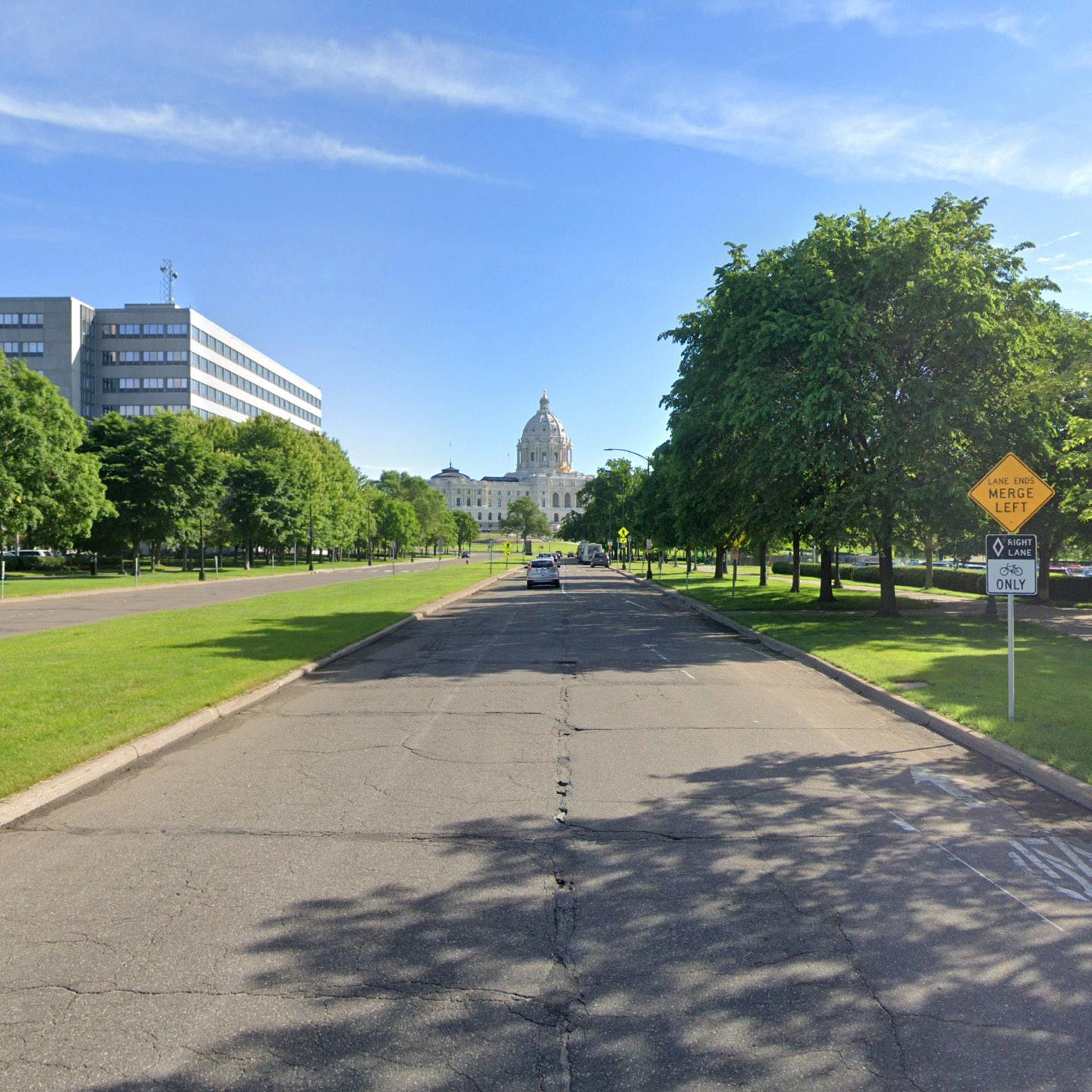
management

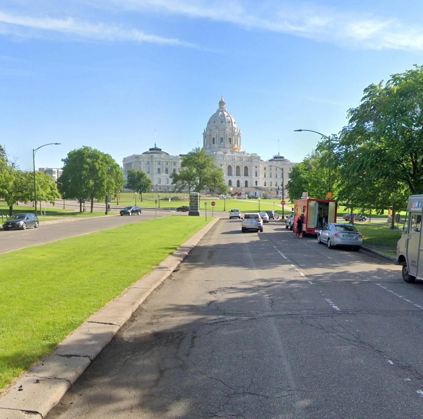
Capitol views reoriented to pedestrians
VIEW 2 FRO M AMENITYZONE VIEW1 FROM A MENITYZONE JOHN IRELAND BOULEVARD AT THE LOWER MALL E C W S ST LEGEND Water Stormwater Electrical Underground Communication Sewer Stormwater
Protected
Increased
canopy Primary
Right-sized
Separated
ROW ROW VIEW 1 VIEW 2
existing trees
tree
vehicular lanes
Views taken from perspective of pedestrian in Amenity Zone.
222 223 Capitol Mall Design Framework Design Framework
PROPOSED STREET
RIGHT-SIZE THE ROADS DRAFT
SECTIONS
CEDAR STREET
SID E WALK
Like John Ireland Boulevard, Cedar Street is a historically significant viewshed between the Capitol Building and Downtown Saint Paul. It is also identified as a primary bicycle way in the Saint Paul Bicycle Plan and 2040 Comprehensive Plan. Lastly, the street is oversized both in width and number of lanes. The proposed Cedar Street addresses all of this, with right-sized vehicular lanes and strategically placed street trees that frame historic views to and from the Capitol Building. Easily accessible street parking allows for visitors and workers to conveniently park. A separated and protected bike lane provides direct access to Downtown. Pedestrians can meander down an extended promenade under large tree canopies. Bioswales and various other landscape zones capture stormwater and display various native plant species.
Reference the Analysis chapter for existing street sections.
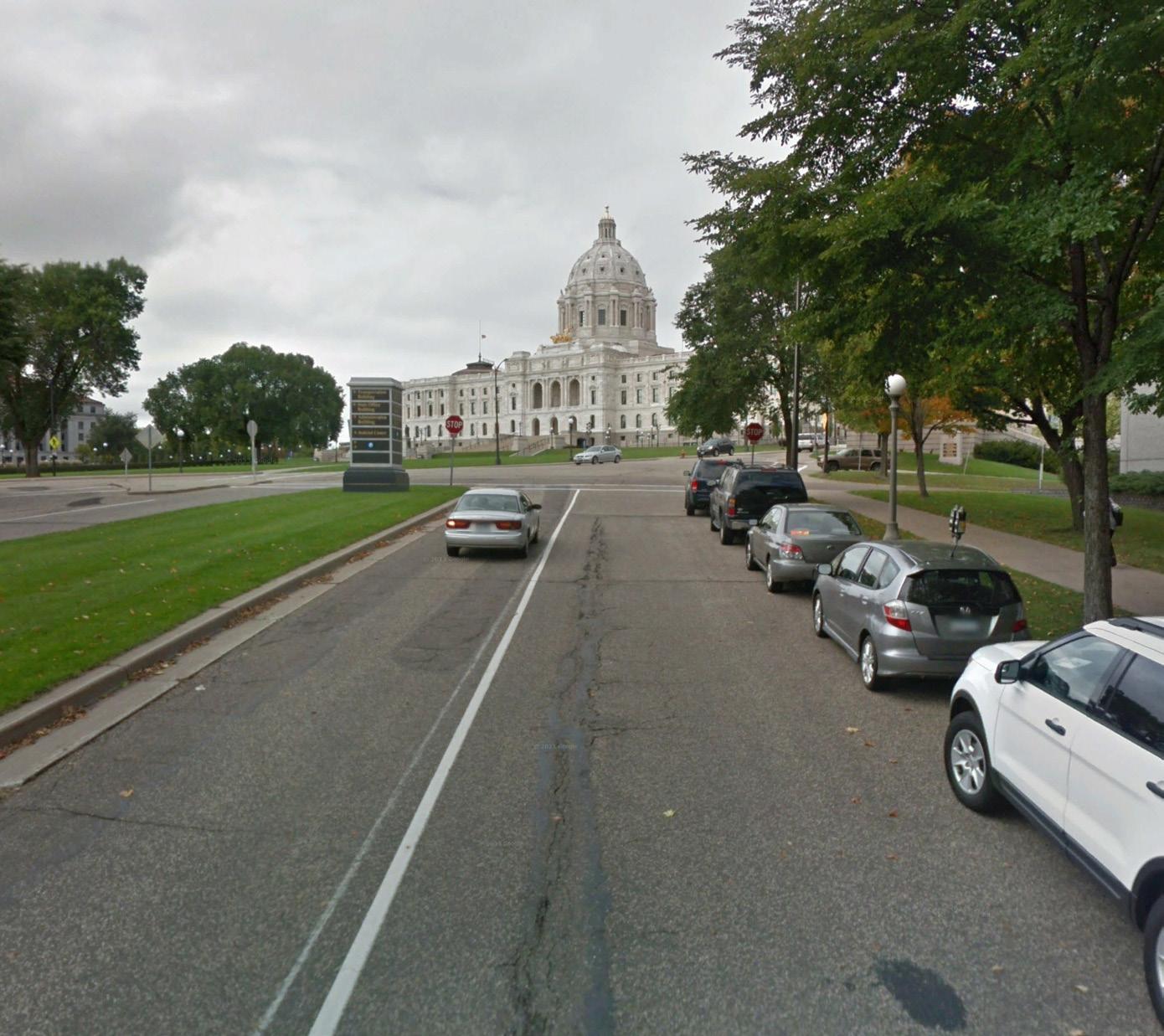
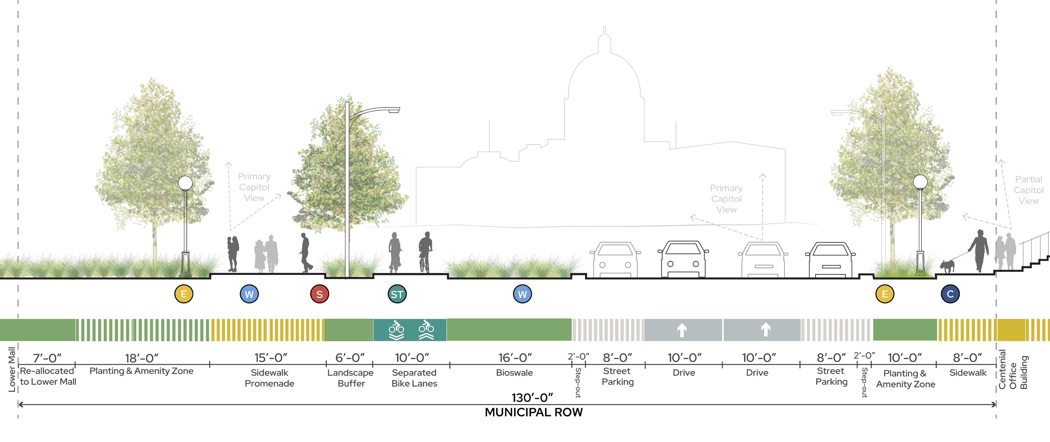
VIEW1FROM
VIEW3 FROM D RIVE LANES CEDAR STREET AT THE LOWER MALL VIEW 1 VIEW 3 VIEW 2 E C W S ST Water Stormwater Electrical Underground Communication Sewer LEGEND ROW ROW Stormwater management Protected existing trees Primary Capitol views reoriented to pedestrians Right-sized vehicular lanes Separated and protected bike lanes per 2040 Comp Plan
VIEW2FROM SIDE W ALK PROMENADE
PROMENADE
Views taken from perspective of pedestrian in Sidewalk Promenade.
View taken from perspective of driver in drive lanes.
224 225 Capitol Mall Design Framework Design Framework
RIGHT-SIZE THE ROADS DRAFT
PROPOSED STREET SECTIONS
UNIVERSITY AVENUE
PROPOSED STREET SECTIONS
University Avenue fluctuates in size, only occupying a 6-foot ROW just adjacent to the Capitol Building, while expanding to a 110-foot ROW at the Capitol and Rice Street light rail station. Regardless of size, the street must accommodate light rail infrastructure while still providing for a safe and comfortable pedestrian environment. Both street sections right-size the vehicular lanes to add bioswales and extended pedestrian amenity zones. Enlarged sidewalks allow more pedestrian traffic, especially for those traveling to the newly proposed Cass Gilbert Park (discussed in a later section). University Avenue at North Capitol Avenue is a critical neighborhood connection to the north. Therefore, a proposed pedestrian bridge over University Avenue allows people to safely cross the street while observing prime views to the Capitol Building.
Reference the Analysis chapter for existing street sections.
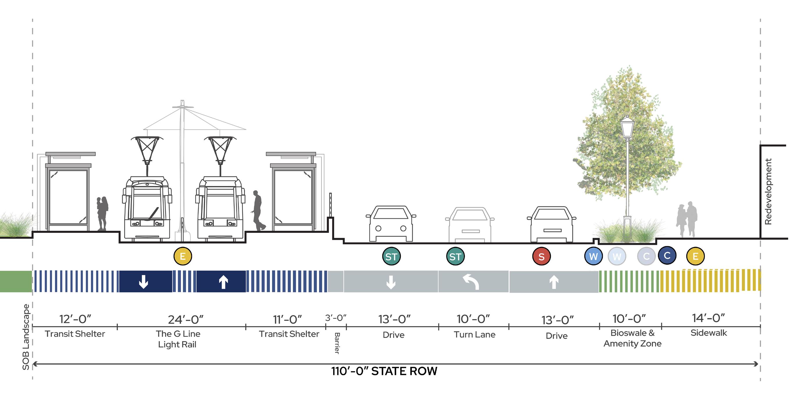
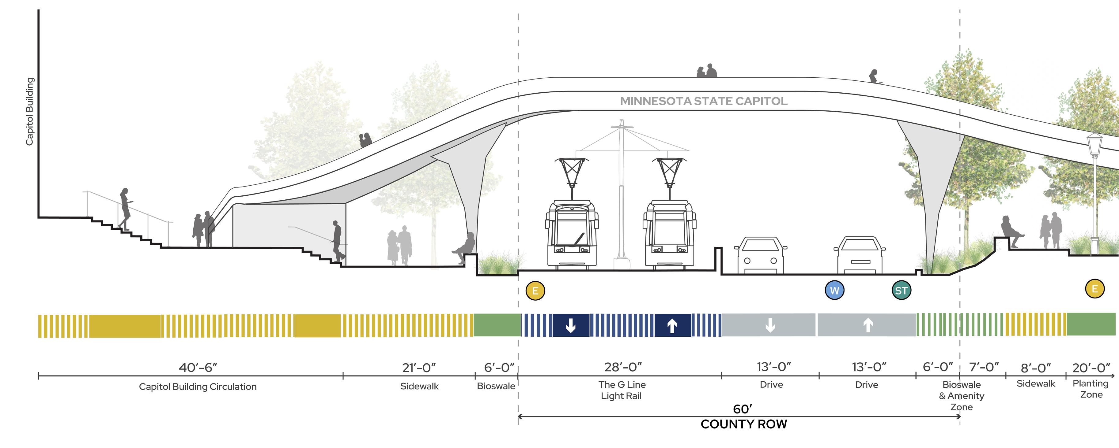
A. UNIVERSITY AVENUE AT CAPITOL / RICE ST LIGHT RAIL STOP B. UNIVERSITY AVENUE AT NORTH CAPITOL AVENUE E C W S ST Water Stormwater Electrical Underground Communication Sewer LEGEND Potential bridge over University Ave Stormwater management Right-sized vehicular lanes Right-sized vehicular lanes Increased tree canopy Increased pedestrian realm A B ROW ROW ROW ROW Increased tree canopy, relocated utilities 110’-0” Rated security wall
226 227 Capitol Mall Design Framework Design Framework
RIGHT-SIZE THE ROADS
DRAFT
NORTH CAPITOL AVENUE AND WEST 12TH STREET
PROPOSED STREET SECTIONS
A. NORTH CAPITOL AVENUE
As previously stated, North Capitol Avenue is a primary neighborhood connection that is centered on the Capitol Building. To improve the street, the Design Framework proposes right-sizing the vehicular lanes while adding bioswale and pedestrian amenity zones to improve the public realm experience. Enlarged sidewalks are well-lit and aligned with the proposed University Avenue Bridge to ensure optimal connectivity.
Reference the Analysis chapter for existing street sections.
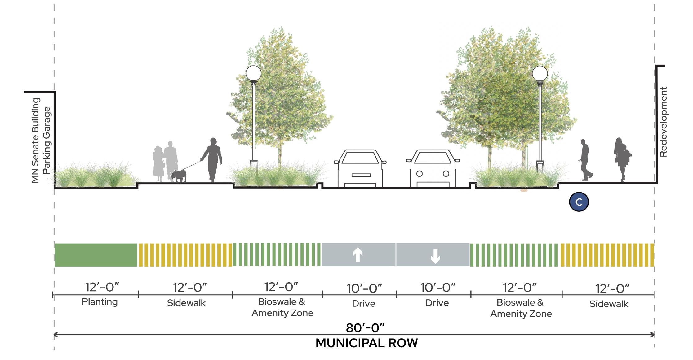
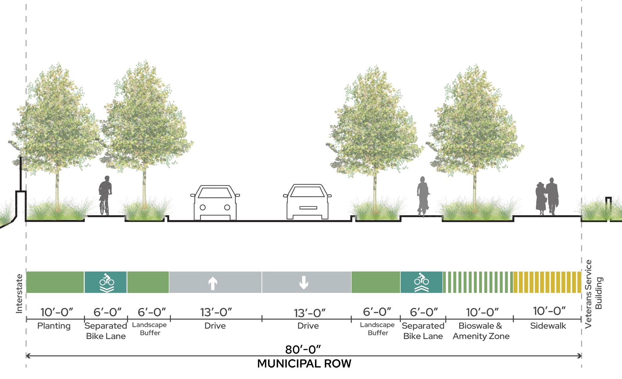
B. WEST 12TH STREET
West 12th Street forms the southern border of the Capitol Mall and also buffers the Capitol Mall from particulate and noise pollution from the interstate highways. Furthermore, the street fluctuates between a two-way and one-way street, reducing the ROW by half. The Saint Paul Bicycle Plan and 2040 Comprehensive Plan specify West 12th Street as a primary bicycle way, demanding strategic reallocation of ROW space to accommodate this new mobility option. Therefore, the proposed street section right-sizes the vehicular lanes to accommodate separated and protected bike lanes and additional landscape buffer. By doing this, cyclists can safely traverse the road and make critical connections to John Ireland Boulevard or Rice Street. Pedestrians can comfortably walk while not feeling like they are immediately on an interstate highway.
Reference the Analysis chapter for existing street sections.
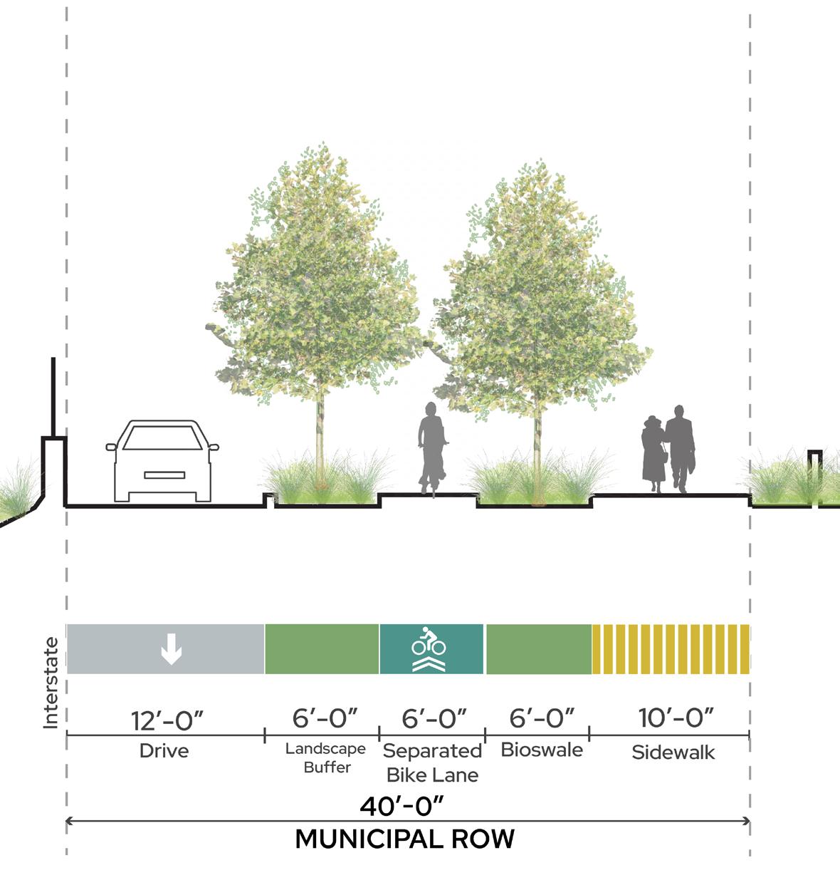
B2. WEST 12TH STREET (ONE-WAY) B1. WEST 12TH STREET (TWO-WAY) A. NORTH CAPITOL AVENUE E C W S ST LEGEND Water Stormwater Electrical Underground Communication Sewer B1 B2 A Stormwater management Right-sized vehicular lanes Right-sized vehicular lanes Separated and protected bike lanes per 2040 Comp Plan Separated and protected bike lanes per 2040 Comp Plan Vegetation buffer to interstate ROW ROW ROW ROW ROW ROW Right-sized vehicular lanes Sidewalk alignment with University Ave bridge Sidewalk alignment with University Ave bridge Increased tree canopy Rated removable bollards integrated into landscaping Rated removable bollards integrated into landscaping
228 229 Capitol Mall Design Framework Design Framework
RIGHT-SIZE THE ROADS DRAFT
PARKING AND ACCESS
BUS DROP OFFS
Parking and access is critical to the overall Capitol Campus experience for both workers and visitors alike. While the 2040 Comprehensive Plan outlines a process for transitioning away from single-occupancy vehicles and thus parking, surface and structured parking is still an integral part of the Design Framework in a more strategic and consolidated approach. The Design Framework preserves all existing parking ramps and adds a substantial new parking ramp at the corner of University Avenue and Rice Street. Enhanced pedestrian circulation connects this new parking ramp to the various government buildings around the Capitol Mall. The re-envisioned Cass Gilbert Memorial Park contains a revised surface parking lot with bus parking opportunities. Bus drop-off and pick-up occurs adjacent to the Upper Mall on Cedar Street and Rev. Dr. Martin Luther King, Jr. Boulevard, with queuing along John Ireland Boulevard and the southern portion of Cedar Street. Other surface parking lots have been consolidated to strategic locations that allow for accessible stalls and essential staff parking.
The Centennial Office Building parcel is anticipated to be demolished in the next decade and will have interim conditions prior to and during construction. This could include temporary bus parking. The redeveloped parcel should include additional bus parking tucked behind an active building frontage along Cedar Street.
PROPOSED PARKING RAMP WITH GROUND FLOOR ACTIVATION
Enhanced Pedestrian Circulation
Vehicular Circulation
Bus Drop Off / Pick Up Circulation
Surface Parking
Parking Ramps
Bus Queue
Drop Off / Pick Up Area
Cultural Walk - Stop
Vehicular Gateway Upgrades at Intersections
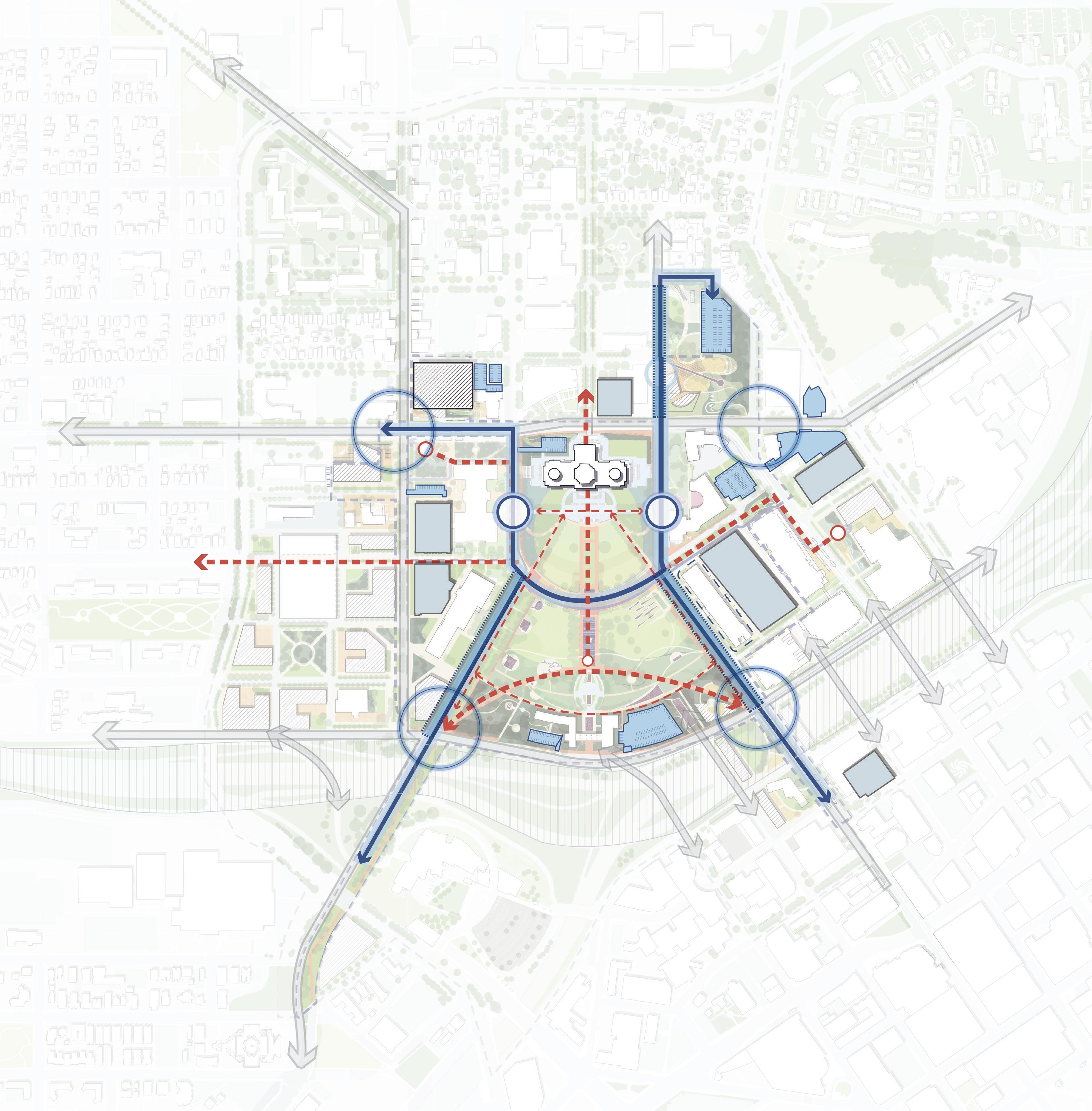
BUS QUEUING OPPORTUNITY
VEHICULAR GATEWAY UPGRADES
BUS
P P P P P P P P P P DROP
INTERIM
N 0’ 500’ 250’ 125’
PARKING OPPORTUNITY
OFF / PICK UP
CONDITION: BUS PARKING
LEGEND I-35E Park St Cedar St WKelloggBlvd JacksonSt Como Ave ComoAve W Pennsylvania Ave 10thStE Valley Park DOWNTOWN SAINT PAUL
230 231 Capitol Mall Design Framework Design Framework
Figure 208: Parking + Access RIGHT-SIZE THE ROADS DRAFT
PARKING SUPPLY AND DISTRIBUTION
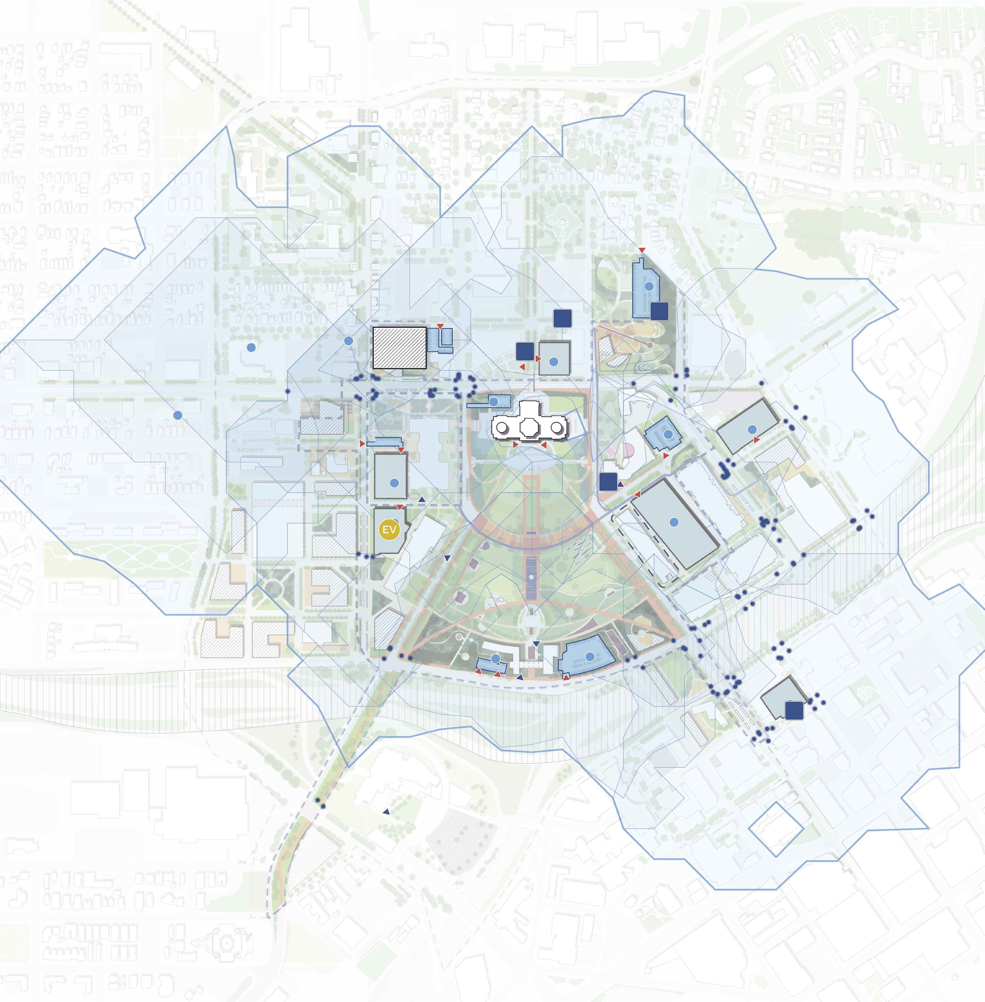
BUS PARKING OPPORTUNITY P PROPOSED PARKING RAMP WITH GROUND FLOOR ACTIVATION PARKING RETROFIT N 0’ 500’ 250’ 125’ Surface Parking Parking Ramps ADA Parking ADA Ramp Entrances Parking Entrances EV Parking 3-Minute Walkshed from Parking Lots Pedestrian Crossing Signals LEGEND EV 20 STALLS 1,481 STALLS 887 STALLS 92 STALLS 250 STALLS 404 STALLS 25 STALLS 260 STALLS 120 STALLS 514 STALLS 34 STALLS 75 STALLS 478 STALLS 34 STALLS I-35E Park St Rice St Cedar St WKelloggBlvd JacksonSt Como Ave ComoAve W Pennsylvania Ave 10thStE Valley Park DOWNTOWN SAINT PAUL I-94 Total
**Parking Stall Inventory was done in April 2024. Metric is total parking stalls available on Capitol Campus.
Total Adjusted Parking
232 233 Capitol Mall Design Framework Design Framework
Existing Campus Parking Stalls: 5,757
Existing Parking Stalls Removed: 888
Stalls: 4,869
CAPITOL CAMPUS Figure 209: Parking Supply + Distribution RIGHT-SIZE THE ROADS
DRAFT
TAKEAWAYS
TRANSIT AND MICROMOBILITY
The Capitol Campus is ideally located at the nexus of multiple sharedand micromobility options. An extensive bicycle network, laid out by the Saint Paul Bicycle Plan and 2040 Comprehensive Plan, connects cyclists from Downtown or the north to the Capitol Campus. These bicycle lanes are separated and protected from vehicular traffic in addition to being tree covered and shaded. The LRT Green Line stops at two nearby locations, allowing visitors and workers to easily travel between various destinations without the need of single-occupancy vehicles. Additionally, Metro Transit has two BRT lines planned that run through the Capitol Campus. The BRT G-Line will run down Rice Street, with three distinct stops in walking distance to the Capitol Building and Capitol Mall. The BRT Purple Line will travel down Robert Street and continue northeast, with one stop in walking distance (East 14th Street). Collectively, this network makes the Capitol Campus highly accessible and supports more sustainable and equitable modes of transportation.
Vehicular Circulation Bike Lanes
2 Way Bike Lanes (Proposed)
1 Way Bike Lanes (Proposed) LRT Green Line
Purple Line (Planned)
G Line (Planned)
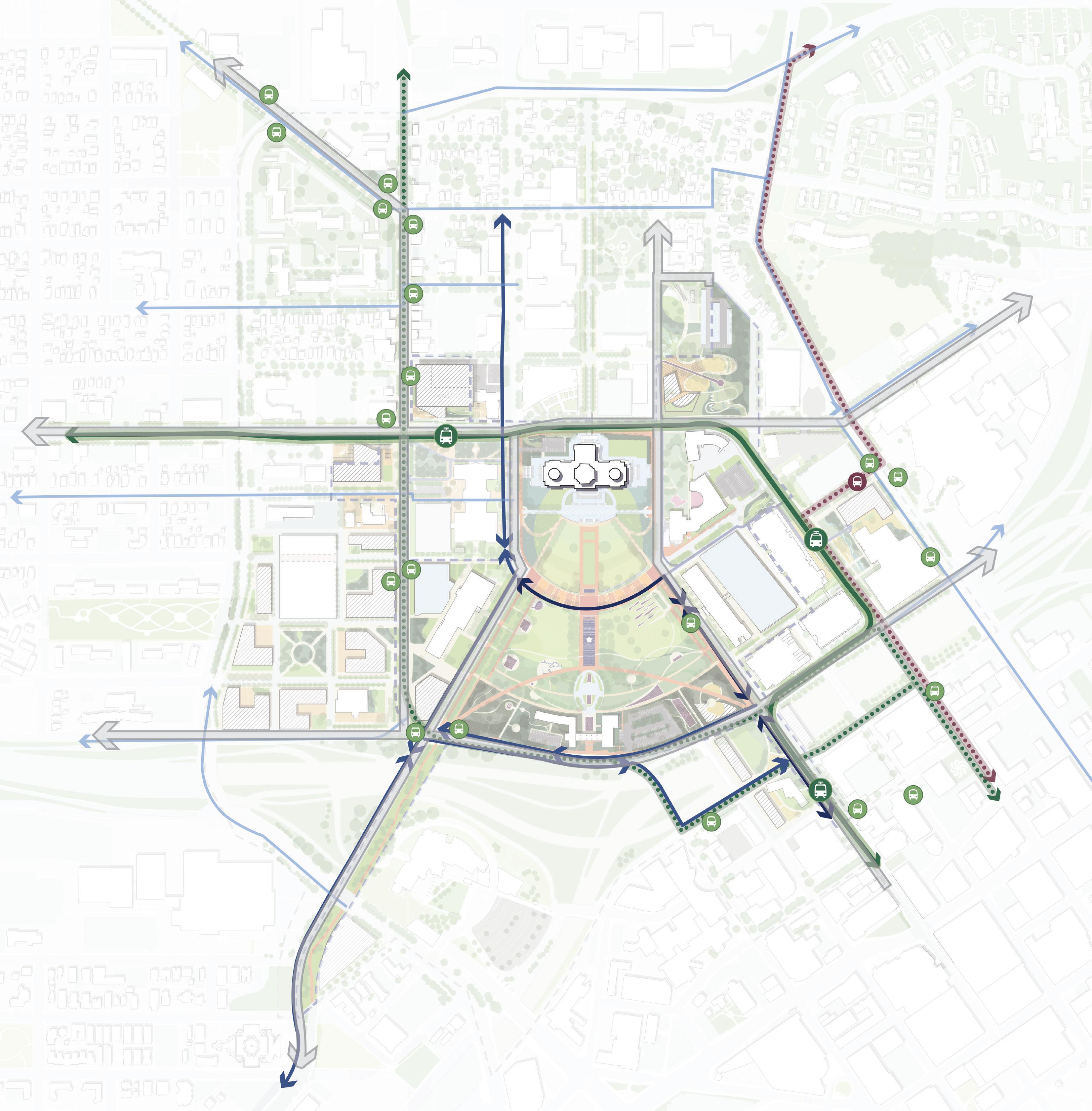
RICE + UNIVERSITY AVE MOBILITY HUB ROBERT STATION MOBILITY STOP N 0’ 500’ 250’ 125’
LRT
LEGEND
BRT
BRT
Transit Stop BRT Purple Line Transit Stop Bus Stops
234 235 Capitol Mall Design Framework Design Framework
RIGHT-SIZE THE ROADS Figure 210: Transit + Micromobility
DRAFT
STREETSCAPE PRECEDENTS
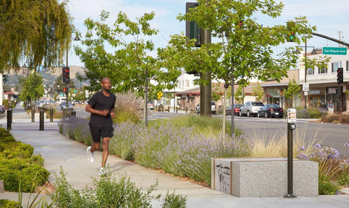
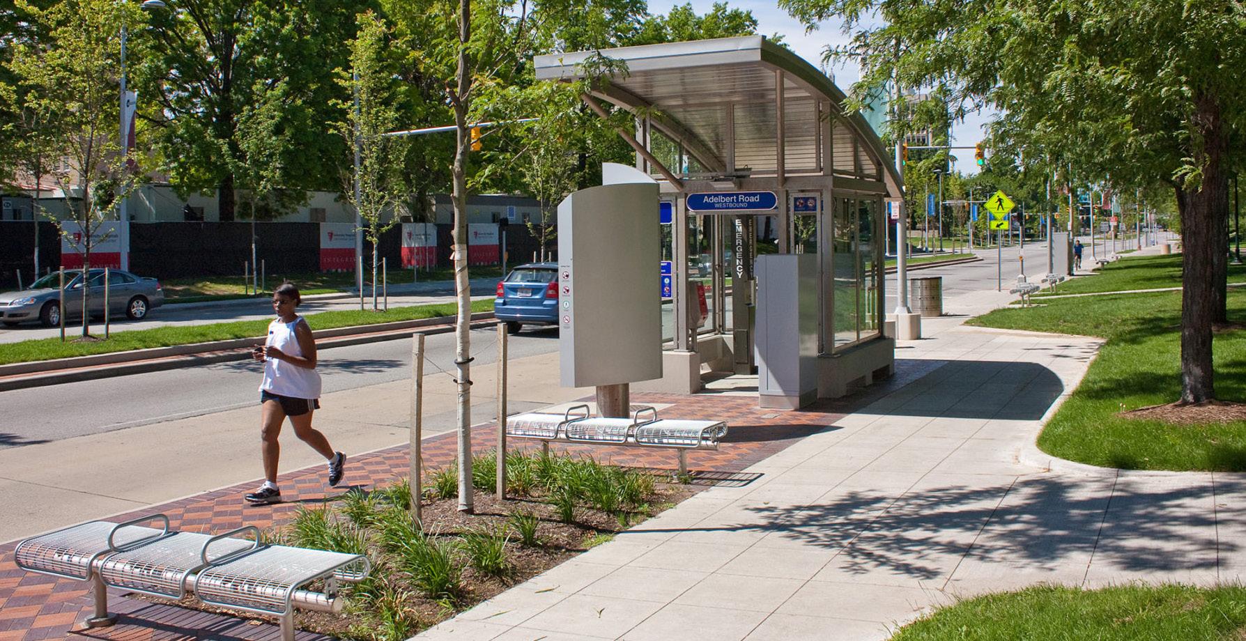
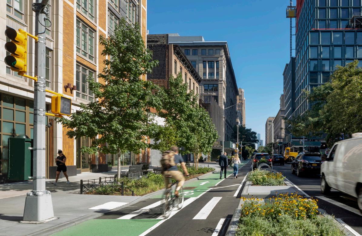
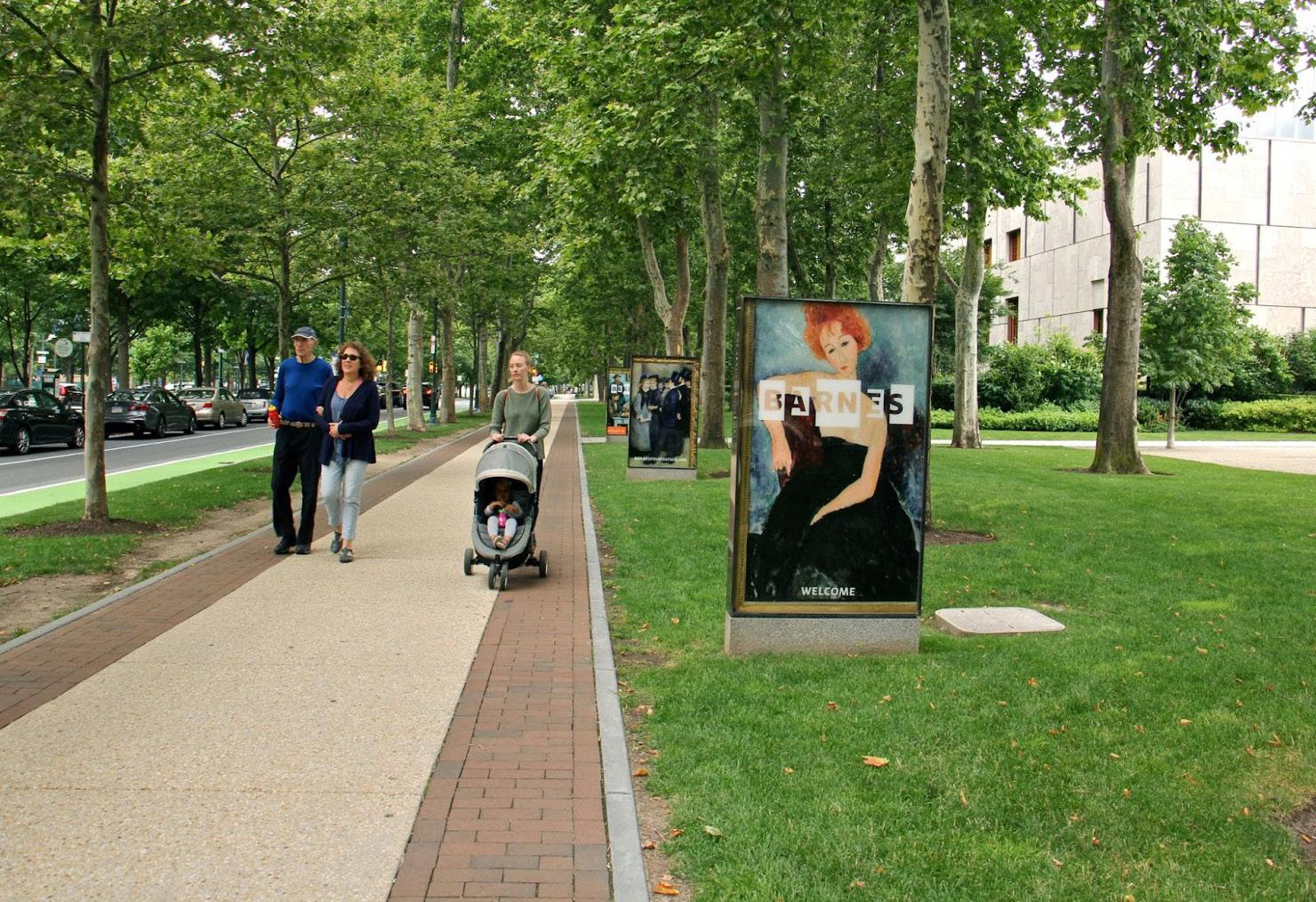
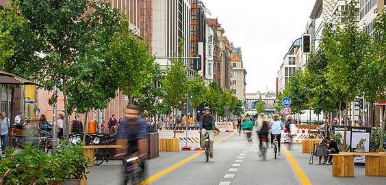 Source:xx
Figure 214: Euclid Avenue BRT, Cleveland, OH
Source:xxx
Source:xxx Source:xxx
Source:xxx
Figure 215: Hudson Square streetscape in New York City Figure 216: Ben Franklin Parkway, Philadelphia
Figure 217: Flaniermeile Friedrichstrabe, Berlin, Germany
Figure 211: Castro Valley, CA Source:xxx Source:xxx
Source:xx
Figure 214: Euclid Avenue BRT, Cleveland, OH
Source:xxx
Source:xxx Source:xxx
Source:xxx
Figure 215: Hudson Square streetscape in New York City Figure 216: Ben Franklin Parkway, Philadelphia
Figure 217: Flaniermeile Friedrichstrabe, Berlin, Germany
Figure 211: Castro Valley, CA Source:xxx Source:xxx
212:
213:
236 237 Capitol Mall Design Framework Design Framework
Figure
xx Figure
xx
RIGHT-SIZE THE ROADS DRAFT
O Sculpt Topography
O Security
O Security Typologies
O Physical Security Considerations
O Pedestrian Circulation
O ADA Accessibility and Security
SCULPT TOPOGRAPHY DRAFT
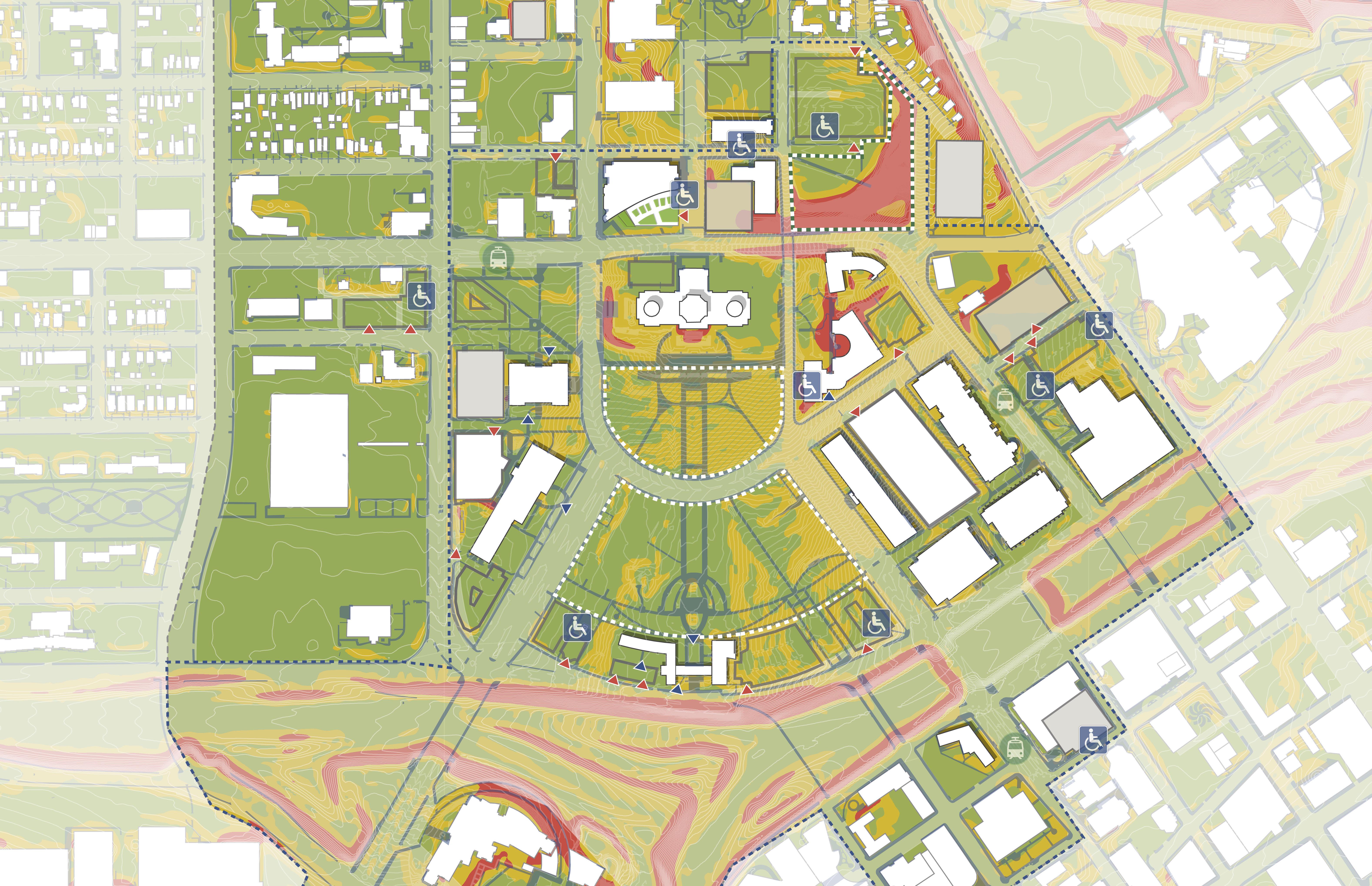
Sculpt topography to improve accessibility, seamlessly integrate security and provide a platform for events
238 239 Capitol Mall Design Framework Design Framework
TO IMPROVE ACCESSIBILITY, SEAMLESSLY INTEGRATE SECURITY, AND PROVIDE A PLATFORM FOR EVENTS
The Design Framework revises grading throughout the Capitol Mall to improve accessibility and pedestrian circulation, as well as seamlessly integrate physical security barriers. Existing topography, especially within the Upper Mall, exceeds the recommended slope for ADA accessibility and larger events. Moreover, stakeholder engagement outlined portions of the Upper and Lower Malls touching Rev. Dr. Martin Luther King, Jr. Boulevard as lacking proper security infrastructure. By slightly leveling portions of the Upper Mall and integrating a series of low retaining seat walls along Rev. Dr. Martin Luther King, Jr. Boulevard, the Upper and Lower Malls become more flexible, easier to traverse, and safer for all those using them. Lastly, new pedestrian connections across University Avenue and throughout the Lower Mall ensure better connectivity to existing neighborhoods and Capitol Campus arrival points.
SCULPT TOPOGRAPHY TAKEAWAYS
O The Upper and Lower Malls have vastly different slope profiles, with the Upper Mall being particularly steep.
O By strategically sculpting the existing topography, the spaces become more flexible, easier to traverse, and safer for those using them.
DRAFT
1.68% < 3% 1.68% < 3% Cass Gilbert Memorial Park ACCESSIBLE PROMENADE NEW ADA ROUTES NEW ADA ROUTES GENTLE SLOPE FLATLAWN GENTLE SLOPE FLAT LAWN BRIDGE CONNECTION STAIRS STAIRS N 0’ 250’ 125’ 60’ Rice St University Ave W Aurora Ave John Ireland Blvd CedarSt RobertSt Cedar St E12thSt Park St I-35E WabashaStN Rev Dr MLK Jr Blvd
240 241 Capitol Mall Design Framework Design Framework
SCULPT TOPOGRAPHY Figure 218: Sculpt Topography
SECURITY CONSIDERATIONS
CONSIDERATIONS
The Design Framework incorporates security-related considerations identified in the Minnesota State Capitol Complex – Physical Security Study (June 2014), the Minnesota Capitol Complex Physical Security Predesign Report (October 2017), the Minnesota Capitol Complex Physical Security Predesign Report (2022 Update) (April 2022), and the 2040 Comprehensive Plan for the Minnesota State Capitol Area (June 2021). Security stakeholders will be further engaged as individual projects are undertaken under the framework umbrella to identify specific technical and performance-related requirements applicable to the projects.
The Design Framework integrates the security objectives identified in these security reports with the aesthetic and functional aspirations of the space development. The landscaping and planting development provides trees that can be trimmed and a low and thin vegetation palette that will minimize concealment in the gathering spaces and near the Capitol Mall buildings. Placement of containers, such as receptacles, vendor boxes and bicycle storage, maintain appropriate separation from these spaces. These elements, as well as other street furniture, will incorporate security-related anchorage considerations. Lighting development considers and will incorporate input from the security stakeholders for visibility and technical security considerations.
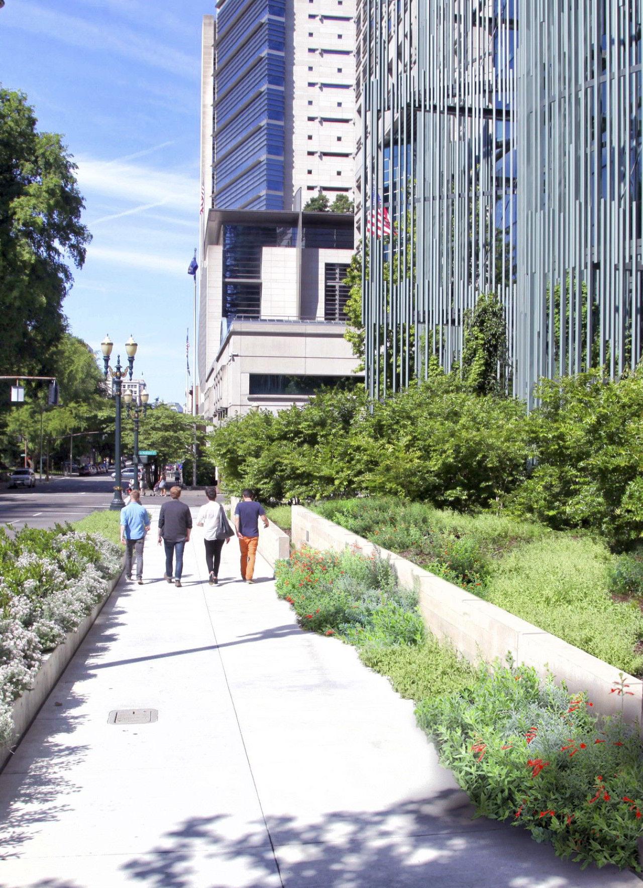
Source: https://architectureprize.com/winners/ winner.php?id=3966
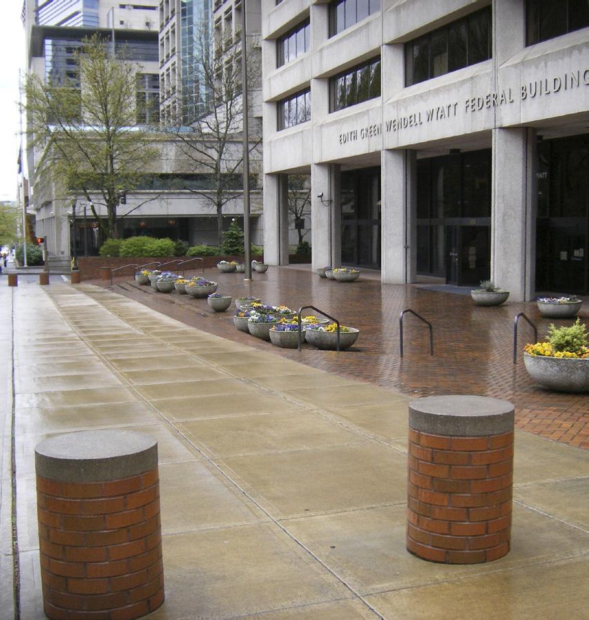
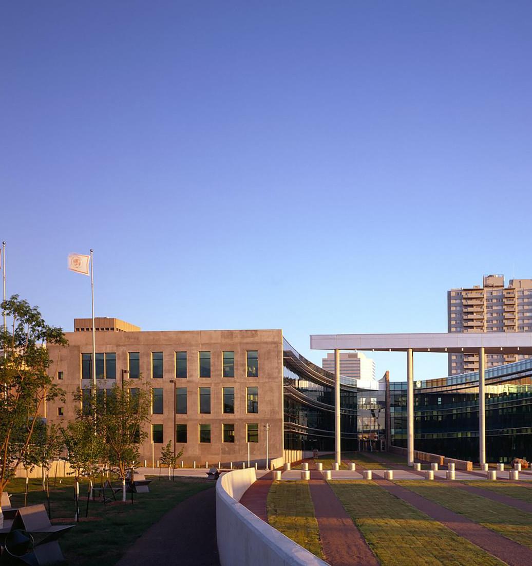
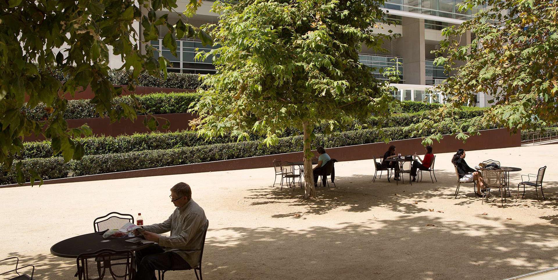
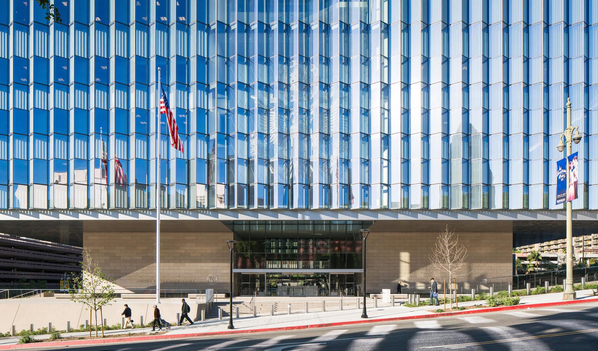
Source: https://architectureprize.com/winners/ winner.php?id=3966
Figure 221: Retaining Seatwall at US Capitol
Figure 219: Retaining Seatwalls, Edith Green Wendell Wyatt Federal Building
Figure 222. Sloping Retaining Wall at San Diego Federal Courthouse
Figure 223. Retaining Wall, OK City Federal Building Figure 224. Multifunction Seating as Security, Boston Federal Bank Reserve
Figure 220. Bollards, Edith Green Wendell Wyatt Federal Building
Figure 225. Impact-rated bollards, Financial District Figure 226. Permanent Bollards, Los Angeles Federal Courthouse
Source: Sasaki, Retaining Seatwall. Sasaki.
Source: Spurlock Landscape Architects. Retaining Wall, San Diego.
Source: Grassl/Esto, Anton. Multifunction Seating as Security, Boston Federal
Source: Hedrich Blessing Photographers. Retaining Wall, OK City Federal Building. Archello.
Source: Rogers Partners. Impact-rated Bollards, Financial District. Instagram,
Source: Kerhart, Hunter. Permanent Bollards, Los Angeles Federal Courthouse. Studio MLA,
242 243 Capitol Mall Design Framework Design Framework
FRAMEWORK
SCULPT TOPOGRAPHY
DRAFT
SECURITY TYPOLOGIES DIAGRAMS
O Implement recommended 33-foot setback from building to maintain clear sightlines
O Maintain clear sightlines with a minimum of nine-foot clear height of trees
O Mount surveillance cameras at a nine-foot minimum height to prevent unmounting
O Set back bollards from sidewalks with planting
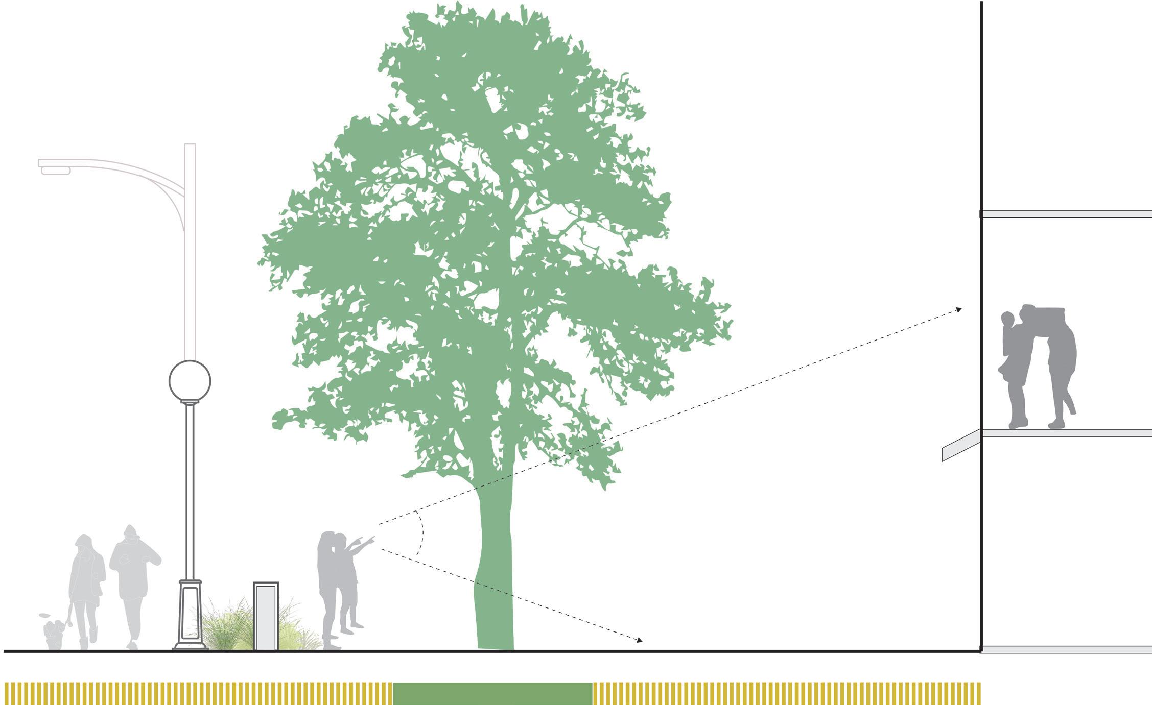
ANTI-RAMMING RATED WALL
O Ensure three-foot minimum height to be effective in stopping vehicles
O Utilize anti-ramming rated walls in areas where aesthetics are more crucial
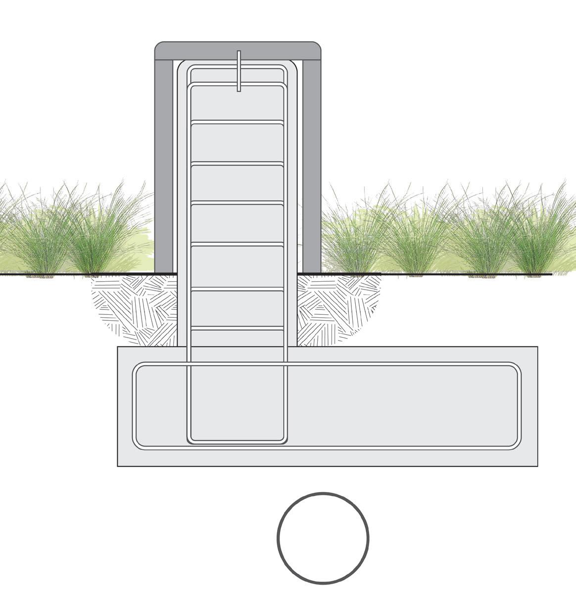
DRAFT
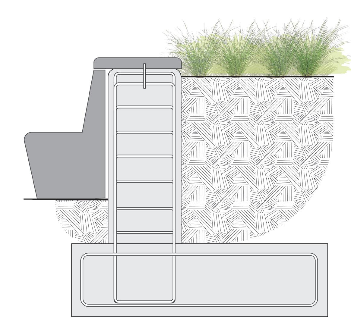
O Consider integrating with landscape to create landscape retaining structures
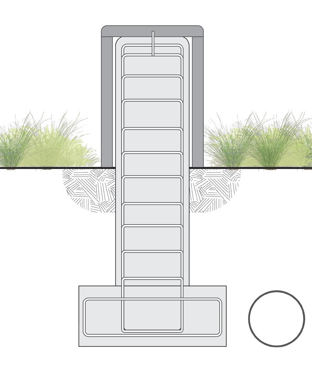
BOLLARDS
O Place bollards at building or pedestrian entrances
O Space bollards with 4-foot maximum spacing between structural pipes (i.e. excluding cover dimensions)
O Install a minimum of two bollards per foundation
O Install bollards with a decorative stainless steel or powder coated sleeve with custom RAL color
Building Face min 9’ min 9’ Surveillance Camera Decorative Slip Cover Utility Line Utility Line SPACING BETWEEN STRUCTURAL BOLLARD INTERIOR SightLine Setback min 10’ 1.5’ MIN 1.5’ MIN 4’ MAX 3’ MIN 3’ MIN 3’ MIN 3’ MIN 1.5’ MIN 2’ Sidewalk Dimension Varies
Figure 230: Anti-Ramming Rated Retaining Wall
SIGHT LINES + SETBACKS
Rated
Vertical
Figure 229: Anti-Ramming Rated Wall with Horizontal Foundation Figure 231: Anti-Ramming
Wall with
Foundation
Figure 232: Bollards
246 247 Capitol Mall Design Framework Design Framework
SCULPT TOPOGRAPHY
Figure 228: Sight Lines + Setbacks
SECURITY TYPOLOGIES DIAGRAMS
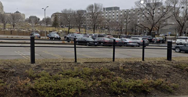
O Recommend cable rail system in private surface parking lots that need reinforcement and along highway systems
O Heavily plant cable rail system with low shrubs and groundcover on a berm typology to provide additional physical barrier
O There is an existing Cable Rail System by the Veteran Building Parking Lot and along Saint Anthony’s Street.
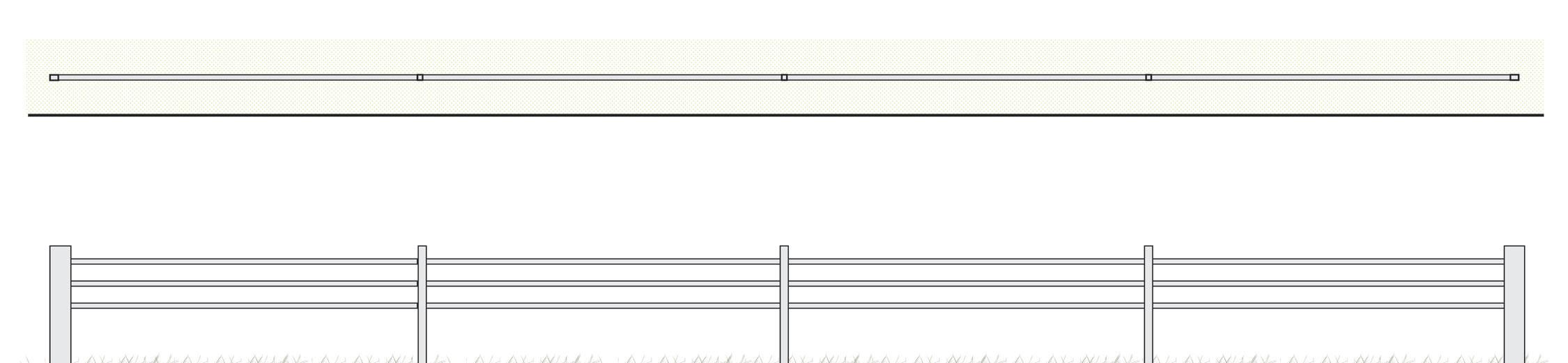
AT REV. DR. MARTIN LUTHER KING, JR. BOULEVARD
O Include temporary, retractable or removable bollards along pedestrian pathways
O Reuse existing curb systems along Rev. Dr. Martin Luther King, Jr. Boulevard to separate pedestrians and vehicular traffic
O Provide temporary barriers as needed at vehicular entrances to Rev. Dr. Martin Luther King, Jr. Boulevard, refer to Temporary Barriers for further information
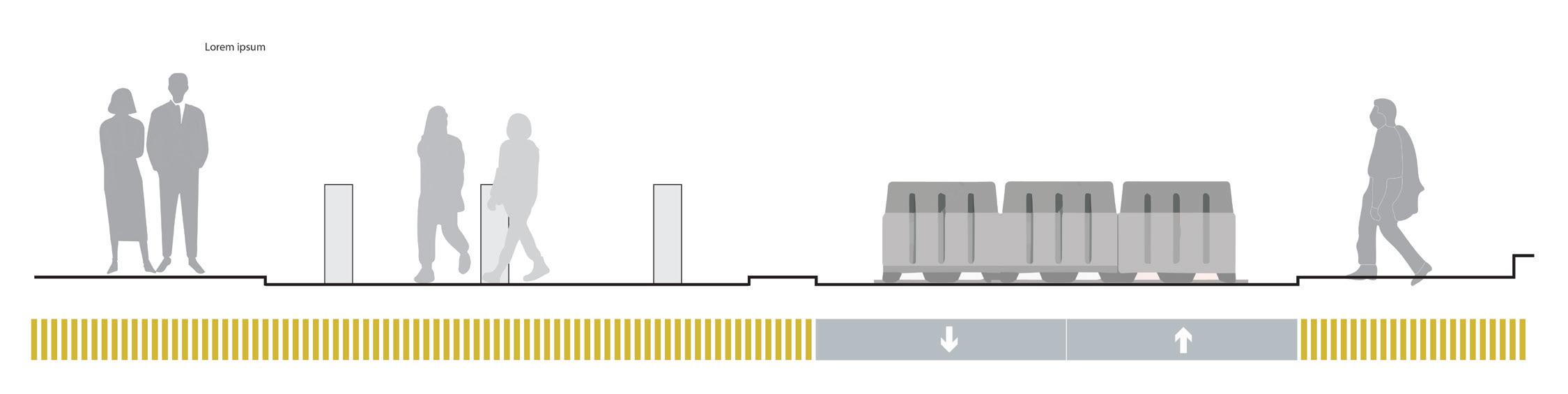
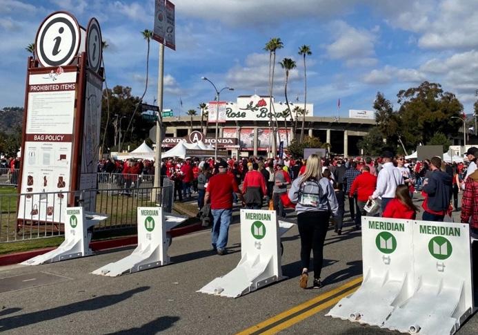
Source:https://www.betterbarriers.com/meridian-barriers-contributeto-the-safety-of-the-rose-parade/
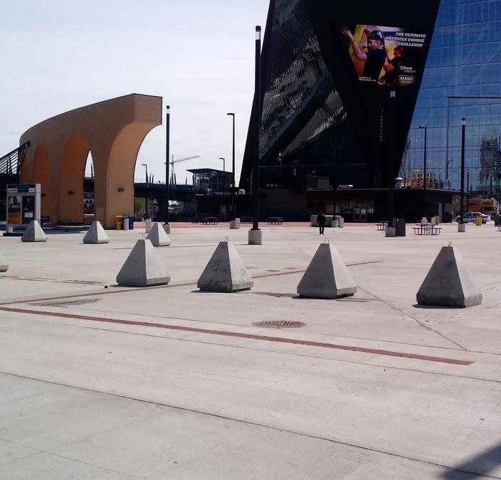
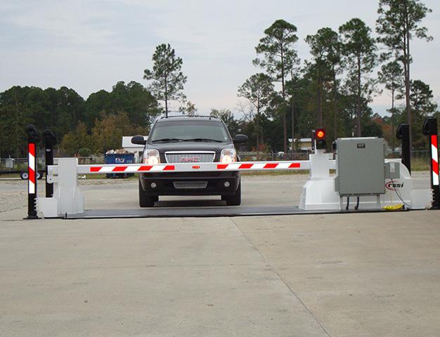
Source:https://www.rssi.com/products/mobilesurface-barrier/
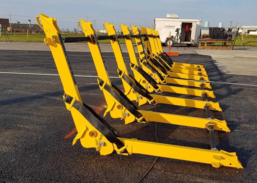
Source:https://www.warninglitesmn.com/traffic-controlrental-and-sales
Source:https://www.securityprousa.com/blogs/news/modular-vehiclebarriers-a-new-light-on-mifram-s-bestseller
Source:https://www.wcvb.com/article/red-sox-games-could-close-lansdowne-street-by-next-week/9568168
Temporary Barriers Bollards Posts Bollards Plan Elevation Vehicular Traffic Sidewalk Sidewalk MLK Shared Street TEMPORARY BARRIERS IN POST BURIAL CABLE RAIL SYSTEM
248 249 Capitol Mall Design Framework Design Framework
SCULPT TOPOGRAPHY
Figure 233: MLK Blvd Security Typology
Figure 234: Meridian Archer 1200
Figure 236: PDI Blocks
Figure 237: Modular Vehicle Barrier
Figure 238: Modular Vehicle Barricade
Figure 235: Mobile Surface Barrier
DRAFT
PEDESTRIAN CIRCULATION ADA ACCESSIBILITY
Vital to the Design Framework is a re-envisioned pedestrian circulation network that better connects Capitol Campus arrival points and other points of interest. The linear north-south circulation stretching from the Capitol Building to the Veterans Service Building is an integral design feature of the Cass Gilbert and Johnston/Nelson/Nichols plans. The Design Framework preserves and reinforces this north-south connection. Additionally, primary circulation along the Aurora Promenade, John Ireland Boulevard and Cedar Street connect pedestrians to and from Downtown and the Cathedral of Saint Paul. Building upon the existing pathway arc within the Lower Mall, additional pedestrian paths capture those arriving from the southern entry points and create a clear and curated experience throughout the many memorials of the Lower Mall. See Introduce New Public Space Strategies for more information. Lastly, proposed pedestrian bridges and enhanced crosswalks across University Avenue connect the Capitol Campus to the neighborhoods in the north as well as the re-envisioned Cass Gilbert Memorial Park.
LEGEND
Major Mall Access Points
Pedestrian (Capitol Area)
Stairs
ADA Circulation
ADA Ramps to Buildings
Primary Circulation
Secondary Circulation
Tertiary Circulation
Trails
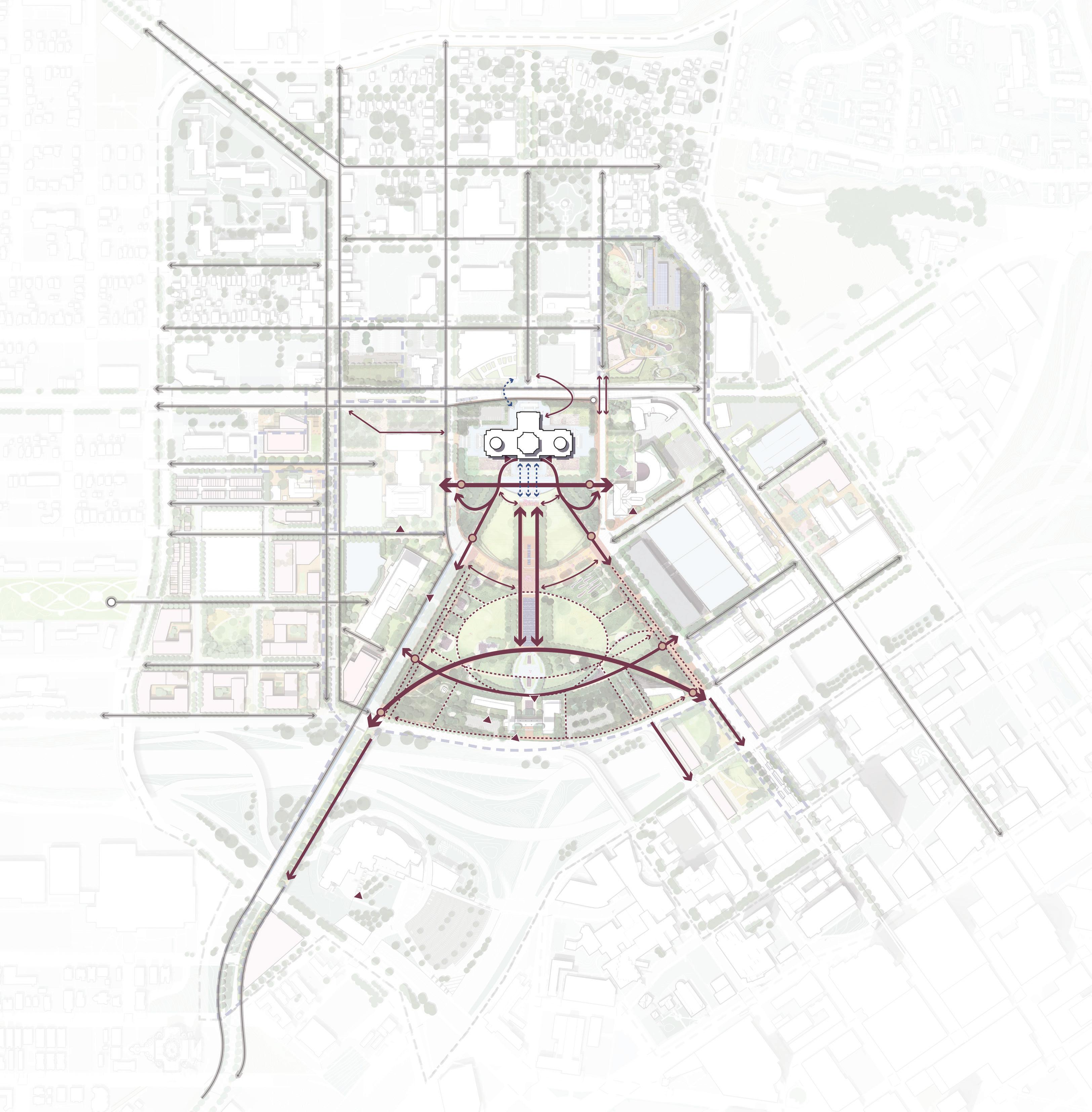
N 0’ 500’ 250’ 125’ University Ave W Aurora Ave W Fuller Ave St Anthony Ave Como Ave W Pennsylvania Ave Park St N Capitol Blvd Cedar St Rice St Marion St John Ireland Blvd JacksonSt UniversityAveE E12thSt 10thStE RobertSt CedarSt WabashaSt FortRd DOWNTOWN SAINT PAUL
250 251 Capitol Mall Design Framework Design Framework
SCULPT TOPOGRAPHY
Figure 239: Pedestrian Circulation DRAFT
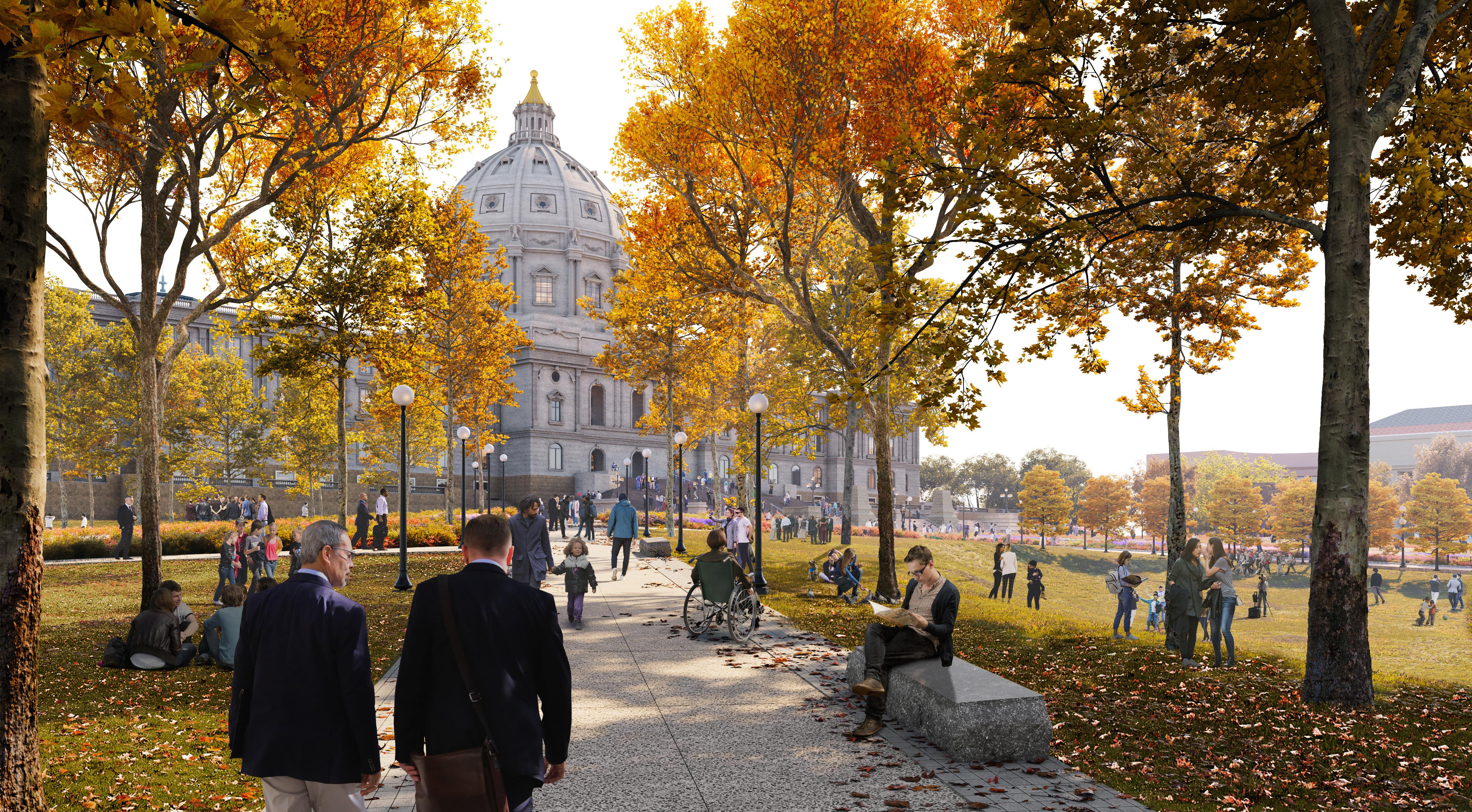
252 253 Capitol Mall Design Framework Design Framework SCULPT TOPOGRAPHY
RENDERING Before DRAFT
UPPER CAPITOL MALL
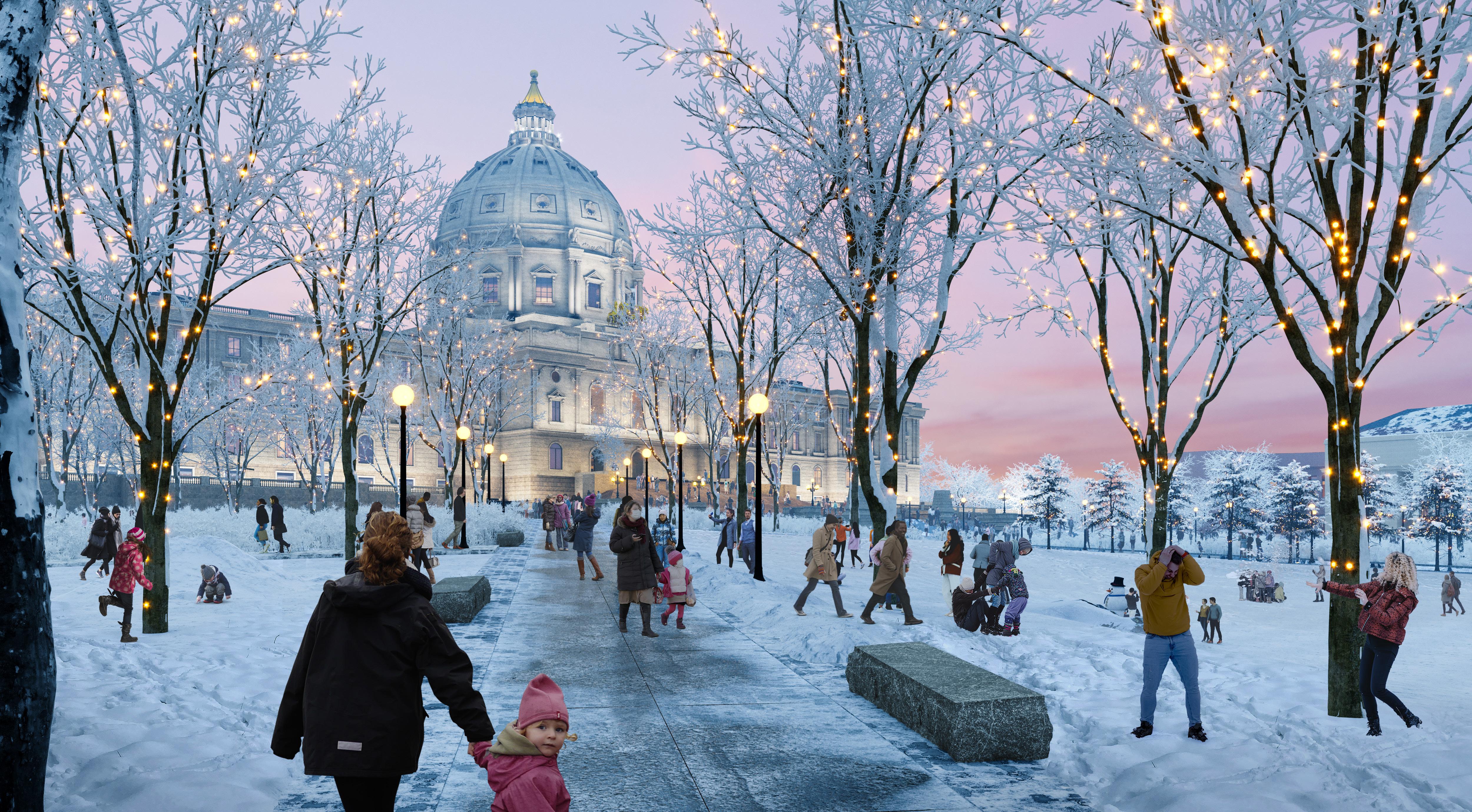
254 255 Capitol Mall Design Framework Design Framework SCULPT TOPOGRAPHY
RENDERING Before DRAFT
UPPER CAPITOL MALL
ADA ACCESSIBILITY AND SECURITY
ADA accessibility is essential for equitable access to the Capitol Campus. Community engagement throughout the Capitol Mall Design Framework highlighted the Upper Mall’s steep slopes as particularly hard to traverse. Moreover, half of Cass Gilbert Memorial Park is inaccessible to anyone regardless of ability due to its southern cliff-like edge. To resolve these issues, strategic regrading and stepped retaining seat walls level the Upper Mall while providing for necessary security barriers. The impactrated seat walls prevent vehicles from driving into the Upper Mall, especially during large events. The regraded southern portion of Cass Gilbert Memorial Park and additional pedestrian circulation provide for improved accessibility while also maintaining the natural topography inherent to this area long before the Capitol Campus was built. See Transform Cass Gilbert Memorial Park for more information.
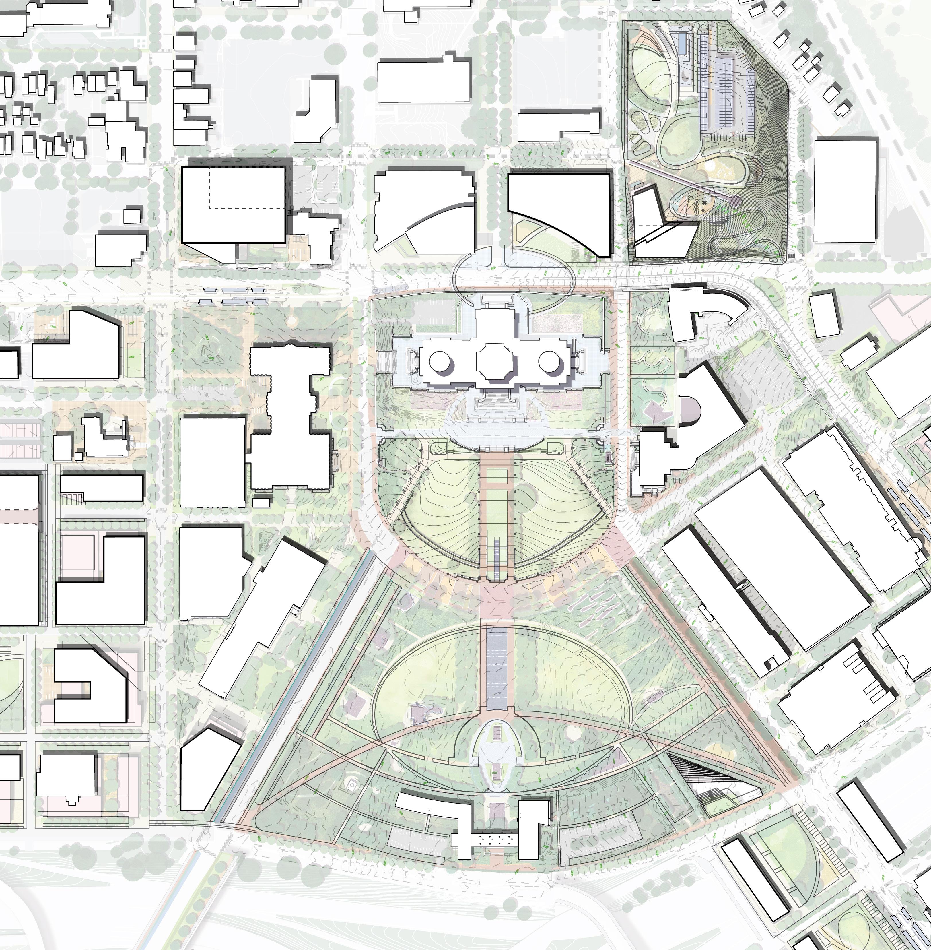
PROPOSED GRADING TO PROVIDE ADA ACCESS AND SPACE FOR PROGRAMMING STEPPED RETAINING SEATWALL STEPPED RETAINING SEATWALL N 0’ 250’ 125’ 60’ Rice St University Ave W Aurora Ave John Ireland Blvd CedarSt RobertSt Cedar St E12thSt Park St STATE CAPITOL I-35E WabashaStN Rev Dr MLK Jr Blvd 1.68% 3% 3.3% 0.9% 3.3% 4.8% + 910 +909 + (845) + HP 912
256 257 Capitol Mall Design Framework Design Framework
SCULPT TOPOGRAPHY Figure 240: ADA Accessibility and Security (Overall) DRAFT
OVERALL
ADA ACCESSIBILITY AND SECURITY
UPPER MALL
Phase 1 of the Design Framework focuses on Rev. Dr. Martin Luther King, Jr. Boulevard and the Upper Mall. More specifically, it strives to create consistent 3% slopes within the eastern and western flanks of the Upper Mall, as well as the prominent north-south axial connection. To achieve this, stepped 2-foot, 6-inch impact-rated retaining seat walls step down to Rev. Dr. Martin Luther King, Jr. Boulevard; this feature not only provides additional security to those gathering in the Upper Mall, but creates places to sit or moments for branding and signage. Numerous other Capitol complexes (including the United States Capitol in Washington, D.C.) utilize this approach to provide safe pedestrian realms that do not feel opposing or off-limits. ADA accessible pathways enter from the eastern and western edges of the Upper Mall, adjacent to designated drop-off zones.
Existing
Proposed
Proposed Retaining Wall (to be studied further)

STEPPED RETAINING SEATWALL 2.5’ IMPACT RATED EXISTING MEMORIAL TO REMAIN EXISTING MEMORIAL TO REMAIN EXISTING MEMORIAL PLINTHS TO REMAIN PHASE 1 : REV. DR MLK JR. BLVD AURORA
N 0’ 80’ 40’ 20’ Park St John Ireland Blvd Cedar St + 857.0 + BS 859.0 + TS 862.0 + (TS 867) (868) + 1.8% (864.5) + + 861 860 + + + (862.76) + (860) (860) (865) (870) (875) (855) (850) (845) (845) (840) (840) (845) (TC 852) + TW 856.0 BW 853.0 TW 855.0 BW 852.0 (BW 862.76) + + (TC 853) TW 856.5 + + TW 848.0 BW 845.5 + TW 848.0 BW 845.5 TW 846.0 + BW 843.5 TW 847.0 + BW 844.5 3% 3% 1.8% 1.8% 1.8% 4.8% 8.3% 7.7% 4.8% 7.7% 3.6% 3.3% TS 847.5 + + TS 844 + (BS841)
LEGEND
PROMENADE
258 259 Capitol Mall Design Framework Design Framework SCULPT TOPOGRAPHY
Figure 241: ADA Accessibility and Security (Upper Mall) DRAFT
O Represent Minnesota’s Cultural Diversity and Ecological Variety
O Democracy Stage
O Cultural Platform
O History and Relevance
O Commemorative Artwork
O Community Shared Street
PUBLIC SPACE STRATEGIES DRAFT
O Establish a Cultural Walk
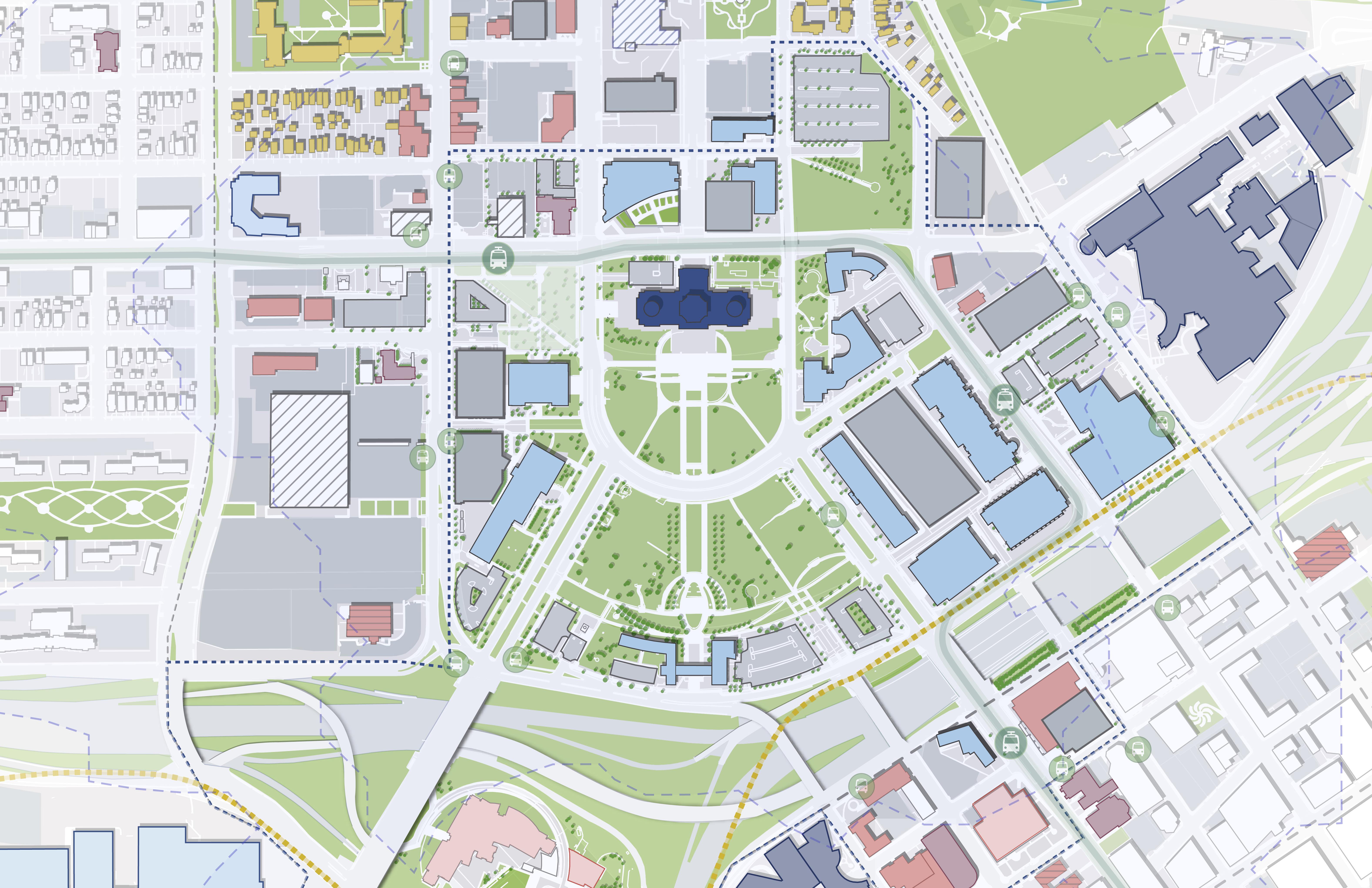
Introduce new public space strategies to include and celebrate more of Minnesota and introduce new strategies to represent Minnesota’s cultural diversity
260 261 Capitol Mall Design Framework Design Framework
INTRODUCE NEW STRATEGIES TO REPRESENT MINNESOTA’S CULTURAL DIVERSITY AND ECOLOGICAL VARIETY
As previously discussed in the Analysis chapter, much of the Capitol Mall open space is lawn with no specific programming. While the Upper and Lower Malls operate like distinct spaces, they lack differentiation other than the density of commemorative works. Furthermore, the Capitol Campus does not have a collective open space narrative that ties everything together. To remedy this, the Design Framework introduces new strategies to represent Minnesota’s cultural diversity and ecological variety by reimagining the roles of various open spaces and proposing a Cultural Walk along Rev. Dr. Martin Luther King, Jr. Boulevard.
The Upper Mall operates as the Democracy Stage—an area free of future commemorative works that provides a neutral space for free speech and large events. The Lower Mall is a space for History and Reverence, where new strategically located commemorative works highlight those not currently represented on the Capitol Mall. Additionally, various different landscape typologies spotlight the ecological story of the Capitol Mall and frame the many commemorative spaces throughout; see a Gradient of Planting Strategies for more information. The Cultural Platform facilitates gatherings and events while forming the Commemorative Loop—a pedestrian path that links all of the commemorative works together. Lastly, the Cultural Walk creates a collective historical narrative that not only links all of Minnesota’s seats of government, but various other community points of interest.
TAKEAWAYS
O The Upper Mall and Capitol Building are the Democracy Stage—a space for all people to come and exercise their First Amendment rights.
O The Lower Mall is a space for History and Reverence, with commemorative works highlighting those not currently represented on the Capitol Mall.
O The Cultural Walk ties together various community points of interest.
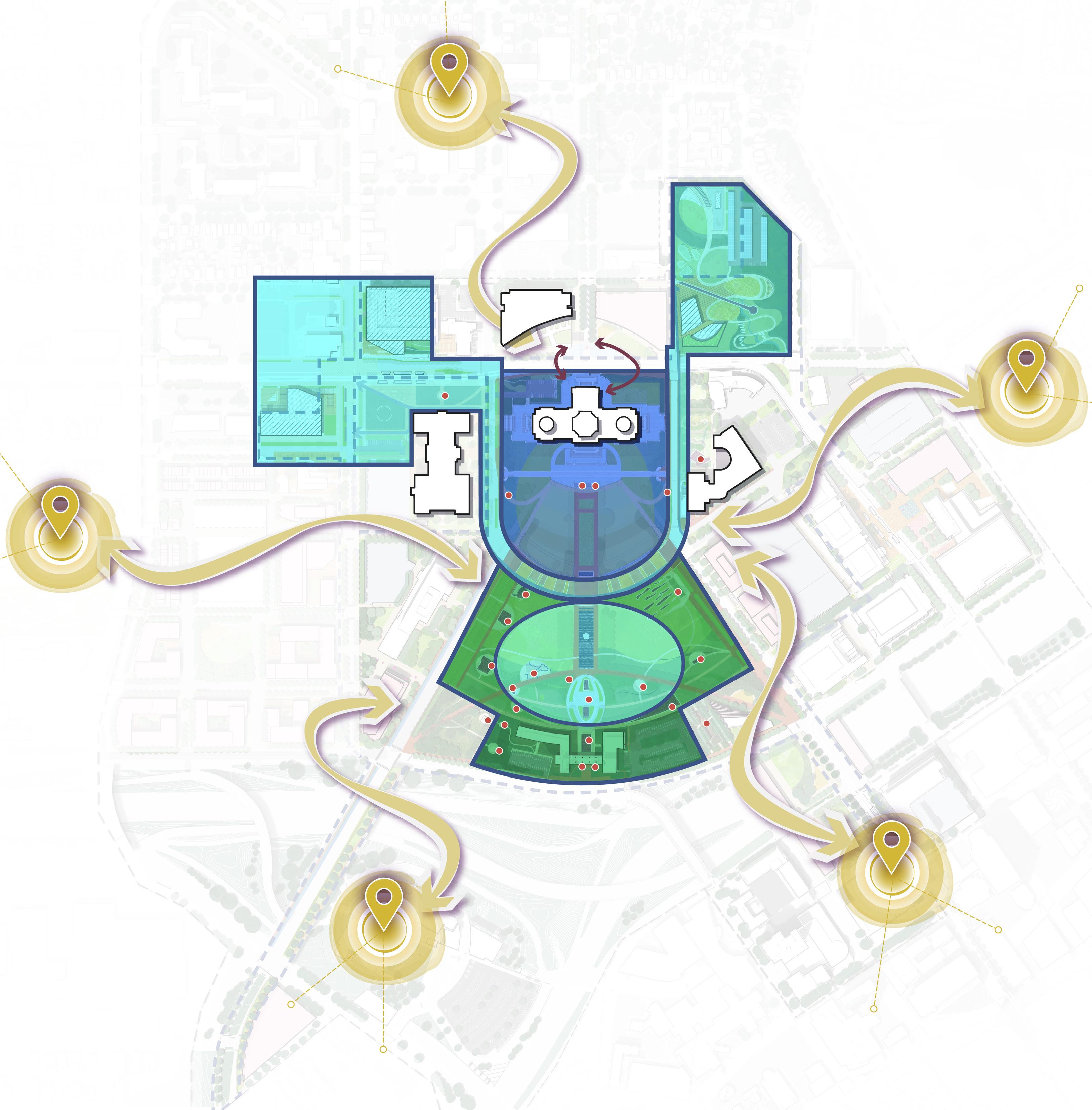
DRAFT
REGIONSCONNECTION R I NOITCENNOCEC D O NOCNWOTNW NECTION HISTORYCONNECTIO N CULTURAL WALK N 0’ 250’ 125’ 60’ Figure 242: Minnesota’s Cultural Diversity and Ecological Variety
RONDO NEIGHBORHOOD CONNECTION
DEMOCRACY STAGE CULTURAL PLATFORM HISTORY AND RELEVANCE
262 263 Capitol Mall Design Framework Design Framework
PUBLIC SPACE STRATEGIES
DEMOCRACY STAGE
FIRST AMENDMENT RIGHTS
THE DEMOCRACY STAGE WILL BE FREE OF FUTURE COMMEMORATIVE WORKS AND PROVIDE A NEUTRAL SPACE FOR DEMONSTRATING FIRST AMENDMENT RIGHTS AND HOSTING LARGE, MULTI-CULTURAL COMMUNITY EVENTS.
The Upper Mall and Capitol Building form the Democracy Stage. The Design Framework recommends not locating any new commemorative works in this space. Instead, the Democracy Stage operates as a blank canvas for those who want to come and protest or share their ideas. Furthermore, the Democracy Stage offers some of the larger gatherings spaces or event lawns on the Capitol Campus—the perfect place to gather and celebrate at the steps of the Capitol Building. See a Gradient of Planting Strategies for planting strategies related to the Democracy Stage.
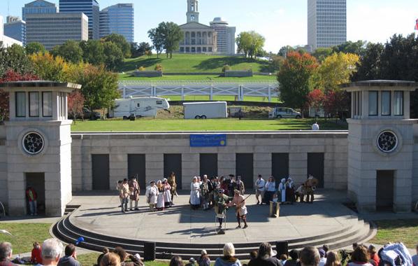
244. Bicentennial Capitol Mall State Park, TN
Source: https://www.planning.org/greatplaces/spaces/2011/ bicentennial.htm
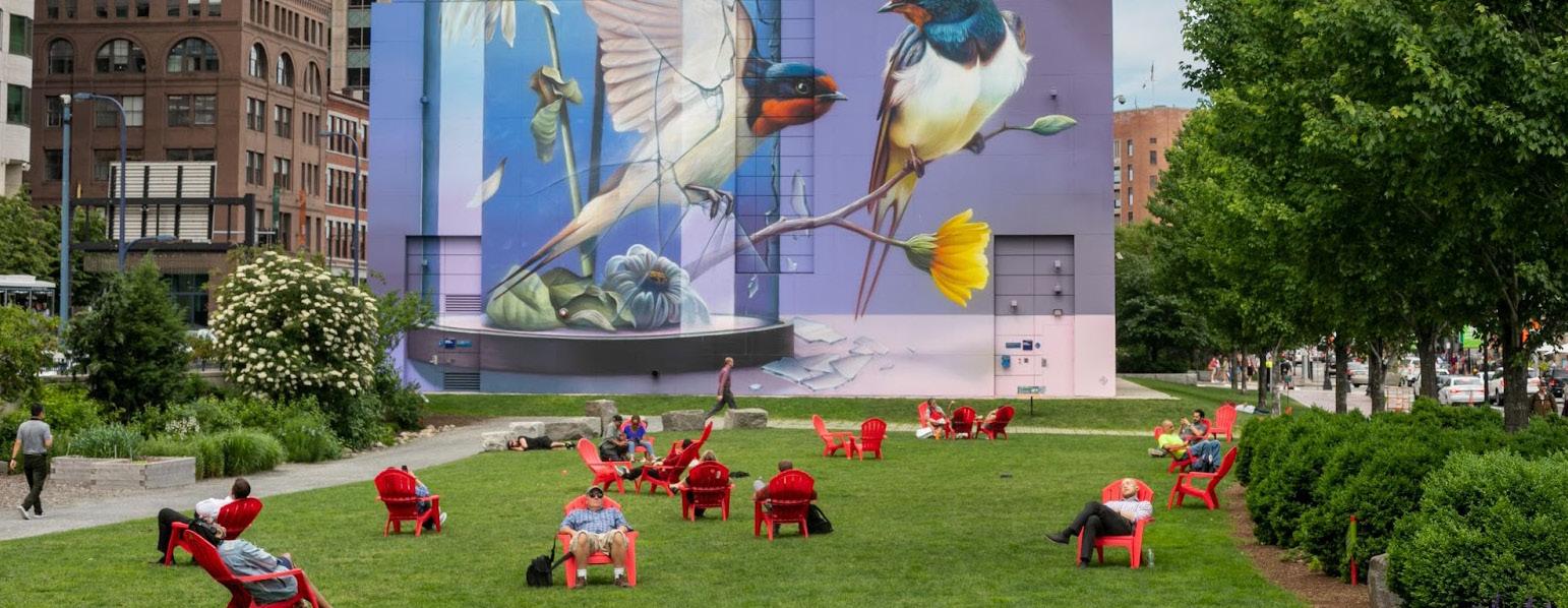
Source: https://www.rosekennedygreenway.org/resonance/
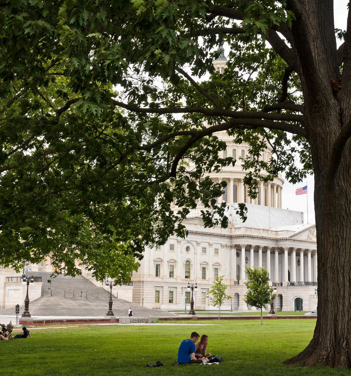
Source: U.S. Capitol Visitor Center Landscape, Sasaki, https://www.sasaki. com/projects/u-s-capitol-visitor-center/
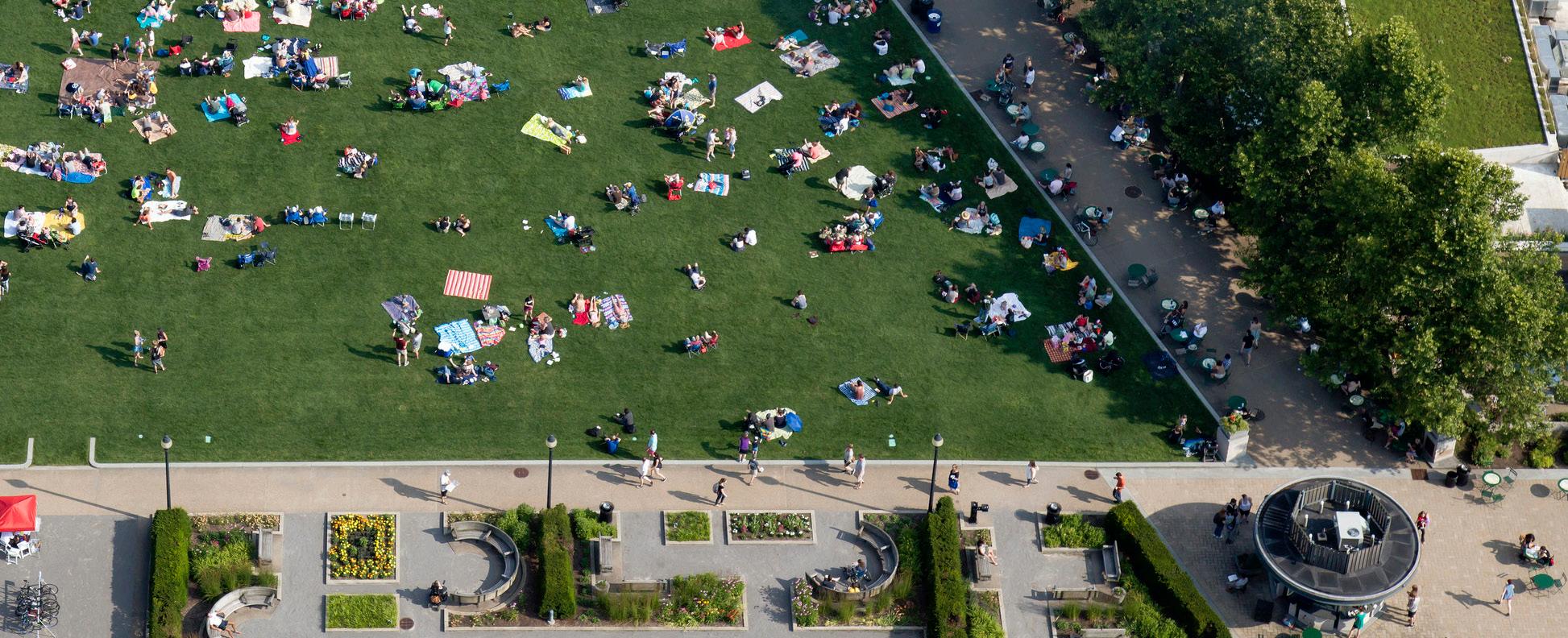
Source: Schenley Plaza, Sasaki, https://www.sasaki.com/projects/schenleyplaza/
Source: Moore Square, Sasaki, https:// www.tclf.org/landscapes/moore-square
Source: https://business.mansfieldchamber.orga
Source: https://www.dezeen.com/2024/04/11/texascapitol-complex-green-mall-glass-offices-page/
Source: Pixabay, https://idahocapitalsun.com/2022/01/04
Figure 245. U.S. Capitol Visitor Center Landscape, Washington, DC
Figure 246. Schenley Plaza, PA
Figure 247. Texas Capitol Complex, TX
Figure 248. Texas Capitol Complex, TX
Figure 249. Moore Square, NC
Figure 250. U.S. Capitol Building, D.C.
Figure 243. Rose Kennedy Greenway, MA
Figure
264 265 Capitol Mall Design Framework Design Framework
PUBLIC SPACE STRATEGIES
DRAFT
CULTURAL PLATFORM
THE CULTURAL PLATFORM FACILITATES SMALLER GATHERINGS AND EVENTS WHILE FORMING THE COMMEMORATIVE LOOP—A PEDESTRIAN PATH THAT LINKS ALL COMMEMORATIVE WORKS TOGETHER.
The inner portion of the Lower Mall forms the Cultural Platform. Similar to the Democracy Stage, the Cultural Platform provides ample lawn space for gathering and events. It also contains commemorative works like the Minnesota World War II Veterans Memorial and Court of Honor. More importantly, the boundaries of the Cultural Platform form the Commemorative Circle, which is a proposed pedestrian path that links many of the commemorative works, both existing and proposed, together. It should be noted that most of the proposed sites for new commemorative works are not located in the Cultural Platform, but instead sited in History and Reverence. See a Gradient of Planting Strategies for planting strategies related to the Cultural Platform.
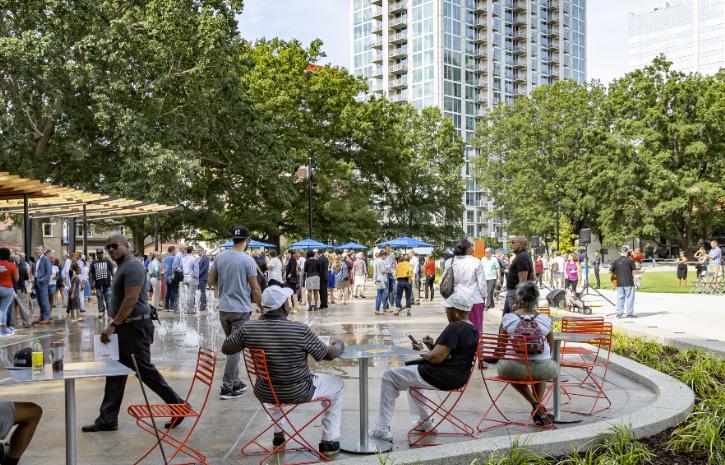
252. Moore Square, NC
Source: Moore Square, Sasaki, https://www.tclf.org/landscapes/ moore-square
251.
Source: Ithaca Commons Redesign, Sasaki, https://www.sasaki. com/projects/ithaca-commons-redesign/
Source: https://indyculturaltrail.org/calendar/aarp-in-on-the-trail/
Source: https://hyperallergic.com/829787/indigenous-artists-paint-300-footpath-to-reconciliation-in-canada/
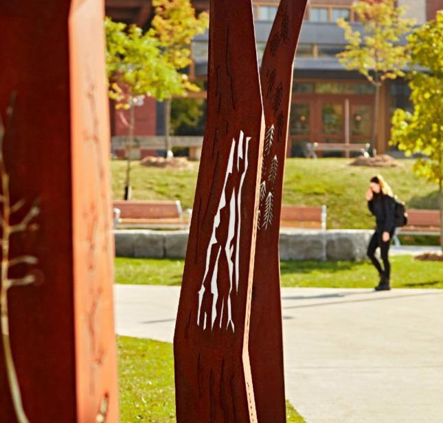
Source: https://ccie.educ.ubc.ca/indigenousknowledges-and-the-environment-symposium/
Source: https://www.straight.com/arts
Source: https://www.canadianarchitect. com/humber-unveils-indigenouscultural-markers
Source: Nelson-Moody, Arron & George, Angela, https://www. nvrc.ca/arts-culture/public-art/art-collection/nchemus
Figure 253. Indianapolis Cultural Trail , IN
Figure 254. The Path to Reconciliation, Regina
Figure 255. UBC University Boulevard, Vancouver
Figure 256. New Indigenous Mural, Vancouver
Figure 257. Humber Unveils Indigenous Cultural Markers
Figure 258. Indigenous, Integrated Mural, Vancouver
Figure
Ithaca Commons Redesign,NY
Figure
266 267 Capitol Mall Design Framework Design Framework
COMMEMORATION AND
PUBLIC SPACE STRATEGIES
CELEBRATION
DRAFT
HISTORY AND REVERENCE
HONORING PEOPLE AND THE LAND
History and Reverence forms the outer edges of the Lower Mall and is also the most densely populated in terms of commemorative works and vegetation. This space is more contemplative and is not meant to host large events or gatherings. As a person meanders among the various commemorative works, they are immersed in native Minnesota plants and shaded by extensive tree canopy. There are moments of rest and reflection, as well as cultural and ecological education. Most of the proposed sites for new commemorative works are located in History and Reverence, with special attention paid to ensure symmetry and equitable historic storytelling. See a Gradient of Planting Strategies for planting strategies related to History and Reverence.
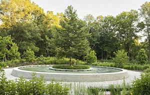
Source: https://worldlandscapearchitect.com/the-clearingsandy-hook-usa-swa/?v=3a1ed7090bfa
Source: Sydney CBD and South East Light Rail, Aspect Studios, www.aspect-studios.com
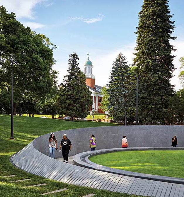
Source: https://www.architecturalrecord.com/articles/14725-the-memorial-toenslaved-laborers-at-the-university-of-virginia
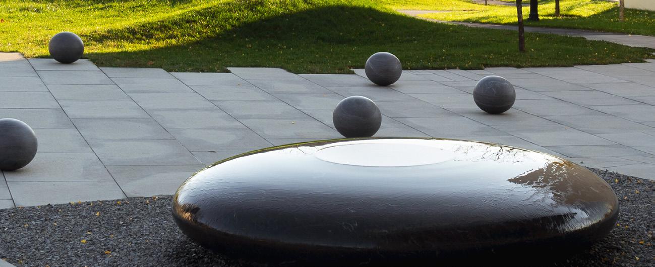
Source: https://www.mayalinstudio.com/art/princeton-table

Source: https://i.pinimg.com/originals/5c/ ed/3b/5ced3bc14b42ce12fc8d43581bcff311.jpg
Source: https://www.visitoverlandpark.com/about/
Source:https://southviewdesign.com/ blog/minnesota-native-prairie
Source: https://www.planning.org/greatplaces/spaces/2011/ bicentennial.htm
Figure 261. The Memorial to Enslaved Laborers, VA
Figure 259. Wall of Discovery, MN
Figure 262. Einstein’s Table NJ
Figure 260. The Clearing, CT
Figure 263. Coldwater Spring National Park oak savanna/prairie restoration
Figure 264. Wharf District Parks, MA
Figure 265. Overland Park, KS
Figure 266. The Rivers of Tennessee fountain, TN
COMMEMORATIVE WORKS AND NEW STRATEGICALLY LOCATED WORKS ON THE CAPITOL MALL. ADDITIONALLY, VARIOUS DIFFERENT LANDSCAPE TYPOLOGIES SPOTLIGHT THE CAPITOL
HISTORY AND REVERENCE HONORS EXISTING
MALL’S ECOLOGY.
268 269 Capitol Mall Design Framework Design Framework
PUBLIC SPACE STRATEGIES
DRAFT
COMMEMORATIVE ARTWORK
PROPOSED ORGANIZATION
The proposed organization and guiding principles for commemorative artwork in and around the Capitol Mall draw upon the Minnesota Rules Governing Commemorative Works on the Minnesota Capitol Grounds (CAAPB 2022), 2040 Comprehensive Plan (CAAPB 2021), Cultural Landscape Report (Damon Farber 2024), and public engagement to date. It also references recent work by the National Park Service, National Capital Planning Commission, and Van Alen Institute (Van Alen 2024).
Fundamental to the Design Framework is the notion that the Upper Mall remain free of any new commemorative artwork and the Lower Mall become the focus for artwork moving forward. The Design Framework enhances existing commemorative artwork through re-envisioned circulation that makes it easier to access and experience these pieces. Future artwork is sited to create physical symmetry across the Lower Mall, support Gilbert’s original notion of a “memorial approach,” maintain existing thematic groupings, and provide space for more inclusive Minnesota stories.
Additional commemorative opportunities exist that connect the Capitol Mall to MNHS, the Old State Capitol Site, Western Sculpture Garden, Cass Gilbert Memorial Park, and proposed mobility hub. These opportunities are also located near all major thresholds to the Capitol Campus, which means visitors can begin experiencing the many stories of Minnesota from the moment they arrive at the State Capitol.
Existing Commemorative Artworks
Revised / Relocated Commemorative Artwork
Proposed Zone for Future Commemorative Artwork
Commemorative Loop
Primary Commemorative Walks
Capitol Campus Thresholds
Note: Not all proposed locations for future commemorative artwork need to be built out. Additionally, they do not need to occupy the entire zone outlined on the map. See Commemorative Artwork: Opportunities and Guiding Principles for more information.
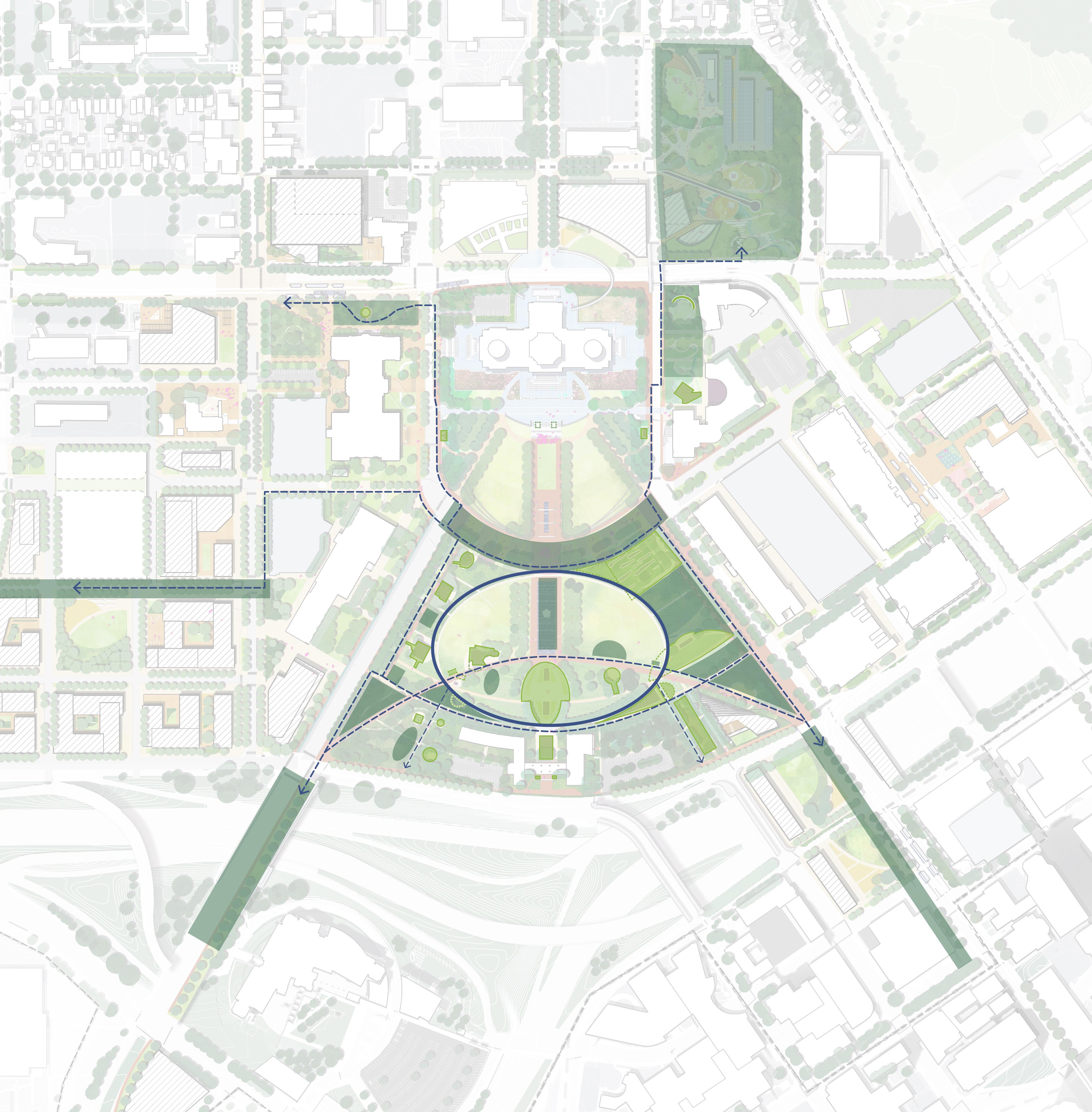
I-94 University Ave W Aurora Ave St Anthony Ave Park St Rice St John Ireland Blvd E12thSt RobertSt SaintPeterSt WabashaSt CedarSt I-35E N 0’ 200’ 100’ 50’ Rev Dr MLK JrBlvd
CAAPBBoundary
MNHS Old State Capitol Site MN State Capitol Veterans Service Building Welcome Center
Cass Gilbert Memorial Park
The Upper Mall remains free of future commemorative artwork. The Lower Mall becomes the focus for future commemorative artwork that is inclusive and representative of All Minnesotans.
IndividualPeople Gardens
Public Service
Proposed Mobility Hub
open lawn, no works here open lawn, no works here DOWNTOWN SAINT PAUL REDUCEDSLOPE
To Western Sculpture Park
LEGEND
CommemorativeCircle
Figure 267. Commermorative Artwork 270 271 Capitol Mall Design Framework Design Framework
PUBLIC SPACE STRATEGIES
DRAFT
COMMEMORATIVE ARTWORK
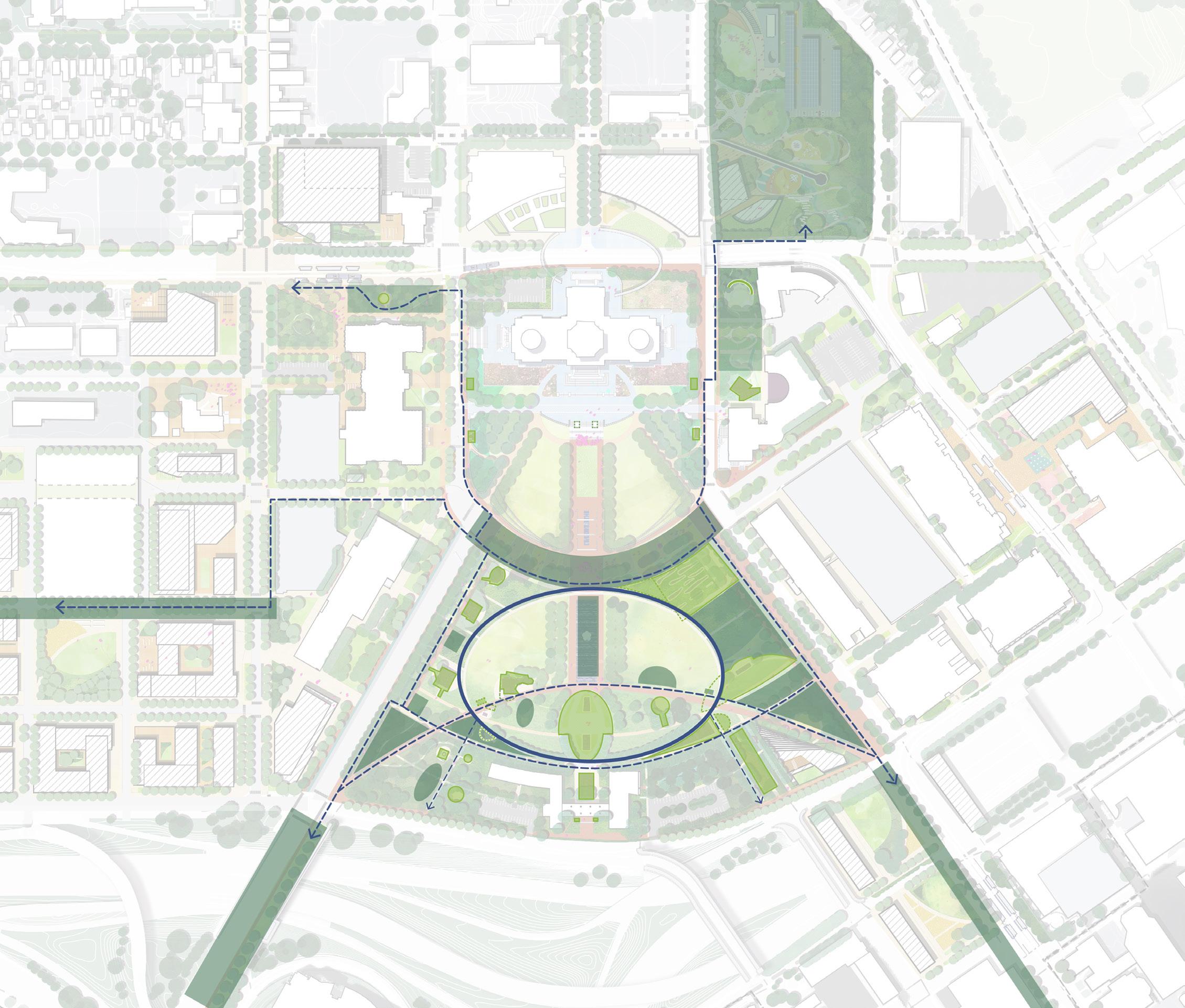
MOVING TOWARDS MORE BALANCED COMMEMORATION
THE FOLLOWING ARE EXAMPLES OF IDEAS VOICED DURING THE CMDF THAT INCLUDE IDEAS FOR INTRODUCING STORIES OF MINNESOTA THAT ARE CURRENTLY MISSING ON THE CAPITOL MALL:
1. Public art or commemorative installation(s) commemorating the historic loss of Black neighborhoods during urban renewal era in Saint Paul.
DRAFT
2. Installations celebrating contributions from individuals from historically underrepresented communities. Specifically, sites currently honoring Black, Indigenous and Persons of Color (BIPOC), women and LGBTQIA2S+ communities.
3. Installations honoring the identity of indigenous communities of Minnesota including the federally recognized eleven Tribal Nations and Urban Indian communities.
4. Installation(s) that acknowledge and celebrate the history of the many communities that have made the Capitol Area home, with broad focus that includes immigrant communities during settlement, and development of Saint Paul, but also the many centuries before settlement and creation of statehood.
5. Emphasize Minnesota’s ecology at important points throughout the Capitol Campus so that the visitor experience includes celebrations of the unique lands, lakes, and rivers of Minnesota. This could include a water feature that celebrates our identity as the “Land of 10,000 Lakes.”
6. During statutorily required review of monuments, reconsider the settings and locations of several works to help organize and better balance thematic groupings to be reflective of BOTH historical and modern Minnesota communities.
Example:
O Clear some spaces, such as the steps, Aurora Promenade, Democracy Stage, and MLK Commons to be free of commemorative works, so that free speech can be staged by all groups.
7. Extend the programming of Minnesota History Center and Capitol tours to include visits to shaded and accessible comfortable spaces outside the Capitol and on the Mall.
Examples:
O Utilize the existing amphitheater and new shaded spaces as places for live commemorative storytelling: comfortable gathering spaces designed so that anyone can come and reflect on their own unique Minnesota history.
O Enhance the comfort of pedestrian walking routes, and coordinate creation of self-guided walking tours using combination of virtual technologies and wayfinding to teach visitors about government and Minnesota.
8. Celebrate Indigenous history and culture given the historic prevalence of this location.
The CMDF public engagement process generated many ideas from many people for Making the Mall More Welcoming for More Minnesotans. However, the CMDF as an official policy document does not suggest explicit topics for commemoration. Specific proposals for new works, modifications or removals are left to individuals and groups in Minnesotans to propose through a process outlined by the new Commemorative Works Rules adopted by CAAPB in 2022. (See MN Rules Chapter 2400.)
University Ave W St Anthony Ave Rice St CedarSt John Ireland Blvd I-35E Rev Dr MLK JrBlvd E12thSt CAAPBBoundary Cass Gilbert Memorial Park To MNHS To Old State Capitol Site MN State Capitol Veterans Service Building Welcome Center To Western Sculpture Park 1 2 2 2 9 7 7 4 4 3 3 3 8 3 5 6
272 273 Capitol Mall Design Framework Design Framework
OPPORTUNITIES PUBLIC SPACE STRATEGIES
COMMEMORATIVE ARTWORK
GUIDING PRINCIPLES
GUIDING PRINCIPLES
Memorials for the Future by the National Park Service, National Capitol Planning Commission, and Van Alen Institute outline a series of recommendations for future memorials on public lands. They include:
O ENGAGE THE PRESENT AND FUTURE AS MUCH AS THE PAST: “Events that unfold around us every day can be as compelling and culturally important [as the past]. The tools of memorialization can help people learn about and appreciate recent events, important issues, and on-going trends and experiences that impact their lives directly.”
O USE LOCAL SETTINGS FOR NATIONAL ISSUES: “Some issues like climate change and immigration may feel abstracted in national debate, but smart design can create real opportunities to engage with and understand these issues in a personal way... [There is an] opportunity for memorials that resonate at the local level, making abstract issues immediate for those who encounter these memorials on a daily basis.
THE SITING AND SELECTION OF COMMEMORATIVE ARTWORK IS CRUCIAL IN ESTABLISHING AN EXPERIENCE OF THE MALL THAT IS ORCHESTRATED AROUND A LARGER VISION AND CIRCULATION AS WELL AS BEING INCLUSIVE OF ALL MINNESOTAN’S STORIES.
SITING OF WORKS:
The Siting Plan for Commemorative Works in this CMDF (currently previous pages) will guide the location of new works and relocated works subject to review of proposals under MN Rules Chapter (24XX….). The proposed organization of works may be adjusted over time through Board action enabling updates to the Siting Plan.
CREATING STAGES FOR DEMOCRACY
Over time, there shall be spaces on the Mall made largely or completely free of commemorative works in order to establish spaces that are not dominated by messages from any one group or point of view. These spaces outlined in the 2024 Siting Plan of the CMDF include the Capitol Steps, Aurora Promenade, Upper Mall’s Democracy Stage, and the Commons spaces between John Ireland and Cedar along Martin Luther King Jr. Boulevard. With exception of the Cultural Walk identified on the Commemorative Works Siting Plan, this guideline extends to include public thoroughfares and right-of ways throughout the Capitol Area, with specific exceptions may be made in some cases such as interpretive markers or in other special circumstances. This guideline applies only to permanent installations.
FULL REPRESENTATION OF MINNESOTA COMMUNITIES
Over time, there will be efforts by CAAPB decision making to introduce a more balanced representation of the many communities of Minnesota to make those groups feel more
explicitly welcome to the Capitol Area and to the Capitol Building as a place created for everyone, all families and all groups to feel comfortable. This will be done incrementally through review of proposed works and through statutorily required review of existing works.
FACILITATION OF TEMPORARY WORKS
Though the Capitol Mall Design Framework guides creation and placement of spaces for gathering, free speech and celebration, the guidelines are not intended as guidance for temporary works as they are defined or determined by CAAPB. Temporary Works generally are characterized by those installations that include plans and budget for removal after a pre-defined period, and that also do not result in permanent changes to other works, their settings, or other features of the Capitol Area. Temporary Works may or may not trigger be reviewed under MN Rules Chapter 2400, based on interpretation of the Board Executive Secretary or the Board.
DRAFT
CAAPB PARTNERS
These guidelines assist CAAPB in their decision-making responsibilities and do not replace, change or cancel the statutory authorities and responsibilities defined by MN Statutes granted to partners such as the City of Saint Paul, Department of Administration nor Minnesota Historical Society.”
O ALLOW FOR CHANGING NARRATIVES: “As time passes, new information is exposed and cultural values shift, sometimes creating disconnects between a memorial’s original message and representation and modern day perceptions. There will always be a need to incorporate perspectives that were either recently developed or previously marginalized. Future memorials need to address this challenge and represent diverse narratives.”
O UNIVERSAL EXPERIENCES IN ADDITION TO PLACES, PEOPLE, AND EVENTS: “Often memorials commemorate subjects of significant events, important places, or individuals of great accomplishment. While these subjects can yield powerful, enduring memorials... this leaves opportunity to commemorate more universal experiences shared by many people over time.”
O CREATE MEMORIALS WITH THE PUBLIC AS WELL AS FOR THE PUBLIC: “Inviting the public to shape memorials, either during the initial planning process or after construction, can help ensure that they are valued by communities in which they reside and that the many perspectives of those communities are well reflected.”
O CONSIDER EPHEMERAL, MOBILE, AND TEMPORARY FORMS: “Typically, existing memorials are permanent, requiring visitors to be physically present to experience a memorial. Future memorials could be temporary or mobile.”
O MEMORIALS BEYOND PHYSICAL SPACE: “... [Using clever applications of technology...[enable memorials to] transcend the need for physical spaces altogether. Technology allows people to connect around subject matter in ways that don’t require central squares or physical infrastructure,” (National Park Service, National Capitol Planning Commission, Van Alen Institute).
CAAPB GUIDELINES
The CAAPB’s Rulemaking: Commemorative Works on the Minnesota Capitol Grounds outlines guidelines for future commemorative works within the Capitol Campus. A high level summary of these guidelines includes:
SITING
O The site of the proposed location must be visible to people nearby and immediately accessible via pathway.
O The scale of the artwork must fit the artwork’s location, providing familiarity to the viewer while not being overpowering. Any element of the artwork other than trees must not exceed 20 feet in height.
O The use of the site must maintain and protect existing open space and the space’s public use; it should not interfere with existing works.
DESIGN
O The artwork must encourage engagement with the public and provide amenities such as seating.
O The design and setting of an artwork must consider climatic elements like sunlight, shade, wind, and the varied Minnesota seasons.
O An artwork’s illumination must not compete with or distract from the sight of the Capitol.
O The intended message of the artwork must be clear and understandable. The artwork must convey a meaning of enduring value for future generations.
O Materials for the artwork must be visible to people nearby, durable, and compatible with the artwork’s setting.
O The artwork’s design, construction, materials sourcing, and maintenance must conserve energy and water resources.
274 275 Capitol Mall Design Framework Design Framework
PUBLIC SPACE STRATEGIES
CONVERT REV. DR. MARTIN LUTHER KING, JR. BOULEVARD INTO A COMMUNITY SHARED STREET
Community and stakeholder engagement throughout the Design Framework process highlighted Rev. Dr. Martin Luther King, Jr. Boulevard as an opportunity to create a shared community space. More specifically, every focus group within the design charrette similarly noted the boulevard as a special space that not only linked the Upper and Lower Malls together but had so much more potential than just a four-lane vehicular road. In response to this, the Design Framework preserves the form or bend of Rev. Dr. Martin Luther King, Jr. Boulevard as a historically significant feature while re-envisioning the boulevard to be more in line with the ideals of Rev. Dr. Martin Luther King, Jr. himself—a shared community space that stitches the Capitol Mall together and creates a central heart to the Capitol Campus. As a part of this new vision, opportunities for equitable commemoration and ecological education take precedence. Rather than prioritizing cars through the boulevard, the shared street reallocates ROW to pedestrians, cyclists, and planting. Collectively, the various landscape features create a strong east-west promenade and lively transition between the Upper and Lower Malls.
N 0’ 250’ 125’ 60’
PROMENADE Park St John Ireland Blvd Cedar St
AURORA
Figure 268. xxx 276 277 Capitol Mall Design Framework Design Framework
PUBLIC SPACE STRATEGIES DRAFT
MLK JR BLVD
SHARED STREET
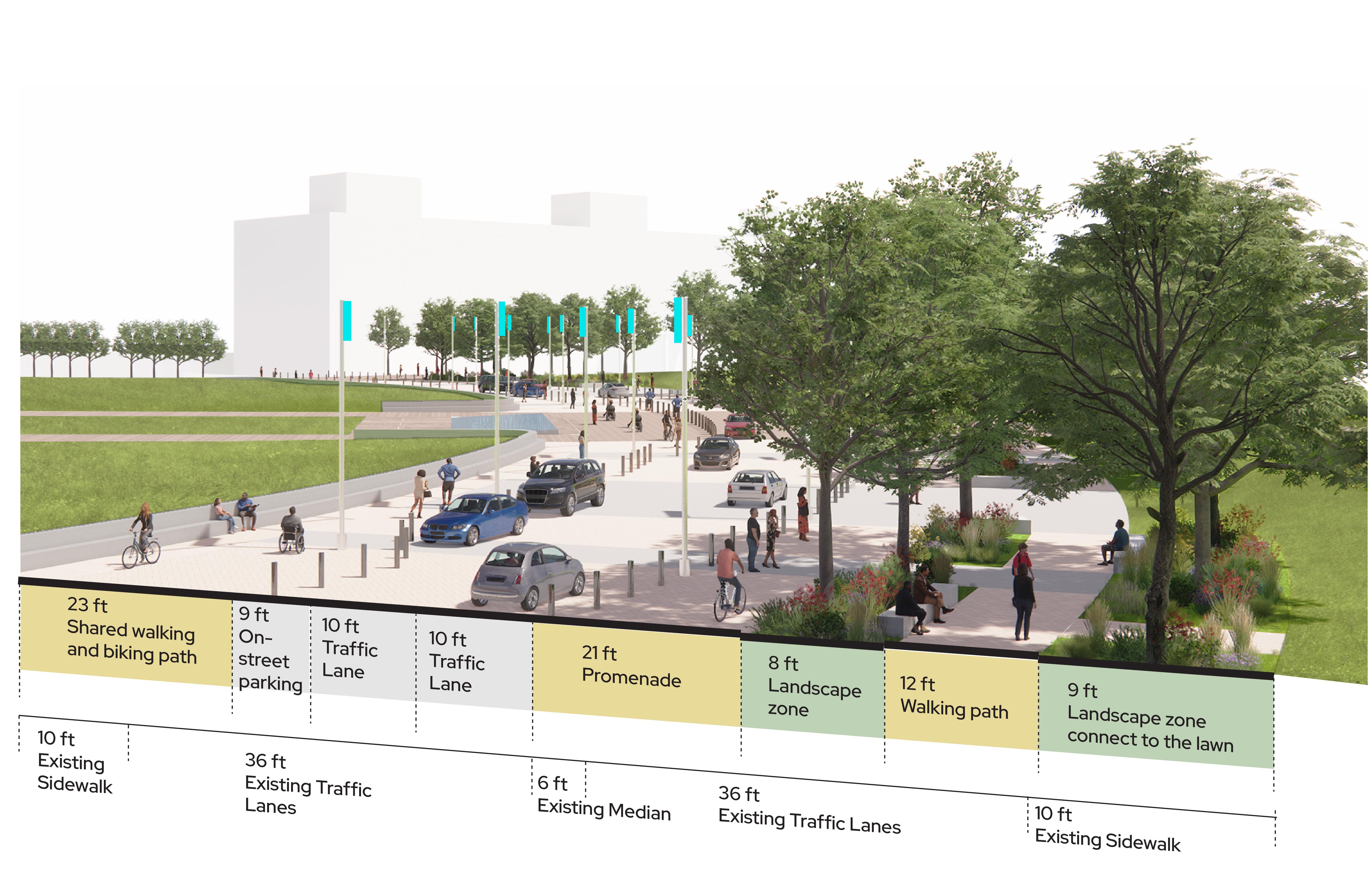
NATIVE CANOPY TREES
UNDERSTORY PLANTS INSPIRED BY DAKOTA ETHNOBOTANY UPPER
INCORPORATE LIGHTING INTO BOLLARDS
GATHERING SPACE, SPECIAL PAVEMENT DESIGNED WITH COMMUNITY
TRAFFIC LANE KEEPS OPEN THROUGHOUT THE YEAR, CLOSURE ONLY FOR SPECIAL EVENTS
FLAGS OF THE TRIBAL NATIONS
E E C C W W W S S ST ST Electrical Underground Communication Sewer Water Stormwater LEGEND
LOWER MALL Figure 269. MLK Jr Blvd Sectional Perspective 278 279 Capitol Mall Design Framework Design Framework
MALL & CAPITOL BUILDING
PUBLIC SPACE STRATEGIES DRAFT
MLK JR BLVD SHARED STREET
RENDERING
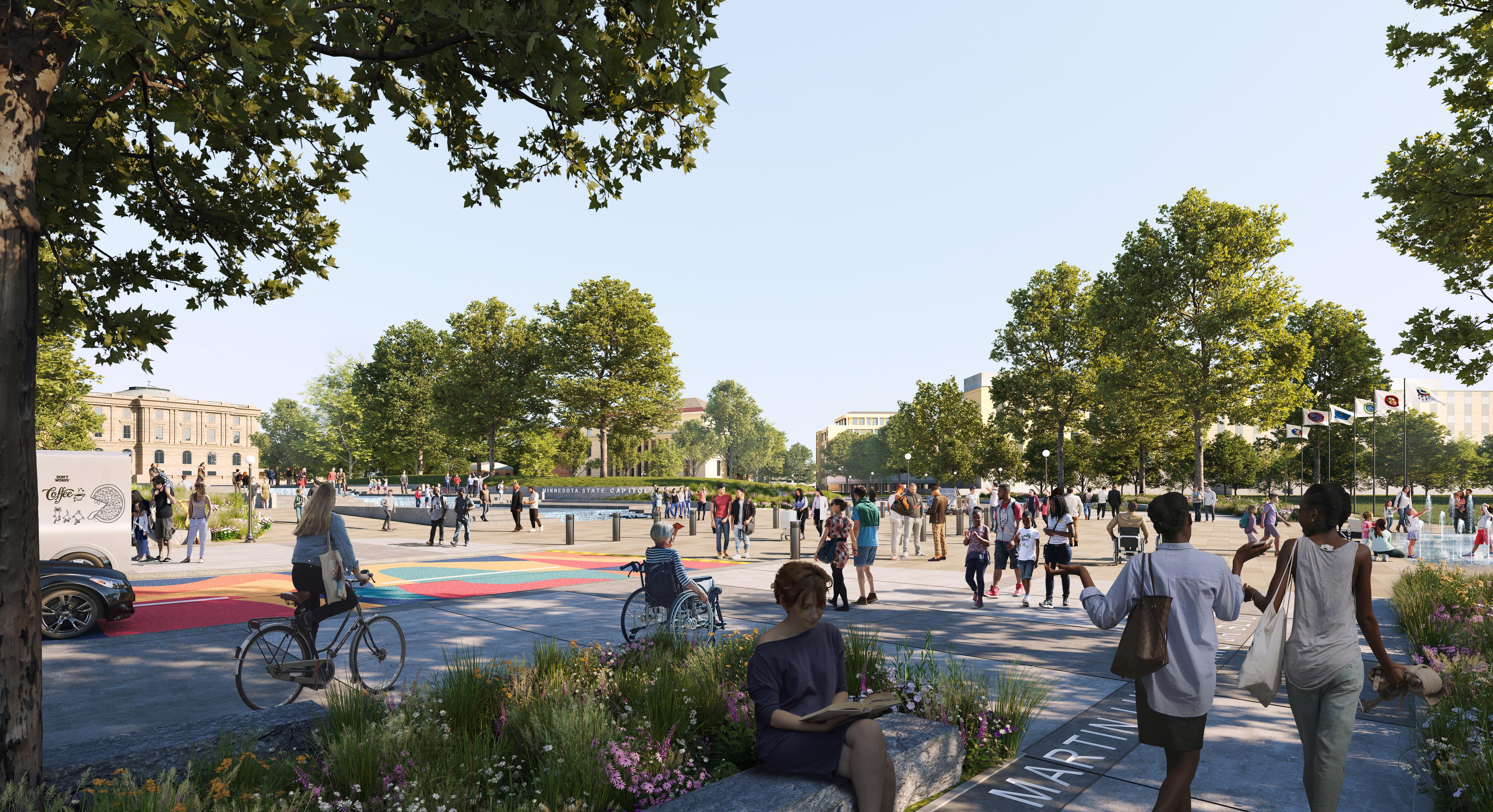
280 281 Capitol Mall Design Framework Design Framework CAPITOL MALL DESIGN FRAMEWORK
DRAFT
CULTURAL

Figure 270. Commermorative Artwork 282 283 Capitol Mall Design Framework Design Framework PUBLIC SPACE STRATEGIES
DRAFT
WALK PRECEDENTS
O Stormwater Capture and Treatment
O BMP Footprints and Catchment Areas
O Stormwater Systems
O Conveyance and Catchment Areas
O Precedent Imagery
CELEBRATE WATER DRAFT
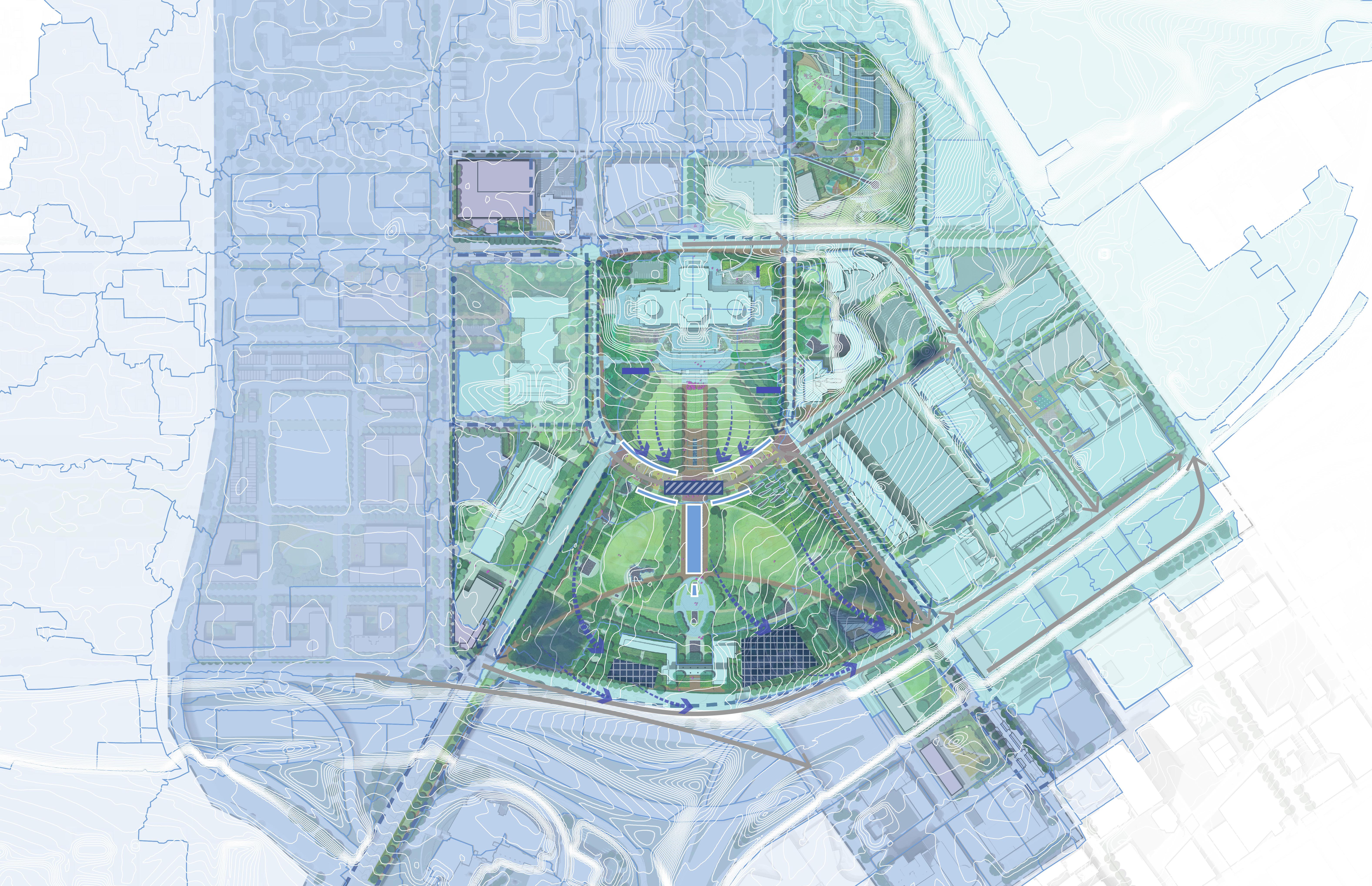
Celebrate Minnesota’s connection to water in all seasons.
284 285 Capitol Mall Design Framework Design Framework
STORMWATER CAPTURE AND TREATMENT
This bold design move involves the incorporation of green stormwater infrastructure into the street rights-of-way within the transportation network surrounding the Capitol Mall, the incorporation of stormwater reuse for the irrigation of landscapes on and around the Capitol Mall, the treatment of runoff from offsite areas within the Mall footprint itself using district-scale stormwater management strategies, the integration of climate resilient water management practices within the southern portions of the Mall area.
STORMWATER TRAP SYSTEM AS PART OF THE SOB EXPANSION
GROUNDWATER PUMPING FROM AROUND TRANSPORTATION BUILDING
Hydrological Movement
Streetscape Water Treatment
Underground Storm Chamber
Green Stormwater
Infrastructure
Water Feature
Stormwater Reuse LEGEND
Figure 271: Stormwater Capture and Treatment

On-Surface Water Treatment
Catchment Area
State-Owned Parking Lot Retrofit BMP
Underground Storm Chamber (Existing) Water Feature (Existing)
Source: Capitol Region Watershed District and Barr document
Source: HGA. Minnesota State Capitol Repairs, Restoration & Preservation. 09 May, 2014.
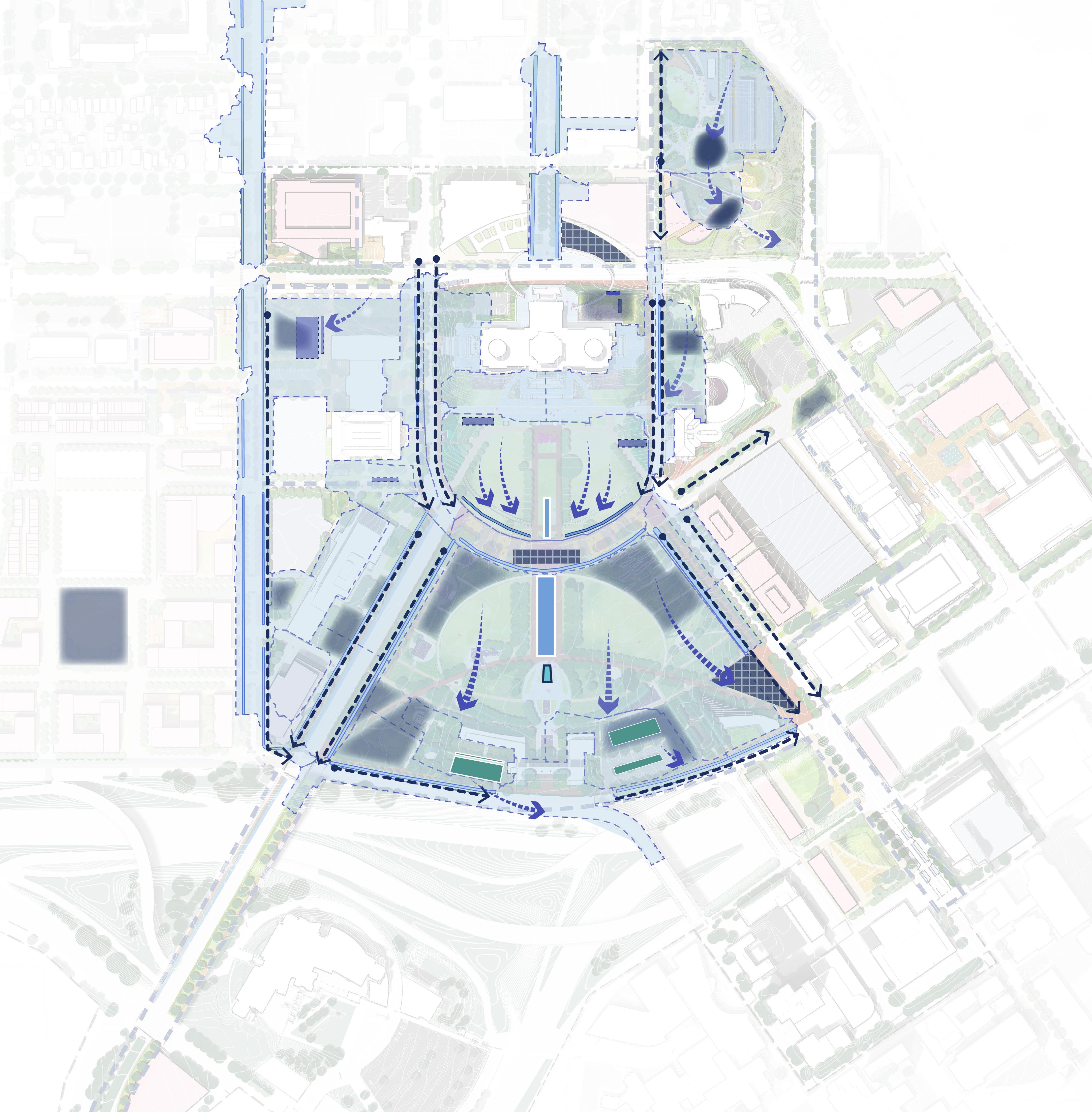
MN State Capitol DOWNTOWN SAINT PAUL ICE RINK SEASONAL POND BIOSWALE
RAIN
INTERACTIVE JETS
+
GARDENS
PROPOSED
STEPPED
FILTRATION BIOSWALE PARKING
RETROFIT
FILTRATION BIOSWALE University Ave W Aurora Ave St Anthony Ave Park St Rice St John Ireland Blvd E12thSt RobertSt SaintPeterSt WabashaSt CedarSt N 0’ 250’ 125’ 60’ I-94 I-35E
UNDERGROUND STORM BMP
WATER
LOT
BMP
286 287 Capitol Mall Design Framework Design Framework
CELEBRATE WATER DRAFT
STORMWATER BMP FOOTPRINTS AND CATCHMENT AREAS
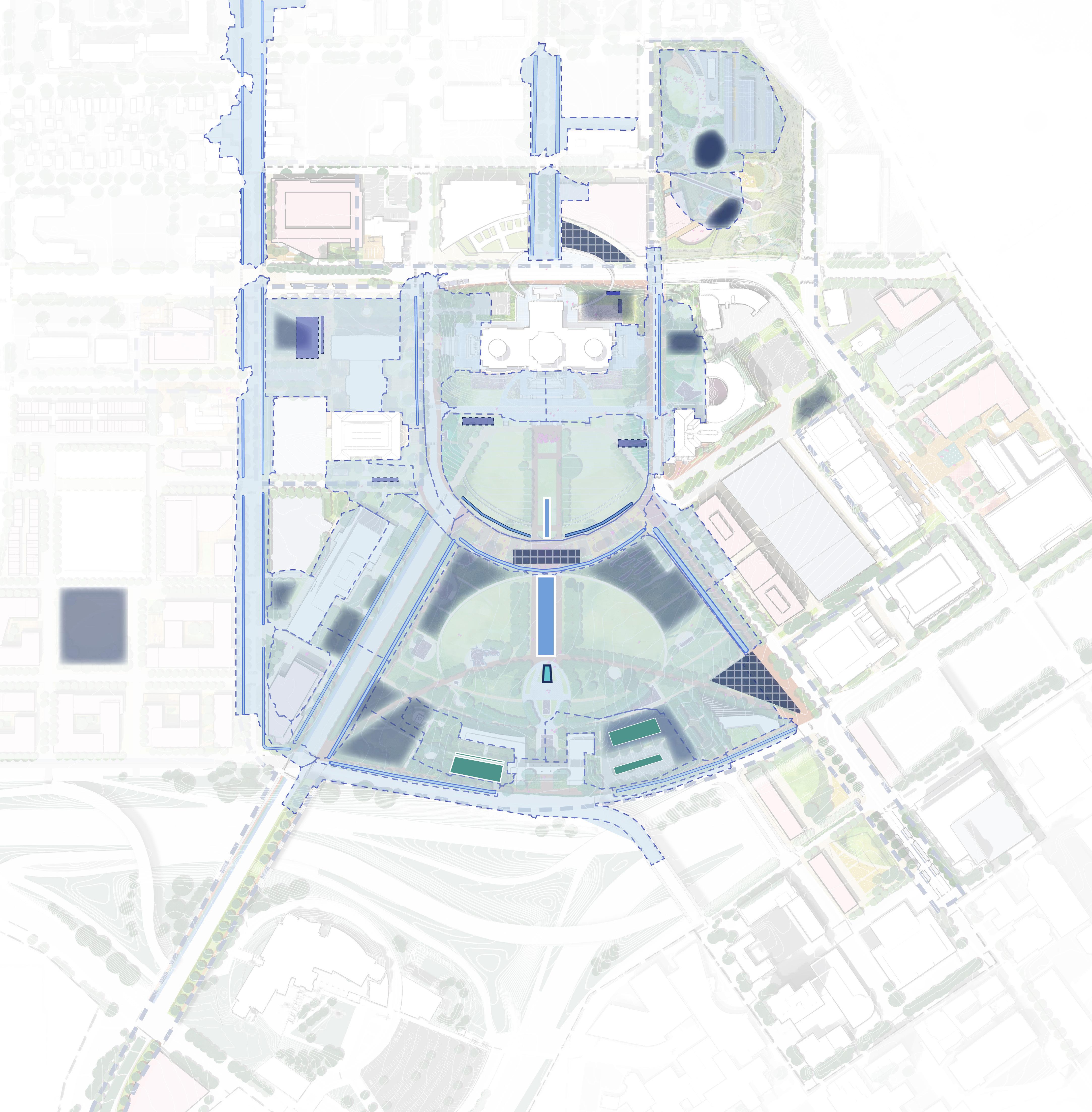
Source: HGA. Minnesota State Capitol Repairs, Restoration & Preservation. 09 May, 2014. Source: Capitol Region Watershed District and Barr document Figure
and Catchment Areas Catchment Area State-Owned Parking Lot Retrofit BMP Underground Storm Chamber (Existing) Water Feature (Existing) Underground Storm Chamber Green Stormwater Infrastructure Water Feature Stormwater Reuse On-Surface Water Treatment LEGEND University Ave W Aurora Ave St Anthony Ave Park St Rice St John Ireland Blvd E12thSt RobertSt SaintPeterSt WabashaSt CedarSt N 0’ 250’ 125’ 60’ I-94 I-35E The Design Framework integrates a resilient district stormwater management system and green stormwater infrastructure while taking a closer look at the contributing areas. 1 2 8 13 14 19 20 24 21 6 22 23 12 16 25 17 26 27 28 29 3 4 5 7 11 18 9 10 15 1 1 See Estimated BMP Footprints on Proposed Conditions for information on BMP concepts and contributing area descriptions Note: # O Green Stormwater Infrastructure O Underground Storm Chamber O Rain Garden + Bioswales O Filtration Bioswales O Stormwater Reuse O State-Owned Parking Lot Retrofit BMP AND CATCHMENT AREAS BMP CONCEPT CATCHMENT AREAS 1 2 8 13 14 19 20 24 21 6 22 23 12 16 25 17 26 27 28 29 3 4 5 7 11 18 9 10 15 288 289 Capitol Mall Design Framework Design Framework
272: Stormwater BMP Footprints
CELEBRATE WATER DRAFT
STORMWATER BMP FOOTPRINTS
AND CATCHMENT
AREAS
The newly tree-lined streets around the Capitol Mall will incorporate open-topped planter boxes with climate resilient vegetation and associated subsurface systems to capture, hold, infiltrate, and treat stormwater runoff from adjacent hard surfaces including sidewalks, roadways, and trails. These subsurface systems should include specially-engineered soil media designed to store, filter, and promote infiltration of stormwater runoff. These soil systems provide sufficient volume for healthier root growth for the newly planted street trees to support a better growing evironment. Stormwater entering these systems will be filtered and allowed to infiltrate into the
ground, when feasible, reducing the amount of urban pollutants entering the surrounding storm sewer and being discharged to the nearby Mississippi River (Haháwakpa). In situations where the infiltration of stormwater is prohibited by state or local guidance due to site conditions, such as poor or contaminated soils, the filtered stormwater will be conveyed into the surrounding storm sewers in a cleaner condition.
STORMWATER REUSE WITHIN THE CAPITOL MALL IRRIGATION
Currently, the Upper Mall and Lower Mall encompass nearly 20-acres of lawn area and plantings, each of which has different irrigation demands with irrigation systems currently sourced with potable water. As part of this bold
underground storage tanks for the capture and storing of stormwater runoff from the surrounding area will be installed within the centralized and southern portions of the Capitol Mall. The tanks will be plumbed to connect into the existing irrigation system for the Capitol Mall. Water flowing into these tanks will be filtered to remove pollutants, stored, and then used as a replacement for potable water for a more resilient approach to irrigation of the Capitol Mall.
INTEGRATING CLIMATE RESILIENT PRACTICES WITHIN THE SOUTHERN MALL
As the priorities for the southern mall transition away from surface parking and toward additional green space, climate resilient stormwater practices will be woven into these reimagined landscapes. Stormwater bioinfiltration basins and native vegetation will be artistically incorporated and utilized to capture stormwater runoff from the remaining hard surfaces, filtering the water to remove pollutants and allowing it to infiltrate when possible. In situations where the infiltration of stormwater is prohibited by state or local guidance due to site conditions, biofiltration practices will be utilized. As remaining parking areas in the southern mall area are reconstructed, there are opportunities to incorporate green stormwater management practices
DRAFT
either directly adjacent to or within the parking areas itself using linear bioinfiltration or filtration basins and tree trenches to treat runoff, soften the hardscape of the parking areas, and provide additional tree canopy.
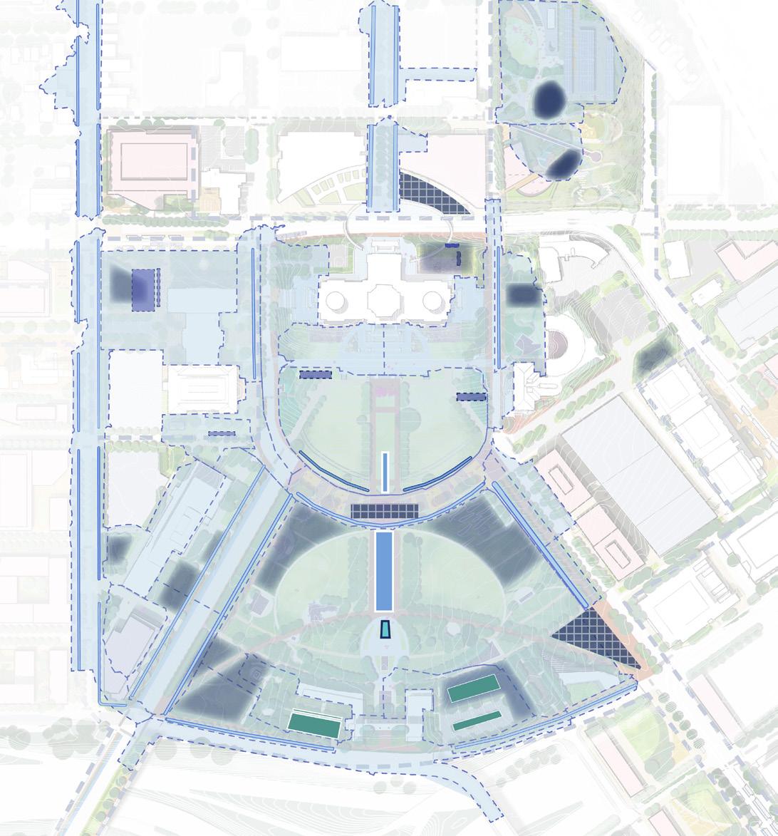
Figure 273: Stormwater Catchment Areas Key Map BMP CONCEPT BASIN # BMP FOOTPRINT (SF) VOLUME (CF) CONTRIBUTING AREA (SF) CONTRIBUTING AREA DESCRIPTION Integrated green stormwater infrastructure within modified streetscapes along John Ireland Blvd, Cedar Street, Rev. MLK Blvd, Rice Street, and W 12th Street Adjacent roadways, sidewalks, and other neighboring areas 86,974 1,095,272 Upper Lawn filtration bioswales Southern portion of Upper Mall areas 4,105 237,707 Bioswale & rain garden at Capitol Complex Lot Q and Cass Gilbert Park New solar canopy over bus parking, regraded Lot Q parking lot, and contributing park areas 19,514 177,733 Parking lot retrofits & neighboring bioswales in southern Mall area Lower Mall areas surrounding the Veterans Service Building, Lot I and Lot J parking lots 22,221 134,784 Underground stormwater filtration & reuse system (Central Mall location) Areas surrounding Capitol Building, Upper Mall, adjacent Capitol Complex properties, roadways, and surrounding streetscape areas 10,736 909,781 Underground stormwater filtration & reuse system (Southern Mall location) Areas tributary to Central Mall reuse system, plus Lower Mall, neighboring roadways, and surrounding streetscape areas 22,947 1,896,855 Underground stormwater filtration & reuse systems at SOB site Portions of State Office Building expansion, adjacent site, and parking lot areas 2,275 181,546
move,
1 2 3 4 5 8 10 14 9 11 15 7 12 13 GREEN STORMWATER INFRASTRUCTURE
TRANSPORTATION NETWORK
WITHIN THE
1 2 8 13 14 12 3 4 5 7 11 9 10 15 1 1 290 291 Capitol Mall Design Framework Design Framework CELEBRATE WATER
STORMWATER SYSTEMS
PRECEDENT IMAGERY
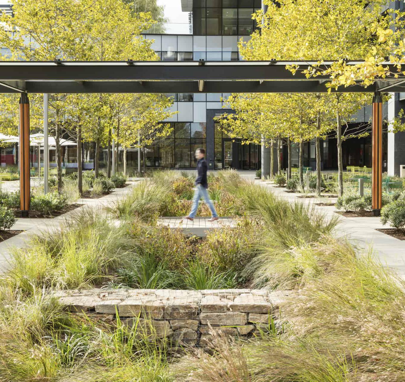
Los Angeles, CA
Source: https://landezine-award.com/partners-healthcareadministrative-campus/
Source: https://www.mwmo.org/projects/towerside-districtstormwater-system/
Source: https://www.scapestudio.com/projects/town-branchcommons/
Source: https://www.capitolregionwd.org/projects/ minnesota-united-fc-soccer-stadium/
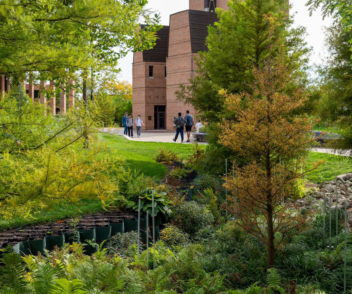
Source: https://www.flickr.com/photos/134605195@ N07/20481679852/in/album-72157654770786784/
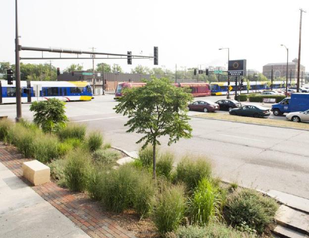
Source:https://www.capitolregionwd.org/projects/green-lineinfrastructure/
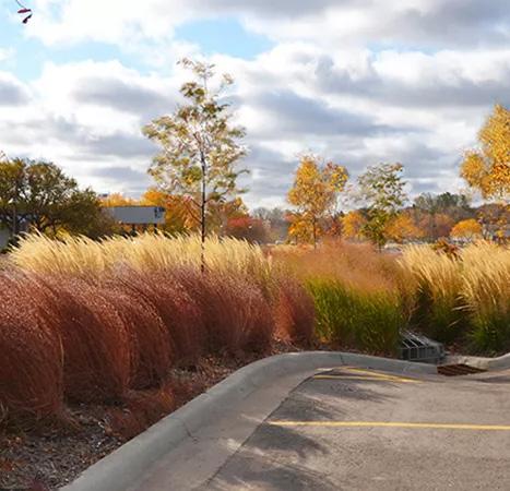
Source:https://rwmwd.org/projects/maplewood-mallretrofit/
Figure 278. LRT Station at Robert St and 14th St
Figure 276. Allianz Field District, Saint Paul, MN
Figure 279. Marion Street and University Ave
Figure 280. Maplewood Mall, Maplewood, MN
Town Branch Commons, Lexington, KY
292 293 Capitol Mall Design Framework Design Framework
Figure 281. University of Michigan, MI
CELEBRATE WATER
Figure 274. Edison High School, Minneapolis, MN
Figure 275. Partners Healthcare Administrative Campus,
Source:n/a who saved this photo?
DRAFT
O Create a Gradient of Planting Strategies
O Landscape Typologies
O Planting Palette
O Tree Canopy Coverage
O Increase Thermal Comfort
O Planting Strategies
PLANTING STRATEGIES DRAFT
Create a gradient of planting strategies and ecological variety that support cultural programming, sustainable maintenance and human comfort goals.
294 295 Capitol Mall Design Framework Design Framework
CREATE A GRADIENT OF PLANTING STRATEGIES
SUPPORTING CULTURAL PROGRAMMING, SUSTAINABLE MAINTENANCE AND HUMAN COMFORT GOALS
In conjunction with New Public Space Strategies, the Design Framework proposes a gradient of planting strategies that not only reflects the diverse ecologies of Minnesota, but supports cultural programming, sustainable maintenance practices and human comfort. The landscape will transition from the more wild woodlands, meadows and prairie near the southern edge of the Capitol Campus to the northern green frame—a highly curated and structured planting zone that aims to visually support the Capitol Building. In between, the cultural planting zone will support the many commemorative works located in the Lower Mall and an arboretum-esque environment. The open glades will include extensive shade trees and generous event lawns. Lastly, the civic plinth will provide high-performance event lawns with the understanding that the similarly located Democracy Stage will attract high pedestrian traffic.
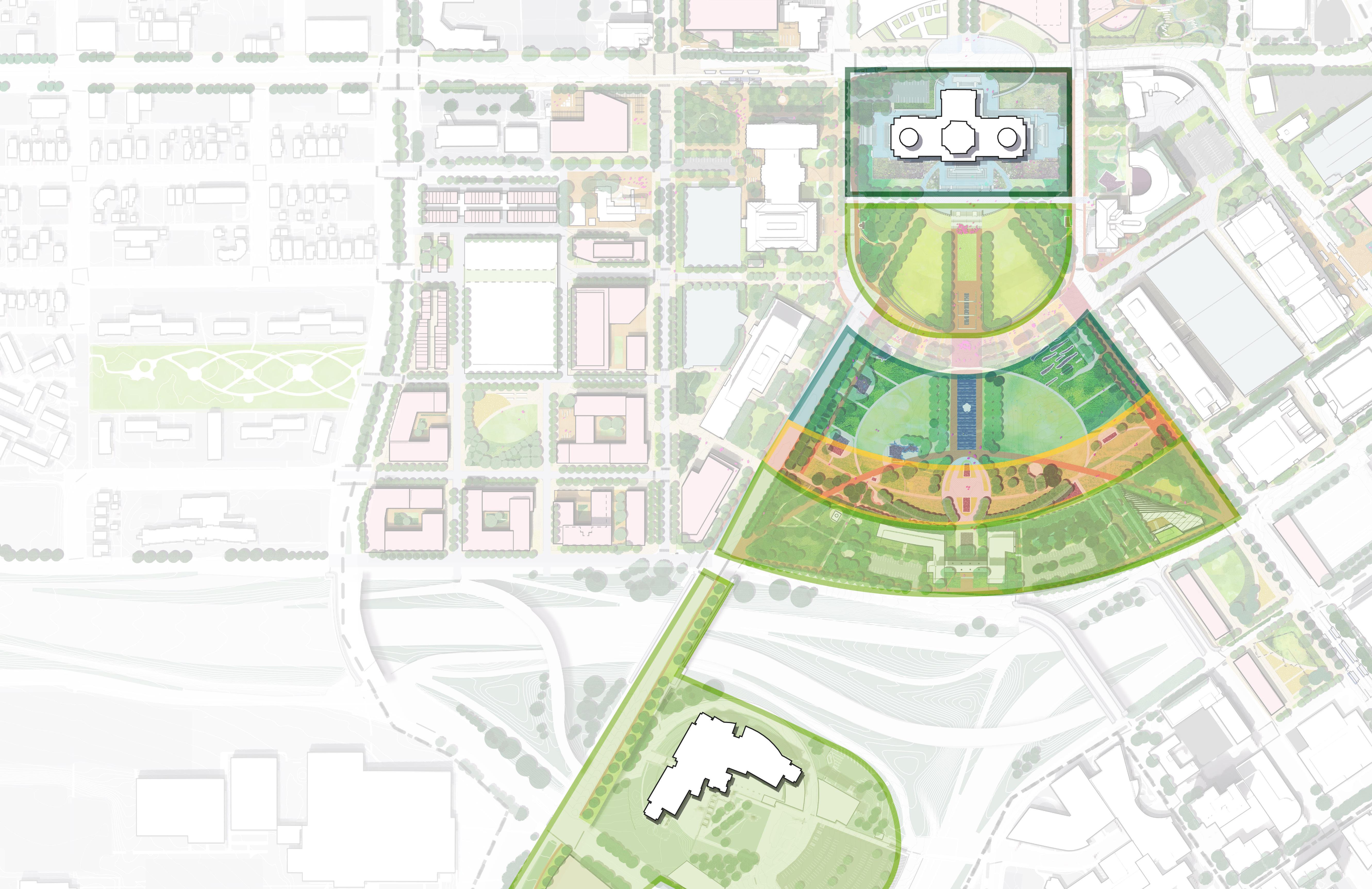
TAKEAWAYS
O Native prairies showcase significant Minnesotan plants.
O The cultural planting zone provides wind protection and shade while supporting commemorative works.
O An open glade with shade trees and generous lawn supports large events.
O A civic plinth supports high performance event lawns and high pedestrian traffic.
MANICURED MORE MANICURED AND MORE HORTICULTURAL
DRAFT
OPEN GLADES CULTURAL PLANTING WOODLANDS, MEADOWS AND PRAIRIE
PROPOSED MALL TREES
WOODLANDS, MEADOWS AND PRAIRIE
402 Figure 282: Gradient of Planting Strategies MORE
NATURAL AND LESS
THE GREEN FRAME
CIVIC PLINTH
296 297 Capitol Mall Design Framework Design Framework
PLANTING STRATEGIES
LANDSCAPE TYPOLOGIES
THE GREEN FRAME CIVIC PLINTH
Figure 283: Wisconsin State Capitol
Source: Klassy, Todd. Wisconsin State Capitol. Fine Art America, fineartamerica.com/featured/capitol-tulips-todd-klassy. html?product=greeting-card. Accessed Apr. 2024.
Source: Sasaki. Lawn Sasaki, www.sasaki.com/projects/u-scapitol-visitor-center/.
Figure 286: US Capitol Green Frame
Source: US Capitol. The Daily Signal, https://www.dailysignal. com/2018/09/13/if-congress-cant-pass-a-conservative-farmbill-they-should-extend-existing-law/
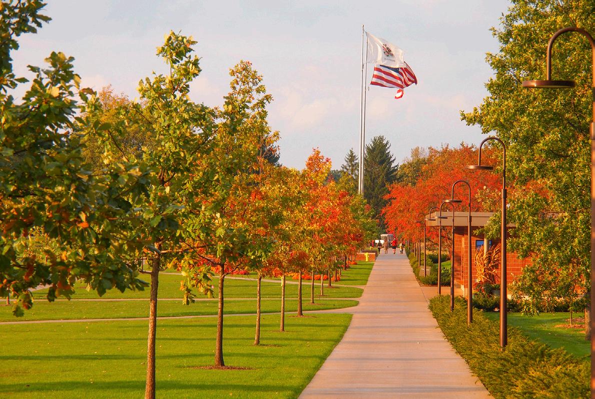
OPEN GLADES CULTURAL PLANTING
DRAFT
Source: Sasaki. Cantigny Park. Sasaki, www.sasaki.com/voicesengineering-news-record-honors-cantigny-park-as-it-movesinto-next-phase/.
Source: Nord Family Greenway. Cultural Landscape Foundation, www.tclf.org/
292: Cantigny Park and Landscape, Wheaton,
Source: Sasaki. Cantigny Park and Landscape. Sasaki, www. sasaki.com/projects/cantigny-park-garden-and-landscapeimprovements/.
Source: UMN. Dakota Ethnobotany. UMN Extension, extension.umn.edu/find-plants/native-plants.
WOODLANDS, MEADOWS, AND PRAIRIES
285: Texas State Capitol
Source: G. Lyon Photography, Inc. Texas Capitol Mall. Coleman Associates, www.colemanandassoc.com/projects/ texas-capitol-complex-mall-and-garage.
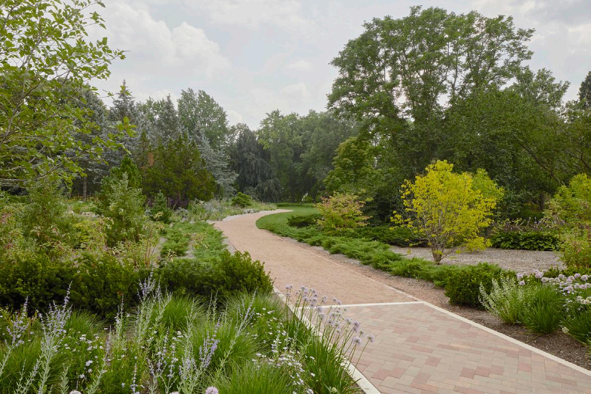
Source: Sasaki. Lawn. Sasaki, www.sasaki.com/projects/u-scapitol-visitor-center/.
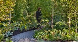
Source: Sasaki. Lawn Sasaki, www.sasaki.com/projects/u-scapitol-visitor-center/.
Figure
IL
Figure 284: US Capitol
Figure 287: Cantigny Park, Wheaton, IL
Figure 291: Dakota Ethnobotany
Figure 288: Nord Family Greenway, Cleveland, OH
Figure 289: US Capitol
Figure 290: Monk’s Garden, Boston, MA
Figure
298 299 Capitol Mall Design Framework Design Framework
PRECEDENT IMAGES PLANTING STRATEGIES
PLANTING PALETTE
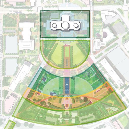
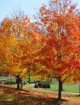
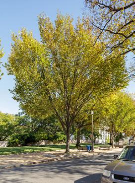
SHADE
Acer saccharum (Sugar Maple)
Quercus x warei ‘Nadler’ (Kindred Spirit Oak)
Tilia americana (Basswood)
Ulmus americana (American Elm)
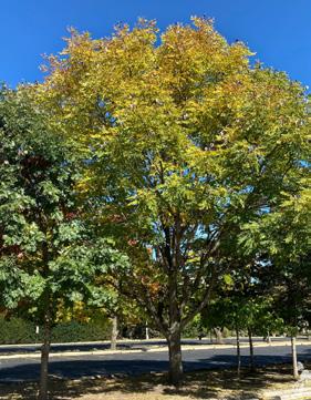
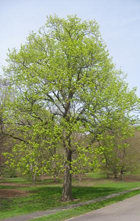
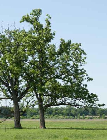
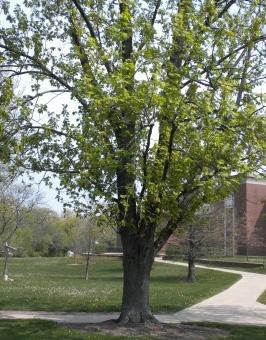
Source:https://www.dnr.state.mn.us/trees/index.html
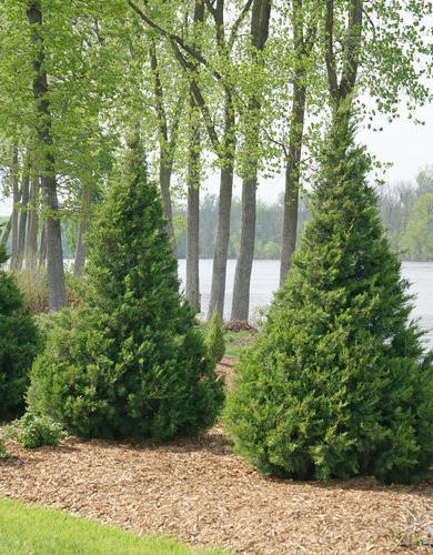
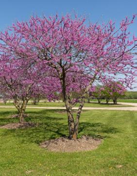
Source: HGA. Minnesota State Capitol Restoration Project. 16 Oct. 2015.
ORNAMENTAL
Cercis canadensis (Eastern Redbud)
Gleditsia triacanthos var. inermis (Thornless Honey Locust)
Juniperus chimensis ‘Trautman’ (Trautman Juniper)
GROVE
Ulmus americana (American Elm)
Tilia americana (Basswood)
SHADE
Celtis occidentalis (Hackberry)
Gymnocladius dioicus (Kentucky Coffeetree)
Quercus macrocarpa (Bur Oak)
Quercus macrocarpa x robur (Heritage Oak)
Asclepias syriaca sub tuberosa (Common Milkweed)
Hydrangea paniculata ‘SMHPLQF’ (Little Quick Fire Hydrangea)
Ilex verticillata ‘Red Sprite’ (Red Sprite Winterberry)
Juniperus sabina ‘Blue Forest’ (Blue Forest Juniper)
Narcissus sp. (Daffodil)
DRAFT
Nepeta fasseni ‘Walker’s Low’ (Walker’s Low Catmint)
Spiraea betulifolia ‘Tor’ (Tor Birchleaf Spirea)
Taxus x media ‘Taunton’ (Taunton Yew)
Asclepias syriaca sub tuberosa (Common Milkweed)
Artemiisia ludoviciana (White Sagebrush)
Nepeta fasseni ‘Walker’s Low’ (Walker’s Low Catmint)
Panicum virgatum (Switchgrass)
Physocarpus opulifolius ‘Donna May’ (Little Devil Ninebark)
Rhus aromatica ‘Gro-Low’ (Fragrant Sumac)
Sorghastrum nutans (Indiangrass)
Spiraea betulifolia ‘Tor’ (Tor Birchleaf Spirea)
Verbana hastata (Blue Vervian)
SHADE
Acer saccharinum (Silver Maple)
Gleditsia triacanthos var. inermis
(Thornless Honey Locust)
Quercus ellipsoidalis (Northern Pin Oak)
Tilia americana (Basswood)
Ulmus americana (American Elm)
ORNAMENTAL
Cercis canadensis (Eastern Redbud)
Source:https://extension.umn.edu/trees-and-shrubs/trees-and-shrubs-minnesota-landscapes
Diospryos virginiana (American Persimmon)
Hydrangea paniculata ‘SMHPLQF’ (Little Quick Fire Hydrangea)
Ilex verticillata ‘Jim Dandy (Jim Dandy Winterberry)
Ilex verticillata ‘Red Sprite’ (Red Sprite Winterberry)
Prunus americana (Wild Plum)
Rhus aromatica ‘Gro-Low’ (Fragrant Sumac)
Schizachyrium scoparium (Little Bluestem)
Sorghastrum nutans (Indiangrass)
Spiraea betulifolia ‘Tor’ (Tor Birchleaf Spirea)
Sporobolus heterolepis (Prairie Dropseed)
Climate-ready trees based on projected local projected climate and University Minnesota Research HIGH
Increased shade canopy for thermal comfort Dynamic height differences to create wind flow at human height Pollinator and wildlife friendly landscape Develop maintenance friendly plant communities based on typologies
Increased carbon sequestration
Noise buffering along I-94 with Woodlands, Meadows, and Prairies
Strategic placement of canopy trees to avoid security cameras
THE GREEN FRAME CIVIC PLINTH OPEN GLADES TYPOLOGY TREE SPECIES PLANT COMMUNITIES NOTES ON HUMAN COMFORT & CLIMATE CHANGE MAINTENANCE & PERFORMANCE
MED MED
300 301 Capitol Mall Design Framework Design Framework
PLANTING STRATEGIES
MATRIX
TYPOLOGY
PLANTING PALETTE
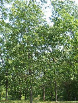
SHADE
Betula papyrifera (Paper Birch)
Carpinus caroliniana (Blue Beech)
Carya ovata (Shagbark Hickory)
Celtis occidentalis (Hackberry)
ORNAMENTAL
Amelanchier (Serviceberry)
Prunus virginiana (Chokecherry)
Andropogon gerardii (Big Bluestem)
Asclepias syriaca sub tuberosa (Common Milkweed)
Helianthus pauciflorus (Stiff Sunflower)
Ratibida pinnata (Prairie Coneflower)
Rosa arkansana (Prairie Rose)
Rubus occidentalis (Black Raspberry)
Salix purpurea ‘Nana’ (Dwarf Blue Leaf Arctic Willow)
Schizachyrium scoparium (Little Bluestem)
Sorghastrum nutans (Indiangrass)

SHADE
Carya tomentosa (White Hickory)
Ulmus americana (American Elm)
Quercus macrocarpa (Bur Oak)
Quercus ellipsoidalis (Northern Pin Oak)
Betula papyrifera (Paper Birch)
Populus tremuloides (Quaking Aspen)
Dalea purpurea (Purple Prairie Clover)
Helianthus pauciflorus (Stiff Sunflower)
Ratibida pinnata (Prairie Coneflower)
Schizachyrium scoparium (Little Bluestem)
Solidago nemoralis (Gray Goldenrod)
Symphyotrichum laeve (Smooth Aster)
Climate-ready trees based on projected local projected climate and University Minnesota Research
Increased shade canopy for thermal comfort
Dynamic height differences to create wind flow at human height Pollinator and wildlife friendly landscape Develop maintenance friendly plant communities based on typologies
SHADE
Ulmus americana (American Elm)
Tilia americana (Basswood)
Gleditsia triacanthos var. inermis
(Thornless Honey Locust)
Celtis occidentalis (Hackberry)
Bouteloua curtipendula (Sideoats Grama)
Panicum virgatum (Switchgrass)
Schizachyrium scoparium (Little Bluestem)
Sorghastrum nutans (Indiangrass)
Sporobolus heterolepis (Prairie Dropseed)
Increased carbon sequestration
Noise buffering along I-94 with Woodlands, Meadows, and Prairies
Strategic placement of canopy trees to avoid security cameras
Source:https://www.dnr.state.mn.us/trees/index.html
Source: HGA. Minnesota State Capitol Restoration Project. 16 Oct. 2015.
Source:https://extension.umn.edu/trees-and-shrubs/trees-and-shrubs-minnesota-landscapes
STREET
TYPOLOGY TREE SPECIES PLANT COMMUNITIES NOTES ON HUMAN COMFORT & CLIMATE CHANGE MAINTENANCE & PERFORMANCE
WOODLANDS, MEADOWS, AND PRAIRIES
TREES
HIGH HIGH LOW
302 303 Capitol Mall Design Framework Design Framework
CULTURAL PLANTING
PLANTING STRATEGIES
TYPOLOGY MATRIX DRAFT
TREE CANOPY COVERAGE

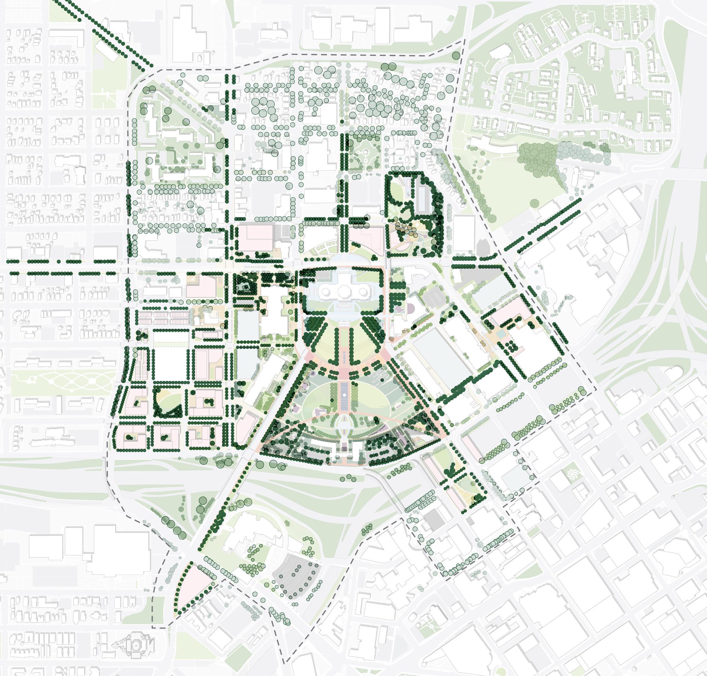
EXISTING TREE CANOPIES PROPOSED TREE CANOPIES N NTS N NTS CLR + Feb. 2024 Tree Survey Boundary Existing Trees (Survey) Existing Trees (CAAPB) Existing Trees (Google Earth trace) LEGEND Existing Trees Proposed Trees LEGEND CAAPBBoundary CAAPBBoundary
Figure 293: Capitol Area Tree Canopy (Existing)
University Ave W University Ave W St Anthony Ave St Anthony Ave ComoAve ComoAve John Ireland Blvd John Ireland Blvd CedarSt CedarSt UniversityAveE UniversityAveE Valley Park Valley Park Western
Park Western
Park Proposed Trees in Mall: 402 Proposed Trees in Cass Gilbert: 121 Proposed Trees in MLK: 32 Proposed Street Trees: 1,151 Existing Trees Removed or Relocated: 259 Total Proposed: 1,968 304 305 Capitol Mall Design Framework Design Framework
Figure 294: Capitol
Area
Tree Canopy (Proposed)
Sculpture
Sculpture
PLANTING STRATEGIES
DRAFT
METRICS
INCREASE THERMAL COMFORT
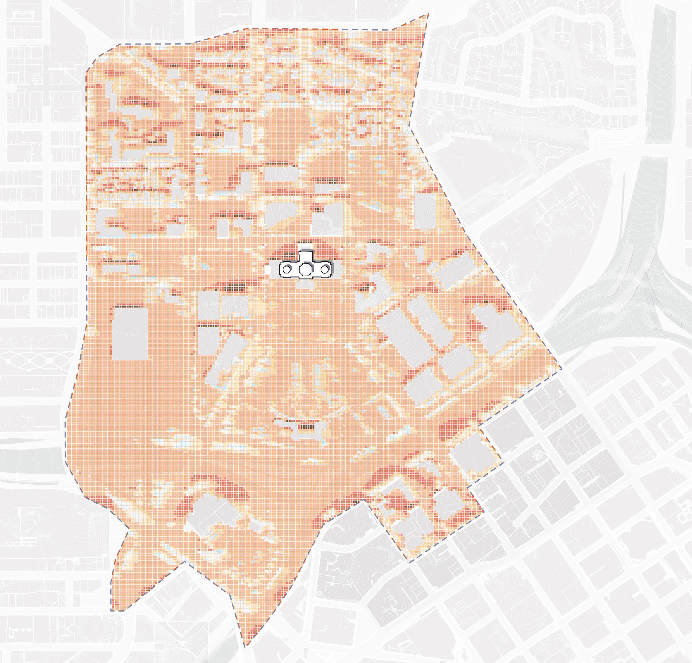
Figure 295: Thermal Comfort (Existing)
Source: Minnesota Geospatial Commons. gisdata.mn.gov/dataset.
Source: Ramsey County Map Ramsey. maps.co.ramsey.mn.us/mapramsey/.
Source: Ramsey County Maps and Surveys. www. ramseycounty.us/residents/property/maps-surveys.
Source: Saint Paul Minnesota. information.stpaul.gov/search.
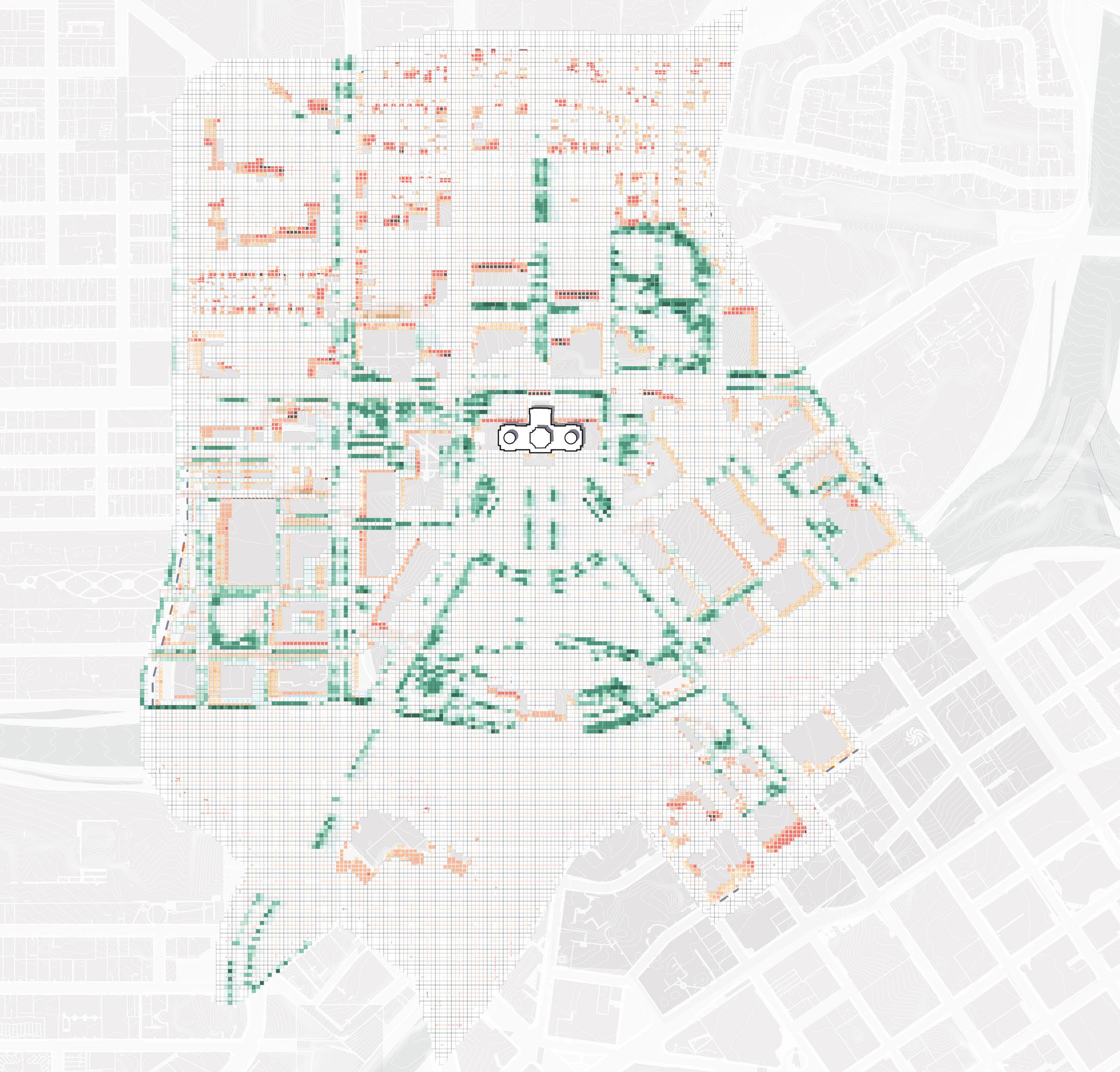
The Design Framework suggests placing buildings and tree canopies in key spots to offer year-round thermal comfort. Summer shade is provided by trees positioned in the upper and lower malls, ideal for programming and use.
EXISTING PROPOSED
N NTS N NTS CAAPBBoundary
296: Thermal Comfort Net Impact University Ave W University Ave W St Anthony Ave St Anthony Ave ComoAve ComoAve John Ireland Blvd John Ireland Blvd CedarSt CedarSt UniversityAveE UniversityAveE
TO BE UPDATED
CAAPBBoundary Figure
More comfortable More comfortable Less comfortable Less comfortable 306 307 Capitol Mall Design Framework Design Framework
PLANTING STRATEGIES IMPACT
DRAFT
PLANTING STRATEGIES
The Design Framework supports a variety of landscape strategies, including green infrastructure, natural drainage and infiltration, and selective planting material for longterm maintenance. Some specific interventions include the following:
O Increase native street trees to provide shade and thermal comfort
O Design seasonal plantings to frame the Capitol Building
O Create gently sloped lawns for event programming
O Utilize low shrubs and groundcover to provide greenery while maintaining sight lines and security
O Select cultural plantings to pay homage and support wildlife
O Add biofiltration through rain gardens and detention zones
O Buffer interstate noise and pollution using berms with woodland plant species along East/West 12th Street
STREET TREES PROVIDE SHADE AND THERMAL COMFORT

SEASONAL PLANTING TO FRAME THE CAPITOL BUILDING
UNIVERSITYAVEW AURORAPROMENADE
GENTLE LAWN FOR PROGRAMMING
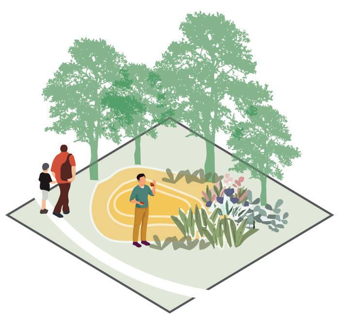
LOW SHRUBS AND GROUNDCOVER IN BETWEEN RETAINING WALLS
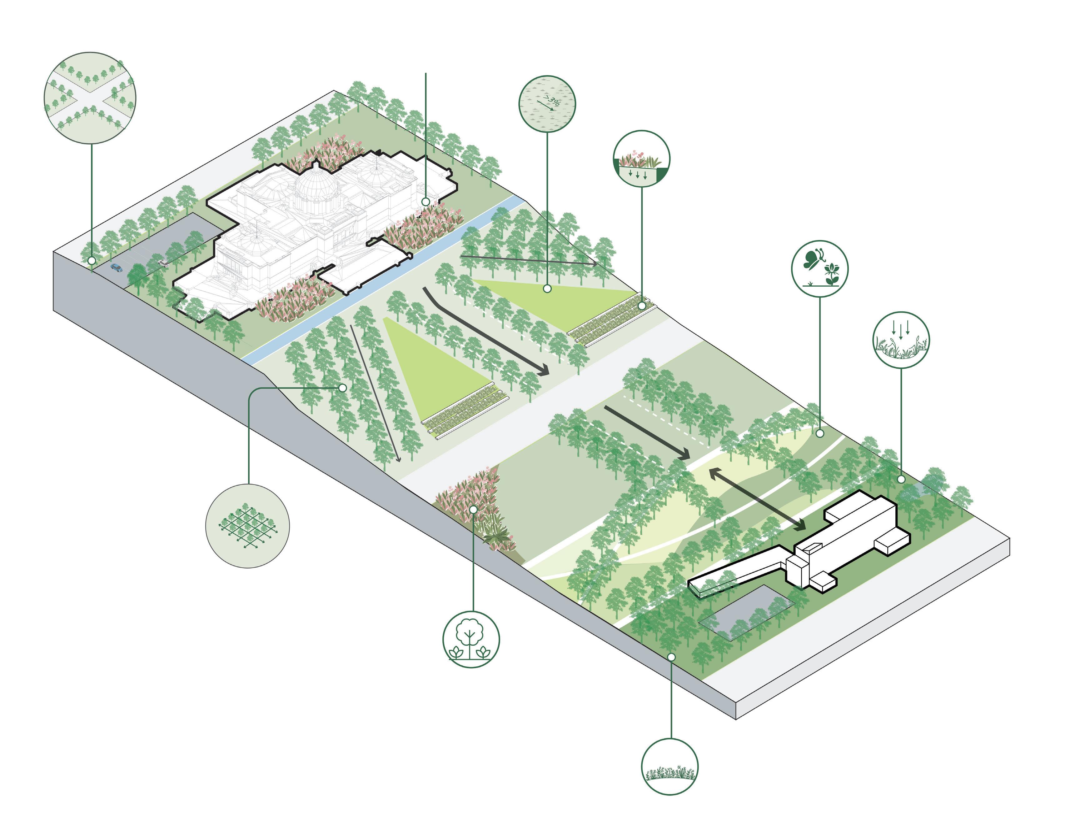
CULTURAL PLANTING TO PAY HOMAGE AND PROVIDE FOR WILDLIFE
BIOFILTRATION USING RAIN GARDENS AND DETENTION ZONES
REVMLKBLVD
12THST
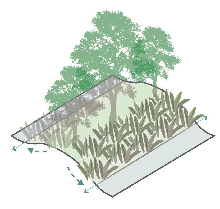
GARDEN SPACE SURROUNDING OPEN GLADES
BERM WITH WOODLAND ALONG 12TH ST AS A NOISE BUFFER AGAINST I-94
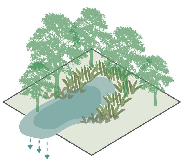
RETAIN INFILTRATE BIOSWALE BERM
PARKING PARKING
TREE KNUCKLE IN GROVES
308 309 Capitol Mall Design Framework Design Framework
PLANTING STRATEGIES
DRAFT
LOWER CAPITOL MALL
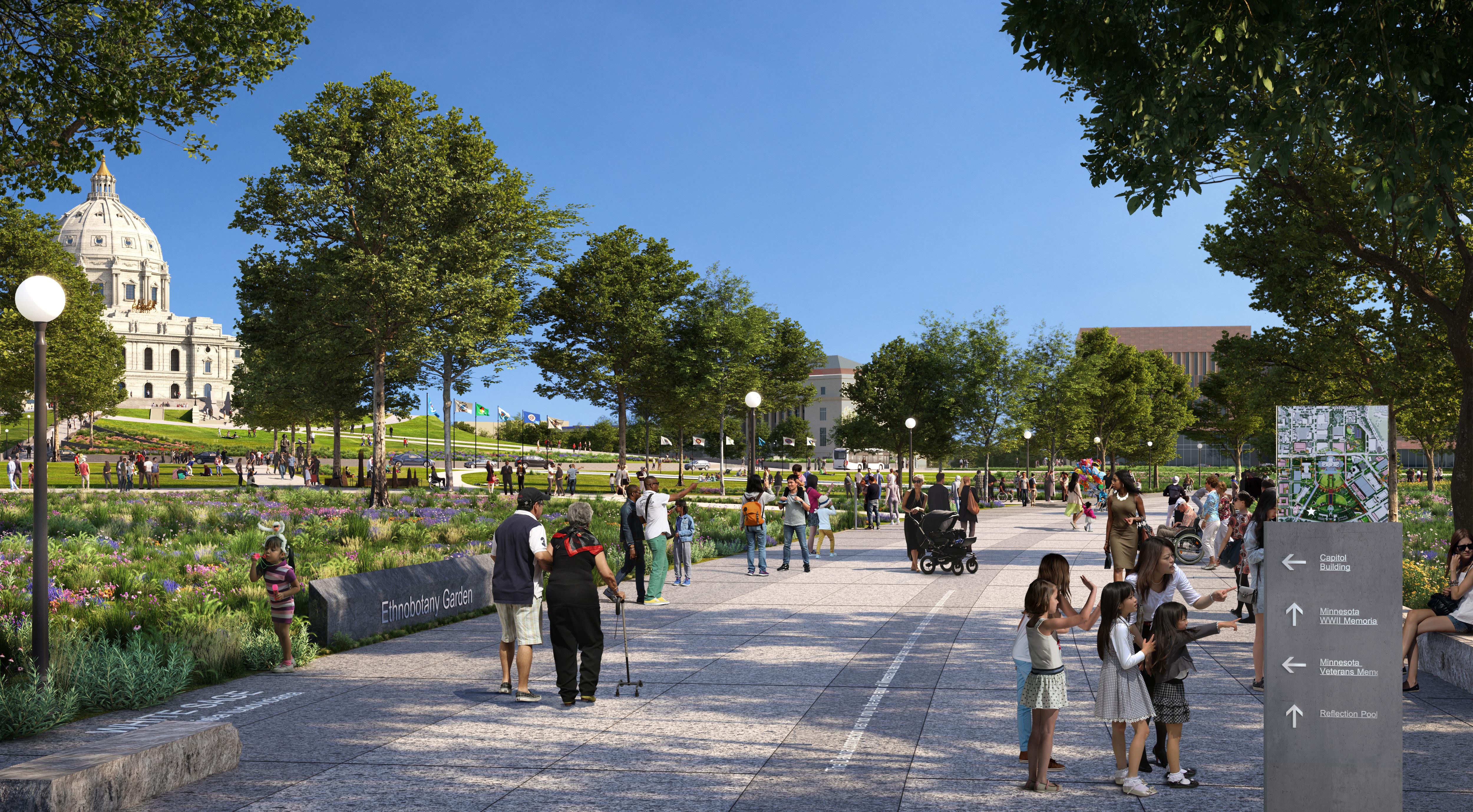
310 311 Capitol Mall Design Framework Design Framework PLANTING STRATEGIES
DRAFT
RENDERING
O Multi-Generational Space
O Site Amenities and Programming
O User and Annual Programming
O Precedent Imagery
CASS GILBERT MEMORIAL PARKDRAFT
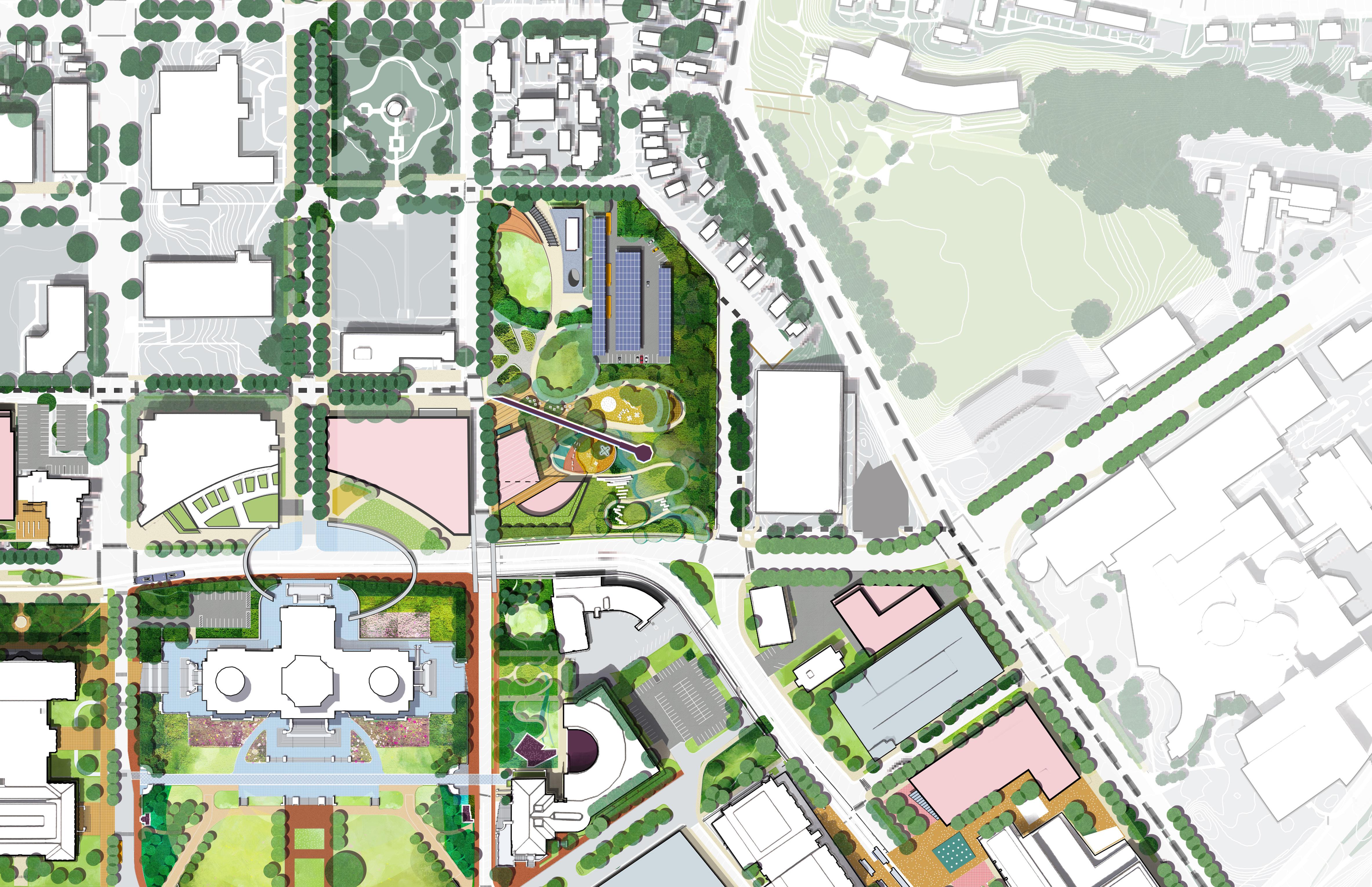
Transform Cass Gilbert Memorial Park into a multi-generational space for play, recreation and views
312 313 Capitol Mall Design Framework Design Framework
MULTI-GENERATIONAL SPACE
TRANSFORM CASS GILBERT
MEMORIAL PARK INTO A MULTIGENERATIONAL SPACE FOR PLAY, RECREATION AND VIEWS
Cass Gilbert Memorial Park’s existing topography, sweeping views, and proximity to both neighborhoods and existing community assets (like the Capitol Building) make it a prime location for a public space that serves the broader community. As previously mentioned, the Capitol Mall fills a critical park gap in the City of Saint Paul. While the Upper and Lower Malls are great places to walk, picnic, and enjoy the outdoors, there is currently no space for young children to climb, swing, and play. Cass Gilbert Memorial Park can be this space and more. People of all ages and abilities can gather, play, and relax while gazing upon the Capitol Mall and Downtown. Gardens and iconic nature-based play features make Cass Gilbert Memorial Park a destination for those in the Twin Cities and beyond. Furthermore, a new discovery museum, interior event space, and cafe support additional Capitol Mall programming that was highly requested by community members and stakeholder alike.
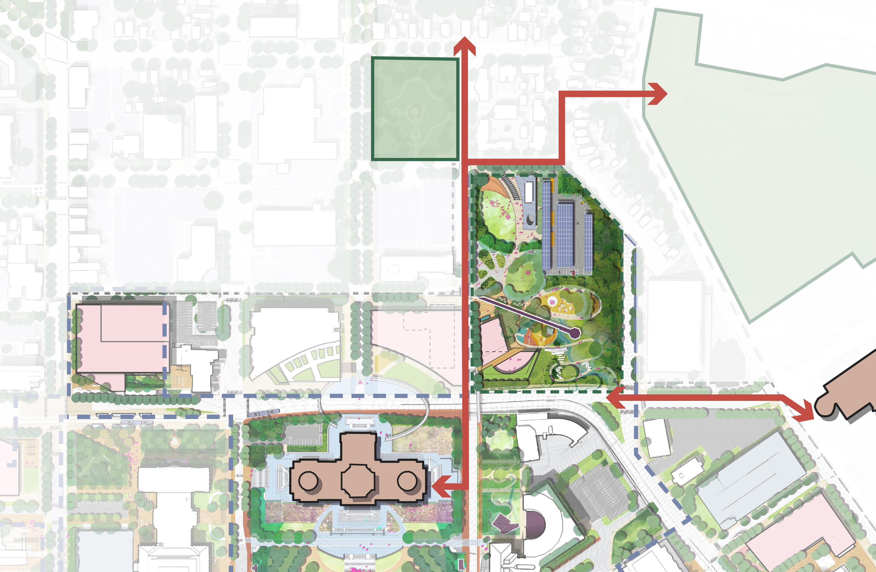
TAKEAWAYS
O Cass Gilbert Memorial Park’s existing topography, sweeping views, and proximity to both neighborhoods and existing assets (like the Capitol Building itself) make it a prime location for a public space that serves the broader community.
O Integrating diverse programming such as a children’s play environment, tree groves, walking paths, an overlook and park pavilions will create a destination for varied user groups.
CASS GILBERT MEMORIAL PARK TO REGIONS HOSPITAL PLAY NATURE PLAY OUTDOOR FLEXIBLE SPACE AMENITY BUILDING EXTENDED BUS PARKING PARK STREETSCAPE UPGRADES STREETSCAPE UPGRADES Cedar St University Ave W Charles Ave Sherburne Ave CapitolHeights RobertSt JacksonSt Valley Park MT. AIRY MN STATE CAPITOL CAPITOL HEIGHTS NEIGHBORHOOD
314 315 Capitol Mall Design Framework Design Framework
CASS GILBERT PARK
DRAFT
SITE AMENITIES AND PROGRAMMING
SOMETHING FOR EVERYONE
The various site amenities and programming opportunities within Cass Gilbert Memorial Park include the following:
O Solar-shaded visitor and bus parking
O Outdoor pavilion with public restrooms and shade cover
O Outdoor swings for people of all ages
O Open lawns for play and events
O Educational gardens to demonstrate Minnesota’s agricultural history
O Butterfly adventure and topography play with iconic, interactive play features
O Movable furniture and other flexible seating opportunities
O Cultural walk that terminates at the original overlook
O Discovery Museum, cafe, and event space
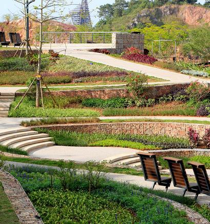
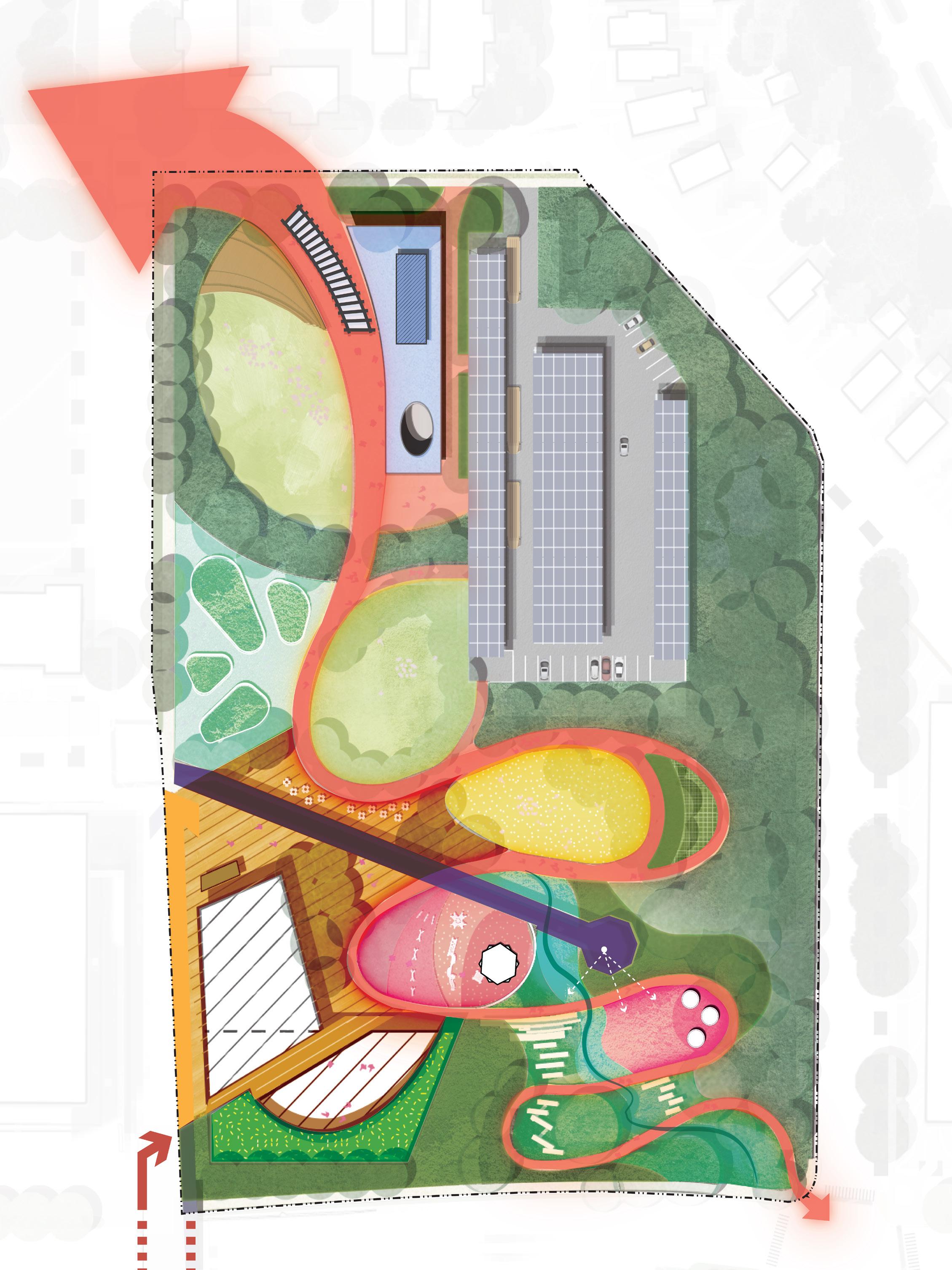
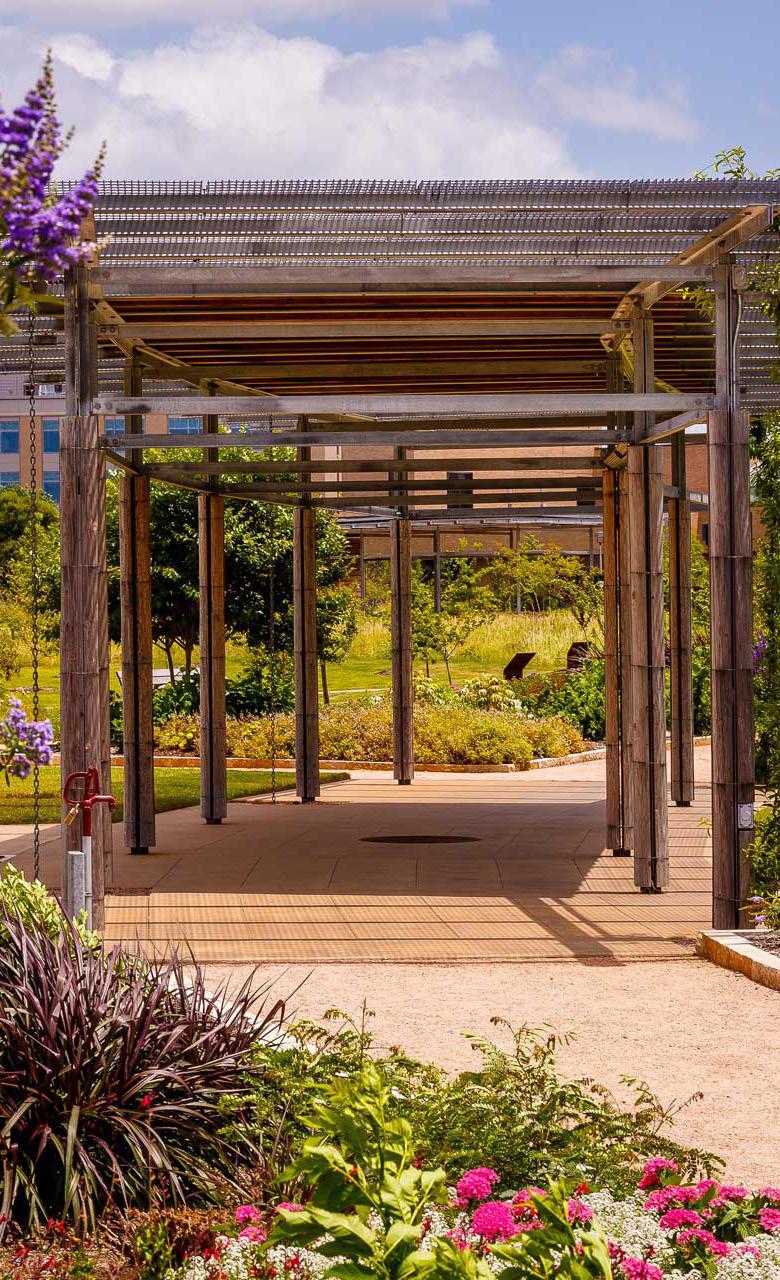
BUTTERFLY ADVENTURE PLAY NET IN THE WOODS FLEXIBLE LAWN OPEN LAWN PLAY ZONE PARKING + BUS QUEUE SWING CHAIR THE WOODS THE NEST EDUCATIONAL GARDEN NATURE PLAY VIEW CORRIDOR TOPOGRAPHY PLAY DISCOVERY MUSEUM CONNECT TO BRIDGE ON ROOF ROOF GARDEN RESTROOM OUTDOOR PAVILION CULTURALWALK B I OSWALE Cedar St Robert St CapitolHeights University Ave W
Ave Charles Ave N 0’ 100’ 50’ 25’
Sherburne
316 317 Capitol Mall Design Framework Design Framework
CASS GILBERT PARK DRAFT
USER AND ANNUAL PROGRAMMING
Take advantage of a walk to the neighboring park on a day trip to the Capitol for a variety of activities made to accommodate a large group of users from daily visitors such as Residents and Community, Office Workers to visitors who come far for a meaningful trip, such as Visitors and Students for an educational trip.
O Get a nice overlook to the Capitol Building and Downtown at the Overlook
O Trace the Cultural Trail from various access points, such as the Rice Station Hub
O Place for gathering after work
O Lunch spot with a view
O Multi-use event spaces
O Flexible space easily accessible from neighborhood
USER EXPERIENCE ANNUAL PROGRAMMING

RESIDENTS AND COMMUNITY STUDENTS
O Play after class at the various flexible and play areas VISITORS
O Various seating arrangements to accommodate large and small groups of users
O Connected network of pedestrian trails from Capitol Area to Capitol Heights

O Engage and learn with the Discovery Museum and Educational Garden
DRAFT

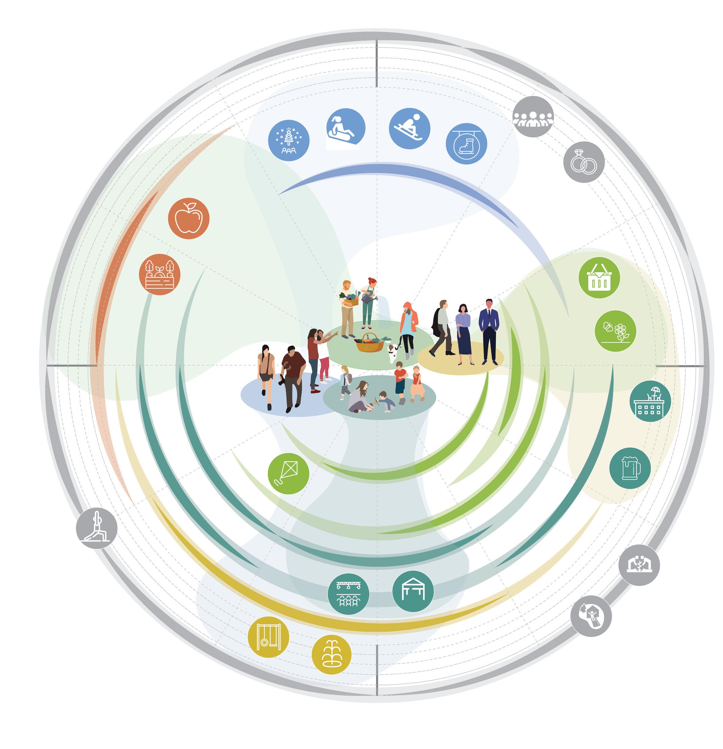
The proposed design incorporates existing topography to build a tiered outdoor space for overlooking the Capitol Mall and Downtown while also providing opportunities for various programming. The addition of a multi-use amenity building inserted into the hill of the site folds in another level of flexibility in user experience with seasonality.
AUTUMN WINTER SUMMER SPRING O Illuminated Walk O Snow Tubing O Sledding O IceSkating RESIDENTS AND COMMUNITY OFFICE WORKERS STUDENTS VISITORS O Sp r ing Flowers O Rooftop Ba r O BeerGardens O Picnic O Festivals O Concerts O SplashPad O SummerCamp O Yoga O Kite Flying O Harvest O ApplePicking December November October January February March Ap r i l May June July August S e ptember O Gardening O WeddingsandEvents O CommunityClasses O OutdoorGames
OFFICE WORKERS
318 319 Capitol Mall Design Framework Design Framework
CASS GILBERT PARK
PARK PROGRAMMING
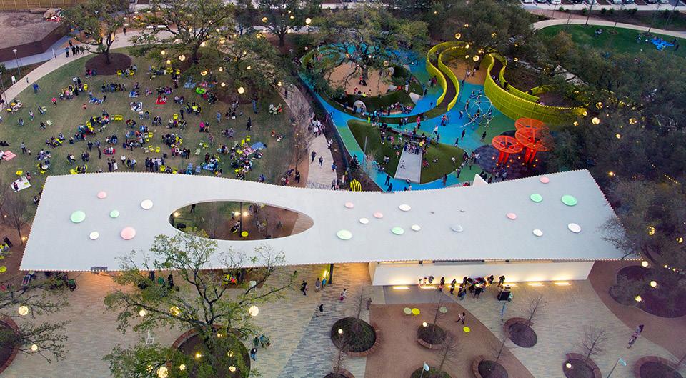
Source: OJB. Levy Park, Texas. 24 Oct. 2018. OJB, www.ojb.com/work/levy-park/#lg=1&slide=4.
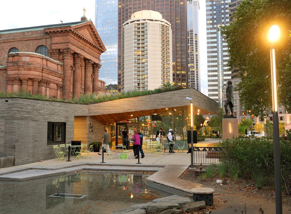
Studio: Brian Hanes. Sister Cities Park, Philadelphia Party Space,
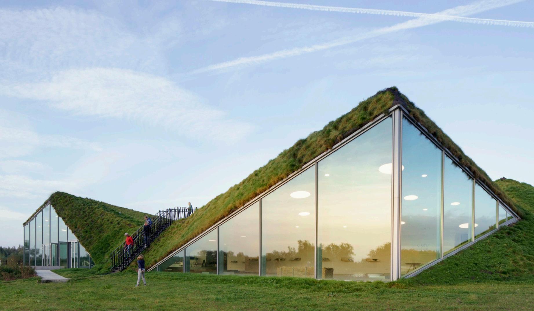
Source: Tilleman, Ronald. Biesbosch Museum, Netherlands Arch Daily, www.archdaily.com/777852/biesbosch-museum-island-studiomarco-vermeulen.
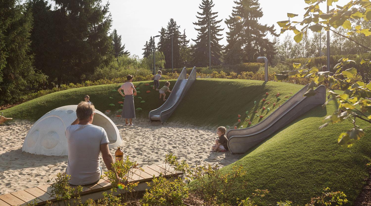

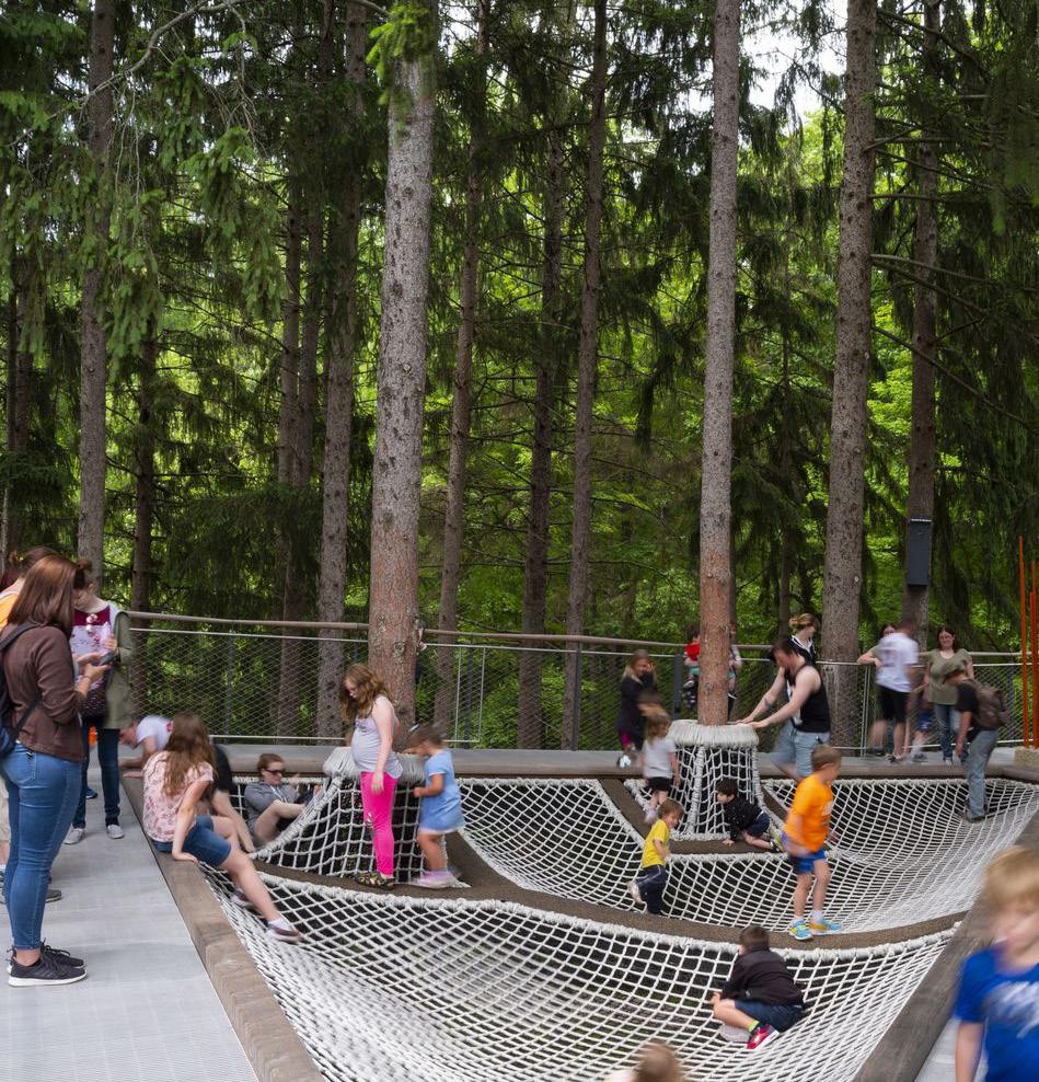
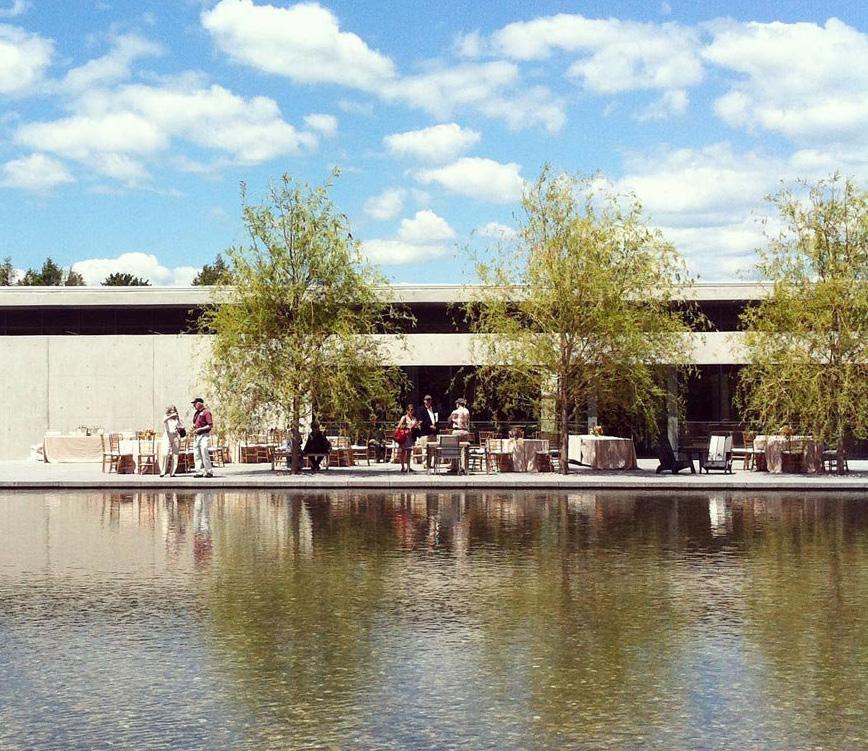
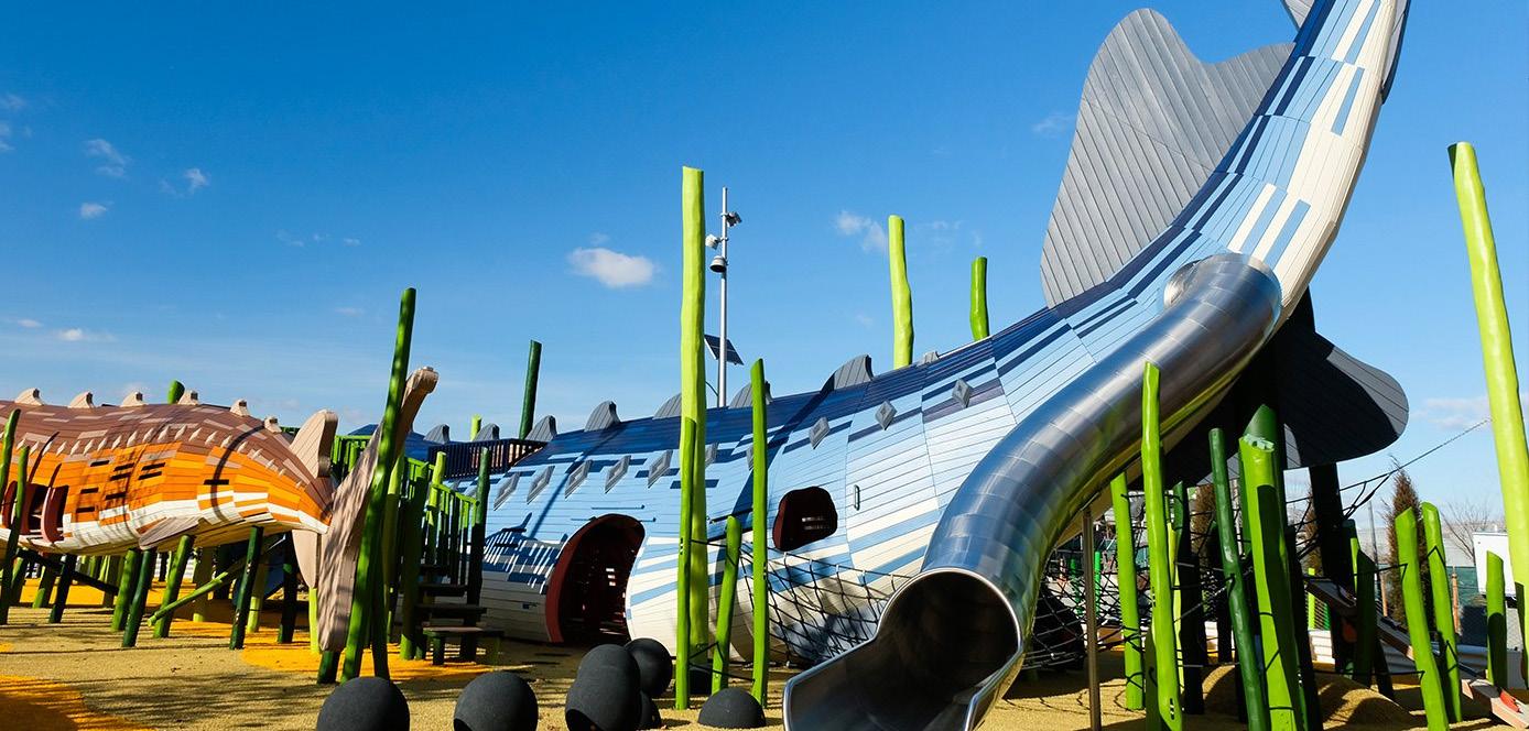 Figure 301: Levy Park, Texas
Figure 302: Sister Cities Park, Philadelphia
Figure 304: Izzy’s Playground, North Carolina
Figure 303: Biesbosch Museum, Netherlands
Source:
Source: Teplov, Ilya. Izzy’s Playground, North Carolina. Landezine
Figure 305: Franklin Park Conservatory and Botanical Garden, Ohio
Source: Schieber, Randall L. Franklin Park Conservatory and Botanical Garden.
Figure 306: Whiting Forest, Michigan
Source: Lehoux, Nic. Whiting Forest. Caitlin Brady,
Figure 307: Clark Art Institute, Massachusetts
Source: Cheang, Becky. Clark Art Institute, Massachusetts. Fathom,
Figure 308: Pier 26, New York
Figure 301: Levy Park, Texas
Figure 302: Sister Cities Park, Philadelphia
Figure 304: Izzy’s Playground, North Carolina
Figure 303: Biesbosch Museum, Netherlands
Source:
Source: Teplov, Ilya. Izzy’s Playground, North Carolina. Landezine
Figure 305: Franklin Park Conservatory and Botanical Garden, Ohio
Source: Schieber, Randall L. Franklin Park Conservatory and Botanical Garden.
Figure 306: Whiting Forest, Michigan
Source: Lehoux, Nic. Whiting Forest. Caitlin Brady,
Figure 307: Clark Art Institute, Massachusetts
Source: Cheang, Becky. Clark Art Institute, Massachusetts. Fathom,
Figure 308: Pier 26, New York
320 321 Capitol Mall Design Framework Design Framework
Source: Olin Studio. Pier 26, New York. Olin Studio, www.theolinstudio.com/news.
PRECEDENT
CASS GILBERT PARK DRAFT
IMAGERY
CASS GILBERT PARK
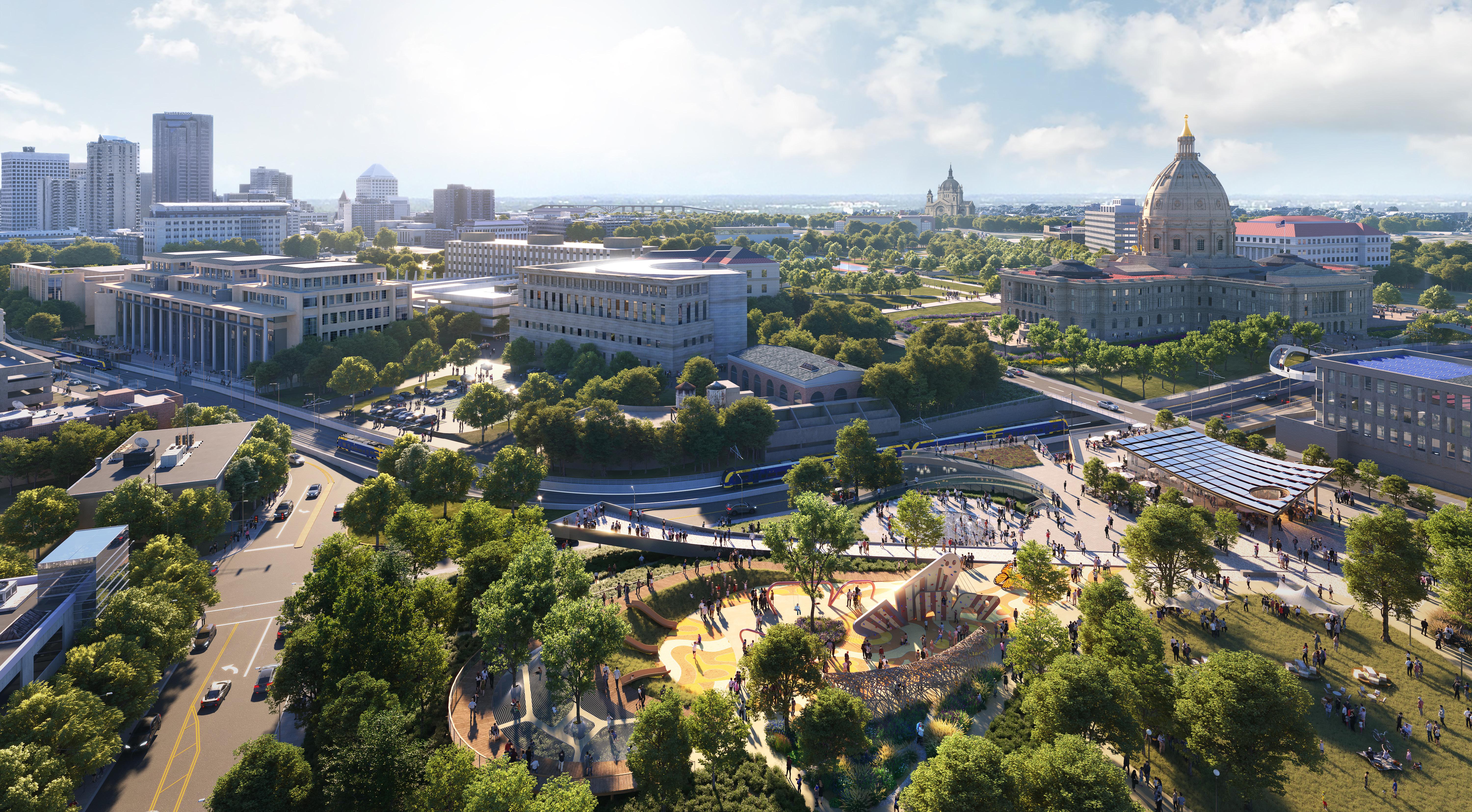
322 323 Capitol Mall Design Framework Design Framework
CASS GILBERT PARK DRAFT
RENDERING
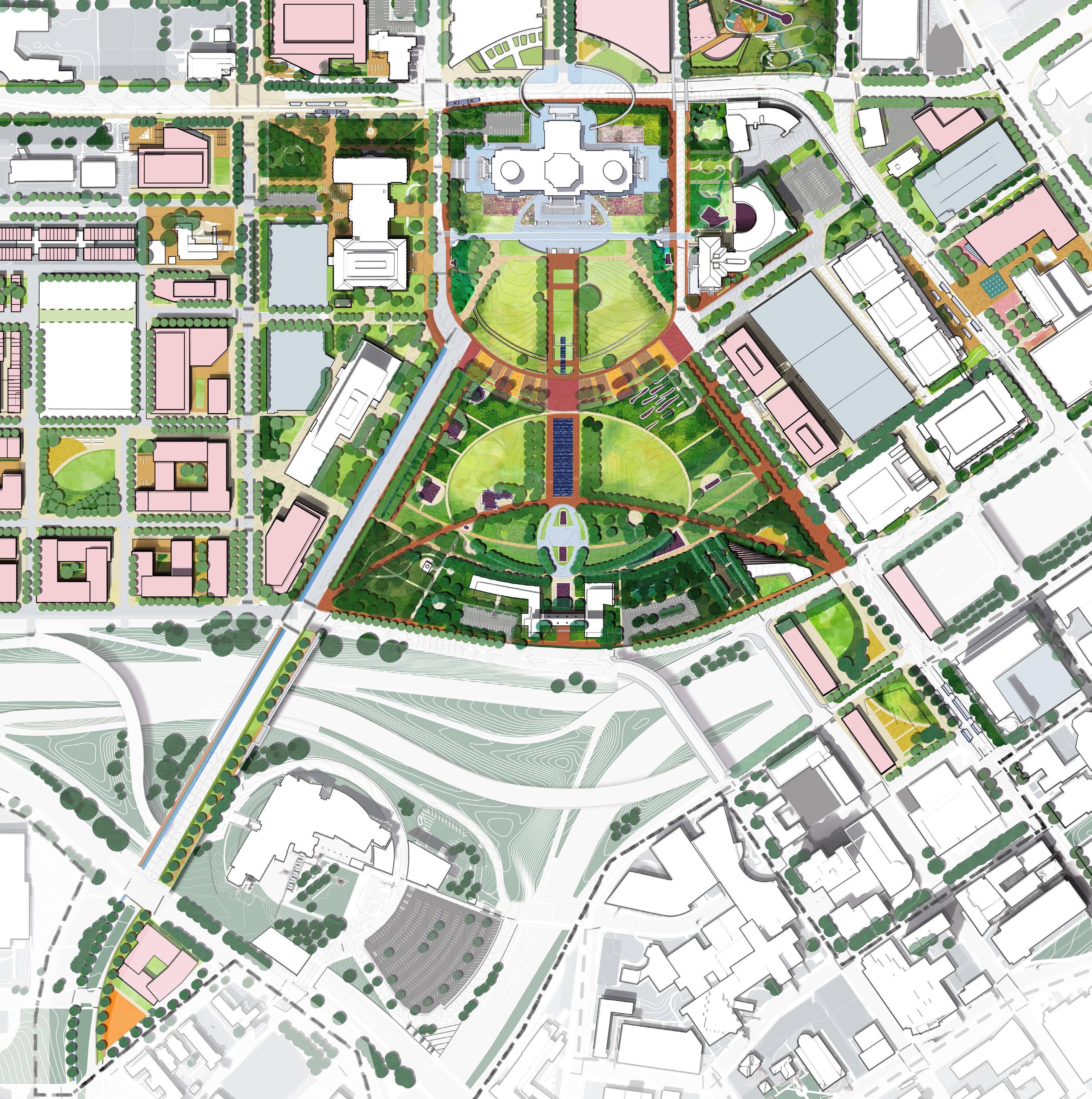
CHAPTER 5
PROJECT IMPLEMENTATION
DRAFT
GOVERNANCE & STEWARDSHIP CONSIDERATIONS AND FUNDING PASSWAYS
ROLES + RESPONSIBILITIES
CURRENT CAPITOL AREA “ACTOR” DICTIONARY
To ensure successful implementation, the first step is to have a thorough understanding of existing actors and their roles, as well as identifying potential actors we should engage. The directory below is not exhaustive but can serve as a starting point for understanding who is involved.
“CONSERVANCY” MODEL CONSIDERATIONS
Implementing a park conservancy model for the Minnesota State Capitol Mall and its surrounding areas is strongly suggested. Firstly, it allows for the consolidation of multiple actors listed on the left. By bringing these diverse stakeholders under one umbrella, the conservancy model fosters collaboration, streamlines decisionmaking processes, and ensures a unified vision for the area’s enhancement. Secondly, pooling funding resources through the conservancy model provides financial stability and sustainability for the long-term development and maintenance of the Capitol Mall and its adjacent spaces. This pooled funding approach enables strategic investment in key projects and initiatives, avoiding fragmentation and maximizing impact. Thirdly, treating the project as a whole and committing to its continuous improvement over multiple years ensures consistency and coherence in the revitalization efforts. This long-term perspective allows for comprehensive planning, phased implementation, and ongoing maintenance, resulting in lasting positive outcomes for the community. The conservancy serves as a valuable ally, contributing expertise, resources, and community engagement efforts to advance the shared goals of CAAPB and ensure the vitality of the Capitol Mall and its surroundings for generations to come.
INCOME OTHER FUNDING AND RESOURCES
FUNDING PATHWAYS
Exploring funding pathways for projects encompasses a wide array of sources, spanning from federal public funding to private donations and earned incomes. Each avenue presents its own set of opportunities and obstacles, influencing project feasibility and sustainability. Maintaining a comprehensive database of funding options is essential for strategic planning and effective resource management, enabling organizations to navigate the complexities of funding landscapes with clarity and confidence. Identifying how funding resources align with short, medium, and long-term projects is the key to successful implementation, ensuring that financial support is strategically allocated to meet project goals over time.
F F F F F F F F F M M M M C C C D D D CAPITOL AREA “ACTORS” STATE OF MINNESOTA CITY OF SAINT PAUL COUNTY NGO AND PRIVATE SECTOR Capitol Area Architecture and Planning Board (CAAPB) Minnesota Department of Administration Governor’s Office Federal Grants City Funding State Funding County Funding etc. Value Capture Financial Tools PILOT, BIDs, TIFs Private Funding State Contributions in lue of Taxes Earned income from programming Rental and concessions Contributed income from operating endowments, annual funding or giving drivers, membership programs etc. City of Saint Paul Neighborhood Safety Parks and Recreation Planning and Economic Development Ramsey County Metro Transit Capitol Region Watershed District Sear’s Site Developer Private Partnership Developers in P3 deals Funding Operation and Maintenance Capitol Area Construction Developer Site Construction Minnesota Historical Society Minnesota Legislature Minnesota State Patrol Minnesota Council on Disability Minnesota Department of Transportation Public Health Public Works Water Local Residentials Philanthropic Community CONSERVANCY CAAPB FEDERAL STATE PROJECT IMPLEMENTATION GUIDELINES PROJECT CONSTRUCTION OPERATION / MAINTENANCE IMPLEMENTATION OF PROJECT FUNDING RESOURCE / STAKEHOLDERS COUNTY CITY PRIVATE / PHILANTHROPY PUBLIC FUNDING AND RESOURCES EARNED AND CONTRIBUTED
Advisor Fund
etc.
raising, implementation, operation & maintenance, collaborations,
326 327 Capitol Mall Design Framework Introduction
IMPLEMENTATION
DRAFT
NEXT STEPS
The Capitol Mall Design Framework represents a comprehensive approach to understanding the needs of Minnesotans in the Capitol Mall area. Through extensive engagement efforts, the framework has pinpointed crucial bold moves necessary for near term and long term development.
However, translating this vision into reality will be a long-term process spanning several years to decades. The implementation process involves a substantial amount of work, guided by the principles outlined in the framework. Identifying and prioritizing these tasks will be pivotal in ensuring the successful realization of the envisioned improvements to the Capitol Mall area.
NEAR TERM IMPLEMENTATION
NEXT STEP TASK PIPELINES
TO ENSURE THE CAPITOL MALL AREA CAN BE IMPLEMENTED AS A WHOLE SYSTEM, A SERIES OF
For effective progress, CAAPB should provide recommendations, backed by legislative support, while the state administration carries out the tasks outlined in the Capitol Mall Design Framework. This collaborative effort ensures a streamlined approach to realizing the envisioned enhancements.
FUNDING DATABASE
A funding database for the Capitol Area implementation is crucial for transparent resource allocation and informed decision-making. It centralizes financial information, enabling efficient budgeting and monitoring of expenditures to ensure responsible management and prioritize projects effectively.
DRAFT
FINANCIAL MODEL AND EXPLORING POTENTIAL P3 PARTNERSHIP
A financial model and study on potential Public-Private Partnerships (P3) for undeveloped state-owned land are essential for the Capitol Mall project’s implementation to assess the feasibility of alternative funding mechanisms and leverage private sector expertise and resources.
EXISTING USER INFORMATION
Access to existing user information provides insights into the community and office worker’s needs, preferences, and usage patterns. This data ensures that development initiatives align with the requirements and expectations of those who utilize the area regularly.
FULL SITE SURVEY
A full site survey and an as-built database are crucial for the Capitol
TASKS SHOULD BE CONDUCTED PARALLEL TO THE NEAR TERM IMPLEMENTATION. THESE TASKS CAN ENSURE WE CONSOLIDATE RESOURCES AND HAVE DETAILED GUIDELINES FOR EVERY ASPECT OF THE AREA.
LONG TERM IMPLEMENTATION
Mall project’s implementation to provide accurate, up-to-date information about the existing infrastructure, topography, and utilities. This data ensures that construction plans are aligned with the site’s realities, minimizing potential conflicts and facilitating efficient project execution.
ARCHAEOLOGICAL STUDY
In a more detailed resolution, an archaeological study for the Capitol Mall is essential for understanding and preserving the area’s historical significance. It ensures that development plans respect and protect any culturally significant artifacts as well as release areas that could be used for new landscapes.
PARKING DATABASE
A thorough parking database for the entire district, such as parking space amount, condition and need analysis, will be helpful to effectively manage parking resources and alleviate congestion.
WAYFINDING MASTERPLAN AND STANDARDS
By providing clear signage and guidance, it facilitates uniform visual clues for the entire site, improving accessibility and enhancing visitor experience.
LANDSCAPE STANDARDS
The landscape standards through site furniture, paving, lighting, and other site components guide the design and maintenance of all landscape within the Capitol Area, promoting a clear visual clue of the district, together with the wayfinding standards.
The long-term implementation has a lot of uncertainties, including funding resources, collaboration levels, and community priorities at the time. However, there are general guidelines to develop a robust implementation plan to achieve overarching goals. In terms of funding, we need to understand project-specific revenue sources for each individual projects, such as public funding, earned income, value capture, or contributed income. We also need to understand the cost breakdowns, including site preparation, utilities/ infrastructure, parking, roads, site furnishings, special elements, hardscape, landscape, operations, and maintenance. In the following pages, we’ve identified key actors and funding avenues for different kinds of projects within the Capitol Area, and this could serve as a starting point for future implementation conversations.
CAPITOL MALL
DESIGN FRAMEWORK
328 329 Capitol Mall Design Framework Introduction
IMPLEMENTATION BUILDING
COMPREHENSIVE
TOWARDS A
IMPLEMENTATION
PROJECT PIPELINES
PUBLIC REALM IMPROVEMENT AND POTENTIAL DEVELOPMENT PARCELS
The Capitol Mall Design Framework serves as our comprehensive roadmap for the upcoming years’ initiatives. It incorporates a phased strategy that aligns funding streams, addresses key stakeholder priorities, and ensures project dependencies are managed effectively.
The Framework’s Phasing strategy is focusing on three main areas of improvement: enhancing the Capitol Mall and Park spaces, upgrading streetscapes, and exploring potential development parcels. However, it’s important to note that the plan is approaching these projects as a cohesive unit, rather than tackling them in subphases. This approach emphasizes the importance of holistic planning and seamless integration to achieve the overarching goals.
Phase 1
Existing Construction Site (SOB)
Capitol Mall and Adjacent Park Improvement
I-94 Cap and Adjacent Park
Cass Gilbert Park
Bridge over University and Back of Capitol Landscape
Lower Mall - Oval Path with Flags
Lower Mall - Main Path and Water Features
Lower mall - Curvy Path
Lower Mall - Landscape near John Ireland Blvd
Lower Mall - Parking Transformation
Lower Mall - Visitor Center
Lower Mall - All Other Improvements
Park near Minnesota State Law Library
Planting around the Capitol
Overall Signage, Furniture and Lighting Upgrades (not shown)
Street Public Realm Improvement
North Capitol Streetscape
University and Rice Public Spaces
John Ireland North of 94
John Ireland South of 94
Cedar North of 94
Cultural Loop outside of MLK Cedar Bridge to Cass Gilbert
University and Rice District (NE)
University Rice (SW) Retail and Affordable
Redevelopment of Existing
Admin
Robert and 14th State
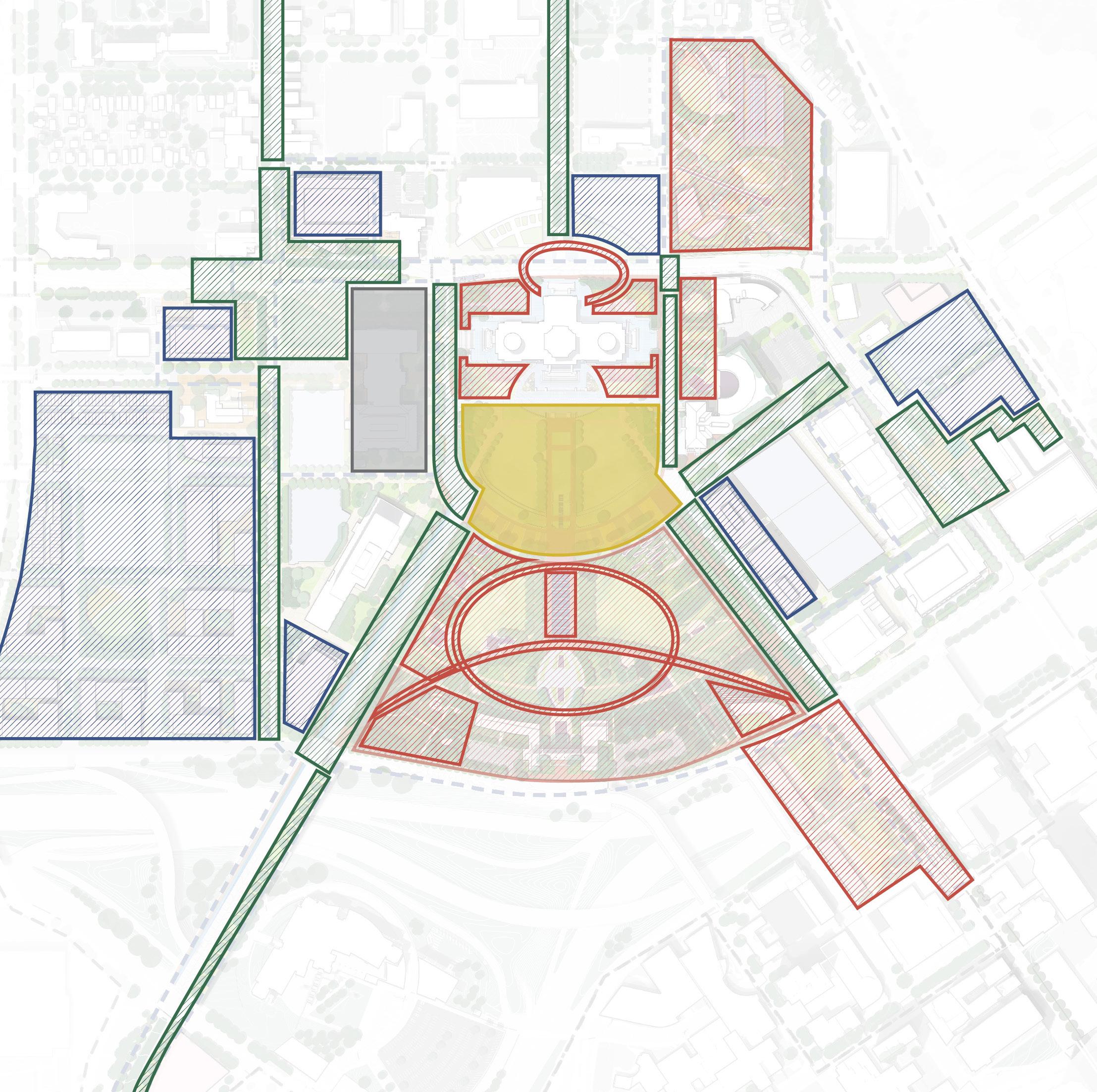
LEGEND
Robert
State Office Public Realm Rice Streetscape Improvements MLK East Improvement Potential Development Parcels
Parking
Housing
Upgrade
/ 14th
Retail and Workforce
Housing
Office
- District Parking and State
Office
Ireland/Rice Parking to Museum or other Civic Use Centennial Building Ground-floor retail and Veterans Housing Redevelopment of Existing Parking near Sears 1 1 2 3 4 5 6 7 7 2 3 4 5 6 7 8 9 10 11 12 12 12 12 12 13 1 1 2 3 4 5 6 2 1 1 2 2 3 3 4 4 5 5 6 6 6 7 7 8 8 9 10 10 9 9 3 4 5 6 7 8 9 10 11 MN State Capitol DOWNTOWN SAINT PAUL University Ave W Aurora Ave St Anthony Ave Park St Rice St John Ireland Blvd E12thSt RobertSt SaintPeterSt WabashaSt N 0’ 250’ 125’ 60’ CedarSt I-94 I-35E 330 331 Capitol Mall Design Framework Implementation
John
IMPLEMENTATION
DRAFT
FRAMEWORK
PHASING STRATEGIES
I-94 CAP AND ADJACENT PARK
Partnership at Federal, state and city level
Exclusively CAAPB / Admin
CAAPB / Admin, DOT
Exclusively CAAPB / Admin
Exclusively CAAPB / Admin
Exclusively CAAPB / Admin
LOWER MALLWEST LANDSCAPE
Grants, State and Philanthropy
Relocate reduced parking on nearby site
Prior project: redevelopment of existing Admin; Suggested parallel project: North Capitol Streetscape
None, suggest to work with other Lower Mall Improvements
None, suggest to work with other Lower Mall Improvements
None, suggest to work with other Lower Mall Improvements
Exclusively CAAPB / Admin
Exclusively CAAPB / Admin
State and Philanthropy
Exclusively CAAPB / Admin
State and Philanthropy, earned income
Exclusively CAAPB / Admin
State and Philanthropy
CAAPB / Admin, Private Sector
Exclusively CAAPB / Admin
State and Philanthropy, private
State and Philanthropy
NORTH CAPITOL STREETSCAPE
Partnership at Municipal level
Partnership at the state and city level
Partnership at the state and city level
Partnership at the state and city level
Partnership at the state and city level
Partnership at the state and city level
CEDAR BRIDGE TO CASS GILBERT
Partnership at the County and city level
Partnership at the State, County and city level
Partnership at the State, County and city level
Partnership at the State, County and city level
Philanthropy
Suggest to parallel with Bridge Over University
Suggest to parallel with Rice District Redevelopment
State and Philanthropy
State and Philanthropy
State and Philanthropy
State and Philanthropy
State, County, Philanthropy
State, County, Philanthropy
State, County, Philanthropy
State, County, Philanthropy
None, suggest to be parallel or close to Cedar North of 94 None, suggest to be parallel or close to John Ireland North of 94
MLK
UNIVERSITY AND RICE DISTRICT (NE)
Demolition of existing parking lot
All other Lower Mall prior
State and Philanthropy
None, suggest to be parallel or close to Cass
Gilbert Park
Suggest to parallel with Robert / 14th Development
University / Rice intersection improvement
None John Ireland North of 94
with or after
/ Rice Public Space Improvement
with or after University / Rice Public Space Improvement
Find space for reduced parking as needed None
None
Find space for reduced parking as needed Find space for reduced parking as needed
CAPITOL MALL AND ADJACENT PARK IMPROVEMENT STREET PUBLIC REALM IMPROVEMENT POTENTIAL DEVELOPMENT PARCELS CAPITOL AREA ACTORS CAPITOL AREA ACTORS CAPITOL AREA ACTORS FUNDING AVENUE FUNDING AVENUE FUNDING AVENUE COST COST COST
Partnership at the state and city level
Federal government Federal grants, State and City funding Private funding with State Incentive Private funding with State Incentive Private funding with State Incentive State Funding Only Private funding and State Funding State, Philanthropy, Private funding Private funding 60-75M 5M 3M 3M 3M 6M 6-10M 6-10M 6-10M 40-50M 50-60M 40-50M 25-35M 40-55M 500-700M 20-30M 8-20M 8M 1-2M 1-2M 1-2M 2-3M 2-3M 5M 2-3M 5-8M 7-10M 3-5M 7M 3-5M State and Philanthropy, earned income State and Philanthropy State and Philanthropy State and Philanthropy State and Philanthropy State and
funding
Saint
Paul Ramsey County Public Health Relocation
The oval path and John Ireland South of 94 The Lower Mall Curvy Path (Improvement #6)
projects None None
projects
Suggest to build with other
Parallel
University
Parallel
Partnership with Private Sector Partnership with Private Sector Partnership with Private Sector Partnership with Private Sector Partnership with Private Sector Partnership with Private Sector Partnership with Private Sector
PROJECT DEPENDENCIES PROJECT DEPENDENCIES PROJECT DEPENDENCIES
UPGRADE REDEVELOPMENT NEAR SEARS LOWER MALLOVAL PATH JOHN IRELAND SOUTH OF 94 ROBERT AND 14TH STATE OFFICE CASS GILBERT PARK UNIVERSITY AND RICE PUBLIC SPACES UNIVERSITY AND RICE DISTRICT (SW) LOWER MALL PARKING TRANSFORMATION LOWER MALL ALL OTHER IMPROVEMENTS LOWER MALLMAIN PATH CEDAR NORTH OF 94 JOHN IRELAND AND RICE PARKING PARK NEAR LAW LIBRARY BRIDGE OVER UNIVERSITY JOHN IRELAND NORTH OF 94 REDEVELOPMENT OF EXISTING ADMIN LOWER MALLVISITOR CENTER ROBERT / 14TH STATE OFFICE RICE STREETSCAPE IMPROVEMENTS MLK EAST IMPROVEMENTS LOWER MALLCURVY PATH CULTURAL LOOP OUTSIDE OF MLK CENTENNIAL BLDG REPLACEMENT PLANTING AROUND CAPITOL OVERALL SITE UPGRADES 1 1 1 2 2 2 3 3 3 4 4 4 5 5 5 6 6 6 7 7 7 8 8 9 10 9 10 11 12 13 $ $ $ $ $ $ $ $ $ $ $ $ $ $ $ $ $ $ $ $ $ $ $ $ $ $ $ $ $ $ 332 333 Capitol Mall Design Framework Implementation
IMPLEMENTATION A DYNAMIC
DRAFT
PROCESS
EXAMPLES OF CREATIVE PARTNERSHIPS
We understand each project is unique and faces it’s own challenges, but studying successful examples and learning from their partnerships and operations can provide valuable insights for navigating our own paths towards success.
MADISON DOWNTOWN PARTNERSHIP
Downtown Madison, Inc (DMI) is a not-for-profit advocacy organization for over 40 years. It’s mission is to support a healthy and thriving downtown Madison, including the State Capitol area. DMI has more than 480 members ranging from State of Wisconsin, Wisconsin State Capitol to City of Madison, to all different kinds of private sectors.
DMI managed the State Street Mall until handed over to the City of Madison in 1978. It also helped start the annual Freakfest Halloween event on State Street, starting at 2006. The thriving environment near the State Capitol is the effort of multiple years of connecting and management. One outstanding event that happens on the State Street Mall is the Dane County Farmer’s Market (DCFM). This association consists of local farmers, artisans, and vendors who come together to sell their products directly to consumers and the farmer’s market has become one of the most famous market in US. The vitality of the State Capitol is also coming from the active connectivity between the Capitol, Downtown and the Waterfront, and the collaboration through DMI is critical for that.
DENVER CIVIC CENTER CONSERVANCY
Located at the heart of the city and surrounded by many of our key civic and cultural institutions, Civic Center has served as Denver’s most significant gathering spot for cultural events, festivals, and First Amendment rallies for over 100 years. Civic Center Conservancy is dedicated to keeping Denver’s Civic Center Park active and thriving for all. As an independent nonprofit, the Conservancy manage the city and county owned land, engages individuals, businesses and community groups as champions for this essential public space.
The Denver Civic Center Conservancy led a 2005 park Master Plan. Now, they are working with its partners to bring it to life by creating a vision for key features of Civic Center that will accommodate its traditional uses and also encourage daily active use. Their current partners for the “next 100 years” are a series of private actors including Bank of America, Liberty Global, The VF Foundation and East West Partners. They are open to have more partners to ensure the park can serve as the Heart of Denver.
BRYANT PARK CORPORATION MODEL
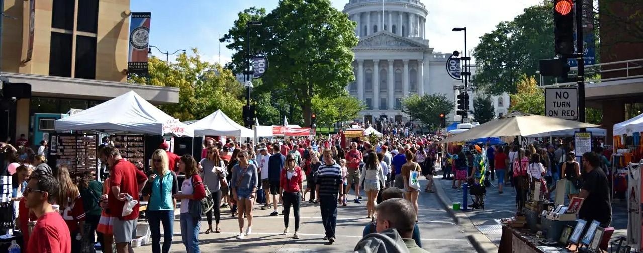
DRAFT
Bryant Park is one of the world’s busiest public spaces and is located in the center of New York City, adjacent to the New York Public Library’s main branch, known as the Stephen A. Schwarzman Building. Bryant Park Corporation (BPC) is a not-for -profit entity, organized as Bryant Park Restoration Corporation to promote the restoration, maintenance, and utilization of Bryant Park in association with the New York Public Library, Astor, Lenox and Tilden Foundations (the Library) and the New York Cit Department of Parks and Recreation (the City). Bryant Park Management Corporation (BPMC) was organized in 1983, more focusing on the District Management. Neither BPC nor BPMC owns the land; instead, they are entering into a lease agreement with the City and Library. Collaboratively, BPC and BPMC are enhancing Bryant Park and the district through joint management of operations, maintenance, funding, and revenue initiatives.
Figure
Figure 310: Downtown Civic Center Park, https://civiccenterpark.org/about-us/ Figure 311: Byrant Park and Public Library, https://en.wikipedia.org/wiki/New_York_ Public_Library_Main_Branch#/media/File:New-York_-_Bryant_Park.jpg
309: Farmer’s Market on State Street Mall, https://www. theedgewater.com/5-best-things-dane-county-farmers-market/
334 335 Capitol Mall Design Framework Implementation
IMPLEMENTATION
CHAPTER 7
SUSTAINABLE LANDSCAPE
DESIGN AND MAINTENANCE STANDARDS
DRAFT
SUSTAINABLE MAINTENANCE OVERVIEW
PRINCIPLES AND RESPONSIBILITIES
CLIMATE READY AND NATIVE PLANTING APPRROACH
In adopting sustainable planting approaches for landscapes like the Capitol Mall Area, the focus lies on utilizing native plants suited to the site’s specific climate and conditions. Local and regional native plant producers offer a range of options, from seeds to plugs, allowing for cost-effective installations. Plugs provide immediate impact and perform well under stress, making them ideal for areas requiring instant effect. For naturalistic meadows, successful seed mix installations necessitate meticulous planning, taking into account species traits and environmental factors affecting germination. Dormancybreaking techniques, such as scarification, aid in seed germination, with timing crucial for different plant species. Cool and warm-season plants respond differently to seasonal changes, and including a mix of both can enhance resilience and competition against invasive species.
UPFRONT MAINTENANCE INVESTMENT LEADS TO LONGTERM COST SAVINGS
Investing in upfront maintenance, like early weed detection and trimming, leads to longterm cost savings. By addressing issues early, such as weed encroachment and seedling establishment, the need for expensive treatments later on is minimized. Practices like late winter vegetation removal also preserve habitat and soil health. Prioritizing proactive maintenance upfront ensures healthier ecosystems and reduces long-term expenses.
GEARING TOWARDS CARBON EFFICIENCY
Prioritizing low-carbon materials and sustainable practices in hardscape design and maintenance is crucial for reducing the Capitol Mall’s carbon footprint. Life cycle analysis (LCA) guides the selection of materials with lower environmental impacts, such as recycled aggregates and locally sourced options. By integrating these practices early in the design phase, the project can contribute to carbon sequestration efforts and promote environmental sustainability in urban landscapes. Different landscape typologies offer varying opportunities for carbon storage, emphasizing the importance of strategic vegetation management to maximize sequestration potential.
CLIMATE RESILIENT STORMWATER SYSTEM
Stormwater system maintenance involves cleaning green infrastructure, inspecting filtration systems, and managing vegetation in biofiltration basins. Prioritizing proactive upkeep ensures the resilience and longevity of these systems, effectively mitigating climate change impacts and promoting sustainability.
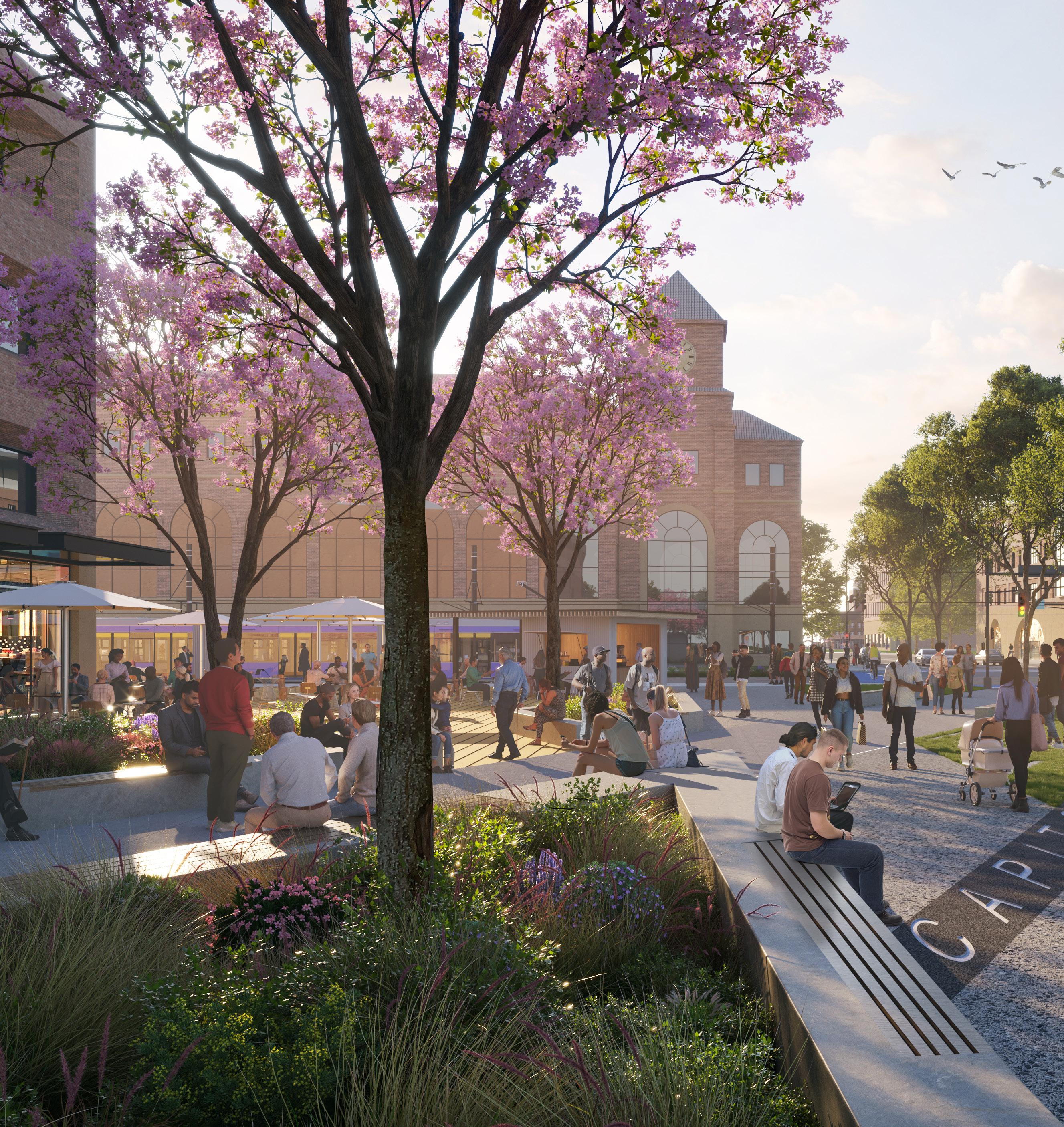
338 339 Capitol Mall Design Framework Implementation
SUSTAINABILITY AND MAINTENANCE
DRAFT
LANDSCAPE STANDARDS AND MAINTENANCE
BY LANDSCAPE TYPOLOGIES
CREATING A UNIFIED APPROACH IS THE KEY
The key to effective maintenance in the Capitol Mall area lies in consolidating disparate maintenance standards and practices from various jurisdictions into a unified approach. Treating the area as a cohesive whole is essential to ensure consistency and efficiency in upkeep. Whether it’s the maintenance of county-owned roads or city-owned roads, or the care of the Capitol Mall lawn and new public realm park spaces, adhering to an overarching standard is crucial. By streamlining maintenance practices across state, county, and city boundaries, we can optimize resources, enhance coordination, and preserve the integrity and attractiveness of this important civic space for residents and visitors alike.
Canopy
Botanic / Arboreta Gardens
Street Landscape
Naturalized Landscape, forest
Stormwater Landscape
Hardscape
Parking Space
Water Features
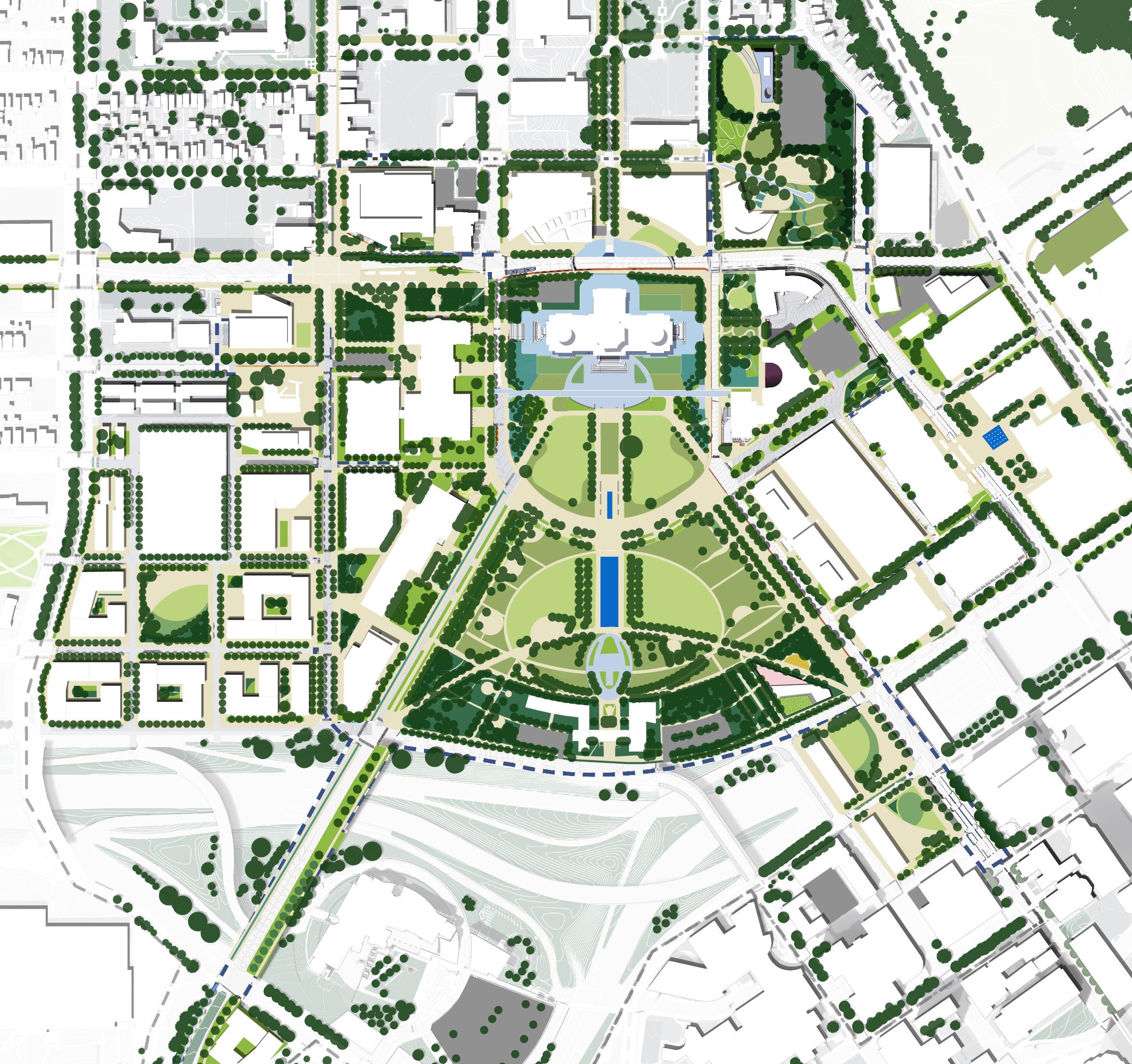
Tree
Lawn
LEGEND MN State Capitol DOWNTOWN SAINT PAUL University Ave W Aurora Ave St Anthony Ave Park St Rice St John Ireland Blvd E12thSt
SaintPeterSt WabashaSt N 0’ 250’ 125’ 60’ CedarSt I-94 I-35E
RobertSt
340 341 Capitol Mall Design Framework Implementation SUSTAINABILITY AND MAINTENANCE
DRAFT
LANDSCAPE STANDARDS AND MAINTENANCE
BY LANDSCAPE TYPOLOGIES
TREE CANOPY
MAINTENANCE LEVEL
Implementing sustainable tree maintenance is crucial for their long-term health, especially in urban areas. Street trees need regular pruning to maintain clearance for pedestrians and vehicles and reduce the risk of falling branches. Trees on lawns benefit from watering, mulching, and fertilization to combat drought and soil compaction. Trees on slopes require erosion control measures like retaining walls or erosion blankets to prevent soil erosion. Choosing tree species resistant to winter conditions and extreme weather also enhances their resilience.
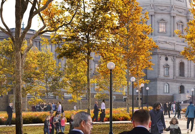
NATURALIZED LANDSCAPE, FOREST
MAINTENANCE LEVEL
The naturalized landscape involves careful selection of native species adapted to the local environment, minimizing the need for ongoing interventions such as watering, fertilizing, and pruning. By mimicking natural ecosystems, these landscapes can largely sustain themselves, relying on natural processes like decomposition and self-regulation to thrive. Initial efforts may include site preparation, such as soil amendments and weed control, to establish a resilient ecosystem. Once established, minimal ongoing maintenance is required.
STORMWATER LANDSCAPE
MAINTENANCE LEVEL
Stormwater landscapes maintenance includes meticulous planning to ensure proper water level management and easy access for maintenance while preventing mosquito breeding. Careful consideration of water flow patterns and drainage systems promoting healthy plant growth and minimizing stagnant water. Additionally, integrating educational components into stormwater landscape designs raises awareness about the importance of these green infrastructure systems and fosters community engagement in their care and maintenance.
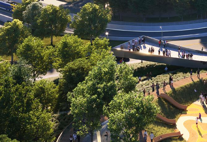
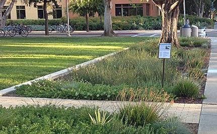
Figure 312: Retrofitting with Green Infrastructure, https://dirt.asla.org/2018/06/12/retrofittingwith-green-infrastructure/
LAWN HARDSCAPE
MAINTENANCE LEVEL
Lawn maintenance strategies should be consistent across all lawns and differentiate by uses. Efficient irrigation, including utilizing stormwater reuse systems, along with mowing at lower frequencies and reducing fertilizer application, maintains health while conserving resources. Lawns designated for events need additional care, like aeration and overseeding, to withstand foot traffic. Conversely, those for passive use thrive with minimal intervention, supporting biodiversity.
BOTANIC / ARBORETA GARDENS
MAINTENANCE LEVEL
The maintenance of botanic/arboreta gardens begins with careful selection of native species that can thrive together, fostering local pollinators and ecosystems. Expert guidance from arborists ensures proper care, which, if done right, can significantly reduces maintenance efforts - limiting cutting and fertilizing, and allowing plants to dictate their growth. By letting nature take its course, these gardens not only require less maintenance but also flourish as harmonious and resilient ecosystems.
STREET LANDSCAPE
MAINTENANCE LEVEL
With careful planning, the street landscape should ensure proper sizing of street trees and plants, and select species with compatible light and water requirements. Consideration of extreme weather conditions and harsh winters, including salt tolerance and water/drought resistance, is paramount. Additionally, promoting biodiversity throughout the district by incorporating a variety of street plant selections enhances ecological resilience. Treating the entire area as a cohesive unit facilitates coordinated maintenance efforts, fostering healthier and more resilient street landscapes.
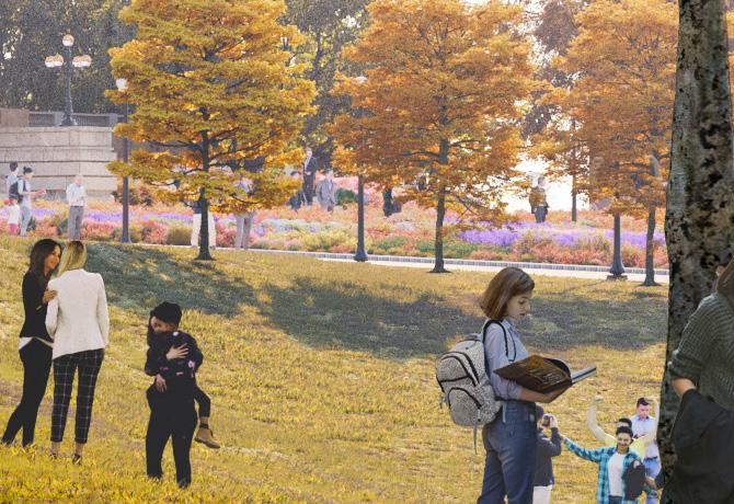
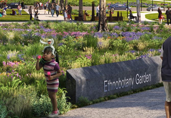
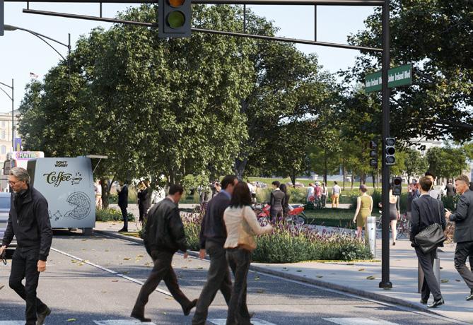
MAINTENANCE LEVEL
The hardscape should consider carbon efficiency alongside other factors. This includes selecting materials with lower embodied carbon footprints, such as recycled aggregates or locally sourced materials, to reduce environmental impact during construction and maintenance. Incorporating sustainable maintenance practices, such as utilizing electric or low-emission equipment for cleaning and repair tasks, helps minimize carbon emissions during upkeep.
PARKING SPACE
MAINTENANCE LEVEL
DRAFT
Parking space’s maintenance approach should focus on stormwater management, solar panel integration, and carbon reduction. Incorporating permeable pavement and bioswales in parking lot whenever is possible. Installing solar panels on parking structures not only generates renewable energy but also provides shade for vehicles, reducing heat island effects and improving comfort. Additionally, implementing electric vehicle charging stations and promoting carpooling and alternative transportation options further reduces carbon emissions.
WATER FEATURES
MAINTENANCE LEVEL
Implementing sustainable maintenance strategies for water features in the Capitol Mall District emphasizes water conservation, holistic maintenance, ease of cleaning and management, and year-round operational simplicity. Incorporating water-saving technologies and a district-wide maintenance approach ensures efficiency and effectiveness. By prioritizing these practices, water features can thrive while conserving resources and promoting environmental stewardship.
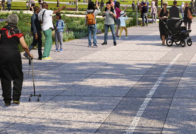
https://www.mass.gov/ locations/walden-pond-state-reservation
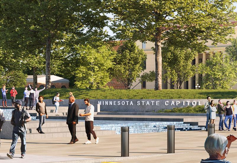 Figure 313: Solar Panel Parking Lot at Walden Pond, MA,
342 343 Capitol Mall Design Framework Implementation SUSTAINABILITY AND MAINTENANCE
CLIMATE READY AND NATIVE PLANTING APPROACH
PLANTING INSTALLATION STRATEGIES
PLANTING APPROACHES
A broad variety of native plants are available in formats ranging from seed, plugs, and large containers. For large landscape installations, it’s usually more economical to utilize a combination of plug and seed mix applications to achieve a balance between instant effect, landscape success, and a balanced budget. All of these options are offered by local and regional native plant producers. These local and regional growers specialize in native plants with diverse and localized genotypes better suited to various site and climate conditions.
WHEN TO UTILIZE PLUGS
Plugs are juvenile plants with extensive root systems that provide immediate impact. Although small, plugs often perform better than larger container plants with water stress and transplant shock. Depending on species and appropriate spacing, these plants close canopy gaps in usually three months and are fully mature in the next growing season. Sasaki utilizes plugs where instant effect is important, including formal landscapes, edges around areas planted by seed, and islands within seeded zones. Plant development is highly dependent on species, so the team suggests investing in plugs when species have low seed germination rates, grow slower than counterparts, or have an aesthetic quality that brings formality to seeded meadows. In naturalistic areas, plugs of species that spread by rhizome or seed are often sought to help aid establishment over time.
DETAILS IN SEED MIXES
Success in native seed mix installations resembling naturalistic meadows is dependent on vigorous planning and site preparation. Seed mix composition is largely based on each species life cycle traits, germination rate, competitiveness, and factors that affect seed dormancy. A successful seed mix includes a diverse array of flowering perennials and grasses that respond to cool and warm season conditions and have relatively high germination rates. Many of the plants most suited for these applications tend to be prairie or grassland species that rely on wind for seed transport.
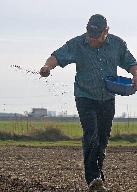
SEED DORMANCY & GERMINATION
Most native plants produce seed with an embryonic dormancy to ensure germination does not occur until conditions are optimum for seedling growth. In most cases, a seed shell or coating helps to stop germination until it’s broken down by environmental conditions. In northern climates, cold winter temperatures, moisture, sunlight, freeze-thaw cycles, and soil contact often break this dormancy period and allow for seeds to germinate. For seeds that are usually animaldispersed, scarification or a mechanical / chemical weakening of the seed coat is usually required -- think about a seed passing through a bird’s digestive system. A mechanical scarification technique usually requires abrading the seed with sandpaper or tumbling in a blender with dulled blades. In general, seed companies do not pre-treat or stratify their seed mixes to ensure longer shelf-life. Some companies will treat seeds if requested, but caution against it unless a guaranteed installation date is known. In most applications, the best method is to allow natural processes to break seed dormancy insitu (on-site).
DRAFT
Seeds break dormancy and germinate at different rates depending on species. Most research for the region concludes that flowering perennials and cool season grasses germinate best when planted in mid-late autumn, while warm season grasses germinate at higher rates when sowed in early spring. These seeding conditions and recommendations change in different regions of the U.S. When planted in autumn, warm season grasses have shown to have a higher susceptibility to mold and consumption by local wildlife. An easy compromise is to plan for sowing in late winter and early spring before the last frost, but when snow has generally cleared. This timeframe allows for freeze-thaw action, rain, and increasing sunlight to help seeds germinate at a more even rate.
Seeding can generally be performed throughout the growing season, but moisture stress and competition with unwanted weeds tends to be highest in late spring through early autumn, so seeding during these months is not recommended. Often times, a landscape planted with seed in summer will fail to germinate until the soil temperature cools in autumn.
COOL SEASON AND WARM SEASON PLANTS
Plants respond to seasonal change in different ways. Plants that emerge in cool weather are termed cool-season dependent and those that require the soil to warm for emergence are warm-season dependent. In North American prairies, the vast majority of grass species are warm-season, while many of the flowering perennials start emerging from overwintering basal leaves quite early. In forest and meadowedge environments, the vast majority of the herbaceous layer includes plants that are coolseason dependent. In forests, the competitive advantage for plants to endure heavy summer shade is to emerge before trees develop mature leaves and/or persist after tree leaves have fallen.
Many common invasive weeds in North America are cool-season adapted and outcompete warm-season grasses and flowering perennials. Including some native cool season plants can help compete with these invaders.
PLUG SUGGESTIONS
O Economic strategy for large scale formal areas
O Use plugs to pre-establish seeded area boundaries and along pathway edges
O Use plugs for species that are slow to establish or have low germination rates
O Plant generally closer than you would a #1 container to help crowd out weeds
O Use a handheld soil auger to speed installation
SEED MIX SUGGESTIONS
O Best applied in large naturalistic areas
O Use simple palettes of fewer species for formal areas to increase legibility and decrease weeding struggles
O Work with seed producers to target specific genotypes and species that best fit the site
Figure 314: Parable of the Sower and the Seed, https://stjamesgettysburg.wordpress. com/2010/05/02/skit-parable-of-thesower/
O Sow in early spring to allow for some seed stratification
344 345 Capitol Mall Design Framework Implementation SUSTAINABILITY AND MAINTENANCE
IRRIGATION AND LANDSCAPE CARE
STRATEGIES

ENSURE PLANT HEATHVEGETATION AND ROOT SYSTEMS
CLIMATE READY AND NATIVE PLANTING APPROACH DRAFT
Care must be taken to inspect all procured container nursery stock for proper vegetation health, density, form, and root systems. All plants must have an equal proportion of vegetation to root density to aid in successful establishment on site.
Plants with roots that circle or considered “root-bound” should be avoided as they are unlikely to establish deep tap roots for survival in times of drought.
In many cases, plants in smaller containers or younger specimens will make more successful installations.
PLAN PLANTING TO SEASONAL CLIMATE PATTERNS
The best time to plant in Minnesota’s climate is at the start of fall or rainy season. This ensures plants are relived from excessive drought and intense summer sun.
IRRIGATE DEEPLY AND AT LONGER INTERVALS
Drip irrigation should be designed to provide plants with deep thorough watering to encourage the development of deep tap roots. Deep waterings can be planned at longer intervals to allow the soil to dry before another watering.
UTILIZE MYCORRHIZAL INOCULANTS
Plants adapted to arid environments often rely on networks of fungi-associates to help increase nutrient and water absorption efficiency. Mycorrhizal fungi are naturally occurring, but can be boosted in new plantings through the inclusion of an inoculant.
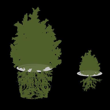
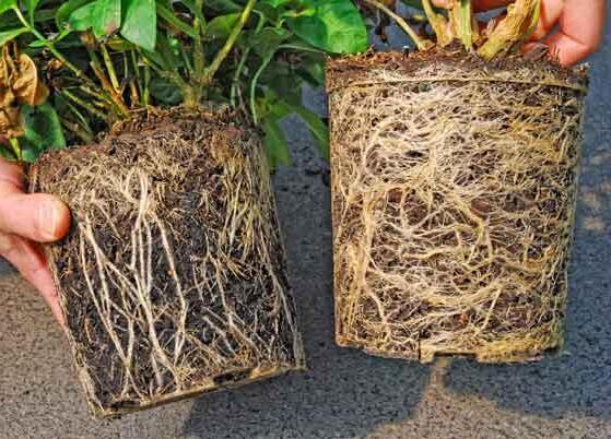
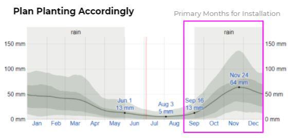
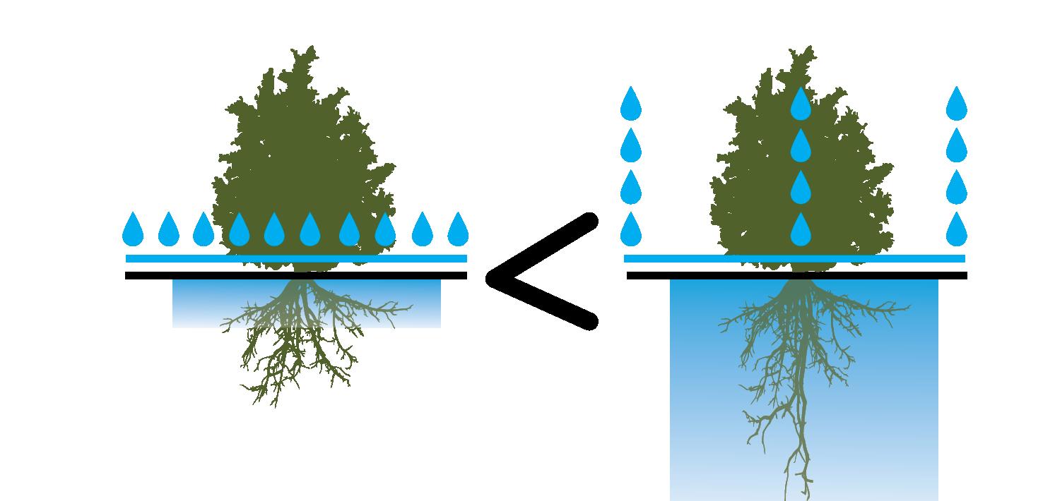

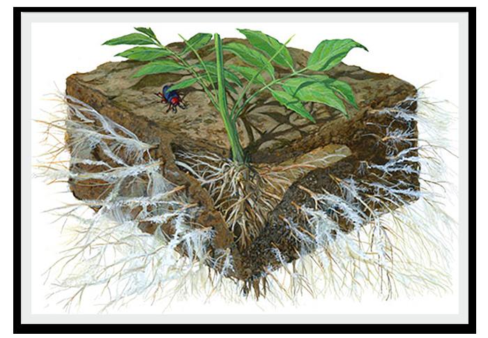
346 347 Capitol Mall Design Framework Project Implementation SUSTAINABILITY AND MAINTENANCE
COOL SEASON WEED DETECTION &
Inspect for cool season weeds in the months of March and April before the intended seed mix germinates. Cool season weeding continues throughout the life of the meadow, but becomes less of a priority as native plants mature. Prioritize problem weeds for manual removal.
ESTABLISHMENT TRIMMING
As seeded areas begin to germinate and emerge, monitor for aggressive or problematic weeds. When
UPFRONT MAINTENANCE INVESTMENT LEADS TO LONGTERM COST SAVINGS DRAFT
PROBLEM WEED DETECTION AND REMOVAL
Throughout the summer, observation and removal of problematic weed species is critical for meadow success. Many of these species are easily eradicated when young. Older, established weeds usually require herbicide applications for successful removal.
ALTERNATIVE MANAGEMENT METHODS
As the plants matures, other management techniques including prescribed burning and goat grazing can be utilized to address specific issues as they arise. If permitted, prescribed burning can greatly enhance meadow health, reduce weed pressure, and contribute to soil nutrients. Goats are currently being utilized with great success to help remove excess weed biomass in inaccessible areas. Contact a local ecological maintenance contractor and the local fire department for more information on these techniques.
the overall vegetation reaches an average height of 18-24,” utilize a string trimmer or pull-behind rotary mower to trim the meadows to a height of 8.” Continue trimming as needed whenever heights reach over 24” until October. Trimming helps to reduce weed establishment and outcompeting cover crops.
SEED GERMINATION OBSERVATION
June is an excellent time to observe and record seed mix germination rates. A high percentage of germinating seed will be cool-season annual grasses (cover crops) that help reduce soil erosion and creates competition for any encroaching weeds.
SEEDLING ESTABLISHMENT OBSERVATION
Annual trimming should cease in the second year as established native grasses and forbs should be able to compete with any reseeded cover crops and new weeds. Observations of establishing plants to record diversity (intended native plants and non-native weeds) is an important practice to better understand future composition goals and address issues.
WEED ISSUE RECOURSE TRIMMING
If weeds continue to outcompete the intended seed mix, perform periodic trimmings to 8.” Trimmings should be conducted if weeds represent a majority of vegetation reaching over 24” in height.
LAST SEASON’S VEGETATION REMOVAL
In late winter when snow has cleared and the ground is still frozen (February-March), remove last seasons vegetation to a height of 2”. This can be performed with a mulching mower, handheld string trimmers, or with a pull-behind rotary mower. Mowing helps maintain landscape aesthetics, increases decomposition and soil creation, limits woody plant growth, and encourages earlier plant emergence.
Why Winter? Removing vegetation in late winter provides habitat and food during months when these resources are in demand for local wildlife. This time of year also creates less disturbance to ground-nesting wildlife and resists soil disturbance, compaction, and erosion.
If possible, leave some areas unmown (out of sight or adjacent to natural areas if aesthetics are a concern) to provide cover for over-wintering insects until spring. Old vegetation can be mown or cleared after emergence, usually in April.
2ND YEAR 3RD
Mulching Mower Utilizing a mulching mower ensures nutrients are kept on-site and contributes to soil fertility. In areas where plugs and mature plants have been established, this added layer of mulch helps reduce invading weeds.
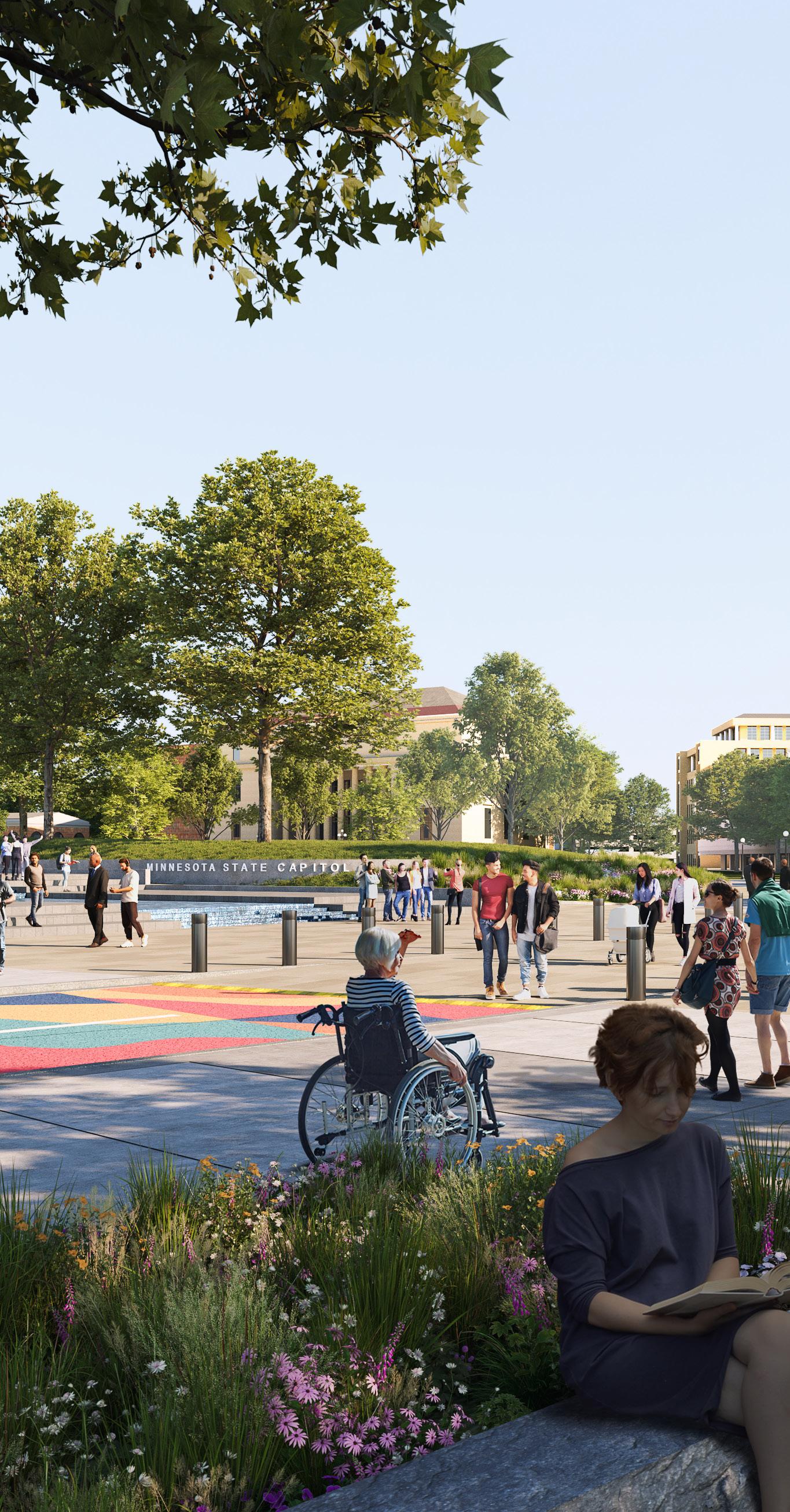
SPRING SEASONAL ACTIONS SUMMER FALL WINTER
Site Preparation & Installation Cool Season Weed Removal Establishment Trimming Seed Germination Observation Problem Weed Detection & Removal Last Establishment Trimming Establishment Observation Weed Issue Recourse Trimming Seasonal Vegetation Removal Plant Diversity Survey & Meadow Structure Goals SPRING SUMMER FALL WINTER SPRING SUMMER WINTER EARLY MID LATE EARLY MID LATE EARLY MID LATE EARLY MID LATE EARLY MID LATE EARLY MID LATE EARLY MID LATE EARLY MID LATE EARLY MID LATE EARLY MID LATE EARLY MID LATE ONGOING ONGOING Alternative Matintenance Methods
1ST YEAR
YEAR ONGOING ONGOING Source: Information Compiled From: Ernst Seeds Establishment Guide, 2018-2019. ernstseed.com
REMOVAL
348 349 Capitol Mall Design Framework Project Implementation SUSTAINABILITY AND MAINTENANCE
GEARING TOWARDS CARBON EFFICIENCY
CARBON SEQUESTRATION IN LANDSCAPE
The landscape of the Capitol Mall presents a unique opportunity to contribute to carbon sequestration and emission reduction efforts. By incorporating native plantings, green infrastructure, and sustainable maintenance practices, the Mall can serve as a carbon sink, capturing and storing atmospheric carbon dioxide through photosynthesis. Additionally, features such as permeable pavements, bioswales, and urban forests can help mitigate stormwater runoff and heat island effects, further enhancing the Mall’s resilience to climate change while reducing the need for energy-intensive cooling systems. Through thoughtful design and management, the Capitol Mall’s landscape has the potential to play a vital role in achieving carbon neutrality and fostering a more sustainable urban environment.
CONSIDER CARBON IN EARLY DESIGN PHASES
Considering carbon in early design phases is crucial for creating sustainable and resilient landscapes like the Capitol Mall. By integrating carbon-conscious strategies from the outset, designers can minimize the project’s carbon footprint and maximize its potential for carbon sequestration. This involves evaluating the embodied carbon of materials used in construction and selecting low-carbon alternatives whenever possible. Additionally, prioritizing passive design strategies such as optimizing building orientation and maximizing natural ventilation reduces the need for energy-intensive heating and cooling systems, further lowering carbon emissions. Incorporating green infrastructure features like native plantings, bioswales, and permeable pavements not only enhances the Mall’s aesthetic appeal but also contributes to carbon sequestration by capturing and storing atmospheric carbon dioxide. By considering carbon throughout the early design phases, designers can create landscapes that not only mitigate carbon emissions but also enhance overall environmental quality and resilience.
DIFFERENT LANDSCAPE MATTERS
Different landscape typologies have varying capacities for carbon sequestration. Urban landscapes like the Capitol Mall can enhance carbon storage by strategically planting trees and dense vegetation. Natural landscapes such as forests and wetlands are highly effective at sequestering carbon due to their extensive vegetation and organic soil. Designed landscapes like botanical gardens and green roofs also contribute to carbon sequestration through optimized planting and soil management practices. By understanding the carbon sequestration potential of each typology, designers can maximize their role in mitigating climate change and creating resilient urban environments.
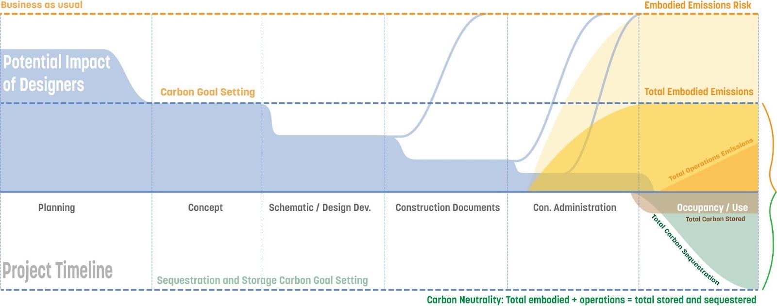
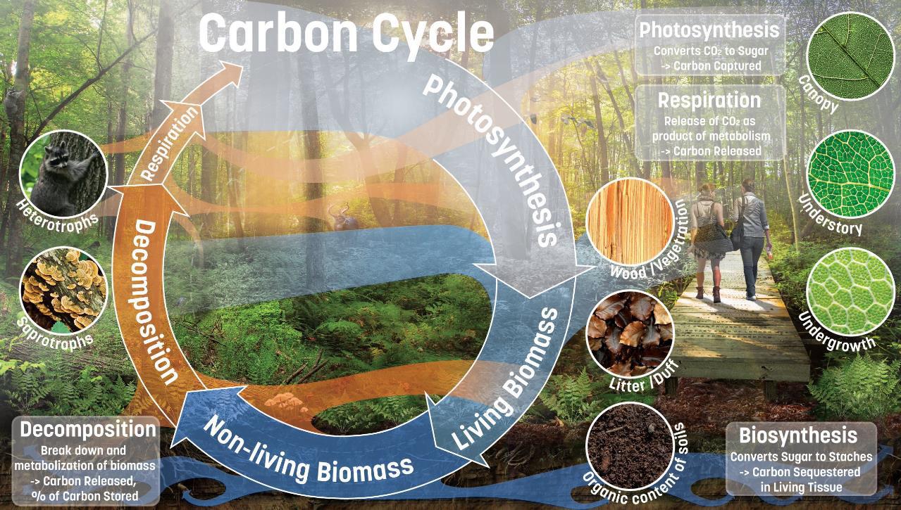 Source: Carbon Conscience Research Project, Sasaki
350 351 Capitol Mall Design Framework Project Implementation SUSTAINABILITY AND MAINTENANCE
DRAFT
GEARING TOWARDS CARBON EFFICIENCY
REDUCE EMBODIED CARBON IN HARDSCAPE
Hardscape materials, such as concrete, asphalt, and stone, often have high embodied carbon due to their manufacturing processes and transportation. Therefore, selecting low-carbon alternatives or incorporating carbon-efficient practices can significantly reduce the project’s overall carbon footprint. Additionally, integrating sustainable maintenance strategies for hardscapes, such as minimizing water use and reducing energy consumption during upkeep, further contributes to carbon reduction efforts. By prioritizing carbon-conscious design and maintenance practices in hardscape elements, the Capitol Mall project can play a vital role in mitigating climate change and promoting environmental sustainability.
CONSIDER CARBON THROUGH LCA
Life cycle analysis (LCA) is a crucial tool for understanding the carbon footprint of hardscape elements in projects like the Capitol Mall. It involves assessing the environmental impacts of materials and processes throughout their entire life cycle, from extraction and manufacturing to use and disposal. By conducting LCAs for hardscape materials, designers can identify hotspots of carbon emissions and prioritize low-carbon alternatives. For example, traditional concrete production is energyintensive and emits significant carbon dioxide, whereas alternative materials like recycled aggregates or low-carbon concrete can reduce emissions. Additionally, considering transportation distances and energy consumption during construction further informs decisions to minimize carbon emissions. Moreover, ongoing maintenance practices also

LOCAL STONE
~0.08 MCf (KgCO2e/ Kg Material)
Note: Savings lost if transporting long distances
STABILIZED AGGREGATES
~0.06 MCf (KgCO2e/ Kg Material)
Note: Savings lost if using epoxy or cementitious binder (Psyllid Husk/Biobinder preferred) OR if transporting aggregates long distances.
contribute to the life cycle carbon footprint of hardscapes. By incorporating sustainable maintenance strategies that reduce energy use and minimize resource consumption, designers can effectively mitigate the carbon impact of hardscape elements over their entire lifespan. Overall, integrating carbon considerations through life cycle analysis ensures that hardscape design and maintenance practices in projects like the Capitol Mall align with climate mitigation goals and promote environmental sustainability.
THE LOW CARBON MATERIALS
AIR-DRIED BRICK
~0.03 MCf (KgCO2e/ Kg Material)
Note: Limited application to weather-protected structures
Low-carbon materials play a crucial role in reducing the environmental impact of hardscape elements and life cycle analysis (LCA) helps identify these options. LCA assesses the entire life cycle of materials, considering factors like extraction, manufacturing, transportation, installation, and end-of-life disposal. Through LCA, we can evaluate the embodied carbon of different materials and prioritize those with lower environmental impacts. For instance, recycled aggregates, reclaimed materials, and low-carbon concrete alternatives have lower embodied carbon compared to traditional materials like virgin concrete or asphalt. Additionally, using locally sourced materials reduces transportationrelated emissions, further lowering the overall carbon footprint of hardscape elements. By integrating low-carbon materials identified through LCA into the design and construction of the Capitol Mall, we can significantly reduce the project’s carbon emissions while promoting sustainability and resilience in urban landscapes. Here we listed some typical low carbon materials as reference, but what is suitable for the multiple projects in the implementation plan, will need to identify various factors.
RECLAIMED MATERIALS
~0.02 MCf (KgCO2e/Kg Material)
~0.02 MCf (KgCO2e/Kg Material)
Note: Currently low carbon as bitumen is accounted for as a waste product of the oil industry.
ASPHALT
352 353 Capitol Mall Design Framework Project Implementation SUSTAINABILITY AND MAINTENANCE
DRAFT
CLIMATE RESILIENT STORMWATER SYSTEM
Maintaining climate-resilient stormwater systems requires regular upkeep. This includes cleaning green infrastructure within road profiles, inspecting and cleaning filtration systems for stormwater reuse, and managing vegetation in biofiltration basins to sustain their effectiveness in mitigating climate-related challenges. By prioritizing proactive maintenance measures, communities can ensure the longevity and resilience of their stormwater systems, effectively mitigating the impacts of climate change while promoting environmental sustainability.
STORMWATER SYSTEM
Green stormwater infrastructure within the ROW
OPERATIONS & MAINTENANCE
O Inspect for and clean trash and debris (monthly during growing season)
O Inspect for and repair erosion (monthly during growing season)
O Inspect vegetation and much; weed basins (monthly during growing season)
O Inspect for standing water (after large storms)
O Clean pretreatment structures (annually or as needed)
O Confirm basins not being used for snow storage (twice per winter)
Stormwater reuse system with filtration
Stormwater bioinfiltration basins with native vegetation
O Clean pretreatment structures (annually or as needed)
O Inspection of all structures for sediment, trash, damage (annually)
O Spring reuse startup (spring)
O Winterization of reuse system (fall)
O Inspect for and clean trash and debris (monthly during growing season)
O Inspect for and repair erosion (monthly during growing season)
O Inspect vegetation and much; weed basins (monthly during growing season)
O Inspect for standing water (after large storms)
O Clean pretreatment structures (annually or as needed)
O Confirm basins not being used for snow storage (twice per winter)
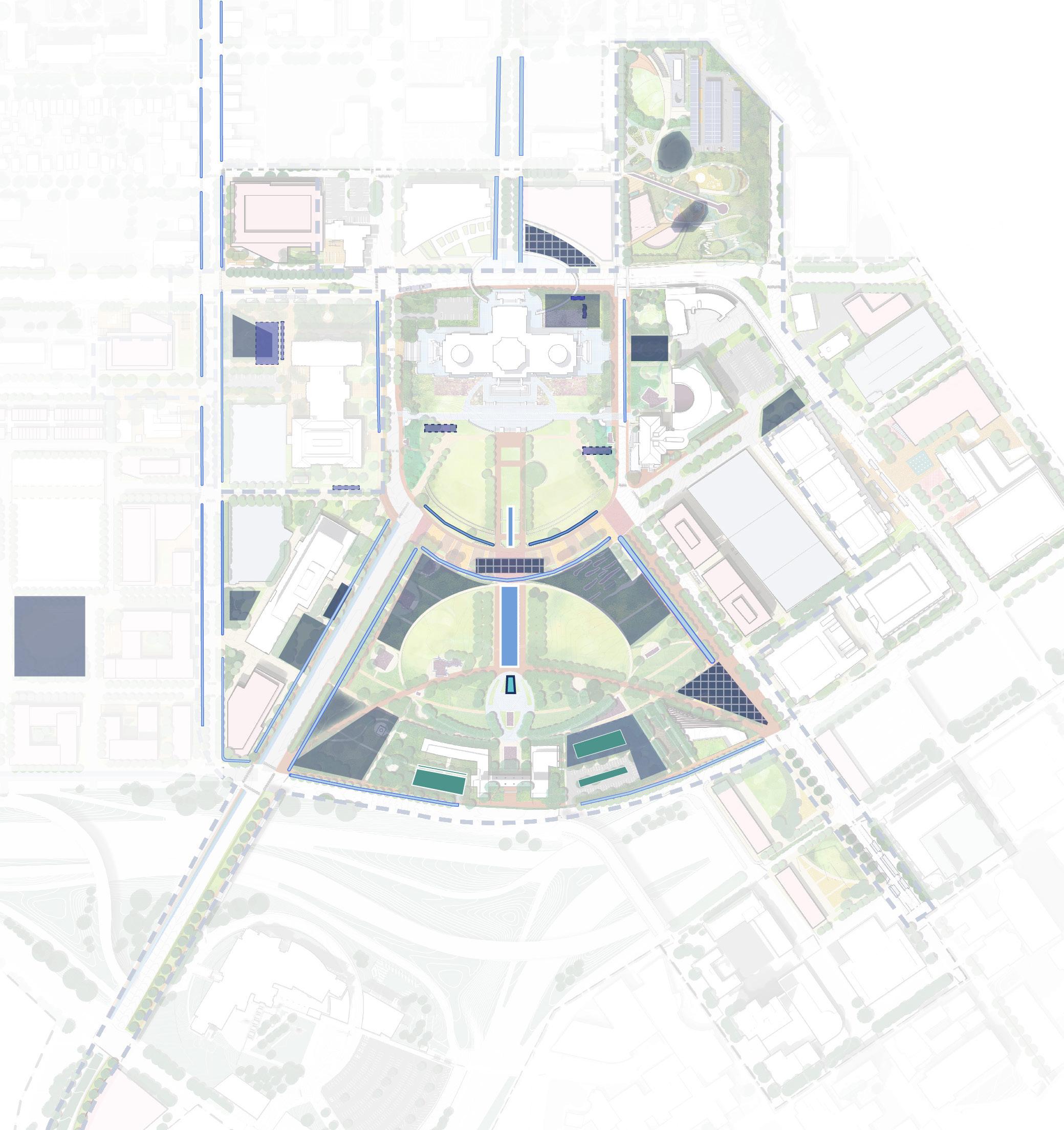
Minnesota State Capitol Repairs,
&
09 May, 2014.
State-Owned
Retrofit
Underground
Chamber (Existing) Water Feature
Underground Storm Chamber Green Stormwater Infrastructure Water Feature Stormwater Reuse On-Surface Water Treatment LEGEND MN State Capitol DOWNTOWN SAINT PAUL University Ave W Aurora Ave St Anthony Ave Park St Rice St John Ireland Blvd E12thSt RobertSt SaintPeterSt WabashaSt N 0’ 250’ 125’ 60’ CedarSt I-94 I-35E
Source: HGA.
Restoration
Preservation.
Source: Capitol Region Watershed District and Barr document
Parking Lot
BMP
Storm
(Existing)
354 355 Capitol Mall Design Framework Project Implementation
SUSTAINABILITY AND MAINTENANCE
DRAFT
