
O WHERE WE ARE AT
O WHAT WE HAVE HEARD
O RESEARCH SUMMARY
O BOLD MOVES
AGENDA
O FRAMEWORK DESIGN
O IMPLEMENTATION
O PHASE 1
O NEXT STEPS
O Q&A


O WHERE WE ARE AT
O WHAT WE HAVE HEARD
O RESEARCH SUMMARY
O BOLD MOVES
O FRAMEWORK DESIGN
O IMPLEMENTATION
O PHASE 1
O NEXT STEPS
O Q&A
1 2 3 4 5
Specific recommendations for physical changes across the District that touch all public realm areas
Detailed Design Guidelines for public spaces and elements such as planting, streetscapes, security, materials, and lighting
A specific design proposal (Schematic Design) for the first phase of implementation in 2024
Urban Design Framework Elements to assist in evaluating building placement, major infrastructure changes, maintenance, public realm changes, and recommended policy changes to the 2040 Comprehensive Plan
A prioritization matrix that outlines phasing over the coming years and decades into the future
Dec 1
Initial Site
Visit
TASK
Site Analysis
CLR Work Tree Inventory
Framework Approval and Phase 1 Identification
LEARN + CREATE REFINE+ DESIGN CELEBRATE + LAUNCH
Draft of Final Framework and Schematic Design Submission and Hand-Off
Capitol Mall Design Framework Draft
Final CLR
Phase 1 Schematic Design Submission
Sasaki presentation to CAAPB Board and State Legislators
Draft CLR and Phase 1 Submission
Feb 5th - Feb 8th
Keystone Engagement Event One - Charrette Week
ENGAGEMENT
CMDF Website launch and “Survey One” release
Final Capitol Mall Design Framework Submission
Jun 30
Anticipated CMDF Project Completion
Keystone Engagement Event Two
3 TASK 4
Phase Detailed Design and Implementation
Keystone Engagement Event Three
CMDF Final Roadshow
“Survey Two” release “Survey Three” release
Dec 31
Phase 1 Implementation Complete
JANUARY
TECHNICAL ADVISORY TEAM (TAT) KICK-OFF MEETINGS CMDF DESIGN CHARRETTE WEEK
01/12/2024 KICK-OFF OPTION A
01/17/2024 KICK-OFF OPTION B
STAKEHOLDER & TAT LISTENING SESSIONS
01/18/2024 STATE LEGISLATORS
01/18/2024 OFFICE OF ENTERPRISE SUSTAINABILITY (OES)
01/18/2024 FACILITIES MANAGEMENT DIVISION (FMD) AND DEPARTMENT OF PUBLIC SAFETY (DPS)
01/19/2024 FACILITIES MANAGEMENT DIVISION (FMD) AND DEPARTMENT OF PUBLIC SAFETY (DPS)
01/25/2024
CITY OF SAINT PAUL
01/25/2024 RAMSEY COUNTY
01/25/2024 CAPITOL REGION WATERSHED DISTRICT (CRWD)
01/25/2024
CITY OF SAINT PAUL DIRECTOR OF PLANNING AND ECONOMIC DEVELOPMENT NICOLLE GOODMAN
01/29/2024 HOUSE SPEAKER MELISSA HORTMAN
STAKEHOLDER & TAT CHARRETTE PREVIEW
01/30/2024
DESIGN CHARRETTE SNEAK PEEK
02/05/2024 DAY 1 | FOCUS GROUP KICK-OFF MEETING
02/06/2024 DAY 2 | CHARRETTE DAY
02/07/2024 DAY 3 | OPEN STUDIO DAY
02/08/2024 DAY 4 | FOCUS GROUP CONCLUSION
TAT MEETINGS AND LISTENING SESSIONS
02/20/2024 TAT CHARRETTE WEEK RECAP OPTION A
02/21/2024 TAT CHARRETTE WEEK RECAP OPTION B
MULTIPLE DAYS TAT FOCUS GROUP MEETINGS WITH CAAPB
WE ARE HERE!
03/01/2024 PRESENTATION TO CAAPB BOARD AND MINNESOTA STATE LEGISLATORS
03/08/2024 PROPOSED BI-MONTHLY TAT MEETING 1
03/22/2024 PROPOSED BI-MONTHLY TAT MEETING 2
04/05/2024 PROPOSED BI-MONTHLY TAT MEETING 1
04/19/2024 PROPOSED BI-MONTHLY TAT MEETING 2
05/03/2024 PROPOSED BI-MONTHLY TAT MEETING 1
05/17/2024 PROPOSED BI-MONTHLY TAT MEETING 2


LEVEL 4: STATEWIDE ENGAGEMENT
LEVEL 3: REGIONAL & INFORMAL ENGAGEMENT
LEVEL 2: CITYWIDE PUBLIC ENGAGEMENT EVENTS
LEVEL 1: DESIGN CHARRETTE & FOCUS GROUPS
Design Charrette Focus Group Stakeholder Meetings Keystone Engagement Event Roadshow Pop-up Events Mobile Engagement Online Survey & Website In-person Survey Youth EngagementREACH
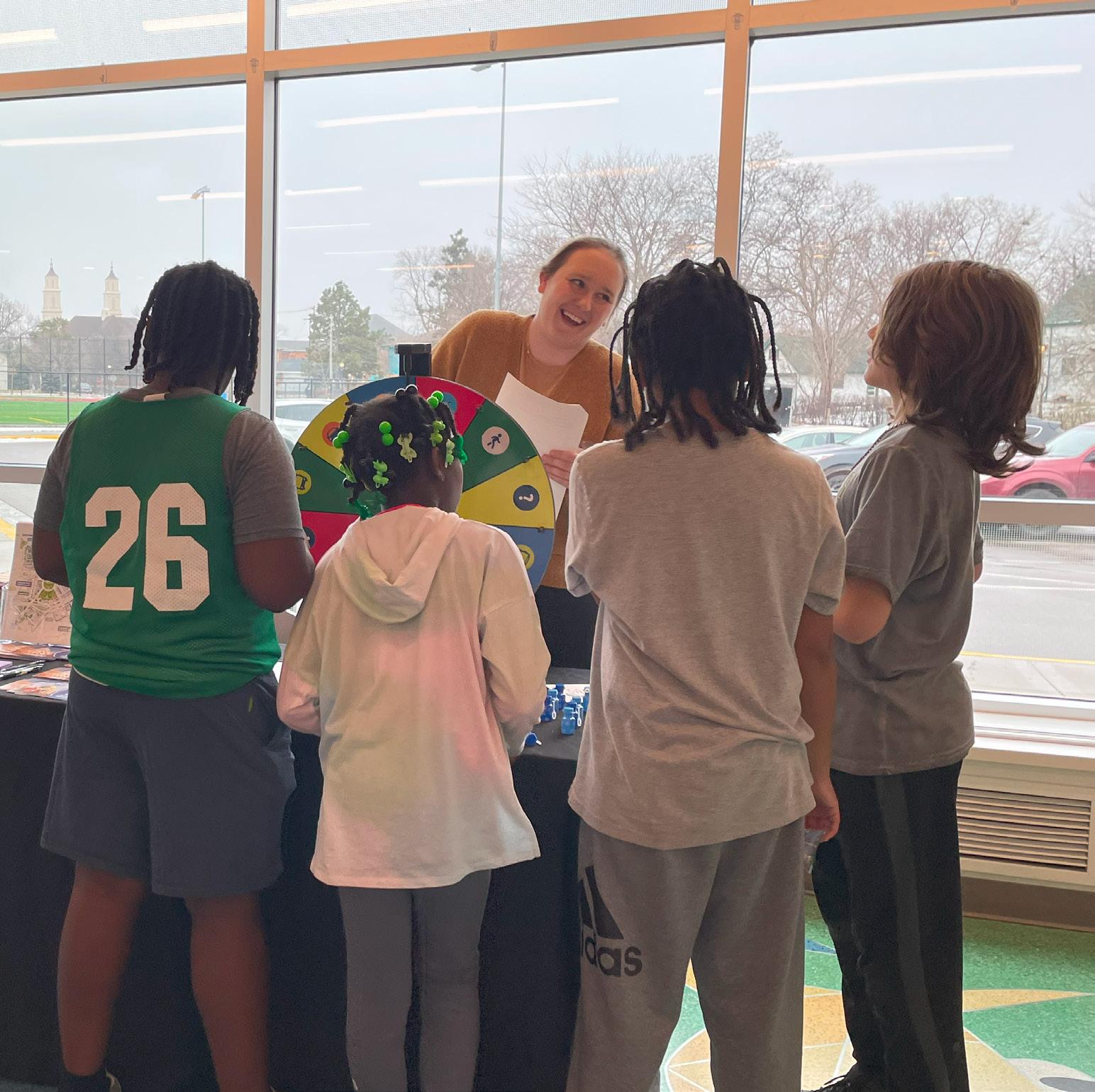

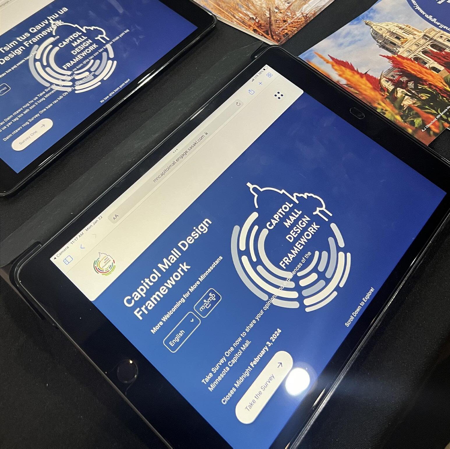
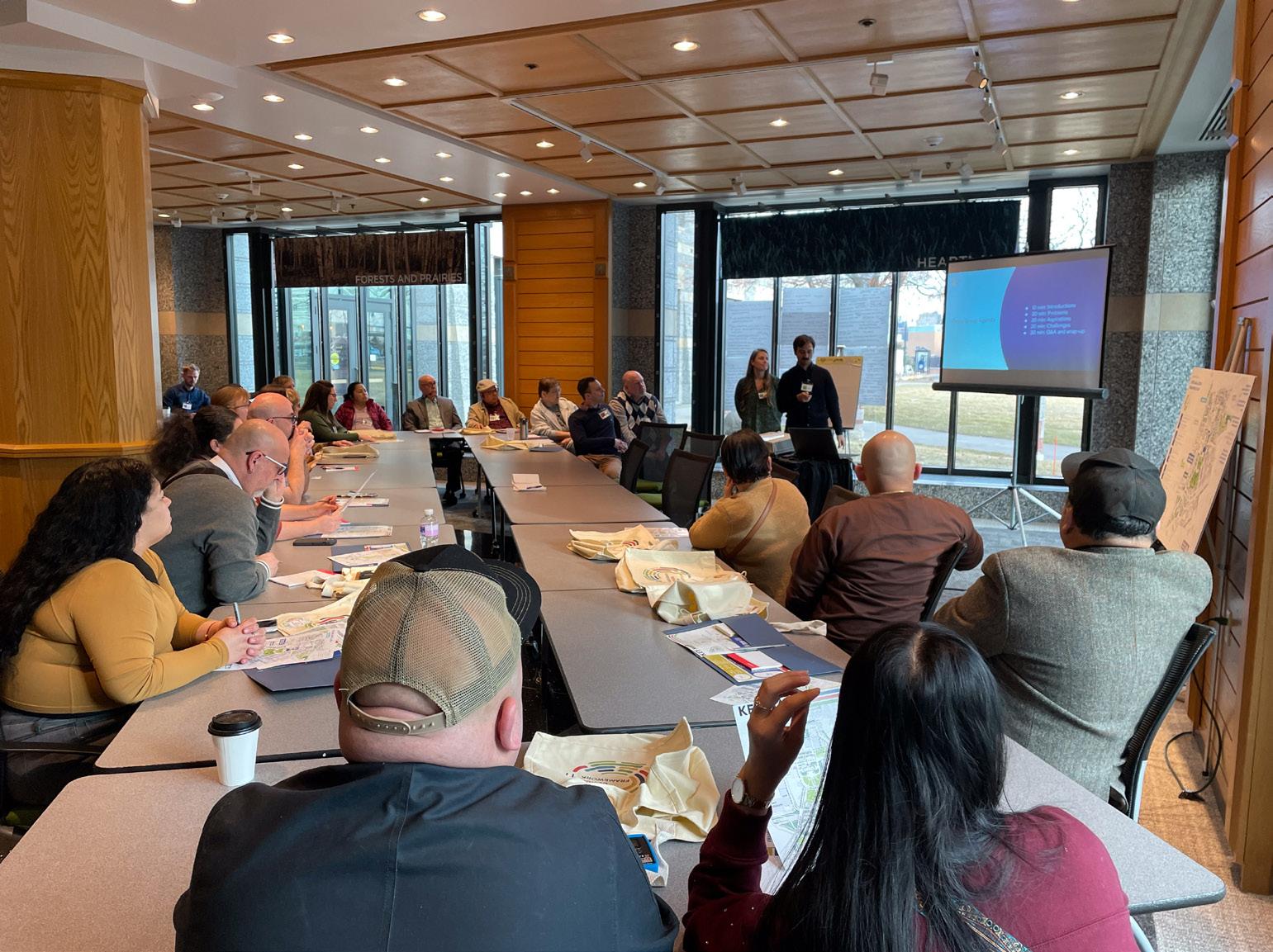
O 5 events attended or hosted
O 422 estimated participants
INCLUDING A ONE-WEEK INTENSIVE DESIGN CHARRETTE WITH OVER 80 COMMUNITY MEMBERS
O 1,441 surveys (partial + complete)
O 2,900 unique website visitors
O over 4,700+ community members emailed



1,441 respondents across Minnesota (partial + complete)

While the survey had statewide reach, a majority of respondents live in the Twin Cities area.
1The Survey had statewide reach, with respondents from the Twin Cities area, Rochester, Duluth, and many smaller communities in northern and western Minnesota. The number of respondents has significantly increased since the public engagement charrette in early February. Thank you for sharing!
Respondent Age Respondent Race / Ethnicity
EQUITY SURVEY 1 FINDINGS UNDER CAAPB REVIEW. COMMENT PERIOD OPEN. UNDER CAAPB REVIEW. COMMENT PERIOD OPEN.
3.8% 3.6% 2% American Indian, Alaska Native 3.2%
4% Asian or Asian American
Multiracial Other Hispanic or Latinx
4.4% Asian, Asian American Race & Ethnicity (2020)
2% American Indian or Alaskan Native
2.8% Black
MN / SP
3% Black of African-American
White 76.3% / 54.3%
80% White
6.7% 70-79 1.1% 80+ 0.6% under 18
3% Hispanic or Latinx
Black 7.0% / 15.6%
Multiracial 6.1% / 7.8%
0% Native Hawaiian or other Pacific Islander
Hispanic, Latinx 6.0% / 8.6%
2 12.1% 18-29 17.2% 60-69 19.3% 50-59
Asian, Asian American 5.2% / 18.4%
American Indian, Alaska
Native 1.2% / 0.7%
Other 3.1% / 0%
survey has not reached a demographic as diverse as the State of Minnesota or the city of Saint Paul. We need your help in the future to reach all communities. 22% 30-39
(2020)
FINDINGS
60
40
20
food at a food truck USER HABITS SURVEY 1
I Participate in demonstrations, rallies and marches
6 responses] Percent 0
Pass through on the way to work, home or daily activities elsewhere
Mall to... [top Visit for tourism and general sightseeing
Get
Engage with elected and government officials
3
the Capitol Mall to... [Select all that apply]: Conductofficial
Conduct official business at Capitol Campus buildings
Enjoynature (examples: birdwatching, enjoying gardens) 40
VisitaspecificmemorialOthe go to the Capitol
Beactive(examples:exercising, jogging, walking, playing) Participateinculturalgatheringsandperformances Restandrelax (examples:sitting,reading,takingabreak) 20
Imagine the Capitol Mall, what comes to mind?

UNDER CAAPB REVIEW. COMMENT PERIOD OPEN. UNDER CAAPB REVIEW. COMMENT PERIOD OPEN.
Gatherwithfriends andfamily(examples: picnicking, hangingout 60
Pass throughonthewaytootherculturalandtourism destinations(examples:MinnesotaHistoryMuseum,CathedralofSaintPaul) 0
Respondents report that they currently view the Mall mostly as a place to conduct official business and pass through on the way to other destinations, and less so a place to linger and enjoy themselves. When respondents are actively using the Mall, the most common reasons are to participate in demonstrations, rallies, marches and visit food trucks.
is well-maintained
4
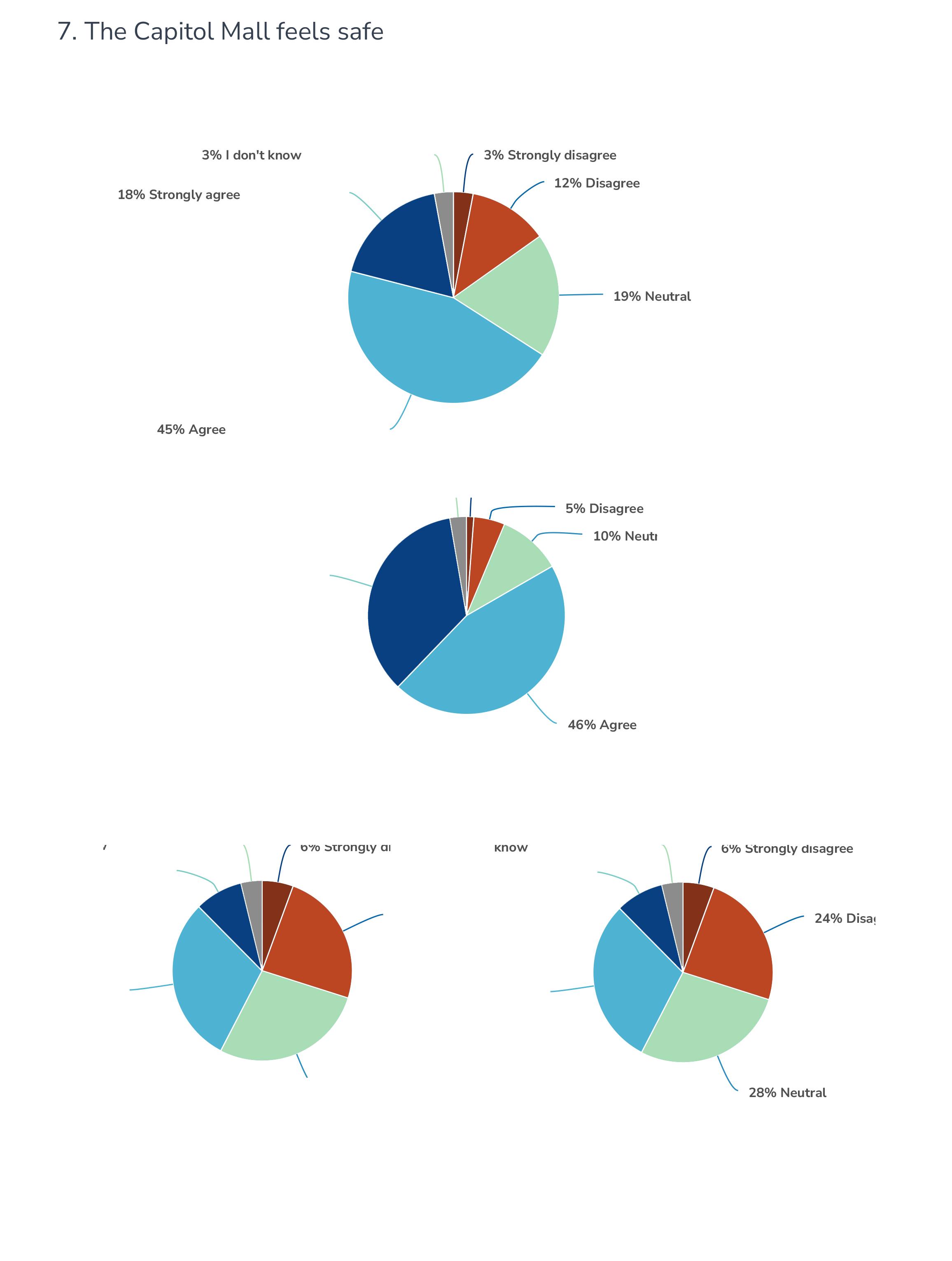


On issues of performance (accessibility and maintenance), respondents were relatively positive about the Mall; on issues of placemaking and meaningfulness, respondents were split about whether the Mall represents Minnesotan culture, has exciting activities and is a memorable place.
ere areas in the Capitol Area where you feel unsafe? If so, s to the map where you feel unsafe. Click the map to add a tell us what you find unsafe about that area.
Areas that feel unsafe?
When you come, where do you go?

rail

Count Comment 1152 460 Option Comment traffic and h ghways are really awful we should redu r traffic and cover or f ll in I-94
Value Count Comment Places I go 1754 675 ID Option Comment 36 40 lots of gather ngs here 42 Park ng and walking to the Capitol 42 Police memor al 44 Eat


The Strongly Disagree Strongly Agree

UNDER CAAPB REVIEW. COMMENT PERIOD OPEN. UNDER CAAPB REVIEW. COMMENT PERIOD OPEN.
5 Disagree Agree
LOOKING TO THE FUTURE
e creation of a welcoming and beautiful Capitol Mall wil ement recent restoration of the Capitol Building and ens ccess of Minnesotans to their seat of democracy. Of the ments proposed in the 2040 Comprehensive Plan to ma Mall more welcoming, select five (5) that would be mo
Of the investments proposed in the 2040 Comprehensive Plan to make the Capitol Mall more welcoming, select five (5) that would be most important to you... Enhance pedestrian bridges across I-94
Increasetree canopyInstallmore furniture,benches andpicnictables
6
Add gardensandsymbolicplantings
AddfoodandbeverageEoptions nhance pedestrianbridgesacrossI-94
and beverage options
Enhancepedestrianpathways
ExpandgreenIspace
Constructmore restrooms
ntegratecampussecurity andpublicsafetyintolandscapedesign
Improve educationalsignage
Rank the roles for the Capitol Mall from most important to least important...


For the future, Respondents see value in both reinforcing the Mall’s role as a civic space for first amendment practices and education, as well as expanding its tree canopy, furnishings and vegetation for a more comfortable and connected open space.
Expandbicycle infrastructure
Improvephysical accessibility(handrails,ramps,lifts, removalofsteps)
OtherImprove directionalsignageImprovelighting Inco
Survey 2 (open March 16 - March 30)
1. Duluth: UMD Hockey Pre-Game (March 8)
2. Saint Paul: Black Market (March 9)
3. Bemidji: The Great Thaw Craft Fest (March 9)
4. Saint Paul: Capitol Rotunda (March 18)
5. Willmar: Kids Day at the Mall (March 19)
6. Saint Paul: Capitol Rice LRT (March 19)
7. Rochester: (detail TBD)
Virtual Focus Group Meetings (March 12)
Virtual Town Hall (March 14, state-wide)


O Regional connectivity
O Arrival points
O Thresholds to the Capitol Campus
O Utilities
O Existing parking
O Street typologies
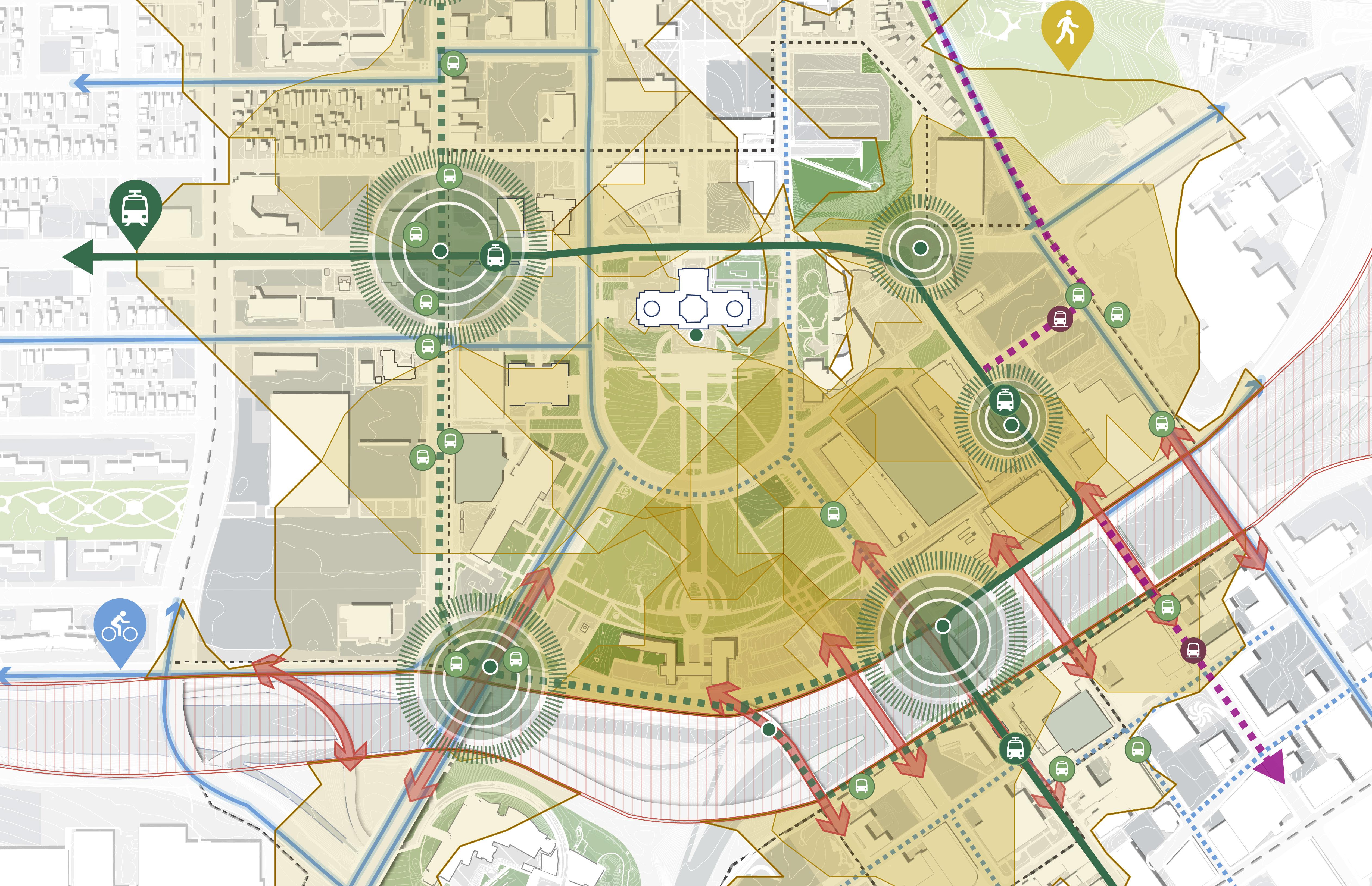
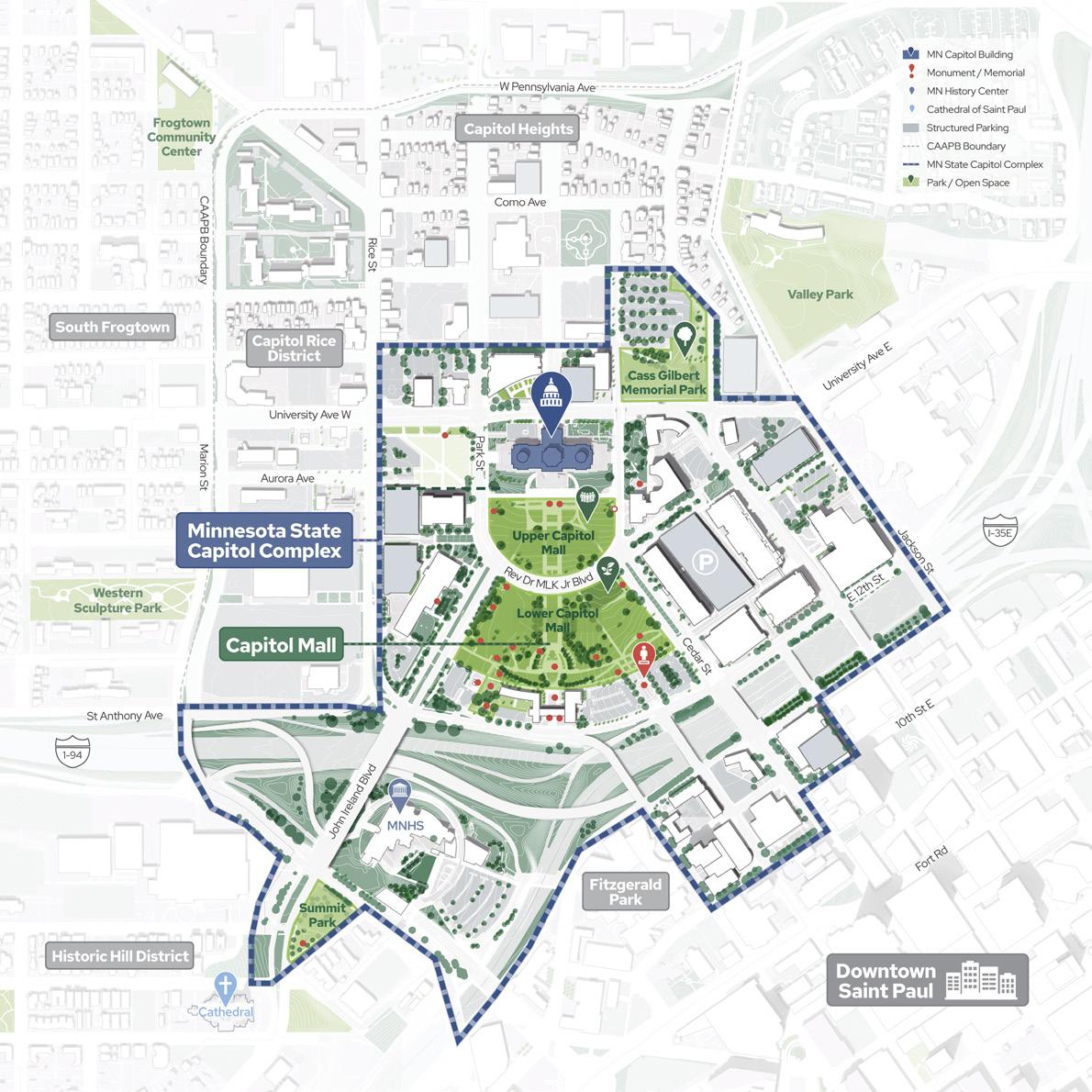
The Capitol Mall will forge connections between Minnesotans and their democratic institutions, through shared experiences, heritage, and physical connections which link the Capitol to the surrounding city and state.

O Timeline
O Capitol Mall evolution
O Historical demographics
O Period plans
O Historical site elements
O Viewshed analysis
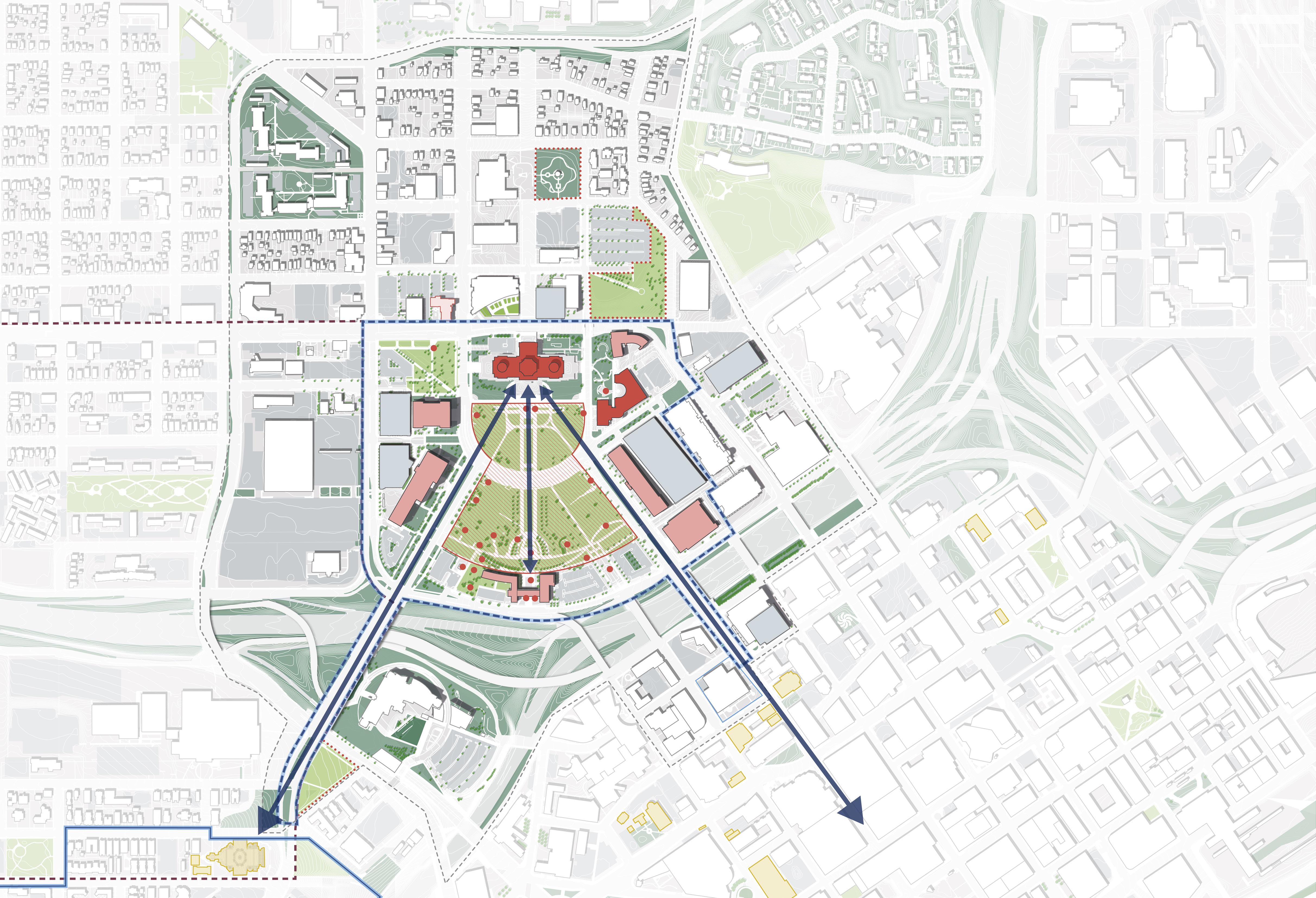
The Capitol Mall will be an enduring representation of Minnesota’s rich past, design legacy, and landscape heritage while adapting to new maintenance and climate challenges.

O Capitol Area amenities
O Existing park gap analysis
O Demographics
O Existing programming and events
O Security and access
O Future opportunities
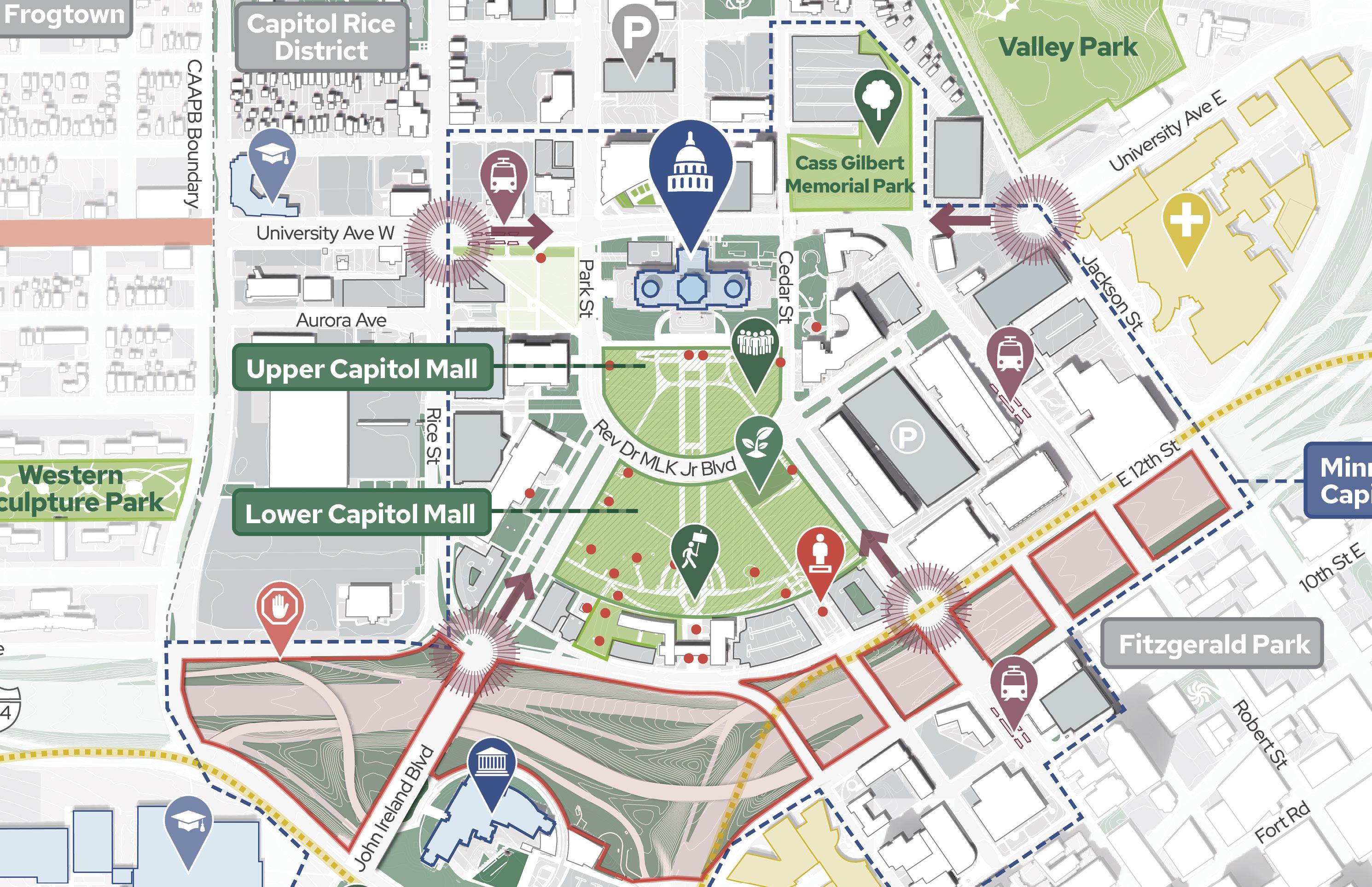
The Capitol Mall will become more welcoming for more Minnesotans to gather and share ideas through events, activities, and opportunities to authentically tell a diversity of Minnesotan stories.

O Natural Heritage and Climate Change
O Human Comfort
O Environmental Concerns
O Landscape Quality
O Maintenance

The Capitol Mall will steward its landscape with sustainable maintenance practices. The cultivation of a diverse and resilient ecosystem will enable this important district of Saint Paul to adapt to a changing climate while preserving cultural heritage.

A Cultural Landscape Report (CLR) describes the physical history, analyzes existing conditions, and recommends treatment actions to preserve, restore, or rehabilitate the cultural landscape.
(National Park Service)
Damon Farber Landscape Architects and 106 Group are currently working on the CLR.
UNDER CAAPB REVIEW. COMMENT PERIOD OPEN. UNDER CAAPB REVIEW. COMMENT PERIOD OPEN.
The Capitol Mall Design Framework draws upon the CLR to best understand the historic intentions and features of the site.
A MN State Capitol, 1900
B State Office Building, 1932
C State Office Building Parking
D MN Dept of Transportation, 1956
E Parking Ramp F, 2013-2015
F Veterans Service Building, 1954
G National Guard Office, 1961
H Centennial Office Building, 1959
I Centennial Parking Ramp, 1976
J MN Judicial Branch, 1917
K Power Plant, 1900
1 Leif Erickson, 1949
2 Quadriga, 1906
3 Judicial Plaza, 1990
4 Floyd B. Olson, 1958
5 John Johnson, 1912
6 Knute Nelson, 1928
7 Christopher Columbus, 1931
8 Hubert H. Humphrey, 2012
9 MN Woman Suffrage Memorial, 2000
10 Charles Lindbergh, 1985
11 Spiral for Justice: Roy Wilkins, 1995
12 Special Forces in Laos Memorial, 2016
13 MN Vietnam Veterans Memorial, 1992
14 MN WW II Veterans Memorial, 2007
15 Court of Honor, 1950-1953
16 MN Korean War Veterans Memorial, 1998
17 MN Workers Memorial Garden, 2010
18 Military Family Tribute; Gold Star Table, 2015
19 Military Family Tribute; Story Stones, 2015
20 MN Fallen FIrefighters Memorial, 2012
21 Memorial to the Living, 1982
22 Promise of Youth, 1958
23 USS Ward Gun, 1958
24 Peace Officers Memorial, 1995
25 Earthbound Monument, 1956
26 Liberty Bell, 1950
Contributing Building
Non-contributing Building
Contributing Memorial Structure
Non-contributing Memorial Structure
Contributing Small Scale Site Structure

Each space was lined with a row of trees reinforcing circulation.

Based on aerial photography
Tree loss at Leif Erickson Park
Significant tree loss
Significant tree gain
Tree planting emphasis shifts toward Court of Honor and middle EW arcing walkways.

Based on aerial photography
LRT Rail Station
Wabasha Ave converted to pedestrian walkway
Aurora Ave terminated at both east and west of capitol mall
Aurora Ave converted to pedestrian walkway south of capitol building
Fuller Ave terminated
Middle E/W arcing road converted to double walkway
Interior-mall radiating roads removed, one converted to pedestrian walkway
Removal of street Walkways
Roadways

Based on aerial photography

Based on aerial photography


HONOR THE CONSISTENT INTENT OF THE ORIGINAL DESIGNERS.
O Preserve the three axial approaches to the Capitol Building.
O Preserve the three axial approaches to the Capitol Building.
O Maintain the wide views to/from the Capitol framed by the approach corridors.
O Maintain the wide views to/from the Capitol framed by the approach corridors.
O Honor the character defining features of the Upper Mall
O Honor the character defining features of the Upper Mall
O Retain and maintain existing contributing features
O Retain and maintain existing contributing features
O Consider expanding the list of contributing features to include extant original structures
O Consider expanding the list of contributing features to include extant original structures
O Expand accessibility throughout the district while following preservation treatment standards.
O Expand accessibility throughout the district while following preservation treatment standards.
O Design interventions with care so as not to obscure, damage, or destroy character-defining features in the process of undertaking work to meet code requirements.
O Design interventions with care so as not to obscure, damage, or destroy character-defining features in the process of undertaking work to meet code requirements.
O Replace missing tree canopy along major approaches, district streets, and pedestrian corridors.
O Replace missing tree canopy along major approaches, district streets, and pedestrian corridors.
O Consider planting in groves which can reinforce linear corridors.
O Consider planting in groves which can reinforce linear corridors.
O Develop guidelines for a consistent planting palette district-wide – including within commemorative spaces.
O Develop guidelines for a consistent planting palette district-wide – including within commemorative spaces.
O Maintain and reconnect historical approaches into the urban fabric.
O Maintain and reconnect historical approaches into the urban fabric.
O Improve the human experience along the approach corridors.
O Improve the human experience along the approach corridors.
O Evolve land use at the periphery of the district with contemporary planning strategies.
O Evolve land use at the periphery of the district with contemporary planning strategies.
O Consider strategies for stormwater management within the Capitol Mall that emulate the character of the cultural landscape.
O Consider strategies for stormwater management within the Capitol Mall that emulate the character of the cultural landscape.
O Replace turf lawn with more sustainable or native seed mixes with lower maintenance requirements.
O Replace turf lawn with more sustainable or native seed mixes with lower maintenance requirements.
O Allow turf and turf replacements to enter dormancy during hot and dry seasons.
O Allow turf and turf replacements to enter dormancy during hot and dry seasons.
O Consider alternative options to monocultural plantings, including native species and disease resistant varieties.
O Consider alternative options to monocultural plantings, including native species and disease resistant varieties.
O Utilize the Lower Mall for future expansion of commemorative spaces.
O Utilize the Lower Mall for future expansion of commemorative spaces.
O Organize memorial interventions according to massing and space allowed, not according to content themes.
O Organize memorial interventions according to massing and space allowed, not according to content themes.
O Refrain from expanding commemoration into the Upper Mall, an area of high integrity.
O Refrain from expanding commemoration into the Upper Mall, an area of high integrity.
O Encourage future commemorative interventions to have smaller footprints and utilize existing pedestrian circulation patterns.
O Encourage future commemorative interventions to have smaller footprints and utilize existing pedestrian circulation patterns.


LESS DETAIL

DESIGN TOPICS
Framework Ideas
Big Moves
Implementation Partnerships
Phasing
MORE DETAIL
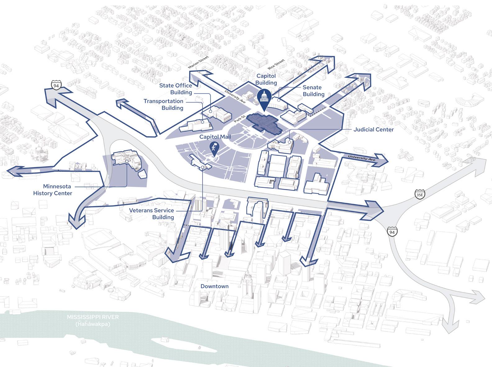
DESIGN TOPICS
Design Guidelines
Early Phase Implementation
Possibilities
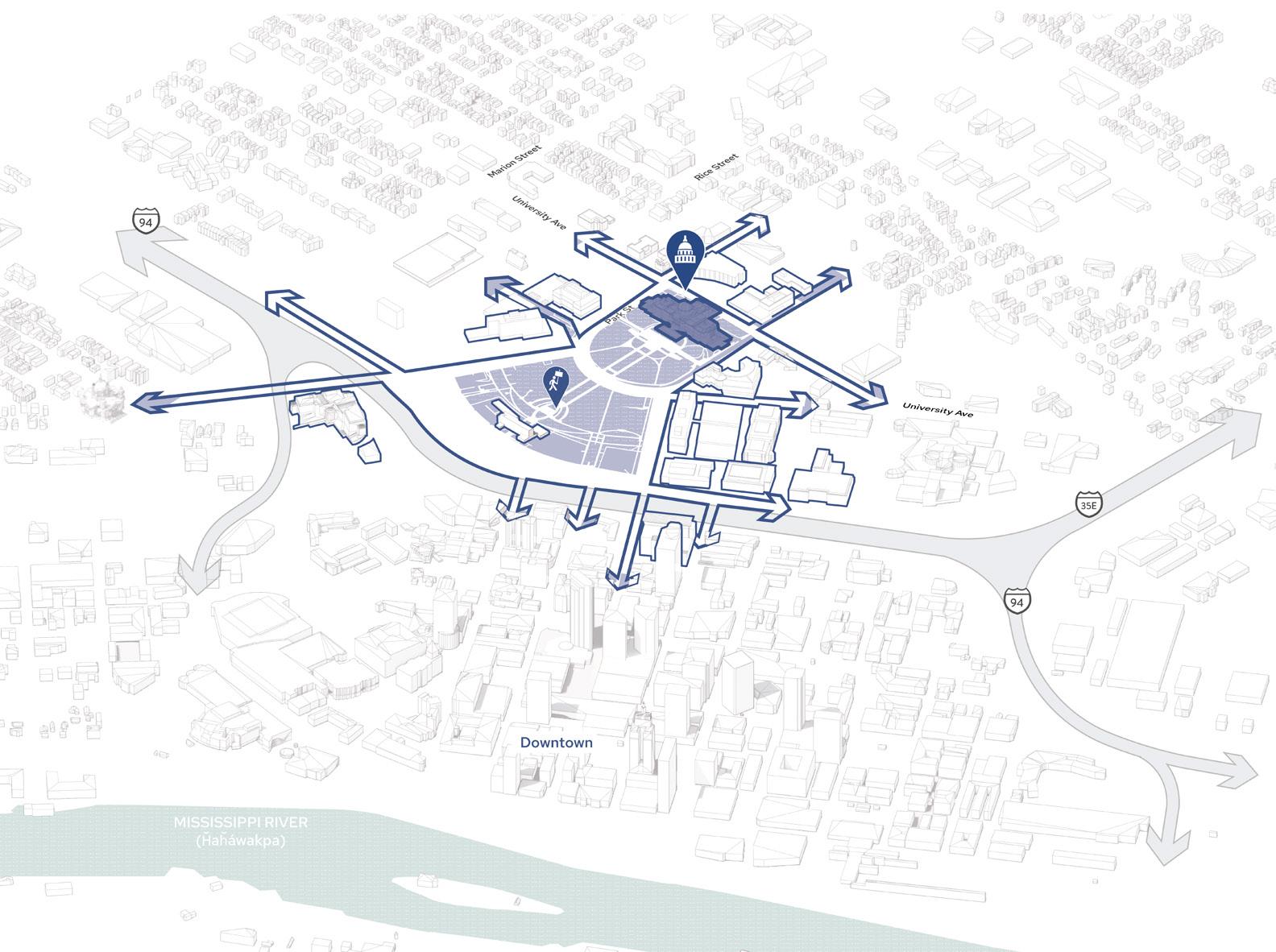
DESIGN TOPICS
Conceptual Design
1 2 3 4 5 6 7
As Minnesota’s seat of government and destination for thousands of people each year, the Capitol Area offers the highest quality experience to visitors.
The Capitol building and Mall are central to the identity of Saint Paul and are a unifying focal point for the city, as Cass Gilbert once envisioned.
The Capitol Area is a model for Minnesota, where best practices are utilized in the planning, design, and development of public and private projects.
The entire Capitol Area provides an integrated, high quality, human scale public realm experience.
The Capitol Area is an urban multi-modal district, seamlessly connected to destinations and the larger mobility network of Saint Paul. Land use diversity is encouraged throughout the Capitol Area.
DESTINATION CONNECT PRESERVE ACTIVATE GROW


Support the continued use of the Capitol Mall as a welcoming community gathering place by adapting security practices. Explore design measures which discretely incorporate security features without interrupting the ability of all Minnesotans to enjoy the Mall.
Historic character-defining elements of the Capitol Area should be priorities for preservation, but historical preservation guidelines need to be flexible enough to allow reasonable modernization that addresses principles of accessibility, inclusivity and sustainability.
Revise regulations to enable small businesses like retail, food and beverage to lease space on the ground level of government buildings, helping to activate the public realm and support workplace wellbeing.
The State can leverage their underutilized land to develop private partnerships that catalyze economic development and community vitality. Partnerships can also be forged on privately owned land in the Capitol Area to incentivize owners to adopt practices that benefit the entire district. Funds raised through private development can be directed back into the management and maintenance of the shared public realm.
Parking should be approached as a collective and district wide resource to increase utilization efficiency. The district can explore ways to provide free visitor parking for those with government business. Surface parking should be prioritized for accessibility and service needs with structured parking meeting most parking demand at strategic locations within a 3 minute walk of workplaces.
Explore the formation of new management structures that enable efficient coordination and resource use for the Mall and surrounding public realm including a “Mall Conservancy” model that is a MOU between the State, City, and County utilized for both programming and maintenance.

EXTRA LARGE LARGE
SMALL
POLICY SCALE
A CHANGE THAT WILL OCCUR BEYOND DISCRETE SITE
INTERVENTIONS THAT DEFINE REQUIREMENTS
DISTRICT SCALE
A SERIES OF INTERCONNECTED PROJECTS THAT SPAN ACROSS THE MALL OR DISTRICT
SITE SCALE
A DISCRETE INTERVENTION AT A SPECIFIC PLACE IN THE DISTRICT/ON THE MALL
Enhance the user experience and make for a more inclusive and welcoming space
EXTRA LARGE LARGE
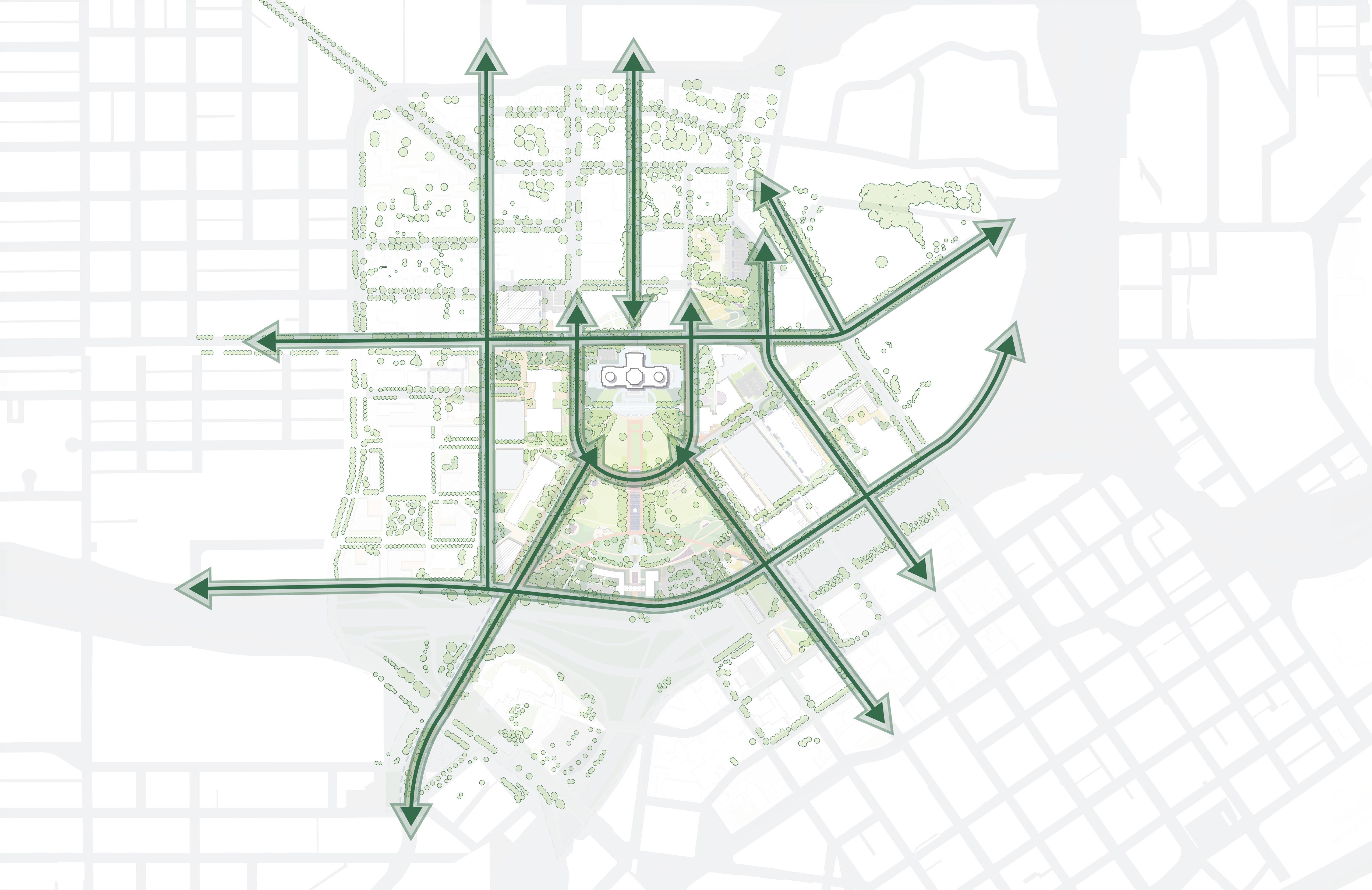
Reinvigorate nodes that connect the community to the capitol in each direction
Right-size the roads and reinforce them with trees.
Sculpt topography to improve accessibility, seamlessly integrate security and provide a platform for events
Introduce new strategies to represent Minnesota’s cultural diversity and ecological variety
Celebrate Minnesota’s connection to water in all seasons
Create a gradient of planting strategies that support cultural programming, sustainable maintenance and human comfort goals
SMALL
Transform Cass Gilbert Park into a multi-generational space for play, recreation and views
Establish a Cultural Walk that draws visitors in and provides opportunities for representation
Convert Martin Luther King Jr. Blvd. into a community shared street
SURVEY RESPONDENTS REPORTED THAT THEY ONLY GO TO THE MALL TO PASS THROUGH OR FOR OFFICIAL BUSINESS OR EVENTS. COMMUNITY MEMBERS OFTEN SAID THEY DIDN’T THINK THEY SHOULD BE AT THE CAPITOL WITHOUT GOVERNMENT BUSINESS.

I go to the Capitol Mall to... [top 6 responses]

Pass through on the way to work, home or daily activities elsewhere
Pass through on the way to other cultural and tourism destinations
Conduct official business at Capitol Campus buildings
35.9 % OF SURVEY RESPONDENTS LISTED “ADD FOOD AND BEVERAGE OPTIONS” AS A TOP PRIORITY FOR THE CAPITOL MALL, THE NUMBER 4 RESPONSE OUT OF 17 OPTIONS
“MULTIPLE LANGUAGES AND ACCESS FOR ALL ABILITIES”
“HAVE AMBASSADORS THAT HELP PEOPLE AND PROVIDE SECURITY”
EXISTING SIGNAGE IS DESIGNED FOR CARS AND OUT OF SCALE WITH THE PEDESTRIAN EXPERIENCE
Engage with elected and government officials
Participate in demonstrations, rallies and marches
Participate in cultural gatherings and performances
“CLEAR SIGNAGE AND DIRECTIONS...PEOPLE DON’T UNDERSTAND WHAT SPACES ARE OPEN TO THE PUBLIC”
“MAKE IT MORE PEOPLEORIENTED...ADD CAFES AND PLACES TO GATHER ”
WHAT WOULD MAKE THE MALL MORE WELCOMING FOR MORE MINNESOTANS?
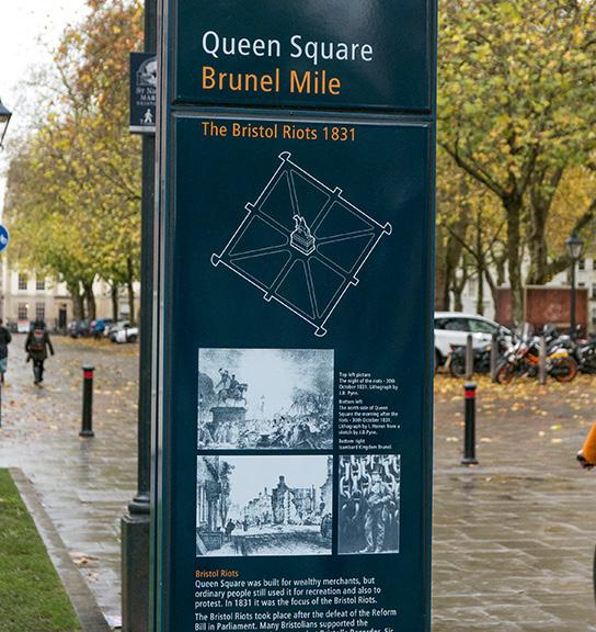
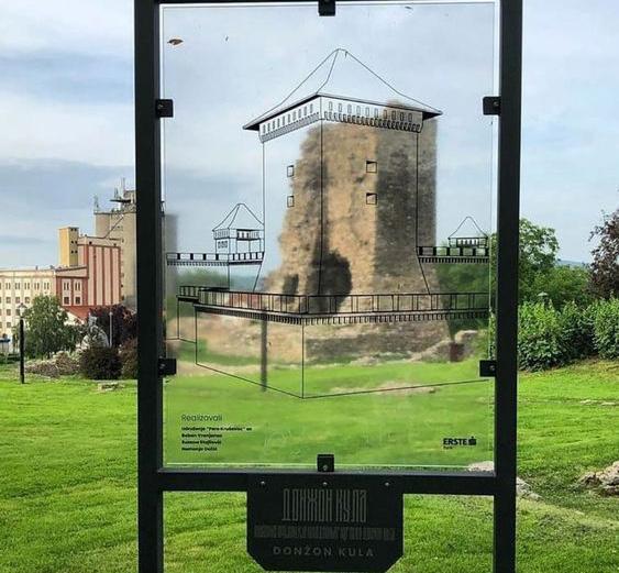
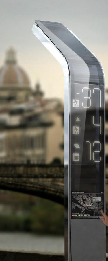
O Digital infrastructure includes features like the “Cap App” with GPS- enabled wayfinding and/or augmented reality.
O A visitor amenity center can provide a home base or starting point for those visiting the Capitol Campus with restrooms, educational materials, and so on.
O Amenity guidelines ensure consistent landscape treatments and reinforce the Capitol Mall as distinct and special place.









reas in the Capitol Area where you feel unsafe? If so, he map where you feel unsafe. Click the map to add a us what you find unsafe about that area.
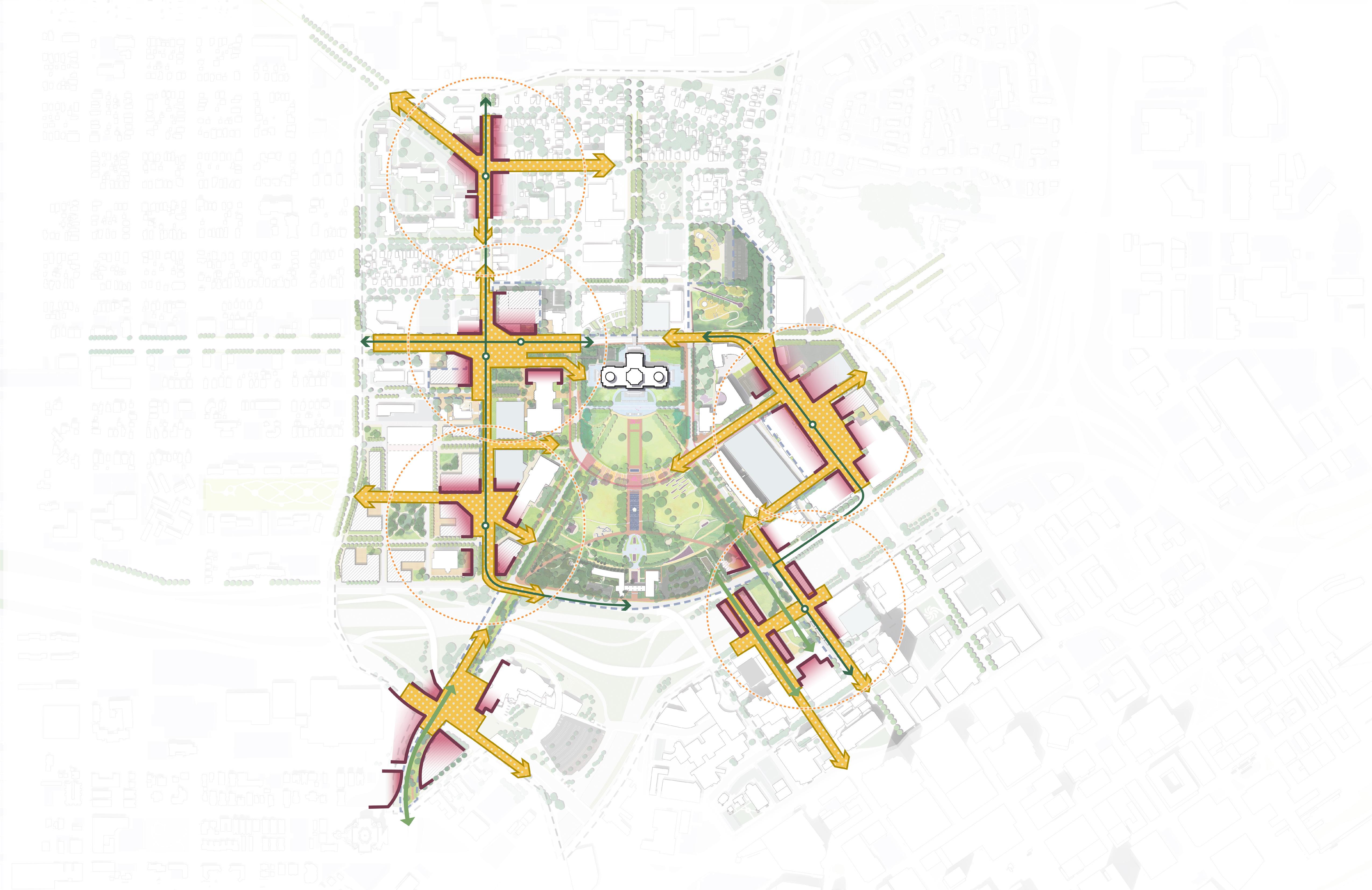
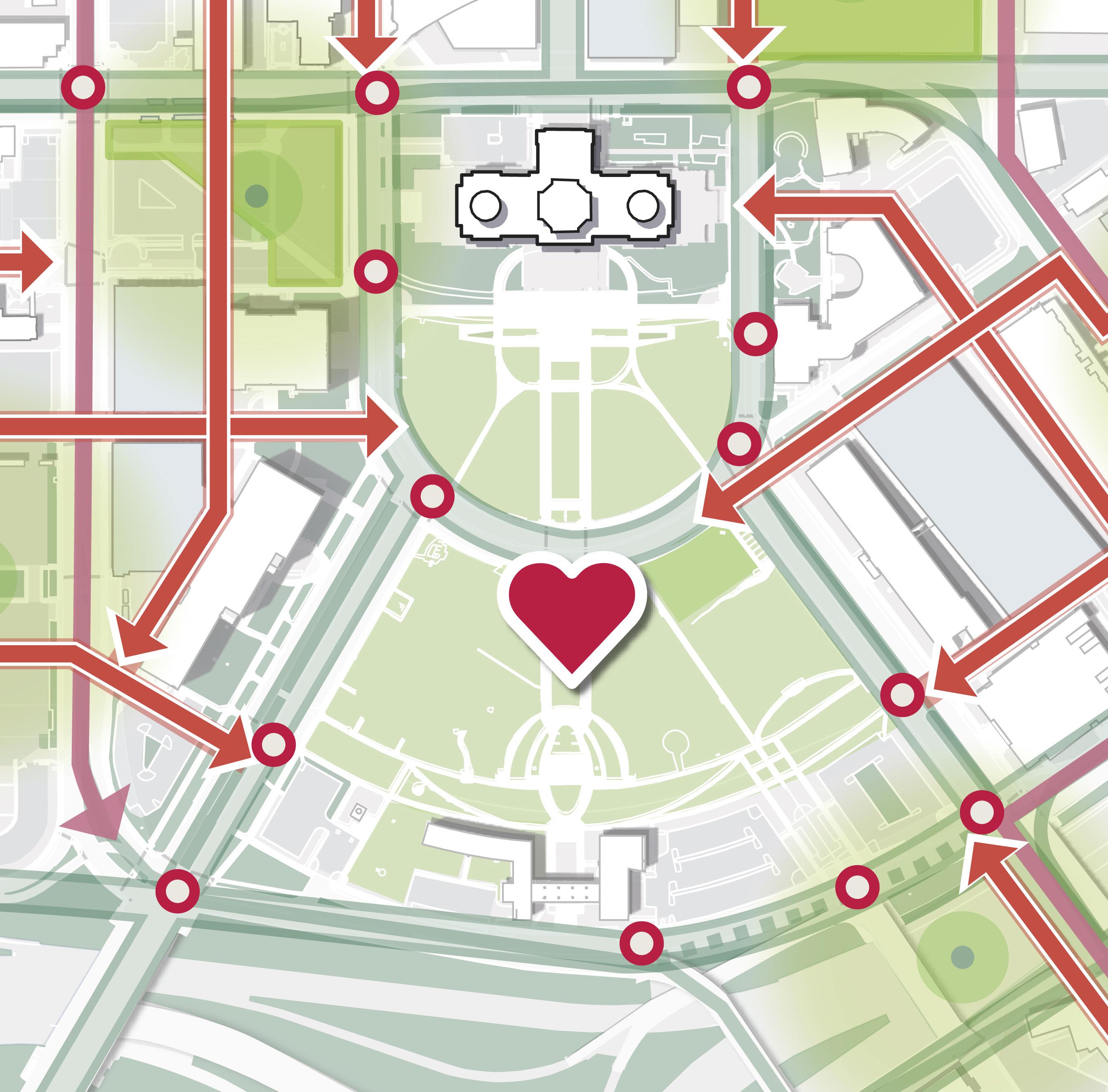
REINVIGORATE NODES THAT CONNECT THE COMMUNITY TO THE CAPITOL IN EACH DIRECTION
“THE LIGHT RAIL IS A HAVEN FOR CRIME”
“IT FEELS LIKE NOBODY CARES” “FEELS DESERTED”
VISITORS ARRIVING TO THE CAPITOL AT ITS PERIMETER THRESHOLDS ARE MET WITH A SENSE OF DESOLATION AND FEW PEOPLE IN THE PUBLIC REALM
“I FEEL TRAPPED ON THE BRIDGE” “FEELS DESOLATE”


34.4 % OF SURVEY RESPONDENTS LISTED “ENHANCE PEDESTRIAN BRIDGES ACROSS I-94” AS A TOP PRIORITY FOR THE CAPITOL MALL, THE NUMBER 5 RESPONSE OUT OF 17 OPTIONS
“COULD THIS BE A LAND BRIDGE?”
“DESIGN IT FOR MORE ACTIVE PEDESTRIAN USE TO GET EYES ON THE STREET” “THERE IS VERY LITTLE STREET ACTIVITY AND CONNECTIONS INTO DOWNTOWN. THIS MAKES A PEDESTRIAN FEEL ISOLATED AND UNSAFE.”

“IT SHOULD SEAMLESSLY CONNECT TO DOWNTOWN”
“INTIMATE GATHERING SPACES”
“PEOPLE AND VITALITY WOULD SOLVE A LOT”
Count Comment
SURVEY RESPONDENTS OVERWHELMINGLY
PERCEIVE THE THRESHOLDS OF THE CAPITOL CAMPUS TO BE UNSAFE
1152 460
“BEING MORE CONNECTED TO THE NEIGHBORHOODS ON ALL SIDES OF THE MALL WOULD MAKE A TREMENDOUS DIFFERENCE”
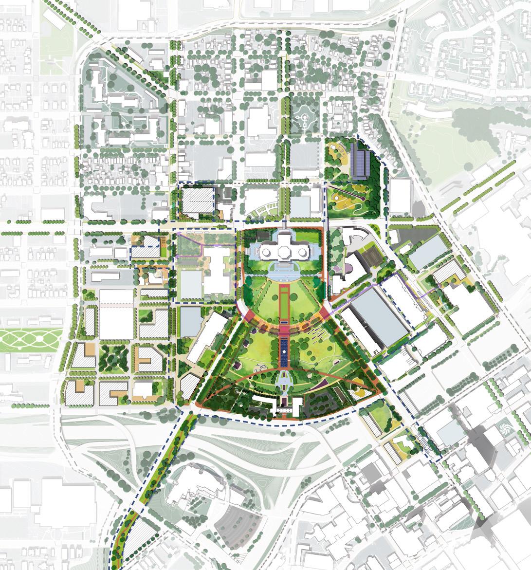
CAPITOL RICE DISTRICT
HISTORICAL HILL DISTRICT
SEARS
COMO & RICE BRT NODE UNIVERSITY & RICE MOBILITY HUB
ROBERT STREET STATION PLAZA MHC
MN STATE CAPITOL MALL
FITZGERALD
CEDAR & WABASHA DECK NODE
O Nodes are opportunities to focus placemaking investments in intentional areas rather than spread them too thin.
O Creating a vibrant public realm at each of these nodes will provide a welcoming and inviting face to the Capitol where visitors arrive by car, pathways and transit.
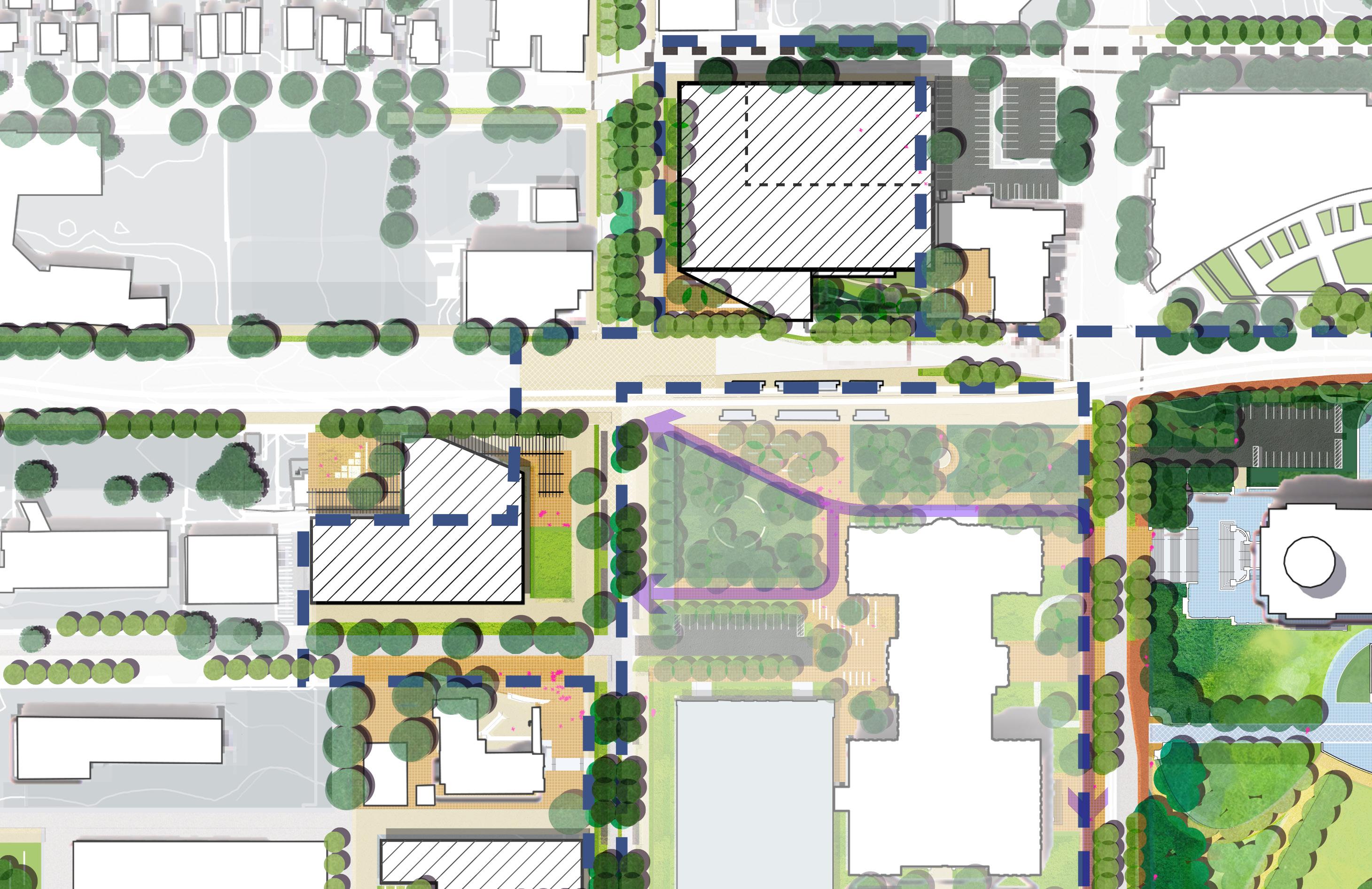
UNIVERSITY
PARKING GARAGE OPPORTUNITY WITH GROUND FLOOR AND BALCONY ACTIVATION
PPSOB LANDSCAPE TO BE COORDINATED
LIGHT RAIL STATION
NEW STATE OFFICE BUILDING
MN STATE CAPITOL
CIRCULATION ROUTE WITH WAYFINDING
VISION AND KIT OF PARTS

DISTRICT PARKING
ACTIVE GROUND FLOOR
ACTIVE GROUND FLOOR
CONCENTRATE PUBLIC REALM INVESTMENT
MOBILITY CONCENTRATIONS
SOB LANDSCAPE TO BE COORDINATED
PUBLIC GATHERING SPACES
INCREASED CONNECTIVITY


FROM 1962TODAY
RIGHT-SIZE THE ROADS AND REINFORCE THEM WITH TREES.
52.2 % OF SURVEY RESPONDENTS LISTED “INCREASE TREE CANOPY” AS A TOP PRIORITY FOR THE CAPITOL MALL, THE TOP RESPONSE
“A LARGE, MATURE TREE CANOPY SHOULD BE A HIGH PRIORITY FOR THIS PROJECT”
TREE LOSS HAS REDUCED PATHWAYS IN SHADE


“RIGHT NOW ITS HARD FOR A PEDESTRIAN TO CROSS A LOT OF THE WIDE ROADS”
“REDUCE JOHN IRELAND TO TWO LANES AND CREATE WIDER PEDESTRIAN PATHWAYS”
77 % OF THE PUBLIC RIGHT OF WAY IS DEDICATED TO CARS
228 SURVEY COMMENTS MENTIONED CARS AND TRAFFIC AS A REASON THE CAPITOL FEELS UNSAFE
CANOPY COVER IN DOWNTOWN SAINT PAUL IS SOME OF THE LOWEST IN THE REGION

O The streets around the Capitol Mall are currently over-sized.
O Right-of-way dedicated to vehicles can be slightly reduced and given back to pedestrians, street trees, and green infrastructure.
Over-sized
Rice Street section taken at proposed METRO G-Line stop (Bus Rapid Transit): Rice and Fuller. Rice Street fluctuates in width from St Anthony Ave / W 12th St (approx. 105’ ROW) to University Ave (89’ ROW).

No
Water Stormwater Electrical
C W S ST
Underground Communication Sewer
*Flex Zones include street trees, landscaping, BRT shelters, street lighting and street parking.


Large median; minimal street trees
No sidewalk buffer
Over-sized travel lanes
Capitol views from vehicles prioritized over views from pedestrians

No stormwater management
Separated and protected bike lanes per 2040 Comp Plan
Stormwater management
Right-sized vehicular lanes

Primary Capitol views reoriented to pedestrians
Increased tree canopy
Protected existing trees
UNIVERSITY AVE W

Intimidating concrete barrier
No stormwater management
LEGEND
Water Stormwater Electrical

Increased tree canopy
VISION UNDER CAAPB REVIEW. COMMENT PERIOD OPEN. UNDER CAAPB REVIEW. COMMENT PERIOD OPEN.
Over-sized travel lanes
Lack of direct access to Capitol Campus
Stormwater management
EXISTING W ST
Right-sized vehicular lanes


A SIGNIFICANT PORTION OF THE UPPER CAPITOL MALL HAS TOPOGRAPHY AT SLOPES OF GREATER THAN 5% - LACKING WHEELCHAIR ACCESSIBILITY AND NOT WELL SUITED TO EVENT USES.
“KEEP THE PLAN AN ACCESSIBLE CIVIC PLACE THAT IS MORE REPRESENTATIVE OF OUR DIVERSE COMMUNITIES, INCLUDING THE YOUTH, AND AN OPEN AND SAFE SPACE WHERE EVERYONE IS WELCOME AND CAN FEEL A SENSE OF BELONGING IN GOVERNMENT AND TO THE STATE.“

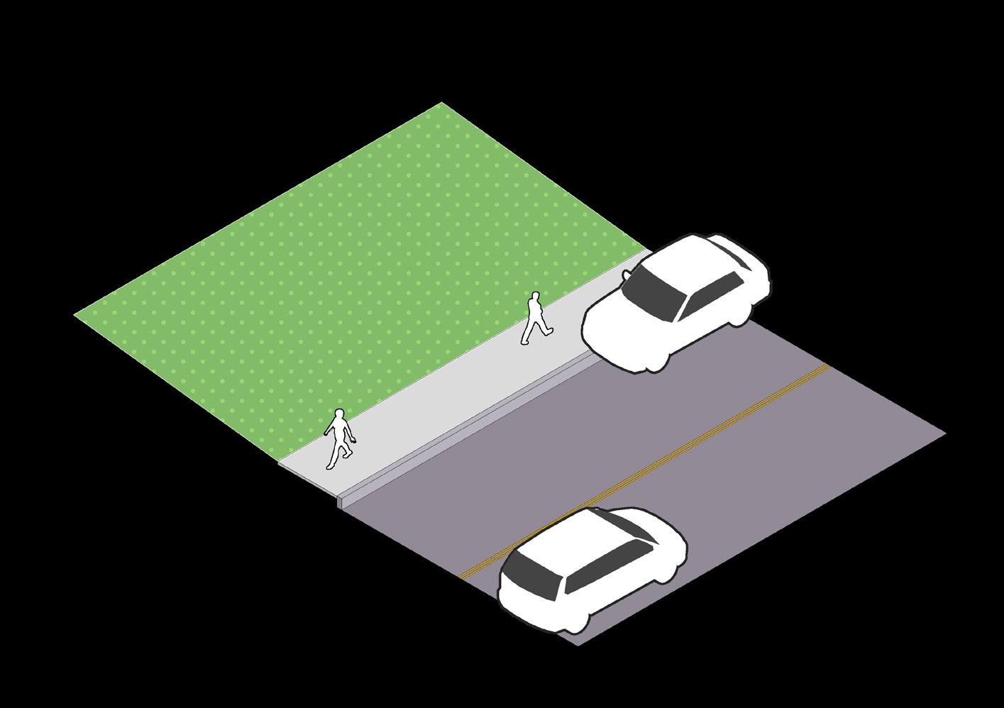
26.8% OF SURVEY RESPONDENTS IDENTIFIED
NO BARRIER
BARRIER + ADA ACCESS

“INTEGRATE CAMPUS SECURITY AND PUBLIC SAFETY INTO LANDSCAPE DESIGN” AS A TOP PRIORITY FOR THE FUTURE OF THE CAPITOL

SURVEY RESPONDENTS FELT THE SECOND MOST IMPORTANT ROLE OF THE CAPITOL MALL IS TO ACT AS “A PLACE TO EXERCISE FIRST AMENDMENT RIGHTS TO CIVIC EXPRESSION”
“I WOULD LIKE TO EMPHASIZE THE IMPORTANCE OF PHYSICALLY BEING ACCESSIBLE TO PEOPLE WITH DISABILITIES”

O The Upper and Lower Malls have vastly different slope profiles, with the Upper Mall being particularly steep.
O By strategically sculpting the existing topography, the spaces become more flexible, easier to traverse, and safer for those using them.

ACCESSIBLE PROMENADE
CREATING SPACES FOR PROGRAM
EXISTING SLOPE 1.43%
PROPOSED SLOPE 1.68%
EXISTING SLOPE RANGES 5 TO 10%
PROPOSED SLOPE 2%


INTRODUCE NEW STRATEGIES TO REPRESENT MINNESOTA’S CULTURAL DIVERSITY AND ECOLOGICAL VARIETY 11
MINNESOTA IS THE HOME OF FEDERALLY RECOGNIZED NATIVE AMERICAN TRIBES
8.8 % OF MINNESOTANS ARE FROM OUTSIDE THE U.S..
8 % OF MINNESOTANS LIVE IN RURAL AREAS
REPRESENTATION BEYOND
STATUES: 48.2 % OF SURVEY
RESPONDENTS LISTED “ADD GARDENS AND SYMBOLIC PLANTINGS” AS A
TOP PRIORITY FOR THE CAPITOL MALL, THE NUMBER 3 RESPONSE OUT OF 17 OPTIONS
EXISTING COMMEMORATIVE WORKS
“BRING IN HISTORIC STORYTELLING, GARDENS THAT DELIGHT, ART WITH MEANING“
“AN OPPORTUNITY TO LEARN ABOUT OTHER THINGS LIKE ECOLOGY AND AGRICULTURE“
EXISTING COMMEMORATIVE WORKS FOCUS ON WAR OR SPECIFIC INDIVIDUALS.
“LESS STATUES OF PEOPLE: HONOR IDEAS, ERAS, GROWTH“
“MORE REPRESENTATION OF OTHER ASPECTS OF OUR SHARED CULTURE“
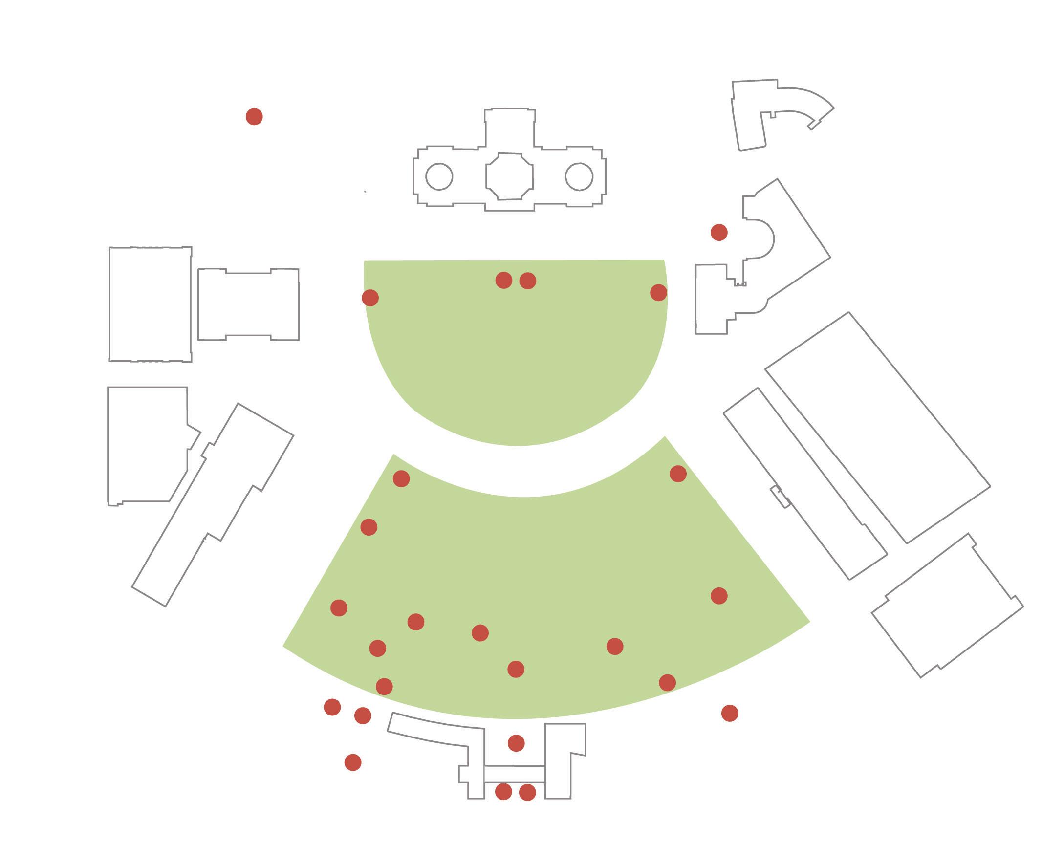
“HAVE A RANGE OF REPRESENTATIONS, NOT JUST SCULPTURES“
MINNESOTA HAS A DIVERSE ECOLOGY, RANGING FROM THE PRAIRIES OF THE WESTERN PLAINS, LUSH HARDWOOD FORESTS OF EASTERN RIVER VALLEYS, AND THE TOWERING RED PINES OF THE NORTHWOODS.

War & Military Government Individuals Groups
White Men
BIPOC
Women
“PROVIDE MORE LANDMARKS THAT REFLECT THE DIVERSITY OF MINNESOTA EXPERIENCE“
WETLAND
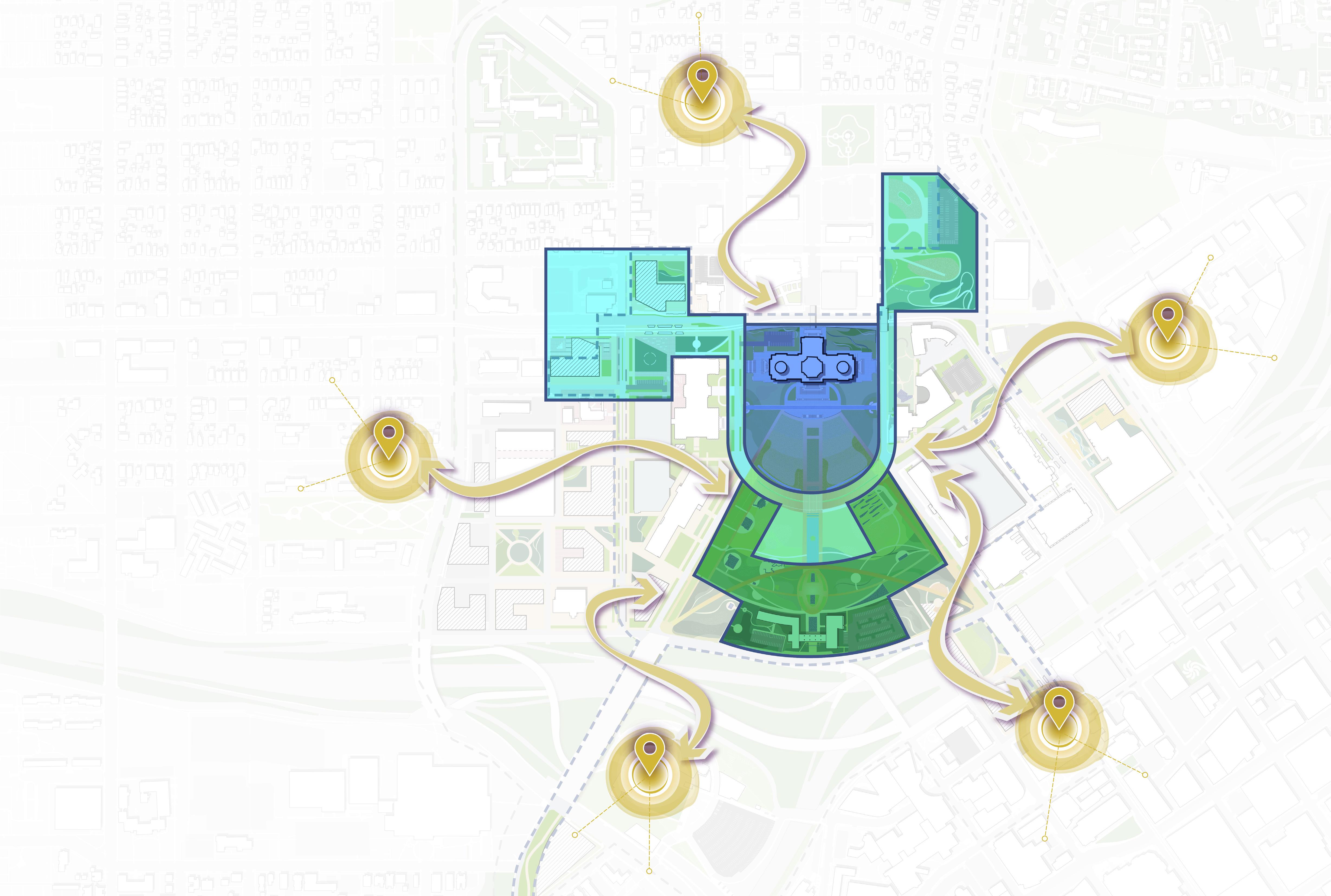
O The Upper Mall and Capitol Building are the democracy stage – a space for all people to come and exercise their first amendment rights.
O The cultural platform (which also includes the cultural trail) ties together various community points of interest.
O The history and reverence zone includes a majority of the commemorative works (both new and old) that celebrate all people in Minnesota.


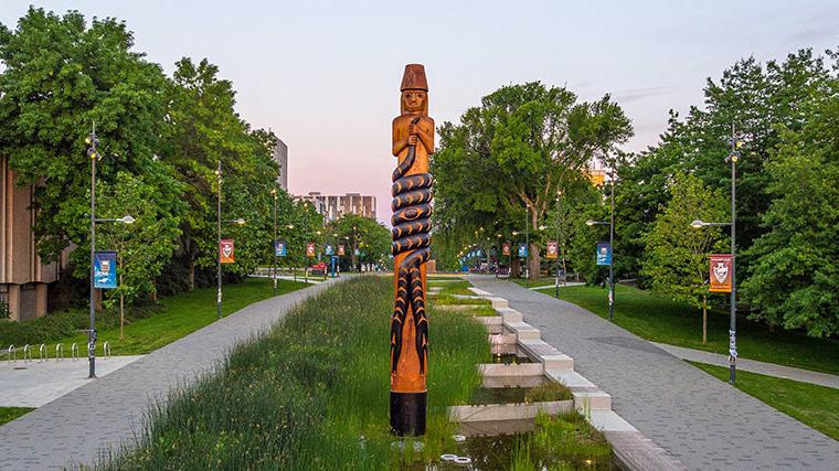


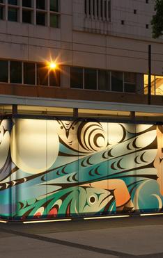


CELEBRATE MINNESOTA’S CONNECTION TO WATER IN ALL SEASONS
AS THE LAND OF 10,000 LAKES, LINKED BY TWO OF THE NATION’S LARGEST RIVERS, WATER IS CENTRAL TO MINNESOTA’S IDENTITY.

Water
Stormwater

TODAY FUTURE
Days / year warmer than 90 °F C
Comparison between today and 2080


Days / 100 years when daily rainfall exceeds 4 inches
Comparison between today and 2080
RAIN IS A RESOURCE
SUMMER TEMPERATURES ARE RISING RAINFALL IS BECOMING HEAVIER
WATER FEATURES ARE AN OPPORTUNITY TO ADDRESS RISING TEMPERATURES AND MAKE USE OF INCREASING RAINFALL
As the land of 10,000 lakes, water is a critical component of Minnesota’s identity – as well as that of the many Indigenous American communities who first called this land home. Water will be utilized as a resource by:
O Integrating it as a major landscape feature for all to experience
O Capturing and storing underground
O Infiltrating it to filter it and return it slowly back to the system
O Reused for irrigation
The role of water on the Capitol Mall is both ecologically responsive and contextually relevant.

Interactive Jets
Water
Cascade
Regional Detention
Seasonal Pond and Skating Location
Regional Water Quality Treatment


CREATE A GRADIENT OF PLANTING STRATEGIES THAT SUPPORT
CULTURAL PROGRAMMING, SUSTAINABLE MAINTENANCE AND HUMAN COMFORT GOALS

TODAY FUTURE SUMMER TEMPERATURES ARE RISING

“INCREASE TREE CANOPY” WAS SURVEY
MORE THAN 80% OF THE CAPITOL GROUNDS IS COVERED IN LAWN. WHILE LAWN IS GREAT FOR FLEXIBLE EVENT AREAS, OTHER PLANTING STRATEGIES ARE NEEDED TO SUPPORT CONTEMPLATIVE, RECREATIONAL AND DAILY USES OF THE GROUNDS.
3% GARDEN
RESPONDENTS’ TOP PRIORITY FOR THE FUTURE OF THE CAPITOL MALL
80%+ LAWNS
16% MEADOW
“EMPTY AREAS OF EXPANSIVE LAWN. HOT WITH LITTLE SHADE.”
A LACK OF SHADE MAKES MUCH OF THE CAPITOL MALL UNCOMFORTABLE IN SUMMER
“I’M DRAWN TO AREAS WITH TREES AND BENCHES, NOT LAWN”
“MORE NATIVE PLANTS, LESS CHEMICALS!”

“A LOT OF UNUSED SPACE”
“A LAWN IS JUST NOT THAT USEFUL”
CREATE A GRADIENT OF PLANTING
STRATEGIES THAT SUPPORT CULTURAL PROGRAMMING, SUSTAINABLE MAINTENANCE AND HUMAN COMFORT GOALS

STRATEGIES
O Native prairies showcase significant Minnesotan plants.
O The arboretum provides wind protection and shade while supporting commemorative works.
O An open glade with shade trees and generous lawn supports large events.
O Lastly, a civic plinth supports high performance event lawns and high pedestrian traffic.
MORE MANICURED AND MORE HORTICULTURAL
MORE NATURAL AND LESS MANICURED
PROPOSED MALL TREES
THE GREEN FRAME
WOODLANDS, MEADOWS AND PRAIRIE
CIVIC PLINTH
OPEN GLADES CULTURAL PLANTING
WOODLANDS, MEADOWS AND PRAIRIE


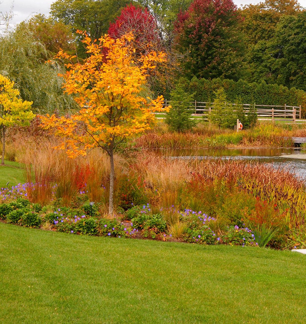

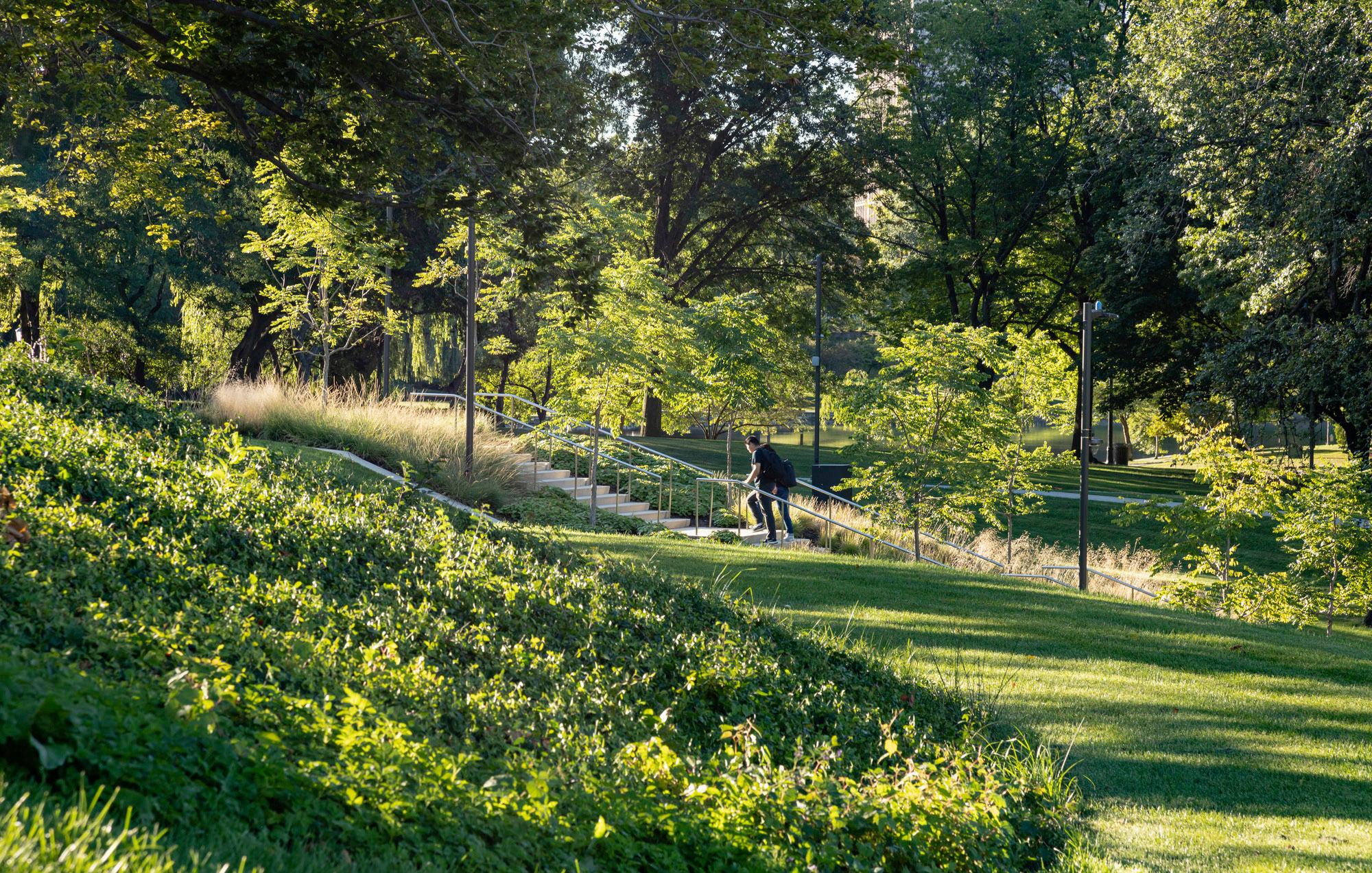

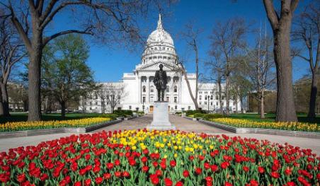


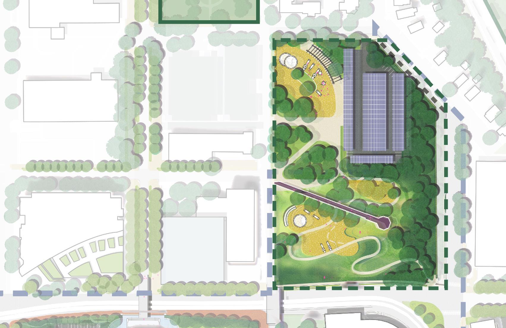
TRANSFORM CASS GILBERT PARK INTO A MULTIGENERATIONAL SPACE FOR PLAY, RECREATION AND VIEWS
“I WOULD LOVE TO SEE IT AS A BEAUTIFULLY DESIGNED PARK, AND MAYBE ALSO HAVE A PLAYGROUND FOR LITTLE KIDS - SOMETHING GOVERNMENT OR HISTORICAL FOCUSED. “
“CASS GILBERT PARK IS VERY DISAPPOINTING”
“CASS GILBERT PARK IS UNDERUTILIZED”


“WE NEED A PLACE TO LET KIDS RUN AROUND AND GET THEIR ENERGY OUT”

Families
Families
HOUSEHOLD SIZES
“FELT OFFICIAL”
“IT SEEMED LIKE AN OLD, FORMAL PLACE”
WHAT ARE YOUNG MINNESOTANS’ FIRST IMPRESSIONS OF THE CAPITOL?
“WE HAD TO EAT SITTING ON THE CURB”
“A LOT OF BUSINESS STUFF”

“WE NEED PLANTINGS THAT EDUCATE ABOUT OUR UNIQUE HABITATS AND SPECIES”

MOST SURVEY RESPONDENTS FELT THAT THE MOST IMPORTANT ROLE OF THE CAPITOL A PLACE TO LEARN
MALL IS AS ABOUT OUR GOVERNMENT AND OUR HISTORY
“I WANT OUR YOUNG PEOPLE TO COME HERE AND THINK ABOUT THEIR ROLE IN DEMOCRACY AND THEIR FUTURE IN IT”
AT POP-UP EVENTS THROUGHOUT THE TWIN CITIES, ATTENDEES FREQUENTLY EXPRESSED A HOPE THAT THE CAPITOL WOULD BECOME A MORE FAMILY-FRIENDLY DESTINATION
O Cass Gilbert Park’s existing topography, sweeping views, and proximity to both neighborhoods and existing assets (like the Capitol Building itself) make it a prime location for a public space that serves the broader community.
O Integrating diverse programming such as a children’s play environment, tree groves, walking paths, an overlook and park pavilions will create a destination for varied user groups.




MANY COMMUNITY MEMBERS EXPRESSED A SENSE THAT COMMEMORATIVE ELEMENTS HAVE BEEN RANDOMLY
PLACED ON THE MALL, WITHOUT A LARGER ORGANIZATIONAL LOGIC
“IT IS BEING FILLED UP WITH MEMORIALS”
THE “HORSESHOE” AROUND THE CAPITOL FORMS AN IDEAL WALKING PATH WITH VISIBILITY OF THE CAPITOL FROM ALL LOCATIONS

Best view of the Capitol Building
Hardly see the Capitol Building
“MANY STRUCTURES CLUTTERING THE LOWER MALL” “RANDOMLY PLACED STATUES”

LOCATIONS OF COMMEMORATIVE WORKS
SURVEY RESPONDENTS WERE LARGELY NEUTRAL OR NEGATIVE ABOUT THE CAPITOL MALL AS A CULTURAL DESTINATION

Strongly Disagree Strongly Disagree Strongly Agree Strongly Agree
Disagree Disagree Agree Agree
has lots to do and see is exciting Neutral Neutral


MN SENATE BUILDING
O The cultural walk is a short tour undertaken on foot that highlights not only the various branches of government, but the many histories and stories of Minnesota’s people.
O It utilizes distinct landscape features, artwork, monuments, and so forth to create an easy-to-follow educational experience for all.
MN STATE OFFICE BUILDING
MN STATE CAPITOL
MN JUDICIAL BRANCH




CONVERT MARTIN LUTHER KING JR. BLVD INTO A COMMUNITY SHARED STREET

“ART THAT REPRESENTS OUR DIVERSE PEOPLE”
PAVED SPACE FOR GATHERING IS LIMITED ON THE CAPITOL MALL WHILE SPACE FOR CARS IS ABUNDANT. EVENTS FREQUENTLY OCCUPY ROADS THAT HAVE NO SHADE OR SUPPORTING EVENTS INFRASTRUCTURE.
“ SENTARME A LEER EN VERANO O HACER PICNICS”
” “SITTING AND READING IN THE SUMMER OR HAVING PICNICS”
52.1 % OF SURVEY RESPONDENTS LISTED “INSTALL MORE FURNITURE, BENCHES + PICNIC TABLES” AS A TOP
PRIORITY FOR THE CAPITOL MALL, THE NUMBER 2 RESPONSE
“FARMERS MARKETS”
“ROTATING ART INSTALLATIONS”
“PLENTY OF SPACE FOR SOCIAL GATHERING”
WHEN YOU COME TO THE CAPITOL, WHERE DO YOU GO?


“CULTURAL EVENTS AND FESTIVALS”

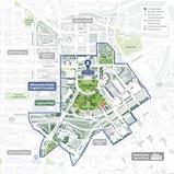
WHAT WOULD MAKE THE MALL MORE WELCOMING FOR MORE MINNESOTANS?


VIEWS OF THE CAPITOL BUILDING ATTRACT MINNESOTANS TO GATHER, DEMONSTRATE AND CELEBRATE NEAR ITS FRONT DOOR.
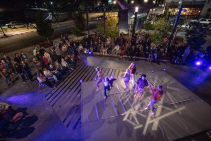
O MLK Jr. Blvd bridges the upper and lower malls as a critical pedestrian link in all directions.
O By creating a curbless and distinctly paved street, MLK Jr. Blvd becomes a safe and activated public space with occasional community programming, fewer cars, and more flexibility.




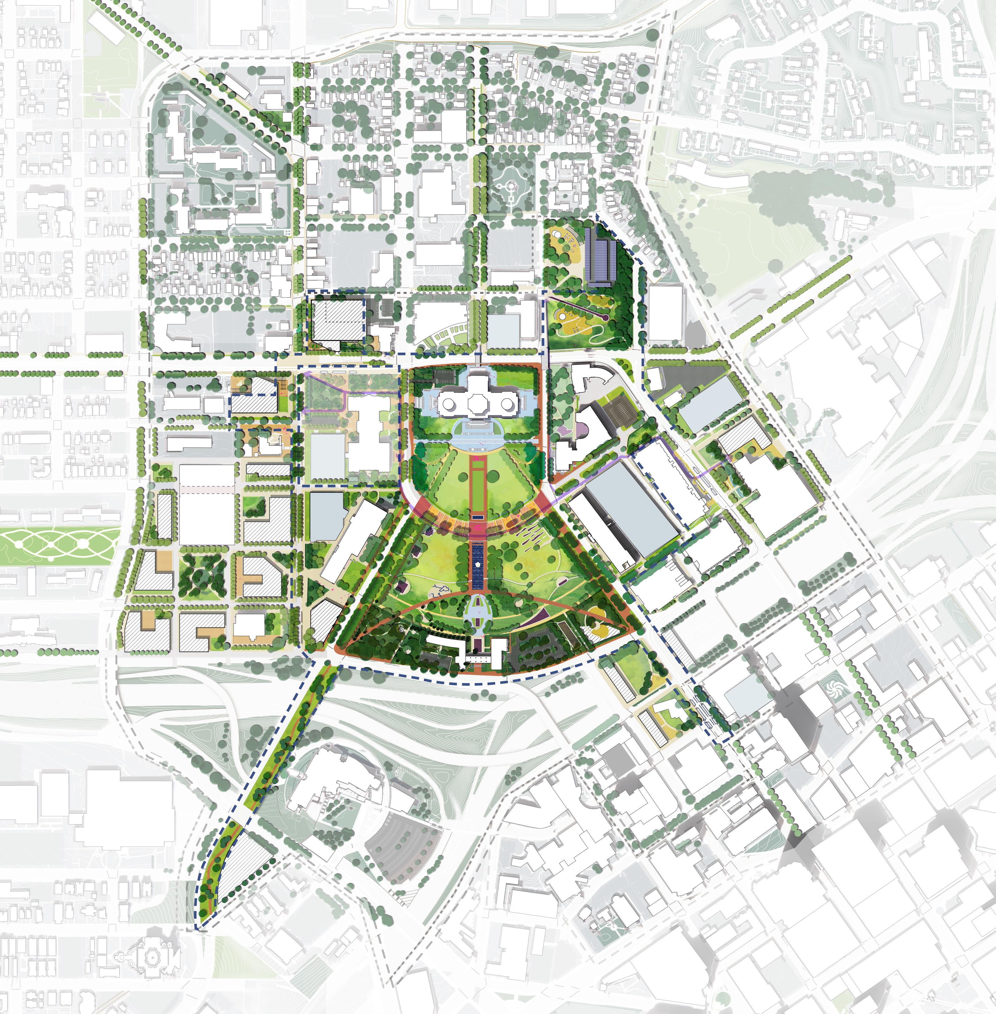

Proposed Trees in Upper Mall: 162
Proposed Trees in Lower Mall: 277
Proposed Trees in Cass Gilbert: 68
Proposed Trees at Rice Node: 126
Proposed Street Trees Corridors: 956
Proposed Trees at Sears Site: 107
Existing Trees Removed: 49
Total Proposed: 1,648
E12thSt
Cass

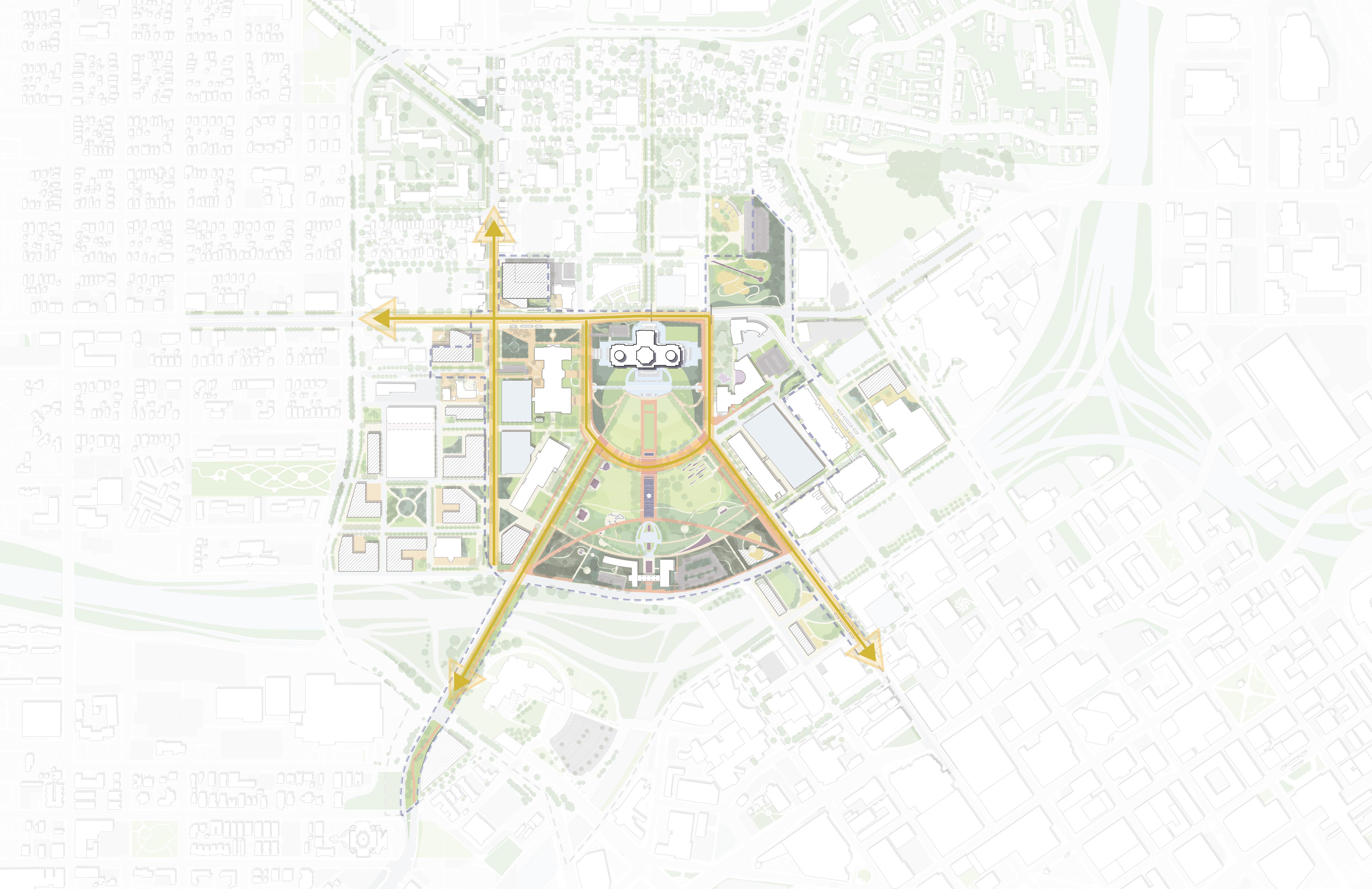
Current one-way Downtown streets support over 2,000 vehicles daily and two-way Downtown streets support over 10,000 vehicles daily while not having significantly greater roadway capacity than what is being proposed for the Capitol Mall Design Framework.
O Preserve the three axial approaches to the Capitol Building.
O Maintain the wide views to/from the Capitol framed by the approach corridors.
O Honor the character defining features of the Upper Mall
O Retain and maintain existing contributing features
O Consider expanding the list of contributing features to include extant original structures
O Expand accessibility throughout the district while following preservation treatment standards.
O Design interventions with care so as not to obscure, damage, or destroy character-defining features in the process of undertaking work to meet code requirements.
O Replace missing tree canopy along major approaches, district streets, and pedestrian corridors.
O Consider planting in groves which can reinforce linear corridors.
O Develop guidelines for a consistent planting palette district-wide – including within commemorative spaces.
O Maintain and reconnect historical approaches into the urban fabric.
O Improve the human experience along the approach corridors.
O Evolve land use at the periphery of the district with contemporary planning strategies.
O Consider strategies for stormwater management within the Capitol Mall that emulate the character of the cultural landscape.
O Replace turf lawn with more sustainable or native seed mixes with lower maintenance requirements.
O Allow turf and turf replacements to enter dormancy during hot and dry seasons.
O Consider alternative options to monocultural plantings, including native species and disease resistant varieties.
O Utilize the Lower Mall for future expansion of commemorative spaces.
O Organize memorial interventions according to massing and space allowed, not according to content themes.
O Refrain from expanding commemoration into the Upper Mall, an area of high integrity.
O Encourage future commemorative interventions to have smaller footprints and utilize existing pedestrian circulation patterns.


REALIZING THE CMDF
STATE IMPLEMENTED
PROJECTS
KEY PROJECTS
Upper Mall
Lower Mall
MLK Jr Blvd.
Rice Node
University & Rice Mobility Hub
Robert Street Station Plaza
MHC Plaza
Cass Gilbert Memorial Park

CITY/COUNTY IMPLEMENTED PROJECTS
PRIVATELY IMPLEMENTED PROJECTS
MAINTENANCE AND OPERATIONS
KEY PROJECTS
University Ave.
Rice St. John Ireland Blvd.
Cedar St.
St. Anthony Ave. / 12th St.
Robert St.
Capitol Blvd.
Cedar & Wabasha Deck Node
KEY PROJECTS
Sears Site
Sears & Rice BRT Node
Como & Rice BRT Node
KEY PROJECTS
Tree Canopy Maintenance
Ground Maintenance Security
Cultural Programming
Events Programming
O Plan
O Experience
O Phasing
O Order of Magnitude Costs
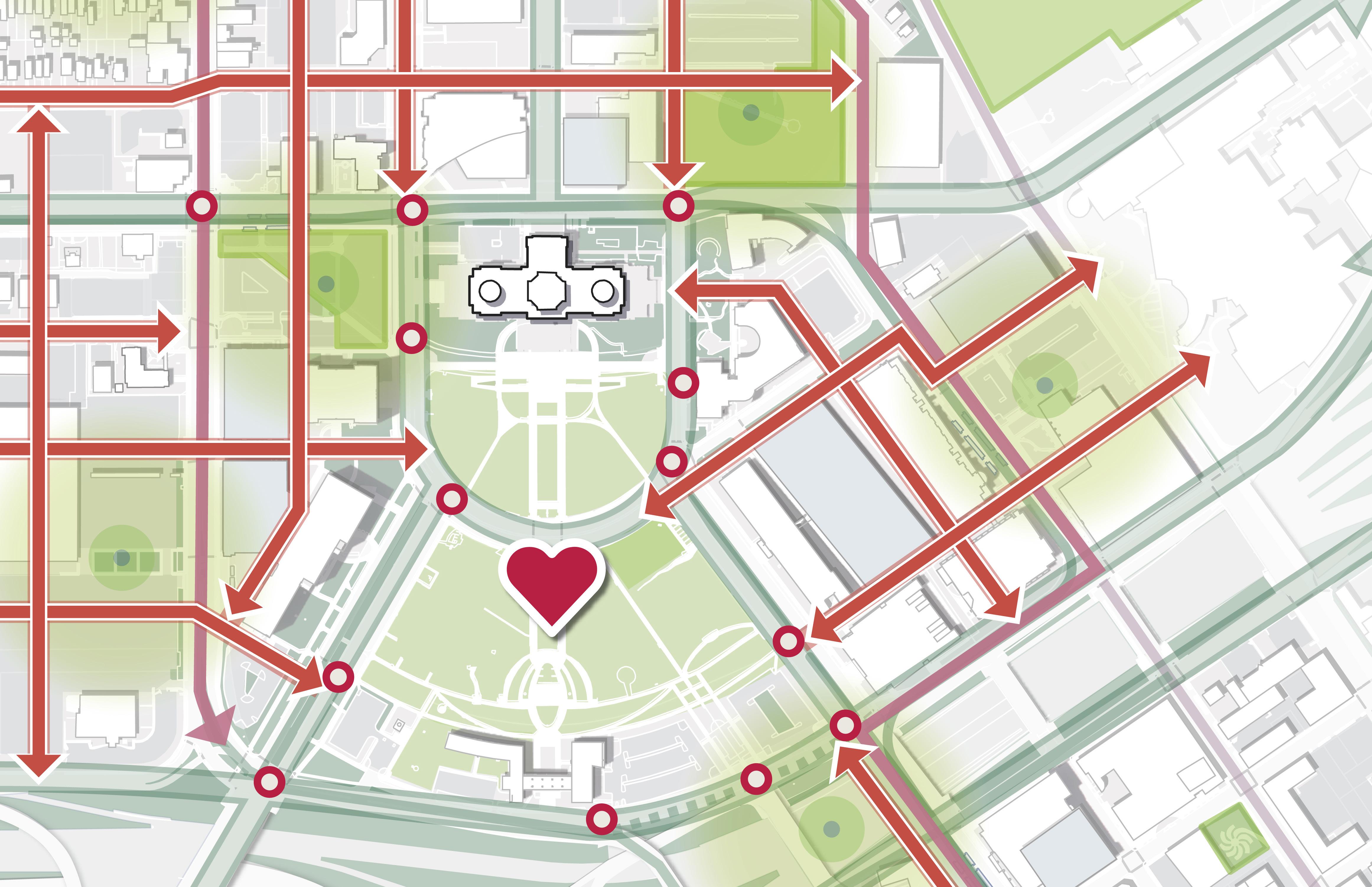
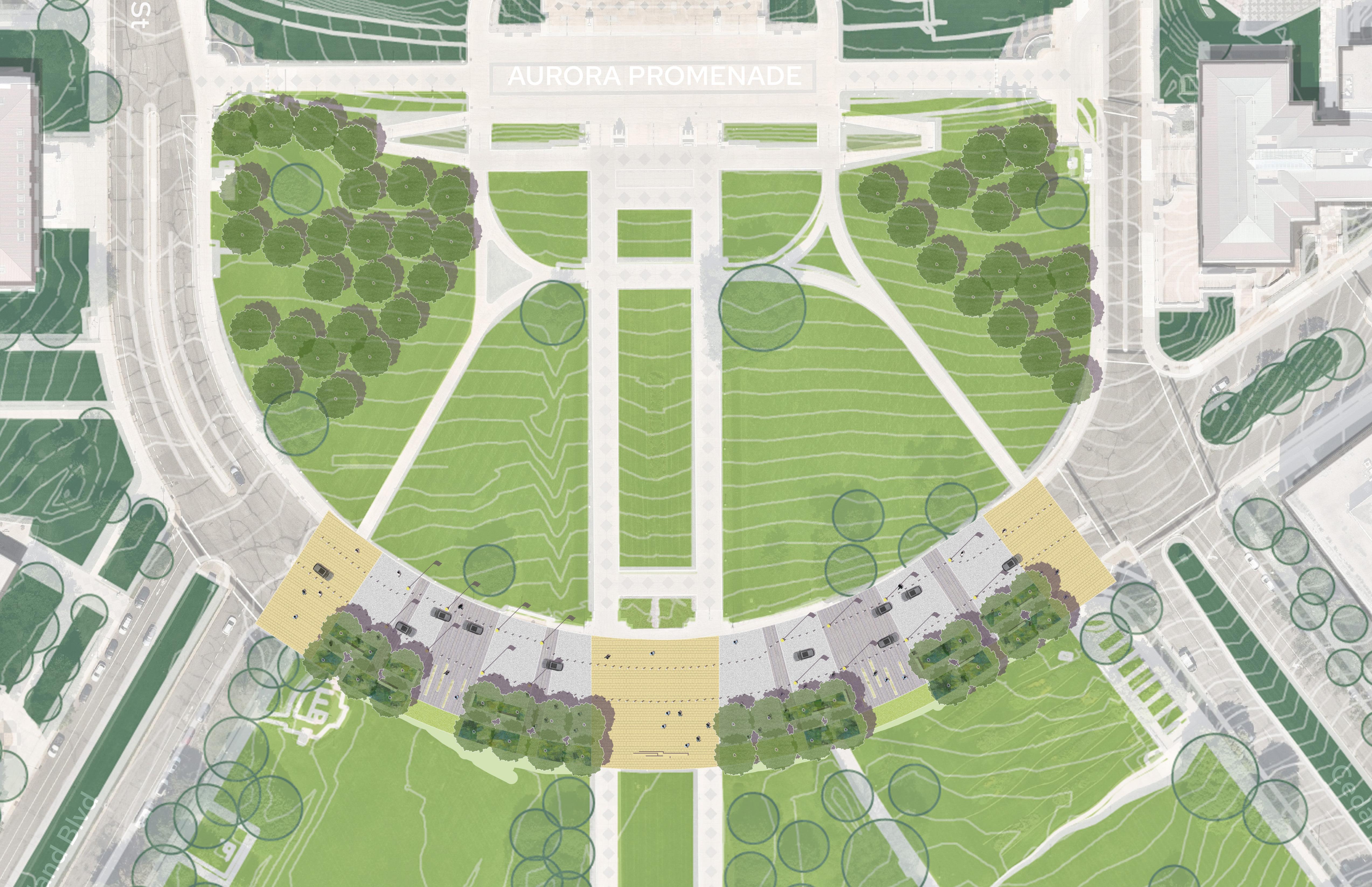
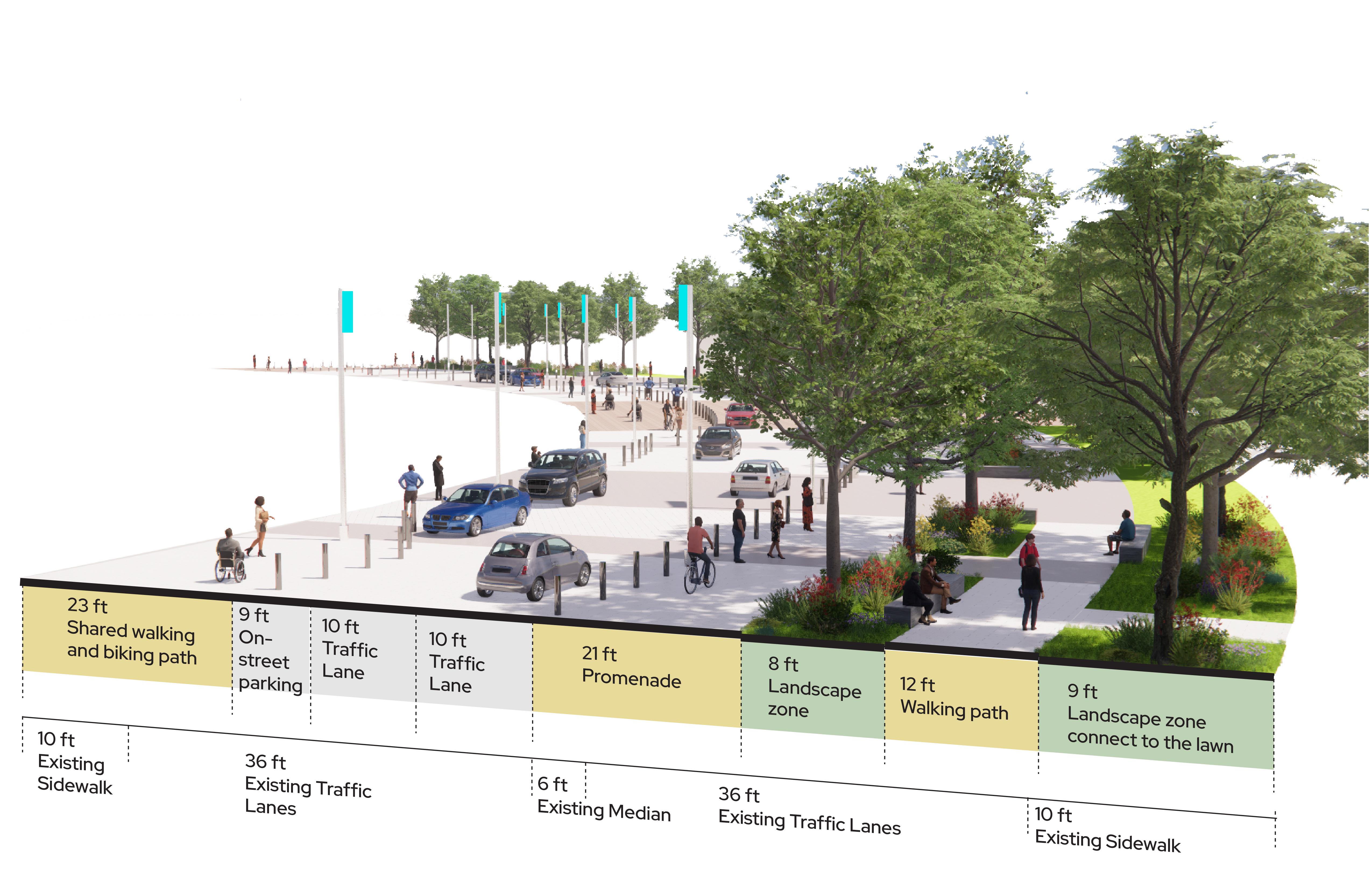
MLK Jr. Blvd will become the nexus of the Upper and Lower Malls. A curbless and distinctly paved street, MLK Jr. Blvd will becomes a safe and activated public space with occasional community programming, fewer cars, and more flexibility. It will be shaded along its length while still maintaining crucial views, and will be buttressed by “shoulder” of trees.
MLK JR BLVD
SHARED STREET AND UPPER MALL SHADING

A COMMUNITY HUB FOR EVERY DAY AND BIG DAY!
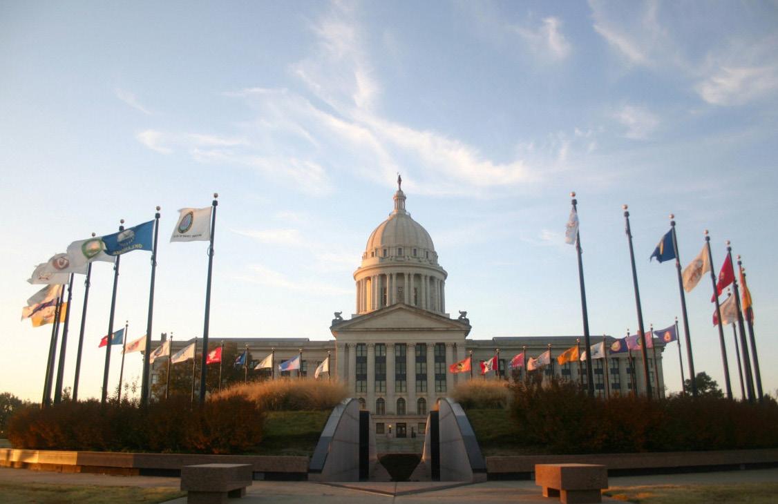
THE CULTURAL WALK IS A PLACE TO INCLUDE CELEBRATION OF THE TRIBAL NATIONS OF MINNESOTA FOR THE FIRST TIME ON CAPITOL MALL
NATIVE CANOPY TREES
GATHERING SPACE, SPECIAL PAVEMENT DESIGNED WITH COMMUNITY
TRAFFIC LANE KEEPS OPEN THROUGHOUT THE YEAR, CLOSURE ONLY FOR SPECIAL EVENTS
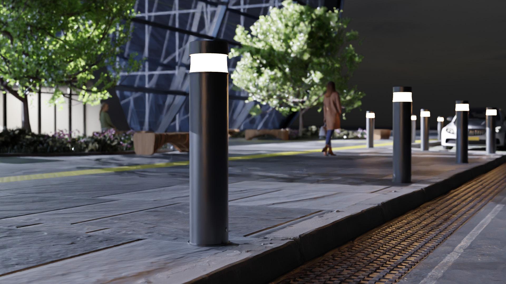
INCORPORATE LIGHTING INTO BOLLARDS
UPPER MALL & CAPITOL BUILDING
UNDERSTORY PLANTS INSPIRED BY DAKOTA
ETHNOBOTANY
FLAGS OF THE TRIBAL NATIONS
LOWER MALL


Overall cost is somewhere between $4.5-6.5M
Includes all of MLK Jr. Blvd and tree planting in the Upper Mall, along with minor regrading of the Upper Mall where trees are located
Does not include major utility changes
Does not include regional stormwater under MLK Jr. Blvd


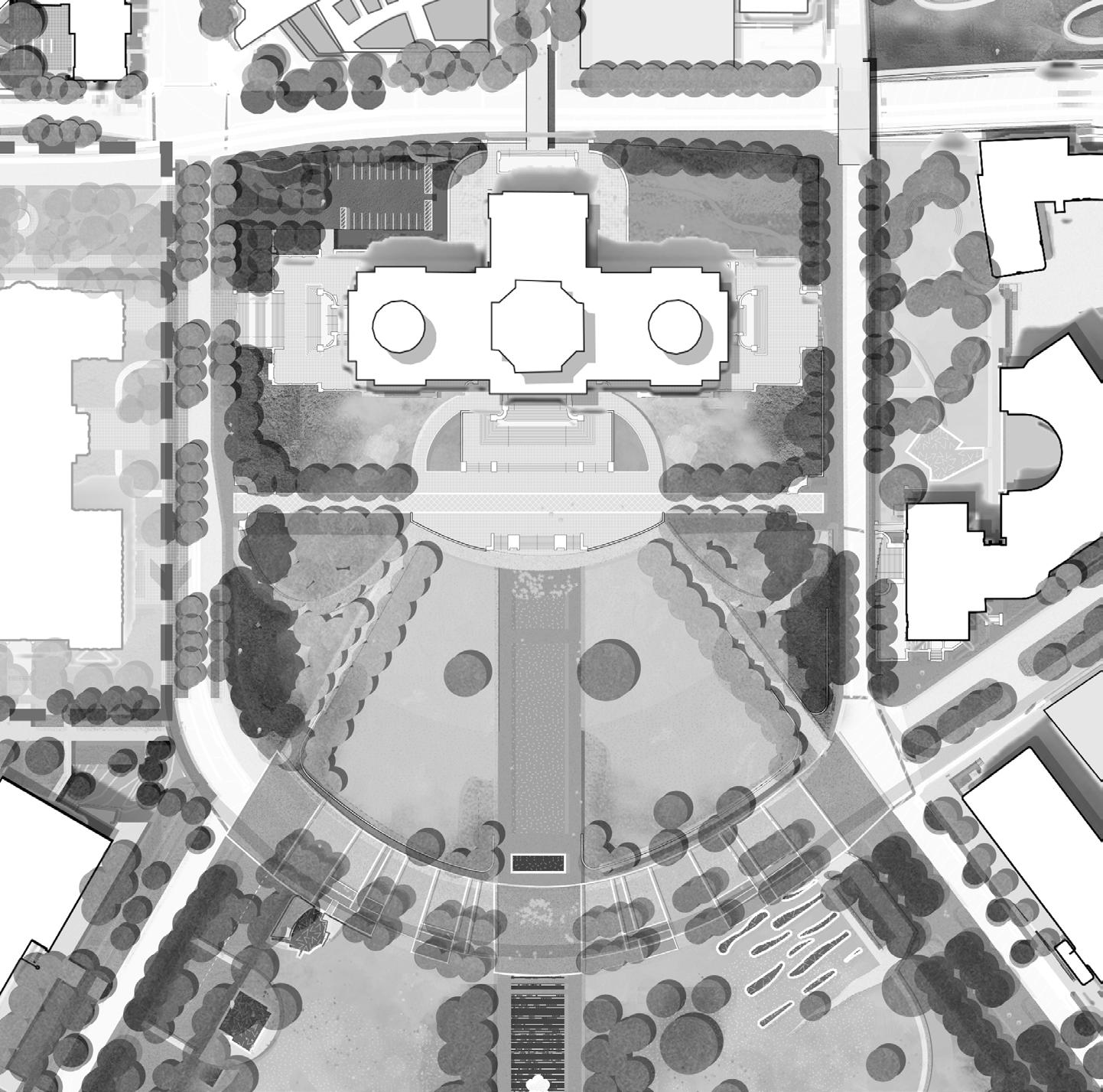


Upper Mall Additional Scope Study 1
Key Design Components: Central lawn, new paths in alignment with John Ireland Boulevard and Cedar Street ~166,000sf
Cost at $40/sf: $6,640,000
Cost at $75/sf: $12,450,000
Upper Mall Additional Scope Study 2
Key Design Components: Tree Shoulders, “Democracy Stage”, new paths in alignment with John Ireland Boulevard and Cedar Street ~193,300sf
Cost at $40/sf: $7,732,000
Cost at $75/sf: $14,497,500
Upper Mall Additional Scope Study 3
Key Design Components: All open space around the existing Capitol Building . ~439,000sf
Cost at $40/sf: $17,560,000
Cost at $75/sf: $32,925,000
New Phase 1 Trees = 198
New Planting Beds = 33,000SF
New Lawn = 23,000 SF
New Pedestrian Only Hardscape = 37,500SF
New

=


LESS DETAIL

DESIGN TOPICS
Framework Ideas
Big Moves
Implementation Partnerships
Phasing
MORE DETAIL

DESIGN TOPICS
Design Guidelines
Early Phase Implementation
Possibilities

DESIGN TOPICS
Conceptual Design


BUILDING TOWARDS EMBRACING CHANGE AND ADDING NEW CAPACITIES THAT CAREFULLY AND SENSITIVELY BUILD ON THE TRADITIONS OF PLACE.
1 2 3 4 5
Specific recommendations for physical changes across the District that touch all public realm areas
Detailed Design Guidelines for public spaces and elements such as planting, streetscapes, security, materials, and lighting
A specific design proposal (Schematic Design) for the first phase of implementation in 2024
Urban Design Framework Elements to assist in evaluating building placement, major infrastructure changes, maintenance, public realm changes, and recommended policy changes to the 2040 Comprehensive Plan
A prioritization matrix that outlines phasing over the coming years and decades into the future


Minnesota Council on Disability
Office of Governor Tim
Walz & Lt. Governor
Peggy Flanagan


Minnesota Legislature


Minnesota Department of Administration
City of Saint Paul
Minnesota

Minnesota Historical Society
Minnesota Legislature
Minnesota State Patrol
Capitol Region
Watershed District
106 GroupHistoric Consultant
BARR EngineeringStormwater Management & Lighting Design
Damon Farber - Local Landscape Architecture
Davey TreeArborist & Tree Canopy Planning

EDEN ResourcesPre-Construction Estimating
Pine & SwallowSoil Scientist
Stone Security EngineeringSecurity
Water in MotionIrrigation Design
Zan - Engagement & Media Relations






LEVEL 4: STATEWIDE ENGAGEMENT
LEVEL 3: REGIONAL & INFORMAL ENGAGEMENT
LEVEL 2: CITYWIDE PUBLIC ENGAGEMENT EVENTS
LEVEL 1: DESIGN CHARRETTE & FOCUS GROUPS
Design Charrette Focus Group Stakeholder Meetings Keystone Engagement Event Roadshow Pop-up Events Mobile Engagement Online Survey & Website In-person Survey Youth Engagement


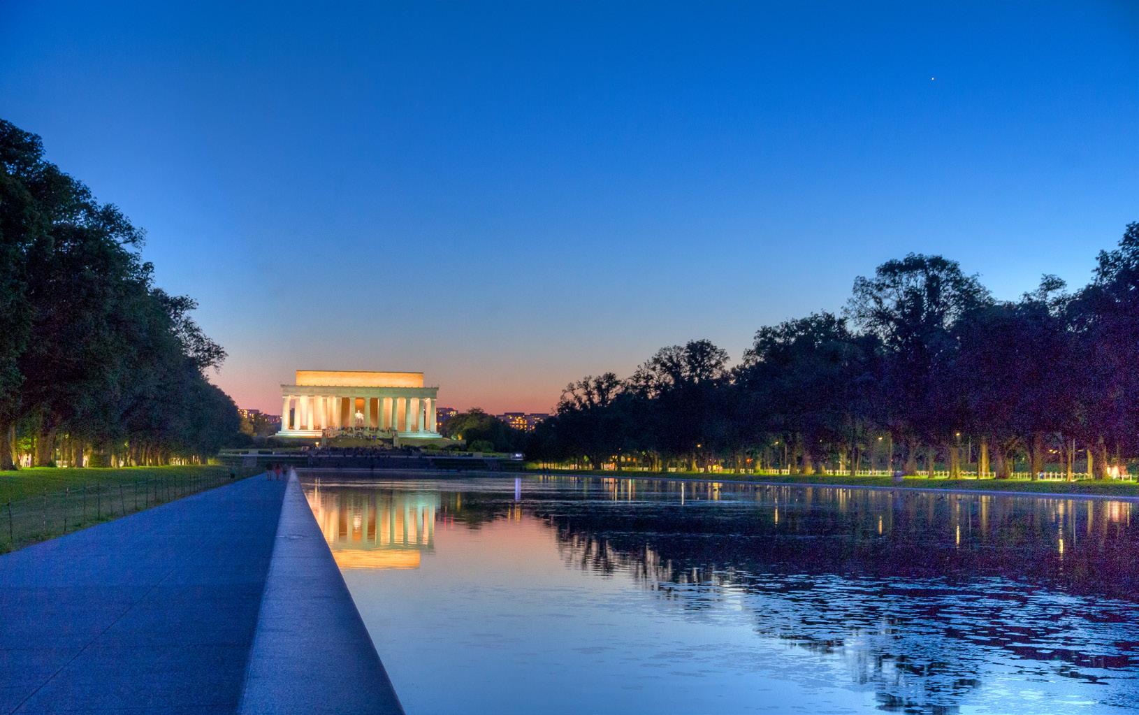
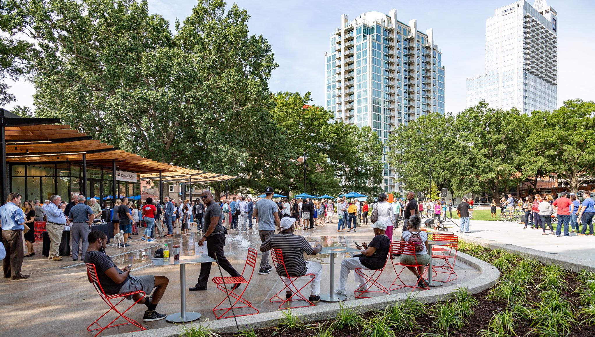

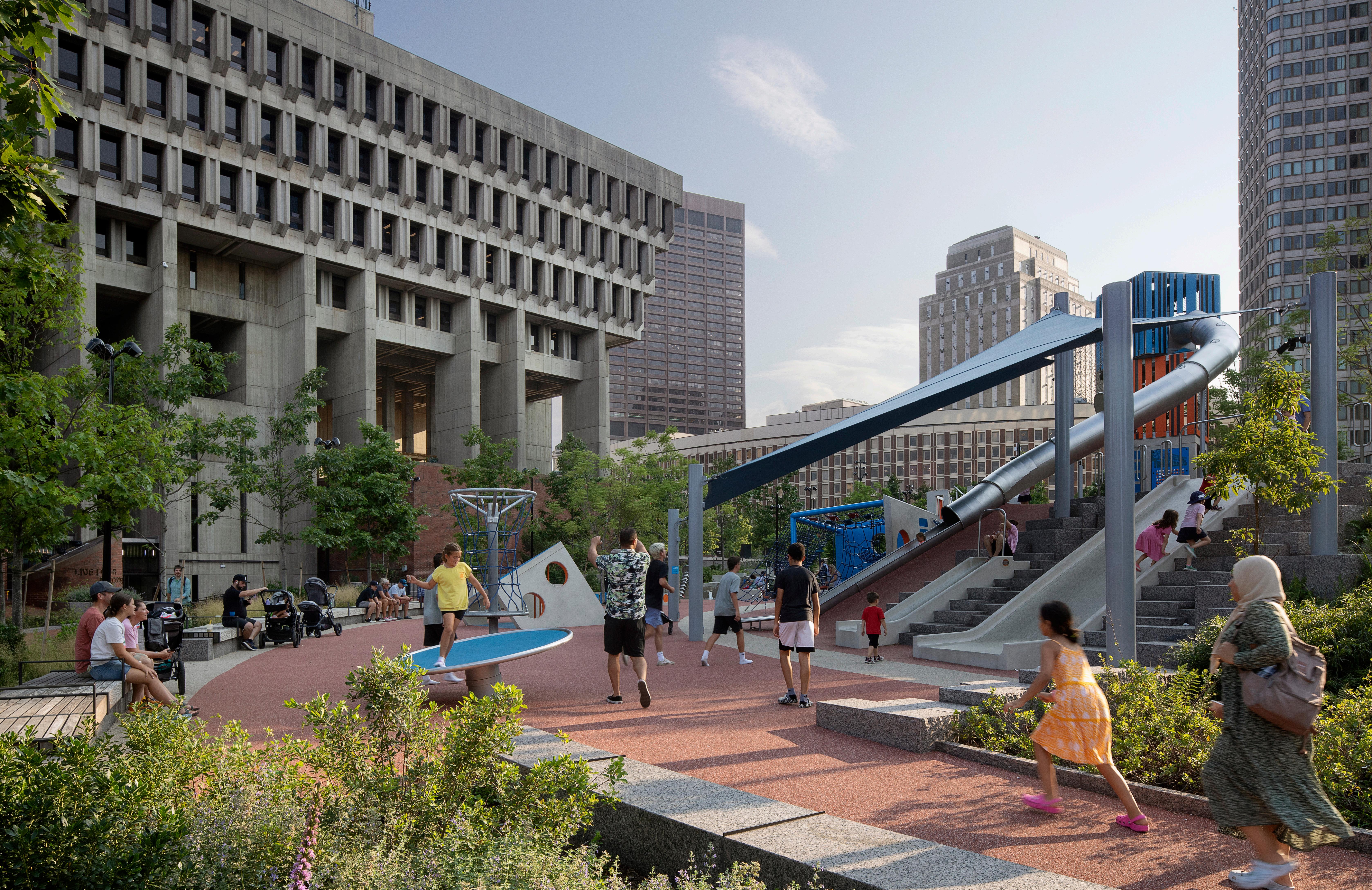
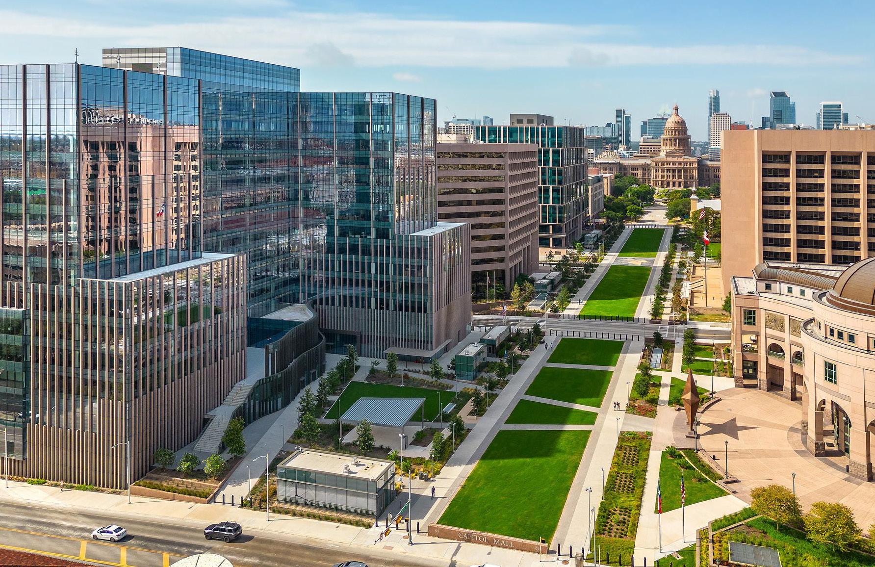
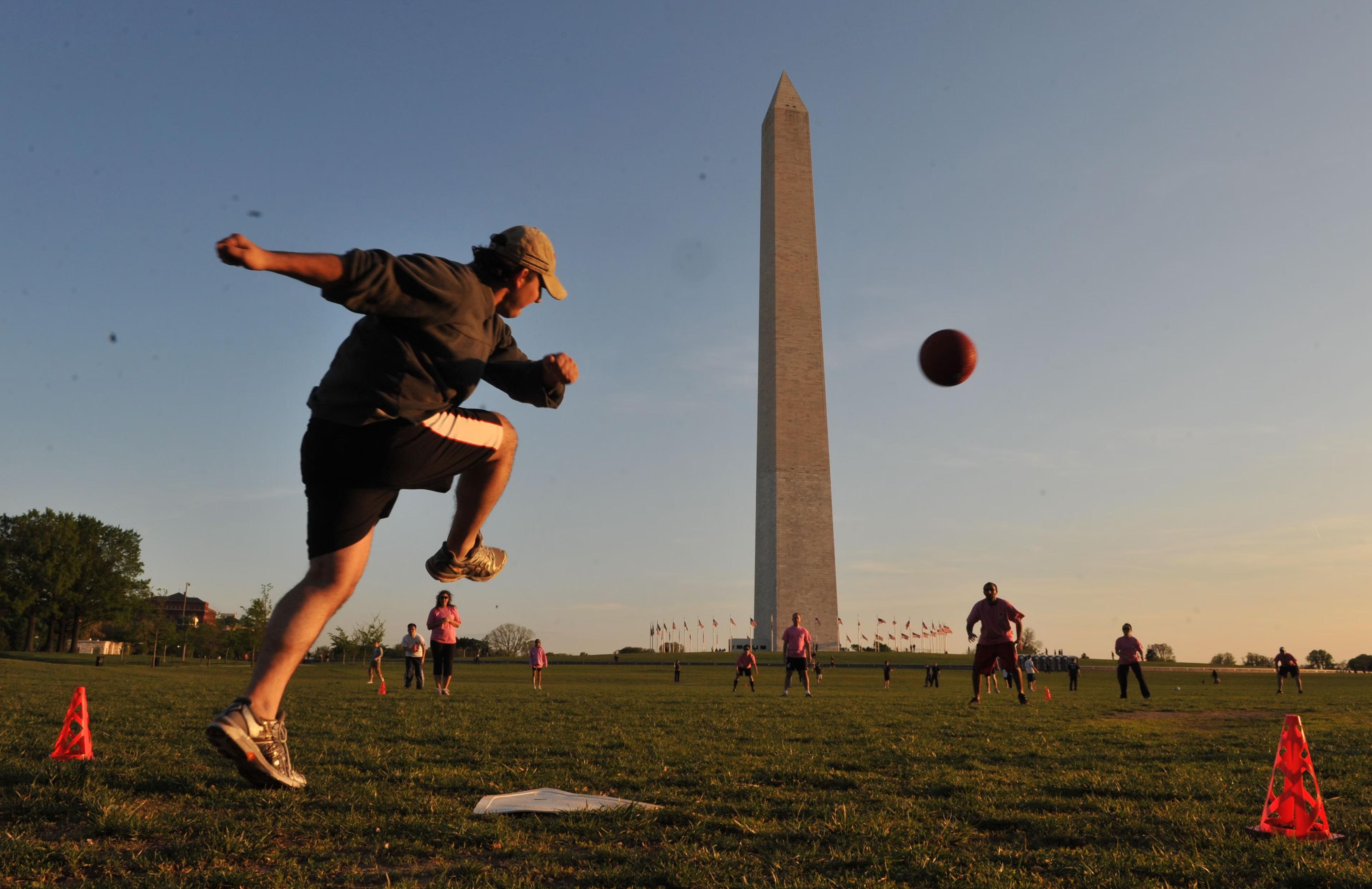
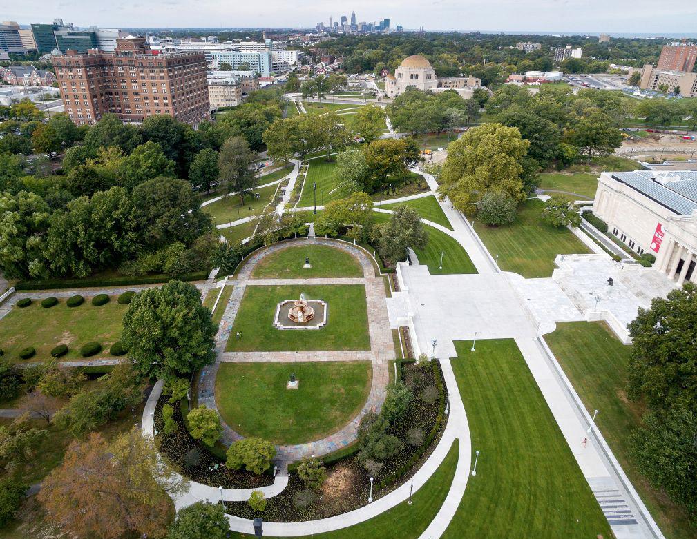 COPLEY SQUARE
ITHACA COMMONS
BOSTON CITY HALL PLAZA
PEARL STREET MALL



1 2 3 4 5 6 7
As Minnesota’s seat of government and destination for thousands of people each year, the Capitol Area offers the highest quality experience to visitors.
The Capitol building and Mall are central to the identity of Saint Paul and are a unifying focal point for the city, as Cass Gilbert once envisioned.
The Capitol Area is a model for Minnesota, where best practices are utilized in the planning, design, and development of public and private projects.
The entire Capitol Area provides an integrated, high quality, human scale public realm experience.
The Capitol Area is an urban multi-modal district, seamlessly connected to destinations and the larger mobility network of Saint Paul. Land use diversity is encouraged throughout the Capitol Area.
DESTINATION CONNECT PRESERVE ACTIVATE GROW


O Regional connectivity
O Arrival points
O Thresholds to the Capitol Campus
O Utilities
O Existing parking
O Street typologies

The Capitol Mall will forge connections between Minnesotans and their democratic institutions, through shared experiences, heritage, and physical connections which link the Capitol to the surrounding city and state.
7
Metro
BRT
- Planned
BRT Purple Line - Planned
Bikeways
Bikeways - Planned
Interstate Crossing
-
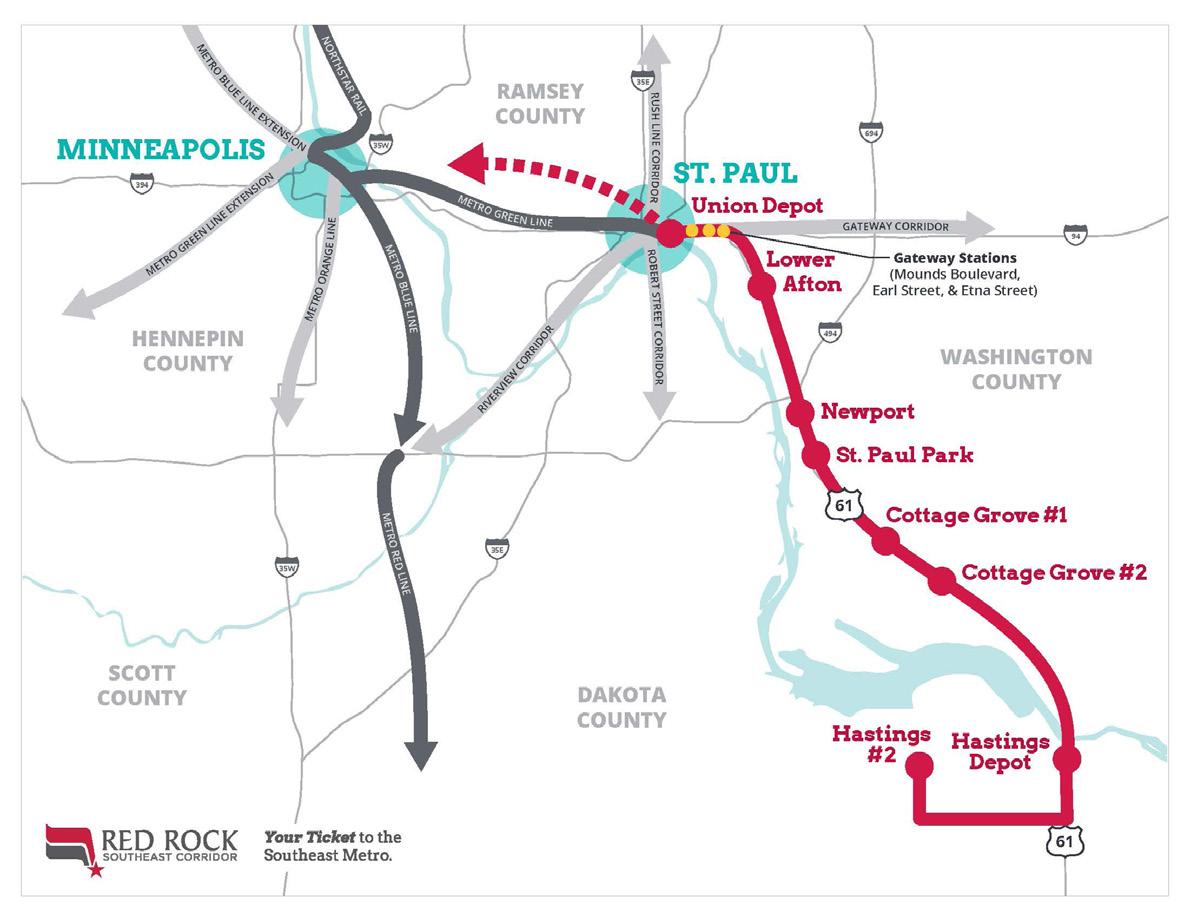
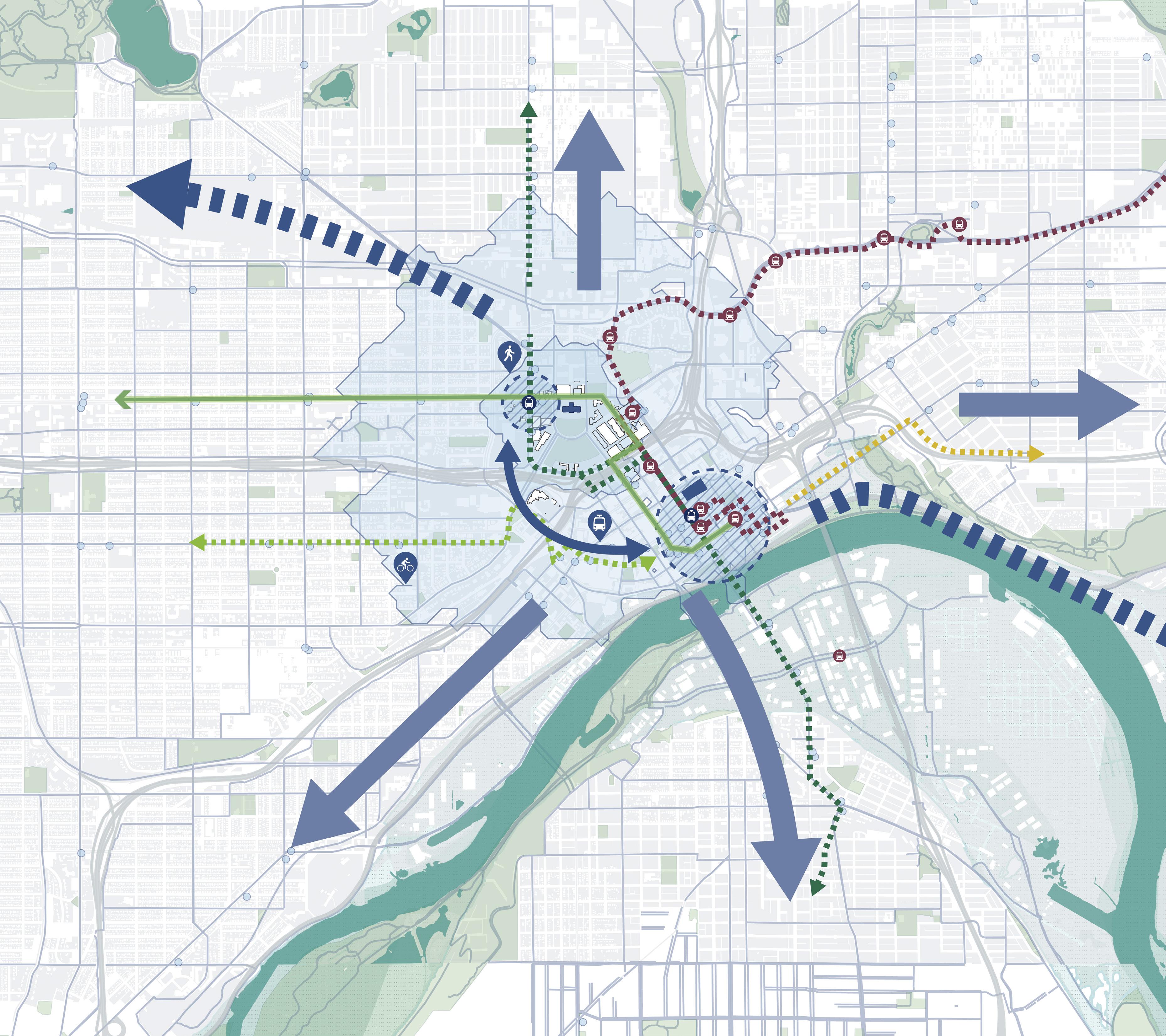
Sited as one of two prime locations to be an integrated mobility hub in the twins cities shared mobility action plan


O 7 identified arrival points with multiple transportation modes
O Existing light rail system services 2 of the 7 arrival points, marking the start of the pedestrian experience on site
O City-wide visual connections to Capitol Building from most major directions, as seen from 4 of the 7 arrival points. New plan should include strategies on enhancing visual corridor to Campus Mall.


 Image 1 John Ireland Blvd
Image 7 Como Ave and Rice St
Image 4 LRT Station at Robert St and 14th St
Image 3 Cedar St
Image 2 Saint Peter’s Bridge

Crosswalk Improvement Needed
Gaps in sidewalk
Underground Tunnel
Keycard Access
Public Access
ADA Ramp to Building Parking Entrance
Rack Transit Station Pedestrian Crossing Signal
The Capitol Campus is a critical path for nonvehicular connectivity between the adjacent neighborhoods and Downtown. The future Sears redevelopment underscores the need to accommodate increased local pedestrian traffic, including day and night activities.

KEY CARD ACCESS TO CAAPB BUILDING
PUBLIC ACCESS TO CAPITOL BUILDING
maintenance
TAKEAWAYS
Data

Water
Stormwater

Sewer
Underground Communication Electrical collection still in progress


10-Foot Underground Tunnel
Keycard Access
Parking is well-distributed and primarily located around the edges of the District, providing ease of access to nearly the entire site except for the central portion of the Mall and Capitol Building. The new plan of the Capitol Mall should embrace the changing parking demands with pedestrianfriendly structured solutions and preserve connectivity from the Capitol Campus to surrounding districts by reimagining medium and large surface parking lots. Surface parking lots
could be transformed into land use opportunities with the investment of “Smart Parking” technologies by the Department of Administration.
O Over 45 acres of land used for parking and 11,000+ parking stalls available in public and private lots and ramps (2040 Comprehensive Plan)
O 2 lots are rezoned as potential open space adjacent to Veterans Service Building

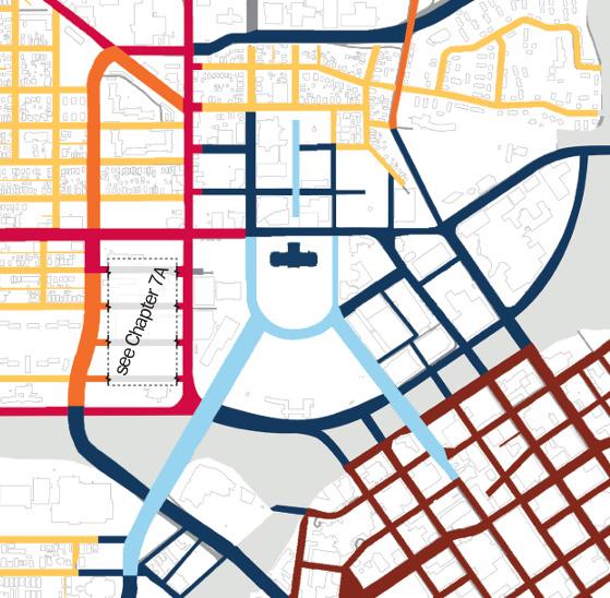

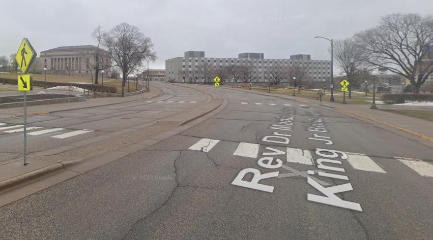
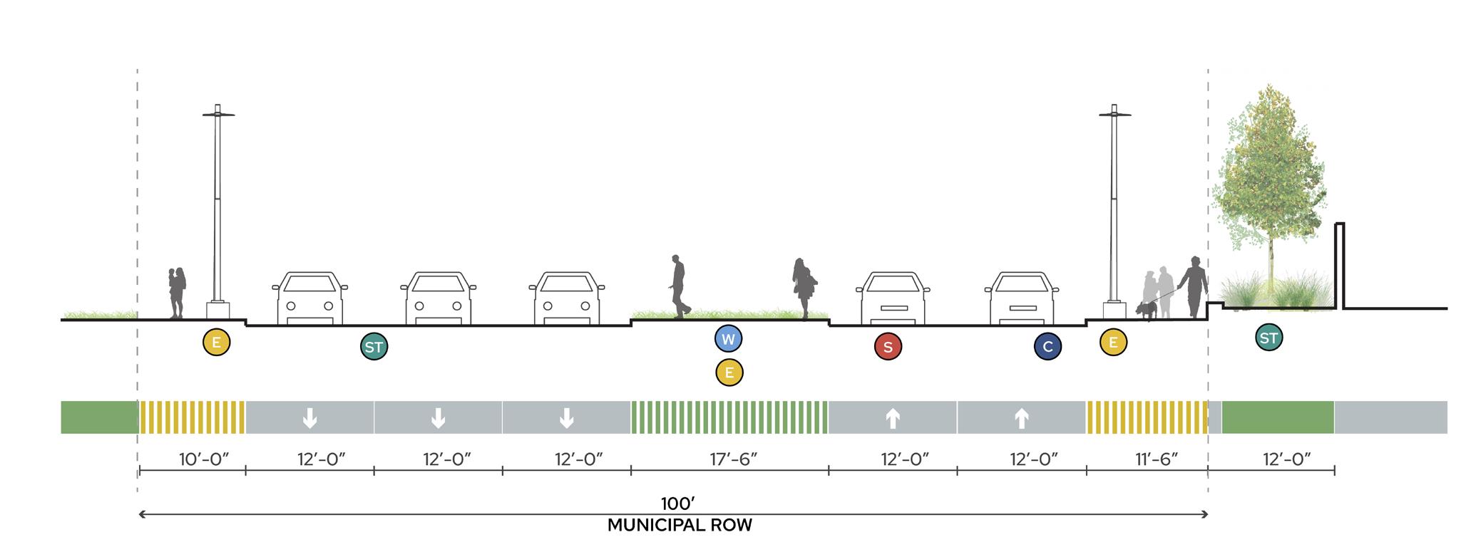


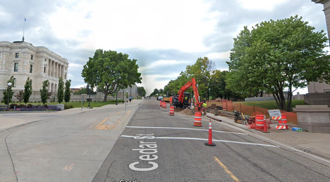


ROW DOES NOT SUPPORT CURRENT TRAFFIC DEMAND
Summarized from site analysis
INFRASTRUCTURE
HEAVY ARRIVAL POINTS IN CAPITOL AREA
INCOMPLETE PEDESTRIAN CIRCULATION IN CAPITOL CAMPUS
BUILT AND PERCEIVED BARRIERS AROUND THE CAPITOL CAMPUS
ESTABLISH MULTI-MODAL ARRIVAL POINTS TO CONNECT LOCAL AND REGIONAL CORRIDORS
PRESERVE AND INTEGRATE HISTORICAL RELEVANCE WITH GREEN CORRIDORS ALONG RICE STREET AND MAJOR AXES
ESTABLISH PEDESTRIAN CIRCULATION HIERARCHY WITH COMPLETE STREET FRAMEWORK AND WELLDEFINED OPEN SPACES
BETWEEN THE CAPITOL CAMPUS AND SURROUNDING DISTRICTS BY TRANSFORMING PARKING SPACES
O Rice Station will become a mobility hub that draws regional attention. It should be treated with a clear sense of arrival and indicate a clear route to the campus
O Provide a welcoming pedestrian experience at multi-modal arrival points with active landscape and building frontages
O Create nodes of activity by promoting green corridors along transit lines and major axes within a 5 to 10 minute walk
O Expand axes to the North and East neighborhoods by integrating sidewalks and bikeways to connect to major trails and corridors outside of Capitol Campus
O Design for growth by having efficient and accessible stops, coordinated signals, and integrate Smart Technology with dedicated parking spaces
O Facilitate movement for all users with dedicated bike lanes and separation from fast-moving vehicles along all vehicular lanes
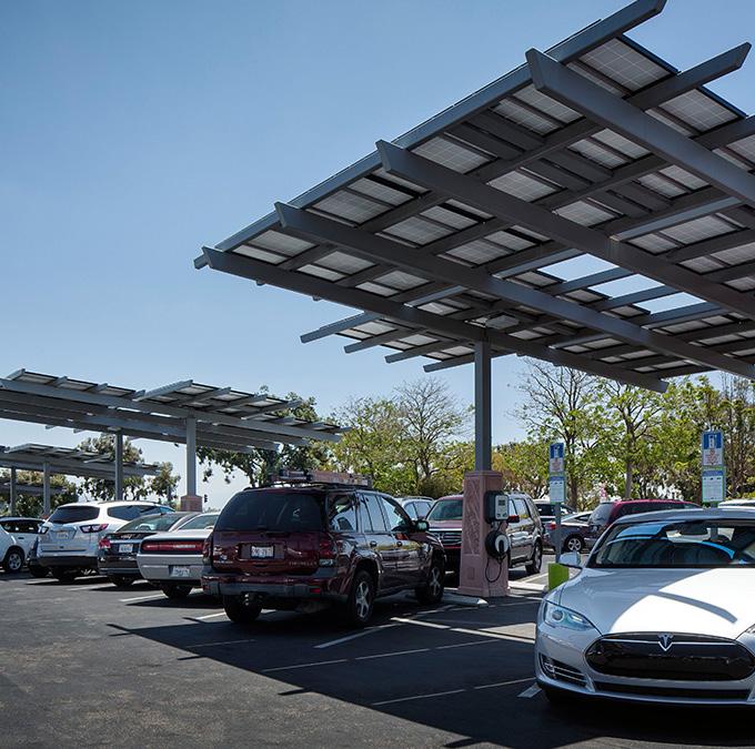
O Encourage green transportation by providing infrastructure like charging stations, dedicated parking and drop offs for ride-share

O Utilize tree allees to draw pedestrians into the central mall axis to reinforce the historic viewshed corridor
O Integrate Rice Street as a green corridor by promoting pedestrianfriendly crosswalks and landscape buffers with areas of respite through a Complete Street Framework
O Develop human-scaled green corridors that are human scaled, have a welcoming streetscape, share similar visual cues with the campus, and integrate to the whole park system
O Establish arrival points as visual entrances to the Capitol Campus with strategic placement of landscape buffers and urban street trees to frame views
O Promote sustainable stormwater management with green infrastructure, such as healthy trees, bioswales, and permeable surfaces that are efficient to maintain
O Incorporate smart technology to improve efficiency and accommodate changes in traffic volume on streets
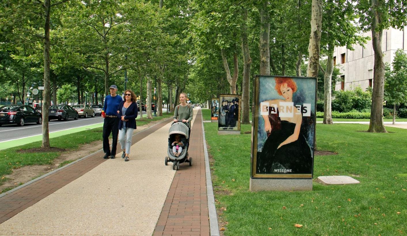
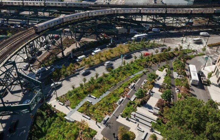
 Xuhui Runway Park, Shanghai, China
Dilworth Park, Philadelphia, PA
O Create sidewalks that are accessible for all ages, abilities and weather conditions. The campus should promote a vibrant walking environment through comfortable and human-scaled design with inviting building frontages
O Establish the Aurora Promenade as a shared street with removable bollards, drop offs, etc.
O Provide bike racks and bike lockers that are accessible from each building entrance (within 300 feet) to encourage alternative modes of micro-mobility
O Ensure crosswalks are at each major intersection with traffic signals and stop signs. Crosswalks should be placed every 200 to 300 feet to encourage pedestrian movement across areas

O Comprehensively analyze the parking demand for the campus and identify the barriers for pedestrian circulation
O Increase pervious surfaces in parking areas to reduce stormwater runoff volumes and increase water quality by utilizing bioswales and rain gardens.
O Incentivize alternative transportation through the reduction of parking to mitigate CO2
O Promote collaborative parking by utilizing shared parking strategies, flexible parking plans, and Smart Technologies
O Provide street parking with curb bulb outs and frontage buffers to calm traffic and act as an alternative to expansive parking surface lots
O Consolidate and streamline campus-wide parking strategy

O Timeline
O Capitol Mall evolution
O Historical demographics
O Period plans
O Historical site elements
O Viewshed analysis

The Capitol Mall will be an enduring representation of Minnesota’s rich past, design legacy, and landscape heritage while adapting to new maintenance and climate challenges.
History is often told from one lens. The MN Capitol’s story demands much more. In doing so, we can begin to unpack the various forces at play — whether that was the glacier carving Imnizaska (Dakota for “white cliffs”), or the impacts of urban renewal on nearby communities of color.

1853 - 1883
Original Capitol Building built; destroyed by fire & replaced
1895 - 1905
Cambrian + Ordovician Periods
Twin Cities Area Sedimentary Bedrock: 30’ thick layer Platteville limestone overlying 150’ softer Saint Peter sandstone
Pre-Wisconsin glaciation est. eventual course of Mississippi River (Haha Wakpa)
Wisconsin
Glaciation
Water carved Mississippi River Valley & formed cliffs, river terraces,& caves within Saint Paul’s tall river bluffs
Natural vegetation of Twin Cities (presettlement): oak woodland & brushland, dominated by bur oak & pin oak; aspen & hazel tickets; & prairie openings
Capitol area: deciduous savanna & prairie, with deciduous forest in the southwestern corner; low bluff or hills extended east to west through the southern portion of site; small creek ran south from what is now MNHS
ca. 12,000 - 8,000 YA
PaleoIndian Stage
ca. 8,000 - 3,000 YA
Archaic Stage
ca. 3,000 - 1,100
Woodland Stage 1,100 - 1650
Late Prehistoric Stage
1650
Earliest Euro-Americans
1903 Power Plant
Gilbert led relocation & construction of current Capitol Building
1903
Gilbert 1903 Plan: 3 major axes
1907
Capitol CommissionGroundsest.;
Gilbert 1907 Plan: revised to included gov. buildings
1837-1854
1861 - 1862
1929-1939
Adjacent low-income neighborhoods decried as “slum” & destroyed
1932 State Office Building
1950
Significant land clearance
1961 Armory
1953 Vet. Service Building
1958
1962
Clearance for future Sears site
1967
1992
Supreme Court relocated to Judicial Center; MNHS relocated to current site
2016
MN Senate Building
2017
Dep. of Admin. Building
Transportation & Centennial Office Buildings
1973
Vet. Services Building upper level connection
1986
1931
Gilbert 1931 Plan: additional building placement & southern extension across river
1932
Morrell & Nichols Plans for grading & planting
1930s
1946
Johnston/Nelson/Nichols Plan: extended Capitol Mall fan & located Vet. Service Building
ca. 1944
1956
1967
Project for the Completion of the Capitol Grounds
1989
Green river enhancementsplanting
1990
Capitol Restoration
2023State Office Building Expansion
2014
Green Line LRT
2017
Capitol Restoration
2020
Ash trees along I-94 removed & replaced
2023
East Campus studies for future development
Leif Erikson Park removed
1760
1830
Indian Removal Act
“Starving Winter” & Dakota War of 1862
Various treaties (later determined invalid) pushed communitiesDakotaout of their traditional villages 1863 Remaining Dakota forced out of MN
Twin Cities redlining
90% city’s Black pop. lived from Rondo Neighborhood to Capitol area ca. 1900
Immigrant & Black communities settled around Capitol Area
1957
Rondo Neighborhood destroyed by I-94 construction; many American Indians resettled in the Twin Cities
Legislative Building Commission created
2020 - 2023
COVID-19 Pandemic; Black Lives Matter
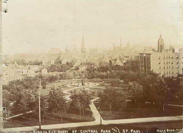

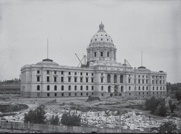

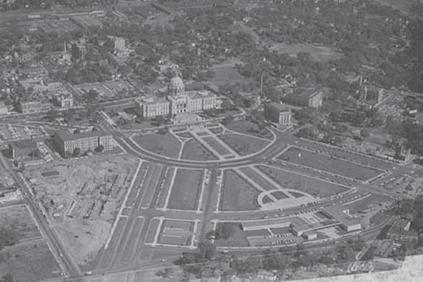
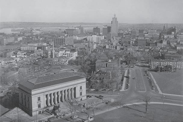

The Capitol Area has grown and developed significantly since the Capitol Building’s initial construction on its current site in 1905. However, it has consistently stood as an icon and symbol for Saint Paul and the state.

Source 12. Informed by the City of Saint Paul 2040 Comprehensive Plan (2020), Historic Context Report... (2022), and other public guiding documents.

Established three major axes: commerce, culture, and nature; network of green gardens to river; and primary views
O Cass Gilbert set forth bold plans that prioritized views, axes, and the Capitol’s position over (and connection to) Downtown. Many of these plans never came to fruition.
O The 1946 Nichols Plan bifurcated Gilbert’s central axis and viewshed across the river (undoubtedly influenced by future plans to build I-94).
O Later plans addressed the Capitol Mall’s landscape/public realm, as well as the loss of connectivity to Downtown after the construction of I-94 in 1967.


Revised to include government buildings

Revised to include government buildings (State Office Building).

Extended Capitol Mall fan & located Veterans Service Building, bifurcating Gilbert’s original plan.
Other planning and design efforts involving the Minnesota Capitol Mall include:
O Green River Planting Enhancements (1989)
O Capitol Restoration (2017)
O 2040 Comprehensive Plan for the Minnesota State Capitol Area (2021)
Source 13. Informed by the City of Saint Paul 2040 Comprehensive Plan (2020), Historic Context Report... (2022), and other public guiding documents.
1931 CASS GILBERT PLAN 1946 JOHNSTON / NELSON / NICHOLS PLAN 1986 PROJECT FOR THE COMPLETION OF THE CAPITOL GROUNDS 1970 COMPREHENSIVE PLAN FOR THE MINNESOTA STATE CAPITOL AREACass Gilbert’s early plans demonstrated a sensitivity to existing urban fabric around the State Capitol; this inherently preserved porosity and connectivity to adjacent neighborhoods and Downtown.
This same sensitivity was lost over time as sweeping land clearance, larger blocks, and the automobile became more prevalent. This can be observed by the sheer number of streets connecting to the Capitol Building site from 1903-1907 versus what exists at the Capitol Mall today.

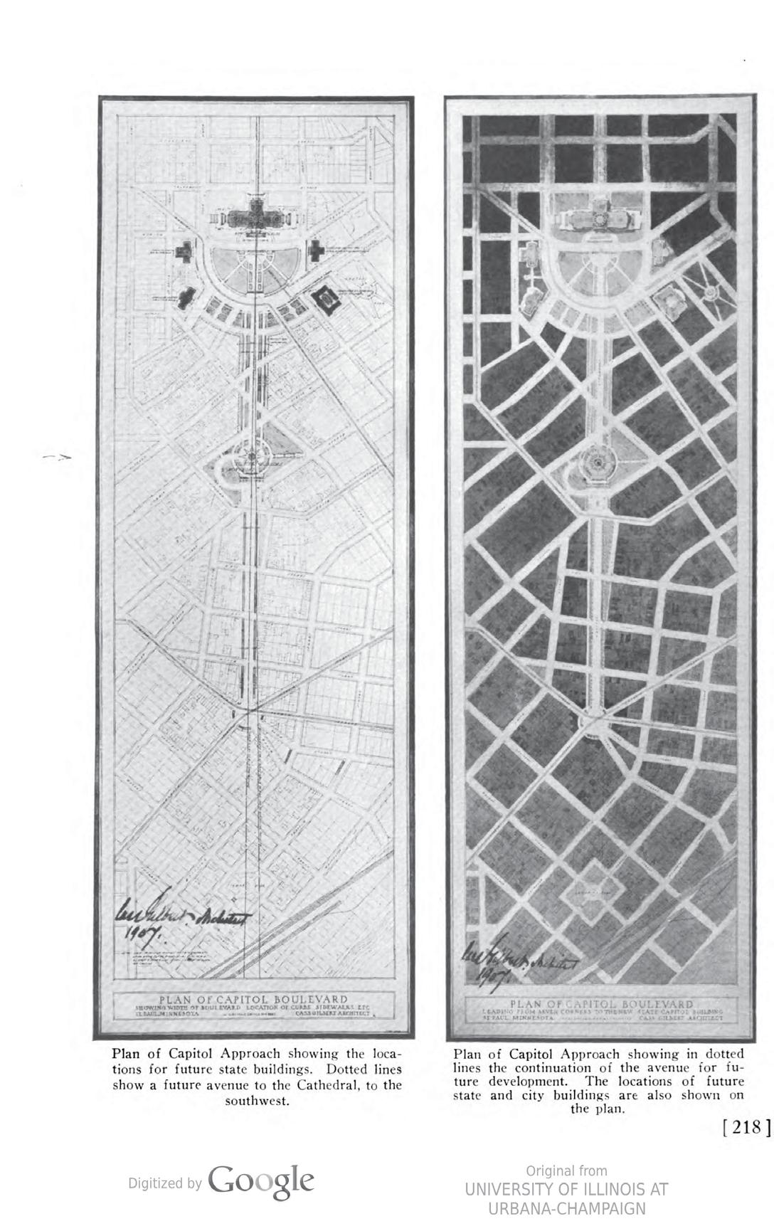


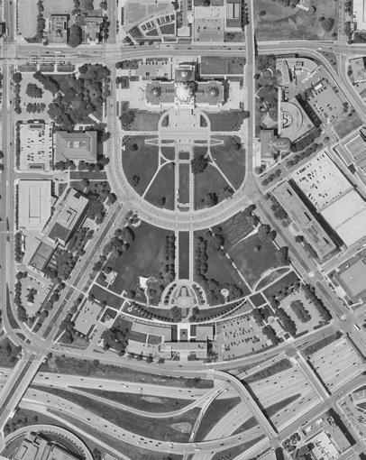
Many historically diverse neighborhoods surround the Capitol Area. These communities have been disenfranchised and / or forcibly relocated over the last two-hundred years. The Indigenous American and Black communities were hit particularly hard. The Dakota suffered both great loss in terms of people and land — what was left of their community was relocated to distant reservations.
The Black neighborhoods were redlined and intentionally bisected by the construction of I-94. While many Black people still live in close proximity to the Capitol, many more were pushed northward.
Source 15. Informed by the Historic Context Report for the Minnesota State Capitol Planning & Context Development Project (2022).
Black neighborhoods in Saint Paul (Bisected and many residents displaced by I-94 construction)
1900-1960
Jewish neighborhoods in Saint Paul 1850-1900
Black neighborhoods in Saint Paul 1880-1915
1860-1900
Carver’s Cave (Wakaŋ Tipi)
1880 - 1950
Dayton’s Bluff Mound Group
Indian Mounds Park Mound Group
Kaposia (Kap’oża) (to 1837)
Jewish neighborhoods in Saint Paul 1890 - 1940
1930 - Present
German residents concentrations over 10%
Irish residents concentrations over 10%
Swedish residents concentrations over 10%
Jewish neighborhoods
Black neighborhoods
Contact-period Dakota Places

Kaposia (Kap’oża)

CAAPB Boundary
Historic Rondo Neighborhood
Today’s Parcels
Today’s Highways
Much of the diverse and vibrant neighborhood fabric adjacent to the Capitol Mall has been demolished to accommodate parking lots, freeways, and large urban redevelopments (like the now-closed Sears site). With that, communities of color were also pushed out.
Source 16. Informed by the Historic Context Report... (2022) and CAAPB data.

TAKEAWAYS
SOUTH FROGTOWN
CAAPB Boundary
NRHP-listed Historic District
Eligible Historic District
Other Notable Landscapes
Historic Rondo Neighborhood
Historic Listing: Locally and Nationally Listed (outside CAAPB Boundary)
Historic Viewshed
Sculptures, Monuments, & Memorials
NRHP-listed (within CAAPB Boundary)
Norwegian Evangelical Lutheran Church (1915)
NRHP-listed + Contributing Property to Determined Eligible Historic District
MN Capitol Building (1905)
C
Contributing Property to Determined Eligible Historic District
A D E F G H I J K
MN Historical Society Building (1918)
Source 17. Informed by the Historic Context Report... (2022).
State Capitol Power Plant (1903)
State Office Building (1932)
MNDOT Building (1958)
Veteran’s Administration Building (1973)
State Capitol Mall (1955)
Centennial Office Building (1958)
National Guard Armory Building (1962)
State Register of Historic Places (within CAAPB Boundary)

Each space was lined with a row of trees reinforcing circulation.
Each space was lined with a row of trees reinforcing circulation.
Given
Fuller
Aurora
Based on aerial photography
Based on aerial photography
Tree loss at Leif Erickson Park
Tree loss at Leif Erickson Park
Significant tree loss
Significant tree loss
Significant tree gain
Significant tree gain
Tree planting emphasis shifts toward Court of Honor and middle EW arcing walkways. Trees Locations
Tree planting emphasis shifts toward Court of Honor and middle EW arcing walkways. Trees
Based on aerial photography
Based on aerial photography
The Capitol Mall contains numerous sculptures, monuments, and memorials dating back to the early 1900s. The oldest structures are located near the Capitol Building as well as near the Veterans Service Building. Given the determined period of significance, sculptures, monuments and memorials built between 1902 and 1962 (noted as “Contributing” in the legend below) require the most preservation consideration.
CAAPB Boundary
Eligible Historic District
Sculptures, Monuments, & Memorials 1903 - 30 (Contributing)
Oldest: Soldiers and Sailors Memorial “Progress of the State”
John A. Johnson Statue
Knute Nelson Statue 1931 - 60 (Contributing)
Christopher Columbus Statue, (toppled by protests in June 2020)
Leif Erikson monument
Liberty Bell Sculpture
Promise of Youth Fountain
Gov. Floyd B. Olson Statue
Court of Honor
Earthbound Monument
USS Ward Gun
1961 - 90 (Non-Contributing)
‘Monument to the Living’
Charles A. Lindbergh Memorial ‘The Boy and the Man’
1990- 20 (Non-Contributing)
MN Vietnam Veterans Memorial
Roy Wilkins Memorial
Peace Officers Memorial
MN Korean War Veterans Memorial
MN Woman Suffrage Memorial
MN World War II Veterans Memorial
MN Workers Memorial Garden
MN Fallen Firefighters Memorial
Hubert H. Humphrey Statue
Military Family Tribute: Gold Star Table
Military Family Tribute: Story Stones
Special Forces in Laos Memorial
Transportation Worker Memorial


Dedication War & Military Government Individuals Groups

Demographic White Men BIPOC Women
The monuments can be thematically organized into war and military, government, and those dedicated to individuals and groups. Individual monuments commemorate a single person, while group monuments commemorate larger communities (e.g. women, workers, firefighters, etc).
O 70% of participants in prior engagement efforts called for change when it comes to art, monuments, and statues.
O “We need more recognition of the history of BIPOC, women, and LGBTQ communities.”
O 26% dedicated to White Men
O 37% dedicated to War/Military
O 7% dedicated to BIPOC
O 4% dedicated to Women
O 0 dedicated to LGBTQ+ communities
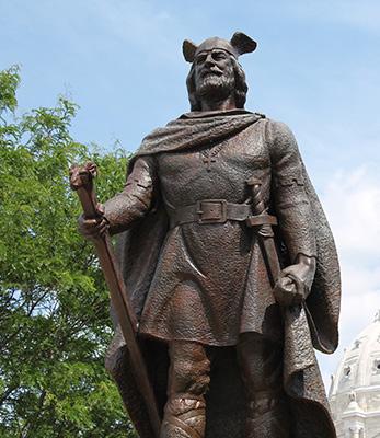



Hardly see the Capitol Building
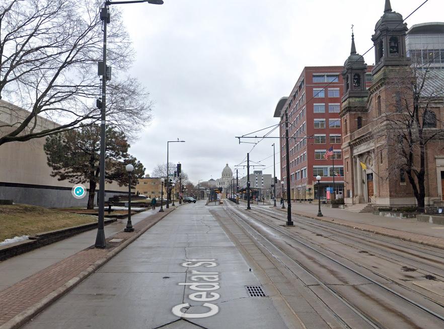
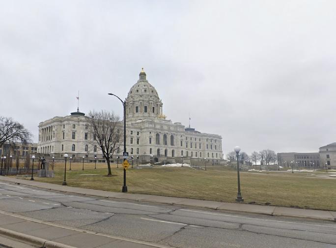
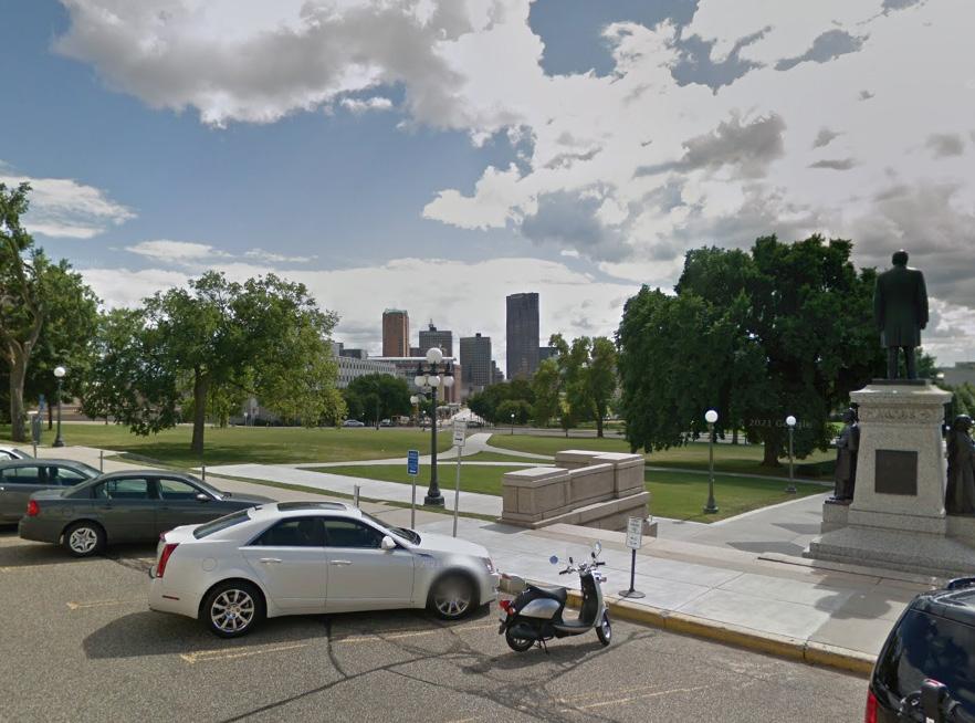
O The viewshed analysis studied the relationship between the Capitol Building and downtown Saint Paul - the impressive views that were described in Gilbert’s plan.
O The view of the Capitol Building is largely depending on the topography and adjacent buildings. Trees have less of an impact than the topography.
O Downtown Saint Paul can be easily seen from many directions because it sits on higher ground. The location and height of the trees along the main view corridor between Cedar St and Wabasha St influences the view due to the topography drop.



Hardly see Downtown


HISTORIC AND NONCONTRIBUTING FEATURES PRESENT
Summarized from site analysis
UNFULFILLED OR DISRUPTED HISTORIC PLANS
A LOSS OF HISTORIC URBAN FABRIC AND NEIGHBORHOODS
LACK OF INCLUSIVE & HOLISTICALLY CURATED COMMEMORATION
PRESERVE, MAINTAIN AND CELEBRATE HISTORIC LANDSCAPE ASSETS WHILE ADAPTING TO CURRENT AND FUTURE CLIMATE CHANGE
DRAW INSPIRATION FROM UNFULFILLED HISTORIC PLANS WHERE APPROPRIATE - INCLUDING VIEWSHEDS, PLANTING STRATEGIES, ETC.
MEMORIALIZE THE LOSS OF HISTORIC NEIGHBORHOODS AND IDENTIFY AREAS OF SENSITIVE AND CULTURALLYRELEVANT INFILL
REFLECT A HOLISTIC AND INCLUSIVE MINNESOTAN HISTORY THROUGH ARTFUL CURATION AND A FOCUS ON BIPOC, WOMEN, AND LGBTQ+ COMMUNITIES
O Protect historically contributing landscape features through preservation, restoration, and rehabilitation
O Allow additions in conformance with the treatment guidance. Ensure new features are approved, designed, and placed at the discretion of the CAAPB
O Remove existing features that diminish the integrity of the Capitol Mall, like parking lots, and replace with ecologically resilient landscapes / uses
O Utilize historically relevant and resilient plant species. Increase tree canopy where historically relevant and ensure new trees do not damage archaeological sites. Ensure new plantings / landscapes preserve historic axes, viewsheds, etc
O Prioritize historically relevant pedestrian-oriented circulation networks
O Develop a Capitol Mall Historic District branding strategy
O Ensure regular maintenance and repair for all contributing features of the Capitol Mall

O Refer and give precedent to all historic plans during the period of significance (1902-1962), including the early Cass Gilbert Plans and 1946 Nichols Plan.
O Consider the reconstruction of unbuilt landscape features (initially proposed by Gilbert and Nichols), like the segmented and landscaped malls parallel to the radial boulevards
O Draw inspiration from post-1962 plans, so long as they support the historic integrity of the mall -- including the 1986 Project for the Completion of the Capitol Grounds
O More conclusive strategies are pending and will be determined by the Cultural Landscape Report
 Source 21. Historic viewshed looking toward Capitol Building along John Ireland Blvd
Source 22. Cass Gilbert 1931 Plan
O Acknowledge and address past displacement and community erasure through audio-visual walks and/or memorials
O Propose redevelopment and new public realms that are culturally relevant and responsive to nearby/ displaced communities, including the vacant Sears site
O Propose redevelopment and infill of various scales that respond to the adjacent neighborhood fabric
O Include affordable housing as a critical component of any new development
O Implement anti-gentrification measures for communities adjacent to new development

O Identify and illuminate missing and/or neglected historic narratives through various programming strategies
O Curate a campus-wide approach to effectively tell the complete story of Minnesota’s history through strategically placed memorials and public art
O Thoughtfully site inclusive and diverse commemorative memorials as a part of the curated campus-wide approach
O Recognize and celebrate the Dakota Tribe and other Indigenous Americans
O Highlight and celebrate historic immigrant and African American communities
O Highlight and celebrate women and LGBTQ communities
O Identify and determine the treatment of harmful memorials


O Capitol Area amenities
O Existing park gap analysis
O Demographics
O Existing programming and events
O Security and access
O Future opportunities

The Capitol Mall will become more welcoming for more Minnesotans to gather and share ideas through events, activities, and opportunities to authentically tell a diversity of Minnesotan stories.
Source
Educational
O
Mall has the opportunity to partner with various nearby community amenities like the Frogtown Community Center and Regions Hospital.
O The Capitol Mall is surrounded by various distinct neighborhoods.
O The Capitol Mall is bounded by government office / institutional buildings that only operate during business hours and provide very few daily life amenities.

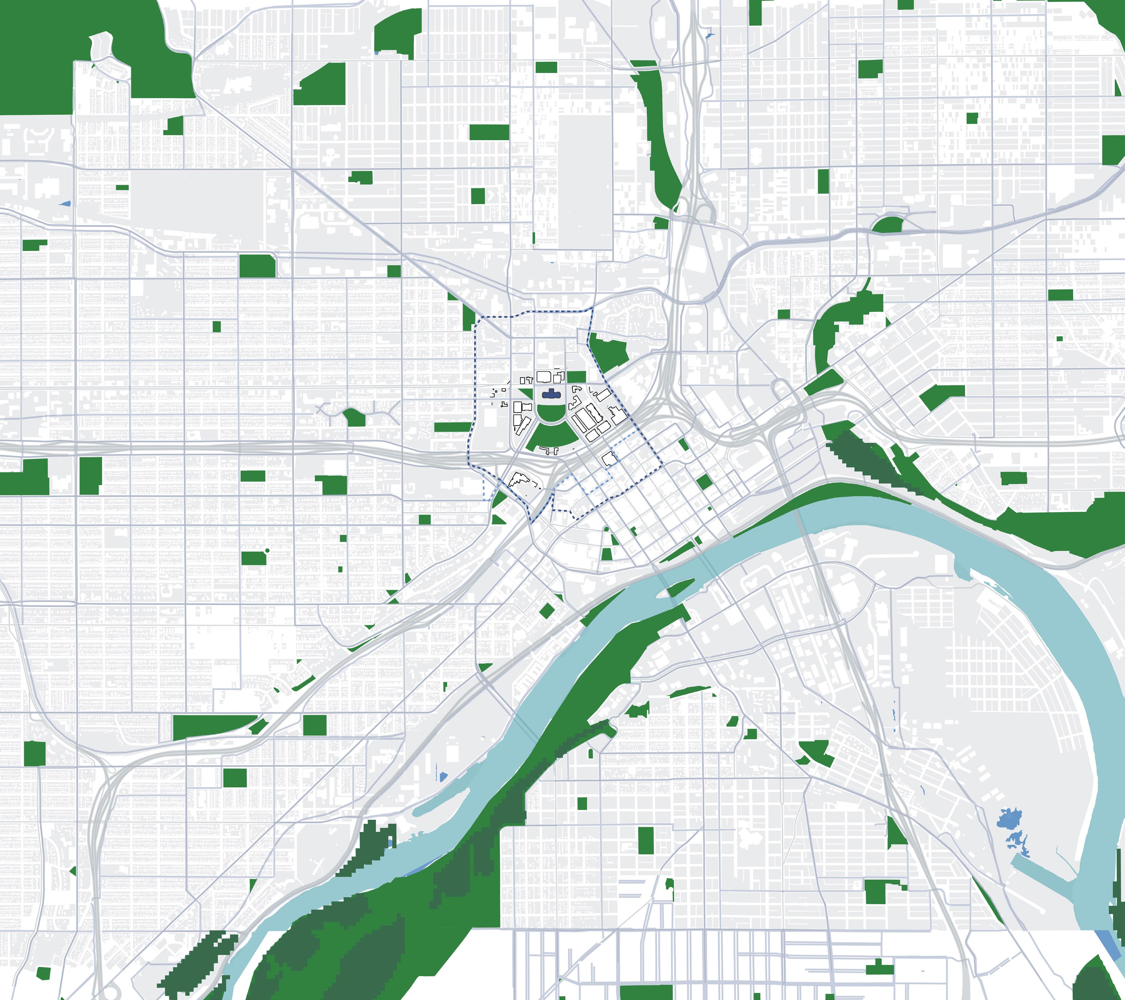

0
Source
by Census Data provided by
O Recent engagement data reveals people of color use the Capitol Mall far less than those who identify as White, despite living in such close proximity.
O The Capitol Mall has the opportunity to be the “backyard” or prime gathering space for these diverse communities.
O The neighborhoods to the north of the State Capitol contain many families. Capitol Mall programming should accommodate this.


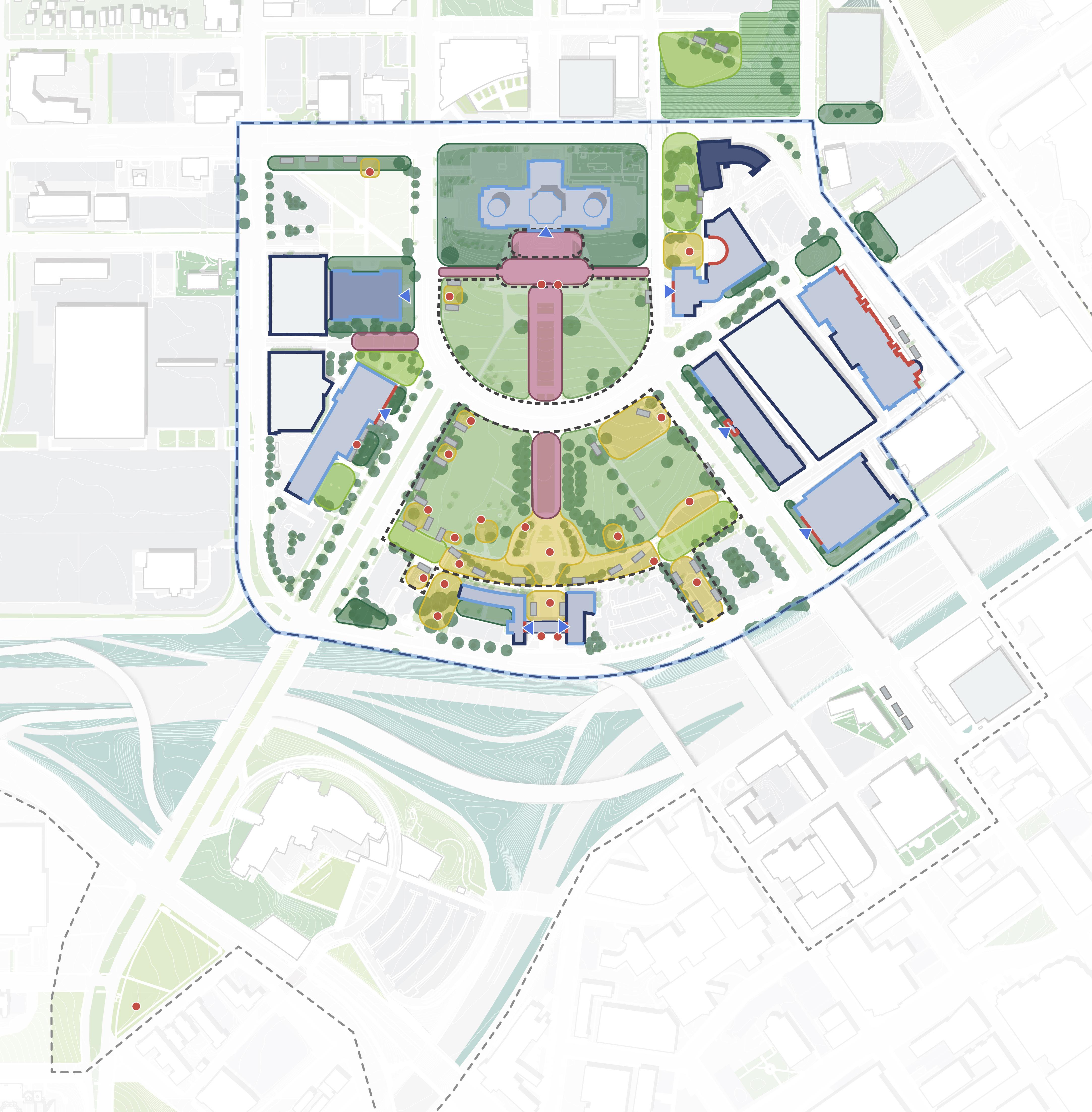
Capitol Mall
*Programmatic “Rooms”
Large lawn (>30,000SF)
Small lawn
Promenade / Steps
Contemplative
Building / Street Buffer
Other
Permitted Event Spaces
Sculptures, Monuments, & Memorials
Bench / Seat Areas
Public Building Entrance
Building Public Access
Private, Closed to Public
Semi-Public, Business Hrs (By Appointment Only)
Semi-Public, Business Hrs (Capitol Building open Saturdays)
Public, Cafe, Business Hrs
O The Capitol Mall is primarily used for exercise walking, first amendment demonstrations, enjoying the gardens / lawns, and the occasional large event.
O While the Capitol Mall has ample open space, it lacks diverse and specific programming.
O Most of the Capitol Mall buildings are semi-public and only open during business hours.
Ground Floor Building Frontage
Active (Entrances)
Office/Institutional (Windows)
Inactive (Solid Wall, Parking Garage)
*Programmatic “Rooms”refer to spaces that feel distinct with obvious edges like walkways, roadways and/or landscaping.
Potential / suitable programs for the existing slope percentages
0
5
Slopes
O
Mall have dramatically different areas and slope profiles; they should consider different programming accordingly.
O
accessibility is a critical measure of inclusive design. Many sidewalks, particularly along Cedar St, are difficult to traverse.


Capitol
Permitted Event & Allocated Protest Spaces, High-Visibility Zones
Allocated Counter-Protest Space
Critical Security Zones / Areas in Need of Immediate Security Upgrades
Building Entrances
Vehicular Entries to Mall
Underground Tunnel Network
Parking Garages (inactive facades)
Barriers
**Other
O Visibility is critical to Capitol Mall security. Tree canopy inhibits visibility, but provides shade and human comfort. The CMDF will need to balance these considerations.
O The Upper and Lower Malls are at risk of vehicular threats, especially during public assembly. Fencing and other blockades impede the natural feel of public accessibility. The CMDF will need to address such threats while ensuring the Capitol Mall still feels welcoming to all those exercising their first amendment rights.
O Other potential threats surround the LRT Green Line Stations, which are in need of infrastructural security upgrades.
O Small informal gatherings are not allowed without a permit
O The public outlines the following areas as feeling unsafe in ongoing engagement surveys: LRT station at University Ave and Rice St, Cass Gilbert Park, and the lower portion of the Mall near I-94.
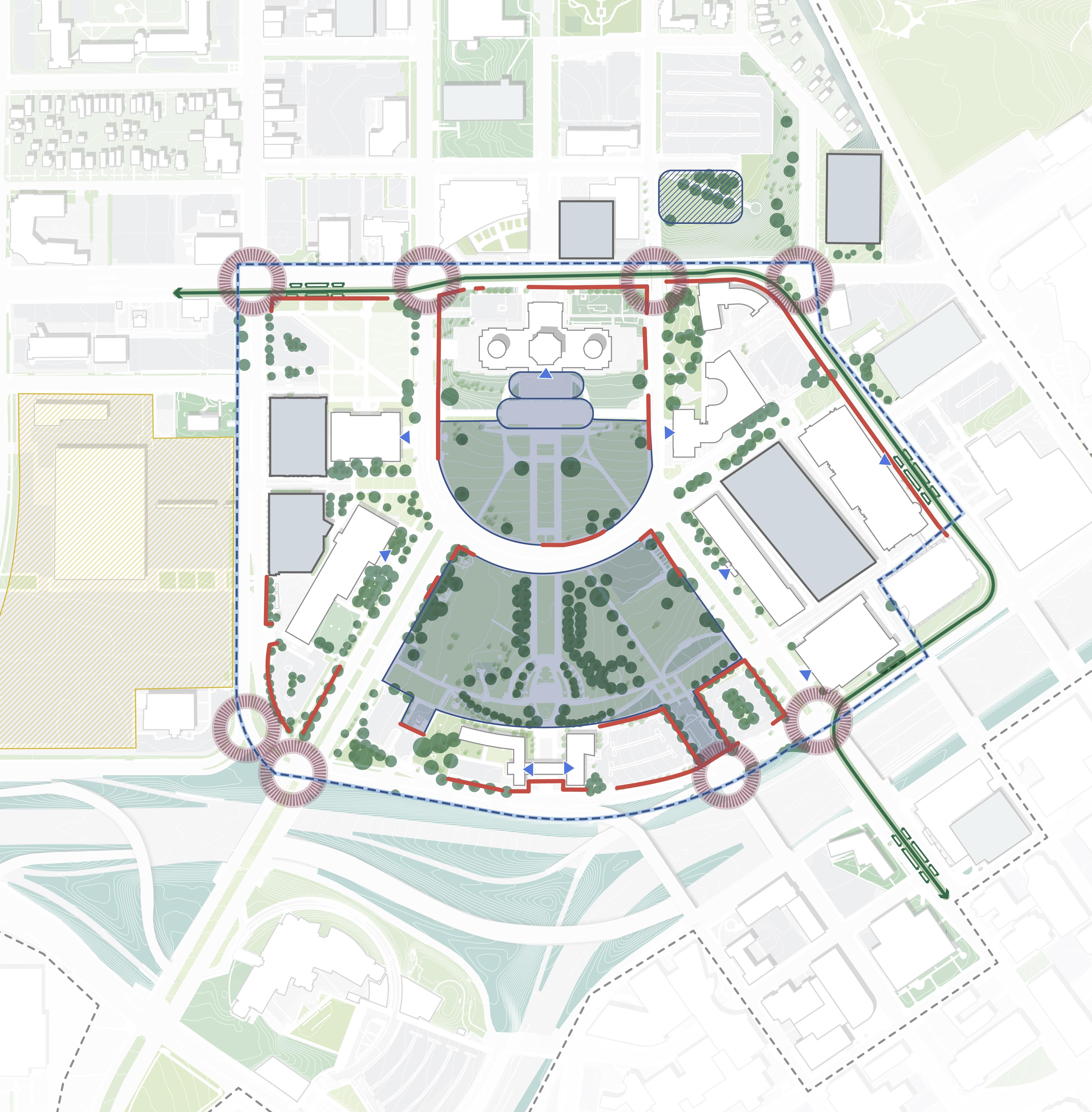
Source
O There are various ongoing / proposed improvements outlined in the 2040 Comprehensive Plan and other guiding documents. The CMDF will need to respond to, inform, and coordinate with these efforts.
N
Future Development Plans
Future Building Plans
Important Intersections
Intersection Improvements
Streetscape Improvements
Future Public Realm Improvements

MINIMAL LANDSCAPE AND ADJACENT BUILDING USE RELATIONSHIP
summarized from site analysis
LIMITED EVERYDAY AMENITIES FOR CAPITOL USERS AND NEIGHBORS
ENSURING THE CAPITOL MALL IS WELCOMING TO ALL BALANCING SECURITY AND PUBLIC ASSEMBLY
CREATE OUTDOOR SPACES THAT RESPOND TO AND COMPLEMENT EXISTING AND FUTURE BUILDING USES
DESIGN FOR THE DAY-TODAY AS WELL AS WEEKLY, MONTHLY, AND SPECIAL EVENTS
ALIGN SECURITY PRACTICES AND TECHNIQUES WITH DESIRED PHYSICAL DESIGN ATTRIBUTES
DESIGN INCLUSIVE SPACES WITH DIVERSE PROGRAMMING TO ACCOMMODATE VARIOUS LIFESTYLES
O Coordinate with ongoing and future site developments to ensure optimal connectivity and access to the Capitol Mall; historic site features (like viewsheds) are maintained; and more
O Utilize strategic planting and other landscape features to emphasize building entrances and aid in wayfinding or place recognition
O Utilize the landscape as an educational opportunity, especially in historic story-telling
O Provide adjacent outdoor dining and working opportunities for government staff on campus
O Create landscape and streetscape conditions that accommodate active building frontage. Create multiple active hubs for small scale gatherings within a 5 to 10 minute walk
O Diversify the landscape programs across the campus

O Design civic spaces of varying sizes that accommodate both active and passive activities
O Provide easy access to and from the site in the form of diverse mobility options, e.g., transit stops, bike lanes, complete sidewalks, crosswalks, pedestrian signals, and (affordable) parking opportunities in close proximity to the site
O Implement planting strategies that accommodate diverse programming needs. Design spaces for human comfort
O Ensure the site’s infrastructure can accommodate large groups of people
O Provide access to everyday amenities like clean and secure toilet facilities. Eliminate barriers to everyday amenities
O Promote daily life amenities for government workers and nearby communities that operate beyond the hours of 9am to 5pm
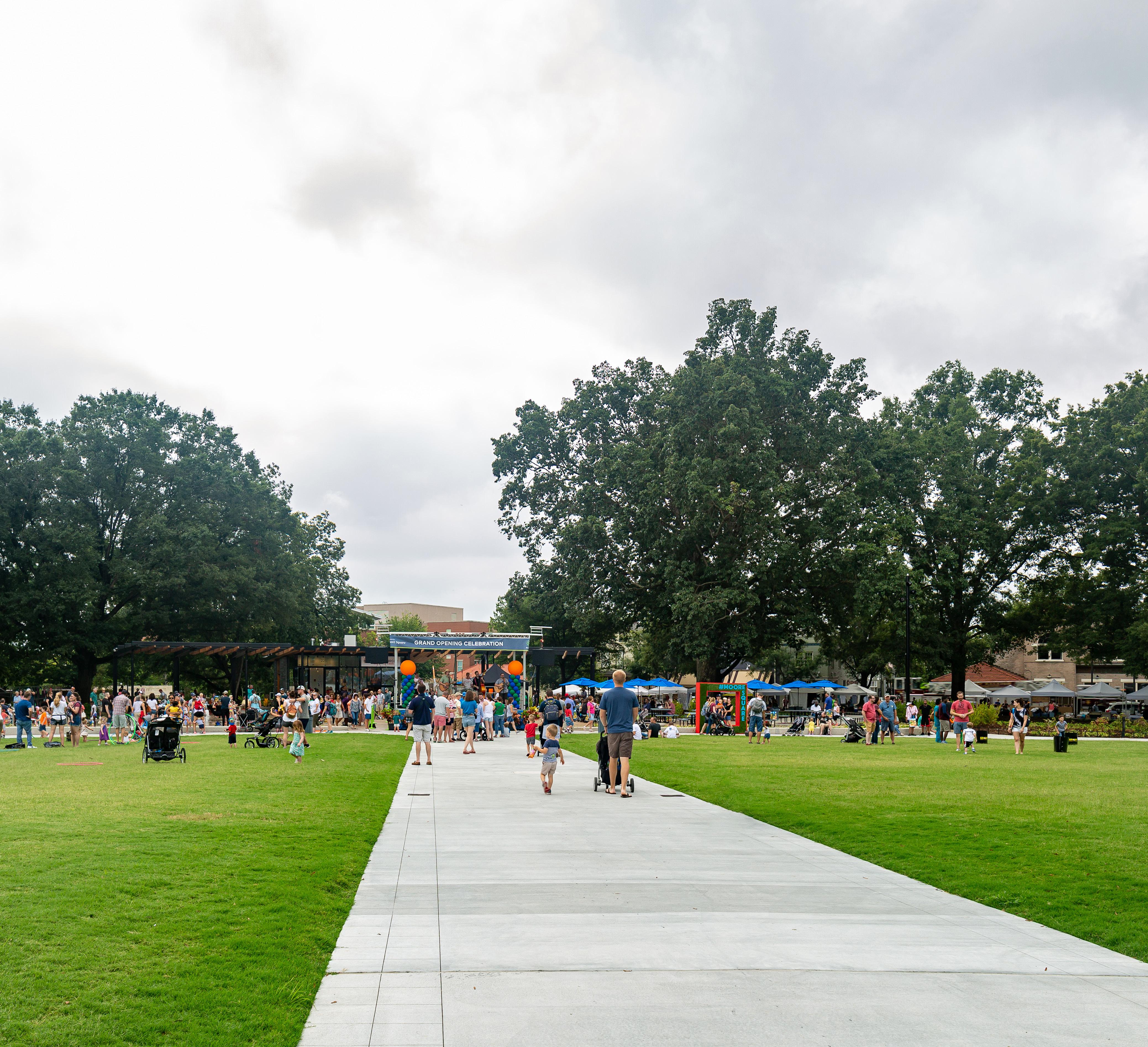
 Moore Square, Raleigh, NC
O Provide ample lighting within the site and along access routes to and from supporting site services and amenities
O Provide clear, well-kept paths and sightlines that are not obstructed by low-canopy trees, overgrown or dense vegetation, changes in elevation, and other obstructions
O Eliminate or mediate sites of operational security threats, as well as all “non-spaces”
O Promote programming and building uses that operate throughout the day, including evening hours
O Design gathering spaces with operational security in mind. Design landscape and infrastructure to prevent vehicular access on lawns
O Implement security design features that mitigate crime at LRT stations
O Design programmatic rooms (i.e. landscape zones separated by plantings, trees, etc.) to separate protesters from counter-protesters. Create space for easy flow control to reduce the complexity for events management

O Highlight and celebrate the presence of diverse populations (both in true form and representation)
O Recognize and celebrate Indigenous Americans as well as African American, immigrant, and LGBTQ communities
O Connect to and engage nearby communities of color; explore programming partnerships with local community groups
O Provide provisions for young children and the elderly
O Ensure all site features are specified with diverse populations in mind, i.e., furniture that is ergonomic for various bodies / ADA accessible
O Develop a branding strategy that is forward-looking, one that creates awareness and builds trust
O Incorporate wayfinding or easy-to-read signage that helps people find their way (include ADA accessibility, gender-inclusive graphics, language translation)
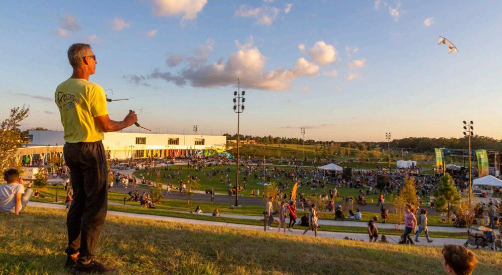

O Natural Heritage and Climate Change
O Human Comfort
O Environmental Concerns
O Landscape Quality
O Maintenance

The Capitol Mall will steward its landscape with sustainable maintenance practices. The cultivation of a diverse and resilient ecosystem will enable this important district of Saint Paul to adapt to a changing climate while preserving cultural heritage.
Arctic Cordillera
Tundra
Taiga
Hudson Plain Northern Forests
Northwestern Forested Mountains
Marine West Coast Forest Eastern Temperate Forests
Great Plains
North American Deserts
Mediterranean California
Southern Semi-arid
Highlands
Temperate Sierras
Tropical Dry Forests
Tropical Wet Forests


Minnesota is fortunate to lie at the center of four major North American ecological regions or biomes, converge: aspen parklands, prairie grasslands, deciduous forest, and coniferous forest.


Days / year warmer than 90 °F C Comparison between today and 2080
Minnesota will have warmer winters and nights, along with increased summer heat and longer dry spells. The warming temperatures will alter ecosystem productivity, exacerbating the spread of invasive species, and changing how species interact with each other and with their environment. These changes are reconfiguring ecosystems in unprecedented ways.
Today, Minnesota’s climate supports forests and trees. In 50 years, climate change could turn most of it to oak savannas, dominated not by trees but grasslands. In fact, over 70% of the northern tree species have already shifted further northward.
Heavy rains are now more common in Minnesota and more intense than any recorded rain on record - and climate projections indicate extreme events, like flooding, drought, and heatwaves, will likely become more frequent and more intense.
Days / 100 years when daily rainfall exceeds 4 inches Comparison between today and 2080
4.1-4.8°C
No climate policies
Without action, the rich variety of plants in Minnesota will be threatened due to climate change. The State Capitol Mall has the responsibility and opportunity to showcase the diverse natural heritage of Minnesota, and how that can adapt to the changing climate.
Current policies
2.7-3.1°C
Pledges & targets 2.4°C

The State Capitol is located along the important green corridor of the Mississippi flyway. This is the migratory corridor for 40% of North America’s waterfowl and shorebirds. According to Audubon MN’s Important Bird Areas (IBA), over 12 6,000 birds used this corridor in the fall of 1997.
The State Capitol Mall is one of the largest public green space near the Downtown area of Saint Paul. It sits at the intersection of the city and regional green corridors, which makes it critical for biodiversity of the region and culturally important for ecological education.

The State Capitol Mall is located on the Mississippi Flyway and a total of 234 bird species use this corridor for migration. With climate change, over half of Minnesota’s birds are at risk of severe declines. The new plan of the Capitol Mall should take action to meet the new climate demand and preserve the local biodiversity.
Source 28. **Informed by Audubon Minnesota and other public guiding documents
Parks and Green Corridors
Private Greenspace and Cemetery
Regional Ecological Corridors
Regional Significant Ecological Areas
Greenspace associated with City Infrastructure
100 year Floodplain

Where the State Capitol sits now, was once a deciduous forest with prairie openings. Traces of bluffs, wetlands and creeks were found on locations of parking lots and buildings. Prior to colonization, Dakota people were living and using the native plants here for centuries.
Source 29. Informed by Minnesota Department of Natural Resources, Minnesota Capitol Historic Context Report, Minnesota’s Natural Heritage by John R. Tester and other public guiding documents.

Common yellowthroat
Geothlypis trichas

Brown belted bumble bee
Bombus griseocollis


Red-eyed vireo
Vireo olivaceus

Scarlet tanager
Piranga olivacea

Virginia opossum
Didelphis virginiana

Fox squirrel
Sciurus niger

White-tailed deer
Odocoileus virginianus

Indigo bunting
Passerina cyanea
Sugar maple
Acer saccharum

Ruffed grouse
Bonasa umbellus


Grey fox
Geothlypis trichas

Rusty patched bumblebee
Bombus affinis
Eastern screech owl
Megascops asio

Western/Boreal chorus frog
Pseudacris maculata
Painted lady
Vanessa cardui


Red-bellied woodpecker
Melanerpes carolinus

Tilia americana

Bitternut hickory
Carya cordiformis

Quaking aspen Basswood
Populus tremuloides


Bur oak
Quercus macrocarpa

Prairie Phlox
Phlox pilosa

Big bluestem
Andropogon gerardii

Stiff sunflower
Helianthus pauciflorus
American elm
Ulmus americana


Red admiral Basswood
Tilia americana

Vanessa atalanta


Rosa arkansana
White Sage
Salvia apiana


Redosier dogwood
Cornus sericea
Black Raspberry
Rubus occidentalis

Prairie Rose Eastern Cottonwood
Populus deltoides

Chokecherry
Prunus virginiana


Hackberry
Celtis occidentalis

Formal lawn
Commercial and civic lawn
Streetscape lawn
Residential lawn
Meadow along steep slopes
Vegetation in the vacant lot
Meadow along highway - “the Green River”
PROGRAMMED LANDSCAPE
Monumental landscape
Other programmed landscape including pocket parks, sport fields and community gardens
Tree Canopy
Source 30. Informed by the City of Saint Paul 2040
Comprehensive Plan (2020), and other public guiding documents.
State owned park and ROW
City owned park and ROW
County owned ROW
Privately-owned public park
Commercial / institutional landscape
Private Residential Landscape
As Minnesota’s Front Lawn, lawn with specimen trees are the dominated landscape type of the Capitol Campus, with some meadows and programmed landscape. The maintenance effort for public space and ROW is divided by landscape ownerships.


The level of maintenance varies across the district. The current standard maintenance practice is focusing on lawns, but with climate change challenges, there is a need for more sustainable maintenance for all landscape types.


The Central business district has an existing canopy cover of 9.4%, significantly lower than the city average of 32.5%. Increasing tree canopy while preserving important view corridor will be critical for this project.

CANOPY COVER CLASSIFIED BY PARCEL
More than 55 native species of trees are documented by CAAPB, including Basswood (Tilia americana), Norway maple (Acerplatanoides), Hackberry (Celtis occidentalis) and other trees that play significant roles in the Saint Paul Baldwin Plains and Moraines Ecoregion.


The thermal comfort study evaluates the impact of temperature, humidity, wind, and solar radiation on site. The study shows the existing trees on site help improve the thermal comfort throughout the four seasons.
The projection study indicates that additional shade could improve the thermal comfort across various areas of the site.
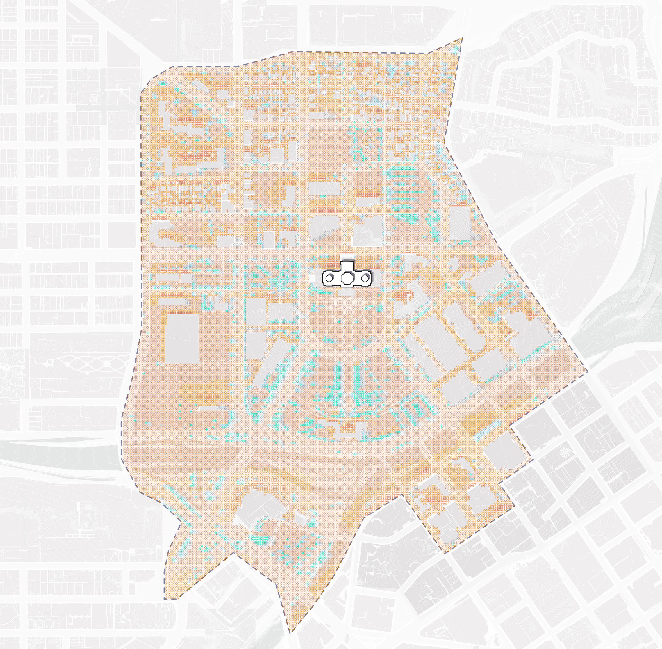
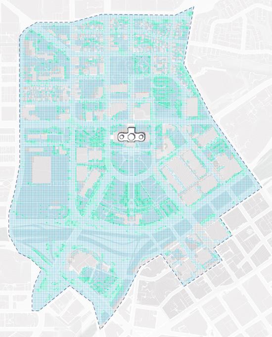

The intensity of the color indicates how much comfort you could potentially gain if you deploy the strategy well.
More comfortable
Add more shade
Less comfortable

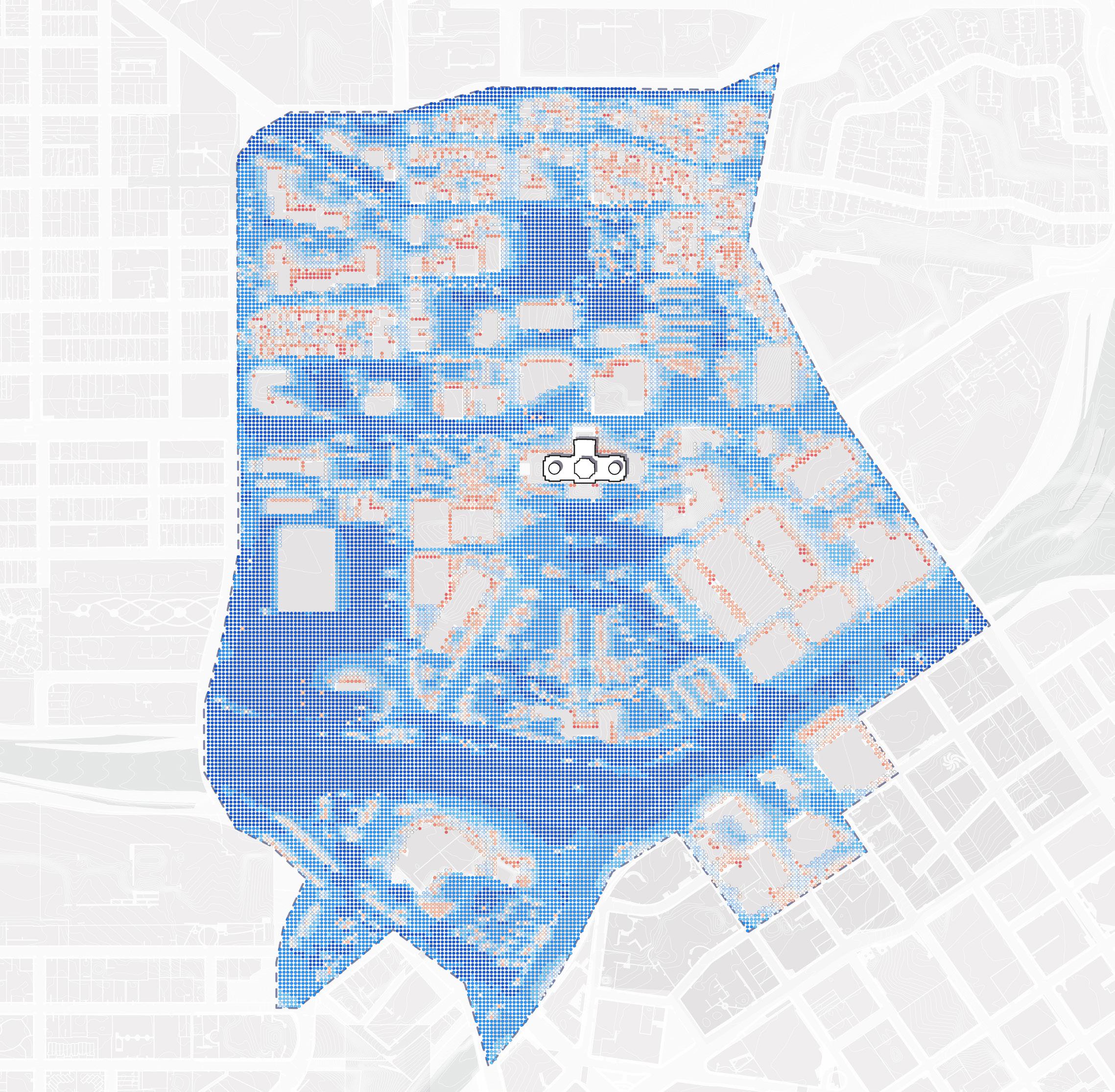
Add more sun


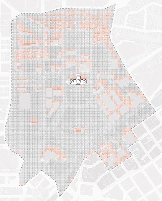
The majority of the site area is covered in impervious surfaces. Most of that drains to the Mississippi River untreated, pollutants were detected in the stormwater runoff. A comprehensive stormwater management system is needed for the landscape improvements.

HUMAN COMFORT CHALLENGES RELATED TO SHADE AND WIND PATTERNS ON SITE
summarized from site analysis
DISCONNECTED FROM NATURAL PROCESS AND PRE-SETTLEMENT ECOLOGIES
INVESTING IN ONGOING MAINTENANCE AND OPERATIONS
CLIMATE ADAPTABILITY AND RESILIENCE TO EXTREME NATURAL EVENTS
INCREASE TREE CANOPY COVERAGE AND EMBED HUMAN COMFORT IN PLACEMAKING
RECONNECT THE SITE’S NATURAL HERITAGE AND CELEBRATE PLANTING CULTURE FOR ALL
AN EVOLVING MAINTENANCE PRACTICE OF AN ECOLOGICAL AND SUSTAINABLE LANDSCAPE
CREATE A CLIMATE READY LANDSCAPE WITH COMPREHENSIVE PLANTING AND STORMWATER MANAGEMENT
O Strategically increase tree canopy and design plant communities for improved sightlines and microclimate effects in both parks and streetscapes
O Provide shading opportunities every 2-4 minutes of walking distance along park pathways and streets. Incorporate deciduous planting to balance thermal comfort during summer and winter
O Design with plant phenology in mind. Limit the use of plant that can be negatively affected by Minnesota’s climate extremes
O Leveraging and strategically preserve existing vegetation to enhance resilience and thermal comfort
O Create dynamic height differences to increase mixing of air and encourage more wind at human height. Consider shading structures and plantings that encourage summer wind flow and block winter wind flow
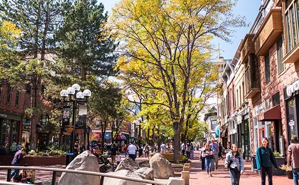
O Design planting patterns with Indigenous ethnobotany in mind
O Embed nature education opportunities in design
O Use native planting communities and landscape succession as a guide, design with faunal associations in mind. Prioritize the use of native plant species that provide superior ecological benefits
O Utilizing foundational plant species that support local habitat, such as sugar maple, basswood, bur oak and aspens
O Create a pollinator-friendly landscape that supports butterflies, moths, and pollen specialist bees. Resources like Keystone Plants by Ecoregion led by Dr. Doug Tallamy from University of Delaware and the Pollinator Station Program led by City of Saint Paul will be helpful for this effort
O Eliminate the use of invasive plant species and restrict the use of those that may become invasive in the future
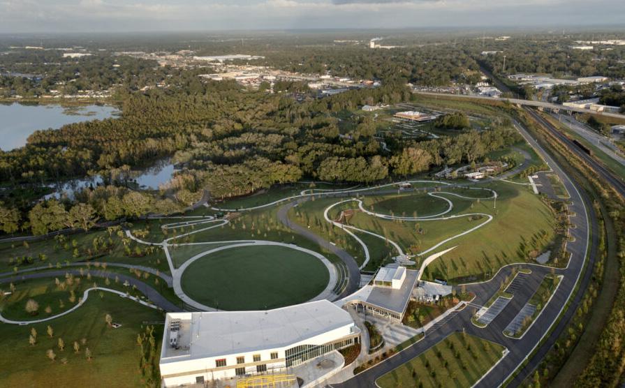
O Facilitate application of resilience principles to ecosystem management through rich landscape settings at the human scale. Promote a diversified native landscape pattern that sustains climate change and other anthropogenic stressors
O Design with plants that are less affected by common pathogens and pests and avoid those that may become a concern in the future
O Prioritize plants that are adapted to the current soil profile. Group plants together that share similar soil, irrigation and maintenance needs
O Promote green waste recycling. Consider natural maintenance methods and reduce the use of chemicals and motorized equipment
O Maintain winter structure for planting and minimize salt damage on both parks and ROWs
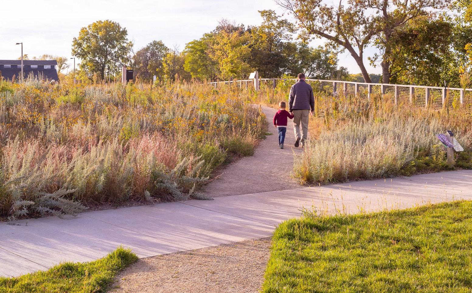
O Use climate ready species and refer to local planting sources. Utilize the University of Minnesota Climate Adaptation resources such as climate-ready woodlands for more site specific planting suggestions
O Design the landscape and hardscape to help with carbon draw down. Select plants and materials that promote carbon sequestration and storage. Create a landscape that reduces operational carbon
O Maximizing green infrastructure for stormwater treatment. Consider local habitat and species while designing the stormwater landscape
O Identify areas with high runoff potential and strategically size green infrastructure and the management requirements at those locations.
O Design a landscape that promotes phosphorus and other pollutant removal
