24 minute read
SITE ASSESSMENT RECOMMENDATIONS
All areas identified by the Shire of Esperance, highlighted through the community survey and identified by on ground investigations were considered. The following attributes were deemed priority attributes:
▪ Accessibility and connectivity ▪ Existing facilities and infrastructure ▪ Existing land use ▪ Land availability ▪ Land tenure ▪ Opportunity to create skills development experiences ▪ Social, economic and environmental values
A desk top analysis of all sites was carried out and then on ground confirmation of findings. There were multiple sites that would be suitable for sustainable mountain bike facility development across the Shire, but these were rationalised to provide fewer facilities of higher quality, to meet the needs of a wider user group, a growing interest in mountain biking and a growing population. Creating a connected network of trails within the Shire, meeting the needs of multiple user groups will provide the local community and visitors with experiences encouraging outdoor recreation. It is also recognised that there is a need for facilities that meet the growing demand of more experienced riders and offer growth and development opportunities for mountain bikers in the region.
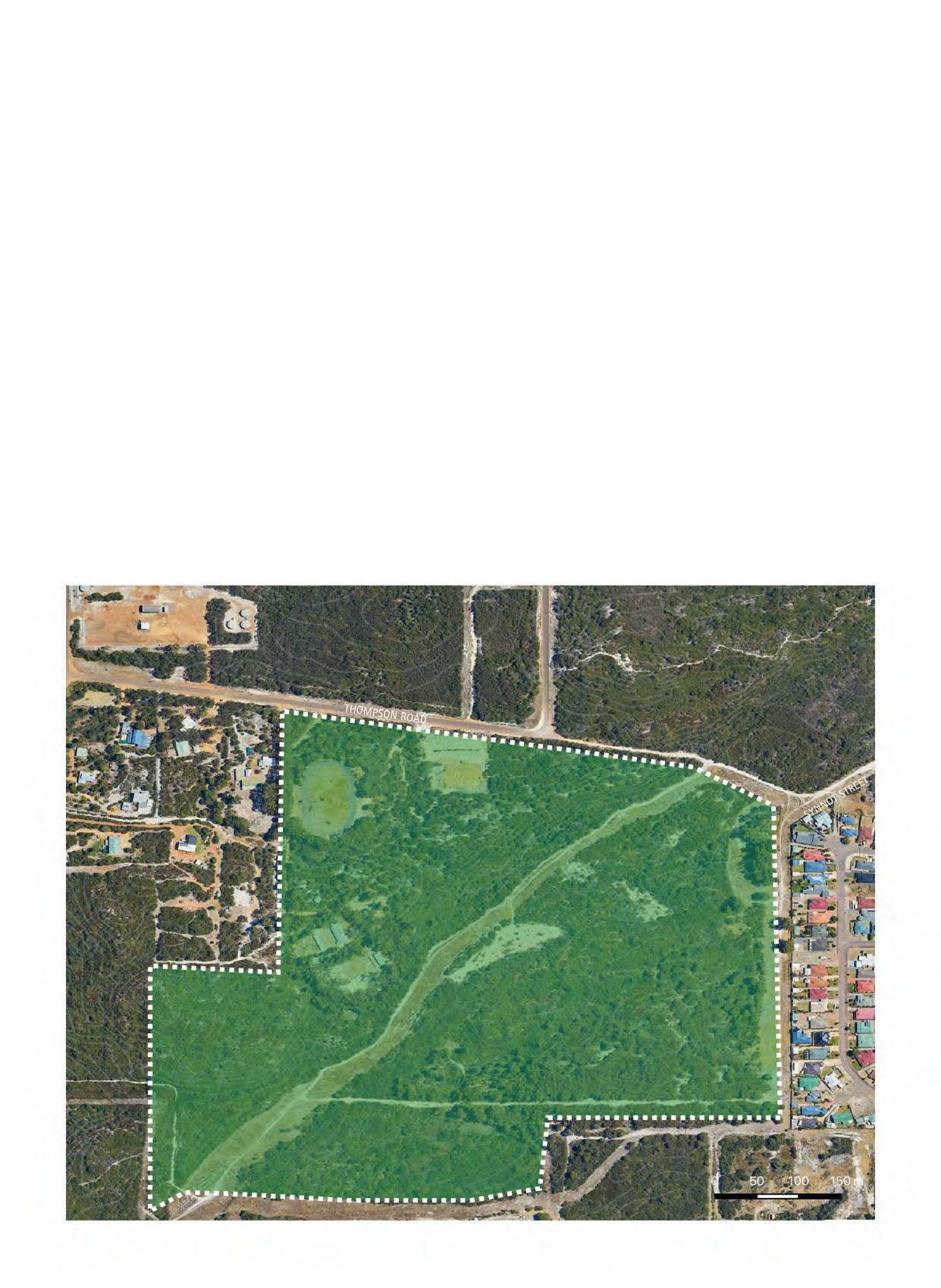
The Shire of Esperance is relatively flat, limiting mountain biking experiences that may be easier to develop in more varied terrain. Most notable elevation variances can be seen in Cape le Grande National Park. The distance to the park does not create a local mountain biking facility to meet the growing needs of the local mountain biking population. During online and onsite investigations, a parcel of freehold land adjacent to crown land was noted as suitable for the development of a diverse range of trails. The area would support a regional level riding facility and could host longer downhill trails creating a much more rewarding riding experience in comparison to the unsanctioned downhill trail at Dempster Head. It is a recommendation that the Shire open discussions with the landowner and investigate the possibility of access to the land, in the form of a lease or access agreement. Alternatively, if they Shire was to acquire this parcel of land, the site could be developed into an excellent long term facility, which would be an asset to the Shire and local mountain biking community. The site has intentionally been omitted from this report until investigations into accessing it for the purpose of mountain biking has been negotiated with the landowner.
East of the town was not considered high priority due to high density of freehold land. If this constraint can be overcome the recommendation for a touring style trail from the town to Cape le Grande should be investigated, as suggested in the Esperance 2050 Cycle Plan.
Figure 4. Site’s assessed as providing opportunity for cycle facility development.
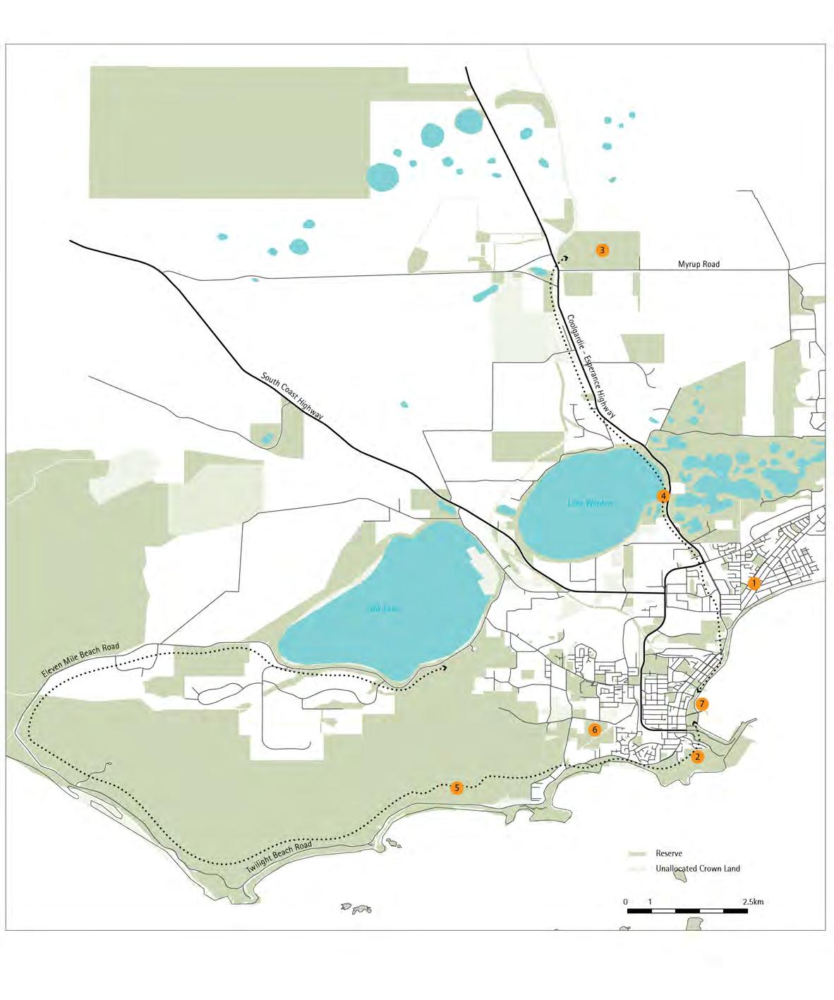
ID 1
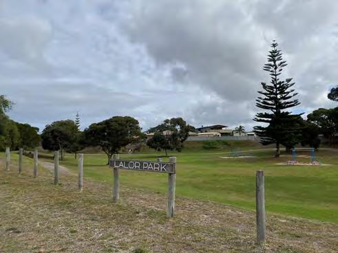
SITE/LOCATION: Lalor Park
FACILITY: Pump Track & Jump Lines
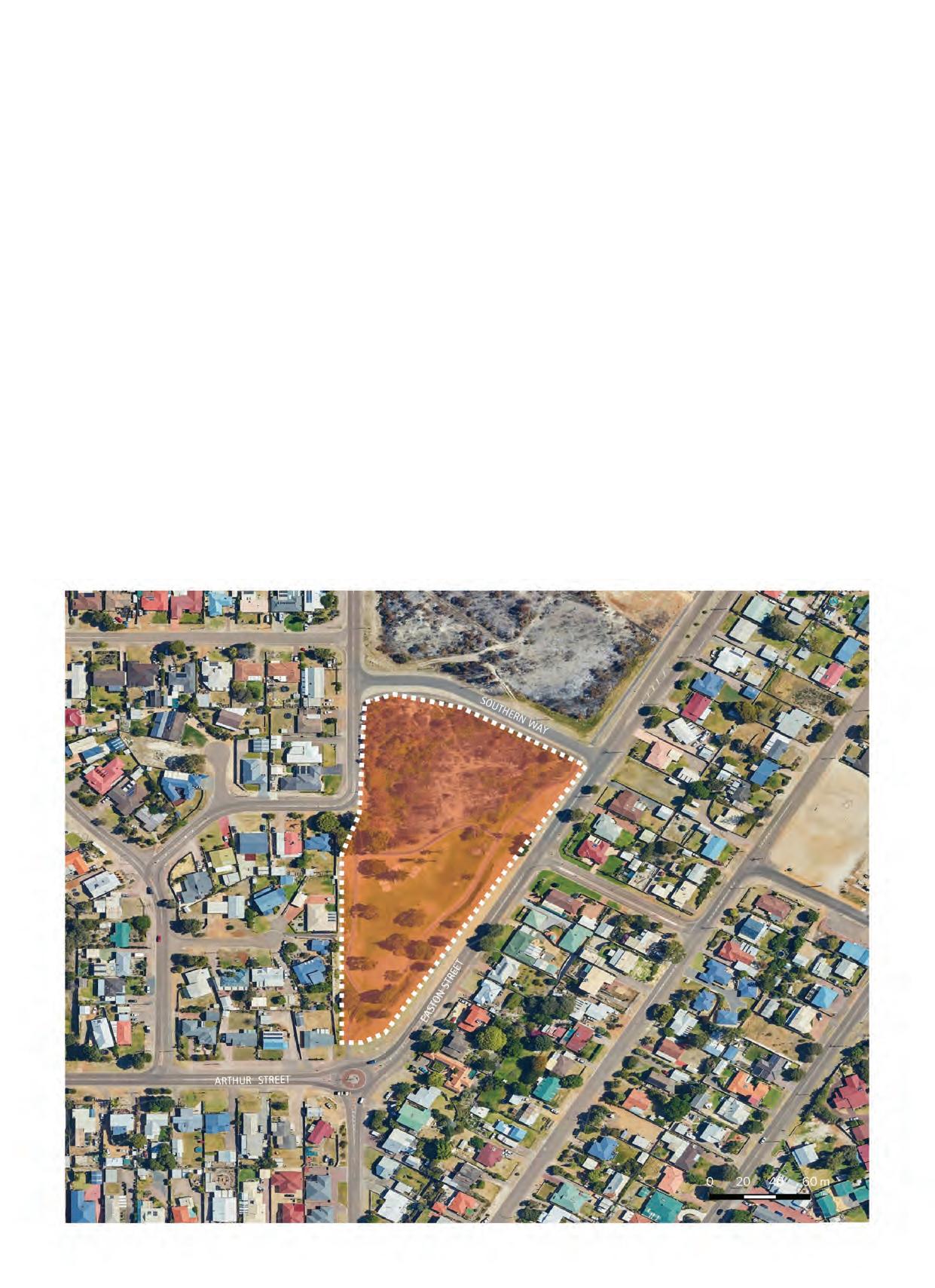
SITE SIZE: ~1.6Ha
RECOMMENDED SCALE: ~500m2
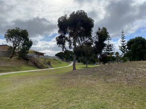
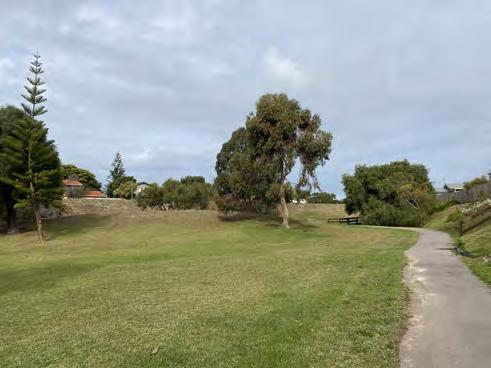
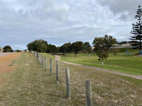
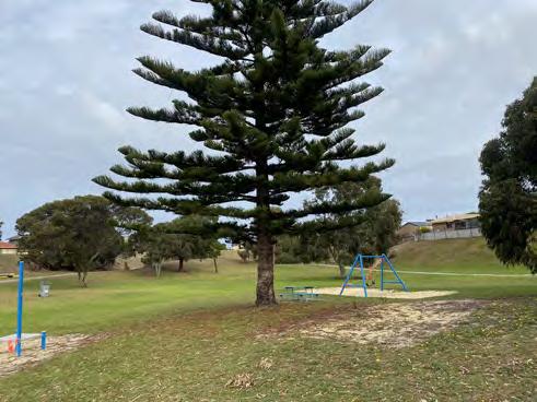
CURRENT SITUATION: Small community playground with open green space.
WHERE WE WANT TO BE: A local scale facility for the north eastern end of town to encourage recreational cycling for users of all age and ability.
HOW WE GET THERE: Design a pump track with jump lines to fit into the existing space. There is opportunity to utilsie the elevation to the north of this site for jump lines. Community consultation should guide the concept design process in this area to meet the needs of the immediate community members. POSITIVES CONSTRAINTS RECOMMENDATION LAND INFORMATION
▪ Existing underutilised space ▪ Creates a recreational cycling opportunity for the eastern end of town ▪ Small amount of elevation on site suitable for jump lines ▪ Financial ▪ Allocate capital budget for concept design, community consultation, detailed design and construction of small facility for the eastern end of town ▪ Playpark facilities to be maintained, to ensure there are facilties for riders and non-riders, creating an inviting space for a variety of age groups and families Tenure: Crown
Land Manager: SOE Management Plan: Shire of Esperance Playgrounds & Public Open Space Strategic Plan 2015-2025

ID 2
SITE/LOCATION: Dempster Head
FACILITY: XC, Downhill, Walk Trail
RECOMMENDED SCALE: 3km XC, 0.6km Downhill, 1.5km Walk Trail
SITE SIZE: ~70Ha
ELEVATION RANGE: ~ 60m
STEEPEST SLOPE: ~11%
CLASSIFICATION: Green and Blue XC, Black Downhill, Grade 2 Walk Trail CURRENT SITUATION: Dempster Head is an exposed fragile environment with many ad-hoc trails traversing the area. Erosion is clearly visible, and the area is continually accessed by anglers, walkers, cyclists and beach goers. The site is smaller than the recommended area for a mountain bike facility of local significance, as outlined in the WA MTB Management Guidelines.
MTB is a prohibited activity at Dempster Head as per the Shire of Esperance Dempster Head Management Plan.
WHERE WE WANT TO BE: An accessible sustainable public open space for use by all local residents and visitors to Esperance. An area that multiple recreational users can access safely, and environmentally and culturally responsibly.
HOW WE GET THERE: Shire of Esperance commission a detailed landscape masterplan of the area and undertake extensive remediation works. POSITIVES CONSTRAINTS RECOMMENDATION LAND INFORMATION
▪ Accessible site ▪ Good elevation for mountain biking ▪ Site able to host a small number of very high quality mountain biking trails designed specifically to sit in existing disturbed area with minimal to no impact on surrounding vegetation ▪ If designed responsibly it could be a recreational asset to the town ▪ Opportunity for remediation of site ▪ Environmentally sensitive site ▪ Very short downhill trail experience ▪ Limited XC trail network opportunity ▪ Site could potentially be a site of cultural significance ▪ The site in its current state is not suitable for
MTB, and consideration of closure of access tracks to all users until remedial actions are carried out would protect the site from further erosion issues ▪ Consider other areas within the Shire, including private property, that allow for more extenisve riding experience, with longer descents, and more scope for
XC trail network ▪ If proceeding with trail development at Dempster
Head there will be requirement to create a detailed landscape masterplan of the area which outlines detail design of the area with professionally designed walk trails, XC mountain bike loop and Downhill track.
Masterplan also to incorporate remedial actions for erosion issues, track rationalisation and subsequent closures, native revegetation and interpretational signage. ▪ Progression of any works at this site should be remedial focused, and should be fully supported by the Shire and community members ▪ Carry out further community consultation to ensure needs of the local community are met Tenure: Crown
Land Manager: SOE Management Plan: Shire of Esperance Dempster Head Management Plan 2018
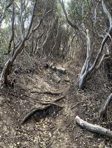

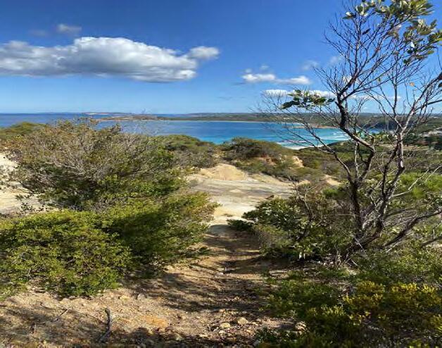

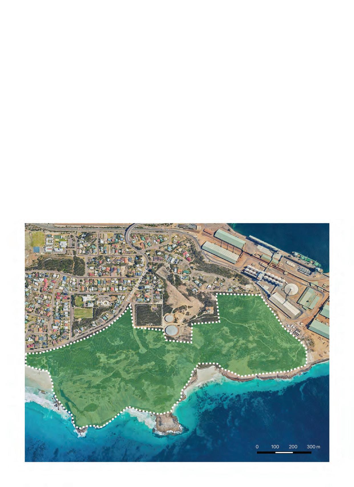
SITE/LOCATION: The Piggery & Piggery Link
FACILITY: XC Trail Network and Jump Track
RECOMMENDED SCALE: ~14km
SITE SIZE: ~87Ha
ELEVATION RANGE: ~25m
STEEPEST SLOPE: ~3%
CLASSIFICATION: Green and Blue XC, Blue and Black Jump Track
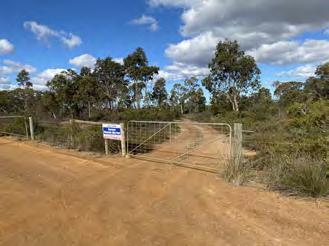
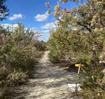
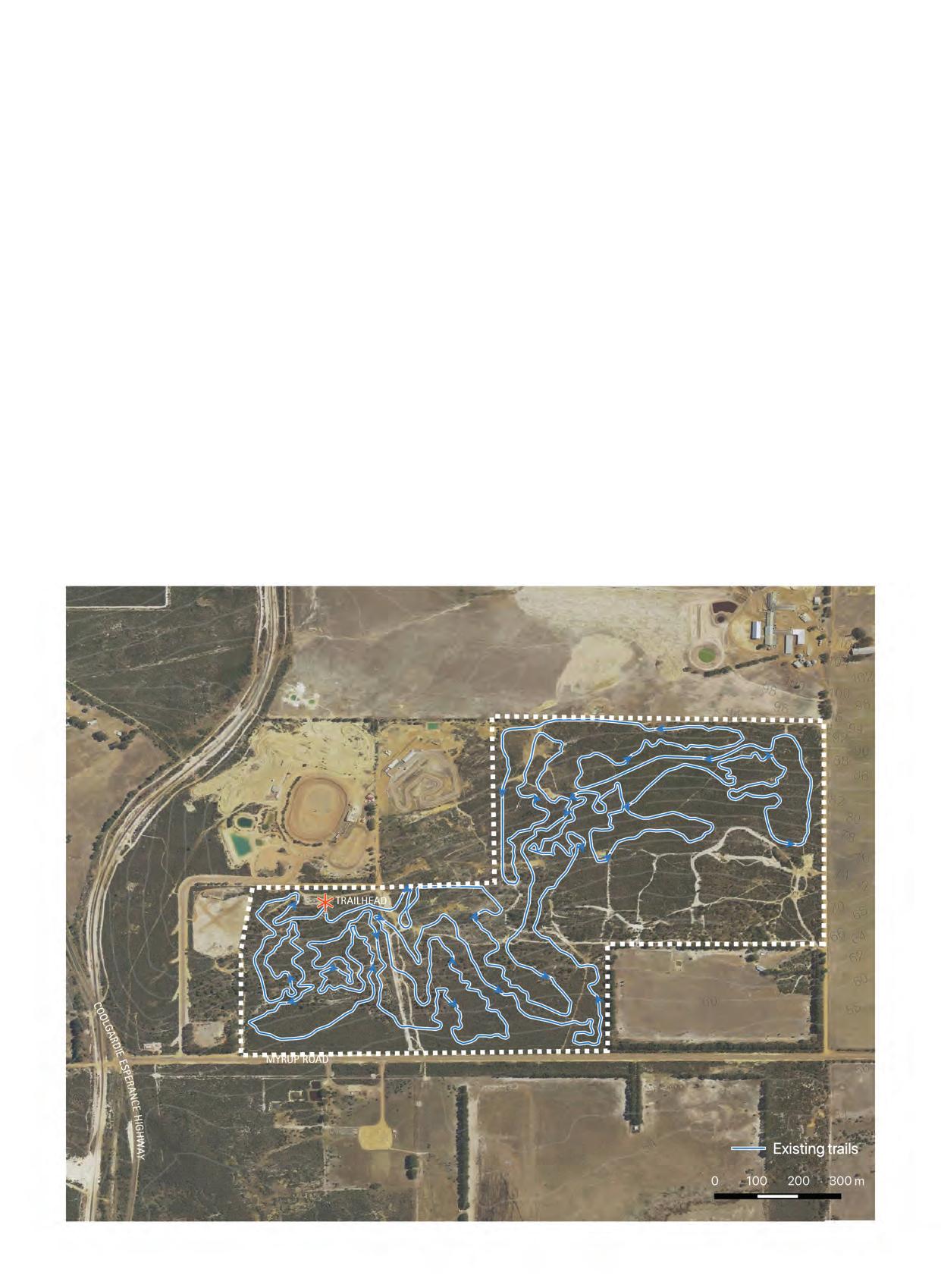
CURRENT SITUATION: The Piggery was established in 2008, it is situated on crown land, but under agreement is managed by the Esperance Mountain Biking Association. There is 13.5 km of XC trail and 2.5km of ‘family’ trail. The network provides mountain biking options attractive to beginner and intermediate riders. The network has many built features using manmade objects. The trail signage is weathered and difficult to follow. No emergency signage and limited topography to work with.
WHERE WE WANT TO BE: A network of trails that require minimal maintenance and provide an enjoyable MTB experience to a range of users of all ages and all abilities. A facility that allows for skills development. Inclusion of a jump track to meet the needs of wider mountain biking community and provide a level of thrill and challenge.
HOW WE GET THERE: Carry out a professional review of the current network and develop an upgrade plan. Apply for external funding for planning and upgrade works.
Carry out further community consultation to ensure needs of the local community are met
POSITIVES
▪ Established mountain biking infrastructure ▪ Managed and maintained by volunteers ▪ Designated mountain biking area, minimal planning constraints ▪ Site could be easily reconfigured to meet current trends CONSTRAINTS
▪ Financial constraints ▪ Managed and maintained by volunteers – financial limitations ▪ Trails do not meet the needs of current mountain biking trends ▪ Limited elevation on site RECOMMENDATION
▪ Develop a site management plan endorsed by the
Shire of Esperance ▪ Carry out a professional evaluation of the current network and develop concept design for upgrades to meet all users needs ▪ Consider realignment of existing trails to take advantage of changes in elevation across the site ▪ Develop concept for jump lines within network ▪ Grow membership of the EMBA ▪ Gain Shire committment to assist with events (volunteer build days and fundraisers) and funding opportunties and grant applications LAND INFORMATION
Tenure: Crown
Land Manager: SOE (EMBA by agreement) Management Plan: No current management plan (last plan 2010-2013)


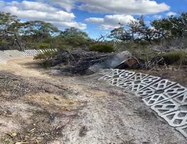

SITE/LOCATION: Piggery Link
FACILITY: XC Trail
SCALE: ~ 15km
CURRENT SITUATION:
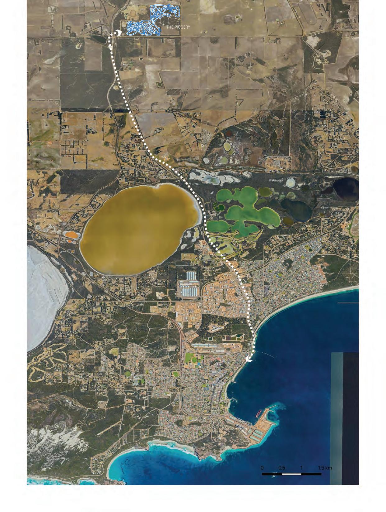
The Piggery network lies 14.7km north of town, currently there is no safe cycling facilities linking The Piggery and Esperance town. There is a gradual elevation change between the site and town that would support the development of a flowy green cross country trail that would be enjoyable to ride in both directions.
WHERE WE WANT TO BE:
An enjoyable connecting trail allowing mountain bikers in Esperance to ride from town to a mountain biking facility. A safe designated trail connecting the network to town would also allow for riders to get a lift out to site and ride home, or vice versa. The trail would additionally be an exercising route to provide for a broader group of riders.
HOW WE GET THERE:
The current visitation levels at the Piggery may not support the investment in this trail. This trail should be factored into upgrades to The Piggery, creating a high quality accessible mountain biking experience.
Carry out community consultation to ensure needs of the local community are met. A well designed trail could be dual purpose and safely provide an exercise experience for both trail runners and walkers.
POSITIVES
▪ Creates a link to an existing site ▪ Allows for safe travel between The Piggery and town ▪ Creates a trail running experience which is not currently available directly from the townsite ▪ If additional mountain bike sites are identified this connecting trail could form part of a connective network CONSTRAINTS
▪ Financial ▪ Restricted choice of alignment due to land tenure RECOMMENDATION
▪ Connecting trail is factored into upgrades at The
Piggery ▪ A green, dual purpose flow cross country trail is constructed with techincal trail features incorporated, which is appealing to mountain bikers and trail runners LAND INFORMATION
Tenure: Crown and road reserve
Land Manager: Shire of Esperance
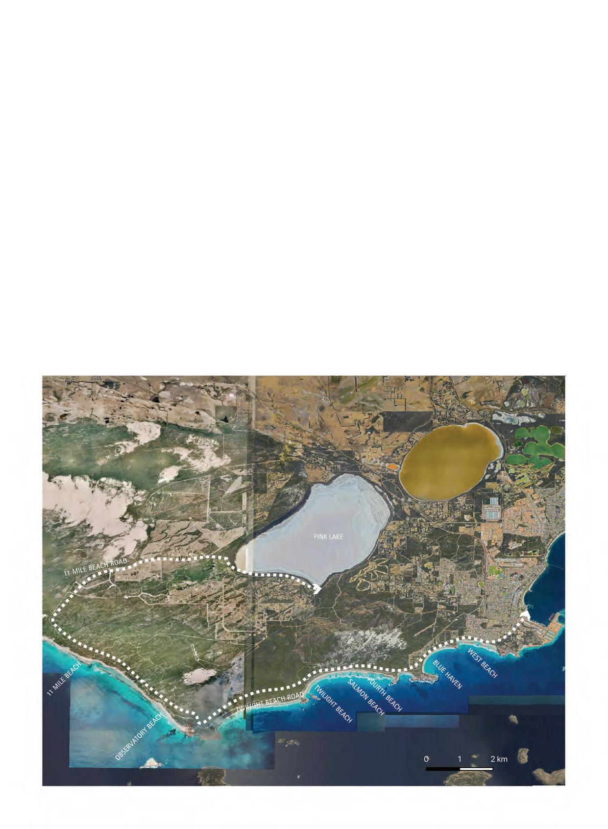
SITE/LOCATION: Adventure Trail - Town to 11 Mile Beach via coast, linking round to Pink Lake Rd and back via shared use path.
FACILITY: Touring and XC
SCALE: ~20KM
CLASSIFICATION: Green and Blue
CURRENT SITUATION: There is a dual use trail that heads west out of town along the coast. This is a family friendly trail but does not meet the need of the more adventurous rider. The substrate is sandy and the coastline is a fragile dune environment. Importation of material for a hardened surface would be required.
WHERE WE WANT TO BE: Encourage participation, provide a fitness option for the local community including MTB community. Create an extension of trails out from the Esplanade, Dempster Head and Skroly Park and create a sustainable experience for both locals and visitors to Esperance. This could be an excellent cycling experience taking in the scenic vistas and unique coastal heath vegetation communities.
HOW WE GET THERE: Create an alternative off-road XC route. Link the XC experience to the existing dual use trail system and create a loop back into town.
The Public Drinking Water Source Area (PDWSA) is a constraint. It is feasible to create a trail on the north side of Twilight Beach Rd, but a much better recreational experience could be created if the constraints around the PDWSA could be overcome.
Carry out community consultation to ensure needs of the local community are met.
POSITIVES
▪ Excellent experience for locals and visitors ▪ Opportunity for local bike hire business ▪ Exercise opportunity for local residents ▪ Options to extend into greater experience in the long term CONSTRAINTS
▪ Financial constraints ▪ Fragile coastal environment ▪ Restricted choice of alignment due to
PDWSA RECOMMENDATION
▪ Develop a concept for a longer distance XC adventure trail that allows riders to depart and return on a loop from town ▪ Link trail to exising dual use infrastructure ▪ Establish alignment outside of the PSWSA ▪ Harden trail for longevity and enjoyable user experience LAND INFORMATION
Tenure: Crown
Land Manager: SOE
regional facilities
SITE/LOCATION: Skroly Park
FACILITY: Skills Loop and Jump Track
SCALE: 2km Skills Loop and 2 x Jump Lines
SITE SIZE: ~ 43Ha
ELEVATION RANGE: ~ 15m
STEEPEST SLOPE: ~ 4%
CLASSIFICATION: Blue Skills Loop, Blue and Black Jump Track
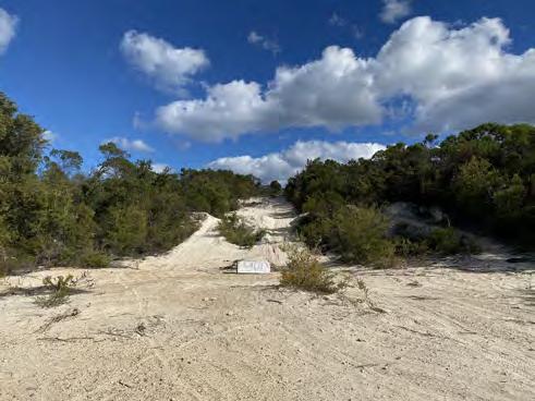
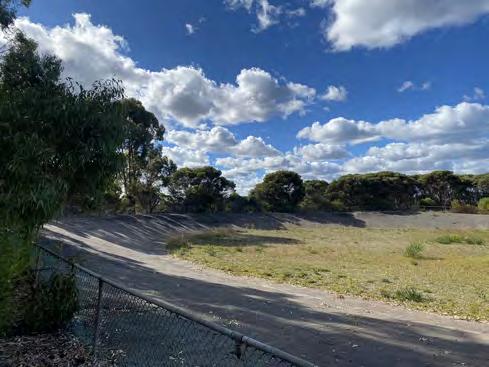
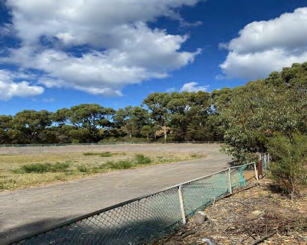
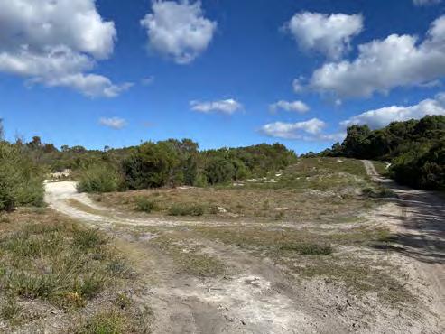
CURRENT SITUATION: There is a derelict velodrome situated out at Skroly Park. The area is quite removed from town and is visually isolated.
WHERE WE WANT TO BE: The area to be utilised productively, a presence in the area to activate it and provide a space for community managed dirt jumps and a skills tracks. A skills loop to be designed and constructed with local input and the space generally re-activated as a recreational area, including upgrades to existing velodrome facilities.
HOW WE GET THERE: Develop a concept plan for the area in collaboration with local riders and encourage youth participation in concept design. Seek funding opportunities and create a youth riding precinct.
POSITIVES
▪ Underutilised site suitable for recreation cycle facility development ▪ Could satiate local desire to construct challenging MTB features CONSTRAINTS
▪ Is on the outskirts of town (presently) and is quite isolated ▪ Dirt bike access to site presently. Conflict would need to be managed ▪ Sandy terrain would require material import RECOMMENDATION
▪ Undertake further targeted community consultation to determine if there is a group interested in managing a set of dirt jumps through a formal agreement ▪ Develop a concept plan identifying scale and scope of dirt jump area and skills track LAND INFORMATION
Tenure: Crown
Land Manager: SOE
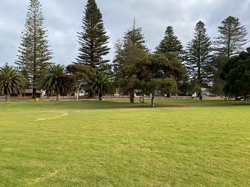
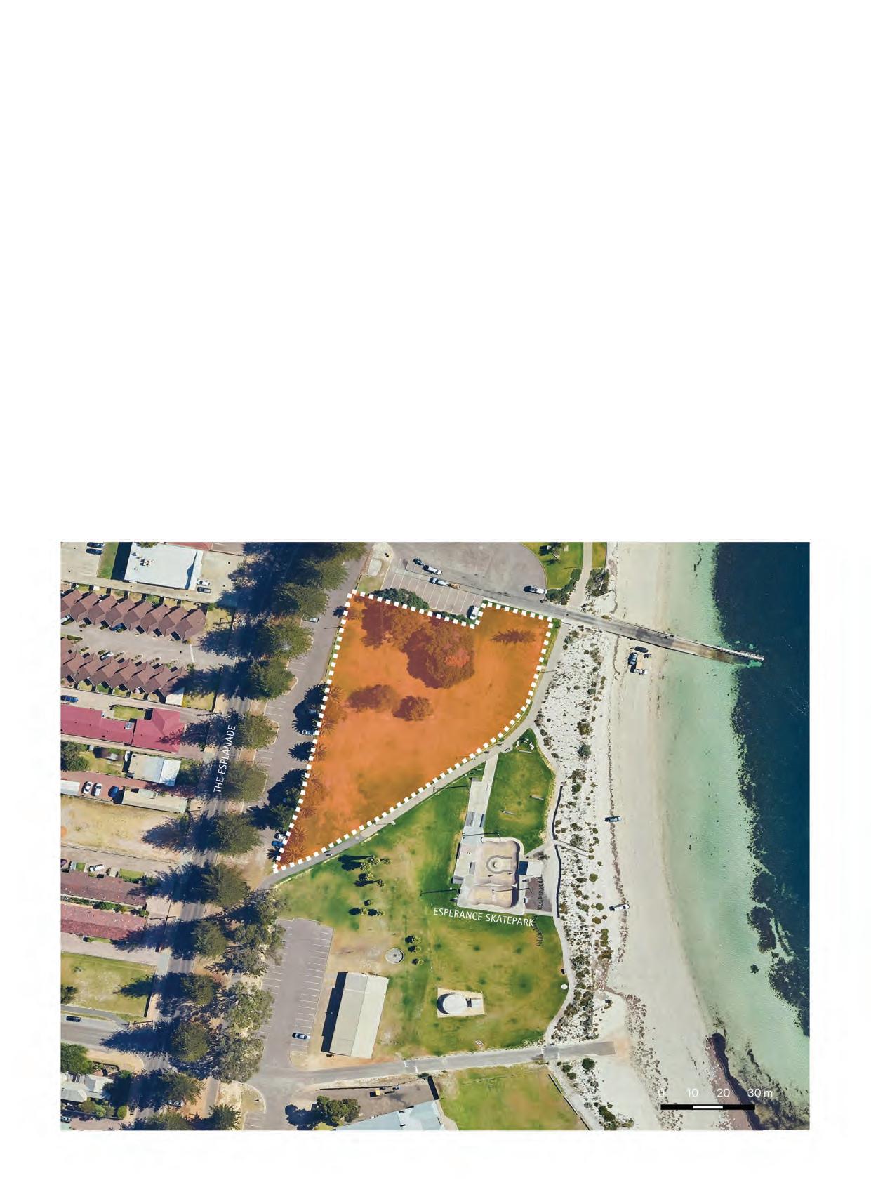
SITE/LOCATION: The Esplanade
FACILITY: Pump Track
SCALE: 500-600m2
SITE SIZE: ~ 0.5Ha
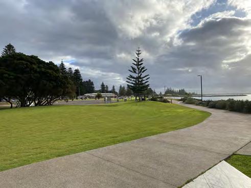
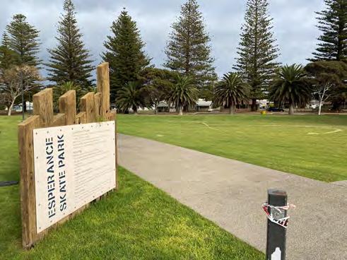
CURRENT SITUATION: The Esperance Esplanade has undergone significant upgrades over the past few years. Recent concept design works include the development of a Youth Precinct. The previous Esperance skate park, utilised additionally by BMX riders, has been decomissioned.
WHERE WE WANT TO BE: A multi-faceted recreation precinct for all wheeled sports on the Esplanade, which provides opportunities for participation in recreational cycling and skills progression.
HOW WE GET THERE: Incorporate a regional scale pump track into the Youth Precinct concept design. Carry out community consultation to ensure needs of the local community are met.
POSITIVES
▪ A fit for purpose track incorporating optional jump lines and transition features, attractive to wide range of users and keeping users engaged ▪ Central location for local residents and visitors ▪ Will further enhance and complement existing wheeled sports facilities in the area ▪ Opportunity for freestyle BMX events to be held on
Esperance Esplanade CONSTRAINTS
▪ Financial ▪ Consultant has been engaged to develop concept design and inclusion of regional scale pump track may be an additional design cost RECOMMENDATION
▪ Work with design consultants to incorporate full scale regional pump track into existing concept design LAND INFORMATION
Tenure: Crown
Land Manager: SOE Management Plan: Shire of Esperance Playgrounds & Public Open Space Strategic Plan 2015-2025

Staging of sustainable recreational cycling facilities will be dependent on available funding. It is recommended that Stage 1 includes:
▪ Site confirmation ▪ Concept designs ▪ Business case development ▪ Budget and funding confirmation and commitment
The pump tracks at Lalor Park and the Esplanade are straight forward projects and could be delivered within a 3-6 months period with sufficient funding.
The Piggery upgrades could be progressed quickly with Shire investment or could take a longer period of time if external funding is to be sought. It is recommended that the Shire assists in this process. The connecting trail should be incorporated into planning.
Dempster Head, Skroly Park and the Adventure Trail are much larger projects and will require detailed project planning prior to commencement.
Table 13. Priority of proposed sites The Espanade Pump Track and investigation into utilsing the parcel of private land are deemed high priority as they would both meet the current needs of local mountain bikers in Esperance, and would also support continued growth in participation numbers and skills progression.
Lalor Park and The Piggery network and Connecting Trail are deemed medium priority, as these would not meet the immediate needs of the mountain biking community. These projects will enhance Esperances mountain biking offering.
The Lalor Park facility will provide local mountain biking opportunties to residents at the eastern end of town, but will be supplementary to the larger pump track at the Esplanade.
Upgrades to The Piggery will create an inviting mountain biking facility for existing users, individuals new to the sport and visitors to the Shire. The site is limited due to elevation, and more technical advanced mountain bike facilities could be constructed on a site with more varied terrain.
Dempster Head is deemed low priority due to the sensitivity of the site and should only be progressed once other options are exhausted.
Skroly Park has been identified as an underutilised parcel of crown land. This site is low prioroty as it would require a high investment to create an excellent mountain bike facility.
The Adventure Trail is primarily a toursim product and deemed low priority as it does not meet the immediate needs of the local community.
ID SITE PRIORITY RATIONALE BEHIND PRIORITY RATING 1 Lalor Park Pump Track MEDIUM Quick win project providing facilties for the eastern end of town.
2 Dempster Head XC and Downhill
3 The Piggery
XC LOW This site should only be progressed if there are no alternative options.
MEDIUM Quick win project with existing community support. Good return on investment.
4 The Piggery Link XC LOW The priority of this concept is directly related to upgrades at The Piggery. Upgrading The Piggery network will see an increase in visitation and merit the development of a trail connecting the network to the town.
5 Adventure Trail Touring and XC
6 Skroly Park Skills Loop and Jump Lines LOW Good project to enhance cycle options and tourism product within the Shire of Esperance but does not meet the existing skills progression needs of the Esperance mountain biking community.
LOW This is an alternative site that could provide mountain biking experiences should other sites not be progressed. It is noted it is out of town, would require a large investment and may have management issues due to the remote nature of the site.
7 Esplanade Pump Track HIGH Meets desire for suburban skills development opportunities and can be incorporated into existing capital project.
Private Property HIGH The parcel of private land that has been identified offers a far superior mountain biking opportunity in comparison to the limited area at Dempster Head for downhill, and the limited elevation at The Piggery for more advance XC riding.
COSTS
Costing has been determined based on previous Common Ground Trails design and construct contracts, and industry knowledge. It should be noted that these costs are indicative and subject to large changes based on scope, materials, additional site furniture, re-location of overhead or underground services, de-contamination of land, upgrades to existing parking, toilets and roads, and many other influencing factors.
A management plan should be developed for each site prior to development. This will outline required maintenance, resources, annual budgets and asset lifespan information.
The following costings are displayed in thousands and are indicative costs for the facilties concept design, detailed design and construction. Table 14. Indicative costings of facilities
JUMP TRACK MTB TRAILS PUMP TRACK SKILLS TRACK
COMMUNITY $50-75 5-10KM $200-400
LOCAL
$75-100 10-20KM $400-800 REGIONAL $150-500 20-80KM $800
STATE $500+ 80km+ $3.6M+ $50-100 $25-50
$100-200 $50-100
$200-400 $100-300
$400+ $300+
Additional to Shire of Esperance capital investment there are a number of potential funding options and partnerships available for the facilities suggested in this report. The following funding partners and grant opportunities are aimed at the improvement of community health, youth health, or increasing active recreational opportunities, and have potential to be supportive of a facility such as that proposed:
▪ Lotterywest – Community spaces outdoor www.lotterywest.wa.gov. au/grants ▪ Lotterywest - Trails: www.lotterywest.wa.gov.au/grants/grant-types/ trails ▪ Sport Australia - Community Sport Infrastructure Grant: www. sportaus.gov.au/grants_and_funding/ community_sport_ infrastructure_grant_program ▪ Commonwealth Bank Staff Community Fund: www.commbank.com. au ▪ Department of Local Government, Sport and Cultural Industries – Youth engagement Grants Program, Community Sporting and Recreation Facilities Fund (CSRFF): www.dlgc.wa.gov.au/
GrantsFunding/Pages/ Youth-Engagement-Grants-Program www.dsr. wa.gov.au/funding/facilities-(csrff) ▪ Healthway Health Promotion Project Grants and Sport and Racing sponsorship: www.healthway.wa.gov.au ▪ RAC Sponsorship – Community Partnerships: www.rac.com.au ▪ Telstra Foundation Social Innovation: exchange.telstra.com.au ▪ Philanthropic investment and corporate sponsorship
SUMMARY OF RECOMMENDATIONS
There are three delivery methods which can be considered for the development of mountain biking facilities within the Shire of Esperance; professional, professional with volunteer assistance and volunteer lead. Delivery methods are often determined by location of the development and the quality of facility required. Facilities developed in urban and urban fringe are typically led or undertaken by professional designers and contractors. Developments located in the natural landscape have a higher potential for volunteer development. The following outlines the benefits and constraints with each of the delivery methods.
PROFESSIONAL
Professional design, by industry specific designers, typically yields high quality and accurate documentation enabling competitive and accurate pricing. Professional design can be costly but typically ensures successful and highly desirable facilities. Typically, professional designers will host workshops to foster community participation and ownership. Professional construction, by industry specific contractors, ensures high quality with a high level of accountability. Professional construction is most appropriate when the project incorporate hardened surfaces and landscaping requirements. It does however have higher capital costs and can lead to reduced ownership if not successfully delivered. Development progress is typically fast.
PROFESSIONAL AND VOLUNTEER ASSISTANCE
Community lead design with professional documentation can yield high quality and accurate documentation and community ownership. It remains costly and can have compromised design outcomes if not successfully managed.
Professional lead construction, by industry specific contractors, with volunteer assistance can yield high quality but with a reduced level of accountability. Volunteer assisted construction is most appropriate when the project incorporates a combination of natural and hardened surfaces. Volunteer assisted projects can be difficult to price and unless volunteer involvement is significant, it can increase the cost of development through increased management requirements.
VOLUNTEER
Community lead design with minimal input from professionals can be low cost but can often lead to lower quality documentation and potentially less useable facilities. Volunteer lead construction is most appropriate for natural surface developments in urban fringe and natural landscape settings. Accountability of the final outcome is significantly reduced, and development progress is typically slow. Volunteer lead construction can lead to significant community ownership, if the final product is desirable.
Table 15. Summary of recommendations
ID LOCATION CLASSIFICATION TYPE
1 Lalor Park Community Pump Track & Jump Lines
2 Dempster Head Local XC, Downhill & Walk Trail
3 The Piggery Local XC
4 The Piggery Link Local XC MATERIALITY DELIVERY
Asphalt Professional
Gravel and Natural Earth
Gravel and Natural Earth
Gravel and Natural Earth Professional
Professional and Volunteer
Professional and Volunteer
5 Adventure Trail Local Touring and XC Gravel and Natural Earth Professional and Volunteer ESTIMATED BUDGET ($000)
$50-100
$400-800
$400-800
$400-800
$400-800
6 Skroly Park Local Skills Loop and Jump Track Gravel and Natural Earth Professional and Volunteer $125-200
The sites identified within this study are recommendations based on professional opinion, the identified needs and desires of the local community, and consideration into social, economic and environmental impacts of sustainable mountain bike facility devlopment. The sites are identified as suitable for specific types of mountain biking facility development, but still require substantial planning utilising the 8 Step Trail Development Process.
Shire of Esperance internal review of recommendations and consideration of priority projects in line with strategic plans and capital budget allocations
Council and land manager approval to proceed
Follow the 8 Stage Trail Development Process
Table 16. Trail development process.
STAGE OUTCOME
PLANNING 1. PROPOSAL
The trail development is either supported in principle for trail development, or is not supported due to environmental, social or cultural constraints. The purpose of the proposal could be to identify suitable areas for consideration. 2. FRAMEWORK A project outline, developed by project steering group (stakeholders), including: project objectives, project management model, stakeholder roles, target market, requirements, standards, execution, and ongoing trail management model. 3. SITE ASSESSMENT Undertake a broad scale study of the area and identify constraints, soil types, vegetation etc. 4. CONCEPT PLANNING Identify opportunities and conceptual trail plan including broad trail corridors and infrastructure requirements. 5. CORRIDOR EVALUATION Detailed assessment of trail corridors for use in determining the final trail alignment.
6. DETAILED DESIGN Detailed trail design produced and physically flagged in the field, including: trail classifications, technical trail features (TTFs), construction types and specifications.
CONSTRUCTION 7. CONSTRUCTION Trail is constructed in line with the detailed design.
MANAGEMENT 8. MANAGEMENT Management plan implemented detailing maintenance and monitoring requirements.
Source: Trail Development Series DESKTOP
FIELD

1. Australian Bike Council. (2017). National Cycling Participation Survey
2. Esperance. Region Data Summary. ABS
3. Shire of Esperance Annual Report 2018-2019
4. Shire of Esperance, Strategic Community Plan, 2018-2028
5. Shire of Esperance Visitor Fact Sheet. Three Year Average 2016/2017/2018. Produced by Tourism WA – Strategy and Research
6. Segmenting the Cycle Tourism Market. Faster Horses. 2019
7. Shire of Esperance, Playgrounds & Public Open Space Strategic Plan 2015-2025
8. Dempster Head Management Plan 2018. South Coast Natural Resource Management Inc. On behalf of Shire of Esperance.
9. Trails Development Series, Part A: A Guide to the Trail Development Process. Department of Biodiversity, Conservation and Attractions and Department of Local Government, Sport and Cultural Industries
10. Western Australia, Strategic Cycling Facilities Review, West Cycle
11. ABS (2012), Children’s Participation in Cultural and Leisure Activities, Australia, 2012, code 4901.0
12. Western Australia Strategic Cycling Facilities Review (2017)
13. BMX Sports Western Australia. (2017). 2016-2017 Annual Report
14. Western Australian Mountain Bike Strategy 2015 – 2020 Unlocking the potential

PO box 122 Margaret River WA 6285 www.commongroundtrails.com info@commongroundtrails.com


