pARkS COMBINATORIA
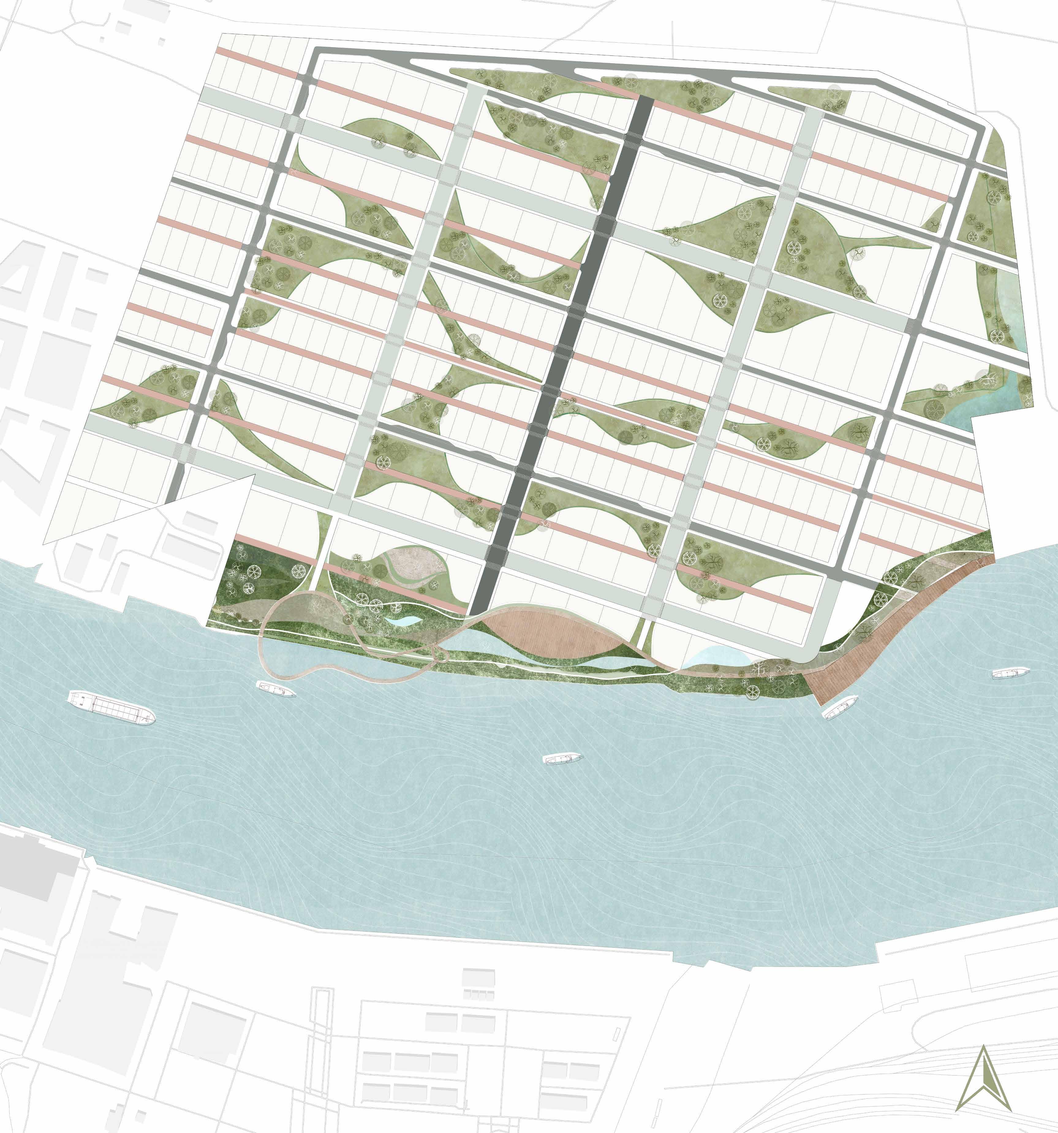
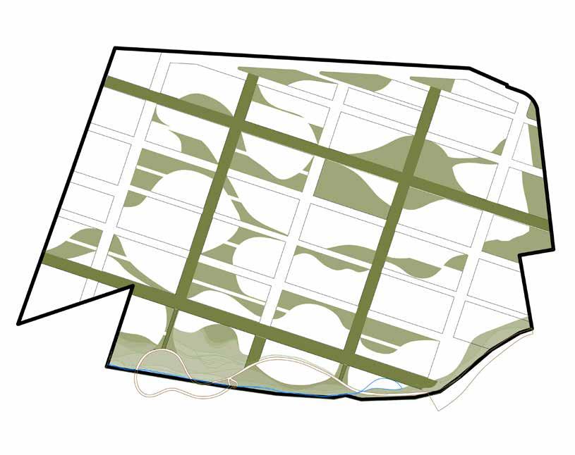
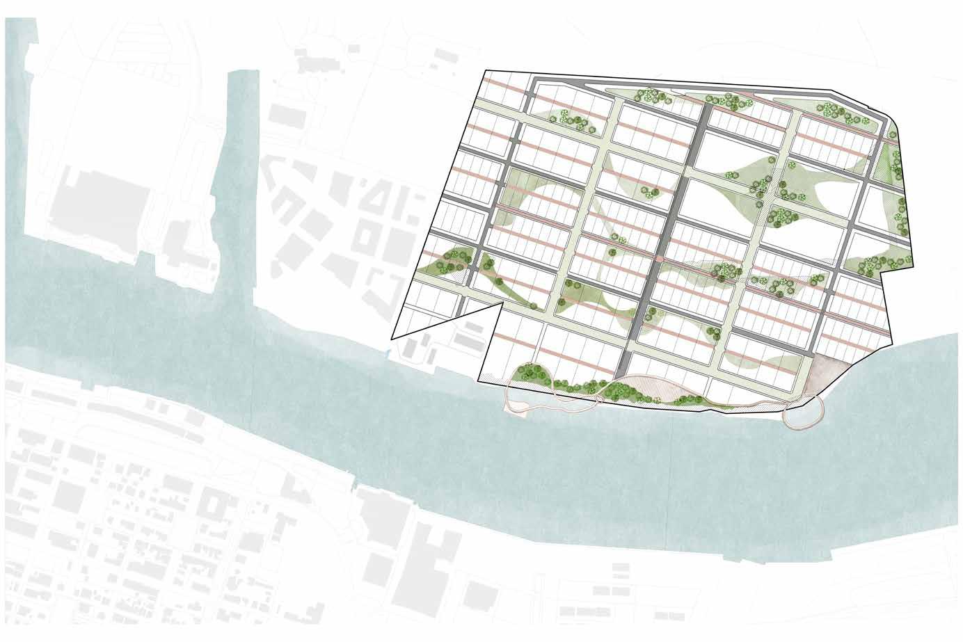
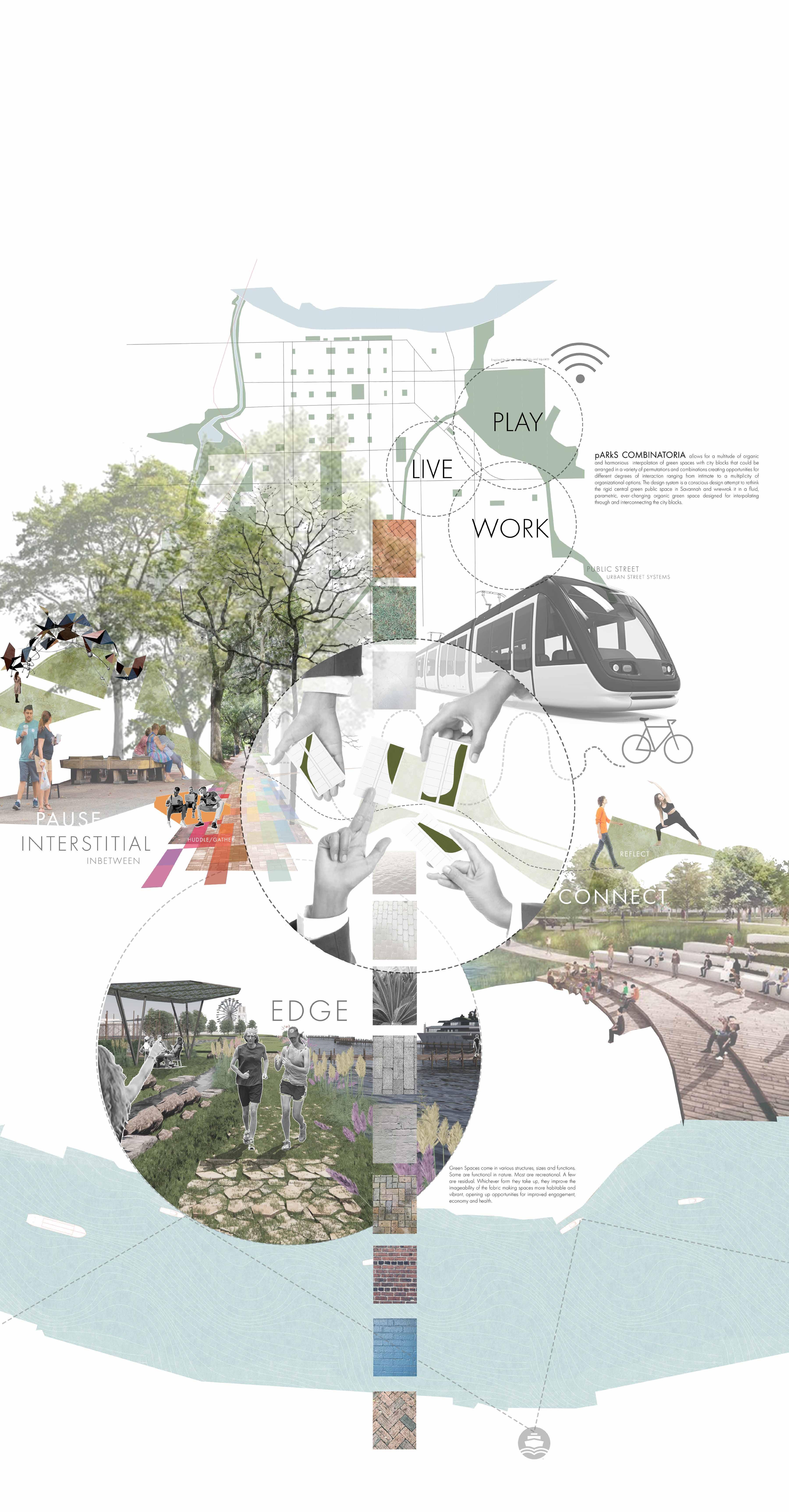
This new parametric alphabet, playfully named parks combinatoria, applies Leibniz’s principle of combinatorial art to the design of an alphabet of park and green spaces and investigates their effects in present in the formation of the new proposed urban environment of the Savannah Innovation District & Technology Park.
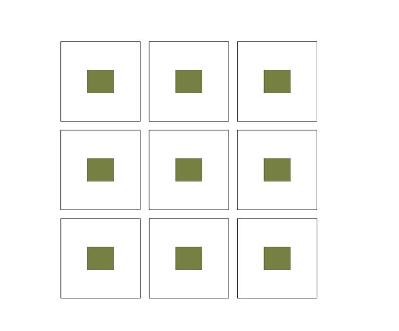
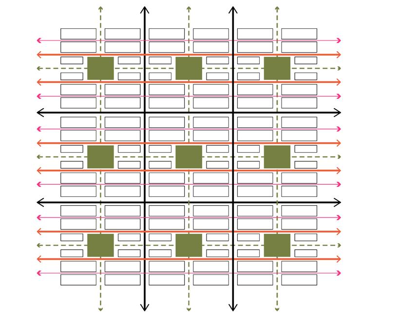
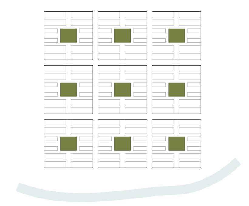
WARD PEDESTRIAN MOVING ALONG THE AXIS A MOVING ALONG THE AXIS B DISINTEGRATION OF CENTRAL SQUARES PROPOSED WARD This diagram shows the WARD plan designed by Oglethorpe. This diagram shows the DNA of the Proposed masterplan.
SAVANNAH
GREEN COVER FERRY ROUTE
LOCATION AND TOPOGRAPHY:

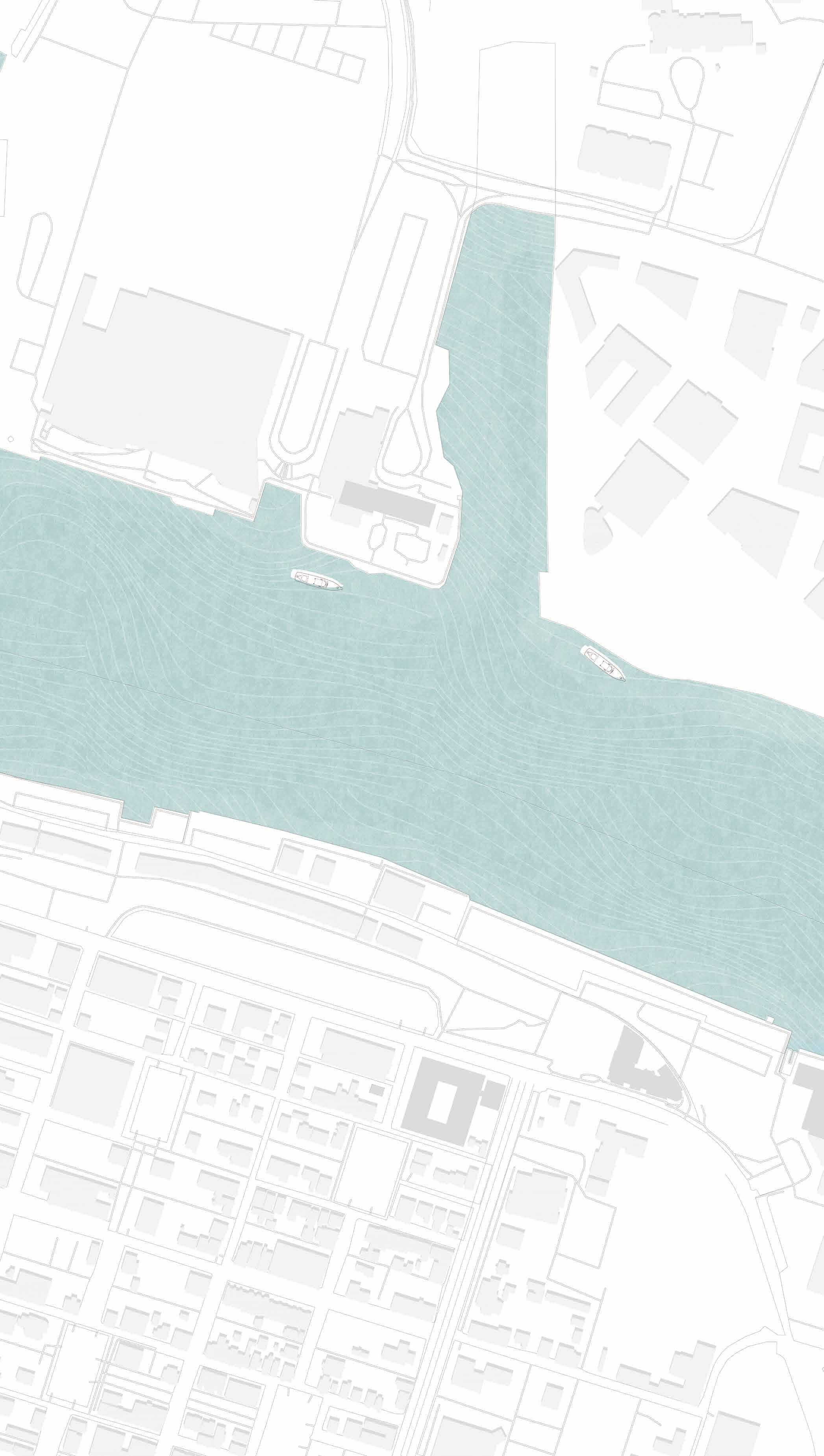
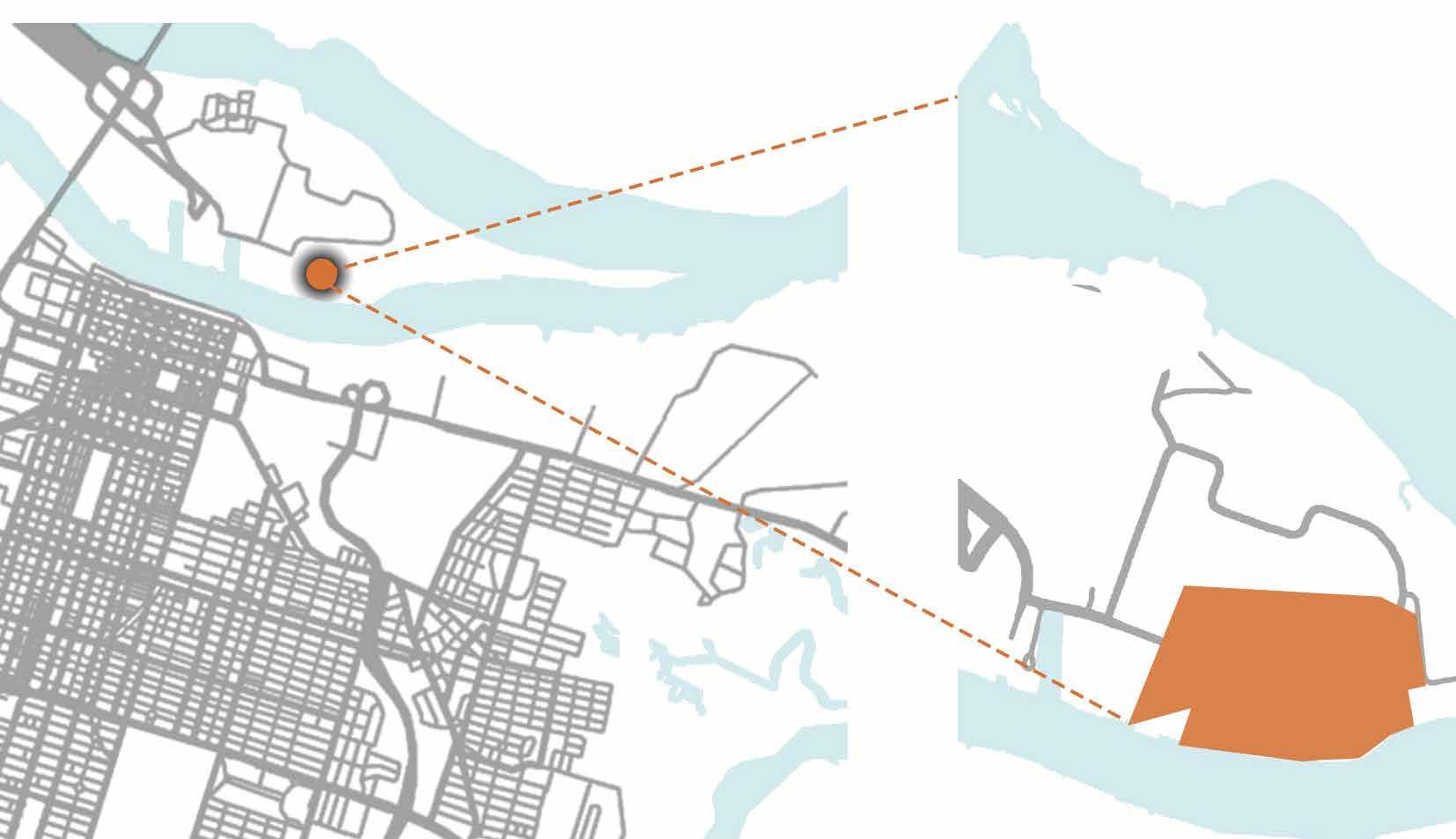
The site is located on the hutchinson island right across the the Historic district of Savannah. The land is predominantly flat but is one of the highest points on the Hutchinson island.
TRANSPORTATION:
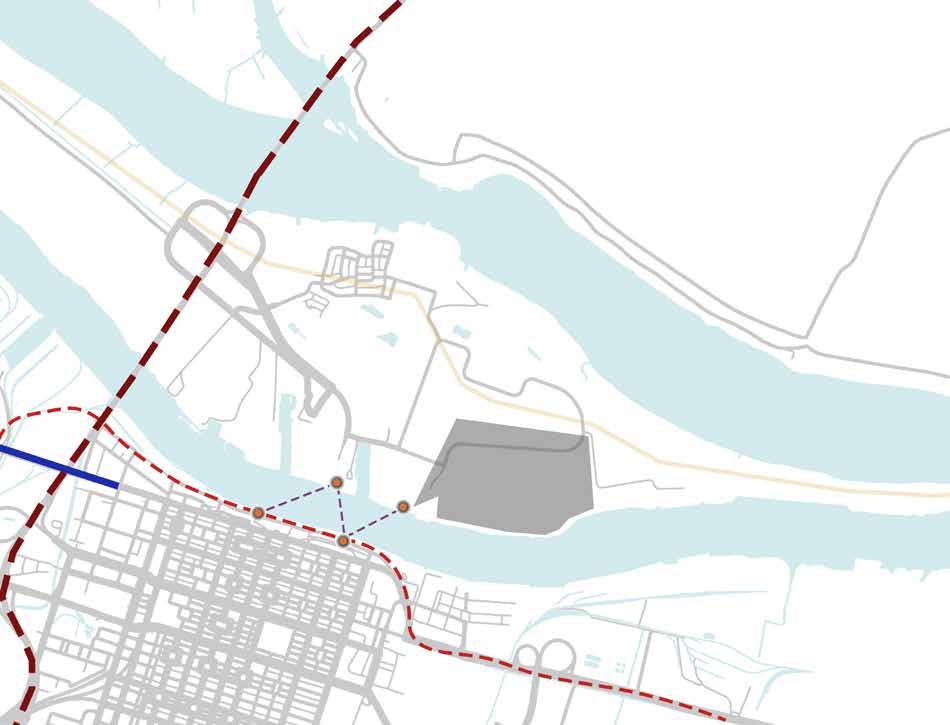
The island is connected by roads and ferry to the Historic District. You can reach the site by road via the Tamaldge Memorial Bridge or by the Ferries that run to the convention centre from City Hall, Trade center or Waving girl landings. (available every 2o0 mins)
POPULATION DENSITY : While the density of the historic distoric is greater than 5000. The Hutchinson island current ly has density lesser than 50.. This doesnt however respond to the growth in the population in Savannah As much as there has been a 26-50% increase in the Daytime population there has also been a significant population growth in the district making it the fastest growing met ropolitan area in the peach state.
DEMOGRAPHICS: Savannah has around 54% of African American population and 38% White and 2.5 percent Asian. 18-29 yrs are higher in number 75 years or older. Has a steady student population due to the presence of SCAD.
TRANSPORTATION
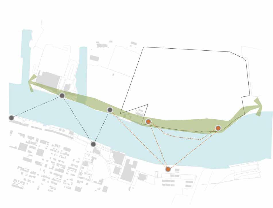
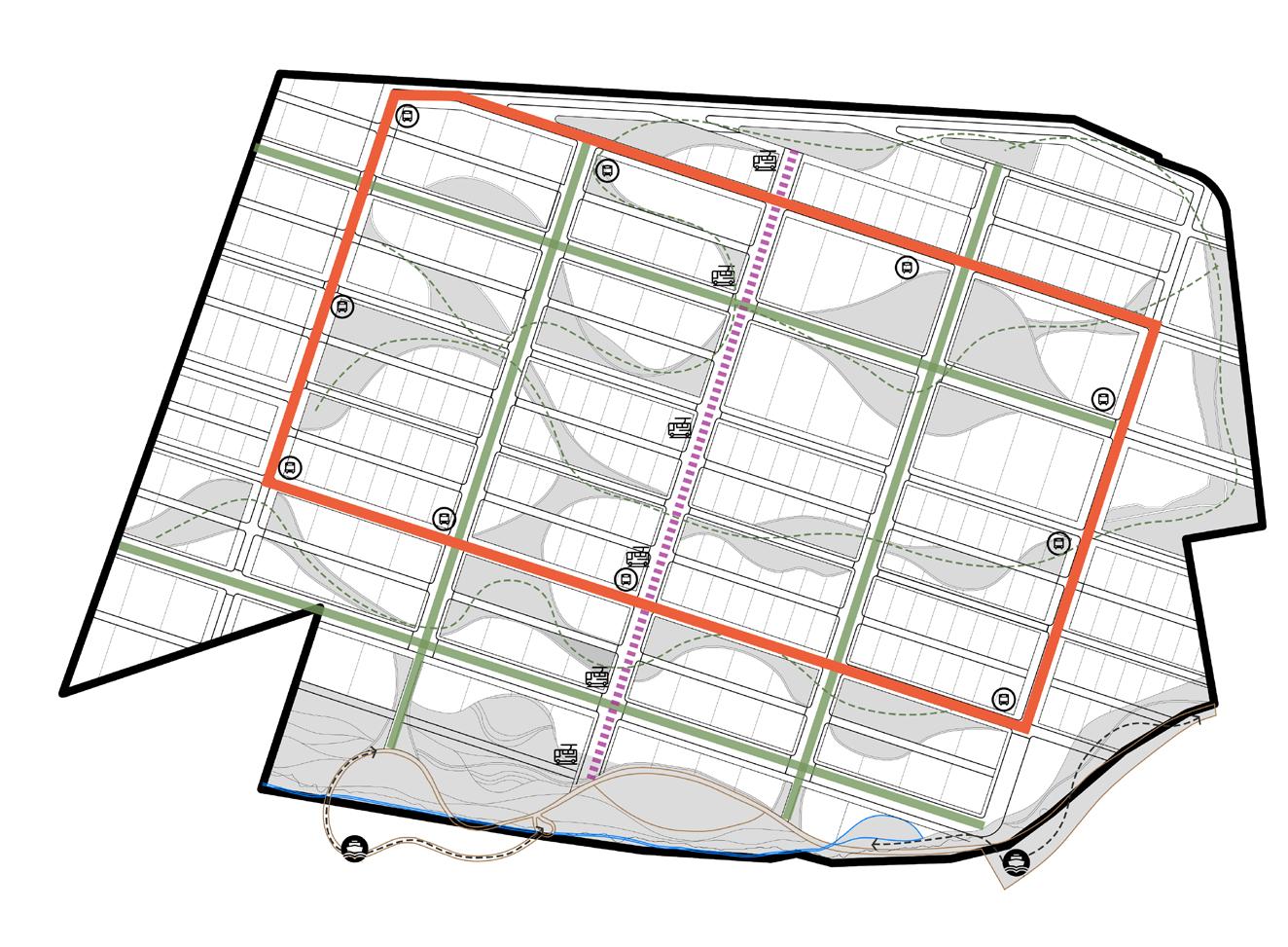
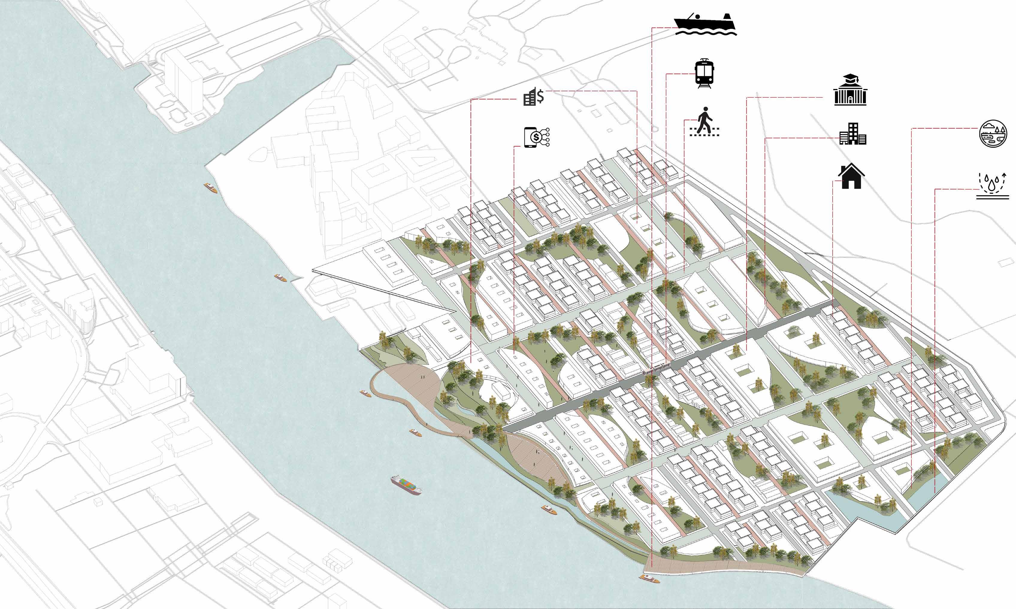
This diagram shows the public transportation routes that serve the upcoming innovation district. One can approach the site through the Ferries that will stop at two locations on site. After, one will walk out from the ferry jetty and reach the main electric train and bus stops in a short five minutes walk. The bus route is a single loop system that creates a walkable neighborhood in the inner wards.
WATER MANAGMENT
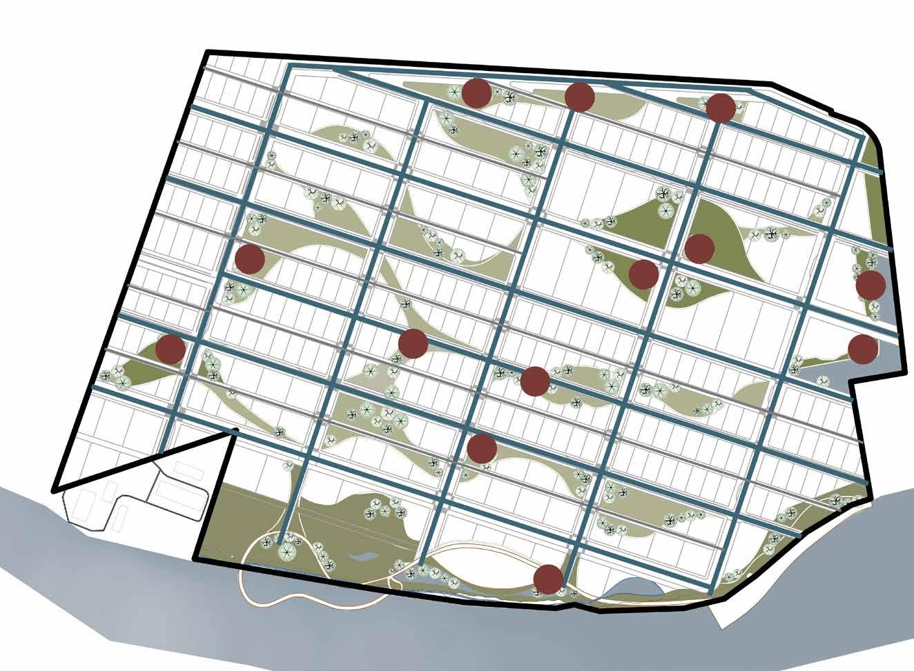
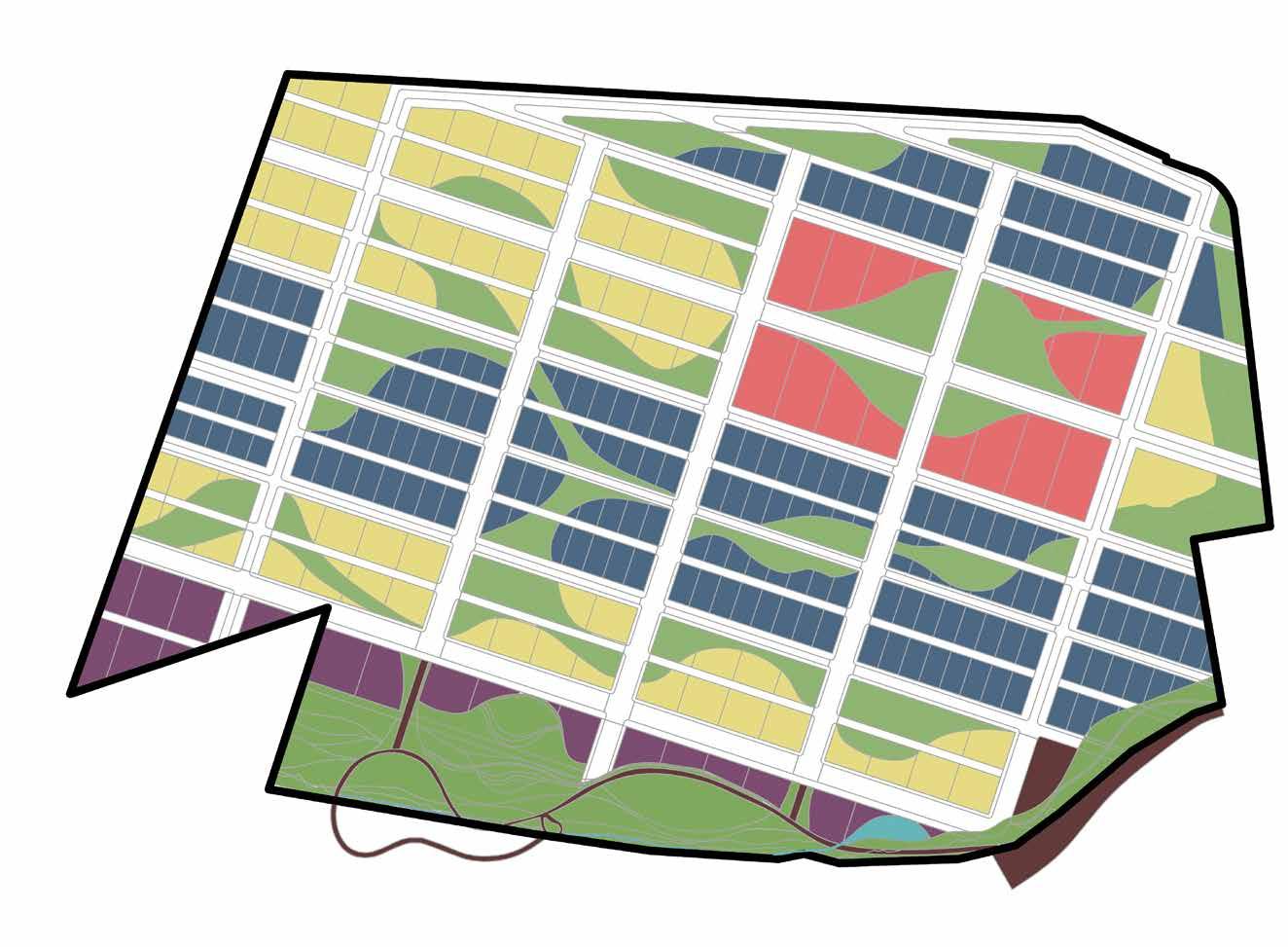
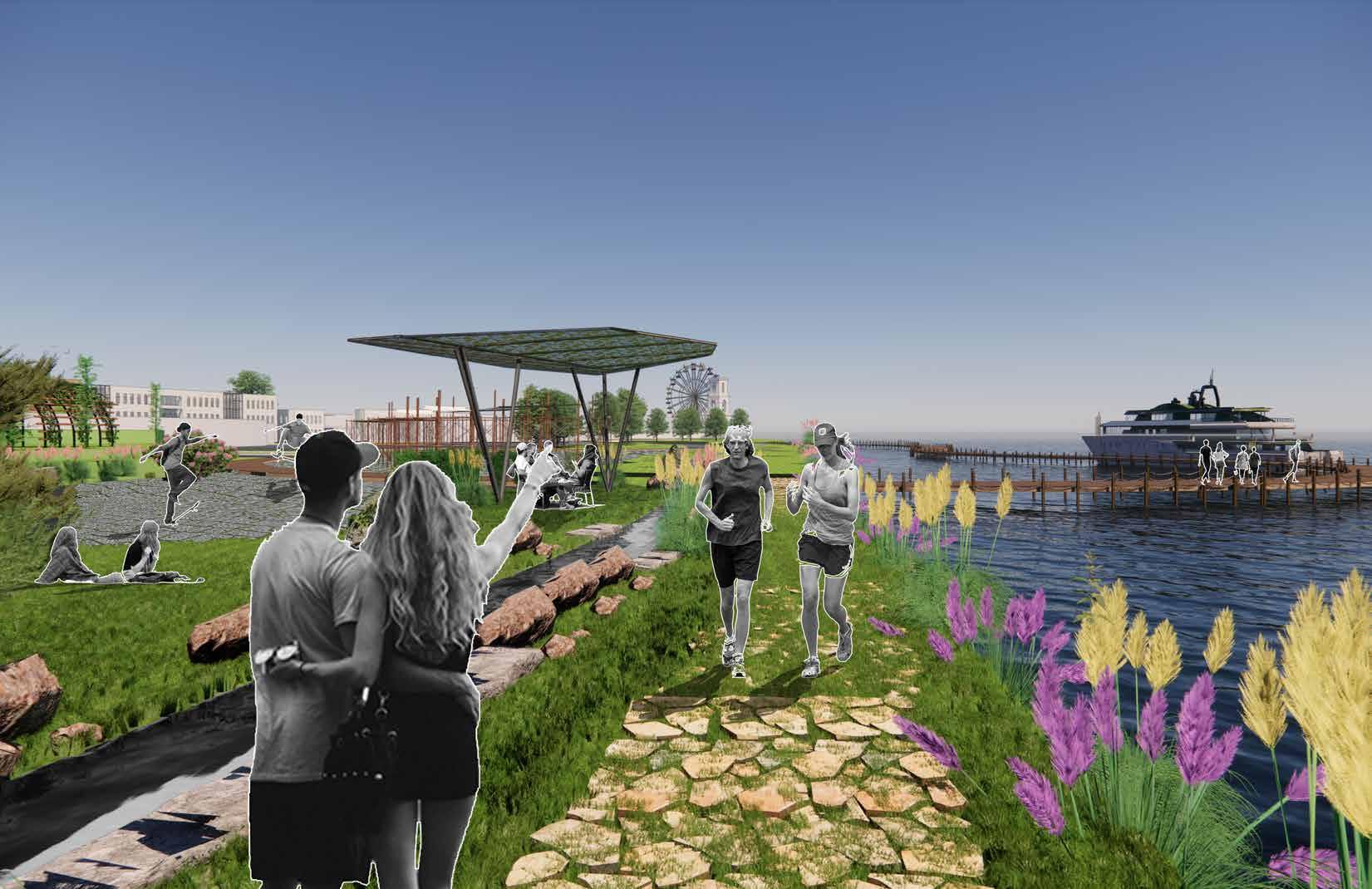
This diagram shows the elements of green infrastructure incorporated on site in order to improve the absorption and quality of stormwater. The design uses raingardens to soak and infiltrate , bioswales to convey and wetlands to filter the water on site.
75’
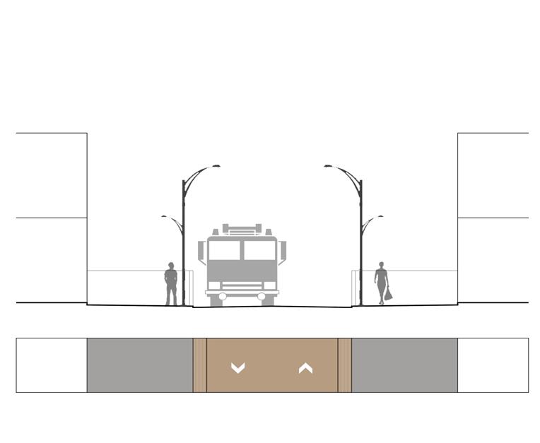
75’ SHARED STREET
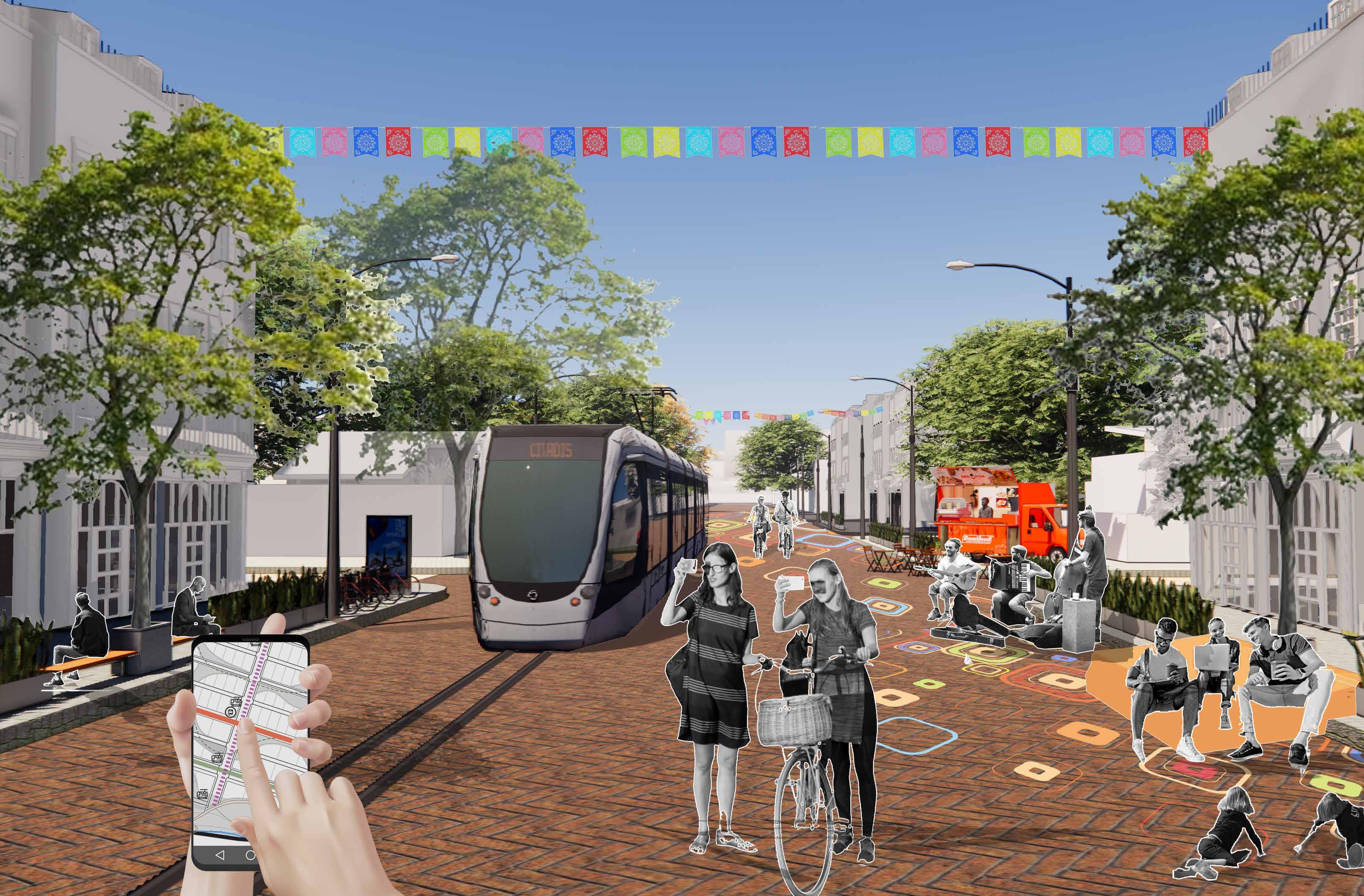
This typology of street prioritizes pedestrians over automobile traffic encouraging buildings to extend on to the street that will create a dynamic and vibrant pedestrian activity space.
The street also has the Smart Tram system that encourages people to use public transport enhancing connectivity all across the site.
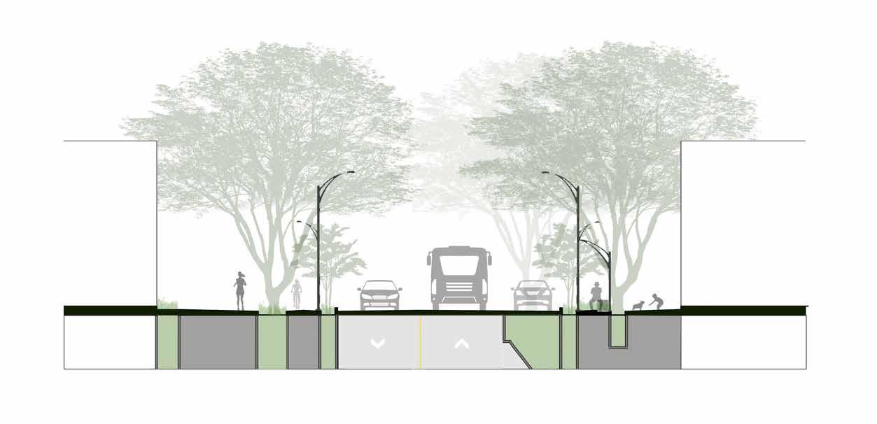
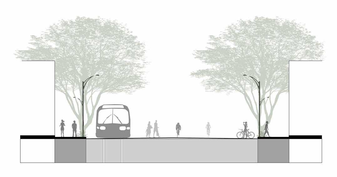
COLLECTOR ROAD
This typology is the major road that connects the Site to other places like major city centers , districts, etc. This has a 24’ two lane way road , allows for public transportation, a dedicated two way footpath for cyclists and a wide enough pedestrian road.
22.5’ ALLEY
This typology happens at the back end of the built structures , a clear path that allows for service vehicle movement. Sometimes they happen between 2 buildings, sometimes between large and small green spaces. Alleys could become a potential intimate
ZONING Residential No. of Plots - 176 (7050 sq.ft each) Total Built up Area (50% 2 Storey + 50% 3 storey) = 3,109,920 Sq. Ft. No. of Plots - 58 (15625 sq. ft each) Total Built up Area (2 Storey) = 1,812,500 Gathering Spaces Commercial Educational (7,50,000 Sq. Ft) 2,03,125 Sq. Ft)
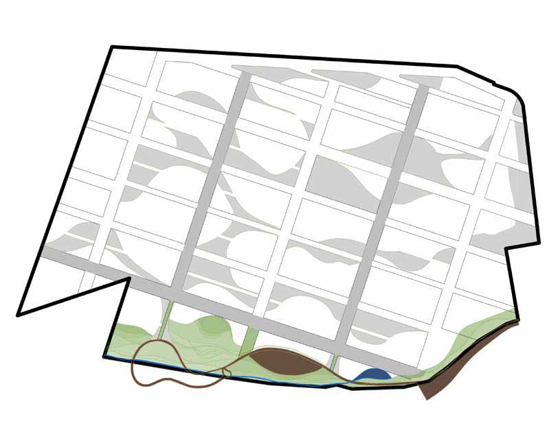
Rain gardens Bioswales Gutters Wetlands
pARkS COMBINATORIA ACCESS AND APPROACH
37.5’ RESIDENTIAL STREET
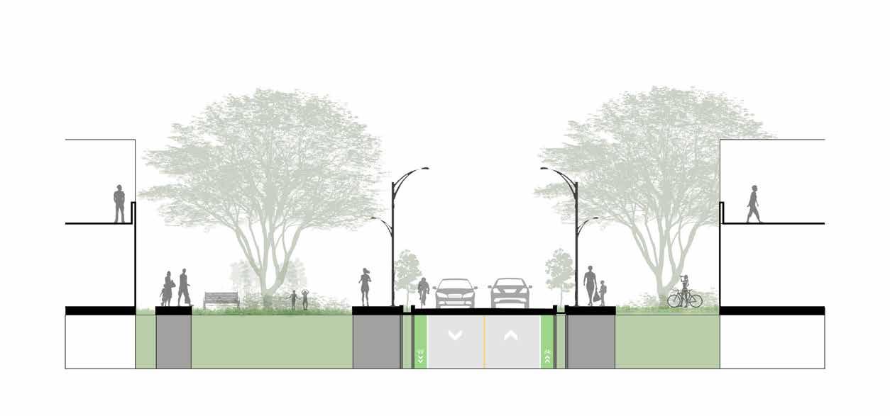
This typology happens between 2 residential blocks. It consists of 20’ wide vehicular road and 8’ wide pedestrian paths on either sides. This is much more slower and quieter street and hence there are no major public transportation systems running across the street .
52’ COMMERCIAL STREET

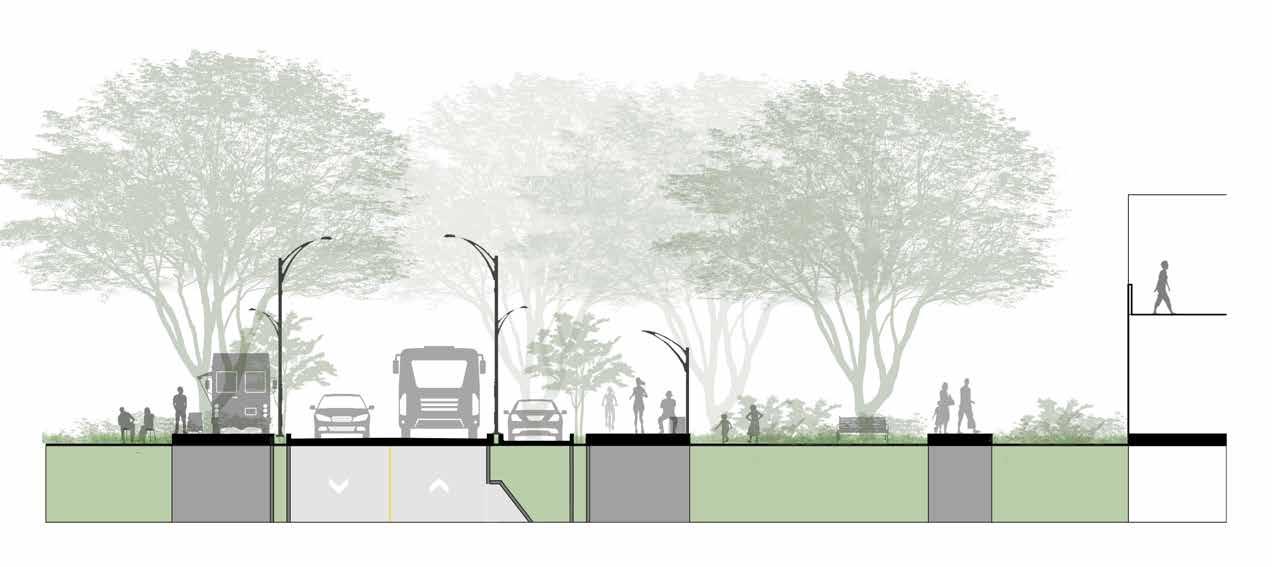
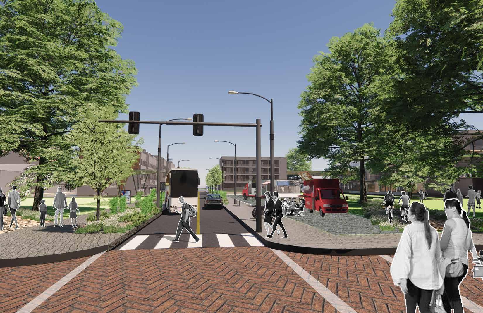
This typology happens between every residential and commercial plot. It consists of shared spaces for cyclists and pedestrians and has provisions for onstreet parking. When the road is encompassed by the Urban Green Space, it’s sidewalks extend to provide opportunities for pop ups , food trucks and outdoor events to take place. Public buses and tram connections happen on this street.
pARkS COMBINATORIA
ANALYSES AND REFLECTIONS OF THE SYSTEMS IN SAVNNAH EDGE
N
NETWORKS WARD BLOCK CONNECTIONS PROGRAM RIVERFRONT
RHYTHM
0’ 250’ 500’ 1000’
LONG TERM POSSIBILITIES
INTERIM VISION
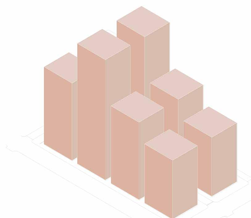
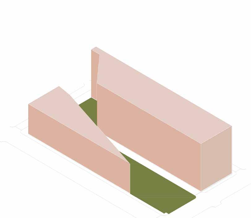
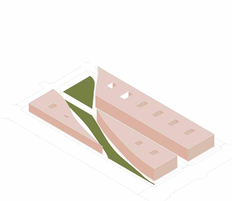
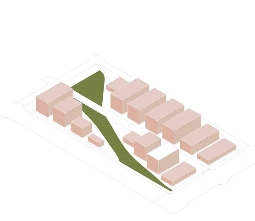
These diagrams show possibilities of formal exploration with low rise structures. Buildings can respond to the organic form of urban green spaces or build orthagonally. However, the master plan lays down a developmental rule : Any building coverage on the upper levels should not be more than 20% of the green space.
 VISION FOR THE SMART CITY
REVENUE GENERATING PUBLIC AND COMMERCIAL BUILDINGS IOT FERRY NETWORK SMART TRANSIT SYSTEMS WALKABILITY WETLAND PARKS WATER RETENTION PONDS COMMERCIAL EDUCATION RESIDENTIAL pARkS COMBINATORIA VIEW : Shared Pedestrian Street VIEW : Commercial x Residential Junction VIEW : Riverfront wetland park
This diagram shows the possibilities of formal explorations with the urban system in the future to plan for high rise development. The master plan system allows for endless possibilities to explore with various forms and future visions. However, the master plan lays down a developmental rule : Riverfront development should not go taller than 2 floors.
THE START UP VILLAGE

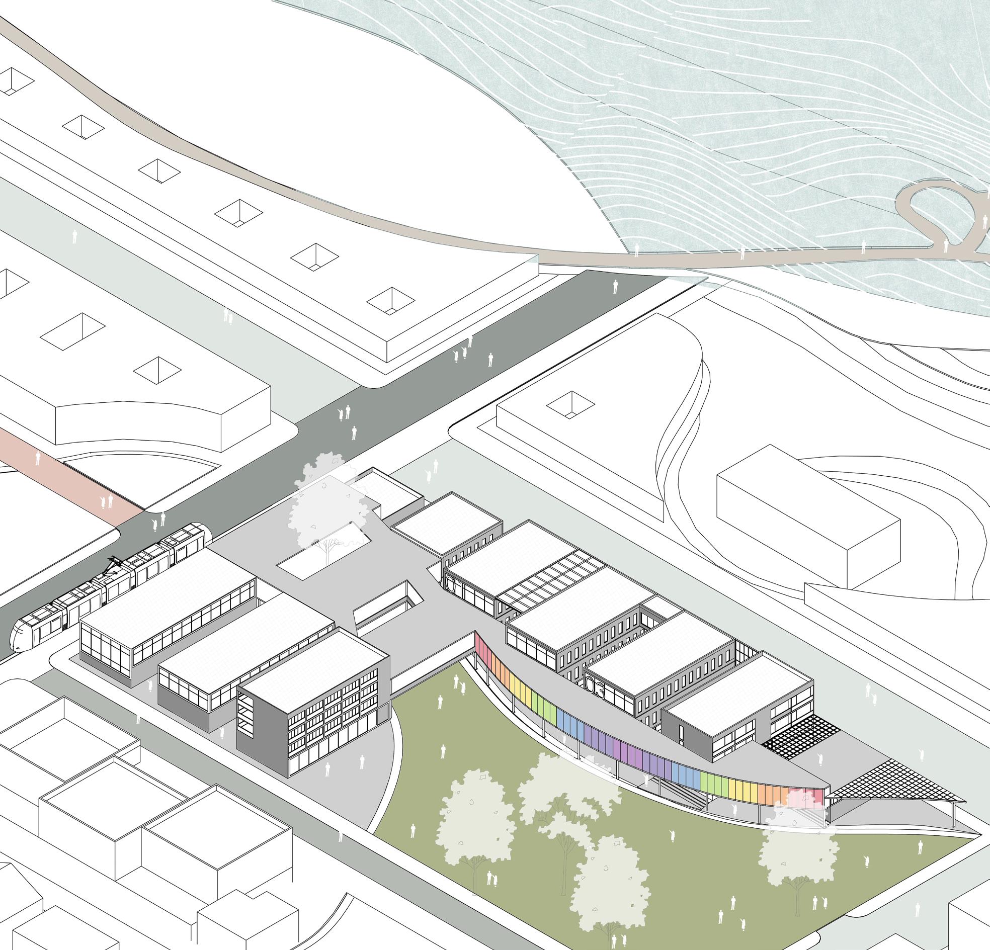
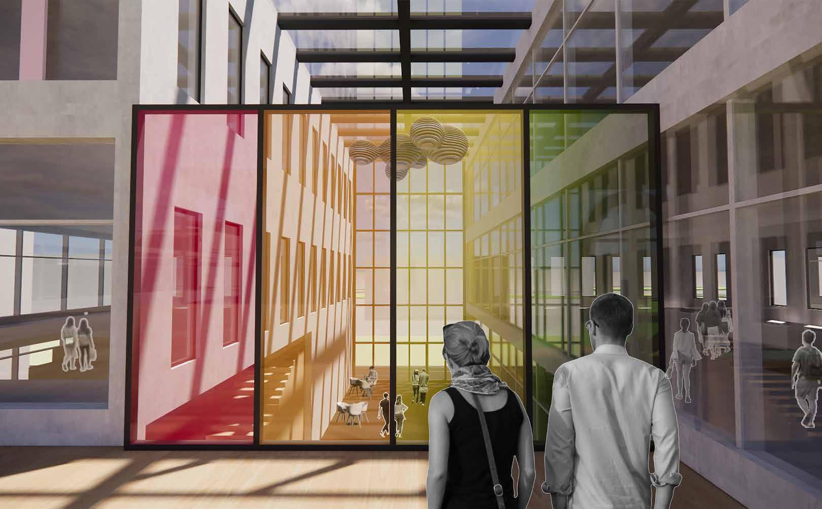
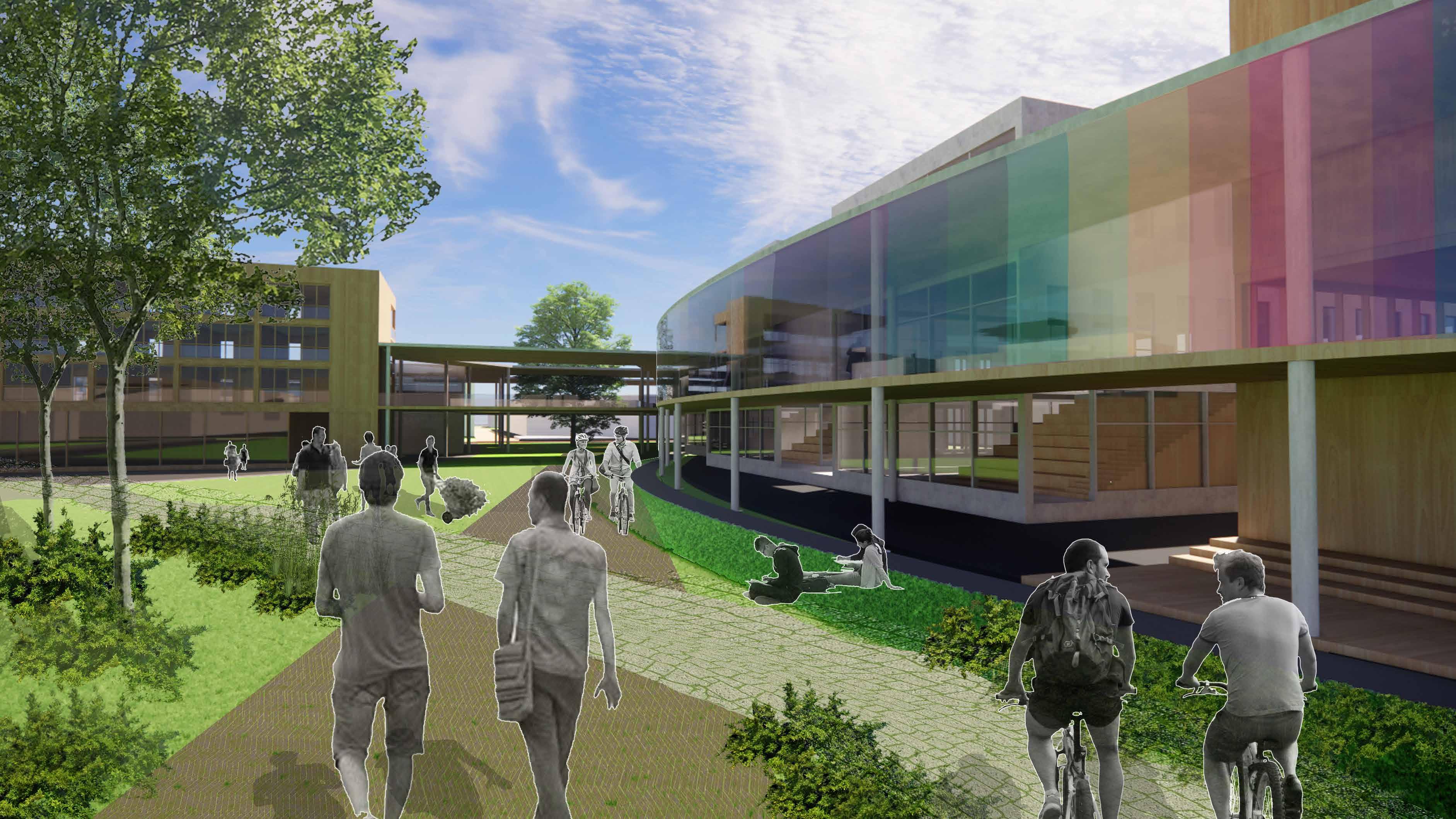
The start-up village becomes an apparatus for chance encounters between the users of the various programs amongst each other and the public gardens. This phenomenon lies at the heart of the aspirations of the project. It also drives strategic architectural moves that create transitional spaces that people from different parts of the building can enjoy together while still being closely connected to the Innovation district through the public park in the center. Its proximity to the SMART metro, which connects the district’s core spine, makes it easier for city residents to visit the technology incubators and accelerators.

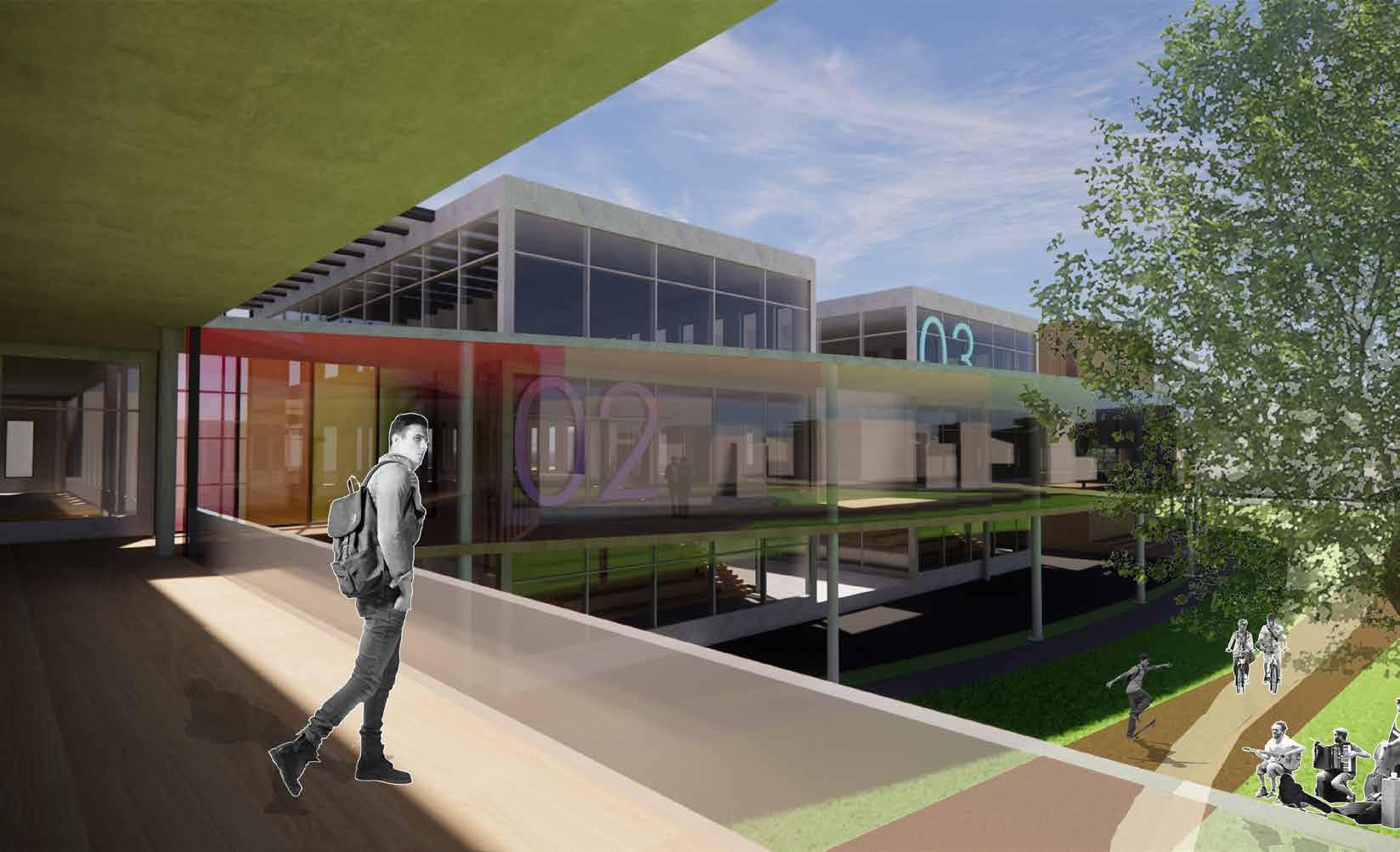
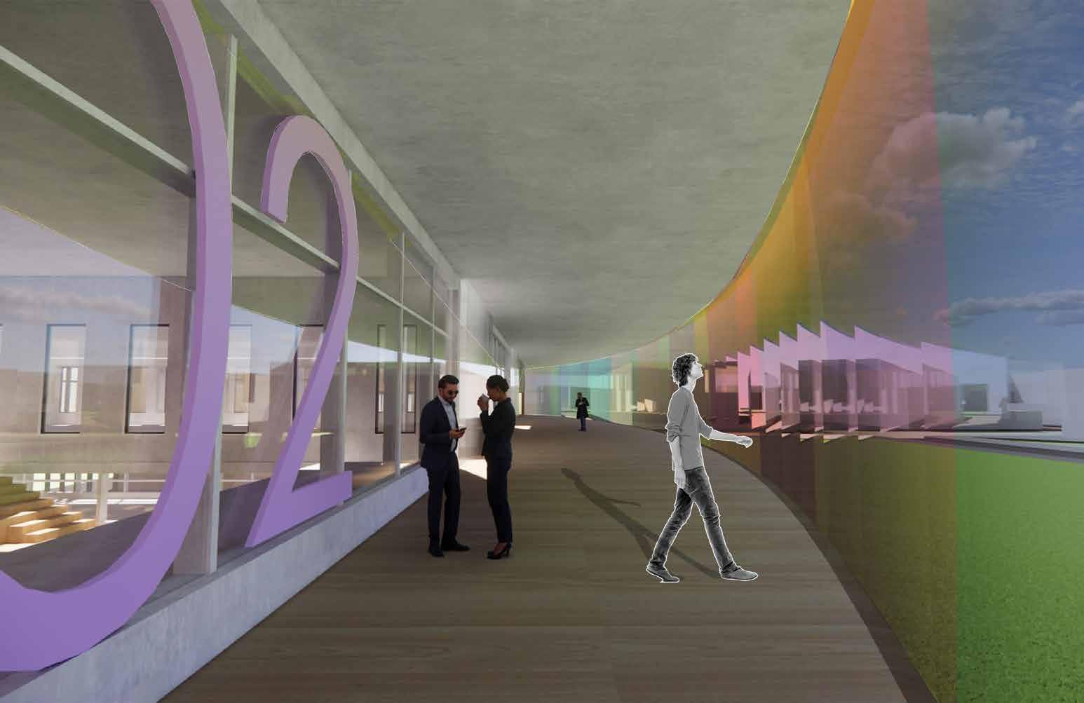
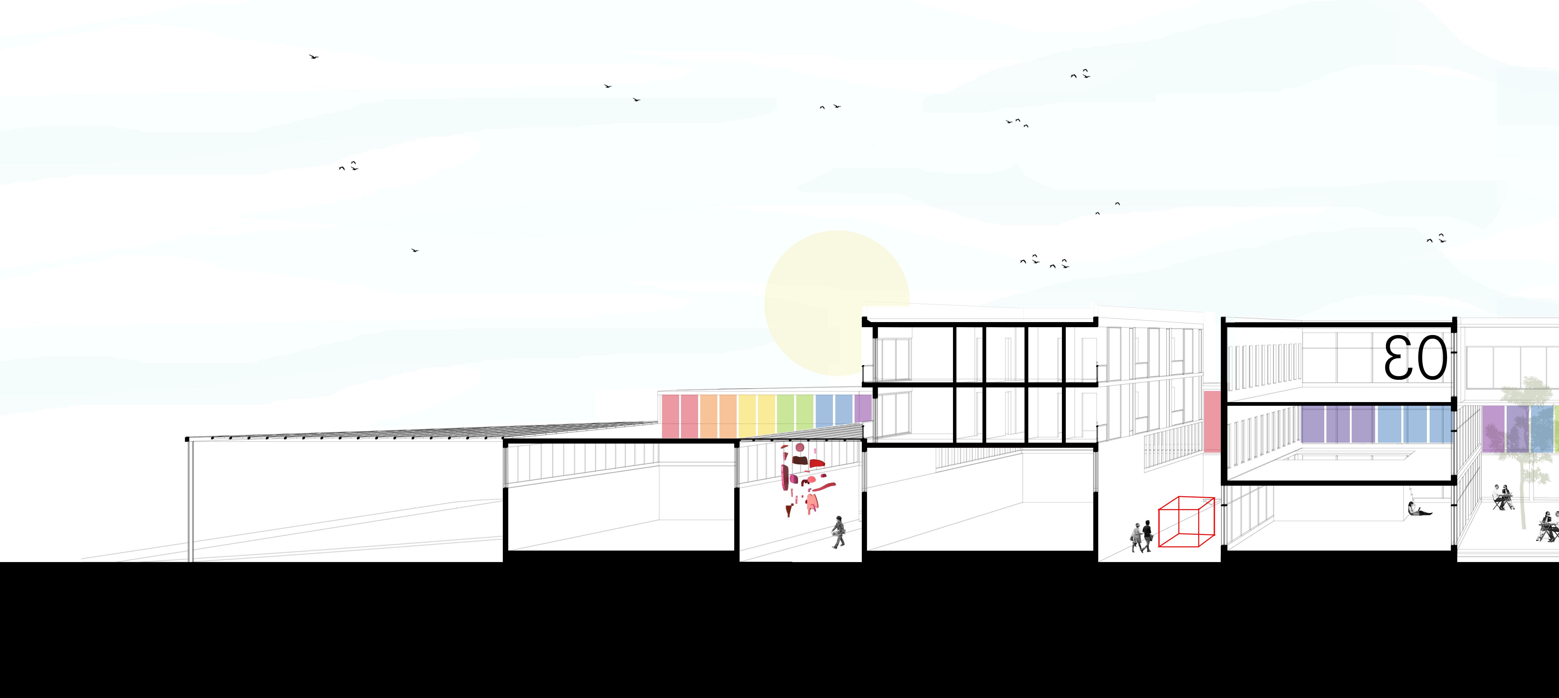
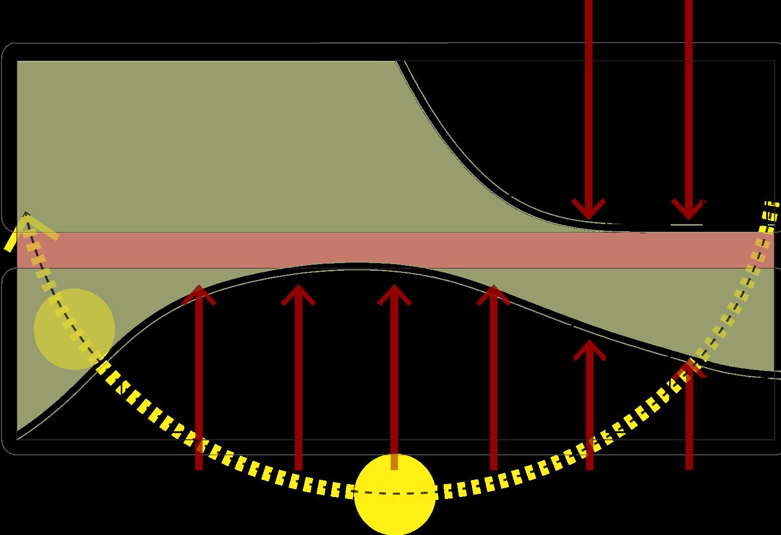
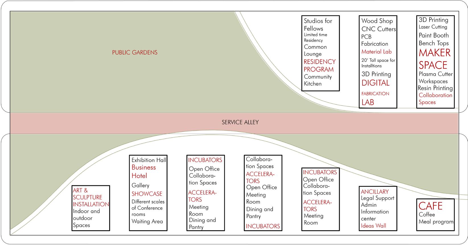
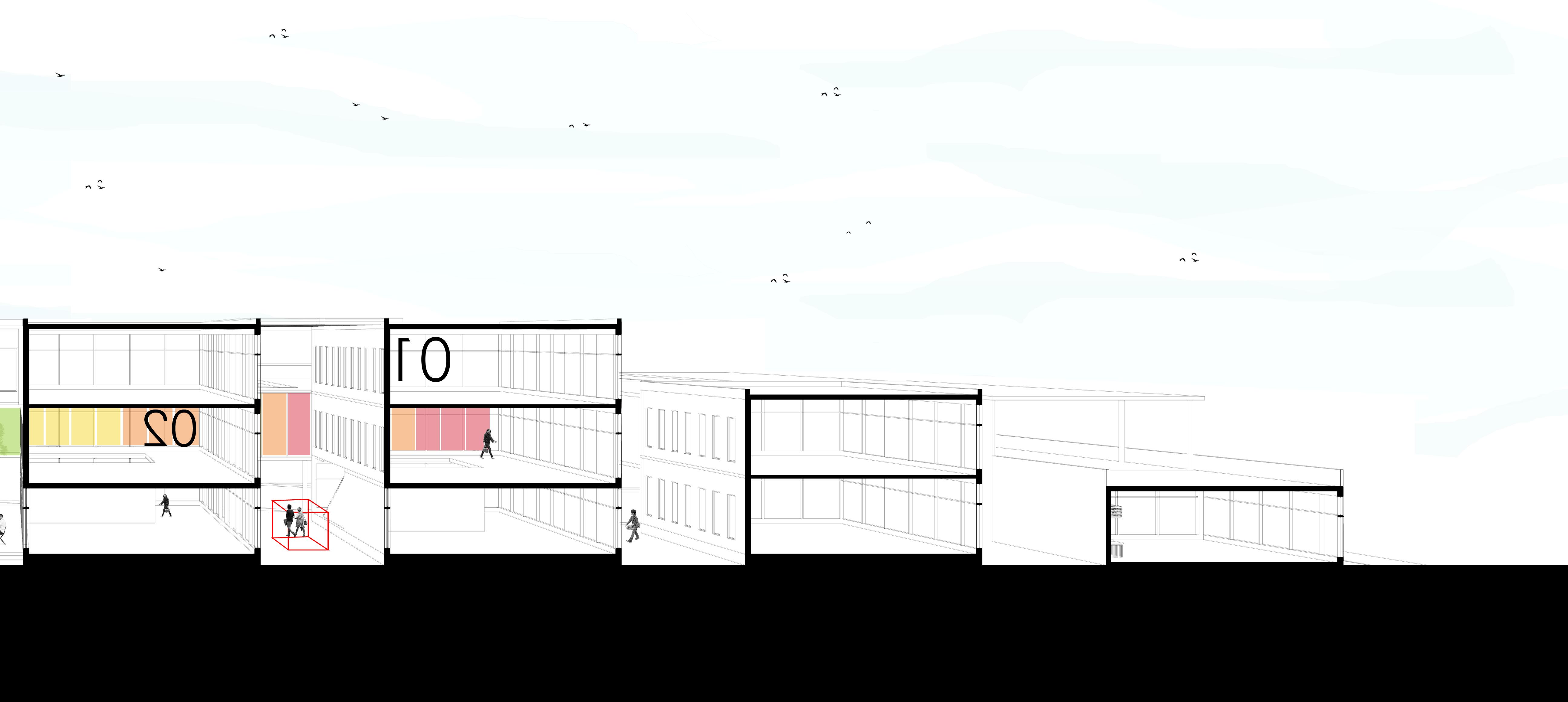
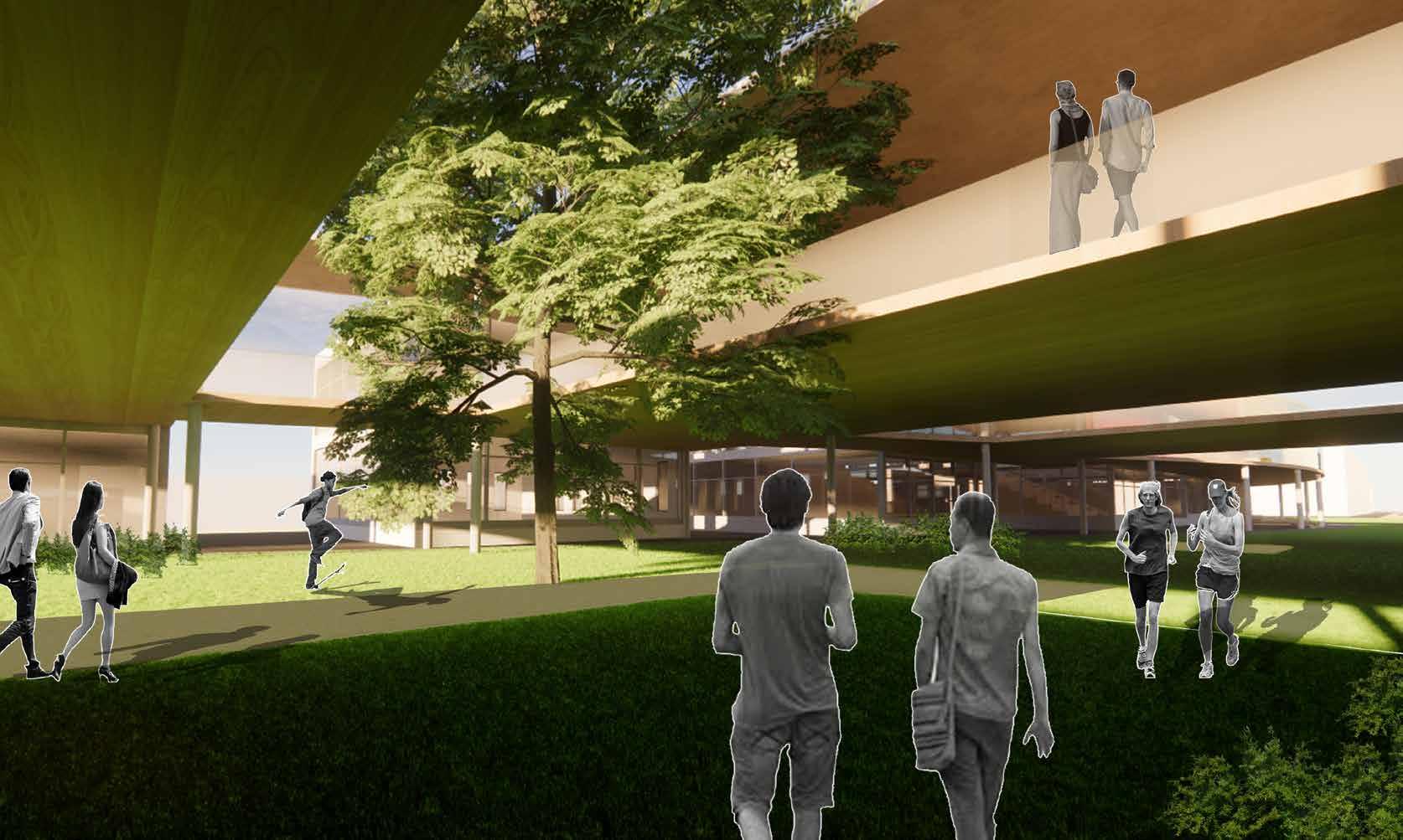
The village is divided up into ten separate blocks that are connected to the public garden through covered and open-to-sky walkways. These transitional spaces are programmed keeping in mind the buildings it comes between and attempting to maximize the ease of usability for its guests. On level 2, a covered sky bridge that connects the various blocks also provides an opportunity for impromptu interactions between people from various backgrounds. The sky bridge also adapts the form from the district masterplan to deliver a softer presence for district users of the park inside the site. The village aims to launch a 14-week residency within the campus and accommodate up to 30 people at a time. The site also has maker spaces, a lab for digital fabrication, a business hotel, and a space that can be rented for events including long-term exhibitions, installations, and art displays. The campus’s varied programming offers increased opportunities for interactions between various personalities. The buildings open with glazed facades towards the North and East direction to maximize diffused natural lighting. It also closes itself off at the South and West ends, to reduce heat gain and improve the thermal


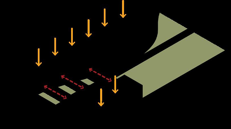

01 02 03 04 05 CONTEXTUAL AXONOMETRIC KEY PLAN MASSING PROGRAM STATEMENT & ORGANIZATION SECTIONAL AXONOMETRIC : This
ORIENTATION AND ACCESS SITE LINES IN-BETWEEN CONNECT FORM This diagram shows the solar envelope developed in the master plan proposal. It also show plot divisions. This diagram shows the division of the form between orthographic and curvilinear. This diagram shows the separation between the offseted facades that respond the organic form of the park with a pushed down connector. This diagram shows the connection of all the individual blocks separated by courtyards through a skybridge This diagram shows the massing of the START-UP Village THE START UP VILLAGE
shows the nature of the spaces in between the building blocks.
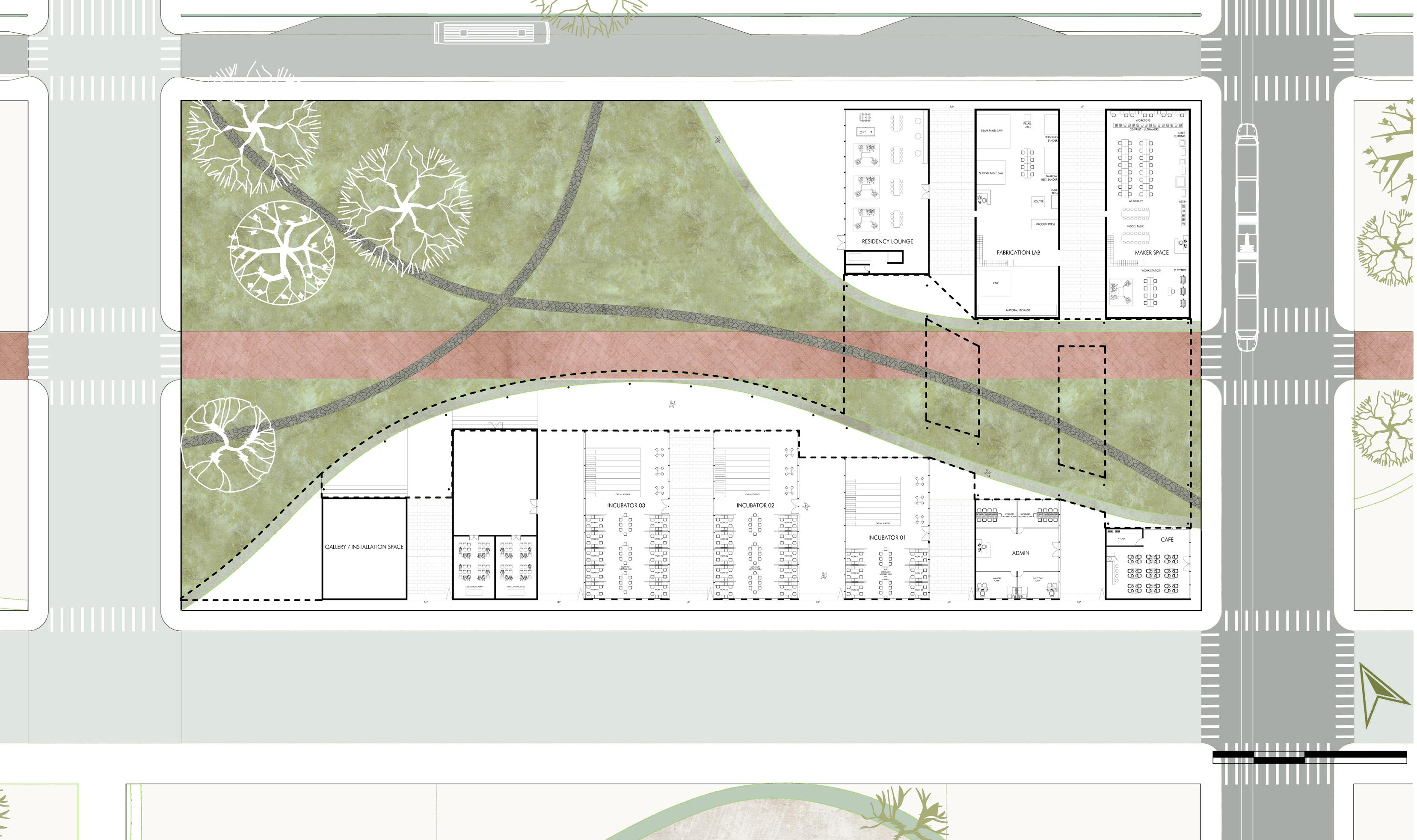
FLOOR PLAN AT LEVEL +3’-0”
: Approaching the campus through the
garden 0’ 25’ 50’ N 150’ pARkS COMBINATORIA
VIEW
public


 VISION FOR THE SMART CITY


