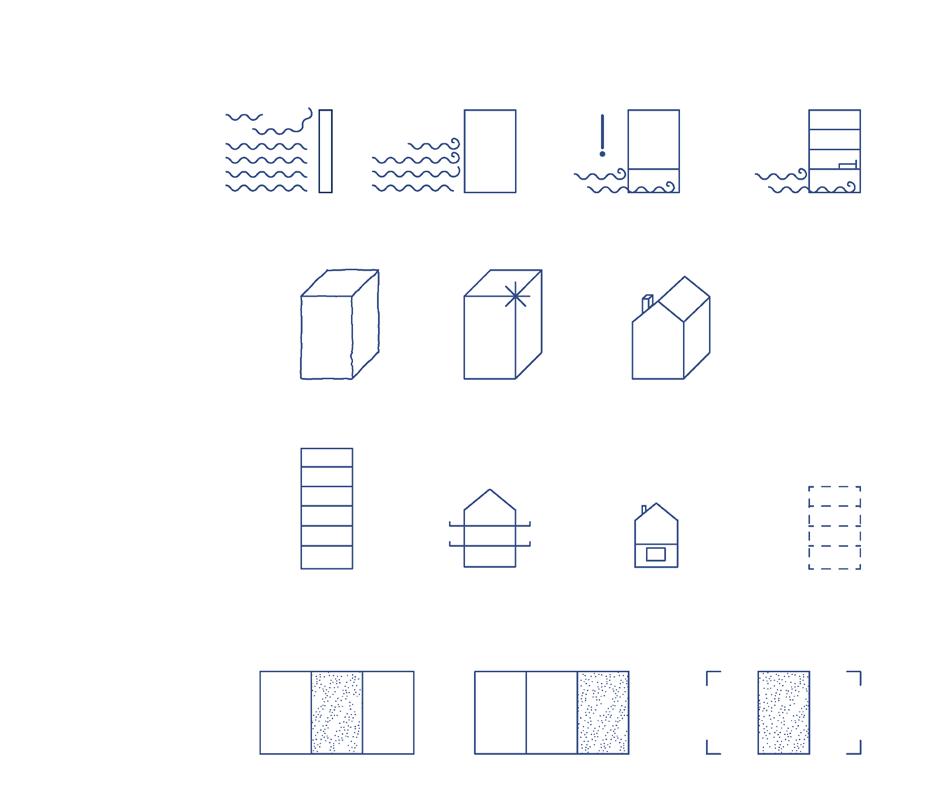
05_Forest and water urbanism 08_Street as safe urban realm
Rural catalyst
Urban research
Energizing concrete-scapes
Activism in Architecture
Didactic Urbanism
New Delhi
India
Bihar
Hyderabad
Mumbai Pune
Vietnam
Indonesia Cantho Bandung
01_Infrastructure as landscape
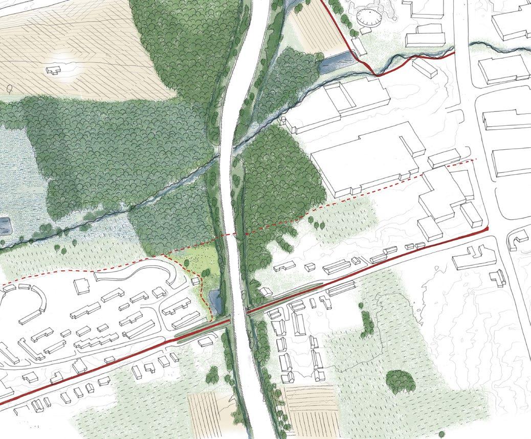
ROND RONSE
Ronse, Belgium
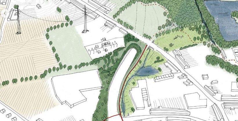
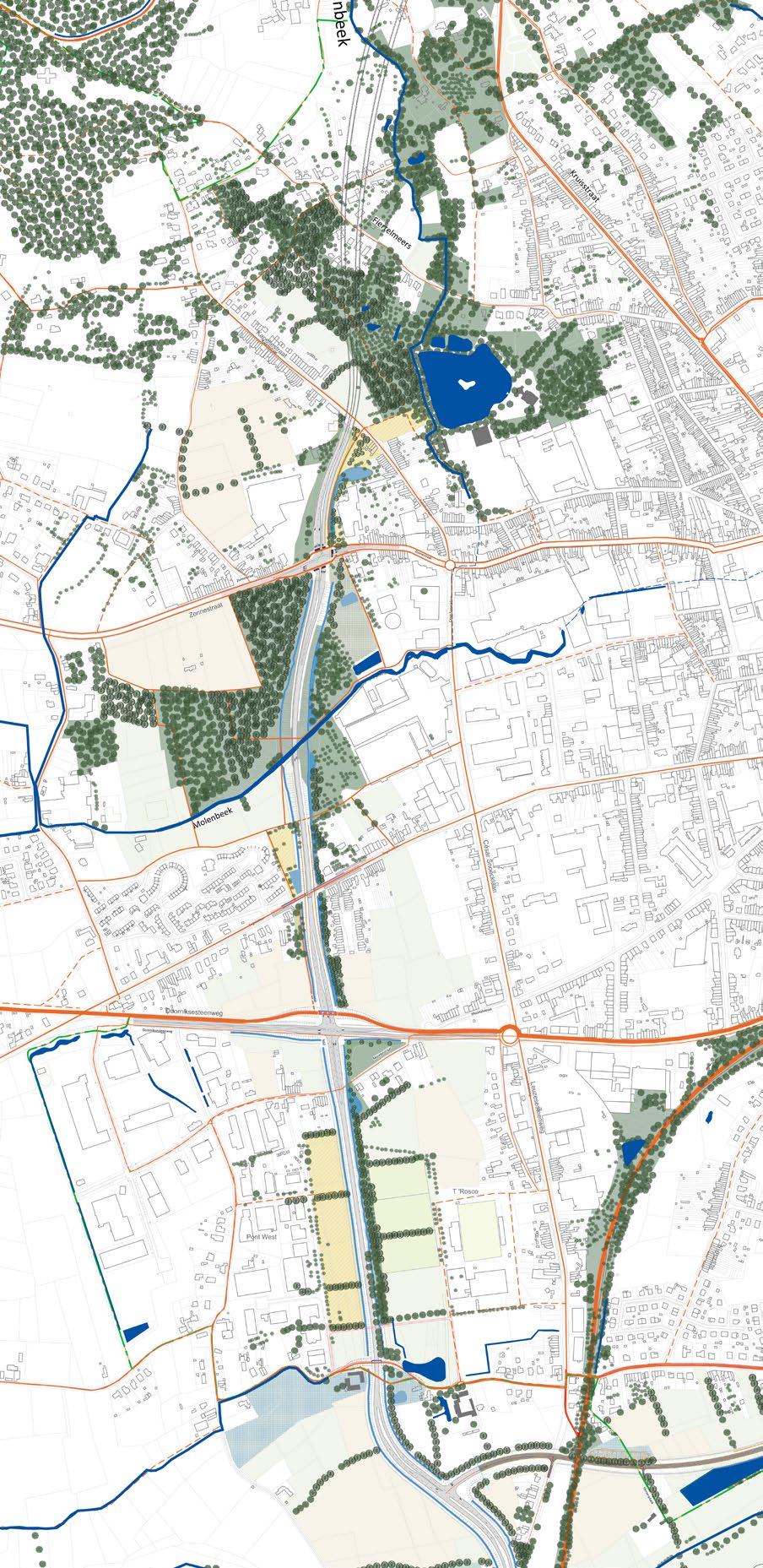
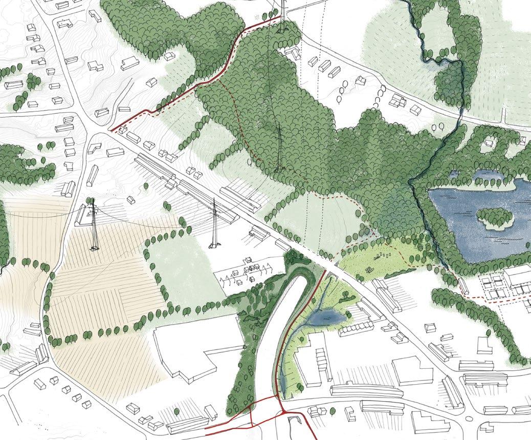
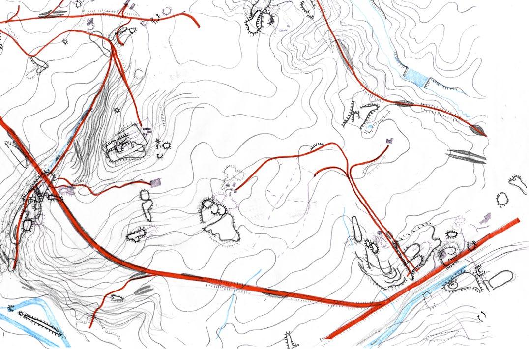
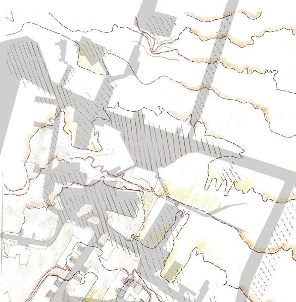
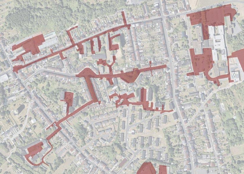
Rond Ronse is a road infrastructure project that creates a by-pass route for the city of Ronse. The team looked at the road as landscape itself that needs to be shaped keeping in mind the networks of ecology, soft mobility, noise and water. The intention is to create social and ecological value for the city while the road link project is hugely impacting its morphology by creating barriers.
The drawing above shows the different shades of ecology that the project aimed to create. In red are marked the soft mobility routes for biking and walking. In addition, the project aimed to create greater linkages make sure the road does not act as a barrier for urban movement but rather as an opportunity to connect the neighbourhoods.
Professional- Tractebel Spatial Design
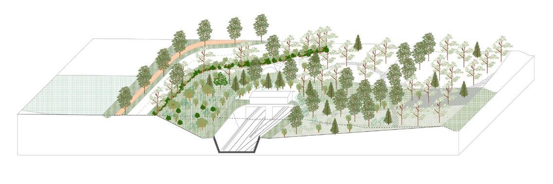
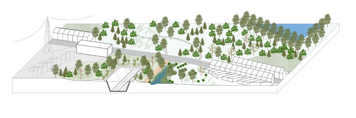
The sketches on the right were created to cohesively communicate to all stakeholders in the project, including the road engineers and the general public on what the urban vision for the new road is. These were drawn out by the author on different layers of tracing paper and collated on Adobe Photoshop.
Molenbeek Bridge sectional explorations
Tunnel- north entrance
Tunnel- north entrance
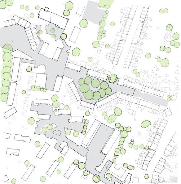
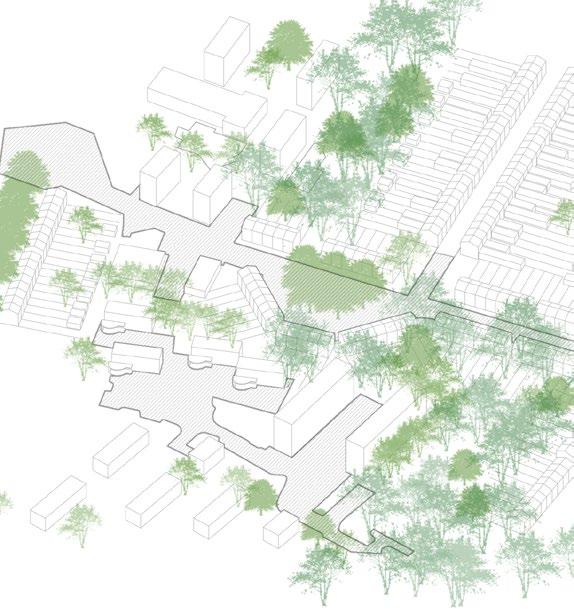
02_Public space design competition
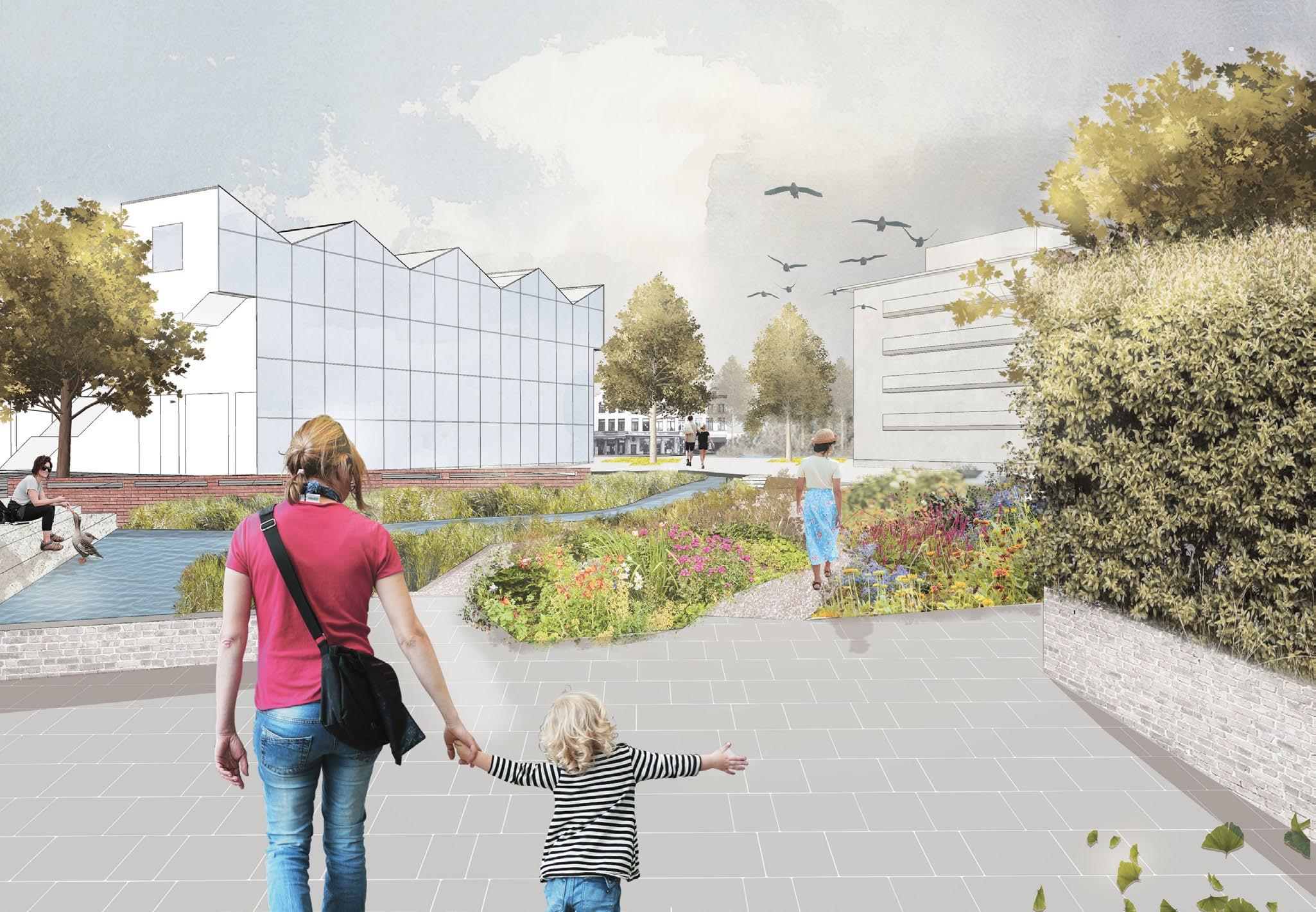
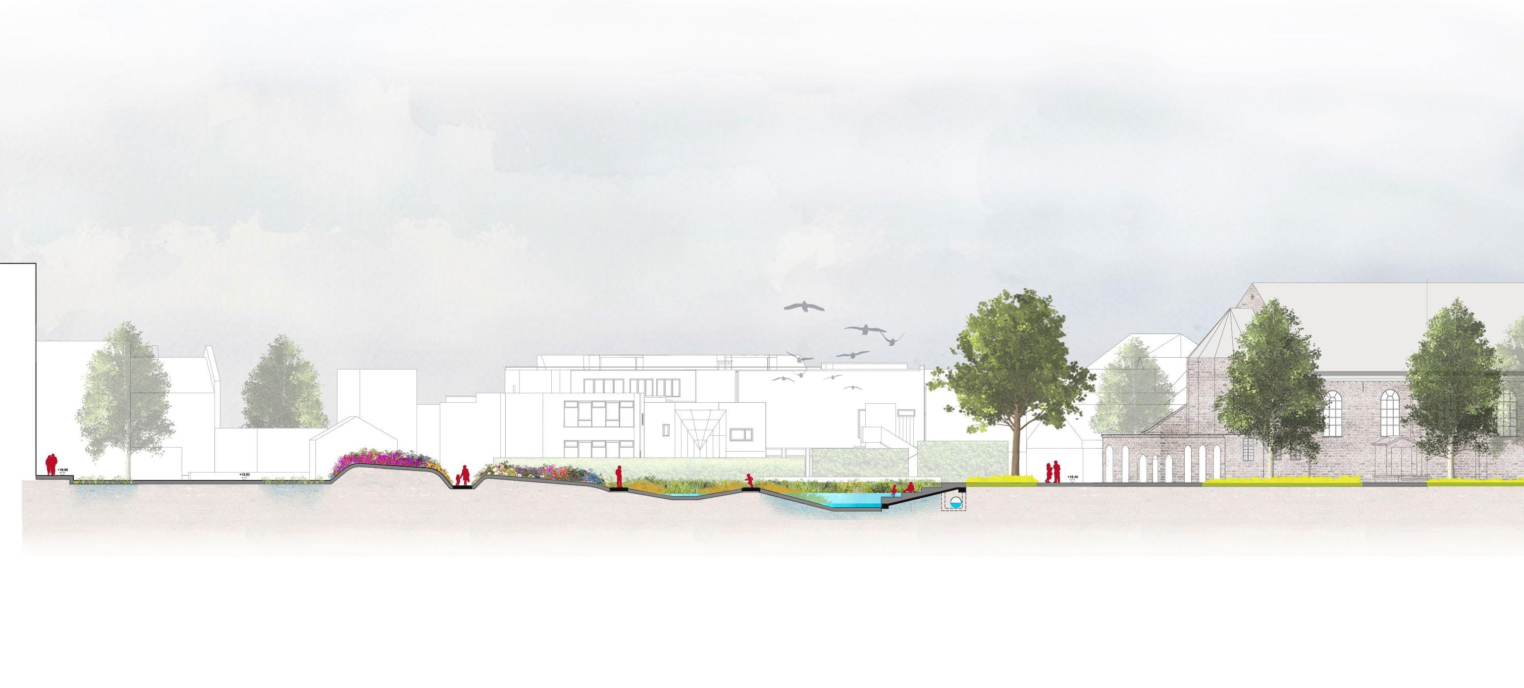
GULLEGEM
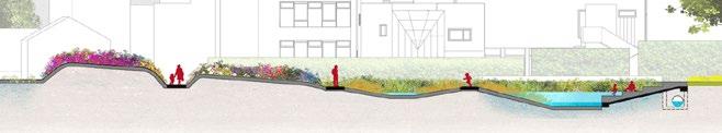
The image shows the diversity of plants envisioned for the floral garden while emphasizing the underground stream which has been de-mineralised and softened to improve the water quality of the stream and make it a part of the daily lives of the neighbourhood.
Semi-paved Parking For water infilteration Biodiverse species of floral plants The underground stream has been re-surfaced
Creating softscapes for increased ground water recharge
The drawings were created as part of a public space design competition that aimed to redesign a parking lot in the middle of a church sqaure in Gullegem. The proposed design maximised the green area to provide as much softscaping as the site allows. The intention was to make it the complete opposite of what it represented and make it a space for biodiversity, play, reflection and community.
The 3D view , sectional drawings and renderings shown here have all been done by the author
Floral sunken garden
Space for water De-paved surfaces for new trees
5m 10m
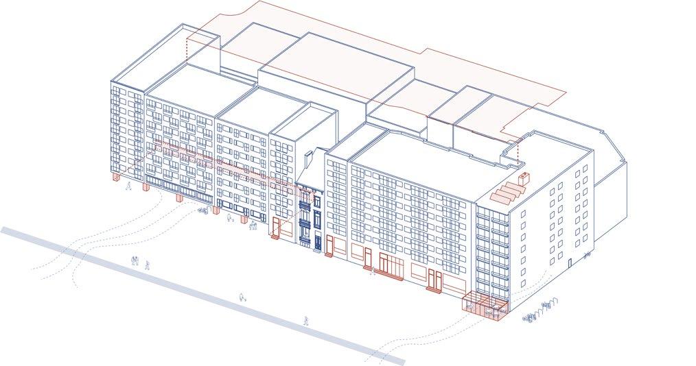
03_First line of defense in coastal protection
VLAAMS KUST
Belgian coast , Belgium
Professional- Tractebel Spatial Design
Location of building on the block
The study was aimed at spatially defining the different building typologies that exist on the belgian coast and how they must adapt to cope with the rising sea levels and storm surges. The different types of housing are located in the map above to understand the distribution of these houses on the coastline. They form a part of the first line of defense in case of extreme climate events.
Different cases of housing clusters were then identified and drawn to create various scenarios of protective interventions that could happen at a building block level.
Oostende
Zeebrugge
Blankenberge
De Haan
Nieuwpoort
De Panne
Koksijde Middelkerke
James Ensor- Oostende belgium
Different types of building clusters- each with their own opportnities and challenges to adapt them to the sea level rise and consequential flooding
04_Masters Thesis
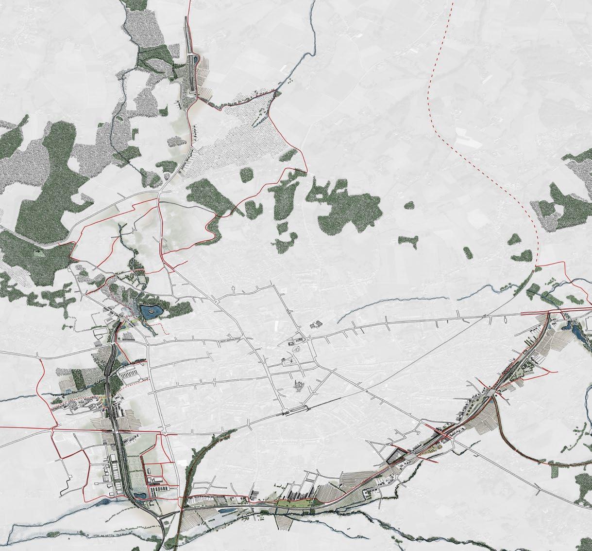
A ‘found’ Landscape- Charleroi
Charleroi, Belgium
Academic Masters- KU Leuven
Independent Thesis 2021
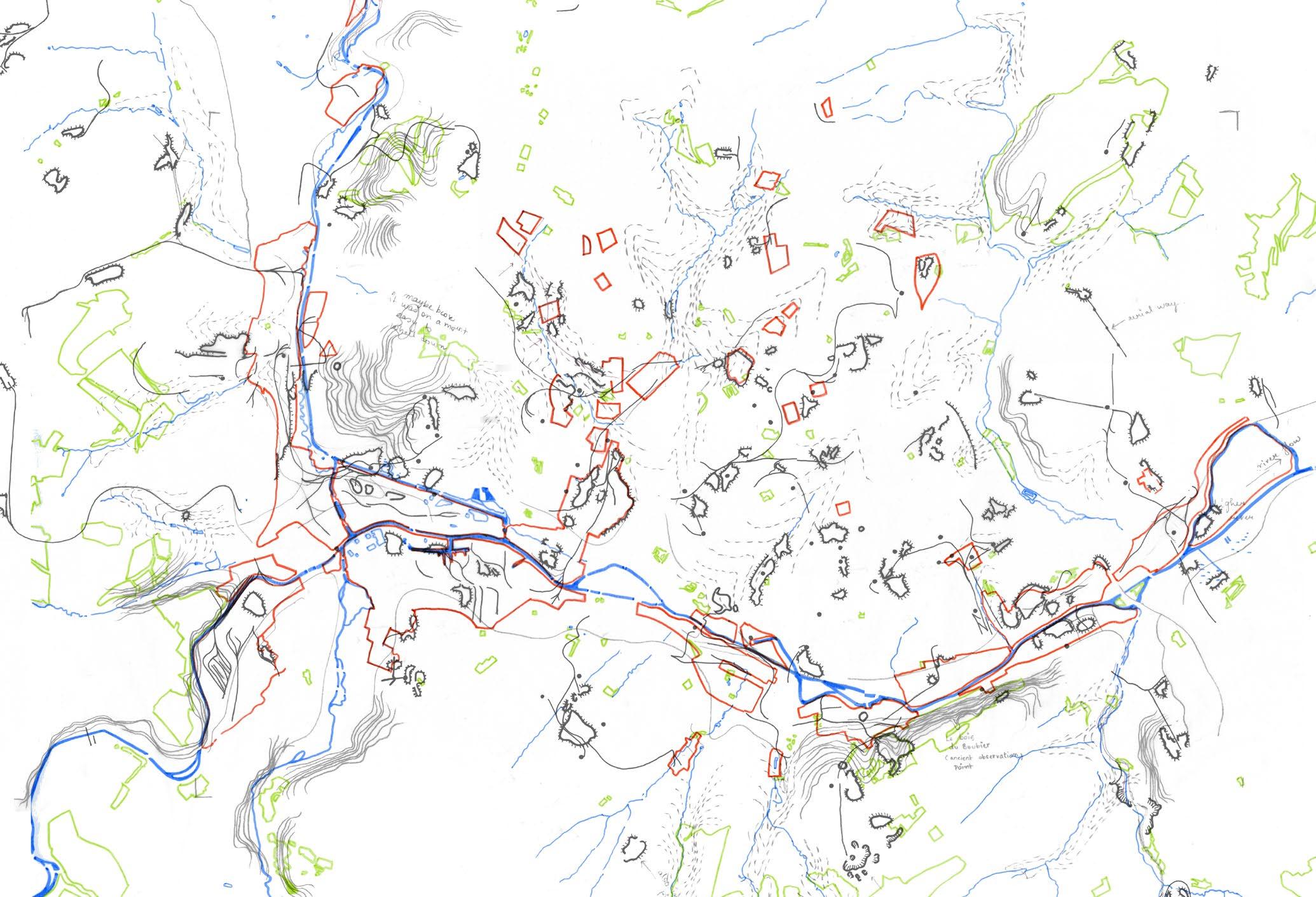
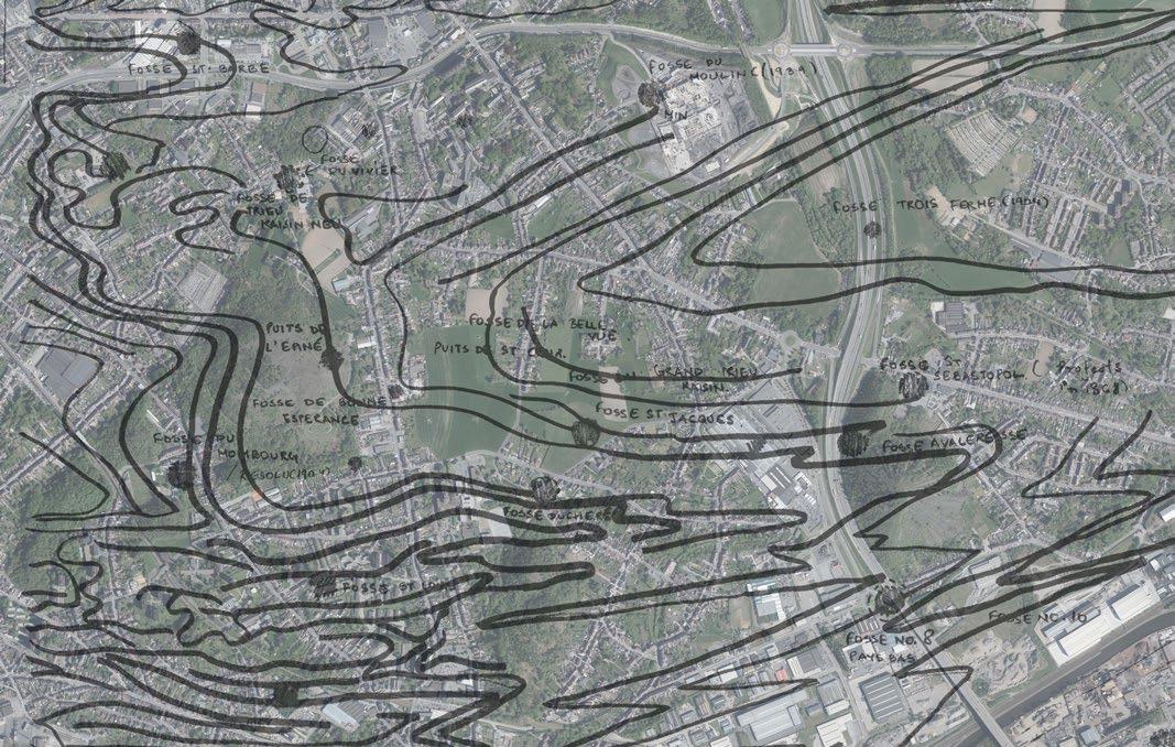
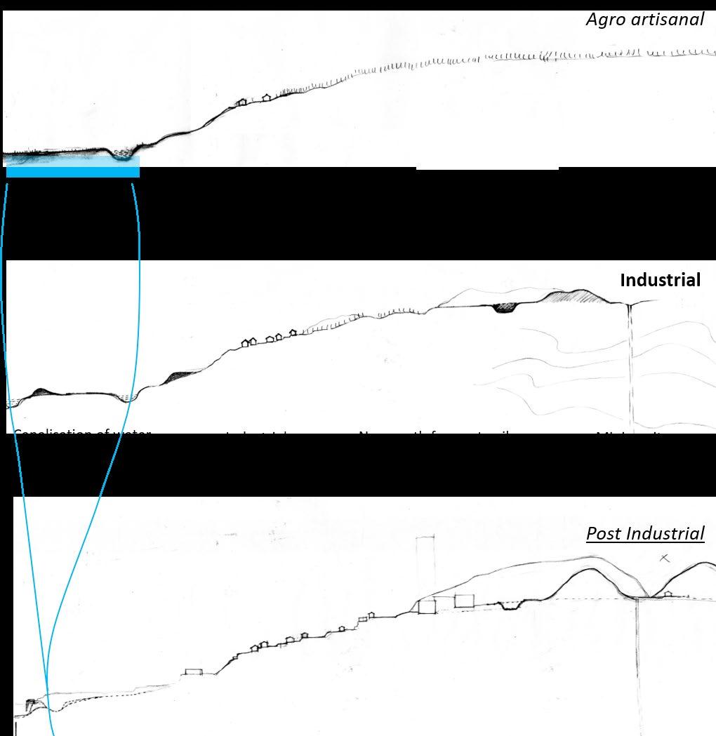
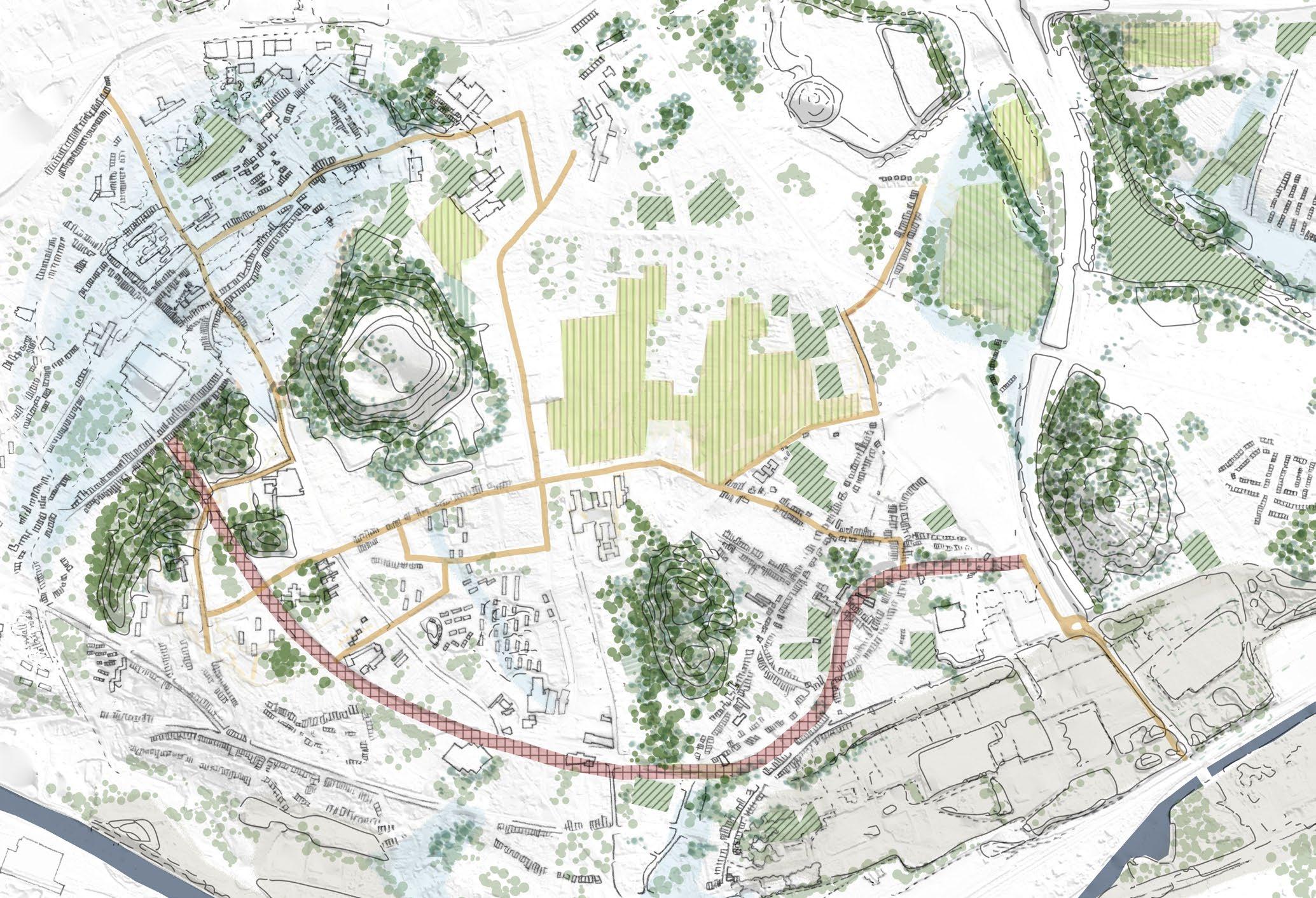
The industrial era of Charleroi- The map shows how the entire territory of Charleroi was put to work for the extraction of coal
56% of the population of Charleroi lives in difficult neighbourhoods while the city suffers from high unemployment rates. The thesis takes the side of neo-nature and topographical conditions to envision a ‘found’ landscape frame for Charleroi.
Through mapping, the region is studied in it’s different life cycles as an agro-artisanal region to an industrial zone and now to it’s inherited post industrial reality. This is done to arrive at a new relation between the city and its territory to take it towards a new direction.
The underlying coal veins in the Trieu Kaisin Mining Concession
The industrial mining infrastructure leading to an altered topography
Different lifecycles of the territory
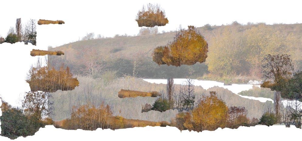
New emergent nature taking root in the vestiges of the Post Industrial City
5km X 2.5km
Post Industrial Section
04_Masters Thesis
A
‘found’
Charleroi, Belgium
Landscape- Charleroi
Academic Masters- KU Leuven
Independent Thesis 2021 (ongoing)
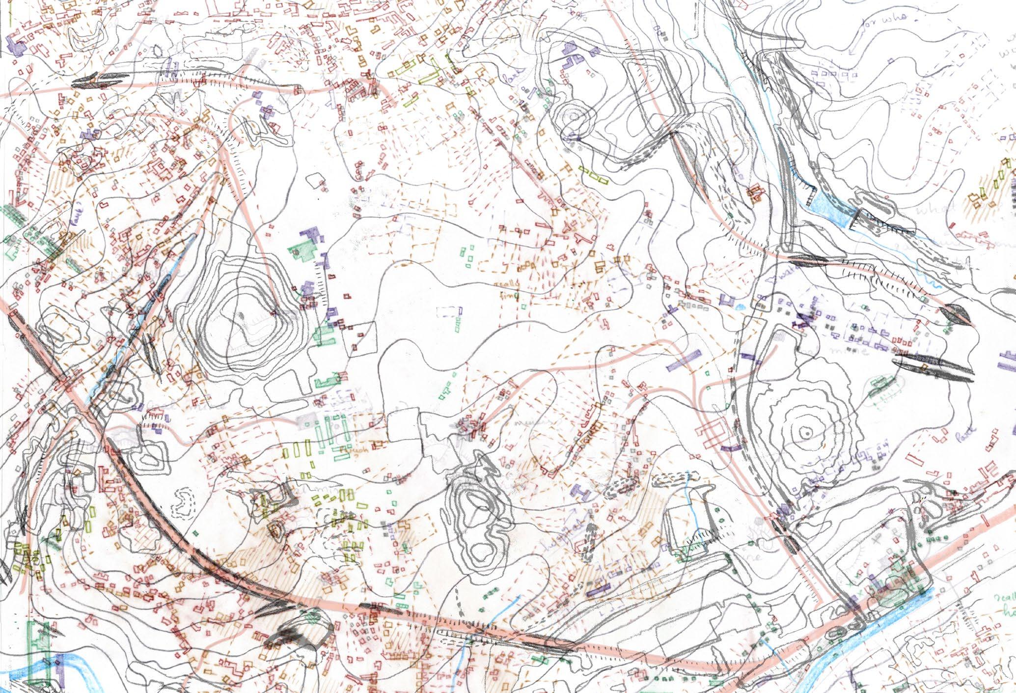
The urban palimpset : mapping the transformation of the landscape and the urban tissue in the mining era (5km X 2.5km)
The industrial era has created a dispersed poly-centric urbanisation. Inspired from the concept of a “City in a City” or the “Urban Archipelago” by Mathhias Ungers, Rem Koolhas et Al, the intention is to distill the characteristics of the region in terms of the unique spatial assets that need to be retained and invested in.
300m X 300m
Design Vision: The city in a city
The new figures to structure present and future urbanity
While the other dispersed components of the city can slowly be turned to nature and disintegrate. The result will be a more compact yet intense urban tissue, that will create more focussed developments. The design recognises the new figures of the landscape as a frame for the urban. This figure of topography and vegetation recognises the neo-ntaure of the post industrial city. In this new ‘found’ frame, the existing urban and the new future urban will flourish.
Farmland
Pasture fields
Forest
Industrial grassland
Soft mobility roads
Repurposed old railway line corridor
04_Masters Thesis
A ‘found’ Landscape- Charleroi
Charleroi, Belgium
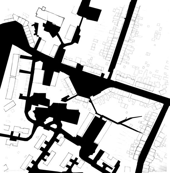
The neighbourhood roads are turned into urban platforms that connect the neighbourhood and provide public spaces of different textures.
Academic Masters- KU Leuven
Independent Thesis 2021
The new ‘found’ frame gives space for urban projects to find a point of focus. For example, the neighbourhood scale design on the left images shows how the internal road space is over-provided for and proposes that it be looked at as mineral slabs that provide soft mobility and open space to the residents living around.
This helps in transforming the place into a neighbourhood that is not just a place to rush past in a car, but has transformed into a place for people and activities.
These interventions can slowly turn the pace of development towards the unique post industrial landscape of Charleroi rather than focussing on water front developments and road based investments.
Congregating urban grassland
School bush garden
Neighbourhood scale 300m X300m
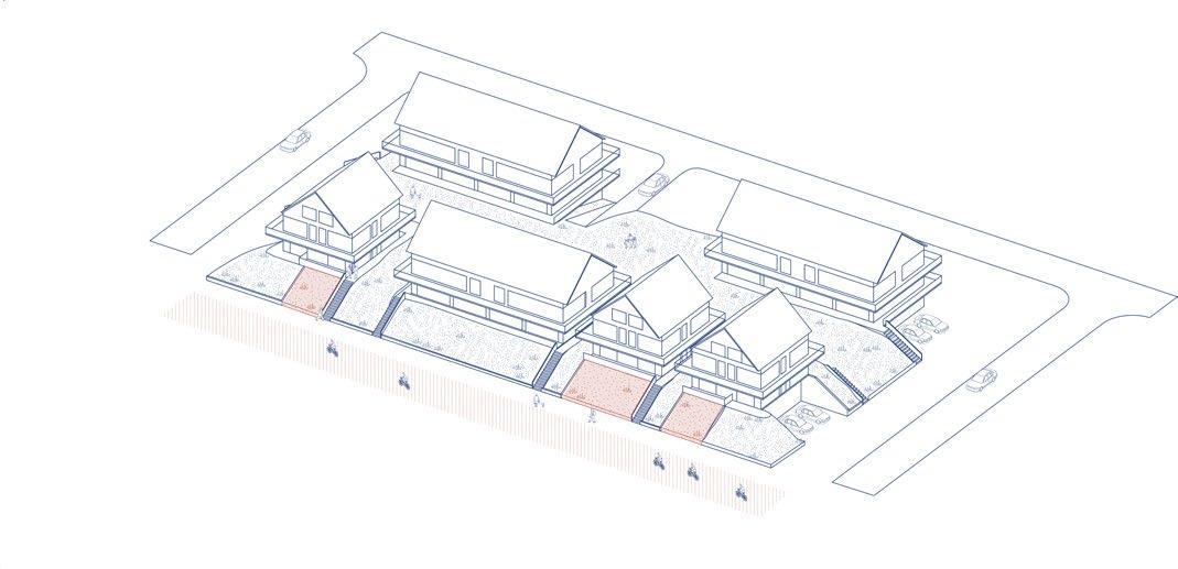
The housing is inspired and derived from the landscape tissue around it.
For example, the parcel with a forest floor and large trees, is proposed to be settled with appartment buildings that provide the height and density to allow for this typology to take root.
forest apparments
Low-rise community farm housing
The
Tree nursery
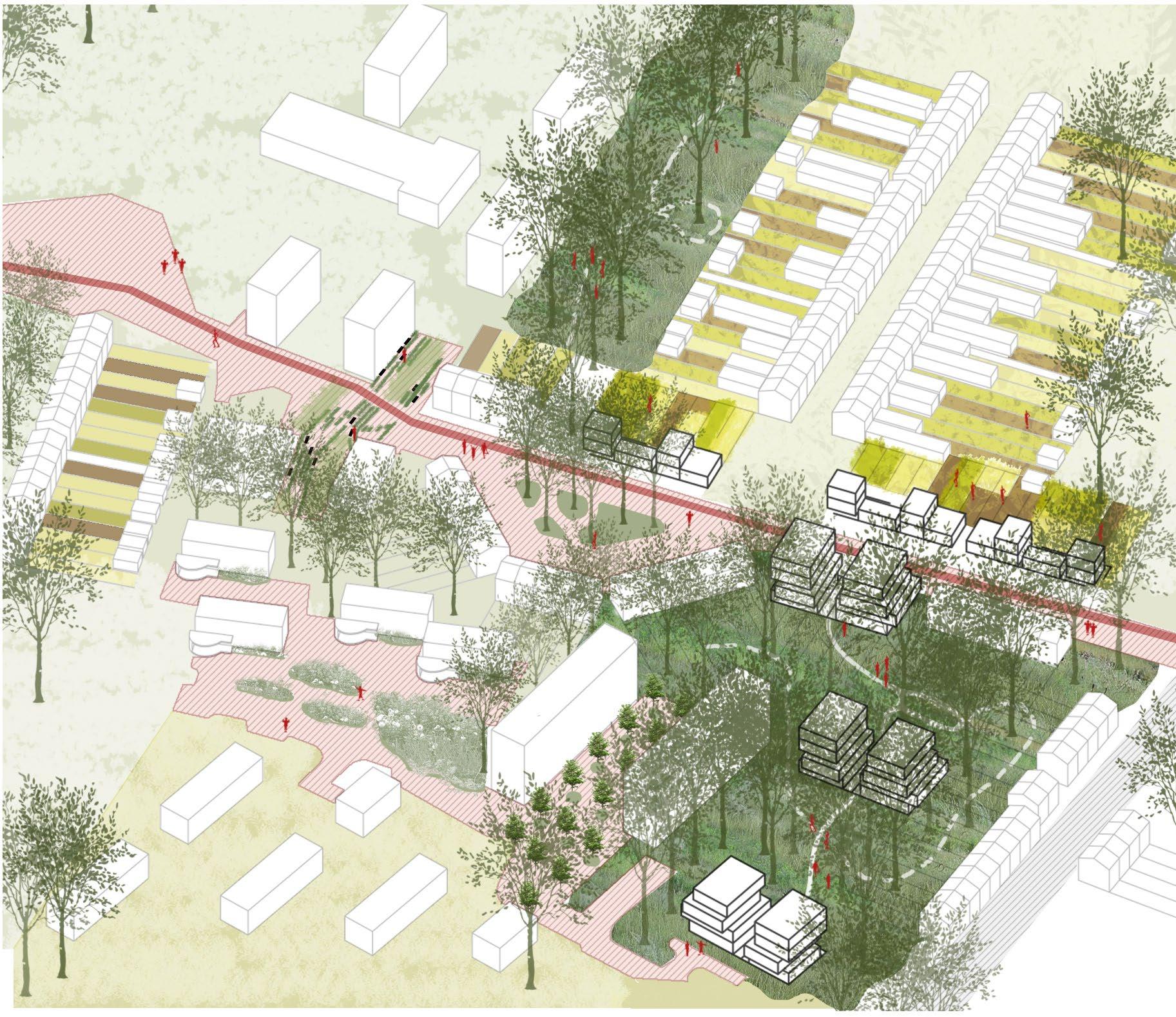
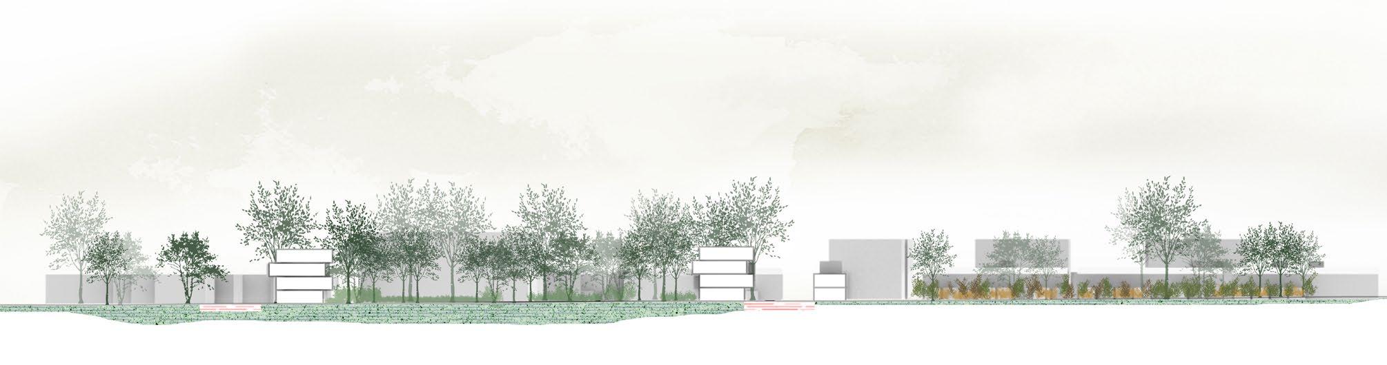
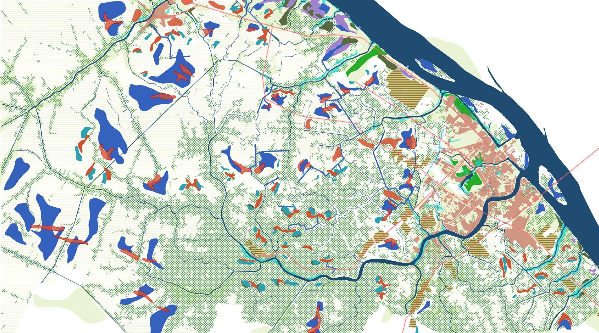
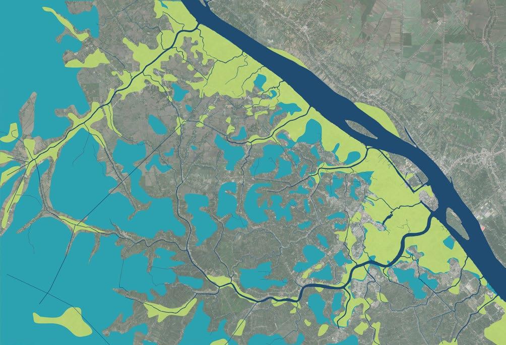
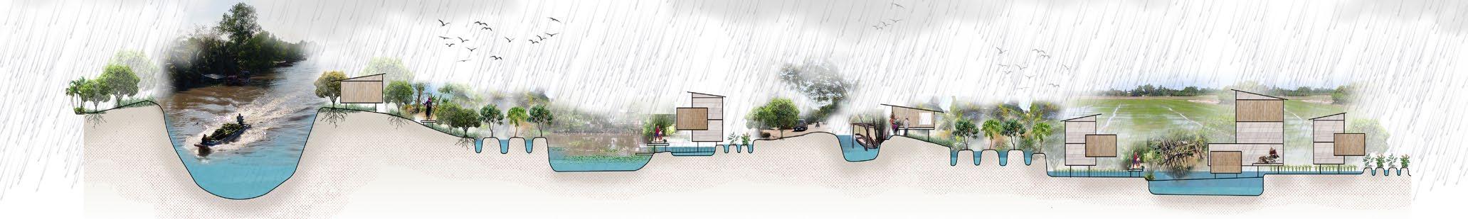
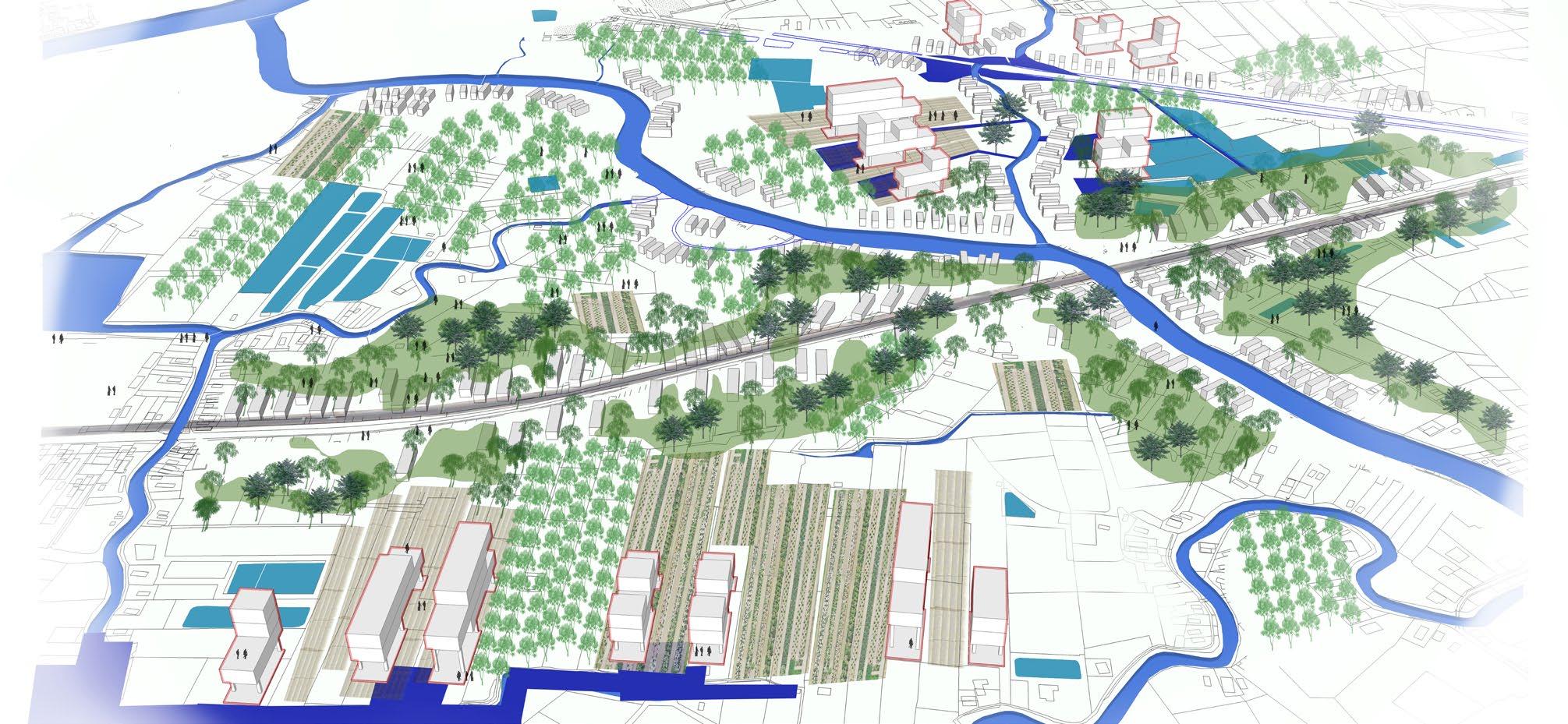
05_Forest and water urbanism
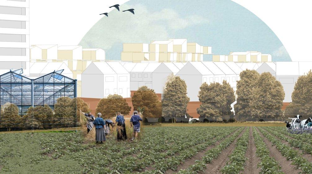
WATER BORN(E)
Cantho, Vietnam
Academic Masters- KU Leuven
Team effort + Individual component 2020
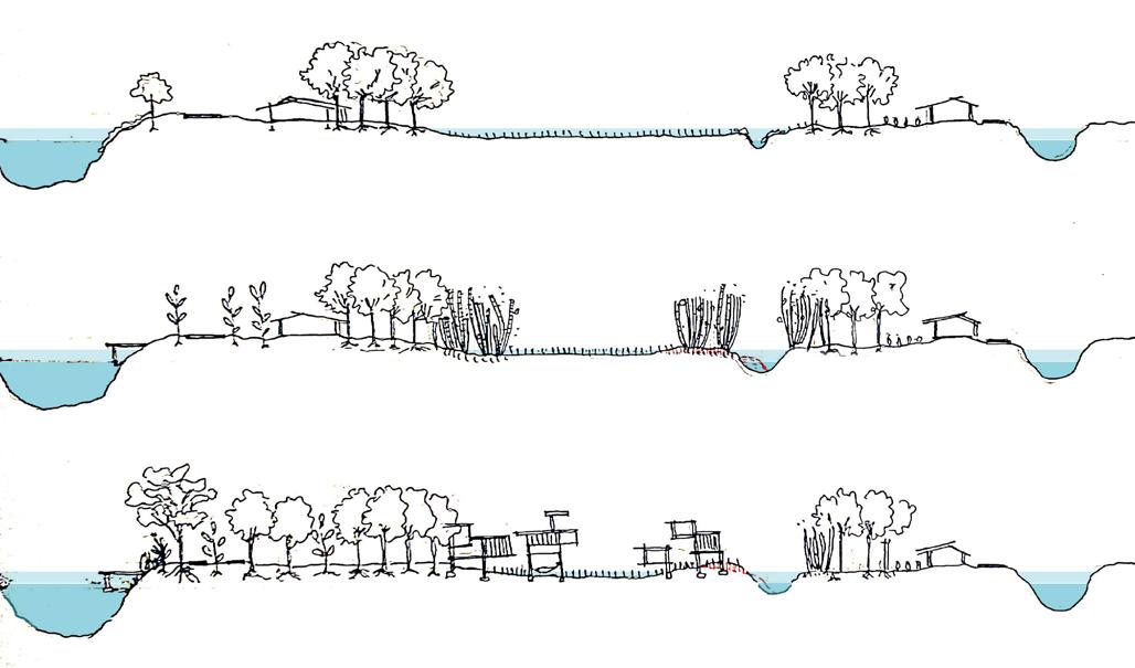
Located in a deltaic landscape, the vision creates a blue green structure to frame the urbanisation and growth of Cantho region as opposed to the prevalent road-based impermeable expansion that is the prevalent BAU.
(Right) The places with the highest and lowest elevation levels are marked to identify spaces for forest and water figures. These guide the larger vision for making space for water in the territory. Sediments from the river have created this land and must continue to do so if it is to fight the rising sea levels, land subsidence and sea salination issues.
A strategic project located near the city core of Omon, a growing administrative city. In an attempt to create space for water, new housing tissue is proposed in the low lying area that is closer to the water. This helps save the forests on the sand levies and intensify them. Thus, the fragmented trees are re-qualified to form a productive forest. While urban growth is directed towards water channels. New housing typologies are developed that are inspired from living with the water. New materials and spatial forms in terms of architecture come into play here.
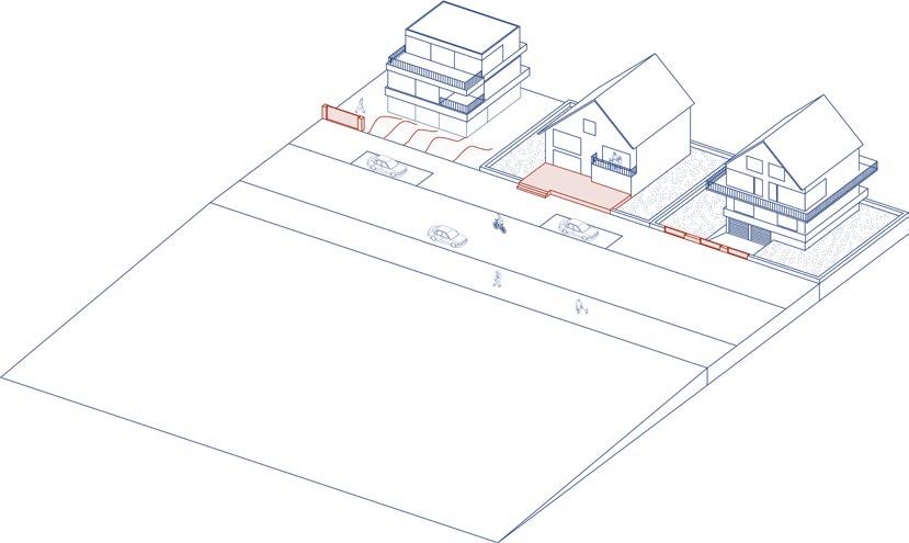
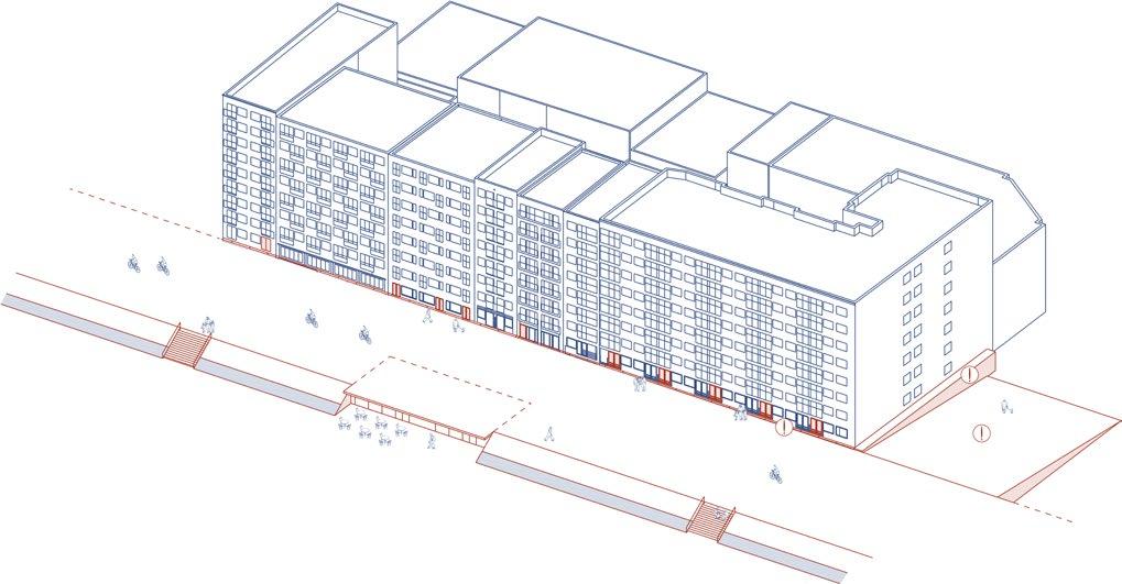
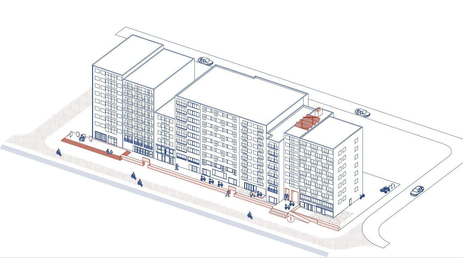
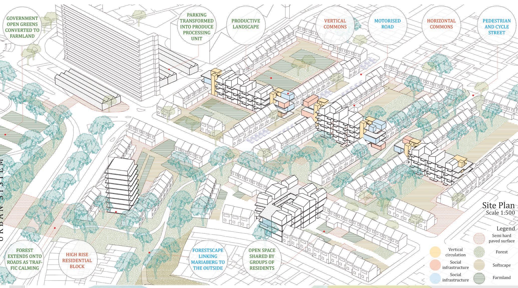
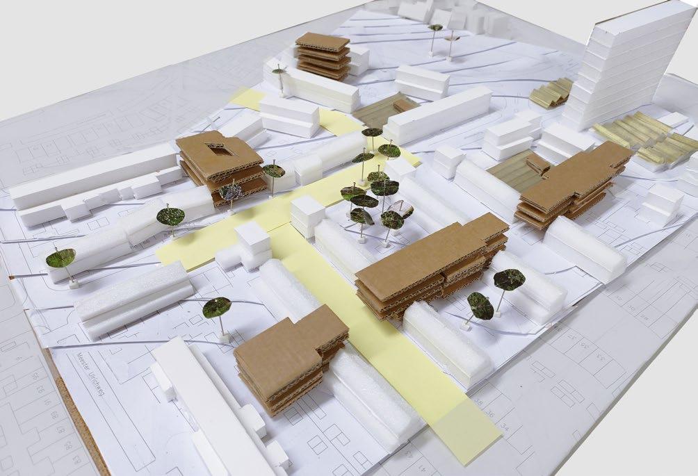
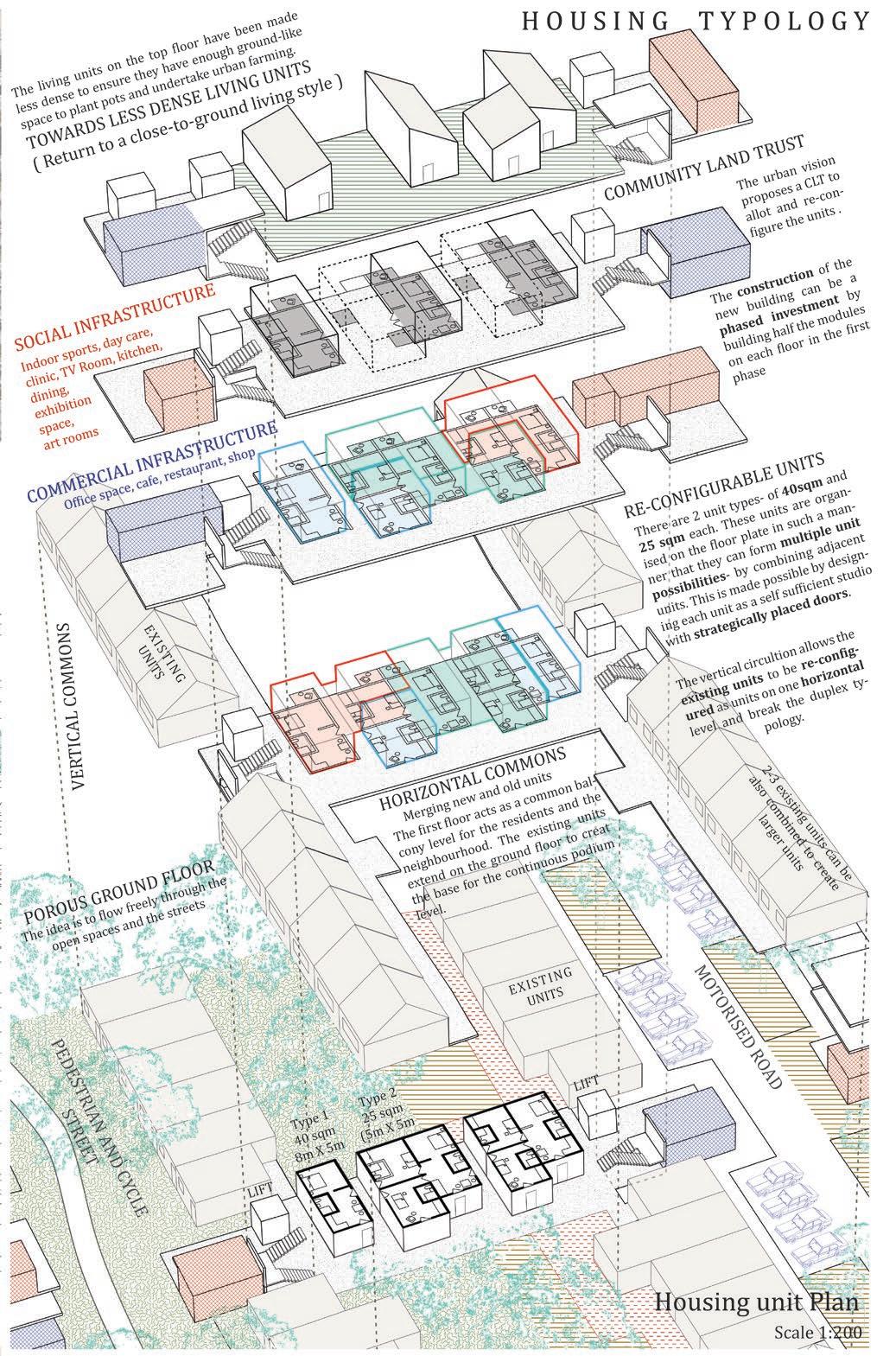
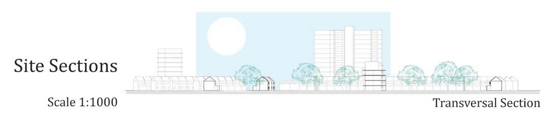
06_Exploring Vertical and Horizontal Commons
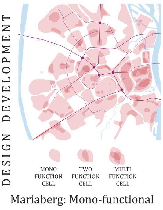
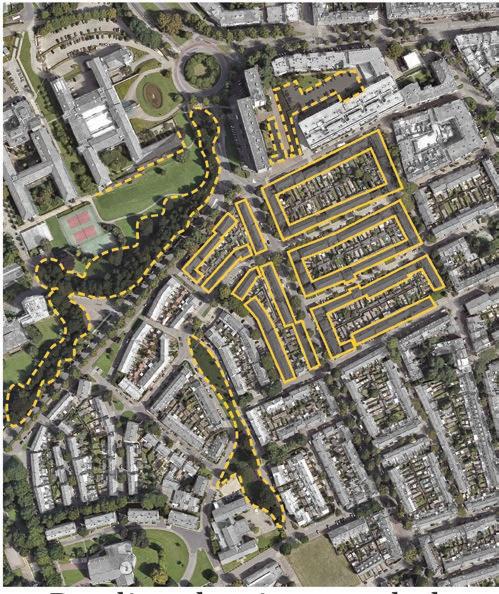
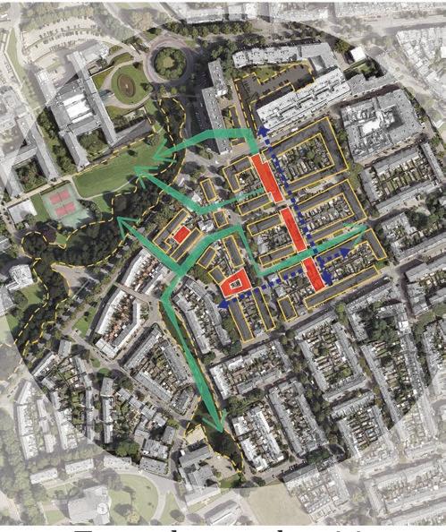
ENERGIZING MARIABERG
Mariaberg, Netherlands
Academic Masters- KU Leuven
Independent project 2019
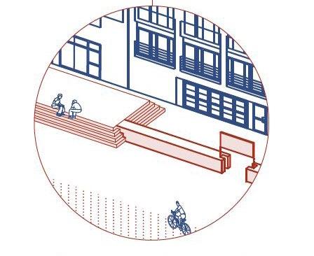
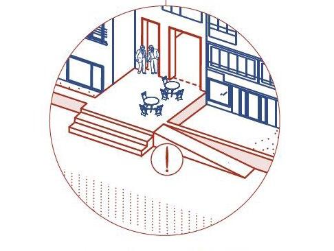
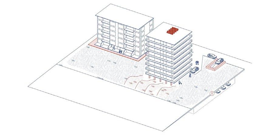
Rethinking housing towards a new contemporary way of living. The proposed housing units are introduced in the existing built form in sucha way that new opportunities for collected livign are created. New common spaces refered to here as vertical and horizontal commons are created to increase social interaction and provide spaces for community activities.
The ground floor is imagined as a big urban park with a variety of open spaces. In the process, road infrastructure is redefined as not just a place for mobility, but for meeting, relaxing and enjoying.
07 Urban research and documentation
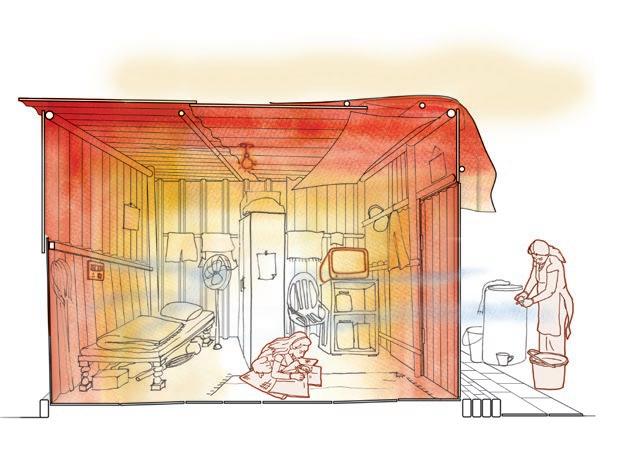
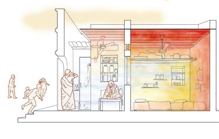
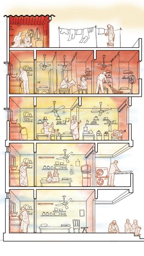
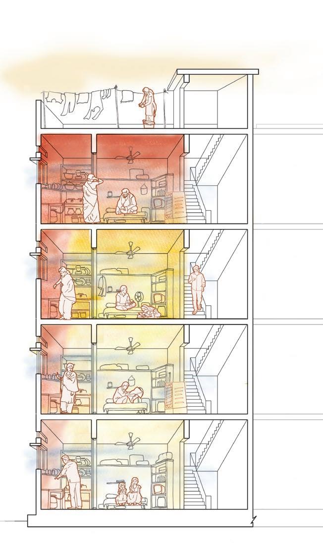
HEAT STUDY
Hyderabad, India
Professional- Hyderabad Urban Lab
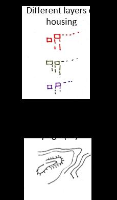
In collaboration with Hyderabad Urban Lab, the heat study aims to study and document the experience of heat in the informal settlement of Singareni Colony in Hyderbad, India.
The sections above show the 6 housing typologies that were identified. The shades of red to white demonstrate visually the heat signatures in the house during peak summers.
(All sections visualised by the Author)
2023-2024
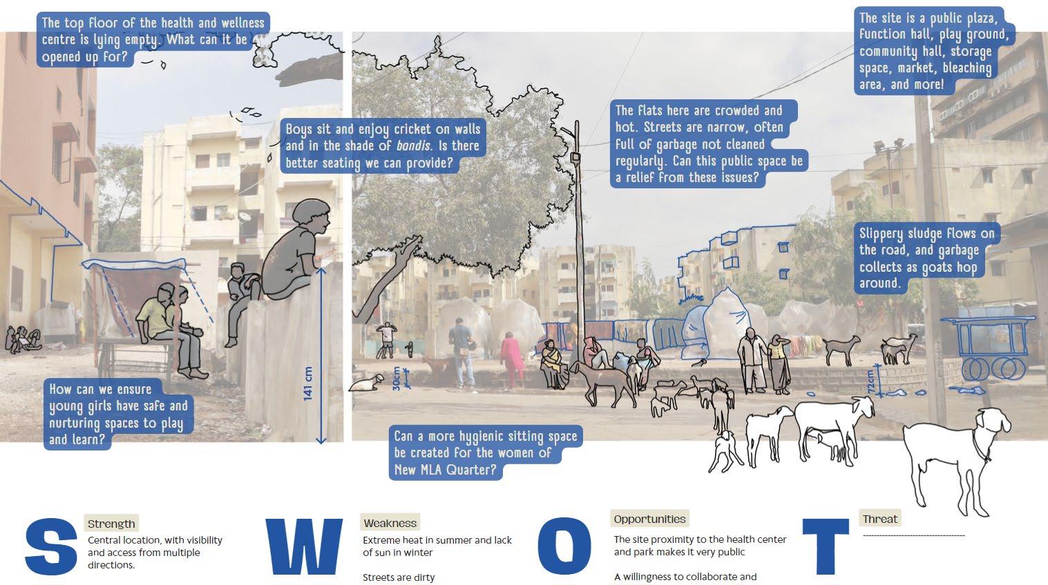
URBAN IDEA COMPETITION
Hyderabad, India
Professional- Hyderabad Urban Lab
2023-2024
iLocal Design Idea Competition is an attempt to create a unique design competition in India that puts more emphasis on the multi-disciplinarity of the teams and the intensity of the idea than the actual proposal submitted.
The Author created the site study drawings and collages for the 10 sites selected for the competiton.
Logo Design Link to website
Co-compiled the competition into a compendium to be printed into a book
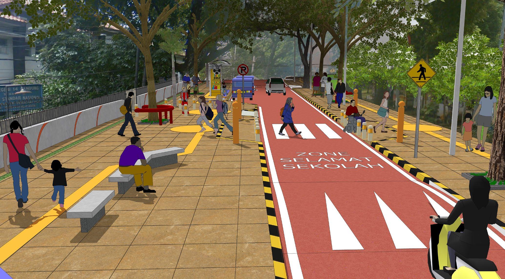
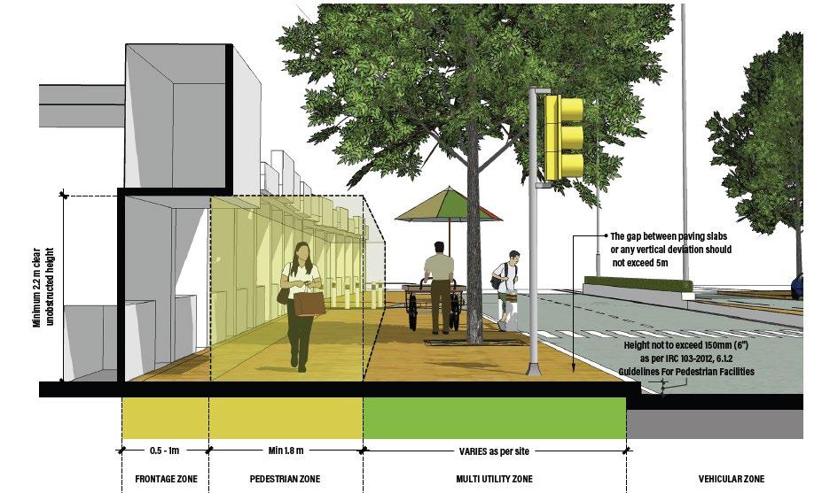
08_Street as safe urban realm
SAFER STREETS FOR CHILDREN
Professional- WRI India
Bandung, Indonesia 2019
The project redistributes the road section to create a more equitable environment for school children and provide more space for public transport. The design radically transforms the road into a street.
Hence, a playful safe street with wider footpaths and sitting spaces for parents.
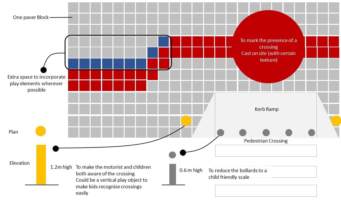
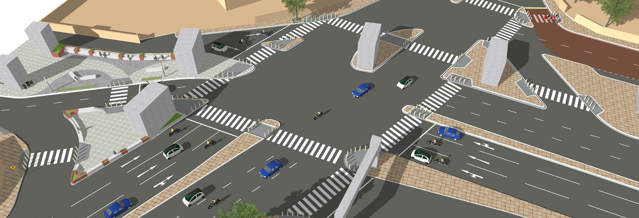
INTERSECTION DESIGN
Mumbai, India
Intersections in Mumbai, India are undefined large ambiguous crossings that lead to high fatalities and make streets unfriendly for pedestrians and cyclists. WRI India is working with the local government to push for compact, safer, streamlined intersections. Equitable road space sharing for all users is a concept that takes time to be grasped, especially in a city like Mumbai, where road space for cars is already considered limited.
WRI India is working with the local government to push for compact, safer, streamlined intersections. This street majual was developed specifically for the street conditions of the roads in Mumbai. It is aimed at informing the governement executives and civil engineers of the options available even when there is very little footpath space , which is often the case/ in Mumbai.