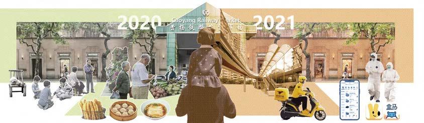
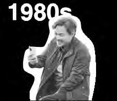
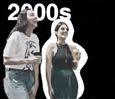
Urban Landscape Under Pandemic 01
Landscape Infrastructure Design as Supplement
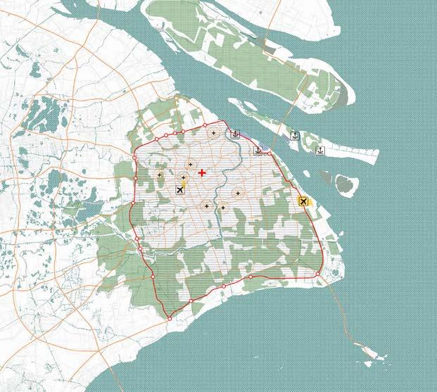
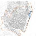
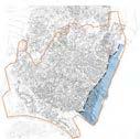
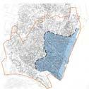
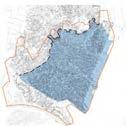
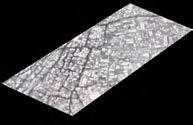
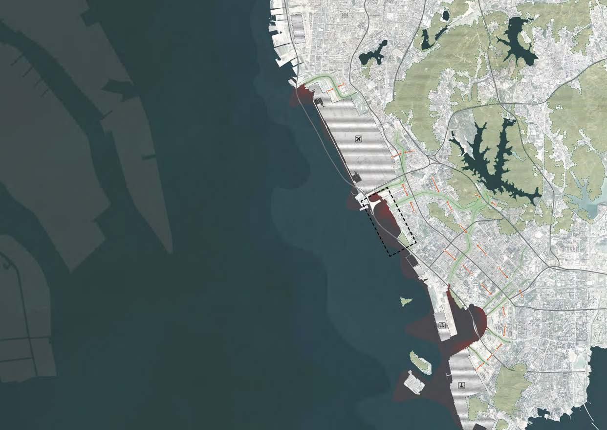
Site:Shanghai,China
Area:13.5ha
Individual Work
In the last two years of the epidemic, Shanghai's supply chain, road networks and systems from origin to consumer have been affected by the epidemic policy. For considering the landscape resilience the new landscape infrastructure should be an effective complement to community, enhancing the flexibility, serving the neighbourhoods and residents and improving the resilience of the place.
The current urban food chain supply chain focuses on the design of campuses and neighbourhoods, can the urban system be reconfigured through the landscape infrastructure of the Cao Yang highline? Can landscape space be used as a complementary infrastructure under the influence of epidemics and policies.
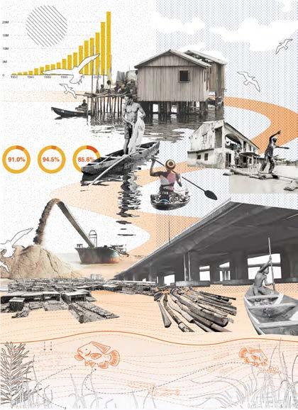
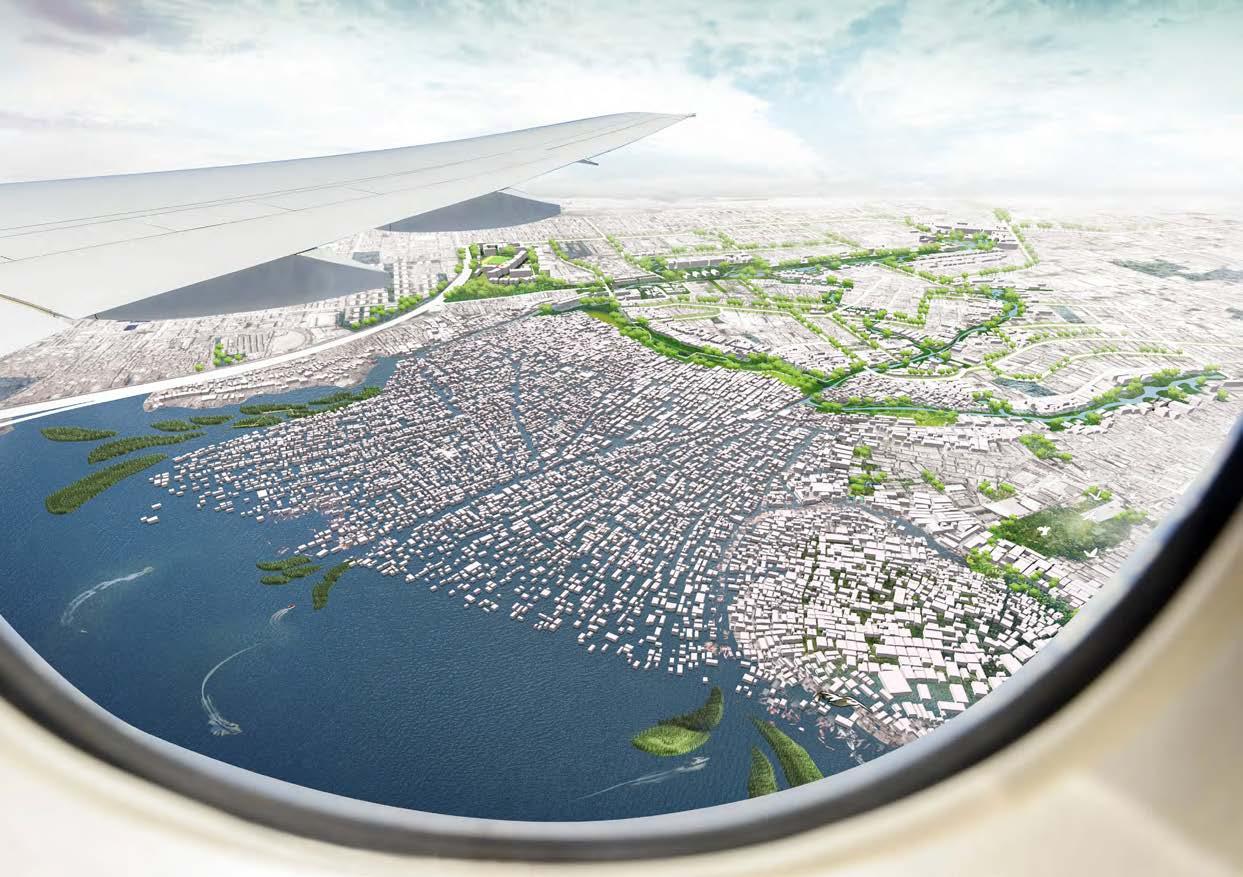
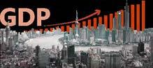
Shanghai,with well developed transportation system and high desity of population,became the leader of Yangtze river delta area and the population reached to 24.87 million.To control the spread of the pandemic,the toll stations connected Shanghai and other cities temporarily shut down,the transportation disrupted,the food supply chain faced great challenge and the supply can not immediately meet the demand.
Facilities Around The Site
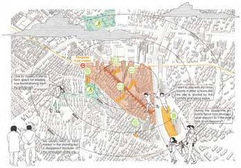
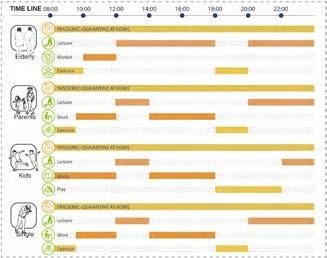
What Do They Do in a Day?
Food Delivery Network Impacted By Lockdown


During the pandemic period,for reducing the exposure of the virus,the government called suspension of social activities.
With Shanghai's population reaching 25 million by 2020, the pressure on food infrastructure at the time of the epidemic will be particularly significant with this large population.
During the lockdown period, all residents quarantined themselves.During that time,Shanghai residents relied heavily on the government for food, e-commerce platforms, and supplies from outside the province with longdistance supply chains.
YangtzeRiver 0 N 20 50km HuangpuRiver SITE Suchow Jiaxing Taicang
Impact of the Pandemic Population Growth 1953 5 10 15 20 1982 2010 1964 2000 1990 2020 Unbalanced supply Transportation disruption Public place closure self quarantine in home Food Transport Index 30 60 90 120 JanFebMarch Lockdown End of Spring Festival April 2022 Farmland Hignway-Free Pass Wholesale Market Treminal City Toll Station Closed Hignway-Under Control
fl
Changes Re
ected on the Site
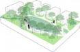
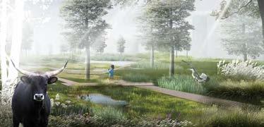
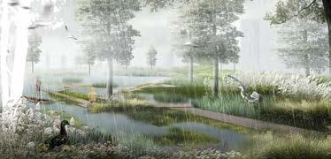
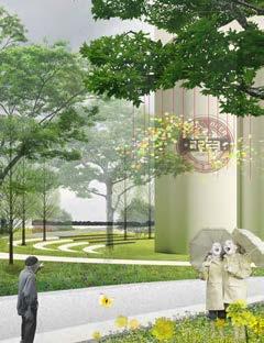
Free get-together Convinent life with Caoyang Market Park take the place of Caoyang Market Quaiantine changed people's life style Online shopping developmented 3
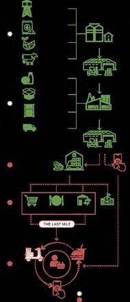
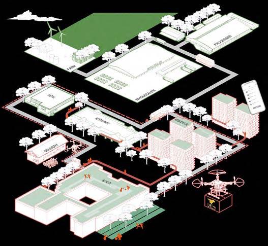

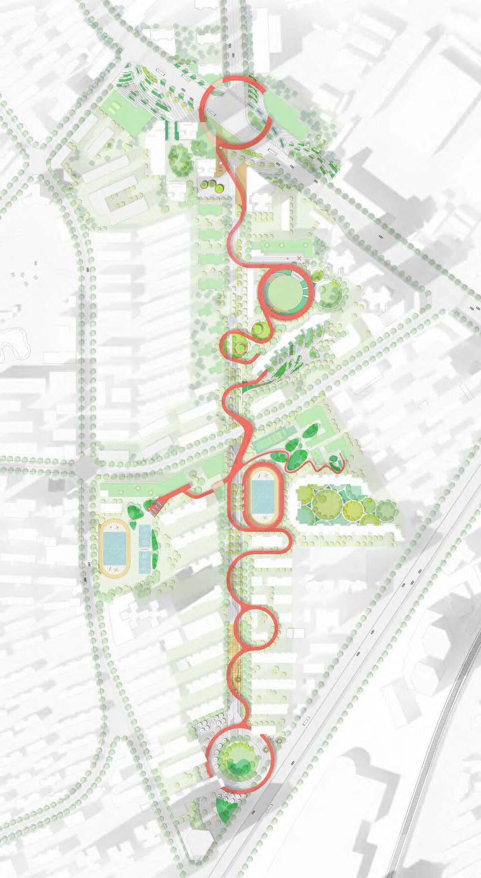
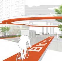
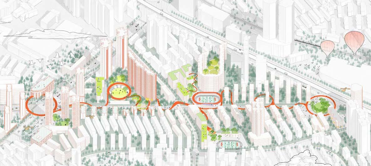
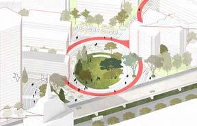
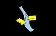
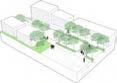
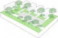
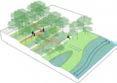
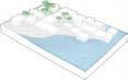
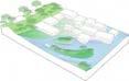
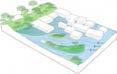
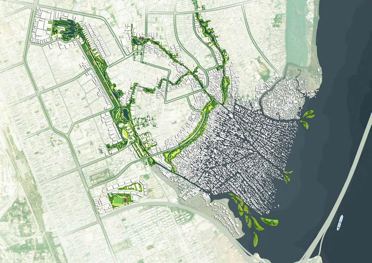
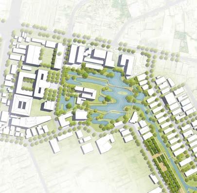
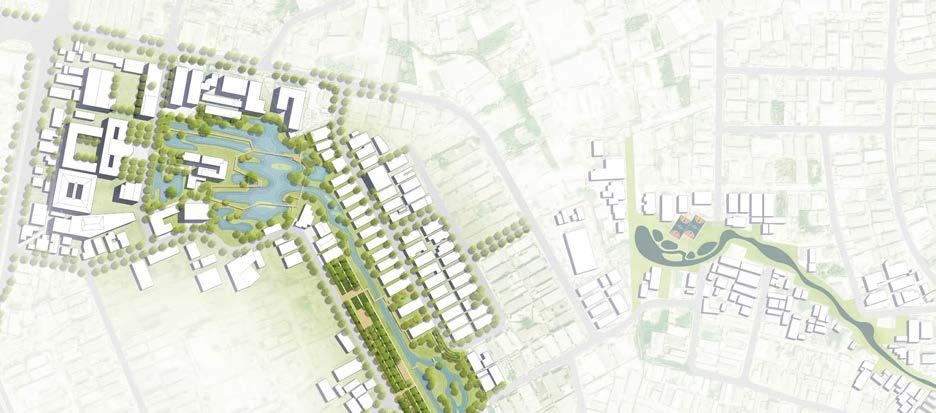
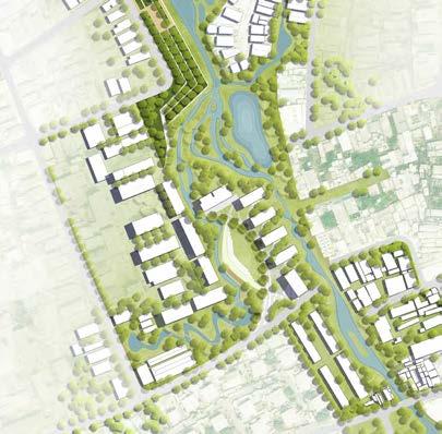
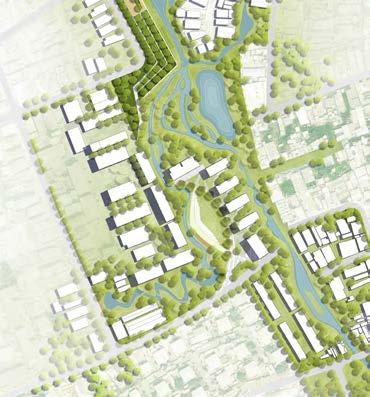
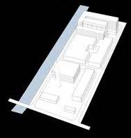
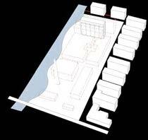
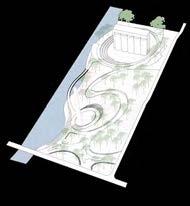
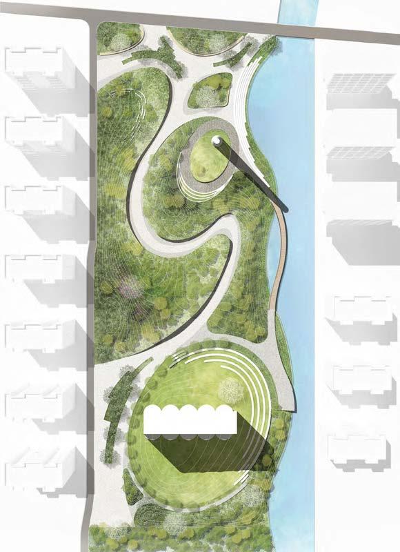
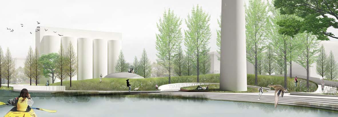
0 N 2050100m Master Plan-Make Connection By the deployed infrastructure connected with area for commercial,sports and planting garden,these puiblic spaces for the residents and neighboorhoods may gradually affect the communities along the infrastructure. 01 07 02 08 03 09 05 11 04 10 06 12 Station W/ Market Plaza Central Garden and Path Leisure Plaza W/ Bench Double-Lane and Sports Area School and Sunken Plaza Look-out Stage School and Sunken Plaza Festival Market and Lawn Herb Garden and Seats Kids' Play Area Planting Practice Area Rooftop Garden ZhongshanNorthRd LanxiRd CaoyangRd Meiling North Rd 10 11 09 12 07 08 06 12 03 04 05 01 02 12 Original and New Resilient Food Network
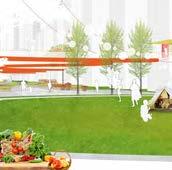
Group Buy Drone Rooftop Garden Healing Garden Farm Box Unmanned Robot Educational Field Bicycle Public Transportation
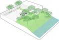
Rooftop Garden Shared Kitchen Healing Garden Commercial Residential School Market Overpass Public Realm Public Realm Public Garden Public Garden 01 Existing Liner Landscape Infrastructure 02 Food Network Along The Liner Landscape 03 Multi-layer Landscape Infrastructure Connect Communities Public Realm for Delivery Public Realm as Farm Liner Landscape Infrastructure Market Market 4
Concept and Project Generation
Foodprint Before Pandemic
Foodprint Post Pandemic
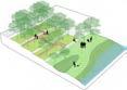
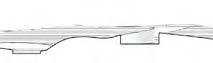
Commercial and sports area would be deployed by the infrastructure and finally attract visitors and residents to use the public realm during pandemic and post-pandemic era.
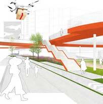
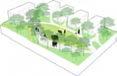
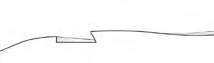
The overpass connects the market indoor and the public area both sides of the road.The steps and elevator in the buildinng can be supplement transportation.
The
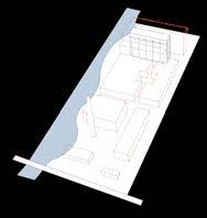
Providing space and facilities for food market existing before.Renovation do not mean just remove the crowded market,but keep the function in the same site.
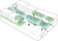
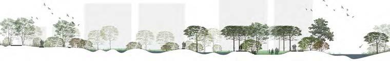
View-Enhancing the
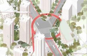
of Public Realm Station Cross Road 01
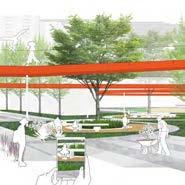
Plaza Sports Area Outdoor Market
Aerial
Network
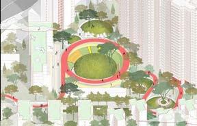
Gathering
Station Cross Road
Gathering Plaza
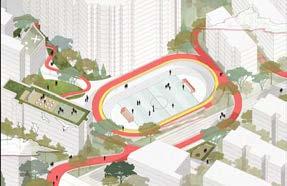
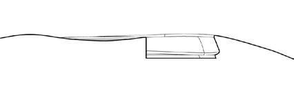
Sunken plaza and planting gardens and roof sapce are used as supplement for public realm and provide space for planting and cultivation class and space for delivering food.
Sports Area
overpass connects the communities to the sports area which will encourage residents to meet here,and roof space are used for outdoor sharing class. Outdoor Market
01 02 02 03 03 04 04
5
Flooding City-Makoko 02
Rebuilt the Retreat Green Infrastructure
Site:Makoko in Lagos,Nigeria
Area:162.3ha
Individual Work
The rainy seasons are a welcome phenomenon.But it also brings a new problem-flooding. Lagos is a quick developing city with a increasing number of population,meanwhile,the poor planning and infrasturcture result in high density of living and slums,which is prone to flooding.
In this project,we tried to balance the way to water managerment and creat better living environment,to provide flexible environment and open space both in dry season and rainy season.
What Happend Here?
-Rising population,Fragile settlements,Frequent floods
Existing Typology


Typical Typology
Typology 1:Street
Typology 2:Community
Relocate and Propose New Infrustructure
Bio-Swale,Permeable Paving,Detention area,decontaminate creek,rain garden
Typology 3:River
Relocate
Typology 4:Wetland
Proposed
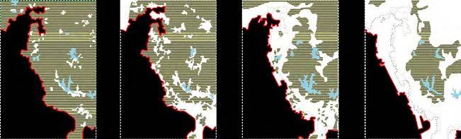
Sediment Accumuluted Dredge and sawmill happened by Lagos Lagoon Floods happened in rainy season As the sawmill and dredge activities makes the river to lagoon blocked and dameged the ecology in the area AreaToProfundal
Rising Population Fragile Settlements Frequent Floods
60% of the residents of Lagos are poor and live in the over 100 slums and informal settlements that are prone to flooding. Harm Health Cause Potable Water Shortage Deny Job Opportunities 1980's 1990's 2000's 2010's ? Sea level Boundry Change for The Rising of Water Level Bio-Swales Absorb Stormwater Permeable Paving Underground Cistern Detention Area Stepped Basin Relaxing Deck Detention Pond Tide Buffers Living Levee As Flood Protection
60%
Over
Disconnected Ecological Network X Poor Urban Planning development on flood plain poor sanitation poor drainage facilities limited green corridor much base water flow lack of public inadequate drainage illegal structure blockage of lagoon surge low effciency impervious covers 60% of residents live in slums floating wood blocked river Urbanization and Population Influence of Canals risk for water lever rise
Bio-Swales Absorb Stormwater Existing Condition Interfere Multipal Usage During Floods
Green Infrustructure
Proposed
Bio-Swale,Permeable Paving
Stepped Basin,Relexing Deck,Terrain Park,Detention area Flood Protection As Open Space,Fishing port,Attractive Tide Buffers
Green Structures and Manage Water Flow
Living Levee and Wetland
6
levee
With the pollution of the water and the massive fishing,the original ecology has been seriously affected.Oyster and tilapia species have declined dramatically,while discarded wood has blocked the river corridor.
The island gradually formed by several years,the wetland play a role as a restorative environment for local wildlife and as a natural water treatment process, local plants grow and oyster and tilapia appear again. Lagos
Master Plan N 0100 500 M 200 WaterRemediation Area Eco-Community Rebuilt Wetland
INSERTED BARRIER REBUILD
RECURRENCE
STRUCTURE
HABITAT
The structure of Makoko will gradually decrease the speed of river and the sand taken by water run-off will be collected by the structure.The island will be growing up with the sedimentation.
Lagoon A B C C D E F F H H I I J G G G
WATER REMEDIATION AREA
ECO-COMMUNITY B STEPPED PLANTED BASIN
LEVEE C BIO-SWALE
OPEN SPACE I FILTRATION CREEK
DETENTION POND
ACTIVE RECREATION OPEN SPACE J WETLAND
Mainland Bridge
Rd
IwayaRd OgayemiSt Owodunni St Iyaomolere St
WrightSt McEvenSt HughesAve Commercial Ave 7
A
E
F
G
D
H
Third
Yaba-Onike
IsholaSt FemiEsuruoshoSt
MusiliuSmithSt MakokoRd
Wetland As Detention Pond In Rainy Season
This area can gather water run off through streets and dinage system from the communities and in the rainy season this area can be a water front park.
in Dry Season
The space dug into the ground with degrading terraces with a curve shape.During the dry season it can be used as a open air amphitheater,for playing,holding enents,gathering or projecting a movie or as a recreational area for residents.
in Rainy Season
During the rainy season the amphitheater receives storm water and gradually releases the water to canal.
Filtration Creek to The River remove debris before it sinks to the bottom of the creek River Amphitheater as Detention provide temporary storage of rainwater run-off Rain Garden a shallow area of ground which receives run-off from roofs and roads.
storm water run-off
Bio-Swale
storm water run-off
Bio-Swale
remove debris before it sinks to the bottom of the pond and decays
Bio-Swale Filtration Pond storm water run-off
Plan of Remediation Area N 050 M 100 20
N 050 M 100 20
Plan of Eco-Community
View
View
BOWL BIO-SWALE DECK BIRD ISLAND DETENTION POND DETENTION POND WATER FILTRATION RUN-OFF CATCHMENT FILTRATION CREEK BIRD ISLAND AMPHITHEATER DECK 8
MEADOW
A New Floating City-Makoko
The New water channels, with existing streets and rivers, create a blue-green network and slow down the erosion of the sea in the makoko area through the mounding of the topography. By the landscape components of detentation and remediation area, the relationship between people and water is reduced by the intervention of the landscape, the development of the site is ensured and, in a few years, the city of Makoko will be better developed due to the special landscape features.
Remediation
Stepped Basin
Eco-Community
Canal Street
Living Levee
Birds Island
Lagos Lagoon
Wetland With Wood Deck
Football Court As Detention Area
9
Sound Reflects Memory
Memory can exist in another way
Site:Shanghai,China
Area:2.54ha
Individual Work
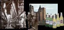
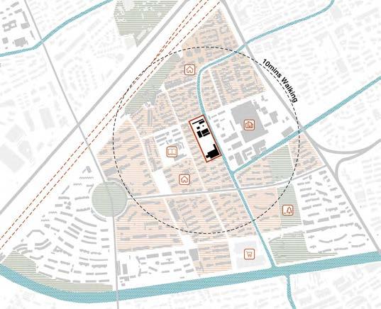
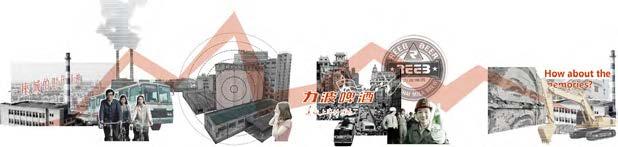
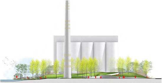
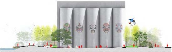
In the past 50 years, the state of three generations, the social and individual background, had greatly changed. It is a issue on how the past life style affects the present state of life.REEB BEER FACTORY is surrounded by residential area, in the area of 10mins walking with schools, parks and office area and it highly related with the people who worked and lived in Shanghai. It has a great meaninng for shanghaiers and how to cope with the problems between renovation and factory rebirth is a great challenge for our field of landscape architecture and city design. For this project I try to find a relation between sound and space, in this way, trying to keep the specific memory in a another way.
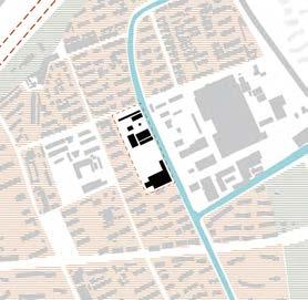
Existing Conditions of the Site

The site is surrounded by residential area, in the area of 10mins walking with schools, parks and office area. Dwelling Shanghai Minhang
Historical Evolution of People on the Site
In the past 50 years, the state of three generations, the social and individual background,had greatly changed. It is a issue on how the past life style affects the present state of life.
STATE OF BACKGROUND

THREE GENERATIONS
Social Background

Individual Memory


From the Past to the Future

Highway
River
SubwayLine1 Zhonghuan
Dianpu
MeilongRiver HuminHighway
SITE
Park Market School Office
The Worker
The Worker
The Generation Z
Reform and Opening-up in China
Industry Development in 1980s
The Great Development of Shanghai Generation Z-Internet generation
Anticipated in Establishing of Industry
REEB and Our Daily Life
03
Struggle of the City and the People Pollution and Noise Shanghaier's 'Great Beer' From REEB <the reason to love shanghai>
Away Area and the Develop of the City We'd consider not only the economy,but also the people who ever lived here. 10
The Fade
Individual memory
Individual memory
From the reform and opening up to the economic take-off, from the planned economy to the Internet era, from the post-60s, the post-80s to the post-00s, each generation has its own special memories, in the form of sounds, objects and buildings, which exist in memory or on the earth.
Record of Sound Track
Social background
Social background
Social background
11
Individual memory 1960s 1980s 2000s
transportation
Site Generation
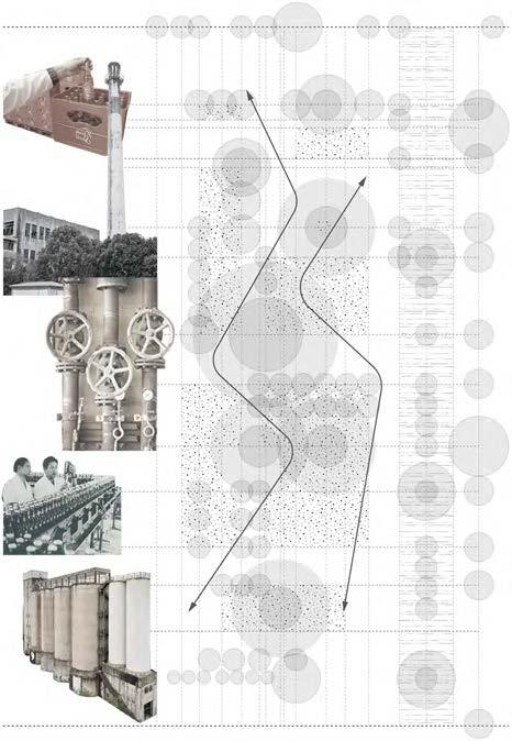
malt bin
production workshop material loading
chimney loading
industrial boiler
production workshop
malt bin
sales transportation transportation transportation transportation
The sound of sales , material loading , manufacture and beer production proceess ,and storage ,happened along the axis of the site. Acoustic intensity reflected on the site by the shape of terrain and space
industrial boiler chimney
sales area
01 Existing Condition
The functional elements located in the area,alone the Meilong River.
02 Layout and Boundry Change
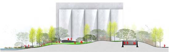
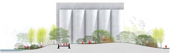
Soften the river boundary and keep the chimney and malt bin.
From Sound to Space


Sales and Transportation
Sounds reminds memory of 1980s,which is happy and enjoyable,drinking and delivering beer in the summer.

Production Process
Sounds reminds memory of 1960s,grinding the wheat and preparing ferment.
03 Pedestrian Circulation
The sound of industry in memory affect the circulation of pedestrian.
04 Space Devided by Terrain
The circulation cross the terrain and formed valley of memory.


Sounds reminds memory of 1960s,the workers unloading the coal,busy and feeling tired


Production Process

Material Loading Production Process Storage
Producting the bottled beer,the glass bottle making sound,which is not so noisy.
Sounds reminds memory of 1960s,keep the boiler running,quite tired and noisy


Storage and transport the wheat.
Sound Map
SALES MATERIAL MANUFACTURE PROCESS STORAGE
12
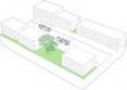
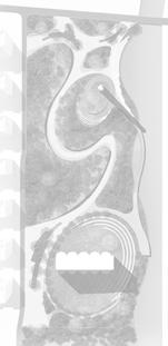
site overlook leisure lawn leisure lawn step seat event lawn bridge river river river river view deck sunken seat event lawn mist plaza sidewalk bridge bridge leisure lawn slopeing lawn mist valley viewing point leisure lawn leisure lawn sidewalk sidewalk sunken seats arrival plaza sidewalk corridor and seats A B C 1 2 3 4 5 6 1 7 3 9 5 11 2 8 4 10 6 12 Arrival Plaza Kids' Area Mist Valley Flowery Path Viewing Area Bridge Sunken Seats Sunshine Lawn Leisure Lawn Viewing Deck Mist Plaza Step Seats 7 8 9 10 Meilong River 11 12 D
B
A
D Master Plan N 0 M 50 25 10 13
Section
Section
Section C Section

Landform and retaining wall in arrival plaza provide viewing spot in different levels.
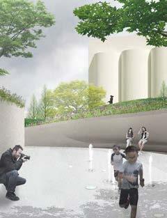
Along the inserted valley in the terrain,deployed fountains and floor lights in different colours.
In this area,view is opened to the Meilong River and the opposite wall is lifted up as viewing platform.
At the end of the valley,the view directly linked to the Malt Bin,wind chimes made by glass.
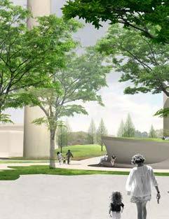
Perspectives-New Reeb
The view from the Meilong River shown the chimney and malt bin as the background of the park,people enjoy themselves in different levels and are easily access to the river by steps to the river and bridge fly over the river.
Arrival Plaza
View From the River
01 02 03 05 04 01 05 02 03 04 14
Mist Valley Viewing Corner Sunshine Lawn
LANDSCAPE OF DREDGING 04
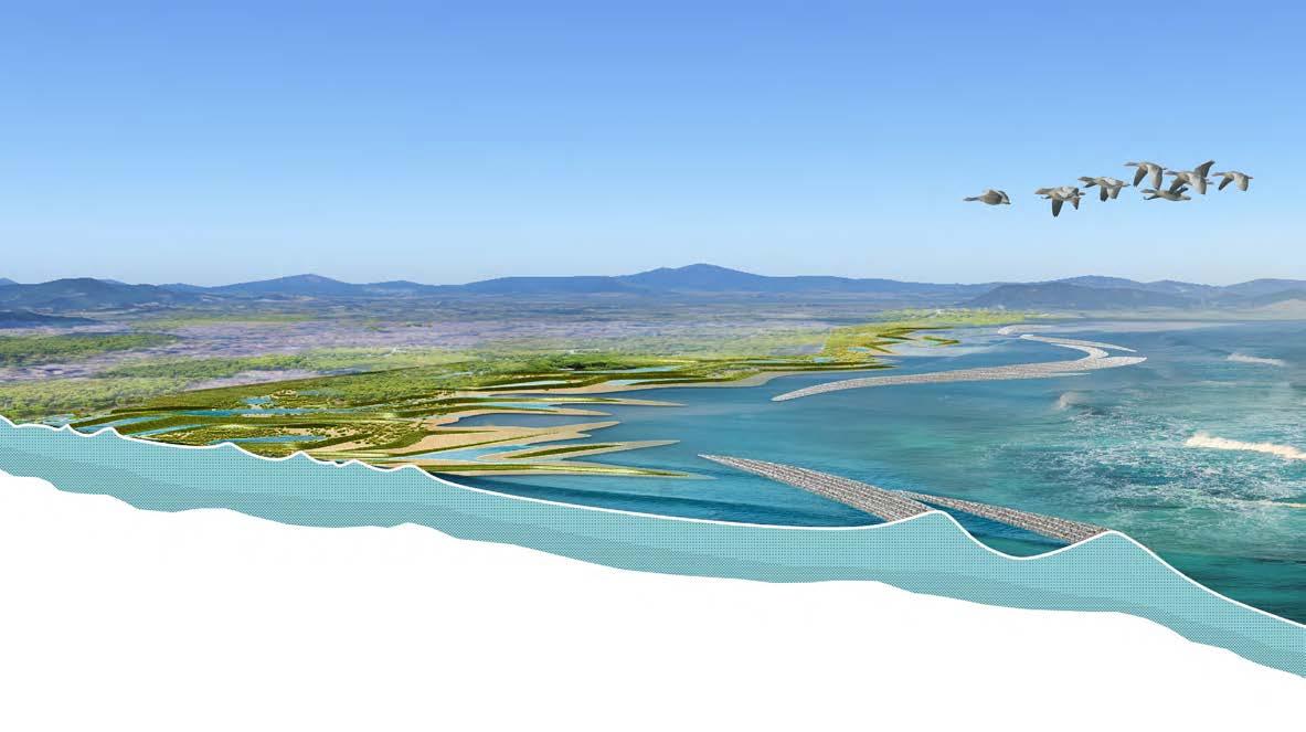
Rewilding The Seashore
Site:Shenzhen,China
Area:2.54ha
Individual Work
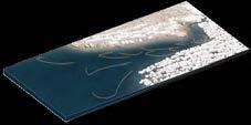
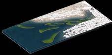
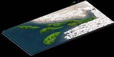
Through sunthetic mapping of sea reclamation,population growth and water pollutant in coastal waters of Pearl River estuary,these elements show positive correlation,the site's historical layers could be unfolded and inspire us in what should we do in the future.Pearl river estuary has a long history of dredging.Dispite the construction period,the dredging amount keeps in an average 10 milliom m3 each year.The source of dredging in Shenzhen is mainly the daily dredging of the port, which has a low contaminated component and can be treated as a source of topography. The structure made up of dredge brings a sedimentary function due to tidal forces and gravity.
Positive Correlation Between Population and Phosphrus and Reclamation

According to the Bulletin of Shenzhen Marine Environmental Status,the water quality of urban rivers is inferior to Class V of surface water quality standards, and DIP,DIN and other standards are exceeded,by the year of 1980-2015,urban expansion has led to a continuous reduction in green space and a gradual progress of the coastline towards the west

Dachan Bay Terminal Mawan Container Terminal Chiwan Container Terminal
Shenzhen
Ban'an International Airport
SITE
Legend: Reserve Area Highway Sewage Point and Runoff Water Pollution Urban Area Industry Area Ship Route River Route Water Area N 02 1 5 KM ±0.00 +200
15


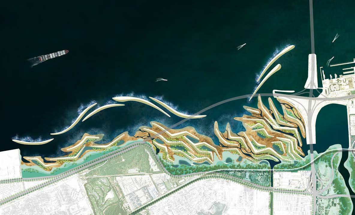
Substance of dredge is used as the material for terrain construction, where people place wave attenuation dams in offshore areas to counteract the erosion of coastal by currents and typhoons, reducing seawater flow velocities and accelerating internal sediment deposition. Internal dredging structures create spaces with varying flow rates to achieve specific areas of siltation. Ultimately, the nutrients accumulated from the siltation feed the growth of the internal seagrasses and mangroves, purify and sediment the water discharged from the airport and urban area, and ultimately create a mangrove-based ecosystem
Master Plan
2 1 3 4 10 Sedimentation and Catchment Filtration 5 5 6 7 8 8 9 3 2 Airport Drainage Channel Stream to Wetland Protective Dam 1 Reservoir Drainage Channel Dredge Terrain Pedestrian and Deck 3 4 5 6 7 8 9 10 Tidal Pools Intertidal Zone GuangshenCostalExpy
Blvd
Existing Dock Xiwan Mangrove Wetland Landform Constructed By Dredge and Tidal Power 0 100 500m 250
Master Plan
Jinwan
Line11
. No land for mangrove forest to expand Soft bank enbaled opputunties for plants and generating habitat Tycipal existing hard revetment Water caught by pond and biodiversity of the site gradually enriches over time Plants for water purification: absorbing nitrogen and phosphorus by plants Mangrove forests take root, grow and expand REBUILD THE SEA SHORE Different salinity pools are formed between high and low tides Allowing different vegetation to grow Rainwater runoff directly drain to the sea and causes pollution Hard revetment along the seashore Existing Process Final ? Evaporate Salinity Rises Polluted N P 16


 Tidal Pools
Dredge Terrain
Embankment
Sea
Protective Dam
Tidal Power
Effciency of Sedimentation
Salinity of Water Body
Mangrove Wetland
Marsh
Habitat for Migrant Bird
Keep Water
Mangrove Restoration Protective Dam Break Water
Tidal Pools
Dredge Terrain
Embankment
Sea
Protective Dam
Tidal Power
Effciency of Sedimentation
Salinity of Water Body
Mangrove Wetland
Marsh
Habitat for Migrant Bird
Keep Water
Mangrove Restoration Protective Dam Break Water