
GREEN SPAIN

The Spirit of the North awaits
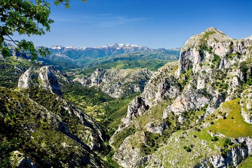
More than 2,500 kilometres lie in wait, along the coastline of the Cantabrian Sea and Atlantic Ocean, from the border with France to the gateway of Santiago de Compostela. The Cordillera Cantábrica mountain range and surrounding foothills likewise accompany us along the way.

We will be journeying through unique landscapes, wild, solitary beaches, unforgettable roads, nature reserves and parks, enchanting villages and treasured UNESCO heritage sites. A unique journey, steeped in a thousand experiences, and with one common thread throughout: world-famous local cuisine.
Over the following pages we cover this great journey in 16 sections. And also suggest some amazing places to visit nearby. Just remember: there is no one path; the path is made by walking.
Feel free to discover Green Spain.
ingreenspain.es

Discover Green Spain in 2 minutes
The Grand Route of GREEN SPAIN


SECTION 01 The first few gems of the Cantabrian Sea BASQUE COUNTRY 90 KM SECTION 02 Destination: wine country BASQUE COUNTRY 180 KM SECTION 03 Mountains, beech groves and endless beaches BASQUE COUNTRY 150 KM SECTION 04 By sea as far as Bilbao BASQUE COUNTRY 67 KM SECTION 05 See you soon, Basque Country. Hello, Cantabria! CANTABRIA 158 KM SECTION 06 Enchanting villages and the essence of Cantabrian landscape CANTABRIA 72 KM SECTION 07 From sea to sky in a heartbeat CANTABRIA 163 KM SECTION 08 A dose of Asturian contrasts ASTURIAS 144 KM Prettiest Villages of Spain Protected Designation of Origin Protected Natural Space UNESCO World Heritage Site Biosphere Reserve Click and navigate Previous section Next section Back to home page OF INTEREST ALONG THE ROUTE NAVEGACIÓN: SECTION 09 Three urban aces ASTURIAS 114 KM SECTION 10 Sticking to the coastline ASTURIAS 140 KM SECTION 11 Before us, the Atlantic GALICIA 207 KM SECTION 12 Getting to know urban Galicia GALICIA 219 KM SECTION 13 Journey to the heart of Ribeira Sacra GALICIA 216 KM SECTION 14 Alongside the Rías Baixas throughout GALICIA 228 KM SECTION 15 Days of Albariño wine and camellias in O Salnés GALICIA 181 KM SECTION 16 Santiago: the end of the route GALICIA 182 KM Route profile on WIKILOC GALICIA ASTURIAS CANTABRIA EUSKADI AEROPUERTO DE VITORIA AEROPUERTO DE SANTIAGOROSALÍA DE CASTRO AEROPUERTO DE VIGO AEROPUERTO
SEBASTIÁN AEROPUERTO
BALLESTEROS-
AEROPUERTO
AEROPUERTO DE BILBAO AEROPUERTO
DE SAN
SEVE
SANTANDER
DE ASTURIAS
DE A CORUÑA
The first few gems of the Cantabrian Sea
Our adventure begins alongside a river, the Bidasoa, close by an international border (with France), and a city (Irun) that the Romans used as a trading port. Following the course of the River Bidasoa towards the sea, we arrive at Hondarribia, a fortified town with a noted mediaeval quarter higher up, a famed culinary tradition, and the distinctive feel of a fishing town, particularly apparent in the district of La Marina.
Before leaving, it is worth heading half a kilometre northwards to Cabo Higer. This is the last headland (or the first, depending on your viewpoint) on the Spanish coast.
A small range of mountains lies between us and our next destination: Monte Jaizkibel. Rising to a height of 550 m, it drops down to the coast, the GI-3440 highway following the route and offering outstanding views of the Cantabrian Sea.
This route through Green Spain winds through marshland, mountains, rivers, waves and solitary lighthouses. There are also towns and villages along the way where cuisine is almost a religion. Enjoy your trip!

On descending from Jaizkibel we come across the picturesque Pasai Donibane: with just a single street, and its houses quite literally lapped by the waters of the estuary. To reach San Sebastian by car, we must skirt around the bay.
The capital of Gipuzkoa enjoys a privileged geographical
setting: draped across three coastal mountains (Igeldo, Urgull and Ulia) and three beaches: Ondarreta, La Concha and Zurriola. Split in two by a river, the Urumea, its bay is embellished by a single island, which goes by the name of Santa Clara.
The grandeur of San Sebastian as a tourist destination is

thanks to the developments undertaken in the late 19th century, which turned it into a summer resort. It was then that the city was expanded in the Romantic style, along with the construction of such noble edifices as the Gran Casino (which now houses City Hall), the Victoria Eugenia theatre, and the Cathedral of the Good Shepherd. The

SECTION 01
LOIOLA
IRUN
LA CONCHA BAY FROM MONTE IGELDO, IN SAN SEBASTIAN
GETARIA, WITH THE N-634 COASTAL HIGHWAY ON THE LEFT
'FLYSCH' CLIFFS OF ZUMAIA INDEX OF SECTIONS NEXT SECTION 9 8
UNESCO World Heritage Site Protected Designation of Origin
whole layout was beautified with parks such as the Plaza de Gipuzkoa, and seafront promenades. The Old Town, clustered around the Plaza de la Constitución, is home to many of its famous pintxo bars.
We leave San Sebastian southbound, heading for the N-634. Shortly before reaching Lasarte-Oria we take the GI-2132 as far as Chillida Leku, in Hernani, one of the last the creations
vast beach, the longest on the Basque coastline, and a well-established surfing tradition.
of the artist Eduardo Chillida. The open-air museum exhibits larger sculptures, while inside Zabalaga, a traditional Basque farmhouse, smaller sculptures and drawings are on display.

We turn back onto the N-634, following the River Oria as far as the mouth, alongside the fishing and whaling town of Orio. After Orio, the resort town of Zarautz awaits, with its


From here we follow one of the most beautiful stretches of the N-634, weaving through tunnels dug into the rock. Getaria stands out for its mountain in the shape of a mouse, its grilled fish restaurants, the countryside bedecked with the vineyards of the Txakoli Designation of Origin (Getariako Txakolina ), and was also the birthplace of two world-famous citizens of Gipukzoa: the sailor Juan Sebastián Elcano, and the designer Cristóbal Balenciaga, prince of fashion.
The Cristóbal Balenciaga Museum takes visitors on a journey through his legacy and the international scope of his creations, with the largest and most significant collection of
his works to be found anywhe re in the world, featuring both clothes and accessories, as well as the fashion designer’s personal effects. The museum covers his own biography and the most entrancing aspects of 20th-century Europe.
Continuing along the N-634 we arrive at Zumaia, a seafa ring town whose coastal cha racter conceals a geological gem: the Flysch Trail, the Bas que Coastal Geopark, taking in cliffs where one can “read” such events as the extinction of the dinosaurs.
From here, we follow the route of the GI-631. Our first stop will be in the village of Zestoa, known for its springs of sul phur-rich water. The Zestoa Spa, built in the late 19th cen tury, blending beautifully into an idyllic landscape, perfectly illus trates how important this town was during the Belle Époque.
There are records of human activity in this part of the valley dating from 14,000 years ago, in the nearby cave of Ekain . The Ekainberri replica allows visitors to enjoy what is a real gem, declared a UNESCO World Heritage Site.
We turn back onto the GI-631 as far as Azpeitia, where a stroll around the old town is highly recommended, taking in the Church of San Sebastián, the Plaza Mayor, or a look around the Basque Railway Museum, which in season also offers trips on a genuine steam train.
PASAI DONIBANE, WITH THE PASAIA ESTUARY IN THE FOREGROUNDBetween Zumaia and Deba, the cliffs and beaches of the Basque Coastal Geopark allow one to “read” the geological history of the Earth.
INDEX OF SECTIONS NEXT SECTION SECTION 01 - BASQUE COUNTRY 10 11
Route
profile
on WIKILOC INTERIOR OF THE ZABALAGACHILLIDA LEKU FARMHOUSE
Destination: wine country
A stretch of almost two kilometres heads dead straight to the south-west of Azpeitia. At the end stands a huge Baroque complex, with a dome so large that when it was built, the congregation feared to step inside. This is the Sanctuary of Loyola, erected in the 18th century with luxurious details featuring the finest stones and timbers, to “shelter” the fortified mediaeval tower where St Ignatius was born.

After Loyola, we pass through historic Azkoitia, after which the winding GI-631 (with a greenway alongside throughout) takes us to Zumarraga and Urretxu, the industrial heartland of Gipuzkoa.
In the west of Zumarraga, a highway climbs up to a terrace of Monte Beloki. It is here that the La Antigua hermitage was erected seven centuries ago, a marvel with mediaeval roots, the walls of which conceal a real treasure: an oak roof as beautiful as it is technically complex. According to legend, the stones for the chapel were brought here by the gentiles, the pagan giants of Basque mythology.
Our route takes us along narrow valleys and hidden sanctuaries, into the Basque fields and vineyards alongside the River Ebro. Want more? There are stories of witches and underground wine cellars, too.


We return to Zumarraga, linking up with the GI-230 as it heads south through Legazpi. After climbing up to the Udana mountain pass, we come face-to-face with a huge, mountainous wall of limestone. These are the eastern peaks of the Aizkorri-Aratz Nature Park , the provincial boundary between Gipuzkoa and Araba. They are home to the hi-

SECTION 02
LAGUARDIA
LOIOLA
ROAD RUNNING THROUGH VINEYARDS IN RIOJA ALAVESA TOWARDS LAGUARDIA
Prettiest Villages of Spain
Protected Designation of Origin
THE MARQUÉS DE RISCAL WINERY, WITH ELCIEGO IN THE BACKGROUND INDEX OF SECTIONS NEXT SECTION PREVIOUS SECTION 13 12
Protected Natural Space
ghest mountain in the Basque Country, El Aitxuri (1,551 m); a striking natural tunnel (San Adrián); a cave which was home to wild animals (Arrikrutz), dolmens, beech groves, and a host of hiking trails.
And so we arrive in Oñati, a monumental town with an old quarter to stroll around at one’s leisure, in search of a Gothic church built over a river (San Miguel), a Renaissance University (Sancti Spiritus) and the Plaza de los Fueros.
9 kilometres on from Oñati along the GI-3591, tucked away in a fold of the Aizkorri-Aratz uplands, stands the Sanctuary of Arantzazu. Together with Loyola and La Antigua, it makes up the Route of the Three Churches: a ground-breaking
architectural complex hewn in granite and overlooking a steep gully. The interior of the church is equally striking, so abstract that in the 1950s few understood its bold design. To continue on our way we must first return to Oñati, and then link up with Arrasate/Mondragón along the GI-2630.
The route takes us south along the main road (AP-1 motorway) running between the mountains of Gipuzkoa and the province of Araba. Before reaching the plains, with take a diversion along the GI-627 climbing up to the mountain pass of Arlaban as far as Leintz Gatzaga.
After passing by Arlaban, it is time for a new province as we drive through Araba along the A-627, before turning off onto
the A-3014 towards Marieta. To our left, the Ullibarri-Gamboa reservoir, which supplies nearby Vitoria-Gasteiz and boasts blue flag beaches.
We drive between fields of crops, and soon in the distance catch sight of Agurain/Salvatierra, an ancient mediaeval fortified town (its churches look more like fortresses), which has spent centuries watching over travellers, warriors and pilgrims alike.
The A-2128 takes us to one of the highest mountain passes in the Basque Country: Opakua, at an altitude of 1,025 metres. We cross the plateau of the Sierra de Entzia uplands, dotted with villages with a mediaeval air, such as Kontrasta, Santa Cruz de Campezo/Santi-
kurutze Kanpezu and Antoñana; traversed by a greenway (the route of the Basque-Navarre railway), and offering the chance to discover the landscapes of the Izki Nature Park . A minor highway south of Izki, the A-3136, takes us to Bernedo and the mountain pass of La Aldea, leading into the vast valley of the River Ebro.
As we head down the A-3228 we see how the landscape is transformed: all is covered by the ever-present vineyards. We are now in one of Europe’s premier wine-making regions, Rioja Alavesa , with Spain’s longest-standing Qualified Designation of Origin.

In Elvillar/Bilar the dolmen of Chabola de la Hechicera awaits, a landmark dating back

more than 5,000 years. This funeral complex, one of the largest and best-preserved in the Basque Country, was given its name, “The Hut of Sorcery”, because it was believed to have been the lair of witches.
The A-3228 leads us up to the fortified town standing atop a hill. It goes by the name of Laguardia : narrow streets, underground wine cellars, mediaeval buildings and the Church of Santa María de los Reyes, which boasts one of the few polychromatic Gothic porticoes still to be found in Old Europe.
YSIOS DE LAGUARDIA WINERY. THE SIERRA DE CANTABRIA IN THE BACKGROUND
At the end of the road Laguardia awaits, with its narrow streets, underground wine cellars, mediaeval buildings and Spain’s only polychromatic church portico.
SECTION 02 - BASQUE COUNTRY INDEX OF SECTIONS NEXT SECTION PREVIOUS SECTION 14 15
Route profile on WIKILOC
Mountains, beech groves and endless beaches
If there is one thing we have seen, it is that Green Spain is full of contrasts. Ahead lies an outstanding stage with the unique landscapes of Urdaibai lying in wait at the finishing line.

It is worth getting up early to see the effect of the first rays of sunlight on the titanium of the Marqués de Riscal de Elciego winery. One perfect place to witness this ceremony is the viewing platform of the nearby hermitage of San Vicente. After this experience, we leave palatial country houses and the remarkable Church of San Andrés behind, heading north as we zigzag up the A-2124 towards Peñacerrada/Urizaharra. Halfway up, we reach the Balcony of La Rioja, affording spectacular views over the Ebro Valley.
As its name suggests, Peñacerrada, or “Enclosed Cliff”, was in ancient times a difficult town to conquer. All that now remains of this era is the imposing sou-
thern gateway, with two towers and a wooden machicolation used to fend off invaders. We leave on the A-3126, passing through Berganzo and Ocio (with its hilltop castle) before crossing the River Ebro and the old Royal Highway from Madrid, now the A-1 motorway. We head north along this route.
The motorway takes us to Vitoria-Gasteiz, capital of the Basque Country and an exemplary city in terms of quality of life, sustainable growth and an unrivalled urban layout. Its oldest buildings lie in the central mediaeval district, a traditional quarter of winding alleyways, the most notable sight being the Gothic Cathedral of Santa María, offering the chance to discover the innermost secrets of its construction.
At the foot of the old town the agreeable 19th-century development stretches out: the Plaza de España and Plaza de la Virgen Blanca (the perfect place to sample the local pintxos), along with promenades such as the Paseo de la Senda, with their grand townhouses and French-inspired parks that serve as the green lungs of the city, such as La Florida. Vitoria-Gasteiz is also a vibrant cultural hub, its numerous museums include Artium (the Basque Contemporary Art Centre-Museum) and Bibat, combining the Araba Archaeology Museum and the Fournier Playing Cards Museum.
Leaving Vitoria-Gasteiz, we head northwards along the N-240 towards Legutio and the Urrunaga reservoir, the

SECTION 03
LAGUARDIA
URDAIBAI
BALCONY OF LA RIOJA WITH THE VILLAGE OF SAMANIEGO IN THE BACKGROUND
PLAZA DE LA VIRGEN BLANCA IN VITORIA-GASTEIZ INDEX OF SECTIONS NEXT SECTION PREVIOUS SECTION 17 16
Protected Natural Space Biosphere Reserve
size of an inland sea. To the left rises a huge mountainous outcrop: the massif of the Gorbeia Nature Park , the border between the provinces of Araba and Bizkaia.

The A-623/BI-623 leaves us at the gates of Otxandio, a village of noble architecture, as may be seen on Calle Uribarrena and the town hall itself, while the nearby beech grove of Presazelai is well worth a stroll.
The highway climbs up another mass of limestone: the Sierra de Aramotz, which makes up the Urkiola Nature Park , with the Sanctuary of San Antonio Abad and San Antonio de Padua standing atop the mountain pass. Here we park up to visit the Tres Cruces

lookout, offering views over the Duranguesado, the legendary summit of Anboto and the farming hamlet of Gatzagieta. The BI-623 now drops steeply down to Durango. One essential stopping-off point is the Basilica of Santa María de Uribarri, its portico (the largest in the Basque Country, as big as the church itself), and the museum revealing the innermost enigma of the Cross of Kurutziaga.
The A-8 motorway is the express route running right across the north of the Basque Country. We head in the direction of Bilbao, continuing as far as Amorebieta, before turning onto the BI-635 towards Gernika-Lumo. Known around the world for the bombing of the civilian population in 1937
(thanks to Picasso’s accusatory painting), Gernika-Lumo is also a city of powerful symbolism: it is home to the Basque Parliament Building and the oak trees (both the original, now moribund, and its offshoot), which symbolise the identity, the devolved laws and freedoms of the Basques. The traditional local produce market is held here on Mondays.
Gernika-Lumo serves as the gateway to the Urdaibai Biosphere Reserve , one of the most outstanding natural landscapes along the route. At its heart lies the river estuary, which undergoes a radical change of appearance with the tide, uncovering huge expanses of pale sand (the Playa de Laida) when the waters recede. The reserve
is also home to marshlands, woods, islets, and an extraordinary wealth of birdlife.
One of the folds of Monte Ereñozar contains the Cave of Santimamiñe, another of the cathedrals of Basque prehistoric art, also declared a UNESCO World Heritage Site. What lies within? Some fifty or so animals (bison, goats, horses and even a bear), drawn in the Magdaleniense period with a simple lump of charcoal.
 MOUTH OF THE URDAIBAI ESTUARY IN THE URDAIBAI BIOSPHERE RESERVE
ENTRANCE TO THE CAVE OF SANTIMAMIÑE
WIKILOC SECTION 03 - BASQUE COUNTRY
Route profile on
INDEX OF SECTIONS NEXT SECTION PREVIOUS SECTION 18 19
The landscape of the Urdaibai Biosphere Reserve undergoes a radical change with the tide. When the waters recede, huge expanses of pale sand come to light.
By sea as far as Bilbao

Our journey begins in Mundaka, a picturesque coastal town whose places of worship (the Chapel of Santa Catalina and Church of Santa María) boast privileged views over the mouth of the estuary, the island of Izaro and Cape Ogoño. Mundaka is also famous in the surfing world for having one of the most perfect tube waves in Europe.
After a brief promenade, the highway takes us as far as Bermeo, a historic port with a major tuna-fishing fleet. The docks are the perfect place to revel in every aspect of the Basque Country’s seafaring culture: culinary, architectural, and even ethnographic, thanks to the Torre Ercilla Fishing Museum. We must also find time to stroll along the dockside and the adjacent alleyways, which widen only to make way for the Gothic Church of Santa Eufemia.
We will spend much of the day taking in the Cantabrian Sea, its winds and scents. A land of fishing villages, cliffs, and vineyards as well. As the finishing touch: the city of iron and titanium.


Leaving Bermeo behind, we head along one of the most popular sections of the Basque coastline, on the BI-3101. The first stop is Cape Matxitxako, the northernmost point of the Basque Country. From the lighthouse we can just make out our next destination, San Juan de Gaztelugatxe, perhaps the most photographed spot in the whole land. The island is topped by a chapel, and linked to the mainland by a bridge of stone and flight of steps. Gaztelugatxe also marks our departure point from the Urdaibai Biosphere Reserve .
We now continue on to the resort town of Bakio, with the
MUNDAKA AND ITS PORT ENJOYING PINTXOS IN BERMEO SOPELA BEACHSECTION 04
URDAIBAI
BILBAO
SAN JUAN DE GAZTELUGATXE INDEX OF SECTIONS NEXT SECTION PREVIOUS SECTION 21 20
Biosphere Reserve Protected Designation of Origin
longest beach in the province of Bizkaia, as well as another distinctive feature. The hillsides here are covered with the vineyards that produce txakoli, a very slightly sparkling white wine with an acidic touch, whose grapes ripen in the salty breeze of the Cantabrian Sea. The town’s wineries offer tours and tastings of the produce of the Bizkaiko Txakolina Designation of Origin.
The BI-3152 highway takes us to another fishing village with a curious aspect, Armintza, surrounded by mountains and sheltered by its port. The rugged geography of this stretch of the coastline means that we will have to take the BI3151 highway to reach Gorliz and Plentzia. The modern lighthouse is one of the sights
to be seen in the former. In Plentzia, we will stroll along the broad strand and narrow mediaeval streets.

As soon as we leave the town along the BI-2122, the landscape becomes tamer, as we continue parallel with a coastline of alternating cliffs and long beaches: Barrika, the ‘wilds’ of Sopela, and Gorrondatxe in Getxo. The last of these is another of our stops, taking the chance to stroll around the Punta Galea headland (with views over the River Abra and the industrial ports), as well as the harbour of Las Arenas, with its British-style houses. The delightful residential district of Neguri is another essential feature, as well as the Home for Shipwrecked Mariners.
The Old Port of Algorta will live long in the memory. Our gaze is met by an amphitheatre of houses, delightfully clustered as they climb up the hillside. The streets? Narrow and almost maze-like, with stepped pavements. The scent? The aroma of Basque coastal cuisine from the bars and restaurants.
In Las Arenas there also stands a metal structure which for more than hundred years has linked the two sides of the estuary. The Puente Bizkaia is more commonly known as the “hanging bridge”. It was the first metal transporter bridge in the world, and is one of the few to remain in operation today.
The upper walkway offers spectacular panoramic views.
From here, Bilbao is within easy reach: we simply follow the BI-711 which runs along the right-hand bank of the estuary, and the Guggenheim Bilbao Museum rises to meet us. The building changed Bilbao’s destiny in the late 20th century, prompting the renaissance and conversion of a city with more than 700 years of history.

The same estuary which brought us here continues to guide us down to the Old Town and its Seven Streets, the oldest part of the city and a vibrant shopping and dining district, with numerous traditional restaurants, pintxo bars (Plaza Nueva always boasts an outstanding atmosphere), and the iconic La Ribera market.
The monumental theatre overlooking the estuary is the Arriaga, while the bridge alongside leads us to Gran Vía and the 19th-century new town, with such dazzling features as the Azkuna Zentroa and the model Isozaki towers.
THE GUGGENHEIM BILBAO MUSEUM, WITH ITS DISTINCTIVE TITANIUM CLADDING, ALONGSIDE THE NERVIÓN ESTUARYWIKILOC SECTION 04 - BASQUE COUNTRY INDEX OF SECTIONS NEXT SECTION PREVIOUS SECTION 22 23
The Puente Bizkaia bridge linking Getxo and Portugalete was the first metal transporter bridge in the world. Built 130 years ago, it is still in operation today.
Route profile on
See you soon, Basque Country. Hello, Cantabria!

We arrived in Bilbao along the right-hand bank of the estuary, but will leave along the left bank, grittier and more industrial. Driving along the A-8 towards Cantabria we reach Muskiz and the beach of La Arena, with its marshlands, dunes and a greenway alongside the sea.
Castro Urdiales is our first port of call in Cantabria, a seafaring and fishing village dating back to the mediaeval era. The port boasts a notable collection of buildings perched atop the rocks: the Gothic Church of Santa María de la Asunción, the neighbouring castle and lighthouse, and the mediaeval bridge leading to the hermitage of Santa Ana. The luminous Paseo de Luis Ocharán Mazas is another picture.
Today’s route covers two cities of Cantabria, a mediaeval complex on the seafront, as well as a fair helping of enchanting bays and estuaries. Want more? A hill replete with prehistoric art.

The N-634 continues to offer a series of photogenic spots, such as the beach of Oriñón, watched over by the cliffs of Candina and Cerredo. We cross through the serenely green Liendo Valley before reaching Laredo, a historic settlement where we should seek out the Puebla Vieja and Arrabal districts. Without overlooking the noble townhouses and the Gothic Church of Santa María de la Asunción. The town’s other gems are its beaches: La Salvé and Regatón, bathed by the Treto estuary, into which the waters of the Rivers Clarín and Asón flow.
We suggest taking a southerly detour to discover the spring of the River Asón. Following the

N-629 we arrive in Ramales de la Victoria, before continuing along the CA-256 to Hazas. The Asón waterfall is barely a kilometre distant from another (the Gándara, which flows into it), and they both feature outstanding viewing platforms The CA-265 takes us back to Ramales via the Collados del Asón Nature Park .
In Colindres we again ahead along the N-634 and then turn onto the CA-241 towards Santoña. The route takes us through the Nature Park of the Santoña, Victoria and Joyel marshlands , one of the richest wetland areas in northern Spain, where over 130 species of waterfowl have been sighted.
SECTION 05
SANTANDER
BILBAO
Prettiest Villages of Spain Protected Natural Space UNESCO World Heritage Site
SOURCE OF THE RIVER ASÓN
CASTRO URDIALES
SALTED ANCHOVIES, TRADITIONAL TO SANTOÑA
INDEX OF SECTIONS NEXT SECTION PREVIOUS SECTION 25 24
To the north of the marshes stands Santoña, which has for centuries been a notable fishing port. The town has also won culinary fame through its anchovy canning industry. At one end of Monte Buciero stands the El Caballo Lighthouse, which can be reached by walking along the path… and up 700 steps.
Leaving Santoña via Playa de Berria, we take the CA-141,

heading south as far as the Liérganes junction. Here we come across an idyllic spa town dotted with traditional rural architecture, exemplified by the Mercadillo market building. Crossing the River Miera over the 17th-century bridge, we then rejoin the CA-405.
The Cabárceno Safari Park is striking not only for the landscape itself, but also the wildlife roaming free across its wide,
decorated with prehistoric art, declared a UNESCO World Heritage Site, with three of them open to the public: the cave of El Castillo , with paintings covering a wide range of subjects (hands, bison and enigmatic symbols); Las Monedas , with geological formations and animals of the ice age, drawn with charcoal; and Las Chimeneas , with its unique engravings and geometrical forms.
offering an insight into the other side of rural Cantabria: a pleasant, residential area serving as the gateway to the Bay of Santander.

Those who are keen to keep on driving could take the chance to discover the delights surrounding the regional capital. The route along the CA-141 takes us through Rubayo, before turning onto the S-10 and then the A-8

open spaces, including both local species and even animals from Africa, such as gorillas, lions, giraffes and elephants. This is the largest safari park in Europe, and even has a cable car offering views from above.
Leaving the park along the N-634, in Vargas we turn onto the N-623 as far as Puente Viesgo. Deep within Monte Castillo there are four caves
Ahead of us lies Santander, a city of bewitching natural charm. There is the traditional Santander clustered around the Cathedral, Plaza Porticada and the Esperanza market, an unmissable stopping-off point to discover the ingredients behind the delicious local cuisine. And then there is the elegant, summer resort of Santander, which begins at the peninsula and the Palacio de la Magdalena, continuing along the Sardinero beach, with all its fin de siècle charm. And then there is also the avant-garde Santander of the Botín Centre, dedicated to art and creative development, designed by Renzo Piano to make the most of the magic of the bay. Nor should we overlook the sumptuous natural setting that the city enjoys, beginning with the Mataleñas area, the headland of Cabo Mayor, and continuing along the northern cliffs.
SECTION 05 - CANTABRIA
Route profile on WIKILOC
At one end of Monte Buciero in Santoña stands the Caballo Lighthouse, reached by walking along a path… and up 700 steps.THE STEPS LEADING TO THE EL CABALLO LIGHTHOUSE IN SANTOÑA
INDEX OF SECTIONS NEXT SECTION PREVIOUS SECTION 26 27
SANTANDER, BOTÍN CENTRE
Enchanting villages and the essence of Cantabrian landscape


We leave Santander along the S-20 before turning onto the CA-231 and the branch leading off to the Ciriego cemetery. Our first port of call is the island of La Virgen del Mar. This is the starting point for an odyssey around the Costa Quebrada Geological Park, covering more than 20 kilometres along an outstanding stretch of coastline.
Home to towering cliffs, dunes, surfing beaches, unexplored bays, pine woods lashed by the salty breeze, and a host of headlands jutting out boldly to sea. For example? The Cabo Mayor lighthouse, the beaches of La Arnía and Los Urros and the Dunas de Liencres Nature Park , the largest sand dune system on the Cantabrian coastline.
The CA-231 takes us as far as Arce, where we turn onto the N-611 to Barreda, and then join the CA-131, leading us to our next destination. Santillana del Mar regularly tops the lists of Spain’s most beautiful villages, thanks to the outstanding state of preservation of its traditional architecture, its noble townhouses, wooden balconies and the Collegiate Church of Santa Juliana, an imposing Romanesque building.
Today is a day to revel in small towns, and explore the meadows, woodlands and mountains of Cantabria. As well, of course, as beaches and a unique and abrupt coastline.

On heading out of Santillana, we have the option of exploring a well-known secret. The CA134 takes us to another unique site: the Cave of Altamira , one of the most important examples of cave painting anywhere in Europe, declared
 SAN VICENTE DE LA BARQUERA
SANTANDER
CAVE OF ALTAMIRA
SAN VICENTE DE LA BARQUERA, GERRA BEACH
CARMONA
Prettiest Villages of Spain
Protected Natural Space
SAN VICENTE DE LA BARQUERA
SANTANDER
CAVE OF ALTAMIRA
SAN VICENTE DE LA BARQUERA, GERRA BEACH
CARMONA
Prettiest Villages of Spain
Protected Natural Space
SANTILLANA DEL MAR
UNESCO World Heritage Site
SECTION 06 INDEX OF SECTIONS NEXT SECTION PREVIOUS SECTION 29 28
The Cave of Altamira, alongside Santillana del Mar and a UNESCO World Heritage Site, is home to the most famous bison in European cave painting.
a UNESCO World Heritage Site. The whole site can be explored in detail thanks to a life-size reproduction. The museum gives us an insight into the artists who made it possible, their motivations and their daily life.
We continue along the CA-131 as far as Cóbreces and then Comillas, embellished by its landmark buildings erected in the late 19th century. For example? The neo-Gothic palace of the Marquess of Sobrellano and its chapel, the modernist palace of El Capricho built by Gaudí himself, and the Pontifical University which looms over the whole town.

The CA-131 takes us as far as the Oyambre Nature Park . Our port of call here is Oyambre beach, so vast as to appear endless.
Here we are but an estuary away from our destination, San Vicente de la Barquera, but will put off our arrival to visit a number of idyllic spots. Past the village of La Revilla we continue inland along the N-634 towards Cabezón de la Sal, the gateway to the Saja Valley, along the CA-180 and CA-280 highways. Our destination here is Bárcena Mayor. The other side of Fresneda, we take the CA-817.
And soon discover that Bárcena Mayor is well deserving of its fame. Time seems to have stopped still here: a grouping of grand houses huddled together against the harshness of Cantabria’s mountains, cobbled streets, an open-air laundry which was once the hub of daily life, and a bridge over the River Argonza offering splendid views.
Part of the charm of Bárcena Mayor lies in its surroundings.

The Saja-Besaya Nature Park boasts biodiversity to be found nowhere else in the north of the Iberian peninsula, not only thanks to its beech and oak groves (which in autumn lend even greater colour to the woodlands), but also the wildlife that makes its home there. Saja has a Visitor Centre furnishing all the information one might need.
Returning to the lower course of the valley, there are two gems to be sought out in the Historical Complex of Renedo: the pastoral Terán, with its chestnut trees, and the spring waters of Ruente and its nine-spanned bridge.
We then head uphill along the CA-182, watching out for a
viewing platform (La Vueltuca) where we bid farewell to the River Saja, and then another on the way down (Asomada del Ribero) where Carmona rises to greet us. Were it not for the motor vehicles, we could imagine ourselves in the 19th century. In Carmona, the streets do not trace a single straight line: viewed from above, the village resembles a flower of unruly petals.
Heading westwards out of Carmona along the CA-181, on reaching Celis we take the branch leading off to the La Florida mine. What lies concealed there? The cave of El Soplao, known as the “Sistine Chapel” of Cantabria’s geology: a cavern featuring stalactites, stalagmites, and an outstanding number of eccentric features.
Back in Celis, we head northwards again, along the CA181. Leaving the A-8 behind, we then turn onto the N-634 as far as San Vicente de la Barquera. Here we head uphill to visit the castle and the Church of Santa María de los Ángeles, allowing ourselves to be tempted into one of the seafood restaurants, before stopping off at El Puntal beach to take a photo of San Vicente, with the Picos de Europa mountains in the background.
on WIKILOC
Route profile
SECTION 06 - CANTABRIA
SOBRELLANO PALACE, IN COMILLAS
INDEX OF SECTIONS NEXT SECTION PREVIOUS SECTION 30 31
From sea to sky in a heartbeat
We visit a secret valley reached via the longest gorge in Spain, rising as high as the clouds. And this is not the only surprise in store: a unique relic is also waiting to be discovered.
We begin the day by continuing along the N-634 towards the west. This takes us to Unquera, the last town in Cantabria, where we visit the Sable de Pechón beach, to discover the mouth of the Tina Menor estuary. Leaving Unquera to the south, along the N-621, in just a few kilometres we will be close enough to feel the presence of the Picos de Europa National Park : the valleys become narrower, and the hills will soon be mountains.
Beyond Panes we enter the longest gorge in Spain, La Hermida, over twenty kilometres in length, carved over centuries by the River Deva. Although the route continues all the way to Potes, we will allow ourselves to be distracted by
a number of “temptations” that cross our path. The first appears as we pass through the village of La Hermida, taking the CM-22/03 to ascend as far as Bejes, a town which gives its name to one of Spain’s most delicious cheeses, Picón Bejes-Tresviso , with its own Protected Designation of Origin. What makes it so special? The fact that it is matured inside a natural cave.
Leaving behind this “secret” valley, we return to the La Hermida canyon and head along the CA-282 towards Piñeres. We continue as far as the Santa Catalina viewing platform, the perfect spot to catch a glimpse of the tip and eastern flank of the Picos de Europa mountains.

Heading back to the N-621, we then continue southwards. Waiting for us around one of the many curves is the Church of Santa María de Lebeña. Built in the pre-Romanesque style, with Mozarabic influences, it is one of the most important and intriguing places of worship in late mediaeval Christian architecture.
Any keen mountain climbers in the party will undoubtedly have spotted the via ferratas that dot the landscape, perfect for those of a vertical inclination.
On the other side of Lebeña, the gorge gradually opens out. We head into the Liébana Valley and stop off at the Picos de Europa National Park Visitor Centre, housed in a modern building alongside the
SECTION 07
COLOMBRES
Prettiest Villages of Spain Protected Natural Space Protected Designation of Origin UNESCO World Heritage Site
THE GLACIAL CIRQUE OF FUENTE DÉ INDEX OF SECTIONS NEXT SECTION PREVIOUS SECTION 33 32
SAN VICENTE DE LA BARQUERA
road. It provides an in-depth explanation of the secrets of the natural landscape and its relationship with human ways of life, culture and ethnography.
Shortly after leaving the Centre we come across Potes , the main town in the valley. The picturesque district of La Solana is a must-see, with its landmark Infantado tower, and the Cayetano stone bridge. Potes is also the commercial heart of the valley, the perfect place to pick up a few souvenirs and local culinary produce.
Three kilometres on from Potes stands the Monastery of Santo Toribio de Liébana, one of the oldest abbeys in Spain. On one side of the 13th-century church is the Gate of Pardon, which is open only when a holy

year is celebrated in Liébana. The Chapel of Santa Cruz houses the Lignum Crucis, the largest known fragment of the Cross of Christ.
We may encounter backpacking pilgrims here, who have followed the 70-kilometre Camino Lebaniego , a UNESCO World Heritage route, to pay homage at the Cross of Christ. Santo Toribio de Liébana is, alongside Rome, Jerusalem and Santiago de Compostela, one of the four holy sites in the world to earn the remission of sins by Jubilee.
Along the way to Fuente Dé via the CA-185, there is a possible detour to Mogrovejo along the CA-887. With its privileged hilltop setting, the village stands out for its forti -

fied architecture (such as the tower), its Baroque church and a number of houses and manor houses typical of the area around Liébana.
Back on the CA-185, past Espinama an entirely unexpected sight lies in wait after miles driving down the narrow, hemmed-in valley: the cirque of the Fuente Dé glacier, an explosion of light, space and sky. At our feet, the greenest of meadows. Above our heads, limestone peaks which can be reached on board the cable car. The Cable Lookout offers one of the most beautiful panoramic vistas of the whole journey.
And the cable car ride is just the start of the adventure, in scarcely 4 minutes, we will
have reached an altitude of 1,823 metres. The Meadows of Áliva serve as the gateway to the Picos de Europa National Park , the first area of Spain’s countryside to receive such protection, back in 1918. The park is a world unto itself, criss-crossed by more than thirty recognised ‘PR’ short-length hiking trails, allowing visitors to discover its flora, fauna, peaks and Atlantic woodland.
After this high-altitude experience, we return to our starting point, at Unquera.

WIKILOC SECTION 07 - CANTABRIA
Route profile on
MOGROVEJO, WITH THE PICOS DE EUROPA IN THE BACKGROUND
POTES
INDEX OF SECTIONS NEXT SECTION PREVIOUS SECTION 34 35
We travel inland down Spain’s longest gorge, La Hermida, over twenty kilometres in length.
A dose of Asturian contrasts
These are our first few kilometres in the region of Asturias, with the beautiful villas that dot the landscape soon coming into view. These are the houses built by locals who headed off to make their fortunes in the Americas in the 19th and 20th centuries (known as “Indianos” because of their time spent in the West Indies). In Colombres, the Indianos Archive Foundation-Museum of Emigration in Quinta Guadalupe studies (and displays) all the details of emigration from Asturias and Spain to the Americas.
We return to the N-634, which a few kilometres further on leads us to Llanes, with the distinctive atmosphere of a charming fishing village. A mediaeval air is also quite apparent in its ancient fortified walls, the 13th-century tower and Gothic basilica; a modernist touch thanks to the Casino; and a highly “Instagrammable” avant-garde artwork: the “Cubes of Memory”.
Although we will be on the coast at dawn and dusk, we will also be breathing in plenty of mountain and woodland air. While also finding time for a visit to a historic sanctuary and legendary river.


All that goes on in the town is overlooked at a distance by the mountains of the Sierra de Cuera, where we will soon be setting a course for… but there is one last tip before heading south. Barely 5 kilometres from Posada de Llanes along the AS-379 lies one of the most curious beaches anywhere on the Cantabrian Sea: Gulpiyuri, an entirely circular “inland” beach, surrounded by meadows and linked to the sea via a tunnel, “dug” naturally by the water.
Here we come across one of the greatest contrasts in the


SECTION 08
INDIANOS ARCHIVE FOUNDATION-MUSEUM OF EMIGRATION IN COLOMBRES
GULPIYURI BEACH, IN THE LLANES DISTRICT
CAVE OF TITO BUSTILLO, IN RIBADESELLA/RIBESEYA
LASTRES
ROYAL
COLOMBRES
SITE
OF COVADONGA, CANGUES D’ ONÍS/CANGAS DE ONÍS
Biosphere Reserve Protected Designation of Origin
INDEX OF SECTIONS NEXT SECTION PREVIOUS SECTION 37 36
UNESCO World Heritage Site
landscapes along our journey: leaving Llanes on the AS-379, and then the AS-115. The endless horizons of the sea give way to a battalion of mountains. Arriving in Carreña, we follow the winding climb up to Asiegu, and from there to the Pedro Udaondo lookout, for a view of the Picu Urriellu mountain.
From here, the AS-114 leads us to Arenas de Cabrales, home to the Cabrales Exhibition Cave, dedicated to this local cheese which has its own Protected Designation of Origin . Cabrales is one of the most well-known cheeses in Spain, owing its unique aroma and flavour to a long ageing process inside the natural mountain caves of the Picos de Europa. The Exhibition Cave features a
presentation of all the theory and practice of this culinary phenomenon (with samples available to taste).
The Picu Urriellu is the heart of the Picos de Europa National Park on the Asturian side, and the most distinctive peak of its central massif. It is flanked by the massifs of Ándara, Cornión and Los Urrieles. In Cangues d’ Onís/Cangas de Onís, the Casa Dago Visitor Centre has information about routes and panoramic lookouts.
From Carreña we head west along the AS-114 as far as Soto de Cangas. Once there, we turn southwards onto the AS262, taking us to one of the most popular visitor spots in Asturias. The Royal Site of


Covadonga, commemorating a legendary battle of the Reconquest, has a number of attractions in store: the Holy Cave, where La Santina, an effigy of the Virgin Mary, is venerated, the Hermitage, and the waterfall, known as El Chorrón. On the other side of the esplanade, the Basilica of Covadonga.
We return to Sotu Cangues, passing through the landmark town of Cangues d’ Onís/Cangas de Onís, and then continue along the N-625 as far as Arriondas/Les Arriondes, the starting point for a famed canoeing race, the Descent of the River Sella, the course of which we then follow towards the coast, along the N-634.
Ribadesella/Ribeseya is home to two towns in one: a simple fishing village on the one hand, and a summer resort with its majestic villas lining the beach, on the other. It is now time to walk as far as the grand Prieto-Cutre house, cross Calle Oscura into the Portiellu neighbourhood, or on the other bank enjoy such sumptuous modernist homes as Villa Rosario.
We drive along the RS-2 as far as the small Karstic massif that bounds the town on the southern side, to reach the Cave of Tito Bustillo with more than a hundred figures engraved and painted between 22,000 and 10,000 BC. The variety of themes and techniques is as rich as in an art gallery, with
depictions of eveything from horses and anthropomorphic figures to vulvas.
Taking the N-632 we pass by Colunga, heading out towards the north along the AS-257, and onto the turning which leads to the Jurassic Museum of Asturias. The building, in the shape of a dinosaur footprint, delves into the how and why of these fascinating creatures and their relationship with the Principality. A link which is in plain view on the neighbouring La Griega beach, where genuine fossilised footprints can be seen at the eastern end.
The cottages just visible on the hillside in the west belong to the town of Llastres, our final destination.
SECTION 08 - ASTURIAS
Route profile on WIKILOC
BOAT MOORINGS IN LLANES
INDEX OF SECTIONS NEXT SECTION PREVIOUS SECTION 38 39
Gulpiyuri is an “inland” beach in circular form, surrounded by meadows linked to the sea via a natural tunnel.
Three urban aces
At dawn, the first rays of sunlight shine directly on the amphitheatre of houses that make up Llastres . The perfect moment to enjoy a panoramic view (from the San Roque lookout or the harbour jetty), and a stroll around its slopes and steps, chancing across such sights as the Chapel of Buen Suceso.
The A-257 and N-632 take us to the next town, Villaviciosa, one of the “capitals” of Asturian cider. The town is linked to the sea via a huge estuary, declared a Partial Nature Reserve , and boasts an interesting array of palatial mansions in the Renaissance and Indiano styles.

Although Gijón/Xixón awaits, we suggest a brief tour to the south, to discover two little gems. Heading southbound along the AS-380, a turning off to the right leads to the Church of Santa María and the Monastery of San Salvador de Valdediós . Nestling like a treasure in a clearing of the dense Boides Valley, the pre-Romanesque church was built in the 9th century to help consolidate the Christian faith here.

In the blink of an eye we shift from rural to metropolitan Asturias, without forsaking either idyllic landscapes or the very finest architecture. Spoiler alert: medieval stones and futuristic buildings lie in store.


We return to the AS-380 and then turn onto the AS-357 at El Alto de la Campa. The road will leave us at the gates of Nava, to pay a visit to the Cider Museum , with a comprehensive explanation of the culinary, cultural and social context surrounding the drink: the chigre cider houses, the folk songs and Asturian tradition.
The N-634 and A-8 return us to Villaviciosa, where after this inland detour we again head
SECTION 09
AVILÉS LASTRES SAN SALVADOR CATHEDRAL OVIEDO/OVIÉU Prettiest
Protected Natural Space UNESCO World Heritage Site Protected Designation of Origin INDEX OF SECTIONS NEXT SECTION PREVIOUS SECTION 41 40
LABORAL CIUDAD DE LA CULTURA GIJÓN/ XIXÓN
Villages of Spain
along the AS-356 as far as the junction with the N-632, which will take us into the heart of Gijón/Xixón. The ideal starting point is Cimadevilla, a traditional fishing district at the foot of the Santa Catalina hill (topped by Chillida’s Eulogy to the Horizon), before exploring the beaches of San Lorenzo and Poniente, the delightful promenades which line them, and such cultural venues as the Aquarium. Nor should we overlook the Plaza Mayor, the marina and the Cuesta del Cholo, the vibrant heart of Gijón/ Xixón’s restaurant and cider sector, nor the Roman Gijón/ Xixón which lies beneath the pavement, of which the thermal baths of Campo Valdés are the outstanding example.
Other establishments offering a further insight into Asturian culture include the Museum of the People of Asturias and the Botanical Garden, alongside the N-632, with its outstanding display of North Atlantic flora. The Laboral Ciudad de la Cultura Tower is another striking sight to be seen, a huge 20th century complex converted into a knowledge district.

We head southwards out of Gijón/Xixón to take the AS-381 towards Oviedo/Oviéu, the capital of the principality. A city built to a human scale, of user-friendly dimensions, perfect to stroll around. Our route leads through the city squares, beginning at the Cathedral, the

heart of the old town known as “El Antiguo”. After visiting this Gothic building (with a pre-Romanesque heart in its Holy Chamber ), we stroll down the surrounding alleyways onto Plaza de la Constitución, home to the town hall, with the Arch of Cimadevilla further down. Nor should we overlook Plaza de Fontán (and the neighbouring market, the ideal place to for a deep dive into Asturian gastronomy); the always lively Trascorrales and Escandalera, with the nearby Campoamor Theatre, at the edge of Oviedo’s modern, commercial district. Just a few metres from the theatre lies the Campo de San Francisco park, a true urban oasis.
We bid our farewell to Oviedo/ Oviéu from the best possible place, the southern slopes of Monte Naranco, where two pre-Romanesque churches have stood for more than ten centuries: Santa María del Naranco , a palatial residence converted into a place of worship, and San Miguel de Lillo , a towering monolith looking out from the heights of the city.
Next we head north to join the AS-17 highway leading to Avilés, a bold and dynamic city. Its streets and buildings reflect almost every stage of its history, with a delightful mediaeval old town, several kilometres (yes, kilometres) of colonnades, one seafaring and another indus-
trial side, and an avant-garde resurgence exemplified by the Niemeyer Centre.
Standing on the “other” bank of the broad estuary, this architectural complex, the only work in Spain designed by Brazilian architect Oscar Niemeyer, features an extensive programme of music, cinema, drama and exhibitions. A mere stroll around the site, climbing the spiral staircase of the viewing platform or looking for the perfect photo of the dome, would itself be the perfect finishing touch. Route
profile on WIKILOCSECTION 09 - ASTURIAS
CHURCH SANTA MARIA DEL NARANCO OVIEDO/OVIÉU
INDEX OF SECTIONS NEXT SECTION PREVIOUS SECTION 42 43
Avilés awaits, a bold city with an industrial past, home to the only work in Spain designed by the Brazilian architect Oscar Niemeyer.
Sticking to the coastline
Avilés and the Cabo de Peñas are now just a memory. We here bid farewell to the big city bustle and industrialisation, since the other side of the Nalón estuary is a complete change.


As demonstrated by Somáu (Pravia), a charming town built in the Indiano style, its striking mansions and towers jutting out from a sea of hydrangeas, sequoias and such architectural curiosities as the Modernist pantheon of La Casona.
Keeping to the same course, heading ever westwards, across meadows that end where the sea begins. Asturias still has a few surprises in store in this last stretch…
The N-632 awaits, to transport us on to another magical setting: Cudillero . The Quinta de Selgas, in El Pito, welcomes us from the top of the town. Notable features include the neoclassical mansion and gardens inspired by Versailles. We head downhill to the port of Cudillero, to take in this “amphitheatre” of fisher folk’s cottages. A stroll out to the lighthouse reveals the discrete Gothic style of the Church of San Pedro, before we lose ourselves amid the maze of steps and streets.
Returning to the N-632, we continue along a delightful stretch of coastline (full of cliffs, headlands and beaches), but at some distance from the sea itself. A alert eye is needed to spot the occasional turnings to sights such as the Cabo Vidio headland and El Silencio beach.
The N-632 links up with the N-634, taking us to another magical seafaring town: Luarca/L.luarca. At its summit, another surprise in the form of the cemetery, home to such illustrious graves as those of the Nobel prizewinner Severo Ochoa, as well as ocean views. Lower down, a fishing village (“a whitewashed town on the green coast”, they say), clinging to the hillside, its more rural districts home to such Indiano treasures as the Modernist Villa Excelsior.
At one end of the beach rises a verdant mass which is a world away from the meadows of Asturias. This is the Fonte Baixa Garden, a botanical garden twice the size of its counterpart in Madrid, with hundreds of species of local and exotic flora. In short, a work of art fashioned both by human hand and by nature itself.
The N-634 continues close by Puerto de la Vega, while the NV-7 brings us to its door. The
SECTION 10
Prettiest Villages of Spain
Biosphere Reserve
PEÑARRONDA BEACH, IN CASTROPOL AND TAPIA
MUROS DE NALÓN
CUDILLERO FISHING VILLAGE INDEX OF SECTIONS NEXT SECTION PREVIOUS SECTION 45 44
CASTROPOL AVILÉS
town has a unique atmosphere, with the familiar hallmarks of Asturian identity (the blend between rural and coastal, lordly and folksy), and a more laid-back atmosphere.


It has now been some kilometres since we last came across one of the estuaries which carve up the landscape, before we arrive at Navia, and spy the mouth of the river of the same name, as if meeting up with old friend. Across the other side awaits the headland of Cabo San Agustín in Ortigueira, in the district of Coaña, topped by two lighthouses, one ancient and another modern.
Returning to Navia we take the AS-12 heading southwards towards Coaña and its hillside fortified settlement, populated since the Iron Age, with more than 80 dwellings, a defensive wall and ditch, as well as a number of enclosures the
purpose of which remains a mystery.

Turning back to the N-634, we pass by A Caridá, leaving us alongside the beach at Porcía, an idyllic strand of gentle undulations, well protected from the sea, a complete contrast with the rugged coastline of the first few kilometres.
The N-634 takes us right by another particularly enchanting town. The houses in Tapia quite literally stand on a strut of land jutting out to sea. After exploring the districts of San Blas and San Sebastián, or enjoying the saltwater swimming pool, we should head over to the “best bench in the world”, or try out one of the Cantabrian Sea’s top surfing beaches: Anguileiro.
Continuing westwards along the N-634, it is worth taking a detour as far as the beach of Peñarronda. Part of the River Eo, Oscos and Terras de
Burón Biosphere Reserve , it stands out for the stream which divides it in two, and its distinctive rocky outcrop. This is a truly wild beach, typically with plenty of wind, as well as waves that are a real delight for surfers.
The N-640 takes us to Castropol, located a kilometre from the coastline, but lapped by the waters of the sea thanks to the salty estuary of the River Eo. The must-sees here include the old town of immaculate buildings, and steep, narrow streets with their majestic houses and a few gems of Indiano architecture Castropol’s greatest appeal lies in the beautiful landscape of its estuary and all it has to offer: flora and fauna, watersports, hiking, and a huge variety of dining options.
SECTION 10 - ASTURIAS
Route profile on WIKILOC
EO
Standing atop a hill, Luarca/L.luarca’s cemetery is home to such illustrious tombs of that of Nobel prizewinner Severo Ochoa. The graveyard boasts unrivalled views.
ESTUARY, CASTROPOL
INDEX OF SECTIONS NEXT SECTION PREVIOUS SECTION 46 47
VIEW OF LUARCA/L.LUARCA FROM THE FONTE BAXA GARDENS
Before us, the Atlantic

Daybreak finds us by the estuary in Ribadeo, the most beautiful boundary imaginable between Asturias and Galicia. Our odyssey continues westward, but we must first head to the north along the N-640 which brought us here, to cross the estuary over the A-8 viaduct. Once on the other side of the briny inlet, we find ourselves in “Terra Galega”, in the province of Lugo, with Ribadeo rising up to greet us. Here we will visit the majestic and religious buildings on the Plaza de España; head into the old town, and seek out the San Roque neighbourhood, with its houses in the Indiano style.
9 kilometres further along the N-634, we follow the signposts to one of the most famous features on the Cantabrian Sea, a stretch of sand whose rocky formations resemble the buttresses of a huge Gothic temple rising from the sea. The beach of As Catedrais is the most famous spot along this section of coastline, protected by the Natura 2000 Network.
As we enter Galicia, the proximity of the ocean magnifies everything: we explore some of the highest cliffs in Europe, and one of the most ancient cathedrals in Spain.


declared a Historical-Artistic Complex, clustered around a Cathedral which dates from the Romanesque period, with a huge Gothic rose window on its façade. Standing on the Northern Pilgrim’s Way to Santiago, Mondoñedo has a number of hugely photogenic spots to offer, such as the Pasatempo bridge, the neighbourhood of Los Molinos and the Hospital of San Pablo.
We are here traversing the
Mariña Lucense district, almost 100 kilometres of outstanding coastline, with delights appearing along the way as we enjoy the easy drive along the straights of the N-642. 40 km further on and we reach Viveiro, the district’s main town, and a major coastal resort. One end is tucked into the estuary of the same name, similarly dotted with beaches and sites of natural interest, such as O Fuciño do Porco, as rugged as
At kilometre 524 of the A-8 motorway, the junction with the N-642 takes us to the modern resort town of Foz, known for such outstanding beaches as Llas and Peizás.
We then return to the A-8, which once again takes us southwards. Leaving the motorway at kilometre 536, we head onto the N-634 towards Mondoñedo . What awaits us there is a mediaeval town of narrow streets and tiled roofs,
SECTION 11
SANTO ANDRÉ DE TEIXIDO, IN THE SERRA DA CAPELADA MOUNTAINS
MONDOÑEDO
Prettiest Villages of Spain
CASTROPOL
LOIBA BENCH INDEX OF SECTIONS NEXT SECTION PREVIOUS SECTION 49 48
SANTO ANDRÉ DE TEIXIDO
it is majestic. A small headland chiselled away by the sea, and reached after a hike of some 35 minutes.
The LU-862 takes us to another beautiful spot, the estuary of the River Sor with the town of O Barqueiro on its banks, gateway to Cabo de Estaca de Bares, the most northerly promontory in Spain. The AC100 will take us there: no part of the Spanish mainland juts so far into the sea, resulting in a uniquely spectacular setting (thanks to the wind, the waves, the seabirds flying by…).
We leave the cape along the same highway, before joining the AC-862 towards Loiba. The village is home to what is known as the “prettiest bench in the world”, thanks to its views over the cliffs and coastline.
The estuary of Ortigueira and Ladrido is the last placid stretch of landscape for some kilometres. The imposing estuary which opens out into the Cantabrian Sea serves as a winter refuge for waterfowl, making it a privileged (and protected) bird-spotting sanctuary.
The DP-6121 takes us as far as Cariño, where we can visit the seafaring old town, its marshland beaches (Playa de

Figueiras) and others along the Cantabrian coastline. The road which begins in the north of Cariño will take us to Cabo Ortegal, the second most northerly headland, after the neighbouring Estaca de Bares, and more importantly, the point which marks the official dividing line between the Cantabrian Sea and the Atlantic Ocean.
Ortegal is the final outcrop of the Serra da Capelada, a coastal mountain range which is home to numerous wild horses roaming free, and which drops abruptly into the ocean, at what are among the loftiest cliffs in Europe. The highest peak is Vixía Herbeira (620 metres), offering panoramic views over the sea thanks to the lookout at the hermitage of the same name, standing alongside the DP-2205 road. This is the route to follow as far as Santo André de Teixido.
Do not let its small size deceive you: this is the second most important sanctuary in Galicia after Santiago de Compostela, dating back more than eight centuries. According to legend, “those who do not visit Santo André de Teixido in life will do so in death”, thanks to its magnetic attraction for troubled souls… and legends.
 Route profile on WIKILOC
SECTION 11 - GALICIA
AS CATEDRAIS BEACH, IN RIBADEO
INDEX OF SECTIONS NEXT SECTION PREVIOUS SECTION 50 51
Cabo de Estaca de Bares is the most northerly promontory in Spain, making for a uniquely spectacular natural setting.
Getting to know urban Galicia

We have spent many days in the company of the Cantabrian Sea, but today are welcomed by a new host: its big brother, the Atlantic Ocean, which here has sculpted an extraordinarily jagged coastline. As we will see in Cedeira, where the beach of Vilarrube stands at the meeting point of two rivers. A tranquil stroll around the town leads us to the gate of its ancient fortifications, before wandering up to the Plaza del Rectoral, or walking along its riverside promenade.
Galicia has more than 1,500 kilometres of coastline, resulting in a varied cuisine, with fish, shellfish and seafood centre stage. Fish farming is also very much a feature of our next few stops.

The AC-566 takes us to Ferrol, a city with a glorious naval past, where we will explore the neighbourhood of La Magdalena, the neoclassical district with the greatest concentration of glazed colonnades anywhere in Galicia, along with Modernist buildings, idyllic squares, such as Plaza del Marqués de Amboage, with the Co-cathedral of San Julián to one side.
We will be visiting two cities surrounded by water, and a third encircled by a great Roman wall. Setting a course will prove no problem: we have the oldest lighthouse in the world to guide us.

Ferrol’s seafaring heritage is on display in the Naval Museum, presenting the history of the Spanish Navy through its comprehensive collection of models, sailing equipment and weaponry. The Exponav Shipbuilding Museum is the largest in Europe dedicated to the sector, with dozens of exhibits to explain how a ship is designed and built.
Leaving Ferrol to the southeast, we cross the estuary and link up with the N-651, taking us to another wide, open space. On the banks of the River Eume, heading up Monte Beamo, stands the summer resort of Pontedeume. A stroll between wooden balconies and cosy colonnades, with the Church of Santiago among the surprises to be discovered, along with Spain’s longest bridge dating from the Middle Ages.
Heading upstream along the DP-6902 we arrive at the quintessentially Galician landscape of the Fragas del Eume Nature Park , a dense Atlantic woodland where not a single stone is free of moss. There are various routes along which visitors can explore its paths, bridges, ruins, monasteries and other nooks and crannies.
Returning to Pontedeume, we link up with the AP-9 motorway heading for A Coruña.
SECTION 12
SANTO ANDRÉ DE TEIXIDO
CASTLES ON THE FERROL ESTUARY
BETANZOS
UNESCO World Heritage Site
Protected Natural Space
TOWER OF HERCULES, IN A CORUÑA INDEX OF SECTIONS NEXT SECTION PREVIOUS SECTION 53 52
LUGO
Just like other coastal cities we have discovered, A Coruña owes much to its fortunate location: a sandy isthmus lapped by both estuary and ocean.
We begin with the galerías of La Marina, a series of houses with the traditionally local and sought-after glazed, panoramic balconies. Behind this wall of houses Plaza de María Pita lies concealed, presided over by the town hall. We then head out to explore the Old Town, passing through Puerta Real, the royal gate recalling the former city wall, behind the Gothic Church of Santiago, palatial mansions, the picturesque Plaza de Azcárraga and San Antón Castle, alongside the Gardens of San Carlos.
Here we discover modern, beachside A Coruña on the

promenade running from Orzán to Riazor; the Modernist and fin de siècle city on Calle Juan Flórez; the shopping district of Calle Real; and the nightlife of Barrera, Estrella and Galera; as well as the tranquil Méndez Núñez gardens, alongside the evocative “glass city” of La Marina.
Before leaving, we simply must pay a visit to the Tower of Hercules , the oldest lighthouse in the world still in service (shining out for 2,000 years now). The interior can be visited, and it is also surrounded by the perfect setting for a stroll or more vigorous sport, or simply to unwind from the urban bustle.
The same motorway that brought us here continues on to the
neighbouring town of Betanzos, capital of the As Mariñas district. Famed for its Spanish omelettes, Betanzos boasts a remarkable old town, with Historical Complex status.
We then take the A-6 motorway towards Madrid, following it as far as Lugo. The Romans built a defensive wall of remarkable stature here (over 2 kilometres in length), with a footpath leading all the way around.
Having discovered Roman Lugo, we then visit the old town, and soon realise why the city has earned such culinary fame, thanks to its numerous inns and restaurants. The wall serves almost as an open-air museum, enclosing most of the city’s landmarks, from the Cathedral of Santa María
(with a neoclassical façade concealing the Romanesque and Gothic place of worship within), to the vibrant (and very foodie) Praza do Campo and its colonnades, along with the always lively Plaza Mayor. On a rainy day, the Roman baths offer shelter.
 Route
Route
profile on WIKILOC
OF LUGO SECTION 12 - GALICIA
ROMAN
WALL
INDEX OF SECTIONS NEXT SECTION PREVIOUS SECTION 54 55
The Tower of Hercules in A Coruña is the oldest lighthouse in the world still in service, more than 2,000 years on.
Journey to the heart of Ribeira Sacra


There is a place in Galicia which is home to a remarkable number of mediaeval monasteries, vineyards stretching up the mountainside, and river canyons. The River Sil will serve as our guide.
If we leave Lugo early in the morning, the River Miño may still be shrouded in the mist of daybreak. Enveloped in mystery, we head off to Sarria, where we may come across some of those following the French Pilgrims’ Way to Santiago.
Continuing along the LU-546 we reach Monforte de Lemos, capital of the Ribeira Sacra district. The region is home to the greatest concentration of rural Romanesque churches anywhere in Europe. It is also wine-making country, with its own designation of origin (D.O. Ribeira Sacra ), its grapes ripening on almost vertical terraced vineyards known as “socalcos”.
Monforte de Lemos is home to a registered Historical Complex
of particular interest, featuring the Monastery of San Vicente do Pino, the Convent of Las Clarisas and the College of La Compañía, whose formidable dimensions still astound, 500 years after they were built. The Centro do Viño, meanwhile, explains the process of wine-making.
The LU-903 leads us on to O Castro de Caldelas . Here we will soon get to recognise the typical landscape of Ribeira Sacra and the River Sil: vineyards facing south, and woodlands looking northwards. In O Castro de Caldelas we head down Calle Sol and Calle Grande, to reach the Castle of Los Condes de Lemos and the Church of Santa Isabel and San Sebastián.
From here, we will be driving into the most bewitching part of Ribeira Sacra, along the OU-536 as far as Vilariño Frío, before turning northwards onto the OU-0604. In Teimende, the OU-0508 awaits. We stop off in Parada do Sil to enjoy the view from Os Balcóns de Madrid. The silence, the harmony we experience travelling through this landscape was one of the reasons why the Monastery of Santa Cristina de Ribas de Sil was built nearby. Concealed within the woods on a natural terrace, it stands out for the beautiful rose window of its façade and the storied brackets of the apses, some with erotic imagery.
The OU-0508 takes us past Pombar and on to the neighbouring Abbey of Santo Es-
SECTION 13
OURENSE LUGO
Prettiest Villages of Spain
Biosphere Reserve
Protected Designation of Origin
RIVER SIL CANYON, RIBEIRA SACRA INDEX OF SECTIONS NEXT SECTION PREVIOUS SECTION 57 56
VINEYARDS IN RIBEIRA SACRA
tevo de Ribas de Sil, hedged around by wooden chestnut trees. This monastery for centuries served as a retreat for bishops, who made use of its three cloisters (one Romanesque, one Baroque and another Renaissance) which still survive to this day.
Before continuing, we will take a detour leading us a few kilometres back on ourselves to the village of Loureiro, where a road branches off leading down to the banks of the River Sil, and the jetty at Santo Estevo. Boat trips can be taken from here, and there are also walking trails running along the banks of the river, at the feet of the rocky massifs and gorges.
Back on the OU-0508, we head west to Luíntra, and then take

the OU-0509 southbound. Shortly after Gomariz, we then turn onto the road leading down to the Monastery of San Pedro de Rocas. At the end of the track lies the oldest monastic site in Galicia, a place of worship carved by hand into the rocky hillside of Monte Barbeirón.
Once again continuing on the OU-0509, we head south before turning onto the OU-536 towards Esgos, and then on to Alto do Couso where the OU104 awaits, in the direction of Maceda. The OU-0108 is then the road taking us to Allariz, a town standing alongside the River Arnoia in the idyllic Área de Allariz , where whitewashed houses are interspersed with plots of vineyards. We start out visit higher up, in the Campo da Barreira opposite
the Sanctuary of San Benito, from where we head down into the old town, looking out for mediaeval churches, mansions, and the tranquil gardens of Portovello.
The A-52 takes us on to Ourense, an old Roman town with an interesting historical quarter. Our starting point is in As Burgas, the thermal springs which rise in the very heart of the city itself, at a temperature of 67 degrees.

After visiting the food market, we dive into the old town via Plaza Mayor, with its delightful blend of architectural styles. It is well worth exploring the array of town squares, including La Magdalena and El Trigo, the charming antechamber to the Cathedral of
San Martiño. Those looking for delightfully atmospheric streets will find plenty on offer on Calle Lepanto and nearby (Paz, Viriato and Pizarro), on Plaza del Cid and Plaza del Ferro. To round off the visit, we head down to the River Miño to take in the Ponte Vella, the radiant Roman bridge rebuilt in the Middle Ages.

SECTION 13 - GALICIA
Route profile on WIKILOC
The Santo Estevo jetty offers boat trips along the gorges of the River Sil, between limestone cliffs and steeply sloping vineyards.
OURENSE INDEX OF SECTIONS NEXT SECTION PREVIOUS SECTION 58 59
MONASTERY OF SAN PEDRO DE ROCAS
Alongside the Rías Baixas throughout
The little River Miño we first met in Lugo has grown up now. We accompany it on its way down to the sea, and begin our drive along the A-52 as far as Ribadavia. It is at this point that the River Avia contributes its waters to the Miño, in view of the castle, the Church of Santa María da Oliveira, the Convent of Santo Domingo and the best-preserved Jewish quarter in Galicia.
Ribadavia also serves as the springboard to explore the O Ribeiro Trail , heading deeper into the valley of the Miño and the two other rivers we have just come across, the Avia and Arnoia, amid the vineyards, an almost Mediterranean climate, and an outstanding array of mediaeval monasteries and villages.
We return to the A-52, where we set a course westwards as far as junction 287, where we turn off onto the PO-402, which climbs up to the town of Mondariz-Balneario, known for its thermal springs, and for being the smallest municipality in Spain.


We bid our farewells to an old acquaintance, the River Miño, and embark on a unique stretch of coastline, where no two headlands, beaches or waves are alike.
The PO-254 takes us back to the lands bathed by the Miño, and in Ponteáreas we then turn onto the N-120 before joining the A-52 as far as A Porriño. There, the A-55 will lead us on to Tui, a noted frontier city crested by a cathedral which looks more like a fortress. The best way to appreciate its beauty (and to take the perfect photo) is from the river itself, or from the Portuguese side. The other option is to dive straight

SECTION 14
PONTEVEDRA OURENSE
JEWISH QUARTER OF RIBADAVIA
MONDARIZ SPA
PLAZA DE LA CONSTITUCIÓN, IN VIGO
Protected Natural Space
MINO ESTUARY INDEX OF SECTIONS NEXT SECTION PREVIOUS SECTION 61 60
Protected Designation of Origin
in, beginning among the colonnades, aristocratic houses, narrow alleyways and mediaeval charms lower down, before gradually climbing up to the Paseo de la Corredera, the town hall, and the aforementioned Romanesque-Gothic cathedral.
We track the course of the Miño along the PO-552 as far as the fishing village of A Guarda (with its unmissable seafaring quarter, straddling Spanish and Portuguese culture), where we climb up to the top of Monte Santa Trega to take in the fabulous estuary, the hills of Grova and neighbouring Portugal. Up at the summit, enjoying the protection afforded by its altitude of 341 m, stands the hill fort of Santa Trega,

an ancient settlement of the pre-Roman Gallaeci, where the homes, streets and waterworks of the former population can still be made out.
The journey between A Guarda and Baiona (northwards along the PO-552) is another unforgettable stretch of highway to add to our collection. Some 30 kilometres running between sea and mountain as far as the splendid bay which stretches from Monteferro to Monterreal.
Baiona is a former seafaring town which has now become a major tourist destination, thanks to its large, convenient beaches. It has a long list of heritage sites, including Mon -
terreal Castle, the picturesque old town (with its colonnades, mansions and sailors’ cottages), the must-see Calle Ventura Misa and places of worship such as the Collegiate Church of Santa María de Baiona.
We continue our way northwards, heading for the mouth of the Vigo Estuary, which marks the southernmost point of the Rías Baixas. To our left we can make out the Cíes Islands, which make up the Maritime-Terrestrial National Park das Illas .
Atlánticas, and can be reached by boat from Baiona and Vigo. Once there, we can simply revel in an almost unspoiled setting: walking along the sig-

nposted trails, climbing up the hills, or enjoying the sight (and company) of the birdlife.
Vigo awaits at the end of the PO-325, the largest and most populous city in Galicia, guaranteeing a real contrast with our experience over the past few days. Vigo is a youthful, vibrant metropolis with an extensive industrial past (and has therefore grown around the port at its heart), and is now home to the largest wholesale fish market in Spain.
Our stroll begins around the “Casco Vello”, or old town, continuing through the 19th-century “Ensanche” new town, while also taking in Rúa de Pescadería and Plaza de la
Constitución. After a visit to the Co-Cathedral of Santa María, we head down to the seafaring district of Berbés, and enjoy the modernism which lies in wait at the Porta do Sol. To get a better sense of the city, we climb up Monte O Castro, taking in the views of the estuary landscape, a new ecosystem to note down in our travel log. The floating platforms we see moored on the water are the rafts where the shellfish which are such a feature of Galician cuisine are raised.
Leaving Vigo along the AP-9, we soar over the estuary across the Rande Bridge, before ending the day in Pontevedra, the provincial capital, with a distinctly different atmosphere from Vigo.
Route profile on WIKILOCSECTION 14 - GALICIA
RODAS BEACH, IN THE CÍES ISLANDS
INDEX OF SECTIONS NEXT SECTION PREVIOUS SECTION 62 63
Monte Santa Trega affords a complete panoramic view of the mouth of the River Miño, the vastness of the ocean, and the border with Portugal.
Days of Albariño wine and camellias in O Salnés

Waking up in Pontevedra we find ourselves in one of the best-preserved old towns in Galicia. A stroll along streets and squares such as Rúa Real and Praza da Leña creates the impression of being in a small town, not a city of 80,000 people. Pontevedra is acknowledged as being one of the most livable cities in Spain. As demonstrated by its quiet, pedestrianised old town. Our starting point is the eclectic Basilica of Santa María, continuing via Plaza Alonso de Fonseca on the lookout for aristocratic townhouses, monumental landmarks (the Principal Theatre, the Sanctuary of Las Apariciones, and the Chapel of La Virgen Peregrina), and town squares including O Peirao, A Estrela and A Ferraría.
We will be driving through the Galicia of summer vacations, between spa resorts, islands linked to the mainland and holiday villas. The green landscape is courtesy of the Albariño vineyards.
To the south of the Gothic ruins of Santo Domingo stands the modern city, running either side of the attractive Alameda boulevard. We head out of Pontevedra along the PO-308, setting a course for the Rías Baixas, ancient valleys flooded by rising seawater millions of years ago.
The Historical Complex of Combarro is our first port of call, a town of sailors’ cottages clustered alongside the estuary. One particularly notable feature is the array of hórreos,
Galicia’s traditional granite grain stores, raised up from the ground on pillars to protect the harvest from rodents.

The PO-308 takes us as far as Sanxenxo, a tourist resort which benefits from the microclimate found in the Rías Baixas, with mild temperatures all year round. We continue along the coastline of O Sal-

nés, heading north as far as a vast, sandy beach. This is A Lanzada, boasting over 2 kilometres of pale sand, excellent surfing waves, and a 12th-century hermitage, Nuestra Señora de la Lanzada, offering some outstanding views.
A detour to Borreiros is well worth it, to climb up to the viewing platforms on Monte
SECTION 15
NOIA
PONTEVEDRA
Protected Designation of Origin
Protected Natural Space
PONTEVEDRA
FEFIÑÁNS BEACH, CAMBADOS
A LANZADA BEACH, BETWEEN SANXENXO AND O GROVE INDEX OF SECTIONS NEXT SECTION PREVIOUS SECTION 65 64
Siradella. From there we can see the whole route we have covered, and the road that lies ahead: the Arousa estuary and the wetlands of the Umia-O Grove Intertidal Space, a haven for birdwatchers.
Heading downhill towards the island of A Toxa, we cross the bridge and step back in time to the 19th century, when the waters and mud that bathe the island gave rise to its famous spa. A peaceful stroll around the whole island eventually leads us to the curious Hermitage of San Caralampio, covered in scallop shells.
Returning to the beach at A Lanzada, we then take the PO-550 as far as Cambados, another village hewn in granite, and the capital of the popular Albariño wine district . In the old town, we walk along Calle Isabel II and Calle Infantas as we approach to the majestic
Pazo de Ulloa, and higher up, the cemetery stands amid the ruins of the Church of Santa Mariña, one of the most evocative graveyards in Spain.
Continuing on foot, we reach the district of Fefiñáns and its cobbled square. Watched over by the façade of the mansion of the same name, built by one of Philip II’s ministers, and featuring intriguing details, such as its circular balconies and arch-bridge.
tuary, without any shortcuts. But not before visiting the de Rubianes, a manor house standing on the outskirts of Vilagarcía de Arousa. The VG-4.3 itself leads us onto the N-640, which we follow as far as the Hospital do Salnés, al most at the gates of the estate.
Rubianes boasts a distincti ve 40-hectare garden in the French style, complete with magnolias, a maze, a wide va riety of camellias, centuries-old eucalyptus trees, and the lar gest vineyard in the district of O Salnés.

The VG-1.7 carries us northwards, and beyond Vilagarcía de Arousa we then take the PO-548 on the approach to Padrón, where we turn onto the AG-11 and head west. Our destination is the Corrubedo Nature Park , its sand dune landscape (a huge moving dune more than 1 km long, 250 m wide and some 20 m high) and the lagoons of Carregal and Vixán, where the population of waterfowl serve as a magnet for bird spotters.
We leave Cambados along the VG-4.3 towards Vilanova de Arousa, birthplace of the writer Vallé-Inclán. Illa de Arousa is an island-oasis along our route, a real contrast in terms of landscape, with its miles of solitary beaches, villages with a seafaring air, and to the south the Carreirón nature reserve.
We take the long route around the whole of the Arousa es-

The AC-550 leads us to the peninsula of Castro de Baroña, a settlement which still retains the circular outline of some twenty dwellings which were inhabited in the Iron Age. There, surrounded by the sea and salty mist, this section comes to an end.

SECTION 15 - GALICIA
Route profile on WIKILOC
A TOXA ISLAND
The beach of A Lanzada, its waves particularly popular with surfers, lies under the watchful gaze of the Romanesque Hermitage of Nuestra Señora de la Lanzada.
INDEX OF SECTIONS NEXT SECTION PREVIOUS SECTION 66 67
PAZO DE RUBIANES, IN VILAGARCÍA DE AROUSA
Santiago: the end of the route


We awake in Noia, the most inland point of the estuary of Muros and Noia. After exploring its wharfs and seawalls, we plunge into the old town, which seems to “dance” around Plaza de la Constitución, looking out for the Gothic Churches of San Martiño and Santa María a Nova, and the gravestone museum.
We head out of town to the north, towards Outes along the AC-550, and at Sellán turn onto the AC-554 to Bendimón. We will soon be in Muros, one of the most attractive historical seafaring settlements in Galicia. Our stroll takes us along Paseo de A Mariña, Rúa Real and Plaza de Pescadería Vella.

Leaving Muros behind, we embark on a section where legends spring up around every corner. There is also turquoise water and dazzlingly white sand to be seen, including the beaches of Area Maior, Lariño and Carnota, the longest in Galicia. The town is also home to one of the largest hórreos anywhere in Galicia, declared a National Monument.

The last few kilometres of our route are dotted with mythical and mystical spots: a holy city, a headland that once marked the “end of the world”, and a mountain venerated for centuries.
Past Carnota, we continue along the AC-550, skirting the foothills of Monte Pindo, a landmark peak (with magical connotations since the Roman era), climbing to a height of just over 620 m. Beyond the village of O Pindo, we cross the River Xallas and link up with the DP2308. Before climbing uphill, we should stop to admire the majestic waterfalls of Ézaro. Beyond this spectacle, a climb
SECTION 16
ÉZARO WATERFALL, IN DUMBRIA
CARNOTA BEACH
CATHEDRAL OF SANTIAGO, PORTICO OF GLORY
UNESCO World Heritage Site
NOIA
PRAZA DO OBRADOIRO IN FRONT OF THE CATHEDRAL OF SANTIAGO DE COMPOSTELA INDEX OF SECTIONS PREVIOUS SECTION 69 68
SANTIAGO DE COMPOSTELA
gers of the past (rocky headlands, cliffs, fog…), are today among its picturesque appeals.
Here we set a course for Cape Finisterre, the legendary “end of the world” since Roman times. It is here, on this steep rocky outcrop topped by a lighthouse, that numerous pilgrims end their long journey.

take the DP-2303, which leaves us at the entrance to the fishing village of Muxía. The must-see sights here include the seafront promenades, the Romanesque Church of Santa María, and a visit to the Sanctuary of La Virgen de A Barca.
A combination of the AC-440, CP-1603 and AC-432 allows us to skirt the Camariñas es -

Ponte do Porto, we take the CP-9023 to Berdoias, and from there a combination of highways (the AC-441, AC546, AC-544 and the AG-56 motorway) will lead us to the Galician capital.
Santiago de Compostela has been a prized tourist destination for centuries, ever since the remains of the apostle were dis-
market is a must, to get a feel for Galician cuisine, or pick up the odd edible souvenir. Nor should we forget the city’s array of museums, including establishments dedicated to the Galician People, Pilgrimage, as well as the CGAC, the Galician Centre of Contemporary Art, where there is always bound to be something going on.
botanical gardens, featuring such marvels as the Olive Tree Promenade. The Pazo de Oca is another Baroque treasure surrounded by gardens where the camellia is the undisputed star of the show, with some specimens climbing to heights of almost 10 metres.
Route profile on WIKILOCSECTION 16 - GALICIA
CAPE FINISTERRE LIGHTHOUSE
INDEX OF SECTIONS PREVIOUS SECTION 70 71
There are two potential endpoints to the legendary route of El Camino: Santiago de Compostela, and Cape Finisterre, known as the “end of the world”.
