1 minute read
Regional Map vs. PEL Study

from Reimagining 322: Strategies for the proposed State College Area Connector in Penns-Brush Valley

What’s the Difference?
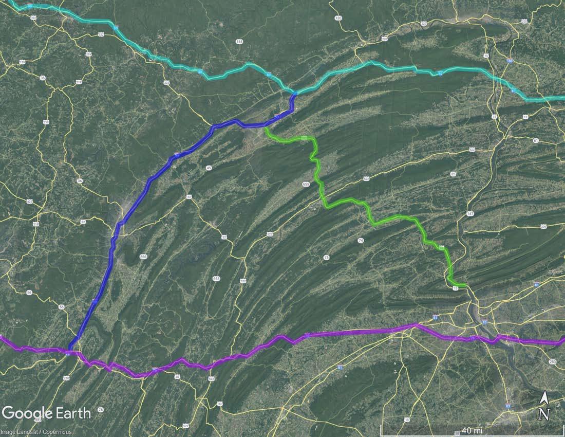
Figures 5.08 and 5.09 show the difference between PennDOT’s Planning and Environmental Linkage (PEL) Study and the scope of the region that trucks seem to be coming from.

Conversations with PennDOT staff indicated that they only counted trucks within the study area in their research (Figure 5.09), not the broader regional dynamics. While this is useful information, it doesn’t recognize the origin of trucks from outside of the study area shown (Figure 5.08). From a statewide point of view, it would be helpful to know where trucks are coming from and where they need to travel to (statewide, regional, local). If trucks are in fact coming from further away and simply passing through, are there better routes to consider? Would improvements on the PA Turnpike, such as like lowering tolls, convince truckers and their employers to take alternative routes? How about improving the PA Turnpike connections between I-70 in Breezewood and I-99 in Bedford? Neither intersection as a direct freeway-to-freeway connection.


