PORTFOLIO
Landscape Architect
Wenqing Sun


Nanjing Agriculture University 09/2018-06/2022
Bachelor of Engneering
Landscape Architecture
University of Copenhagen 09/2022-now Master of Science
Landscape Architecture

Qingdao Public Architecture Design Institute Qingdao,China 08/2020, 07/2021-08/2021 Intern
Arkitema Copenhagen, Denmark 02/2024-present Intern; Student Assistant

03
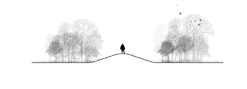
Suture The Wound A memorial place for laboratory animals 01 DRAGØR A Climate-Resilient Coastal Municipality 02 Wetland Station Habitat for Animals
Landscape Architecture can be a bond, establishing a natural bond between ecosystem and people, a connected bond between greenways and urban life, a livable bond between water and life, a spiritual bond between laboratory animals and human being, and an interactive bond between socially vulnerable people and nature.
New Vitality Pacemaker
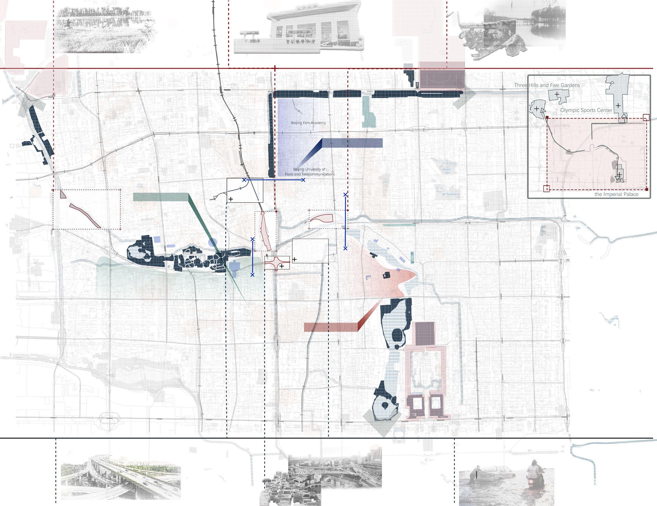
A Mega-infrastructure in Beijing
Introducing Active Ways of Living With Water A laboratory for community-driven flood prevention 06 More Than Landscape Other Work 04
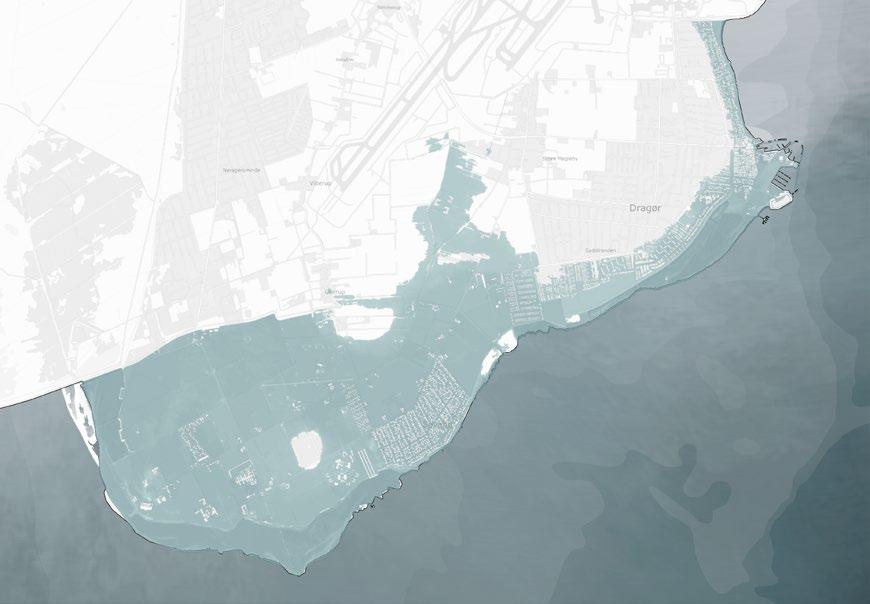
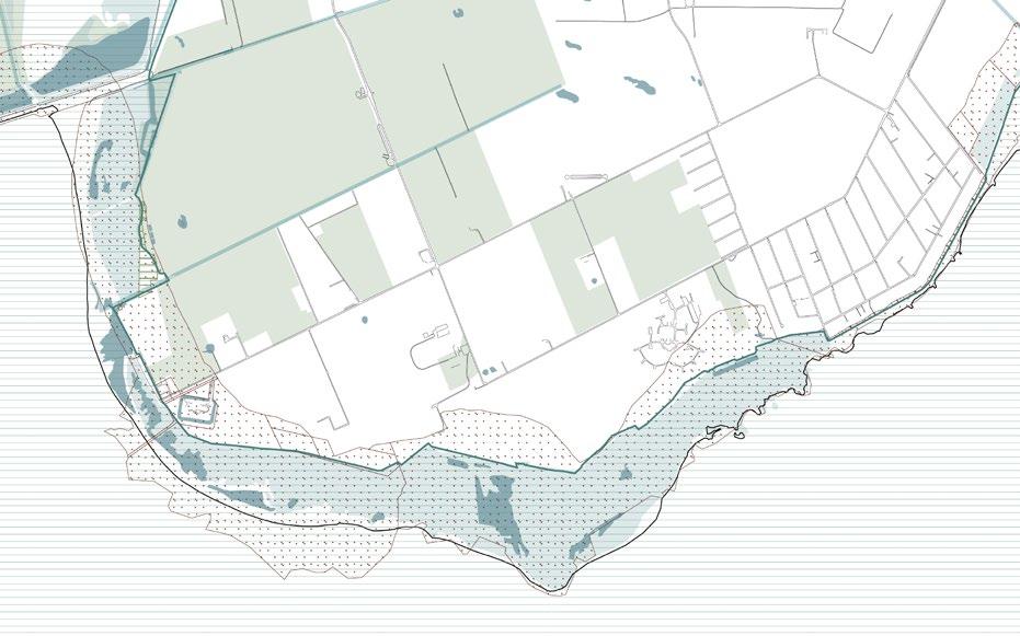
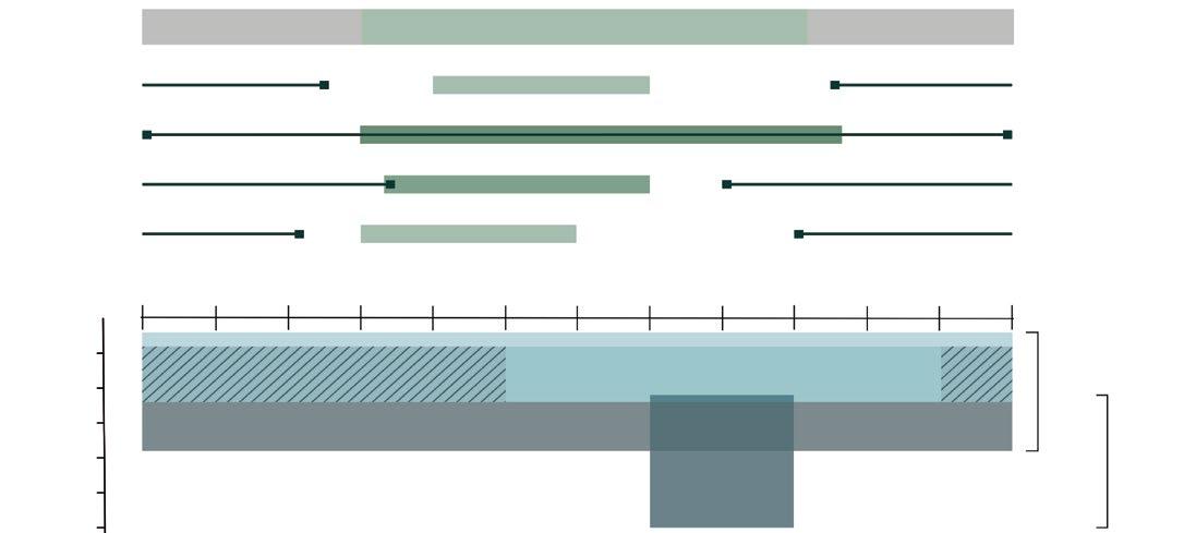
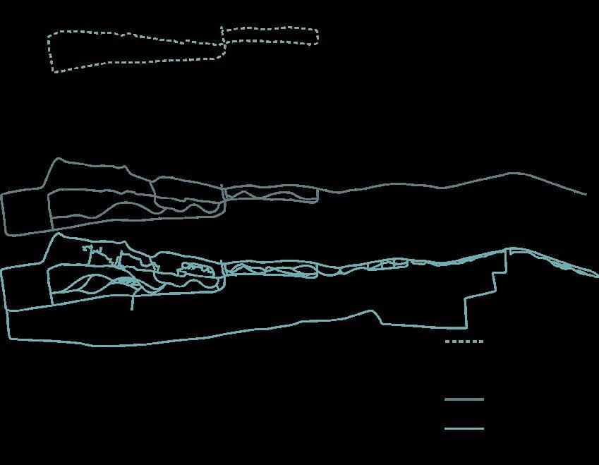
The figure shows the water level along Dragør’s coastline (in meters DVR90) during a 100-year storm surge event in 2075 and the extent of the flooding on land under existing conditions without coastal protection. Contributions from waves are not included.
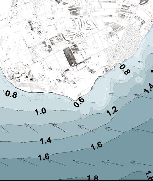
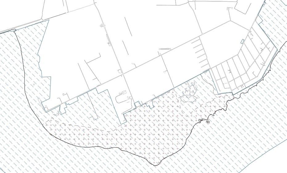
Modeled wave conditions during the storm surge on October 20–21, 2023. The figure shows the distribution of waves at the peak of the storm surge. The numbers indicate wave heights in meters (specified as the significant wave height, Hm0), and the arrows show the direction of wave propagation.
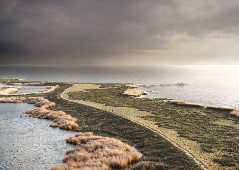
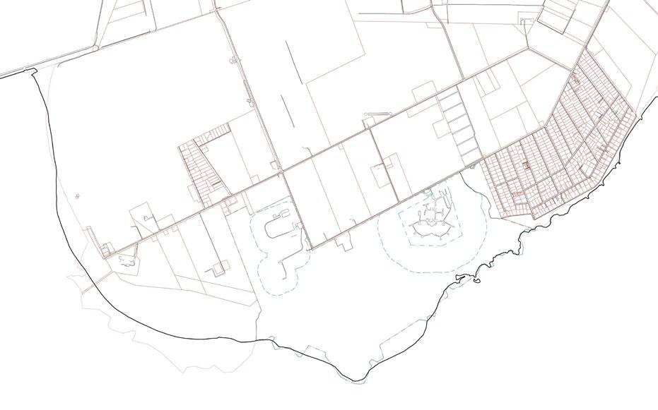
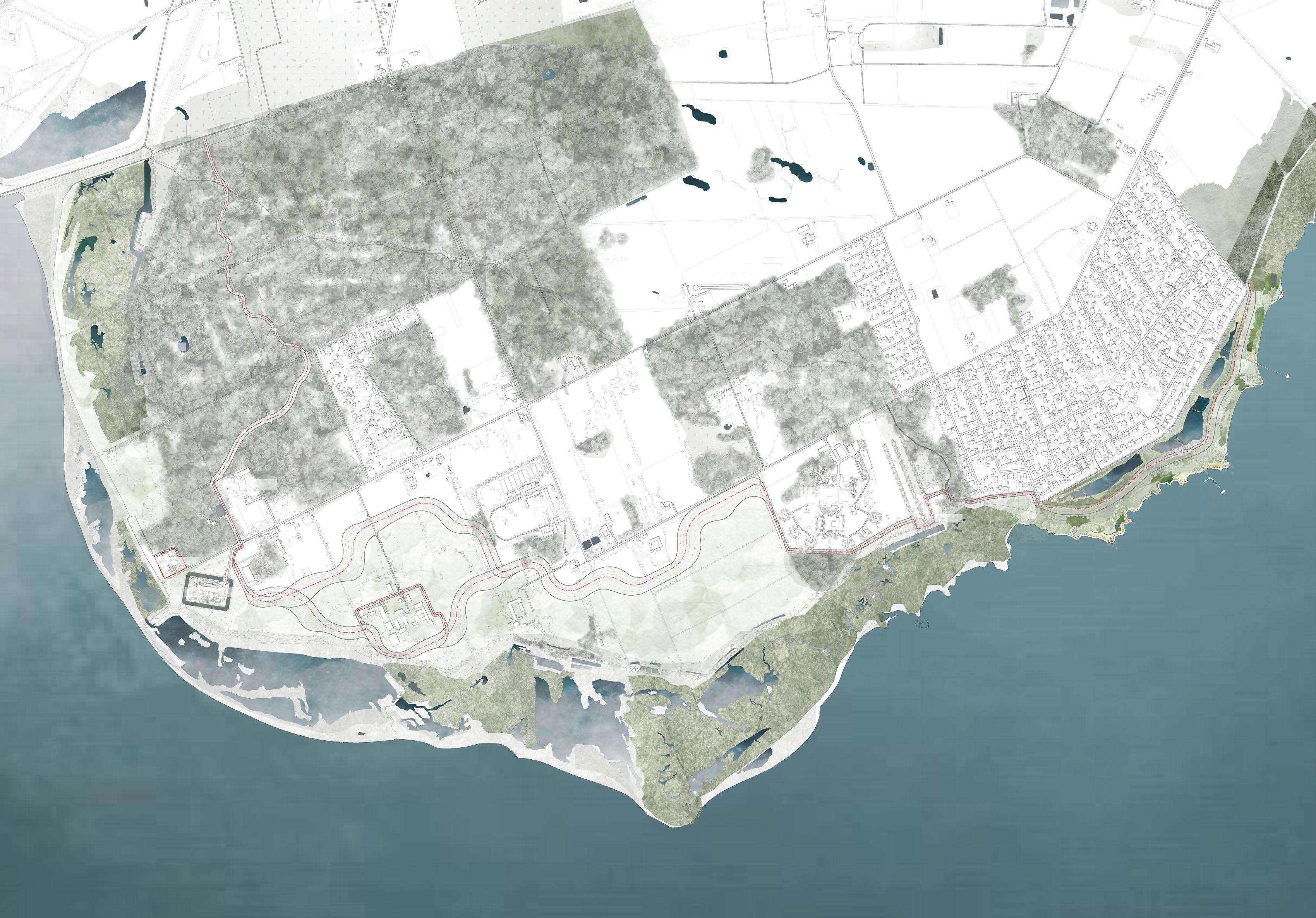
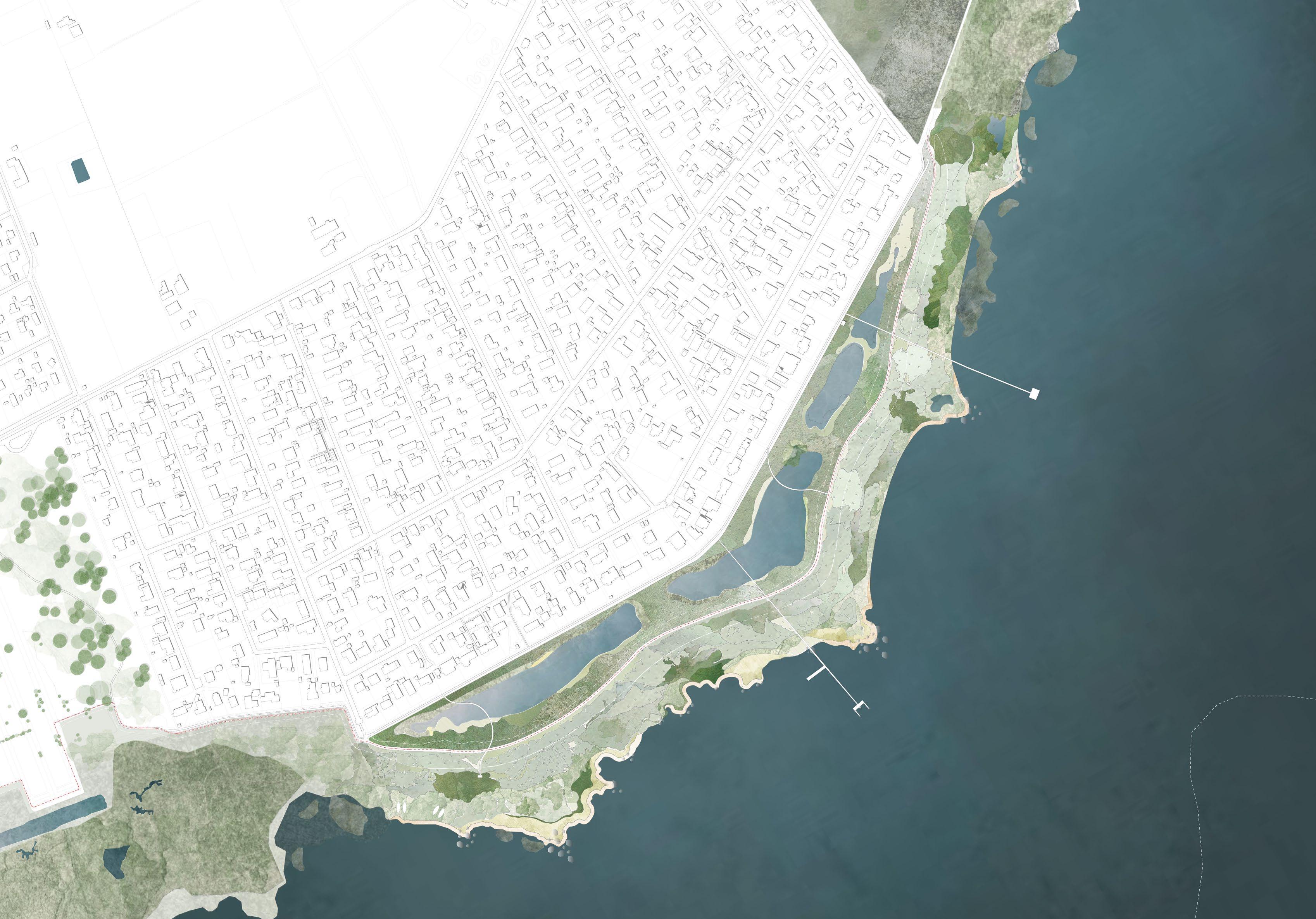
A Climate-Resilient Coastal Municipality
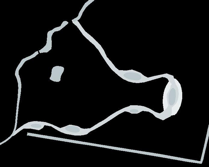
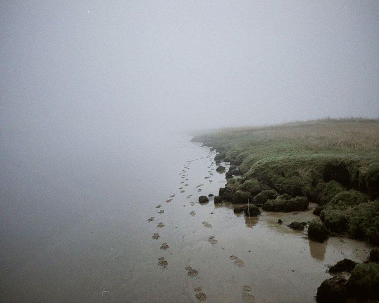
Dragør Municipality, just south of Copenhagen, is blessed with unique nature. Its long, stunning coastline, beach meadows, and forest form an exceptional area designated as a protected Natura-2000 zone.
However, with rising sea levels, increasing groundwater levels, more frequent flooding due to storm surges, and heavier rainfalls, the municipality faces a critical challenge: protecting both its citizens and its natural treasures. This has led to the development of a new coastal protection strategy – done with great care.
Together with COWI and IS IT A BIRD, and not least our client Dragør Kommune, we have designed a nature-based coastal defense featuring absorbent borders as the core solution. By precisely shaping the future landscape, we can accommodate expected water volumes naturally. Unlike hard defenses with reflective barriers, this approach doesn’t resist water but embraces it as a force of nature.
This design not only safeguards but also enhances the distinctive character of Dragør Municipality where proximity to nature and the integration of cultural and natural heritage are part of Dragør’s DNA.


(NBL §3)
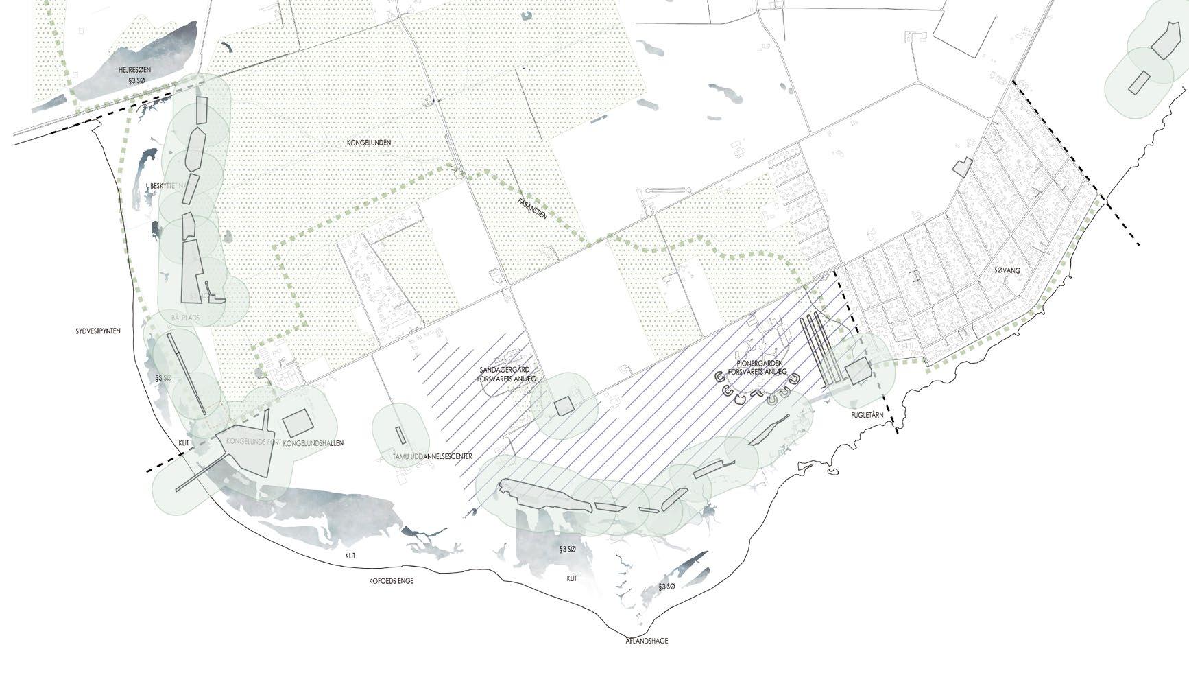
Subsection 6 Kongelunden
Subsection 5 Søvang
Design Principle
Place-Based Design
Subsection 5 Sydvestpynten

The Military Property Area
Heritage Sites

Protected Forest
Existing Embankments
Armarminoen Route
Subsection Division

Visual and physical connection to the water is a characteristic of Dragør, which must be
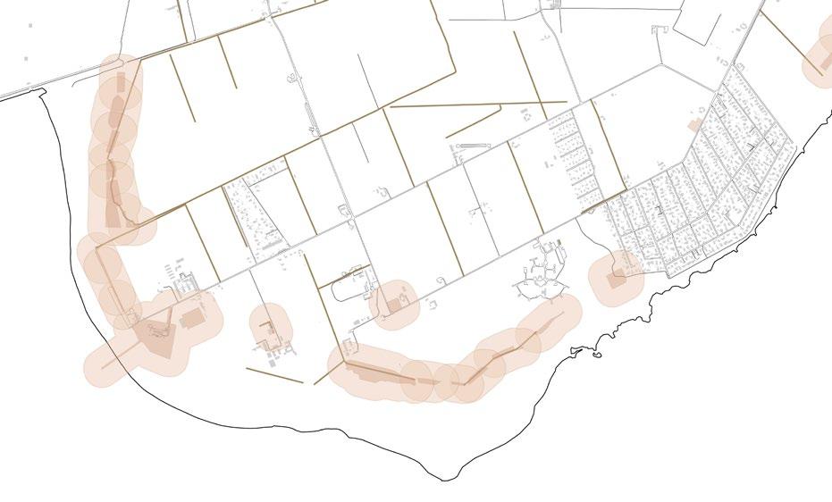
As the basis for coastal protection, a potential route area for the alignment has been identified based on analyses and discussions. An analysis of the site's landscape characteristics, including spatial, visual, and physical connections, should, together with conversations with local residents and property owners, form the basis for the coastal protection alignment. The stretch is divided and treated specifically according to its character and function.
Each area has a special value or function that impacts the alignment and the solution; the forest in Kongelunden contains historical elements such as the avenue leading to the water. Monuments, along with the Natura 2000 area, the coastline, and the landscape, demarcate the area. The military has various facilities in large parts of the area. All of this must be reconciled with conservation areas, nature protection, and both public and private lands.


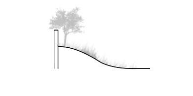
Space for nature! Through a retreat of the dike, a potential is created to allow space for future natural development in front of the dike, in line


SOUTHERN FOREST REDOUBT
KONGELUNDEN
HORSEBACK RIDING TRAILS
COURSE
KONGELUND CAMPGROUND KALVEBODROAD
NATURE SCHOOL KONGELUNDEN
KONGELUNDSHALLEN
LINJEFØRING OPTION, TILBAGETRUKKET LANDSKABSDIGE
SANDAGER BASE
KONGELUND FORT
ROUTE ALIGNMENT OPTION ADVANCED LANDSCAPE DIKE
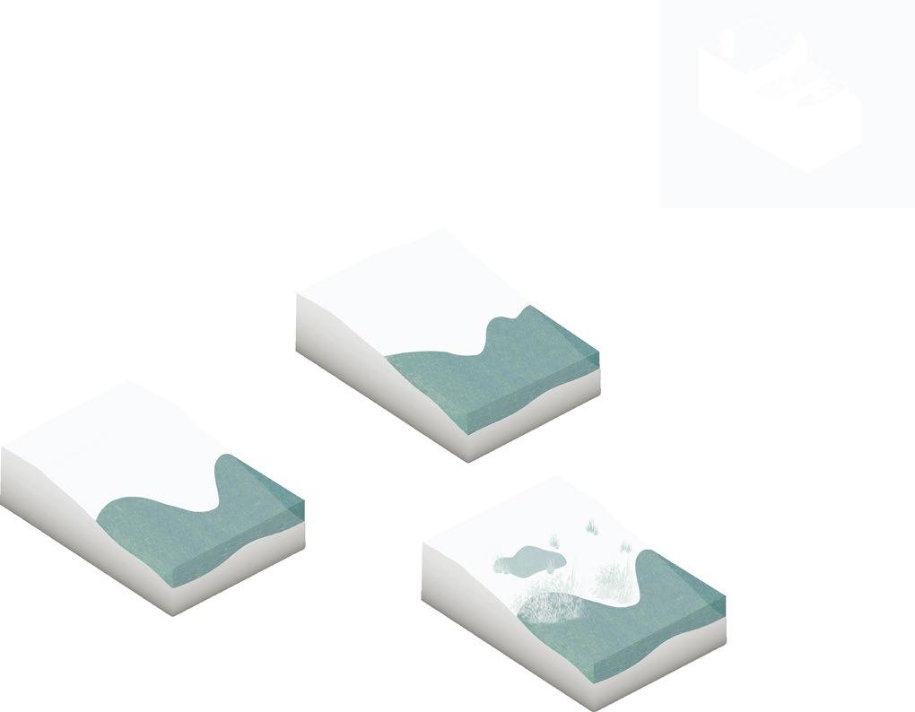
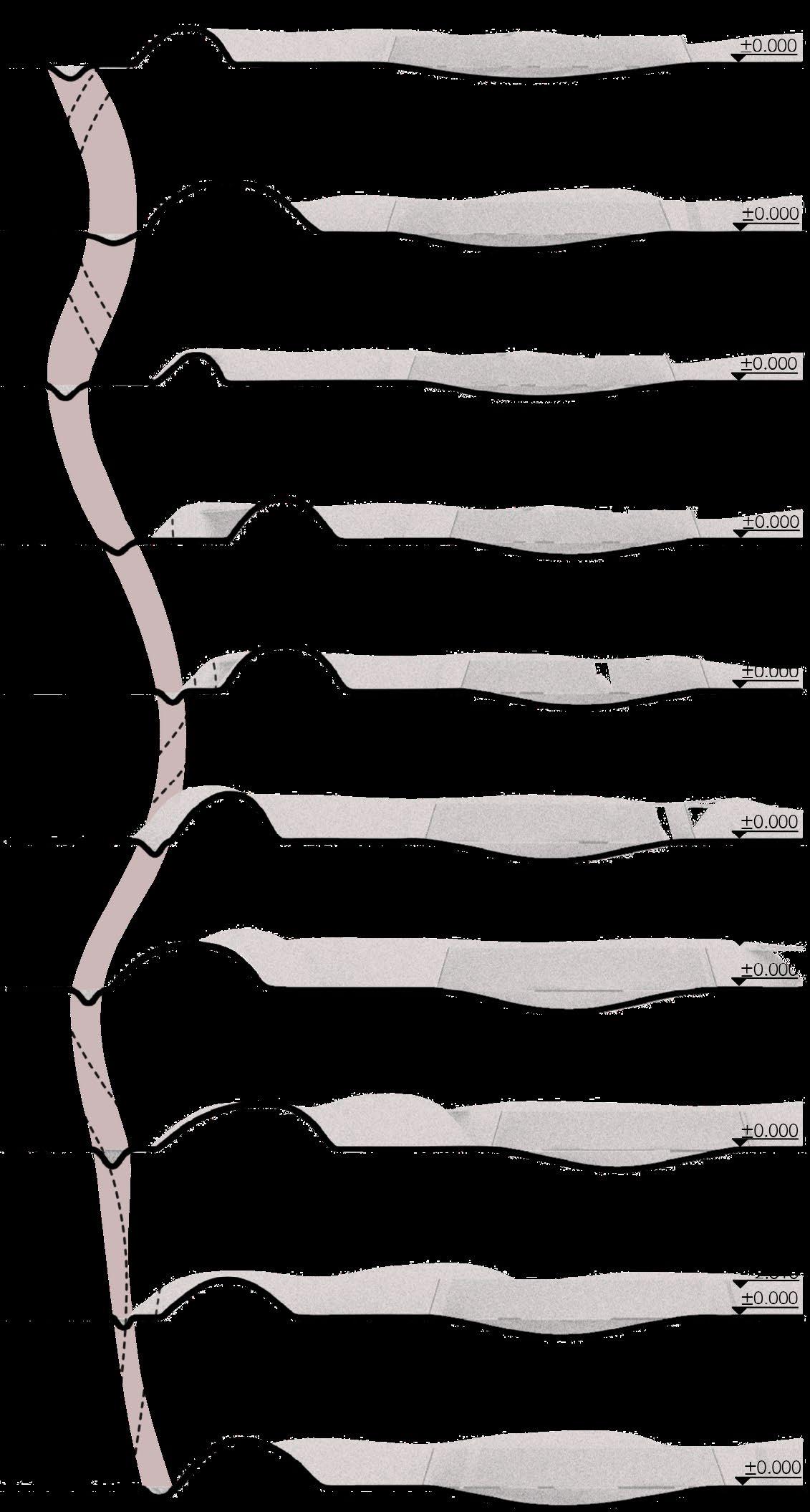
The protection elevation for coastal protection is determined based on the design water level for a 100-year storm surge event in 2075, along with a wave allowance that ensures the maximum permissible wave overtopping is not exceeded during the storm surge event. The required protection elevation will therefore vary depending on the wave exposure of the location. By constructing the dike with a longer and gentler slope on the front side, wave run-up and, consequently, the protection elevation can be reduced.
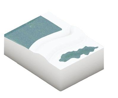
Where the coastal protection extends beyond the coastline, it is established as an advanced foreland. With an advanced foreland and lakes located behind the built-up dike, a greater wave overtopping can be accepted, and thus a foreland with a lower elevation can be established compared to the existing closely positioned dike.
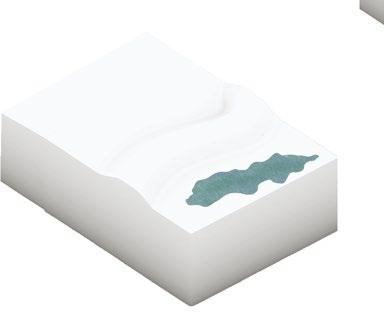
The landscape dike forms the primary solution where the coastal protection is set back in the open land. The solution will support the existing area and nature, and in several places, the dike will gradually blend naturally into the landscape over time. The landscape dike has different slopes, varies in width, and can be adjusted over time by raising the dike.
A narrower version of the landscape dike can be advantageously used in the forest and in specific areas where space is limited. In the forest, the dike can either follow existing paths or be concealed within the forest, allowing passage past, on, or along the dike.
Locally, there will be specific requirements for space or execution, which is why a solution in the form of a barrier or emergency solution may be the right choice. A barrier can be designed using various materials and possibly with features like benches or other functions.

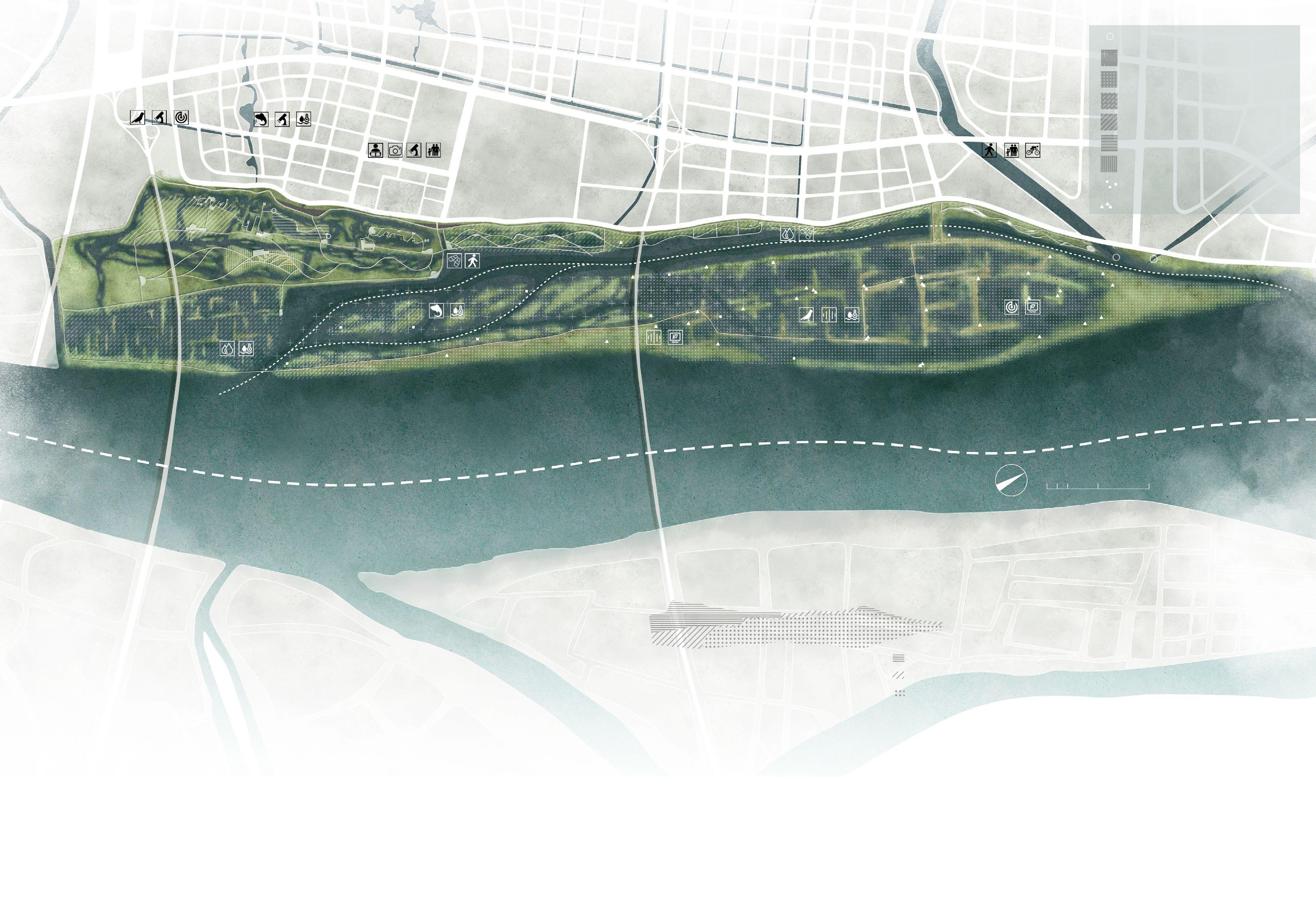
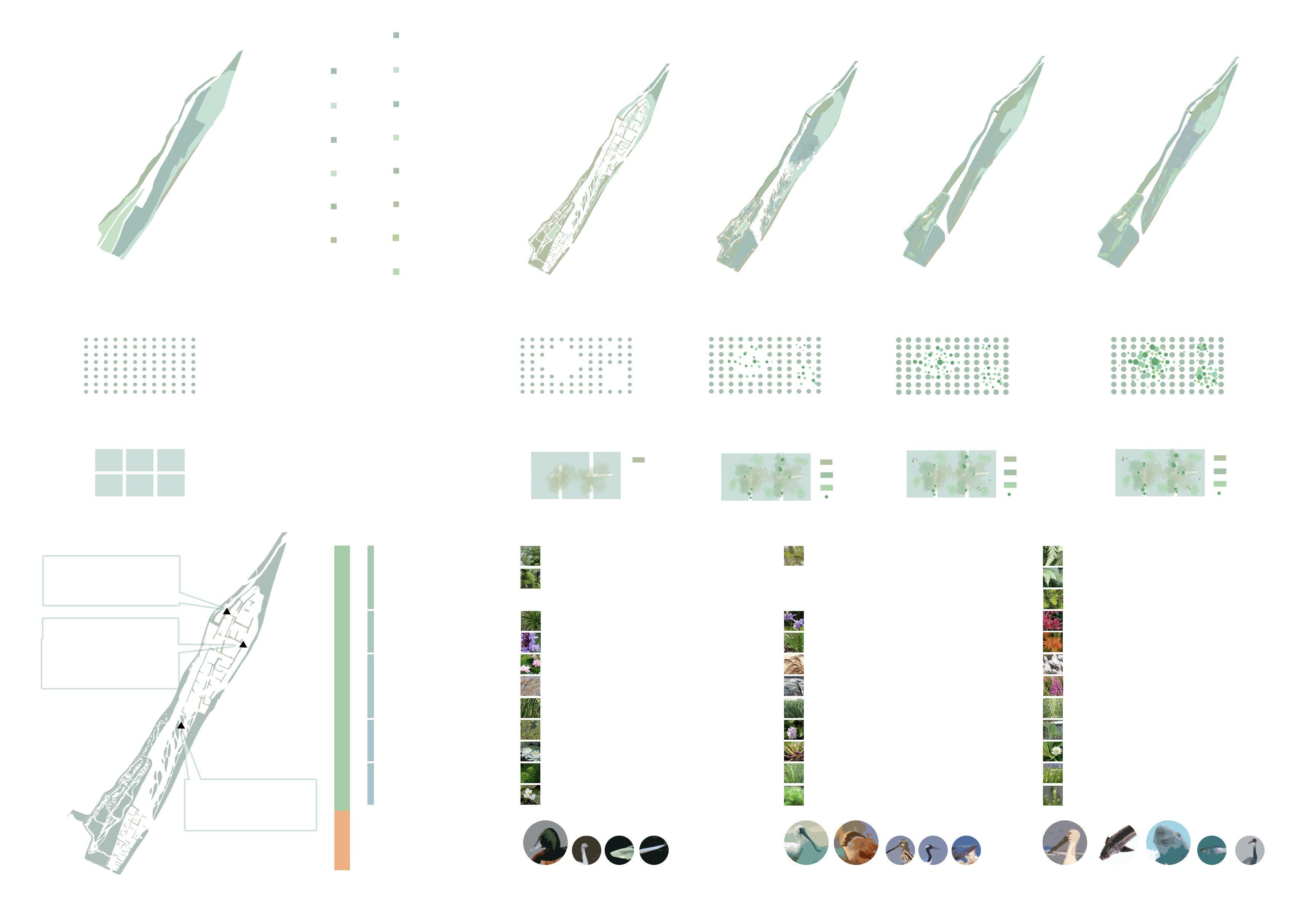
Habitat for Animals
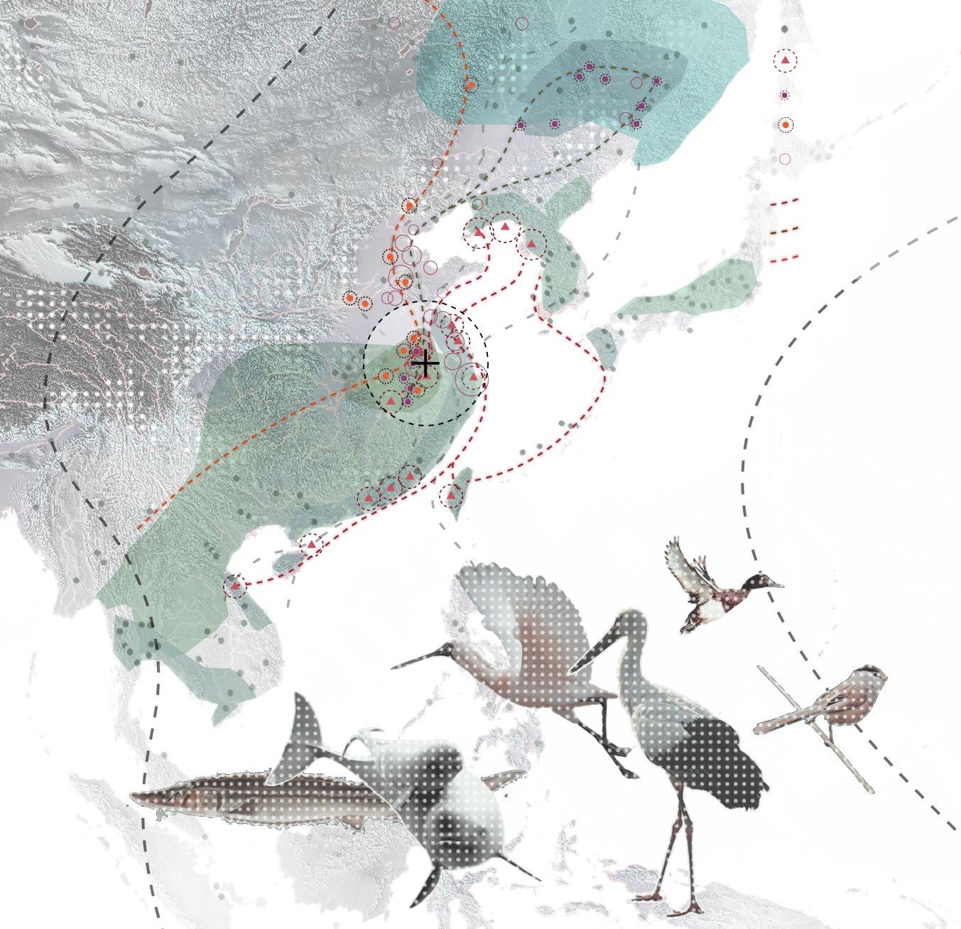
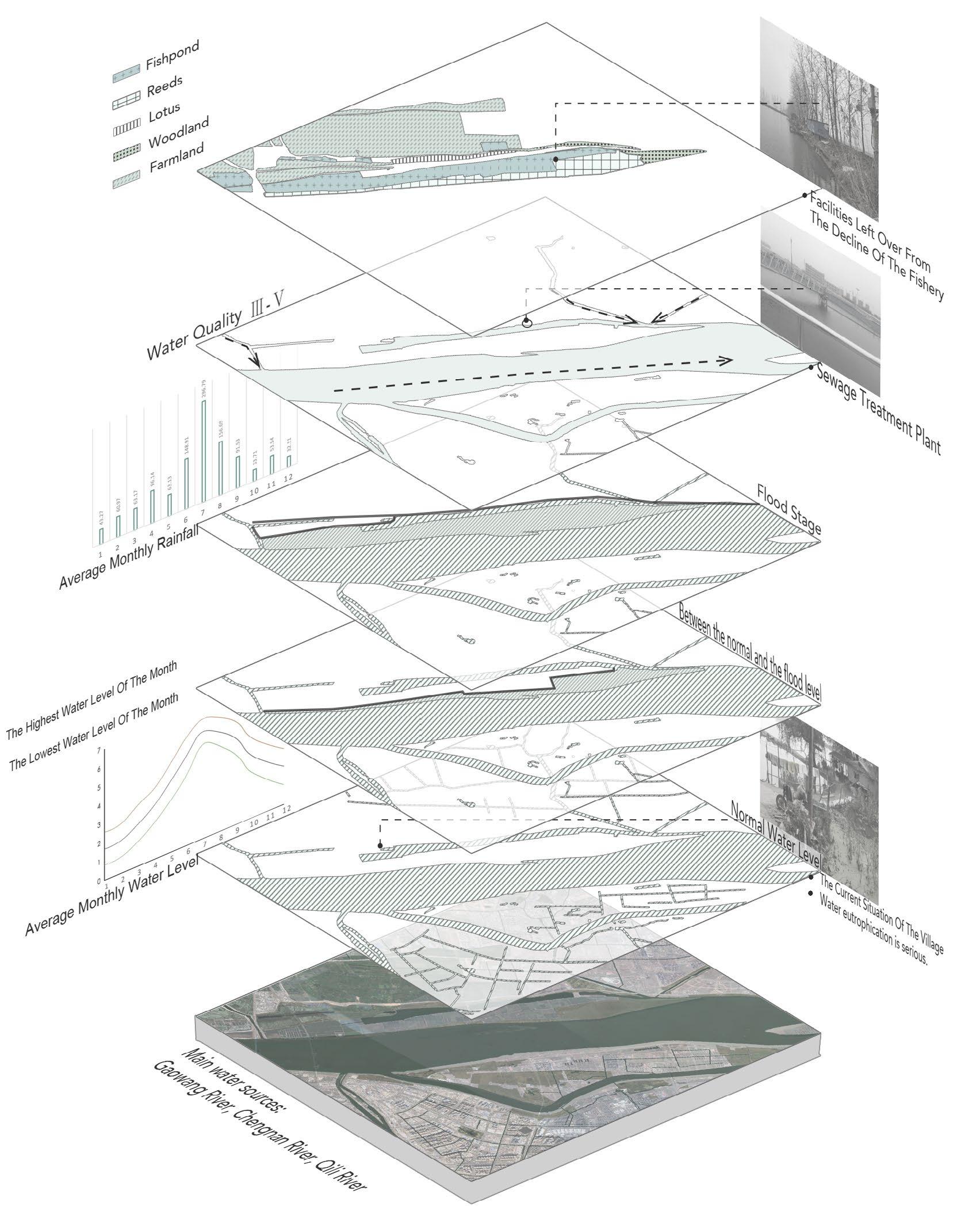
Located on the edge of the East AsianAustralian Migration Line, the design site is an important migratory bird migration route in China, where a large number of birds will take advantage of it to take a short break, or spend the whole winter here.
With the city's development, the wetland of Lvshuiwan has been over-exploited Fish ponds occupy a great number of wetlands, and the area of animal habitat has also been largely reduced. The current fishery is declining, followed by massive fishery residues, which causes the problem of poor water quality and destroys animal habitats
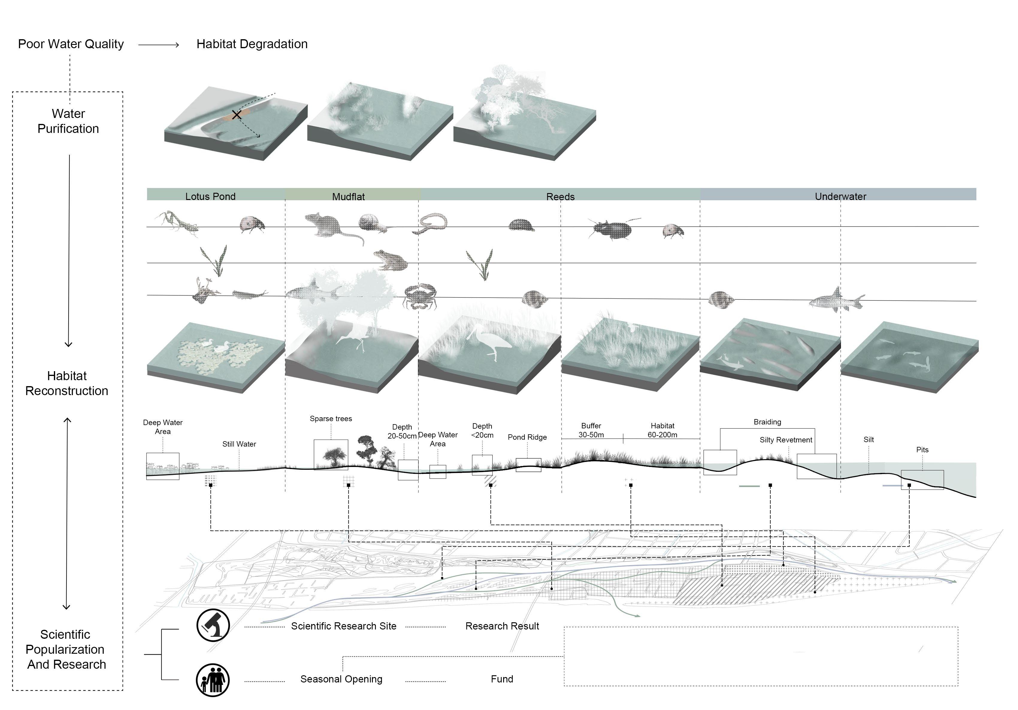
Through the research of the site and the habits of protected wildlife, the project specifically designed six main habitats for protected animals to restore wetland habitats, reshape and stabilize wetland ecosystems, and build an animal and plant science research campus to raise public awareness of wetlands and animal protection.
The site will become a resting station for migratory birds and fishes and a biodiversity conservation area for fish and birds.
Animal Habits Calendar
The site was a natural wetland, after man-made development, wetland was occupied by farmland and fishponds, biological habitat was forced to reduce, and a large number of surrounding factories to the wetland caused further environmental pollution, the life of the animals living here poses a threat.
Mountain Farmland Grassland Fishpond Education Buildings Reeds Water Road Expressway
Seasonal flooding exists in some areas of the site, but for waterbirds and fish, it is an excellent natural environment, providing important breeding grounds for some migratory fish and providing sufficient food sources and shelter for waterbirds.
The direction of the water flow


Colony Of Populus
Colony Of Phragmites
Colony Of Trapa
Colony Of Oryza sativa
Colony Of Nelumbo nucifera
Mudflats
Existing Woodland
Colony Of Emergent Plants
Colony Of Submerged Plants
Colony Of Horticultural Crop
Colony Of Floating Plants
Mudflats
Colony Of Fir Wood Grassland
Interrupt the pond ridge and build fish trails and islands
Construct underwater forests and remove some vegetation.
Vegetation coverage increases. The ecosystem is more complete.
Hygrophytic Ligneous Plants
Clean up pest and disease tree species and invasive species.
To rehydrate and nurture saplings.
Vegetation growth. Form more complex communities.
Submergent Plant Submergent Plant Submergent Plant Submergent Plant Floating Plant Floating Plant Floating Plant Emerged Plant Emerged Plant Emerged Plant Ligneous Plants Ligneous Plants Ligneous Plants Build bird pile.
Interrupt the pond ridge Create a wetland planting node that combines a variety of plants.
Taxodium distichum var. imbricatum (Nuttall) Croom
PopulusL.
Hygrophytic Herb Acorus tatarinowii
Pontederia cordata L.
Emerged Plant Floating Plant
Submergent Plant
Nelumbo SP.
Phragmites australis
Schoenoplectus tabernaemontani
Salvinia natans
Nymphaea tetragona
Myriophyllum verticillatum L.
Hydrocharis dubia (Bl.) Backer
Salix matsudana Koidz.
Iris tectorum Maxim.
Acorus tatarinowii
Form a stable water ecosystem.
Taxodium distichum (L.) Rich.
Alnus trabeculosa Hand.-Mazz.
Taxodium mucronatum Tenore
Lycoris radiata (L’Her.) Herb.
Hemerocallis fulva (L.) L.
Phragmites australis (Cav.) Trin. ex Steud. Phragmites australis (Cav.) Trin. ex Steud.
Triarrhena sacchariflora (Maxim. ) Nakai
Zizania latifolia (Griseb. ) Stapf
Eichhornia crassipes (Mart.) Solms
Trapa bispinosa Roxb.
Potamogeton distinctus A.Benn.
Ceratophyllum demersum L.
Lythrum salicaria L.
Zizania latifolia (Griseb. ) Stapf
Cyperus rotundus L.
Alternanthera philoxeroides (Mart.) Griseb.
natans (Lour.) Hara
Ceratophyllum demersum L.
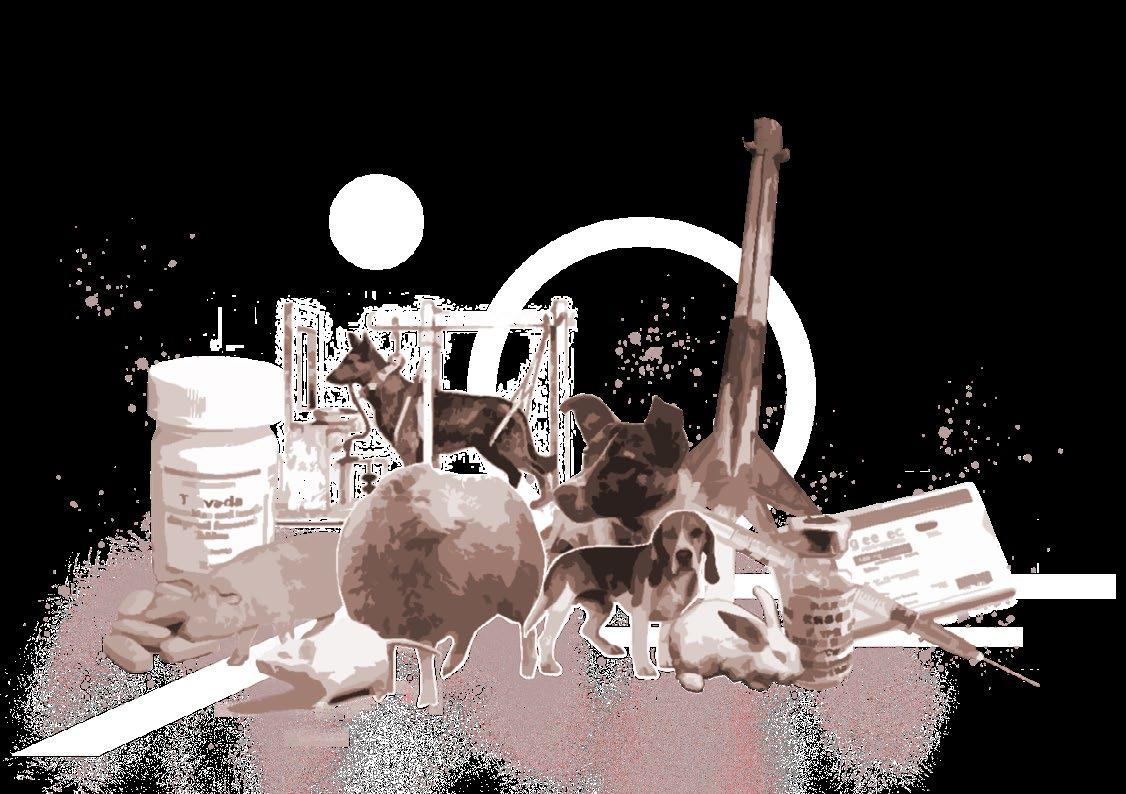
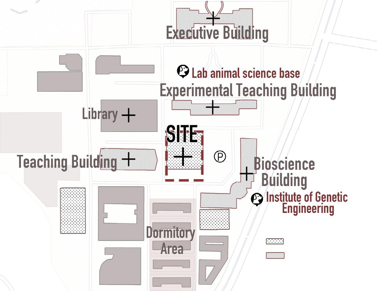
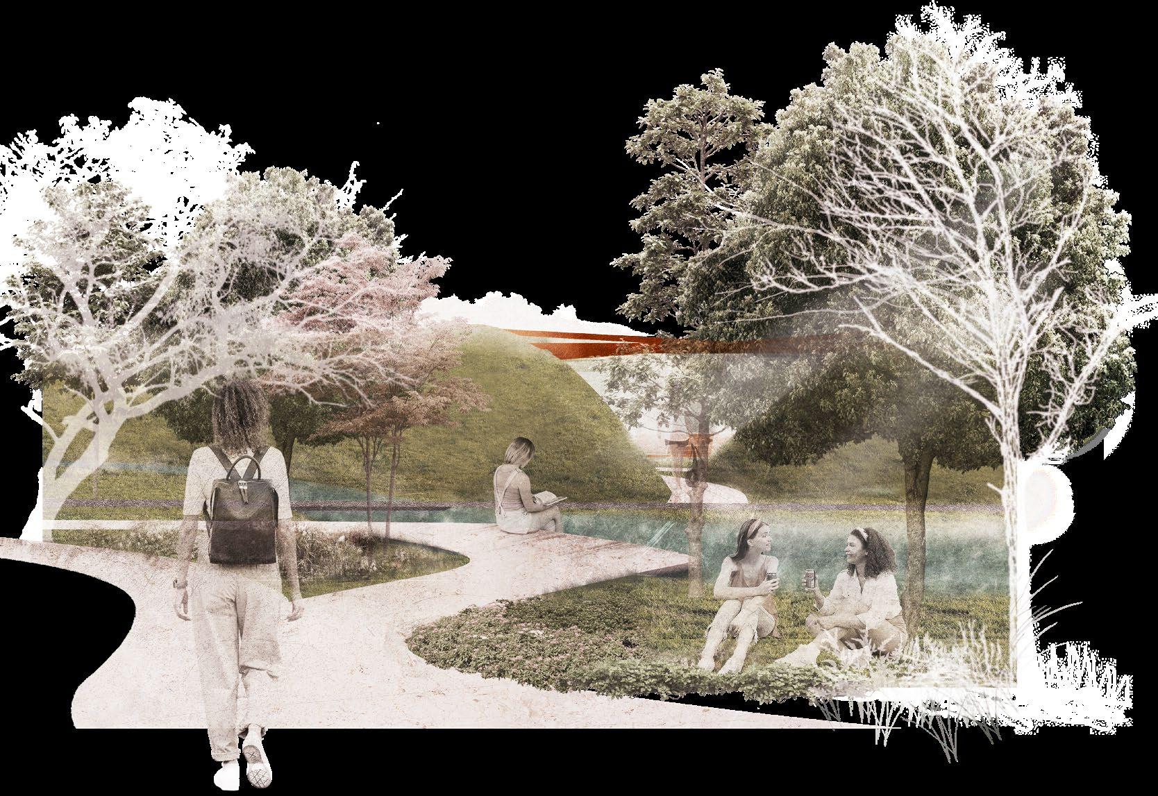
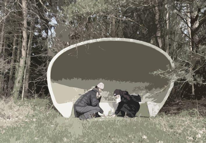
A memorial place for laboratory animals
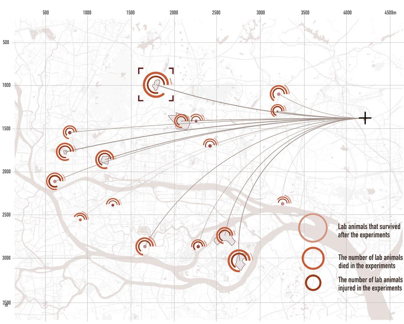
Animal experiments have made significant contributions to the advancement of medicine, and tens of millions of laboratory animals are injured or killed every year. At the same time, many experimenters are under tremendous psychological pressure and even have psychological problems such as PTSD.
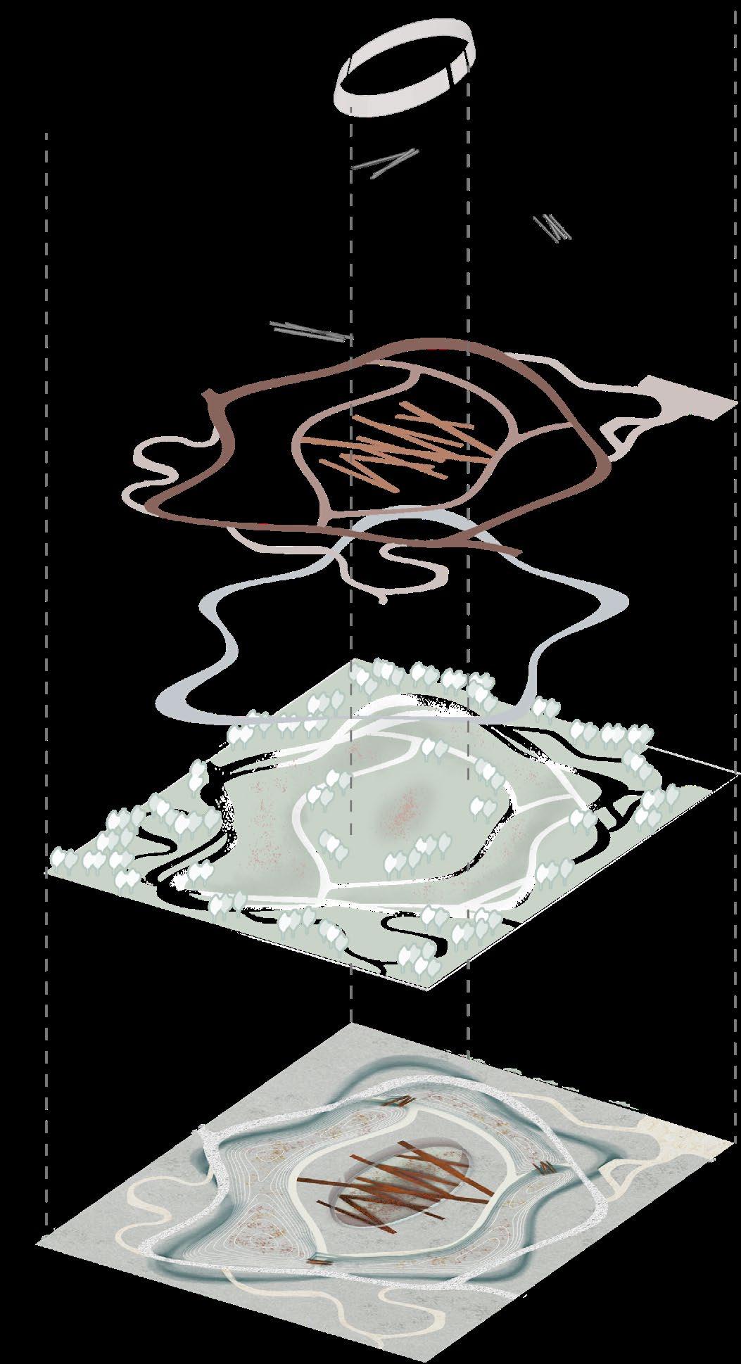
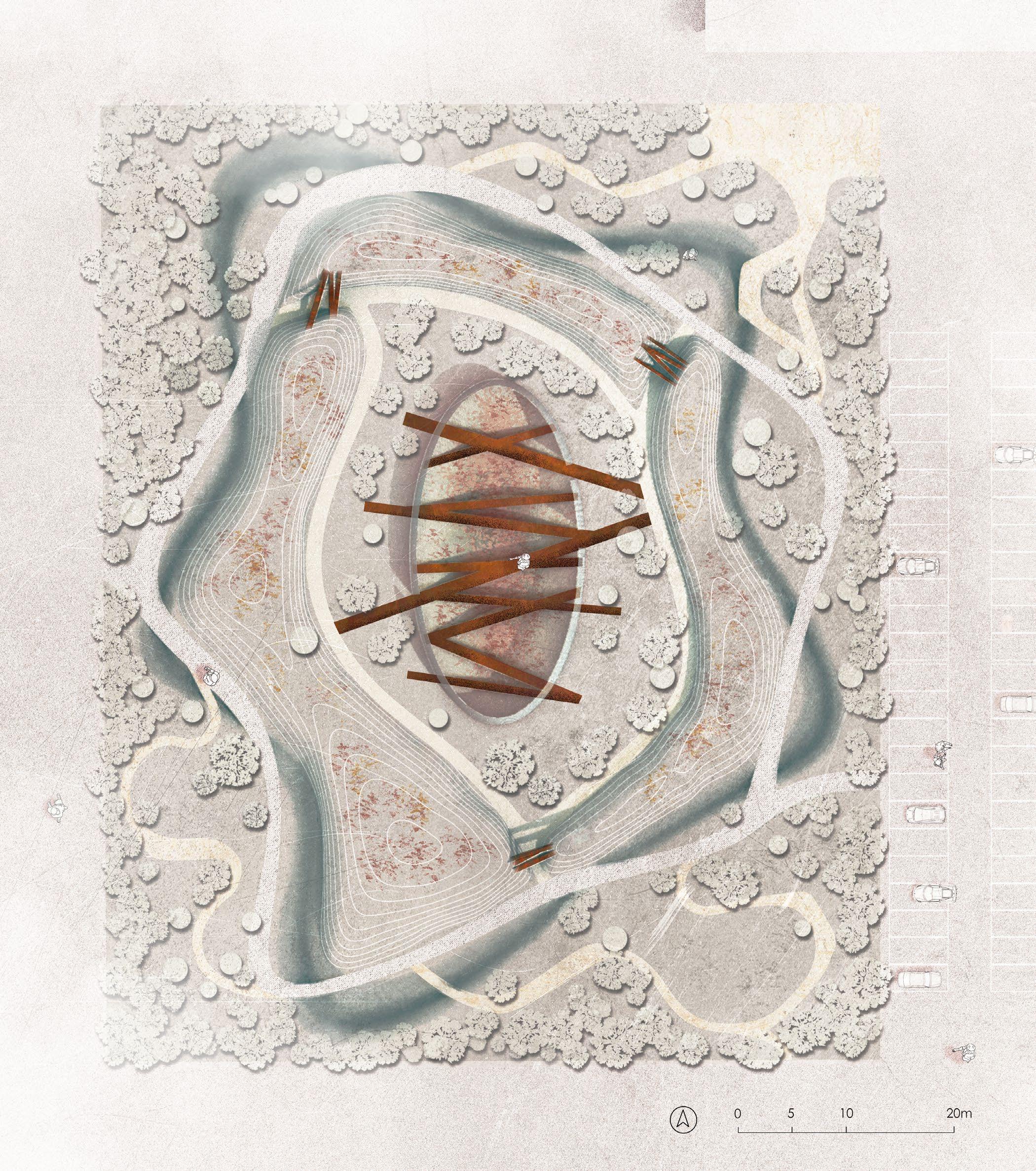
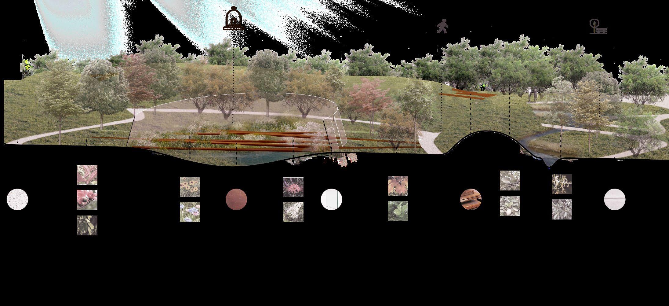
Using the landscape to commemorate the laboratory animals is the starting point of this design. The design uses the water system to divide the site into two parts. The overall design reflects the entire life of the laboratory animals through topography and circulations and the use of plants and materials The design of the center of the site is inspired by a huge wound. Based on the concept that “the proof of the existence of experimental animals might be just a line of drug toxicity in the drug instructions”, the sacrificed laboratory animals are represented by vivid flowers and plants reminding people that the price of the rapid development of medicine is a large number of the lives of laboratory animals. The peripheral of the site provides a place for experimenters to release the pressure

Total
Usage data of the lab animals in Guangzhou
Complex land use types
The site is located at Medical School, next to the laboratory animal facilities.
Ⅰ Born and raised in a cage
Ⅱ Experience surgery and drug testing, etc
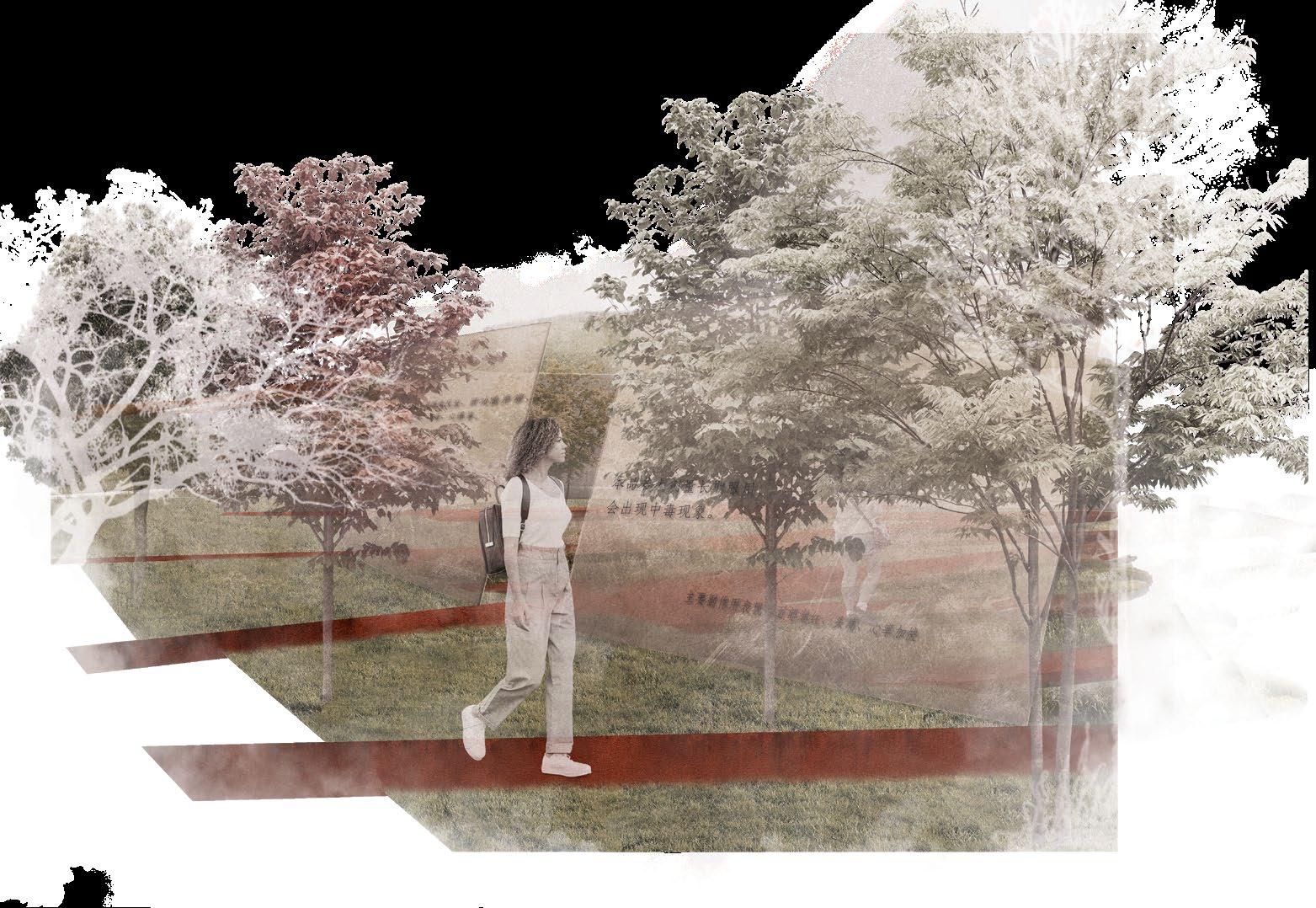
The entrance to the center memorial site
The surrounding landscape with curvy roads leads to the central memorial space, rusted steel stripes creating a feeling of constrained. Transform into design content
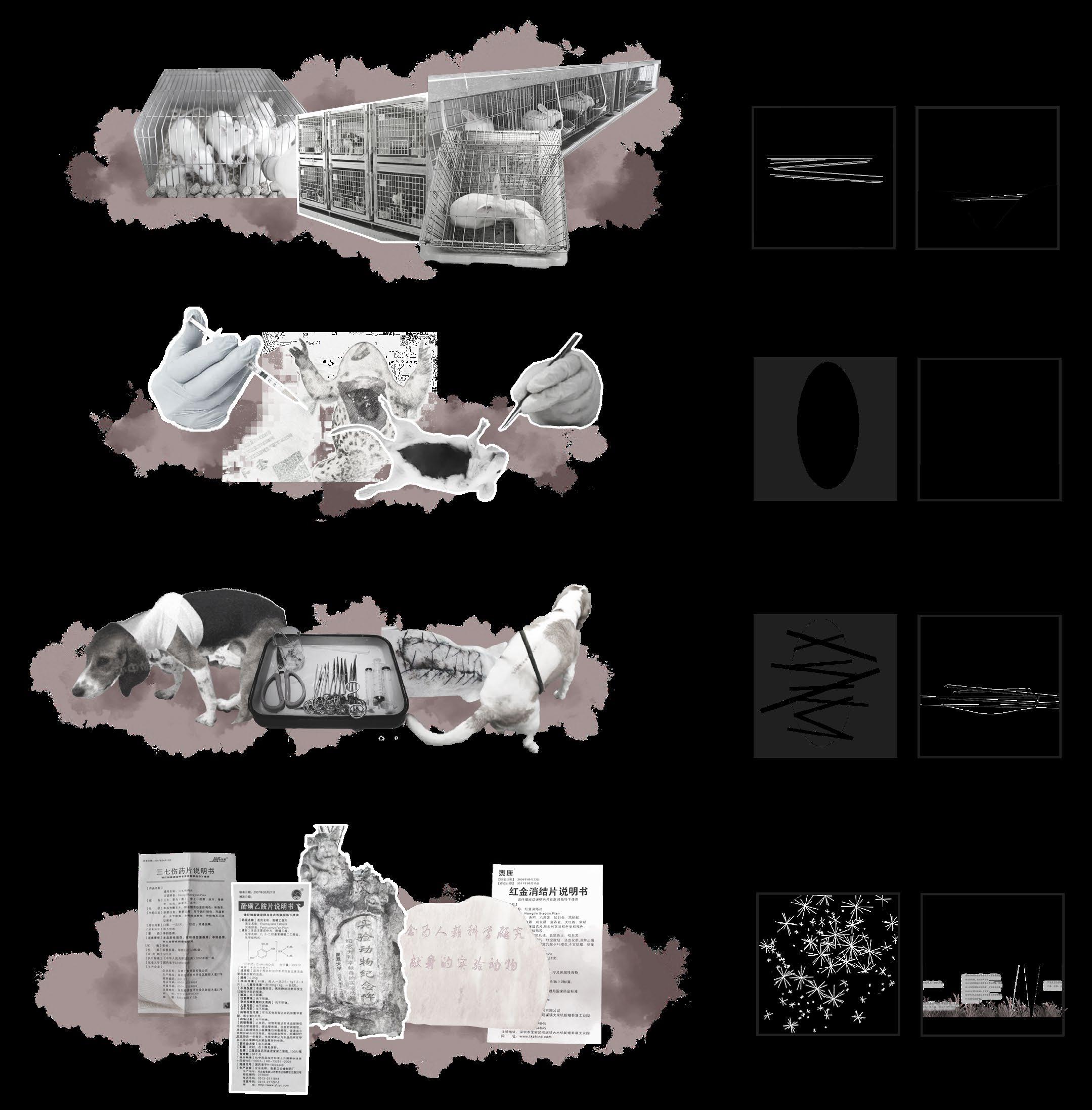
Ⅲ The wound is stitched up and the animals wait the next operation
The center memorial site
The central memorial space is a concaved flowery green scape, representing the shape of the surgery wounds.
Ⅳ The drug taboos on the drug instructions are proof of the presence of laboratory animals.
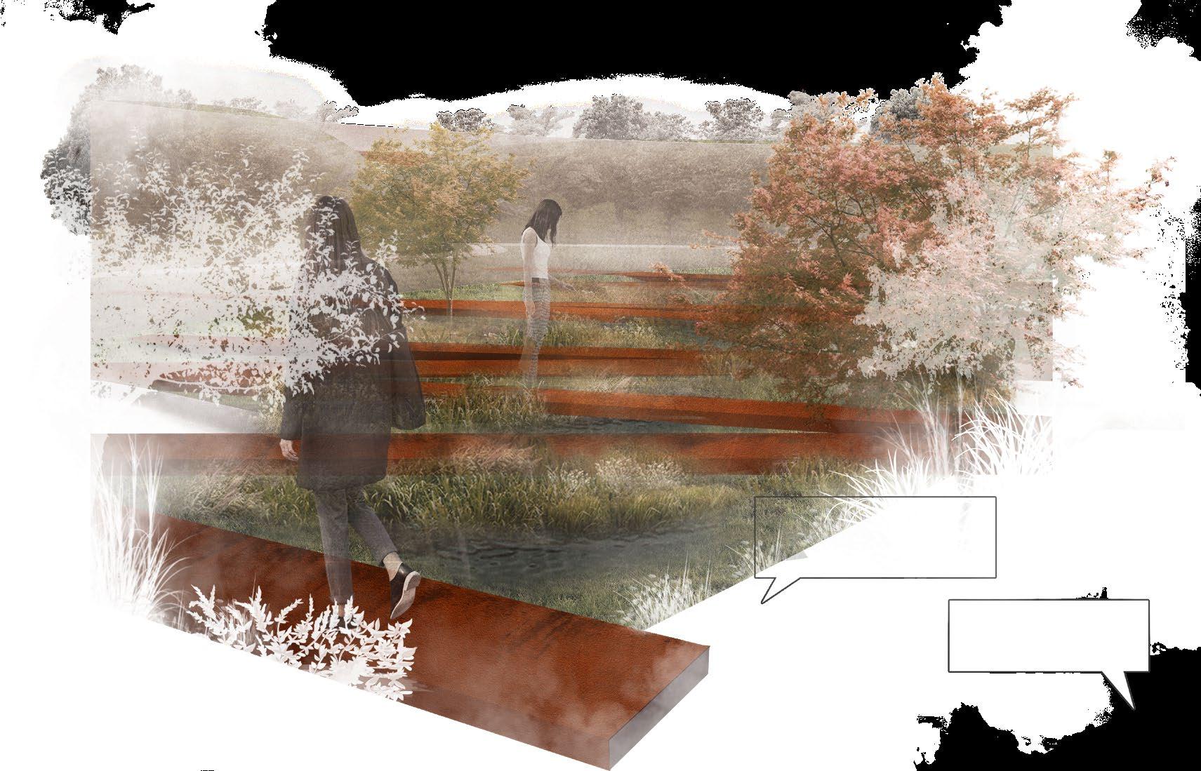
The road through the central memorial space
The roads are like surgical suture, stiching the wound together.
The interior of the central memorial space
Instead of stone monuments, the space uses flowering shrubs and herbs in memory of lab animals.
-Design Analysis
‘Drug Instructions’
A glass ring with instuctions on it.
‘Cage'
Weatherproof steel plates that stand in elevated terrain.
Path System
Plaza
Relieve the students‘ pressure
Weatherproof steel
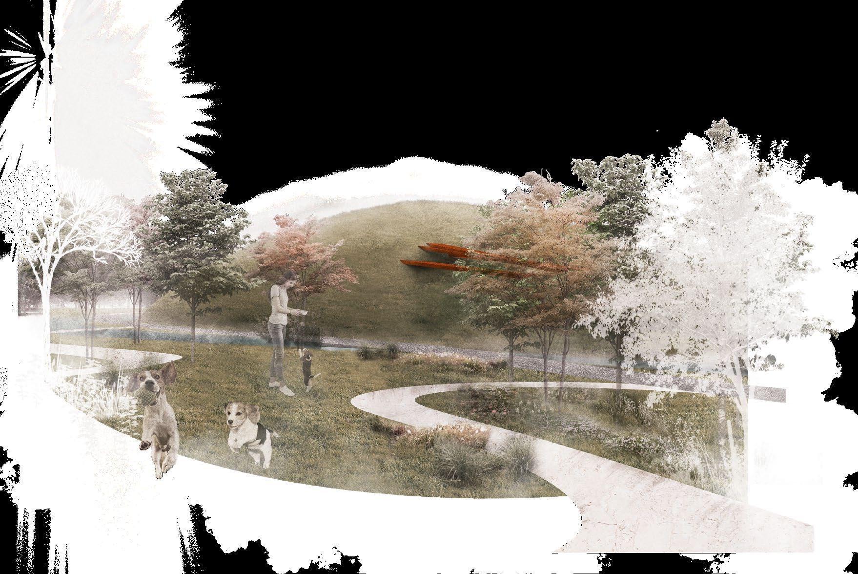
Water System
Divide the site in two, with the outside for recreation and the inside as a memorial.
Vegetation
Use the seeds of perennial herbs as tombstones rather than stones for experimental animals to show the huge amount of experimental animal use hidden behind drug instructions. Lawn for laboratory dog
Composition
-Master Plan
Most lab animals died after several surgeries. Their sacrifice became drug toxicity and side effects. A number of selected drug specifications are engraved on the glass panel, while flowery plants behind become a background of these texts, commemorating the contribution of all the unknown lab animals.
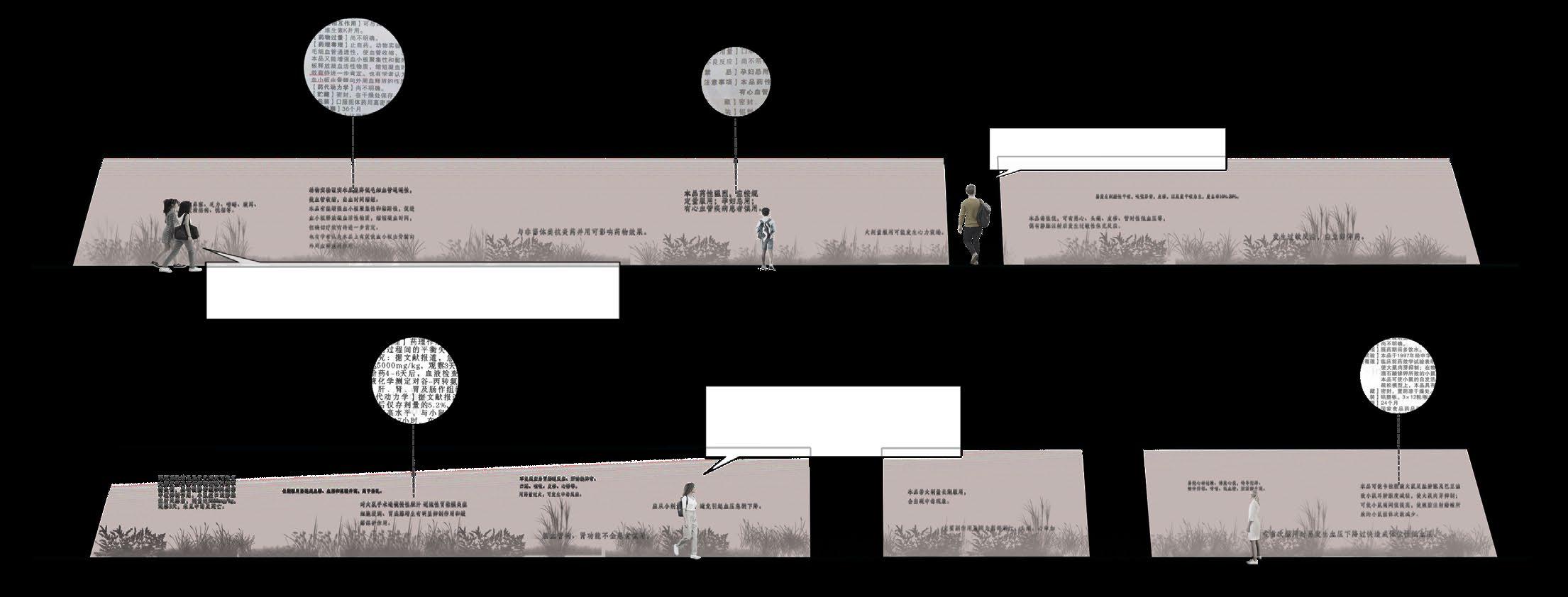
Drowsiness, dizziness, constipation, stomach upset, blurred vision, or dry mouth/nose/throat may occur.
The risk of serious side effects (such as slow/shallow breathing, severe drowsiness/dizziness) may be increased if this medication is taken with other products that may also cause drowsiness or breathing problems.
Oh my god, that reminds me of the animal experiments did.
Although dulaglutide by itself usually does not cause low blood sugar (hypoglycemia), low blood sugar may occur if this drug is prescribed with other diabetes medications.
It turned out that the side effects of this drug were also obtained through animal experiments.
Nausea, vomiting, diarrhea, and muscle pain may occur. If any of these effects persist or worsen, tell your doctor or pharmacist promptly.
1 A waterfront plaza for people to chat and rest
3 Glass Panels engraved with drug specifications, with flowery plants seeing through
2 A patch of grass for laboratory dogs to play and run
4 Surgical-thread-like roads meandering through the central space
I have planted a seed here, after I had killed an labora-tory animal in an experiment.
I see…too many laboratory animals died in the experiment.
Guo Zhiyi
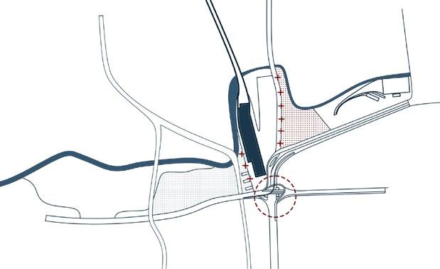
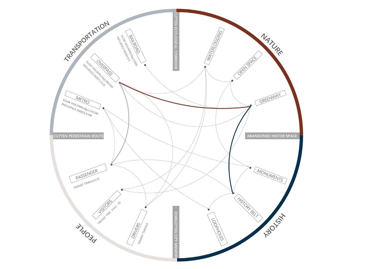
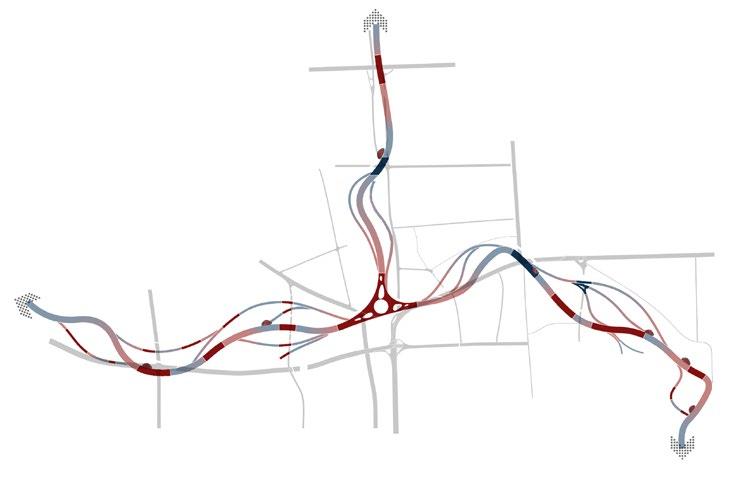
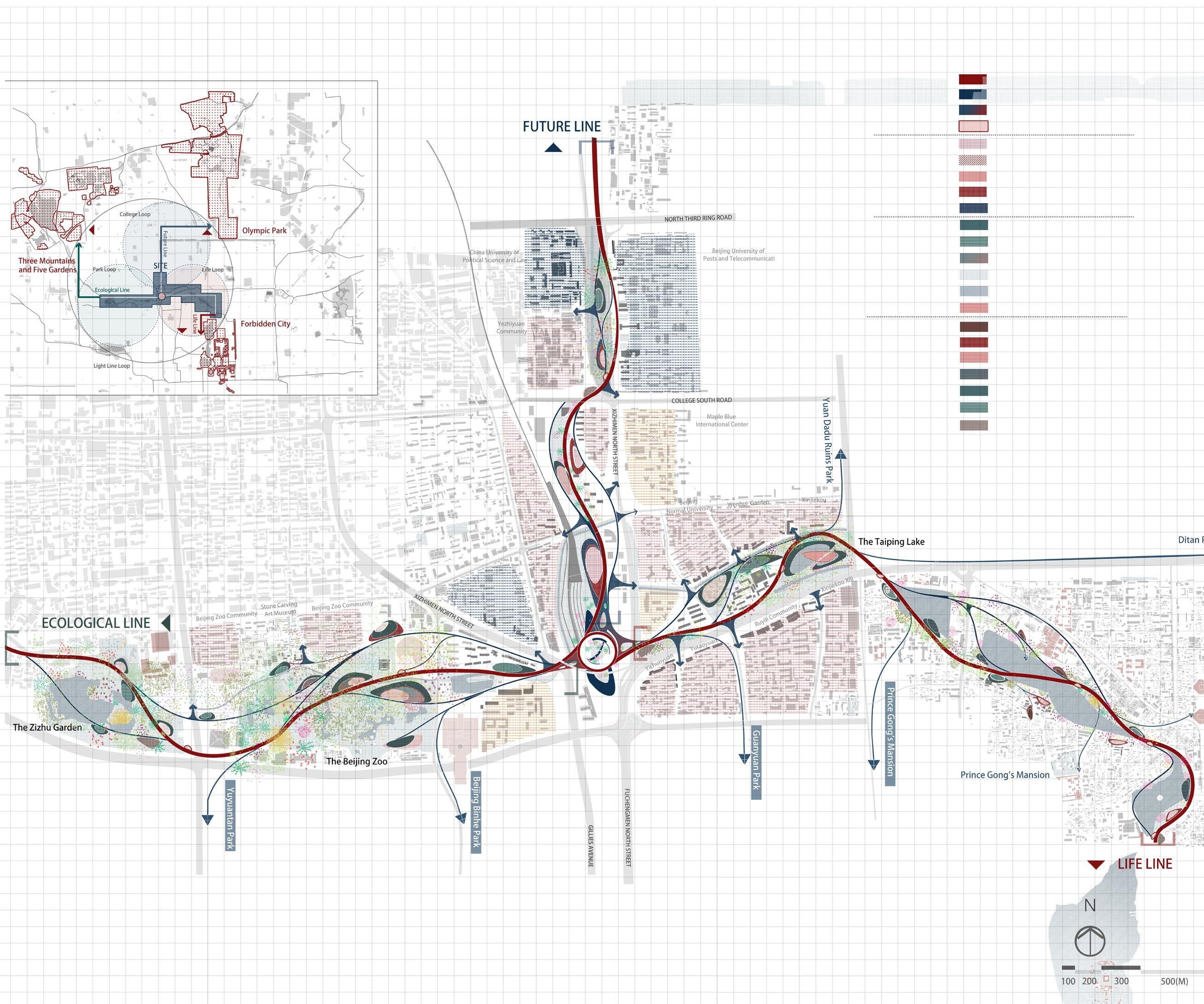
Although located in the center of the three greenways, Xizhimen does not well connect them. Instead, the center of the greenways is the overpass with heavy traffic and the train station with less traffic. So that, the entire traffic system cuts off greenways
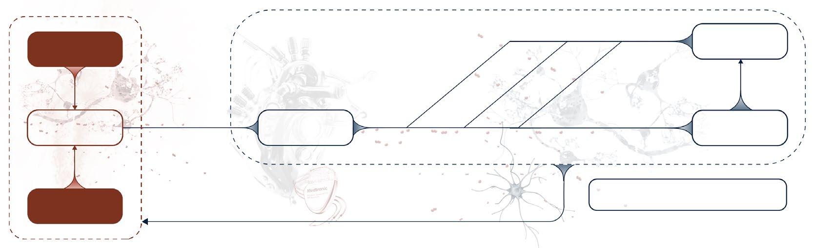
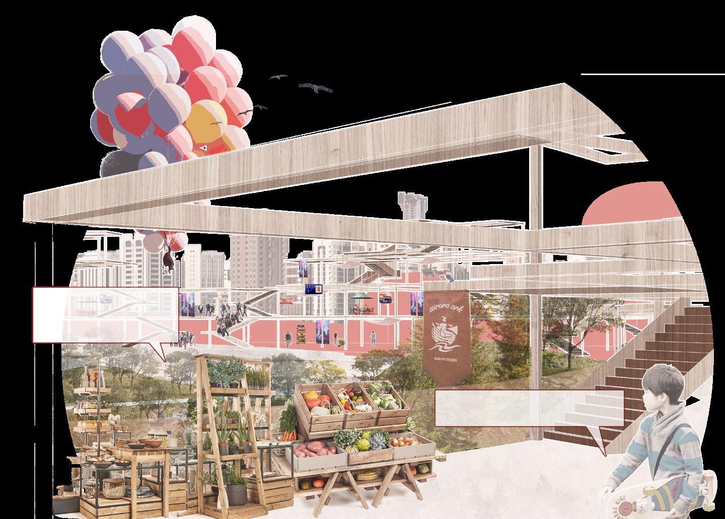
We hope to use the fractured landscape belt as a PACEMAKER for the chaotic Beijing city, and integrate the functions of transportation, business and landscape by transforming dysfunctional Beijing North Railway Station into a multifunctional infrastructure that constantly delivers vitality like a PULSE GENERATOR, and use reconstructed light rail and market route as the lead ELECTRODE OF THE PACEMAKER to bring VITALITY PULSES such as business, community activities, and urban greening to the deactivated communities. Through this new lifestyle, the site can be rejuvenated.


b a
congestion in Xizhimen overpass
complex metro circulation
Low train station usage
serious waterlogging problem reduction of land attached to rivers
b c b c a
People's travel routes are more complicated
disruption of slow-pace life
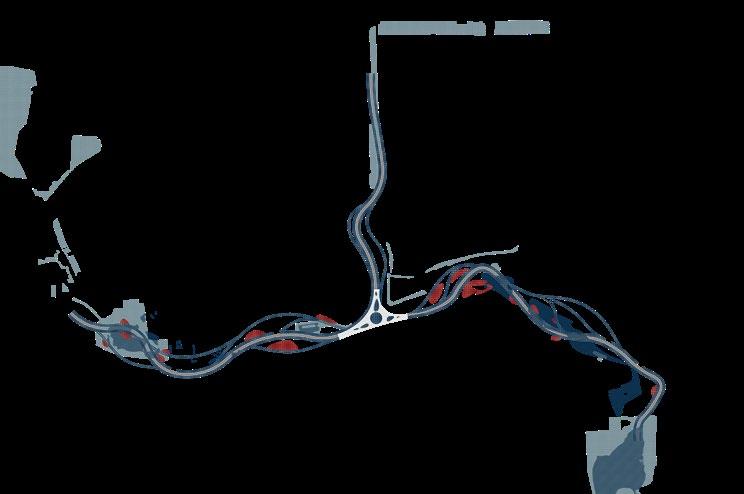
By proposing strategies for transportation, nature and history, people have a new lifestyle now
Widening river channels, restoring Taiping Lake and increasing wetlands make the problems of urban waterlogging be improved and the missing greenways be reorganized.
Urban ecological corridor fracture
Landfill of Taiping Lake make city memory lost b a
Three broken historical zones of Beijing
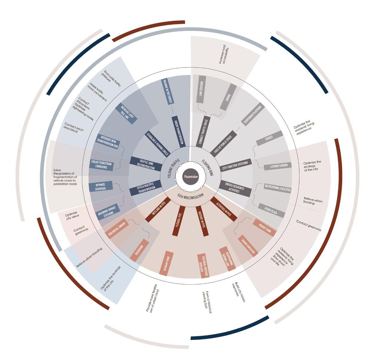
TRANSPORTATION PULSE
By establishing a transportation hub, integrating ground and underground transportation
Through establishment of landscape sight corridors, problem of fractures in the urban landscape belt is improved. We connect the relationship between original history and modern life
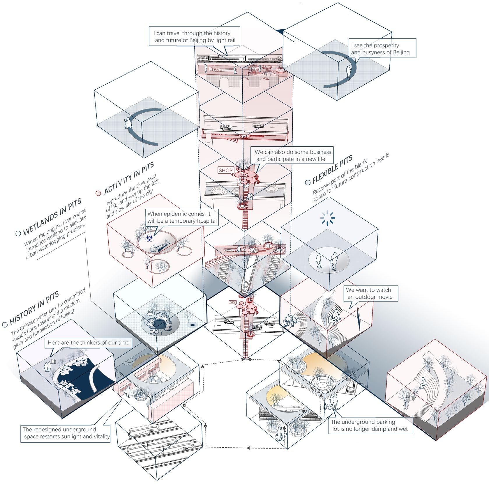
A : Traffic Pulse

underground road(-7 - (-15)m)
road(7-15m)
By planning the route of light rail, greenway and commerce, it becomes a medium of activity, as a VITALITY PULSE to bring the activities originating from the pulse generator to each inactive community, and at the same time planning commerce, green space and activity pits as VITALITY ELECTRODES to revitalize the community, and repair the fractured historical landscape belt with 3 types of PULSES and bring vitality to the communities along the way TRAFFIC CORRIDOR
Site Selection
The site is located at the center of the three historical greenway lines, covering the disconnection of the historical greenway
LEGEND:
Use the ups and downs of the traffic line as the pulse generator of the pacemaker in the city, and carry out the minimum traffic transformation
B : Green Space Pulse

green space
The green space on both sides of light rail line is used as ECOLOGICAL WIRE ELECTRODE, it carrying activities is used as electrode to stimulate surrounding communities vitality, and also as a green corridor to connect urban green space in series
C : Commercial Pulse

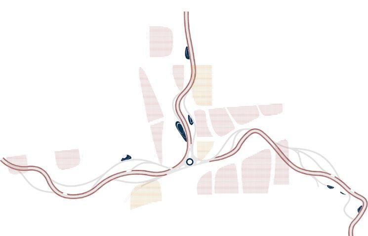
Set up mobile markets along light rail as a PULSE OF Commercial VITALITY, and set up larger commercial centers in densely populated areas of colleges and communities to serve as a VITALITY ELECTRODE to re-energize communities
Flexibale Pits(to be built)
By transforming the Beijing North Railway Station into an infrastructure that integrates functions such as transportation, greening, and leisure, it serves as a PULSE GENERATOR that activates the vitality of the site, and then uses the WIRE ELECTRODES of greenways and light rails to transmit vitality pulses to various communities
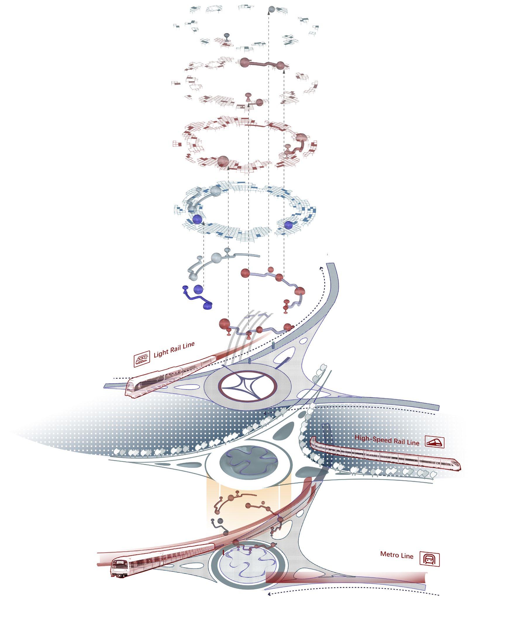
Perspective : Wire Electrodes
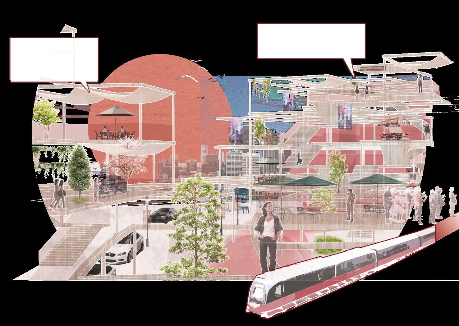
: Pulse Generator It used to be a dying community and an old railway station. Transportation Hub is now more orderly, we can take light rail to see Beijing
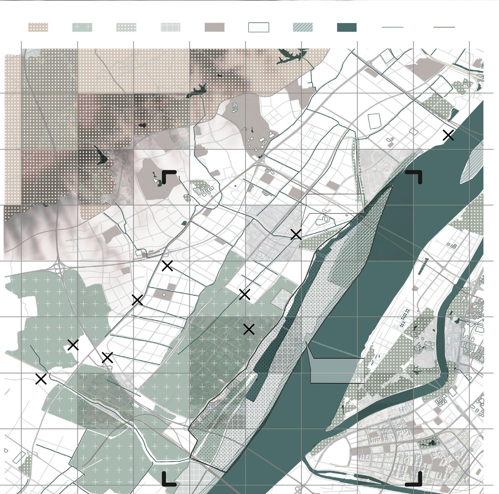
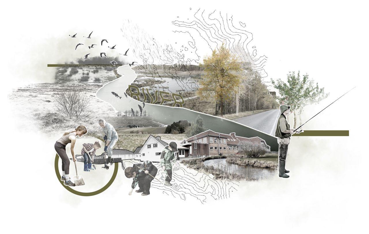
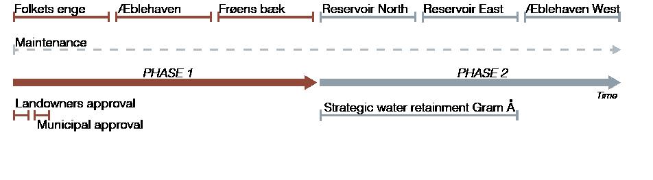
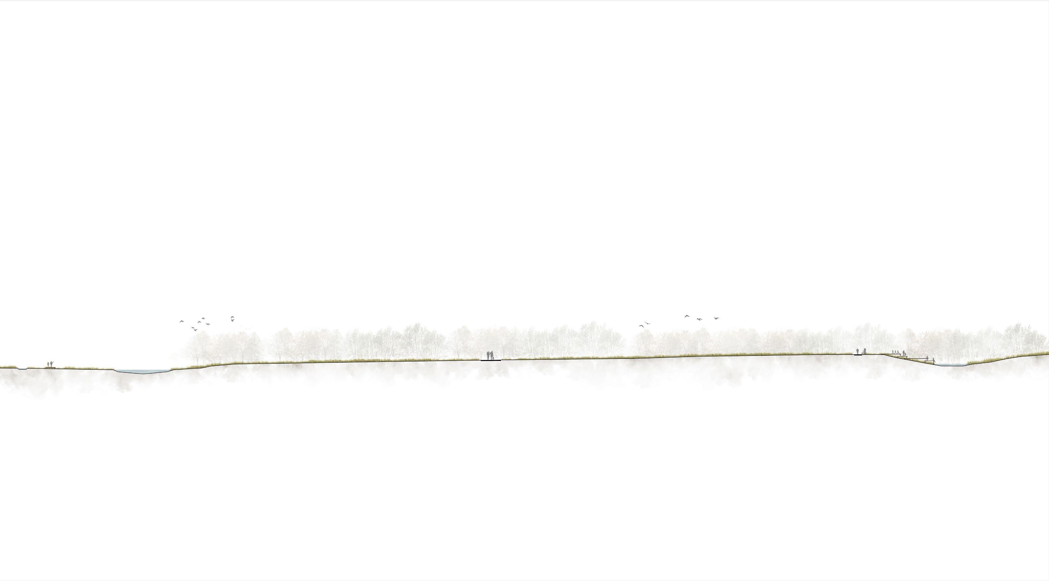
A laboratory for community-driven flood prevention in Fole
Team Work Teammate:
Kit Sandra Christensen
Nikolaj Tofting Junker
Styrmir Níelsson
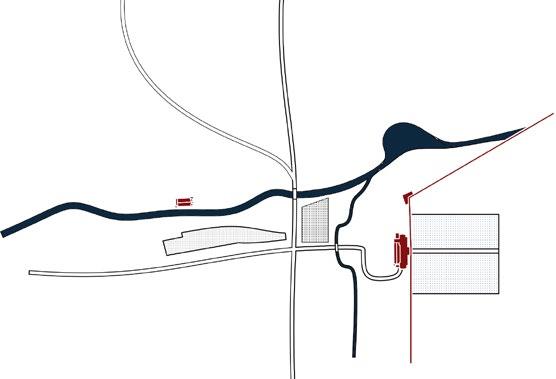
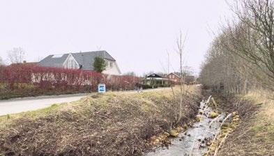
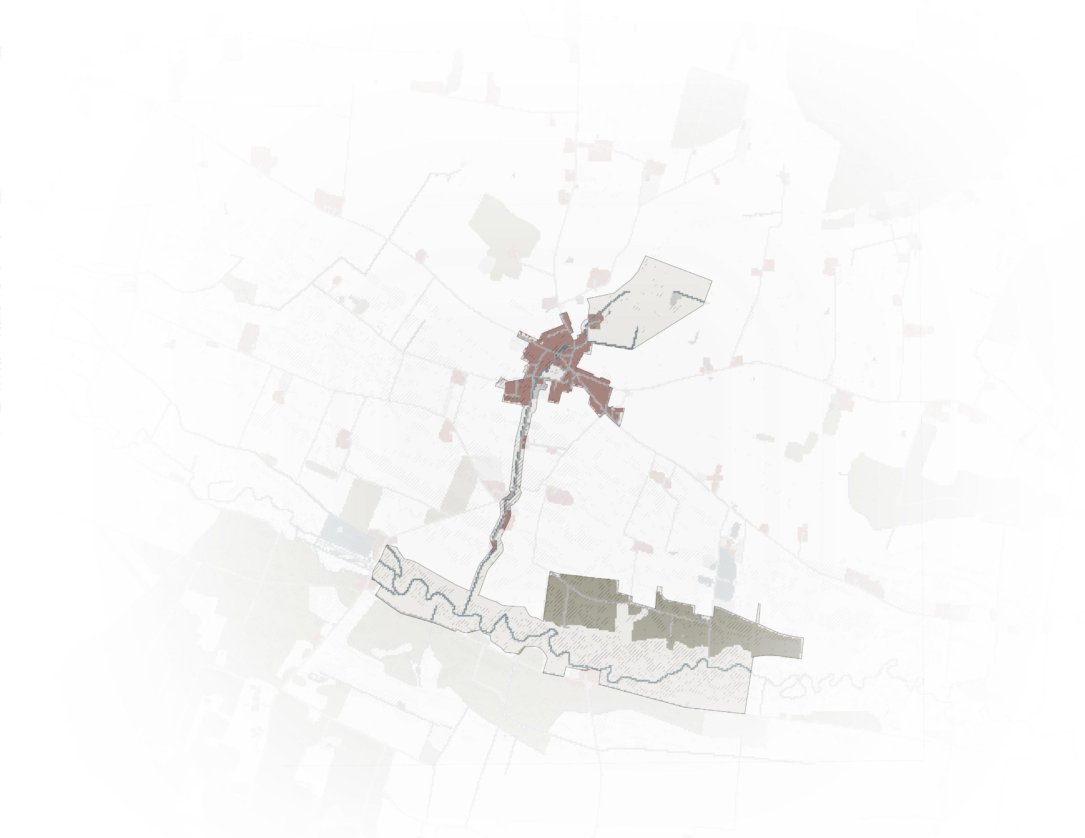
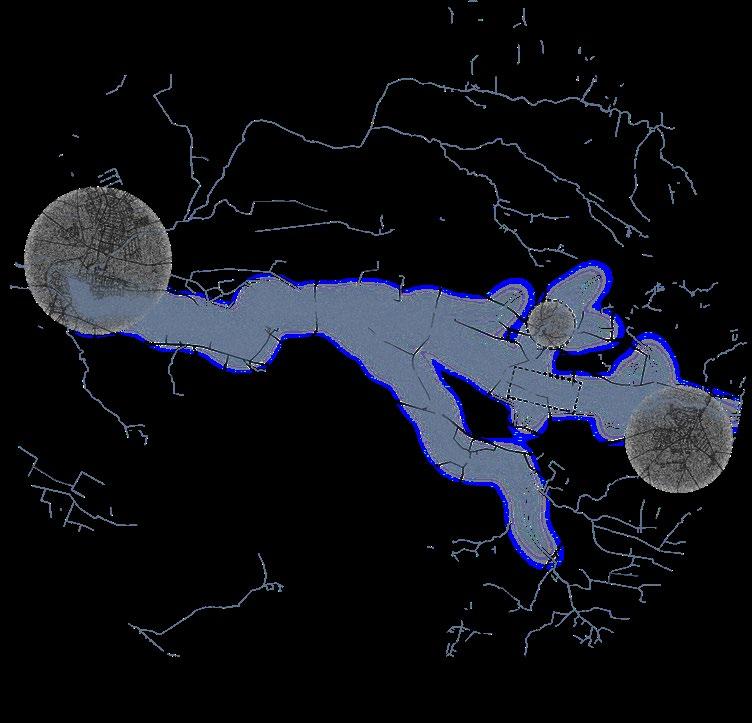
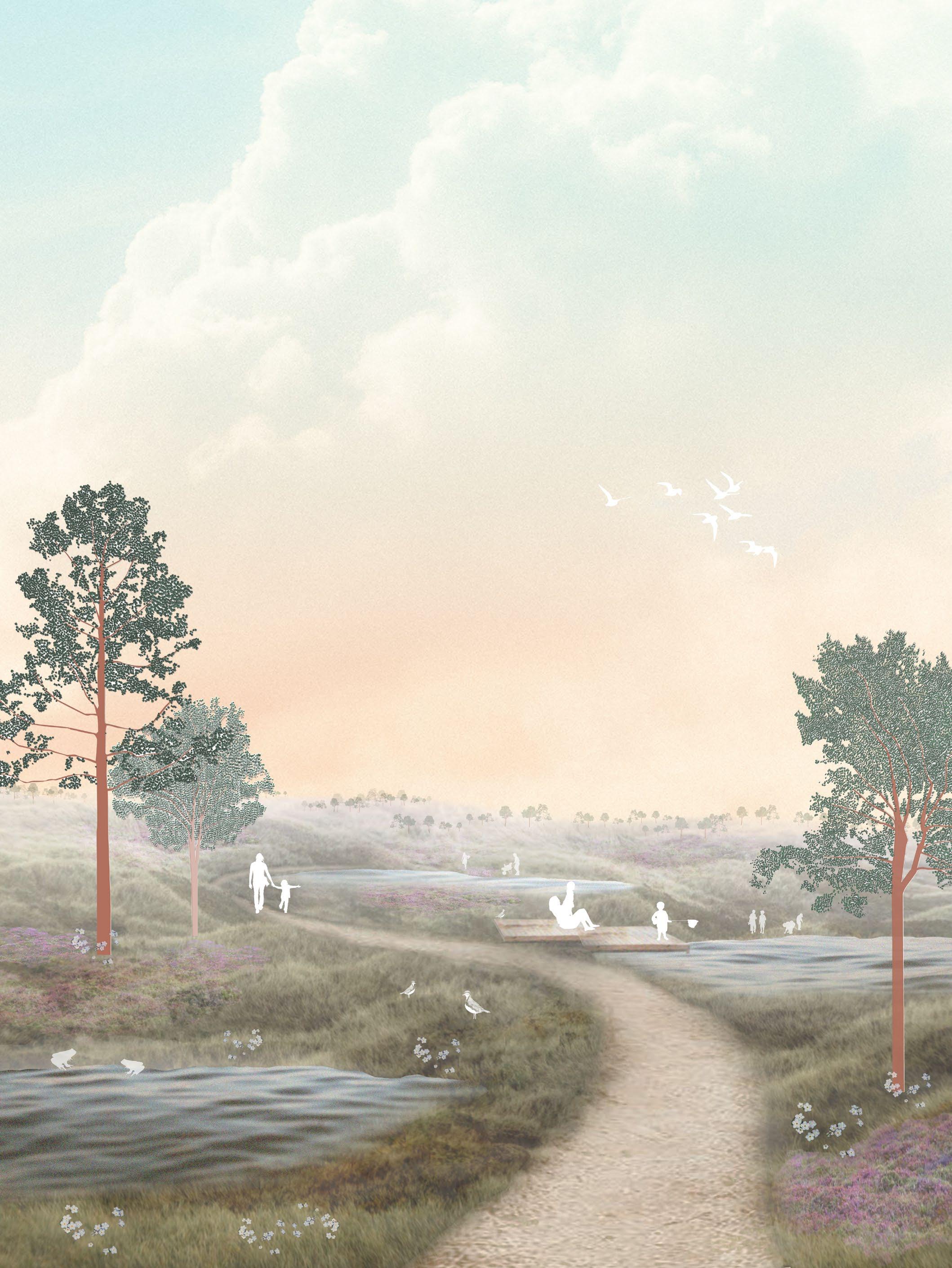
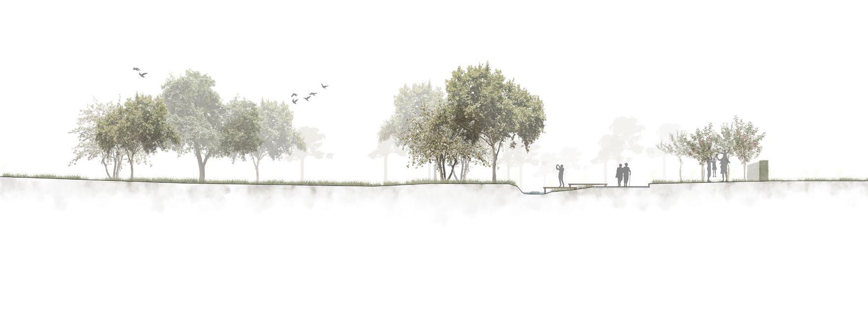
This project proposes to develop the water systems around Fole as a laboratory for community-driven flood prevention measures with active ways of living with water
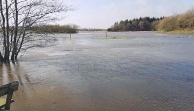
Fole is situated in a low-lying area on a former outwash plain, with the small Fole stream running through the village. The stream connects to the larger Ribe River system. Fole occasionally gets flooded by the small stream. Flooding occurs due to bottlenecks in the riverbed, during rain events, water accumulates and has no way to escape. The community’s eagerness to preserve and further develop their town for future generations, Fole may deliver sustainable solutions to resilience against flooding
In this project, Fole may potentially become a laboratory and a role model for other towns and villages in the future to adapt to increased rainfall by engaging the community to implement interactive ways to live with water.
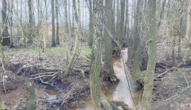
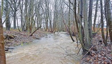
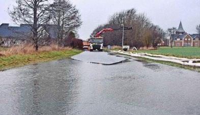
The flooding happens 3-4 times a year, because Fole is located in a valley. People living in Fole seem to rarely visit the nature and river surrounding the village. There
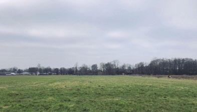
The farmland is too wet to plant, and the farmers are willing to sell the land.


Intervention,
Intervention,
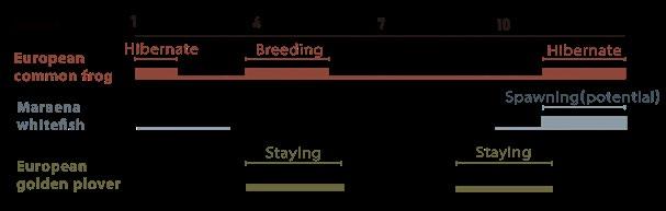
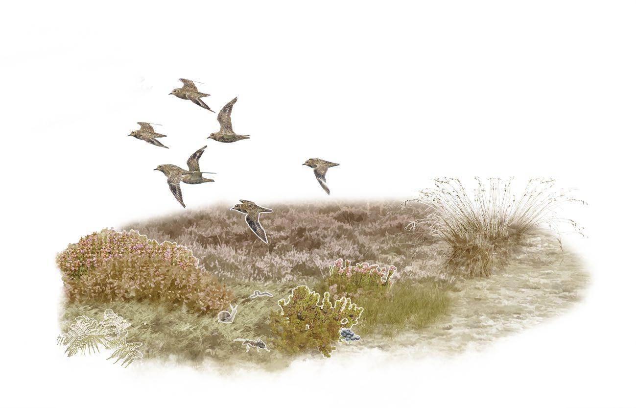
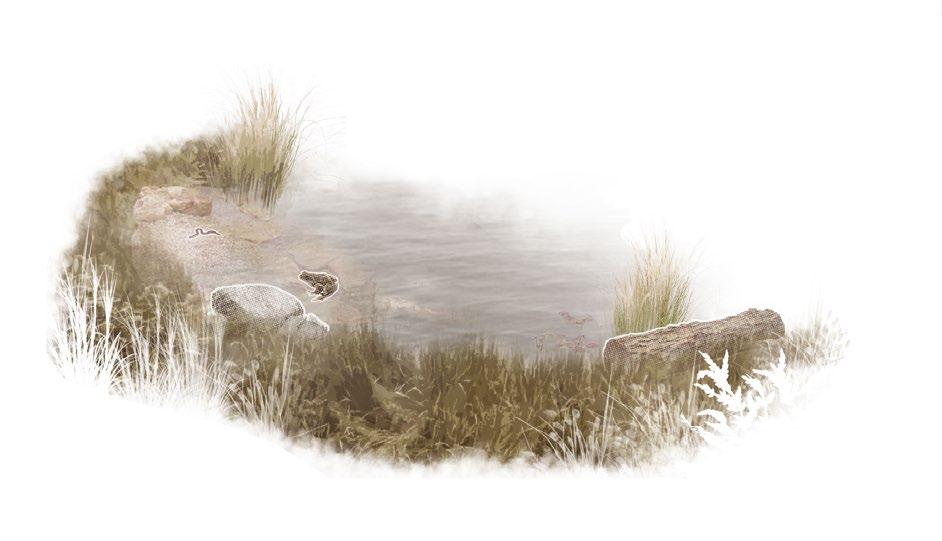
+European Golden Plover

Snaebel Spawning
Snaebel Habitat Present Propose & Effect
Habitat Golden Plover
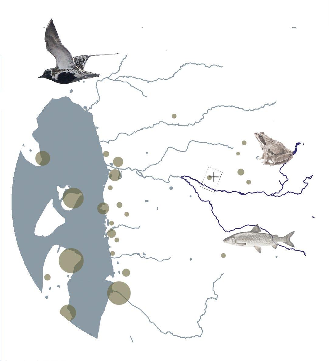
+European Common Frog Fole
+Snaebel
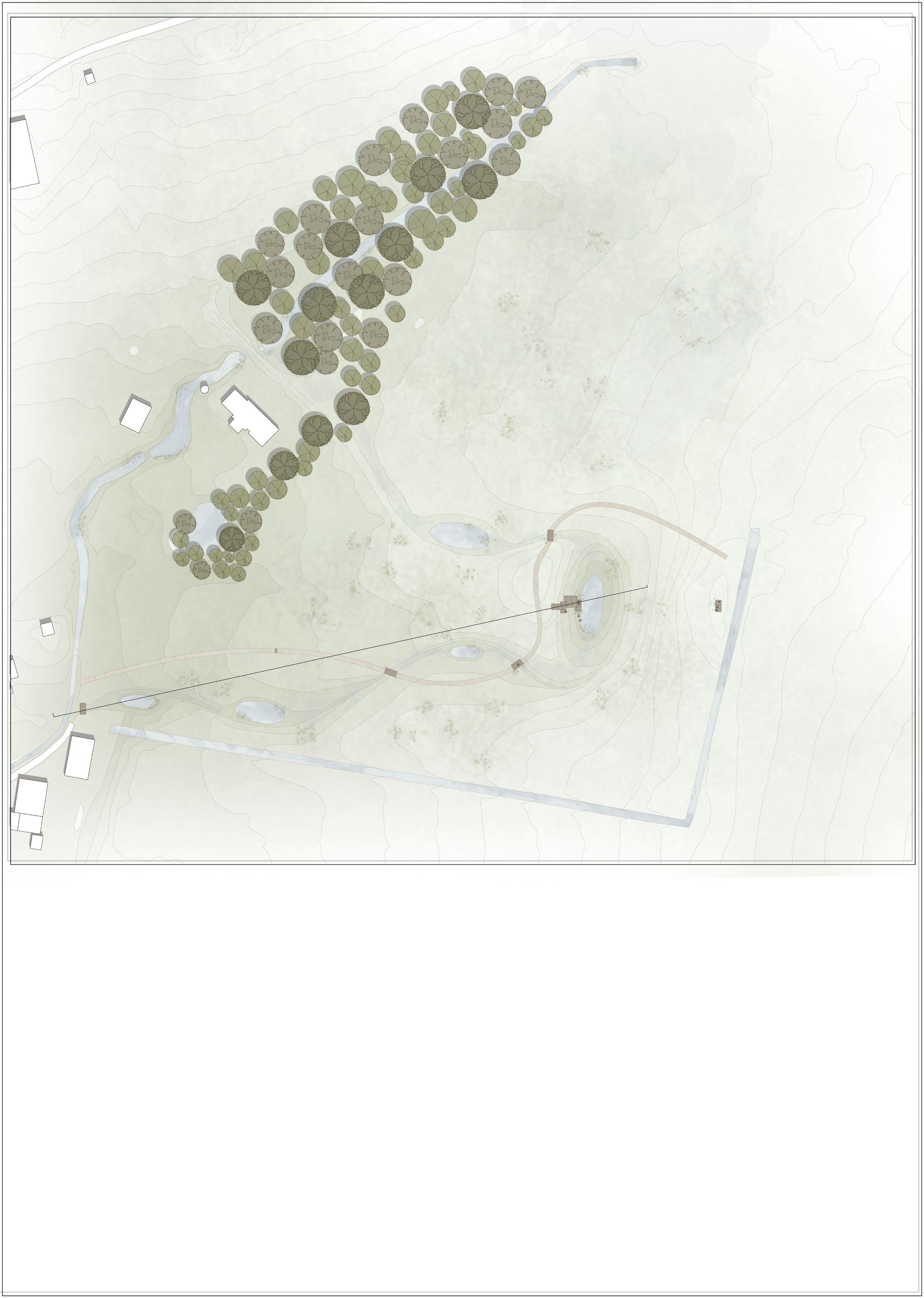
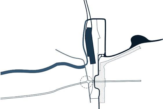
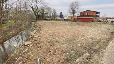
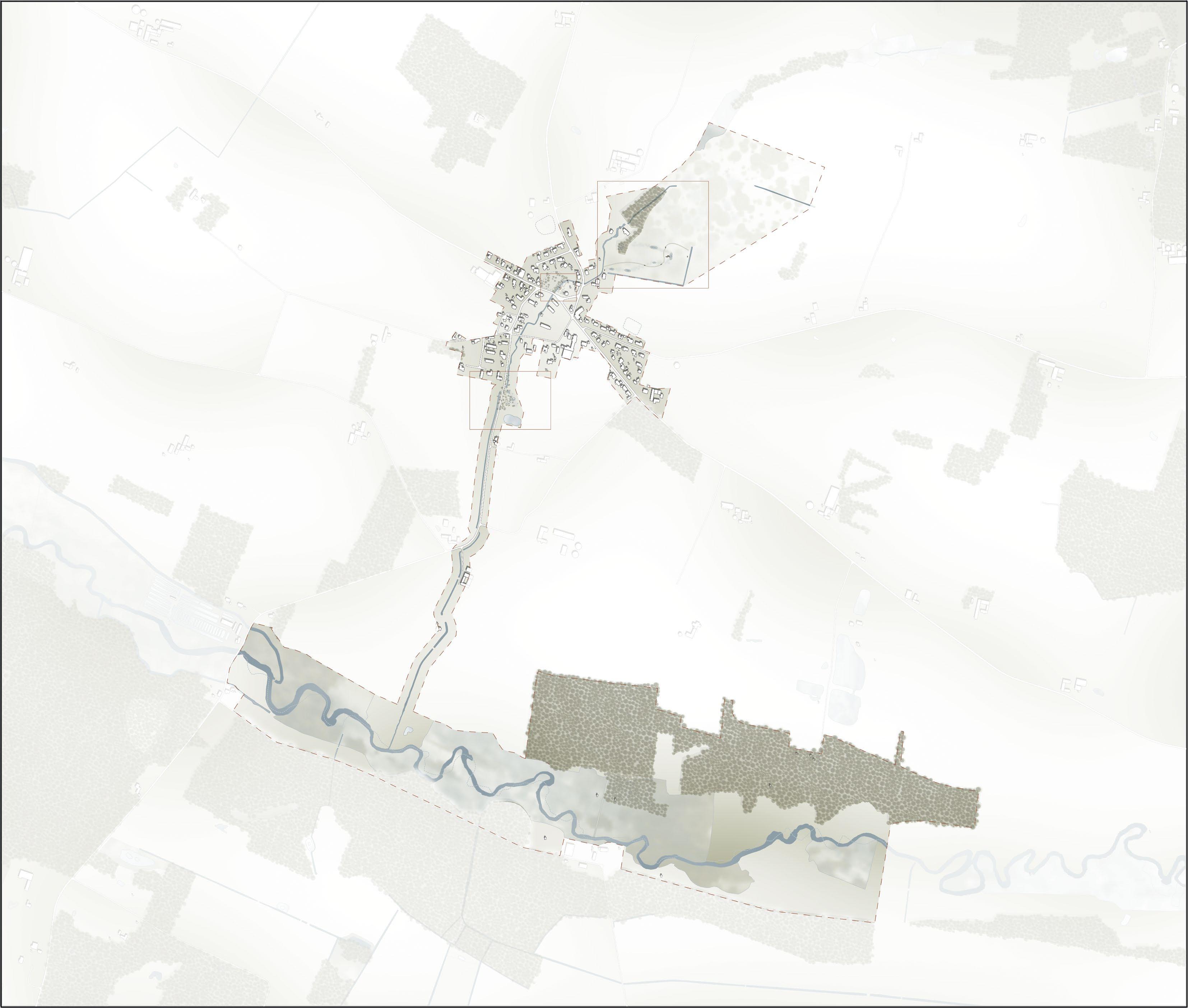
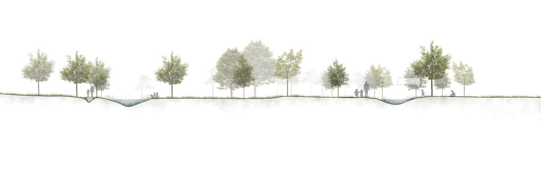
Folkets Enge in north of the town is a water catchment area for flood prevention in Fole. The intervention will lead excess water during high levels of precipitation away from the Fole Stream onto the wet meadow, led by a dike from the existing forest. Besides collecting water from the Fole Stream, surface water coming from the east of Fole is also led into the catchment area.
The design takes the seasonal changes into account. In the constructed reservoirs burrowed on the site, it is expected the meadow to contain water year round. During heavy rain events, the water will be led like a meandering river, draining into a number of reservoirs on the way. This allows the water flow to slow down and thus reducing the risk of creating a bottleneck inside Fole.
The field is currently owned by a farmer willing to sell off the land to the community of Fole. The farmer’s willingness to provide the land is due to the field having high density levels of water in the ground, thereby having a low total yield.
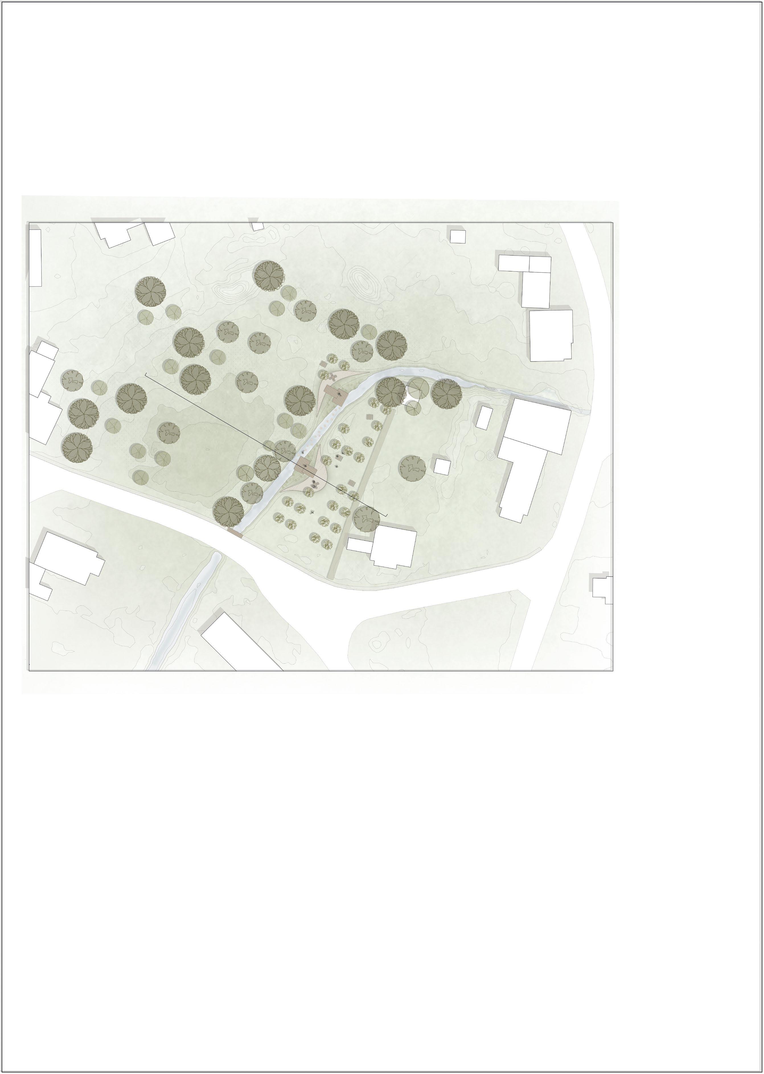
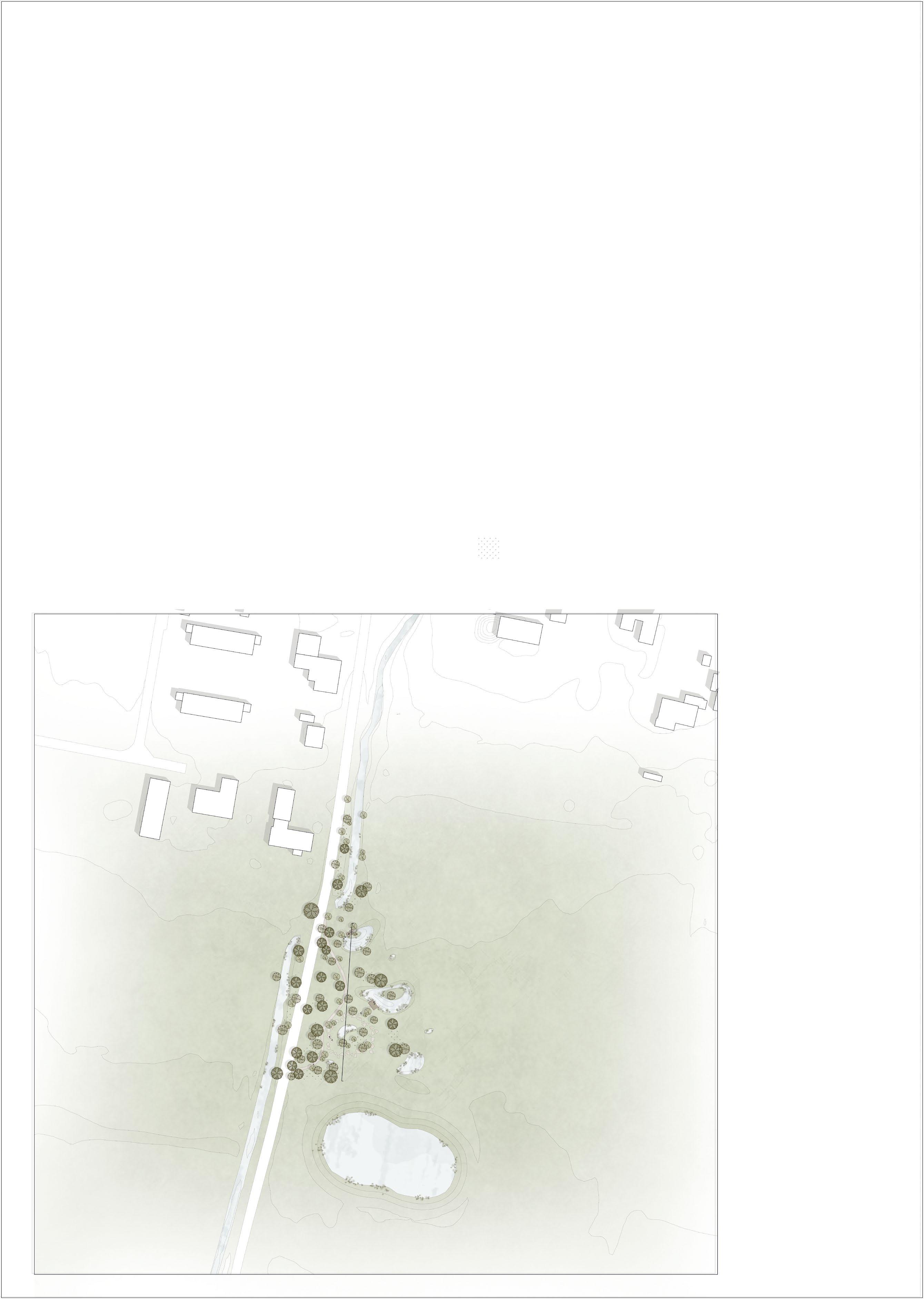
The current owner intends to make the land available for public use, the design intends to involve the apple plantation and the idea of having a social meeting point on the site, which the residents are planning to do, while at the same time utilizing it as an overflow containment , preventing a bottleneck during heavy rain events.
By widening the riverbed and installing small terraces in two strategically selected locations on each side of the river, the design aims to double as a water retainment area.
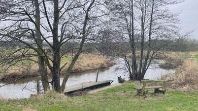
The land on the other side of the stream is owned by a local resident who allows it to function as a an open space and public park.


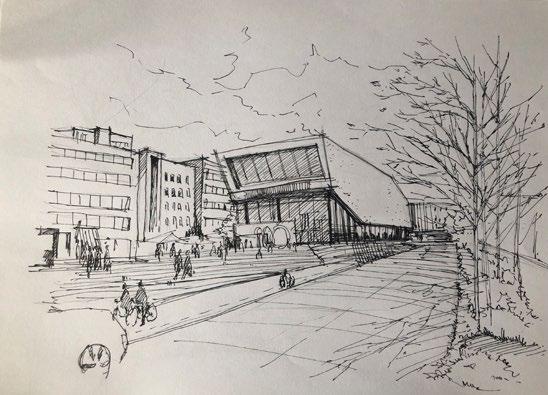
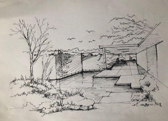
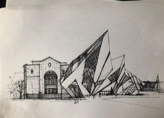
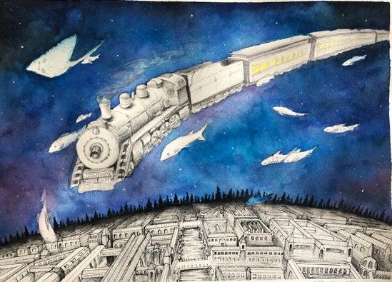
As a student learning design, more skills are needed. More than landscape, I work in different fields of design.
Here's are my modelings, sketches, design work, photography and drawing. All of these skills help me when I do landscape design.