Interpretation Centre
A PROJECT REPORT
Submitted by SURUTHI SANKARI K
in partial fulfillment for the award of the degree of
BACHELOR OF ARCHITECTURE in ARCHITECTURE
C.A.R.E. SCHOOL OF ARCHITECTURE
TRICHY 620 009
C.A.R.E. SCHOOL OF ARCHITECTURE
TRICHY 620 009
C.A.R.E. SCHOOL OF ARCHITECTURE
TRICHY 620 009
A PROJECT REPORT
ANNA UNIVERSITY

CHENNAI 600 025
A PROJECT REPORT
June 2023
Submitted by M.SRINITHISH
Submitted by M.SRINITHISH
BONAFIDE CERTIFICATE
Certified that this project report “Interpretation Centre” is the bonafide work of “Suruthi Sankari K” who carried out the project work under my supervision.
Ar. T. Judith Belinda Laura Head of the Department
Ar.Ramalingam Natarajan Supervisor Professor and Design Chair
C.A.R.E. School of Architecture
Tiruchirappalli 620 009
C.A.R.E. School of Architecture
Tiruchirappalli 620 009
Submitted for Anna University Thesis Viva-voce Examination held in June 2023 at C.A.R.E. School of Architecture, Tiruchirappalli, affiliated to Anna University, Chennai.
Signature :
Name :
Internal Examiner
External
Examiner
Date :
ACKNOWLEDGEMENT
I wish to express my sincere thanks to Ar. Ramalingam Natarajan, Ar. Maniyarasan.R, Ar. Vidhyashankar.S for their valuable help and guidance he had rendered through all the stages of my thesis work, my thesis coordinator Ar.Dr.Shabitha.P for her valuable guidance and motivation, which helped me to complete this project on time.
I am greatly thankful to Ar.Vijaykumar Sengottuvelan, Director, and C.A.R.E School Of Architecture for giving me the opportunity to display my professional skills through this project.
I would like to thank my thesis panel members, Ar. Parvathy kartha and Ar. Paveen of the Architecture department for their passionate support, for helping me to identify my mistakes and also for the appreciation they gave me in achieving my goal.
I would sincerely like to thank my friends, Ar.Sivakkumar B C, Ar.Shrinithy.G, Mangala Sudhan.M and my family Mr. Karthikeyan and Mrs. Rajalakshmi for helping me and supporting me during case studies and also to identify my mistakes while doing my thesis project
Suruthi Sankari K
ABSTRACT
History is the study of evolution over centuries across many different landscapes, cultures and time periods. Heritage can be categorized into tangible and intangible. Through identifying and reusing an historical architectural space we can conserve the tangible heritage from being exterminated. But on the other hand to archive the intangible things we need the involvement of the people/ community and their stories.
In this contemporary world what we see and read is a manipulated form of data. This museum will bring out the voice of the true history of the people through various art forms that are done and exhibited by the localate or people who volunteer to voice out their problems.
To archive the intangible historical things we can revitalize a cluster of heritage value sites rather than construction one. This process can be done through adaptive reuse of local heritage sites.
Table of Content List of Figures...........................................................................................................vi Chapter 1 : SYNOPSIS .............................................................................................1 1.1 Introduction..........................................................................................................1 1.2Aim.......................................................................................................................2 1.3 Research Question................................................................................................2 1.4 Interpretation center..............................................................................................2 1.5 Hypothesis............................................................................................................2 1.6 Justification of the project....................................................................................2 Chapter 2 :Literature Study........................................................................................3 2.1 Literature Study....................................................................................................3 2.1.1 Harvard Art Museum.........................................................................................3 2.1.1.1 Introduction..........................................................................................3 2.1.1.2 Calderwood Courtyard.........................................................................4 2.1.1.3 Exhibition Galleries.............................................................................5 2.1.1.4 Straus Center for Conservation and Technical Studies........................5 2.1.1.5 Materials Lab.......................................................................................5 2.1.1.6 Art Study Center...................................................................................5 2.1.1.7 Lecture Halls and Seminar Rooms.......................................................5 2.1.1.8 Sustainable Aspect...............................................................................6 2.1.2 Pondicherry Heritage Conservation..................................................................7 2.1.2.1 Introduction..........................................................................................7 2.1.2.2 The French Quarter..............................................................................8 2.1.2.3 The Tamil Quarter................................................................................9 2.1.2.4 Location..............................................................................................10 2.1.2.5 Listing.................................................................................................11 2.1.3.6 Architectural Heritage.........................................................................11 2.1.2.7 Listing, Documentation & Intervention.............................................12
Chapter 3 : Live Case Study......................................................................................14 3.1.1 Kochi Biennale................................................................................................14 3.1.1.1 Introduction........................................................................................14 3.1.1.2 Aspinwall House................................................................................14 2.1.1.3 Observation........................................................................................17 Chapter 4 : Site and Site Study.................................................................................18 4.1.1 Site Context.....................................................................................................18 4.1.1.1 Architectural Aspect...........................................................................18 4.1.1.2 Location Aspect.................................................................................18 4.1.1.3 Religious Aspect................................................................................18 4.1.1.4 Archeological Evidence.....................................................................19 4.1.1.4 Musical And Art Evidence.................................................................19 4.1.2 Site..................................................................................................................19 4.1.3 Site mapping.........................................................................................19 4.1.3.1 Pudukkottai site 1...............................................................................20 4.1.3.2 Pudukkottai Kallakottai palace site 2.................................................21 4.1.3.2.1 Building description..............................................................21 4.1.3.2.2 History of this building.........................................................23 4.1.2.2.3 History of Pudukkottai..........................................................23 4.1.3.3 Pudukkottai town hall site 3...............................................................25 4.1.3.3.1 Building description..............................................................25 4.1.4 Roads of Pudukkottai..............................................................................28 4.1.5 Site Context Study.................................................................................29 4.1.5.1 Land Use..................................................................................29 4.1.5.2 Site Marking............................................................................30 4.1.5.3 Traffic Analysis........................................................................31 4.1.5.4 Wind Analysis..........................................................................32 4.1.5.5 Sun Path Diagram....................................................................33 4.1.5.6 Wind Analysis..........................................................................34 4.1.5.7 Listing......................................................................................35 Chapter 5 : Plans and Sections.....................................................................................
List of Figures
Figure 1 : AspirinWall Kochi......................................................................................1 Figure 2 : Plan of Harvard Museum...........................................................................2 Figure 3 : Central Section of Harvard Museum.........................................................3 Figure 4 : views of Harvard Museum.........................................................................4 Figure 5 : Section of Harvard Museum......................................................................6 Figure 6 : Streets of Pondicherry................................................................................7 Figure 7 : The French Quarters..................................................................................8 Figure 8 : Streets of Pondicherry................................................................................9 Figure 9 : Old Map of Pondicherry.............................................................................9 Figure 10 : The Tamil Quarters.................................................................................11 Figure 11 : The French Quarters...............................................................................11 Figure 12 : Raj Nivas (French Quarter)....................................................................12 Figure 13 : Raj Nivas (French Quarter)....................................................................12 Figure 14 : Raj Nivas (French Quarter)....................................................................12 Figure 15 : Map of listed heritage buildings............................................................13 Figure 16 : Biennale Venues.....................................................................................15 Figure 17 : Multiscreen projection...........................................................................15 Figure 18 : Multiscreen projection...........................................................................15 Figure 19 : Circulation..............................................................................................15 Figure 20 : Mist Projection.......................................................................................15 Figure 21 : Working of Mist projection....................................................................15 Figure 22 : Circulation..............................................................................................16 Figure 23 : View points and cone of vision..............................................................16 Figure 24 : Exhibition spaces...................................................................................17 Figure 25 : Site A.....................................................................................................20 Figure 26 : Waterbody..............................................................................................20 Figure 27 : Site plan.................................................................................................20 Figure 28 : Views From Site....................................................................................20 Figure 29 : Views To Site.........................................................................................20 Figure 30 : Noise Analysis.......................................................................................20 Figure 31 : Existing Structure..................................................................................20 Figure 32 : Entry To Site..........................................................................................20 Figure 33 : Ruins of Palace......................................................................................21 Figure 34 : Exterior open to sky...............................................................................21 Figure 35 : Site plan.................................................................................................22 Figure 36 : Views From Site....................................................................................22 Figure 37 : Views To Site........................................................................................22
Figure 38 : Contour Analysis....................................................................................22 Figure 39 : Existing Structure..................................................................................22 Figure 40 : Entry To Site..........................................................................................22 Figure 41 : Floor plans and sections.........................................................................22 Figure 42 : Top view of central courtyard................................................................23 Figure 43 : Roof damages........................................................................................23 Figure 44 : Slop roof................................................................................................24 Figure 45 : Building condition.................................................................................24 Figure 46 : Missing Roof.........................................................................................24 Figure 47 : Demolished Structure............................................................................24 Figure 48 : Window..................................................................................................24 Figure 49 : Top View................................................................................................24 Figure 50 : First floor................................................................................................24 Figure 51 : Front Elevation......................................................................................25 Figure 52 : Right Elevation......................................................................................25 Figure 53 : Left Elevation........................................................................................25 Figure 54 : Rear Elevation.......................................................................................25 Figure 55 : Site plan.................................................................................................26 Figure 56 : Views From Site....................................................................................26 Figure 57 : Views To Site.........................................................................................26 Figure 60 : Entry To Site..........................................................................................26 Figure 61 : Floor plans.............................................................................................26 Figure 62 : Interior view...........................................................................................27 Figure 63 : Arches view 1........................................................................................27 Figure 64 : Arches view 2........................................................................................27 Figure 65 : Interior view..........................................................................................27 Figure 66 : Exterior view.........................................................................................27 Figure 67 : Entrance view........................................................................................27 Figure 68 : Roof Detail............................................................................................27 Figure 69 : Main Door.............................................................................................27 Figure 70 : Window..................................................................................................27 Figure 71 : Site C.....................................................................................................30 Figure 72 : Site B.....................................................................................................30 Figure 73 : Site C.....................................................................................................30 Figure 74 : Horse stable...........................................................................................35 Figure 75 : Mansion 1..............................................................................................35 Figure 76 : Mansion 2..............................................................................................35 Figure 76 : Mansion 3..............................................................................................35 Figure 78 : Government Building............................................................................35
1.1 Introduction
Chapter 1 SYNOPSIS
History is the study of evolution over centuries across many different landscapes, cultures and time periods. Heritage can be categorized into tangible and intangible. Through identifying and reusing an historical architectural space we can conserve the tangible heritage from being exterminated. But on the other hand to archive the intangible things we need the involvement of the people/ community and their stories.
In this contemporary world what we see and read is a manipulated form of data. This museum will bring out the voice of the true history of the people through various art forms that are done and exhibited by the localate or people who volunteer to voice out their problems.
To archive the intangible historical things we can revitalize a cluster of heritage value sites rather than construction one. This process can be done through adaptive reuse of local heritage sites.
9
Figure 1 : Aspirin Wall Kochi
1.2 Aim
The aim of this Interpretation center is to bring together people from all over the world to share and gain knowledge about history. The historical events will be converted into some installations which can be conserved for future generations. Through adaptive reuse we can enrich the heritage values. Adaptive reuse is a step towards sustainable development.
1.3 Research Question
• Is it possible to adaptive reuse/ revitalize a heritage site
• Is it possible to maintain the essence of the heritage site and also modify little according to the contemporary need?
• Can the museum be an expression of history through our senses?
• How can we conserve the history that is fading away?
1.4 Interpretation center
• An Interpretation Center is a place for people to learn about cultural heritage. It is a modern form of museum, typically linked to visitor centers or ecomuseums. These institutions provide an opportunity for visitors to gain insight into the history and culture of a certain area.
• An ecomuseum is a type of museum that focuses on the unique identity of a specific location. It emphasizes local involvement and seeks to promote the prosperity and progress of the people living in the area.
1.5 Hypothesis
This project seeks to establish an experiential center that preserves and showcases the history of the area and its urban surroundings. Visitors will be able to explore and discover the past of the place through interactive exhibits and displays.
1.6 Justification of the project
• At this interactive interpretation center, located in an urban setting, visitors can explore the history of the Dravidian Tamil dynasty and immerse themselves in the local culture. It is a great way to bring the dynasty to life and gain a deeper understanding of its history.
• In this project, existing and plentiful buildings are being adapted for reuse in order to preserve the unique character of the area.
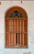
• Pudukkottai has many facts that are not widely known. By making these facts known, the public can gain a better understanding of the area.
10
2.1 Literature Study
2.1.1 Harvard Art Museum
2.1.1.1 Introduction
Architects
Area
Year
Manufacturers
Civil Engineering
Structure
Chapter 2
: Payette, Renzo Piano Building Workshop
: 204000 ft²
: 2014
: Goppion, Zone Display Cases, Thrislington Cubicles
: Nitsch Engineering
: Robert Silman Associates
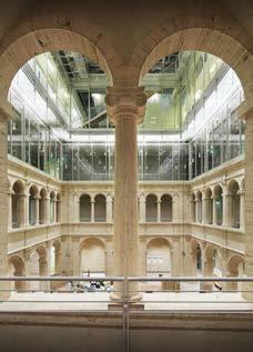
The Harvard Art Museums are university museums, a place to collect and exhibit art, a great workshop to study, in direct contact with the artworks. Show, preserve, teach.
It is a stratification, an overlap of spaces and services that proceeds upwards towards more specialized functions.
The hidden base of the museums’ machine is the storage, where the artworks are filed and protected from the effects of time; while the rest of the space, under the big glazed lantern, is open to the city and to the light.
11
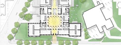
Figure 2 : Plan of Harvard Museum
If I had to describe the new Harvard Art Museums in a synthetic image, I would say that the ground floor is urban, serving the city by providing life; the second and third floors are for the art and the people who come to know it; the fourth and fifth contain more specialized spaces for the students like the Art Study Center and the conservation lab.
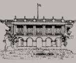
2.1.1.2 Calderwood Courtyard
The project adds 12,000 square feet of exhibition space, for a total of 43,000 square feet. Expanded permanent collections and special exhibition galleries are complemented by University Galleries, programmed in consultation with faculty to support specific coursework. These University Galleries, which are open to the public, can also be used for curatorial studies and training or to provide additional space to support the Art Study Center.
12
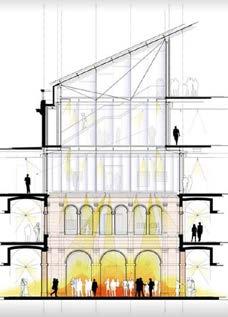
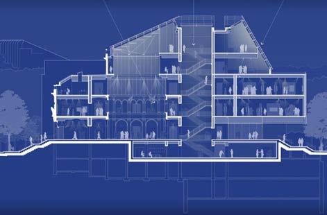
Figure 3 : Central Section of Harvard Museum
Figure 4 : views of Harvard Museum
2.1.1.3 Exhibition Galleries
The project adds 12,000 square feet of exhibition space, for a total of 43,000 square feet. Expanded permanent collections and special exhibition galleries are complemented by University Galleries, programmed in consultation with faculty to support specific coursework. These University Galleries, which are open to the public, can also be used for curatorial studies and training or to provide additional space to support the Art Study Center.
2.1.1.4 Straus Center for Conservation and Technical Studies
The Harvard Art Museums are home to the first fine arts conservation, research, and training facility established in the United States. Visitors can gain a glimpse of the conservation and research activity under way in the glass-walled Straus Center, located on the building’s uppermost levels.
2.1.1.5 Materials Lab
Located on the lower level, this space is dedicated to exploring material ingenuity and innovations in art media. The hands-on, active learning experiences conducted here are based on works of art on view in the galleries and in the Art Study Center.
2.1.1.6 Art Study Center
A central feature of the new facility, the Art Study Center provides distinct areas for study and research, offering students, faculty, and the public purpose-built environments for learning through the close examination of original works of art from the collections of the Fogg, Busch-Reisinger, and Arthur M. Sackler Museums. There is a 300-seat lecture hall for presentations, performances, and events on the new lower level. This and other lecture and classroom spaces are activated by Harvard faculty and students as well as through public programs and events.
2.1.1.7 Lecture Halls and Seminar Rooms
13
2.1.1.8 Sustainable Aspect
• Reusing existing spaces, among them the original facade of the 32 Quincy Street building.
• 16.9 percent energy reduction by introducing new design and operation strategies, building materials, and energy-efficient HVAC equipment.
• Procuring 35 percent of electricity needs through the purchase of Renewable Energy Certificates.
• Water reduction strategy in which rainfall on the building’s roof and landscapes is collected in underground storage tanks to supplement restroom flush and flow fixtures.
• Developing an Indoor Air Quality (IAQ) Management Plan for, during, and after construction.
• Selecting regionally and responsibly harvested materials, including building materials extracted and manufactured within 500 miles of the site, and wood certified by the Forest Stewardship Council (FSC).
• Diverting over 97 percent of construction waste, thereby reducing the impacts on local landfills and promoting material reuse.
14
Figure 5 : Section of Harvard Museum
2.1.2 Pondicherry Heritage Conservation
2.1.2.1 Introduction
“Pondicherry” is the French interpretation of the original name “Puducheri” meaning ‘new settlement’. Excavations at Arikamedu, about 7 kms to the south of the town, show that the Romans came here to trade in the 1st century AD. The trade included dyed textiles, pottery and semi-precious stones. The findings are now displayed in the Pondicherry Museum. Pondicherry was part of the Pallava, the Chola and Pandya empires from the 4th to l4th centuries, and thereafter it became a part of the Vijayanagar Empire, followed by Islamic rule.
In 1521 the Portuguese were the first Europeans to return to trade in textiles. In the 17th century the Dutch and the Danes followed suit. The flourishing trade attracted the French to establish a settlement in 1674. Under Governors such as Frangois Martin and Dupleix, it grew into a prominent fortified town and an important port of call.
In 1746 the British lost Fort St. George in Madras to Dupleix, and retaliated by capturing Pondicherry in 1761 and razing the town to the ground, sparing only a few structures. However the Treaty of Paris returned Pondicherry to the French. The removal of fortifications led to flattened ramparts, which form the boulevards of Pondicherry today. A storm water canal separated the French and Tamil quarters, and streets were laid in the form of a grid. By 1768 much of the old town of Pondicherry, as we know it today, had been laid out and rebuilt on its former foundations
15
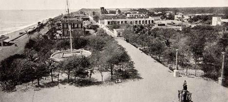
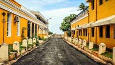
Figure 6 : Streets of Pondicherry
2.1.2.2 The French Quarter
The French quarter developed along the beach and around the present Bharathi Park, which is surrounded by stately government buildings. Residential vilas ‘extend on either side interspersed by Institutional structures. In general the buildings fall into two main categories: residential, which form the majority, and are simple and varied, and public, which are set amidst large plots with fenced enclosures. French bulding models were adapted to suit local climatic conditions.
The street fagades are usually characterised by continuous wall-to-wall construction with high garden walls and elaborate gateways. The fagades are Givided into smaller panels by the use of vertical pilasters and horizontal cornices, and feature flat or segmental arched windows with bands and louvered wooden shutters. Wooden balconies over ron brackets and continuous parapets ith simple ornamental features are common.
Most French houses were built on similar ground plans with few variations and with full or partial street frontage. The main fagades have colonnaded porticoes to provide better protection from sun and rain, and also act as a transition space to the garden court. A major change from the original French model 5 the use of fat terraced roofs Instead of the pitched roofs of the Parisian villas. The walled gardens form private interior courts on to which the rest of the building spaces open. The interiors of the houses are usually more ornate than the exterior HIgh ceilings, tal arched doors and windows mark the rooms, and In the case of two. storied bulldings, vaulted staircases wind up. Often the Inclined window shades were made of light materials like wood or metal.
16
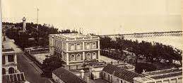
Figure 7 : The French Quarters
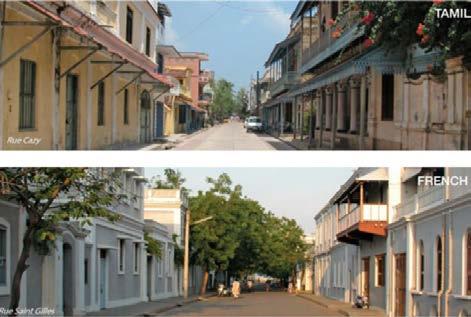
2.1.2.3 The Tamil Quarter
Originally the native Tamil town Geveloped around the nucleus of group of temples in the northern section, and the streets were laid along the east-west axis, onto which the back to-back row houses opened. These streetscapes with continuous wall to wall construction are very different in character from the French strestscapes. Their exterior fagades mainly feture a thalvaram (street veranda with a lean-to roof over wooden posts) -a Social extension of the house providing Shelter for the pedestrians- and a thinnal (semipublic veranda space) with masonry benches for visitors and pilgrims, These “talking-streets”, so called because of their intimate scale and Interactive nature, are typical of vernacular Tamil architecture, and the entire street stretch 1s homogeneous because of connecting elements ike lean-toroofs, cornices (horizontals), and pilasters and engaged columns (verticals) with ornamental parapets which define the skyline. All ouses sre similar, but no two houses are exactly the same.
Colonial History of Pondicherry
Portuguese setup a 1523 factory
Dutch buy textes 1618
Danes set up a factory. 1624
First French settlement 1674-1693
Dutch rue 1693-1700
French rule 1700-1761
Bish nue 1761-1765
French rule 1765-1778
Bish nue 1778-1783
French rule 1783-1793
British ne 1793-1815
French rule 1815-1954
Pre-colonial History
Paliava Dynasty 325-900
Chola Dynasty 900-1279
Pandya Dynasty 1279-1370
Viayanagar Empire 1370-1614
Sultanate of Biapur 1614-1638
17
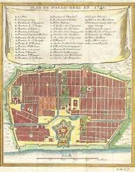
Figure 8 : Streets of Pondicherry
Figure 9 : Old Map of Pondicherry
2.1.2.4 Location
The Union Territory of Pondicherry comprises four enclaves in three South Indian States and includes the seaside towns of Pondicherry and Karaikal in Tamil Nadu, Yanam in Andhra Pradesh and Mahe in Kerala.
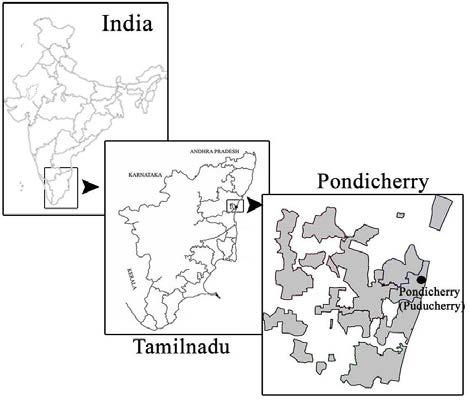
Pondicherry region includes the communes of Ozhukarai, Ariankuppam, Villianur, Mannadipet and Nettapakkam. They are scattered within the state of Tamil Nadu.
Pondicherry has an interesting cross-cultural history and its built form lends a unique identity to the town. The old part of Pondicherry is known as the Boulevard Town since it is bounded by four boulevards that once constituted the outer limits of the city fortification. The Boulevard Town presents two distinct architectural styles in the Tamil and French quarters, which are separated by a canal and unified by a rectilinear grid plan. In the French Town the buildings are in European style adapted to a tropical climate, whereas in the Tamil Town area they are in the local
18
vernacular. While maintaining their individual identities, the two styles have influenced one another, evolving into a synthesis: Franco-Tamil architecture.
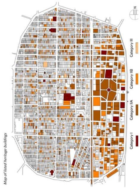
2.1.2.5 Listing
Listing
From 1987 to 1995 INTACH, together with EFEO, prepared an inventory of heritage-value buildings in the old town. Such buildings are classified according to their architectural and historical merits. A revised list has been prepared in 2001 according to the standard prescribed by the Ministry of Environment & Forests (MoEF), having four categories:
Category -I
Category -II A
Category -IIB
Category -III
2.1.3.6 Architectural Heritage
19
Figure 11 : The French Quarters
Figure 10 : The Tamil Quarters
There are few monumental buildings in Pondicherry, and the architectural character of the town is the result of hundreds of traditional-style houses (both in Tamil and French Quarters) that form the unique streetscapes so distinctive of Pondicherry.
2.1.2.7 Listing, Documentation & Intervention
Category I
Buildings of national and historic importance: they embody excellence in architectural style and character.
Category II (A&B)
Buildings of regional or local importance possessing special architectural or aesthetic merit.
Category III
Buildings of importance for townscape that evoke architectural, aesthetic or sociological interest
Documentation of heritage buildings, comprising preparation of measure drawings and taking photographs, is a central part of INTACHs work. It is the basis for carrying out various activities related to preservation of the built heritage. These activities include restoration, adaptive re-use and extension of listed buildings, design of new buildings in heritage precincts, preparation of publications and conducting awareness programs.
Conservation is practiced at two levels:
* Individually-listed “Heritage buildings”.
* “Heritage precincts”: Areas where a number of traditional structures are intact and a collection of such buildings forms a unique quarter.
20
Figure 12 : Raj Nivas (French Quarter) Figure 13 : Raj Nivas (French Figure 14 : Raj Nivas (French
21
Figure 15 : Map of listed heritage buildings
Chapter 3
3.1 Live Case Study
3.1.1 Kochi Biennale
3.1.1.1 Introduction
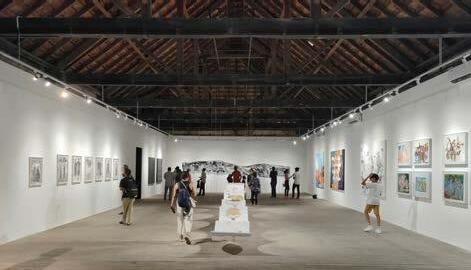
The Kochi-Muziris Biennale is an international exhibition of contemporary art held in the city of Kochi in Kerala, India. It is the largest art exhibition in the country and the biggest contemporary art festival in Asia. The exhibition is set in spaces across Kochi, with shows being held in existing galleries, halls, and site-specific installations in public spaces, heritage buildings and disused structures.
Indian and international artists exhibit artworks across a variety of mediums including film, installation, painting, sculpture, new media and performance art. Through the celebration of contemporary art from around the world, the Kochi-Muziris Biennale seeks to invoke the historic cosmopolitan legacy of the modern metropolis of Kochi, and its mythical predecessor, the ancient port of Muziris.
3.1.1.2 Aspinwall House
Aspinwall House is a large sea-facing heritage property in Fort Kochi on the way to Mattancherry.
The property was originally the business premises of Aspinwall & Company Ltd. established in 1867 by English trader John H Aspinwall. Under the guidance of Aspinwall the Company traded in coconut oil, pepper, timber, lemon grass oil, ginger, turmeric, spices, hides and later in coir, coffee, tea and rubber.
The large compound contains office buildings, a residential bungalow and a number of warehouses and smaller outer-lying structures. Aspinwall House will be a primary venue of the Biennale, hosting numerous artist led projects and events spaces.
The venues here were very old buildings built during the Portuguese period that were reused and revitalized with a new purpose.
The venues were located in different locations, hence connecting all these dots people go through many experiences.
22
Biennale Venues:
To make the exhibition more engaging and give visitors an opportunity to explore, unconventional elements were added.
The display of the material was not limited to linear arrangements. It was presented in a variety of different formats.
The exhibition was held showcasing installations and large boards containing information about the writeups. It served as a platform for displaying the gathered data and insights.
Workshops are conducted to exchange knowledge and culture.
23
KMB 2022-23 Aspinwall House Pepper House Anand Warehouse Students’ Biennale Armaan & Co. Building VKL Warehouse KVN Arcade Trivandrum Warehouse Invitations Programme TKM Warehouse Dutch Warehouse Kashi Townhouse David Hall KBF Programmes and Exhibitions Kashi Art Café, Durbar Hall KBF Public Programmes TNQ KMB Pavilion at DLF Cabral Yard Satellite Exhibitions Mocha Art Café Dutch Warehouse
Figure 16 : Biennale Venues
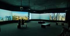
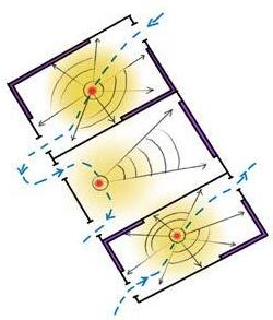
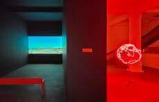
Figure 17 : Multiscreen projection
Figure 18 : Multiscreen projection
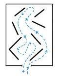
Figure 19 : Circulation
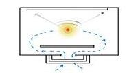
Figure 20 : Mist Projection
Figure 21 : Working of Mist projection
• The venues here were very old buildings built during the Portuguese period that were reused and revitalized with a new purpose.
• The venues were located in different locations, hence connecting all these dots people go through many experiences.
• Every area was given a makeover to make it more appealing and to create an atmosphere that was inviting. Minor changes were made to each area to give it a more attractive and inviting feel.
• To make the exhibition more engaging and give visitors an opportunity to explore, unconventional elements were added.
• The display of the material was not limited to linear arrangements. It was presented in a variety of different formats.
• The exhibition was held showcasing installations and large boards containing information about the writeups. It served as a platform for displaying the gathered data and insights.
• This platform enabled individuals from different countries to showcase their works, as well as to bring attention to often overlooked issues. It provided a space for people to express their perspectives and to be heard.
• Workshops are conducted to exchange knowledge and culture.
• Kochi’s streets offer terrific chances for locals to start businesses that cater to the tourists, thus promoting the region’s economic growth. These interactions between the businesses and tourists make the city a vibrant place that continues to develop.
24
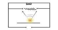
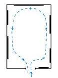
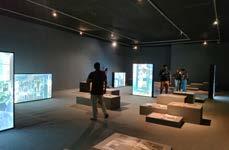
Figure 22 : Circulation
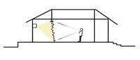
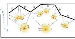
Figure 23 : View points and cone of vision
2.1.1.3 Observation
• There are multiple venues provided to make people walk through the streets.
• The venues are the outcome of adaptive reuse of old abandoned building in that area that are converted into exhibition spaces.
• Making people walk connecting the dots of the venue creates interaction between the local people and people who visit India from places all over the world. This has also increased the local economy.
• Spaces are modified for today’s needs. They were used for different purposes like projection area etc.
• Some additional elements were added to make the movement across the exhibition interesting.
• Exhibitions were done mainly through installations that was a 3d form of exhibition.
• Each and every venue talked about different topics. The essence of the building was sometime used as it is to exhibited stories.
• It was a platform for people to know about things happening around us. Themes were also taken regarding the problems which needed to be voiced out.
25
Figure 24 : Exhibition spaces
Chapter 4
4.1 Context study
4.1.1 Site Context
4.1.1.1 Architectural Aspect
• Traces of buildings from megalithic period (BC 02) to colonial period are found in Pudukkottai district.
• All these buildings are found in a radius of 10km from the main town.
• Tamil Nadu was divided into 12 divisions during the Dravidian period. Pudukkottai was one among this12 and was named as Pandrinadu.
• The architecture found in Pudukkottai is a mixture of Cholas and Pandiyas.
• Sir Amaravati Seshayya Sastri rebuilt the town Pudukkottai. He did the town planning of Pondicherry also. Hence we can find many similarities here.
4.1.1.2 Location Aspect
• All the historical places are located within 10km radius.
• To create a museum of Tamil Dravidian history which mainly consist of Cholas and Pandiyas where Tanjore is the headquarters of Cholas and Madurai is the headquarters of Pandiyas but Pudukkottai is located in the boarders of both the dynasties.
• There is a river named vellaru running through Pudukkottai. The region form north vellaru to south carvery is early chola dynasity whereas region from south vellaru to thamirabarani river is the pandiyas dynasity.
• Selecting Trichy, Tanjore the chola dynasity or selecting Madurai the pandiyan dynasity restricts us towards one side of the Dravidian history.
• And also the factor that Trichy and Madurai are already in the process of urbanization and Pudukkottai is in the place to be taken care of in both historical conservation and revenue generation.
4.1.1.3 Religious Aspect
• Pudukkottai has the traces of the most important Jain temples and Jain beds. Example- sithanavasal
• There are many shaivism and Vaishnavism temples found in and around Pudukkottai.
• One of the most important hindu temple for lord Murugan in viralimalai is found here.
• There is a belief that there are 7 Amman in Hinduism among which 4 are located
26
in Pudukkottai district.
• There are two mosques here in which one of them ages back to 1800s.
• We can find an old church which has a mixture of Romanesque and gothic architecture.
4.1.1.4 Archeological Evidence
• Archaeologists say that maximum number of inscriptions are found in India out of which most are in Tamil Nadu, majorly in Pudukkottai.
• The traces about three main division of tamil that is iyal, isai and naadagam are inscribed in Pudukkottai.
4.1.1.4 Musical And Art Evidence
• Pudukkottai is the only place in India where inscriptions about music is found.
• There is an inscription about Parivarthini teaching veena.
• There is a place near Pudukkottai called Kudumiyan malai, here there are inscriptions that talk about the seven swaras of music.
• We can find evidences of devaraadi dance forms also in this inscriptions.
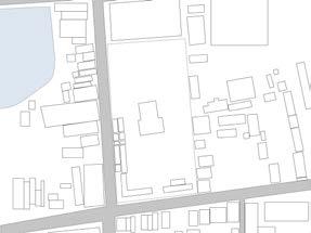
4.1.2 Site
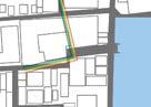
• The proposed interpretation center is to be spread out over an urban context, with three sites located along the heritage walk. The first site is located at the start of the walk, the second is located in the middle, and the third is located at the end, providing a conclusion to the walk.
• Through connecting these sites by heritage walk people get a chance to interact with the surrounding urban context.
• One of the site has been repurposed and adapted to a new use, while still preserving its heritage value.
4.1.3 Site mapping
The map below shows the location of the chosen site as well as the various places that can be visited while undertaking the heritage walk. These locations are marked with pins on the map.
27
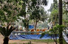
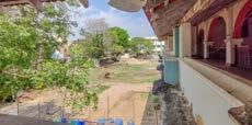
4.1.3.1 Pudukkottai site 1
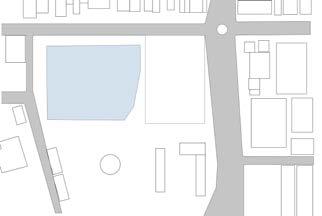
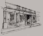
• Starting from Pudukkottai bus stand, the heritage walk takes visitors through a wide array of colonial buildings, many of which have been adapted for reuse.
• These buildings provide a unique insight into the history of the area and make for an interesting and educational experience.
28
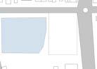
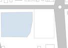
Figure 27 : Site plan
Figure 31 : Existing Structure
95 m 64 m
Figure 30 : Noise Analysis AREA - 6136 sq m
Figure 28 : Views From Site Figure 29 : Views To Site
Figure 32 : Entry To Site
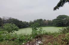
Figure 26 : Waterbody
Figure 25 : Site A
4.1.3.2 Pudukkottai
Kallakottai
palace site 2
4.1.3.2.1 Building description
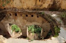
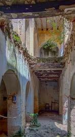
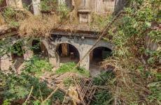
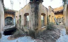
• The Kallakottai Palace was an old, abandoned structure constructed by Rajagopala Thondaiman (Periyavar) to provide a home for his sister.
• The building had a central courtyard with a stage where marriages can happen.
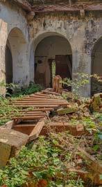
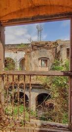
• The entire structure is in a state of disrepair, with much of the roof having collapsed.
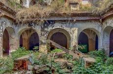
• The central courtyard above the stage features traces of a mansard roof.
• A new building has been constructed next to this one, preserving and replicating the original building’s features in certain areas.
• The structure of the building is made with sabpa stone and lime plaster. The roof is constructed with Madras terrace.
• We can observe broken roofs scattered throughout the area. Additionally, many of the windows and doors are missing.
• This building has great potential for adaptive reuse due to its rich heritage value and unique style. It is a great opportunity to preserve and repurpose this building for a new purpose.
• Visiting this site can be a great opportunity for visitors to interact with the native Pudukkottai people living there. It can be a great way to learn about the culture and traditions of the region.
• This palace is situated close to a temple pond called Pallavan Kulam.
29
Figure 33 : Ruins of Palace
Figure 34 : Exterior open to sky

30 A B B' GROUND FLOOR PLAN 8785 18980 A A' B B' FIRST FLOOR PLAN 2055 SECTION BB' SECTION AA' 1940 3301.87 1940.08 SECTION BB' SECTION AA' 124 m 71 m
AREA - 7687 sq m
Figure 38 : Contour Analysis
Figure 35 : Site plan
Figure 39 : Existing Structure
Figure 36 : Views From Site
Figure 37 : Views To Site
Figure 40 : Entry To Site
Figure 41 : Floor plans and sections
4.1.3.2.2 History of this building
• The King gave his sister this palace as a gift, as she was unable to ascend the throne due to the fact that women are not allowed to wield power in this kingdom.
• Rajagopala Thondaiman was the last monarch of Pudukkottai who held ruling powers. After India’s independence, he willingly relinquished all his properties to the Indian government.
4.1.2.2.3 History of Pudukkottai
• Pudukkottai was its own nation even after India achieved independence, until it was eventually integrated into the Indian Union.
• Pudukkottai’s development was much more drastic than other places due to the amicable relationship the Pudukkottai king had with the British.
• During British rule, a bus service was established for the first time in the region, prior to which there was no such facility available.
• The Pudukkottai Samasthanam, unlike many of its surrounding dynasties, had a much lesser tax burden due to the warm relationship between its King and the British.
• The Pudukkottai Samasthanam comprises of five areas - Pudukkottai, Thirumaiyam, Gandaravakottai, Alamkudi and Keeranoor.
• After the king signed the agreement to incorporate Pudukkottai into India, all of his property was repurposed as administrative buildings and government offices.
31
Figure 42 : Top view of central courtyard Figure 43 : Roof damages

32
Figure 44 : Slop roof
Figure 46 : Missing Roof
Figure 49 : Top View
Figure 50 : First floor
Figure 45 : Building condition
Figure 47 : Demolished Structure
Figure 48 : Window
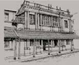
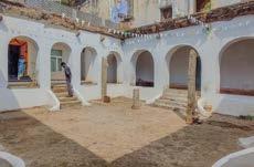
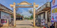
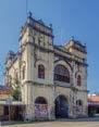
4.1.3.3 Pudukkottai town hall site 3
4.1.3.3.1 Building description
• The Maharaja’s Town Hall, erected by the Pudukkottai Public in 1899, was a building commissioned by His Highness Shree Brahadambadas, Raja Marthanda
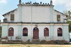
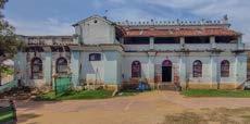
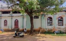
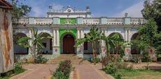
Bhairava Thondaiman Bahadur in honor of Her Most Gracious Majesty The Queen Empress of India.
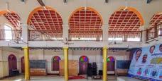
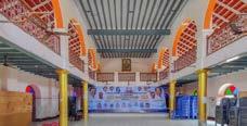
• This building has been used as an assembly hall since its inception and continues to be used for the same purpose today.
• Most government meetings nowadays take place in this location.
• This town hall has ample space surrounding it, making it an ideal location for site selection.
• It is also located near the keela raja veethi along with the other venues are located.
33
Figure 51 : Front Elevation
Figure 52 : Right Elevation
Figure 54 : Rear Elevation
Figure 53 : Left Elevation
34 22610 15746 15150 3945 3451.74 2140 GROUND FLOOR PLAN 13618 8242.69 FIRST FLOOR PLAN 94 m 94 m 184 m 184 m
AREA - 16852 sq m
Figure 55 : Site plan
Figure 59 : Existing Structure
Figure 56 : Views From Site Figure 57 : Views To Site
Figure 60 : Entry To Site
Figure 58 : Contour Analysis
Figure 61 : Floor plans
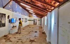
35
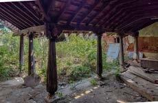
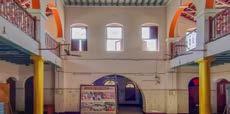
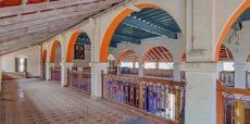
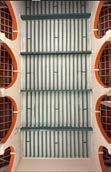
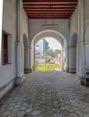
Figure 62 : Interior view
Figure 63 : Arches
Figure 64 : Arches
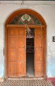
Figure 68 : Roof Detail
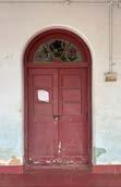
Figure 69 : Main Door
Figure 70 : Window
Figure 71 : Side door
Figure 65 : Interior view
Figure 66 : Exterior view
Figure 67 : Entrance view
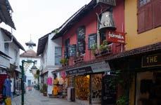
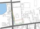
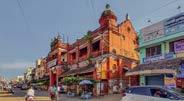
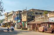
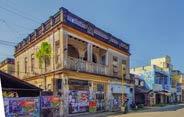
4.1.4 Roads of Pudukkottai
• Keela Raja Veethi is a major street in Pudukkottai, connecting Tanjore and Pudukkottai. It is home to numerous bazaars, resulting in a large floating population.
• Along the roads while walking, one can come across many old mansions that have been repurposed as shops. Some of these mansions have been encroached upon and converted into shops, while others remain unused.
• Since it is a bazaar we can see a variety of shops in that street.
• A heritage walk through the area can be a great way to experience the many historical temples located here. It will bring the area to life and allow people to explore and appreciate its rich history.
36
4.1.5 Site Context Study
4.1.5.1 Land Use
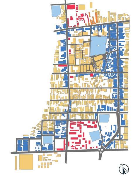
37
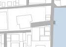
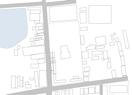
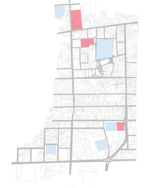
4.1.5.2 Site Marking


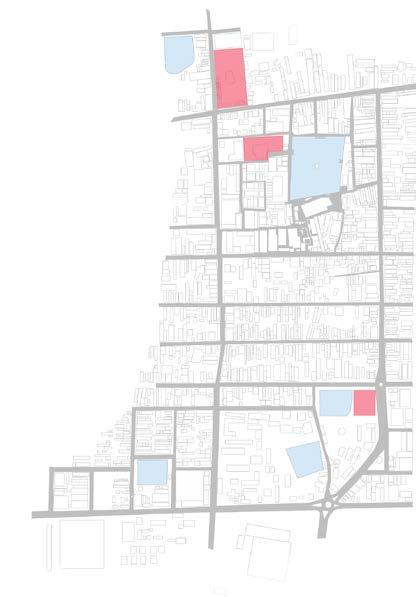
38
Pudukkottai bus stand West main Rd West main Rd East main Rd East main Rd Pudukkottai local bus stand Vadakkudu Alangudi Rd North main Rd
Figure 71 : Site C
Figure 72 : Site B
Figure 73 : Site A
4.1.5.3 Traffic Analysis
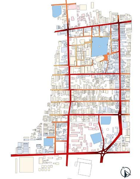
39
4.1.5.4 Wind Analysis
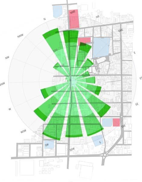
40
4.1.5.5 Sun Path Diagram
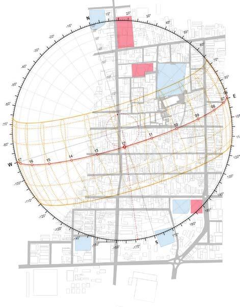
41
4.1.5.6 Wind Analysis
42
4.1.5.7 Listing
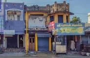
Marker - 1
Area name
Property use
In use/ not in use
Present use
Past use
No of Floors
Marker - 2
Area name
Property use
In use/ not in use
Present use
Past use
No of Floors
Marker - 3
Area name
Property use
In use/ not in use
Present use
Past use
No of Floors
Marker - 4
Area name
Property use
In use/ not in use
Present use
Past use
No of Floors
Marker - 5
Area name
Property use
In use/ not in use
Present use
Past use
No of Floors
: Santhanathapuram
: This gate way is not in use
: Abandoned : Horse stable
: G+1 : Santhanathapuram
: Not in use
: Abandoned : Residence and shop : G+1 : Santhanathapuram
: In use : Restaurant : Residence : G+1
: Melaraja vidi, Santhanathapuram
: In use : Residence
: Residence
: G+1 : Santhanathapuram
: Not in use
: Pudukkottai municipal purity council
: Abandoned : G+1
43
Figure 74 : Horse stable
Figure 75 : Mansion 1
Figure 76 : Mansion 2
Figure 77 : Mansion 3
Figure 78 : Government Building
