GEOSPATIAL ANALYSIS TEAM
WHERE CONSERVATION AND APPLIED RESEARCH MEET.
The Geospatial Analysis Team (GAT) at the Texas A&M Natural Resources Institute (NRI) provides geospatial and data analytic support for research and extension projects aiding in data-driven, conservation-focused decision making across landscapes.

GIS.NRI.TAMU.EDU
DISCOVERY
STEWARDSHIP ENGAGEMENT INNOVATION
THE TEXAS A&M NATURAL RESOURCES INSTITUTE
ABOUT THE GAT
SEE OUR GEOSPATIAL HUB TO LEARN ABOUT OUR RECENT PROJECTS, ACCESS THE GEOSPATIAL PORTAL AND FIND OUR GEOSPATIAL TOOLS.
At the Texas A&M Natural Resources Institute, our work improves the conservation and management of natural resources and private land stewardship through interdisciplinary and applied research, education and policy.
With decades of combined experience, the Geospatial Analysis Team (GAT) responds to these conservation challenges with unique skillsets, including:
ArcGIS Enterprise system management
Advanced geospatial analysis

Remote sensing
Web GIS
Field GIS
Cartography
The Geospatial Analysis Team assists each of our program focus areas of Land, Wildlife, Military and Stewardship, through the creation and application of geospatial models and interactive tools, to:
1. promote long-term planning for landscape conservation
2. support plant and animal population management, including threatened and endangered species
3. support the twin imperatives of military readiness and land conservation
4. foster stewardship of private lands and their public benefits
01
ABOUT
ARCGIS ENTERPRISE SYSTEM MANAGEMENT
NRI Geographic Information Systems (GIS)
Our ArcGIS Enterprise management expertise is the foundation for NRI’s GIS.
ArcGIS
Online Enterprise Server Image Server Pro Portal

ArcGIS Enterprise is a flexible mapping and data management server software that allows the GAT to deploy ArcGIS products on-premises and in the cloud and enables us to run and manage numerous other extensions.
The browser-based enterprise system lets us control, store, and access data securely while we share data within the Institute to empower and equip research science and policy decisions.

02
GEOSPATIAL ANALYSIS TEAM
ADVANCED GEOSPATIAL ANALYSIS
GATHERING, DISPLAY, AND MANIPULATION OF GEOREFERENCED DATA TO BUILD MAPS, GRAPHS, STATISTICS AND FIGURES
Making complex relationships understandable
The geospatial team has extensive experience using geospatial tools and data analysis to solve complex natural resource challenges.
The team supports research and extension projects in data-driven decision-making through advanced modeling, scripting, and analysis using Esri’s suite of geospatial products including ArcGIS Pro and Portal for ArcGIS Common workflows include:
Habitat modeling and endangered species monitoring and assessment

Military engagement and support

Private lands advocacy and stewardship
Rural land trends analysis
03
GEOSPATIAL ANALYSIS TEAM
REMOTE SENSING
Remote sensing and acquiring distance information
In addition to advanced geospatial analysis, the GAT also provides valuable support and expertise for projects by utilizing remote sensing to characterize the physical landscape.
Using ENVI, ArcGIS Pro, Google Earth Engine, and R, the GAT is able to apply remote sensing technology to address many landscape-driven questions.
Our portfolio reflects our expertise in using remote sensing data from a wide variety of sensors, such as LiDAR, satellite and aerial imagery, and analytical methods, including land cover classification, change detection analysis, biophysical parameter modeling, and 3D data analysis
Ocelot Reintroduction
Sprague's pipit
Louisiana Pinesnake
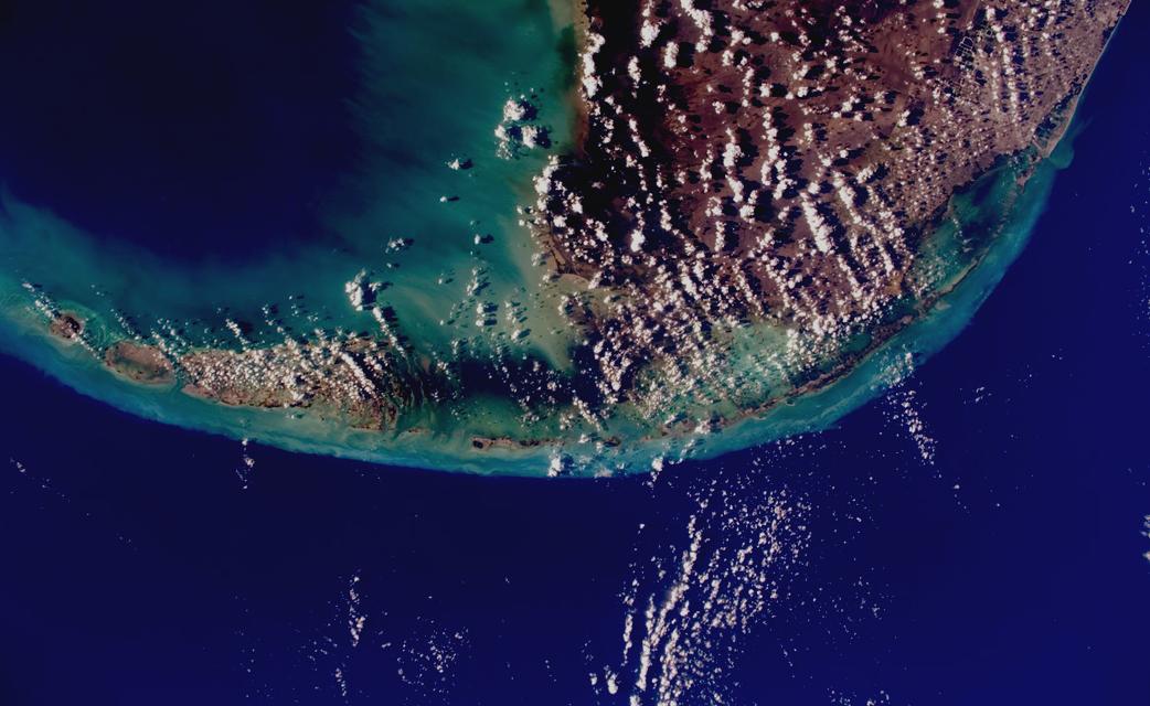
Habitat Disturbance in the Florida Keys
Golden-cheeked warbler and black-capped vireo

04
GEOSPATIAL ANALYSIS TEAM
FIELD GIS
In the office or in the field, the GAT is able to mobilize the Institute’s geospatial products to capture data remotely.

Using in-house GPS equipment and webbased data collection and visualization methods, such as ArcGIS Field Maps, we can geolocate and ground truth property infrastructure and natural resource assets in the field to be used in maps and data in the office
We can create and customize mobile surveys for citizen science applications and streamline field data collection using ArcGIS Field Maps and ArcGIS QuickCapture Since these applications are fully integrated with our Enterprise system, we can efficiently collect, disseminate, and analyze field data
The DA2's performance scales with your Trimble Catalyst service subscription to deliver anywhere from centimeter to sub-meter precision to location-enabled Android and iOS field apps and workflows

ArcGIS Field Maps
ArcGIS Field Maps is an all-in-one app that uses data-driven maps to help field operations collect and edit data, find assets and information, and report real-time locations This app is especially useful as it can be used to visualize maps and collect data offline
 GPS Capabilities
Trimble DA2- Catalyst GNSS System
05 GEOSPATIAL ANALYSIS TEAM
CHECK OUT OUR FIELD WORK AT THE DEPT. OF RANGELAND, WILDLIFE AND FISHERIES MANAGEMENT'S LA COPITA RANCH
WEB GIS
Web GIS enables the GAT to mobilize the NRI GIS to share maps, apps, and authoritative data, both internally and with external partners.
Using Portal for ArcGIS and other ArcGIS Enterprise systems, our team has created web-based geospatial products that make our data more accessible and interactive to a wide range of users.
In addition to using Esri’s built-in web applications, including ArcGIS Configurable Apps like Story Maps, and ArcGIS Web AppBuilder for web mapping applications, we are capable of customizing web applications using the Python and JavaScript API and customized mapping widgets
Web Mapping Applications
Texas Early Notification Tool
TxMAP

Texas Airspace Planning and Forecasting Tool
Texas Land Trends Data Explorer

Story Maps
Texas Quail Atlas
06
GEOSPATIAL ANALYSIS TEAM
CARTOGRAPHY


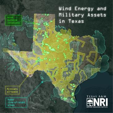
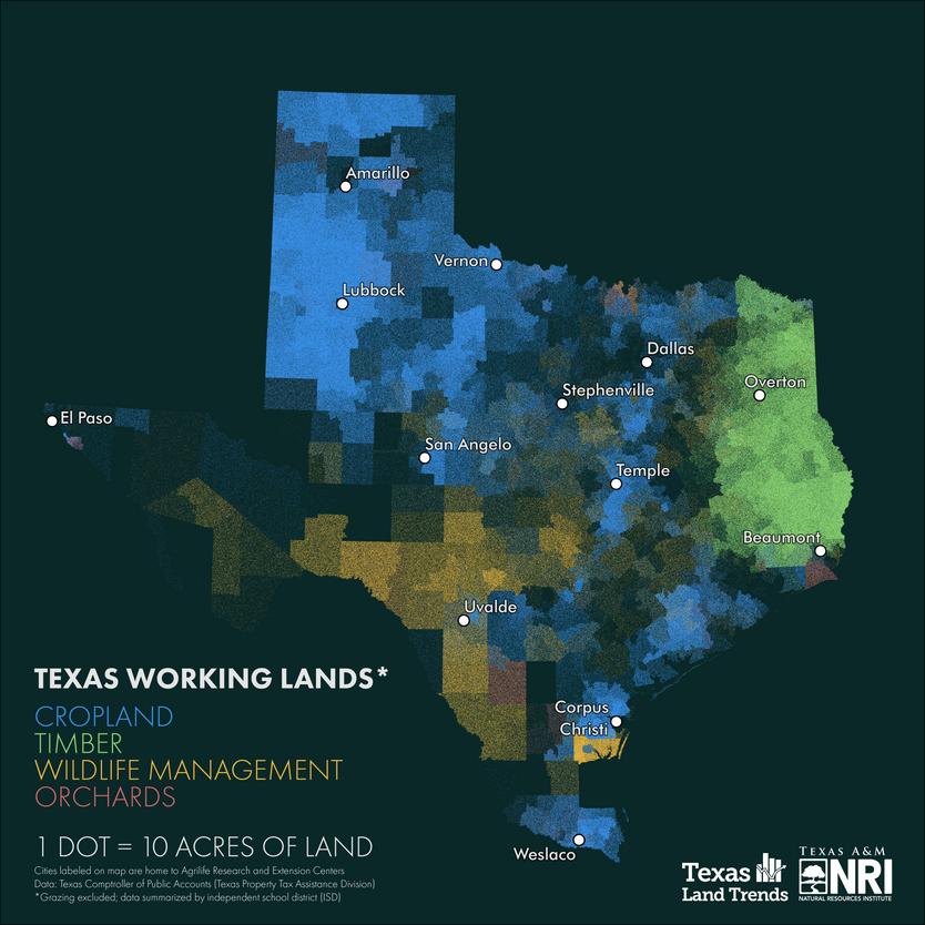
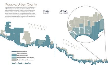
In addition to offering extensive geoprocessing and analytical skillsets to the Institute and its partners, we also create engaging, and informative maps using cartographic knowledge and tools.
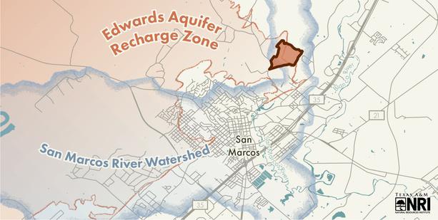
Often found at the intersection of science and art, the GAT utilizes map visualization and graphic design techniques to effectively communicate geographic stories and data.
07 GEOSPATIAL ANALYSIS TEAM
GEOSPATIAL ANALYSIS TEAM

 THE TEXAS A&M NATURAL RESOURCES INSTITUTE


 GPS Capabilities
Trimble DA2- Catalyst GNSS System


