
4 minute read
Good Getaways


Good Getaways The Locust Fork Canoeing a river that’s literally older than the hills it cuts through
Story and photos by David Moore
Advertisement
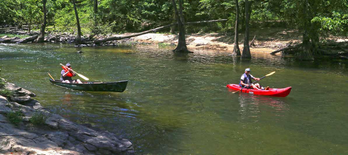
Our paddles gurgle the water against the canoe’s green hull, propelling us down the Locust Fork of the Black Warrior River as leisurely as the white clouds drift against the blue sky over Blount County. My son, Hunter, captains his canoe from the stern. I paddle in the bow when I’m not photographing trees arching overhead, boulder jumbles, ancient river-carved cliffs, occasional sandy beaches and our guide/host, Stephen Guesman, up ahead in his red kayak.
Against sand bottoms in the shallow flats we sometimes spot darting fish. “Red bass,” Stephen says. “Anglers love them.”
Over the years, I have canoed this and other stretches of Locust Fork, and my appreciation of the river only grows today.
Thanks to the Friends of the Locust Fork River (FLFR), this remains one of the few free-flowing rivers that grace Alabama. Relatively undeveloped, it meanders off the Appalachian Plateau from the southern shadows of Sand Mountain on its 158-mile course to the Black Warrior River. Nearly every bend further affirms the Locust Fork’s top-2-percent ranking among free-flowing rivers with “outstandingly remarkable values,” according to a National Park Service inventory.
Interestingly, the river’s course today roughly follows that of its ancient forefather streams, which, according to state archaeologist Dr. Jim Lacefield, watered the ancestors of the dinosaurs when the Appalachians were being born some 300 million years ago. Since then, the Locust Fork has carved a path through the surrounding ridges a dozen times or more, making it, literally, older than the hills.
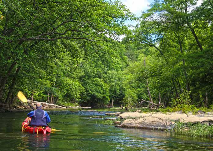
Five of the river’s seven sections flow through Blount County. We’re paddling the lower half of Section II, a 4-hour sojourn into the solitude of nature. The quiet flats are interrupted only by the sound of approaching shoals and small rapids where we maneuver around outcroppings and over submerged boulders. Yes ... I occasionally manage to get us hung up.
It’s a gorgeous late spring day, but it hasn’t rained lately. Stephen says water depth – as gauged downstream at our takeout where Ala. 79/US 231 bridges the river – is at 1.7 feet. Unless you want to get out and push your canoe down the river, you need at least 1.5 feet of water at the bridge. Two feet is better, but at four feet some of the river’s features are under rushing water, and attempting to paddle it at that point is, Stephen adds, is like “falling down a mine shaft.”
Eventually, we reach the final two big hairpin bends of The Locust Fork opens out at Cornelius Falls, above. The only falls on bottom right, is evidence of a mill located below the falls in a past


Section II, it gives a sense of how the river cut through the Appalachian Plateau over the eons. More recently, a rusted bolt and clamp, century. Much of this section is a calm paddle through the woods, but a few shoals give you a taste of the white water in Section III.


Hunter Moore, left, and Stephen Guesman paddle down a quiet stretch of the Locust Fork. Hunter is a district sales manager for Gulf Distributing in Huntsville. Stephen, a retired contractor, lives off the grid with his wife on a Blount County farm and raises goats.
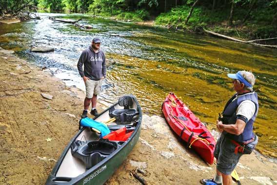
Hunter, left, and Stephen chat at the put-in. Stephen, who lives nearby, is a former president of the Friends of the Locust Fork. Contact him at: friends@ FLFR.org.
Section II, passing the sites of the FLFR’s annual Kids’ Day on the River and two of the three Alabama Cup Whitewater Races. (The other is near Garden City on the Mulberry Fork of the Black Warrior.)
We take out at King’s Bend Scenic Overlook on Ala. 79 – a mighty nice project spearheaded by Blount County Commission Chairman Chris Green – and the three of us agree it’s been a great day.
“Wow,” Stephen later says. “Cornelius Falls, to me, is worth the price of admission. But just the general pastoral value of getting out in nature, being on relatively pristine river, is an unparalleled experience.”
Good Life Magazine
If you paddle the Locust Fork...
Research your trip first. John Foshee’s “Alabama Canoe and Float Trips” is a great start. His Blount County sections can be found at: www. FLFR.org, under the “Our River/Guide to the River” tab; get a gage reading for water depth under “Our River/USGS Conditions.”
The lower Section II trip described above starts at Taylor Ford Road. Foshee’s put-in for the section, about 90 river minutes farther upstream, is at Cold Branch Hollow on Cold Branch Road. Find both locations on Google maps. For an easy, flat water trip, call Eric Nolen at River Beach Outfitters in Snead: 205-237-6989. $30 gets you a kayak and shuttle for a familyfriendly 5-mile paddle on Section I. Use your own kayak or canoe and pay only for the shuttle.


