


The Bartlett School of Planning has an international reputation as a centre of academic excellence in research, teaching and policy and practice interaction. Located within the heart of one of the world’s greatest cities, the School’s research and teaching opportunities provide a unique laboratory for knowledge creation, rich in academic, cultural and social diversity.
Publisher
The Bartlett School of Planning, UCL
The Bartlett School of Planning Expo, Catalogue coordinators and curators
Valentina Giordano
Pablo Sendra
Jo Williams
Catalogue design and content editing
Erika Kulpa
Head of The Bartlett School of Planning
Nick Gallent
Administrative staff for the Expo
Victoria Howard
ISSN 2516-5666
Copyright 2019 The Bartlett School of Planning, UCL.
Copyright of all images and texts belong to their authors.
For more information on research and teaching at The Bartlett School of Planning, visit https://www.ucl.ac.uk/bartlett/planning/
The Bartlett School of Planning, UCL Central House, UCL. 14 Upper Woburn Place WC1H 0NN London
Printed in the UK London, 2019
Cover picture by: Wei Huaung
From Shutterstock


Dr Kwame Addae-Dapaah
Dr Sonia Arbaci
Dr Yasminah Beebeejaun
Elena Besussi
Professor Matthew Carmona
Dr Elisabete Cidre
Dr Ben Clifford
Dr Claire Colomb
Professor Harry Dimitriou
Dr Dan Durrant
Dr Jessica Ferm
Dr Tommaso Gabrieli
Professor Nick Gallent
Dr Iqbal Hamiduddin
Dr Robin Hickman
Dr Nikos Karadimitriou
Dr Qiulin Ke
Dr Nicola Livingstone
Professor Claudio de Magalhães
Professor Stephen Marshall
Dr Juliana Martins
Dr Susan Moore
Mr Peter McLennan
Professor Nick Phelps
Professor Mike Raco
Professor Peter Rees
Professor Yvonne Rydin
Dr Danielle Sanderson
Dr Pablo Sendra
Dr Michael Short
Dr Jung Won Sonn
Dr Tse-Hui Teh
Professor John Tomaney
Dr Catalina Turcu
Dr John Ward
Dr Jo Williams
Professor Fulong Wu
Dr Filipa Wunderlich
Dr Fangzhu Zhang
Dr Emanuele Belotti
Dr Frances Brill
Valentina Giordano
Dr Tatiana Moreira de Souza
Dr Lucy Natarajan
Dr Fenghua Pan
Lisa Fernand
Jenny Post
Anthony Grout
Eliza Fleming
Alkesh Patel
Judith Hillmore
Nina Jasilek
Ben Tasker
Victoria Howard
Jackie Nelson
Faraz Baber
Richard Barras
Marco Bianconi
Duncan Bowie
David Cadman
Jim Coleman
Wulf Daseking
Michael J Dear
Michele Dix
Bill Dunster
Tim Edmundson
Michael Edwards
Jose Farina
Colin Haylock
Michael Hebbert
Kate Henderson
Mark Kleinman
Klaus R. Kunzmann
Niamh Moore-Cherry
Janice Morphet
Taner Oc
John Parr
Alan Peters
Ann Skippers
Dominic Stead
Robin Thompson CBE
Simonetta Tunesi
Richard Wang
Anne Williams
Juan Alberti
Kyunghyun Baek
Karla Barrantes Chaves
Melissa Barrientos Trinanes
Gualtiero Bonvino
Lucia Cerrada Morato
Anon Chaimanee
Steve Chambers
Rit Chandra
Feng-Shu Chang
Sizhe Chen
Kai-Jen Cheng
Hyunji Cho
Seamus Cleary
Stefania Fiorentino
Sonia Freire Trigo
Xing Gao
Brian Garcia
Alexandra Gomes
Graziano Di Gregorio
Dongho Han
Paul Hildreth
Miguel Hincapié Triviño
Elisabeta Ilie
Alizara Juangbhanich
Katy Karampour
Ju Eun Kim
David Kingman
Alireza Kolahi
Jae Kwang Lee
Xiaoxuan Lan
Nan Li
Yingcheng Li
Siyao Liu
Yuqi Liu
Chien-Ling Lo
Monica Lopez Franco
Beatriz Mella Lira
Derry O’Connell
Dimitrios Panayotopoulos-Tsiros
Marialena Petrakou
Lorna Qesteri
Khairul Rizal
Reetuparna Sarkar
Carina Schneider
Ilwon (Veny) Seo
Ruth Sepulveda Marquez
Jacob Simpson
Lesley Slavitt
Phoebe Stirling
Yixiang Sun
Veeramon Suwannasang
Umnaj Thananantachai
Richard Timmerman
Justinien Tribillon
Xiangyu Wang
Xiaoqing Zhang
Yuerong Zhang
Weilong Zhang
Jingyi Zhu
Tianke Zhu
Ms Adriana Cabello Plasencia
Mr Jonathan Rokem
Professor Madhav Badami
Ms Rebecca French
Dr Silvia Gullino


The Bartlett’s roots as an institution date back much more than a century: the School of Architecture is 178 years old, while the School of Planning was set up in 1914. However, the ‘Bartlett’ name was first used in 1919. In 1911, Sir Herbert Henry Bartlett, a civil engineer and building contractor, gave £30,000 to UCL to fund a new building to house the School of Architecture, along with the Department of Applied Statistics and studios to teach sculpture. He chose to remain anonymous until 1919, when he finally consented to his name being given to the department. A century later, The Bartlett has grown to become UCL’s global faculty of the Built Environment, comprising of 12 schools, institutes and centres. The ‘Bartlett 100’ year will be used to explore the radical thinking that has characterised The Bartlett for a century, celebrating what has happened and mapping out where we are going to build a better future.
Alan Penn, Dean of The Bartlettwww.bartlett100.com
 PROF NICK GALLENT
HEAD OF THE BARTLETT SCHOOL OF PLANNING
The BSP EXpo, now in its third year, is an annual celebration of student achievements across the Bartlett School of Planning at UCL. It is an opportunity for current and former staff members and and students, alogside the s The BSP Expo is our annual celebration of student achievements across the Bartlett School of Planning at UCL. It brings together current and former staff members and students with the BSP’s many friends and partners, to review some of the past year’s projects from undergraduate and postgraduate programmes and also examples of research being undertaken within the school’s PhD community and by members of staff and collaborators.
BSP is one of the largest and most diverse planning schools in the UK, with more than 50 members of staff (plus a similarly large group of honorary and visiting colleagues, as well as a great many contributing practitioners from a range of industry sectors) and more than 600 students from the UK and overseas. Undergraduates follow programmes in Urban Planning and Real Estate, Urban Planning, Design and Management or Urban Studies. Our post-graduate taught (MSc, MPlan and MRes) students are enrolled on programmes focused on spatial planning, city planning (over two years), international planning, urban regeneration, urban design, housing, transport, infrastructure, sustainable urbanism, real estate and ‘inter-disciplinary urban design’. We also work with the Centre for Advanced Spatial Analysis on the RTPI ‘pathway’ through the MSc in Smart Cities and Urban Analytics. The majority of our programmes are accredited by the Royal Town Planning Institute and / or the Royal Institution of Chartered Surveyors – both of which are important partners for the School.
Students at BSP produce a range of outputs as part of their studies –from shorter essays and reviews to longer projects and dissertations. Team-based design and planning projects also form a core component of student work, and many examples of these are showcased in the Expo.
Added to this array of taught programmes is the work of our 60 plus PhD students, each of whom aims to make an ‘original contribution to knowledge’ through individual research undertaken over at least 3 years. These students work closely with academic supervisors on projects that take them to different parts of the world, or keep them here in London –studying the many urban challenges that this city will face in the decades ahead. A research degree is one of the first steps in what often evolves into a longer academic career. Research students frequently work closely with our full-time and visiting staff members, developing and deliveringas ‘post-graduate teaching assistants’ - many of the modules showcased in the Expo and in this catalogue.
The aim of the catalogue is to provide a more permanent record of this year’s work. It offers, however, just a glimpse of the vast array of work that students on our different programmes produce and our academics and contributors supervise. We are proud of our students’ work and
grateful for the many contributions of our friends and partners. The Expo provides an opportunity to celebrate and say thank you to everyone who works so hard to achieve BSP’s continuing success. chool´s many friendes and partners, to review some of the past year´s projects from undergraduate and postgraduate programmes and also examples of reasear being undertaken within the school´s PhD community.
The BSP EXpo, now in its third year, is an annual celebration of student achievements across the Bartlett School of Planning at UCL. It is an opportunity for current and former staff members and and students, alogside the school´s many friendes and partners, to review some of the past year´s projects from undergraduate and postgraduate programmes and also examples of reasear being undertaken within the school´s PhD community.
Prof Nick Gallent Head of The Bartlett School of PlanningJune 2019
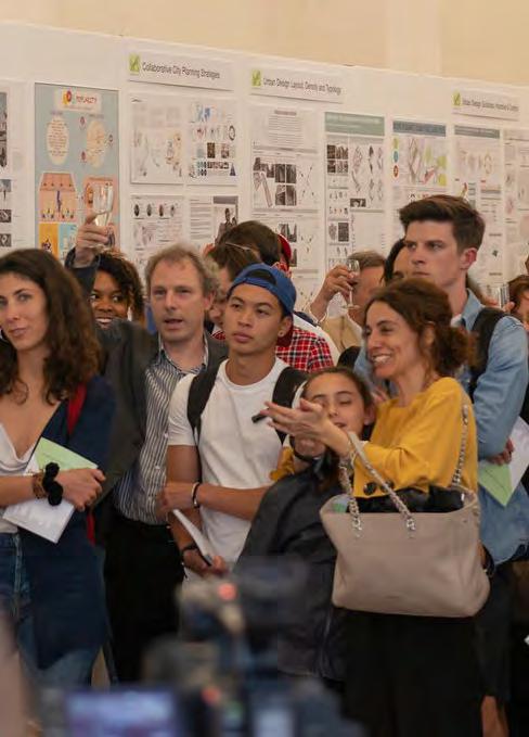 Picture by: Richard Timmerman



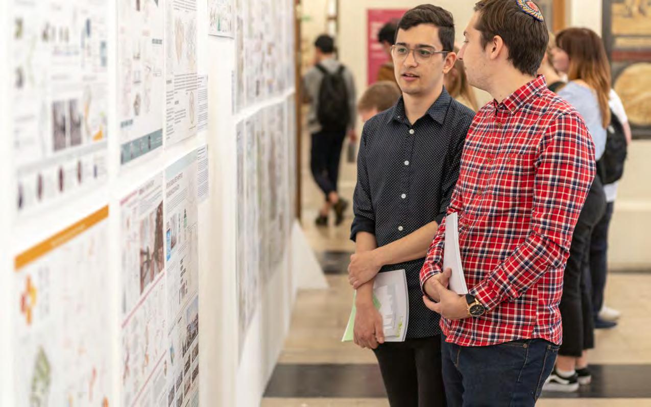
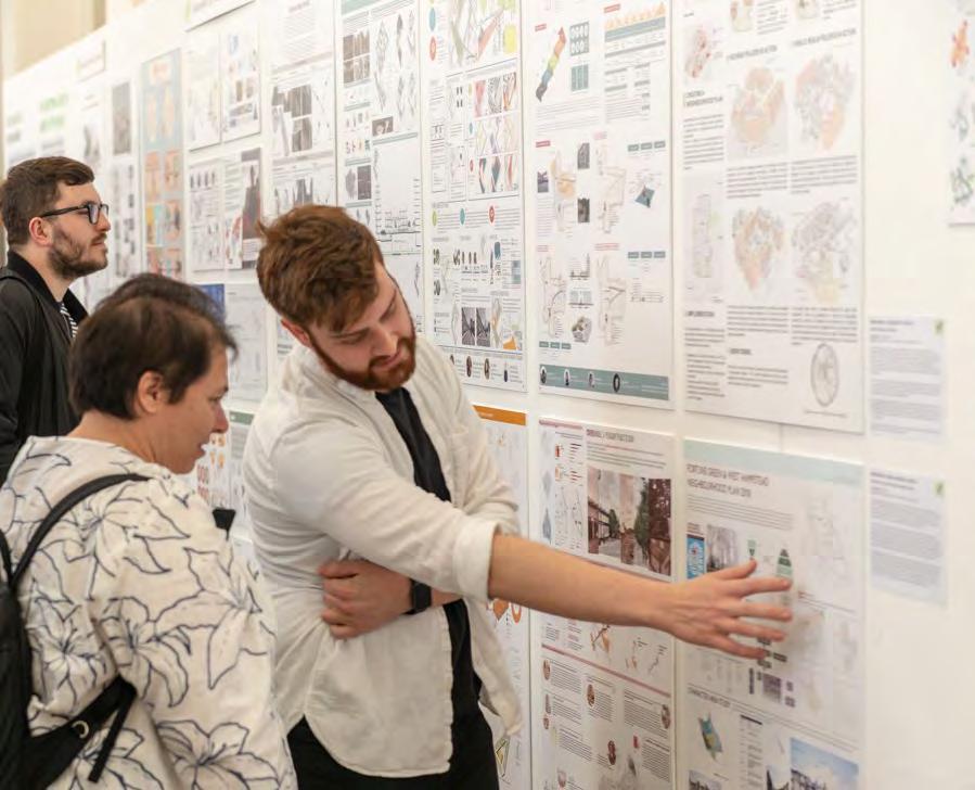
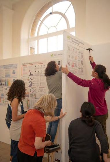
 Pictures by: Richard Timmerman
Undergraduate Programmes
• BSc Urban Planning and Real Estate
• BSc Urban Planning, Design and Management
• BSc Urban Studies
Postgraduate Programmes • MPlan City Planning
• MSc Spatial Planning
• MSc International Planning
• MSc/Dip Urban Regeneration
• MSc/Dip International Real Estate and Planning
• MSc/Dip Sustainable Urbanism
• MSc/Dip Urban Design and City Planning
• MSc Infrastructure Planning Appraisal and Development
• MSc Housing and City Planning
• MSc Transport and City Planning
• MSc Smart Cities and Urban Analytics (RTPI Pathway)
• MRes Inter-disciplinary Urban Design
Postgraduate Research Programmes
• Phil/PhD Research Programmes

This BSc builds on the core programme offered within the School of Planning (focusing on urban planning and design) and combines it with a focus on property markets, investment decisions and real estate economics. It is accredited by the Royal Institute of Chartered Surveyors (RICS) and recognised by the Royal Town Planning Institute (RTPI).
Programme Director:
Programme Director: Dr Elisabete Cidre


This BSc offers students a broad-based education in the built environment with an opportunity to specialise in real estate. It provides students with a route towards professional accreditation by two of the most internationally recognised professional bodies for built environment professionals in the UK.
The Bartlett’s strong research track record and links to professional practice will feed into the core and specialist aspects of the programme, ensuring that contemporary challenges and issues in theory and practice are addressed.
In addition to the academic activities at the school and across UCL, London offers built environment students an unrivalled concentration of professional meetings, seminars, conferences, exhibitions and events which will greatly enrich your education.
The Bartlett maintains an international outlook and provides opportunities for combined study overseas in Europe, North America, Australia and Hong Kong.
The aim of the module is to introduce students to the real estate market generally, communicating a basic understanding of how the real estate market works. We will consider key elements of real estate, based around the following questions:
• What is real estate?
• How does the real estate market function and who are the key players?
• How can it be valued and appraised?
• Who invests in real estate and why?
• What role does real estate play in city development?
• Who are the real estate professionals and what do they do?
London is adopted as a ‘living laboratory’ for students and offers an ideal lens through which we can examine the evolution of urban real estate specifically. The historical growth of the London real estate market
will be considered and examples adopted to illustrate relevant points, encouraging students to think differently and adopt a critical perspective on real estate within the city.
Students were tasked with choosing a commercial building in London’s real estate market and then telling its story through a poster. Key information required included reflections on the property’s history, development, location, style, purpose, use and value. Therefore the students had to create a poster with a diverse range of real estate related information, and were encouraged to link their poster design with the nature of the building itself. Each group then presented their posters and buildings in the final week of term.

the Street, and Aldgate Available lines City, DLR and lanes, trails and
of London. conglomeration with the (Walkie and 52-54 radius. all types restaurants, worship. The floors is a wide very easily the Street, and Aldgate lines City, DLR and trails and
(April)
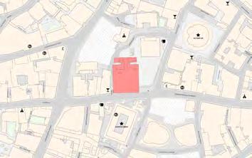
iconic, recogniseable for its distinct wedge shape which is highly skyline. It is at the heart of the insurance district, standing across London, the Willis Building and adjacent to the Aviva Building (St. stone’s throw from the Gherkin, 30 St Mary Axe. space at the base: seven-storey high open daylit public space, of onto the adjacent St. Helen’s Square. Permeable base, with through
and office space:
•
Building of the Year Offices: Best Commercial Workplace in the UK Architecture: New London Awards - Best Commercial Building London Awards
• Peculiarly it was demolished from the ground up and the central core was kept.
• The property was developed by The British Land Company PLC and Oxford Properties Group Inc. as a partnership. In 2017, British Land and Oxford Properties exchanged contracts for the sale of the building to Chinese Investors of CC Land for £1.15 billion pounds.
the building offers a unique variety of different sized floor needs of different clients (occupiers) in the separate core frees up space in the main floor plan for floor plate is rectangular - easily adapted and used.
2019
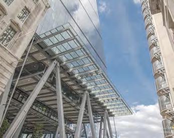
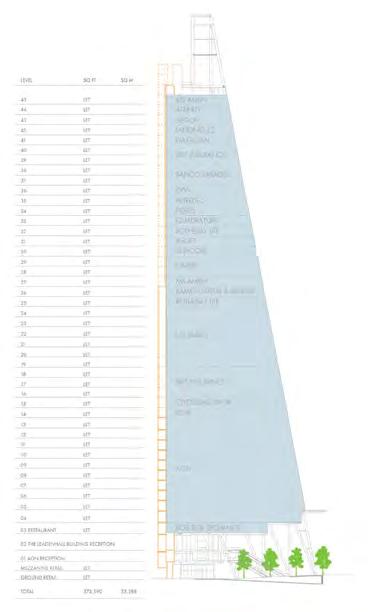
The building is used predominantly as office space, with retail space offered in the from the ground floor up to the third


• The old building located at 122 Leadenhall Building belonged to GMW and


• The old was designed
• Peculiarly kept.
• The property Properties Properties Investors
• Peculiarly it was demolished from the ground up and the central core was
• The property was developed by The British Land Company PLC and Oxford Properties Group Inc. as a partnership. In 2017, British Land and Oxford
The space is operated by Xcite.

The building is used predominantly as office space, with retail space offered in the from the ground floor up to the third floor. British Land and Oxford Properties completed the leasing of the building on the 11th of july 2016. Below is a diagram displaying the current occupiers.
* 613,713 (NIA) = £45,918,007
Yield) *100
(45,918,007 / 3.45) *100 000 000
12,901 SF
(44th floor, renting 6,584 SF) signed a 10-year lease with an £90,00 per SF.
according to the developers’ (British Land and Oxford Properties) sustainable approach is essential to delivering high-quality pre-certified with the BREEAM Excellent Rating engineering specifically made to increase the building’s efficient use from inner layer by a cavity that incorporates blinds (which the sun’s movements) - Keeps office cool throughout the day every 7 floors allows for even less artificial cooling to be the largest energy use of office buildings)
energy us of the building actually built off-site



Completion of the

The building offered in Oxford Properties 2016. Below
Completion of the
[FIGURE
Coordinator: Dr Danielle Sanderson
This module explores the management of real estate assets from the perspective of the various stakeholders (owners, tenants and occupiers). It examines how managers can enhance the value of real estate as an investment asset, and how occupiers can maximise the benefits of the space they occupy - considering property as a factor of production. It aims to provide the student with an understanding of the role, responsibilities and skills required of asset managers, property managers and corporate real estate managers. The module will also cover aspects such as corporate social responsibility in property management, environmental issues and facilities management.
The module aims to enable students to:
- apply management concepts to the business of real estate;
- critically assess how real estate management can add value;
- describe key issues facing real estate managers; - Evaluate how these issues affect the various sectors of real estate, from different perspectives;
- enhance oral and communication skills through discussions; and
- develop report/essay writing skills through the coursework.
Students: Jolene Lim
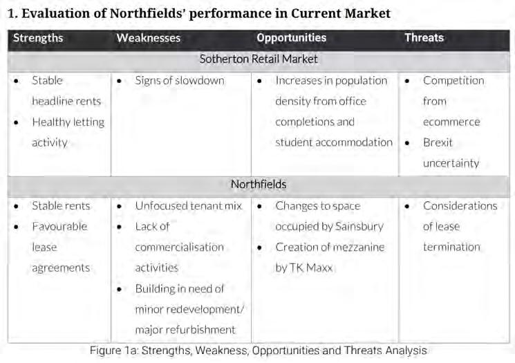
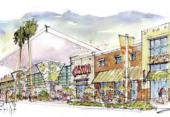
Urban planning is concerned with the complex management of change within the built and natural environment. This programme, accredited by the Royal Institute of Chartered Surveyors (RICS) and recognised by the Royal Town Planning Institute (RTPI), gives you the skills to work in both traditional planning careers and in various related professional and specialist areas.
Programme Director: Dr Elisabete Cidre


This BSc offers students a broad-based education in the built environment with an opportunity to specialise in real estate. It provides students with a route towards professional accreditation by two of the most internationally recognised professional bodies for built environment professionals in the UK.
The Bartlett’s strong research track record and links to professional practice will feed into the core and specialist aspects of the programme, ensuring that contemporary challenges and issues in theory and practice are addressed.
In addition to the academic activities at the school and across UCL, London offers built environment students an unrivalled concentration of professional meetings, seminars, conferences, exhibitions and events which will greatly enrich your education.
The Bartlett maintains an international outlook and provides opportunities for combined study overseas in Europe, North America, Australia and Hong Kong.
Tutors: Dr Gualtiero Bonvino; Yuerong Zhang
Guest lecturers: Beatriz Mella; Chris Martin (Urban Movement consultants)
Guest critics: Dominic Cherry (Transport for London); Simon Jay (Atkins consultants)
This module provides final year students of planning (and other urbanrelated undergraduate courses) with an introduction to transport studies, including key transport planning concepts, policies and the relationship between transport and urban planning. It also provides insight into – and a taste of experience in – ‘doing’ transport planning, to help prepare for further study or work in the planning and / or transport sectors.
By the end of the module, students have experience in understanding and handling key transport concepts such as flow and capacity, both practically through fieldwork and calculations, and through the transport policy and planning literature.
Assessment is via two linked assignments: a group-based Consultants’ Report
(Assignment 1); and an individual short Academic Briefing (Assignment 2).
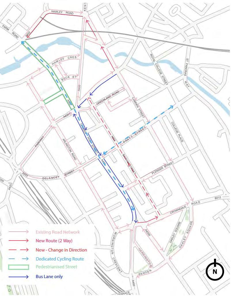
The first assignment envisages the London Borough of Camden commissioning consultancy groups to undertake an exploratory study of the Camden Town area, to develop and evaluate possible options for reorganising the gyratory oneway street system around Camden High Street, to promote especially movement on foot, cycle and bus; and enhance the place value of Camden High Street
Camden Transport Project
Students: Hou Lon Choi, Alice Bennett, Chun Pong Benjamin Cheng, Ho Man Tang & Satia Putra
Coordinator: Prof Stephen Marshall
Tutors: Dr Daniel Fitzpatrick
Guest Critic: Elisabeta Ilie
The purpose of this module is to give a grounding in the understanding of relationships between urban form and formation: how insights from urban morphology and morphogenetic processes that created existing urban form can better inform the creation of future urban form through planning, design and more informal urbanism.
This involves study of different urban form components and patterns at different scales – buildings, spaces, streets and districts – and how these are created in relation to each other to generate overall urban form.
The course involves a combination of creativity and focused enquiry. It allows students to explore and research the creation of urban form and then go on to apply insights from this in relation to planning and design interventions.
The module typically has inter-disciplinary
groups, including not only planning students but those studying architecture, engineering, geography and arts and sciences. It encourages students to consider how new urban places could be built not only through conventional master planning, but in a more bottom-up manner by the by citizens themselves.
Assessment is via two linked assignments: an individual assignment learning from the urban form and formation of an existing place (Assignment 1); and a group-based project creating proposals for a particular site (Assignment 2).
The group project is based on developing an extensive unbuilt of area of Thamesmead, a ‘new town’ in outer London that was never completed to its original plan, but which includes a significant undeveloped area close to the existing ‘town centre’, into which new development could ‘grow’ by different processes of formation.
Reimagining Thamesmead Students:Jesse Silva, Anastassia Gusseinova, Ni Zhan (Jenny), Claude Lynch, Inbar Langerman

This programme has been designed with a range of professional career opportunities in mind. It offers great flexibility for students curious to explore a broader range of studies relating to the built environment, as well as other subjects with a different focus offered elsewhere in UCL and other University of London institutions.
Programme Director: Dr Elisabete Cidre
This BSc offers students a broad-based education in the built environment with an opportunity to specialise in real estate. It provides students with a route towards professional accreditation by two of the most internationally recognised professional bodies for built environment professionals in the UK.
The Bartlett’s strong research track record and links to professional practice will feed into the core and specialist aspects of the programme, ensuring that contemporary challenges and issues in theory and practice are addressed.
In addition to the academic activities at the school and across UCL, London offers built environment students an unrivalled concentration of professional meetings, seminars, conferences, exhibitions and events which will greatly enrich your education.
The Bartlett maintains an international outlook and provides opportunities for combined study overseas in Europe, North America, Australia and Hong Kong.
Coordinator: Jonathan Kendall
Tutors: Dr Daniel Kohler, Enriqueta Llabres Valls, Dr Fangzhu Zhang, Prof Jacqui Glass, Prof Michael Pitt, Dr Michael Short, Miguel Hincapie, Dr Paolo Zaide, Rae Whittow-Williams, Tom Dyckhoff
Making Cities is a unique module within the Bartlett. It brings together students undertaking programmes in architecture, planning and construction management and seeks to understand how each of these disciplines relates to one another and to the city as a whole. The focus of the module is on the formation of relationships between members of professional teams, how these teams come together to design and deliver projects within the built environment, and how the accumulation of these projects shapes and is shaped by their urban context. The module exploits London as its primary resource. Students undertake critical and creative research on specific built and emerging projects within the city which are primarily explored through the production of short films, conceived and executed in interdisciplinary groups.
- This module helps students establish foundations of interdisciplinary knowledge and practice.
- The module provides an opportunity to contextualise professional roles and relationships.
- The module helps establish foundations in urban design and urbanism.
- The module introduces students to basic skills in research, analysis, managing a project, presentation and communication.
On successful completion of the module, each student will have identified, described and communicated:
- the contribution of architects, construction project managers and planning professionals to the production of urban environments
- how diverse professionals work together and relate to each other in the built environment industry
- the role of diverse agents in shaping projects before, during and after their conceptualisation, and the processes of decision-making through which those projects evolve
- the relationship between specific urban interventions in London and the wider contexts in which they are located
Coordinator: Bianca Maria Nardella
Tutors: Terpsithea Laopoulou, Isabel Sanchez, Dr Elisabete Cidre
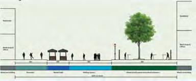
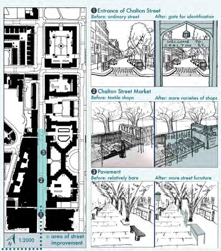
This module provides an Introduction to some of the basic drawing and presentational skills and techniques required in urban planning, combining freehand sketching and technical drawing with digital graphic tools and software (Urban Skills Portal and Photoshop). Two routes in London, one in Somers Town and one in Bloomsbury, are the backdrop to all the project work gathered for the urban analysis undertaken. The module also helps students to develop their creativity.
The aim is to develop through practical application the ability to:
- work effectively as part of a small team;
- present work using a variety of graphic techniques;
- use basic freehand sketching and technical drawing skills to communicate urban analysis;
BSc Planning and Real Estate
BSc Urban Studies
- use basic photo manipulation and presentation skills to compose effective graphic layouts.
On successful completion of the module, each student will have acquired skills in:
- analysing street composition and urban form through descriptive and observational analysis;
- collecting primary data speci c to an urban environment and present this information graphically;
- understanding, reading and executing a variety of graphic techniques that complement each other to enable 2D and 3D representation of space and the urban environment;
- creative graphic communication, including effective layout composition.
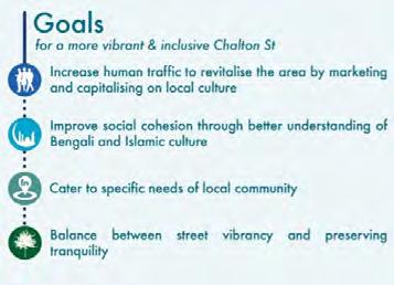
Underutilisation of Space along Chalton Street
Students: Bryan Goh Jian Hao, Chng Chun
Hua Ian, Lo Tsz Kwan Natalie & Weng Tai Ho
Coordinator: Dr Elisabete Cidre
Tutors: James Chadwick, Terpsi Laopoulou, Isabel Sanchez, Miguel Hincapie
BSc Urban Planning, Design and Management
BSc Planning and Real Estate
BSc Urban Studies
This module provides an introduction to the theory, techniques and appreciation of design within the context of town planning and urban design. It involves the development of technical and creative communication skills, both in oral and graphic 2D+3D presentation, that sustain the learning and developing of an iterative procedural approach to design problems.
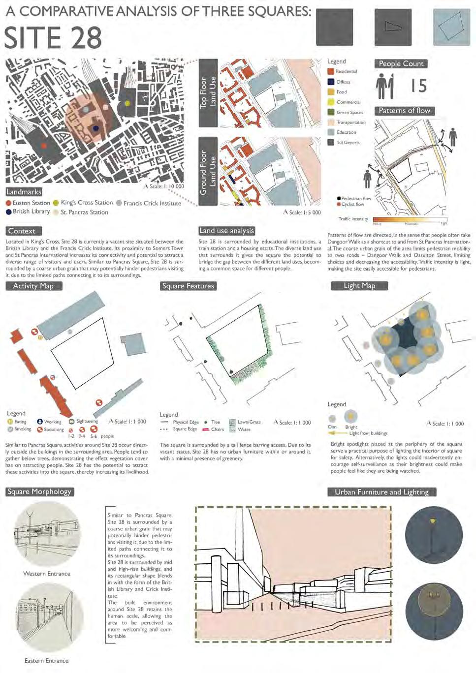
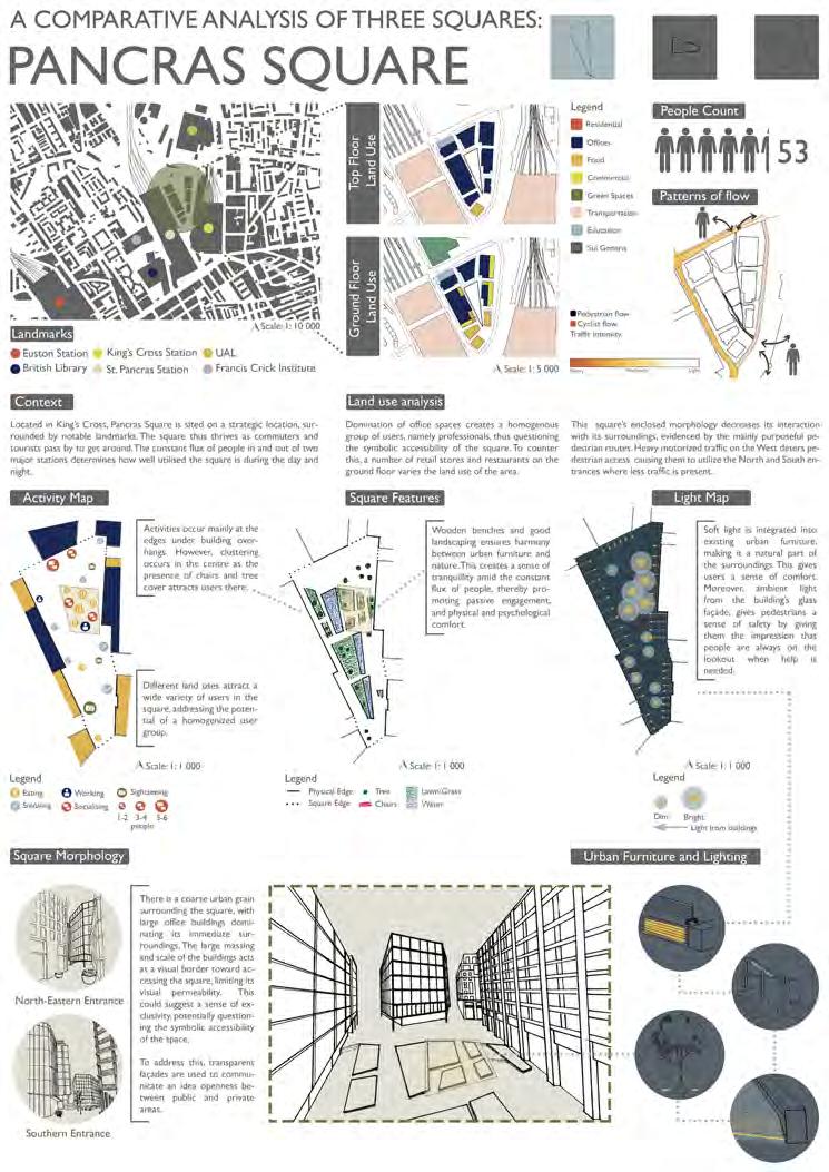
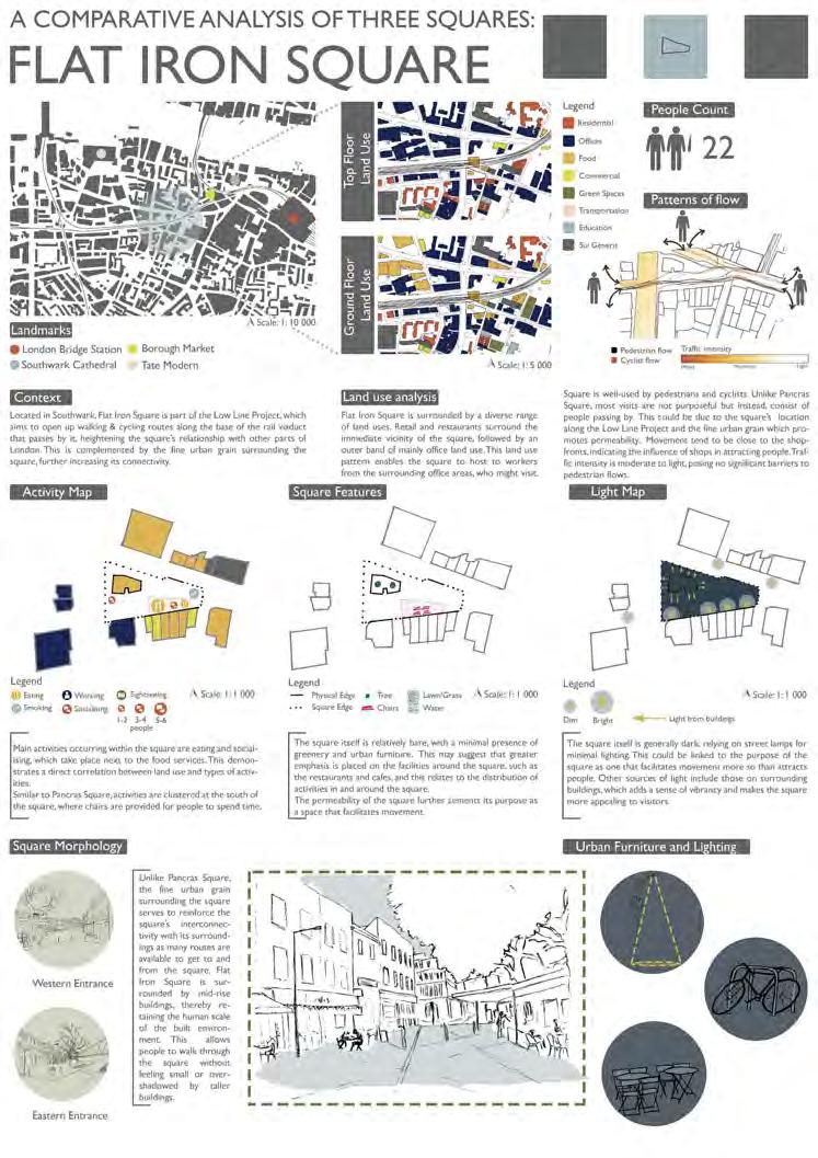
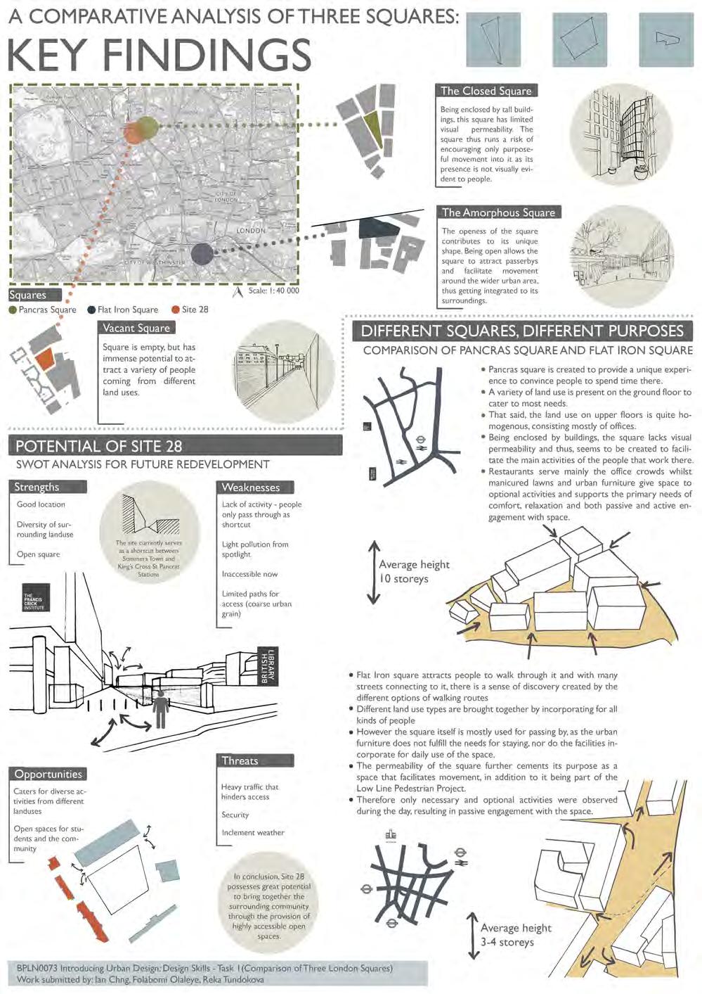
There is one ongoing project, focusing on Site 28, in London, which is developed in two tasks:
Task 1 – (existing) Urban Places: urban design analysis, methods and techniques
- Students work in small teams of three/ four to develop a comparative study of townscape(s) and site analysis looking at different urban design methods and techniques. The systematic analysis
explores issues of morphology/urban fabric, accessibility/mobility, and activity.
- The comparative analysis informs Task 2, whereby each student individually develops a proposal for the re-design of Site 28, sustained by a concept and vision for the future.

Coordinator: Dr Elisabete Cidre
Tutors: James Chadwick, Terpsi Laopoulou, Isabel Sanchez, Miguel Hincapie, Elisabeta Ilie
BSc Urban Planning, Design and Management
BSc Planning and Real Estate
BSc Urban Studies
Task
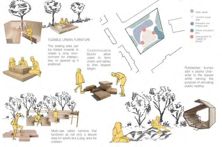
Each student proposes a positive design intervention to create a new and distinctive Public Space on Site 28 that respect its contextual surrounding uses and users (British Library, Francis Crick Institute, St Pancras Station, Somerstown housing estates). Students develop their design rationale through the graphic representation of their vision, concept and lessons learned (from London, and from other squares visited during the 4-day field trip to an European city, which in 20182019 was Lisbon, in Portugal), and they build a 3D model of their proposal.
On successful completion of the module, each student will have developed:
- an awareness and appreciation of townscape, buildings and urban spaces in context.
- an understanding of the value of comparative analysis and the use of different analysis methods.
- skills in drawing and modelling techniques suitable for analysing, describing and designing urban forms.
- the ability to identify problems in the urban environment and to develop skills in making constructive proposals for their solution
Urban Places: (re-)design of a London Public Space
Student: Reka Tundokova

Coordinator: Prof Matthew Carmona
Tutors: Wendy Clarke, Valentina Giordano, Terpsithea Laopoulou
BSc Planning and Real Estate
BSc Urban Studies
This module draws on the extensive theoretical underpinning of urban design as a means to:
· explore approaches to appraise the character of the built environment, and
· forward practical and even visionary proposals aimed influencing the quality, liveability and value of urban space as a key contribution to sustainable place making.
The modules illustrates the potential of design as a creative problem solving process, a process necessary to deliver the types of public and private investments in the built environment that will continue to return social and economic value to their users and investors over the long-term.
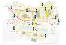
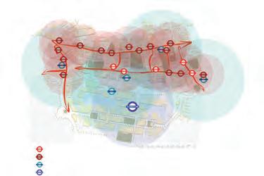
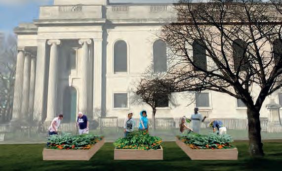
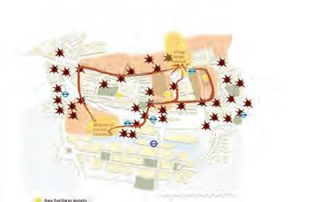
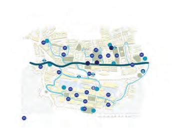
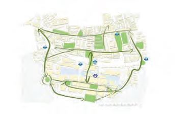
In 2018/19 the focus was on Poplar and its interface with Canary Wharf. In the context of the transformative projects
already occurring in the area (not least the coming of Crossrail) and the development pressures that the Poplar area is currently facing, the module sought to develop a new vision for this area to guide its successful transformation over the next 20 years. Groups were asked to develop a set of solutions that restore the integrity of the Poplar / Canary Wharf interface as a ‘place’ and not just a traffic /. Infrastructure artery, whilst considering the opportunities within and beyond into its surrounding areas.
The project provided an opportunity to rediscover the value and potential of one of London’s historic villages – Poplar – and to deal with the disconnection and inequity that followed redevelopment of Canary Wharf next door.
Poplar Connect
Students: Pui Chong (Paco) Chan,
Ying (Cecilia) Lam, Man Pok Leung, Ka Hei
Kristin Leung




Coordinator: Dr Joanna Williams
Tutors: Dr Joanna Williams, Jo Hintz, Rachna Leveque
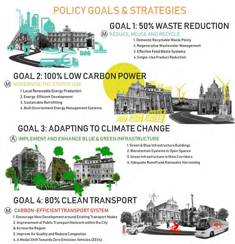
This module provides an opportunity for students to engage in developing a climate action plan for a city. It runs as an urban laboratory to apply creative problemsolving, critical thinking, and make use of knowledge acquired during the course to formulate a strategic vision for the future climate mitigation and adaptation in a city they have chosen. The output from this work is summarised in four panels:
Panel 1 The SWOT analysis – a diagnosis to identify where emission reductions can be delivered and the urban environment can be adapted for climate change. This stage identifies policy priorities for cities which forms the basis of the strategic vision.
Panel 2 Strategy - Appropriate strategies for mitigation and adaptation based on local conditions and the potential for change are
outlined.
Panel 3 Policy goals and instruments - the policy targets and instruments (regulatory, fiscal, educational, technological, design solutions) for reaching those targets are outlined.
Panel 4 Spatial Plan - the spatial plan illustrates both the impact of policy instruments on the physicality of the city and where area-based policies will be introduced.
This project-based module combines lectures, weekly tutorials, collective discussions and concludes with an Exhibition of the Planning Teams’ work led by students. Some examples of are featured here
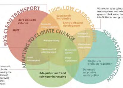
Take action now for Low Carbon Future of Catania Students: Anastassia Gusseinova, Ekaterina Chistyakova, Cristina Trovati, Cecilia Scapinelli, Sebastian Borkiewicz, Trevor Kennish, Alex Di Pasquale
Coordinators: Dr Susan Moore & Dr Claire Colomb
BSc Planning and Real Estate
BSc Urban Studies
This course is concerned with the interrelationships between society and space in contemporary UK and European cities. It explores key concepts and theories in urban studies, urban geography and urban sociology to understand the link between social change and spatial processes, as well as the urban policies and planning interventions which have been set up to tackle important urban issues. An important underlying theme is the effect of economic, social and political restructuring on patterns of urban spatial change and social inequalities in cities. The objective of the course is to raise students’ awareness of their social responsibility as future professionals in the field of planning, urban regeneration and real estate development, and become reflective practitioners. The lectures and seminars consequently encourage students to critically think about the social implications
of the trends, developments and policies shapingcontemporary cities, and about the social and political construction of ‘urban problems’ to understand the opportunities and limitations of urban (public) policies, planning and other interventions in urban space.
London is used as a case-study to illustrate and discuss key urban social issues.
One of the two assignments for the course is a ‘feature-style’, illustrated newspaper article of 1,500 words, done by groups of two students. Students were asked to investigate the contemporary urban social dynamics of a particular street, housing estate, public space (e.g. market, park or square) or area of redevelopment/ regeneration in London, focusing on the interactions between people and place, that is, between social groups and the
built environment. It tests students’ ability to identify in their urban surroundings the key socio-demographic trends, processes and sociological concepts introduced in the module, e.g. social segregation, ethnic segregation, gentrification, crime,
anti-social behaviour, tensions between social groups and uses of space, poverty and homelessness, crisis of public space, neighbourhood effect, the social impacts of regeneration/renewal, community mobilization and participation.
Stepping out of Hackney Wick station is like wandering into a disordered concrete jungle. Guiding you down the road is a brick wall decorated with graffiti. Almost instantly you are hit with the sound of drilling and hammering from the large construction site on your left.There, you will see a tower of luxury flats on the rise wrapped by a black opaque cover marketed ‘The Bagel Factory.’ The name is ironic; the very industry that previously existed there is successfully marketing the site into flats that are sold in excess of half a million pounds. As you draw your eyes to the ground level you will see the development enclosed in an 8ft fence covered with graffiti. The entrance to The Bagel Factory marketing suite is hidden around the corner, allowing only selective access through their closed-door intercom entry system.
The office manager of The Bagel Factory, dressed in smart casual, took a relaxed approach in talking about how the development would change the area. “They will keep a lot of the cultural factors in Hackney Wick, like the graffiti, but they will make it a bit more attractive, giving it that ‘Shoreditch feeling.’ I don’t think the locals will be too upset...” (1). Property developers commonly exploit creative industries to benefit the company’s marketing material with no intention to deliver affordable work spaces to benefit the artists (2). It’s clear that in this scenario the developer views the graffiti as aesthetically pleasing, rather than symbolic of the artists that live and work here. Moreover, graffiti is often an expression of voicing issues, such as gentrification.

The tale of gentrification is instantly recognisable in Hackney Wick. Laid out in the former industrial area is an eclectic mix of creative types and few remaining productive industries. Artists who are the early ‘pioneers’ of the area (3) inhabit former industrial warehouse buildings, adding an ‘edge’ to the area and making it an attractive place. Areas such as this eventually become a mere shell of their former self, often reflected with the faint outline of washed away artworks that used to give the place its identity. Shiny residential blocks and ‘every flavour bean’ coffee shops replace warehouse style buildings. The once vibrant communities are displaced with corporate types who live amongst empty homes obtained by investors, who will never visit the area but saw the new development on a foreign website (4).
3rd December 2018
Anna Carver & Olivia D’Mello-Browning
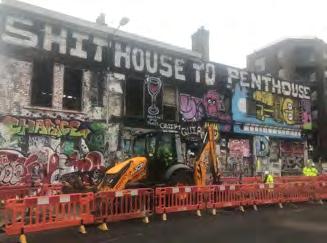
Hackney Wick was once famed for its of innovative industrial hub. The first plastic ‘parkesine’ and the first waterproof cloth were created there and the successful confectionary business Clarnico, famous for its peppermint creams, was first established there (5). Much of the local area was mapped out between 1870 and 1900, as the industries began to decline pre-1900s (5). Terry Bell, a former resident, recalled the “coronation street style, 2 up, 2 down houses with one family living on the ground floor in 2 rooms and another on the first floor”(6) that were created around retail centres on Whitepost Lane and Victoria Road (5). The quality of housing was extremely poor with inadequate drainage facilities and outside toilets.
Terrible conditions drew the Eton Mission to Hackney Wick (5) to improve the lives of young people in the area through community building. “You can imagine the Etonians coming down with their silk and top hats and seeing hundreds of kids like street urchins, no shoes, nothing.”(6) The mission erected the church and later a club house on the site of manor farm called Eton Manor. Later, during the 30s ‘slum’ clearance, large estates were developed to improve housing for the local community including the Trowbridge estate and Kingsmead estate (5). During this time the council actually cared about the welfare of the local community.
Having the densest concentration of artists in Europe (7), Hackney Wick still prides itself on its strong community. However, the relationship between the residents and the local authority seems to have diminished in recent years. Pete Bennett, a local artist, business owner and active community member plays a key role in engaging residents about development in the area. Not only does his social media platform inspire many people, but he also makes the time to talk to individuals whilst running his own business.
Yet, the number of affordable work spaces is declining faster than you can imagine and artists like Pete Bennett are under pressure to move out of Hackney Wick. The London Legacy Development Corporation (LLDC) insist that there will be “no net loss of artists’ workspace.”(8).
However, this is far because we’re making the area, but as soon Pete explained that ue their work and been displaced elsewhere,
It seems that disregard for the proposal to completely tion of the Blackwall GLC suggested that residents would
Today, developers when in fact the process clusive of residents. ticipation in planning even realise they were stall.”(10) Said one
Where is the collaboration developers
After the announcement would take place in Stratford, demolition would reshape Despite many sources merous compulsory where successful businesses gan closing as they couldn’t tion; Bowdens Glass to close in 2007, all Areas surrounding trified and saw the rise ing affordable art spaces veloper was able to benefit branding the marketing material, he had no intention
“Have you seen any “Nope.
Pete Bennett, his home with only ed to an area across Now all that remains character’ to the future are classed as ‘affordable.’
the studio space which of artists that were ers, without the realisation working with developers,
Coordinator: Dr Jessica Ferm
Tutor: Dr Stefania Fiorentino
BSc Planning and Real Estate
BSc Urban Studies
This 2nd year undergraduate module examines different perspectives on the economy of cities and regions as these apply to a number of salient trends and features of cities and urbanisation – urban form and structure, specialisation and diversity, urban economic agglomeration, suburbanisation, gentrification, the housing crisis, inequality, deindustrialisation and the rise of the creative economy.
The module is designed to produce an understanding of:
- different perspectives on the economy of cities and regions;
- key historical and contemporary developments in the economy of cities and regions;
- basic empirical methods for describing the economy of cities and regions; and
- the relationship between planning, urban policy and urban economies.
The module is assessed in two parts, a group poster and an exam. In the first assignment, students are organised into groups to produce and present a poster, a selection of which are featured here. The purpose of the poster is to:
- research a case study of a particular phenomenon covered in the module;
- demonstrate some understanding of the theoretical basis of that phenomenon;
- present and select appropriate quantitative and qualitative data from academic, policy and online sources, images, diagrams etc. logically ordered to tell the story of the case; and
- reflect on actual or potential urban policy or planning policy interventions to address the problems identified.
Research & Development in the level of investment in
theories, the region between Cambridge and Oxford,
2.5%
presents a unique opportunity to capitalise on
towards economies which rely on information-technology. Despite this shift, the framework for planning economic growth remains based on the principle of encouraging agglomeration; essentially the belief that the concentration of firms and housing has economic benefits.
of growth-tech companies. The proposed ‘growth corridor’ has been named CaMKOx.
Cambridge
CREATED?
London
agglomeration
with £20m link. station. an Oxford.
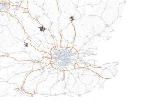
Marshallian theory argues amongst firms of similar nature occur when transport costs
Building on the investment in Commitment towards ‘Expressway’ between
• Knowledge spillovers - increased communication, initiating population across the corridor 2050 [5] .
Founded on such theories, the region between Cambridge and Oxford, encompassing Milton Keynes, presents a unique opportunity to capitalise on world-class universities and a plethora of growth-tech companies. The proposed ‘growth corridor’ has been named CaMKOx.
Cambridge
2018 [2] the government has set out the following
2.5% of GDP by 2027
The largest ever increase in the
Research & Development
in
current expertise: £6.9m driverless-vehicle testing scheme.
1m
investment to fund
Marshallian theory [3] argues towards city specialisation amongst firms of similar nature to provoke innovation. occur when transport costs are reduced through proximity:
The 21st century has seen a shift away from manufacturing based economies towards economies which rely on information-technology. Despite this shift, the framework for planning economic growth remains based on the principle of encouraging agglomeration; essentially the belief that the concentration of firms and housing has economic benefits.
• Linkages between input number of suppliers to access Productivity of firms is likely worker by 2050 [5] .
Founded on such theories, the region between Cambridge and Oxford, encompassing Milton Keynes, presents a unique opportunity to capitalise on world-class universities and a plethora of growth-tech companies. The proposed ‘growth corridor’ has been named CaMKOx.
London
A new East-West rail company established, with £20m investment to outline a Cambridge-Oxford rail link. £5m investment for the Cambridge South station.
• Labour market interactions higher skilled workers. The the corridor zone in 2014
In an Industrial Strategy [1] and the Autumn Budget 2018 [2] the government has set out the following steps to kick start the growth corridor:
from
CaMKOx will be able to develop specialist labour markets, research innovations and growth of knowledge-intensive companies.
Commitment towards construction of an ‘Expressway’ between Cambridge and Oxford.
The 21st century has seen a shift away from manufacturing towards economies which rely on information-technology. framework for planning economic growth remains based encouraging agglomeration; essentially the belief that the and housing has
Building on the corridor’s current expertise: £6.9m investment in a driverless-vehicle testing scheme.
• Linkages between input suppliers and final producers number of suppliers to access firms, encouraging competition Productivity of firms is likely to increase from today’s worker by 2050 [5]
1m homes by 2050. Housing deal with Oxfordshire: £215m investment to fund local infrastructure in return for 100,000 homes by 2031.
Housing deal with Oxfordshire: £215m investment to fund return for 100,000 homes by 2031.
face-to-face innovation as the 4.3-4.8m by allows a wider economies of scale.
Marshallian theory [3] argues towards city specialisation with the hope to gain from knowledge spillovers amongst firms of similar nature to provoke innovation. The benefits of agglomeration [4] reflect gains that occur when transport costs are reduced through proximity:
gain from knowledge spillovers agglomeration [4] reflect gains that
Founded on such theories, the region between Cambridge encompassing Milton Keynes, presents a unique opportunity world-class universities and a plethora of growth-tech companies. ‘growth corridor’ has been
External Economies of Scale: Expansion of the industries within the CaMKOx corridor will lead to the development of additional suppliers which benefit producers in the industry.
CaMKOx will be able to develop specialist labour markets, research innovations and growth of knowledge-intensive companies.
• Labour market interactions - increased availability of higher skilled workers. The economy in CaMKOx is expected the corridor zone in 2014 to 2.9m by 2050 [5] .
• Knowledge spillovers - increased population are grouped together to promote face-to-face communication, initiating innovation CaMKOx will see growth in the areas of innovation as the population across the corridor is expected to rise form 3.3m (2014) to between 4.3-4.8m by 2050 [5]
In an Industrial Strategy [1] and the Autumn Budget 2018 [2] the government has set out the following steps to kick start the growth corridor:
CaMKOx will be able to develop specialist labour markets, research innovations and growth of knowledge-intensive companies.
A new East-West rail company established, with £20m investment to outline a Cambridge-Oxford rail link. £5m investment for the Cambridge South station.
• Linkages between input suppliers and final producers - increased infrastructure allows a wider number of suppliers to access firms, encouraging competition and external economies of scale. Productivity of firms is likely to increase from today’s £50,000 per worker of output to £85,000 per worker by 2050 [5]
promote face-to-face areas of innovation as the between 4.3-4.8m by infrastructure allows a wider external economies of scale. worker of output to £85,000 per productivity due to the use of from 1.8m people employed in
POLICY INTERVENTIONS following
Commitment towards construction of an ‘Expressway’ between Cambridge and Oxford.
• Labour market interactions - increased availability of labour boosts productivity due to the use of higher skilled workers. The economy in CaMKOx is expected to grow from 1.8m people employed in the corridor zone in 2014 to 2.9m by 2050 [5]
External Economies of Scale: Expansion of the industries within the CaMKOx corridor will lead to the development of additional suppliers which benefit producers in the industry.
• Air quality issues
Building on the corridor’s current expertise: £6.9m investment in a driverless-vehicle testing scheme.
Agglomeration economies lead to additional economic transactions, this results in negative externalities. Population in CaMKOx region would suffer from [6]:
• High rent and house prices
• High travel costs
£268,350 £252,171
• Air quality issues
• Displacement of communities
• Displacement of communities
3. DISADVANTAGES
External Economies of Scale: Expansion of the industries within the CaMKOx corridor will lead to the development of additional suppliers which benefit producers in the industry.
1m homes by 2050. Housing deal with Oxfordshire: £215m investment to fund local infrastructure in return for 100,000 homes by 2031.
External
• Air quality issues
Marshallian theory [3] argues towards city specialisation with the hope to gain from knowledge spillovers amongst firms of similar nature to provoke innovation. The benefits of agglomeration [4] reflect gains that occur when transport costs are reduced through proximity:
Scale
Arguably, relying on agglomeration for economic growth is not the way forward. Diversity[9] is an alternative theory of promoting economic growth which does not suffer from the problems associated with agglomeration. Policies which could promote diversity include:
Fig.2. Negative External Economies in Production
• Displacement of communities
• Knowledge spillovers - increased population are grouped together to promote face-to-face communication, initiating innovation. CaMKOx will see growth in the areas of innovation as the population across the corridor is expected to rise form 3.3m (2014) to between 4.3-4.8m by 2050 [5] .
Cost & Price Output
As land uses determine land values and not vice versa [8], the growth corridor could become an area:
• Defined by a single industry
• Dominated by a few large firms
Long run average cost
• High barriers to entry
• Encourage mixed-use development to promote more variation and experimentation;
Costs & Benefits Price 2 Price 1 Socially output
• Enforcement of affordable work-space to maintain space on the market for smaller businesses.
• Linkages between input suppliers and final producers - increased infrastructure allows a wider number of suppliers to access firms, encouraging competition and external economies of scale. Productivity of firms is likely to increase from today’s £50,000 per worker of output to £85,000 per worker by 2050 [5]
• Using this model in CaMKOx’s case, the fundamental drawback to agglomeration can be identified: the benefits are accrued privately and the costs are socialised [7]
The desirability of this is questionable as the CaMKOx region may suffer from:
• Reduced employment choice
• Lack innovative firms entering the market, and
CaMKOx will be able to develop markets, research innovations and knowledge-intensive companies.
External Economies of Scale: Expansion industries within the CaMKOx corridor to the development of additional benefit producers in the industry.
Additional policy interventions which could reduce the problems identified:
• Enforcement of affordable home targets in new developments to ensure the area remains accessible to all;
• Implementation of pollution permits to give firms a financial incentive to foster sustainability.
• Labour market interactions - increased availability of labour boosts productivity due to the use of higher skilled workers. The economy in CaMKOx is expected to grow from 1.8m people employed in the corridor zone in 2014 to 2.9m by 2050 [5]
• Fostering agglomeration to create a region which is life-science orientated could result in an exclusionary economy
• Based on the principles of game theory, reduced competition due to tacit collusion.
All of the above would reduce economic growth.
Output (Q)
Agglomeration economies lead to additional economic transactions, this results in negative externalities. Population in CaMKOx region would suffer from [6]:
• High
Arguably, relying on agglomeration for economic
BPLN0081 Economics of Cities and their Regions Group 2: Ali, H., Fuller, A., Gusseinova, A., Herbertson, M., Kennish, T.
Fig.3.
• Using this model in CaMKOx’s fundamental drawback to identified: the benefits are the costs are socialised [7]
• Fostering agglomeration which is life-science orientated exclusionary economy.
Arguably, relying on agglomeration for economic growth is not the way forward. Diversity[9] is an alternative theory of promoting economic growth
• Using this model in CaMKOx’s case, the fundamental drawback to agglomeration can be
which does not suffer from the problems
As versa The CaMKOx MILTON
Arguably, relying on agglomeration for economic growth is not the way forward. Diversity[9] is an alternative theory of promoting economic growth which does not suffer from the problems associated with agglomeration. Policies which could promote diversity include:
Coordinator: Elena Besussi
Tutors: Elena Besussi, Dr Daniel Fitzpatrick, Magdalena Jakubowska
BSc Planning and Real Estate
BSc Urban Studies
This module provides an opportunity for students to engage in plan making process. It runs as an urban laboratory to apply creative problem-solving, critical thinking, and make use of knowledge acquired in other BSc modules to formulate a strategic vision for the future development of a London region and prepare the spatial plan that will deliver it.
The Project Strategic Planning for Climate Change considers a scenario in which the Greater London Authority (GLA) is looking for new ideas to address its objectives of tackling climate change by rethinking how society, economy and urban space interact. Students, organized in Planning Teams are asked to
- DIAGNOSE AND FORECAST URBAN CHANGE in the allocated pilot area with attention to spatial patterns and
morphologies; residential, retail, office and industrial land-uses; accessibility; affordability; tenures; economy and demographics (stage 1).
- PREPARE A STRATEGIC SPATIAL PLAN that demonstrate how urban space can support the reduction of GHG and the retention and enhancement of a diverse and inclusive economy and society (stage 2):
This project-based module combines lectures, weekly tutorials, collective discussions and concludes with an Exhibition of the Planning Teams’ works led by students. Some examples of stage 2 are featured here.
area revealed clear spatial accessibility, environment
revealed clear spatial accessibility, environment
infrastructures. The Spatial reorganising the study neighbourhoods, aiming to connecting to central London.
improve the
The Spatial the study aiming to connecting to central London. improve the


West Hampstead
West Hampstead’s structure provides great opportunities to redesign the area in line with compact-neighbourhood. The presence of light industry in the town centre provides potential for denitrification. Thus, creating a walkable mixed-use neighbourhood which encompasses employment, housing, social infrastructure and retail connected by green routes.
West Hampstead’s great opportunities in line with compact-neighbourhood.
The presence the town centre for denitrification.
walkable mixed-use which encompasses housing, social retail connected
Coordinator: Dr Juliana Martins
Tutors: Dr Juliana Martins, Dr Elisabete Cidre, Neha Tayal, Lucia Cerrada, James Chadwick
This module aims to develop skills and knowledge for carrying out large-scale inner-city urban design investigations, masterplanning, and detailed design proposals. It includes an introduction to Computer Aided Design (SketchUp).
The term is organised around one major project: the redevelopment of the Earls Court site in West London. The existing scheme is controversial and has raised concerns due to its density, urban form, demolition of housing estates and Exhibition Centres, and small share of affordable housing. Given the strong opposition of local communities, this module considers a scenario in which residents aim to develop an alternative scheme - the People’s Masterplan - that maintains their homes and offers a framework for urban intensification of the area.
The project comprises two tasks:
- Task 1: Analysis and Masterplan proposal (group work, 6 weeks) consists of developing an alternative vision and scheme for the site maintaining the existing housing estates, and providing a mix of uses and a minimum of 3.500 units. Three students’ proposals (featured here) were chosen by the class to be further developed in Task 2;
- Task 2: Detailed Urban Design proposal (individual work, 5 weeks) consists of developing in greater detail a section of one of these masterplans. The design response should address the massing and character of the built form, and the character of the streets and open spaces
This project-based module combines lectures and weekly tutorials.
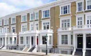
The
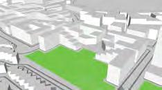
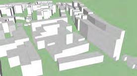
Retail, commercial office and public space are concentrated in the central southern part of the site due to its proximity to two underground stations and the Empress State building.
The cluster of tall buildings around the Empress State Building are mixed-use, retail, office and residential, as shown. This would allow the area, which is mostly office due to the Empress State Buidling, to maintain activity and presence at all times of the day.


BSc Planning and Real Estate
BSc Urban Studies
This is the third and final module in the ‘management’ stream which runs across all our three undergraduate programmes. The aim of this third-year module is to provide students with an introductory yet comprehensive overview of programme and project management as applied to urban projects. It draws on executive level practices, conveys ‘real world’ urban project situations, and encourages, through a mix of conceptual lectures, class exercises and case study presentations from guest lecturers, an understanding and appreciation of the complexities and dynamism that comprise modern urban project management.
The aim of the module is to provide students with an introductory yet comprehensive overview of project management as applied to urban projects. It also provides an opportunity to turn project management
theory and methodology into practice through the completion of two projectbased written assignments. The first assignment (30% of the overall mark) is the production and presentation of a group poster. An A0 poster is designed to support the group’s ‘pitch’ to a company board (or local authority’s scrutiny committee) to gain approval to go ahead with an urban project. Students are assessed on their application of theoretical concepts in project management to a group project of their choice, their understanding of the different components of a project initiation document (PID) and execution suitable to the project proposed.
The course illustrates the potential of PPM as a problem solving process, a process necessary to deliver the types of public and private projects in the built environment that will continue to return value to their users,
investors and local communities over the long-term. It also provides a stepping off point for final year BSc students by arming them with both the academic and practical
knowledge of urban project management applicable within the complexity of today’s urban networks.
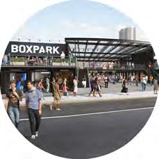
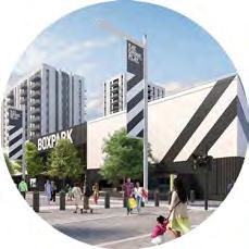
Bocpark Wembley London
Students: Zhaoxi Li, Lingzi Pan, Yuchi Ding, Raina Radia
around restaurant/café, of cycle regenproject

Internal Stakeholders (Board & Brent Council
Media Services erators, Fire of Health politan Police)
Lobbying
Local Residents
Local Businesses Visitors
Tanents
Local artists Boxpark -


- ECONOMY
A Plan Supporting the Local Economy
Help start ups transition
Attract workers to boost local economy and create new local services – OAPF Wembley target for 11,000 jobs

CULTURE -
To develop a leisure centre to help facilitate Wider Wembley regeneration project
Encourage cultural exchange by various types of businesses
Boost tourism within the borough

- SOCIAL -

- ENVIRONMENT
-
CONSTRAINTS & ASSUMPTION. SURROUNDING COMMUNITIES. this area STAKEHOLDER LOW POWER HIGH LOW FEASIBILITY of
Improve community links and social cohesion by created a new urban village to create a sense of place/belonging
Allow for Wembley Park to become a cultural focus point to boost tourism within the borough
Using environemntal friendly materials and ways of construction
Made up of recycled shipping containers
Utilizing abondon brownfield site
Coordinator: Dr Danielle Sanderson
Tutors: Dr Danielle Sanderson and Dr Patricia Canelas
BSc Urban Studies
This module considers Real Estate Development from the perspectives of various stakeholders including Planners, Developers, and those affected by development. It examines models of the development process and factors that affect land development. Development appraisal methods are discussed, and simple spreadsheet modelling of development viability is carried out.
The aims of the module are to enable students to:
- understand and evaluate developments from various standpoints, including economic, political and social;
- understand market forces and interactions between planners, real estate developers and other stakeholders.
By the end of the module, students should have acquired skills in:
- mapping the roles played by a wide range of actors and social and economic institutions in the development of land and property at different times and in different places;
- describing the interaction of land ownership, construction, development and investment finance, planning, and other aspects of regulation;
- critically evaluating real estate developments;
- carrying out simple development appraisals.
Revolution. At its peak the power station provided some 20% of London’s


Factors Influencing Development
UK Planning System
Inputs
42-acre site £9bn in investment
42-acre site
Conformity with the London Plan and wider Nine Elms Regeneration Plan
Factors Influencing Development Inputs
Battersea Power Station
Students: Oliwia Popek, Vicky Patyna Kieran Easton, James McDonnell Arne Janssen Design
Creation of 3,000 jobs through construction
Creation of 3,000 jobs through construction
£9bn in investment
Tenure Mix
Conformity with wider Nine Elms Regeneration Plan
Grade II listed building & surrounding brownfield sites
Grade II listed building & surrounding brownfield sites
Viability Assessment Renewable clean energy production
Grade II Listed and Heritage status EIA Protected Peregrine Falcon nests
Construction Methods


2, 5
2, 5 21 P E
Limited Significant Positive Negative Apple HQ Key
Regulation
Regulation
permission granted units, office units, retail entertainment, hotel apartments, plus other Physical constraint of working England’s guidelines on of the Grade II* listed The 40% reduction of affordable Section 106 Agreement backlash. Negative public badly on the rest of the
Surrounding Nine Elms Development
Project Timeline
due to inefficiency and maintenance costs, it was no longer feasible to produce power in the city, and the station was fully closed in 1983. The redevelopment now plays a central part of a wider regeneration scheme across Nine Elms. P E S T E L Brexit Championed by Boris Johnson Vauxhall, Nine Elms, Battersea Opportunity Area Drop in the value of the pound following Brexit decision Difficulty attracting skilled labour Change in ownership Affordable Housing Targets Surrounding Nine Elms Development Limited community resistance Grade II Listed and Heritage status EIA Protected Peregrine Falcon nests UK Planning System Tenure Mix Construction Methods Slowdown in high-end rental market Viability Assessment Renewable clean energy production Political Economic Social Technical Environmental Legal Limited Significant Positive Negative Apple HQ Key Conformity with the London Plan and wider Nine Elms Regeneration Plan 2009 2010 Planning permission given Northen extension Battersea REO & Treasury Holdings submit new plans to redevelop the power station Project’s masterplan approved Wandsworth Council the London
This £9bn redevelopment of the Grade II listed power station into a high-end, mixed-use area will be entirely funded by Malaysian owners PNB - there has been no public funding allocated. The scheme will provide about 4,300 new luxury homes - of which 9% will be affordable housing. As well as the mixed-use residential and retail space, the developers will unlock 18 acres of new public realm, including a new park designed by LDA Design. To increase connectivity to the area, the investors will fund an extension to the Northern Line, and create a new tube station called Battersea Power Station, due to be opened in 2020. The commercial space will be home to a number of high-profile companies, of which Apple’s new European HQ will occupy the most space.


The Programme explores both domestic and international planning practice and culture, and offers the opportunity to further embed learning through either a term spent in planning practice, or at an international partner institution.
Programme Director: Dr Michael Short


The Programme provides students with an academically based vocational education in City Planning;
Equips students with the knowledge, theory, skills and values required to become effective professional planners both in the UK and internationally;
Offers specialist courses based on the research expertise of the staff in the department;
Offers a principle and theory driven programme, which gives students both conceptual understanding, and the skills needed to tackle practical problems; and
Emphasises the importance of a spatial and comparative perspective to City Planning, the need for integrated solutions to planning problems for planning cities and regions, and the need for creative and research based solutions to the management of our built and natural environments.
This module is the first in a two-part PlanMaking module specifically for students of the new 2 year MPlan City Planning (the other module is run by Dr. Sonia Arbaci) which seeks to explore conceptions of densification in a studio environment. Densification is a term used in the built environment to denote, in some form, the increasing density of people living and working in urban areas. Advocates of densification argue that the denser a city, the more sustainable it is, since dense cities use less energy per person than suburban or rural areas where people are spread over a wider distance and so travel more often and further. It is also argued that less waste is produced by dense cities as smaller spaces take less energy to heat and cool and use fewer resources to fit
out. In addition, the level of infrastructure and supply chain coordination can be more efficient in areas of high density. It is our job in this studio to interrogate this assumption in relation to a site that each student chooses in London.

Density + Placelesness in the Nine Elms, Opportunity Area
Student: Stephanie Goldberg


Coordinator: Dr Sonia Arbaci
Tutors: Alexandra Gomes
This module provides an opportunity to engage in a strategic planning exercise in a wider metropolitan context in the UK. It aims to develop an appreciation of planmaking to foster changes that are socially, economically, and environmentally just and sustainable. Students apply creative problem-solving, critical thinking, and analytical skills and knowledge acquired in other modules of the Mplan City Planning.
The Project “Thamesmead for all” considers a scenario whereby the Peabody Group has commissioned an international competition for a Strategic Plan for the Thamesmead Waterfront, considered “the biggest regeneration project in London” that could benefit from a (new) town centre, the arrival of the Crossrail (2018) and a proposed DLR station (2026).
Teams of students, acting as planning consultants, respond to this call and develop a Strategic Plan in stages:
- broader context analyses of the project site in relation to national, and regional/city contexts;
- analysis - Plan exercise and initial strategic vision informed by site observations (surveys);
- strategic Vision - Concept Plan exercise: translation of the strategic vision into a spatial concept plan, informed by context analyses, site observations, theories/ concepts, and examples.
- strategic Plan for the project site: final output integrating the above in a clear rationale for the plan and including a set of spatial plans, sectoral policies and implementation.
This module operates as an urban laboratory where groups share their work building collective knowledge through interim presentations, class discussions, and show&tell sessions. The Neighbourhood Manager of Peabody Regeneration Team participated in the final presentations acting as the client.


Thamesmead Students: Lucy Bretelle, Stephanie Goldberg, Letian Liang
RESIDENTIAL (MARKET RATE)
RESIDENTIAL (CO-HOUSING)
This model has a bottom-up structure wherein decision making power flows from the membership base through an elected apparatus of committees. Notable exceptions are the social housing and secondary school, which administered by the borough.
Social infrastructure (various scales)
New housing paradigm (various scales)
New employment (various scales)
Improved movement
Improved access
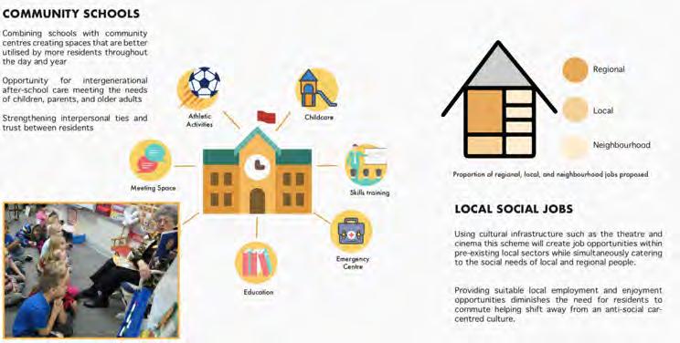
This scheme supports local artists by providing long term affordable live/work space and incorporating their work into the local landscape through renewal and rehabilitation of the built
Renewal projects include installations in underpasses, crossings and derelict spaces transforming barriers between neighbourhoods into places of strong local character and identity. 3.

 Picture from MPlan Instragram
Account

On 23rd October the MPlan City Planning students were given a guided tour of Peckham Levels by Makeship, who initiated the regeneration project.
The Programme is designed to equip you with the necessary skills to plan, appraise and deliver large-scale and complex infrastructure programmes and projects fit for the challenges of the 21st century.
Programme Director: Dr John Ward


The Programme looks at:
• the fundamental characteristics of major infrastructure projects, plans and programmes
• past and contemporary challenges and trends in infrastructure planning, appraisal and delivery
• the contribution that such initiatives make to environmental, social, economic and institutional objectives
• the international, national and regional policies, legislative frameworks and market contexts that surround nationally significant infrastructure development
• the diversity of stakeholders’ agendas and the inter-relationships and tensions between local, national and global objectives
• the critical issues concerning sustainable infrastructure investment
• strategic planning and risk management
• infrastructure planning and appraisal methods including: Financial, Economic and Social Cost Benefit Analysis (CBA), Cost Effectiveness Analysis (CEA), Environmental Impact Assessment (EIA) and Social Impact Assessment
This introductory module presents a framework for developing business cases for infrastructure projects both in the UK and elsewhere. It critically reviews the theory and practice in the field drawing from the experiences of the UK’s HM Treasury/ Department for Transport, the European Investment Bank (EIB), the World Bank and OMEGA Centre international case study research.
For this task, representing 20% of the module credits, student teams have been asked to critically evaluate the business case of a recently approved infrastructure project against the 5 case business model, a best practice framework developed by HM Treasury. The model strives for better decision making and project outcomes through the consideration of:
1. strategic case - Is the proposed project supported by a compelling case for change that fits within the strategic context and meets development needs?
2. economic case - Does the preferred project option optimise value for money?
3. commercial case - Is the proposed project commercially viable?
4. financial case - Is the proposed project affordable and how can it be funded?
5. management case – Is the proposal achievable and can it be delivered successfully?
Students presented their posters in class, highlighting performance of their chosen project against this framework. and discussing the relative strengths and weaknesses of such models, and their adequacy for guiding project ‘successes’ fit for the multiple demands of infrastructure development in the C21st.
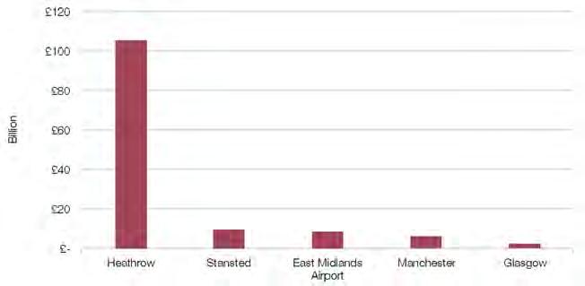
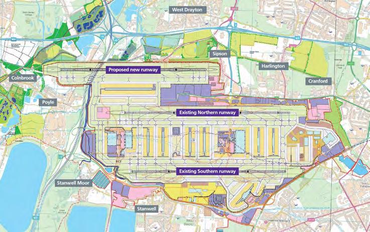
Heathrow is the busiest two runway airport in the
Airport Capacity in the United Kingdom
Students: Yiming Zhou | Haihong Zhu | Hirohisa Kondo | Edward Aitken
The Commission’sStrategic alignment provide
The business inEurope, Change Framework
Allshort scheme changes
The final this Competitors demand
TimelineSource: Aldred2018
The final this Competitors demand
Report, andto growth, relative decline withthe UK Climate Aviation Policy
The optionremains Heathrow Heathrow its the otherEuropeancompetitors optioneeringexerciserather
these vary are contingent
funds, however, greatly by party
Current incorporate identified comparison expensive Fi
of UK aviation,
The Commission’sobjective for the Cost and
Integration
affordable and financeable
The business to complete be made assumptionswereaffected
The Commission’s maximise economicbenefits the UK economy,
Politicsis inherently and the ability
The optionremains Heathrow Heathrow its the otherEuropeancompetitors optioneeringexerciserather Current incorporate identified comparison expensive
StakeholderEngagement
It isgenerallyobserved the complexityis priorities of British Airways option did not key parties approach to stakeholders influentialparties
The affordable Aero
To complete the Cost namely,economic GDP, UK consumerexpenditure like oil prices, fuel activity, itislikely that leave the EU one year benefits invalid Moreover, International EnergyAgenciesprojections which creates Commission, 2015). stipulated a departurefrom globalimplications
Settingthe
In basing the restson an commencement which alignswithglobal environmentis projectoutcomeswill
In asking the maintain the clearlyidentified
Integration runwayat Heathrow of 50% on surfaceaccess tothe estimated these costs higher value making the projecteconomically assumptionsmade may also look at the project sponsor, government as they beenagreed to date determine Surface
Noting the of airport capacity of the business Brexit:Soft,hard
Source: OWGRA 2018
A third runwayat Heathrow willproduce up to 260,000 additionalair movementsper year, or an increase of 50% on currentmovements(AirportsCommission,2015). To facilitate this growth, surfaceaccess tothe airport must also be significantlyincreased The AirportsCommission (2015) estimated these costs at approximately £3 Billion but TfL’s subsequent assessmentwas £18 Billion
The Northwest anassumption demand airlines Bookrequiresevidence to that associated Financial The environment negotiation financial A decision sounding the sufficient Heathrow Northwest Scheme
Assess the overall viability,and the
Coordinator: Dr Dan Durrant
Tutors: Dr Marco Dean, Dr Martin Hurst and Prof Peter Rees
As a group students play the role of an international consultancy recruited to propose alterations to the UK infrastructure planning regime. They are required to quickly familiarise themselves with the current regime and identify a project or set of projects which will form the basis of a critical case study report. The aim of the report is to demonstrate how their proposed methodology (this will be a suite of different methods, based around Multi Criteria Analysis) would have, if applied have produced better spatial outcomes.
The course aims to develop student’s skills in applying a range of techniques encountered in the IPAD programme to the development of a critical case study report. The report will to critique both UK projects and the processes used in their consent. This will require an understanding of the UK infrastructure planning system(s)
as well as; the principles and practices of project appraisal, evaluation, scenario planning, public consultation, stakeholder and expert engagement and the ability to select and apply some or all of the appropriate techniques. Specifically, this requires the analysis of a wide range of policy and background information on the selected project and the issues generated.
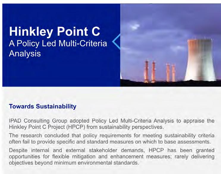
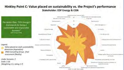
The MSc/Dip International Real Estate and Planning focuses on the relationship between the property development process and the planning systems of Europe and beyond.
Programme Director: Dr Nicola Livingstone


The MSc/PGDip explores the systems through which urban planning and property development operate:
- market mechanisms
- ownership frameworks
- taxation and subsidy
- land use
- policy planning
It also considers market mechanisms from the perspective of investors, developers and occupiers of buildings, and the relationship between markets and policy at various geographical levels.
The programme consists of lectures and seminars, project work and a dissertation. It aims to give you an understanding of the range of variation across national boundaries, and theoretical and practical knowledge that can be applied internationally.
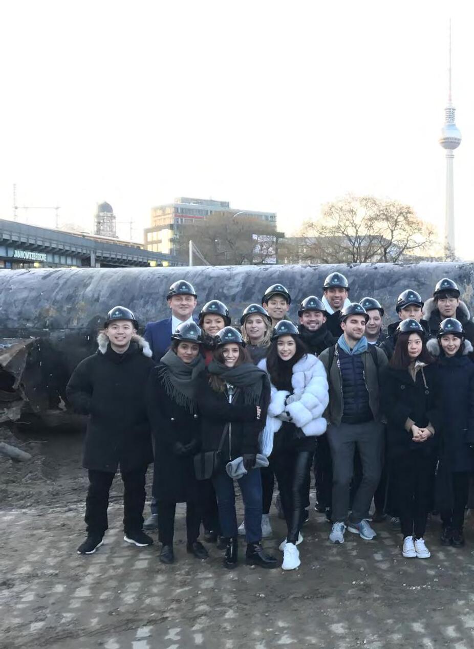
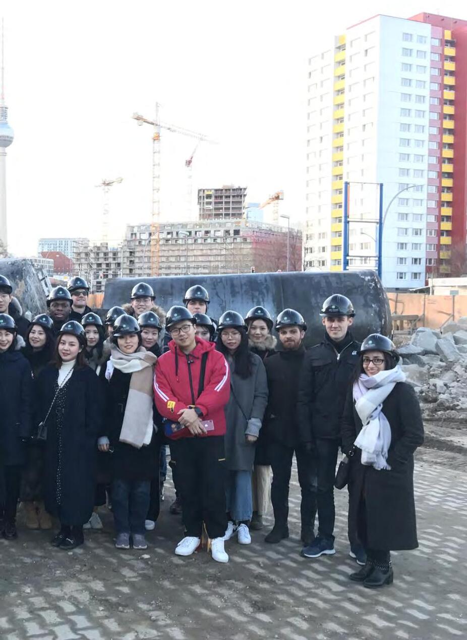
This programme has a unique focus on urban design as a creative planning tool and the interface between urban design and city planning. It stresses the importance of planning as a positive and propositional force for good, and of urban design as a discipline within which the physical shaping of places is accompanied by an equal concern for their economic, social and environmental well-being.
Programme Directors: Dr Juliana Martins
Dr Pablo Sendra


The programme offers a comprehensive understanding and exposure to urban design theory and practice, with a particular emphasis on its interface with key dimensions of planning, real estate and sustainability. It aims to help students develop an understanding of the quality and diversity of design products and plan-making processes, the ability to think in critical, creative and analytical ways across different dimensions of the city, and the capacity to engage with project work across scales and practice in the fields of urban design and city planning.
• a programme with a unique focus on urban design as a creative planning tool
• a long-term urban design research specialisation
• an inter-disciplinary programme that integrates various social science disciplines
• an international focus, drawing on comparative studies and experiences from other European, North American and Asian countries
Coordinator: Professor Peter Rees
Tutors: Bianca Maria Nardella, Dr Stefania Fiorentino, Dr Katayoun Karampour
The best examples of British urban regeneration are created by collaboration between the development industry, architects and local planners. Through site visits, presentations and critical interrogation, we learn how this is achieved. The absence of municipal master planning in the UK creates opportunity and flexibility for the development sector, but requires unique planning skills to shape projects and represent the needs of the community. Students visit areas of major commercial development in Central London and receive presentations from senior property professionals, architects and planners. The course covers key elements of masterplanning, architectural design, real estate and project management, which combine to produce successful development projects in London, a world business city. Through tutored walks, critical discussions and team work, students develop the ability to:
- analyse existing urban neighbourhoods
and their regeneration/development potential; and
- communicate area assessments and opportunities, both orally and graphically.
Student teams are assigned to one of the featured locations to identify the unique set of characteristics that form its identity as a place. This activity is complemented by gathering information on local transport provision, accessibility and land use, and a review of the local planning policies relating to development. These studies will culminate in team presentations “selling” the key attractions of the location, as a potential commercial investment opportunity, to a panel of development professionals at the final session. In addition, an individual submission will describe the merits and urban character of a London neighbourhood. This combination of team-working and concise presentation mirrors the “real world” of real estate.
Borough Community Association
Students: Victoria Snarska
Ching Yu Wong, Natalie
Cheuk Yan Tong, Christy Chatnam Lee
Sukon So Yasuha Murabayashi


Coordinator: Elena Besussi
Tutors: Marian Larragy, Paula Morais, Dr Pablo Sendra, Dr Michael Short
In collaboration with Just Space
High streets are ubiquitous in London and essential to its social and economic life: “47% of businesses outside Central London are on a high street and 1.45 million employees work on or within 200 metres of a high street, and this number is growing” (LSE, 2017). Despite consensus that that the high street is a key urban, social and economic environment for London, there is heightened concern among local community groups and researchers that planning has but a minimal understanding of the social value of the high street and of the role it has in supporting the social and economic wellbeing of marginalised and low income groups in London.
This year’s project is dedicated to the London’s high street and to develop critical knowledge as the basis to develop planning and design propositions that are socially just. The module’s pedagogical
rationale is underpinned by the notion that the content of urban design proposals and planning strategies relies heavily on the type of knowledge we produce about urban environments. For planning and urban design to be socially just, their practice must be grounded in an ethical approach to knowledge production. Students conducts systematic studies of London high street covering themes such as work, culture and social value followed by a critical assessment of the impacts of the London Plan on the future of the high street.

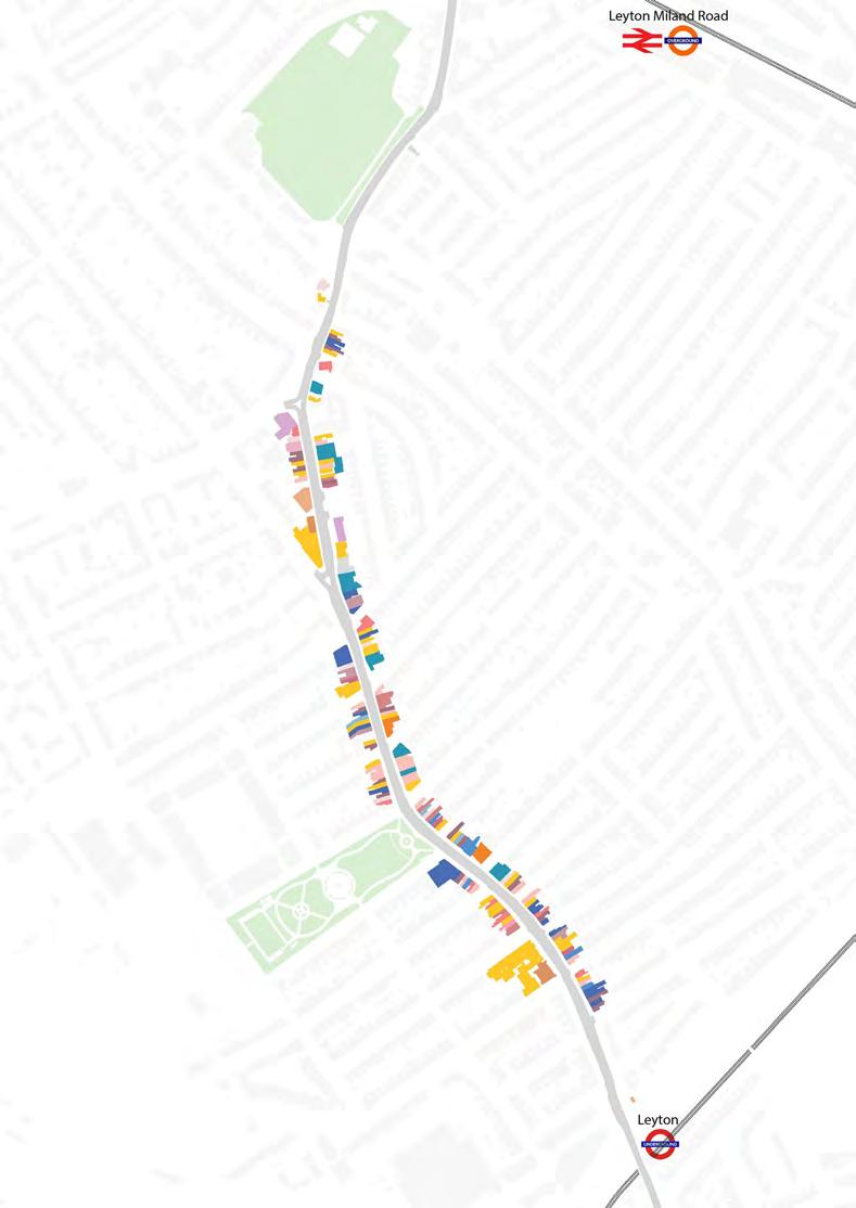
Affordability comparison: where selected products are cheaper


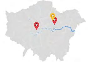


Travel Agency
Gambling Advisory
Beauty
Real Estate Agency
Laundrette
Hotel
Education
Car Services
Healthcare
Others
Groceries
Tool/Hardware
Electronic Accessories
Others Food & Drinks
Social
Services overall
Retail overall

High Road Leyton Students: Victoria Snarska, Jane Rossman, Ching Yu Natalie Wong, Cheuk Yan Christy Tong
Juanita Soto Ochoa, Eduardo Torres Rojas
Coordinator: Dr Pablo Sendra
Tutors: Dr Pablo Sendra, Dr Michael Short, Joost Beunderman, Dr Patricia Canelas, Dr Daniel Fitzpatrick, Marco Picard
The aim of the course is to provide the student with a holistic approach to all the aspects of sustainability: social, cultural, economic and environmental. It seeks to make the student reflect on possible sustainable future cities by addressing issues that are currently at the forefront of the debate on urban design and city planning: how to make cities more inclusive, collaborative, consume less resources, interact with nature and, at the same time, strengthen its design and maintain and reuse its heritage.
The module combines design and theoretical reflection through a series of lectures, workshops and a design proposal. This year, we have been working on the Wandle Valley and have worked in collaboration with the Wandle Valley Regional Park Trust. Students first developed proposals related to the workshops on the key topics of sustainability. After completing the
workshops, they developed a “Sustainable Vision” for the Wandle Valley, which is presented through a poster and a creative piece of writing.
The key topics of sustainability that the lectures and workshops address are:
- City and nature: interaction between humans, non-humans, city and nature. Land use, food, waste, urban metabolism, urban fauna and flora.
- Urban character and heritage: what makes a place, townscape, urban conservation.
- Collaborative urbanism: participation, co-production, co-design, collaborative economy.
- Inclusive cities: social justice, culture, gender, age, democracy and welfare delivery.
Court -
BPLN0034 - Task 2 - Bringing Together the Young and Old on the Wandle - Alex Clarke
WHAT
Diverse age demographic around Wandle
Wandsworth
Increasing population of under 19s and over 60s
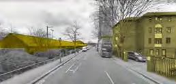
Disconnect between these age groups, both vulnerable to loneliness
Wandle ValLey provides opportunity to facilitate interaction between these groups
Interaction in new public space will raise awareness of the unique River Wandle environment
Interaction in new public space will raise awareness of the unique River Wandle environment
Communities using new public space will be able to shape and transform it over time
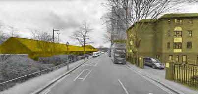
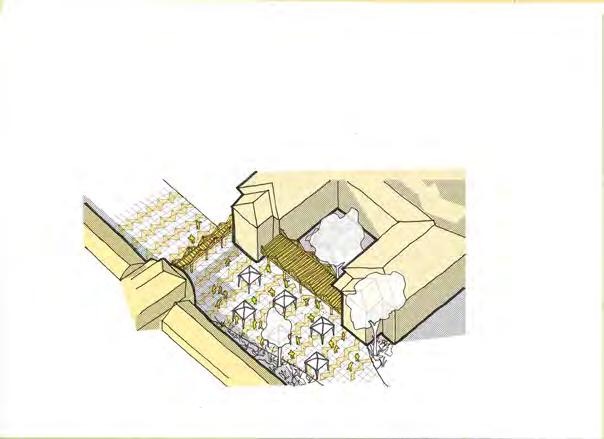

Currently the Recreation Centre and Over 55s home are fenced off with a

Communities public able transform

Mantle CourtOver 55 Living
Wandle
Over 5 - 10 years, transformation to a community hub for all ages will bring lasting sustainability
Wandsworth Council will team up with Local community groups focusing on the young and the old. They will engage with Mantle Court (Over 55 Living) and the Wandle Recreation Centre to create a new public space, while reducing the physical and social barriers between the predominantly younger users of the recreation centre and the over 55s in Mantle Court.
A pavilion structure will be made, bridging the Over 55s home, public space and Recreation Centre. Residents and users will be involved in the design process, culminating in a community barn-raising event. Eventually
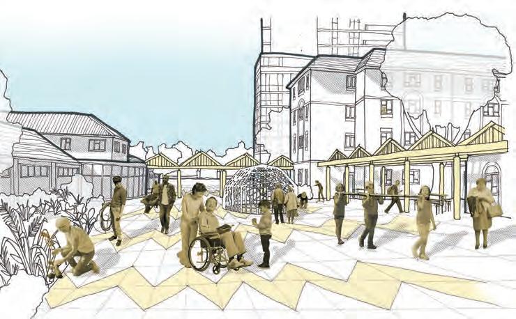

Eventually a re-paved space will be created, linking Garratt Lane to King George’s Park and facilitating events run by Forever Fit and others. This will be linked to community-owned gardens on the River Wandle, this sense of ownership redefining the local’s relationship to the river.

Coordinator: Dr Juliana Martins
Tutors: Dr Juliana Martins, Prof Stephen Marshall, Colin Haylock, Neha Tayal, Ming Cheng
This module is the first part of the Urban Design Specialism. It provides an opportunity to critically investigate the spatial characteristics and qualities of the built environment, with a focus on layout, density, and typology, and explore the use of different typologies in the development of design proposals. It aims to develop knowledge and a range of skills for carrying out urban design investigations and proposals. Considering a hypothetical scenario in which the Mayor of London wants to consider possible appraoaches to the development of site of the former Holloway Prison , students are asked to undertake two interrelated tasks:
• Task 1: Comparative analysis of two urban building types from the surrounding area (individual work, 4 weeks) is an introduction to the concepts of density and typology and aims to develop both an understanding of the spatial structure and scale of the built environment, and how these characteristics relate to the qualities
and perceived character of place, as well as analytical and graphic skills;
• Task 2: Urban design proposal (group work, 6 weeks) consists of developing an alternative vision and masterplan for the Holloway Prison site by exploring and testing different typologies. This exercise aims to foster the ability to engage with design as an iterative process and includes: an analysis of the urban context; the development of an overall strategy and two options that explore alternatives for redevelopment; a final masterplan.
This project-based module combines lectures and weekly tutorials. Students are encouraged to explore relevant theory to inform the analytical and design work.


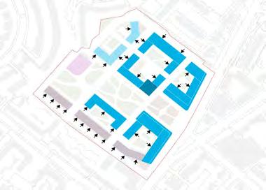


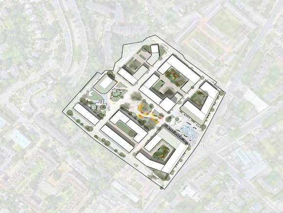
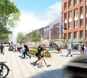
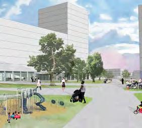
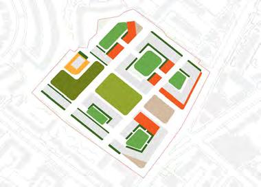



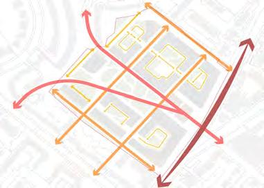
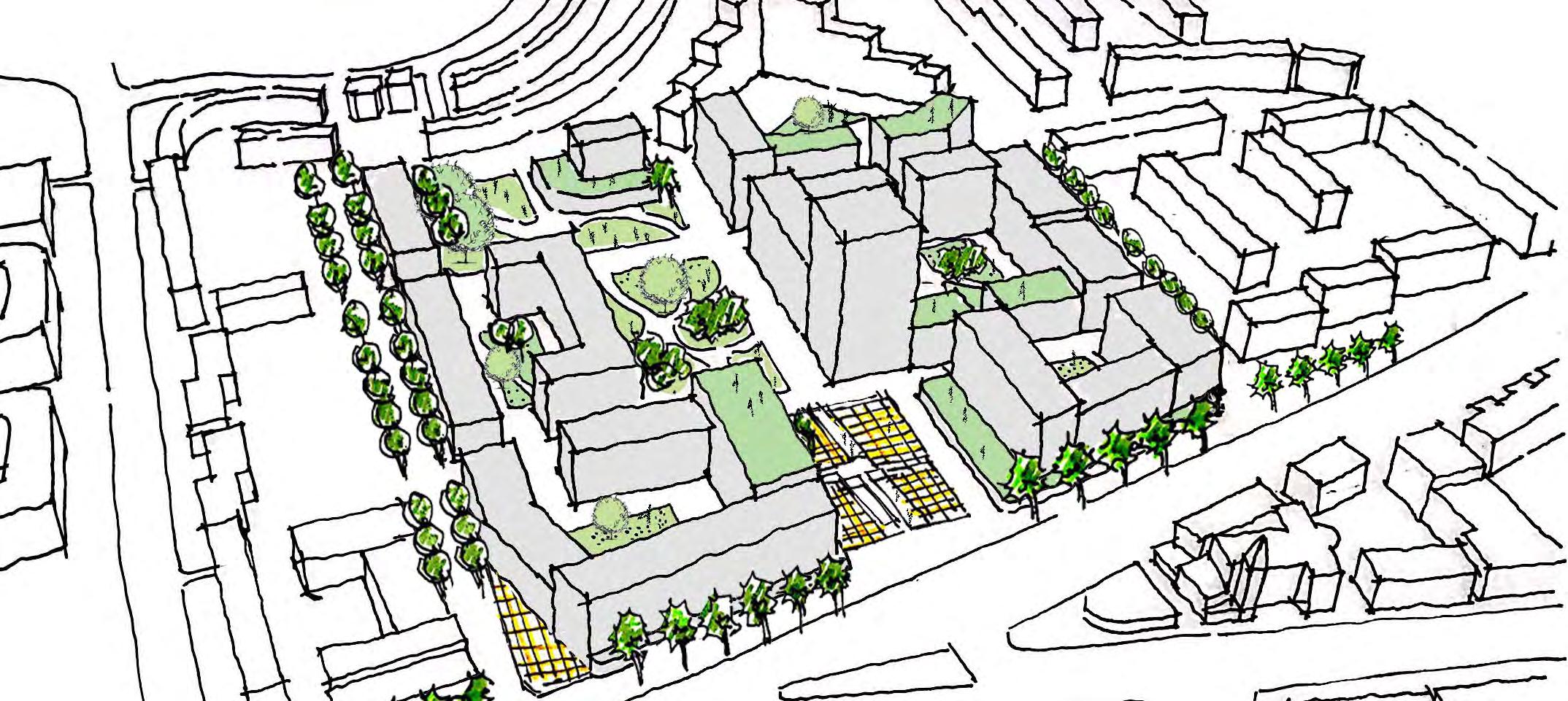
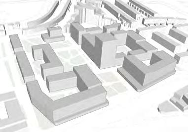


Coordinator: Colin Haylock
Tutors: Wendy Clarke, Valentina Giordano, Dr Stefania Fiorentino, Dr Richard Timmerman, Omar Sherif
This module engages students in the conduct of urban design at one remove from directly designing places. This is urban design as conducted through the planning process and its work on influencing design delivered by others - developers, architects, etc. It works from visions and related outcomes, through mechanisms designed to secure the outcomes sought in terms of the nature and quality of places. The module studies this activity at a range of scales from the strategic to the detailed.
The module uses London as laboratory and current plans for various parts of the city as the starting point for study. Students work in small groups each of which works on a different area. The areas chosen deliberately cover a wide range of scales ranging from London Plan Opportunity Areas with their strategic approaches to delivering large scale change, through the more modest London Plan Intensification
Areas to very locally based Neighbourhood Plans. All module presentations at the end of each of the module’s two stages allow the sharing of experience between the range of areas and scale of planning covered.
Apart from the expression of individual reactions to the area and the related existing planning document in week 1, the whole of this module is conducted through group work. Group working, with members often coming from very different backgrounds and bringing different skills to the work, parallels likely working contexts. The group working in the module is, therefore, seen as a beneficial educational experience in itself. To emphasise this, the submissions at the end of each of the two stages include a reflection on the experience, conduct and management of the group work and individual contributions to it.

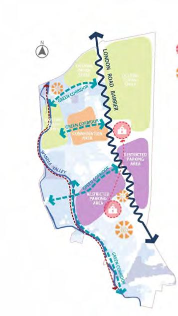
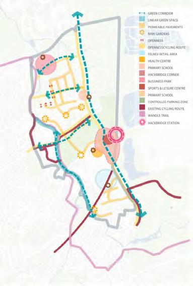
Coordinator: Dr Filipa Wunderlich
Tutors: Dr Filipa Wunderlich and Dr. Catalina Turcu
Supervisors: Principals at Clarion Housing Group, Urban Movement, Urban Initiatives, Lewisham Council, East - Architecture, Landscape and Urban design, Haylock Planning and Design, Urban Architecture, AECOM Design + Planning, EMEA, Scott BrownRigg
To complete the MSc Urban Design and City Planning and MSc in Sustainable Urbanism, students are given the option to submit a Major Research Project. This project should typically focus on a key area of knowledge covered in the course, e.g. urban design, urban design guidance and control, housing and development, sustainable urban design, sustainable transport, or other.
A Major Research Project represents an in-depth exploration of a complex topic / problem. It is a demonstration of knowledge, a critique, and the application of this knowledge and critique into a project. The project will focus on a particular site, method or process and will be propositional, delivering a vision, and working it out in depth so as to exhibit its potential, but also reflect upon its limitations. The major project should embrace the complexity of
the chosen topic and apply knowledge in a critical and reflective manner. Students will be assigned a practice-based supervisor from amongst consultants working within the Sustainable Urbanism and Planning, Design and Development fields. All students have 4 individual faceto-face supervision meetings to discuss their project with their practice-based supervisors, and 2 workshops, in which students will need to present their project and will receive feedback from across the team of supervisors and students involved in this Major Projects route.
Objective 1/ Spatial: mitigating water sensitivity by retrofitting a network of SuDS.
Problem: Water sensitivity (and in worst case water shortages) is the most prominent problem, which is catalysed by poor planning, design and management of water.
01/ SPATIAL
Objective 2/ Environmental: increasing biodiversity and ecology through rewilding strategies
Problem: An abundance of impervious surfaces, no green network only isolated public spaces, water is an issue for urban greening.

urban design Social contribute to transferability Cape drainage stormwater. state comprehensive urban on the quantity,
02/ ENVIRONMENTAL


Objective 3/ Social: repurposing disused public spaces through
are costly and non-environmentally friendly; these options oppose sustainable solutions. The images (right) provide examples of poor design, planning and management with regards to water sensitivity in Cape Town.

RETROFITTING: SUDS TYPOLOGIES


What is Rewilding?
urban landscaping nature’ (Kowarik 2017) where there is or Rewilding is beneficial functional and aims targets in urban reintroducing flora ecosystems services, land’ and giving benefit of people in amenity, and most of the natural environment. is that it acts as a is carried out through Thus, rewilding ‘explicitly dysfunctional ecological function via a (Sandom et al. 2013).
REWILDING: GREEN INFRASTRUCTURE


Incorporating rewilding applied by xeriscaping urban fabric, thereby water usage for the In addition, greywater for every day purposes. to maintain the its purpose as complementary strategies collaborate to increase respond to (1) water (3) Amenity. These problems (see page



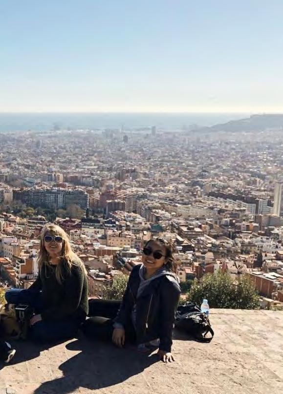
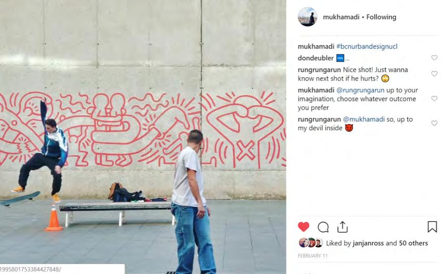
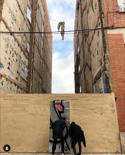 Madi Mukhametaliyev
Jane Rossman

 Stephan Zhang
Consuelo Morales
The MSc Spatial Planning programme provides a general introduction to planning theories, systems and cultures with a focus on the importance of taking a spatial perspective and on UK practice.
Programme Director: Dr Ben Clifford


The MSc Spatial Planning provides:
• an integrated programme, with all modules linked by common principles
• a programme dealing with real places and the role of planning in placemaking
• a spatial perspective on planning systems and cultures
• lecture- and seminar-based modules, project work, site visits and the preparation of a 10,000 word dissertation
• The degree looks at how people, places and the environment interact and change, and the ways this might be influenced. The focus is on UK practices. They’re considered within a European and global context, and approached through critical analysis and evaluation.
The degree includes both core modules, providing an introduction to key knowledge, and specialist modules, allowing you to tailor your studies to your interests.
Coordinator: Prof. Matthew Carmona
Tutors: Gualtiero Bonvino, Wendy Clarke, Elisabeta Ilie, DrnStefania Fiorentino, Dr Hooman Foroughmand, Valentina Giordano, Dr Katy Karampour, Leo Hammond, Terpsi Laopoulou, Mat Proctor, Dr Pablo Sendra
MSc Sustainable Urbanism
MSc Urban Regeneration
MPlan City Planning
This module draws on the extensive theoretical underpinning of urban design as a means to:
· explore approaches to appraise the character of the built environment; and
· forward practical and even visionary proposals aimed influencing the quality, liveability and value of urban space as a key contribution to sustainable place making.
The modules illustrates the potential of design as a creative problem solving process, a process necessary to deliver the types of public and private investments in the built environment that will continue to return social and economic value to their users and investors over the long-term.
In 2018/19 the focus was on Poplar and its interface with Canary Wharf. In the
MSc Urban Design and City Planning
MSc Spatial Planning
MSc International Planning
context of the transformative projects already occurring in the area (not least the coming of Crossrail) and the development pressures that the Poplar area is currently facing, the module sought to develop a new vision for this area to guide its successful transformation over the next 20 years. Groups were asked to develop a set of solutions that restore the integrity of the Poplar / Canary Wharf interface as a ‘place’ and not just a traffic /. Infrastructure artery, whilst considering the opportunities within and beyond into its surrounding areas.
The project provided an opportunity to rediscover the value and potential of one of London’s historic villages – Poplar – and to deal with the disconnection and inequity that followed redevelopment of Canary Wharf next door.
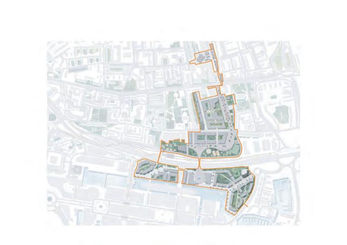


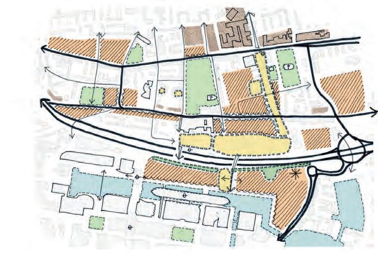


Coordinator: Elena Besussi
Tutors: Emanuele Belotti, Elena Besussi, Dr Patricia Canelas, Dr Michael Short
Neighbourhood planning is one of the key innovations brought forward by the reform of the UK planning systems. It seeks to allow local communities to make decisions about the future development of their area by establishing Neighbourhood Forums and developing Neighbourood Plans. In London Neighbourhood Forums faces a key challenge: the development of technical expertise and evidence base required to prepare plans that can successfully negotiate local needs with the strategic dimension of London’s planning.
In the context of this “planning revolution”, the module gives the students the opportunity to experience what it means to be a planner in a live context. In groups, students will work collaboratively with existing London’s neighbourhood forums and use planning and spatial knowledge to support their progress towards the creation of a neighbourhood plan.
The module aims to provide students with the competence, confidence and skills required to develop urban plans and spatial knowledge which critically engage with planning as a peopled, political and technical process. It provides an opportunity for students to use previous knowledge and knowledge acquired in other modules and apply creative problem-solving and critical thinking to the development of an actual urban plan that can influence the future of a London’s area.
Neighbourhood Forum





Green Space and Connectivity: Roman Road Neighborhood Plan
Students: Gargi Roy, Grace Hewett, David Maguire, Wing Lam Tse, Emilio Romero,Hiu Yam


People of the Neighbourhood


Green Links
Green spaces in social housing
Publicly accessible green spaces
Water bodies/ canals
Schools
Neighbourhood Boundary

Revitalisation of of social housing
Revitalisation
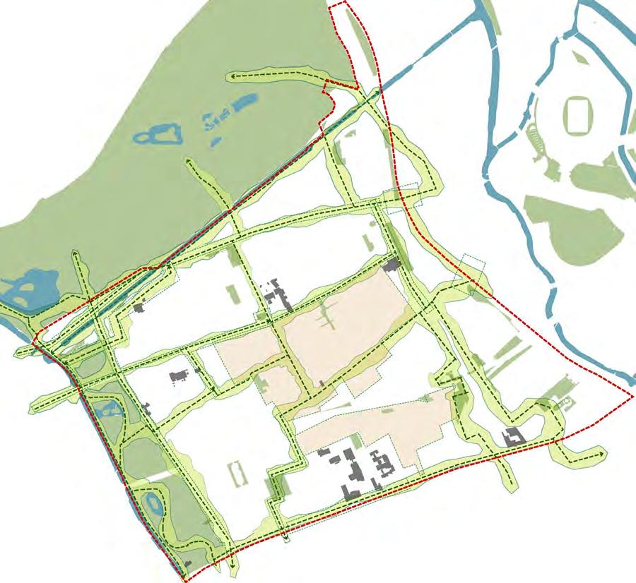
Implementation the neighbourhood Retrofit on Grove Improving the Enhancement cycling network Proposed Spatial Diagram of the Neighbourhood
Proposals of the selected theme:

Revitalisation of of social housing
Revitalisation

The Programme brings together three critical perspectives - in three linked streams - on the housing question, examining how planning policy and practice contributes to the wider environment for development; how housing development is financed and managed; and how new housing may have a lighter environmental footprint, and older housing retrofitted to lessen its impact.
Programme Director: Dr Iqbal
Hamiduddin

The programme examines development from multiple perspectives: examining its regulatory context; seeing it as a project, large or small, to be financed and managed; and viewing it also as an opportunity to contribute to broader environmental and social goals through good design. It aims to provide a rounded perspective on housing development, imparting a critical understanding from planning, design and project-management perspectives.
It delivers critical understanding and a range of key skills. Graduates from the programme will have demonstrated their ability to work within the regulatory context, developing realistic proposals for housing development that are feasible in terms of policy compliance and financing. They will also have an in-depth understanding of housing design and retrofit and will be able to relate these to the management and financing of projects.
The programme is directed to urban professionals and graduates from the fields of planning, property, architecture and project management who are looking to specialise in the area of housing development.
Coordinator: Dr Sonia Freire Trigo
Tutors: Dr Sonia Freire Trigo, Lesley Johnson, Mónica López
Franco, Dr Elanor Warwick
This is a project-based module that builds on the conceptual and policy-orientated foundation of its prerequisite module “Planning for Housing: Process”. It challenges students in small groups to apply and extend their knowledge of development actors, practices and constraints to reallife residential development projects and opportunity areas in Greater London.
The module consists of two parts. “Part I: Case Study Lesson Drawing” focuses on understanding the critical challenges to effective planning for housing. This is facilitated through targeted weekly presentations from practitioners and experts in the field, and via independent and small group work assessing the vision, process and outcomes of existing examples of housing development and estate regeneration in London.
The case study profiles are then operationalised in “Part II: Outline Development Proposal” wherein the ‘lessons-learned’ are applied to the proposal of an outline development scheme for one of three sites located in South Thamesmead, London Borough of Bexley. Eight groups produced outline scheme proposals in poster format and presented this to an expert panel, including the GLA and the landowner, Peabody.
Students: Dainton, Billie; Lim, Jin; Lin, Hung-Chun; Raghavan Selvaratnam; Wang, Ziyu; ZHang, SHuliu
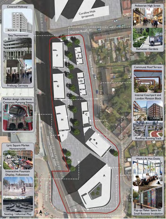
The MSc International Planning gives students an international perspective on planning systems and cultures
Programme Director: Dr Susan Moore


The MSc International Planning provides:
• an integrated programme, with all modules linked by common principles
• a critical appreciation of the commonalities and differences among a variety of national planning approaches and systems
• an enhanced understanding of planning as a culturally specific, contextdependent activity
• a programme dealing with real places and the role of planning in placemaking
• lecture- and seminar-based modules, project work, site visits and the preparation of a 10,000 word dissertation
This module provides an opportunity to engage in a strategic planning exercise for a large-scale urban area in an international context. It aims to develop an appreciation of plan-making to foster changes that are socially, economically, and environmentally just and sustainable. Students apply creative problem-solving, critical thinking, and analytical skills and knowledge acquired in other modules of the MSc International Planning programme. The Project “Our Sagrera 2030” considers a scenario whereby Barcelona City Council commissions a competition for a Strategic Plan for the site of the future high-speed train station, La Sagrera, in Barcelona, Spain. Teams of students, acting as planning consultants, respond to this call and develop a Strategic Plan in stages:
- thematic analyses of Barcelona with references to the project site in transnational, national, and regional/city contexts;
- analysis - Plan exercise site-specific analysis (desktop research) and initial strategic vision in preparation for the site visits;
- strategic Vision - Concept Plan exercise (inc. field trip to Barcelona): translation of the strategic vision into a spatial concept plan, informed by thematic analyses, site observations, theories/concepts, and examples.
- strategic Plan for the project site (3 weeks): final output integrating the above in a clear rationale for the plan and including a set of spatial plans, sectoral policies and implementation.
This module operates as an urban laboratory where groups share their work building collective knowledge through interim presentations, class discussions, and show&tell sessions. The Director of Barcelona Sagrera Alta Velocitat participated in the final presentations acting as the client.
Dynamic La Sagrera
Students: Shaohua Chen, Qi Lang, Anqi Shao, Xiaosi Shao, Ka Chi Yip, Sze Wing Yiu
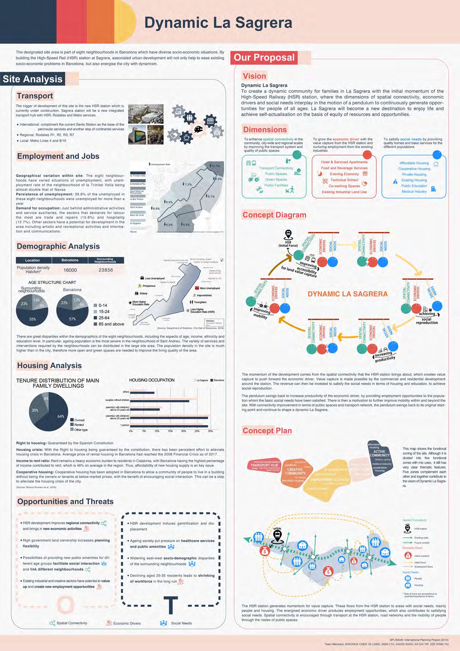

The MSc/Dip Sustainable Urbanism provides students with both the skills to conceptualise a sustainable city and the ability to design one
Programme Director: Dr Catalina Turcu


The Programme offers:
• a theoretical understanding from a diverse range of disciplines, including sociological, environmental, political and economic theory
• knowledge of key disciplinary areas including urban design, spatial planning, property development and ecology
• the aptitude to enable implementation such as creative thinking, negotiation and advocacy
It brings together three critical dimensions of sustainable urbanism:
• Sustainable thinking: the latest thinking and debates on urban sustainability from policy, research and practice perspectives
• Sustainable places: the study of what this actually means on the ground through the creation of real projects and places
• Delivering sustainability: a focus on the skills and knowledge required to actually deliver sustainable development
Coordinator: Dr Tse-Hui Teh
Tutors: Fernando Gutierrez Hernandez
“Sustainable Urban Design” is a 10 week module that introduces and engages students in the debates of sustainable urban design by working in groups to research and produce a sustainable urban design proposal affecting the Waterloo Opportunity Area in London.
The task of developing a sustainable urban design proposal facilitates a discovery of the different interacting factors that create urban areas and which actants can be reconfigured to improve the sustainability of human life. Coevolutionary Actor-Network Theory is the theoretical framework within which the sustainable urban design proposals are developed and evaluated.
Students work in multidisciplinary teams of 3-4. Each group had at least one planner, one geographer, and one or two people from other disciplines such as engineering,
architecture, liberal arts, economics and communication. The multidisciplinary groups learn to communicate and collaborate across disciplinary boundaries. It requires each student to practice critical thinking of their own presumed knowledge, as well as knowledge they were acquiring in the process of developing a sustainable urban design. These processes lead to creative sustainable urban design outcomes and students who can confidently convey their ideas verbally, and visually



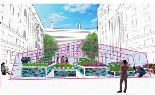
Waterfood Station
Students: Jeremy Bourgault, Munther Naseef, Chloe Small, Lauren Uba
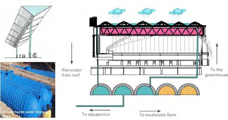

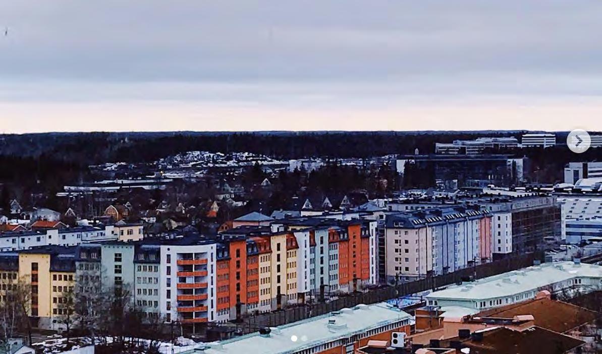 Picture by: Catalina Turcu
Picture by: Nour Hajjar
Picture by: Lisa Juangbhanich
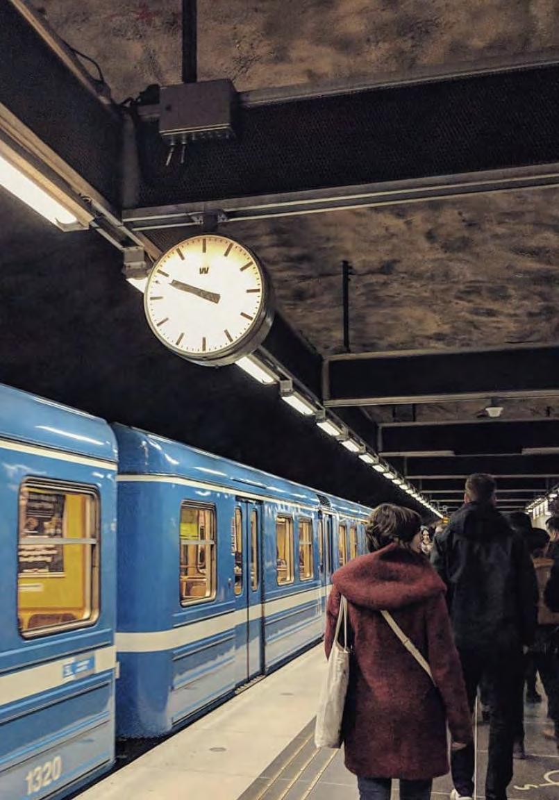
The Programme offers a groundbreaking and critical perspective on transport planning, with an urban and international focus.
The aim of the MSc in Transport and City Planning is to equip students to work effectively as transport and planning practitioners in urban contexts.
Programme Director: Dr Robin Hickman
The programme has an integrative design, providing perspectives from core disciplines without being rooted in any one. Students are encouraged to anchor their studies in a core discipline:
• Urban Transport Planning examines the role and nature of transport planning in the delivery of sustainable cities internationally. It covers everything from the context and rationale for transport to infrastructure and the psychological and sociological dimensions to mobilities.
• Sustainable Cities introduces some of the key sustainability debates and literature. It considers the tensions and synergies between environmental, social and economic objectives and the theory underpinning city planning.
• Investing in Major Projects provides a critical review of major infrastructure theory and international practice.
This module explores the key challenges, dilemmas and opportunities confronting transport planners in a wide range of international case studies. These include addressing car reduction and active travel in mature cities of Europe to rapid growth and informal transport across cities of the Global South. What specific lessons can we learn and how applicable might the lessons be in different contexts? These are some of the core questions considered. The bulk of the world’s population lives in smaller settlements of less than ½ million inhabitants. Despite their cumulative significance, these places are often overlooked by national policy makers and they struggle to meet sustainability goals.
This short piece of project work focuses on proposals for improving transport sustainability in the small city of Bath (popn. 85,000) - Britain’s only World
Heritage City and an important regional hub in the West of England. Working in small groups, students took one transport strategy currently under public discussion in the city and, drawing on case study evidence from elsewhere, considered the viability of different options in relation to Bath and North East Somerset’s following seven planning priorities:
- support and enable economic growth, competitiveness and jobs;
- promote sustainable mobility;
- widen travel choice;
- widen access to opportunities: jobs / learning / training;
- improve air quality & health, reducing vehicle carbon emissions;
- safeguard and enhancing the unique historic environment and World Heritage Site status; and
- improve the quality of life in the city
Improving Soft Mobility in Bath
Students: Fiorella, Florencia, Cliff, Zeina
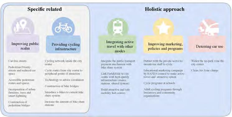


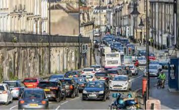


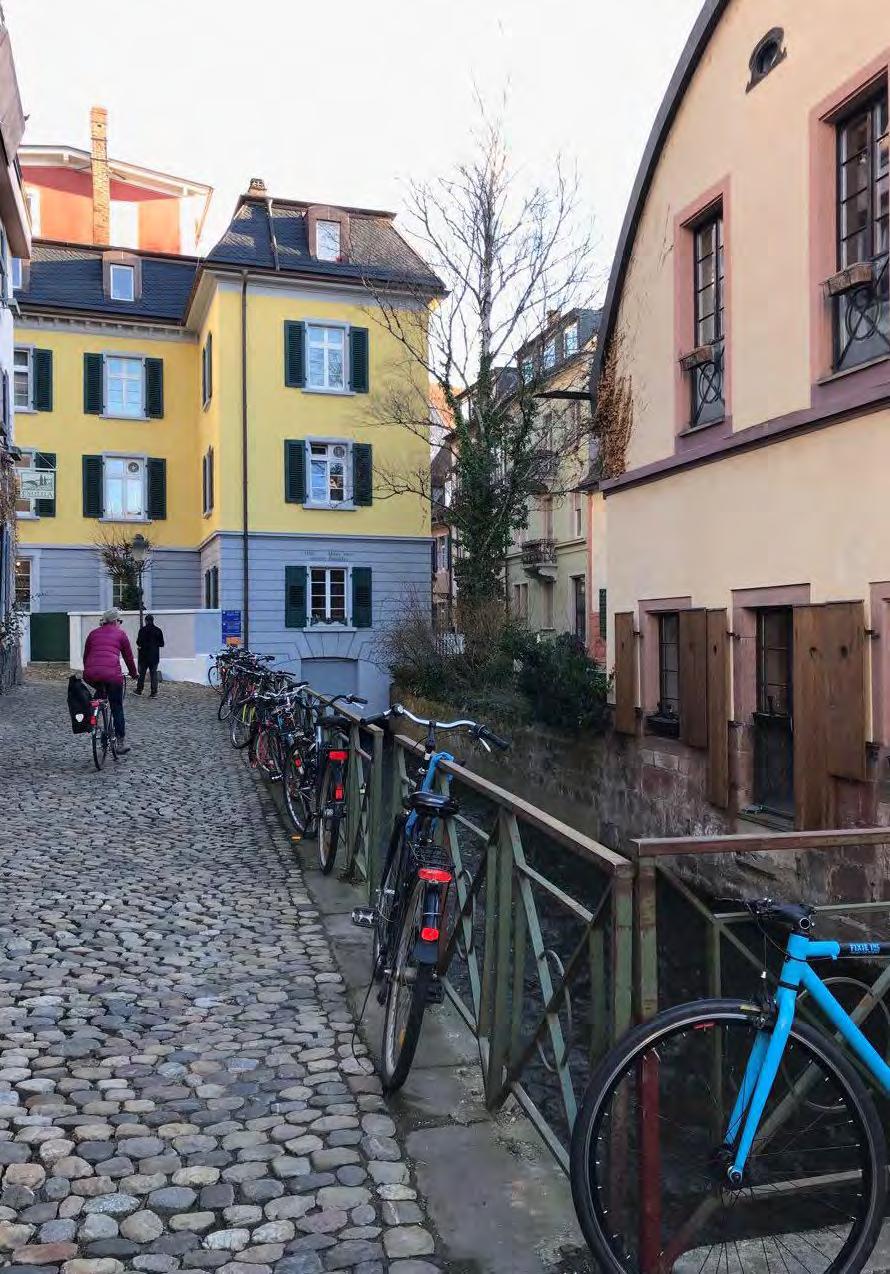 Picture by: Erika Kulpa
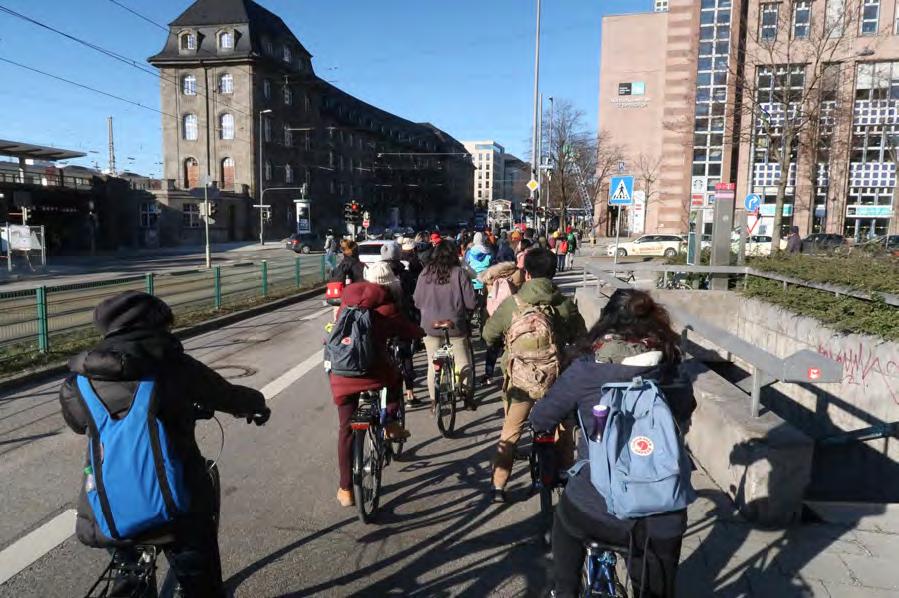
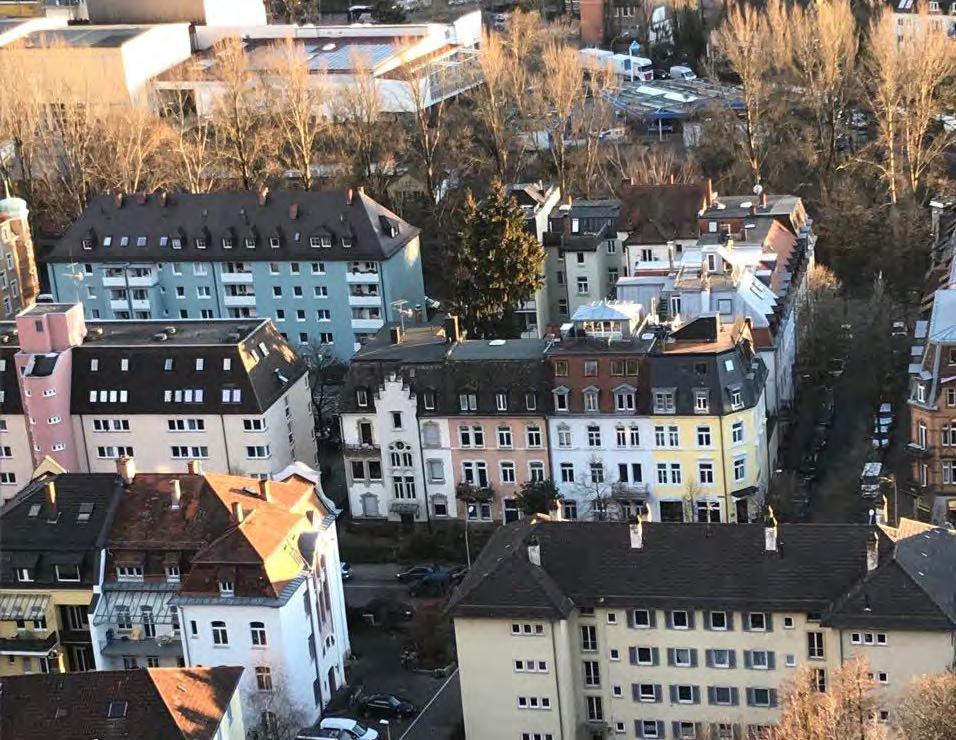 Picture by: Erika Kulpa
Picture by: Kai Guan
The MSc/Dip Urban Regeneration addresses the challenge of urban decline and the planned renaissance of our cities.
Programme Directors: Prof Claudio De Magalhaes Dr Sonia Arbaci


The MSc in Urban Regeneration has been created in response to a great challenge facing urban professionals in Britain and around the world: the decay and deterioration of our cities and their planned renaissance.
The challenge, however, is even greater than restoring and rebuilding the physical fabric of cities: it is to provide a new economic base to replace the one that has been lost, to restore hope to communities that have been shattered, to provide children and adults alike with a better chance in life.
It is a massive task that requires ‘out of the box’ thinking, intellectual rigour and collaboration. The programme aims to develop three qualities necessary for urban professionals:
• the ability to understand and critically analyse complex urban issues
• the boldness to address those issues in a creative, strategic manner
• the confidence to propose appropriate and realistic implementation plans
Coordinator: Professor Fulong Wu
Tutors: Professor Fulong Wu, Dr Sonia Freire Trigo
This is a project-based module that requires students to develop a diagnostic account of the problems of a chosen locality, to then generate their own proposals for policy and project intervention. The module challenges students investigate how proposals can be delivered within the constraints of existing urban governance arrangements; to understand the connections between shortterm outputs of regeneration interventions and their long-term outcomes; and to reflect on the trade-offs between gains and losses of regeneration proposals.
The module is organised around the production of a group project for an urban regeneration intervention in an area of London chosen by group. This is facilitated through weekly tutorials, in which the small groups and the tutors discuss the diagnosis of the area, the suggested aims and objectives if the intervention, and the
different strategies and mechanisms to implement their vision.
This year, the range of projects included proposals for the regeneration of an industrial estate, in Tottenham Hale; the regeneration of a council estate, in Haringey; the regeneration of brownfield land in Barking & Dagenham, Tower Hamlets, and Camden; and the regeneration of town centres, in Southwark, Ealing, and Greenwich.
Unlocking River Roding Students: Lorraine Lau, Syon Yoon, Dominique Mirepoix, Tian Yi, Parawin Gillian Vallely
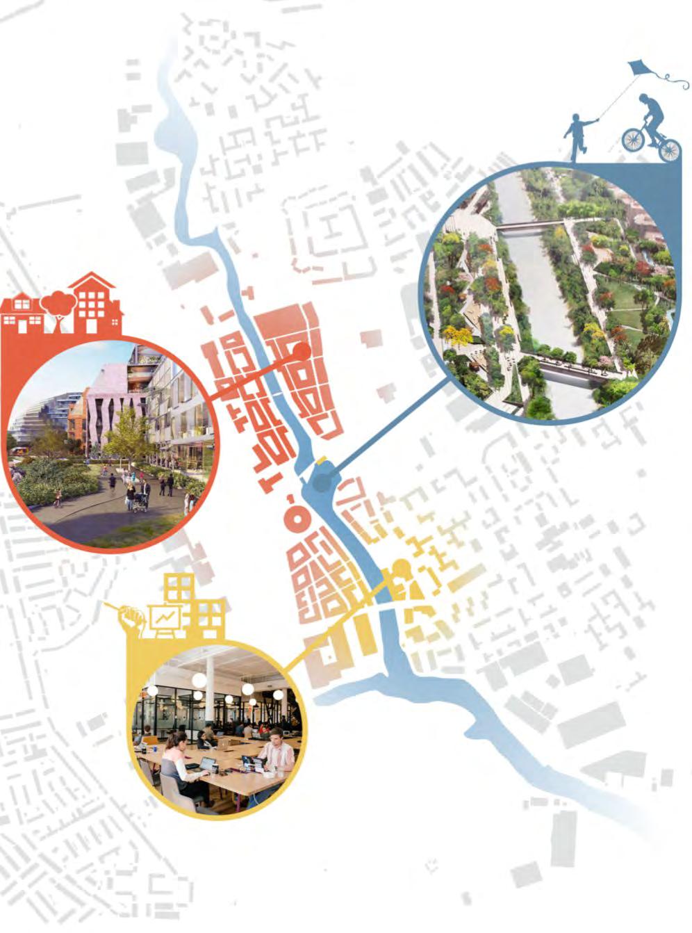
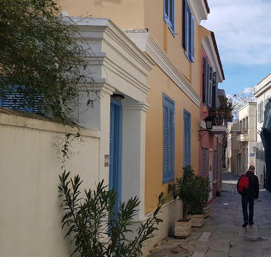
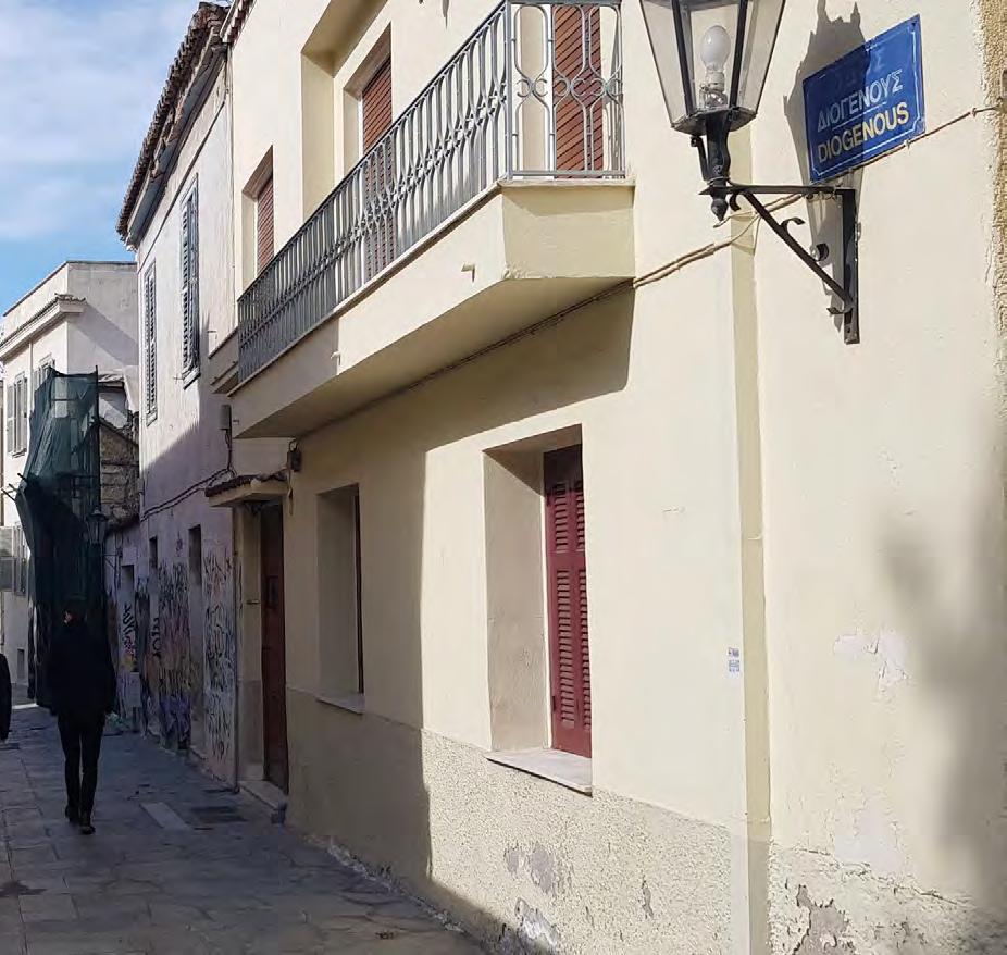 Picture by: Giovanni Zayas
A flexible programme exploring urban design as a critical arena for advanced research and practice.
Programme Director: Dr Filipa Wunderlich
The programme aims to:
• Provide an inter-disciplinary space for students to examine the challenges of urban design from comparative disciplinary perspectives
• Expose students to the diversity of urban design teaching and the latest cutting edge research from across The Bartlett and beyond
• Help students conduct a substantial piece of individual urban design research
• Train students in research methodologies for urban scale research and critically informed urban design practice
Coordinator: Dr Filipa Wunderlich
This is the final module of the MRes Interdisciplinary Urban Design programme, providing students with the opportunity to conduct a major individual research project that explores the nature of urban design as an inter-disciplinary research subject, and as a key dimension of understanding and unlocking complex urban problems.
The Urban Design Research Project represents an in-depth exploration of a complex topic / problem. It should provide a demonstration of theoretical knowledge and rigorous and incisive analysis. The study should embrace the complexity of the chosen topic and apply knowledge in a critical and reflective manner. The work takes the form of a 15,000 word dissertation or a 10,000 research report and major research based design proposal.
Given the cross-Faculty nature of the programme, students are assigned a supervisor amongst academics from all parts of The Bartlett and beyond, including The Bartlett Schools of Architecture, Planning, and Graduate Studies, and the Development Planning Unit.
altered the relationships between geographic location and employment paradigm combined with high social expectations and the configuration of a new way of working as a globalisation in the weakening of traditional class-based
fostered collective forms of identity (Sennett, 1998; Bauman, forms of cooperation emerged around working experiences defining the concept of ‘open workspace’.
spatial configuration in a single, embedded co-working meaningful attachment to specific neighbourhoods. By spatial production, the study focuses on the role that the case diary-method interviews with members of Second Home, postulate open structures to unlock the potential of a attachment. In this way, members would be enabled to create a
co-working spaces the production examine the way of condition. To at the spatial the micro and fostering a sense
attachment to place?
Over the past decades, globalisation and technological change have altered the relationships between geographic location and socio-economic activities (Giddens, 1991). The collapse of the employment paradigm combined with high social expectations and job uncertainty have led to the recasting of labour organization and the configuration of a new way of working as a freelancer. Theorists have long observed some of the consequences of globalisation in the weakening of traditional class-based social spaces that historically facilitated associational ties and fostered collective forms of identity (Sennett, 1998; Bauman, 2000). However, to face the ongoing transformation process, new forms of cooperation emerged around working experiences (Bourdieu, 1998; Neilson & Rossiter, 2005; Ettlinger, 2007; Waite, 2009), defining the concept of ‘open workspace’. The research seeks to understand the dynamics carried out around the spatial configuration in a single, embedded coworking space, Second Home Spitalfields, through habits that may generate meaningful attachment to specific neighbourhoods. By exploring the informal actions (Merkel, 2018), such as events and spatial production, the study focuses on the role that the case study has in fostering a collective sense of community. Based on the diary-method interviews with members of Second Home, the awareness of the complexities of human behaviour might postulate open structures to unlock the potential of a co-working space at the urban level through processes of attachment. In this way, members would be enabled to create a shared sense of place and re-negotiating meaning into space.
The research aims to contribute to the by providing an in-depth case study of meaningful attachment to the place working transformation due to the investigate the different dynamics occurring dimension. Assess key factors and evaluate macro scale in order to discuss the opportunity of place. (1) Main research question: Do co-working spaces in London help
a.
b. Survey
c.
d.
emerged, in fact, that attachment processes
would be enabled to create a
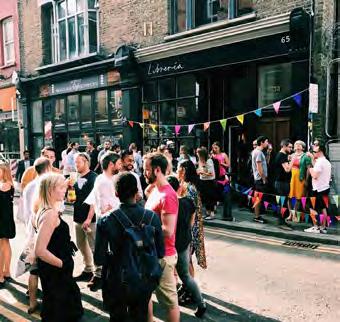
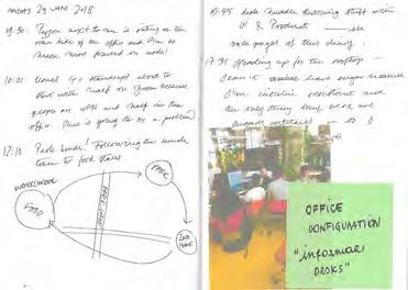

sense of place.

From the diaries emerged, in fact, that attachment processes are developing by members both at the micro-scale (building) and at the macro-scale (neighbourhood) through patterns of personalisation for the former, and patterns of routine for the latter.
catalyst tactics around co-working spaces, performed both by members through habits

Using planning, public policy and design to positively shape the urban built environment. The Bartlett School of Planning is distinguished by the breadth of its research and its capacity to bring together multiple disciplinary perspectives on urban challenges thanks to its leading academics staff and dynamic student community. Our research is driven by a belief in the power of planning, public policy and urban design to positively shape the urban built environment for the benefit of wider society and by a conviction that only robust and innovative scholarship can deliver a fundamental understanding of urban problems.
Programme Director:
• To understand urbanism at all its scales and from multiple disciplinary perspectives.
• To support policy design and delivery.
• To advance the theories and methods that frame the disciplines represented in the Bartlett School of Planning.
In our time at BSP, we have contributed our knowledge as authors and coauthors of books and highly prestigious journals. We have been awarded a significant amount of budget from many sources. And we have participated in researches and initiatives from around the world. At a more small scale, we have publicize our work to the community through many initiatives, such as Lonely Planner, Just Socially Planning, seminar, talks and discussion.
As young researchers of BSP, we are called to bring solutions to the most pressing problems in the urban built environment. We have done it and we will keep doing it.
Editorial team: Dongho Han, Ruth Sepulveda Marquez, Jingyi Zhu
General content: Dimitris Panayotopoulos
Design and layout booklet: Hyunji Cho, Alizara Juangbhanich, Vafa Dianati Maleki
Editing booklet: Manqi Wang – Design and layout of posters
A selection of on-going doctoral research posters at the BSP. These posters are an example of the diversity and originality of the approaches adopted by our PhDs in their research during their time at BSP. Our PhD students are opening new spaces of discussion and knowledge, providing with their work new and unique answer to the most urgent questions in the global planning community.
A collection of these projects can be found in the fourth edition of the publication ‘Taking Planning Forward’ produced by the PhD students at the BSP. Hard copies of the booklet can be obtained at the Expo, while digital copies are found at BSP Planning Issue https://issuu.com/ bartlettschoolofplanning/docs
How and why do private developers engage in green building practice?
The case of Bangkok, Thailand Student and Author of Picture: Alizara Juangbhanich


 The dynamics of place attachment and perceived density; Exploring the impact of urban densificacion on social sustainability in Teran Student and Author of Picture: Vefa Dianati

 A case study of inner city areas in Guangzhou Student and Author of Picture: Manqi Wang

 The morphology of urban voids: A metabolic approach to cohesion
The case of Eleonas, Athens Student and Author of Picture: Dimitris Panayotopoulos-Tsiros

Coordinator: Dr Pablo Sendra
Campaigns collaborating: Westway23, Friends of North Kensington Library, Save Wornington College. Coordinator of the collaboration with the campaigns: Toby Laurent Belson.
Collaborators: CivicWise.
The Civic Design UCL Summer School is a 3-week course at University College London, developed in collaboration with Civicwise and with the campaigns Westway23, Friends of North Kensington Library and Save Wornington College. The aim of this course is to provide students with skills for working in collaboration with community groups. Given the importance
of genuinely involving communities in decision-making process, this skill is now key for urban planning professionals. During the course, students work in a brief that has been previously agreed with the community. From this collaboration, students learn to respond to the community needs and the community groups receive a useful document for their campaigns.
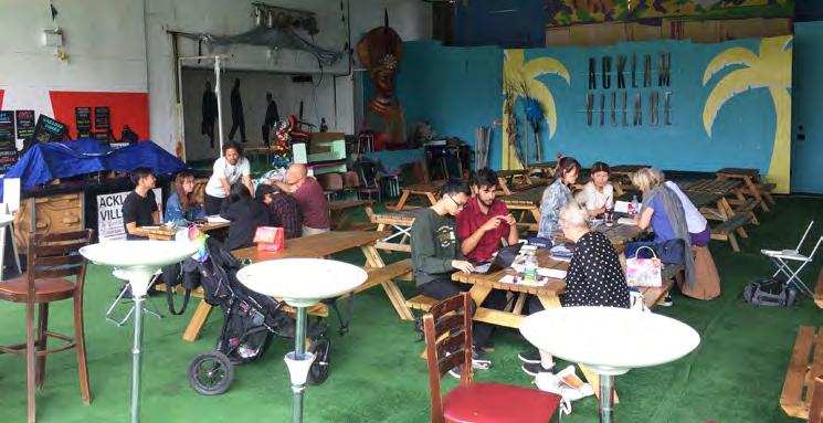
College Campaign was set up in October 2016 to achieve
b. Buy back the land from RBKC at a cheaper price than sold for OR
c. Rent the college site to KCC on a 99 year lease at a the current rent of £1 million per annum, which the college afford OR
Wornington College
Civic Design UCL Summer School. July 2018 collaboration with the campaigns: Save Wornington College, Friends of North Kensington Library and Westway23
“ensure that the entire site of the college remains in and the KCC management four alternatives on the Morley College, a Specialist Designated Institution (SDI) education OR
Coordinator of the course: Pablo Sendra
Collaborators in the course: CivicWise
d. Change the governance of KCC and start anew, allowing independent college as it is today.
Coordination of the campaigns: Toby Laurent Belson
Students: André Alves Goncalves, Kay Thi Kyin and Wang Hui Liu
ultimately, aim of this project is to suggest ways in which towards its main aims of providing education for all financially sustainable and create stronger ties with proposal is a two pronged approach, very much like a re-connect KCC with the community.
The proposal and, ultimately, aim of this project is to suggest ways in which KCC can better work towards its main aims of providing education for all in the community, be financially sustainable and create stronger ties with the community. The proposal is a two pronged approach, very much like a 2 pin plug that can re-connect KCC with the community.
The first “prong” of the proposal is a suggestion in which structure of the KCC management can be tweaked to better needs of the community and the creation of a Residents’ on case study from Singapore, all of which will be explained On the other hand, the second “prong” of the proposal improve the physical space of the college through several
Change in KCC governance structure and creation of Residents’ Committee governance structure of KCC governance structure of KCC does not have an equal proporstudents and alumni, local community representatives and lawyers, urban planners and civil engineers that could expertise on the development of the school. Hence, below suggests a “one-third” power sharing rule in the structure.
The first “prong” of the proposal is a suggestion in which the governance structure of the KCC management can be tweaked to better represent the needs of the community and the creation of a Residents’ Committee, based on case study from Singapore, all of which will be explained in section 8.1. On the other hand, the second “prong” of the proposal is to expand and improve the physical space of the college through several suggestions.
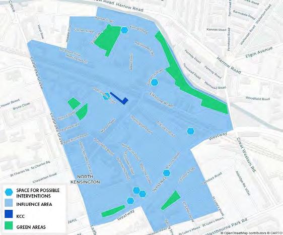
Residents’ Committee (RC) case study - creating a Golborne
Since 1978 in Singapore, there are 572 Residents’ committees across all the Housing Board Estates (Ong, 2013)11. RCs promote “neighbourliness, harmony and community cohesiveness residents living in HDB flats” (Teo et al., 1992). RCs also for the residents and work with government agencies to environment in the neighbourhood (Teo et al., 1992).
André Alves Goncalves, Kay Thi Kyin and Wang
Civic Design UCL Summer School. July 2018
Developed in collaboration with the campaigns: Save Wornington College, Friends
Campaign was set up in October 2016 to achieve that the entire site of the college remains in the KCC management four alternatives on the College, a Specialist Designated Institution (SDI) OR
Coordinator of the course: Pablo Sendra
b. Buy back the land from RBKC at a cheaper price than the price it was sold for OR
Coordination of the campaigns: Toby Laurent
Collaborators in the course: CivicWise
c. Rent the college site to KCC on a 99 year lease at a cheaper rent than the current rent of £1 million per annum, which the college is struggling to afford OR
d. Change the governance of KCC and start anew, allowing KCC to be an independent college as it is today.
aim of this project is to suggest ways in which towards its main aims of providing education for all financially sustainable and create stronger ties with is a two pronged approach, very much like a re-connect KCC with the community.
The first “prong” of the proposal is a suggestion in which the governance structure of the KCC management can be tweaked to better represent the needs of the community and the creation of a Residents’ Committee, based on case study from Singapore, all of which will be explained in section 8.1. On the other hand, the second “prong” of the proposal is to expand and improve the physical space of the college through several suggestions.
will be presented, seek to establish through the physical between the North Kensington community and KCC, “sense of belonging” of the community to the college with the removal of the wall that separates the college 1). And replace it with something more permeable or shipyard containers. The shipyard containers can then be entrepreneurship or social hubs for the students to experiment they could set up small street shops or fashion boutiques
governance structure of KCC structure of KCC does not have an equal proporalumni, local community representatives and urban planners and civil engineers that could expertise on the development of the school. Hence, suggests a “one-third” power sharing rule in the

Residents’ Committee (RC) case study - creating a Golborne Ward RC Since 1978 in Singapore, there are 572 Residents’ committees spread across all the Housing Board Estates (Ong, 2013)11. RCs were introduced to promote “neighbourliness, harmony and community cohesiveness among residents living in HDB flats” (Teo et al., 1992). RCs also organise activities for the residents and work with government agencies to improve the living environment in the neighbourhood (Teo et al., 1992).
in the container trucks, with financing assisted by the finance in the KCC board of governors. In parallel to the improvement of the building, the projects development of the community. To do so, the students projects in areas of North Kensington (Figure 2, helping areas or engage with the community. Some examples designing the landscape of parks, planning the interior of pottery products in Portobello Market or even making spaces.

Programme Director:
The Bartlett School of Planning is a world-leading centre for research, impact and innovation. We are one of the UK’s major centres for research into the built environment and planning, and one of the leaders internationally in the field. Our research is motivated by an ambitious intellectual and practice-oriented mission and underpinned by external funding from a variety of sources. We collaborate on projects and initiatives with governmental and civil society organisations in a range of countries and cities and have a breadth of activity that spans four key inter-disciplinary fields: governance and planning; real estate and development; sustainable infrastructure; and urban design.
We are world-leaders in the development of broader intellectual agendas, methodologies, and techniques for the study of planning and planning systems. We strive to generate new cross-disciplinary knowledge and insights to inform policy-making and help tackle pressing contemporary planning challenges faced by governments, communities, citizens, and business groups.
This research group focuses on the governance of urban and regional processes and the role of planning and public policy in the mediation of space.
The research group focuses on delivering sustainable transformations within urban systems exploring the role of institutions, policy instruments, spatial planning, urban design and infrastructures in shaping and governing these processes. We seek to create resource efficient, low carbon, resilient, regenerative, socially-just, smart, economically sustainable, natureinspired urban systems. We investigate how infrastructural changes transform economies, lifestyles and social practices drawing upon international examples, and investigating the translation of best practice.
Our work spans these key themes:
- Cities – sustainable, circular, smart, low carbon, resilient and shrinking cities
- Resources – energy, land, water, materials Infrastructure and Transport – transport, energy, social (schools, hospitals,
community housing e.t.c), green, water, telecommunications, ports, major infrastructure projects
- Measurement – indicators, appraisal & evaluation methodologies, monitoring Governance – transformation, transitions, translation, scenarios
Staff
Catalina Turcu | Dan Durrant | Fangzhu
Zhang| Harry Dimitriou | Iqbal Hamiduddin
| Joanna Williams | John Ward | Robin
Hickman | Tse-Hui Teh |Yvonne Rydin
Alejandro Rivero Villar | Beatriz Mella Lira
| Calvin King Lam Chung | Dongho Han |
Gualtiero Bonvino | Hyunji Cho | Jorge
Martin Sainz De Los Terreros | Ju Eun Kim
| Lisa Juangbhanich | Mengqiu (Matthew)
Cao | Ruth Sepulveda Marquez | Vafa
Dianati
Working to research the whole value chain in and by cities from policy to impact, through urban regeneration, local and regional economic development initiatives and real estate market practices.
Core Focus
The research of the group focuses on the processes and policies of: urban development, management and regeneration; the economic development of cities and their region; real estate development, investment and management.
In each of those fields, our research seeks to understand the interaction between policies, the action and behaviour of agents and the economic imperatives behind them, as well as the impacts action and behaviour have on markets, policies, citizens and cities. We are concerned with the forming and creation of our built environment to its management and operation, from diverse perspectives.
SHyunji Cho | Justinien Tribillon | Monica Lopez Franco | Sonia Freire Trigo
Staff
Claudio De Magalhaes | Danielle
Sanderson | Fulong Wu | Jung Won Son
| Kwame Addae-Dapaah | Nick Phelps |
Nicola Livingstone | Nikos Karadimitriou
| Peter McLennan | Qiulin Ke | Tommaso
Gabrieli
PhD Researchers
Chien-Ling Lo Seo | Ilwon Seo | Karla
Barrantes Chaves | Siyao Liu | Stefania
Fiorentino | Xing Gao
Our research centres on understanding how to deliver sustainable transformations within urban systems.
Our research addresses the politics of planning, at a range of spatial scales, in the context of diverse and unequal societies and economies. We are particularly concerned with the role of local government in an era shaped by austerity, privatisation, financialisation and the transformation of citizenship. We explore these questions in fields such as housing, urban regeneration, devolution and spatial planning.
Staff:
Ben Clifford | Claire Colomb | Elena
Besussi | Jessica Ferm | John Tomaney |
Michael Edwards | Mike Raco | Nick Gallent | Peter Rees | Sonia Arbaci | Susan Moore |
Yasminah Beebeejaun | Sonia Freire Trigo
Hyunji Cho | Justinien Tribillon | Monica
Lopez Franco
We aim to examine the theories, processes, practices, actors and pedagogies of urban design.
The urban design research group’s work ranges from fundamental theoretical questions about the nature of urban design to direct engagement in the practice, policy and teaching of urban design:
- Design governance: the practices of state intervention in the means and processes of designing the built environment, and the planning, development, regeneration and conservation processes to which they relate
- Public space and morphology: the streets, spaces and local infrastructure of the city, their physical form, and how they are designed, managed, connected, and used over time
- Society, economy and urban design: the influence of urban design on social interaction and behaviours, and how the economic and social value of place is mediated by the built environment
- Engaging in urban design: the role of urban design and studio-based teaching in a creative and reflective built environment pedagogy, and the involvement of communities in collaborative design processes.
Staff
Colin Haylock | Elisabete Cidre | Filipa Wunderlich | Juliana Martins | Matthew
Carmona | Michael Short | Pablo Sendra
| Richard Simmons | Stephen Marshall | Tanner Oc | Valentina Giordano | Wendy
Clarke
Anon Chaimanee | Alexandra Gomes |
Elisabeta Illie | Jingyi Zhu | Kyunghyun
Baek | Lesley Slavitt | Miguel Hincapie | |
Reetuparna Sarkar | Yuerong Zhang
Reaserch Initiatives
Place Alliance campaigns for place quality. It is founded on the idea that through collaboration and better communication we can establish a culture whereby the quality of place becomes an everyday national and local priority.
Place Alliance is open to all and brings together organisations and individuals who share the belief that the quality of our built environment has a profound influence on people’s lives.
Vision
i. Place quality has a value that is recognised by all
ii. The quality of buildings, streets, and spaces is always given a high priority by those who have the power to shape them
iii. National and local government recognises the vital contribution of the quality of place to the economic, social and
cultural life of the nation and to achieving environmental sustainability
iv. Professionals with a responsibility for making and managing places, work constructively together and with local communities to shape high quality local environments.
Aim
- Inspire and raise aspirations for places
- Support dialogue and collaboration to improve place quality
- Build and share evidence, knowledge and resources
- Influence policy, practice and behaviour to achieve better place quality
- Be open and accessible to all interested individuals and organisations.
Place Alliance campaigns for place quality. It is founded on the idea that through collaboration and better communication we can establish a culture whereby the quality of place becomes an everyday national and local priority.
Place Alliance is open to all and brings together organisations and individuals who share the belief that the quality of our built environment has a profound influence on people’s lives.
Vision
i. Place quality has a value that is recognised by all
ii. The quality of buildings, streets, and spaces is always given a high priority by those who have the power to shape them
iii. National and local government recognises the vital contribution of the quality of place to the economic, social and cultural life of the nation and to achieving environmental sustainability
iv. Professionals with a responsibility for making and managing places, work constructively together and with local communities to shape high quality local environments.
Aim
- Inspire and raise aspirations for places
- Support dialogue and collaboration to improve place quality
- Build and share evidence, knowledge and resources
- Influence policy, practice and behaviour to achieve better place quality
- Be open and accessible to all interested individuals and organisations.

Place Alliance has been working with its partners to deliver a programme of research to inform debates about the quality of the built environment and its delivery. Our aim is to deliver rigorous empirical (but also digestible) evidence of direct use in policy and practice. The intention is for this to be an ongoing study programme monitoring the capacity of the country to deliver high quality urban environments, and tracking how this changes over time.
The Place Alliance Working Groups have been established following Big Meet 3. These are open to all and define their own agenda. Some are taking forward post-Farrell Review activities and others reflect issues raised in the various Big Meets.
Place Alliance working groups focus on evidence gathering and an associated campaigning role, Working Groups act as largely independent Affiliated Groups.
The BIG MEET is the Place Alliance annual conference, an opportunity for a diverse range of organisations across the built environment sectors to come together to discuss, debate and provide a powerful collective voice on the current issues about the quality of the built environment and its delivery.
Since its inception, Place Alliance has increasingly taken on a more active campaigning role to better fuilfil our core aim of bringing people, evidence and new thinking together as a means to support the case for place quality, and to actively campaign in favour of investing in a high-quality built environment.
The Bartlett School of Planning has collaborated with the Just Space network of London community groups since its foundation 10 years ago.
Through this connection hundreds of BSP students and a number of staff have gained experience in working with neighborhood forums, other local campaign groups and with London-wide networks and NGOs.
In this session undergraduate and masters students have been involved in three main ways:
1 Supporting the dozens of community groups who have given evidence at the Examination in Public of Mayor Sadiq Khan’s new draft London Plan. This examination comprises hearings stretching from January to May. Our students and staff have contributed research support, note-
taking and blogging and logistic support. Two students even gave oral evidence at the hearings. The School of Planning has also facilitated a series of 5 public events at UCL in which participants have discussed the progress of the hearings and prepared for forthcoming sessions. More about all this at JustSpace.org.uk
2 We have responded to requests by a community development team to provide support to communities whose rather desolate, deindustrialised riverside neighbourhood – Thames Ward in Barking - the site of a massive (Opportunity Area) housing scheme. A dozen or so student volunteers have written digests and aids to non-technical readers of the many planning documents surrounding this project and are continuing to provide support, particularly on the governance problems of this large and troubled project.
3 Students and staff working in a number of modules have engaged in work which follows research agendas generated by community needs and cations. This year the main example has been in Collaborative City Planning strategies, coordinated by Elena Besussi, and also taught by Pablo Sendra, Michael Short, Paula Morais and Marian Larragy, on High Streets in London. Examples of the work are here in the catalogue.
The initiatives of BSP over the years have spread across the Faculty and UCL with important iniatives elsewhere. This session we convened a major discussion at the Tate Modern as part of the Tate Exchange on how universities can work with community groups across London as a whole. A full report is on the Just Space web site.
Credit to the UCL Public Engagement Unit for encouragement and material support over the years.

