
SCHOOL OF PLANNING EXPO CATALOGUE 2019/2020 ISSN 2516-5666
BARTLETT


BARTLETT SCHOOL OF PLANNING EXPO CATALOGUE 2019/2020 ISSN 2516-5666
The Bartlett School of Planning Expo Catalogue
2019/2020
Publisher
The Bartlett School of Planning, UCL
The Bartlett School of Planning Expo organisers. Team: Valentina Giordano
Victoria Howard
Pablo Sendra
Jo Williams
Expo curator
Valentina Giordano
Virtual Expo design
V21 Artspace
Expo communications
Victoria Howard
Catalogue Coordination
Pablo Sendra
Catalogue design and content editing
Matt Faraci
Cover design
Matt Faraci
Head of The Bartlett School of Planning Claudio De Magalhães
ISSN 2516-5666
© Copyright 2020 The Bartlett School of Planning, UCL.
© Copyright of all images and texts belong to their authors.
For more information on research and teaching at The Bartlett School of Planning, visit https://www.ucl.ac.uk/bartlett/planning/
Visit our virtual Bartlett School of Planning Expo here:
https://www.ucl.ac.uk/bartlett/planning/virtual-bsp-expo-2020
The Bartlett School of Planning, UCL Central House, UCL. 14 Upper Woburn Place
WC1H 0NN London
Printed in the UK London, 2020
The Bartlett School of Planning has an international reputation as a centre of academic excellence in research, teaching and policy and practice interaction. Located within the heart of one of the world’s greatest cities, the School’s research and teaching opportunities provide a unique laboratory for knowledge creation, rich in academic, cultural and social diversity.
This catalogue is a small selection of the work displayed at the BSP Expo 2020. To view the full extent of the BSP work, visit our virtual exhibition at: https://www.ucl.ac.uk/bartlett/planning/virtual-bsp-expo-2020

8

9

STAFF
Staff
Dr Kwame Addae-Dapaah
Dr Lauren Andres
Dr Sonia Arbaci
Dr Yasminah Beebeejaun
Elena Besussi
Professor Matthew Carmona
Professor Elisabete Cidre
Dr Ben Clifford
Professor Claire Colomb
Dr Marco Dean
Professor Harry Dimitriou
Dr Dan Durrant
Professor Michael Edwards
Dr Jessica Ferm
Dr Daniel Fitzpatrick
Dr Sonia Freire Trigo
Dr Tommaso Gabrieli
Professor Nick Gallent
Valentina Giordano
Dr Iqbal Hamiduddin
Professor Robin Hickman
Dr Nikos Karadimitriou
Dr Katy Karampour
Dr Qiulin Ke
Dr Nicola Livingstone
Professor Claudio De Magalhães
Professor Stephen Marshall
Dr Juliana Martins
Dr Susan Moore
Mr Peter McLennan
Dr Lucy Natarajan
Professor Mike Raco
Professor Peter Rees
Professor Yvonne Rydin
Dr Danielle Sanderson
Dr Pablo Sendra
Dr Michael Short
Dr Jung Won Sonn
Dr Tse-Hui Teh
Professor John Tomaney
Dr Catalina Turcu
Dr Jonas De Vos
Dr John Ward
Dr Jo Williams
Professor Fulong Wu
Dr Filipa Wunderlich
Dr Fangzhu Zhang
Research Staff
Dr Joao Bento
Dr Frances Brill
Dr Richard Timmerman
Dr Calum Ward
Professional Services
Lisa Fernand
Elize Fleming
Judith Hillmore
Dr Julie Hipperson
Victoria Howard
Nina Jasilek
Naomi Jones
Jackie Nelson
Alkesh Patel
Jenny Post
Yvonne Sibblies
10
Honorary and Visiting Academics
Faraz Baber
Richard Barras
Duncan Bowie
Susan Brownhill
David Cadman
Patricia Canelas
Lai Har (Rebecca) Chiu
Jim Coleman
Wulf Daseking
Michele Dix
Bill Dunster
Tim Edmundson
Jose Farina
Brian Fields
Yohance Harper
Colin Haylock
Michael Hebbert
Kate Henderson
Meri Juntti
Charles King
Klaus R. Kunzmann
Jonathan Manns
Niamh Moore-Cherry
Janice Morphet
Taner Oc
John Parr
Alan Peters
Nick Phelps
Richard Simmons
Ann Skippers
Tuna Tasan-Kok
Simonetta Tunesi
Anne Williams
Arata Yamamoto
11

CONTENTS Foreword 14 Undergraduate Programmes 16 BSc Programmes 18 Urban Lab 1 Graphic Skills 20 Introducing Urban Design: Design Skills 22 Urban Design Theory to Practice 24 Cities and Social Change 26 Economics of Cities and Their Regions 28 Strategic Planning Project 30 Urban Design Space and Place 32 Real Estate Development 34 Green Futures 36 Urban Project Management 38 Real Estate Investment and Finance 40 Real Estate Management 42 Postgraduate Programmes 44 MPlan City Planning 46 Plan Making Studio 1 48 Plan Making Studio 2 50 MSc Infrastructure, Planning, Appraisal and Development 52 Business Cases for Infrastructure 54 MSc Urban Design and City Planning 56 Design and Real Estate 58 Collaborative City Planning Strategies 60 Sustainable Futures by Design 62 Urban Design: Layout, Density and Typology 64 Urban Design: Guidance, Incentive and Control 66 Major Research Project (UDCP) 68 MSc Spatial Planning 70 Urban Design Placemaking 72 From Strategic Vision to Urban Plan 74 Governance for Urban Sustainability 76 MSc Housing and City Planning 78 12
Planning for Housing: Project 80 MSc International Planning 82 International Planning Project 84 MSc Sustainable Urbanism 86 Sustainable Urban Design 88 Sustainable Urban Development Project 90 Major Research Project (SU) 92 MSc/Dip Urban Regeneration 94 Case Studies in Preparing Regeneration Projects 96 Urban Regeneration: Development Projects 98 MRes Interdisciplinary Urban Design 100 Urban Design Research Project 102 Field Trips 104 Glasgow and Barcelona 106 Stockholm 108 Research Programmes 110 MPhil / PHD Planning Studies 112 PhDs 114 Continuing Professional Development 142 Civic Design 2020 144 Civic Design 2019 146 Research at the Bartlett School of Planning 148 Civic Design Exchange 150 Community-Led Regeneration 152 Designing Disorder 154 A Housing Design Audit for England 156 Evaluating Urban Design Governance 158 Child-Friendly City Planning 160 13

FOREWORD
The BSP Expo, now in its fourth year, is an annual celebration of student achievements across the Bartlett School of Planning at UCL. It is an opportunity for current and former staff members and students, alongside the school´s many friends and partners, to review some of the past year’s projects from undergraduate and postgraduate programmes and also examples of research being undertaken within the school’s PhD community and by members of staff and collaborators.
This year, the BSP Expo takes on the even more important role of allowing our community of students and academics to communicate with our friends and partners all over the World in spite of the restrictions imposed by the global Covid-19 pandemic, and share what we have done over the last 12 months. We hope to show that despite the constraints and difficulties to education and research that the pandemic has posed, we are here and still striving to produce exciting, challenging and stimulating work.
BSP is one of the largest and most diverse planning schools in the UK, with more than 50 members of staff (plus a similarly large group of honorary and visiting colleagues, as well as a great many contributing practitioners from a range of industry sectors) and more than 600 students from the UK and overseas. Undergraduates follow programmes in Urban Planning and Real Estate, Urban Planning, Design and Management or Urban Studies. Our post-graduate taught (MSc, MPlan and MRes) students are enrolled on programmes focused on spatial planning, city planning , international planning, urban regeneration, urban design, housing, transport, infrastructure, sustainable urbanism, real estate and ‘inter-disciplinary urban design’. We also work with the Centre for Advanced Spatial Analysis on the RTPI ‘pathway’ through the MSc in Smart Cities and Urban Analytics. The majority of our programmes are accredited by the Royal Town Planning Institute and / or the Royal Institution of Chartered Surveyors – both of which are important partners for the School.
14


Students at BSP produce a range of outputs as part of their studies – from shorter essays and reviews to longer projects and dissertations. Team-based design and planning projects also form a core component of student work, and many examples of these are showcased in the Expo.
Added to this array of taught programmes is the work of our 60 plus PhD students, each of whom aims to make an ‘original contribution to knowledge’ through individual research undertaken over at least 3 years. These students work closely with academic supervisors on projects that take them to different parts of the world or keep them here in London –studying the many urban challenges that this city will face in the decades ahead. A research degree is one of the first steps in what often evolves into a longer academic career. Research students frequently work closely with our full-time and visiting staff members, developing and delivering - as ‘post-graduate teaching assistants’ - many of the modules showcased in the Expo and in this catalogue.
The aim of the catalogue is to provide a more permanent record of this year’s work. It offers, however, just a glimpse of the vast array of work that students on our different programmes produce and our academics and contributors supervise. Despite challenging circumstances, our students continue to produce work that make us proud. We are also grateful for the many contributions of our friends and partners. The Expo provides an opportunity to celebrate all that and say thank you to everyone who works so hard to achieve BSP’s continuing success.
Prof Claudio De Magalhães Head of The Bartlett School of Planning October 2020
15

16

UNDERGRADUATE PROGRAMMES
The BSP Expo showcases the work of students and researchers across all our programmes and brings together the wider BSP academic and research community.
The Bartlett School of Planning offers three internationally renowned undergraduate programmes, reflecting the challenges facing urban professionals in the 21st century. The programmes place a particular emphasis on:
• understanding urban change
• pro-active engagement in urban problems
• urban design and/or real estate, management and planning
•urban sustainability, exploring issues in social, economic and environmental fields.

18
Programmes Director Dr Jessica Ferm
PLANNING AND REAL ESTATE
BSc
URBAN PLANNING, AND MANAGEMENT
BSc URBAN STUDIES
Each of the three BSc programmes share a core curriculum in planning, with three streams of modules that respectively focus on understanding’, ‘managing’ and ‘delivering’ urban change.
The BSc Urban Planning, Design and Management programme offers students a broad-based education in the built environment with an opportunity to specialise in planning and urban design.
The BSc Urban Planning and Real Estate programme examines current urban challenges with a focus on property markets, investment decisions and real estate economics.
The BSc Urban Studies programme provides a broad-based education in urbanism and the built environment, offering flexibility to choose additional related modules across UCL and benefit from the wide educational offerings across the university.
19
BSc

Undergraduate
BSC Year 1
Programmes
BSc PLANNING DESIGN AND MANAGEMENT
BSc PLANNING AND BSc URBAN STUDIES REAL ESTATE
URBAN LAB 1 GRAPHIC SKILLS
Coordinator
Bianca Maria Nardella
Tutors
Terpsithea Laopoulou
Isabel Sanchez
Dr. Elisabete Cidre
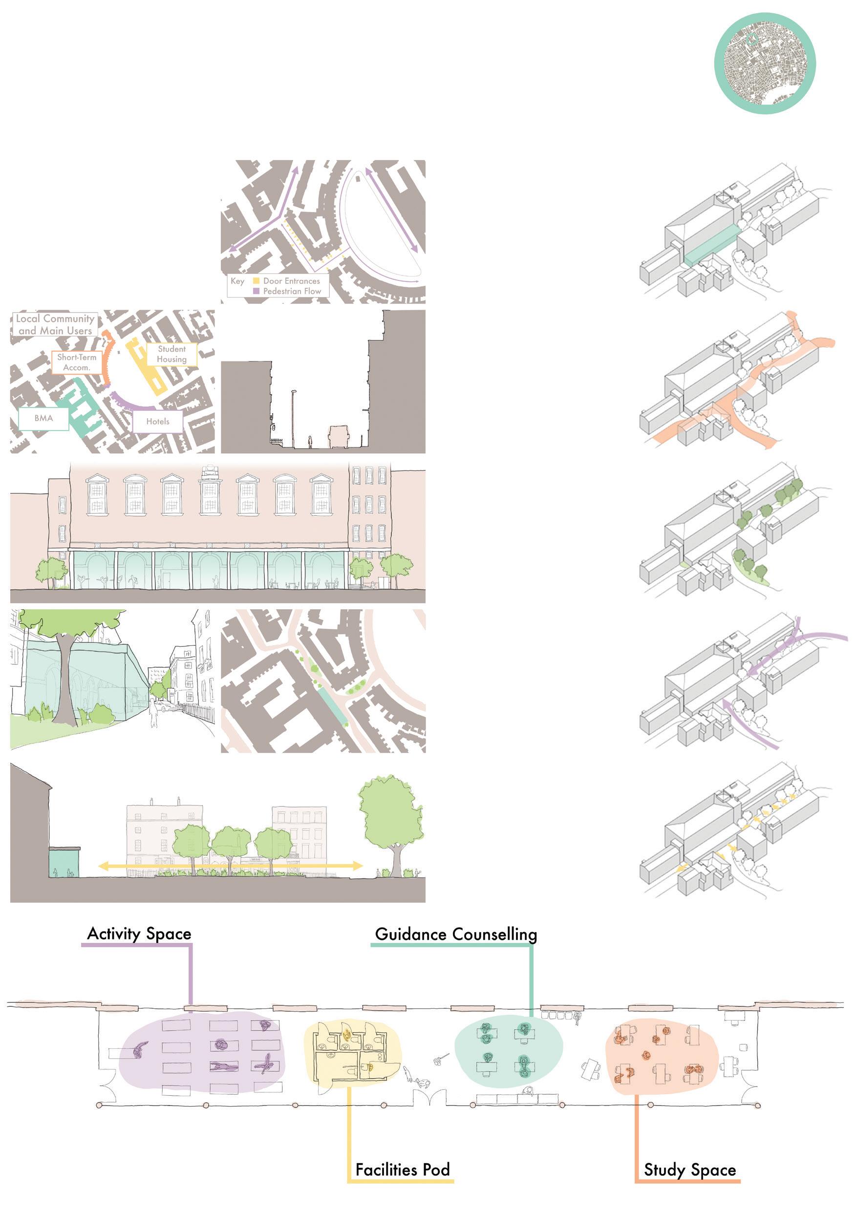
This module provides an Introduction to some of the basic drawing and presentational skills and techniques required in urban planning, combining free-hand sketching and technical drawing with digital graphic tools and software (Urban Skills Portal and Photoshop). Two routes in London, one in Somers Town and one in Bloomsbury, are the backdrop to all the project work gathered for the urban analysis undertaken. The module also helps students to develop their creativity.
The aim is to develop through practical application the ability to:
- work effectively as part of a small team;
- present work using a variety of graphic techniques;
- use basic freehand sketching and technical drawing skills to communicate urban analysis;
- use basic photo manipulation and presentation skills to compose effective graphic layouts.
On successful completion of the module, each student will have acquired skills in:
- analysing street composition and urban form through descriptive and observational analysis;
- collecting primary data specific to an urban environment and present this information graphically;
- understanding, reading and executing a variety of graphic techniques that complement each other to enable 2D and 3D representation of space and the urban environment;
- creative graphic communication, including effective layout composition.
20 Urban Analysis Student: Joseph Chen


21

Undergraduate
BSC Year 1
Programmes
BSc PLANNING DESIGN AND MANAGEMENT
BSc PLANNING AND BSc URBAN STUDIES REAL ESTATE
Coordinator
Dr Elisabete Cidre
INTRODUCING URBAN DESIGN: DESIGN SKILLS (Task 1)
Tutors
Isabel Gutierrez Sanchez
James Chadwick
Miguel Hincapie
Elisabeta Ilie
This module provides an introduction to the theory, techniques and appreciation of design within the context of town planning and urban design. It involves the development of technical and creative communication skills, both in oral and graphic 2D+3D presentation, that sustain the learning and developing of an iterative procedural approach to design problems.
There is one ongoing project, focusing on Site 28, in London, which is developed in two tasks:
Task 1 – (existing) Urban Places: urban design analysis, methods and techniques
This systematic analysis explores issues of morphology/urban fabric, accessibility/mobility, and activity.
In Task 1 students work in small teams of three/four to develop a comparative study of townscape(s) and site analysis looking at different urban design methods and techniques.
The comparative analysis informs Task 2, whereby each student individually develops a proposal for the re-design of Site 28, sustained by a concept and vision for the future. [Note: Task 2 was cancelled before completion due to Covid-19]
22 Comparative Analysis Student: Kong Umpujh Chen Lin
Site 28 is an unpopular choice to socialise since there aren’t a lot of people and the site is unattractive in the first place

Pancras Square has an intense population flow. The equal distribution and high number of urban furniture provides enough space for people to socialise.
23

Undergraduate
BSC Year 2
Programmes
BSc PLANNING DESIGN AND MANAGEMENT
Coordinator
Prof Matthew Carmona
URBAN DESIGN THEORY TO PRACTICE
This module draws on the extensive theoretical underpinning of urban design to:
· explore approaches to appraise the character of the built environment, and
Tutors
Wendy Clarke
Valentina Giordano
Jingyi Zhu
· forward practical and even visionary proposals aimed influencing the quality, liveability and value of urban space as a key contribution to sustainable place making.
The modules illustrates the potential of design as a creative problem solving process, a process necessary to deliver the types of public and private investments in the built environment that will continue to return social and economic value to their users and investors over the long-term.
In 2019/20 the focus was on Poplar and its interface with Canary Wharf. In the context of the transformative projects already occurring in the area (not least the coming of Crossrail) and the development pressures that the Poplar area is currently facing, the module sought to develop a new vision for this area to guide its successful transformation over the next 20 years. Groups were asked to develop a set of solutions that restore the integrity of the Poplar / Canary Wharf interface as a ‘place’ and not just a traffic / Infrastructure artery, whilst considering the opportunities within and beyond into its surrounding areas.
Reconnecting Poplar as a Sustainable Urban Village - Framework Students: Xavier Ayub, Ian Chng, Fola Olaleye, Reka Tundokova, Sarah Kexuan Xu
BSc PLANNING AND BSc URBAN STUDIES REAL ESTATE 24
The project provided an opportunity to rediscover the value and potential of one of London’s historic villages – Poplar – and to deal with the disconnection and inequity that followed redevelopment of Canary Wharf next door.
•
Canary Wharf and Poplar

• High quality social housing addressing needs for dense, mixeduse built environments, sustainable construction and catering for growing diverse populations
Guidelines for Dingle Gardens and Development:
around the node of Poplar DLR
120m tall around station and 80m at development zone pedestrian walkways between buildings permeability
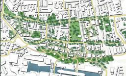
Source: Agrawal, Sandeep Kumar

VISION CONCEPT DIAGRAM MASTERPLAN extension of Lea Valley Walk route (Bromley-by-Bow to East India Dock) extension of Lea Valley Walk route (Three Mills, Bromley-by-Bow to extension of Lea Valley Walk route (Bromley-by-Bow to East India Dock) MOBILITY MAP acting as a bridge, Pedestrian and cycle-friendly paths WALKING CONNECTION LEGEND POPLAR HIGH STREET POPLAR HIGH STREET (BEFORE) EAST INDIA DOCK ROAD LAYOUT (BEFORE) EAST INDIA DOCK ROAD LAYOUT (AFTER) REVITALISING THE HIGH STREET Converted to commercial services Creates active frontages Establishing nodes of activity Enhances night time economy BENEFITS • Safer and liveable streets Improves sense of place and pedestrian amenity Boosts economic activity Allows some vehicular movement Sustainable design model BENEFITS Air quality improvements Promotes public transport use Safer for pedestrians REDUCING CAR DEPENDENCY Poplar will be included in the 2021 ULEZ expansion Reduce the presence of cars Burying a section of the Aspen Way road and covering it with new public space Community engagement Increased value of nearby land and properties New revenue generated by mixed-use developments Sustainable Environments Social Wellbeing Housing Improvement Areas Pedestrian and Cycle Friendly Routes Integration of Green Networks High Street Corridor CONCEPT MAP LEGEND Mixing of different income and social groups Representing sociocultural interests Inclusive design principles Gradual development with minimal disruption Cultural and ethnic integration, resilient community life Proximity and privacy comfort of private space Visual and audio nuances to correspond with sufficient privacy Clear characteristic of usage Connectivity
CONNNECTIVITY SOCIAL WELLBEING KEY OPPORTUNITY AREAS (KOAs) housing New green space and parkland Green network counteracting pollution created by road Source: AtlantaDowntown VISION CONCEPT DIAGRAM MASTERPLAN
HIGH STREET
INDIA DOCK ROAD LAYOUT Sustainable Environments Social Wellbeing Green Spaces Key Opportunity Areas Housing Improvement Areas Heritage Areas Pedestrian and Cycle Friendly Routes Integration of Green Networks High Street Corridor Aspen Way Nexus CONCEPT MAP LEGEND East India Dock road - a less car-dominated corridor • Promote understanding and appreciation of heritage Connectivity RE-CONNECTING POPLAR CONNNECTIVITY Chrisp Street Market After: KEY OPPORTUNITY 25 Visual Connection
RE-CONNECTING POPLAR AS A SUSTAINABLE URBAN VILLAGE
POPLAR
EAST
The creation of relatively tall (80120m) tall mixed-use towers will create a more gradual building height transition between
PHASING 2020 2045 2040 2025 2030 2035 Aspen Way Nexus Aspen Way Development Dingle Gardens Poplar Baths Improve Public Parks West-Ferry Heritage Trail Green Corridors Community Gardens Vertical Farms
and Cyclefriendly Roads
Heritage
Council Estates Poplar High Street
Dock Road
Gardens
Architecture
Urban Design: Theory to Practice Reconnecting Poplar as a Sustainable Urban Village - Framework Xavier Ayub, Ian Chng, Fola Olaleye, Reka Tundokova, Sarah Kexuan Xu Coordinator/Tutor names: Matthew Carmona, Wendy Clarke
Pedestrian
Refurbishing
Refurbishing
East-India
Rooftop
Green
BPLN0078

Undergraduate
BSC Year 2
Programmes
BSc PLANNING DESIGN AND MANAGEMENT
CITIES AND SOCIAL CHANGE
REAL ESTATE
BSc PLANNING AND BSc URBAN STUDIES
Coordinator
Dr Susan Moore
Dr Claire Colomb
This course is concerned with the interrelationships between society and space in contemporary UK and European cities. It explores key concepts and theories in urban studies, urban geography and urban sociology to understand the link between social change and spatial processes, as well as the urban policies and planning interventions which have been set up to tackle important urban issues. An important underlying theme is the effect of economic, social and political restructuring on patterns of urban spatial change and social inequalities in cities. The objective of the course is to raise students’ awareness of their social responsibility as future professionals in the field of planning, urban regeneration and real estate development, and become reflective practitioners. The lectures and seminars consequently encourage students to critically think about the social implications of the trends, developments and policies shaping contemporary cities, and about the social and political construction of ‘urban problems’ to understand the opportunities and limitations of urban (public) policies, planning and other interventions in urban space. London is used as a case-study to illustrate and discuss key urban social issues.
One of the two assignments for the course is a ‘feature-style’, illustrated newspaper article of 1,500 words, done by groups of two students. Students were asked to investigate the contemporary urban social dynamics of a particular street, housing estate, public space (e.g. market, park or square) or area of redevelopment/regeneration in London, focusing on the interactions between people and place, that is, between social groups and the built environment. It tests students’ ability to identify in their urban surroundings the key socio-demographic trends, processes and sociological concepts introduced in the module, e.g. social segregation, ethnic segregation, gentrification, crime, anti-social behaviour, tensions between social groups and uses of space, poverty and homelessness, crisis of public space, neighbourhood effect, the social impacts of regeneration/renewal, community mobilization and participation.
Above: The Enduring Social Value of Chicken Shops
Students: Xavier Ayub and Fola Olaleye
Below: War on the walls: a tale of two communities in Peckham
Students: Tessa Tan & Ian Chng
26
The good, the bad and the greasy: the enduring social value of chicken shops
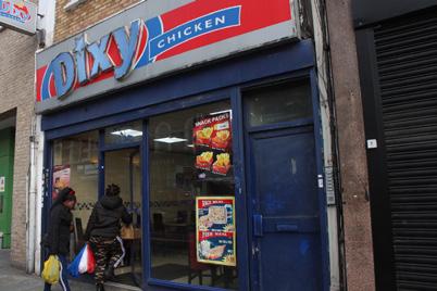
Nestled amongst the patchwork streetscape of Dalston’s bustling Kingsland High Street, Dixy is everything you expect from a typical chicken shop: four tables, a three star hygiene rating, two bossmen and a mountain of fried chicken. The story of its parent franchise is archetypal of any fried chicken chain in London: founded by South Asian immigrants in the 80s and built on the cornerstone of providing cheap, halal alternatives to the products of globalised fast-food corporations1
However, this is just one factor fuelling London’s idiosyncratic chicken shop culture8. Chicken shops aren’t just a source of cheap food; they also act as social hubs for young people9. By 4pm, Dixy is packed with schoolkids debating philosophical matters such as the difference between melted cheese and cheese sauce. Amongst the after-school rush is a group from Hackney New School. They sit huddled around the table, their uniforms a study in navy and grey. The most vocal of the boys is Isaiah. “I don’t get the school lunch10.” He pauses to take a sip of Mirinda. “It doesn’t even taste nice. I just save my money so I can go Dixy’s with my mates.”
With the ripples of austerity manifesting themselves in the form of government cuts to youth centres11, teenagers like Isaiah have fewer and fewer places to spend free time outside of the tiled walls of chicken shops12. Unfortunately, the cash flow brought by the rapidly materializing luxury towers and trendy coffee shops tends to elude the pockets of deprivation dotted across Dalston13. While the government wages a war against chicken shops, it fails to provide alternative spaces for Dalston’s youth to feel safe and fulfilled. According to some, chicken shops are the only things keeping many young people out of the clutches of opportunistic gangs on the hunt for fresh meat. At-risk children escaping unstable, deprived homes often turn to chicken shops as safe havens12. However, a government inquiry suggests that in the comfort of chicken shops, lured in with the promise of free chicken, many end up falling into the beckoning hands of those same waiting gangs12.This practice of chicken shop grooming, combined with rising knife crime, prompted the government to implement its #knifefree chicken box campaign14 In August 2019, boxes printed with anti-knife crime messages were rolled out in chicken shops across the country, including London staples like Morley’s, Chicken Cottage and, of course, Dixy. However, the government’s initiative sparked controversy, swiftly being dubbed as racist14

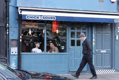
At the other end of Kingsland Road, sandwiched between corner shops and vast social housing complexes, lies Chick’n’Sours. This establishment prides itself on its use of ethically sourced, free-range, Asian fusion fried chicken. Their chickens come from a small farm in Yorkshire, raised on a diet of over 10 herbs and fresh salad leaves16. Evidently, these are very privileged chickens. However, healthy fried chicken is somewhat of an oxymoron, and eating it is an oddly disconcerting experience.
Chick’n’Sours is just one of many similarly trendy enterprises sprouting up in every nook and cranny of Dalston17. It is a prime example of food gentrification whereby culturally important and traditionally inexpensive foods become fashionable and unaffordable, spiralling out of the reach of low-income communities18
It’s apparent that Chick’n’Sours are trying to cater to a wide customer base with several options on the menu suitable for their ‘vegan and flexitarian friends’19. Yet one notable omission is halal chicken: an interesting oversight given Dalston’s sizeable Muslim population5. But this isn’t the only form of exclusion occurring at Chick’n’Sours.
In this territory the middle-aged Pakistani bossmen are worryingly absent, replaced with youthful, British chefs and waiters. Cardboard boxes and plastic forks make way for embellished ceramic plates and hefty steel cutlery. Mysteriously, frying chicken seems to take much longer on this end of the road. It also comes out tasting suspiciously of fish but maybe that’s what the higher price of £18 per meal is for. Of course it comes as no surprise that Chick‘n’Sours has frequently been a contender for the best chicken shop in London in lists curated by the likes of GQ20 and Timeout21, being hailed as “the greatest gift from the god of fried chicken” - a claim we, and no doubt Isaiah, would dispute.

The contrast between Dixy and Chick’n’Sours exposes the social division within Dalston; yet their coexistence reflects how gentrification has also led to local residents and wealthier newcomers going about their daily lives in their respective social bubbles. Dixy challenges the assumed and seemingly ubiquitous trend of newer establishments replacing traditional, local shops. Throughout our time in Dixy, the door barely rested on its hinges, with a steady stream of customers flowing in and out at all hours.
its purest form. Health agencies point to chicken shops as being responsible for the exceptionally high child obesity rates in London boroughs4 including Hackney (where child obesity rates lie at over 40%)5. But outside of the pages of governmental documents the reality is that chicken shops and similar fast food outlets are often the only options some people have. Parents in low-income households and night-workers don’t always have the time and money to buy or cook healthier meals6. “You’ve got mums working two jobs, looking after three or four kids with absent fathers7.” says Stacey-Ann, Dalston resident and one of the older customers in Dixy. She pauses for a second, gesturing vaguely with a half-eaten chicken breast. “It’s a struggle. Some kids have to fend for themselves.” she laments.

Clearly, lectures from chicken boxes alone aren’t going to cure London’s crime ailment. The aforementioned cuts to youth services are just the tip of the iceberg. Other deep-rooted socio-economic issues lie at the heart of the problem. These include the Coalition government’s scrapping of the Education Maintenance Allowance scheme in England, growing exclusion rates in schools, a country-wide housing crisis exacerbated by gentrification, mental health issues among BME children, and systematic racism15. Stacey-Ann has a more simple explanation: “Those kids, they’ve got the devil in them7.”
War on the walls: a tale of two communities in Peckham
Contest between street art and graffiti on the walls highlights a conflict between two communities in Peckham, and a creeping gentrification that threatens to change its character forever


The walls outside Peckham Rye station are scrawled with a patchwork of names and symbols in blue, red and black. The likes of Ghostface Killah and DJ Jazzy Jeff jump out beneath rusty shutters and peeling plaster. Down the street, “EXMA” is menacingly sprayed in large black letters, aside a messy assortment of cardboard boxes filled with dried peppers and over-ripened bananas. The smell of raw fish and nail varnish pervades the air. A man walks down Rye Lane with a loud hailer – he is intensely angry about “our schools, our children”, proclaiming everyone needs Jesus.
Around the bend, something else colours the walls. A picture perfectly composed with a mix of elusive carnation pink and tortilla brown pastels. @KELLYANNALONDON spells out the Instagram handle of the painter in an artful teal. This splash of colour invites visitors into the foyer of Peckham Levels, a once derelict carpark now converted into artist studios and coworking spaces. Metal beams run obtrusively across the ceiling, whilst wooden crates are fashioned into benches which deck a gritty cement flooring. Scents of craft beer and succulent burger patties permeate the top floor of the building. Here, artists and young professionals work intently on their laptops, sipping their afternoon coffee against a constant chatter ebbing above tracks from “The Clash”.
One street away; two worlds apart. At this frontier, the war has already begun. Just outside, a wall splashed lively orange with the words “Peckham Levels” in funky turquoise, red and mustard bubble font is marred ruthlessly by a black and white stomper, along with a chaotic assail of hollows and tags. If a picture speaks a thousand words, then the war on the walls speaks of the war on the streets. It tells the tale of two communities playing out fiercely across Peckham, the centre of a creeping gentrification that has run an eerily similar course in Shoreditch and other parts of the East End.

A vibrant art scene has evolved discreetly behind Rye Lane. Pushed out by the everincreasing rents in rapidly gentrifying Shoreditch , artists have moved south of the 1 Thames for cheaper rents in abandoned industrial buildings. Peckham’s proximity to Camberwell and Goldsmiths art colleges further cemented its importance to this budding artist community.
Bartender Nick Kidd attests, saying “The thing that initially attracted me to Peckham was that my friends live around here and they go to Goldsmiths College of Art”2
The arrival of artists saw the gradual conversion of disused post-industrial buildings into affordable studio spaces and galleries. Copeland Park and Bussey Building, former factories producing sporting goods, are examples of this conversion. More recently in 2017, a disused carpark was converted by Southwark Council into subsidised studio spaces, with bars and food stalls on the top floor in an attempt to attract people to the area whilst catering to the young artist demographic. This development is the renowned Peckham Levels. This conversion process has been sped up recently by a super-heated housing market and Peckham’s changing image - now home of the hipsters, crib of the creatives. 2012 was a pivotal year for Peckham, with the London Overground connecting it to central London and important parts of East London, establishing it as the new go-to destination for young professionals, creative-types and first-time home buyers . In 34
If you took a £2 coin to Dixy you’d walk out with a portion of chips and some change. If you walked into Chick’n’Sours with a £2 coin you’d walk back out with the same coin because, firstly, nothing on the menu is that cheap, and secondly, they won’t accept your coin, as they’re a cashless business. This social and financial exclusion undoubtedly contributes to the overwhelmingly homogenous customer base of young white professionals that we find inside. The room is brimming with freelancers swimming in blueberry hoisin sauce; the intellectual discussions of cheese sauce a distant memory. Instead, the air is oozing with trivial talk of architecture drawings and finance.
This highlights the first of two key factors that allow Dixy to resist the pressures of gentrification. Dixy plays essential social roles, both in acting as a source of affordable food and a safe space for Dalston’s most vulnerable. When combined with the prevalent social housing in the area providing an established customer base for which Chick’n’Sours would not even be an option, it’s clear there will always be a need for Dixy. The chicken shop has been elevated to the level of a community institution. Meanwhile, well-meaning yet naïve outsiders working for not-for-profits are trying to spread the gospel of cheap, healthier food to London’s youth through subsidized food vans22. For now though, Bossman has little to worry about, with these benevolent crusades often unravelling thanks to social tone deafness, as many vans overlook the need for halal products.
The second factor is Dixy’s possession of a freehold lease23, allowing Bossman to pass on his empire from generation to generation, rather than the lot being pounced on by an incoming developer. With chicken shops growing in number across London, while almost every other type of high street shop has been seeing more closures than openings24, Dixy is just a microcosm. It may not be unreasonable to speculate that, with its limited social value, lack of a strong foundation in the community, and reliance on potentially short-lived societal trends, Chick’n’Sours may invert expectations of gentrification and disappear before Dixy ever budges.
In Dalston, they’re trying to scrub away the grease, but it just won’t come off.
Amidst this churn of capital investment and regeneration, one group stands to lose the most.
Mentioning Peckham 10 years back would conjure images of a bustling Afro-Caribbean community. Even today, countless AfroCaribbean food stores, hair and beauty salons along Rye Lane serve Peckham’s vibrant, multiethnic community. With a 49% foreign-born population, many of Peckham’s residents hail from African countries such as Nigeria and Jamaica . Their roots can be traced back to the 6 1970s, where significant in-migration occurred due to political instability within African countries, and the desire to seek better educational opportunities in Britain . Once 7 settled in Britain, underlying discriminatory practices and economic restructuring placed them in difficult financial situations, prompting them to form community enclaves . Today, 84% 8 of Peckham’s residents fall into the most deprived quintile as compared to England’s 20%, making Peckham one of the most deprived areas9
While the recent slew of changes have been touted to bring positive benefits to local residents, many locals think otherwise. “These projects try to attract more people to the area, make businesses more money, not serve us local people” says resident Tasha10
One example is the redevelopment of the space in front of Peckham Rye station, which involved relocating long-standing local eateries and Afro-centric salons to make way for a public square. Southwark Council’s promised alternatives were far from ideal, however. The Palms, an Afro-centric retail space supporting local women in the hair and beauty industry used to occupy a central spot on Peckham’s main street. Today, it sits on a small street at the back of Rye Lane, away from the hustle and bustle of the station. What’s proposed to stand in its former place are cafés.

The back of Rye Lane is now a hipster enclave, shut off from the local community. Sake bars offer drinks at £10 per bottle and Italian restaurants serve mains for £16, putting them well beyond the budget of the average Peckham resident. Not everyone is unhappy, however. When asked about her feelings towards this trend, one business owner said, “we’re mainly trying to catch young people who come here for fun, office commuters, working class people, for us it’s (gentrification) obviously going to be better.”11
Even projects originally planned to benefit the local community have fallen prey to being gentrifiers themselves. Peckham Levels, which initially intended to offer affordable rental space for local artists and aspiring business owners has struggled to fulfil its promises. Only 12% of its members are of Black, Black-British or AfroCaribbean descent compared to 72% White12 Moreover, less than half the artists benefitting from the affordable studio spaces are Peckham locals.
“The community doesn’t step into Peckham Levels. They don’t like it. They don’t like the vibes.”
Daniel Opoku-Baah, a longtime Peckham resident and one of Peckham Levels’ only two black business owners states “If you walk onto the high street in the daytime, you’re going to see a lot of black people, and if you walk into Peckham Levels, it was its own entity.” His 13 friend, Cristiano Vitelli agrees: “The community doesn’t step inside Peckham Levels. They don’t like it. They don’t like the vibes.”14
“Only be a matter of time before Rye Lane loses its local charm”
With the back streets of Rye Lane already gentrified and well-meaning developments hoping to strike a compromise falling far short, it will only be a matter of time, it seems, before Rye Lane loses its local charm.
“There’s been this approaching monster, you feel it like a shadow and you’re not quite sure what it is. And there’s a tension that starts to be created by that approaching shadow within the community and within your conversations with people”, says Flora Duley, project coordinator of Peckham Platform15
Beside the Ghanian money changers and informal fruit stands, scaffolds and shutters portend of their impending demise. The tacky storefronts of “Khan’s Hairdressing” and “Harte’s Irish Meat Market” sit uncomfortably alongside minimalist black facades of new cafes and co-working spaces. “Peckham is Rye Lane”, says Kidd16
An important cradle of local life is slowly slipping away and this is no small matter for the families and fishmongers, barbers and bedrins who call Peckham home. The opening of Market Peckham, a coworking space combined with live music bars and restaurants along Rye Lane, marks the ominous start of this displacement of
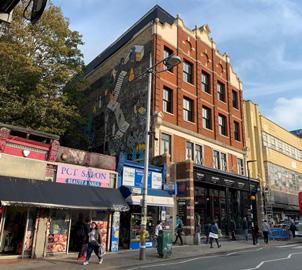
For now, it remains to be seen what fate Rye Lane will face but as it is, the war on the walls rumbles on. Tags stare down a moonlit Geisha pondering over a craft sake. Perhaps, they too will one day be gentrified. The tags, wildstyles and blockbusters that so characterized gritty Rye Lane now jostle with manicured images and nauseating artistry. The grit that once flowed from Rye Lane’s identity, is now made-up mystique, a shallow image of the city – anything that appeals to the incoming creative. The irony is unmissable and one wonders what insidious process of co-option turned crime to creativity 17

With every splash and every swash, the stencil and spraycan, artist and “antisocial”, scream out for space and a right to the city but the narrative is all too familiar and the winners are always the same. Perhaps Peckham will be no different and the inevitable cycle will run its course. But as fruit stand turns Foxtons and Poundland turns penthouse, one can hope that what remnant of local life will put up a fierce fight, that when Afro-foods turn Avo-shakes and local turns latte, the collective crowd of the gentrified will spray themselves back into the city.
BPLN0080: CITIES AND SOCIAL CHANGE
A Dixy Chicken in Dalston resisting change highlights the role of chicken shops as community institutions Authors: Xavier Ayub and Fola Olaleye | 9 Dec 2019
we sit inside, a pair of £3.50 meals between us, we hear the successive conversations with Bossman, each varying both in length and levels of playful familiarity. Elderly couples set up camp in the same spot where they’ve come for years, while mums with pushchairs feed their babies tiny chunks of chicken amongst clusters of black and brown schoolkids. A trio of communal sauce bottles circulates constantly, passed from table to table. Traditional chicken shops like Dixy have long been the target of criticism from the government. From child obesity to knife crime, fried chicken regularly finds itself at the centre of controversy surrounding many a social ill2,3. Sadiq Khan has been vocal about tackling the issue of obesity in London, showing particular concern for the health of young Londoners. The Mayor views stemming the greasy tide of chicken shops as a key move in this fight. A ban on new hot food takeaways within 400 metres of London schools2 is just one of several measures implanted into the London Plan4 that he hopes will act as barriers to hold back the burgeoning surge of fried poultry. His rationale holds water. Fundamentally, chicken shops are fast food taken to its logical extreme; the pursuit of speed over healthiness distilled to
As
Dixy Chicken on Kingsland High Street
Two Isaiah-approved meals in Dixy
The Lockner Estate which sits across the road from Chick’n’Sours
Chick’n’Sours on Kingsland Road
Two GQ-approved meals in Chick’n’Sours. Source: Chick’n’Sours Instagram
2015-2016 alone, 7.5 million entries and exits were recorded at Peckham Rye station5
Tessa Tan & Ian Chng Thursday, 5 December 2o19
Levels; Photograph: Ian Chng, 5.12.19
The Palms boarded up, beside new Cafés;
Photograph: Ian Chng, 5.12.19
Newly opened Market Peckham (center right) stands out amongst local shops along Rye Lane;
Photograph: Tessa Tan, 31.10.19
Street art on the shutters of Sake Bewery & Taproom. Photograph; Tessa Tan, 31.10.19
“One street away; two worlds apart”
“Projects don’t serve local people”
“Home of the hipsters, crib of the creatives”
27
Society theCityInquirer

Undergraduate
BSC Year 2
Programmes
BSc PLANNING DESIGN AND MANAGEMENT
BSc PLANNING AND
BSc URBAN STUDIES
REAL ESTATE Coordinator
Dr Jessica Ferm
ECONOMICS OF CITIES AND THEIR REGIONS
Tutors
Andrew Purves
This 2nd year undergraduate module examines different perspectives on the economy of cities and regions as these apply to a number of salient trends and features of cities and urbanisation – urban form and structure, specialisation and diversity, urban economic agglomeration, suburbanisation, gentrification, the housing crisis, inequality, deindustrialisation and the rise of the creative economy. The module is designed to produce an understanding of:
· different perspectives on the economy of cities and regions;
· key historical and contemporary developments in the economy of cities and regions;
· basic empirical methods for describing the economy of cities and regions; and the relationship between planning, urban policy and urban economies.
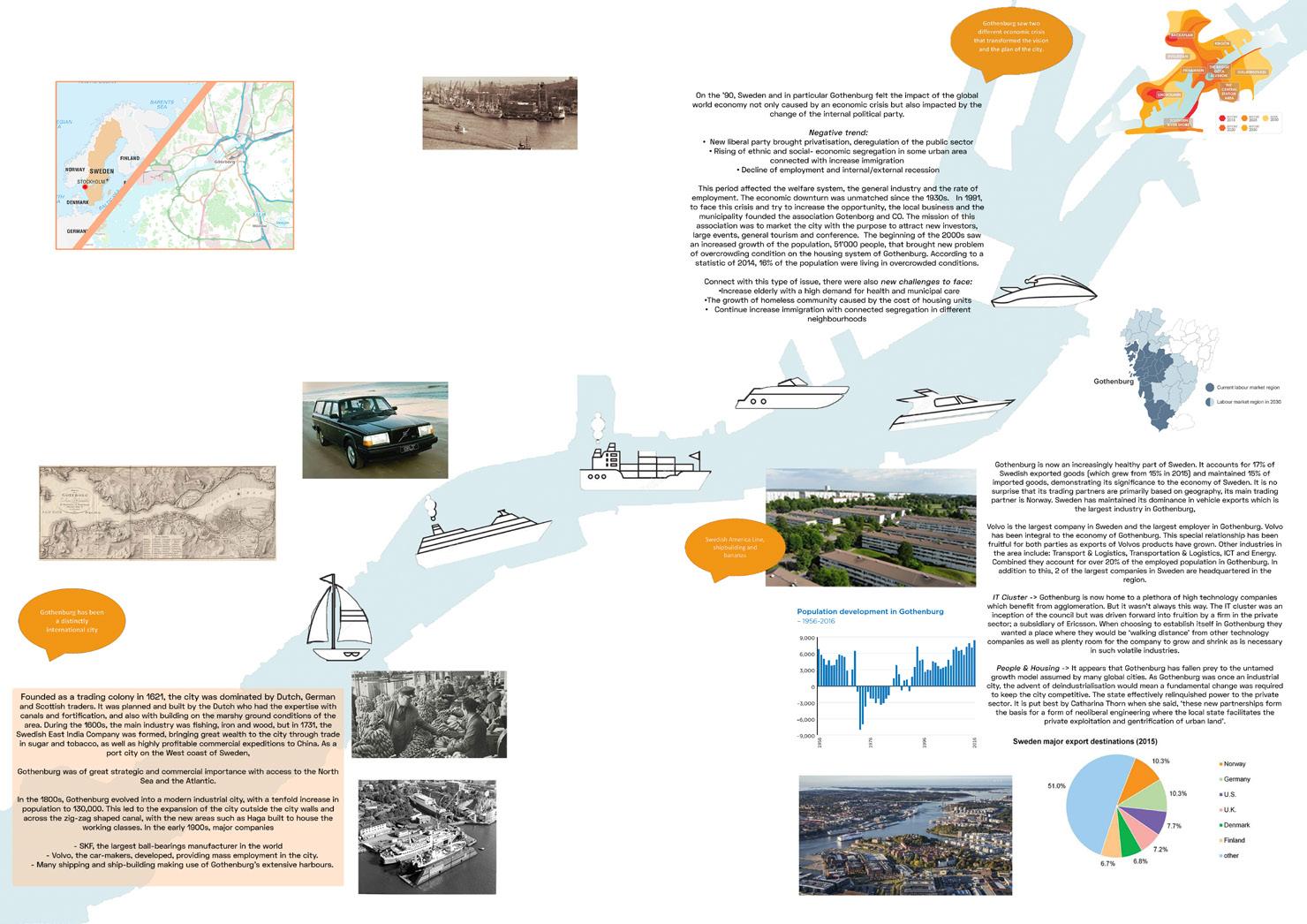
The module is assessed in two parts, a group poster and an exam. In the first assignment, students are organised into groups to produce and present a poster, a selection of which are featured here. The purpose of the poster is to:
· choose a case study city that remains relatively under-researched. This can be either a global city or a city of national importance in any country of the students’ choice;
· research the historic evolution of the economy of that city, how it links to national and international networks, and how the spatial urban structure of the city has evolved accordingly;
· use some the theoretical concepts covered in the module to explain the changes that have taken place;
· present and select appropriate quantitative and qualitative data available from academic, policy and online sources, images, diagrams etc. logically ordered to tell the story of the chosen case;
· demonstrate students’ written and verbal presentational skills.
Above: Medellin Study
Students: Xavier Ayub, Ian Chng, Fola Olaleye, Reka Tundokova
Below: Gothenburg Study
Students: Sofia Pina, Mikko Saukkomaa, Basya Markovits, Hammond Ozakpolor, Ekaterina Miroshnikova
28


29

Undergraduate
BSC Year 2
Programmes
BSc PLANNING
DESIGN AND MANAGEMENT
BSc PLANNING AND
REAL ESTATE
BSc URBAN STUDIES
Coordinator
Daniel Fitzpatrick
STRATEGIC PLANNING PROJECT
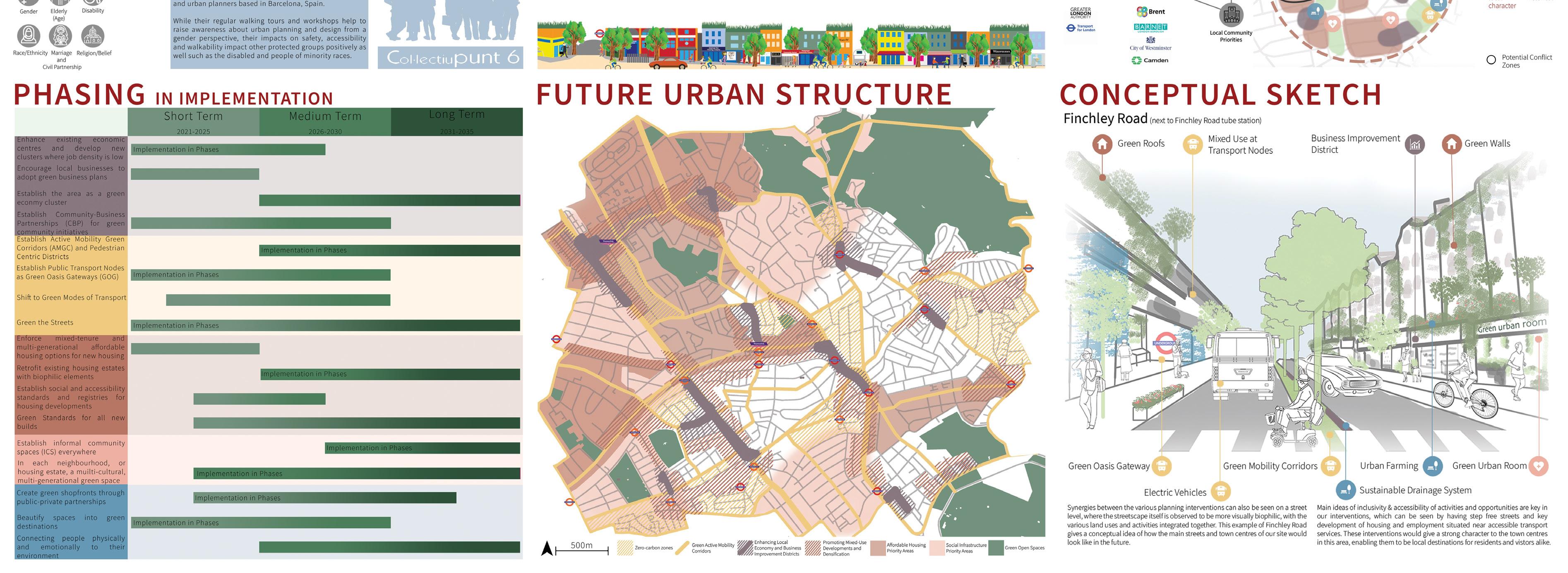
Strategic Planning Project is a 2nd year undergraduate module which introduces students to strategic spatial planning at the sub-regional scale, and provides an opportunity for students to engage in the analysis of and planning for urban change in the context of a changing economy, social inequality and of climate emergency.
Tutors
Elena Besussi
Magdalena Jakubowska
Stefania Fiorentino
This year the two key themes were ‘Planning for a climate emergency’ and ‘Planning with community’. Urban analysis was followed by the preparation of a strategic spatial plan for the London region which corresponded roughly to the North-West (Camden, Islington, Brent and Barnet). The Strategic Plan would drive and govern changes towards a set of established goals as expressed in four potential manifestos for a sustainable city, including Car-free City, Bio City, Post-carbon City, and a Commons City (Chatterton 2019). In addition, consideration of Public Sector Equalities Duty framed students’ analysis and response by drawing on community groups’ perspectives and potential roles and impacts in the area.
30 15 Minute Biophilic Neighbourhoods Students: Bryan Goh, Charmaine Chua, Christopher Wong, Ploy Na Thalang, Rachel Chiam, Tessa Tan



Undergraduate
BSC Year 3
Programmes
BSc PLANNING DESIGN AND MANAGEMENT
BSc PLANNING AND
REAL ESTATE
BSc URBAN STUDIES
Coordinator
Dr Katayoun Karampour
URBAN DESIGN SPACE AND PLACE
This module aims to develop skills and knowledge for carrying out largescale inner-city urban design investigations, masterplanning, and detailed design proposals.
Tutors
Dr Katayoun Karampour
Neha Tayal
Isabel Gutierrez Sanchez
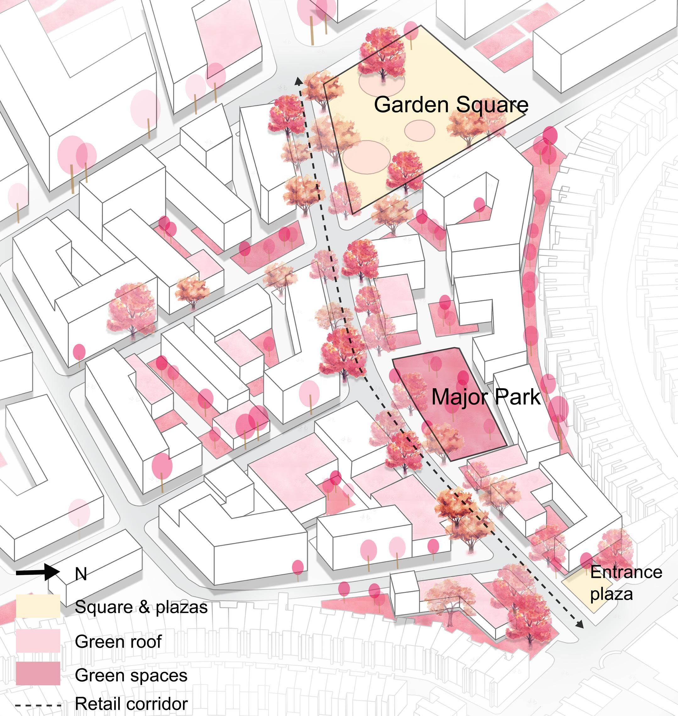
The term is organised around one major project: the redevelopment of Earls Court site in West London. The existing scheme is controversial and has raised concerns due to its density, urban form, demolition of housing estates and Exhibition Centres, and small share of affordable housing. Given the strong opposition of local communities, this module considers a scenario in which residents aim to develop an alternative scheme - the People’s Masterplan - that maintains their homes and offers a framework for urban intensification of the area.
The project comprises two tasks:
Task 1: Analysis and Masterplan proposal (group work, 6 weeks) consists of developing an alternative vision and scheme for the site maintaining the existing housing estates, and providing a mix of uses and a minimum of 3.500 units. Three students’ proposals (two of them featured here) were chosen by the class to be further developed in Task 2;
Task 2: Detailed Urban Design proposal (individual work, 5 weeks) consists of developing in greater detail a section of one of these masterplans. The design response should address the massing and character of the built form, and the character of the streets and open spaces.
This project-based module combines lectures and weekly tutorials.
32 Creating Lifelong Neighbourhoods Student: Quan Yuan
Commodore apartment building, Planta
Havenhurst Park, West Hollywood
Brainport Smart District, Netherlands Bureau Druzhba, Moscow
Major park
Green roofs
Pocket Park
Recreational ground Neighborhood park
Commodore apartment building, Planta
Havenhurst Park, West Hollywood
Brainport Netherlands Bureau Druzhba, Moscow
Major park
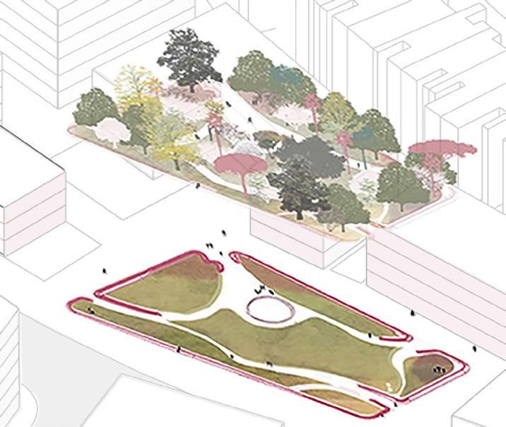
The park aims at bringing back life to urban community, providing a place for relaxation and entertainment to encourage living. Also the park located between the residential area and actvity corridor as a buffer to protect the privacy of local residents.
Livable Land Mixed diverse activity
A B Urban Mix the
A A B B
33

Undergraduate
BSC Year 3
Programmes
BSc PLANNING
DESIGN AND MANAGEMENT
BSc PLANNING AND
REAL ESTATE
BSc URBAN STUDIES
REAL ESTATE DEVELOPMENT
Dr Danielle Sanderson
Coordinator Tutors
Dr Danielle Sanderson
Dr Peter McLennan
This module considers Real Estate Development from the perspectives of various stakeholders including Planners, Developers, and those affected by development. It examines models of the development process and factors that affect land development. Development appraisal methods are discussed, and simple spreadsheet modelling of development viability is carried out.
The aims of the module are to enable students to:
1. understand and evaluate developments from various standpoints, including economic, political and social;
2. understand market forces and interactions between planners, real estate developers and other stakeholders.
By the end of the module, students should have acquired skills in:
1. mapping the roles played by a wide range of actors and social and economic institutions in the development of land and property at different times and in different places;
2. describing the interaction of land ownership, construction, development and investment finance, planning, and other aspects of regulation;
3. critically evaluating real estate developments;
4. carrying out simple development appraisals.
34 Development Process of Wembley Park Students: Ni Zhan, Yining Liu, Jiaqi Zhu, Lingjia Zhong

• The political will of the Brent council to and boost the local economy through new revitalization
•
• The PRS (private rent sector) guarantee BTR industry
• Local council subsidise the financial challenges housing
•
• Set by the GLA in London Plan as a Preferred and an Opportunity Area with an indicative of 5,500 jobs and 5,000 homes between
•
• 35% affordable housing set by the central initial affordable housing offer was considered clear definition of housing mix and the affordable for the masterplan was required.
• 2017 London Plan Draft
•
•
•
• High return on large-scale regeneration
Demand for rental homes remain strong
Increasing demands for high living standards form potential tenants
Recession and financial crisis
•
Mortgage initiatives for home buyers
•
•
•
Need for job opportunities; low income and Local needs for urban regeneration
•
Wembley’s sport, music and entertainment
Increasing population, especially the young Public realm improvement
•
Requirement for new schools, health, sports facilities for local communities
• Need to improve accessibility into this area, parking and transport services
•
•
• Developing technology: Modern estate management
•
• Full access to information communication infrastructure
• The transportation links (underground, expected
•
• In corporate a site-wide energy centre
•
• Deliver Code for Sustainable Homes Level
•
• BREEAM Excellent standards
• Lack of wildlife sites to
•
•
•
Composition of Funding Capital, 1,400 restaurants commercial local space, centre, centre and a community Retail industrial, surface masterplan construction and 1.8m to on-year investment in the payment potential previous Economic Technological Environmental
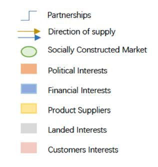
The financial year ended 31 Mar (loss) Revenue Cost of sales Adjusted capital Deficit on revaluation of investment properties Share of from joint venture Share of profit from associates Operating profit before administrative expenses Agency Model Analysis Political PESTEL Factors With Stakeholders’ Interactions (Adams&Tiesdell,2013) Stock Of Land Planning Applications Intentions: BTR + increase commercial value Local needs for economic opportunities and urban regeneration C H A N G E High expectations from the investors Increasing demand for new retail provision National and Mayor Policy (a 60:40 mix of Affordable Rent) and Brent Council Policy Demand for rental homes remain strong especially for young generations Population growth Increasing demand for high living standards from potential tenants Successful operation of Wembley Stadium and Wembley Arena reinforce Wembley’s role as a major visitor destination Aspiration Opportunity Conditions Satisfied Land Ready to Develop Taking Stock DEVELOPMENTPRESSUREANDPROSPECTS DEVELOPMENT FEASIBILITY IMPLEMENTATION USE Disposal Of Development Construction Project Viability Physical Conditions Standards Fund Available Site Requirements Infrastructure needs Section 106/ IIF: CIL Demand Acquisition/assembly costs Financial Institutions Construction industry Funding for services and site prep. Programming site works Site Prepared & Serviced Consumption / investment in product Community Infrastructure as shown in Brent Infrastructure and Investment Framework * *
Event-Sequence Model Analysis
provide
significant the natural environment
a
Provision
sustainable homes and businesses Target BEFORE AFTER (Barrett et al., 1978) Capital, 1,400 restaurants commercial local space, and a community Retail industrial, surface masterplan and 1.8m to year in the payment potential Economic Social Technological Environmental
of
Politica PESTEL With Stakeholders’ Interactions (Adams&Tiesdell,2013) Planning Applications Intentions: BTR + increase commercial value C H A N G E High expectations from the investors Increasing demand for new retail provision National and Mayor Policy (a 60:40 mix of Affordable Rent) and Brent Council Policy Demand for rental homes remain strong especially for young generations Population growth Increasing demand for high living standards from potential tenants Successful operation of Wembley Stadium and Wembley Arena reinforce Wembley’s role as a major visitor destination Aspiration Opportunity Conditions Satisfied Land Ready to Develop Taking Stock DEVELOPMENTPRESSUREANDPROSPECTS DEVELOPMENT FEASIBILITY IMPLEMENTATION USE Disposal Of Development Construction Project Viability Physical Conditions Standards Fund Available Site Requirements Infrastructure needs Section 106/ IIF: CIL Demand Acquisition/assembly costs Financial Institutions Construction industry Funding for services and site prep. Programming site works Site Prepared & Serviced Consumption / investment in product Community Infrastructure as shown in Brent Infrastructure and Investment Framework * *
The political and boost revitalization
The PRS BTR industry
Local housing
Set by and an of 5,500
Agency Model Analysis
•
•
•
•
35% affordable initial clear definition for the
2017
High return
Demand
•
Increasing standards
Recession
Mortgage
Need for
Local needs
•
Wembley’s
Increasing
Public realm
Requirement facilities
Need to parking
Developing
Full access infrastructure
The transportation
In corporate
Deliver
BREEAM
Lack of the natural
Provision BEFORE AFTER 35

Undergraduate
BSC Year 2
Programmes
BSc PLANNING DESIGN AND MANAGEMENT BSc URBAN STUDIES
GREEN FUTURES
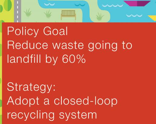
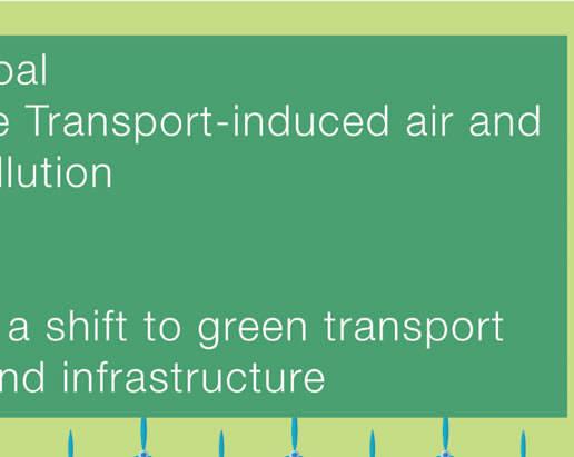
This module provides an opportunity for students to engage in developing a climate action plan for a city. It runs as an urban laboratory to apply creative problem-solving, critical thinking, and make use of knowledge acquired during the course to formulate a strategic vision for the future climate mitigation and adaptation in a city they have chosen. The output from this work is summarised in four panels:
Coordinator
Dr Jo Williams
Tutors
Jo Williams
Ju Eun Kim
Rachna Leveque
Panel 1 The SWOT analysis – a diagnosis to identify where emission reductions can be delivered and the urban environment can be adapted for climate change. This stage identifies policy priorities for cities which forms the basis of the strategic vision.
Panel 2 Strategy - Appropriate strategies for mitigation and adaptation based on local conditions and the potential for change are outlined.
Panel 3 Policy goals and instruments - the policy targets and instruments (regulatory, fiscal, educational, technological, design solutions) for reaching those targets are outlined.
Panel 4 Spatial Plan - the spatial plan illustrates both the impact of policy instruments on the physicality of the city and where area-based policies will be introduced.
This project-based module combines lectures, weekly tutorials, collective discussions and concludes with an Exhibition of the Planning Teams’ work led by students.
36 Climate Action Plan (Selected Pages) Students: Bryan Goh Jian Hao











37

Undergraduate
BSC Year 3
Programmes
BSc PLANNING DESIGN AND MANAGEMENT
BSc PLANNING AND
REAL ESTATE
BSc URBAN STUDIES
URBAN PROJECT MANAGEMENT
Tutors
Dr John Ward
Dr Marco Dean
This is the third and final module in the ‘management’ stream which runs across all our three undergraduate programmes. The aim of this third-year module is to provide students with an introductory yet comprehensive overview of programme and project management as applied to urban projects. It draws on executive level practices, conveys ‘real world’ urban project situations, and encourages, through a mix of conceptual lectures, class exercises and case study presentations from guest lecturers, an understanding and appreciation of the complexities and dynamism that comprise modern urban project management.
The module provides an opportunity to turn project management theory and methodology into practice through the completion of a group presentation (comprising 30% of the overall mark). A powerpoint presentation is prepared to support the group’s ‘pitch’ to a company board (or local authority’s scrutiny committee) to gain approval to go ahead with an urban project. Students are assessed on their application of theoretical concepts in project management to a group project of their choice, their understanding of the different components of a project initiation document (PID) and execution suitable to the project proposed.
Coordinator
Dr Jessica Ferm
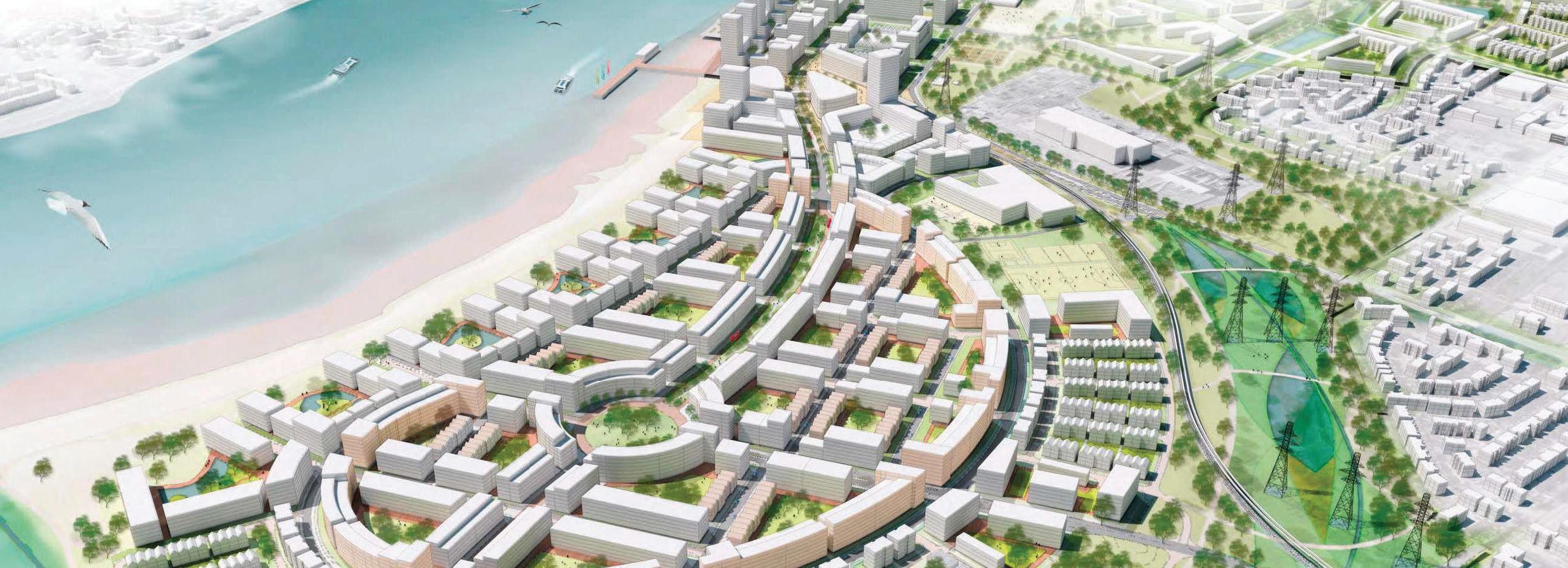
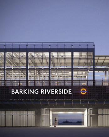
38 Barking Riverside Students: Hassan Ali, Anastassia Gusseinova, Max Herbertson, Alex Di Pasquale, Cecilia Scapinelli


39

Undergraduate
REAL ESTATE INVESTMENT AND FINANCE
Coordinator
Dr Nicola Livingstone
The aim of the module is to introduce and develop knowledge of the key concepts and fundamental principles of commercial real estate investment. This module considers the application of investment theories to both the general investment markets and the property market specifically – where and how does property fit in?
The module begins by considering the unique characteristics of property as an asset class and considers the ‘value’ of an investment: who invests in property and why? The risk and return potential of direct and indirect property will be considered in relation to other investment media, such as stocks and bonds. Diverse ways in which property can be invested will be considered, as well as how such vehicles are managed by investors as an integral aspect of international and multi-asset portfolios. Market performance, cycles and trends are considered, and relevant models and theories examined. Market forecasting, modelling, indices and the efficiency of the market are introduced, combining to offer a solid introduction to property as an international investment medium.
The coursework element of the module is a report on each student’s stock portfolio, which runs throughout the term for three months. The students are provided with a £1m hypothetical investment pot to trade under real life market conditions, and adopt their own approach to risk.
40
Programmes
PLANNING
REAL ESTATE Investment Portfolio Report (Selected Pages) Student: Sophie Hermann
BSc
AND
BSC Year 3
MARKET OVERVIEW


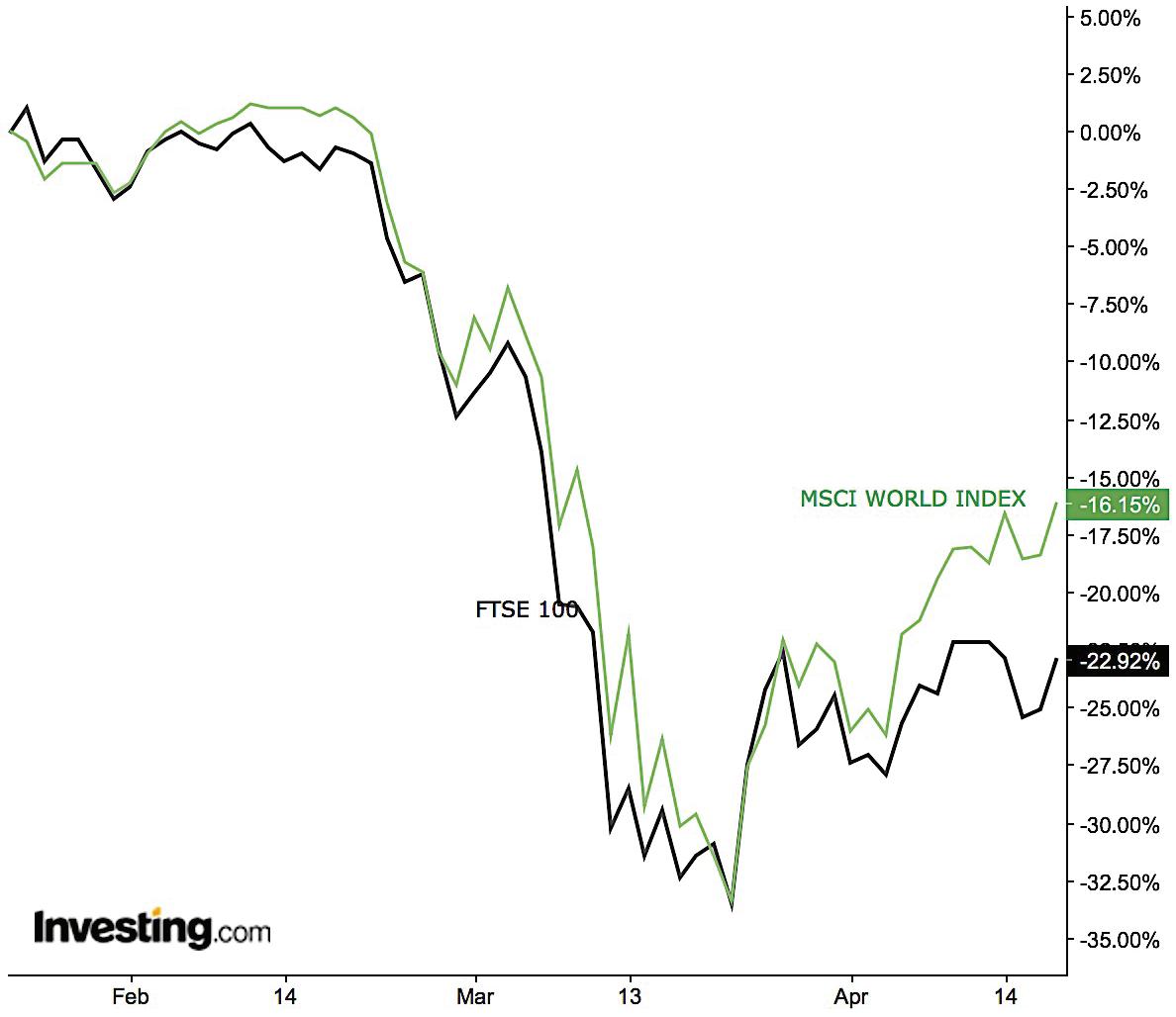
• Throughout the trading period, markets around the world showed extreme levels of volatility in response to the increasing severity of the Covid-19 pandemic and its effects on the economy (Invesco, 2020).
o Clearly illustrated by (investing.com):
The MSCI World Index
• -16.15%
The FTSE100
• -23.7%
The CBOE Volatility Index (VIX)
• Reached a “record high” of 82.69 points on 16.03. (Li, 2020)
• End of January, UK markets reflected uncertainty over UK’s official departure from the EU and increasing fears of the virus as the first UK cases were confirmed (Partington, 2020; Kollmeyer, 2020).
• UK sell-offs heightened following the statement by Marc Carney that came at the end of February, warning the “UK should prepare for economic growth downgrade” largely caused by the spreading virus (Invesco, 2020).
• March saw UK’s “domestic financial market volatility [hit] historically high levels” and the “biggest quarterly fall for more than three decades” reported at the end of the month (Invesco, 2020).
PECUNIA INVESTMENT LLC INVESTMENT PORTFOLIO REPORT PAGE 6
-23.7% -16.15% 41
Figure 1. MSCI World Index and FTSE 100 from 24th Jan. 2020 –
17th Apr.
2020 (investing.com)

Undergraduate
BSC Year 3
Programmes
REAL ESTATE MANAGEMENT
Dr Danielle Sanderson
This module explores the management of real estate assets from the perspective of the various stakeholders (owners, tenants and occupiers). It examines how managers can enhance the value of real estate as an investment asset, and how occupiers can maximise the benefits of the space they occupy - considering property as a factor of production. It aims to provide the student with an understanding of the role, responsibilities and skills required of asset managers, property managers and corporate real estate managers. The module will also cover aspects such as corporate social responsibility in property management, environmental issues and facilities management.
The module aims to enable students to:
- Apply management concepts to the business of real estate;
- Critically assess how real estate management can add value;
- Describe key issues facing real estate managers;
- Evaluate how these issues affect the various sectors of real estate, from different perspectives;
- Enhance oral and communication skills through discussions; and
- Develop report/essay writing skills through the coursework.
Coordinator
BSc PLANNING AND
REAL ESTATE
42 Northfields Shopping Centre Management Report (Selected Pages) Student: Alexander Di Pasquale
7. Refurbishment and improvements
Here is a list of our recommendations for refurbing and improving the shopping centre, in line with our three core strategies:
1. Update the interior of the shopping centre with a minor refurbishment works to include sustainably grown hardwood interior cladding and green walls where appropriate. This improves aesthetic appeal of the centre and also embraces corporate social responsibility that helps create a service culture (Morgan et al, 2012).

2. Increase the sustainability of the building by implementing photovoltaics and water harvesting systems on the roof space. The electricity generated will be used for common parts and any surplus will be sold off to the grid with the proceeds being fed back into the service charge account, reducing service charge costs long term.

3. Add recycling facilities to keep the centre clean, contribute to a better shopping experience and protect the environment.
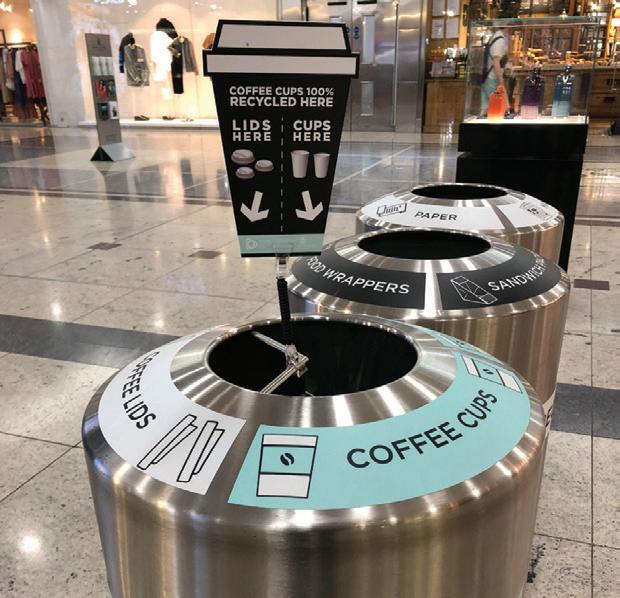
These proposals will be put forward to the retailers for their approval in order for the expense to be taken out of the service charge reserve funds in accordance with the service charge code (RICS, 2014).
11
Figure 10: Photovoltaics on shopping centre
Credit: edie.net
Figure 9: Refurbishment example
Credit: 360architecture.com
Figure 11: Recycling facilities
43
Credit: Pinterest

44

POSTGRADUATE PROGRAMMES
The Bartlett School of Planning offers a range of internationally renowned Master’s programmes on planning and related disciplines. These build on the school’s reputation for excellent, policy-focused research and aim to equip students with the skills and the knowledge needed for a career in planning or in related areas of professional practice.
All of our programmes, with exception of the MRes programme, are professionally accredited by the Royal Town Planning Institute (RTPI) and/or the Royal institution of Chartered Surveyors (RICS).

46
MPLAN CITY PLANNING
The MPlan City Planning is a two-year programme that offers an in-depth, academically informed introduction to the professional practice of city planning and explores both domestic and international planning practice and culture.
47
Dr Michael Short Programme Director

Postgraduate
PLAN MAKING STUDIO 1
Dr Michael Short
Tutor Rotem Shevchenko
This module is the first in a two-part Plan-Making module specifically for students of the new 2 year MPlan City Planning (the other module is run by Dr. Sonia Arbaci) which seeks to explore conceptions of densification in a studio environment. Densification is a term used in the built environment to denote, in some form, the increasing density of people living and working in urban areas. Advocates of densification argue that the denser a city, the more sustainable it is, since dense cities use less energy per person than suburban or rural areas where people are spread over a wider distance and so travel more often and further. It is also argued that less waste is produced by dense cities as smaller spaces take less energy to heat and cool and use fewer resources to fit out. In addition, the level of infrastructure and supply chain coordination can be more efficient in areas of high density. It is our job in this studio to interrogate this assumption in relation to a site that each student chooses in London.
MPlan CITY PLANNING
Coordinator
48 Rethinking Density (Selected Pages) Students: Helen Carter
Programmes
a MEB cluster (in accordane with POL 1.0).
4
Elephant & Elephant Road up and pp.33). This ‘cheap rent’, model single recognized by so POL.1.1), and displacing
Elephant & Elephant Road ‘divided up and pp.33). This ‘cheap rent’, this model of a single recognized by units, so POL.1.1), and is displacing
1 Movable Walls
The retail workspace will be fitted with movable walls to be flexible to tenants needs. For example, as a business grows ‘they are easily able to upscale’ (Ibid, pp16) by removing a wall. This also works vice versa for smaller MEBs, who may prefer a smaller space at reduced rent. Rent is affordable and based on square footage occupied. The ‘Tienda’ model ‘operates as a natural business incubator’ (Ibid, pp.33) due the space’s flexibility.


Movable Flooring
8
An optional corridor will be provided floor. This gives tenants flexibility if they have a wider unit (see figure 15). The vides ease of movement between the ing to facilitate the cluster. On the reverse, allows the flexibility of having more cated businesses, if the MEB requires customers, for example a salon (see

1
2
Figure 14: Variety of retail space sizes are shown. Sizes can be altered using movable wall structure.
Flooring 3 Opportunities for Negotiation
structure.
Figure 16: Side on view of retail space shows the high density of the design, both in terms of units per hectare and units of affordable retail space.
49
Flooring
3 Opportunities for Negotiation
2 1 2 3
structure.
Figure 16: Side on view of retail space shows the high density of the design, both in terms of units per hectare and units of affordable retail space.
Figure 15: Entrance to clustered workspace showing movable flooring to facilitate easy movement between units.
8

Postgraduate
Programmes
PLAN MAKING STUDIO 2
Coordinator
Dr Sonia Arbaci
Tutors
Alexandra Gomes
This module provides an opportunity to engage in a strategic planning exercise in a wider metropolitan context in the UK. It aims to develop an appreciation of plan-making to foster changes that are socially, economically, and environmentally just and sustainable. Students apply creative problem-solving, critical thinking, and analytical skills and knowledge acquired in other modules of the Mplan City Planning. The Project “Thamesmead for all” considers a scenario whereby the Peabody Group has commissioned an international competition for a Strategic Plan for the Thamesmead Waterfront, considered “the biggest regeneration project in London” that could benefit from a (new) town centre, the arrival of the Crossrail (2018) and a proposed DLR station (2026).
Teams of students, acting as planning consultants, respond to this call and develop a Strategic Plan in stages: “Broader context analyses” of the project site in relation to national, and regional/city contexts; “Analysis-Plan exercise” and initial strategic vision informed by site observations; “Strategic Vision-Concept Plan exercise” translating the strategic vision into a spatial concept plan, informed by thematic analyses, site observations, theories/ concepts, and examples. Finally, the “Strategic Plan” for the project site. The various stages are integrated into the final output (2xA0 posters) advancing a visual narrative that runs through a set of spatial plans, sectoral policies and implementation.
This module operates as an urban laboratory where the teams share their work and build collective knowledge through interim presentations, class discussions, and show&tell sessions. The Neighbourhood Manager of Peabody Regeneration Team participated in the final presentations acting as the client.
MPlan CITY PLANNING
50
From the Margins to the Centre: Transforming Industries of Services Students: Emma Bunting, Nicole Pumarino, Isaac Reitman

51

52
MSc
INFRASTRUCTURE, PLANNING, APPRAISAL
AND DEVELOPMENT
The MSc Infrastructure Planning Appraisal and Development is a modular/flexible programme, aiming to provide a critical review of mega infrastructure theory and practice both globally and in the UK.
53
Dr John Ward Programme Director

Postgraduate
Coordinator
Dr John Ward
BUSINESS CASES FOR INFRASTRUCTURE
This introductory module presents a framework for developing business cases for infrastructure projects both in the UK and elsewhere. It critically reviews the theory and practice in the field drawing from the experiences of the UK’s HM Treasury/ Department for Transport, the European Investment Bank (EIB), the World Bank and OMEGA Centre international case study research.
For this task, representing 20% of the module credits, student teams have been asked to critically evaluate the business case of a recently approved infrastructure project against the 5-case business model, a best practice framework developed by HM Treasury. The model strives for better decision making and project outcomes through the consideration of:
1. Strategic case - is the proposed project supported by a compelling case for change that fits within the strategic context and meets development needs?
2. Economic case - does the preferred project option represent value for money?
3. Commercial case - is the proposed project commercially viable?
4. Financial case - is the proposed project affordable and how can it be funded?
5. Management case – is the proposal achievable and can it be delivered successfully?
Students presented their posters in class, highlighting performance of their chosen project against this framework. and discussing the relative strengths and weaknesses of such models, and their adequacy for guiding project ‘successes’ fit for the multiple demands of infrastructure development in the C21st.
MSc INFRASTRUCTURE
APPRAISAL AND DEVELOPMENT
PLANNING,
54
Programmes
Waste to Energy Project, Singapore Student: Chuandong Pu, Fakhrisya Zahara, Xingchen Li, Minzhao Li


55

56
MSc
URBAN DESIGN AND CITY PLANNING
The MSc Urban Design and City Planning programme offers a unique focus on urban design as a creative planning tool and the interface between urban design and city planning.
Dr Pablo Sendra Programme Director
57

Postgraduate
Programmes
DESIGN AND REAL ESTATE
Prof Peter Rees
Tutors
Bianca-Maria Nardella
Karla Barrantes Chaves
The best examples of British urban regeneration are created by collaboration between the development industry, architects and local planners. Through site visits, presentations and critical interrogation, we learn how this is achieved. The absence of municipal master-planning in the UK creates opportunity and flexibility for the development sector but requires unique planning skills to shape projects and represent the needs of the community. Students visit areas of major commercial regeneration in Central London and receive presentations from senior property professionals, architects and planners. The course demonstrates how the disciplines of master-planning, architectural design, real estate and project management combine to produce successful development projects in London, a global business city.
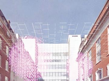
Student groups are assigned key Central London locations to identify the unique set of characteristics that form its identity as a place. This activity is complimented by gathering information on the location including (but not limited to) real estate data, local planning policies and community issues. These studies culminate in 10min video presentations “selling” the key attractions of the location, and its potential opportunities, to a panel of development professionals at the final session. The need for a combination of creative team-working and concise presentation mirrors the “real world” of real estate.
Coordinator
MSc URBAN DESIGN AND CITY PLANNING
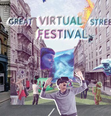
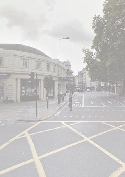
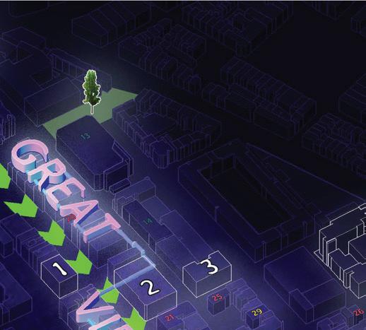
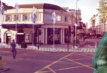
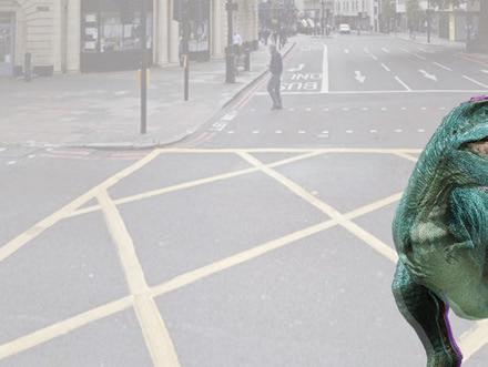
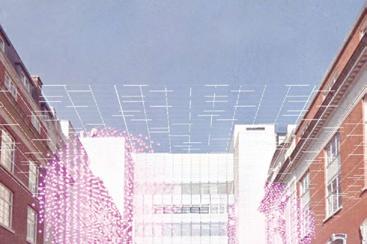
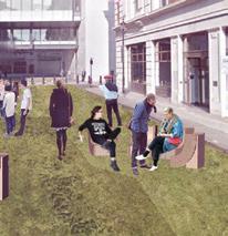
58 Great Virtual Street Festival, Great Portland Street (Festival Map) Students: Ben Tattersall, Cynthia Espinola Cano, Martha Sainsbury, Matt Faraci, Tomasz Kopczewski, Zerlong Li




















59

Postgraduate
Programmes
MSc URBAN DESIGN AND CITY PLANNING
Coordinator
Elena Besussi
COLLABORATIVE CITY PLANNING STRATEGIES
Tutors
Elena Besussi
Marian Larragy
Paula Morais
Dr Michael Short
High streets are ubiquitous in London and essential to its social and economic life: “47% of businesses outside Central London are on a high street and 1.45 million employees work on or within 200 metres of a high street, and this number is growing” (LSE, 2017). Despite consensus that that the high street is a key urban, social and economic environment for London, there is heightened concern among local community groups and researchers that planning has but a minimal understanding of the social value of the high street and of the role it has in supporting the social and economic wellbeing of marginalised and low income groups in London.
This year’s project is dedicated to the London’s high street and to develop critical knowledge as the basis to develop planning and design propositions that are socially just. The module’s pedagogical rationale is underpinned by the notion that the content of urban design proposals and planning strategies relies heavily on the type of knowledge we produce about urban environments. For planning and urban design to be socially just, their practice must be grounded in an ethical approach to knowledge production. Students conducts systematic studies of London high street covering themes such as work, culture and social value followed by a critical assessment of the impacts of the Mayor’s of London Economic Strategy on the future of the high street.
60
A Just Transition for Hackney’s High Streets Students: Maria Castilla, Rafaela Christodoulou, Bas Dijkhoff, Nethra George, Lydia Ogden & Ben Tattersall





Demographics: ethnicities Types of crime
10%

10% of all



Digital exclusion often leads to wider social and economic conclusion. Therefore, high streets need to remain up-to-date fand be able to incorporate new technologies.

Access to education and workforce development must target groups and areas that are subject to existing inequalities.

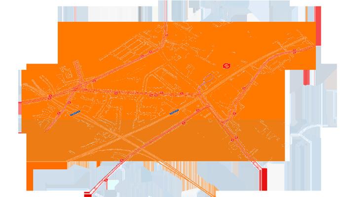


Mayor will support start-ups and micro businesses in financial stability, growth potentials and sustainability issues.
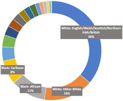

Business owners in Hackney Central


Trends of automation would result in losses of jobs and skills which would hinder workers on the high streets.



Office and industrial space conversion into residential use threatens the viability of especially small and medium sized businesses.

Community Engagement Opportunities:
The high street should provide spaces and services that facilitate social cohesion. For example, trusted donation points for foodbanks, charities and community cooking schools. These services teach skills and provide opportunities within a green economy to people from a range of background.



The Healthy Streets Approach will contribute to a just transition of the high street and make them more attractive destinations.
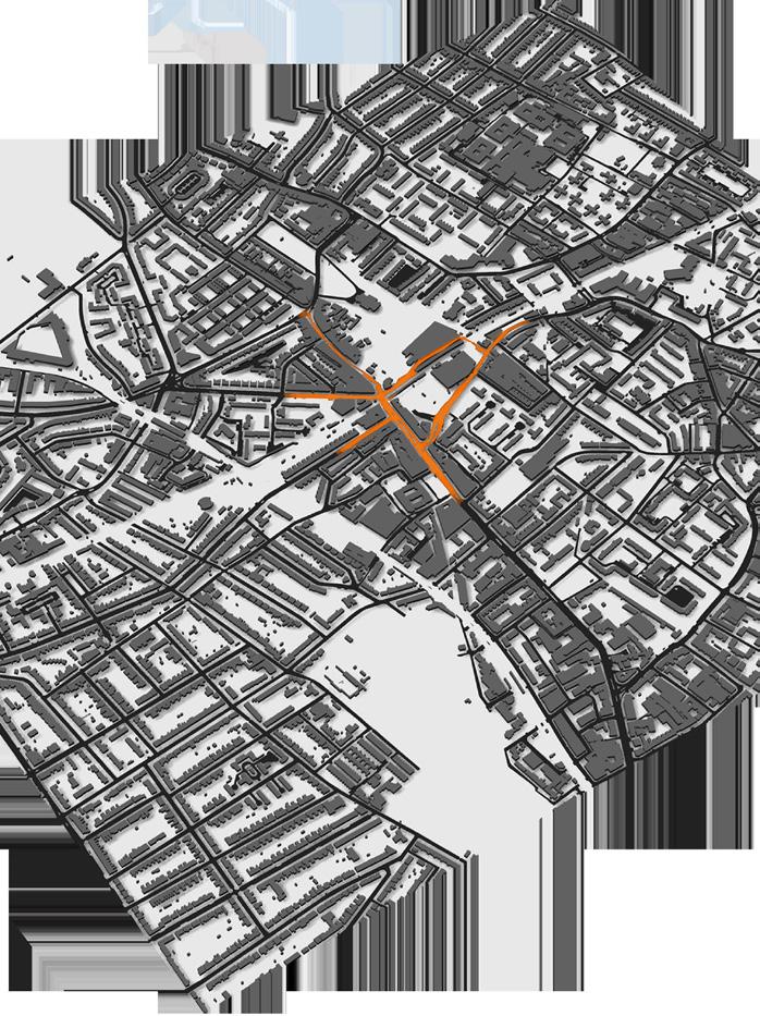
street For example, mental health signposting, job seekers and citizens advice.
Funding zero-carbon medium-sized enterprises by government funded ready struggle to survive
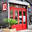

The Mayor must ensure gagement is inclusive pact of regeneration tactics.

Overlooks scalability, in diversity of small and prises that are often displaced evolve with economical
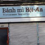
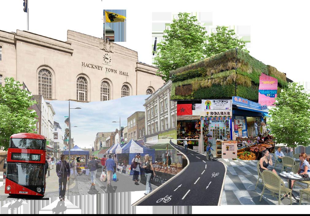
Central A just transition for Hackney’s high streets Land Use Social spaces Supply of goods Transportation Diversity CARIBBEAN CHINA JAPAN MEXICO VIETNAM Key Restaurants
Bars Shops
Hackney
and
floor Hackney
ITALY TURKEY VIETNAM AFROCARIBBEAN Coffee prices & origins Perceptions of Hackney Central 61 A just transition for Hackney’s high streets Land Use Social spaces Supply of goods Transportation TURKEY AFROCARIBBEAN CHINA JAPAN ITALY MEXICO VIETNAM Key Restaurants and Bars Shops
Central specific ethnic and groups
of all ground floor units in Hackney Central cater to specific ethnic and cultural groups ITALY TURKEY CHINA MEXICO VIETNAM AFROCARIBBEAN JAPAN The mayor’s policies impacting hackney central London’s Local Industrial Strategy Economic Development Strategy for London Racial inequalities and the vulnerabilities of BAME groups must be addressed to ensure inclusive growth accross sectors. I II Access to education and workforce develop ment must target groups and areas that are subject to existing inequalities. Commercial ethnicities Demographics: ethnicities Types of crime CARIBBEAN Mare Street Amhurst Road Diversity and ... Hackney Central policies recommendations hackney central locality and ... Strategy Development London Environment Racial inequalities and the vulnerabilities of BAME groups must be addressed to ensure inclusive growth accross sectors. The LES must include diversity as indicator to ensure that policies do not negatively affect ethnic and cultural diversity. Markets: Markets offer a dynamism to the high street through a changing selection of vendors and opportunities for local enterprise to flourish without permanent premises. Moreover, they invite visitors to the area without changing the permanent retail context. Active Frontages: Exciting and varied business fronts is more achievable with improved pedestrianisation. More seating, awnings, and market frontages open up the space to encourage people to engage with the high street in more meaningful ways. Vital services: There is a continued need for access to wellbeing and civic services on the high
UCL
Christodoulou, Bas Dijkhoff, Tattersall
Perceptions
Hackney
Coffee prices & origins
of
Central

Postgraduate
Programmes
Coordinator
Dr Pablo Sendra
SUSTAINABLE FUTURES BY DESIGN
Tutors
Dr Pablo Sendra
Dr Michael Short
Tom Dobson
Rotem Shevchenko
Marco Picardi
The aim of the course is to provide the student with a holistic approach to all the aspects of sustainability: social, cultural, economic and environmental. It seeks to make the student reflect on possible sustainable future cities by addressing issues that are currently at the forefront of the debate on urban design and city planning: how to make cities more inclusive, collaborative, consume less resources, interact with nature and, at the same time, strengthen its design and maintain and reuse its heritage.
The module combines design and theoretical reflection through a series of lectures, workshops and a design proposal. This year, we have been working on the Wandle Valley and have worked in collaboration with the Wandle Valley Regional Park Trust. Students first developed proposals related to the workshops on the key topics of sustainability. After completing the workshops, they developed a “Sustainable Vision” for the Wandle Valley, which is presented through a poster and a creative piece of writing.
The key topics of sustainability that the lectures and workshops address are:
• City and nature: interaction between humans, non-humans, city and nature. Land use, food, waste, urban metabolism, urban fauna and flora.
• Urban character and heritage: what makes a place, townscape, urban conservation.
• Collaborative urbanism: participation, co-production, co-design, collaborative economy.
• Inclusive cities: social justice, culture, gender, age, democracy and welfare delivery.
MSc URBAN DESIGN AND CITY PLANNING
62
A Window Over an Algae-Powered Colliers Wood Student: Matt Faraci
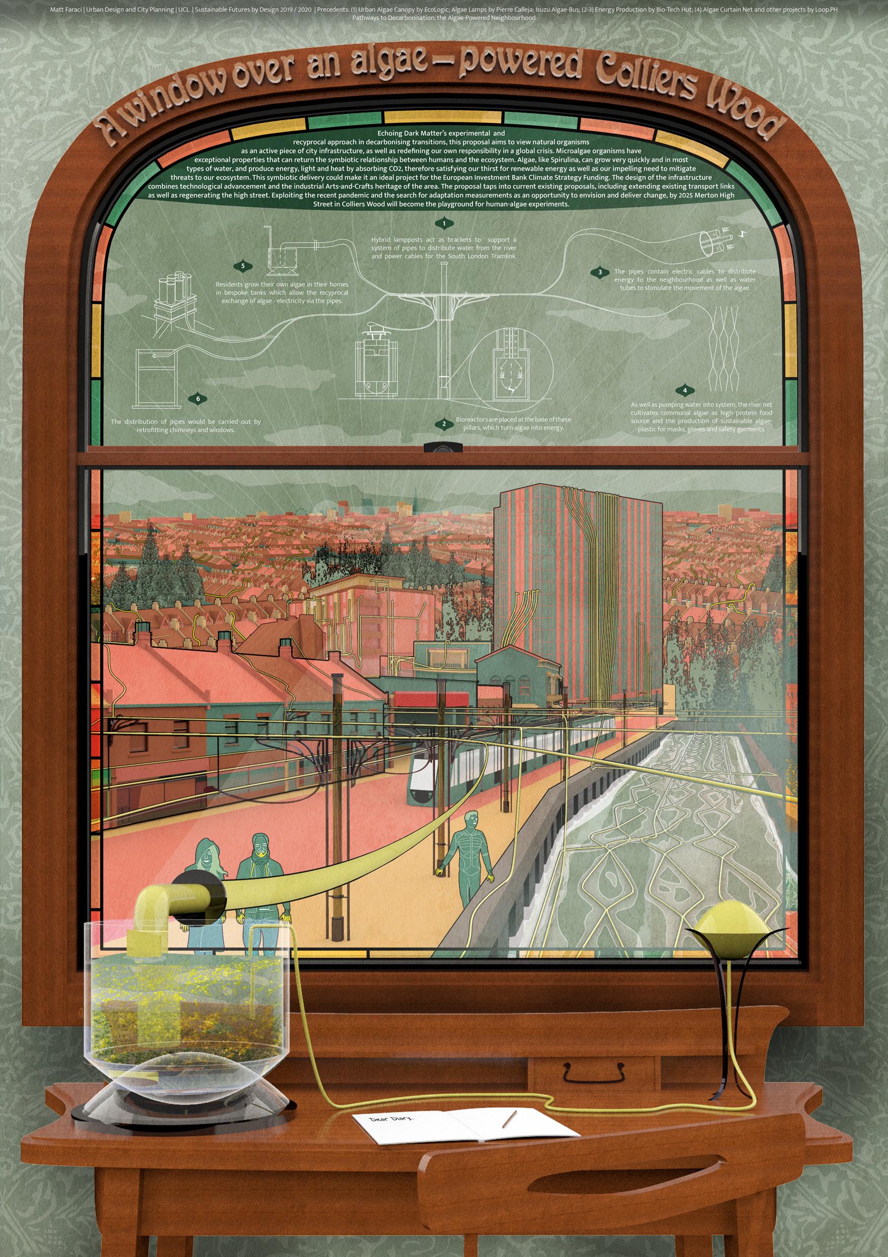
63

Postgraduate
Programmes
MSc URBAN DESIGN AND CITY PLANNING
Coordinator
Dr Katy Karampour
URBAN DESIGN: LAYOUT, DENSITY AND TYPOLOGY
Tutors
Dr Katy Karampour
Prof Stephen Marshall
Colin Haylock
Neha Tayal
Ming Cheng
This module is the first part of the Urban Design Specialism. It provides an opportunity to critically investigate the spatial characteristics and qualities of the built environment, with a focus on layout, density, and typology, and explore the use of different typologies in the development of design proposals. It aims to develop knowledge and a range of skills for carrying out urban design investigations and proposals. Considering a hypothetical scenario in which the Mayor of London wants to consider possible approaches to the development of site of the former Holloway Prison, students are asked to undertake two interrelated tasks:
· Task 1: Comparative analysis of two urban building types from the surrounding area (individual work, 4 weeks) is an introduction to the concepts of density and typology and aims to develop both an understanding of the spatial structure and scale of the built environment, and how these characteristics relate to the qualities and perceived character of place, as well as analytical and graphic skills;
· Task 2: Urban design proposal (group work, 6 weeks) consists of developing an alternative vision and masterplan for the Holloway Prison site by exploring and testing different typologies. This exercise aims to foster the ability to engage with design as an iterative process and includes: an analysis of the urban context; the development of an overall strategy and two options that explore alternatives for redevelopment; a final masterplan.
This project-based module combines lectures and weekly tutorials. Students are encouraged to explore relevant theory to inform the analytical and design work.
64 Vision and Masterplan for Holloway Prison Site Students:
Gregersen-Hunt, Martha Sainsbury, Guanyi Zhou
Yiqin Du, Matt Faraci, Oscar
ROAD
Integration of proposed development into wider context
Estate, Clerkenwell, uses the original estate and permeability whilst maintaining
Create a hierarchy of green spaces
Celebrating spaces for women
Activating Parkhurst Road Energy Sustainability
maximise
Example: Abode Village, Cambridge, mixes open and private green space within pedestrian spaces and frontages.
permeability and allow public
PRINCIPLES
ANALYSIS
Example: Glasgow Womens’ Library, which celebrates important literature works by women in the new facade.
Example: London City Island, Canning Town, with a civic square with educational facilities which turned an unused industrial plot into a lively urban space.

m2
Integration of proposed development into wider context
Create a hierarchy of green spaces
Celebrating spaces for women
Example: Glasgow Womens’ Library, which celebrates important literature works by women in the new facade.
ANALYSIS
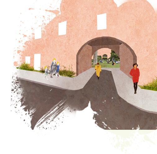

Activating Parkhurst Road Energy and Sustainability
existing central green space; identification of new active frontage along Parkhurst Road
Wherever possible, the sustainable urban drainage infrastructure and renewable
possible, the site should incorporate sustainable urban drainage systems, green infrastructure and renewable energy
Proposed pavement

Faraci, Guanyi Zhou, Martha Sainsbury, Yiqin Du, Oscar Gregersen-Hunt
initial design achieved in the the fluidity layout and to achieve Northern corner utilised more courtyard block applied. This as it is low point of the adjacent estate justification of the spaces were definition space. To typologies in boundaries of the connect this
33% total building coverage, to 40,398m2 = 1.35 p ha: 184 dw/ha (743
to 40,398m2 = 1.35
Dwelling Density p ha: 184 dw/ha (743 dwellings in total)
Private Gardens 3 2 1 Communal Gardens for the cluster Public Parks Outdoor Space for the Womens Centre Site Area: 40,398 m2 Plot Coverage: 33% total building coverage, F.A.R: 54,681m2


Private Gardens 3 2 1 Communal Gardens for the cluster Public Parks Outdoor Space
Private Gardens 3 2 1 Communal Gardens for the cluster Public Parks Outdoor Space for the Womens Centre
for
Balconies
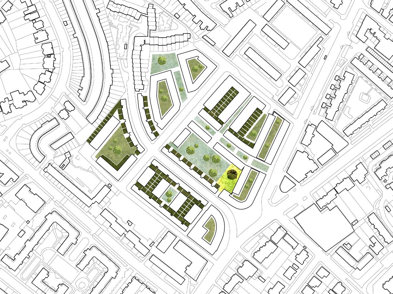
1B1P 41m2 2B3P 61m2 3B4P 84m2 3B6P 95m2 Retail 4B5P 102m2
Balconies overlooking communal garden on podium
1B1P 41m2 2B3P 61m2 3B4P 84m2 3B6P 95m2 Retail 4B5P 102m2 Womens’ Centre Communal Entrances Balconies overlooking communal garden on podium Arches maximise permeability and allow public access through the central park Ground floor properties have main entrances on the crescent equipt with SUDs A view form the cresent looking onto the public park aimed to mirror local design features of common typologies in the area and achieve permeability between green spaces. View of ground floor roof garden from upper floor balcony. This is achieves dual aspect and provides surveillance onto the gardens. A street view of the reclaimed traffic island: Multifunctional benches provide SUDS, traffic buffers, and hostile vehicle mitigation (HVM) which create a sense of safety and place. By widening the pavement the crossing times are shortened and the traffic is calmed in this area. A central adaptable art space for the Women’s centre and celebrates spaces for women; the area is well lit to enhance pedestrian safety. This space acts as an entry way for the development and highlights the presence of the women’s centre. Adaptable art space managed by the women’s centre. SUDs along buildings maintain a high quality and functional pedestrian environment Multifunction seating, HVM and SUDs

The site of the former Holloway prison presents many challenges due to its fortified nature. However, due to the opportunity to reinvent this site there is potential to create a place which can host a mixed tenure and bring new variation to the housing stock of Holloway. The ‘blank canvas’ nature of the site allows for the area to become seamlessly integrated into the surrounding context whilst pre-existing natural features can provide the basis for a healthy, socio-environmentally aware residential neighbourhood. Through exploring Holloway and the needs of the demographic of the area, the following plans aim to address key factors raied in the New London Plan and Holloway Prison Supplementary Planning document in addition to adhering to four core design principles. NEWCHAMBERSROAD PARKHURST ROAD PARKHURSTROAD BAKERSFIELDCRESCENT LIBRARYROAD Proposed pavement adjustments and new bus stop location. Possible connections with the wider area; retaining existing central green space; identification of new active frontage along Parkhurst Road 2 1 3 DESIGN Vision and Masterplan for Holloway Prison Group 3 - Matt Faraci, Guanyi Zhou, Martha Sainsbury, Yiqin Du, Oscar Gregersen-Hunt URBAN DESIGN: PLACE MAKING Module coordinator: Dr Katy Karampour. Tutor: Stephen Marshall
65
Balconies overlooking communal garden on podium
A street view of the mitigation (HVM) which the traffic is calmed in the area is well lit to 2
Adaptable art space managed by the women’s centre.
1B1P 41m2 2B3P 61m2 3B4P 84m2 3B6P 95m2 Retail 4B5P 102m2 Womens’ Centre Communal Entrances
DESIGN
access
the central park
floor properties have main entrances on the crescent equipt with SUDs
Arches
through
Ground
buffers, and hostile vehicle crossing times are shortened and celebrates spaces for women; development and highlights the
Module coordinator: Dr Katy Karampour. Tutor: Stephen Marshall
the Womens Centre
PROPOSAL
coverage, 1.35 dw/ha (743
area; retaining
DESIGN
PROPOSAL
overlooking communal garden on podium Arches permeability public access the central
floor properties have main entrances on the crescent equipt with SUDs A view form the cresent looking aimed to mirror local design typologies in the area and achieve floor roof garden from upper floor achieves dual aspect and provides surveillance onto the gardens. A street view of the reclaimed traffic island: Multifunctional benches provide SUDS, traffic buffers, and hostile vehicle mitigation (HVM) which create a sense of safety and place. By widening the pavement the crossing times are shortened and the traffic is calmed in this area. A central adaptable art space for the Women’s centre and celebrates spaces for women; Adaptable art space managed by the women’s centre. SUDs along buildings maintain a high quality and functional pedestrian environment Multifunction seating, HVM and SUDs NEWCHAMBERSROAD PARKHURST
PARKHURSTROAD BAKERSFIELDCRESCENT Proposed pavement adjustments and new bus stop location. connections with the wider area; retaining existing central green space; identification of new active frontage along Parkhurst Road 2 3
achieves all the initial design particularly those achieved in the as maintaining the fluidity of the street layout and typologies. In order to achieve option 1, the Northern corner Bakersfield Estate was utilised more and the courtyard block option 2 was applied. This was also utilised as it is low to the highest point of the height of the adjacent estate in the justification of the option 3. Green spaces were achieve a clearer definition space and open space. To agglomeration of typologies in areas, the boundaries of the to seamlessly connect this isolated site.
Ground
ROAD
Example: Bourne Estate, Clerkenwell, uses arches to mimic the original estate and maximise permeability whilst maintaining privacy. Example: Abode Village, Cambridge, mixes open and private green space within pedestrian spaces and frontages. Example: London City Island, Canning Town, with a civic square with educational facilities which turned an unused industrial plot into a lively urban space. Wherever
DESIGN
PROPOSAL
Option 3 achieves all the initial design principles, particularly those achieved in the first option such as maintaining the fluidity and granularity of the street layout and neighbouring typologies. In order to achieve more units than option 1, the Northern corner near the Bakersfield Estate was utilised more in the final plan and the courtyard block approach used in option 2 was applied. This area of the site was also utilised as it is low lying compared to the highest point of the site and the height of the adjacent estate was considered in the justification of the block height for option 3. Green spaces were reclassified to achieve a clearer definition between general space and open space. To reflect the agglomeration of typologies in the surrounding areas, the boundaries of the site were blended to seamlessly connect this previously isolated site.
Vision and Masterplan for Holloway Prison Site

Postgraduate
Programmes
MSc URBAN DESIGN AND CITY PLANNING
Coordinator
Colin Haylock
URBAN DESIGN: GUIDANCE, INCENTIVE AND CONTROL
Tutors
Wendy Clarke
Valentina Giordano
Omar Sherif
Neha Tayal
Jingyi Zhu
This module engages students in the conduct of urban design at one remove from directly designing places. This is urban design as conducted through the planning process and its work on influencing design delivered by others - developers, architects, etc. It works from visions and related outcomes, through mechanisms designed to secure the outcomes sought in terms of the nature and quality of places. The module studies this activity at a range of scales from the strategic to the detailed.
The module uses London as laboratory and current plans for various parts of the city as the starting point for study. Students work in small groups each of which works on a different area. The areas chosen deliberately cover a wide range of scales ranging from London Plan Opportunity Areas with their strategic approaches to delivering large scale change, through the more modest London Plan Intensification Areas to very locally based Neighbourhood Plans. All module presentations at the end of each of the module’s two stages allow the sharing of experience between the range of areas and scale of planning covered.
Apart from the expression of individual reactions to the area and the related existing planning document in week 1, the whole of this module is conducted through group work. Group working, with members often coming from very different backgrounds and bringing different skills to the work, parallels likely working contexts. The group working in the module is, therefore, seen as a beneficial educational experience. To emphasise this, the submissions at the end of each of the two stages include a reflection on the experience, conduct and management of the group work and individual contributions to it.
66 Colindale and Burnt Oak Area Action Plan Students: Ben Tattersall, Lydia Ogden, Martha Sainsbury, Matt Faraci, Tomasz Kopczewski
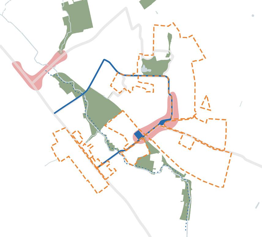
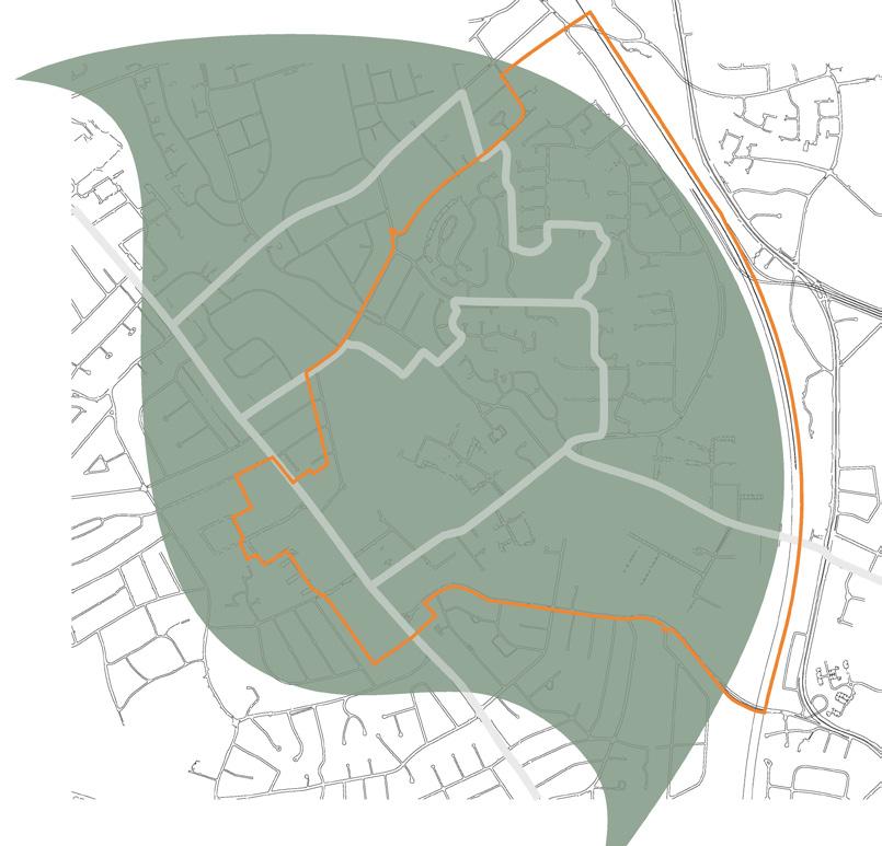

The better use of space for planting and biodiversity strategies such as wildflower meadows, rather than absent spaces of grass lawns.

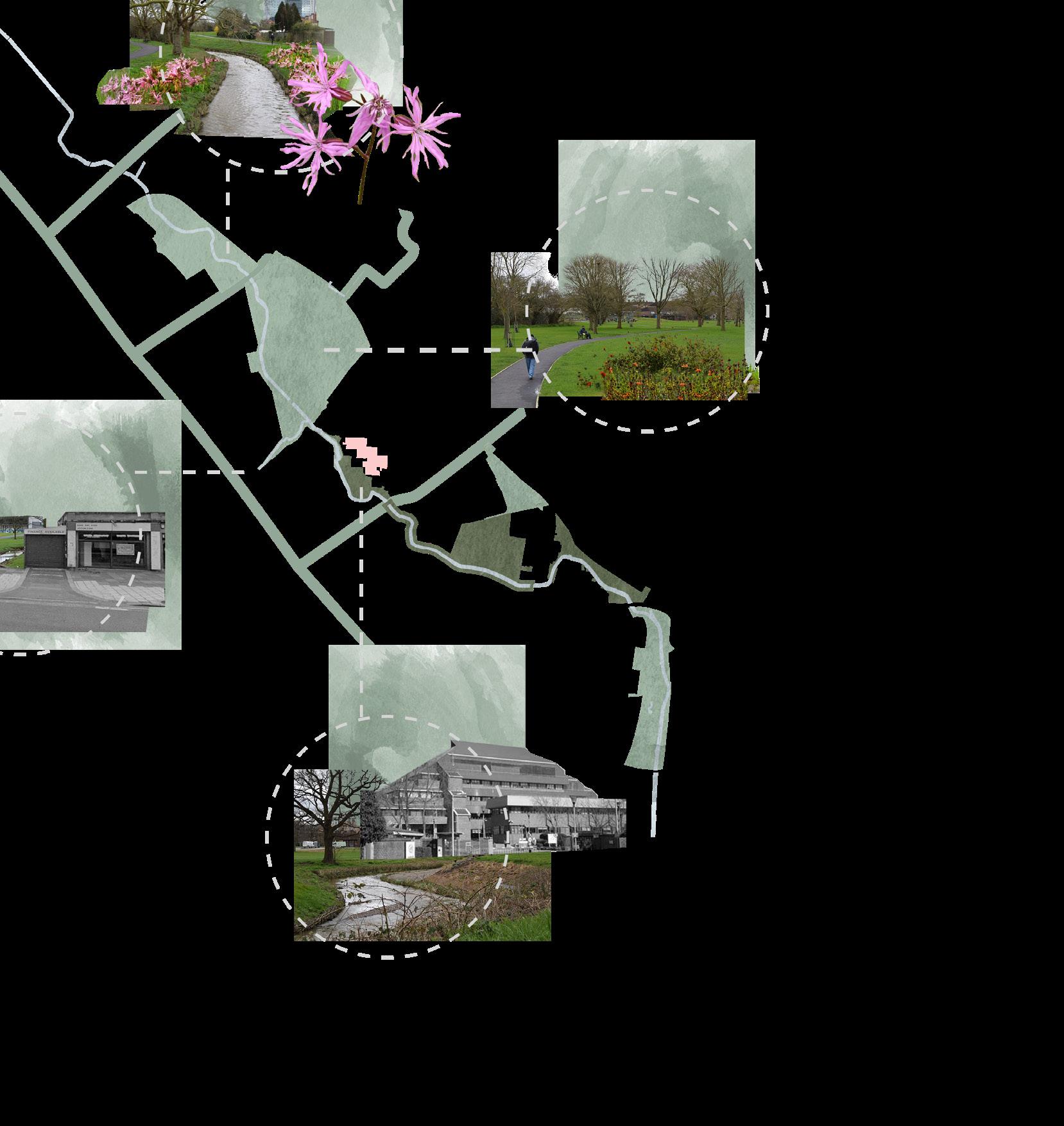
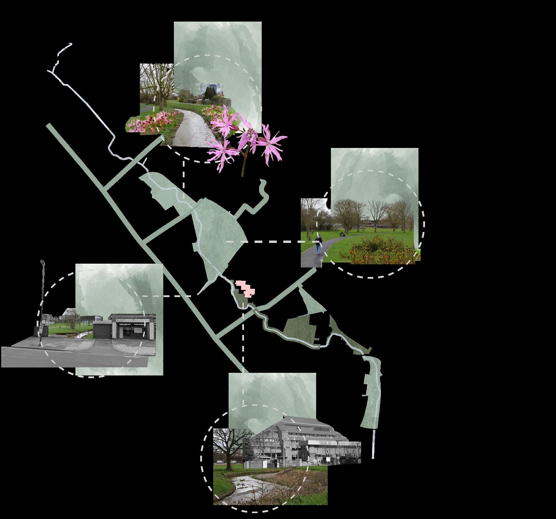


Policy 1.1 - Guidance: To utilise green spaces adjacent to the Silk Stream as flood attenuation basins to increase the flood capacity and resilience of Extensive environmental assessments would need to take place to reduce the impact of major environmental and landscape works. However, the final improvements can enhance the quality of the local ecosystems and ecosystem services in addition to contributing to and a sense of place in both form and function. • Guidance tools have been employed within this section of the document. This decision was taken because it was deemed necessary to create design guidance for shop units and active fronts to ensure the right kind of neighbourhood centres were created as a result of the APP. These neighbourhood centres need to be vibrant, active and inclusive for business owners, different uses and different users. Objectives of Neighbourhood Centres and High Streets: COLINDALE AND BURNT OAK AREA ACTION PLAN Subsidise business rates by 50% for start-ups and independent businesses (A Use Classes) for the first two years of operation when located in the neighbourhood centre zone. This will support a local and dynamic high street and businesses agglomeration, putting independent business Subsidised start up business rates will attract new and unique businesses to diversify the local economy and character of the high street, thus enhancing financial sustainability. To create a transport interchange within Colindale’s new neighbourhood centre. This would be enabled through the creation of a new and expanded transport interchange by Colindale underground station fecilitating increased transport connections, mainly bus routes, and increased capacity The policy would require cooperation between stakeholders and the community in order to achieve the best results. This would also need the integration between transports, pedestrian, cycle and green infrastructure to provide the community with a high quality To ensure there is a diverse tenure mix, all developments are expected to provide 50% afforable housing within new developments. This will contribute towards Colindale and Burnt Oak’s ability to sustainably house Policy 4.2 is a strict control measure to ensure developers provide a diverse and sustainable Module name: Urban design: Guidance, incentive and control. Project title: Colindale Burnt oak area action plan. Student names: Ben Tattersall, Lydia Ogden, Martha Sainsbury, Matt Faraci, Tomasz Kopczewski. Tutor names: Colin Haylock and Omar Sherif. Green Spaces Connections and Movements Neighbourhood Centres and High Streets Housing 67 Colindale Burnt Oak EDGWAREROAD WATLINGAVE ColindaleAve Rushgrove Park Silkstream Park Watling Park Lanacre Ave Bristol Ave Green Space Requiring Modification Opening Up Silk Stream Water Colindale Burnt Oak EdgwareRoad WatlingAvenue ColindaleAve Silkstream Park Watling Park Lanacre Ave Bristol Ave COLINDALE AND BURNT OAK AREA ACTION PLAN Green Spaces Connections and Movements Neighbourhood Centres and High Streets Housing Rushgrove Park Introducing plants along the stream that enhance the biodiversity. For example, Rugged Robin, native to London’s rivers, is a striking source of nectar for pollinators
Native Biodiversity Better Use of Space EDGWAREROAD WATLINGAVE By reclaiming the large car park beside Public Health England, we can link the Burnt Oak section to the Colindale section and integrate the high street as Public Health England Green Space Requiring Modification / Opening Up Accessible Parks Silk Stream Sustainabiltiy Character Centres Diversity
LIFE AFTER COAL
RESEARCH PROBLEM
Regeneration problems neglect factors

Postgraduate
Social Economic Cultural Health
Environmental
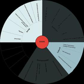
High
IDENTIFYING ISSUES
Exploiting the above and below ground legacy of mining to give former mine locations a reviewed role at the heart of former mining communities.
RESEARCH OUTCOMES
Programmes
Comprehensive analysis of issues resulted from mining closure and faced by neighbouring urban areas
MSc URBAN DESIGN AND CITY PLANNING Coordinator
Analysis of current trends and their limitations for regeneration attempts in post-mining towns
Explore alternative solutions for the use of mining site and its role in regeneration
Low
MAJOR RESEARCH PROJECT (UDCP)
High
Develop a comprehensive toolkit based on literature and case studies that can solve identifying issues
Create a design proposal for selected site
Dr Filipa Wunderlich Tutors
CASE STUDIES
High


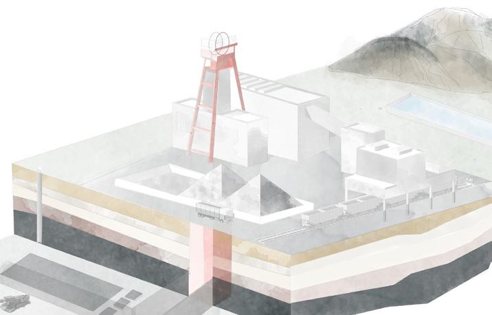
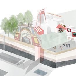

Dr Filipa Wunderlich
Dr Catalina Turcu
Supervisors
Principals at Urban Initiatives Studio, Urban Architecture, Urban Movement, East Urban Design Landscape Architects, Haylock Planning and Design, Ramboll - Architecture, Airey Miller


To complete the MSc Urban Design and City Planning and MSc in Sustainable Urbanism, students are given the option to submit a Major Research Project. This project should typically focus on a key area of knowledge covered in your course, eg. urban design, urban design guidance and control, housing and development, sustainable urban design, sustainable transport, or other. A Major Research Project represents an in-depth exploration of a complex topic / problem. It is a demonstration of knowledge, a critique, and the application of this knowledge and critique into a project. The project will focus on a particular site, method or process and will be propositional, delivering a vision, and working it out in depth as to exhibit its potential, but also reflect upon its limitations. The major project should embrace the complexity of the chosen topic and apply knowledge in a critical and reflective manner. The project will prepare students to enact positive change through design and is an opportunity to develop both research and problem-solving skills and abilities whilst entering in-depth a particular area of studies and explore a problem that is up-to-date, critical and complex. A Major Research Project should integrate a literature review and analytical research, but most importantly it will be propositional. You will look ahead, seek opportunities to imagine a different world and explore / test innovative approaches to planning, design and or development in the city.


PROPOSED TOOLKIT


Land use analysis dominated with the closure of

This Major Research Project is the culmination of the Masters programme, and therefore the student’s chance to synthesise, in a major and largely self-managed study, what he or she has gained from the course and, possibly, to integrate it with elements from previous studies or professional experiences. The Major Project is something you can take with you, use to demonstrate your expertise and launch the next stage of your career.


1.


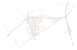
Stainforth has connected with way, that

The work is delivered in the form of a 8,000 words research report, and every year, students are supervised by a prestigious team of practitioners of renown Urban design and Planning consultancies in London, such as Urban Initiatives Studio, Urban Architecture, Urban Movement, East Urban Design Landscape Architects, Haylock Planning and Design, Clarion Housing Group, Ramboll and others.
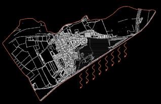

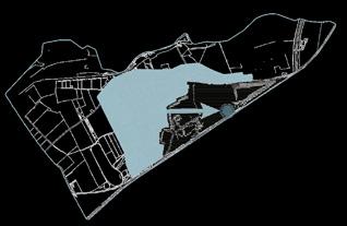


68
that cause socio-economic issues and do not
derelict physcal
use
environment
AMM LITERATURE
REVIEW
site selection criteria density of the population access to energy pylons railway connection size of industrial site closed mining site close proximity to urban centre wet-conserved mine access to water basin and tunnels gas methane release/ access site selection OBJECTIVES AND TOOLKIT APPLICATION CONCEPT
PRESERVE MINING HISTORY & CULTURE 2. RECLAIM CONTAMINATED
EXPLORE OPPORTUNITIES BELOW GROUND 4. EXPLORE NEW OPPORTUNI5. BRINGING NEW MEANING TO THE MINING SITE 6. CONNECT A SITE WITH GREATER URBAN AND REGION
3.
ployment
increase Hashima and Ikeshima Japan Nord-Pas-de-Calais France Heerlen Holland Ruhr Germany Eden Project UK Daw Mill Colliery UK preserving the physical environment support and involvement of local communities creation of mining museum promoting (marketing and advertising) of industrial heritage AMM abandoned mine methane extraction mine water geothermal energy provide an opportunity for the development of new skills create new employment opportunities create new points of attraction Case studies and literature were analysed against identifying issues, which allowed to form site selection criteria and the toolkit
Claimant rates
start-up rates
“Bad” health state
contaminated land Life After Coal Student: Kateryna Martovytska


RESEARCH QUESTION
How can the former mining area, which was a central of the life and economy of mining town be exploited and developed to have a new role as a central focus in the future life and economy of town?


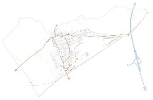
Stainforth has a big location advantage and is connected with a railway, river and a motorway, that increase the attractiveness of new developments
CONCEPT PLAN
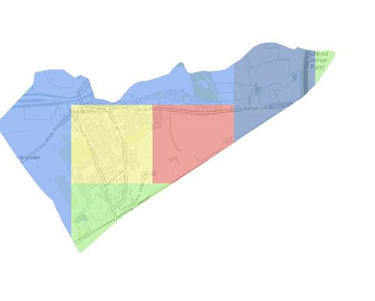
The map above shows the methane releases in the are, which allows benefiting from methane extraction.

STAINFORTH
selection and analysis

analysis has shown that the town is with residential use, whilst after mine there are not many employment opportunities
South Yorkshire Coalfield
roads bridges


Existing railway station
Proposed roads green bridge additional bridges industrial rail shopping mall
Proposed Land Use

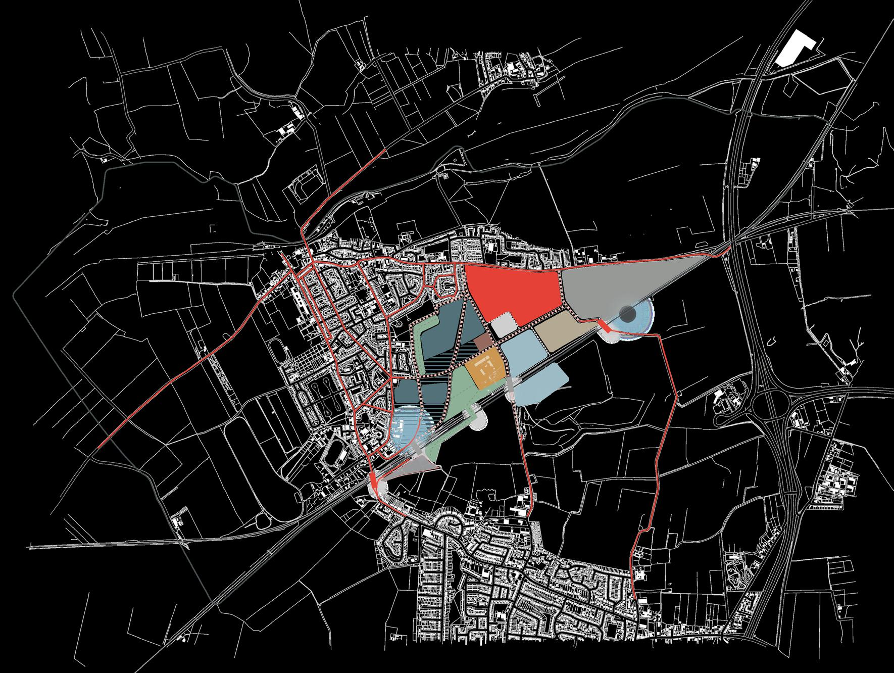
Green areas are not maintained properly and do not act as destination points. Hence, the provision of new recreation areas is crucial a big location advantage and is with a railway, river and a motor-

CONCEPT PLAN

The map above shows the methane releases in the are, which allows benefiting from methane extraction.


mixed-use commercial/residential residential leisure and recreation areas
Hatfield main: museum and community centre new energy education hub
mine methane extraction energy station
hydro-pumping station
mine-water heothermal energy additional energy units, i.e.waste-to-power station


1(2019-2029) PHASE 2(2029-2039)
3(2039-2044) 2019 2024 2029 2034 2039 2044 2049 Stainforth downtown
culture and education Energy industry hub
PHASE
PHASE
Post-industrial
mixed-use commercial/residential residential Proposed Land Use roads bridges Existing railway station Proposed roads green bridge additional bridges industrial rail shopping mall
increase the attractiveness of new developments
69

70
MSc
SPATIAL PLANNING
The MSc Spatial Planning programme provides a general introduction to planning theories, systems and cultures with a focus on the importance of taking a spatial perspective.
71
Dr Ben Clifford Programme Director

Postgraduate
Programmes
URBAN DESIGN PLACEMAKING
This module draws on the extensive theoretical underpinning of urban design to:
-explore approaches to appraise the character of the built environment, and -forward practical and even visionary proposals aimed influencing the quality, liveability and value of urban space as a key contribution to sustainable place making.
Coordinator
Prof. Matthew Carmona Tutors
Wendy Clarke
Raj Rooprai
Bianca Maria Nardella
Isabel Gutierrez Sanchez
Mat Proctor
Irene Manzini Ceinar
Valentina Giordano
Sharon Molloy
Dr Pablo Sendra
Monica Lopez Franco
The module illustrates the potential of design as a creative problem solving process, a process necessary to deliver the types of public and private investments in the built environment that will continue to return social and economic value to their users and investors over the long-term.
In 2019/20 the focus was on Poplar and its interface with Canary Wharf. In the context of the transformative projects already occurring in the area (not least the coming of Crossrail) and the development pressures that the Poplar area is currently facing, the module sought to develop a new vision for this area to guide its successful transformation over the next 20 years. Groups were asked to develop a set of solutions that restore the integrity of the Poplar / Canary Wharf interface as a ‘place’ and not just a traffic / Infrastructure artery, whilst considering the opportunities within and beyond into its surrounding areas.
The project provided an opportunity to rediscover the value and potential of one of London’s historic villages – Poplar – and to deal with the disconnection and inequity that followed redevelopment of Canary Wharf next door.
MSc URBAN DESIGN AND CITY PLANNING
MSc SUSTAINABLE
MSc SPATIAL MSc URBAN
MSc INTERNATIONAL
MPlan CITY PLANNING
URBANISM
PLANNING REGENERATION PLANNING
72 The East London Green Link Students: Lydia
Martha Sainsbury, Matt Faraci, Tomasz Kopczewski
Ogden, Ben Tattersall,
Green Link CLIMATE SHOWCASING IDENTITY DESIGN ENERGY INTERVENTIONS
Four design formed the ethos the area of Poplar.
As
an alternative future for the area of Poplar through utilising urban design and place making principles taught throughout the course, alongside original and creative ideas generated through group work. Poplar is an area in East London bound by Bow to the north, Canary Wharf to the south, Limehouse to the West and Leamouth to the East. Poplar provided a unique case study to develop urban design strategies because of the area being uniquely situated at the crossroads of urban transformation, diverse populations and maritime history and heritage. These provided key ingredients to develop substantial, yet creative, urban design solutions to tackle persistent problems experienced in the area, including poor connectivity, gentrification stemming from Canary Wharf and ageing social housing. Creating the final document was a challenging yet rewarding task which enriched group members ability to coin creative and strategic urban design solutions responding to specific problems experienced in Poplar.
PROPOSED
principles were created in response to the key issues. These principles ethos of the document alongside the urban design solutions developed for Poplar.
Three key issues were identified in response to analysis undertaken about Poplar. These key issues were seen as threats to the future of Poplar.
SHOWCASING
CLIMATE CHANGE HOUSING
FRACTURED LOCAL ECONOMY
Four design principles were created in response to the key issues. These principles formed the ethos of the document alongside the urban design solutions developed for the area of Poplar.
SOCIOENVIRONMENTAL SUSTAINABILITY
DESIGN
IMPROVING CONNECTIVITY
SHOWCASING IDENTITY COMMUNITY OWNERSHIP DLR Station Improving existing stations and connections to Poplar. Energy Centre Harness and distribute energy from DLR infrastructure, providing educational uses.
A series of moments will feature across the
Areas social interactions.
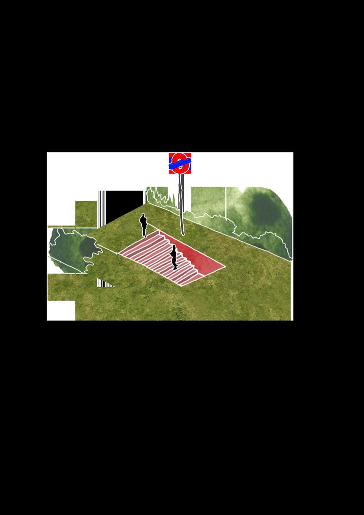
ENERGY
serve as a new pedestrian and cycle
Play Areas Facilitate child and social interactions.
SHOWCASING IDENTITY
DESIGN
tackling different issues with innovative solutions and interventions. The moments presented local employment and social interactions. The East London
through the heart of Poplar, providing for a high level of adaptability and flexibility in order to facilitate future population
innovative solutions and interventions. The moments presented below aim to create a diverse and mixed-use space across the link, promoting permeability, and cycle route through the heart of Poplar, providing residents with interesting stops and spaces for interaction and economic activity. Moments allow and flexibility in order to facilitate future population growth and social change.
Improving
INTERVENTIONS
INTERVENTIONS

Community-Led Space for local employment, horticulture.
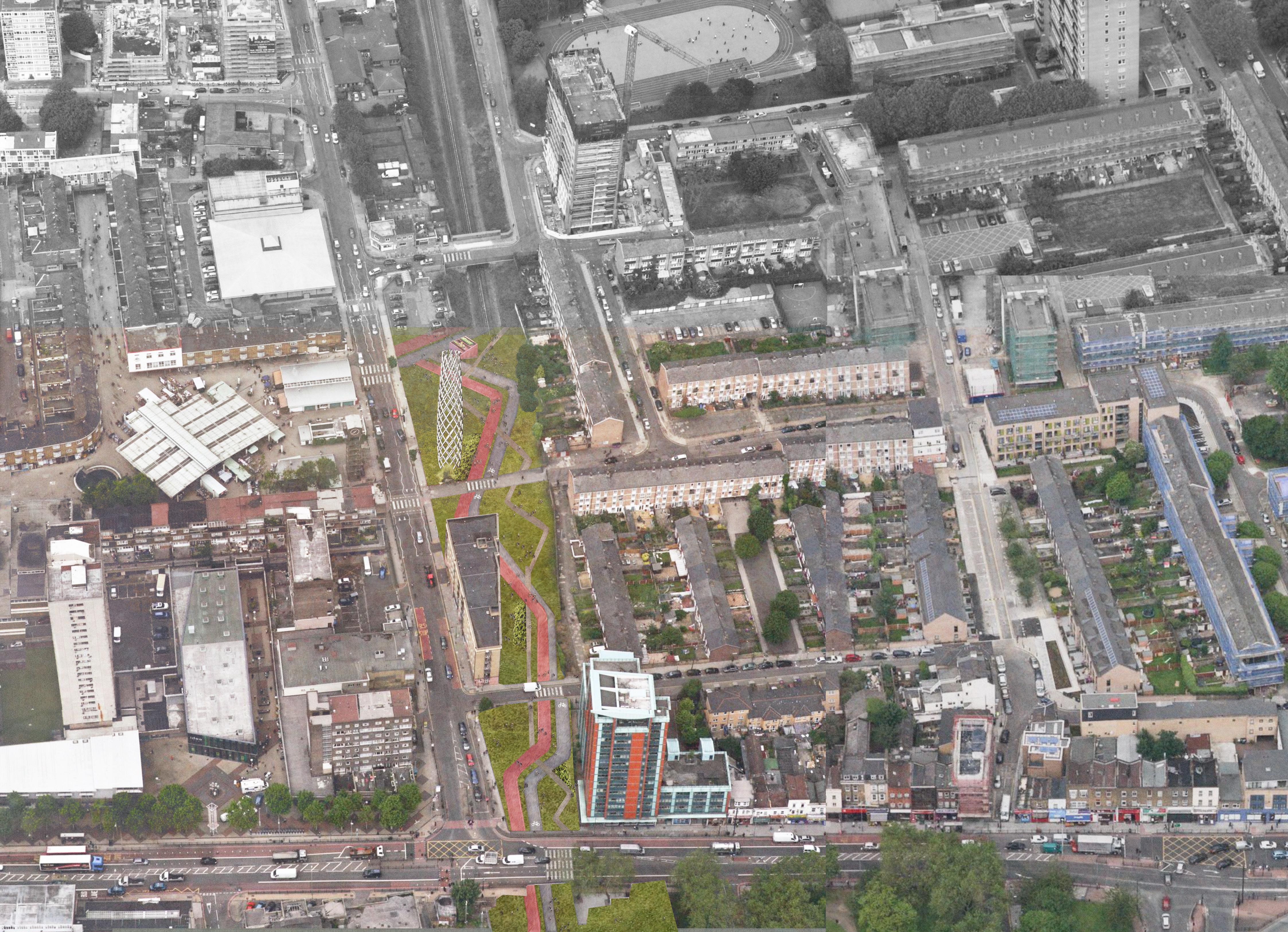
break on their approach to the stations. A council owned energy agency energy centre and beacon will provide educational facilities, carbon capture technology and enhance the
opportunity to harness the varying forms of energy produced in order to fund varying stages of the masterplan. Hot air is redistributed through pipes approach to the stations. A council owned energy agency would manage the redistribution and maintenance of energy, whereas the newly created facilities, carbon capture technology and enhance the sense of place in the newly reclaimed Poplar.
Sustainable Urban Drainage Educational Centre
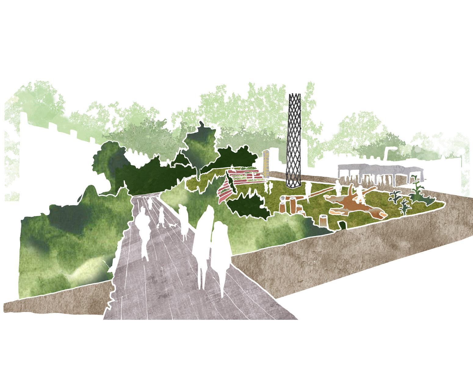
Carbon-Capture Energy Centre Solar Panels Breaks’
Nature Playground
Community-Led
A series of interventions were developed in response to our design principles. Chrisp Street Market becomes a new neighbourhood to the market. A temporary green canopy over Aspen Way is installed to maintain the buffer between Canary Wharf and Poplar, changes to the use of Aspen Way. Redistributing road heirarchy and prioritising pedestrian and cyclists along East India Dock Road

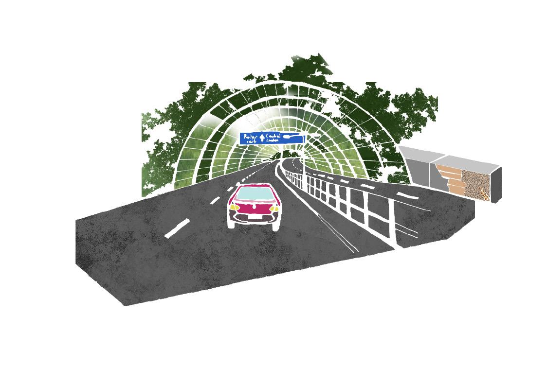
A series of interventions were developed in response to our design principles. Chrisp Street Market becomes a new neighbourhood centre, showcasing identity to the market. A temporary green canopy over Aspen Way is installed to maintain the buffer between Canary Wharf and Poplar, facilitating two new pedestrian changes to the use of Aspen Way. Redistributing road heirarchy and prioritising pedestrian and cyclists along East India Dock Road reduced the volume of
Aspen Way Chrisp Street Market PLACEMAKING / The East London
A series of moments will feature across the East London Green Link tackling different issues with innovative solutions and interventions. The moments presented local employment and social interactions. The East London Green Link will serve as a new pedestrian and cycle route through the heart of Poplar, providing for a high level of adaptability and flexibility in order to facilitate future population
The East London Green Link covers the DLR tracks running through Poplar, this presents an interesting opportunity to harness the varying forms of energy into new and retrofitted homes where as electrical energy is collected whilst DLR trains break on their approach to the stations. A council owned energy agency energy centre and beacon will provide educational facilities, carbon capture technology and enhance the
existing stations and connections to Poplar. Harness and distribute energy from DLR infrastructure, providing educational uses.
Space for local employment, horticulture.
ENERGY Carbon-Capture Energy Centre Solar Panels 73
Chrisp Street Market
Toolkit
Clock Tower
Trailing Plants
CLIMATE CHANGE
Nature Playground
IDENTITY
Urban Drainage
Parasitic Energy
Heat Energy
Sustainable Drainage
Breaks’ Energy
part of BPLN0042 Urban Design: Place Making, groups were tasked with creating
East London Green Link
Green Link will
route
The East London Green Link covers the DLR tracks running through Poplar, this presents an interesting opportunity to harness the varying forms of energy into new and retrofitted homes where as electrical energy is collected whilst DLR trains
Chrisp Street Market
Bee Hotels
Energy Centre’s Chimney Green Canopy Green Link Toolkit Clock Tower Trailing Plants

Postgraduate
Programmes
Elena Besussi Tutors
Elena Besussi
Dr Michael Short
Paula Morais
Dr Katy Karampour
Dr Stefania Fiorentino
In collaboration with the Drummond Street Neighbourhood Forum
Neighbourhood planning is one of the key innovations brought forward by the reform of the UK planning systems. It seeks to allow local communities to make decisions about the future development of their area by establishing Neighbourhood Forums and developing Neighbourhood Plans. In London Neighbourhood Forums faces a key challenge: the development of technical expertise and evidence base required to prepare plans that can successfully negotiate local needs with the strategic dimension of London’s planning.
CONCEPT PLAN FROM STRATEGIC VISION TO URBAN PLAN
In the context of this “planning revolution”, the module gives the students the opportunity to experience what it means to be a planner in a live context. In groups, students work collaboratively with an existing London’s neighbourhood forum and use planning and spatial knowledge to support their progress towards the creation of a neighbourhood plan. The community partner for the 2019-2020 course is the Drummond Street Neighbourhood Forum.
The module aims to provide students with the competence, confidence and skills required to develop urban plans and spatial knowledge which critically engage with planning as a peopled, political and technical process. It provides an opportunity for students to use previous knowledge and knowledge acquired in other modules and apply creative problem-solving and critical thinking to the development of an actual urban plan that can influence the future of a London’s area.
MSc SPATIAL PLANNING Coordinator
74 The Drummond Street Neighbourhood Plan Students: Mollie Foley, George Kent, Jake Ash, Juliette Smith, Mingyang Li
N
Underground Railway
Key: Economy interventions
Identity interventions
Environmental infrastructure interventions
UndergroundRailway
1:2500 75

GOVERNANCE FOR URBAN SUSTAINABILITY
“Governance for Urban Sustainability: Project” is a ten-week module that is based on group work to a brief. For the past few years, this module has been undertaken in collaboration with Peterborough City Council, who have adopted the goal of becoming a ‘Circular City’ through applying circular economic principles.
This year - the last year that the module will run in this format - the task given to the student group was to devise and launch a handbook of actions to promote a more Circular City, building on what has been learned through past student projects and undertaking new research as necessary.
This task has involved comprehensive review of research reports, business websites and other materials on the circular economy and the circular city, but also close attention to how to devise a ‘handbook’ that is addressed to the relevant stakeholders. The group have had to pay careful attention to structure, layout and language to ensure that the report ‘speaks to’ stakeholders and proves to be a useful document.
MSc SPATIAL PLANNING Coordinator
Prof Yvonne Rydin 76 The Circular City Handbook (Selected Pages) Authors: Professor Yvonne Rydin, Ewan Clegg, Isabel Cordwell, Danielle Dempsey, Olivia Dickie, Patrick Franklin, Caroline Gaboriau, Emma Hulland, Edona Korenica, Sara Parsadoust, Molly Purcell, Victoria Shiu, Jacqueline Streur
Programmes
Postgraduate


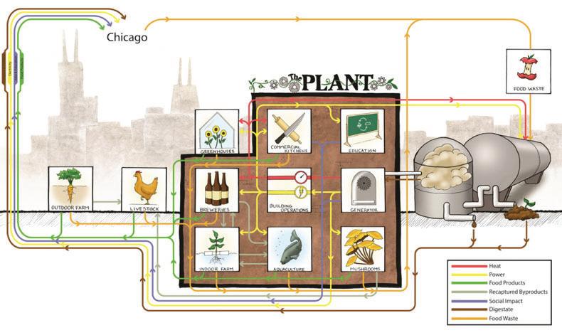


things we can do to address change, create healthy cities, and biodiversity. The current food system urbanisation,
desupported a fast-growing
come at an to
the environ-
2 Harvey, Fiona, 'Can we ditch intensive farming world?', The Guardian, 28 January 2019 3 WRAP, Food Surplus and Waste in the UK
economic
However, this has
society and
MacArthur Foundation, 2017).
© Food Drink Europe (2018) 36 The Circular City Handbook Governance for Urban Sustainability Project 2020
Figure 3.2: A Circular System: Food and Drink Manufacturing
Circular restaurants Ultima, Iceland--
Figure 3.3:
-
3)
Key stakeholders
Resources Online Trading Platforms16 Sitra, ‘Ultima – a circular economy restaurant’, Sitra, 2020 <https:// >--ResearchFunding 17 Venture Giants, ‘Organic Food Trading Platform’, Venture Giants 2020 <https://www.venturegiants.com/proposal-7542-organic-food-trading-platform.aspx> 18 Ellen MacArthur Foundation Food and the Circular Economy, Quote, (Ellen MacArthur Foundation, 2017), <https://www.ellenmacarthurfoundation.org/explore/food-cities-the-circular-economy> 19 WRAP, ‘Food and Drink Circular Economy’, WRAP, 2020 <www.wrap. org.uk/food> 77
4)

78
MSc
HOUSING AND CITY PLANNING
The MSc Housing and City Planning is a programme for urban professionals and graduates from the fields of planning, property, architecture and project management who are looking to specialise in the area of housing development.
79
Dr Iqbal Hamiduddin Programme Director

Postgraduate
Programmes
MSc HOUSING AND CITY PLANNING
PLANNING FOR HOUSING: PROJECT
Coordinator
Dr Sonia Freire Trigo
Tutors
Lesley Johnson
Mónica López Franco
Dr Elanor Warwick
This is a project-based module that builds on the conceptual and policyorientated foundation of its prerequisite module, Planning for Housing: Process. It challenges students, working in small groups, to apply and extend their knowledge of development actors, practices and constraints to real-life residential development projects and opportunity areas in Greater London.
The module consists of two parts: a group housing-led development proposal (presented here) and an individual reflection on the lessons learnt from their group work about housing delivery in London. The module is taught over ten sessions and combines site visits, weekly presentations from practitioners and experts in the field, and group tutorials to discuss the practical implications of those talks for their sites and their proposals. This year’s guest speakers has included representatives from GLA Housing and Land Directorate, Be First (Barking and Dagenham regeneration company) and Savills among others.
For the housing-led development proposal, groups were allocated a selected development site in the London borough of Barking and Dagenham. The three selected sites represent three different contexts (i.e. town centre location; former industrial site; waterfront brownfield land) that forced students to critically assess the policy framework, consider competing interests and/or differing perspectives of key actors, and arrive to welljustified and creative proposals. The outcome of this hard work has been six different outline scheme proposals (two proposals per selected site) in a poster format that demonstrate the groups’ deep understanding of housing delivery in London as well as their design and communication skills.
80 Sunday Market Riverside Housing Students: Tanushree Agarwal, James Ainsworth, Yuan Feng, Jack Gandy, Agnes Jeeves, Yangtao Ma, Ada Mc Murtrie, Calum McConnachie

6. Design


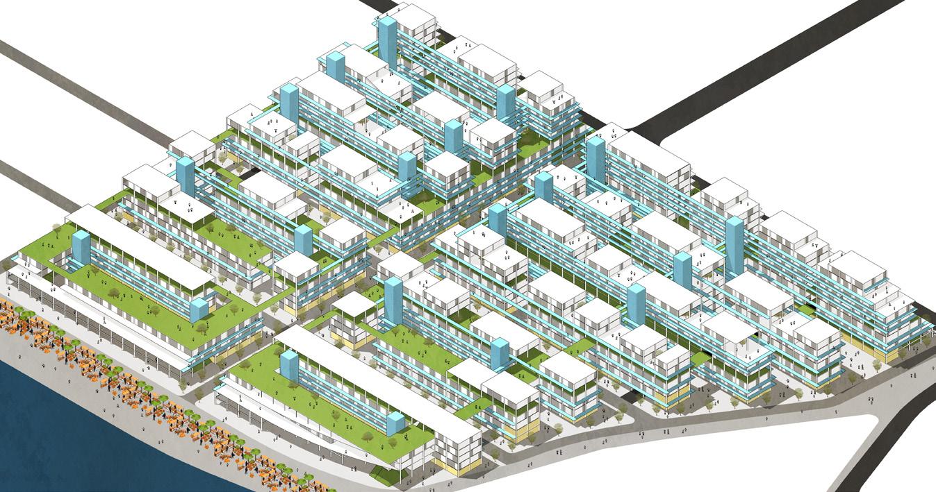
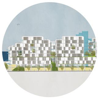


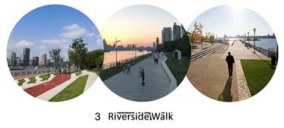

PHASE 2 (Year 3-4) PHASE 3 (Year 5-6)
8. Phasing 7. Viability Southern Block 2 Central Block 2 Northern Block 2 Northern Block 1 Central Block 1 Riverside market and walk Southern Block 1 Temporary Parking Temporary Parking Construction material and equipment storage compound PHASE 1 (Year 1-2) Completion of Phase 1 equates to Riverside Market Completion of Phase 2 equates to all dwellings Completion of Phase 3 equates to all dwellings and Construction material and equipment storage compound Bedroom 1 Bedroom 1 Bedroom 1 Bedroom 2 Bedroom 3 Bedroom 2 Bedroom 2 Corridor Corridor Balcony Balcony Living room Living room Living room Toilet Toilet Toilet Toilet Dual aspect homes 2 Bed Unit 3 Bed Unit Retail + Amenities Housing Housing Public open space Our design offers modern homes that are integrated into green spaces, at a density that can sustain a vibrant community. The building form gradually steps up from the river front and the scale of the building is broken down by layering blocks, enriching the verticality of the building. With an emphasis on placemaking, our design sees the creation of a new central hub which forms a vital part of the area’s new identity. Generous open spaces on the ground level are encircled by civic amenities, commercial and retail spaces that animate the new public realm. They draw people up from the station towards the riverside market and provide residents with valuable amenities and employment within easy walking distance of their homes. Flexibility: A squared grid establishes a relationship between the roads and the building’s structural module. This enables the system to expand freely throughout the territory. As it expands, the building becomes open to appropriation, activating the urban fabric. A majority of the homes are dual or triple-aspect, providing residents with high levels of natural light. Each home benefits from a private balcony and each apartment block offers residents sunny, raised podium gardens or roof terraces to enjoy together. Public Paths: The fourth floor is a public open space that opens up to the river view. Generous stairs invite the flow of pedestrians from the nearby station into the building. This entire route is surrounded by commercial use and, thus, the public and private domains are dissolved. The city permeates this great urban structure. INCOME Market Sale Housing £361,459,834.93 Rented Housing £80,638,788.39 Commercial capital value £67,901,213.88 Affordable rent subsidy (70k/unit) £23,800,000.00 Shared ownership subsidy (28k/unit) £11,200,000.00 Total Income £678,213,863.60 EXPENDITURE Pre construction £800,000.00 Construction £474,348,525.30 Planning contributions £29,211,500.00 Disposal fees £15,027,636.71 Finance to build £93,489,779.16 Profit (15%) £64,404,157.32 Total expenditure before aquisition cost £677,281,598.49 Offer for land £932,265.11 81 PHASE 2 (Year 3-4) PHASE 3 (Year 5-6)
6. Design
Riverside Sunday Market Section A Pedestrian and cycle friendly streets Riverside walk Section A 8. Phasing 7. Viability Central Block 2 Northern Block 2 Northern Block 1 Central Block 1 Temporary Parking Temporary Parking Construction material and equipment storage compound PHASE 1 (Year 1-2) Construction material and equipment storage compound Bedroom 1 Bedroom 1 Bedroom 1 Bedroom 2 Bedroom 3 Bedroom 2 Bedroom 2 Corridor Corridor Balcony Balcony Living room Living room Living room Toilet Toilet Toilet Toilet Dual aspect homes 2 Bed Unit 3 Bed Unit Retail + Amenities Housing Riverside market Housing Public open space Our design offers modern homes that are integrated into green spaces, at a density that can sustain a vibrant community. The building form gradually steps up from the river front and the scale of the building is broken down by layering blocks, enriching the verticality of the building. With an emphasis on placemaking, our design sees the creation of a new central hub which forms a vital part of the area’s new identity. Generous open spaces on the ground level are encircled by civic amenities, commercial and retail spaces that animate the new public realm. They draw people up from the station towards the riverside market and provide residents with valuable amenities and employment within easy walking distance of their homes. Flexibility: A squared grid establishes a relationship between the roads and the building’s structural module. This enables the system to expand freely throughout the territory. As it expands, the building becomes open to appropriation, activating the urban fabric. A majority of the homes are dual or triple-aspect, providing residents with high levels of natural light. Each home benefits from a private balcony and each apartment block offers residents sunny, raised podium gardens or roof terraces to enjoy together. Pedestrian movement activity takes precedence throughout the site. Gardens provide attractive landscaped spaces within the centre of the building for the apartments to overlook, putting community at the heart of buildings. Private balconies overlooking community spaces create “eyes on the street”. Public Paths: The fourth floor is a public open space that opens up to the river view. Generous stairs invite the flow of pedestrians from the nearby station into the building. This entire route is surrounded by commercial use and, thus, the public and private domains are dissolved. The city permeates this great urban structure. INCOME Market Sale Housing £361,459,834.93 Rented Housing £80,638,788.39 Commercial capital value £67,901,213.88 Affordable rent subsidy (70k/unit) £23,800,000.00 Shared ownership subsidy (28k/unit) Total Income £678,213,863.60 EXPENDITURE Pre construction £800,000.00 Construction £474,348,525.30 Planning contributions £29,211,500.00

82
MSc
INTERNATIONAL PLANNING
This programme is intended for students who want an international perspective on planning systems and cultures, or are likely to work outside the UK after their studies. It is open to graduates of any discipline who wish to make a career in planning or related fields.
83
Dr Sonia Arbaci Programme Director

Postgraduate
Programmes
INTERNATIONAL PLANNING PROJECT
Coordinator
Dr Sonia Arbaci
Tutors
Alexandra Gomes
Antonio Rovira
This module provides an opportunity to engage in a strategic planning exercise for a large-scale urban area in an international context. It aims to develop an appreciation of plan-making to foster changes that are socially, economically, and environmentally just and sustainable. Students apply creative problem-solving, critical thinking, and analytical skills and knowledge acquired in other modules of the MSc International Planning programme. The Project “Our Sagrera 2040” considers a scenario whereby Barcelona City Council commissions a competition for a Strategic Plan for the site of the future high-speed train station, La Sagrera, in Barcelona, Spain.
Teams of students, acting as planning consultants, respond to this call and develop a Strategic Plan in stages: “Thematic analyses” of Barcelona with references to the project site in transnational, national, and regional/ city contexts; “Analysis-Plan exercise” combining site-specific analysis (desktop research) and initial strategic vision in preparation for the site visits; “Strategic Vision-Concept Plan exercise” (including field trip to Barcelona) translating the strategic vision into a spatial concept plan, informed by thematic analyses, site observations, theories/concepts, and examples. Finally, the “Strategic Plan” for the project site. The various stages are integrated into the final output (2xA0 posters) advancing a visual narrative that runs through a set of spatial plans, sectoral policies and implementation.
This module operates as an urban laboratory where the teams of students share their work and build collective knowledge through interim presentations, class discussions, and show&tell sessions. The Director of Barcelona Sagrera Alta Velocitat participated in the final presentations acting as the client.
MSc INTERNATIONAL PLANNING 84 Circular Sagrera
Sato
Students: Aisha Taj, Jason Chun, Yulu Han, Ronika Postaria,
Tenji

spaces
resources generations)

financial capital flow
social capital flow


by its economy, citizens, and the several social
COMMUNITY: PHASING
STRATEGIC MASTER PLAN
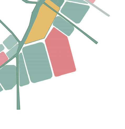
Community cohesion: achieved?

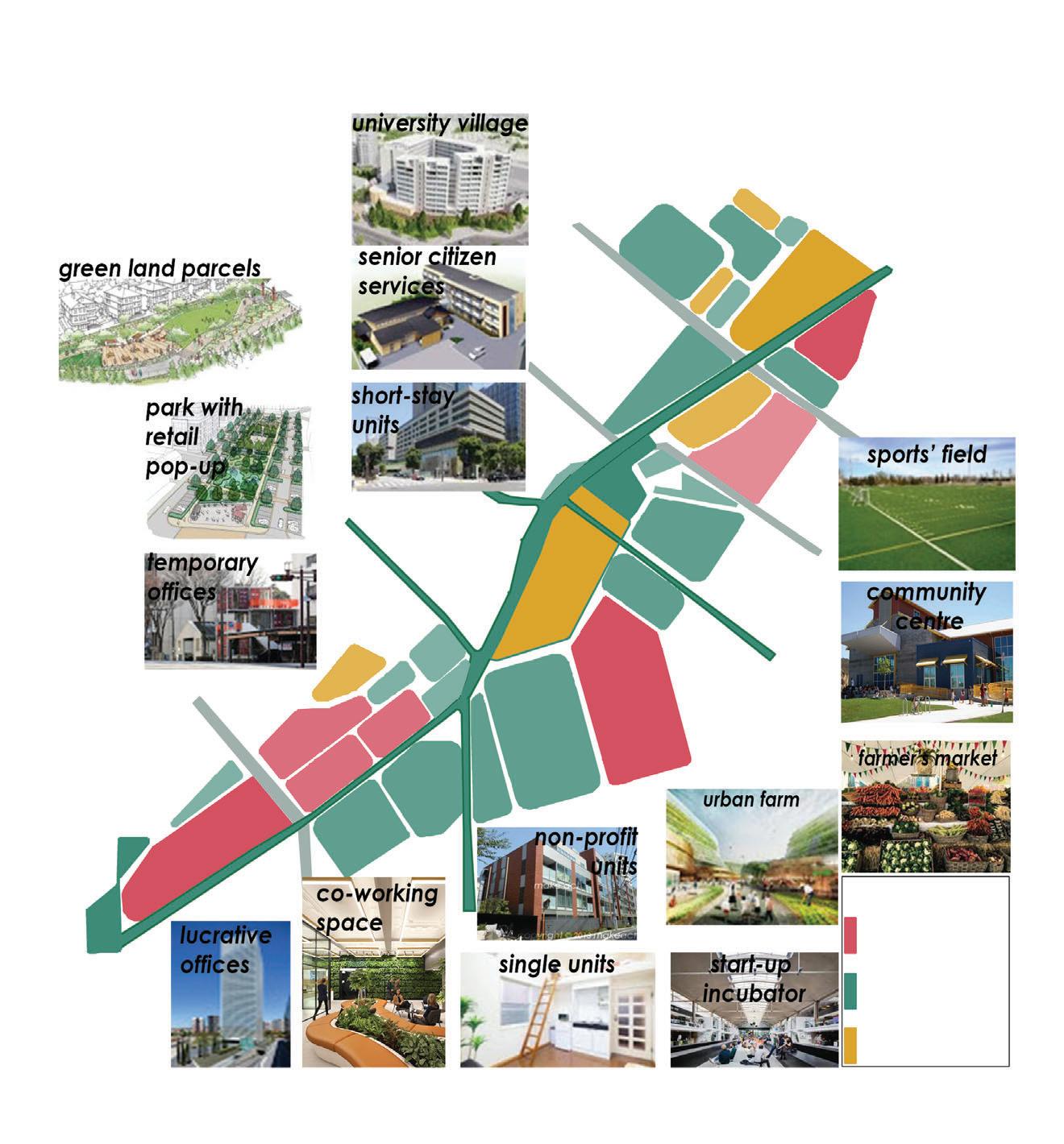
map legend
economic interventions
neighbourhood interventions
citizens interventions
short-stay units / hotels travellers (business & leisure)
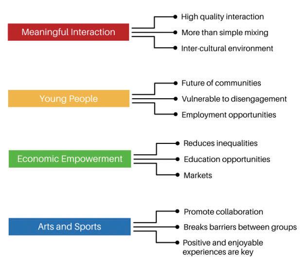


generators
beneficiaries
Positive exchanges: Initiative + Market an urban farm will their food production, of store-bought food the use of plastic. the urban farm will housing and office number of plots, residents after each provide housing knowledgeable in the current La Sagrera
Single Units
Non-Profit Units
Senior citizens’ accomodation
University Village
Short-stay appartments
85
profitable

86
MSc
SUSTAINABLE URBANISM
The MSc Sustainable Urbanism programme develops the necessary skills and knowledge necessary in the types of large and complex sustainable urban projects that are increasingly being planned across the world.
87
Dr Catalina Turcu Programme Director

Postgraduate
Programmes
SUSTAINABLE URBAN DESIGN
Coordinator
Dr Tse-Hui Teh Tutors
Fernando Gutierrez Hernandez
Sustainable Urban Design is a 10 week module that introduces and engages students in the debates of sustainable urban design by working in groups to research and produce a sustainable urban design proposal affecting the Paddington Opportunity Area in London.
The task of developing a sustainable urban design proposal facilitates a discovery of the different interacting factors that create urban areas and which actants can be reconfigured to improve the sustainability of human life. Collective Coevolution of Actant Trajectories is the theoretical framework within which the sustainable urban design proposals are developed and evaluated.
Students work in interdisciplinary teams of 4-5, where each member represents one discipline. These groups learn to communicate and collaborate across disciplinary boundaries. It requires each student to practice critical thinking of their own presumed knowledge, as well as knowledge they were acquiring in the process of developing a sustainable urban design. These processes lead to creative sustainable urban design outcomes and students who can confidently convey their ideas verbally, and visually.
88 Co-Canal Students: Irma Ramadan, Li Huang, Victoria Ching Shiu, Zhu Yating Michelle
MSc/Dip SUSTAINABLE URBANISM
ENROLMENT - Chemical Waste
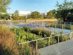


buy-in for expanding existing initiatives. will allow more people to be involved
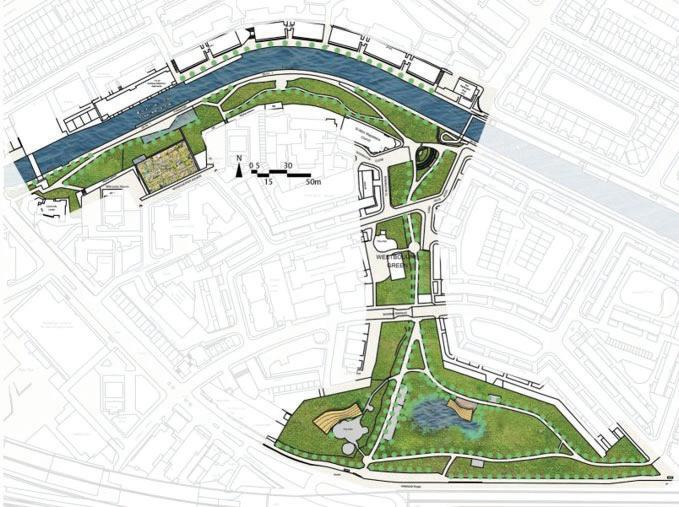
Phase Two: Little Venice
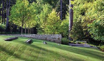

· Stronger community engagement
· Stable collaboration with organisations

Connect larger solve canal water
Phase Three: Kensal Green to
Regent’s
Phytoremediation
MOBILISATION - Phasing
Paddington Basin connects to Regent’s Canal through Little Venice, making it the natural location for the next set of interventions. The chosen area is approximately twice the size of the area in Phase 1, allowing us to test the scalability of interventions before rolling it out to a longer stretch of Regent’s Canal.
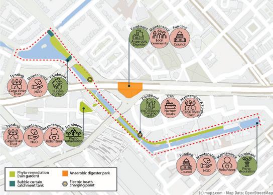
Phytoremediation is a process by which various types of plants are used to remove contaminants in the soil. Rain gardens will be implemented alongside the canal to catch road runoff and stormwater, which will then be naturally filtered before entering the water system. In addition, this reduces the rates of runoff to the canal, having the added effect of reducing flood risk.
While Phase 1 focused on visible and largely top-down interventions, Phase 2 focuses on community engagement and achieving greater buyin to our project. Therefore, environmental literacy is a key thrust of Phase 2, and community groups will be involved to a greater extent. Actants introduced in this phase are the local community, as well as schools and volunteer groups. There will be many opportunities for locals and visitors to get involved in this phase.
· Improvement of water quality
· Inspire involvement of local community
Phase One: Paddington Basin
Phasing Timeline
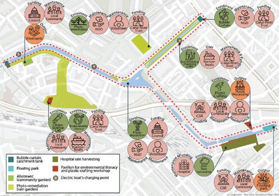
A key area for rain gardens is the conversion of parts of Westbourne Green, as depicted below. When not raining, the area can be used as a public space, and the environmental literacy pavillion nearby will educate users on the rain garden.
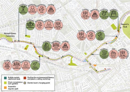
· More buy-in for expanding existing initiatives.
Phase Two: Little Venice
·
Phase 3 further expands the geographical scope to connect two large green spaces in the wider a green corridor. This phase aims to improve biodiversity canal and provide ecosystem services to the entire Phase 2 would have led to strong community area so far, in addition to cleaner canal waters. extended Phase 3 area would see the benefits incentivised to take it on. A greater range of community involved in the project to extend it to the wider become involved in funding and maintaining the will be placed on sustainability and improving biodiversity
Phase Three: Kensal Green to Regent’s Park Paddington Basin is the centre of Paddington Opportunity Area, one of London’s key development areas. The high traffic around the area has led to high levels of water pollution in the canal. Improving the water quality in the canal would not only prevent pollution from spreading to the nearby Regent’s Canal and improve the urban experience for visitors and
Paddington Basin connects to Regent’s Canal through Little Venice, making it the natural location for the next set of interventions. The chosen area is approximately twice the size of the area in Phase 1, allowing us to test the scalability of interventions before rolling it out to a longer stretch of Regent’s Canal.
Phase 3 further expands the geographical scope of the project, in order to connect two large green spaces in the wider area utilising the canal as a green corridor. This phase aims to improve biodiversity throughout the canal and provide ecosystem services to the entire area.

Phase 2 would have led to strong community engagement within the area so far, in addition to cleaner canal waters. Therefore, actants in the extended Phase 3 area would see the benefits of the project and be incentivised to take it on. A greater range of community actants will be involved in the project to extend it to the wider area. More companies will become involved in funding and maintaining the project. A greater focus will be placed on sustainability and improving biodiversity along the canal.

Policies -
-
-
Plan Plan for Westbourne Area Dietz, M. and Clausen, J.,
Eco-mooring An are initiative adjustment target
Higher
Provision
Regulations
2005. A Field Evaluation of Rain Garden Flow and Pollutant Treatment. Water, Air, and Soil Pollution
project, such as local restaurants and volunteers. of Westminster, 2007. Biodiversity Action Plan. London. of Westminster, 2014. Paddington Opportunity Area Fact Sheet. London.
· Phase 2 will allow more people to be involved
· Stronger community engagement
⇨ ⇨ ⇨ BPLN0051 Sustainable Urban Design C0-Canal Irma Ramadan Li Huang Victoria Ching Shiu Zhu Yating Michelle Dr. Tse-Hui Teh Fernando Gutierrez Hernandez 89
Stable collaboration with organisations Connect larger green spaces to solve canal water quality as a whole
⇨ ⇨

Postgraduate
Programmes
MSc/Dip SUSTAINABLE URBANISM
MSc/Dip TRANSPORT AND CITY PLANNING
SUSTAINABLE URBAN DEVELOPMENT PROJECT
Tutors
Dr Catalina Turcu
Prof Robin Hickman
Dr Jo Williams
Dr Lisa Juangbhanich
Dr Vafa Dianati
Dr Beatriz Mella Lira
This module is the second part of the two-part Sustainable Urbanism Specialism (Design Track). It aims to apply theories and models of sustainable development and sustainability to a real-life urban location and develop a large scale ‘sustainable urban plan’ at the strategic level and over a long timeframe. The module also aims to develop an understanding of financial and institutional mechanisms needed to implement such a development in practice.
This project-based module enables students to consider the potential options for achieving environmental, social, economic and institutional sustainability objectives for a specific site, in this instance, Väsjön in Sollentuna municipality, NE of Stockholm, Sweden. The students develop Strategic Sustainable Urban Plans (SSUPs) in four steps:
· Scene setting & strategic planning
· Vision, key policies and urban strategies
· Implementation: value capture, phasing and governance mechanisms
· SSUP: bringing it all together
This is a module available to students reading MSc Sustainable Urbanism, MSc Transport and City Planning and Master in City Planning (MPlan).
Coordinator
Dr Catalina Turcu
90 INNOVäsjön
Students: Gonzalo Alarcon, Henry Crabb, Veronica Klucik, José Ignacio, Selles, William Vallejo, Hannah Yu-Pearson





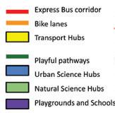








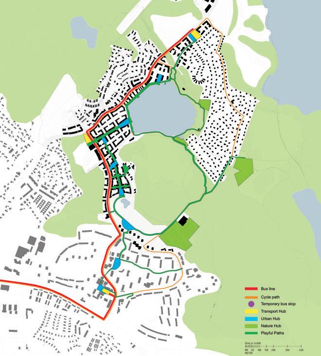
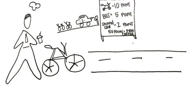


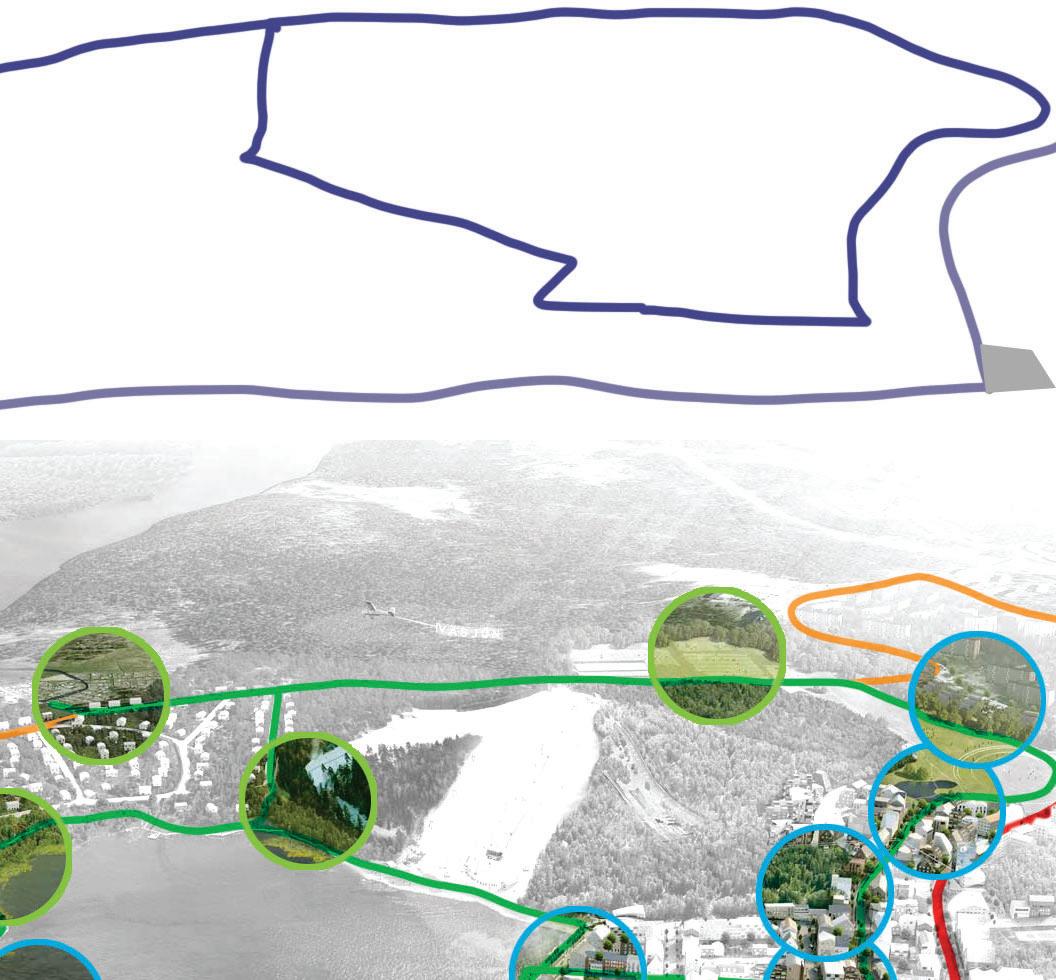


91

Postgraduate
Programmes
MSc/Dip SUSTAINABLE URBANISM
MAJOR RESEARCH PROJECT (SU)
Coordinator
Dr Filipa Wunderlich Tutors
Dr Filipa Wunderlich Dr Catalina Turcu
Supervisors
Principals at Urban Initiatives Studio, Urban Architecture, Urban Movement, East Urban Design Landscape Architects, Haylock Planning and Design, Ramboll - Architecture, Airey Miller
To complete the MSc Urban Design and City Planning and MSc in Sustainable Urbanism, students are given the option to submit a Major Research Project. This project should typically focus on a key area of knowledge covered in your course, eg. urban design, urban design guidance and control, housing and development, sustainable urban design, sustainable transport, or other. A Major Research Project represents an in-depth exploration of a complex topic / problem. It is a demonstration of knowledge, a critique, and the application of this knowledge and critique into a project. The project will focus on a particular site, method or process and will be propositional, delivering a vision, and working it out in depth as to exhibit its potential, but also reflect upon its limitations. The major project should embrace the complexity of the chosen topic and apply knowledge in a critical and reflective manner. The project will prepare students to enact positive change through design and is an opportunity to develop both research and problem-solving skills and abilities whilst entering in-depth a particular area of studies and explore a problem that is up-to-date, critical and complex. A Major Research Project should integrate a literature review and analytical research, but most importantly it will be propositional. You will look ahead, seek opportunities to imagine a different world and explore / test innovative approaches to planning, design and or development in the city.
This Major Research Project is the culmination of the Masters programme, and therefore the student’s chance to synthesise, in a major and largely self-managed study, what he or she has gained from the course and, possibly, to integrate it with elements from previous studies or professional experiences. The Major Project is something you can take with you, use to demonstrate your expertise and launch the next stage of your career.
The work is delivered in the form of a 8,000 words research report, and every year, students are supervised by a prestigious team of practitioners of renown Urban design and Planning consultancies in London, such as Urban Initiatives Studio, Urban Architecture, Urban Movement, East Urban Design Landscape Architects, Haylock Planning and Design, Clarion Housing Group, Ramboll and others.
92 Catalysing Post-Growth Strategies for Declining Coastal Communities Student: Jeremy Bourgault
Margate Central and Northdown Road (Green) are the historical socio-economic centres of the town. They are now also the areas most heavily impacted by gentrification. All major socio-cultural attractions (Pink: Dreamland, Turner Gallery, and Town Gardens Concert Hall) are located in Margate Central, leaving Cliftonville West, east of the town centre, with no real social driver. The neighbourhood is also cut off from the beaches by the derelict Margate Coastal Park and its abandoned leisure infratrutcures (Blue), including Margate’s former lido, stretching along the northern shore.
community such as funds, education, transferable skills and knowledge, mental support, advice
vibrant community hub hosting work and gathering spaces.

CONCLUSIONS
The first aim of this project is to draw wider attention to the problematic of coastal decline among urban academics and practitioners in the UK. The developed framework does not pretend to deliver an ultimate solution to the problems of declining coastal communities, but it seeks to unveil some of the structural challenges any improvement strategy would be facing in this context.
The second objective is to challenge the general perception of circular economy as a neoliberal model for sustainable growth. This project argues for a much wider understanding of circularities than the ones arising from the current omnipresent economic and technical framings (Turcu and Gillie, Forthcoming). Circularities, as defined by Williams’ framework, offer a strong new approach to the design and governance of the built environment (Williams, 2019:1). However, evidence and tools are still missing for an effective
Submitted September 2019
Supervisor: Matthias Wunderlich
Cliftonville West is characterised by high unemployment addictions, poor mental health conditions, high chronic and circulatory cies (Kent Public Health Observatory, 2016). It is home to a very 2016. However, the access to higher education is difficult, and low. Cliftonville also bares high teenage pregnancy levels, as country (Kent County Council, 2019:1,2). Housing conditions intimacy and space, the absence of central heating and ventilation against extreme weather conditions. High levels of absentee difficult. These living conditions add to the vulnerability of residents unable to move out or to perform maintenance works (Zsamboky,
and integrative implementation of circular principles at the urban level. Using the circular cities framework outside of the traditional economic growth paradigm is an attempt at illustrating its value independently from technical and financial considerations.
Although this research has sought to address the sociocultural and institutional barriers to action, many political, regulatory and technical questions are yet to be solved. The design proposal based on Cliftonville West has unveiled numerous gaps that may render the framework ineffective. Legal conflicts regarding ownership rights, technical safety restrictions, overwhelming technicalities, political tensions with the municipality, among the third party actors, or within the community, are likely to undermine the implementation of the strategy. Thus, this research calls for a rigorous quantitative and context-specific analysis involving the local stakeholders, before any realistic masterplan can be extracted from its framework.
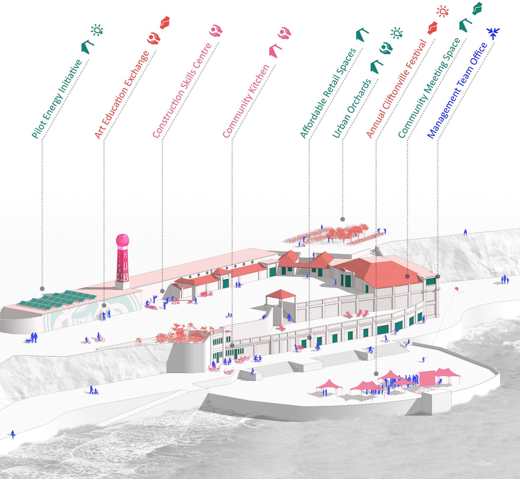

Jérémy Bourgault (jeremy.bourgault.18@ucl.ac.uk)
lysts involve induce tions tem services, mental

94
MSc/DIP URBAN REGENERATION
Dr Sonia Freire Trigo Programme Director
The MSc in Urban Regeneration has been created in response to a great challenge facing urban professionals in Britain and around the world: the decay and deterioration of our cities and their planned renaissance.
The challenge, however, is even greater than restoring and rebuilding the physical fabric of cities: it is to provide a new economic base to replace the one that has been lost, to restore hope to communities that have been shattered, to provide children and adults alike with a better chance in life.
It is a massive task that requires ‘out of the box’ thinking, intellectual rigour and collaboration. The programme aims to develop three qualities necessary for urban professionals:
· the ability to understand and critically analyse complex urban issues
· the boldness to address those issues in a creative, strategic manner
· the confidence to propose appropriate and realistic implementation plans
95
 Postgraduate
CASE STUDIES IN PREPARING REGENERATION PROJECTS
Dr Lauren Andres
This module takes a project-based learning approach and requires students to develop a diagnostic account of the problems of a chosen locality in London and generate their own proposals for policy or intervention. Working in small teams, students will have to define why the chosen location is ‘in need of regeneration’; identify the key issues underpinning ‘the problems’ of the selected area; propose a vision and/or strategies to tackle the problems; and explain how such vision and strategies will be delivered. The module is organised around the production of a group project for an urban regeneration intervention in an area of London, chosen by group. This is facilitated through weekly tutorials, in which the small groups and the tutors discuss the reasons why the area needs regeneration; the diagnosis of the selected area of intervention; the suggested aims and objectives of the intervention; and the different strategies and mechanisms to implement their vision.
This year, the range of projects included proposals for the regeneration of different places such as Earl’s Court (Kensington & Chelsea and Hammersmith & Fulham); Wood Green and Seven Sisters (Haringey); Catford (Lewisham); Camberwell and Bermondsey (Southwark) and Cambridge Heath (Tower Hamlets). The scope of the interventions addressed the multiple and interlinked challenges present in the selected areas. The outcome of this hard work has been seven reports of around 7,000 words each, in which students presented their vision and coordinated actions to address the identified: from town centre revitalisation, to council estate regeneration, to social cohesion, to pedestrian connectivity, to environmental quality.
MSc/DIP URBAN REGENERATION Coordinator
Dr Sonia Freire Trigo 96 Earl’s Court Urban Regeneration Project Students: Gkiza, Antigoni Jackson, Jenny Jiang,YingxuanQin, Meng Song, Yaling Xu,Han
Programmes
Tutors

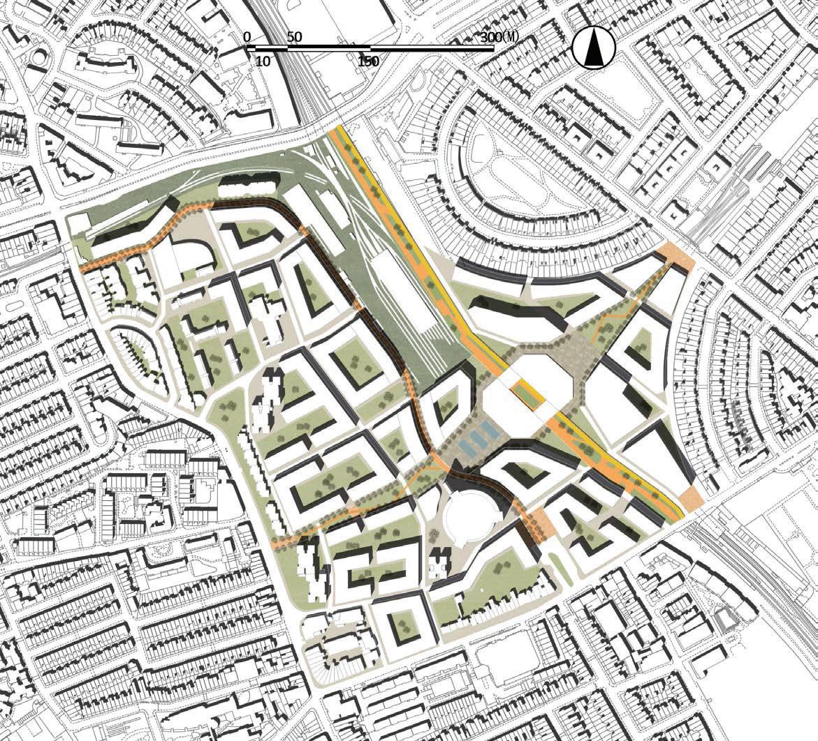


1 2 3 4 5 6 Earl' s Court HighlinePark Greencorridor Earls courtcentre Publiccorridor Primary School Earls courtsquare 7Construction TrainingCentre 8Skills and RecruitmentCentre 9 Earls Court Multifunctional Community Centre 10 North End Roadmarket 11Office for newenterprises 1 2 3 4 5 6 9 7 8 10 11 27
2.3Masterplan
97
Figure 2.3.1 Masterplan(Author)

Postgraduate
Dr Stefania Fiorentino
URBAN REGENERATION: DEVELOPMENT PROJECTS
Tutors
Michael Manlangit
This module looks at the different conceptualisations of the development process, value creation and (re)distribution, risk and external impact factors. Financing tools and possible regeneration strategies employed by the public, private and third sector actors are explored, engaging in property development within urban regeneration projects. The module also examines basic techniques available for property development appraisal, their strengths and limitations and the appropriate contexts for their application.
The module comprises lectures, tutorials, class discussions, guest speakers and a site visit to a key contemporary development site in London.
The first part of the learning contents is more theoretical and explores key conceptual definitions and real estate development topics like: agency theory, development models, the concept of value creation, risk assessment and mitigation, etc. The second part of the module is more practical, looking at different geographical contexts and different types of urban regeneration practices. Through a series of case studies and guests from the industry, the module provides an overview of the different financing frameworks, the different types of value creation models, the different agents involved and interests at stake. New emerging trends and issues concerning future urban regeneration strategies impacting on property development like climate change and meanwhile uses are also considered.
MSc/DIP URBAN REGENERATION Coordinator
98 An assessment of Mayfield, Manchester Students: Nick Ferns
Programmes
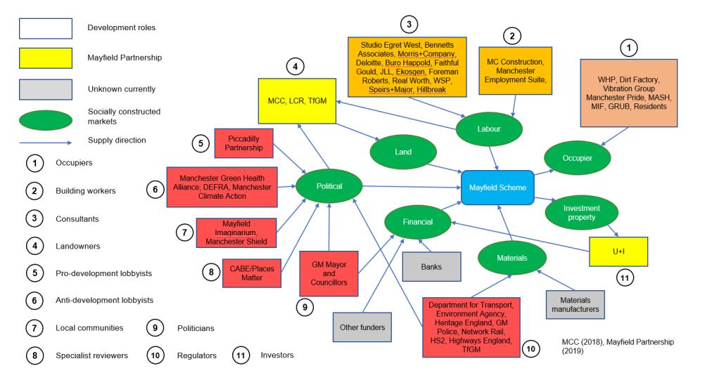
An assessment of Mayfield, Manchester: To what extent does the regeneration scheme meet the public interest?
Mayfield is an area in the south-east of Manchester City Centre, adjacent to the central railway station, Manchester Piccadilly. Given its prime location, Mayfield is well placed to be one of the city’s flagship neighbourhoods, yet the site has remained derelict since 1986. The area is soon to be regenerated, with redevelopment commencing in 2020. This paper assesses the proposed scheme, examining its strategic vision as well as the policy, framework and risks underpinning its delivery. This work critically evaluates the value the scheme will create, considering the goals of the development and the wider public interest
Role based development model, adapted from Adams and Tiesdell (2013).
99

100
MRes INTERDISCIPLINARY URBAN DESIGN
The MRes Inter-disciplinary Urban Design programme allows students to construct their study in a cross-disciplinary manner and explore urban design as a critical arena for advanced research and practice.
101
Dr Filipa Wunderlich Programme Director

Postgraduate
Programmes
MRes
Coordinator
Dr Filipa Wunderlich
URBAN DESIGN RESEARCH PROJECT
To conclude the MRes Inter-disciplinary Urban Design students need to complete an Urban Design Research Proposal leading to the design, production and delivery of your own Urban Design Research Project.
The Urban Design Research Project represents an in-depth exploration of a complex topic / problem. It provides a demonstration of theoretical knowledge and rigorous and incisive analysis. The project embraces the complexity of the chosen topic and applies knowledge in a critical and reflective manner.
This research work has five main educational aims:
-To produce an innovative and original study that contributes new knowledge within the discipline of urban design
-To gain and demonstrate aptitudes to urban design as an inter-disciplinary research arena, and to contribute to furthering the practices of urban design
-To explore, in-depth, one or more of the various academic / disciplinary lenses shaping urban design that you have explored in the programme, as a means to frame and conduct your study
-To successfully execute methods and approaches to the research of urban design that are relevant/ appropriate to the understanding of complex urban problems
-To deliver a rigorous, critical and reflective, incisive and professional research project
The Urban Design Research Project is the culmination of the MRes programme, and therefore also a chance to synthesise, in a major and largely self-managed study, key dimensions of what students have gained from the course and, possibly, to integrate it with elements from previous studies or professional experiences. This is something for students to take with them, demonstrate their expertise and launch the next stage of their career.
This Urban Design Research Project is put together under of 15,000 words dissertation or 10,000 design-based major research project. In line with the interdisciplinary nature of the MRes Interdisciplinary Urban Design programme and its cross-faculty identity, students attend classes and are supervised in all parts of the Bartlett, including The Bartlett Schools of Planning, Architecture, DPU, CASA, UCL Urban Lab.
102
INTERDISCIPLINARY URBAN DESIGN
Disruptive Citizenship: Spaces of Resistance in the Smart City? Student: Richard Sobey
DISRUPTIVE CITIZENSHIP:
SPACES OF RESISTANCE IN THE SMART CITY?
Researcher: Richard SOBEY
Supervisor: Dr Jens KANDT
MRes Interdisplinary Urban Design │ The Bartlett School of Planning │ Faculty of the Built Environment
Critical problem Hypothesis & assumptions
As key actors in smart urbanism, city governance, corporates and academia drive development This triple helix configuration also forms the leading power and control structure for smart city development, steering both direction and implementation (Kitchin et al 2017) Citizen participation is positioned within current frameworks in ways that reflect this power structure Even when civil society supports participation (creating a quadruple helix), citizens still appear to be users (data contributors), testers (living lab users) or evaluators (surveys) The capacity for citizens in decision-making, innovation and development seems limited in practice Where we see resistance to smart urbanism, dataveillance and geoprivacy we fail to recognise this as participatory and adequately accommodate these actions in frameworks for citizen participation Where are bigbrotherwatch org uk and #BlockSidewalk campaign to be situated if we understand them as participatory and contributing to the development of the smart city?
The value of 'challenge', of outsider thinking, to governance, thinking and practice, is recognised in literature: de Waal (2018), Ehland & Fischer (2018), Jacobsson (2015) and Mouffe (2005) It impacts on the development of new ideas and models of practice, and the development of mechanisms that ensure just and fair access to those processes that counter monopoly, stimulate debate, deliver innovation and question policy
The research is based on a hypothesis that models of citizen participation in smart urbanism fail to represent contestation and acts of resistance because they do not recognise them as necessary alternative manifestations of engagement in decisionmaking or debate in the public realm and as situated externally to invitations to participate They are not recognised as practices that usefully challenge how ideas develop or how solutions are implemented outside those normative consultation techniques considered as participation by professionals; as practices that do not seek permission or wait for invitation
There is a need to understand the role and position of resistant activity in smart city development in order to more effectively position it in ways that recognise contestation and resistance as a healthy external component in the urban arena, rather than a controllable mode of participation within it
Do the smart city (as an entity) and smart urbanism (as a practice) need spaces for purposefully resistant activity in order to recognise this as an expression of citizen participation?
Taking Bristol city as a case study, this study uses interviews with actors across the quadruple helix to explore the role, meaning and position of resistant activity in the smart city
Findings
Field work has shown resistance holds no real meaning for professionals in relation to the development of the city, smart or otherwise In activities pertaining to smart urbanist participatory processes in the case study city, this resistance and the spaces for it do not appear and disruptive citizenship is not deemed useful However, the research identifies, not spaces of resistance, but spaces of challenge in liminal positions that bring together diverse voices to explore thinking and practice in ways that challenge expectations about citizen participation, engagement with residents and the power structures of smart urbanism Findings show specific actors convening these spaces, working at the interface between a citizenry and those triple helix partners leading on smart urbanism It identifies their utilisation of porous boundaries between communities of practice to continually negotiate the production of these process spaces of challenge Using shifting identities, it would appear that those defining the production logic of these spaces inhabit purposefully outsider positions to contexts controlled by the power structure, exploiting the porous boundary for strategic advantage; no longer simply 'citizens'; they inhabit both spaces, but reside in neither
Further action
Understanding the terms 'resistance and 'challenge : The hypothesis recognises that resistance takes many forms understood as either tactical or strategic (Swanlund & Schuurman 2019, de Certeau 1984), designed to evade or thwart governance or policy on one hand (tactical, short term objectives) or to seek change in practice or policy on the other (strategic, longer term goals); that resistance implies the presence of power relations and of an exterior or outsider location The use of 'challenge' here specifically relates to a process of questioning decisions, practice or policy in ways that focus on justification or validity Thus both strategic resistance and challenge are assumed to be expressions of engagement and (crucially here) participation in social, economic, technological, environmental, legal or political processes It is also understood that resistance adopts a variety of tools; those more readily associated with popular notions of political resistance (eg demonstrations) and those expressing the demands for justification or contestation of validity characterising challenge (eg purposeful public debate; invitations to explore alternatives) While these tools exemplify a normative understanding of resistance, it is useful to assume that resistance can be understood both as a practice and as inhabiting a location As such, spaces for resistance can be understood as physical locations or elements in a process Thus for this study, it is assumed that resistance manifests in both physical space and process space
Research Aims Methodology
Research aim
to explore whether the notion of resistant activity in the smart city and in smart urbanism and disruptive citizenship is recognised by professionals
to examine the role, meaning and value of this resistance for professionals and determine where is it positioned in relation to citizen participation in the smart city and smart urbanism
to establish if spaces of resistance exist in the smart city (physical space) and in smart urbanism (process space) and, if so, ascertain who inhabits them
to map what technological tools are employed to facilitate this expression of citizen participation
to identify the implications for existing frameworks in relation to citizen participation
Research questions
Do professionals recognise strategic resistance or challenge activity in the city or urbanism?
Do they consider resistant activity as citizen participation?
Is 'disruptive citizenship' a useful notion in this professional sector?
What does vocabulary used by professionals reveal about the role, meaning and value of strategic resistance and the role of challenge in the smart city and smart urbanism?
Where is strategic resistance positioned?
Are spaces of resistance in evidence in the smart city and smart urbanism?
Who inhabits them & who has power in them?
Is the resistance manifesting in physical or process spaces?
What technology is used in smart citizen participation? Who is using it? Who 'owns' it?
Do this study's findings suggest a new approach to a citizen participation framework?
What would that look like?
Research tools: what Research tools: why desk research of websites, forums, media coverage
to map ecology; identify initiatives; build localised understanding of current activity & practice review of city project and policy documents, including websites
to map ecology; build a localised understanding of current vocabulary and practice; confirm case studies; identify individuals to contact and inform structure of data collection four face to face scoping meetings with specific local actors in projects and organisations (informants)
enrich map; confirm individuals to contact; inform structure of data collection & identify gaps
ten face to face semi-structured interviews with those working with playable city, smart city and urbanism projects
to collect data on activity in smart urbanism (&urbanism more widely); on how participation is framed and delivered; & on interpretation and understanding, attitudes & opinions about the role of resistance participatory observation of a continued professional development (CPD) workshop
to record presentation content/style & group discussion for data on interpretation/understanding, attitudes/opinions on participatory urban design & use of technologies in participatory processes

Preliminary framework for citizen participation as challenge
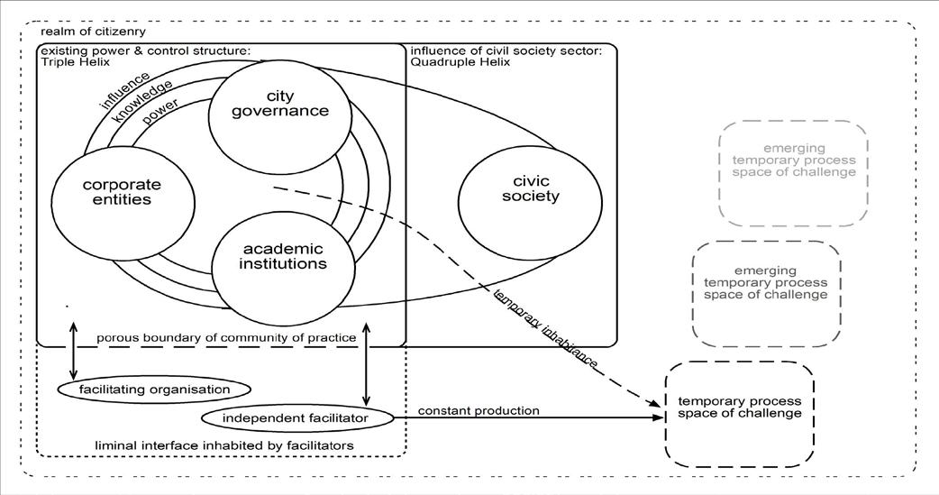
Figure One: Preliminary framework for citizen participation as challenge
To contribute to debate on participatory practice in smart urbanism, the study offers a preliminary framework for citizen participation as challenge in Figure One, and identifies further study for more assured claims for the role of challenge in smart urbanism and urbanism more widely
On Spaces of Challenge: What are the qualities of this space? What examples are there? What happens in it? What are the conditions that allow this conversation? How important is the parenthetical nature of the space? Do they manifest in the virtual world? If so, is there a 'physical' element alongside the 'process'? eg. avatars
On the Actors: Who allows the boundary's porosity? Who gives the permissions? How do power relations facilitate or impede activity? Who gets to facilitate? What do artists and cultural producers bring? Why do bounded professionals step into this space? Do the triple helix partners convene such spaces? Do their roles shift? What spaces do they shift in & out of?
On the Impact: Where is the impact situated? Is it in the physical or process? Is the challenge having lasting effects on attitude, practice and policy? Who benefits from the impacts? In what ways?
Who is excluded or disadvantaged? What else might be challenged as a ripple effect? What evaluation frameworks exist in smart urbanism for this activity?
On Extrapolation: Is this specific to Bristol and its smart and alternative culture? Is it a result of Bristol City Council policies on culture? Do other cultures or urban forms exhibit this? Informal settlements or cities in conflict zones?
What other professions/sectors see these spaces of challenge? Does environmental citizen science and crowd-sourcing offer any insights?
On Models: Does our model continue to negate the role of citizens by simply positioning the facilitators and the space? What examples of participatory projects fit the framework's spaces?
Do these make sense to those on the ground & to academia? Where would de Waal's disruptive citizenship fit within this model and what implications does that reveal?
Richard SOBEY richard.sobey.18@ucl.ac.uk www.richardsobey.com
photo credit: Richard Sobey 2019 de Certeau M (1984) The Practice of Everyday Life Translated by Rendall S Berkeley, Univ of California Press; de Waal, S (2018) Civil leadership as the future of leadership: harnessing the power of disruptive citizens Amsterdam, Warden Press; Ehland C & Fischer, P (eds ) (2018) Resistance & the city: challenging urban space Boston: Brill/Rodopi; Jacobsson, K (ed ) (2015) Urban Grassroots Movements in Central & Eastern Europe Farnham, Ashgate Publishing, Cities and Society Series; Kitchin R Coletta C Evans, L Heaphy L & MacDonncha D (2017) Smart Cities, Epistemic Communities, Advocacy Coalitions and the `last Mile' Problem Information Technology 59 6 2017: 275-84; Mouffe C (2005) On the political London: Routledge; Swanlund D & Schuurman N (2019) Resisting geosurveillance: A survey of tactics & strategies for spatial privacy Progress in Human Geography 43(4), 596–610 103

104

FIELD TRIPS

Field Trip
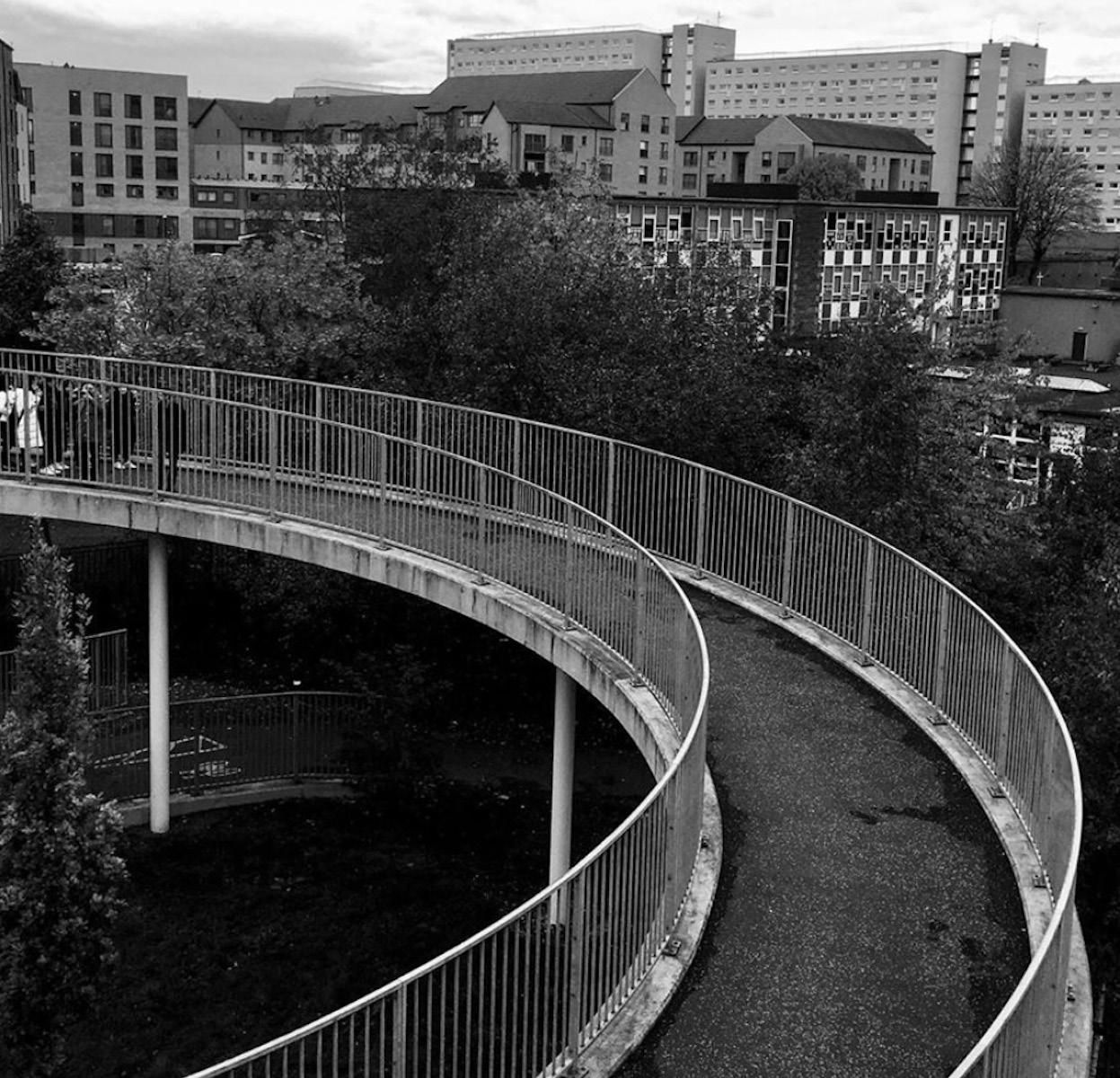
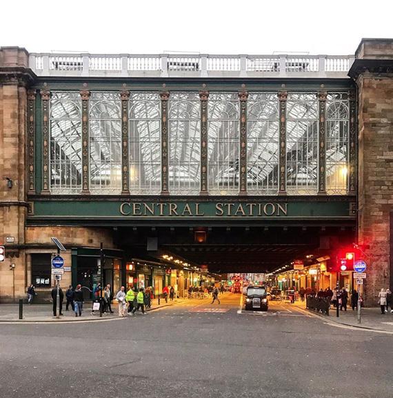
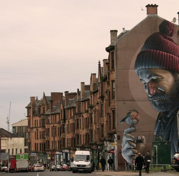
106
Glasgow
Top:
Lili Pandolfi (MPlan)
Bottom Left:
Matt Faraci (UDCP)
Bottom Right:
Maria Castilla (UDCP)


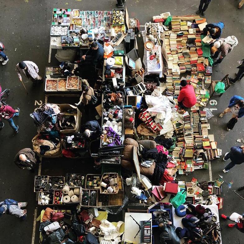
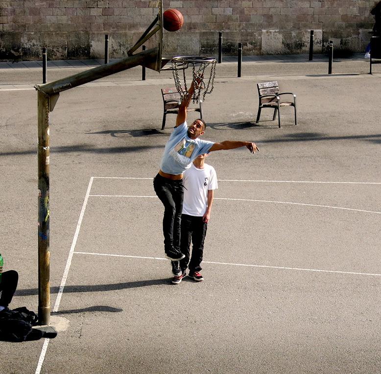
Barcelona
Top:
Ben Tattersall (UDCP)
Bottom Left:
Lydia Ogden (UDCP)
Bottom Right:
Maria Castilla (UDCP)

Field Trip
#sufieldtrip
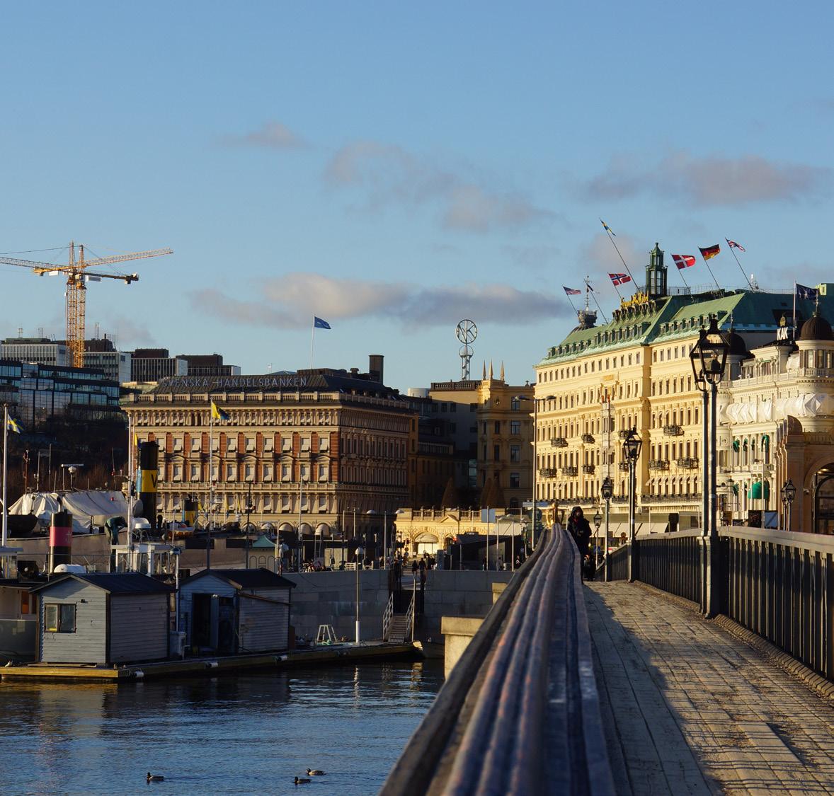
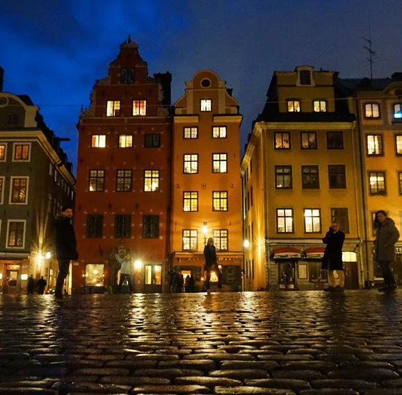

108
Stockholm
Top: Dehi Shetty
Bottom Left: Nashwa Naushad
Bottom Right: Laura Zumbado


110

RESEARCH PROGRAMMES

112
MPhil/PHD PLANNING STUDIES
The MPhil/PhD in Planning Studies is designed for graduates of any discipline who wish to make a career in planning or in related fields in teaching or research.
At the BSP, PhD students are from a variety of geographical, cultural and professional backgrounds, but integrated as a PhD Community. Our diverse yet interrelated research activities and events are also supported by numerous funding opportunities, and other resources available from the BSP. In addition, there is good communication, critical dialogue and mutual support between students and faculty. Thus, we believe we can contribute significantly to knowledge and achieve a practical end in the real urban world.
113
Prof Yvonne Rydin
Departmental Graduate Tutor

PhD PhD
Mega-transport projects and the “rules of the game”: The role of contractual risk management in the planning and appraisal process in Latin America.
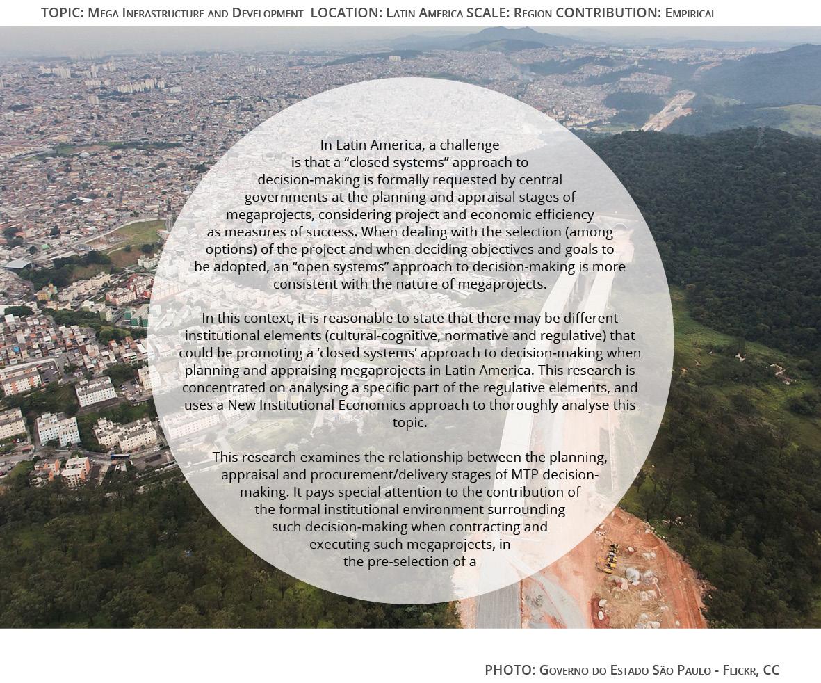
Primary supervisor: Professor Harry Dimitriou
Secondary supervisor: Dr John Ward
114
JUAN ALBERTI

PhD
Fear of crime beyond the walls: Effects of gated communities in neighbouring public spaces. The case of Greater Metropolitan Area of Costa
Fear of Crime beyond the Walls: Effects of Gated Communities in Neighbouring Public Spaces. The Case of the Greater Metropolitan Area of Costa Rica.
Rica
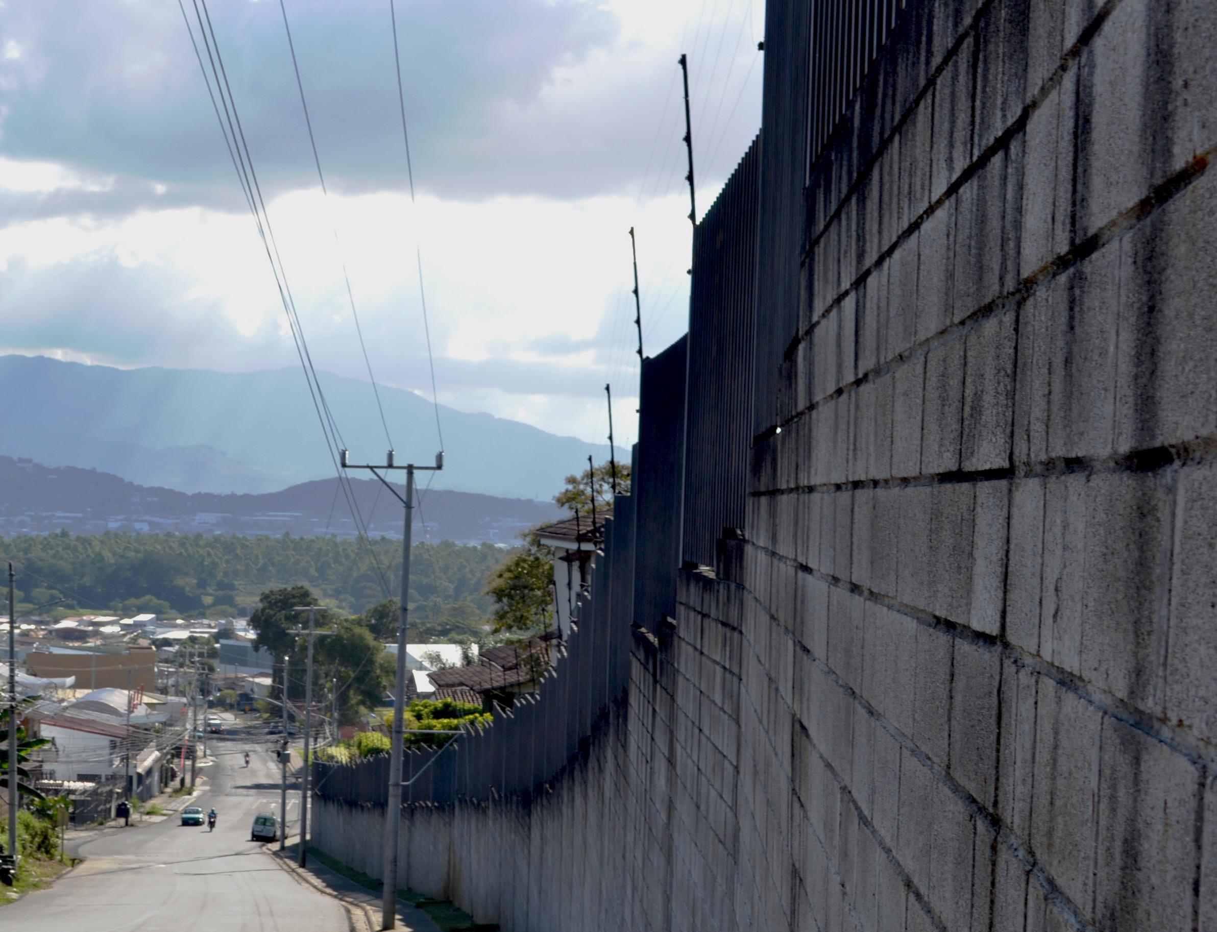
Gated communities in Costa Rica have proliferated in the last two decades, occupying large areas of land without control over their shape, size or design. In Latin America, fear of crime is a persistent worry and, some people have seen in gated communities shelters against criminality.
However, those developments might be increasing the residential segregation and, paradoxically fuelling fears towards their peripheries. This research aims to explore the distribution of fear of crime outside of gated communities, in the adjacent areas. It analyses the variation of that feeling according to poverty levels and elements of the built environment. The research takes place within the Greater Metropolitan Area of Costa Rica.
Eight study cases were selected; they correspond to neighbourhoods next to gated communities with distinct levels of unfulfilled needs (NBI). The NBI indicator encompasses access to good and services, housing, education and health. The empirical data were collected through walking interviews -tracked with GPS, focus groups, in-depth interviews and observations. The preliminary findings suggest an overall increase in the intensity of fear of crime next to the gated communities’ walls; which is exacerbated by the profound residential segregation. That feeling varies according to income inequality, community ties and, features of the built environment.
Primary supervisor: Professor Claudio De Magalhães
Secondary supervisor: Dr Pablo Sendra
Sponsor: Universidad de Costa Rica
115
KARLA BARRANTES CHAVES
PHOTO: Karla BarranTes CHaves
TOPIC: CITIes, real esTaTe and eCOnOmIC develOPmenT lOCaTIOn: COsTa rICa sCale: regIOn COnTrIBUTIOn: emPIrICal
Karla Barrantes Chaves

Sustainability appraisal framework for Investment in Airport development infrastructure
Sustainability, major infrastructure projects and community consensus. The case of Heathrow Airport

Over the last century, aviation has become the world’s fastest-growing global industry with more than 18,000 commercial aircrafts in service, 1,300 airlines operating and over 1,200 airports open to international aviation. Airports have become increasingly complex, influential and expensive investments, but also places of huge controversies. Several protests around airport construction and expansion have raised critical issues and revealed tensions between the varying implications and impacts they exert on their surrounding areas at a variety of scales.
Considering the changing attituded towards climate change, this research aims to investigate how the public and the private sector will be able to secure the necessary social and environmental consensus to ensure that the industry will continue to success to 2050, and beyond.
Heathrow Airport is adopted as case study. Early this year, the Court of Appeal in London ruled in favour of campaigners fighting to block plans for a third runway at Heathrow Airport in London. This decision has thrown Heathrow expansion plans into doubt and has opened a completely new frontier for planning challenges to major projects in Britain and around the world.
116
TOPIC: SuSTaInable TranSPOrT, InfraSTruCTure & CITIeS reSearCh lOCaTIOn: unITed KIngdOm SCale: regIOn COnTrIbuTIOn: emPIrICal
dI gregOrIO
PhOTO: grazIanO
Graziano Di Gregorio
Primary supervisor: Dr John Ward Secondary supervisor: Dr Iqbal Hamiduddin
GRAZIANO DI GREGORIO
PhD PhD


PhD
The Dynamics of Place Attachment and Perceived Density; Exploring the Impact of Urban Densification on Social Sustainability in Tehran.
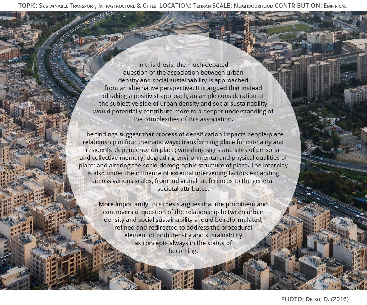
Primary supervisor: Dr Catalina Turcu
Secondary supervisor: Dr Michael Short
117
VAFA DIANATI

New voucher programs for low-income families in Santiago and Valparaiso: residential mobility or struggle against segregation?
New voucher programs for low-income families in Santiago and Valparaiso: residential mobility or struggle against segregation?

The research aims to understand the interplay among 3 sociospatial processes: Residential Segregation, Residential Mobility and Housing Production. The latter with an emphasis on informal housing strategies in the metropolitan areas of Santiago and Valparaiso, in the period 1992-2017.
A historical analysis of segregation and housing production will be conducted in both cities. An assessment of recent housing policies such as the “Chao Suegra” rental subsidy and “2nd chance” relocation social housing subsidy will be developed. The previous, in order to understand the effectiveness of these voucher programs to tackle overcrowding (allegamiento) and the increasing number of self-built settlements (campamentos).
The success of the policies in promoting residential mobility in low-income families will interact with the formal/informal housing strategies they pursue and the dynamics of residential segregation (patterns, resistances). My work will contribute to a comprehensive analysis of segregation and its structural factors, in order to develop a research line in chilean and latinamerican cities, under a comparative contextual divergence perspective.


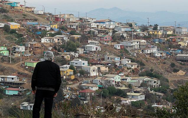
118
TOPIC: SegregaTIOn, HOuSIng LOCaTIOn: SanTIagO, VaLParaíSO, CHILe SCaLe: urban regIOn COnTrIbuTIOn: THeOreTICaL, MeTHOdOLOgICaL
PHOTOS: TeCHO, 2018
Cristobal Diaz Martinez
Primary supervisor: Dr Sonia Arbaci Secondary supervisor: Dr Nicola Livingstone
CRISTOBAL DIAZ MARTINEZ
PhD PhD

PhD
Rethinking the Role of the Lebanese Urban Planning Law in Times of Intersectional Crises and Austerity to Urban Public Services
Rethinking the Role of the Lebanese Urban Planning Law in Times of Austerity: Can We Move Towards Inclusive Prosperity?

Urban planners, economists, and legislators working in government positions in localities and regions across the world are seeking prosperity and wellbeing amidst state austerity and cuts in public budgets (Pike and Tomaney 2006).
Yesterday’s prosperity was assumed to be the diametrical opposite of austerity. It was conceptualized as simple economic growth in GDP. However, in recent years, many countries have been experiencing a convergence of crises along with concerns around equality and human wellbeing (Fioramonti 2016). This convergence reinforced the debate around the inadequacy of relying on GDP indicators as proxies of prosperity (Stiglitz 2009; Joshanloo, Jovanović, and Taylor 2019). Economic growth and GDP per head seem decoupled from subjective wellbeing. They suggest that localities and regions perform similarly on a macro level, but mask significant differences in terms of people’s quality of life when we consider dimensions of wellbeing such as equal access to housing and basic public services through urban planning – albeit with insights and procedures that still need to be developed. (Tomaney 2015)
Prosperity is thus explored in this research in terms of ways in which the benefits of urban development can inclusively reach all citizens and are translated into factors reflected in their quality of life. For example, inclusive and reliable infrastructures and services are fundamental to people’s lives. (Mintchev, Baumann, Moore, Rigon, and Dabaj 2019)
Primary supervisor: Dr Michael Short
Secondary supervisor: Professor Claudio De Magalhaes
Sponsor: IJURR (International Journal of Urban and Regional Research) Foundation
119
TOPIC: PrOsPerIT y BeyOnd GdP LOCATIOn: LeBAnOn sCALe: nATIOnAL COnTrIBUTIOn: TheOreTICAL, emPIrICAL
PhOTO: AUThOr
ABIR ELTAYEB
Abir Eltayeb

PhD PhD
Financing Urban Development in China Using Local Government Financial Vehicles, From Entrepreneurial Governance to Financialization
Primary supervisor: Professor Fulong Wu
Secondary supervisor: Dr Fangzhu Zhang
120
YI FENG

PhD
Landscape character conservation through local communities’ participation: The Case of Colombian cultural landscapes
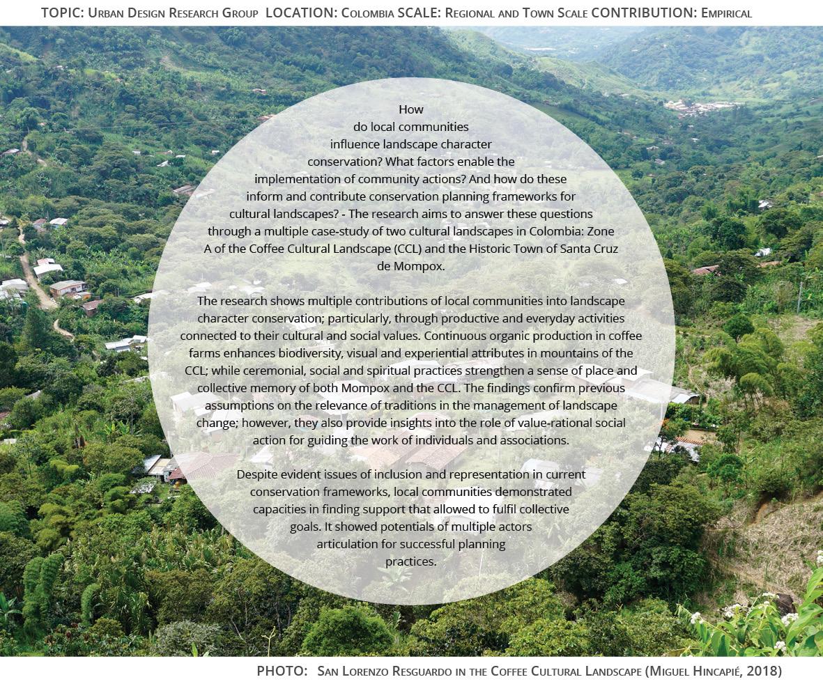
Primary supervisor: Dr Elisabete Cidre
Secondary supervisor: Dr Michael Short
121
MIGUEL HINCAPIÉ TRIVIÑO

PhD PhD
urban planning reform under developmental-state planning system--a study of Taipei, Taiwan
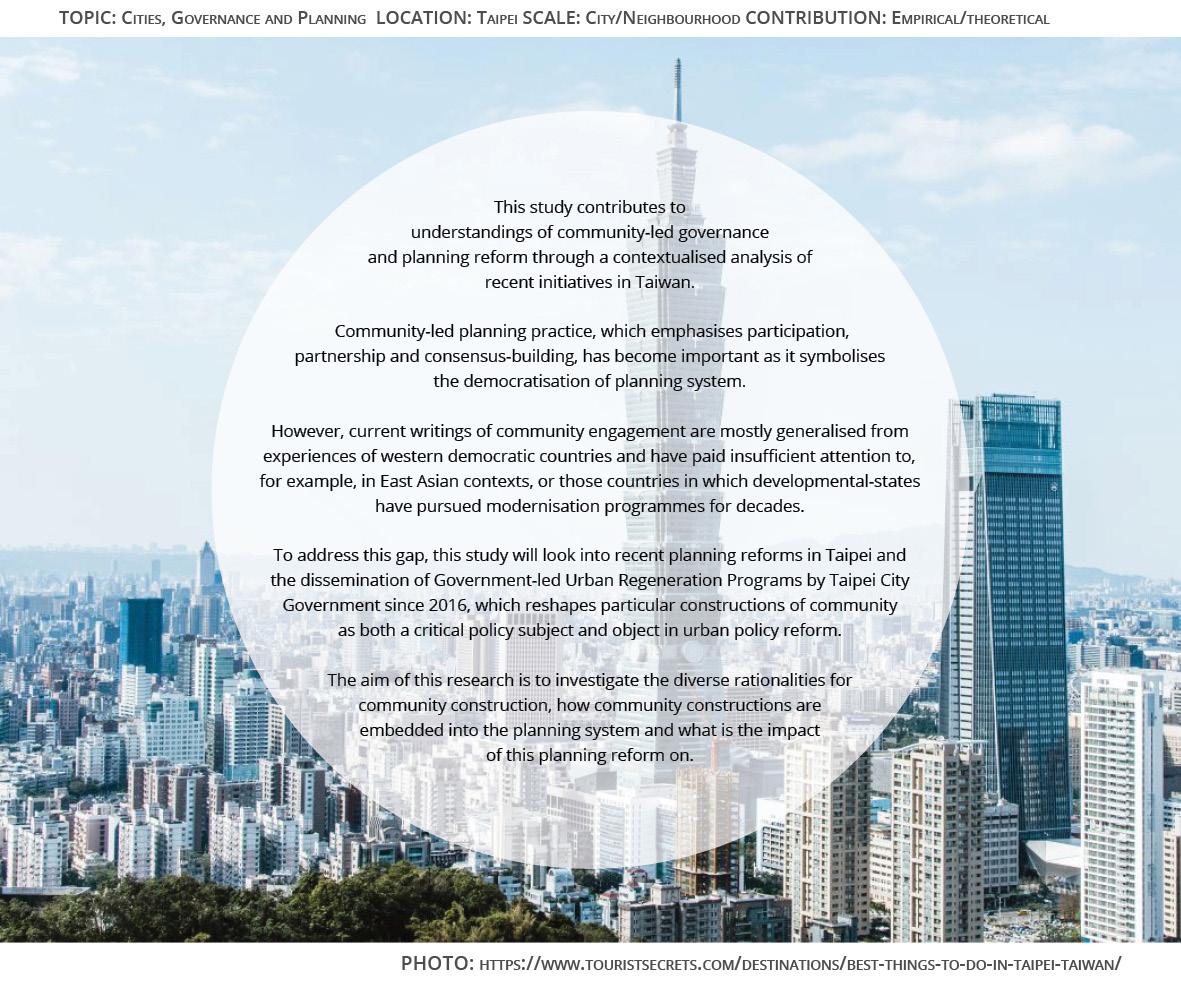
122
Community-led
Primary supervisor: Professor Mike Raco
Secondary supervisor: Dr Susan Moore
YING-CHUN HOU

PhD
A Flourishing Smart City for Entrepreneurs? Evolution of Urban Technological Innovation Pattern in the Digital Age
Lin-Fang Hsu
A Flourishing Smart City for Entrepreneurs? Evolution of Urban Technological Innovation Pattern in the Digital Age
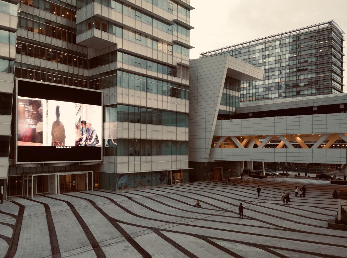
Innovation and entrepreneurship have been described across history as key drivers of regional growth (Schumpeter 1934; Lambooy 2002; Boschma and Martin 2010). As such, numerous scholars have argued that the creative competencies of economic agents or markets can lead to economic evolution (Metcalfe 2006).
In the last decade, we witnessed a significant increase in the development of Information and Communication Technologies (ICTs) and Digital Technologies. In parallel, a variety of technological applications have emerged in cities, leading to signifincant transformations in urban innovation and a new trajectory for urban development. IBM, the multinational technology company, introduced the concept of ‘Smart Cities’ to the global market in 2008, contributing to its rising popularity (Willis and Aurigi 2017). As a result, the understanding that cities are engines of creativity and innovation has become more prevelent than ever. The demand for technology-dependence in cities located in emerging markets creates a new opportunity for hightech entrepreneurs to florish (Kummitha 2019). In addition, this demand has been said to open up a ‘window of locational opportunity’ (Stoper 1997; Boschma 1996) for regions to develop new technologies that can drive industrial transformation.
PhOTO: by lIn-Fang
123
TOPIC: Urban EvOlUTIOn lOCaTIOn: TaIPEI, TaIwan SCalE: METrOPOlITan rEgIOn COnTrIbUTIOn: ThEOrETICal, EMPIrICal
hSU
LIN-FANG HSU
Primary supervisor: Dr Jung Won Sonn Secondary supervisor: Dr Juliana Martins

Shaping Imaginary Geographies into Inclusive Cities
Shaping imaginary geographies into inclusive cities.
Approaching inclusive urban design for London’s rough sleepers
Elisabeta G. Ilie
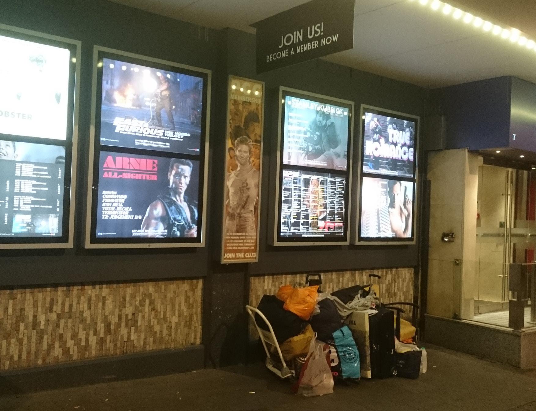
The current debate around inclusive urban design focuses predominantly on physical accessibility to the built environment. In doing so, it perpetuates broad social stereotypes of normality and order when using public space and engages only partially with groups experiencing spatial exclusion. As a result, in its present form inclusive urban design falls short from meeting its overarching goal: designing cities for all.
This research challenges taken-for-granted notions of inclusion by and through urban design, as well as the discipline’s working methodology which is unsuccessful in delivering tailored solutions due to a limited understanding of marginalised individuals’ lived experiences and resulting needs. The research hereby attempts to rephrase the conversation about what and who belongs in urban public space and goes on to explore an alternative theoretical framework for an altogether more inclusive urban design approach. In order to achieve this, the present work builds on sociological theories of phenomenology and socio-cultural production of space and of a socially different Other.
To probe the proposed framework, the research works with the case study of urban rough sleepers in London. The lessons drawn from this exercise inform tailored tools and solutions when designing public spaces inclusive of the study group, as well as more general guidelines for an inclusive urban design process.
PHOTO:
124
THEORETICAL
TOPIC: URBAN DESIGN LOCATION: LONDON SCALE: CITY CONTRIBUTION: CONCEPTUAL /
ILIE (2015)
BY E. G.
Primary supervisor: Dr Filipa Wunderlich Secondary supervisor: Professor Matthew Carmona
PhD PhD
ELISABETA ILIE


PhD
Financialising urban development in China
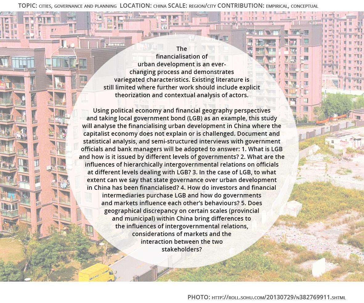
Primary supervisor: Professor Fulong Wu
Secondary supervisor: Dr Fangzhu Zhang
125
LI
ZHENFA

Manchester Regime after Recession: City Leadership, Entrepreneurial Regeneration and Market Sustainability
Manchester Regime after Recession: City Leadership, Entrepreneurial Regeneration and Market Sustainability
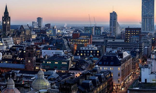
This research intends to expand the important debate on the state-market relations highlighting the role of municipal governance through regeneration strategies to shape office market in Manchester as well as to critically assess the claim of Manchester City Council that the city has been economically transformed with a strong leadership and successful regeneration developments in the setting of municipal entrepreneurism and public-private partnerships since the 1970s.
This research examines the decision-making process that extends the focus from local authority planners as market actors to political policy-makers that fills the gap of lacking sufficient discussions on the role of municipal leadership in moulding property market through regeneration strategies.
The construction of new regeneration office index sheds light on the market impact of planning policies within a conceptual framework of market sustainability, which encompasses three essential indicators - mature marketability, economic resilience and competitiveness for investment.
This research indicates there is positive connectivity between the local planning policies and property market behaviour. The landscape and evolution of office market can be seen as a political product created through regeneration developments.
126
TOPIC: CITIes, Real esTaTe and eCOnOmIC develOPmenT ReseaRCh GROuP |sCale: CIT y |COnTRIBuTIOn: emPIRICal, COnCePTual/TheOReTICal
PhOTO: sImOn ausTIn
Chien-Ling Lo
Primary supervisor: Professor Claudio De Magalhaes Secondary supervisor: Professor Mike Raco
CHIEN-LING LO PhD PhD


PhD
Frameworks for Urban Conservation: Social Equality in Mexican Historic Centres of Mexico City and Guadalajara.

Primary supervisor: Dr Elisabete Cidre
Secondary supervisor: Professor Claudio De Magalhaes
127
MONICA LOPEZ FRANCO

PhD PhD
Territorial governance and planning of urban circularity in shrinking cities
Territorial governance and planning of urban circularity in shrinking cities
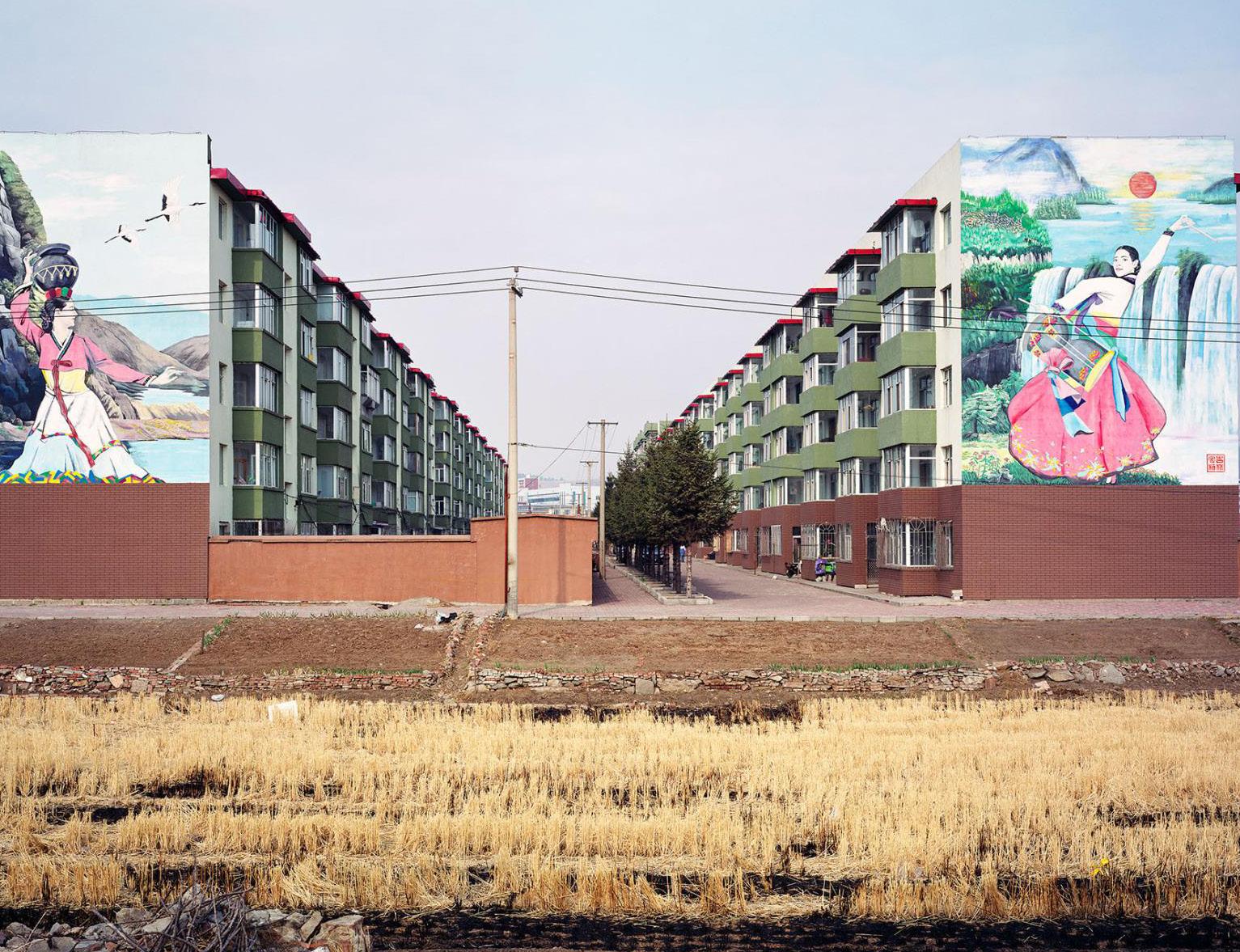
The world of today faces unprecedented pressure on its resources in the face of climate change while cities represent particular hotspots of resource consumption and waste generation. Accordingly, departing from the linear model of resource consumption and transitioning to circular urban systems becomes an imperative for cities around the globe.
With the abundance of vacant land, shrinking cities provide a fertile ground for the development of urban circularity. Meanwhile, urban circular activities can be an important, yet unexplored asset in tackling shrinkage.
However, in shrinking cities, a wide spectrum of coalitions and the actual interplay of power, normative settings, and different actors’ interests generate specific traditions and cultures which lead to a hegemony of certain narratives about the nature of urban problems, their causes, and possible solutions. The central issue of transitioning to urban circularity in shrinking contexts, therefore, concerns the efforts to involve a huge variety of stakeholders and to align their expectations and ambitions.
Consequently, the question of how different actors come together and work to deliver the transformation of an urban ecosystem of a shrinking city needs to be put under further scrutiny. On that account, this research aims to examine the dynamic and evolving linkages and processes that characterise the governance of urban circularity in shrinking cities.
128
hTTPS://www.NaTIONaLGeOGRaPhIC.COm/CuLTuRe/2019/01/yOuNG-LONeLy-heaRTS-mILLeNNIaL-NORTheaST-ChINa-ShRINkING-CITIeS/
TOPIC: STIC ReSeaRCh GROuP LOCaTION: PaRkSTad (NL) & TeeSSIde (uk) SCaLe: CITy ReGION CONTRIBuTION: emPIRICaL PhOTO:
Marjan Marjanović
Primary
supervisor: Dr Joanna Williams
Secondary
supervisor: Professor Claire Colomb MARJAN MARJANOVIC

PhD
Eventual urbanism, an enquiry on sociomaterial participation
Eventual Publics: an enquiry on socio-material participation in El Campo de Cebada, Madrid

This research begins with a speculation: what if, rather than thinking about public participation as an instrument of planning and urban design, we consider it a socio-material performative phenomenon; in other words, what if, rather than trying to design, organize, devise or implement public participation, we understand it as something that already happens in everyday urban ordinary practices.
To develop this dissertation from this point of departure, I focus on ‘eventual publics’, a concept that combines the idea of ‘eventual urbanism’—which accounts for practices developed in temporarily used urban sites—and the pragmatist understanding of a public as a ‘set of actors affected by an issue and organised around it in order to solve it’. In particular, the research analyses the case of El Campo de la Cebada—a publicly owned urban site in Madrid managed by a heterogeneous group of people—and concentrates at the specific relationship between temporality and materiality. Drawing on an STS perspective—and particularly using ANT—the argument is built around three questions:
How are communities and collectives formed?
How is conflict managed?
And how are care practices deployed?
Primary supervisor: Professor Yvonne Rydin
Secondary supervisor: Dr Tse-Hui
129
TOPIC: GOvernanCe and PlannInG lOCaTIOn: SPaIn, eurOPe SCale: neIGhbOurhOOd/dISTrICT COnTrIbuTIOn: emPIrICal
PhOTO: JOrGe marTín SaInz de lOS TerrerOS
Jorge Martín Sainz de los Terreros
JORGE MARTÍN SAINZ DE LOS TERREROS
Teh

PhD PhD
Democratisation of the Serbian urban planning system
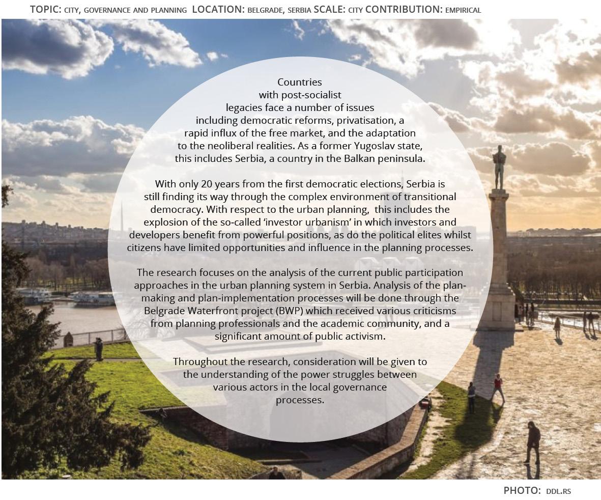
Primary supervisor: Dr Ben Clifford
Secondary supervisor: Dr Jessica Ferm
130
ALEKSANDRA MILENTIJEVIC

PhD
Deconstructing the Lebanese-Syrian borderscape through waiting and temporality
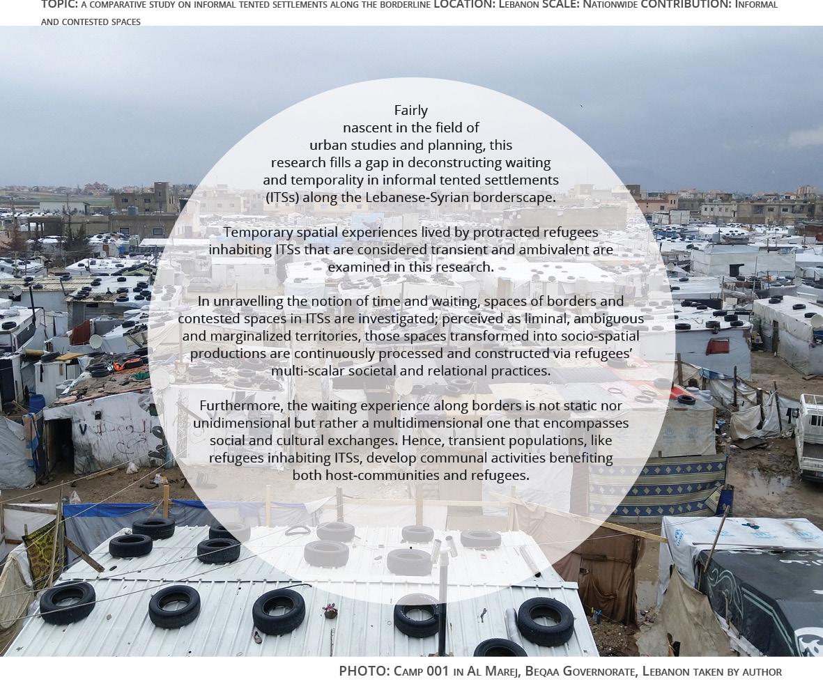
Primary supervisor: Dr Lauren Andres
Secondary supervisor: Professor Mike Raco
131
PAUL MOAWAD

From ‘void’ to ‘voidness’: a trans-scalar and relational approach to urban voids in post-industrial cities. Learning from Eleonas, Athens, Greece
From ‘void’ to ‘voidness’: a trans-scalar and relational approach to urban voids in post-industrial cities. Learning from Eleonas, Athens, Greece
TOPIC: urban vOIds, POsT-IndusTrIal CITIe, urban mOrPhOlOgy, urban meTabOlIsm, urban POlITICal eCOlOgy
lOCaTIOn: aThens, greeCe sCale: regIOnal COnTrIbuTIOn: dIsCIPlInary, meThOdOlOgICal, PlannIng PraCTICe
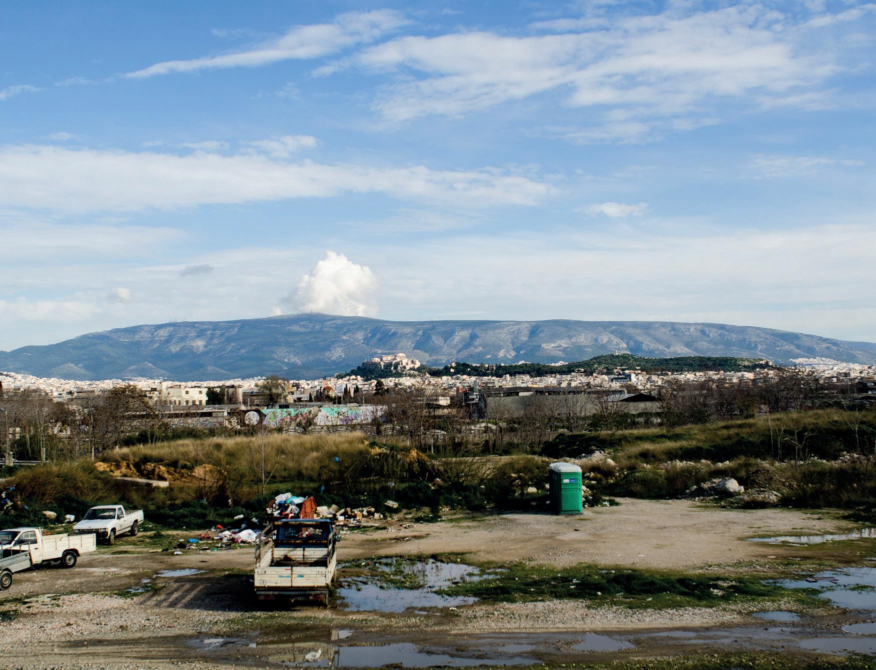
Post-industrial urban environments are often constituted of a patchwork of urbanisms that result in the creation of urban voids; large inactive and neglected areas where key spatial, social and environmental factors are ignored.
Highlighting the importance of a relational and trans-scalar approach to planning, this thesis uses the ‘urban void’ known as Eleonas in Athens, Greece to investigate the idea that there is a transformative function proper to these spaces. This function, termed ‘voidness’ is defined as the capacity of urban voids to induce transformative urban change across scales and across urban form, activities and socio-economic contexts. Hence, throughout this thesis there is a gradual shift from the investigation of an epistemological object: the ‘urban void’, to the exploration of an ontological process: the ‘voidness’ and its implications in daily life and planning practice.
Drawing from the disciplines of Urban Morphology, Urban Metabolism and Urban Political Ecology, I trace the transformation of Eleonas in space and time and track how the notion of the ‘void’ is conceptualised at the scales of the region, the municipality and the neighbourhood. Using mappings, observations and interviews with policy makers, residents, local workers and academics I examine under what conditions areas are perceived as ‘voids’ and how this affects the decision-making of the local planning administrations. Furthermore, I explore the derelict and decaying morphology of urban voids, the dwindling local economic activity, the conflicts between local reality and regional planning and critically addresses the dismissal of these spaces as ‘backyards for unwanted uses.’
132
PhOTO: dImITrIOs PanayOTOPOulOs-TsIrOs
Dimitrios Panayotopoulos-Tsiros
Primary supervisor: Dr Susan Moore Secondary supervisor: Professor Camillo Boano
DIMITRIOS PANAYOTOPOULOS-TSIROS
PhD PhD

PhD
Economic rent, inequality and public revenue - the Singapore model
Economic rent, inequality and public revenue - the Singapore model.


Singapore has experienced rapid economic growth and development since independence, ensuring that its well educated citizens can participate fully in the modern technological information economy. It is known for its low regulation, free market approach; however, beneath the surface, following systematic land acquisition, the government has controlled and directed land use to ensure affordable housing, and well connected industrial and commercial space to attract multinational companies in strategic sectors. At the same time, a leasehold system of ownership has generated significant public revenue streams from land values, while enabling 90% of the population to become homeowners, with 80% in public housing.
Through government ownership of development companies, utilities and other corporations, additional revenue is generated from unconventional sources to keep personal and consumption taxes low. The system is an outlier, when compared to conventional systems of taxation adopted by most developed economies, yet it accords with the theoretical perspective of Smith, Ricardo and George amongst the Classical economists. This thesis will explore the origins of the system, whether it was driven by theory, ideology or pragmatism; how the political economy accommodated its introduction, and how it has adapted over time. It will examine in detail the revenue streams collected, and how they are reported. It will test an hypothesis, that not only has the system brought development, but also delivered greater equality of wealth distribution, conforming with Piketty’s measure of an ideal society. Significant problems, including a large and temporary foreign workforce who do not enjoy the same benefits as citizens, as well as active suppression of opposition voices will not be ignored in the analysis. However, the aim is to identify any lessons that might be adopted by other countries to reduce inequality, ensure affordable housing, and defuse populist and disruptive tendencies in their polities.
Primary supervisor: Professor Nick Gallent
Secondary supervisor: Dr Josh Ryan-Collins
133
TOPIC: CITIes, Real esTaTe and eCOnOmIC develOPmenT lOCaTIOn: lOndOn sCale: CITy sTaTe COnTRIBUTIOn: emPIRICal
PHOTO: dROnePICR
Andrew Purves
ANDREW PURVES

PhD PhD
Urban agriculture projects under the constrains of Neoliberalism: networks, discourses and story-lines in Santiago, Chile
Urban Agriculture Projects under the Constrains of Neoliberalism: Networks, Discourses and Story-lines in Santiago, Chile
Ruth Sepulveda Marquez
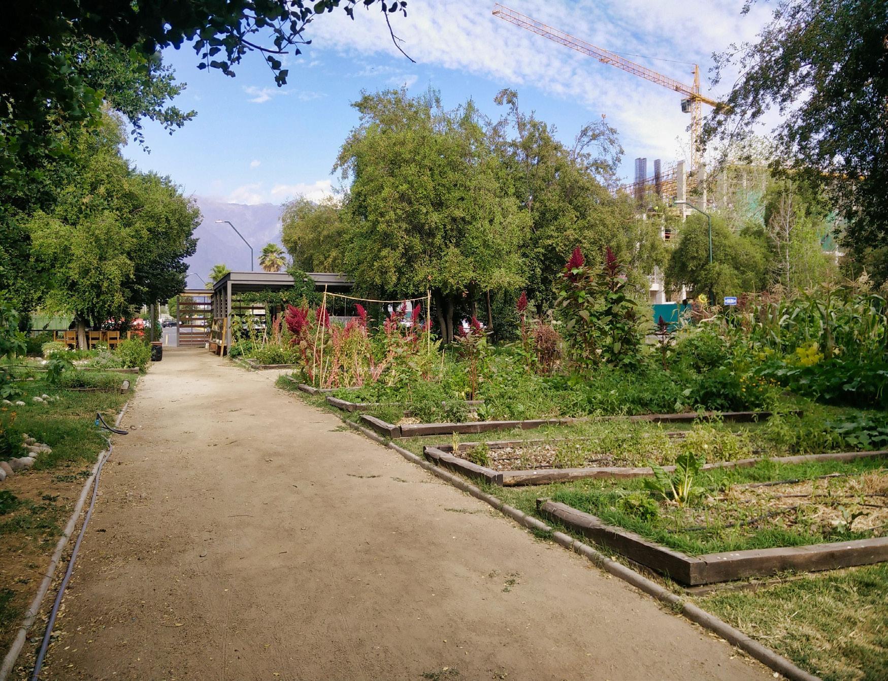
The neoliberal economic and political scenario in Chile, which promotes corporatism, has constantly excluded civil society from decisions regarding sustainability and urban planning. Despite their disadvantaged position, community actors have developed their strategies to communicate their ideas about the environment and social inequality. Urban agriculture emerged in Santiago in times of political conflict and has been used by the community as a platform to raise awareness about social, economic and environmental problems. Due to their relegated position in the society and their work in sustainable issues, urban agriculture groups present an interesting case to understand the position and opinion of civil society in a neoliberal context, especially when most gardens are located in municipalities of low socioeconomic level.
The research analyses the networks and discourses established by civil society in urban agriculture concerning the environment and neoliberalism in Santiago. Through a study case approach with Santiago as the main research area, the study is based on the interviews of 20 groups from different municipalities in the region.
Primary supervisor: Dr Yvonne Rydin
Secondary supervisor: Professor Claudio De Magalhães
Sponsor: Becas Chile
134
TOPIC: SuSTaInable, TranSPOrT, InfraSTruCTure & CITIeS lOCaTIOn: ChIle SCale: regIOn COnTrIbuTIOn: emPIrICal
PhOTO: ruTh SePulveda marquez
RUTH SEPULVEDA MARQUEZ

The Curated City: Exploring Urban Curation Practices
The Curated City: Exploring Urban Curation Practices
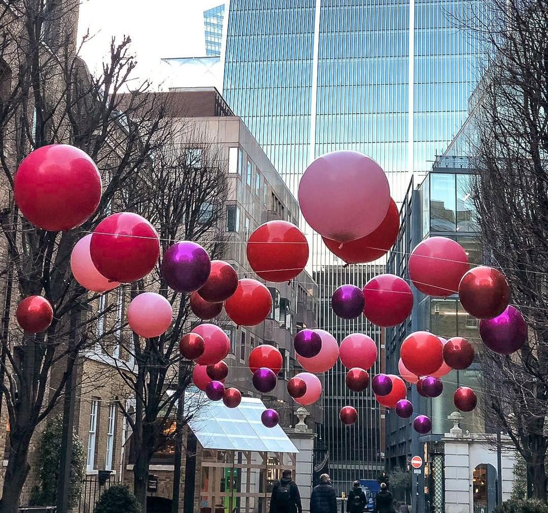
This study explores the under researched phenomenon of urban curation. Urban curation emerges from the interplay between various urban actors (individuals, communities, businesses and policy makers) who are participating in curatorial practices initiated and led, for the most part, by large corporations.
These strategies aim to nurture the lifestyles and desires of a certain cohort – the New Elite, within the setting of the experience economy. Within this framework, creation and extraction of values is co-produced through the interaction between consumers and producers. The experience economy has been the subject of urban studies over recent years, highlighting the shift in focus from cities as production clusters to ‘stages’ of consumption activity and spatial destinations.
Beyond traditional curation, this set of practices has been applied in the co-working domain. Co-working spaces have become a global phenomenon and recent studies show that the co-working concept has been shifting from being rooted in socio-economic motivations towards increasingly embracing a corporate, for profit, outlook. The notion of The Curated City suggests a scaling up that extends beyond the workspace into the urban, and from work to other spheres of everyday life.
Primary supervisor: Dr Sonia Arbaci
Secondary supervisor: Dr Juliana Martins
135
TOPIC: CITIes,GOvernanCe,PlannInG lOCaTIOn: UK,Israel sCale: Urban COnTrIbUTIOn: emPIrICal,TheOreTICal,meThOdOlOGIC
PhOTO: PICUKI
Rotem Shevchenko
ROTEM SHEVCHENKO
PhD

PhD PhD
Urban redevelopment in China - a case study of Guangzhou

Primary supervisor: Professor Fulong Wu
Secondary supervisor: Dr Fangzhu Zhang
136
MANQI WANG

PhD
The Role of Institutions in the Evolution of Traditional Industrial Agglomerations

137
XIANGYU WANG
Primary supervisor: Professor Fulong Wu

Migrants’ attitudes towards social integration in urban China
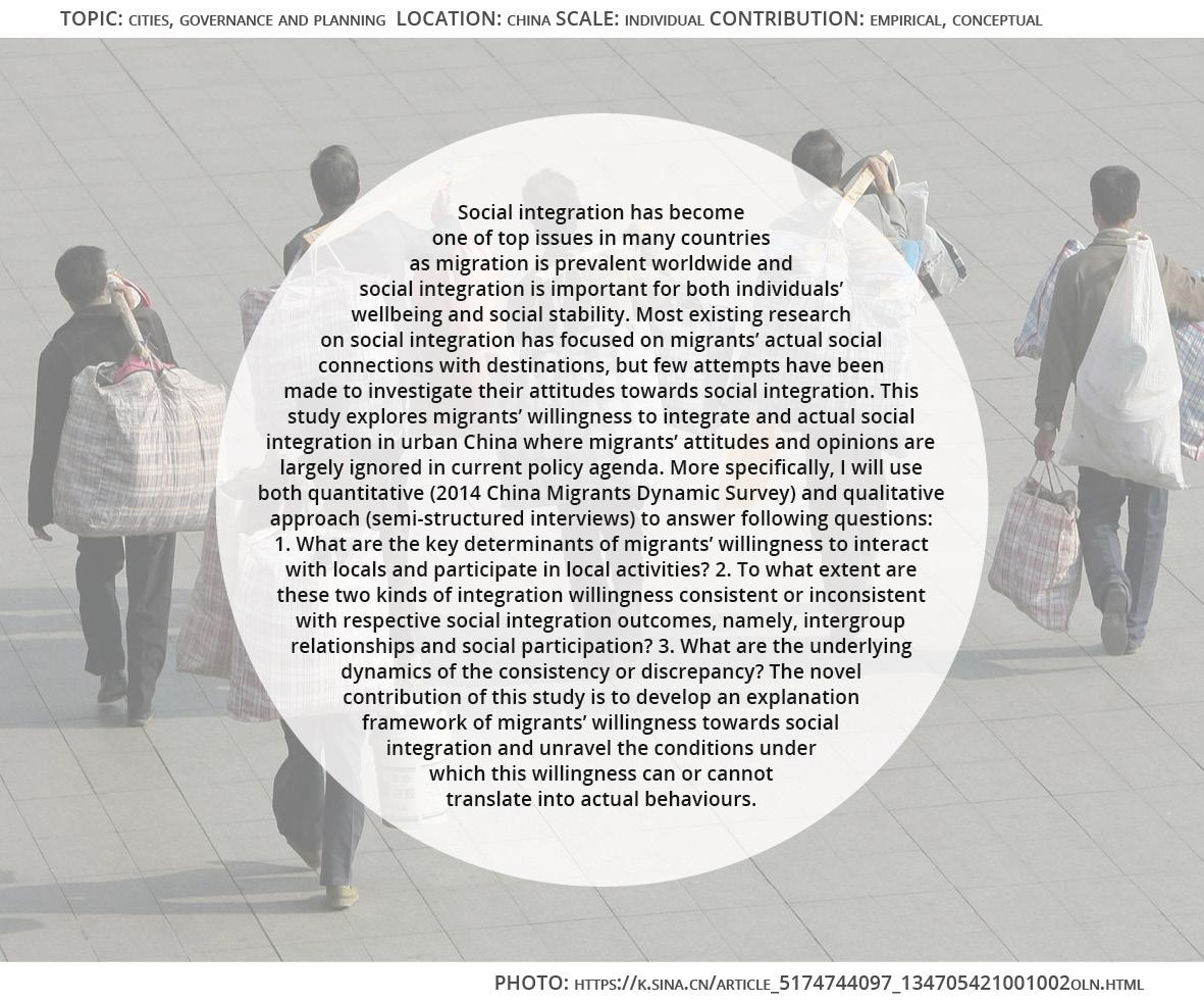
Primary supervisor: Professor Fulong Wu
Secondary supervisor: Dr Susan Moore
138
MENGRAN XU
PhD PhD

PhD
Towards better understanding of metro system resilience from joint perspectives: an intra-urban study of Greater London
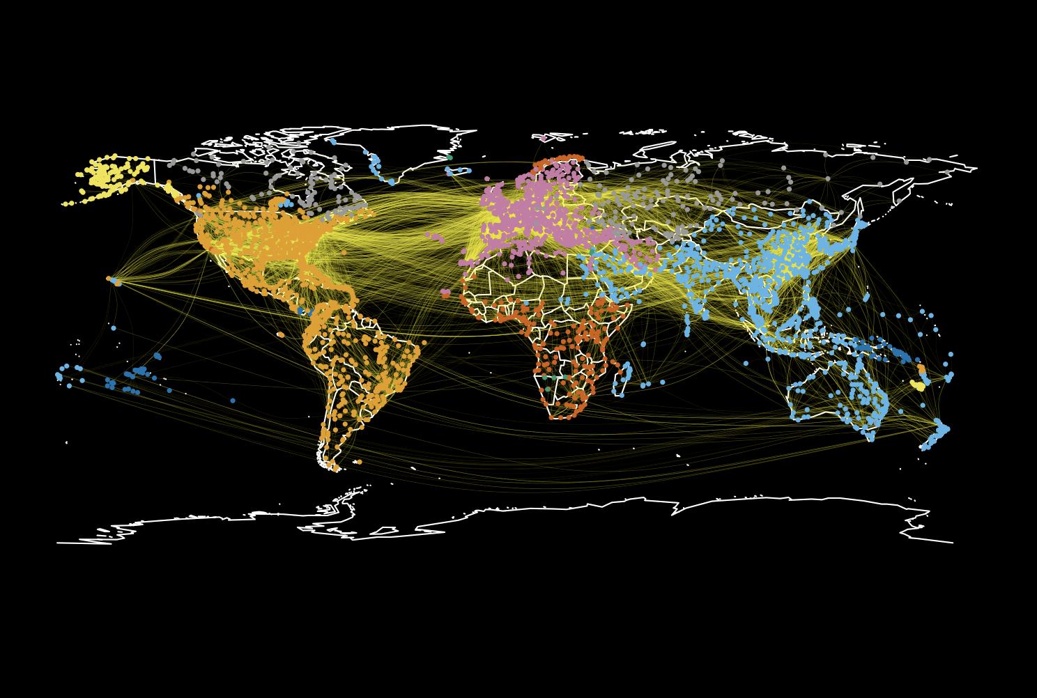
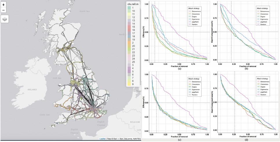
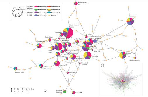
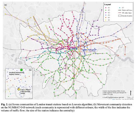
Primary supervisor: Professor Stephen Marshall
Secondary supervisor: Dr Ed Manley
139
Fig. 2 UK railway networks resilience based on the percoaltion model (the efficiency and passenger-based giant component size is caculated by ResilienceNet).
Fig.3 Community detection based on Louvain algorithms based on Oyster card data
YUERONG ZHANG

PhD PhD
Understanding social production and construction of public space from the perspective of public- private dynamics: A case study of Shanghai
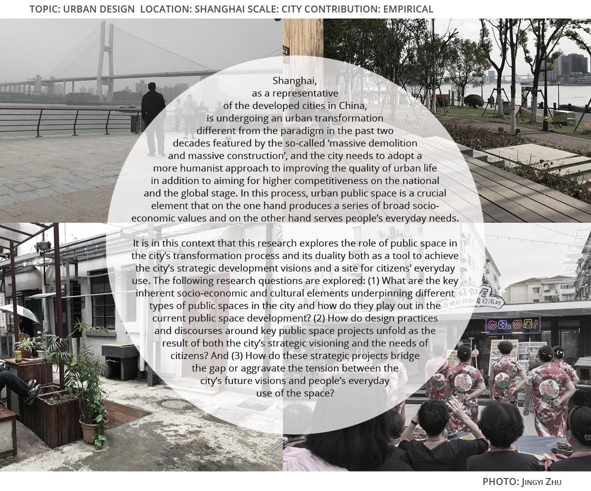
140
Primary supervisor: Professor Matthew Carmona
Secondary supervisor: Dr Pablo Sendra
JINGYI ZHU

PhD
Building innovation under China’s evolving urban governance: A case study in Shanghai
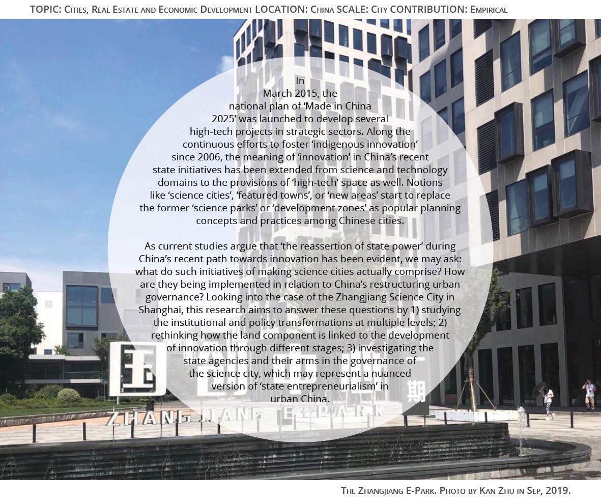
141
ZHU
KAN
Primary supervisor: Dr Fangzhu Zhang
Secondary supervisor: Professor Fulong Wu

142

CONTINUING PROFESSIONAL DEVELOPMENT

CPD
Programmes
CPD
Coordinator
Dr Pablo Sendra
Community Partners
Granville Community Kitchen (Leslie Barson)
Collaborators
CivicWise
Other Tutors and Guest Speakers
Domenico Di Siena
Nicolas Fonty
Toby Laurent Belson
Michael Edwards (Just Space)
Civic Design CPD 2020
The Bartlett School of Planning, University College London
Students
Afag Ahmadova, Norah AlOmair, Alice Anderson-Gough, Elizabeth Awoyemi, Mary-Anne Cooper, Carlos Peraita, Chris Rea, Dolors Vila, Deirdre Woods
Course Coordinator
Pablo Sendra
Community Partner
Granville Community Kitchen. Leslie Barson
Brief design
Pablo Sendra (UCL) and Leslie Barson (Granville Community Kitchen)
Co-design methodology used in the course
Pablo Sendra and Domenico Di Siena, building on Di Siena’s Civic Design Method
Collaborators
CivicWise
CIVIC DESIGN 2020
Tutors and guest lecturers
Domenico Di Siena, Nicolas Fonty, Toby Laurent Belson, Michael Edwards (Just Space)
Introduction
In this course, students and participants learn how to run a co-design process, better enable civic engagement and involve communities in decision-making. This is a blended course for planners, urban designers and architects working in practice, consultancy, as freelancers, or in local authorities. The course is ideal for those involved in co-design processes and community engagement. This is a CPD course delivered at The Bartlett School of Planning, which has been taking place since 2018. From 2020/2021, the Civic Design CPD will run in parallel with the postgraduate module BPLN0103 Civic Design, which will share content, structure, community partners and brief with the CPD.
The Civic Design CPD is a course at University College London, developed in collaboration with CivicWise and, in its 2020 edition, with Granville Community Kitchen. The short course aims to equip students with methods and tools to run co-design processes, enable civic engagement and involve communities in decision-making. Additionally, participants experience working in collaboration with community representatives and groups. During the course, students have worked in a brief that has been previously agreed with the community. From this collaboration, students learn to respond to the community needs, and the community groups receive a useful document for them.
The Brief
This year, students have worked with various community organisations and residents that use the community buildings Granville and Carlton in South Kilburn Estate. The students collaborated with community members for developing the coursework. This included designing a route map of how a co-design process should be conducted to ensure it represents the voices of residents and comminity organisations in the decision-making process. Secondly, they worked with community members on the co-production of evidence on topics such as memories around the buildings, activities that have taken place and the current governance structure. Thirdly, the students co-designed a proposal for the spatial design, activities and services to be hosted, and community-led management for the two buildings.
Civic engagement is now considered to be a key process in urban design and planning practice. For avoiding ‘box-ticking’ engagement processes that do not genuinely involve communities in decision making, it is essential to learn and experience how to work in collaboration with communities.
Brief History of Granville and Carlton
Delivered in collaboration with community groups across London, the UCL Civic Design course will:
The Granville was built in 1888 by the St Johns Woods Presbyterian Church as a Mission Hall to help the poor of Kilburn. During the 1950s The Granville was sold to the local authority, and spent much of the 1990s and 2000s as part of Brent Youth and Community Service. The Carlton was built as a primary school in 1910; when the school closed, it became an Adult Education Centre until 2017, when the charity ULFA Aid occupied it.
· Equip participants with methods and tools to run co-design processes, enable civic engagement and involve communities in decision-making.
· Expose participants to the direct experience of working in collaboration with community groups.
In 2016 Brent Council Cabinet voted to demolish both buildings, but the community fought back, and that decision was rescinded after a campaign. As a response to this, a new group was formed by the Council of stakeholders to decide on the future of the buildings with the Council. In 2019, the Cabinet approved a regeneration scheme that included the demolition of one of the historial parts of the Granville, and the contruction of new homes. This happaned despite the opposition of some of the user organisations in the buildings that are part of the stakeholder group.
During the course you will undertake a group project together with a London community group. The brief for the course will be previously agreed with the community groups and it will address some of the current needs of the community. The project is guided by tutors from the Bartlett School of Planning, UCL and offers you the opportunity to learn through direct experience of including communities in the decision-making process.
Elevation of historical buildings Grandville and Carlton from Granville Road.
Co-Design Route Map
This course is delivered in collaboration with CivicWise (http://civicwise.org), an international community of professionals working on tools and projects for civic engagement. The course will provide participants the opportunity to connect with this network of professionals.
The co-design route map was created in collaboration between course participants and community members. The aim was to map out how a co-design process should be conducted.
Towards a Community Plan for Granville & Carlton Students: Afag Ahmadova, Norah AlOmair, Alice Anderson-Gough, Elizabeth Awoyemi, Mary-Anne Cooper, Carlos Peraita, Chris Rea, Dolors Vila, Deirdre Woods
144
Co-producing evidence: mapping memories, activities and organisations
What are your memories of Carlton and Granville? What activities take place at Carlton & Granvielle and what services are provided?
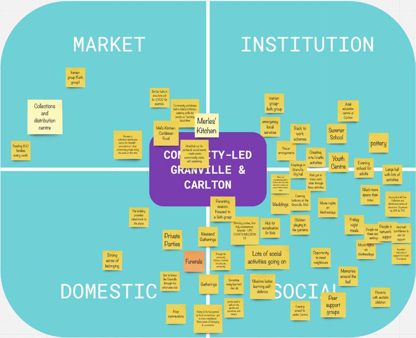
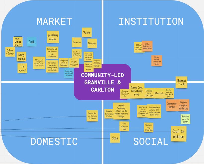
Proposal co-produced during the Civic Design CPD
Potential impact of the redevelopment on these memories and activities:
Proposal co-produced during the Civic Design CPD
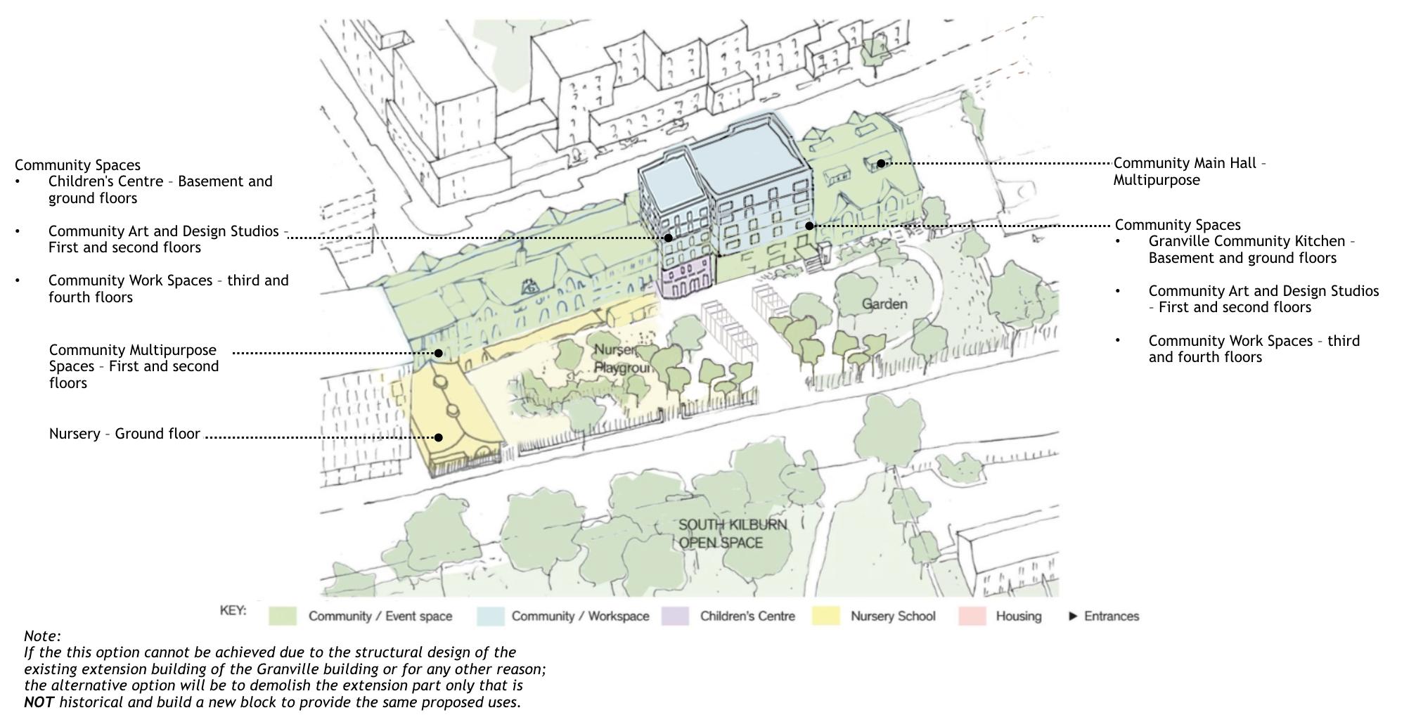
Proposal for a community-led governance model: “for us, by us”
Proposal compared to Brent Council’s proposal
Proposal compared to Brent Council’s proposal
Proposal co-produced during the Civic Design CPD
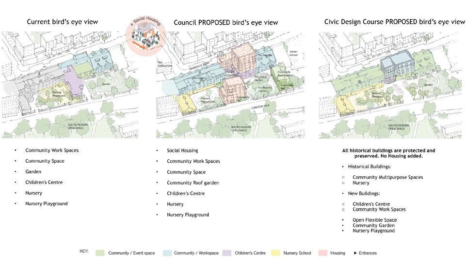
Proposal for public space design
Proposal for public space design
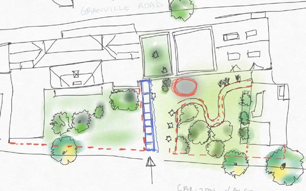
and Hall authority, The Adult fought group the demolition happaned the and conducted.
Meanwhile use/FLexible space This space could be used for market stalls, events and outdoor activities. A shared space for everyone to have access to. Market stalls direct connects to food - a major identity for Graville and the area. It would re-inforce the building as a place for local community add food. This flexible open space could also increase the garden amenty space where more planting could be introduced. to the space. 3. Community Garden A shared space for everyone diversity of uses. A play area for childrens centre. It would be located (Basement) floor people to play and Light seperation from the Nursery to the garden. For safety reasons, It creates a buffer and shield the nursery away from the public RETAIN EXISTING TREES Public Realm interventions Community Garden A play area for children in connection with the It would be located on the lower ground (Basement) floor as a safe place for young people to play and learn and horticulture. FLEXIBLE SPACE RETAIN EXISTING TREES Public Realm interventions This space could be used for market stalls, events and outdoor activities. A shared space for everyone to have access to. Market stalls direct connects to food a major identity for Graville and the area. It would re-inforce the building as a place for local community add food. This flexible open space could also increase the garden amenty space where more planting could be introduced. to the space. 3. Community Garden A shared space for everyone to have access and ecourage diversity of uses. A play area for children in connection with the childrens centre. It would be located on the lower ground (Basement) floor as a safe place for young people to play and learn and horticulture. reasons, It creates a buffer and shield the nursery away from the public Hall authority, The Adult fought group the demolition happaned the and conducted.
Meanwhile use/FLexible space This space could be used for market stalls, events and outdoor activities. A shared space for everyone to have access to. Market stalls direct connects to food a major identity for Graville and the area. It would re-inforce the building as a place for local community add food. This flexible open space could also increase the garden amenty space where more planting could be introduced. to the space. 3. Community Garden A shared space for everyone diversity of uses. A play area for childrens centre. It would be located (Basement) floor people to play Light seperation from the Nursery to the garden. For safety reasons, It creates a buffer and shield the nursery away from the public Public Realm interventions Community Garden Meanwhile use/FLexible space This space could be used for market stalls, 3. Community Garden A shared space for everyone to have access and ecourage A play area for children in connection with the It would be located on the lower ground (Basement) floor as a safe place for young people to play and learn and horticulture. Light seperation from the Nursery to the garden. For safety reasons, It creates a buffer and shield the nursery away FLEXIBLE SPACE RETAIN EXISTING TREES Public Realm interventions A shared space for everyone to have access to. Market stalls direct connects to food a major identity for Graville and the area. It would re-inforce the building as a place for local community add food. This flexible open space could also increase the garden amenty space where more planting could be introduced. to the space. 3. Community Garden A shared space for everyone to have access and ecourage A play area for children in connection with the childrens centre. It would be located on the lower ground (Basement) floor as a safe place for young people to play and learn and horticulture. 145
where

CPD
Programmes
CPD
CIVIC DESIGN 2019
Learn how to run a co-design process, better enable civic engagement and involve communities in decision-making.
Coordinator
Dr Pablo Sendra
Community Partners
Granville Community Kitchen (Leslie Barson)
Collaborators CivicWise
Other Tutors / Guest Speakers
Domenico Di Siena Nicolas Fonty
Toby Laurent Belson
Michael Edwards (Just Space)
This is a blended course for planners, urban designers and architects working in practice, consultancy, as freelancers, or in local authorities. The course is ideal for those involved in co-design processes and community engagement.
Civic engagement is now considered to be a key process in urban design and planning practice. For avoiding ‘box-ticking’ engagement processes that do not genuinely involve communities in decision making, it is essential to learn and experience how to work in collaboration with communities.
Delivered in collaboration with community groups across London, the UCL Civic Design course will:
- Equip participants with methods and tools to run co-design processes, enable civic engagement and involve communities in decision-making.
- Expose participants to the direct experience of working in collaboration with community groups.
During the course you will undertake a group project together with a London community group. The brief for the course will be previously agreed with the community groups and it will address some of the current needs of the community. The project is guided by tutors from the Bartlett School of Planning, UCL and offers you the opportunity to learn through direct experience of including communities in the decision-making process.
This course is delivered in collaboration with CivicWise (http://civicwise. org), an international community of professionals working on tools and projects for civic engagement. The course will provide participants the opportunity to connect with this network of professionals.
146
Towards a Co-Design Process: An Alternative to Demolition. Students: Aggie Morris, Alice Devenyns, Cecilia Colombo, Dolors Vila, Dominic Cort, Iacovos Loizou, Irene Manzini Ceinar, Ursula Wyss

BUILT FORM
CONCEPTS
Building infill

PUBLIC SPACE

PUBLIC SPACE

MOVEMENT

Flexible reshuffling of residents through mixed flat sizes
Enhancing green spaces
Increasing common spaces through reactivation of underused areas
Permeable pathway
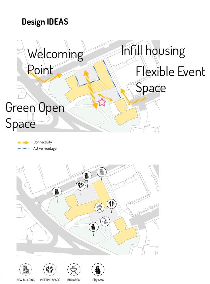
Alternative proposal to demolition: refurbishment, new infill homes and new community spaces
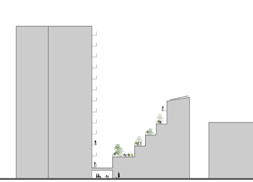
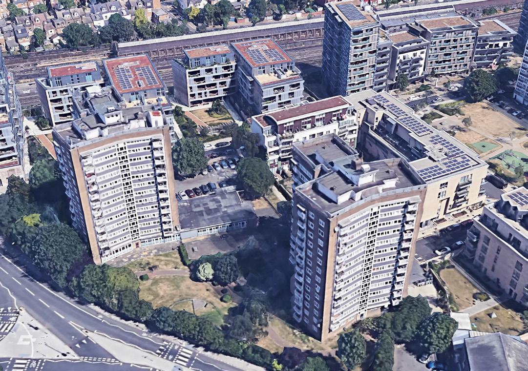
Existing building Opportunity for solar panels New infill building 7-storey for 32 new flats Proposed flexible community room to enhance the footfall of people through the new common space Private gardens for residents Open terrace open only for maintenance to keep the view quality for existing residents 6.70 m 10.00 m 13.00 m Proposed active frontages Council office 9 Opportunity for New infil Common space Opportunity to inclease allotment space Enhancing pedestrian footfal Respecting the neighbors’ privacy with a buffer zone Opportunity to enhance the existing green space with communal gardens, urban furniture and flexible shelter focommunity events Terraced gardens Approx. 370sqm Approx. 260sqm
CATEGORIES
BUILT FORM
147

148
RESEARCH AT THE BARTLETT SCHOOL OF PLANNING
The Bartlett School of Planning is a worldleading centre for research, impact and innovation. We are one of the UK’s major centres for research into the built environment and planning, and one of the leaders internationally in the field.
149

Research
RESEARCH AT THE BARTLETT SCHOOL OF PLANNING
Principal Investigator and Project Coordinator
Dr Pablo Sendra Team
Cecilia Colombo
Alice Devenyns
Irene Manzini Ceinar
Quantity Surveyor
Simon Morrow
SJ Morrow Ltd
In collaboration with Residents Association
In partnership with Granville Community Kitchen
Leslie Barson
Funded by Research England’s Higher Education Innovation Fund, managed by UCL Innovation & Enterprise
CIVIC DESIGN EXCHANGE: CO-DESIGNING NEIGHBOURHOODS WITH COMMUNITIES
Between October 2019 and March 2020, a group of researchers from University College London (UCL) has been carrying out the knowledge exchange project ‘Civic Design Exchange: Co-designing Neighbourhoods with Communities’. This project has been carried out in partnership with Granville Community Kitchen, which acts as a link between UCL researchers and the residents from two tower block in a North-West London council estate.
The estate is going through a major a regeneration scheme that involves a phased demolition and redevelopment of the whole estate. In the first masterplan that came out in 2005, these two blocks were planned to be refurbished, not demolished. In 2016, a new Masterplan Review was published, which included the demolition and redevelopment of these two blocks. When residents found out that their homes will be demolished at the end of 2016, this came as a great shock to some of the residents. The Masterplan Review 2016 proposes to demolish the two buildings, as well as other constructions on the site, and to build a new development with 213 new homes – 176 (83%) market and 37 (17%) affordable – and commercial units on the ground floor.
150

Aims of the Knowledge Exchange Project
· Through the workshops and other research methods, co-produce with residents an assessment of the impact the demolition and redevelopment of the buildings will have on the current residents.
· Through community engagement activities and workshops, as well as a survey, understand which are the main priorities for William Dunbar and William Saville houses’ residents in the regeneration of the estate, and co-produce with them a community vision for the future of their neighbourhood. In this document, we refer to this vision as the Community Plan.
· Study and assess to what extent the Community Plan meets the objectives outlined in the Masterplan Review.
Co-designing neighbourhoods with communities
· Study and assess the feasibility of the Community Plan.
· Exchange knowledge between communities and universities.

151

Research
RESEARCH AT THE BARTLETT SCHOOL OF PLANNING
Authors
Pablo Sendra
Daniel Fitzpatrick
Collaborators
Just Space
Contributors
Sarah Sackman
Richard Lee
Michael Edwards
Publisher UCL Press, 2020
Free download: https://www.uclpress. co.uk/products/125696
COMMUNITY-LED REGENERATION: A TOOLKIT FOR RESIDENTS AND PLANNERS
This book is the main output of a research project developed by Pablo Sendra and Daniel Fitzpatrick, in collaboration with Just Space and various community groups in London. The research project was funded by a British Academy/Leverlhume Small Grant. The book is published open access.
Through seven London case studies of communities opposing social housing demolition and/or proposing community-led plans, CommunityLed Regeneration offers a toolkit of planning mechanisms and other strategies that residents and planners working with communities can use to resist demolition and propose community-led schemes. The case studies are Walterton and Elgins Community Homes, West Ken and Gibbs Green Community Homes, Cressingham Gardens Community, Greater Carpenters Neighbourhood Forum, Focus E15, People’s Empowerment Alliance for Custom House (PEACH), and Alexandra and Ainsworth Estates. Together, these case studies represent a broad overview of groups that formed as a reaction to proposed demolitions of residents’ housing, and groups that formed as a way to manage residents’ homes and public space better.
Drawing from the case studies, the toolkit includes the use of formal planning instruments, as well as other strategies such as sustained campaigning and activism, forms of citizen-led design, and alternative proposals for the management and ownership of housing by communities themselves.
Community-Led Regeneration targets a diverse audience: from planning professionals and scholars working with communities, to housing activists and residents resisting the demolition of their neighbourhoods and proposing their own plans.
152
153

DESIGNING DISORDER: EXPERIMENTS AND DISRUPTIONS IN THE CITY
Authors
Pablo Sendra
Richard Sennett
Publisher Verso Books, 2020
This book is a collaboration between the sociologist Richard Sennett and the architect Pablo Sendra. It has been published by Verso in 2020, and it is currently being translated into Russian, Ukrainian, Spanish, Farsi and Italian.
In 1970, Richard Sennett published the groundbreaking The Uses of Disorder, arguing that the ideal of a planned and ordered city was flawed. Fifty years later, Sennett returns to these still fertile ideas and, alongside campaigner and architect Pablo Sendra, sets out an agenda for the design and ethics of the Open City.
The public spaces of our cities are under siege from planners, privatisation and increased surveillance. Our streets are becoming ever more lifeless and ordered. What is to be done? Can disorder be designed? In this provocative essay Sendra and Sennett propose a reorganisation of how we think and plan the social life of our cities. “Infrastructures of disorder” combine architecture, politics, urban planning and activism in order to develop places that nurture rather than stifle, bring together rather than divide up, remain open to change rather than closed off.
154
RESEARCH AT THE BARTLETT SCHOOL OF PLANNING Research
Designing Disorder


155

Research
RESEARCH
AT THE BARTLETT SCHOOL OF PLANNING
A HOUSING DESIGN AUDIT FOR ENGLAND
Research Team
Matthew Carmona
Amer Alwarea
Valentina Giordano
Anastassia Gusseinova
Fola Olaleye
Advisory Group
Richard Simmons, UCL / CPRE; Philip Box, UK Green Building Council; Ben Coleman, Chartered Institution of Highways and Transportation; Tim Hagyard and Dee Haas, CPRE (local); Sarah James, Civic Voice; Matt Lally, Arup; Paul Miner, CPRE (national); Brian Quinn and Ambreen Shah, Design Council; David Rudlin, Academy of Urbanism / URBED; Alan Stones, Urban Design Group; Andrew Whitaker, Home Builders Federation.
Supporting Consultancies
ARUP, JTP, Spawforths, URBED
With the drive to deliver more homes across the country has come a loud call for those developments to be of a high standard of design in order to deliver high quality, liveable and sustainable environments for residents. Research has consistently shown that high quality design makes new residential developments more acceptable to local communities and delivers huge value to all.
Housing design audits represent systematic approaches to assess the design quality of the external residential environment. This new audit evaluates the design of 142 large-scale housing-led development projects across England against seventeen design considerations. It provides enough data for comparisons to be made regionally and against the results of previous housing design audits conducted over a decade ago. It establishes a new baseline from which to measure progress on housing design quality in the future.
Whilst some limited progress has been made in some regions, overwhelmingly the message is that the design of new housing environments in England are ‘mediocre’ or ‘poor’. Collectively, we need to significantly raise our game if we are to create the sorts of places that future generations will feel proud to call home.
Based on the design audit and correlations with data on market, contextual and design governance factors, a number of conclusions were drawn. These concern the type of housing that is being delivered, what is going right and wrong, and why there is such a variation in practice across the country.
Drawing from the findings it is possible to make a number of recommendations for Government, Industry and Local Government.
Find out the results of the Audit here:
http://placealliance.org.uk/research/national-housing-audit/
156
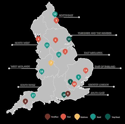

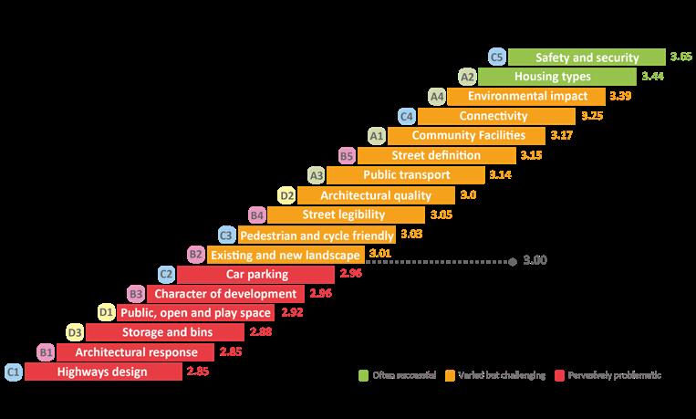
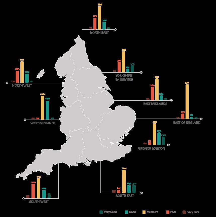
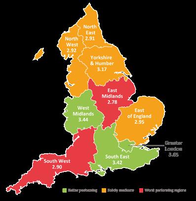
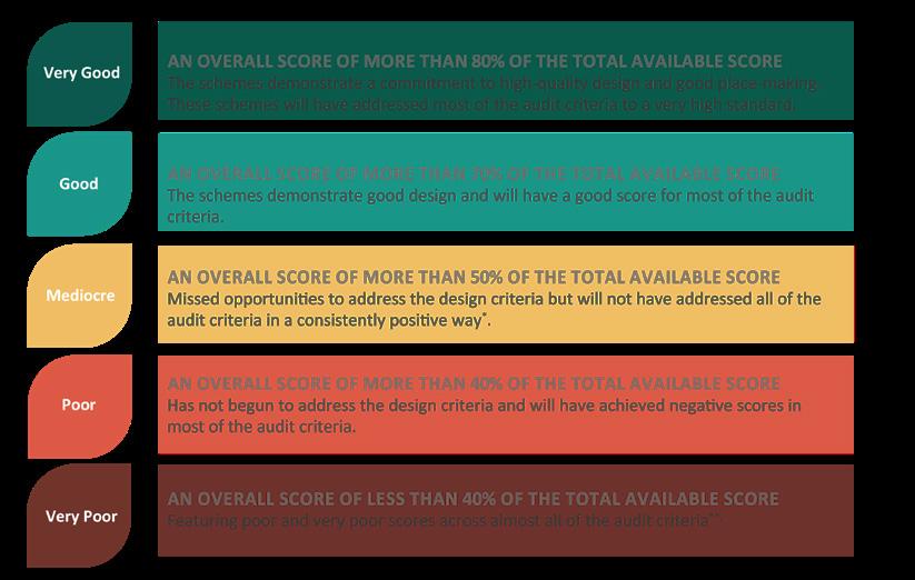
Acknowledgements:

This research was funded by UCL (Place Alliance), CPRE the countryside charity and the Laidlaw Scholarship programme. We also gratefully acknowledge contributions made by the Tanner Trust, and other generous supporters.
Special thanks go to Paul Miner (CPRE) for all his work in helping to bring the project to fruition, from inception through to dissemination.
The audit would not have been possible without the generous help, support and hard work of the Advisory group, Supporting consultancies and network of Volunteer auditors.
157

Research
RESEARCH AT THE BARTLETT SCHOOL OF PLANNING
The Laidlaw Research and Leadership Programme
Laidlaw Research Team
Anastassia Gusseinova
Fola Olaleye
Laidlaw Supervisor
Valentina Giordano
Poster Fola Olaleye
Find out more about the Laidlaw Scholarship Programme : https://www.ucl.ac.uk/ laidlaw-scholarships/
EVALUATING URBAN DESIGN GOVERNANCE
The Laidlaw Research and Leadership Programme runs alongside students’ main degree programmes at UCL. It aims to create the leaders of the future through training and six weeks of full-time research and leadership activities in their first and second summer holidays. It is open to high-performing first year undergraduate students in any discipline who have the ambition to take up a leadership position in the future and a desire to undertake research at a high level. One of the mandatory elements of the programme consists of one summer research period of six weeks when students undertake a research project supervised by a UCL academic.
In 2019 the Laidlaw research was part of a wider national project “A Housing Design Audit for England” led by Place Alliance.
18 case studies - two for each region - were chosen from the original housing audit list of 142 schemes to illustrate good vs poor examples of design quality scores and a range of development contexts: greenfield / brownfield, urban / suburban / rural, and so on. The purpose of the case studies was largely to determine the impact that local authority design governance processes had on the designed outcomes as audited.
Methodology:
· Reviewed planning applications for 134 housing developments using local authority planning portals
· Designed a short survey to identify design tools and guidance referenced in the planning applications
· Case study analysis of 18 developments for a more detailed understanding the role of design governance in influencing design outcomes
· Correlated this data with housing audit scores to identify the relationship between design governance and design outcomes
Design Governance Analysis Findings:
· Generic governance tools were used more frequently than site-specific tools.
· Schemes that used design codes were almost five times more likely to be classified as ‘good’ or ‘very good’ schemes.
· Design codes and design reviews are the most effective but less frequently used tools.
· However, neither approach alone offers a perfect solution for good design outcomes.
158
1. Pre-applica�on discussions
2. Reference to Na�onal Planning Guidance
3. Supplementary Planning Guidance / Documents covering new residen�al development
4. Community Consulta�on / partecipa�on process
5. Reference to Na�onal Highway Design Guidance
6.
8.
Community
Pre-applicaiton discussions
Design Design
National highways
BfL12
Community consultation
While governance plays an important role, other external factors can influence the pursuit of good design quality in housing across England.
Housing developments in more affluent areas scored higher than those in less affluent areas. Poor schemes were almost 10 times more likely to be located in the least affluent areas.
CONTEXTUAL DIFFERENCES
More urban, higher (although not necessarily high) density and brownfield schemes all seemingly better able to simultaneously address the seventeen design considerations.
93% 85% 83% 82% 57% 45% 24% 16% 0%
National Planning guidance
Pre-applicaiton discussions
SPG / SDG
1:1.1
1:1.2
1:1.2
While governance plays an important role, other external factors can influence the pursuit of good design quality in housing across England.
use of design governance developments
MARKET INFLUENCES
CASE STUDY SAMPLES
Housing developments in more affluent areas scored higher than those in less affluent areas. Poor schemes were almost 10 times more likely to be located in the least affluent areas.
CONTEXTUAL DIFFERENCES
More urban, higher (although not necessarily high) density and brownfield schemes all seemingly better able to simultaneously address the seventeen design considerations.
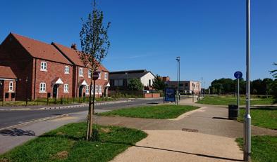
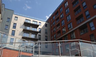
INFLUENCES developments in more affluent areas scored higher than those in less affluent areas. almost 10 times more likely to be located in the least affluent areas. DIFFERENCES

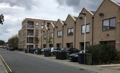
(although not necessarily high) density and brownfield schemes all
Range of housing types and sizes provided with segregated tenures.
Community facilities and public transport are well integrated and easily accessible.
Attractive hierarchy of streets and shared spaces.
Limited range of housing types and sizes; no affordable housing.
to simultaneously address the seventeen design considerations.
Limited range of housing but tenure blindness achieved to a good level.
Good mix of housing types with good energy efficiency ratings.
CASE STUDY SAMPLES
Streets and spaces are attractively designed with robust and varied materials.
Architectually distinct, reflecting the area’s heritage.
170 dwellings
Final Reflections:
CASE STUDY SAMPLES
CASE STUDY 2
the Humber dwellings
Highway design is fairly poor with secondary streets being somewhat pedestrian friendly.
CASE
Poor design and management of public open space; undermines recreational and social value.
Attempts to create a distinctive character were undermined by the poor quality of the public realm.
Insufficient car parking; cars dominate key areas and undermine pedestrian friendly environment.
CASE
Mapping the Audit scores nationally shows that the best and worst scores are widely distributed. It is clearly possible to deliver both high quality design and placemaking, as well as poor quality, across the country, in all regions. Good design outcomes will not be achieved by simply checking against a list of generic design principles; it requires a proactive and site-specific process of guidance and accompanying peer review. It requires a design governance process that is consistently applied, not only at the start when the masterplan is approved, but through all reserved matters applications and in relation to how developments are phased on site.
North West 206 dwellings
Range of housing types and sizes provided with segregated tenures.
CASE STUDY 3
West Midlands 249 dwellings
Limited range of housing types and sizes; no affordable housing.
CASE
STUDY 4
London 149 dwellings
Lack public Roads street degree.
Good of character
Limited range of housing but tenure blindness achieved to a good level.
MARKET INFLUENCES
Had a signi cant positive impact Had some positive impact Had a positive impact 1:4.8 1:3.6 1:2.4 1:1.8 1:1.3 1:1.2 1:1.2 1:1.1 Design Codes Design review
highways guidance BfL12
National
consultation
SPG
SDG
/
National Planning guidance
Fig.2 | Varying impacts of design governance tools
new residen�al development
Community Consulta�on / partecipa�on process 5. Reference to Na�onal Highway Design Guidance
Use of Building For Life 12 7. Site specific design codes 8. Design Review 9. Design policies in Neighbourhood Plans 83% 82% 57% 45% 24% 16% 0%
STUDY 4 London
dwellings
STUDY 1 Yorkshire and the Humber 170 dwellings
STUDY 3
dwellings
2
West
dwellings
4.
6.
CASE
149
CASE
CASE
West Midlands 249
CASE STUDY
North
206
4.50 5.00 5.25 2.75 2.75 4.25 5.25 3.00 2.75 3.00 3.75 1.50 1.50 1.50 2.50 1.25
Fig.1 | Frequency of use of design governance tools across all developments
159
Had a signi cant positive impact Had a positive impact 1:1.3
Fig.2 | Varying impacts of design governance
93%
Use of Building For Life 12
Site specific design codes
7.
Design Review 9. Design policies in Neighbourhood Plans 85% 83% 82% 57% 45% 24% 16% 0%
and the Humber
CASE
STUDY
1
Yorkshire
STUDY
3 West Midlands 249 dwellings
STUDY
2 North West 206 dwellings
4.50 5.00 5.25 2.75 2.75 4.25 5.25 3.00 2.75 3.00 3.75 1.50
Fig.1 | Frequency of use of design governance tools across all developments
Had a signi cant positive impact Had some positive impact Had a positive impact 1:4.8 1:3.6 1:2.4 1:1.8 1:1.3 1:1.2 1:1.2 1:1.1
able
BfL12
Design Codes Design review National highways guidance
Community consultation
Pre-applicaiton discussions SPG / SDG National Planning guidance
Fig.2 | Varying impacts of design governance tools
plays an important role, other external factors can influence the pursuit of in housing across England. Guidance Guidance / Documents covering partecipa�on process Design Guidance Neighbourhood Plans
STUDY 1

Research
RESEARCH AT THE BARTLETT
SCHOOL OF PLANNING
Funding UCL Culture: Beacon Bursaries
Project Managing
Valentina Giordano (UCL / Place Alliance)
Project Coordination and Delivery
Valentina Giordano
Simon Wasser (Sustrans)
With the help and assistance of Jenna Clarke, Executive Headteacher
Gainsbury Primary School
Find out more about Beacon Bursary: https://www.ucl.ac.uk/ culture/projects/beaconbursaries
CHILD-FRIENDLY CITY PLANNING
The streets and parks around us have a big influence on children as they grow up. Our local area is part of our personal history and our family’s history. The way streets are designed influences how we travel, socialise with others and experience the world. Learning to look at our streets – and seeing how they were designed – helps us to understand the role they play in our lives. It also allows us to think positively about how they might be improved in the future.
This project set out to explore the following question: what would a child-friendly city look like?
By involving children in a design workshop to explore this question and co-create a manifesto for a ‘child-centred future of Stratford’, the project aims are:
· Engage and educate young people (and school staff) around urban planning issues, how it impacts their lives, and how they can participate in it.
· Raise awareness among the wider public through an exhibition about children’s rights, the importance of meaningful participation and the need for more childcentred planning policy.
· Encourage children to look at the city around them and think about how it could be made more child friendly.
We originally planned to work with the School Council – a group of children from Year 3-6 who represent their peers in issues relating to the school and wider community – and the project included workshops, site visits and model-making sessions at the school. Following the Covid-19 developments, we have developed a series of activities that could be carried at out by the children at home, including an online survey and a drawing and model-making competition.
The project was carried out with the help of teachers and children at Gainsborough Primary School, Hackney. This school is next to UCL East and will be neighbours with new UCL developments in future.
160
Child-friendly Cities
The streets and parks around us have a big influence on children as they grow up. Our local area is part of our personal history and our family’s history. The way streets are designed influences how we travel, socialise with others and experience the world. Learning to look at our streets –and seeing how they were designed – helps us to understand the role they play in our lives. It also allows us to think positively about how they might be improved in the future.
This project set out to explore the following question:
What would a child-friendly city look like?
By involving children in a design workshop to explore this question and co-create a manifesto for a ‘child-centred future of Stratford’, the project aims are:
• Engage and educate young people (and school staff) around urban planning issues, how it impacts their lives, and how they can participate in it.
1. MAPPING EXERCISE
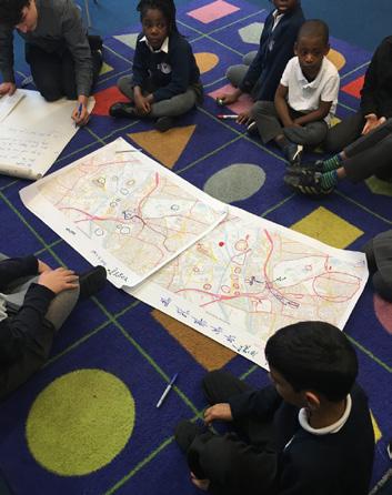
In early March the project was introduced during an all school assembly followed by a co-design workshop involving practical activities with School Council children which explored the following:
• What is urban planning and how does it impact your life?
Reference will be made to UCL EAST and developments in the area: are children aware of what is happening?
• What’s it like to be a child in Stratford? What barriers do you experience to living the life you want? (ie traffic risk and play, lack of independence in public space etc)
• If the Local Council’s were to involve children more in urban planning policy and practice, how should they do this?
• If children were in charge, how would you design your local area?
2. SURVEY/CLASS QUESTIONNAIRE RESULTS
We surveyed 61 primary school pupils (24 in-class, plus 37 online during lock-down). The questions were developed with Gainsborough school children and consisted of a mix of multiple-choice and open-ended questions, and included a small number of questions that the children had to ask their parents. The aim of the questionnaire was to encourage the children to look at their streets and see how they are designed and used, to help them understand the role they play in their lives. It also encouraged them to think positively about how they might be improved in the future.
Following the lock-down measures, as only a small number of children was able to attend school in person, we had to devised an online questionnaire which included some lock-down related questions to the online questionnaire. The results are summarised below.


What would make more kids walk or cycle to school?
• Education on the benefits of active travel and problems of cars
• Fewer cars
• Safer streets for walking and cycling
More colourful streets
• School competitions to encourage active travel
• Improved air quality
• Safer routes

Positive Lock-down CHANGES to keep forever
More walking
• More cycling
More exercising
• People caring more for their neighbours
• Fewer cars
Wider pavements
A child-friendly city MUST have…

Fewer or no cars
• Quality green space / play areas
Safe and friendly community
Safe streets and crossing points
• No rubbish • Good lighting
Freedom to be independent
A good school
Public Engagement Research
Raise awareness among the wider public through an exhibition about children’s rights, the importance of meaningful participation and the need for more child-centred planning policy.
• Encourage children to look at the city around them and think about how it could be made more child-friendly.
We originally planned to work with the School Council – a group of children from Year 3-6 who represent their peers in issues relating to the school and wider community - and the project included workshops, site visits and model-making sessions at the school. Following the Covid-19 developments, we have developed a series of activities that could be carried at out by the children at home, including an online survey and a drawing and model-making competition. The project was carried out with the help of teachers and children at Gainsborough Primary School, Hackney. This school is next to UCL East and will be neighbours with new UCL developments in future.
3. DESIGN PROPOSALS
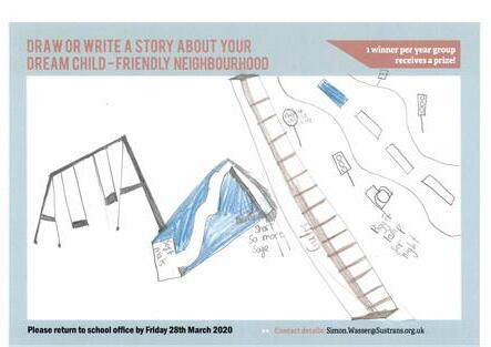
dream child-friendly neighbourhood
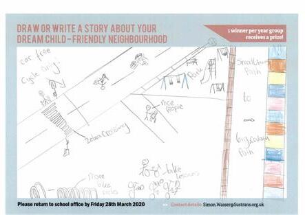
4. MODEL-MAKING
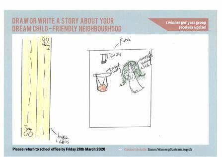


Favourite
childhood memories of parents
Playing with friends on the streets and in estates
Playing in parks and greenspaces
Less cars around
• Riding bikes Tree climbing!

How can UCL East support your child and their school?
• Free resources and workshops at the school
Listening to children’s ideas
Ensuring the area has activities for the whole community and all families, just just restaurants and bars
A child-friendly city MUST NOT have…

Too many cars / Fast cars
• Crime
Dangerous roads
Too much fast food
• Pollution
• No green space
icons by “https://icons8.com


LUKAS: “I made a bridge so people can walk across and get to the park.”


NATASHA: “I included features from my area like the twisty tower in the Olympic Park.”


ZACHARY: “I created a town hall for our city. A town hall is important because this is where the decisions are made about how to make the city safer and more child-friendly.”
CHRIS: “I wanted to make something that will keep children and adults safe. So I created a fire engine and an ambulance so if there are ever any emergencies there is someone to call.”
ILANA: “I decided to create something fun for children to do! I created a sand pit play park with a slide, a swing and some benches (left) and a zipline (right).”
ZEREN: “I decided to design a pool for our city. A pool is a good thing to include because on a hot summer’s day, children can come here and have fun with their family and friends.”
Valentina Giordano (UCL / Place Alliance) PROJECT COORDINATION and DELIVERY Valentina Giordano, Simon Wasser (Sustrans)
PROJECT MANAGING
campaigning for place quality


