MS c
URBAN DESIGN AND CITY PLANNING
PROGRAMME CATALOGUE

MS c
URBAN DESIGN AND CITY PLANNING
PROGRAMME CATALOGUE
URBAN FUTURES: An Exhibition by MSc Urban Design and City Planning
The Bartlett School of Planning, UCL
ISSN 2399-5254
Coordinator of catalogue
Pablo Sendra
Coordination team of catalogue
Alice Bennett
Marco Ng
Programme Director:
Pablo Sendra
Graphic design and content editing of the catalogue:
Alice Bennett
Marco Ng
Graphic design of the exhibition:
Alice Bennett
Marco Ng
Cover Design:
Alice Bennett
TERM 1
Design and Real Estate
Urban Design: Place Making
Urban Design: Layout, Density and Typology
Field Trip to Glasgow
TERM 2
Collaborative City Planning Strategies
Sustainable Futures by Design
Urban Design: Guidance, Incentive and Control
Field Trip to Barcelona
Programme Director
Dr Pablo Sendra
Programme Administrator
Yvonne Sibblies
Module Coordinators
Elena Besussi
Prof Matthew Carmona
Paula Morais
Colin Haylock
Richard Simmons
Prof Peter Rees
Dr Pablo Sendra
Dr Katy Karampour
Dr Filipa Wunderlich
Other Academic Staff
Prof Stephen Marshall
Dr Juliana Martins
Dr Lucy Natarajan
Dr Michael Short
Dr Tse-Hui Teh
Dr Jo Williams
Major Research Project Supervisors
Dr Elanor Warwick
Oliver Davey
Christopher Martin
Matthias Wunderlich
Tobias Goevert
Judith Loesing
Colin Haylock
Neha Tayal
Prof Peter Rees
Hugo Nowell
Ming Cheng
Elad Eisenstein
Tutors and Other Teaching Staff
Karla Barrantes Chaves
Ming Cheng
Wendy Clarke
Tom Dobson
Valentina Giordano
Isabel Gutierrez Sanchez
Marian Larragy
Rachna Leveque
Monica Lopez Franco
Sharon Molloy
Bianca Maria Nardella
Marco Picardi
Mat Proctor
Raj Rooprai
Omar Sherif
Rotem Shevchenko
Neha Tayal
Jingyi Zhu
Ivan Andonov
Jake Atkins
Nikola Babic
Alice Bennett
Zoe Brown
Maria Castilla Bravo
Harpriya Chaggar
Pieter-Jan Chielens
Jeong Hyun Cho
Rafaela Christodoulou
Bas Dijkhoff
Yiqin Du
Alice Dubot
Cynthia Espinola Cano
Matt Faraci
Rosalina Gadyuchkova
Ahmed Gele
Nethra George
Savannah Gladstone
Oscar Gregersen-Hunt
Hangning Huang
Tomasz Kopczewski
Yuri Langlois
Zhaoxi Li
Zerong Li
Huanzhou Li
Chun Wing Matthew Li
Kwame Lowe
Ho Ting Ng (Marco)
Thomas Noble
Lydia Ogden
Fabien Piesakowski-O’neill
Zilin Qin
Vasiliki Sagkovits
Raphaël Saillard
Martha Sainsbury
Deliani Siregar
Alan Smithies
Zhiyun Song
Gabriela Spangenthal
Aisha Stoll
Isabel Syrek
Ho Man Tang
Ben Tattersall
Bernard Touzet
William Turner
Flora Walker
Simon Wasser
Toby Williams
Vernise Wong
Jiaying Wu
Yiwen Yu
Rui Zhou
Guanyi Zhou
Sara Zubair
THE BARTLETT SCHOOL OF PLANNING
UNIVERSITY COLLEGE LONDON
Coordinator: Prof Peter Rees
Tutors: Bianca-Maria Nardella, Karla Barrantes Chaves
The best examples of British urban regeneration are created by collaboration between the development industry, architects and local planners. Through site visits, presentations and critical interrogation, we learn how this is achieved. The absence of municipal master-planning in the UK creates opportunity and flexibility for the development sector but requires unique planning skills to shape projects and represent the needs of the community. Students visit areas of major commercial regeneration in Central London and receive presentations from senior property professionals, architects and planners. The course demonstrates how the disciplines of master-planning, architectural design, real estate and project management combine to produce successful development projects in London, a global business city.
Student groups are assigned key Central London locations to identify the unique set of characteristics that form its identity as a place. This activity is complimented by gathering information on the location including (but not limited to) real estate data, local planning policies and community issues. These studies culminate in 10min video presentations “selling” the key attractions of the location, and its potential opportunities, to a panel of development professionals at the final session. The need for a combination of creative team-working and concise presentation mirrors the “real world” of real estate.


Coordinator: Prof Matthew Carmona
Tutors: Wendy Clarke, Raj Rooprai, Bianca Maria Nardella, Isabel Gutierrez Sanchez, Mat Proctor, Irene Manzini Ceinar, Valentina Giordano, Sharon Molloy, Dr Pablo Sendra, Monica Lopez Franc
This module draws on the extensive theoretical underpinning of urban design to:
• explore approaches to appraise the character of the built environment, and
• forward practical and even visionary proposals aimed influencing the quality, liveability and value of urban space as a key contribution to sustainable place making.
The module illustrates the potential of design as a creative problem solving process, a process necessary to deliver the types of public and private investments in the built environment that will continue to return social and economic value to their users and investors over the long-term.
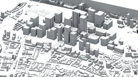
In 2019/20 the focus was on Poplar and its interface with Canary Wharf. In the context of the transformative projects already occurring in the area (not least the coming of Crossrail) and the development pressures that the Poplar area is currently facing, the module sought to develop a new vision for this area to guide its successful transformation over the next 20 years. Groups were asked to develop a set of solutions that restore the integrity of the Poplar / Canary Wharf interface as a ‘place’ and not just a traffic / Infrastructure artery, whilst considering the opportunities within and beyond into its surrounding areas.
The project provided an opportunity to rediscover the value and potential of one of London’s historic villages – Poplar – and to deal with the disconnection and inequity that followed redevelopment of Canary Wharf next door.


FROM STRATEGIES TO MASTER PLAN


Coordinator: Dr Katy Karampour
Tutors: Dr Katy Karampour, Prof Stephen Marshall, Colin Haylock, Neha Tayal, Ming Cheng
This module is the first part of the Urban Design Specialism. It provides an opportunity to critically investigate the spatial characteristics and qualities of the built environment, with a focus on layout, density, and typology, and explore the use of different typologies in the development of design proposals. It aims to develop knowledge and a range of skills for carrying out urban design investigations and proposals. Considering a hypothetical scenario in which the Mayor of London wants to consider possible approaches to the development of site of the former Holloway Prison, students are asked to undertake two interrelated tasks:
• Task 1: Comparative analysis of two urban building types from the surrounding area (individual work, 4 weeks) is an introduction to the concepts of density and typology and aims to develop both an understanding of the spatial structure and scale of the built environment, and how these characteristics relate to the qualities and perceived character of place, as well as analytical and graphic skills;
• Task 2: Urban design proposal (group work, 6 weeks) consists of developing an alternative vision and masterplan for the Holloway Prison site by exploring and testing different typologies. This exercise aims to foster the ability to engage with design as an iterative process and includes: an analysis of the urban context; the development of an overall strategy and two options that explore alternatives for redevelopment; a final masterplan.
This project-based module combines lectures and weekly tutorials. Students are encouraged to explore relevant theory to inform the analytical and design work.




Date: 06.11.2019 - 07.11.2019
Tutors: Dr Michael Short, Dr Pablo Sendra, Dr Katy Karampour, Dr Nicola Livingstone


Coordinator: Elena Besussi
Tutors: Elena Besussi, Marian Larragy, Paula Morais, Dr Michael Short
In collaboration with Just Space
High streets are ubiquitous in London and essential to its social and economic life: “47% of businesses outside Central London are on a high street and 1.45 million employees work on or within 200 metres of a high street, and this number is growing” (LSE, 2017). Despite consensus that that the high street is a key urban, social and economic environment for London, there is heightened concern among local community groups and researchers that planning has but a minimal understanding of the social value of the high street and of the role it has in supporting the social and economic wellbeing of marginalised and low income groups in London.
This year’s project is dedicated to the London’s high street and to develop critical knowledge as the basis to develop planning and design propositions that are socially just. The module’s pedagogical rationale is underpinned by the notion that the content of urban design proposals and planning strategies relies heavily on the type of knowledge we produce about urban environments. For planning and urban design to be socially just, their practice must be grounded in an ethical approach to knowledge production. Students conducts systematic studies of London high street covering themes such as work, culture and social value followed by a critical assessment of the impacts of the Mayor’s of London Economic Strategy on the future of the high street.

Coordinator: Dr Pablo Sendra
Tutors: Dr Pablo Sendra, Dr Michael Short, Joost Beunderman, Dr Patricia Canelas, Dr Daniel Fitzpatrick, Marco Picardi
The aim of the course is to provide the student with a holistic approach to all the aspects of sustainability: social, cultural, economic and environmental. It seeks to make the student reflect on possible sustainable future cities by addressing issues that are currently at the forefront of the debate on urban design and city planning: how to make cities more inclusive, collaborative, consume less resources, interact with nature and, at the same time, strengthen its design and maintain and reuse its heritage.
The module combines design and theoretical reflection through a series of lectures, workshops and a design proposal. This year, we have been working on the Wandle Valley and have worked in collaboration with the Wandle Valley Regional Park Trust. Students first developed proposals related to the workshops on the key topics of sustainability. After completing the workshops, they developed a “Sustainable Vision” for the Wandle Valley, which is presented through a poster and a creative piece of writing.
The key topics of sustainability that the lectures and workshops address are:
• City and nature: interaction between humans, non-humans, city and nature. Land use, food, waste,
• urban metabolism, urban fauna and flora.
• Urban character and heritage: what makes a place, townscape, urban conservation.
• Collaborative urbanism: participation, co-production, co-design, collaborative economy.
• Inclusive cities: social justice, culture, gender, age, democracy and welfare delivery.


Coordinator: Colin Haylock
Tutors: Wendy Clarke, Valentina Giordano, Omar Sherif, Neha Tayal, Jingyi Zhu
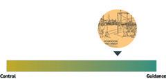
This module engages students in the conduct of urban design at one remove from directly designing places. This is urban design as conducted through the planning process and its work on influencing design delivered by othersdevelopers, architects, etc. It works from visions and related outcomes, through mechanisms designed to secure the outcomes sought in terms of the nature and quality of places. The module studies this activity at a range of scales from the strategic to the detailed.
The module uses London as laboratory and current plans for various parts of the city as the starting point for study. Students work in small groups each of which works on a different area. The areas chosen deliberately cover a wide range of scales ranging from London Plan Opportunity Areas with their strategic approaches to delivering large scale change, through the more modest London Plan Intensification Areas to very locally based Neighbourhood Plans. All module presentations at the end of each of the module’s two stages allow the sharing of experience between the range of areas and scale of planning covered.
Apart from the expression of individual reactions to the area and the related existing planning document in week 1, the whole of this module is conducted through group work. Group working, with members often coming from very different backgrounds and bringing different skills to the work, parallels likely working contexts. The group working in the module is, therefore, seen as a beneficial educational experience. To emphasise this, the submissions at the end of each of the two stages include a reflection on the experience, conduct and management of the group work and individual contributions to it.

Part 1: Critical appraisal of Woolwich Town Centre and the Woolwich Town Centre Masterplan (2014)
An
Part 2: Developing a realistic + deliverable vision for the area: Woolwich Town Centre SPD




Date: 16.02.2020 - 20.02.2020
Tutors: Dr Pablo Sendra, Dr Katy Karampour, Monica Lopez Franco


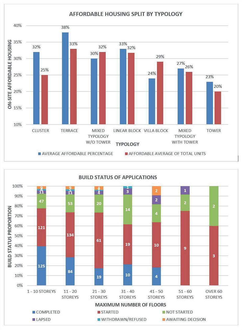
Driven by the need to deliver 43,000 new affordable homes annually, there has been a surge in new residential tall buildings over the last 10-15 years in London. Advocates claim they are necessary to cope with housing demand whilst critics argue high construction costs impact affordable housing contribution. Using primary data on over 850 planning applications referable to the Mayor between 2011-2020, this study examines whether new tall buildings in London provide proportionally less affordable housing and are less likely to be built than mid-rise typologies. Data collected includes the maximum height and type of development, location, typology, Mayoral decision date and completion status. Findings show that, on average, the proportion of affordable housing is lower in tall building applications than lower-rise typologies. This is particularly marked for applications over 30 storeys and those of a tower typology, whereas developments of 10 storeys or less achieve the highest proportion of affordable housing, particularly those in terrace or linear block typologies. The influence of location is marginal, but main land-use and decision date play the greatest role where the proportion of affordable housing has increased in recent years. Using data from the London Development Database (LDD), the completion rate of tall buildings was found to be lower than mid-rise developments. Overall, this study argues that high-rise typologies provide proportionally lower levels of affordable housing and are less proficient at delivering them. On this basis, it is recommended that planning policy in London recognise the influence of height and typology in the provision and delivery of affordable housing.


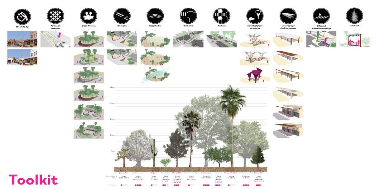
Walking is a heavily underused transportation mode in United States desert cities, due to urban sprawl and its consequences, among others. Sprawl repair can help create more walkable cities, but the sole activity of infilling open spaces is not enough to ensure walkability in desert cities. Human scale urban design interventions are necessary to mitigate the impact of the desert heat on pedestrians and to create a truly walkable environment.
In this research, academic literature is reviewed and case study cities from around the world are analysed, resulting in a toolkit of human scale urban design guidelines that facilitate walkability in US desert cities. The guidelines are applied and tested on the context of Downtown Palm Springs, California. The result is a practical toolkit for urban designers that work on US desert cities and which can serve as a base for further research into walkability in extreme climates.


Restoring Post-Industrial Identity: an urban design approach for tackling identity loss resulting from deindustrialisation.Ben Tattersall - ben.tattersall.19@ucl.ac.uk
Deindustrialisation created a new generation of post-industrial centres in a number of countries. While some cities have emerged as post-industrial powerhouses through the growth of global financial services or cultureled regeneration, smaller post-industrial settlements continue to suffer from the social losses of deindustrialisation. Decades on, smaller post-industrial settlements continue to mourn their dissolution from industrial powerhouses to causalities of a deregulated and globalised economic system.
This research explores the critical problem of identity loss within the postindustrial context, where place identity was rooted and originally sourced from industrial culture which has subsequently declined leaving communities in loss, disenfranchised and longing for the stability industrialism once brought.
While sourcing place identity often comes from a diverse set of sources, within a stagnant or declining post-industrial context, sourcing identity from a rich past may be valuable when the present or future do not withhold particular promise nor optimism. The research will be valuable for urban design practioners aiming to tackle disenfranchised or demoralised post-industrial contexts through utilising industrial memory and heritage to reconstruct place identity and pride.
The research will use academic literature to identify the effects of deindustrialisation and how these effects impact upon place identity. The research will also draw on case studies to illustrate the role memory, nostalgia and heritage can play in the recovery of place identity.
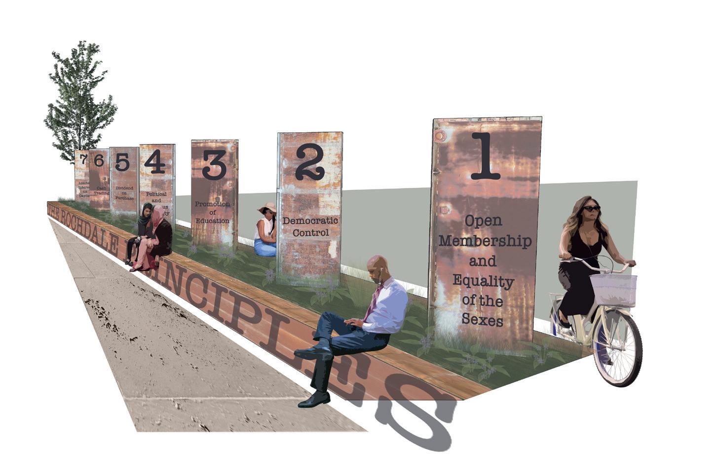
Through the synthesis of literature and case studies, five design principles are put forward in the aim to recover identity in secondary post-industrial centres. The principles will be applied within the post-industrial town of Rochdale, Greater Manchester in Northern England; a former textile mill town and the birthplace of the co-operative movement. The application of the principles will allow for reflections on the effectiveness of the research and how might the research benefit future urban design practice.


Metropolitan areas have become premium places for locating and structuring logistics activities. The logistics sector has evolved towards a need for larger warehouses on available land. Spatial dynamics, logistical loosening push these warehouses in the outskirts of metropolitan areas. This logistic suburbanization amplifies the negative externalities of transport and contributes to urban sprawl. However, rural-urban fringe areas are not the only areas of metropolitan logistics. Logistics keep staying located in dense areas of the metropolis closest to consumers. Strategic industrial land intensification could provide new warehouses and comply with environmental objectives and optimization of the last mile. In London, the strategy to maintain industries is to intensify existing spaces. Intensification of logistics and its integration creates new opportunities and activities, catalyze the individuality of the place and improve working conditions and social cohesion. The project explores how intensified logistics spaces in strategic industrial lands can be associated with a design strategy for the interface between big sheds and the public realm. The author argues that such an approach can increase attachment to a place, stimulate citizen participation and encourage flexibility in interpreting the urban future of these places.


Restore and increase the social interactions between rivers and people in Hong Kong and to act as a catalyst for children’s health improvements
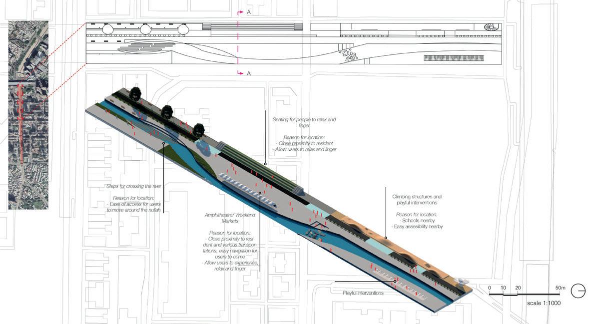
Chun Wing Matthew Li - chun.li.19@ucl.ac.ukRivers have been altered and heavily engineered to accommodate urbanization and flood controls. Such work affects the values and functions of the rivers greatly including but not limited to reduced ecology, diminished aesthetic values and water retention. This MRP seeks to address a suitable design framework that can be applied to revitalize the nullahs in Hong Kong. There are 228 nullahs scattered around the city of Hong Kong, these nullahs can function as a quality public space for all to enjoy rather than being left without any sufficient uses. Furthermore, it will also include the idea of reviving children to play outdoors. The increasing use of mobile phones and lack of outdoor time is causing an increase number of children to have mental health issues. In the light of this, the MRP will aim to address to revitalize nullahs and also how to encourage children to go back to outdoors and gain physical activity to achieve health benefits.


Barriers of social class, ethnicity and economic inequality are generating segregation between different backgrounds even if they inhabit in the same part of a city, this is particularly the problem in multicultural and high dense cities, where lack of interactions between users of the same space in has become a more frequent issue causing problems of segregation and distrust. Considering the public realm as the main or only space that users share with others makes it a favourable place to bring them into contact with other groups. For this reason, external open spaces have been considered fundamental and the best option for this project to allow people to mix.
This project presents an exploration on how to use public space to promote social cohesion in areas with the mentioned problematics. Information from multiple theories, research and authors has been compiled by using a literature review to explore how different groups make use of the public space, what characteristics of a public place attract users and if there are existing elements that prevent people from having interactions among ethnic and social backgrounds groups and how these barriers could be reduced.
By using the principles from the literature review, case studies and in situ observations, design strategies are developed and applied in a network of public spaces in the Borough of Tower Hamlets, London, UK, to respond to the problem of segregation by using the built environment as a tool to allow interactions to take place, creating social mix and inclusion without people perceiving each other’s status or ethnic background.


“What will the safe night-time city designed for women be like?”
Due to a traditional mind-set which put men as ‘the neutral user’ of the cities, most of cities can be seen that they are planned and designed for men, workers and commuters. A study on public transportation also showed that most of urban public transport focus on the services which are provided from 9 am to 5 pm. The limitation on involving and accommodating the needs of women also results the exclusion of women in the cities especially at the night-time city (after dark). The cities are not inclusive and may lead to most of women are not welcomed in the public realm.
Due to the lack concerns on the night-time activities and women’s needs, cities turn into unsafe place for women. As cities do not offer safety or safety perception through their design, women usually decide to access the nighttime city by taking longer route, more expensive expenses on travel and/or even worst cancel the possibility to be in the night-time city which may also impact their wealth by turning down the offer and not being able to join the opportunity of night-time economy.
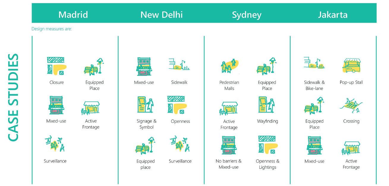
By doing this Major Research Project, the challenges which are faced by women and the perspective on safety of the night-time city will be explored. Principles and number of study cases will be presented to endorse the offered toolkit. A recommendation and/or application of toolkit will be shown on how to design safe night-time city for women in Senen District of Jakarta, Indonesia context.


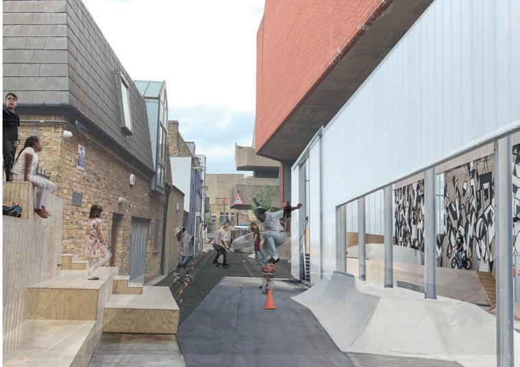
How can town centres be made more resilient through designing for the inclusivity of young people?
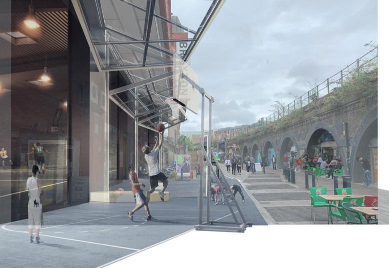
Fabien Piesakowski-O’Neill - fabien.oneill@icloud.comThe challenges facing town centres as a focus for communities are set to become more complex and demanding requiring not only an ability to adapt to the problems already visible on the horizon, but also an ability to respond to unknown and unpredictable events that could arise from a number of different causes including the impacts of the climate emergency, the volatility of the world economy, or shifts in public behaviour resulting from crises such as Covid-19.
What is certain is that the 20th century model, based on an acceleration of real estate value in town centres driven by the commodification and surrender of the town centre to Trans-national Corporation chains and selective residential development, will no longer work. It lacks the flexibility and purpose to respond to these challenges and at best just promises an increasingly unpredictable and unhealthy cycle of boom and bust.
To meet these challenges a re-evaluation of the purpose, function and values of town centres is required and through this it may be possible to define the components needed for a more resilient model that also supports and adds to the life of the host community.
This project attempts to contribute to this conversation by addressing these issues from the perspective of young people, partly because they have become a disenfranchised group in the town centre and partly because their activities are a vital part of a more rounded life of town centres. Making provision for them by providing ‘...space for young people’s hanging out helps in cultivating lively, convivial urban spaces for others...‘ and creates ‘Complex multi layered spaces that are more interesting and help foster heterogeneity...’ which in turn will make town centres that are more resilient. (Pyyry and Tani, 2016, p208)

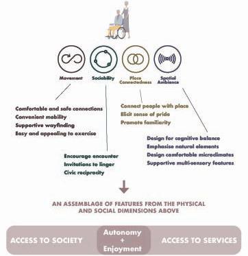
More of us will grow older in urban environments than ever, thanks to rapid global urbanisation and population ageing (ONS, 2020; UN, 2019). These demographic mega-trends provide a pressing mandate for improvements to be made to the urban built environment so that it can better suit the needs of older people. Cities could do much more to respond to the physical, sensory, cognitive and social needs of their citizens, this is even more the case for their older citizens.
This project seeks to creatively explore what the neighbourhood environment can do to enable people to age well, “maintaining the highest autonomy, wellbeing, and preservation of one’s self and identity as possible, even in the face of severe competence loss.” (Wahl 2016)
The research aims to raise awareness of the complex and heterogeneous ways in which capabilities may change as we age, informed by research across the disciplines of urban design, planning, gerontology, sociology and psychology. It considers how these changes affect the way that older people experience the built environment and how physical and social features and design processes might be designed to respond to these attributes.
A framework has been designed which separates these considerations into four dimensions: movement, sociability, place connectedness and spatial ambience. It advocates for these elements to be considered together, with each element having a bearing on the other; they form an interwoven assemblage.


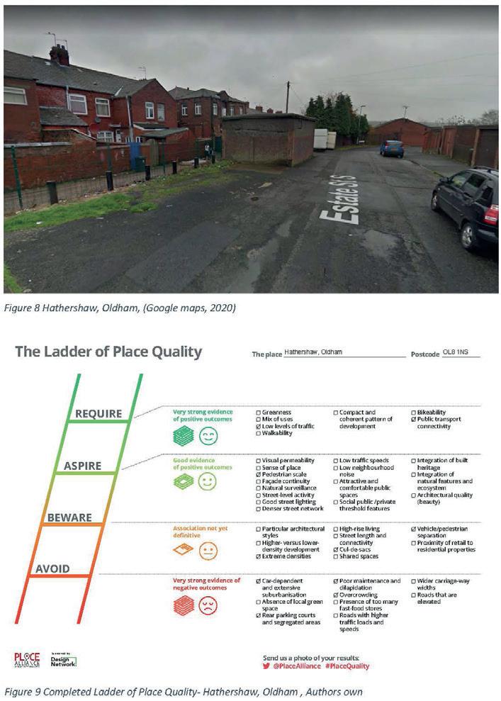
What are the challenges in confronting ‘race’ in the built environment profession? An investigation into planners’ responsibility in tackling environmental racism
Harpriya Chaggar
The demand for racial and social justice has become more prominent than ever, as the escalation of the BLM movement this summer and Covid-19 disparities position the lives of ethnic minorities as disregarded. The vast differences in livelihoods of deprived BIPoC communities and white affluent communities is alarming. While academic studies and government official documents touch on D&I in some shape or form, the barrier in truly confronting the challenges facing aspiring BIPoC individuals acquires further analysis. Viewing planning objectives through the lens of needing to improve health and well-being has potential to enable such change . The importance of the built environment in facilitating racial equality is tremendous, as the built environment is founded on the shaping of communities. This paper will examine where responsibility lies in undertaking anti-racism in the built environment and identify the rooted stigmas that enable discrimination. Although this paper inspects at UK level, the discrepancies in ‘race’ and class divides play a role in every society. There should be more light on the continual struggle on building out racism from the system, as racial hate, racial bias’s and micro aggressions have profound impressions on the quality of life for ethnic minorities.


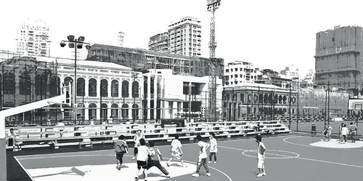
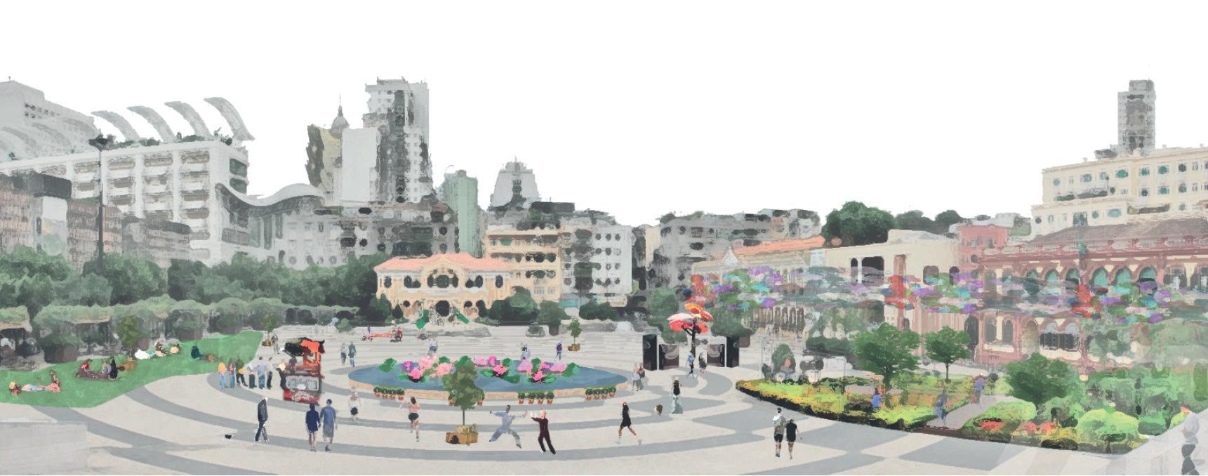
How to (re)design open space in historic cities to integrate place identity of the past and the future? The case of Praça do Tap Seac in Macau.
Ho Ting Ng (Marco) - zcfthtn@ucl.ac.ukIn the contemporary world, city development has become one of the crucial matters to promote more economic opportunity and to accommodate the increasing population. Urban renewal offers a new urban environment, enhancing the physical function of space, especially in the old and historic city centres.
However, the special characteristic in historic cities is often the local people’s core element, creating a sense of belonging and identity. The tradition, culture and lifestyle, therefore, reflects the social and spatial quality of the place. This attracts international visitors to “worship” and experience the uniqueness of space.
Recently, Macau has fallen into the temptation of urbanising its historic parts for economic development. How to promote future development in existing historic settings hence become a challenging topic for plan-makers.
Despite several limitations due to COVID-19, this research stresses the importance of community participation at different design stages. Rather than being an empty open space, the set of design interventions aim to deliver various social activities at different stages. The project takes initiatives of using Tactical Urbanism and Community Design Strategy to re-invite local communities into the early stages.
The set of design interventions from these optimistically provide a sense of how it can be transformed to become a square for the Macau community. It can also become an exemplar to offer urban renewal with more considerations on the spatial and social quality of the place.

Retrofitting an urban fringe neighborhood to cater for remote workers, the case of Seoul
Jeong Hyun Cho - jeonghcho@outlook.comThe modern city has placed offices and businesses at its core promising economic opportunities as the centralizing force of urbanization. This has resulted in expanded residential settlements surrounding centres of offices and contributes to the increase of carbon emissions from commute. Meanwhile, the remote working phenomenon accelerated by the recent global pandemic signals a sustainable urban development pathway that challenges the notion of traditional offices as urban centres. Despite the tragic losses from the COVID-19, the crisis presents an important lesson regarding climate change as decentralized work from home being the ‘new normal’ has led to a significant reduction in carbon emission. Seizing this as an opportunity, the research project intends to strengthen this environmental gain by consolidating a transition of our cities towards a decentralized urban structure.
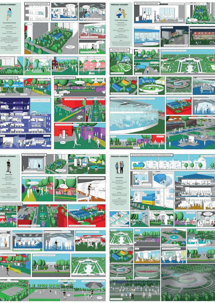
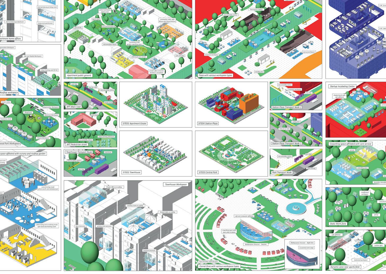
Ever since teleconferencing and internet technologies have pervaded our lives, the benefits and risks of the remote working have been actively discussed. However, the implications of remote working specifically to sustainable urban development as well as the measures to plan our cities more adaptable to the future for the rising community of remote workers has yet been thoroughly addressed. By investigating the desire of remote workers, trend of workplaces, and the sustainability implications of remote working, the research presents a design framework that integrates urban compactness and a catalogue of workspace typologies to achieve a sustainable remote working neighborhood. Based on author’s place-based knowledge about the social and historical context of South Korea, Seoul and the urban fringe neighborhood Pyeongchon are selected as the focus area for this research proposal. Interventions on four sites from Pyeongchon aims to demonstrate the design strategies culminating with persona scenarios illustrating the experience of sustainable living and remote working in the retrofitted neighbourhood.

Over the course of the last 30 years, changes in governance trends have led to a growing opportunity for citizen participation in decision-making at the level of local government. The 2011 Localism Act enshrined this in planning policy. However, the voluntary uptake of participatory planning mechanisms has been mixed at best. Areas with wealthier communities with more resources have been more likely to see these opportunities realised in a way they are not in areas with less affluent communities.
UK planning policy does not specify the means by which local authorities should engage their communities but social infrastructure is implicated as a possible way to do this. This dissertation will therefore explore the potential contribution social infrastructure could make to empowering communities to play a more active role in the planning system. Community empowerment will be defined by using the concept of social capital and Sen’s capabilities approach.
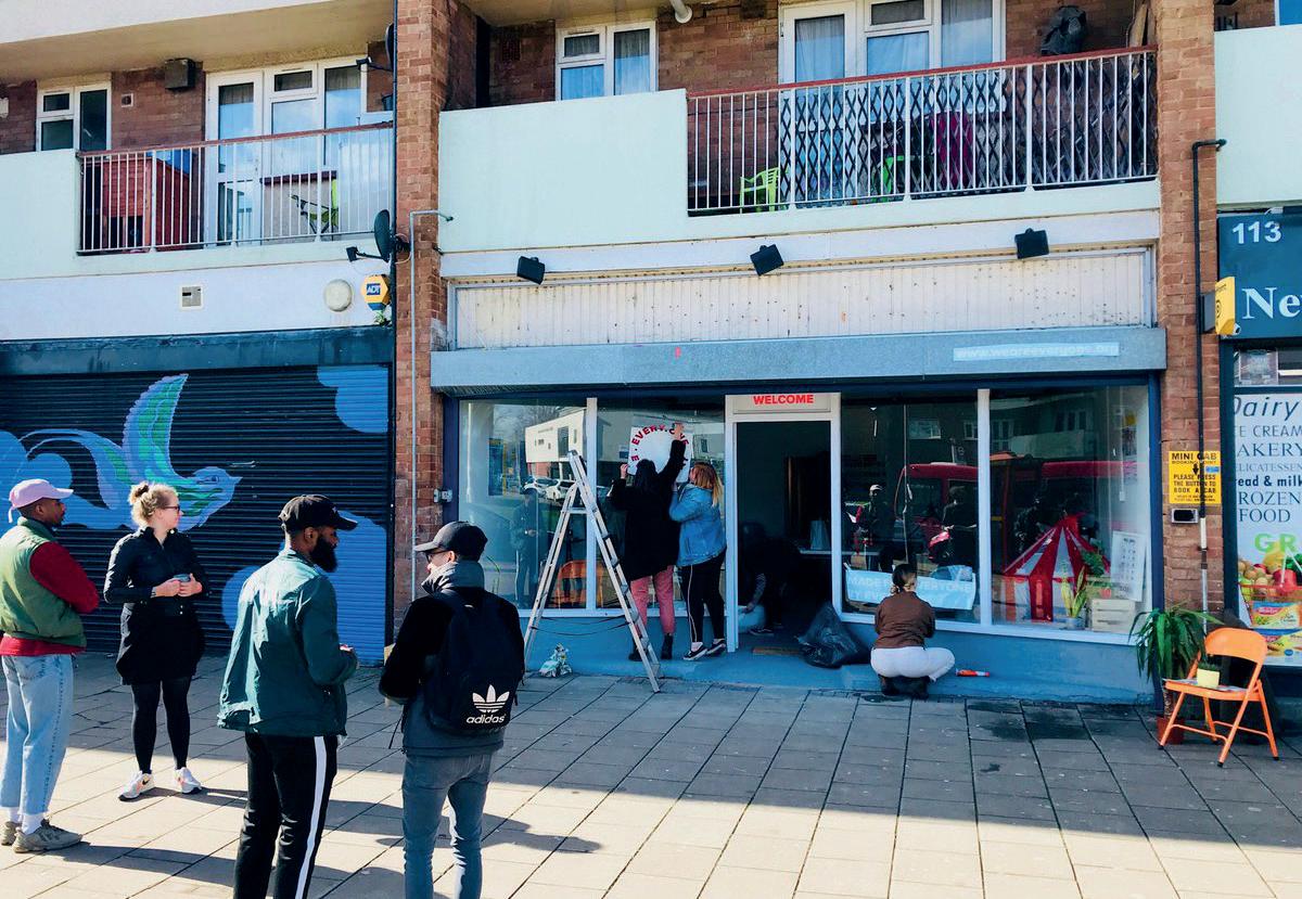
There has been considerable interest in libraries and participatory culture spaces since the start of the 21st century for their ability to generate social capital and broaden communities’ capabilities. This dissertation will look at two examples from East London. The first being Every One Every Day, the UK’s biggest participation scheme, in Barking & Dagenham and the second being the Idea Stores, a chain of modernised libraries, in Tower Hamlets. These examples will be used to make the case for a new type of social infrastructure that can empower communities and contribute to achieving participatory planning in line with the evolution of governance and recommendations in current planning policy.
The findings from this study suggest that participatory culture spaces and libraries sit among wider networks of social infrastructure that, when combined, facilitate the social life and political power of communities across the UK to a greater or lesser degree.


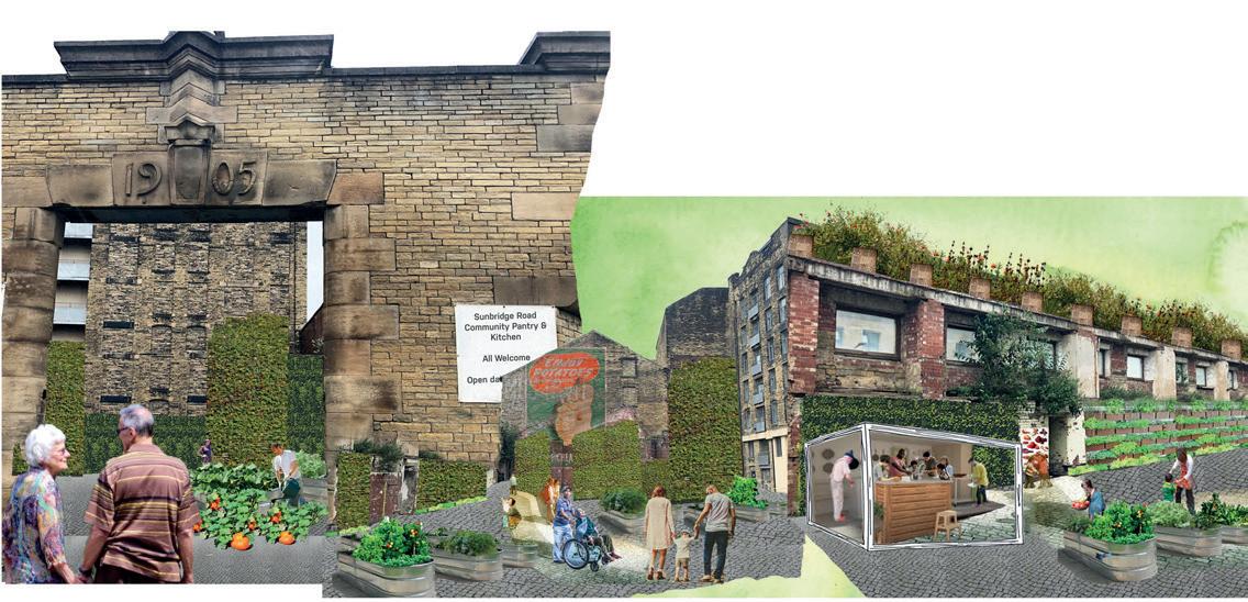
This paper explores the possibilities for re-designing urban food systems that serve communities and work in symbiosis with the environment through an Edible Urbanism approach.
This research proposes that it is possible to integrate localised food networks into the existing urban fabric in a way that serves multiple regeneration aims, from public realm improvements to creation of employment opportunities. The research is focused on the impact of Edible Urbanism in terms of social benefits, environmental gains and urban food security.
Research was carried out in the form of a literature analysis and review, and a case study review. From this, a conceptual toolkit was developed, highlighting the key design principles for the realisation of Edible Urbanism interventions. These principles are Connectivity, Retrofit, Reuse, Access and Flexibility. From the conceptual toolkit, a design toolkit was created containing design concepts that could be applied in a variety of urban settings.
This toolkit was then tested on two contrasting urban contexts in the UK. The first site is Bradford, a former industrial city in the North of England suffering from urban decline. The second site is Wandsworth, a borough in South West London and hotspot for international development projects where competition for land is high. The project concludes that Edible Urbanism offers a variety of benefits to the mainstream regeneration dialogue, most notably, in improving access to fresh food and food-related opportunities in urban areas experiencing deprivation relative to surrounding areas. Whilst Edible Urbanism cannot offer a viable alternative to rural agriculture owing to the scale of its rural counterpart, it is a useful urban design tool that presents a multitude of benefits when combined with site specific regeneration aims.


It is estimated that by the year 2050, 68% of the world’s population will live in urban areas (UN 2018), and governments need to take mitigation measures so that the world’s temperature does not rise above 1.5 °C. Consequently, cities need to be resilient to climate change and growth projections.
The Urban Heat Island Effect (UHI) is a phenomenon seen in cities when they present a higher temperature than their rural surroundings. It has a negative impact on both the environment and people. Environmentally, it is a major contributor to air pollution and climate change, and socially, it can become a risk for human health, comfort and local economy. The UHI effect is produced by humans: by the properties of the urban materials, the replacement of vegetation and bodies of water, the anthropogenic heat and the urban form (or urban corridors).
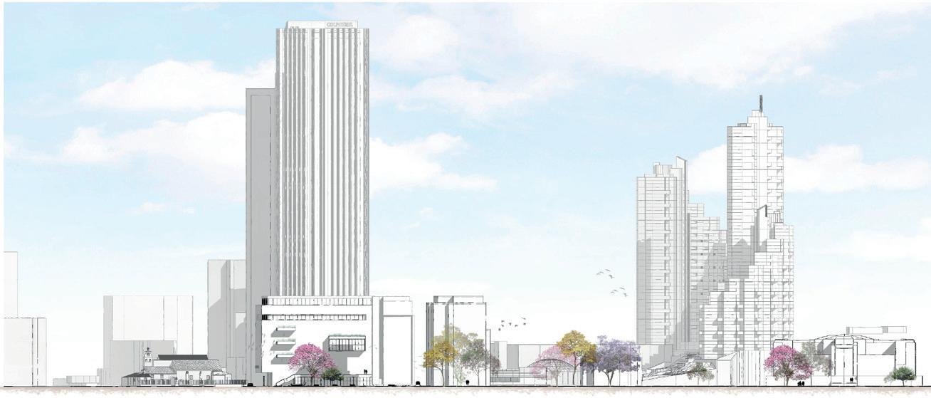
On the other hand, there is a global opportunity in cities: the current tendency of restricting car use and spaces in cities. The amount of space that roads and parking take on cities, combined with traffic, a vast energy consumption and carbon emissions, have made cars an complication, and cities around the globe are now taking measures to reduce the amount of cars. Now, as cities are diverging their plans away from cars, how can previously-owned car spaces be repurposed to help address the Urban Heat Island (UHI) effect to create resilient high-density cities?
The research, findings and implementations referenced in this project will have an important contribution to the urban design and planning practice, as it will show an analysis of a problem (the UHI Effect) and an opportunity (the no-car movement), and propose an urban design toolkit that could use an opportunity to address a problem, making this way resilient cities to climate change.


How can the built environment contribute towards the cognitive mapping and wayfinding of VI pedestrians?
Martha SainsburyNavigation through the built environment relies on the user’s ability to perceive hazards and recognise visual cues to aid wayfinding. Daily experiences and representations of our surroundings enable humans to cognitively map locations and place, making it easier to navigate them with each journey. For visually impaired pedestrians the visual cues cannot be perceived, and where the built environment does not provide a sensory alternative to compensate for sight loss, a perception of place becomes harder to mentally establish. When a perception of place is compromised by a lack of stimuli, this hinders the cognitive mapping of those who are visually impaired, impacting the ability to effectively navigate and wayfind independently.
This research explores reasons as to why the built environment fails to cater to the needs of visually impaired pedestrians and why the cognitive mapping of such individuals may not be considered by built environment professions. The literature and case studies reviewed will investigate ways in which sensory environments can be enhanced in order to inform a design framework and toolkit. The practical response of the toolkit intends to deliver sensory environments and community education through transformative learning in the public realm.


Do high-rise developments provide environments for their residents to form social networks?
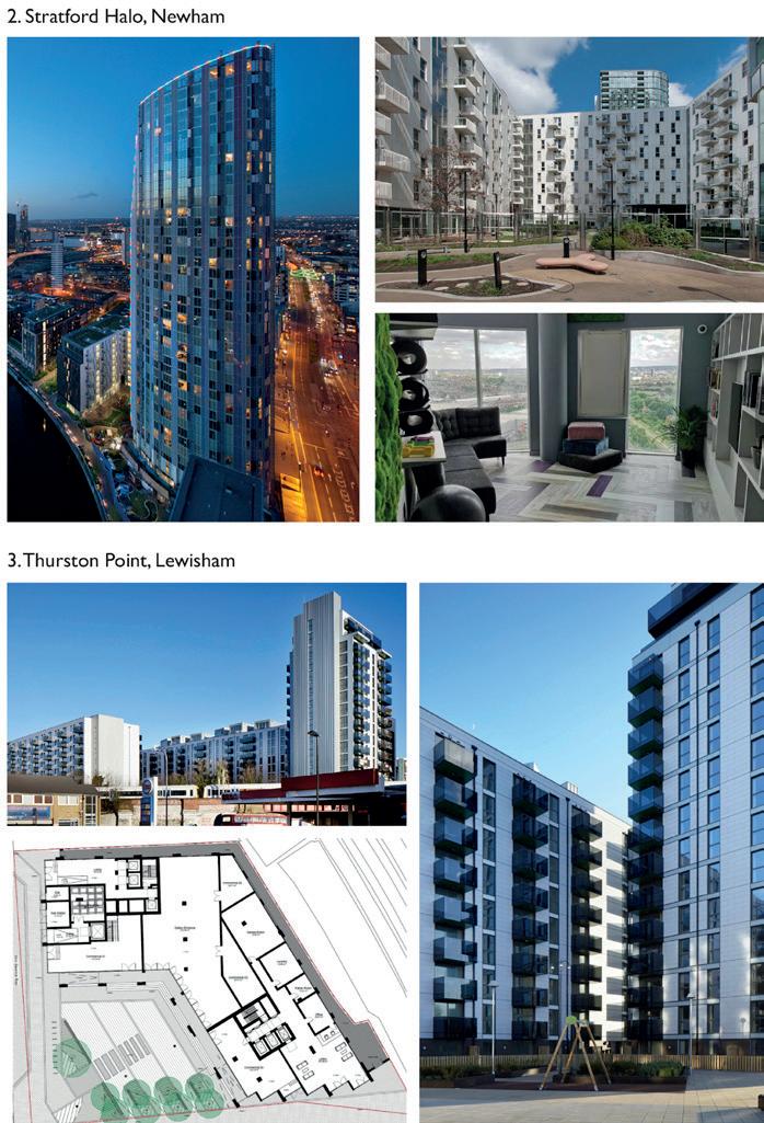
Rafaela Eirini Christodoulou - rafaela.christodoulou.19@ucl.ac.ukThis paper reviews high-rise developments in the UK and whether well-being is generated within the schemes. Dwellings of great heights have raised concerns about the social well-being of residents. Investigating the core ideas that formed tall structures is important in understanding their contribution and impact in the contemporary living environment. Based on precursory literature and research, the paper seeks to understand how high-rise developments evolved in the UK, particularly in London. Furthermore, the association of the public spaces provided by the developments and the residents’ social well-being is explored in order to pinpoint the indicators that have a significant role in community formation. This relationship is initially investigated through the existing planning policies that shape developments. 15 high-rise estates across Greater London were selected to see how they respond to the planning policies related to community formation and provision for communal spaces. Three case studies were analysed further: Saffron Square in Croydon, Stratford Halo in Newham, and Thurston Point in Lewisham. The findings from questionnaires and planning applications testify a contradiction between the initial target and the final outcome. Even though the sense of community is highly promoted by planning policies, tenants reveal they rarely discourse with their neighbours and that the existing communal spaces don’t foster interaction. Social well-being and community empowerment need to be achieved through the provision of quality public spaces within new developments.


An ecosystem depends on its components’ interaction to thrive or collapse. The construction industry is responsible for resource excavation and mass waste production which emphasize that our built environment has a considerable impact on sustainability. Circular economy concept has emerged in order to gain efficiency from a linear to a circular resource management seen as a closed loop where waste is a resource for future use.
Reuse practice is one of the three rules to improve our material consumption and management along reducing and recycling. It has an economical, environment and social implication that follows the three sustainability pillars. In this research we want to demonstrate the potential of the city as an urban mine able to be rebuilt on itself drawing from its own material and human resources
Design principles improve reuse and resource management during the life cycle of a product or project. Findings in the literature review and cases studies enables the creation of a design toolkit that follows the phases of a project development and is then applied on an urban regeneration site in London. It shows the potential regarding sustainability and urban metabolism that reuse practice have on project development. Creating identity, local employment and reducing waste.
Although reuse can be seen as a constraint it is a great source of innovation in all fields of the built environment. Design plays a key role to showcase good practice and potentiality around reuse, raising awareness of the population around sustainability.


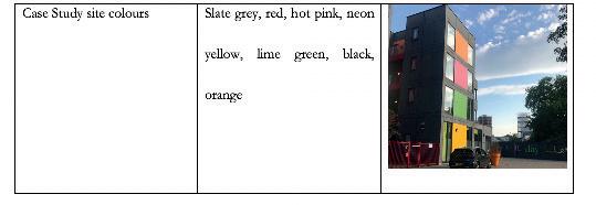
A thesis presented on the appropriateness of meanwhile use for housing as a genuine example of temporary urbanism in the activation and regeneration of high streets, with a case study focus on ‘PLACE’ in Lewisham, South London. The objective is researched through a series of three research questions, which break down the urban design value of the development whilst assessing its contribution and impacts on local people and the existing place brand and public realm. This study employs interviews, site visit observations and secondary data analysis to determine to what extent urban activation has been achieved. The study finds that ‘PLACE’ is not coherent with the aesthetic value of its locale, nor is it a favoured or desired development amongst local people. Ultimately, the site has not achieved the desired outcome of urban activation with regard to stimulating new, innovative temporary uses outside of itself, nor has it attracted a steady, consistent income stream from ‘gentrifiers’, but it has successfully obviated dereliction. This study recommends against meanwhile use for housing as a regeneration strategy on high streets, and advocates for collaborative initiatives steeped in community needs, for the development of temporary urban enterprises in the future.



Cohousing is a growing form of community-led housing in England that aims to build stronger community networks through design and self-governance. Some of the key challenges for cohousing schemes include gaining access to land and planning permission. This paper explores the role of local planning authorities in enabling the delivery of cohousing in England. The research is focused on the case of Marmalade Lane, an award-winning cohousing scheme in Cambridge. Qualitative semi-structured interviews were conducted with a range of stakeholders involved in the delivery of the scheme to understand the decision-making process. Enabling factors identified in the research include: cohousing champions within the council; access to council-owned land; and a partnership with an experienced developer. This cohousing scheme was instigated by the council which was a significant factor in its deliverability. Council-led cohousing schemes are not common in England and much can be learned from this approach.


Fighting urban smog: methods to limit concentration and exposure rates of urban smog while regenerating sovietstyle neighbourhoods and their public spaces, employing Kraków, Poland, as a test bed.
Tomasz Kopczewski - tomasz.kopczewski.19@ucl.ac.ukThe role human behaviour plays in altering our environment has become widely recognised. Increased private vehicle ownership, persistent fossil fuel use and poor energy security have been identified as the most common sources of urban smog within cities. Rising levels of urban smog contribute to poor human health and urban environments, therefore, the problem requires solutions.
Urban form and how cities are designed tends to be overlooked when trying to tackle the problem of urban smog, despite a relationship between the two existing. The common slab typology, prevalent in soviet-style neighbourhoods around Eastern Europe and parts of Asia, can be linked with causing poor wind environments and increased smog levels within cities. Therefore, the MRP collates literature and case study information to propose a toolkit formed of 5 principles: 1) enhanced green infrastructure, 2) extending distances, 3) tackling urban smog hotspots, 4) controlling the source and 5) optimising urban form. Together these can be used to reduce concentration levels and human exposure rates to urban smog whilst enhancing public spaces amongst ageing sovietstyle neighbourhoods.
The toolkit is applied to the Pisatów neighbourhood, found in Kraków, Poland, in order to demonstrate its merits. Built-in the 70’s many of the buildings are approaching their lifespan and require modification to improve their thermal efficiency. This can lead to spikes in smog during colder months when the coalfuelled heating network kicks into use. It is acknowledged that some interventions, such as green infrastructure, would have limited capabilities to alleviate smog during certain times of the year. Therefore, a thorough understanding of the site context is needed when implementing the toolkit in other regions. Nevertheless, the toolkit demonstrates how urban design can be utilised to create better public spaces whilst helping to reduce the concentration and exposure rates to urban smog.


Estate regeneration has been the subject of extensive research for decades, originally stemming from a need to improve conditions for those living in what were considered to be unsafe and poorly designed developments. This focus has shifted in recent years towards the need for additional homes, with regeneration schemes also delivering large uplifts in density. Although attitudes are changing, there is a general presumption in favour of mass decanting of residents and subsequent demolition, with estates thought to be of a poor build quality and inefficient layout.
This project argues that urban estates with a site area below 0.5ha require a different way of thinking, this separation being required because the general discussion of estates focuses almost exclusively on those with a far larger site area. Larger estates require urban design interventions such as increased public permeability and connection to the wider urban context, which is proposed to be neither necessary nor desirable on smaller estates.
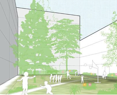
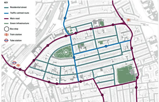
Existing residents’ well-being is used as an indicator to understand their requirements from where they live, derived from a review of literature. Key themes from literature informed a case study review, used to propose a toolkit of urban design interventions to intensify the use of the spaces around homes. Interventions include enhanced green and communal spaces, facilitation and encouragement of active travel over private car use, integrated children’s play facilities, and adjustments to movement patterns and connections. The need for more homes is addressed with a design-led approach to infill development, with positive impacts on existing residents’ well-being captured and enhanced, and negative real or perceived impacts mitigated. The research focuses on London, and the proposed took-kit is tested at a design level across three small estates in the London Borough of Wandsworth.


This Major Research Project aims to address three inter-related issues in the built environment: climatic variation and climate change, underused high street, and lack of adaptive design to ensure thermal comfort in different seasons. This research aims to investigate how urban public space design can reactivate the high street by improving its comfort level under various weather conditions in seasons. This research mainly based on a volume of literature review, case studies and primary observation, and there are three major subjects of research:
1) The factors influence the perceived thermal comfort level in public spaces
2) User’s preferences of public space design in different seasons
3) The effectiveness of existing climate-sensitive design in adapting to seasonal weathers
The first stage of the research is to understand the critical factors of thermal comfort and user’s preference under different weather conditions referring to the previous studies. In terms of design, this research will concentrate on the strategies what would strengthen two types of adaptations emphasised by Nikolopoulou & Steemers (2003): physiological and psychological adaptation. Physiological adaptation is the objective climate parameters and comfort level, and psychological adaptation is more about the qualitative perception and experience of users. The design consideration of these two types of adaptation would significantly improve people’s tolerance to the outdoor comfort level in different seasons and thus encourage more usage in public spaces. A set of assessment framework was then summarised based on both literature review and case studies. The framework includes criteria such as EIA, cost-effectiveness, appropriateness and adaptability.
The deliverables of this research include seasonal climate-sensitive design toolkits, application of the suggested design strategies, and evaluation criteria. These research outcomes are expected to raise the awareness of climatology in the urban design discipline and shed light on the future climate-sensitive design in a ‘seasonal’ perspective.


MSc URBAN DESIGN AND CITY PLANNING PROGRAMME CATALOGUE
