14 minute read
FIRE MANAGEMENT PROGRAM


The City of Hobart runs three programs to reduce the City’s bushfire risk: 1. Fuel breaks. 2. Fuel management. 3. Fire trails. In 2017 a Tasmanian Vegetation Fire Management Policy was developed by the State Fire Management Council to provide guidance in the use and control of fire to reduce bushfire risk. The City of Hobart has based its bushfire management plans on this policy, and encourages a shared approach to bushfire management, one that includes the local community. The policy reinforces the City’s strategy of using fire to reduce the build-up of bushfire fuels in fire-prone areas as a primary means of reducing bushfire risk. The policy also highlights the importance of treating bushfire fuel in zones close to assets such as houses, and the need to take a landscape approach to risk assessment. The City does this through an annual program of prescribed burns and an extensive fuel break program.
FUEL BREAKS
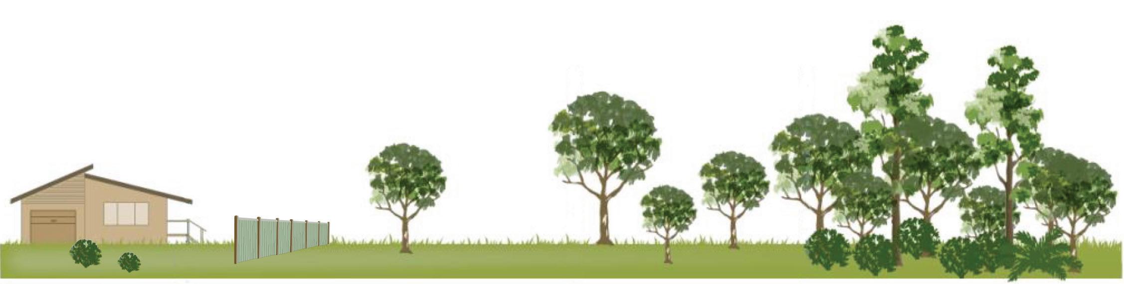
Every year as part of efforts to protect Hobart from bushfire the City carries out fuel break maintenance across its bushland reserves. Fuel breaks are cleared or semi-cleared strips of land between bushland and homes, buildings or infrastructure. They are designed to lessen the impacts of fire coming out of bushland by substantially reducing fuels such as tall grasses, shrubs and smaller trees. Fuel breaks also create open, clear and defendable spaces for firefighters. The City does everything it can to manage the bushfire threat to homes, including maintaining fuel breaks between bushland reserves and residential properties, but we need individual residents to take action too. If you live next to a fuel break it is very important that you keep your side of the fence free of bushfireprone vegetation to help the defence of your home in the event of a bushfire. The diagram on page 13 shows how fuel breaks extend into individual properties – most likely the space from your house to your property’s boundary with nearby bushland. Every year, well before the bushfire season starts, residents living adjacent to bushland reserves are advised to cut back fire-prone vegetation and to check for fire hazards. By maintaining the fuel break on your side of the fence with these simple steps you can reduce the risk of bushfire to your house: • Minimise bushfire fuel by keeping fire-prone vegetation to a minimum and flammable material such as wood piles away from the house and other buildings. • Cut back fire-prone vegetation between your property and reserve boundaries and check for fire hazards. • Do not dispose of garden cuttings in nearby bushland, this increases the bushfire risk. • Avoid planting trees or shrubs in or adjacent to a fuel break, they hinder the effectiveness of the fuel break. • Keep grass short, no more than 10cm high in summer. • Prune shrubs and keep them away from windows. • Keep gutters clean and your roof free of leaf litter. • Remove large shrubs from next to or under windows, away from wooden walls or under leaves or fascias. Fuel breaks are an effective fire prevention and firefighting tool, but they cannot stop all fires all of the time. During severe and catastrophic fires fuel breaks can help reduce the intensity of bushfire, but once a fire has escalated to an intensity where there is a significant ember attack, spotting well ahead of the fire front and/or crowning through the
FUEL BREAK AREA MANAGED FUEL LOAD
YOUR PROPERTY BUSHLAND RESERVE
Fuel breaks between houses and bushland reserves extend on to private property, abutting the nearest edge of your home.
top of the forest canopy, it is unlikely a fuel break will stop a fire of this magnitude. During lower intensity fires, fuel breaks provide significant advantages. They provide safe access for firefighters and create a buffer zone between firefighters and fire front, reducing exposure to radiant heat and other fire-related dangers such as falling trees and branches. If property owners have created a similar open space on their property, especially around their house, it can be used to defend the property from bushfire. The Tasmania Fire Service’s fuel break guidelines can be downloaded from fire.tas.gov.au. The guidelines are designed to be used in conjunction with the Fuel Width Break Calculator, which can also be found on the TFS website.
FUEL REDUCTION
Prescribed burns
Every year the City of Hobart undertakes a program of prescribed burns across its bushland reserves. These burns significantly reduce the build-up of bushfire fuel such as dry leaf litter and grass and can be effective for at least three to five years, sometimes longer. It is not possible or desirable to safely burn all of Hobart’s bushland every year. Burning native forest, woodland and grasslands too much can have adverse impacts on both native plants and animals. Carrying out prescribed burns over a longer period of time creates a mix of fuel loads across the landscape and leaves sanctuaries and habitat strongholds for animals and plants. Reducing the amount of flammable material in Hobart’s bushland reserves can lower the severity of future bushfires and the movement of bushfire through the landscape. Just like fuel breaks, prescribed burns cannot stop all fires all of the time. However, when combined with fuel breaks, they can reduce the intensity of bushfires. Once a bushfire escalates to a Severe, Extreme or Catastrophic rating and there is significant ember attack, spotting well ahead of the fire front and/or crowning through the top of the forest canopy, it is unlikely any amount of fuel reduction or fuel break activities will stop fires of this magnitude. When fire conditions reach Extreme or Catastrophic levels the amount of fuel on the forest floor makes little to no difference to a fire’s intensity. In one study following Victoria’s 2009 Black Saturday bushfires, where the Forest Fire Danger Index exceeded 100, it was found that even in areas where prescribed burns had been carried out less than five years before the event, there was no measurable effect on the intensity of the fires. During a forest fire once the fire danger rating exceeds about 50 the fire switches from being fueldominated to weather-dominated. That means that
FIRE DANGER RATING
FIRE DANGER INDEX FOREST GRASSLAND CATASTROPHIC 100+ 150+ EXTREME 75-99 100-149 SEVERE 50-74 50-99 VERY HIGH 25-49 25-49 HIGH 12-24 12-24 LOW-MODERATE 0-11 0-11

MEASURING BUSHFIRE RISK TO YOUR PROPERTY
In Australia the potential impact of a bushfire on a house or building is calculated using a BAL rating – Bushfire Attack Level. BAL ratings take into account a building’s potential exposure to ember attack, radiant heat and direct flame. They consider risks such as the slope of the land, which can exacerbate fire conditions, the amount of nearby fire-prone vegetation, the location of the building on the property, its proximity to other houses and the design and construction materials used in the building itself. Most houses in Hobart were built before this rating system was created and do not meet these new building standards. In Hobart new houses or developments in the area mapped as being ‘Fire Prone’ will not be approved unless they have a BAL Assessment and can meet all of the conditions in the associated Fire Management Plan. Given that many established houses in Hobart do not meet the new BAL standards the City of Hobart builds and maintains its fuel breaks to assist in reducing the impact of fire, especially from radiant heat (the heat you feel when standing in front of a fireplace). But what does a BAL standard mean? If built to the standards listed below your house should be able to withstand the related bushfire conditions: BAL Low: There is insufficient risk to warrant specific construction requirements. BAL 12.5: Ember attack (BAL 12.5 Construction Requirements). BAL 19: Increasing levels of ember attack and burning debris ignited by windborne embers, together with increasing heat flux (BAL 19 Construction Requirements). BAL 29: Increasing levels of ember attack and burning debris ignited by windborne embers, together with increasing heat flux (BAL 29 Construction Requirements). It must be noted that the Tasmania Fire Service is very reluctant to consider approving houses designed to be sited within a BAL-40 or BAL-FZ environment. The chance of a house being badly damaged or destroyed by fire in such an area remains very high. BAL 40: Increasing levels of ember attack and burning debris ignited by windborne embers, together with increasing heat flux and with the increased likelihood of exposure to flames (BAL 40 Construction Requirements). BAL FZ: Direct exposure to flames from fire, in addition to heat flux and ember attack (BAL FZ Construction Requirements).
while bushfire fuel continues to have an effect, fire behaviour is determined to a much greater extent by weather conditions. During the bushfire season, both the Bureau of Meteorology and the Tasmania Fire Service regularly release local fire danger ratings. In Hobart, once this rating enters the Severe category (50-74) a number of actions are triggered to reduce the impacts of any bushfire that could ignite under these conditions. Many of Hobart’s reserves are in bushfire prone areas. While they are great places to visit and enjoy, on days of higher fire danger they may not be safe. The City of Hobart may close selected reserves in the interests of public safety when the Fire Danger Rating is Severe or higher.
Timing of prescribed burns
The City of Hobart takes prescribed burning very seriously and has invested heavily in equipment and training staff to undertake prescribed burns, predominantly between autumn and spring. It would be financially impossible and environmentally catastrophic to burn every patch of bushland in Hobart every year in the hope that razing nature to the ground would rule out any bushfire risk. Instead, we work within a number of parameters – environmental considerations, resource limitations and community needs. A number of factors are also considered in determining when and where prescribed burns can safely take place, including: • vegetation communities • threatened plant and animal species • Aboriginal heritage sites • European heritage sites • smoke management • traffic management • presence of utilities such as power and telephone infrastructure • vegetation thresholds and the time since an area was last burnt. The Australian bush is fire adapted, but that doesn’t mean all native plants and animals can survive regular prescribed burns. There are animals and plants that will not survive even a small amount of fire, while others, especially many plants, rely on frequent burning as part of their life cycles. Tasmania’s grasslands were once extensive throughout the state’s midlands – a landscape most likely created and maintained through regular burning by Aboriginal people. We still have areas of these native grasslands in Hobart and they require fire every three to five years. This is known as the fire interval or fire threshold, and varies for different vegetation. Wet forests should not be burnt at intervals of less than 80 years, if at all. However, under most conditions wet forests will not burn and often only burn during a major wildfire, so prescribed burns are rarely an option in this type of forest. When taking into account the needs of the community we look at which bushland areas are close to houses. Will smoke impact the local community? How can we reduce impacts? We also factor in activities planned for the area. The grasslands in the Queens Domain are an obvious case. The Domain often plays host to sporting events and people use it every day for walking and jogging, it is close to houses and businesses, bounded by major roads and there are even commercial grape vines nearby! Evaluating other factors is also critical to a safe and successful prescribed burn. This includes understanding what the wind will do on the day, how well the smoke will rise and disperse high into the atmosphere, and of course knowing that the vegetation is dry enough to take on a cool burn, but not so dry that it becomes a fire hazard in its own right. All of these conditions, and more, are taken into account for each individual burn, and form what is termed the prescription, hence prescribed burn. Every time we carry out a prescribed burn in Hobart’s bushland reserves it has behind it a detailed burn plan setting out weather conditions, any limitations on burn intensity and constraints
such as threatened plant or animal species, or Aboriginal and European heritage values that should be protected. Preparing for each burn can be quite complex and includes removing fuel from fire trails, raking around flammable trees and larger habitat trees as well as protecting any threatened assets or sites. The City takes the matter of smoke very seriously. Smoke from prescribed burns can disrupt business and traffic, taint crops such as grapes and, even more seriously, impact people’s health. To counteract these threats we do all we can to give people plenty of notice about prescribed burns planned for their area. People living nearby are alerted to the upcoming burn prior to the day, as are those who have let us know they may suffer breathing difficulties because of increased smoke in the atmosphere, such as people with asthma. We also voluntarily comply with the smoke management program managed by the EPA. This program assesses the amount of smoke in the atmosphere and if conditions will result in poor smoke dispersal, planned burns can be halted.

Mechanical thinning
Past management practices mean some areas of Hobart’s bushland reserves have altered over time. One of the best examples is on the Queens Domain. Much of the Domain was once grassland interspersed with eucalypts and wattles, however, many of these areas have become dominated by sheoak (Allocasuarina verticillata). While this is a native plant, conditions and past management practices have allowed it to dominate and suppress the native grasslands and outcompete other tree species such as eucalypts for water. This can lead to many eucalypts becoming severely stressed or even dying. Allocasuarina verticillata is a species that burns easily and burns hot. Grasslands require regular burning but do not respond well to extremely hot burns. Suppression of native grasses by she-oak also significantly reduces the amount of grass seed in the soil, which in turn has consequences for natural regeneration following any fire. By thinning out the amount of she-oak on the Queens Domain we can help return the landscape to a more natural setting and help bring back more of the critically endangered lowland temperate grasslands, which have been mostly cleared from
BIODIVERSITY ACTION PLAN
The City of Hobart is continually exploring ways in which it can reduce the impact of fires on the people who live in Hobart while maintaining healthy bushlands for the native plants and animals that make this region so special, and which are so important as recreational spaces for the community. The City’s Biodiversity Action Plan identifies the impacts of fire on Hobart’s native plants, vegetation communities, animals and their habitats. This information is used to help plan prescribed burns and ensure bushfire mitigation activities have a minimal impact on threatened and vulnerable species.
FIRE TRAILS

The City of Hobart maintains a network of fire trails throughout its bushland reserves. These fire trails break up areas of bushland into sections that provide clearly defined access for firefighting and help manage the prescribed burns programs. The design, construction and maintenance of the fire trail network is constantly evolving and the effectiveness of each fire trail and its potential to be safely used by firefighters is continually reviewed.
FIREFIGHTING CAPABILITY
The City of Hobart maintains a well-trained and equipped fire crew qualified to Australian standards and experienced in fire operations. They carry out prescribed burns and ensure that once the burn is complete the area is safe and any lingering flames are completely extinguished. They also monitor each burn area before and after fires to reduce negative impacts such as the encroachment of weeds.
surrounding urban areas. In fact, across Australia, less than 1 per cent of these grasslands remain.
Smoke management
Smoke from prescribed burns can cause breathing difficulties, especially in people with underlying conditions such as asthma. Smoke can also be a safety issue, especially when thick smoke blows across main arterial roads leading into and around Hobart. It can also be absorbed by grapes, making them unsuitable for wine production. A range of smoke management guidelines have been designed to help reduce the effects of smoke on people’s health. Guidelines for smoke management have been developed for the conduct of prescribed burns in Tasmania by the Forest Practices Authority. Specific guidance to manage or limit the effects of smoke on people’s health has also been developed by the Tasmanian Department of Health (www.dhhs. tas.gov.au/publichealth/alerts/air). Any member of the public requiring information about air quality can also download AirRater, a free smartphone app (airrater.org). Members of the Hobart community can also register for Council notifications of any prescribed burns planned for their area, allowing them to take precautionary measures. The City also voluntarily complies with the smoke management program managed by the EPA. This program assesses the amount of smoke in the atmosphere and if conditions will result in poor smoke dispersal, planned burns can be halted. For further information visit the Tasmania Environment Protection Agency Smoke Management website: epa.tas.gov.au/epa/air/ management-of-planned-burning


