5 minute read
Drones In a USAR World


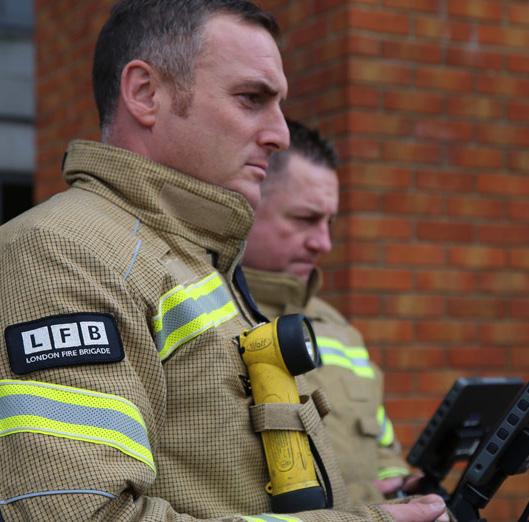
Lee Newman, RPAS Manager at London Fire Brigade talks us through the history and progress of implementing drones in Urban Search and Rescue.
Urban Search and Rescue in its purest form has been with us in various forms since way back and in a more uniformed and developed capability form since World War 2. During the war years it was mainly a dig by hand process, maybe some tools and if lucky some heavy plant. By the end of the war the capability had grown in technical and practical know how to the point where some shoring techniques are a direct consequence of this knowledge learned. From the war years through until today it has increased immeasurably in what it can deliver at an incident if called upon with various hi-Tec equipment, enhanced technical skills and advanced methods of rescue. Advanced technology should see further changes to capability including, robotic search dogs (SPOT is already in service https://www.bostondynamics. com/spot), artificial intelligence sensors, nano technology and drones. The use of drones in the urban search and rescue environment is the main thrust of my work within the London Fire Brigade along with the organisations aim of driving innovation into different areas of the service.
This article will explore how drones could effectively be used in a USAR environment and what it will mean for teams overall planning, searching and rescuing using the information harnessed from the drone. I will discuss how I have tested drones within exercise simulations, the benefits gained and the feedback from the staff and technicians received was.
Before Drones
Information at the scene of a USAR incident and any incident really, is incredibly important so those in charge can assess the situation quickly and make value judgement decisions and plan a course of action. The stages of a USAR incident are broken down into Assessment, Search & Rescue (ASR) levels which will range from wide area assessments down to individual search sites. Before drones the information over a wide land mass was gathered by ground intel, satellite images and aerial photography sometimes using planes or helicopters. The information captured allow for a picture to be built of what teams are going into and to help break it down into sizable chunks thus allowing a more efficient approach to be taken when allocating work sites to teams. Although this has proved successful for incidents in the past, evolving technology has now opened a new source of information gathering that can prove game changing for future incidents.
Drones and Beyond
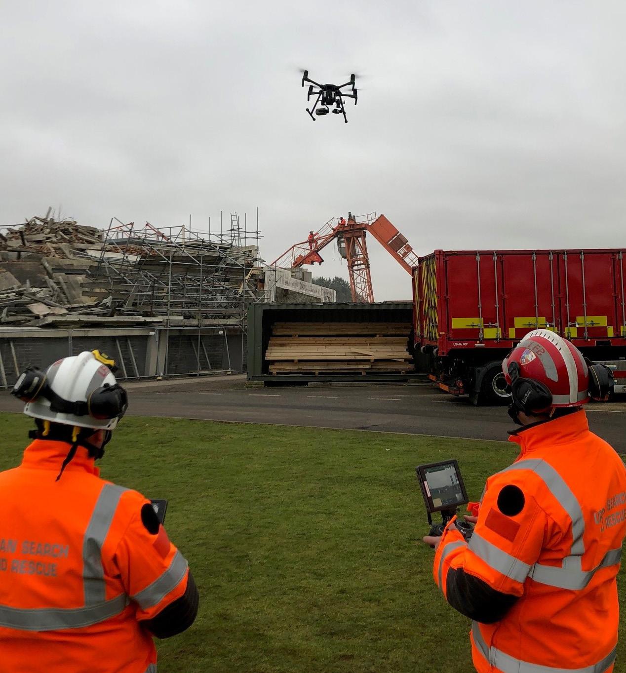
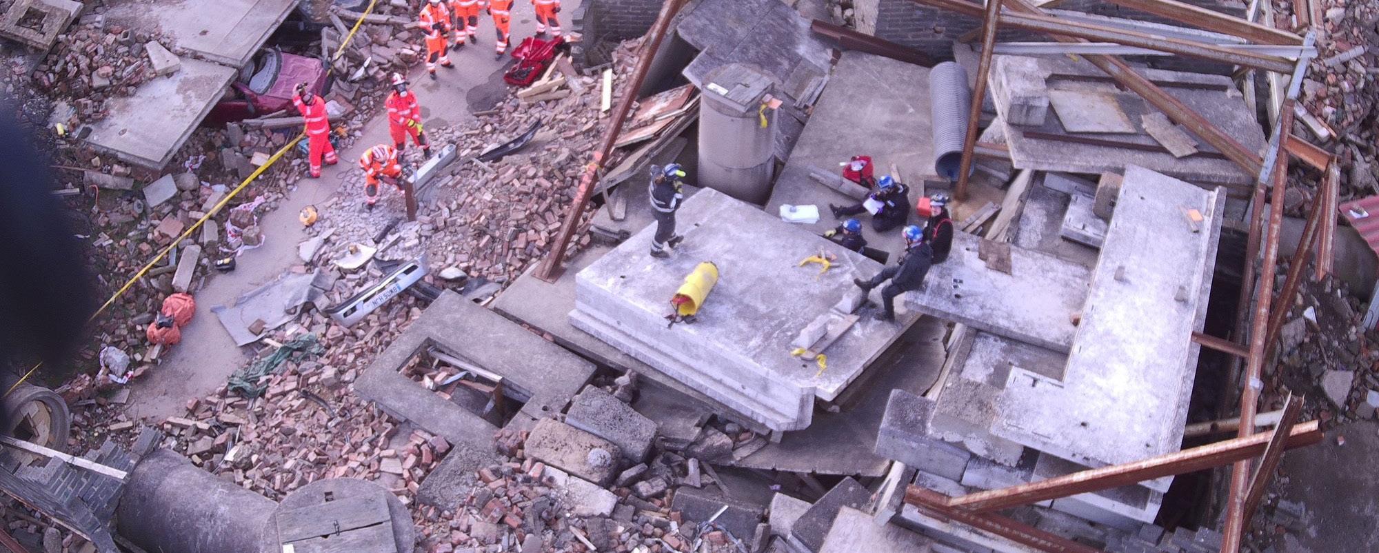
The new age of drone technology within USAR will be a potential game changer in respect to continuous 360° situational awareness and additional capabilities it can provide. At a recent USAR exercise at the Fire Service College (UK) I used the drone for the initial assessment to feed back to the command cell. I was able to identify hazards, locate victims and send back the images for the officers to start making plans from. The drone was also used to fly above the line and hail rubble pile sweep to give a wider view and to spot any potential hazards not seen from the ground. The operator with a radio relayed the information to the team leader in a rapid manor to give early warning of potential hazards. This role moving forward could be done autonomously and the live feed received via a team leader tablet and will be a normal integrated process within a few years. At a recent incident in London a three-story house had partially collapsed, and a full search had to be made to locate the missing occupants. The access to the top floor was a slow process due to the need for a platform to be built plus shoring around the structure to enable a safe work environment. All of this took time and by the time shoring systems had started being put in place the aerial appliance had arrived that was then used to gain access for USAR technicians to look inside and clear it of any victims.
I thought about the timescale we have in USAR to save life and the time it takes to erect safety systems to gain access there is a gap in which we could exploit using drones. I tested the ability to fly small sized drones through windows, doors or any general sizable gap to see if this would be an ideal procedure to explore voids and spaces not easily assessable by technicians for the reasons of having to put safety systems in place first. The flight in our USAR training rig was fairly easy and once we were familiarised and spatially aware, we could fly about the room and use the camera to assess and systematically search the area. I then took it to the next level when I flew it from outside of the USAR rig up to the 6th floor of the tower block and into the lobby, I used this flight to test the limits of drone use and how far into a building you could go before losing signal or any other limiting factor.
The only limiting factor was the drone that at the initial stages of an incident we can assess and search from a stand-off position which will limit USAR technicians from entering buildings unnecessarily increasing their safety and providing critical information to incident planners.
Mapping and Planning
Aside from the physical flying of drones at USAR incidents the other options they give us are, Mapping and planning, 3D modelling and situational awareness. At any incident we can take photos and print them off for incident commanders to use to draw up search sectors and for briefing crews with, however the capability of the drone and associated software via computers means the mapping can be far superior to just a piece of paper.
It is possible to show this as a live visual with floating icons to denote specific points of interest or cordons and can be as dynamic as the incident and will aid the situational awareness to be maintained remotely.
3-D modelling is fast becoming an application which in some cases can be turned around within 20 minutes and enables the viewer to look round the whole building from floor level or a bird's eye view. This will be the go-to for any incident and as the incident progresses the 3-D models will almost be a time lapse of the incident and show progression and or deterioration of the building.
These models will form part of the post incident brief and any subsequent investigations and will enable people who attended the incident to remember actions and events better through a visual representation.
Summary
The use of drones within the USAR world is slowly increasing in use and its untapped potential is only now being realised to what it can bring to the table. Through innovation and education, we will start to see a rapid increase in utilising drones in this field of operations. Using them as a safety tool primarily for firefighter safety coupled with their ability to aid in information gathering and post flight mapping and planning processes. The next generation of drones will incorporate robotic search dogs to undertake a multitude of functions, artificial intelligence drones to aid in search and rescue and nano robots or drones to enter voids and send back data of conditions and casualty information. A few years ago, this would have seemed like fantasy but the reality is a lot closer than we think.
Lee Newman
I am a Station Officer in the London Fire Brigade and have served 25 years in an operational role. I assumed the role of Drone Project Lead for LFB and am now responsible for its growth and expansion.