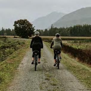
Explore on two wheels.
CHILLIWACK
Ts’elxwéyeqw (Ch-ihl-kway-uhk) means as far as you can go upstream in a canoe or “slough at the top of the head”; “going into a slough from the river at the top of the head,” referring to the many sloughs at the mouth of the Chilliwack River where it flows out of the valley and leads to the Fraser River.
STO:LO-COAST SALISH CULTURAL LANDSCAPE
The traditional language of Stó:lō in the Central and Upper Fraser Valley is Halq’eméylem. Biking provides a way of respectfully exploring and experiencing S’ólh Téméxw – “Our World” or “Our Land” – an interconnected place of people, nature, geography, and history. There is much to learn and benefit from experiencing the great outdoors and deep Stó:lō connections to the land and resources – a cultural landscape including the transformations of Xexá:ls “the Transformers,” snoweyelh “laws of the land,” sxexó:mes “gifts of the Creator” – and our rich cultural traditions.

VEDDER ROTARY LOOP
21 KM
The Vedder Rotary Loop is a beautiful trail runs along the north and south sides of the Vedder River. Great for running, biking, walking and horseback riding, many outdoor enthusiasts find this trail wonderful not only for the scenery but for the great accessibility to the Vedder River.


VALLEY RAIL TRAIL
2.3 KM
The Valley Rail Trail extends from Luckakuck Way north over the Trans-Canada Highway and Chilliwack Creek to Airport Road. Following an existing railway, the trail provides cyclists of all abilities with a protected cycling trail that connects the north and south sides of the highway.
CANYON TO COAST
18 KM
The Canyon to Coast trail is a portion of the Experience the Fraser Trail that is a recreational, cultural and heritage project that extends along the Lower Fraser River Corridor connecting Hope to the Salish Sea. The Canyon to Coast portion of the trail runs through Chilliwack for 18km from Island 22 to the Ferry Island Provincial Park.
DOWNTOWN CHILLIWACK
Downtown Chilliwack is the commercial and historic core of the city and is located on the north side of the Trans-Canada Highway. With over 300 locally owned and operated businesses, the area offers an array of specialized products and services in the heritage area of Downtown Chilliwack. While you cycle, stop for some delicious baked goods, lunch or shopping!
Rules of the road.
Please follow the rules of the road. People who cycle have the same rights and responsibilities as drivers. The motor vehicle act and City by-laws also apply to people who cycle. Visit safercity.ca and chilliwack.com to learn more.
5 PRINCIPLES OF SAFE CYCLING
1 Know and obey the rules of the road
2 Maintain your bicycle & ensure it is in good working order
3 Be as visible as possible to others
4 Learn the skills you need to control your bike
5 Cycle in traffic safely and predictably
Use lights at night
When visibility is poor, use a strong white headlight and red taillight. Use bike reflectors and reflective clothing.
Obey traffic signs & signals
In order to be taken seriously and be safe, cyclists must obey the rules of the road.
Pedestrians & buses
Yield to all pedestrians at intersections and zebra-marked bike path crossings. Yield to a bus when it is leaving a stop.
Stay off sidewalk
Riding on sidewalks is illegal and dangerous. Only ride on a sidewalk where permitted by signs.
Use hand signals
Signal all turns and stops ahead of time, shoulder check then make your intended move when it is safe.

The British Columbia Motor Vehicle Act states that cyclists have the same rights and duties as a motor vehicle driver.
Signal your turn Signal before you want to change lanes by using hand signals or pointing. Go slow when you turn, especially if the road is wet.
Scan the road behind:
• Shoulder check regularly and use a mirror to monitor traffic.
• Be prepared to q for safety.
Use appropriate lane:
• Do not ride in a right-turn-only lane, if you are going through.
• Move into a through lane early.
Be careful at intersections:
• Most accidents occur at intersections.
• Vehicles making turns are particularly dangerous.
• Make eye contact with drivers.
• Your bike is allowed to take the whole lane if that is the safest thing to do.
Be aware of car doors:
• Vehicle occupants may unexpectedly open doors.
• If you see people in a parked car, ride a door width away.
Plan your route:
• Try several routes to find one that feels the most comfortable.
• Allow extra time on an unfamiliar route.
Year round cycling:
• Take extra care in slippery conditions.
• Plan for sudden weather changes and adjust your route and speed.
Ride in a straight line:
• Ride at least 1m from the curb, so you can move around hazards.
• Do not dodge between parked cars.
Be Careful with Children:
• There is not approved standard or regulation for child carriers.
• Everyone, including children, should wear a helmet.
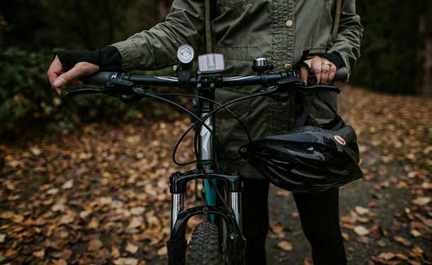
Helmets Cyclists are required by law to wear an approved helmet. In the event of a crash, a helmet will greatly reduce your chances of a serious brain injury. A helmet should have CSA, ANSI, ASTM, or SNELL standards approval clearly designated on it. Hockey or other types of sports helmets are not legal for cycling.
SAFE CYCLING PRINCIPLES
LEFT-HAND TURN STOP RIGHT-HAND TURN

These
are more likely to be cyclists along the route.
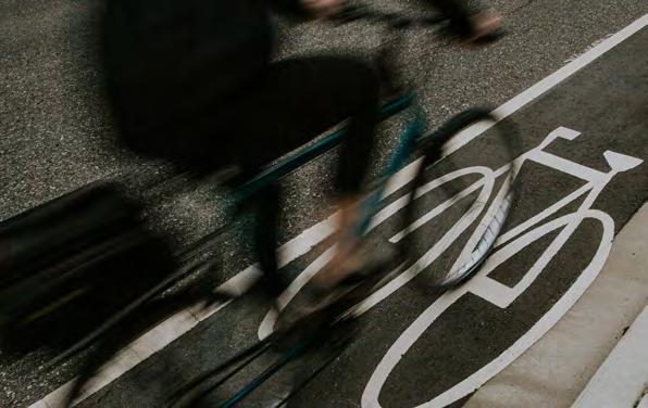
Bicycle Indicates a bicycle route or lane.
Special Reserved Lane
Indicates a reserved lane for the devices noted on associated signs or pavement markings. When combined with a bicycle this symbol indicates a dedicated bicycle lane.
Elephants feet/ White Squares at Crosswalks When a SharedUse Path crosses an intersection, the crosswalk may be lined with white squares. These squares identify shared bicycle and pedestrian crossings and may be controlled by a pedestrian walk light or traffic signal.
On Your Bike
• There is no need to dismount your bike to cross.
Sharrow (Shared Roadway)
Indicates a roadway shared with motor vehicles. The arrow shows where people cycling should generally position themselves
• At the crosswalk with pedestrian light: press the pedestrian walk button. Cross when clear to do so.
• At a crosswalk without a pedestrian light: yield to cars and pedestrians before entering the roadway and cross when it’s safe to do so.
Bicycle Box
Indicates where people cycling should position themselves at a red signal, allowing them to turn left, right, or go straight in advance of other vehicles.
Green Bike Boxes painted in a driving lane allow cyclists to do two things:
1) Pull in front of waiting traffic at a signalized intersection, making cyclists more visible and giving them a head start when turning or going straight.
2) Make safe turns by using it as a Bike Turn Box.
When stopped at an intersection, do not stop on the x.


These signs help to direct cyclists along recommended routes and remind drivers that there

SHARED-USE PATH ETIQUETTE
Be respectful: Share the path / Keep right
Be courteous: Pass on the left / Ring bell to pass / Slow down: always slow down and provide ample space when passing others.

Green Paint Highlights potential conflict areas with motor vehicles.
Commonly used along protected bike lanes at intersections and driveways.

Turning Left using a Bike Box

1) Go straight through the intersection when the signal is green and wait in the turn box.
2) Proceed left across the intersection when the signal changes.
Bike Lanes and Roundabouts Roundabouts are singlefile, share the road intersections. Bike lanes end prior to roundabouts – vehicles and cyclists merge to form a single lane of traffic. Or cyclists can choose to dismount and walk on sidewalks and marked crosswalks.
crossing points on SharedUse Paths, but may also be used where a Protected Bike Lane ends.

characteristics. These include narrow lanes, poor visibility, changes to the roadway alignment or where a reserved bicycle lane ends.
are allowed full use of the lane ahead and to warn motorists that the lane is too narrow for side by side operation.
been painted on the road, along with bicycle symbol pavement markings. There is no bicycle parking allowed in bicycle lanes.
PAVEMENT MARKINGS ROAD SIGNS
markings and signs help to direct cyclists along recommended routes and remind drivers that there
1 2


Protecting this gift. There are many individuals and groups tha build, maintain and use our trails. Without these dedicated groups our beautiful back country would not be as accessible. When using our trails please be mindful to respec our backcountry and the many people that maintain it. A special thanks to the following groups their outstanding dedication to our comm Chilliwack Outdoor Club Vedder Mountain Trails Association Fraser Valley Mountain Bikers Associatio Backcountry Horseman of BC Chilliwack Park Society Around the Lake Give’r Take 30 Trails BC City of Chilliwack Mt. Waddington Outdoors 1% for the trail Fraser Valley Regional District BC Parks Recreation Sites and Trails BC Stó:lō Nation Valley Outdoor Association (VOA) Chilliwack River Valley Resident Associat Recognition PLEASE RESPECT OUR BACKCOUNTRY: MINIMIZ E YOUR IMPACT AND PACK OU T YOUR WASTE. If you want to venture further into the backcountry we recommend using a more detailed map or guidebook. Hiking on these trails is at your own risk. Due to snow, most alpine hikes are best done June through September. Conditions of trails and access roads vary and cannot be guaranteed passable. Wear and bring appropriate clothing and footwear, and be prepared for unpredictable weather. Carry water and snacks. Minimize environmental impact by staying on the trail. Tell someone where you’re going and when you’ll be back, or better yet, complete a Trip Plan –www.chilliwacksar.org/trip-planner. Cell phones coverage is unreliable in many of these areas. For Emergencies Dial 911. Always remember: Do not leave any valuables in your vehicle. Prevent, observe and Report all wildfires: Report a wildfire: 1 800 663-55 55 or * 55 55 on a cell / Fire information line: 1 888 336-7378 please be sure to follow fire safety regulations at all times of the year and check with BC Wildfire Services before lighting any open fire. www.bcwildfire.ca Please note: This guide is intended as an overview of some of the most popular hiking trails in the Chilliwack area. Not intended for navigational purposes. For the latest Forest Service Road conditions visit www.arcg.is/2aewrny FOREST SERVICE ROADS KNOW BEFORE YOU GO Legend 4x4 4x4 4x4 Mount Cheam Cultus Lake Chilliwack Lake Slesse Memorial Slesse Peak Forest Service Recreation Sites: aralsbc.ca a Trails Major Highways Major Roads Forest Service Roads Rivers/Creeks The Great Trail The Great Trail The Great Trail, formerly known as the Trans-Canada Trail stretches from the west coast of Vancouver Island to Canada’s East Coast. The Chilliwack portion of the trail is long, beautiful and worth exploring. Follow the legend as the trails change from gravel to road, to traditional trails For more detailed information on the route through the Chilliwack River Valley and the rest of B.C, check out the trail guide, visit the Trails BC website at w ww.triailsbc.ca 59 8 8 84 84 64 35 44 1 44 44 19 44 60 44 2 2 2 10 10 27 90 90 20 23 23 23 23 31 32 40 35 35 2 2 15 60 15 19 1 1 35 64 PRAIRIE CENTRAL RD CHILLIWACK CENTRAL RD WOLFE RD KNIGHT RD WELLS KNIGHT RD SPRUCE WILTSHIRE MANUEL SCHWEYEYRD CHILLIWACKMTNRD FIRST AVE CHARLES ST BRINX GLADYS STRATHCONA BRICE PORTAGE ELM DR HOCKING AVE BERKLEY LEWIS WELLINGTONAVE ASHWELL RD RIVERSIDE BELL MCNAUGHT RD WALDEN ST KENT WILLIAMS TOWERRD CARTMELL YALERD CAMPRIVERRD D R H T A R G C M D R D R O F D R S I N N A HOPE RIVER RD QUARRY TESKEYRD SYLVANRD D R N O S B I G D R R E V R K C A W I L L I H C PROMONTORY RD Y A W K R A P G N I D N A L E L G A E MCGUIRE RD BAILEY RD STEVENSON HIGGINSON THOMAS RD CUMBERLAND AVE STEVENSON WATSON RD THORNTON RD EXTROM RD RYDER LAKE RD ELK VIEW RD ELK VIEW RD INDUSTRIALWAY D R N A M K C I L D R E I R I A R P S A M U S D R N W O R B D R H T R O W S N U VEDDER MOUNTAIN RD COLUMBIAVALLEYHWYCULTUSLAKERD CHILLIWACKLAKERD YARROW CENTRAL RD NO. 3 RD ABBOTSFORD SOUTH SUMAS RD YALE RD KEITH WILSON RD KEITH WILSON RD LUCKAKUCK RD RYDER LAKE YARROW PROMONTORY SARDIS FAIRFIELD ISLAND ROSEDALE D R Y E S D A H C D R Y R A D N U O B D R S N A V E D R N O S Y T D R R E T R A C D R R E D D E V G N U O Y YALERD N O S D R A H C I R L O O H C S D E R R D R E L L I M D V L B N O S R R A G YALERD LUCKAKUCKWAY D R G N U O Y MENZIES BROADWAY AIRPORTRD KERR AVE FRASER RIVER FRASERRIVER DOWNTOWN CHILLIWACK CHILLIWACK LAKE GREENDALE BALLAMRD CANYONTOCOASTTRAIL YALERD D R E I R A R P R E P P U KITCHEN RD RYDERLAKERD YALERD MCDONALD FIRST AVE SDRTERP DRDROFNAB Tourism Visitor Centre Pedal Sport Jack’s Cycle Vedd Mtn Bike Routes RECREATIONAL ROUTES Valley Rail Trail 2.3 KM Vedder Rotary Loop 21 KM Canyon to Coast 18 KM EAST–WEST ROUTES Yarrow 9.9 KM Start your trip at No. 3 Rd and Boundary Rd. Travel along Boundary Rd to Yarrow Central to Vedder Mountain Rd until you reach the Vedder Crossing Bridge. Keith Wilson 1 KM Start your trip at Tyson Rd and Keith Wilson Rd. Travel along Keith Wilson Rd until you reach the Keith Wilson Bridge. Stevenson 1.7 KM Start your trip at Higginson Rd and Stevenson Rd. Travel along Stevenson Rd until you reach Chilliwack River Rd. Kn ight 2.3 KM Start your trip at Evans Rd and travel along Knight Rd until you reach Chilliwack River Rd. Yale West 12.3 KM Start your trip at Dyke Crest and travel along Yale Rd to Luckakuck Way to Evans Rd and back to Yale Rd until you reach Airport Rd. Industrial 6.2 KM Start your trip at Yale Rd and Highway 1. Follow along Industrial Way to Progress Way and end at Lickman Rd. A irport–Broadway 4.3 KM Start your trip at Yale Rd and Airport Rd. Travel along Airport Rd to Broadway and end on Yale Rd. Yale East 13.5 KM Start your trip at Williams St and Yale Rd. Travel along Yale Rd until you reach the municipal boundary. Reece 3.1 KM Start your trip at Wellington Ave and Hamilton St. Travel along Hamilton St to Reece Ave, to Williams St, to Portage Ave ending on Little Mountain. Chilliwack Lake 40 KM Chilliwack Lake Road is an 80km round trip through the Chilliwack River Valley, ending at Chilliwack Lake. Please note that there are no washroom facilities or water stations for a majority of the route. NORTH–SOUTH ROUTES Lickman 5.1 KM Start your trip at Ashwell Rd and Wolfe Rd. Travel along Wolfe Rd to Schweyey Rd to Chilliwack Mountain Rd to Lickman Rd ending on Yale Rd. Tyson–Evans 7.6 KM Start your trip at Wolfe Rd and Ashwell Rd. Travel along Ashwell Rd to Eagle Landing Pkwy to Evans Rd ending on Tyson Rd at Keith Wilson Rd. Sardis 5.8 KM Start your trip at Luckakuck Creek. Travel to Wells Rd to Maitland Ave to Wiltshire St to Miller Drive to Garrison Blvd to Dieppe Pl to Sicily Rd to Petawawa Rd ending on Vedder Rd. Vedder 0.7 KM Start your trip at Keith Wilson Rd and Vedder Rd. Travel along Vedder Rd until you reach the Vedder River (Vedder Crossing Bridge). Sheffield 1.8 KM Start your trip at the Sardis Rail Trail and Sheffield Way. Travel along Sheffield Way to School Ln to Hogginson Rd ending on Stevenson Rd. Young–Promontory 9.8 KM Start your trip at Third Ave and Young Rd. Travel along Yale Rd to Chilliwack River Road to Promontory Rd ending on Sylvan Dr. Edward 2.2 KM Start your trip at Hodgins Ave and Newman Rd. Travel along Newman Rd to Menholm Rd to Edward St to McIntosh Dr to Meadowbrook Dr to Hocking Ave to Yale Rd ending on Airport Rd. Strathcona 1.4 KM Start your trip at Kent Rd and Strathcona Rd. Travel along Strathcona Rd to Williams Rd ending at Hope River Rd. Williams–Charles 3.9 KM Start your trip at Young Rd and Clarke Dr. Travel along Clarke Dr to Riverside Dr to Williams St to Third Ave to Charles St to Chilliwack Central Rd to Elm Dr to Southlands Dr ending on Young Rd. Corbould 2.6 KM Start your trip at Young Rd and Berkley Ave. Travel along Berkley Ave to Corbould St to Hodgins Ave ending on Ashwell Rd. Mary–College 1.7 KM Start your trip at Young Rd and College St. Travel along College St to Wellington Ave to Mary St ending on Bernard Ave. Fairfield 2.6 KM Start your trip at Brinx Rd and McDonald Rd. Travel along McDonald Rd to Brice Rd to Kent Rd to Hope River Rd to Menzies St ending on Yale Rd. 2 8 10 20 32 40 44 60 64 84 88 90 15 19 23 31 67 55 91 27 65 35 71 59 Protecting this gift. MINIMIZE YOUR IMPACT To do your part in keeping Chilliwack clean, please do not litter. If cycling where there are no accessible garbage or recycling receptacles, please do your part in packing out what you pack in. Conditions of trails may vary and cannot be guaranteed as passable. Always be prepared. Be extra visible with reflective gear on your bicycle pedals and wheels. Remember to plan for poor weather or low light conditions. Your bicycle must be equipped with a front white headlight and a rear red light/reflector. Be extra visible with reflective gear on your pedals and wheels. Carry water with you and dress in layers that are breathable and wind resistant in case of sudden weather changes. For Emergencies Dial 911 Always remember: Do not leave any valuables in your vehicle, and lock up your bike when leaving it unattended. NEED A BIKE REPAIR? Pedal Sport 604.795.2453 www.pedalsport.com Vedder Mountain Bike Co 604.846.2453 www.vmbc.ca Legend Gravel Path Highway 1 Paved Path Neighbourhood Street Bikeway Major Street – Bicycle Lane Major Street – Share Lane Public Washroom Water Bike Shop Bus Exchange Hospital 91 84 88 59 65 65 71 64 35 35 55 15 64 67 8 67 HOPERIVERRD YALE RD FIRST AVE WOLFE HODGINSAVE BERNARD AVE HOCKING AVE ELM DR LEWIS AVE PORTAGE AVE CHILLIWACK CENTRAL RD AIRPORTRD MENZIESST YOUNG RD CORBOULD ST ASHWELL BROADWAY CHARLES ST PREST RD PREST RD YOUNG RD STRATHCONA RD WILLIAMS RD BERKLEY AVE WELLINGTONAVE CLARKE DR MCNAUGHT RD WALDEN ST WILLIAMS ST FIRST AVE DOWNTOWN CHILLIWACK Pedal Sport


