78 minute read
NEWS & RESEARCH BY COUNTRY
NEWS AND RESEARCH BY COUNTRY
OMAN
Advertisement
We are very grateful to Mr Sultan Al-Bakri, DG of Archaeology of the Ministry of Heritage and Tourism of Oman, and Dennys Frenez for information and updates from Oman as below. Photographs are courtesy of the Ministry of Heritage and Tourism.
Country News
2020 has marked profound changes in the Sultanate of Oman following the nomination of H.M. Haitham bin Tariq Al Said as the new Sultan after the loss of Oman's renaissance father, Sultan Qaboos bin Said Al Said. The reorganisation of the country began by Sultan Haitham immediately after the mourning period also touched the Ministry of Heritage and Culture, of which he had been the Minister from 2002; this has now become the Ministry of Heritage and Tourism. At the same time, the new Ministry has also absorbed the role, functions, and projects of the former Office of the Adviser to H.M. the Sultan for Cultural Affairs. H.E. Salim bin Mohammed Almahruqi, the former Undersecretary for Heritage Affairs, has been appointed as the first Minister of Heritage and Tourism of the Sultanate of Oman. H.E. Almahruqi will not only guide Oman towards its consolidation as a major worldwide tourist destination but will also continue the country's long tradition in archaeological research and heritage preservation (See Research section). Heritage and Tourism will also harmonise in a series of new initiatives concerning museums, open-air parks, visitor centres, and heritage tracks throughout the country, as well as scholarly and enthusiast-oriented publications (See Museums & Publications sections). The Sultanate’s renowned attention to understanding, preserving, and disseminating its tangible and intangible heritage also led to its nomination as a member of the UNESCO World Heritage Committee 20192023.
Research
In 2020, the Sultanate of Oman confirmed and further strengthened its support for both cultural tourism and purely research-oriented field projects. The collaboration with a great number of projects and scholars, both local and foreign, has characterised the mission of the Ministry of Heritage and Culture over the past forty years, making Oman one of the fastest forward-moving countries worldwide in terms of understanding, preservation, and promotion of its archaeological and historical heritage.
The new Ministry of Heritage and Tourism has confirmed this attitude towards the support of heritage sciences, with the country hosting more than twenty international research projects in collaboration with institutions from all over the world, Australia (La Trobe University, and the University of Sydney), the Czech Republic (Masaryk University, and the Czech Academy of Sciences), France (University of Paris 1 Pantheon-Sorbonne, University of Lyon, the National Centre for Scientific Research, the National Institute for Preventive Archaeological Research, the Institut des déserts et des steppes, and Eveha International), Germany (Heidelberg University, University of Tübingen, and the Goethe University Frankfurt), Italy (University of Bologna, University of Milan, University of Pisa, Sapienza University of Rome, and the University of Naples Orientale), Japan (Research Institute for Humanity and Nature), the Netherlands (Leiden University), Poland (University of Warsaw), the USA (American University of Beirut, New York University Abu Dhabi, Johns Hopkins University, Ohio State University, Temple University, and the University of Wisconsin), and the UK (Durham University, Exeter University, and Oxford University). Such institutions always collaborate with the Department of Exploration and Archaeological Studies of the Ministry and often also team up with the Departments of Archaeology and Earth Science of the Sultan Qaboos University.
In addition to archaeological excavations and studies, the Ministry of Heritage and Tourism supports the conservation and restoration of specific sites and monuments based on constant monitoring by the Department of Exploration and Archaeological Studies in collaboration with the regional sections of the Ministry and the World Heritage Sites Department. In 2020, the Ministry has continued the
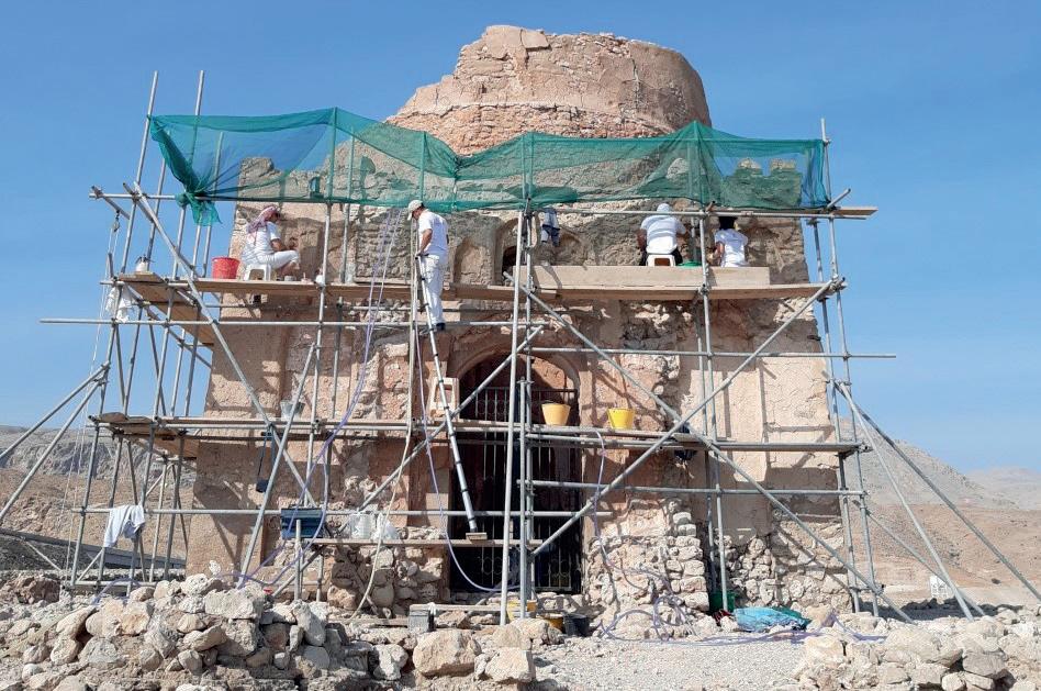
restoration of several important archaeological and historical buildings across the country, including the massive Bronze Age stone tower of Al-Khutm, in the UNESCO site of Bat, Al-Khutm & Al-Ayn (Ad-Dhahirah), the mid-sixteenth century Al-Owainah Mosque in Wadi Bani Khalid (AshSharqiyyah) and Qurnat Qaid Mosque in Samail (AdDakhiliyah), as well as Bait Fateh Al-Kabir in Bawshar (Muscat) and the Medieval Fort of Nakhal (image previous page), which is considered one of the most prized historical and touristic destinations of southern Al-Batinah. Moreover, the structural conservation and ornamental restoration of the thirteenth century Bibi Maryam Mausoleum (below), a unique landmark in the history of Oman that stands at the entrance of the UNESCO site of Qalhât, has also started with technical support from Regoli & Radiciotti Ltd. (Rome). The conservation of some structures in the UNESCO sites of Sumhuram and Al-Baleed, in Dhofar, is also planned to begin early in 2021 as soon as the containment measurements implemented against COVID-19 allows safe working conditions. Important monitoring activities have also been implemented by the GIS (Geographic Information System) Department of the Ministry, which is creating a digital map of the archaeological risk to be shared with other Ministries in order to proactively plan the infra-structure development of the country in close consideration of the necessary safeguards of its tangible heritage.
Museums
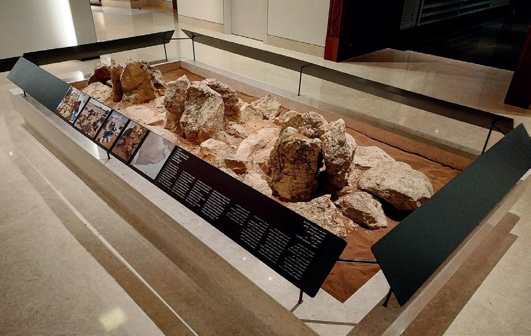
The Ministry of Heritage and Tourism of Oman is presently working to establish new museums and visitor centres in different regions of the country. The Bisya & Salut Visitor Centre (Ad-Dakhiliyah Governorate) is planned to be inaugurated in spring 2021. It will present the ecological, historical, and archaeological background that led to intensive settlement of this area from the Neolithic to the Islamic period. An illustrated tour in both Arabic and English will allow the visitors to admire the thousands of artefacts on display in the visitor centre together with illustrated panels about various aspects of the archaeology of the area, and 3D models of the impressive Bronze and Iron Age sites. The Ministry has also recently signed an agreement with OQ Oil & Gas Company to start building a Visitor Centre at the site of Daba, Musandam Governorate, from next July. It will present the impressive discovery of two large collective Iron Age tombs (LCG-1 and LCG-2), which have been uncovered over several excavation seasons carried out by the Department of Excavations and Archaeological Studies of the Ministry in collaboration with Sapienza University of Rome. Specific training activities for tourist guides have also been implemented in collaboration with the Embassy of Italy in Oman. According to H.E. Salim bin Mohammed Almahruqi, Minister for Heritage and Tourism, “Investment by the private sector in the heritage sector is a novel way to adopt and support projects that concern the wider society, support tourism and provide local communities with a variety of work opportunities, as well as help develop the cultural dimension.”
New Publications
In the Shadow of the Ancestors: The Prehistoric Foundations of the Early Arabian Civilization in Oman – Second Expanded Edition, by Serge Cleuziou & Maurizio Tosi. Edited by Dennys Frenez and Roman Garba. 2020 © Archaeopress Publishing Ltd. in collaboration with the Ministry of Heritage and Tourism, Sultanate of Oman. (Paperback, 582 pages; Printed ISBN 9781789697889, E-Publication ISBN 9781789697896)
The Tangible and Intangible Cultural Landscape of Wadi Bani Kharus: Investigations in the Sultanate of Oman, by Moawiyah M. Ibrahim and Laura M. Strachan. 2020 © Archaeopress Publishing Ltd. in collaboration with the Ministry of Heritage and Tourism, Sultanate of Oman. (Paperback, 454 pages; Printed ISBN 9781789698053, E-Publication ISBN 9781789698060).
Die Bestattungsgruben in Bat (Arabia Orientalis 1), by Conrad Schmidt, with contributions by Stefan Giese, Christian Hübner and Steve Zäuner 2020 © Archaeopress Publishing Ltd. (Hardback, 374 pages; German text; Printed ISBN 9781789697391, E-Publication ISBN 9781789697858).
The Journal of Oman Studies, Volume 21 2020 © Ministry of Heritage and Tourism, Sultanate of Oman (Printed ISSN 0378-8180)
International Association for the Study of Arabia (IASA) Notices on activities and research in Oman from some of the teams and organisations mentioned in the report of the Ministry of Heritage and Tourism appear below.
The Ministry of Heritage and Tourism and Embassy of Italy in Oman have completed an archaeology training and tourist promotion project in Musandam.
The project for the conservation and promotion of the Daba Al Bayah archaeological site in Musandam Governorate is a joint effort of the Italian Embassy and the Ministry of Heritage and Tourism.
An Italian archaeological team led by Dr. Francesco Genchi of La Sapienza University of Rome has been excavating the site since 2013 with the support of the Ministry of Foreign Affairs and International Cooperation of Italy. The activity, which was recently concluded, involved provided a training course for 10 Ministry of Heritage and Tourism officials for enhanced preservation of the site and to support the development of its museum as a tourism destination.
A multilingual guide of the site will allow visitors to learn about the historical importance of the settlement of Daba. A museum of the site will feature panels describing the various aspects of the archaeological complex. It also included a training for local tourist guides from Musandam who will accompany the visitors in the tours of the site. The initiative comes in the framework of the long collaboration between Italy and Oman in the archaeological sector, with more than 40 years of scientific and academic exchanges. Although the restrictions to the excavations due to the precautionary measures related to COVID-19 did not allow in-the-field activities, the cooperation between the two countries continued also this year through virtual programmes.
The project contributed to develop capacities to highlight the rich and diverse cultural heritage of Oman and to promote sustainable tourism within the economic diversification programme.

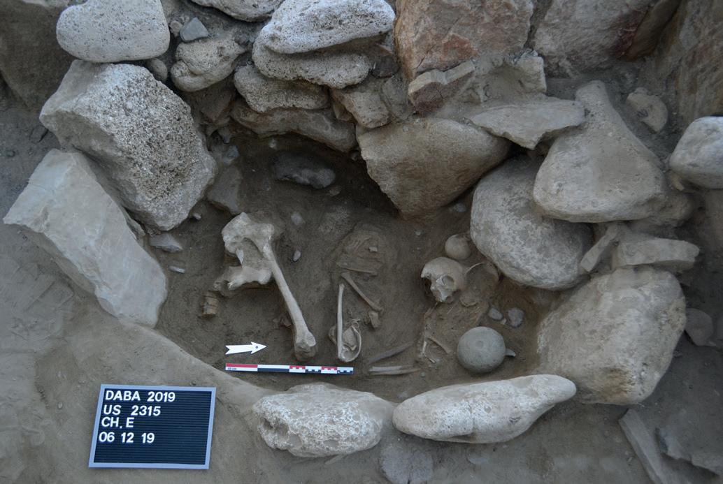
Daba funerary chamber. Photo: Ministry of Heritage and Tourism
Daba is a burial complex of great importance formed by numerous large collective graves containing hundreds of individuals each, accompanied by thousands of valuable goods. Daba is located on the east coast of Musandam Peninsula and is surrounded by several Iron Age sites including both settlements and burial complex, giving the idea of a wealthy society that was living in the area. Daba is at present among the richest sites of Eastern Arabia. The metal objects recovered represent a unique assemblage for wealth and quality: a milestone for the understanding of Early Arabian Civilisation that for a decade will engage scholars from all over the world.
As a result of the importance and the good conservation of the site, the potential for tourism development in the area is extremely high.
The Al-Mudhaybi Regional Survey
Stephanie Döpper
The history of Central Oman during the Bronze and Iron Ages is regarded as having steadily alternated between phases of sedentism and phases of mobility, between times of upswing and decline, and between far-reaching contacts and increasing regional isolation. In this constellation, the Umm an-Nar period, with its monumental round structures, i.e. so-called towers, and the Iron Age are considered to have been periods of prosperity that replaced the less conspicuous Hafit and Wadi Suq periods as well as the Late Bronze Age. Against this background, the aim of the Al-Mudhaybi Survey is to generate an overview of the settlement history and the archaeological structures in an approximately 30 x 30 km-large area around the modern city of Al-Mudhaybi. The survey uses a combination of different methods, including remote sensing with the help of freely available satellite images, GIS-based landscape modelling, as well as targeted and systematic intensive surface survey. Funding for this project is being provided for three years by the German Research Foundation (DFG).
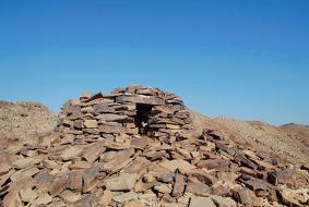
The first field season in 2019 was based on the remote sensing of satellite images. All potential archaeological structures visible on the satellite images were marked in GIS with additional information on the possible type of structure and date. In a second step, all of the structures were groundproven in the field. The greatest density of structures was encountered along the Wadi Andam, i.e. the main wadi course running from north to south in the eastern portion of the survey area. The Hafit period is by far the most numerously attested in the survey area, mostly due to its tombs (Figure 1). Surprisingly, the Umm an-Nar period is one of the least identified in the survey. In contrast, five large Wadi Suq period cemeteries have been documented to have a total of more than 700 tombs. These include two cemeteries near Mukhtru and one each near Al-Wafi, Al-Sudairah and Buweiten (Figure 2). No tombs could be attributed to the Iron Age by their architecture, but quite a number of them had Iron Age surface finds. Those tombs were mainly circular in shape and are probably badly preserved and reused Hafit period tombs. Non-funerary sites were not discovered in the remote sensing at all, except for the previously known Bronze Age sites Al-Khashbah and AlFath, the Iron Age site Lizq and several Late Islamic campsites, open-air mosques and abandoned mud-brick settlements.
Figure 1: Hafit period tomb north-east of Al-Fath (photo: AlMudhaybi Regional Survey).
The systematic survey started during the second field season in 2020. It differs from traditional surveys in that the systematic survey does not limit the collection of artefacts to previously identified and anticipated sites, but rather considers places in supposedly empty areas between the localities. It is the only way to find smaller sites, such as mobile camps and other artefact scatters, and, thus, create a representative overall picture of the study area. Every four kilometres in the survey area, a straight line running from north to south is field-walked by a team of four people who are spaced two meters apart from each other to ensure visual coverage of the ground (Figure 3). This enabled documenting a large Iron Age site near Sinaw with plenty of pottery on the surface, as well as Neolithic artefacts such as arrowheads. The systematic survey is planned to continue in 2021. Additionally, small-scale excavations were carried out at the

Figure 2: Wadi Suq period pottery sherd (top) and soft-stone bowl (bottom) from the Mukhtru and Buweiten cemeteries (photo: AlMudhaybi Regional Survey).
monumental structure, a so-called tower, at Al-Fath (Figure 4). Here, no Umm an-Nar pottery was found on the surface, which led to the idea that it could be a Hafit period tower. Radiocarbon dates from the lowest layers above the bedrock, however, turned out to be from the middle Islamic period around AD 1300, during which the tower had apparently been reused.
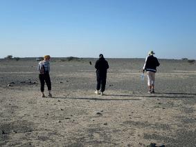
Figure 3: Systematic pedestrian survey (photo: Al-Mudhaybi Regional Survey).
The results of the Al-Mudhaybi Regional Survey have so far provided a great amount of evidence for the intensive use of the survey area during the Hafit period, but surprisingly much less during the following Umm an-Nar period, which is generally considered to be one of the most flourishing periods of Oman’s history. The Wadi Suq is well documented, indicating widespread and persistent activities in the area, in contrast to what is generally assumed for this period. Remarkably, no Iron Age remains were discovered

Fig 4: Excavations at Al-Fath (photo: Al-Mudhaybi Regional Survey)
during the remote sensing, but a large settlement site near Sinaw was discovered during the systematic survey. Middle Islamic structures are so far only known from the excavations at Al-Fath, while Late Islamic findings, above all pottery sherds, were plentiful throughout the entire survey area.
References: Döpper, S. – Schmidt, C. (2020), Nothing but Tombs and Towers? Results of the Al-Mudhaybi Regional Survey 2019, Proceedings of the Seminar for Arabian Studies 50, 157–169.
Indian and local ceramics from Dhofar: a multi-analytical approach to unravel a complex cultural network.
Silvia Lischi (University of Pisa-DHOMIAP project), Patrícia Moita (University of Évora and HERCULES laboratory), Marike E. J. J. van Aerde (University of Leiden – “Routes of Exchange, Roots of Connectivity” project), Daniele Zampierin (ARCHMAT). With collaboration among the Erasmus Mundus project “ARCHMAT”, the HERCULES Laboratory and the Archaeology Faculty of Leiden University it was possible to carry out a series of archaeometric analyses of pottery artefacts from the sites HAS1 (Inqitat) and Sumhuram, both in the area of Khor Rori, Dhofar. This was made possible through a fruitful collaboration with the project "DHOMIAP" and the Ministry of Heritage and Tourism (Oman).
With their strategic location concerning the production areas of frankincense, as well as the routes of exchange, HAS1 and Sumhuram were strongly involved in the ancient Indian Ocean trade network. In the time-span going from the 3rd- 2nd century BC to the early 5th century AD, materials from a remarkable variability of regions along the coast of the Indian Ocean and beyond reached both sites.
The materials considered in the analysis were composed of a group of pottery sherds of both 'local' and 'Indian' origins, partly from Sumhuram and partly from Inqitat. The selection tried to cover the whole time-span of the two sites and to include the most characteristic types within the recovered assemblage. The aim, in fact, was to conduct a survey of the pottery composition by means of archaeometric analysis and compare the results with the archaeological and typological data in our hand. The aim was to verify whether the types identified, during archaeological survey, are also evident from a mineralogical and chemical point of view and whether the attributed areas of origin are confirmed by the fabric components.
Map of Arabian Sea including some of the most important archaeological sites connected to the Arabian Sea trade (after Lischi et al. 2020).

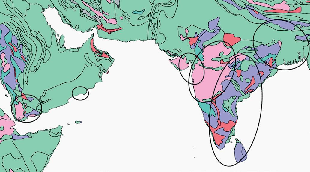
General map of South Arabian and Indian geology (after www.usgs. gov) with provenance of the different groups.
The site of HAS1, ca. 8th century BC-1st/2nd century AD, was inhabited by semi-nomadic people belonging to the Coastal Culture of Dhofar. On the other hand, the city of Sumhuram, 3rd/2nd century BC-early 5th century AD, was a South Arabian colony of the Kingdom of the Hadramawt. The two sites are just a few kilometres away from each other, both along the Wadi Darbat, and they both yielded a great variety of imported materials of different cultural origins. A huge amount of pottery samples was found during the excavation activities in Sumhuram, but our attention was captured by the Indian and the local sherds. The ceramics found at the HAS1 site, certainly fewer in number but often typologically different, stimulated the need to find an alternative way to analyse them to understand whether they were expressions of the same cultural and geographical sphere or not. By means of a multi-analytical approach, which included techniques like XRD, SEM-EDS, ICP-MS and conventional petrography, it was possible to define the elemental and mineralogical composition. Furthermore, we were able to determine the presence of different groups with distinct characteristics not perceptible through only typological and macroscopic study.
The samples collected were divided into 8 groups: Shell Tempered (ST), Shale-rich Fabric (SF), Talc-rich Fabric (TF), Basalt-rich Fabric (BF), Rice Tempered (RT), Fine Fabric (FF), Medium-Large inclusions in fine Fabric (MLF) and the Shell and Sand rich Fabric (SSF).
The first three groups classify the ceramics as 'local', although only for group ST is the area of production likely to be Dhofar. For groups SF and TF the production area is likely to be South-western Arabia.
The other four groups (BF, RT, FF, MLF) identified ceramics coming from four different macro-regions within India. Interestingly, the SSF group, represented by three specimens, has intermediate characteristics that do not allow identification of its provenance.
The remarkable variability in pottery composition, resulting from the geological variability of the origins, underlined three extremely important aspects. The first aspect is that the typological classification does not always give a clear indication of the provenance. Secondly, the multianalytical archaeometric approach has proven to be useful in recognising the different characteristics of production within the typological groupings. For this reason, sometimes, we noted a discrepancy between the typological grouping and the archaeometric grouping.
Thirdly, the results from the analysis gave indications of the geographical extension of this network. In fact, the analysis, not only underlined that the ceramics were imported from South-western Arabia, probably in relation to the Hadramawt control of Sumhuram, but also how, in both archaeological sites, materials were imported from different regions of the Indian subcontinent.
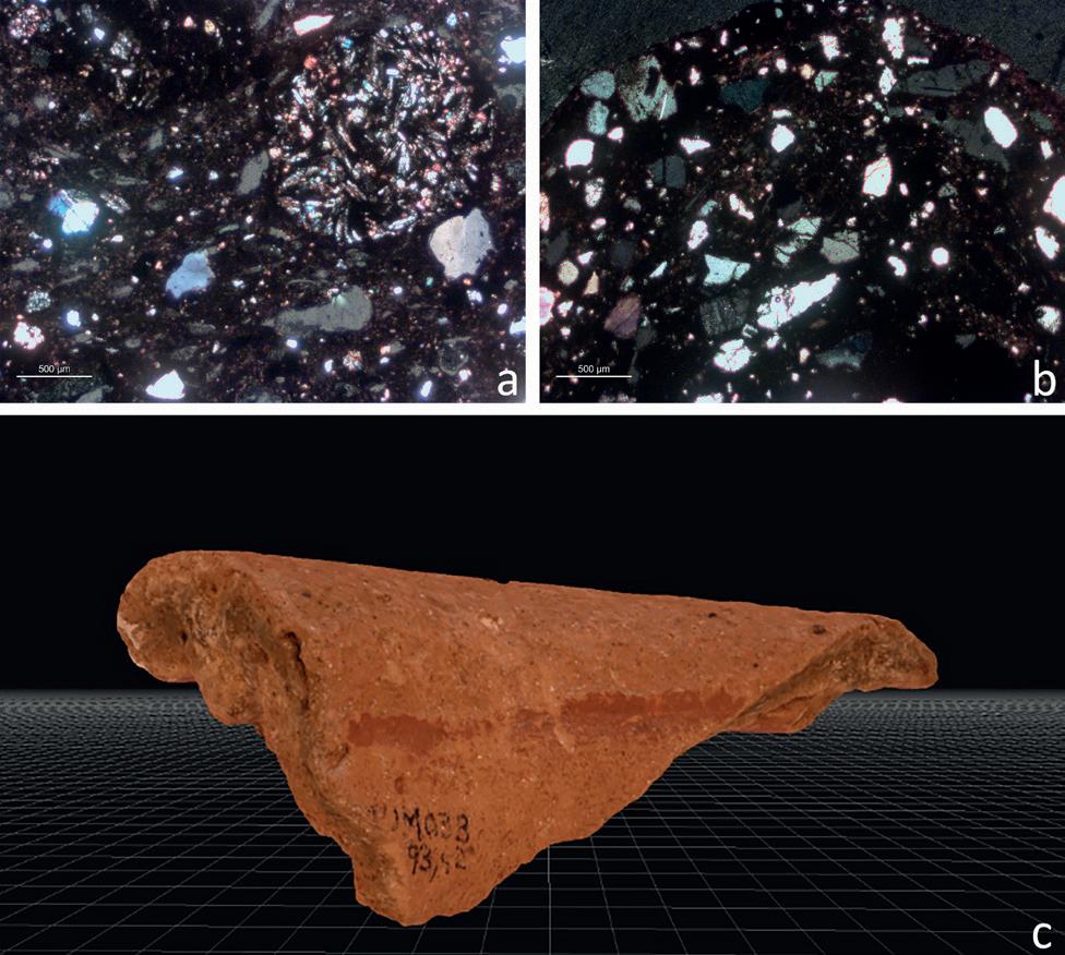
Microphotographs (with cross polarized light-XPL) presenting the general textural features of Groups BF (a) and MLF (b). 3D reconstruction of one of the samples (c).
This survey of the pottery composition from HAS1 and Sumhuram, has proved the effectiveness of a multidisciplinary scientific approach when tackling the studying of materials related to such a very complex reality as the Indian Ocean ancient trade network. It also underlines the importance of keeping a bottom-up approach when trying to understand extremely complex mechanisms of the past. Phenomena like globalisation, trade exchanges and movements of people are processes that do not leave linear or direct traces, but it is possible to reconstruct evidence that resulted from these processes, in the first instance, by attempting to comprehensively understand the nature and information that we can collect and analyse based on these tangible data.
References Pavan, Alexia. 2017. Khor Rori Report 3. A cosmopolitan city on the Arabian coast. The imported and local pottery from Khor Rori. Roma: L’ERMA di Bretschneider.
Study of Inqitat. In: Cattani M, Frenez D, eds. Dreamers. 40 years of Italian archaeological research in Oman. Rome: BraDypUS. p. 149–51.
Zampierin, Daniele. 2020. “Multi-Analytical Characterization of Ceramics from Dhofar (Southern Oman): Provenance and Trade.” MA Thesis. Unpublished.
Alexia Pavan, Roberta Giunta & Andrea D’Andrea
In 2019 a new collaboration between the Office of the Adviser to HM the Sultan, now Ministry of Heritage and Tourism, and the University of Naples “L’Orientale” started at al-Balīd (fig. 1), one of the most important ports of the Western Indian Ocean between the 13th and the 17th centuries. The aim of the project is an extension of the works in the field, currently focused on the citadel (ḥuṣn al-Balīd), within the frame of a general re-consideration of the development of the city.
To achieve this target three different and parallel research lines have been set-up: an on-field investigation which was mainly focused on the analysis of the masonry, a review of the available data-archives and, finally, the study of pottery and small finds, including coins.
The first step of the joint mission was a preliminary season in situ with the aim of investigating and recording the different types of masonries attested at al-Balīd through the creation of a chrono-typological Atlas. The activities have initially been focused on the citadel (fig. 2), because it is the most complex structure so far excavated and it boasts a wide variety of different masonries with many construction techniques having been adopted. Moreover, its extensive excavation, together with the study of the finds, could allow a better comprehension of the chronological phases in the frame of the historical and economic development of the site. Seven main types of masonry have been identified according to parameters such as: building technique, layout, manufacturing, finishing and size. Thus, the complete list of the walls of the citadel has been reviewed accordingly, associating each wall with its related type. This allowed the updating of the occurrence of the different types of masonry both in the plan (fig. 3) and in the elevation, in order to clarify the progressive enlargement of the building and the modifications which occurred during its long occupation. This approach led to the identification of four different constructional phases, featured by progressive additions, related to the different historical and economic scenarios. During the first phase there was an initial, smaller citadel, square in plan, which had the same orientation of the actual building. Four jutting towers were placed at the corners, according to the typical arrangement of the pre-gunpowder forts in Oman. The main gate was through a portal located on the western side, which was high enough to allow entrance inside the ḥuṣn while riding a horse. In the following phase the citadel gained a much more monumental appearance with two extensions located along the northern and eastern sides. The former was used for activities linked to water, as evidenced by the occurrence of a well, channels and many plastered rooms and cisterns, which suggest both the existence of productive activities and the presence of an ablution area connected with the citadel itself. The eastern area was, instead, possibly related somehow to the occurrence of stables. In this phase the gate was located on the southern side and a monumental staircase allowed access to the upper part of the construction. The layout of the
Figure 1. View of al-Balīd and its location (Satellite images: Google Earth)


Figure 2. Aerial view of the citadel (ḥuṣn al-Balīd) (Photo: A. Massa)
building underwent considerable changes after the arrival of the Turks and Portuguese in the Indian Ocean in the 16th century. “Full” circular towers were added onto three of the four corners; the northern and eastern extensions were obliterated and the citadel gained a much more solid and massive appearance, thanks to the addition of bastions along all of the four sides. The very last occupational phase is mirrored in the most external perimeter, nowadays visible. These walls often have an irregular orientation because of the presence of earlier structures below. Most of these walls were clearly built up to reinforce previous compartments or to improve static problems which occurred mainly in connection with the adjoining elements such as the towers. The types so far identified at the citadel will be employed to define and catalogue the other masonry structures at alBalīd. Considering, in fact, the vastness of the site and the impossibility of excavating the entire complex of the buildings, such an analysis of the standing structures could lead to the establishment of a chronology range for the monuments of the settlement.
The second research line is focused on the re-examination of all the available maps with the aim to geo-reference the whole excavated or surveyed areas. A GIS application will be implemented in order to merge all the graphical information provided by the different teams who worked at the site with the aim of recording, organizing and managing the whole heterogeneous corpus of data. The archive includes materials such as topographical maps, historical pictures, epigraphic documentation and a number of written sources such as the chronicles of a number of Arab travellers and geographers, Chinese accounts and written reports by British Lieutenants and Captains belonging to the East India Company’s Service or to the Indian Navy.
The aim of this task is to clarify some open questions about the extension of the city, the natural or artificial borders of

Figure 3. Thematic map of the citadel based on the identified masonry types (Drawing: C. Passaro, after A. Massa)
the urban space delimitated by the lagoon and the sea, the identification of the port area as a fully fledged harbour or a landing place for small boats, and, finally, the city’s relations with its surrounding areas.
As far as the study of small finds and pottery is concerned, the project started out with the creation of a digital archive including the almost 1500 coins discovered at the site. The corpus is actually the most consistent among the medieval corpora of coins discovered in the whole of the Western Indian Ocean and includes local, Chinese and African samples. The joint project points, moreover, to the study of the objects stored in Salalah and included in the so-called Museum Collection, a selection of pottery, small finds and coins, which gathered together the artefacts considered significant for provenience, dating and state of preservation.
References
D’Andrea A. Reconsidering the Topography of al-Balīd: A Preliminary Review of the Graphical Documentation, Annali dell’Università di Napoli “L’Orientale” 81 (forthcoming)
Pavan A., Laurenza S. & Valentini R. 2019. Masonry and building techniques in a Medieval city port of the Sultanate of Oman: preliminary typological atlas at al-Balīd, Newsletter di Archeologia 10: 321-344.
Pavan A., Fusaro A., Visconti C., Ghidoni A. & Annucci A. 2020. New Reearches at The Port of Al Balid and Its Castle (Husn): Interim Report (2016-2018), The Journal of Oman Studies 21: 172-199.
Newton L.S. & Zarins J. 2017. The Archaeological Heritage of Oman. Dhofar Through the Ages. An Ecological, Archaeological and Historical Landscape. Muscat: Ministry of Heritage and Culture.

A noteworthy Chinese assemblage in Arabia: recent discoveries from al-Balīd, Sultanate of Oman
Chiara Visconti, Alexia Pavan
Since the resuming of the archaeological investigations at the city port of al-Balīd, Sultanate of Oman, in 2016, a number of new research projects have been developed, under the aegis of the Office of the Adviser to HM the Sultan for Cultural Affairs, now Ministry of Heritage and Tourism, and other foreign institutions. Particularly significant has been the study of the pottery assemblage from East Asia carried out in collaboration with the University of Naples “L’Orientale”.
The recent excavations at the citadel (ḥuṣn al-Balīd, fig. 1) dramatically increased the quantity of pottery from East Asia, providing significant fresh data about the relationship between South Arabia and China during the Islamic period. The study of the assemblage from al-Balid has been carried out in the frame of a wider investigation of the imported and local pottery together with the analysis of the stratigraphy and of the architectural development of the citadel.
The data emerging from the still on-going studies reveal a numerically noticeable assemblage from China, although in most of the cases very fragmentary, which varies from 0.8% to 4% of the total amount of pottery recovered, with an average of 2.56%. The quantity appears definitely to be definitively consistent, considering that usually in Arabia and in the Gulf Area the pottery from East Asia represents
24
Figure 1 (above) The citadel of al-Balīd with the new recently excavated area in the foreground. (Photo: S. Al-Shahri)
less than 1% of the assemblage. Most of the fragments come from China, and from the Jingdezhen and Longquan kiln systems in particular. Some materials were manufactured in southern kilns, such as Dehua in Fujian. Other fragments, which need further study, may come from South-East Asia.
The pottery found during the excavations of ḥuṣn al-Balīd ranges from the end of the 13th century to the second half of the 18th century, attesting two main periods of relations between China and the Western Indian Ocean. The archaeological evidence emerging at al-Balīd is matched by a broader picture which includes the general economic development of the site, the Chinese ceramic production for export, and the inter-Asian maritime trade system in the Indian Ocean which is actually the focus of the on-going studies by the authors.
It is not excluded that earlier material could possibly occur at the site, but the excavations were suspended due to the pandemic before reaching the earlier levels of occupation of the citadel.
The assemblage has been divided out and studied according to fabric and glaze, the main groups being: Longquan celadon (qingci) and Jingdezhen blue and white (qinghua) porcelain which occur in reverse proportion in the early phase (13th/15th centuries) and late phase (16th/18th centuries). The last occupational phase is moreover marked by the presence of porcelain decorated with overglaze
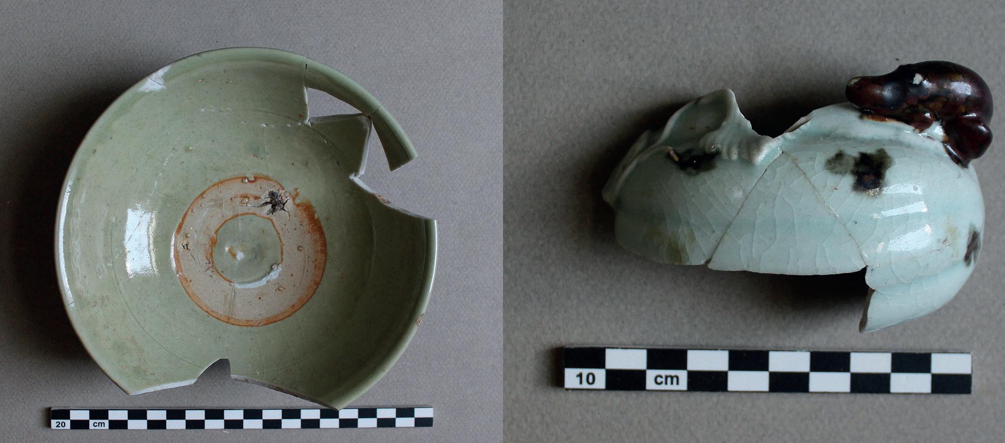
Figure 2. Left: Celadon bowl with unglazed stacking ring on the interior bottom (US301,39); right: lid with raised decoration and iron brown spots under celadon glaze (SU301,63). (Photos: A. Pavan)
Figure 4 Chinese figurative groups possibly arrived to al-Balīd through the gift exchange system (SU73,1 and SU200,284). (Photos: A. Pavan)
enamels, and/or with a brown glaze of the type generally known as Batavia.
Longquan celadon mostly occur in open shapes (bowls with different diameter; plates with flattened and foliated lips) with some closed diagnostic forms such as baluster vases which are quite rare in the Chinese assemblages discovered in the extensive Western Indian Ocean which includes the Gulf and the Red Sea. A number of shapes attested for the first time at the site (fragments of ewers and lids) have been very recently discovered during the excavations of an area located north from the citadel, which belonged to an early phase of the building. This northern large annex, which includes a well, channels, and plastered basins (see fig. 1), was obliterated contemporaneously as the works aimed at fortifying the building through the addition of towers, bastions and ramparts which were started at the very end of the 15th/ beginning of the 16th century, contemporary to the arrival of the Portuguese in the Indian Ocean. The celadon fragments from this area of the site can be largely dated to between the 14th and 15th centuries. An example, so far unique on the al-Balīd site, is the fragment of a lid with raised decoration and iron brown spots under celadon glaze (fig. 2, right). The fragments of a blue and white bowl (fig. 3), which show a decorative pattern consisting of lotus petal-panels and foliate elements, are attributable to the same period. Indeed, the decorative scheme is typical of the blue and white porcelain production during the Yuan dynasty (1279-1368).
In addition to the division into ceramic classes, based on different glazes and fabrics, the sherds unearthed at alBalīd can be further tentatively subdivided into utilitarian wares and diplomatic gifts. To the first category belong, for example, the fragments of ‘Martaban’, i.e. jars for storing and transporting goods, found in large quantities throughout the site. To the same category can be ascribed the numerous celadon bowls with matching stacking rings on the interior bottom (fig. 2, left). To the category of diplomatic gifts, on the other hand, can be ascribed some fragments that are remarkable for their quality and form, such as guan jars and noteworthy lotus bowls. We can assume that the two
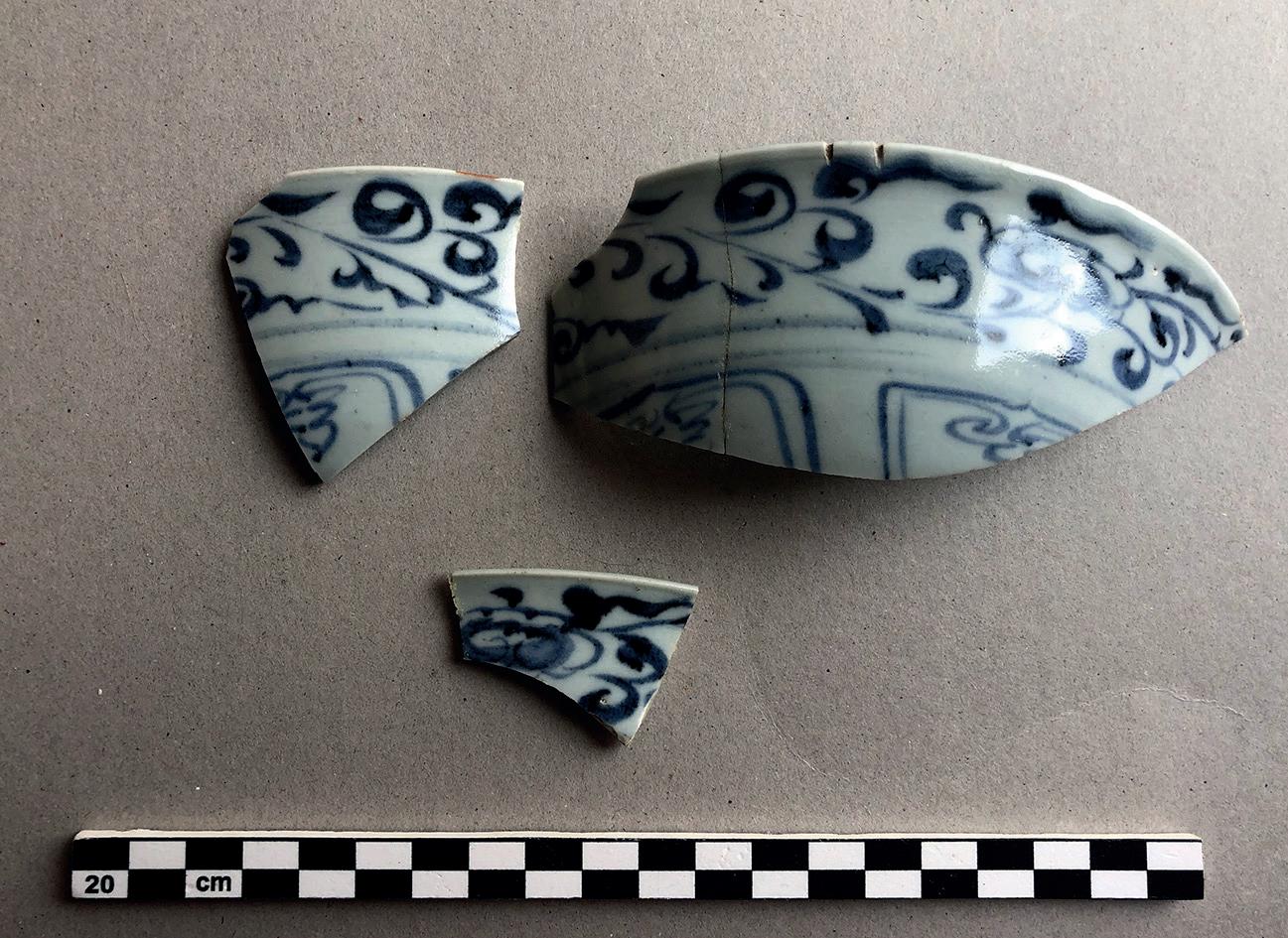
Figure 3. Blue and white bowl with a band of scrolling flower above upright petal lappets (SU301,62). (Photo: A. Pavan)

figurative groups (fig. 4), for which no significant comparisons have been found in the assemblages of other sites of the Arabian Peninsula, were also brought to al-Balīd through the gift exchange system.
Pavan A., Fusaro A., Visconti C., Ghidoni A. & Annucci A. 2020. New Researches at The Port of Al Balid and Its Castle (Husn): Interim Report (2016-2018), The Journal of Oman Studies 21: 172-199.
Pavan A. & Visconti C. 2020. Trade and contacts between southern Arabia and East Asia: the evidence from al-Balīd (southern Oman), Proceedings of the Seminar for Arabian Studies 50: 243–257.
SAUDI ARABIA
Survey of al-Ḥawrāʾ 2020: Uncovering the structure of a medieval port city on the Red Sea coast
So Hasegawa, Waseda University & Higashinippon International University, Risa Tokunaga, Arabic Islamic Institute in Tokyo & Kanazawa University, Abdulaziz Alorini, Ministry of Culture, Saudi Arabia & Sumio Fujii, Kanazawa University
The Saudi Japanese Archaeological Mission at al-Ḥawrāʾ has been conducting surveys in the medieval Red Sea port of al-Ḥawrāʾand its hinterland since 2018. The site is located approximately 10 km north of Umluj, Tabūk Province (Fig. 1). From February to March 2020, we conducted our first excavations of the site and the graffiti and petroglyph survey in the hinterland plateaus to the south and southwest of alḤawrāʾ.
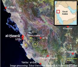
Fig. 1 Map of al-Ḥawrāʾ and its hinterland
The al-Ḥawrāʾ site, which extends 2 km from north to south and 0.5–1.0 km from east to west, is divided into a port area and a settlement area composed of several groups of dwellings. We started excavations on the two structures in the latter area whose outlines appeared during the cleaning of the 2019 season: a square-shaped landmark structure similar to a fortress and the southern end of House 1. This fortress-like structure particularly drew our attention as the 10th-century geographer al-Muqaddasī had mentioned the existence of a fortress in al-Ḥawrāʾ. We excavated eight grids (10 square meters in each) in the northern part of the “fortress” and four grids at the southern end of House 1 (Fig. 2).
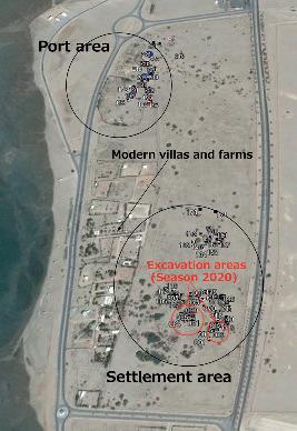
Fig. 2 The al-Ḥawrāʾsite and the excavation areas in 2020
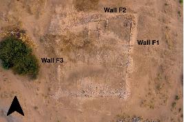
At the “fortress,” we found a number of blocks made of coral and volcanic stones in the surface soil at a depth of one meter below the surface. They seem to have fallen here when the northern wall of the “fortress” (Wall F2) collapsed. After the removal of the blocks, the inner surface of the wall with chamfered blocks in an orderly arrangement appeared (Fig. 3). Inside the “fortress” appeared what seemed to be the inner wall of a small room. Worthy of note, we found many fragments of grinding stones, stone lamps, incense burners, and animal bones when we removed the collapsed blocks. The outline of the “fortress” turned out to be trapezoidal with its eastern wall slightly longer than the western wall, as Prof. Shin-ichi Nishimoto observed (History of Architecture, Nippon Institute of Technology) in the 2019 season. However, it was difficult to locate the northwestern corner of the “fortress” due to overhanging vegetation (Fig. 4).
On the southernmost part of House 1, Wall S1 (0.6 – 0.7 m thick) was exposed, making it the most evident indicator of the existence of a structure. After the removal of the surface
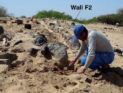
Fig. 3 Excavation of the northern wall of the “fortress” (Wall F2)
Fig. 4 The “fortress” after the excavation of the northern part Fig. 6 A kitchen at the southern end of House 1 after excavation
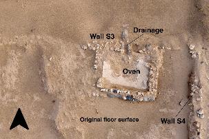
soil, two projections appeared on this wall. About 1.8 m to the east, almost parallel to Wall S1, we observed the foundation of Wall S2. However, its axis slightly differs from that of Wall S1, so it could be part of a different house (Fig. 5). On the original floor level to the east of Wall S2, there is a small room measuring 2.8 m x 2.6 m adjacent to Wall S3. This wall has water drainage. Most of the floor mortar of this room remains intact, and its central part is raised for an embedded pottery oven. These facts suggest that the room had been used as a kitchen (Fig. 6). Some pieces of grinding stones were collected on the floor around the kitchen. To the south of Wall S2, an alkali blue-green glazed bowl, probably dating to the ninth to twelfth centuries, was found intact on the floor.

The hinterland survey of this season focused mainly on the southern end of Ḥarrat Lunayyir about 65 km to the eastsoutheast of Umluj (Fig. 1: Area A) and the plateau which extends to the south-southeast of Umluj (Fig. 1: Area B). The survey in the former area was supported by remote sensing technology: an attempt to locate rock formations suitable for inscription through the analysis of the satellite imagery by a team from the Tokai University Research and Information Center led by Dr. Masahiro Etaya. The survey in the latter area was aided by local informants. A total of 27 sites, including three previously surveyed sites, were surveyed this season, and 46 early Islamic Arabic graffiti, 43 Ancient North Arabian (ANA) graffiti, and many petroglyphs of various periods were registered. Among them, 62 graffiti (41 Arabic and 21 ANA) were found around the locations surveyed in the results of the imagery analysis, showing the effectiveness of this method.
In the area around the southern end of Ḥarrat Lunayyir, both ANA and Arabic graffiti were found. Some of the ANA graffiti are vertically incised, showing a typical Thamūdic D formula ʾn + PN (a personal name) “I am PN,” but many are short and incised in a disorderly or unskillful fashion. Remarkably, two graffiti are accompanied by depictions of an ox. The Arabic graffiti of this area can be dated to the eighth or ninth century judging from the letter shapes and the wording (Fig.7).
Meanwhile, the graffiti in the plateau south-southeast of Umluj were confined to ANA. Among these graffiti—22 inscriptions in total—all except one were found in Wādī alMulaylīḥ. One of them is accompanied by a drawing of camels and an ostrich (Fig. 8). The graffiti were vertically engraved and resemble Thamūdic D in terms of formulae and letters but also include some unattested letters. Many texts include a Thamūdic D formula ʾn + PN, and some
.. include a greeting word, wdd. An isolated graffito in Murayyikh has a typical Thamūdic C formula wdd f + PN “Greeting to PN.”
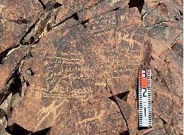
Fig.7 Arabic graffiti to the south of Ḥarrat Lunayyir (al-Ḥalaqāt)

Fig. 8 ANA graffiti and petroglyphs of camels and an ostrich in Wādī al-Mulaylīḥ
Other than the areas mentioned above, it is worth mentioning the discovery of more depictions of Bactrian camels in alGhawt (Fig. 1: Area C & Fig. 9) and two Arabic graffiti in Wādī al-Ṭabaq (Fig. 1: Area D & Fig. 10). During our second survey in al-Ghawt, we noticed a group of Bactrian camels depicted on a rock surface adjacent to a Bactrian camel found in the 2019 season. Although they cannot be modern works, their dating is quite difficult due to the lack of graffiti.
On the other hand, Wādī al-Ṭabaq (locally pronounced “alṬibq”) is a wādī running east to west at the southwestern end of Ḥarrat Lunayyir. This wādī is filled with thick black lava caused by a volcanic eruption of ca. 1000 CE. We found two Islamic invocations engraved on a remaining rock surface of the southern bank. They are undated, but judging from the letter shapes and wording, probably dated between the mid-eighth and the ninth centuries. Many other old routes connecting al-Ḥawrā and the towns around al-ʿĪṣ are presumably buried under lava.
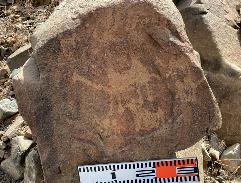
Fig. 9 New petroglyphs depicting Bactrian camels of al-Ghawt
Fig. 10 Wādī al-Ṭabaq covered with black lava
Now al-Ḥawrāʾ and its hinterland have begun to reveal concrete details of past human activities. Unfortunately, the fieldwork scheduled for spring 2021 was postponed due to the pandemic, but we are hoping to resume our surveys as soon as it is resolved.
Selected bibliography
Al-Ghabbân, ʿAlî Ibrâhîm (2011). Les deux routes syrienne et égyptienne de pèlerinage au nord-ouest de l’Arabie Saoudite, Le Caire: Institut français d’archéologie orientale.
Al-Muqaddasī (1962). Aḥsan al-taqāsīm fī maʿrifat al-aqālīm, Bibliotheca Geographorum Arabicorum 3, Leiden: Brill (English translation: Collins, B., The Best Divisions for Knowledge of the Regions, Reading: Garnet, 2001).
Hasegawa, S. & R. Tokunaga (2018). Archaeological Research at al-Hawrā’: Medieval Port Site on the Red Sea Coast of Saudi Arabia 1, Tokyo: Saudi-Japanese Archaeological Mission at al-Hawrā’ Research Office.
Hasegawa, S., R. Tokunaga, S. Nishimoto & A. Alorini (2020). A New Perspective on the Site Plan of al-Hawrāʾ, a Medieval port on Saudi Arabia’s Red Sea Coast. The IASA Bulletin, 25 (2020): 17-19.
UAE
New Aflāj discoveries in Hili, Al Ain
Peter Sheehan, Historic Environment Department, Abu Dhabi
Since the end of 2019, the Historic Environment Department of Culture and Tourism (DCT) Abu Dhabi has been carrying out an ongoing project of archaeological monitoring during the upgrading of roads and infrastructure in the areas of Falaj Al Mazmi, Eidan Al Mahabba and Misbah Hili to the south, east and north respectively of the present Hili Oasis. This work has revealed the routes of a number of ancient aflāj preserved below the housing built in these areas from the 1970s onwards. These underground water channels brought water from the mountains to cultivated areas around and between the present oases of Hili, Jimi and Qattara.
These are some of the oldest residential neighbourhoods in Al Ain, and a major project of Al Ain City Municipality for the rehabilitation of roads was accompanied by excavations for an extensive stormwater drain network. Mitigation measures imposed by DCT included a requirement for archaeological monitoring which focused on the excavation of the deep stormwater trenches. Number 26, 2021 This monitoring showed that archaeological deposits in these areas had been truncated during earlier levelling works preceding the construction of the shaʿabiyat of Falaj Al Mazmi, Eidan Al Mahabba and Misbah in the 1970s and 1980s. Deeply cut features like the aflāj however largely survived this levelling and in many places are wellpreserved, often to their full height. To date the existence of more than 20 separate aflāj have been identified in approximately 50 different locations around Hili at depths of up to 5 meters below the modern street level. Mapping these different locations has allowed us to plot the courses of the various channels for a total length of more than 3km and is helping to create a new map of the aflāj of Al Ain.
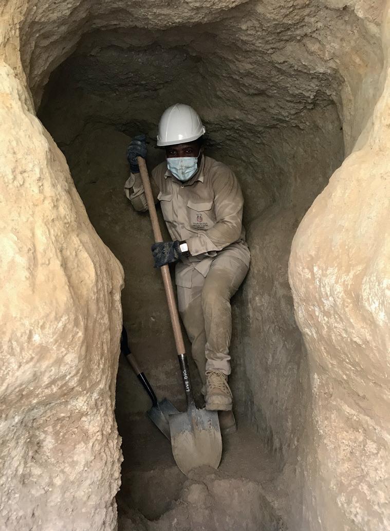
Several different falaj types have been distinguished, including an important group where the aflāj have been constructed by tunnelling between closely spaced access shafts or thuqāb. These were then closed and sealed with flat limestone roofing slabs laid on a ledge at the top of the vertical sides of the actual rock-cut channel and sealed with a thick layer of mortar. In most cases the aflāj had silted up and the roofing slabs had subsequently collapsed into the channel but one 25 meter section of intact open tunnel was noted and recorded by 3D scanning in Eidan Al Mahabba. The direction of these aflāj and a review of the earlier topography shown in archive air photography suggests they were probably tapping water from shallow subsurface wadi flows and supplying a large area of prehistoric and later settlement that was still preserved as late as the 1980s between Hili Oasis and the archaeological site of Rumeilah.
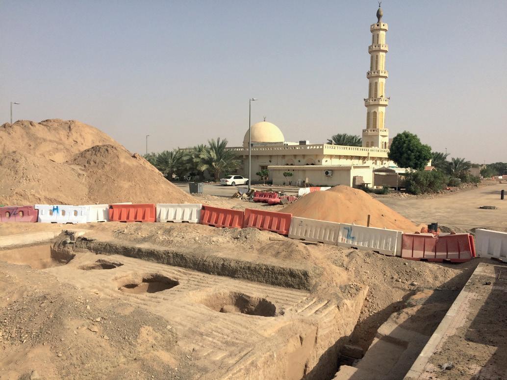
Closely spaced thuqāb in Falaj Al Mazmi
The Historic Environment team has carried out detailed investigation, sampling and 3D scanning or photogrammetry at these falaj locations, followed by protection and conservation measures where necessary. In a few cases where it was possible to widen the trenches locally this provided more information in plan on the sinuous direction of the falaj channels. In general monitoring of the northsouth streets proved the most productive for identifying the routes of the aflāj where the latter cross them perpendicularly. Following on from the successful initial monitoring of the stormwater trenches, DCT has now
instituted a planning requirement to verify, record and preserve the presumed routes of the falaj channels during any proposed future demolition or new building in these areas. Access to some of the most significant aflāj discovered so far has also been made possible by building manholes and access shafts.
The sequence and dating of the aflāj will be addressed through study of soil and C-14 samples taken during the works. Small but consistent quantities of ceramics were also retrieved. Most of these can be placed in the Iron Age II period. Iron Age III morphological type fossils were also present, especially bowls with sharply in-curving or S-shaped rims with close parallels to the Niveau II assemblage at Rumeilah. First millennium CE common wares spanning the Late Pre-Islamic and Early Islamic periods include torpedo jars, hard-fired wares and turquoise glazed wares. These periods account for the majority of the ceramics from the Hīlī aflāj. At least two major aflāj discovered during these works can also be dated to the Early Islamic period on the basis of the finds assemblages and the use of fired bricks in their construction. Nineteenth- and twentieth-century ceramic classes were almost entirely absent, indicating that modern disturbance is either entirely absent or has been truncated away.
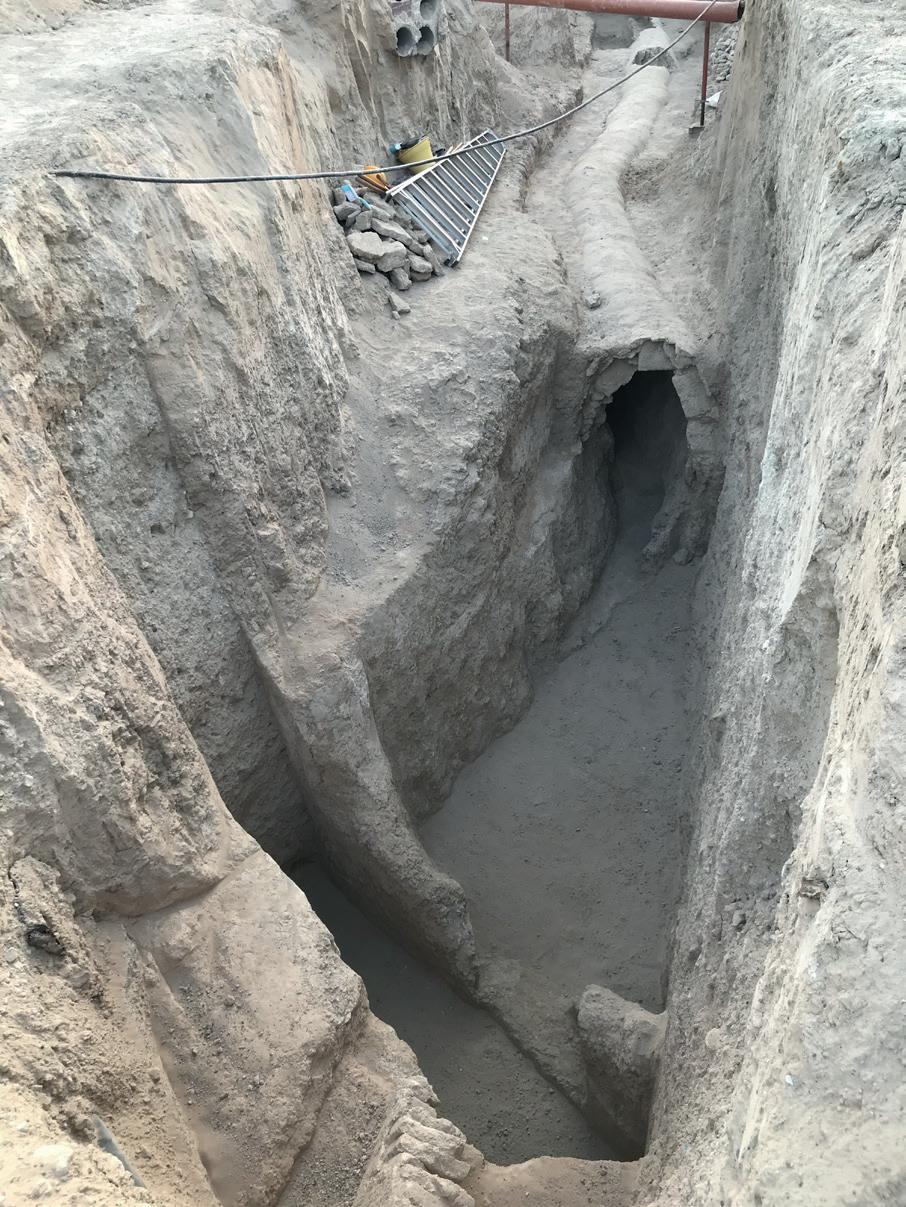
Hili Misbah. Brick vaulted tunnel of Early Islamic falaj.
The works at Hili have been complemented in 2020 and 2021 by the discovery of other important ancient aflāj around Qattara, Jimi & Al Ain Oases and most recently along the line of the Oman border fence. The discovery of these aflāj forming a network of channels and tunnels below the streets of the modern city related to its past settlement and agriculture represents a major step forward in our understanding of the development of the cultural landscape forming the World Heritage Site of Al Ain.
We are grateful to the Department of Antiquties and Museums in Ras Al-Khaimah for the following contributions, compiled by Christian Velde & Imke Möllering, Senior Researchers and Archaeologists, Department of Antiquities and Museums, Government of Ras al-Khaimah, United Arab Emirates
UNESCO
Previous work on four places of great archaeological and historical importance was rewarded with their official selection for the ‘Unesco Tentative List’. They include:
• SHIMAL - the largest prehistoric cemetery with megalithic tombs in Southeast Arabia, • JULFAR - Ras al-Khaimah’s famous port and trading centre during the last 1500 years, • DHAYAH - a unique and condensed representation of all geographical, historical, and cultural landscapes on the Musandam Peninsula, • JAZIRAT AL-HAMRA - the last surviving pearling town of the Arabian Gulf, which has remained unchanged since pre-oil times
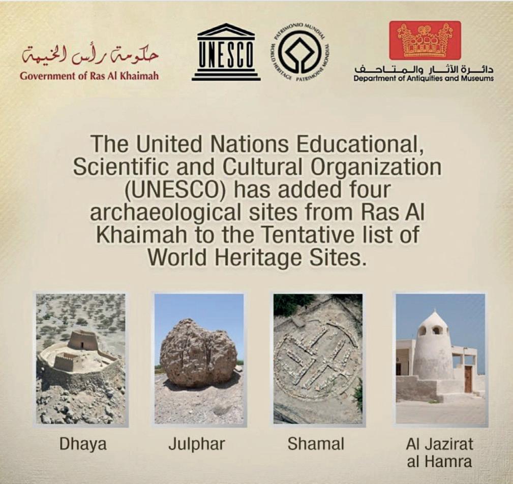
UNESCO announcement ©Department of Antiquites and Museums, RAK
Revitalizing the National Museum
After replacing the previous museum management, improvements could be started to revitalize the National Museum and embark on new setups of the exhibition galleries. The surprise discovery of a date press (‘madbasa’) inside the former ‘Natural History’ section lead to its conversion of display, now featuring the versatile date palm tree and its important cultural history. Further changes have
been started inside the ‘Archaeology’ galleries, which will be refurbished and provided with updated exhibits and informative storylines.
Highlighting Silver Heritage
Long standing plans for a reopening of the National Museum’s ‘Silver Room’ could be finalized, and a new, larger location selected. The planned exhibition of the museum’s unique and extensive collection of traditional silver jewellery will, for the first time, display the artefacts in accordance with their geographical background and highlight their cultural significance. A forthcoming publication is planned to supplement and emphasize the jewellery project.
Jazirat Al-Hamra
Enhanced directives in combination with a new management could be implemented for the restoration work and archaeological research in Jazirat al-Hamra, to continue and improve the understanding and conservation of this unique pearl fishing town. Work along two pathways was intensified, providing access to the heart of the settlement for future visitors. The different traditional courtyard houses along this route will provide firsthand insights into past coastal life along the Arabian Gulf.
Public Outreach
The Department of Antiquities and Museums continued its efforts to highlight Ras al-Khaimah’s heritage through press releases and videos. Wide international media coverage was received about the department’s ongoing American collaboration with Prof. Lesley Gregoricka, Prof. Jaime Ullinger, and their team to study 400 kg of diagnostic bones from the human skeletal remains of two Umm an-Nar tombs dating to the 3rd mill. BC. Furthermore, a Jewish tombstone dating to the 14th - 16th century AD was prominently featured, highlighting Ras al-Khaimah’s past as an important trading centre, its multicultural history, and tolerance.
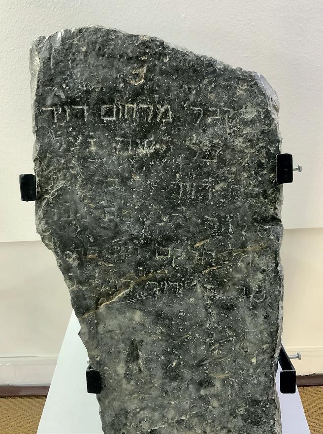
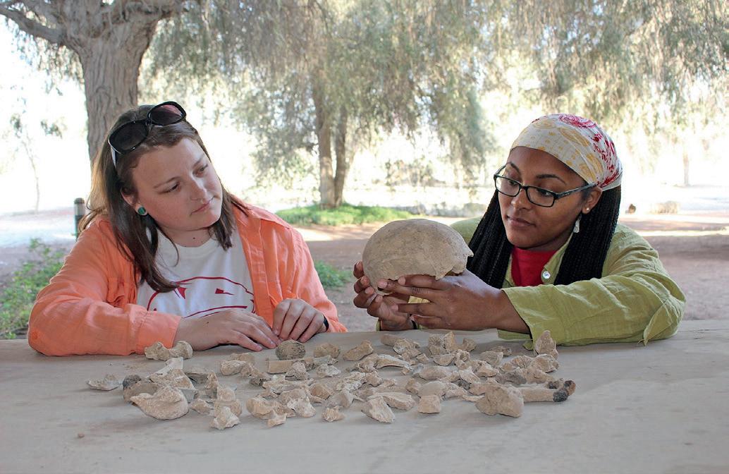
Work on human remains from Shimal © L.Gregoricka/J.Ullinger
Falayah Park Project
The historical summer residence of the ruling Quwasim family, consisting of a fortified farmstead, tower, and mosque dating to the 18th/19th century, lies at the heart of the newly started ‘Falayah Park Project’. Its specific arrangement combining traditional domestic, religious, and fortified architecture is further enhanced by its historical meaning and national importance. Future visitors will be able to explore the place where the 1820 peace treaty was signed, representing one of the historical cornerstones for the founding of the United Arab Emirates.
Etihad Railway Survey
Preceding the building of a railway, which will be connecting all seven Emirates, an extensive survey was conducted to secure/protect Ras al-Khaimah’s heritage sites from any threat and damage. Several previously unknown sites, ranging from the Palaeolithic to the Medieval Ages, could be discovered. One of the last existing copper mining sites, dating to the 10th century AD, could be excluded from the railway’s initial route planning.
Notices on activities and research in Ras alKhaimah from some of the teams and organisations working in the Emirate appear below.
Lesley A. Gregoricka & Jaime M. Ullinger
Year 1 of a National Science Foundation-funded Research Experiences for Undergraduates (NSF-REU) program, the Bioarchaeology of Bronze Age Social Systems, took place between May-July 2019. This three-year program supports the bioarchaeological training and professional development of undergraduate students. Housed at the Center for Archaeological Studies at the University of South Alabama (USA), the 2019 REU consisted of eight students who – in collaboration with an interdisciplinary group of guest scientists and mentors – conducted original bioarchaeological research on two Early Bronze Age skeletal
collections from the Shimal Necropolis in the Emirate of Ras al-Khaimah.
The tombs of Unar 1 (2400-2200 BCE) and Unar 2 (23002100 BCE) represent the only two Umm an-Nar mortuary structures within the Shimal Necropolis. In tomb Unar 1, following decomposition, the dead subsequently became disturbed as new bodies were continually placed inside. In tomb Unar 2, after the placement of the dead within the ground story of the tomb, skeletal remains appear to have been removed, cremated, and then returned to the second story. As a result, in both tombs, the skeletal remains of hundreds of individuals became commingled, extensively fragmented, and burned to varying degrees (Blau 2001).
When the tombs were excavated nearly 30 years ago, early estimates of the minimum number of individuals, or MNI (Unar 1: 438; Unar 2: 431; Blau 2001) indicated that they held similar numbers of individuals, despite a significant difference in overall tomb size. Nevertheless, these data were collected on unwashed bones that had not yet been curated. Moreover, sex distributions are poorly documented, yet estimating this basic demographic parameter represents crucial, foundational knowledge in determining who was (and wasn’t) permitted access to this space after death. Following the cleaning and ongoing curation of these two skeletal collections at the University of South Alabama beginning in 2017, assessing demographic patterns including MNI and sex – which have the potential to change our understanding of shifting demographics, mortuary practices, and social complexity in the region – became the focus of the Year 1 REU projects.

Figure 1. REU fellows Rachel Heil (California State University, Fullerton) and Alyssa McGrath (University of Notre Dame) review landmarks on the talus during MNI data collection
MNI was scientifically evaluated using landmark (Mack et al. 2016) and zonation (Knüsel and Outram 2004) techniques applied to two skeletal elements likely to survive commingling and cremation due to their density: the talus (McGrath et al. 2021) and the mandible (Arellano et al. 2021). MNI data was also collected using the landmark method for the petrous portion of the temporal (Ullinger et al. 2021). The landmark technique (Unar 1: 107; Unar 2: 306) produced a larger MNI for the mandible than the zonation method. The talus had similar MNI estimates using both landmark (Unar 1: 87; Unar 2: 227) and zonation (Unar 1: 88; Unar 2: 228) techniques. The left petrous portion produced the highest MNI estimates of all elements examined (Unar 1: 193; Unar 2: 410), and represents our most up-to-date estimate. Regardless of technique or skeletal element, Unar 2 had a consistently larger MNI relative to Unar 1. This was both expected given the relative size of these tombs, as Unar 2 (14.5 m diameter) is significantly larger than Unar 1 (11.5 m diameter), but also unexpected, as earlier MNI estimates indicated over 400 people interred in each tomb.
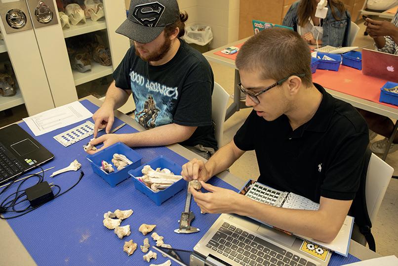
Figure 3. REU fellows Charlie Downey (Albion College) and Silvio Ernesto Mirabal Torres (College of Southern Nevada) take measurements and record cremation-based color changes using the distal humerus.
Sex was estimated using the mastoid process of the temporal bone (Calvin et al. 2021) as well as by taking measurements of the distal humerus (Downey et al. 2021). In order to be assessed, features had to be complete and undamaged, which severely limited the number elements that could be used in these analyses. Qualitative assessment of mastoid size produced a total of three males, 13 females, and four individuals of indeterminate sex in Unar 1, and eight males, 35 females, and seven individuals of indeterminate sex in Unar 2. The gracile nature of many mastoid processes indicated that either more women were interred in the tombs or that the skulls of females were more likely to survive fragmentation. Conversely, quantitative measurements of the humerus estimated the presence of more males (Unar 1: 8; Unar 2: 40) than females (Unar 1: 6; Unar 2: 8), suggesting that Umm an-Nar peoples of both sexes may have had relatively robust postcranial skeletons. While both females and males were clearly permitted access to tomb spaces throughout the latter part of the third millennium BCE, further research is warranted on other skeletal elements to clarify broader patterns of sexual dimorphism at the site.
Unfortunately, Year 2 (Summer 2020) of the REU was cancelled due to COVID-19. The REU will resume in Summer 2021, when students will continue paleodemographic investigations including adult and subadult age estimation using both traditional qualitative and quantitative measures as well as newer techniques including transition analysis. These methods will be used to develop
age profiles in order to compare interment practices between the tombs over time. Bone bioerosion in perinates will also be evaluated using micro-CT scans to assess whether stillborn infants were permitted access to interment within the tomb.
For more information about the REU, please visit our https://www.southalabama.edu/colleges/artsandsci/syansw/ anthropology/reu/ and student blog. You can also watch Digital Stories summarizing the research of our REU student fellows (in English and with Arabic subtitles) on our YouTube Channel. Follow us on Facebook, Twitter and Instagram.
Acknowledgements: Thanks to the Emirate of Ras alKhaimah’s Department of Antiquities and Museums and the National Science Foundation (Award #1852426) for their support. Special thanks are also extended to Christian Velde and Imke Moellering.
References
Arellano, C., Burke, Q., Gregoricka, L.A., and Ullinger, J.M. (2021). Counting chins to count people: Determining MNI for Umm an-Nar tombs from mandibular fragments. Abstract, American Association of Physical Anthropologists, Baltimore, MD, April 7-28.
Blau, S. (2001). Fragmentary endings: A discussion of 3rd ¬millennium BC burial practices in the Oman Peninsula. Antiquity, 75, 557-¬570.
Calvin, V., Simmons, J., Gregoricka, L.A., and Ullinger, J.M. (2021). Sex estimation for Early Bronze Age Arabian tombs using the temporal bone. Abstract, American Association of Physical Anthropologists, Baltimore, MD, April 7-28.
Downey, C., Mirabal Torres, S.E., Gregoricka, L.A., and Ullinger, J.M. (2021). An examination of sex distributions in Umm an-Nar tombs from Bronze Age Arabia using the distal humerus. Abstract, American Association of Physical Anthropologists, Baltimore, MD, April 7-28.
Knüsel, C.J., and Outram, A.K. (2004). Fragmentation: The zonation method applied to fragmented human remains from archaeological and forensic contexts. Environmental Archaeology, 9, 85-97.
Mack, J.E., Waterman, A.J., Racila, A.-M., Artz, J.A., and Lillios, K.T. (2016). Applying zooarchaeological methods to interpret mortuary behavior and taphonomy in commingled burials: The case study of the Late Neolithic site of Bolores, Portugal. International Journal of Osteoarchaeology, 26, 524536.
McGrath, A., Heil, R., Gregoricka, L.A., and Ullinger, J.M. (2021). A tale of two tombs: Calculating MNI and bone calcination in commingled remains from two Bronze Age tombs in the UAE. Abstract, American Association of Physical Anthropologists, Baltimore, MD, April 7-28. Number 26, 2021
A newly discovered Iron Age II settlement in the Shimal Plain
Michel de Vreeze, Samatar Botan, Tibor Paluch
It was in the late sixties that Beatrice de Cardi first explored the archaeology of the Shimal area in her survey of the Trucial States (de Cardi & Doe 1971). Her contributions to our knowledge of both the prehistoric and historic archaeology of the region still hold much value up to this day. It is thus a great honour to continue working at the area of Shimal, Ras al-Khaimah, with the support of a Beatrice de Cardi award provided by the Society of Antiquaries of London, chasing up some of the clues Beatrice herself already started untying. In late 2019, a first season kindly sponsored by a de Cardi award and with full support from the Department of Antiquities and Museums, Ras alKhaimah, set out to further study the prehistoric settlement history of the Shimal area, and focused on previously unexplored low-lying mounds within the Shimal area.
The Shimal plain is a large alluvial fan stretching from the northern Hajjar mountains to the coast above the Islamic port of Julfar. The present-day landscape is marked by gravel plains with acacia and shrubs roamed by goats, and extensive palm gardens within the alluvial fan away from the foot of the Hajjar mountain range to the east. It is an area that has always been rich in water provided by the run-off wadis from the mountains. Shimal is particularly rich in archaeological remains and foremost known for the hundreds of monumental Wadi Suq (2000-1600BC) tombs made of the large limestone boulders extracted from the nearby mountains, besides two earlier monumental Umm an-Nar tombs (Velde in prep.). A relatively small settlement of Wadi Suq-Late Bronze Age date is also known (Shimal-Middle), excavated by a German team in the 1980’s (Vogt and Vogt 1987). Although potentially a prime area for settlement throughout prehistory, Iron Age occupation was less well attested, leaving a large gap in our understanding. Although some evidence of Iron Age shell middens was explored in the plain (a bulldozed shell midden was examined by Beatrice de Cardi), and some of the Wadi Suq period tombs were known to have been re-used in the Iron Age too, a more sizeable Iron Age settlement was so far conspicuous in absence. The ‘Understanding Prehistoric Settlement Dynamics Project’ was launched to further understand the shifts in prehistoric settlement patterns, and to test the possible presence of further Iron Age remains in the area.
The first season proved already highly successful in identifying an Iron Age (ca. 1100-600BC) settlement within an area of derelict palm-gardens. Surface scatters of Iron Age pottery, together with protruding stone architecture, pointed to possible evidence of buildings (Fig 1). Two main trenches excavated on one of the higher mounds with this evidence established multiple buildings with so far at least two distinct phases of habitation. An earlier phase was predominantly made of mudbrick architecture, and a later
phase features stone built architecture, partially of rather unique nature.

Fig. 1: the ongoing excavations at Shimal with the Hajjar mountains in the background
Although no complete ground plans have been excavated, the settlement seems to have included a thick exterior wall and a set of multi-room buildings. Thick layers of shell, predominantly Terebralia palustris—a giant mangrove whelk—and oyster shells (but awaiting specialist analysis), fit with the settlement being located close to ancient mangroves, providing an important economic staple for the people in the Shimal plain. This follows the same pattern as the nearby Bronze Age settlement. What kind of agricultural regime was practised is an important question that merits further study, partly by studying the botanical material from the site in future seasons.
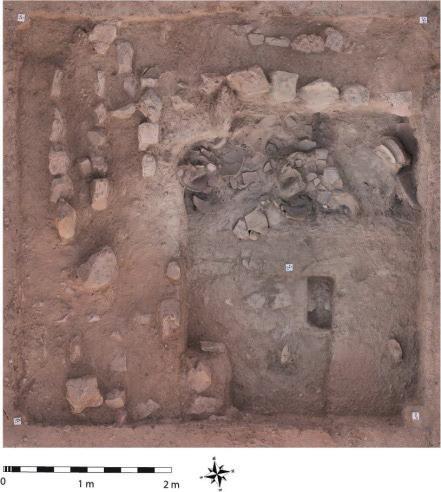
Fig. 2: Partially burnt room of the lower phase with in situ smashed storage jars.
At the newly discovered site, at least one pillar support in the later phase of the main rectangular building suggests that we might have an example of a pillared hall (though not of the size of that of contemporary Muweilah or Rumeilah). The lower phase of habitation showed another welcome surprise. In trench 2, a heavily burnt floor was found, with burnt wood (at least partially of the local Ghaf tree) suggesting a wooden roof to have collapsed. Within this burnt collapse were several large Iron Age storage jars, smashed but still in situ on the floor (Fig. 2). Flat stones probably functioned as supports for these large vessels. Next to these large jars, the fragment of an intriguing vessel was found. A handled jug with a distinct greenish-brown splash painted decoration was found on the floor (Fig. 3). Further fragments of the vessel, also found in later disturbed contexts, suggest that the vessel featured a snake applique decoration and a distinct trifold handle. The splash decoration is indeed very reminiscent of a certain snake’s skin and might have imitated this serpentlike pattern intentionally. This jug was certainly a special vessel and one can imagine its striking look while serving liquids to the thirsty in the many bowls found on site. In the next room, a hammer stone was found with copper prills still lodged inside. Evidence of tiny copper prills in different locations of the buildings suggest copper working was a part of the daily activities here. All this evidence starts to point to the buildings so far discovered at Shimal having a function akin to columned halls and cultic buildings at Masafi, Muweilah, and Adam and other places. C14 analysis of samples from the destruction layer suggest that at least part of the early phase building was destroyed shortly before 800BC. Whether this fits the more general upheaval in the region will be actively researched within future seasons. For now, the renewed Shimal excavations have added important Iron Age settlement evidence within the Shimal area of Ras al-Khaimah. These will help us further understand how people in southeast Arabia sustained their livelihoods in this area throughout prehistory, dealing with the many challenges of climate and cultural change.
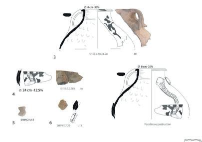
Fig. 3: Jug with splash decoration and snake applique, showing a possible reconstruction
References
de Cardi, B, Doe, B.D. 1971. Archaeological survey in the Northern Trucial States, East and West, 21. 3–4, 225–89
Velde C. (in preparation). The cemeteries of Shimal and Dhayah (Middle Bronze Age/Wadi Suq Period), Ras alKhaimah, United Arab Emirates
Vogt B. & Franke-Vogt, U. 1987. Shimal 1985/1986. Excavations of the German mission in Ras al-Khaimah, U.A.E. — A preliminary report. (Berliner Beiträge zum Vorderen Orient, Bd. 8). Berlin: Dietrich Reimer.
Sharjah Museums Authority has very kindly provided the reports below on some of its activity over the past year.
A year of Covid 19 – Sharjah Museums Authority
Like many places around the world, Sharjah Museums Authority closed its museums in March 2020 as we all sheltered from exposure to the virus. While some exhibitions were postponed, two had just opened; it became an opportunity for many of us to work from home with newly created secure access to our servers.
For the Collections Management team this also meant we had secure access to our collection management system. As a team, we were able to concentrate on auditing and editing entries and adding images, conservation records, and loan and exhibition histories. It gave us an opportunity to tidy up, archive files, and review our internal electronic filing. We have used Zoom and Webex to meet and deliver collection care webinars.
Once 50% work place attendance began in July and the museums gradually reopened during July and August the staff of Sharjah Museum of Islamic Civilization resumed work on the addition of some 120 objects to the permanent displays that had been gifted courtesy of Sharjah Museums Authority’s patron, His Highness Sheikh Dr Sultan bin Muhammad Al Qasimi, Ruler of Sharjah.
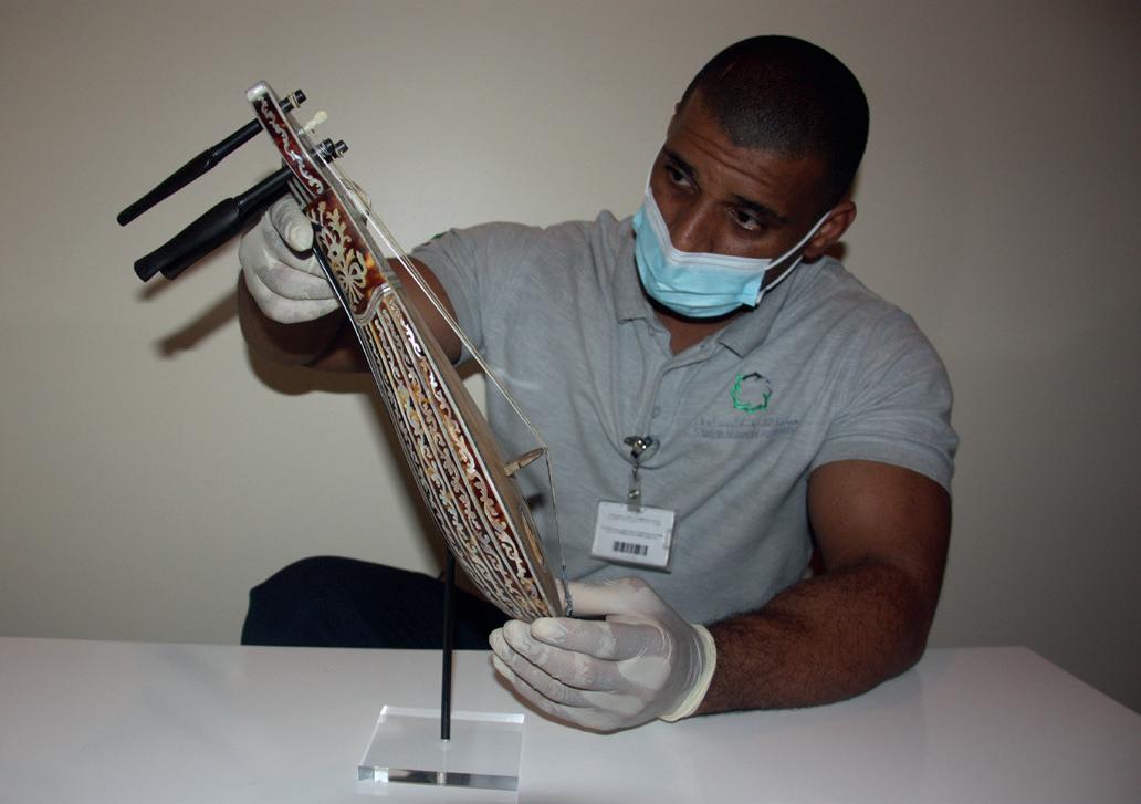
This required a review of the four art gallery displays and resulted in both a complete change and redisplay of a case’s contents or the alteration of a case’s contents for 42 out of 83 cases. The team learned to draw to scale plan and elevation views of displays, and many began to use the collections management system extensively to check object identification numbers, download images and audit collections. With case layouts redesigned, labels were reviewed and rewritten, display case furniture and number blocks quantified and purchased. Many objects also needed new mounts to optimise their presentation and for support. Since 2016 there had been a programme of upgrading display case furniture in these galleries and with the addition of the new objects this has enabled us to complete this process.
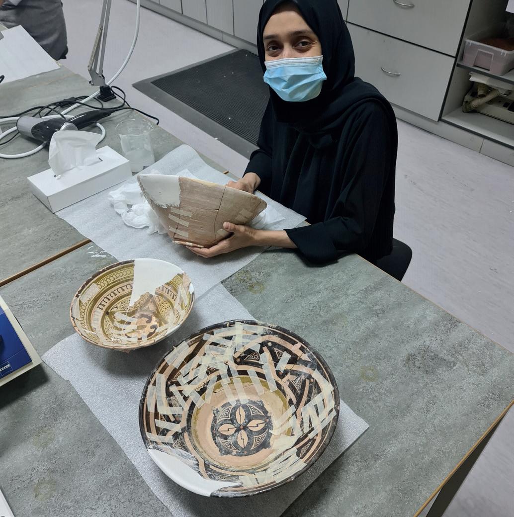
From September onwards and working around home schooling, the collections team conserved and prepared some of the ceramics for the art galleries redisplay. This provided a training opportunity to take down old repairs, reassemble and gap-fill. Prior to this, we had hurriedly prepared 70 metal and ceramic objects at the end of 2019 for temporary display but some of the ceramics needed more work (below).
With fewer visitors and no international temporary exhibitions, the process of adding these new collections to the permanent galleries has allowed curatorial and collections care and particularly museum technicians to take advantage of the time to learn new skills, to practise and to become more proficient in these and others previously acquired, especially welding and making metal mounts. Whilst this behind the scenes work was going on the Education, Marketing and IT teams worked rapidly to increase the virtual museum experience. At Sharjah Art Museum, this included a virtual tour of the temporary photographic exhibition of Ada Mulunehat’s work with online catalogue and tours of the Barjeel and Sharjah Art Museum’s permanent collections of contemporary Arab art. The Education team quickly made their family workshops available on line providing a list of the required materials on registration for each workshop. There have been virtual lectures and talks offered for their more academic programmes. For the family workshops, initial uptake was
good, but decreased once on-line schooling started in September. However the academic programmes have seen a 100% increase in attendance. The Education staff were determined to succeed and their use of Zoom improved as their confidence grew.
Although we are still working with reduced numbers of staff in the work place at any one time, home schooling and ‘at risk’ staff sheltering at home, it has been a busy and productive year in a different way to that envisioned at the end of 2019. There is also the realisation that we need to maintain a greater on-line and virtual presence and review the design and activation of gallery interactives currently out of order for hygiene reasons.
And, yes, some staff and their family members have been ill; fortunately most are fine but sadly there have been a few deaths. We are fortunate that the vaccination programme is well underway and we are looking forward to hosting some international exhibitions this year.
Sharjah Museums Authority - Digital Programmes
Due to the outbreak of Covid-19 and in response to the country’s laws and regulations to ensure public safety and wellbeing, Sharjah Museums Authority (SMA) was keen to continue reaching and engaging its audience locally and globally through delivering its high standard educational programmes each designed for specific community groups. The programmes delivered via Zoom served as a safe and convenient alternative to physically attended programmes and acted as a bridge between museums and the public during a time of uncertainty.
The Authority’s series of digital programmes kicked off on July 6th, 2020 with 300 participants from various countries attending "Humans and Mars", a lecture that outlined scientific interests in Mars and highlighted the Hope Probe and UAE’s astronomical ambitions. Other lectures covered topics that included "Emirati Women and the Family", in which the role and experience of Emirati women both past and present were highlighted; "Social Customs and Traditions during the Covid-19 Epidemic", "Islamic Architecture", "Art Techniques", "Life in Stone Age Sharjah" as well as programmes highlighting the history and techniques of Arabic calligraphy.
Besides lectures and talks, SMA’s digital offerings also included virtual tours of museum galleries and collections, as well as engaging workshops to stimulate curiosity and creativity for families and individuals with disabilities. Several local and international specialists and professionals were guest speakers including renowned calligraphers, historians, car collectors, university professors, artists and museum staff. The programmes aim to reach community members of various interests and ages including families, students, researchers and people with disabilities. During the course of 6 months, SMA delivered 46 digital programs with a total attendance of 1,836 from across the globe. Although all Sharjah Museums are now open, a new bundle of exciting digital programmes continues to be offered every month.
Sharjah Museums Authority’s digital exhibition in celebration of the International Museum Day - Museums for Equality: Diversity in Times of Adversity, 18 May 2020 - 31 July 2020
Every year since 1977, the International Council of Museums (ICOM) chooses a theme to celebrate International Museums Day (IMD). Because of the Covid-19 global health crisis, museums around the world celebrated this day under the theme "Museums for Equality: Diversity and Inclusion". Sharjah Museums Authority (SMA) took the opportunity to share moments of creativity and solidarity via its digital platforms, by inviting young artists, musicians and poets to share their artistic creations and be part of a unique digital exhibition.
Artists from around the world submitted diverse artworks that included photography, digital design, paintings and poetry. The 17 artworks selected to be part of this specially curated digital exhibition came from both male and female artists from different countries including the United Arab Emirates, Egypt, Iraq, Sudan and India. These original and inspiring works responding to the 2020 IMD’s theme demonstrated the global need for creativity during the international health crisis.
"Stay. At. Home", "A World Crisis", "Family", "All for One, One for All", and "Hang in There", were some of the titles participants chose for their submissions. Although different in style, the works had one thing in common Covid-19 and its influence. Many of the works highlighted the family bond, connectivity and entertainment during quarantine, with depictions of family members spending quarantine time with pets, puzzles, painting, or gadgets. In an artwork titled "United", the artist depicted humanity in its diverse cultural backgrounds, ethnicities, and religions, coming together to form one existence, one presence, one face.
Another artwork entitled ‘'My Children’s Dreams 1" was a way the artist could share her children’s view and reaction to Covid, as it depicts her son in an encounter with the virus without a face mask, reflecting how fearless he is of the invisible enemy. Other artworks were dedicated to frontline workers in appreciation of the risks they have taken and sacrifices they have made towards ensuring the safety and wellbeing of others.
Umm al-Quwain archaeological heritage: Research, conservation and valorisation
Rania Hussein Kannouma (Archaeology Department, Umm al-Quwain) with Michele Degli Esposti and Federico Borgi (Italian Archaeological Mission in Umm al-Quwain)
In late 2019, the appointment of H.H. Sheikh Majid bin Saud bin Rashid al Mualla as the Chairman of the Tourism and Archaeology Department of Umm al-Quwain (TAD) boosted a season of renewed efforts in the study, protection, and promotion of the archaeological and traditional heritage of the Umm al-Quwain Emirate, entailing the start of new projects and the revitalization of ongoing ones.
A new research programme focused on the al-Abraq area was started in cooperation with the Italian Archaeological Mission in UAQ (IAMUQ – Abraq Research Project) directed by Michele Degli Esposti and Federico Borgi. Its core project is the excavation at the multi-period site of Tell Abraq, the eastern part of which lies in Umm al-Quwain’s territory (Degli Esposti and Borgi, 2020). There, two fieldwork seasons (2019, 2020) highlighted significant archaeological contexts, with a specific focus on the Late Bronze Age / Early Iron Age transition and on the Late PreIslamic period. The latter, in particular, is now evidenced by the unexpected discovery of a massive building, the investigation of which promises to change the picture of this period in the area (Figure 1).
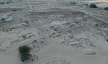
Figure 1: General view of Tell Abraq at the end of the 2020 season, looking southwest, with the IAMUQ trenches in the foreground (©IAMUQ/F. Borgi).
Stratigraphic excavations at Tell Abraq are conceived as part of an integrated approach comprising the immediate consolidation of the discovered ancient architecture, with the final aim of providing the public with a new site to visit in the near future.
The Abraq Research Project also includes the investigation of two long chamber graves located some 300m east of Tell Abraq, at a site labelled Abraq 2 (Figure 2). A team from the TAD has carried out two short excavation seasons in 2019 and early 2020 and works will be completed over the next years. The team of the IAMUQ is supporting the works specifically dealing with mapping, drawing and study of the archaeological materials, and analysis of the building materials (in collaboration with the University of Milan). Over the last few years, the TAD has excavated several graves at the Late Pre-Islamic site of Ed-Dur. Limited areas within the site were also tested. The study of the grave architecture and the grave goods is ongoing and will hopefully lead to an exhaustive publication. Currently, the main efforts at Ed-Dur are concerned with conservation and restoration, under the supervision of Mr Simon Warrack.
Figure 2: Orthorectified zenithal view of the partially excavated graves at the Abraq 2 site (©IAMUQ/F. Borgi).
While the so-called Temple of Shamash (Haerinck, 2011) was restored in 2015, the restoration of the fort excavated inside the site by an Iraqi-UAE team in the 1970s was completed in November 2020 (Figure 3), and works are continuing in the necropolis of Area N (Haerinck, 2001). All these works are aimed at making Ed-Dur, “The lost city of Arabia”, the principal archaeological park of Umm alQuwain, hopefully opening soon.
In the Umm al-Quwain lagoon, a relevant development project is going to interest the island of Siniyah. For this reason, the TAD first, and the IAMUQ in late 2020, carried out the intensive archaeological survey of the island, identifying several sites of potential archaeological interest, all dated to the Late Islamic period as far as one can tell from survey collection. Against the background provided by this research, the development project has been examined and test excavations were started in early 2021 by the TAD at sites endangered by the works.
An additional survey in the lagoon (Akab Island, alHarmalah Island) was carried out by the IAMUQ team. This confirmed the presence of substantial Late Pre-Islamic and less so Islamic remains on the Akab island, which will become the next main focus of archaeological research after the completion of the ongoing excavation programmes. It is worth pointing out here that in the Umm al-Quwain Municipality’s maps Akab Island does not correspond with the one rightly made famous by the discovery of the “dugong mound” (Méry et al., 2009), but to the one to its south. In
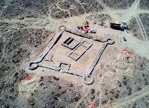
Figure 3: Aerial view of the Ed Dur fort after the restoration work completed in November 2019 (©IAMUQ/F. Borgi).
relation to the archaeological literature published so far, the toponyms of Ghallah Island and Akab Island should be inverted (Figure 4).
Another main goal of the TAD-UAQ is to complete the archaeological map of the Emirate. Results of the uttermost relevance were already achieved by the French Archaeological Mission, directed by Sophie Méry, for what concerns the coastal area of Umm al-Quwain, where several Neolithic sites were also excavated (most recently Méry et al., 2019; Degli Esposti et al., 2020). In October 2020, the southern area of the Emirate, around Falaj al-Mualla, was surveyed by a team of the IAMUQ. The remaining, mostly desert strip of land will be the target of a new survey during the second semester of 2021. References Degli Esposti M., Borgi F., Gallou C., Martin C., Lidour K & Méry S. 2020. A first note on the excavations at UAQ38, a new Neolithic site in the Emirate of Umm al-Quwain. Arabian Archaeology and Epigraphy, 31: 105–118. doi: 10.1111/aae.12133. Degli Esposti M. & Borgi, F. 2020. The Abraq Research Project - 2019 season. Bulletin of the International Association for the Study of Arabia 25: 20–22. Haerinck E. 2001. The Tombs. The University of Ghent South-East Arabian Archaeological Project: Excavations at ed-Dur (Umm al-Qaiwain, United Arab Emirates) Vol. II. Peeters Publishers. Haerinck E. 2011. A Temple of the Sun-God Shamash and Other Occupational Remains at ed-Dur (Emirate of Umm al-Qaiwain, UAE). The University of Ghent South-East Arabian Archaeological Project: Excavations at ed-Dur (Umm al-Qaiwain, United Arab Emirates) Vol. III. Peeters Publishers. Méry S., Charpentier V., Auxiette G. & Pelle E. 2009. A dugong bone mound: The Neolithic ritual site on Akab in Umm al-Quwain, United Arab Emirates. Antiquity 83(321): 696–708. doi: 10.1017/S0003598X00098926. Méry S., Degli Esposti, M., Aoustin D., Borgi F., Gallou C., Leroyer C., Lidour K., Lindauer S. & Parker A. G. 2019. Neolithic settlement pattern and environment evolution along the coast of the northern UAE: the case of Umm alQuwain UAQ36 vs. UAQ2 and Akab shell-middens. Proceedings of the Seminar for Arabian Studies, 49: 223–240.
Figure 4: Correct toponyms for the islands of the Umm al-Quwain lagoon ((©IAMUQ/F. Borgi).
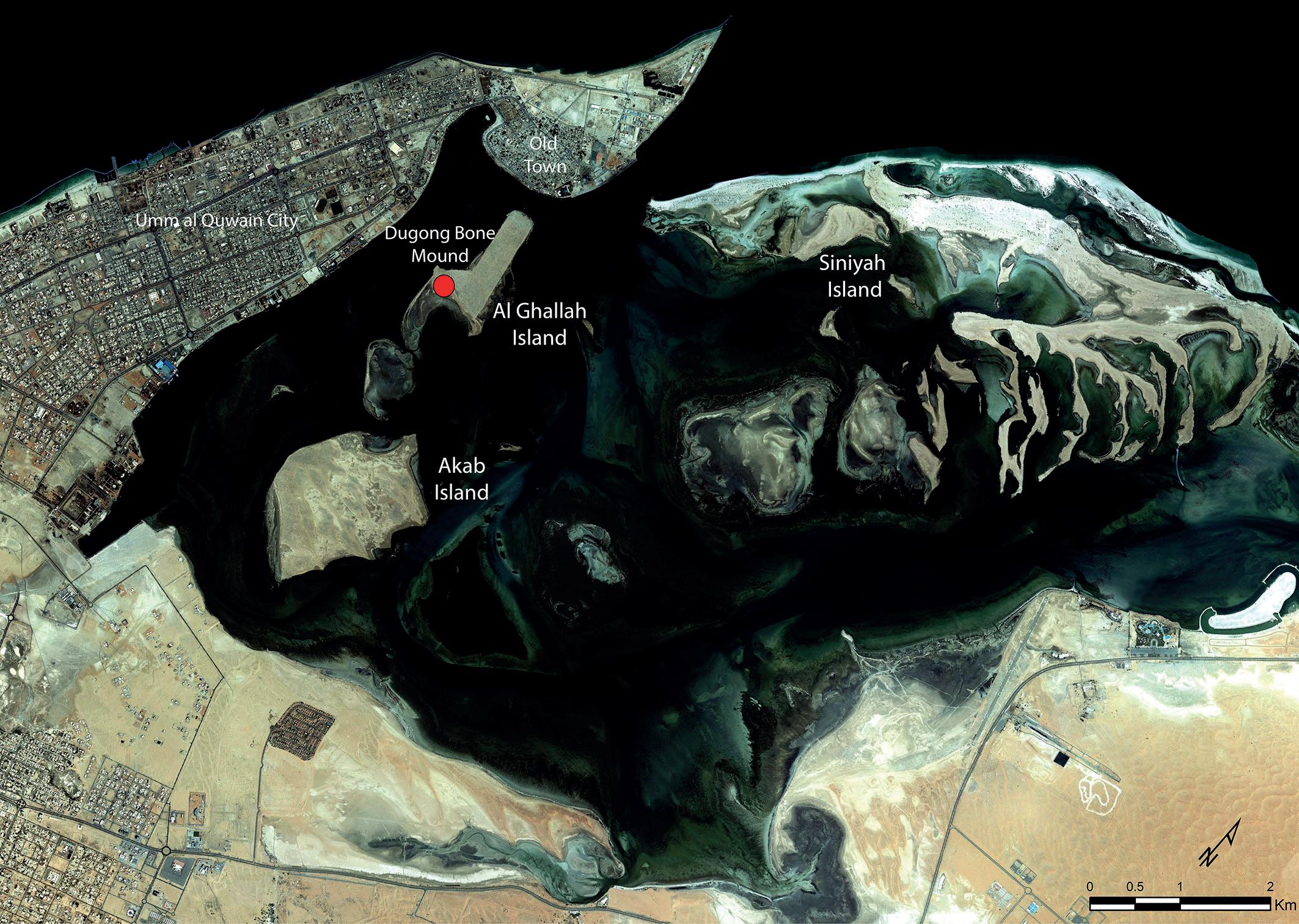
YEMEN
Saeed Ba Yashoot
The Kathiri Sultan’s palace - the most popular tourist attraction in Yemen, even ahead of the walled mud city of Shibam, also in Hadhramaut - was given World Heritage Site status by UNESCO in 1985.
The most imposing structure in the town of Seiyun, this majestic white building is probably one of the largest mudbrick structures in existence. The actual date of building is unknown but it was the site of a Kathiri Sultanate government building as early as 1411. This famous landmark is an important surviving example of the distinctive style of Hadhrami mud architecture.
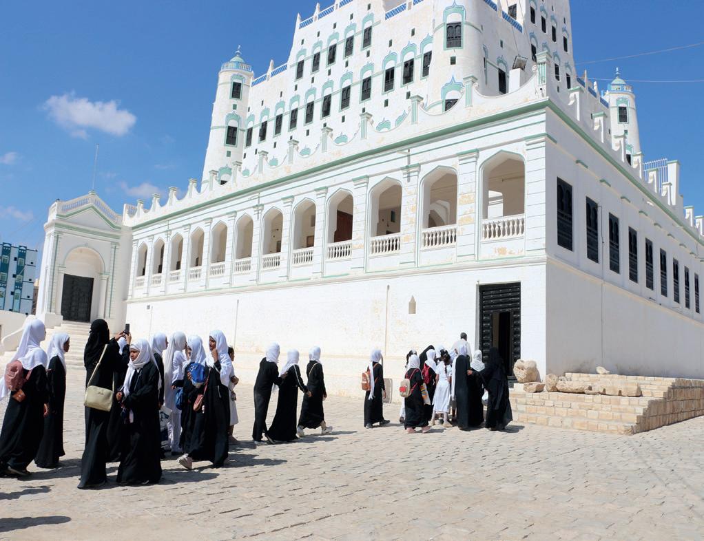
In 1857 the Sultan Ghalib Bin Mohsin Al Kathiri constructed the mud-brick palace in its present form – five storeys and 25 metres high, and it was completed by his son, second Sultan of the modern Kathiri dynasty, Al Mansour Bin Ghalib. Since 1983, the palace has housed the Seiyun Museum (the Kathiri Sultan's Palace) and is itself one of the most important elements of the museum. The museum is ranked third in the museums’ classification in Yemen.
Seiyun Museum was founded in 1974, when the government purchased a collection of popular heritage (ethnographic items) from a local collector, the late Mr Ali Al Mashhour. This collection formed the basis of the museum, which opened first in a building called Bir Elmejraf (Elmejraf Well). The move to the new headquarters (the Kathiri Sultan’s palace) coincided with the establishment of the archaeology section of the museum in 1984. That section housed the results from various scientific expeditions that worked in Hadhramaut, such as a French expedition in 1979, a Yemeni archaeological team that carried out work in 1981 and the Soviet –Yemeni joint interdisciplinary expedition, which, commencing in 1983, conducted excavations at the Rayboon site until 2004. The Museum consists of three sections, each representing a particular cultural and historic period, covering ancient archaeology, folk heritage objects and an exhibition of blackand-white photographs. The museum’s collection tells the stories of cultures from the dawn of human history, more than 1.3 million years ago. Objects range from the earliest tools made by humans to much more recent items.
Ancient Archaeology Section This includes artifacts, displayed in chronological order from the oldest period until the Islamic era.
Items in the Prehistory Artifacts Gallery, covering the Stone and Bronze Ages, come mainly from archaeological excavations and surveys of different sites in Wadi Hadhramaut and its tributaries, like Al Qezza cave in Wadi Dou’an and areas in the Jol (southern and northern plateau) and desert. These artifacts, including stone tools and anthropomorphic stone stelae, date from as much as 1.3 million years ago (Palaeolithic) stretching to around 2,000 BC.
The Pre-Islamic Artifacts Gallery (The Ages of Yemeni Civilisations) includes items from excavations by national and foreign expeditions along the length of the Wadi Hadramaut and its tributaries. Artifacts are shown from some of the most important sites, including Rayboon, Jujah, Al Ghuraf, Mekaynon, Meshga and Suna.
The Islamic Antiquities Gallery. This section contains various masterpieces found in different early and medieval Islamic archaeological and historical sites. They include many examples of wooden objects with arabesque designs, like doors, columns and their capitals, and pulpits (Minbars), the oldest of which dates back to the 7th Century AH (after Hijra) / 13th Century AD. There are also tombstones with Arabic inscriptions, the oldest being from the 4th Century AH / 10th Century AD, as well as coins and glass and ceramic items.
Popular Heritage Section This section contains historical objects from the first half of the 20th Century, showing aspects of life in Wadi Hadramaut. The objects relate to economic activity as well as other elements, while a number of prestige items imported from abroad by members of the Hadrami diaspora in Africa and South-East Asia are also included. The section includes the following galleries:
Galleries of Marriage, Birth, Clothing and Jewellery. Gallery of Handicrafts and Tools Gallery of Ancient Cooking Implements Gallery of Coffee and Tea Customs Gallery of Traditional Medicines Gallery of Folk Agriculture Gallery of Carpentry and Building Tools Gallery of Weapons.

Historic Photographs exhibition
This exhibit includes black and white photographs which provide documentation of life and the environment, in Hadhramaut in particular and, more generally, the rest of Yemen. Often beautifully shot, they include pictures of monuments, other buildings, handicrafts and people. Most were taken between 1930 and 1960 by foreign travellers, like the Dutchman Daniel Van der Meulen, Britain’s Freya Stark, and Hans Helfritz, German-born but later a Chilean citizen. As a result of the civil war in Yemen, the Seiyun Museum was closed, re-opening on February 2019. It was then closed again, due to precautionary measures associated with the Covid-19 pandemic, but re-opened in September 2020.
The Museum receives both Yemeni and foreign visitors, the latter mainly being those associated with international organisations working in the country. It also receives groups from schools and universities. Visitors usually number between 800-100 per month, although approximately 11,500 visited during 2020.
Two ‘cities’ on Yemen’s Tihamah Plain
Michael Fradley
Remote-sensing survey by the Arcadia-funded Endangered Archaeology in the Middle East and North Africa (EAMENA: www.eamena.arch.ox.ac.uk) project at the University of Oxford has identified two large settlement sites on Yemen’s Tihamah Plain, first presented at a talk to the British-Yemeni Society (Fradley and Bewley 2019). As the conflict in Yemen is ongoing and the Red Sea city of Hudaydah remains a key focus of this engagement, the two sites will be discussed without reference to their specific location, and will just be discussed regionally as the Hays site and the Wadi Mawr site.
At a general level the Tihamah Plain is not a landscape that can be effectively surveyed using optical remote-sensing techniques, and even documented archaeological sites can be difficult to identify. The two sites discussed are therefore quite distinct in terms of their physical size and their visibility on satellite imagery.

Figure 1: The Hays site.
The Hays site (Figure 1) consists of a large area enclosed by a rampart bank or wall defining its north and eastern sides and measuring approximately 800m in length, with a combination of curves and angular turns in the perimeter. The western side of the site is defined by a wadi channel, and the south by rising rocky slops, encompassing an area of around 22 hectares. There are several breaks in the rampart, but on the basis of the available imagery it is not possible to indicate any potential original entrances. In the interior there is visible evidence of c.50+ rectangular structures, in some cases with attached walled enclosures. These are largely concentrated on the south-western side of the area within the ramparts, with evidence of recent agricultural fields in the north-eastern section. The layout of structures within the interior appears relatively irregular, with a number of building alignments in evidence. The highest concentration of structures is in the south-eastern corner, with a small number of additional structures terraced in to the slopes to the south. A single solitary structure was also recorded at the peak of the hill some 700m to the south of the settlement area.
The Wadi Mawr site (Figure 2) is also enclosed by a morphological comparable running for c.950m around all but its western side, again with curves and angular turns in the perimeter, and broken at one stage of its northern circuit by a wadi channel. It is possible that the rampart was longer, but has been cut away along its west and part of its southern circuit by shifts in wadi channels. The interior visible today measures approximately 22 hectares, again near-identical to that of the Hays site. A key visible difference in this rampart is the existence of a possible entrance on the southern side of the perimeter, marked by two possible rectangular towers set on the interior side of the rampart. An outer rampart also runs out to the south of this area, creating a trapezoid ‘forecourt’, enclosing an area of c.0.5 hectares. All but the north-eastern quarter of the interior is covered by modern agricultural fields, with evidence of only four rectangular structures or enclosures. A small rise of ground in the north-eastern quarter is crested by a range of rectangular
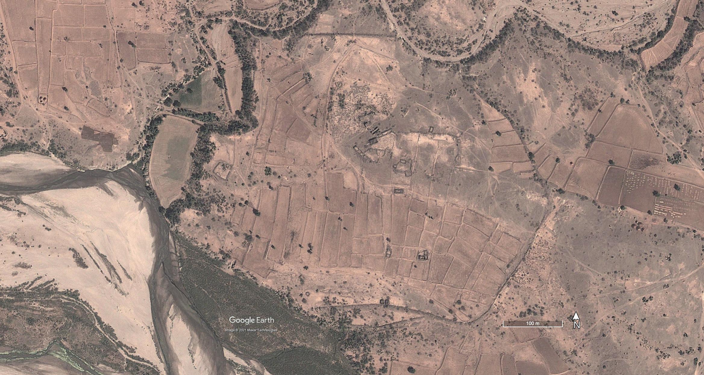
Figure 2. The Wadi Mawr site.
structures and enclosures, possibly part of a larger complex. Immediately to the north-west of this complex of buildings is an Islamic cemetery. Sharp wall lines visible on a number of structures across the interior of the Wadi Mawr site suggest that some of the structures may have been rebuilt or maintained recently, or additional buildings added for agricultural or religious use.
Further investigation in the environs of the two sites has recorded a range of additional features in the foothills along the eastern edge of Tihamah. This includes a number of terraced settlement sites, although these cannot be morphologically linked to either of the ‘city’ sites. Particularly distinct are a number of features found only in the hinterland of the Wadi Mawr sites. Consisting of parallel walls made up of elongated mounds or cairns, creating what appears on a satellite image as a series of adjoining rectangular chambers. There is some variation in the form and size of these structures, and in some cases the mounds are surrounded by a rectangular enclosing wall (Figure 3). Function can only be speculated for these features, although the cairn-like features visible, and their positions in prominent positions on low foothills are suggestive of a possible funerary or religious use.
On the basis of satellite imagery, we can only start to speculate about the date and function of the Wadi Mawr or Hays sites, as well as of the many additional sites recorded in their hinterlands. The size of the enclosed areas and the evidence of structures at the Hays site are suggestive of an urban or proto-urban function, but it is difficult to draw a parallel with comparable sites in the region. The Wadi Mawr and the Hays sites appear connected, with similarities in their size and rampart form, with the latter’s combination of curved and angular corners, and near absence of perimeter towers. The two also sit in geographically similar positions at the crook of a larger and smaller wadi channel, and both seem to lack any evidence of redundant field systems associated with these complexes. There is little to link them morphologically to the Islamic centres of Timahah Plain such as Zabid and Mocha, but equally there little to link them to the Islamic or pre-Islamic centres of the Yemeni highlands and desert fringes, or the evidence of pre-Islamic settlement recorded elsewhere on Yemen’s Red Sea coastal strip (Phillips 1998; 2005). The EAMENA project will take investigations of the site forward through the use of historic aerial and satellite imagery, as well as potentially through the use of higher-resolution satellite imagery. Ultimately detailed investigation and survey on the ground is needed to further advance understanding of these two enigmatic sites.
Fradley, M. and Bewley, R. 2019. ‘Endangered Archaeology in Southern Arabia’. Journal of the British-Yemeni Society 27, 61-69. Phillips, C. 1998. ‘The Tihamah c. 5000 to 500 BC’. Proceedings of the Seminar for Arabian Studies 28, 233-237. Phillips, C. 2005. ‘A preliminary description of the pottery from al-Hamid’. Proceedings of the Seminar for Arabian Studies 35, 177-193.
