Concepts, Applications, and Case Studies
September 2024
Co-Lead Authors, Maria Irshad & Casey Jones


September 2024
Co-Lead Authors, Maria Irshad & Casey Jones
In December 2015, the US Department of Transportation launched the Smart City Challenge, asking mid-sized cities across America to develop ideas for the integrated, first-of-its-kind smart transportation system that would use data, applications, and technology to help people and goods move more quickly, cheaply, and efficiently. 78 applicant cities shared their challenges and ideas for how to tackle them. Then, seven finalists worked with DOT to further develop their ideas. Ultimately, the City of Columbus, Ohio won the Challenge and was awarded $40 million and another $65 million was divided among finalist cities.
While the cities were diverse, many of the 78 applicants faced similar challenges:
• The typical job is accessible to only 27 percent of its metropolitan workforce within 90 minutes or less.
• Trucks stuck in traffic in metropolitan areas cost shippers an estimated $28 million annually in truck operating costs and wasted fuel.
• 28 percent of transit agencies in the US have open data systems that freely provide transit times to the public.
• An estimated 30 percent of traffic in urban areas is caused by cars looking for parking.
• The 78 applicant cities represent over one billion metric tons of CO2 emissions per year
• Outdated traffic signal timing causes more than 10 percent of all traffic delays on major routes in urban areas.
In response to these challenges,
• 44 cities proposed automated shared use vehicle testing.
• 11 cities proposed smarter curb management to improve urban freight movement.
• 17 cities proposed inducting wireless charging for electric vehicles.
• 45 cities proposed unified traffic data analytics platforms.
• 53 cities proposed implementing Dedicated Short-Range Communication (DSRC) to connect vehicles to infrastructure and each other.
• 9 cities proposed providing free WiFi on buses, taxis, and public spaces.
• The 7 finalist cities proposed over 60 unique strategies to increase access to jobs, providing training, reach underserved areas, and ensure connectivity for all.
How much progress has our industry made in the nine years since the DOT initiated the Challenge and invested over $100 million? How much more is being done to advance smart transportation outside of the initial set of awardees? Have smart transportation solutions become as ubiquitous as sustainability in parking, transportation and mobility or did COVID-19, the lack of enough funding, public private partnerships, or lack of proven technology impede our collective advancement of ideas and promises articulated by a handful of visionary, optimistic and creative city leaders who pitched their ideas back in 2015? Do we all understand what smart transportation entails and what goals might be advanced through its implementation? And if we agreed on these goals, what smart transportation activities might we pursue?
In late 2022 IPMI stood up a task force of volunteers to seek answers to these questions with the goal of furthering smart transportation broadly, well beyond the small but important group of Challenge applicants back in 2015. More specifically, the task force charge was to identify ways in which IPMI can support the promotion of smart transportation for the benefit of member organizations and their parking, transportation, and mobility constituents, primarily through this publication.
The logical starting point for the task force was to evaluate various definitions for smart transportation and select a definition most applicable to parking and mobility professionals. This required stepping back to consider smart city definitions and then placing within a shared construct of the smart city, a workable, cogent, and applicable definition of smart transportation.
IBM defines a smart city as “one that makes optimal use of all the interconnected information available to better understand and control its operations and optimize the use of limited resources.” A smart city uses a framework of information and communication technologies to create, deploy and promote development practices to address urban challenges and create technologically enabled and sustainable infrastructure.

Smart transportation has been defined as taking a data-driven approach to using existing and emerging technologies and innovations in mobility management to make moving around a city more convenient, more cost effective (for both the city and the individual), and safer
While instructive, these definitions were viewed as limited and lacking breadth. The Task Force also included additional specific outcomes, modernizing its Smart Transportation definition as follows:
Smart transportation means people-centered, and problem-driven technology-enabled solutions in mobility management to make the movement of people and goods across all modes more convenient, resource efficient, safe, and secure, and equitable.
Convenient – Technology solutions should be used to make mobility more convenient for end users. Regardless of the mode, transportation and mobility consumers expect streamlined, intuitive and understandable information and processes and in many cases, technology should be used to automate as many processes as possible.
Safe – Personal safety is paramount to many, especially in larger metropolitan areas, late at night, in isolated circumstances or when traveling to unfamiliar places. Technology solutions should promote and support safety by providing accurate and timely information, and ease of access to transportation and mobility services.
Secure – Technology should improve and not degrade accuracy while protecting confidential personal and financial information.
Equitable - Equity in transportation seeks fairness in mobility and accessibility to meet the needs of all community members. Smart transportation solutions must account for fairness and promote it where possible.
Resource Efficient – A critical overarching goal of smart transportation is for technology solutions and innovations to be resource efficient. This can mean either reducing operational costs, improving revenue generation or both. Solutions that are convenient, safe, secure, equitable but unaffordable do not promote smart transportation.
With smart transportation defined and goals identified, the Task Force identified common smart transportation activity types or pillars to create a comprehensive view of the types of initiatives an organization might consider.
Smart transportation activity pillars (categories) provide a framework for considering the multitude of things an organization might do if it has interest in advancing smart transportation. In this Guidebook, activities are associated with goals so that an organization can be steered towards activities most likely to achieve certain specific goals. Relating activities and goals will help organizations determine which activities are most impactful or need adjustment.
Regular Coordinated Data Collection & Analysis – Today’s technology provides for the collection and analysis of significant amounts of data and in many cases in real time. Coordinated data collection and analysis means aggregating disparate data sources into a single system so that information is less siloed. Analysis must be provided at multiple levels from operational to strategic improving decision-making processes.
First and Last Mile Service – First and last mile service refers to establishing connection points typically between parking or transit facilities and final destinations. Activities that use technology to promote first and last mile service might include the mode itself or the tool or application for connecting modes.
Limiting Impact of Climate Change – The full breadth of technology-enabled sustainability activities are undertaken to limit the impact of climate change. This includes reducing consumption of resources, generating energy, and limiting carbon emissions.
Movement of People and Goods – This overarching activity group involves moving people and goods and for the purposes of IPMI, is not likely to include all movement types (shipping, long-haul air travel, long-haul trucking, etc.) but may include air travel to move people and goods within an urban area (drones launched from parking structures, for example).
Maximizing Parking Efficiency – This activity seeks to maximize the number of parking events per parking space over a period or to increase the density of parking per a given area of land. Activities can also improve how parking is found and how entry and exit is facilitated to reduce congestion and/or queueing and dwell time.
Optimizing Traffic Flow – Similar to parking efficiency, these are activities that optimize traffic flow to reduce congestion. Typically, technology is used to improve traffic signalization, traffic queuing and modal prioritization.
The purpose of this guidebook is to provide an industry-specific working definition of smart transportation and to illustrate progress made toward specific and measurable goals through case study illustration. Case studies have been chosen along each of the six defined activity pillars and provide detail about desired outcomes, challenges faced, resources and logistics, and lessons learned for each.
In the following six chapters, each pillar will be highlighted with a definition and example case study. Each case study will highlight the primary pillar addressed, preliminary and actual goals attained, resources used and lessons learned. There will then be a chapter on overall conclusions and findings followed by additional case study information.

What is meant by “technology-enabled, regular, coordinated data collection and analysis”? Data allows organizations to understand the causes and effects of various activities and policies, identify areas of opportunity or improvement, and measure the effectiveness of implemented actions or strategies. Data is therefore critical to decision making and the amount of and accessibility to parking and mobility data has never been greater than it is today. But the collection and analysis of data can be costly even when enabled by technology which demands a solid understanding of the intended use of that data in order to justify its collection, analysis and presentation. Optimizing the collection and use of data also raises data privacy concerns, requires common definitions and coordination and communication among likely disparate or potentially differentiated information
sources (i.e. on-street parking meters and parking access and revenue control systems in parking garages that both produce revenue and utilization data but do not reside on the same backend system). And the plethora of available data prompts consideration of storage resources and computing platforms (How much data do I want to save and what tools are available to “crunch” the numbers?). Coordination exists when single distinctive data inputs are assembled and presented together, such as in a single dashboard which promotes understanding by providing several sources of information simultaneously. Regular means that the information assembled in a coordinated output of various data inputs is done consistently and routinely to inform decision-making on an on-going, perpetual basis (as opposed to, say, a single analytical report conducted every five years).
Activities associated with technology-enabled regular coordinated data collection and analysis can be categorized in three general ways: collection, storage and analysis. Data collection activities include the use of devices that record particular activities and events and are typically based on camera, RFID, infrared, and electromagnetic technology. GPS and Bluetooth are also technologies that support data collection activities. Depending on the technology, these devices can go well beyond rudimentary questions like: “When did a parking session begin and end?” to “What color, make and model is the car that just parked in the loading zone and who does it belong to?” The question now turns to how to store the data we’re collecting with these devices.
While a more technical explanation goes beyond our current purposes, data is generally stored remotely on computer servers or remotely via
cloud storage1. Cost, internal expertise, storage space, data security and the particular vendors engaged in a project or activity typically dictates storage infrastructure decisions.
Business intelligence (BI) is a technologydriven process for analyzing data and delivering actionable information that helps executives, managers and workers make informed business decisions and represents the last category type for this Smart Transportation pillar. Business intelligence processes are frequently carried out through specialized software systems either as stand alone and proprietary to the data collection apparatus (such as that which might be offered as part of a Parking Access and Revenue Control System) or as an integration where multiple data sources are ingested through application programming interfaces or APIs.


The Seattle Department of Transportation (SDOT) actively manages the curb in Seattle consistent with policy priorities articulated in places like Seattle’s Municipal Code, Comprehensive Plan, Complete Streets Ordinance, and a variety of other guiding policy documents. Most broadly, the intent is to effectively manage the curb to provide reliable access using a variety of regulations, permits and pricing.
Specific to data collection, SDOT’s Curbside Management team has been administering a Performance-Based Parking Pricing Program since 2010. That year, legislation was adopted to delegate to SDOT the responsibility to adjust on-street paid parking rates within a rate range, using parking data collected to drive rate adjustments, with the intent that one to two parking spaces per block be available throughout the day to provide reliable access for business district visitors and customers. Pricing the curb appropriately reduces instances of drivers circling the block looking for cheap, underpriced on-street parking in areas of high demand. Less vehicles circling reduces harmful carbon emissions, lessens unnecessary congestion in these neighborhood business areas, and limits distracted, frustrated drivers looking for parking who might put pedestrians, bike riders and other vulnerable people at risk.
Effectively managing short-term paid parking at the curb also benefits other pillars. Ongoing data collection and analysis is at the heart and foundation of Seattle’s Performance-Based Parking Pricing. As described above, by reducing vehicles circling an area looking for parking, it reduces congestion and carbon emissions in support of Pillar 3 (Limiting Impacts of Climate Change). By providing reliable space at the curb and limiting vehicles circling, it also facilitates Pillar 4 (Movement of People and Goods.) Effectively pricing parking at the curb by geographic area and time of day directly supports Pillar 5 (Maximize Parking Efficiency). And doing so also reduces congestion, supporting Pillar 6 (Optimized Traffic Flow).
As articulated in Seattle’s Municipal Code, the goal of effectively pricing the curb is that one or two parking spaces are available on each block to provide reliable access for visitors and customers to neighborhood business areas. SDOT has developed a base inventory of all on-street paid parking spaces down to the linear foot on each block, and calculated an associated parking occupancy goal consistent with the Municipal Code guidance. SDOT’s target parking occupancy range is 70% - 85%. Parking occupancy in this range means that the on-street parking resource is well-utilized, but visitors and customers can reliably find a space near their destination. Parking occupancy over 85% is an indicator that parking demand is high and pricing too low, which leads to vehicles circling an area for available parking, resulting in congestion and emissions. It could lead to some drivers deciding not to visit an area or businesses knowing that the availability of on-
street parking is limited. When parking occupancy is under 70%, it provides an opportunity to lower the hourly paid parking rate, so that the parker is not charged more than necessary to meet the overall objective.
Between 2010 and 2020, SDOT conducted (through a contracted vendor) an annual parking occupancy study in all paid parking areas to determine occupancy by area and time of day. This effort was largely manual, with data collected mid-week in the spring (what would be considered an average or typical condition and time of year) and rate adjustments were made in the fall based on that data. Since the summer of 2020, data collection has occurred on an ongoing basis, and is done through a combination of paid parking transaction analysis combined with targeted manual parking occupancy counts to “true up” the transaction data and analysis to account for gaps between paid occupancy and true on-street occupancy. SDOT now makes three rate adjustments per year – in the spring, summer and fall.
Working with a contracted vendor to conduct this analysis, SDOT has taken an approach akin to machine-learning and continuous improvement in developing its parking occupancy model based on tens of millions of paid parking transactions over the years, coupled with prior and current manual parking studies. This also provides a richer data set from which to calculate parking occupancy and adjust rates. Rather than the prior one-time hourly manual count on a day in the spring, SDOT is now able to consolidate a full month’s worth of transaction data to determine parking occupancy, which is a much more accurate picture of occupancy in each area.
• Developing and evolving the policy and implementation: While there were initially some related examples of data-driven approach to rate-
setting, Seattle’s Performance-Based Parking Pricing Program staff had to consistently work to determine whether data collection, data analysis and implementation were meeting the program objectives. For example, in the first years with a single day’s worth of hourly parking occupancy data, staff had to determine how to calculate an appropriate occupancy range, how to consider different parts of the day’s occupancy and whether to manage to a “peak” condition, how to consider occupancy variance by days of the week or seasonally.
• Funding: Working with Seattle’s Mayor’s Office and City Council, SDOT effectively articulated a need for ongoing annual funding in the base budget for parking data collection and analysis. Preserving this
funding over time has been critical to SDOT’s ability to update and improve program outcomes and evolve the data collection methodology from the prior once-per-year manual counts to today’s more complex, sophisticated hybrid model of transaction data analysis coupled with targeted groundtruthing parking studies.
• Public engagement: When SDOT initially moved to a system of annual rate adjustments by geographic area and time of day, it drove a significant amount of interest and questions from elected officials, decision makers, neighborhood business districts and the general public and media. SDOT has been intentional and transparent in providing as much data and information as possible. Annual data reports are produced and available on SDOT’s website going back to program inception, and provide a combination of hard data, helpful graphics, and higher level narrative to consistently articulate the intent of the program. The millions of transaction data and prior study results are all available on Seattle’s Data.
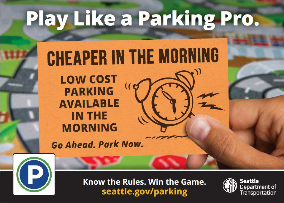
Gov web site. SDOT has developed a consistent marketing effort under a “Play Like a Parking Pro” umbrella to drive a variety outreach campaign and collateral materials with consistent branding. SDOT also spent significant time redesigning its on-street parking signs to provide the parking public with clear, concise messaging on parking rules. SDOT also created a Curbspace Sounding Board and held regular meetings with business district representatives to talk through the program, its purpose, methodology, and to facilitate communication and support during rate adjustments.
• Elected officials and decision makers: In its first years, regular adjustment of on-street paid parking rates resulted in high volumes of questions from elected officials and the media. As SDOT has consistently applied this approach over time, the questions have diminished significantly, with a much greater understanding that Seattle adjusts on-street paid parking rates based directly on parking data collected. All areas are treated equitably through this approach.
What for many cities can be a “third rail” issue – changing on-street paid parking rates – has in Seattle become an accepted regular way of doing business. SDOT has built trust over time with decision makers and the public, they’ve been transparent about desired outcomes and data collection, and they have been consistent in their implementation.
Because SDOT has been able to build on its successes since 2010, the Curbside Management Team has a relatively stable budget to carry out its Performance-Based Parking Pricing Program, including the data collection that underpins the system. The Curbside Management team has staff that focus on policy and outreach, staff that manage contracts with the parking pay station vendor and the mobile payment vendor and who have become experts in working in the back offices of those vendors, engineering staff who write the work instructions for sign and pay station installations, and a Parking Shop that operates, maintains and programs the pay stations.
As a critical component of its Performance-Based Parking Pricing Program, Seattle has allocated a portion of its annual base budget for ongoing parking studies. This allows them to monitor on an ongoing basis whether rate adjustments are having their intended effect, and drives their data-driven approach to regular rate updates and improvements. SDOT has typically allocated $250k of its annual base budget for this purpose. Over the years, SDOT has worked with consultants to modify use of this budget as the program
has evolved and lessons have been learned. In the program’s initial years, this money primarily funded an annual large manual parking study in all paid areas to determine rate adjustments. More recently, less of this funding has been devoted to manual studies and more towards the updating of a parking occupancy model based on historical parking trends and updated transaction records, supplemented with some manual data collection. Seattle also has budgeted base annual funding for other parking studies in areas where SDOT works with neighborhoods to determine whether updated curb management tools would be appropriate, including the potential for new paid parking. SDOT reserves about $150k - $200k annually for this purpose. SDOT otherwise uses its annual base budget and programs for staffing and signage changes to administer these programs and implement changes.
Specific to data collection, staff on the SDOT Curbside Management team manage ongoing vendor contracts for data collection and analysis. For the first several years this involved management of a detailed spring parking data collection study that resulted in annual fall rate adjustments. That has evolved to managing the current contract in which paid parking transaction data is the key input into a parking occupancy model that continues to evolve and improve over time. That transaction model uses current transaction data, but is built on a history of years of historical transaction data coupled with years of detailed on-street parking studies, to model actual occupancy in way that effectively accounts for gap between paid and actual occupancy that occurs for a variety of reasons (disabled placard and license plates, non-payment, permits, etc.) That gap can vary by area and time of day, so the transaction model is continually trued up by targeted manual parking counts and studies.
SDOT Curbside Team
Pay station vendor IPS Group
Mobile Payment vendor PayByPhone
SDOT used its Performance-Based Parking Pricing Program as the most illustrative example of data collection over time in Seattle. It is an approach that has broadened beyond that specific program to other areas of curb management. SDOT piloted sensor installation in commercial and other loading zones to ingest data to determine use and what might be the most effective ways to convey that data to external users.
The City of Seattle’s Surveillance Ordinance limits SDOT’s ability to use some technology like cameras for data collection and/or curb management on an ongoing basis, though SDOT is allowed to use camera technology for limitedduration studies.
SDOT adjusts on-street paid parking rates to achieve specific policy objectives described above. Revenue is an outcome, but SDOT does not make revenue-driven rate adjustments. This helps build public trust in the program, and greater buy-in that SDOT is taking a “smart transportation” approach to managing the public right of way. SDOT’s rate adjustments are data-driven, tied directly to actual parking occupancy data.
There are several keys to using data collection and analysis to drive decisions. First, make sure there is understanding and agreement of the ultimate goals and objectives (in Seattle’s case, pricing the curb to reduce vehicles circling.) Next is to determine what is the most relevant data that needs to be collected to drive decisions. Seattle also had established an underlying asset management system prior to the launch of this program, having mapped all paid parking spaces and signs in those areas down to the linear foot. Having this base layer of critical data provided an important foundation to facilitate effective data collection and analysis. Also, as more information becomes available through data collections, it can reveal unexpected things happening at the curb, so be open to adjusting and pivoting based on data collection (as long as remaining true to the ultimate objectives).
There is no shortage of available data in our industry and there are a variety of means and technologies to collect and analyze data. Effective data use can help drive better operations and decision-making. Data can be used to more effectively describe outcomes to the public and build trust. Increasing attention at national and international levels to common data standards can enhance efficiencies and incentivize better public/private collaborations, and improve integrations between previously disparate data sources and systems. When combined and coordinated, data systems improve understanding, impact and efficiency. But the plethora of available data and allure of making use of it comes with challenges.
Trying to collect and analyze too much data can result in unclear direction for analysis (i.e., “analysis paralysis”). Technology makes data collection more feasible, but can be complex and expensive and require reliance on subject matter experts either found internally within organizations or externally through technology providers or consultants. Identification of sufficient, necessary resources for ongoing data collection and analysis can be challenging and many organizations do not have the right staff for effective complex data analysis.
The availability of sufficient initial and ongoing resources for ongoing, regular and coordinated data collection and analysis is considered a best practice. From the onset, organizations must have clarity on objectives for data collection and analysis and expect that to maximize the use of multiple data streams, multiple vendors and partners are likely necessary. Considerable effort will also be needed in order to translate complex data and outcomes into an understandable story for the general public.
First and last mile service refers to establishing connection points typically between parking or transit facilities and the beginning or end of a trip. Walking may be an option for shorter distances, but in many cases, the origin or destination may be too far or too difficult to walk. This gap in the journey is what the first and last mile services aim to address.
Smart Transportation activities that use technology to promote first and last mile service include the mode itself or the tool or application for connecting modes. The different first and last mile strategies include a variety of transportation options, infrastructure improvements, and innovative tech solutions.
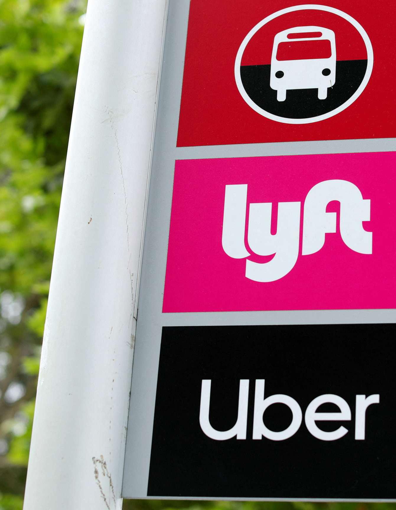
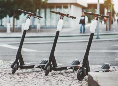
First and last mile services include the provision of scheduled or on-demand shuttle service, rideshare accommodations (Uber, Lyft, Didi, etc.), shared or personal bicycles and other mobility devices such as scooters.
Adding Smart Transportation technology-enabled elements improves the accessibility and usage of first and last mile services and typically includes activities such as:
• Real-time shuttle location information accessible to the rider by mobile device (such as Nextbus2)
• User-facing applications that facilitate renting or locating the mobility service
• Traffic signal management to reduce congestion and make first and last mile trips more efficient
• Predictive analytics to assess the future demand of different solutions for the purposes of optimizing routes, schedules, capacity, and services
• Mobility wallet to allow for a streamlined way to pay for multiple service options


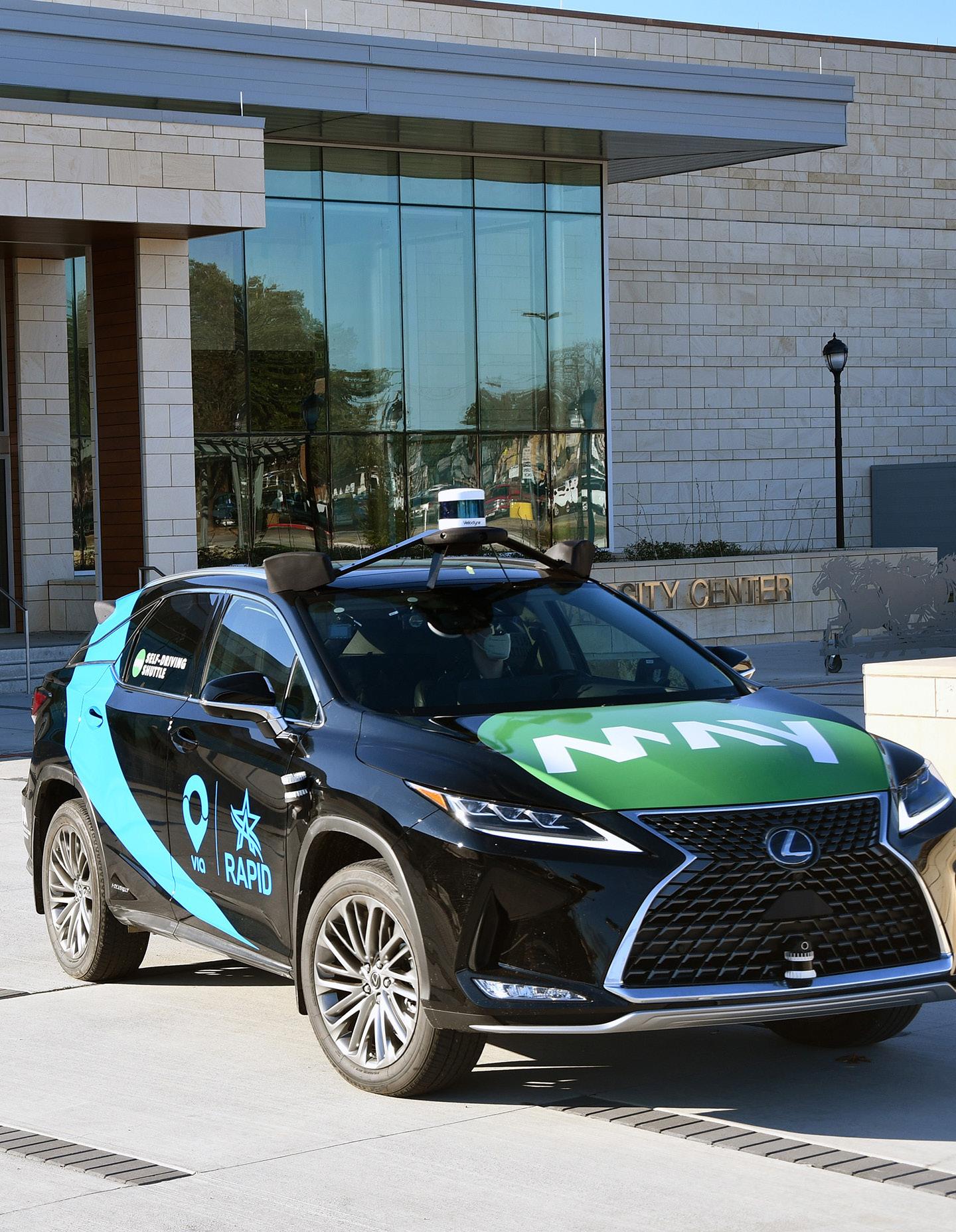

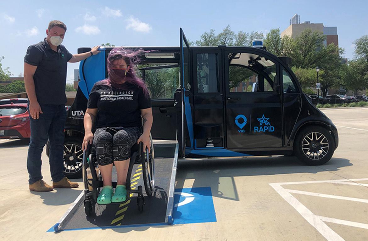
The University of Texas at Arlington (UTA), City of Arlington, May Mobility, and Via are currently in the third year of operation of providing self-driving shuttles for students. This public-private partnership originally incorporated a fleet of five self-driving Lexus RX450H SUVs and one wheelchair-accessible Polaris GEM into the university mobility network and city public transportation system to move students around campus and downtown Arlington for free. In 2023, the fleet was upgraded to larger capacity Toyota Sienna vans. Faculty and the public could ride for a nominal fare. The Arlington RAPID (Rideshare, Automation, and Payment Integration Demonstration) project was the first of its kind to integrate Level 4 self-driving autonomous vehicles into an existing public transportation system with integrated free and paid fares.
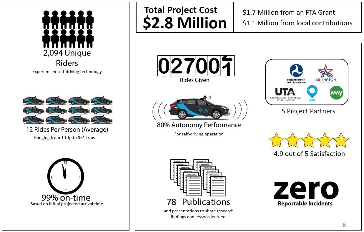
Paid for with a $1,698,558 million Federal Transit Administration grant matched by $1,181,770 million in local funds, the project lasted a total of 30 months, with 12 months focused on programming, mapping, testing, and education. Year 2 included a full 12-month deployment of the integrated services, data analysis, ridership surveys, and service evaluation. The final six months wrapped up evaluations and shared research-based lessons learned in over 42 academic papers, 16 community events, and more than 20 professional presentations. This opportunity had its roots in the pandemic, when smaller vehicle capacities were preferred by riders practicing social distancing. UTA quickly recognized a need and pivoted operations by eliminating redundant service modes after ridership fell on the traditional larger-capacity campus shuttle bus service. As a result, the university parked its larger 32-passenger fixed-route shuttle buses. It focused exclusively on offering a three-month service modification where only self-driving shuttles were used for the campus circulator, saving $111,000 in operating costs. These savings were later reapplied to this project after the grant-funded free fares for students were exhausted early due to high demand.
CASE STUDY: Arlington Rideshare, Automation, and Payment Integration Demonstration (RAPID) Project
Over 28,000 rides were provided during the 12-month pilot, 99% of which transported UTA students.
This project is the first in the country to implement self-driving on-demand service into a university and public transportation system with payment integrations. Additionally, project partners quickly recognized the opportunity to be the first university in the country to exclusively offer self-driving shuttles to students to demonstrate what the future of camp.us mobility may look like.
The main project goal was to demonstrate a successful combination of autonomous vehicle technology with on-demand services to develop an effective, efficient, safe, and accessible transportation network in a low-density setting where traditional fixed-route transit can be impractical. Over 28,000 rides were provided during the 12-month pilot, 99% of which transported UTA students. UTA also sought to collect data to analyze how a shared ondemand autonomous service performs as part of a public transit service and in comparison to operator-controlled vehicles within the Arlington On-Demand services and establish an effective payment integration with UTA’s Bursar’s systems to provide free rides for university students yet paid rides for non-students. These were phase one project goals and following implementation, additional goals were established including:
• Introduce higher-capacity hybrid electric vehicles to replace large diesel buses on a UTA shuttle route.
• Test the functionality of autonomous vehicles (AVs) in a campus circulator use case.
• Explore the integration of a circulator route with an existing on-demand AV service.
• Install communication devices in all AV fleet vehicles and in first responder vehicles from the City of Arlington and UTA for direct vehicle-to-vehicle communication.
• Advance towards removing the human operator from AVs through the use of May Mobility’s tele-operations feature.
• Provide efficient, safe, and affordable daily transportation for transitdependent populations.
• Enhance air quality by transitioning from gasoline buses to hybrid AVs.
• Position UT Arlington and the broader DFW region as leaders in transportation technology innovation.
In planning and implementing the Arlington RAPID program, UTA faced several barriers and challenges, including technological integration, regulatory compliance, public acceptance, and data privacy concerns. To address technological integration, UTA closely collaborated with partners
May Mobility and Via Transportation to seamlessly integrate autonomous vehicles into the existing public transit system, ensuring a smooth operation of the service. Regulatory compliance required diligent navigation of local and federal transportation regulations; UTA engaged with regulatory bodies early in the process to ensure all operations were in full compliance and to advocate for supportive policies. To increase public acceptance, UTA conducted extensive community outreach and education campaigns, highlighting the safety, efficiency, and environmental benefits of the service. Data privacy concerns were addressed by implementing robust data protection measures, ensuring all collected data was anonymized and securely stored, and establishing clear data sharing protocols that protected personally identifiable information. Through these efforts, the team successfully overcame the initial challenges, setting a precedent for future smart transportation initiatives.
Phase 1 was made possible with a $1,698,558 grant from the FTA, and $1,181,770 in-kind contributions from the partners. Phase 2 is made possible by a $4,538,552 grant from the North Texas Council of Governments and $1,157,332 in-kind contributions from the partners. A bridge period existed between Phase 1 and Phase 2 that consisted only of operating expenses.
One March 2021-March 2022
share: $1,181,770
“Bridge” March 2022-October 2023 City contributed $150,000 cash City and all partners contributed significant in-kind support
Two November 2023-May 2025 COG share: $4,538,552 Local share: $1,007,332
In the Arlington RAPID program, each partner played a crucial role, overseeing various aspects critical to the program’s success:
• The City of Arlington served as the project leader, coordinating between all partners and overseeing the integration of the RAPID service into the city’s transportation infrastructure. They were responsible for regulatory compliance, community engagement, and ensuring the service met the city’s mobility and sustainability goals.
• UTA focused on aligning the program with the university’s needs, facilitating access for students, and integrating the service into the campus transportation system. UTA also played a key role in research and evaluation, analyzing data to understand the impact on the campus community.
Payment
• May Mobility3 was responsible for the deployment and operation of the autonomous vehicle fleet, including vehicle maintenance, safety protocols, and technology updates. Their expertise in AV technology was crucial for navigating the technical challenges of operating in an urban and campus environment.
• Via Transportation4 managed the ondemand software platform, ensuring a seamless user experience from
ride booking to payment integration. They were also in charge of data management and analysis, utilizing their technology to optimize service routes, reduce wait times, and improve overall service efficiency.
Together, these partners combined their strengths to address the multifaceted challenges of implementing an innovative transportation solution, making the Arlington RAPID program a model for smart, collaborative urban mobility.
3 May Mobility is a private, for–profit company that develops autonomous vehicle (AV) technology and deploys fleets of vehicles to municipal and business customers.
4 Via Transportation, Inc. is a for-profit company that provides software as a service (SaaS) and mobility as a service to operators of public transportation, multimodal transport, paratransit operations, non-emergency medical transportation, logistics and deliveries, school bus fleets, commercial ridesharing and corporate shuttles, and autonomous vehicles.
STUDY: Arlington Rideshare, Automation, and Payment Integration Demonstration (RAPID) Project
City of Arlington
UTA May Mobility
Via
Department of Civil Engineering Parking & Transportation
Federal Transit Administration
North Central Texas Council of Governments5
There were several measurable outcomes that underscored the Arlington RAPID program’s success. Operationally, there were no reportable incidents. The vehicles provided 28,000+ rides with an overall satisfaction rating of 4.9 out of 5. They operated in self-driving mode an average of 80% of the time and arrived by the predicted time 99% of the time. From a research perspective, study findings were shared widely within the industry. More than 42 research-based academic publications have been published to share best practices and lessons learned, and more than 36 additional informational presentations have been given by project partners.
The project offers valuable insights and lessons for organizations looking to embark on similar smart transportation initiatives. Here are some key takeaways:
Collaboration is Key: The success of Arlington RAPID was largely due to the strong partnership between public entities, private companies, and educational institutions. Future projects should prioritize establishing clear communication channels and shared goals among all stakeholders.
Flexibility and Adaptability: Adapting to technological challenges and unexpected operational issues was critical. Organizations should be prepared for a learning curve with autonomous vehicles and the integration of new technologies into existing systems.
Community Engagement: Early and ongoing engagement with the community, including potential users, is essential. Feedback and user data should inform service adjustments and improvements to meet actual needs and increase adoption.
The initial phases focused on operational data and user feedback. Expanding the scope of data analysis to include more detailed demographic studies and travel pattern analyses could provide deeper insights for service optimization. Additionally, it is highly recommended to understand the local and national regulatory landscape regarding autonomous vehicles to anticipate compliance challenges.
From the outset, design the program with stringent safety protocols for passengers and pedestrians and secure data management practices to protect user privacy. Ensure redundancy, and while 100% autonomous operation is the goal, ensure a plan is in place when it isn’t possible.
While AVs promise to revolutionize public transit, it’s important to set realistic expectations about the timeline for integration, operational challenges, and the evolution of user acceptance.
5 The North Central Texas Council of Governments (NCTCOG) is a voluntary association of, by and for local governments, and was established to assist local governments in planning for common needs, cooperating for mutual benefit, and coordinating for sound regional development. NCTCOG’s purpose is to strengthen both the individual and collective power of local governments and to help them recognize regional opportunities, eliminate unnecessary duplication, and make joint decisions.
There are many reasons to pursue first and last mile services. Further enabling these services via technology can increase the attractiveness of commuting via transit and make critical first- and last-mile linkages between final destinations and drop-off and pick up locations. This, in turn, can increase accessibility to transit options, reduce congestion, provide more flexibility and convenient options for riders and promote transportation equity. There are also potential downsides to these services.
Shuttle-based services may have long wait times when not aligned with the main public transportation service schedule and may have high per rider operating costs. Shared mobility services may also clutter the streets or may not be available (from private providers) depending on demand. There may also be regulatory challenges to navigate and inadequate physical infrastructure (enough curb to curb space, for example) to address potential safety concerns. And, as with any data-rich service, technology-enabled first- and last-mile may not be attractive options for some based on privacy concerns.

Climate change is an existential threat to humanity. While it is difficult to quantify the extent to which humans have already negatively impacted the physical environment of Earth, scientists around the world agree that the actions of humans since the Industrial Revolution have caused Earth’s climate to change for the worse. Without drastic action including significant reductions in fossil fuel emissions, human caused climate change is likely to lead to additional warming of the planet resulting in continued sea level rise, greater incidents of extreme weather events, and mass extinctions of plant and animal species. This will lead to catastrophic damage to coastal cities, displacement of population in coastal and low-lying geographies, and significant loss of human life.
Given the threat posed by climate change, the potential positive impacts of any smart transportation solution must be weighed against that solution’s potential negative impact on the environment.
Technology-enabled activities associated with limiting impacts of climate change can include installation of energy efficient lighting, use of license plate recognition or other idle-reduction parking payment technology, installation of advanced vehicle guidance systems, among others.
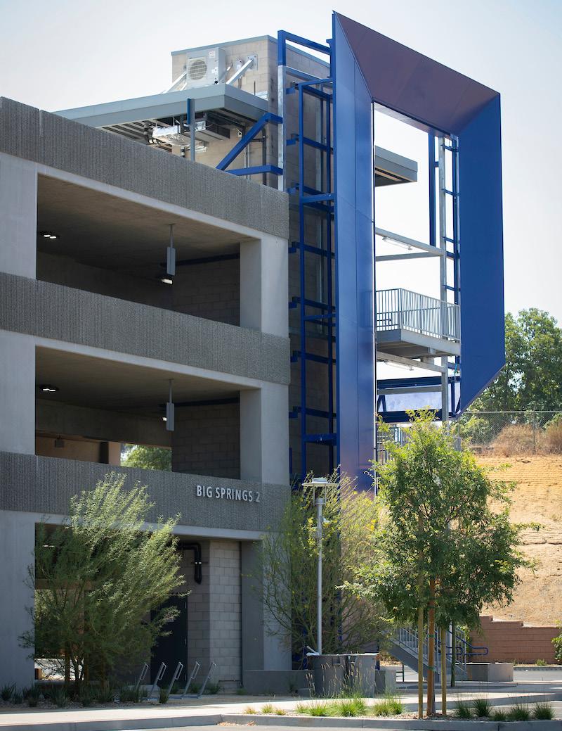

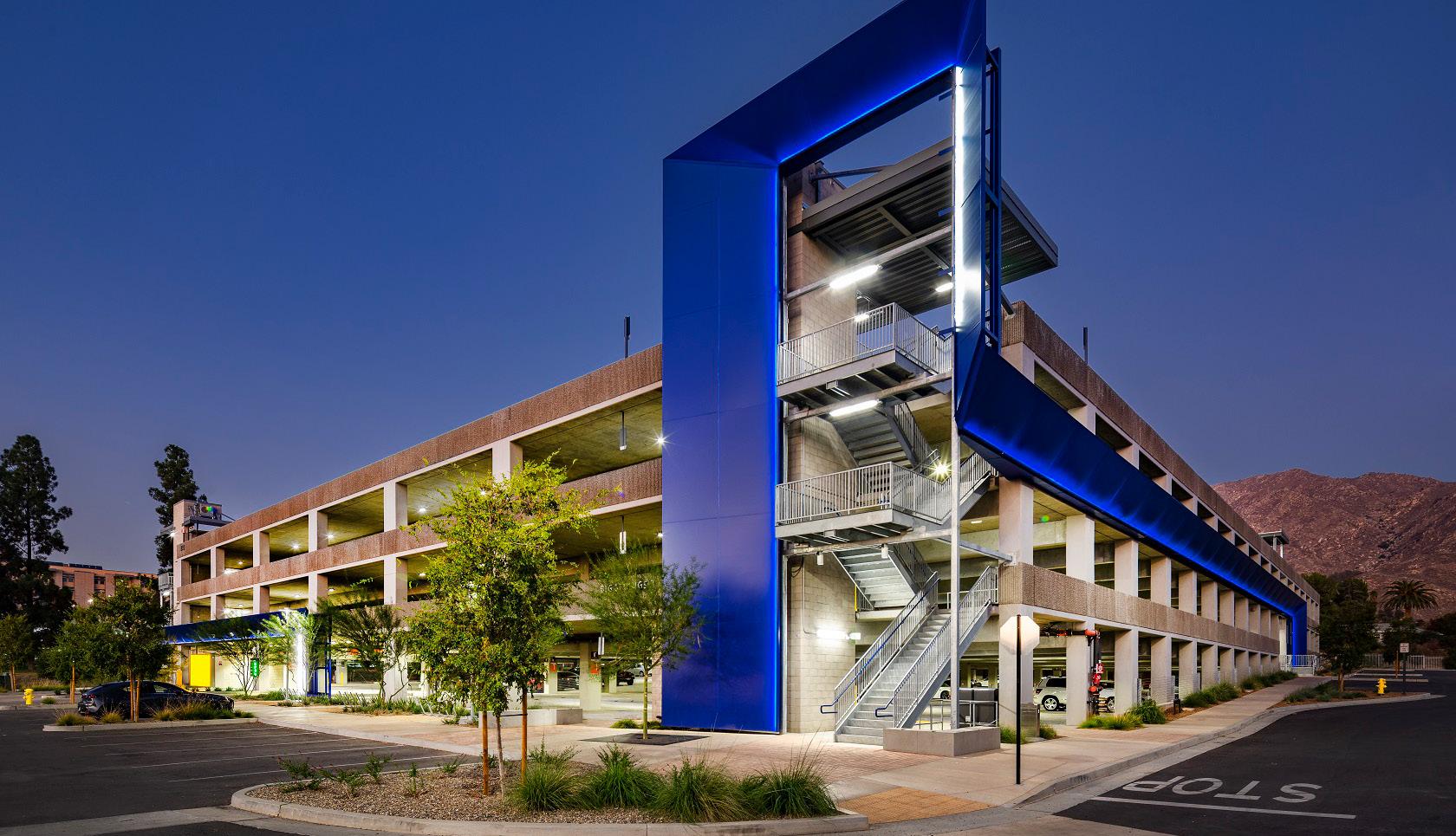
Nestled into a hillside with a magnificent view of Box Springs Mountain is the University of California, Riverside’s (UC Riverside) newest four-level parking facility, Big Springs Parking Structure 2. Prominently located at the east end of campus, it opened in August 2021, adding 1,079 parking spaces for students, staff, faculty, and visitors and directly responding to the demands of a growing university whose development projects were replacing existing older surface parking lots.
Among the sustainable design elements were:
• Regional, reused, repurposed, and recycled materials comprise the parking structure, which was constructed with regional labor.
• The use of non- or low-VOC coatings, paints, and sealants to assist in the reduction of air contamination throughout the structure.
• Participation in sustainable purchasing programs such as Green Spend and Economically and Socially Responsible Spend.
• An energy-efficient lighting system designed to maintain the required illumination with proficient energy use on the site without sacrificing high energy usage.
• Water-efficient landscaping featuring drought-tolerant native vegetation that adhered to the LEED Outdoor Water Use Reduction requirements.
• Stormwater management via bioretention basins at the perimeter of the building and site parking lot islands. An erosion and sedimentation control plan satisfies the requirements of the U.S. EPA Construction General Permit.
• As part of the original design and commitment to UC Riverside’s zero carbon footprint goal, the roof can accommodate the installation of photovoltaic solar panels.
• The consistent use of environmentally safe cleaning products and waste disposal.
• An iconic tower branded with the UC Riverside blue and gold colors and a unifying “blue ribbon” that encapsulates the elevator tower and accentuates exterior walls combine to distinguish the structure and connect it visually to other campus buildings. The east façade is enlivened by climbing vines attached to green screens that double as shading devices.
CASE STUDY: University of California Riverside Sustainable Parking Facility
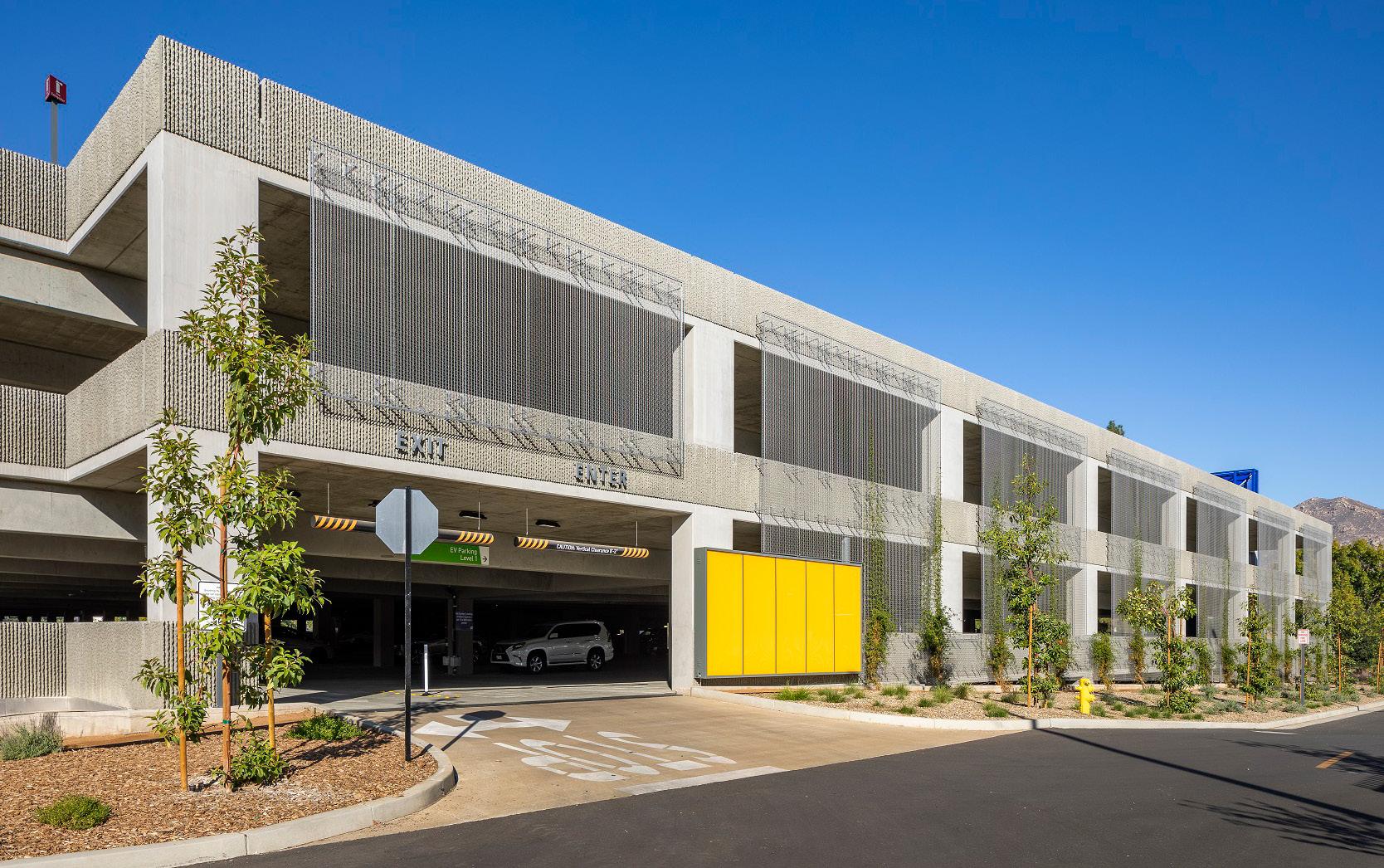
The project features several accessibility elements including two-lane entrances and exits for ease of access, a parking guidance system on each level, and 105 combined Level I and Level II EV charging spaces to support the university’s commitment to reducing resource usage and greenhouse gas emissions. Alternative transportation is supported by bicycle parking and maintenance stations that provide safe storage and tools for self-service repairs. Lastly, as a visible sign of UC Riverside’s environment-forward position, recycling bins are located throughout each level of the structure.
When UC Riverside began the planning process to provide additional parking for the expanding campus, goals were developed to guide the design
and construction process. The facility needed to preserve campus land for possible future academic development; be a model for future campus transportation facilities; push industry standards for efficient facility design, delivery, and operation; and meet or exceed the university’s sustainability goals and California’s green building program requirements.
To meet these goals, the Parksmart certification program was used as a design and construction guide for the project development team. At the completion of construction, the campus submitted the project and operating documentation required by the Parksmart program for review to attain a Silver certification level. However, the team’s diligence and attention to detail paid off, and the project achieved Gold certification.
A key challenge UC Riverside faced was keeping their design and construction partners focused on the root design elements that mattered to users. Most of the parking public prefers to park in a structure that is well-lit, bright, and open; dimly-lit parking structures inherently feel less safe and less desirable as a parking location. By providing four inches of clearance beyond ADA requirements throughout the whole facility these safety-based concerns were addressed. People could see farther, airflow in the facility was increased, light fixtures were more efficient, and vehicles could move freely throughout the entire facility.
Transportation Services’ maintenance team’s desire to not maintain white interior paint was an argument with the design team that carried on for several weeks. This traditional interior finish helps with some light reflection and provides a uniform finish but requires ongoing maintenance. The department concluded when discussing the perceived safety of parking facilities with users that the apparent cleanliness and care a facility receives relates to the level of perceived safety. The bare concrete interior maintains a more consistent appearance and is easier to maintain than a painted interior that is easily marred by use and vandalism.
These differences in professional experiences by different industry experts were challenging to work through. However, having a shared understanding of the project’s goals encouraged the team to set aside the standard approach and try new ideas.
CASE STUDY: University of California Riverside Sustainable Parking Facility
This project was a design-build project. The team that won the competition was PCL Construction with Watry Design. Their total cost for design and construction was $25,286.775. Their total cost included all design and construction costs. The university did not require a breakdown of their costs in the process. Their total did include some additional work that was added to the project to refurbish some existing surface parking spaces and some additional ADA work outside of the project boundary. The department’s total project costs were $28,870,691. The additional differences included Basis of Design development, design competition costs, peer review costs, project management staff through project completion, and building inspections.
UC Riverside Transportation Services Department
UC Riverside Department of Design and Construction
UC Riverside Facilities Services
Pacifica Services Project Management
PCL Construction
Watry Design
Document all of your goals, desires, and dreams for the project even if you can’t afford them. Make sure they are all listed in your Basis Of Design documents and include sample photos if possible. UC Riverside’s project had an initial goal to include infrastructure for a commercial car wash operator to serve the facility users. It was not seen as a financial possibility and was removed from the project. It was only at the end of the project it was realized that with minor additions the carwash space could be completed for a few thousand dollars. Just one more thing to make the facility a destination of choice.
IPMI’s sustainability framework concisely articulates the importance of sustainability in parking and mobility:
Sustainability in parking and transportation means meeting “the needs of today without compromising the ability of future generations to meet their own needs.6” To be successful, transportation solutions and sustainable practices should balance economic feasibility, public health and welfare, and consideration of environmental effects. These sustainable practices work to reduce fossil fuel use and carbon emissions, air and water pollution, and land use.
The use of technology has accelerated sustainability advancements within parking and mobility and in many cases the cost of sustainable activities has decreased making it easier to justify what previously might have been considered costprohibitive. Technologies that promote the use of transportation alternatives, improve energy efficiency, increase the use of renewable energy sources and decrease pollution, carbon emissions, waste, harmful chemical use and potable water use are all worthwhile to consider especially if the costs of such activities decreases over time and promotes economic profitability, equity and prosperity.

The rise of the societies and emergence of trade is dependent upon the ability for goods to get to market and people to freely and efficiently travel across short and great distances. In modern times, the efficiency of such movements is largely more complex and involves the interplay amongst a variety of modes, technologies, and assets as well as consideration of geography, wealth and space.
In the context of curb management, the interplay between the movement of people (transit services, taxis, personal vehicles, bicycles, etc.) and goods (package delivery services, personal vehicle, pedal powered, etc) has increasingly relied upon good planning and the advent of smart transportation and mobility ecosystems. Understanding the need of these various services for both geographic space and where the consumers of their services reside is important to design a smart transportation plan that balances the allocation of resources and street space to the various needs in an equitable approach.
Technology-enabled activities associated with movement of people and goods can include deployment of technologies to develop and track Key Performance Indicators (KPI) to measure efficiency and performance, development of data-driven processes to quantify approaches and strategies for both the movement of people and goods and the optimization of “smart” data streams and sources.


The Pittsburgh Parking Authority (PPA) is committed to providing safe and affordable parking, uniformly enforcing parking ordinances and laws while advancing the economic progress of the region, and to do so with a commitment to customer service. With these goals in mind, the PPA partnered with Automotus, Inc.7 (Automotus) on an initiative to enable the city to monitor and manage its loading zones more effectively.
Through this initiative, the PPA and the Pittsburgh Department of Mobility and Infrastructure (DOMI), sought to create a cleaner, safer, and more pleasant loading zone parking experience, while carrying over the impacts of these solutions to the public. The goal of the project was to ensure curb access to delivery vehicles, monetize loading zones throughout the city, incentivize loading zone turnover and reduce double parking, thereby decreasing the amount of time vehicles spend idling and the resulting carbon emissions.
This project is aimed at supporting curb management solutions to reduce traffic congestion and accelerate the comprehensive goal of zero emissions from delivery vehicles. To achieve this goal, the PPA sought to improve the parking experience for loading zone users, while decreasing the amount of time vehicles spend idling throughout the city each day. Specific goals included:
• Aligning parking and loading policies with real-time data
• Decreasing emissions from unnecessary idling and circling
• Reducing parking-caused traffic by 20% and double-parking by 60%
• Generating additional revenue from parking and loading
• Increasing parking turnover for restaurants and small businesses
• Improving safety for pedestrians, cyclists, and other curb users
• Increasing delivery efficiency and reduce dwell time
The solution implemented across the Pittsburgh smart loading zones has resulted in several benefits for the city, loading zone users, and the public. The project has increased loading zone turnover by 40%, while reducing the average stay by 23% and double-parking safety hazards by 74%. It has also significantly increased delivery efficiency for small businesses and delivery drivers. These improvements have also reduced vehicle idling, thereby lowering greenhouse gas emissions and the devastating impacts to the environment.
One challenge the project team faced involved the crossdepartmental coordination. The PPA is responsible for parking enforcement, including parking payments, throughout the City, while DOMI is responsible for designating curb use and setting meter rates not already set forth in municipal code. Successful curb management required the coordination and cooperation of each of these departments and agencies. The team conducted weekly meetings at the start of this project to ensure alignment across contracts, legislation to enable the initial pilot project, questions of legal authority, integration into the existing parking meter payment system, accounting, and more. The commitment of DOMI and PPA and their willingness to collaborate was crucial to the success of this program.
Many, if not most, cities do not have reliable data regarding double parking, idling time, or time spent searching for loading zone space which made the identification of zones challenging. However, most cities do have anecdotal evidence that these safety conflicts and increased emissions are occurring due in part to poor curb management. For this project, DOMI created a list of approximately 40 of those areas with frequent loading conflicts that could benefit from Smart Loading Zones. From there, DOMI took those locations to business improvement districts (BIDs) and registered community organizations (RCOs) to review and validate the proposed Smart Loading Zones.
CASE STUDY: Pittsburgh Parking Authority
Many cities, like Pittsburgh, have limited funds to deploy new technologies or pilot projects. In this case, the Smart Loading Zone pilot was made possible through in-kind contributions from Automotus through the Commercial Curb Challenge, as well as a revenue-share agreement. This allowed for the implementation of the Smart Loading Zone pilot without any out-of-pocket expenses for the City or PPA.
Finally, existing city code did not support automated loading zone payment and enforcement with cameras. This required introducing and passing legislation to give the parking authority clear guidance to deploy smart loading zones as they currently exist in Pittsburgh.
Collaboration and engagement with stakeholders was a critical initial step toward implementing effective curb management solutions. The team worked with DOMI to reach out to council members, business improvement districts, community organizations, and local businesses to discuss the curb conflicts they were experiencing and to explore potential locations for Smart Loading Zones. This early collaboration validated the City’s observed problems at the curb and ensured effective solutions were implemented throughout the pilot.
From a policy standpoint, the project, which spans over three years, is in the process of scaling up in policy and implementation. In 2023, the City increased the number of Smart Loading Zones throughout the city to 200, while offering incentivized pricing for zero emission vehicles. The project also included the development of new policies to support zero emissions pricing. Further, a recent grant provides support for the evaluation of curb management policy and technology implementation outcomes on key metrics,
Loading Zones
including incentivizing the transition of commercial delivery companies and drivers to zero emission vehicles or smaller delivery form factors. The project is now the first example of fully automated on-street parking enforcement in a major US metropolitan area.
There are multiple funding mechanisms to deploy a similar project. The first, should an agency select the SasS model (software as a service), expect costs of about $8,700 per year, per camera. Each camera will cover up to five spaces. The second funding mechanism is revenue share with the vendor responsible for deploying all the capital needs to implement a Smart Zone and then sharing in the revenue recovered from the Smart Zones users.
Pittsburgh Parking Authority
Pittsburgh Department of Mobility and Infrastructure
Pittsburgh Mayor’s Office Automotus, Inc.
Duncan Solutions
One of the most important components of the project is understanding unique needs ahead of time. This will help all project team members to have a clear directive regarding the goals of the project.
Collaboration is key. It is vital to ensure all relevant departments and stakeholders have the opportunity to contribute and communicate their needs, while providing the project team with valuable data and information that may help streamline the project or ensure that important components are not missed.
Because of the inherent tension between the movement of people and goods, a review and analysis of the societal benefits and investments of different and competing needs is integral. For example, an investment in dedicated bus lanes means faster bus times but slower vehicle speeds and reduced capacity, but the benefits of faster mobility and number of users outweigh the delay in travel time for personal vehicles. Dedicated strategies focused on efficient goods delivery allows for optimization of a critical pillar of community sustainability. Balanced systems that account for retail and personal delivery improve efficiencies and congestion.


This pillar seeks to maximize the number of parking activities per parking space over a period or to increase the density of parking per a given area of land. Activities can also improve how parking is found and how entry and exit is facilitated to reduce congestion and/or queueing and dwell time. Maximizing efficiency involves both the design and implementation of strategies that optimize the use of parking spaces to accommodate the maximum number of vehicles while minimizing congestion and improving overall user experience.
Technology-enabled activities can include pricing strategies to ensure ideal utilization rates, parking wayfinding technology such as sensors, electronic signage, or applications that direct drivers to available parking spaces, reservation platforms and increased data collection with technology (sensor, license plate recognition, permit systems that collect license plate and vehicle data, mobile license plate inventory, etc.).
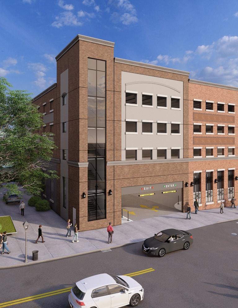
The City of Bethlehem is a historic city located in the Lehigh Valley area of Pennsylvania and an increasingly popular destination for shopping, tourism, and events. Parking in the City’s downtown districts has historically been, and is currently, highly utilized.
The Bethlehem Parking Authority (BPA), an Accredited Parking Organization (APO), is keenly aware that parking management technology and the analysis of the associated data is critical to both maximize the utilization of its existing parking assets and to guide them in the pending development of a new mixeduse parking facility to support the City’s vibrant Downtown. This case study illustrates the BPA’s use of technology and data to support right sizing the redevelopment of an existing parking garage, developing an interim parking strategy to accommodate parkers during the demolition of the existing facility and construction of the new facility, and implementing management and pricing strategies to better distribute parking demand amongst the City’s on and off-street assets.
Utilizing parking related data from facility parking access revenue control systems (PARCS), the mobile license plate reader (LPR) technology, and digital occupancy systems, the BPA was able to understand the utilization dynamics of its parking system and better utilize its assets. In addition, the analysis of the BPA’s parking related data guided the effort to develop a fiscally responsible replacement garage and promote smart urban planning by not overbuilding the facility and making valuable property in the heart of the downtown, available for beneficial development.
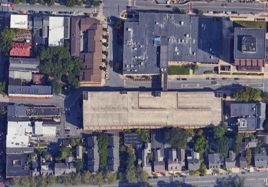
In 2021, the BPA faced a difficult challenge regarding the continued utilization of the Walnut Street Garage (WSG). The facility served as a primary parking resource for the City’s thriving “Historic Moravian District”, accommodating businesses, retail, restaurant patrons, and attendees of multiple City festivals. However, the 50- year-old, 770-space structure was at the end of its useful life, requiring increasingly significant funds to maintain it, and the capital investment to bring the sub-par facility to a state of good repair would be substantial. Accordingly, the BPA, in conjunction with its parking consultant, THA Consulting (THA), determined that the demolition and replacement of the garage would
in the long term be the best option to provide the City and its stakeholders with a user friendly and aesthetically appealing facility that would serve as an inviting gateway to Bethlehem’s Historic Moravian District.
In addition to its poor condition, the WSG was over 500 feet in length and occupied the majority of Walnut Street just 100 feet from Bethlehem’s vibrant Main Street. Accordingly, the BPA, the City, and THA, in addition to planning, the garage to meet present and future parking needs of the area, contemplated making a portion of the site available to other development that would benefit the City and add to the downtown’s economic vitality.
To right size the new garage, the BPA and THA undertook a parking supply, demand, and future adequacy assessment for the area served by the existing Walnut Street Garage. Understanding the importance of this planning study and its potential impact on the City, the BPA and THA worked collaboratively to not only perform field parking utilization counts but to also obtain and regularly monitor parking utilization data of both off street and on-street parking. In summary, the data collected identified the existing utilization of the WSG, the anticipated parking demand associated with new development in the area, and future demand in the study area based on census data for the City and surrounding region.
In addition to parking field counts for the on and off-street parking in the study area, parking occupancy reports for the BPA’s garage in the study area were regularly collected through the BPA’s PARCS portal to further monitor actual parking utilization. The PARCS portal provided 24/7 hourly occupancy data of permit and transient
spaces in the two garages in the study area to assess daily and monthly peaks. The system collected occupancy data using LPR technology to scan license plates and record them in the PARCS database allowing an understanding of when permit and transient parkers utilized the facilities, the level of peak occupancy, and the peak utilization times for both weekdays and weekends. The data revealed that the two garages in the study were rarely over 50%-60% occupied, except during major festivals or events in the City.
For on street and surface parking, occupancy data from the BPA’s mobile LPR system was collected on multiple days to augment the field collection by THA staff. This data again gave further evidence and validation of the peak occupancy levels throughout the study area to help confirm that the existing parking demand was accurately captured. The data also provided the BPA with information to guide the development and implementation of its Interim Parking Plan during the demolition of the existing garage and construction of the new WSG, and to inform the BPA regarding parking fee adjustments to financially support the new facility based on actual parking demand.
In summary, the Parking Supply and Demand Assessment concluded that based on existing peak parking demand in the study area, the existing supply, and the additional parking needed to support new development and future growth, the study area had a future parking need of approximately 500 spaces given the demolition of the WSG. This analysis resulted in the ability to reduce the size of the replacement garage by approximately 250 spaces and allowed for the planning and design of a new, functionally efficient, and user-friendly facility, and make over 30,00 square feet of adjacent property available for mixed use development.
The WSG’s demolition and construction of a new facility is scheduled to take approximately 20 months, during which time WSG permit and transient parkers need access to parking alternatives. Accordingly, the BPA and THA developed an Interim Parking Plan largely established on the data available by the BPA’s PARCS and LPR systems. Based on the referenced occupancy data, significant parking was available at the North Street Garage (NSG) which was located just a short walk from the WSG. Given its available occupancy, which was consistently monitored by the BPA, a significant
number of permit and transient parkers were moved to the NSG. Using the occupancy data from the PARCS and mobile LPR system, four (4) other public off street facilities, as well as underutilized on-street parking on the periphery of the study area and in residential areas, were identified to serve as replacement parking during the redevelopment of the WSG.
In addition to using parking occupancy data to identify available parking resources as replacement parking, the BPA and THA identified and implemented additional strategies to assist in the management of the BPA’s parking resources and the interim parking facilities during the WSG demolition and new facility construction.
Updated Wayfinding and Parking Signage - To encourage the utilization of the NSG during WSG’s demolition / construction, the existing wayfinding system was updated to direct visitors toward the NSG. The updated signage was installed at key vehicular approach locations and at the entries of each facility so that drivers can easily identify the available parking facilities.
Installation of Digital Occupancy Signage System in the North Street Garage - To provide parking availability information in real time, the BPA installed a digital signage system that integrates with the PARCS to display real time parking occupancy information at the NSG. The digital signage mounted at the entrance of the NSG alerts parkers to space availability before entering and the information is also displayed on the City’s website and via web based devices, allowing downtown visitors to check availability before arrival.
Communicating Parking and Construction Information to Customers on City’s Website and Social Media - During the demolition of the WSG and construction of the new facility, the BPA and City’s website and social media (e.g., Facebook, Instagram, Twitter) is used to communicate available parking resources.
Event Parking - Due to the high parking demand during large events in Bethlehem, the BPA will establish shuttle services to provide connections between garages or remote lots and downtown during event days. The BPA is in the process of designating a remote pick-up lot where users would park free of charge or at a nominal fee and then be dropped off at a downtown location or establishing a route on main streets where users could conveniently access the shuttle system.
CASE STUDY: Bethlehem Parking Authority Parking Data and Technology
The parking occupancy data collected for the parking supply, demand, and future adequacy assessment for the area served by the existing Walnut Street Garage revealed that on-street parking occupancy levels on many downtown streets regularly exceed 90%, making it difficult for many parkers to find an on-street space. Conversely, most of the BPA’s off-street parking facilities had significant parking availability. Based on this information, the BPA is implementing a demand-based pricing model where rates are periodically adjusted based on the analysis of occupancy data and re-evaluated to respond to changes in occupancy over time. Rates in “high occupancy zones”, with 85% or greater occupancy will be adjusted at a higher price, while less utilized zones are lower priced to encourage parkers to switch from more congested areas. The analysis of occupancy data from the BPA’s mobile LPR 4 and PARCS will guide the BPA with regards to rate adjustments to promote greater availability of on-street parking for short-term users and encourage longer term parkers to utilize off-street parking facilities with parking capacity.
There were several challenges regarding the sizing, design, approval, and public perception of the project. First, the City of Bethlehem is an increasingly popular destination, and the provision of adequate parking is important to the continued appeal of the area. The reduction of the size of the WSG replacement facility was met with opposition by many downtown stakeholders who felt that the WSG often was highly utilized, especially during major events and holiday shopping. While the WSG did achieve high levels of use during events and the holidays, the NSG Garage, just a block away, often had significant
capacity, except for the larger events. Accordingly, to address the event parking concerns, the BPA made a conscious decision established on the occupancy data, not to oversize the new garage for a few events per year, but to build the appropriate size garage for typical and future development needs and to implement alternative multi-modal accommodations during major events. The regular monitoring and communication of the occupancy data to local stakeholders with the implementation of alternative modes (transit service and BPA sponsored shuttles from remote facilities) during large events, allowed the BPA to obtain approval of the new, “rightsized” parking facility.
The cost of the new Walnut Street Garage is approximately $ 26,000,000. By right-sizing the garage and reducing the size of the new facility by almost 250 spaces, the BPA averted approximately $8M of additional capital costs. In addition, the creation of the new development site given the reduced garage footprint, will provide the BPA with revenue from the sale of the property to a selected developer, and when developed, will expand the tax base for the city of Bethlehem.
The BPA received approval from the City in February 2024 to carry out the replacement plan and begin demolition. As of March 2024, the demolition is in progress and the construction of the new parking garage is slated for completion in late 2025. The new garage has a smaller footprint that creates an available parcel of land adjacent to the new garage for mixed-use development. The BPA issued an RFP and accepted developer proposals for the site that are under evaluation by the BPA and the City.
CASE STUDY: Bethlehem Parking Authority Parking Data and Technology
Bethlehem Parking Authority
THA Consulting8
Flash9
IPDisplays10
This project made evident the importance of obtaining and continually monitoring data pertaining to parking needs and occupancy, and effectively communicating that data to local stakeholders to plan for the effective use of existing assets, right size new facilities, and support new development. The PARCS used in the Walnut Street Garage and North Street Garage and the LPR system used for on-street and surface lot parking enabled the BPA / THA to continually monitor and validate occupancy data that was pivotal to achieve acceptance of a smaller facility. The smaller facility will allow the BPA and the City to promote the development of the remaining parcel for exciting beneficial development.
8 THA Consulting, Inc. (THA) is an engineering and design firm that specializes in planning and design services for parking and mixed-use facilities.
9 Flash is a provider of parking and mobility technology solutions with a specific focus on access and revenue control, electric vehicle charging, and asset and transaction digitization.
10 IPDisplays is a manufacturer of smart LED signs and smart LCD signage players.
As agencies seek to maximize use of limited infrastructure, deploying technology to collect and share data with public users is critical. Congestion at the curb or in a parking structure leads to a perception of a lack of parking. When implementing programs or technology to support this pillar, agencies should consider how providing detailed information to drivers can promote better decision making. Barriers to deployment typically center around cost or technology requirements.

Optimizing the flow of traffic is critical to the proper function of any downtown core or busy parking area. If a city block face is overcrowded with vehicles trying to access the curb or move toward their destinations, significant delays or pedestrian safety concerns can arise. Construction and other road work events can cause bottlenecks that reduce the flow to downtown cores. By controlling traffic, cities can limit congestion, decrease carbon emissions, save travel time, expedite emergency response, and create a better resident and visitor experience.
Technology-enabled activities associated with this pillar include parking asset utilization, micro-mobility usage, bike lane counts, rideshare data, transit use data, gps data from fleet vehicles, work zone and delivery data. Data can be collected from occupancy sensors, license plate recognition, manual counts, fixed cameras and models.
The collected data can be used to inform decision making and drive policy changes. These can include new vehicle-free zones, congestion tolling, dynamic pricing, dedicated commercial loading areas, etc. Live data can also be used to guide vehicles using smart traffic signals, wayfinding signage and digital guidance options.
Investment in these activities can increase safety and mitigate congestion leading to clearer streets, with enhanced wayfinding in bike lanes and pedestrian crosswalks. A better parking experience leads to more return customers for retail and restaurant districts. Congestion is better managed for large events and integrated with planned work.


Approximately 800 parking spaces are available to the many inhabitants and visitors of one of Cologne’s liveliest districts, Nippes. The parking situation, however, is less than ideal with drivers circling the area repeatedly looking for available parking spaces. The City partnered with Cleverciti11 and the local energy provider, RheinEnergie, to improve the quality of life and reduce emissions in the neighborhood by deploying an innovative parking management system. Sensors, LED displays/wayfinding, and a mobile app were introduced to provide real-time, turn-by-turn guidance helping drivers find a parking space in less time.
The district of Cologne-Nippes is one of the busiest and most densely populated ones in the city—and it is here that RheinEnergie wanted to implement a smart parking solution. In an area as busy as Nippes with shops, a daily market, schools, and many residents, drivers waste large amounts of time looking for available spots among the 800 outdoor parking spaces (approximately 1-2 square miles), which is not only a stressor to them but also to the environment. Not having reliable historical and live data to refer to, city administrators were unable to get a comprehensive picture of the parking situation in Nippes.
Like other big cities, Cologne suffers from high CO2 emissions that regularly exceed EU norms. Up to 52% of those emissions are caused by inner-city traffic. According to researchers, parking search traffic makes up about 30% of traffic emissions—emissions the city intends to reduce by 50% by 2030 as part of the Smart City Cologne project.
By optimizing the use of parking spaces in the area and putting a traffic management system in place that would eliminate unnecessary search traffic, RheinEnergie wanted to not only significantly reduce traffic and CO2 emissions but also improve the quality of life in the neighborhood. To achieve this, parking technology was required that would guide drivers to the closest available parking space at every critical decision point. 11
The project’s desired outcomes included the reduction of traffic congestion, a reduction in emissions, mitigation of frustration for residents and decrease stress for drivers. By collecting data and making it publicly available, the program sought to guide drivers directly to free parking spaces via LED-signs placed at key decision points in the neighborhood.
RheinEnergie is responsible for operating and managing the lamp poles which were used to mount the overhead sensors. But this was balanced by the fact that the utility had a strong interest in making the lamp poles smart for the future of smart city.
To power the hardware, a power source is required and collaborating with the RheinEnergie eliminated the need for battery powered equipment as the team was able to take advantage of the lamp poles and the power they provided.
Because the parking information must be updated real-time to ensure parkers have the best data to make informed decisions, device communication is critical. The team opted to support the communications via LTE/4G making it easy to implement independently.
To avoid civil work on the surface and minimize disturbances in the neighborhood, the parking guidance system would have to be installed using the existing infrastructure of lampposts provided and managed by RheinEnergie. In addition, civic authorities and parking operators required an end-to-end solution to minimize internal adminis-
trative efforts as well as comprehensive parking data about occupancy rates, peak times, and peak areas.
The funding for this project was shared by the City of Cologne and RheinEnergie. A similar scale project would cost about $12,000-$15,000 per month.
City of Cologne Mayor’s Office
City of Cologne District Mayor
City of Cologne Traffic Department
RheinEnergie
Cleverciti
With the newly installed guidance displays, drivers can now avoid searching for available parking for extended periods of time, improving their overall experience and reducing vehicle emissions. On-site test drives have shown that parking search time can be reduced by 45% by providing information about the location of available parking space through the system as opposed to a random search. At the same time, the distance driven could be reduced by 41%. In the process, 145 test drives were carried out during the day on weekdays at three different locations and at a parking space occupancy rate between 95 and 99%. Prior to the installation of the solution, the occupancy rate was at 88% between 10 am and 6 pm on weekdays. This result was based on the measurement of 10,000 parking spaces/events. After the guidance system had been deployed, the parking capacity usage increased by nearly 8 percentage points to 96%.
STUDY: City of Cologne, Germany
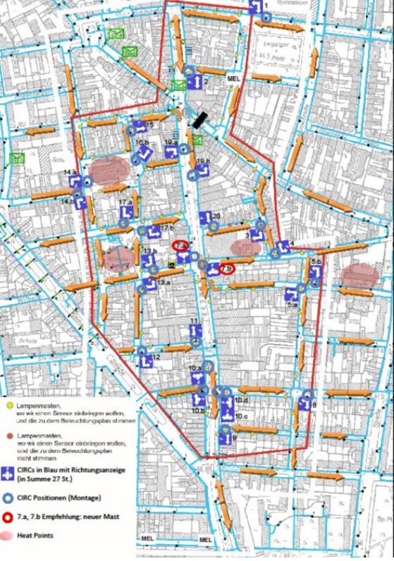
In other words, two thirds of parking spaces that previously remained unoccupied can now be found by drivers, meaning that the limited outdoor parking capacities are being used in an optimal way with the sensors providing real-time information about each individual parking space. This data can also be used by city officials to further optimize the parking management in Nippes itself and in other parts of the city.
When people actively use the system, it avoids 550,000 to 700,000 kilometers of parking search trips per year just in the small area. This means around 60 to 70 tons of CO2 emissions are avoided.
The positive financial return on investment is expected within two years, considering increased payment compliance, increased use of capacity, emission reduction, and time savings.
Cologne’s climate neutral plan 2035 states, “In order to avoid parking search traffic, the promotion of the digital parking guidance system Smart Parking is to be extended to the entire city area by 2030”. As the data has shown, the deployment of smart parking citywide will significantly reduce congestion and carbon emissions – while creating a more accessible and livable city.
Moreover, the use of existing infrastructure (lamp poles) minimized costs and inconveniences.
While the pandemic may have flattened the rise in congestion on roadways, the Texas Transportation Institute reported that the flattening was short-lived giving way to a post-pandemic return to crowded roads12 As with other pillars, activities supporting the optimization of traffic flow have significant costs but the cost to deal with the uncontrolled traffic is greater. Mitigation of congestion at the curb or in a parking facility can improve the experience for both parkers and drivers in heavily trafficked areas while leading to other positive outcomes such as reduced travel times, decrease in emissions and improved safety for pedestrians and bicyclists.
Positive benefits of optimizing traffic flow include clearer streets and improved parking experiences which spur growth and development for businesses.
How far has our industry come since the Smart City challenge of nearly a decade ago? It is clear that the challenges have become more acute, necessitating the need for agencies to improve their ability to handle them. It is evident that companies are still pushing the boundaries of technology-enabled operations to tackle pressing issues in many settings.
Since the case studies in this publication continue to grapple with the same issues and use technology to address them—such as automated vehicles to handle first- and last-mile problems, cameras to reduce curbside congestion, and automated data collection techniques—we can see that some of the issues that the cohorts of the Smart City challenge attempted to address simply resulted in a kicking down of the door to move forward. Although there are still difficulties, technology is being adopted more widely and solutions are more strategically focused.
Challenge applicants sought to add more sensors to measure parking availability, car traffic and even the number of bicycles and pedestrians and today’s practitioners are similarly motivated demonstrating that the challenges of a decade ago remain today. Although it is evident that the difficulties still exist, there are an increasing number of pilot projects and testing being conducted in academic institutions as well as in cities.
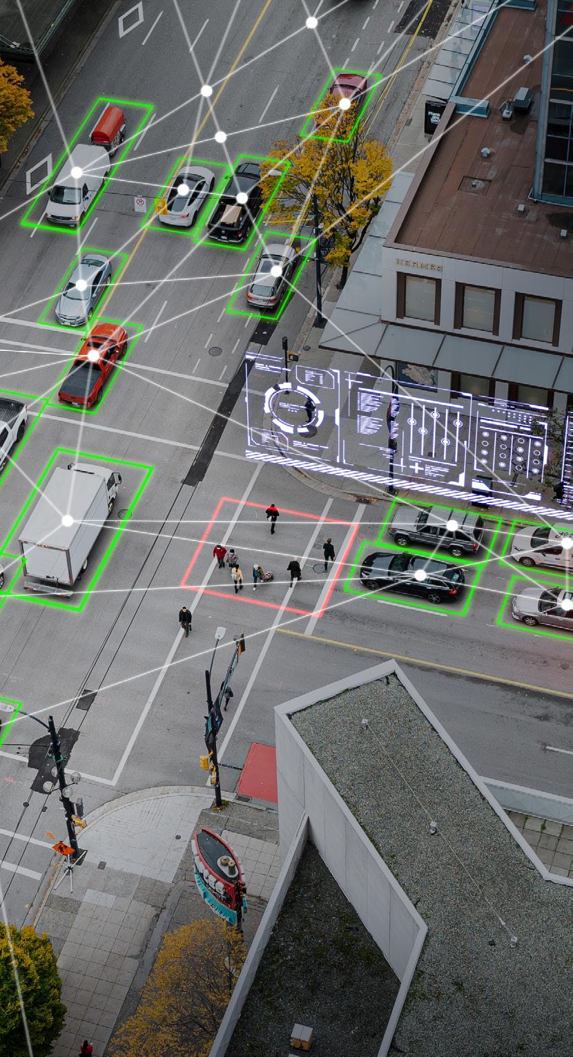
In the introduction, the question was posed:
“Have smart transportation solutions become as ubiquitous as sustainability in parking, transportation and mobility or did COVID-19, the lack of enough funding, public private partnerships or lack of proven technology impede our collective advancement of ideas and promises articulated by a handful of visionary optimistic and creative city leaders who pitched their ideas back in 2015?”
Indeed, smart transportation is here to stay, to answer the question. Whether it is a more comprehensive solution intended to optimize traffic flow to reduce carbon emissions, or something as basic as counting cars at the curb for real-time information, it is a necessary tool in both the urban and rural environment.
These solutions complement one another, and by establishing the groundwork for information collection, an agency can very likely start small and grow the scope of operations.
From the case studies in this publication, it is clear that organizations are focusing on specific goals and demonstrating pragmaticism with respect to
the investments being made. And while the original challenge focused on cities – it’s not just well funded cities pursuing smart transportation any longer but the full spectrum of verticals see value in technology-enabled solutions to solve many challenges and support countless goals.
Financing will always be a hurdle, but technology cannot be proven until it is tested, and there is a lot going on here, with many organizations eager to take on the obstacles that frequently accompany evaluating new technologies. It certainly helps that the cost of smart transportation investments appear to be decreasing while potential technology providers appear to be growing. Buyers of smart transportation solutions have many cost-conscious options and partners from which to choose.
How is your organization planning for the smart transportation ecosystem of the future? Change is coming fast and furious and parking and mobility professionals are on the frontline, testing new systems, technologies and methods to combat these challenges.


The City of Milwaukee has pursued a multi-faceted approach aimed at reducing their carbon footprint. These include advancing the capacity of the City to generate energy from renewable sources, reducing energy consumption in buildings, and reducing energy usage of street and alley lighting by converting to LED fixtures. On the transportation front, Milwaukee has invested in public transportation infrastructure, and continues to work to electrify its parking enforcement fleet.
Milwaukee sees itself as a vibrant city built on the spirit of innovation, resilience and progress. A rapidly warming planet and changing climate present a new set of challenges for Milwaukee. It is believed that how the City responds to these challenges will shape the future of their community. Through a focus on attracting family-supporting green jobs of the future, creating resilient neighborhoods and modern transportation networks – as well as ensuring the city uplifts those who bear the brunt of impact of climate change – the City is committed to addressing this crisis in a way that promotes growth. Local leaders believe they must be clear-eyed about the damage climate change is creating, and will continue to create, in Milwaukee. Industry that put Milwaukee on the map has polluted our land and overheated our planet, threatening our city with more frequent flooding and extreme heat. The car-centric transportation system has devastated many neighborhoods. Prolonged disinvestment has left many homes poorly positioned to shield families from extreme weather events. All of these impacts have been felt most severely by residents of color. As Milwaukee looks ahead to the future, many of their leaders believe they must seize the opportunity to address these wrongs. The City’s response to these challenges is an important part of the vision to grow Milwaukee’s economy and population, and through an equity-driven approach to the changing climate, a predominant goal is to keep Milwaukee as a hub for the jobs of the future.
Equipment procurement challenges were addressed by collaboration with city staff in multiple departments to budget for and purchase the needed/desired equipment, which has been impacted by delays including supply chain issues.
Funding challenges were addressed by collaboration with multiple partners, including at the federal, state and intergovernmental levels to apply for multiple and different types of programs, including grants and incentives.
MILWAUKEE’S Climate and Equity Plan
milwaukee.gov/ClimatePlan
GKeeping the public informed was addressed by holding public meetings to share plans and solicit feedback from the public to assist in ensuring the community and its residents have the opportunity to provide input. Similar challenges were faced with elected officials and decision makers where communication and collaboration were critically important. This was also true of business partners and organizations throughout the city and region, and collaboration with elected officials at the municipal, state and federal levels depending on the project and its scope/funding.

reenhouse gas emissions are changing the Earth’s atmosphere and dangerously warming the planet. All Milwaukeeans will be affected by climate change, and low-income communities face environmental hazards at a higher rate. These threats include extreme storms, flooding and excessive heat days.
In the face of these threats, Milwaukee will support a new clean energy economy that provides opportunities for people of color to more fully and equitably participate in the economic life of the city. The Milwaukee Climate and Equity Plan is the result of over three years of planning and public input through the City-County Task Force on Climate and Economic Equity
The Climate and Equity Plan supports Milwaukee's goals to:
1. Reduce community greenhouse gas emissions 45% by 2030 and achieve net zero emissions by 2050.
2. Improve racial and economic equity by creating green jobs that pay at least $40,000 and are focused on recruiting local people of color.
To achieve these goals, this plan includes 10 Big Ideas for Action. These strategies can be achieved in collaboration among government agencies, businesses, community-based organizations and other partners. The plan will be financed primarily from new federal resources including the Inflation Reduction Act and is consistent with the federal Justice40 Initiative.


The City of Milwaukee has multiple departments which work with their own departmental staff and collaborate with other city departmental staff, as well as multiple governmental partners, vendors/ consultants, and outside agencies depending on the type of project, program and everything which is needed to research, apply and compile all needed resources to effectuate the awards and outcomes of the multiple types of grants/awards and incentives which are available at local, state and federal levels. There are ongoing financial and human resources needed, at multiple levels and within and throughout different
city departments to support the multiple programs and services involved. This includes budgeting, accounting, recruitment and retention of both internal and external (vendors) staff, and ongoing communication and collaboration with a multitude of agencies and partners throughout governmental and outside governmental agencies to ensure these programs and services have the needed support to result in the desired outcomes.
City of Milwaukee:
Transportation/Parking Services
Forestry
Sanitation and Fleet Services
Mayor’s Office
Common Council
Department of Administration
Budget Office
Environmental Collaboration Office (ECO)
City Engineering and Infrastructure
Elected officials and decision makers
Neighborhood business districts
Neighborhood organizations
Partnerships and collaborations with city, state and federal agencies and organizations
In order to address the existential threat to humanity which climate change continues to pose, it is crucial to collaborate with multiple agencies, starting in any and every way possible at the governmental level – municipal, state, and federal levels – as well as seek initial and ongoing partnerships with outside agencies and organizations to seek options and alternatives which will allow opportunities to seek out funding and resources necessary to build a network capable of accomplishing a variety of projects, programs and initiatives which support the incredibly value and impactful desire to limit the impacts of climate change. We will continue to seek out options and alternatives, working with partners and organizations throughout governmental and outside governmental agencies in our ongoing effort to deliver positive and ongoing reductions to the harmful effects and impacts of climate change. Organizations should know and be prepared to share their goals, mission and vision throughout their organization to encourage and incentivize staff at all levels to promote their desire and efforts to combat climate change. They should actively seek out programs and partnerships which align with this philosophy, and prioritize their actions and operations as such.

The goal of the Dublin Digital Mapping and Management of Kerbside project was to create a digital curb inventory for Dublin to visualize and understand their curbside regulations and improve Dublin’s logistics and delivery processes at the curbside.
The project was awarded to CurbIQ13 by Dublin City Council, in partnership with the SENATOR14 platform. Dublin, Ireland serves as one of the living labs for testing the effectiveness of the SENATOR project. The main objective of SENATOR is to develop an innovative urban logistics model that enhances urban mobility governance. Additionally, the project fosters collaboration among citizens, operators, transporters, and administrators to create new market opportunities.
With access to their digital curbside inventory, Dublin can measure and realize their sustainability goals, specifically around loading and delivery areas. By quantifying what is available at the curb, the City can make the necessary changes to offer more sustainable options, such as alternate mobility options, zero emissions loading zones, and more.
The technology has provided Dublin the ability to quantify their curbside uses, particularly as they test out different strategies. Some potential impacts include reducing congestion, tracking sustainability targets, and adjusting the price of parking to optimize revenue and increase turnover.
The insights gathered through the project result in a more optimized curbside, where different users and uses are balanced and lead towards a more vibrant, livable city.
One of the project’s key extensions was the implementation of Curb Rules API. The API, provided in the Curb Data Specification format, allows third-party organizations to access curbside information. Such accessibility can improve route planning, delivery efficiency, and reduce potential conflicts among curb users, contributing to an integrated urban logistics solution.
13
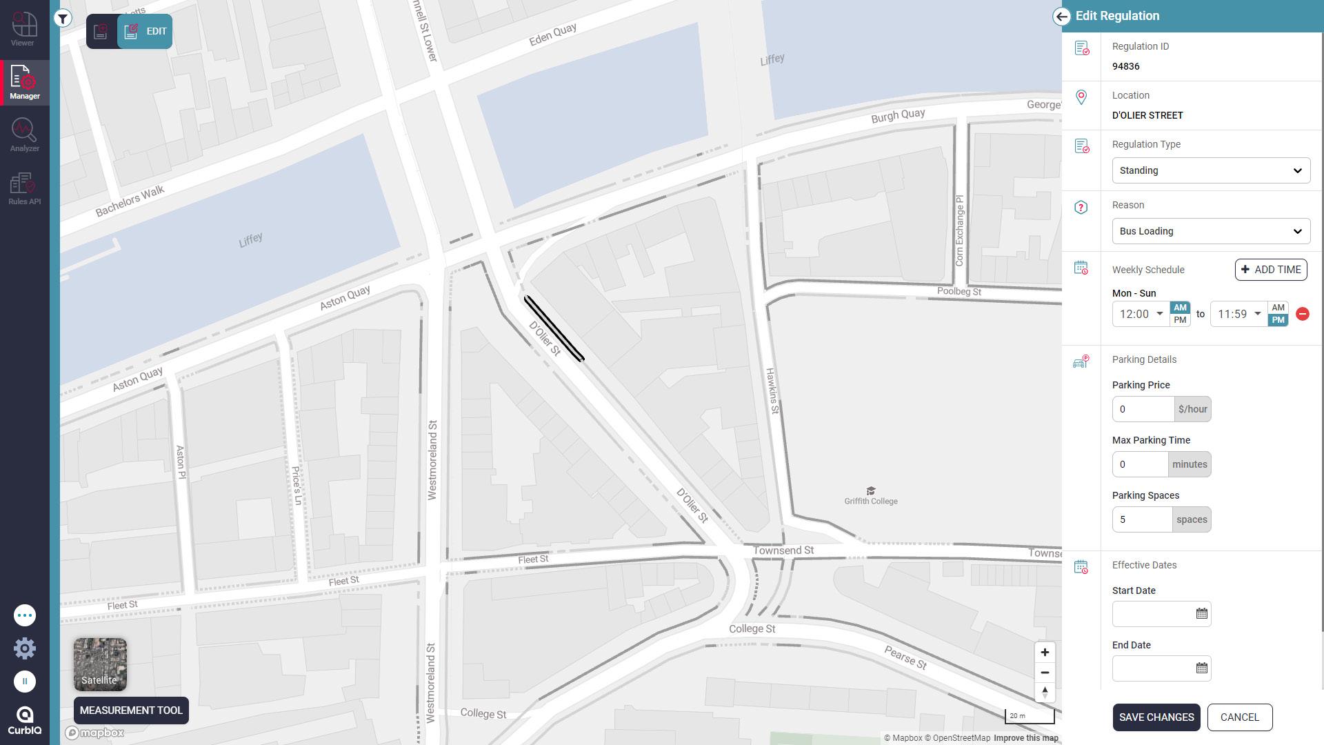
This lead to increased collaboration between citizens, operators, transporters, and administrators, which was accomplished by several stakeholders accessing CurbIQ. For example, Dublin’s postal service (An Post) has access to CurbIQ and can use it to determine the most optimal loading locations. Dublin Town was given access to disseminate loading zone locations to businesses.
The Dublin project is part of a dual-city trial alongside Zaragoza, Spain, that is expected to be duplicated throughout the European Union. Once applied, the model is expected to decrease CO2 emissions by 10%.
The pilot will also increase awareness among the public of the environmental impact of delivery logistics in the city and the advantages of sustainable transport alternatives.
Surveying a complex curbside area is no simple feat and requires ongoing project management to handle the physical surveying, data ingestion, and ultimately, the creation and delivery of the digital curb inventory. Carrying out the project in another country and continent meant adapting to local conditions, signage, and curb rules.
To successfully complete the project on time and within scope, the CurbIQ team adapted to on-site conditions. To accurately collect the curbside information, physical surveyors usually take pictures of each sign along the curbside. Surveying was conducted on foot using patented technology that was processed by the platform to ultimately create the digital inventory.
In this case, Dublin has many signs at the curbside that do not correspond to a regulation, for example, Do Not Turn signs. These were not captured to maintain efficiency for both the data collection and ingestion processes. The physical
CASE STUDY: Dublin Digital Mapping and Management of Kerbside Maximizing Parking Efficiency
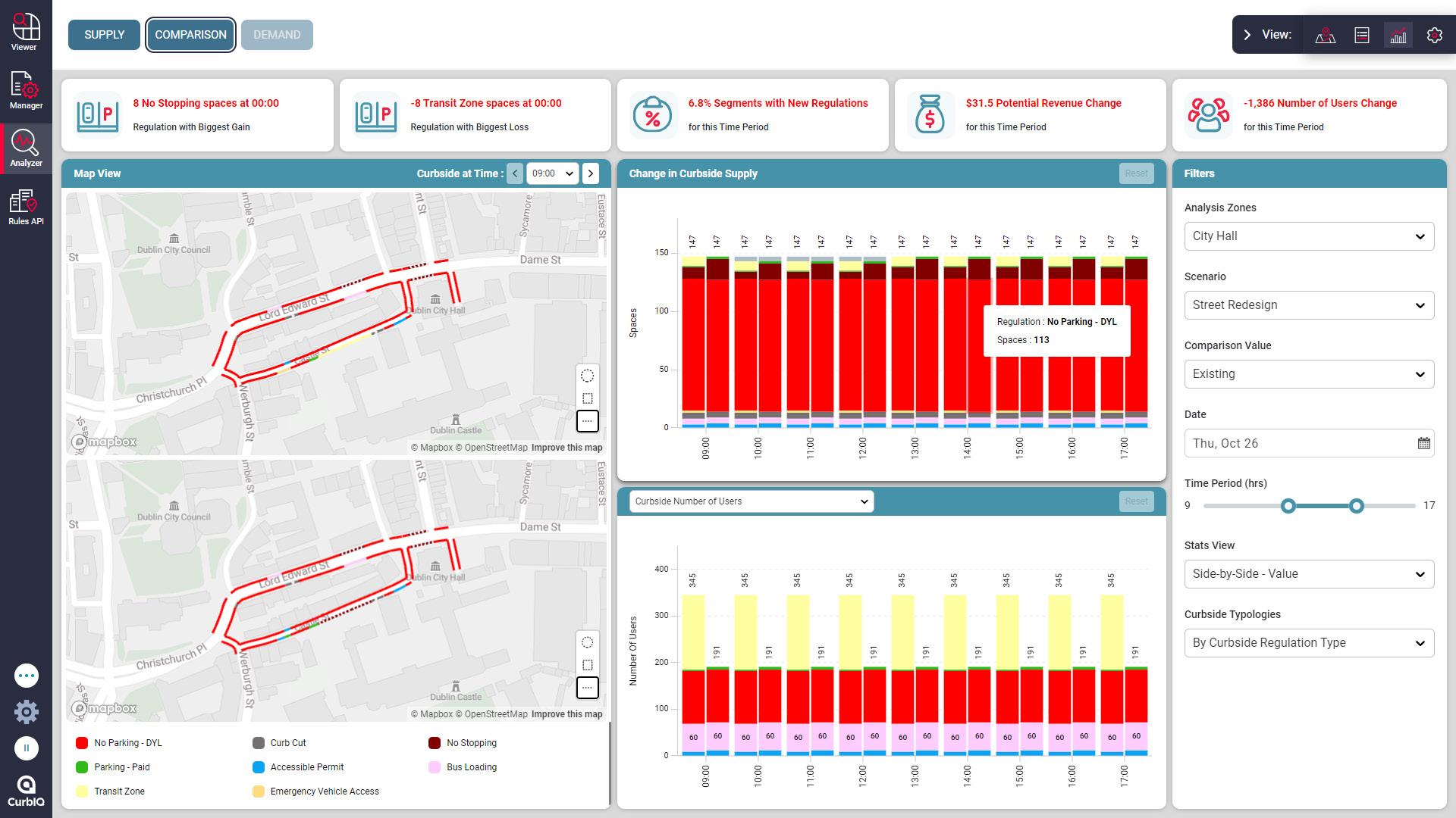
surveyors spent several hours ensuring the complete inventory was collected and stuck to a predetermined schedule. Using local staff with familiarity of curbside uses also helped improve the ability to collect data efficiently.
Overall, there were many moving parts and complex elements to collecting the curbside inventory that were managed and overcome to successfully deliver the project.
As with most projects, the main resources behind this deployment are people and funding. The project would not be possible without physical surveyors, the technical team, and the Dublin staff that use the CurbIQ platform.
Deploying physical surveyors, the team collected comprehensive curbside data over 18 miles of Dublin’s Temple Bar area using patented CurbLevel Surveying processes. This data was subsequently processed to create the digital curb
inventory that is visualized and managed in the CurbIQ platform.
For the first phase of the project, which lasted a period of six months, the data collection and software access costs were about $5,325. Future phases are being planned which will include additional data collection, data maintenance and integration of demand data infrastructure for analysis in the platform.
Dublin City Council
DublinTown (business improvement district),
SENATOR Project
An Post (Dublin Postal Service) CurbIQ
Smart Dublin
Deusto Institute of Technology
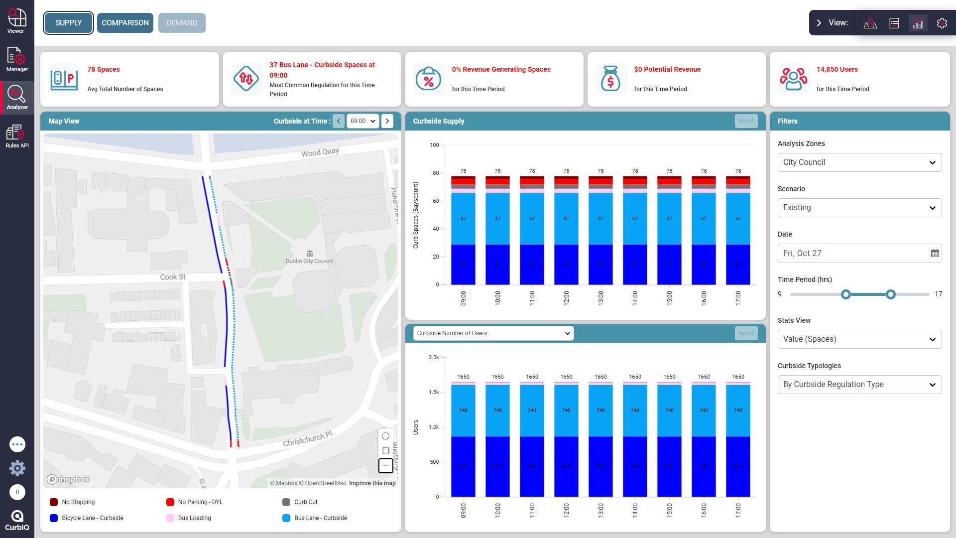
Throughout the pilot project, CurbIQ extended the impact of Dublin’s digital curb inventory by involving other curbside stakeholders. Groups such as Dublin Town, An Post (Dublin’s postal service), and Deusto were given access to the platform.
Additionally, the team worked with Deusto, who manages the overall platform as part of the SENATOR project. The team collaborated and ensured a smooth integration and implementation process into the broader platform. Working with this team also ensured that data sharing was focused on the information the end users cared about, and was in a standard that was helpful.
This sharing of digital curb data amplified the benefits of the digital curb inventory. For example, An Post can improve their route planning, delivery efficiency, and reduce conflict among curb users, something they are looking to do in the future through the SENATOR platform. The platform’s API shares curbside regulation information to third parties according to the time of the day.
Dublin Town also was given access to the platform to better understand ways to share loading zone information to local businesses. Plus, it encourages them to make the best use of the nearest loading zone during the designated times. Deusto integrated the data into their platform to be shared with the larger SENATOR project and inform urban logistics on a wider scale.
Overall, Dublin was able to view and manage the digital curb inventory, relevant assets and signage, and make informed decisions about the curb. Dublin can now update virtually anything about the curb, including changing regulations, time limits, or parking rates. They can then analyze the highest and best use of their curbside, and make changes to achieve their logistics solution, but also their broader climate action goals.
We’d like to thank the following volunteers for their two years of service and countless hours dedicated to producing this publication. Over this period, from October of 2022 to June of 2024, the task force developed industry specific smart transportation working definition, identified desired goals, conducted case study research and developed a practical framework for presenting its findings.
Iain Banks Nelson/Nygaard Consulting
Nan Chen
Walker Consultants
Peter Cho, CAPP LAZ Parking
Daniel DeMott
Elite Parking Services
Stuart DeVust T2 Systems
Humberto Escandon
Miami Parking Authority
Mike Estey
Seattle Department of Transportation
Dillon Fried, CAPP City of Minneapolis
Thomas G. Szubka, CAPP
Walker Consultants
Kayla Gordon Populus
Eric Haggett
Walker Consultants
Irma Henderson, CAPP University of California
Task Force Co-Chairs:
Riverside
David Hoyt
Parkmobile
Michael J. Drow, CAPP Parking Revenue Recovery Service
Chris Jones
WeDriveU
Claudia King Spaces USA
James Knickrehm
University of Alabama
Adam Kriegel
Jacob Larson City of Omaha
Joshua Naramore
Joe Parker Park Engage
Lena Price
University of Houston
Kathryn Rush City of Dallas
Kenneth Smith
Kimley-Horn
Iris Solsona Lakoma Corp
Wilfred Soto
Miami Parking Authority
David Stein
New York Department of Transportation
Matthew Valera Parking Guidance Systems
Elissa von Czoernig
Flash
Kierra Williams
City of Dallas
Thomas Wong
Stanford University
Thomas Woznick, CAPP City of Milwaukee
Rachel E Yoka, CAPP
International Parking & Mobility Institute
James Zullo, CAPP
THA Consulting
Maria Irshad, CAPP, MPA, ParkHouston and Casey Jones, CAPP, PMP, Flash
Special thanks also to IPMI staff Rachel Yoka and Kristin Scrimalli for their support, professionalism and drive.