


Submitted to: Department of Environmental Planning and Protection Ministry of the Environment and Natural Resources Charlotte House, 1st Floor Charlotte & Shirley Street New Providence, The Bahamas
Submitted by: Bron Ltd. On Behalf of: Space Exploration Technologies Corp 1 Rocket Road Cape Canaveral, Florida FL 32920
Date Submitted: March 25, 2024
7.3
Table 3-1. Species observed that can be expected within the Exuma Sound. LC = Least Concern 10
Table 3-2. Bird species of IUCN Concern..................................................................................10
Table 3-3. Landing Site is 24°18'7.82"N and 76°14'36.31"W. The Centre of the parafoil mean impact circle is at 24° 1'15.77"N and 75°54'42.55"W. Distance was calculated from this center of the parafoil mean impact circle..................................................................................................11
Table 3-4. List of Protected Areas from the Bahamas Protected Areas Fund Registry of Protected Areas. The areas are managed by The Bahamas National Trust (BNT) and the Ministry of Environmental and Natural Resources......................................................................................20
Table 3-5. Discussion regarding Alternative Options 26
Table 5-1. Impact Significance description................................................................................34
Table 5-2. Summary Impact Table showing significance rating for worst-case and nominal scenarios in the Exuma Sound. 35
Table 5-3. Impact Significance Key...........................................................................................35
Table 5-4. List of gases in Falcon M1D exhaust. The table was provided by SpaceX. 39
Table 5-5. List of gases in Falcon M1D exhaust (continued). The table was provided by SpaceX. .................................................................................................................................................40
Title | Environmental Baseline Statement
Figure 3-1. Flight Plan figure provided by SpaceX. .................................................................... 3
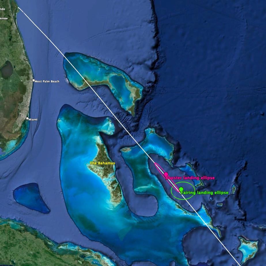
Figure 3-2. Proposed landing is shown relative to The Bahamas, Florida, and Turks and Caicos (Basemap Google Earth, 2024) 4
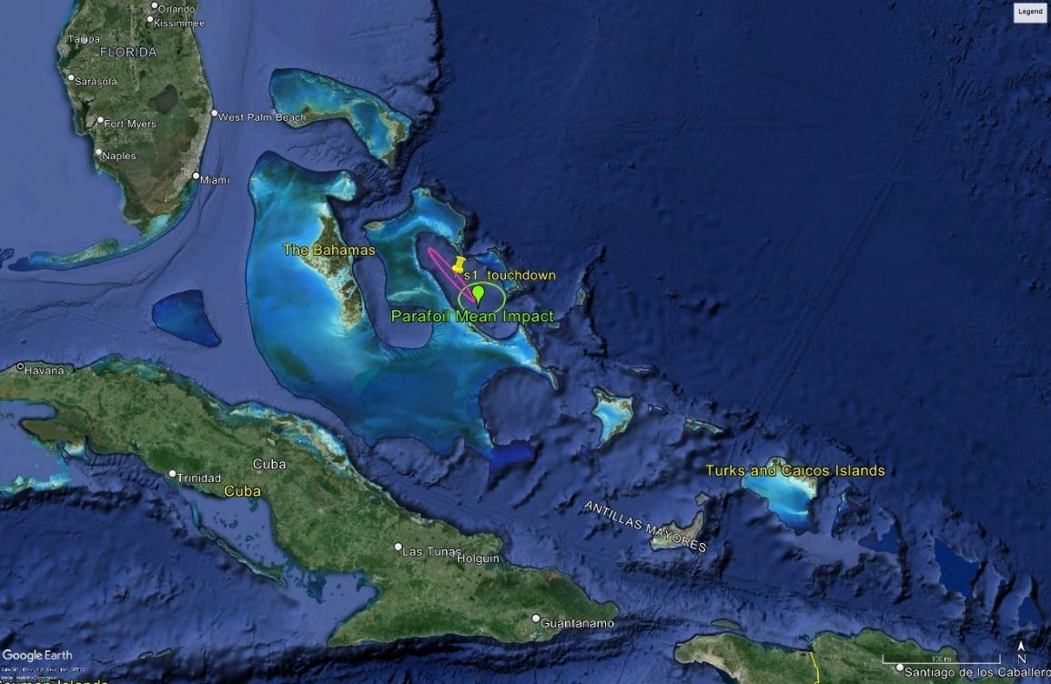
Figure 3-3. Proposed landing site relative to islands in the Central Bahamas. (Basemap Google Earth, 2024) 4
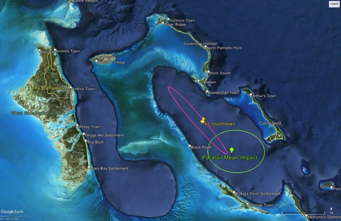
Figure 3-4. Proposed landing relative to the Exuma Cays, and Cat Island (Basemap from Google Earth, 2024) 5
Figure 3-5. Map showing the location of the IBAs and Protected Areas related to the impact area (Basemap from Google Earth 2024)..........................................................................................12
Figure 3-6. IBA BS018 South Tarpum Bay 13
Figure 3-7. IBA BS019 Allan's Cays 14
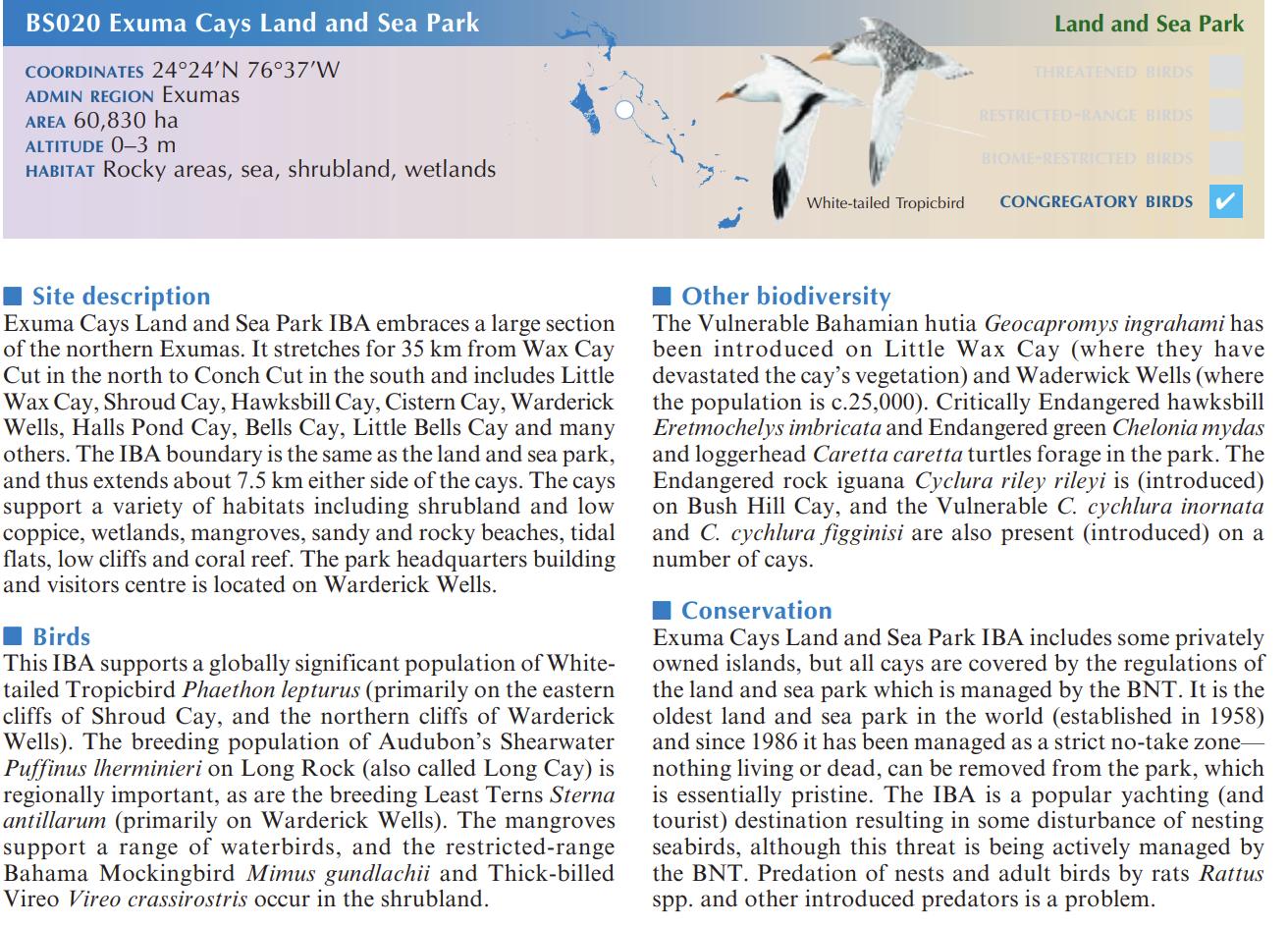
Figure 3-8. IBA BS020 Exuma Cays Land and Sea Park..........................................................15
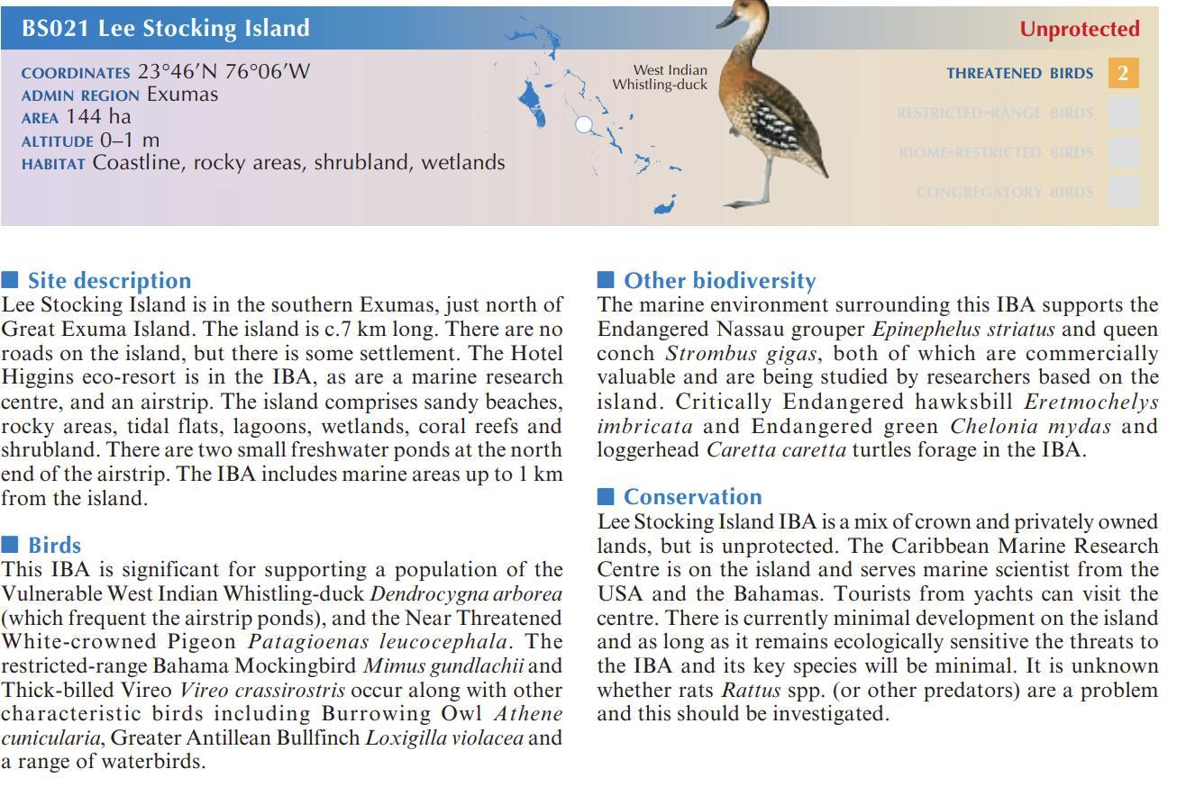
Figure 3-9. IBA BS021 Lee Stocking Island 16
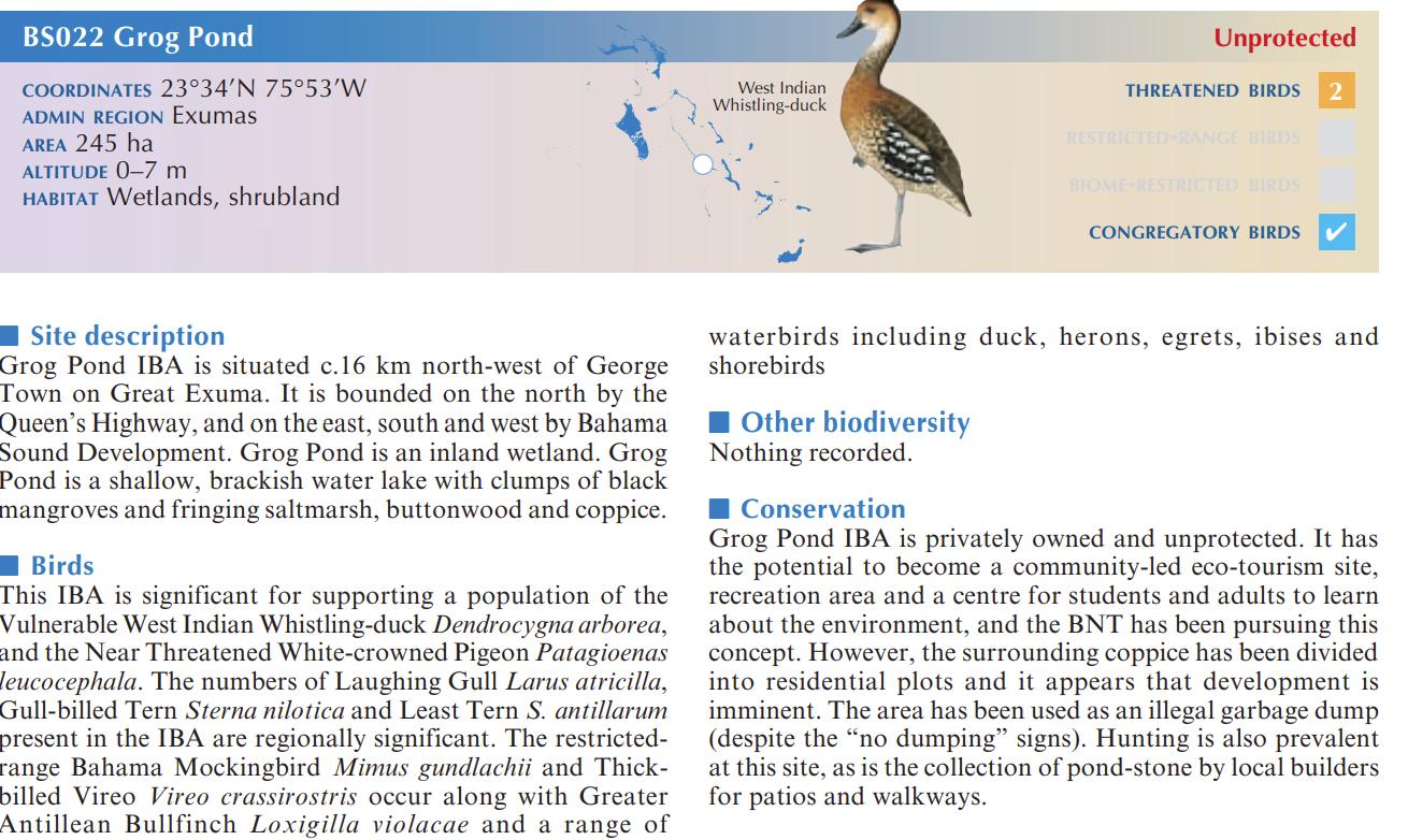
Figure 3-10. IBA BS022 Grog Pond..........................................................................................17
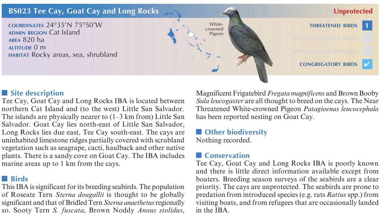
Figure 3-11. IBA BS023 Tee Cay, Goat Cay, and Long Rocks 18
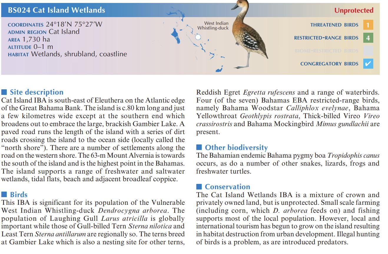
Figure 3-12. BS024 Cat Island Wetlands 19
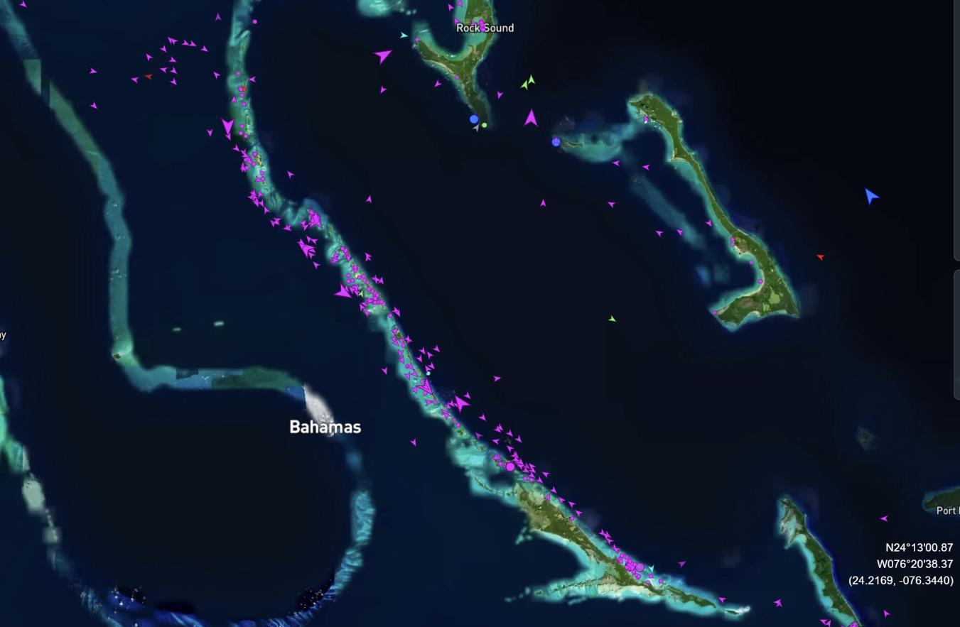
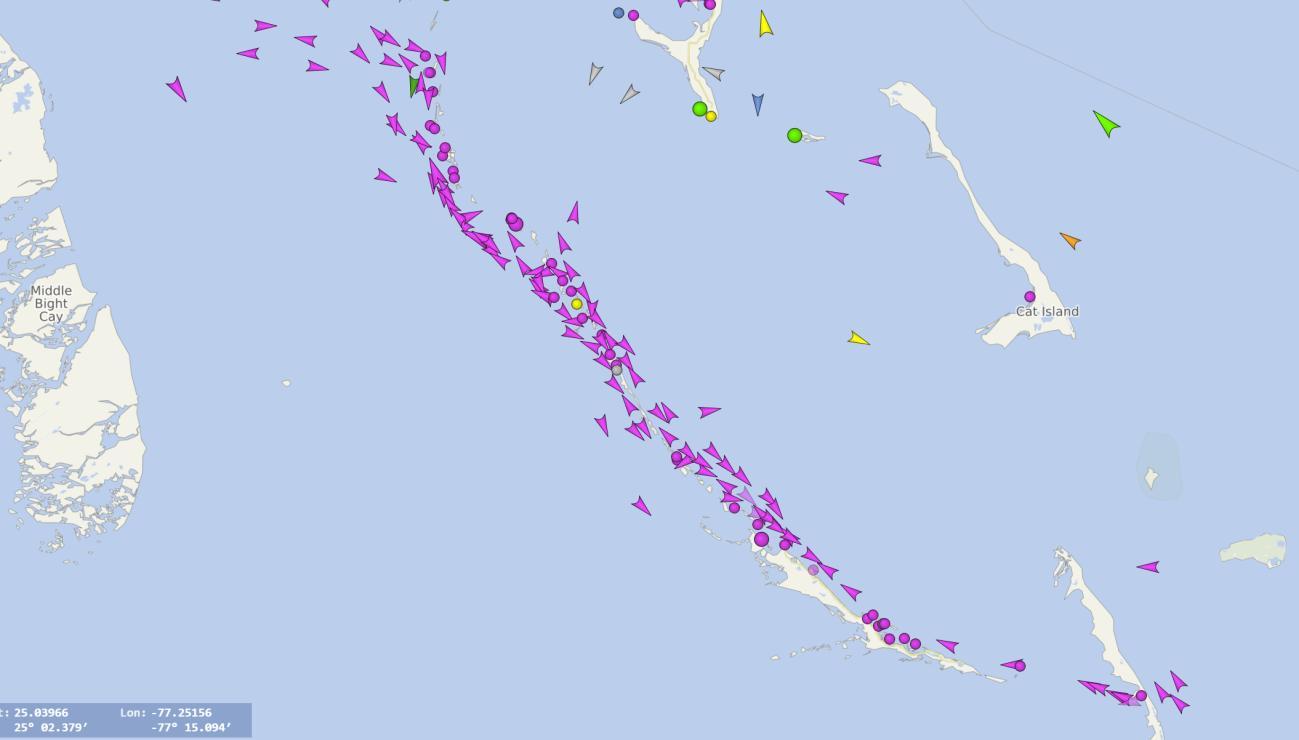
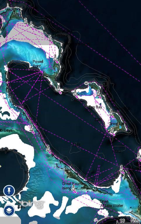
Figure 3-13. Map from Marine Traffic website...........................................................................21
Figure 3-14. Map from Vessel Finder website. 22
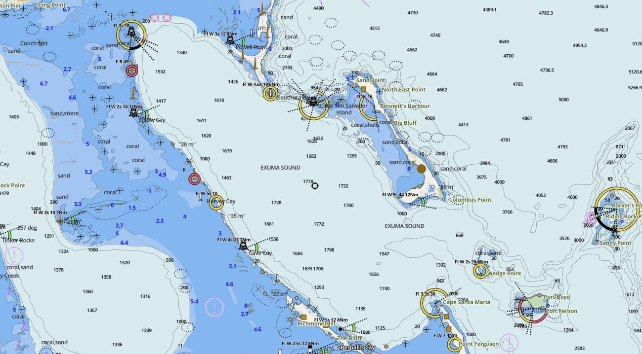
Figure 3-15. Navigational Chart depicting the most common sea routes that fall close to the landing site. (Bing, 2024) ..........................................................................................................23
Figure 3-16. Nautical Map showing the depth of the Exuma Sound in meters. 24
Figure 3-17. Three alternative options for consideration. 26
Figure 4-1. General launch and flight methodology for the Falcon 9. (Figure provided by SpaceX) 27
Figure 4-2. Correlation of General Flight Plan phases and map of the Northern Bahamas (Provided by SpaceX). 28
Figure 4-3. Correlation of General Flight Plan phases and map of the Central Bahamas (provided by SpaceX). ..............................................................................................................................29
Figure 4-4. Hazard Area Breakdown (Provided by SpaceX). 31
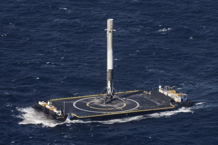
Figure 4-5. Image of the Booster Landing successfully landed on the drone ship, the proposed methodology to be utilized for the Exuma sound mission (Provided by SpaceX).......................32
Figure 4-6. The parachute system consists of one drogue parachute and one parafoil (Provided by SpaceX). ..............................................................................................................................33
Figure 5-1. Launch trajectory. 36
Figure 5-2. Comparison between Fuel reserves of Falcon 9 at landing and a Boeing 737 at takeoff. .................................................................................................................................................42
Figure 5-3. There are no expected casualties for this mission. (Graph provided by SpaceX) 44
Title | Environmental Baseline Statement
Space Exploration Technologies Corp. (SpaceX) is a space transportation and satellite communication company that offers the Starlink internet service. SpaceX first successfully launched in 2008 and has been transporting cargo to and from the International Space Station (ISS) since 2012 and astronauts since 2020.
SpaceX is collaborating with the Government of The Bahamas to launch Starlink satellites to lowearth orbit that will be used to provide 100Mbps+ internet service in The Bahamas. The Falcon 9 rocket will be launched in Florida, United States and land in the Exuma Sound, Bahamas. The Falcon 9 has flown over 300 missions with a success rate greater than 99% and is considered the world’s most reliable rocket with more consecutive successful missions than any other launch vehicle in history As a part of this collaboration SpaceX will establish Starlink terminals in some Bahamian schools, provide educational outreach, and space tourism opportunities for Bahamians. SpaceX met with several government agencies to help plan the proposed Project.
Bron Ltd. (BRON) was engaged by SpaceX to provide the following information requested by the Department of Environmental Planning and Protection (DEPP), the regulatory agency responsible environmental compliance within The Bahamas.
• Benthic profile
• Presence of any protected species (flora and fauna),
• Proximity to Cays that serve as Important Bird Areas,
• Marine traffic Survey
• Depth Verification Soundings and Alternative areas for recovery in The Bahamas (waters near Ragged Island).
The objective of the EBS is to identify and document environmentally sensitive habitats and species, where possible, that may be affected within the footprint or adjacent areas of the proposed project. It includes a description of the site and the proposed project, as well as a discussion of potential environmental impacts within the footprint and adjacent area. The results of this EBS will assist in providing SpaceX and DEPP with details of the site that help to avoid or mitigate detrimental environmental impacts due to the proposed project, and therefore, assist with successful project execution. The assessment of the proposed project is a preliminary step in the environmental compliance process, in accordance with standard environmental regulations within the Commonwealth of The Bahamas.
The SpaceX Environmental Baseline Study (EBS) represents the initial environmental baseline conditions based on available studies, literature, and mapping of the marine ecosystem within the proposed first stage booster rocket retrieval site, the Exuma Sound. The Exuma Sound, situated in the archipelago of The Bahamas, is a vast body of water stretching approximately 150 miles from north to south and spanning depths reaching up to 3,000 meters As such, a depth soundings and a benthic study in this area will require specialized equipment which is not readily available in The Bahamas.
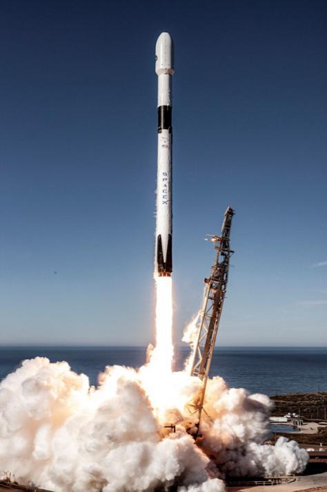
The Project objective is to deliver Starlink satellites to low earth orbit to join the larger Starlink satellite internet constellation system, and to collect the first stage booster rocket which is programmed to land on an unmanned, dynamically positioned barge controlled from the launch control center titled ‘Droneship’. This reuse model is inherently more environmentally responsible compared to the expendable configurations of other launch providers, with SpaceX boasting a 100% record in successfully landing all first stage booster rockets to the droneship over the last 2 years SpaceX has had failures in the learning phase of this process, but in the last couple years IT has turned it into a repeatable and reliable process.
The Project’s scope is to consider available studies and literature, maps, and charts of the marine environment within the proposed project area in the Exuma Sound. This includes the assessment of physical, biological, and anthropogenic aspects. The study area encompasses all the potential landing sites where the droneship may be positioned for the first stage booster rocket to be successfully collected to be re-used. Reference is made to an Environmental Assessment conducted in July 2020 that discusses the Project near the launch area. The complete document is available in the appendices.
The EBS aims to identify and document environmental habitats and species that are known to be present within the Exuma Sound, which also includes a description of the site and the proposed activities. The results of this EBS will assist in providing details of the area that helps to avoid or mitigate any potential detrimental environmental impacts due to the proposed activity, and therefore, assist with successful equipment retrieval. Overall, there is no large land masses or other coastal installations located within the Project’s location, further adding to the suitability of the overall site. Based on the Project proposal, there are no plans for any activities to take place on the sea floor.
3.1
The Bahamas, an archipelagic nation situated in the Atlantic Ocean, comprises 29 major islands, 661 cays and 2,387 rocks The islands vary significantly in size and there are numerous
Date | March 25, 2024
Title | Environmental Baseline Statement
uninhabited cays. There are extensive shallow sand banks, most notably, the Great Bahama Bank and the Little Bahama Bank. The Bahamas' prevailing trade winds, originate from the northeast during the winter months and the east-southeast during the summer months. These consistent winds, typically ranging from 10 to 20 knots, exert a significant influence on the region's tropical climate
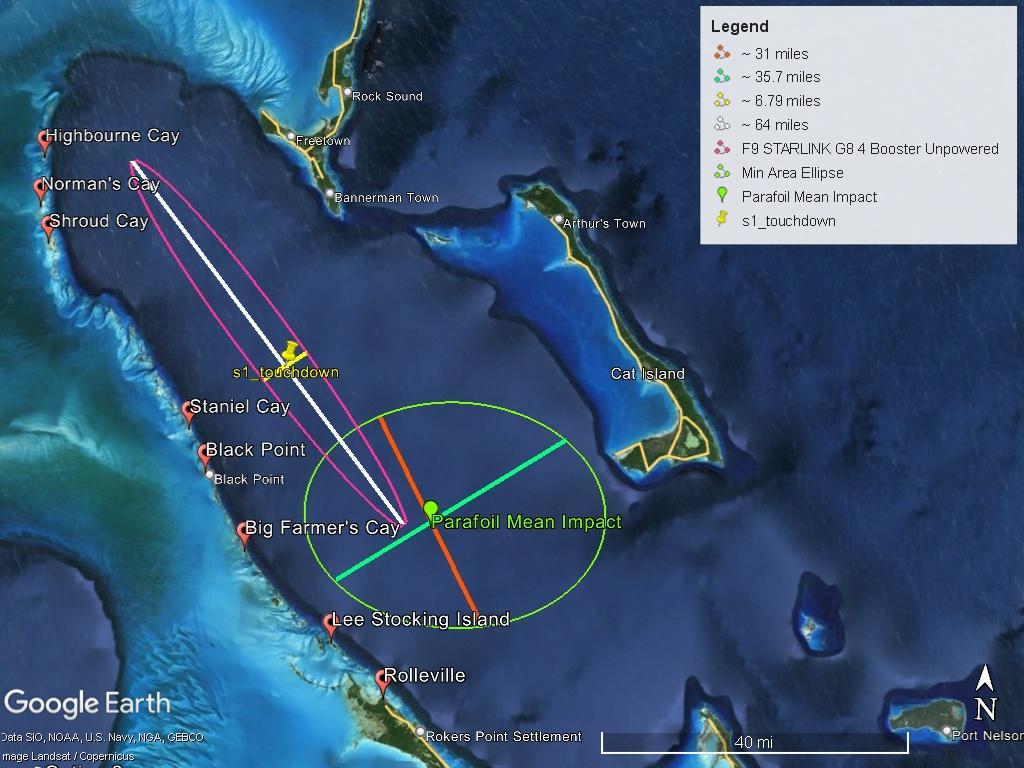
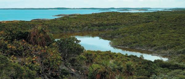
The Exuma Archipelago collectively comprise approximately 365 islands and cays, forming a chain extending about 150 miles within the Bahamian archipelago. With a population recorded at 11,515 as of 2010, the Exuma Cays lie approximately 32 miles southeast of country’s capital city, Nassau. The two main islands within the Exuma district are Great Exuma and Little Exuma. George Town, the capital city of Exuma, is situated on Great Exuma, which spans an estimated landmass of 32 miles in length, while Little Exuma measures approximately 3 miles in length and is connected to Great Exuma via the Ferry Dock Bridge. The proposed landing site is located in the Exuma Sound, positioned due east of the Exuma Cays. The approximate coordinates of the landing site is 24°18'7.82"N and 76°14'36.31"W These coordinates are at the center of a booster landing ellipse The landing will remain inside the booster landing ellipse. The parafoil coordinates is approximately 24° 1'15.77"N and 75°54'42.55"W. The retrieval area will remain will this ellipse. The following figures show the proposed flight plan and landing site relative to islands in The Bahamas.
Date | March 25, 2024
Title | Environmental Baseline Statement
Date | March 25, 2024
Title | Environmental Baseline Statement
Due to the depths of the Exuma Sound, it is not possible to perform a typical in-situ survey, so for this segment all research was limited to existing research conducted within the proposed retrieval site. The marine surveys were conducted over two (2) main phases which were;
1. Phase I
a. Reconnaissance of the entire proposed landing area utilizing existing satellite and aerial imagery.
b. Use of Navigational maps and charts to further study the proposed project area.
c. Liaison with Space X.
2. Phase II
a. Research undertaken utilizing existing studies conducted within the Exuma Sound.
b. Utilized a mix of both online and literary sources.
c. Liaison with Space X.
Title | Environmental Baseline Statement
3.2.1
According to a study conducted by Álvarez-Filip, L., & Gill, J. A. (2011)1, the offshore benthic environment of the Exuma Sound consists of mainly a sandy-bottom with occasional seagrass meadows and numerous patch reefs in the shallow bank areas. As it gets deeper, the frequency of coral reefs and seagrasses become more infrequent, which becomes notable around the 100 feet+ mark Which is where the bottom then falls to several thousand feet During that transition, the sandy bottom habitat changes to a ‘shelf’ habitat which is characterized by a hard-bottom habitat and bare sand bottom, with a very occasional rare, isolated head. The shelf habitat refers to the submerged part of the marine continental shelf that extends from the shoreline extending out where the seafloor drops off steeply into the deeper ocean. It is characterized by relatively shallow waters, typically ranging from a few feet to a few thousand feet in depth and has proven a very difficult environment to study due to the extreme adverse conditions. In the event of an anomaly, the retrieval of the first stage booster rocket and the parafoil will have minimal impact on the seafloor and is insignificant compared to the vastness of the Exuma Sound. SpaceX will make every effort to ensure the landing in on the droneship, which means there will be no impact to the seafloor.
3.2.2
3.2.2.1
Marine mammals that inhabit the Exuma Sound are known to be considered some of the apex predators within the environment, as they dive deep to prey on fish and squid as a critical food source. Despite their importance, the full extent of species diversity and behavior in this area remains unknown due to the absence of detailed sonar and heavy boat traffic, with most research having derived from comparing the behavior of similar species in nearby regions or similar habitats across the world. Initial surveys performed by the US Navy and the few research projects that have occurred within the Sound indicate the presence of marine mammals, such as Blainville's, Cuvier's, Gervais' Beaked Whales, Pilot Whales, Dwarf Sperm Whales, Risso's dolphins, and Killer Whales2. Although these species have been studied elsewhere in the western Atlantic, there has been no known notable research studies conducted in the southeastern Bahamas on the marine mammals that live within the Exuma Sound. Section 3.8.2.1 in the July 2020 EnvironmentalAssessment discusses the marine habitats and wildlife in the western Atlantic Ocean, which is the habitat of concern near the launch site. Section 4.8.1.3.2 states, “… no adverse impacts are expected for protected marine species or critical habitats under the proposed action.”
1 Álvarez-Filip, L., & Gill, J. A. (2011). Hydrodynamic decoupling of recruitment habitat quality and adult abundance in the Caribbean spiny lobster: Source-sink dynamics. Journal of Experimental Marine Biology and Ecology, 409(1-2), 169-175.
2 Cape Eleuthera Institute. (n.d.). The Exuma Sound Ecosystem Research Project: Open Ocean Research Initiatives. Retrieved from https://islandschool.org/cape-eleuthera-institute/research-initiatives/open-ocean/
Title | Environmental Baseline Statement
3.2.2.2
Initial surveys conducted by the Cape Eleuthera Institute (CEI) have revealed sporadic occurrences of Dusky and Silky Sharks in the Exuma Sound3. Previous studies have only observed juvenile and subadult Silky Sharks in this area, leading to the hypothesis that they use the Exuma Sound as a breeding ground or nursery habitat. However, all observed activities have taken place in deep water, making further study challenging. In the worst-case scenario, no adverse effects are anticipated on pelagic shark species or wider shark populations.
3.2.2.3
Deep-sea corals found in the depths of the Exuma Sound are a mysterious and vital component of the marine ecosystem. Unlike their shallow-water counterparts, Deep Sea corals are known to thrive in dark, cold, and high-pressure environments, often growing at depths of hundreds to thousands of feet. Despite the challenges they face, deep-sea corals play a crucial role in providing habitat for a diverse array of marine life, including fish, crustaceans, and other invertebrates. These corals are also incredibly long-lived, with some species living for hundreds or even thousands of years, making them important archives of past environmental conditions. While the diversity of corals that build reefs in shallow waters is very high, and includes hundreds of species, there are only known six (6) main species of deep-sea stony corals. Deep-sea stony corals, also known as Scleractinia corals, are a group of corals that build calcium carbonate skeletons that create reefs. The most common of these is Lophelia pertusa, which forms massive reefs throughout the Atlantic Ocean, including the Gulf of Mexico and the South Atlantic Bight. Based on similar conditions found elsewhere it is thought that the main six species of deep-water corals can be found within the Exuma Sound. In the worst-case scenario, no adverse effects are anticipated on deep sea coral species populations4 .
The six main deep sea stony coral species that are expected to be found within the Exuma Sound include:
1. Lophelia pertusa - Lophelia pertusa is one of the most well-known deep-sea stony corals. It forms large, reef-like structures in cold, deep waters and provides habitat for diverse marine life.
2. Desmophyllum - Desmophyllum corals are found in deep waters around the world. They are known for their distinctive spiral-shaped skeletons.
3. Enallopsammia- Enallopsammia is a genus of deep-sea stony corals found in the Atlantic Ocean. They form solitary colonies and have a cup-shaped appearance.
4. Flabellum - Flabellum corals are found in deep waters of the Pacific Ocean. They have a flattened, fan-like appearance and form colonies on the seafloor.
3 Cape Eleuthera Institute. (n.d.). The Exuma Sound Ecosystem Research Project: Open Ocean Research Initiatives. Retrieved from https://islandschool.org/cape-eleuthera-institute/research-initiatives/open-ocean/
4 NOAA Office of Ocean Exploration and Research. (n.d.). Coral Ecosystems. Ocean Explorer. Retrieved from: https://oceanexplorer.noaa.gov/explorations/17sedci/background/coral-ecosystems/coral-ecosystems.html
Title | Environmental Baseline Statement
5. Caryophyllia - Caryophyllia corals, also known as cup corals, are found in deep waters worldwide. They have a cup-shaped skeleton and often have bright colors.
6. Deltocyathus - Deltocyathus corals are found in deep waters of the Atlantic Ocean. They have a cone-shaped skeleton and form colonies on the seafloor.
The Exuma Sound is a hugely popular spot for anglers and commercial fishermen alike, offering a diverse range of commercially important fish species. The Exuma Sound known to be a popular spot for anglers and hosts a whole array of commercially important species that are both treasured by the sport fishing community and for domestic and international consumption, popular and commercial fish species that can be found within the Exuma Sound include but is not limited to5:
1. Mahi-Mahi (Dolphinfish): Known for their vibrant colors and unique consistency, MahiMahi are prized by anglers and are often found in the deep offshore waters of the Exuma Sound brining fisherman to the area.
2. Wahoo: These fast-swimming predators are highly sought after by anglers for their speed and the perceived process of catching one. They are often found in deep offshore waters.
3. Tuna: Various species of tuna, such as Yellowfin and Blackfin Tuna, can be found in the Exuma Sound. They are popular targets for anglers due to their fighting ability and is known to be a delicacy, these species are known to bring anglers from far and wide.
4. Billfish: The Exuma Sound is known for its populations of billfish, including Blue Marlin, White Marlin, and Sailfish. These majestic fish are highly prized by anglers for their size and beauty and serve as a national symbol of the Bahamas.
5. Snappers and Groupers: The Exuma Sound is home to a variety of snapper and grouper species, which are important both commercially and recreationally. Species like the Yellowtail Snapper and Nassau Grouper are particularly popular and are highly sought after. Nassau Grouper was specifically included on pages 30 and 37 in the Letter of Concurrence, which is available in appendices.
6. Lobster: The Exuma Sound is known to act as a nursery or spill over site for Lobster species, where the area is recognized for its role as a nursery or spill-over site for these crustaceans. The Spiny Lobster is particularly known to utilize the diverse habitats of the Exuma Sound for reproduction and early life stages.
3.2.2.5 Avian Species
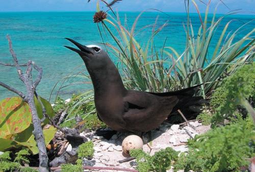
Preliminary offshore surveys conducted by CEI has shown that the Exuma Sound is known to host a diverse range of seabird and migrating bird species, with many of these species known to breed in The Bahamas (Breeding Permanent Resident) With the main known Avian species that can be expected to be found in the Exuma Sound include the: Audubon’s Shearwater, Bridled and Sooty Terns, White-tailed Tropicbirds, Magnificent Frigate Birds, Brown Noddies, Wilson’s
5 Stephen J. Pavlidis (2016). The Exuma Guide – a cruising Guide to the Exuma cays ‘Epifauna’ 26 – 37.
Date | March 25, 2024
Title | Environmental Baseline Statement
Storm Petrels, and Black-capped Petrels6. It should be worth mentioning that there is no known dedicated studies or information on the importance of the Exuma Sound as a foraging area for avian species. However, based on previous studies conducted elsewhere on similar species the Exuma Sound acts as a key feeding ground that avian species utilize.
The proposed landing and retrieval site location is not located close to any major Cays and or outcroppings that act as avian nesting or breeding sites There is no expected outcome to avian populations or nesting habitats.
An avian survey review was conducted to identify the presence, abundance, and habitat utilization of avian species within the site. The assessment utilized readily available literature, and studies were limited for the proposed impact area shown in the ellipse and flight plan. Due to the shortterm duration of the landing activity, no expected long-term impacts on avian populations are expected.
The range of a species is the geographic areas where the birds can be consistently found e.g., migrant birds have seasonal ranges while restricted range species remain on the same island or in the same region year-round. Range categories are described below:
Breeding Permanent Resident - Breeding Permanent Resident (BPR) species refers to the resident species that live and breed year-round throughout the Bahama Islands.
Breeding Summer Resident - Breeding Summer Resident (BSR) species refer to species that migrate to The Bahamas during the summer months and reproduce.
Non-Breeding Winter Resident - Non-Breeding Winter Resident (NWR) species refer to species that migrate to The Bahamas during the fall and winter months. They do not reproduce in The Bahamas.
Endemic Species - Endemic species (ES) are birds that exist only in The Bahamas.
Endemic Subspecies - Endemic subspecies (ESS) are variations of a species that exist only in The Bahamas but are not yet recognized as its own full species.
Transient - Transient species (TS) are birds that make brief stopovers in The Bahamas during migrations.
6 Cape Eleuthera Institute. (n.d.). The Exuma Sound Ecosystem Research Project: Open Ocean Research Initiatives. Retrieved from https://islandschool.org/cape-eleuthera-institute/research-initiatives/open-ocean/
Date | March 25, 2024
Title | Environmental Baseline Statement
Introduced - A Introduced species (INT) is a species that was introduced to the region, mainly via Anthropogenic means.
Presented below is the total count of species that were recorded all sites surveyed. All the species observed are protected under the Wild Birds Protection Act Chapter 249 (Statue Law of The Bahamas).
Table 3-1 Species observed that can be expected within the Exuma Sound78 LC = Least Concern
Common name
Gulls, Sandpipers, Stilts
Brown Noddy
Scientific name Class Range9
Charadriiformes
Anous stolidus
Bridled Tern Laridae
Laughing gull
Sooty Tern
Least Tern
Pelecaniformes
Brown Pelican
Phaethontiformes
White-tailed tropicbird
Procellariiformes
Audubon’s shearwater
LC BPR
LC BPR
Leucophaeus atricilla LC BPR
Onychoprion fuscatus LC BPR
S. antillarum
Pelecanidae
LC BPR
LC BPR
Pelecanus occidentalis LC BPR
Phaethontidae
Phaethon lepturus LC BPR
Procellariidae
LC BPR
Wilson's storm petrel Oceanites oceanicus LC BPR
Black-capped petrels
Pterodroma hasitata Threatened BPR
Suliformes Fregatidae
Double-crested Cormora
Double-crested cormorant LC BPR
Fregata magnificens Magnificent frigate birds LC BPR
Neotropic cormorant Nannopterum brasilianum LC BPR
Masked Booby Sula dactylatra LC BPR
*As no field observation was conducted, bird species were sourced from previous field studies, based on confirmed sightings across different observations, with only main avian species listed.
None of the species recorded are classed as endangered according to the International Union for Conservation of Nature (IUCN)
Table 3-2. Bird species of IUCN Concern. 10
7 Birds of the west Indies H. A. Raffaele et al, (2020)
8 Seabirds in The Bahamian Archipelago and The Adjacent Waters: Transient, Wintering, and rare Nesting Species –Anthony White (2004)
9 BPR = Breeding Permanent Resident, BSR = Breeding Summer Resident, NWR = Non-Breeding Winter Resident, ES = Endemic species, ESS = Endemic subspecies, TS = Transient, INT = Introduced
10 V = Vulnerable, NT = Near Threatened, T = Threatened, EN = Endangered, CR = Critically endangered
Date | March 25, 2024
Title | Environmental Baseline Statement
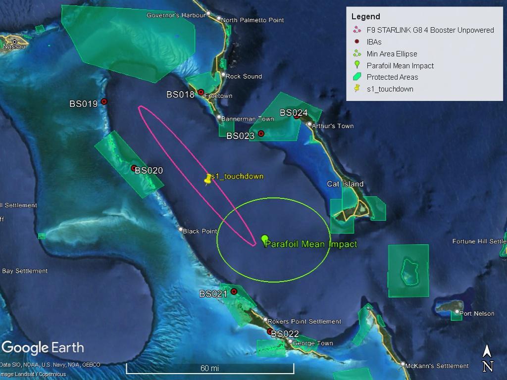
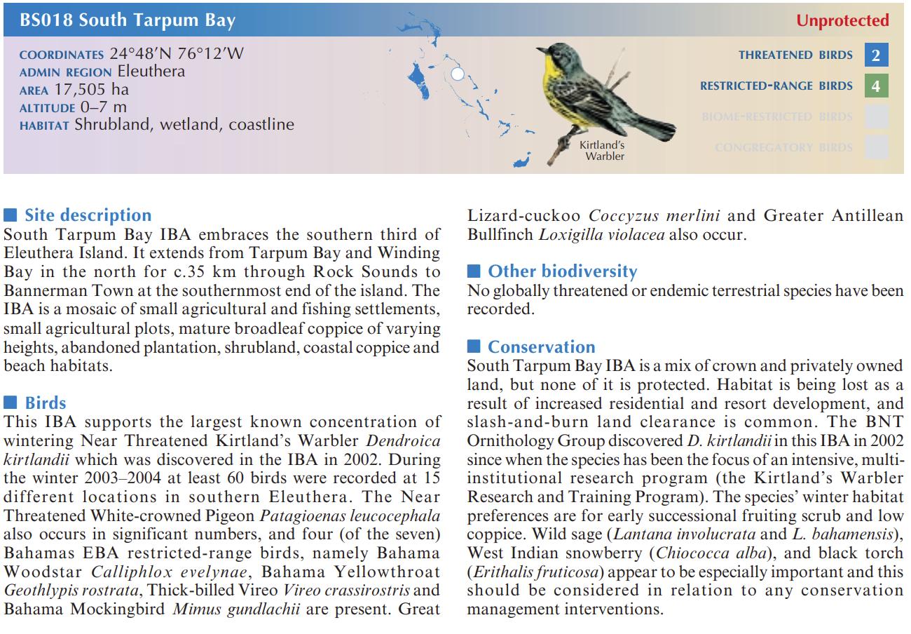
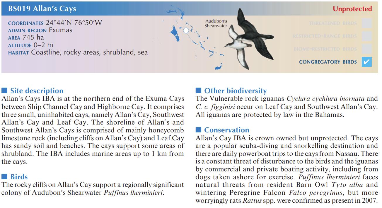
Important Bird and Biodiversity Areas (IBAs) are “key sites for the conservation of bird species, identified through the BirdLife International IBA programme.”11 A review of the Birdlife Country Profile shows that of the 39 IBAs in The Bahamas, 7 are in proximity to the Project site.12 These are BS018 through BS024. The following figures from the same report provide additional information about each of these IBAs. The map showing the proximity of the IBAs is provided in the appendices and in Figure 3-5
Table 3-3 Landing Site is 24°18'7.82"N and 76°14'36.31"W. The Centre of the parafoil mean impact circle is at 24° 1'15.77"N and 75°54'42.55"W. Distance was calculated from this center of the parafoil mean impact circle. IBA
The designed trajectory & recovery operations have taken into consideration local sites of scientific interest such as around Marine Protection Areas (MPAs) and has further refined the fairing ellipse to avoid impacts to these sensitive and highly valuable areas. The Hawksnest Creek, Exuma Cays Land and Sea Park, and the Southern Exuma Cays were looked at and avoided before arriving at the Exuma Sound as the most suitable location.
11 UNEP-WCMC 2014, Biodiversity A-Z website: www.biodiversitya-z.org, UNEP-WCMC, Cambridge, UK. Important Bird and Biodiversity Areas (IBA) definition | Biodiversity A-Z
12 See page 60 of the Important Bird Areas in the Caribbean – Bahamas countrychapters (birdlife.org)
Date | March 25, 2024
Title | Environmental Baseline Statement
Date | March 25, 2024
Title | Environmental Baseline Statement
Date | March 25, 2024
Title | Environmental Baseline Statement
Date | March 25, 2024
Title | Environmental Baseline Statement
Date | March 25, 2024
Title | Environmental Baseline Statement
Date | March 25, 2024
Title | Environmental Baseline Statement
Date | March 25, 2024
Title | Environmental Baseline Statement
Date | March 25, 2024
Title | Environmental Baseline Statement
Date | March 25, 2024
Title | Environmental Baseline Statement
Table 3-4. List of Protected Areas from the Bahamas Protected Areas Fund Registry of Protected Areas. The areas are managed by The Bahamas National Trust (BNT) and the Ministry of Environmental and Natural Resources.
1. Betty Cay Wild Bird Reserve Exuma
2. Big Darby Island Wild Bird Reserve Exuma
3. Big Galliot Cay Wild Bird Reserve Exuma
4. Channel Cays & Flat Cay Exuma
5. Cistern Cay (Private) Exuma
6. Exuma Cays Land and Sea Park (BNT) Exuma
7. Goat Cay Exuma
8. Guana Cay Exuma
9. Harvey Cay Exuma
10. Leaf Cay Exuma
11. Little Derby Island Exuma
12. Moriah Harbour Cay National Park (BNT) Exuma
13. Pigeon Cay (Private) Exuma
14. Rock off Hog Cay Exuma
15. The Exuma (Jewfish Cay) Marine Reserve* Exuma
* This protected area is managed by the Department of Marine Resources.
Elements of the marine traffic management plans have been derived from ‘The Formal Safety Assessment (FSA)’ methodology adopted by the International Maritime Organization (IMO) as a structured approach to the assessment of marine risks, and the effectiveness of control mechanisms in a real-world environment.
The criteria for the marine traffic plan for the Project area located within the Exuma Sound will focus on understanding the patterns and impacts of vessel traffic for a specific area. The proposed landing area will be monitored using a mix of historical data and the most current readily available navigational charts and will involve collecting data on vessel movements, types of vessels, and their routes using AIS (Automatic Identification System) data, satellite imagery, and field observations. The collected data will be analyzed to identify peak traffic times, common routes, and areas of high vessel density. Special attention will be given to potential environmental impacts, such as noise pollution and disturbance to marine life. The study will also assess the safety and navigational aspects of marine traffic in the area. Recommendations will be developed based on the findings to improve the management and regulation of marine traffic in the Exuma Sound, to minimize environmental impacts and to enhance mariner safety.
Prior to the launch, SpaceX will perform surveillance of the landing location using AIS and radar to detect any vessels that may be transiting through the hazardous area. SpaceX is required to hold the
Date | March 25, 2024
Title | Environmental Baseline Statement
launch if risk to the general public exceeds allowable thresholds defined in 14 CFR 417.107(b). The established hazardous area is shown in Figure 4-2.
Figures from two websites are provided below to show the location of marine vessels located in the Exuma Cays in March 2024. The third figure shows common sea routes across the Exuma Sound, which may indicate that while there may be several pleasure crafts within the Exuma Cays, there are typically not crossing over the Exuma Sound near the coordinates of the anticipated landing site.
Date | March 25, 2024
Title | Environmental Baseline Statement
Date | March 25, 2024
Title | Environmental Baseline Statement
Depth verification soundings refer to the process of measuring the depth of water at various points in a body of water to verify its depth. These soundings are typically conducted using specialized equipment such as depth finders or echo sounders. These soundings help to create depth charts and maps, ensuring that ships, boats, and other vessels can navigate safely through the water without running aground or encountering other hazards. The depth of the Exuma Sound has been previously charted using such equipment. Furthermore, BRON was engaged on March 11, 2024, with a launch deadline of March 25th , 2024. As the equipment necessary to conduct depth verification soundings is not readily available in country, conducting depth verifications within the timeline was not feasible.
There are several references to the depth of the Exuma sound in scientific research and in nautical charts. A few examples are provided below.
• “Exuma Sound is a deep (>1000m), semi-enclosed basin (approximately 175 x 65 km) in the Central Bahamas, surrounded by the Exuma Cays and the Great Bahama Bank to the
Date | March 25, 2024
Title | Environmental Baseline Statement
north and west and by Eleuthera and Cat Island to the east, and by Long Island to the south.”15
• The CEI documented up to 1,800 ft / 550 meters. “We found this isopod at around 550 meters (1,800 ft) deep, and it is only about the length of your pinky finger.”16
• The nautical map from GPS Nautical Maps is shown below.
3.2.6 Alternative areas for recovery in The Bahamas (waters around Ragged Island)
SpaceX evaluated three (3) potential landing locations outlined below including Exuma, 143 degrees direct, and south dogleg. The 143 degrees direct inject was not selected due to its location in shallow waters, proximity to land and people, and sensitive habitats. The south dogleg option was not chosen due to the fuel required to perform the maneuver – SpaceX could not successfully launch 23 Starlink v2.0 satellites and still have enough fuel to land the booster.
SpaceX does not have much or any flexibility to move the landing location for a few different reasons which include:
15 Lipcius, Romuald & Stockhausen, William & Eggleston, D. & Jr, L. & Hickey, B.M.. (1997). Hydrodynamic decoupling of recruitment, habitat quality and adult abundance in the Caribbean spiny lobster: Source-sink dynamics?. Marine and Freshwater Research - MAR FRESHWATER RES. 48. 10.1071/MF97194.
16 https://islandschool.org/news/the-island-school/new-species-discovered-in-the-exuma-sound/
17https://fishing-app.gpsnauticalcharts.com/i-boating-fishing-web-app/fishing-marine-chartsnavigation.html?title=Crooked+Island+Passage+and+Exuma+Sound+boating+app#8.27/24.1956/-75.9283
Date | March 25, 2024 Title | Environmental Baseline Statement
1. Moving the landing site, especially in the cross-range (Northeast) direction, will reduce landing reliability and therefore increase the probability of an unsuccessful landing due to rough weather and more adverse conditions.
2. Moving the landing site large distances like 20 miles east as requested is most likely impossible.
3. SpaceX predicts moving a landing location east would likely violate the FAA's public risk criteria as the locations get closer to North Eleuthera and Cat Island.
4. There is potential to move 2 miles southeast from the current landing location, but SpaceX is not comfortable moving more than that due to reliability reduction and increased risk to general public. The current landing location is optimized for all the given constraints listed above.
The following parameters were considered during site selection.
1. The landing location must be away from people and land to minimize risk to the general public on the surrounding island
2. The landing location requires at least 65ft of depth for droneship transport and recovery operations. This is approximately double the clearance of the dronehip and what SpaceX has deemed as the minimum depth to safely perform the operation. SpaceX prefers to operate in as deep of waters as possible, which is one benefit of the Exuma location with depths in the range of 3,000 to 5,000 feet.
3. The landing location shall be away from any land and sensitive habitats.
4. The landing location is constrained to the orbital trajectory. This means the booster can only land up-range and down-range on the flight path. Moving off the flight trajectory reduces the landing reliability by increasing propellant slosh and aerodynamic/thermal loads and therefore increases the probability of an unsuccessful landing. This constraint limits the number of landing locations that can be selected.
Date | March 25, 2024
Title | Environmental Baseline Statement
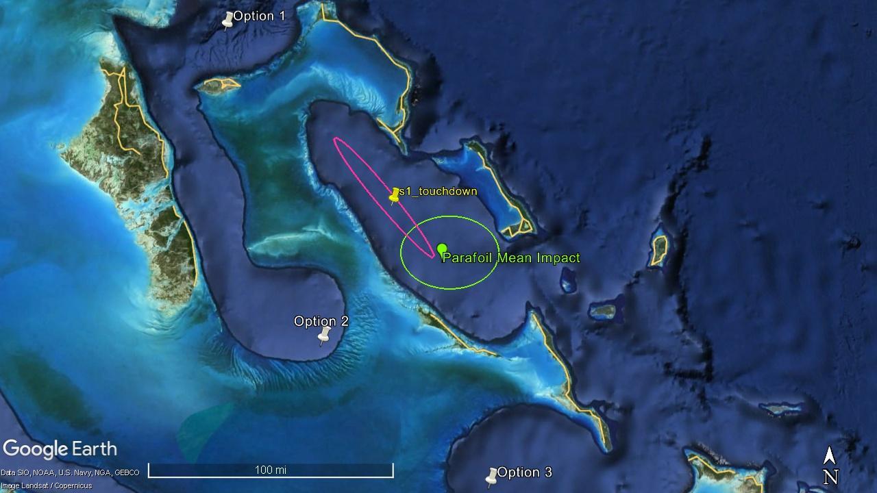
Figure 3-17. Three alternative options for consideration.
Table 3-5. Discussion regarding Alternative Options
Disadvantages
• Proximity to known Marine Mammal migratory routes.
1
2
3
• Proximity to the general public, considering the capital on New Providence.
• Proximity to the Andros Barrier Reef and known Nassau Grouper Spawning aggregation sites.
• Proximity to popular fishing grounds.
4.1
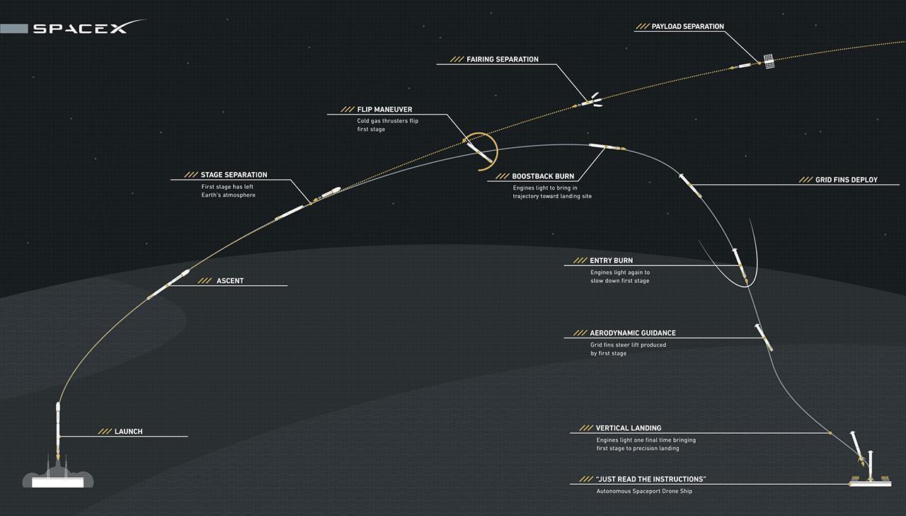
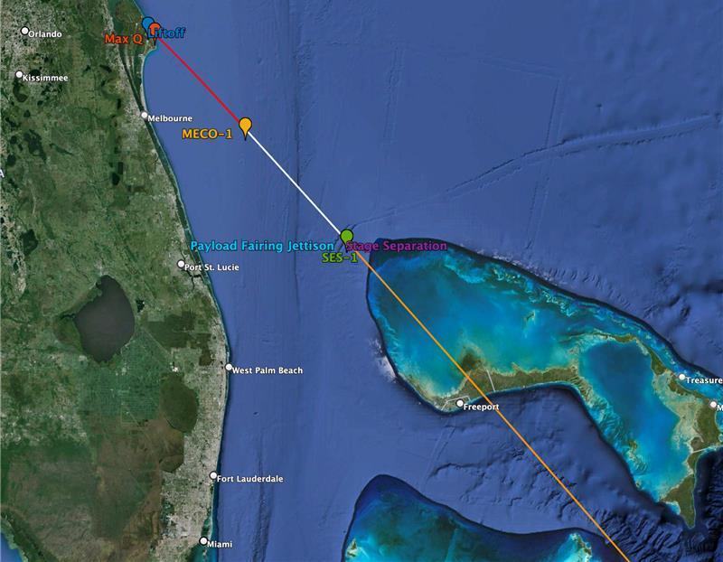
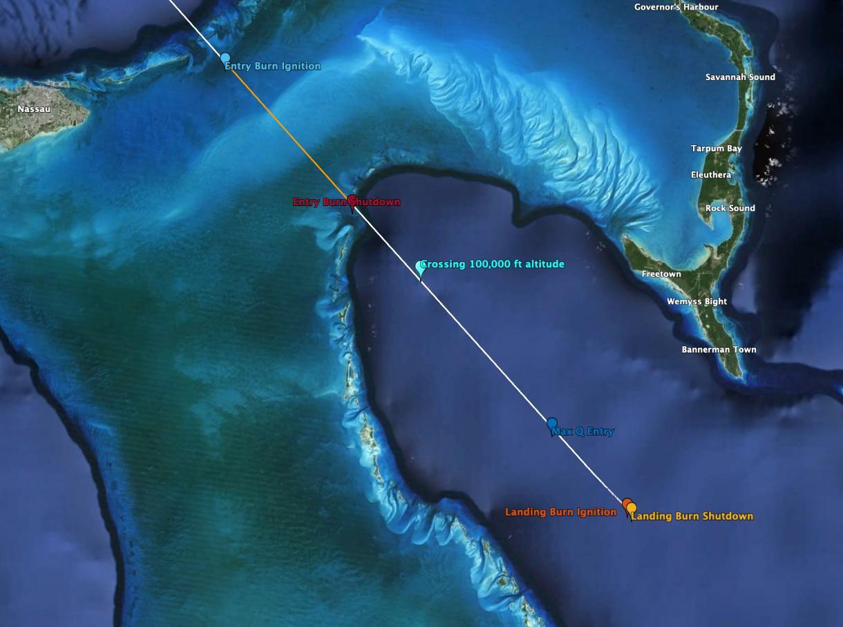
Once the rocket takes over, Stage 1 flight over Grand Bahama is expected to last for less than 2 seconds, with the Engine cutoff Stage Separation, and Stage 2 start then initiating over the Exuma Sound Stage 2 performs ‘two burns’ essentially a controlled landing on an autonomous droneship to successfully retrieve the equipment for future use. Two fairing halves come down under parafoil and land in the water to be picked up by a recovery vessel waiting nearby. Figure 4-1 provides general information on the flight of the Falcon 9. Figure 4-2 shows the correlation between the flight plan and the map of The Bahamas.
Date | March 25, 2024
Title | Environmental Baseline Statement
Date | March 25, 2024
Title | Environmental Baseline Statement
Date | March 25, 2024
Title | Environmental Baseline Statement
Operational Timeline:
After the Droneship and hazard area has been cleared of all personnel and surveilled prior to launching the following is then performed:
1. Rocket Lands on Droneship, exact coordinate – Residual fuel still left post landing estimated at:
• Liquid Oxygen: 314 gallons (less then ~4 bathtubs)
• Vented directly onto the Droneship deck and evaporates in pure O2. No contact with ocean.
• RP-1: 300 gallons (less than ~4 bathtubs)
• Remains contained on the rocket post landing.
2. Falcon 9 is structurally secured to deck with a robot.
3. SpaceX crew boards the droneship and connects fluid and electrical connections to the rocket.
4. Remaining RP-1 is drained off the rocket to specialized fuel storage on Droneship.
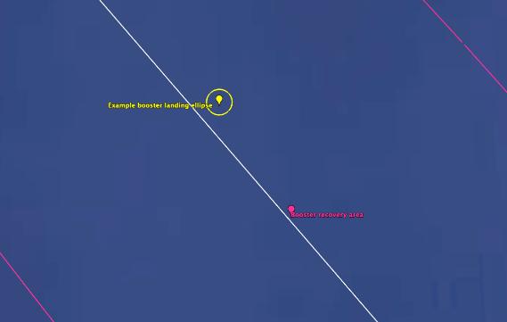
The Fairing will steer into the wind during flight to minimize drift and improve aerodynamics. The selected area is large enough to account for variability for the day of launch in wind changes and conditions within the booster recovery area All possible locations that the landing site could be designed for does not change from mission-to-mission. The Booster landing ellipse is a small (500m wide) circle for the planned stage 1 landing. The final location will be determined missionto-mission but will generally remain inside the Booster recovery area Stage 1 boasts a landing success rate of >95% from 2017 to the present, with debris always confined to the forecasted sites.
Date | March 25, 2024
Title | Environmental Baseline Statement
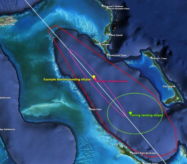
A crewed fairing recovery vessel navigates to and remains in location prior to launch near the proposed landing location, approximately ~30nm downrange of the droneship/ booster Landing Zone. The Fairing recovery area is cleared of all personnel and surveilled prior to launch to ensure that it is free and clear of any potential hazards. During the rocket operation, Fairings will separate from the second stage once in the vacuum of space, with the fairings re-entering the atmosphere under the parafoil and soft landing into the ocean where they are designed to float, The Parafoils separate from the fairing halves and are retrieved out of the water by a small fastboat that is in location and waiting for the equipment to land. Fairing halves are recovered out of the water by a crane on the fairing recovery vessel.
Title | Environmental Baseline Statement
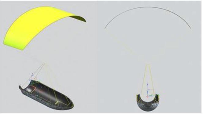
The fairing consists of two halves which separate, allowing the deployment of the payload at the desired orbit. In the past, following the fairing separation, both halves of the fairing were left to splash down in the ocean, break apart, and sink. The parachute system consists of one drogue parachute and one parafoil. Following re-entry of the fairing into Earth’s atmosphere, the drogue parachutes deploy at a high altitude (approximately 50,000 feet) to begin the initial slow down and to extract the parafoil. The drogue parachute (and the attached deployment bag) cuts away following the successful deployment of the parafoil. The parachute system slows the descent of the fairing to enable a soft splashdown so that the fairing remains intact. Both fairings, parafoils and drogue chutes are recovered during these operations.
Date | March 25, 2024
Title | Environmental Baseline Statement
In the event of a landing anomaly, debris would be contained to the booster landing ellipse. SpaceX would be responsible for recovering or disposing of any resulting launch vehicle debris. Debris would include the ~300 gallons of liquid propellant, which is expected to combust in the destruct action, be dispersed in the air, or expelled into the ocean upon impact and dissipate within hours. The droneship is expected to survive a landing failure scenario based on observations from SpaceX’s early landing attempt failures.
In the event of an in-flight anomaly, there is a potential for debris to be dispersed along the flight path. Due to the very high altitudes that the vehicle is travelling during ascent, much of the debris is expected to demise from atmospheric heating before reaching land or the ocean’s surface. The risk analysis performed by the United States Space Force for each Falcon 9 launch assesses the risk from the resulting debris from a variety of failure scenarios. This analysis is used to verify the risk to any public individual does not exceed 1 in a million and that the cumulative risk to the public does not exceed 149 in a million.
5.1
The Project’s impact on the environment was determined by first dividing the total Project impact into different categories. The categories include land use, water quality, biological resources, air quality, noise quality, cultural resources, energy, socioeconomics, community services, aesthetics, and marine transportation. The significance of the impact was then determined. Significance is a function of the impact’s magnitude and its likelihood. The magnitude was determined by the combination of the Project activity’s Extent, Duration, Intensity and Likelihood.
Title | Environmental Baseline Statement
Table 5.1 summarizes impact significance. The impact of each of the Project activities was considered for each category, then ranked according to its significance.
Extent refers to the area and distance influenced by the Project activity. Restricted on-site to the immediate Project area (O), locally within a 10-mile radius (L), regionally to include the island (R), and Nationally to include the extent of the Bahamian Archipelago (N).
Duration reflects the timeframe the Project activity will be influencing the Project area. The duration of the impact relates to the temporal scale which is required for changes in the host environment to return to baseline conditions or undetectable levels. Temporary (T) impacts persist for a short duration and occur occasionally and/or intermittently. Short Term (ST) impacts are expected to persist for the duration of the Project activities related to the Project. Long Term (LT) impacts extend beyond the duration of the flight and landing and exist throughout the life of the Project. Permanent (P) impacts persist far beyond the life of the Project and are irreversible changes to the host environment due to project related activities.
The intensity of an impact can be considered as Negligible (N), Low (LW), Medium (M) or High (H). A negligible impact is one which has no detectable change on the host environment. A low intensity impact does not affect the host environment in such a manner to alter natural flows and processes. Medium intensity impacts alter the natural flows and processes of the host environment while allowing the flows and processes to retain their natural functions. High intensity impacts alter natural flows and processes to the extent where natural functions are totally inhibited for a temporary or permanent period of time.
The likelihood of an impact evaluates the likely potential for an impact to occur, with typical rating categories being Unlikely to occur (U), Likely to occur under most conditions (L), and definitely will occur (D).
Extent Duration Intensity
On Site (O) Temporary (T) Negligible (N)
Unlikely (U)
Local (L) Short-Term (ST) Low (LW) Likely (LK)
Regional (R) Long-Term (LT) Medium (M)
National (N) Permanent (P) High (H)
Definite (D)
Once the significance was determined, each category was classified as negligible, minor, moderate, severe and beneficial Table 5.2 below summarizes the potential environmental impacts that may be caused by the proposed Project. White fill cells indicate there is no expected impact or a negligible impact on a category. Green fill categories indicate potentially beneficial impacts are expected, while yellow fill cells indicate minor potentially adverse impacts, orange fill cells indicate more moderate impacts and red fill cells indicate potentially severe impacts are
Date | March 25, 2024
Title | Environmental Baseline Statement
expected. Following the table, potential impacts of the Project in the best-case scenario and worst-case scenario are presented.
Table 5-2 Summary Impact Table showing significance rating for worst-case and nominal scenarios in the Exuma Sound.
Land Use
Water Quality
Biological Resources
Air Quality
Noise Quality
Cultural Resources
Energy (Fuel)
Socioeconomics & Community Services
Aesthetics
Marine Traffic
Negligible (white)
(orange)
(orange)
(yellow)
(orange)
(white)
(yellow)*
(green)
(yellow)
(orange)
(white)
(white)
(white)
(white)
(white)
(white)
(white)
• Negligible/No Impact (White) –no detectable change on the host environment or alters the natural flows/process of the host environment while allowing the flows and process to retain their natural functions.
• Minor Impact (Yellow) –does not affect the host environment in such a manner to alter natural flows and processes.
• Moderate Impact (Orange) –alter natural flows and processes to the extent where natural functions are inhibited for a temporary or permanent period
• Severe Impact (Red) – adverse/negative impacts to the immediate/extended environment and stakeholders.
• Beneficial Impact (Green) – positive impacts on the surrounding environment and/or stakeholders.
The Project is not expected to result in land and marine construction or modification of buildings, neither development or modification of infrastructure and roadways due to the nature of the Project The proposed site is approximately 12 nautical miles northwest from the nearest Exuma cay and approximately 26.55 miles from the southern tip of Cat Island However, there is concern of impact on inhabitants due to the possibility of an anomaly in trajectory and recovery. The phase
Date | March 25, 2024
Title | Environmental Baseline Statement
1 trajectory of the launch from Florida to the Exuma Sound predicts passage over Grand Bahama and New Providence Additionally, the proximity of the Boost Recovery Area and the Fairing Landing Ellipse to Exuma, Cat Island and Eleuthera. In addition to the following figure, note figure 3-4.

Water quality is not expected to be impacted by exhaust. The engine burn duration is only several seconds and does not contain harmful exhaust that could result in acid deposition (See Tables 54 and 5-6). Recovery operations are also not expected to alter the pH or other water quality parameters. Hazardous materials, substances and wastes used and generated as part of recovery operations would be collected, stored on the recovery vessel, and disposed of using practices that minimize the potential for accidental releases or contact with marine environment. Fuel/Hazardous material will be stored on board and disposed of once the recovery vessel is in Port Canaveral US. Spills and Clean Up Methodology will follow the spill prevention plans, Resource Conservation and Recovery Act, and Occupational Safety and Health Administration (OSHA) regulations. All accidental releases of polluting substances would be respondedto quickly
Title | Environmental Baseline Statement
and appropriate clean-up measures would be implemented in accordance with applicable laws to minimize impacts on the environment.
In the event of an anomaly there could be a potential impact to the marine environment as the spacecraft and launch vehicle debris would fall into the ocean areas. Debris would include the ~300 gallons of liquid propellant, which is considered a negligible hazard because virtually all hazardous materials would combust in the destruct action, dispersed in the air, or expelled into the ocean upon impact and dissipate within hours. Recovery vessels will be in proximity to the landing and will commence emergency response as soon as it is safe to do so. SpaceX would activate its emergency response plans to recover or dispose of any remaining debris
The SpaceX emergency response procedures include the salvage of any floating debris in the water and sinking large pieces of debris that are unsafe to collect or cannot be retrieved. The SpaceX team will have a vessel on the scene ready to respond in the event of an anomaly as agreed with the Government of The Bahamas
5.4.1 Terrestrial
While the Project is marine focused, some of the species that may be impacted are avian wildlife, which are considered terrestrial. According to SpaceX, the sonic boom over populated land is expected to be less than 1 psf.
The impact of noise on avian species can be significant, as it disrupts various aspects of their behavior, communication, and physiology. Loud noises can interfere with birds' ability to hear crucial sounds for navigation, predator detection, and mate attraction. Prolonged noise exposure can induce stress, leading to decreased reproductive success, altered foraging behavior, and even physiological changes such as elevated corticosterone levels. However, the duration of the sound impact is short term.
In addition to the impact of the sound of the sonic boom, sonic booms can produce vibrations. When a shock wave passes through the air, it creates rapid changes in air pressure. These pressure fluctuations can cause nearby objects to vibrate. Based on the site, there are no buildings in the area of impact that may impacted by vibrations. SpaceX will ensure the area is clear of all marine vessels prior to landing to ensure vibrations and sound do not impact the boating and fishing community in the area.
The flight plan and landing of the Project may lead to direct impact to some avian species known as bird strikes. Based on the duration of the flight and the sound it will generate it is unlikely that birds will venture near the rocket, which means bird strikes are not likely.
The retrieval exercise in the Exuma Sound is expected to have minimal impact on the marine environment due to its small scale and the isolated nature of the area. Being situated in deep water with fast-moving currents, the exercise is likely to take place in a remote location characterized by swift water movement. These factors combine to limit the ecological footprint of the exercise, ensuring that any potential effects on the marine environment remain minimal. Overall, long-term impacts on the marine environment from the proposed retrieval exercise is anticipated to be negligible. The careful implementation of the best management practices will help to minimize any potential adverse effects and ensure the preservation of the Exuma Sound's unique and valuable marine ecosystem forfuture generations while providing a unique opportunity for The Bahamas.
Potential disturbance to marine mammals includes increased noise levels in the upper layers of the ocean and an increase in anthropogenic activity within areas frequented by marine mammals. This increase in traffic and noise may impact transient marine mammals foraging and with young calves.
The impacts of fumes on the marine environment can be profound and wide-ranging. Fumes, contain a variety of pollutants such as hydrocarbons, nitrogen oxides, sulfur dioxide, and particulate matter. When released into and near the marine environment, these fumes can lead to air pollution, which can have direct and indirect effects on marine ecosystems. Direct impacts include the deposition of pollutants onto the sea surface, leading to contamination of water and sediments, as well as harmful effects on marine organisms such as fish, shellfish, and plankton. Indirect impacts may include changes in atmospheric chemistry, altering weather patterns and contributing to climate change, which in turn can affect ocean currents, sea surface temperatures, and marine habitats. Additionally, fumes can contribute to the formation of smog and acid rain, which can further degrade marine ecosystems by altering water chemistry and pH levels, impacting the health of coral reefs, shellfish populations, and other sensitive marine organisms.
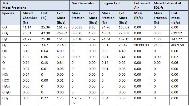
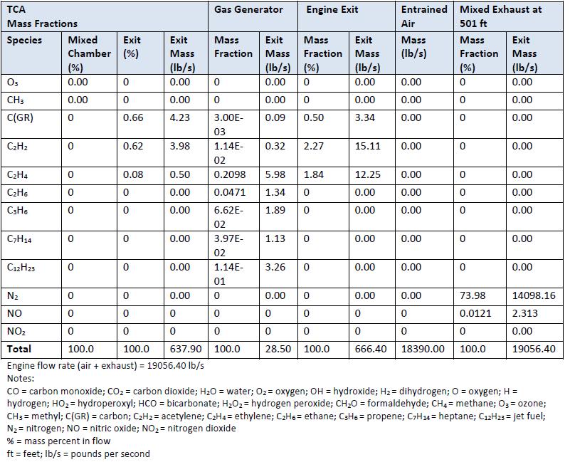
However, the primary emission products from the Falcon liquid engines, which use RP-1 and LOX as propellants, are CO2, CO, water vapor, and carbon particulates. Due to the short duration (several seconds) of the landing burn, engine emissions do not have the potential to result in longterm impacts on regional air quality. Unlike other launch vehicles that utilize solid rocket motors, Falcon does not produce significant quantities of nitrogen oxides, sulfur dioxide, or other exhausts that could result in acid deposition. The Falcon M1D engine exhaust gas plume was analyzed to have the following exhaust gases listed in the following tables
Date | March 25, 2024
Title | Environmental Baseline Statement
Table 5-4 List of gases in Falcon M1D exhaust. The table was provided by SpaceX.
Date | March 25, 2024
Title | Environmental Baseline Statement
Table 5-5 List of gases in Falcon M1D exhaust (continued). The table was provided by SpaceX.
Another source of fumes resulting from the Project is the recovery vessels. Recovery vessels are boats that were outfitted to make the droneship autonomous. These vessels abide by the United States Coast Guard regulations for boats. These recovery vessels are mobile sources of air pollutants, thus there would only be temporary emissions in The Bahamas during missions that land in the Exuma Sound. Accordingly, there would be negligible impacts to ambient air quality due to recovery operations in the Exuma Sound.
Landing and recovery efforts in the Exuma Sound would not result in long-term increases to the ambient noise levels in the Exuma Sound. Engine noise from landing events would last several seconds and would be loudest at the droneship, lowering in intensity further away from the droneship. Near the droneship, engine noise would be expected to be approximately 100-110
Title | Environmental Baseline Statement
decibels (A-weighted). Given the distance from the proposed landing area and inhabited land masses, as well as the short duration of the noise event, engine noise would not result in adverse impacts to human health or safety. A sonic boom of approximately 1 poundper square foot, similar to a clap of thunder, may be heard by populated areas but would last for less than a second. Noise propagation is heavily influenced by atmospheric conditions at the time of landing, thus the sound heard at one location may differ between missions.
Noise levels generated should not have long lasting impacts provided exposure does not exceed 30 minutes to 2 hours per day. There is no expected long-term impact from noise levels on wildlife. Similarly, vibration rates will remain low during the whole operation, with no excepted long-term vibration rates expected to exceed that of the operational vessel engine, and that is only to last the duration of the landing exercise.
The short-term impact of noise may be related to triggering the fear response in some avian species or causing some species to change their migration patterns. A study by Van Den Broeke and Gunkel (2020) indicates that thunderstorms can indeed influence bird migration patterns. It explains that weather conditions, including thunderstorms, can impact bird migration by forcing them to land or causing them to alter their migration routes18
Overpressure is the brief intense spike in air pressure that can occur from explosive events such as thunderclaps. This increase in pressure if often much stronger than typical sound waves and is measure in pound per square foot (psf). It should be noted that the overpressure of a thunderclap is roughly 1 psf. There is a likelihood that a sonic boom may be experienced due to the reduced velocity in landing the rocket. The Federal Aviation Administration, United States Space Force, and National Aeronautics and Space Administration do not expect the overpressure from re-entering spacecraft to exceed 1 psf based on the shape and size of existing spacecraft. For boosters that can currently land on a barge in the ocean such as the SpaceX Falcon 9, overpressures at the oceanʼs surface could be up to 8 psf. The study by Richardson et al. (1995)19 , as cited in the NOAA Programmatic Concurrence Letter for Launch and Reentry, found that acoustic energy in the air does not efficiently penetrate the air-water interface, with most of the noise being reflected off the water surface. The NOAA Programmatic Concurrence Letter for Launch and Reentry is available in the appendices. A discussion on sound begins on page 61 of this appendix.
It is recommended that the Antiquities, Monuments and Museums Corporation (AMMC) of The Bahamas be notified immediately if cultural resources are discovered during the deployment of
18 https://doi.org/10.1002/rse2.179
19Book Editors: W. John Richardson, Charles R. Greene, Charles I. Malme, Denis H. Thomson, Marine Mammals and Noise, Academic Press, 1995, Page iii, ISBN 9780080573038,https://doi.org/10.1016/B978-0-08-057303-8.50001-X. or https://www.sciencedirect.com/science/article/pii/B978008057303850001X
Date | March 25, 2024
Title | Environmental Baseline Statement
the launch retrieval of the booster or navigating to the booster recovery area. The contact information is (242) 604-2662 and (242) 604-6800. The DEPP should also be made aware of any discovery of cultural or suspected culturally significant items. The contact information is (242) 322-4546 and inquiries@depp.gov.bs
Most of the fuel will be used in the flight plan prior to entering The Bahamas’ EEZ as shown in Figure 4-2. Main Engine Cut Off (MECO-1) is between Florida and Grand Bahama. This indicates that in the event of an in-air explosion, there will be little to no fuel available for a spill event. Furthermore, the height of the Falcon 9 from MECO-1 stage of the flight plan to Entry Burn stage shown in Figure 4-3 is well above 200,000 feet which is far above traditional commercial aviation height. In the event of an in-air explosion at this height, not only will the fuel be consumed during the combustion, but also the remaining fuel will dissipate to negligible concentrations in the atmosphere, which means there will be no expected impact to the Bahamian environment.
When the first stage booster rocket lands on the droneship, it has an estimated amount of less than 314 gallons (~4 bathtubs) of Liquid Oxygen as fuel which is vented directly onto the Droneship deck and evaporates in pure oxygen. There is no contact with the larger marine environment or wider ocean.
• Rocket Propellant 1, highly refined kerosene.
• Less flammable and toxic than car gasoline
• Very similar to Jet-A fuel used in aircraft.
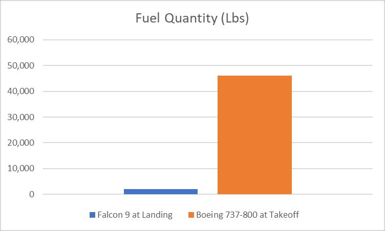
Figure 5-2 Comparison between Fuel reserves of Falcon 9 at landing and a Boeing 737 at takeoff
Date | March 25, 2024
Title | Environmental Baseline Statement
As discussed in Section 5.3 Water Quality, fuel is expected to be consumed or dissipated in the event of an anomaly. The fairings use nitrogen gas thrusters, which have minimal impact on the environment compared to conventional chemical propulsion due to their emission of inert nitrogen. Inert nitrogen neither depletes ozone nor contributes to greenhouse gas concentrations.
In the unlikely event of an in-air explosion after launch, the fuel would be consumed during the combustion process It is not expected that the fuel will not spill in the marine / terrestrial environment in this case. In the DEPP communication dated March 1, 2024, a Fuel Management Plan and Spill Prevention Control/Plan and Countermeasures Plan were requested. These documents were provided to DEPP
The Preliminary Census Report for 2022 states that Exuma accounts for 1.83% of the total population of The Bahamas and that the Exuma and Cays experienced a population increase since the last census20 The ratio of male to female was 3,517 to 3,776 The Exuma Cays population distribution on Cays in proximity to the landing site is available as a part of the 2010 Census and is provided below21; an updated report was not available to date.
• All Cays northward and westward up to and including Normans Pond – 246
• Black Point – 230
• Little Farmers Cay – 66
• Staniel Cay – 118; The landing site is 13.42 nautical miles.
Due to the proximity to these populated Cays, it is important to note the following.
• This is a Federal Aviation Administration (FAA) licensed mission
• A risk analysis has been coordinated with the FAA for many months
• Meets all applicable FAA public risk and safety criteria
• Statistical risk analysis conducted by SpaceX shows the risk to the population of The Bahamas (~0.3 in a million) is orders of magnitude less than the FAA allowable limit (100 in a million)
• The following graph shows there are no expected casualties resulting from the mission.
20 2022+CENSUS+PRELIMINARY+RESULTS_FINAL+April+12+2023.pdf (bahamas.gov.bs)
21 Microsoft Word - EXUMA AND CAYS POPULATION BY SETTLEMENT_2010 CENSUS.doc (bahamas.gov.bs)
Date | March 25, 2024
Title | Environmental Baseline Statement
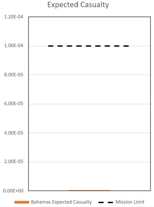
Figure 5-3. There are no expected casualties for this mission. (Graph provided by SpaceX)
SpaceX is required under the terms of its FAA launch operator license to assess public risk for all persons beneath the launch trajectory per launch regulations 14 CFR 417.107(b). While the flight path passes over land, the vehicle is over 40 miles in altitude above when crossing over Grand Bahama. The trajectory was also designed to stay north of Nassau and minimize risk to the public of overflight during its descent. Accounting for these factors, the cumulative risk to the general public is well below the FAA public risk thresholds. Cumulative expected casualty (Ec) risk to persons in The Bahamas was calculated to be 4 in 1 million, which is well below the FAA regulatory threshold of 149 in 1 million. Furthermore, the sonic boom over populated land is expected to not exceed 1 psf. In general, for well-maintained structures, the threshold for potential damage from sonic booms is 2 psf; below 2 psf, damage is unlikely. Therefore, SpaceX does not expect damage to historical structures. SpaceX would be responsible for resolving any structural damage caused by the sonic boom.
The Exuma Cays is a popular boating destination as shown by the Marine Traffic maps in Section 3.2.4 Marine Traffic Survey The Project will benefit mariners that want to remain connected while sailing and transversing throughout the islands of The Bahamas It will also benefit the residents on the Cays by improving the internet service (100 Mbps+). Additional benefits to the Exuma island and Cays are as follows:
• Starlink terminals will be constructed in schools
• SpaceX will support the University of The Bahamas campus on Great Exuma and provide internships to Exuma students to help foster an interest in STEM
• SpaceX will support educational outreach in various forms in the community and provide space tourism opportunities
• Landings in Exuma will feature Starlink satellites that communicate directly to cell phone in the event of an emergency.
The temporary Project activity is not expected to alter the aesthetics of the Exuma Sound due to its remote location and short duration. In the event of an anomaly, the Government of The Bahamas will secure the location for the SpaceX team to provide a quick recovery response SpaceX will remove any debris from waterways. SpaceX will be responsible for all clean up activities related to any anomalies.
Based on the marine traffic shown on two websites, every effort should be made by SpaceX to communicate with the boating community in advance of the launch and the landing to reduce interference with the landings and the recovery phase of the Project. This will help ensure the safety of the boating and fishing community The landing activity is short in duration and SpaceX is required to hold a launch if vessels are not clear of the area. The landing location avoids major shipping and cruise ship routes and is not expected to impact those operations (See Figure 315). SpaceX is in communication with the Port Department to coordinate a notice to all mariners in proximity to the landing site. The Emergency Action Plan and Area Security and Coordination Plan were provided to DEPP
SpaceX has landed Falcon 9 over 160 times in the last 2 years with a 100% success rate While the plan is to land precisely on the s1_touchdown location, SpaceX does account for off nominal scenarios, which is why SpaceX has generated the pink booster ellipse previously shown. This ellipse shows the possible landing location area in the event Falcon 9 had an anomaly and lost full control of the vehicle. The worst-case scenario is that Falcon 9 does not land on the droneship and instead lands in the pink ellipse.
In the event this were to happen, SpaceX has emergency response procedures to salvage any floating debris in the water and sink large pieces of debris that are unsafe to collect or cannot be retrieved. The SpaceX team will have a vessel on the scene and be ready to respond in the event of an anomaly. SpaceX will bear all costs related to recovery and anomalies.
• No hydrocarbon propellant is used on the fairings
• 2023 Fairing recovery success rate – 93%
Date | March 25, 2024
Title | Environmental Baseline Statement
• 2023 Parafoil recovery success rate – 73% It is important to note that SpaceX has improved its recovery rate of fairings and parafoils year after year even as launches have increased. The Exuma Sound provides more favorable sea state for fairing recovery thus SpaceX expects successful fairing recovery for this mission.
• Expect even better recovery rates in The Bahamas due to better weather and sea state conditions in Exuma Sound
Under the No Action Alternative, the Landing and retrieval exercise will not be permitted to occur in the Exuma Sound, forcing the exercise to occur elsewhere. The benefits to The Bahamas expected to include but not be limited to increased and improved Starlink terminals to schools, as well as 100 Mbps+ internet service rollout to The Bahamas scheduled for summer 2024, and addition to improved and enhanced educational outreach and further space tourism growth and potential new opportunities. The landings in Exuma will enable, use and feature Starlink satellites that can communicate directly with cell phone in the event of an emergency will be of great use and benefit to mariners who can stay connected while sailing in areas that traditionally had no coverage, further improving the connectivity of The Bahamas.
Date | March 25, 2024
Title | Environmental Baseline Statement

LAND AREA 13,940 km 2 ALTITUDE 0–63 m
HUMAN POPULATION 330,550 CAPITAL Nassau
IMPORTANT BIRD AREAS 39, totalling 4,700 km2
IMPORTANT BIRD AREA PROTECTION 23%
BIRD SPECIES 300 THREATENED BIRDS 6 RESTRICTED-RANGE BIRDS 7
PREDENSA MOORE AND LYNN GAPE (BAHAMAS NATIONAL TRUST)
The Commonwealth of The Bahamas is an archipelago of c.700 islands and c.2,000 cays and rocks extending over 1,100 km. The archipelago, which lies north and east of Cuba, runs from east of the southern end of Florida (USA), south-east until it terminates at the Turks and Caicos Islands (to the UK) which are geologically a continuation of the islands. The Bahamas are exposed parts of a limestone platform that is divided into several shallow banks. Little Bahama Bank is located along the northern coasts of Grand Bahama and encompasses all of Abaco and its North Atlantic offshore rocks and cays. The Great Bahama Bank (which is rich in marine life) stretches from north of the Biminis and Berry Islands, southward to hug the southern shoreline of New Providence and the western shores of Andros, Eleuthera, Cat Island, the Exumas, Long Island and the Ragged Islands. The Cay Sal Bank (which is biologically impoverished) is located at the extreme western sea border of The Bahamas, very close to Cuba. The islands of the Bahamas are low and flat with ridges that usually rise to no more than 15–20 m. However, there are precipitous slopes under water, between and within the convoluted banks. The Tongue of the Ocean is a 30-km wide trench between New Providence and Andros which drops
to depths of 2,000 m. The islands have no rivers or streams and the soil is fertile but thin, and often lodged in shallows and “banana holes” within the harsh limestone rock. A freshwater lens exists close to the surface, resting on the underlying salt-water.
The Bahamas are often divided, ecologically, into three regions: Northern Bahamas (Grand Bahama, Biminis, Berry Islands, Abacos, North Andros, and New Providence) where all the larger islands are covered primarily by Caribbean pine Pinus caribaea woodland (with a broadleaf shrub and palm understorey), although much of this woodland was logged in the mid-twentieth century; Central Bahamas (South Andros, Eleuthera, Cat Island, the Exumas, Ragged Islands, Long Island, Rum Cay, Conception Island and San Salvador), in which the islands are covered primarily in broadleaf “coppice”—a dense, low semi-evergreen forest; and Southern Bahamas (Crooked Island, Acklins Island, Samana Cay, Mayaguana, Little and Great Inagua), where the islands are drier and support dry shrubland. New Providence, in spite of being one of the smaller islands, is home to c.69% of the Bahamian population and the nation’s capital. Grand Bahama is second only to New Providence in terms of development, and it supports 16% of the population. It is also home to the longest underwater cave system in the world. The rest of the
Bahamas islands are called the “Family Islands” which are sparsely populated and retain their natural beauty. Of these Family Islands, Great and Little Abaco (and its cays) are considered “the sailing capital of the world”, and the islands have a booming tourist trade. Andros is the largest island in the Bahamas, with extensive creeks, interlacing channels, bays, bights and inlets. It is also home to many blue holes and as a result is renowned for its cave-diving. Inagua is the southernmost island in the Bahamas with the nation’s only Ramsar site—Inagua National Park—which is home to over 40,000 Caribbean Flamingo Phoenicopterus ruber (and many other waterbirds). The company Morton Bahamas Ltd. produces salt from the salinas at one end of Lake Rosa (which occupies c.30% of the island). Morton is one of the largest salt producers in North America.
The Bahamas has the third highest per capita income in the western hemisphere (after the USA and Canada). Tourism is the primary economic activity, accounting for c.65% of the gross domestic product (GDP). The government’s current economic thrust is to put an anchor resort on each of the major Family Islands which will have huge implications for the biodiversity of these otherwise relatively untouched islands. Offshore finance is the nation’s second largest industry, accounting for c.15% of GDP. The settlement history of the Bahamas is convoluted and often different on each island. Plantations were established on some of the islands during the late eighteenth century, and large-scale agriculture was trialed in the mid-twentieth century when much of remaining virgin pine forests in the Northern Bahamas were logged. Subsequent development (especially on New Providence and Grand Bahama, but also locally on the other inhabited islands) has had a profound negative impact on the surrounding habitats.
The climate of the Bahamas is subtropical to tropical, and is moderated significantly by the waters of the Gulf Stream which keeps the islands warmer than Florida in the winter and cooler in the summer. Summer is the rainy season with June and October the wettest months. However, the Southern Bahamas only get half the rainfall that the northern Bahamas receive. The islands are frequently hit by hurricanes; for example, Hurricane Andrew in 1992, Floyd in 1999, Francis and Jeanne in 2004, and Wilma in 2005. Low-pressure systems associated with tropical waves and resulting in strong winds and drenching rain are a regular feature in the Bahamas.
■ Conservation
In the Bahamas, the Ministry of Environment is currently the principal government department involved in conservation and the environment. Within this ministry is the Bahamas Environment Science and Technology Commission, also known as the BEST Commission, which was established in 1994. The
BEST Commission manages the implementation of multilateral environmental agreements and reviews environmental impact assessments and environmental management plans for development projects within the Bahamas. The Bahamas National Trust (BNT) 1 was established in 1959 under the Bahamas National Trust Act. It is a non-profit organisation, funded by private donations, an endowment fund and a significant subvention from the Government of the Bahamas. BNT advises the government on conservation policies and is charged with safeguarding the nation’s environmental heritage. One of its statutory roles is to hold environmentally important lands in trust for the country. BNT also has the responsibility for managing the national park system. The park system now consists of 25 parks and protected areas (10 parks were designated in 2002), covering 283,400 ha throughout the archipelago. Many of these extraordinary and often innovatively managed parks are also IBAs and are mentioned in more detail within the individual IBA profiles below. BNT works in partnership with the Bahamas government, local business, national and international conservation organisations, schools and the community.
In the Bahamas, there is a constant quest for economic advancement, but without the necessary knowledge and appreciation that the nation’s environment has limitations, this could have catastrophic long-term consequences. In the past, valuable timber (pine and coppice) were cut, monoculture agriculture was practiced, and introduced livestock (goats) and slash-and-burn agriculture expanded to less arable areas. At the same time, subsistence, commercial and recreational hunting and fishing, introduction of alien species, urban sprawl, road works, careless tapping of the freshwater lens, interference with natural drainage, dredging and reclamation of wetlands and tidal mangroves, pesticide spraying to eradicate mosquitoes, malaria, yellow fever, crop pests, problems of sewage and solid waste disposal and many other human intrusions have all taken a huge toll on local biodiversity, and thus threaten the essence of the nation’s valuable tourism product.
In order to promote appropriate development for the Family Islands (which have previously been little impacted by development), there is an urgent need for a national land management or development plan. This would help identify sensitive areas (such as the IBAs) which should be subject to limited exploitation and/or should be placed in the protected area system. As an island archipelago, the Bahamas needs to be particularly sensitive to the tourism carrying capacity, water resource use and wetland destruction. Strategic planning for
1The Bahamas National Trust (BirdLife in the Bahamas) is referred to throughout this chapter by the acronym BNT.
the marina needs for the entire archipelago could effectively limit destruction of mangrove wetlands and tidal creeks. However, for such planning to be adopted there needs to be a clear appreciation and understanding of the need to limit or mitigate the effects of development on the biodiversity of the islands.
Lack of environmental legislation and, more importantly, the lack of enforcement of environmental legislation continue to be an obstacle for conservation in the Bahamas. The very nature of the archipelagic nation creates enforcement problems compounded by insufficient human resources in both the Royal Bahamas Police Force and the Royal Bahamas Defense Force. Draft enabling legislation for the environment has recently been developed by the BEST Commission, and includes Environmental Impact Assessment Final Draft Regulations; Pollution Control and Waste Management Final Draft Regulations; Draft National Environmental Policy; and Environmental Management Final Draft Legislation. Enactment of such legislation will provide the basic framework for the coherent management of the nation’s unique environment.
All conservation partners in the Bahamas agree that a stronger environmental ethic needs to be established. This can only be accomplished through a major public outreach campaign targeting both school-age and adult citizens as well. In particular, decision-makers need to be made aware of our environmental responsibilities so that collectively the threats outlined below can be addressed. Government agencies and the BNT are faced with a paucity of trained environmental staff. Many of those that are trained seek employment in unrelated but higher salaried professions in the financial or legal sectors. Even in-country field research capacity is minimal but vital to inform regulations for marine and terrestrial natural resource management. However, there is growing awareness that visiting researchers and international projects have a responsibility to help with this training and capacity issue. The Kirtland’s Warbler Training and Research Program, a collaboration between BNT, U.S. Forest Service, The Nature Conservancy and the College of the Bahamas has been exemplary in providing opportunities for Bahamian students to gain expert field and academic training.
Habitat destruction and degradation caused by human population growth and extensive changes in land use practices is impacting on the birdlife and other biodiversity. Local species extinctions are happening, e.g. the Great Lizard-cuckoo Saurothera merlini has been extirpated from New Providence over the last 10 years. While the habitat loss that leads to such extinctions is best addressed through improved planning, legislation, protection and enforcement, the BNT is working to engage local communities in the protection of critical areas. For example, local Site Support Groups in Abaco, New
Infrastructure for visitation (and education and awareness) is being put in place by BNT in a number of IBAs such as this viewing platform and boardwalk in the Blue Holes National Park, Central Andros. (PHOTO: SHELLEY CANT)
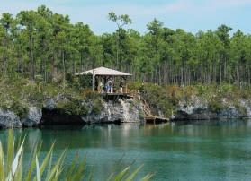
Providence and Inagua are working with the BNT to develop native tree nurseries and to re-plant areas with native vegetation. BNT is also working with local nurseries to promote the propagation of native trees and vegetation by these privatesector businesses. In the Bahamas, it is common practice to treat the wetlands as wastelands to be filled in to provide more land or to be dredged for canals and marinas. The work of the BNT through the West Indian Whistling-duck and Wetlands Conservation Program (a program of the Society for the Conservation and Study of Caribbean Birds) has gone some way to raising awareness of the critical importance of wetlands for biodiversity, as nursery grounds for economically important fisheries, and for coastal zone protection (including flood and hurricane damage mitigation). BNT has recently partnered with RARE Conservation to implement a Pride Campaign, a social marketing campaign to educate Bahamians about the value of wetlands and change the perception of them as “wastelands” or dumping grounds. The site focus for this Pride Campaign is Harrold and Wilsons Ponds National Park, one of the IBAs described below.
Biodiversity in the Bahamas is facing a constant threat by introduced or invasive species, both plants (e.g. Brazilian pepper Schinus terebinthefolius and casuarina Casuarina equisetifolia) and animals (e.g. feral cats Felis catus, raccoons Procyon lotor and wild hogs Sus scrofa ) alike. The historic and cultural practice of using small islands as natural corrals for goats has impacted the vegetation on many remote cays. The BNT is working with a Site Support Group to manage invasive plants at Harrold and Wilsons Ponds National Park, and with Friends of the Environments (another Site Support Group) in Abaco to manage the feral cat population. In the last two years, feral cats predated 50% of the “Bahama Parrot” Amazona leucocephala bahamensis nests on the island. Conservation agencies in conjunction with the BEST Commission have adopted, and are promoting, a National Invasive Species Policy.
■
■ ■ Birds
Over 300 species of bird have been recorded from the Bahamas, 109 of which breed on the islands, 169 are migrants that pass through the islands or winter, and 45 are vagrants that have occurred only a few times each. Only three breeding landbirds are summer visitors: Antillean Nighthawk Chordeiles gundlachii, Grey Kingbird Tyrannus dominicensis and Black-whiskered Vireo Vireo altiloquus. However, many of the seabirds are only present during their spring and summer breeding seasons. Neotropical migrants (that breed in North America) comprise c.50% of the total land bird population in the northern islands from November through March. The number and diversity of migrants declines from north to south through the islands. Bahamas Endemic Bird Area (EBA) restricted-range birds total seven extant species (see Table 1).
The “Bahama Parrot” has been the focus of research and conservation project actions such as the management of the predatory feral cat population on Abaco. (PHOTO: HENRY NIXON)
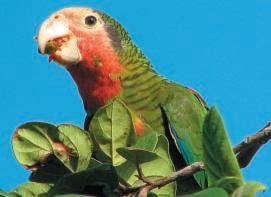
Table 1. Key bird species at Important Bird Areas in the Bahamas.
West Indian Whistling-duck Dendrocygna arborea
Audubon’s Shearwater Puffinus lherminieri
Caribbean Flamingo Phoenicopterus ruber
Reddish Egret Egretta rufescens
White-tailed Tropicbird Phaethon lepturus
Magnificent Frigatebird Fregata magnificens
Brown Pelican Pelecanus occidentalis
Masked Booby Sula dactylatra
Brown Booby Sula leucogaster
Piping Plover Charadrius melodus
Laughing Gull Larus atricilla
Gull-billed Tern Sterna nilotica
Royal Tern Sterna maxima
Sandwich Tern Sterna sandvicensis
Roseate Tern Sterna dougallii
Common Tern Sterna hirundo
Least Tern Sterna antillarum
Bridled Tern Sterna anaethetus
Noddy Anous stolidus
Pigeon Patagioenas leucocephala
Amazon Amazona leucocephala
Bahama Woodstar Calliphlox evelynae
Thick-billed Vireo Vireo crassirostris
Swallow Tachycineta cyaneoviridis
Thrasher Margarops fuscatus
Warbler Dendroica pityophila
Kirtland’s Warbler Dendroica kirtlandii
Bahama Yellowthroat Geothlypis rostrata
West Indian Whistling-duck Dendrocygna arborea VU
Audubon’s Shearwater Puffinus lherminieri
Caribbean Flamingo Phoenicopterus ruber ■
Reddish Egret Egretta rufescens
White-tailed Tropicbird Phaethon lepturus
Magnificent Frigatebird Fregata magnificens
Brown Pelican Pelecanus occidentalis
Masked Booby Sula dactylatra
Brown Booby Sula leucogaster ■
Piping Plover Charadrius melodus NT
Laughing Gull Larus atricilla
Gull-billed Tern Sterna nilotica
Royal Tern Sterna maxima
Sandwich Tern Sterna sandvicensis ■ 50–249
Roseate Tern Sterna dougallii ■ 50–24950–249
Common Tern Sterna hirundo ■
Least Tern Sterna antillarum ■ 50–24950–249
Bridled Tern Sterna anaethetus ■ 50–249250–99950–249
Sooty Tern Sterna fuscata
Brown Noddy Anous stolidus
White-crowned Pigeon Patagioenas leucocephala NT ■ <5050–249250–99950–249
Cuban Amazon Amazona leucocephala NT ■
Bahama Woodstar Calliphlox evelynae ■ ✓
Thick-billed Vireo Vireo crassirostris ■ 50–249
Bahama Swallow Tachycineta cyaneoviridis VU ■ ■
Bahama Mockingbird Mimus gundlachii ■ 50–249
Pearly-eyed Thrasher Margarops fuscatus ■
Olive-capped Warbler Dendroica pityophila ■ Kirtland’s Warbler Dendroica kirtlandii NT ■
Bahama Yellowthroat Geothlypis rostrata ■ <50
All population figures = numbers of individuals. Threatened birds: Vulnerable ■; Near Threatened ■ Restricted-range birds ■ Congregatory birds ■ Criteria
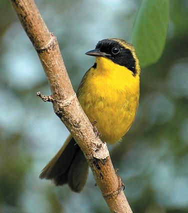
The Bahamas EBA includes the Turks and Caicos Islands (to the UK) with which the Bahamas share four of the restrictedrange birds, namely Bahama Woodstar Calliphlox evelynae , Bahama Mockingbird Mimus gundlachii , Pearly-eyed Thrasher Margarops fuscatus and Thick-billed Vireo Vireo crassirostris . Of the remainder, Olive-capped Warbler Dendroica pityophila occurs also in Cuba, but Bahama Yellowthroat Geothlypis rostrata and Bahama Swallow Tachycineta cyaneoviridis are endemic to the islands. The yellowthroat is common on Grand Bahama and Abaco, less common on Andros and Cat Island, uncommon on New Providence and non-existent on the other islands. The swallow is locally common and breeds on Grand Bahama, Abaco and Andros, less common on New Providence, and uncommon to non-existent in the central and southern Bahama Islands. An eighth restricted-range bird (and third national endemic) was the Brace’s Emerald Cholorostilbon bracei which is now extinct. It was known only from a single specimen collected in 1877. A subspecies of the Greater Antillean Oriole, Icterus dominicensis northropi is found only on Andros (where it is threatened), having been extirpated from Abaco.
Globally threatened birds in the Bahamas include the Vulnerable West Indian Whistling-duck Dendrocygna arborea and Tachycineta cyaneoviridis , and the Near Threatened White-crowned Pigeon Patagioenas leucocephala , Cuban Amazon Amazona leucocephala bahamensis , Piping Plover Charadrius melodus and Kirtland’s Warbler Dendroica kirtlandii Dendrocygna arborea only occurs on Andros, Inagua, Cat Island, Long Island and Exuma where significant numbers occur in a few areas (such as Hog Cay off Long Island). The species is protected by law under the Bahamas Wild Birds (Protection) Act. Tachycineta cyaneoviridis relies on pine forests for breeding, but the movements of the species outside the breeding season are poorly known although it appears that significant numbers over-winter in the country. Patagioenas leucocephala is a target for recreational hunting, but poaching and excessive hunting is common because although laws exist for the species’ protection, enforcement is inadequate. Charadrius melodus is an uncommon winter resident in the Bahamas although some specific beaches and tidal flat areas (which need to be designated as protected areas) do support significant numbers. Eleuthera supports the largest
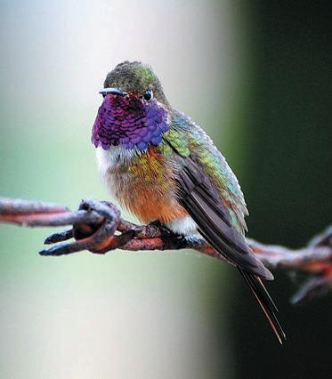
population of wintering Dendroica kirtlandii currently known, and is the focus of a multi-institutional initiative, the Kirtland’s Warbler Training and Research Program.
Over 14 species of seabirds breed in the Bahamas, but their preferred habitats of isolated cays with steep cliffs or rocky shorelines, and with low vegetation near to deep water, are being lost due to increased human uses of coastal areas through resort developments, disturbance, and increased pollution of near-shore waters. Seabird eggs (and adults) are also collected. Recent (2002–2006) surveys in the Northern Bahamas identified over 60 seabird breeding locations in Grand Bahama, Biminis, Berry Islands and Abacos showing just how important these northern islands are for their seabird populations.
The Bahama islands are of great importance to wetland birds, but their usage of individual wetland sites varies seasonally and between years depending on weather and local conditions. This suggests that a network of protected wetland sites is critical to the long-term viability of the nation’s waterbird populations. Large numbers of migratory shorebirds use these wetlands as stop-over sites and as wintering grounds, as do ducks and significant numbers of resident egrets and herons and other species. However, these waterbirds face many threats including draining and infilling of wetlands, contamination of food supplies, oil spills, introduced mammalian predators, disturbance, and hunting. However, conservation efforts can have a profound impact. In 1905, the National Audubon Society (BirdLife in the US) requested the Government of the Bahamas to provide legal protection for the Caribbean Flamingo Phoenicopterus ruber The government responded by passing the Wild Birds (Protection) Act. An initial attempt to save the flamingo breeding colonies on Andros failed in the 1950s, but a research program was established and a colony was discovered on Great Inagua. A 99-year lease was agreed, the Inagua National Park was established, and the flamingo colony (over the next 40 years) increased from less than 10,000 birds to over 40,000. Conservation of birdlife in the Bahamas has been concentrated on a few high-profile species such as the Caribbean Flamingo Phoenicopterus ruber , West Indian Whistling-duck Dendrocygna arborea , “Bahama Parrot” Amazona leucocephala bahamensis, White-crowned Pigeon Patagioenas
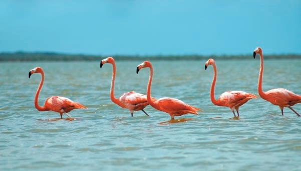
leucocephala and Kirtland’s Warbler Dendroica kirtlandii However, more attention is now being paid to critical sites (such as IBAs) and habitats (such as the dry forests) as well as the species themselves.
The Bahamas’ 39 IBAs—the nation’s international site priorities for bird conservation—cover 4,700 km² (including extensive marine areas). The IBAs include nine of the BNTmanaged national parks and protected areas. However, just two IBAs are protected in their entirety. Seven are part protected, part unprotected, while for 30 of the IBAs there is currently no legal protection.
The IBAs have been identified on the basis of 30 key bird species (listed in Table 1) that variously trigger the IBA criteria. These 30 species include six globally threatened birds (two Vulnerable and four Near Threatened), all seven restricted-range species, and 20 congregatory waterbirds/ seabirds.
Significant populations of the Bahamas’ key bird species are found in two or more IBAs. Also, as the IBAs are almost evenly split between the Northern, Central and Southern Bahamas, there is good geographic representation for most species (where this is possible) throughout the archipelago. For shear numbers, both the North Atlantic Abaco Cays IBA (BS005) and Cay Sal IBA (BS025) stand out as supporting the largest numbers of seabirds, while Great Inagua IBA (BS039) is home to the largest congregation of waterbirds.
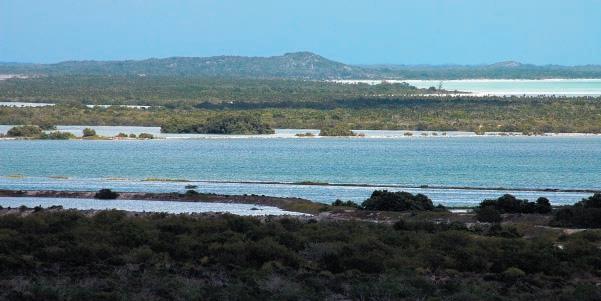
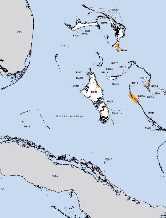
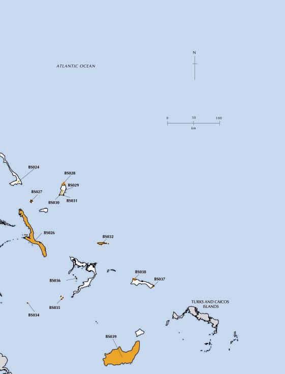
Monitoring currently being undertaken by local Site Support Groups, and also on some of the high profile species should be used to feed into the annual assessment of state, pressure and response variables at each of the Bahamas’ IBAs in order to provide an objective status assessment, and highlight management interventions that might be required to maintain these internationally important biodiversity sites. With over 75% of IBAs unprotected, key species monitoring and status assessments will be critical to lobby for protection and develop conservation strategies.
BAINTON, A. M. AND WHITE, A. W. (2006) A bibliography of birds, ornithology and birding in The Bahamas and Turks and Caicos Islands . Nassau, Bahamas: Media Enterprises Ltd.
BENDON, J. (1997) Moon over Mayaguana: return to Booby Cay. Iguana Times 6(4): 81–88.
ETHERIDGE, H. (2001) Yachtman’s guide to the Bahamas (including Turks and Caicos). Coral Gables: Tropic Island Publishers.
HALLETT, B. (2006) Birds of The Bahamas and the Turks and Caicos Islands . Oxford, U.K.: Macmillan Caribbean.
KUSHLAN , J. A. (2006) Seabird nesting and conservation in the northern Bahamas. (Unpublished report for the Bahamas National Trust).
RAFFAELE, H. WILEY J., G ARRIDO, O., KEITH, A. AND RAFFAELE, J. (1998) A guide to the birds of the West Indies. Princeton, New Jersey: Princeton University Press.
SEALEY, N. E. (1994) Bahamian landscapes: an introduction to the geography of the Bahamas. Nassau, Bahamas: Media Publishing Ltd.
COORDINATES 26°36’N 78°28’W
ADMIN REGION Grand Bahama
AREA 16 ha
ALTITUDE 0–4 m
HABITAT Forest, wetland
SPRUNT, A. (1984) The status and conservation of seabirds of the Bahama Islands. Pp157–168 in J. P. Croxall, P. G. H. Evans and R. W. Schreiber eds. Status and conservation of the world’s seabirds . Cambridge, U.K.: International Council for Bird Preservation (ICBP Techn. Publ. 2).
SUTTON , A. H., Sorenson, L. G. and Keeley, M. A. (2001) Wondrous West Indian wetlands: teachers’ resource book . Boston, Mass.: West Indian Whistling-Duck Working Group of the Society of Caribbean Ornithology.
WARDLE, C. AND MOORE, P. (2006) Important Bird Area program field trip to Mangrove Cay and South Andros. Nassau: Bahamas National Trust. (Unpublished field trip report).
WARDLE, C. AND MOORE, P. (2007) Important Bird Area program field trip to Cat Island. Nassau: Bahamas National Trust. (Unpublished field trip report).
WARDLE, C. AND MOORE, P. (2007) Important Bird Area program field trip to South Andros. Nassau: Bahamas National Trust. (Unpublished field trip report).
WHITE, A. W. (1998) A birder’s guide to the Bahama Islands (including Turks and Caicos). Colorado Springs, Colorado: American Birding Association.
The authors would like to thank the BNT Ornithology Group, The Sam Nixon Bird Club (Inagua), Carolyn Wardle, Henry Nixon, Anthony White, Herb Rafaelle, Bruce Hallett, Rosemarie Guam, William Mackin, Lisa Sorenson, Jim Kushlan, William Hayes, David Ewert, Joe Wunderle, Kim Thurlow, The Nature Conservancy Bahamas Programme, Morton Bahamas Ltd., Friends of the Environment, Anita Knowles, David Knowles, Caroline Stahala and Frank Rivera for their invaluable contributions to bird conservation in the Bahamas, and thus to the development of the Important Bird Area program. 1

National Park
THREATENED BIRDS
RESTRICTED-RANGE BIRDS

■ Site description
Lucayan National Park IBA encompasses a section of southcentral Grand Bahama including the tidal Gold Rock Creek and adjacent beach. The IBA supports a wide diversity of habitats including a tall dune system, mixed scrub, wet coppice, pine forest, mangrove swamp and beach. Within the park, Ben’s Cave and Burial Ground Cave are entrances to one of the longest underwater cave system in the world. Explorers have found pre-Columbian human skeletons and artefacts in Burial Mound Cave. The Grand Bahama South Shore IBA (BS003) adjoins the park to the west.
■ ■ Birds
This IBA is significant for supporting three (of the 7) Bahamas EBA restricted-range birds, namely Thick-billed Vireo Vireo crassirostris, Bahama Swallow Tachycineta cyaneoviridis and Olive-capped Warbler Dendroica pityophila Tachycineta cyaneoviridis is Vulnerable, and is regularly seen in the Lucayan National Park during the breeding season. The key bird species are all confined to the coppice and pine forest north of the
3
BIOME-RESTRICTED BIRDS
CONGREGATORY BIRDS
east–west Queen’s Highway. Waterbirds frequent the mangrove swamps, and shorebirds and terns occur along the beach.
■ ■ ■ ■ ■ Other biodiversity
The recently discovered Lucayan oar-foot “shrimp” Spelionectes lucayensis is endemic to the caves in this IBA. The Bahamas blind cave fish Lucifuga (Stygicola) spelaeotes (a Bahamian endemic) occurs. Buffy flower bat Erophylla sezekorni occurs in Ben’s Cave during the summer. Two endemic orchids Encyclia fucata and Cattleyopsis lendenii flourish in the park
■ ■ ■ ■ Conservation
Lucayan National Park IBA is managed by BNT, and there is a boardwalk through the mangroves at Gold Rock Creek. Speculative proposals to develop a resort in eastern Grand Bahama could impact on the borders of this IBA, and developments are occurring all the time outside of the national park. Natural forest fires within the pine forest are a threat that needs management.
COORDINATES 26°33’N 78°30’W
ADMIN REGION Grand Bahama
AREA 435 ha
ALTITUDE 0–1 m
HABITAT Rocky areas, sea, shrubland

National Park/Unprotected
■ ■ ■ ■ Site description
Peterson Cay National Park IBA lies c.2 km offshore on the south (leeward) side of Grand Bahama, c.2 km east of the entrance to the Grand Lucayan Waterway. It is a windswept and sparsely vegetated limestone island, and the only cay on the south side of Grand Bahama. The cay has a rocky shoreline with a sandy beach on the north side, and shrubland on the top of the cay. Shallow sand bars and coral reefs extend to the west of the cay. The IBA includes all marine areas up to 1 km from the cay.
■ ■ Birds
This IBA supports a globally significant nesting colony of Bridled Tern Sterna anaethetus, with 160 pairs found in 2005.
■ ■ Other biodiversity
No globally threatened or restricted-range species have been recorded.
■ ■ Conservation
RESTRICTED-RANGE BIRDS
BIOME-RESTRICTED BIRDS
CONGREGATORY BIRDS
Peterson Cay National Park IBA is crown owned, and managed as a national park (the smallest in the Bahamas) by BNT. Marine areas up to 500 m from the cay are protected as part of the national park, leaving some of the marine areas of the IBA unprotected. The cay is uninhabited, but is actively used for ecotourism by resident kayak tour guides and resident and visiting boaters. There is potential for uncontrolled tourism to introduce predators such as rats Rattus spp. (or indeed other animals) to the cay. It is not know if this has already happened. Disturbance to the tern colony is also a threat, and the extent to which this already happens is unknown.
COORDINATES 26°38’N 78°06’W
ADMIN REGION Grand Bahama
AREA 44 ha
ALTITUDE 0–3 m
HABITAT Rocky areas, coastline, shrubland
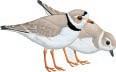
THREATENED BIRDS
RESTRICTED-RANGE BIRDS
BIOME-RESTRICTED BIRDS
CONGREGATORY BIRDS
■
■ Site description
The Grand Bahama South Shore IBA extends along the south coast of Grand Bahama from the Grand Lucayan Waterway’s south entrance eastward for c.11 km through the settlement of Ole Freetown and on to the western boundary of the Lucayan National Park (IBA BS001). It comprises a long stretch of uninterrupted sandy beach, beach flats and dunes including Barbary beach
■ ■ ■ ■ ■ Birds
This IBA is significant for the Near Threatened Piping Plover Charadrius melodus which winters on the beach along with a range of other shorebirds, and also herons and egrets. During the 2006 census 70 Charadrius melodus were recorded at this site.
■ ■ Other biodiversity
Nothing recorded.
■ Conservation
Grand Bahamas South Shore IBA is crown land but is unprotected. It is a popular beach for recreational activity, attracting hundreds of residents and tourist alike. There are small restaurant and bar developments along the beach (outside of the IBA), but currently no large developments (as yet). The heavy recreational use of the beach causes disturbance to C. melodus and other wintering shorebirds. Invasive alien Casuarina trees threaten the stability of the beach, and the native vegetation behind the beach.
COORDINATES 26°53’N 77°41’W
ADMIN REGION Abaco
AREA 16,428 ha
ALTITUDE 0–3 m
HABITAT Forest, shrubland, rocky areas, coastline

■ ■ Site description
Little Abaco IBA is at the northernmost end of Abaco where it is just 15 km north of Grand Bahama. Little Abaco extends for about 30 km west of the northern point of Great Abaco Island (at Angel Fish Point) to which it is joined by a short causeway (“the bridge”). The island supports extensive tracts of virgin Caribbean pine Pinus caribaea forest, and has long stretches of sandy beach. There are five settlements: Crown Haven (at the westernmost tip), Fox Town, Wood cay, Mount Hope and Cedar Harbour.
■ Birds
The pine forests in this IBA support four (of the seven) Bahamas EBA restricted-range birds, namely Bahama Woodstar Calliphlox evelynae , Thick-billed Vireo Vireo crassirostris, Olive-capped Warbler Dendroica pityophila and Bahama Yellowthroat Geothlypis rostrata . The resident endemic race of Yellow-throated Warbler Dendroica dominica also occurs.
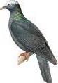
THREATENED BIRDS
RESTRICTED-RANGE BIRDS
BIOME-RESTRICTED BIRDS
CONGREGATORY BIRDS
A sizeable population of the Near Threatened White-crowned Pigeon Patagioenas leucocephala breeds. Little Abaco can be the first landfall for many Neotropical migrants in the fall.
■ ■ Other biodiversity
No globally threatened or restricted-range species have been recorded.
■
Conservation
Little Abaco IBA is a mixture of crown and private lands, but it is currently unprotected. The pine forest in the IBA is thought to be the oldest, and only remaining virgin stand in the Bahamas. However, it is being degraded through illegal clearance, bulldozing and other human activities. The Government is currently building a trash transfer station within the pine forest, and as the human population of Abaco increases, the pressure on the forest for development and lumber will intensify.
COORDINATES 26°53’N 77°33’W
ADMIN REGION Abaco
AREA 41,165 ha
ALTITUDE 0–1 m
HABITAT Rocky areas, sea, shrubland
■ ■ Site description
North Atlantic Abaco Cays IBA embraces the cays along the northern and north-eastern edge of the Little Bahama Bank. It runs from the 1,555-ha Walker’s Cay National Park in the north (the northernmost point of the Bahamas), east and south-east to Scotland Cay (north of Marsh Harbour) including Pensacola, Spanish, Powell, Manjack, Green Turtle, Whale and Great Guana cays, and many isolated rocks. The vegetation on many of the cays comprises fringing mangroves and scrub. Gilliam Bay, at the south-east point of Green Turtle Cay, has extensive sand and mudflats at low tide.
■ Birds
This IBA is significant for its breeding seabirds. The breeding populations of Laughing Gull Larus atricilla, Roseate Tern Sterna dougallii, Least Tern S. antillarum and Bridled Tern S. anaethetus are globally important. Those of Audubon’s Shearwater Puffinus lherminieri , White-tailed Tropicbird Phaethon lepturus , Magnificent Frigatebird Fregata magnificens, Brown Pelican Pelecanus occidentalis, Sooty Tern
THREATENED BIRDS
RESTRICTED-RANGE BIRDS
BIOME-RESTRICTED BIRDS
CONGREGATORY BIRDS
S. fuscata and Brown Noddy Anous stolidus are regionally so. Brown Booby Sula leucogaster also breeds and the flats at Gilliam Bay support many shorebirds.
■ ■ Other biodiversity Nothing recorded.
■ ■ ■ ■ Conservation
North Atlantic Abaco Cays IBA is a mixture of private and crown ownership. Walker’s Cay is protected as a national park and managed by BNT. This includes a large marine area as well as the cay. The rest of the IBA is unprotected. Many of the cays are uninhabited. Others are sparsely populated all or part of the year. Game and commercial fishing and tourism related activities are the primary occupation of the residents within the IBA. Threats include illegal egg collecting and hunting, clearance for development, pollution (from urban developments and visiting boaters), disturbance, and introduced alien predators.
BS006 Southern Abaco
COORDINATES 25°58’N 77°13’W
ADMIN REGION Abaco AREA 23,836 ha
ALTITUDE 0–6 m
HABITAT Pine forest, shrubland, dry forest, coast, cliff, wetland
■ ■ ■ ■ Site description
Southern Abaco IBA embraces a large swathe of southern Abaco including the 8,296-ha Abaco National Park, and areas up to the east coast of southern Abaco, Hole-in-the-Wall at the southernmost tip of the island (where there are some low, coastal cliffs), and areas to the west of the park. Most of the IBA comprise undeveloped Caribbean pine Pinus caribaea forest and black land coppice.

THREATENED BIRDS
RESTRICTED-RANGE BIRDS
BIOME-RESTRICTED BIRDS
CONGREGATORY BIRDS
Quail-dove Geotrygon chrysia . A regionally significant population of White-tailed Tropicbird Phaethon lepturus breed at Hole-in-the-Wall.
■ Other biodiversity
The Atala hairstreak butterfly Eumaeus atala (confined to southern Florida, Cuba and Bahamas) is abundant in the pine forests of southern Abaco.
■
■ ■ ■ ■ Birds
The IBA is significant for supporting the majority of the Abaco population of the Near Threatened Cuban Amazon (“Bahama Parrot”) Amazona leucocephala. Surveys in 2006 estimated c.3,600 individuals. Based on a number of recent sightings, small numbers of the Near Threatened Kirtland’s Warbler Dendroica kirtlandii are thought to winter in the IBA. The pine forests support good populations of four (of the seven) Bahamas EBA restricted-range birds, namely Bahama Woodstar Calliphlox evelynae, Bahama Mockingbird Mimus gundlachii, Olive-capped Warbler Dendroica pityophila and Bahama Yellowthroat Geothlypis rostrata . The resident race of Yellow-throated Warbler Dendroica dominica also occurs, as do Cuban Emerald Chlorostilbon ricordii and Key West
COORDINATES 25°13’N 78°11’W
ADMIN REGION Andros
AREA 1,369 ha
ALTITUDE 0–7 m
HABITAT Coastlne, forest, shrubland
■ ■ ■ Conservation
Over 40% of this IBA is protected within the Abaco National Park which was established in 1994, primarily to protect the “Bahama Parrot”. The parrot nests in limestone sinkholes within the pine forest areas, but uses the coppice extensively for feeding. BNT has developed a management plan for the park, and for the parrot which is vulnerable to predation by feral cats, introduced racoons and other predators. Game and pig hunting takes place in the park and surrounding areas which are primarily privately owned and unprotected. Fire is a significant threat and has been the focus of significant conservation efforts. The parrot has also been the focus of much conservation and research attention.
Site description
Red Bays IBA it at the northernmost end of Andros island, on the west coast. It is centred on the settlement of Red Bay, the only settlement on the west coast of Andros. It was founded in the 1800s by Seminole Indians and escaped slaves from Florida. Sponge fishing is an active occupation as is the unique woven straw work produced by the residents. The IBA embraces a diverse area of Caribbean pine Pinus caribaea forest, broadleaf coppice, mangroves, shoreline scrub and beach. There is some small-scale agriculture (mostly slashand-burn agriculture) with second-growth vegetation taking over abandoned areas.
■ ■ Birds
This IBA supports regionally significant numbers of wintering Laughing Gull Larus atricilla and breeding Royal Tern Sterna maxima . Six (of the seven) Bahamas EBA restricted-range birds occur, including the Vulnerable Bahama Swallow
THREATENED BIRDS
RESTRICTED-RANGE BIRDS
BIOME-RESTRICTED BIRDS
CONGREGATORY BIRDS
Tachycineta cyaneoviridis . The Near Threatened Whitecrowned Pigeon Patagioenas leucocephala is found in significant numbers. Other species such as Cuban Emerald Chlorostilbon ricordii, Western Spindalis Spindalis zena and Great Lizard-cuckoo Coccyzus merlini are present, and the endemic subspecies of Greater Antillean Oriole Icterus dominicensis northropi occurs in the coconut palm trees within the Red Bay settlement. A diversity of waterbirds frequents the coast.
■ ■ Other biodiversity
Nothing recorded.
■ Conservation
Red Bays IBA is a mixture of crown and privately owned land and is unprotected. Local development (in the form of slash-and-burn to cultivate and build) is causing some habitat destruction, and there is disturbance to breeding seabirds.
COORDINATES 25°03’N 78°02’W
ADMIN REGION Andros
AREA 1 ha
ALTITUDE 0–10 m
HABITAT Wetland, shrubland
■ ■ Site description
San Andros Pond IBA is located in northern North Andros where it is situated within the security boundary at the San Andros Airport. It comprises a small freshwater pond with associated shrubland and coppice (but also cultivated fields and verges associated with the airport). The pond is immediately surrounded by overgrown vegetation. The IBA is situated within the airport security boundary.
■ ■ ■ Birds
This IBA supports a significant number of Vulnerable West Indian Whistling-duck Dendrocygna arborea . The current status of the ducks is unknown since the sides of the pond became overgrown thus precluding easy observation. The Vulnerable Bahama Swallow Tachycineta cyaneoviridis also occurs at the IBA in good numbers. Three (of the seven) Bahamas EBA restricted-range birds occur, namely Bahama
THREATENED BIRDS
RESTRICTED-RANGE BIRDS
BIOME-RESTRICTED BIRDS
CONGREGATORY BIRDS
Woodstar Calliphlox evelynae, T. cyaneoviridis and Bahama Yellowthroat Geothlypis rostrata. The pond attracts a range of waterbirds while the coppice is important for wintering Neotropical migrant landbirds.
■ ■ Other biodiversity
Nothing recorded.
■
Conservation
San Andros Pond IBA is on a mix of crown and private lands, and is within the airport security boundary. Access is restricted within the airport boundary due to increased security measures, and the pond can only be visited by special permission. This provides the pond and the associated birds some degree of de facto protection. However, any expansion of the airport could easily destroy this IBA.
COORDINATES 24°47’N 77°53’W
ADMIN REGION Andros
AREA 8,536 ha
ALTITUDE 0–10 m
HABITAT Wetland, forest, shrubland, coastline
■ ■ Site description
Stafford Creek to Andros Town IBA embraces a large tract of land extending along the north-east coast of Central Andros from the settlements of Stafford Creek in the north, through Staniard Creek and Coakley Town to Andros Town (also known as Fresh Creek) in the south. It encompasses the sandy beach flats, Caribbean pine Pinus caribaea forest, broadleaf coppice, wetland, and inland blue holes. In extends inland to include the Blue Hole National Park. The area is used for large scale domestic and commercial agriculture; fly, sport, and commercial fishing; and ecotourism, general tourism and research.
■ Birds
This IBA supports important populations of four (of the seven) Bahamas EBA restricted-range birds, namely Bahama Woodstar Calliphlox evelynae, Bahama Swallow Tachycineta cyaneoviridis , Bahama Mockingbird Mimus gundlachii and Bahama Yellowthroat Geothlypis rostrata Tachycineta cyaneoviridis is a Vulnerable species. Up to 85 Near Threatened Piping Plover Charadrius melodus have been recorded wintering along this stretch of coast. Other characteristic birds within the IBA include Great Lizard-
THREATENED BIRDS
RESTRICTED-RANGE BIRDS
BIOME-RESTRICTED BIRDS
cuckoo Coccyzus merlini, Key West Quail-dove Geotrygon chrysia , Cuban Emerald Chlorostilbon ricordii and many others.
■ Other biodiversity
■
The Vulnerable rock iguana Cyclura cychlura cychlura occurs throughout the pine and coppice areas.
■ ■ ■ ■ ■ Conservation
Stafford Creek to Andros Town IBA is a mix of crown and private lands, most of which is unprotected. However, the western portion of the IBA (including areas of pine forest and coppice) is protected within the Blue Holes National Park (managed and being developed for visitation by the BNT). Offshore from the beaches (and just outside) of this IBA is the Andros Barrier Reef National Park. There are two research centres within the IBA: Forfar Field Station, midway between Stafford and Staniard Creeks, which is a field site of the International Field Studies Program; and the Bahamas Environmental and Research Centre located at Staniard Creek, a joint project of George Mason University and College of the Bahamas. Development and agriculture threaten vital habitats and hunting causes disturbance to the birds.
BS010 Owenstown
COORDINATES 24°53’N 78°01’W
ADMIN REGION Andros
AREA 1,535 ha
ALTITUDE 0–12 m
HABITAT Forest, shrubland
■ ■ ■ ■ Site description
Owenstown IBA is in northern Central Andros, inland from the northern end of the Stafford Creek to Andros Town IBA (BS009). It comprises the former commercial lumber settlement of Owenstown, on the north bank of Stafford Creek, and includes the western portion of the creek. The town was abandoned after major deforestation of the native Caribbean pine Pinus caribaea forest in the 1970s and is now overgrown with landscaping vegetation and weeds. Some native trees have returned. The habitat immediately surrounding the town consists of pine forest, broadleaf coppice and coconut palms. The area remains uninhabited.
■ ■ Birds
This IBA supports important populations of four (of the seven) Bahamas EBA restricted-range birds, namely Bahama Woodstar Calliphlox evelynae, Bahama Mockingbird Mimus gundlachii, Olive-capped Warbler Dendroica pityophila and
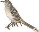
THREATENED BIRDS
RESTRICTED-RANGE BIRDS
BIOME-RESTRICTED BIRDS
CONGREGATORY BIRDS
Bahama Yellowthroat Geothlypis rostrata . Other characteristic birds within the IBA include the endemic subspecies of Greater Antillean Oriole Icterus dominicensis northropi , Greater Antillean Bullfinch Loxigilla violacea , Western Spindalis Spindalis zena, Northern Bobwhite Colinus virginianus and many Neotropical migrant warblers. Stafford Creek supports many waterbirds, including Black Rail Laterallus jamaicensis
■ ■ ■ Other biodiversity
Nothing recorded.
■ Conservation
Owenstown IBA is on crown land but is currently unprotected. As an abandoned town there are seemingly no threats although there has been little research in this area to support this assumption.
COORDINATES 24°14’N 77°39’W
ADMIN REGION Andros
AREA 2,228 ha
ALTITUDE 0–7 m
HABITAT Forest, coastline, shrubland, wetland
■
Site description
Mangrove Cay IBA lies between Middle Bight and South Bight in the middle of Andros, with Bog Wood Cay to the north, and South Andros Island to the south. Settlements are confined to the east coast of the island where a mangrove creek runs parallel to the seashore behind a sand dune. The west side of the island is uninhabited. The island consists of Caribbean pine Pinus caribaea forest, broadleaf coppice, freshwater blue holes, inland wetlands and mangroves and beaches. There is some agriculture practiced around the settlements.
■ ■ Birds
This IBA supports populations of four (of the seven) Bahamas EBA restricted-range birds, namely Bahama Woodstar Calliphlox evelynae , Thick-billed Vireo Vireo crassirostris, Bahama Mockingbird Mimus gundlachii and Bahama
THREATENED BIRDS
RESTRICTED-RANGE BIRDS
BIOME-RESTRICTED BIRDS
CONGREGATORY BIRDS
Yellowthroat Geothlypis rostrata. The IBA is also significant for the Near Threatened White-crowned Pigeon Patagioenas leucocephala . The mangrove creek supports wintering shorebirds and other waterbirds.
■ Other biodiversity
Nothing recorded.
■ ■ ■ Conservation
Mangrove Cay is a mix of private and crown land, but is currently unprotected. The communities of Moxey Town, Bastian Point and Lisbon Creek are expanding and the gradual development is resulting in habitat loss and fragmentation. The mangrove creek has been severely degraded in places by causeways and other obstacles cutting off the flow of water. There has been little research of conservation activity on Mangrove Cay.
COORDINATES 24°03’N 77°34’W
ADMIN REGION Andros
AREA 10,060 ha
ALTITUDE 0–5 m
HABITAT Wetland, shrubland, coastline
■ ■ Site description
Driggs Hill to Mars Bay IBA is on the eastern side of South Andros Island. From Driggs Hill at the northernmost tip of South Andros it runs south (following the road) for c.48 km through Congo Town, The Bluff, Kemp’s Bay, over deep creek and Little Creek to Mars Bay in the south. The IBA extends c.5 km inland from the east coast, and embraces a number of blue holes including Rat Bat Lake and Twins, north of Congo Town airport, and Nine Tasks Blue Hole and Evelyn Green Blue Hole south of The Bluff. The IBA supports impenetrable shrubland coppice and unexplored wetlands, numerous creeks and a shallow shoreline with tidal flats. The human population is small and focus on low key agriculture, fishing and tourism activities
■ Birds
This IBA supports populations of four (of the seven) Bahamas EBA restricted-range birds, namely Bahama Woodstar Calliphlox evelynae , Thick-billed Vireo Vireo crassirostris, Bahama Mockingbird Mimus gundlachii and Bahama Yellowthroat Geothlypis rostrata. The IBA is also significant for the Near Threatened White-crowned Pigeon Patagioenas leucocephala . Mars Bay is important for wintering Near
COORDINATES 25°01’N 77°34’W
ADMIN REGION New Providence
AREA 412 ha
ALTITUDE 0 m
HABITAT Rocky areas, sea, shrubland
THREATENED BIRDS
RESTRICTED-RANGE BIRDS
BIOME-RESTRICTED BIRDS
CONGREGATORY BIRDS
Threatened Piping Plover Charadrius melodus. Other species present in the IBA include Great Lizard-cuckoo Coccyzus merlini , the endemic subspecies of Greater Antillean Oriole Icterus dominicensis northropi and the Bahamas only known nesting site for Cave Swallow Petrochelidon fulva (in limestone cavities in Nine Tasks Blue Hole and at Twins Blue Hole). The IBA also supports many waterbirds.
Other biodiversity
The Vulnerable Andros rock iguana Cyclura cychlura cychlura occurs in this IBA.
■ ■ Conservation
Driggs Hill to Mars Bay IBA is a mix of private and crown land, but is unprotected. The ecosystem is currently relatively intact, although development is an ever-present threat while this IBA remains unprotected. The IBA is one of the premier Patagioenas leucocephala hunting sites in the Bahamas, and this should be monitored in relation to annual population estimates for this Near Threatened bird. Disturbance (by people and dogs) of shorebirds (especially Charadrius melodus) on the tidal beach flats is a problem that needs to be monitored and managed.

■ ■ Site description
Goulding Cay IBA lies 3 km off the westernmost end of New Providence. It is directly offshore of Jaws Beach, near Lyford Cay. Goulding Cay is a 4-ha uninhabited offshore rocky cay with low coastline vegetation such as bay marigolds, bay lavender, bay cedar, sea purslane and railroad vines. The IBA includes all marine areas within 1 km of the cay.
■ ■ ■ Birds
This IBA is seabird colony. Regionally significant numbers of Bridled Tern Sterna anaethetus and Brown Noddy Anous stolidus nest on the cay each summer (May–August). Sooty Tern S. fuscata also breed on the cay.
■ ■ ■ ■ Other biodiversity Nothing recorded.
■ ■ Conservation
THREATENED BIRDS
RESTRICTED-RANGE BIRDS
BIOME-RESTRICTED BIRDS
CONGREGATORY BIRDS
Goulding Cay Wild Bird Reserve is crown owned land and legally recognised reserve, making hunting on the island illegal. However, formal protected status has yet to be granted by the government. The BNT Ornithology Group has been monitoring the seabirds since 2004 with little apparent change in the populations being counted each year. There is no evidence of egg collecting or indeed of the presence of rats Rattus spp. on the island, and disturbance from tourist and diving boats (the cay is a popular dive site, but landing is difficult) appears to be minimal.
COORDINATES 25°02’N 77°22’W
ADMIN REGION New Providence AREA 81 ha
ALTITUDE 0–5 m
HABITAT Wetlands, shrubland
■ ■ ■ ■ Site description
Harrold and Wilson Ponds National Park IBA is in central New Providence, south-west of Nassau. It encompasses a large area of freshwater ponds with areas of mud, and fringing vegetation of reeds, sedge, broadleaf coppice and some pine lands. Being so close to the nation’s capital agriculture and commercial and residential development had encroached on the site before it was designated a national park in 2002.
■ ■ ■ ■ ■ Birds
This IBA supports a diversity of species and is particularly important for its waterbirds. The population of Laughing Gull Larus atricilla is globally significant, while those of Gull-billed Tern Sterna nilotica and Royal Tern S. maxima are regionally so. Large numbers of cormorants, herons, egrets, ibises, ducks and shorebirds frequent the IBA. The Near Threatened Whitecrowned Pigeon Patagioenas leucocephala occurs, as does the Vulnerable Bahama Swallow Tachycineta cyaneoviridis which is one of three Bahamas EBA restricted-range birds to be found around the ponds.
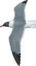
■ ■ Other biodiversity Nothing recorded.
■ ■ Conservation
THREATENED BIRDS
RESTRICTED-RANGE BIRDS
BIOME-RESTRICTED BIRDS
CONGREGATORY BIRDS
Harrold and Wilson Ponds National Park IBA is a mix of crown and private lands. However, the area is now designated a national park under the management of the BNT. Being so close to Nassau, this IBA is an ideal educational and ecotourism site, and an interpretation and public use plan has been developed. Implementation of this plan has started (2007) and boardwalks, observation platforms and educational signage have been installed. The IBA still faces the threat of pollution from adjacent housing developments (and squatters) and dumping and infill to “reclaim” land. A commercial chicken farm has been closed down and the land will be annexed to the park. Invasive plants such as Casuarina and Brazilian pepper crowd out native species, but are the focus of a BNT invasive species management project in the park.
COORDINATES 25°00’N 77°19’W
ADMIN REGION New Providence AREA 376 ha
ALTITUDE 0–6 m
HABITAT Coastline, shrubland, wetland, rocky areas
■
Site description
South Beach Tidal Flats IBA extends along c.3 km of New Providence’s south-eastern coastline. It follows the line of Marshall Road, from Blue Hill Road, south-west towards Cay Point. The IBA is characterised by sand and limestone tidal flats, with rocky banks supporting low mangroves. It also includes some freshwater wetlands just inland of the beach, and shrublands adjacent to the beach.
■ ■ ■ ■ ■ Birds
This IBA is significant for its wintering population of the Near Threatened Piping Plover Charadrius melodus. The numbers of Laughing Gull Larus atricilla and Royal Tern Sterna maxima are regionally important. Large numbers of a wide diversity of shorebirds use this IBA as a stop-over site and as wintering habitat. Least Tern S. antillarum are common in the nesting season, migrant warblers and resident land birds
THREATENED BIRDS
RESTRICTED-RANGE BIRDS
BIOME-RESTRICTED BIRDS
CONGREGATORY BIRDS
can be found in the shrubland along the shoreline, and the freshwater wetlands Marshall Road support a wide range of waterbirds.
■ Other biodiversity
Nothing recorded.
■ ■ Conservation
South Beach Tidal Flats IBA comprises crown lands (the tidal zone) and private lands inland, none of which is currently protected. The population in this area is expanding rapidly leading to habitat destruction from development and disturbance of birds by people and dogs. The shoreline is a popular beach and picnic area, and it is also a favoured launching point for resident fishermen. Pollution from adjacent developments and illegal dumping are additional threats to this IBA.
COORDINATES 25°09’N 77°03’W
ADMIN REGION New Providence
AREA 968 ha
ALTITUDE 0–2 m
HABITAT Sea, rocky areas, shrubland
■ ■ Site description
Salt Cay IBA is an island c.5 km north-east of Nassau, and c.1.5 km north of the eastern end of Paradise Island. Also known as Blue Lagoon Island, it is the easternmost island in a chain of cays that extends towards Eleuthera. The island has been much altered over time. Originally supporting a salt marsh, this was dredged out in the 1900s and connected to the sea to make the lagoon. Over 5,000 palm trees were planted at this time. The eastern end of the island is a popular tourism and recreation destination. The western end is very narrow and rocky. The island, which is c.3 km long, supports shrubland and has a mix of sandy and rocky shoreline. The IBA includes marine areas up to 1 km from the cay.
■ Birds
This IBA is regionally significant for its population of Laughing Gull Larus atricilla. Many wintering shorebirds occur, and Roseate Tern Sterna dougallii is reported to nest
Laughing Gull
THREATENED BIRDS
RESTRICTED-RANGE BIRDS
BIOME-RESTRICTED BIRDS
CONGREGATORY BIRDS
although numbers are unknown. White-cheeked Pintail Anas bahamensis nest on Salt Cay, but move their young to Paradise Island once they have fledged.
■ ■ Other biodiversity Nothing recorded.
■ ■ ■ ■ Conservation
Salt Cay IBA is privately owned and unprotected. The eastern end of the island is heavily used by day visitors (taking boat trips from Nassau). Dolphin Encounters—a natural seawater dolphin experience facility—is based around the lagoon and is one of the Bahamas’ premier tourist attractions. Further development will impact three breeding seabirds. It is unknown what introduced predators are present on the island, although it is likely that rats Rattus spp. occur and are predating gull and tern eggs and chicks.
COORDINATES 25°05’N 77°11’W
ADMIN REGION New Providence AREA 825 ha
ALTITUDE 0–1 m
HABITAT Rocky areas, sea, shrubland
■ ■ Site description
Booby Island IBA lies 22 km north-east of the eastern end of New Providence, towards the western end of the chain of cays that extends towards Eleuthera. It is north-east of Rose island. Booby Island is 3 km long and less than 100 m wide, and has a low, rocky coralline shoreline that makes access difficult. It supports minimal vegetation such as sea purslane, bay cedar and other salt resistant plants. The IBA includes marine areas up to 1 km from the island.
■ ■ Birds
This IBA supports a number of breeding seabirds. The population of Roseate Tern Sterna dougallii is globally significant, while those of Laughing Gull Larus atricilla, Least Tern S. antillarum and Bridled Tern S. anaethetus are

THREATENED BIRDS
RESTRICTED-RANGE BIRDS
BIOME-RESTRICTED BIRDS
CONGREGATORY BIRDS
✔
regionally so. Brown Noddy Anous stolidus , Sooty Tern S. fuscata and Brown Booby Sula leucogaster also breed in the IBA. A range of shorebirds have been recorded.
■ ■ Other biodiversity
Nothing recorded.
■ ■ ■ ■ Conservation
Booby Island IBA is crown land but is unprotected. The BNT Ornithology Group visited the island to count breeding seabirds in September 2007 which could form the baseline for monitoring this important seabird island. Rats Rattus spp. and illegal egg collecting are potential but unconfirmed problems.
COORDINATES 24°48’N 76°12’W
ADMIN REGION Eleuthera
AREA 17,505 ha
ALTITUDE 0–7 m
HABITAT Shrubland, wetland, coastline
■ ■ ■ ■ Site description
South Tarpum Bay IBA embraces the southern third of Eleuthera Island. It extends from Tarpum Bay and Winding Bay in the north for c.35 km through Rock Sounds to Bannerman Town at the southernmost end of the island. The IBA is a mosaic of small agricultural and fishing settlements, small agricultural plots, mature broadleaf coppice of varying heights, abandoned plantation, shrubland, coastal coppice and beach habitats.

THREATENED BIRDS
RESTRICTED-RANGE BIRDS
BIOME-RESTRICTED BIRDS
CONGREGATORY BIRDS
Lizard-cuckoo Coccyzus merlini and Greater Antillean Bullfinch Loxigilla violacea also occur.
■ ■ Other biodiversity
No globally threatened or endemic terrestrial species have been recorded.
■ ■ Conservation
■
■
■ ■ Birds
This IBA supports the largest known concentration of wintering Near Threatened Kirtland’s Warbler Dendroica kirtlandii which was discovered in the IBA in 2002. During the winter 2003–2004 at least 60 birds were recorded at 15 different locations in southern Eleuthera. The Near Threatened White-crowned Pigeon Patagioenas leucocephala also occurs in significant numbers, and four (of the seven) Bahamas EBA restricted-range birds, namely Bahama Woodstar Calliphlox evelynae , Bahama Yellowthroat Geothlypis rostrata , Thick-billed Vireo Vireo crassirostris and Bahama Mockingbird Mimus gundlachii are present. Great
COORDINATES 24°44’N 76°50’W
ADMIN REGION Exumas
AREA 745 ha
ALTITUDE 0–2 m
HABITAT Coastline, rocky areas, shrubland, sea
South Tarpum Bay IBA is a mix of crown and privately owned land, but none of it is protected. Habitat is being lost as a result of increased residential and resort development, and slash-and-burn land clearance is common. The BNT Ornithology Group discovered D. kirtlandii in this IBA in 2002 since when the species has been the focus of an intensive, multiinstitutional research program (the Kirtland’s Warbler Research and Training Program). The species’ winter habitat preferences are for early successional fruiting scrub and low coppice. Wild sage (Lantana involucrata and L. bahamensis ), West Indian snowberry ( Chiococca alba ), and black torch (Erithalis fruticosa ) appear to be especially important and this should be considered in relation to any conservation management interventions.

THREATENED BIRDS
RESTRICTED-RANGE BIRDS
BIOME-RESTRICTED BIRDS
CONGREGATORY BIRDS
■ ■ Site description
■
■
Allan’s Cays IBA is at the northern end of the Exuma Cays between Ship Channel Cay and Highborne Cay. It comprises three small, uninhabited cays, namely Allan’s Cay, Southwest Allan’s Cay and Leaf Cay. The shoreline of Allan’s and Southwest Allan’s Cays is comprised of mainly honeycomb limestone rock (including cliffs on Allan’s Cay) and Leaf Cay has sandy soil and beaches. The cays support some areas of shrubland. The IBA includes marine areas up to 1 km from the cays.
■ ■ Birds
The rocky cliffs on Allan’s Cay support a regionally significant colony of Audubon’s Shearwater Puffinus lherminieri
■ ■ Other biodiversity
The Vulnerable rock iguanas Cyclura cychlura inornata and C. c. figginisi occur on Leaf Cay and Southwest Allan’s Cay. All iguanas are protected by law in the Bahamas.
■ Conservation
Allan’s Cay IBA is crown owned but unprotected. The cays are a popular scuba-diving and snorkelling destination and there are daily powerboat trips to the cays from Nassau. There is a constant threat of disturbance to the birds and the iguanas by commercial and private boating activity, including from dogs taken ashore for exercise. Puffinus lherminieri faces natural threats from resident Barn Owl Tyto alba and wintering Peregrine Falcon Falco peregrinus , but more worryingly rats Rattus spp. were confirmed as present in 2007.
COORDINATES 24°24’N 76°37’W
ADMIN REGION Exumas
AREA 60,830 ha
ALTITUDE 0–3 m
HABITAT Rocky areas, sea, shrubland, wetlands
■ ■ Site description
Exuma Cays Land and Sea Park IBA embraces a large section of the northern Exumas. It stretches for 35 km from Wax Cay Cut in the north to Conch Cut in the south and includes Little Wax Cay, Shroud Cay, Hawksbill Cay, Cistern Cay, Warderick Wells, Halls Pond Cay, Bells Cay, Little Bells Cay and many others. The IBA boundary is the same as the land and sea park, and thus extends about 7.5 km either side of the cays. The cays support a variety of habitats including shrubland and low coppice, wetlands, mangroves, sandy and rocky beaches, tidal flats, low cliffs and coral reef. The park headquarters building and visitors centre is located on Warderick Wells.
■ Birds
This IBA supports a globally significant population of Whitetailed Tropicbird Phaethon lepturus (primarily on the eastern cliffs of Shroud Cay, and the northern cliffs of Warderick Wells). The breeding population of Audubon’s Shearwater Puffinus lherminieri on Long Rock (also called Long Cay) is regionally important, as are the breeding Least Terns Sterna antillarum (primarily on Warderick Wells). The mangroves support a range of waterbirds, and the restricted-range Bahama Mockingbird Mimus gundlachii and Thick-billed Vireo Vireo crassirostris occur in the shrubland.
COORDINATES 23°46’N 76°06’W
ADMIN REGION Exumas
AREA 144 ha
ALTITUDE 0–1 m
HABITAT Coastline, rocky areas, shrubland, wetlands
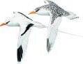
Land and Sea Park
THREATENED BIRDS
RESTRICTED-RANGE BIRDS
BIOME-RESTRICTED BIRDS
CONGREGATORY BIRDS
■ ■ ■ ■ Other biodiversity
The Vulnerable Bahamian hutia Geocapromys ingrahami has been introduced on Little Wax Cay (where they have devastated the cay’s vegetation) and Waderwick Wells (where the population is c.25,000). Critically Endangered hawksbill Eretmochelys imbricata and Endangered green Chelonia mydas and loggerhead Caretta caretta turtles forage in the park. The Endangered rock iguana Cyclura riley rileyi is (introduced) on Bush Hill Cay, and the Vulnerable C. cychlura inornata and C. cychlura figginisi are also present (introduced) on a number of cays.
■ ■ Conservation
Exuma Cays Land and Sea Park IBA includes some privately owned islands, but all cays are covered by the regulations of the land and sea park which is managed by the BNT. It is the oldest land and sea park in the world (established in 1958) and since 1986 it has been managed as a strict no-take zone— nothing living or dead, can be removed from the park, which is essentially pristine. The IBA is a popular yachting (and tourist) destination resulting in some disturbance of nesting seabirds, although this threat is being actively managed by the BNT. Predation of nests and adult birds by rats Rattus spp. and other introduced predators is a problem.

■ ■ Site description
Lee Stocking Island is in the southern Exumas, just north of Great Exuma Island. The island is c.7 km long. There are no roads on the island, but there is some settlement. The Hotel Higgins eco-resort is in the IBA, as are a marine research centre, and an airstrip. The island comprises sandy beaches, rocky areas, tidal flats, lagoons, wetlands, coral reefs and shrubland. There are two small freshwater ponds at the north end of the airstrip. The IBA includes marine areas up to 1 km from the island.
■ Birds
This IBA is significant for supporting a population of the Vulnerable West Indian Whistling-duck Dendrocygna arborea (which frequent the airstrip ponds), and the Near Threatened White-crowned Pigeon Patagioenas leucocephala . The restricted-range Bahama Mockingbird Mimus gundlachii and Thick-billed Vireo Vireo crassirostris occur along with other characteristic birds including Burrowing Owl Athene cunicularia, Greater Antillean Bullfinch Loxigilla violacea and a range of waterbirds.
■
Other biodiversity
THREATENED BIRDS
RESTRICTED-RANGE BIRDS
BIOME-RESTRICTED BIRDS
CONGREGATORY BIRDS
The marine environment surrounding this IBA supports the Endangered Nassau grouper Epinephelus striatus and queen conch Strombus gigas , both of which are commercially valuable and are being studied by researchers based on the island. Critically Endangered hawksbill Eretmochelys imbricata and Endangered green Chelonia mydas and loggerhead Caretta caretta turtles forage in the IBA.
■ ■ ■ ■ ■ Conservation
Lee Stocking Island IBA is a mix of crown and privately owned lands, but is unprotected. The Caribbean Marine Research Centre is on the island and serves marine scientist from the USA and the Bahamas. Tourists from yachts can visit the centre. There is currently minimal development on the island and as long as it remains ecologically sensitive the threats to the IBA and its key species will be minimal. It is unknown whether rats Rattus spp. (or other predators) are a problem and this should be investigated.
COORDINATES 23°34’N 75°53’W
ADMIN REGION Exumas
AREA 245 ha
ALTITUDE 0–7 m
HABITAT Wetlands, shrubland
West Indian Whistling-duck
■ ■ ■ ■ Site description
Grog Pond IBA is situated c.16 km north-west of George Town on Great Exuma. It is bounded on the north by the Queen’s Highway, and on the east, south and west by Bahama Sound Development. Grog Pond is an inland wetland. Grog Pond is a shallow, brackish water lake with clumps of black mangroves and fringing saltmarsh, buttonwood and coppice.
THREATENED BIRDS
RESTRICTED-RANGE BIRDS
BIOME-RESTRICTED BIRDS
CONGREGATORY BIRDS
waterbirds including duck, herons, egrets, ibises and shorebirds
■ ■ Other biodiversity Nothing recorded.
■ Conservation
■
■
■
■
■ Birds
This IBA is significant for supporting a population of the Vulnerable West Indian Whistling-duck Dendrocygna arborea, and the Near Threatened White-crowned Pigeon Patagioenas leucocephala . The numbers of Laughing Gull Larus atricilla, Gull-billed Tern Sterna nilotica and Least Tern S. antillarum present in the IBA are regionally significant. The restrictedrange Bahama Mockingbird Mimus gundlachii and Thickbilled Vireo Vireo crassirostris occur along with Greater Antillean Bullfinch Loxigilla violacae and a range of
Grog Pond IBA is privately owned and unprotected. It has the potential to become a community-led eco-tourism site, recreation area and a centre for students and adults to learn about the environment, and the BNT has been pursuing this concept. However, the surrounding coppice has been divided into residential plots and it appears that development is imminent. The area has been used as an illegal garbage dump (despite the “no dumping” signs). Hunting is also prevalent at this site, as is the collection of pond-stone by local builders for patios and walkways.
COORDINATES 24°35’N 75°50’W
ADMIN REGION Cat Island
AREA 820 ha
ALTITUDE 0 m
HABITAT Rocky areas, sea, shrubland
■
Site description
Tee Cay, Goat Cay and Long Rocks IBA is located between northern Cat Island and (to the west) Little San Salvador. The islands are physically nearer to (1–3 km from) Little San Salvador. Goat Cay lies north-east of Little San Salvador, Long Rocks lies due east, Tee Cay south-east. The cays are uninhabited limestone ridges partially covered with scrubland vegetation such as seagrape, cacti, haulback and other native plants. There is a sandy cove on Goat Cay. The IBA includes marine areas up to 1 km from the cays.
■ ■ Birds
This IBA is significant for its breeding seabirds. The population of Roseate Tern Sterna dougallii is thought to be globally significant and that of Bridled Tern Sterna anaethetus regionally so. Sooty Tern S. fuscata , Brown Noddy Anous stolidus ,
THREATENED BIRDS
RESTRICTED-RANGE BIRDS
BIOME-RESTRICTED BIRDS
CONGREGATORY BIRDS
Magnificent Frigatebird Fregata magnificens and Brown Booby
Sula leucogaster are all thought to breed on the cays. The Near Threatened White-crowned Pigeon Patagioenas leucocephala has been reported nesting on Goat Cay.
■ Other biodiversity
Nothing recorded.
■ ■ ■ Conservation
Tee Cay, Goat Cay and Long Rocks IBA is poorly known and there is little direct information available except from boaters. Breeding season surveys of the seabirds are a clear priority. The cays are unprotected. The seabirds are prone to predation from introduced species (e.g. rats Rattus spp.) from visiting boats, and from refugees that are occasionally landed in the IBA.
COORDINATES 24°18’N 75°27’W
ADMIN REGION Cat Island
AREA 1,730 ha
ALTITUDE 0–1 m
HABITAT Wetlands, shrubland, coastline
■ ■ Site description
Cat Island IBA is south-east of Eleuthera on the Atlantic edge of the Great Bahama Bank. The island is c.80 km long and just a few kilometres wide except at the southern end which broadens out to embrace the large, brackish Gambier Lake. A paved road runs the length of the island with a series of dirt roads crossing the island to the ocean side (locally called the “north shore”). There are a number of settlements along the road on the western shore. The 63-m Mount Alvernia is towards the south of the island and is the highest point in the Bahamas. The island supports a range of freshwater and saltwater wetlands, tidal flats, beach and adjacent broadleaf coppice.
■ Birds
This IBA is significant for its population of the Vulnerable West Indian Whistling-duck Dendrocygna arborea . The population of Laughing Gull Larus atricilla is globally important while those of Gull-billed Tern Sterna nilotica and Least Tern Sterna antillarum are regionally so. The terns breed at Gambier Lake which is also a nesting site for other terns,
THREATENED BIRDS
RESTRICTED-RANGE BIRDS
BIOME-RESTRICTED BIRDS
CONGREGATORY BIRDS
Reddish Egret Egretta rufescens and a range of waterbirds. Four (of the seven) Bahamas EBA restricted-range birds, namely Bahama Woodstar Calliphlox evelynae , Bahama Yellowthroat Geothlypis rostrata, Thick-billed Vireo Vireo crassirostris and Bahama Mockingbird Mimus gundlachii are present.
■ ■ ■ ■ Other biodiversity
The Bahamian endemic Bahama pygmy boa Tropidophis canus occurs, as do a number of other snakes, lizards, frogs and freshwater turtles.
■ ■ Conservation
The Cat Island Wetlands IBA is a mixture of crown and privately owned land, but is unprotected. Small scale farming (including corn, which D. arborea feeds on) and fishing supports most of the local population. However, local and international tourism has begun to grow on the island resulting in habitat destruction from urban development. Illegal hunting of birds is a problem, as are introduced predators.
COORDINATES 23°42’N 80°24’W
ADMIN REGION Cay Sal Bank
AREA 859 ha
ALTITUDE 0–3 m
HABITAT Sea, rocky areas, shrubland
■ ■ Site description
Cay Sal IBA is located due south of Miami, midway between Florida and Cuba. It is closer to Florida and Cuba than to Andros. The IBA comprises Double Headed Shot Cays, Elbow Cay, Damas and Anguilla Cays and Cay Sal that are situated along the northern and eastern edges of the Cay Sal Bank. These cays are presently uninhabited, except as a harbour for yachts sailing between Cuba and Florida. The cays are rocky, with some sandy beaches, a saltwater lagoon on Cay Sal, and some low shrubland. The IBA includes marine areas up to 1 km from the cays.
■ Birds
This IBA supports significant numbers of seabirds. The populations of Roseate Tern Sterna dougallii and Bridled Tern S. anaethetus are globally important, and those of Audubon’s Shearwater Puffinus lherminieri , Brown Pelican Pelecanus occidentalis , Royal Tern S. maxima , Sandwich Tern S. sandvicensis and Sooty Tern S. fuscata are regionally so. Other seabirds frequent the IBA as non-breeding residents. Elbow Cay is the main nesting cay for the seabirds. The Near Threatened White-crowned Pigeon Patagioenas leucocephala
THREATENED BIRDS
RESTRICTED-RANGE BIRDS
BIOME-RESTRICTED BIRDS
CONGREGATORY BIRDS
breeds along with a small number of other resident landbirds. The IBA is an important stop-over site for Neotropical migratory landbirds and shorebirds.
■ ■ Other biodiversity
Critically Endangered hawksbill Eretmochelys imbricata , and Endangered green Chelonia mydas and loggerhead Caretta caretta turtles nest in the IBA. The Cay Sal anole Anolis fairchildi is endemic to the IBA, and the Bahama pygmy boa Tropidophis canus occurs.
■ ■ Conservation
Cay Sal IBA is crown land, but is currently unprotected. There are apparently plans to build a marina on Cay Sal which will inevitably lead to habitat loss and disturbance of the nesting seabirds. Elbow Cay has a fresh water cistern and refugees from Cuba frequently stop there, and have decimated the Puffinus lherminieri colony to obtain fresh meat. Introduced predators such as rats Rattus spp. are a potential threat, although it is not know whether they are present on the islands. The seabirds and the threats to them are seldom monitored.
BS026 Long Island and Hog Cay
COORDINATES 23°35’N 75°16’W
ADMIN REGION Long Island AREA 81,010 ha
ALTITUDE 0–7 m
HABITAT Rocky areas, shrubland, wetlands, coastline, sea
West Indian Whistling-duck
■ ■ ■ ■ Site description
Long Island and Hog Cay IBA lies south of Cat Island and south-east of the southern end of the Exumas. The island is about 128 km long and a maximum of 6.5 km wide. Hog Cay is a privately-owned island on the leeward side of northern Long Island. Long Island supports a variety of habitats including shrubland, coppice, freshwater and saltwater wetlands, mangroves swamps and tidal flats. Wetlands are scattered throughout the interior of the island and there are frequent roadside ponds. Fishing and farming are the main occupations of the local population.
■ ■ Birds
This IBA is significant for supporting a large population of the Vulnerable West Indian Whistling-duck Dendrocygna arborea which roost on Hog Cay each night. The island’s wetlands are also home to a diversity of waterbirds including ducks, herons, egrets and migratory shorebirds. Sandwich Tern Sterna sandvicensis and Roseate Tern S. dougallii breed on Hog and Galliott Cays. The breeding population of
COORDINATES 23°50’N 75°06’W
ADMIN REGION Conception Island
AREA 2,905 ha
ALTITUDE 0 m
HABITAT Rocky areas, sea, shrubland
THREATENED BIRDS
RESTRICTED-RANGE BIRDS
BIOME-RESTRICTED BIRDS
CONGREGATORY BIRDS
Laughing Gull Larus atricilla is regionally important. The restricted-range Bahamas Mockingbird Mimus gundlachii and Thick-billed Vireo Vireo crassirostris also occur. A population of the Near Threatened White-crowned Pigeon Patagioenas leucocephala occurs, but the numbers involved are unknown.
■ Other biodiversity
The Near Threatened Gervais’s funnel-eared bat Nyctiellus lepidus and Brazilian free-tailed bat Tadarida brasiliensis occur (along with a number of other bat species).
■ Conservation
Long Island and Hog Cay IBA is a mixture of crown and privately owned land, but none of it is protected. The owner of Hog Cay provided daily feed for the large flock of D. arborea which roost on the cay at night. Residential and urban development is leading to habitat destruction, and illegal hunting is a problem. Feral cats, wild goats and pigs are all common and are impacting the vegetation and nesting birds.
THREATENED BIRDS
RESTRICTED-RANGE BIRDS
BIOME-RESTRICTED BIRDS
CONGREGATORY BIRDS
■
■ Site description
Conception Island IBA lies c.40 km south-west of San Salvador, midway between Cat Island and Rum Cay. It is c.5 km by 2.5 km and it encircles an interior lagoon. The island is uninhabited and comprises coral reefs, sandy beaches, rocky and low coralline cliff shores, mangrove, low scrub and coppice. Offshore to the east lies Booby Cay, and to the southwest is South Rocks. The island is an attractive destination for yachts. The IBA includes marine areas up to 1 km from the islands.
■ ■ Birds
This IBA is characterised by its breeding seabirds. The population of White-tailed Tropicbird Phaethon lepturus is globally significant while those of Audubon’s Shearwater Puffinus lherminieri , Bridled Tern Sterna anaethetus and Brown Noddy Anous stolidus are regionally so. Booby Cay has one of the largest colonies of Sooty Tern S. fuscata in the Bahamas (and is also where the A. stolidus nests). The restricted-range Bahama Mockingbird Mimus gundlachii and Bahama Woodstar Calliphlox evelynae are present and ducks,
herons and shorebirds are common in the interior lagoon. A population of the Near Threatened White-crowned Pigeon Patagioenas leucocephala occurs, but the numbers involved are unknown.
■ Other biodiversity
Critically Endangered hawksbill Eretmochelys imbricata and Endangered green Chelonia mydas turtles are common in the interior lagoon.
■ ■ Conservation
Conception Island is owned by the crown and is protected as a national park under the management of the BNT. However, Booby Cay and South Rocks and the surrounding shallow water are not included in the protected area. Hunting and illegal egg collecting by boaters and fishermen stopping over on the island are significant threats to the breeding seabirds. The mouth of the lagoon is sometimes illegally blocked by fishermen in order to catch fish and turtles trapped in the interior.
BS028 Graham’s Harbour
COORDINATES 24°08’N 74°28’W
ADMIN REGION San Salvador
AREA 4,262 ha
ALTITUDE 0–6 m
HABITAT Rocky areas, coastline, shrubland, sea
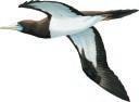
■ ■ Site description
Graham’s Harbour IBA lies off the north coast of San Salvador where several pristine cays are found in the “harbour’s” shallow waters. The area is characterised by shallow reefs and rock throughout the bay, with White Cay nearest the reef edge, Green Cay on the north-western side, and Gaulin, Cato and Cut cays near to the north shore of San Salvador. The cays are uninhabited with rocky shorelines and some sandy beaches, and supporting low scrub.
■ ■ Birds
The cays in Graham’s Harbour are important seabird colonies. Regionally significant populations of Brown Booby Sula leucogaster and Bridled Tern Sterna anaethetus nest on Green Cay, which also supports some breeding Magnificent Frigatebird Fregata magnificensis. Frigatebirds and Brown Booby Sula leucogaster nest on White Cay, and Brown Noddy Anous stolidus , Sterna anaethetus and Sooty Tern S. fuscata
COORDINATES 24°00’N 74°30’W
ADMIN REGION San Salvador
AREA 1,530 ha
ALTITUDE 0–3 m
HABITAT Wetlands, shrubland
THREATENED BIRDS
RESTRICTED-RANGE BIRDS
BIOME-RESTRICTED BIRDS
CONGREGATORY BIRDS
nest on Gaulin and Cato Cays, albeit not in significant numbers.
■ ■ ■ ■ Other biodiversity
About 250 Endangered rock iguanas Cyclura rileyi rileyi were living on Green Cay in 1997.
■ ■ ■ ■ Conservation
Graham’s Harbour IBA is a mix of crown and privately owned land and is currently unprotected. However, the BNT has targeted this area as a potential national park and a managed ecotourism site. Invasive plants (that crowd out native flora) are a potential threat that needs monitoring as it would ruin the pristine state of the cays. Similarly, invasive predators such as rats Rattus spp. could deplete the seabird populations. The arrival of such alien invasives should be monitored for, along with the seabird populations. Visitation by tourists needs to be well controlled to avoid disturbance to nesting seabirds.
■ ■ Site description
Southern Great Lake IBA embraces the saline wetland that occupies a large proportion of the interior of southern San Salvador. The wetlands are extensive and largely unobserved or explored due to the difficulty of access. The wetland is surrounded by dry shrubland and there are fringing mangroves. San Salvador is a small island (8 km by 19 km) with less than 1,000 people resident. The southern wetlands are therefore little disturbed.
■ ■ Birds
This IBA supports globally significant breeding populations of Gull-billed Tern Sterna nilotica and Laughing Gull Larus atricilla . The Great Lake is home to a wide diversity of waterbirds including the endemic diminutive race of Doublecrested Cormorant Phalacrocorax auritus, egrets and herons. Four (of the 7) Bahamas EBA restricted-range birds, namely Bahama Woodstar Calliphlox evelynae , Pearly-eyed Thrasher Margarops fuscatus, Thick-billed Vireo Vireo crassirostris and
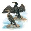
THREATENED BIRDS
RESTRICTED-RANGE BIRDS
BIOME-RESTRICTED BIRDS
CONGREGATORY BIRDS
Bahama Mockingbird Mimus gundlachii are present. The endemic race of West Indian Woodpecker Melanerpes superciliaris is present in the IBA.
■ ■ Other biodiversity
The Endangered rock iguanas Cyclura rileyi rileyi is found in the interior lake areas. An endemic blind snake Leptotypholops columbi is present.
■ ■ ■ ■ ■ Conservation
Southern Great Lake IBA is crown land, but is currently unprotected. An observation platform overlooking the northern end of the lake (near Cockburn Town) is the only easily accessible viewing point and thus the wetland and the populations of its waterbirds are poorly known. Resort development is an ever present (but as yet unrealised) threat. The expanded airport at Cockburn Town has recently caused considerable habitat destruction although this has not impinged on the lake system.
COORDINATES 23°56’N 74°33’W

■ ■ ■ ■ Site description
Sandy Point IBA is located at the south-western tip of San Salvador. The IBA includes residential areas (a subdivision of an urban development called “Columbus Landing”), the ruins known as Watling’s Castle and surrounding shrubland. However, the primary interest is the sandy beaches.
■ ■ ■ ■ Birds
The beaches in this IBA support a regionally important population of Least Tern Sterna antillarum. Many Charadrius spp. plovers use the beaches too. The surrounding shrubland is home to four (of the 7) Bahamas EBA restricted-range birds, namely Bahama Mockingbird Mimus gundlachii, Bahama Woodstar Calliphlox evelynae , Pearly-eyed Thrasher Margarops fuscatus and Thick-billed Vireo Vireo crassirostris
THREATENED BIRDS
RESTRICTED-RANGE BIRDS
BIOME-RESTRICTED BIRDS
CONGREGATORY BIRDS
The endemic race of West Indian Woodpecker Melanerpes superciliaris also occurs.
■ ■ Other biodiversity Nothing recorded.
■ Conservation
Sandy Point IBA is a mix of crown and privately owned land and is unprotected. The beaches are public and are a popular destination for tourists and locals from the residential community within the IBA. The recreational traffic on the beaches poses a serious threat to the nesting S. antillarum Predation from household pet cats and dogs, and also from introduced predators such as rats Rattus spp. is also a problem.
COORDINATES 23°57’N 74°29’W
ADMIN REGION San Salvador
AREA 1,225 ha
ALTITUDE 0–4 m
HABITAT Coastline, rocky areas, sea, shrubland, wetlands
THREATENED BIRDS
RESTRICTED-RANGE BIRDS
BIOME-RESTRICTED BIRDS
CONGREGATORY BIRDS
■
■ Site description
Low Cay, High Cay and Sandy Hook IBA is at the southeastern end of San Salvador. Sandy Hook is a subdivision of an urban development called “Columbus Landing”. It is a peninsula with the sandy Snow Bay Beach on it eastern side, and Pigeon Creek (a tidal lagoon) to its north and west. Low and High Cays are small rocky cays located 0.5–1 km offshore to the south-east of Sandy Hook. Pigeon Creek supports mangrove and there is some shrubland on Sandy Hook, but the primary habitats of importance are the sandy beaches and rocky cays. The IBA includes marine areas 1 km from the shore and from the cays.
■ ■ Birds
This IBA is home to regionally significant populations of breeding Least Tern Sterna antillarum (on the beaches at Sandy Hook), and Audubon’s Shearwater Puffinus lherminieri and Bridled Tern S. anaethetus (on the offshore cays). Mixed
flocks of seabirds, including (additionally) Roseate Tern S. dougallii, Sooty Tern S. fuscata and Brown Noddy Anous stolidus are seen feeding close to the mouth of Pigeon Creek in the fall.
■ Other biodiversity
Nothing recorded.
■ ■ ■ Conservation
Low Cay, High Cay and Sandy Hook IBA is a mix of crown and privately-owned land. The residential development at Sandy Hook is likely to be further expanded which will cause inevitable habitat destruction and increase the disturbance to birds on Snow Bay Beach. The cays are visited by tourists (on jet skis) from the Club Med Resort. Local “guides” use the cays for commercial purposes. This visitation is unregulated and will cause inevitable disturbance to the nesting seabirds. It is unknown whether rats Rattus spp. are present on the cays.
COORDINATES 23°05’N 73°44’W
ADMIN REGION Acklins
AREA 8,650 ha
ALTITUDE 0–1 m
HABITAT Rocky areas, shrubland, sea, coastline
■ ■ Site description
Samana Cay is located 32 km north-east of Crooked Island (Crooked and Acklins islands). It is a small island (c.16 km by 3 km) completely surrounded by coral reefs and with a small offshore islet—Propeller Cay—situated off its eastern end. The cascarilla tree Croton elutaria grows profusely on the island. Samana Cay is uninhabited (although there is evidence of Lucayan inhabitants present up until the 1500s). However, it is visited frequently by locals for fishing and collecting cascarilla bark. There is no fresh water on the cay. The IBA includes marine areas up to 1 km from the cay.
■ Birds
A globally significant population of Bridled Tern Sterna anaethetus nests on Propeller Cay, along with a range of other seabirds including Audubon’s Shearwater Puffinus lherminieri,
THREATENED BIRDS
RESTRICTED-RANGE BIRDS
BIOME-RESTRICTED BIRDS
CONGREGATORY BIRDS
Sooty Tern S. fuscata and Brown Noddy Anous stolidus. A regionally important population of Royal Tern S. maxima breeds in the IBA. Brown Booby Sula leucogaster has been found roosting on Propeller Cay although there is no evidence of breeding.
■ ■ Other biodiversity
Nothing recorded.
■ ■ ■ ■ ■ Conservation
Samana Cay is crown land but is unprotected. Disturbance to seabirds is likely to be caused by visitors (locals collecting bark and fishing and boaters). There is some local, small scale farming practiced on the island, and refugees land on the island seeking food and shelter. It is unknown whether rats Rattus spp. are present on the cays.
COORDINATES 22°26’N 77°39’W
ADMIN REGION South Great Bahama Bank
AREA 700 ha
ALTITUDE 0–1 m
HABITAT Rocky areas, sea, shrubland
■ ■ Site description
Cay Lobos IBA is a minute cay (c.250 long) located on the southern edge of the Great Bahama Bank, c.32 km north of Cuba’s Cayo Romano. The cay (which is in Bahamian territorial waters) is uninhabited. The Cay Lobos lighthouse was built on the island in 1860, and this is the dominant feature. A small area of low shrubland surrounds the lighthouse, but the rest of the cay comprises sandy beach and surrounding reef.
■ ■ Birds
This IBA supports a globally significant breeding population of Roseate Tern Sterna dougallii, and regionally important populations of Least Tern S. antillarum and Bridled Tern S. anaethetus . Many Neotropical migratory birds were collected on the island (attracted by the light of the lighthouse)
THREATENED BIRDS
RESTRICTED-RANGE BIRDS
BIOME-RESTRICTED BIRDS
CONGREGATORY BIRDS
between 1899 and 1901, but there is little subsequent information on the landbirds using this site.
■ ■ Other biodiversity Nothing recorded.
■ ■ Conservation
Cay Lobos is crown land but is unprotected. There is no threat of development on the island which is, however, a stopping point for fishermen (both Bahamian and Cuban) who inevitably disturb the breeding seabirds. Illegal egg collecting and killing of the birds by refugees and fishermen is thought to be a threat to the seabird populations. It is unknown if rats Rattus spp. are present on the cay. Scuba-divers visit the cay to dive on the surrounding reefs.
COORDINATES 22°01’N 75°11’W
ADMIN REGION South Great Bahama Bank
AREA 690 ha
ALTITUDE 0–1 m
HABITAT Shrubland, rocky areas, sea Unprotected
THREATENED BIRDS
RESTRICTED-RANGE BIRDS
BIOME-RESTRICTED BIRDS
CONGREGATORY BIRDS
■ ■ ■ ■ Site description
Cay Verde IBA is an isolated cay at the south-easternmost edge of the Grand Bahama Bank, 48 km east of Greater Ragged Island and 110 km west of the southern tip of Acklins Island. It covers about 16 ha and supports extensive growth of sea grape Coccoloba uvifera, prickly pear Opuntia sp. and sea lavender. However, there is no fresh water on the cay, and it is uninhabited. The IBA includes marine areas up to 1 km from the cay.
■ ■ ■ ■ Birds
This IBA supports a large seabird colony. The breeding populations of Magnificent Frigatebird Fregata magnificens (99 pairs) and Brown Booby Sula leucogaster (550 pairs) are regionally significant although these estimates (made in 1979) were 60% lower than counts done in 1907. Other seabirds nest
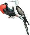
on the island including Sooty Tern Sterna fuscata, Bridled Tern S. anaethetus , Brown Noddy Anous stolidus and Audubon’s Shearwater Puffinus lherminieri although there is no recent data.
■ Other biodiversity Nothing recorded.
■ ■ ■ Conservation
Cay Verde IBA is crown owned but is unprotected. Illegal egg collecting and killing of the birds by refugees and fishermen is thought to be a threat to the seabird populations. It is unknown if rats Rattus spp. are present on the cay. With little recent information concerning the status of the island and its seabirds, this IBA should be a target for monitoring expedition.
COORDINATES 22°06’N 74°31’W
ADMIN REGION Acklins
AREA 2,168 ha
ALTITUDE 0 m
HABITAT Rocky areas, shrubland, sea
■
Site description
Mira Por Vos IBA comprises a series of uninhabited rocky islands and shoals spread across c.100 km2 . It is located c.14 km south-west of Salina Point, Acklins. South Cay supports a pond and North Rock one of the main seabird colonies.
THREATENED BIRDS
RESTRICTED-RANGE BIRDS
BIOME-RESTRICTED BIRDS
CONGREGATORY BIRDS
the IBA. Caribbean Flamingo Phoenicopterus ruber and Reddish Egret Egretta rufescens have been seen at a pond on South Cay.
■ Other biodiversity Nothing recorded.
■
■ ■ ■ Birds
This IBA is home to many seabirds. The breeding populations of Brown Booby Sula leucogaster (on North Rock) and Audubon’s Shearwater Puffinus lherminieri are regionally significant. Sooty Tern Sterna fuscata , Bridled Tern S. anaethetus and Brown Noddy Anous stolidus also breed in
■ ■ Conservation
Mira Por Vos IBA is crown land but is currently unprotected. Little is known about the threats to the islands and their seabirds, but it is possible that refugees and fishermen land on the rocks to take eggs and birds for food. It is unknown if rats Rattus spp. are present on any of the islands.
COORDINATES 22°27’N 74°13’W
ADMIN REGION Acklins
AREA 682 ha
ALTITUDE 0 m
HABITAT Rocky areas, sea, shrubland
■ ■ Site description
Guana Cays IBA comprises a group of small cays (including North Cay, Fish Cay and Guana Cay) and associated rocks and reefs. The cays are aligned in a loose chain across the south-western reef edge and entrance to the Bight of Acklins, lying between Crooked Island’s Long Cay to the north and Binnacle Hill on Acklins Island to the south. They are assumed to be uninhabited, have rocky (coralline) coastlines, and support some scrub vegetation. The IBA extends to include marine areas up to 1 km from the cays.
■ Birds
This IBA supports a range of seabirds. The breeding colonies of Sandwich Tern Sterna sandvicensis and Roseate Tern S. dougallii are globally significant, while those of Least Tern S.
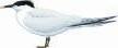
THREATENED BIRDS
RESTRICTED-RANGE BIRDS
BIOME-RESTRICTED BIRDS
CONGREGATORY BIRDS
antillarum , Bridled Tern S. anaethetus and Magnificent Frigatebird Fregata magnificens are regionally so.
■ ■ ■ ■ Other biodiversity
Nothing recorded, although it is likely that globally threatened sea-turtles are present.
■ ■ ■ ■ Conservation
Guana Cays IBA is crown land but is unprotected. The cays are poorly known in terms of their biodiversity, and an up-todate assessment of their seabird populations is needed. Any such visit should assess current threats to the IBA such as disturbance from tourists (scuba divers, bone-fishers) and fishermen, or indeed the potential presence of predators such as rats Rattus spp.
COORDINATES 22°19’N 72°43’W
ADMIN REGION Mayaguana
AREA 2,340 ha
ALTITUDE 0 m
HABITAT Coastline, shrubland, wetlands
■ ■ Site description
Booby Cay IBA lies less than 500 m offshore from the easternmost end of the isolated Mayaguana Island. This uninhabited cay covers only c.75 ha, and dips in the centre of the island have formed two ponds which shrink and grow in water level and salinity according to rainfall (although they occupy c.30% of the island). There is a sandy beach along the north-western shore, and the south-east portion of the cay supports impenetrable shrubland coppice vegetation. Buttonwood, cacti and other plants grow around the central ponds.
■ Birds
This IBA supports a regionally significant population of Brown Booby Sula leucogaster. It is unknown if other seabirds breed on the island. There are reports of up to 80 non-breeding Caribbean Flamingo Phoenicopterus ruber on the cay (presumably part of the resident non-breeding flock on Mayaguana).
■ ■ ■ ■ Other biodiversity
THREATENED BIRDS
RESTRICTED-RANGE BIRDS
BIOME-RESTRICTED BIRDS
CONGREGATORY BIRDS
✔
A subspecies of the Critically Endangered Bahamas rock iguana Cyclura carinata bartschi is endemic to Booby Cay (although in 1998 a colony was established on Mayaguana).
■ ■ Conservation
Booby Cay IBA has been leased by the crown to a private individual who established the goats on the island that have significantly impacted the vegetation. There is no protection afforded this cay, although the BNT has proposed that it be included in the national parks system on the basis of the presence of the iguana and the breeding seabirds. Some goats have been removed, but this action needs to be completed to safeguard the island’s biodiversity. Local conch fishermen occasionally overnight on the island. The status of introduced predators including cats and rats Rattus spp. is unknown.
BS038 Booby Rocks and Pirates Bay
COORDINATES 22°19’N 72°44’W
ADMIN REGION Mayaguana
3,620 ha
ALTITUDE 0–3 m
HABITAT Rocky areas, sea, shrubland, wetlands
■ ■ ■ ■ Site description
Booby Rocks and Pirates Bay IBA is located on the northwestern tip of the isolated Mayaguana Island. Booby Rocks are a cluster of rocks c.400 m offshore from the rocky shore of Northwest Point, at the head of the wide shallow Pirates Bay. Sandy beaches extend along Pirates Bay to Blackwood Point at the north-eastern tip of the bay. The IBA includes marine areas up to 1 km from the shore and Booby Rocks, and also the shallow mangrove wetlands (with adjacent coppice) lie on the landward side of the bay.
■ ■ Birds
This IBA supports a range of seabirds, all in regionally significant populations. There is a Brown Booby Sula leucogaster nesting colony on Booby Rocks, and White-tailed Tropicbird Phaethon lepturus nest on the cliffs at Northwest Point. Non-breeding numbers of Brown Pelican Pelecanus occidentalis , Masked Booby Sula dactylatra and Royal Tern Sterna maxima are also regionally important. Magnificent Frigatebird Fregata magnificens nest in the IBA. The wetlands
COORDINATES 21°04’N 73°21’W
ADMIN REGION Inagua
AREA 178,140 ha
ALTITUDE 0–5 m
HABITAT Wetlands
THREATENED BIRDS
RESTRICTED-RANGE BIRDS
BIOME-RESTRICTED BIRDS
CONGREGATORY BIRDS
support shorebirds, ducks, herons and egrets. Reddish Egret Egretta rufescens is apparently common, and up to 200 Caribbean Flamingo Phoenicopterus rubber frequent the wetlands at Blackwood Point. The Near Threatened Whitecrowned Pigeon Patagioenas leucocephala breeds in the IBA.
■ Other biodiversity
Nothing recorded.
■ ■ ■ Conservation
Booby Rocks and Pirates Bay IBA is unprotected crown and private land. A mega resort development started to be built in 2006. It includes plans to connect the wetlands to the sea for a commercial marina in the north-western corner of the island (within the IBA) which will have a serious impact on the natural vegetation and these currently undisturbed fresh and salt-water habitats. It is unknown if predators are present on Booby Rocks, or indeed if there are other threats impinging on the seabird populations within the IBA.
RESTRICTED-RANGE BIRDS
BIOME-RESTRICTED BIRDS
CONGREGATORY BIRDS
■ Site description
■
■
■
Great Inagua IBA embraces the entire island of Great Inagua— the southernmost (and third largest) island in the Bahamas, lying just 90 km north-east of the easternmost tip of Cuba. The island is c.90 km by 30 km, and Lake Rosa occupies c.30% of the western end. Lake Rosa is a permanent shallow brackish lake, up to 1.5 m deep with small islands scattered throughout. It is fringed with brackish marshes, and dense mangrove swamps on the northern and eastern borders. The rest of the island comprises seasonal marshes, open shrubland and broadleaf coppice on the higher ground. The western portion of Lake Rosa is managed for commercial salt production.
■ ■ Birds
This IBA is home to a wide diversity and large numbers of waterbirds. Over 40,000 Caribbean Flamingo Phoenicopterus ruber occur (the largest colony outside of Cuba), and populations of Reddish Egret Egretta rufescens, Roseate Tern Sterna dougallii , Common Tern Sterna hirundo and the Vulnerable West Indian Whistling-duck Dendrocygna arborea are globally significant. A number of other waterbirds are present in regionally important numbers. Over 6,000 Near
Threatened Cuban Amazon (“Bahama Parrot”) Amazona leucocephala bahamensis occur on the island, and there are records of the Vulnerable Bahama Swallow Tachycineta cyaneoviridis although numbers involved are unknown.
■ Other biodiversity
Critically Endangered hawksbill Eretmochelys imbricata and Endangered green Chelonia mydas turtles are present, and the endemic Inagua freshwater turtle Chrysemys malonei occurs.
■ ■ Conservation
Great Inagua is a mix of crown and private land. About 50% of it is protected within the Inagua National Park (which is also designated a Ramsar site), although the park has just one warden to manage and monitor it. Recognising these issues, the BNT has been working with the local Sam Nixon Bird Club (a Site Support Group) to monitor the IBA and its birds and to develop micro-enterprises to assist in the establishment of ecotourism on the island. Wild pigs, donkeys and cats all represent a threat to the natural vegetation and nesting waterbirds. Occasional unauthorised hunting occurs within portions of the national park.
Date | March 25, 2024
Title | Environmental Baseline Statement
Final Environmental Assessment and Finding of No Significant Impact for SpaceX Falcon Launches at Kennedy Space Center and Cape Canaveral Air Force Station
July 2020
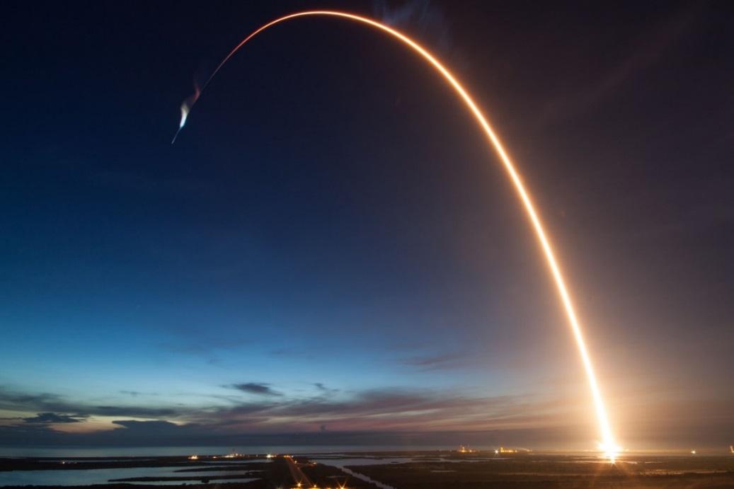
This Page Intentionally Left Blank
This Page Intentionally Left Blank
The Federal Aviation Administration (FAA) prepared the attached Final Environmental Assessment (EA) to analyze the potential environmental impacts of issuing launch licenses to Space Exploration Technologies Corp. (SpaceX) to conduct Falcon 9 and Falcon Heavy launches from Kennedy Space Center’s (KSC) Launch Complex 39A (LC-39A) and Cape Canaveral Air Force Station’s (CCAFS) Launch Complex 40 (LC-40). The EA also analyzed the potential environmental impacts of issuing reentry licenses to SpaceX for Dragon reentry operations The EA was prepared in accordance with the National Environmental Policy Act of 1969, as amended (NEPA; 42 United States Code [U.S.C.] § 4321 et seq.); Council on Environmental Quality NEPA implementing regulations (40 Code of Federal Regulations [CFR] parts 1500 to 1508); and FAA Order 1050.1F, Environmental Impacts: Policies and Procedures
After reviewing and analyzing available data and information on existing conditions and potential impacts, the FAA has determined the Proposed Action would not significantly affect the quality of the human environment. Therefore, the preparation of an Environmental Impact Statement (EIS) is not required, and the FAA is issuing this Finding of No Significant Impact (FONSI). The FAA has made this determination in accordance with applicable environmental laws and FAA regulations. The Final EA is incorporated by reference into this FONSI.
For any questions or to request a copy of the EA, contact the following FAA Environmental Specialist. A copy of the EA may also be obtained from the FAA’s website: https://www.faa.gov/space/environmental/nepa_docs/
Daniel Czelusniak
Environmental Specialist
Federal Aviation Administration
800 Independence Ave., SW, Suite 325
Washington DC 20591
Daniel.Czelusniak@faa.gov
(202) 267-5924
The purpose of FAA’s Proposed Action is to fulfill the FAA’s responsibilities as authorized by the Commercial Space Launch Act (51 U.S.C. Subtitle V, ch. 509, §§ 50901-50923) for oversight of commercial space launch activities, including licensing launch activities. The need for FAA’s Proposed Action results from the statutory direction from Congress under the Commercial Space Launch Act, 51 U.S.C 50901(b) to, in part, “protect the public health and safety, safety of property, and national security and foreign policy interests of the United States” while “strengthening and [expanding] the United States space transportation infrastructure, including the enhancement of United States launch sites and launch-site support facilities, and development of reentry sites, with Government, State, and private sector involvement, to support the full range of United States space-related activities.”
The FAA is proposing to modify existing SpaceX launch licenses or issue new launch licenses to SpaceX to continue conducting Falcon launch operations at KSC and CCAFS and to issue new reentry licenses to SpaceX for Dragon reentry operations. SpaceX is also proposing to construct a mobile service tower (MST) at LC-39A to support commercial launches and the U.S. Air Force’s National Security Space Launch program. NASA is responsible for approving the construction of the MST at LC-39A. The FAA has no federal action related to the construction of the MST. Therefore, construction of the MST is not addressed in this FONSI.
Alternatives analyzed in detail in the EA include (1) the Proposed Action and (2) the No Action Alternative. Under the No Action Alternative, the FAA would not modify existing SpaceX licenses or issue new licenses to SpaceX for Falcon launch and Dragon reentry operations as discussed in Section 2.1 of the EA. SpaceX would continue Falcon 9 and Falcon Heavy launch operations at KSC and CCAFS, as well as Dragon reentry operations, as analyzed in previous NEPA and environmental reviews and in accordance with existing FAA licenses until the licenses expire.
On February 27, 2020, the FAA published a Notice of Availability of the Draft EA in the Federal Register The public comment period ended on March 20, 2020. The FAA received six comment submissions (see Appendix D of the Final EA). The FAA considered all public comments when preparing the Final EA.
The potential environmental impacts from the Proposed Action and No Action Alternative were evaluated in the attached Final EA for each environmental impact category identified in FAA Order 1050.1F Chapter 3 of the Final EA describes the affected environment and regulatory setting In addition, Chapter 3 identifies those environmental impact categories that are not analyzed in detail, explaining why the Proposed Action would have no potential effect on those impact categories. Those impact categories include farmlands, floodplains and wetlands, environmental justice and children’s environmental health and safety risks, and wild and scenic rivers.
Chapter 4 of the Final EA provides evaluations of the potential environmental consequences of each alternative for each of the environmental impact categories analyzed in detail and documents the finding that no significant environmental impacts would result from the Proposed Action. In addition, Chapter 4 addresses the requirements of special purpose laws, regulations, and executive orders.
A summary of the documented findings for each impact category, including requisite findings with respect to relevant special purpose laws, regulations, and executive orders, is presented below.
• Air Quality, Final EA Section 4.3. Air pollutant emissions below 3,000 feet would be of short duration (a matter of seconds) during launches, including landings. Air pollutant emissions would not result in violations of any air quality standards, including the National Ambient Air Quality Standards. Therefore, the Proposed Action would not result in significant impacts on air quality
• Biological Resources (including Fish, Wildlife, and Plants), Final EA Section 4.8. Temporary and infrequent impacts (e.g., startle response) on wildlife species would occur due to launch noise. In accordance with Section 7 of the Endangered Species Act (ESA), the FAA conducted consultation with the U.S. Fish and Wildlife Service (USFWS) and the National Marine Fisheries Service (NMFS). USFWS and NMFS concluded that the Proposed Action would not jeopardize the continued existence of a federally listed threatened or endangered species, and would not
result in the destruction or adverse modification of federally designated critical habitat. Therefore, the Proposed Action would not result in significant impacts on biological resources.
• Climate, Final EA Section 4.4. The maximum total annual greenhouse gas (GHG) emissions under the Proposed Action is estimated to be 68,877 metric tons of carbon dioxide equivalent (CO2e). Though emissions from launch operations would increase the yearly levels of GHGs, the emissions would represent a negligible fraction of GHG emissions from the United States and the world. Therefore, the Proposed Action would not result in significant climate impacts.
• Coastal Resources, Final EA Section 4.9. Launch operations would take place in the coastal zone but not within intertidal areas, salt marshes, estuaries, or coral reefs. The Proposed Action does not include any coastal construction or seafloor-disturbing activities Dragon reentry and recovery operations would occur in deeper waters at least five nautical miles off the Atlantic or the Pacific coasts. The Florida State Clearinghouse review resulted in no objections. Therefore, the Proposed Action would not result significant impacts on coastal resources.
• Department of Transportation Act, Section 4(f), Final EA Section 4.7. The Proposed Action would not result in a physical use of any Section 4(f) property. Section 4(f) properties could be exposed to a sonic boom during booster returns to CCAFS and during a Falcon 9 polar launch. The FAA has determined that Falcon launches, including landings, would not result in substantial impairment of the 4(f) properties because sonic booms would occur infrequently and would be similar to or less than the noise experienced during a clap of thunder in the majority of the sonic boom footprints. Thus, the Proposed Action would not result in a constructive use of any 4(f) property. On launch days, there is a possibility of temporary restricted access due to visitor volume on sections of KSC managed by USFWS and National Park Service (NPS), as have occurred for other space programs. These temporary closures of Section 4(f) properties are typically related to crowd control and access for emergency services. They are related to the volume of visitor traffic in an area and are not related to a public safety hazard from a launch. Any potential closures due to visitor volume would be coordinated between KSC security, USFWS, and NPS by monitoring to ensure parking lot thresholds are not exceeded, and that roadways allow for emergency egress for any form of emergency associated with large crowds. Such closures would not be expected to cause more than a minimal disturbance to the enjoyment of the resources of MINWR and CNS and would be determined by the land managing agencies In summary, the Proposed Action would not constitute a physical or constructive use
of any Section 4(f) property and therefore would not result in significant impacts to Section 4(f) properties.
For some future launches and landings, debris and/or propellant dispersion analyses could lead to a recommendation by USAF Range Safety to close parts of MINWR and CNS to ensure public safety. Day-of-launch winds, anticipated crowds, and time of day are among the many factors that contribute to this recommendation. For the purposes of this FONSI, all closures associated with the activities in the EA would be voluntary and coordinated between the land managing agencies: NASA, USAF, MINWR, and CNS. This FONSI does not contemplate mandatory closures that are directed by NASA or USAF, nor does the FAA have the authority to close the MINWR and/or CNS.
• Hazardous Materials, Solid Waste, and Pollution Prevention, Final EA Section 4.11. All hazardous materials and solid wastes would be handled in accordance with all applicable federal, state, and local laws and regulations. KSC and CCAFS have established plans and procedures to handle and dispose of hazardous materials and solid wastes. Therefore, the Proposed Action would not result in significant impacts related to hazardous materials, solid waste, and pollution prevention.
• Historical, Architectural, Archeological, and Cultural Resources, Final EA Section 4.6. NASA and USAF previously conducted Section 106 consultation for Falcon launches, including landings, at KSC and CCAFS during preparation of previous EAs. The FAA conducted consultation with the State Historic Preservation Officer (SHPO) for Falcon 9 polar missions, the only aspect of the FAA’s current undertaking that has not previously been consulted on with the SHPO. The SHPO concurred with the FAA’s determination that the undertaking would not adversely affect historic properties. Therefore, the FAA has determined the Proposed Action would not result in significant impacts on historical, architectural, archeological, or cultural resources.
• Land Use, Final EA Section 4.1. The Proposed Action would not change existing land use at KSC and CCAFS. The Proposed Action would not change the fire management program activities in the area surrounding LC-39A and LC-40. Therefore, the Proposed Action would not result in significant impacts related to land use.
• Natural Resources and Energy Supply, Final EA Section 4.12. The existing utilities and water supply at KSC and CCAFS are adequate to support Falcon launch operations. The Proposed
Action is not expected to significantly increase demand or use of natural resources and energy supply. Therefore, the Proposed Action would not result in significant impacts on natural resources and energy supply.
• Noise and Noise-Compatible Land Use, Final EA Section 4.5. Noise levels during launch operations, including landings, would be of short duration and diminish quickly as the vehicle rises or lands. Previous Falcon launches at KSC and CCAFS have not resulted in significant noise impacts. Sonic booms would occur infrequently and would be similar to or less than the noise experienced during a clap of thunder in the majority of the sonic boom footprints. Noise modeling for the Proposed Action shows that the 65 Day-Night Average Sound Level (DNL) contour for all rocket operations in 2025 (the year with the maximum number of launch operations) is located within the CCAFS and KSC properties. These areas are not considered noise-sensitive for purposes of assessing significance of noise impacts. Therefore, the Proposed Action would not result in significant noise impacts. That is, the Proposed Action would not result in an increase in noise by DNL 1.5 dB or more for a noise sensitive area that is exposed to noise at or above the DNL 65 dB noise exposure level, or that will be exposed at or above the DNL 65dB level due to a DNL 1.5 dB or greater increase.
• Socioeconomics, Final EA Section 4.13. Launch operations might have moderate economic benefits, including increased demand in the workforce, higher revenues, and increased per capita income. SpaceX would continue to use its existing workforce for launch operations. The Proposed Action would not significantly affect the local housing market and would not negatively affect the local economy. Therefore, the Proposed Action would not result in significant socioeconomic impacts.
• Visual Effects (including Light Emissions), Final EA Section 4.2. Under the Proposed Action, rockets would be visible in the sky more often and there could be greater instances of nighttime lighting due to the increased launch frequency. Given the industrialized environment of KSC and CCAFS and existing Light Management Plans, significant visual effects are not expected. First stage drone ship landings, Dragon splashdowns, and fairing recoveries would not be visible from the coast, because they would occur a minimum of five nautical miles offshore. Therefore, the Proposed Action would not result in significant visual effects.
• Water Resources (including Wetlands, Surface Waters, and Groundwater), Final EA Section 4.10. The launch exhaust cloud formed from the exhaust plume and evaporation and
subsequent condensation of deluge water could affect surface water drainage from the launch complexes. The temporary and minimal volume of water condensing from the exhaust cloud would not result in significant impacts to surface water quality. Operations would occur according to existing permits, including National Pollutant Discharge Elimination System permits. Dragon propellant storage is designed to retain residual propellant and recovery vessels would operate in accordance with the International Convention for the Prevention of Pollution from Ships, which prohibits certain discharges of oil, garbage, and other substances from vessels. Therefore, the Proposed Action would not result in significant impacts on water resources.
Please refer to Chapter 4 of the Final EA for a full discussion of the determination for each environmental impact category.
Chapter 5 of the Final EA provides an analysis of the potential cumulative impacts of the Proposed Action when added to other past, present, and reasonably foreseeable future actions. The FAA has determined that the Proposed Action would not result in significant cumulative impacts in any environmental impact category.
As prescribed by 40 CFR § 1505.3, the FAA shall take steps as appropriate to the action, through mechanisms such as the enforcement of licensing conditions, and shall monitor these as necessary to ensure that SpaceX implements avoidance, minimization, and/or mitigation measures as set forth in Chapter 4 of the Final EA under the various impact categories. These avoidance, minimization, and mitigation measures include:
• A notification plan to educate the public and announce when a booster return and/or a Falcon 9 polar mission would occur so that the public is aware they might hear a sonic boom;
• Avoidance and minimization measures, as well as reporting requirements, identified in ESA consultations with NMFS and USFWS;
• All closures of sections of KSC managed by USFWS and NPS would be coordinated between the land managing agencies: NASA, USAF, MINWR, and CNS; and
• Handling hazardous materials, hazardous wastes, and solid wastes in accordance with all relevant federal, state, and local regulations pertaining to these substances.
This Page Intentionally Left Blank
5.2.1.
Table 3-2 Measured Ambient Air Concentrations of Criteria Pollutants in the Regiona ............................
Table 3-3. KSC History of Actual Annual Emissions (tons per year) ............................................................
Table 3-4. CCAFS History of Actual Annual Emissions (tons per year) ........................................................
Table 3-5. Summary of Greenhouse Gases Emissions for CCAFS (Years 2011 through 2013) ...................
Table 3-6. NASA KSC Greenhouse Gas Emissions Trends (FY2008 through FY2017)
Table 3-7. SpaceX Acoustic Data
Table 3-8. Estimated Background Noise Levels
Table 3-9. Launches at CCAFS and KSC in 2017
Table 3-10. NRHP-Listed Properties in the Sonic Boom APE for a Falcon 9 Polar Launch
Table 4-1. M1D Engine Exhaust Species
Table 4-2. Estimated Annual Operation Emissions (tons per year) Compared to KSC and CCAFS
Table 4-3. Total Estimated Annual Operation Emissions (tons per year) for the Proposed Action
Table 4-4. Estimated Carbon Dioxide (CO2) Emissions Comparison
Table 4-5. Estimated GHG Emissions for the Proposed Action...................................................................
Table 4-6. Sonic Boom Overpressure Measured and Predicted Values .....................................................
Appendix A Noise Studies
Appendix B Consultation with the National Marine Fisheries Service, U.S. Fish and Wildlife Service, and State Historic Preservation Officer
Appendix C Emissions Modeling
Appendix D Public Comments and FAA Responses
Appendix E Airspace
List of Appendices i
Environmental Assessment for SpaceX Falcon Launch Vehicle at KSC and CCAFS
ACRONYMS & ABBREVIATIONS
ACS attitude control system
CAA Clean Air Act
CCAFS Cape Canaveral Air Force Station
CERCLA Comprehensive Environmental Response, Compensation, and Liability Act
CEQ Council on Environmental Quality
CFR Code of Federal Regulations
CNS Canaveral National Seashore
CO carbon monoxide
CO2 carbon dioxide
dB decibels
dBA A weighted sound pressure level
DNL day-night average noise level
DoD Department of Defense
DOT Department of Transportation
EA Environmental Assessment
EFH Essential Fish Habitat
EO Executive Order
EPA Environmental Protection Agency
FAA Federal Aviation Administration
FAC Florida Administrative Code
FDEP Florida Department of Environmental Protection
FPF Fairing Processing Facility
FPL Florida Power and Light
ft feet
GHG greenhouse gas
GN2 gaseous nitrogen
GPS global positioning system
HAP Hazardous Air Pollutants
HAPC Habitat Area of Particular Concern
IRL Indian River Lagoon
IRP Installation Restoration Program
ISS International Space Station
KSC John F. Kennedy Space Center
LC Launch Complex
LOX liquid oxygen
LZ Landing Zone
M1D Merlin 1D
MINWR Merritt Island National Wildlife Refuge
MMH monomethylhydrazine
MSAT Mobile Source Air Toxics
MSL mean sea level
MST mobile service tower
mt metric tons
NAAQS National Ambient Air Quality Standards
NASA National Aeronautics and Space Administration
NEPA National Environmental Policy Act
NESHAP National Emission Standards for Hazardous Air Pollutants
NMS National Marine Sanctuary
NO2 nitrogen dioxide
NOAA National Oceanic and Atmospheric Administration
NOTAM Notice to Airmen
NOTMAR Local Notice to Mariners
NOx nitrogen oxide
NPDES National Pollutant Discharge Elimination System
NPS National Park Service
NTO nitrogen tetroxide
O3 ozone
ODS Oxygen Depleting Substance
OSHA Occupational Safety and Health
Administration
PA Programmatic Agreement
PAFB Patrick Air Force Base
Pb lead
PCB polychlorinated biphenyl
PM10 particulate matter less than or equal to 10 microns in diameter
PM2.5 particulate matter less than or equal to 2.5 microns in diameter
PPF Payload Processing Facility
psf pounds per square foot
RCRA Resource Conservation Recovery Act
RHIB rigid-hulled inflatable boat
RP-1 kerosene
SEL sound exposure level
SLF Shuttle Landing Facility
SLS Space Launch System
SO2 sulfur dioxide
SpaceX Space Exploration Technologies
SPCC Spill Prevention, Control, and Countermeasures
SWMU Solid Waste Management Unit
U.S. United States
USAF United States Air Force
U.S.C. United States Code
USFWS United States Fish and Wildlife Service
VAFB Vandenberg Air Force Base
VOC Volatile Organic Compounds
Acronyms and Abbreviations i
1.1. Introduction
Founded in 2002, SpaceX Exploration Technologies Corporation (SpaceX) is a space transportation and technology company headquartered in Hawthorne, California. SpaceX currently operates its Falcon family of launch vehicles, which includes the Falcon 9 and the Falcon Heavy, from launch complexes at Kennedy Space Center (KSC), Cape Canaveral Air Force Station (CCAFS), and Vandenberg Air Force Base (VAFB). 1 All Falcon 9 and Falcon Heavy launch vehicles can carry payloads, including satellites, experimental payloads, and SpaceX’s Dragon spacecraft (Dragon). SpaceX has two versions of Dragon: Dragon-1 and Dragon-2. Dragon-1 was used for cargo missions to the International Space Station (ISS) and Dragon-2 was developed with the intent to carry astronauts (crew) and future cargo missions (cargo) SpaceX retired Dragon-1 in April 2020 after Dragon-1 completed its last mission SpaceX will only use Dragon-2 now Most Falcon launches are conducted for commercial clients, but some are government-sponsored launches SpaceX first launched the Falcon 9 at CCAFS on June 4, 2010, from Launch Complex 40 (LC-40) SpaceX has launched over 80 times from CCAFS, KSC, and VAFB. Over 15 of SpaceX’s Falcon 9 launch missions have included boost-back and landing of the first stage booster with the landing occurring either on a SpaceX drone ship (a special-purpose barge) in the Atlantic Ocean or Pacific Ocean, or on land at Landing Zones 1 and 2 (LZ-1 and LZ-2) at CCAFS and Landing Zone 4 (LZ-4) at VAFB
All of SpaceX’s past construction activities at KSC and CCAFS, as well as SpaceX’s past Falcon operations at these launch sites, were analyzed by the U.S. Air Force (USAF), National Aeronautics and Space Administration (NASA), and/or the Federal Aviation Administration (FAA) in accordance with the National Environmental Policy Act (NEPA; 42 United States Code [U.S.C.] §4321 et seq.), Council on Environmental Quality (CEQ) NEPA-implementing regulations (40 Code of Federal Regulations [CFR] Parts 1500–1508), and agency-specific NEPA regulations or policies.
Due to SpaceX’s ability to launch more frequently at KSC (LC-39A) and CCAFS (LC-40), SpaceX’s launch manifest includes more annual Falcon launches and Dragon reentries than were considered in previous NEPA analyses. Also, SpaceX is proposing to add a new Falcon 9 southern launch trajectory from Florida for payloads requiring polar orbits. SpaceX is also proposing to construct a mobile service tower (MST) at LC-39A to support commercial launches and USAF’s National Security Space Launch program. 2 NASA is responsible for managing areas on KSC for space-related development and operations and provides oversight for non-NASA space and technology development use of KSC property. NASA is responsible for approving the construction of the MST at LC-39A. The FAA has no federal action related to the construction of the MST. The FAA is preparing this EA to assess the potential environmental impacts of SpaceX’s proposed 1) increase in launch and reentry rates for the years 2020–2025, 2) new southern launch trajectory, and 3) MST construction and use at LC-39A
SpaceX intends to apply to the FAA’s Office of Commercial Space Transportation for new launch and reentry licenses or modifications to existing launch and reentry licenses. A list of existing commercial space launch licenses held by SpaceX is available in Section 2.2. Issuing launch licenses is considered a federal action subject to environmental review under NEPA. As the lead federal agency for this action, the FAA prepared this EA in accordance with NEPA, CEQ NEPA-implementing regulations, and FAA Order 1050.1F, Environmental Impacts: Policies and Procedures. The USAF (45th Space Wing [SW]) and NASA
1 Vandenberg Air Force Base (VAFB) is mentioned as background and context for describing SpaceX operations, but operations from VAFB are not included in the scope of this EA.
2 This program was previously named the Evolved Expendable Launch Vehicle program.
Environmental Assessment for SpaceX Falcon Launch Vehicle at KSC and CCAFS
are cooperating agencies in the development of this EA (see Section 1.2 for a description of agency roles).
1.2.1.
KSC is located on Florida’s east coast, midway between Miami and Jacksonville on Merritt Island, Florida, and is north-northwest of Cape Canaveral on the Atlantic Ocean. KSC is approximately 34 miles long and roughly 6 miles wide, covering 219 square miles (Figure 1-1). NASA manages many space-related operations at KSC. Currently, SpaceX launches the Falcon 9 and Falcon Heavy from LC-39A, which previously supported Space Shuttle launches.
SpaceX also launches the Falcon 9 from LC-40 at CCAFS. CCAFS occupies approximately 15,800 acres of land on Florida’s Cape Canaveral barrier island (Figure 1-1). It is approximately 4.5 miles wide at its widest point. CCAFS is directly south and adjacent to KSC and has 81 miles of paved roads connecting various launch support facilities within the centralized industrial area.
The following sections provide a brief history of SpaceX’s past and current operations at CCAFS and KSC. All NEPA documents identified in these sections are briefly summarized in Section 3.0.
Figure 1-1. Kennedy Space Center and Cape Canaveral Air Force Station Map
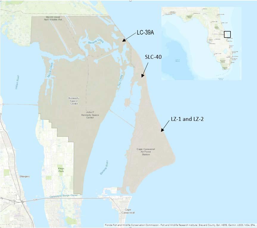
In 1998, as a result of USAF’s decision to implement the Evolved Expendable Launch Vehicle Program (now called the National Security Space Launch program) at CCAFS (USAF 1998), the 45th SW initially decided to deactivate LC-40 and place it in a “pre-demolition” state. However, in 2007, the 45th SW decided to renew the complex for use by SpaceX. SpaceX’s proposal to revitalize LC-40 was analyzed in a 2007 USAF EA (USAF 2007). Since then, SpaceX has conducted refurbishment of and upgrades to the existing support buildings and launch pad to bring LC-40 back into operation as a launch facility for the Falcon launch vehicle program. The 2007 USAF EA analyzed the potential environmental impacts of operating the Falcon 1 and Falcon 9 (Block 1) from LC-40. In addition to Falcon launch operations, the 2007 USAF EA included construction of a new hangar facility with supporting systems, as well as Dragon reentry. At the time, SpaceX’s goal was to conduct 8 to 12 launches per year for both the Falcon 1 (no longer in operation) and Falcon 9. All flights were expected to have payloads, including either satellites or Dragon.
In 2011 and 2012, SpaceX constructed a hangar annex and support facilities. Launch pad and facility modifications also were accomplished. The potential environmental impacts of this construction were
analyzed by the 45th SW (two Air Force Form 813 3 dated June 2011 and February 2012). In 2013, a supplemental EA (USAF 2013; referred to as the 2013 USAF SEA) was prepared to expand on the action analyzed in the 2007 USAF EA to include operation of an upgraded Falcon 9 (referred to as the Falcon 9 version 1.1. [v1.1]). The FAA was a cooperating agency in the preparation of the 2013 USAF SEA. The Falcon 9 v1.1 was similar to the vehicle design of the Falcon 9 (Block 1), except it was taller, heavier, and had more thrust due to a newer model of the rocket’s Merlin engine. The Falcon 9 v1.1 was a mediumlift class launch vehicle with a gross lift-off weight of approximately 1,100,000 pounds. The Falcon 9 v1.1 used the same propellants as Block 1: liquid oxygen (LOX) and highly refined kerosene (RP-1). Additional modifications necessary to increase thrust were subsequently analyzed in FAA’s Written Re-evaluation 4 (FAA 2018a), which concluded that the modified Falcon 9 vehicles 1) conformed to the prior environmental documentation; 2) that the data contained in prior environmental documentation remained substantially valid; 3) there were no significant environmental changes; and 4) all pertinent conditions and requirements of the prior approvals were met or would be met in the current action at the time. The 45th SW documented similar conclusions in a Form 813. Therefore, additional NEPA documentation was not necessary to support issuing licenses to SpaceX for subsequent modifications to the Falcon 9.
As of October 2019, SpaceX has launched the Falcon 9 vehicle from LC-40 46 times One anomaly occurred in June 2015 when, approximately 139 seconds into flight, the second stage exploded over the Atlantic Ocean After assessment of operations, SpaceX successfully launched the Falcon 9 with 11 ORBCOM satellites in December 2015. Another anomaly occurred when LC-40 was heavily damaged following the September 2016 catastrophic failure during a static fire test. The complex was repaired and returned to operational status in December 2017. Current activities at LC-40 remain consistent with those analyzed in the 2007 USAF EA and 2013 USAF SEA.
Over the past several years, SpaceX has developed the technology and ability to boost-back and land the Falcon 9 first stage booster. To support the environmental review of boost-back and landing, the USAF prepared an EA in 2014 (2014 USAF EA) for landing at LC-13, later renamed LZ-1. The 2014 USAF EA assessed construction of a main landing pad (LZ-1) and boost-back and landing of the first stage booster on the pad or on a drone ship in the Atlantic Ocean. In 2017, the USAF prepared a supplemental EA (referred to as the 2017 USAF SEA) to analyze Falcon Heavy boost-back and landing at CCAFS (USAF 2017a). The 2017 USAF SEA analyzed conducting boost-backs and landings of up to three Falcon Heavy boosters, which would have required construction of two additional landing pads. The 2017 USAF SEA also included the option of landing one or two Falcon Heavy boosters on a drone ship in the Atlantic Ocean. The 2017 USAF SEA also addressed construction and operation of a Dragon processing and testing facility. Both the FAA and NASA were cooperating agencies on the 2014 USAF EA and 2017 USAF SEA. SpaceX eventually constructed only one of the two additional landing pads evaluated in the 2017 USAF SEA, which is referred to as LZ-2. On February 6, 2018, SpaceX landed two of Falcon Heavy’s first stage boosters at LZ-1 and LZ-2.
3 The USAF uses AF Form 813 to document the need for environmental analysis or for certain categorical exclusion determinations for proposed actions. The form helps narrow and focus the issues to potential environmental impacts. 32 CFR § 989.12.
4 A Written Re-evaluation is a document the FAA uses to determine whether the contents of a previously prepared environmental document (i.e., a draft or final EA or EIS) remain valid, or if a new or supplemental environmental document is required (FAA Order 1050.1F, Paragraph 9-2.)
1.2.4.
LC-39A construction was started in 1965 and completed in 1966 to support the Apollo Program. Both LC-39A and LC-39B were later modified for the Shuttle Program. NASA prepared an EA in 2013 to increase KSC spaceport capabilities and allow both commercial and governmental entities to use LC-39A and LC-39B for launch purposes involving a variety of vertical launch vehicles, including Falcon launch vehicles (NASA 2013; referred to as the 2013 NASA EA). The FAA was a cooperating agency for the 2013 NASA EA. In 2014, NASA granted a lease to SpaceX to operate at LC-39A and construct a horizontal integration facility. Additional components of SpaceX activities at LC-39A were reviewed by NASA via KSC’s Environmental Checklist and Record of Environmental Consideration process. SpaceX successfully launched the first of several Falcon 9 v1.1 launch vehicles at LC-39A on February 19, 2017 and, as of October 2019, there have been 18 total launches. The Falcon Heavy launched for the first time on February 6, 2018 and again on April 11, 2019 and June 25, 2019, all from LC-39A. In a 2016 Programmatic Environmental Impact Statement (EIS), NASA identified potential environmental impacts associated with proposed operations, activities, and facilities at KSC over a 20-year period, including at LC-39A (NASA 2016a).
Since 2010, SpaceX has also used facilities formerly used by the USAF and NASA for a variety of purposes that support launch operations at both LC-40 and LC-39A. The USAF has leased the following facilities to SpaceX: Hangar AO, Hangar M, Payload Processing Facility (PPF), Fairing Processing Facility (FPF), and Area 59.
1.2.5.1.
Hangar AO was built in 1964 as a concrete block building that was used for payload processing and flight hardware testing. Modifications to the rear high bay portion of this building were completed in 1995. Hangar AO formerly had several other designations, including Spacecraft Building #2 (1964), Spacecraft Building #2 Mar AO (1971), and Spacecraft Building #2 AO (1975). NASA contractors occupied the facility from the time it was built in 1964 until 1996. The Gemini, Apollo, Space Shuttle, and Delta programs all used this facility to process payloads. The facility consists of two floors containing office space, storage spaces, and a high bay area. During the period of NASA occupation, the high bay was used for buildup and testing of flight control operation systems, while the remainder of the facility provided the engineering control console, office, and logistical support areas. United Launch Alliance occupied the building from 1996 to 2011 and conducted Delta payload processing operations and testing of the Delta rocket. The surrounding paved area has been used for parking and storage. In 2011, SpaceX assumed use of the hangar through a real property lease with USAF. SpaceX uses the facility as a logistics center for storage of new material and launch vehicle parts inventory, shipping and receiving center, and minor launch vehicle work. SpaceX also uses the facility as a reception and meeting area for clients. Surrounding paved areas are used for parking and limited storage for bulk material and/or re-landed first stage boosters.
1.2.5.2.
Hangar M is directly adjacent (to the north) of Hangar AO. SpaceX is in the process of renovating the hangar for similar activities being performed in Hangar AO. It is currently used for storage of flight hardware, particularly returned Falcon first stage boosters.
1.2.5.3.
SpaceX uses the large processing facility (former USAF Facility 70000, also known as Solid Motor Assembly Building or Large Processing Facility) at CCAFS to prepare payloads. The Titan Integrate-
Transfer-Launch system was originally located here. The processing facility was initially designed for assembling, checking out, and integrating the Titan IIIC’s major components before the Titan IIIC booster was transferred to the pad for payload mating and launch operations. SpaceX leases this facility for payload processing activities and hypergolic fuel loading of certain payloads and has named it the PPF. SpaceX provides this ISO Class 8 (Class 100,000) PPF for processing customer spacecraft, including equipment unloading, unpacking/packing, final assembly, non-hazardous flight preparations, and payload checkout. The PPF is also designed to accommodate hazardous operations, such as hypergolic propellant loading and ordnance installation. Any required fueling operations are performed with assistance from SpaceX personnel. All personnel use certified Self-Contained Atmospheric Protective Ensemble (SCAPE) suits, pass a physical, and attend SCAPE training classes.
Located very close to and north of the PPF, the FPF also has a high-bay and clean rooms and is used for payload processing and storage This building was formerly known as the Solid Motor Assembly and Readiness Facility (USAF Facility 69800) used for mating the core vehicles to the solids
1.2.5.5.
SpaceX recently obtained access to and use of a set of buildings named Area 59, located adjacent to and south of the CCAFS runway known as the Skid Strip. The area was previously used for satellite processing and associated hypergolic fuel-related operations, which is consistent with SpaceX’s use of the facility. The area will be used for Dragon capsule processing.
1.2.6.
SpaceX is developing a campus facility in an area of KSC currently known as the Roberts Road site. The campus would support ongoing Falcon 9 and Falcon Heavy launches at LC-39A and LC-40. The proposed campus could include a facility for a launch and landing control center, booster and fairing processing and storage facility, security office, and utilities yard. The site would require approximately 67 acres of land for proposed facility development. Roberts Road and A Avenue would be paved to provide access on the south and north sides. The purpose of the site is to enable improved access to KSC's space launch and test operation capabilities by commercial and other non-NASA users, and to advance NASA’s mission by fostering a commercial space launch and services industry. NASA completed an EA and issued a finding of no significant impact (FONSI) for construction of this facility in December 2018 (NASA 2018). It is mentioned here for payload processing completeness.
1.3.1.
As the lead federal agency, the FAA is responsible for analyzing the potential environmental impacts of the Proposed Action. As authorized by Chapter 509 of Title 51 of the U.S. Code, the FAA licenses and regulates U.S. commercial space launch and reentry activity, as well as the operation of non-federal launch and reentry sites. The mission of the Office of Commercial Space Transportation is to ensure protection of the public, property, and the national security and foreign policy interests of the United States during commercial launch or reentry activities, and to encourage, facilitate, and promote U.S. commercial space transportation.
1.3.2.
As defined in 40 CFR §1508.5, a cooperating agency may be any federal agency other than the lead agency that has jurisdiction by law or special expertise with respect to the environmental impacts expected to result from a proposal. An agency has “jurisdiction by law” if it has the authority to approve,
veto, or finance all or part of the proposal (40 CFR §1508.15). An agency has “special expertise” if it has statutory responsibility, agency mission, or related program experience with regards to a proposal (40 CFR §1508.26). A lead agency must request the participation of cooperating agencies as early as possible in the NEPA process, use the environmental analyses and proposals prepared by cooperating agencies as much as possible, and meet with cooperating agencies at their request (40 CFR §1501.6[a]).
The FAA requested the participation of NASA and the USAF (45th SW) as cooperating agencies in the preparation of this EA due to their jurisdiction by law and special expertise. LC-39A is located on KSC property and the KSC Director has ultimate responsibility for all operations and improvements that occur on KSC property. Additionally, NASA provides special expertise with respect to environmental issues concerning space launch vehicles, especially crewed capsules like the Dragon-2. LC-40 is located at CCAFS, which is controlled by the 45th SW. The 45th SW has a special interest and specific expertise with regards to all activities located at CCAFS. The 45th SW also has interest in managing their local environmental related activities performed by the growing number of tenants at CCAFS who may be affected by any proposed actions.
The purpose and need provide the foundation for identifying intended results or benefits and future conditions. In addition, the purpose and need define the range of alternatives to a proposed action. According to FAA Order 1050.1F, Paragraph 6-2.1(c), the purpose and need presents the problem being addressed and describes what the FAA is trying to achieve with the Proposed Action.
The purpose of FAA’s Proposed Action is to fulfill the FAA’s responsibilities as authorized by the Commercial Space Launch Act (51 U.S.C. Subtitle V, ch. 509, §§ 50901-50923) for oversight of commercial space launch activities, including licensing launch activities. The need for FAA’s Proposed Action results from the statutory direction from Congress under the Commercial Space Launch Act, 51 U.S.C 50901(b) to, in part, “protect the public health and safety, safety of property, and national security and foreign policy interests of the United States” while “strengthening and [expanding] the United States space transportation infrastructure, including the enhancement of United States launch sites and launch-site support facilities, and development of reentry sites, with Government, State, and private sector involvement, to support the full range of United States space-related activities.”
The purpose of SpaceX’s proposal to modify and expand several elements of its Falcon launch vehicle program at KSC and CCAFS is to continue to support missions for NASA and USAF, as well as to conduct business with commercial customers. SpaceX’s proposed changes provide greater capability in its mission to support the ISS, the U.S. Department of Defense (DoD), and other commercial enterprises. SpaceX’s activities continue to fulfill the U.S. expectation that space transportation costs are reduced to make continued exploration, development, and use of space more affordable.
SpaceX’s proposal is needed to increase the operational capabilities and cost effectiveness of its space flight programs. Satisfaction of these needs benefits government and public interests to continue resource protection and reduce operation costs. Demand for launch services continues to increase beyond that originally proposed over the past 20 years, and the space industry growth projections indicate this will continue into the foreseeable future.
In accordance with CEQ’s NEPA-implementing regulations and FAA Order 1050.1F, the FAA initiated a
public review and comment period for the Draft EA by publishing a Notice of Availability in the Federal Register on February 27, 2020. The public review and comment period ended on March 20, 2020. The FAA received six public comment submissions (refer to Appendix C). In response to some of the comments, the FAA added a new appendix (Appendix E). The FAA did not make any substantive changes to the body of the EA
This chapter describes the Proposed Action (Section 2.1) and the No Action Alternative (Section 2.2).
The FAA is proposing to modify existing SpaceX launch licenses or issue new launch licenses to SpaceX to continue conducting Falcon launch operations at KSC and CCAFS and to issue new reentry licenses to SpaceX for Dragon reentry operations. NASA is responsible for managing areas on KSC for space-related development and operations and provides oversight for non-NASA space and technology development use of KSC property. NASA is responsible for approving the construction of the MST at LC-39A. The FAA has no federal action related to the construction of the MST.
Due to SpaceX’s ability to conduct launches, including booster landings, more frequently at KSC (LC-39A) and CCAFS (LC-40, LZ-1, and LZ-2), SpaceX’s launch manifest includes more annual Falcon launches and Dragon reentries than were considered in previous NEPA analyses. This section provides the following:
• a description of the Falcon launch vehicles and Dragon spacecraft that FAA would license to conduct commercial space launch and reentry operations (Section 2.1.1)
• a description of the MST that SpaceX would construct to support launch operations at LC-39A (Section 2.1.1)
• a description of Falcon launch vehicle operations at LC-39A and LC-40 that FAA would license (Section 2.1.2)
• a description of Dragon reentry and recovery operations that FAA would license (Section 2.1.3)
• a description of payload processing associated with Falcon launch operations that FAA would license
2.1.1.
2.1.1.1.
SpaceX recently upgraded the Falcon 9 with a newer version of its Merlin engine to increase the amount of thrust. The upgraded vehicle is referred to as Falcon 9 Block 5, but is referred to generally as the Falcon 9 in this EA. Additional changes include improvements to the landing legs and modifications to increase the efficiency of the recovery and reusability of the first stage boosters. Each of the Falcon 9 upgraded Merlin 1D (M1D) engines is capable of providing 190,000 pounds (pound-force) of thrust at sea level (for a total of approximately 1.7 million pounds of thrust at liftoff). The current Merlin engine used on Falcon 9 produces 170,000 pounds of thrust at sea level. The Falcon 9 is 229 feet tall with a diameter of 12 feet (Figure 2-1). These dimensions are the same as the previous Falcon version. Falcon 9 launches would occur at LC-40 and LC-39A. Consistent with past practices, a static fire test would be performed prior to each launch.
2.1.1.1.1.
The Falcon 9 first stage includes nine M1D engines, which are propelled by LOX and RP-1. The engines are configured in a circular pattern, with eight engines surrounding a center engine. The first stage has four deployable landing legs which are locked against the first stage during ascent. These legs are used on missions that include first stage boost-back and landing. Four grid fins near the top of the first stage support precision reentry and landing operations. The grid fins help align the first stage booster for reentry after separating from the rest of the launch vehicle in space.
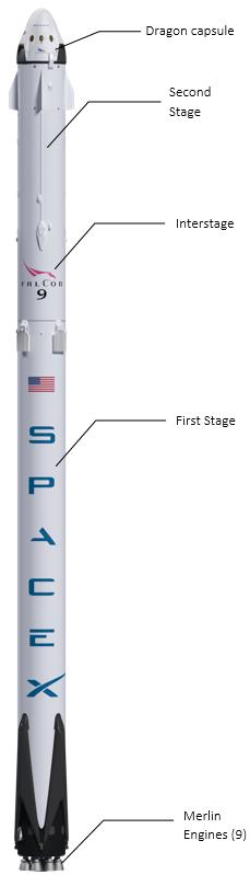
A performance comparison of the current version of Falcon 9 to previous Falcon 9 launch vehicles is shown in Table 2-1.
Table 2-1. Performance Comparison of Falcon 9 Launch Vehicles
Parameter
9 (original)
Notes: a Propellant quantities vary based on mission parameters. lbf = pound-force; lbm = pound-mass; LOX = liquid
Recent modifications to the second stage are relatively minor and include improvements to the engine nozzle, mass optimization, and engine control enhancements. For added reliability of restart, the engine contains dual redundant triethylaluminum-triethylborane (TEA-TEB) pyrophoric igniters. In addition, the second stage contains a cold nitrogen gas (GN2) attitude control system (ACS) for pointing and roll control. The GN2 ACS is more reliable and produces less contamination than a propellant-based reaction control system. The second stage is either left in orbit after payload (e.g., satellite) separation or planned for deorbit and reentry During reentry, the second stage would eventually disintegrate and be consumed as it falls back into the upper atmosphere SpaceX safes the second stage according to FAA regulations.
The Falcon Heavy has a mass of approximately 3.1 million pounds and an overall length of 229 feet. Falcon Heavy has the ability to lift up 64 tons (141,000 pounds) into low Earth orbit. Merlin engines are used on both stages of the Falcon Heavy. The propellants are the same as the Falcon 9 (LOX and RP-1). The Falcon Heavy contains 1,898,000 pounds of LOX and 807,000 pounds of RP-1 in the first stage, and 168,000 pounds of LOX and 64,950 pounds of RP-1 in the second stage. The center and two side boosters are essentially the same design as the Falcon 9 first stage booster. The Falcon Heavy produces a total of 5.13 million pounds of thrust at liftoff. An illustration of the Falcon Heavy launch vehicle is shown in Figure 2-2.
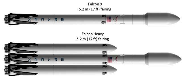
SpaceX developed the Dragon-2 to deliver cargo and experiments to the ISS and Low Earth Orbit and to transport astronauts to the ISS. Dragon-2 weighs approximately 18,000 pounds without cargo and is
approximately 17 feet tall with a base width of 13 feet. Dragon-2 is similar to the previous Dragon-1 (Figure 2-3). Both are composed of two main elements: the capsule for pressurized crew and cargo, and the unpressurized cargo module or “trunk.” The capsule contains a pressurized section, an unpressurized service section, and a nosecone. Other primary structures include a welded aluminum pressure vessel, primary heat shield support structure, and back shell thermal protection system support structure. The thermal protection structure supports secondary structures, including the SuperDraco engines, propellant tanks, pressurant tanks, parachute system, and necessary avionics.

One of the primary differences between Dragon-1 and Dragon-2 is that Dragon-2 has an integrated launch escape system capable of providing powered abort from the launch pad all the way to orbit, with enough thrust to escape from the Falcon 9 under worst-case conditions. The SuperDraco engines of the launch abort system are integrated into the sidewalls of Dragon-2.
After Dragon leaves the ISS, Dragon re-enters Earth’s atmosphere at a pre-planned trajectory and splashes down (lands with parachutes) in the Atlantic Ocean (5 to 200 nautical miles east of Cape Canaveral). The Gulf of Mexico or the Pacific Ocean would be used as an alternate splash down area if conditions in the Atlantic Ocean are unfavorable. The potential environmental impacts of Dragon landings in the Gulf of Mexico were previously analyzed by the FAA in an EA (FAA 2018b), which resulted in a FONSI, and are not assessed in this EA.
Dragon’s propulsion system consists of a reaction control system and the integrated launch abort system. Dragon contains 18 Draco engines and 8 SuperDraco engines. The propulsion system uses nitrogen tetroxide (NTO) and monomethylhydrazine (MMH) propellant combination because of its hypergolic ignition and long-term in-orbit storage benefits. Dragon could contain up to 5,650 pounds of propellant, which includes 3,500 pounds of NTO and 2,150 pounds of MMH. The pressurization subsystem, which uses gaseous helium, is separated between the oxidizer and fuel to prevent propellant migration reactions. Dragon’s propellant storage is designed to retain residual propellant, preventing release into seawater upon splashdown.
2.1.1.4.
SpaceX plans to develop vertical integration capabilities at LC-39A to support commercial launches, NASA launches, and USAF’s National Security Space Launch program. An MST would be constructed on the existing LC-39A pad to support this capability. The MST would consist of a steel trussed tower, a base, and a rail bridge (Figure 2-4). Four transport wheel assemblies located at the corners of the tower
would be constructed and used to move the tower 130 feet from an integration to a launch position (Figure 2-5). The tower would have 11 floors and would be approximately 284 feet tall. The MST would meet all applicable codes, including IBC 2015, ACI 318-14, ASCE 7-10, AISC, 15th Ed., 91-710 requirements, and AWS D1.1.
During tower construction, equipment and build materials would be staged east of the pad deck in the laydown area. Mobile cranes on the east and west of the tower site would be used to construct and assemble the tower. Construction dumpsters would be placed around the area and all materials would be disposed of according to federal and state regulations. Minimal demolition would occur on top of the MST area to allow access to the top of the existing concrete and install new shear walls and foundations. Figure 2-6 shows a general site overview for the proposed staging and laydown operations.
2-7. Site Overview
New reinforced concrete slabs would be placed over the existing flame trench. No new impervious areas would result from tower construction. Design drawings of the foundation modifications are shown in Figure 2-7.
2-8. Foundation Modifications
New lighting would only be added inside the tower, which would be shielded by the walls of the tower. If any additional exterior lighting were planned later, the designs would be included in the LC-39A Light
Management Plan, which is a plan intended to minimize nighttime lighting impacts on the environment (e.g., sky glow). A rendering of LC-39A with the existing infrastructure and the proposed MST is presented in Figure 2-8.

All launch operations would continue to comply with the necessary notification requirements, including issuance of Notices to Airmen (NOTAMs) and Local Notices to Mariners (NOTMARs), consistent with current procedures. A NOTAM provides notice of unanticipated or temporary changes to components of, or hazards in, the National Airspace System (FAA Order JO 7930.2S, Notices to Airmen). A NOTMAR provides notice of temporary changes in conditions or hazards in navigable waterways. Eastern Range operations (which include SpaceX’s launches from KSC and CCAFS) currently follow the procedures stated in a Letter of Agreement (LOA) (dated May 1, 2020) between the 45th SW and FAA. The LOA establishes responsibilities and describes procedures for the 45th SW, Eastern Range operations, within airspace common to the Miami Center, Jacksonville Center, New York Center, San Juan Center Radar Approach Control, Central Florida Terminal Radar Approach Control, NASA Shuttle Landing facility, Fleet Area Control and Surveillance Facility Jacksonville, Air Traffic Control System Command Center, and Central Altitude Reservation Function areas of jurisdiction. The LOA defines responsibilities and procedures applicable to operations, which require the use of Restricted Areas, Warning Areas, Air Traffic Controlled Assigned Airspace, and/or altitude reservations within Eastern Range airspace.
The Proposed Action does not include altering the dimensions (shape and altitude) of the airspace. However, temporary closures of existing airspace and navigable waters would be necessary to ensure public safety during launch operations. Advance notice via NOTAMs and NOTMARs would assist general aviation pilots and mariners in scheduling around any temporary disruption of flight or shipping activities in the area of operation. Launches would be of short duration and scheduled in advance to minimize interruption to airspace and waterways. For these reasons, significant environmental impacts of the temporary closures of airspace and waterways, and the issuance of NOTAMS and NOTMARs
under the Proposed Action, are not anticipated (see Appendix E for a discussion airspace-related impacts).
On launch days, there is a possibility of temporary restricted public access due to visitor volume on sections of MINWR and NPS. These temporary closures of MINWR and CNS are typically related to crowd control and access for emergency services. They are related to the volume of visitor traffic in an area and are not related to a public safety hazard from a launch. Any potential closures due to visitor volume would be coordinated between KSC security, MINWR, and CNS by monitoring to ensure parking lot thresholds are not exceeded, and that roadways allow for emergency egress for any form of emergency associated with large crowds. Such closures would not be expected to cause more than a minimal disturbance to the enjoyment of the resources of MINWR and CNS and would be determined by the land managing agencies.
For some future launches and landings, debris and/or propellant dispersion analyses could lead to a recommendation by USAF Range Safety to close parts of MINWR and CNS to ensure public safety. Dayof-launch winds, anticipated crowds, and time of day are among the many factors that contribute to this recommendation. For the purposes of this EA, all closures associated with the activities in this EA would be voluntary and coordinated between the land managing agencies: NASA, USAF, MINWR, and CNS. Voluntary safety-related closures have occurred for some previous Falcon 9 launches that contained a Dragon capsule for NASA’s crew and cargo missions. This EA does not contemplate mandatory closures that are directed by NASA or USAF, nor does the FAA have the authority to close the MINWR and/or CNS.
The Proposed Action includes annual SpaceX Falcon launches and related operations at LC-40, LZ-1, LZ-2, and LC-39A for the next six years (Table 2-2). Each takeoff would be preceded by a static fire test of the engines, which lasts a few seconds. This launch schedule is based on SpaceX’s anticipated need to support NASA and DoD missions, as well as commercial customers. In addition to its typical launch trajectories, SpaceX is proposing to increase the launch azimuth window to include a new Falcon 9 southern launch trajectory to support missions with payloads requiring polar orbits. SpaceX estimates approximately ten percent of its annual Falcon 9 launches would fly this new southern launch trajectory. Falcon launch vehicle trajectories would be specific to each particular mission. Each trajectory would be provided in SpaceX’s Flight Safety Data Package and submitted to the FAA in advance of the launch.
Table 2-2. Past and Estimated Future Falcon 9 and Falcon Heavy Launch
a Data for the years 2015–2019 represent launches that occurred
The following subsections describe nominal launch operations, including takeoffs and first stage boost-
backs and landings.
The Falcon vehicle payload system includes a fairing cover that protects non-Dragon payloads (e.g., satellites). The fairing consists of two halves which separate, allowing the deployment of the payload at the desired orbit. In the past, following the fairing separation, both halves of the fairing were left to splash down in the ocean, break apart, and sink. SpaceX is currently attempting to recover and reuse the payload fairings by adding a parachute system to the fairing halves. The parachute system consists of one drogue parachute and one parafoil (Figure 2-9). Following re-entry of the fairing into Earth’s atmosphere, the drogue parachutes deploy at a high altitude (approximately 50,000 feet) to begin the initial slow down and to extract the parafoil. The drogue parachute (and the attached deployment bag) cuts away following the successful deployment of the parafoil. The parachute system slows the descent of the fairing to enable a soft splashdown so that the fairing remains intact. The predicted impact points within desired recovery areas of both the fairing (with parafoil) and drogue parachute assembly are developed using modeling tools. Various parachute systems are being tested, but generally, the drogue parachute canopy area is approximately 110 square feet and the fairing parafoils are approximately 3,000 square feet. In addition to various parachute systems, SpaceX is also testing recovery of the fairings using power boats to “chase and catch” the chutes and fairings as they descend to the ocean surface. SpaceX successfully caught a faring half using a power boat after a Falcon Heavy launch on June 25, 2019.
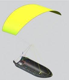
In 2020 through 2025, SpaceX anticipates approximately three recovery attempts per month involving recovery of both halves of the fairing. Thus, during these six years, SpaceX anticipates up to 432 drogue parachutes and up to 432 parafoils would land in the ocean. SpaceX would attempt to recover all parafoils over this time period, but it is possible some of the parafoils would not be recovered due to sea or weather conditions at the time of recovery. Recovery of the drogue parachute assembly would be attempted if the recovery team can get a visual fix on the splashdown location. Because the drogue parachute assembly is deployed at a high altitude, it is difficult to locate. In addition, based on the size of the assembly and the density of the material, the drogue parachute assembly would become saturated and begin to sink. This would make recovering the drogue parachute assembly difficult and unlikely.
SpaceX is working on an engineering solution for recovery of the drogue parachute assembly, including landing the assembly on a pre-positioned recovery vessel that would be equipped with a landing pad/mechanism.
If SpaceX did not catch the fairings prior to falling in the ocean, the fairing and parafoil would be recovered by a salvage ship stationed in a Range Safety-designated zone near the anticipated splashdown area no closer than 5 nautical miles offshore. The salvage ship would be able to locate the fairing using GPS data from mission control and strobe lights on the fairing data recorders. Upon locating the fairing, a rigid-hulled inflatable boat (RHIB) would be launched. Crew members would hook rig lines to the fairing and connect a buoy to the parafoil. Then the crew would release the parafoil riser lines and secure the canopy by placing it into a storage drum. If sea or weather conditions are poor, recovery of the fairing and parafoil may be unsuccessful.
The southern launch trajectory would increase the potential fairing splashdown area to include the redlined and yellow-lined areas in Figure 2-10 The yellow-lined area would also include any potential downrange first stage booster landing during Falcon 9 polar missions using the SpaceX drone ship. These areas consist of deep waters. SpaceX cannot conduct recovery operations in shallow waters near the Bahamas. The Florida Keys National Marine Sanctuary (NMS) is located along the southern Florida coast near the new proposed yellow-lined area.
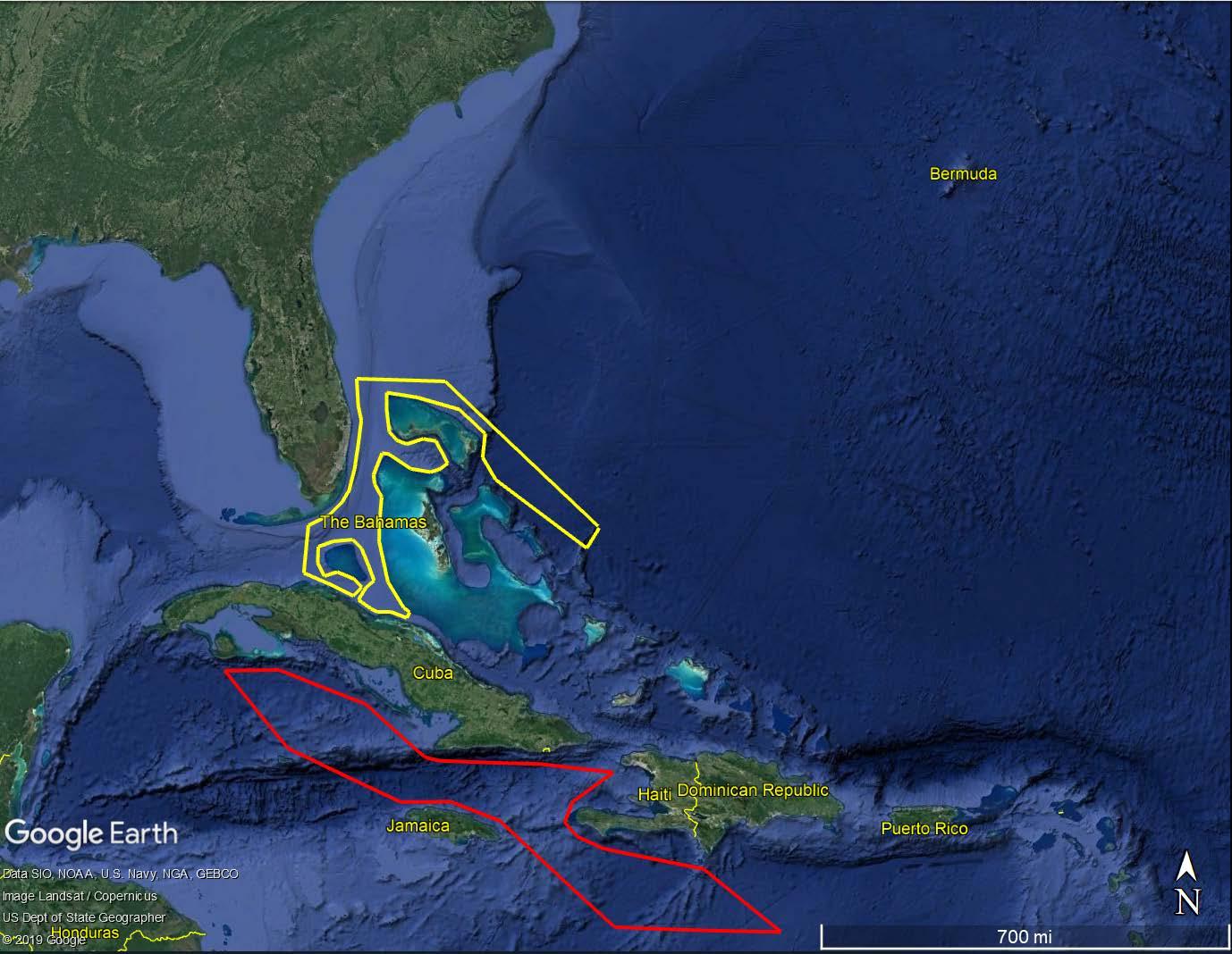
The Proposed Action includes conducting boost-back and landing of Falcon 9 and Falcon Heavy first stage boosters. After first stage engine cutoff and separation from the second stage, three of the nine first stage M1D engines are restarted to conduct a reentry burn. This reduces the velocity of the booster and places it in the correct angle for descent. Each booster has internal carbon overwrapped pressure vessels which are filled with either nitrogen or helium and are used to orient the position of the booster. Once the booster is in position and approaching its landing target, the three engines are cut off to end the entry burn. A final burn of one to three engines slows the booster to a velocity of zero for landing on the drone ship or at LZ-1 and/or LZ-2.
For missions involving boost-back and landing, SpaceX measures wind speed in the landing area using weather balloons. Measurements are taken at various intervals before launch and landing events and used to create the required profiles of expected wind conditions during the landing event. A radiosonde, which is approximately the size of a shoe box and is powered by a 9-volt battery, is attached to a weather balloon and transmits data to SpaceX and to vehicle onboard predictive systems. The balloon, which is made of latex, rises to approximately 12 to 19 miles and bursts. The balloon is shredded into many pieces as it falls back to Earth, along with the radiosonde, and lands in the ocean. The radiosonde does not have a parachute and would not be recovered.
LZ-1 and LZ-2 support preparations for and the landing of Falcon 9 and Falcon Heavy first stage boosters. They also support post-flight landing and safing activities which begin upon completion of all landing activities and engine shutdown. Once a booster(s) is safed, it is eventually transported to a SpaceX facility for refurbishment.
Following a nominal launch from LC-40 or LC-39A (including a polar mission), the first stage booster(s) would return to LZ-1 and/or LZ-2 for potential reuse (or land on a drone ship; see next section), rather than splashing down in the Atlantic Ocean. After first stage engine cutoff, exoatmospheric cold gas thrusters would be triggered to flip the booster(s) into position for retrograde burn, and three of the nine booster engines would be restarted to conduct the retrograde burn. This reduces the velocity of the booster and places it in the correct angle to land. Once the booster is in position and approaching its landing target, the three engines would be shut down to end the reentry burn. During the boost-back stage, sonic booms would be generated by each booster (the number of booms depends on the number of returning boosters). The landing legs on the booster(s) would then deploy in preparation for a final single-engine burn that would slow the booster to a velocity of zero before landing on the pad.
The detailed sequence of events for first stage booster landing(s) along with trajectory data would be provided in SpaceX’s Flight Safety Data Package submitted to the FAA prior to the operation. Although propellants would be burned to depletion during flight, there is a potential for residual LOX and RP-1 to remain in the booster(s) upon landing. Final volumes of propellant would be included in the Flight Safety Data Package. A small amount of ordnance, such as small explosive bolts and batteries, would typically also be onboard. Any hazardous materials would be handled in accordance with federal, state, and local laws and regulations. SpaceX has an established emergency response team and any unexpected spills would be contained and cleaned up per the procedures identified in the SpaceX Emergency Action Plan and Spill Control and Countermeasures Plan.
2.1.2.3.2.
If SpaceX is unable to return the first stage booster(s) to LZ-1 and/or LZ-2, SpaceX would attempt a drone ship landing. SpaceX’s drone ship includes four outboard dynamic positioning devices which allow the barge to maintain a constant position for booster landings. In addition to the drone ship, SpaceX
charters a crewed tug that tows the drone ship into position prior to launch. An accompanying crew boat also houses crew and communications equipment. Once on location, the drone ship positioning system is remotely activated, tow is broken, and the crew boat and tug boat fall back and stage themselves cross-range of the rocket’s flight path. This puts the nearest vessel approximately 5 nautical miles from the drone ship, and the furthest vessel no more than 12 nautical miles from the drone ship The drone ship would be no closer than 5 nautical miles from shore, but could be located several hundred miles offshore in the Atlantic Ocean. This area is referred to as the “superbox” and is shown in Figure 2-11. For polar missions, downrange drone ship recovery operations could include areas of the Atlantic Ocean north and south of Cuba and west of the Bahamas (Figure 2-10).
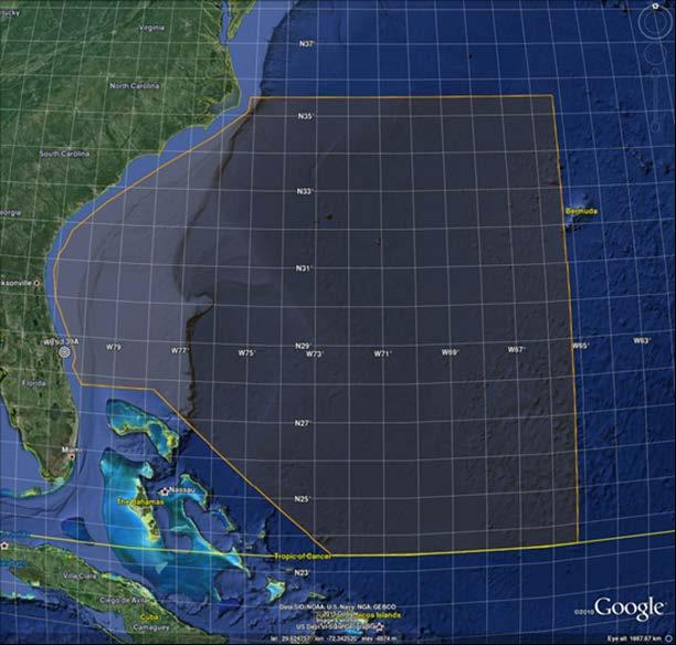
Following a drone ship landing, automated and remotely operated systems are initiated to ensure the booster completes its landing and safing operations. Commands are transmitted through a satellitebased communication system that provides feedback and pertinent data about the systems to SpaceX controllers. The safing steps include venting pressure of stored helium and nitrogen, purging residual hazardous ignition fluid (TEA-TEB), and emptying remaining LOX from the booster. In some cases, the booster may fail to make a successful landing due to a number of variables (e.g., lack of fuel or hydraulic
fluid, wind shear, etc.). In the case of an unsuccessful landing, any remaining fuel would ignite and burn off, and the wreckage would sink, similar to the fate of traditional non-reusable first stage boosters.
A remote controlled robot device is used to secure the booster. Once the booster is remotely safed, SpaceX personnel board the drone ship to service the fluids system to further remove hazards and protect against corrosion. Operations are optimized to require a small amount of time with a small number of personnel on the drone ship. After safing and securing operations are complete, the drone ship is placed under tow and all vessels return to shore.
As the drone ship approaches shore, automated systems ensure the booster is in a safe-state to proceed into port. SpaceX personnel are mobilized at the port to receive and off-load the booster. The booster is then placed into processing fixtures on-shore that allow any residual fuel to be offloaded into storage tanks, landing gear removed, ordnance removed, and to ultimately facilitate on-road transport to a SpaceX facility for further processing.
While it is SpaceX’s goal to renter and land all first stage Falcon boosters for reuse, some payloads require additional propellant to reach desired orbits or destinations (due to increased weight or extended trajectory), and, as a result, not all the launches listed in Table 2-2 would include boost-back and landing. Approximately 75 percent of missions are expected to include a boost-back and landing. In the event SpaceX is unable to locate an expended first stage in the Atlantic Ocean (refer to Figures 2-10 and 2-11 for locations), SpaceX expects the stage would sink and therefore not be recovered. If the stage lands intact, SpaceX would attempt to recover it (as described in the 2007 USAF EA).
For Falcon Heavy boost-back and landing (which involves three first stage boosters), each of the three boosters would be controlled separately so their approach and landing would be managed independently. Not all of the boosters would land at CCAFS. Some would land on one of SpaceX’s drone ships in the Atlantic Ocean. For a conservative analysis, the FAA is assuming a maximum of 54 annual first stage boosters landing at CCAFS (LZ-1 and/or LZ-2) and 27 annual first stage boosters landing on a drone ship (Table 2-3) If SpaceX operations exceed these numbers in the future, the FAA would conduct further environmental review to the extent necessary under NEPA.
Table
a Not all boosters would land at CCAFS (LZ-1 and/or LZ-2). Some boosters would land on SpaceX’s drone ship in the Atlantic Ocean. For a conservative analysis, the FAA is assuming 54 boosters per year would land at CCAFS and 27 boosters per year would land on the drone ship.
The Proposed Action includes Dragon reentry and recovery operations. SpaceX plans to continue supporting its Commercial Cargo and Commercial Crew contracts with NASA by transporting cargo and NASA astronauts to the ISS onboard Dragon. These Dragon missions are included in the number of Falcon launches discussed above.
2.1.3.1.
For Dragon recovery in the Atlantic Ocean, Dragon would be shipped to SpaceX facilities located at Port Canaveral or a CCAFS-located wharf. For Dragon recovery in the Pacific Ocean, Dragon would be shipped to the Port of Los Angeles. SpaceX would be responsible for coordinating local approvals with the relevant state and local agencies, including port authorities. Upon arriving at a port, Dragon would be offloaded and transported by truck to a SpaceX facility for further post-flight processing. In accordance with U.S. Department of Transportation (DOT) requirements, as outlined in SpaceX’s DOT permit regarding the transport of hazardous waste, SpaceX would ensure all pressurized tanks are vented to a DOT-mandated maximum pressure prior to transport.
As Dragon-2 could contain astronauts, SpaceX and NASA plan to splash down Dragon-2 as close to the shore as possible (an area referred to as the “bulb;” Figure 2-12). The bulb would be the nominal landing area for Dragon-2, with the Superbox acting as the contingency splashdown location. SpaceX designed the shape of the bulb such that all locations within the bulb are greater than 5 nautical miles from the coast to avoid North Atlantic right whale critical habitat.
Figure 2-13. Atlantic Ocean Recovery Area for Dragon-2 – The Bulb
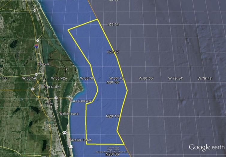
2.1.3.2.
The eastern boundary of the Pacific Ocean recovery area starts a minimum of 5 nautical miles offshore (Figure 2-13). There are several nearshore marine sanctuaries along the Pacific coast In previous consultation with the FAA and National Marine Fisheries Service (NMFS), SpaceX agreed to never locate the nominal splashdown in a marine sanctuary (NMFS 2017 5) The Pacific Ocean recovery area would be
5 The FAA conducted consultation with NMFS in 2017 to address SpaceX landing and recovery operations in the Atlantic Ocean, Gulf of Mexico, and Pacific Ocean.
a contingency splashdown location for Dragon-2 missions.
Figure 2-14. Pacific Ocean Recovery Area for Dragon
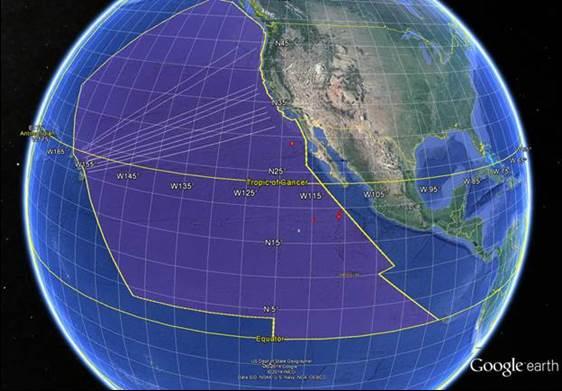
After completing its mission in space, Dragon executes a deorbit burn and reenters the atmosphere at a pre-planned trajectory. It is tracked to a splashdown area within a larger recovery circle with a radius of approximately 5.4 nautical miles. Dragon lands using drogue and main parachutes (Figure 2-14) with both versions using two drogue parachutes. Dragon-2 uses four main parachutes
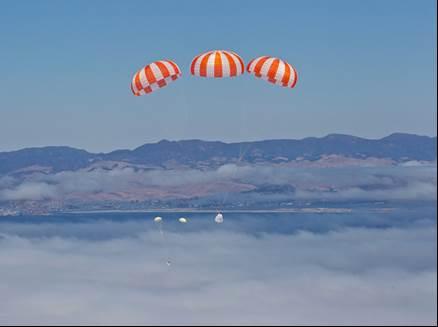
Following splashdown, an electronic locator beacon on Dragon would assist SpaceX in locating and recovering Dragon by a pre-positioned recovery vessel. The recovery vessel is a 160-foot ship equipped with a helideck and “A-Frame” (Figures 2-15 and 2-16).
Figure 2-16. Dragon Recovery Vessel

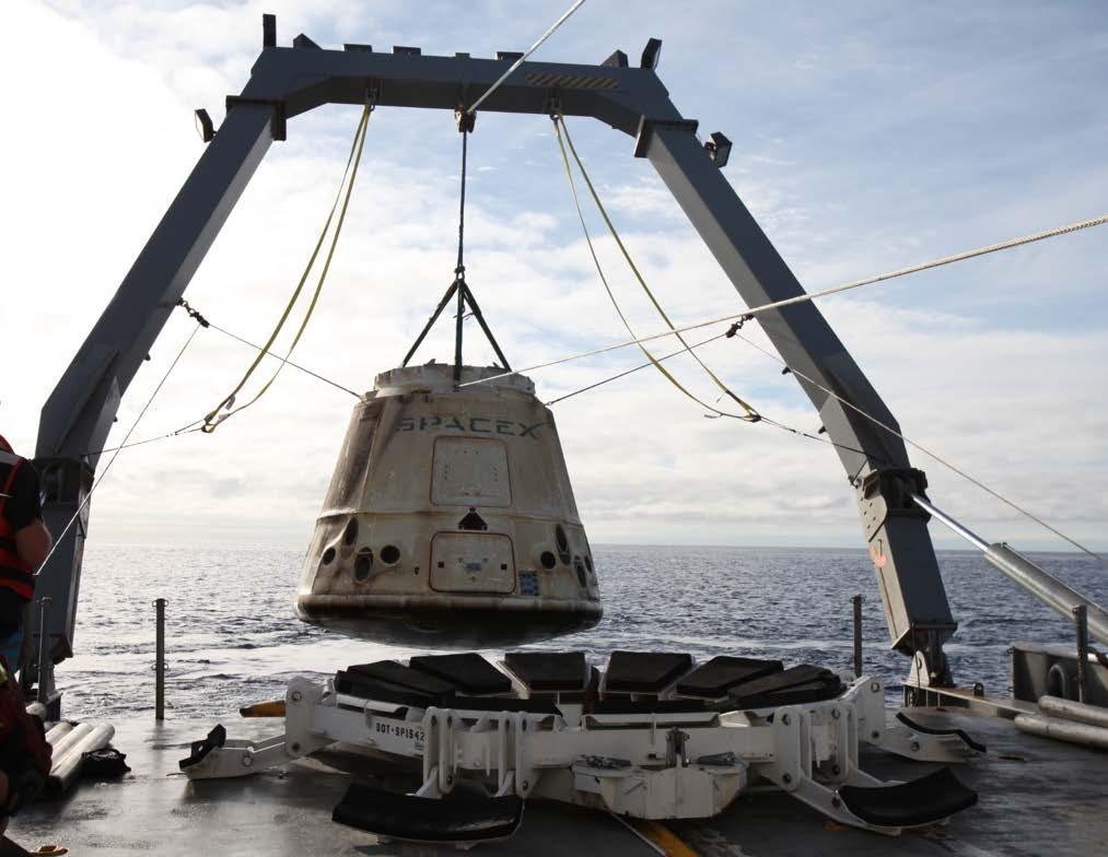
Pre-positioned RHIBs arrive at Dragon’s location first to assess Dragon’s condition. This assessment includes checking for hypergol vapors, which can be fatal if inhaled, and ensuring the capsule is floating in an upright and stable position. Dragon propellant storage is designed to retain residual propellant, so any propellant remaining in Dragon is not expected to be released, and it is unlikely a propellant leak would occur. In the unlikely event the tank ruptures on impact, the fuel would almost immediately form nitric and nitrous acid on contact with water, and would be quickly diluted and buffered by seawater.
Following the assessment, the lift brings Dragon gently out of the water and onto the deck of the recovery vessel. While Dragon is loaded onto the recovery vessel, a RHIB attempts to recover all of the drogue and main parachutes deployed. However, it is possible some or all of the parachutes would not be recovered due to sea or weather conditions.
For crewed missions, Dragon would be secured in the on-deck hangar, egress equipment would be positioned in front of Dragon, Dragon’s pressure would be equalized, and the side hatch would be opened. Crew egress would then begin. Crew would be helped from the capsule into shipboard medical evaluation quarters. Medical assessments would begin in private medical quarters. The crew and timecritical cargo would be transported via helicopter to the nearest airport.
The following is an estimate of the total number of Dragon parachutes expected to be recovered from 2020–2025.
• 2020: 5 Dragon-2 reentries in the Atlantic Ocean – total of 10 drogue parachutes and 20 main parachutes
• 2021: 7 Dragon reentries per year. All Dragon-2 reentries in the Atlantic Ocean – total of 14 drogue parachutes and 28 main parachutes
• 2022–2025: 10 Dragon reentries per year. All Dragon-2 crew and cargo reentries are targeted for the Atlantic Ocean – total of 20 drogue parachutes and 40 main parachutes each year.
In addition to Dragon, SpaceX continues to fly commercial satellites as well as NASA, DoD, and Intelligence Community missions. SpaceX has various facilities across CCAFS and KSC that are used for payload processing and vehicle refurbishment operations. These facilities include LC-40, LC-39A, Hangars AO and M, the PPF, and FPF. SpaceX continues to process vehicles and payloads in its LC-40 hangar. Operations also include recovered booster and fairing refurbishment for reuse. SpaceX plans to conduct static fires of Dragon-2 engines at the new Dragon site at LZ-1 prior to and following launch and recovery of Dragon-2. SpaceX is planning to process Dragon-2 at Area 59 near the CCAFS skid strip, and estimates there may be up to two Dragon test fires per month at LZ-1.
CEQ regulations (44 CFR §1502.14) require agencies to consider a “no action” alternative in their NEPA analyses to compare the effects of not taking action with the effects of the action alternative(s). Thus, the No Action Alternative serves as a baseline to compare the impacts of the Proposed Action. Under the No Action Alternative, the FAA would not modify existing SpaceX licenses or issue new licenses to SpaceX for Falcon launch and Dragon reentry operations discussed in Section 2.1 SpaceX would continue Falcon 9 and Falcon Heavy launch operations at KSC and CCAFS, as well as Dragon reentry operations, as analyzed in previous NEPA and environmental reviews and in accordance with existing FAA licenses until the licenses expire. Under the No Action Alternative, SpaceX would not conduct polar missions from LC-39A and LC-40 using a southern launch trajectory. Under the No Action Alternative, SpaceX would not construct the MST at LC-39A. SpaceX currently holds two FAA licenses for launches at KSC or CCAFS and one Dragon reentry license:
• License LLO 18-105 authorizes Falcon 9 launches at LC-40 to deliver payloads to geostationary transfer orbit; expires January 18, 2023.
• License LLO 19-110 authorizes Falcon 9 and Falcon Heavy launches from LC-39A to deliver payloads to low Earth or geosynchronous transfer orbit; expires February 14, 2024
• License RLS 15-006 authorizes three reentries of Dragon from Earth orbit to a reentry location in the ocean in support of the NASA Commercial Resupply Services Missions; expires October 1, 2020.
Previous environmental reviews included up to 12 Falcon 9 annual launches at CCAFS (including boostback and landing at LZ-1 or LZ-2), up to 10 Falcon 9 and 10 Falcon Heavy annual launches at KSC (including boost-back and landing of the first stages at LZ-1 or LZ-2), up to three Dragon-1 landings in the Pacific Ocean and three Dragon-2 landings in the Atlantic Ocean annually through 2020, and 12 Dragon landings in the Atlantic Ocean annually from 2021 through 2024.
SpaceX considered an alternative location for increasing the frequency of Falcon launches, including the proposed Falcon 9 polar launch trajectory. In addition to operating its Falcon launch vehicles at LC-39A and LC-40, SpaceX currently conducts Falcon 9 operations at Space Launch Complex 4 (SLC-4) at Vandenberg Air Force Base (VAFB), California SLC-4 does not support Falcon Heavy operations. SpaceX dismissed SLC-4 from consideration for the following reasons
One aspect of the proposed action includes Dragon missions. Dragon supports NASA for ISS resupply missions and will also eventually carry NASA crew to the ISS. LC-39A is located on KSC, which has the essential resources needed to support ISS resupply missions and is the only launch pad with infrastructure necessary to support crewed Dragon missions. SpaceX would need to undertake
substantial modifications to SLC-4 to support crewed Dragon missions and Falcon Heavy missions. Further, SLC-4’s location does not support a majority of the launch trajectories that comprise SpaceX’s future launch missions; SLC-4 can only support SpaceX’s polar launch trajectories.
LC-39A and LC-40 provide the best combination of existing infrastructure, launch-related resources, and available launch azimuths. Splitting the launch cadence between SpaceX’s launch sites at CCAFS and VAFB would decrease efficiency, require more travel by SpaceX employees, increase cross-country transport of hardware, increase costs associated with supplying resources needed to expand operations at SLC-4, and result in more environmental impact. For these reasons, SLC-4 was not considered further.
This chapter provides a description of the environmental impact categories that have the potential to be affected by the Proposed Action, as required by FAA Order 1050.1F. The environmental impact categories assessed in detail in this EA include air quality; biological resources; climate; coastal resources; Department of Transportation Act Section 4(f); hazardous materials, solid waste, and pollution prevention; land use; natural resources and energy supply; noise and noise-compatible land use; socioeconomics; visual effects (including light emissions); and water resources (surface waters and groundwater). In accordance with 40 CFR §1502.15 and Paragraph 6-2.1.e of FAA Order 1050.1F, the level of detail provided in this section is commensurate with the importance of the potential impact on the environmental impact categories. The following environmental impact categories are not analyzed in detail for the reasons stated:
• Farmlands: There are no designated agricultural lands at CCAFS or KSC. Therefore, the Proposed Action would not impact farmlands.
• Floodplains and Wetlands: Although the proposed MST construction at LC-39A would occur within a flood hazard area (the 500-year floodplain), the construction would occur at an existing launch complex and would not result in new impervious surfaces. Thus, the construction would not impact any natural or beneficial floodplain values. The construction would not occur within a wetland. Launch operations would not affect floodplains or wetlands at KSC or CCAFS. Therefore, the Proposed Action would not impact floodplains or wetlands.
• Environmental Justice and Children’s Environmental Health and Safety: The Proposed Action includes activities that regularly occur at KSC and CCAFS. There would be no impacts that disproportionately adversely affect environmental justice populations. Additionally, no component of the Proposed Action would result in a disproportionate health and safety risk to children.
• Wild and Scenic Rivers: The Proposed Action would not impact wild and scenic rivers because there are no wild and scenic rivers located near KSC and CCAFS
The geographic area potentially affected by the Proposed Action is referred to as the study area. Each resource area discussed in this section has a distinct study area, which is described in each section below. Previous NEPA documents have addressed and described the affected environment for SpaceX’s Falcon launch vehicle program at LC-39A, LC-40, LZ-1, and LZ-2, as well as Dragon recovery in the Atlantic and Pacific Oceans, as follows:
• LC-39A: The 2013 NASA EA for the multi-use of LC-39A and LC-39B (NASA 2013). The FAA was a cooperating agency in the preparation of this EA and issued a FONSI (FAA 2016) to support issuing launch licenses to SpaceX for Falcon 9 and Falcon Heavy launch operations at LC-39A.
• LC-40 and Dragon Recovery in Atlantic and Pacific Oceans: The 2007 USAF EA and 2013 USAF SEA for Falcon 9 and Falcon Heavy launch operations at LC-40, including Dragon recovery in the Atlantic Ocean or Pacific Ocean (USAF 2007, 2013). The FAA was a cooperating agency in the preparation of the 2007 USAF EA and 2013 USAF SEA and issued FONSIs (FAA 2009, 2013) to support issuing licenses to SpaceX for Falcon 9 and Falcon Heavy launch operations at LC-40 and Dragon reentry.
• LZ-1: The 2014 USAF EA for Falcon 9 first stage boost-back and landing at LZ-1 (formerly called LC13) (USAF 2014). The FAA was a cooperating agency in the preparation of the 2014 USAF EA and issued a FONSI (FAA 2015) to support issuing launch licenses to SpaceX for Falcon 9 first stage boost-back and landing at LZ-1.
• LZ-2: The 2017 USAF SEA for Falcon Heavy first stage boost-back and landing at LZ-1 and LZ-2 (only referred to as LZ-1 in the SEA) (USAF 2017a). The FAA was a cooperating agency in the preparation of the 2017 USAF SEA and issued a FONSI (FAA 2017) to support issuing launch licenses to SpaceX for Falcon Heavy first stage boost-back and landing at LZ-1 and LZ-2.
In accordance with 40 CFR §1502.21, this section incorporates material from the EAs mentioned above by reference to avoid redundancy without impeding agency and public review of the Proposed Action. The incorporated material is cited and briefly described.
The study area for land use includes KSC and CCAFS. Land and open water resources of KSC and CCAFS are located in Brevard County and Volusia County and are located along the east coast of central Florida. The majority of the KSC land is located on the northern part of Merritt Island, which forms a barrier island complex adjacent to Cape Canaveral. Undeveloped areas (uplands, wetlands, mosquito control impoundments, and open water) comprise approximately 95 percent of KSC. Nearly 40 percent are open water areas of the Indian River Lagoon (IRL) system, including portions of the Indian River, Banana River, Mosquito Lagoon, and all of Banana Creek (NASA 2015a).
Neither Brevard County nor the City of Cape Canaveral has land use or zoning authority over CCAFS land. The general plans of Brevard County and City of Cape Canaveral designate compatible land uses and zoning around CCAFS. CCAFS designates its own land use and zoning regulations. Land uses at CCAFS include launch operations, launch and range support, airfield, port operations, station support area, and open space, and does not include farmland. The launch operations land use category is present along the Atlantic Ocean shoreline and includes both inactive and active launch sites and support facilities. Open space is dispersed throughout the station. There are no public beaches located on CCAFS.
KSC was established under NASA jurisdiction for the purpose of implementing the Nation’s space program (National Space Act 1959). NASA maintains operational control over approximately 4,400 acres of KSC (NASA 2015a). These are the operational areas, which are dedicated to NASA ground processing, launch, and landing activities and include facilities and associated infrastructure such as roads, parking areas, and maintained right-of-ways. Undeveloped lands within the operational areas are dedicated safety zones or are reserved for planned and future expansion.
The overall land use and management objectives at KSC are to maintain the Nation’s space mission operations while supporting alternative land uses that are in the Nation's best interest. KSC land use is carefully planned and managed to provide required support for missions while maximizing protection of the environment. Land use planning and management responsibilities for areas not directly used for NASA operations are delegated to the USFWS at MINWR and the NPS at CNS. The approximately 135,225 acres outside NASA operational control are managed by the NPS and the USFWS. The NPS administers an approximate 6,655-acre area of the CNS, while the USFWS administers the remaining approximately 128,570 acres of the CNS and the MINWR (NASA 2015b). This unique relationship between space flight and protection of natural resources is carefully orchestrated to ensure that both objectives are achieved with minimal conflict.
MINWR was created in 1963 by agreement between the Bureau of Sport Fisheries and Wildlife (later USFWS) and NASA to manage the undeveloped lands needed as a safety buffer around KSC. Congress established CNS in 1975. It is located in both Brevard and Volusia Counties and includes 58,000 acres of barrier islands, open lagoons, coastal hammocks, and pine flat woods and 24 miles of undeveloped beaches. KSC has an agreement with the U.S. Department of the Interior for management of a portion of the CNS by the NPS and a portion by the USFWS.
Under the Interagency Agreement between NASA and USFWS for Use and Management of Property at KSC known as MINWR (KCA-1649 Rev. B), the USFWS conducts habitat management activities, including prescribed burning. The USFWS coordinates prescribed burns on MINWR in accordance with the “Joint Operating Procedure between the 45th SW, USFWS, and KSC for Prescribed Burning on the MINWR, KSC, and Cape Canaveral Air Force Station, Florida,” (KSC 2019).
For more than 35 years, MINWR has conducted prescribed fire and wildfire control operations in smokesensitive areas of KSC and CCAFS. KSC facilities are intermixed with fire-dependent wildland habitats including oak-palmetto scrub, pine flat woods, and marshlands. Due to the high occurrence of lightning strikes, wildfires occur on MINWR. These wildfires can be managed but not eliminated, and unplanned wildfires pose a risk to public health and safety and interfere with spaceflight operations.
Prescribed burning is the intentional ignition of grass, shrub, or forest fuels for specific purposes. Burn programs on CCAFS and KSC are used as an important natural resource and land management tool and provide biological, ecological, environmental, and safety benefits. Prescribed burns are conducted to enhance and restore wildlife habitats to pre-fire exclusion conditions, to promote and benefit wildlife species that are dependent on fire adapted ecosystems, to aid the control of exotic plants and vegetation or “hazardous fuel loads” to reduce wildfire threat, and to protect critical spaceflight infrastructure on CCAFS and KSC.
LC-39A is adjacent to Fire Management Unit (FMU) 5.3 to the north and west, and approximately 0.2 mile from FMU 7.4 to the southeast. Approximately 116 acres of the 1,000 acres contained in FMU 5.3 burned in May 2011. FMU 7.4 encompasses 1,863 acres, of which 793 acres burned in August 2011. Smoke-sensitive areas are located northwest and southwest of this burn unit. This unit does not receive fire according to the prescribed fire schedule
LC-40 is approximately 0.6 mile to the south of FMU 7.4 (Figure 3-1). As described above, the USFWS attempts to manage wildfire threats through planned prescribed burn ignitions. Although some FMUs do not receive fire according to the fire schedule due to restrictions, all FMUs are scheduled to receive fire on a 3 to 4 year rotation and will receive fire when restrictions allow.
Visual resources are defined as the natural and man-made features that give an area its aesthetic qualities. These features define the landscape character of an area and form the overall impression received by an observer of the property. The study area for visual resources includes the viewshed around the Proposed Action site, such as adjacent lands at KSC and CCAFS within view of facilities. Visual resources are any naturally occurring or man-made feature that contributes to the aesthetic value of an area. Areas such as coastlines, national parks, and recreation or wilderness areas are usually considered to have high visual sensitivity.
Visual and aesthetic resources refer to natural or developed landscapes that provide information for individuals to develop their perceptions of the area. The existing conditions at KSC are characterized as having low visual sensitivity because the site is currently an industrialized area that supports rocket launches. Notable visual structures include the lightning protection towers at LC-39A, LC-39B, LC-41, and those launch pads further south of the proposed site. Due to the flat topography and the height of the lightning protection towers (approximately 600 feet tall), the towers can be seen several miles away. Other highly visible structures include the Vehicle Assembly Building and the KSC Visitor Complex Space Shuttle Atlantis External Tank and Solid Rocket Booster Display.
The visual resources at KSC are typical of an administrative and industrial campus. The LC-39 area is characterized by facilities for launch vehicle assembly, testing, and processing, while the industrial area includes various facilities dedicated to administration, payload and launch vehicle processing, and research. Specialized development at KSC includes the Shuttle Landing Facility (SLF) (with associated hangars and
fueling facility), LC-39A, and LC-39B.
CCAFS, located just to the south of LC-39A, is primarily flat with scrub oak and palmetto as dominant land cover types. Visual resources at CCAFS are typical of a military installation with hangars and administrative facilities, but also encompass launch complexes, lightning protection towers, and a lighthouse.
CNS, located north of KSC, consists of naturally dark conditions. Lighting impacts can disrupt this and degrade the views of the night sky in the park. The existing conditions on KSC, including LC-39A, require lighting that may cause skyglow, which is light that escapes into the sky and illuminates particulates and degrade the views of the night sky in the park.
Existing light sources at KSC and CCAFS include nighttime security lighting at the launch complexes and buildings. NASA has guidelines to address the light impacts to wildlife species under the KSC exterior lighting requirements in Chapter 24 of Kennedy NASA Procedural Requirements 8500.1 Rev. E (NASA 2018). The installation and use of any lighting that is visible from the exterior of a facility must be in compliance with these guidelines. Development of a Light Management Plan that meets the exterior lighting requirements is mandatory for all new structures.
This section describes air quality resources for KSC and CCAFS at altitudes below 3,000 feet, which contain the atmospheric boundary layer. The Earth’s atmosphere consists of five main layers: the troposphere, stratosphere, mesosphere, ionosphere, and exosphere. For the purposes of this EA, the lower troposphere is defined as at or below 3,000 feet above ground level (AGL), which the U.S. Environmental Protection Agency (EPA) accepts as the nominal height of the atmosphere mixing layer in assessing contributions of emissions to ground-level ambient air quality under the Clean Air Act (CAA) (EPA 1992). Although Falcon 9 launch vehicles and Dragon emissions from operations at or above 3,000 feet AGL would occur, these emissions would not result in appreciable ground-level concentrations. Since the Falcon launch vehicle program occurs at both KSC and CCAFS, and the proposed Dragon reentry, splashdown, and recovery operations would primarily occur in Atlantic Ocean, Pacific Ocean, Port Canaveral, Florida, and Port of Los Angeles, California, the study area for air quality is Brevard County, Florida and Los Angeles County, California.
Atmospheric monitoring for chemicals at KSC and CCAFS occurs within the atmospheric boundary layer where people live and work Air quality at KSC and CCAFS is regulated under the CAA regulations (40 CFR Parts 50 through 99) and Florida Administrative Code (FAC) Chapters 62-200 through 62-299. Both KSC and CCAFS are located in Brevard County which is classified as in attainment with the National Ambient Air Quality Standards (NAAQS) (Table 3-1). The Florida Department of Environmental Protection (FDEP) has exclusively adopted the NAAQS. KSC operates under a Title V Operating Permit that governs the air emissions from activities considered a major source of air pollution. This permit is designed to improve compliance by clarifying actions that must be taken to control air pollution. CCAFS had operated under a Title V Air Operation Permit by designation until recently. Following a USAF review which indicated that over the past several years criteria air pollutants and Hazardous Air Pollutants (HAP) emitted annually did not warrant having a Title V permit, CCAFS surrendered the Title V Permit back to FDEP and requested a General Permit. The General Permit (62-210.310, F.A.C.) was issued on May 5, 2017. The General Permit only covers internal combustion engines and generators. All other air emissions units at CCAFS are currently exempt under the General Permit. All emissions types that would occur under the Proposed Action are exempt from air permitting requirements pursuant to FAC Rule 62-210.300(3)(a), Categorical and Conditional Exemptions. These types of categorically excluded emissions units or activities are considered to produce “insignificant” emissions pursuant to FAC Rule 62-213.430(6).
Under the CAA, criteria pollutants include carbon monoxide (CO), sulfur dioxide (SO2), nitrogen dioxide (NO2), ozone, particulate matter less than or equal to 10 microns in diameter (PM10), particulate matter less than or equal to 2.5 microns in diameter (PM2.5), and lead (Pb). CO, SO2, Pb, nitrogen oxides, and some particulates are emitted directly into the atmosphere from emissions sources. Ozone, NO2, and some particulates are formed through atmospheric chemical reactions that are influenced by weather, the ultraviolet component of sunlight, and other atmospheric processes.
The NAAQS represent the maximum levels of pollution that are considered acceptable, with an adequate margin of safety, to protect public health and welfare (Table 3-1). Short-term standards (1-, 3-, 8-, and 24hour periods) are established for pollutants contributing to acute health effects, while long-term standards (quarterly and annual averages) are established for pollutants contributing to chronic health effects.
secondary 3 hours 0.5 ppm
Source: 40 CFR 50, EPA 2016. Criteria Air Pollutants NAAQS
Not to be exceeded more than once per year
Notes: mg/m3 = milligrams per cubic meter; µg/m3 = micrograms per cubic meter; ppb = parts per billion; ppm = parts per million; PM10 = particulate matter less than or equal to 10 microns in diameter; PM2.5 = fine particulate matter 2.5 microns or less in diameter
(1) In areas designated nonattainment for the Pb standards prior to the promulgation of the current (2008) standards, and for which implementation plans to attain or maintain the current (2008) standards have not been submitted and approved, the previous standards (1.5 µg/m3 as a calendar quarter average) also remain in effect.
(2) The level of the annual NO2 standard is 0.053 ppm. It is shown here in terms of ppb for the purposes of clearer comparison to the 1-hour standard level.
(3) Final rule signed October 1, 2015, and effective December 28, 2015. The previous (2008) ozone standards additionally remain in effect in some areas. Revocation of the previous (2008) ozone standards and transitioning to the current (2015) standards will be addressed in the implementation rule for the current standards.
(4) The previous SO2 standards (0.14 ppm 24-hour and 0.03 ppm annual) will additionally remain in effect in certain areas: (1) any area for which it is not yet 1 year since the effective date of designation under the current (2010) standards, and (2) any area for which implementation plans providing for attainment of the current (2010) standard have not been submitted and approved and which is designated nonattainment under the previous SO2 standards or is not meeting the requirements of a SIP call under the previous SO2 standards (40 CFR 50.4(3)), A SIP call is an EPA action requiring a state to resubmit all or part of its State Implementation Plan to demonstrate attainment of the required NAAQS.
Based on measured ambient criteria pollutant data, the EPA designates all areas of the U.S. as having air quality better than the NAAQS (attainment), worse than the NAAQS (nonattainment), or unclassifiable (40 CFR Part 81, Subpart C, Section 107). The designation of attainment for any NAAQS is based on the evaluation of ambient air quality monitoring data collected through federal, state, and/or local monitoring networks. According to the EPA, Brevard County is in attainment for all criteria pollutants (EPA 2019). Los Angeles County is in nonattainment for PM2.5 and O3 (EPA 2019).
Florida and California’s air monitoring effort is concentrated on the six criteria pollutants. In 2016, Florida continued to be in attainment for all criteria pollutants, with the exception of Tampa’s nonattainment designation for lead and sulfur dioxide nonattainment areas in Hillsborough County and Nassau County (EPA 2018a). As of March 31, 2019, 40 counties in California were in nonattainment, mainly for ozone. The state coastal boundaries are part of the same air quality jurisdiction area as the contiguous land area. Coastal waters for most states lie within 3 nautical miles of a shoreline. Dragon splashdowns and recovery operations would occur at a minimum of 5 nautical miles from shore and would be outside state coastal water jurisdictions.
The CAA defines conformity as the upholding of a set of air quality goals by eliminating or reducing violations of the NAAQS and achieving attainment of these standards. Conformity determinations are not required for launch operations in Florida since both launch facilities (LC-39a and LC-40) are located within NAAQS attainment area for all regulated criteria pollutants. The ambient air quality at both facilities is predominantly influenced by daily operations such as vehicle traffic, utilities, fuel combustion, and standard refurbishment and maintenance operations. Other operations occurring infrequently throughout the year, including launches and prescribed fires, also play a role in the quality of air as episodic events.
The Port of Los Angeles and adjacent coastal waters are in the South Coast Air Basin (SCAB) under the jurisdiction of the South Coast Air Quality Management District. The SCAB is classified as an attainment/unclassified area for the NAAQS for CO, NO2, SO2, and PM10, and a nonattainment area for O3, PM2.5, and Pb The CAA’s General Conformity rule applies to federal actions occurring in non-attainment or maintenance areas. The General Conformity rule requires federal agencies to demonstrate that their
actions conform with the applicable State Implementation Plan.
3.3.2.
In addition to the NAAQS, national standards also exist for HAPs. The National Emission Standards regulate 187 HAPs based on available control technologies (40 CFR Parts 61 and 63). The majority of HAPs are volatile organic compounds. Mobile sources of air emissions include launch vehicles, commercial ships, recreational boats, cruise ships, and aircraft. HAPs emitted from mobile sources are called Mobile Source Air Toxics (MSATs). MSATs are compounds emitted from highway vehicles and non-road equipment that are known or suspected to cause cancer or other serious health and environmental effects. In 2001, EPA issued its first Mobile Source Air Toxics Rule, which identified 21 compounds as being HAPs that required regulation (EPA 2001). A subset of six of these MSATs compounds were identified as having the greatest influence on health and included benzene, 1,3-butadiene, formaldehyde, acrolein, acetaldehyde, and diesel particulate matter. EPA issued a second Mobile Source Air Toxics Rule in February 2007, which generally supported the findings in the first rule and provided additional recommendations of compounds having the greatest impact on health. The rule also identified several engine emission certification standards that must be implemented (EPA 2007).
MSATs would be the primary HAPs emitted by mobile sources during pad launch activity and recovery operations. The recovery vessel and RHIB used during recovery operations would likely vary in age and have a range of emission controls. It is anticipated that recovery equipment and vehicles would be operated for approximately five days for each launch-recovery operation and would produce negligible ambient pollutant emissions in a widely dispersed area. HAPs from the combustion of fossil fuel, which is the cause of emissions from mobile sources, are anywhere from one to three orders of magnitude less than criteria pollutant emissions from these sources. Because of small scale of the emissions and in the context of the minimal mobile source operations required by the proposed action, HAP emissions are not considered further in this analysis.
Table 3-2 is a summary of ambient air quality measurement data for 2013–2017 for the local region. The table shows that ground-level concentrations of criteria pollutants in the study area are within the NAAQS.
Lead Quarterly No lead monitors are located within 100 miles of LZ-1 - - - - -
Source: EPA 2018a.
a Each maximum is measured as defined by the respective standard.
Tables 3-3 and 3-4 are summaries for years 2009 through 2016 of KSC and CCAFS Air Emissions Inventory Reports of actual tons per year of the criteria pollutants and total HAPs that are included in the current permits. The KSC Title V permit covers four categories of air emission units: hot water generators/boilers, internal combustion engines, chromate conversion operations, and portable aggregate material crushing operations The CCAFS General Permit is for emissions from internal combustion engines.
Table 3-3. KSC History of Actual Annual Emissions (tons per year)
Source: FDEP 2018
Table 3-4. CCAFS History of Actual Annual Emissions (tons per year)
Source: FDEP 2018.
3.4. Climate
While the topic of climate can be global in nature, the “local weather” for this environmental impact category lies along the Atlantic coast in Brevard County, Florida, the western Atlantic Ocean, and the California Coast in Los Angeles, County, California. However, climate change resulting from GHG emissions is a cumulative global phenomenon, so the affected environment (study area) is the global climate (EPA 2009a). Given the minor nature of activities that would occur in Los Angeles County (a potential Dragon reentry and recovery operation at the Port of Los Angeles if conditions are unfavorable for landing in the Atlantic Ocean), climate change is not expected to affect Dragon recovery operations in California in the foreseeable future. Therefore, this EA does not discuss in detail the local climate in Los Angeles County. Brevard County experiences a subtropical climate of hot, humid summers with distinct wet and dry seasons From 1981 to 2010, precipitation averaged 54 inches per year, with high precipitation months during August and September, and December, the driest month averaging 2.3 inches (US Climate Data 2018) During the same time period, temperatures vary between an average high of
in January to an average of 90.6oF in July and August
At the coast, mean sea level (MSL) is defined as the height of the sea with respect to a local land benchmark, averaged over a period of time long enough to eliminate the effects of wave, tidal, and seasonal fluctuations. Changes in MSL as measured by coastal tide gauges are called “relative sea level changes,” because they can come about either by movement of the land on which the tide gauge is situated or by changes in the height of the adjacent sea surface. MSL from NOAA is established at CCAFS as 19.9 feet. The average high tide for CCAFS is 21.5 feet, while the average low tide is 18.2 feet The highest observed water level at CCAFS was 25.9 feet on September 26, 2004 (NASA 2013) According to the International Panel on Climate Change (IPCC), global mean sea level continues to rise due to thermal expansion of the oceans in addition to the loss of mass from glaciers, ice caps, and the Greenland and Antarctic Ice Sheets (NASA 2013).
Inclement weather for Brevard County is characterized by large storm cells moving west to east across North America in the cool, winter months and local or tropical systems during the hot, summer months. Occasional hurricanes do affect the area, with storm surge and wind playing a dominant factor in the damage incurred. Hurricane season extends from June through November. The most active hurricane season in the area’s history was 2004, when damages to KSC facilities alone exceeded $100 million
Additionally, many habitats, such as marshes, shoreline, and dunes were affected, at least temporarily, due to the storm surge and beach erosion (NASA 2013). The central Florida region has the highest number of thunderstorms in the United States during the summer months (May – September), and over 70 percent of the annual 48 inches of rain occurs in the summer. During thunderstorms, wind gusts of more than 60 miles per hour and rainfall of over 1.0 inch often occur in a one-hour period, and there are numerous cloud-toground lightning strikes.
Solar irradiance, the greenhouse effect, and earth’s reflectivity are the key factors interacting to maintain temperatures on Earth within critical limits. Relatively recent changes in greenhouse gas concentrations [primarily carbon dioxide (CO2)] have been identified as the primary factor influencing Earth’s current climate trends (EPA 2009b). Human land use changes and burning of fossil fuels for energy are the major contributors to increases in greenhouse gases that are accelerating the rate of climate change. Impacts include warmer temperatures, rising sea levels, changes in rainfall patterns, and a host of other associated and often interrelated effects. For the KSC and CCAFS region, the average air temperature for the 30-year climate baseline period is 72o F (NASA 2015a). Climate forecasts indicate that average temperatures will increase by as much as 6oF during the latter part of the century Emissions of CO2 at KSC and CCAFS are primarily associated with vehicle traffic, ground support operations, and launch events. On KSC, CO2 emissions in 2016 were estimated at 99,025.2 metric tons, equaling a 54 percent reduction in sources controlled by the government and a 32 percent reduction from non-government sources from 2008 baseline emission statistics (unpublished data summarized in NASA 2016a).
During the last two decades, erosion along the KSC and CCAFS coastline has increased as a result of frequent storm surges from nor’easters, tropical storms, and hurricanes. Erosion may have been exacerbated by effects from rising sea levels which have exceeded 5 inches in the last 20 years as measured at the Trident Pier in the adjacent Port Canaveral. As a result, the area has been categorized as “critically eroded” by the Florida Department of Environmental Protection (FDEP 2016). Nearly 3.0 miles of artificial dune have been created along the KSC coastline to protect space program assets and important wildlife habitat; additional dune creation is planned. The coastal dune along CCAFS has not experienced the same erosion as the KSC beaches and is accreting in most areas.
Greenhouse gases (GHG) are gas emissions that trap heat in the atmosphere. These emissions occur from natural processes and human activities. Some scientific evidence indicates a trend of increasing global temperature over the past century which may be due to an increase in GHG emissions from human activities. The climate change that may be associated with this global warming may produce negative
economic and social consequences across the globe.
The FAA has developed guidance for considering GHGs and climate under NEPA, as published in the Desk Reference to Order 1050.1F. 6 Considering GHG emissions for an FAA NEPA review should follow the basic procedure of considering the potential incremental change in CO2 emissions that would result from the proposed action and alternative(s) compared to the no action alternative for the same timeframe, and discussing the context for interpreting and understanding the potential changes. For FAA NEPA reviews, this consideration could be qualitative (e.g., explanatory text), but may also include quantitative data (e.g., calculations of estimated project emissions).
Discussion of the estimated GHG emissions associated with the Proposed Action and the impact analysis can be found in the environmental consequences analysis in Section 4.4 Table 3-5 below summarizes GHG emissions for all activities at CCAFS (USAF 2017a) While more recent data are not available, the CCAFS landfill was the primary methane emission source for all GHG The landfill was closed in 2013 and a decision was made by the USAF that residual methane emissions would be negligible Therefore, methane emission can be taken as zero for 2014 and beyond (USAF 2017a).
Table 3-5. Summary of Greenhouse Gases Emissions for CCAFS (Years 2011 through 2013)
Source: USAF 2017a. NOTE: MtCO2e = Metric Ton Carbon Dioxide Equivalent – describes greenhouse gases in a common unit. For any quantity and type of greenhouse gas, CO2e denotes the amount of CO2 which would have the equivalent global warming impact. R-22 = Chlorodifluoromethane or difluoromonochloromethane is a hydrochlorofluorocarbon (HCFC-22) refrigerant being phased out, R-123= 2,2-Dichloro-1,1,1-trifluoroethane or HCFC-123 is a replacement refrigerant being phased in.
Table 3-6 shows trends in GHG emissions at KSC from 2008 through 2017. Emissions in Scope 1 and 2 pertain to sources owned or controlled by the government (e.g. government fleet, stationary sources), and purchased electricity, heat, or steam Scope 3 emissions are from activities not directly controlled by the government such as emissions from non-government vehicles (e.g. employee travel) NASA’s goal is to reduce Scope 1 and 2 GHG emissions by 22.4 percent and Scope 3 emissions by 15.2 percent by FY2020, as
6
https://www.faa.gov/about/office_org/headquarters_offices/apl/environ_policy_guidance/policy/faa_nepa_order/de sk_ref/
compared to emissions in 2008 (NASA 2016b).
Table 3-6. NASA KSC Greenhouse Gas Emissions Trends (FY2008 through FY2017)
Source: Dan Clark/NASA/ 8-16-2018 email; Erik Tucker/ 8-20-2018 email.
Compatible land use means the use of the land is normally consistent with the outdoor noise environment at the location (14 CFR § 150.7). Compatible land use analysis considers the effects of noise on special management areas, such as national parks, national wildlife refuges, and other sensitive noise receptors. The concept of land use compatibility corresponds to the objective of achieving a balance or harmony between the Proposed Action and the surrounding environment. Noise is defined as unwanted or annoying sound that interferes with or disrupts normal human activities. Although exposure to very high noise levels can cause hearing loss, the principal human response to noise is annoyance. The response of different individuals to similar noise events is diverse and influenced by the type of noise, perceived importance of the noise, its appropriateness in the setting, time of day, type of activity during which the noise occurs, and sensitivity of the individual.
The study area for noise and noise-compatible land use includes KSC, CCAFS, and extends into central Florida with a center point between LC-39A and LC-40 (Falcon 9 and Falcon Heavy launch operations). Given that 1) noise associated with Dragon splashdown in the Pacific Ocean would be minor and not affect noise sensitive areas and 2) noise associated with transporting Dragon to the Port of Los Angeles would not appreciably affect noise levels at the port, the study area does not include Dragon recovery operations on the west coast.
The study area has an approximate radius of 55 miles (Figure 3-2). This area has experienced sonic booms during previous SpaceX first stage booster landings (USAF 2017a). It also includes the recovery area positioned 5 to 140 nautical miles off the Atlantic coastline where the majority of sonic boom noise would occur. This study area includes those areas where the effects of launch noise and sonic boom noise from reentry may occur, and where recovery offloading activities would occur at CCAFS and Port Canaveral.
CCAFS and KSC are relatively isolated facilities which reduces the potential for noise impacts on adjacent communities. The nearest residential area is the City of Titusville to the west, across the Indian River. Open space lies to the north. Land just to the south-southwest of KSC is largely undeveloped with low density housing located approximately 9 miles from LC-39. The beach cities of Cape Canaveral and Cocoa Beach are also to the south, immediately south of Port Canaveral, approximately 15 miles from the LC-39 area, and 10 miles from LC-40 The sound produced by current rocket launches is noticed in all of these areas and the perimeter locations are commonly visited by the public for launch viewing. In the cities of Merritt Island and Cape Canaveral, ambient noise levels are normally low, with higher noise levels occurring in the communities’ industrial areas, and lower noise levels (normally about 45 to 55 A-weighted decibels [dBA]) in the residential areas and along the beaches. Aircraft fly-overs and rocket launches from CCAFS and KSC increase noise levels for short periods of time; sonic booms from returning first stage boosters also cause very short noise events.
Noise levels around facilities at CCAFS and KSC approximate those of any urban industrial area, reaching levels of 60 to 80 dBA. Additional on-site sources of noise are the aircraft landing facilities at the CCAFS Skid Strip and the KSC SLF. Other less frequent but more intense sources of noise in the region are launches from CCAFS and KSC, which includes both engine noise and sonic booms produced as launch vehicles reach supersonic speeds. Sonic booms produced during vehicle ascent over the Atlantic Ocean are directed in front of the vehicle and do not impact land areas; however, returning Falcon first stage vehicles (that land at LZ-1) do produce a double sonic boom that has been heard as far away as the metro-Orlando area.
For the increased launch azimuth window, the study area for downrange landing operations includes the Bahamas and near-shore waters in Bahamas and Cuba, as defined by the sonic boom footprints (see Figures 4-5 and 4-6). The FAA is aware that noise generated from launches may be audible beyond the U.S. border. NEPA requires that federal agencies include analysis of potential transboundary effects extending across the border and affecting another country’s environment.
The decibel (dB) is a ratio that compares the sound pressure level of the sound source of interest (e.g., a launch) to a reference sound pressure level (e.g., the quietest sound that can be heard). It is a logarithmic unit that accounts for the large variations in amplitude. A number of factors affect sound as the human hearing mechanism perceives it. These include the actual level of noise, the frequency content, the time period of exposure to the noise, and changes or fluctuations in noise levels during exposure. Various noise metrics are used to assess and correlate the assorted effects of noise on humans, including land use
compatibility, sleep and speech interference, annoyance, hearing loss, and startle effects. To correlate the frequency characteristics from typical noise sources to human response, several frequency weighting scales have been developed. Sound levels that have been adjusted to correspond to the frequency response of the human hearing mechanism are referred to as A-weighted (dBA) sound pressure levels. The long-term equivalent A-weighted sound level (Leq) is an A-weighted sound level that is "equivalent" to an actual timevarying sound level. If structural damage is a concern, then the overall sound pressure level (OASPL) is used. This quantity has no frequency weighting and includes low frequencies which may induce vibration in structures The largest portion of the total acoustic energy produced by a launch vehicle is usually contained in the low-frequency end of the spectrum (1 to 100 Hz) Launch vehicles (and returning first stage boosters) also can generate sonic booms. A sonic boom, the shock wave resulting from the displacement of air in supersonic flight, differs from other sounds in that it is impulsive and very brief (often less than one second) A sonic boom is not generated until the vehicle reaches supersonic speeds or reduces velocity to below supersonic for landing vehicles and/or returning capsules. The launch site itself does not experience a sonic boom during launch; the entire boom footprint is usually some distance downrange of the launch site. However, during the landing sequence, the landing site and areas surrounding may experience a sonic boom. Although derived for humans, A-weighted sound level descriptors can also be used to qualitatively assess the effects of noise on wildlife.
FAA Order 1050.1F requires the FAA to assess noise impacts on noise sensitive areas using the Day-Night Average Sound Level (DNL) metric to determine if significant impacts would occur. Normally, noise sensitive areas include residential, educational, health, and religious structures and sites, and parks, recreational areas (including areas with wilderness characteristics), wildlife refuges, and cultural and historical sites. There are other federal agency noise standards that pertain to hearing conservation (e.g., those established by the National Institute for Occupational Safety and Health [NIOSH] and the Occupational Safety and Health Administration [OSHA]).
The DNL is a cumulative noise metric that is an average of noise levels over a 24-hour period with a 10 dB upward adjustment of noise levels during the nighttime (10:00 p.m. to 7:00 a.m.). This adjustment accounts for increased human sensitivity to noise at night. The DNL can be calculated on the basis of the Sound Exposure Level (SEL) and the number of daytime and nighttime noise events. The SEL represents all of the acoustic energy associated with a noise event such as a vehicle pass-by. The SEL normalizes the sound level as if the entire event occurred in one second. The SEL is also useful for directly comparing two different noise events with differing maximum noise levels and durations.
3.5.2.1.
Noise contour maps of noise metrics are used to assess the noise level and impact of noise on a community. Noise contours depict the area within which a certain noise level occurs, as predicted by a computer model and/or measured with sound level meters. A significant noise impact would occur if the action would increase noise by DNL 1.5 dB or more for a noise sensitive area exposed to noise at or above the DNL 65 dB noise exposure level, or that will be exposed at or above the DNL 65 dB due to a DNL 1.5 dB or greater increase, when compared to the no action alternative for the same timeframe.
Launches and landings are a major source of operational noise; all other noise sources in the launch area are considered minor compared to rocket noise. Generally, three types of noise occur during a standard vehicle launch or landing: 1) combustion noise from the launch vehicle chambers; 2) jet noise generated by the interaction of the exhaust jet and the atmosphere; and 3) combustion noise from post-burning of combustion products The initial loud, low frequency noise heard in the immediate vicinity of the launch pad is a result of the three types of noise combined. SpaceX measured noise levels for its May 22, 2012,
Falcon 9 (Block 1) launch at LC-40. The launch time was 3:44 p.m. with all nine Merlin engines firing. SpaceX also measured near-field noise levels during the Falcon Heavy launches. SpaceX’s noise data are presented in Table 3-7.
2
3
db = decibels; OASPL = overall sound pressure level
3.5.2.1.1.
Another characteristic of typical launch or landing vehicles is that they reach supersonic speeds (faster than the speed of sound) and generate sonic booms. Sonic booms are measured in pounds per square foot (psf) of overpressure This is the amount of the increase over the normal surrounding atmospheric pressure (2,116 psf/14.7 psi). At one-pound overpressure, no damage to structures would be expected. Overpressures of 1 to 2 psf are produced by supersonic aircraft flying at normal operating altitudes. Some public reaction could be expected between 1.5 and 2 psf. Rare, minor damage may occur with 2 to 5 psf of overpressure (NASA 2013). During the shuttle landing events, a double sonic boom was heard at times across central Florida and the east coast, depending upon the specific flight trajectory.
SpaceX performed a sonic boom study in 2014 to support its first landing operation; however, since that time, several other studies, including one by the USAF have been conducted. Additionally, SpaceX has been measuring sonic boom events for the drone ship landings and for landings at LZ-1. These studies are included in Appendix A. These data and further discussions of sonic boom impacts are detailed in Section 4.5.
3.5.2.1.2.
This section presents an estimate of the existing noise environment (DNL) for 2017 launch operations and other typical noise events occurring at CCAFS and KSC. These estimates can be used to determine how future launch operations of the Falcon 9 and Falcon Heavy would be expected to influence the DNL. To accurately describe the DNL at CCAFS and KSC, a detailed study would be required involving either the modeling of all major noise sources or conducting noise monitoring throughout these areas for a period of time that adequately represents the different types of launch vehicles and frequency of launches conducted. The estimates of DNL presented here are basic and serve to identify whether launch operations at CCAFS and KSC are expected to have a significant noise impact per the guidelines in FAA Order 1050.1F.
Before estimating DNL for the CCAFS and KSC properties and surrounding cities, it is important to note that these areas have a variety of land uses. CCAFS and KSC have areas that should be considered rural or remote, except where NASA or other launch facilities are located. KSC encompasses a wildlife refuge. Populated areas of Merritt Island could be considered rural or quiet suburban residential areas, whereas Titusville and the city of Cape Canaveral are more urban areas with mixed residential and industrial uses. It Falcon 9
is therefore important to consider the land use category and associated background noise levels when determining if launch operations will have a significant noise impact.
To determine DNL for 2017, background noise levels were estimated, as was the DNL from all 2017 launch operations at CCAFS and KSC. Background DNL was rated using ANSI/ASA S12.9-2013/Part 39 which provides estimated background noise levels for different land use categories and population density. Table 3-8 shows the DNL estimated for rural or remote areas and several different categories of suburban and urban residential land use which can be used to represent DNL for the various land uses within CCAFS, KSC, and surrounding areas. According to these values, many of the remote areas within the CCAFS and KSC properties would be expected to have a DNL less than 49 dBA, while parts of Titusville and the city of Cape Canaveral would be expected to have a DNL as high as 59 dBA. The DNL values in Table 3-8 provide an estimate of the background levels expected in typical noise environments and do not include noise from launch operations.
Source: ANSI/ASA S12.0-2013/Part 3 dBA = A-weighted decibels; DNL = day-night average sound level; Leq = equivalent continuous sound level
To estimate the 2017 DNL for CCAFS, KSC, and the surrounding areas, the noise from all 2017 launches at CCAFS and KSC should be added to the background noise estimated for these areas. Table 3-9 shows all of the 2017 launches at CCAFS and KSC. There were 19 total launches, including 13 Falcon 9 Full Thrust launches (12 of these occurred at LC-39A and one occurred at LC-40). The remaining six launches by the Atlas V, Delta IV, and Minotaur occurred at three other CCAFS launch sites. Of the 19 launches in 2017, three (about 16 percent) were nighttime launches.
V 401 (3) or 421 (1)
IV M+(5,4)
lbf = pound-force
KBRwyle (2018) estimated the DNL for the 2017 launches (see Appendix A for the noise report). As stated in the noise report, the SEL 100 dBA contour shown in the report’s Figures 10 and 11 can be used to represent the DNL for all 2017 launch operations and is equivalent to a DNL of 40 dBA. The estimated DNL exposure from all 2017 launches at CCAFS and KSC is in most areas less than any of the estimated background DNL values in Table 3-8 (KBRwyle 2018). The SEL and maximum A-weighted sound pressure level (LAmax) contours in the KBRwyle report model discrete noise events associated with launches (e.g., Appendix A, Figures 4 to 9).
Cultural resources encompass a range of sites, properties, and physical resources relating to human activities, society, and cultural institutions. Such resources include past and present expressions of human culture and history in the physical environment, such as prehistoric and historic archaeological sites, structures, objects, and districts that are considered important to a culture or community. Cultural resources also include aspects of the physical environment, namely natural features and biota that are a part of traditional ways of life and practices and are associated with community values and institutions.
The major law that protects cultural resources is the National Historic Preservation Act (NHPA). Section 106 of the NHPA requires a federal agency to consider the effects of its action (referred to as the undertaking) on historic properties. Compliance with Section 106 requires consultation with the State Historic Preservation Officer (SHPO) and other parties, including Indian tribes. The Section 106 process is outlined in 36 CFR Part 800. Major steps in the process include identifying the Area of Potential Effects (APE) in consultation with the SHPO, identifying and evaluating any historic properties within the APE, and assessing the effect of the undertaking on any historic properties. If a historic property would be adversely affected, the consultation process includes resolution of adverse effects.
As part of previous NEPA reviews for SpaceX launches operations at LC-39A, LC-40, LZ-1, and LZ-2, NASA and USAF analyzed potential impacts to historic properties and conducted Section 106 consultation with the Florida State Historic Preservation Officer (SHPO) as needed. During preparation of the 2013 NASA EA, which included Falcon 9 and Falcon Heavy launches from LC-39A, NASA determined the action analyzed in the EA would constitute an adverse effect on LC-39A (a historic property) in accordance with the 2009 Programmatic Agreement Among the National Aeronautics and Space Administration, John F. Kennedy Space Center, Advisory Council on Historic Preservation, and the Florida State Historic Preservation Officer Regarding Management of Historic Properties at the Kennedy Space Center, Florida (2009 PA) and consulted the SHPO. The SHPO concurred with NASA’s finding and noted that KSC has previously completed and will be following the appropriate mitigation stipulations identified in the 2009 Programmatic Agreement (PA) (DHR Project File Number: 2013-1817).
The 2013 USAF SEA analyzed potential effects to historic properties from Falcon 9 operations at LC-40. USAF’s analysis concluded that Falcon launch operations at LC-40 would not affect historic properties because there are no historic properties located at or near LC-40.
The 2017 USAF SEA analyzed the potential effects to historic properties for Falcon Heavy first stage boostback and landing at LZ-1 and LZ-2. Three previously unrecorded archaeological sites were identified during an archaeological survey conducted by the USAF between June and August 2014. The USAF determined the sites were ineligible for listing on the National Register of Historic Places (NRHP) and the SHPO concurred with that determination. USAF’s analysis concluded that Falcon booster landings at LZ-1 and LZ-2 would not affect historic properties (DHR Project File Number: 2014-4037).
The only aspect of the FAA’s undertaking that has not been previously evaluated as part of Section 106 consultation with the SHPO is SpaceX’s proposed Falcon 9 southern launch and landing trajectory (polar missions). Therefore, the FAA is focusing the cultural resource analysis on that aspect of the project.
The study area for this impact category is referred to as the Area of Potential Effects (APE), which is a term defined in the Section 106 regulations (36 CFR §800.16). The APE is the geographic area or areas within which an undertaking may directly or indirectly cause alterations in the character or use of historic properties, if any such properties exist. In addition to engine noise generated during rocket takeoff from LC-39A or LC-40 (which was considered in the previous Section 106 consultations identified above), a sonic boom is expected to impact parts of Florida during a Falcon 9 polar launch, including landing at LZ-1 or LZ-2 (see Figures 4-3 and 4-4). Therefore, the FAA has defined the APE based on the sonic boom footprint
generated during a Falcon 9 polar launch. The FAA completed Section 106 consultation with the SHPO (see Appendix B for correspondence). The SHPO concurred with the FAA’s definition of the APE and identification of historic properties in the APE.
The FAA conducted a search of properties listed on the National Register of Historic Places (NRHP) using the National Park Service’s geospatial database. The identified properties within the sonic boom APE are listed in Table 3-10. The majority of the historic properties in the sonic boom APE are buildings.
Table 3-10. NRHP-Listed Properties in the Sonic Boom APE for a Falcon 9 Polar Launch Property Name Reference Number Resource Type City
Driftwood Inn and Restaurant 94000751
Vero Railroad Station 86003560
Gregory, Judge Henry F., House 94000540
Vero Beach Community Building, Old 92001746
Vero Beach Woman's Club 95000051
Indian River County Courthouse 99000768
Pueblo Arcade 97000211
Royal Park Arcade 98000925
Vero Theatre 92000421
Maher Building 94001274
Vero Beach Diesel Power Plant 99000252
Old Palmetto Hotel
91001650
Building Vero Beach
Building Vero Beach
Building Vero Beach
Building Vero Beach
Building Vero Beach
Building Vero Beach
Building Vero Beach
Building Vero Beach
Building Vero Beach
Building Vero Beach
Building Vero Beach
Building Vero Beach
Osceola Park Historic Residential District 12001196 District Vero Beach
Hausmann, Theodore, Estate 97000230
Building Vero Beach
McKee Jungle Gardens 97001636 Site Vero Beach
Hallstrom House 02000605
Immokolee 93001450
Casa Caprona 84000955
St. Lucie Village Historic District 89002062
Hurston, Zora Neale, House 91002047
Moores Creek Bridge
01000890
St. Anastasia Catholic School, Old 00000941
Fort Pierce City Hall, Old 01001338
Fort Pierce Old Post Office 01000567
Arcade Building 01001085
Sunrise Theatre 01001339
Cresthaven 85000770
St. Lucie High School 84000956
Fort Pierce Site 74002181
Frere, Jules, House 95000467
Hammond, Captain, House 90000310
First Methodist Episcopal Church, South 15000509
Freedman-Raulerson House 85000764
Okeechobee Battlefield 66000269
Red Barn 08001243
Moore Haven Downtown Historic District 95001166
Moore Haven Residential Historic District 98000714
Florida Power and Light Company Ice Plant 82001033
Gleason, William H., House 96001608
Rossetter, James Wadsworth, House 05000734
Green Gables 16000269
Building Vero Beach
Building Fort Pierce
Building Fort Pierce
District St. Lucie Village
Building Fort Pierce
Structure Fort Pierce
Building Fort Pierce
Building Fort Pierce
Building Fort Pierce
Building Fort Pierce
Building Fort Pierce
Building Fort Pierce
Building Fort Pierce
Site Fort Pierce
Building Fort Pierce
Building White City
Building Okeechobee
Building Okeechobee
Site Okeechobee
Building Okeechobee
District Moore Haven
District Moore Haven
Building Melbourne
Building Melbourne
Building Melbourne
Building Melbourne
Community Chapel of Melbourne Beach 92000505
Melbourne Beach Pier 84000829
St. Joseph's Catholic Church
Fell, Marian, Library
87000816
96001059
Fellsmere Public School 96001368
First Methodist Episcopal Church 96001521
Heiser, Frank and Stella, House 100001862
Jungle Trail 03000700
Lawson, Bamma Vickers, House 90001116
Old Town Sebastian Historic District East 03000728
Old Town Sebastian Historic District, West 03001364
Pelican Island National Wildlife Refuge 66000265
Sebastian Grammar and Junior High School 01000889
Smith, Archie, Wholesale Fish Company 94001275
Spanish Fleet Survivors and Salvors Camp Site 70000186
Desert Inn 93001158
Auburndale Citrus Growers Association Packing House 90001277
Auburndale City Hall 72000350
Baynard, Ephriam M., House 90001272
Jenks, Holland, House 75000567
Babson Park Woman's Club 90001085
Dundee ACL Railroad Depot, Old 90001271
Atlantic Coast Line Railroad Depot 90001273
Bok Mountain Lake Sanctuary and Singing Tower 85003331
Bullard, B. K., House 90001275
Casa De Josefina 89001481
Chalet Suzanne 00000265
Church of the Holy Spirit 90001274
Dixie Walesbilt Hotel 90000732
El Retiro 97000858
First Baptist Church 91000113
Johnson, C. L., House 93000871
Lake of the Hills Community Club 01001086
Lake Wales City Hall 01000306
Lake Wales Commercial Historic District 90001276
Lake Wales Historic Residental District 14000152
Mountain Lake Colony House 01001414
Mountain Lake Estates Historic District 02000266
North Avenue Historic District 01001337
Roosevelt School 00000660
Tillman, G. V., House 98000927
Cypress Gardens 90001277
Downtown Winter Haven Historic District 72000350
Interlaken Historic Residential District 90001272
Pope Avenue Historic District 75000567
Winter Haven Heights Historic Residential District 90001085
Woman's Club of Winter Haven 90001271
Building Melbourne Beach
Structure Melbourne Beach
Building Palm Bay
Building Fellsmere
Building Fellsmere
Building Fellsmere
Building Fellsmere
Site Orchid
Building Sebastian
District Sebastian
District Sebastian
Site Sebastian
Building Sebastian
Building Sebastian
Site Sebastian
Building Yeehaw Junction
Building Auburndale
Building Auburndale
Building Auburndale
Building Auburndale
Building Babson Park
Building Dundee
Building Lake Wales
Building Lake Wales
Building Lake Wales
Building Lake Wales
Building Lake Wales
Building Lake Wales
Building Lake Wales
Building Lake Wales
Building Lake Wales
Building Lake Wales
Building Lake Wales
Building Lake Wales
District Lake Wales
District Lake Wales
Building Lake Wales
District Lake Wales
District Lake Wales
Building Lake Wales
Building Lake Wales
Site Winter Haven
District Winter Haven
District Winter Haven
District Winter Haven
District Winter Haven
Building Winter Haven
Section 4(f) properties are publicly owned lands including public parks, recreation areas, wildlife and waterfowl refuges, and public and private historic sites of national, state, and/or local significance. The term historic sites includes prehistoric and historic districts, sites, buildings, structures, or objects listed in, or eligible for listing in, the NRHP. Section 4(f) properties are protected under Section 4(f) of the U.S. Department of Transportation (DOT) Act, codified and renumbered as 49 U.S.C. § 303(c). In accordance with Section 4(f), the FAA will not approve any program or project that requires the use of a Section 4(f) property unless no feasible and prudent alternative exists to the use of such land and the program or project includes all possible planning to minimize harm resulting from the use.
The term use, as it relates to Section 4(f), denotes an adverse impact to, or occupancy of, a Section 4(f) property. There are three conditions under which use occurs:
• Permanent Incorporation – when a Section 4(f) property is acquired outright for a transportation project
• Temporary Occupancy – when there is temporary use of property that is adverse in terms of Section 4(f)’s preservationist purpose
• Constructive Use – when the proximity impacts of a transportation project on a Section 4(f) property, even without acquisition of the property, are so great that the activities, features, and attributes of the property are substantially impaired. Substantial impairment would occur when impacts to Section 4(f) lands are sufficiently serious that the value of the site in terms of its prior significance and enjoyment are substantially reduced or lost
The study area for this resource area includes CCAFS, KSC, Port Canaveral, Port of Los Angeles, and the surrounding area that would be affected by operations (i.e., potential operational-related closure and noise)
LC-39A, LC-39B, the Crawlerway, and a portion of the KSC railroad track are listed on or eligible for listing on the NRHP, making them Section 4(f) properties. Additional Section 4(f) properties located at KSC further from LC-39A include the Vehicle Assembly Building, Launch Control Center, Headquarters Building, and Operations and Checkout Building (renamed the Neil Armstrong Building), all of which are listed on the NRHP. Section 4(f) properties directly adjacent to KSC include CCAFS (listed on NRHP), MINWR, and CNS.
MINWR and CNS property within KSC boundaries are also considered Section 4(f) properties KSC land use is carefully planned and managed to provide required support for missions while maximizing protection of the environment Other public parks and recreation areas in addition to the MINWR and CNS located near CCAFS and KSC include Jetty Park and Port Canaveral, located just south of the CCAFS boundary, and Kelly Park; Kennedy Athletic, Recreation, and Social (KARS) Park; Kings Park; and Manatee Cove Park located on Merritt Island
As noted in Section 3.1, land use planning and management responsibilities for areas not directly used for NASA operations are delegated to the USFWS at MINWR and the NPS at CNS. This unique relationship between space flight and protection of natural resources is carefully orchestrated to ensure that both objectives are achieved with minimal conflict. The designation of MINWR and CNS, in 1963 and 1975, respectively, on the 135,225 acres outside NASA’s operational control reflects this mutually beneficial objective. Both MINWR and CNS effectively provide a buffer zone between NASA operations and the surrounding communities (NASA 2013). The NPS administers a 6,655-acre area of the CNS, while the USFWS administers the remaining 128,570 acres of the CNS and MINWR. The USFWS and NPS exercise control over habitat management, recreation, and environmental programs within their respective jurisdictions at KSC, subject to operational requirements defined by NASA, such as temporary closures for
launch and landing-related activities (NASA 2013). NASA remains the landowner and retains the authority to remove lands or construct facilities within MINWR or CNS as needed to support the space program.
Section 4(f) properties within the sonic boom footprint for a Falcon 9 polar launch (see Figures 4-3 and 4-4) include those NRHP-listed properties shown in Table 3-10 above. Other potential Section 4(f) properties within this sonic boom footprint include numerous public parks, recreation areas, and wildlife management and conservation areas, such as the Fisheating Creek Wildlife Management Area, Savannas Preserve State Park, Florida National Scenic Trail, Fort Pierce Inlet State Park, Oars and Paddles Park, Samsons Island National Park, Erna Nixon Park, Gleason Park, Wickham Park Community Center, Pelican Island National Wildlife Refuge, Sebastian Inlet State Park, Indian River Lagoon Preserve State Park, St. Sebastian River State Park, and Lake Kissimmee State Park. The potential Section 4(f) properties range in location from developed areas to natural, undisturbed environments, and contain a variety of uses, including hunting, recreation, and wildlife viewing. The below description exemplifies the variety of settings and uses found among the potential Section 4(f) properties.
Fisheating Creek Wildlife Management Area provides recreational opportunities such as hunting, bird watching, and fishing. Visitors to Savannas Preserve State Park can enjoy canoeing, kayaking, fishing, hiking, bicycling, horseback riding, and wildlife photography. The Florida National Scenic Trail, better known as the Florida Trail, is a federally designated, non-motorized recreation trail that meanders approximately 1,300 miles in Florida, including around Lake Okeechobee. Fort Pierce Inlet State Park welcomes visitors for swimming, snorkeling, surfing, fishing, beachcombing, picnicking, and scuba diving. Oars and Paddles provides the public a place to launch canoes, kayaks, or paddleboards in the Whiting Waterway. Samsons Island is a federally designated, recreation island, only accessible by non-motorized boats and watercrafts. Erna Nixon is a 54-acre nature preserve with elevated boardwalks that gently wind up and through a natural Florida hammock. Gleason Park is a 27-acre area for the public to enjoy the outdoors and water. Wickham Park Community Center is community park of nearly 400 usable acres that includes recreational activities such as walking, jogging, biking, swimming lakes, and other outdoor amenities. Pelican Island is only accessible by boat or chartered tours and holds hundreds of species of animals including birds, fish, plants, and mammals. Sebastian Inlet State Park boasts salt-water fishing, including mackerel, snook, and bluefish, plus surfing and scuba diving. Indian River Lagoon Preserve State Park is home to abundant wildlife and is one of the most biologically diverse estuaries in North America. St. Sebastian River State Park is a vast open grassy forests of long leaf pines with miles of trails. Visitors of Lake Kissimmee State Park can enjoy boating, canoeing, fishing, trail hiking, and camping.
3.8.
Biological resources include vegetation, wildlife, and the habitats in which they are found. This section describes the terrestrial habitats on KSC and CCAFS, and habitats and wildlife in the Atlantic and Pacific Oceans that are within the study area. It is organized into three primary parts: terrestrial habitat and wildlife, marine habitats and wildlife, and protected species and critical habitat. Detailed descriptions of biological resources at KSC and CCAFS, and the Atlantic and Pacific Ocean study areas, are found in the EAs previously prepared for the Falcon 9 and Falcon Heavy launch vehicle programs (USAF 2007, 2013, 2014, 2016, 2017; NASA 2013, 2015). The resources are summarized in the following subsections.
The study area for terrestrial habitat and wildlife includes LC-39A, LC-40, LZ-1, LZ-2, the areas immediately surrounding these launch and landing complexes, and the terrestrial areas that would be exposed to a sonic boom (see Figures 4-3, 4-4, and 4-5). The KSC and CCAFS areas provide for some of the greatest wildlife diversity among federal facilities in the continental United States (Breininger et al. 1994, NASA 2013, 2015a). The properties are bordered on three sides by parts of the Indian River Lagoon (IRL) system,
considered to be one of the most diverse estuarine ecosystems in the United States (Swain et al. 1995). Further to the west lies the St. Johns River Basin ecosystem, one of the largest freshwater marsh systems in the state. In addition, the proximity to the coast fosters an abundance of migratory birds. According to the USFWS Information for Planning and Consultation (IPaC) system (USFWS 2019b), there are 63 species of birds of conservation concern that use habitat in Brevard County, Florida (USFWS 2019a). All of these factors contribute to the exceptional species diversity found in the area. Much of the land is undeveloped and in a semi-natural state. Topography is generally flat, with elevations ranging from sea level to approximately 20 feet above sea level More than 50 percent of KSC is classified as wetlands.
The habitats in the vicinity of LC-39A and LC-40 include uplands (oak scrub, palmetto scrub, hardwood hammocks, coastal strand, dune), wetlands (freshwater marsh, brackish marsh, cabbage palm hammock, wetland scrub-shrub), and disturbed habitats consisting of maintained and unmaintained ruderal vegetation. These habitat types are described in detail in NASA (2013) and KSC’s environmental resources document (NASA 2015b).
Over 430 species of wildlife have been documented on KSC and CCAFS. Surveys for amphibians and reptiles have occurred sporadically on KSC and CCAFS since the 1970s; documented taxa include four salamanders, 16 species of frogs and toads, the alligator, 11 turtles (not including marine turtles), 13 lizards, and 27 snakes. Four of the lizards and two of the frogs are introduced exotic species (IMSS 2018).
The area of east-central Florida that includes KSC and CCAFS is considered by the Audubon Society to be the fourth most diverse Important Bird Area in Florida, with over 330 documented species. Many are yearround residents (e.g., great blue heron, osprey, Florida scrub-jay, eastern towhee), some species come just for their breeding season (e.g., eagles, black-necked stilts), to winter (e.g., ducks), or visit during spring and/or fall migration (e.g., many warblers). MINWR is one of the top birding destinations in the United States and the Space Coast Birding and Wildlife Festival is the largest event of its kind.
Thirty species of mammals inhabit KSC lands and waters. Typical terrestrial species include the opossum, hispid cotton rat, raccoon, river otter, and bobcat. These species now hold the position of top mammalian predators on KSC due to the regional loss of large carnivores such as the Florida panther, bobcat, and otter. The gray fox also occurs on KSC and CCAFS, and there has been an increase in sightings of coyotes since the mid-2000s.
3.8.2.
The Atlantic Ocean and Pacific Ocean study areas (Figures 2-10, 2-11, 2-12, and 2-13) are vast. However, SpaceX recovery operations in these study areas would occur in considerably smaller areas as SpaceX intends to recover Dragon and first stage boosters in an economical and rapid fashion, typically within 400 nautical miles of shore. Marine wildlife resources in the study areas include mammals, fish, reptiles, birds, and invertebrates (e.g. shrimp, mollusks, jellyfish, etc.). Marine wildlife and habitats that have federal protected status are discussed in Section 3.8.3
3.8.2.1.
Several aforementioned EAs for launch systems, facilities, and projects provide recent descriptions of the local marine wildlife and oceanographic resources for the KSC and CCAFS areas and the Atlantic Ocean study area (USAF 2007, 2013; NASA 2015a, 2018) In addition, a large marine resources study of the region, including southeast coastal Florida and the Bahamas just east of Andros Island, provides extensive biological and oceanographic details (Navy 2007). The Atlantic Ocean study area (Figures 2-10, 2-11, and 212) begin at least 5 nautical miles east of the Atlantic coastline and are composed of pelagic, open ocean that provides habitat for various life stages of a wide range of species. While the largest zone extends from the eastern tip of North Carolina toward Bermuda and then south and east of the southeastern Bahamas,
the primary study area is restricted to within 400 nautical miles of Cape Canaveral, Florida. As shown in Figure 2-10, the study area for the downrange polar mission landings extends just south of Cuba and Hispaniola but north of Jamaica (Figure 2-10). The study area is does not include territorial waters of Cuba, Dominican Republic, and Jamaica. These areas support important commercial and recreational fish species such as wahoo, cobia, marlin, sailfish, swordfish, tuna, etc., in addition to sea turtles and whales Numerous invertebrates and fishes rely on the upper, middle, and bottom of the water column, in addition to the benthic substrates
The nearshore benthic habitat off of Cape Canaveral is described by NASA (2015, 2018) as consisting primarily of topographically elevated sand ridges and includes important food or energy resources for fish and larger organisms. These habitats include soft bottom substrates, consolidated substrates, and the surf zone.
The northern boundary of a unique strip of deep water corals known as the Oculina Bank is located 20 nautical miles east of Cape Canaveral. This reef is in water depths of 262 to 450 feet and runs approximately 90 nautical miles from Cape Canaveral south to Ft Pierce, Florida The area is named after the slow-growing ivory tree coral, Oculina varicosa, which forms massive thickets that support diverse communities of finfish and invertebrates. The coral provides essential habitat for many species, including those managed by the South Atlantic Fishery Management Council’s Snapper Grouper Fishery Management Plan. The site was first protected in 1994, as the Oculina Habitat Area of Particular Concern (HAPC) and was closed to all manner of bottom fishing and designated as the Experimental Oculina Research Reserve. Since 2000, the area was expanded to 300 square miles and prohibited all fishing gear that caused mechanical disruption to the habitat (NASA 2015a).
The requirements of the Magnuson-Stevens Fishery Conservation and Management Act provide for the protection of Essential Fish Habitat (EFH) and was described in detail for these local waters by NASA (2015) The waters off Cape Canaveral have several areas designated as EFH and are of particular importance to sharks, other game fish, and numerous species of shrimp, lobster, and crabs.
Sand shoal sites off Brevard County and several counties to the south are reported to include 63 fish taxa and 32 taxa of stomatopods, decapod crustaceans, echinoderms, and squid. The densities of several economically valuable fish species are relatively high, including red drum (Sciaenops ocellatus), black drum (Pogonius cromis), pompano (Trachinotus carolinus), sheepshead (Archosargus probatocephalus), and whiting (Menticirrhus sp.) Additionally, the open surf zone and longshore troughs serve as a high value nursery for juvenile lemon sharks (Negaprion brevirostris).
NASA (2015) reported that the regionally dominant commercial finfish species are sharks, kingfish (Menticirrhus americanus), Spanish mackerel (Scomberomorus maculatus), striped mullet (Mugil cephalus), and king mackerel (Scomberomorus cavalla). Recreational catch numbers are dominated by spotted seatrout (Cynoscion nebulosus), crevalle jack (Caranx hippos), kingfish, gray snapper (Lutjanus griseus), and red drum. Pinfish (Lagodon rhomboides) are also recorded as a large component of the recreational fishery. Decapod crustaceans sustain the largest commercial and recreational fisheries by weight in east Florida, with landings dominated by white shrimp (Litopenaeus sp.) and blue crabs (Callinectes sapidus).
All marine mammals in the study area (dolphins, whales, seals, etc.) are protected under the Marine Mammal Protection Act (MMPA) and some are also protected under the Endangered Species Act (ESA). The five marine reptile species (sea turtles) present in the study area are protected under the ESA These protected species and designated critical habitats are addressed in Section 3.8.3.
The Florida Keys NMS is located along the southern Florida coast. The Florida Keys NMS protects approximately 3,800 square miles of coastal and ocean waters from the estuarine waters of south Florida along the Florida Keys archipelago, encompassing more than 1,700 islands, out to the Dry Tortugas
National Park, reaching into the Atlantic Ocean, Florida Bay, and the Gulf of Mexico.
The Pacific Ocean study area depicted in Figure 2-13 is extensive, but the recovery area is operationally focused and is within 400 nautical miles of the west coast, but no closer than 5 nautical miles offshore. Multiple EAs (USAF 2007, 2009, 2016a, 2016b) for Falcon 9 operations and Dragon recovery near VAFB, located just north of Santa Barbara, California, provide extensive reviews of biological resources in the region based on information from the California Natural Diversity Database, the Cetacean Density and Distribution Mapping Working Group records, North American range maps for seabird species, and marine mammal density estimates The EAs assessed the potential occurrence, distribution, and habitat use of wildlife resources, including special status species, within the region.
The Pacific Ocean study area is comprised of open ocean, submarine canyons, and seamounts. The bathymetry is varied, with the continental shelf being fairly close to shore; the 656-foot isobath is rarely more than 40 nautical miles off the coast and in some areas of southern California is less than 5.3 nautical miles offshore.
Submarine canyons are known for enhanced primary productivity due to upwelling which results in concentrations of macrobenthos, micronekton, demersal fishes, and cetaceans relative to surrounding areas on the Pacific slope and shelf. They provide EFH for groundfish and provide large quantities of food on the deep sea floor. The canyons provide habitat for larger size classes of some species that prefer structures of high relief such as boulders, vertical walls, and ridges. The upper, shallower portions of submarine canyons are where coastal upwelling fronts have been shown to contain high abundance of certain larval fish (PFMC 2018, MBNMS 2018).
Seamounts within the Pacific Ocean study area are areas of volcanic origin rising over 3,280 feet above the surrounding seafloor Studies by the Monterey Bay Aquarium Research Institute (MBNMS 2018) have documented unique and diverse biological communities, including long-lived coral and sponge habitats along the crests and slopes of several seamounts with at least 24 coral taxa on Davidson Seamount Seamounts show enriched biological activity with enhanced biomass of pelagic and benthic organisms relative to the surrounding waters and essentially function as deep-sea islands of localized species distributions, dominated by suspension feeders like corals and sponges. On the U.S. west coast, the major seamounts include Thompson Seamount, San Juan Seamount, Davidson Seamount, Gumdrop Seamount, Pioneer Seamount, Guide Seamount, President Jackson Seamount, and Taney Seamount
The Pacific Ocean study area has partial overlap with the jurisdiction of the Pacific Fisheries Management Council (PFMC 2018), which designated EFH and HAPCs for Pacific Groundfish, Pacific Coast Salmon, Coastal Pelagic Species, and Highly Migratory Species, and was previously described by USAF (2016a, 2016b) The HAPC designated for groundfish includes all waters, substrates, and associated biological communities falling within estuaries, canopy kelp or kelp forests, seagrasses, rocky reefs. The rocky reefs are submerged rock outcrops occurring from the intertidal zone to deep water and include seamounts, described above. While the part of the EFH for the Pacific Coast Groundfish is located within the Pacific Ocean study area, a 5-mile buffer was established previously with SpaceX and is maintained around the EFHs and HAPC
The Pacific Ocean study area includes EFH for the federally managed fish species within the Coastal Pelagic Species and Highly Migratory Species Fishery Management Plans (FMPs), as described in earlier EAs (USAF 2017a, 2016b). Coastal pelagic species within the study area include finfish such as Pacific sardine (Sardinops sagax), Pacific chub mackerel (Scomber japonicus), northern anchovy (Engraulis mordax), jack mackerel (Trachurus symmetricus), and market squid. The EFH for Coastal Pelagic Species includes all marine and estuarine water from the coast to the limits of the Exclusive Economic Zone (200 nautical miles from shore) and above the thermocline, where sea surface temperatures seasonally range between 50°
and 70° F. The southern limit of this EFH is the U.S. and Mexico maritime boundary and the northern boundary is located north of VAFB (PFMC 2018). There are no HAPC designated for coastal pelagic species. Highly Migratory Species in the Pacific Ocean study area include five species of tuna and five species of shark, as well as the striped marlin, swordfish, and Dorado The EFH extends between 3 and 200 nautical miles from shore and is delimited by the maritime boundaries of the U.S. and Canada to the north and U.S. and Mexico to the south. There are no HAPCs designated at this time for Highly Migratory Species.
Various species of fish, sea turtles, and marine mammals protected under the ESA and/or MMPA that occur in the Pacific Ocean study area are described in Section 3.8.3
There are currently four listed NMS along the California Pacific coast, all of which are north of Los Angeles, including the Channel Islands NMS, Monterey Bay NMS, the Greater Farallones NMS, and Cordell Bank NMS (NOAA 2018). The Channel Islands NMS is closest to the Los Angeles Harbor (59 nautical miles). The Channel Islands NMS extends about 6 nautical miles offshore from mean high water line of each island.
3.8.3.
This subsection describes the wildlife species and habitats in the study areas with legal protection status, including species and habitat protected by ESA, MMPA, and the Bald and Golden Eagle Protection Act (BGEPA). Section 7 of the ESA requires all federal agencies to consult with USFWS and/or NMFS before initiating any action that may affect a listed species or designated critical habitat.
3.8.3.1.
The FAA used the USFWS IPaC system (USFWS 2019b) to identify ESA-listed, proposed to be listed, or candidates for listing in the study area (refer to the FAA’s USFWS ESA consultation letter in Appendix B for the list of species). In addition to these ESA-listed species, the bald eagle, which is protected by BGEPA, is located in the study area.
3.8.3.2.
The ESA and the MMPA are the primary federal statutes protecting marine species in U.S. waters. All marine mammals, sea turtles, and sharks are also protected in Bahamian waters (potential downrange location of Falcon first stage booster drone ship landings for polar missions) by the Minister of Agriculture and Fisheries of The Bahamas. The fairing recovery locations include economic exclusion zones of Bahamas, Cuba, Jamaica, and Haiti. All marine mammals, sea turtles, and sharks are protected in Cuban waters by the Minister of Science, Technology and Environment of the Republic of Cuba, also known as CITMA. Wildlife in Jamaica is protected by the National Environment and Planning Agency under the Wildlife Protection Act. The FAA is aware that recovery efforts may be extended beyond the U.S. border. NEPA requires that federal agencies include analysis of potential transboundary effects extending across the border and affecting another country’s environment.
Under the MMPA, NMFS has jurisdiction over whales, dolphins, seals, and sea lions. NMFS also has jurisdiction under the ESA for marine and anadromous species and designates critical habitat for ESA-listed species. NMFS and USFWS share jurisdiction over sea turtles with life stages that overlap on the land and the sea. NMFS is responsible for sea turtles in the marine environment.
In 2017 and 2018, the FAA conducted ESA consultations with NMFS (see Appendix B) A total of 10 marine mammals, 6 species of sea turtles, and 13 species of fish were considered in the consultations Refer to Appendix B for a complete list and descriptions of the species. Note that the 2017 ESA consultation with NMFS also included species in the Gulf of Mexico, which are not part of this EA.
3.8.3.3.
There is terrestrial critical habitat in the study area for the Everglade snail kite Within the Pacific Ocean study area for Dragon recovery, designated critical habitat exists for the endangered North Pacific right whale, leatherback sea turtle, southern resident killer whale, and the green sturgeon. In the Atlantic Ocean study area, designated critical habitat exists for the North Atlantic right whale and loggerhead sea turtle (NOAA 2014, 2018a). Refer to Appendix B for a discussion of these critical habitats.
Coastal resources include all natural resources occurring within coastal waters and their adjacent shorelands. Coastal resources include islands, transitional and intertidal areas, salt marshes, wetlands, floodplains, estuaries, beaches, dunes, barrier islands, and coral reefs, as well as fish and wildlife and their respective habitats within these areas Inland water resources are described in Section 3.10
The Coastal Zone Management Act provides for management of our Nation’s coastal uses and resources. Coastal states are encouraged to develop and implement comprehensive management programs that balance the need for coastal resource protection with the need for economic growth and development in the coastal zone. Once a management program is developed and approved by NOAA, the state is authorized to review certain federal activities affecting the land, water uses, or natural resources of its coastal zone for consistency with the program. This authority is referred to as “federal consistency”.
Any activities which directly affect a state’s coastal zone are subject to a determination of consistency with the State's Coastal Management Program (15 CFR 930.30-46, 930.50-66) The FAA may not issue a license, permit, or authorization to an applicant unless an applicant’s proposed action meets the consistency requirements of the state’s coastal management program. A license or permit means any authorization that an applicant is required by law to obtain in order to conduct activities affecting any land or water use or natural resource of the coastal zone and that any federal agency is empowered to issue to an applicant. Florida’s statewide coastal management program, executed by the FDEP, oversees activities occurring in or affecting the coastal zone and is based on a network of agencies implementing 24 statutes protecting coastal resources. The State of Florida’s coastal zone is the area encompassed by the entire state and its territorial seas. It is SpaceX’s responsibility to consult with FDEP to ensure its action is consistent with the coastal management program.
In addition to KSC, CCAFS, and the nearshore habitat, the study area for coastal resources includes the nearshore habitat along the California coastline where Dragon recovery operations would occur The California Coastal Zone extends 3,000 feet inland and up to 3 nautical miles seaward. However, the California Coastal Zone may extend up to 5 miles inland for significant coastal estuarine, habitat, and recreational areas and less than 333 feet inland in urban areas. Federal lands are typically excluded from the California Coastal Zone. Dragon recovery operations would occur in the California Coastal Zone when traveling out to and returning from the sea.
Water resources include groundwater and surface water, and their physical, chemical, and biological characteristics. The study area for groundwater includes the local aquifers that are directly or indirectly used by KSC and CCAFS. The surface water study area is the watershed in which KSC and CCAFS are located and the ocean waters where Dragon would splash down and the fairing and booster recovery areas. The affected environment for water resources at the launch and landing sites has been described in previous EAs (NASA 2013; USAF 2007, 2013, 2014, and 2017) and is briefly summarized here.
3.10.1.
The State of Florida has created four categories used to rate the quality of groundwater in a particular area. The criteria for these categories are based on the degree of protection that should be afforded to that groundwater source, with Class G-I being the most stringent and Class G-IV being the least. The groundwater at KSC is classified as Class G-II, which means that it is a potential potable water source and generally has a total dissolved solids content of less than 10,000 mg/l (parts per million [ppm]). The groundwater at LC-39 and LC-40 has been classified as Class G-III because of their proximity to the ocean. The subsurface of KSC is comprised of the Surficial Aquifer, the Intermediate Aquifer, and the Floridian Aquifer. Recharge to the Surficial Aquifer system is primarily due to precipitation. Of the approximately 55 inches of precipitation occurring annually, approximately 75 percent returns to the atmosphere through evapotranspiration. The remainder is accounted for by runoff, base flow, and recharge of the Surficial Aquifer. However, the quality of water in the KSC and CCAFS aquifer is influenced by the intrusion of saline and brackish surface waters from the Atlantic Ocean and the IRL. This is evident from the high mineral content, principally chlorides, that has been measured in groundwater samples from various KSC surveys.
3.10.2.
The inland surface waters in and surrounding KSC are shallow estuarine lagoons and include portions of the Indian River, Banana River, Mosquito Lagoon, and Banana Creek. The area of Mosquito Lagoon within the KSC boundary and the northernmost portion of the IRL, north of the Jay Railway spur crossing (north of State Road 406), are designated by the State as Class II, Shellfish Propagation and Harvesting areas. All other surface waters at KSC have been designated as Class III, Recreation and Fish and Wildlife Propagation areas All surface waters within MINWR are designated as Outstanding Florida Waters (OFW) as required by Florida Statutes for waters within national wildlife refuges Surface water quality at KSC is generally good, with the best water quality being found adjacent to undeveloped areas of the IRL, such as Mosquito Lagoon and the northernmost portions of the Indian and Banana Rivers (NASA 2015a) However recent brown tide events in the IRL have extended into the Mosquito Lagoon and Banana River, reducing light availability and causing great reduction in seagrasses. CCAFS is also located within the IRL watershed and is bordered by the Banana River to the west and the Atlantic Ocean to the east
The U.S. EPA designated the IRL as an “estuary of national significance” in 1990 and the IRL supports over 400 species of fishes, 260 species of mollusks, and 479 species of shrimps and crabs (NASA 2015a). Lagoon habitats serve as important nursery areas for fish resident within the lagoon, as well as many offshore species. It also supports protected species including mammals and sea turtles, which are discussed in Section 3.8.3 Fresh surface waters within KSC and CCAFS are primarily derived from the surficial groundwater, which is recharged by rainfall Shallow groundwater supports numerous freshwater wetlands
In October 2000, the EPA authorized the FDEP to implement the National Pollutant Discharge Elimination System (NPDES) stormwater permitting program in Florida. This program regulates point source discharges of stormwater into surface waters from municipal facilities, and from industrial and construction activities. The NPDES permit requires that the City of Cape Canaveral (City) develop/implement strategies for reducing pollutants in stormwater runoff, thereby improving overall water quality. The primary method of attaining these goals is through the implementation of Best Management Practices (BMPs) which include:
• Public Education: Requires the City educate the public concerning stormwater issues;
• Public Involvement/ Participation: Requires the City involve the public in the stormwater management process;
• Illicit Discharges: Requires the City implement a monitoring and enforcement program to identify
and eliminate illicit discharges to the storm sewer system;
• Runoff Control – Construction Sites: Requires the City monitor and enforce regulations limiting the amount of stormwater runoff from active construction sites;
• Runoff Control – Post-Construction: Requires the City continue to monitor and enforce regulations limiting the amount of stormwater runoff from completed construction projects; and
• Pollution Prevention: Requires the City monitor and enforce regulations concerning the illegal discharge of pollutants to the storm sewer system.
The City maintains a NPDES permit and continually implements the six required BMPs. To assist in implementation, as well as funding of stormwater improvement projects, a Stormwater Utility was established by the City Council in 2003.
The Stormwater Utility ensures that dedicated funding is available for:
• The management of stormwater runoff;
• The performance of facility maintenance of the storm sewer system (City of Cape Canaveral 2018).
The study area for ocean waters is the Dragon, fairing, and booster recovery areas (Figures 2-10 to 2-13).
Ocean waters within the study area include offshore, deep high salinity waters that are defined by prevailing currents. Water quality in ocean waters may be characterized by temperature, salinity, dissolved oxygen, and nutrient levels.
Hazardous materials, solid waste, and pollution prevention as an impact category includes an evaluation of the following:
• waste streams that would be generated by a project, potential for the wastes to impact environmental resources, and the impacts on waste handling and disposal facilities that would likely receive the wastes;
• potential hazardous materials that could be used during construction and operation of a project, and applicable pollution prevention procedures;
• potential to encounter existing hazardous materials at contaminated sites during construction, operation, and decommissioning of a project; and
• potential to interfere with any ongoing remediation of existing contaminated sites at the proposed project site or in the immediate vicinity of a project site.
Solid Waste is defined by the implementing regulations of the Resource Conservation and Recovery Act (RCRA) generally as any discarded material that meets specific regulatory requirements, and can include such items as refuse and scrap metal, spent materials, chemical by-products, and sludge from industrial and municipal waste water and water treatment plants (see 40 CFR § 261.2 for the full regulatory definition).
Hazardous waste is a type of solid waste defined under the implementing regulations of RCRA. A hazardous waste (see 40 CFR § 261.3) is a solid waste that possesses at least one of the following four characteristics: ignitibility, corrosivity, reactivity, or toxicity as defined in 40 CFR part 261 subpart C, or is listed in one of four lists in 40 CFR part 261 subpart D, which contains a list of specific types of solid waste that the U.S. EPA
has deemed hazardous. RCRA imposes stringent requirements on the handling, management, and disposal of hazardous waste, especially in comparison to requirements for non- hazardous wastes.
Hazardous substance is a term broadly defined under Section 101(14) of the Comprehensive Environmental Response, Compensation, and Liability Act (CERCLA) (see 42 U.S.C. § 9601(14)). Hazardous substances include:
• any element, compound, mixture, solution, or substance designated as hazardous under Section 102 of CERCLA;
• any hazardous substance designated under Section 311(b)(2)(A) or any toxic pollutant listed under Section 307(a) of the Clean Water Act (CWA);
• any hazardous waste under Section 3001 of RCRA;
• any hazardous air pollutant listed under Section 112 of the CAA; and
• any imminently hazardous chemical substance or mixture for which the EPA Administrator has “taken action under” Section 7 of the Toxic Substances Control Act (TSCA).
The definition of hazardous substances under CERCLA excludes petroleum products, unless specifically listed or designated there under.
Hazardous material is any substance or material that has been determined to be capable of posing an unreasonable risk to health, safety, and property when transported in commerce. The term hazardous materials includes both hazardous wastes and hazardous substances, as well as petroleum and natural gas substances and materials (see 49 CFR § 172.101).
Pollution prevention describes methods used to avoid, prevent, or reduce pollutant discharges or emissions through strategies such as using fewer toxic inputs, redesigning products, altering manufacturing and maintenance processes, and conserving energy.
The study area for hazardous materials, pollution prevention, and solid waste is CCAFS, KSC, the Port Canaveral, CCAFS wharf facilities, the Port of Los Angeles, and Atlantic Ocean and Pacific Ocean recovery areas which could be affected by the materials transported, stored, and used; waste generated; or spills/releases that may occur during launch operations, landings, and recovery KSC and CCAFS each have their own pollution prevention programs. SpaceX is compliant with those programs and also strives to prevent and reduce various forms of pollution.
3.11.1.1.
Numerous types of hazardous materials are used to support the various missions and general maintenance operations at KSC and CCAFS. These materials range from common building paints to industrial solvents and hazardous fuels. Hazardous materials used at KSC and CCAFS include petroleum products, oils, lubricants, volatile organic compounds (VOC), corrosives, refrigerants, adhesives, sealants, epoxies, and propellants. Waste may be classified as hazardous because of its toxicity, reactivity, ignitability, or corrosivity All hazardous wastes at KSC and CCAFS must be managed, controlled, stored, and disposed of according to regulations found in 40 CFR Parts 260 through 282 and FAC Chapter 62-730. SpaceX manages hazardous materials through the Hazardous Materials Contingency Plan developed for the Falcon 9 and Falcon Heavy launch vehicles program.
The KSC Spill Prevention, Control, and Countermeasures (SPCC) Plan outlines the criteria established by KSC to prevent, respond to, control, and report spills of oil. Various types and quantities of oil are stored, transported, and handled to support the operations of KSC. The KSC SPCC Plan describes both the facilitywide and site-specific (KSC-PLN-1920) approaches for preventing and addressing spills. At CCAFS, in the
event of a spill of hazardous materials at any of the launch facilities, the USAF would provide initial emergency spill response; however, the remaining emergency/corrective actions would be the responsibility of SpaceX. SpaceX is responsible for preparing its own Emergency Response Plan as part of the FAA licensing process as well as for the Falcon Launch Vehicle Program in accordance with the CCAFS Hazardous Materials Emergency Response Plan. SpaceX has developed specific SPCC plans for each of its facilities at CCAFS and KSC that address petroleum-related storage tanks and systems. SpaceX also developed and successfully uses hypergolic fuel handling procedures at its LC-40 facility, and other processing locations which are used to manage any related operations for the Dragon capsule processing at Area 59.
Solid waste at both KSC and CCAFS are managed similarly. Commercial firm Waste Pro, Inc. provides solid waste collection under franchise agreement with both organizations. Solid waste generated in Brevard County is disposed of at the Central Disposal Facility located on Adamson Road in Cocoa.
KSC has a remediation program to evaluate sites where contamination is present under RCRA and its Hazardous and Solid Waste amendments. KSC's Remediation Program was initiated in response to an agreement with FDEP in the late 1980s regarding KSC's oldest contamination remediation sites or Solid Waste Management Units (SWMU), Wilson Corners and Ransom Road Landfill. Since then, KSC has been working with the EPA and FDEP to identify potential release sites and implement corrective action at those sites as warranted. EPA's SWMU Assessment initially identified 16 sites for investigation under the corrective action program. More sites were also identified by KSC as the program was implemented. In addition to corrective action sites, the NASA Remediation Group also manages petroleum contamination sites. To date, KSC has identified and investigated approximately 200 sites.
SWMUs and Potential Release Locations (PRLs) are generally concentrated in operational areas such as the Vehicle Assembly Building, LC-39, Industrial Area, and facilities on CCAFS currently or formerly operated by NASA. The most prevalent soil contaminants are petroleum hydrocarbons, RCRA metals, and polychlorinated biphenyls (PCB). The most prevalent groundwater contaminants are chlorinated solvents and associated degradation products. LC-39A has been designated as SWMU 8. RCRA Facility Investigation (RFI) activities were performed at LC-39A from early 1998 through mid-2000. In the DBA portion of the site, groundwater impacts due to VOCs were observed. In the HOF area, PAHs, pentachlorophenol, and 2, 4, and 6-trichlorophenol were detected above maximum contaminant levels and groundwater cleanup target levels (MCLs/GCTLs) in two monitoring wells Surface water inside and outside of the perimeter fence contained PAHs and metals above Surface Water Cleanup Target Levels (SWCTLs) and some pesticides were also detected outside the fence line An interim measure (IM) was conducted in 2000 which removed soils contaminated with PCBs and PAHs (NASA 2013)
3.11.1.3.
The DoD established the Installation Restoration Program to identify, characterize, and evaluate past disposal sites and remediate associated contamination as needed to protect human health and the environment for CCAFS and Patrick Air Force Base (PAFB) The IRP was initiated at CCAFS in 1984. The IRP efforts at CCAFS have been conducted in parallel with the program at PAFB and in close coordination with the EPA, the FDEP and NASA CCAFS is not a National Priorities List (NPL) site, and the IRP sites are being evaluated and remediated under RCRA authority while meeting the CERCLA regulations.
As a former active launch complex, a number of hazardous chemicals were stored and used at LC-40 and at LZ-1 (SWMU C038), including trichloroethylene (TCE), trichloroethane, fuels, methyl ethyl ketone, alcohols, oils, hydrazine, red fuming nitric acid, paints, lubricants, Freon and PCBs. It has also been established that historical paint formulations used on launch structures included PCBs and lead Routine sand blasting
activities following launches dispersed the PCBs throughout site surface soils (3E Consultants 2013). Additionally, paint delamination from the launch structure also contributed to PCB and lead contamination throughout the site. The groundwater is monitored regularly at the various SWMUs; details can be found at the 45th SW Installation Restoration Program Office and in the 45th SW Land Use Controls Management Plan, and the CCAFS HSWA Permit.
3.11.2.1.
Routine operations at Port Canaveral and CCAFS-based wharf facilities require use of a variety of hazardous materials, including petroleum, oil, and lubricant products, solvents, cleaning agents, paints, adhesives, and other products necessary to perform ship, ground vehicle, and equipment maintenance and repair.
Bulk quantities of fuel are managed by the Port in two petroleum tank farms totaling 5 million barrels in capacity. These storage locations and facilities represent potential sources of spills. Petroleum tanks and associated systems and operations at Port Canaveral are managed and permitted in accordance with federal and state regulations.
3.11.2.2.
The International Convention for the Prevention of Pollution from Ships (MARPOL) is the main international convention covering prevention of pollution of the marine environment by ships from operational or accidental causes and was adopted at the International Maritime Organization in 1973. The Convention includes regulations aimed at preventing and minimizing pollution from ships, both accidental pollution and that from routine operations, and currently includes six technical Annexes. Special Areas with strict controls on operational discharges are included in most Annexes. Annex I covers prevention of pollution by oil from operational measures as well as from accidental discharges. Annex II details the discharge criteria and measures for the control of pollution by noxious liquid substances carried in bulk. Annex III contains general requirements for the issuing of detailed standards on packing, marking, labeling, documentation, stowage, quantity limitations, exceptions and notifications. Annex IV contains requirements to control pollution of the sea by sewage. Annex V deals with different types of garbage and specifies the distances from land and the manner in which they may be disposed. Annex VI sets limits on sulphur oxide and nitrogen oxide emissions from ship exhausts and prohibits deliberate emissions of ozone depleting substances.
Large commercial vessels routinely discharge ballast water, gray and black water, bilge water, and deck runoff consistent with applicable international and national standards. Discharges of sewage (also known as black water) and gray water, which is the effluent generated from wash basins and showers on board ships, are regulated under MARPOL Annex IV. Discharges of black water are prohibited except for specific conditions stipulated under the Annex. In addition to the international standards established under MARPOL Annex IV, the U.S. regulates vessel discharges of sewage, gray water, bilge water, and a variety of other vessel discharges through the EPA's Clean Water Act (CWA) NPDES Program.
Port Canaveral Port Authority has conducted a voluntary water quality monitoring program since 1992, regularly analyzing water samples from six stations in the Harbor and five stations in the Barge Canal. This enables the identification of short-term fluctuations and long-term trends in water quality. Water is regularly sampled from Port stormwater outfalls. Efforts to decrease contaminants include sweeping piers after cargo operations, cleaning pipes, installing stormwater treatment boxes and educating tenants on managing potential pollutants.
The Port also monitors water quality along the beaches south of the Port. In 2005, a study funded by the Port Authority and Brevard County and carried out by NOAA concluded there was no evidence of a water quality problem in the form of elevated bacteria or nutrient levels along these beaches. However, to
increase available data and maintain water quality, additional monitoring stations have been added (Port Canaveral 2018).
As an impact category, natural resources and energy supply provides an evaluation of a project’s consumption of natural resources and use of energy supplies. The FAA has not established a significance threshold for natural resources and energy supply. While permanent or existing natural resources or energy supplies will be impacted, it is FAA policy to encourage the development of facilities that exemplify the highest standards of design, including principles of sustainability. The following regulations provide guidance to Federal agencies regarding sustainable use of natural resources and energy:
• EO 13123, Greening the Government through Efficient Energy Management;
• EO 13423, Strengthening Federal Environmental, Energy, and Transportation Management; and The study areas for natural resources and energy supply include LC-39A on KSC, and LC-40, LZ-1, and LZ-2 on CCAFS, along with recovery areas in the Atlantic and Pacific Oceans, as well as drone ship landing areas in the Atlantic.
Water for CCAFS and KSC is acquired from the City of Cocoa municipal potable water distribution system Launch pad use of non-potable water include noise abatement, cooling, and shock wave attenuation associated with the deluge system. The City of Cocoa operates the Claude H. Dyal Water Treatment Plant that treats the raw water primarily from a Floridan Aquifer wellfield located in east Orange County, and has the ability to also draw surface water from the Taylor Creek Reservoir, located in Brevard County The City has a Consumptive Use Permit (CUP) with the St. Johns River Water Management District allowing withdrawal of up to 12 million gallons per day from the aquifer Because KSC and CCAFS are consecutive systems, CUPs are not required Water from the Dyal Plant is transmitted to KSC and CCAFS via interconnects at the southern end of each system. The distribution systems of KSC and CCAFS are also connected at the NASA Causeway and at the northern extreme of the system near LC-41. Throughout KSC and CCAFS there are various storage systems and secondary pump systems to supply water needs for fire suppression, launch activities, and potable water (NASA 2015b).
Florida Power and Light (FPL) provides power for CCAFS and KSC. FPL owns the transmission, but CCAFS and KSC own the distribution. FPL delivers electricity to CCAFS at 115 kilovolts (kV), which is distributed throughout the installation at various reduced voltages. The CCAFS electrical distribution system includes three major subsystems: high-voltage, medium- voltage, and low-voltage. CCAFS has five substations with individual locations at the south end, the north end, and at the Titan area.
The electric power distribution system at KSC is a combination of a FPL transmission system and two NASAowned distribution systems. FPL transmits 115 kilovolts (kV) to KSC, which are distributed to two major substations. The C-5 substation serves the LC-39 Area, providing 13.8 kV, and the Orsino substation serves the Industrial Area, providing 13.2 kV, for a total of 25% of the electricity currently allocated to KSC.
Socioeconomics is an umbrella term used to describe aspects of a project that are either social or economic in nature. A socioeconomic analysis evaluates how elements of the human environment such as population, employment, housing, and public services might be affected by the proposed action and alternative(s).
Section 1508.14 of the Council on Environmental Quality (CEQ) Regulations states that “economic or social effects are not intended by themselves to require preparation of an EIS. When an EIS is prepared and economic or social and natural or physical environmental effects are interrelated, then the EIS will discuss
all of these effects on the human environment.” Therefore, the requirement to prepare socioeconomic analysis in an EA or EIS is project specific and is dependent upon the existence of a relationship between natural or physical environmental effects and socioeconomic effects. The study area for socioeconomics includes KSC, CCAFS, and Brevard County, Florida. Dragon recovery in the Pacific study area does not involve onshore activities that could affect economic activity, population and housing, or social conditions.
Vital statistics from the from the US Census Bureau were accessed January 16, 2019 7 and report an estimated population of 590,000 for Brevard County. The median household income in Brevard County was $51,184. The most current data on Brevard employment is for the years 2015–2016 and the percentage change was a positive increase of 3.7 percent.
The Falcon program fits within the range of several planned and notional programs that were evaluated in the NASA (2016), KSC Programmatic Environmental Impact Statement (PEIS). The PEIS was prepared as KSC proposed the transition to a multi-user spaceport over a 20 year period (2012 to 2032). The PEIS provides extensive review of data for Brevard and Volusia counties and compares them to demographic and economic data for the State of Florida. The PEIS describes age groups, housing, employment, earnings, property values, taxation, tourism, community cohesion, etc., within the study area for the 2000 to 2013 time frame. They concluded that the short term overarching direct economic impacts from the transition to a multiuser spaceport would be beneficial, but insignificant. A moderate creation of jobs and labor income would be created but most jobs were expected to be filled by area residents. Over the long term, however, the indirect impacts would be adding employees for non-NASA projects (i.e. SpaceX, Blue Origin, etc.,) that could support increases in jobs that expand to payroll at local service establishments and retailers.
7 https://www.census.gov/quickfacts/fact/table/brevardcountyflorida
This chapter presents the environmental consequences associated with the Proposed Action and No Action Alternative. As noted at the beginning of Chapter 3, the environmental consequences of Falcon 9 and Falcon Heavy launches at KSC and CCAFS (including first stage booster landings at CCAFS), as well as Dragon reentry and recovery operations in the Pacific and Atlantic Oceans, have been previously analyzed (NASA 2013; USAF 2007, 2013, 2014, 2017). The FAA was a cooperating agency in the preparation of each of those environmental documents, formally adopted them, and issued independent FONSIs (FAA 2009, 2013, 2015, 2016, 2017). In accordance with 40 CFR §1502.21, this chapter summarizes the environmental consequences of launch operations previously analyzed and focuses on the intensity of potential impacts from increased annual launch and reentry operations (including landings and payload processing), as well as a new southern launch trajectory Also, the potential impacts of MST construction and use are discussed.
In determining whether a potential impact would be significant under NEPA, the analysis in this chapter takes into account the FAA’s significance thresholds and factors to consider presented in FAA Order 1050.1F, Exhibit 4-1. Please note that the “factors to consider” are not intended to be thresholds. If these factors exist, there is not necessarily a significant impact; rather, the FAA must evaluate these factors in light of context and intensity to determine if there are significant impacts.
As explained at the beginning of Chapter 3, several environmental impact categories are excluded from detailed analysis. Only those impact categories for which existing conditions were discussed in Chapter 3 are presented here.
The FAA has not established a significance threshold or identified factors to consider when evaluating the context and intensity of potential environmental impacts for land use. The determination that significant land use impacts exist is normally dependent on the significance of other impacts.
The unique location and purpose of the CNS and MINWR, overlaid on KSC lands, creates a threshold that is also unique as compared to other more remote park lands. The land is surrounded by Operational Buffer/Conservation areas managed by MINWR. These conservation lands are currently designated as non-operational areas by NASA and are managed by MINWR. These areas, and areas on CCAFS, are subject to controlled burning operations, one of the Refuge’s primary management tools. NASA, working with MINWR, would continue to include SpaceX in their prescribed fire planning and coordination activities to ensure that controlled burning of adjacent land and related issues are wellcommunicated with the ultimate goal of limited, if any, impact to operations at the launch complexes. The burn planning and operations of these operational areas adhere to a Prescribed Burn MOU, KCA4205 Rev B (NASA 2019). This document lays out conditions and constraints for conducting prescribed burns, both on KSC and CCAFS. The document states no prescribed burning would occur on CCAFS or KSC/MINWR within a 1-mile radius of a smoke-sensitive spaceflight hardware or payload transport route beginning one day prior to arrival and/or transport. LC-39A and LC-40 are considered smoke-sensitve areas. The 1-mile radius around LC-39A and LC-40 would include FMU 5.3 and 7.4 (Figure 4-1).
The fire management program administered by MINWR controls vegetative fuel loads at KSC to reduce the potential of wildfires. When NASA KSC or CCAFS receives USFWS notification of a planned prescribed burn adjacent to LC-39A or LC-40, NASA KSC or CCAFS shall notify SpaceX within three days to allow coordination of prescribed burns. NASA KSC management and CCAFS would assist the USFWS in resolving any operational or other barriers in order to accomplish prescribed burns. The Proposed Action would not change the fire management program activities in the area surrounding LC-39A and LC-40 and would not change the existing use of the land.
In summary, the Proposed Action would not result in significant impacts related to land use.
4.1.2.
Under the No Action Alternative, the FAA would not modify existing SpaceX licenses or issue new licenses to SpaceX for launch operations discussed in Section 2.1. SpaceX would continue Falcon 9 and Falcon Heavy launch operations at KSC and CCAFS as analyzed in previous NEPA and environmental reviews and in accordance with FAA licenses. Also, SpaceX would not construct and use the MST at LC39A. As documented in the previous EAs and FAA FONSIs, the No Action Alternative would not result in significant impacts on land use
4.2.
The FAA has not established a significance threshold for visual effects. However, the FAA has identified factors to consider when evaluating the context and intensity of potential visual effects. Factors to consider that might be applicable to visual effects include:
• The degree to which the action would have the potential to:
o Create annoyance or interfere with normal activities from light emissions; and
o Affect the visual character of the area due to the light emissions, including the importance, uniqueness, and aesthetic value of the affected visual resources.
• The extent the action would have the potential to:
o Affect the nature of the visual character of the area, including the importance, uniqueness, and aesthetic value of the affected visual resources;
o Contrast with the visual resources and/or visual character in the study area; and
o Block or obstruct the views of visual resources, including whether these resources would still be viewable from other locations.
4.2.1.
Potential visual impacts to the landscape in the study area include the proposed 284-foot tall MST at LC39A. A site plan with details on structure dimensions and site layout would be submitted to NASA for review. The KSC site plan review process identifies potential constraints including land use, operational conflicts, natural resources, line-of-sight, safety, and security. The addition of the MST at LC-39A would be consistent with existing infrastructure at KSC. All lighting associated with the MST would have to comply with SpaceX’s Light Management Plan for LC-39A, which is intended to reduce nighttime lighting impacts in the surrounding areas. Compliance with the Light Management Plan would prevent significant lighting impacts in the study area.
All launch operations would occur at established launch complexes and industrial areas. Launches (including landings at LZ-1 and LZ-2) would occur more frequently than what was analyzed in previous environmental reviews, and therefore rockets would be visible in the sky more often and there could be greater instances of nighttime lighting. As noted above, the visual sensitivity of KSC and CCAFS is low because they are federal launch ranges. All SpaceX operations at KSC and CCAFS must comply with Light Management Plans to minimize the amount of sky glow. Given the industrialized environment of KSC and CCAFS and lighting mitigation in place, significant land use and visual effects are not expected. First stage drone ship landings, Dragon splashdowns, and fairing recoveries would not be visible from the coast, because they would occur a minimum of 5 nautical miles offshore.
In summary, the Proposed Action would not result in significant visual effects.
Under the No Action Alternative, the FAA would not modify existing SpaceX licenses or issue new licenses to SpaceX for launch operations discussed in Section 2.1. SpaceX would continue Falcon 9 and Falcon Heavy launch operations at KSC and CCAFS as analyzed in previous NEPA and environmental reviews and in accordance with FAA licenses. Also, SpaceX would not construct and use the MST at LC39A. As documented in the previous EAs and FAA FONSIs, the No Action Alternative would not result in significant visual effects.
Significant air quality impacts would occur if the action would cause pollutant concentrations to exceed one or more of the National Ambient Air Quality Standards (NAAQS), as established by the Environmental Protection Agency under the Clean Air Act, for any of the time periods analyzed, or to increase the frequency or severity of any such existing violations. For most of the United States, the territorial seas extend 12 nautical miles from the coast. Beyond this area, the CAA does not apply. Air pollutant emissions outside U.S. territorial seas are calculated in the same manner as emissions over
territorial waters. These emissions are evaluated under Executive Order 12114, Environmental Effects Abroad of Major Federal Actions, as the CAA does not apply to actions outside the United States.
4.3.1.
The primary emission products from the Falcon liquid engines, which use RP-1 and LOX, are CO2, CO, water vapor, oxides of nitrogen, and carbon particulates. Calculations were performed to estimate the far-field exhaust constituents of SpaceX’s M1D rocket engine firing under sea-level conditions (Sierra 2018). Although the exhaust is fuel-rich and contains high concentrations of CO, subsequent entrainment of ambient air results in complete conversion of the CO into CO2 and oxidation of the soot from the gas generator exhaust. A small amount of thermal nitrous oxides (NOx) is formed as NO. The NO emission rate is predicted to be 2.3 pounds/second under nominal power. Effects of the vehicle dynamics and multiple engines are difficult to estimate. Necessary assumptions were made to best capture the characteristics of the LOX/RP-1 plume. The analysis was done using a single engine firing into a stable environment within 516 feet of the engine exhaust. This assumes the gas generator exhaust is efficiently entrained into the rocket exhaust. The analysis from the single engine was then extrapolated to estimate the emissions for all 9 engines for the Falcon 9 and 27 engines for the Falcon Heavy. Additionally, the presence of any sound suppression water could change the environment, likely cooling the near-plume air. This could slow the rate of combustion; therefore, as the rocket gains altitude, the more efficiently the combustion process becomes.
The Performance Correlation Program (PERCORP) is a model that uses known engine performance to estimate mixing and vaporization efficiencies in liquid rocket engines and provide a simple method of predicting nozzle exit-plane flow constituents and properties The PERCORP analysis model was used to estimate the oxidizer/fuel mixture ratio variations that exist within the M1D thrust chamber. The fuelrich combustion model in PERCORP was also used to estimate the gas generator exhaust constituents. Table 4-1 shows the estimated emissions from the M1D engine
Notes:
CO = carbon monoxide; CO2 = carbon dioxide; H2O = water; O2 = oxygen; OH = hydroxide; H2 = dihydrogen; O = oxygen; H = hydrogen; HO2 = hydroperoxyl; HCO = bicarbonate; H2O2 = hydrogen peroxide; CH2O = formaldehyde; CH4 = methane; O3 = ozone; CH3 = methyl; C(GR) = carbon; C2H2 = acetylene; C2H4 = ethylene; C2H6 = ethane; C3H6 = propene; C7H14 = heptane; C12H23 = jet fuel; N2 = nitrogen; NO = nitric oxide; NO2 = nitrogen dioxide % = mass percent in flow ft = feet; lb/s = pounds per second
Potential air emissions from the proposed launches would include activities related to liquid fuel loading (LOX and RP-1) and projected numbers of maximum launches. Air permits are not required for emissions from the launches, as these are mobile sources, are temporary in nature, and not considered to be major emissions of criteria pollutants or HAPs (FAC Rule 62-210.300(3)(a)). All emissions types described for the Proposed Action are exempt from air permitting requirements at KSC and CCAFS pursuant to FAC Rule 62-210.300(3)(a), Categorical Exemptions. These types of categorically excluded emissions units or activities are considered to produce “insignificant” emissions pursuant to FAC Rule 62-213.430(6). The liquid fuel loading operations are categorically excluded from air permitting and are considered insignificant sources of air pollution by the FDEP. Although permitting is not required, the air emissions of the Proposed Action are still required to be analyzed for potential impacts.
Emissions from Falcon 9 and Falcon Heavy launches at LC-39 and LC-40 were previously characterized as CO2, CO, water vapor, NOx, and carbon particulates (USAF 2007, 2013; NASA 2013) Most CO emitted by the engines is oxidized to CO2 during afterburning in the exhaust plume. The only pollutant not converted is NOx. The launch of the Falcon 9 would be expected to reach the upper limit of the mixing area (3,000 feet) within 23 seconds and the Falcon Heavy within 21 seconds. For the maximum launch
frequency of 60 Falcon 9 launches per year, the Falcon 9 would emit approximately 6.5 tons of NOx per year. The Falcon Heavy would emit approximately 3.0 tons of NOx per year at a launch frequency of 10 annual launches. These levels are well below the 100 tons-per-year threshold (General Conformity Rule basic de minimis threshold). While the General Conformity Rule does not apply for regulatory reasons because Brevard County is in attainment, these values are useful for assessing the scale of the operational emissions. All of the emissions are well below the threshold and would be expected to have little or no impact on regional air quality
Air emissions from Falcon first stage booster landings at LZ-1 and LZ-2 include CO2, CO, hydrogen, water, NOx, VOC, and PM. As discussed in the USAF EAs (USAF 2007, 2013), these emissions are expected to be minimal. The amount of CO emissions that would result from landing a Falcon booster would be between 60 and 88 percent less than a Falcon 9 or Falcon heavy launch, since only three engines would be re-lit during landing (for each returning first stage). This amount is not enough to result in an exceedance of the NAAQS for CO. Brevard County, including CCAFS, is in attainment; therefore, the General Conformity Rule does not apply. Additionally, the subsequent entrainment of ambient air results in complete conversion of the CO into CO2 and oxidation of the soot from the gas generator exhaust.
Three vessels would be required for a Falcon booster drone ship landing in the Atlantic Ocean: drone ship, support vessel, and ocean tug. The support vessels would originate from Port Canaveral and travel to a position in the ocean to support drone ship landings. The tug and support vessel would be staged just outside the landing location. The support vessel is a research vessel that is capable of housing the crew, instrumentation, and communication equipment, and supporting debris recovery efforts, if necessary. The tug is an open-water commercial ocean vessel. The tug tows the drone ship into position at the landing area and tows the drone ship and rocket back to Port Canaveral. The vessels would be within the boundary of Florida’s Coastal Zone for approximately eight hours of the total transit time (four hours outbound and four hours inbound). Emissions from operating the three vessels would be below the major source threshold of 100 tons per year for all criteria pollutants (Table 4-2).
During a fairing recovery mission, one recovery vessel is required for each fairing half. Each of the two recovery vessels are equipped with a sizeable net that is positioned underneath the falling fairing and catches it before it hits the ocean surface. The vessels would be within the boundary of Florida’s Coastal Zone for approximately two hours of the total transit time (one hour outbound and one hour inbound).Emissions from the operation of the two vessels would be below the major source threshold of 100 tons per year for all criteria pollutants (Table 4-2).
Loading of hypergolic propellants would be performed at Area 59 in a manner similar to previous operations with the Dragon capsule at LC-40 Each loading or unloading operation would be independent, sequential, and conducted using a closed-loop system During the operation, all propellant liquid and vapors are contained (USAF 2014) Although both NTO and hydrazine are classified as hazardous air pollutants (HAPs), the National Emission Standards for Hazardous Air Pollutants (NESHAP) regulations under Title III of the CAA have not yet established control standards The packed bed scrubber systems usually used are considered Best Available Control Technology (BACT) and would be considered acceptable when NESHAPs regulations are promulgated SpaceX would comply with applicable state and federal regulations.
Inadvertent releases of toxic air contaminants are unlikely, but possible as a result of accidents during Dragon capsule system testing. The highest possible contaminant release scenario would result from the
unlikely event of a spillage of the entire quantity of liquid propellants. Lesser releases would result from the unlikely event of fires or explosions and would consume substantial amounts of the propellants. SpaceX implements safety procedures to ensure there is minimal risk for these events to occur. In addition, spill response planning procedures are in place to minimize spill size and duration, as well as possible exposures to harmful air contaminants (USAF 2014).
The Proposed Action would involve increased activity from Dragon capsule payload processing at Area 59 than previously performed at LC-40. In 2017, there were fourteen launches from LC-39A or LC-40, four of which involved the Dragon, the remaining 10 launches carried a payload which would have required some amount of processing. For years 2019 through 2020, the number of missions with Dragon is expected to be up to seven per year, and payload processing would rise with the increase in expected launches per year. However, each processing event would still involve limited mobile source activities on an annual basis and therefore limit any effects.
Recovery efforts under the Proposed Action would consist of the use of one 160-foot recovery vessel equipped with a helideck and six RHIBs to track down, collect, and transport Dragon and potentially six parachute recovery teams back to shore. By 2025, SpaceX anticipates up to ten Atlantic Ocean recovery operations per year that would originate from Port Canaveral or a CCAFS-based wharf facility in Florida and traveling no more than 1,000 nautical miles roundtrip. From 2019–2020, SpaceX anticipates up to four Dragon recoveries per year in the Pacific Ocean, and by 2025, all recovery operations would occur in the Atlantic Ocean.
Emissions associated with the combustion of diesel fuel being consumed by the recovery vessels would have the potential to affect air quality. The primary combustion products of the diesel fuel would be nitrogen, oxygen, CO2, water vapor, and pollutant emissions. Common pollutants contained in these emissions would include unburned hydrocarbons, CO, NOx and PM. For this analysis, it was assumed that up to 6 RHIBs would be deployed from the salvage vessel for capsule and parachute recovery. For the purposes of this analysis, the salvage vessel is assumed to be a modern, fuel efficient, dynamic positioning, multi-role construction/intervention vessel similar to the offshore supply ship, Havila Harmony.
Emissions associated with Dragon reentry would be generated by the combustion of the NTO/MMH propellant during the reentry burn, but these emissions would occur at elevations well above the 3,000foot boundary layer and would have no impact on ground-level ambient air quality The combustion of fuel by the helicopter that would potentially transport crew and time critical cargo to Port Canaveral or the closest airport is a source of emissions that would operate below the boundary layer for most or all of its operation time. Any fuel payloads remaining in the capsule would wait in the fuel storage containers until they could be safely transferred and stored.
The use of a helicopter up to ten times a year would generate minimal pollutant emissions. Information on the emission factors for the H-47 Chinook, which uses two turboshaft engines of similar horsepower as the ones used on the Erickson S-64E, were used to estimate the helicopter emissions Helicopter operations include taking off from the recovery vessel, airborne visual monitoring during parachute recovery, and transfer of any crew and critical cargo to the closest airport, which would not exceed 150 miles The emissions analysis assumes the helicopter would operate below 3,000 feet, which is the vertical threshold for assessing ground-level pollutant impacts
The total annual operational emissions, which include the helicopter and recovery vessel operations for Dragon recovery, are presented in Table 4-2. All of the emissions are well below the 100-ton threshold. Additionally, most of the emissions would occur offshore, beyond state boundaries, where attainment
status is unclassified and the NAAQS do not apply.
Table 4-2. Estimated Annual Operation Emissions (tons per year) Compared to KSC and CCAFS Emissions
Approximate Total
of Major Source
Sources: FAA 2018b; Rindlisbacher 2015; 40 CFR 93, Subpart B
Notes: GCR = General Conformity Rule; PM10 = particulate matter less than or equal to 10 microns in diameter; PM2.5 = fine particulate matter 2.5 microns or less in diameter
Port Canaveral and Port of Los Angeles, where vessels involved in the recovery mission would depart from and return to offload Dragon, are located in Brevard County and Los Angeles County, respectively Because this is the only known location with activities that would be covered under the Clean Air Act, all of the emissions from the operations have been conservatively compared to KSC and CCAFS emission inventories and General Conformity Rule thresholds to assess worst-case impacts.
Based on the infrequency and limited scale of the operations, emissions impacts from vessels engaged in SpaceX recovery operations ten times per year would represent small percentages of the Brevard County and Los Angeles County emissions and would not cause an exceedance of any NAAQS. Dragon recovery efforts would not have a significant impact on local or regional air quality.
4.3.1.5. Summary
Table 4-3 shows the maximum emissions from all aspects of the Proposed Action.
9 and Falcon Heavy
of Major Source
a Emissions that would result from landing a Falcon booster would be 60 percent less than a Falcon 9 launch, since only three engines would be re-lit during landing.
Notes: GCR = General Conformity Rule; PM10 = particulate matter less than or equal to 10 microns in diameter; PM2.5 = fine particulate matter 2.5 microns or less in diameter.
Based on these estimates, the total potential emissions of any criteria pollutants from Falcon 9 and Falcon Heavy launches, first stage boost-backs and landings, and Dragon recovery would not be expected to cause exceedances of the NAAQS. Emissions below 3,000 feet would be of short duration (a matter of seconds) as the vehicle rises above the launch pad and accelerates. The high temperatures of the exhaust products cause them to rise rapidly and disperse with prevailing winds. Therefore, impacts to air quality from these launch activities are expected to be insignificant.
4.3.2.
Under the No Action Alternative, the FAA would not modify existing SpaceX licenses or issue new licenses to SpaceX for launch operations discussed in Section 2.1. SpaceX would continue Falcon 9 and Falcon Heavy launch operations at KSC and CCAFS as analyzed in previous NEPA and environmental reviews and in accordance with FAA licenses. SpaceX’s Falcon launch vehicle program results in temporary air emissions. As documented in the previous EAs and FAA FONSIs, the No Action Alternative would not result in exceeding the NAAQS and therefore would not result in significant air quality impacts.
The FAA has not established a significance threshold or factors to consider for climate. The CEQ-issued NEPA guidance for considering the effects of climate change and GHG emissions was withdrawn on March 28, 2017. CEQ subsequently issued draft guidance on this topic in 2019. There are currently no accepted methods of determining significance applicable to aviation or commercial space launch projects given the small percentage of emissions they contribute. There is a considerable amount of ongoing scientific research to improve understanding of global climate change and FAA guidance will evolve as the science matures or if new federal requirements are established.
4.4.1.1.
The estimated amount of GHG (CO2) emissions generated during Falcon 9 and Falcon Heavy launches is
compared to total global, U.S., CCAFS, and KSC GHG emissions in Table 4-4 below. The KSC GHG emissions in the table do not include launch activity. Twelve launches from KSC occurred in 2017 which would have resulted in a higher value reported in the table. The estimated CO2 emissions from annual Falcon operations at KSC and CCAFS are significantly less than the total GHG emissions generated by the United States in 2018 and the total CO2 emissions generated worldwide (EIA 2018; WRI 2018). CO2 emissions from first stage boost-backs and landings would be appreciably less than launch (takeoff) emissions because fewer engines would be operating At present, no methodology exists that would enable estimating the specific impacts (if any) that this incremental change in GHGs would produce locally or globally
Table
Total
Total U.S.
1011
x 106
Source: EPA 2018b; Tables C-1 and C-2 to Subpart C of 40 CFR 98 a Emissions from launch operations are not included.
Planned reuse of between 28 and 81 first stage boosters per year between 2020 and 2025 would reduce potential emissions compared to manufacturing and shipping a new booster to the launch site.
The CAA does not list rocket engine combustion emissions as ozone depleting substances (ODSs); therefore, rocket engine combustion emissions are not subject to limitations on production or use. The proposed launch activities do not generate ODSs. While not regulated, rocket engine combustion is known to produce gases and particles that reduce stratospheric ozone concentrations locally and globally (WMO 1991).
The propulsion systems used by the Falcon 9 and Falcon Heavy emit a variety of gases and particles directly into the stratosphere, including CO2, water vapor, NOx, and soot (carbon). A large fraction of these emissions are chemically inert and do not affect ozone levels directly. Other low reactive emissions, such as H2O, have an impact on ozone globally since they react with ozone destroying gases known as radicals. A small fraction of rocket engine emissions are highly reactive radical compounds that attack and deplete ozone in the plume wake immediately following launch. Particulate emissions, such as carbon (soot), may also be reactive in enabling important reactions that would not proceed otherwise. These emissions are a small fraction of the total emissions and are below the CO2e emissions described above. They are not expected to result in significant climate-related impacts.
4.4.1.2.
Since there are only very minor GHG gases associated with Dragon and/or payload processing and other than increased payload frequency, there would be no change from current activities, and there would be no climate-related impact.
4.4.1.3.
The Proposed Action would directly and indirectly generate small increases in GHG emissions to the atmosphere as a result of vessel and helicopter activities. Emissions were estimated for total carbon dioxide equivalents (CO2e) for annual operations, at 3,815 metric tons CO2e from six Dragon landings (FAA 2018b). The Proposed Action would include up to four additional Dragon landings. Recovery
operations involving limited mobile source activities on an annual basis, would incrementally contribute to global emissions, but are not themselves of such magnitude as to make a direct correlation with climate change. The primary combustion products of the propellants MMH and NTO used in the Dragon propellant system are nitrogen gas and water (Stuetzer 2013, Haas 1984); therefore, there are no significant criteria pollutants or GHG emissions associated with the operation of this system.
Table 4-5 shows all GHG emissions associated with the Proposed Action. No significant climate-related impacts are anticipated.
Table 4-5. Estimated GHG Emissions for the Proposed Action
Under the No Action Alternative, the FAA would not modify existing SpaceX licenses or issue new licenses to SpaceX for launch operations discussed in Section 2.1. SpaceX would continue Falcon 9 and Falcon Heavy launch operations at KSC and CCAFS as analyzed in previous NEPA and environmental reviews and in accordance with FAA licenses. SpaceX’s Falcon launch vehicle program results in temporary GHG emissions. As documented in the previous EAs and FAA FONSIs, the No Action Alternative would not result in significant climate-related impacts.
4.5.1. Proposed
Under the Proposed Action, potential noise impacts could occur from the proposed construction, increase in launch and landing operations of the Falcon 9 and Falcon Heavy vehicles, and the proposed Dragon reentry and recovery operations. Significant noise impacts would occur if the Proposed Action would increase noise by DNL 1.5 dB or more for a noise sensitive area that is exposed to noise at or above the DNL 65 dB, or that will be exposed at or above the DNL 65 dB level due to a DNL 1.5 dB or greater increase, when compared to the no action alternative for the same timeframe. There are other federal agency noise standards that pertain to hearing conservation (e.g., those established by the NIOSH and OSHA). Activities conducted under the Proposed Action would be in compliance with these standards.
Noise levels at KSC would increase during construction of the MST. The construction noise would be contained within KSC and would not affect noise sensitive areas. The workforce would adhere to OSHA safety practices in place at KSC.
4.5.1.1.
Appendix A contains a noise study entitled Rocket Noise Study For SpaceX Flight And Static Test Operations At Cape Canaveral Air Force Station And Kennedy Space Center (October 2018). The study was conducted by KBRwyle. That study addressed engine noise for the Falcon 9 and Falcon Heavy using the noise model RNOISE to compute the LAmax and SEL contours. The LAmax contours indicate the maximum sound level at each location over the duration of the launch. As shown in the study, the
LAmax 70 dB through 110 dB contours represent the maximum levels estimated for a Falcon Heavy launch. The higher LAmax contours (90, 100, and 110 dB) are located entirely within either the CCAFS or KSC properties. If a launch occurs during nighttime, when background levels are lower than during the day (e.g., in the 40 dB to 50 dB range), then residents of Titusville, Merritt Island, and Cape Canaveral may notice launch noise levels that exceed 60 dB. If a Falcon 9 launch occurs during the day, when background levels are higher (e.g., 50 dB to 60 dB range), then residents of these communities may notice launch noise levels above 70 dB. A prevailing on-shore or off-shore breeze may also strongly influence noise levels in these communities.
As mentioned previously, SEL is an integrated metric and is expected to be greater than the LAmax because the launch event is up to several minutes in duration whereas the maximum sound level (LAmax) occurs instantaneously. For Falcon 9, the SEL 100 and 110 dB contours are expected to remain almost entirely on CCAFS or KSC property. For Falcon Heavy, the SEL 110 dB contour is expected to remain within the CCAFS and KSC properties, whereas Merritt Island and parts of Titusville are expected to be exposed to SELs higher than 100 dB. In general, the estimated noise exposure from Falcon Heavy launches at LC-39 A is 4 to 5 dB higher than estimated noise exposure from Falcon 9 launches at LC-39A.
Estimated DNL for all rocket operations in 2025 is shown in Figure 4-2. This includes Falcon Heavy and Falcon 9 launches, static fire tests, and booster landings. Estimated SEL contours for these operations are depicted in figures contained in the report provided in Appendix A. The 65 DNL contour for all rocket operations in 2025 is located within the CCAFS and KSC properties. These areas are not considered noise-sensitive for purposes of assessing significance of noise impacts.
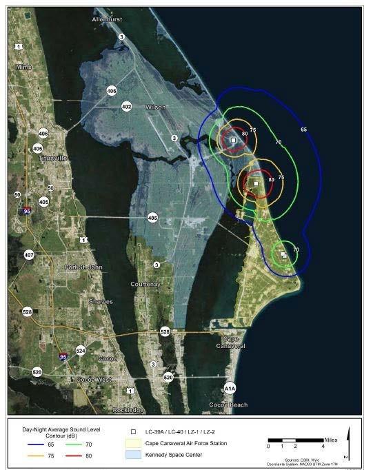
4.5.1.2.
Results from past studies of launch-related (ascent) sonic booms show that the surface intercept of the sonic boom would be observed more than 40 miles off the coast. Since most launches have sonic boom footprints that occur down track and over the ocean, sonic booms would occur away from the eastern coastline of Florida and would not occur on or near land or other noise sensitive areas. However, for the few launches with southern trajectories (up to six per year), sonic boom peak overpressures were modeled to occur over populated land near Vero Beach, Florida, with the vast majority experiencing peak overpressures of less than 1 psf (BRRC 2019; see Appendix A). Figure 4-3 shows a narrow region north of Vero Beach with land area less than 3 square miles is predicted to receive overpressures of greater than 2 psf with less than 0.01 square miles experiencing 4.6 psf. The majority of the land area within the sonic boom footprint is expected to experience overpressures of around 0.25 psf, which is similar to distant thunder. The location of focus boom regions is highly dependent on the actual trajectory and atmospheric conditions, and it is unlikely any given location would experience the focus more than once over multiple events. A modeled peak overpressure of 4.6 psf translates to an equivalent C-weighted DNL (CDNL) of 51 dBC. Therefore, the proposed Falcon 9 polar launch operation does not pose a significant impact with regards to human annoyance as the noise exposure is less than the significance threshold of CDNL 60 dBC for impulsive noise sources (equivalent to DNL 65 dBA). The potential for hearing damage (with regards to humans) is negligible, as the modeled sonic boom overpressure levels over land are lower than the approximate 4 psf impulsive hearing conservation noise criteria, except for an area less than 0.01 square miles (BRRC 2019).
BRRC’s sonic boom assessment for a Falcon 9 polar launch (see Appendix A) discusses the potential for structural damage from sonic booms. In general, for well-maintained structures, the threshold for potential damage from sonic booms is 2 psf; below 2 psf, damage is unlikely. If the sonic boom reaches levels of around 4 psf, it is possible there could be some minor damage (refer to Table 2 in BRRC’s 2019 sonic boom report, attached to this EA in Appendix A). Major damage is unlikely. The FAA does not expect significant impacts related to structural damage from the sonic boom generated during a Falcon 9 polar launch. SpaceX would be responsible for resolving any structural damage caused by the sonic boom.
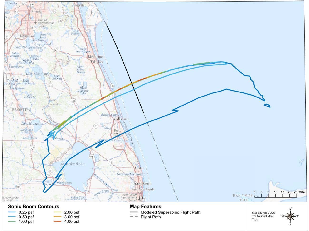
With regard to sonic booms generated during landing (descent) , several studies ( see Appendix A ) have been conducted along with actual sonic boom overpressure measurements. PCBOOM, as well as NASA’s 1122 sonic boom prediction method, was used and compared with actual overpressure measurements (Table 4 - 6) . SpaceX measured overpressures for Falcon 9 Flight 19 on the west coast and measured 2.3 psf at the drone ship. SpaceX also measured the sonic boom produced on Flight 21/Orbcomm, which launched from LC-40 and landed at LZ-1. The value measured at LC-40 was 2.5 psf. Sonic booms would be heard over land and are expected to be less than 4 psf. SpaceX and USAF noted that after the landings in July 2016 and December 2017, no broken windows were reported (SpaceX 2018). Additional analysis of sonic booms associated with landings at LZ-1 is provided in Appendix A (BRRC 2017).
Table 4-6. Sonic Boom Overpressure Measured and Predicted Values
Source: SpaceX 2018.
Notes:
1 95th Air Base Wing and AFFTC 2003 psf = pounds per square foot
KBR conducted sonic boom modeling for a Falcon 9 booster landing at LZ-1/LZ-2 during a polar mission, which could occur up to six times per year (see Appendix A for KBR’s report). The outer contours of the sonic boom footprint were modeled to span over populated areas further south than typical landing trajectories at LZ-1 and LZ-2 (see Figure 4-4). These areas include land near Indialantic, West Melbourne, Palm Bay, Sebastian Inlet, and western areas of Florida, south of Orlando. The overpressure levels in the vicinity of the landing pad range from about 2.0 to 2.7 psf, which is consistent with the typical landing trajectories that currently occur. Overpressure levels in the areas adjacent to CCAFS and KSC are predicted between 0.5 to 1.0 psf. The highest overpressure levels, which would occur offshore, are up to 4.6 psf. The broad crescent shown in Figure 4-4, with overpressure levels of 0.1 psf, is located over a large land area south of Orlando and stretching south of Port St. Lucie. The majority of the land area within the sonic boom footprint is expected to experience overpressures of 0.25 to 0.5 psf, which is similar to distant thunder.
The USAF conducted an independent sonic boom analysis for Falcon 9 polar missions and determined that predicted damage to public areas is very low and does not pose a safety concern (see Appendix A).
Because the FAA is required to analyze transboundary impacts, areas in the Bahamas and Cuba are also considered in the analysis. As shown in Figure 2-10, Falcon first stage booster landings during a polar mission could occur in areas near Cuba and the Bahamas. A sonic boom generated during a landing in the eastern portion of the recovery area is predicted to intercept the ground near the southern part of Andros Island, Bahamas (BRRC 2019; Appendix A), as shown in Figure 4-5. This area of Andros Island is sparsely populated and includes part of West Side National Park and small settlements along the eastern coast near Kemp’s Bay. The overpressures are predicted to be less than 0.5 psf. Much of the boom footprint is predicted to be less than 0.25 psf, which is similar in character to distant thunder A sonic boom generated during a landing in the western portion of the recovery area is predicted to intercept the ground near the northern islands of Cuba (BRRC 2019; Appendix A), as shown in Figure 4-6 Given that noise levels associated with proposed landing activities would last less than 1 minute and occur infrequently, no significant noise impacts are expected
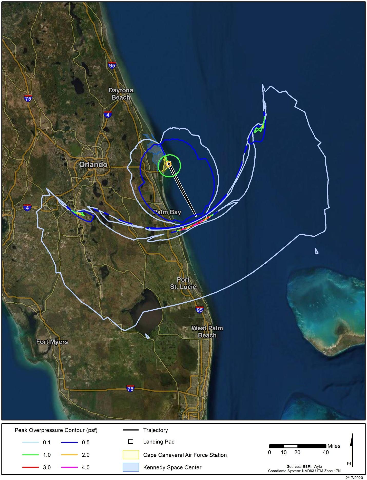
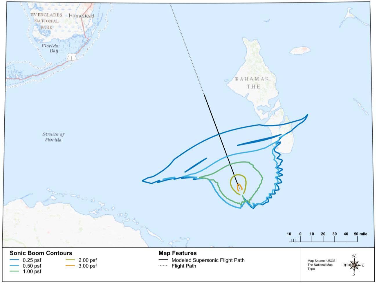
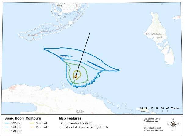
SpaceX has developed a notification plan to educate the public and announce when a southern trajectory launch and/or landing event at LZ-1 and/or LZ-2 would take place so that the public is aware they might hear a sonic boom. The plan would involve issuing statements to news outlets and law enforcement regarding the anticipated sonic boom, so that if heard, the public would understand what has occurred. SpaceX would implement a similar plan in coordination with the Bahamian and Cuban government for polar missions.
For periodic static test firings of the Dragon, the combined total thrust for would be approximately 131,000 pounds of force, which is less than 10 percent of the amount of thrust generated during a Falcon 9 launch. Thus, the noise associated with a Dragon test fire would be much less than a Falcon 9 launch. Dragon test firings would be less than 2 seconds in duration. Higher SELs above 80 dB would be mostly contained within the CCAFS and KSC properties (KBRwyle 2018; see Appendix A). Based on the above analysis for Falcon launches, normal Dragon processing and test firings would not result in significant noise impacts
4.5.1.4.
The noise analysis assumes a proposed maximum of ten Dragon reentries. Now that Dragon-1 is retired, SpaceX plans to conduct all Dragon reentries in the Atlantic Ocean. However, SpaceX may request a reentry license modification to include the Pacific Ocean as an alternative landing site if conditions are unfavorable for landing in the Atlantic Ocean. Under the Proposed Action, there would be no Dragon engine noise during reentry/splashdown, as Dragon would land via parachutes.
Potential noise impacts could occur from both ship and helicopter engines during Dragon recovery. The anticipated noise from both sources are considered relatively low, short-term, and infrequent. Both noise sources are consistent with current Atlantic Ocean use, which includes vessel engine noise associated with common maritime operations. No adverse impacts from vessel and helicopter activity is anticipated
A sonic boom may be generated during Dragon reentry. Sonic booms generated during reentry and landing in the Pacific Ocean impact the ocean’s surface far offshore and do not intersect any noise sensitive areas. Sonic booms generated during reentry and landing in the Atlantic Ocean would most likely only impact the ocean’s surface. For Dragon-2 reentry missions, a portion of Florida could experience the boom, depending on the location of the exact landing location in the Atlantic Ocean. Blue Ridge Research and Consulting (BRRC) conducted a sonic boom analysis for Dragon landings at CCAFS using the single-event prediction model, PCBOOM, which is an FAA-approved model (BRRC 2015; see Appendix A). Based on BRRC’s analysis and the fact that the reentry trajectories (Mach, altitude, and angle-of-attack profiles) for a landing at CCAFS and a landing offshore in the Atlantic Ocean are the same, an overpressure of 0.4 pound per square foot (psf) would be expected approximately 19 miles from the landing site and 0.35 psf approximately 50 miles from the landing site. Therefore, because it is possible for Dragon to land approximately 50 miles from the coast, overpressures could impact land and oil platforms Assuming a reentry at the closest point in the recovery area to the shoreline (5 nautical miles offshore), the sonic boom could extend approximately 150 miles inland. However, it would be at an overpressure of less than 0.25 psf For reference, an overpressure of 0.25 psf is similar to distant thunder Therefore, sonic booms generated during Dragon reentry would not result in significant noise impacts.
4.5.2.
Under the No Action Alternative, the FAA would not modify existing SpaceX licenses or issue new licenses to SpaceX for launch operations discussed in Section 2.1. SpaceX would continue Falcon 9 and Falcon Heavy launch operations at KSC and CCAFS as analyzed in previous NEPA and environmental reviews and in accordance with FAA licenses. SpaceX’s Falcon launch vehicle program results in temporary noise. As documented in the previous EAs and FAA FONSIs, the No Action Alternative would not increase noise by DNL 1.5 dB or more for a noise sensitive area that is exposed to noise at or above the DNL 65 dB noise exposure level and therefore would not result in significant noise impacts.
The FAA has not established a significance threshold for cultural resources. Factors to consider when assessing the significance of potential impacts on cultural resources include whether the action would result in a finding of Adverse Effect through the Section 106 process. However, an adverse effect finding does not automatically trigger preparation of an EIS.
4.6.1.
As noted in Section 3.6, NASA and USAF previously conducted Section 106 consultation for Falcon launches, including landings, at KSC and CCAFS during preparation of the EAs mentioned at the
beginning of Chapter 3. NASA KSC has a stewardship responsibility for managing the cultural resources on NASA-owned lands. To this end, KSC has developed an Integrated Cultural Resources Management Plan (ICRMP) that reflects NASA’s commitments to the protection of its cultural resources. The ICRMP provides an inventory of cultural resources and a plan of action to identify, assess, manage, preserve, and protect these resources. It also includes a guide for impact analysis review and a set of standard operating procedures for ongoing cultural resource management activities. NASA follows stipulations identified in the ICRMP, existing memoranda of agreements, and the 2009 PA. During preparation of the 2013 NASA EA, which included Falcon 9 and Falcon Heavy launches from LC-39A, NASA determined its action would constitute an adverse effect on LC-39A (a historic property) in accordance with the 2009 PA and consulted the SHPO. The SHPO concurred with NASA’s finding and noted that KSC has previously completed and will be following the appropriate mitigation stipulations identified in the 2009 PA. Prior to and during construction of the MST, SpaceX and NASA would comply with the 2009 PA and resolve any adverse effects to LC-39A in consultation with the SHPO.
The 2013 USAF SEA concluded that Falcon launch operations at LC-40 would not affect cultural resources because there are no historic properties located at or near LC-40. Similarly, the 2017 USAF SEA for Falcon Heavy first stage boost-back and landing at LZ-1 and LZ-2 concluded that Falcon booster landings at LZ-1 and LZ-2 would not affect historic properties and the SHPO concurred with that finding
Based on SpaceX’s estimate, up to six Falcon 9 launches per year could fly a southern trajectory. Thus, sonic booms could impact Florida up to twelve times per year once during ascent and once during landing (see Figures 4-3 and 4-4 for the sonic boom footprint). Sonic booms are low-frequency impulsive noise events with durations lasting a fraction of a second. The majority of land within the APE is predicted to experience overpressures of less than 1 psf. An overpressure of 1 psf is similar to a clap of thunder. A narrow region north of Vero Beach with land area less than 3 square miles is predicted to receive overpressures greater than 2 psf. An area less than 0.01 square miles could experience a maximum overpressure of 4.6 psf. Based on the sonic boom modeling, no historic properties are expected to experience overpressures greater than 2 psf. Most of the APE would experience a boom of 0.25 psf, which is similar to distant thunder Figures 4-3 and 4-4 show a common footprint in a portion of the region between the coast and Lake Okeechobee, and sonic booms could be experienced during both ascent and landing (i.e., up to a maximum of twelve times per year). Areas outside of this region would only experience sonic booms during either ascent or landing (i.e., up to a maximum of six times per year). During landings, sonic booms exhibit lower overpressure.
As noted in Section 4.5, in general, for well-maintained structures, the threshold for potential damage from sonic booms is 2 psf; below 2 psf, damage is unlikely. Therefore, the FAA does not expect any adverse effects to the historic structures within the APE. SpaceX would be responsible for resolving any structural damage caused by the sonic boom. Also, because sonic booms would occur up to a maximum of twelve times per year and would be similar to or less than the noise experienced during a clap of thunder in the majority of the APE, the FAA does not expect any adverse effects related to the setting of historic sites within the sonic boom APE. The FAA completed Section 106 consultation with the SHPO (see Appendix B). The SHPO concurred with the FAA’s determination that the Proposed Action would have no adverse effect to historic properties. Therefore, the Proposed Action would not result in significant impacts on historical, architectural, archeological, and cultural resources
4.6.2.
Under the No Action Alternative, the FAA would not modify existing SpaceX licenses or issue new licenses to SpaceX for launch operations discussed in Section 2.1. SpaceX would continue Falcon 9 and Falcon Heavy launch operations at KSC and CCAFS as analyzed in previous NEPA and environmental reviews and in accordance with FAA licenses. As documented in the previous EAs and FAA FONSIs, the
No Action Alternative would not result in significant impacts to historical, architectural, archaeological, and cultural resources.
A significant impact would occur if the action involves more than a minimal physical use of a Section 4(f) resource or constitutes a “constructive use” based on an FAA determination that the aviation project would substantially impair the Section 4(f) resource. Resources protected by Section 4(f) are publicly owned land from a public park, recreation area, or wildlife and waterfowl refuge of national, state, or local significance; and publicly or privately owned land from an historic site of national, state, or local significance. Substantial impairment occurs when the activities, features, or attributes of the resource that contribute to its significance or enjoyment are substantially diminished.
4.7.1.1.
For decades, the 4(f) properties located at KSC and CCAFS have been experiencing increased noise levels during launches taking place at CCAFS and adjacent KSC Some of the launch vehicles, including the Space Shuttle, that have launched from CCAFS and KSC produced more thrust and thus louder noise than would occur under the Proposed Action Due to the long history of these 4(f) properties experiencing noise from launches at CCAFS and KSC, the FAA has determined that Falcon launches would not substantially diminish the protected activities, features, or attributes of any of the Section 4(f) properties identified, and thus would not result in substantial impairment of the properties Section 4(f) properties located within the sonic boom footprints of a Falcon 9 polar launch or landing would be exposed to a sonic boom up to six times per year or up to 12 times per year if they are exposed to sonic booms during both ascent and landing. Section 4(f) properties within the sonic boom footprint include those NRHP-listed properties shown in Table 3-10. Other potential Section 4(f) properties within this sonic boom footprint include public parks, recreation areas, and wildlife management and conservation areas as described in Section 3.7.
Visitors at the Section 4(f) properties might experience a sonic boom at the time of a Falcon 9 polar launch and landing. Sonic booms are low-frequency impulsive noise events with durations lasting a fraction of a second. The majority of land within the sonic boom footprints is predicted to experience overpressures of less than 1 psf. An overpressure of 1 psf is similar to a clap of thunder. A narrow region north of Vero Beach with land area less than 3 square miles is predicted to receive overpressures greater than 2 psf during Falcon 9 ascent. An area less than 0.01 square miles could experience a maximum overpressure of 4.6 psf during Falcon 9 ascent. Most of the areas within the sonic boom footprints would experience a sonic boom of 0.25 psf, which is similar to distant thunder. Although some of the Section 4(f) properties include wildlife management and natural areas with typically quiet settings, this low magnitude of overpressure at only occasional times (maximum of twelve times per year) should not diminish the significance and enjoyment of these properties.
As noted in Section 4.5, in general, for well-maintained structures, the threshold for potential damage from sonic booms is 2 psf; below 2 psf, damage is unlikely. Therefore, the FAA does not expect any adverse effects to historic structures. SpaceX would be responsible for resolving any structural damage caused by the sonic boom. Also, because sonic booms would occur up to a maximum of twelve times per year and would be similar to or less than the noise experienced during a clap of thunder in the majority of the sonic boom footprint, the FAA has determined that Falcon 9 polar launches (including landings) would not substantially diminish the protected activities, features, or attributes of any Section 4(f) properties within the sonic boom footprint, and thus would not result in substantial impairment of
the properties.
On launch days, there is a possibility of temporary restricted public access due to visitor volume on sections of MINWR and NPS. These temporary closures of MINWR and CNS are typically related to crowd control and access for emergency services. They are related to the volume of visitor traffic in an area and are not related to a public safety hazard from a launch. Any potential closures due to visitor volume would be coordinated between KSC security, MINWR, and CNS by monitoring to ensure parking lot thresholds are not exceeded, and that roadways allow for emergency egress for any form of emergency associated with large crowds. Such closures would not be expected to cause more than a minimal disturbance to the enjoyment of the resources of MINWR and CNS and would be determined by the land managing agencies.
For some future launches and landings, debris and/or propellant dispersion analyses could lead to a recommendation by USAF Range Safety to close parts of MINWR and CNS to ensure public safety. Dayof-launch winds, anticipated crowds, and time of day are among the many factors that contribute to this recommendation. For the purposes of this EA, all closures associated with the activities in this EA would be voluntary and coordinated between the land managing agencies: NASA, USAF, MINWR, and CNS. Voluntary safety-related closures have occurred for some previous Falcon 9 launches that contained a Dragon capsule for NASA’s crew and cargo missions. This EA does not contemplate mandatory closures that are directed by NASA or USAF, nor does the FAA have the authority to close the MINWR and/or CNS.
In summary, the Proposed Action would not constitute a physical or constructive use of Section 4(f) resources and therefore would not result in significant impacts to Section 4(f) properties.
4.7.1.2.
This aspect of the Proposed Action does not occur on or near Section 4(f) properties and therefore would not be considered a constructive use of any Section 4(f) property and would not invoke Section 4(f) of the DOT Act.
4.7.1.3.
Dragon recovery would not result in the physical use, direct taking, or temporary occupancy of Section 4(f) properties. As described in Section 4.5.1, Dragon landing would not be expected to produce a significant noise impact from sonic booms during Dragon-2 reentry. These booms would resemble a thunderclap that would be short in duration (only a few seconds) and would occur infrequently (up to seven times a year). Therefore, Dragon landings would not result in a use of a Section 4(f) property
4.7.2.
Under the No Action Alternative, the FAA would not modify existing SpaceX licenses or issue new licenses to SpaceX for launch operations discussed in Section 2.1. SpaceX would continue Falcon 9 and Falcon Heavy launch operations at KSC and CCAFS as analyzed in previous NEPA and environmental reviews and in accordance with FAA licenses. As documented in the previous EAs and FAA FONSIs, the No Action Alternative would not result in significant impacts to Section 4(f) properties.
This section addresses impacts on biological resources from SpaceX’s proposed activities, including Falcon 9 and Falcon Heavy launch and landing operations, and Dragon reentry and recovery. These types of impacts and impact mechanisms have been addressed in previous EAs (USAF 2017a, 2014, 2016, 2016a; NASA 2013) and are briefly summarized in this section, with a focus on the potential impacts from SpaceX’s proposed increased launch frequencies at KSC and CCAFS. Biological resources impacts
would be significant if the USFWS or NMFS determines that the action would be likely to jeopardize the continued existence of a federally listed threatened or endangered species, or would result in the destruction or adverse modification of federally designated critical habitat. The FAA has not established a significance threshold for non-listed species. Factors to consider for non-listed include whether the action would have the potential for:
• A long-term or permanent loss of unlisted plant or wildlife species, i.e., extirpation of the species from a large project area;
• Adverse impacts to special status species (e.g., state species of concern, species proposed for listing, migratory birds, bald and golden eagles) or their habitats;
• Substantial loss, reduction, degradation, disturbance, or fragmentation of native species’ habitats or their populations; or
• Adverse impacts on a species’ reproductive success rates, natural mortality rates, non-natural mortality (e.g., road kills and hunting), or ability to sustain the minimum population levels required for population maintenance.
4.8.1.1.
The biological resources data and analyses from previous EAs for the Falcon 9 and other recent launch programs are applicable to the Proposed Action, and a significant impact on terrestrial vegetation and wildlife occurring in the study area would not be expected. The effects on local vegetation from 14 Delta, 20 Atlas, and 8 Titan launches from CCAFS have been mapped, and there was temporary near - field damage from fire and heat post - launch (Schmalzer 1998) . Such impacts have also been experienced during past Falcon 9 launches. The proposed increase in Falcon 9 and Falcon Heavy launches would be expected to have similar consequences. The Falcon vehicles use the same liquid fuels (LOX and RP1) as the Delta, Atlas, and Titan rockets, so there is very little to no acid or particulate deposition anticipated that would permanently damage surrounding vegetation Impacts to vegetation are anticipated to be minimal, and therefore, minimal for wildlife occupying the area.
Besides the changes in habitat structure from fire and heat in small areas adjacent to the launch pads, the other potential impact expected for wildlife would be from increased frequency of noise from launches, landings, and static fire tests. Wildlife in the study area would be exposed to noise generated by the engines during takeoff and landing events, as well as sonic booms generated during first stage boost-back and landing. The number of Falcon 9 and Falcon Heavy launches is predicted to increase from a current 24 launches per year to 70 launches per year by 2025 (Table 2-2). Monitoring scrub-jay behavior after Delta, Atlas, and Titan launches found no apparent impacts from noise, but these data were for a combined 42 launches over a time period of 2 ½ years (16 launches per year) (Schmalzer et al. 1998). Monitoring associated with the Space Shuttle program (135 launches over 30 years or 4.5 launches per year) found that there was an initial flight response from birds in the vicinity, but no longterm impacts were observed (NASA 2014). Nesting wood storks were documented flying off active nests, but would typically return within 4 minutes No significant adverse effects to wildlife have been reported from recent SpaceX launch operations.
More annual launches increases the rate of disturbance as well as the chances that a noise-induced startle response at a critical time in the nesting cycle could occur. A startle response from nesting birds can result in broken eggs, or cause young flightless birds to jump out of a nest. Repeated nest failures can eventually trigger desertion of a nesting area. There are no mitigation measures currently available to reduce the chances of noise-induced startle responses. Although there would be an increased launch
frequency under the Proposed Action, noise from launch events is not expected to result in a long-term or permanent loss of wildlife species or adverse impacts on species’ reproductive success rates.
Construction of the MST at LC-39A would not affect wildlife habitat. All construction would occur on previously developed areas. Noise during construction would be temporary and not affect wildlife populations at KSC. In summary, the Proposed Action would not result in significant impacts on general wildlife species.
4.8.1.2.
As described in previous NEPA analyses (USAF 2007, 2013, 2016a, 2016b) and ESA Section 7 consultations with NMFS (NMFS 2016, 2017, 2018a, 2018b), significant impacts on marine habitats and species from SpaceX’s reentry and recovered operations are unlikely.
Potential impacts on marine habitats and wildlife from Falcon vehicle launches and Dragon splashdowns relate to reentry sonic booms and the open ocean splashdowns of the Falcon booster or Dragon, associated fairings, parachute components, expendable radiosondes, and weather balloons. Impacts could include direct strikes to an animal, entanglement with parachute or parafoil lines and material, the ingestion of pieces of latex weather balloons and exposure to sonic boom. These potential impacts are fully described by NMFS as part of FAA’s 2017 ESA Section 7 consultation (NMFS 2017) that addressed SpaceX’s landing and recovery operations in the Atlantic and Pacific Oceans (and Gulf of Mexico). The same impact mechanisms and effects described and assessed as part of the 2017 NMFS consultation are applicable to non-protected species. The consultation concluded with NMFS concurring that SpaceX’s landing and recovery operations would be unlikely to adversely affect federally listed threatened and endangered species. Based on the same reasoning, it is unlikely that non-protected marine wildlife would be adversely affected and that the effects from an increased number of landing and recovery operations would be negligible. The following paragraphs provide a summary of the potential impacts on marine wildlife from the NMFS 2017 consultation (see Appendix B).
Given the low frequency of the Dragon Capsule’s reentry, splashdown and recovery operations and the fact that marine wildlife, marine mammals, and special status species spend the majority of their time submerged as opposed to on the surface, it is extremely unlikely they would be impacted (e.g., struck) by a Dragon splashdown. The capsule would remain on the surface throughout splashdown and recovery operations. Direct strikes by falling debris and the splashdown of the spacecraft are discounted as extremely unlikely for all species of concern, fish, sea turtles, and marine mammals. This is also due to the small size of the components as compared to the vast open ocean. The relative availability of these animals at the ocean surface, spatially and temporally, combined with the low frequency of the propose action, reduce the likelihood of impacts to extremely low. Additionally, there are no known interactions with any of these species after decades of similar rocket launches.
Fairing recovery operations occur in the vast action area in deep open ocean waters, 300–500 nautical miles from shore Fairing recovery operations could also include waters off the coast of the Bahamas, Cuba, Jamaica, and Haiti. SpaceX expects to recover both halves of the nose fairing and main portions of the parafoils. Unrecovered portions would sink rapidly. The drogue parachute begins to sink within one minute of splashdown and is estimated to have sunk to a depth of 1,000 feet with 46 minutes while the parafoil would sink to similar depths within one to two hours. These small fragments are not expected to resuspend to a level where they would be encountered by species, once resting on the ocean floor.
Marine mammals and sea turtles could potentially ingest unrecovered debris (e.g., parachute materials, radiosondes). However, for reasons explained above regarding sink rates and limited opportunities for such encounters by marine turtles and marine mammals, ingestion is deemed so low as to be discountable. Ingestion by various listed fish species were also considered during the 2017 consultation.
Interaction with fairing halves, radiosondes, or parachutes was deemed very unlikely. Fish within the action area are expected be in water depths beyond the ranges of effect for most actions resulting in highly unlikely interactions. Weather balloons which burst at altitude and shred were evaluated and should only be available for exposure to these protected species in the upper portion of the water column for a matter of weeks. Given the expected fate and size of the weather balloon shreds, accidental ingestion is not anticipated to occur
Marine species entanglement with parachutes, parafoils and lines from the Falcon 9 fairing is unlikely due to rapid sink rates reducing time at the surface for any interaction. The Dragon main parachutes, which remain at the surface longer, are generally recovered by SpaceX. In the few case main or drogue parachutes might not be recovered, they are not expected to remain at the surface for more than a few hours. In addition, the infrequency of the splashdowns and recovery actions renders the probability of interactions highly unlikely for turtles, seals/sea lions, and other marine mammals.
In the event of failure there could be a potential impact on marine species as the spacecraft and launch vehicle debris would fall into the ocean areas. Debris would include the liquid propellant, which is considered a negligible hazard because virtually all hazardous materials would be consumed in the destruct action, dispersed in the air, and only structural debris remains could strike the water. In a destruct action, the Dragon spacecraft or launch vehicle may survive to impact the water essentially intact, presenting some potential for habitat impact. Any unspent hypergolic propellants, which are toxic to marine organisms, would be of concern, however this potential is extremely low as described in USAF (2007, 2014, and NMFS 2017).
As described in Section 4.5, sonic booms created by launches and Dragon reentry near CCAFS/KSC intercept the ocean surface more than 40 miles offshore over the open Atlantic Ocean. Due to the low magnitude of the boom during reentry, and the substantial attenuation of a sonic boom at the air/water interface, coupled with exponential attenuation with water depth, the sonic boom would not result in impacts to marine species beneath the surface. The only impact expected may be a startle-type response as described in USAF (2000a) and NMFS (2017). Sonic booms are infrequent, and marine species in the ocean’s surface waters are present in low densities. The spring and fall northern right whale migration would place periodic groups of whales along the Atlantic coastline but rarely more than 5 miles off shore. Even though the frequency of sonic booms would increase slightly based on the increased in launch-landing cycles between 2020 and 2025, the actual sonic boom event associated with landings would remain relatively infrequent and are not expected to negatively affect the survival of any marine species (USAF 2014, NMFS 2017).
4.8.1.3.
4.8.1.3.1. Terrestrial
Based on the previous EAs, no mortality would be expected from future Falcon launches of any of the protected wildlife species potentially occurring in the study area. These previous analyses also concluded that overall impacts to these species are expected to be minimal (USAF 2007, 2013, and NASA 2013) No anomalies were observed in the behavior of scrub-jays after Delta, Atlas, or Titan launches, implying no noise - related effects (Schmalzer 1998) However, these data were gathered for fewer launches than are anticipated to occur in the future, and also did not take into account additional noise from static fire tests or sonic booms . Repeated startle responses from sudden noises during the bird nesting season could potentially cause reduced reproductive success . No mitigat ion measures are available to reduce this potential . Monitoring via remote cameras of select species such as Florida scrub - jays and bald eagles during the nesting season could help determine if a problem exists and quantify the severity.
No observable, measurable rocket impacts occurred for southeastern beach mice at KSC during studies of this species during the space shuttle program.
Regarding nesting and hatchling sea turtles, USFWS Biological Opinions have been in place for many years at CCAFS and KSC to ensure proper measures are taken to protect this light sensitive species from exterior operational lights. Light operations manuals have been in place for all launch pads and are updated with as new information becomes available for best practices. Proper lighting controls are expected to manage this issue, but it is evaluated by NASA, USAF, and USFWS on a regular basis with nest monitoring and lighting compliance surveys.
The FAA conducted ESA section 7 consultation with the USFWS to address potential effects to ESA-listed species (see Appendix B) The USFWS concurred with the FAA’s determination that the Proposed Action would not adversely affect ESA-listed species
4.8.1.3.2.
As determined in earlier environmental assessments of the Falcon 9 and similar programs (USAF 2007, 2013, 2014, 2017; NASA 2013), no adverse impacts are expected for protected marine species or critical habitats under the proposed action The FAA consulted NMFS under ESA Section 7(a)(2) for SpaceX landing and recovery operations. The consultations resulted in letters of concurrence (NMFS 2017, 2018a, 2018b; Appendix B). NMFS reviewed all of the information between June and September of 2017 and concurred with the FAA’s determination that the SpaceX landing and recovery operations in the Atlantic and Pacific Oceans (and Gulf of Mexico) are not likely to adversely affect threatened or endangered species or adversely modify designated critical habitat. The FAA reinitiated consultation with NMFS for SpaceX landing and recovery operations after the giant manta ray and oceanic whitetip shark were listed as threatened under ESA. The NMFS concurred with FAA’s determinations that SpaceX’s landing and recovering operations would not likely adversely affect these two species (NMFS 2018a, 2018b; see Appendix B).
The FAA reinitiated consultation again with NMFS during preparation of this EA to account for the expanded action area associated with polar missions (see Appendix B for correspondence) A detailed description of impacts to federally listed species can be found in Appendix B. NMFS concurred with the FAA’s determination that the Proposed Action would not adversely affect ESA-listed species
4.8.1.3.3. Critical Habitat
The study area does not contain terrestrial critical habitat. NMFS’s previous evaluation of SpaceX’s launch and recovery operations (NMFS 2016, 2017, 2018a, 2018b) resulted in the conclusion that all potential effects of open-water landings to listed species and critical habitat are discountable, insignificant, or beneficial, and concurred with FAA, USAF, and NASA’s determination that the Proposed Action is not likely to adversely affect critical habitat. The FAA has determined that polar launches (including landings) would have no effect on critical habitat.
4.8.2. Summary
Given that 1) the USFWS and NMFS determined the Proposed Action would not jeopardize the continued existence of a federally listed threatened or endangered species, and would not result in the destruction or adverse modification of federally designated critical habitat, and 2) none of the factors to consider for non-listed species would result, the Proposed Action is not expected to result in significant impacts on biological resources.
4.8.3. No Action Alternative
Under the No Action Alternative, the FAA would not modify existing SpaceX licenses or issue new licenses to SpaceX for launch operations discussed in Section 2.1. Under the No Action Alternative,
SpaceX would continue Falcon 9 and Falcon Heavy launch operations at KSC and CCAFS at a launch rate as analyzed in previous NEPA and environmental reviews and in accordance with FAA licenses. The No Action Alternative would not jeopardize the continued existence of a federally listed threatened or endangered species or result in the destruction or adverse modification of federally designated critical habitat, and therefore would not result in significant impacts on biological resources.
The FAA has not established a significance threshold for coastal resources. However, the FAA has identified factors to consider when evaluating the context and intensity of potential environmental impacts on coastal resources. Factors to consider include whether the action would have the potential to:
• Be inconsistent with the relevant state coastal zone management plan(s);
• Impact a coastal barrier resources system unit (and the degree to which the resource would be impacted);
• Pose an impact to coral reef ecosystems (and the degree to which the ecosystem would be affected);
• Cause an unacceptable risk to human safety or property; or
• Cause adverse impacts to the coastal environment that cannot be satisfactorily mitigated.
Operations and launch and landing activities for the Falcon vehicles at LC-39A, LC-40, LZ-1, and LZ-2 would take place in the coastal zone, which is the entire State of Florida, similar to other vehicle launches. Falcon first stage landings on the drone ship would be no closer than approximately 10 nautical miles from shore, but could be located several hundred miles offshore in the Atlantic Ocean. Payload fairing landing and recovery would take place no closer than 5 nautical miles offshore.
Dragon landing operations and recovery activities would occur in deeper waters at least 5 nautical miles off the Atlantic or the Pacific coasts The recovery vessel would remain in deep waters during the transport of the recovered Dragon to Port Canaveral, a CCAFS-based wharf facility, or a commercially available wharf on the Pacific Coast.
Landing and recovery operations would not take place in intertidal areas, salt marshes, estuaries, and coral reefs. Dragon is designed to conduct precision landings. National Marine Sanctuaries and NWRs in the Gulf of Mexico and the Pacific Ocean would be avoided. Any coral reefs occurring in the study area would be avoided during planning of the landing location for each Dragon mission and operations.
Aside from the construction of the MST at LC-39A (an existing launch facility), the Proposed Action does not include any coastal construction or seafloor disturbing activities and would be consistent with commonly occurring Atlantic and Pacific Ocean maritime operations. Spacecraft processing for the Falcon 9 and its payloads would be the same as currently performed. No impacts are expected from Falcon payload processing operations. All materials and procedures would remain essentially the same.
The Florida State Clearinghouse previously determined that SpaceX’s Falcon launch operations in Florida are consistent with the state’s coastal management program (NASA 2013, USAF 2013). To facilitate SpaceX’s compliance with the state’s coastal management program for the proposed increase in annual operations, the FAA has submitted the Draft EA to the Florida State Clearinghouse for review. The Clearinghouse review resulted in no objections (see Appendix D) Therefore, no significant coastal resource impacts are expected
4.9.2.
Under the No Action Alternative, the FAA would not modify existing SpaceX licenses or issue new licenses to SpaceX for launch operations discussed in Section 2.1 Under the No Action Alternative, SpaceX would continue Falcon 9 and Falcon Heavy launch operations at KSC and CCAFS at a launch rate as analyzed in previous NEPA and environmental reviews and in accordance with FAA licenses. The No Action Alternative would be consistent with Florida’s and California’s coastal management programs and would not result in significant impacts on coastal resources.
This section addresses impacts to surface water and groundwater resources. Determination of water resource impacts is based on an analysis of the potential for activities to affect surface water or groundwater quality as defined by applicable laws and regulations. Considered in this analysis is activityrelated introduction of contaminants into surface water or groundwater resources. The Proposed Action does not involve physical alterations or disturbances of overland surface water flows and groundwater recharge Potential impacts to water quality could occur; however, most of these potential impacts would be avoided and minimized through Clean Water Act compliance (e.g., NPDES permits). A significant impact to surface waters would occur if the action exceeded water quality standards established by federal, state, local, and tribal regulatory agencies; or contaminated the public drinking water supply such that public health may be adversely affected. A significant impact to groundwater would occur if the action would exceed groundwater quality standards established by federal, state, local, and tribal regulatory agencies; or contaminate an aquifer used for public water supply such that public health may be adversely affected.
4.10.1.1.
Falcon 9 and Falcon Heavy launch operations include launches, landings, and associated activities These impacts have been addressed in previous EAs and are briefly summarized here.
There is potential for an inadvertent discharge of industrial wastewater (deluge water) into nearby jurisdictional waters of the United States in the event of an overflow of the deluge water system at LC40. It is highly unlikely that the maximum discharge of deluge water would occur with a deluge basin capacity of 160,000 gallons. The USAF 2013 EA found launching of the Falcon 9 would not be expected to significantly impact water resources. Since the 2013 EA, SpaceX has improved the industrial wastewater and now recycles approximately 75,000 gallons back into the system after launch. Any remaining water is collected in a wastewater pond.
Operations at LC-39A would have minimal impacts on the surface water quality Surface waters at the launch complex would drain to existing swales within the pad perimeter. Stormwater runoff generated from the launch pad drains to various manmade grassed swales that radiate from the pad The grassed swales discharge via culverts to a swale that runs parallel to the perimeter access road The perimeter access road swale discharges to receiving waters on the periphery of the site. Launch deluge and pad washdown water at LC-39A flows down two concrete flumes into east and west treatment tanks. These tanks have a net lined holding capacity of 704,146 gallons. No chemicals are used for treatment of the wastewater. It is allowed to settle and attenuate pH over time in the containment tanks before being land applied to a 2.2-acre bermed disposal area operated as a spray field, as authorized by Florida Department of Environmental Protection.
The launch exhaust cloud formed from the exhaust plume and evaporation and subsequent condensation of deluge water could affect surface water drainage from the launch complexes. The
exhaust cloud would consist largely of steam with insignificant amounts of hazardous materials from LOX and RP-1 propellants. The temporary and minimal volume of water condensing from the exhaust cloud would not result in significant impacts to surface water quality.
Potential impact to surface waters of the Indian River Lagoon or the Atlantic Ocean of a failed landing from spilled fuel, if not consumed by combustion or contained inside the tank, would be relatively minor. Residual RP-1, approximately 400 gallons, would be expelled into the ocean upon impact and dissipate within hours.
Construction of the MST at LC-29A would not impact the existing stormwater infrastructure. The construction would occur on previously developed and existing concrete surfaces.
In summary, less than significant impacts on surface waters are expected during Falcon launch operations or from payload processing. All materials and procedures would remain essentially the same as those analyzed in previous EAs. Even with an increased number of launches, implementing procedures already in place and adhering to NPDES permit conditions would avoid and minimize water quality impacts.
Several aspects of the Proposed Action are potential sources of water quality pollutants. Dragon landing operations along with recovery vessel and RHIB activities are evaluated for the possible release of contaminants and hazardous constituents into ocean waters. A full discussion of hazardous materials, solid waste, and pollution prevention is presented in Sections 3.11 and 4.11. Dragon propellant storage is designed to retain residual propellant, so any propellant remaining in the capsule is not expected to be released into ocean waters. The capsule has multiple system redundancies in place in the event it is damaged upon reentry and/or splashdown that help to prevent unanticipated releases. If any propellant were to be released, it would rapidly disperse and does not represent a source of substantial environmental degradation to water quality.
Recovery vessel and RHIB operations have the potential to release small amounts of oil and gas into the water. However, vessel operations would be conducted in accordance with the International Convention for the Prevention of Pollution from Ships (MARPOL 73/78), which prohibits certain discharges of oil, garbage, and other substances from vessels. The Proposed Action is therefore not expected to have a significant impact on ocean water resources in the Atlantic or Pacific.
4.10.1.3.
Wastewater from Dragon and routine payload processing would be processed through existing wastewater handling and treatment systems at CCAFS. The Proposed Action falls within the scope of existing water discharge permit definitions. There would be a negligible impact on surface water or groundwater.
4.10.2.
Under the No Action Alternative, the FAA would not modify existing SpaceX licenses or issue new licenses to SpaceX for launch operations discussed in Section 2.1. SpaceX would continue Falcon 9 and Falcon Heavy launch operations at KSC and CCAFS as analyzed in previous NEPA and environmental reviews and in accordance with FAA licenses. As documented in the previous EAs and FAA FONSIs, the No Action Alternative would not result in significant impacts on water resources.
4.11.
The FAA has not established a significance threshold for Hazardous Materials, Solid Waste, and Pollution Prevention; however, the FAA has identified factors to consider in evaluating the context and intensity
of potential environmental impacts. Factors to consider that may be applicable to hazardous materials, solid waste, and pollution prevention include, but are not limited to, situations in which the action would have the potential to:
• Violate applicable federal, state, tribal, or local laws or regulations regarding hazardous materials and/or solid waste management;
• Involve a contaminated site (including, but not limited to, a site listed on the National Priorities List). Contaminated sites may encompass relatively large areas. However, not all of the grounds within the boundaries of a contaminated site are contaminated, which leaves space for siting a facility on non-contaminated land within the boundaries of a contaminated site. An EIS is not necessarily required. Paragraph 6-2.3.a of FAA Order 1050.1F allows for mitigating impacts below significant levels (e.g., modifying an action to site it on non-contaminated grounds within a contaminated site). Therefore, if appropriately mitigated, actions within the boundaries of a contaminated site would not have significant impacts;
• Produce an appreciably different quantity or type of hazardous waste;
• Generate an appreciably different quantity or type of solid waste or use a different method of collection or disposal and/or would exceed local capacity; or
• Adversely affect human health and the environment
4.11.1. Proposed Action
4.11.1.1.
Since all applicable federal, state, county, NASA, and USAF rules and regulations would continue to be followed for the proper storage, handling, and usage of hazardous materials under the continued Falcon Launch Vehicle Program, less than significant impacts on hazardous materials management are expected under the Proposed Action. There would be no changes for fuel handling procedures. The only changes would entail loading additional, denser RP-1 into the Falcon launch vehicles and more propellant deliveries to the launch facilities throughout the year.
The processing of launch vehicles at LC-39A and LC-40 requires the use of hazardous materials and results in the production of hazardous wastes. Impacts due to use of large quantities of hazardous materials and creation of large quantities of hazardous waste would be measurable but would be reduced through appropriate management and conservation measures. All hazardous materials would continue to be handled and disposed of per the requirements established by OSHA (Hazardous Materials) and per the Hazardous Materials Contingency Plan developed for the Falcon Launch Vehicle Program. SpaceX has implemented proper handling procedures for payloads containing hypergolic fuels. During Falcon program launch operations, hazardous and solid waste would be handled and disposed of in a manner consistent with the guidelines established by NASA as outlined in Kennedy NASA Procedural Requirement 8500.1 and USAF rules and regulations. There would also be contingency plans for responding to and minimizing the effects of spills. All hazardous material releases to air, water, soil, and pavement at KSC must be reported per the requirements in KDP-KSC-P-3008 and CCAFS. With the proper procedures and safeguards in place, it is not expected that soil or groundwater contamination would be caused by operational activities at the Proposed Action sites.
While the amount of waste per launch would remain approximately the same, due to increased frequency of launches, there would be a corresponding increase in hazardous material being used (refer to Table 2-2 for planned launch frequency). SpaceX would comply with all applicable rules and regulations for each launch, thereby minimizing the potential for impacts related to hazardous
materials.
All hazardous materials would continue to be handled and disposed of per the requirements established by OSHA (Hazardous Materials), RCRA and per the Hazardous Materials Contingency Plan developed for the Falcon 9 and Heavy Launch Vehicle Program Approximately 2,800 pounds or less of RP-1 fuel may remain on-board each returning first stage vehicle. After removing the legs, the vehicles would be transported shortly after landing to another SpaceX facility for processing activities including maintenance and cleaning. Since all applicable federal, state, county, and USAF rules and regulations would continue to be followed for the proper storage, handling, and usage of hazardous materials under the Falcon Launch Vehicle Program, less than significant impacts for hazardous materials management are expected from Falcon landing operations.
4.11.1.2.
The approximate quantities of materials that would be used during processing of a routine payload spacecraft would remain the same as past and current operations. Facilities at LC - 40 and LC - 39A have been permitted to process hypergolic propellants and would continue operating under those permit requirements for any hypergolic propellants and waste products. Payload processing would increase between years 2020 and 2025, similar to the rate discussed above for launches. SpaceX would implement processes to reduce the incremental use of these materials per launch so that overall increase would be moderate.
The hazardous materials used to process routine payload spacecraft could potentially generate hazardous waste. SpaceX would continue operating in accordance with existing requirements. No Class I ODSs would be used in the payload processing facilities.
Operation of the proposed Dragon processing buildings at Area 59 would be managed in the same fashion as other processing facilities at CCAFS Fuel volumes and subsequent safety arcs would be approved by USAF safety prior to operations beginning SpaceX has implemented proper handling procedures for payloads containing hypergolic fuels at LC-40 Since all applicable federal, state, and local regulations would continue to be followed for the proper storage, handling, and usage of hazardous materials under its Falcon Launch Vehicle Program, no significant impacts due to hazardous materials management are expected
Dragon engine testing and payload processing is expected to generate much less solid waste than a launch of a Falcon 9 vehicle. Examples of solid waste may include cardboard packaging, wood, rag material, plastic and aluminum bottles and cans. The Proposed Action at the Area 59 processing facility would therefore not have a significant impact on CCAFS’s solid waste management.
The recovered first-stage boosters that would be brought by barge to the Port and wharf areas could contain small amounts of RP-1, hydraulic fluid, and some explosives. Dragon could contain up to 20 percent of the maximum propellant load (approximately 300 pounds) of MMH propellant when recovered. MMH is a strong irritant which may damage eyes and cause respiratory tract damage. Repeated exposure to lower concentrations may cause toxic damage to liver and kidneys as well as anemia. In addition, the EPA classifies MMH as a probable human carcinogen. MMH is also flammable and could spontaneously ignite when exposed to an oxidizer.
Operation and maintenance of vessels, vehicles and equipment used for booster and Dragon recovery operations would generate small quantities of hazardous wastes. These wastes would include, at a minimum, empty containers, spent solvents, waste oil, spill cleanup materials (if used), unused explosives, and lead-acid batteries.
As described in the 2007 EA (USAF 2007), SpaceX would be responsible for identifying, containing, labeling, and accumulating the hazardous wastes in accordance with all applicable federal, state, and local regulations. It is not anticipated that Proposed Action would increase hazardous waste production. Operations supporting the Dragon recovery operations could use a small amount of products containing hazardous materials, including POLS, paints, solvents, oils, lubricants, acids, batteries, and chemicals. In particular, the Dragon may contain approximately 20 percent of the maximum propellant load upon splashdown, including MMH. If human error (e.g., not following procedures, not wearing protective clothing, or not donning breathing equipment) occurs during capsule recovery, exposure of personnel to toxic propellant vapors may result. This would give some level of short-term adverse health impact and an incremental increase in the chance of the exposed individual developing cancer. However, continued implementation of existing handling and management procedures for hazardous materials and hazardous wastes would limit the potential for impacts.
Management of hazardous materials is the responsibility of each individual or organization and is regulated under RCRA (40 CFR 260-280) and Rule 62-730. Hazardous materials and wastes would be handled in accordance with applicable federal, state, and local environmental and public and occupational health and safety regulations. Safeguards, including multiple system redundancies in case of damage upon reentry, are in place to minimize the release of toxic chemicals in the environment, and rapid emergency response plans would ensure that accidental spills would be cleaned up quickly. No significant impacts from hazardous materials or hazardous waste management are expected from the Proposed Action.
Solid wastes would be placed in covered receptacles until disposed of off-site to minimize accidental entry into marine waters or contact with stormwater and prevent offsite deposition from wind. Solid wastes would be salvaged or recycled to the maximum extent practicable and the remaining solid waste disposed of in appropriately permitted landfills. With the implementation of appropriate handling and management procedures, solid wastes generated as a result of recovery operations would have no significant impacts to the environment.
Hazardous materials, substances and wastes used and generated as part of recovery operations would be collected, stored, and disposed of using practices that minimize the potential for accidental releases or contact with storm or marine water and in accordance with applicable spill prevention plans, RCRA and OSHA regulations. All accidental releases of polluting substance would be responded to quickly and appropriate clean up measures would be implemented in accordance with applicable laws to minimize impacts to the environment. The Dragon has been designed to perform pinpoint landings to avoid collisions with existing structures in the Gulf of Mexico and to avoid release of hazardous materials and pollutants. To avoid collision with marine vessels, to further ensure public and environmental safety, a NOTMAR would be issued 3-6 days prior to reentry, splashdown and recovery efforts. As a result, recovery operations would have no significant impacts to the environment with regards to pollution.
4.11.1.4.
MST construction activities would use small quantities of hazardous materials, which would result in generation of small volumes of hazardous wastes. Hazardous materials that are expected to be used are common to construction activities and include diesel fuel and gasoline to power the construction equipment, hydraulic fluids, oils and lubricants, welding gases, paints, solvents, adhesives, and batteries.
Appropriate hazardous material management techniques would be followed to minimize their use and waste disposal. The construction contractors would make all reasonable and safe efforts to contain and control any spills or releases that may occur. All hazardous material releases to air, water, soil, and pavement at KSC must be reported per the requirements in KDP-KSC-P-3008, Hazardous Materials Emergency Response. Compliance with hazardous material and waste management regulations and adherence to guidelines established by NASA as outlined in Kennedy NASA Procedural Requirement 8500.1 would avoid or minimize impacts from construction activities
Under the No Action Alternative, the FAA would not modify existing SpaceX licenses or issue new licenses to SpaceX for launch operations discussed in Section 2.1. SpaceX would continue Falcon 9 and Falcon Heavy launch operations at KSC and CCAFS as analyzed in previous NEPA and environmental reviews and in accordance with FAA licenses. SpaceX’s Falcon launch vehicle program requires the use of hazardous materials and the generation of solid waste. As documented in the previous EAs and FAA FONSIs, the No Action Alternative would not result in significant impacts related to hazardous materials, solid waste, and pollution prevention.
The FAA has not established a significance threshold for natural resources and energy supply. However, the FAA has identified a factor to consider when evaluating the context and intensity of potential environmental impacts on natural resources and energy supply. Aspects to consider include situations in which the action would have the potential to cause demand to exceed available or future supplies of these resources.
4.12.1.
The demands of the Proposed Action on infrastructure at KSC and CCAFS has been analyzed in previous NEPA documents (NASA 2013; USAF 2013, 2017a) and are summarized here.
The current potable and non-potable water supply to LC-40 was designed to support the Titan IV launch vehicle program and can handle Falcon vehicle launch requirements. Since only one vehicle will be in preparation for launch on each pad at any given time, Falcon program reliance on the water supply would be relatively small with no significant impact expected.
Electrical power capabilities at LC-40 were also designed to support the Titan IV launch program The Falcon launch program electrical power needs are less than that of the Titan program and would not be a significant impact on availability of electrical power. Similarly, impacts to electricity, natural gas, and communications infrastructure at KSC would be minimal. These utilities and services are currently available in the vicinity of Proposed Action sites and minimal additional demands on these services would be readily absorbed.
Ground support and construction activities are anticipated to have minimal impacts on current potable water resources and electricity on KSC. These utilities are currently available at LC-39A and are expected to be able to absorb the additional demands of Falcon launch operations. Therefore, the proposed action would not have significant impacts on water supply or electrical power capabilities.
Recovery operations would require the use of fuel for the recovery vessel, RHIB and helicopter. Reentry operations would require the use of hypergolic fuels for deorbit. The demand for both types of fuel would be met without difficulty. The Proposed Action is not expected to significantly increase demand or use of natural resources and energy supply and therefore would not result in significant impacts.
4.12.2.
Under the No Action Alternative, the FAA would not modify existing SpaceX licenses or issue new licenses to SpaceX for launch operations discussed in Section 2.1. SpaceX would continue Falcon 9 and Falcon Heavy launch operations at KSC and CCAFS as analyzed in previous NEPA and environmental reviews and in accordance with FAA licenses. There would be no new effects on natural resources and energy supply as a result of the No Action Alternative.
The FAA has not established significance thresholds for socioeconomics. However, the FAA has identified factors to consider when evaluating impacts. For socioeconomics, the factors to consider are whether the Proposed Action would have the potential to:
• Induce substantial economic growth in an area, either directly or indirectly (e.g., through establishing projects in an undeveloped area);
• Disrupt or divide the physical arrangement of an established community;
• Cause extensive relocation when sufficient replacement housing is unavailable;
• Cause extensive relocation of community businesses that would cause severe economic hardship for affected communities;
• Disrupt local traffic patterns and substantially reduce the levels of service of roads serving an airport and its surrounding communities; or
• Produce a substantial change in the community tax base.
4.13.1.
The Proposed Action involves additional operations related to launch and landing and does not involve substantial construction or development Launch operations have moderate economic benefits, including increased demand in the workforce, higher revenues, and increased per capita income While the population under the poverty threshold may not directly benefit through employment and income, it may indirectly benefit as regional economic health is improved through the proposed increase in commercial space exploration activity.
The Proposed Action does not involve onshore activities that could adversely affect economic activity and income, employment, population and housing, and public services and social conditions. Up to ten Dragon recoveries per year would occur at Port Canaveral, or a CCAFS-based wharf facility (such as Poseidon Wharf), and four recoveries at Port of Los Angeles. Issuing a notice to mariners for the short term avoidance of the splashdown and recovery area for ten splashdown and 27 landing operations per year.
SpaceX would continue to use its existing workforce for launch, landing, and recovery activities The Proposed Action would not significantly affect the local housing market and would not negatively affect the local economy.
In summary, the Proposed Action would not result in significant socioeconomic impacts on the region.
4.13.2.
Under the No Action Alternative, the FAA would not modify existing SpaceX licenses or issue new licenses to SpaceX for launch operations discussed in Section 2.1. Under the No Action Alternative, SpaceX would continue Falcon 9 and Falcon Heavy launch operations at KSC and CCAFS at a launch rate as analyzed in previous NEPA and environmental reviews and in accordance with FAA licenses The No
Action Alternative would not result in significant impacts to Socioeconomics.
CEQ NEPA-implementing regulations define a cumulative impact as the impact on the environment which results from the incremental impact of the action when added to other past, present, and reasonably foreseeable future actions regardless of what agency (federal or non-federal) or person undertakes such other actions. Cumulative impacts can result from individually minor but collectively significant actions taking place over a period of time (40 CFR § 1508.7). According to CEQ (1997b), “each resource, ecosystem and human community must be analyzed in terms of its ability to accommodate additional effects, based on its own time and space parameters.” Therefore, a cumulative impacts analysis normally will encompass geographic boundaries beyond the immediate area of the Proposed Action, and include past, present, and reasonably foreseeable future actions, in order to capture these additional impacts.
Future development and activities that may occur at or near the launch and landing sites were researched and considered. Projects planned at CCAFS, Port Canaveral, and KSC, including Exploration Park and the Visitor Complex, are discussed in the following paragraphs. Many of these actions involve federal agency agreements or funding and have already had NEPA documents prepared or would be required to go through NEPA coordination and documentation. Because Dragon recovery on the west coast would have minor impacts, such that when combined with other past, present, or reasonably foreseeable future actions at the Port of Los Angeles would not meaningfully contribute to cumulative impacts, this aspect of the Proposed Action is not discussed in this chapter.
The future land use plan for KSC promotes the most efficient use of land area resources balanced with an understanding of development suitability and capacity. KSC’s transition to a multi-user spaceport advocates compatible relationships between adjacent land uses, encourages infill development, and preserves environmentally sensitive areas (NASA 2017). Current actions at KSC include Exploration Ground Systems (EGS) leading the center's transformation from a historically government-only launch complex to a spaceport with activity involving government and commercial vehicles alike. The program's primary objective is to prepare the center to process and launch the next-generation vehicles and spacecraft designed to achieve NASA's goals for space exploration.
LC-39B is under the process of redevelopment for the Space Launch System (SLS) rocket and Orion spacecraft The pad was returned to a clean design after removal of the Fixed Service Structure This will allow multiple types of vehicles to launch from LC-39B arriving at the pad with service structures on the mobile launch platform rather than custom structures on the pad NASA has announced LC-39B would be available to commercial users during times when it is not needed by SLS. Northrop Grumman plans to integrate the OmegA rocket at NASA’s Vertical Assembly Building and launch from LC-39B (Northrop Grumman 2019)
KSC’s newest launch pad, designated 39C, is designed to accommodate Small Class Vehicles. Located in the southeast area of the LC-39B perimeter, this new concrete pad measures about 50 feet wide by about 100 feet long. Launch Pad 39C will serve as a multi-purpose site allowing companies to test vehicles and capabilities in the smaller class of rockets, making it more affordable for smaller companies to break into the commercial spaceflight market As part of this capability, NASA’s Ground Systems Development and Operations Program developed a universal propellant servicing system, which can provide liquid oxygen and liquid methane fueling capabilities for a variety of small class rockets
With the addition of Launch Pad 39C, KSC can offer the following processing and launching features for
companies working with small class vehicles (maximum thrust up to 200,000 pounds):
• Processing facilities – i.e. Vehicle Assembly Building
• Vehicle/payload transportation (KAMAG, flatbed trucks, tugs, etc.) from integration facility to pad
• Launch site
• Universal propellant servicing system (LOX, liquid methane)
• Launch control center/mobile command center options
KSC is in the process of constructing LC-48 as a multi-use launch complex for Small Class Launch vehicles. This launch complex would be located approximately 6,500 feet southeast of LC-39A and 5,220 feet north of LC-41. Development could also include construction of a Horizontal Integration Facility, Manufacturing and Refurbishment Facility, and Vertical Landing Facility near the launch complex, on other undeveloped areas at KSC, in an area sited for industrial use, on CCAFS, or elsewhere off Center property.
Increased flight operations at the SLF would involve construction of new facilities and increased flight operations at the SLF in the following broad categories: commercial spaceflight program and mission support aviation, aviation test operations including unmanned aerial vehicles, airborne research a nd technology development and demonstration, parabolic flight missions, testing and evaluation of experimental spacecraft, ground based research and training, and development and demonstration of future supersonic passenger flight vehicles. To take full advantage of the capabilities of the SLF, new construction would occur at both the south-field and mid-field sites.
Virgin Galactic’s space tourism spinoff company, Virgin Orbit, has developed LauncherOne to serve the small-satellite industry LauncherOne is a two-stage, expendable, LOX/RP-1 rocket that launches from a dedicated 747-400 carrier aircraft named Cosmic Girl. It may operate from multiple locations including KSC LauncherOne will be capable of placing a 661-pound payload into a sun-synchronous orbit and a 992-pound payload into an equatorial orbit. LauncherOne will be able to launch polar and sunsynchronous missions from approximately 50 miles off the west coast of Los Angeles, California, and a similar distance off the east coast of Cape Canaveral, Florida, for equatorial missions (Virgin Orbit 2017).
SpaceX is proposing to expand operations to include launch of the Starship/Super Heavy (in development) from LC-39A. The fully reusable rocket system is being developed by SpaceX to take humans and cargo to Earth orbit and beyond, including to the Moon and Mars. The launch vehicle is comprised of two stages using LOX and liquid methane (LCH4) as propellant. SpaceX intends to eventually launch the Starship/Super Heavy approximately 24 times per year. The Starship/Super Heavy would include Lunar and Mars missions, satellite payload missions, and human spaceflight. NASA issued a FONSI based on the EA in September 2019
The CCAFS/PAFB Installation Development Plan aligns the future vision for CCAFS and PAFB with the priority of achieving short- and long-term sustainability of the installation. The 45th SW Mission Statement is “One team…delivering assured space launch, range, and combat capabilities for the Nation” with a vision of becoming the “World’s Premier Gateway to Space” (USAF 2017b). Future development wo uld be guided by sustainability, and increases in launch tempo and associated support activities would occur sustainably and compatibly with the efficient use of land and energy, the conservation of natural resources and the safe operation of launch vehicles and processing facilities. New facilities and launch complexes would be developed as to minimize any potential impact or compatibility with current facilities and the environment.
Blue Origin is in the process of constructing an Orbital Launch Site at LC-11 and LC-36 on CCAFS The facility would support testing of rocket engines, integration of launch vehicles, and launches of liquid fueled, heavy-lift class orbital vehicles
Space Florida holds an FAA Launch Site Operator License for LC-46. This allows Space Florida to offer the site for launches of solid and liquid propellant launch vehicles to launch operators for several types of vertical launch vehicles The proposed launch vehicles and their payloads would be launched into low earth orbit or geostationary orbit. All vehicles are expected to carry payloads, including satellites (FAA 2008) Orbital ATK plans to launch the Minotaur IV rocket from LC-46
The short-term forecast for CCAFS and KSC includes launches from LC-37B, LC-39A, LC-40, LC-41, and LC - 46 . LC-37 is used to launch communications and global positioning system (GPS) satellites aboard the Delta IV launch vehicle. A Delta IV Medium launched a communications satellite in March of 2017.
Launches from LC - 39A to date include launches of the SpaceX Falcon 9 for ISS resupply missions, a U.S. Government National Reconnaissance Office (NRO) intelligence satellite, and various communications satellites. The maiden launch of the Falcon Heavy occurred on February 6, 2018 . On September 7, 2017 the USAF X - 37B mission was launched on a Falcon 9 from LC - 39A.
LC-41 is currently used by United Launch Alliance for Atlas V launches A USAF payload was launched from LC-41 in January 2017 An Orbital ATK unmanned resupply Cygnus spacecraft was flown from LC-41 to the ISS in April 2017. Additional launches in 2017 included communications satellites, a National Reconnaissance Office intelligence satellite, and an early warning missile detection system .
USAF is currently preparing an EA to assess the environmental impacts of a Real Property transfer, via license, of 214 acres of land, to include LC-20 at CCAFS and all facilities contained thereon, to Space Florida. Space Florida would develop and sublicense the 214 acres to meet current and future commercial, national, and state space transportation requirements through the expansion and modernization of space transportation facilities within Space Florida’s Cape Canaveral Spaceport territories to include areas within CCAFS. A draft or final EA has not been published.
USAF is also planning to prepare an EA to assess the environmental impacts of a Real Property transfer of LC-16 to Relativity for launch operations. Relativity would conduct demolition activities and construct new facilities at LC-16 to support its launch operations. A draft or final EA has not been published.
United Launch Alliance is developing the Vulcan Centaur launch vehicle to provide a more versatile and cost competitive space launch vehicle while maximizing the use of existing space launch infrastructure The Vulcan Centaur will contain a larger diameter booster tank than the Atlas V, use new BE-4 booster engines that consume liquid oxygen and liquid natural gas for the first stage, multiple solid rocket motor configurations United Launch Alliance plans to launch the Vulcan Centaur vehicle from LC-41. Vulcan Centaur Program modifications will occur at LC-41, the Vertical Integration Facility and the Solid Motor Assembly and Readiness Facility.
A Minotaur IV rocket was launched from LC-46 in August 2017 This was the first launch of an Orbital ATK Minotaur rocket from CCAFS The mission launched a surveillance satellite for the USAF
The Canaveral Harbor or Port Canaveral is a man-made, deepwater port located on the barrier island north of the City of Cape Canaveral. Cruise ship activity continues to increase with additional homeport ships including some of the largest in the world. Port Canaveral is currently the world’s second busiest cruise port for multi-day embarkation. With more travelers taking to the water and new cruise ships continuing to be built, the Port’s cruise industry is set to expand even further. Recent developments include the new Cruise Terminal One, and multi-million dollar renovations to Cruise Terminals Five,
Eight, and Ten. Carnival, Disney, Royal Caribbean, and Norwegian Cruise lines all sail out of Port Canaveral.
Port Canaveral continues to develop facilities and capacity to become a premier cargo port The first quarter of 2017 saw significant increases in vehicle, slag, salt and petroleum imports New cargo services in 2016 include Blue Stream, a weekly container service connecting Central Florida with Europe, Central America and the Caribbean. In 2016 an auto processing company AutoPort opened a 14.7-acre terminal for new vehicles arriving at the docks.
In accordance with FAA Order 1050.1F and the CEQ NEPA-implementing regulations, the FAA analyzed the potential cumulative impacts on those impact categories discussed in Chapter 4. Cumulative impacts result from the incremental effect of an action when added to other past, present, and reasonable foreseeable future actions, regardless of the proponent undertaking these actions Minimal or negligible impacts from individual projects may, over a period of time, become collectively significant Past, current, and future launch vehicle processing operations at KSC and CCAFS, along with present and future actions occurring on a regional basis, must be considered when evaluating cumulative impacts
Under the No Action Alternative, there would be no change in baseline conditions for the resources evaluated in this EA. No new cumulative impacts are expected.
5.2.1.
The Proposed Action would not result in land use impacts. The Proposed Action would not change the existing use of the launch facilities. The Proposed Action would not change the fire management program activities in the area surrounding LC-39A and LC-40. Therefore, the Proposed Action, when combined with other past, present, and reasonably foreseeable future actions, would not result in cumulative impacts on land use.
5.2.2.
Under the Proposed Action, rockets would be visible in the sky more often and there could be greater instances of nighttime lighting. All operations at KSC and CCAFS must comply with Light Management Plans to minimize the amount of sky glow and avoid or minimize effects to nesting sea turtles. All future projects at KSC and CCAFS will have to comply with this lighting requirement. Therefore, the Proposed Action, when combined with other past, present, and reasonably foreseeable future actions, is not expected to result in significant cumulative visual effects.
5.2.3.
KSC, CCAFS, and Brevard County are in an “attainment” area and the operational emissions for the Proposed Action represent an extremely small percentage of the Brevard County regional emissions and would not cause an exceedance of any NAAQS. The past, present, and reasonably foreseeable future actions with the potential to affect air quality are presented in the previous section. As discussed in Chapter 4, the Proposed Action would result in temporary air emissions during a launch operation. It should be noted that each launch operation would separately, avoiding simultaneously combining impacts associated with exhaust plumes from more than one vehicle at a time.
Air emissions from other projects summarized above would be localized and short term in nature except for launch operations at KSC and CCAFS, and shipping activity at Port Canaveral which are anticipated to continue. Long-term emissions from the projects are not expected to increase. Air emissions from the Proposed Action when combined with other past, present, or reasonably foreseeable future actions would not result in an exceedance of any NAAQS and therefore would not result in significant cumulative air quality impacts
5.2.4.
The total direct and indirect impacts resulting from the launch, landing, and recovery activities would be limited to small increases in GHG emissions and therefore would not have a significant impact to cumulative GHG emissions or climate change. The small quantity of GHG emissions from the Proposed Action alone would not cause appreciable global warming that would lead to climate changes. However, these emissions would increase GHG concentration in the atmosphere, and, in combination with past, present, and reasonably foreseeable future emissions from all other sources, contribute incrementally to climate change.
Short-term increases in the noise levels received in the community from the Proposed Action are not anticipated to be significant. Long-term noise levels for the proposed launch (including landing) activities for the Falcon 9 and Falcon Heavy are not expected to surpass the significance thresholds for impacts. Sonic booms generated by most (non-polar) launch events would impact the ocean surface beyond 30 miles off the coast and would not be audible on land; therefore, these sonic booms would not produce any significant impacts in the surrounding areas. A sonic boom would impact parts of Florida during a polar mission. The majority of the areas impacted would experience an overpressure of around 0.25 psf, which is similar to distant thunder.
The past, present, and reasonably foreseeable future actions with the potential to affect noise are presented in the previous section Launch frequencies are anticipated to remain fairly constant when comparing past and future launch manifests and incorporating the Proposed Action. As Starship/Super Heavy launches gradually increase over time to 24 launches per year, the number of Falcon launches would decrease. All past and future launches have or will result in short-term and temporary increases in noise levels. It should also be noted that each launch would or has occurred separately, avoiding combining noise related impacts from more than one launch at a time. As a result, the overall cumulative effect of other past, present, and reasonably foreseeable future actions from noise is considered minor and less than significant. When considered with other past, present, and foreseeable future actions, the Proposed Action would not result in significant cumulative noise impacts.
The FAA’s undertaking does not involve construction. In previous consultations with the SHPO, the SHPO has determined that launches (including landings) at KSC and CCAFS would not adversely affect historic properties. The FAA consulted the SHPO regarding potential effects to historic properties from Falcon 9 polar launches (including landings) (the only aspect of the FAA’s undertaking that has not been previously reviewed by the SHPO). The SHPO concurred with the FAA’s determination that the Proposed Action would have no adverse effect to historic properties.
The past, present, and reasonably foreseeable future actions with the potential to affect cultural resources are presented in the previous section. Launch frequencies are anticipated to remain fairly constant when comparing past and future launch manifests and incorporating the Proposed Action. As Starship/Super Heavy launches gradually increase over time to 24 launches per year, the number of Falcon launches would decrease. All past and future launches have or will result in short-term and temporary increases in noise levels. The overall cumulative effect of other past, present, and reasonably foreseeable future actions from noise is considered minor and less than significant. When considered with other past, present, and foreseeable future actions, the Proposed Action is not expected to result in significant cumulative impacts on historical, architectural, archaeological, or cultural resources.
The Proposed Action would contribute to the annual number of times launch noise is received in MINWR and CNS and by other Section 4(f) properties. Also, the Proposed Action would contribute to the annual number of times that sections of KSC managed by MINWR and CNS are temporarily restricted due to visitor volumes. Closures due to visitor volume are coordinated between KSC security, MINWR, and CNS by monitoring to ensure parking lot thresholds are not exceeded, and roadways allow for emergency egress for any form of emergency associated with large crowds. Closures are temporary and do not cause more than a minimal disturbance to the enjoyment of the resource.
Given their proximity to the launch facilities at KSC and CCAFS, MINWR and CNS (and o ther 4(f) properties in the study area; see Section 3.7) have been experiencing launch noise for decades. Due to the long history of these Section 4(f) properties experiencing noise from launches at CCAFS and KSC, the FAA has determined the Proposed Action, when combined with other past, present, and reasonably foreseeable future actions, would not substantially diminish the protected activities, features, or attributes of any Section 4(f) property, and thus would not result in substantial impairment of the properties. The FAA has made the same determination for 4(f) properties within the sonic boom footprint of a Falcon 9 polar launch (including landing) Therefore, the Proposed Action would not result in significant cumulative impacts on Section 4(f) properties.
5.2.8.
Although the Proposed Action and other concurrent projects may disturb wildlife, the disturbance would be temporary and wildlife would continue to use habitat in the study area. The short and infrequent operation would not be expected to have residual effects past each operation. Compliance with the measures specified in ESA consultations and implementation of environmental protection measures would minimize impacts to special-status species. Therefore, implementation of the Proposed Action in conjunction with other past, present, or reasonably foreseeable projects would not result in significant cumulative impacts to biological resources.
5.2.9.
The Proposed Action is not expected to result in impacts on coastal resources. Therefore, the Proposed Action would not contribute to cumulative impacts on coastal resources. The Florida State Clearinghouse previously determined that SpaceX’s Falcon launch operations in Florida are consistent with the state’s coastal management program. The FAA submitted the Draft EA to the Florida State Clearinghouse for review. The Clearinghouse review resulted in no objections (see Appendix D).
5.2.10.
Cumulative impacts to water resources could occur if concurrent projects were to inadequately address water resources in the study area. Compliance with all state and federal regulations and implementation of proper management of materials and wastes would minimize impacts to water resources. Therefore, implementation of the Proposed Action in conjunction with other past, present, or reasonably foreseeable projects would not result in significant cumulative impacts to water resources.
5.2.11.
Falcon launch operations would use products containing hazardous materials, including paints, solvents, oils, lubricants, acids, batteries, surface coating, cleaning compounds, propellants, chemicals, and other hazardous material payload components. However, continued implementation of existing handling and management procedures for hazardous materials, hazardous wastes, and solid wastes generated during the operation of the vehicles would limit the potential for impacts.
The past, present, and reasonably foreseeable future actions with the potential to affect hazardous materials and hazardous waste are presented in the previous section. Numerous types of hazardous materials are used to support the missions and general maintenance operations at CCAFS and KSC. Management of hazardous materials is the responsibility of each individual or organization and is regulated under RCRA (40 CFR 260-280) and Rule 62-730. As a result, the overall cumulative effect of other past, present, and reasonably foreseeable future actions from hazardous materials and waste are considered minor and less than significant. When considered with other past, present, and foreseeable future actions, it is not anticipated that the Proposed Action would contribute a noticeable incremental impact from hazardous materials and waste.
The Proposed Action would involve the consumption of fuel, oil, and lubricants for launch, landing, and recovery operations. Any impacts to electrical service would occur within KSC and result in relatively small cumulative impacts to regional service providers Potable water supply could become more limited Future operations and personnel could implement water conservation measures and evaluate alternative water sources in order to minimize impacts on this resource. The commitment of energy and natural resources to implement the Proposed Action in conjunction with past, present, and reasonably foreseeable future actions is not anticipated to be excessive in terms of region-wide usage; cumulative impacts to natural resources and energy supply would not be significant.
5.2.13.
The Proposed Action with the addition of added economic activity would result in a minor but positive impact to the local economy. The past, present, and reasonably foreseeable future actions with the potential to affect socioeconomics are presented in the previous section. The Spaceport (KSC and CCAFS) is Brevard County’s major employer. The presence of these employers causes a chain of economic reactions throughout the local region and nearby counties. These actions have or will have a positive influence on socioeconomics, through contributions to the local economy. As a result, the overall cumulative effect of the Proposed Action when combined with other past, present, and reasonably foreseeable future actions on socioeconomics is considered beneficial but less than significant.
The following persons prepared the EA and provided insight into specific resource areas.
NAME TITLE
IMSS
AREA OF CONTRIBUTION
Patrice Hall Environmental Engineer Lead Writer
Jane Provancha Ecologist/Project Manager Editor, Writer
Rebecca Bolt Wildlife Ecologist Writer
Kandi Lawson Secretary Format SPACEX
Katy Groom Environmental Engineer Proposed Action FAA
Daniel Czelusniak Environmental Protection Specialist Lead Reviewer
Nick Baker NEPA Specialist (FAA Contractor) Reviewer
Kennedy Space Center Legislative Affairs Office
Patrick S. Giniewski, Chief
Installation Management Flight
45 CES/CEI
1224 Jupiter Street Patrick AFB, FLORIDA 32925-2231
Eva Long
NEPA Specialist, Environmental Planning and Conservation
45 CES/CEIE 1224 Jupiter Street Patrick AFB, FLORIDA 32925-2231
Angy Chambers
Natural Resources Program Manager
45 CES/CEIE
1224 Jupiter Street Patrick AFB, FLORIDA 32925-2231
Florida Department of Environmental Protection Clearinghouse-Chris Stahl Office of Intergovernmental Programs
Florida Dept. of Environmental Protection 3900 Commonwealth Boulevard Tallahassee, Florida 32399-3000
Donald Dankert
Environmental Management Branch SI-E3, NASA Kennedy Space Center Florida
Annie Dziergowski
Chief, Project Review and Consultation
U.S. Fish and Wildlife Service
North Florida Ecological Services Office 7915 Baymeadows Way, Suite 200 Jacksonville, FL 32256-7517
Adam Brame
National Marine Fisheries Service
Southeast Regional Office 263 13th Ave South
St. Petersburg, Florida 33701
Jacqueline Pearson Meyer
National ESA Section 7 Coordinator
ESA Interagency Cooperation Division
Office of Protected Resources
National Marine Fisheries Service
Silver Spring, MD 20910
Timothy Parsons
Florida Division of Historical Resources Bureau of Historic Preservation
R.A. Gray Building
500 South Bronough Street Tallahassee, Florida 32399
Kristen Kneifl
National Parks Service -
Canaveral National Seashore (CANA)
Canaveral National Seashore
212 S. Washington Ave. Titusville, Florida 32796
Gretchen R. Kelley, P.E. and Susan Moor
St Johns River Water Management District
Division of Regulatory, Engineering, & Environmental Services
525 Community College Parkway Palm Bay, Florida 32909
John Palmer
Department of the Army, Jacksonville District Corps of Engineers, Cocoa Permits Section 400 High Point Drive, Suite 600 Cocoa, Florida 32926
Rory Boyle
U.S. Coast Guard
MST2, Sector Jacksonville Waterways Management 10426 Alta Drive Jacksonville, Florida 32226
Eugene (Gene) Stratton
U.S. Coast Guard
Planning, Marine Information & Waterways Management
Seventh Coast Guard District
909 SE 1st Ave # 510, Miami, Florida 33131
Layne Hamilton
Project
Leader/Refuge Manager
Merritt Island National Wildlife Complex
U.S. Fish and Wildlife Service
P.O. Box 2683
Titusville, Florida 32781-2683
3E Consultants. 2013. Submittal of Annual Long-Term Monitoring Report, Space Launch Complex 13 (SLC-13), Solid Waste Management Unit (SWMU) No. C038, CCAFS, Florida January, 2013.
95 ABW and AFFTC (95th Air Base Wing and Air Force Flight Test Center). 2003. Noise and Sonic Boom Analysis for Hypersonic Corridors at Edwards AFB. Document 8 on file at 95 ABW/CEV technical library.
Breininger, D.R., M.J. Barkaszi, R.B. Smith, D.M. Oddy, and J.A. Provancha. 1994. Endangered and potentially endangered wildlife on John F. Kennedy Space Center and faunal integrity as a goal for maintaining biological diversity. NASA Technical Memorandum 109204, pp. 451.
BRRC (Blue Ridge Research and Consulting). 2015. Sonic Boom Noise Analysis for the SpaceX Dragon Reentry. Technical Memo. BRRC 15-04. May 29, 2015.
BRRC. 2017. Sonic Boom Analysis for SpaceX Falcon 9 Flybacks to CCAFS and VAFB. Technical Memo. BRRC 17-05. March 2017.
BRRC. 2019. Sonic Boom Analysis for SpaceX’s Falcon 9 Polar Launch and Lading Operations from CCAFS Technical Report. BRRC 19-03. March 1, 2019.
City of Cape Canaveral. 2018. Available: https://www.cityofcapecanaveral.org/stormwater_admin. Accessed: October 21, 2018.
EIA (U.S. Energy Information Administration). 2018. Today in Energy – “U.S. energy-related CO2 emissions fell slightly in 2017.” September 5. Available: https://www.eia.gov/todayinenergy/detail.php?id=36953. Accessed: November 18, 2019.
EPA (U.S. Environmental Protection Agency). 1992. Procedures for Emission Inventory Preparation Volume IV: Mobile Sources. U.S. Environmental Protection Agency, EPA420-R-92-009.
EPA. 2001. Final Rule on Controlling Emissions of Hazardous Air Pollutants from Mobile Sources, U.S. Environmental Protection Agency, 66 CFR 17229.
EPA 2007 Control of Hazardous Air Pollutants from Mobile Sources. U.S. Environmental Protection Agency EPA-HQ-OAR-2005-0036.
EPA. 2009a. Technical Support Document for Endangerment and Cause or Contribute Findings for Greenhouse Gases under Section 202(a) of the Clean Air Act. Climate Change Division, Office of Atmospheric Programs, Washington, DC.
EPA 2009b. Past Climate Change: Causes of Change Prior to the Industrial Era (pre-1780). Environmental Protection Agency. Climate Change Division, Office of Atmospheric Programs, Washington, D.C. http://www.epa.gov/climatechange/science/pastcc.html
EPA. 2016. Criteria Air Pollutants NAAQS Table. https://www.epa.gov/criteria-air-pollutants/naaqstable.
EPA 2018a. Outdoor Air Quality Data. Website accessed 8/4/2018. https://www.epa.gov/outdoor-airquality-data/monitor-values-report
EPA. 2018b. Greenhouse Gas Equivalencies Calculator. Available: https://www.epa.gov/energy/greenhouse-gas-equivalencies-calculator. Accessed: November 18, 2019.
EPA. 2019. https://www3.epa.gov/airquality/greenbook/ancl.html. Accessed: May 14, 2019.
FAA (Federal Aviation Administration). 2009. Finding of No Significant Impact for Operation and Launch of Falcon 1 and Falcon 9 Space Vehicles at Cape Canaveral Air Force Station, Florida. January 2009. Federal Aviation Administration.
FAA. 2013. Finding of No Significant Impact for the Supplemental Environmental Assessment for Operation and Launch of Falcon 1 and Falcon 9 Space Vehicles at Cape Canaveral Air Force Station, Florida. July 2013.
FAA. 2014. Final Environmental Impact Statement SpaceX Texas Launch Site. Volume II- Appendices, May 2014.
FAA 2015. Finding of No Significant Impact for Issuing Licenses to SpaceX for Falcon landings at CCAFS. Available: https://www.faa.gov/about/office_org/headquarters_offices/ast/environmental/nepa_docs/review /launch/media/20151201_FAA_FONSI_for_F9_RTLS_at_LC-1.pdf
FAA. 2016. Adoption of the Environmental Assessment and Finding of No Significant Impact for MultiUse of Launch Complexes 39A and 39B, John F. Kennedy Space Center, FL. Available: https://www.faa.gov/about/office_org/headquarters_offices/ast/environmental/nepa_docs/review /launch/media/FAA_FONSI_SpaceX_Falcon_Ops-LC_39A-final.pdf.
FAA 2018a. Written Re-Evaluation of the 2013 Supplemental Environmental Assessment to the 2007 Environmental Assessment for the Operation and Launch of the Falcon 1 and Falcon 9 Launch Vehicles and Final Environmental Assessment for Multi-Use of Launch Complexes 39A and 39B John F. Kennedy Space Center, Florida, 7 pp.
FAA. 2018b. Final Environmental Assessment and Finding of No Significant Impact for Issuing a Reentry License to SpaceX for Landing the Dragon Spacecraft in the Gulf of Mexico, August 2018.
FDEP 2016. Critically Eroded Beaches in Florida. Division of Water Resource Management. Available: https://www.dep.state.Florida.us/beaches/publications/pdf/CriticalErosionReport.pdf
FDEP. 2018. Air Emissions. Website accessed August 6, 2018: http://prodenv.dep.state.Florida.us/DarmAircom/public/searchFacilityPILoad.action.
IMSS (Integrated Mission Support Services). 2018. Herpetological Surveys for four USAF properties including Cape Canaveral Air Force Station, Patrick Air Force Base, Malabar Missile Tracking Annex, and Jonathon Dickenson Missile Tracking Annex. Prepared for 45th SW, Patrice Air Force Base, Florida. Delivery Order FA252117-F0092. Prepared by Integrated Mission Support Services, Kennedy Space Center, Florida.
KBRwyle 2018. TN18-03 Rocket Noise Study for SpaceX Operations at CCAFS and KSC. October 3
KSC Master Plan. 2017. Current State: Current Utilities. Available: https://masterplan.ksc.nasa.gov/Current-State/Current-Utilities. Accessed July 16, 2017.
MBNMS (Monterey Bay National Marine Sanctuary) 2018. Sanctuary Integrated Monitoring Network Accessed September 2018 www.mbnmssimon.org/sections/seamounts/overview.php
NASA (National Aeronautics and Space Administration). 2013. Environmental Assessment for Multi-Use of Launch Complexes 39A and 39B, John F. Kennedy Space Center, FLORIDA
NASA 2014 Ecological Impacts of the Space Shuttle Program at John F. Kennedy Space Center, Florida. NASA/TM-2014-216639 National Aeronautics and Space Administration, John F. Kennedy Space
Center, Florida. 209 pp.
NASA 2015a Environmental Assessment for the Kennedy Space Center Shoreline Protection Project. National Aeronautics and Space Administration, John F. Kennedy Space Center, Florida. 169 pp.
NASA. 2015b. Environmental Resources Document. John F. Kennedy Space Center. KSC-PLN-1911/Rev F, dated March 2015. 412 pp. Available: http://environmental.ksc.nasa.gov/projects/nepa.htm.
NASA. 2016a. Center Master Plan, Final Programmatic Environmental Impact Statement, NASA Kennedy Space Center, FLORIDA. 700pp.
NASA. 2016b. Kennedy Space Center Annual Sustainability Report. Available: https://www.nasa.gov/sites/default/files/atoms/files/asr2017_web.pdf.
NASA 2017. NASA Energy Program Information. Available: https://environmental.ksc.nasa.gov/projects/energyInfo.htm. Accessed: July 2017.
Navy. 2007. Marine Resources Assessment for the Southeastern Florida and the AUTEC-Andros Operating Areas, Final Report. Naval Facilities Engineering Command, Norfolk, Virginia. Contract #N62470-02-D9997. CTO 0034. By Geo-Marine, Inc., March 2007.
NMFS (National Marine Fisheries Service). 2016. United States Department of Commerce RE: Request for Consultation with the National Marine Fisheries Service, Kennedy Space Center, FLORIDA, August 08, 2016.
NMFS 2017. United States Department of Commerce Request for Reinitiation of Informal Consultation under Section 7(a)(2) of the Endangered Species Act for the SpaceX Landing and Recovery Operations in the Atlantic Ocean, Gulf of Mexico, and Pacific Ocean. October 02, 2017
NMFS. 2018a. United States Department of Commerce RE: Request for Consultation with the National Marine Fisheries Service, Kennedy Space Center, FLORIDA, November 21, 2018.
NMFS 2018b. United States Department of Commerce Request to reinitiate Endangered Species Act informal consultation for potential effects on giant manta ray (Manta birostris) from activities associated with the commercial space launch operations conducted by SpaceX, November 30, 2018.
NOAA (National Oceanic and Atmospheric Administration). 2014. Loggerhead Turtle Critical Habitat. Available: https://www.federalregister.gov/d/2014-15748/p-487.
NOAA 2018 Current Marine Protected Areas List and Status Available: https://marineprotectedareas.noaa.gov/nationalsystem/nationalsystemlist/
Northrop Grumman Corp. 2019. OmegA Partnerships Support Kennedy Space Center’s and Air Force’s Vision for Space Coast. Available at: https://news.northropgrumman.com/news/features/omegapartnerships-support-kennedy-space-centers-and-air-forces-vision-for-space-coast. Accessed October 4, 2019.
OSHA (Occupational Safety and Health Administration) 2017 OSHA Technical Manual: Noise. Available: https://www.osha.gov/dts/osta/otm/new_noise/index.pdf. Accessed: July 2017.
PFMC (Pacific Fishery Management Council). 2018. Available: https://www.pcouncil.org/. Accessed: September 2018
Port Canaveral. 2018. Available: https://www.portcanaveral.com/About/EnvironmentalStewardship/Water-Quality. Accessed: October 21, 2018.
Port Canaveral. 2017. BizNotes, Thursday, February 9, 2017. Available:
http://myemail.constantcontact.com/Business-Community-News February2017.html?soid=1102224464455&aid=p8rWrvpNPpw. Accessed: June 2017.
Rindlisbacher, T , and C Lucien. 2015. Guidance on the Determination of Helicopter Emissions
Schmalzer, P. A., S.R. Boyle, P. Hall, D.M. Oddy, M.A. Hensley, E.D. Stolen, and B.W. Duncan. 1998. Monitoring direct effects of Delta, Atlas, and Titan launches from Cape Canaveral Air Station. NASA Technical Memorandum 207912. 61 pp.
Sierra. 2018. Exhaust Plume Calculations for SpaceX Merlin5 Booster Engine. Sierra Engineering and Software, Inc. October 2018.
SpaceX. 2018. Sonic Boom Analysis. Memorandum to FAA, May 29.
Swain, H.M., D.R. Breininger, D.S. Busby, K.B. Clark, S.B. Cook, R.A. Day, D.E. Defreese, R.G. Gilmore, A.W. Hart, C.R. Hinkle, D.A. McArdle, P.M. Mikkelsen, W.G. Nelson, and A.J. Zahorcak 1995. Indian River Lagoon Biodiversity Conference - Introduction. Bulletin of Marine Science 57:1-7.
U.S. Climate Data. 2018. Titusville weather averages. Available: https://www.usclimatedata.com/climate/titusville/florida/united-states/usfl0490. Accessed: March 2019
USAF (U.S. Air Force). 1998. Final Environmental Impact Statement: Evolved Expendable Launch Vehicle Program, United States Air Force, HQ USAF/ILEVP, 1260 Air Force Pentagon, Washington, D.C. April 1998.
USAF 2007 EA for Operation and Launch of Falcon 1 and Falcon 9 Space Vehicles at Cape Canaveral Air Force Station, Florida. Prepared by Aerostar Environmental Services, Orlando, FLORIDA. Prepared for Space Exploration Technologies Corporation and United States Air Force, 45 Space Wing, Patrick Air Force Base, Florida November 2007.
USAF. 2013. Supplemental EA to November 2007 EA for Operation and Launch of the Falcon 1 and Falcon 9 Space Vehicles at Cape Canaveral Air Force Station, Florida. Prepared for Space Exploration Technologies Corporation and 45 Space Wing, Patrick Air Force Base, Florida. August 2013.
USAF 2014. EA for Space Exploration Technologies Vertical Landing of the Falcon Vehicle and Construction at Launch Complex 13 at CCAFS. December 2014.
USAF. 2017a. Supplemental Environmental Assessment to the December 2014 EA for Space Exploration Technologies Vertical Landing of the Falcon Vehicle and Construction at Launch Complex 13 at Cape Canaveral Air Force Station. Prepared for Space Exploration Technologies Corporation and 45 Space Wing, Patrick Air Force Base, Florida. February 2017.
USAF 2017b. Installation Development Plan 90% Submittal. Cape Canaveral Air Force Station/Patrick Air Force Base, Florida. April 2017.
USFWS (U.S. Fish and Wildlife Service). 2019a. Information for Planning and Consultation System. Migratory Birds, Brevard County, Florida.
https://ecos.fws.gov/ipac/location/44TB4DQBJ5DF3A6HAVJ7NODCXY/resources#migratory-birds Accessed March 2019.
USFWS. 2019b. Information for Planning and Consultation System. Endangered Species, Brevard County, Florida. Available: https://ecos.fws.gov/ipac/location/R4VN3HZA2RCUPB5AQBG45TG5WE/resources. Accessed March 2019.
Virgin Orbit. 2017. LauncherOne information. Website accessed July 2017 at https://virginorbit.com.
WMO (World Meteorological Organization) 1991. Global Ozone Research and Monitoring Project –Report No. 25: Scientific Assessment of Ozone Depletion
WRI (World Resources Institute). 2018. Online Article: “New Global CO2 Emissions Numbers Are In. They’re Not Good.” December 5. Available: https://www.wri.org/blog/2018/12/new-global-co2emissions-numbers-are-they-re-not-good. Accessed: November 18, 2019.
Date | March 25, 2024
Title | Environmental Baseline Statement
Refer to NMFS No: OPR-2021-02908
Michelle Murray
Manager, Operations Support Branch (A), ASA-140
FAA Office of Commercial Space Transportation
800 Independence Ave SW, Suite 325 Washington, DC 20591
RE: Programmatic Concurrence Letter for Launch and Reentry Vehicle Operations in the Marine Environment and Starship/Super Heavy Launch Vehicle Operations at SpaceX’s Boca Chica Launch Site, Cameron County, TX
Dear Ms. Murray:
On August 25, 2021, the National Oceanic and Atmospheric Administration’s (NOAA) National Marine Fisheries Service (NMFS) Endangered Species Act (ESA) Interagency Cooperation Division received a request for concurrence with the Federal Aviation Administration’s (FAA) determination that launch and reentry vehicle operations in the marine environment may affect, but are not likely to adversely affect ESA-listed species or designated critical habitat under the Endangered Species Act of 1973, as amended (ESA; 16 U.S.C. 1531 et seq.). On August 11, 2021, the FAA submitted a consultation request letter to the ESA Interagency Cooperation Division seeking concurrence on their determination that issuing experimental permits and/or a Vehicle Operator License that would allow SpaceX to launch the Starship/Super Heavy from the Boca Chica (Cameron County, TX) Launch Site may affect, but are not likely to adversely affect ESA-listed species or designated critical habitat. Because of the similarities in the two proposed actions, NMFS decided to batch the two consultations into a single programmatic letter of concurrence. This response to your consultation requests was prepared by NMFS pursuant to section 7(a)(2) of the ESA, implementing regulations at (50 CFR §402), and agency guidance for preparation of letters of concurrence.
This letter underwent pre-dissemination review using standards for utility, integrity, and objectivity in compliance with agency guidelines issued under section 515 of the Treasury and General Government Appropriations Act of 2001 (Data Quality Act; 44 U.S.C. 3504(d)(1) and 3516). A complete record of this informal consultation is on file at NMFS Office of Protected Resources in Silver Spring, Maryland
Because of the history of the FAA requesting individual consultations for different components of space launches and reentries, NMFS proposed a programmatic consultation focused on commercial space launches and reentries to the FAA in March 2018. The FAA agreed to a programmatic approach to combine space launches and reentries into a single consultation. The
National Aeronautics and Space Administration (NASA) and the U.S. Space Force (USSF) are included as federal action agencies in this programmatic consultation due to their involvement with commercial space launch operations that are part of the proposed action, such as leasing launch complexes and launch-related infrastructure to commercial launch operators.
The FAA submitted a consultation request letter to the ESA Interagency Cooperation Division on August 11, 2021, seeking concurrence on their effects determination for the proposed issuance of experimental permits and/or a Vehicle Operator License that would allow SpaceX to launch the Starship/Super Heavy from the Boca Chica (Cameron County, TX) Launch Site.
NMFS ESA Interagency Cooperation Division decided to combine the two consultations into a single programmatic letter of concurrence. Programmatic ESA section 7 consultations allow the Services to consult on the effects of programmatic actions such as: (1) multiple similar, frequently occurring or routine actions expected to be implemented in particular geographic areas; and (2) a proposed program, plan, policy, or regulation providing a framework for future actions (50 C.F.R. §402.02)
The history of this consultation is as follows:
• During early coordination and technical assistance, the FAA submitted a draft Programmatic Biological Evaluation (BE) to NMFS on February 25, 2021, to solicit review and comments. The ESA Interagency Cooperation Division subsequently distributed the draft BE to NMFS regional offices for review. NMFS comments on the BE were combined and provided to the FAA on June 4, 2021.
• The FAA provided a revised BE to NMFS on August 25, 2021. The revised BE was reviewed by ESA Interagency Cooperation Division staff and sent to the NMFS regional offices. NMFS provided the FAA with questions following review of the revised BE on September 13, 2021. FAA provided responses on October 13, 2021. NMFS had additional questions regarding these responses, which were sent to the FAA on October 18, 2021, and the FAA responded on October 22, 2021.
• The SpaceX concurrence request letter was subsequently distributed to NMFS regional offices for review by the ESA Interagency Cooperation Division. NMFS comments on the letter were combined and provided to the FAA on September 15, 2021. The FAA provided responses on November 4, 2021, that included a revised letter and an expanded action area in the Gulf of Mexico for the consultation
• On October 15, 2021, the ESA Interagency Cooperation Division staff requested a meeting with the FAA to discuss combing the Starship-Super Heavy proposed activities with the programmatic launch and reentry vehicle operations consultation. The meeting occurred on November 5, 2021, and, due to the significant overlap of proposed activities, action areas and effects analysis, NMFS and the FAA agreed to incorporate the StarshipSuper Heavy consultation into the programmatic launch and reentry vehicle operations consultation.
The FAA, NASA, the USSF, and the U.S. Air Force (USAF) prior to the creation of USSF, have completed informal consultations with NMFS for the types of activities included in this programmatic consultation.
Previous consultations for the activities included in this programmatic consultation include:
• SER-2016-17894: On April 11, 2016, the FAA, USAF and NASA submitted a request for concurrence under ESA section 7 to NMFS’s Southeast Regional Office (SERO) for SpaceX launch operations occurring from Cape Canaveral, Kennedy Space Center, and the SpaceX Texas Launch Site (now referred to as the SpaceX Boca Chica Launch Site), and launch recovery operations occurring in open waters in the Atlantic Ocean and Gulf of Mexico. On August 8, 2016, NMFS issued a Letter of Concurrence for those proposed activities.
• FPR-2017-9231: After concluding the 2016 consultation, SpaceX informed the FAA that parafoils and parachutes associated with the payload fairings that descend through the Earth's atmosphere and land in the Atlantic Ocean after a launch might not be fully recovered by SpaceX. The FAA also learned the parachutes associated with other spacecraft (e.g., Dragon) reentry were not always recovered. These aspects of the project were not considered in the 2016 consultation because it was assumed all parachutes and parafoils would be fully recovered. SpaceX also proposed to conduct Falcon 9 launch vehicle and Dragon spacecraft recovery operations in the Pacific Ocean, which were not addressed in the 2016 consultation. Actions in the Pacific Ocean include recovery of parafoils and parachutes associated with payload fairings and the Dragon spacecraft. On June 7, 2017, via conference call, staff from the FAA, USAF, NASA, and NMFS Protected Resources staff (from Headquarters and SERO) discussed ongoing operations and ESA coverage needs for future operations. The parties mutually agreed that NMFS ESA Interagency Cooperation Division would complete the ESA section 7 consultation for the expanded operations. On October 2, 2017, NMFS issued a Letter of Concurrence for SpaceX's proposed launch and recovery operations in the Atlantic Ocean, Gulf of Mexico, and Pacific Ocean
• SER-2018-19649 and FPR-2018-9287: On October 15, 2018, the FAA reinitiated ESA consultation with NMFS (Headquarters and SERO) to consider the effects to the giant manta ray (Manta birostris) and the oceanic whitetip shark (Carcharhinus lonigmanus) because these species were federally listed subsequent to the 2016 and 2017 consultations. On November 21, 2018 and November 30, 2018, NMFS SERO and NMFS Headquarters, respectively, issued Letters of Concurrence.
• OPR-2020-00268: On October 7, 2019, the FAA reinitiated ESA consultation with NMFS (Headquarters) because SpaceX expanded their proposed launch trajectories to include a southern trajectory for payloads requiring polar orbits. The change expanded the action area for which Falcon first stage booster return and recovery operations in the Atlantic Ocean could occur. On February 26, 2020, NMFS Headquarters issued a Letter of Concurrence.
The purpose of this programmatic consultation is to streamline the FAA’s, USSF’s, and NASA’s compliance with ESA section 7 for the actions as described in the Proposed Action section of this letter This programmatic consultation includes all the project-specific activities evaluated in the above-mentioned consultations (including the environmental protection measures) and expands upon them to enable application to future launch projects or operations. Thus, this programmatic consultation supersedes the above-mentioned consultations.
If a federal agency finds that a proposed action is likely to injure National Marine Sanctuary resources, the agency is required to consult with the NOAA Office of National Marine Sanctuaries (ONMS). The ESA Interagency Cooperation Division provided the Programmatic BE and the Starship Super Heavy concurrence request letter to ONMS on October 1, 2021, to determine if consultations would be needed for the proposed activities. The ONMS responded on October 12, 2021, stating that a permit might be needed if any material is expected to make its way into a sanctuary. The FAA determined none of the proposed activities are expected to occur within sanctuaries.
The Marine Mammal Protection Act (MMPA) requires that an incidental take authorization be obtained for the unintentional “take” of marine mammals (e.g., by harassment) incidental to otherwise lawful activities The action agencies and/or their commercial space partners are required to apply for an MMPA authorization from the NMFS Office of Protected Resources, Permits and Conservation Division, if their activities could subject marine mammals to “take” as defined by the MMPA.
The FAA, USSF, and NASA prepared the Programmatic BE to address the potential effects of the following federal actions on ESA-listed species and designated critical habitat:
1) FAA’s action of issuing licenses or permits to commercial space applicants in general practice, and specifically for SpaceX Starship-Super Heavy operations launched from Boca Chica;
2) USSF’s (Space Launch Delta [SLD] 30 and 45) action of conducting launch operations from Cape Canaveral Space Force Station (CCSFS) and Vandenberg Space Force Base (VSFB) 1 , including the action of leasing launch complexes to commercial launch operators; and
3) NASA’s action of conducting launch, landing, and recovery operations from Kennedy Space Center (KSC) and Wallops Flight Facility (WFF), including the action of leasing launch complexes and launch-related infrastructure to commercial launch operators.
The following subsections provide an overview of the FAA’s, USSF’s, and NASA’s missions pertaining to this consultation.
Federal Aviation Administration
The FAA Office of Commercial Space Transportation oversees, licenses, and regulates U.S. commercial launch and reentry activity, as well as the operation of non-federal launch and reentry sites, as authorized by the Commercial Space Launch Act of 1984, as amended and codified at 51 U.S.C. 50901–50923 An FAA license or permit is required for any commercial launch or reentry, or the operation of any commercial launch or reentry site, by U.S. citizens anywhere in the world, or by any individual or entity within the United States. An FAA license
1 With the creation of the USSF, Cape Canaveral Air Force Station and Vandenberg Air Force Base were renamed Cape Canaveral Space Force Station and Vandenberg Space Force Base. The 30th and 45th Space Wings were renamed Space Launch Delta (SLD) 30 and 45.
or permit is not required for launch or reentry activities carried out by the federal government, such as NASA or Department of Defense (DoD) launches. The FAA licensing and permitting evaluation consists of five major components: 1) a policy review, 2) a payload review, 3) a safety review, 4) a determination of maximum probable loss for establishing financial responsibility requirements, and 5) an environmental review.
The FAA defines a ‘launch vehicle’ as a vehicle built to operate in, or place a payload in, outer space, or a suborbital rocket. The FAA defines a ‘reentry vehicle’ as a vehicle designed to return from Earth orbit or outer space to Earth substantially intact. The FAA issues licenses or permits to commercial launch vehicle operators (referred to as vehicle operators or launch operators) for operation of launch and reentry vehicles. The same vehicle operators may also conduct operations for NASA or DoD. Additionally, NASA and DoD may conduct launches and/or reentries of launch and reentry vehicles that were built by the federal government.
The FAA Office of Commercial Space Transportation issues the following types of licenses and permits, in accordance with Title 14, Code of Federal Regulations (CFR) parts 420, 437, and 450:
• Launch Site Operator License (14 CFR Part 420): A license to operate a launch site authorizes a licensee to offer its launch site to a launch operator (i.e., a person or company conducting the launch of a launch vehicle and any payload) for each launch point, launch vehicle type, and weight class identified in the license application and upon which the licensing determination is based. Examples of launch site operators include airports and state or local governments. Examples of launch operators include companies such as SpaceX, Blue Origin, Firefly, Rocket Lab, Northrop Grumman, Virgin Orbit, and United Launch Alliance. Issuance of a launch site operator license does not relieve a licensee of its obligation to comply with any other laws or regulations, nor does it confer any proprietary, property, or exclusive rights in the use of airspace or outer space. A launch site operator license remains in effect for 5 years from the date of issuance unless surrendered, suspended, or revoked before the expiration of the term and is renewable upon application by the licensee. Actual launches cannot occur from a launch site until a launch operator receives a vehicle operator license for the site.
• Vehicle Operator License (14 CFR Part 450):A vehicle operator license authorizes a licensee to conduct one or more launches or reentries using the same vehicle or family of vehicles. Launch includes the flight of a launch vehicle and pre- and post-flight ground operations. Reentry includes activities conducted in Earth orbit or outer space to determine reentry readiness and that are critical to ensuring public health and safety and the safety of property during reentry flight. Reentry also includes activities necessary to return the reentry vehicle, or vehicle component, to a safe condition on the ground after impact or landing
• Experimental Permits (14 CFR Part 437): An experimental permit authorizes launch or reentry of a reusable suborbital rocket. The authorization includes pre- and post-flight ground operations. A suborbital rocket is a vehicle, rocket-propelled in whole or in part, intended for flight on a suborbital trajectory. A permit is an alternative to licensing and is valid for a one- year renewable term.
• SpaceX Starship-Super Heavy, Boca Chica: SpaceX must obtain an experimental permit or launch vehicle operator license from the FAA for Starship (spacecraft)-Super
Heavy (rocket booster) launch and reentry operations that originate from the Boca Chica Launch Site. SpaceX proposed launch operations include suborbital and orbital launches.
The USSF is the lease or license holder for the real property and ranges where launches occur from CCSFS and VSFB. The USSF uses its own launch and reentry vehicles, as well as those of commercial launch operators, to launch USSF payloads into space.
• Space Launch Delta 45: SLD 45 is responsible for overseeing the preparation and launching of U.S. government, civil, and commercial satellites from CCSFS, Florida, and operates the Eastern Range for the USSF. SLD 45 also provides launch facilities and services to support NASA and commercial space operations. A directive of the USSF is to provide efficient means of executing national security and military policy goals. The Eastern Range operations provide the resources and activities for safe flight, range instrumentation, infrastructure, and schedule to support space and ballistic launches. The Eastern Range consists of tracking stations at CCSFS, mainland annexes, and downrange tracking stations on islands located in the Caribbean Sea and South Atlantic Ocean. SLD 45 is the primary missile and rocket launch organization for the USSF on the east coast of the United States.
• Space Launch Delta 30: SLD 30 at VSFB is the Air Force Space Command organization responsible for DoD space and missile launch activities on the west coast of the United States The primary mission of VSFB is to launch and track satellites destined for polar or near-polar orbit, test and evaluate America’s Intercontinental Ballistic Missile systems, and support aircraft operations. SLD 30 supports West Coast launch activities for the DoD (including USAF and Missile Defense Agency), NASA, foreign nations, and various private contractors.
The National Aeronautics and Space Act is the U.S. federal statute that created NASA. The Space Act gives NASA the responsibility for planning, directing, and conducting the nation’s civilian space program, aeronautics and aerospace research activities. It also gives NASA the authorization to enter into cooperative agreements, leases, and contracts with public and private entities in the use of NASA’s services, equipment, and facilities in support of scientific research and discovery.
• Kennedy Space Center: Established in 1962 as the NASA Launch Operations Center, KSC has carried out launch operations for the Apollo, Skylab, Space Shuttle, and cargo and crewed launches to the International Space Station KSC is NASA’s only launch site for human spaceflight. KSC’s mission is to function as a multi-user spaceport for launch operations operated by NASA and a growing number of private partners. In addition to providing all aspects of launch, landing, and recover operations for both government and commercial launch providers, KSC also provides payload processing, testing, and integration for government and commercial partners at facilities across KSC. KSC is located adjacent to CCSFS and the two entities work closely together to execute their missions, sharing resources, facilities, and infrastructure. KSC’s launch complexes consist of Launch Complex 39A and 39B, Launch Complex 48, and the Shuttle Landing Facility. KSC also has land identified for up to two additional launch complexes for potential future development. In anticipation of missions to the
moon and Mars, KSC will facilitate further research, development, and diverse partnerships to develop, integrate, and sustain space systems. Launch Complex 39A is designated as a multi-use complex that will support the NASA Space Launch System launch vehicle and the Orion crew capsule for manned missions beyond low Earth orbit. Launch Complex 39A is operated by SpaceX and supports Falcon vehicle launch operations with potential plans to support future SpaceX launch vehicle operations. Launch Complex 48 is a small class vehicle pad that is being developed to support commercial launches.
• Wallops Flight Facility: NASA Goddard Space Flight Center manages WFF, the oldest active launch range in the continental United States and the only rocket testing and launch range owned and operated by NASA. For over 70 years, WFF has flown thousands of research vehicles in the quest for information on the flight characteristics of launch vehicles and spacecraft, and to increase the knowledge of the Earth's upper atmosphere and the near space environment. The primary purpose of the WFF launch range is to provide the infrastructure, data services, logistics, and safety services necessary for flight projects supporting NASA science, technology, and exploration programs; DoD research and other government agency needs; and academic and commercial industry needs. WFF regularly provides launch support, range safety, and downrange tracking for the emerging commercial launch industry, either directly or through the Mid-Atlantic Regional Spaceport, which is a commercial launch site on Wallops Island licensed by the FAA and operated by the Virginia Commercial Space Flight Authority (Virginia Space) The Spaceport provides facilities and services for NASA, DoD, and commercial launches of payloads into space.
USSF launches occur at CCSFS and VSFB. NASA launches occur at KSC and WFF. Commercial space launches are currently authorized to occur at several launch sites, including sites at CCSFS, VSFB, KSC, and WFF. 2 Existing launch sites that involve operations in the marine environment are listed in Table 1. The FAA, USSF, and/or NASA might receive proposals in the future for launch operations involving operations in the marine environment at other existing launch sites or new launch sites. Upon receipt of a new proposal that involves operations in the marine environment, the lead action agency will review the proposal and coordinate with NMFS to determine if the proposed launch operations fall within the scope of this consultation (see Project Specific Review for details)
Cecil Airport Yes Jacksonville, FL Jacksonville Aviation Authority Horizontal
CCSFS (multiple launch and landing complexes) No Cape Canaveral, FL U.S. Space Force Vertical
2 See the FAA’s website for a current list of active licenses: https://www.faa.gov/data_research/commercial_space_data/licenses/.
Launch Site
CCSFS Skid Strip No
CCSFS LC-46 Yes
Ellington Airport Yes
Mojave Air and Space Port Yes
NASA KSC (except SLF) No
NASA KSC SLF Yes
NASA WFF (except LC-0) No
NASA WFF LC-0 (referred to as MARS) Yes
NASA WFF Main Base Yes
Pacific Spaceport Complex Alaska Yes
Space Coast Regional Airport Yes
SpaceX Boca Chica Launch Site Nob
VSFB (multiple launch and landing complexes) No
Cape Canaveral, FL U.S. Space Force Horizontal
Cape Canaveral, FL Space Florida Vertical
Houston, TX Houston Airport System Horizontal
Mojave, CA Mojave Air & Space Port
Merritt Island, FL NASA
Merritt Island, FL Space Florida
Wallops Island, VA NASA
Wallops Island, VA Virginia Commercial Space Flight Authority
Wallops Island, VA NASA Horizontal
Kodiak Island, AK Alaska Aerospace Development Corporation
Titusville, FL Titusville-Cocoa Airport Authority Horizontal
Brownsville, TX SpaceX
Vandenberg, CA U.S. Space Force
a Vertical = the launch vehicle takes off vertically from a launch pad (i.e., a traditional rocket launch); Horizontal = the launch vehicle takes off horizontally from a runway like an aircraft.
b SpaceX is the exclusive user of the Boca Chica Launch Site and therefore only need a vehicle operator license to launch.
AK = Alaska; CA = California; CCSFS = Cape Canaveral Space Force Station; FL = Florida; KSC = Kennedy Space Center; LC = Launch Complex; MARS = Mid-Atlantic Regional Spaceport; NASA = National Aeronautics and Space Administration; SLF = Shuttle Landing Facility; TX = Texas; VA = Virginia; VSFB = Vandenberg Space Force Base; WFF = Wallops Flight Facility
A launch vehicle is a vehicle built to operate in, or place a payload in, outer space, or it is a suborbital rocket. Launch vehicles are commonly termed rockets. Launch vehicles take off either vertically from a launch pad or horizontally from a runway.
Currently, all of the vertical launch vehicles included in this consultation are expendable (i.e., individual stages are either disposed of in the ocean or in outer space), except for the first stages of SpaceX’s Falcon 9, Falcon Heavy, and Super Heavy rockets, which are reusable (i.e., SpaceX recovers the first stages by either landing them at a launch site or on a barge in the ocean). In the
future, the FAA, USSF, and/or NASA expect to receive proposals from other operators (e.g., Blue Origin) for first stage booster landings at a launch site or on a barge in the ocean, similar to SpaceX.
In addition to vertically launched rockets, there are three main types (or concepts) of horizontal launch vehicles: Concepts X, Y, and Z (Table 2). Concepts X and Y vehicles are reusable (i.e., they are not expended during a launch mission). Concept Y vehicles are similar to Concept X vehicles, except they are powered solely by rocket engines. Propellants include liquid oxygen and either kerosene or alcohol. The Concept Y vehicle takes off from the runway under rocket power and flies a suborbital trajectory. Upon atmospheric reentry, the vehicle conducts an unpowered descent and landing at the spaceport. The Concept Z vehicle is a two-part launch system consisting of a carrier aircraft (reusable) and a rocket (expendable or reusable). The turbojet engines of the carrier aircraft use Jet-A fuel (kerosene) and the hybrid rocket engine uses nitrous oxide and hydroxyl-terminated polybutadiene. During a launch, the carrier aircraft takes off from the spaceport runway with the rocket attached and ascends to an altitude of approximately 50,000 feet (ft), where the rocket is released from the carrier aircraft. The rocket ignites its engines and flies a suborbital trajectory. Upon atmospheric reentry, a reusable rocket makes an unpowered descent and landing at the spaceport. Meanwhile, the carrier aircraft makes a normal powered landing after releasing the rocket. Use of an expendable rocket for the Concept Z launch vehicle involves expending a booster stage into the ocean.
Table 2. Types of Horizontal Launch Vehicles
Concept X Jet Rocket Jet
Reusable
Concept Y Rocket Rocket Unpowered (glide) Reusable
Concept Za Jet Rocket Jet (carrier aircraft); Unpowered (rocket) Both
Notes:
a The Concept Z vehicle is a two-part launch system consisting of a carrier aircraft (reusable) and a rocket (expendable or reusable).
Examples of launch vehicles (vertical and horizontal) for which operations could affect ESAlisted species under NMFS jurisdiction are listed in Table 3.
Table 3. Examples of Launch Vehicles that could affect the Marine Environment
Launch
Alpha Vertical Firefly VSFB
Antares Family Vertical Northrop Grumman WFF
Astra Rocket 3 Vertical
Atlas V Vertical
Astra Space, Inc. PSCA
ULA, Lockheed Martin CCSFS, VSFB
Delta IV Vertical ULA CCSFS, VSFB
Electron Vertical Rocket Lab WFF
Falcon 9 Vertical SpaceX CCSFS, KSC, VSFB
Launch Vehicle Type
Operator(s)
Launch Site(s)
Falcon Heavy Vertical SpaceX KSC
Minotaur Family Vertical Northrop Grumman
New Glenn Vertical
CCSFS, WFF, VSFB
Blue Origin CCSFS, VSFB
Pegasus Horizontal – Concept Z (expendable) Northrop Grumman
LauncherOne Horizontal – Concept Z (expendable)
RS1 Vertical
CCSFS, WFF, VSFB
Virgin Orbit MASP
ABL Space Systems
CCSFS, VSFB
Sounding Rockets Vertical NASA WFF
Starship/Super Heavy Vertical SpaceX KSC, SpaceX Boca Chica Launch Site
Terran 1 Vertical Relativity Space, Inc.
CCSFS, VSFB
Vector-H, VectorR Vertical Vector CCSFS, WFF
Vulcan Vertical ULA CCSFS, VSFB
X-60 Horizontal Generation Orbit Cecil Airport, WFF
AFB = Air Force Base; CCSFS = Cape Canaveral Space Force Station; KSC = Kennedy Space Center; MASP = Mojave Air & Space Port; PSCA = Pacific Spaceport Complex-Alaska; ULA = United Launch Alliance; VSFB = Vandenberg Space Force Base; WFF = Wallops Flight Facility
Starship-Super Heavy Launch Vehicle
The fully integrated launch vehicle is approximately 400 ft tall by 30 ft diameter and comprised of two stages: Super Heavy is the first stage (or booster) and Starship is the second stage. Both stages are designed to be reusable. Unlike the SpaceX Falcon launch vehicle, Starship-Super Heavy will not have separable fairings or parachutes. The Super Heavy is expected to be equipped with up to 37 Raptor engines, and the Starship will employ up to six Raptor engines. The Raptor engine is powered by liquid oxygen (LOX) and liquid methane (LCH4). Super Heavy is expected to hold up to 3,700 metric tons (MT) of propellant and Starship will hold up to 1,500 MT of propellant.
Reentry means to return or attempt to return, purposefully, a vehicle and its payload or human being, if any, from Earth orbit or from outer space to Earth. A reentry vehicle is a vehicle designed to return from Earth orbit or outer space to Earth intact. Examples of reentry vehicles are SpaceX’s Dragon and Starship spacecrafts, NASA’s Orion spacecraft, Boeing’s Starliner spacecraft, and Sierra Nevada’s Dream Chaser spacecraft. SpaceX’s Dragon spacecraft has reentered Earth and landed in the Pacific Ocean and the Gulf of Mexico. SpaceX is proposing to have Starship landings occur in the Gulf of Mexico and a location in the Pacific Ocean (offshore Kauai Island, Hawaii; see Figure 5 in the Action Area).
SpaceX is able to conduct landings of the first stage of the launch vehicle shortly after launch (takeoff). These first stage operations are suborbital and are not considered by the FAA to be a reentry vehicle because they have not completed one orbit around the Earth. These first stage landings are considered part of a launch and it is expected that additional launch operators will utilize this strategy in the future.
Vertical launches occur from launch pads located at a launch site. After liftoff, the rocket quickly gains altitude and flies over the ocean. At some point downrange, the rocket reaches supersonic speeds (which generates a sonic boom) and pitches over to attain its intended orbital trajectory. Depending on the rocket’s orientation, it is possible for the sonic boom to intercept the Earth’s surface. Given the altitude at which the rocket reaches supersonic speeds, most of the sonic boom footprint that reaches the Earth’s surface is usually of small magnitude (1–2 pounds per square foot [psf]), but there could be areas that experience a sonic boom up to 8 psf. The area exposed to the higher overpressure (up to 8 psf) is much smaller than the areas that experience lower overpressures. Sonic boom intensity, in terms of psf, is greatest under the flight path and progressively weakens with greater horizontal distance away from the flight track.
Vertical rocket launches may involve expending one or more stages (or boosters) in the ocean. After stage separation during the rocket’s flight, the booster(s) falls into the ocean and sinks to the ocean floor. This has been the normal practice for decades. The commercial aerospace company SpaceX has developed the ability to recover first stage boosters for subsequent reuse instead of expending boosters in the ocean For missions involving booster recovery, the booster conducts fly back and landing on a platform barge in the ocean or on a pad at a launch site. The platform barge 3 has its own azimuth thrusters to maintain position needed for landings. After securing the vehicle, the barge is towed (by an approximately 80 ft long tugboat) with the booster to a port or wharf (e.g., Port of Cape Canaveral, a CCSFS-located wharf, Port of Long Beach, or Port of Los Angeles). During booster landing in the ocean, a sonic boom is produced, up to 8 psf directly underneath and directed towards the landing barge platform. Other launch companies will likely develop technology to recover boosters in the future.
In addition to expended boosters falling into the ocean, payload fairings also fall into the ocean and sink. The fairing consists of two halves that separate to facilitate the deployment of the payload. Like booster recovery, SpaceX has developed the ability to conduct fairing recovery. SpaceX’s fairing recovery operations use a parachute system hundreds of miles offshore in deep water. The parachute system consists of one drogue parachute and one parafoil (see Appendix A for characteristics of parachutes and parafoils). Drogue parachutes are thinner and smaller (65113 foot square[ft2]) than the parafoils (1,782-3,000 ft2), deployed to gain control of the fairing at speeds that would destroy the larger parafoil, and therefore deployed before the parafoil. Following re-entry of the fairing into Earth’s atmosphere, the drogue parachute is deployed at a high altitude (approximately 50,000 ft) to begin the initial slow down and to extract the parafoil. The drogue parachute is then cut away following the successful deployment of the parafoil. A salvage ship (approximately 170 ft long, offshore supply vessel) that is stationed in a designated safety zone near the anticipated splashdown area facilitates the fairing and parafoil recovery
3 A converted Marmac freight barge (~300 ft x 100 ft) that SpaceX refers to as an autonomous drone ship https://www.americaspace.com/2015/01/04/spacex-autonomous-spaceport-drone-ship-sets-sail-for-tuesdays-crs-5-rocket-landing-attempt/
operation. Upon locating the fairing, rigid-hulled inflatable boats (RHIBs; approximately 12 ft long) recover the fairing. If sea or weather conditions are poor, recovery of the fairing and parafoil may be unsuccessful. The salvage ship transports the fairing to a port, wharf, (e.g., Port of Cape Canaveral, Port of Long Beach or Port of Los Angeles). The drogue parachute assembly is deployed at a high altitude, so it can be difficult to locate, but if the recovery team can get a visual fix, recovery of the drogue parachute is attempted. The drogue parachute becomes saturated with seawater quickly and begins to sink (see Appendix A for approximate sink rates), which also makes recovery of the drogue parachute difficult.
Boosters and fairings that are expended in the ocean are made of materials that sink, strong metal with heavy duty components designed to stand up to the stressful forces of launch, reentry, and extreme temperatures. A few internal parts that are lighter items (e.g., carbon composite-wrapped aluminum containers) could be released upon impact and may float, but are expected to become waterlogged and sink within a few days (10 days maximum).
During the program’s development, SpaceX is proposing to conduct up to 20 Starship suborbital launches annually (Table 4). As the program progresses, SpaceX is proposing to conduct up to five Starship suborbital launches annually (operational phase). During a Starship suborbital launch, the Starship would ascend to high altitudes and then its engines would throttle down or shut off to descend, landing back at the Boca Chica Launch Site or downrange (no closer than 19 miles from shore) either directly in the Gulf of Mexico or on a platform barge (as described above for the Falcon booster landings) in the Gulf of Mexico. A Super Heavy launch could be orbital or suborbital and could occur by itself or with Starship integrated as the second stage of the launch vehicle.
Each Starship-Super Heavy orbital launch would include an immediate boost-back and landing of the Super Heavy. During flight, the Super Heavy’s engines would cut off at an altitude of approximately 40 miles and the booster would separate from Starship. Shortly thereafter, Starship’s engines would start and burn to the desired orbit location. After separation, Super Heavy would rotate and ignite engines to place it in the correct angle to land. Once Super Heavy is in the correct position, the engines would be shut off. Super Heavy would then perform a controlled descent using atmospheric resistance to slow it down and guide it to the landing location (like current Falcon 9 booster landings at Cape Canaveral Space Force Station). Once near the landing location, Super Heavy would ignite its engines to conduct a controlled landing. Super Heavy could have approximately up to 5 metric tons of LCH4 onboard following an orbital flight.
When Super Heavy landings occur on a platform barge downrange in the Gulf of Mexico, the Super Heavy would then be delivered on the towed barge to the Port of Brownsville and transported the remaining distance to the Boca Chica Launch Site over roadways. Super Heavy landings would generate a sonic boom(s). The maximum overpressure from a sonic boom
generated by a Super Heavy landing is predicted to be 15 psf. A maximum of five Super Heavy landings in the Gulf of Mexico could occur each year during the operational phase (Table 4).
It is SpaceX’s goal to recover and reuse the Starship and Super Heavy boosters. However, during launches that are still early in the program development, SpaceX may require expending Super Heavy or Starship in the ocean (Gulf of Mexico or Pacific Ocean). When this occurs, SpaceX would not recover the Super Heavy or the Starship and expects they would breakup on impact with the ocean surface. Impact debris is expected to be contained within approximately one kilometer of the landing point. SpaceX expects debris to sink because the launch vehicle is made of steel, and if some lighter internal parts (e.g., carbon composite-wrapped aluminum containers as stated for other vertical launches) are released, they are expected to become waterlogged and sink within 10 days.
Horizontal launches, including takeoff and landing, occur from a runway at the launch site. Concept X, Concept Y, and reusable Concept Z launch vehicle operations do not involve expending launch vehicle components in the marine environment. Horizontal launch vehicle operations can produce a sonic boom during flight over the marine environment that may affect the ocean’s surface. The expendable Concept Z launch vehicle operations (e.g., Pegasus launches) involve expending a stage(s) into the ocean. The stage(s) is not recovered and rapidly sinks to the ocean floor.
An unintended launch failure (referred to as a launch anomaly) is possible during launch operations. Accidental failure could result in an explosion and/or breakup of a rocket booster and/or spacecraft on or near the launch pad or landing area Anomalies could also occur later, during flight. Since 1989, there have been 415 commercial launches and 27 have resulted in mishaps that involved debris in the water.
Some launch companies launch spacecraft as their payload into space (e.g., SpaceX Dragon spacecraft and Boeing Starliner spacecraft). After completing its mission in space, the spacecraft returns to Earth. Spacecraft reentry, splashdown, and recovery are the three elements of a spacecraft landing operation. After completing its mission in space, the spacecraft travels back to Earth where it completes a deorbit burn and reenters the atmosphere. During reentry, the spacecraft creates a sonic boom that may impact the ocean’s surface. Spacecraft reentry would not be conducted in any type of stormy weather (i.e., weather that would compromise the success of the mission; e.g., a severe thunderstorm or hurricane) unless deemed necessary in an emergency (e.g., a medical emergency with an astronaut).
Spacecraft typically deploy two drogue parachutes and three to four main parachutes to assist in landing. The smaller drogue parachutes (19 ft2 each) are deployed first to gain control of the spacecraft and then are released (and expected to land in the ocean within 0.5–1 mile from the spacecraft) before the larger main parachutes (116 ft2 each) are deployed. The main parachutes slow the spacecraft enough to allow for a soft splashdown in the water (or on land). Drogue and main parachutes are typically made of Kevlar and nylon (see Appendix A).
During reentry, the spacecraft reenters Earth’s atmosphere on a pre-planned trajectory and is tracked to a splashdown area in the ocean. Following splashdown, an electronic locator beacon on the spacecraft assists in locating and recovering the spacecraft by a pre-positioned 160 ft long recovery vessel equipped with up to six RHIBs.
Hypergolic fuels (e.g., nitrogen tetroxide [NTO] and monomethylhydrazine [MMH]) may be on the spacecraft during splashdown. A spacecraft’s propellant storage is designed to retain residual propellant, so any propellant remaining in the spacecraft is not expected to be released into the ocean. In an unlikely event the propellant tank ruptures on impact, the propellant would evaporate or be quickly diluted and buffered by seawater.
The vehicle operator’s personnel attempt to recover all parachutes deployed and load the spacecraft onto the recovery vessel. It is possible some or all the parachutes may not be recovered due to sea or weather conditions, and the drogue parachute may land well beyond sight of the spacecraft recovery area. For missions involving space crew (humans), the crew and any time-critical cargo may be transported via helicopter to the nearest airport. The recovery vessel transports the spacecraft to whatever port the launch operator uses (e.g., Port of Cape Canaveral, a CCSFS-located wharf, commercially available port or wharf on the Gulf Coast, Port of Long Beach, or Port of Los Angeles).
Each Starship-Super Heavy orbital launch would include a Starship reentry and landing after Starship completes its orbital mission. Starship landing could occur at the vertical launch area, downrange in the Gulf of Mexico (either on a floating platform or expended in the Gulf of Mexico), or expended in the Pacific Ocean approximately 62 nautical miles (NM) north of Kauai, Hawaiian Islands (Figure 5). Starship may have between 1 to 10 metric tons of LCH4 onboard following an orbital flight. As Starship slows down during its landing approach, a sonic boom(s) with a maximum predicted overpressure of 2.2 psf will be generated. If a Starship landing occurs downrange in the Gulf of Mexico on a floating platform barge, it will be delivered on the barge to the Port of Brownsville, and transported the remaining distance to the Boca Chica Launch Site over roadways.
For missions involving the Starship landing in the Pacific Ocean, SpaceX will arrange an overflight to confirm that debris from the impact has sunk and attempt to locate the launch vehicle mission recording device (aka the ‘black box’) which has a global positioning system (GPS) tracking signal. If the tracking signal from the recording device is found, locally contracted scuba divers may be deployed to facilitate device retrieval. If there is floating debris found, a local contractor may be utilized to recover any floating debris that could drift into the Papahanaumokuakea Marine National Monument
As part of research and development, launch operators may conduct launch abort tests that include waterborne landings. Abort tests may include pad abort tests and launch ascent abort tests. For both types of tests, operations may involve launching spacecraft on a low-altitude, nonorbit trajectory resulting in a waterborne landing in the Atlantic Ocean (see Atlantic Ocean in Action Area). Abort test operations typically involve a non-propulsive spacecraft landing using
drogue and main parachutes. Recovery of the spacecraft will be similar to recovering a reentry vehicle (i.e., use of a recovery vessel and RHIBs). During an abort test, the launch vehicle could break apart (explode) and land in the ocean. In such a case, the launch operator will be responsible for retrieving as many pieces of debris as feasible. SpaceX’s January 19, 2020 inflight abort test is an example of a launch abort test. During that test, the Falcon 9 launch vehicle exploded and landed in the Atlantic Ocean. SpaceX personnel retrieved as many pieces of debris as they could locate.
Launch operators and federal government personnel (e.g., the Weather Squadron at VSFB) release weather balloons, typically 5 but up to 15 if there are any launch delays, to measure wind speed prior to launches. The data are used to create wind profiles that help determine if it is safe to launch and land the vehicle A radiosonde, typically the size of a half-gallon milk carton, is attached to the weather balloon to measure and transmit atmospheric data to the launch operator. The latex balloon rises to approximately 20-30 kilometers (km) above Earth’s surface and bursts. The radiosonde and shredded balloon pieces fall back to Earth and are not recovered. The radiosonde does not have a parachute and is expected to sink to the ocean floor.
A number of spotter aircraft and surveillance vessels (watercraft) are used during launch activities to ensure that designated hazard areas are clear of non-participating crafts. Combinations of radar and visual spotter aircraft, and surface surveillance and law enforcement vessels (watercraft), may be deployed prior to launch. Most fixed wing aircraft operate at altitudes of 15,000 ft but may drop to 1,500 ft to visually obtain a call sign from a nonparticipating vessel.
Project design criteria (PDCs) are identified as part of a programmatic consultation and are applicable to future projects implemented under the program. In the case of this consultation, PDCs include environmental protection measures developed by the FAA to limit the effects of launch operations. These environmental protection measures will lead to avoidance and minimization of effects to ESA-listed species and designated critical habitat in the action area to assist in the conservation of these resources.
General PDCs applicable to this consultation:
• Launch and reentry operations will be conducted by the USSF, NASA, or an FAA-licensed (or permitted) commercial operator from a launch site identified in Table 1. Launch preparations will occur in compliance with standard operating procedures and best management practices currently implemented at these existing launch vehicle facilities.
• Launch operations will utilize launch vehicles identified in Table 3.
• Launch activities, including suborbital landings and splashdowns, and orbital reentry activities will occur in the proposed action area at least 5 NM offshore the coast of the United States or islands. The only operations component that will occur near shore will be watercraft transiting to and from a port when recovering spacecraft or launch vehicle components, or possibly for surveillance
o No launch operator will site a landing area in coral reef areas.
o No activities will occur in or affect a National Marine Sanctuary unless the appropriate authorization has been obtained from the Sanctuary.
• Landing operations will not occur in the aquatic zone extending 20 NM (37 km) seaward from the baseline or basepoint of each major rookery and major haul-out of the Western Distinct Population Segment (DPS) Steller sea lion located west of 144° W
• Launch abort testing will only occur in the Atlantic Ocean from CCAFS or KSC as previously analyzed (SER-2016-17894, FPR-2017-9231). In addition:
o It will not occur in designated critical habitat for the North Atlantic right whale.
o It will not occur during the North Atlantic right whale winter calving season from November to mid-March.
• Utilize all feasible alternatives and avoid landing in Rice's whale core habitat distribution area as much as possible. No more than one splashdown, reentry and recovery of the Dragon capsule, will occur in Rice's whale core habitat distribution area per year. No other operations, spacecraft, launch or reentry vehicle landings, or expended components will occur in Rice's whale core habitat distribution area. The Rice's whale core habitat distribution area map (Figure 1) and GIS boundary can be accessed here: https://www.fisheries.noaa.gov/resource/map/rices-whale-core-distribution-area-map-gisdata.
• Each launch operator will instruct all personnel associated with launch operations about marine species and any critical habitat protected under the ESA, and species protected
under the MMPA that could be present in the operations area 4 The launch operator will advise personnel of the civil and criminal penalties for harming, harassing, or killing ESA-listed and MMPA-protected species.
• Each launch operator will provide a dedicated observer(s) (e.g., biologist or person other than the watercraft operator that can recognize ESA-listed and MMPA-protected species) that is responsible for monitoring for ESA-listed and MMPA-protected species with the aid of binoculars during all in-water activities, including transiting marine waters for surveillance or to retrieve boosters, spacecraft, other launch-related equipment or debris
o When an ESA-listed or MMPA-protected species is sighted, the observer will alert vessel operators to apply the Vessel Operations protective measures.
o Dedicated observers will record the date, time, location, species, number of animals, distance and bearing from the vessel, direction of travel, and other relevant information, for all sightings of ESA-listed or MMPA-protected species.
o Dedicated observers will survey the launch recovery area for any injured or killed ESA-listed or MMPA-protected species and any discoveries will be reported as noted below.
• Each launch operator will immediately report any collision(s), injuries or mortalities to, and any strandings of ESA-listed or MMPA-protected species to the appropriate NMFS contact listed below, and to Cathy Tortorici, Chief, ESA Interagency Cooperation Division by e-mail at cathy.tortorici@noaa.gov
o For operations in the Gulf of Mexico and Atlantic Ocean: 727-824-5312 or via email to takereport.nmfsser@noaa.gov, and a hotline 1-877-WHALE HELP (942-5343).
o For operations on the west coast/Pacific Ocean: 562-506-4315 or via email to Justin.Viezbicke@noaa.gov, and a hotline for whales in distress 877-767-9245.
o For operations near Alaska, statewide hotline: 877-925-7773
o Additional regionally organized contact information is here: https://www.fisheries.noaa.gov/report.
• In the Gulf of Mexico and Atlantic Ocean waters near Florida, each launch operator will report any smalltooth sawfish sightings to 941-255-7403 or via email Sawfish@MyFWC.com
• Each launch operator will report any giant manta ray sightings via email to manta.ray@noaa.gov
• In the Atlantic Ocean, each launch operator will report any injured, dead, or entangled North Atlantic right whales to the U.S. Coast Guard via VHF Channel 16.
All watercraft operators will be on the lookout for and attempt to avoid collision with ESA-listed and MMPA-protected species. A collision with an ESA-listed species will require reinitiation of consultation Watercraft operators will ensure the vessel strike avoidance measures and reporting are implemented and will maintain a safe distance by following these protective measures:
• Maintain a minimum distance of 150 ft from sea turtles.
4 The FAA is responsible for ensuring ESA compliance. The launch operator is responsible for MMPA compliance. Measures to protect all marine mammals are included here for animal conservation purposes.
• In the Atlantic Ocean, slow to 10 knots or less and maintain a minimum distance of 1,500 ft (500 yards) from North Atlantic right whales.
• In the Gulf of Mexico, slow to 10 knots or less and maintain a minimum distance of 1,500 ft (500 yards) from Rice’s whale [formerly Gulf of Mexico Bryde’s whale]. If a whale is observed but cannot be confirmed as a species other than a Rice’s whale, the vessel operator must assume that it is a Rice’s whale.
• Maintain a minimum distance of 300 ft (100 yards) from all other ESA-listed and MMPA-protected species. If the distance ever becomes less than 300 ft, reduce speed and shift the engine to neutral. Do not engage the engines until the animals are clear of the area.
• Watercraft operators will reduce speed to 10 knots or less when mother/calf pairs or groups of marine mammals are observed.
• Watercraft 65 ft long or longer will comply with the Right Whale Ship Strike Reduction Rule (50 CFR §224.105) 5 including reducing speeds to 10 knots or less in Seasonal Management Areas or in Right Whale Slow Zones, which are d ynamic management areas established where right whales have been recently seen or heard
o The Whale Alert app automatically notifies when entering one of these areas.
• Check various communication media for general information regarding avoiding ship strikes and specific information regarding North Atlantic right whale sightings in the area. These include NOAA weather radio, U.S. Coast Guard NAVTEX broadcasts, and Notices to Mariners.
o There is also an online right whale sightings map available at https://appsnefsc.fisheries.noaa.gov/psb/surveys/MapperiframeWithText.html
• Attempt to remain parallel to an ESA-listed or MMPA-protected species’ course when sighted while the watercraft is underway (e.g., bow-riding) and avoid excessive speed or abrupt changes in direction until the animal(s) has left the area.
• Avoid vessel transit in the Rice’s whale core distribution area. If vessel transit in the area is unavoidable, stay out of the depth range of 100 m to 425 m (where the Rice’s whale has been observed; Rosel et al. 2021) as much as possible and go as slow as practical, limiting vessel speed to 10 knots or less.
• No operations or transit will occur at night in Rice's whale core distribution area.
Spotter aircraft will maintain a minimum of 1,000 ft over ESA-listed or MMPA-protected species and 1,500 ft over North Atlantic right whales. Additionally, aircraft will avoid flying in circles if marine mammals or sea turtles are spotted to avoid any type of harassing behavior.
In the event of a failed launch operation, launch operators will follow the emergency response and cleanup procedures outlined in their Hazardous Material Emergency Response Plan (or similar plan). Procedures may include containing the spill using disposable containment materials and cleaning the area with absorbents or other materials to reduce the magnitude and duration of any impacts. In most launch failure scenarios, at least a portion (if not most) of the
5 See: http://www.fisheries.noaa.gov/pr/shipstrike/.
propellant will be consumed by the launch/failure, and any remaining propellant will evaporate or be diluted by seawater and biodegrade over time (timeframes are variable based on the type of propellant and environmental conditions, but generally hours to a few days).
Project-specific reviews for this programmatic consultation for launch and reentry vehicle operations in the marine environment are not required as long as the activities are within the scope of the Proposed Action, within the action area, and comply with the PDCs. If operations are proposed that are not a part of the Proposed Action and/or are not in the Action Area, an individual consultation will be needed. If operations in the future include the use of a new launch site, a new launch vehicle, or other substantial changes in technology and operations, an individual consultation or reinitiation of this programmatic consultation may be required. A project specific review is required when proposed operations do not fully comply with the applicable PDCs identified in this consultation. For example, if a reentry landing and recovery operation could possibly happen at night in the Rice’s whale core habitat distribution area, a project specific review would be needed.
When projects do not fully meet the requirements, the action agency should submit a request for project-specific review to the NMFS Office of Protected Resources ESA Interagency Cooperation Division. The request should be sent by email to cathy.tortorici@noaa.gov with the subject line “Project Specific Review Request, OPR-2021-02908, Programmatic Concurrence for Launch Vehicle and Reentry Operations” and include the following information: a project description that details the operations, where and when they will occur, any criteria or measures that may not be fully implemented, and determination of effects to ESA-listed species and critical habitat that could result from the project.
NMFS will review the request to determine if the scope of the project is within this programmatic concurrence, if a supplemental effects analysis is needed, or if an individual consultation is required. Requests for project-specific review should be submitted at least six months in advance of the proposed activity to allow time for completion of a formal ESA section 7 consultation if one is required.
The FAA, USSF, and NASA, in collaboration with launch operators, propose to prepare and submit reports to NMFS by December 31 beginning the calendar year this consultation is completed and continuing each year activities covered under this consultation occur. The reports will document the outcome of each launch mission that may affect the marine environment. The FAA will report on FAA-licensed launches (i.e., commercial launches) and USSF and NASA will report on their respective launches (i.e., government launches), including those involving commercial space vehicle operations
Annual reports will include the following for all activities covered under this programmatic:
1) The dates and locations of all missions, including launch site, launch and reentry vehicles and any relevant license or permit that authorized the activities;
2) Contact information for the agencies and commercial entities involved in the events;
3) Details of launch and reentry operations that may affect the marine environment, such as booster stage landings at sea, and particularly those that involve entry of materials into
the marine environment, such as payload fairing recovery missions, spacecraft reentries, and abort tests;
4) Dates of reentry and recovery operations if different from launch date;
5) Approximate locations with GPS coordinates when available of all landing and splashdown areas, including fairing recoveries (and drogue parachute recoveries, if applicable) and spacecraft recoveries (including abort tests). Information should also be provided regarding support vessels used during operations and transit routes, as well as aircraft activity associated with an event;
6) Any available information on the location and fate of unrecovered parachutes, parafoils, expended components and debris;
7) Information regarding the implementation of the Environmental Protection Measures described above, including any issues identified by an observer or other crew member, divers or other personnel engaged in in-water activities;
8) Any information regarding effects to ESA-listed species due to the activities; and
9) Sighting logs with observations of ESA-listed species with date, time, location, species (if possible to identify), number of animals, distance and bearing from the vessel, direction of travel, and other relevant information
Annual reports should be submitted electronically to cathy.tortorici@noaa.gov with the subject line “Annual Review, OPR-2021-02908, Programmatic Concurrence for Launch Vehicle and Reentry Operations Starship/Super Heavy Launch Vehicle Operations at SpaceX’s Boca Chica Launch Site.”
Basic information regarding events conducted in a given year can be provided in tabular form accompanied by a narrative summary organized by geography: Pacific, Atlantic, and Gulf of Mexico. Copies of the annual reports should also be submitted electronically to the appropriate NMFS regional offices for their review and comment dependent on where launch and reentry activities occur in a given year: SERO (nmfs.ser.esa.consultations@noaa.gov), PIRO (EFHESAconsult@noaa.gov), and WCR (see https://www.fisheries.noaa.gov/westcoast/consultations/esa-section-7-consultations-west-coast for information on contacts based on geographic area).
The summary of annual aggregate activities and associated effects will allow NMFS to evaluate, among other things, whether the scope of the activities are consistent with the description of the proposed action and action area, and whether the nature and scale of the effects predicted continue to be valid. Annual reviews help monitor development of the industry and the potential for increased frequency of activities that may indicate the effects to ESA resources could change, requiring new analysis and/or adjustments to implementing requirements under the programmatic.
It is possible that a stage booster landing could have a failure. The FAA indicated that, for the past several years, SpaceX has been successfully landing boosters on land and offshore on a barge. A failure on the barge would be very rare. SpaceX has adjusted mission operations to avoid explosions on the barge. During reentry/descent, if the launch vehicle indicates any failures, SpaceX would expend it into the open ocean, rather than attempt a barge landing to avoid an explosion on the barge. Therefore, this consultation does not include stage booster
landing failure. If a failure were to occur in the marine environment, reinitiation of this consultation may be required.
The action area is defined in 50 CFR §402.02 as “all areas to be affected directly or indirectly by the federal action and not merely the immediate area involved in the action.” In general, the action area includes portions of the Atlantic Ocean, Gulf of Mexico, and the Pacific Ocean where launch and reentry activities are anticipated (see Figures 2, 3 and 4). SpaceX is proposing to land the Starship after an orbital mission in the Pacific Ocean, approximately 62 NM north of Kauai, Hawaii, as shown in Figure 5.
The launch and reentry activities occurring in the marine environment would occur in deep waters at least 5 NM offshore the coast of the United States or islands, with most activities occurring hundreds of miles offshore. The only component of the launch and reentry operations that occurs near (less than 5 NM offshore) the coast of the United States are the vessels (watercraft) transiting to and from a port during pre-launch surveillance or when recovering and transporting spacecraft or launch vehicle components in the ocean. These nearshore vessel transit areas in the action area include marine waters that lead to the Port of Brownsville, Texas; Port Canaveral, Florida; Port of Los Angeles, California; Port of Longview, California; Port of Kodiak, Alaska; and a port facility at Vandenberg Space Force Base, California.
5. Proposed Landing Area in the Pacific Ocean for SpaceX Starship Orbital Missions.
Dependent on mission needs, the amount of annual launch and recovery operations can be variable. The table below outlines the maximum annual operations expected by the action agencies in the marine environment over the next five years (2022 through 2026) for the activities included in this consultation.
Several ESA-listed marine mammals (cetaceans and pinnipeds), sea turtles, fishes and designated critical habitats are known to occur or have the potential to occur in the action area (Table 6). The FAA, USSF, and NASA have determined that launch and reentry vehicle operations in the marine environment may affect, but are not likely to adversely affect any ESA-listed species or designated critical habitat.
The action area does not include nearshore areas where most ESA-listed coral species occur. There is proposed critical habitat for three coral species in the Gulf of Mexico farther offshore (i.e., > 5 NM). However, no launch operator would site a landing area in coral reef areas, and the location of the proposed critical habitat in the Gulf of Mexico is too far north of the launch trajectories from the Boca Chica Launch Site to be affected. Therefore, the FAA determined launch and reentry operations will have no effect on ESA-listed coral species or their proposed critical habitat in the action area.
Table 6. ESA-listed Species and Designated Critical Habitat Potentially Present in the Action Area
Blue Whale (Balaenoptera musculus)
False Killer Whale (Pseudorca crassidens) – Main Hawaiian Islands Insular DPS
Fin Whale (Balaenoptera physalus)
– 35 FR 18319
Gray Whale (Eschrichtius robustus) – Western North Pacific Population E – 35 FR 18319
Humpback Whale (Megaptera novaeangliae) – Central America DPS
Humpback Whale (Megaptera novaeangliae) – Mexico
DPS
Humpback Whale (Megaptera novaeangliae) –Western North Pacific DPS E – 81 FR 62259
Killer Whale (Orcinus orca) – Southern Resident DPS E – 70 FR 69903
Amendment 80 FR 7380
North Atlantic Right Whale (Eubalaena glacialis) E – 73 FR 12024
North Pacific Right Whale (Eubalaena japonica)
– 73 FR 12024
Rice’s Whale (Balaenoptera ricei) E – 84 FR 15446 E – 86 FR 47022
FR 21082 11/1991
FR 69054
FR 41668
FR 4837
FR 4176 01/2008
FR 32293 08/2004
Sei Whale (Balaenoptera borealis) E – 35 FR 18319 12/2011
Sperm Whale (Physeter macrocephalus) E – 35 FR 18319
Guadalupe Fur Seal (Arctocephalus townsendi) T – 50 FR 51252
Hawaiian Monk Seal (Neomonachaus schauinslandi)
– 41 FR 51611
Steller Sea Lion (Eumetopias jubatus) –Western DPS E – 55 FR 49204
Green Turtle (Chelonia mydas) – North Atlantic DPS T – 81 FR 20057
Green Turtle (Chelonia mydas) – Central North Pacific DPS T – 81 FR 20057
Green Turtle (Chelonia mydas) – Central West Pacific DPS E – 81 FR 20057
Green Turtle (Chelonia mydas) – Central South Pacific DPS E – 81 FR 20057
FR 50925
FR 45269
FR 81584 12/2010
FR 46966 2007
FR 11872 2008
FR 46693 10/1991
FR 28359 01/1998
FR 28359 01/1998
FR 28359 01/1998
Green Turtle (Chelonia mydas) – East Pacific DPS
Hawksbill Turtle (Eretmochelys imbricata)
Kemp’s Ridley Turtle (Lepidochelys kempii)
Leatherback Turtle (Dermochelys coriacea)
T – 81 FR 20057
E – 35 FR 8491 63 FR 46693
63 FR 28359 01/1998
57 FR 38818 08/1992 – U.S. Caribbean, Atlantic, and Gulf of Mexico
63 FR 28359 05/1998 – U.S. Pacific
E – 35 FR 18319 09/2011
E – 35 FR 8491 44 FR 17710 and 77 FR 4170 10/1991 – U.S. Caribbean, Atlantic, and Gulf of Mexico
63 FR 28359 05/1998 – U.S. Pacific
Loggerhead Turtle (Caretta caretta) –Northwest Atlantic Ocean DPS T – 76 FR 58868 79 FR 39855 74 FR 2995 10/1991 – U.S. Caribbean, Atlantic, and Gulf of Mexico 05/1998 – U.S. Pacific 01/2009 – Northwest Atlantic
Loggerhead Turtle (Caretta caretta) – North Pacific Ocean DPS
E – 76 FR 58868 63 FR 28359
Olive Ridley Turtle (Lepidochelys olivacea) – All Other Areas/Not Mexico’s Pacific Coast Breeding Colonies T – 43 FR 32800
Olive Ridley Turtle (Lepidochelys olivacea) – Mexico’s Pacific Coast Breeding Colonies E – 43 FR 32800
Fishes
Atlantic Sturgeon (Acipensar oxyrinchus oxyrinchus) – Carolina DPS E – 77 FR 5913 82 FR 39160
Atlantic Sturgeon (Acipensar oxyrinchus oxyrinchus) –Chesapeake DPS
E – 77 FR 5879 82 FR 39160
Atlantic Sturgeon (Acipensar oxyrinchus T – 77 FR 5879 82 FR 39160
FR 28359
oxyrinchus) – Gulf of Maine DPS
Atlantic Sturgeon (Acipensar oxyrinchus oxyrinchus) – New York Bight DPS
Atlantic Sturgeon (Acipensar oxyrinchus oxyrinchus) – South Atlantic DPS
Chinook Salmon (Oncorhynchus tshawytscha) –California Coastal ESU
Chinook Salmon (Oncorhynchus tshawytscha) – Central Valley Spring-Run ESU
Chinook Salmon (Oncorhynchus tshawytscha) – Lower Columbia River ESU
Chinook Salmon (Oncorhynchus tshawytscha) – Puget Sound ESU
Chinook Salmon (Oncorhynchus tshawytscha) –Sacramento River Winter-Run ESU
Chinook Salmon (Oncorhynchus tshawytscha) – Snake River Fall-Run ESU
Chinook Salmon (Oncorhynchus tshawytscha) – Snake River Spring/Summer Run ESU
Chinook Salmon (Oncorhynchus tshawytscha) – Upper Columbia River SpringRun ESU
Chinook Salmon (Oncorhynchus tshawytscha) – Upper Willamette River ESU
(Draft)
Chum Salmon (Oncorhynchus keta) –Columbia River ESU
Chum Salmon (Oncorhynchus keta) –Hood Canal SummerRun ESU
Coho Salmon (Oncorhynchus kisutch) – Central California Coast ESU
Coho Salmon (Oncorhynchus kisutch) – Lower Columbia River ESU
Coho Salmon (Oncorhynchus kisutch) – Oregon Coast ESU
Coho Salmon (Oncorhynchus kisutch) – Southern Oregon and Northern California Coasts ESU
Eulachon (Thaleichthys pacificus) –Southern DPS
Giant Manta Ray (Manta birostris)
Green Sturgeon (Acipenser medirostris) – Southern DPS
Gulf Sturgeon (Acipenser oxyrinchus desotoi)
Nassau Grouper (Epinephelus striatus)
Oceanic Whitetip Shark (Carcharhinus longimanus)
Smalltooth Sawfish (Pristis pectinata) – U.S. portion of range DPS
Scalloped Hammerhead Shark (Sphyrna lewini) – Central and Southwest Atlantic DPS
– 83 FR 2916
(Outline) 8/2018- Final
– 83 FR 4153
Outline
Outline
FR 3566 01/2009
– 79 FR 38213
Scalloped Hammerhead Shark (Sphyrna lewini) – Eastern Pacific DPS
Scalloped Hammerhead Shark (Sphyrna lewini) – Indo-West Pacific DPS
Shortnose Sturgeon (Acipenser brevirostrum)
Sockeye Salmon (Oncorhynchus nerka) –Ozette Lake ESU
Sockeye Salmon (Oncorhynchus nerka) –Snake River ESU
Steelhead Trout (Oncorhynchus mykiss) – California Central Valley DPS
Steelhead Trout (Oncorhynchus mykiss) – Central California Coast DPS
Steelhead Trout (Oncorhynchus mykiss) – Lower Columbia River DPS
Steelhead Trout (Oncorhynchus mykiss) – Middle Columbia River DPS
Steelhead Trout (Oncorhynchus mykiss) – Northern California DPS
Steelhead Trout (Oncorhynchus mykiss) – Puget Sound DPS
Steelhead Trout (Oncorhynchus mykiss) – Snake River Basin DPS
Steelhead Trout (Oncorhynchus mykiss) – South-Central California Coast DPS
Steelhead Trout (Oncorhynchus mykiss)
– Southern California Coast DPS
Steelhead Trout (Oncorhynchus mykiss) – Upper Columbia River DPS
Steelhead Trout (Oncorhynchus mykiss) – Upper Willamette River DPS
DPS=distinct population segment; ESU=evolutionarily significant unit; E=endangered; T=threatened; FR=Federal Register
ESA-Listed Marine Mammals in the Action Area
Blue whales, fin whales, and sei whales are widely distributed across the globe in all major oceans. All of these species typically winter at low latitudes, where they mate, calve and nurse, and summer at high latitudes, where they feed. They are most common in offshore continental shelf and slope waters that support productive zooplankton blooms.
Humpback whales are also widely distributed and winter at low latitudes, where they calve and nurse, and summer at high latitudes, where they feed. The Western North Pacific DPS of humpback whales breeds/winters in the area of Okinawa and the Philippines, which are not in the action area, and migrates to feeding grounds in the northern Pacific Ocean, primarily off the Russian coast outside of the action area, but also feeds near the Aleutian Islands and the Gulf of Alaska (81 FR 62259). The Mexico DPS of humpback whales breeds along the Pacific coast of mainland Mexico and the Revillagigedos Islands, and feeds in the action area across a broad geographic range from California to the Aleutian Islands (81 FR 62259). The Central America DPS of humpback whales breeds along the Pacific coast of Central America and feeds in the action area almost exclusively offshore of California and Oregon (81 FR 62259).
The Southern Resident DPS killer whale is found along the Pacific Coast of the United States and Canada. Southern Resident killer whales occur in the inland waterways (not in the action area) of Puget Sound, the Strait of Juan de Fuca, and the Southern Georgia Strait during the spring, summer and fall. During the winter, they move out into coastal waters primarily off Oregon, Washington, California, and British Columbia.
The Western North Pacific gray whales tend to feed near the bottom in productive waters closer to shore. Some Western North Pacific of gray whales winter in the action area on the west coast of North America, while most others migrate south to winter in waters off Japan and China and summer in the Okhotsk Sea off northeast Sakhalin Island, Russia, and off southeastern Kamchatka in the Bering Sea (Burdin et al. 2013).
The North Atlantic right whale is primarily found in the western North Atlantic Ocean from shallow coastal water breeding grounds in temperate latitudes off the coast of the southeastern
U.S. during the winter, and feeding in summer outside the action area on large concentrations of zooplankton in the sub-polar latitudes (Colligan et al. 2012) off the coast of Nova Scotia (Waring et al. 2016).
North Pacific right whales mostly inhabit coastal and continental shelf waters in the North Pacific Ocean. They have been observed in temperate latitudes during winter off Japan (outside the action area), California, and Mexico where they likely calve and nurse. In the summer, they feed on large concentrations of zooplankton in sub-polar waters around Alaska.
The range of Rice’s whale is primarily in a relatively small biologically important area in the northeastern Gulf of Mexico near De Soto Canyon, in waters 100 to 400 meters (m) deep along the continental shelf break. It inhabits the Gulf of Mexico year round, but its distribution outside of this biologically important area is unknown. It should be noted that population estimates for Rice’s whale are very low, in 2009 estimated at 33 individuals (Rosel et al. 2016). An estimate by Roberts et al. (2016) utilizing habitat-based density models that incorporate visual survey data from 1992 to 2009 is 44 individuals.
The sperm whale is widely distributed globally, found in all major oceans. Sperm whales mostly inhabit areas with a water depth of 600 m (1,968 ft) or more, and are uncommon in waters less than 300 m (984 ft) deep. They winter at low latitudes, where they calve and nurse, and summer at high latitudes, where they feed primarily on squid and demersal fish.
False killer whales prefer waters more than 1,000 m (3,280.8 ft) deep, feeding on fishes and cephalopods. The Main Hawaiian Islands Insular DPS of false killer whale is considered resident within 40 km (21.6 NM) of the Main Hawaiian Islands.
Guadalupe fur seals breed mainly on Guadalupe Island with another smaller breeding colony in the San Benito Archipelago, Baja California, Mexico (Belcher and T.E. Lee 2002). Guadalupe fur seals feed mainly on squid species (Esperon-Rodriguez and Gallo-Reynoso 2013) with foraging trips that can last between four to 24 days (average of 14 days) and cover great distances, with sightings occurring thousands of kilometers away from the main breeding colonies (Aurioles-Gamboa et al. 1999). Guadalupe fur seals are infrequently observed in U.S. waters but they can be found on California’s Channel Islands.
The entire range of the Hawaiian monk seal is located within U.S. waters. The main breeding subpopulations are in the Northwestern Hawaiian Islands, but there is also a small growing population found on the Main Hawaiian Islands. Hawaiian monk seals are considered foraging generalist that feed primarily on benthic and demersal prey such as fish, cephalopods, and crustaceans in subphotic zones (Parrish et al. 2000).
The Western DPS Steller sea lions reside in the central and western Gulf of Alaska, the Aleutian Islands, as well as coastal portions of Japan and Russia that are not in the action area. Western DPS Steller sea lions typically forage in coastal waters on the continental shelf, but they sometimes forage in deeper continental slope and pelagic waters, especially in the non-breeding season.
The green turtle has a circumglobal distribution, occurring throughout nearshore tropical, subtropical and, to a lesser extent, temperate waters. After emerging from the nest, hatchlings swim to offshore areas and go through a post-hatchling pelagic stage believed to last several years. Adult green turtles exhibit site fidelity and migrate hundreds to thousands of kilometers from nesting beaches to foraging areas. Green turtles spend the majority of their lives in coastal foraging grounds, which include open coastlines and protected bays and lagoons. Green turtles from the North Atlantic DPS range from south of the action area from the boundary of South and Central America throughout the Caribbean Sea (outside action area), into the Gulf of Mexico and the U.S. Atlantic coast (in the action area), and range north of the action area toward Canada (outside the action area). The range of the North Atlantic DPS of green turtle also extends east beyond the action area to the western coasts of Europe and Africa. The North Atlantic DPS of green turtle nesting occurs primarily outside the action area in Costa Rica, Mexico, and Cuba, but also in Florida The Central North Pacific DPS of green turtle is found in the Pacific Ocean near the Hawaiian Archipelago and Johnston Atoll. The major nesting site for the Central North Pacific DPS of green turtle is at East Island, French Frigate Shoals, in the Northwestern Hawaiian Islands; lesser nesting sites are found throughout the Northwestern Hawaiian Islands and the Main Hawaiian Islands. Green turtles in the Central West Pacific DPS are found throughout the western Pacific Ocean, in Indonesia, the Philippines, the Marshall Islands, and Papua New Guinea. In the action area, Central West Pacific DPS green turtle nesting assemblages occur in the Federated States of Micronesia, and the Marshall Islands. Green turtles in the East Pacific DPS are found in the action area from the California/Oregon border to south of the action area, to central Chile. Nesting occurs outside the action area at major sites in Michoacán, Mexico, and the Galapagos Islands, Ecuador. Smaller nesting sites are found in the Revillagigedos Archipelago, Mexico, and along the Pacific Coast of Costa Rica, Columbia, Ecuador, Guatemala and Peru (Seminoff et al. 2015). The Central South Pacific DPS green turtle is found in the South Pacific Ocean extending north from northern New Zealand to Tuvalu and extending east over to Easter Island, Chile. The Central South Pacific DPS encompasses several island groups including American Samoa, French Polynesia, Cook Islands, Fiji, Kiribati, Tokelau, Tonga, and Tuvalu. Those island groups are south of the action area, except Kiribati breaches into the action area, the most northern island group. Central South Pacific DPS nesting occurs sporadically throughout the geographic distribution of the population, with isolated locations having relatively low to moderate nesting activity.
The hawksbill turtle has a circumglobal distribution throughout tropical and, to a lesser extent, subtropical waters of the Atlantic, Indian, and Pacific Oceans. In their oceanic phase, juvenile hawksbill turtles can be found in Sargassum mats; post-oceanic hawksbills may occupy a range of habitats that include coral reefs or other hard-bottom habitats, seagrass, algal beds, mangrove bays and creeks (Bjorndal and Bolten 2010; Musick and Limpus 1997)
The Kemp's ridley turtle occurs from the Gulf of Mexico and up along the Atlantic coast of the U.S. (TEWG 2000). The majority of Kemp's ridley turtles nest at coastal Mexican beaches in the Gulf of Mexico. During spring and summer, juvenile Kemp’s ridleys occur in the shallow coastal waters of the northern Gulf of Mexico from south Texas to north Florida. In the fall, most Kemp’s ridleys migrate to deeper or more southern, warmer waters and remain there through the
winter (Schmid 1998). As adults, many Kemp’s ridley turtles remain in the Gulf of Mexico, with only occasional occurrence in the Atlantic Ocean (NMFS et al. 2010).
Globally, olive ridley sea turtles can be found in tropical and subtropical waters in the Atlantic, Indian, and Pacific Oceans. Major nesting beaches are found outside the action area in Nicaragua, Costa Rica, Panama, India and Suriname. Olive ridleys may forage across ocean basins, primarily in pelagic habitats, on crustaceans, fish, mollusks, and tunicates. The range of the endangered Pacific coast breeding population extends as far south as Peru and up to California. Olive ridley turtles of the Pacific coast breeding colonies nest outside the action area on arribada beaches at Mismaloya, Ixtapilla and La Escobilla, Mexico. Solitary nesting takes place all along the Pacific coast of Mexico.
Loggerhead turtles are circumglobal, and are found in the temperate and tropical regions of the Atlantic, Indian, and Pacific Oceans. The post-hatchling stage is in pelagic waters and juveniles are first in the oceanic zone and later in the neritic zone (i.e., coastal waters). While in their oceanic phase, loggerhead turtles undertake long migrations using ocean currents. Adults and sub-adults occupy nearshore habitat important for foraging and inter-nesting migration. The Northwest Atlantic Ocean DPS of loggerhead turtle hatchlings disperse widely, most likely using the Gulf Stream to drift throughout the Atlantic Ocean. Genetic evidence demonstrates that juvenile loggerheads from southern Florida nesting beaches comprise the vast majority (71 to 88 percent) of individuals found in foraging grounds throughout the western and eastern Atlantic (Masuda 2010). North Pacific Ocean DPS of loggerhead turtles are found throughout the Pacific Ocean, north of the equator. Their range extends from the West Coast of North America to eastern Asia. Two major juvenile foraging areas have been identified in the North Pacific Basin: Central North Pacific and off Mexico’s Baja California Peninsula. Hatchlings from Japanese nesting beaches outside the action area use the North Pacific Subtropical Gyre and the Kurishio Extension to migrate to those foraging grounds (Abecassis et al. 2013; Seminoff et al. 2014) The leatherback sea turtle is unique among sea turtles for its large size and ability to maintain internal warmth (due to thermoregulatory systems), which allows it to range worldwide from tropical into subpolar latitudes. Leatherbacks occur throughout marine waters, from nearshore habitats to oceanic environments (Shoop and Kenney 1992). Leatherback sea turtles migrate long, transoceanic distances between their tropical nesting beaches and the highly productive temperate waters where they forage, primarily on jellyfish and tunicates. Detailed population structure is unknown, but the leatherback distribution is assumed dependent upon nesting beach locations in the Pacific, Atlantic, and Indian Oceans. Movements are largely dependent upon reproductive and feeding cycles and the oceanographic features that concentrate prey, such as frontal systems, eddy features, current boundaries, and coastal retention areas (Benson et al. 2011).
Atlantic sturgeon spawn in freshwater, but spend most of their adult life in the marine environment. Atlantic sturgeon occupy ocean waters and associated bays, estuaries, and coastal river systems from Hamilton Inlet, Labrador, Canada, to Cape Canaveral, Florida (ASMFC 2006; Stein et al. 2004) Five DPS’s of Atlantic sturgeon are listed under the ESA: Gulf of Maine, New York Bight, Chesapeake Bay, Carolina, and South Atlantic. Juveniles typically spend two to five years in freshwater before eventually becoming coastal residents as sub-adults (Boreman 1997; Schueller and Peterson 2010; Smith 1985). Atlantic sturgeon exhibit high
fidelity to their natal rivers but can undergo extensive mixing in coastal waters (Grunwald et al. 2008; King et al. 2001; Waldman et al. 2002).
The Pacific salmon (chinook, coho, chum and sockeye) and steelhead trout are anadromous fishes and the ESA-listed DPSs and ESUs spawn in their natal rivers in Washington, Oregon and California. Juvenile Chinook may reside in freshwater for 12 to 16 months, but some migrate to the ocean as young-of-the- year within eight months of hatching. Chinook salmon spend a few years feeding in the ocean, and sexually mature between the ages of two and seven but are typically three or four years old when they return to spawn, generally in summer or early fall. Coho salmon spend a year in freshwater and then migrate out to the ocean to spend about 1.5 years feeding before returning to spawn, generally in fall or early winter. Sockeye salmon rear in freshwater for one to three years, after which they reach the smolt stage and migrate to the ocean to feed and grow. They typically mature and return to freshwater to spawn in the summer or fall after two to three years at sea, but some return earlier or stay at sea longer, between four and five years. Steelhead trout typically migrate to open marine waters after spending two years in freshwater. They reside in marine waters for typically two or three years prior to returning to their natal stream as four- or five- year-olds to spawn shortly after river entry from December through April. Young chum salmon (fry) typically migrate directly to estuarine and marine waters soon after they are born and do not reside in freshwater for an extended period. As chum salmon grow larger, they migrate offshore and as they approach maturity, typically between the ages of three and six, they migrate back to spawn in late summer through March.
The eulachon is an anadromous fish, smaller than salmonids (8.5 inches, 21.5 centimeters), that can be found in the continental shelf waters of the eastern Pacific Ocean. Adult and juvenile Southern DPS eulachon typically occupy waters 50 to 200 m deep (Gustafson 2016), and up to depths of about 300 m, from California to the Bering Sea. Southern DPS eulachon are those that return to spawn in rivers south of the Nass River in British Columbia to the Mad River in California.
The giant manta ray occupies tropical, subtropical, and temperate oceanic waters and productive coastlines where they feed on zooplankton. Giant manta rays are commonly offshore in oceanic waters, but are sometimes found feeding in shallow waters (less than 10 m [32.8 ft]) during the day. Giant manta rays can dive to depths of over 1,000 m (3,280.8 ft), and also conduct night descents to between 200 and 450 m (656.2 to 1,476.4 ft) deep.
The green sturgeon is an anadromous fish that occurs in the nearshore coastal waters to a depth of 110 m from Baja California, Mexico to the Bering Sea, Alaska (Hightower 2007) Adult Southern DPS green sturgeon enter San Francisco Bay and migrate up the Sacramento River to spawn (Heublin et al. 2009).
The current range of the Gulf sturgeon extends from Lake Pontchartrain in Louisiana east to the Suwannee river system in Florida. Young-of-the-year slowly work their way downstream from where they hatched and arrive in estuaries and river mouths where they will spend their next six years developing (Sulak and Clugston 1999) After six years, Gulf sturgeon enter the marine environment to forage on benthic (bottom dwelling) invertebrates along the shallow nearshore (2-4 m depth), barrier island passes, and in unknown offshore locations in the Gulf of Mexico (Huff 1975, Carr et al. 1996, Fox et al. 2002, Ross et al. 2009)
The Nassau grouper is distributed from south Florida throughout the Caribbean, and Bermuda. Juveniles inhabit macroalgae, coral clumps, and seagrass beds, and are relatively solitary. As they grow, they occupy progressively deeper areas and offshore reefs, and can be in schools of up to forty individuals. When not spawning, adults are most common in waters less than 100 m deep.
The oceanic whitetip shark is a large pelagic shark distributed globally throughout open ocean waters, outer continental shelves, and around oceanic islands, primarily from 10 degrees North to 10 degrees South, but up to 30 degrees North and 35 degrees South (Young 2016). They occur from the surface to at least 152 m (498.7 ft) deep, and display a preference for water temperatures above 20 degrees Celsius (°C).
Shortnose sturgeon occur in estuaries, rivers, and the sea along the east coast of North America (Vladykov and Greeley 1963). Their northerly distribution extends north of the action area to the Saint John River, New Brunswick, Canada, and their southerly distribution historically extended to the Indian River, Florida (Evermann and Bean 1898, Scott and Scott 1988) Some populations rarely leave freshwater while others are known to migrate along the coast between river systems (Quattro et al. 2002, Wirgin et al. 2005, Dionne et al. 2013, Altenritter et al. 2015).
The scalloped hammerhead shark is found throughout the world and the Central and Southwest Atlantic DPS, Eastern Pacific DPS, and Indo-West Pacific DPSs live in coastal warm temperate and tropical seas. The species occurs over continental shelves and the shelves surrounding islands, as well as adjacent deep waters, but is seldom found in waters cooler than 22 (°C) (Compagno 1984; Schulze-Haugen and Kohler 2003). It ranges from the intertidal and surface to depths of up to 450 to 512 m (1,476.4 to 1,679.8 ft), with occasional dives to even deeper waters. It has also been documented entering enclosed bays and estuaries. The Central and Southwest Atlantic DPS of scalloped hammerhead shark’s range extends from the southeast coast of Florida to outside the action area, down to Brazil, including the Caribbean Sea, but not the Gulf of Mexico. The Eastern Pacific DPS of scalloped hammerhead shark’s range extends from the coast of southern California, down south past the action area, to Ecuador and possibly Peru, and waters off Tahiti. The Indo-West Pacific DPS of scalloped hammerhead shark ranges from Japan down to Australia, including tropical Pacific islands in the action area. The central Pacific Ocean waters near Hawaii are not included within the range of listed DPSs.
Historically within the United States, smalltooth sawfish have been captured in estuarine and coastal waters from New York southward through Texas, with the largest number of recorded captures in Florida (NMFS 2010). Recent capture and encounter data suggest that the current distribution is primarily south and southwest Florida from Charlotte Harbor through the Dry Tortugas (Seitz and Poulakis 2002, Poulakis and Seitz 2004). Water temperatures (no lower than 16-18°C) and the availability of appropriate coastal habitat (shallow, euryhaline waters and red mangroves) are the major environmental constraints limiting the distribution of smalltooth sawfish (Bigalow and Schroeder 1953) Juvenile sawfish spend the first 2-3 years of their lives in the shallow waters provided in the lower reaches of rivers, estuaries, and coastal bays (Simpfendorfer et al. 2008 and 2011). As smalltooth sawfish approach 250 centimeters (cm), they become less sensitive to salinity changes and begin to move out of the protected shallow
water embayments and into the shorelines of barrier islands (Poulakis et al. 2011). Adult sawfish typically occur in more open water, marine habitats (Poulakis and Seitz 2004).
This section discusses designated critical habitat that is either completely encompassed by the action area or is partially within the action area.
The action area includes critical habitat for Southern DPS green sturgeon (Figure 6) In marine waters, the designated critical habitat is up to the 110 m depth isobath from Monterey Bay to the U.S.-Canada border.
The physical and biological features (PBFs) essential for the conservation of the Southern DPS green sturgeon are:
1. Migratory corridor: A migratory pathway necessary for the safe and timely passage within marine and between estuarine and marine habitats.
2. Water quality: Nearshore marine waters with adequate dissolved oxygen levels and acceptably low levels of contaminants (e.g., pesticides, organochlorines, elevated levels of heavy metals) that may disrupt the normal behavior, growth, and viability of subadults and adults.
3. Food resources: Abundant prey items for subadults and adults, which may include benthic invertebrates and fishes.
Most of the Gulf sturgeon critical habitat is outside the action area, except for a boundary portion near Cedar Key, Florida, in the Gulf of Mexico (Figure 7). Most subadult and adult Gulf sturgeon spend cool months (October or November through March or April) in estuarine areas, bays, or in the Gulf of Mexico.
The PBFs relevant to the conservation of gulf sturgeon in estuarine and marine areas are:
1. Abundant prey items within estuarine and marine habitats and substrates for juvenile, subadult, and adult life stages;
2. Water quality, including temperature, salinity, pH, hardness, turbidity, oxygen content, and other chemical characteristics, necessary for normal behavior, growth, and viability of all life stages;
3. Sediment quality, including texture and other chemical characteristics, necessary for normal behavior, growth, and viability of all life stages; and
4. Safe and unobstructed migratory pathways necessary for passage within and between riverine, estuarine, and marine habitats (e.g., a river unobstructed by any permanent structure, or a dammed river that still allows for passage).
Pacific Leatherback Sea Turtle
The action area includes leatherback sea turtle critical habitat along the U.S. West Coast (Figure 8). This designation includes approximately 43,798 square kilometers stretching along the California coast from Point Arena to Point Arguello east of the 3000 m depth contour; and 64,760 square kilometers stretching from Cape Flattery, Washington to Cape Blanco, Oregon east of the 2,000 m depth contour. The designation includes waters from the ocean surface down to a maximum depth of 80 m. These waters were designated specifically because of the occurrence of prey species, primarily Scyphomedusae of the order Semaeostomeae (i.e., jellyfish), of sufficient condition, distribution, diversity, abundance and density necessary to support individual as well as population growth, reproduction, and development of leatherbacks.
The action area includes Northwest Atlantic Ocean DPS loggerhead sea turtle critical habitat in the Gulf of Mexico and Atlantic Ocean (Figure 9). The designated critical habitat includes overlapping areas of nearshore reproductive habitat, constricted migratory habitat, breeding habitat, and Sargassum habitat (descriptions below). The FAA determined that approximately 13 miles of nearshore reproductive habitat is within the action area around Cape Canaveral and Port
Canaveral, but the remaining nearshore reproductive habitat areas are outside the action area because the landing/splashdown area begins 5 NM offshore.
• Nearshore reproductive habitat: The PBFs of nearshore reproductive habitat as a portion of the nearshore waters adjacent to nesting beaches that are used by hatchlings to egress to the open-water environment as well as by nesting females to transit between beach and open water during the nesting season. The following primary constituent elements support this habitat: (i) nearshore waters directly off the highest density nesting beaches and their adjacent beaches, as identified in 50 CFR § 17.95(c), to 1.6 kilometers offshore; (ii) waters sufficiently free of obstructions or artificial lighting to allow transit through the surf zone and outward toward open water; and (iii) waters with minimal manmade structures that could promote predators (i.e., nearshore predator concentration caused by submerged and emergent offshore structures), disrupt wave patterns necessary for orientation, and/or create excessive longshore currents.
• Constricted migratory habitat: The PBFs of constricted migratory habitat as high use migratory corridors that are constricted (limited in width) by land on one side and the edge of the continental shelf and Gulf Stream on the other side. Primary constituent elements that support this habitat are the following: (i) constricted continental shelf area relative to nearby continental shelf waters that concentrate migratory pathways; and (ii) passage conditions to allow for migration to and from nesting, breeding, and/or foraging areas.
• Breeding habitat: The PBFs of concentrated breeding habitat as those sites with high densities of both male and female adult individuals during the breeding season. Primary constituent elements that support this habitat are the following: (i) high densities of reproductive male and female loggerheads; (ii) proximity to primary Florida migratory corridor; and (iii) proximity to Florida nesting grounds.
• Sargassum habitat: The PBFs of loggerhead Sargassum habitat as developmental and foraging habitat for young loggerheads where surface waters form accumulations of floating material, especially Sargassum. Primary constituent elements that support this habitat are the following: (i) convergence zones, surface-water downwelling areas, the margins of major boundary currents (Gulf Stream), and other locations where there are concentrated components of the Sargassum community in water temperatures suitable for the optimal growth of Sargassum and inhabitance of loggerheads; (ii) Sargassum in concentrations that support adequate prey abundance and cover; (iii) available prey and other material associated with Sargassum habitat including, but not limited to, plants and cyanobacteria and animals native to the Sargassum community such as hydroids and copepods; and (iv) sufficient water depth and proximity to available currents to ensure offshore transport (out of the surf zone), and foraging and cover requirements by Sargassum for post-hatchling loggerheads, i.e., >10 m in depth.
NMFS designated two units of critical habitat for the North Atlantic right whale. Unit 1 is for foraging habitat in the Gulf of Maine and Georges Bank region, and is not in the action area. Unit 2 is for calving and is in the action area, consisting of all marine waters from Cape Fear, North Carolina, southward to approximately 27 NM below Cape Canaveral, Florida (Figure 10). Unit 2 occurs off the coast of CCSFS and extends seaward approximately 5 NM off the coast north of CCSFS. The following PBFs are present in Unit 2:
• Sea surface conditions associated with Force 4 or less on the Beaufort Scale.
• Sea surface temperatures of 7°C to 17°C.
• Water depths of 6-28 m, where these features simultaneously co-occur over contiguous areas of at least 231 square NM of ocean waters during the months of November through April. When these features are available, they are selected by right whale cows and calves in dynamic combinations that are suitable for calving, nursing, and rearing, and which vary, within the ranges specified, depending on factors such as weather and age of the calves.
Designated critical habitat for the North Pacific right whale includes an area in the Southeast Bering Sea, which is not in the action area, and an area south of Kodiak Island in the Gulf of Alaska (Figure 11), which is in the northern boundary of the action area in the Pacific. Both critical habitat areas support feeding by North Pacific right whales because they contain the designated PBFs, which include: nutrients, physical oceanographic processes, certain species of zooplankton (e.g. copepods Calanus marshallae, Neocalanus cristatus, and N. plumchris, and the euphausiid Thysanoëssa raschii), and a long photoperiod due to the high latitude (73 FR 19000).
Humpback Whale
NOAA Fisheries designated critical habitat for the endangered Western North Pacific DPS, the endangered Central America DPS, and the threatened Mexico DPS of humpback whales on May 21, 2021 (86 FR 21082; Figures 12-14). The area designated as critical habitat for the Central America DPS contain approximately 48,521 square NM of marine habitat in the Pacific Ocean
within the portions of the California Current Ecosystem off the coasts of Washington, Oregon, and California (Figure 12). Areas designated as critical habitat for the Mexico DPS contain approximately 116,098 square NM of marine habitat in the North Pacific Ocean, including areas within portions of the eastern Bering Sea, Gulf of Alaska, and California Current Ecosystem (Figure 13). Areas designated as critical habitat for Western North Pacific DPS contain approximately 59, 411 square NM of marine habitat in the North Pacific Ocean, including areas within the eastern Bering Sea and Gulf of Alaska (Figure 14).
The following PBFs were identified as essential to the conservation of the DPSs as follows:
1. Central American DPS: prey species, primarily euphausiids and small pelagic schooling fishes, such as Pacific sardine, northern anchovy, and Pacific herring, of sufficient quality, abundance, and accessibility within humpback whale feeding areas to support feeding and population growth.
2. Mexico DPS: prey species, primarily euphausiids and small pelagic schooling fishes, such as Pacific sardine, northern anchovy, Pacific herring, capelin, juvenile walleye pollock, and Pacific sand lance of sufficient quality, abundance, and accessibility within humpback whale feeding areas to support feeding and population growth.
3. Western North Pacific DPS: prey species, primarily euphausiids and small pelagic schooling fishes, such as Pacific herring, capelin, juvenile walleye pollock, and Pacific sand lance of sufficient quality, abundance, and accessibility within humpback whale feeding areas to support feeding and population growth.
In 2006, NMFS issued a final rule designating approximately 2,560 square miles of inland waters of Washington State as critical habitat for the Southern Resident DPS killer whale. In August of 2021, NMFS issued a revised rule to the critical habitat designation by expanding it to include six new areas along the U.S. West Coast, while maintaining the whales’ currently designated critical habitat in inland waters of Washington (Figure 15). The expanded critical habitat includes marine waters between the 6.1 m depth contour and the 200 m depth contour from the U.S. international border with Canada south to Point Sur, California. Critical habitat within the action area contains PBFs associated with water quality to support growth and development, prey availability for growth, reproduction and development, and overall population growth; and passage conditions to allow for migration, resting, and foraging.
On July 24 2018, NOAA Fisheries designated critical habitat for the main Hawaiian Islands insular false killer whale DPS by designating waters from the 45-m depth contour to the 3,200-m depth contour around the main Hawaiian Islands from Ni'ihau east to Hawai'i (Figure 16). Islandassociated marine habitat is an essential feature for the conservation of the main Hawaiian Islands insular false killer whale. Main Hawaiian Islands insular false killer whales are islandassociated whales that rely entirely on the productive submerged habitat of the main Hawaiian Islands to support all of their life-history stages. The following characteristics of this habitat support insular false killer whales’ ability to travel, forage, communicate, and move freely around and among the waters surrounding the main Hawaiian Islands:
1. Adequate space for movement and use within shelf and slope habitat;
2. Prey species of sufficient quantity, quality, and availability to support individual growth, reproduction, and development, as well as overall population growth;
3. Waters free of pollutants of a type and amount harmful to main Hawaiian Islands insular false killer whales; and
4. Sound levels that would not significantly impair false killer whales’ use or occupancy.
NOAA Fisheries designated Critical Habitat for the Hawaiian monk seal in sixteen occupied areas within the range of the species (See series of Critical Habitat maps at: https://www.fisheries.noaa.gov/resource/map/hawaiian-monk-seal-critical-habitat-map), These areas contain one or more PBFs essential to Hawaiian monk seal conservation, including: preferred pupping and nursing areas, significant haul-out areas, and/or marine foraging areas out to 200 m in depth.
Northwestern Hawaiian Islands (Hawaiian names in parenthesis)
There are ten designated Hawaiian monk seal critical habitat areas in the Northwestern Hawaiian Islands that include all beach areas, sand spits, and islets, including all beach crest vegetation to its deepest extent inland, as well as the seafloor and marine habitat 10 m in height above the seafloor from the shoreline out to the 200 m depth contour around:
• Kure Atoll (Hōlanikū)
• Midway Atoll (Kuaihelani)
• Pearl and Hermes Reef (Manawai)
• Lisianski Island (Kapou)
• Laysan Island (Kamole)
• Maro Reef (Kamokuokamohoali‘i)
• Gardner Pinnacles (‘Ōnūnui)
• French Frigate Shoals (Lalo)
• Necker Island (Mokumanamana)
• Nihoa Island
Main Hawaiian Islands
There are six designated Hawaiian monk seal critical habitat areas in the main Hawaiian Islands that include the seafloor and marine habitat to 10 m above the seafloor from the 200-m depth contour through the shoreline and extending into terrestrial habitat 5 m inland from the shoreline between identified boundary points around the following islands:
• Kaula Island (includes marine habitat only)
• Niʻihau (includes marine habitat from 10 to 200 m in depth)
• Kauaʻi
• Oʻahu
• Maui Nui (including Kahoʻolawe, Lānaʻi, Maui, and Molokaʻi)
• Hawaiʻi Island
Steller Sea Lion
Critical habitat for designated for the Steller sea lion includes specific rookeries, haul-outs, and associated areas, as well as three foraging areas that are considered to be essential for the health, continued survival, and recovery of the species. Critical habitat includes terrestrial, air and aquatic areas that support reproduction, foraging, resting, and refuge
Critical habitat in Alaska includes a terrestrial zone extending 3,000 ft (0.9 km) landward from each major rookery and haul-out; it also includes air zones extending 3,000 ft (0.9 km) above these terrestrial zones and aquatic zones. Aquatic zones extend 3,000 ft (0.9 km) seaward from the major rookeries and haul-outs east of 144°W (Figure 17). West of 144° W, where the Western DPS is located, the aquatic zone extends 20 NM (37 km) seaward from the baseline or basepoint of each major rookery and major haul-out (Figure 18). In addition, NMFS designated special aquatic foraging areas as critical habitat for the Steller sea lion. These areas include the Shelikof Strait (in the Gulf of Alaska), Bogoslof Island, and Seguam Pass (the latter two are in the Aleutians). These sites are located near Steller sea lion abundance centers and include important foraging areas with large concentrations of prey.
Although within the range of the now delisted Eastern DPS, the designated critical habitat in California and Oregon remains in effect (Figure 19). In California and Oregon, major Steller sea lion rookeries and associated air and aquatic zones are designated as critical habitat. Critical habitat includes an air zone extending 3,000 ft (0.9 km) above rookery areas historically
occupied by sea lions. Critical habitat also includes an aquatic zone extending 3,000 ft (0.9 km) seaward.
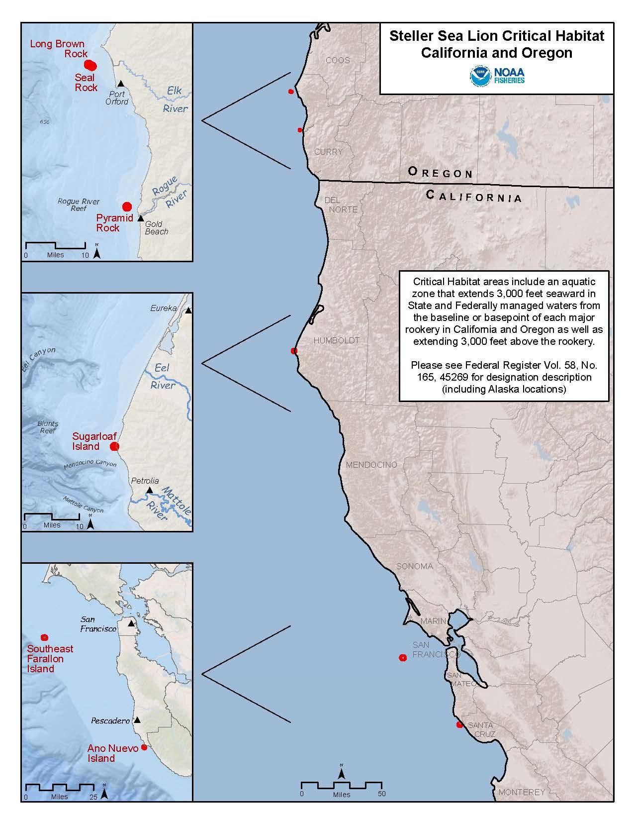
“Effects of the action” means all consequences to ESA-listed species or designated critical habitat that are caused by the proposed action, including the consequences of other activities that are caused by the proposed action. A consequence is caused by the proposed action if it would not occur but for the proposed action and it is reasonably certain to occur. Effects of the action may occur later in time and may include consequences occurring outside the immediate area involved in the action (see 50 C.F.R. §402.2).
The applicable standard to find that a proposed action is not likely to adversely affect ESA-listed species or designated critical habitat is that all of the effects of the action are expected to be discountable, insignificant, or wholly beneficial. Beneficial effects have an immediate positive effect without any adverse effects to the species or habitat. Insignificant effects relate to the size or severity of the impact and include those effects that are undetectable, not measurable, or so minor that they cannot be meaningfully evaluated. Insignificant is the appropriate effect conclusion when plausible effects are going to happen, but will not rise to the level of constituting an adverse effect. For an effect to be discountable, there must be a plausible adverse effect (i.e., a credible effect that could result from the action that would be an adverse effect if it did affect an ESA-listed species), but it is very unlikely to occur.
The following subsections identify the potential stressors and analyze the potential effects of the proposed launch and reentry vehicle operations on the ESA-listed species and critical habitat in the action area
Stressors are any physical, chemical, or biological agent, environmental condition, external stimulus, or event that may induce an adverse response in either an ESA-listed species or its designated critical habitat. Potential stressors to ESA-listed species from the proposed activities include the following:
• Impact by fallen objects: spacecraft, rocket parts, radiosonde;
• Entanglement in unrecovered parachutes and parafoils;
• Ingestion of material from unrecovered parachutes, parafoils, and weather balloon fragments;
• Exposure to hazardous materials;
• Exposure to sonic booms (overpressure) and impulse noise generated during spacecraft reentry or stage landings in the ocean;
• Ship strike; and
• Harassment by aircraft overflight.
Fallen objects, unrecovered parachutes/parafoils, and hazardous materials could also impact designated critical habitat. Potential effects to the ESA-listed species from these stressors are discussed in the following sections, followed by potential effects to the PBFs of designated critical habitat.
Boosters, fairings, spacecraft, and radiosondes from weather balloons falling through the atmosphere to Earth’s surface have the potential to affect ESA-listed species marine species Debris from a launch abort test or any launch failure anomalies could also have an effect. The
primary concern is a direct impact from an object landing on an ESA-listed marine mammal, sea turtle or fish.
The action area where objects could splashdown encompasses vast expanses of ocean. ESAlisted species are sparsely distributed across these ocean expanses, resulting in very low densities of species overall. The probability of a direct impact to an ESA-listed species is thus extremely unlikely.
The same conclusion was reached when analyzing the Joint Flight Campaign missile testing from some of the same launch sites and overlapping areas of the Atlantic and Pacific Oceans (OPR-2021-02470). The BE for the Joint Flight Campaign utilized the best available density data for ESA-listed marine mammals and sea turtles, which is from the U.S. Navy’s Marine Species Density Databases for training and testing areas in the Pacific and Atlantic (U.S. Navy 2017a and b, U.S. Navy 2018). Species densities were averaged across study areas within a proposed drop zone and the highest estimated densities across seasons were used to represent animal densities in the entire drop zone. For a flight test from VSFB, the maximum number of estimated animal exposures for any ESA-listed species in the broad ocean area is for fin whales at 0.00002 individuals, corresponding to a one in 50,000 chance of contacting a fin whale during a single test from VSFB. For a flight test from WFF, the maximum number of estimated animal exposures for any ESA-listed species in the broad ocean area is 0.000008 individuals for marine mammals (fin whales) and 0.00005 for sea turtles (loggerheads). This corresponds to a one in 121,000 chance of contacting a fin whale and a one in 22,000 chance of contacting a loggerhead turtle during a single test from WFF.
The very low probabilities of direct contact further illustrate the likelihood of ESA-listed mammals or sea turtles being in the same spot where these materials happen to land in vast open ocean areas is very low Similar density data for ESA-listed fish species is not available, but most of the fish species that may be present in the action area do not spend much time near the surface where direct strikes could occur and often prefer deeper waters (e.g., eulachon, grouper, sawfish, sturgeons, salmonids). Additionally, a physical strike affecting a fish depends on the relative size of the object potentially striking the fish and the location of the fish in the water column. Because fish are likely able to detect an object descending in the water column (e.g., sensing the pressure wave or displacement of water) and are highly mobile, fish would likely swim away from an oncoming object. The oceanic whitetip shark, scalloped hammerheads and giant manta ray are known to spend time near the surface, likely to utilize sunlight-warmed waters, but are also known to dive to greater depths. However, the chance of any ESA-listed fish species being in the same spot where launch materials happen to land is highly unlikely, and therefore, the risk of being directly hit by any falling objects from launch operations is extremely low.
It is worth noting that materials have been expended from rocket launches for decades with no known interactions with any of the ESA-listed species considered in this programmatic. In summary, because it would be extremely unlikely for an ESA-listed species to be directly struck by launch vehicle components, spacecraft, radiosondes, and any launching or landing-related debris, the potential for effects to ESA-listed species from a direct impact by those fallen objects are discountable. Therefore, we conclude that direct impacts from fallen objects to ESA-listed
marine mammals, sea turtles, and fish in the action area because of activities covered under this programmatic may affect, but are not likely to adversely affect these animals.
Entanglement
Spacecraft reentry and recovery operations and fairing recovery involve the use of parachutes and/or parafoils, which introduces the possibility of marine species becoming entangled in the parachute/parafoil material and attached lines, particularly if the material is not recovered by the launch operator. Entanglement can impact a marine animal by limiting its ability to move through the water for feeding, reproductive, or migratory purposes (Laist 1997). Materials entangled tightly around a body part may cut into tissues, enable infection, and severely compromise an individual’s health, and may lead to death. A compromised individual is also less likely to be able to escape predation.
Drogue parachutes are the smallest and are cut away at altitude, which separates it from the spacecraft or fairing before the point of splashdown and so are more likely not to be recovered than the other parachutes and parafoils. The drogue parachute’s primary material (nylon) is in the family of high molecular weight polymers, which are not easily degraded by abiotic (physical or chemical) or biotic processes (Haines and Alexander 1974). Photooxidative degradation, the process of decomposition of the material by light (most effectively by near-ultraviolet [UV] and UV wavelengths) would be the most effective source of damage exerted on the nylon parachute. However, the drogue parachute assembly becomes saturated within approximately one minute of splashing down and begins to sink. The drogue parachutes are expected to sink at a rate of approximately 1,000 ft in 46 minutes (or approximately 22 ft per minute; see Appendix A), rapidly sinking below the depths to which UV radiation penetrates in the oceans, eventually resting on the ocean floor where exposure to UV light would not occur, making photo-oxidation improbable. Once on the ocean floor, the relatively constant temperatures and lower oxygen concentration (as compared to the atmosphere) would slow the degradation process (Andrady 1990).
If the larger main parachutes or parafoils are not recovered, they will take longer than the drogue parachutes to become saturated and will sink more slowly, but even the largest parafoil is expected to sink at a rate of approximately 1,000 ft in 145.5 minutes (or approximately 7 ft per minute; see Appendix A). This still is a relatively short amount of time to pass through the water column, likely reaching the ocean floor within a matter of hours.
All parachutes and parafoils are meant to be recovered and they have been recovered during the majority of operations Even if the parachutes or a parafoil are not recovered, they sink rather quickly and spend a short time passing through the water column. Fairing recovery typically takes place between 300-500 NM offshore and if any drogue parachutes or parafoils are not recovered, they are expected to settle (> 3,000 m [9,800 ft]). None of the ESA-listed species considered in this programmatic forage that deep, and therefore are not expected to encounter the settled parachutes or parafoils. SpaceX’s Dragon spacecraft parachutes (drogue and main) are the only spacecraft parachutes that have been deployed to date for spacecraft re-entries. Missions use the Dragon spacecraft during contract support for NASA, delivering cargo to the International Space Station. Recovery of Dragon spacecraft reentering from resupply missions occurs offshore over deep waters (> 3,000 m [9,800 ft]), similar to the fairings. SpaceX has typically recovered the Dragon spacecraft within one hour of splashdown and subsequently recover parachutes
However, there have two instances where sea and weather conditions during Dragon cargo spacecraft recovery created complications and SpaceX did not recover the parachutes. In 2020, a crewed test flight of Dragon-2 was conducted and the recovery operation was not as far offshore (approximately 27 NM), for human crew safety logistics, and therefore occurred over shallower water. The crewed Dragon test flight recovered both drogue parachutes and 3 of the 4 main parachutes. As the crewed Dragon flights become operational, procedures should become more efficient, including parachute retrieval. Crewed Dragon spacecraft missions will be less frequent than cargo missions and only expected to happen once or twice a year.
Considering the low occurrence of parachutes or parafoils not being recovered, the limited time they would spend in the water column and settling typically in the deep ocean, exposure of ESAlisted mammals, sea turtles, or fishes to the parachutes or parafoils is extremely unlikely and therefore the risk of entanglement is discountable.
Foraging individuals of ESA-listed species could be exposed and therefore risk ingesting, pieces of weather balloons, parachutes or parafoils.
Latex weather balloons typically have a diameter at launch of approximately 4 ft, but then rise to approximately 20–30 km where the volume increases to the point where the elastic limit is reached and the balloon bursts. The temperature at this altitude range can reach negative 40 degrees Fahrenheit (°F) and even colder. Under these conditions of extreme elongation and low temperature, the balloon undergoes "brittle fracture" where the rubber actually shatters along grain boundaries of crystallized segments. The resultant pieces of rubber are small strands comparable to the size of a quarter (Burchette 1989) This was confirmed by researchers at the University of Colorado and NOAA (University of Colorado and NOAA 2017). The small shreds then make their way back to the surface of the Earth and are expected to land in the ocean. Along the way, the pieces can be subject to movements in atmospheric pressure and wind as they sink through the air. This can cause the fragments to become scattered and disperse before landing on the surface of the ocean where they are subject to movement of surface currents, which can cause additional dispersion.
The balloon fragments would be positively buoyant, float on the surface, and begin to photooxidize due to UV light exposure. Studies have shown latex in water will degrade, losing tensile strength and integrity, though this process can require multiple months of exposure time (Pegram and Andrady 1989; Andrady 1990; Irwin 2012). Field tests conducted by Burchette (1989) showed latex rubber balloons are very degradable in the environment under a broad range of exposure conditions, including exposure to sunlight and weathering and exposure to water. The balloon samples showed significant degradation after six weeks of exposure (Burchette 1989)
The floating latex balloon fragments would provide substrate for algae and eventually be weighed down with growth of heavier epifauna, such as tunicates (Foley 1990). The degree to which such colonization may occur will correspond to the amount of time the balloon remains at or near the ocean’s surface. Additionally, an area’s geographic latitude (and corresponding climatic conditions) has a marked effect on the degree of biofouling on marine debris. Fouling of the latex shreds could be confused with organic matter while ESA-listed species are foraging. Green sea turtles are herbivorous and a large study of green sea turtles that stranded in Texas
between 1987 and 2019, discovered 48% had ingested plastic, although there was no evidence of mortality related to the ingestion of the plastics (Choi et al. 2021). A study of latex balloon fragment ingestion by freshwater turtles and catfish found no significant impact on survival or blood measured indicators of stress response (Irwin 2012).
In addition to further degradation of the latex material, the embedded fouling organisms would cause the material to become negatively buoyant, making it slowly sink to the ocean floor. Studies in temperate waters have shown that fouling can result in positively buoyant materials (e.g., plastics) becoming neutrally buoyant, sinking below the surface into the water column after only several weeks of exposure (Ye and Andrady 1991; Lobelle and Cunliffe 2011), or descending farther to rest on the seafloor (Thompson et al. 2004).
Given the small balloon shreds are likely to be scattered and not concentrated, and they should only be available in the upper portions of the water column on the order of weeks, the potential for exposure of ESA-listed marine species to these shreds is extremely low and therefore discountable.
As stated previously, operators expect to recover parachutes/parafoils soon after splashdown and in the rare occasion they are not recovered (a few each year, see Appendix A), the parachutes/parafoils will sink to the seafloor within a matter of hours. As discussed previously, the degradation of parachute and parafoil materials will be a slow process that takes place after the materials have settled on the sea floor It is possible that small fragments could temporarily resuspend in the water column, but the potential for this depends on local ocean floor conditions and the fragments are not expected to resuspend high in the water column where they would likely be encountered by ESA-listed species. As previously discussed recover y operations typically take place far offshore (e.g. 300-500 NM) and any drogue parachutes or parafoils not recovered are expected to settle (> 3,000 m [9,800 ft]). None of the ESA-listed species considered in this programmatic forage that deep, therefore, the likelihood of them encountering ingestible material once it has settled over the long-term is expected to be extremely unlikely to occur and thus discountable.
We conclude that the risk of ingesting pieces of weather balloons, parachutes or parafoils to ESA-listed marine mammals, sea turtles, and fish in the action area because of activities covered under this programmatic may affect, but are not likely to adversely affect these animals.
Hypergolic fuels (e.g., NTO and MMH) may be on the spacecraft during a splashdown. A spacecraft’s propellant storage is designed to retain residual propellant, so any propellant remaining in the spacecraft is not expected to be released into the ocean. In an event the propellant tank actually ruptures on impact, the propellant would evaporate or be quickly diluted.
In the event of a failed launch operation, launch operators will follow the emergency response and cleanup procedures outlined in their Hazardous Material Emergency Response Plan (or similar plan). Procedures may include containing the spill using disposable containment materials and cleaning the area with absorbents or other materials to reduce the magnitude and duration of any impacts. In most launch failure scenarios, at least a portion of the propellant will be consumed by the launch/failure, and any remaining propellant will evaporate within hours or
be diluted by seawater and degrade over time (timeframes are variable based on environmental conditions, but generally hours to days).
Launch vehicles and spacecraft are designed to retain propellants and even if there is a rare launch failure (> 93% success rate over 30 years), propellants will evaporate and be diluted within hours. The chance for ESA-listed marine species to be exposed to the residual propellants from a splashdown or launch failure is extremely low and therefore discountable. Therefore, we conclude that hazardous material exposure to ESA-listed marine mammals, sea turtles, and fish in the action area because of activities covered under this programmatic may affect, but are not likely to adversely affect these animals.
A sonic boom will be generated during spacecraft reentry and stage landings in the ocean. Due to the shape and size of existing spacecraft and spacecraft in development, as well as the altitude at which reentering spacecraft generate a sonic boom, the FAA, USSF, and NASA do not expect the overpressure from reentering spacecraft to exceed 1 psf. An overpressure of 1 psf is similar to a thunderclap. For boosters that can currently land on a barge in the ocean (e.g., SpaceX Falcon series), overpressures at the ocean’s surface could be up to 8 psf For the Super Heavy, which is currently in developmental stages and expected to be operational soon, overpressures at the ocean’s surface could be up to 15 psf from ocean barge landings. Boom intensity, in terms of psf, is greatest under the flight path and progressively weakens with horizontal distance away from the flight track. Based on modeling for landings at the Boca Chica Launch Site, the area beneath the stage receiving the maximum overpressure (up to 15 psf) as it is landing could be up to 1.28 km in diameter.
Overpressure from sonic booms are not expected to affect marine species underwater. Acoustic energy in the air does not effectively cross the air/water interface and most of the noise is reflected off the water surface (Richardson et al. 1995). The landing platform barge will also act as a barrier to the most intense portion of overpressure from landings. In addition, underwater sound pressure levels from in-air noise are not expected to reach or exceed threshold levels for injury or harassment to ESA-listed species.
Previous research conducted by the USAF supports this conclusion with respect to sonic booms, indicating the lack of harassment risk for protected marine species in water (U.S. Air Force Research Laboratory 2000). The researchers were using a threshold for harassment of marine mammals and sea turtles by impulsive noise of 12 pound per square inch (psi) peak pressure and/or 182 decibels (dB) referenced (re) to the standard unit of acoustic pressure underwater, 1 micro Pascal (µPa), which is an older threshold used by NMFS and DoD at the time. The researchers pointed out that, to produce the 12 psi in the water, there needs to be nearly 900 psf at the water surface, assuming excellent coupling conditions. They also noted that it is very difficult to create sonic booms that even approach 50 psf. Current thresholds utilized by NMFS for behavioral disturbance from impulsive acoustic sources are lower (in water, re 1 µPa: 175 dB sea turtles, 160 dB marine mammals, 150 dB fishes) but these are root mean square (rms) values and not peak pressure values The rms is a square root of the average of sound signal pressures that have been squared over a given duration. Due to the squaring and averaging of sound pressure values (which tends to level out large values), the rms, results in a more conservative value than just a peak value Still, what the USAF research report illustrates is that it would take
a tremendously greater sonic boom than what is generated by the booster stage landings to create an acoustic impact underwater that could approach disturbing ESA-listed marine mammals, sea turtles or fish. Therefore, any effect from the sonic booms on ESA-listed species while under water would be insignificant.
ESA-listed marine mammals and sea turtles could be exposed to the overpressures from sonic booms in the air when they are surfacing for air; however, the chances of both events happening at same time (i.e., species surfacing and a sonic boom occurring) is extremely unlikely, especially considering the length of a sonic boom is less than one second. The Guadalupe fur seal, Hawaiian monk seal, and Steller sea lion can spend time hauled out of the water and therefore may be affected by an in-air sonic boom. The potential for effect would only be present during spacecraft reentry missions occurring in the Pacific Ocean and rocket booster landing are not planned near areas where these species haul out. Spacecraft reentry in the Pacific Ocean would generate sonic booms at high altitudes (approximately 50,000 ft). The magnitude of the high altitude sonic boom overpressure that has the potential to impact land areas where Guadalupe fur seals, Hawaiian monk seals, and Steller sea lions may be present is low (1 psf or lower). Therefore, the effect of these sonic booms is unlikely to create any meaningful disturbance for these ESA-listed pinnipeds when they are out of the water.
The 2019 MMPA Letter of Authority for VSFB launch operations arrived at a similar conclusion (84 FR 14314). Over 20 years of monitoring data for species including harbor seals (Phoca vitulina), elephant seals (Mirounga angustirostris), and California sea lions (Zalophus californianus) at VSFB and the North Channel Islands (CA), show reactions to sonic booms tend to be insignificant when not above 1.0 psf Observational data do not include the ESA-listed pinnipeds considered in this programmatic, but the long time series data for other species serve as a proxy indicating this category of sonic booms for marine mammals that haul out of water do not result in disturbance at low overpressures
In summary, it is extremely unlikely that an ESA-listed sea turtle or marine mammal would surface close to a landing booster at the exact moment to be exposed to a sonic boom (greater than 1 psf) in the air, therefore the effects are discountable. Any ESA-listed sea turtles, marine mammals or fishes underwater are not expected to be exposed to measurable acoustic effects from a sonic boom therefore, the effects are insignificant. The low level sonic boom (not above 1 psf) resulting from spacecraft reentry at high altitude in the Pacific, is not expected to create any significant disturbance to hauled out ESA-listed pinnipeds and the effects are therefore insignificant.
Ships and other watercraft vessels are used to recover launch vehicle stages that land on a platform in the ocean, as well as to recover spacecraft and payload fairings. Vessels may also be used for surveillance to ensure that designated hazard areas are clear of non-participating crafts. These watercraft operations have potential to result in a ship strike of ESA-listed species that spend time at or near the surface of the water (e.g., marine mammals, sea turtles, giant manta ray, oceanic whitetip shark, and scalloped hammerhead). ESA-listed marine mammals and sea turtles can spend time at the surface, but most of their time is spent submerged. Giant manta ray, oceanic whitetip and scalloped hammerhead sharks can also spend time at or near the ocean surface and be subject to potential ship strikes, but they also dive to great depths. All vessels
would be required to comply with the Environmental Protection Measures for vessel operations All watercraft would have a dedicated observer on board, adhere to maintaining minimum safety distances between ESA-listed species and vessels, and reduce speed as required.
During the portion of time that ESA-listed marine mammals, sea turtles, and some elasmobranch fish species may spend near the ocean surface, ship strikes are considered extremely unlikely to occur and therefore discountable, due to the use of dedicated observation personnel and safety procedures for avoidance Based on previous operation reports provided as part of ESA section 7 consultations for similar operations, there have not been reported vessel collisions with ESAlisted marine species.
Rice’s whale requires additional consideration due to its very low population size (likely < 50) and its ecology. The Rice’s whale dives deep during the day to forage but at night tends to stay just below the surface, increasing the chance of the animal being struck at night. The Vessel Operations measures in the PDCs for this programmatic consultation include the condition that recovery and vessel transit will not occur at night in the Rice’s whale core distribution area. The PDCs for this programmatic consultation stipulate only one splashdown, a reentry and recovery of the Dragon capsule, may occur in Rice's whale core habitat distribution area per year. These restrictions will ensure the effects of vessel strike due to recovery vessel operations are discountable
We conclude that the risk of ship strike to ESA-listed marine mammals, sea turtles, and fish in the action area because of activities covered under this programmatic may affect, but are not likely to adversely affect these animals.
Noise from aircraft overflight may enter the water, but, as stated in relation to sonic booms, very little of that sound is transmitted into water. Sound intensity produced at high altitudes is reduced when it reaches the water’s surface. At lower altitudes, the perceived noise will be louder, but it will decrease rapidly as the aircraft moves away Individual ESA-listed species that occur at or very near the surface (e.g., marine mammals, sea turtles, giant manta ray and sharks) at the time of an overflight could be exposed to some level of elevated sound. There could also be a visual stimulus from overflight that could potentially lead to a change in behavior. Both noise and visual stimulus impacts would be temporary and only occur if an individual is surfacing or very close to the surface and an aircraft happens to be flying over at the same time.
Studies in the Gulf of Mexico found that most sperm whales dive when overflown by fixed wing aircraft (Wursig et al. 1998). Richter et al. (2006) documented only minor behavioral effects (i.e., both longer surface time and time to first vocalization) of whale-watching aircraft on New Zealand sperm whales. However, details on flight altitude were not provided. Smultea et al. (2008) studied sperm whales in Hawai‘i, documenting that diving responses to fixed winged overflights occurred at approximately 820 ft above ground level (AGL).
Patenaude et al. (2002) observed bowhead whales, which are not a species considered in this consultation but serve as an example for mysticetes, during spring migration in Alaska and recorded short-term responses to fixed-wing aircraft activity. Few (approximately 2%) of the observed bowheads reacted to overflights (between 200 and 1,500 AGL), with the most common
behavioral responses being abrupt dives, short surfacing episodes, breaching, and tail slaps (Patenaude et al. 2002). Most of these responses occurred when the aircraft was below altitudes of 600 ft (Patenaude et al. 2002), which is below the altitude expected to be flown by fixed wing aircraft during project-related surveillance for the activities considered in this consultation.
Species-specific studies on the reaction of sea turtles to fixed wing aircraft overflight are lacking. Based on sea turtle sensory biology (Bartol and Musick 2003), sound from low-flying aircraft could likely be heard by a sea turtle at or near the ocean surface. Sea turtles might be able to detect low-flying aircraft via visual cues such as the aircraft's shadow, similar to the findings of Hazel et al. (2007) regarding watercraft, potentially eliciting a brief reaction such as a dive or lateral movement. However, considering that sea turtles spend a significant portion of their time below the sea surface (Lutcavage and Lutz 1997) and the low frequency and short duration of surveillance flights, the probability of exposing an individual to an acoustically or visuallyinduced stressor from aircraft momentarily flying overhead would be very low. The same is relevant for giant manta rays and the ESA-listed shark species in the action area, considering their limited time near the surface and brief aircraft overflight.
As stated in the Environmental Protection Measures, spotter aircraft will maintain a minimum of 1,000 ft over ESA-listed or MMPA-protected species and 1,500 ft over North Atlantic right whales. Additionally, aircraft will avoid flying in circles if marine mammals or sea turtles are spotted to avoid any type of harassing behavior. The chances of an individual ESA-listed species being exposed to the proposed aircraft overflights are extremely low. Given the limited and temporary behavioral responses documented in available research, it is expected that potential effects on ESA-listed species, should they even occur, would be insignificant. We conclude that effects from aircraft overflight to ESA-listed marine mammals, sea turtles, and fish in the action area because of activities covered under this programmatic may affect, but are not likely to adversely affect these animals.
A common element across several of the designated critical habitats in the action area that may be affected by the proposed action is water quality: green sturgeon, Gulf sturgeon, Southern Resident DPS killer whale, and Main Hawaiian Islands Insular DPS false killer whale critical habitat include PBFs for water quality. Water quality may be temporarily degraded as a result of a launch failure. Potential effects to water quality could result from debris and propellants. Recovery activities and any emergency response and cleanup procedures would reduce the magnitude and duration of any impacts. As previously discussed, propellants are expected to evaporate and quickly become diluted, limiting any impacts to a temporary duration. Given the unlikely scenario of a launch failure and the brief exposure of residual propellants from splashdowns, it is highly unlikely that water quality features would become degraded to the extent the conservation value of the critical habitats are impacted.
Most of the proposed operations would occur well offshore in deep waters. Landing and recovery operations would not occur within 5 NM of the coast where most of the critical habitat for green sturgeon is located. The same is true for Gulf sturgeon, except for Cedar Key, Florida, but it is far away from flight trajectories from the Boca Chica Launch Site. It is very unlikely that any launch or reentry operations would occur within that portion of Gulf sturgeon critical habitat. Unit 2 of the North Atlantic right whale critical habitat occurs off the coast of CCSFS and
extends seaward approximately 5 NM off the coast. Keeping operations out of the first 5 NM from shore helps avoid this critical calving area. Operations are not expected to have any impact on the oceanic features near the Unit 2 calving area such as sea temperature, sea state or depth. PBFs for Hawaiian monk seal conservation include significant haul-outs and preferred pupping/nursing areas. Operations will not occur in or near those areas. Critical habitat for Steller sea lions includes major rookeries, haul-outs, and associated zones extending 3,000 ft (0.9 km) landward, in the air above, or into the water from those major rookeries and haul-outs, that support reproduction, foraging, resting, and refuge. Operations will not occur in those zones. West of 144° W, where the Western DPS Steller sea lion is located, the critical habitat aquatic zone extends 20 NM (37 km) seaward from the baseline or basepoint of each major rookery and major haul-out. If operations cannot comply with the PDC that landings will not occur in those 20 NM aquatic zones, they will require a project-specific review.
Migratory passage and adequate space for movement are features common to Southern Resident DPS killer whale, Main Hawaiian Islands Insular DPS false killer whale, and Northwest Atlantic Ocean DPS loggerhead sea turtle critical habitats. As stated previously, no operations will occur in the immediate nearshore environment (< 5 NM), resulting in a considerable amount of those critical habitats not being affected by the proposed action. Landing and reentry operations will typically be much farther out but, even if they were to occur close to the 5 NM limit, they are temporary with no long-term occupation or structures creating obstructions to movement, thus any potential effects are likely to be insignificant.
Prey and foraging areas are other common elements across several of the designated critical habitats in this consultation: leatherback, Southern Resident DPS killer whale, Main Hawaiian Islands Insular DPS false killer whale, North Pacific right whale; Western North Pacific, Central America, and Mexico DPSs of humpback whales; and Hawaiian monk seal and Steller sea lion foraging areas. As previously stated, sound from sonic booms is not expected to enter the water with enough intensity to create any significant disturbances to ESA-listed species and the effects of this sound is also expected to be insignificant for zooplankton or small pelagic schooling fishes that are the important prey species for these critical habitats. Pieces of weather balloons or parachutes/parafoils are not expected to be available to prey species in sufficient concentrations to measurably affect prey populations. Considering the rare occurrence of not recovering parachutes/parafoils, as the parachutes/parafoils begin to become saturated with seawater and begin to sink, prey fish species should be able to detect the object and move out of the way (as previously discussed for fishes) and the chance of entanglement is extremely unlikely to occur and thus discountable. Prey zooplankton species may have less of an ability to move out of the way and therefore some could get entrapped in the parachute/parafoil. The removal of a small amount of zooplankton is not expected to reduce the conservation value of that PBF in any designated critical habitats and therefore the effect will be insignificant.
A unique PBF for Main Hawaiian Islands Insular DPS false killer whale critical habitat is sound levels that would not significantly impair false killer whales’ use or occupancy. As previously stated, sound of any intensity that would create meaningful disturbance underwater is not an expected effect from proposed operations.
Oceanographic conditions supporting Sargassum habitat having adequate abundance and cover for post hatchlings and prey is a PBF for Northwest Atlantic Ocean DPS loggerhead sea turtle critical habitat. The scale of operations are not large enough to affect boundary currents or areas of convergence that promote the aggregation of Sargassum. Any potential impacts to these features are expected to be very small and temporary, and therefore insignificant.
In summary, the effects associated with stressors from launch and reentry operations that are part of the proposed action may affect, but are not expected to adversely affect any of the designated critical habitats in the action area.
We have concluded the proposed launch and reentry vehicle operations in the marine environment, when in compliance with the requirements of this programmatic, are not likely to adversely affect ESA-listed marine mammals, sea turtles, and fishes or designated critical habitat for green sturgeon, Gulf sturgeon, leatherback sea turtle, Northwest Atlantic Ocean DPS loggerhead sea turtle, North Atlantic right whale, North Pacific right whale; Western North Pacific DPS, Central America DPS, and Mexico DPS of humpback whales; Southern Resident DPS killer whale, Main Hawaiian Islands Insular DPS false killer whale, Hawaiian monk seal, and the Western DPS Steller sea lion. Programmatic consultations often involve actions that may occur with some frequency over many years and possibly continue for an indefinite time. As a result, we evaluate the potential for the effects of the stressors to ESA-listed species and designated critical habitat over the lifetime of the proposed action to result in additive effects due to chronic stress or cumulative effects. Therefore, we determine if, when considered additively, the effects of stressors associated with the launch and reentry vehicle operations in the marine environment that are part of the proposed action are likely to adversely affect the aforementioned ESA-listed species and designated critical habitat.
The USSF (and previously USAF), NASA, and commercial space operations with authorization from the FAA have been conducting launch and reentry vehicle operations for decades with little documented impact to the marine environment as a whole, including a lack of reported incidences affecting ESA-listed species and designated critical habitats in the action area. The activities considered in this programmatic consultation will occur across large expanses of open water in the Atlantic and Pacific Oceans, and the Gulf of Mexico. Each of the stressor categories (see Effects of the Action) were determined to have effects that are extremely unlikely to occur and therefore discountable, or to result in effects that are so small as to be insignificant. The possibility of the discountable effects overlapping in time and space and having a cumulative effect to ESA-listed species and designated critical habitat in the action area does not seem plausible considering the limited time operations occur in a small portion of the vast action areas. Within the same reasoning, chronic stress from activities whose effects are considered insignificant also does not seem plausible. Therefore, additive effects from the activities considered in this consultation are extremely unlikely and thus discountable.
Based on this analysis, NMFS ESA Interagency Cooperation Division concurs with the FAA, NASA and the USSF, that the proposed action may affect, but is not likely to adversely affect ESA-listed species and designated critical habitat.
Section 7(a)(1) of the ESA directs Federal agencies to use their authorities to further the purposes of the ESA by carrying out conservation programs for the benefit of the threatened and endangered species. Conservation recommendations are discretionary agency activities to minimize or avoid adverse effects of a proposed action on ESA-listed species or critical habitat, to help implement recovery plans or develop information (50 C.F.R. §402.02).
As previously stated, the Rice’s whale population is likely less than 50 individuals and therefore at high risk from threats that could reduce their numbers. Vessel strike is one of those threats. As discussed in the Effects Analysis, spacecraft recovery vessel activities are not likely to adversely affect ESA-listed marine mammals such as the Rice’s whale. Even though one Dragon capsule splashdown and recovery per year in the Rice’s whale core distribution area is not considered a significant threat, we are using this opportunity within this programmatic consultation to emphasize the conservation priority of avoiding the area, especially depths greater than 100 m deep. We also want to take this opportunity to address debris that originates from space launch and reentry operations, even though it is mostly expected to sink and settle in deep water, any reduction of debris in the marine environment could benefit all marine wildlife, including ESAlisted species.
The following conservation recommendations are discretionary measures that NMFS believes are consistent with the Federal action agencies’ obligation under section 7(a)(1) and therefore should be carried out where applicable:
• Every effort should be made to move spacecraft capsule splashdowns closer to shallow edges of the Rice’s whale core distribution area boundaries. Moving out of the area altogether is preferred.
• No vessel transit should take place in the Rice’s whale core distribution area unless to specifically to pick up the capsule and then immediately exit at the nearest boundary edge while staying out of the core habitat area with depths of 100 m to 425 m, where the Rice’s whale has been observed (Rosel et al. 2021).
• The action agencies should coordinate with NMFS ESA Interagency Cooperation Division to foster collaboration with the NOAA Marine Debris Program (MDP), in order to evaluate how activities of the MDP may apply to debris that originates from space launch and reentry operations (e.g., expended vehicle components).
In order for NMFS to be kept informed of actions minimizing or avoiding adverse effects on, or benefiting, ESA-listed species or their critical habitat, the FAA, NASA, and/or USSF (as applicable) should notify the ESA Interagency Cooperation Division and SERO of any conservation recommendations implemented as part of activities included in this programmatic consultation. This information can be included in annual reports.
Reinitiation of consultation is required and shall be requested by the federal agency, where discretionary federal involvement or control over the action has been retained or is authorized by law and:
1. New information reveals effects of the action that may affect an ESA-listed species or designated critical habitat in a manner or to an extent not previously considered;
2. The identified action is subsequently modified in a manner that causes an effect to the ESA-listed species or designated critical habitat that was not considered in this concurrence letter;
3. Take of an ESA-listed species occurs; or
4. A new species is listed or critical habitat designated that may be affected by the identified action (50 C.F.R. §402.16).
Please direct questions regarding this letter to Dr. Soren Dahl, Consulting Biologist, at (301) 427-8495 or soren.dahl@noaa.gov, or me at (301) 427-8495, or by email at cathy.tortorici@noaa.gov.
Sincerely,
Cathryn E. Tortorici Chief, ESA Interagency Cooperation Division Office of Protected Resources
Cc: USSF, NASA
Abecassis, M., Senina, I., Lehodey, P., Gaspar, P., Parker, D., Balazs, G. and Polovina, J., 2013. A model of loggerhead sea turtle (Caretta caretta) habitat and movement in the oceanic North Pacific. PLoS One, 8(9), p.e73274.
Altenritter, M.E., Kinnison, M.T., Zydlewski, G.B., Secor, D.H. and Zydlewski, J.D., 2015. Assessing dorsal scute microchemistry for reconstruction of shortnose sturgeon life histories. Environmental Biology of Fishes, 98(12), pp.2321-2335.
Andrady, A.L. 1990. Environmental Degradation of Plastics under Land and Marine Exposure Conditions. In R.S. Shomura and M.L. Godfrey (Eds.), Proceedings of the 2nd International Conference on Marine Debris, vol. 1 (pp. 848–869). United States Department of Commerce, Honolulu, Hawaii, USA.
ASMFC. 2006. ASMFC Atlantic sturgeon by-catch workshop, Norfolk, Virginia.
Aurioles-Gamboa, D., C. J. Hernandez-Camacho, and E. Rodriguez-Krebs. 1999. Notes on the southernmost records of the Guadalupe fur seal, Arctocephalus townsendi, in Mexico. Marine Mammal Science 15(2):581-583.
Bartol, S.M., and J.A. Musick. 2003. Sensory biology of sea turtles. In P.L. Lutz, J.A. Musick, and J. Wyneken (Eds.). The biology of sea turtles, Volume II (pp. 79–102). CRC Press, Boca Raton, Florida.
Belcher, R. L., and T.E. Lee, Jr. 2002. Arctocephalus townsendi. Mammalian Species 700(1):15.
Benson, S.R., Eguchi, T., Foley, D.G., Forney, K.A., Bailey, H., Hitipeuw, C., Samber, B.P., Tapilatu, R.F., Rei, V., Ramohia, P. and Pita, J., 2011. Large‐scale movements and high‐use areas of western Pacific leatherback turtles, Dermochelys coriacea Ecosphere, 2(7), pp.1-27.
Bigalow, H. and W. Schroeder. 1953. "Fishes of the western North Atlantic, Part 2 Sawfishes, Guitarfishes, Skates and Rays." Mem. Sears Found 1: 588pp.
Bjorndal, K. A., and A. B. Bolten. 2010. Hawksbill sea turtles in seagrass pastures: success in a peripheral habitat. Marine Biology 157:135-145.
Boreman, J. 1997. Sensitivity of North American sturgeons and paddlefish to fishing mortality. Environmental Biology of Fishes 48(1-4):399-405.
Burchette, D., 1989. A study of the effect of balloon releases on the environment. National Association of Balloon Artists, p.20.
Burdin, A. M., O. A. Sychenko, and M. M. Sidorenko. 2013. Status of western gray whales off northeastern Sakhalin Island, Russia in 2012. IWC Scientific Committee, Jeju, Korea.
Carr, S.H., Tatman, F. and Chapman, F.A., 1996. Observations on the natural history of the Gulf of Mexico sturgeon (Acipenser oxyrinchus de sotoi Vladykov 1955) in the Suwannee River, southeastern United States. Ecology of Freshwater Fish, 5(4), pp.169-174.
Choi, D.Y., Gredzens, C. and Shaver, D.J., 2021. Plastic ingestion by green turtles (Chelonia mydas) over 33 years along the coast of Texas, USA. Marine pollution bulletin, 173, p.113111.
Colligan, M. A., D. M. Bernhart, M. Simpkins, and S. Bettridge. 2012. North Atlantic Right Whale (Eubalaena glacialis) Five-Year Review. NMFS.
Compagno, L.V.J. 1984. FAO species catalogue, Vol 4, Sharks of the world. An annotated and illustrated catalogue of shark species known to date. Part 2, Carcharhiniformes. FAO Fish. Synop. 125, Vol 4, Pt. 2. 655 pp.
Derraik, J. G. 2002. The pollution of the marine environment by plastic debris: a review. Marine Pollution Bulletin. 44(9):842–852.
Dionne, P.E., Zydlewski, G.B., Kinnison, M.T., Zydlewski, J. and Wippelhauser, G.S., 2013. Reconsidering residency: characterization and conservation implications of complex migratory
patterns of shortnose sturgeon (Acispenser brevirostrum). Canadian Journal of Fisheries and Aquatic Sciences, 70(1), pp.119-127.
Esperon-Rodriguez, M., and J. P. Gallo-Reynoso. 2013. Juvenile and subadult feeding preferences of the Guadalupe fur seal (Arctocephalus townsendi) at San Benito Archipelago, Mexico. Aquatic Mammals 39(2):125-131.
Evermann, B. W. and B. A. Bean. 1898. "Indian River and its Fishes." Report U.S. Comm. Fish and Fisheries for 1896.
Foley, A.M. 1990. A Preliminary Investigation on Some Specific Aspects of Latex Balloon Degradation. Florida Department of Natural Resources, Florida Marine Research Institute. St. Petersburg, FL. August 3. 4 pp.
Fox, D.A., Hightower, J.E. and Parauka, F.M., 2002. Estuarine and nearshore marine habitat use by Gulf sturgeon from the Choctawhatchee River system, Florida. In American Fisheries Society Symposium (Vol. 28, pp. 111-126).
Grunwald, C., L. Maceda, J. Waldman, J. Stabile, and I. Wirgin. 2008. Conservation of Atlantic sturgeon Acipenser oxyrinchus oxyrinchus: delineation of stock structure and distinct population segments. Conservation Genetics 9(5):1111-1124.
Gustafson, R. G., editor. 2016. Status Review Update of Eulachon (Thaleichthys pacificus) Listed under the Endangered Species Act: Southern Distinct Population Segment.
Haines, J.R., and M. Alexander. 1974. Microbial degradation of polyethylene glycols. Applied Microbiology, 29(5):621–625.
Hazel, J., I.R. Lawler, H. Marsh, and S. Robson. 2007. Vessel speed increases collision risk for the green turtle Chelonia mydas. Endangered Species Research 3:105–113.
Heublein, J.C., Kelly, J.T., Crocker, C.E., Klimley, A.P. and Lindley, S.T., 2009. Migration of green sturgeon, Acipenser medirostris, in the Sacramento River. Environmental Biology of Fishes, 84(3), pp.245-258.
Hightower, J. E., 2007. Oceanic distribution and behavior of green sturgeon. Anadromous Sturgeons: Habitats, Threats, and Management: Proceedings of the Symposium" Anadromous Sturgeons Status and Trends, Anthropogenic Impacts, and Essential Habitats" Held in Quebec City, Quebec, Canada, August 11-13, 2003, American Fisheries Society.
Huff, J. A 1975). "Life history of Gulf of Mexico sturgeon, Acipenser oxrhynchus desotoi, in Suwannee River, Florida."
Irwin, S.W. 2012. Mass Latex Balloon Releases and the Potential Effects on Wildlife. Doctoral Dissertation. Clemson University Department of Wildlife and Fisheries Biology, Clemson, SC. August. 73 pp.
King, T., B. Lubinski, and A. Spidle. 2001. Microsatellite DNA variation in Atlantic sturgeon (Acipenser oxyrinchus oxyrinchus) and cross-species amplification in the Acipenseridae. Conservation Genetics 2(2):103-119.
Laist, D.W. 1997. Impacts of marine debris: entanglement of marine life in marine debris including a comprehensive list of species with entanglement and ingestion records. Pp. 99–140. In J.M. Coe and D.B. Rogers (Eds.), Marine Debris: Sources, Impacts and Solutions. Springer, New York, NY, USA.
Lobelle, D., and M. Cunliffe. 2011. Early microbial biofilm formation on marine plastic debris. Marine Pollution Bulletin, 62(1):197–200.
Lutcavage, M.E. and P.L. Lutz. 1997. Diving Physiology. In P. L. Lutz and J. A. Musick (Eds.). The biology of sea turtles (pp. 277–296). CRC Press, Boca Raton, Florida.
Masuda, A. 2010. Natal Origin of Juvenile Loggerhead Turtles from Foraging Ground in Nicaragua and Panama Estimated Using Mitochondria DNA.
Musick, J. A., and C. J. Limpus. 1997. Habitat utilization, and migration in juvenile sea turtles. Pages 137-163 in P. L. Lutz, and J. A. Musick, editors. The biology of sea turtles. CRC Press, Boca Raton, Florida.
NMFS. 2010. Smalltooth sawfish (Pristis pectinata) 5- year review: summary and evaluation. N. O. A. A. National Marine Fisheries Service, Commerce. St. Petersburg, FL, Protected Resources Division.
NMFS, USFWS, and SEMARNAT. 2010. Draft bi-national recovery plan for the Kemp’s ridley sea turtle (Lepidochelys kempii), second revision. National Marine Fisheries Service, U.S. Fish and Wildlife Service, and SEMARNAT, Silver Spring, Maryland.
Patenaude, N.J., W.J. Richardson, M.A. Smultea, W.R. Koski, G.W. Miller, B. Würsig, and C.R. Greene. 2002. Aircraft sound and disturbance to bowhead and beluga whales during spring migration in the Alaskan Beaufort Sea. Marine Mammal Science 18(2):309-335.
Parrish, F. A., M. P. Craig, T. J. Ragen, G. J. Marshall, and B. M. Buhleier. 2000. Identifying diurnal foraging habitat of endangered Hawaiian monk seals using a seal-mounted video camera. Marine Mammal Science 16(2):392-412.
Pegram, J.E., and A.L. Andrady. 1989. Outdoor weathering of selected polymeric materials under marine exposure conditions. Polymer Degradation and Stability, 26(4):333–345.
Poulakis, G.R., Stevens, P.W., Timmers, A.A., Wiley, T.R. and Simpfendorfer, C.A., 2011. Abiotic affinities and spatiotemporal distribution of the endangered smalltooth sawfish, Pristis pectinata, in a south-western Florida nursery. Marine and Freshwater Research, 62(10), pp.1165-1177.
Poulakis, G. and J. Seitz. 2004. "Recent occurrence of the smalltooth sawfish, Pristis pectinata (Elasmobranchiomorphi: Pristidae), in Florida Bay and the Florida Keys, with comments on sawfish ecology." Florida Scientist 67(1): 27-35.
Quattro, J.M., Greig, T.W., Coykendall, D.K., Bowen, B.W. and Baldwin, J.D., 2002. Genetic issues in aquatic species management: the shortnose sturgeon (Acipenser brevirostrum) in the southeastern United States. Conservation Genetics, 3(2), pp.155-166.
Richardson, W.J., C.R. Greene, Jr., C.I. Malme, and D.H. Thomson. 1995. Marine Mammals and Noise. Academic Press, San Diego.
Richter, C., S. Dawson, and E. Slooten. 2006. Impacts of commercial whale watching on male sperm whales at Kaikoura, New Zealand. Marine Mammal Science 22(1):46-63.
Roberts, J. J., B. D. Best, L. Mannocci, E. Fujioka, P. N. Halpin, D. L. Palka, L. P. Garrison, K. D. Mullin, T. V. Cole, C. B. Khan, W. A. McLellan, D. A. Pabst, and G. G. Lockhart. 2016 Habitat-based cetacean density models for the U.S. Atlantic and Gulf of Mexico. Scientific Reports 6:22615.
Rosel, P. E., Peter Corkeron, Laura Engleby, Deborah Epperson, Keith D. Mullin, Melissa S. Soldevilla, Barbara L. Taylor. 2016. Status Review of Bryde's Whales (Balaenoptera edeni) in the Gulf of Mexico under the Endangered Species Act. NMFS Southeast Fisheries Science Center, NOAA Technical Memorandum NMFS-SEFSC-692, Lafayette, Louisiana.
Rosel, P.E., Wilcox, L.A., Yamada, T.K. and Mullin, K.D., 2021. A new species of baleen whale (Balaenoptera) from the Gulf of Mexico, with a review of its geographic distribution. Marine Mammal Science, 37(2), pp.577-610.
Ross, S.T., Slack, W.T., Heise, R.J., Dugo, M.A., Rogillio, H., Bowen, B.R., Mickle, P. and Heard, R.W., 2009. Estuarine and coastal habitat use of Gulf sturgeon (Acipenser oxyrinchus desotoi) in the north-central Gulf of Mexico. Estuaries and Coasts, 32(2), pp.360-374.
Schmid, J. R. 1998. Marine turtle populations on the west-central coast of Florida: Results of tagging studies at the Cedar Keys, Florida, 1986-1995. Fishery Bulletin 96(3):589-602.
Schueller, P., and D. L. Peterson. 2010. Abundance and Recruitment of Juvenile Atlantic Sturgeon in the Altamaha River, Georgia. Transactions of the American Fisheries Society 139(5):1526-1535.
Schulze-Haugen, M., and Kohler, N. E. 2003. Guide to sharks, tunas, & billfishes of the U.S. Atlantic and Gulf of Mexico. RI Sea Grant, National Marine Fisheries Service.
Scott, W. and M. Scott.1988. Atlantic fishes of Canada Canadian Bulletin of Fisheries and Aquatic Science, 219, University of Toronto Press, Toronto, Canada.
Seitz, J. and G. R. Poulakis. 2002. "Recent occurrence of sawfishes (Elasmobranchiomorphi: Pristidae) along the southwest coast of Florida (USA)." Florida Scientist 65(4): 256-266.
Seminoff, J.A., Eguchi, T., Carretta, J., Allen, C.D., Prosperi, D., Rangel, R., Gilpatrick Jr, J.W., Forney, K. and Peckham, S.H., 2014. Loggerhead sea turtle abundance at a foraging hotspot in the eastern Pacific Ocean: implications for at-sea conservation. Endangered Species Research, 24(3), pp.207-220.
Shoop, C. R., and R. D. Kenney. 1992. Seasonal distributions and abundances of loggerhead and leatherback sea turtles in waters of the northeastern United States. Herpetological Monographs 6:43-67.
Simpfendorfer, C.A., Poulakis, G.R., O’Donnell, P.M. and Wiley, T.R., 2008. Growth rates of juvenile smalltooth sawfish Pristis pectinata Latham in the western Atlantic. Journal of Fish Biology, 72(3), pp.711-723.
Simpfendorfer, C.A., Yeiser, B.G., Wiley, T.R., Poulakis, G.R., Stevens, P.W. and Heupel, M.R., 2011. Environmental influences on the spatial ecology of juvenile smalltooth sawfish (Pristis pectinata): results from acoustic monitoring. PLoS One, 6(2), p.e16918.
Smith, T. I. 1985. The fishery, biology, and management of Atlantic sturgeon, Acipenser oxyrhynchus, in North America. Environmental Biology of Fishes 14(1):61-72.
Smultea, M.A., J.J.R. Mobley, D. Fertl, and G.L. Fulling. 2008. An unusual reaction and other observations of sperm whales near fixed-wing aircraft. Gulf and Caribbean Research 20:75-80.
Stein, A. B., K. D. Friedland, and M. Sutherland. 2004. Atlantic sturgeon marine distribution and habitat use along the northeastern coast of the United States. Transactions of the American Fisheries Society 133(3):527-537.
Sulak, K. J. and J. P. Clugston. 1998. "Early life history stages of Gulf sturgeon in the Suwannee River, Florida." Transactions of the American Fisheries Society 127(5): 758-771.
TEWG. 2000. Assessment update for the Kemp's ridley and loggerhead sea turtle populations in the western North Atlantic. NOAA Technical Memorandum NMFS-SEFSC-444.
Thompson, R.C., Y. Olsen, R.P. Mitchell, A. Davis, S.J. Rowland, A.W. John, and A.E. Russell. 2004. Lost at sea: where is all the plastic? Science, 304(5672):838–838.
U.S. Air Force Research Laboratory. 2000. Supersonic Aircraft Noise at and Beneath the Ocean Surface: Estimation of Risk for Effects on Marine Mammals.
U.S. Navy. 2017a. U.S. Navy Marine Species Density Database Phase III for the HawaiiSouthern California Training and Testing Study Area. NAVFAC Pacific Technical Report. Naval Facilities Engineering Command Pacific, Pearl Harbor, HI.
U.S. Navy. 2017b. U.S. Navy Marine Species Density Database Phase III for the Atlantic Fleet Training and Testing Study Area. NAVFAC Atlantic Final Technical Report. Naval Facilities Engineering Command Atlantic, Norfolk, VA. 281 pp.
U.S. Navy. 2018. U.S. Navy Marine Species Density Database Phase III for the Mariana Islands Training and Testing Study Area. Authors: S. Hanser, E. Becker, and M. Zickel. U.S. Pacific Fleet Technical Report. Pearl Harbor, HI. 130 pp.
University of Colorado and National Oceanic and Atmospheric Administration (NOAA). 2017. Pop Goes the Balloon! What Happens when a Weather Balloon Reaches 30,000 m asl?
Cooperative Institute for Research in Environmental Sciences, University of Colorado, Boulder. NOAA, Boulder, Colorado. American Meteorological Society. Available: http://journals.ametsoc.org/doi/pdf/10.1175/BAMS-D-16-0094.1
Vladykov, V. D. and J. R. Greeley. 1963. "Order Acipenseroidei. Pages 24-60 in Fishes of the Western North Atlantic." Memoir Sears Foundation for Marine Research 1 (part III).
Waldman, J., C. Grunwald, J. Stabile, and I. Wirgin. 2002. Impacts of life history and biogeography on the genetic stock structure of Atlantic sturgeon Acipenser oxyrinchus, Gulf sturgeon A. oxyrinchus desotoi, and shortnose sturgeon A. brevirostrum. Journal of Applied Ichthyology 18(4‐6):509-518.
Waring, G. T., E. Josephson, K. Maze-Foley, and P. E. Rosel. 2016. US Atlantic and Gulf of Mexico Marine Mammal Stock Assessments - 2015. National Marine Fisheries Service Northeast Fisheries Science Center NMFS-NE-238, Woods Hole, Massachusetts.
Wirgin, I., Grunwald, C., Carlson, E., Stabile, J., Peterson, D.L. and Waldman, J., 2005. Rangewide population structure of shortnose sturgeon Acipenser brevirostrum based on sequence analysis of the mitochondrial DNA control region. Estuaries, 28(3), pp.406-421.
Wursig, B., S.K. Lynn, T.A. Jefferson, and K.D. Mullin. 1998. Behaviour of cetaceans in the northern Gulf of Mexico relative to survey ships and aircraft. Aquatic Mammals 24(41-50).
Ye, S., and A.L. Andrady. 1991. Fouling of floating plastic debris under Biscayne Bay exposure conditions. Marine Pollution Bulletin, 22(12):608–613.
Young, C. N., Carlson, J., Hutchinson, M., Hutt, C., Kobayashi, D., McCandless, C.T., Wraith, J. 2016. Status Review Report: oceanic whitetip shark (Carcharhinius longimanus). Final report to the National Marine Fisheries Service, Office of Protected Resourses.:162.
Two sets of parachutes are typically used during spacecraft re-entry: drogue and main parachutes. The drogue parachutes are thin parachutes deployed during reentry to gain control of the spacecraft at speeds that would destroy larger parachutes and therefore are deployed before the larger and thicker main parachutes (see Figure A-1). Spacecraft can be rigged with two drogue parachutes. Each drogue parachute has a diameter of approximately 19 feet with 72 feet of risers/suspension and are made of variable porosity conical ribbon. The drogues typically land within 0.5–1 mile from the spacecraft.
Shortly after the drogue parachutes are deployed, they are released, and the main parachutes are deployed (see Figure A-1). The main parachutes slow the spacecraft to a speed of approximately 13 miles per hour allowing for a “soft” splashdown in the water. The main parachutes are made of Kevlar and nylon and have a diameter of approximately 116 feet with 147 feet of risers/suspension. Spacecraft may be rigged with up four main parachutes.
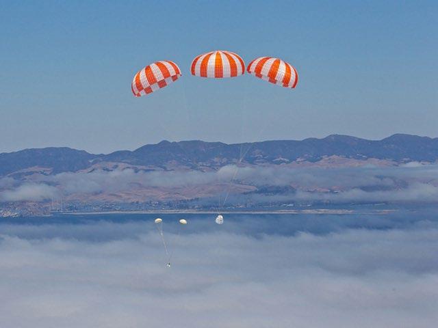
SpaceX’s Dragon parachutes (drogue and main) are the only spacecraft parachutes that have been deployed to date for spacecraft re-entries. The parachutes remain floating on the surface enabling the recovery operations. However, due to sea and weather conditions, there have been two instances where SpaceX did not recover Dragon’s main parachutes. Similarly, there have been four instances where SpaceX
did not recover Dragon’s drogue parachutes. Refer to the FAA’s 2018–2020 annual reports sent to NMFS regarding SpaceX launch recovery efforts.
SpaceX has designed a parachute system to enable recovering of payload fairings. Other launch operators may do the same in the future. SpaceX’s parachute system consists of one drogue parachute and one parafoil (see Figures A-2 and A-3).
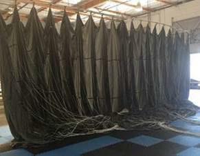
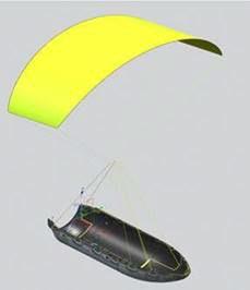
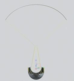
The parachute system slows the decent of the fairing to enable a soft splashdown such that the fairing remains intact. Following re-entry of the fairing into Earth’s atmosphere, the drogue parachute is deployed at a high altitude (approximately 50,000 feet) to begin the initial slow down and to extract the parafoil. The drogue parachute is then cut away following the successful deployment of the parafoil. Refer to the FAA’s 2018–2020 annual reports sent to NMFS regarding SpaceX launch recovery efforts.
Two parachute systems for the fairing may be used (Type 1 and Type 2). The specifications of each system are noted below (Tables A-1 and A-2). The Type 2 system has a similar drogue parachute as the Type 1 system but a larger and lighter parafoil than Type 1. Type 1 drogue parachute risers are made of Kevlar with nylon overwrap. Type 1 parafoil risers, for which there are four, are made of nylon with Kevlar overwrap. Type 2 drogue parachute risers are made of Kevlar. Type 2 parafoil risers, for which there are four, are made of nylon.
a The deployment bag is part of the drogue parachute assembly; the two components are connected.
b Spectra cloth with Kevlar webbing.
c Nylon cloth.
ft2 = square feet
ft = feet; ft 2 = square feet
The projected sink rates for both types of drogue parachutes and parafoils are shown below (Tables A-3 to A-6 and Figures A-4 to A-7). As indicated in the figures, both types of drogue parachutes are expected to sink at a rate of approximately 1,000 feet in 46 minutes (or approximately 22 feet per minute). The Type 1 parafoil is expected to sink at a rate of approximately 1,000 feet in 63 minutes (or approximately 16 feet per minute). The Type 2 parafoil is expected to sink at a rate of approximately 1,000 feet in 145.5 minutes (or approximately 7 feet per minute). These estimated sink rates were calculated using a NASA method/spreadsheet for estimating sink rates of parachutes and balloons. The spreadsheet provides steady-state sink rates in water for parameters inputted by the user. There are conservative assumptions built in the spreadsheet, such as assuming the parachute remains open during the entire in-water descent, slowing the descent velocity, when, in actuality, the parachute could either collapse or become entangled in the other flight train components. The calculations present the most conservative (slowest) sink rates.
Properties
Sum of masses: 18.2 pounds
Sum of buoyancy forces: 8.73 pounds
Sum of drag areas: 73 square feet
Sink Rate
Terminal velocity of system in water: 0.36 feet/second
Sink time per 1,000 ft of depth: 46.2 minutes
Sink time per 100 m of depth: 15.17 minutes
Table A-4. Projected Sink Rate for Type 1 Parafoil
Properties
Sum of masses: 181 pounds
Sum of buoyancy forces: 84 pounds
Sum of drag areas: 1,426 square feet
Sink Rate
Terminal velocity of system in water: 0.26 feet/second
Sink time per 1,000 ft of depth: 63.7 minutes
Sink time per 100 m of depth: 20.91 minutes
A-5. Sink Rate Chart for Type 1
Table A-5. Projected Sink Rate for Type 2 Drogue Parachute
Properties
Sum of masses: 18.2 pounds
Sum of buoyancy forces: 6.36 pounds
Sum of drag areas: 90 square feet
Sink Rate
Terminal velocity of system in water: 0.36 feet/second
Sink time per 1,000 ft of depth: 45.9 minutes
Sink time per 100 m of depth: 15.07 minutes
Table A-6. Projected Sink Rate for Type 2 Parafoil
Properties
Sum of masses: 70 pounds
Sum of buoyancy forces: 39.01 pounds
Sum of drag areas: 2,376 square feet
Sink Rate
Terminal velocity of system in water: 0.11 feet/second
Sink time per 1,000 ft of depth:
Sink time per 100 m of depth:
minutes
