Antonio Olea SELECTED WORKS- 2021 - 2024
Landscape Architecture Portfolio 01
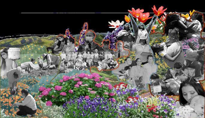
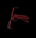
POR TFO LIO

Antonio Olea SELECTED WORKS- 2021 - 2024
Antonio Olea
Master’s of Landscape Architecture
Cal Poly Pomona - School of ENV Design
My name is Antonio Olea, and I am a recent MLA graduate with a keen interest in data and mapping cartography. I possess technical skills in 3D visualization using programs such as Rhino, Lumion, and Blender3D.
Since starting my program at Cal Poly Pomona, my design approach has focused on creating spaces that value both community and technology. I am particularly interested in integrating technology with landscape analysis and design at every stage and scale of the process.
(760) 708-8823
Tonyolea44@gmail.com
California State Polytechnic University, Pomona Master of Landscape Architecture
California State University, Fresno
B.S., City and Regional Planning
Minor: Environmental Planning & GIS
Fresno City Community College, Fresno
Duley’s Landscape, INC. (Fresno, CA) Landscape Project Estimator/ Administrator
Green Perspective’s, INC. (San Diego, Orange) Office Manager
Starbucks Coffee Company (SD, Fresno) Barista
Tony Olea Photography Photographer
Extra-Curricular Activitis
GIS Tutor for graduate and undergrad students
Transborder Landscape Workshop Participant
ADOBE Suite Lumion Blender 3D
August 2021- May 2024 3-Year Program
August 2019- May 2021 Undergraduate Degree
August 2017- May 2019 2-Year Associates Degree
August 2017 - July 2021 4 Years
Sept. 2015 - August 2017 2.5 Years
February 2015 - Oct. 2020 5 Years
January 2013 - August 2018 5 Years.
Spring 2022 - Present 2 Years
May 2022
Ipad Sketching TwinMotion Geographic Informations Systems (GIS)
DSLR Photography Rhino Drone Videography
MLA Year 03
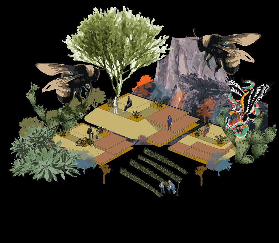
Restorative Landscapes
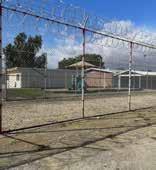
“Huron The Beautiful” California Institution for Women
Final Capstone Project
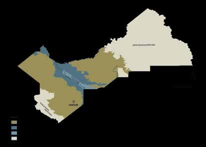
A Vision of Multibenefit Restoration for Agricultural Communities in the San Joaquin Valley, California.
Reforming the Prison Environment with mental Health in mind.
Pollution Past Borders Tansborder Landscapes
Understanding Landscapes that Transcends Borders
Oasis Urbano
Mexican International Design Competition
A New Vision for Urban Living in Border City for Equity and Inclusion.
Beyond The Wetlands Landscape Arch. Research Grant
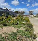
Encironmental Planning for senstive Wetland Ecosystems in Baja California. San Quintin, B.C, MX Fall 2023 02 01 03 04 05
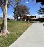
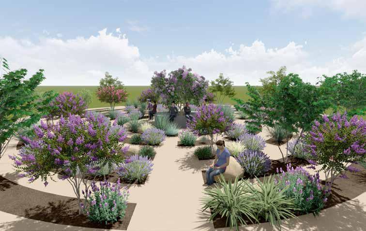
Detention Basin Spring 2024
Prison Campus Spring 2023
Summer Workshop Summer 2021
Mexicali, B.C, MX Summer 2023
MLA Year 3 Capstone Project
Professors: Dr. Weimin Li & Dr. Kyle Brown
Project Statement
For all its economic benefits, agriculture in California’s San Joaquin Valley has fragmented native ecosystems, polluted air and waterways, and left marginalized farmworker communities isolated and over-dependent on agriculture.
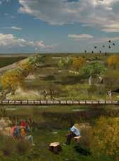
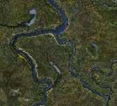
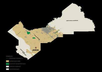
As climate change threatens the future of farming in this region, a new vision for multi-benefit land management is needed. This project reimagines a 3000-acre brownfield site near Huron, CA resulting from the construction of the California Aqueduct. Guided by a multi-scalar analysis process, the project team proposes design and planning concepts that would protect public health, provide ecosystem and community benefits, and establish a model of community-based ecosystem restoration for the San Joaquin Valley.
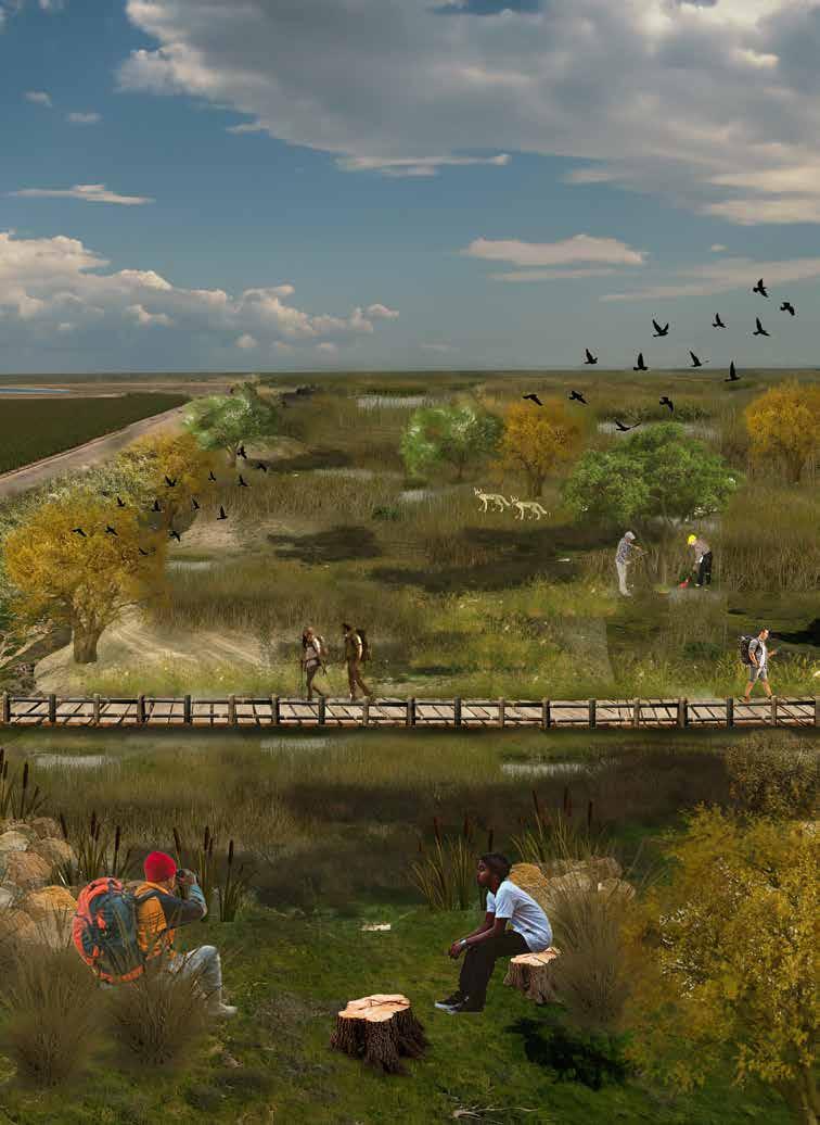
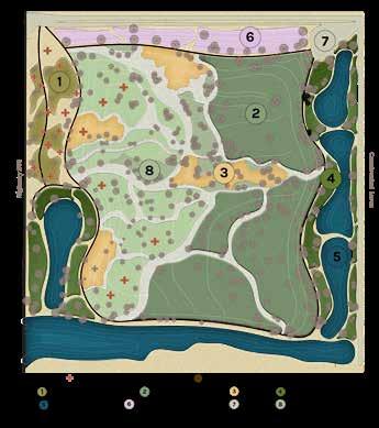
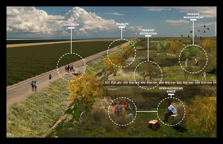
The goal of this project is simple: reverse this history of environmental injustice through community-based restoration of the project site for multiple benefits, including habitat restoration, groundwater infiltration, community recreation, education, and economic development. In partnership with the City of Huron and the National Park Service Rivers, Trails & Conservation Assistance Program, the project team developed five spatial design concepts to meet these goals.
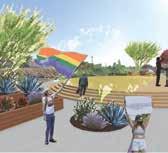
The spatial designs are visions for how the site could be restored, made safe for visitors, and connected to the community of Huron. A capped recreation area, a riparian energy dissipator, a native plant nursery and education center, and a regional landmark to the California Aqueduct are all options for how the federal site could be co-managed to serve multiple purposes. At the heart of the designs are the community members, who would find educational, economic, and recreational opportunities at the reimagined project site, and whose relationship to the project would serve as a model of sustainable, community-based land management for the San Joaquin Valley.
Project Team: Myself, Andy Sett, Connor Rudmann, Francisco Salas-Tamayo, Alfredo Zuniga
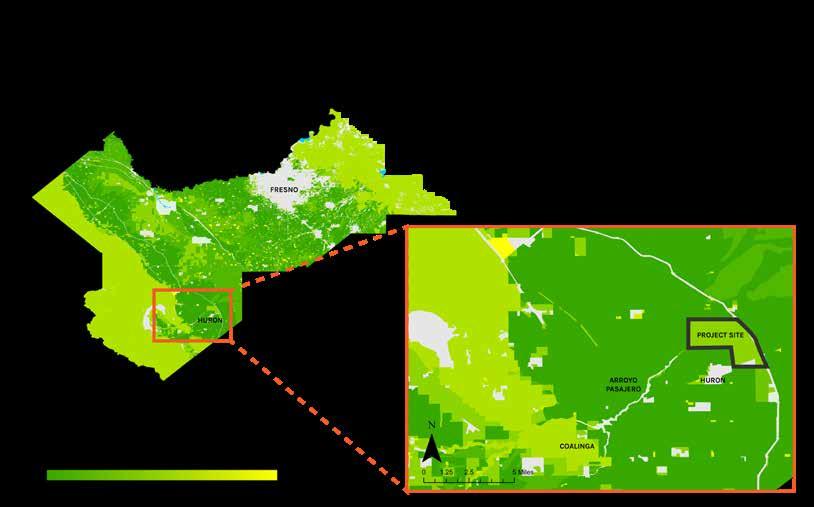
With an annual value of $30 billion, the San Joaquin Valley is one of the most productive agricultural regions in the nation, growing a quarter of the nation’s fruits, nuts, and berries, 80% of the world’s almonds, and 24% of its pistachios (Butterfield et al. 2021). However, this agricultural production comes at a cost... The San Joaquin valley consumes 4.3 trillion gallons of water every year, 89% of which is used for agriculture, while land use conversion to agriculture has eliminated roughly 2 million acres of native grassland, wetlands and riparian forest habitat (Butterfield et al. 2021).
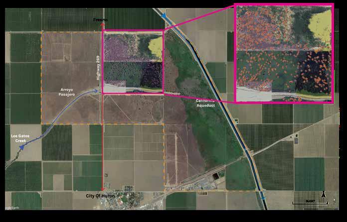
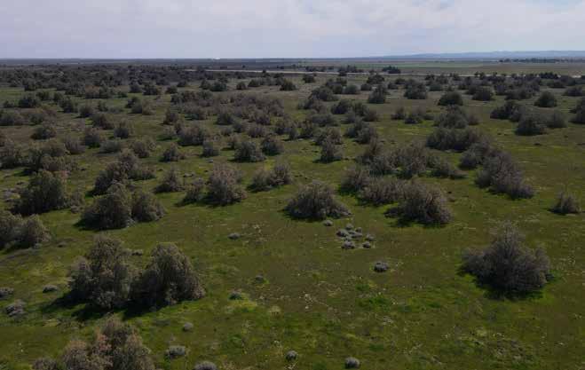
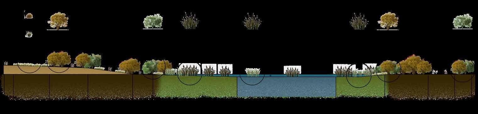
Finding opportunities to manage the invasive species, such as the Tamarisk, by locating the clusters of trees that have overtaken large spaces could provide use for opportunities to restore its conditions and make space for new life to form. The focus area currently has 650 Tamarisk trees evenly dispersed, totaling a total of about 52-acres. The goal is to completely remove all Tamarisk and utilize the area for community and restoration programming.
Proposing an intervention phase will allow for a transformational design that will allow for adaptation of programming for the transformation of deteriorating landscape spaces that serve multiple benefits for a nature-human design. For example, determining areas for managing invasive tamarisk can also serve multiple benefits for education and expanding career opportunities outside of agriculture.
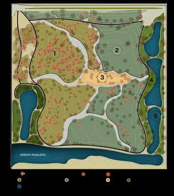
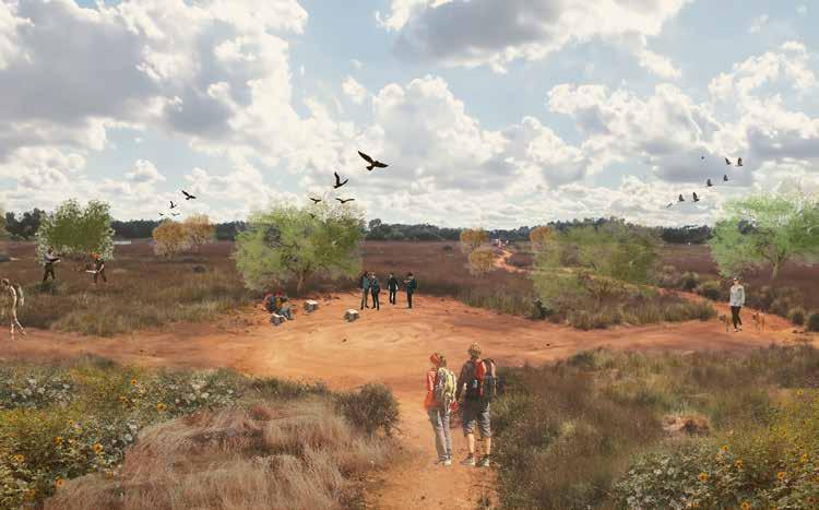
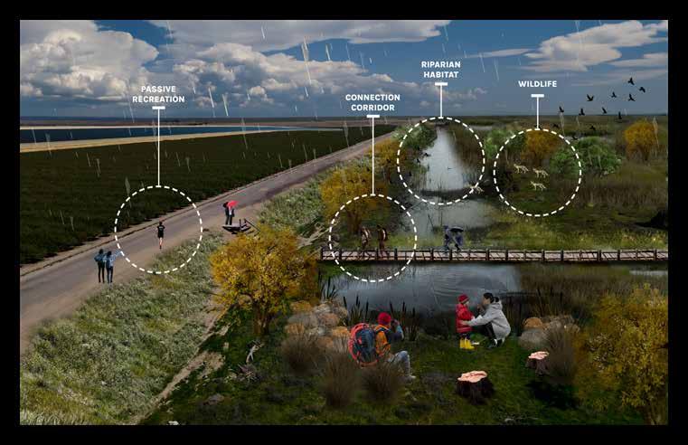
The newly proposed berm will allow for a newly designed space for riparian habitat to form on site. Considering the seasonal patterns of Fresno County, a space that will be charged with incoming stormwater from the Diablo’s Mountain ranges during rainy seasons will allow for native and seasonal riparian opportunities like hiking, birdwatching, and all nature-based activities can now take place in areas that we once managing flood events. habitat to be introduced in areas where the new waterflow is now being diverted. During heavy rainfall the site will allow to filter out polluted sediments, recharge underground aquifers, and replenish native vegetation that have been re-introduced into the site.
Spring 2023
Professors: Claire Latané & Adrian Tenney
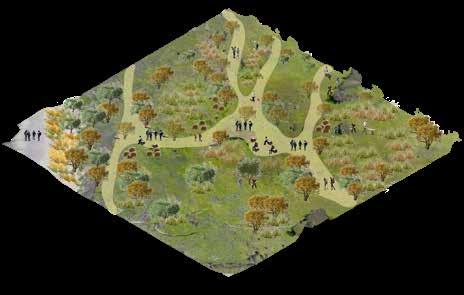
Designing for the California Institution for Women in Chino, CA brought up critical questions that made designing this project an incredible experience. The project focused on landscape design strategies that are restorative and rehabilitating to the trauma experienced by all individuals that are interconnected to the California Institution for Women, including staff, CIW residents, families and community members.
The goal for this project is to provide a healthy environment that will promote the following: transform the residents of the prison for re-integration into society, foster healthy working conditions for staff, and nurture families and community members who visit the site regularly.
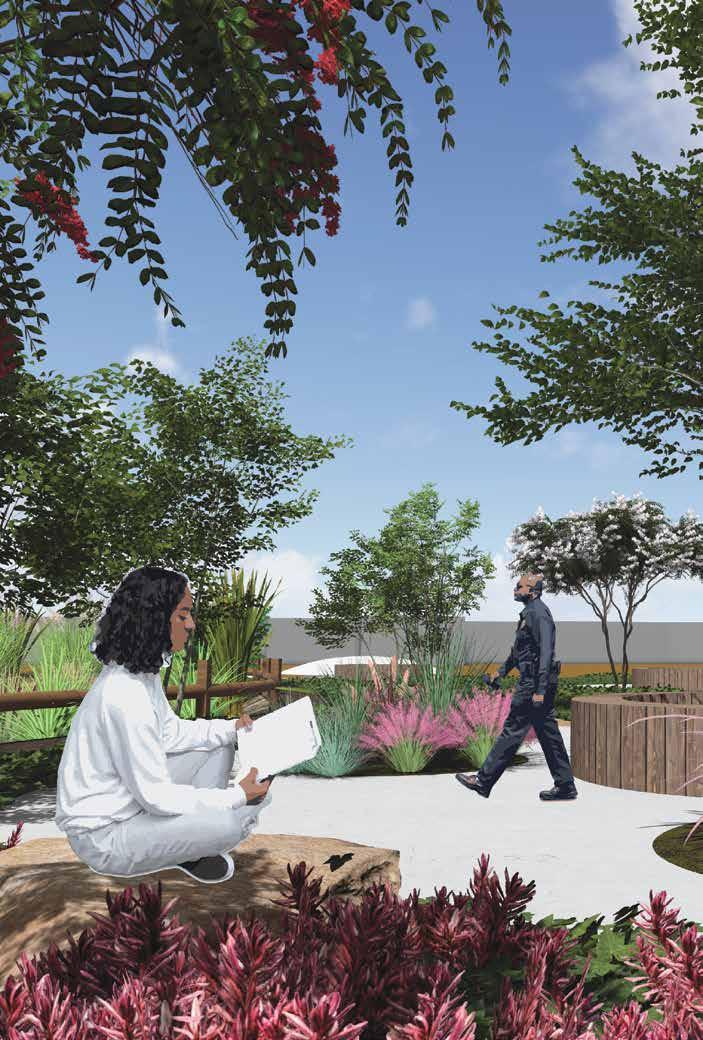
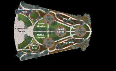
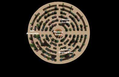
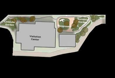
The design approach that helped shape the schematic design, titled ‘Restorative Landscapes’, will offer the users of the space diverse opportunities, from outdoor educational spaces, community courtyards, sensory gardens, and native gardens.
Every individual space will hold a purpose and theme that supports one goalto restore.
As a profession, we reimagine underutilized spaces. while activating spaces when current conditions lack livability and safety. The prison environments fall under the spaces that lack essential conditions for users of the space to thrive and live. The women of the California Institution for Women deserve a thriving landscape environment in their own backyard, as serving prison time is the punishment, but access to beauty is not.
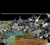
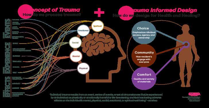
Landscape Architecture and mental health can create for rehabilitation within individuals who suffer from health and mental conditions. Through case studies and research studies implementating principles of ‘Trauma Informed Design’, there are ways to to design spaces that can help improve an individuals condition. These series of infographics display the body responses to certain events in one’s life, which incarcerated individuals have shown the effects of experienced trauma.
A Deeper Understanding

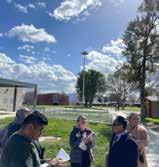

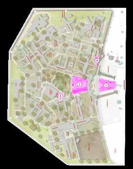
Our focus as a team was to incorporate feedback from residents of CIW and staff by having a survery sent out by email by anyone who works or resides within the prison campus. Our survey ended with about 50 responses by residents and staff, which gave us a deeper understanding of areas within the prison campus that are underused and which areas are more popular for gathering spaces. The responses given by every individual helped shaped our own individual schematic design.
Community Survey
An Insight to Prison Environments
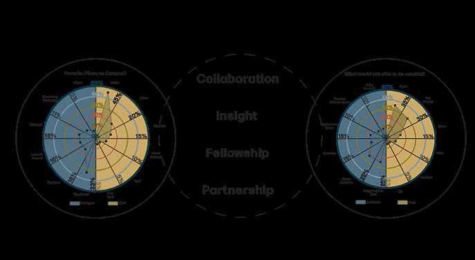
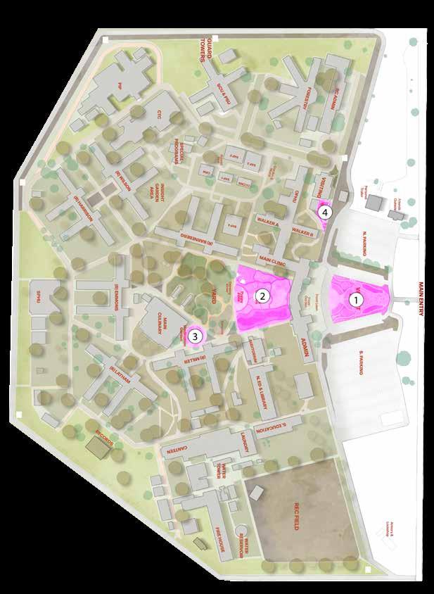
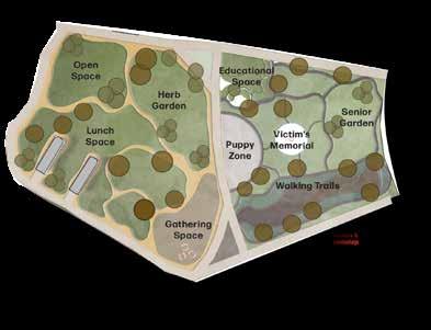
Staff of CIW need a place to recollect from stress of the workplace. The results from the survey resulted in the staff of CIW having no outdoor space or area to relax during their break. The current coditions of the area is a vacant unused lot.
An outdoor education space for the Women who are in education courses, Rehabilitation programs and spiritual meetings.
A meditation Garden for individuals to help improve mental health and wellbeing. Sensory garden inspired for enjoyment.
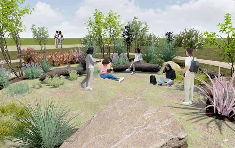
Native planting and seating for the women of the campus who are visited by families and their children during scheduled visits.
The CIW campus can help integrate spaces for residents to continue their vocational/ academic programs, self-help programs, and community betterment projects through outdoor learning classrooms that provide a safe space for individuals seeking a communal space. Current residents are hosting events in designated areas that have no ventelation and windows, limiting the opportunity to create meaningful connections and collaborations for all individuals who are associated with CIW.
Through a series of surveys given to the residents of CIW, the response was overwhelming with a need of multi-use space for active movement and a place that will provide shade and rest. Incorporating a medication garden, all individuals will have access to walking areas, communal space, and individual space that will allow for some meditation space for few residents. Incorporating areas that help promote mental and physical well-being will improve the quality of life within the campus at CIW.
Project Workshop: San Diego, CA
Program Directors: Jimmy Ta, Raul Bielsa
Project Partner: Andy Sett
Purpose of Transborder Workshop:
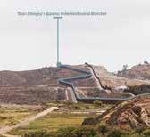
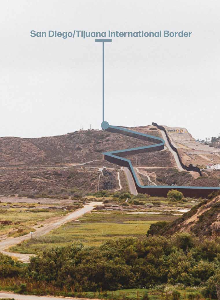
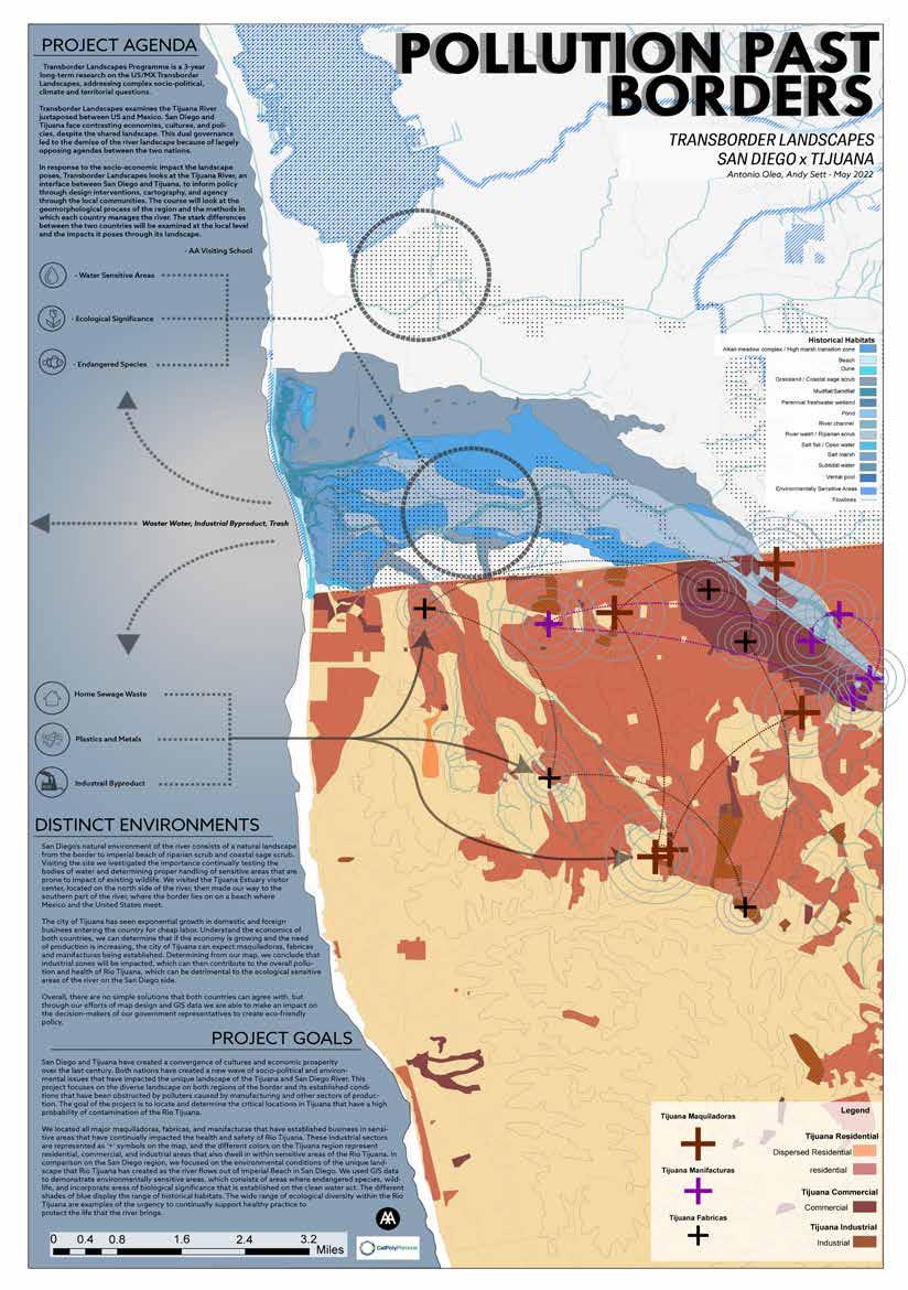
Transborder Landscapes Programme is a 3-year long-term research on the US/MX Transborder Landscapes, addressing complex socio-political, climate and territorial questions.
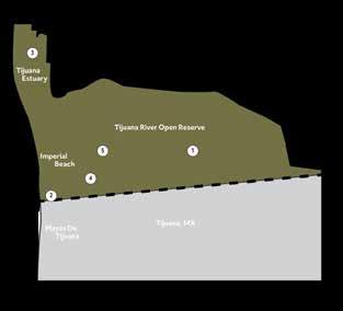
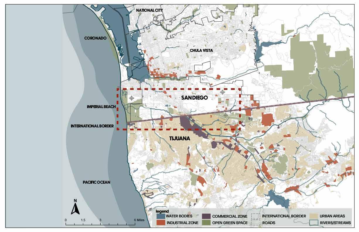
Transborder Landscapes examines the Tijuana River juxtaposed between US and Mexico. San Diego and Tijuana face contrasting economies, cultures, and policies, despite the shared landscape. This dual governance led to the demise of the river landscape because of largely opposing agendas between the two nations.
In response to the socio-economic impact the landscape poses, Transborder Landscapes looks at the Tijuana River, an interface between San Diego and Tijuana, to inform policy through design interventions, cartography, and agency through the local communities. The course will look at the geomorphological process of the region and the methods in which each country manages the river. The stark differences between the two countries will be examined at the local level and the impacts it poses through its landscape.
- AA Visiting School


Site Walk
Photo Diary
The 9-Day workshop was structured to be an 8-hour scheduled program with extensive learning tutorials of 3D rendering programs such as, GIS, Rhino, Blender3D, and video editing software, such as Adobe Premier. Two days were scheduled for site visits along the Tijuana Estuary in Imperial Beach, following the day crossing international borders into Tijuana to learn about research by professors of Colegio De La Frontera and ended the day in Eco Park, a research center in the hills in Tijuana.
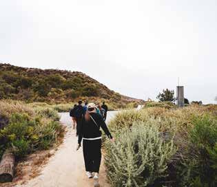
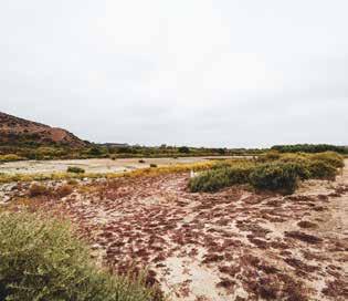
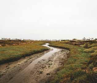
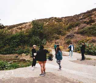

The site walk developed critical environmental issues that developed in Tijuana and impacted San Diego coastal regions- leading to beach closures due to pollution, such as human waste, trash, and erosion. The Tijuana River originates from Sierra De Juarez and undergoes drastic changes throughout the region of Mexico, leading to a channelized river developed in 1979, due to flooding. Ending the site walk in Friendship Park where it is no longer accessible to the public since Februrary 2020.
Final Day consisted of a presentation to 6 academic tutors who had given presentations on current research and tutorials on data visualization and applications. My partner Andy and I gave our presentation on the harmful impacts of maquiladoras and the transportation of harmful pollution coming from Tijuana. We mapped out the critical areas where pollution is evendent, which were areas of illigal settlements along the mountainous regions of tijuana and areas along the channelized Tijuana River where manufacturing is most prevalent.
The exploration and workshop gave us the initial interest in GIS mapping and utilizing data to represent real world issues and create an impact to transborder evironmental issues.
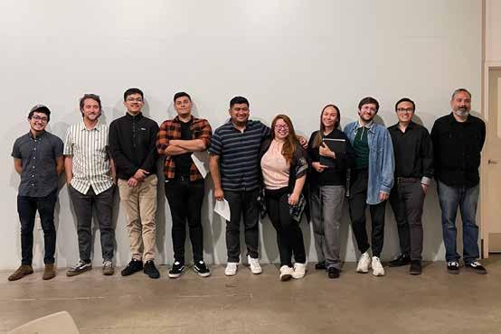
Final presentation picture with all participants and Directors: (Left to Right): Andy S. (CPP), Michael G. (CPP), Bryan C. (CPP), Student (Woodbury), Brenda V. (Woodbury), Anna V, (USC), Raul Bielsa
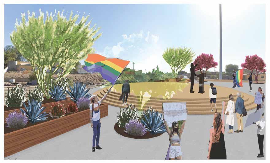
A New Vision for Urban Living in Border City for Equity and Inclusion.
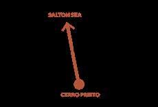
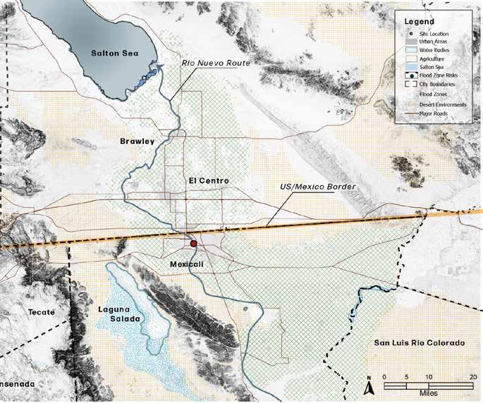
El Rio Nuevo A Crossborder River Through Mexicali to Salton Sea

El Rio Nuevo Regional Anaylsis
Understanding the region of Mexcali, we initiated our research in mapping out the environment of El Centro, CA and Mexicali in Baja California. El Rio nuevo was an important opportunity for us to incorporate at our procject site and bring back the river to people.
La Communidad De Mexicali Project Site Analysis
The project site is situated alongside a commercial road that lacks sufficient street infrastructure that makes this region of Mexicali unwalkable. Rio Nuevo runs directly underneath Ave. Rio Nuevo, where it is now channelized to help with flooding.
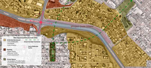
Protest Route Residential Commercial Networks
As we continued to make our case for design strategies for the project, we researched the surrounding community of the project site; such as, where do did communities reside, commute for work, and the accessibility of the site. As a group our researched and investigation led us to create indicividual design schemes.
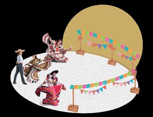
Un Lugar Para Celebrar A Place to Celebrate
Un Lugar Para Jugar A Place to Play
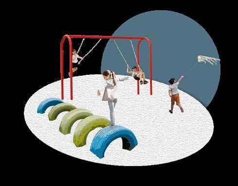
An adaptive space for the residents and visitors of Mexicali is essential for community building and business owners who sell alongside roads to passerbys.
An area of my individual design scheme was to develop an area for outdoor events and social gatherings, while also paving the way for free speech and social justice. The country of Mexico is filled with rich history and culture that have been present pre-colonization era with indigenous communities, such as, the Aztecs, Mixtecos, and Mayans. In current times, similar to the United States, the people of Mexico have developed a need for social justice reform and the fights for rights for all citizens of its country. Every year the border city of Mexicali, hosts the annual ‘Marcha del Orgullo”, in which community members of all ages come together to celebrate the diversity of all LGBTQ+ identyfing individuals, and their supporters such as family and friends. The event is a long 2-mile stretch in Mexicali downtown area, which then ending at the city hall, where city officials and organization members help in the celebration and acknowledging a special event for its community.
Dangermond Research Fellowship Grant
Budget: $5,000
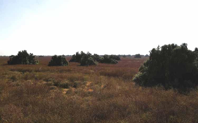
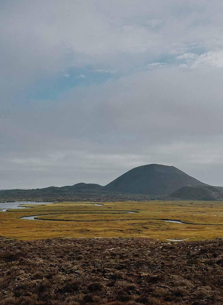
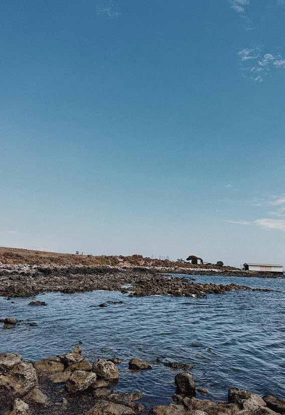
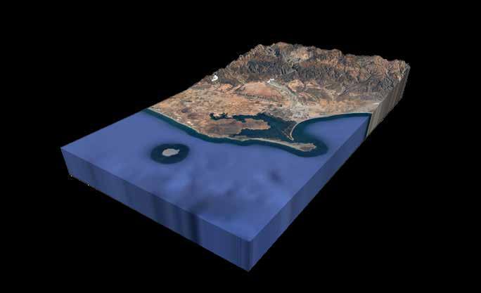
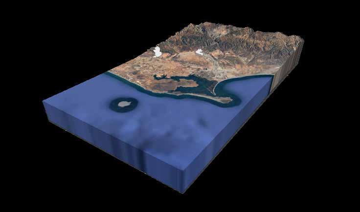
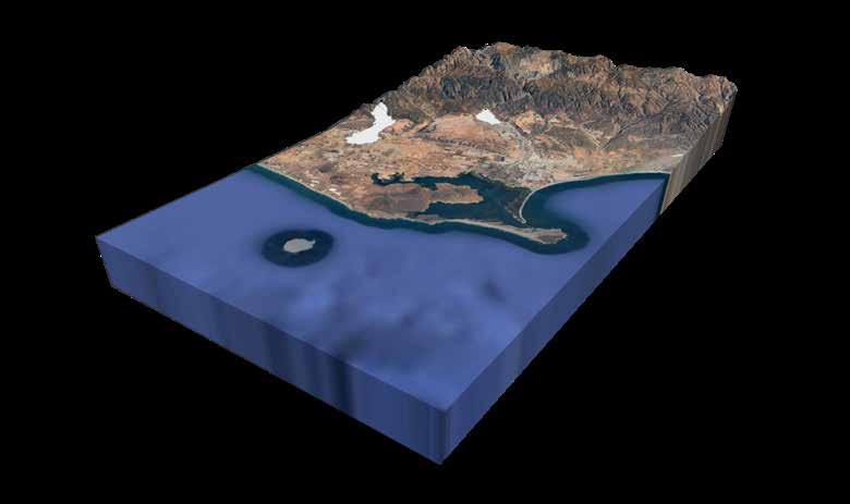
The city of San Quintin has been experiencing a shift in extreme weather patterns that have impacted the landscape from the mountain ranges towards the east to the coastal wetlands on the west coast. The agricultural town of San Quintin resides about 200 miles from Tijuana and is under the municipality of the city of Ensenada. San Quintin is known to have historical landmarks along the Baja coastline, from inactive volcanoes, to the only known wetland and floodplain habitat in all the state. There are currently efforts by NPO’s, such as Terra Peninsular, who are working alongside the Mexican government to establish sensitive ecological areas as protected areas. The efforts made by this organization have now established five areas within the city of San Quintin to be recognized as protected areas that include inactive volcanoes, shorebird areas, and the natural wetlands along the coast. Determining how to visualize the natural landscape into a visual language that could be understand by a wide range of audience will be my overall goal with my term project.

The city of San Quintín is primarily an agricultural city that produces about 55% of the entire state of Baja farm output, which majority of its crops are produced for export, consisting of, strawberries and tomatoes (Rural Migration News 2021).
My study of the region will investigate how agriculture, specifically crop producton, impacts the largest natural wetland landscapes of the bay of San Quintín.
The region of San Quintín land-use is mainly distributed for agricultural use and the landscape environment is rural, with unpaved roads, coastal scrub and mountainous regions. The city of San Quintín has one linear road that extends to the southern part of Baja California and minor roads that leads to more urbanized areas of the city.
Overall, the city of San Quintín has areas that seem untouched and preserved, with rich and diverse geological formatíons and unique natural preserves, such as inactive volcanoes, natural wetlands, and habitats for migrating birds along the coast of Baja California.
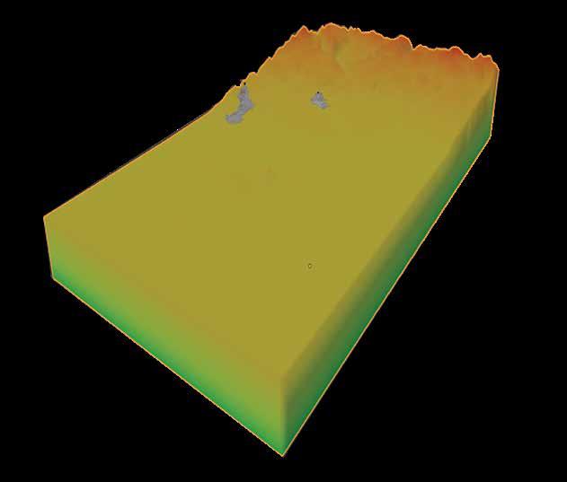
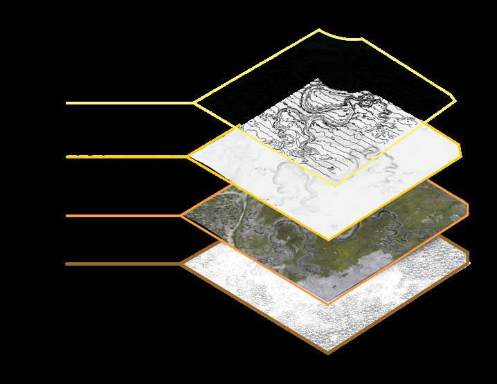
What resulted from this project was the use of mapping to locate agriculture, wetland habitat, historic sites, and protected areas of San Quintin using Google Earth. Then next steps were investigating how to use digital elevation models to visualize elevation using 3d visualization. Using data from the USGS where you can locate certain areas and download tiles of raster elevation information then adjust it to specific areas for study.
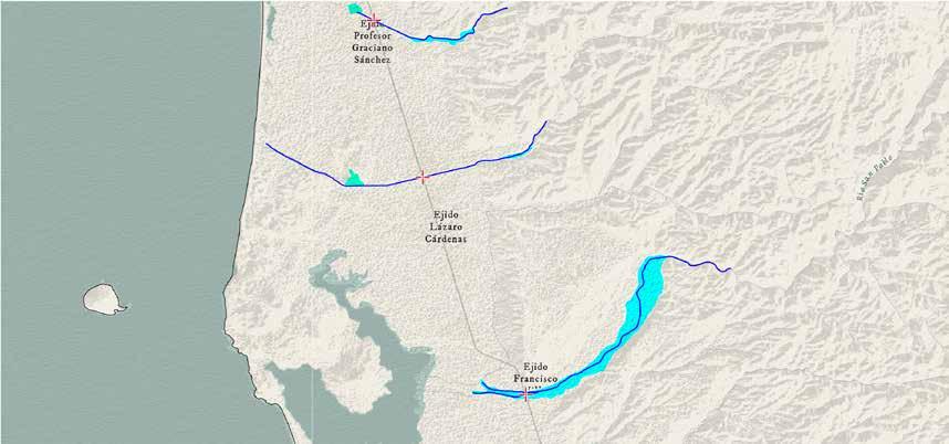


Navigating Flood Challenges for Agriculture Zones in La Bahía de San Quintín
The methodology that I will apply to this project will consist of using two specific applications to manipulate and utilize data from various sources. Initializing my process would be to use Google Earth to create polygons and line work to show where flooding sources are located and how they travel within the watershed. The polygons will determine boundaries and various land-use typologies within the San Quintin region. This initial step would be then transferred to ArcGIS Pro to determine acreage and create my aesthetic for representing the various land types. Using ArcGIS as a tool for layering datasets on top of each other that will give me an understanding in the landscape and ecosystems that will be researched.
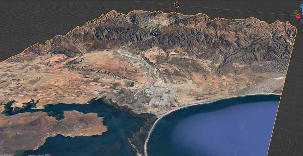
Lastly, the last step in the visualization process would be to use the information that have been presented through the research phase to create a real-time visual of how waterflow occurs when there are extreme weather conditions in the San Quintin region. Importing Google Earth imagery and implementing elevation data from USGS to represent physical landscapes into the digital space.
The importance of symbolizing physical landscape into a language that is universal is critical and an approach that should be main priority with every design visualization project. As Landscape Architects, we tend to symbolize in in simple images and axonometric visualizations, so establishing my visualization to fill in the gaps of graphics into animation is almost rare to come across (Bako 2023).
The Blender 3D visualization goals will include to give the following: allow for the visual representation to be accessible to various stakeholders and change the perception of how society imagines the landscapes in which they reside in, and help with the gaps of visual graphic communications within the field of Landscape Architecture.
Utilizing Blender as my visual tool for representing flooding impacts in San Quintin can help influence behavior by humanizing nature to allow for us to become part of nature. As Landscape Architects, we have studied different areas of how we impact nature and what nature means to us with principles not every individual understands. For example, we understand that impacts of human activity result from pollution, over extraction of natural resources, which could be difficult to grasp by the everyday individual (Sheppard 2005). Society lacks the knowledge to perceive nature that we have, which is why we should continue to diversify our skills to continue to make ideas and designs accessible and easier to understand without the need for us to explain what our visualizations are trying to display.
How can we as Landscape Architects accurately represent the landscapes that we design and intervene? Incorporating structured and accessible workflow we can gather information from a specific site that will allow us to extract necessary information such as contours, 3D rendering model, and topography that will allow us as designers to accurate represent landscapes in a visual language that we could understand.
My research for this project allowed me to understand hardware that could effectively gather data, render it, and visualize it all through the ease of your mobile device. Utilzing complex methods of visualization I was able to experiment with tools and software that allowed me to capture the landscape of San Quintin as it should be experience. To see the textures of the vegetation, and the topography of the wetlands.
Overall, this research fellowship allowed to further expand the field of Landscape Architecture to incorporate more efficient and accurate representation of landscapes using technology and a variety of photography and videography using DSLR and Drone videography to simultaneously see the results on my cellular device.
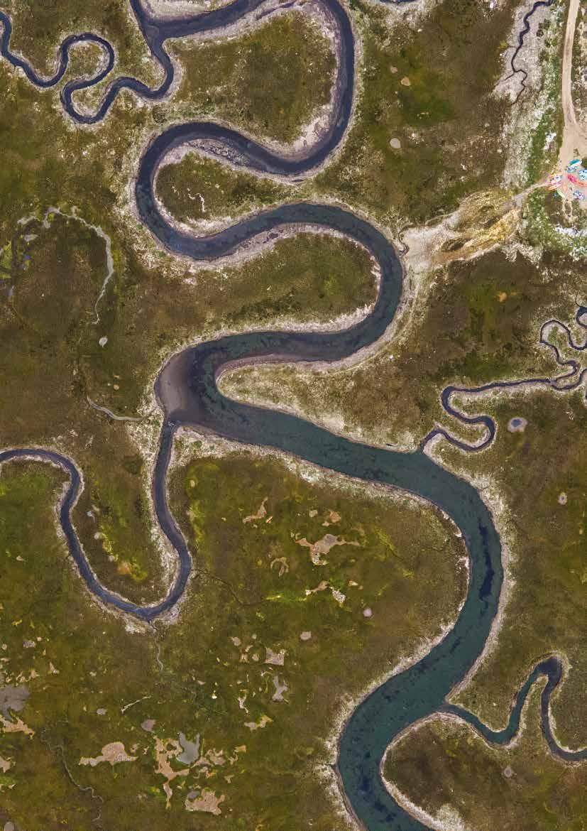
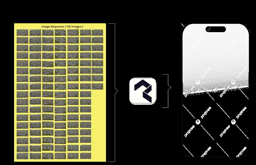
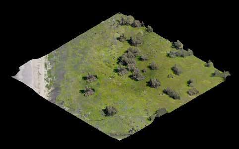
During my site visit in San Quintin I was able to record the site using drone video and DSLR images that allowed me to capture areas of the wetlands that I could not access by foot. By establishing an area that showed the textures of the site visibly I was able to use my drone to focus on an area and record a 2-min video, then creating a photo sequence of 110 images that was the foundation to creating a 3D model.
Using the application PolyCam 3D I was able to upload the 110 images and rendering them into a 3D model of the focus area. The benefits of using this system is that it is easily accesible and the ease of functions would allow us to easily create these models on site and through our mobile devices. I enjoyed this method of capturing my site, as it gave me a unique model to work on and study the area within the bay of San Quintin.
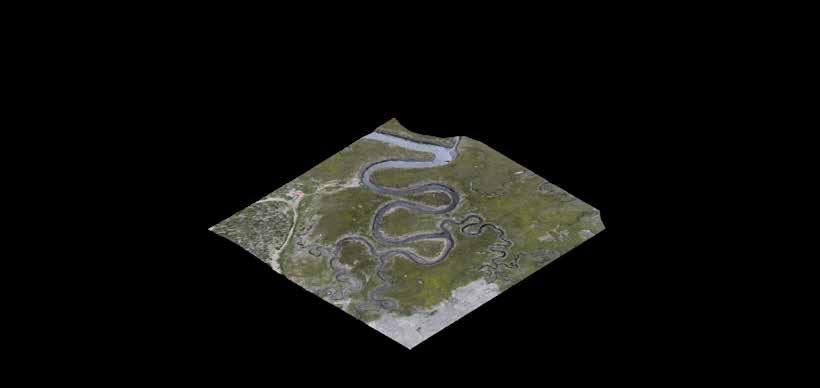
Utilzing the rendered 3D model, you are then able to inport this model into any 3d software. I imported the model using Rhino, which I could then could be manipulated to create other 2D models. What resulted from this was extraction of data such as 3D surface, rendered Surface, Topographic Surface, and Contours that could allow us to accurately design and manage the wetlands.
PH: 760-708-8823
Email: Tonyolea44@gmail.com