INTRODUCTION
Though it has some precise geographical definitions, the word “Antipodes” is generally used in the Northern Hemisphere to refer to Australia and New Zealand. So it is the perfect word to describe where we visited on this trip Australia and New Zealand.
Zegrahm does not do a voyage to Kimberley (on Australia’s northwest coast) very often and we were unable to join them the first time we ever saw it advertised. So this time we jumped at the chance to see this amazing part of Australia and the world. What drew us to this area will be discussed fully in the first section of this journal.
The trip was divided into three parts: an expedition ship exploration of the Kimberly coast, an overland bus trip extension to explore the interior of this remote area, and a stay-over in Brisbane. We will begin with the sea portion.
Since Australia is just across the Tasman Sea (“the big ditch” as the Aussies & Kiwis call it) from New Zealand, we knew we could not come so far and not visit one of our favorite places in the entire world. Plus, we also have some dear friends who live on the North Island and were invited to visit them as well. So you can see why New Zealand had to be tacked on at the end of our complete journey.
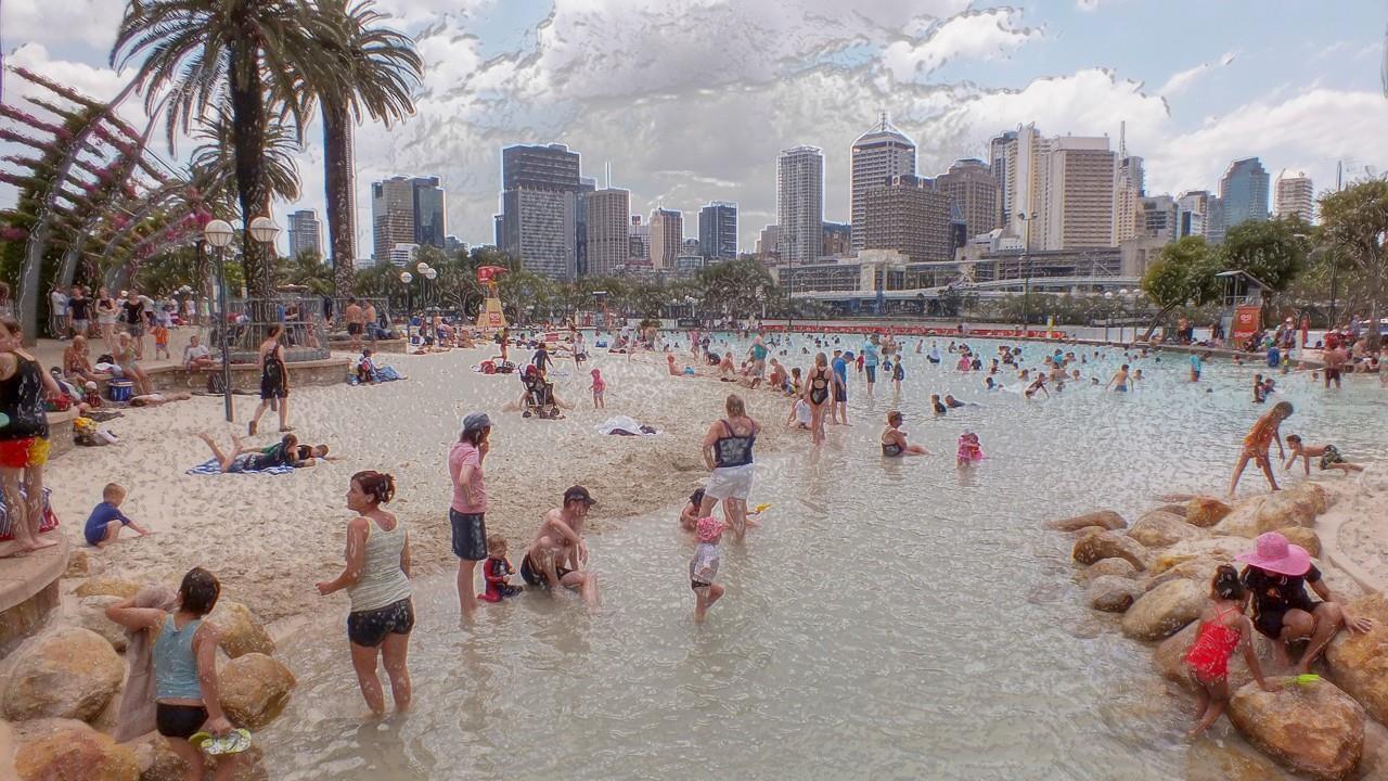
Because these friends were just returning from a trip of their own just about the same time that our Kimberley trip ended, we knew we would need to stay somewhere on the East Coast of Australia a few days to give them time to recover from their own travel fatigue. So that’s why we decided to spend a few days in Brisbane where the Zegrahm folks dropped us off. We had never visited this wonderful Queensland city so it was the perfect stopover.
GEOGRAPHY
The Northwest portion of the Australian continent is geologically different from the rest of the island because this area was not originally a part of the continent when it broke off from Gondwanaland those gazillion years ago. Something like 2 billion years from the present, what is called the Kimberley Block broke away from Gondwanaland and collided with the original blocks which had formed mainland Australia and fused with them. But geologic evolution had produced major differences in the two areas. The Kimberley Block created a separate drainage system which it maintains to this day because of the mountains which uplifted in the collision forming a sort of fence aroundthe Kimberley Block. Rivers arising in these mountains flow to the Pacific Ocean from Kimberley but rivers on the mainland blocks found other courses to their destinations without passing through Kimberley.
Furthermore, the chief sands & rocks in the Kimberley area are different. In Kimberley, the rocks are mostly sandstone that can form quartzite under the proper conditions, limestone that can become marble, and clays that create mica. All these rocks together create the dramatic, colorful, and torqued layers in the seafront cliffs! Some layers actually turned round on themselves an create curves, and noose shaped loops, and even circles. The powerful forces that shape and change the earth are ever on display in this geologic playground.

With this separate and distinct geologic history, we expected to see something very different from the East Coast of Australia and even its desert “Red Center.” And we were not disappointed. We were mesmerized by the monumental and colorful cliffs lining the coast of Kimberley. The huge tides created by the shallow shelving nature of the underlying coastal structure were stupendous and exciting. This part of Australia lies in the neotropical zone and experiences monsoonal rainfall during the “wet” season (November to April) & becomes desiccated during the “dry” (May to October), resembling a desert more than a rainforest then.
One would hope to see flora and fauna which had evolved on another schedule altogether but that did not turn out to be true. The birds and animals are the same ones seen in other parts of Australia. Perhaps that is because some evolved before main block Australia separated from Gondwanaland and failed to change on the Kimberley Block left behind. Also, animals and birds can now migrate across the whole of the continent and cover it with similar species.
We were interested in visiting this remote and difficult to access corner of Australia for the following reasons:
Its remoteness was intriguing so that it is accessed only by sea or flights. We love expedition ships and explorations by zodiac from the “mother ship.”
The titanic tides and the control they exert over any explorations of the area.
The geologic processes that are so clearly “read” in the seafront cliffs, the mountains, peninsulas, and islands in the Kimberley.
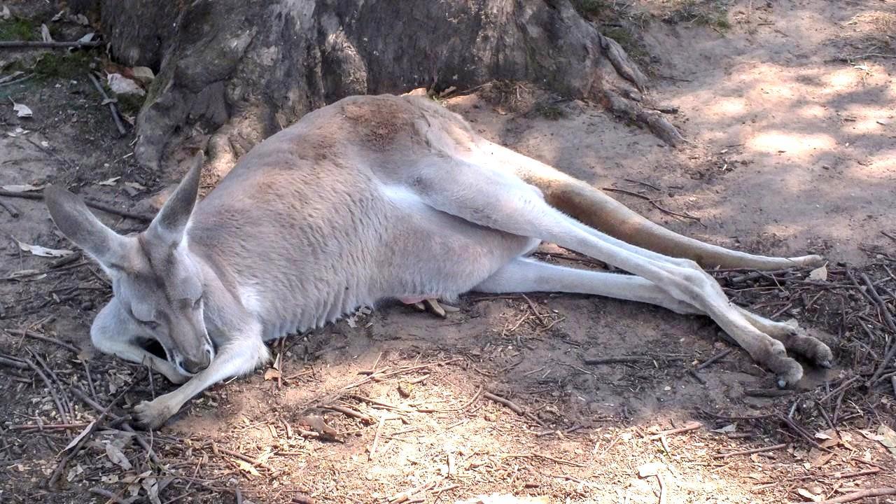
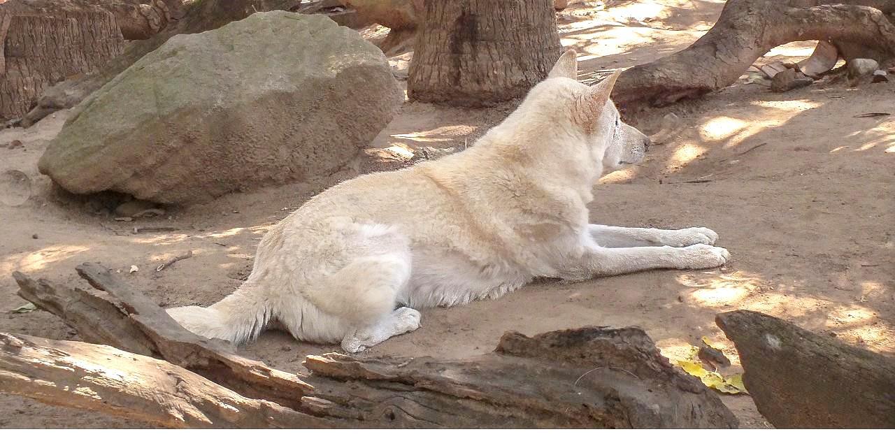
The animals said to inhabit the area: wallabies, walleroos, dingoes, salt & fresh water crocodiles, and the many bird species living along the coast & in the mountainous areas.
Aboriginal art in the caves, rocky overhangs, and ledges in the cliffs & mountains said to be between 17,000 and 50,000 years old, making even Egyptian and Viking antiquities seem recent.
So, off we go.
TRANSPORTATION
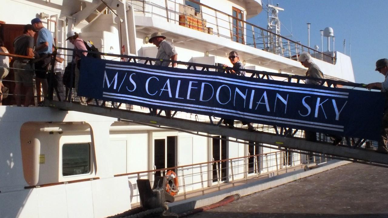
The expedition ship which made our visit to the sea-cliffs, river rivers, gorges, and islands of the region possible was one new to us: The MS Caledonian Sky. Built in the early 90s, the ship was completely refurbished in 2012. It sails under the Bahamian flag (meaning it is registered in the Bahamas). The ship is 295 ft. long and 55 ft. wide and carries a maximum of 114 passengers (in 57 outside-facing cabins) and 74 crewmembers. On our voyage, the passengers numbered 88 and the crew 70.
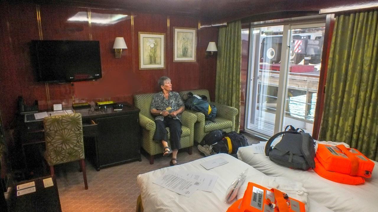
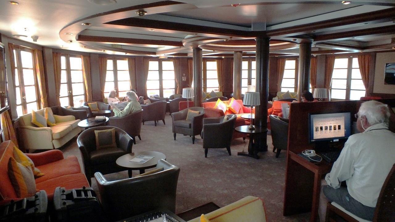
The ship is quite handsome with a comfortable lounge for passenger meetings (for us that meant the recaps and briefings held every day around 6 p.m.). The library and club area is at the top of the ship and affords wonderful sea views. There is a dining room and a Lido deck for meals. The cabins are comfortable and roomy and each one has an ocean view (carrying in size depending on the class of cabin selected). It carries 12 zodiacs for exploring off ship. A very nice way to travel indeed.
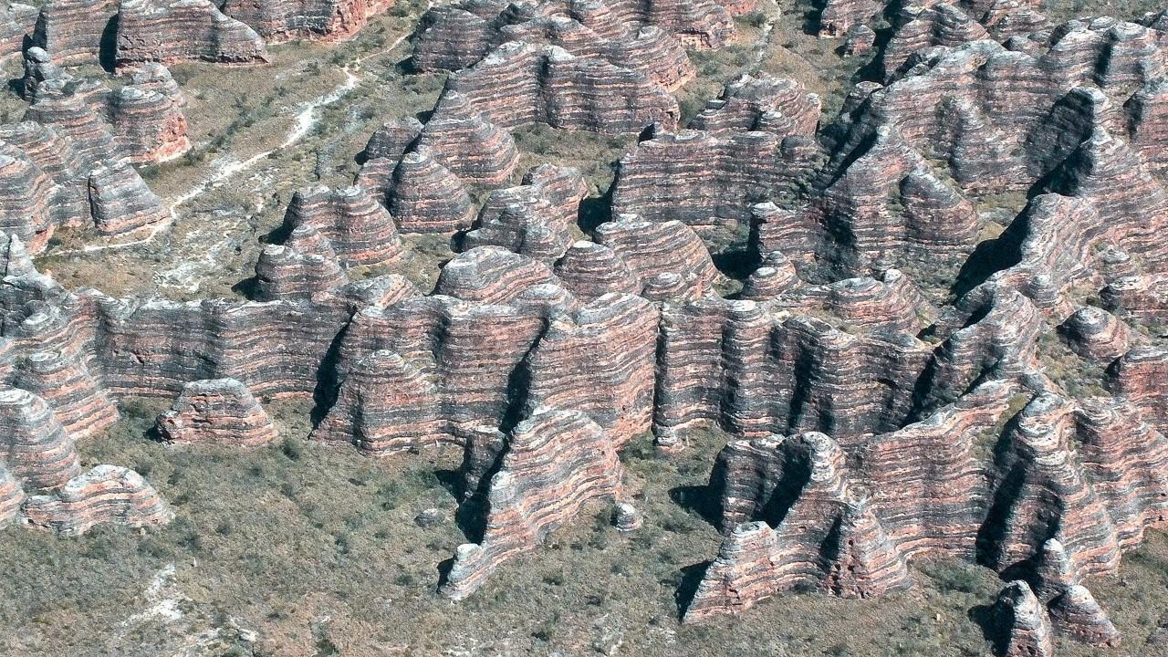
During the course of the trip, we also used vans, helicopters, and small airplanes to reach places of interest. Because of the difficult terrain, the small planes and helicopters were absolutely essential for visits to places like the Mitchell Plateau & Mitchell Falls, Bungle Bungle National Park, as well as Katherine River and Gorge.
BROOME
The Kimberley area is sparsely populated and its towns are small. Our trip started in Broome, a city of about 15,000 in the non-tourist season and it rises to 50,000 when the visitors arrive. Because so many kinds of termites live in and around Broome, residential & commercial buildings are usually built of steel frames “clothed” with corrugated steel panels colored with bonded paint. This lends a rather “temporary” appearance to the town, but that is a false impression. Broome was founded in 1883 as a pearling center and the site of the undersea cable connecting Western Australia with Britain through Singapore. Today a small pearling industry still functions but tourism has overtaken it as the prime economic mover of the town.
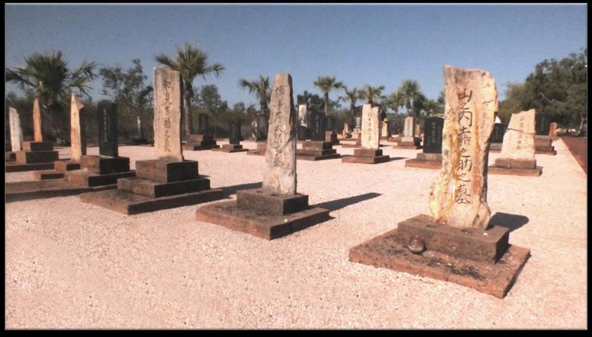
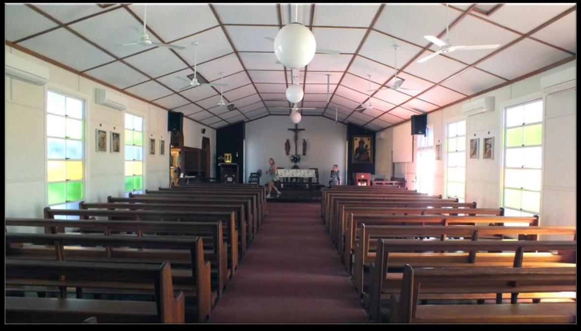
We were given a short tour of Broome that included sights that testified to the importance of pearls in its history. For instance, Our Lady of Peace Catholic Church boasts of a nacre (mother of pearl) altar and many other smaller decorations made of the nacre. There is a small museum dedicated to the pearling pioneers and while we were visiting, a festival celebrating the pearling industry was in progress. Many of the early divers were from Japan and their descendants are a vital part of this multicultural small town. There is a dedicated Japanese cemetery which honors the divers who lost their lives collecting the oysters it was a very hazardous occupation!
To cement in our minds the vital role pearling has played in the history and present of Broome, we taken to the largest remaining pearling facility: Willie’s Creek Pearl Farm.
Willie’s Creek Pearl Farm
Wild oysters no longer supply the pearls processed here. Cultured pearls are the rule as they are almost everywhere in the world. That’s why the historic company is now called a “farm.” The oysters are “farmed” in that they are grown on lines in the waters of the Creek and artificially “inseminated” with a grain of irritating material which causes the oyster to protect itself by producing the nacre (mother of pearl) which eventually becomes a pearl a cultured pearl.
There is a considerable amount of calcium carbonate in the waters in this creek and most other rivers and creeks in the Kimberley. That imparts the most beautiful colors to the water: teal greens, pure azure, turquoise, and light jade. For sure, the waters look tropical. The shallow continental shelf also contributes to the beautifully hued seawater.
We learned quite a bit about the culturing of pearls and their production into various jewelry pieces, but Kay and I did not feel inclined to purchase any of the examples on sale in the showroom. The prices were very high but probably fair enough considered the complexity of the entire process and the high risk of failure in good pearl production.
Gantheaume Point
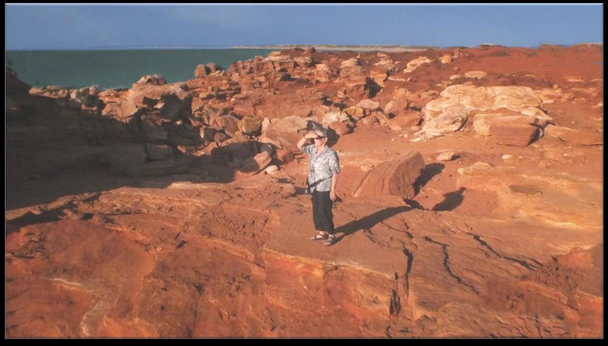
Broome is the southern gateway to the Kimberley, so it was appropriate that our introduction to the amazing geology of the whole area would occur here at Gantheaume Point. Our shipboard geologist was quite excited to visit this significant site and present it to us. The point is composed of fiery red sandstone craggy-topped cliffs standing against the brilliant blue of the Indian Ocean and its crashing whitecaps. At low tide, 130 million year old dinosaur footprints of at least 9 different species are visible. For those of us unlucky to visit the site at higher tides, plaster casts of the prints have been place on top of the cliffs.
The red sandstone boulders and even the ground itself change colors as the sunlight changes angles from light oranges to deepest reds. Sandstone itself is an important building block for all the geology seen in the Kimberley area.
There has been a lighthouse at the point since 1907 and there was once even a lighthouse keeper’s house. But those original structures are long gone and today there is a skeletal steel framed unmanned lighthouse here unmanned but not uninhabited. For several years, an osprey pair has maintained its nest cradled in the steel arms of the lighthouse, raising at least one chick every season and sometimes even two.
Broome was all very nice but we did not come to The Kimberley to visit human habitations! We came for the scenery ruled by the titanic tides, supposedly the 2nd biggest in the world (after the Bay of Fundy in Maritime Canada)! We would learn that not only was the terrain partially created by the tides but that our landings and shore visits would also be determined by those huge tides.
FANTASTIC TIDES
Perhaps now is the time to discuss those phenomenal waves in a little more detail. As mentioned before, unlike the Bay of Fundy whose big tides are created by a bottleshaped bay into which the Atlantic Ocean pours twice daily, these waves are mostly the product of the wide and shallow continental shelf along this coast. The Indian Ocean piles up on the shelf and roars up the ocean bottom into all the gorges, fiord-like fissures in the cliff walls, river and creek deltas, and the sunken reefs. Water from the deep ocean rolls up and is constricted by the shallow continental shelf and the currents increase to push the water up on the shelf, creating the enormous tides. At the town of
Derby in the mid Kimberley region, the tides reach a high of 38 feet (highest on the coast) and the lowest tide would measure 5 feet. So you can see the huge variation possible between high and low tides. At the Bay of Fundy, high tides can reach 49 feet and low tide 1 foot. The tides at Fundy are higher and demonstrate the most variation from high to low tide.
LACEPEDE ISLANDS (75 MILES NORTH OF BROOME)
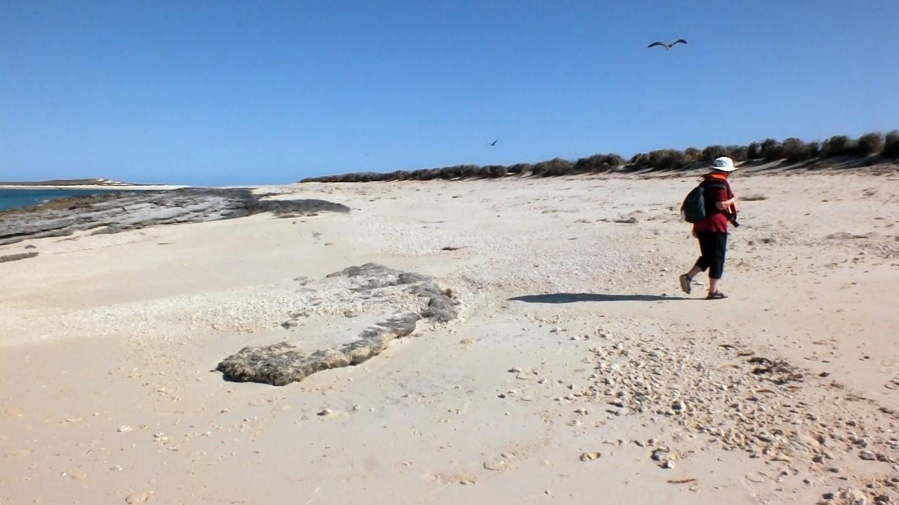
Our first stop after a night on the Caledonian Sky was at these islands that are the tops of a inundated coral reef which was covered when the sea levels rose a few thousand years ago. They are now a nature reserve for nesting birds, chiefly for brown boobies but also black-naped terns, noddies, pied cormorants, dusky oystercatchers, reef herons, and silver gulls (the only gull in this area). The tides determined when we could hope to land because the islands are very low in the water and are surrounded by submerged rocks and coral towers which must be sufficiently covered for even the Zodiacs to maneuver their way through the treacherous maze to reach the shore. Furthermore, much of the shore disappears when the tide gets high so the timing between enough water and too much is exquisite.
When approaching the 4 low-lying islets, they shine bone-white under the blazing sunshine in the cloudless sky. As we get closer, the white sand turned beige as we saw thousands of brown boobies on the flat area beyond the shoreline. Some of these inquisitive birds also flew loose order drills over our little boats checking us out. The other birds carried on their usual activities. We had been told that only a certain number of people can be on the islands at one time and we were cautioned not to pick up anything to take away. Only pictures are allowed.
Our Zodiac drivers timed their approaches well and we were all able to go ashore among the quite fearless birds and look at the detritus that littered the beach as well a few shells and the tractor-like patterns in the sand that indicated where the female green sea turtles had hauled themselves above the tideline to lay their eggs.
Some of the birds might be their enemies because they could dig up the eggs and eat them denying the turtles their reproductive rights. Low vegetation above the tideline was also the preferred space for the nesting birds.
In the years prior to the islands becoming a nature preserve, they had been exploited for guano mining. Lots of birds make lots of guano. The “lode” was so rich that even an American tried to stake a claim to one of the islands because Australia had not yet
claimed it officially. The U.S. Guano Islands Act allowed its guano miners to get rights to any unclaimed guano island more than 3 miles off the coast of any country. What arrogance, wouldn’t you agree? At any rate, the Australian government protested vigorously and the matter was settled by allowing the audacious Yank to pay a fine and leave the island immediately.
NECESSARY ASIDE
The U.S. Guano Islands Act of 1856 has never been repealed and indeed, was affirmed as constitutional by the Supreme Court in 1890. An expansive interpretation of the Act is the basis for our hold on Guantanamo in Cuba.
Over 100 islands have been claimed through this act in the years since its enactment and 12 of these islands are still held by the US in various parts of the world. The Act is vague and many thorny issues surround it. Read about it and learn something very disturbing from our history. The Act was last used by Leicester Hemingway, brother of Ernest, to lay claim to a spot in the Caribbean 9 miles off Jamaica to establish his own Republic of New Atlantis. His claim was struck down by the Supreme Court.
The islands were also used for a vicious practice called “blackbirding” as well. Aborigines were kidnapped and marooned on the waterless islands until they agreed to sign contracts to work in various industries, particularly pearling, on the mainland. Needless to say, the contract was not to the benefit of the aboriginal person who was forced to sign.
Ignorant of this dark past, we enjoyed the bird-filled islands and loved watching the antics of these now protected avian inhabitants.
NARES POINT &TALBOT BAY
The purpose in visiting this area of the Kimberley Coast was to ride Zodiacs through “The Gutter”, a very narrow channel in a fjord like gorge where our lectures on the geology of the area would be clearly revealed. The day was beautiful and waters calm as we went round Koolan Island (now an open pit iron mine). All around us were high cliffs showing synclines, anticlines, folded stratified rocks. The layering was dramatic, but the power of volcanic upheavals and tectonic plate movements was staggering. The 300 thick layers of sandstone and limestone were twisted in complete circles, arches, and even pretzelshapes by these movements. It is probably beyond comprehension that our seemingly solid earth could be shaped and reshaped as though it were a child’s clay ball!
As we floated through the gorge, we were accompanied by humpback dolphins, a humpback whale mother and calf, snubnose dolphins, and Indo-Pacific bottlenose dolphins too. Ospreys soared overhead and we strained our eyes for a glimpse of a dugong (close relative of the Manatee) and an estuarine crocodile, but neither of these
species showed themselves. Our marine biologist remarked that it was not surprising because the waters are so deep in Talbot Bay that crocodiles are never easily spotted here and dugongs are secretive and shy.
In the afternoon, we were treated to a jet boat ride through the famous “horizontal falls”. They are a difficult phenomenon to describe but are a specific and exciting result of the enormous ocean tides galloping through very narrow passages between the cliffs. These horizontal falls actually are created because the seawater must squeeze through two very narrow gaps in the McLarty Range that forms the back part of Talbot Bay. The seaward gap is 65 ft. wide and the inward one is only 39 feet wide. Needless to say, the huge tides, either incoming or outgoing, cause water to pile up at the gaps creating a horizontal wall of water. The day we visited the area, the tides created a 6 feet high wall of water at the wider opening and an even higher one of about 10 feet at the narrow one. Whirlpools and eddies and dizzying swirls develop on both sides of the two gaps making a “run through the gaps” on a jet boat an exciting experience.

Because the water wall was so high in the second gap our driver elected not to try to take us through those mighty waters so we only passed through the first. The boat was flung about by the waves and the whirlpools and it seemed we would crash into the sides of the gap at any moment. This jet boat was not small or light like our zodiacs so its frantic trip through the gap was very exhilarating. Sometimes the water coming at us was so strong that the boat seemed to stand still despite its two 350 HP engines pushing hard and struggling to move forward!
That experience made it clear that although volcanic action and tectonic plate pressures combined to create the sublime geological features we were seeing, that the powerful oceanic tides also had, and continue to have, a large part in shaping this surreal landscape.
ANCIENT ABORIGINAL ART
The aboriginal rock and cave art painted by the ancient & modern peoples of Australia constitute the longest continuously practiced series of artistic traditions in the whole world today. Many sites contain artwork of indeterminate age since these people are considered to have been in Australia for 50,000+ years. No scholar has been able to convincingly pinpoint the era in which individual rock art has been created. Carbon dating has been attempted but that technique only gives an estimate of the age of the rocks, not the artwork produced on their surfaces. Some internal evidence in individual sites and pictures can give ideas about the age such as when animals which are now extinct (and the approximate time of their extinction is known) are depicted. Drawings of what are obviously white men and sailing vessels of European origin can assure the experts that these paintings were done after “contact” (when Europeans first appeared in the world of the aborigines).
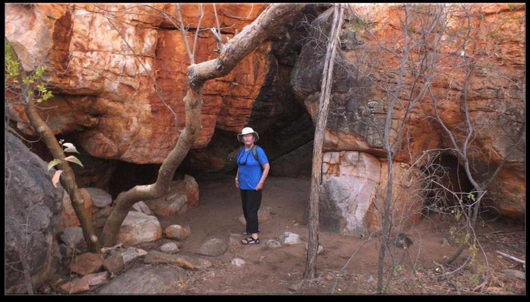
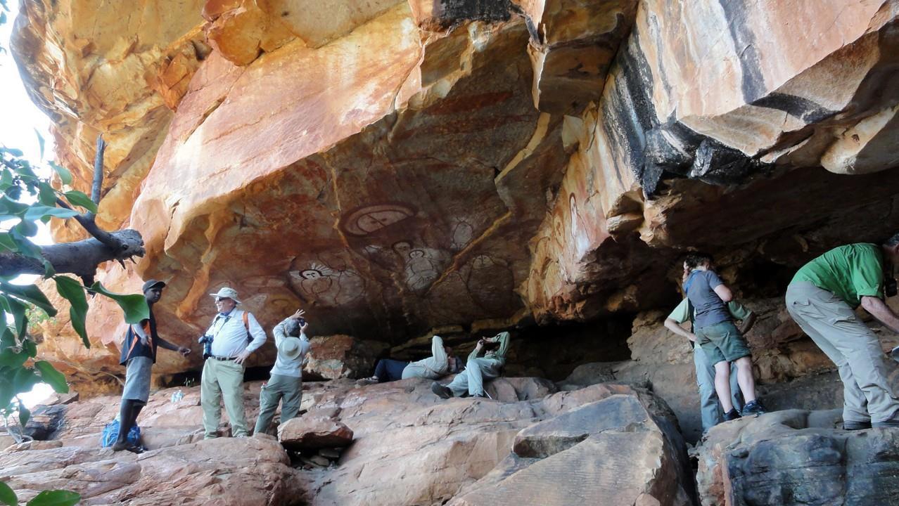
At three different sites, we went to explore examples of prehistoric cave drawings created by different aboriginal peoples. No one has been able to pinpoint exactly how old these artifacts may be. Estimates range between 17,000 and 50,000 years old. Though current aboriginal tribes certainly are aware of these sites, their oral traditions are not useful in any dating efforts. The aboriginals consider them sacred and protect them on their own lands but do allow tourist visits to them, so we were not guilty of trespassing.
Raft Point
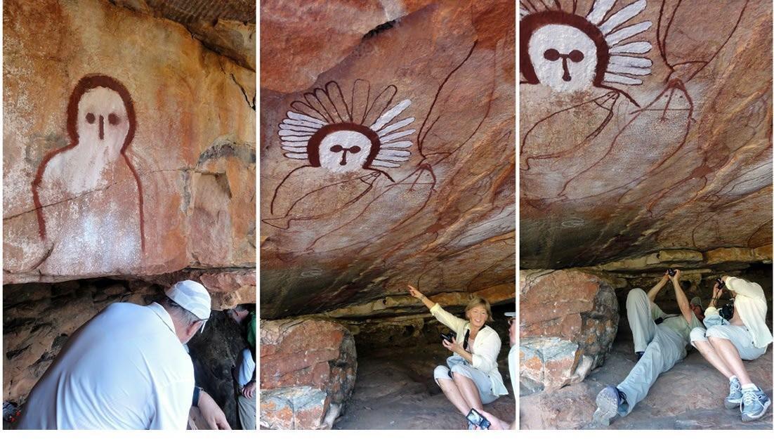
The first site we visited was Raft Point. The cave paintings here are attributed to the Wandjina peoples and current aboriginal guides describe the mysterious moon-round, blank white eyed faces with no mouths as “spirit people” from the Dreamtimes. When asked why they have no mouths to speak their wisdom or advice or experiences of the sacred, the guides say they have no need to speak because their power is so great.
Though the great white faces floating on the vivid red sandstone walls arrest our attention first, further examination reveals portraits of animals emerging from the walls: sharks, dugongs, even crocodiles. These animals are drawn with great finesse and artistic accomplishment. It is clear from the representations that the vagueness of the humanoid figures is not due to an inability to recreate in art such a form. The dreaminess and mystery is certainly deliberate.
Jar Island
A few days later, we explored Jar Island where another large collection of ancient aboriginal art (the Bradshaw grouping) was contained in two galleries that were under overhanging ledges. These pictures were created by the Gwion Gwion people, according to experts. As always, no one can accurately date these paintings either, but they definitely looked very different from those created by the Wandjina folks.
There were human figures and animal representations visible but the animal figures were much harder to identify. They seemed less “finished”. More like suggestions than realistic depictions. As we studied the walls more closely, we could see fish emerge from the dark red backgrounds, but it was not as easy to decide on kinds of fish as it had been at Raft Point.

However, the human figures were much more perfectly drawn. Though faces were not individualized, the costumes and other anatomical features were specific. All the figures were quite tall and attenuated, rather like Giacometti sculptures. Their carriage was elegant and even kingly. Their long robes were decorated with tassels and cinched by decorated waistbands. Their hands were graceful with slender fingers. Realism was easy to question however when we noticed that some of the figures had 6 fingers on each hand. Each human portrait also wore an elaborate headdress such as might befit a chieftain or ruler of some sort. The mysteriousness of these drawings, since not even people who have studied them for years have been able to decipher their meanings, remains but the puzzles added to the feelings we had when contemplating such ancient artwork.
Ubirr
The third suite of aboriginal rock art we examined came along later during our post-trip extension which took us inland into the Northern Territory (a separate governmental entity from Western Australia) Ubirr in Kakadu National Park. This site consisted of three separate galleries under rock outcrops at different levels as we ascended sacred Ubirr Rock.
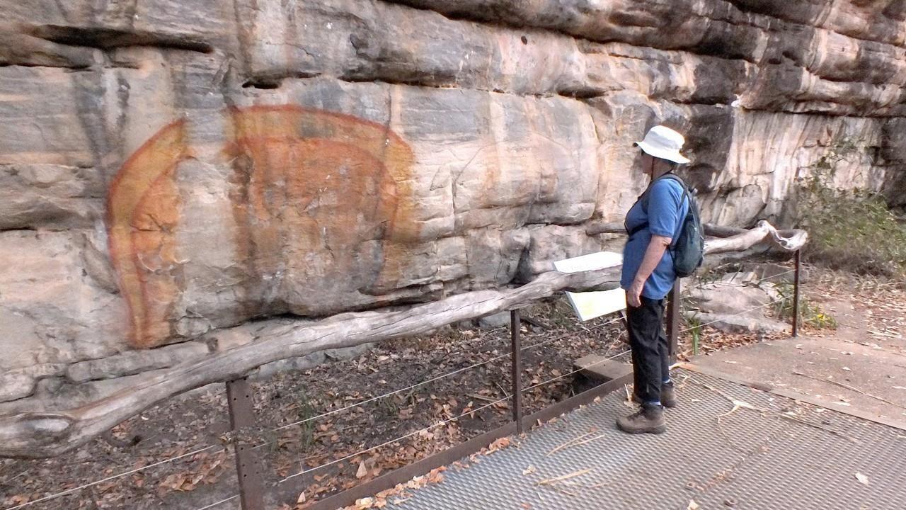
This site was quite different from the other two we visited because it consisted of drawings so old they are lost in the mists of time and much more modern ones, even up to the present when current aborigines have either drawn their own pictures or painted over earlier ones. Because of this practice, scholars have been able to sequence these since they depict events that can be dated. Classifications for differing types of drawings based on style and/or content have been proposed. So we have Pre-estuarine styles (meaning ones which came before the first big sea level rise), x-ray types (means internal organs of men and creatures are drawn inside the exterior bodies), and the aforementioned “contact” ones.

As one would expect, all these different styles are indicative of the long period of time the aborigines have inhabited this continent. Many of these rock paintings are still considered sacred to these people and it is generous of them to allow foreigners and other tourists to visit sites. Presumably, some of the current populations may understand more of the mysterious drawings than they want to discuss with outsiders. For instance, one very important painting we were allowed to see was of the Rainbow Serpent a creation goddess present in the Dreamtime who helped create the earth. Her depictions and stories about her have always been the preserve of aboriginal women no males were allowed to see this art or hear the stories and that is still true
today. However, both men and women tourists are permitted to view them and are given some indication of what the drawings mean to the aboriginal people today.
The visit to this site culminated with a climb to Ubirr Rock to overlook the valley below.
PHENOMENAL SIGHT: MONTGOMERY REEF
When we told that our afternoon Zodiac ride one day would be to view Montgomery Reef, we had no idea what that meant. Neither of us had ever even heard of the place, but we figured it would something like a mini-great Barrier Reef only on this Western side of Australia instead of the East Coast. Well, it turned out that we went out on 9/18, the same day we had visited the Raft Point aboriginal cave art already described.
Our ride out was very long, probably about 45 minutes, but over a fairly calm sea and under another sky afire with unfiltered sunlight. Water colors were so lovely and everchanging so the ride didn’t seem that prolonged. But even we “arrived” we couldn’t see
anything because we were in open ocean just aimlessly floating about and eagerly watching some shore birds picking their way around some sand bars which are only temporary given the big tidal changes.
It was clear that we were riding an outgoing tide that was moving very quickly so the bars became larger as we watched. Then we looked out to sea again and a great grey ghost seemed to be looming on the horizon and growing larger and larger as we sat gaping. As the tide sped along, details on the enormous structure began to come clear. There were pools on top, stair step formations along the sides, terraced ledges and seawater pouring off everywhere in stupendous amounts. There were “waterfalls” forming at the top of the reef and spilling in leaps over the sides. We were still a bit unsure just what was happening. But as more of the structure emerged, we began to understand.
Montgomery Reef is actually a 154 square mile deal coral reef that was formed when the sea levels were higher than they are today. As the water levels lowered, the reef was exposed to too much sunlight and dehydration and began to die, just like what is happening to many of our coral reefs around the world today. Even though the roaring tides have ripped across the reef every day for thousands of years, it has not been worn away. Today, at every low tide, it rears its bulk from under the waves and stares with its “dead eyes” into the sun again. Though it appears to be “rising” during low tide, it is actually being exposed because the tide is running out, baring it to the open sky once again.
Today, there are some few living coral colonies on the reef, they are miniscule and are never exposed nowadays. However, even today, sponges, octopi, reef fish, sharks, and
mantas call it home. In addition, the reef still teems with life at low tide. Turtles and fish and myriad other sea creatures are stranded in pools atop the reef when sea level is low enough and these become a buffet bar for the many birds which know the tidal cycle and appear in the sky when the reef is up. They land on the reef and have a feast on the trapped creatures. Turtles are usually large enough to either escape the depressions or scuttle to the curving downward slopes so they can slip safely into the ocean again.
We saw reef herons patrolling the depressions along with silver gulls and terns. Montgomery Reef still supports life in abundance and we were sure that the part of structure that is always beneath the waves is no doubt providing food and shelter for many sea creatures, though perhaps different ones from its earliest incarnation. It was a truly mind-bending experience to watch this huge formation appear in the open ocean!
EXPLORING RIVERS, FALLS,GORGES, AND PLATEAUS
In some significant ways, a visit to the Kimberley is like a visit to Antarctica. How, you may well ask since one is frozenly cold and blindingly white and the other is crushingly hot and blazingly red. Well, here are a few similarities: both support relatively few species of animals who have adapted to live in their harsh environments, both are fenced by very high and forbidding cliff faces, and most significant to explorers, there are very few sites for safe landings. Consequently, if you meet a fellow tourist who has been to Antarctica and ask him about where he was able to get out on land, you will find that his answer matches the places you were able to stand on the land. There just aren’t that many different places for a Zodiac to land its passengers safely.
In the Kimberley, much of the exploration is done from ships, boats, and zodiacs from which you only occasionally alight. Rivers, both their deltas and their stunning gorges are good examples of this type of “touring“. Waterfalls are often seen only from the boats. Plateaus with interesting formations and views too must be visited in restricted fashion.
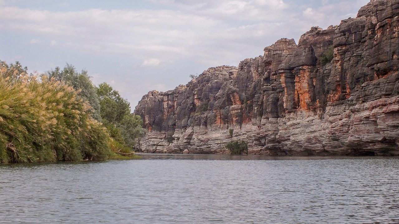
With the rivers and their gorges and waterfalls, there was a certain similarity among them all. The rivers are slaves to the oceanic tides and consequently exhibit the enormous tides already discussed. The huge sandstone and limestone cliffs through which the rivers carve their courses are alike in their vivid colors, their startling geologic features, their definite linear depositions of soils throughout the millennia. The differences lie in the heights the cliffs reach, the richness of their layering and the drama of their responses to the geologic, volcanic, and water forces that have acted upon them. That does not render them any less magnificent and unique in the world, but it does make it unnecessary to describe each one individually in such a journal as this.
The rivers we toured were the Prince Regent, the King George, the Hunter, the Ord and the Fitzroy. There were also many tributaries whose names did not make it into my
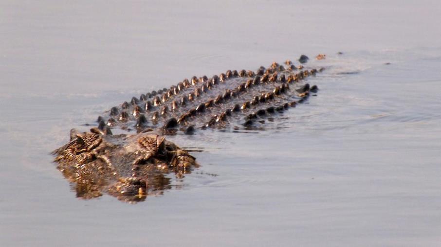
handwritten journal. They were all marvelous to see and we were treated to many wonderful sightings. The animals included saltwater crocodiles, freshwater crocodiles, wallabies, whales, fishes of many varieties and several varieties of colorful birds. The persistent and hardy mangroves were also features of the boat rides. Several different varieties live on this coast and all must be very strong to survive the enormous tides. All have white salt lines on their trunks testifying to those ever-swirling waters.
Freshwater Crocodile
Mitchell Falls
One exciting place we reached was Mitchell Plateau, but we had to ride in helicopters for about 20 minutes to reach this unique spot. The four-leap Mitchell Falls was included in the tour and we were dropped off on the plateau to walk about and explore the rock formations, the views from the heights and the plunge pools.
The Plateau is rugged and hosts many different plants and animals. We saw the trees & bushes but never saw any mammals and very few birds. But the amazing views
compensated for those deficits. The falls were full even though we were visiting around the end of the dry season. We could clearly see there were four cascades from top to bottom and the pools were varying colors of green. We, however, did not venture into them though we had been assured they would be no crocodiles of either the freshwater or the saltwater variety.
Ord River and Argyle Lake
The Ord River trip deserves special mention because of what man has wrought here. It is a huge river with lots of flow from the mountains and the 35 tributaries that feed into it. The river is 198 miles long and has a catchment area of 17,799 square miles.
The Ord River Irrigation Scheme was started in the 1920s has remained a project throughout the twentieth century. Two different dams are involved in the plan, one creating Australia’s largest artificial lake, Lake Argyle. The other dam holds back the waters of a natural lake, Lake Kununurra.
Thousands of acres of arable land are now provided adequate water, a bird preserve thrives, and hydroelectric power is provided to meet all of the town of Kununurra’s needs. There is considerable controversy at present because it would appear that a Chinese company has won a big to develop a large tract for growing chiefly sugar cane to be shipped back to China. A sugar processing plant is also part of the 50-year lease. There is considerable unrest in the area about the Chinese having won the bid but it was unclear what the resolution will be at the time we visited.
WYNDHAM
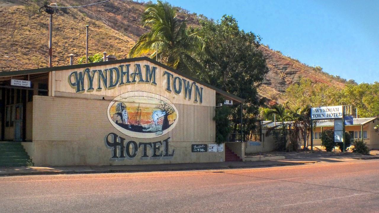
Our last destination before leaving the Kimberley area by ship heading for Dili, East Timor (this will be explained later) was the tiny but oldest town in the area Wyndham. The town was founded in 1886 in response to the gold rush at a nearby river crossing. That gold find was played out in a couple of years and the town fell upon very hard times, depending only upon some cattle stations for survival.
An abattoir operation gave the town new life in the 1920s and that lasted until the l960s. When the meat works was closed, the town was in big trouble again. It was even attacked several times by the Japanese during World War II. Discovery of nickel and iron ore resulted in mining operations nearby ( by Australian standards) which required a port operation. The port was still operational from the old cattle shipping operation and was deemed appropriate for the shipping needs of the mines. Because of its importance in the past better days, the little town of 800 people (half “white fellas” and half aboriginals) today still has a hospital, 4 schools, a government office, a post office and a dam to insure a steady water supply.
Wyndham enjoys (endures) a tropical climate with some of the hottest temperatures in Australia—often above 90F for many days. There are monsoon rains in the wet season that can result in major flooding and the land around the town is basically uninhabitable due to little soil, rough terrain, and extreme weather conditions. Located on the Gulf of Cambridge that is the catchment area for 5 major rivers in the area, the town now is split in half with the lower half being the port area and the upper level providing residential property less apt to flood.
Our 15-minute walk from the port to the Port Center made us feel that we were walking on a waffle griddle. The very ground seemed to be roasting and the road surfaces seemed to be melting. How anything can live in this oppressive climate remains a mystery to us. The townspeople were welcoming to us and seemed sane, but that may be open to question.
A Road Train Barrels through Town
Australian shipping regulations (like those of the USA) require that passenger ships cruising in Aussie waters not flagged in Australia must visit at least one other international port on every trip. Since the Caledonian Sky is registered in the Bahamas, she was required to visit another country. The closest foreign port was located in the capital of the tiny country of Timor Oeste and that is where we would sail. First, we had to clear customs and have individual face checks in Wyndham before we could leave the country and return for the rest of our voyage.

The voyage to Timor Oeste took two sea days, about 4 hours in the Dili Airport with customs checks there, while we awaited our chartered flights back to Darwin, Australia to complete our Zegrahm core trip. Silly, really, but we usually enjoy the sea days for relaxation and reading and this was no exception. Dili appeared to be a small third world town, poor, but not destitute, and it did provide us another country to add to our list.
DARWIN
For the Zegrahm passengers who had already taken the pre-trip option to visit Kakadu National Park and other sites in the Northern Territories, their adventure would end in Darwin. For those of us who would do the same itinerary but as a post trip extension, Darwin was our “jumping off” point for an overland trip. So all of us would be disembarking the Caledonian Sky in Darwin after the sea days and our “visit “ to Timor Oeste before flying back.
The northernmost city in Western Australia, Darwin is a modern and vibrant city of 130,000 people. It really is modern too even though it had started out as a very small pioneer outpost in the 1800s. However, it expanded in area and population since the visit of the Beagle with its namesake aboard, it has suffered from widespread damage from World War II when the Japanese bombed it many times. The first bombing should resound in American’s minds because the same 188 planes that bombed Pearl Harbor bombed this Australian city just a day later. Not many civilians actually lost their lives in the attacks, the infrastructure including homes and business were heavily damaged. Like a slightly bedraggled Phoenix, Darwin rose again and rebuilt itself though it remained a small and relatively unimportant town in the Top End. Why then do we say it is modern? It was 70% destroyed again in 1974 by Hurricane Tracy. Because of the extensive and catastrophic damage, the whole town had to be rebuilt. Even old stone buildings earlier times could not stand the strong winds associated with Tracy, even though they had endured the bombing sorties. After Trace, the government had more money and help Darwin rebuilt again and its importance in the area had become clearer. So today, Darwin’s commercial center is full of new structures and a busy retail life.
Today, besides being the capital city of the Northern Territories it is also the regional center for the whole “Top End” as the Aussies label this part of the continent. It has a busy airport, still is important in shipping, has developed a vibrant cultural scene with performance venues for dance, classical and popular music, an important museum, and a bustling commercial center.
We enjoyed a day in the city before our post–trip group boarded buses to begin the drive to Kakadu National Park.
THE “BUSH” OF THE NORTHERN TERRITORIES
Aussies have a couple of good names for their interior sparsely populated areas: the bush is one of those epithets and the outback is another. It seemed that in Western Australia, the preferred term is “bush.” Our post trip extension took us through a very good sampling of what this “bush” is like.
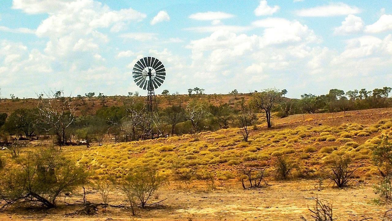
I remembered that in Broome, the locals called the areas outside the town itself the “pindan”. This term, from an aboriginal language, is used to specify the red-soil landscape in The Kimberley. The trees here are short and twisted with very deep roots so they can survive the hot and dry season. There is an understory of shrubs and grasses, such as the spinifex (grass with tiny hooks along the blades that catch at your skin or pant legs as you walk through it).

The area also hosts a huge insect population, especially termites. We were told that there are 200+ species of termites in the Kimberley and we certainly many different shapes and sizes of termite mounds. My favorites were the muffin-shaped ones that really did look like muffins just out of the oven little round pillow shaped lobes above the “stem.” There were conical ones, ones with jagged spires that looked like ruined Cinderella castles, round ones, and tall skinny ones resembling dead trees. Of course, the colors ranged from ochres to flaming reds depending on the soil type and color. Unlike termite mounds in Africa, very few of them seemed to form about living trees or fence posts usually they were freestanding.

Soil quality also seemed to determine how widely spaced the trees and shrubs appeared to be. Though many patches of land were so sparsely vegetated that they almost looked like desert, there was no balancing opposite of thick forest or bush sites. There’s too little rain and probably very poor soil in The Kimberley.
As we rode through the various kinds of “pindan”, we were disappointed, but not surprised, at how few animals we saw. However, we were visiting at the end of the dry season. Perhaps they had moved further inland where there were water sources. The “forests” and grasses also looked almost dead almost everywhere we passed leaves were drooping and shriveled, turning yellow and brown. The scenery brought home what a dry place The Kimberley is for most of the year!
KAKADU NATIONAL PARK
The park, a UNESCO World Heritage Site, was a point of interest to us that turned out to be a little underwhelming, but again it may have been due to the season of the year we were visiting. However, there were two significant discoveries for us there.
The Holiday Day Inn Crocodile Motel: This amazing property had been built in the shape of a crocodile and it was easy to see this shape even from ground level. Aerial photographs in the lobby showed the conformation more clearly, but the whole concept was clever and enjoyable. Even the eyes were special because they were lighted in such a way that they glowed yellow-orange once the sun sank down the sky.
We saw the aboriginal art at Ubirr already discussed and took two very enjoyable boat trips on two different bodies of water while in Kakadu as well. One was the Mary River Wildlands Wetlands Excursion and the other was the Yellow Water Cruise. We saw many different birds and lots of crocodiles, both freshwater and salties on both of these outings. But must admit we were a little disappointed at the size of the biggest salties floated among we had expected them to be much larger!
FLIGHTSEEING IN THE NORTHERN TERRITORIES
After our two nights at Kakadu, we went to the local airport to take small plane excursions from the park to the little town of Katherine. The flight was about 2 hours and took us over some truly amazing terrain. We saw two falls, Jim Jim and Twin Falls, or at least we saw the cliffs over which they usually cascade, but the dry season had taken its toll and there were very meager ribbons of water to be seen.
The flight continued over Arnhem Land where the aborigines hold most of the land rights but it was rather like visiting our Indian Reservations in the Southwest and Montana no one else would want the land they have been given! Arnhem Land looks hostile and unforgiving. Travel there has to be grueling and the territory was so dry that it appeared nothing much could survive the drought time.
The Arnhem Land escarpment led us to the Katherine Gorge that is actually a series of 13 different gorges that are beautiful because of their configurations, their colors, and their awesome severity. One of the most striking things we saw while flying over this enormous and desolate landscape were the eucalypt trees. As an adaptation to protect them against the fires that sweep the area during the “dry” season, these trees have no bark in their crowns. This causes the trees to look like ghostly creatures lifting their skeletal chalky white arms to the heavens in some sort of sad supplication to the relentlessly cloudless blue skies and the burning sun. The whole scene was melancholy and hopeless.
Nevertheless, then, these unhappy scenes would be broken by some unexpected green bushes and scrubby trees winding along in a thin line where obviously there was underground water to keep them alive and healthy. The escarpment was dramatic but its colors were not nearly as deeply red as the cliffs on the coast.
Katherine River and her gorges were filled with water such an astonishment. However, like lakes and rivers in other very dry places, the land around the waters did not benefit at all from the stored waters. The desert-like ground went right to the water’s edge with no break in the dry sandy terrain. We had seen such a phenomenon before in the desert places of the world, particularly pronounced in Patagonian Argentina.
KUNUNURRA
The rest of our trip to the little town of Kununurra was completed in a coach in about 5 hours. This really is a new town it was established in the 1960s as part of the Ord River Irrigation Project. Now about 7000 people live there permanently but it is an important tourist destination for both Australians and foreign travelers.
The economy today is based on agriculture (huge Indian Sandalwood plantations), fruits and veggies are important crops too. There is also the largest open-pit diamond mine on the planet that employs a good number of folks. However, it appears to be playing out according to our guide and will probably close down in the not too distant future. A very controversial Chinese lease of a very large parcel of land to be irrigated through the Ord River Irrigation System had been concluded in the months before our visit and there were signs around the town still shouting in capital letters against the lease and the product which the Chinese are planning to grow sugar cane. Part of the protests are against the Chinese having a lease on any land in the area, and against their using the water of the Ord for products that will be sent home to China, and the local farmers hate the fact that now there will be two significant monoculture projects in the area: the sugarcane and the sandalwood.
How it will all end is a question but the lease apparently has been signed so it is probable that the local protests will never amount to anything.
Kununurra is populated about half-and-half by “white fellas” and aborigines (incidentally, it appears that “white fellas” is the label the white Aussies use for themselves in this heavily aborigine-owned part of the continent). We saw many aboriginals in the town, using the parks, along the city streets, and shopping in the few stores that were open while we were there (a late Saturday afternoon arrival on our part revealed that the town pretty much shuts down around 4 p.m. to start the weekend).
My Wal-Mart special wristwatch ($12.00) had died a few days before we reached Kununurra and I am lost without knowing what time it is. We found a Target Community store that was still open (and yes, it is our familiar Target brand) so I bought a $15.00 watch there prices are very high in Australia! So far it has been working for about 6 weeks. Let’s hope it is as long-lived as the Wal-Mart one it lasted a year.
Near this little town is another national park, small but interesting Mirima National Park. It had lovely trails leading up some challenging rock formations and the reward for the hikes was the marvelous view of the surrounding terrain.


