PORTFOLIO
T RINE THOMSEN
Landscape architect, cand.hort.arch

TRINE THOMSEN
Landscape architect, cand.hort.arch
As a graduated Landscape architect from the University of Copenhagen, I am passionate about creating sustainable development within design, landscaping, and urban planning. During my studies, I worked on various projects that allowed me to develop my skills in the field, both through academic work and practical experience.
I am a patient, dedicated, and engaged individual who consistently strives to be the best version of myself. As both a person and a colleague, I am committed to delivering quality in everything I do and am highly motivated by opportunities for personal and professional growth.
CONTACT
+45 26 35 36 17
Trine-thomsen3@hotmail.com
Linkdin: https://www.linkedin.com/in/trine-thomsen-bb1817322/
Copenhagen, Danmark 1995
EDUCATION
MSc Landscape Architecture
KU,UniversityofCopenhagen 2022-2024
In the Master’s program Landscape Architecture, I have gained in-depth knowledge of planning, design, and management of both urban environments and landscapes. The program has equipped me with the tools to create future attractive and sustainable urban spaces, residential areas, parks, and landscapes. I have specialized in Landscape Design.
Master thesis: Design proposal for a new urban landscape of Næstved Harbor. The proposal is created through the transformation of a post-industrial area.
Relevant courses: Design by Management, Transformation Studio, Miljø- og planlovgivning - natur og by, Urbanism Studio, Landscape Studio
BSc Landscape Architecture
KU,UniversityofCopenhagen 2019-2022
In the Bachelor’s program in Landscape Architecture, I have gained a solid academic foundation in planting, design, planning, and analysis of cities, urban spaces, and landscapes. In a creative academic environment, I have worked with fellow students on design and planning tasks, which has enhanced my ability to collaborate and think innovatively. My final Bachelor’s project, carried out in collaboration with my internship host, Gottlieb Paludan Architects, has provided me with practical experience in solving real-world challenges.
Bachelor’s project: Designforslag for to forpladser ved Ny Ellebjerg st.
Relevant courses: Beplantningsdesign Håndværk & æstetik i landskabsarkitektur studio, Byplan StudioStrategi og Design
Diplomingeniør Bygningsdesign
DTU,TechnicalUniversityofDenmark 2018-2019
After completing the first year with engineering and architectural knowledge in building design at DTU, I decided to switch to Landscape Architecture at the University of Copenhagen to incorporate more nature into my higher education.
Relevant courses: Ingeniørarbejde - fra dele til det hele, Arkitektur og teknologi.
Krabbesholm Højskole Skive Autumn2015
A valuable experience that has sharpened my creative thinking with the subject of Architecture.
WORK EXPERIENCE
Pizzaiolo at Gorms Pizza Tivolifoodhall 2017-2024
Intern at Gottlieb Paludan Architects Copenhagen,Nordhavn Spring2022
Participated in design processes and collaborated with experienced professionals.
Developed skills in research, sketching, modeling, presenting design solutions, and strengthened my abilities in creative problem-solving and interdisciplinary collaboration.
Sales assistant at Hvisk Copenhagen 2017-2018
Service assistant a Shell/Cirkel K Kildebjergsyd 2009-2017
SOFTWARE COMPETENCIES
Adobe pakken, Indesign, Illustrator og Photoshop AutoCAD
Office pakken Rhino (Insight) Revit (Insight)
COMPETENCIES
Design and Planning
Interdisciplinary Collaboration
Plant Knowledge
Analytical and Structured Environmental and Sustainability Focus Local Plan Understanding and Building Regulations
LANGUAGES
Danish - Native English - Fluent
01 NÆSTVED HARBOR
Anewurbanlandscapecreatedthroughthetransformationof apost-industrialarea
Acadimic project, Master thesis: february-june 2024
Group work: Kit Sandra Christensen
Supervisor: Peter Lundsgaard Hansen og Lærke Sophie Keil
LINKEROEVER PARK
Acadimic project: april-june 2023
Group work: Jonas Rued Jensen, Mie Risager Nielsen and Olivia Kuhlmann Gehl Course: Landscape Studio
KLAKSVIGSGADE
Portrayingdynamicvegetationdesign
Acadimic project: september-november 2023
Individual work Course: Design by management
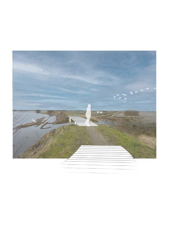
FLOODPLAIN PARK RIBE
Adialoguebetweennaturalandcultivatedlandscape
Acadimic project: february-april 2023
Group work: Aske Holt, Johannes Harder and Theresa Trüper Course: Transformation Studio
page:11-14 page:15-18
page:19-22
page:??
page:5-10 02 03 04 05
Abstract
NÆSTVED HARBOR
Anewurbanlandscapecreatedthroughthetransformation ofapost-industrialarea
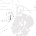
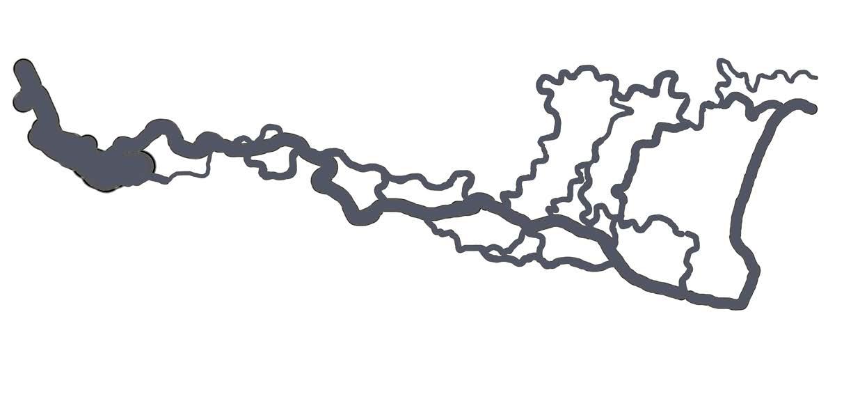
Location: Næstved harbor, Denmark
This is an excerpt from our master thesis consisting of an analysis, vision and design proposal for Næstved Harbor’s transformation into a new recreational urban area, based on Næstved Municipality’s decision to relocate the industrial harbor and repurpose the site as a new urban area. The design proposal envisions the post-industrial harbor as a recreational urban space by establishing connections through the harbor to the surrounding city, revitalizing the area with landscape typologies, and enhancing its existing identity
The design proposal suggests a masterplan for the new urban area featuring a landscape plan, new built structures, recreational areas, preservation of the harbor’s identity, access to water, and improved connectivity. The transformation aims to merge the existing post-industrial harbor’s identity and qualities with a new urban landscape. This is achieved by preserving some existing built structures and transforming them into functions that support the urban environment and to preserve the harbor’s identity. New landscape typologies and green structures are introduced to create varied spatial expressions and enhance recreational areas. Residential areas are harmoniously integrated within the site by the new built structures, and access to water is improved through the addition of a harbor bath, promenades, and platforms. Connections are established both internally and with the surrounding city, physically through pathways and visually through materials and green structures.
Illustrations: Conceptual design, Program, Vision, Materplan, Detail plan, Section, Visualization, Structure diagram.
Group work: Kit Sandra Christensen
Software uses: Illustrator, Indesign, Photoshop, AutoCad, GIS, Dataforsyningskort.
Location:NæstvedMunicipality,Zealand Projectsite


Concept
The main concept for Næstved Harbor, derived from the vision for the design proposal, is divided into four components that together constitute a new harbor area with a connection between the qualities of the post-industrial harbor and the new urban landscape of Næstved Harbor.
Theexistingbuiltstructureandtheharboredgelead thedirection
Newlandscapetypologiesareintroduced.
Newbuiltstructuresareadaptedtothelandscape typologies.
Connectionsarecreatedinternallyandtothecity.
Theexistingbuiltstructureandtheharboredgeleadthe direction
Newlandscapetypologiesareintroduced.
Newbuiltstructuresareadaptedtothelandscape typologies.
Connectionsarecreatedinternallyandtothecity.
Parking
Amphitheater
Pedestrian
Cinema

MaglemølleA/S RessourceCity
MaglemølleForest
Promenade
SiloCommunity HouseandCafé
Playfacilities
Multihall andcafé
Næstved
Klatrecentralen
Supermarket
MatchPadel
Rundfart Friheden
BedandBreakfast
Structures for the recreational urban spaces
These urban spaces are crucial elements of the site, contributing to social cohesion, environmental sustainability, cultural enrichment, and the overall well-being of residents. Within the site, there are urban spaces designed for everyday use, as well as spaces that serve as destinations for residents and visitors with specific purposes, such as event spaces, cultural venues, and recreational facilities, which often have the capacity to accommodate larger gatherings.
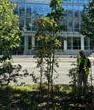
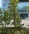
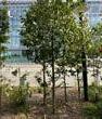
Residentialareawithintimatespacesbetween thebuildingsandaccesstothepromenade.
Residentialareawithintimatespacesbetween thebuildingsandaccesstothepromenade.
Residentialareawithintimatespacesbetween thebuildingsandaccesstothepromenade.
Residentialareawithintimatespacesbetween thebuildingsandaccesstothepromenade.

Residentialareawithintimatespacesbetween thebuildingsandaccesstothepromenade.
Residentialareawithintimatespacesbetween thebuildingsandaccesstothepromenade.
Transformedbuilingintoacommunityhouse
Transformedbuilingintoacommunityhouse