
www.naturns.it Holiday Guide EN Headoffice: 39025 Naturno Main Street 12 Tel. +39 0473 671 671 | www.rkuv.it ATM: Naturno, Plaus, Ciardes, Castelbello, Senales SCAN ME


CABLE CAR UNTERSTELL NATURNO www.gruener.it Hiking at the Sonnenberg Mountains Tel. +39 0473 66 84 18 - www.unterstell.it Etsch / Adige Schnalserbach Senales Rio Etsch / Adige N RATISIORATHEIS TSCHARS CIARDES TSCHARS CIARDES CIARDESTSCHARS VALSCHNALSTAL SENALES sentiero - Wallburgweg Etschpromenade Sonnenberger Panoramaweg Sentiero panoramico Monte Sole acquale Waalweg acquale Waalweg sentiero - Pichlweg Kirchsteigallachiesa Vogeltennpromenade sentiero Rittersteig sentiero Jesus Besinnungsweg Alpine-Well-Fit-Parcours Etschpromenade/Passeggiatalungol’Adige sentiero Wallburgweg Tschirland Cirlano 578 m Tabland Tablà 674 m Kompatsch Compaccio 540 m Staben Stava 553 m Reschenpass Passo Resia Stein Meran Merano Sonnenberg Monte Sole MonteNörderbergTramontana NATURNS NATURNO 554 m PLAUS 519 m Sonnenberg ST. OSWALD SAN OSVALDO ST. NIKOLAUS SAN NICOLÒ ST. ULRICH SAN ULRICO HL. MONIKA S. MONICA PFARRKIRCHE ST. ZENO SAN ZENO LIEBFRAUEN N.S. DI STAVA SCHLOSS DORNSBERG CASTEL TARANTO HOCHNATURNS CASTELLO DI NATURNO ST. PROKULUS SAN PROCOLO SCHLOSS JUVAL CASTELLO JUVAL ERLEBNISBAD ACQUAVVENTURA ERLEBNISBAHNHOF STAZIONE D‘AVVENTURA Schießstandweg ViaBersagl i o K u g e lg a sse Via delleBocce Lahnweg Lidostr. Via Tröger Trögerstr V ia S. Ybertracher-St r ViaTintori SandVia weg Damm Str. Via dellArgine Herrngassl Schlo ssweg Feldgasse Via V t Sg r e b e e l Kt s u g u A a i r Via lossweg Castello
Etschangerstr
St.-Ursula-
Am Graben Al
o t a s s o F St.-Zeno ViaS. Zeno -Str Kirchweg Via d. Chiesa V a i St.-Pro -St r E ichg asse Vi a Eich V ia Brun nweg Runst e s s a g R uns t Via V ia Steinweg ViaFallroh r weg Vi a Hilb Via V i a Drei Hilbstr. land weg Segheria weg V.
r e b r e G weg M üh l gasse VMulino Sch
STAATSSTRAS S E I NS SCHNALSTAL STRADASTATALE VAL SENALES Kompatscherst r Municipi o HAUPTS TR ASS E VIA PRINCIPALE V i a P -M itterh o ferS t r Recyclinghof Centro di riciclaggio Falkenstein Hilbstr e ß a r t s f o h n h a B V i a z a t S io n e V ia Gustav Flora HAUPTSTRASSE Via Hilb sberg Dorn weg Dornsberg Vi a V a G ö b e nwe g Unter m el s we g Fl o r ia n we g Erlenweg Vi a Gröb wegen Rettungsdienst Pronto soccorso VIA Via Sta zione Bahnho f s t r Kompatscherstr. ViaCompaccio R a th a uss t r ./ V i a STAATSSTRASSE NR. 38 kulus V o l l e t s a C a i dei Campi Burggräflerplatz
Burggräfler T d n a l r i h c s ViaCastello E lektri z it ä tswer k Azienda elettrica Bahnhof - stazione Seilbahn Unterstell Bahnhof stazione B a hnho sta z o n e Funivia Unterstell Unterortl Shuttl e u va l Tenniscamp Beach- Volleyball PRINC IPALE Färberweg Festplatz Campo delle feste o l o c o r P S Bike Park Gsindboden Hinzelweg Kinderarzt pediatria Fischerteich Laghetto pesca Via Lido Gustav-Flora-Str. iVWaie herweg Lorenzi Ruine NFP NFP 24h 24h Fun Park Bike Erlebnispark Parco avventura Arzt Angerer Schmerztherapiezentrum Dr. Christanell Tierarzt 1 2 3 4 A 6 B C D E F G H I J 5 1 2 3 4 6 5 A B C D E F G H I J Info-Point Ötzi-Bike-Academy Schloss / Castello E-Mobility Vinschgauer Bauernladen Bottega dei contadini Postamt / Ufficio postale Fahrradweg Pista ciclabile Nature Fitness Park® NFP Naturparkhaus Centro Visite Gruppo di Tessa Bushaltestelle / Fermata bus Bibliothek Biblioteca Minigolf Park Parco Minigolf Fahrradverleih Noleggio biciclette Apotheke / Farmacia Klettergarten / Palestra di roccia Info-Point Arzt, Zahnarzt, Weißes Kreuz Medico, Dentista, Croce Bianca Prokulus Museum Museo S. Procolo
V a Pedruiweg
Via Adige
Straße
AmGraben
Conciapelli
Säge
Piazza
5 Suedtirol Alto Adige Guest Pass
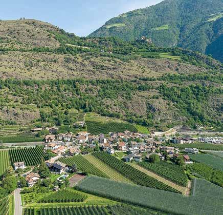
6 Naturno at a Glance
8 Picturesque Villages
10 The Neighbouring Village of Plaus
12 Texelgruppe Nature Park Hiking Experience
14 The Sonnenberg Mountain – A Hiking Paradise
18 Merano High Mountain Trail
20 Alpine Roses & Mountain Pastures on the Nörderberg Mountain
22 Tips for Hikers and Climbers
24 Themed Trails
30 Cable Cars and Chairlifts
34 Getting there by Bus and/or Train
36 Health & Wellness
38 Naturno Thermal Adventure Pool
40 Our Fridolin Family Page
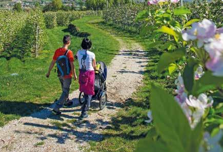
42 Buggy-friendly Hiking Trails in Naturno
44 Children’s Playgrounds
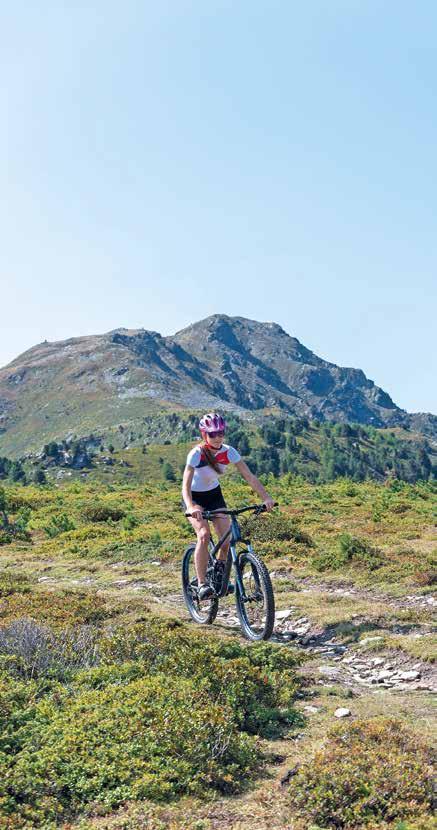
46 Leisure Biking, Road Bikes and MTBs
48 Mountain Climbing and Via Ferrata
52 Trail Running
54 Sports, Fun & Action
58 Sightseeing in Naturno
66 Sightseeing in the Surrounding Area
78 Hiking Suggestions
138 Vinschgau Valley – Merano Biking Region
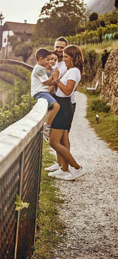
Would you like to join one of our organized cultural tours, or perhaps embark on a hiking or biking excursion using a shuttle service? You could also register for a guided visit to historical churches from the Romanesque period, home to some of Europe’s oldest frescoes. If any of these activities pique your interest, come and visit us at the Tourist Office to find out more.

Naturno/Plaus Tourist Office, Via Municipio/Rathausstraße 1, I-39025 Naturno/Naturns, Tel. +39 0473 66 60 77, info@naturns.it


Contents
3


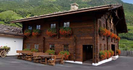
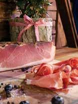
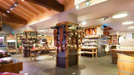
1Gift Adventure World with shop and museum Visit our shop with the unique Speck museum. On request, we offer you a great guided tour of the museum followed by a tasting of our delicacies. Right on the main street Stein 17, I-39025 Naturns phone +39 0473 671 008 | e-mail: info@moser.it | Moser Speck | moser.speck Onlineshop www.moser.it/onlineshop
Südtirol Alto Adige Guest Pass
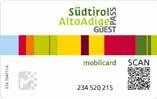

The “Südtirol Alto Adige Guest Pass – Mobilcard” is offered to guests (from 6 years) as a special inclusive service by the host (member of the local tourism organisation).
Included services
The following public transportation services and lines can be used free of charge by guests:


• Regional trains in Südtirol: Brenner/Brennero to Trento, Mals/Malles to Innichen/S. Candido, Ritten/Renon narrow-gauge railway
• Local busses (Regional- & City-busses), PostAuto Switzerland (Line 811 between Mals/Malles and Müstair) and VVT Directbus (Line 273 between Mals/Malles and Kajetansbrücke)
• Cable cars Mühlbach-Meransen/Rio di Pusteria-Maranza, Burgstall-Vöran/Postal-Verano, Vilpian-Mölten/VilpianoMeltina, Bozen-Kohlern/Bolzano-Colle, Bozen-Ritten/ Bolzano-Renon, funicular to the Mendel/Mendola
Good to know
• the landlords hand out the Südtirol Alto Adige Guest Pass to their guests
• is issued exclusively to all guests aged 6 and over
• children up to 6 years old do not require a Südtirol Alto Adige Guest Pass
• validity of max. 7 days per card (another card will be issued beyond this period)
• must be labelled on the back with name & period of validity
• must ALWAYS be validated
• excluded: long distance trains, bicycles and animals
NEW! 5
Naturno: Historical Background and Future Prospects
The Oldest Hotel in Merano and Environs
It might sound surprising, but Naturno is home to what is probably the oldest hotel in today’s holiday area of Merano and Environs. When the glaciers of the Ice Age receded around 9,000 BC, the early humans of that epoch found shelter in a rock cavern (known as the “Neuräutl”) on the Sonnenberg mountain above Naturno. Naturno remained a popular spot for thousands of years to come: Ötzi, the renowned 5,000 year-old Ice Mummy, and his ilk roamed this mountainous terrain. In the Bronze Age that followed the first settlements appeared around Naturno, primarily on the hill where Juval Castle now stands. The landscape was marked by receding glaciers, moraines, and alluvial cones – at a time when the Vinschgau Valley was subjected to the perilous sudden surges of the Etsch river. In what today are the fertile lands around Naturno, the violent flooding of the valley created a tundra-like swampland. During the Iron Age, inhabitants of the valley settlements retreated to higher ground where they were exposed to the harsh elements. This included the area along the “Wallburg” area on the Sonnenberg mountain in Naturno. The Celts who descended into these lands in the 5th and 4th centuries BC left hardly any traces – except for a few place names. Nowadays, academics still argue about whether the name “Naturns” originated from the Celtic “ana duron” settlement in the valley or whether it was derived from the RomanLatin “Nocturnis” (night station). Also settled around Naturno were the “Venost” Rhaetian tribesmen (whose culture and language disappeared around the 15th Century BC during the Roman conquest of the Alps) and who lent their name to the valley.
A mountain symbolising freedom
In the centuries that followed the history of Naturno and environs is largely unrecorded. Referred to as “Nocturnis” in ancient records dating from 1150, the settlement is also home to the renowned 8th Century Church of St. Proculus. This was a time when the castles of Hochnaturns and Dornsberg were being erected, just as the earliest farms coalesced beneath the Sonnenberg. One of these is the “Mauerbam”, where a rare original “Torggl” wine press is on display. Subsequently, the first mountain farms also apppeared. It took the hardiest farmers who cherished freedom the most to adapt to this inhospitable terrain, where they established themselves in isolation from the communities below. While the valley farmers were compelled to pay ecclesiastical and feudal taxes to the landlords, those in the mountains remained unaffected. When the typhus epidemic ravaged South Tyrol in the early 17th Century,
6
the population of Naturno was decimated. A separate cemetery was uncovered during archaeological excavations at the Church of St. Proculus, revealing the remains of 135 victims of the epidemic. Despite the hasty burial, the rites were performed with due reverence – although it took many decades for the population of Naturno to recover. After analysis, the relics taken from the plague cemetery were transferred to the St. Proculus Museum next to the church, serving as a testament of the horrors it wrought on this small mountain community.
Looking to the future
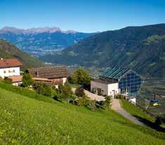
Following the two 20th Century world wars, the economy of Naturno entered a new era. The agricultural sector was transformed from subsistence animal husbandry, grain cultivation and small-scale viticulture, to intensive apple farming. This was facilitated by the introduction of large-scale irrigation systems and a concerted drive towards mechanisation. The 1970’s saw the start of a boom in tourism which encouraged the creation of new businesses and attracted others to Naturno. This progressive trend continues and is supported by a population that is steadily increasing. As tourism in South Tyrol rises to the highest standards, we are gratified that local businesses are thriving – enabling Naturno to gain international renown. With the local climate providing more sunshine than elsewhere around these parts, we take pride in welcoming visitors to a very special destination!
Tip: Juval Castle, Neuräutl and the Wallburg are connected by a well-developed system of hiking trails.
7
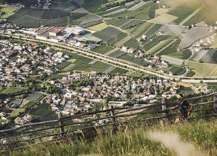
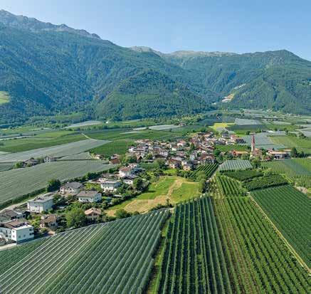
Picturesque Villages
Pay a visit to the satellite villages of Tablà, Cirlano & Stava
Tablà/Tabland lies at 647 m above sea level facing Juval Castle, at the entrance of the Schleidertal Valley. In these rich soils where pears, apricots, currants and strawberries grow in abundance, the hiking and cycling trails lead through apple orchards, past flowering meadows and small, historical churches.
Formerly part of the independent “Neunhöfe” hamlet, the former district that included Tablà and Stava was absorbed into the Naturno municipality in 1928.
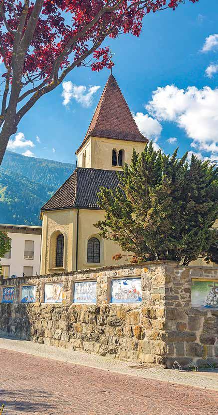
With its nave and church tower dating to the Romanesque era, the St. Nicholaus Church was mentioned in the archives as far back as 1369. In 1493, a choir was added and a pointed arch entrance erected. Its crafted late-Gothic era altar and the St. Christophorus painting on the church façade are well worth visiting. The latter seems to indicate that the church was situated on what was once a significant pilgrimage route.
Southwest of Naturno, on the slope of the spectacular Tablander Murkegel, lies Cirlano/Tschirland at 578 m. With its narrow Gothic tower, the St. Oswald Church is renowned for its elaborate Baroque fresco on the ceiling and painted altar frontals by Simon Ybertrachter (1694 – 1772), a native of Naturno.
Walking through the narrow streets of Cirlano with its old walls partly draped in ivy, you’ll come across forged window grilles and kiln ovens protruding from the facades of some houses, or the aged dials of an old sundial ... as if frozen in time.
Three kilometres west of Naturno lies Stava/Staben (552 m), a typical village in the Vinschgau Valley which, like Tablà, was formerly also an independent municipality. Straddling the Etsch River, the scenic village of Stava is a must-see for hikers and passing visitors.
Tip: Don’t forget to stop at the small “Unsere liebe Frau” Sanctuary, dating back to the Romanesque period. Start your tour at the ruins of St. Laurentius Church and follow the old road on the right bank of the Etsch River connecting Stava and Cirlano. Along this treacherous route, where unsuspecting merchant wagons and pilgrims were sometimes held up by brigands, is today a peaceful and scenic landscape to be enjoyed.
8
9
The Neighbouring Village of Plaus
The “Little Venice” of South Tyrol
The history of Plaus is closely intertwined with the surrounding marshes and moorlands. The waters of the Etsch River that flow through the Vinschgau Valley, has shaped the landscape and its people for thousands of years, sparing only a small portion of its fertile land. Time and again, the flood waters of the Etsch River ravaged even the remaining arable land, creating hardship for both humans and animals. To safeguard the lives and livelihood of its inhabitants, the economic boundaries of the municipality were shifted. As late as the 19th Century, nearby villagers still made fun of the so-called “City of Seven Houses”, which got their name due to the constant flooding, causing Plaus to be sarcastically referred to as “Little Venice”. There’s even the legend of the gondoliers or boatmen, who had to accompany children to school in small boats, known as the ‘nachen’.
The name ‘palus’ (meaning ‘swamp’ in Latin) belies the troubled origins of the village, built on land recovered from the marshes of the Etsch River. This troubled legacy is commemorated today with a giant statue of a frog in the park!
But Plaus isn’t Venice, and today the tamed waters of the Etsch flow down from the glacier into the valley, bringing life not destruction. In this picturesque valley with its mild climate, rows of vineyards cover the sun-kissed slopes merge with sprawling fruit orchards.
With its 700 inhabitants, the tranquil village of Plaus bordering Naturno is one of the smaller municipalities in South Tyrol.
Plaus offers a convenient starting-point for a variety of excursions. With Naturno and its satellite villages just a short distance away, riding to Merano/Meran along the well-kept cycle path is easy. Or setting out on a bracing mountain hike.
The St. Ulrich Parish Church with its Romanesque tower is worth a visit. Legend has it that it was built by Charlemagne.
An unusual work of contemporary art adorns the St. Ulrich Church cemetery wall. Referred to as the ‘Danse Macabre’, this fresco consisting of 18 panels is the work of artist Luis Stefan Stecher. Created in 2001, these colourful caricatures depict typical rural traditions and personalities from the Vinschgau Valley.
The Church of St. Monika in Plaus was recently erected next to the old St. Ulrich Parish Church and is well worth visiting. On entering the vestibule, the visitor literally walks through an oversized marble cross. Other features include a coloured light cross cut into the altar and a sacred relic of St. Monika kept in a glass casing.
10
11
Texelgruppe Nature Park Hiking Experience
Hiking at three levels
From the sunny vineyards down in the valley to the fragrant Alpine mountain pastures, all the way up to the glacier. In South Tyrol‘s largest nature reserve, you won’t only encounter deer and chamois.
Hiking in the Texelgruppe Nature Park

Spanning 33,430 Ha, the Texelgruppe Nature Park is the largest and arguably the most beautiful of the seven nature reserves in South Tyrol. Comprising the entire Texelgruppe Massif, the Ötztal Alps together with the Schnalstal Valley and the Gurgler Mountain Chains, as well as a section of the Stubaier Alps between the Timmelsjoch Ridge and the Timmelsjochberg Mountain, one might say that hiking in the Texelgruppe Nature Park is on “three levels”.
The rocky terrain along the slopes turn into sprawling larch forests, and the trails pass thunderous waterfalls, flowering meadows, Alpine pastures, oaks and sycamore trees. Following the crystal-clear streams and springs, you can stop and quench your thirst whenever you wish. Unless, of course, you prefer to take a rest at one of the Alpine farms and relax with a glass of good red wine. Or what about a glass of fresh farm milk paired with genuine cured South Tyrolean Speck at one of the mountain dairies?
The signposts along the well-maintained hiking trails show the way up the sunny slopes of the Sonnenberg Mountain above the village of Naturno as far as the glacier. The incomparable views of majestic mountains such as the Lodner, Hohe Wilde and Hohe Weiße are well worth the effort. And what could be more fascinating than watching a Golden Eagle ride a thermal current ever higher into the sky without hardly flapping its wings? The spectacle of Lake Langsee, the largest of the Spronser Seen Lakes, is no less impressive. In this sparse yet magnificent high-mountain terrain, you can find the Alpine Rose, the Golden Salamander and many other indigenous creatures of the region. The Texelgruppe Nature Park is home to rare animal and plant species, where one can observe marmots or ibexes defying gravity on the steep rockfaces. Although by the end of the 17th Century, the ibex was believed to have gone extinct, it was rediscovered and small populations successfully resettled in the unspoilt Pfossental Valley, in the heart of the nature reserve. And don’t be alarmed if a shrill noise suddenly breaks through the silence: marmots are just as at home here as red deer and chamois.
12
13
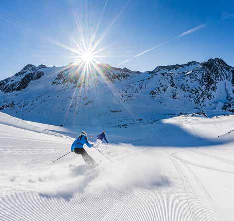
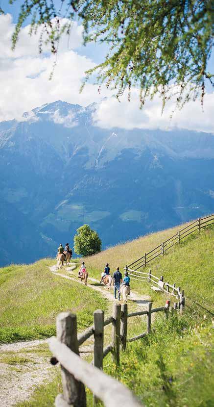
Hiking Paradise: The Sonnenberg Mountain above Naturno
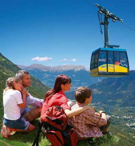
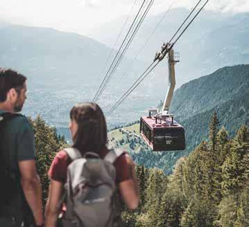
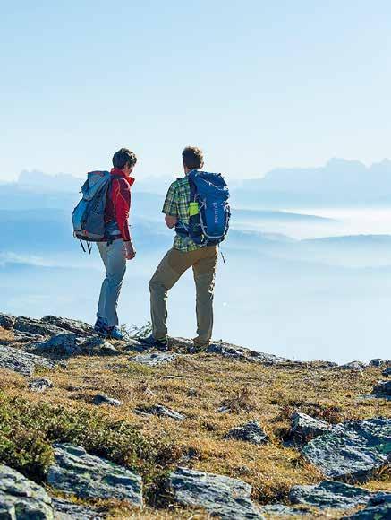
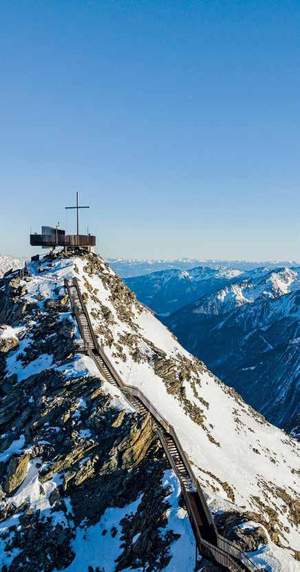
With no less than 315 days of sunshine per year, the aptly-named Sonnenberg Mountain invites visitors to see this hiking paradise at first-hand. Whether it’s leisurely hikes, more arduous climbs or trips to the summits – there are numerous worthwhile destinations worth visiting on the sunny Sonnenberg above Naturno! This peaceful and unspoilt terrain provides a welcome respite from the hustle and bustle of everyday life, with numerous exciting experiences in this enchanting, changing landscape. Contrast the steep, barren scrubland high on the mountain slopes with the lush green vineyards and apple orchards down in the valley. The Sonnenberg amply rewards those trekking along its slopes or ascending its summit on the Unterstell or the Texelbahn Cable Cars with fantastic views as far as the eye can see!
Unterstell is a starting point for long hikes that repeatedly intersect with the Merano High Mountain trail, along what is probably the most spectacular leg of this popular circuit trail through the Texelgruppe Nature Park. Whichever route you choose, you are surrounded by diverse species of flora and fauna, including emerald lizards, fire salamanders, zika lizards and praying mantises. The vegetation growing at these altitudes has evolved a variety of strategies to be able to survive the great fluctuations in temperature and wide variations between humid and dry conditions. Reinforced with fences and stone walls, the walkways lead to picturesque farmsteads practicing innovative farming methods. Although the precise origins of these scattered farms are unknown, what is certain is that the inhabitants had to discover a means of survival in this inhospitable terrain. Transforming rocks and stones into fertile soil, they also became independent, far from the jurisdiction of the towns and villages down in the valleys. Wherever you go, there are signs of the 1,000-year-old mountain farming culture and traditional way of life. Roadside shrines, simple stone walls, old irrigation canals and primitive sundials are just some of the numerous landmarks testifying to the life, practical ingenuity and deep-seated religiosity of the locals. As one of the most arid areas in the Alpine region, an irrigation canal system was devised to bring water from the mountain down into the valley. Often sourced from the glaciers, the water flowed downhill along these manmade irrigation canals. According to the old traditions, each farmer was allocated a timetable for the irrigation of his fields, on predetermined days and for a limited number of hours. And it is also true that the precious water resource
14
OUTDOOR IS MORE
Hiking trails and mountain bike routes surrounded by a breathtaking panorama. A via ferrata for the most adventurous. Fun for the little mountain explorers in the Outdoor Kids Camp and relax on the sunny terraces of the huts.
AND IN WINTERTIME? The numerous possibilities of Merano 2000 will inspire the whole family!
ALPIN BOB SUMMER + WINTER meran2000.com
was often the cause of disputes between farmers and canal wardens. For centuries, the old farm buildings only received minimal maintenance and after the passing of so much time there was a great need for proper maintenance. Thanks to new agricultural reform legislation, farmers on the Sonnenberg Mountain have been able to take up the opportunities offered to them, thus being able to improve their quality of life, as well as their hospitality services, enabling guests to spend holidays on the farms.
Man and the forces of Nature have, over the centuries, shaped this austere but captivating terrain on the Sonnenberg to create a cultural landscape like no other. Thus, leisure hikers, explorers, climbers as well as locals succumb to its fascination. And when you visit, the Sonnenberg Mountain is sure to win you over too!
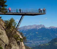
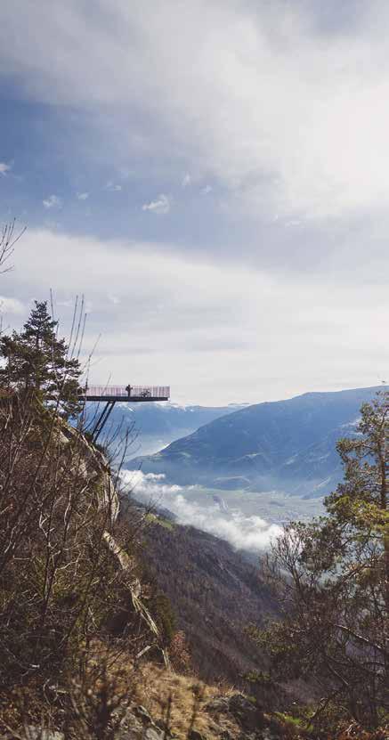
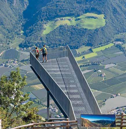
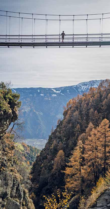
Tip: The viewing platform at the Unterstell Cable Car mountain station extends outwards above the rock, offering a magnificent view of the Etschtal Valley and the Vinschgau Valley. In late 2016, a new via ferrata was installed on the rockface just beneath the platform.
16
 VIA CANTINA 9 MARLENGO
Merano High Mountain Trail
Hiking the Merano High Mountain Trail
On foot or using the Naturno – Unterstell Cable Car, the ascent from Naturno takes you up to between 1500 and 1800 m. With just a few steep sections and covering about 95 km, the Merano High Mountain Trail is a hiking paradise that offers breath-taking views of the Passeiertal Valley, the Merano Valley basin, as well as the Sarntal, Stubai and Ötztal Alps. On clear days, the Dolomites, Brenta Group and Ortler all seem close enough to touch.
The circuit trail may be approached from either the north or the south. The “Merano High Mountain Trail South” stretches from Monte S. Caterina/Katharinaberg in the Schnalstal Valley to Ulvas/ Ulfas above Plata/Platt in the Passeiertal Valley. The “Merano High Mountain Trail North” leads to Plan/Pfelders in the heart of the Texelgruppe Nature Park. Thanks to its various access points, one can start a hike from a number of places along the circuit, which also offer a relatively quick descent down into the valley. The access points are easily accessible by cable car, public transport, private vehicle, and taxi. There are a few challenging sections that do require surefootedness, a head for heights and attentiveness. In the most exposed spots, chains, ropes, and railings offer additional protection.
Hiking maps of the Merano High Mountain Trail are available at the Naturno Tourist Office.
Duration – Merano High Mountain Trail
From – To
Linthof – Monte S. Caterina (1,245 m)
Monte S. Caterina (1,245 m) – Vorderkaser/ Jägerrast (1,694 m)
Vorderkaser/Jägerrast – Eishof (2,076 m)
Eishof – Stettiner Hütte (2,875 m)
Stettiner Hütte – Plan (1,624 m)
Plan – Ulvas (1,369 m)
Ulvas – Unterchristlhof (1,100 m)
Unterchristlhof – Magdfeld (1,150 m)
Magdfeld – Longfall (1,075 m)
Longfall – Hochmut (1,400 m)
Hochmut – Hochganghaus (1,839 m)
Hochganghaus – Giggelberg (1,565 m)
Giggelberg – Linthof (1,464 m)
ca. 2h
ca. 3h 30
ca. 2h
ca. 3h
ca. 3h
ca. 2h 30
ca. 1h 30
ca. 2h 50
ca. 3h 45
ca. 1h 30
ca. 2h 30
ca. 4h
ca. 4h
Duration
18
19
Alpine Roses and Mountain Pastures on the Nörderberg Mountain
On the one side of the valley lies the sunny but arid Sonnenberg Mountain, while on the opposite side a dense forest covers the north-facing slopes of the Nörderberg Mountain. The two sides of the valley stand in contrast, complementing each other: the latter with its green Alpine pastures, shady forests and idyllic mountain lakes in stark contrast to the dry, sun-baked Sonnenberg, with its sparse vegetation and mighty 3,000 m summit, flowing into the Texelgruppe Massif. Beneath the Sonnenberg lies Naturno, with its old buildings, historical churches and quaint satellite villages.
On the Nörderberg, one finds peace and tranquillity, secluded picnic spots, places to stop, relax and regain one’s energy. Mainly spruce and larchwood forests cover the slopes of the Nörderberg, while pines also grow at lower altitudes. The sprawling forests on the Nörderberg above 2,000 m are the habitat of mountain deer. While hiking above the tree line, it isn’t uncommon to spot herds of chamois crossing the high-mountain trails.
Exploring the Nörderberg on Foot
The highest peak on the Nörderberg, the majestic Naturnser Hochwart (2,608 m), offers a fantastic 360° panoramic view of the Dolomites, the Sarntal Alps, the Ortles and Brenta Massifs. This is perhaps where countless mountain enthusiasts of all ages have chalked up their first summit conquest. Climbing to the top of the Hochwart can also be achieved on a circuit trail from one of three Alpine refuges. Hiking towards Merano/Meran, the Naturno Nörderberg passes over the forested Vigiljoch Mountain, demarcating the boundary with the Nörderberg, which forms part of the Ortler Massif.
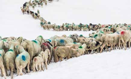
Needless to say, there are are numerous refreshment-stops on the Nörderberg. But, these aren’t the usual mountain taverns you might expect, but hospitable mountain huts offering a typical local “Brettlmarende” (a traditional snack consisting of meat, cheese and bread) rich dumpling broth and traditional apple strudel. To round off the idyllic setting, the spectacle of sheep, goats, highland cattle and horses grazing in the lush meadows in the summer months adds to the overall Alpine experience.
The mountain pastures and huts on the Nörderberg Mountain are accessible by taxi or by private vehicle. Having parked your vehicle at the Kreuzbrünnl car park, you can choose to take the forest track (suited to strollers/buggies) or the single hiking trails to the Alpine
20
pastures, lasting somewhere between 30 min – 1hr30’. The length of the hike from one hut to another depends on the distance between them and there are also a number of refreshment-stops along the way where one can stop for a drink and a hearty home-cooked meal. With its wide forest tracks, the Nörderberg is also ideal for MTB tours with various difficulty levels to choose from. The annual TransAlp Tour road-bike rally passes the Nörderberg – going from Naturno to the Naturnser Alm mountain hut and the Vigiljoch Mountain and down to the Ultental Valley. Even upwards of 1,500 m, the temperatures on the slopes of the Sonnenberg Mountains can be uncomfortably high while the shady forests of the Nörderberg Mountains on the opposite side of the valley offer a welcome respite from the heat.
21
Emergency Tips for Hikers and Climbers
Planning your trip: To help you acclimatise, start with smaller hikes/ climbs, gradually increasing your effort level. Allow your heart-rate to get used to the added strain a little at a time. Read carefully the route description and/or tour guide. Study the maps and make sure you obtain any information you need from the Alpine Club, mountain hut managers or ask a qualified mountain guide. Select the route that comes closest to matching your level of competence and physical fitness. As a necessary precaution, always tell your host where you are hiking to.
Luggage/equipment: Take only what you need into the mountains –don’t waste precious space by packing your rucksack with unnecessary items. The size and amount of gear you need will largely depend on the nature of your trip. In any case, make sure to always wear sturdy shoes with grip soles and remember to bring adequate protection from the rain as well as a first-aid kit.
Weather: Pay attention to the weather forecast. Turn back immediately if the weather changes for the worse or if you’re having difficulty orienting yourself or getting around. For the latest weather bulletins, go to: http://weather.provinz.bz.it/default.asp
The hike/climb: Take time to enjoy the environment that surrounds you. Don’t rush, take regular breaks, eat something at intervals and make sure you drink plenty of fluid to keep yourself hydrated.
Mountain emergency/accidents: In the event of an accident, attend to the injured party and try to keep him/her calm. Emergency signals in the Alps: make a sharp sound or visual signal (such as a light) repeating 6x per minute at regular intervals; stop for one minute and then start over again. Rescuers respond with signals 3x per minute. To call the emergency services via cell-phone, dial 112.
Getting there: To assist nature and the environment: try to use a public bus, the train, cable car, a bicycle or even a pool vehicle whenever possible. Try not to use your own car. If you do, then park it in a car park and not just anywhere, which will also likely earn you a fine.
Nature conservation:
• Protect the meadows and Alpine pastures by keeping on the paths.
• Take your waste and any rubbish you make away with you.
• Don’t pick flowers or plants.
• Avoid unnecessary noise and respect the natural habitat.
22
• Observe the rules of the Nature Park.
• Use your mountain bike on the trails and forest paths only.
• At no time should you light a fire in the forest. This is extremely dangerous and life-threatening and isn’t limited to just the dry season.
• Picking mushrooms is prescribed under State Law and limited as follows: 1 kg (one kilogram) per adult picked on even days, and provided a permit has been issued by the Municipal Office concerned, which attracts a fee. The Naturno-Plaus Tourist Association is responsible for maintaining the hiking trails, park benches and signposts within the municipal district of Naturno-Plaus. Constructive feedback and suggestions are welcome.
Mooo ...... 10 tips when encountering bovines grazing in the fields
Cows are undomesticated animals, which means that certain codes of behaviour need to be observed to ensure that possible encounters do not present a threat to hikers. The rules are:
1. Try to avoid any contact with grazing livestock – just leave them alone
2. Do not feed the animals
3. Do not frighten them – they might react unexpectedly

4. Take special care to avoid cows with calves. Stay away from them altogether.
5. Make sure you stay on the hiking trails – don’t go wandering into the pastures
6. If you have dogs, ensure they are kept close to you on a short leash
7. If any cows happen to block your path, try to avoid them as best you can
8. When approaching grazing animals: walk slowly, stay calm, and do not turn your back on them
9. Fenced off areas must be respected – do not jump over fences
10. Treat the locals respectfully – be considerate towards the environment and the animals
23
Themed Trails for all Ages
“Hinzl” Circuit Trail
The “Hinzl” circuit hiking trail offers a captivating journey through the history of Tablà. This trail, divided into fifteen stations, takes you from the heart of Tablà village to the surrounding woods, meandering through clearings, flowering meadows, birch groves, pine forests, pastures, and rocky outcrops. Along the way, you’ll encounter tales, legends, anecdotes, and historical insights about local craftsmanship and farm life. You will also appreciate the beauty of the region’s flora. The trail offers serene and picturesque spots perfect for relaxation, with breathtaking views that encompass Tablà and Naturno from stunning vantage points.
Total length: approx. 2.8 km
Total walking time: 2hrs – 2hrs30
Jesus Besinnungsweg Contemplation Trail
The Jesus Contemplation Trail at the foot of the Nörderberg mountain features fifteen “stations,” similar to the Stations of the Cross. It highlights fifteen significant events in the life of Jesus, from the Annunciation and Nativity to the Resurrection and the Sending of the Holy Spirit, each illustrating key aspects of his message. At each station, you will discover messages and reflections to contemplate during your walk. This path is also suitable for children. The circular walk begins above the Naturno Sports Center, at the end of Bahnhofstraße street.
Total walking time: 1hrs30
Gsindboden Circuit
The best starting point for this circular route is the village of Cirlano, reachable by bus 261 from Naturno. From there, follow the signs along an asphalt road lined with beautiful meadows and orchards until you arrive at the Waldschenke Inn. The path then ascends moderately through a shaded forest to a tunnel, passing an idyllic resting spot on the way to Gsindboden, where you’ll be treated to a unique panoramic view. The route then descends through a mixed forest to the Tschirlander Heide, home to many extraordinary plants and flowers. Shortly after, you’ll return to the starting point. From Cirlano, you can take the bus back to the village center or walk along the road to the bridge over the Etsch River, then follow the Etschdammweg trail and Bahnhofstraße street (an additional 45 minutes of walking).
Total length: approx. 4.6 km
Total walking time: 1hrs45
24
25
Via Vinum Venostis
Beginning in the center of Naturno, the hike follows Feldgasse, Kirchweg, and Kirchgraben, then continues along St.-Zeno-Strasse and Hauptstrasse streets to the Unterstell cable car valley station in Compaccio. From there, take Schießstandstraße street to the start of the trail leading up to the Schwalbennest snack station. The path then descends gently to Sonnenbergstraße and ascends briefly to the entrance of trail No. 6 below the Falkenstein vineyard. The trail climbs steeply up to Wallburgweg road. Head east along the flat path, then descend sharply to Wiedenplatzerkeller Restaurant. Continue downhill on the asphalt road to the turn-off for the Sonnenberger Panoramaweg trail. Follow this trail westward until you reach St. Prokulusstraße street. Cross the road and proceed along the Vogelpromenade to Schlossweg. From there, walk along Kirchbach to Kirchgraben, then return via Kirchweg and Feldgasse to your starting point.
Total lenght: 6.7 km
Total walking time: 2hrs15
Riolagundo Forest Adventure Trail (5 km from Naturno)
New adventure trail (Walderlebnispfad Aschbach in German) in the picturesque mountain village of Riolagundo/Aschbach, showcasing the forest ecosystem and its flora/fauna. This easy family hike starts at the Riolagundo cableway mountain station. Take hiking trail no. 27A in the direction of Eggerhöfe farms. After about 5 min take the turn-off to the Forest Adventure Tail, where the 3.6 km trail circuit begins.
Total length: approx. 3.5 km
Total walking time: approx. 1hr30’
Starting point: Riolagundo cableway mountain station
Haflinger Adventure Trail
This new adventure trail to S. Caterina/St. Kathrein was named after the village of Avelengo/Hafling, which also lent its name to the striking white horse with its characteristic blonde mane. Originally a farm workhorse, the Haflinger is now mostly used in recreational tasks. Along its various info stations, the trail provides information on the Haflingers and more besides. The trail starts in Avelengo and follows the old Bürgeleweg road (trail No. 2). After joining up with the road to Falzeben, it branches off to the left. The end of the Haflinger Adventure Trail is in the village of S. Caterina.
Total length: 2 km
Total walking time: 2hrs, stroller-friendly
26
GET YOUR ADVENTURE #alpinarenasenales
Nature and Adventure Trail – “Squirrel Trail” in Marlengo (15 km from Naturno)
With its various rest stops, the “Squirrel Trail” (Eichhörnchenweg in German) offers numerous recreation and workout options to visitors of all ages, including a high rope course, forest info stations about the woods, the natural and experiential worlds as well as an auditorium for creative “forest artists”. It takes approx. 20 minutes to reach the Squirrel Trail from the village centre (direction Marlinger Waalweg irrigation channel trail), following the squirrel signposts. The trail starts at the car park above the Waldschenke Inn, directly on the Marlinger Waalweg. Comprising a total of 23 nature/adventure stations, the circuit trail is easily accessible to almost everyone.
Total length: approx. 1 km
Total walking time: approx. 30’
The Gumperle Forest Trail in Agumes, near Prato allo Stelvio (38 km from Naturno)
Following the Forest Nature Trail (Waldtierpfad in German) in Agumes/Agums, children and parents can learn some interesting facts about the fauna inhabiting the South Tyrolean forests, in an entertaining way. Guided by Ferdinand, the forest mouse, find clues at 13 stations, listen to the birdsong, admire deer antlers, try the badger tunnel and ascend the woodpecker hill.
Total walking time: The 2 km long circuit is a comfortable 1hr30’ hike, including a rest stop. The circuit trail starts and ends at the St. Georg Pilgrimage Church in Agumes.
“Sonnensteig” Trail from Burgusio (50 km) to Spondigna (35 km)
This new theme trail in the Upper Vinschgau Valley begins southwest of Burgusio/Burgeis, just outside the village. Head uphill towards the Marienberg Monastery. Just before getting there, turn right towards the northern entrance of Burgusio onto the old bridge, across the village and over the fields to the stone bridge. Take the path along the upper Waalweg irrigation channel trail to Malles/Mals, and Tarces/Tartsch to the Ganglegg archaeological site near Sluderno/Schluderns. To complete the theme trail, follow the Leitenwaal path along the slope of the Schludernser Berg mountain to Spondigna. Along the route, 11 info panels explain the special features and natural history of the surrounding terrain. Ten traditional tales of Upper Vinschgau Valley are also vividly recounted, with works by a local sculptor. Three info panels describe the story of the old irrigation canals. Designed with families in mind, each individual stage of the trail can be walked as an independent hike.
28
Plima Gorge Experience in Martelltal Valley
This trek through the back of the Martelltal Valley might seem like a perfect adventure: rugged terrain with rocky slopes and Larchwood forests. In the middle of all this, lies the Plima Gorge created by the thundering waters of the Plimabach mountain torrent. Cascading down for thousands of years, the water gradually eroded the rock, forming this spectacular gorge. The silence is broken by the constant gushing sound of the torrent, while water-droplets spray into the air. The Plima Gorge is nowadays a natural arena at the foot of the Cevedale Massif. Four new steel structures, serving as walkways with viewing platforms, were erected to bring hikers closer into the gorge. Four new structures, named “trowel”, “panoramic crescent”, “observation pulpit” and “suspension bridge” complete the adventure hike for visitors of all ages.
Total length: 6 km
Total walking time: approx. 1hr45’
Passeiertal Valley “Schluchtenweg” Gorge Trail
Along the edge of the Passer River, between S. Leonardo/St. Leonhard and Moso/Moos, an ambitious project to build a hiking trail through the gorge was started in 2008 and completed in 2015. All along the Valley, the Passer River is the central feature and the section between Moso and S. Leonardo is particularly spectacular. From the S. Leonardo sports grounds, follow the Passer River on Trail no. 1 signpost for about a kilometre before coming to a bridge that leads to the start of the trail. An elaborate metal walkway against the rock on the side of the river with steps and bridges enables crossing through the more difficult parts of the gorge. With a 340 m elevation difference, the walkway stretches about 5 km to Moso. The varied trail sometimes brings one closer to the forces of nature such as the Stuller waterfalls, alternating with less challenging sections along the slopes through the forest.
Starting points: S. Leonardo sports grounds or Moso
Signposts: Trail No. 1, Moso
Elevation difference: 340 m
Special features: Metal walkway with grating: steps, bridges
Total length: 6.5 km
Total walking time: approx. 2hr30’ (depending on direction)
Note: If you don’t want to hike back, there’s a bus from Moso to S. Leonardo.
29
Note: The cable cars and chairlifts are out of service in strong winds! Limited mountain bike transport in cable cars. All information is without guarantee. Subject to change without notice.
30
Cable Cars, Gondolas and Chairlifts
Journey times and prices:
The current journey times and prices can be found on the respective websites. Discounts are available for children and families. Most of the cable cars run every 30 minutes (every full and half hour). Intermediate trips run continuously as required.
Unterstell & Texelbahn Cable Cars combined tickets
The ascent and descent is valid for both cable cars, e.g. ascent with the Unterstell cable car and return journey with the Texelbahn cable car.
Dogs: Muzzle requirement according to Provincial law.

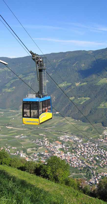
Unterstell Cable Car, Naturno Sonnenberg Mountain 46, (545 m – 1,300 m)
Tel. +39 0473 668418 | www.unterstell.it
Texelbahn Cable Car, Parcines/Partschins-Moncucco/Giggelberg, (635 m – 1,544 m)
Tel. +39 0473 968295 www.texelbahn.com

Alpin Arena Senales, Maso Corto/Kurzras, (2,011 m – 3,212 m)
Tel. +39 0473 662171 | www.schnalstal.com
31
Aschbach Cable Car, Rablà/Rabland, (522 – 1,349 m)
Tel. +39 0473 967198 | www.aschbach.it
Merano 2000 Cable Car, Merano/Meran, (2,000 m)
Tel. +39 0473 234821 | www.meran2000.com
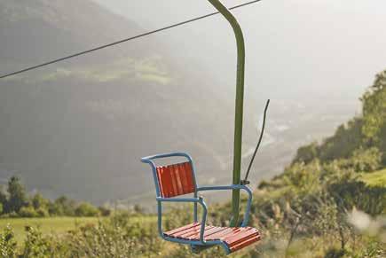
Lagundo/Algund-Velloi/Vellau Chairlift, (350 – 950 m)
Tel. +39 0473 448660
Velloi/Vellau-Leiter Alm Basket Lift / Gondola, (950 – 1,522 m)
Tel. +39 0473 448532
Lana-Vigiljoch Mountain Cable Car, Lana, (295 – 1,500 m)
Tel. +39 0473 561333 | www.vigilio.com
Postal/Burgstall-Voiana/Vöran Cable Car, Voiana, (226 – 1,170 m)
Tel.+39 0473 278 187
Tirolo/Dorf Tirol-Hochmuth Mountain Cable Car, Tirolo, (650 m – 1,400 m)
Tel. +39 0473 923480 | www.seilbahn-hochmuth.it
Hirzer Cable Car, Saltusio/Saltaus-Prenn-Klammeben, (490 m – 1,980 m)
Tel. +39 0473 645498 | www.hirzer.info
Schwemmalm Cable Car-Ultental Valley, S. Valburga/St. Walburg, Tel. +39 0473 795390 | www.schwemmalm.com
S. Martino in Monte/St. Martin am Kofel Cable Car, Laces/Latsch, (626 m – 1,740 m)
Tel. +39 0473 623109 | www.bergbahnen-latsch.com
Tarscher Alm Chairlift, Laces/Latsch, (1,180 – 1,940 m)
Tel. +39 0473 623109 | www.bergbahnen-latsch.com
Solda/Sulden Cable Car, Solda, (1,900 m)
Tel. +39 0473 613047 | www.seilbahnensulden.it
Langenstein Chairlift, Solda/Sulden (1,900 – 2,330 m)
Tel. +39 0473 613073 | www.seilbahnensulden.it
Kanzel Chairlift, Solda/Sulden, (1,900 – 2,350 m)
Tel. +39 0473 613097 | www.seilbahnensulden.it
Verdines/Verdins Cable Car – Talle/Tall, Scena/Schenna (850 - 1,450 m)
Tel. +39 0473 949450/www.verdins.it
Plan/Pfelders Cable Car Plan (1,601 - 2,001 m)
Tel. +39 0473 646721/www.pfelders.info
32
33
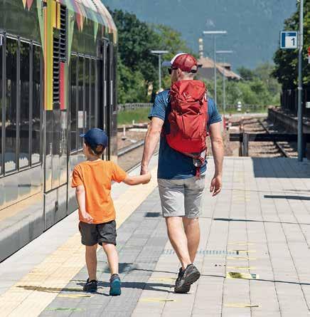
Getting there by Bus and/or Train
All South Tyrol public transport info you need at your fingertips.
• Looking for the best bus or train connection to quickly help you get from A to B?
• Where to find the nearest bus stop?

• How much does a trip cost and how long does it take – including on foot?
• Are there any service delays?
• Receive updated road traffic reports

After downloading the Südtirolmobil “Suedtirol2Go” app to your smartphone, you’ll have answers to all the above – and a lot more info at your fingertips! Due to the possible last-minute changes in the timetable please make sure you always get the latest service data on the südtirolmobil app or on our website: https://suedtirolmobil.info/de/
Buy your ticket online:

• Single ticket: select the desired route and time, click on “buy” as well as “single ticket”. Enter your name and the number of tickets you want to buy. Pay by credit/debit card.
• Ticket shop: this is where you can get a Mobilcard, day ticket for bike transport, etc. (in the südtirolmobil app: use the violet icon on the top right hand side). Just select the ticket you want, fill in the data and pay. All done!
• Before starting a ride, tickets must be validated. How do you validate your ticket? This is done right on your smartphone. Show your smartphone with the green-framed “active journey” screen to the bus driver or the ticket inspector.
34
Dogs:
Guide dogs and small lap dogs held in your arms or kept in a small carrying cage/pet container are exempt from any transport charges. Larger dogs must be muzzled and kept on a leash – they require a Mobilcard Junior or a single ticket.
Children:
Children under 6 ride free on all public transport.
Bicycles:
Bicycles transported on the train require an additional ticket, which must be validated for each trip. Tickets are available at the station from a ticket vending machine. Kindly note that on regional trains are allowed only 15 – 18 bicyles. If there are no available seats left, bicycles may be prevented from being loaded onto the train.


35
Health & Wellness
DIVE IN. REFRESH. REVITALIZE.
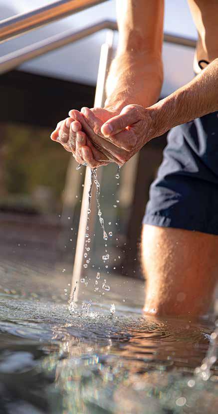
Water is essential for health and is of great importance for our wellbeing, both preventively and therapeutically. Thermal water is THE “recreational agent” on holiday. After an active day in the beautiful nature of the Vinschgau, water is relaxing and calming, serves to reduce stress and provides fresh energy. Good news from the South Tyrolean wellness region - Naturno thermal resort. Historically, Naturno can look back on a long tradition of healing water. It was already the Romans who, on their way along their important trade route, the Via Claudia Augusta, appreciated the energy of warm springs and healing places. Much later, from the 16th century, the first aspects of our current wellness concept started here with a bathing house in Stadel.
Bad Kochenmoos becomes a well-known, prosperous inn with a healing spring. The Kochlmoos health spring splashes warmly at the foot of Juval Castle from the Sonnenberg at the entrance to the Schnalstal Valley. Until the 1960s, people enjoyed therapeutic baths and water cures in bathing cabins with wooden bathtubs. Whether rheumatism, arthritis or circulatory disorders, the warm mineral water provided relief and well-being. With the advent of modern medicine, natural remedies lost their importance.
The thermal water of Naturno rises at 17 degrees from a depth of approx. 200 m at the foot of the Sonnenberg below Juval Castle. Due to its temperature, the Naturno thermal water is used for cold applications, e.g. in cold pools or Kneipp treatments, or it is heated to a comfortable temperature of over 32°. The thermal water from Naturno allows the muscles to relax after sporting activity and guarantees faster recovery. Beneficial, regenerating and pleasantly relieving stress. If you classify the chemical-physical properties, you get slightly mineralized, sulphate and fluoride-containing thermal water. It is also characterized by moderate concentrations of bromine and iodine and traces of lithium are present. Reduce stress through natural healing remedies Run down, exhausted or tired? Thermal water has been a real miracle cure for thousands of years.
36
37
Effective wellness moments
• Relief of rheumatic, orthopedic or traumatological complaints of the musculoskeletal system
• A bath in warm thermal water increases your well-being in the long term. A state of relaxation can quickly set in through a significant reduction in the stress hormone cortisol.
• Stress resilience is improved.
• Therapeutically, it can have a positive effect on complaints of the musculoskeletal system.
• After sporting activity, Naturno thermal water has a muscle-relaxing, calming and soothing effect. A faster recovery is guaranteed.
• The composition of the water creates a feeling of neuromuscular relaxation and thus general well-being.
• Slight irritations of the skin are relieved and it appears more relaxed, smoother and clearer.
In the exclusive hotels and the Naturno Adventure Pool, you can seamlessly blend inspiring outdoor activities with South Tyrolean joie de vivre and the rejuvenating benefits of water, creating the perfect holiday experience. Enjoy exclusive getaways that combine pleasure and relaxation. According to a 2021 study by Dr. Scaramuzzino from the University of Pisa, water not only improves health but also enhances beauty. Enjoy a relaxing and active holiday amidst stunning landscapes, vineyards, apple orchards, and modern wellness hotels. These relaxing elements create special moments of happiness that will leave you smiling. With the beauty secret of thermal water, it’s truly a fountain of youth. So, why wait? Book your holiday at the thermal resort of Naturno, treat your body and soul, and reap the benefits of this rejuvenating water.
38
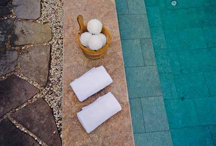
- Outdoor pool with 75m giant slide
- Indoor pool (temperature 31°C) with 51m slide - Saltwater and thermal whirlpool (36°C)
- Sauna area and cold plunge pool (with thermal water) - Outdoor and indoor children’s pool
- Restaurant/pizzeria
Erlebnistherme
Naturns
www.erlebnisbad.it Erlebnistherme Naturns
Tel. 0473 668036 /
Foto Stefan Gorfer
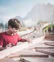
Our Fridolin Family Page
Hi, I’m Fridolin the Frog and I’m from Naturno.

I am so pleased that you’re spending your holidays with us! There’s so much for kids to see and do in Naturno, even with the whole family. Every day there are new and exciting surprises with fantastic games and adventures organised by our guides. Come and see for yourself: Lama trekking, climbing, minigolf, cycling on the Etschradweg Cycle Path, Daksy action days in summer and much more.
How about taking the cable car up high up to the top of the mountain? Looking down, people look like ants and the houses and cars look like matchboxes. If you think that walking, hiking and climbing the mountain sounds like fun, then Naturno is just the right place for you. There are 3 hiking levels on the mountains: starting at the bottom of the valley, are orchards then going up the mountain slopes there are pastures and meadows with cows. On the top of the mountain you’ll see the high peaks that are usually covered in snow. If you go up there you have a beautiful view to enjoy, even better than from an airplane.
Both down in the valley and up on the mountain, there’s plenty to do in the children’s playgrounds. And even if you’re not such a good hiker yet, or if you have a baby brother or sister, then tell your mummy that she can take the baby pushchair to nearly all of the playgrounds.
Sometimes I just like to go walking around, without any fixed plan. Maybe I’ll jump on the next bus or take the colourful Vinschgau Valley Train, as it winds its way through the green valley like a brightly-coloured worm. Or I might go and see Merano, or the Vinschgau Valley, where there’s so much to see and do!
Have fun!
Your new friend, Fridolin

40
41
Buggy-friendly Hiking Trails in Naturno
Circuit Tour of Naturno
Walking down the Bahnhofstraße street, you’ll come to a children‘s playground. Follow the Etschpromenade road to Compaccio/Kompatsch, past another playground and proceed along Färberweg street as far as August Kleeberg street. Turn right and then go left onto the small footpath to Gerberweg street. Return the same way.
Total walking time: approx. 1hr – 1hr30’.
Naturno Panoramic Walk
Start from Rathausstraße street in Naturno, then turn right into the Feldweg gravel road and head uphill towards the St. Prokulus Church. Just before the church, turn left into St. Prokulus Straße street, before turning into Vogeltennpromenade street. Continue until you reach Schlossweg trail, passing the tennis courts until you come to a brick wall on the left. Cross over Kirchbachbrücke bridge and follow the road to the St. Zeno Parish Church. Continue up the hill, crossing back over the Kirchbach stream and to the War Memorial. Turn left into the Feldweg gravel road and take Rathausstraße back to your starting point. Alternatively, from the War Memorial you can go back to the village centre along Schlossweg street. This walk has some great panoramic views.
Total walking time: approx. 2 hrs.
From Compaccio in Naturno to Cirlano and Back
Starting at Kompatscherstraße or Etschangerstraße streets, cross the bridge over the Etsch River and then turn right in the direction of Stava. Turn left at the Niedermair Estate n the direction of Cirlano until you reach the St. Oswald Church with the nearby playground. Pass the church and head to the next intersection. Across the intersection, continue straight along the path lined with fruit trees as far as the Naturno sports field and the mini-golf course. From there, follow Bahnhofstraße street back to the children‘s playground at the Etsch River bridge and across the Etschpromenade road back to the starting point.
Total walking time: approx. 2 hrs.
42
Easy Walk to Plaus
Start from Gröbenweg road until it becomes Birchbergweg. Follow Birchbergweg until it branches off right to the “Alpine-Well t-Parcours” outdoor gym park. This calisthenics-park has some great fitness stations for all ages. Continuing, at the Hilbertal Valley turn right into the street, at the intersection turn right again, continue via Hilb and then head back to Plaus.
Total walking time: approx. 2 hrs.
Naturno Jesus Contemplation Trail
Not suited to strollers! But highly recommended with bigger kids! An unusual variation of a Way of the Cross, the 15-station Jesus Contemplation Trail (Jesus-Besinnungsweg in German) lies beneath the Nörderberg Mountain. Celebrating the most important events in the life of Jesus, the simple yet original stations blend into nature and the surrounding terrain. The trail starts above the Naturno sports centre, at the end of Bahnhofstrasse street. Along the way are rest stops and picnic spots.
Total walking time: approx. 2 hrs. Resting places and picnic areas along the trail
Alpine Pastures on the Nörderberg Mountain
Hiking to the Naturnser Alm mountain pastures lasts about 1hr30’. It takes approx. 40 min to get to the Alt Alm/Zetn Alm mountain pastures and about 1hr30’ – 2 hours to the Mausloch Alm. All trails are suitable to strollers and reachable from the Kreuzbrünnl car park on gravel roads. You can get to the Tablander Alm mountain pasture as far as the Ciardes/Tschars – Montefontana/Tomberg – car park by car and from there it takes about 1hr30’ to reach the mountain pasture.
43
Naturno Children’s Playgrounds
Room for Adventure!
Whether you’re looking for a playground for small children or monkey bars – the spacious playgrounds of Naturno guarantee big fun for action kids. The playgrounds in Naturno, Plaus as well as Tablà, Cirlano and Stava have a lot to offer including football fields, skating rinks and fun parks.
Playground in Bahnhofstraße Street
Location: the biggest playground in central Naturno is off the cycle path near the railway station. Sunny/exposed with shady spots. Equipment: large play area with water feature (summer months only), a sand-pit, nest swing, swing, slides, merry-go-round and beam seesaw.
Special features: extra-long slide, cable car and big climbing merrygo-round
Playground in Compaccio
Location: just off the cycle path, sunny/exposed with shady spots
Equipment: nest swing, swings, slides, sand pit, spring seesaw, beam seesaw
Special features: playing field for ball games (with spectators stand), climbing-wall, climbing tower, merry-go-round & disc swing
Playground in Hilbstraße Street
Location: large, sunny playground in the Hilb residential area
Equipment: swing and swing for small children, spring seesaw, slide, sand-pit, mound with water feature (summer months only)
Special features: separate playing field for ball games, table tennis, large, open play area
Playground at the Unterstell Mountain Cable Car Station
Location: large, sunny playground on the mountain slope just next to the Unterstell mountain cable car station on the Sonnenberg Mountain, above Naturno
Equipment: spring see-saw, merry-go-round, slide, climbing combo, crocodile swing, double swing & playhouse
Special features: accessible by cableway 8
44
Playground at the Gasthof Lint – Sonnenberg Mountain
Location: sunny playground at the Berggasthof Lint mountain inn at the Naturno Sonnenberg Mountain
Equipment: slide, beam seesaw, climbing bars, spring seesaw & swings
Special features: directly located at the Merano High Mountain Trail
Playground at the Gasthof Pirch – Sonnenberg Mountain
Location: sunny playground at the Pirchhof mountain farm and inn, on the Sonnenberg Mountain above Naturno
Equipment: spring seesaw, slope slide, swings, sand-pit
Special features: tame rabbits and guinea pigs for petting
Playground in Tablà (approx. 2 km from Naturno)
Location: large playground in a sunny location
Equipment: water pump, nest swing, swings, climbing poles, crawling tunnel, climbing tower, beam seesaw, climbing-wall, sand-pit with water feature (summer months only)
Special features: demarcated football pitch
Playground in Stava (approx. 2 km from Naturno)
Location: fenced-in playground next to the football field about 500 m from the Stava train station, sunny location with shady spots
Equipment: climbing merry-go-round, slide, sand-pit, swings, small climbing frame, seating. Special feature: toilet, next to the football field
Playground in Cirlano
Location: small, sunny playground near the church
Equipment: slide, spring seesaw and swings, sandy play area with water feature (summer months only)
Special features: completely fenced in; suited to smaller children
Playground in Plaus – Gröbenweg Street (approx. 2 km from Naturno)
Location: sunny location with shady areas on the outskirts of Plaus
Equipment: slide, swing – also for toddlers, spring seesaw
Special features: adjoining the cableway, multi-purpose, fenced-in
Playground in Rablà – Saringerstraße Street (approx. 1 km from Naturno)
Location: small, sunny playground with shady areas, near the railway station and cycle path
Equipment: sandy play area, swing (also for toddlers), slide with play tower and climbing facility, spring seesaw
45
Leisure Biking in Naturno
The sunny region around Naturno is highly-suited to biking and the Vinschgau Valley Cycling Trail is one of the most breath-taking cycle routes in the Alps. With panoramic views all along its 80-km length, it stretches from the Reschensee Pass to Merano. The section that passes Naturno next to the Etsch River stands out in particular. Since the Vinschgau Valley Train line runs parallel to the Cycling Trail, this presents cyclists with some interesting transport combination options ...
Cycling on a Road Bike or MTB
In Naturno, we encourage vigorous pedalling, especially on a mountain or racing bike! With our fantastic Alpine terrain, cultural landscapes, Mediterranean vegetation and wild animals, there’s so much to experience on a ride along the slopes of the sunny Sonnenberg Mountain, or in the shade of the Nörderberg Mountain! Running across Parcines, Naturno and Castelbello, this cycle network offers a broad range of options all ready to be discovered. Refer to our mountain bike map, which helps you get around our mountains and on the Meran(o) Bike Highline. Ride alongside the waters of the Etsch River on a road or racing bike, through medieval villages and up the hairpin bends across the 2,757 m high Stelvio Pass.
Bike Park
The technical training ground and training parcour above the sports field is run by the Naturno Ötzi MTB Academy, offering beginners’ and advanced-level cycling and MTB courses. During the open afternoons, attendees have the opportunity to improve their biking technique and safety skills.
For further info and registration: Tel. +39 347 130 09 26
Tip: Our Bike Folder offers a selection of the best MTB trails and road cycling routes running through Silandro, Naturno and Parcines. Whether it’s a MTB, road bike, leisure cycle or e-bike, you‘ll find loads of ideas for some of the best rides. And that’s on top of all the other info about cycle touring in one of the best biking regions in South Tyrol. Hurry up and collect your copy at the local Tourist Office!
46
47
Mountain Climbing and Via Ferrata
Difficulty levels of via ferratas
in European comparison
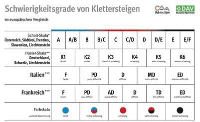
Südtirol,Trentino, Austria
Germany, Switzerland
Italy
France Colour scale
from (www.alpenverein.de)
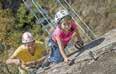
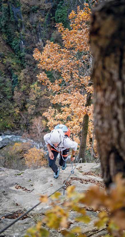
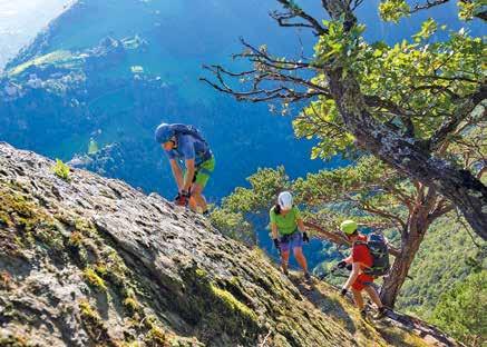
The Hoachwool – a climb in a class all of its own! With its 1,400 m rope length and 630 m elevation difference, the Hoachwool via ferrata at the entrance to the Schnalstal Valley facing Juval Castle is one of the most attractive via ferrata climbs in South Tyrol. The 32 m rope-bridge across the Schnalsbach stream signals the start of the climb. Would-be climbers should be warned in advance of the difficulties in attempting the Hoachwool. Two-hundred years ago this once “forbidden climb” was only recommended for those “with firm feet, whose eyes do not lie and whose knees do not waver”! The route follows the 10 km long former Schnalstal Valley-Naturno Waalweg irrigation canal, also referred to as the Hoachwool by the locals and the challenging via ferrata section crosses the rockfaces with breath-taking views. The various points of interest, such as the Elferplätt (a rock serving as a sundial) and the unusually shaped Stegerfrau rock, add to the mystique of the climb. The Hoachwool via ferrata on the slopes of the Sonnenberg Mountain has long inspired legends and those who’ve experienced it for themselves tend to agree!
Knott Family Via Ferrata – Unterstell Cable Car
The Knott practice range near Unterstell is the first family-friendly via ferrata in South Tyrol. Though some of the newer courses are fairly long and tricky, the Knott serves as an introduction to via ferrata climbing giving beginners or families with children the chance to practice, with levels ranging from easy/medium/difficult.
easy moderately difficult difficult very difficult extremely difficult 48
49
The Knott includes four climbing routes, a short connection route, a 20 m cable bridge and two steep ladders. The four via ferrata courses consist of an easy climb, graduating to more challenging passages, some exposed stretches over the rockface and the technical sections. It stays open throughout the day, with a short ascent and descent.
More detailed information about the via ferrata can be obtained from your host or the local Tourist Office.
The newly-opened Knott practice wall for families on the Sonnenberg Mountain is located next to the Unterstell Cable Car mountain station in Naturno. Four via ferrata courses of varying difficulty levels are on the wall beneath the viewing platform. Beginners are under the supervision of professional mountain guides who teach safe climbing techniques, while more experienced/daring climbers can descend directly from the viewing platform down to the wall.
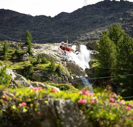
Ötzi High Rope Park in the Schnalstal Valley
Situated at the far end of Vernagtsee Lake at 1,780 m above sea level, the Ötzi High Rope Park promises thrills and challenges for both adults and children. Eleven high-rope courses lead to 150 platforms, varying between 2 m – 30 m in height, across a wide gorge. Between highlights including the Giant Swing, Flying Foxes as well as the new 700 m and 250 m Ziplines, the course takes about 3 hours to complete. The Ötzi High Rope Park can be reached by bus and if you come by car you’ll find parking onsite. For the opening hours and entry fee refer to our pamphlet, or go to our website. Although safety equipment is provided, suitable footwear is required. Gloves are available for rent. Open: May – October.
Visit: www.hochseilgarten.bz info@hochseilgarten.bz
Larix Ferrata
The ‚Larix‘ (larch in Latin) via ferrata with suspension bridges, exciting rope slides and a parallel hiking trail will be available.The challenging via ferrata is of medium difficulty and also suitable for experienced families. The entrance is located at the foot of the large Kurzrasbach waterfall and leads towards the Teufelsegg hut. The ‚Alpin Trail‘ hiking trail runs partly along this, allowing you to observe and accompany the climbers. Whether you are a leisurely hiker or an arduous climber, you will find what you are looking for here.
Prerequisite: via ferrata equipment (rental in Maso Corto at Service Stricker or Ski Factory Maso Corto).
Entrance: behind the Roter Kofel chairlift, at the foot of the large Kurzrasbach waterfall
Exit: above the Teufelsegg hut
Difficulty: medium difficult (C)
Ascent: 3:30 h
Length: 1.8 km
Metres in altitude: 410 hm each
50
Climbing Garden Marchegg
Those who want to experience this (including the surge of adrenaline) can learn it under the supervision of an instructor in the Marchegg rock climbing garden. The 30 metre high wall offers a lot, from fixed rope climbing to climbing routes with degrees of difficulty from 4a to 7b+. Great adventure and fun not only for kids!
Climbing Garden Mastaun
The climbing garden Mastaun is located in the high valley oft he same name near Madonna di Senales/Unser Frau in the Schnalstal Valley, approx. 20 minutes walk behind the Mastaunalm hut.
The approx. 70 metre high rock face offers technically challenging routes over several pitches in the middle of an untouches natural landscape. It was initiated and built by Nereo Ongaro (AVS Schnalstal Valley), further routes are planned.
Special features: Due to the exposed location oft he rock face, the multi-rope lenghts and the technically challenging routes, the climbing garden is suitable for experienced climbers.
Rockarena
Via Palade/Gampenstraße 74, Merano, Tel. +39 0473 234619
Since its opening in 2008, the Rockarena climbing hall in Merano completes the offer of Meranarena. Located to the north of the ice rink, this bouldering facility offers another sports location dedicated to one of the most popular sports of recent years. Indeed, climbing and bouldering are now popular activities, not only in South Tyrol. This is because they are fun, but they are also an excellent workout for physical coordination. And furthermore, they can be practised without any particular experience by people of all ages. Further information, bookings and price list: www.rockarena.it
51
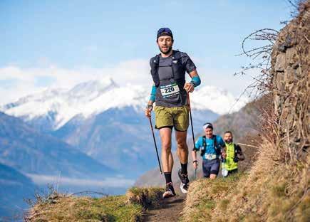
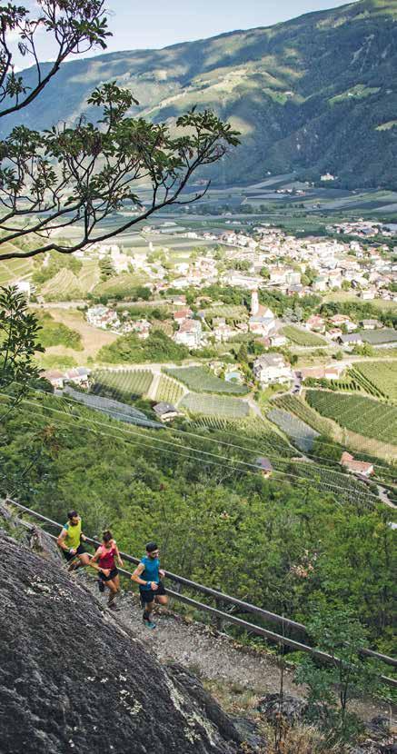
Naturno: Trail Running in Nature’s Paradise
Where else can one find so many opportunities for a run through mountain forests and trails in the Alpine wilderness? Stretching across an awe-inspiring terrain beneath the majestic peaks, the Naturno Sonnenberg Mountain in the Texelgruppe Nature Park offers some of the best conditions for trail running enthusiasts all year round. At an elevation of between 500 and 1,500 metres, the Sonnenberg Mountain in South Tyrol with its idyllic vistas and accessible trails is a true haven for trail runners of all levels.
• Wallburg Tour Naturno: duration 1:50 h – Length 8,6 km –362 metres altitude uphill, 369 downhill –
Level of difficulty medium/red mountain path
• Panorama-Run Naturno: duration 3 h – Length 10,7 km –986 metres altitude uphill, 977 downhill –
Level of difficulty medium/red mountain path
• Panorama-Run Naturno – Rablà: duration 3:50 h –
Length 15,9 km – 803 metres altitude uphill, 808 downhill –Level of difficulty medium/red mountain path
• Skyrace Naturno: duration 3:50 h – Length 14,3 km –1.185 metres altitude uphill, 1.185 downhill –
Level of difficulty medium/red mountain path
• Sunny Mountain Trail: duration 6:50 h – Length 28,6 km –2.174 metres altitude uphill, 2.174 downhill –Level of difficulty/black mountain path
52
53
Sports, Fun and Action
Naturno Thermal Adventure Pool
Via dei Campi/Feldgasse street, Naturno, Tel. +39 0473 66 80 36, www.erlebnisbad.it
The pool is a recreational & wellness oasis for folks of all ages. Open summer and winter, no matter the weather conditions!
• Outdoor pool area: 25 m sports pool, children’s pool, 75 m slide, bubbles, water cannons, water mushroom, large sunbathing lawn, and chillout zone
• Indoor pool area: adventure pool (water temp. 31°C), 51 m slide, water chute, water curtain, underfloor bubble jet, underwater massage beds, bubble bench, neck showers, thermal experience shower, thermal whirlpool, thermal waterfall & palm tree, brine pool, children‘s play area, etc.
• 600 m2 sauna landscape: Finnish sauna, steam bath, bio sauna, cold water plunge pool, large open-air area, and relaxation rooms
• Restaurant, pizzeria, bistro and bar
Tennis
Game, Set and Match: tennis for champs (or those trying to be!)
• Naturno Tennis Camp, Tennis School Via Gustav-Flora-Str. 29, Tel. +39 0473 668094, 4 indoor courts with joined soft-rubber granulate, 4 outdoor sand tennis courts and 1 outdoor beach volleyball court (also used for beach tennis). More information at: www.tenniscamp-naturns.com
• Nischlhof Tennis, Tennis School, Via Castello/Schlossweg 26, Tel. +39 0473 667350. Synthetic turf (feels like a clay court).
Golf
Teeing off with a view! In South Tyrol, golf is played almost all year round! www.golfinsuedtirol.it
• Lana 9-Hole Golf Course, Tel. +39 0473 56 46 96, (Par 35) www.golfclublana.it
• Passeiertal Valley 18-Hole Golf Course, Tel. +39 0473 64 14 88, (Par 71) www.golfclubpasseier.com
• Petersberg 18-Hole Golf Course, Tel. +39 0471 61 51 22, (Par 71) www.golfclubpetersberg.it
Mini-Golf
Naturno Mini-Golf Park Sports grounds Via Stazione/Bahnhofstraße 67, www.ssvnaturns.it/minigolf.html
The Naturno Mini-Golf Park has two courses: one in concrete and another in fibrous cement. Completed in 2009, the concrete section extends across both the mini-golf and miniature golf courses, and hosted the 2011 European Youth Championship. Both courses are approved for national and international events.
54
55
The team at the Mini-Golf Park looks forward to the next sporting fixtures and, in the meantime, wishes its visitors plenty of fun, relaxation and “great golfing”! Open from April to October. www.ssvnaturns.it/minigolf.html
Jogging and Inline Skating
Naturno’s Nature.Fitness.Park® is the largest outdoor activity park in the Alps:
• 10x Nordic Walking routes totalling 65 km
• 4x jogging paths totalling 35 km
• Bike track totalling 31.7 km
• Inline skating track totalling 15.7 km
• 4x Alpine-Well-Fit stations
A Nature.Fitness.Park® has all you need to satisfy your outdoor sports and recreation needs. The Naturno Nature.Fitness.Park® remains the largest facility of its type in the Alps. The well-marked signposts help visitors get oriented and at the start of each course, there are boards with easy-to-read instructions that also indicate the length, altitude and an overview of the individual routes. The Nature.Fitness.Park® offers biking, Nordic walking, jogging, inline skating and an Alpine Well-Fit Course to get into great shape. At the entrance just select your route, note down your route number and you’re ready to go! It’s that simple!
Naturno Fun Park
Naturno Skate and Leisure Park, Via Gustav-Florastraße. Covering over 1,000 m2, the Fun Park comprises a 40 x 20 m multi-purpose games court, a state-of-the-art synthetic pitch for ball games such as basketball, mini-football, handball and volleyball. Gear can be rented out from the nearby Youth Centre. There’s also has a paved area for skateboarding, in-line skating, practicing BMX tricks and setups for half pipes (height ± 180 cm), pyramids (height ± 125 cm), quarter benches (height between 180 - 220 cm), quarter pipes (height ± 110 cm), curbs (height ± 30 - 45 cm) as well as a fun box (height ± 160 cm).
Rafting, Canyoning, Kayaking and Hydrospeeding
From May to September, there are dinghy excursions on the Etsch and Passer rivers – daily and also at night. Canyoning, kayaking and hydrospeeding also offered. For further info, please contact: Aquaterra: www.aquaterra.it
3D Archery Range – Monte Santa Caterina
Spend a fantastic day immersed in the magnificent mountain landscape of the Schnalstal Valley. After a short introduction, get started armed with bow and arrow with 20 3D realistic targets to choose from on 3 different ranges. In addition, enjoy the amazing panorama over Monte Santa Caterina, Moarhof farm Tel. +39 333 4959213, www.moarhof-schnals.com
56
Paragliding: Taking off from the Sonnenberg Mountain
Experience a thrilling bird’s-eye view of the South Tyrolean mountains on a tandem paraglide flight with our fully qualified pilots. Please contact the Naturno Tourist Office.
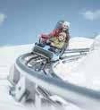
Merano 2000 Alpine Bob
Merano 2000 Ski and Hiking Area, Merano-Avelengo. See: www.meran2000.com.
Open both in summer and winter, Merano 2000 boasts the first 365-day bobsled track in South Tyrol. At an altitude of 1,900 m, the Alpine-Bob in Merano 2000 glides effortlessly over obstacles on the ground. From the mountain station, the bobsled gathers speed on a rail track up to 12 m above the ground! The 1.1 km scenic ride is popular with children and adrenaline addicts of all ages. Children above the age of 10 years can ride alone, while those under 10 must be accompanied by an adult.
Riding
• Sulfner Reiterhof Hotel in Avelengo Via S. Caterina/St.-Kathrein-Straße 4, 39010 Avelengo, reitstall@sulfner.com
While for some, happiness is riding on horseback, for many more it’s a completely new experience. Whether you’re a beginner, a pro or just on a “trial-ride”, we do our best to meet your expectations. At the Reiterhof, we offer rides on an hourly basis, half-day or full-day for beginners and seasoned riders. There are also supervised outings for children and horse-drawn-carriage rides. All trips are under the guidance of our trained staff.
• Tholer Riding Stables Contact: Piazzi Family – Riolagundo 30, 39022 Lagundo; info@tholer.com/www.tholer.com
Horse riding for adults and pony rides for the junior set: we have thoroughbred Haflinger horses and Shetland ponies respectively. Organised riding tours through the forest near Rio Lagundo/ Aschbach, after a quick assessment for beginners/novices. We fully cater to habitual/experienced riders. After completing their ride, children are given the choice of lending a hand with the horse grooming. Our large stable of horses as well as other kinds of livestock are sure to please both adults and children. Besides, we’re only 5 minutes from the Riolagundo upper cable car station on foot!
Please note that you need to book in advance. Call or text us at +39 338 848 2521.
57
Sightseeing in Naturno Church and Museum
St. Proculus Church and Museum
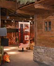
Naturno, Via S. Procolo/Sankt Prokulus-Str. street 1a, Tel. +39 0473 673 139 | prokulusmuseum@naturns.eu www.prokulus.org | f “St. Proculus Church and Museum”. Though small in size, the Church of St. Proculus is an historical-cultural treasure that still holds myriad secrets, despite considerable international research conducted over the years. Even though agreement about the origins of the church is yet to be found among some experts, it probably dates from the late 8th Century.
The ticket is available at the museum.
The church contains a distinctive fresco cycle which, at the time of discovery in 1923, caused a sensation among scholars. As it was uncovered, the fresco revealed angels and saints, and even a herd of cattle. Most significantly, the now-famous figure of the “Schaukler” (The Saint on the Swing) symbolising St. Proculus also emerged at the time. The depictions represent some of the earliest examples of pre-Romanesque wall painting in the Alpine region. Depending on the different dating methodologies, scholars agree that the frescoes date from between the 8th – 10th centuries. However, the paintings on the triumphal arch wall and the choir loft are unquestionably older than the those in the nave.
St. Proculus Church and Museum
Probably dating from the late 8th Century, the church’s distinctive fresco cycle is one of the earliest examples of pre-Romanesque wall painting in the Alpine area.
Housing research and archaeological findings, the adjacent museum documents the history of Naturno/Naturns and Proculus from Late Antiquity and the Early Middle Ages to the Gothic era, as well as the plague of the 17th Century.
Opening hours and entrance fees you can find on our website
www.prokulus.org
Info
Phone +39 0473 673139 museosanprocolo@naturno.eu www.prokulus.org
The upper part (nave was elevated around 1400) carries Gothic frescoes, with an original, pre-Romanesque painting in the lower part. The Gothic paintings covering the original mural paintings were removed using the strappo technique and are housed in the adjacent Proculus Museum. The contemporary museum also contains remarkable archaeological relics discovered in the immediate environs of St. Proculus Church, making use of multimedia stations to take visitors on an exciting journey through the ages. Entry tickets are on sale at the museum. Free admission for holders of the Museumobil Card and the Museumcard. For full visitor information and opening hours please see our homepage.
St. Prokulus Kirche und Museum

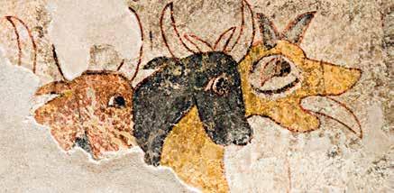
multimedia time travel
linienwerk.com | Foto: IDM Südtirol
and Tanja Flarer
58
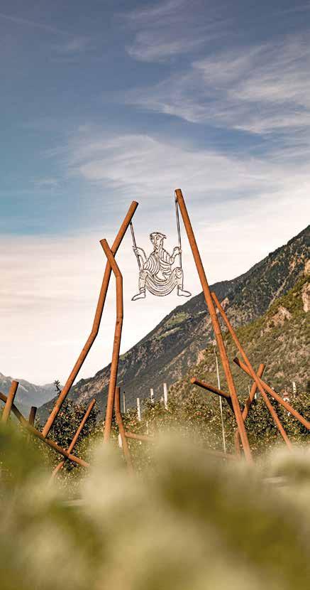
59
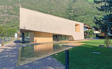
Texelgruppe Nature Park Visitor Centre
Water is the defining element of the Texelgruppe Nature Park. It has shaped the landscape and significantly influences the habitats within the park, presenting challenges to people, animals, and plants alike, both in its scarcity and abundance.
Fittingly, the permanent exhibition at the new Texelgruppe Nature Park House in Naturno is dedicated to water. The exhibit, titled “Towards the Water”, guides visitors through this impressive building, taking them on a journey from the Etsch River on the valley floor to the eternal ice of the glaciers, traversing the various altitude levels of the Texelgruppe Nature Park.
Both adults and children can explore the park in a novel way, discovering its complex ecosystems through interactive, hands-on displays. The 600 square meter exhibition allows visitors to engage with different habitats, from Mediterranean to high Alpine, dry to wet, and hot to icy. Plants and animals from each habitat are showcased like a cabinet of curiosities. Special sections focus on irrigation channels, Alpine pastures, farms, and meadows, requiring attention, curiosity, and a bit of skill. A historical technology game highlights the park’s fascinating geology with its diverse rock formations and mineral wealth.
The exhibition even takes visitors to the glaciers’ eternal ice and into the heart of a mudslide, demonstrating water’s destructive power. The Nature Park House itself features clear lines and an upward-reaching design, reflecting the Texelgruppe Nature Park’s landscape. Large windows fill the spacious rooms with sunlight, offering unobstructed views of Naturno, its surroundings, and especially the Naturno Sonnenberg Mountain. The best view is from the terrace, which faces the Sonnenberg, connecting visitors to the world they’ve just explored.
60
A visit to the Nature Park House can be complemented with a leisurely stroll through the newly created adjacent park. Rich in greenery and featuring a water basin that ties into the exhibition theme, the park is named after renowned butterfly collector and researcher Bernardin Astfäller, a native of Naturno.
Address: Bernardin Astfäller Platz square, 1
Telephone: 0473 668201 info.tg@provinz.bz.it; www.provinz.bz.it/naturparke
St. Laurentius Ruins
Cirlano/Stava. A short distance from the town centre on the road to Cirlano, you will find the ruins of the St. Laurentius Church. Waggoners and wanderers of days gone by would often seek refuge here and were on occasion stripped of their possession by bands of unscrupulous thieves. The ruins were carefully restored by the Association for the Preservation of Local Heritage, and is lovingly cared for and maintained by its members. Equally so the cornfields right next to the church, which have been revived and are farmed using traditional methods of agriculture to preserve the cultural landscape of bygone days.
Neuräutl
Naturno. The oldest settlement traces of Naturno are the huge rock formations of “Neuräutl” at the “Leitenhang” above Compaccio in Naturno. The Neuräutl area is located on the Naturno Sonnenberg, where a large rock formation rises out of the mountainside in the shape of a roof. The protective cavity underneath was first used as a dwelling in the Stone Age around 11,000 years ago. This makes the rocky roof one of the earliest settlement sites discovered in the Vinschgau Valley to date. In Roman times, the Middle Ages and up until the 19th century, the rock also served as a shelter from time to time. The artefacts are on display in the Prokulus Museum in Naturno. On display are finds from the Stone Age - tools made from flint: blades and scrapers.
St. Zeno Parish Church
Naturno. Named after the 4th Century Bishop of Verona, the Church of St. Zeno commemorates a patron saint today better known for protecting fishermen from the perils of the sea. The relics of the ancient church date back to the pre-Carolingian era and fragments of the old frescoes can be seen in the sacristy and on the lower floor of the church tower. Built around 1200 AD, the old Romanesque church had a choir and the pre-Carolingian building served as an apse instead of the side church of today. Today’s late-Gothic structure with a double nave and ribbed vault was built sometime between 1474 – 75 and the choir was given its Baroque style sometime around 1760.
61
Church of St. Oswald
Cirlando. Revered as Guardian of the Crusaders, St. Oswald was the King of Northumberland/England in the 7th Century. Today, however, he is known as patron saint of the Peasants and the Poor, as well as of Water and the Weather. 800 years ago, the St. Oswald Church and its lands formed part of the Welfen-Klosters-Weingarten in Baden-Württemberg. The Gothic church was redesigned in 1433 and renovated in 1669. The 17th Century altars, altarpieces and frescoes are the work of Simon Ybertracher (1694 – 1772), a baroque painter from Naturno. The relics of the Gothic fresco on the southern wall was discovered during the last restoration.
Kirche zu unserer lieben Frau Church
Named after the Virgin Mary, the church and its tower date back to Romanesque times. The church was rebuilt and re-consecrated in 1638. A stone with a magnificent coat of arms is set above the pointed archway and the 17th Century Cross on the west façade survived a devastating village fire in 1876.
St. Nikolaus Church
Tablà. St. Nikolaus was Bishop of Myra (Southern Turkey) in the 4th Century and is also known as the patron saint of Water and Wayfarers. First mentioned in the old records in 1369, the church with its nave and tower date back to the Romanesque period. In the late Gothic era (sometime around 1493), a choir was added and the pointed archway was erected. The church was rebuilt after a major village fire that devastated the original edifice in 1899 and subsequently changed into a Baroque structure. The church’s most notable feature is the intricately carved late-Gothic side altar, which is most likely the work of Hans Schnatterpeck.
Hochnaturns Castle
Naturno, Via Castello/Schlossweg. The 12th Century Hochnaturns Castle looks down on the town, and is one of its most important landmarks. The antique furniture, paintings, coffered ceilings, panelling and tiled stoves found in its stately rooms are all of considerable historical interest. Built by the Counts of Tyrol, the medieval castle was purchased in 1952 by the Mastropaolo family, after which it served as a Castle Hotel until 1992. Since then, visitors are no longer allowed access.
Tarantsberg Castle
Naturno, Via Dornsbergweg. Beneath the Nörderberg Mountain, between the villages of Naturno and Plaus, lies the imposing Tarantsberg Castle – also referred to as the “Dornsberg”. As ministers during the reign of the Counts of Tyrol, the Tarants had the castle built in the year 1217. The old coffered ceilings in the various rooms, finely-carved doors and panels, tiled stoves, arched Romanesque windows and valuable paintings on the door lunettes and hanging
62
in the arcades are priceless works of art. The paintings lining the chapel walls are also unique. In 1964, the castle passed into the hands of the Gottschall family from Munich and since then visitors are no longer allowed access.
Parish Church of St. Ulrich
Plaus, main village square. The Church of St. Ulrich was mentioned in the archives as far back as 1164 and only its large Romanesque bell tower survived a devastating fire in 1400. The church was rebuilt in Gothic style and consecrated in 1403. The two Baroque-era paintings by the famous Vinschgau Valley painter, Simon Ybertracher (1694 – 1772), are well worth seeing. The new Church of St. Monika was built next to the old St. Ulrich Parish Church, and is open to visitors during the day.
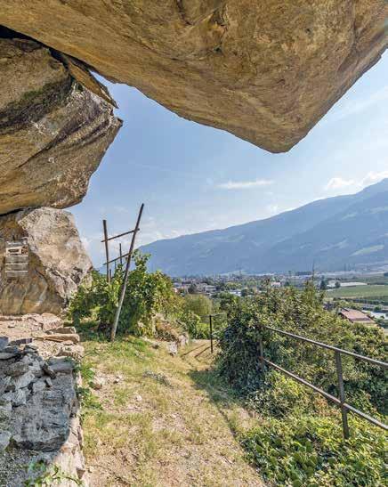
63
Church of St. Monika, Plaus
Less than two years under construction, a new church was consecrated by Bishop Ivo Muser on 27th August 2017, to coincide with St. Monika’s Day. The new church follows a very simple layout. After literally crossing through an oversized marble cross at the entrance, the first thing you see is a coloured light falling on the altar through the dome. The new church is well worth a visit.
“Plauser Totentanz”: Danse Macabre of Plaus
A series of 18 panels by renowned local artist, Luis Stephan Stecher, can be seen on the wall of the parish church in the Plaus village square. Each panel depicts different scenes of “Death, our constant companion”. Written in the local German dialect, the aphorisms are a constant reminder of death as a condition of life. In this seminal work, the artist captures the legends, real stories and the general mindset of the locals. Written in the vernacular: “Tonzn tian miar àlle gearn – lei nit mit sou durre Hearn”, the words encapsulate our attitude to religion, and the dangers of daily life on the streets. Visiting the “Plauser Totentanz” on the walls of the Plaus Cemetery is surely a memorable experience!
Moser Speckworld – The Bacon Adventure Experience
Stein 17, Naturno, Tel. +39 0473 671008, www.moser.it Smell, taste & enjoy: that’s the catch-phrase for the Moser Speckworld experience. Based around South Tyrolean Speck, the museum with a shop uses info panels and interactive stations to explain the old traditions and show how production methods have changed over time. There’s also plenty of sound advice such as how best to slice this processed meat, the optimal storage conditions and so on.
Juval Messner Mountain Museum
Stava, Juvale/Juval, www.messner-mountain-museum.it. Juval Castle was built around 1278 by Hugo von Montalban on the site of a prehistoric settlement. After world-renowned climber, Reinhold Messner, bought it in 1983 it became his residence and where he kept several of his art collections. These include various exhibits and images of sacred mountains from around the world. Visitors can see Messner’s unique collection of Tibetan, African, Indian and Nepalese works of art portraying the religious dimension of the mountains.
Open: 10 a.m. – 5 p.m. from the fourth Sunday of March to the first Sunday in November Last admission at 4 p.m. Closed on Wednesdays
64
St. Proculus Church and Museum
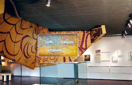
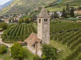
St. Proculus Church and Museum
Probably dating from the late 8th Century, the church’s distinctive fresco cycle is one of the earliest examples of pre-Romanesque wall painting in the Alpine area.
Housing research and archaeological findings, the adjacent museum documents the history of Naturno/Naturns and Proculus from Late Antiquity and the Early Middle Ages to the Gothic era, as well as the plague of the 17th Century.
Opening hours and entrance fees you can find on our website www.prokulus.org
Info
Phone +39 0473 673139
museosanprocolo@naturno.eu www.prokulus.org
St. Prokulus Kirche und Museum

multimedia time travel
linienwerk.com | Foto: IDM Südtirol and Tanja Flarer
available at the museum.
The ticket is
Sightseeing in the Surrounding Area
The Church Tower in the Reschensee Lake Curon-Resia. Protruding from the waters of Reschensee Lake, the tower dates back to the 14th Century, and is the only visible reminder of the villages of Curon and Resia, which were destroyed in 1950 to make way for the construction of the dam. This dramatic event gave rise to various legends and stories, mainly around the church tower. The lake is a popular summer relaxation and recreation destination.
Marienberg Benedictine Abbey
Burgusio, Tel. +39 0473 84 39 80, www.marienberg.it. The Marienberg Benedictine Abbey in the Upper Vinschgau Valley was built in 1160 by the Tarasp Nobles of the Engadine. The crypt and its Romanesque frescoes are the oldest part of the monastery and have survived the centuries surprisingly well. Built in 2007, the new exhibition hall portrays daily life showing highlights in the monastery’s history and provides a spiritual interpretation of the Romanesque frescoes in the crypt.
Glorenza
A small medieval town with an eventful history. Step back into the Middle Ages by entering one of the city gates of Glorenza/Glurns. Preserved in its entirety, the circular wall encloses the alleyways, arches and squares of the smallest town in South Tyrol, which was granted market rights by Meinhard II in 1291. Due to its favourable location on the Etsch river and the Via Claudia Augusta trade route, the hamlet was already an important trading centre in Roman times.
Vinschgau Valley Museum
Sluderno, Tel. +39 0473 61 55 90, www.vintschgermuseum.com. The permanent exhibitions held in the Vinschgau Valley Museum in Sluderno help to unveil the history of the Vinschgau Valley. These include permanent exhibitions about the Swabian Children, the history of the old irrigation canals and life in old Vinschgau Valley. A circuit tour follows one of the old irrigation canal paths, the Ganglegg Archaeological park displaying relics of the prehistoric era, and the majestic Churburg Castle.
Churburg Castle
Sluderno, Tel. +39 0473 6152 4141. With its 16th Century Renaissance interiors, Churburg Castle dates back to 1260. Boasting the largest private armoury in Europe, the arcades of the castle display the family tree of the Counts of Trapp, who acquired the property in 1504. Churburg Castle.
66
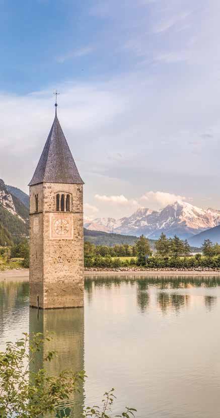
67
Messner Mountain Museum – Ortles
Solda, Tel. +39 335 608 1205. The Messner Mountain Museum (MMM) houses a collection of world-famous images of the mountains. At the Ortles MMM, the focus is on the glaciers, as exemplified by the Ortler Mountain.
Lichtenberg Castle
Perched high above Montechiaro/Lichtenberg near Prato, the ruins of Lichtenberg Castle boast a rich history of Minnesang, the medieval courtly tradition of lyric poetry and song. The Count of Tyrol owned the expanded castle until 1513, after which it was acquired by the Counts of Khuen-Belasi, who still own it today. The castle’s legacy of minstrelsy is evident in the remnants and traces of its once-lavish fresco decorations, reflecting the grandeur of its historical courts. Although much of the fresco cycle was removed in 1912, it now resides in the Ferdinandeum Museum in Innsbruck.
Kastelbell Castle
Castelbello, Tel. +39 0473 624 1 93. Built in 1238 by the Lords of Montalban, Kastelbell Castle subsequently changed hands several times. After the death of the last Count of Hendl, it was finally abandoned and subsequently fell to a state of disrepair. The Italian State Monuments Authority had the castle restored and in 1999, it was placed under the custodianship of the Castelbello Castle Board of Trustees. Points of interest in the castle complex include the manor rooms, inner courtyard, old kitchen, the Count’s residential wing, the Chapel and a permanent exhibition of the “Via Claudia Augusta”.
Allerengelberg Carthusian Monastery –
Former Monastery Complex of Certosa
Schnalstal Valley. A tour includes the cloister, grotto, priory and the kitchen, outer walls of the monastery, crucifixes, monastery gate, as well as the Church of St. Anna. Summer exhibitions of famous South Tyrolean artists in the cloister. Open all year round.
ArcheoParc Schnalstal Valley: Ötzi Archaeological Open-Air Museum
Schnalstal Valley, Madonna di Senales. Everything at the archeoParc revolves around Ötzi, the ice-man. The exhibition tells of Ötzi’s discovery in 1991 and the life that he and his contemporaries lived in these mountains over 5,000 years ago. Highlights include the realistic replicas of the Stone Age houses (outdoor exhibition area), items of clothing and tooling (indoor exhibition area). Lasting about an hour in all (Parcour 1), the tour includes a demonstration of how fires were lit during the Stone Age (every hour). The visitors’ workshop is especially recommended to those interested in the ancient crafts as well as families, and includes a stop at the archery range and pier for reconstructed dugout canoes. (Parcours 1 – 3, 3 – 4 hours).
68
Peter Mitterhofer’s Typewriter Museum
Parchines. Over 120 years of history are spread across four storeys of the Typewriter Museum, spanning Peter Mitterhofer’s earliest typewriters in 1864 to the keyboards of the digital age. Discover the exciting story of the early 20th Century Enigma computer and some interesting facts about the secretarial profession. Try the typewriters for yourself while following the audio tutorial. http://www.schreibmaschinenmuseum.com/en
Train World Museum in Rablá
Rablá, Piazza Geroldplatz 3
Miniaturized South Tyrol: a scale-model railway museum
The Train World Museum in Rablà near Parcines is a magnet for visitors of all ages. Spread across more than 1,000 m2, the digital model railway takes up three floors and is the largest in Italy. Comprising 20,000 pieces, 40 running trains, 400 vehicles, 7,000 figurines and with railway tracks totaling 400 m, the impressive 1:87 scale model is one of the largest private collections in Europe. Junior visitors can take turns driving a model train through surprisingly realistic landscapes. The main 130 m2 Train World Museum complex is located on the top floor, representing a miniaturized South Tyrol.
Prince’s Castle Merano
Merano, Via Galileo/Galileistr., info@gmeinde.meranz.bz.it
A visit to the Prince’s Castle gives a real insight into the life of the nobility in the Middle Ages. Thanks to the professional restoration, the former living quarters, but also the kitchen, the bathroom and the armory are perfectly preserved. This snapshot instantly transports the visitor back centuries. While some might wonder what was once considered absolute comfort, the sight of the old parlors with their mighty tiled stoves allows you to vividly imagine the social life of that time.
Women’s Museum Merano
Merano, Via Mainardo/Meinhardstraße,
The focus of the Women’s Museum in the spa town of Merano, called Museia, is set on the female way of looking at things.The Women’s Museum in Merano - “Frauenmuseum Meran” in German, “Museo delle Donne Merano” in Italian - was brought into being in 1988 by Evelyn Ortner (1944 - 1997), born in Austria. She was a passionate collector and called her museum “The little museum for dress and trumpery”. Today, of double size and collection, it is a tourist attraction in the old town of Merano. Also on an international scale, the Women’s Museum is recognized and manages the coordination of the Women’s Museums network worldwide. The museum mainly aims at raising awareness for the history of women as well as for equal opportunities and current women’s issues.
69
Gardens of Trauttmansdorff Castle, Botanical Garden and Touriseum
Via S. Valentino/St.-Valentin-Straße 51a, Merano, Tel. +39 0473 255600 (Gardens), Tel. +39 0473 255655 (Touriseum). Spread across twelve hectares and an elevation difference of 100 m, the Gardens of Trauttmansdorff Castle in Merano are shaped like a natural amphitheatre. The strategically-positioned gardens look across on exotic Mediterranean landscapes with breath-taking views of the surrounding mountains. The various themed sections, adventure stops, art pavilions and flowers combine to create a kaleidoscopic all year-round spectacle blending nature with culture and art! Elisabeth’s (Sissi) Trauttmansdorff Castle is centrally-positioned in the garden grounds and once served as the Empress’s summer retreat. Today it houses the South Tyrol’s Museum of Tourism (Touriseum), recounting 200 years of tourism in the Alps in an entertaining manner. www.trauttmansdor.it | www.touriseum.it
Schenna Castle
Scena, Via Castello/Schlossstr. 14, Tel. +39 0473 945 630. Built in 1350 as residence of the Lords of Schenna, the castle was acquired by Archduke John of Austria in 1844, who later passed it down to its present-day owners, the Counts of Merano. With its Renaissance Hall, including an early 18th Century faience oven, the castle boasts an impressive collection of antique weaponry. Paintings of erstwhile Tyrolean personalities, such as Margarethe “Maultasch”, Andreas Hofer and Archduke Johann, decorate the hall and dining room.
Bird Rescue Centre – Tyrol Castle
Tirolo, Tel. +39 0473 221 500. Daily in-flight shows featuring birds of prey are a major attraction at Tyrol Castle, captivating visitors of all ages. The shows, held at 11:15 am and 3:15 pm, showcase trained falcons, vultures, eagles, buzzards, kites, and owls soaring over the Merano Basin and returning to their trainer. The Bird Rescue Centre is dedicated to rehabilitating injured birds of prey and releasing them back into the wild as quickly as possible.
Tyrol Castle – South Tyrolean Museum of Culture and Provincial History
Tirolo, Tel. +39 0473 220 221. The castle that was once the seat of the Counts of Tyrol today houses the South Tyrolean Museum of Culture and Provincial History. The exhibition features an interactive tour highlighting the most significant events in the history, art and society of the region, as well as daily life in the castle during the Middle Ages. South Tyrol’s turbulent 20th Century history is presented in the medieval tower on 20 levels, including multimedia presentations, audio-visual testimonies and a large collection of contemporary documents explaining the long and arduous road to regional autonomy. Important temporary exhibitions highlighting other significant themes are also held at the castle complex.
70
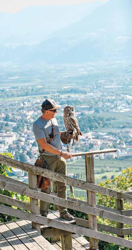
71
Museum Passeier – Andreas Hofer
Sandwirt in S. Leonardo – Passeiertal Valley, Tel. +39 0473 659 086. This small museum dedicated to 19th Century Tyrolean hero and resistance leader, Andreas Hofer, houses some of his personal effects. The memorial chapel portrays the dramatic events that took place in 1809, when Hofer led the Tyrolean Rebellion against the Napoleonic Army and the Covenant of 1796.
Museum Hinter Passeier – Bunker Mooseum
Enclosed in a contemporary glass tower, the entrance looks out on the village of Moso. The Bunker Mooseum in the Passeiertal Valley houses various exhibitions in an authentic WWII bunker. Themes include local history and the economy, archaeology and the flora and fauna in the Texelgruppe Nature Park. The gallery is housed inside the rock, with archaeological finds from the rear Passeiertal Valley spanning the Ice Age to the present day. The well-preserved corridors, staircases and gun positions of the former the 1940’s military bunker, reveal its wartime history. The Schneeberg mountain exhibition within the Mooseum focuses on the local mining operations in what used to be the highest mine in Europe. The outdoor area houses an ibex enclosure, where these remarkably agile mountain goats can be seen at close quarters. The return to the bunker is via an external staircase, forming part of an elaborate modern steel and glass structure.
Kränzelhof Experience – 7 Gardens
Weingut Kränzelhof Estate, Via Palade/Gampenstr. 1, Cermes, Tel. +39 0473 564 549. Surrounded by vineyards, the Kränzelhof wine estate is a choice venue for various kinds of events and cultural programmes. Comprising an amphitheatre, terraced artistic gardens, water features, art exhibitions in the Miil Restaurant, this medieval estate with a courtyard date from 1350.
South Tyrolean Fruit Growing Museum
Roggia di Brandis/Brandis-Waalweg 4, Lana, Tel. +39 0473 564 387. The Ansitz Larchgut Residence in Lana boasts the first fruit growing museum in South Tyrol. In its 2,000 m2 grounds, the historical development and evolution of fruit-farming in South Tyrol is comprehensively documented.
Schnatterpeck Altar
In the Niederlana Parish Church, you can find a high altar crafted by the sculptor Hans Schnatterpeck. The Schnatterpeck Altar, a stunning carved and gilded winged altar, dates back to the late Gothic period. Created by the Swabian sculptor Hans Schnatterpeck and his apprentices between 1503 and 1511, it is the only confirmed work from his workshop. Schnatterpeck was generously compensated for his masterpiece, receiving 1,600 Rhenish
72

In our Minigolf Park there are two courses: Concrete and Miniaturegolf. Both courses are internationally accredited, so that national and international Championships may be held. The park is open from April to October
The Minigolf Team wishes all visitors a lot of fun and good luck
Station street 67 in the sports zone Tel. +39 340 1591553 / +39 340 3220644 www.ssvnaturns.it/minigolf.html – E-Mail: zischg.josef@bahnengolf.it
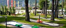
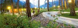
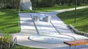
miniGolf-Park Naturns
guilders, equivalent to the value of three farmsteads, along with eight cartloads of wine. This was the highest amount ever paid for a Gothic altar in Tyrol.
Gampen Gallery in the Bunker
Laurengo/Laurein. At only 1,520 m, the Gampenpass mountain pass (Passo Palade in Italian) is one of the lowest mountain passes in the Alps and was the main north-south route once used by wayfarers and pilgrims, before the roads were built. The Alta Val di Non/ Deutschnonsberg area always represented the boundary between cultures and served as a frontier: a place of both meeting and separation.
Built between 1935 and 1939, the road across the Gampenpass mountain pass connecting the villages of Lana in South Tyrol and Fondo in Trentino represented an engineering feat at the time. One of the most important WWII-era bunker systems in South Tyrol was built on the Gampenpass on the border between South Tyrol and Trentino. Today the bunker in the Gampen Gallery hosts exhibitions including a permanent collection of minerals and a photo exhibition.
Raffeiner’s World of Orchids
Via Nazionale/Reichstraße 26, Gargazzone, Tel. +39 0471 920 218. A world of experiences, with 500 different orchid species lies in a tropical setting spread across 6000 m2. Attractions include waterfalls, Koi ponds, parrots, adventure playgrounds, Orchidea gastronomy and much more besides!
Messner Mountain Museum Firmian
Sigmundskron Castle near Bolzano, Via Castel Firmiano/Sigmundskronerstraße 53, Tel. +39 0471 63 12 64. As one of the six MMM exhibition sites of the mountains of the world, Reinhold Messner reflects on the origins, grandeur and conquest of the heights. Reinhold Messner, King of the Eight-Thousand-Plus-Metre Peaks has dedicated a museum project to mountains and mountain culture. The museum includes six settings located in an extraordinary Alpine context. The heart of the project is housed within the ancient walls of Sigmundskron Castle in Bolzano. The exhibition is laid out in various spaces throughout the castle and offers an overview of the world of mountain through artefacts, natural objects, and works of art.
South Tyrol Museum of Archaeology
Via Museo/Museumstraße, Bolzano/Bozen, Tel. +39 0471 32 01 00. Although the focus of the permanent exhibition is the 5,000-year-old ice mummy “Ötzi” and his artefacts, the idea is to provide a broader insight into human survival during the Copper Age, the cultural world of the Iceman, and the results of forensic research carried out since his accidental discovery in 1991. Other temporary exhibitions at the museum shed light on related subjects.
74
South Tyrol Museum of Natural History
Via Bottai/Bindergasse 1, Bolzano/Bozen, Tel. +39 0471 41 29 64.
Situated in Bolzano’s old town, the South Tyrol Museum of Natural History houses both permanent and temporary exhibitions. The permanent exhibition focuses on the South Tyrolean landscape, its geology and the terrain as a natural habitat for wildlife and it also includes a large aquarium. The interactive visit is like experiencing a journey through time.
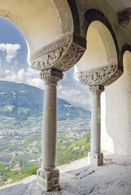
75
Visitor Centres of the Stelvio National Park: The museums of the National Park in South Tyrol
The aquaprad Visitor Centre in Prato
Tel. +39 0473 618212; info@aquaprad.com
The aquaprad Visitor Centre is located in the village centre of Prato allo Stelvio in the National Park Region. It is no coincidence that Prato was chosen as the location for this visitor centre dedicated to the aquatic world: the Suldenbach stream forms the only undeveloped river delta in South Tyrol here near the village and still exhibits natural flow dynamics. In the large lake aquarium of the visitor centre, the habitat of the lowland lake with its biocoenosis and food chain has been recreated. The almost complete fish fauna of South Tyrol from the headwater stream to the lowland lake is shown in lifelike aquariums.
The avimundus Visitor Centre in Silandro
Tel. +39 0473 730156; info@avimundus.com
The world of birds in the Stelvio National Park
The National Park visitor centre avimundus in the pediastrian zone of Silandro is entirely devoted to the bird kingdom of the Stelvio National Park. It offers visitors an overview of the world of birds, and selected bird species are clearly presented and assigned to their respective habitats. Visitors are given extensive information about the breeding and rearing, and on bird voices and their songs.
76
The culturamartell Visitor Centre in Martello
Tel. +39 0473 745027; info@culturamartell.com
Mountain farming in the National Park: then and now Over the centuries, most human activity in the Stelvio National Park has revolved around mountain farming and the hard life of the mountain farmers. This is reflected at the culturamartell Visitor Centre in the Martelltal Valley, with its contemporary museum of local history.
The lahnersäge Visitor Centre in the Ultental Valley
Tel. +39 0473 798123; info@lahnersaege.com
The lahnersäge Visitor Centre in S. Gertrude/St. Gertraud explains and documents the vital role of the forests in the National Park. Nearby, a 200-year old Venetian sawmill was discovered and later restored to full functionality.
At the lahnersäge Visitor Centre, the life-cycle of indigenous trees is explained, as well as processing. Demonstrations of traditional workmanship are on display, using the refurbished Venetian saw. The production of boards and other wooden items is demonstrated at the refurbished old sawmill.
The naturatrafoi Visitor Centre on the Stelvio Pass Road
Tel. +39 0473 530045; info@naturatrafoi.com
The Geology of the Ortler-Cevedale Mountains
In the village of Trafoi along the Stelvio Pass, the naturatrafoi Visitor Centre shows how nature has successfully managed to adapt in this high Alpine region. With sometimes extreme weather conditions as well as the unique geology of the Ortler, both animals and plants have had to evolve a number of ingenious survival strategies.
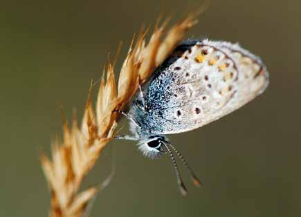
77
Hiking Suggestions
Wallburgboden Circuit: Cult Places and Energy Spots S. 80
Of Knights and Frogs – From Rittersteig to Plaus
Sonnenberg Panoramic Trail
82
84
From Naturno to the Parcines Waterfall S. 86
Juvaler Waalwegrunde Circuit Hike S. 88
The Rablander Waalweg Trail: Short and Spectacular S. 90
Partschinser Waalweg on the Sonnenberg Mountain S. 92
Algund Waalweg Irrigation Channel Trail S. 94
Marlinger Waalweg –
The Longest Irrigation Channel Trail in South Tyrol
96
Maiser Waalweg Trail – From Saltusio to Maia Alta S. 98
Merano High Mountain Trail – The Gorge of 1.000 Steps! S. 100
Kirchbachspitze – The Mountain above Naturno S. 102 “Orenknott” Trail – Texelbahn Cable Car Circuit Hike S. 104
The Merano High Mountain Trail near Parcines: From Giggelberg to the Tablander Alm S. 106
Merano High Mountain Trail South:
From the Leiter Alm to the Giggelberg
The Spronser Seen Lakes –Pearls in the Texelgruppe Nature Park
108
110
From Rio Lagundo to the Brandhof Dairy Farm S. 112
Naturnser Alm and Vigiljoch Panoramic Plateau S. 114
Nörderberger Almentour: Hiking between Mountain Huts S. 116
Tour of the Picturesque Zirmtal Seen Lakes S. 118
Trail to the Naturno Hochwart Panoramic Peak S. 120
From the Church on the Cliff to Unterstell S. 122
From Emerald to Golden:
Lake Circuit Hike in the Schnalstal Valley S. 124
Picturesque Mastauntal Valley S. 126
Lazaun Circuit Hike S. 128
Bergl Alm – Schnalstal Valley S. 130
Pfossental Valley: Home of Marmots, Chamoix and Ibexes S. 132
Alpine Mountain Tour: From the Glacier into the Valley S. 134
On the Tracks of the Ortler Front in Martello di Dentro S. 136
S.
S.
S.
S.
S.
78
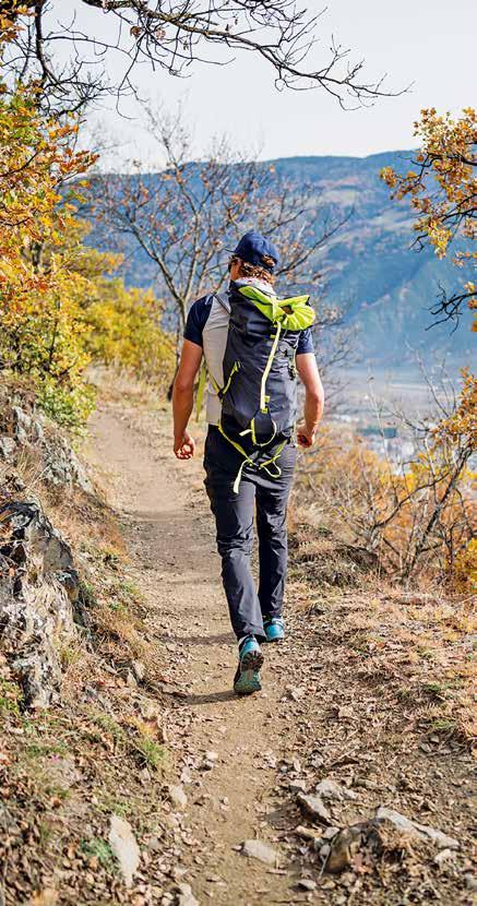
79
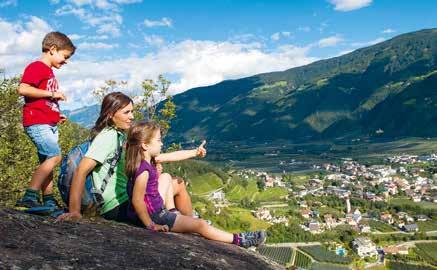
Wallburgboden Circuit: Cult Places and Energy Spots
» Route
Naturno – Sonnenberg Panoramic Trail – Wiedenplatzerkeller – Wallburgweg – Wallburgboden – Schwalbennest Naturno
2 hr. 15
km
Starting from the centre of Naturno, the circuit path leads to Feldgasse road, and then to St. Prokulus-Straße street, from which you turn into Trail No. 39/91. Following the signposts, you arrive at the tarred road leading to the Wiedenplatzer Keller Restaurant. From there, follow the trail for about 5 min through the chestnut trees, passing a light forest and scrubland then climb up a fairly steep incline to reach the Wallburgweg track. Continue along the flat path until you find an access road to some farms, then follow the trail along the slopes of the Sonnenberg. The former Waalweg irrigation channel trail is part of The Meraner Waalrunde Circuit Trail, passing the old Waalerhütte hut in a westerly direction as far as the Wallburgboden lookout point. Back in the Iron Age this was probably where the “upper” and “lower” Wallburg coincided and even today, this location still radiates a special kind of energy. On the return, the initial section follows the same route as the outward hike. Continue on a slightly downhill gradient from the second turning where the signs indicate the “Schwalbennest”, to the rest-stop hut with refreshments. After reaching the Maurbamhof farm, the last
7,2
0
470
470
80
km
a.d.u.
a.d.d.
section on the return trip leads over a narrow, paved road. Follow Schlossweg and Feldgasse streets to return back to the starting point in the town centre.
» Tips/special attractions
Following the path along the old irrigation canals you come to a stunning lookout point above Naturno. This panoramic hike offers fantastic views of the Schnalstal Valley, Juval Castle and Vinschgau Valley, as well as of the Sonnenberg.
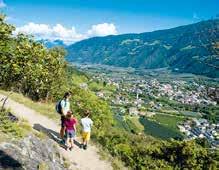
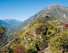

Card no. 04 »
500 535 0 1 2 3 4 5 6 7 700 900 602 735 739 738 796 756 824 647 535 km
Height profile
81
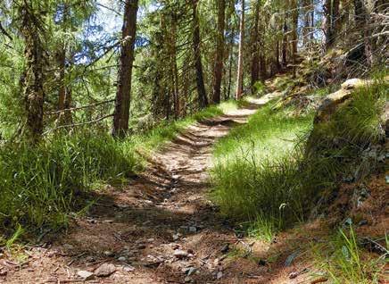
Of Knights and Frogs –From Rittersteig to Plaus
» Route
Naturno – Sports ground – Rittersteig – Alpine-Wellfit-Parcours –Plaus – Naturno
260 a.d.u.
2 hr. 30 11,7 km 0 km
260 a.d.d.
From the centre of Naturno, head for the sports grounds along the road to the Bahnhofstraße road and cross the bridge over the Etsch River. Over the bridge is the first signpost to the Rittersteig trail in the direction of Plaus. Head on a slightly uphill gradient before the road flattens out and branches to the left as it leads into the start of the Jesus-Besinnungsweg Contemplation Trail. Follow Trail No. 1 along the wooded slopes of the Nörderberg Mountain until you come to Dornsberg Castle. Continue until you reach an outdoor gym area called “Alpine-Wellfit-Parcours” before heading to Plaus. Follow Gröbenweg road through apple orchards to the village centre of Plaus. To return, cross the bridge over the Adige River and take the Vinschgau Valley Cycling Trail, which immediately turns left and follows the river to Naturno. Continue along the road parallel to the railway line until you return back to the starting point in the village centre.
82
» Tips/special attractions
In the village of Plaus, the “Dance Macabre” series of paintings on the cemetery wall of the Church of St. Ulrich are the work of local artist, Luis Stephan Stecher. The aphorisms in the German vernacular underpin 18 scenes captured in vivid colours.
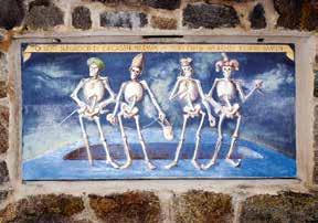
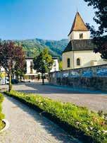
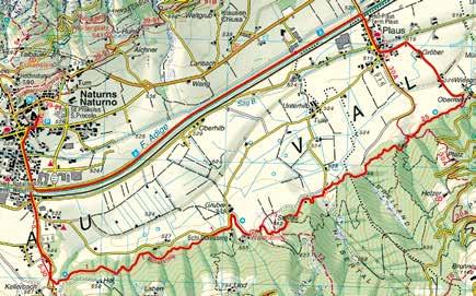
Card no. 011
500 0 1 2 3 8 4 9 5 6 7 12 11 10 700 552 km 535 565 594 539 520 527 535 » Height profile 83
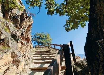
Sonnenberg Panoramic Trail
» Route
Texelbahn Cable Car valley station (Parcines) – Trail No. 1 – Gasthof Winkler – Sonnenberg Panoramic Trail – Naturno
2 hr. 15
260 a.d.u.
360 a.d.d.
7,3 km 6,5 km
Take bus 266 from Naturno and Plaus to the Texelbahn Cable Car valley station in Parcines. From there, follow Trail no. 1 and head up to the Gasthof Winkler Inn, where the Sonnenberg Panoramic Trail. Follow Trail No. 91, along the slopes of the Sonnenberg Mountain past some farmsteads, the newly-restored Runster Mill and the Weinberghof rest stop to the centre of Naturno. The route is mostly flat, with some rises and dips, at times facilitated by steps and railings in the more exposed sections. On the way to Naturno, take a detour to the world-famous Church of St. Proculus and the nextdoor St. Proculus Museum. The nearby Texelgruppe Nature Park House should also be of considerable interest, especially for families with children. Alternatively, start your hike in Naturno and follow the Sonnenberg Panoramic Trail in the opposite direction. Return by bus 266 to Plaus and Naturno.
84
» Tips/special attractions
The view looks out on the the Hirzer and Inger peaks of the Sarntal Alps, the fertile valley, the wooded slopes and the Nörderberg Mountain with the Vigiljoch plateau, the mountains of the Ultental Valley and the Vinschgau Valley, with the snow-capped 3,000 m peaks of the Ortler Mountain. The best times of the year for hiking along the slopes of the Sonnenberg is in spring and autumn.
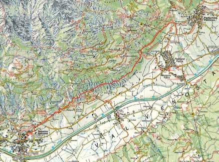
Card no. 011
0 1 2 3 4 5 6 7 700 500 600 km 724 609 660 701 683 655 541 » Height profile 85
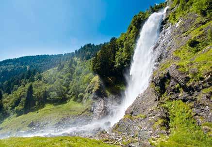
From Naturno to the Parcines Waterfall
» Route
Naturno – Sonnenberg Panoramic Trail – Runster Mill – Trail No. 39A – Trail No. 26 – Dursterhof – Birkenwald
3 hr. 30
800 a.d.u.
412 a.d.d.
8,9 km 0 km /
This hike starts in the town centre of Naturno/Naturns. Take Feldgasse road and then St.-Prokulus Straße street, before continuing along Trail no. 39/91 up to the Sonnenberg Panoramic Trail. Follow the trail to the newly-renovated historical Runster Mill. As the fork, continue uphill on Trail No. 39a/91 to Weitgrub farm. From there, proceed along Trail No. 39a through the forest and then, as the path levels out, across the meadows to the Unterrain and Unterwand farmsteads. The route then follows Trail No. 26, along the steep slopes of the Parcines Sonnenberg Mountain and under the Texelbahn Cable Car to the Jausenstation Dursterhof snack bar. From there, continue along Trail No. 26 through the forest and across the grassy slopes to the Birkenwald inn beneath the Parcines Waterfall.
86
» Tips/special attractions
The main feature on this hike is a rustic stone-walled farmstead built by the owners with their own hands using exclusively natural building materials. The farm houses and outbuildings of the Dusterhof farmstead have progressively been expanded over the years and the raspberry vines growing on the vertiginous slopes, help to make the Dursterhof quite unique.
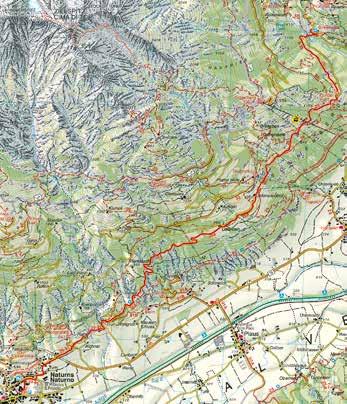
Card no. 011
500 0 1 2 3 4 5 6 7 8 700 900 1.100 535 614 667 827 948 1.028 1.119 979 950 8,9 km » Height profile 87
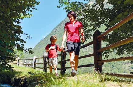
Juvaler Waalwegrunde Circuit Hike
» Route Ciardes – Trail No. 3 – Tscharser Waalweg – Juval Castle – Sonnenhof – Stabner Waalweg – Ciardes
3 hr.
420 a.d.u.
420 a.d.d.
9,7 km 6 km /
From the Ciardes bus stop/railway station near the Hotel Winkler, go to the village centre of Ciardes and follow Trail No. 1a/3 uphill along a paved road before entering the forest, continuing to follow the signs to the Tscharser Waalweg irrigation channel trail (Trail No. 3 – Schnalswaal). The level path runs along the barren slopes of the Sonnenberg Mountain until you reach the Gasthof Sonnenhof Inn. Then turn left and continue uphill for about 5 min until you arrive at Juval Castle. From there, go down to the Schlosswirt Inn. To return to Ciardes, go back up above the Schlosswirt Inn and at the bend turn right into the Waalweg irrigation channel path. Passing the Waalerhütte hut with its waterwheel, go back to the Sonnenhof Inn. From there, turn left and follow Trail No. 1 in the direction of Stava. The Stabner Waalweg irrigation channel trail runs halfway between Juval Castle and the bottom of the valley. The level trail continues towards the Vinschgau Valley as far as the Gasthof Himmelreich
88
Inn. Follow the narrow road to the centre of Ciardes and downhill back to the railway station. From the railway station, take the train back to Naturno.
» Tips/special attractions
Two of the nicest irrigation channel trails run through chestnut groves and across the typical Sonnenberg Mountain landscape, setting this hike apart. Occasionally, you can see water flowing through the water canal and a stop at the Juval Castle Messner Mountain Museum is well worth your time!
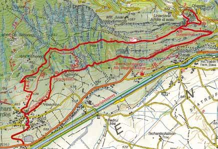
Card no. 04
500 700 900 km 564 564 688 803 840 911 826 705 649 635 » Height profile 0 1 2 3 8 4 9 10 5 6 7 89
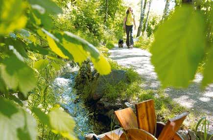
The Rablander Waalweg Trail: Short and Spectacular
» Route Texelbahn Cable Car – Waalweg Trail – Happichl Inn
0 hr. 20
0 a.d.u.
50 a.d.d.
1,0 km 6 km
This irrigation canal above Rablà was created by diverting the waters of the Zielbach Torrent. Despite its short length this canal path is quite remarkable. Starting at the Texelbahn Cable Car parking lot, follow the road leading to the cable car station. Then proceed to the start of the Waalweg above the sports field crossing through a shady forest as far as the Happichl Inn. Follow a narrow road that separates houses from the orchards for about 20 min as far as the bus stop in Rablà. Starting from the Texelbahn Cable Car parking lot follow the trail along the Waalweg onto the Sonnenberg Panoramic Trail. After a fairly difficult ascent from the Happichl Inn, you arrive at the start of the trail. Follow this panoramic path to the Winkler Inn and back to the Texelbahn Cable Car parking lot. With an elevation difference of approx. 170 m the ± 3 km circuit trail lasts about 1 h. 30 on foot. Bus 266 brings you from Naturno via Rablà to the Texelbahn Cable Car. Either Bus 251 or the Vinschgau Valley Train from Rablà bring you back to Naturno.
90
» Tips/special attractions
The Rablander Waalweg offers excellent perspectives of the Burggräfler mountains. The renovated Rablander Waalschelle (a traditional water wheel fitted with a hammer which repeatedly strikes a bell) is a standout feature. In the past, these so-named “Waalschelle” allowed the “Waaler” operator to check if the watercourse was functioning properly.
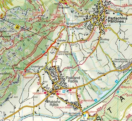
Card no. 011
0 0,2 0,4 0,6 0,8 0,94 600 km 625 609 594 599 589 582 » Height profile 91
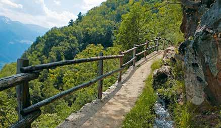
Partschinser Waalweg on the Sonnenberg Mountain
» Route Salten (Zieltal Valley) – Waalweg – Vallettina 0 hr. 45
Dating as far back as the 15th Century the Partschinser Waalweg is one of the oldest irrigation canal trails in the Burggrafenamt area. Taking its waters from the Zielbach Torrent, the canal flows along the slope above Parcines with the path running alongside. At Salto/Salten turn right and follow the scenic Waalweg to Vallettina/ Vertigen east of Parcines to the end of the irrigation canal. Through the scattered trees enjoy a fabulous view of Merano/Meran and its environs with the soothing sounds of the canal waters in the background. Follow Trail No. 7A from Valletta down to the centre of Parcines (approx. 20 mins).
Since this Waalweg is only 2 km long, we recommend completing the route all the way from the Texelbahn Cable Car valley station. Follow Trail No. 1 along the Zielbach Torrent to Salto as it gradually ascends to the Winklerhof, to the start of the Waalweg. From the centre of Parcines, the route leads to Sonnenbergstraße road, continuing through orchards and over a suspension bridge to Winklerhof before heading downhill to the Texelbahn Cable Car station. The whole Waalrunde Hiking Circuit takes about 2 hours to hike.
Bus connections: Naturno – Parcines (Bus 266). Parcines – Waterfall (Bus 265).
7
8
68
92
2,0 km
km /
a.d.u.
a.d.d.
» Tips/special attractions
This irrigation canal trail leads through unspoilt nature, offering unobstructed views. Considered one of the most magnificent Waalwege trails in Merano and Environs, at the east end of the trail lies an ancient stone (known as the “Wohnstein”) and a prehistoric concave rock (“Schalenstein”), both dating from the Copper Age.
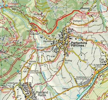
Card no. 011
0 0,4 0,8 1,2 1,6 800 km 814 793 783 776 768 752 » Height profile 93
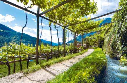
Algund Waalweg Irrigation Channel Trail
» Route
Töllgraben Bridge parking lot – Plars di Sopra – Plars di Mezzo –Lagundo – Quarazze
1 hr. 30
55 a.d.u.
96 a.d.d.
5 km 8 km /
The waters of the Algunder Waalweg irrigation canal are diverted from the Etsch River and flow from Plars to Lagundo and Quarazze/ Gratsch through orchards, vineyards, and mixed forest through what is mostly flat terrain. The Waalweg begins at the parking lot near the Töllgraben Bridge just below the village of Tel. Follow the road uphill to Plars past the Leiter am Waal Inn to Café Konrad beneath Velloi/Vellau. After crossing a small access road, continue along the flat path to the end of the Waalweg to the suspension bridge. Follow Trail No. 29A that branches off the road and after a short 15 min descent you arrive at the little church of St. Magdalena in Quarazze (Bus 236 bus connection to Merano/Meran). The descent along this seldom used road leading from Quarazze to Thurnstein Castle is fairly easy. About halfway down the Tappeinerweg, follow the 4 km long route along the promenade as far as the historic centre of Merano. (Hike duration: approx. one hour). To return to Naturno take either Bus or the Vinschgau Valley Train to Tel railway station (parking lot).
94
» Tips/special attractions
The Algunder Waalweg offers panoramic views of the Burggrafenamt area above the Etschtal Valley as the valley basin widens out. The closer you get to Quarazze near Merano, the more palms, cypresses, and olive trees can be seen, making this Alpine valley with its orchards and vineyards reminiscent of a Tuscan landscape.
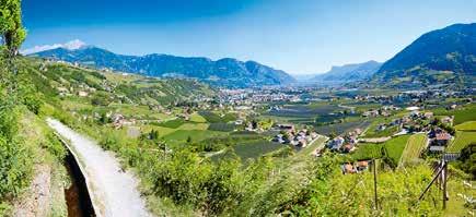
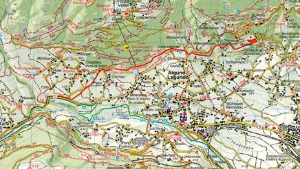
Card no. 011
0 1 2 3 5 4 500 km 498 448 483 464 460 491 » Height profile 95
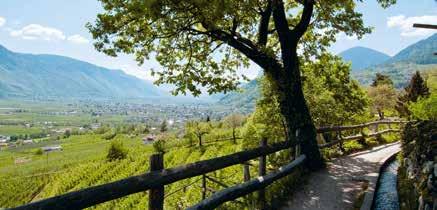
Marlinger Waalweg –The Longest Irrigation Channel Trail in South Tyrol
» Route
Tel (floodgate on the Etsch River) – Foresta – Marlengo – Cermes –Lana di Sopra
3 hr. 12 km
The Marlinger Waalweg, the longest irrigation channel trail in South Tyrol, was built about 250 years ago at the behest of the Carthusian monks of the Schnalstal Valley, who owned a large vineyard in Marlengo. The Marlinger Waal water canal is fed by the waters of the Etsch River at Tel and still flows through the original open canal. From Naturno, take Bus 251 (or the Vinschgau Valley Train) as far as Tel and follow the signs to the start of the Marlinger Waalweg at the Etsch River floodgate in Tel. Turning to the right, the Waalweg irrigation channel trail leads along the slopes of the Marlinger Mountain above Vinschgauer Strasse street to the Forst Brewery and to Marlengo, passing vineyards and fruit orchards, to Lebenberger Strasse street above the small village of Cermes. After this long hike along the old irrigation canal, follow the short descent along Raiffeisengasse road to the village of Lana. Alternatively, instead of hiking the entire Waalweg, you can decide to only hike sections of it, with entry/exit points in Cermes and Marlengo. To return, take Bus 211 from Lana to Merano and from there, change to Bus 251 or take the Vinschgau Valley Train back to Naturno.
7
96
km / 90 a.d.u. 280 a.d.d.
» Tips/special attractions
Try the ± 2 km long Experience Path section of the Waalweg near Marlengo, with many informative and interesting facts about the forest and the role of water. Or take a detour to the 13th Century Lebenberg Castle, a stately manor above Cermes.
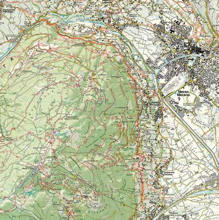
Card no. 011
500 509 497 484 477 458 410 » Height profile 0 1 2 3 8 4 9 5 6 7 12 11 10 km 97
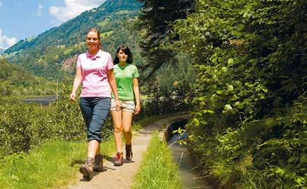
Maiser Waalweg Trail –From Saltusio to Maia Alta
» Route Saltusio – Torgglerhof – Maia Alta (Planta Castle)
2 hr. 30
8 km
46 a.d.u.
270 a.d.d.
26 km /
The river waters on the orographic left of the Passirio River in Saltusio/Saltaus are diverted into the Maiser Waal canal. It meanders next to sparsely wooded slopes to Maia Alta near Merano, with the Waalweg alongside running across almost flat terrain. From the Hirzer Cable Car parking lot in Saltusio descend to the Passerdammweg and further down to the Torgglerhof. From there the Waalweg leads past the so-named “Labböden” and then to the Waalerhaus and the nearby Waalschelle. After crossing the Riffianerweg trail the route leads to the Petaunerhof and along the Rothalerweg trail with only the constant murmuring sounds to remind one of the nearby Passeier River. After some rocky slopes continue to the bridge across the Schnuggenbach Torrent and through the forest to the Leiterweg. On the way to the scenic Sonnwendhof enjoy the views of Maia Alta and Merano through gaps in the sparse forest foliage. Cross a small road through the vineyards and orchards to reach Planta Castle in Maia Alta. From there it takes about 30 min on foot to reach the centre of Merano. You can return on Bus 251 or take the Vinschgau Valley Train to Naturno. Bus 240 from Merano to Saltusio brings you to the entrance of the Passeiertal Valley.
98
» Tips/special attractions
Hiking the Maiser Waalweg you can enjoy a wonderful view of Scena near Merano as well as of the opposite side of the valley across from Tirolo and the hamlets of Chienes and Rifiano. The Maiser Waalweg is a well-trodden and popular hiking trail, especially in the hot summer months.
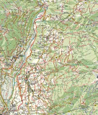
0 1 2 3 4 5 6 7 400 km 462 447 415 435 422 409 » Height profile Card no. 011 99
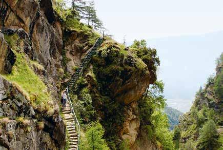
Merano High Mountain Trail –
The Gorge of 1.000 Steps!
» Route
Rablà – Texelbahn Cable Car mountain station – Merano High Mountain Trail – Gorge of 1.000 steps – Linthof – Patleid – Unterstell Cable Car mountain station
3 hr. 30
9,5 km
450 a.d.u.
680 a.d.d.
6,5 km /
Start at the Texelbahn Cable Car mountain station in Parcines and go up a short way to the Gasthof Giggelberg Inn. Then follow the Merano High Mountain Trail No. 24 in a westerly direction (1,500 m average). But be prepared to cross some significant altitude differences after Hochforch over the so-named “Gorge of 1.000 Steps”, connecting the Brunnental and Lahnbachtal ravines. Thanks to the new 55 m suspension bridge over the Lahnbach stream, the number of steps has been reduced, but climbing up the gorge still requires a considerable level of physical fitness. After arriving at the Pirchhof, the route to the Linthof is fairly straight-forward. Following Trail No. 10, you arrive at the Unterstell Cable Car mountain station. Between Pirchhof and Unterstell, are a number of rest and refreshment stops to choose from.
100
» Tips/special attractions
The highlight of this hike is the section across the Gorge of 1.000 Steps, showing how the enormous force of water has eroded the rocks over the centuries to create the impressive Lahnbach Gorge. The newly-built suspension bridge and the ascent over metal and wooden steps help to make this an unforgettable hiking experience.
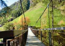
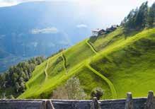
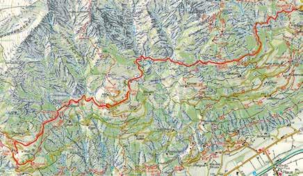
1.200 0 1 2 3 4 5 6 7 8 9,5 1.400 1.600 1.800 km 1.504 1.551 1.455 1.417 1.485 1.300 1.607 1.544 » Height profile Card no. 011 101
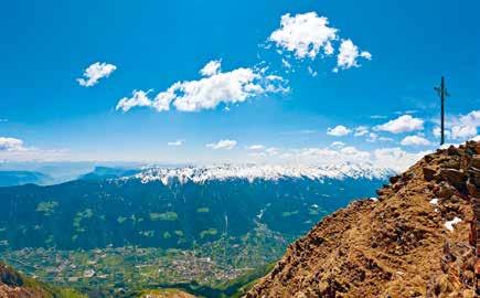
Kirchbachspitze –The Mountain above Naturno
» Route
Naturno – Unterstell Cable Car mountain station – Dicker Alm –Kirchbachspitze – Dickhof – Unterstell Cable Car mountain station
8 hr. 20
1.680 a.d.u.
17 km 1,5 km
1.680 a.d.d.
This circuit hike around the familiar Kirchbachspitze Peak (Naturno “local” mountain) starts at the Unterstell Cable Car mountain station. At a height of some 1,300 m, follow Trail No. 10 past the Patleid and Lint mountain farms before crossing the Merano High Mountain Trail and continuing uphill through larch forests to the Dickhof. From there continue past the Dicker Alm and the Obere Moaralm pastures up to 2,095 m. Having reached the latter, follow Trail No. 10A which leads northeast to above the tree line on partly still grassy, but quite stony and progressively rockier terrain. Along a moderately steep incline, the trail follows the steep contour of the valley basin. Separating you from the summit at about 2,600 m, is a final steep and challenging stretch over fairly loose scree. Approaching the summit from behind, one is suddenly confronted with a vertiginous view of the Kirchbachspitze as it drops almost vertically down into the valley. The descent replicates the same route as the ascent, with the Unterstell Cable Car taking you back to Naturno.
102
» Tips/special attractions
Despite the effort, this demanding route rewards you with breath-taking views. At 2,500 m, the sloped mountainside stretches down from the summit all the way to Naturno.
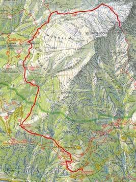
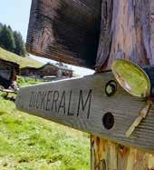
1.200 2.000 2.400 2.800 1.600 0 1 2 3 8 4 9 5 6 7 14 15 16 17 11 12 13 10 km 1.300 1.300 1.689 2.065 2.443 2.951 2.168 1.787 » Height profile Card no. 04 103
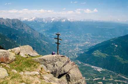
“Orenknott” Trail – Texelbahn
Cable Car Circuit Hike
» Route
Rablà – Texelbahn mountain station – Orenknott – Orenalm –Hochforch – Merano High Mountain Trail No. 24 – Texelbahn mountain station
4 hr. 10
841 a.d.u.
841 a.d.d.
8 km 6,5 km /
From the Texelbahn Cable Car mountain station in Parcines/ Partschins and the Giggelberg Inn follow Trail No. 2 uphill. After passing the Adlerhorst mountain hut, attentive hikers will notice the remains of what appears to be an ancient irrigation canal. Crossing through the sparse forest you finally arrive at a gorge where the trail forks. Follow Trail No. 25A uphill (Trail No. 2 leads further to the Zielspitze Peak – see p. 90). Further up, a signpost signals the way to the Orenknott Summit. Follow the trail to the right and up to the summit at 2,258 m with its breath-taking lookout point and a striking triple cross. On the way back, follow a section of the same path to the previous intersection. Then take Trail No. 25 to Orenalm and Hochforch. Passing the ruins of the dilapidated Orenalm mountain hut, descend further down a considerably steep gradient past the Hochforch mountain refuge to the Merano High Mountain Trail at 1,555 m. From there follow the Merano High Mountain Trail to the Texelbahn Cable Car mountain station and then further down to the
104
cable car valley station. From there the bus service easily connects to Naturno. At the cable car station there’s also free parking for private vehicles.
» Tips/special attractions
Marvel at the fantastic panorama at the Orenknott lookout point as it stretches from the Merano Basin all the way up to the glaciers of the Ortlergruppe. Depending on the prevailing weather conditions, from there the line of view can stretch all the way to the Dolomites.
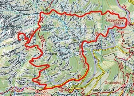
1.400 0 1 2 3 4 5 6 7 8 1.600 1.800 2.000 km 2.258 1.997 1.766 1.948 1.544 1.457 1.807 » Height profile Card no. 011 105
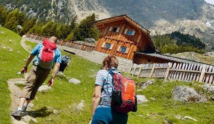
The Merano High Mountain Trail near Parcines: From Giggelberg to the Tablander Alm
» Route
Rabland – Bergstation Texelbahn – Schutzhütte Nasereit –Rablà – Texelbahn Cable Car mountain station – Nasereit Refuge –Tablander Alm – Nasereit – Texelbahn Cable Car mountain station
3 hr. 40
641 a.d.u.
10,5 km 6,5 km /
641 a.d.d.
Bus 265 brings you to the Texelbahn Cable Car valley station in Parcines and from there the cable car takes you up to the Merano High Mountain Trail at 1,500 meters. Starting at the mountain cable car station, the hike along Merano High Mountain Trail No. 24 running through the Zieltal Valley to the Nasereit Refuge is relatively flat. Just above the refuge is a colony of marmots, whose whistling sounds are audible at quite some distance. Follow the gradual incline up to the newly renovated Tablander Alm with its magnificent views (rest/refreshment stop). From there return down the same path as far as the Nasereit Refuge and again take the high trail back to the starting point at the Texelbahn Cable Car mountain station. Alternatively, you can descend from Nasereit along Trail No. 8 and then take Trail No. 8B to the Wasserfall Inn or Birkenwald Inn (descent is approx. 500 m). From there take Bus 265 down to Parcines, and from there switch to Bus 266 to Naturno.
106
» Tips/special attractions
Crossing through the Texelgruppe Nature Park, the view of the Parcines Waterfall which drops almost 100 m is a breath-taking spectacle.
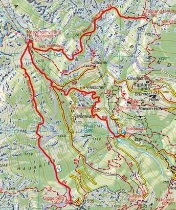
900 0 1 2 3 4 5 6 7 8 9 10,5 1.100 1.300 1.500 1.700 1.900 km 1.788 1.544 950 1.530 1.576 1.348 » Height profile Card no. 011 107
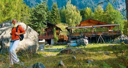
Merano High Mountain Trail South: From the Leiter Alm to the Giggelberg
» Route
Leiter Alm – Hochganghaus – Tablander Alm – Nasereit – Giggelberg – Texelbahn Cable Car mountain station
700 a.d.u.
4 hr. 12 km 10 km
680 a.d.d.
The hike along this stretch of the Merano High Mountain Trail starts at the Leiter Alm mountain hut, above Velloi/Vellau: a small village looking over the main urban centre of Lagundo. After reaching Merano by public bus or on the Vinschgau Valley Train, take Bus 235 straight to Velloi. From Velloi take the nostalgic basket lift, one of the most unusual chairlifts in South Tyrol, to just below the Leiter Alm (1,522 m) which is just 5 minutes on foot from the cable car mountain station. From here, follow a stony section of the Merano High Mountain Trail (No. 24) uphill and westwards through the forest to the large, characteristic Hochganghaus at 1,839m. Continue along the trail to the Goidner Alm and then to the Hohe Wiege lookout point. Proceed to the Tablander Alm in the direction of the Zieltal Valley, past the recently renovated Tablander Alm before finally arriving at the Nasereit Refuge in the Zieltal above Parcines/Partschins. A distinctive feature is a nearby colony of marmots, whose sharp whistles are audible at quite some distance. From Nasereit, the remaining section of the hike leads to the Giggelberg Inn and the Texelbahn Cable Car mountain station. To return, take the cable car back into the valley, and from the cable car valley station take Bus 266 back to Naturno.
108
» Tips/special attractions
Besides the sheer scenic magnificence of this hike, the view from the Hohe Wiege lookout point across the Passeiertal Valley, over the Hirzer and Ifinger to the Dolomites, across the Etschtal Valley and the Vigiljoch all the way up to the Vinschgau Valley – is particularly eye-catching.
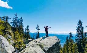
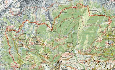
1.500 1.700 1.900 1.475 1.602 1.613 1.799 1.804 1.811 1.863 1.686 1.475 » Height profile Card no. 011 0 1 2 3 4 5 6 7 8 9 10 12 11 km 109
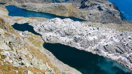
The Spronser Seen Lakes –Pearls in the Texelgruppe Nature Park
» Route
Velloi – Leiteralm Basket Lift – Hochganghaus – Hochgangscharte –Langsee – Oberkaseralm – Taufenscharte – Leiter Alm – Velloi
Basket Lift
1.230 a.d.u.
6 hr. 40 13,3 km 13 km
1.230 a.d.d.
This day-trip to the largest cluster of high Alpine lakes in South Tyrol leads high above the Merano basin in the heart of the Texelgruppe Nature Park. Drive to Velloi by car, where there’s a parking lot. Start the hike at the Leiter Alm mountain hut, above Lagundo/ Algund, which leads directly on to the Merano High Mountain Trail. Take the basket lift at the valley station to the mountain station at the top just below the Leiter Alm mountain hut. Then follow a rocky stretch of the Merano High Mountain Trail along Trail No. 24 in a westerly direction as far as the Hochganghaus refuge at 1,829 m. From there, hike along Trail No. 7 up to Hochgangscharte ridge. This section is steep and difficult, requiring sturdy legs, sure-footedness – and a head for heights! The final stretch of the steep climb along the steep rockface is assisted by chains and steel ropes (via ferrata). From the Hochgangscharte at the top of the ridge (2,441 m), there’s a magnificent view of the Langsee Lake. Along the lake shoreline, Trail No. 22 leads to the nearby Grünsee Lake and then down to Oberkaser Alm mountain hut (2,131 m). Take Trail No. 25b in a south-easterly direction, past Kaser Lacke and Pfitscher Lacke
110
lakes up to the Taufenscharte ridge (2,318 m). Ascend up the steep grassy slopes along a serpentine path before intersecting with the Merano High Mountain Trail just above the Leiteralm mountain hut. Continue along this last stretch back to the Leiter Alm, then back down on the basket lift to the car park to return to Naturno.
» Tips/special attractions
This high mountain hiking circuit is extremely varied, mainly due to its length. If you wish, from the Langsee you can make a detour to the Milchsee Lake (extra 30 min/150 m) and/or to the Kleine Rötelspitze Summit (extra 1hr/ 200 m).
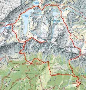
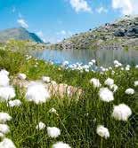
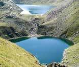
1.400 2.000 2.400 2.200 1.800 1.600 0 1 2 3 8 4 9 5 6 7 14 11 12 13 10 km 1.475 1.736 1.919 2.171 2.441 2.252 2.145 1.889 1.475 » Height profile Card no. 011 111
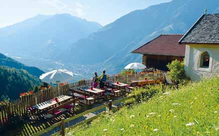
From Rio Lagundo to the Brandhof Dairy Farm
» Route Rablà – Rio Lagundo Cable Car mountain station – Trail No. 16 – Brandhof – Trail No. 17 – Rio Lagundo Cable Car mountain station – Rablà
2 hr. 45
10 km
Take Bus 266, or your private vehicle from Naturno/Naturns to the starting point at the Rio Lagundo Cable Car valley station in Rablà. The cable car takes you up to the small mountain village of Rio Lagundo at just under 1,400 m. Starting from the mountain station, hike through the small village along the tarred access road. Keep following the signs along Trail No. 16 westwards towards the Vinschgau Valley, initially along the wide forest road that begins opposite the small Maria im Schnee Chapel. Then take the narrow hiking trail through the Nörderberg Mountain forest to the Feichterhof farm. From there, descend via Höfestraße street and partly via Trail No. 30A to Brunnerhof and then follow Trail No. 16 again. The little dairy farm has its own stop and rest snack station with its own fresh mountain cheeses on offer. The small, meticulously restored chapel provides an opportunity for another rest stop. Return to Rio Lagundo along Trail No. 17 (along the way the signs read “Rio Lagundo No. 17”). The cable car takes you back down into the valley and return to Naturno is by private vehicle or public bus.
440 a.d.u. 440 a.d.d. 6 km / 112
» Tips/special attractions
Along the route, you are confronted with fascinating views of the barren Sonnenberg Mountain opposite the valley and the rugged peaks of the Texelgruppe Nature Park. A visit to the small Maria im Schnee Church in Rio Lagundo is certainly rewarding. At Pirchhof, there’s the option of going on a trekking tour on llamas/alpacas (including families – for more info see the holiday advisor).
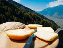
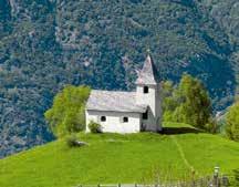
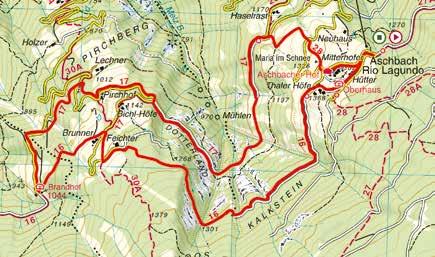
900 0 1 2 3 8 4 9 5 6 7 10 1.500 1.300 1.100 km 1.344 1.280 1.031 1.147 1.325 1.366 1.344 » Height profile Card no. 011 113
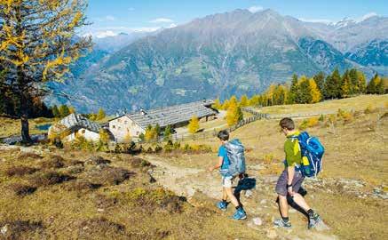
Naturnser Alm and Vigiljoch
Panoramic Plateau
» Route Rablà – Rio Lagundo Cable Car mountain station – Naturnser Alm – Rauhbühel – Trail No. 9 – Vigiljoch – Rio Lagundo Cable Car mountain station
4 hr.
12,9 km
800 a.d.u.
800 a.d.d. 6 km /
Coming from Naturno, the Rio Lagundo Cable Car valley station is easily reachable by bus or train. Starting in the small village of Rio Lagundo from the cable car mountain station, begin the hike on the moderately steep Trail No. 27 through the dense pine forests of the Nörderberg Mountain to the Naturnser Alm mountain pasture at 1,910 m. From there, follow Trail No. 9B that runs above the tree line past the “Rauhen Bühel” to the Ultental Valley side of the mountain to where Trails No. 9B and 9 intersect. At the fork turn left and follow Trail No. 9, which levels out and descend slightly downhill onto the Vigiljoch Plateau at 1,793 m. A visit to the small church of St. Vigilius is a must. The plateau offers a number of refreshment stops and restaurants. From the Vigiljoch follow Trail No. 28, which alternates between steeper and easier sections, on the wide forest path down to Rio Lagundo. The return to the starting point in Naturno is either by cable car or other public transport (bus, etc).
114
» Tips/special attractions
The standout feature of this hike is the 360° view from Rauhen Bühel and the Vigiljoch.
The Walderlebnispfad Forest Adventure Trail, which begins above the Rio Lagundo Cable Car mountain station, is a real insider tip. This highly diverse and fascinating trail with its many facets represents an immersion in the topic of forest and wood in a fun-filled and experiential way, is particularly suited to families with children. The popular and renowned Meraner Mineralwasser mineral water originates from the springs on the Vigiljoch Mountain.
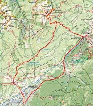
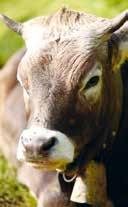
1.300 0 1.700 1.500 1.900 2.100 km 1.344 1 2 3 8 4 9 5 6 7 11 10 12 13 1.566 1.906 2.000 1.775 1.344 » Height profile Card no. 011 115
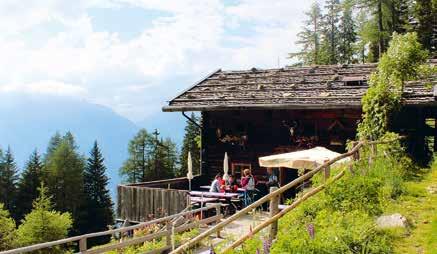
Nörderberger Almentour: Hiking between Mountain Huts
» Route
Naturno – Kreuzbrünnl parking lot – Mausloch Alm – Almenweg –Zetn Alm – Naturnser Alm – Kreuzbrünnl parking lot
3 hr. 50
11,1 km
580 a.d.u.
580 a.d.d. 13 km /
Take either the “hiking shuttle-bus” or your own car past Höfe and Almenstraße road on the Nörderberg Mountain to get to the Kreuzbrünnl car park (1,500 m). Follow the wide forest track to the Mausloch Alm mountain hut on a relatively flat road along the forested slopes of the Nörderberg. The road then climbs up a series of hairpin bends, with a short-cut up a narrow trail, as far as the Mausloch Alm mountain hut at 1,837 m. From there, follow the relatively flat panoramic hiking trail to the Zetn Alm mountain hut at 1,747 m. The final stretch on this hiking circuit of the mountain huts leads to the Naturnser Alm, which is the highest point of the hike. Following the wide forest path from Kreuzbrünnl, return to the car park along a moderate incline. Take the “hiking shuttle-bus” (or drive) back down into the valley. Alternatively, return from the Naturnser Alm down Trail No. 27 to the Aschbach Cable Car to Rablà, which takes just a few minutes. From there, take the train or Bus 266 back to Naturno.
116
» Tips/special attractions
The most scenic stretch of this hike is that along the breath-taking Almenweg mountain pasture trail. Extending from the Mausloch Alm mountain hut across the Vinschgau Valley, it links the remote mountain huts and refuges on the Nörderberg Mountain to each other. Given the emphasis on local culinary specialities and traditional delicacies, this mountain hut circuit hike can be configured as a gastronomic excursion, with a tour of the Alpine farms that are even easier to reach during the summer months. Hiking in the shade of the Nörderberg Mountain is especially rewarding during the hot summer months!
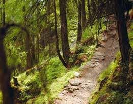
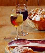
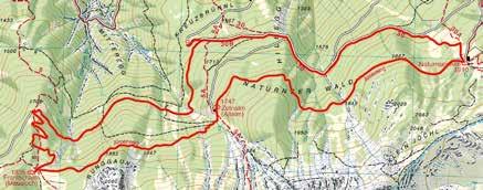
1.500 2.100 1.900 1.700 0 1 2 3 8 4 9 5 6 7 12 11 10 km 1.669 1.835 1.580 1.768 1.868 1.913 1.732 1.580 » Height profile Card no. 011 117
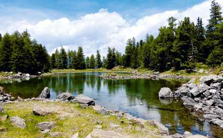
Tour of the Picturesque Zirmtal Seen Lakes
» Route Castelbello/Montefranco – Alte Säge parking lot – Marzoner Alm –Zirmtalsee and Zirmtalalm – Alte Säge parking lot
3 hr. 40
10,2 km
700 a.d.u.
700 a.d.d. 17 km
By car, drive to the village of Castelbello, about 8 km from Naturno. Cross the Etsch River then head towards Lacinigo/Latschinig and to Montefranco/Freiberg. Follow the gravel road uphill up to the “Alte Säge” car park, from where the hike to the Zirmtalseen Lakes begins. Follow the wide forest track for a short stretch before reaching the Marzoner Alm mountain hut. Then take Trail No. 18 just behind the hut through the forest to the “Schweinstall” from where there’s a progressively steep climb. Continue on Trail No. 18 towards the Zirmtalalm mountain hut, across several forest clearings and follow the stream against the current as it flows down from the Zirmtalseen Lakes. Hike uphill on the final stretch of the trail and proceed to the clearing at the edge of the forest. Here you’ll arrive at the rustic Zirmtalalm refuge and the shimmering, turquoise waters of the Zirmtalseen Lakes. Just 5 minutes of walk above the refuge is a high moor. Reaching this picturesque landscape is worth the effort and the small refuge offers a variety of sumptuous local
118
delicacies. The return is along the same route as the outward trip. At the car park, take the road to Naturno via the villages of Montefranco, Lacinigo and Castelbello.
» Tips/special attractions
The Zirmtal Seen Lakes are among the most spectacular on the Nörderberg Mountain. Their unique location and magnificent landscape make this an unforgettable hiking experience. The ideal time is from the beginning of summer until autumn (weather permitting). Especially recommended in June when the Alpine roses are in bloom.
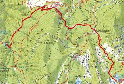
1.400 0 1 2 3 4 5 6 7 8 9 10 1.600 1.800 2.000 2.200 km 1.478 1.571 1.934 2.111 1.915 1.745 1.754 1.582 1.478 » Height profile Card no. 04 119
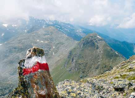
Trail to the Naturno Hochwart Panoramic Peak
» Route
Naturno – Kreuzbrünnl parking lot – Zetn Alm – Mausloch Alm –Hochwart – Kreuzbrünnl parking lot
5 hr. 30
12 km
The mountain trail above Naturno starts at the Kreuzbrünnl parking lot (1,580 m) on the Nörderberg Mountain. To get there, drive up the road on the Nörderberg as far as the car park or go by hiking taxi. From the parking lot, follow the picturesque trail as far as the rustic Zetn Alm mountain hut. From there, take the Almensteig track in a westerly direction to the Mausloch Alm mountain hut. Start the ascent along Trail No. 5, first through the meadows, then past the Alpine rose bushes along the edge of the forest and across more rocky terrain as far as the Hochjoch ridge (2,443 m), to the “Steinmännchen” stone-men figures. Head northeast to the ridge, requiring considerable stamina, up to the panoramic summit of the Hochwart with its imposing cross. Get ready for the amazing 360° view, which is a fitting reward for your efforts! To return, go back the same way down to the Mausloch Alm and then via the wide forest track to the starting point at the Kreuzbrünnl car park.
1.100
120
1.100 a.d.u.
a.d.d. 13 km
» Tips/special attractions
Breath-taking panorama from the Hochwart spanning the Texelgruppe Mountains all the way to the Dolomites.
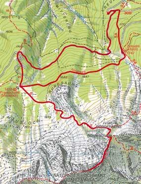
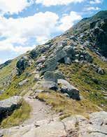
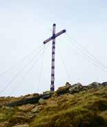
1.500 2.100 2.300 2.500 1.700 1.900 1.825 2.070 2.303 2.559 2.150 1.908 1.580 1.580 »
Card no. 04 0 1 2 3 8 4 9 5 6 7 12 11 10 km 121
Height profile
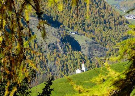
From the Church on the Cliff to Unterstell
» Route
Schnalstal Valley – Monte S. Caterina – Merano High Mountain Trail No. 24 – Linthof – Innerforch – Trail No. 24B – Unterstell Cable Car mountain station
Take the bus from Naturno, to the small village of Monte S. Caterina in the Schnalstal Valley (1,245 m). From the village centre, follow Trail No. 10a. After crossing the meadows and through a larch forest, you arrive at the Merano High Mountain Trail. Follow Trail No. 24 out of the valley towards Naturno along the undulating path past several mountain farms on the Fuchsberg Mountain. The mostly flat trail leads through the forest and then through the barren terrain of the Sonnenberg with its somewhat exotic-looking vegetation. Passing Berggasthof Linthof Inn, continue towards Merano/Meran and after about 10 min on foot, turn right and continue along Trail No. 24b to the Unterstell Cable Car mountain station. Take the cable car back to Naturno.
3
8,3
438 a.d.u. 388 a.d.d. 12 km 122
hr.
km
» Tips/special attractions
Built on top of a jutting cliff and clearly visible from a distance, the church in Monte S. Caterina is certainly worth visiting. The lookout point with a wonderful panoramic view is positioned above the Unterstell Inn. A via ferrata practice wall was recently created just below the viewing platform.
1.200 0 1 2 3 4 5 6 7 8 1.400 1.600 km 1.529 1.474 1.400 1.485 1.504 1.406 1.300 1.245 » Height profile Card no. 04 123
From Emerald to Golden: Lake Circuit Hike in the Schnalstal Valley
» Route Schnalstal Valley – Vernago – Vernago Reservoir Circuit Hike –Vernago
Take the bus, or drive to the Vernago Reservoir parking lot in the Schnalstal Valley. From there, follow the signs to Seerundweg Lake Circuit, over the dam and then along the edge of the forest to the western end of the lake. Once there, cross the suspension bridge and then continue along the Seerundweg trail back to Vernago/ Vernagt. This section around the lake is usually sunny and, in summer, you may find llamas grazing along the shores of the lake! Once at the car park, go back to Naturno by bus or return by car through the Schnalstal Valley. Hiking around the Vernago Reservoir is particularly suited to hot weather. The “Ötzi Rope Park” high rope course is located at the back end of the lake, promising enjoyment and thrills for children and adults alike.
124
2 hr. 6,6 km 220 a.d.u. 220 a.d.d. 19 km
» Tips/special attractions
The Vernago Reservoir is surrounded by dense larch forests with gold colours in autumn. In July, when the lake is usually at its fullest, it gives off an emerald green glow. The play of colours around the lake in summer and autumn adds something special. The centuries-old mass-migration of livestock, known as the “transhumance” is one of the main highlights of Vernago in the Schnalstal Valley. In mid-June, approximately 2,000 sheep migrate from the valleys of the Schnalstal and Vinschgau through the Tisental over the Niederjoch Pass (3,019m) to the summer pastures in the Ötztal Valley. The return migration is repeated in mid-September and is celebrated in Vernago with traditional festivities involving shepherds, drivers and visitors.
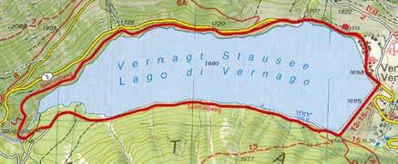
1.600 0 1 2 3 4 5 6 7 1.800 2.000 km 1.700 1.685 1.705 1.711 1.712 1.700 1.754 » Height profile Card no. 04 125
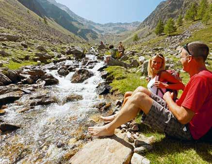
Picturesque Mastauntal Valley
» Route
Schnalstal Valley – Madonna di Senales – Mastaunhof –Mastaunalm – Madonna di Senales
From Naturno, use the public bus service or private vehicle to reach the Sanctuary of Madonna di Senales in the Schnalstal Valley. The unpaved access road starts at the Mastaunhof parking lot just above the archeoParc. Follow this route on a gentle slope up until just before the farm. From there follow the signs 17A along the old hiking trail and then head uphill on the new road across meadows and larch forests. Leading up to the rustic Mastaunalm mountain pasture at about 1,800m, its idyllic view makes an ideal rest stop. From this point, continue further into the magnificent Mastauntal Valley and after about 20 min you’re presented with a picturesque waterfall and behind it a new practice wall, where climbers are busy training. Follow the same route back to Madonna di Senales. From Mastaunalm you can also descend to the sanctuary following Trail no. 17. Return to the starting point.
1
4,6 km 320 a.d.u. 320 a.d.d. 16 km 126
hr. 45
» Tips/special attractions
Dating from 1304, the Baroque Sanctuary of Madonna di Senales is an outstanding attraction as is the Schnalstal Valley archeoParc. This archaeological open-air museum with its Visitor Centre features a simulated environment of 5,000 year-old, Ötzi the Glacier Mummy, which can be experienced at first hand. Euphemistically known as an “active museum”, the archeoParc is an attraction for families with children, and offers participatory activities such as pottery, baking bread and archery workshops. Various exhibitions, both permanent and temporary, add to the general programme of attractions. A view of the Tisenjoch Gorge, where Ötzi was first discovered, is one of the highlights of the archeoParc.
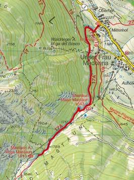
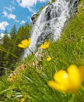
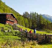
1.500 0 1 2 3 4 5 6 1.700 1.900 km 1.665 1.666 1.816 » Height profile Card no. 04 127
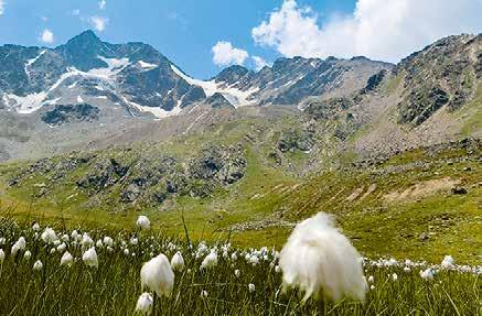
Lazaun Circuit Hike
» Route Maso Corto – Trail No. 1 – Trail No. 11A – Lazaunhütte –Trail No. 11 – Maso Corto
2 hr. 30
6,9 km
454 a.d.u. 454 a.d.d.
Use a public bus or your own vehicle (paid parking) to reach Maso Corto, the last village in the Schnalstal Valley at 2,011 m. From Maso Corto, hike across the primordial glacial moraines and Alpine pastures up to the plateau with its unusual high Alpine vegetation and enjoy the fantastic panorama from the Lazaunalm mountain pasture.
At the parking lot, follow the signposts up to the hotels. Just after, turn left and follow Trail No. 1 along the Schnalserbach stream northwest. After a while, cross the stream and head southwest up a slight gradient that leads to a fork. Bear left and after crossing the stream follow Trail No. 11A onto the Lazaunalm and continue to the Lazaunhütte hut. To return, follow Trail No. 11 over the Alpine pastures and through the Swiss stone pine forest back down into the valley. Alternatively, descend along the approx. 3.3 km forest road (in wintertime the snow-covered road turns into a sled run), which is somewhat longer – but not as steep.
The third and easiest option is to use the cable car, with the mountain station adjacent to the Lazaunhütte, taking you back downhill.
128
26 km
» Tips/special attractions
The spectacular view of the surrounding peaks above 3,000m and fascinating glaciers of the rear Schnalstal Valley around Maso Corto, is characterized by the high-altitude Alpine terrain which is covered with snow and ice, makes it the undisputed highlight of this tour.
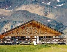
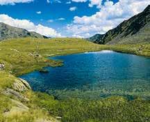
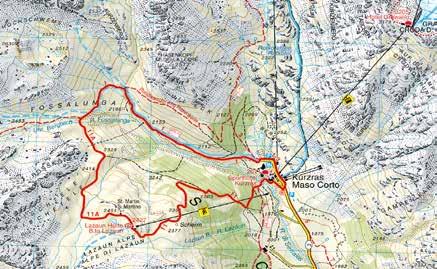
0 2 4 6 6,8 2.000 km 2.010 2.010 2.125 2.270 2.203 2.384 » Height profile Card no. 04 129
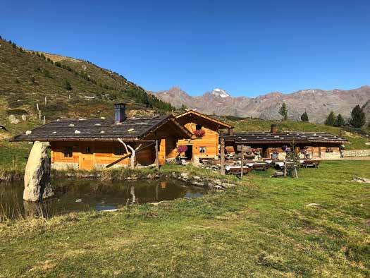
Bergl Alm – Schnalstal Valley
» Route
Schnalstal Valley – Maso Corto – Lagauntal Valley – Bergl Alm – Maso Corto
3 hr. 30
10,4 km
Use a public bus or your own vehicle (paid parking) to get to Maso Corto, the last village in the Schnalstal Valley. From there follow Trail No. 4, which is initially almost flat, until you reach the Wieshof farm. From there, the gradient becomes slightly steeper as the trail ascends through the forest to the wide pastures of the Lagauntal Valley. After crossing the Lagaunbach stream, the route follows Trail No. 5 that gently undulates as it ascends from the valley through the forest to the Bergl Alm mountain hut. The newly renovated, manned refuge lies in a small basin at 2,214 m above sea level. Right next to the hut, a small lake surrounded by flat meadows offers an ideal rest stop before heading back to Maso Corto via the same path. Naturno/Naturns can be reached by public bus or by car. Alternatively, from the Bergl Alm take a short cut down a quicker but somewhat steep path to Hotel Gerstgras (walking time: 45 min, distance: 430 m). A third option is the panoramic hike that leads out of the valley along Trail No. 13 across the Gerstgras Alpine pastures to the Grubalm hut (unmanned). From there, the rather steep descent takes you to Vernago (walking time: 1.50 h, distance 600 m). Both Vernago as well as the Hotel Gerstgras have bus stops.
a.d.u. 430 a.d.d. 26 km 130
430
» Tips/special attractions
Before reaching the Bergl Alm, you’ll notice a number of ancient giant trees shaped over the ages into mysterious-looking figures by lightning. With its upper slopes and summits covered in perennial ice, the mountains behind the Schnalstal Valley are particularly awe-inspiring. The 15-min walk from the Alpine pasture to the Nockspitze Peak is a cairn from which there’s a fantastic panorama.
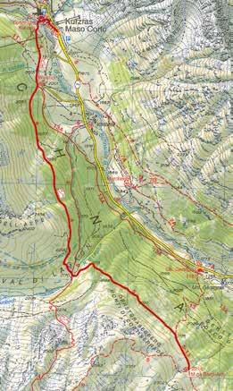
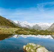
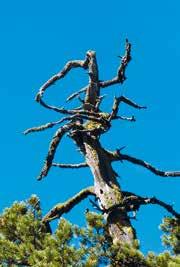
2.000 0 1 2 3 4 5 6 7 8 9 10,4 2.200 2.400 km 2.011 2.011 2.090 2.215 2.175 2.125 2.174 2.224 2.224 » Height profile Card no. 04 131
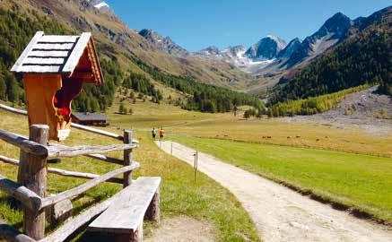
Pfossental Valley: Home of Marmots, Chamoix and Ibexes
» Route
Schnalstal Valley – Pfossental Valley – Vorderkaser/Jägerrast –Eishof – Vorderkaser/Jägerrast
3 hr.
9,8 km
420 a.d.u.
420 a.d.d. 16 km /
This hike in the heart of the Texelgruppe is within the boundaries of the Texelgruppe Nature Park. From Naturno, you can drive and park at the Vorderkaser/Jägerrast farm in the Pfossental Valley, a side valley of the Schnalstal Valley. There is a fee for parking. Starting from the Jägerrast farm and inn, follow the broad farm track, which also doubles as a section of the Merano High Mountain trail (Trail No. 24). Continue along the trail through the valley, then head slightly uphill to the Mitterkaser Alm mountain hut, before passing the rustic Rableidalm hut to the Eishof hut, the highest point of the hike (2,071 m). The trail connecting the Vorderkaser to the Eishof is a “Mountain Pasture Experience Trail”, with info panels explaining the particularities of the natural/cultural landscape in the Texelgruppe Mountains. The view from the Eishof is truly unique, with the magnificent 3,000 m peaks at the back of the Pfossental Valley. The return is along the same route as the outward hike. From the parking lot follow the road back to Naturno.
On Wednesdays, from mid-May to early November, a “hiking shuttle-bus” operates between Naturno and Pfossental Valley.
132
» Tips/special attractions
The Pfossental Valley is one of the most unspoilt valleys in South Tyrol, where chamois, marmots, ibex and even rare golden eagles can be spotted.
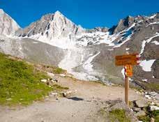
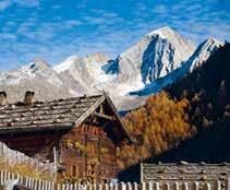
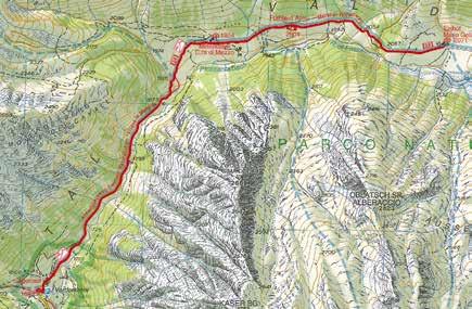
1.700 1.900 2.100 1.867 1.994 2.095 2.032 1.898 1.649 » Height profile Card no. 04 0 1 2 3 4 5 6 7 8 9 10 km 133
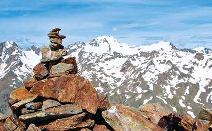
Alpine Mountain Tour: From the Glacier into the Valley
» Route Maso Corto – Ascent with the Glacier Cable Car – Grawand –Schöne Aussicht – Maso Corto 3 hr.
Reach Maso Corto at the head of the Schnalstal Valley by public bus or your own vehicle (paid parking lot). From there, take the Schnalstal Valley Glacier Cable Car to the top and which at 3,212 m makes it the highest elevation cable car in South Tyrol. At this point, you’re surrounded by more than 100 summits rising above 3,000, making this a truly impressive experience. From Grawand, follow Trail No. 3 through stony terrain past the chairlift valley station to the glacier, and continue further down to the Hintereislift ski lift valley station. From here, it takes about 15 min to reach the Schöne Aussicht Refuge. Now follow the old but well-maintained trail from the mountain hut through varied, high Alpine terrain along Trail No. 3 all the way to Maso Corto. If you wish to hike the ascent rather than the descent, initiate the circuit in the opposite direction (hiking time: approx. 4 hours).
Please Note: Before starting the tour, please make sure you are aware of the operating times of the Glacier Cable Car and find out whether the upper section of the hiking trail is open (i.e. unobstructed by ice and snow).
97
1.301 a.d.d. 26 km 134
7,6 km
a.d.u.
» Tips/special attractions
The short but spectacular climb from the Glacier Cable Car mountain station up to the Grawand Peak summit cross (3,251 m) is a must. This vantage point offers a fantastic view of the magnificent mountains of the Ötztal Alps, the Dolomites and the Ortler all the way down into the valley. For fans of “Ötzi (the Iceman)” a visit to the Ötzi Show Gallery at the Grawand Mountain Hotel is obligatory.
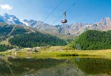
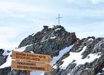
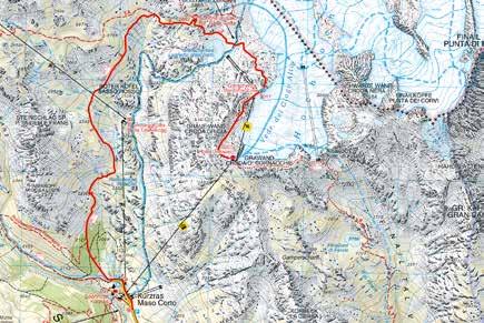
0 2 4 6 7,4 3.000 km 3.211 2.998 2.826 2.671 2.484 2.205 2.011 » Height profile Card no. 04 135
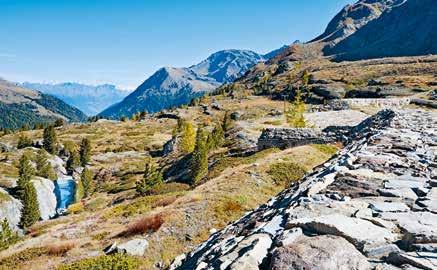
On the Tracks of the Ortler Front in Martello di Dentro
» Route
Martelltal Valley – valley head parking lot – Zufallhütte – Old Dam –valley head parking lot
1 hr. 50
5,5 km
300 a.d.u.
300 a.d.d. 36 km /
The hike starts at the head of the Martelltal Valley, a side valley off the Vinschgau Valley renowned for its strawberry production. From Naturno, it takes about 1 hour by car to reach the Enzianhütte parking lot, which is paid. During the summer months, a regular public bus service also operates between Coldrano/Goldrain and the Vinschgau Valley Train. From the parking lot, follow the signs to the Zufallhütte/Trail No. 151 on the right. Continue along the wide track leading uphill through larch forests and across small streams to a plateau beneath the Zufallhütte mountain hut, where several hiking trails intersect. From there, follow Trail No. 103/No. 36 up to the Zufallhütte. Behind the hut, ascend up Trail No. 103/150, including a short stretch between two rock faces, until you reach the old dam wall on the way to the Marteller Hütte hut. From the parking lot the hike to the old dam wall also coincides with a section of the Gletscherlehrpfad Glacier Nature Trail, which from the head of the valley passes the Zufallhütte, leading up to the glacier front of the Hohe Ferner Mountain and back via the Martellerhütte to the Hotel
136
Paradiso near the starting point. From the dam wall descend down the same route used for the ascent back to the parking lot, from which you return to Naturno by bus, train or by car.
» Tips/special attractions
This route isn’t far from the First World War battlefields of the Ortler Front and is entirely within the Stelvio National Park. It offers unique views of the peaks and glaciers of the Ortler Group, especially the Cevedale Massif rising above 3,700 m. Just below the Zufallhütte is a newly built suspension bridge, one of four such structures along the adventurous Plima Gorge Trail.
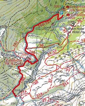
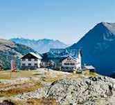
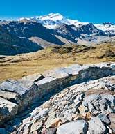
2.000 0 1 2 3 4 5 6 7 2.200 2.400 km 2.317 2.188 2.190 2.054 2.054 » Height profile Card no. 045 137
Vinschgau Valley – Merano Biking Region
MTB Tours:
Parcines Family Trail S. 142
Stuanbruch Trail S. 143
Naturno Bike Highline S. 144
Naturno Circuit S. 146
Naturno Bike Highline West S. 148
Naturnser Alm Circuit S. 149
Naturnser Nörderberg Tour S. 150
Marzoner Alm Circuit S. 151
Marzoner Alm – Lupo Trail Circuit S. 152
Laces Trailzauber S. 153
Monte Sole Trail S. 154
4 gewinnt 13 Trail S. 156
Roatbrunn Trail S. 157
Propain Trail S. 158
Road Bike Tours:
Passo della Mendola – Passo delle Palade Tour S. 160
Passo del Rombo Tour S. 161
Passo dello Stelvio Tour S. 162
Passo di Monte Giovo Tour S. 164
Lago di Caldaro Tour S. 165
Tesimo – Prissiano Panorama Tour S. 166
Vinschgau Valley Panorama Tour S. 167
Leisure Biking Tours:
Riding along the Via Claudia Augusta S. 168
From the spa town into Passeiertal Valley / Off to the lowlands S. 169
Leisure biking tour to Merano S. 170
Leisure biking tour to Lago di Coldrano S. 171
Leisure biking tour from Glorenza to Naturno S. 172
138
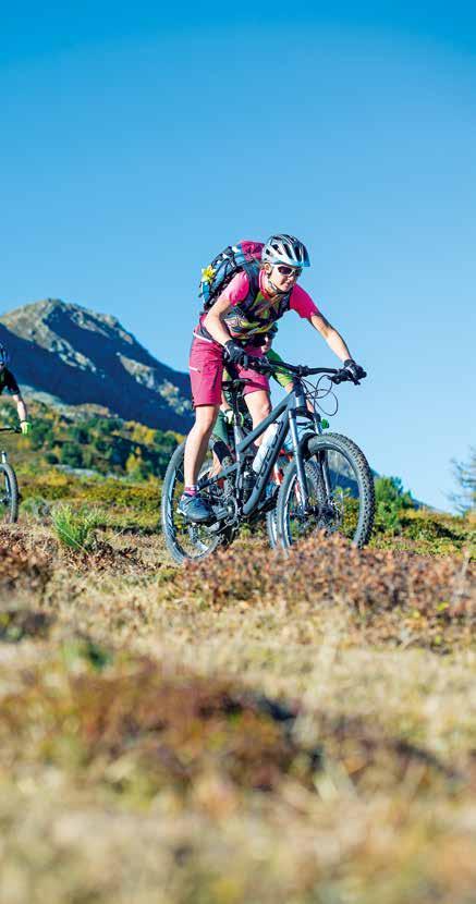
139
Required Fitness Levels
The blue, red and black symbols on the signposts along the trails indicate that the latter are easy, medium and difficult respectively. Yet these colors reveal other helpful information as well.
Easy
An easy trail that only requires a low level of fitness. It is max. 40 km (25 miles) long and has a max. elevation gain of 800 meters (2,600 ft). There are no extreme slopes. Gradients range between 0 and 5%; only short sections of the trail may occasionally have a slope of max. 10%. Duration: max. 4 hours.
Medium
A trail that requires a medium level of fitness. It is max. 50 km (31 miles) long and has a max. elevation gain of 1,200 meters (3,900 ft). Includes some ascents with gradients ranging between 5 and 12%, on short sections with up to max. 17%. Requires a general level of physical fitness and endurance. Duration: max. 5 hours.
Difficult
A demanding trail that requires a high level of fitness. It is over 50 km (31 miles) long and has an elevation gain greater than 1,200 meters (3,900 ft). Some slopes are over 12%, up to a maximum of 17%. Requires a good or very good level of fitness as well as regular training. Duration: over 5 hours.
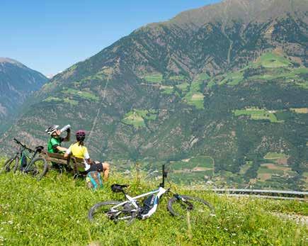
140
Difficulty Levels
The signs along the single trails also inform bikers about each route’s respective difficulty level, which in the Merano–Vinschgau Valley biking region ranges from to
stands for a single trail without any noteworthy difficulties. Most of these routes are flowy forest and meadow tracks with a non-slip natural or compacted gravel surface. There are no obstacles such as steps, rocks or roots. The gradient is low to medium, the bends are wide. Single trails with this difficulty level do not require any special biking skills.
On trails marked , expect to encounter small obstacles such as flat roots and small rocks. Routes are often given this elevated difficulty rating when they contain a few small water channels crossing the path and some of the terrain has been damaged by erosion. Some sections of the trail have a loose surface. The gradient is max. 40%. Hairpin bends are not to be expected. trails require basic biking skills and constant vigilance. Obstacles can be overrun.
Single trails marked are likely to contain larger roots and rocks. Most of the trail surface is loose. Expect to come across steps and flat stairs. These routes often feature tight bends and steep sections with gradients of up to 70%. They require advanced biking skills.
routes include gnarly single trails with many large rocks and/ or roots. High steps, tight hairpin bends and tricky slanted sections are common, while easygoing flowy sections are few and far between. Be prepared for slippery trail surfaces and loose gravel and rock-debris. Gradients of more than 70% are common. Trails with this difficulty rating require excellent bike control, precise braking maneuvers and a good sense of balance. (For more information, please visit www.singletrail-skala.de)
Trail Tolerance
Some of our trails and paths are open to both hikers and mountain bikers. These sections are marked with signs reading “Trail Tolerance” to indicate that they are shared by pedestrians and cyclists alike, and to foster respectful and tolerant interaction between these two groups. It is in nobody’s interest when paths are off limits for certain sports enthusiasts. It is important for everyone to be considerate and respectful when encountering each other along the trails. That way both hikers and mountain bikers are guaranteed to have a great time outdoors.
141
MTB
172 Parcines Family Trail
Downhill fun for the whole family – from the picturesque mountain hamlet of Riolagundo to inns with playgrounds and a petting zoo
S0 S1
14 km elev. +90 / -920 m April–Nov.
The modern cable car takes visitors from Rablà 1,342 meters (4,403 ft) up the mountain to the hamlet of Riolagundo. The scenery up here is very idyllic: The silence is broken only by the occasional chimes of cow bells in the distance. A few hikers and bikers are sitting on the terrace outside the guest house or setting off to one of the mountain huts in the area. We, on the other hand, get on our bikes right there by the cable car’s summit station and follow the signs pointing left. After driving on a paved road for a few meters, we switch to a forest path. The ascent has an elevation gain of 90 meters (295 ft) and leads through the coniferous forest, which opens up every now and again to reveal the valley floor and the villages that lie below. Once we have conquered the first short ascent, we can just go with the flow and let our bikes roll along. We drive on a paved road for quite a while and then on a short section of asphalt before leaving the road and turning right onto a narrow cart path (S1), all the while following the “Family Tour” signs. This short and easy-to-ride section initially leads over small rocks, then across a meadow and finally back onto tarmac that takes us past the Brünnl Inn with its playground and petting zoo as well as past the Niederhof Inn, which also has a playground. After a short stop we continue on the asphalt road towards the valley until we reach the train station in Tel, where we turn onto the cycle path that takes us back to Rablà.
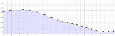
Category
142
Difficulty
MTB
173 Stuanbruch Trail
Train station bridge in Tel – Uphill Riolagundo – Seespitz Inn –Stuanbruch Trail – Tel (alternative ascent: Riolagundo cable car from Rablà, alternative descent: via a forest road)
Bikers attempting this tough ascent will be duly rewarded for their efforts. The break at the Seespitz Inn is the entering point, and the dessert is served right afterwards: The Stuanbruch Trail is a real trail paradise.
27 km elev. +1,250 / -1,250 m May–Oct. Category S2 S3 Difficulty
The first 2.4 kilometers (1.5 miles) of this tour already make us break out into a sweat. We start out at Tel train station and make a steep ascent (16%) on tarmac until we reach a fork in the road. Here we follow the sign that reads “Uphill Riolagundo” and, after mastering one hairpin bend after the next, for about 9 kilometers (5.6 miles), we reach Riolagundo. Bikers wishing to skip the elevation gain of 800 meters (2,600 ft) can float up the mountain in the panorama cable car that starts in Rablà. The hamlet offers a breathtaking view, and the picturesque little church called Maria Schnee is also worth a visit. Just above the cable car’s summit station we follow the “Family Tour” sign on path no. 27A towards Rasner Kreuz (1,416 m / 4,646 ft above sea level). We turn right at the crossing and follow the sign reading “Uphill Seespitz.” Via a steep forest road we reach the Seespitz Inn at the Lago Nero biotope. The inn’s sun terrace is perfect for taking a break before heading on to the best part of the whole tour: the Stuanbruch Trail, which begins right behind the inn and leads back down into the valley over the old quarry with a challenging change in elevation of -925 meters (-3,035 ft). After the quarries, the flowy forest trail contains some challenging sections as well as exposed parts of the path. Bikers preferring a less difficult route can take the forest road that starts at the Seespitz Inn (the first few meters are the same as the trail) and roll back down to Tel on asphalt.
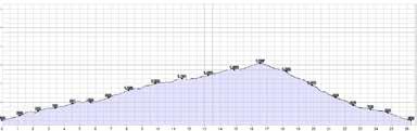
CC EB
143
MTB
436 Naturno Bike Highline
Starting at the Etsch River bridge in Tel – Uphill Riolagundo –Bike Highline Merano to Tablander Alm – Lupo Trail – Naturno –cycle path to Tel (alternative: via the Fontana Trail and Ciardes)
This tour requires stamina and endurance. The idyllic scenery around the hamlet of Riolagundo, the view along the Bike Highline Merano and the spectacular trail through the Tramontana forest towards the end of the route make it all worthwhile.
Brimming with motivation, we start off at the Tel railroad station and tackle the Uphill Riolagundo. The entire road is made from asphalt, yet even the first 2.4 kilometers (1.5 miles) with gradients of 16% demand a great deal of effort. At the first fork in the road we leave the steep section behind and head right, following the signs reading “Uphill Riolagundo.” After 9.5 kilometers (5.9 miles) we arrive at our first destination: a quaint little church called Maria Schnee, glistening in the sunlight at 1,340 meters (4,400 ft) above sea level. Next we take the forest road towards Monte San Vigilio and turn right halfway, onto the Bike Highline Merano. Starting at the highline we remain at an altitude of 1,450 to 1,900 meters (4,760 to 6,230 ft) and follow broad paths in a westerly direction past three mountain huts: the Naturnser Alm, the Zetn Alm and the Mausloch Alm. The breathtaking view across the Texelgruppe and the Vinschgau Valley make this an unforgettable experience. After the Mausloch Alm we follow a somewhat challenging section of the highline until we reach the Tablander Alm. We have now conquered most of the tour! After taking a short break, we tackle the finale: 47 km elev. +1,700 / -1,700 m May–Oct.
Difficulty Category
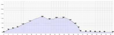 S1
S1
144
CC EB
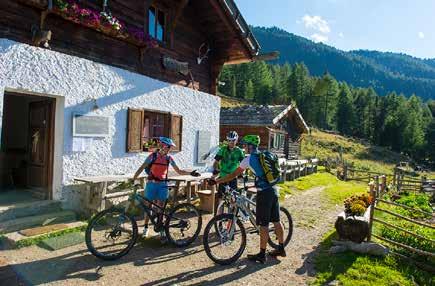
We follow the Bike Highline Merano and then take the forest path to the Schartegg parking lot, where just below lies the starting point of the Fontana Trail and the Lupo Trail. After powering along the highline, we really deserve this speedy descent! After the first easy section along the forest floor, we have to make a decision: Bikers preferring a more challenging ride can take the Fontana Trail (S3) and follow the sometimes rough yet alltogether very flowy path to Ciardes. The Lupo Trail (S1), on the other hand, is suitable for beginners as well as pros. Over loose rocks we glide down to Tablà, where the trail gently releases us into luscious apple orchards. Whichever route we take: They are both the icing on the cake of a truly unique tour!
45 km elev. +1,700 / -1,700 m May–Oct. Difficulty Category Alternative route via the Fontana Trail
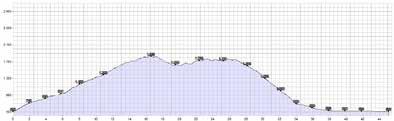
CC S2 S3 145
435 Naturno Circuit
(Naturno – Plon – Kreuzbrünnl via the Bike Highline to the Ötzi Trail – Platzgumm – Naturno), alternative: Kreuzbrünnl shuttle
This tour consists of an uphill ascending Monte Tramontana and culminates in a spectacular downhill trail. In between the two, bikers can choose from a wide range alternative routes – whatever takes their fancy.
Category Difficulty
24 km elev. +1,250 / -1,250 m May–Oct.
On this tour we explore the immediate surroundings of Naturno. Before we even set off, we have to ask ourselves one question: Should we ride uphill using our muscle power, or save our energy and take the bike shuttle instead? Whichever route we take, the destination is the same: the Kreuzbrünnl parking lot. We start out at the train station bridge and head towards Monte Tramontana, following the signs reading “Uphill Naturnser Alm”, first on asphalt and then on gravel, until we reach the parking lot. If at this point you are already calling into question your choice of route and simply can’t wait for the downhill, you now have the option of continuing for another 7.6 kilometers (4.7 miles) at an elevation gain of 710 meters (2,330 ft) and then taking the connecting path that leads to the Platzgumm farm. Shortly before reaching the farmhouse, you then turn onto the Ötzi Trail, where you will end up about halfway up the trail. More patient bikers go from Kreuzbrünnl onto the Bike Highline Merano and take the path that leads west to the start of the trail below the Mausloch Alm. Now comes the next decision: Should we first take a break at the mountain hut (Alm), or just go for it and seek some thrills on the trail? Either way, we will be back in the saddle soon enough, riding along 5.4 kilometers (3.4 miles) of finest forest trail with some gnarly sections and a speedy change in elevation of -1,080 meters (-3,540 ft). The first part of the Ötzi Trail (S3) is flowy and not too challenging. We ride over a few small rocks and roots, following a narrow yet flowy path downhill, and later encounter bigger roots as well as some gnarly yet definitely doable sections that require a certain level of biking skill. This trail is completely untouched and offers the right balance between challenge and pure biking fun – it is not be missed! After passing a forest tavern, we continue on to Cirlano and then back to Naturno.
MTB
CC
146
S2 S3
EN
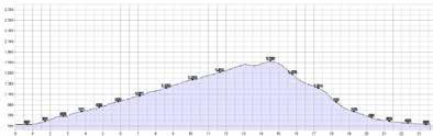
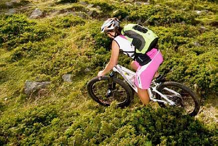
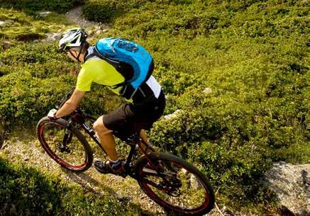
147
436 Naturno Bike Highline West
Naturno – Kreuzbrünnl – Bike Highline Merano heading west –Marzoner Alm – back onto the highline to the start of the Lupo Trail – Naturno (alternative route via the Fontana Trail –Ciardes – Naturno)
The Bike Highline Merano boasts spectacular vistas, endless sunshine and South Tyrolean culinary delicacies. The Lupo and Fontana Trails at the end of the tour are the icing on the cake.
We start off at Naturno train station and head towards Monte Tramontana, following the signs reading “Uphill Naturnser Alm”. The first 7.3 kilometers (4.5 miles) we ride along asphalt and later gravel until we reach the Kreuzbrünnl parking lot. Here we leave the Uphill Naturnser Alm and follow the Bike Highline Merano towards Marzoner Alm, the westernmost point of the highline. The Bike Highline Merano leads past Mausloch Alm and – via a tricky section with occasionally narrow and exposed areas – to Tablander Alm. Next we pass the Schartegg parking lot and head on to Marzoner Alm.
37 km elev. +1,550 / -1,550 m May–Oct.
Difficulty Category
Alternative route via the Fontana Trail
35 km elev. +1,550 / -1,550 m May–Oct.
Difficulty Category
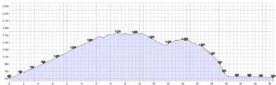
S3
CC S2
MTB
EB 148
S1 CC
Naturnser Alm Circuit
Naturno – Uphill Naturnser Alm – Naturnser Alm –Riolagundo – Tel
Biking in the shade along Nörderberg Mountain and the Bike Highline Merano to the Naturnser Alm – an ideal tour on hot days (and any other day, for that matter).
CC EB
S0
42 km elev. +1,500 / -1,500 m
Category Difficulty
May–Oct.
This classic transalpine route, which has an elevation gain of 1,400 meters (4,590 ft) and is 15.5 kilometers (9.6 miles) long, leads to the Naturnser Alm mountain hut. We start off at the train station bridge in Naturno, take the ascent towards Nörderberg Mountain and pass the sports fields, following the signs reading “Uphill Naturnser Alm”. The entire route is a comfortable uphill slope through the forest, which provides shade on hot days. The first 7.3 kilometers (4.5 miles) we bike on tarmac before hitting gravel all the way to the Kreuzbrünnl parking lot. These last 340 meters (1,120 ft) in elevation gain along the Bike Highline Merano are closed to traffic. At the upper part of the uphill we drive through a forest of larch trees, and from here we can already see the mountain hut in the distance. As we rest and loosen our muscles, we take in the gorgeous view across the Texelgruppe Nature Park, the Ötztal Alps, the Dolomites and the Ortler Alps. After taking a break on the mountain inn’s sun terrace, we hop back onto our bikes and continue eastwards on the Bike Highline Merano until we reach the end of the route, just below Vigiljoch Mountain. From there we either take the asphalt road that passes the idyllic hamlet of Riolagundo or the Family Tour path back down into the valley until we reach Tel. Here we cross the bridge and follow the cycle path that takes us back to our starting point in Naturno.
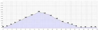
MTB
149
437 Naturnser Nörderberg Tour
Shuttle Kreuzbrünnl parking lot – Uphill Naturnser Alm to the crossing of the Brand Trail descent – Brandhof farm –Plon – Platzgumm – Ötzi Trail
This tour is a class of its own! It shows us the newest trail on the Nörderberg Mountain and rewards us with home-made delicacies produced at the Brandhof farm’s very own cheese factory. What more could we want?
19 km elev. +350 / -1350 m May–Oct. Category Brand-Trail
Off we go to the Brand Trail! We are ready to explore the newest of the many flow trails in this region and take the bike shuttle to the starting point at the Kreuzbrünnl parking lot. Here we follow the signs reading “Uphill Naturnser Alm” along a section of forest road. After about one and a half kilometers (0.9 miles), at an altitude of 1,690 meters (5,540 ft), we reach a fork in the road. Here we turn left, down a winding forest path that takes us to the start of the trail. Saddles down, and off we go! We surf along the Nörderberg forest floor and over countless small pine cones, with some sections being only as wide as our handlebars. This thrilling trail comes to an end at the Brandhof farmhouse, after which the trail is named: A farm tavern that produces its own cheese! We order a wonderful Marende, a traditional platter of cheese and other home-grown and home-made delicacies – the perfect time to take a break on our tour, because another trail already awaits us. We ride past the Steil farm, and then an asphalt road takes us to a bend at which we turn left uphill. We stay on the tarmac for a short while on the Uphill Naturnser Alm, then follow the signs pointing to the Platzgummhof farm. Shortly before we reach Platzgumm, another sign shows us how to get to the entrance of the Ötzi Trail (S3). We follow this path and access the trail at an altitude of 1,230 meters (4,040 ft) above sea level. Some sections of the trail require good biking skills, but overall we can cruise along this flowy trail down into the valley. The Ötzi Trail releases us in Cirlano, and from here we take the country lane back to Naturno.
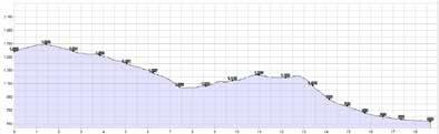
MTB
Ötzi-Trail
S1
150
CC EN
MTB
Marzoner Alm Circuit
Shuttle to the hamlet of Montefranco – Uphill Marzoner Alm –Bike Highline Merano – Fontana Trail
Specialties from South Tyrolean cuisine at a mountain inn, a stunning view along the Bike Highline Merano and technical challenges on the trail: a tour full of unique experiences.
S2 S3 CC EN
12 km elev. +430 / -1,100 m May–Oct. Category Difficulty
The bike shuttle takes us to the hamlet of Montefranco. We roll the first couple of meters to the Freiberger Säge parking lot, an old lumber mill located at 1,480 meters (4,860 ft) above sea level. We continue on for a short while to Marzoner Alm, one of South Tyrol’s lowest mountain huts. An alternative route starts out at the Castelbello bridge across the Etsch River, and the Uphill Marzoner Alm trail takes us all the way up to the mountain pasture, pedaling up a total of 1,070 meters (3,510 ft) in altitude. Green meadows, a sun terrace and a nine-pin bowling alley wait for us at the end of this first stage. Next we head for the Bike Highline Merano, which starts out at Marzoner Alm and takes us to the Fontana Trail. This section of the highline is a true challenge: Technical difficulty is combined with stream crossings as well as narrow and winding paths. Right below the Schartegg parking lot, we meet the Fontana Trail, and four kilometers (2.5 miles) of smooth trails and a challenging 840 m (2,760 ft) descent all the way down to Ciardes lie ahead of us. We get on our bikes and off we go! The first section of the trail is similar to the Lupo Trail and features an easy woodland trail (S1). The Fontana Trail takes a turn to the left a little while later and the track gets more difficult: rough parts, roots, larger rocks and very steep sections followed by narrow hair-pin bends. This trail crosses the normal road time and again, so be careful. The ride is sometimes rough yet maintains a good flow throughout as we embark on a descent through the woods all the way to the end of the trail in the village of Ciardes, where we arrive tired, but happy.
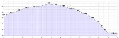
151
MTB
Marzoner Alm – Lupo Trail Circuit
Shuttle to the hamlet of Montefranco – Uphill Marzoner Alm –Bike Highline Merano – Naturno Lupo Trail
After refreshments at the rustic Marzoner Alm mountain inn, we roll along the Bike Highline Merano to the start of the Lupo Trail, a perfect trail even for first-timers on a mountain bike.
CC EN FM
16 km elev. +430 / -1,100 m May–Oct. Difficulty Category S1
From the Freiberger Säge parking lot to the Marzoner Alm mountain inn and onward via the Bike Highline Merano to the Lupo Trail – that is where this tour will take you. To save some energy, we can take the bike shuttle up to the old sawmill. From there, we continue on a forest road that leads to a mountain inn, having to cover an elevation gain of no more than 120 meters on our way. An alternative route starts out at Castelbello and sees us pedaling up a total of 1,070 meters in altitude and a distance of eleven kilometers to the Marzoner Alm mountain inn, with a very steep ascent right at the beginning. We follow the Bike Highline Merano to the starting point of the Lupo Trail. Long sections of the highline take us along easy forest roads, but a technically challenging section lies ahead – turning into a gravel track, the trail has some exposed spots. Right below the Schartegg parking lot, we reach the starting points of the Lupo and Fontana Trails. Signs for both trails are easy to find. After riding together for a short distance, experienced mountain bikers with a solid riding technique may choose to ride along to the Fontana Trail (S3), while less experienced riders can stay on the Lupo Trail (S1). Be careful, the trail crosses the road several times! The trail widens up and we roll through the woods for another 4.5 kilometers. The last part going downhill and requiring some braking maneuvers once again – after all, we cover a total change in altitude of 730 meters before reaching our finish line at Tablà. We smoothly roll downhill on our way back to Naturno.
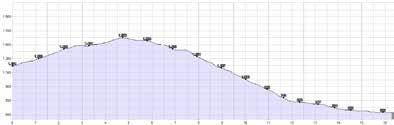
152
MTB
138 Laces Trailzauber
A smooth trail with technical sections, ascents and hair-pin bends, and two enchanting castle ruins.
CC EN
S1 S2
12 km elev. +300 / -300 m Category April–Nov. Difficulty
Starting off at the Laces railroad station, we bike towards the village and take a left at the crossroads, up to the AquaForum. This is the starting point of the Trailzauber trail, taking us uphill in the direction of Tarres, passing the Rehpromenade, the Keep-Fit-Trail and the impounding reservoir used for irrigation purposes. Let’s get started: We pedal up on the rough road taking us past the Jägersteig track. The trail offers a smooth ride on woodland, with some technical sections featuring larger rocks and roots. Descents are followed by some steep passages that require us to work our way uphill again. The Neuwaal track – waal being a German word for ancient irrigation channels – brings us to a large rock into which one of the waalers, as the old keepers of the irrigation channels where called, once carved dates and two pictures of himself. The track passes the rock with the inscriptions and leads us to the ruins of Castel Obermontani. We have now time to catch our breath and take in the stunning view of the castle. We keep left and after a very short descent, we pedal uphill again – we’re back on the Laces Trailzauber trail. Our wheels spin faster as we go into a speedy descent, passing several tricky hair-pin bends, rolling past the second castle ruins, Castel Untermontani, which are just as impressive as the first. This section requires a good technique, which makes the ride all the more fun. Once we’ve mastered this descent, a gravel road alongside a fence takes us to the next access point of the trail, which ends right outside the Laces beer cellar. Smooth tracks passing the Mareinwaal bring us back to our starting point – or we could go visit the beer cellar instead, which, by the way, used to get its beer from its own brewery formerly located in the same building.
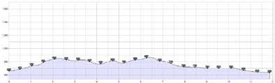
153
77 Monte Sole Trail
San Martino al Monte cable car – San Martino al Monte –Montesole Trail – Laces (and an alternative uphill route)
According to Bike Magazine, the Montesole Trail is the most beautiful trail in the Alps and a true eldorado for bikers who love a technical challenge.
Riding technique, a panoramic view and bone-dry soil from March to November make this trail on Sonnenberg Mountain (Monte Sole in Italian) a true masterpiece: It’s heaven on earth for experienced mountain bikers. The San Martino cable car takes us to the trail from the Laces station (fixed timetable for bike transportation). Those of us who choose to bike up instead can take the Uphill San Martino trail starting in Castelbello: Cross the main road in front of the Castelbello tourism office and keep right once you reach the village square. Take the San Martino tarmac road, which leads up to the mountain station, covering a distance of 12.5 kilometers (7.8 miles) and 1,100 meters (3,610 ft) in altitude on the way. This is the ideal warm-up for the amazing descent that follows. Once we have reached the mountain station, we ride another 1.2 kilometers (0.75 miles) on tarmac before turning right onto hiking path 9 (Wanderweg 9), starting another little warm-up, the first root-covered passage of the trail. The path ends at a forest road, passing the Ratschillhof farm, where Heidi, the farmer, awaits us with some great refreshments. Bikers who choose not to take a break take a left, picking up some speed on a short section on tarmac before starting the main part of this route. What comes next is pure riding pleasure on what Bike Magazine calls the most beautiful trail in the Alps: narrow sections hardly wider than your bike’s handlebars
13 km elev. +50 / -1,300 m March–Nov. Difficulty Category Alternative route via cable car
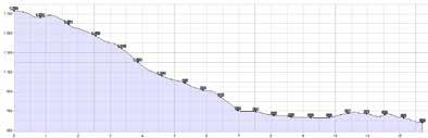
MTB
EN S2 S3 154
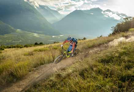
followed by rough, root-covered passages and rocks, all on a steep descent. Sharp turns and ramps make the woods great fun to ride, tricky spots and tight bends require our full attention and the best of our riding technique. We continue in the direction of the Piani di Annenberg section, with our wheels rolling over steppe grass and the route presenting a truly stunning view of the valley floor. Right before we reach the narrow suspension bridge, the route becomes rocky and technical once again. Passing the panoramic path, the track takes us to the hamlet of Tiss before opening up onto the Vinschgau Valley apple orchards where you can find plenty of shiny yellow and red fruits in autumn: What a grand finale! The orchards bring us back to the valley cycle path and to our starting points in either Laces or Castelbello.
Alternative route via Uphill San Martino al Monte
26 km elev. +1,300 / -1,300 m March–Nov.
Difficulty Category
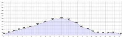
S2 S3 CC 155
137 4 gewinnt 13 Trail
Laces – Uphill Töbrunn – Latscher Alm –4-gewinnt-13 Trail – Laces
The Latscher Alm mountain inn is one of mountain bikers’ favorite destinations. The route leads uphill via forest roads and downhill via two single trails that pair up to form the perfect duo.
22
We start out at the Laces railroad station and ride towards the village. Once we reach the crossing, we take a left turn and follow the road to the AquaForum. There we keep right in the direction of the IceForum ice stadium and pass the Latscherhof farm before getting to the forest road that leads to the Magrinböden region. We now begin our long, moderately steep ascent to the Töbrunn tavern. At the picnic area, we take a short break. We have already covered the majority of the route, and the final section switches back and forth between easy uphill and downhill rides all the way to the rustic Latscher Alm mountain inn. It is time for refreshments before we set out on our way back via the 4-gewinnt-13 Trail (S2), which combines the two hiking paths to form a truly challenging single trail. After a 1.2 kilometer (0.75 mile) descent via the access road, we take a right onto the legendary Hiking Path 4 (Wanderweg 4). Saddles down and on the trail we go, which, according to MountainBIKE magazine, is one of the top ten trails in the Alps. Through the idyllic fairytale forest, we glide down to the Töbrunn forest road, taking our brake disks to the limit! The lower section of Path 4 is for hikers only. We thus change track and continue on the forest road for a while before turning onto Path 13. And this is a true challenge: The narrow trail first passes along some slightly exposed spots (S1) before featuring some roots and rock sections, boosting the difficulty of the track. But this is just the challenge we are looking for! At the end, the trail crosses the Neuwaal road. At this point, we are already close to Laces and our starting point, the railroad station.
MTB
May–Oct. Category Difficulty
km elev. +1,150 / -1,150 m
CC 156
S2 S3
MTB
135 Roatbrunn Trail
Laces – Tarres – Tarscher Alm – Roatbrunn Trail Laces (alternative route via cable car)
Recharge your batteries on the sun terrace at approx. 2,000 meters (6,560 ft) above sea level, because a true challenge lies ahead: The Roatbrunn Trail is a smooth woodland trail with some great rough sections.
Category Difficulty
24 km elev. +1,300 / -1,300 m May–Oct.
On this tour, we embark on the moderately steep Uphill Tarscher Alm track and get our muscles to work on some challenging ascents up to 1,935 meters (6,350 ft) above sea level. Those of us who do not want to waste energy on the uphill trail take the cable car up to the mountain hut. For both options, we start out at the cable car’s valley station. Here we either hop on the cable car or pedal on, taking a right turn at the bottom station of the toboggan run and continuing towards Platzleng. From the picnic area, a forest road takes us to the idyllic Tarscher Alm, the next mountain hut awaits. A 2.4-kilometer long connecting path takes us to the Latscher Alm mountain hut, the starting point of the Roatbrunn Trail. We follow the forest road towards Töbrunn for about one kilometer and then take trail No. 4 on our right. After the first steep passage, the trail offers a smooth ride until it meets the forest road. Once we have crossed that road, we take a right and follow the trail signs. We ride on another forest road for a short while before starting on the next section of the trail which meets the Tarscher Alm Trail. The track has a great flow on forest soil as we roll over some minor steps down through the woodlands. During this last section, the trail becomes more of a challenge (S3), and the track turns stony and steep, especially where it meets the Ramini Waal. At the impounding reservoir we ride back to the AquaForum and the Laces train station.
S3
157
S2
CC EN
MTB
126 Propain Trail
Silandro’s Sonnenberg Mountain – Tappein – Propain Trail – Silandro
The Propain Trail was officially opened in the spring of 2015 and requires solid cornering techniques while also offering some very smooth sections for mountain bike beginners.
19 km elev. +750 / -750 m
March–Nov.
The Propain Trail was built in just three weeks and opened in the spring of 2015. The makers of the legendary Holy Hansen trail built this great route on the steep terrain of Silandro’s Monte Sole right on the other side of the valley. It was designed to replace the old Trail 14, which is now exclusive to hikers. But in light of what the Propain Trail has to offer, most bikers won’t miss the old trail all too much. We start out at the Coldrano railroad station and turn towards Vezzano, following the signs pointing to Tappein. With an elevation gain of 900 meters (2,950 ft), the asphalt road leads us past apple trees and vineyards. Let’s stop for a while, take a deep breath and enjoy the idyllic scenery! Shortly before we reach Tappein, tarmac turns into gravel and we glide along Hiking Path 11 in the direction of Patsch, where we turn onto Trail 14. Bikers share the first short section of this trail with hikers before mainly staying on the Propain Trail. Trail tolerance is only required on very few and short sections on our way to Silandro. Doubles and sharp turns, but especially all those narrow yet playful bends make biking on this steep terrain so diverse and technically challenging. It feels like a rollercoaster ride! Those of us who decide to dismount will still enjoy the rest of the tour, which is nice and smooth and suitable for beginners all along the way. After 6.9 kilometers (4.3 miles) and a change in elevation of 730 meters (2,400 ft) during the descent, the Propain Trail ends at Silandro. From here, we take the valley cycle path back to Coldrano.
Category Difficulty S1 S2 CC 158
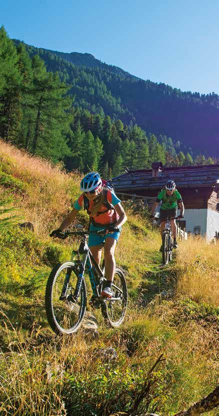
159
Road Biking
Passo della Mendola – Passo delle Palade Tour
Naturno – Merano – Lana – San Paolo – Appiano – Passo della Mendola – Fondo – Passo delle Palade – Merano – Naturno
On the wine route up to the Passo della Mendola, down to the Val di Non and back to Lana via Passo delle Palade: This sporty tour takes us over no fewer than two mountain passes.
125 km elev. +2,000 / -2,000 m
We start our tour at the bike bridge next to the Naturno railroad station. From there, we make our way to Merano and on to what is known as the Lana Apple Cycling Path. We follow the signs to Lana di Sotto and continue through the gorgeous orchards in the direction of Bolzano. The Apple Cycling Path and South Tyrol’s Wine Route take us to the San Paolo crossing. After a short ascent, we ride through the village and pick up speed again on our way to Appiano and Caldaro. On the connecting road that leads to Caldaro, we start our ascent to the Passo della Mendola at the Maxi Mode shopping center. About one hour and 15 kilometers (9.3 miles) later, we reach the Mendola at 1,363 meters (4,470 ft) above sea level. At the pass we go downhill again towards the Trentino Val di Non. Via Guglielmo Marconi and Via Bellavista now take us to Fondo. We should definitely not miss out on a little detour taking us to the beautiful emerald-green Lago Smeraldo reservoir! After regaining our strength during a break, we start our ascent to the second pass of the day. Over 14 moderately steep kilometers (8.7 miles) on a mostly shady road, we work our way up to the Passo delle Palade located at 1,518 meters (4,980 ft) above sea level, the highest point of this tour. Passing Kilometer 8, we glide past Unsere Liebe Frau im Walde, together with St. Felix, one of the three German-speaking communities in the Val di Non. After climbing the Passo delle Palade, we head back down to Lana on a long descent, passing through several tunnels on the way (watch out!). From there, a cycle path takes us back to Merano and then to Naturno.
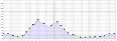
160
Road Biking
Passo del Rombo Tour
San Leonardo, Passiria – Moso, Passiria – Passo del Rombo –Moso, Passiria – San Leonardo, Passiria
Passo del Rombo, the last stage of the Ötztal Bike Marathon, is among the most difficult passes in the Alpine region – which makes this tour all the more exciting.
59 km elev. +1,850 / -1,850 m
The Passo del Rombo located at 2,509 meters (8,230 ft) above sea level connects Sölden in the Ötztal Valley, Austria, and San Leonardo in Val Passiria. The ascent up from South Tyrol is more famous – and also more demanding. It is not for nothing that this section is part of the Ötztal Bike Marathon. We mount up at San Leonardo in Val Passiria and warm up during the first eight kilometers (five miles) until we reach the village of Moso. Leaving the village behind and working our way up the first couple of switchbacks, the elevation gain is already remarkable and the forests already start getting less dense. At Kilometer 18 we stop at the Schönau Inn for refreshments to recharge our batteries for the slopes to come: steep ascents and switchbacks that our legs will soon feel during the remaining 11 kilometers (6.8 miles) after the Rombo river bridge. Here the rough high mountain terrain shows its full beauty as we glide past snowfields to the left and right during the last couple of kilometers – even in the summertime. We pass through the last two tunnels (watch out: the tunnels are not illuminated) and, covering the last kilometer, we reach the Passo del Rombo. We can now catch our breath and take in the scenery and history of the Passo del Rombo. At the end of our tour, we see the pass museum in Tyrol, Austria – a very impressive part of our “Passo del Rombo experience.” Rolling back down to San Leonardo, we pass many other info points. Posters provide information about unique Passo del Rombo stories: its smuggler tradition, the local geology and “hay shooting.” The observation decks provide a great opportunity to marvel at the stunning scenery.
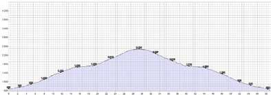
161
Road Biking
Passo dello Stelvio Tour
Prato allo Stelvio – Stelvio – Gomagoi – Trafoi –Passo dello Stelvio – Giogo di Santa Maria – Santa Maria –Tubre – Glorenza – Prato allo Stelvio
Every summer, the “queen of all pass roads” with its 48 long bends is home to thousands of bikers for one day.
65 km elev. +1,950 / -1,950 m
The Passo dello Stelvio located right in the middle of a national park of the same name connects South Tyrol and the province of Lombardy. It is the second highest mountain pass open to traffic in the Alps and the highest pass in Italy. It is not for nothing that the road leading up to the Passo dello Stelvio is commonly known as the “queen of all pass roads.” 48 bends, a distance of 25 kilometers (15.5 miles) and an elevation gain of 1,850 meters (6,070 ft) await you on this popular tour. The main road (tarmac) leads all the way up to the glacier region of the Ortles mountain range, the Passo dello Stelvio located at 2,760 meters (9,060 ft) above sea level being the final destination on this tour. Our starting point is Prato down at the bottom of the green valley, from where we ride towards Gomagoi. The switchbacks are numbered on this road (counting down), and each bend poses a challenge of its own. Leaving Trafoi behind, the village where the legendary skier Gustav Thöni was born, we embark on the real slope. The first 24 bends mainly lead us through woodlands, and a mountain restaurant invites us to stop for refreshments at Bend 22. We can already see our final destination from here, but there is still a long way to go. The next ascent is 6 kilometers (3.7 miles) long and requires a good level of fitness. But we’ll know that getting ourselves into a sweat was definitely worth it once we see the massive glaciers of the Ortles mountain range coming closer and closer. Pride is what keeps us moving on these
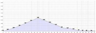
162
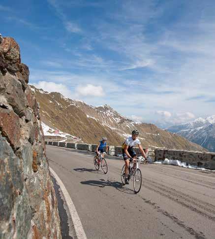
last couple of meters, because we are about to master the queen of all pass roads. Still exhilarated, we start our downhill ride via Giogo di Santa Maria, the highest pass in Switzerland, down to Val Monastero. This second triumph of our tour seems almost effortless. At Santa Maria in Val Monastero we cross the national border (don’t forget to bring your passport!) and continue to Tubre and Glorenza, where the cycle path takes us back to Prato. Seeing as there tends to be a lot of traffic, it is better to avoid coming here on a weekend and to start off early in the day. Only once every summer, bikers can ejoy this route without encountering any traffic at all. The Northeast ramp from Trafoi and the downhill tour via the Passo di Giogo down to Santa Maria are closed to traffic on what is known as Cyclists’ Day. No roaring engines, only the quiet humming of thousands of bike wheels, maybe the occasional whistle of a groundhog, and the company of grazing cows on the wayside and birds hovering in the sunny skies.
163
Road Biking
Passo di Monte Giovo Tour
San Leonardo, Passiria – Valtina – Passo di Monte Giovo –Valtina – San Leonardo, Passiria
Just like the Ötztal Bike Marathon, this tour ascends the Passo di Monte Giovo. On our way back through the Passeiertal Valley, we should take the time to check out one of South Tyrol’s national heroes, Andreas Hofer.
39 km elev. +1,400 / -1,400 m
Participants of the legendary Ötztal Bike Marathon have to master four passes – the Passo di Monte Giovo being one of them. At 2,094 meters (6,870 ft) above sea level, the Passo di Monte Giovo connects Eisacktal and Passeiertal Valleys and is the shortest link between Merano and Vipiteno. We can ascend to Passo di Monte Giovo from either Vipiteno and San Leonardo. The scenery is amazing on both sides, but the ride up from the Passeiertal Valleys is a little more demanding due to its length and slopes. 20 bends spread out across 20 kilometers (12.4 miles) and an elevation gain of 1,400 meters (4,590 ft) take us up to the northernmost pass over the Alps, which is located entirely in South Tyrol. Leaving the village of San Leonardo, we pass woodlands and meadows before rolling through the village of Valtina about halfway through the ascent. Long switchbacks take us up and beyond the treeline. It is now time to enjoy the scenery: Facing the Texelgruppe and the Ötztal Alps, we ascend closer and closer to the Edelweiss mountain hut right beside the pass road, which is the destination of our tour. After refreshments at the little inn, we depart on our downhill ride. For the descent you can either choose to roll down the other side to Vipiteno or go back via Sandhof San Leonardo and the Passiria Museum. This museum is located in the house where Andreas Hofer was born and hosts a permanent exhibition honoring the Tyrolean national hero.
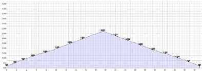
164
Road Biking
Lago di
Caldaro Tour
Naturno – Marlengo – Lana – Riva di Sotto – San Paolo –Lago di Caldaro – Ora – Lana – Naturno
A splendid tour through apple orchards, along the South Tyrolean Wine Route, via idyllic wine villages to the Lago di Caldaro.
119 km elev. +700 / -700 m
If you’re looking for some stunning panoramic views, you should definitely put this road bike tour at the very top of your list. This route is most stunning during the apple blossom season and at harvest time, and you can cool off in Lago di Caldaro on hot days. We start at the Naturno railroad station bridge and take the cycle path towards Merano. We pass by Plaus and Rablà before reaching Tel, where we cross the main road and continue on the cycle path. At the Lagundo swimming pool, we cross the wooden bridge and turn left at the next crossing to the Forst brewery. Right opposite the brewery, we work our way up a little slope in the direction of Marlengo. After reaching the top, we go downhill for a little while, arriving at Cermes and Lana where we turn towards Lana di Sotto. We roll past the Lana di Sotto parish church and follow the road winding through orchards before turning onto the Apple Cycling Path towards Bolzano. From Riva di Sotto, the South Tyrolean Wine Route takes us to the San Paolo crossroads. Here we take a right turn and, after a short ascent, reach the village center and its winding alleys, rustic vaults and cellars, shadowy enotecas, impressive parish church and imposing, historic farms. From San Paolo, the tour goes downhill to Appiano and Caldaro. We follow the connecting road that leads to Lago di Caldaro, the most famous wine-growing area in all of South Tyrol. Now it is time for a break before we leave the lake behind and take the road to Ora at the next crossing. Once we have reached Ora, we ride towards the train station and take a left onto the cycle path, which brings us back to Lana and Naturno.
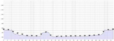
165
Road Biking
Tesimo – Prissiano Panorama Tour
Naturno – Tel – Marlengo – Lana – Tesimo – Prissiano –Nalles – Lana – Naturno
The villages of Tesimo and Prissiano are known as “castle villages”, and this tour takes us to four of their most noteworthy sites. All the more reason to get on your road bike and start exploring.
65 km elev. +800 / -800 m
A total of 800 castles and palaces are spread out all across South Tyrol, and no less than six of them are located in Tesimo and Prissiano. We start at the Naturno train station bridge. Here we turn onto the cycle path towards Merano. We pedal along the Adige river until we reach Tel, where we switch to the other side of the road and roll downhill to the Lagundo swimming pool. We cross the wooden bridge and reach a crossing, where we make a left for the Forst brewery. Right opposite the brewery, we work our way up a small slope in the direction of Marlengo, pass through the village and go downhill again towards Lana. At the second roundabout on the village road, we take a right turn in the direction of the Passo delle Palade. This is where the ascent to Tesimo begins. Only a couple of kilometers later, we are rewarded with a truly breathtaking view: the wide Etschtal Valley right below, the clear-cut lines of the apple orchards, the Lana golf course, a small waterfall and the ruins of Brandis Castle. This is where we are headed now, passing Castel Leone on the way – another sign that we are very close to the castle village. We turn towards Tesimo. After a short downhill ride, we get to the winding alleys and small squares of Tesimo. Moving on to Prissiano, we pass Fahlburg Castle and reach Castel Katzenzungen. Next we are sent into a steep and winding descent down to Nalles. Here, we start heading back towards Merano, riding via Lana and Marlengo to the Forst brewery and back to Naturno.
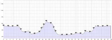
166
Road Biking
Vinschgau Panorama Tour
Naturno – Silandro – Corces – Alliz – Tanas – Sluderno – Naturno
This five-hour road bike tour to the upper Vinschgau Valley takes us as high as 1,580 meters (5,180 ft) above sea level, past picturesque little villages and quaint farms nestled into the barren flanks of the Sonnenberg Mountain.
85 km elev. +1,300 / -1,300 m
Life proceeds at a different pace in the Vinschgau Valley: Mountain farms, remote villages and ancient castles give visitors an impression of what South Tyrol was like in the distant past. So let’s head off and go west! At the bridge next to the Naturno railroad station we take the Passo di Resia bike path to Laces. We stay on the road passing through the village and follow the signs across the orchards to Coldrano in the direction of Silandro, all the way to Covelano. We leave the bike path in Covelano, close in on Silandro to the right for a bit, and then turn onto a dirt road taking us to the fruit cooperative. We continue uphill past the train station, following the road until we get to the state road. The next leg of the tour takes us to Corces in the municipality of Silandro. Behind the village, we follow the dirt road towards Alliz. After the ascent to Alliz, we pass through the village and tackle the ascent to the mountain hamlet of Tanas, the only urbanized settlement on Venosta’s Sonnenberg. The panorama road takes us to the highest point of the tour (1,580 m / 5,183 ft above sea level) just above Tanas. Our reward is a spectacular view of the Ortler Range just across from us and the valley floor of the Vinschgau Valley. We then embark on the longish descent to Sluderno and its landmark, Churburg Castle. At the Count Von Trapp residence we can view a unique collection of knight’s armor. In the summer, the castle hosts a knights’ festival. The tour eventually continues back to Naturno via the bike path.
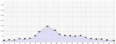
167
Riding along the Via Claudia Augusta
The Vinschgau Valley Cycle Path is among the most beautiful biking routes in the Alps. This 80-kilometer (50-mile) long route begins at Resia and ascends to an altitude of 1,500 m (4,920 ft) towards the spa town of Merano with its Alpine and Mediterranean flair. It forms part of the Etschtal Valley Cycle Path, usually running parallel to the Etsch River, past the natural and cultural highlights of the Vinschgau Valley. But the bike path is actually a piece of culture in its own: It used to be the main artery between Italy and the German city of Augsburg, forming part of the Via Claudia Augusta, an ancient Roman road which was completed in the year 47 AD. Nowadays it is possible to travel along this 700-km (435-mile) long route by bike. The section between Resia and Merano is particularly popular among cyclists. It does not just take bikers from A to B, it also offers something interesting to see around every corner. Near the starting point, at Lago di Resia, the first eye-catcher sticks out of the smooth water next to the path: A church steeple serves as a reminder of the artificial dam that was built here in 1950 and resulted in the flooding of the entire village of Alt-Graun (Old Curon) as well as parts of Resia. With the majestic Ortler Range in plain sight, the road continues downhill from Resia, taking cyclists swiftly from one sight to the next along the Via Claudia Augusta: to the tiny town of Glorenza, the smallest municipality in South Tyrol, to the Churburg Castle armory, past the world-famous Lasa marble quarries, or to the Messner Mountain Museum at Juval Castle. Culture and history everywhere! The municipalities of Parcines, Rablà and Tel are home to the best-known contemporary witnesses of the Via Claudia Augusta. If you are eager to see as many highlights as possible along the cycle path, grab an e-bike and increase your speed! Hiring stations for e-bikes and bicycles can be found all along the route. From Malles on, the Vinschgau Valley railroad line (Vinschger Bahn) runs alongside the cycle path all the way down to Merano, meaning cyclists can just shoulder their bikes and board the train at one of the stations. And if you’ve become a bit tired of all the pedaling, just stop off at one of the numerous biker-friendly inns along the bike path. Enjoy some ice cream or a cappuccino and rest your weary bones before continuing on your way, refreshed and ready to take on the world.

Highlights: Church steeple at Lago di Resia, Marienberg Benedictine Abbey above Burgusio, medieval town of Glorenza, Churburg Castle, Lasa marble quarries, Messner Mountain Museum at Juval Castle, St. Proculus Church in Naturno, replica of a Roman milestone in Rablà, Roman tombstone in Parcines (which is always worth a visit), Tel – former Roman customs station, “Trauttmansdorff Thrones.”
168
From the Spa Town into the Passeiertal Valley
The 20-km (12-mile) long Passeiertal Valley Cycle Path runs from the spa town of Merano with its Mediterranean flair to the quaint municipality of San Leonardo in Passiria. This attractive route with its few, well-manageable inclines is great for a bike tour with the whole family. The gravel path leads along the Passer River, which runs through the valley and provides a refreshing breath of cool air even in the middle of summer. Every now and then, bikers will encounter equestrians on horseback. The cycle path is accessible via the Parco Elisabetta in Merano. It starts just to the right of the bridge at the entrance to the Passeiertal Valley. It runs past Rifiano and crosses the Punta Cervina cable car at Saltusio, about halfway along the way. Picnic spots along the way invite cyclists to take a break. The more culturally inclined can take a detour to the Sandwirt Inn just outside San Leonardo, the birthplace of Andreas Hofer, complete with a museum and fishing pond.
Highlights: Old Town of Merano, Merano promenades, Trauttmansdorff Castle, Schenna Castle, Sandwirt Inn/San Leonardo with fishing pond.
Off to the Lowlands
The Unterland Cycle Path runs from Bolzano, the capital city of South Tyrol, to Salorno. There are no major ascents along the way. As bikers make their way south, they have a spectacular view of the Dolomites with the Rosengarten massif and the Schlern mountain. Each mile covered means a change in the landscape: Apple orchards make way for vineyards, the mountains retreat, the South Tyrolean dialect becomes more and more interspersed with Italian. The municipality of Salorno marks the national border of South Tyrol, and the Chiusa di Salorno bottleneck the German-Italian language border. But the tour does not have to stop there. It is possible to continue to Trento, a historic episcopal city 60 km (37 miles) from Bolzano. And for those tireless bikers who still haven’t had enough, the route continues on towards Verona and all the way to Lake Garda. Besides, it is always possible to board one of the regional trains along the way.
Highlights: Sigmundskron Castle with Messner Mountain Museum Firmian, Bolzano Arcades and Old Town, Ötzi the Iceman at the South Tyrol Museum of Archeology, original Rablà milestone of Via Claudia Augusta at the city museum, episcopal city of Trento.
169
Leisure Biking tour to Merano
Naturno – Plaus – Rablà – Tel – Lagundo – Merano –back by bike shuttle or on the Val Venosta train
A simple tour with a high degree of adventure. From Naturno past the historic sites on Via Claudia Augusta to the fashionable spa town of Merano with its enchanting Mediterranean flair.
16 km elev. +30 / -250 m
At the bridge next to the Naturno railroad station we take the asphalt valley cycle path. Our destination is the city of Merano, which was the favorite spa of Empress Sissi of Austria. That should not come as a surprise to anyone, seeing as the lush Mediterranean vegetation in the valley, the high mountain ranges all around, the picturesque arcades and alleys and cozy little cafés provide a unique atmosphere. But eventually we have to continue: Our path leads us alongside the Adige river past the municipalities and villages of Plaus, Rablà and Tel, where we cross the state road and then follow the cycle path. Right behind Tel, directly on Via Claudia Augusta, we find the perfect spot to stop and enjoy the view: Two oversized wooden chairs, the “Trauttmansdorff Thrones”, provide an unobstructed view of the Etschtal Valley, and a conveniently provided telescope lets us sneak a peek at the Trauttmansdorff Castle Gardens on the opposite side of the valley. After a short break, we descend via Lagundo to the center of Merano, where we walk along the promenade, stroll through the arcades in the historic part of the city, or relax in the thermal baths. Those interested in where Empress Sisi spent her time can visit Trauttmansdorff Castle and its gardens. After our visit to Merano, we take the bike shuttle or the Val Venosta train from the station back to Tel, Rablà or Naturno.
170
Leisure Biking tour to Lago di Coldrano
Parcines/Rablà – Naturno – Castelbello – Laces –Coldrano – Lago di Coldrano and back
An entertaining tour that offers something for each member of the family. Lago di Coldrano boasts a playground and a tavern.
32 km elev. +150 / -150 m
The highlights of this family-friendly leisure tour include Juval Castle, Kastelbell Castle, and Lago di Coldrano. At the Rablà bridge we take the bike path towards Vinschgau Valley. The flat asphalt trail runs alongside the Etsch River and across the apple orchards of Lower Vinschgau Valley to Naturno. Only a few yards into the trail, Juval Castle appears on the right. High on the barren slopes of Sonnenberg Mountain sits the summer residence of legendary mountaineer Reinhold Messner. With the castle always in sight, we eventually arrive in Stava, where we cross the bridge at the train station and turn left for the next leg of the bike tour. We pedal on to the municipality of Castelbello with the castle of the same name, the second highlight of our tour. Climbing slightly uphill now, we continue on the bike path to Laces and Coldrano. Lago di Coldrano with its playground and tavern marks the destination of our tour, and a well-deserved rest is in order. Daily fishing permits are available for those who would like to take their chances together with other fishermen. We take the same route back.
171
Leisure Biking tour from Glorenza to Naturno
Shuttle service to Glorenza – Via Claudia Augusta Cycle Path from Glorenza to Naturno
A town with just about 900 inhabitants, completely surrounded by a city wall, like a living museum: Glorenza is a must-see!
45 km elev. +100 / -450 m
Glorenza is a truly fascinating sight, because the main point of interest is the city itself. The bike shuttle from Naturno stops there twice a week. But leisure biking is put on the back burner when we arrive in Glorenza: Exploring the region’s smallest city takes precedence. And it is like a journey into the past! First impression: Everything is exactly as it used to be in the old days: massive city walls, fortified towers, splendid bourgeois houses and picturesque little streets everywhere. Situated directly on the Via Claudia Augusta, Glorenza was once a thriving trading hub. During the Battle of Calven in 1499, the city was pillaged and completely destroyed. The circular wall, on the other hand, which was erected when Glorenza was rebuilt in 1580, is still fully intact – like so many other things here. When you stroll through this fascinating city, one thing becomes clear: Haste is a foreign concept here. We mount our bikes, completely at ease, and leave Glorenza on the cycle path. Via Prato, we reach the marble village of Lasa. Even the sidewalks are paved with this “white gold” here. Lasa marble is not just famous in Europe but overseas as well. The Pallas Athena Fountain in Vienna, the Victoria Memorial in London, the Ground Zero train station in New York City: They are all decorated with Lasa marble. The next leg of the tour takes us to Silandro and Laces. Through apple orchards and past Kastelbell Castle and Reinhold Messner’s Juval Castle, we cycle along flat roads back to Naturno. By the way: If you have a bikemobil card and are using a rental bike, you can return it at any of the rental stations by the train stations as well as the various specifically marked satellite stations (“Südtirol Rad”) without extra fees and take the train to go back.
172
Imprint
Publisher: Naturno Tourism Cooperative
Photo Credits: IDM Datenbank, Stefan Gorfer, Peter Santer, Stefan Illmer, Armin Terzer, Roter Rucksack, Manuel Pazeller, Phil Ausserhofer, Photo Grüner Thomas, Philipp Reiter, AREA Architetti Associati R. Pauro – A. Fregoni, TG Schnalstal, Katherina Fiser, Jonas Marseiler, Tholer, Meran 2000, Angelika Schwarz, Fotostudio2000, Marion Lafogler, Datenbank TG Naturns Graphic Design: Fliridruck – Marlengo/Marling
Printing: Südtirol Druck
Translation: context . simply good content – Meran/o and Naturno Tourism Cooperative
173
Sonnenberg Monte Sole

TSCHARS CIARDES
Etschpromenade acquale Waalweg acquale Waalweg
Schießstandweg
Reschenpass Passo Resia
TSCHARS CIARDES CIARDESTSCHARS


Kompatsch Compaccio

Schnalserbach Senales Rio N
RATISIORATHEIS
VALSCHNALSTAL SENALES sentiero - Wallburgweg
Tschirland Cirlano 578 m Tabland Tablà 674 m
540 m Staben Stava 553 m
MonteNörderbergTramontana ST. OSWALD SAN OSVALDO ST. NIKOLAUS SAN NICOLÒ LIEBFRAUEN N.S. DI STAVA SCHLOSS JUVAL CASTELLO JUVAL ERLEBNISBAHNHOF STAZIONE D‘AVVENTURA
Via Pedruiweg STAATSSTRAS S E I NS SCHNALSTAL STRADASTATALE VAL SENALES Kompatscherst r. HAUPTST VIA Kompatscher T d n a l r i h c s Seilbahn Unterstell B a hnho f sta z i o n e Funivia Unterstell Unterortl Shuttl e J u va l PRINC IPALE Gsindboden Hinzelweg Fischerteich Laghetto pesca Lorenzi Ruine 1 2 3 4 A 6 B C 5 A B C
ViaBersag
