1 minute read
Awards of Excellence


AT THE DISCRETION OF THE JURY, ONE AWARD OF EXCELLENCE MAY BE GIVEN PER CATEGORY
MERGING THE GAP: A PLAN FOR COMMUNITY UNIFICATION IN BUFFALO GAP
PLANNING + ANALYSIS
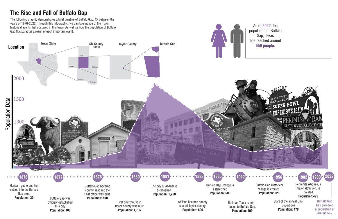
Buffalo Gap is a rural town located in the central part of Texas, in Taylor County. Despite having a rich history, the town was facing challenges in attracting new visitors and residents, as well as celebrating its legacy in a fresh way.
In order to ensure a planning outcome that would be equitable for the population of Buffalo Gap, a social vulnerability analysis was conducted for Taylor County and the surrounding five counties focused primarily on socioeconomic factors, housing/infrastructure conditions, and demographics (i.e., education attainment, race, age). All six counties were moderate to very vulnerable, with Buffalo Gap falling in an area where strong vulnerability is seen. Using this data, a plan was developed to combat these results.
Design Strategies:
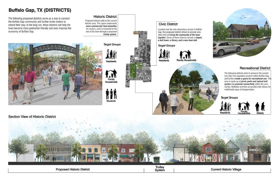
• Developed a notable town center, divided into 5 districts.
• Created more multi-generational housing to match the demographics of the town.
• Designed a new residential neighborhood specifically for senior living to accommodate the large over-65 population.
• Developed a green network to stitch different generations together and unite those who live just outside the boundaries to the rest of the town.
• Emphasized Buffalo Gap’s rich history by creating a formal historical district to bring in new tourism and further highlight the town’s pride.
• Implemented a trolley system to connect the North part of the town to the South.

The Bottom Rises
Cooper Begis, Avery Deering-Frank, Amanda Hinton, Jessie Hitchcock, Violet Lam, Oren Mandelbaum, Dasom Phoebe Mun, Ann Mariya Joseph Thuruthy (University of Texas at Arlington - Graduate Level)
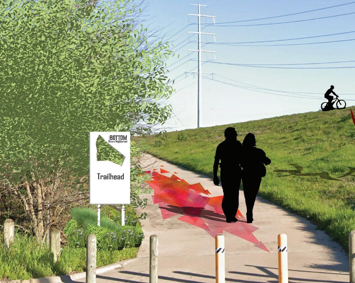
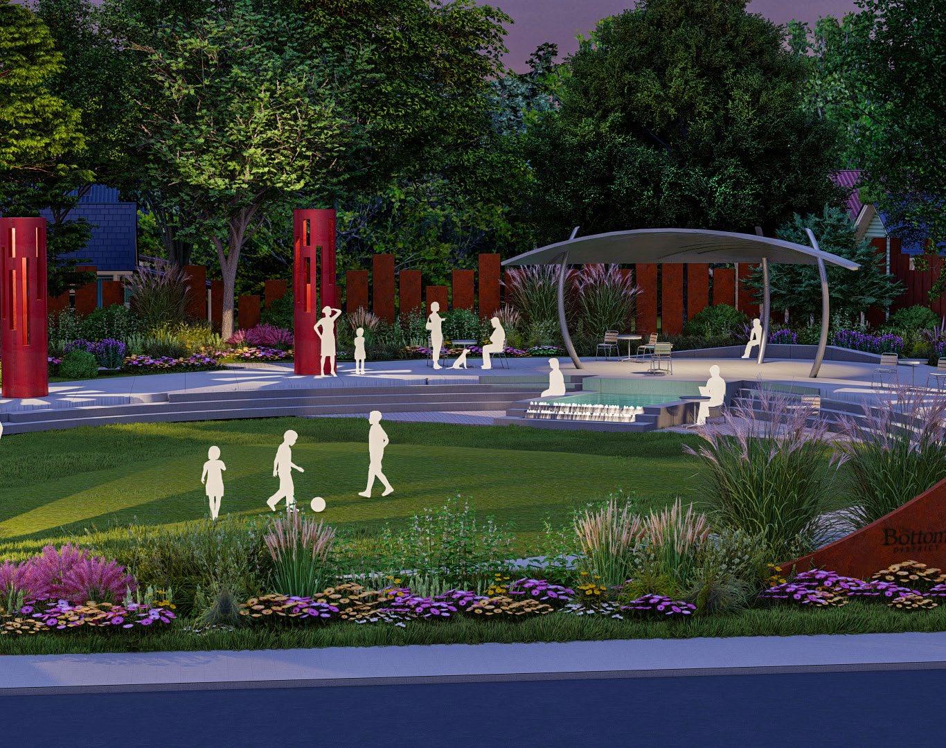
Urban Design
The pillars of environmental, social, and economic sustainability provide an infallible framework for a master plan designed to celebrate the cultural and historical significance of The Bottom, a historic Freedmen’s Town adjacent to the Trinity River just over a mile south of Downtown Dallas. The community’s unique bowl-shaped topography, resulting from natural elevation changes combined with a man-made levy and a barrier created by the I-35 highway corridor, provides for site-specific stormwater and connectivity design opportunities. The master plan implements a green infrastructure network, linking pocket parks, hillside trails, plazas, and green streets into a neighborhood-wide design that successfully mitigates stormwater runoff from the surrounding micro-watershed. Complete streets and a cultural trail inform internal circulation, connect to the greater Dallas community, and link open spaces to provide gathering places for residents and visitors alike. A business incubation center and community garden support local economic opportunities while gateways and signage enhance the neighborhood’s identity. Importantly, the plan provides for growth as The Bottom looks toward the next chapter in its history.