4 minute read
Reopening Ports
Reopening Ports Critical to Recovery Efforts Susan Jackson
The U.S. Army Corps of Engineers Jacksonville District has a unique mission-set as three-quarters of its area of responsibility (AOR) is surrounded by water. The state of Florida, geographically speaking, juts like a finger into the Atlantic and Gulf coast waters, while the Antilles, which includes Puerto Rico and the U.S. Virgin Islands, are completely surrounded by water. This uniqueness is both a blessing and burden, as the AOR is subject to devastating storm events. The secret to response and recovery following these storms is quickly opening major harbors. Jacksonville District’s navigation mission in Florida alone covers 27 federal harbors with an additional five in Puerto Rico and the U.S. Virgin Islands. Of these, 17 are deep-draft and essential to relief and recovery efforts. During the 2017 North Atlantic hurricane season, three tropical storms and four hurricanes made landfall in the U.S. Two hurricanes wreaked havoc across the District’s AOR and sunk thousands of tons of debris into harbors and channels. Hurricane Irma reached maximum sustained winds of 185 mph, tying as the second most intense hurricane on record for the basin according to NOAA.
Advertisement
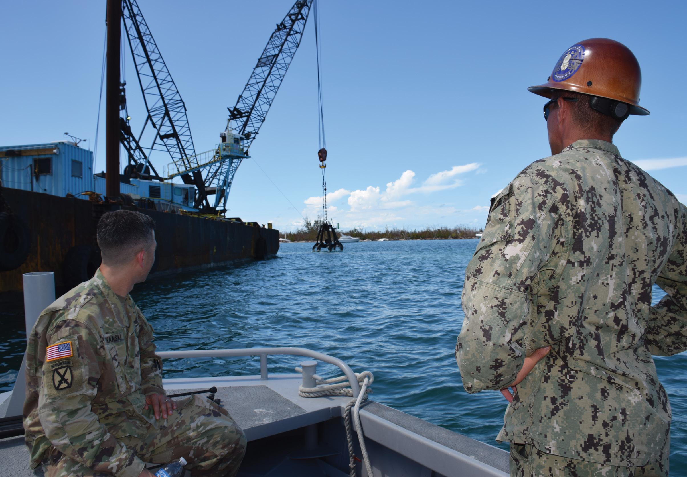
This storm caused massive destruction in the Antilles before making landfall in the Florida Keys as a Category 4 storm. It then caused havoc on both Florida coastlines as it tracked north, pushing storm surge four to eight feet above ground level. Ten days later Hurricane Maria made landfall in southeastern Puerto Rico as a Category 4 hurricane, the strongest tropical cyclone to impact the island since 1928. Still reeling from the effects of Irma, Hurricane Maria passed directly over the island, causing widespread destruction. Both hurricanes crippled transportation, energy and communications infrastructure, as well as relief efforts that were essential to millions of residents. As they do annually prior to hurricane season, Jacksonville District navigation personnel practice the District’s response plan and coordinate with U.S. Coast Guard, NOAA and other agency officials, preparing for likely scenarios. The end result is an efficient plan to immediately assess, survey, and ultimately clear channels for open navigation. The District’s Chief of Navigation at that time, Milan Mora, said that following 2016’s Hurricane Matthew, the interagency team conducted an after action review and then implemented a valuable lesson learned. “We recognized we could work in tandem faster, analyze the work required and open ports quicker if we had Coast Guard specialists onboard the survey vessels. Seven of our survey teams, two (architectural/engineering) contracted teams, and two NOAA survey teams scanned and analyzed the harbors for debris and shoaling in real time. The process was fluid and expedient – it worked extremely well,” he said. Other lessons learned included better and more efficient communication prior to a storm as well as immediately following one. This resulted in quicker actions and allowed the team to expedite clearing channels. All major Florida ports reopened within three days of Irma’s passing, some ports with restrictions. On the same day the Coast Guard reopened deepdraft ports, three petroleum tank ships arrived at Port Everglades to offload 18 million gallons of desperately needed gasoline, 3.5 million gallons of diesel and 14.7 million gallons of jet fuel. A fuel shortage started in south Florida during evacuations prior
to Irma; fuel was also necessary for emergency operations. All of Florida’s deep harbor ports began providing critical services. With Jacksonville Harbor’s JAXPORT serving as Puerto Rico’s primary supplier, it was crucial that port operations recover quickly to provide daily necessities as well as emergency supplies. Still, more work was necessary to clear debris from the open but restricted federal channels. Then Maria struck, and the same pattern of emergency activity ramped up to open ports in Puerto Rico and the U.S. Virgin Islands. Distance from U.S. mainland, isolated locations and catastrophic damages made opening these ports the most difficult and highest priority. The Thomas Jefferson, a NOAA self-sustaining, 208-foot survey vessel, addressed the condition of 16 ports in the Virgin Islands while the Corps surveyed federal channels in Puerto Rico. In Florida, JAXPORT representatives worked closely with federal officials to prioritize relief cargoes and start daily deliveries. Jacksonville District’s Lisa Holland played a pivotal role as a liaison for the port recovery efforts. Her 29 years of federal service with the Marine Corps, Coast Guard, Navy and Army, gave her vast insider knowledge of military operations and capabilities. As a civil engineering technician, Holland coordinated, planned and deployed the District’s hydrographic survey assets, and pre-staged those assets for rapid response. She also worked with the Corps’ Mobile District survey teams, and coordinated with Coast Guard and Navy officials for transportation and lodging to position assets throughout the AOR. “What impressed me the most about our team is that we came together as a cohesive unit to accomplish a very critical need for port recovery, and we did it expeditiously, working side by side with our federal, state and industry partners. We witnessed daily the tremendous dedication, self-sacrifice and perseverance by team members to support the recovery mission,” Holland said. The very long hours crews spent mapping survey data – a behind-the-scenes, little known effort – was integral to the process of opening federal harbors that brought relief and recovery supplies and services to hundreds of communities in need. These major ports were the first-line relief hubs for weeks, until roadways and airports were assessed, cleared of debris, repaired, and re-opened.


