2 minute read
Introduction: Great Salt Lake wetlands: water, plants, birds, and management


Introduction
Great Salt Lake wetlands: water, plants, birds, and management
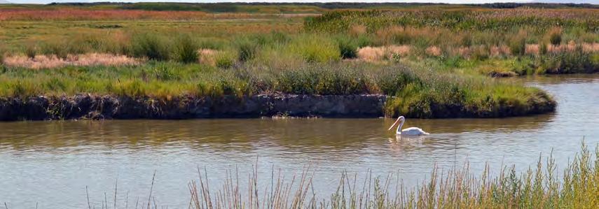
Great Salt Lake (GSL) is renowned throughout North America for its size, salinity, and importance to migratory bird flyways. Located in the Great Basin, the lake encompasses approximately 4,400 km² (1,087,000 ac) of northern Utah and is the largest terminal lake in North America.61 Nearly 1,400 km² (351,000 ac) of wetlands surround GSL’s shorelines; these wetlands teem with life and are a flooded oasis in an otherwise arid region.55 From submergent wetlands to playas, plant communities play a vital part in GSL wetland ecosystems. Wetland plants provide habitat for insects, amphibians, fish, reptiles, mammals, and birds that thrive in wetlands. In fact, Great Salt Lake was designated a Western Hemisphere Shorebird Reserve Network because over 250 bird species migrate to and rely on its wetlands for food, cover, and rest. Together, water, plants, and birds contribute to healthy, vibrant GSL wetland communities. Managing GSL’s wetland plant communities is a tremendous, yet necessary challenge that stands to benefit many stakeholders.
Water
Water is the defining feature of wetlands. From tiny microbes to hardy plants and towering great blue herons, all GSL wetland life is tied together by the presence of water. Water factors such as depth, flooding pattern, and chemistry differentiate the types of wetland communities.
Water levels at GSL and surrounding wetlands fluctuate with changes in snowpack, upstream irrigation demand, and evaporation. Fluctuations are cyclical, but irregular, and have a direct impact on how GSL wetlands function. For the past 15,000 years, water has only been able to leave GSL via evaporation. Meanwhile, salts and other minerals have been left behind and continue to accumulate as GSL’s three main tributaries—the Bear, Weber, and Jordan rivers—contribute more than 2 million tons of salt to the lake each year. Over time, the accumulation of salt has increased GSL’s salinity to 3–7 times the concentration of seawater.22 Wetlands are classified, in part, by the length of time and depth they are flooded. The pattern of flooding and drawdown is called the hydroperiod.36 Depending on the type of GSL wetland, flooding can vary from permanent, deep flooding to temporary saturation. Temporarily flooded wetlands, like playas, are only flooded for brief periods during the growing season, which runs from approximately April to October. Submergent and emergent wetlands are often semi-permanently flooded with standing water throughout most of the growing season. The hydroperiod and water source influence the salinity and alkalinity (pH) of a wetland, shaping the plant community. See Table 1.1 (p. 3) for specific hydroperiod depth and duration attributes of each wetland community. The salinity and alkalinity of the water in GSL and associated wetlands fluctuates throughout the year. These fluctuations occur when freshwater inflows peak during spring snowmelt conditions, and when evaporation increases with rising summer temperatures. When GSL’s water level is low, an additional 1,678 km² (414,688 ac) of saline mudflats and playas are exposed.55 The receding lake leaves behind high concentrations of salts and other elements, leading to high salinity and alkalinity in exposed wetland soils. Brackish wetlands, those with salinities in between fresh and saline conditions, are common where periodic freshwater inflows have flushed hypersaline soils. Freshwater wetlands are found close to freshwater sources like streams and springs. Generally, the longer and deeper wetlands are flooded, the lower the salinity will be. Many GSL wetlands are alkaline, which means the soil or water has a pH higher than 7.4. See Table 1.1 (p. 3) for water chemistry types specific to each wetland community.


